PostGIS 3.7.0dev Manual
DEV (Thu Dec 4 08:47:45 AM UTC 2025 rev. a92fadc )
PostGIS é uma extensão para o sistema de banco de dados objeto-relacional PostgreSQL que permite que objetos SIG (Sistema de Informação Geográfica) sejam armazenados em banco de dados. O PostGIS inclui suporte a índices espaciais baseado em GiST R-Tree, e funções para analise e processamento de objetos SIG.
![]()
![]()
Este é o manual para a versão 3.7.0dev
 This work is licensed under a Creative Commons Attribution-Share Alike 3.0 License. Feel free to use this material any way you like, but we ask that you attribute credit to the PostGIS Project and wherever possible, a link back to https://postgis.net.
- 1. Introdução
- 2. Instalação do PostGIS
- 3. PostGIS Administration
- 4. Data Management
- 5. Spatial Queries
- 6. Dicas de desempenho
- 7. Referência do PostGIS
- 7.1. PostgreSQL PostGIS Geometry/Geography/Box Types
- 7.2. Funções de Gestão
- 7.3. Construtores de geometria
- 7.4. Acessors de Geometria
- 7.5. Editores de geometria
- 7.6. Geometry Validation
- 7.7. Spatial Reference System Functions
- 7.8. Geometry Input
- 7.9. Geometry Output
- 7.10. Operadores
- 7.11. Spatial Relationships
- 7.12. Measurement Functions
- 7.13. Overlay Functions
- 7.14. Processamento de Geometria
- 7.15. Coverages
- 7.16. Affine Transformations
- 7.17. Clustering Functions
- 7.18. Bounding Box Functions
- 7.19. Referência linear
- 7.20. Trajectory Functions
- 7.21. Version Functions
- 7.22. Grandes Variáveis Unificadas Personalizadas do PostGIS (GUCs)
- 7.23. Troubleshooting Functions
- 8. SFCGAL Functions Reference
- 9. Topologia
- 9.1. Topology Primitive Tables
- 9.2. Tipos de topologia
- 9.3. Domínios de Topologia
- 9.4. Gerenciamento de Topologia e TopoGeometria
- 9.5. Topology Statistics Management
- 9.6. Construtores de topologia
- 9.7. Editores de Topologia
- 9.8. Assessores de Topologia
- 9.9. Processamento de Topologia
- 9.10. Construtores de TopoGeometria
- 9.11. Editores de TopoGeometria
- 9.12. Assessores de TopoGeometria
- 9.13. TopoGeometry Outputs
- 9.14. Relações de Topologia Espacial
- 9.15. Importing and exporting Topologies
- 10. Gerência de dados raster, pesquisas e aplicações
- 11. Referência Raster
- 11.1. Tipos de suporte de dados raster
- 11.2. Gerenciamento Raster
- 11.3. Construtores Raster
- 11.4. Assessores Raster
- 11.5. Assessores de banda raster
- 11.6. Assessores e Setters de Pixel Raster
- 11.7. Editores Raster
- 11.8. Editores de Banda Raster
- 11.9. Análises e Estatísticas de Banda Raster
- 11.10. Raster Inputs
- 11.11. Raster Outputs
- 11.12. Processamento Raster
- 11.13. Funções retorno de mapa algébrico embutido
- 11.14. Processamento Raster
- 11.15. Raster para Geometria
- 11.16. Operadores Raster
- 11.17. Relações raster e raster de banda espacial
- 11.18. Raster Tips
- 12. PostGIS Extras
- 13. PostGIS Special Functions Index
- 13.1. PostGIS Aggregate Functions
- 13.2. PostGIS Window Functions
- 13.3. PostGIS SQL-MM Compliant Functions
- 13.4. PostGIS Geography Support Functions
- 13.5. PostGIS Raster Support Functions
- 13.6. PostGIS Geometry / Geography / Raster Dump Functions
- 13.7. PostGIS Box Functions
- 13.8. PostGIS Functions that support 3D
- 13.9. PostGIS Curved Geometry Support Functions
- 13.10. PostGIS Polyhedral Surface Support Functions
- 13.11. PostGIS Function Support Matrix
- 13.12. New, Enhanced or changed PostGIS Functions
- 14. Reporting Problems
- A. Apêndice
Chapter 1. Introdução
PostGIS is a spatial extension for the PostgreSQL relational database that was created by Refractions Research Inc, as a spatial database technology research project. Refractions is a GIS and database consulting company in Victoria, British Columbia, Canada, specializing in data integration and custom software development.
PostGIS is now a project of the OSGeo Foundation and is developed and funded by many FOSS4G developers and organizations all over the world that gain great benefit from its functionality and versatility.
The PostGIS project development group plans on supporting and enhancing PostGIS to better support a range of important GIS functionality in the areas of OGC and SQL/MM spatial standards, advanced topological constructs (coverages, surfaces, networks), data source for desktop user interface tools for viewing and editing GIS data, and web-based access tools.
1.1. Comitê Diretor do Projeto
O Comitê Diretor do Projeto PostGIS (PSC - Project Steering Comitee, em inglês) é responsável pela direção geral, ciclos de lançamento, documentação e os esforços para o projeto. Além disso, o comitê dá suporte ao usuário comum, aceita e aprova novas melhorias da comunidade e vota em questões diversas envolvendo o PostGIS, como por exemplo, uma permissão de commit direta, novos membros do comitê e mudanças significativas da API (Application Programming Interface).
- Raúl Marín Rodríguez
MVT support, Bug fixing, Performance and stability improvements, GitHub curation, alignment of PostGIS with PostgreSQL releases
- Regina Obe
CI and website maintenance, Windows production and experimental builds, documentation, alignment of PostGIS with PostgreSQL releases, X3D support, TIGER geocoder support, management functions.
- Darafei Praliaskouski
Index improvements, bug fixing and geometry/geography function improvements, SFCGAL, raster, GitHub curation, and ci maintenance.
- Paul Ramsey (Presidente)
Co-founder of PostGIS project. General bug fixing, geography support, geography and geometry index support (2D, 3D, nD index and anything spatial index), underlying geometry internal structures, GEOS functionality integration and alignment with GEOS releases, alignment of PostGIS with PostgreSQL releases, loader/dumper, and Shapefile GUI loader.
- Sandro Santilli
Bug fixes and maintenance, ci maintenance, git mirror management, management functions, integration of new GEOS functionality and alignment with GEOS releases, topology support, and raster framework and low level API functions.
1.2. Contribuidores Núclero Atuais
- Nicklas Avén
Melhorias em funções de distância (incluindo suporte a distância 3D e funções de relacionamento), Tiny WKB (TWKB) (em desenvolvimento) e suporte ao usuário geral.
- Loïc Bartoletti
SFCGAL enhancements and maintenance and ci support
- Dan Baston
Geometry clustering function additions, other geometry algorithm enhancements, GEOS enhancements and general user support
- Martin Davis
GEOS enhancements and documentation
- Björn Harrtell
MapBox Vector Tile, GeoBuf, and Flatgeobuf functions. Gitea testing and GitLab experimentation.
- Aliaksandr Kalenik
Geometry Processing, PostgreSQL gist, general bug fixing
- Laurențiu Nicola
Bug fixes, maintenance, stability, and performance
1.3. Contribuidores Núclero Passado
- Bborie Park
Prior PSC Member. Raster development, integration with GDAL, raster loader, user support, general bug fixing, testing on various OS (Slackware, Mac, Windows, and more)
- Mark Cave-Ayland
Prior PSC Member. Coordinated bug fixing and maintenance effort, spatial index selectivity and binding, loader/dumper, and Shapefile GUI Loader, integration of new and new function enhancements.
- Jorge Arévalo
Desenvolvimento Raster, suporte do driver GDAL e importador.
- Olivier Courtin
Funções para entrada e saída de XML (KML, GML)/GeoJSon, suporte a 3D e correção de bugs.
- Chris Hodgson
Antigo membro do comitê. Desenvolvimento em geral, manutenção do website e buildbot, gerente da incubação na OSGeo.
- Mateusz Loskot
Suporte CMake para o PostGIS, criou o carregador raster original em Python e funções de baixo nível da API raster
- Kevin Neufeld
Ex PSC. Documentação e suporte a ferramentas de documentação, suporte e manutenção do builbot, suporte avançado de usuários em listas de discussão e melhorias em funções do PostGIS
- Dave Blasby
Desenvolvedor original e co-fundador do PostGIS. Dave escreveu os objetos do servidor, chamadas de índices e muitas das funcionalidades analíticas presentes no servidor.
- Jeff Lounsbury
Desenvolvedor original do importador/exportador de shapefiles. Atual representante do Dono do Projeto.
- Mark Leslie
Manutenção e desenvolvimento de funções do núcleo. Melhorias para o suporte a curvas e no importador GUI.
- Pierre Racine
Architect of PostGIS raster implementation. Raster overall architecture, prototyping, programming support
- David Zwarg
Desenvolvimento raster (funções analíticas de álgebra de mapas)
1.4. Outros Contribuidores
- Contribuidores Individuais
Alex Bodnaru Gerald Fenoy Matthias Bay Alex Mayrhofer Gino Lucrezi Maxime Guillaud Andrea Peri Greg Troxel Maxime van Noppen Andreas Forø Tollefsen Guillaume Lelarge Maxime Schoemans Andreas Neumann Giuseppe Broccolo Megan Ma Andrew Gierth Han Wang Michael Fuhr Anne Ghisla Hans Lemuet Mike Toews Antoine Bajolet Haribabu Kommi Nathan Wagner Arthur Lesuisse Havard Tveite Nathaniel Clay Artur Zakirov IIDA Tetsushi Nikita Shulga Ayo Adesugba Ingvild Nystuen Norman Vine Barbara Phillipot Jackie Leng Patricia Tozer Ben Jubb James Addison Rafal Magda Bernhard Reiter James Marca Ralph Mason Björn Esser Jan Katins Rémi Cura Brian Hamlin Jan Tojnar Richard Greenwood Bruce Rindahl Jason Smith Robert Coup Bruno Wolff III Jeff Adams Roger Crew Bryce L. Nordgren Jelte Fennema Ron Mayer Carl Anderson Jim Jones Sam Peters Charlie Savage Joe Conway Sebastiaan Couwenberg Chris Mayo Jonne Savolainen Sergei Shoulbakov Christian Schroeder Jose Carlos Martinez Llari Sergey Fedoseev Christoph Berg Jörg Habenicht Shinichi Sugiyama Christoph Moench-Tegeder Julien Rouhaud Shoaib Burq Dane Springmeyer Kashif Rasul Silvio Grosso Daniel Nylander Klaus Foerster Stefan Corneliu Petrea Dapeng Wang Kris Jurka Steffen Macke Daryl Herzmann Laurențiu Nicola Stepan Kuzmin Dave Fuhry Laurenz Albe Stephen Frost David Zwarg Lars Roessiger Steven Ottens David Zwarg Leo Hsu Talha Rizwan David Zwarg Loic Dachary Teramoto Ikuhiro Denys Kovshun Luca S. Percich Tom Glancy Dian M Fay Lucas C. Villa Real Tom van Tilburg Dmitry Vasilyev Maksim Korotkov Victor Collod Eduin Carrillo Maria Arias de Reyna Vincent Bre Esteban Zimanyi Marc Ducobu Vincent Mora Eugene Antimirov Mark Sondheim Vincent Picavet Even Rouault Markus Schaber Volf Tomáš Florian Weimer Markus Wanner Zuo Chenwei Frank Warmerdam Matt Amos George Silva Matt Bretl - Patrocinadores corporativos
Estas são entidades corporativas que contribuiram com horas home, hospedagem ou suporte monetário direto ao projeto PostGIS
- Aiven
- Arrival 3D
- Associazione Italiana per l'Informazione Geografica Libera (GFOSS.it)
- AusVet
- Avencia
- Azavea
- Boundless
- Cadcorp
- Camptocamp
- Carto
- Crunchy Data
- City of Boston (DND)
- City of Helsinki
- Clever Elephant Solutions
- Cooperativa Alveo
- Deimos Space
- Faunalia
- Geographic Data BC
- HighGo
- Hunter Systems Group
- INIA-CSIC
- ISciences, LLC
- Kontur
- Lidwala Consulting Engineers
- LISAsoft
- Logical Tracking & Tracing International AG
- Maponics
- Michigan Tech Research Institute
- Natural Resources Canada
- Norwegian Forest and Landscape Institute
- Norwegian Institute of Bioeconomy Research (NIBIO)
- OSGeo
- Oslandia
- Palantir Technologies
- Paragon Corporation
- Postgres Pro
- R3 GIS
- Refractions Research
- Regione Toscana - SITA
- Safe Software
- Sirius Corporation plc
- Stadt Uster
- UC Davis Center for Vectorborne Diseases
- Université Laval
- U.S. Census Bureau
- U.S. Department of State (HIU)
- Zonar Systems
- Campanhas de financiamento coletivo
Crowd funding campaigns - Campanhas de financiamento de multidões são campanhas que executamos para obter os recursos que queremos para financiar um projeto por um grande número de pessoas. Cada campanha é especificamente focada em um recurso ou conjunto de recursos específicos. Cada patrocinador utiliza uma fração pequena do financiamento necessário e com o número suficiente de pessoas / organizações contribuindo, temos os fundos para pagar o trabalho que vai ajudar muitos. Se você tiver uma idéia de um recurso que você acha que muitos outros estariam dispostos a co-financiar, por favor, postar para o newsgroup PostGIS suas ideias, e juntos podemos fazer isso acontecer.
PostGIS has experimented with community fundraising for features in the past. We used PledgeBank and we got two successful campaigns out of it.
postgistopology - 10 patrocinadores, cada um contribuiu com USD $250,00 para a construção da função toTopoGeometry e melhorias gerais no suporte a topologia da versão 2.0.0. Aconteceu!
postgis64windows - 20 patrocinadores, contribuiram com $100 USD cada, para pagar para a compilação do PostGIS no Windows 64bits. Aconteceu. Agora temos uma versão 64-bits do PostGIS 2.0.1 disponível na PostgreSQL Stack Builder.
- Bibliotecas importantes
The GEOS geometry operations library
The GDAL Geospatial Data Abstraction Library used to power much of the raster functionality introduced in PostGIS 2. In kind, improvements needed in GDAL to support PostGIS are contributed back to the GDAL project.
The PROJ cartographic projection library
Por último, mas não menos importante, o PostgreSQL DBMS, o gigante sobre qual o PostGIS se apóia. Muito da velocidade e flexibilidade do PostGIS não seria possível sem a extensibilidade, um grande analisador de consultas, índice GIST e uma variedade de funcionalidades SQL dadas pelos PostgreSQl.
Chapter 2. Instalação do PostGIS
Este capítulo detalha os passos necessários para instalar o PostGIS.
2.1. Versão Reduzida
Para compilar, assumindo que você tem todas as dependências em seu caminho de busca (search path):
tar -xvzf postgis-3.7.0dev.tar.gz
cd postgis-3.7.0dev
./configure
make
make install
Assim que o PostGIS esteja instalado, ele precisa ser habilitado em cada banco de dados que você deseje utilizá-lo.
2.2. Compilando e instalando da fonte: detalhado
![[Note]](images/note.png) | |
Muitos sistemas operacionas agora incluem pacotes pré-compilados para PostgreSQL / PostGIS. Em muitos casos, a compilação só é necessário se você quiser as versões ponta ou você é um mantenedor do pacote. This section includes general compilation instructions, if you are compiling for Windows etc or another OS, you may find additional more detailed help at PostGIS User contributed compile guides and PostGIS Dev Wiki. Pre-Built Packages for various OS are listed in PostGIS Pre-built Packages Se você é um usuário windows, você pode obter builds estáveis via Stackbuilder PostGIS Windows download site Também builds experimentais para windows são builds lançadadas geramente uma ou duas vezes por semana ou sempre que algo emocionante acontece. Você pode usá-los para experimentar os lançamentos em progresso de PostGIS |
The PostGIS module is an extension to the PostgreSQL backend server. As such, PostGIS 3.7.0dev requires full PostgreSQL server headers access in order to compile. It can be built against PostgreSQL versions 12 - 18. Earlier versions of PostgreSQL are not supported.
Refer to the PostgreSQL installation guides if you haven't already installed PostgreSQL. https://www.postgresql.org .
| |
Para funcionalidade da GEOS, quando você instalar o PostgreSQL você pode ter que linkar explicitamente o PostgreSQL contra a biblioteca padrão C++: LDFLAGS=-lstdc++ ./configure [YOUR OPTIONS HERE] Isto é uma forma de contornar as exceções falso-positivas da interação do C++ com ferramentas de desenvolvimento mais antigas. Se você experimentar problemas estranho (backend fechando de forma inesperada ou coisas similares), tente este truque. Isto irá requerir que você compile o PostgreSQL do zero, claro. |
Os passos a seguir demonstram a configuração e compilação dos fontes do PostGIS. Eles são escritos para usuários de Linux e não funcionarão em Windows ou Mac.
2.2.1. Obtendo o Fonte
Obtenha o fonte do PostGIS através da seção de downloads do website https://postgis.net/stuff/postgis-3.7.0dev.tar.gz
wget https://postgis.net/stuff/postgis-3.7.0dev.tar.gz
tar -xvzf postgis-3.7.0dev.tar.gz
cd postgis-3.7.0dev
Isto irá criar um diretório chamado postgis-3.7.0dev no diretório de trabalho atual.
Outra alternativa ,é o checkout da fonte do svn repository http://svn.osgeo.org/postgis/trunk/ .
git clone https://git.osgeo.org/gitea/postgis/postgis.git postgis
cd postgis
sh autogen.sh
Mude para o recém criado postgis-3.7.0dev diretório para continuar a instalação.
./configure
2.2.2. Instalando pacotes requeridos
PostGIS tem os seguintes requisitos para a construção e uso:
Necessário
PostgreSQL 12 - 18. A complete installation of PostgreSQL (including server headers) is required. PostgreSQL is available from https://www.postgresql.org 18 .
For a full PostgreSQL / PostGIS support matrix and PostGIS/GEOS support matrix refer to https://trac.osgeo.org/postgis/wiki/UsersWikiPostgreSQLPostGIS
Compilador GNU C (
gcc). Alguns outros compiladores ANSI C podem ser utilizados para compilar o PostGIS, mas nós encontramos menos problemas ao compilar comgcc.GNU Make (
gmakeoumake). Para varios sistemas, GNUmakeé a versão padrão do make. Verifique a versão invocandomake -v. Outras versões domakepode não processar o PostGISMakefilecorretamente.Proj reprojection library. Proj 6.1 or above is required. The Proj library is used to provide coordinate reprojection support within PostGIS. Proj is available for download from https://proj.org/ .
GEOS geometry library, version 3.8.0 or greater, but GEOS 3.14+ is required to take full advantage of all the new functions and features. GEOS is available for download from https://libgeos.org .
LibXML2, version 2.5.x or higher. LibXML2 is currently used in some imports functions (ST_GeomFromGML and ST_GeomFromKML). LibXML2 is available for download from https://gitlab.gnome.org/GNOME/libxml2/-/releases.
JSON-C, versão 0.9 ou maior. JSON-C é atualmente utilizado para importar GeoJSON através da função ST_GeomFromGeoJson. JSON-C está disponível para download em https://github.com/json-c/json-c/releases/.
GDAL, version 3+ is preferred. This is required for raster support. https://gdal.org/download.html.
Este parâmetro está atualmente sem funcionalidade, já que o pacote somente irá instalar na localização do PostgreSQL. Visite http://trac.osgeo.org/postgis/ticket/635 para acompanhar este bug.
Opcional
Certifique-se também de ativar os dispositivos que deseja usar como está descrito em Section 2.1, “Versão Reduzida”.
GTK (requer GTK+2.0, 2.8+) para compilar o shp2pgsql-gui para formar o carregador de arquivo. http://www.gtk.org/ .
SFCGAL, 1.4.1 or higher is required and 2.1+ is needed to be able to use all functionality. SFCGAL can be used to provide additional 2D and 3D advanced analysis functions to PostGIS cf Chapter 8, SFCGAL Functions Reference. And also allow to use SFCGAL rather than GEOS for some 2D functions provided by both backends (like ST_Intersection or ST_Area, for instance). A PostgreSQL configuration variable
postgis.backendallow end user to control which backend he want to use if SFCGAL is installed (GEOS by default). Nota: SFCGAL 1.2 require at least CGAL 4.3 and Boost 1.54 (cf: https://sfcgal.org) https://gitlab.com/sfcgal/SFCGAL/.In order to build the Section 12.1, “Padronizador de endereço” you will also need PCRE 1 or 2 http://www.pcre.org (which generally is already installed on nix systems). Section 12.1, “Padronizador de endereço” will automatically be built if it detects a PCRE library, or you pass in a valid
--with-pcre-dir=/path/to/pcreduring configure.To enable ST_AsMVT protobuf-c library 1.1.0 or higher (for usage) and the protoc-c compiler (for building) are required. Also, pkg-config is required to verify the correct minimum version of protobuf-c. See protobuf-c. By default, Postgis will use Wagyu to validate MVT polygons faster which requires a c++11 compiler. It will use CXXFLAGS and the same compiler as the PostgreSQL installation. To disable this and use GEOS instead use the
--without-wagyuduring the configure step.CUnit (
CUnit). Isto é necessário para o teste de regressão. http://cunit.sourceforge.net/DocBook (
xsltproc)é necessário para a construção da documentação. Docbook esta disponível em http://www.docbook.org/ .DBLatex (
dblatex) é necessário para a construção da documentação em formato PDF. DBLatex está disponível em http://dblatex.sourceforge.net/ .GraphicsMagick (
gm convert) is required to generate the images used in the documentation. If GraphicsMagick is unavailable, ImageMagick (convertormagick convert) provides the same command-line syntax. GraphicsMagick is available from http://www.graphicsmagick.org/ and ImageMagick from https://imagemagick.org/ .
2.2.3. Configuração
Como a maior parte das instalações Linux, o primeiro passo é gerar o Makefile que será utilizado para construção do código fonte. Isto é feito utilizando o script shell
./configure
Sem parâmetros adicionais, este comando tentará automaticamente localizar os componentes necessários e bibliotecas para construção do fonte do PostGIS em seu sistema. Embora esta é a forma comum de uso do ./configure, o script aceita diversos parâmetros para aqueles que tem as bibliotecas e programas necessários em localizações do sistema operacional que não são padrão.
A lista a seguir mostra apenas os parâmetros comumente utilizados. Para uma lista completa, utilize os parâmetros --help ou --help=short.
--with-library-minor-versionStarting with PostGIS 3.0, the library files generated by default will no longer have the minor version as part of the file name. This means all PostGIS 3 libs will end in
postgis-3. This was done to make pg_upgrade easier, with downside that you can only install one version PostGIS 3 series in your server. To get the old behavior of file including the minor version: e.g.postgis-3.0add this switch to your configure statement.--prefix=PREFIXEsta é a localização onde as bibliotecas do PostGIS e scripts SQL serão instalados. Por padrão, esta localização é a mesma detectada pela instalação do PostgreSQL.
![[Caution]](images/caution.png)
Este parâmetro está atualmente sem funcionalidade, já que o pacote somente irá instalar na localização do PostgreSQL. Visite http://trac.osgeo.org/postgis/ticket/635 para acompanhar este bug.
--with-pgconfig=FILEO PostgreSQL oferece um utilitário chamado pg_config para habilitar extensões como o PostGIS a localizar a instalação do PostgreSQL. Use o parâmetro (--with-pgconfig=/path/to/pg_config para especificar manualmente uma instalação específica do PostgreSQL que será usada pelo PostGIS.
--with-gdalconfig=FILEGDAL, uma biblioteca requerida, provê funcionalidades necessárias para o suporte a raster. Use o comando gdal-config para localizar o diretório de instalação da GDAL. Use este parâmetro (--with-gdalconfig=/path/to/gdal-config) para manualmente especificar uma instalação em particular da GDAL que o PostGIS irá utilizar.
--with-geosconfig=FILEGEOS é uma biblioteca requerida, dá um utilitário chamado geos-config para localizar o diretório de instalação da GEOS. Use este parâmetro (--with-geosconfig=/path/to/geos-config) para especificar manualmente uma instalação da GEOS que o PostGIS irá utilizar.
--with-xml2config=FILELibXML is the library required for doing GeomFromKML/GML processes. It normally is found if you have libxml installed, but if not or you want a specific version used, you'll need to point PostGIS at a specific
xml2-configconfi file to enable software installations to locate the LibXML installation directory. Use this parameter (>--with-xml2config=/path/to/xml2-config) to manually specify a particular LibXML installation that PostGIS will build against.--with-projdir=DIRA Proj4 é uma bilbioteca pra reprojeção de coordenadas, na qual o PostGIS depende. Use este parâmetro (--with-projdir=/path/to/projdir para especificar manualmente uma instalação do Proj4 que o PostGIS irá utilizar para compilação.
--with-libiconv=DIRDiretório onde o iconv esta instalado.
--with-jsondir=DIRJSON-C é uma biblioteca MIT-licensed JSON exigida pelo suporte PostGIS ST_GeomFromJSON . Use esse parâmetro (--with-jsondir=/path/to/jsondir) para especificar manualmente uma instalação do JSON-C que o PostGIS irá construir contra.
--with-pcredir=DIRPCRE é uma biblioteca BSD-licensed Perl Compatible Regular Expression requerida pela extensão address_standardizer. Use esse parâmetro (--with-pcredir=/path/to/pcredir) para especificar manualmente uma instalação do PCRE que o PostGIS irá construir contra.
--with-guiCompile a interface de usuário para importação de dados (requer GTK+2.0). Isto irá criar a ferramenta de interface gráfica shp2pgsql-gui para o utilitário shp2pgsql.
--without-rasterInstalar suporte a raster
--without-tigerDisables tiger geocoder support.
--without-topologyCompile without topology support.
--with-gettext=noPor padrão o PostGIS vai tentar detectar o suporte gettext e compilar com ele, porém se você tiver problemas incompatíveis que causem dano de carregamento, você pode o desabilitar com esse comando. Referir-se ao ticket http://trac.osgeo.org/postgis/ticket/748 para um exemplo de problema resolvido configurando com este. NOTA: que você não está perdendo muito desligando isso. É usado para ajuda internacional para o carregador GUI que ainda não está documentado e permanece experimental.
--with-sfcgal=PATHPor padrão PostGIS não tentará instalar com suporte sfcgal sem esta mudança.
PATHé um argumento opcional que permite especificar um PATH alternativo para sfcgal-config.--without-phony-revisionDisable updating postgis_revision.h to match current HEAD of the git repository.
| |
Se conseguiu o PostGIS do SVN depósito , o primeiro passo é fazer funcionar o script ./autogen.sh Este script gera a configurar script que na volta é usada para personalizar a instalação do PostGIS. Se em vez de conseguir o PostGIS como tarball, rodando ./autogen.sh não é necessariamente como configurar já foi gerado. |
2.2.4. Construindo
Uma vez que o Makefile tenha sido gerado, compilar o PostGIS é simples como rodar o comando
make
A última linha da saída deve ser "PostGIS was built successfully. Ready to install.."
All the functions have comments generated from the documentation. If you wish to install these comments into your spatial databases later, run the command which requires docbook. The postgis_comments.sql and other package comment files are also packaged in the tar.gz distribution in the doc folder so no need to make comments if installing from the tar ball. Comments are also included as part of the CREATE EXTENSION install.
make comments
The make cheatsheets target generates html cheat sheets suitable for quick reference or for student handouts. This requires xsltproc to build and will generate 4 files in doc folder topology_cheatsheet.html, tiger_geocoder_cheatsheet.html, raster_cheatsheet.html, postgis_cheatsheet.html
Você pode baixar alguns pre-construídos disponíveis em html e pdf de PostGIS / PostgreSQL Study Guides
make cheatsheets
2.2.5. Contruindo extensões PostGIS e implantado-as
The PostGIS extensions are built and installed automatically when PostgreSQL extension support is available.
Se você está compilando do repositório, você precisa de compilar a função de descrições primeiro. Estas são compiladas se você possui o docbook instalado. Você pode também construir manualmente com o comando:
make comments
Construir a documentação não é necessário se você está construindo de uma versão de lançamento no formato tar ball, já que estas são empacotadas pré-construídas com o tar ball.
Se você está construindo o PostGIS contra o PostgreSQL 9.1, as extensão devem ser automaticamente construídas como parte do processo de make. Você pode, contudo, se necessário, construir das pastas de extensões ou copiar os arquivos se você precisar dos mesmos em um servidor diferente.
cd extensions
cd postgis
make clean
make
export PGUSER=postgres #overwrite psql variables
make check #to test before install
make install
# to test extensions
make check RUNTESTFLAGS=--extension
| |
|
Os arquivos de extensões sempre serão os mesmos para a mesma versão do PostGIS, independente do Sistemas Operacional, então é fácil copiar os arquivos de extensão de um sistema operacional para outro, desde que você tenha os binários do PostGIS instalados em seus servidores.
Se você deseja instalar as extensões manualmente em um servidor diferente, do seu servidor de desenvolvimento, você precisará copiar os seguintes arquivos da pasta de extensões para a pastaPostgreSQL /share/extension da sua instalação do PostgreSQL, bem como os binários necessários para o PostGIS, se você não os tem ainda no servidor de destino.
Existe arquivos de controle que denotam informações como a versão da extensão a ser instalada, caso não seja especificada.
postgis.control, postgis_topology.control.Todos os arquivos na pasta /sql de cada extensão. Note que estes precisam ser copiados para a raiz da pasta share/extension do PostgreSQL
extensions/postgis/sql/*.sql,extensions/postgis_topology/sql/*.sql
Once you do that, you should see postgis, postgis_topology as available extensions in PgAdmin -> extensions.
Se você está utilizando psql, pode verificar quais estensões estão instaladas executando essa query:
SELECT name, default_version,installed_version
FROM pg_available_extensions WHERE name LIKE 'postgis%' or name LIKE 'address%';

             name             | default_version | installed_version
------------------------------+-----------------+-------------------
 address_standardizer         | 3.7.0dev         | 3.7.0dev
 address_standardizer_data_us | 3.7.0dev         | 3.7.0dev
 postgis                      | 3.7.0dev         | 3.7.0dev
 postgis_raster               | 3.7.0dev         | 3.7.0dev
 postgis_sfcgal               | 3.7.0dev         |
 postgis_tiger_geocoder       | 3.7.0dev         | 3.7.0dev
 postgis_topology             | 3.7.0dev         |
(6 rows)
Se você tem a extensão instalada no banco de dados de seu interesse, você a verá mencionada na coluna installed_version. Se você não receber nenhum registro de volta, significa que você não tem extensões do PostGIS instaladas no servidor. PgAdmin III 1.14+ também irá lhe dar esta informação na seção extensions do navegador de banco de dados e até permitirá o upgrade ou a desinstação utilizando o clique com o botão direito.
Se você tem extensões disponíveis, pode instalar a extensão postgis no seu database escolhido usando a interface da extensão pgAdmin ou rodando esses comandos sql:
CREATE EXTENSION postgis;
CREATE EXTENSION postgis_raster;
CREATE EXTENSION postgis_sfcgal;
CREATE EXTENSION fuzzystrmatch; --needed for postgis_tiger_geocoder
--optional used by postgis_tiger_geocoder, or can be used standalone
CREATE EXTENSION address_standardizer;
CREATE EXTENSION address_standardizer_data_us;
CREATE EXTENSION postgis_tiger_geocoder;
CREATE EXTENSION postgis_topology;
No psql você pode ver quais versões foram instaladas e qual esquema eles estão instalando.
\connect mygisdb
\x
\dx postgis*
List of installed extensions
-[ RECORD 1 ]-------------------------------------------------
Name        | postgis
Version     | 3.7.0dev
Schema      | public
Description | PostGIS geometry, geography, and raster spat..
-[ RECORD 2 ]-------------------------------------------------
Name        | postgis_raster
Version     | 3.0.0dev
Schema      | public
Description | PostGIS raster types and functions
-[ RECORD 3 ]-------------------------------------------------
Name        | postgis_tiger_geocoder
Version     | 3.7.0dev
Schema      | tiger
Description | PostGIS tiger geocoder and reverse geocoder
-[ RECORD 4 ]-------------------------------------------------
Name        | postgis_topology
Version     | 3.7.0dev
Schema      | topology
Description | PostGIS topology spatial types and functions
![[Warning]](images/warning.png) | |
Extension tables |
Se você instalou 3.7.0dev sem usar nosso sistema de extensão maravilhoso, você pode mudar para uma extensão baseada em primeiro atualizando para a última micro versão rodando as scripts atualizadas:
postgis_upgrade_22_minor.sql,raster_upgrade_22_minor.sql,topology_upgrade_22_minor.sql.
CREATE EXTENSION postgis FROM unpackaged;
CREATE EXTENSION postgis_raster FROM unpackaged;
CREATE EXTENSION postgis_topology FROM unpackaged;
CREATE EXTENSION postgis_tiger_geocoder FROM unpackaged;
2.2.6. Testando
Se desejar testar o PostGIS, rode
make check
O comando acima irá rodar através de várias verificações e testes de regressão usando a biblioteca gerada contra o database do PostreSQL atual.
| |
Se você configurou o PostGIS usando o não padronizado PostgreSQL, GEOS, ou Proj4 localizações, talvez você precise adicionar a biblioteca de localizações deles à LD_LIBRARY_PATH variável de ambiente. |
| |
Atualmente, o faz verificação confia nas variáveis de ambiente |
| |
Sandboxed build accounts that are not PostgreSQL superusers can delegate database ownership during the regression cycle by exporting These variables allow automated environments to exercise the full upgrade and extension install paths without promoting the calling account to superuser, provided the target PostgreSQL instance permits extension installation by those delegate roles. |
If successful, make check will produce the output of almost 500 tests. The results will look similar to the following (numerous lines omitted below):
CUnit - A unit testing framework for C - Version 2.1-3
     http://cunit.sourceforge.net/

        .
        .
        .

Run Summary:    Type  Total    Ran Passed Failed Inactive
              suites     44     44    n/a      0        0
               tests    300    300    300      0        0
             asserts   4215   4215   4215      0      n/a
Elapsed time =    0.229 seconds

        .
        .
        .

Running tests

        .
        .
        .

Run tests: 134
Failed: 0


-- if you build with SFCGAL

        .
        .
        .

Running tests

        .
        .
        .

Run tests: 13
Failed: 0

-- if you built with raster support

        .
        .
        .

Run Summary:    Type  Total    Ran Passed Failed Inactive
              suites     12     12    n/a      0        0
               tests     65     65     65      0        0
             asserts  45896  45896  45896      0      n/a


        .
        .
        .

Running tests

        .
        .
        .

Run tests: 101
Failed: 0

-- topology regress

.
.
.

Running tests

        .
        .
        .

Run tests: 51
Failed: 0

-- if you built --with-gui, you should see this too

     CUnit - A unit testing framework for C - Version 2.1-2
     http://cunit.sourceforge.net/

        .
        .
        .

Run Summary:    Type  Total    Ran Passed Failed Inactive
              suites      2      2    n/a      0        0
               tests      4      4      4      0        0
             asserts      4      4      4      0      n/a
As extensões postgis_tiger_geocoder and address_standardizer , atualmente só suportam o modelo PostgreSQL installcheck. Para testá-los use abaixo. Nota: fazer a instalação não é necessária se você já instalou na raiz do folder code do PostGIS.
Para address_standardizer:
cd extensions/address_standardizer
make install
make installcheck
Saída deve parecer com:
============== dropping database "contrib_regression" ==============
DROP DATABASE
============== creating database "contrib_regression" ==============
CREATE DATABASE
ALTER DATABASE
============== running regression test queries        ==============
test test-init-extensions     ... ok
test test-parseaddress        ... ok
test test-standardize_address_1 ... ok
test test-standardize_address_2 ... ok

=====================
 All 4 tests passed.
=====================
Para o geocoder tiger, certifique-se que você tem extensões portgis e fuzzystratch disponíveis no seu PostgreSQL. Os testes address_standardizer também irão desprezar se seus postgis construídos com address_standardizer suportar:
cd extensions/postgis_tiger_geocoder
make install
make installcheck
saída deve parecer com:
============== dropping database "contrib_regression" ==============
DROP DATABASE
============== creating database "contrib_regression" ==============
CREATE DATABASE
ALTER DATABASE
============== installing fuzzystrmatch               ==============
CREATE EXTENSION
============== installing postgis                     ==============
CREATE EXTENSION
============== installing postgis_tiger_geocoder      ==============
CREATE EXTENSION
============== installing address_standardizer        ==============
CREATE EXTENSION
============== running regression test queries        ==============
test test-normalize_address   ... ok
test test-pagc_normalize_address ... ok

=====================
All 2 tests passed.
=====================
2.2.7. Instalação
Para instalar o PostGIS, digite
make install
Isso irá copiar a instalação dos arquivos do PostGIS para suas subdireções específicas pelo --prefix parâmetro de configuração. Particularmente:
Os binários do carregador e do dumper estão instalados no
[prefix]/bin.Os arquivos SQL, como
postgis.sql, estão instalados em[prefix]/share/contrib.As bibliotecas do PostGIS estão instaladas em
[prefix]/lib.
Se anteriormente você rodou o comando make comments para gerar o arquivo postgis_comments.sql, raster_comments.sql, instale o arquivo sql para executar
make comments-install
| |
|
2.3. Instalando e usando o padronizador de endereço
The address_standardizer extension is bundled with PostGIS. For more information about the address_standardizer, what it does, and how to configure it for your needs, refer to Section 12.1, “Padronizador de endereço”.
O padronizador pode ser usado em conjunção com a extensão tiger geocoder PostGIS compactada como uma reposição para a Normalize_Address discutida. Para usar como reposição Section 2.4.2, “Usando Padronizador de Endereço com Tiger Geocoder”. Você também pode utilizar como um building block para seu próprio geocoder ou como padronizar seu endereço para uma comparação de endereços mais fácil.
O padronizador de endereço confia no PCRE que já está instalado na maioria dos sistemas Nix, mas você pode baixar a última versão em: http://www.pcre.org. Se durante Section 2.2.3, “Configuração”, o PCRE é encontrado, então a extensão do padronizador de endereço será automaticamente construída. Se você tem um pcre personalizado que queira usar, passe a configurar --with-pcredir=/path/to/pcre onde /path/to/pcre é a pasta root para o seu pcre incluso e lista lib.
Windows installation packages include the address_standardizer so you can move straight to the CREATE EXTENSION step.
Uma vez que instalou, você pode conectar no seu banco de dados e rodar o SQL:
CREATE EXTENSION address_standardizer;
O teste seguinte não requer tables rules, gaz ou lex.
SELECT num, street, city, state, zip
 FROM parse_address('1 Devonshire Place PH301, Boston, MA 02109');
Saída deve ser
num |         street         |  city  | state |  zip
-----+------------------------+--------+-------+-------
 1   | Devonshire Place PH301 | Boston | MA    | 02109
2.4. Installing, Upgrading Tiger Geocoder, and loading data
Extras like Tiger geocoder may not be packaged in your PostGIS distribution. If you are missing the tiger geocoder extension or want a newer version than what your install comes with, then use the share/extension/postgis_tiger_geocoder.* files from the packages in Windows Unreleased Versions section for your version of PostgreSQL. Although these packages are for windows, the postgis_tiger_geocoder extension files will work on any OS since the extension is an SQL/plpgsql only extension.
2.4.1. Tiger Geocoder Enabling your PostGIS database
These directions assume your PostgreSQL installation already has the postgis_tiger_geocoder extension installed.
Conecte ao seu banco de dados vis psql ou pgAdmin ou qualquer outra ferramenta e execute os comandos SQL seguintes. Note que se você está instalando em um banco de dados que já possui o postgis, você não precisa fazer o primeiro passo. Se você já tem a extensão
fuzzystrmatchinstalada, não é preciso fazer o segundo passo também.CREATE EXTENSION postgis; CREATE EXTENSION fuzzystrmatch; CREATE EXTENSION postgis_tiger_geocoder; --this one is optional if you want to use the rules based standardizer (pagc_normalize_address) CREATE EXTENSION address_standardizer;
Se você já tem a extensão postgis_tiger_geocoder instalada e só quer atualizar para a última versão, execute:
ALTER EXTENSION postgis UPDATE;
ALTER EXTENSION postgis_tiger_geocoder UPDATE;
Se você fez entradas personalizadas ou alterações nos
tiger.loader_platformetiger.loader_variables, talvez você precisará atualizar estes.Para confirmar que sua instalação está funcionando corretamente, execute esse sql no seu banco de dados:
SELECT na.address, na.streetname,na.streettypeabbrev, na.zip
        FROM normalize_address('1 Devonshire Place, Boston, MA 02109') AS na;
Qual deve sair
address | streetname | streettypeabbrev |  zip
---------+------------+------------------+-------
           1 | Devonshire | Pl               | 02109
Criar um novo registro na table
tiger.loader_platformcom os paths dos seus executáveis e servidor.Então, por exemplo, para criar um perfil chamado debbie que segue a convenção
sh, você deveria fazer:INSERT INTO tiger.loader_platform(os, declare_sect, pgbin, wget, unzip_command, psql, path_sep, loader, environ_set_command, county_process_command) SELECT 'debbie', declare_sect, pgbin, wget, unzip_command, psql, path_sep, loader, environ_set_command, county_process_command FROM tiger.loader_platform WHERE os = 'sh';E então, edite os paths na coluna declare_sect para aqueles que servem ao pg, unzip, shp2pgsql, psql, etc da Debbie.
Se você não editou essa table
loader_platform, ela só irá conter casos comuns de localizações de itens e você terá que editar a script gerada depois que ela for gerada.The Zip code-5 digit tabulation area
zcta5load step uses current ZCTA data and is part of the Loader_Generate_Nation_Script when enabled. It is turned off by default because it takes quite a bit of time to load (20 to 60 minutes), takes up quite a bit of disk space, and is not used that often.To enable it, do the following:
UPDATE tiger.loader_lookuptables SET load = true WHERE table_name = 'zcta520';
If present the Geocode function can use it if a boundary filter is added to limit to just zips in that boundary. The Reverse_Geocode function uses it if the returned address is missing a zip, which often happens with highway reverse geocoding.
Criar uma pasta chamada
gisdatana raiz do servidor ou do seu computador local, se você tem uma rede de conexão rápida com o servidor. Essa pasta está onde os arquivos tiger serão baixados e processados. Se não estiver satisfeito em ter a pasta na raiz do servidor ou, simplesmente, quiser alterar para uma outra pasta para representação, edite o campostaging_foldna tabletiger.loader_variables.Criar uma pasta chamada temp na pasta
gisdataou onde designar astaging_fold. Esta será a pasta onde o carregador extrai os dados tiger baixados.Then run the Loader_Generate_Nation_Script SQL function make sure to use the name of your custom profile and copy the script to a .sh or .bat file. So for example to build the nation load:
psql -c "SELECT Loader_Generate_Nation_Script('debbie')" -d geocoder -tA > /gisdata/nation_script_load.shRun the generated nation load commandline scripts.
cd /gisdata
sh nation_script_load.sh
After you are done running the nation script, you should have three tables in your
tiger_dataschema and they should be filled with data. Confirm you do by doing the following queries from psql or pgAdminSELECT count(*) FROM tiger_data.county_all;
count
-------
  3235
(1 row)
SELECT count(*) FROM tiger_data.state_all;
count
-------
    56
(1 row)
This will only have data if you marked zcta5 to be loaded
SELECT count(*) FROM tiger_data.zcta5_all;
count
-------
  33933
(1 row)
By default the tables corresponding to
bg,tract,tabblock20are not loaded. These tables are not used by the geocoder but are used by folks for population statistics. If you wish to load them as part of your state loads, run the following statement to enable them.UPDATE tiger.loader_lookuptables SET load = true WHERE load = false AND lookup_name IN('tract', 'bg', 'tabblock20');Alternatively you can load just these tables after loading state data using the Loader_Generate_Census_Script
For each state you want to load data for, generate a state script Loader_Generate_Script.
DO NOT Generate the state script until you have already loaded the nation data, because the state script utilizes county list loaded by nation script.
psql -c "SELECT Loader_Generate_Script(ARRAY['MA'], 'debbie')" -d geocoder -tA > /gisdata/ma_load.sh
Executar as scripts commandlines geradas
cd /gisdata
sh ma_load.sh
Depois que terminar de carregar todos os dados ou estiver parado em um ponto, é bom analisar todas as tiger tables para atualizar as estatísticas (incluindo as estatísticas herdadas)
SELECT install_missing_indexes();
vacuum (analyze, verbose) tiger.addr;
vacuum (analyze, verbose) tiger.edges;
vacuum (analyze, verbose) tiger.faces;
vacuum (analyze, verbose) tiger.featnames;
vacuum (analyze, verbose) tiger.place;
vacuum (analyze, verbose) tiger.cousub;
vacuum (analyze, verbose) tiger.county;
vacuum (analyze, verbose) tiger.state;
vacuum (analyze, verbose) tiger.zcta5;
vacuum (analyze, verbose) tiger.zip_lookup_base;
vacuum (analyze, verbose) tiger.zip_state;
vacuum (analyze, verbose) tiger.zip_state_loc;
2.4.2. Usando Padronizador de Endereço com Tiger Geocoder
Uma das maiores queixas das pessoas é a função normalizador de endereços Normalize_Address que normaliza um endereço para preparação antes da geocoding. O normalizador está longe da perfeição e tentar corrigir suas imperfeições demanda um grande número de recursos. Como tal nós integramos com outro projeto que tem um mecanismo de padronizador de endereços muito melhor. Para usar esse novo address_standardizer, você compila a extensão como está descrito em Section 2.3, “Instalando e usando o padronizador de endereço” e instala como uma extensão no seu banco de dados.
Uma vez que você instala essa extensão no mesmo banco de dados que instalou postgis_tiger_geocoder, então o Pagc_Normalize_Address pode ser usado ao invés do Normalize_Address. Essa extensão é avessa ao tiger, logo pode ser usada com outras fontes de dados como: endereços internacionais. A extensão tiger geocoder vem compactada com suas próprias versões personalizadas de rules table ( tiger.pagc_rules) , gaz table (tiger.pagc_gaz), e lex table (tiger.pagc_lex). Essas você pode adicionar e atualizar para melhorar sua experiência com o padronizador de acordo com suas necessidades.
2.4.3. Required tools for tiger data loading
O carregador processa dados de downloads do site de censo para os respectivos arquivos de nação, solicitações de estados, extrai os arquivos e carrega cada estado para seu grupo separado de state tables. Cada state table herda das tables definidas no esquema tiger sendo suficiente apenas para pesquisar aquelas tables para acessar todos os dados e derrubar um conjunto de state tables a qualquer momento usando o Drop_State_Tables_Generate_Script se quiser recarregar um estado ou não precisa de um estado mais.
Para ser capaz de carregar dados, você vai precisar das seguintes ferramentas:
Uma ferramenta para descompactar os arquivos compactados do site de censo.
Para Unix como sistemas: executável
unzipque é instalado, normalmente, na maioria dos Unix como plataformas.Para Windows, 7-zip é uma ferramenta comprimir/descomprimir grátis que você pode baixar no http://www.7-zip.org/
shp2pgsqlcommandline que é instalada por padrão quando você instala o PostGIS.wgetque é uma ferramente grabber da internet, instalada na maioria dos sistemas Unix/Linux.Se você está no Windows, você pode obter binários pre compilados do http://gnuwin32.sourceforge.net/packages/wget.htm
If you are upgrading from tiger_2010, you'll need to first generate and run Drop_Nation_Tables_Generate_Script. Before you load any state data, you need to load the nation wide data which you do with Loader_Generate_Nation_Script. Which will generate a loader script for you. Loader_Generate_Nation_Script is a one-time step that should be done for upgrading (from a prior year tiger census data) and for new installs.
Para carregar dados do estado referir-se a Loader_Generate_Script para gerar uma script de dados de carregamento para sua plataforma para os estados que deseja. Note que você pode instalar estes gradativamente. Você não precisa carregar todos os estados de uma só vez. Pode carregá-los à medida que for precisando deles.
Depois que os estados desejados forem carregados, certifique-se de executar o:
SELECT install_missing_indexes();
como está descrito em Install_Missing_Indexes.
Para testar que está tudo funcionando normalmente, tente executar um geocode em um endereço no seu estado, usando Geocode
2.4.4. Upgrading your Tiger Geocoder Install and Data
First upgrade your postgis_tiger_geocoder extension as follows:
ALTER EXTENSION postgis_tiger_geocoder UPDATE;
Em seguida, derrube todas as nation tables e carregue as novas. Gere uma drop script com essa declaração SQL, como está detalhado em Drop_Nation_Tables_Generate_Script
SELECT drop_nation_tables_generate_script();
Execute as declarações geradas drop SQL.
Gere uma script que carrega uma nação com SELECIONAR como está detalhado em Loader_Generate_Nation_Script
Para windows
SELECT loader_generate_nation_script('windows'); Para unix/linux
SELECT loader_generate_nation_script('sh');Refer to Section 2.4.1, “Tiger Geocoder Enabling your PostGIS database” for instructions on how to run the generate script. This only needs to be done once.
| |
You can have a mix of different year state tables and can upgrade each state separately. Before you upgrade a state you first need to drop the prior year state tables for that state using Drop_State_Tables_Generate_Script. |
2.5. Problemas comuns durante a instalação
Existem várias coisas para averiguar quando a instalação ou atualização não saem como o esperado.
Certifique-se que instalou o PostgreSQL 12 ou mais novo e que você está compilando contra a mesma versão da fonte PostgreSQL assim como a versão do PostgreSQL que está sendo executada. Confusões podem acontecer quando sua distribuição (Linux) já instalou o PostgreSQL, ou você instalou o PostgreSQL antes e se esqueceu disso. PostGIS só irá funcionar com o PostgreSQL 12 ou mais novo, e mensagens estranhas e inesperadas de erro aparecerão se você usar uma versão mais antiga. Para verificar a versão PostgreSQL que está sendo executada, conecte ao banco de dados usando psql e faça essa consulta:
SELECT version();
Se você está usando uma distribuição baseada em RPM, você pode confirmar a existência de pacotes pre instalados utilizando o comando rpm como segue: rpm -qa | grep postgresql
Se sua atualização falhar, certifique-se que você está restaurando em um banco de dados que já possui o PostGIS instalado.
SELECT postgis_full_version();
Também certifique que a configuração detectou a localização e versão corretas do PostgreSQL, da biblioteca do Proj4 e da biblioteca do GEOS.
A saída da configuração foi usada para gerar o arquivo
postgis_config.h. Verifique que as variáveisPOSTGIS_PGSQL_VERSION,POSTGIS_PROJ_VERSIONePOSTGIS_GEOS_VERSIONforam configuradas corretamente.
Chapter 3. PostGIS Administration
3.1. Performance Tuning
Tuning for PostGIS performance is much like tuning for any PostgreSQL workload. The only additional consideration is that geometries and rasters are usually large, so memory-related optimizations generally have more of an impact on PostGIS than other types of PostgreSQL queries.
For general details about optimizing PostgreSQL, refer to Tuning your PostgreSQL Server.
PostgreSQL configuration can be set at the server level without touching postgresql.conf or postgresql.auto.conf by using the ALTER SYSTEM command.
ALTER SYSTEM SET work_mem = '256MB';
-- this forces non-startup configs to take effect for new connections
SELECT pg_reload_conf();
-- show current setting value
-- use SHOW ALL to see all settings
SHOW work_mem;
In addition to the Postgres settings, PostGIS has some custom settings which are listed in Section 7.22, “Grandes Variáveis Unificadas Personalizadas do PostGIS (GUCs)”.
3.1.1. Startup
These settings are configured in postgresql.conf:
Default: partition
This is generally used for table partitioning. The default of "partition" forces the planner to only analyze tables for constraint consideration if they are in an inherited hierarchy and avoids paying the planner penalty otherwise.
Default: ~128MB
Set to about 25% to 40% of available RAM. On windows you may not be able to set as high.
max_worker_processes controls the maximum number of background processes available to the server and therefore also bounds how many workers can participate in parallel queries.
Default: 8
Sets the maximum number of background processes that the system can support. This parameter can only be set at server start.
3.1.2. Runtime
work_mem - sets the size of memory used for sort operations and complex queries
Default: 1-4MB
Adjust up for large dbs, complex queries, lots of RAM
Adjust down for many concurrent users or low RAM.
If you have lots of RAM and few developers:
SET work_mem TO '256MB';
maintenance_work_mem - the memory size used for VACUUM, CREATE INDEX, etc.
Default: 16-64MB
Generally too low - ties up I/O, locks objects while swapping memory
Recommend 32MB to 1GB on production servers w/lots of RAM, but depends on the # of concurrent users. If you have lots of RAM and few developers:
SET maintenance_work_mem TO '1GB';
max_parallel_workers_per_gather
Parallel query support in modern PostgreSQL and PostGIS uses this setting to decide how many workers a plan may request. If set to higher than 0, then some queries such as those involving relation functions like ST_Intersects can use multiple processes and can run more than twice as fast when doing so. If you have a lot of processors to spare, you should change the value of this to as many processors as you have. Also make sure to bump up max_worker_processes to at least as high as this number.
Default: 0
Sets the maximum number of workers that can be started by a single
Gathernode. Parallel workers are taken from the pool of processes established bymax_worker_processes. Note that the requested number of workers may not actually be available at run time. If this occurs, the plan will run with fewer workers than expected, which may be inefficient. Setting this value to 0, which is the default, disables parallel query execution.
3.2. Configuring raster support
If you enabled raster support you may want to read below how to properly configure it.
Out-of-db rasters and all raster drivers are disabled by default. In order to re-enable these, you need to set the following environment variables POSTGIS_GDAL_ENABLED_DRIVERS and POSTGIS_ENABLE_OUTDB_RASTERS in the server environment. You can also use the more cross-platform approach of setting the corresponding Section 7.22, “Grandes Variáveis Unificadas Personalizadas do PostGIS (GUCs)”.
If you want to enable offline raster:
POSTGIS_ENABLE_OUTDB_RASTERS=1
Any other setting or no setting at all will disable out of db rasters.
In order to enable all GDAL drivers available in your GDAL install, set this environment variable as follows
POSTGIS_GDAL_ENABLED_DRIVERS=ENABLE_ALL
If you want to only enable specific drivers, set your environment variable as follows:
POSTGIS_GDAL_ENABLED_DRIVERS="GTiff PNG JPEG GIF XYZ"
| |
If you are on windows, do not quote the driver list |
Setting environment variables varies depending on OS. For PostgreSQL installed on Ubuntu or Debian via apt-postgresql, the preferred way is to edit /etc/postgresql/ where the placeholders refer to the PostgreSQL major version and cluster name.MAJOR/CLUSTER/environment
On windows, if you are running as a service, you can set via System variables which for Windows 7 you can get to by right-clicking on Computer->Properties Advanced System Settings or in explorer navigating to Control Panel\All Control Panel Items\System. Then clicking Advanced System Settings ->Advanced->Environment Variables and adding new system variables.
After you set the environment variables, you'll need to restart your PostgreSQL service for the changes to take effect.
3.3. Creating spatial databases
3.3.1. Spatially enable database using EXTENSION
If you have compiled and installed the extensions/postgis modules, you can turn a database into a spatial one using the EXTENSION mechanism.
Core postgis extension includes geometry, geography, spatial_ref_sys and all the functions and comments. Raster and topology are packaged as a separate extension.
Run the following SQL snippet in the database you want to enable spatially:
CREATE EXTENSION IF NOT EXISTS plpgsql;
      CREATE EXTENSION postgis;
      CREATE EXTENSION postgis_raster; -- OPTIONAL
      CREATE EXTENSION postgis_topology; -- OPTIONAL
3.3.2. Spatially enable database without using EXTENSION (discouraged)
| |
This is generally only needed if you cannot or don't want to get PostGIS installed in the PostgreSQL extension directory (for example during testing, development or in a restricted environment). |
Adding PostGIS objects and function definitions into your database is done by loading the various sql files located in [prefix]/share/contrib as specified during the build phase.
The core PostGIS objects (geometry and geography types, and their support functions) are in the postgis.sql script. Raster objects are in the rtpostgis.sql script. Topology objects are in the topology.sql script.
For a complete set of EPSG coordinate system definition identifiers, you can also load the spatial_ref_sys.sql definitions file and populate the spatial_ref_sys table. This will permit you to perform ST_Transform() operations on geometries.
If you wish to add comments to the PostGIS functions, you can find them in the postgis_comments.sql script. Comments can be viewed by simply typing \dd [function_name] from a psql terminal window.
Run the following Shell commands in your terminal:
DB=[yourdatabase]
    SCRIPTSDIR=`pg_config --sharedir`/contrib/postgis-3.6/

    # Core objects
    psql -d ${DB} -f ${SCRIPTSDIR}/postgis.sql
    psql -d ${DB} -f ${SCRIPTSDIR}/spatial_ref_sys.sql
    psql -d ${DB} -f ${SCRIPTSDIR}/postgis_comments.sql # OPTIONAL

    # Raster support (OPTIONAL)
    psql -d ${DB} -f ${SCRIPTSDIR}/rtpostgis.sql
    psql -d ${DB} -f ${SCRIPTSDIR}/raster_comments.sql # OPTIONAL

    # Topology support (OPTIONAL)
    psql -d ${DB} -f ${SCRIPTSDIR}/topology.sql
    psql -d ${DB} -f ${SCRIPTSDIR}/topology_comments.sql # OPTIONAL
3.4. Upgrading spatial databases
Upgrading existing spatial databases can be tricky as it requires replacement or introduction of new PostGIS object definitions.
Unfortunately not all definitions can be easily replaced in a live database, so sometimes your best bet is a dump/reload process.
PostGIS provides a SOFT UPGRADE procedure for minor or bugfix releases, and a HARD UPGRADE procedure for major releases.
Before attempting to upgrade PostGIS, it is always worth to backup your data. If you use the -Fc flag to pg_dump you will always be able to restore the dump with a HARD UPGRADE.
3.4.1. Soft upgrade
If you installed your database using extensions, you'll need to upgrade using the extension model as well. If you installed using the old sql script way, you are advised to switch your install to extensions because the script way is no longer supported.
3.4.1.1. Soft upgrade using extensions
If you originally installed PostGIS with extensions, then you need to upgrade using extensions as well. Doing a minor upgrade with extensions is fairly painless.
Use the PostGIS_Extensions_Upgrade function to upgrade to the latest version you have installed.
SELECT postgis_extensions_upgrade();
If you are upgrading a database that still runs PostGIS 2.5, issue an ALTER EXTENSION followed by postgis_extensions_upgrade() to make sure the legacy postgis_raster objects are folded back into the main extension.
ALTER EXTENSION postgis UPDATE;
SELECT postgis_extensions_upgrade();
-- This second call is needed to rebundle postgis_raster extension
SELECT postgis_extensions_upgrade();
If you have multiple versions of PostGIS installed, and you don't want to upgrade to the latest, you can explicitly specify the version as follows:
ALTER EXTENSION postgis UPDATE TO "3.7.0dev";
ALTER EXTENSION postgis_topology UPDATE TO "3.7.0dev";
If you get an error notice something like:
No migration path defined for … to 3.7.0dev
Then you'll need to backup your database, create a fresh one as described in Section 3.3.1, “Spatially enable database using EXTENSION” and then restore your backup on top of this new database.
If you get a notice message like:
Version "3.7.0dev" of extension "postgis" is already installed
Then everything is already up to date and you can safely ignore it. UNLESS you're attempting to upgrade from an development version to the next (which doesn't get a new version number); in that case you can append "next" to the version string, and next time you'll need to drop the "next" suffix again:
ALTER EXTENSION postgis UPDATE TO "3.7.0devnext";
ALTER EXTENSION postgis_topology UPDATE TO "3.7.0devnext";
| |
If you installed PostGIS originally without a version specified, you can often skip the reinstallation of postgis extension before restoring since the backup just has |
| |
If you are upgrading PostGIS extension from a version prior to 3.0.0, you will have a new extension postgis_raster which you can safely drop, if you don't need raster support. You can drop as follows: DROP EXTENSION postgis_raster; |
3.4.1.2. Soft upgrade without extensions
Extensions have been the supported installation method for many releases. If you still rely on an unpackaged installation, perform a HARD UPGRADE into a database created with extensions and migrate your data there.
3.4.1.3. Hard upgrade
By HARD UPGRADE we mean full dump/reload of postgis-enabled databases. You need a HARD UPGRADE when PostGIS objects' internal storage changes or when SOFT UPGRADE is not possible. The Release Notes appendix reports for each version whether you need a dump/reload (HARD UPGRADE) to upgrade.
The dump/reload process is assisted by the postgis_restore script which takes care of skipping from the dump all definitions which belong to PostGIS (including old ones), allowing you to restore your schemas and data into a database with PostGIS installed without getting duplicate symbol errors or bringing forward deprecated objects.
Supplementary instructions for windows users are available at Windows Hard upgrade.
The Procedure is as follows:
Create a "custom-format" dump of the database you want to upgrade (let's call it
olddb) include binary blobs (-b) and verbose (-v) output. The user can be the owner of the db, need not be postgres super account.pg_dump -h localhost -p 5432 -U postgres -Fc -b -v -f "/somepath/olddb.backup" olddb
Do a fresh install of PostGIS in a new database -- we'll refer to this database as
newdb. Please refer to Section 3.3.2, “Spatially enable database without using EXTENSION (discouraged)” and Section 3.3.1, “Spatially enable database using EXTENSION” for instructions on how to do this.The spatial_ref_sys entries found in your dump will be restored, but they will not override existing ones in spatial_ref_sys. This is to ensure that fixes in the official set will be properly propagated to restored databases. If for any reason you really want your own overrides of standard entries just don't load the spatial_ref_sys.sql file when creating the new db.
If your database is really old or you know you've been using long deprecated functions in your views and functions, you might need to load
legacy.sqlfor all your functions and views etc. to properly come back. Only do this if _really_ needed. Consider upgrading your views and functions before dumping instead, if possible. The deprecated functions can be later removed by loadinguninstall_legacy.sql.Restore your backup into your fresh
newdbdatabase using postgis_restore. Unexpected errors, if any, will be printed to the standard error stream by psql. Keep a log of those.postgis_restore "/somepath/olddb.backup" | psql -h localhost -p 5432 -U postgres newdb 2> errors.txt
Errors may arise in the following cases:
Some of your views or functions make use of deprecated PostGIS objects. In order to fix this you may try loading
legacy.sqlscript prior to restore or you'll have to restore to a version of PostGIS which still contains those objects and try a migration again after porting your code. If thelegacy.sqlway works for you, don't forget to fix your code to stop using deprecated functions and drop them loadinguninstall_legacy.sql.Some custom records of spatial_ref_sys in dump file have an invalid SRID value. Valid SRID values are bigger than 0 and smaller than 999000. Values in the 999000.999999 range are reserved for internal use while values > 999999 can't be used at all. All your custom records with invalid SRIDs will be retained, with those > 999999 moved into the reserved range, but the spatial_ref_sys table would lose a check constraint guarding for that invariant to hold and possibly also its primary key ( when multiple invalid SRIDS get converted to the same reserved SRID value ).
In order to fix this you should copy your custom SRS to a SRID with a valid value (maybe in the 910000..910999 range), convert all your tables to the new srid (see UpdateGeometrySRID), delete the invalid entry from spatial_ref_sys and re-construct the check(s) with:
ALTER TABLE spatial_ref_sys ADD CONSTRAINT spatial_ref_sys_srid_check check (srid
> 0 AND srid < 999000 );
ALTER TABLE spatial_ref_sys ADD PRIMARY KEY(srid));If you are upgrading an old database containing french IGN cartography, you will have probably SRIDs out of range and you will see, when importing your database, issues like this :
WARNING: SRID 310642222 converted to 999175 (in reserved zone)
In this case, you can try following steps : first throw out completely the IGN from the sql which is resulting from postgis_restore. So, after having run :
postgis_restore "/somepath/olddb.backup" > olddb.sql
run this command :
grep -v IGNF olddb.sql > olddb-without-IGN.sql
Create then your newdb, activate the required Postgis extensions, and insert properly the french system IGN with : this script After these operations, import your data :
psql -h localhost -p 5432 -U postgres -d newdb -f olddb-without-IGN.sql 2> errors.txt
Chapter 4. Data Management
4.1. Carregando dados GIS (Vector)
4.1.1. OGC Geometry
The Open Geospatial Consortium (OGC) developed the Simple Features Access standard (SFA) to provide a model for geospatial data. It defines the fundamental spatial type of Geometry, along with operations which manipulate and transform geometry values to perform spatial analysis tasks. PostGIS implements the OGC Geometry model as the PostgreSQL data types geometry and geography.
Geometry is an abstract type. Geometry values belong to one of its concrete subtypes which represent various kinds and dimensions of geometric shapes. These include the atomic types Point, LineString, LinearRing and Polygon, and the collection types MultiPoint, MultiLineString, MultiPolygon and GeometryCollection. The Simple Features Access - Part 1: Common architecture v1.2.1 adds subtypes for the structures PolyhedralSurface, Triangle and TIN.
Geometry models shapes in the 2-dimensional Cartesian plane. The PolyhedralSurface, Triangle, and TIN types can also represent shapes in 3-dimensional space. The size and location of shapes are specified by their coordinates. Each coordinate has a X and Y ordinate value determining its location in the plane. Shapes are constructed from points or line segments, with points specified by a single coordinate, and line segments by two coordinates.
Coordinates may contain optional Z and M ordinate values. The Z ordinate is often used to represent elevation. The M ordinate contains a measure value, which may represent time or distance. If Z or M values are present in a geometry value, they must be defined for each point in the geometry. If a geometry has Z or M ordinates the coordinate dimension is 3D; if it has both Z and M the coordinate dimension is 4D.
Geometry values are associated with a spatial reference system indicating the coordinate system in which it is embedded. The spatial reference system is identified by the geometry SRID number. The units of the X and Y axes are determined by the spatial reference system. In planar reference systems the X and Y coordinates typically represent easting and northing, while in geodetic systems they represent longitude and latitude. SRID 0 represents an infinite Cartesian plane with no units assigned to its axes. See Section 4.5, “The SPATIAL_REF_SYS Table and Spatial Reference Systems”.
The geometry dimension is a property of geometry types. Point types have dimension 0, linear types have dimension 1, and polygonal types have dimension 2. Collections have the dimension of the maximum element dimension.
A geometry value may be empty. Empty values contain no vertices (for atomic geometry types) or no elements (for collections).
An important property of geometry values is their spatial extent or bounding box, which the OGC model calls envelope. This is the 2 or 3-dimensional box which encloses the coordinates of a geometry. It is an efficient way to represent a geometry's extent in coordinate space and to check whether two geometries interact.
The geometry model allows evaluating topological spatial relationships as described in Section 5.1.1, “Dimensionally Extended 9-Intersection Model”. To support this the concepts of interior, boundary and exterior are defined for each geometry type. Geometries are topologically closed, so they always contain their boundary. The boundary is a geometry of dimension one less than that of the geometry itself.
The OGC geometry model defines validity rules for each geometry type. These rules ensure that geometry values represents realistic situations (e.g. it is possible to specify a polygon with a hole lying outside the shell, but this makes no sense geometrically and is thus invalid). PostGIS also allows storing and manipulating invalid geometry values. This allows detecting and fixing them if needed. See Section 4.4, “Geometry Validation”
4.1.1.1. Ponto
A Point is a 0-dimensional geometry that represents a single location in coordinate space.
POINT (1 2)
POINT Z (1 2 3)
POINT ZM (1 2 3 4)
4.1.1.2. LineString
A LineString is a 1-dimensional line formed by a contiguous sequence of line segments. Each line segment is defined by two points, with the end point of one segment forming the start point of the next segment. An OGC-valid LineString has either zero or two or more points, but PostGIS also allows single-point LineStrings. LineStrings may cross themselves (self-intersect). A LineString is closed if the start and end points are the same. A LineString is simple if it does not self-intersect.
LINESTRING (1 2, 3 4, 5 6)
4.1.1.3. LinearRing
A LinearRing is a LineString which is both closed and simple. The first and last points must be equal, and the line must not self-intersect.
LINEARRING (0 0 0, 4 0 0, 4 4 0, 0 4 0, 0 0 0)
4.1.1.4. Polígono
A Polygon is a 2-dimensional planar region, delimited by an exterior boundary (the shell) and zero or more interior boundaries (holes). Each boundary is a LinearRing.
POLYGON ((0 0 0,4 0 0,4 4 0,0 4 0,0 0 0),(1 1 0,2 1 0,2 2 0,1 2 0,1 1 0))
4.1.1.5. MultiPoint
A MultiPoint is a collection of Points.
MULTIPOINT ( (0 0), (1 2) )
4.1.1.6. MultiLineString
A MultiLineString is a collection of LineStrings. A MultiLineString is closed if each of its elements is closed.
MULTILINESTRING ( (0 0,1 1,1 2), (2 3,3 2,5 4) )
4.1.1.7. MultiPolygon
A MultiPolygon is a collection of non-overlapping, non-adjacent Polygons. Polygons in the collection may touch only at a finite number of points.
MULTIPOLYGON (((1 5, 5 5, 5 1, 1 1, 1 5)), ((6 5, 9 1, 6 1, 6 5)))
4.1.1.8. GeometryCollection
A GeometryCollection is a heterogeneous (mixed) collection of geometries.
GEOMETRYCOLLECTION ( POINT(2 3), LINESTRING(2 3, 3 4))
4.1.1.9. PolyhedralSurface
A PolyhedralSurface is a contiguous collection of patches or facets which share some edges. Each patch is a planar Polygon. If the Polygon coordinates have Z ordinates then the surface is 3-dimensional.
POLYHEDRALSURFACE Z (
  ((0 0 0, 0 0 1, 0 1 1, 0 1 0, 0 0 0)),
  ((0 0 0, 0 1 0, 1 1 0, 1 0 0, 0 0 0)),
  ((0 0 0, 1 0 0, 1 0 1, 0 0 1, 0 0 0)),
  ((1 1 0, 1 1 1, 1 0 1, 1 0 0, 1 1 0)),
  ((0 1 0, 0 1 1, 1 1 1, 1 1 0, 0 1 0)),
  ((0 0 1, 1 0 1, 1 1 1, 0 1 1, 0 0 1)) )
4.1.1.10. Triangle
A Triangle is a polygon defined by three distinct non-collinear vertices. Because a Triangle is a polygon it is specified by four coordinates, with the first and fourth being equal.
TRIANGLE ((0 0, 0 9, 9 0, 0 0))
4.1.1.11. TIN
A TIN is a collection of non-overlapping Triangles representing a Triangulated Irregular Network.
TIN Z ( ((0 0 0, 0 0 1, 0 1 0, 0 0 0)), ((0 0 0, 0 1 0, 1 1 0, 0 0 0)) )
4.1.2. SQL-MM Part 3
The ISO/IEC 13249-3 SQL Multimedia - Spatial standard (SQL/MM) extends the OGC SFA to define Geometry subtypes containing curves with circular arcs. The SQL/MM types support 3DM, 3DZ and 4D coordinates.
| |
Todos as comparações de pontos flutuantes dentro da implementação SQL-MM são representadas com uma tolerância específica, atualmente 1E-8. |
4.1.2.1. CircularString
CircularString is the basic curve type, similar to a LineString in the linear world. A single arc segment is specified by three points: the start and end points (first and third) and some other point on the arc. To specify a closed circle the start and end points are the same and the middle point is the opposite point on the circle diameter (which is the center of the arc). In a sequence of arcs the end point of the previous arc is the start point of the next arc, just like the segments of a LineString. This means that a CircularString must have an odd number of points greater than 1.
CIRCULARSTRING(0 0, 1 1, 1 0)

CIRCULARSTRING(0 0, 4 0, 4 4, 0 4, 0 0)
4.1.2.2. CompoundCurve
Uma curva composta é uma curva única e contínua que tem segmentos curvados (circulares) e lineares. Isto significa que, além de ter componentes bem formados, o ponto final de cada componente (exceto o último) deve ser coincidente com o ponto inicial do componente seguinte.
COMPOUNDCURVE( CIRCULARSTRING(0 0, 1 1, 1 0),(1 0, 0 1))
4.1.2.3. CurvePolygon
Um POLÍGONOCURVO é como um polígono, com um anel externo e zero ou mais anéis internos. A diferença é que um anel pode obter a forma de uma string circular, linear ou composta.
Assim como o PostGIS 1.4, o PostGIS suporta curvas compostas em um polígono curvo.
CURVEPOLYGON(
  CIRCULARSTRING(0 0, 4 0, 4 4, 0 4, 0 0),
  (1 1, 3 3, 3 1, 1 1) )
Example: A CurvePolygon with the shell defined by a CompoundCurve containing a CircularString and a LineString, and a hole defined by a CircularString
CURVEPOLYGON(
  COMPOUNDCURVE( CIRCULARSTRING(0 0,2 0, 2 1, 2 3, 4 3),
                 (4 3, 4 5, 1 4, 0 0)),
  CIRCULARSTRING(1.7 1, 1.4 0.4, 1.6 0.4, 1.6 0.5, 1.7 1) )
4.1.2.4. MultiCurve
A MULTICURVA é uma coleção de curvas, que podem incluir strings lineares, circulares e compostas.
MULTICURVE( (0 0, 5 5), CIRCULARSTRING(4 0, 4 4, 8 4))
4.1.2.5. MultiSurface
Esta é uma coleção de superfícies, que podem ser polígonos (lineares) ou polígonos curvos.
MULTISURFACE(
  CURVEPOLYGON(
    CIRCULARSTRING( 0 0, 4 0, 4 4, 0 4, 0 0),
    (1 1, 3 3, 3 1, 1 1)),
  ((10 10, 14 12, 11 10, 10 10), (11 11, 11.5 11, 11 11.5, 11 11)))
4.1.3. OpenGIS WKB e WKT
A especificação OpenGIS define dois caminhos padrão de expressar objetos espaciais: o Well-Known Text (WKT) e o Well-Known Binary (WKB). Ambos incluem informação sobre o tipo do objeto e as coordenadas que os formam.
A representação bem conhecida de texto do sistema de referência espacial. Um exemplo de uma representação WKT SRS é:
POINT(0 0)
POINT(0 0)
POINT(0 0)
POINT EMPTY
LINESTRING(0 0,1 1,1 2)
LINESTRING
POLYGON((0 0,4 0,4 4,0 4,0 0),(1 1, 2 1, 2 2, 1 2,1 1))
MULTIPOINT((0 0),(1 2))
MULTIPOINT((0 0),(1 2))
MULTIPOINT
MULTILINESTRING((0 0,1 1,1 2),(2 3,3 2,5 4))
MULTIPOLYGON(((0 0,4 0,4 4,0 4,0 0),(1 1,2 1,2 2,1 2,1 1)), ((-1 -1,-1 -2,-2 -2,-2 -1,-1 -1)))
GEOMETRYCOLLECTION(POINT(2 3),LINESTRING(2 3,3 4))
GEOMETRYCOLLECTION
Input and output of WKT is provided by the functions ST_AsText and ST_GeomFromText:
text WKT = ST_AsText(geometry);
geometry = ST_GeomFromText(text WKT, SRID);
Por exemplo, uma declaração inserida válida para criar e inserir um objeto espacial OGC seria:
INSERT INTO geotable ( geom, name )
  VALUES ( ST_GeomFromText('POINT(-126.4 45.32)', 312), 'A Place');
Well-Known Binary (WKB) provides a portable, full-precision representation of spatial data as binary data (arrays of bytes). Examples of the WKB representations of spatial objects are:
POINT(0 0)
WKB: 0101000000000000000000F03F000000000000F03
LINESTRING(0 0,1 1,1 2)
WKB: 0102000000020000000000000000000040000000000000004000000000000022400000000000002240
Input and output of WKB is provided by the functions ST_AsBinary and ST_GeomFromWKB:
bytea WKB = ST_AsBinary(geometry);
geometry = ST_GeomFromWKB(bytea WKB, SRID);
Por exemplo, uma declaração inserida válida para criar e inserir um objeto espacial OGC seria:
INSERT INTO geotable ( geom, name )
  VALUES ( ST_GeomFromWKB('\x0101000000000000000000f03f000000000000f03f', 312), 'A Place');
4.2. Geometry Data Type
PostGIS implements the OGC Simple Features model by defining a PostgreSQL data type called geometry. It represents all of the geometry subtypes by using an internal type code (see GeometryType and ST_GeometryType). This allows modelling spatial features as rows of tables defined with a column of type geometry.
The geometry data type is opaque, which means that all access is done via invoking functions on geometry values. Functions allow creating geometry objects, accessing or updating all internal fields, and compute new geometry values. PostGIS supports all the functions specified in the OGC Simple feature access - Part 2: SQL option (SFS) specification, as well many others. See Chapter 7, Referência do PostGIS for the full list of functions.
| |
PostGIS follows the SFA standard by prefixing spatial functions with "ST_". This was intended to stand for "Spatial and Temporal", but the temporal part of the standard was never developed. Instead it can be interpreted as "Spatial Type". |
A especificação OpenGIS também requer que o formato do armazenamento interno dos objetos espacias incluam um identificador de sistema de referência espacial (SRID). O SRID é fundamental na criação de objetos espaciais para a inserção no banco de dados. Consulte ST_SRID e Section 4.5, “The SPATIAL_REF_SYS Table and Spatial Reference Systems”
To make querying geometry efficient PostGIS defines various kinds of spatial indexes, and spatial operators to use them. See Section 4.9, “Construindo índidces” and Section 5.2, “Using Spatial Indexes” for details.
4.2.1. OpenGIS WKB e WKT
OGC SFA specifications initially supported only 2D geometries, and the geometry SRID is not included in the input/output representations. The OGC SFA specification 1.2.1 (which aligns with the ISO 19125 standard) adds support for 3D (ZYZ) and measured (XYM and XYZM) coordinates, but still does not include the SRID value.
Because of these limitations PostGIS defined extended EWKB and EWKT formats. They provide 3D (XYZ and XYM) and 4D (XYZM) coordinate support and include SRID information. Including all geometry information allows PostGIS to use EWKB as the format of record (e.g. in DUMP files).
EWKB and EWKT are used for the "canonical forms" of PostGIS data objects. For input, the canonical form for binary data is EWKB, and for text data either EWKB or EWKT is accepted. This allows geometry values to be created by casting a text value in either HEXEWKB or EWKT to a geometry value using ::geometry. For output, the canonical form for binary is EWKB, and for text it is HEXEWKB (hex-encoded EWKB).
For example this statement creates a geometry by casting from an EWKT text value, and outputs it using the canonical form of HEXEWKB:
SELECT 'SRID=4;POINT(0 0)'::geometry;
  geometry
  ----------------------------------------------------
  01010000200400000000000000000000000000000000000000
PostGIS EWKT output has a few differences to OGC WKT:
For 3DZ geometries the Z qualifier is omitted:
POINT(0 0)
POINT(0 0)
For 3DM geometries the M qualifier is included:
POINT(0 0)
POINT(0 0)
For 4D geometries the ZM qualifier is omitted:
POINT(0 0)
POINT(0 0)
EWKT avoids over-specifying dimensionality and the inconsistencies that can occur with the OGC/ISO format, such as:
POINT(0 0)
POINT(0 0)
POINT(0 0)
| |
Os formatos estendidos do PostGIS estão atualmente superset de OGC (cada WKB/WKT válido é um EWKB/EWKT válido), mas isto pode airar no futuro, especificamente se OGC sai com um novo formato conflitando com nossas extensões. Assim, você NÃO DEVE confiar neste aspecto! |
A seguir, exemplos das representações de textos (WKT) dos objetos espaciais das características:
POINT(0 0 0) -- XYZ
SRID=32632;POINT(0 0) -- XY with SRID
POINTM(0 0 0) -- XYM
POINT(0 0 0 0) -- XYZM
SRID=4326;MULTIPOINTM(0 0 0,1 2 1) -- XYM with SRID
MULTILINESTRING((0 0 0,1 1 0,1 2 1),(2 3 1,3 2 1,5 4 1))
POLYGON((0 0 0,4 0 0,4 4 0,0 4 0,0 0 0),(1 1 0,2 1 0,2 2 0,1 2 0,1 1 0))
MULTIPOLYGON(((0 0 0,4 0 0,4 4 0,0 4 0,0 0 0),(1 1 0,2 1 0,2 2 0,1 2 0,1 1 0)),((-1 -1 0,-1 -2 0,-2 -2 0,-2 -1 0,-1 -1 0)))
GEOMETRYCOLLECTIONM( POINTM(2 3 9), LINESTRINGM(2 3 4, 3 4 5) )
MULTICURVE( (0 0, 5 5), CIRCULARSTRING(4 0, 4 4, 8 4) )
POLYHEDRALSURFACE( ((0 0 0, 0 0 1, 0 1 1, 0 1 0, 0 0 0)), ((0 0 0, 0 1 0, 1 1 0, 1 0 0, 0 0 0)), ((0 0 0, 1 0 0, 1 0 1, 0 0 1, 0 0 0)), ((1 1 0, 1 1 1, 1 0 1, 1 0 0, 1 1 0)), ((0 1 0, 0 1 1, 1 1 1, 1 1 0, 0 1 0)), ((0 0 1, 1 0 1, 1 1 1, 0 1 1, 0 0 1)) )
TRIANGLE ((0 0, 0 9, 9 0, 0 0))
TIN( ((0 0 0, 0 0 1, 0 1 0, 0 0 0)), ((0 0 0, 0 1 0, 1 1 0, 0 0 0)) )
Entrada/Saída destes formatos estão disponíveis usando as seguintes interfaces:
bytea EWKB = ST_AsEWKB(geometry);
text EWKT = ST_AsEWKT(geometry);
geometry = ST_GeomFromEWKB(bytea EWKB);
geometry = ST_GeomFromEWKT(text EWKT);
Por exemplo, uma declaração inserida válida para criar e inserir um objeto espacial seria:
INSERT INTO geotable ( geom, name )
  VALUES ( ST_GeomFromEWKT('SRID=312;POINTM(-126.4 45.32 15)'), 'A Place' )
4.3. Tipo de geografia POstGIS
O tipo de dados PostGIS geography oferece suporte nativo para recursos espaciais representados em coordenadas "geográficas" (às vezes chamadas de coordenadas "geodésicas", "lat/lon" ou "lon/lat"). As coordenadas geográficas são coordenadas esféricas expressas em unidades angulares (graus).
A base para a geometria PostGIS é um plano. O menor caminho entre dois pontos no plano é uma linha. Isso quer dizer que cálculos em geometrias (áreas, distâncias, cumprimentos, interseções etc) podem ser feitos usando matemática cartesiana e vetores de linhas.
A base para a geometria PostGIS é um plano. O menor caminho entre dois pontos no plano é uma linha. Isso quer dizer que cálculos em geometrias (áreas, distâncias, cumprimentos, interseções etc) podem ser feitos usando matemática cartesiana e vetores de linhas.
Devido à matemática fundamental ser muito mais complicada, existem poucas funções definidas pela geografia em vez da geometria. Ao longo do tempo, à media que os algorítimos forem adicionados, as capacidades da geografia serão expandidas.
Like the geometry data type, geography data is associated with a spatial reference system via a spatial reference system identifier (SRID). Any geodetic (long/lat based) spatial reference system defined in the spatial_ref_sys table can be used. You can add your own custom geodetic spatial reference system as described in Section 4.5.2, “The SPATIAL_REF_SYS Table and Spatial Reference Systems”.
For all spatial reference systems the units returned by measurement functions (e.g. ST_Distance, ST_Length, ST_Perimeter, ST_Area) and for the distance argument of ST_DWithin are in meters.
4.3.1. Criando uma Tabela Espacial
You can create a table to store geography data using the CREATE TABLE SQL statement with a column of type geography. The following example creates a table with a geography column storing 2D LineStrings in the WGS84 geodetic coordinate system (SRID 4326):
CREATE TABLE global_points (
    id SERIAL PRIMARY KEY,
    name VARCHAR(64),
    location geography(POINT,4326)
  );
The geography type supports two optional type modifiers:
Os valores permitidos para o modificador de tipo são: PONTO, LINESTRING, POLÍGONO, MULTIPONTO, MULTILINESTRING, MULTIPOLÍGONO. O modificador também suporta restrições de dimensionalidade através de sufixos: Z, M, e ZM. Então, por exemplo, um modificador de 'LINESTRINGM' só permitiria line strings com três dimensões, e trataria a terceira dimensão como uma medida. Da mesma forma, 'PONTOZM' esperaria dados de quatro dimensões.
the SRID modifier restricts the spatial reference system SRID to a particular number. If omitted, the SRID defaults to 4326 (WGS84 geodetic), and all calculations are performed using WGS84.
Examples of creating tables with geography columns:
Create a table with 2D POINT geography with the default SRID 4326 (WGS84 long/lat):
CREATE TABLE ptgeogwgs(gid serial PRIMARY KEY, geog geography(POINT) );
Create a table with 2D POINT geography in NAD83 longlat:
CREATE TABLE ptgeognad83(gid serial PRIMARY KEY, geog geography(POINT,4269) );
Create a table with 3D (XYZ) POINTs and an explicit SRID of 4326:
CREATE TABLE ptzgeogwgs84(gid serial PRIMARY KEY, geog geography(POINTZ,4326) );
Create a table with 2D LINESTRING geography with the default SRID 4326:
CREATE TABLE lgeog(gid serial PRIMARY KEY, geog geography(LINESTRING) );
Create a table with 2D POLYGON geography with the SRID 4267 (NAD 1927 long lat):
CREATE TABLE lgeognad27(gid serial PRIMARY KEY, geog geography(POLYGON,4267) );
Geography fields are registered in the geography_columns system view. You can query the geography_columns view and see that the table is listed:
SELECT * FROM geography_columns;
Criar um índice funciona da mesma forma que uma GEOMETRIA. O PostGIS irá notar que o tipo de coluna é GEOGRAFIA e criará um índice baseado em esfera apropriado em vez do de costume usado para GEOMETRIA.
-- Index the test table with a spherical index
CREATE INDEX global_points_gix ON global_points USING GIST ( location );
4.3.2. Tipo de geografia POstGIS
You can insert data into geography tables in the same way as geometry. Geometry data will autocast to the geography type if it has SRID 4326. The EWKT and EWKB formats can also be used to specify geography values.
-- Add some data into the test table
INSERT INTO global_points (name, location) VALUES ('Town', 'SRID=4326;POINT(-110 30)');
INSERT INTO global_points (name, location) VALUES ('Forest', 'SRID=4326;POINT(-109 29)');
INSERT INTO global_points (name, location) VALUES ('London', 'SRID=4326;POINT(0 49)');
Any geodetic (long/lat) spatial reference system listed in spatial_ref_sys table may be specified as a geography SRID. Non-geodetic coordinate systems raise an error if used.
-- NAD 83 lon/lat
SELECT 'SRID=4269;POINT(-123 34)'::geography;
                    geography
----------------------------------------------------
 0101000020AD1000000000000000C05EC00000000000004140
-- NAD27 lon/lat
SELECT 'SRID=4267;POINT(-123 34)'::geography;
                    geography
----------------------------------------------------
 0101000020AB1000000000000000C05EC00000000000004140
-- NAD83 UTM zone meters - gives an error since it is a meter-based planar projection
SELECT 'SRID=26910;POINT(-123 34)'::geography;

ERROR:  Only lon/lat coordinate systems are supported in geography.
As funções de consulta e medida usam unidades em metros. Então, os parâmetros de distância deveriam ser esperados em metros (ou metros quadrados para áreas).
-- A distance query using a 1000km tolerance
SELECT name FROM global_points WHERE ST_DWithin(location, 'SRID=4326;POINT(-110 29)'::geography, 1000000);
You can see the power of geography in action by calculating how close a plane flying a great circle route from Seattle to London (LINESTRING(-122.33 47.606, 0.0 51.5)) comes to Reykjavik (POINT(-21.96 64.15)) (map the route).
O tipo GEOGRAFIA calcula a verdadeira menor distância sobre a esfera entre Reykjavik e o grande caminho de voo circular entre Seattle e Londres.
-- Distance calculation using GEOGRAPHY
SELECT ST_Distance('LINESTRING(-122.33 47.606, 0.0 51.5)'::geography, 'POINT(-21.96 64.15)'::geography);
   st_distance
-----------------
 122235.23815667
Great Circle mapper A GEOMETRIA calcula a distância cartesiana insignificante entre Reykjavik e o caminho direto de Seattle para Londres marcado em um mapa. As unidades nominais do resultado podem ser chamadas de "graus", mas o resultado não corresponde a nenhuma diferença angular verdadeira entre os pontos, então, chamá-las de "graus" é incoerente.
-- Distance calculation using GEOMETRY
SELECT ST_Distance('LINESTRING(-122.33 47.606, 0.0 51.5)'::geometry, 'POINT(-21.96 64.15)'::geometry);
      st_distance
--------------------
 13.342271221453624
4.3.3. Quando usar o tipo de dados Geografia sobre os dados Geometria
The geography data type allows you to store data in longitude/latitude coordinates, but at a cost: there are fewer functions defined on GEOGRAPHY than there are on GEOMETRY; those functions that are defined take more CPU time to execute.
O tipo que você escolheu deveria ser condicionado da área de trabalho esperada da aplicação que você está construindo. Seus dados irão abranger o globo ou uma grande área continental, ou é local para um estado, condado ou município?
Se seus dados estiverem contidos em uma pequena área, talvez perceba que escolher uma projeção apropriada e usar GEOMETRIA é a melhor solução, em termos de desempenho e funcionalidades disponíveis.
Se seus dados são globais ou cobrem uma região continental, você pode perceber que GEOGRAFIA permite que você construa uma sistema sem ter que se preocupar com detalhes de projeção. Você armazena seus dados em longitude/latitude, e usa as funções que foram definidas em GEOGRAFIA.
Se você não entende de projeções, não quer aprender sobre elas e está preparado para aceitar as limitações em funcionalidade disponíveis em GEOGRAFIA, então pode ser mais fácil se usar GEOGRAFIA em vez de GEOMETRIA. Simplesmente carregue seus dados como longitude/latitude e comece a partir daqui.
Recorra a Section 13.11, “PostGIS Function Support Matrix” para uma comparação entre o que é suportado pela Geografia vs. Geometria. Para uma breve lista e descrição das funções da Geografia, recorra a Section 13.4, “PostGIS Geography Support Functions”
4.3.4. FAQ de Geografia Avançada
- 4.3.4.1. Você calcula na esfera ou esferoide?
- 4.3.4.2. E a linha de data e os pólos?
- 4.3.4.3. Qual é o maior arco que pode ser processado?
- 4.3.4.4. Por que é tão lento para calcular a área da Europa / Rússia / insira uma grande região geográfica aqui ?
4.3.4.1. | Você calcula na esfera ou esferoide? |
Por padrão, todos os cálculos de distância e área são feitos no esferoide. Você irá encontrar que os resultados dos cálculos nas áreas locais combinam com os resultados locais planares em boas projeções locais. Em grandes áreas, os cálculos esferoidais são mais precisos que os feitos em um plano projetado. Todas as funções de geografia têm a opção de usar um cálculo esférico, configurando um parâmetro booleano final para 'FALSO'. isto irá acelerar os cálculos, particularmente para casos onde as geometrias são bem simples. | |
4.3.4.2. | E a linha de data e os pólos? |
Nenhum cálculo possui a compreensão de linha de data ou polos, as coordenadas são esféricas (longitude/latitude), então uma forma que cruza a linha de data não é, de um ponto de cálculo de view, diferente de nenhuma outra forma. | |
4.3.4.3. | Qual é o maior arco que pode ser processado? |
Nós usamos grandes arcos círculos como a "linha de interpolação" entre dois pontos. Isso significa que quaisquer dois pontos estão de fato juntaram-se de duas maneiras, depende qual direção você vá no grande círculo. Todo o nosso código assume que os pontos estão juntos pelo *menor* dos dois caminhos ao longo do grande círculo. Como consequência, formas que têm arcos de mais de 180 graus não serão modeladas corretamente. | |
4.3.4.4. | Por que é tão lento para calcular a área da Europa / Rússia / insira uma grande região geográfica aqui ? |
Porque o polígono é muito grande! Grandes áreas são ruins por duas razões: seus limites são grandes, logo o índice tende a puxar o traço, não importa qual consulta você execute; o número de vértices é enorme, e testes (distância, contenção) têm que atravessar a lista de vértices pelo meno uma vez e algumas vezes, N vezes (com N sendo o número de vértices em outra característica candidata). As with GEOMETRY, we recommend that when you have very large polygons, but are doing queries in small areas, you "denormalize" your geometric data into smaller chunks so that the index can effectively subquery parts of the object and so queries don't have to pull out the whole object every time. Please consult ST_Subdivide function documentation. Just because you *can* store all of Europe in one polygon doesn't mean you *should*. |
4.4. Geometry Validation
PostGIS is compliant with the Open Geospatial Consortium’s (OGC) Simple Features specification. That standard defines the concepts of geometry being simple and valid. These definitions allow the Simple Features geometry model to represent spatial objects in a consistent and unambiguous way that supports efficient computation. (Note: the OGC SF and SQL/MM have the same definitions for simple and valid.)
4.4.1. Simple Geometry
A simple geometry is one that has no anomalous geometric points, such as self intersection or self tangency.
Um POINT é herdado simple como um objeto geométrico 0-dimensional.
MULTIPOINTs são simple se nenhuma de duas coordenadas (POINTs) forem iguais (tenham o valor de coordenadas idêntico).
A LINESTRING is simple if it does not pass through the same point twice, except for the endpoints. If the endpoints of a simple LineString are identical it is called closed and referred to as a Linear Ring.
(a) and (c) are simple |
 (a) |  (b) |
 (c) |  (d) |
A MULTILINESTRING is simple only if all of its elements are simple and the only intersection between any two elements occurs at points that are on the boundaries of both elements.
(e) and (f) are simple |
 (e) |  (f) | 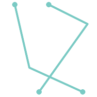 (g) |
POLYGONs are formed from linear rings, so valid polygonal geometry is always simple.
To test if a geometry is simple use the ST_IsSimple function:
SELECT
   ST_IsSimple('LINESTRING(0 0, 100 100)') AS straight,
   ST_IsSimple('LINESTRING(0 0, 100 100, 100 0, 0 100)') AS crossing;

 straight | crossing
----------+----------
 t        | f
Generally, PostGIS functions do not require geometric arguments to be simple. Simplicity is primarily used as a basis for defining geometric validity. It is also a requirement for some kinds of spatial data models (for example, linear networks often disallow lines that cross). Multipoint and linear geometry can be made simple using ST_UnaryUnion.
4.4.2. Valid Geometry
Geometry validity primarily applies to 2-dimensional geometries (POLYGONs and MULTIPOLYGONs) . Validity is defined by rules that allow polygonal geometry to model planar areas unambiguously.
A POLYGON is valid if:
the polygon boundary rings (the exterior shell ring and interior hole rings) are simple (do not cross or self-touch). Because of this a polygon cannot have cut lines, spikes or loops. This implies that polygon holes must be represented as interior rings, rather than by the exterior ring self-touching (a so-called "inverted hole").
boundary rings do not cross
boundary rings may touch at points but only as a tangent (i.e. not in a line)
interior rings are contained in the exterior ring
the polygon interior is simply connected (i.e. the rings must not touch in a way that splits the polygon into more than one part)
(h) and (i) are valid |
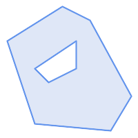 (h) | 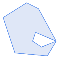 (i) | 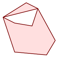 (j) |
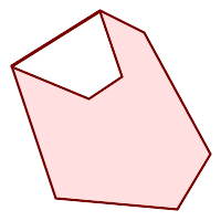 (k) | 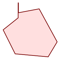 (l) | 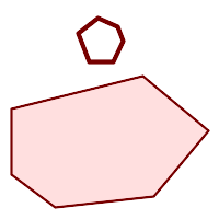 (m) |
A MULTIPOLYGON is valid if:
its element
POLYGONs are validelements do not overlap (i.e. their interiors must not intersect)
elements touch only at points (i.e. not along a line)
(n) is a valid |
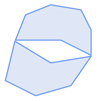 (n) | 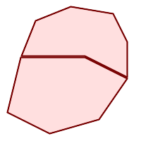 (o) | 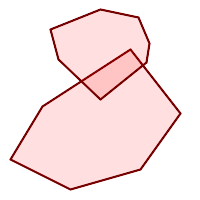 (p) |
These rules mean that valid polygonal geometry is also simple.
For linear geometry the only validity rule is that LINESTRINGs must have at least two points and have non-zero length (or equivalently, have at least two distinct points.) Note that non-simple (self-intersecting) lines are valid.
SELECT
   ST_IsValid('LINESTRING(0 0, 1 1)') AS len_nonzero,
   ST_IsValid('LINESTRING(0 0, 0 0, 0 0)') AS len_zero,
   ST_IsValid('LINESTRING(10 10, 150 150, 180 50, 20 130)') AS self_int;

 len_nonzero | len_zero | self_int
-------------+----------+----------
 t           | f        | t
POINT and MULTIPOINT geometries have no validity rules.
4.4.3. Managing Validity
PostGIS allows creating and storing both valid and invalid Geometry. This allows invalid geometry to be detected and flagged or fixed. There are also situations where the OGC validity rules are stricter than desired (examples of this are zero-length linestrings and polygons with inverted holes.)
Many of the functions provided by PostGIS rely on the assumption that geometry arguments are valid. For example, it does not make sense to calculate the area of a polygon that has a hole defined outside of the polygon, or to construct a polygon from a non-simple boundary line. Assuming valid geometric inputs allows functions to operate more efficiently, since they do not need to check for topological correctness. (Notable exceptions are that zero-length lines and polygons with inversions are generally handled correctly.) Also, most PostGIS functions produce valid geometry output if the inputs are valid. This allows PostGIS functions to be chained together safely.
If you encounter unexpected error messages when calling PostGIS functions (such as "GEOS Intersection() threw an error!"), you should first confirm that the function arguments are valid. If they are not, then consider using one of the techniques below to ensure the data you are processing is valid.
| |
If a function reports an error with valid inputs, then you may have found an error in either PostGIS or one of the libraries it uses, and you should report this to the PostGIS project. The same is true if a PostGIS function returns an invalid geometry for valid input. |
To test if a geometry is valid use the ST_IsValid function:
SELECT ST_IsValid('POLYGON ((20 180, 180 180, 180 20, 20 20, 20 180))');
-----------------
 t
Information about the nature and location of an geometry invalidity are provided by the ST_IsValidDetail function:
SELECT valid, reason, ST_AsText(location) AS location
    FROM ST_IsValidDetail('POLYGON ((20 20, 120 190, 50 190, 170 50, 20 20))') AS t;

 valid |      reason       |                  location
-------+-------------------+---------------------------------------------
 f     | Self-intersection | POINT(91.51162790697674 141.56976744186045)
In some situations it is desirable to correct invalid geometry automatically. Use the ST_MakeValid function to do this. (ST_MakeValid is a case of a spatial function that does allow invalid input!)
By default, PostGIS does not check for validity when loading geometry, because validity testing can take a lot of CPU time for complex geometries. If you do not trust your data sources, you can enforce a validity check on your tables by adding a check constraint:
ALTER TABLE mytable
  ADD CONSTRAINT geometry_valid_check
        CHECK (ST_IsValid(geom));
4.5. The SPATIAL_REF_SYS Table and Spatial Reference Systems
A Spatial Reference System (SRS) (also called a Coordinate Reference System (CRS)) defines how geometry is referenced to locations on the Earth's surface. There are three types of SRS:
A geodetic SRS uses angular coordinates (longitude and latitude) which map directly to the surface of the earth.
A projected SRS uses a mathematical projection transformation to "flatten" the surface of the spheroidal earth onto a plane. It assigns location coordinates in a way that allows direct measurement of quantities such as distance, area, and angle. The coordinate system is Cartesian, which means it has a defined origin point and two perpendicular axes (usually oriented North and East). Each projected SRS uses a stated length unit (usually metres or feet). A projected SRS may be limited in its area of applicability to avoid distortion and fit within the defined coordinate bounds.
A local SRS is a Cartesian coordinate system which is not referenced to the earth's surface. In PostGIS this is specified by a SRID value of 0.
There are many different spatial reference systems in use. Common SRSes are standardized in the European Petroleum Survey Group EPSG database. For convenience PostGIS (and many other spatial systems) refers to SRS definitions using an integer identifier called a SRID.
A geometry is associated with a Spatial Reference System by its SRID value, which is accessed by ST_SRID. The SRID for a geometry can be assigned using ST_SetSRID. Some geometry constructor functions allow supplying a SRID (such as ST_Point and ST_MakeEnvelope). The EWKT format supports SRIDs with the SRID=n; prefix.
Spatial functions processing pairs of geometries (such as overlay and relationship functions) require that the input geometries are in the same spatial reference system (have the same SRID). Geometry data can be transformed into a different spatial reference system using ST_Transform and ST_TransformPipeline. Geometry returned from functions has the same SRS as the input geometries.
4.5.1. SPATIAL_REF_SYS Table
The SPATIAL_REF_SYS table used by PostGIS is an OGC-compliant database table that defines the available spatial reference systems. It holds the numeric SRIDs and textual descriptions of the coordinate systems.
A tabela SPATIAL_REF_SYS de definição está como segue:
CREATE TABLE spatial_ref_sys (
  srid       INTEGER NOT NULL PRIMARY KEY,
  auth_name  VARCHAR(256),
  auth_srid  INTEGER,
  srtext     VARCHAR(2048),
  proj4text  VARCHAR(2048)
)
As opções da commandline são:
sridUm valor inteiro que só identifica o Sistema de Referenciação Espacial (SRS) dentro do banco de dados.
auth_nameO nome do corpo padrão ou corpos padrẽos que estão sendo citados por este sistema de referência. Por exemplo, "EPSG" seria um
AUTH_NAMEválido.auth_sridThe ID of the Spatial Reference System as defined by the Authority cited in the
auth_name. In the case of EPSG, this is the EPSG code.srtextA representação bem conhecida de texto do sistema de referência espacial. Um exemplo de uma representação WKT SRS é:
PROJCS["NAD83 / UTM Zone 10N",
  GEOGCS["NAD83",
        DATUM["North_American_Datum_1983",
          SPHEROID["GRS 1980",6378137,298.257222101]
        ],
        PRIMEM["Greenwich",0],
        UNIT["degree",0.0174532925199433]
  ],
  PROJECTION["Transverse_Mercator"],
  PARAMETER["latitude_of_origin",0],
  PARAMETER["central_meridian",-123],
  PARAMETER["scale_factor",0.9996],
  PARAMETER["false_easting",500000],
  PARAMETER["false_northing",0],
  UNIT["metre",1]
]
For a discussion of SRS WKT, see the OGC standard Well-known text representation of coordinate reference systems.
proj4textO PostGIS usa a biblioteca Proj4 para fornecer capacidades de transformação de coordenada. A coluna
PROJ4TEXTcontém a string de definição da coordenada Proj4 para um SRID específico. Por exemplo:+proj=utm +zone=10 +ellps=clrk66 +datum=NAD27 +units=m
Para maiores informações a respeito, veja o website do Proj4 http://trac.osgeo.org/proj/. O arquivo
spatial_ref_sys.sqlcontém as definiçõesSRTEXTePROJ4TEXTpara todas as projeções EPSG.
When retrieving spatial reference system definitions for use in transformations, PostGIS uses fhe following strategy:
If
auth_nameandauth_sridare present (non-NULL) use the PROJ SRS based on those entries (if one exists).If
srtextis present create a SRS using it, if possible.If
proj4textis present create a SRS using it, if possible.
4.5.2. The SPATIAL_REF_SYS Table and Spatial Reference Systems
The PostGIS spatial_ref_sys table contains over 3000 of the most common spatial reference system definitions that are handled by the PROJ projection library. But there are many coordinate systems that it does not contain. You can add SRS definitions to the table if you have the required information about the spatial reference system. Or, you can define your own custom spatial reference system if you are familiar with PROJ constructs. Keep in mind that most spatial reference systems are regional and have no meaning when used outside of the bounds they were intended for.
Uma ótima fonte para encontrar sistemas de referência espacial não definidos na configuração central é http://spatialreference.org/
Alguns dos sistemas de referência espacial mais comumente usados são: 4326 - WGS 84 Long Lat, 4269 - NAD 83 Long Lat, 3395 - WGS 84 World Mercator, 2163 - US National Atlas Equal Area, Spatial reference systems para cadaNAD 83, WGS 84 UTM zona - zonas UTM são as mais ideais para medição, mas só cobrem 6-graus regiões.
Vários estados dos EUA no sistema de referência espacial (em metros ou pés) - normalmente um ou 2 existem por estado. A maioria dos que estão em metros estão no centro, mas muitos dos que estão em pés ou foram criados por ESRI precisarão de spatialreference.org.
You can even define non-Earth-based coordinate systems, such as Mars 2000 This Mars coordinate system is non-planar (it's in degrees spheroidal), but you can use it with the geography type to obtain length and proximity measurements in meters instead of degrees.
Here is an example of loading a custom coordinate system using an unassigned SRID and the PROJ definition for a US-centric Lambert Conformal projection:
INSERT INTO spatial_ref_sys (srid, proj4text)
VALUES ( 990000,
  '+proj=lcc  +lon_0=-95 +lat_0=25 +lat_1=25 +lat_2=25 +x_0=0 +y_0=0 +datum=WGS84 +units=m +no_defs'
);
4.6. Criando uma Tabela Espacial
4.6.1. Criando uma Tabela Espacial
You can create a table to store geometry data using the CREATE TABLE SQL statement with a column of type geometry. The following example creates a table with a geometry column storing 2D (XY) LineStrings in the BC-Albers coordinate system (SRID 3005):
CREATE TABLE roads (
    id SERIAL PRIMARY KEY,
    name VARCHAR(64),
    geom geometry(LINESTRING,3005)
  );
The geometry type supports two optional type modifiers:
O modificador de tipo espacial restringe o tipo de formas e dimensões permitidas na coluna. O valor pode ser qualquer um dos subtipos de geometria suportados (por exemplo, POINT, LINESTRING, POLYGON, MULTIPOINT, MULTILINESTRING, MULTIPOLYGON, GEOMETRYCOLLECTION etc.). O modificador oferece suporte a restrições de dimensionalidade de coordenadas adicionando sufixos: Z, M e ZM. Por exemplo, um modificador de "LINESTRINGM" permite apenas linhas com três dimensões e trata a terceira dimensão como uma medida. Da mesma forma, 'POINTZM' requer dados de quatro dimensões (XYZM).
the SRID modifier restricts the spatial reference system SRID to a particular number. If omitted, the SRID defaults to 0.
Examples of creating tables with geometry columns:
Create a table holding any kind of geometry with the default SRID:
CREATE TABLE geoms(gid serial PRIMARY KEY, geom geometry );
Create a table with 2D POINT geometry with the default SRID:
CREATE TABLE pts(gid serial PRIMARY KEY, geom geometry(POINT) );
Create a table with 3D (XYZ) POINTs and an explicit SRID of 3005:
CREATE TABLE pts(gid serial PRIMARY KEY, geom geometry(POINTZ,3005) );
Create a table with 4D (XYZM) LINESTRING geometry with the default SRID:
CREATE TABLE lines(gid serial PRIMARY KEY, geom geometry(LINESTRINGZM) );
Create a table with 2D POLYGON geometry with the SRID 4267 (NAD 1927 long lat):
CREATE TABLE polys(gid serial PRIMARY KEY, geom geometry(POLYGON,4267) );
It is possible to have more than one geometry column in a table. This can be specified when the table is created, or a column can be added using the ALTER TABLE SQL statement. This example adds a column that can hold 3D LineStrings:
ALTER TABLE roads ADD COLUMN geom2 geometry(LINESTRINGZ,4326);
4.6.2. A GEOMETRY_COLUMNS VIEW
A OGC Simple Features Specification for SQL define a tabela de metadados GEOMETRY_COLUMNS para descrever a estrutura da tabela de geometria. No PostGIS geometry_columns é uma visualização que lê as tabelas de catálogo do sistema de banco de dados. Isso garante que as informações de metadados espaciais sejam sempre consistentes com as tabelas e visualizações definidas atualmente. A estrutura da visualização é:
\d geometry_columns
View "public.geometry_columns"
      Column       |          Type          | Modifiers
-------------------+------------------------+-----------
 f_table_catalog   | character varying(256) |
 f_table_schema    | character varying(256) |
 f_table_name      | character varying(256) |
 f_geometry_column | character varying(256) |
 coord_dimension   | integer                |
 srid              | integer                |
 type              | character varying(30)  |
As opções da commandline são:
f_table_catalog, f_table_schema, f_table_nameO nome completo da tabela de característica que contém a coluna geométrica. Note que os termos "catálogo" e "esquema" são Oracle. Não existe um análogo do "catálogo" PostgreSQL, logo a coluna é deixada em branco -- para "esquema" o nome do esquema PostgreSQL é usado (
publicé o padrão).f_geometry_columnO nome da coluna geométrica na tabela característica.
coord_dimensionA dimensão espacial (2, 3 ou 4 dimensões) da coluna.
sridA ID do sistema de referência espacial usado para a geometria de coordenadas nessa tabela. É uma referência de chave estrangeira para a tabela
spatial_ref_sys(consulte Section 4.5.1, “SPATIAL_REF_SYS Table”).typeO tipo do objeto espacial. Para restringir a coluna espacial a um tipo só, use um dos: PONTO, LINESTRING, POLÍGONO, MULTIPONTO, MULTILINESTRING, MULTIPOLÍGONO, GEOMETRYCOLLECTION ou versões correspondentes XYM PONTOM, LINESTRINGM, POLÍGONOM, MULTIPOINTM, MULTILINESTRINGM, MULTIPOLÍGONOM, GEOMETRYCOLLECTIONM. Para coleções heterogêneas (do tipo mistas), você pode usar "GEOMETRIA" como o tipo.
4.6.3. Registrando manualmente as colunas geométricas em geometry_columns
Two of the cases where you may need this are the case of SQL Views and bulk inserts. For bulk insert case, you can correct the registration in the geometry_columns table by constraining the column or doing an alter table. For views, you could expose using a CAST operation. Note, if your column is typmod based, the creation process would register it correctly, so no need to do anything. Also views that have no spatial function applied to the geometry will register the same as the underlying table geometry column.
-- Lets say you have a view created like this
CREATE VIEW public.vwmytablemercator AS
        SELECT gid, ST_Transform(geom, 3395) As geom, f_name
        FROM public.mytable;

-- For it to register correctly
-- You need to cast the geometry
--
DROP VIEW public.vwmytablemercator;
CREATE VIEW  public.vwmytablemercator AS
        SELECT gid, ST_Transform(geom, 3395)::geometry(Geometry, 3395) As geom, f_name
        FROM public.mytable;

-- If you know the geometry type for sure is a 2D POLYGON then you could do
DROP VIEW public.vwmytablemercator;
CREATE VIEW  public.vwmytablemercator AS
        SELECT gid, ST_Transform(geom,3395)::geometry(Polygon, 3395) As geom, f_name
        FROM public.mytable;
--Lets say you created a derivative table by doing a bulk insert
SELECT poi.gid, poi.geom, citybounds.city_name
INTO myschema.my_special_pois
FROM poi INNER JOIN citybounds ON ST_Intersects(citybounds.geom, poi.geom);
-- Create 2D index on new table
CREATE INDEX idx_myschema_myspecialpois_geom_gist
ON myschema.my_special_pois USING gist(geom);
-- If your points are 3D points or 3M points,
-- then you might want to create an nd index instead of a 2D index
CREATE INDEX my_special_pois_geom_gist_nd
ON my_special_pois USING gist(geom gist_geometry_ops_nd);
-- To manually register this new table's geometry column in geometry_columns.
-- Note it will also change the underlying structure of the table to
-- to make the column typmod based.
SELECT populate_geometry_columns('myschema.my_special_pois'::regclass);
-- To retain the constraint-based definition behavior
-- (such as case of inherited tables where all children do not have the same type and srid)
-- set optional use_typmod argument to false
SELECT populate_geometry_columns('myschema.my_special_pois'::regclass, false); Although the old-constraint based method is still supported, a constraint-based geometry column used directly in a view, will not register correctly in geometry_columns, as will a typmod one. In this example we define a column using typmod and another using constraints.
CREATE TABLE pois_ny(gid SERIAL PRIMARY KEY, poi_name text, cat text, geom geometry(POINT,4326));
SELECT AddGeometryColumn('pois_ny', 'geom_2160', 2160, 'POINT', 2, false);
Se executarmos em psql
\d pois_ny;
Observamos que elas são definidas de maneira diferente -- uma é typmod, outra é restrição
Table "public.pois_ny"
  Column   |         Type          |                       Modifiers

-----------+-----------------------+------------------------------------------------------
 gid       | integer               | not null default nextval('pois_ny_gid_seq'::regclass)
 poi_name  | text                  |
 cat       | character varying(20) |
 geom      | geometry(Point,4326)  |
 geom_2160 | geometry              |
Indexes:
    "pois_ny_pkey" PRIMARY KEY, btree (gid)
Check constraints:
    "enforce_dims_geom_2160" CHECK (st_ndims(geom_2160) = 2)
    "enforce_geotype_geom_2160" CHECK (geometrytype(geom_2160) = 'POINT'::text
        OR geom_2160 IS NULL)
    "enforce_srid_geom_2160" CHECK (st_srid(geom_2160) = 2160)
Nas geometry_columns, elas registram corretamente
SELECT f_table_name, f_geometry_column, srid, type
        FROM geometry_columns
        WHERE f_table_name = 'pois_ny';
f_table_name | f_geometry_column | srid | type -------------+-------------------+------+------- pois_ny | geom | 4326 | POINT pois_ny | geom_2160 | 2160 | POINT
Entretanto -- se se quiséssemos criar uma view como essa
CREATE VIEW vw_pois_ny_parks AS
SELECT *
  FROM pois_ny
  WHERE cat='park';

SELECT f_table_name, f_geometry_column, srid, type
        FROM geometry_columns
        WHERE f_table_name = 'vw_pois_ny_parks';
A coluna baseada em typmod registra corretamente, mas a baseada em restrições não.
f_table_name   | f_geometry_column | srid |   type
------------------+-------------------+------+----------
 vw_pois_ny_parks | geom              | 4326 | POINT
 vw_pois_ny_parks | geom_2160         |    0 | GEOMETRY
Isto pode modificar as versões futuras do PostGIS, mas por enquanto para forçar a restrição baseada em coluna view registrar corretamente, precisamos fazer isto:
DROP VIEW vw_pois_ny_parks;
CREATE VIEW vw_pois_ny_parks AS
SELECT gid, poi_name, cat,
  geom,
  geom_2160::geometry(POINT,2160) As geom_2160
  FROM pois_ny
  WHERE cat = 'park';
SELECT f_table_name, f_geometry_column, srid, type
        FROM geometry_columns
        WHERE f_table_name = 'vw_pois_ny_parks';
f_table_name | f_geometry_column | srid | type ------------------+-------------------+------+------- vw_pois_ny_parks | geom | 4326 | POINT vw_pois_ny_parks | geom_2160 | 2160 | POINT
4.7. Carregando dados GIS (Vector)
Uma vez que tenha criado uma tabela espacial, você está pronto para atualizar os dados GIS no banco de dados. No momento, existe duas formas de colocar os dados no banco de dados PostGIS/PostgreSQL: usando as declarações SQL ou usando o shape file loader/dumper.
4.7.1. Usando SQL para recuperar dados
Se os dados espaciais puderem ser convertidos em uma representação de texto (como WKT ou WKB), o uso do SQL poderá ser a maneira mais fácil de inserir os dados no PostGIS. Os dados podem ser carregados em massa no PostGIS/PostgreSQL carregando um arquivo de texto de instruções SQL INSERT usando o utilitário SQL psql.
Um arquivo de atualização de dados (roads.sql por exemplo) deve se parecer com:
BEGIN;
INSERT INTO roads (road_id, roads_geom, road_name)
  VALUES (1,'LINESTRING(191232 243118,191108 243242)','Jeff Rd');
INSERT INTO roads (road_id, roads_geom, road_name)
  VALUES (2,'LINESTRING(189141 244158,189265 244817)','Geordie Rd');
INSERT INTO roads (road_id, roads_geom, road_name)
  VALUES (3,'LINESTRING(192783 228138,192612 229814)','Paul St');
INSERT INTO roads (road_id, roads_geom, road_name)
  VALUES (4,'LINESTRING(189412 252431,189631 259122)','Graeme Ave');
INSERT INTO roads (road_id, roads_geom, road_name)
  VALUES (5,'LINESTRING(190131 224148,190871 228134)','Phil Tce');
INSERT INTO roads (road_id, roads_geom, road_name)
  VALUES (6,'LINESTRING(198231 263418,198213 268322)','Dave Cres');
COMMIT;
O arquivo SQL pode ser carregado no PostgreSQL usando psql:
psql -d [database] -f roads.sql
4.7.2. shp2pgsql: Using the ESRI Shapefile Loader
O carregador de dados shp2pgsql converte ESRI Shape files em SQL adequado para inserção dentro de um banco de dados PostGIS/PostgreSQL, seja em formato de geometria ou geografia. O carregador possui vários modos de operação distinguidos pelas linhas de bandeiras de comando:
Juntamente com o comando carregador shp2pgsql, existe uma interface shp2pgsql-gui gráfica com a maioria das opções como o carregador, mas pode ser mais fácil de usar para um carregamento único non-scripted ou se você é novo no PostGIS. Pode ser configurado como um plugin do PgAdminIII.
- (c|a|d|p) Essas são opções mutualmente exclusivas:
-cCria uma tabela nova e popula do shapefile. Este é o modo padrão.
-aAnexa dados do shapefile dentro do banco de dados da tabela. Note que para usar esta opção para carregar vários arquivos, eles devem ter os mesmos atributos e tipos de dados.
-dDerruba a tabela do banco de dados, criando uma nova tabela com os dados do shapefile.
-pProduz somente a criação da tabela do código SQL, sem adicionar nenhum dado de fato. Isto pode ser usado se você precisar separar completamente a tabela de criação e os passos de carregamento de dados.
-?Exibir tela de ajuda.
-DUse o formato PostgreSQL "dump" para os dados de saída. Pode ser combinado com -a, -c e -d. É muito mais rápido para carregar que o formato padrão "insert" SQL. Use isto para dados muito grandes.
-s [<FROM_SRID>:]<SRID>Cria e popula as tabelas de geometria com o SRID específico. Especifica, opcionalmente, que o shapefile de entrada usa o FROM_SRID dado, caso em que as geometrias serão reprojetadas para o SRID alvo. FROM_SRID não pode ser especificado com -D.
-kMantém identificadores (coluna, esquema e atributos). Note que os atributos no shapefile estão todos em CAIXAALTA.
-iCoage todos os inteiros para 32-bit integers padrão, não cria 64-bit bigints, mesmo se a assinatura DBF parecer justificar ele.
-ICria um índice GiST na coluna geométrica.
-m-m
a_file_nameEspecifica um arquivo contendo um conjunto de mapas de nomes (longos) de colunas para nomes de colunas DBF com 10 caracteres. O conteúdo deste arquivo é uma ou mais linhas de dois nomes separados por um espaço branco e seguindo ou liderando espaço. Por exemplo:COLUMNNAME DBFFIELD1 AVERYLONGCOLUMNNAME DBFFIELD2
-SGera geometrias simples em vez de MULTI geometrias. Só irá ter sucesso se todas as geometrias forem de fato únicas (ex.: um MULTIPOLÍGONO com uma única shell, ou um MULTIPONTO com um único vértice).
-t <dimensionality>Força a geometria de saída a ter dimensionalidade especificada. Use as strings seguintes para indicar a dimensionalidade: 2D, 3DZ, 3DM, 4D.
Se a entrada tiver poucas dimensões especificadas, a saída terá essas dimensões cheias com zeros. Se a entrada tiver mais dimensões especificadas, as que indesejadas serão tiradas.
-wGera o formato WKT em vez do WKB. Note que isto pode introduzir impulsos de coordenadas para perda de precisão.
-eExecute cada declaração por si mesma, sem usar uma transação. Isto permite carregar a maioria dos dados bons quando existem geometrias ruins que geram erros. Note que não pode ser usado com a bandeira -D como o formato "dump" sempre usa a transação.
-W <encoding>Especifica codificação dos dados de entrada (arquivo dbf). Quando usado, todos os atributos do dbf são convertidos da codificação especificada para UTF8. A saída SQL resultante conterá um comando
SET CLIENT_ENCODING to UTF8, então o backend será capaz de reconverter do UTF8 para qualquer codificação que o banco de dados estiver configurado para usar internamente.-N <policy>Políticas para lidar com geometrias NULAS (insert*,skip,abort)
-n-n Só importa arquivo DBF. Se seus dados não possuem shapefile correspondente, ele irá trocar automaticamente para este modo e carregar só o dbf. Então, só é necessário configurar esta bandeira se você tiver um shapefile completo, e se quiser os dados atributos e nenhuma geometria.
-GUse geografia em vez de geometria (requer dados long/lat) em WGS84 long lat (SRID=4326)
-T <tablespace>Especifica o espaço para a nova tabela. Os índices continuarão usando espaço padrão a menos que o parâmetro -X também seja usado. A documentação PostgreSQL tem uma boa descrição quando usa espaços personalizados.
-X <tablespace>Especifica o espaço para os novos índices da tabela. Isto se aplica ao primeiro índice chave, e o índice GIST espacial, se -I também for usado.
-ZWhen used, this flag will prevent the generation of
ANALYZEstatements. Without the -Z flag (default behavior), theANALYZEstatements will be generated.
Uma seção exemplo usando o carregador para criar um arquivo de entrada e atualizando ele pode parecer com:
# shp2pgsql -c -D -s 4269 -i -I shaperoads.shp myschema.roadstable
> roads.sql
# psql -d roadsdb -f roads.sql
Uma conversão e um upload podem ser feitos em apenas um passo usando encadeamento UNIX:
# shp2pgsql shaperoads.shp myschema.roadstable | psql -d roadsdb
4.8. Criando uma Tabela Espacial
Os dados podem ser extraídos do banco da dados usando o SQL ou o Shape file loader/dumper. Na seção do SQL discutiremos alguns dos operadores disponíveis para comparações e consultas em tabelas espaciais.
4.8.1. Usando SQL para recuperar dados
A maneira mais direta de extrair dados espaciais do banco de dados é usar uma consulta SQL SELECT para definir o conjunto de dados a ser extraído e despejar as colunas resultantes em um arquivo de texto analisável:
db=# SELECT road_id, ST_AsText(road_geom) AS geom, road_name FROM roads;

road_id | geom                                    | road_name
--------+-----------------------------------------+-----------
          1 | LINESTRING(191232 243118,191108 243242) | Jeff Rd
          2 | LINESTRING(189141 244158,189265 244817) | Geordie Rd
          3 | LINESTRING(192783 228138,192612 229814) | Paul St
          4 | LINESTRING(189412 252431,189631 259122) | Graeme Ave
          5 | LINESTRING(190131 224148,190871 228134) | Phil Tce
          6 | LINESTRING(198231 263418,198213 268322) | Dave Cres
          7 | LINESTRING(218421 284121,224123 241231) | Chris Way
(6 rows)
Entretanto, às vezes algum tipo de restrição será necessária para cortar o número de campos retornados. No caso de restrições baseadas em atributos, só use a mesma sintaxe SQL como normal com uma tabela não espacial. No caso de restrições espaciais, os operadores seguintes são úteis/disponíveis:
ST_IntersectsThis function tells whether two geometries share any space.
=Isto testa se duas geometrias são geometricamente iguais. Por exemplo, se 'POLYGON((0 0,1 1,1 0,0 0))' é o mesmo que 'POLYGON((0 0,1 1,1 0,0 0))' (é).
Next, you can use these operators in queries. Note that when specifying geometries and boxes on the SQL command line, you must explicitly turn the string representations into geometries function. The 312 is a fictitious spatial reference system that matches our data. So, for example:
SELECT road_id, road_name
  FROM roads
  WHERE roads_geom='SRID=312;LINESTRING(191232 243118,191108 243242)'::geometry;
A consulta acima retornaria um único relato da tabela "ROADS_GEOM"na qual a geometria era igual ao valor.
To check whether some of the roads passes in the area defined by a polygon:
SELECT road_id, road_name
FROM roads
WHERE ST_Intersects(roads_geom, 'SRID=312;POLYGON((...))');
The most common spatial query will probably be a "frame-based" query, used by client software, like data browsers and web mappers, to grab a "map frame" worth of data for display.
Usando o operador "&&" , você pode especificar uma CAIXA3D como uma caracetrística de comparação ou uma GEOMETRIA. Entretanto, quando você especifica uma GEOMETRIA, a caixa delimitadora dela será usada para a comparação.
Using a "BOX3D" object for the frame, such a query looks like this:
SELECT ST_AsText(roads_geom) AS geom
FROM roads
WHERE
  roads_geom && ST_MakeEnvelope(191232, 243117,191232, 243119,312);
Observe o uso do SRID 312, para especificar a projeção do envelope.
4.8.2. Usando o Dumper
A tabela dumper pgsql2shp conecta diretamente ao banco de dados e converte uma tabela (possivelmente definida por uma consulta) em um shapefile. A sintaxe básica é:
pgsql2shp [<options
>] <database
> [<schema
>.]<table>
pgsql2shp [<options
>] <database
> <query>
As opções da commandline são:
-f <filename>Atribui a saída a um filename específico.
-h <host>O hospedeiro do banco de dados para se conectar.
-p <port>A porta para conectar no hospedeiro do banco de dados.
-P <password>A senha para usar quando conectar ao banco de dados.
-u <user>O nome de usuário para usar quando conectado ao banco de dados.
-g <geometry column>No caso de tabelas com várias colunas geométricas, a coluna para usar quando atribuindo o shapefile.
-bUse um cursor binário. Isto tornará a operação mais rápida, mas não funcionará se qualquer atributo NÃO-geométrico na tabela necessitar de um cast para o texto.
-rModo cru. Não derruba o campo
gid, ou escapa o nome das colunas.-m filenameRemapeia os identificadores para nomes com dez caracteres. O conteúdo do arquivo é linhas de dois símbolos separados por um único espaço branco e nenhum espaço seguindo ou à frente: VERYLONGSYMBOL SHORTONE ANOTHERVERYLONGSYMBOL SHORTER etc.
4.9. Construindo índidces
Spatial indexes make using a spatial database for large data sets possible. Without indexing, a search for features requires a sequential scan of every record in the database. Indexing speeds up searching by organizing the data into a structure which can be quickly traversed to find matching records.
The B-tree index method commonly used for attribute data is not very useful for spatial data, since it only supports storing and querying data in a single dimension. Data such as geometry (which has 2 or more dimensions) requires an index method that supports range query across all the data dimensions. One of the key advantages of PostgreSQL for spatial data handling is that it offers several kinds of index methods which work well for multi-dimensional data: GiST, BRIN and SP-GiST indexes.
Os índices GiST (Generalized Search Tree) dividem os dados em "coisas para um lado", "coisas que se sobrepõem", "coisas que estão dentro" e podem ser usados em uma ampla variedade de tipos de dados, inclusive dados GIS. O PostGIS usa um índice R-Tree implementado sobre o GiST para indexar dados espaciais. O GiST é o método de índice espacial mais comumente usado e versátil, e oferece um desempenho de consulta muito bom.
BRIN (Block Range Index) indexes operate by summarizing the spatial extent of ranges of table records. Search is done via a scan of the ranges. BRIN is only appropriate for use for some kinds of data (spatially sorted, with infrequent or no update). But it provides much faster index create time, and much smaller index size.
SP-GiST (Space-Partitioned Generalized Search Tree) is a generic index method that supports partitioned search trees such as quad-trees, k-d trees, and radix trees (tries).
Spatial indexes store only the bounding box of geometries. Spatial queries use the index as a primary filter to quickly determine a set of geometries potentially matching the query condition. Most spatial queries require a secondary filter that uses a spatial predicate function to test a more specific spatial condition. For more information on queying with spatial predicates see Section 5.2, “Using Spatial Indexes”.
See also the PostGIS Workshop section on spatial indexes, and the PostgreSQL manual.
4.9.1. Índices GiST
GiST significa "Árvores de Pesquisa Generalizada" e é uma forma genérica de classificar. Além disso, ele é usado para acelerar pesquisas em todos os tipos de estruturas de dados irregulares (arranjos inteiros, dados espectrais etc) que não são agradáveis à classificação normal B-Tree.
Uma vez que uma tabela de dados GIS excede pouco mais de mil filas, você irá querer construir um índice para acelerar pesquisas espaciais dos dados (a menos que suas pesquisas sejam baseadas em atributos, você vai querer construir um índice normal nos campos de atributo).
A sintaxe para construir um índice GiST em uma coluna "geométrica" é a seguinte:
CREATE INDEX [indexname] ON [tablename] USING GIST ( [geometryfield] );
The above syntax will always build a 2D-index. To get the an n-dimensional index for the geometry type, you can create one using this syntax:
CREATE INDEX [indexname] ON [tablename] USING GIST ([geometryfield] gist_geometry_ops_nd);
Building a spatial index is a computationally intensive exercise. It also blocks write access to your table for the time it creates, so on a production system you may want to do in in a slower CONCURRENTLY-aware way:
CREATE INDEX CONCURRENTLY [indexname] ON [tablename] USING GIST ( [geometryfield] );
After building an index, it is sometimes helpful to force PostgreSQL to collect table statistics, which are used to optimize query plans:
VACUUM ANALYZE [table_name] [(column_name)];
4.9.2. BRIN Indexes
BRIN stands for "Block Range Index". It is a general-purpose index method provided by PostgreSQL. BRIN is a lossy index method, meaning that a secondary check is required to confirm that a record matches a given search condition (which is the case for all provided spatial indexes). It provides much faster index creation and much smaller index size, with reasonable read performance. Its primary purpose is to support indexing very large tables on columns which have a correlation with their physical location within the table. In addition to spatial indexing, BRIN can speed up searches on various kinds of attribute data structures (integer, arrays etc). For more information see the PostgreSQL manual.
Once a spatial table exceeds a few thousand rows, you will want to build an index to speed up spatial searches of the data. GiST indexes are very performant as long as their size doesn't exceed the amount of RAM available for the database, and as long as you can afford the index storage size, and the cost of index update on write. Otherwise, for very large tables BRIN index can be considered as an alternative.
A BRIN index stores the bounding box enclosing all the geometries contained in the rows in a contiguous set of table blocks, called a block range. When executing a query using the index the block ranges are scanned to find the ones that intersect the query extent. This is efficient only if the data is physically ordered so that the bounding boxes for block ranges have minimal overlap (and ideally are mutually exclusive). The resulting index is very small in size, but is typically less performant for read than a GiST index over the same data.
Building a BRIN index is much less CPU-intensive than building a GiST index. It's common to find that a BRIN index is ten times faster to build than a GiST index over the same data. And because a BRIN index stores only one bounding box for each range of table blocks, it's common to use up to a thousand times less disk space than a GiST index.
You can choose the number of blocks to summarize in a range. If you decrease this number, the index will be bigger but will probably provide better performance.
For BRIN to be effective, the table data should be stored in a physical order which minimizes the amount of block extent overlap. It may be that the data is already sorted appropriately (for instance, if it is loaded from another dataset that is already sorted in spatial order). Otherwise, this can be accomplished by sorting the data by a one-dimensional spatial key. One way to do this is to create a new table sorted by the geometry values (which in recent PostGIS versions uses an efficient Hilbert curve ordering):
CREATE TABLE table_sorted AS
   SELECT * FROM table  ORDER BY geom;
Alternatively, data can be sorted in-place by using a GeoHash as a (temporary) index, and clustering on that index:
CREATE INDEX idx_temp_geohash ON table
    USING btree (ST_GeoHash( ST_Transform( geom, 4326 ), 20));
CLUSTER table USING idx_temp_geohash;
A sintaxe para criar um índice BRIN em uma coluna geometry é a seguinte:
CREATE INDEX [indexname] ON [tablename] USING BRIN ( [geome_col] );
The above syntax builds a 2D index. To build a 3D-dimensional index, use this syntax:
CREATE INDEX [indexname] ON [tablename]
    USING BRIN ([geome_col] brin_geometry_inclusion_ops_3d);
You can also get a 4D-dimensional index using the 4D operator class:
CREATE INDEX [indexname] ON [tablename]
    USING BRIN ([geome_col] brin_geometry_inclusion_ops_4d);
The above commands use the default number of blocks in a range, which is 128. To specify the number of blocks to summarise in a range, use this syntax
CREATE INDEX [indexname] ON [tablename]
    USING BRIN ( [geome_col] ) WITH (pages_per_range = [number]);
Keep in mind that a BRIN index only stores one index entry for a large number of rows. If your table stores geometries with a mixed number of dimensions, it's likely that the resulting index will have poor performance. You can avoid this performance penalty by choosing the operator class with the least number of dimensions of the stored geometries
The geography datatype is supported for BRIN indexing. The syntax for building a BRIN index on a geography column is:
CREATE INDEX [indexname] ON [tablename] USING BRIN ( [geog_col] );
The above syntax builds a 2D-index for geospatial objects on the spheroid.
Currently, only "inclusion support" is provided, meaning that just the &&, ~ and @ operators can be used for the 2D cases (for both geometry and geography), and just the &&& operator for 3D geometries. There is currently no support for kNN searches.
An important difference between BRIN and other index types is that the database does not maintain the index dynamically. Changes to spatial data in the table are simply appended to the end of the index. This will cause index search performance to degrade over time. The index can be updated by performing a VACUUM, or by using a special function brin_summarize_new_values(regclass). For this reason BRIN may be most appropriate for use with data that is read-only, or only rarely changing. For more information refer to the manual.
To summarize using BRIN for spatial data:
Index build time is very fast, and index size is very small.
Index query time is slower than GiST, but can still be very acceptable.
Requires table data to be sorted in a spatial ordering.
Requires manual index maintenance.
Most appropriate for very large tables, with low or no overlap (e.g. points), which are static or change infrequently.
More effective for queries which return relatively large numbers of data records.
4.9.3. SP-GiST Indexes
SP-GiST stands for "Space-Partitioned Generalized Search Tree" and is a generic form of indexing for multi-dimensional data types that supports partitioned search trees, such as quad-trees, k-d trees, and radix trees (tries). The common feature of these data structures is that they repeatedly divide the search space into partitions that need not be of equal size. In addition to spatial indexing, SP-GiST is used to speed up searches on many kinds of data, such as phone routing, ip routing, substring search, etc. For more information see the PostgreSQL manual.
As it is the case for GiST indexes, SP-GiST indexes are lossy, in the sense that they store the bounding box enclosing spatial objects. SP-GiST indexes can be considered as an alternative to GiST indexes.
Once a GIS data table exceeds a few thousand rows, an SP-GiST index may be used to speed up spatial searches of the data. The syntax for building an SP-GiST index on a "geometry" column is as follows:
CREATE INDEX [indexname] ON [tablename] USING SPGIST ( [geometryfield] );
The above syntax will build a 2-dimensional index. A 3-dimensional index for the geometry type can be created using the 3D operator class:
CREATE INDEX [indexname] ON [tablename] USING SPGIST ([geometryfield] spgist_geometry_ops_3d);
Building a spatial index is a computationally intensive operation. It also blocks write access to your table for the time it creates, so on a production system you may want to do in in a slower CONCURRENTLY-aware way:
CREATE INDEX CONCURRENTLY [indexname] ON [tablename] USING SPGIST ( [geometryfield] );
After building an index, it is sometimes helpful to force PostgreSQL to collect table statistics, which are used to optimize query plans:
VACUUM ANALYZE [table_name] [(column_name)];
An SP-GiST index can accelerate queries involving the following operators:
<<, &<, &>, >>, <<|, &<|, |&>, |>>, &&, @>, <@, and ~=, for 2-dimensional indexes,
&/&, ~==, @>>, and <<@, for 3-dimensional indexes.
There is no support for kNN searches at the moment.
4.9.4. Construindo índidces
Ordinarily, indexes invisibly speed up data access: once an index is built, the PostgreSQL query planner automatically decides when to use it to improve query performance. But there are some situations where the planner does not choose to use existing indexes, so queries end up using slow sequential scans instead of a spatial index.
Se você achar que seus índices não estão sendo usados (ou seus atributos) há algumas coisas que pode fazer:
Examine the query plan and check your query actually computes the thing you need. An erroneous JOIN, either forgotten or to the wrong table, can unexpectedly retrieve table records multiple times. To get the query plan, execute with
EXPLAINin front of the query.Make sure statistics are gathered about the number and distributions of values in a table, to provide the query planner with better information to make decisions around index usage. VACUUM ANALYZE will compute both.
You should regularly vacuum your databases anyways. Many PostgreSQL DBAs run VACUUM as an off-peak cron job on a regular basis.
If vacuuming does not help, you can temporarily force the planner to use the index information by using the command SET ENABLE_SEQSCAN TO OFF;. This way you can check whether the planner is at all able to generate an index-accelerated query plan for your query. You should only use this command for debugging; generally speaking, the planner knows better than you do about when to use indexes. Once you have run your query, do not forget to run SET ENABLE_SEQSCAN TO ON; so that the planner will operate normally for other queries.
If SET ENABLE_SEQSCAN TO OFF; helps your query to run faster, your Postgres is likely not tuned for your hardware. If you find the planner wrong about the cost of sequential versus index scans try reducing the value of
RANDOM_PAGE_COSTinpostgresql.conf, or use SET RANDOM_PAGE_COST TO 1.1;. The default value forRANDOM_PAGE_COSTis 4.0. Try setting it to 1.1 (for SSD) or 2.0 (for fast magnetic disks). Decreasing the value makes the planner more likely to use index scans.If SET ENABLE_SEQSCAN TO OFF; does not help your query, the query may be using a SQL construct that the Postgres planner is not yet able to optimize. It may be possible to rewrite the query in a way that the planner is able to handle. For example, a subquery with an inline SELECT may not produce an efficient plan, but could possibly be rewritten using a LATERAL JOIN.
For more information see the Postgres manual section on Query Planning.
Chapter 5. Spatial Queries
The raison d'etre of spatial databases is to perform queries inside the database which would ordinarily require desktop GIS functionality. Using PostGIS effectively requires knowing what spatial functions are available, how to use them in queries, and ensuring that appropriate indexes are in place to provide good performance.
5.1. Determining Spatial Relationships
Spatial relationships indicate how two geometries interact with one another. They are a fundamental capability for querying geometry.
5.1.1. Dimensionally Extended 9-Intersection Model
According to the OpenGIS Simple Features Implementation Specification for SQL, "the basic approach to comparing two geometries is to make pair-wise tests of the intersections between the Interiors, Boundaries and Exteriors of the two geometries and to classify the relationship between the two geometries based on the entries in the resulting 'intersection' matrix."
In the theory of point-set topology, the points in a geometry embedded in 2-dimensional space are categorized into three sets:
- Boundary
The boundary of a geometry is the set of geometries of the next lower dimension. For
POINTs, which have a dimension of 0, the boundary is the empty set. The boundary of aLINESTRINGis the two endpoints. ForPOLYGONs, the boundary is the linework of the exterior and interior rings.- Interior
The interior of a geometry are those points of a geometry that are not in the boundary. For
POINTs, the interior is the point itself. The interior of aLINESTRINGis the set of points between the endpoints. ForPOLYGONs, the interior is the areal surface inside the polygon.- Exterior
The exterior of a geometry is the rest of the space in which the geometry is embedded; in other words, all points not in the interior or on the boundary of the geometry. It is a 2-dimensional non-closed surface.
The Dimensionally Extended 9-Intersection Model (DE-9IM) describes the spatial relationship between two geometries by specifying the dimensions of the 9 intersections between the above sets for each geometry. The intersection dimensions can be formally represented in a 3x3 intersection matrix.
For a geometry g the Interior, Boundary, and Exterior are denoted using the notation I(g), B(g), and E(g). Also, dim(s) denotes the dimension of a set s with the domain of {0,1,2,F}:
0=> point1=> line2=> areaF=> empty set
Using this notation, the intersection matrix for two geometries a and b is:
| Interior | Boundary | Exterior | |
|---|---|---|---|
| Interior | dim( I(a) ∩ I(b) ) | dim( I(a) ∩ B(b) ) | dim( I(a) ∩ E(b) ) |
| Boundary | dim( B(a) ∩ I(b) ) | dim( B(a) ∩ B(b) ) | dim( B(a) ∩ E(b) ) |
| Exterior | dim( E(a) ∩ I(b) ) | dim( E(a) ∩ B(b) ) | dim( E(a) ∩ E(b) ) |
Visually, for two overlapping polygonal geometries, this looks like:
| ||||||||||||||||||
|
|


Reading from left to right and top to bottom, the intersection matrix is represented as the text string '212101212'.
For more information, refer to:
5.1.2. Named Spatial Relationships
To make it easy to determine common spatial relationships, the OGC SFS defines a set of named spatial relationship predicates. PostGIS provides these as the functions ST_Contains, ST_Crosses, ST_Disjoint, ST_Equals, ST_Intersects, ST_Overlaps, ST_Touches, ST_Within. It also defines the non-standard relationship predicates ST_Covers, ST_CoveredBy, and ST_ContainsProperly.
Spatial predicates are usually used as conditions in SQL WHERE or JOIN clauses. The named spatial predicates automatically use a spatial index if one is available, so there is no need to use the bounding box operator && as well. For example:
SELECT city.name, state.name, city.geom
FROM city JOIN state ON ST_Intersects(city.geom, state.geom);
For more details and illustrations, see the PostGIS Workshop.
5.1.3. General Spatial Relationships
In some cases the named spatial relationships are insufficient to provide a desired spatial filter condition.
 For example, consider a linear dataset representing a road network. It may be required to identify all road segments that cross each other, not at a point, but in a line (perhaps to validate some business rule). In this case ST_Crosses does not provide the necessary spatial filter, since for linear features it returns A two-step solution would be to first compute the actual intersection (ST_Intersection) of pairs of road lines that spatially intersect (ST_Intersects), and then check if the intersection's ST_GeometryType is ' Clearly, a simpler and faster solution is desirable. |
 A second example is locating wharves that intersect a lake's boundary on a line and where one end of the wharf is up on shore. In other words, where a wharf is within but not completely contained by a lake, intersects the boundary of a lake on a line, and where exactly one of the wharf's endpoints is within or on the boundary of the lake. It is possible to use a combination of spatial predicates to find the required features:
|
These requirements can be met by computing the full DE-9IM intersection matrix. PostGIS provides the ST_Relate function to do this:
SELECT ST_Relate( 'LINESTRING (1 1, 5 5)',
                  'POLYGON ((3 3, 3 7, 7 7, 7 3, 3 3))' );
st_relate
-----------
1010F0212
To test a particular spatial relationship, an intersection matrix pattern is used. This is the matrix representation augmented with the additional symbols {T,*}:
T=> intersection dimension is non-empty; i.e. is in{0,1,2}*=> don't care
Using intersection matrix patterns, specific spatial relationships can be evaluated in a more succinct way. The ST_Relate and the ST_RelateMatch functions can be used to test intersection matrix patterns. For the first example above, the intersection matrix pattern specifying two lines intersecting in a line is '1*1***1**':
-- Find road segments that intersect in a line
SELECT a.id
FROM roads a, roads b
WHERE a.id != b.id
      AND a.geom && b.geom
      AND ST_Relate(a.geom, b.geom, '1*1***1**');
For the second example, the intersection matrix pattern specifying a line partly inside and partly outside a polygon is '102101FF2':
-- Find wharves partly on a lake's shoreline
SELECT a.lake_id, b.wharf_id
FROM lakes a, wharfs b
WHERE a.geom && b.geom
      AND ST_Relate(a.geom, b.geom, '102101FF2');
5.2. Using Spatial Indexes
When constructing queries using spatial conditions, for best performance it is important to ensure that a spatial index is used, if one exists (see Section 4.9, “Construindo índidces”). To do this, a spatial operator or index-aware function must be used in a WHERE or ON clause of the query.
Spatial operators include the bounding box operators (of which the most commonly used is &&; see Section 7.10.1, “Bounding Box Operators” for the full list) and the distance operators used in nearest-neighbor queries (the most common being <->; see Section 7.10.2, “Operadores” for the full list.)
Index-aware functions automatically add a bounding box operator to the spatial condition. Index-aware functions include the named spatial relationship predicates ST_Contains, ST_ContainsProperly, ST_CoveredBy, ST_Covers, ST_Crosses, ST_Intersects, ST_Overlaps, ST_Touches, ST_Within, ST_Within, and ST_3DIntersects, and the distance predicates ST_DWithin, ST_DFullyWithin, ST_3DDFullyWithin, and ST_3DDWithin .)
Functions such as ST_Distance do not use indexes to optimize their operation. For example, the following query would be quite slow on a large table:
SELECT geom
FROM geom_table
WHERE ST_Distance( geom, 'SRID=312;POINT(100000 200000)' ) < 100
This query selects all the geometries in geom_table which are within 100 units of the point (100000, 200000). It will be slow because it is calculating the distance between each point in the table and the specified point, ie. one ST_Distance() calculation is computed for every row in the table.
The number of rows processed can be reduced substantially by using the index-aware function ST_DWithin:
SELECT geom
FROM geom_table
WHERE ST_DWithin( geom, 'SRID=312;POINT(100000 200000)', 100 )
This query selects the same geometries, but it does it in a more efficient way. This is enabled by ST_DWithin() using the && operator internally on an expanded bounding box of the query geometry. If there is a spatial index on geom, the query planner will recognize that it can use the index to reduce the number of rows scanned before calculating the distance. The spatial index allows retrieving only records with geometries whose bounding boxes overlap the expanded extent and hence which might be within the required distance. The actual distance is then computed to confirm whether to include the record in the result set.
For more information and examples see the PostGIS Workshop.
5.3. Examples of Spatial SQL
The examples in this section make use of a table of linear roads, and a table of polygonal municipality boundaries. The definition of the bc_roads table is:
Column    | Type              | Description
----------+-------------------+-------------------
gid       | integer           | Unique ID
name      | character varying | Road Name
geom      | geometry          | Location Geometry (Linestring)
The definition of the bc_municipality table is:
Column   | Type              | Description
---------+-------------------+-------------------
gid      | integer           | Unique ID
code     | integer           | Unique ID
name     | character varying | City / Town Name
geom     | geometry          | Location Geometry (Polygon)
- 5.3.1. What is the total length of all roads, expressed in kilometers?
- 5.3.2. How large is the city of Prince George, in hectares?
- 5.3.3. What is the largest municipality in the province, by area?
- 5.3.4. What is the length of roads fully contained within each municipality?
- 5.3.5. Create a new table with all the roads within the city of Prince George.
- 5.3.6. What is the length in kilometers of "Douglas St" in Victoria?
- 5.3.7. What is the largest municipality polygon that has a hole?
5.3.1. | What is the total length of all roads, expressed in kilometers? |
You can answer this question with a very simple piece of SQL: SELECT sum(ST_Length(geom))/1000 AS km_roads FROM bc_roads; km_roads ------------------ 70842.1243039643 | |
5.3.2. | How large is the city of Prince George, in hectares? |
This query combines an attribute condition (on the municipality name) with a spatial calculation (of the polygon area): SELECT ST_Area(geom)/10000 AS hectares FROM bc_municipality WHERE name = 'PRINCE GEORGE'; hectares ------------------ 32657.9103824927 | |
5.3.3. | What is the largest municipality in the province, by area? |
This query uses a spatial measurement as an ordering value. There are several ways of approaching this problem, but the most efficient is below: SELECT name, ST_Area(geom)/10000 AS hectares FROM bc_municipality ORDER BY hectares DESC LIMIT 1; name | hectares ---------------+----------------- TUMBLER RIDGE | 155020.02556131 Note that in order to answer this query we have to calculate the area of every polygon. If we were doing this a lot it would make sense to add an area column to the table that could be indexed for performance. By ordering the results in a descending direction, and them using the PostgreSQL "LIMIT" command we can easily select just the largest value without using an aggregate function like MAX(). | |
5.3.4. | What is the length of roads fully contained within each municipality? |
This is an example of a "spatial join", which brings together data from two tables (with a join) using a spatial interaction ("contained") as the join condition (rather than the usual relational approach of joining on a common key): SELECT m.name, sum(ST_Length(r.geom))/1000 as roads_km FROM bc_roads AS r JOIN bc_municipality AS m ON ST_Contains(m.geom, r.geom) GROUP BY m.name ORDER BY roads_km; name | roads_km ----------------------------+------------------ SURREY | 1539.47553551242 VANCOUVER | 1450.33093486576 LANGLEY DISTRICT | 833.793392535662 BURNABY | 773.769091404338 PRINCE GEORGE | 694.37554369147 ... This query takes a while, because every road in the table is summarized into the final result (about 250K roads for the example table). For smaller datasets (several thousand records on several hundred) the response can be very fast. | |
5.3.5. | Create a new table with all the roads within the city of Prince George. |
This is an example of an "overlay", which takes in two tables and outputs a new table that consists of spatially clipped or cut resultants. Unlike the "spatial join" demonstrated above, this query creates new geometries. An overlay is like a turbo-charged spatial join, and is useful for more exact analysis work: CREATE TABLE pg_roads as SELECT ST_Intersection(r.geom, m.geom) AS intersection_geom, ST_Length(r.geom) AS rd_orig_length, r.* FROM bc_roads AS r JOIN bc_municipality AS m ON ST_Intersects(r.geom, m.geom) WHERE m.name = 'PRINCE GEORGE'; | |
5.3.6. | What is the length in kilometers of "Douglas St" in Victoria? |
SELECT sum(ST_Length(r.geom))/1000 AS kilometers FROM bc_roads r JOIN bc_municipality m ON ST_Intersects(m.geom, r.geom WHERE r.name = 'Douglas St' AND m.name = 'VICTORIA'; kilometers ------------------ 4.89151904172838 | |
5.3.7. | What is the largest municipality polygon that has a hole? |
SELECT gid, name, ST_Area(geom) AS area FROM bc_municipality WHERE ST_NRings(geom) > 1 ORDER BY area DESC LIMIT 1; gid | name | area -----+--------------+------------------ 12 | SPALLUMCHEEN | 257374619.430216 |
Chapter 6. Dicas de desempenho
6.1. Pequenas tabelas de grandes geometrias
6.1.1. Descrição do problema
Current PostgreSQL versions suffer from a query optimizer weakness regarding TOAST tables. TOAST tables are a kind of "extension room" used to store large (in the sense of data size) values that do not fit into normal data pages (like long texts, images or complex geometries with lots of vertices), see the PostgreSQL Documentation for TOAST for more information).
Este problema ocorre se você possui tabelas com geometrias grandes, mas não muitas linhas (uma tabela dos limites todos os países europeus em alta resolução). A tabela em si, é pequena, mas utiliza muito espaço TOAST. Em nosso exemplo, a tabela em si possuía apenas 80 linhas e utilizava apenas 3 páginas de dados, mas a tabela TOAST utilizava 8225 páginas de dados.
Emita uma pesquisa onde você utiliza o operador && para pesquisa por um retângulo envolvente que bate com poucas dessas linhas. O otimizador de pesquisas ve esta tabela contendo apenas 3 páginas e 80 linhas. Como a tabela é pequena, ele estima que um scan sequencial em uma tabela tão pequena será mais rápida do que utilizar um índice, ignorando o mesmo. Geralmente esta estimativa é correta, mas em nosso caso o operador && tem que buscar todas as geometrias em disco para comparação dos retângulos envolventes, lendo todas as páginas TOAST também.
Para visualizar se você sofre com este bug, utilize um "EXPLAIN ANALYZE" na pesquisa em questão. Para maiores informações e detalhes técnicos, você pode recorrer a lista do postgres sobre desempenho: http://archives.postgresql.org/pgsql-performance/2005-02/msg00030.php
and newer thread on PostGIS https://lists.osgeo.org/pipermail/postgis-devel/2017-June/026209.html
6.1.2. Soluções
O pessoal responsável pelo PostgreSQL está tentando resolver esta questão por transformar o otimizador de pesquisas ciente das tabelas TOAST. Por enquanto, existem duas soluções:
A primeira solução é forçar o estimador de pesquisar a utilizar o índice. Emita um comando "SET enable_seqscan TO off" ao servidor antes de emitir a pesquisa. Isto força o estimador a evitar scans sequenciais sempre que possível, utilizando o índice GIST como de costume. Mas esta flag deve ser setada para cada conexão e causa o estimador a decidir mal em outros casos, portanto, você deve habilitar "SET enable_seqscan TO on;" após a pesquisa.
A segunda solução é fazer a pesquisa sequencial tão rápida quanto o estimador imagina. Isto pode ser feito criando uma coluna adicional que cacheia o retângulo envolvente e realizando as pesquisas em cima desta coluna. Em nosso exemplo, os comandos são:
SELECT AddGeometryColumn('myschema','mytable','bbox','4326','GEOMETRY','2');
UPDATE mytable SET bbox = ST_Envelope(ST_Force2D(geom));
Altere sua query para usar o operador && contra o retângulo envolvente ao invés da colunas geométrica, assim:
SELECT geom_column
FROM mytable
WHERE bbox && ST_SetSRID('BOX3D(0 0,1 1)'::box3d,4326);
Claro, se você alterar ou adicionar colunas a mytable, você deve manter o retângulo envolvente em sincronia. A forma mais transparente de fazer isto seria através de triggers, mas você também querer modificar sua aplicação para manter a coluna do retângulo envolvente atualizada or executar a query de UPDATE após cada modificação.
6.2. CLUSTERizando índices geométricos
Para tabelas que são basicamente somente-leitura, e onde um único índice é utilizado pela maioria das queries, PostgreSQL oferece o comando CLUSTER. Este comando fisicamente reordena todas as linhas da tabela assim como as do índice, assim possibilitando duas melhorias de desempenho: primeiro, para pesquisas de intervalo de índice, o número de pesquisas na tabela de dados é dramaticamente reduzido. Segundo, se seu conjunto de trabalho concentra-se em pequenos intervalos nos índices, você tem um cache mais eficiente, pois todas as informações estão divididas em poucas páginas de dados. (Sinta se convidado para ler a documentação do comando CLUSTER do manual do PostgreSQL.)
Contudo, atualmente o Postgresql não permite a clusterização de índices geométricos GIST, pois estes índices simplesmente ignoram valores nulos, retornando um erro como:
lwgeom=# CLUSTER my_geom_index ON my_table;
ERROR: cannot cluster when index access method does not handle null values
HINT: You may be able to work around this by marking column "geom" NOT NULL.
Como a HINT da mensagem te diz, você pode adicionar uma constraint "not null" na tabela para contornar o problema.
lwgeom=# ALTER TABLE my_table ALTER COLUMN geom SET not null;
ALTER TABLE
Claro, isto não vai funcionar se você de fato precisa de valores NULL em sua coluna geométrica. Adicionalmente, você deve usar o método acima para adicionar a constraint. Utilizar uma constraint do tipo CHECK como "ALTER TABLE blubb ADD CHECK (geometry is not null);" não irá funcionar.
6.3. Evitando conversão de dimensões
Algumas vezes, você tem dados que são 3D ou 4D em sua tabela, mas sempre acessa-os usando métodos OpenGIS, como ST_AsText() ou ST_AsBinary(), que somente funcionam em geometrias 2D. Eles fazem isso internamente chamando a função ST_Force2D(), que introduza um gasto extra para grandes geometrias. Para evitar este gasto extra, pode ser viável dropar essas dimensões adicionais para sempre:
UPDATE mytable SET geom = ST_Force2D(geom);
VACUUM FULL ANALYZE mytable;
Note que se você adicionou sua coluna geométrica utilizando o método AddGeometryColumn(), existirá uma constraint na dimensão da geometria. Para contornar isto, você precisará dropar a constraint também. Lembre-se de atualizar a entrada na tabela geometry_columns e recriar a constraint posteriormente.
No caso de grandes tabelas, pode ser sábio dividir este UPDATE em porções menores, restringindo o UPDATE a pequenas partes da tabela com o uso de uma cláusula WHERE sobre sua PRIMARY KEY ou outro critério, rodando um VACUUM, entre os UPDATEs. Isto reduz drasticamente a necessidade de espaço em disco temporário. Adicionalmente, se você tem geometrias de dimensões mistas, restrigir o UPDATE por "WHERE dimension(the_geom)>2" pula as geometrias que já estão em 2D.
Chapter 7. Referência do PostGIS
- 7.1. PostgreSQL PostGIS Geometry/Geography/Box Types
- 7.2. Funções de Gestão
- 7.3. Construtores de geometria
- 7.4. Acessors de Geometria
- 7.5. Editores de geometria
- 7.6. Geometry Validation
- 7.7. Spatial Reference System Functions
- 7.8. Geometry Input
- 7.9. Geometry Output
- 7.10. Operadores
- 7.11. Spatial Relationships
- 7.12. Measurement Functions
- 7.13. Overlay Functions
- 7.14. Processamento de Geometria
- 7.15. Coverages
- 7.16. Affine Transformations
- 7.17. Clustering Functions
- 7.18. Bounding Box Functions
- 7.19. Referência linear
- 7.20. Trajectory Functions
- 7.21. Version Functions
- 7.22. Grandes Variáveis Unificadas Personalizadas do PostGIS (GUCs)
- 7.23. Troubleshooting Functions
As funções descritas abaixo são as que um usuário do PostGIS devem precisar. Existem outras funções que são necessárias para suportar os objetos PostGIS mas que não são de uso comum pelo usuário.
| |
O PostGIS iniciou uma transição da convenção de nomenclatura existente para uma convenção em torno do SQL-MM. Como resultado, a maioria das funções que você conhece e ama foram renomeadas usando o padrão de tipo espacial (com o prefixo ST). As funções anteriores ainda existem, porém não são listadas nesta documentação onde as funções atualizadas são equivalentes. As funções que não possuem prefixo ST_ não listadas nesta documentação estão obsoletas e serão removidas em futuros lançamentos, então PAREM DE UTILIZÁ-LAS. |
7.1. PostgreSQL PostGIS Geometry/Geography/Box Types
Essa seção lista os tipos de dados PostgreSQL instalados pelo PostGIS. Note que descrevemos que o comportamento desses é muito importante , especialmente quando designando suas próprias funções.
Each data type describes its type casting behavior. A type cast converts values of one data type into another type. PostgreSQL allows defining casting behavior for custom types, along with the functions used to convert type values. Casts can have automatic behavior, which allows automatic conversion of a function argument to a type supported by the function.
Some casts have explicit behavior, which means the cast must be specified using the syntax CAST(myval As sometype) or myval::sometype. Explicit casting avoids the issue of ambiguous casts, which can occur when using an overloaded function which does not support a given type. For example, a function may accept a box2d or a box3d, but not a geometry. Since geometry has an automatic cast to both box types, this produces an "ambiguous function" error. To prevent the error use an explicit cast to the desired box type.
All data types can be cast to text, so this does not need to be specified explicitly.
- box2d — The type representing a 2-dimensional bounding box.
- box3d — The type representing a 3-dimensional bounding box.
- geometry — geografia é um tipo de dado espacial usado para representar uma característica no sistema de coordenada da terra-redonda.
- geometry_dump — A composite type used to describe the parts of complex geometry.
- geography — The type representing spatial features with geodetic (ellipsoidal) coordinate systems.
Name
box2d — The type representing a 2-dimensional bounding box.
Descrição
a caixa3d é um tipo de dados postgis usados para representar a caixa enclosing de um ageometria ou conjunto de geometrias. A ST_3DExtent retorna um objeto caixa3d.
The representation contains the values xmin, ymin, xmax, ymax. These are the minimum and maximum values of the X and Y extents.
box2d objects have a text representation which looks like BOX(1 2,5 6).
Comportamento Casting
Essa seção lista os casts automáticos bem como os explícitos permitidos para esse tipo de dados
| Cast To | Comportamento |
| box3d | automático |
| geometry | automático |
Veja também
Name
box3d — The type representing a 3-dimensional bounding box.
Descrição
a caixa3d é um tipo de dados postgis usados para representar a caixa enclosing de um ageometria ou conjunto de geometrias. A ST_3DExtent retorna um objeto caixa3d.
The representation contains the values xmin, ymin, zmin, xmax, ymax, zmax. These are the minimum and maximum values of the X, Y and Z extents.
box3d objects have a text representation which looks like BOX3D(1 2 3,5 6 5).
Comportamento Casting
Essa seção lista os casts automáticos bem como os explícitos permitidos para esse tipo de dados
| Cast To | Comportamento |
| box | automático |
| box2d | automático |
| geometry | automático |
Veja também
Name
geometry — geografia é um tipo de dado espacial usado para representar uma característica no sistema de coordenada da terra-redonda.
Descrição
geografia é um tipo de dado espacial usado para representar uma característica no sistema de coordenada da terra-redonda.
All spatial operations on geometry use the units of the Spatial Reference System the geometry is in.
Comportamento Casting
Essa seção lista os casts automáticos bem como os explícitos permitidos para esse tipo de dados
| Cast To | Comportamento |
| box | automático |
| box2d | automático |
| box3d | automático |
| bytea | automático |
| geography | automático |
| texto | automático |
Name
geometry_dump — A composite type used to describe the parts of complex geometry.
Descrição
geometry_dump is a composite data type containing the fields:
geom- a geometry representing a component of the dumped geometry. The geometry type depends on the originating function.path[]- an integer array that defines the navigation path within the dumped geometry to thegeomcomponent. The path array is 1-based (i.e.path[1]is the first element.)
It is used by the ST_Dump* family of functions as an output type to explode a complex geometry into its constituent parts.
Name
geography — The type representing spatial features with geodetic (ellipsoidal) coordinate systems.
Descrição
geografia é um tipo de dado espacial usado para representar uma característica no sistema de coordenada da terra-redonda.
Spatial operations on the geography type provide more accurate results by taking the ellipsoidal model into account.
Comportamento Casting
Essa seção lista os casts automáticos bem como os explícitos permitidos para esse tipo de dados
| Cast To | Comportamento |
| geometry | explícito |
7.2. Funções de Gestão
These functions assist in defining tables containing geometry columns.
- AddGeometryColumn — Remove uma coluna geometria de uma spatial table.
- DropGeometryColumn — Remove uma coluna geometria de uma spatial table.
- DropGeometryTable — Derruba uma table e todas suas referências em geometry_columns.
- Find_SRID — Returns the SRID defined for a geometry column.
- Populate_Geometry_Columns — Ensures geometry columns are defined with type modifiers or have appropriate spatial constraints.
- UpdateGeometrySRID — Updates the SRID of all features in a geometry column, and the table metadata.
Name
AddGeometryColumn — Remove uma coluna geometria de uma spatial table.
Synopsis
text AddGeometryColumn(varchar table_name, varchar column_name, integer srid, varchar type, integer dimension, boolean use_typmod=true);
text AddGeometryColumn(varchar schema_name, varchar table_name, varchar column_name, integer srid, varchar type, integer dimension, boolean use_typmod=true);
text AddGeometryColumn(varchar catalog_name, varchar schema_name, varchar table_name, varchar column_name, integer srid, varchar type, integer dimension, boolean use_typmod=true);
Descrição
Adiciona uma coluna geometria à uma table de atributos. O schema_name é o nome da table esquema. O srid deve ser um valor de referência inteiro para uma entrada na table SPATIAL_REF_SYS. O tipo deve ser uma string correspondente ao tipo da geometria, por exemplo: 'POLÍGONO' ou 'MULTILINSTRING'. Um erro é descartado se o esquema não existe (ou não é visível no search_path atual) ou a SRID especificada, tipo de geometria ou dimensão é inválida.
| |
Alterado: 2.0.0 Essa função não atualiza mais a geometry_columns desde que ela é a view que lê dos catálogos de sistema. Por padrão, isso não cria restrições, mas usa a construção no comportamento do tipo modificador do PostgreSQL. Então, por exemplo, construir uma coluna wgs84 POINT com essa função é equivalente a: Alterado: 2.0.0 Se você exige o comportamento antigo de restrições use o padrão |
| |
Alterações: 2.0.0 Views não podem ser registradas manualmente mais em geometry_columns, porém as views construídas contra as geometrias typmod tables e usadas sem as funções wrapper irão se registrar corretamente, porque elas herdam um comportamento typmod da table column mãe. As views que usam funções geométricas que fazem outras geometrias saírem, precisarão de ser lançadas para as geometrias typmod, para essas colunas serem registradas corretamente em geometry_columns. Use Section 4.6.3, “Registrando manualmente as colunas geométricas em geometry_columns”. |
 This method implements the OGC Simple Features Implementation Specification for SQL 1.1.
This function supports 3d and will not drop the z-index.
This method supports Circular Strings and Curves.
Melhorias: 2.0.0 argumento use_typmod introduzido. Padrões para criar colunas de geometria typmod ao invés das baseadas em obstáculos.
Exemplos
-- Create schema to hold data
CREATE SCHEMA my_schema;
-- Create a new simple PostgreSQL table
CREATE TABLE my_schema.my_spatial_table (id serial);

-- Describing the table shows a simple table with a single "id" column.
postgis=# \d my_schema.my_spatial_table
                                                         Table "my_schema.my_spatial_table"
 Column |  Type   |                                Modifiers
--------+---------+-------------------------------------------------------------------------
 id     | integer | not null default nextval('my_schema.my_spatial_table_id_seq'::regclass)

-- Add a spatial column to the table
SELECT AddGeometryColumn ('my_schema','my_spatial_table','geom',4326,'POINT',2);

-- Add a point using the old constraint based behavior
SELECT AddGeometryColumn ('my_schema','my_spatial_table','geom_c',4326,'POINT',2, false);

--Add a curvepolygon using old constraint behavior
SELECT AddGeometryColumn ('my_schema','my_spatial_table','geomcp_c',4326,'CURVEPOLYGON',2, false);

-- Describe the table again reveals the addition of a new geometry columns.
\d my_schema.my_spatial_table
                            addgeometrycolumn
-------------------------------------------------------------------------
 my_schema.my_spatial_table.geomcp_c SRID:4326 TYPE:CURVEPOLYGON DIMS:2
(1 row)

                                    Table "my_schema.my_spatial_table"
  Column  |         Type         |                                Modifiers
----------+----------------------+-------------------------------------------------------------------------
 id       | integer              | not null default nextval('my_schema.my_spatial_table_id_seq'::regclass)
 geom     | geometry(Point,4326) |
 geom_c   | geometry             |
 geomcp_c | geometry             |
Check constraints:
    "enforce_dims_geom_c" CHECK (st_ndims(geom_c) = 2)
    "enforce_dims_geomcp_c" CHECK (st_ndims(geomcp_c) = 2)
    "enforce_geotype_geom_c" CHECK (geometrytype(geom_c) = 'POINT'::text OR geom_c IS NULL)
    "enforce_geotype_geomcp_c" CHECK (geometrytype(geomcp_c) = 'CURVEPOLYGON'::text OR geomcp_c IS NULL)
    "enforce_srid_geom_c" CHECK (st_srid(geom_c) = 4326)
    "enforce_srid_geomcp_c" CHECK (st_srid(geomcp_c) = 4326)

-- geometry_columns view also registers the new columns --
SELECT f_geometry_column As col_name, type, srid, coord_dimension As ndims
    FROM geometry_columns
    WHERE f_table_name = 'my_spatial_table' AND f_table_schema = 'my_schema';

 col_name |     type     | srid | ndims
----------+--------------+------+-------
 geom     | Point        | 4326 |     2
 geom_c   | Point        | 4326 |     2
 geomcp_c | CurvePolygon | 4326 |     2
Name
DropGeometryColumn — Remove uma coluna geometria de uma spatial table.
Synopsis
text DropGeometryColumn(varchar table_name, varchar column_name);
text DropGeometryColumn(varchar schema_name, varchar table_name, varchar column_name);
text DropGeometryColumn(varchar catalog_name, varchar schema_name, varchar table_name, varchar column_name);
Descrição
Remove uma coluna geometria de uma table espacial. Note que o schema_name precisará combinar com o campo f_table_schema da fila da table na table geometry_columns.
This method implements the OGC Simple Features Implementation Specification for SQL 1.1.
This function supports 3d and will not drop the z-index.
This method supports Circular Strings and Curves.
| |
Alterações: 2.0.0 Essa função é fornecida para compatibilidade atrasada. Desde que geometry_columns é uma view contra os sistemas catalogados, você pode derrubar uma coluna geométrica como qualquer outra table column usando |
Exemplos
SELECT DropGeometryColumn ('my_schema','my_spatial_table','geom');
                        ----RESULT output ---
                                          dropgeometrycolumn
------------------------------------------------------
 my_schema.my_spatial_table.geom effectively removed.

-- The above is also equivalent to the standard
-- ALTER TABLE command.  Both will deregister from geometry_columns
ALTER TABLE my_schema.my_spatial_table DROP column geom;
Name
DropGeometryTable — Derruba uma table e todas suas referências em geometry_columns.
Synopsis
boolean DropGeometryTable(varchar table_name);
boolean DropGeometryTable(varchar schema_name, varchar table_name);
boolean DropGeometryTable(varchar catalog_name, varchar schema_name, varchar table_name);
Descrição
Derruba uma table e todas as suas referências em geometry_columns. Nota: use current_schema() nas instalações schema-aware pgsql se o esquema não for fornecido.
| |
Alterações: 2.0.0 Essa função é fornecida para compatibilidade atrasada. Desde que geometry_columns é uma view contra os sistemas catalogados, você pode derrubar uma table com colunas geométricas como qualquer outra table usando |
Exemplos
SELECT DropGeometryTable ('my_schema','my_spatial_table');
----RESULT output ---
my_schema.my_spatial_table dropped.

-- The above is now equivalent to --
DROP TABLE my_schema.my_spatial_table;
Name
Find_SRID — Returns the SRID defined for a geometry column.
Synopsis
integer Find_SRID(varchar a_schema_name, varchar a_table_name, varchar a_geomfield_name);
Descrição
Returns the integer SRID of the specified geometry column by searching through the GEOMETRY_COLUMNS table. If the geometry column has not been properly added (e.g. with the AddGeometryColumn function), this function will not work.
Exemplos
SELECT Find_SRID('public', 'tiger_us_state_2007', 'geom_4269');
find_srid
----------
4269
Veja também
Name
Populate_Geometry_Columns — Ensures geometry columns are defined with type modifiers or have appropriate spatial constraints.
Synopsis
text Populate_Geometry_Columns(boolean use_typmod=true);
int Populate_Geometry_Columns(oid relation_oid, boolean use_typmod=true);
Descrição
Assegura que as colunas geométricas são definidas com modificadores de tipo ou têm obstáculos espaciais apropriados. Isso garante que serão registrados corretamente na view geometry_columns. Por padrão, irá converter todas as colunas geométricas com nenhum modificador de tipo para os que têm o modificador. para obter esse comportamento antigo use use_typmod=false
Para compatibilidades atrasadas e necessidades espaciais como a herança das tables, onde cada table child talvez tenha um tipo geométrico diferente, a última verificação do comportamento ainda é suportada. Se você precisar do último comportamento, você tem de passar o novo argumento opcional como falso use_typmod=false. Quando isso for feito, as colunas geométricas serão criadas sem modificadores de tipo, mas terão 3 obstáculos definidos. Isso significa que cada coluna geométrica pertencente a uma table tem, pelo menos, três obstáculos:
enforce_dims_the_geom- assegura que toda geometria tenha a mesma dimensão (veja ST_NDims)enforce_geotype_the_geom- assegura que toda geometria seja do mesmo tipo (veja GeometryType)enforce_srid_the_geom- assegura que toda geometria tenha a mesma projeção (veja ST_SRID)
Se uma table oid é fornecida, essa função tenta determinar a srid, a dimensão e o tipo geométrico de todas as colunas geométricas na table, adicionando restrições se necessário. Se for bem-sucedido, uma fila apropriada é inserida na table geometry_columns, senão, a exceção é pega e uma notificação de erro surge, descrevendo o problema.
Se o oid de uma view é fornecido, como com uma table oid, essa função tenta determinar a srid, dimensão e tipo de todas as geometrias na view, inserindo entradas apropriadas na table geometry_columns, mas nada é feito para executar obstáculos.
A variante sem parâmetro é um simples wrapper para a variante parametrizada que trunca primeiro e repopula a table geometry_columns para cada table espacial e view no banco de dados, adicionando obstáculos espaciais para tables onde são apropriados. Isso retorna um resumo do número de colunas geométricas detectadas no banco de dados e o número que foi inserido na table geometry_columns. A versão parametrizada retorna, simplesmente, o número de filas inseridas na table geometry_columns.
Disponibilidade: 1.4.0
Alterações: 2.0.0 Por padrão, utilize modificadores de tipo ao invés de verificar restrições para restringir os tipos de geometria. Você pode verificar restrições de comportamento ao invés de usar o novo use_typmod e configurá-lo para falso.
Melhorias: 2.0.0 use_typmod argumento opcional foi introduzido, permitindo controlar se as colunas forem criadas com modificadores de tipo ou com verificação de restrições.
Exemplos
CREATE TABLE public.myspatial_table(gid serial, geom geometry);
INSERT INTO myspatial_table(geom) VALUES(ST_GeomFromText('LINESTRING(1 2, 3 4)',4326) );
-- This will now use typ modifiers.  For this to work, there must exist data
SELECT Populate_Geometry_Columns('public.myspatial_table'::regclass);

populate_geometry_columns
--------------------------
                        1


\d myspatial_table

                                   Table "public.myspatial_table"
 Column |           Type            |                           Modifiers
--------+---------------------------+---------------------------------------------------------------
 gid    | integer                   | not null default nextval('myspatial_table_gid_seq'::regclass)
 geom   | geometry(LineString,4326) |
-- This will change the geometry columns to use constraints if they are not typmod or have constraints already.
--For this to work, there must exist data
CREATE TABLE public.myspatial_table_cs(gid serial, geom geometry);
INSERT INTO myspatial_table_cs(geom) VALUES(ST_GeomFromText('LINESTRING(1 2, 3 4)',4326) );
SELECT Populate_Geometry_Columns('public.myspatial_table_cs'::regclass, false);
populate_geometry_columns
--------------------------
                        1
\d myspatial_table_cs

                          Table "public.myspatial_table_cs"
 Column |   Type   |                            Modifiers
--------+----------+------------------------------------------------------------------
 gid    | integer  | not null default nextval('myspatial_table_cs_gid_seq'::regclass)
 geom   | geometry |
Check constraints:
    "enforce_dims_geom" CHECK (st_ndims(geom) = 2)
    "enforce_geotype_geom" CHECK (geometrytype(geom) = 'LINESTRING'::text OR geom IS NULL)
    "enforce_srid_geom" CHECK (st_srid(geom) = 4326)
Name
UpdateGeometrySRID — Updates the SRID of all features in a geometry column, and the table metadata.
Synopsis
text UpdateGeometrySRID(varchar table_name, varchar column_name, integer srid);
text UpdateGeometrySRID(varchar schema_name, varchar table_name, varchar column_name, integer srid);
text UpdateGeometrySRID(varchar catalog_name, varchar schema_name, varchar table_name, varchar column_name, integer srid);
Descrição
Atualiza a SRID de todas as características em uma coluna geométrica, atualizando restrições e referências na geometry_columns. Nota: use current_schema() nas instalações schema-aware pgsql se o esquema não for fornecido.
This function supports 3d and will not drop the z-index.
This method supports Circular Strings and Curves.
Exemplos
Insert geometries into roads table with a SRID set already using EWKT format:
COPY roads (geom) FROM STDIN;
SRID=4326;LINESTRING(0 0, 10 10)
SRID=4326;LINESTRING(10 10, 15 0)
\.
Isso irá alterar a srid das roads tables para 4326 de qualquer coisa que tenha sido antes
SELECT UpdateGeometrySRID('roads','geom',4326);O exemplo anterior é equivalente a esta declaração DDL
ALTER TABLE roads
  ALTER COLUMN geom TYPE geometry(MULTILINESTRING, 4326)
    USING ST_SetSRID(geom,4326);
Se você obteve a projeção errada (ou comprou como desconhecido) no carregamento e quer transformar para mercartor, tudo de uma vez, você pode fazer isso com DDL, mas não existe uma função de gestão equivalente do PostGIS.
ALTER TABLE roads
 ALTER COLUMN geom TYPE geometry(MULTILINESTRING, 3857) USING ST_Transform(ST_SetSRID(geom,4326),3857) ;
Veja também
7.3. Construtores de geometria
These functions instantiate new geometry or geography values. They assemble primitives, coordinate sequences, or existing geometries into well-formed spatial objects that can participate in subsequent analysis.
- ST_Collect — Creates a GeometryCollection or Multi* geometry from a set of geometries.
- ST_LineFromMultiPoint — Cria uma linestring de um multiponto geométrico.
- ST_MakeEnvelope — Cria um polígono retangular formado a partir dos mínimos e máximos dados. Os valores de entrada devem ser em SRS especificados pelo SRID.
- ST_MakeLine — Cria uma Linestring de ponto, multiponto ou linha das geometrias.
- ST_MakePoint — Creates a 2D, 3DZ or 4D Point.
- ST_MakePointM — Cria um ponto com uma coordenada x y e medida.
- ST_MakePolygon — Creates a Polygon from a shell and optional list of holes.
- ST_Point — Creates a Point with X, Y and SRID values.
- ST_PointZ — Creates a Point with X, Y, Z and SRID values.
- ST_PointM — Creates a Point with X, Y, M and SRID values.
- ST_PointZM — Creates a Point with X, Y, Z, M and SRID values.
- ST_Polygon — Creates a Polygon from a LineString with a specified SRID.
- ST_TileEnvelope — Creates a rectangular Polygon in Web Mercator (SRID:3857) using the XYZ tile system.
- ST_HexagonGrid — Returns a set of hexagons and cell indices that completely cover the bounds of the geometry argument.
- ST_Hexagon — Returns a single hexagon, using the provided edge size and cell coordinate within the hexagon grid space.
- ST_SquareGrid — Returns a set of grid squares and cell indices that completely cover the bounds of the geometry argument.
- ST_Square — Returns a single square, using the provided edge size and cell coordinate within the square grid space.
- ST_Letters — Returns the input letters rendered as geometry with a default start position at the origin and default text height of 100.
Name
ST_Collect — Creates a GeometryCollection or Multi* geometry from a set of geometries.
Synopsis
geometry ST_Collect(geometry g1, geometry g2);
geometry ST_Collect(geometry[] g1_array);
geometry ST_Collect(geometry set g1field);
Descrição
Collects geometries into a geometry collection. The result is either a Multi* or a GeometryCollection, depending on whether the input geometries have the same or different types (homogeneous or heterogeneous). The input geometries are left unchanged within the collection.
Variant 1: accepts two input geometries
Variant 2: accepts an array of geometries
Variant 3: aggregate function accepting a rowset of geometries.
| |
If any of the input geometries are collections (Multi* or GeometryCollection) ST_Collect returns a GeometryCollection (since that is the only type which can contain nested collections). To prevent this, use ST_Dump in a subquery to expand the input collections to their atomic elements (see example below). |
| |
ST_Collect and ST_Union appear similar, but in fact operate quite differently. ST_Collect aggregates geometries into a collection without changing them in any way. ST_Union geometrically merges geometries where they overlap, and splits linestrings at intersections. It may return single geometries when it dissolves boundaries. |
Disponibilidade: 1.4.0 - ST_MakeLine(geomarray) foi introduzida. A ST_MakeLine agrega funções que foram melhoradas para lidar com mais pontos mais rápido.
This function supports 3d and will not drop the z-index.
This method supports Circular Strings and Curves.
Exemplos - Uso XLink
Collect 2D points.
SELECT ST_AsText( ST_Collect( ST_GeomFromText('POINT(1 2)'),
    ST_GeomFromText('POINT(-2 3)') ));

st_astext
----------
MULTIPOINT((1 2),(-2 3))
Collect 3D points.
SELECT ST_AsEWKT( ST_Collect( ST_GeomFromEWKT('POINT(1 2 3)'),
        ST_GeomFromEWKT('POINT(1 2 4)') ) );

        st_asewkt
-------------------------
 MULTIPOINT(1 2 3,1 2 4)
Collect curves.
SELECT ST_AsText( ST_Collect( 'CIRCULARSTRING(220268 150415,220227 150505,220227 150406)',
        'CIRCULARSTRING(220227 150406,2220227 150407,220227 150406)'));

        st_astext
------------------------------------------------------------------------------------
MULTICURVE(CIRCULARSTRING(220268 150415,220227 150505,220227 150406),
 CIRCULARSTRING(220227 150406,2220227 150407,220227 150406))
Exemplos: Utilizando versão banco de dados
Using an array constructor for a subquery.
SELECT ST_Collect( ARRAY( SELECT geom FROM sometable ) );
Using an array constructor for values.
SELECT ST_AsText(  ST_Collect(
        ARRAY[ ST_GeomFromText('LINESTRING(1 2, 3 4)'),
            ST_GeomFromText('LINESTRING(3 4, 4 5)') ] )) As wktcollect;

--wkt collect --
MULTILINESTRING((1 2,3 4),(3 4,4 5))
Exemplos: Versão espacial agregada
Creating multiple collections by grouping geometries in a table.
SELECT stusps, ST_Collect(f.geom) as geom
     FROM (SELECT stusps, (ST_Dump(geom)).geom As geom
                FROM
                somestatetable ) As f
    GROUP BY stusps
Name
ST_LineFromMultiPoint — Cria uma linestring de um multiponto geométrico.
Synopsis
geometry ST_LineFromMultiPoint(geometry aMultiPoint);
Descrição
Cria uma LineString de uma geometria MultiPointo.
Use ST_MakeLine to create lines from Point or LineString inputs.
This function supports 3d and will not drop the z-index.
Exemplos
Cria uma LineString de uma geometria MultiPointo.
SELECT ST_AsEWKT(  ST_LineFromMultiPoint('MULTIPOINT(1 2 3, 4 5 6, 7 8 9)')  );

--result--
LINESTRING(1 2 3,4 5 6,7 8 9)
Name
ST_MakeEnvelope — Cria um polígono retangular formado a partir dos mínimos e máximos dados. Os valores de entrada devem ser em SRS especificados pelo SRID.
Synopsis
geometry ST_MakeEnvelope(float xmin, float ymin, float xmax, float ymax, integer srid=unknown);
Descrição
Cria um polígono retangular formado a partir do mínimo e máximo, pela dada shell. Os valores de entradas devem ser SRS especificados pelo SRID. Se nenhum SRID for especificado o sistema de referência espacial desconhecido é assumido
Disponibilidade: 1.5
Melhorias: 2.0: Habilidade para especificar um pacote sem especificar um SRID foi introduzida.
Exemplo: Construindo um polígono bounding box
SELECT ST_AsText( ST_MakeEnvelope(10, 10, 11, 11, 4326) );

st_asewkt
-----------
POLYGON((10 10, 10 11, 11 11, 11 10, 10 10))
Veja também
Name
ST_MakeLine — Cria uma Linestring de ponto, multiponto ou linha das geometrias.
Synopsis
geometry ST_MakeLine(geometry geom1, geometry geom2);
geometry ST_MakeLine(geometry[] geoms_array);
geometry ST_MakeLine(geometry set geoms);
Descrição
Creates a LineString containing the points of Point, MultiPoint, or LineString geometries. Other geometry types cause an error.
Variant 1: accepts two input geometries
Variant 2: accepts an array of geometries
Variant 3: aggregate function accepting a rowset of geometries. To ensure the order of the input geometries use ORDER BY in the function call, or a subquery with an ORDER BY clause.
Repeated nodes at the beginning of input LineStrings are collapsed to a single point. Repeated points in Point and MultiPoint inputs are not collapsed. Components of MultiLineString are handled in the order they appear in the collection. ST_RemoveRepeatedPoints can be used to collapse repeated points from the output LineString.
This function supports 3d and will not drop the z-index.
Availability: 3.7.0 - Support for MultiLineString input elements was introduced
Disponibilidad: 2.0.0 - Suporte para elementos de entrada linestring foi introduzido
Disponibilidad: 2.0.0 - Suporte para elementos de entrada linestring foi introduzido
Disponibilidade: 1.4.0 - ST_MakeLine(geomarray) foi introduzida. A ST_MakeLine agrega funções que foram melhoradas para lidar com mais pontos mais rápido.
Exemplos: Utilizando versão banco de dados
Create a line composed of two points.
SELECT ST_AsText( ST_MakeLine(ST_Point(1,2), ST_Point(3,4)) );

      st_astext
---------------------
 LINESTRING(1 2,3 4)
Cria uma CAIXA2D definida pelos pontos 2 3D dados das geometrias.
SELECT ST_AsEWKT( ST_MakeLine(ST_MakePoint(1,2,3), ST_MakePoint(3,4,5) ));

        st_asewkt
-------------------------
 LINESTRING(1 2 3,3 4 5)
Cria uma Linestring de ponto, multiponto ou linha das geometrias.
select ST_AsText( ST_MakeLine( 'LINESTRING(0 0, 1 1)', 'LINESTRING(2 2, 3 3)' ) );

          st_astext
-----------------------------
 LINESTRING(0 0,1 1,2 2,3 3)
Exemplos: Utilizando versão banco de dados
Create a line from an array formed by a subquery with ordering.
SELECT ST_MakeLine( ARRAY( SELECT ST_Centroid(geom) FROM visit_locations ORDER BY visit_time) );
Create a 3D line from an array of 3D points
SELECT ST_AsEWKT( ST_MakeLine(
          ARRAY[ ST_MakePoint(1,2,3), ST_MakePoint(3,4,5), ST_MakePoint(6,6,6) ]  ));

        st_asewkt
-------------------------
LINESTRING(1 2 3,3 4 5,6 6 6)
Exemplos: Versão espacial agregada
Esse exemplo pega uma sequência de pontos do GPS e cria um relato para cada torre gps onde o campo geométrico é uma line string composta com os pontos do gps na ordem da viagem.
Using aggregate ORDER BY provides a correctly-ordered LineString.
SELECT gps.track_id, ST_MakeLine(gps.geom ORDER BY gps_time) As geom
    FROM gps_points As gps
    GROUP BY track_id;
When ordering within the aggregate is not possible, ordering in a subquery can be used. However, sometimes the query plan may not respect the order of the subquery.
SELECT gps.track_id, ST_MakeLine(gps.geom) As geom
    FROM ( SELECT track_id, gps_time, geom
            FROM gps_points ORDER BY track_id, gps_time ) As gps
    GROUP BY track_id;
Veja também
ST_RemoveRepeatedPoints, ST_AsText, ST_GeomFromText, ST_MakePoint
Name
ST_MakePoint — Creates a 2D, 3DZ or 4D Point.
Synopsis
geometry ST_MakePoint(float x, float y);
geometry ST_MakePoint(float x, float y, float z);
geometry ST_MakePoint(float x, float y, float z, float m);
Descrição
Creates a 2D XY, 3D XYZ or 4D XYZM Point geometry. Use ST_MakePointM to make points with XYM coordinates.
Use ST_SetSRID to specify a SRID for the created point.
While not OGC-compliant, ST_MakePoint is faster than ST_GeomFromText and ST_PointFromText. It is also easier to use for numeric coordinate values.
| |
For geodetic coordinates, |
| |
The functions ST_Point, ST_PointZ, ST_PointM, and ST_PointZM can be used to create points with a given SRID. |
This function supports 3d and will not drop the z-index.
Exemplos
-- Create a point with unknown SRID
SELECT ST_MakePoint(-71.1043443253471, 42.3150676015829);

-- Create a point in the WGS 84 geodetic CRS
SELECT ST_SetSRID(ST_MakePoint(-71.1043443253471, 42.3150676015829),4326);

-- Create a 3D point (e.g. has altitude)
SELECT ST_MakePoint(1, 2,1.5);

-- Get z of point
SELECT ST_Z(ST_MakePoint(1, 2,1.5));
result
-------
1.5
Veja também
ST_GeomFromText, ST_PointFromText, ST_SetSRID, ST_MakePointM, ST_Point, ST_PointZ, ST_PointM, ST_PointZM
Name
ST_MakePointM — Cria um ponto com uma coordenada x y e medida.
Synopsis
geometry ST_MakePointM(float x, float y, float m);
Descrição
Creates a point with X, Y and M (measure) ordinates. Use ST_MakePoint to make points with XY, XYZ, or XYZM coordinates.
Use ST_SetSRID to specify a SRID for the created point.
| |
For geodetic coordinates, |
| |
The functions ST_PointM, and ST_PointZM can be used to create points with an M value and a given SRID. |
Exemplos
Create point with unknown SRID.
SELECT ST_AsEWKT(  ST_MakePointM(-71.1043443253471, 42.3150676015829, 10)  );

                   st_asewkt
-----------------------------------------------
 POINTM(-71.1043443253471 42.3150676015829 10)
Cria um ponto com uma coordenada x y e medida.
SELECT ST_AsEWKT( ST_SetSRID(  ST_MakePointM(-71.104, 42.315, 10),  4326));

                        st_asewkt
---------------------------------------------------------
SRID=4326;POINTM(-71.104 42.315 10)
Get measure of created point.
SELECT ST_M(  ST_MakePointM(-71.104, 42.315, 10)  );

result
-------
10
Veja também
Name
ST_MakePolygon — Creates a Polygon from a shell and optional list of holes.
Synopsis
geometry ST_MakePolygon(geometry linestring);
geometry ST_MakePolygon(geometry outerlinestring, geometry[] interiorlinestrings);
Descrição
Cria uma polígono formado pela dada shell. As geometrias de entrada devem ser LINESTRINGS fechadas.
Variant 1: Accepts one shell LineString.
Variant 2: Accepts a shell LineString and an array of inner (hole) LineStrings. A geometry array can be constructed using the PostgreSQL array_agg(), ARRAY[] or ARRAY() constructs.
| |
Essa função não aceitará uma MULTILINESTRING. Use ST_LineMerge ou ST_Dump para gerar line strings. |
This function supports 3d and will not drop the z-index.
Exemplos: Utilizando versão banco de dados
Cria uma LineString de uma string Encoded Polyline.
SELECT ST_MakePolygon( ST_GeomFromText('LINESTRING(75 29,77 29,77 29, 75 29)'));
Create a Polygon from an open LineString, using ST_StartPoint and ST_AddPoint to close it.
SELECT ST_MakePolygon( ST_AddPoint(foo.open_line, ST_StartPoint(foo.open_line)) )
FROM (
  SELECT ST_GeomFromText('LINESTRING(75 29,77 29,77 29, 75 29)') As open_line) As foo;
Cria uma LineString de uma string Encoded Polyline.
SELECT ST_AsEWKT( ST_MakePolygon( 'LINESTRING(75.15 29.53 1,77 29 1,77.6 29.5 1, 75.15 29.53 1)'));

st_asewkt
-----------
POLYGON((75.15 29.53 1,77 29 1,77.6 29.5 1,75.15 29.53 1))
Create a Polygon from a LineString with measures
SELECT ST_AsEWKT( ST_MakePolygon( 'LINESTRINGM(75.15 29.53 1,77 29 1,77.6 29.5 2, 75.15 29.53 2)' ));

st_asewkt
----------
POLYGONM((75.15 29.53 1,77 29 1,77.6 29.5 2,75.15 29.53 2))
Exemplos: estrutura de dentro e estrutura de fora
Construir um donut com um buraco de formiga
SELECT ST_MakePolygon( ST_ExteriorRing( ST_Buffer(ring.line,10)),
    ARRAY[  ST_Translate(ring.line, 1, 1),
        ST_ExteriorRing(ST_Buffer(ST_Point(20,20),1)) ]
    )
FROM (SELECT ST_ExteriorRing(
    ST_Buffer(ST_Point(10,10),10,10)) AS line ) AS ring;
Create a set of province boundaries with holes representing lakes. The input is a table of province Polygons/MultiPolygons and a table of water linestrings. Lines forming lakes are determined by using ST_IsClosed. The province linework is extracted by using ST_Boundary. As required by ST_MakePolygon, the boundary is forced to be a single LineString by using ST_LineMerge. (However, note that if a province has more than one region or has islands this will produce an invalid polygon.) Using a LEFT JOIN ensures all provinces are included even if they have no lakes.
| |
A construção CASE é usada porque sustentar uma coleção de nulos em ST_MakePolygon resulta em NULO. |
SELECT p.gid, p.province_name,
    CASE WHEN array_agg(w.geom) IS NULL
    THEN p.geom
    ELSE  ST_MakePolygon( ST_LineMerge(ST_Boundary(p.geom)),
                        array_agg(w.geom)) END
FROM
    provinces p LEFT JOIN waterlines w
        ON (ST_Within(w.geom, p.geom) AND ST_IsClosed(w.geom))
GROUP BY p.gid, p.province_name, p.geom;
Another technique is to utilize a correlated subquery and the ARRAY() constructor that converts a row set to an array.
SELECT p.gid,  p.province_name,
    CASE WHEN EXISTS( SELECT w.geom
        FROM waterlines w
        WHERE ST_Within(w.geom, p.geom)
        AND ST_IsClosed(w.geom))
    THEN ST_MakePolygon(
        ST_LineMerge(ST_Boundary(p.geom)),
        ARRAY( SELECT w.geom
            FROM waterlines w
            WHERE ST_Within(w.geom, p.geom)
            AND ST_IsClosed(w.geom)))
    ELSE p.geom
    END AS geom
FROM provinces p;
Veja também
Name
ST_Point — Creates a Point with X, Y and SRID values.
Synopsis
geometry ST_Point(float x, float y);
geometry ST_Point(float x, float y, integer srid=unknown);
Descrição
Returns a Point with the given X and Y coordinate values. This is the SQL-MM equivalent for ST_MakePoint that takes just X and Y.
| |
For geodetic coordinates, |
Enhanced: 3.2.0 srid as an extra optional argument was added. Older installs require combining with ST_SetSRID to mark the srid on the geometry.
This method implements the SQL/MM specification. SQL-MM 3: 6.1.2
Exemplos: Geometria
SELECT ST_Point( -71.104, 42.315);
Creating a point with SRID specified:
SELECT ST_Point( -71.104, 42.315, 4326);
Alternative way of specifying SRID:
SELECT ST_SetSRID( ST_Point( -71.104, 42.315), 4326);
Exemplos: Geografia
Create geography points using the :: cast syntax:
SELECT ST_Point( -71.104, 42.315, 4326)::geography;
Pre-PostGIS 3.2 code, using CAST:
SELECT CAST( ST_SetSRID(ST_Point( -71.104, 42.315), 4326) AS geography);
If the point coordinates are not in a geodetic coordinate system (such as WGS84), then they must be reprojected before casting to a geography. In this example a point in Pennsylvania State Plane feet (SRID 2273) is projected to WGS84 (SRID 4326).
SELECT ST_Transform( ST_Point( 3637510, 3014852, 2273), 4326)::geography;
Veja também
ST_MakePoint, ST_PointZ, ST_PointM, ST_PointZM, ST_SetSRID, ST_Transform
Name
ST_PointZ — Creates a Point with X, Y, Z and SRID values.
Synopsis
geometry ST_PointZ(float x, float y, float z, integer srid=unknown);
Descrição
Retorna uma ST_Point com os valores de coordenada dados. Heterônimo OGC para ST_MakePoint.
Enhanced: 3.2.0 srid as an extra optional argument was added. Older installs require combining with ST_SetSRID to mark the srid on the geometry.
Exemplos
SELECT ST_PointZ(-71.104, 42.315, 3.4, 4326)
SELECT ST_PointZ(-71.104, 42.315, 3.4, srid => 4326)
SELECT ST_PointZ(-71.104, 42.315, 3.4)
Veja também
Name
ST_PointM — Creates a Point with X, Y, M and SRID values.
Synopsis
geometry ST_PointM(float x, float y, float m, integer srid=unknown);
Descrição
Retorna uma ST_Point com os valores de coordenada dados. Heterônimo OGC para ST_MakePoint.
Enhanced: 3.2.0 srid as an extra optional argument was added. Older installs require combining with ST_SetSRID to mark the srid on the geometry.
Exemplos
SELECT ST_PointM(-71.104, 42.315, 3.4, 4326)
SELECT ST_PointM(-71.104, 42.315, 3.4, srid => 4326)
SELECT ST_PointM(-71.104, 42.315, 3.4)
Veja também
Name
ST_PointZM — Creates a Point with X, Y, Z, M and SRID values.
Synopsis
geometry ST_PointZM(float x, float y, float z, float m, integer srid=unknown);
Descrição
Retorna uma ST_Point com os valores de coordenada dados. Heterônimo OGC para ST_MakePoint.
Enhanced: 3.2.0 srid as an extra optional argument was added. Older installs require combining with ST_SetSRID to mark the srid on the geometry.
Exemplos
SELECT ST_PointZM(-71.104, 42.315, 3.4, 4.5, 4326)
SELECT ST_PointZM(-71.104, 42.315, 3.4, 4.5, srid => 4326)
SELECT ST_PointZM(-71.104, 42.315, 3.4, 4.5)
Veja também
Name
ST_Polygon — Creates a Polygon from a LineString with a specified SRID.
Synopsis
geometry ST_Polygon(geometry lineString, integer srid);
Descrição
Returns a polygon built from the given LineString and sets the spatial reference system from the srid.
ST_Polygon is similar to ST_MakePolygon Variant 1 with the addition of setting the SRID.
| |
Essa função não aceitará uma MULTILINESTRING. Use ST_LineMerge ou ST_Dump para gerar line strings. |
This method implements the OGC Simple Features Implementation Specification for SQL 1.1.
This method implements the SQL/MM specification. SQL-MM 3: 8.3.2
This function supports 3d and will not drop the z-index.
Exemplos
Create a 2D polygon.
SELECT ST_AsText( ST_Polygon('LINESTRING(75 29, 77 29, 77 29, 75 29)'::geometry, 4326) );

-- result --
POLYGON((75 29, 77 29, 77 29, 75 29))
Create a 3D polygon.
SELECT ST_AsEWKT( ST_Polygon( ST_GeomFromEWKT('LINESTRING(75 29 1, 77 29 2, 77 29 3, 75 29 1)'), 4326) );

-- result --
SRID=4326;POLYGON((75 29 1, 77 29 2, 77 29 3, 75 29 1))
Veja também
ST_AsEWKT, ST_AsText, ST_GeomFromEWKT, ST_GeomFromText, ST_LineMerge, ST_MakePolygon
Name
ST_TileEnvelope — Creates a rectangular Polygon in Web Mercator (SRID:3857) using the XYZ tile system.
Synopsis
geometry ST_TileEnvelope(integer tileZoom, integer tileX, integer tileY, geometry bounds=SRID=3857;LINESTRING(-20037508.342789 -20037508.342789,20037508.342789 20037508.342789), float margin=0.0);
Descrição
Creates a rectangular Polygon giving the extent of a tile in the XYZ tile system. The tile is specified by the zoom level Z and the XY index of the tile in the grid at that level. Can be used to define the tile bounds required by ST_AsMVTGeom to convert geometry into the MVT tile coordinate space.
By default, the tile envelope is in the Web Mercator coordinate system (SRID:3857) using the standard range of the Web Mercator system (-20037508.342789, 20037508.342789). This is the most common coordinate system used for MVT tiles. The optional bounds parameter can be used to generate tiles in any coordinate system. It is a geometry that has the SRID and extent of the "Zoom Level zero" square within which the XYZ tile system is inscribed.
The optional margin parameter can be used to expand a tile by the given percentage. E.g. margin=0.125 expands the tile by 12.5%, which is equivalent to buffer=512 when the tile extent size is 4096, as used in ST_AsMVTGeom. This is useful to create a tile buffer to include data lying outside of the tile's visible area, but whose existence affects the tile rendering. For example, a city name (a point) could be near an edge of a tile, so its label should be rendered on two tiles, even though the point is located in the visible area of just one tile. Using expanded tiles in a query will include the city point in both tiles. Use a negative value to shrink the tile instead. Values less than -0.5 are prohibited because that would eliminate the tile completely. Do not specify a margin when using with ST_AsMVTGeom. See the example for ST_AsMVT.
Melhorias: 2.0.0 parâmetro opcional padrão srid adicionado.
Disponibilidade: 2.1.0
Exemplo: Construindo um polígono bounding box
SELECT ST_AsText( ST_TileEnvelope(2, 1, 1) );

 st_astext
------------------------------
 POLYGON((-10018754.1713945 0,-10018754.1713945 10018754.1713945,0 10018754.1713945,0 0,-10018754.1713945 0))

SELECT ST_AsText( ST_TileEnvelope(3, 1, 1, ST_MakeEnvelope(-180, -90, 180, 90, 4326) ) );

                      st_astext
------------------------------------------------------
 POLYGON((-135 45,-135 67.5,-90 67.5,-90 45,-135 45))
Veja também
Name
ST_HexagonGrid — Returns a set of hexagons and cell indices that completely cover the bounds of the geometry argument.
Synopsis
setof record ST_HexagonGrid(float8 size, geometry bounds);
Descrição
Starts with the concept of a hexagon tiling of the plane. (Not a hexagon tiling of the globe, this is not the H3 tiling scheme.) For a given planar SRS, and a given edge size, starting at the origin of the SRS, there is one unique hexagonal tiling of the plane, Tiling(SRS, Size). This function answers the question: what hexagons in a given Tiling(SRS, Size) overlap with a given bounds.
The SRS for the output hexagons is the SRS provided by the bounds geometry.
Doubling or tripling the edge size of the hexagon generates a new parent tiling that fits with the origin tiling. Unfortunately, it is not possible to generate parent hexagon tilings that the child tiles perfectly fit inside.
Disponibilidade: 2.1.0
Exemplos: Utilizando versão banco de dados
To do a point summary against a hexagonal tiling, generate a hexagon grid using the extent of the points as the bounds, then spatially join to that grid.
SELECT COUNT(*), hexes.geom
FROM
    ST_HexagonGrid(
        10000,
        ST_SetSRID(ST_EstimatedExtent('pointtable', 'geom'), 3857)
    ) AS hexes
    INNER JOIN
    pointtable AS pts
    ON ST_Intersects(pts.geom, hexes.geom)
GROUP BY hexes.geom;
Exemplo: Construindo um polígono bounding box
If we generate a set of hexagons for each polygon boundary and filter out those that do not intersect their hexagons, we end up with a tiling for each polygon.
Tiling states results in a hexagon coverage of each state, and multiple hexagons overlapping at the borders between states.
| |
The LATERAL keyword is implied for set-returning functions when referring to a prior table in the FROM list. So CROSS JOIN LATERAL, CROSS JOIN, or just plain , are equivalent constructs for this example. |
SELECT admin1.gid, hex.geom
FROM
    admin1
    CROSS JOIN
    ST_HexagonGrid(100000, admin1.geom) AS hex
WHERE
    adm0_a3 = 'USA'
    AND
    ST_Intersects(admin1.geom, hex.geom)
Veja também
Name
ST_Hexagon — Returns a single hexagon, using the provided edge size and cell coordinate within the hexagon grid space.
Synopsis
geometry ST_Hexagon(float8 size, integer cell_i, integer cell_j, geometry origin);
Descrição
Uses the same hexagon tiling concept as ST_HexagonGrid, but generates just one hexagon at the desired cell coordinate. Optionally, can adjust origin coordinate of the tiling, the default origin is at 0,0.
Hexagons are generated with no SRID set, so use ST_SetSRID to set the SRID to the one you expect.
Disponibilidade: 2.1.0
Example: Creating a hexagon at the origin
SELECT ST_AsText(ST_SetSRID(ST_Hexagon(1.0, 0, 0), 3857));

POLYGON((-1 0,-0.5
         -0.866025403784439,0.5
         -0.866025403784439,1
         0,0.5
         0.866025403784439,-0.5
         0.866025403784439,-1 0))
Veja também
Name
ST_SquareGrid — Returns a set of grid squares and cell indices that completely cover the bounds of the geometry argument.
Synopsis
setof record ST_SquareGrid(float8 size, geometry bounds);
Descrição
Starts with the concept of a square tiling of the plane. For a given planar SRS, and a given edge size, starting at the origin of the SRS, there is one unique square tiling of the plane, Tiling(SRS, Size). This function answers the question: what grids in a given Tiling(SRS, Size) overlap with a given bounds.
The SRS for the output squares is the SRS provided by the bounds geometry.
Doubling or edge size of the square generates a new parent tiling that perfectly fits with the original tiling. Standard web map tilings in mercator are just powers-of-two square grids in the mercator plane.
Disponibilidade: 2.1.0
Exemplo: Construindo um polígono bounding box
The grid will fill the whole bounds of the country, so if you want just squares that touch the country you will have to filter afterwards with ST_Intersects.
WITH grid AS (
SELECT (ST_SquareGrid(1, ST_Transform(geom,4326))).*
FROM admin0 WHERE name = 'Canada'
)
  SELEcT ST_AsText(geom)
  FROM grid
Example: Counting points in squares (using single chopped grid)
To do a point summary against a square tiling, generate a square grid using the extent of the points as the bounds, then spatially join to that grid. Note the estimated extent might be off from actual extent, so be cautious and at very least make sure you've analyzed your table.
SELECT COUNT(*), squares.geom
    FROM
    pointtable AS pts
    INNER JOIN
    ST_SquareGrid(
        1000,
        ST_SetSRID(ST_EstimatedExtent('pointtable', 'geom'), 3857)
    ) AS squares
    ON ST_Intersects(pts.geom, squares.geom)
    GROUP BY squares.geom
Example: Counting points in squares using set of grid per point
This yields the same result as the first example but will be slower for a large number of points
SELECT COUNT(*), squares.geom
    FROM
    pointtable AS pts
    INNER JOIN
    ST_SquareGrid(
        1000,
       pts.geom
    ) AS squares
    ON ST_Intersects(pts.geom, squares.geom)
    GROUP BY squares.geom
Veja também
Name
ST_Square — Returns a single square, using the provided edge size and cell coordinate within the square grid space.
Synopsis
geometry ST_Square(float8 size, integer cell_i, integer cell_j, geometry origin='POINT(0 0)');
Descrição
Uses the same square tiling concept as ST_SquareGrid, but generates just one square at the desired cell coordinate. Optionally, can adjust origin coordinate of the tiling, the default origin is at 0,0.
Squares are generated with the SRID of the given origin. Use ST_SetSRID to set the SRID if the given origin has an unknown SRID (as is the case by default).
Disponibilidade: 2.1.0
Example: Creating a square at the origin
SELECT ST_AsText(ST_SetSRID(ST_Square(1.0, 0, 0), 3857));

 POLYGON((0 0,0 1,1 1,1 0,0 0))
Veja também
Name
ST_Letters — Returns the input letters rendered as geometry with a default start position at the origin and default text height of 100.
Synopsis
geometry ST_Letters(text letters, json font);
Descrição
Uses a built-in font to render out a string as a multipolygon geometry. The default text height is 100.0, the distance from the bottom of a descender to the top of a capital. The default start position places the start of the baseline at the origin. Over-riding the font involves passing in a json map, with a character as the key, and base64 encoded TWKB for the font shape, with the fonts having a height of 1000 units from the bottom of the descenders to the tops of the capitals.
The text is generated at the origin by default, so to reposition and resize the text, first apply the ST_Scale function and then apply the ST_Translate function.
Availability: 3.3.0
Exemplo: Construindo um polígono bounding box
SELECT ST_AsText(ST_Letters('Yo'), 1);
Letters generated by ST_Letters
Example: Scaling and moving words
SELECT ST_Translate(ST_Scale(ST_Letters('Yo'), 10, 10), 100,100);Veja também
7.4. Acessors de Geometria
These functions expose structural information about an existing geometry without changing it. They provide access to metadata such as geometry type, dimensionality, or coordinate components so that spatial expressions can interrogate complex objects in a controlled way.
- GeometryType — Retorna o tipo de geometria de valor ST_Geometry.
- ST_Boundary — Retorna o encerramento da borda combinatória dessa geometria.
- ST_BoundingDiagonal — Retorna a diagonal da geometria fornecida da caixa limitada.
- ST_CoordDim — Retorna a dimensão da coordenada do valor ST_Geometry.
- ST_Dimension — Retorna a dimensão da coordenada do valor ST_Geometry.
- ST_Dump — Returns a set of
geometry_dumprows for the components of a geometry. - ST_DumpPoints — Retorna um texto resumo dos conteúdos da geometria.
- ST_DumpSegments — Retorna um texto resumo dos conteúdos da geometria.
- ST_DumpRings — Returns a set of
geometry_dumprows for the exterior and interior rings of a Polygon. - ST_EndPoint — Retorna o número de pontos em um valor ST_LineString ou ST_CircularString.
- ST_Envelope — Retorna uma geometria representando a precisão da dobrada (float8) da caixa limitada da geometria fornecida.
- ST_ExteriorRing — Retorna o número de anéis interiores de um polígono.
- ST_GeometryN — Retorna o tipo de geometria de valor ST_Geometry.
- ST_GeometryType — Retorna o tipo de geometria de valor ST_Geometry.
- ST_HasArc — Tests if a geometry contains a circular arc
- ST_InteriorRingN — Retorna o número de anéis interiores de um polígono.
- ST_NumCurves — Return the number of component curves in a CompoundCurve.
- ST_CurveN — Returns the Nth component curve geometry of a CompoundCurve.
- ST_IsClosed — Retorna
VERDADEIROse os pontos de começo e fim daLINESTRINGsão coincidentes. Para superfície poliédrica está fechada (volumétrica). - ST_IsCollection — Retorna verdadeiro se essa geometria é uma coleção vazia, polígono, ponto etc.
- ST_IsEmpty — Tests if a geometry is empty.
- ST_IsPolygonCCW — Tests if Polygons have exterior rings oriented counter-clockwise and interior rings oriented clockwise.
- ST_IsPolygonCW — Tests if Polygons have exterior rings oriented clockwise and interior rings oriented counter-clockwise.
- ST_IsRing — Tests if a LineString is closed and simple.
- ST_IsSimple — Retorna (VERDADEIRA) se essa geometria não tem nenhum ponto irregular, como auto intersecção ou tangenciação.
- ST_M — Returns the M coordinate of a Point.
- ST_MemSize — Retorna o tipo de geometria de valor ST_Geometry.
- ST_NDims — Retorna a dimensão da coordenada do valor ST_Geometry.
- ST_NPoints — Retorna o número de pontos (vértices) em uma geometria.
- ST_NRings — Retorna o número de anéis interiores de um polígono.
- ST_NumGeometries — Retorna o número de pontos em uma geometria. Funciona para todas as geometrias.
- ST_NumInteriorRings — Retorna o número de anéis interiores de um polígono.
- ST_NumInteriorRing — Retorna o número de anéis interiores de um polígono na geometria. Sinônimo para ST_NumInteriorRings.
- ST_NumPatches — Retorna o número de faces em uma superfícies poliédrica. Retornará nulo para geometrias não poliédricas.
- ST_NumPoints — Retorna o número de pontos em um valor ST_LineString ou ST_CircularString.
- ST_PatchN — Retorna o tipo de geometria de valor ST_Geometry.
- ST_PointN — Retorna o número de pontos em um valor ST_LineString ou ST_CircularString.
- ST_Points — Retorna uma multilinestring contendo todas as coordenadas de uma geometria.
- ST_StartPoint — Returns the first point of a LineString.
- ST_Summary — Retorna um texto resumo dos conteúdos da geometria.
- ST_X — Returns the X coordinate of a Point.
- ST_Y — Returns the Y coordinate of a Point.
- ST_Z — Returns the Z coordinate of a Point.
- ST_Zmflag — Retorna a dimensão da coordenada do valor ST_Geometry.
- ST_HasZ — Checks if a geometry has a Z dimension.
- ST_HasM — Checks if a geometry has an M (measure) dimension.
Name
GeometryType — Retorna o tipo de geometria de valor ST_Geometry.
Synopsis
text GeometryType(geometry geomA);
Descrição
Retorna o tipo de geometria como uma string. Exemplos: 'LINESTRING', 'POLÍGONO', 'MULTIPOINT', etc.
OGC SPEC s2.1.1.1 - Retorna o nome do sub tipo ocasional da geometria da qual essa geometria ocasiona é um membro. O nome do sub tipo ocasional retorna como uma string.
| |
Essa função também indica se a geometria é medida, retornando uma string da forma 'POINTM'. |
Melhorias: 2.0.0 suporte para superfícies poliédricas, triângulos e TIN introduzido.
This method implements the OGC Simple Features Implementation Specification for SQL 1.1.
This method supports Circular Strings and Curves.
This function supports 3d and will not drop the z-index.
This function supports Polyhedral surfaces.
This function supports Triangles and Triangulated Irregular Network Surfaces (TIN).
Exemplos
SELECT GeometryType(ST_GeomFromText('LINESTRING(77.29 29.07,77.42 29.26,77.27 29.31,77.29 29.07)'));
 geometrytype
--------------
 LINESTRING
SELECT ST_GeometryType(ST_GeomFromEWKT('POLYHEDRALSURFACE( ((0 0 0, 0 0 1, 0 1 1, 0 1 0, 0 0 0)),
                ((0 0 0, 0 1 0, 1 1 0, 1 0 0, 0 0 0)), ((0 0 0, 1 0 0, 1 0 1, 0 0 1, 0 0 0)),
                ((1 1 0, 1 1 1, 1 0 1, 1 0 0, 1 1 0)),
                ((0 1 0, 0 1 1, 1 1 1, 1 1 0, 0 1 0)), ((0 0 1, 1 0 1, 1 1 1, 0 1 1, 0 0 1)) )'));
                        --result
                        POLYHEDRALSURFACE
SELECT GeometryType(geom) as result
  FROM
    (SELECT
       ST_GeomFromEWKT('TIN (((
                0 0 0,
                0 0 1,
                0 1 0,
                0 0 0
            )), ((
                0 0 0,
                0 1 0,
                1 1 0,
                0 0 0
            ))
            )')  AS geom
    ) AS g;
 result
--------
 TIN
Veja também
Name
ST_Boundary — Retorna o encerramento da borda combinatória dessa geometria.
Synopsis
geometry ST_Boundary(geometry geomA);
Descrição
Retorna o encerramento do limite combinatório dessa geometria. O limite combinatório é definido com descrito na seção 3.12.3.2 do OGC SPEC. Porque o resultado dessa função é um encerramento, e por isso topologicamente fechado, o limite resultante pode ser representado usando geometrias primitivas representacionais como foi discutido no OGC SPEC, seção 3.12.2.
Desempenhado pelo módulo GEOS
| |
Anterior a 2.0.0, essa função abre uma exceção se usada com |
This method implements the OGC Simple Features Implementation Specification for SQL 1.1. OGC SPEC s2.1.1.1
This method implements the SQL/MM specification. SQL-MM IEC 13249-3: 5.1.17
This function supports 3d and will not drop the z-index.
Melhorias: 2.1.0 suporte para Triângulo foi introduzido
Changed: 3.2.0 support for TIN, does not use geos, does not linearize curves
Exemplos
 Linestring com pontos de limite cobertos
SELECT ST_Boundary(geom)
FROM (SELECT 'LINESTRING(100 150,50 60, 70 80, 160 170)'::geometry As geom) As f;
ST_AsText output

MULTIPOINT((100 150),(160 170))
|  furos de polígono com multilinestring limite
SELECT ST_Boundary(geom)
FROM (SELECT
'POLYGON (( 10 130, 50 190, 110 190, 140 150, 150 80, 100 10, 20 40, 10 130 ),
        ( 70 40, 100 50, 120 80, 80 110, 50 90, 70 40 ))'::geometry As geom) As f;
ST_AsText output

MULTILINESTRING((10 130,50 190,110 190,140 150,150 80,100 10,20 40,10 130),
        (70 40,100 50,120 80,80 110,50 90,70 40))
|
SELECT ST_AsText(ST_Boundary(ST_GeomFromText('LINESTRING(1 1,0 0, -1 1)')));
st_astext
-----------
MULTIPOINT((1 1),(-1 1))

SELECT ST_AsText(ST_Boundary(ST_GeomFromText('POLYGON((1 1,0 0, -1 1, 1 1))')));
st_astext
----------
LINESTRING(1 1,0 0,-1 1,1 1)

--Using a 3d polygon
SELECT ST_AsEWKT(ST_Boundary(ST_GeomFromEWKT('POLYGON((1 1 1,0 0 1, -1 1 1, 1 1 1))')));

st_asewkt
-----------------------------------
LINESTRING(1 1 1,0 0 1,-1 1 1,1 1 1)

--Using a 3d multilinestring
SELECT ST_AsEWKT(ST_Boundary(ST_GeomFromEWKT('MULTILINESTRING((1 1 1,0 0 0.5, -1 1 1),(1 1 0.5,0 0 0.5, -1 1 0.5, 1 1 0.5) )')));

st_asewkt
----------
MULTIPOINT((1 1 1),(-1 1 1))
Veja também
Name
ST_BoundingDiagonal — Retorna a diagonal da geometria fornecida da caixa limitada.
Synopsis
geometry ST_BoundingDiagonal(geometry geom, boolean fits=false);
Descrição
Retorna a diagonal da geometria fornecida da caixa limitada em linestring. Se a entrada da geometria está vazia, a linha diagonal também está, caso contrário é uma linestring de 2-pontos com valores mínimos de cada dimensão no ponto de início e com valores máximos no ponte de fim.
O parâmetro fits especifica se o que se encaixa melhor é necessário. Se negativo, a diagonal de uma caixa limitadora de alguma forma pode ser aceita (é mais rápido obter para geometrias com muitos vértices). De qualquer forma, a caixa limitadora da linha diagonal retornada sempre cobre a geometria de entrada.
A linestring da geometria retornada sempre retém SRID e dimensionalidade (Z e M presentes) da geometria de entrada.
| |
Em casos degenerados (um único vértice na entrada) a linestring retornada será topologicamente inválida (sem interior). Isso não não torna o retorno semanticamente inválido. |
Disponibilidade: 2.2.0
This function supports 3d and will not drop the z-index.
This function supports M coordinates.
Exemplos
-- Get the minimum X in a buffer around a point
SELECT ST_X(ST_StartPoint(ST_BoundingDiagonal(
  ST_Buffer(ST_Point(0,0),10)
)));
 st_x
------
  -10
Veja também
ST_StartPoint, ST_EndPoint, ST_X, ST_Y, ST_Z, ST_M, &&&
Name
ST_CoordDim — Retorna a dimensão da coordenada do valor ST_Geometry.
Synopsis
integer ST_CoordDim(geometry geomA);
Descrição
Retorna a dimensão da coordenada do valor ST_Geometry.
Esse é o pseudônimo condescendente do MM para ST_NDims
This method implements the OGC Simple Features Implementation Specification for SQL 1.1.
This method implements the SQL/MM specification. SQL-MM 3: 5.1.3
This method supports Circular Strings and Curves.
This function supports 3d and will not drop the z-index.
This function supports Polyhedral surfaces.
This function supports Triangles and Triangulated Irregular Network Surfaces (TIN).
Exemplos
SELECT ST_CoordDim('CIRCULARSTRING(1 2 3, 1 3 4, 5 6 7, 8 9 10, 11 12 13)');
                        ---result--
                                3

                                SELECT ST_CoordDim(ST_Point(1,2));
                        --result--
                                2
Veja também
Name
ST_Dimension — Retorna a dimensão da coordenada do valor ST_Geometry.
Synopsis
integer ST_Dimension(geometry g);
Descrição
A dimensão herdada desse objeto geométrico, que deve ser menor que ou igual à dimensão coordenada. OGC SPEC s2.1.1.1 - retorna 0 para PONTO, 1 para LINESTRING, 2 para POLÍGONO, e a dimensão mais larga dos componentes de uma COLEÇÃODEGEOMETRIA. Se desconhecida (geometria vazia) nula é retornada.
This method implements the SQL/MM specification. SQL-MM 3: 5.1.2
Melhorias: 2.0.0 suporte para superfícies poliédricas e TINs foi introduzido. Não abre mais exceção se uma geometria vazia é dada.
| |
Anterior à 2.0.0, essa função abre uma exceção se usada com uma geometria vazia. |
This function supports Polyhedral surfaces.
This function supports Triangles and Triangulated Irregular Network Surfaces (TIN).
Exemplos
SELECT ST_Dimension('GEOMETRYCOLLECTION(LINESTRING(1 1,0 0),POINT(0 0))');
ST_Dimension
-----------
1
Veja também
Name
ST_Dump — Returns a set of geometry_dump rows for the components of a geometry.
Synopsis
geometry_dump[] ST_Dump(geometry g1);
Descrição
A set-returning function (SRF) that extracts the components of a geometry. It returns a set of geometry_dump rows, each containing a geometry (geom field) and an array of integers (path field).
For an atomic geometry type (POINT,LINESTRING,POLYGON) a single record is returned with an empty path array and the input geometry as geom. For a collection or multi-geometry a record is returned for each of the collection components, and the path denotes the position of the component inside the collection.
ST_Dump is useful for expanding geometries. It is the inverse of a ST_Collect / GROUP BY, in that it creates new rows. For example it can be use to expand MULTIPOLYGONS into POLYGONS.
Melhorias: 2.0.0 suporte para superfícies poliédricas, triângulos e TIN introduzido.
Availability: PostGIS 1.0.0RC1. Requires PostgreSQL 7.3 or higher.
| |
Anteriores a 1.3.4, essa função falha se usada com geometrias que contêm CURVAS. Isso é consertado em 1.3.4+ |
This method supports Circular Strings and Curves.
This function supports Polyhedral surfaces.
This function supports Triangles and Triangulated Irregular Network Surfaces (TIN).
This function supports 3d and will not drop the z-index.
Exemplos Padrão
SELECT sometable.field1, sometable.field1,
      (ST_Dump(sometable.geom)).geom AS geom
FROM sometable;

-- Break a compound curve into its constituent linestrings and circularstrings
SELECT ST_AsEWKT(a.geom), ST_HasArc(a.geom)
  FROM ( SELECT (ST_Dump(p_geom)).geom AS geom
         FROM (SELECT ST_GeomFromEWKT('COMPOUNDCURVE(CIRCULARSTRING(0 0, 1 1, 1 0),(1 0, 0 1))') AS p_geom) AS b
        ) AS a;
          st_asewkt          | st_hasarc
-----------------------------+----------
 CIRCULARSTRING(0 0,1 1,1 0) | t
 LINESTRING(1 0,0 1)         | f
(2 rows)
Exemplos de Superfícies Poliédricas, TIN e Triângulos
-- Polyhedral surface example
-- Break a Polyhedral surface into its faces
SELECT (a.p_geom).path[1] As path, ST_AsEWKT((a.p_geom).geom) As geom_ewkt
  FROM (SELECT ST_Dump(ST_GeomFromEWKT('POLYHEDRALSURFACE(
((0 0 0, 0 0 1, 0 1 1, 0 1 0, 0 0 0)),
((0 0 0, 0 1 0, 1 1 0, 1 0 0, 0 0 0)), ((0 0 0, 1 0 0, 1 0 1, 0 0 1, 0 0 0)),  ((1 1 0, 1 1 1, 1 0 1, 1 0 0, 1 1 0)),
((0 1 0, 0 1 1, 1 1 1, 1 1 0, 0 1 0)),  ((0 0 1, 1 0 1, 1 1 1, 0 1 1, 0 0 1))
)') ) AS p_geom )  AS a;

 path |                geom_ewkt
------+------------------------------------------
    1 | POLYGON((0 0 0,0 0 1,0 1 1,0 1 0,0 0 0))
    2 | POLYGON((0 0 0,0 1 0,1 1 0,1 0 0,0 0 0))
    3 | POLYGON((0 0 0,1 0 0,1 0 1,0 0 1,0 0 0))
    4 | POLYGON((1 1 0,1 1 1,1 0 1,1 0 0,1 1 0))
    5 | POLYGON((0 1 0,0 1 1,1 1 1,1 1 0,0 1 0))
    6 | POLYGON((0 0 1,1 0 1,1 1 1,0 1 1,0 0 1))
-- TIN --
SELECT (g.gdump).path, ST_AsEWKT((g.gdump).geom) as wkt
FROM
(SELECT
ST_Dump( ST_GeomFromEWKT('TIN (((
0 0 0,
0 0 1,
0 1 0,
0 0 0
)), ((
0 0 0,
0 1 0,
1 1 0,
0 0 0
))
)') ) AS gdump
) AS g;
-- result --
path | wkt
------+-------------------------------------
{1} | TRIANGLE((0 0 0,0 0 1,0 1 0,0 0 0))
{2} | TRIANGLE((0 0 0,0 1 0,1 1 0,0 0 0))
Veja também
geometry_dump, ST_GeomFromEWKT, ST_Dump, ST_GeometryN, ST_NumGeometries
Name
ST_DumpPoints — Retorna um texto resumo dos conteúdos da geometria.
Synopsis
geometry_dump[] ST_DumpPoints(geometry geom);
Descrição
A set-returning function (SRF) that extracts the coordinates (vertices) of a geometry. It returns a set of geometry_dump rows, each containing a geometry (geom field) and an array of integers (path field).
the
geomfieldPOINTs represent the coordinates of the supplied geometry.the
pathfield (aninteger[]) is an index enumerating the coordinate positions in the elements of the supplied geometry. The indices are 1-based. For example, for aLINESTRINGthe paths are{i}whereiis thenthcoordinate in theLINESTRING. For aPOLYGONthe paths are{i,j}whereiis the ring number (1 is outer; inner rings follow) andjis the coordinate position in the ring.
To obtain a single geometry containing the coordinates use ST_Points.
Enhanced: 2.1.0 Faster speed. Reimplemented as native-C.
Melhorias: 2.0.0 suporte para superfícies poliédricas, triângulos e TIN introduzido.
Disponibilidade: 1.5.0
This method supports Circular Strings and Curves.
This function supports Polyhedral surfaces.
This function supports Triangles and Triangulated Irregular Network Surfaces (TIN).
This function supports 3d and will not drop the z-index.
Classic Explode a Table of LineStrings into nodes
SELECT edge_id, (dp).path[1] As index, ST_AsText((dp).geom) As wktnode
FROM (SELECT 1 As edge_id
        , ST_DumpPoints(ST_GeomFromText('LINESTRING(1 2, 3 4, 10 10)')) AS dp
     UNION ALL
     SELECT 2 As edge_id
        , ST_DumpPoints(ST_GeomFromText('LINESTRING(3 5, 5 6, 9 10)')) AS dp
   ) As foo;
 edge_id | index |    wktnode
---------+-------+--------------
       1 |     1 | POINT(1 2)
       1 |     2 | POINT(3 4)
       1 |     3 | POINT(10 10)
       2 |     1 | POINT(3 5)
       2 |     2 | POINT(5 6)
       2 |     3 | POINT(9 10)
Exemplos Padrão
SELECT path, ST_AsText(geom)
FROM (
  SELECT (ST_DumpPoints(g.geom)).*
  FROM
    (SELECT
       'GEOMETRYCOLLECTION(
          POINT ( 0 1 ),
          LINESTRING ( 0 3, 3 4 ),
          POLYGON (( 2 0, 2 3, 0 2, 2 0 )),
          POLYGON (( 3 0, 3 3, 6 3, 6 0, 3 0 ),
                   ( 5 1, 4 2, 5 2, 5 1 )),
          MULTIPOLYGON (
                  (( 0 5, 0 8, 4 8, 4 5, 0 5 ),
                   ( 1 6, 3 6, 2 7, 1 6 )),
                  (( 5 4, 5 8, 6 7, 5 4 ))
          )
        )'::geometry AS geom
    ) AS g
  ) j;

   path    | st_astext
-----------+------------
 {1,1}     | POINT(0 1)
 {2,1}     | POINT(0 3)
 {2,2}     | POINT(3 4)
 {3,1,1}   | POINT(2 0)
 {3,1,2}   | POINT(2 3)
 {3,1,3}   | POINT(0 2)
 {3,1,4}   | POINT(2 0)
 {4,1,1}   | POINT(3 0)
 {4,1,2}   | POINT(3 3)
 {4,1,3}   | POINT(6 3)
 {4,1,4}   | POINT(6 0)
 {4,1,5}   | POINT(3 0)
 {4,2,1}   | POINT(5 1)
 {4,2,2}   | POINT(4 2)
 {4,2,3}   | POINT(5 2)
 {4,2,4}   | POINT(5 1)
 {5,1,1,1} | POINT(0 5)
 {5,1,1,2} | POINT(0 8)
 {5,1,1,3} | POINT(4 8)
 {5,1,1,4} | POINT(4 5)
 {5,1,1,5} | POINT(0 5)
 {5,1,2,1} | POINT(1 6)
 {5,1,2,2} | POINT(3 6)
 {5,1,2,3} | POINT(2 7)
 {5,1,2,4} | POINT(1 6)
 {5,2,1,1} | POINT(5 4)
 {5,2,1,2} | POINT(5 8)
 {5,2,1,3} | POINT(6 7)
 {5,2,1,4} | POINT(5 4)
(29 rows)
Exemplos de Superfícies Poliédricas, TIN e Triângulos
-- Polyhedral surface cube --
SELECT (g.gdump).path, ST_AsEWKT((g.gdump).geom) as wkt
  FROM
    (SELECT
       ST_DumpPoints(ST_GeomFromEWKT('POLYHEDRALSURFACE( ((0 0 0, 0 0 1, 0 1 1, 0 1 0, 0 0 0)),
((0 0 0, 0 1 0, 1 1 0, 1 0 0, 0 0 0)), ((0 0 0, 1 0 0, 1 0 1, 0 0 1, 0 0 0)),
((1 1 0, 1 1 1, 1 0 1, 1 0 0, 1 1 0)),
((0 1 0, 0 1 1, 1 1 1, 1 1 0, 0 1 0)), ((0 0 1, 1 0 1, 1 1 1, 0 1 1, 0 0 1)) )') ) AS gdump
    ) AS g;
-- result --
  path   |     wkt
---------+--------------
 {1,1,1} | POINT(0 0 0)
 {1,1,2} | POINT(0 0 1)
 {1,1,3} | POINT(0 1 1)
 {1,1,4} | POINT(0 1 0)
 {1,1,5} | POINT(0 0 0)
 {2,1,1} | POINT(0 0 0)
 {2,1,2} | POINT(0 1 0)
 {2,1,3} | POINT(1 1 0)
 {2,1,4} | POINT(1 0 0)
 {2,1,5} | POINT(0 0 0)
 {3,1,1} | POINT(0 0 0)
 {3,1,2} | POINT(1 0 0)
 {3,1,3} | POINT(1 0 1)
 {3,1,4} | POINT(0 0 1)
 {3,1,5} | POINT(0 0 0)
 {4,1,1} | POINT(1 1 0)
 {4,1,2} | POINT(1 1 1)
 {4,1,3} | POINT(1 0 1)
 {4,1,4} | POINT(1 0 0)
 {4,1,5} | POINT(1 1 0)
 {5,1,1} | POINT(0 1 0)
 {5,1,2} | POINT(0 1 1)
 {5,1,3} | POINT(1 1 1)
 {5,1,4} | POINT(1 1 0)
 {5,1,5} | POINT(0 1 0)
 {6,1,1} | POINT(0 0 1)
 {6,1,2} | POINT(1 0 1)
 {6,1,3} | POINT(1 1 1)
 {6,1,4} | POINT(0 1 1)
 {6,1,5} | POINT(0 0 1)
(30 rows)
-- Triangle --
SELECT (g.gdump).path, ST_AsText((g.gdump).geom) as wkt
FROM
(SELECT
ST_DumpPoints( ST_GeomFromEWKT('TRIANGLE ((
0 0,
0 9,
9 0,
0 0
))') ) AS gdump
) AS g;
-- result --
path | wkt
------+------------
{1} | POINT(0 0)
{2} | POINT(0 9)
{3} | POINT(9 0)
{4} | POINT(0 0)
-- TIN --
SELECT (g.gdump).path, ST_AsEWKT((g.gdump).geom) as wkt
  FROM
    (SELECT
       ST_DumpPoints( ST_GeomFromEWKT('TIN (((
                0 0 0,
                0 0 1,
                0 1 0,
                0 0 0
            )), ((
                0 0 0,
                0 1 0,
                1 1 0,
                0 0 0
            ))
            )') ) AS gdump
    ) AS g;
-- result --
  path   |     wkt
---------+--------------
 {1,1,1} | POINT(0 0 0)
 {1,1,2} | POINT(0 0 1)
 {1,1,3} | POINT(0 1 0)
 {1,1,4} | POINT(0 0 0)
 {2,1,1} | POINT(0 0 0)
 {2,1,2} | POINT(0 1 0)
 {2,1,3} | POINT(1 1 0)
 {2,1,4} | POINT(0 0 0)
(8 rows)
Veja também
geometry_dump, ST_GeomFromEWKT, ST_Dump, ST_GeometryN, ST_NumGeometries
Name
ST_DumpSegments — Retorna um texto resumo dos conteúdos da geometria.
Synopsis
geometry_dump[] ST_DumpSegments(geometry geom);
Descrição
A set-returning function (SRF) that extracts the segments of a geometry. It returns a set of geometry_dump rows, each containing a geometry (geom field) and an array of integers (path field).
the
geomfieldLINESTRINGs represent the linear segments of the supplied geometry, while theCIRCULARSTRINGs represent the arc segments.the
pathfield (aninteger[]) is an index enumerating the segment start point positions in the elements of the supplied geometry. The indices are 1-based. For example, for aLINESTRINGthe paths are{i}whereiis thenthsegment start point in theLINESTRING. For aPOLYGONthe paths are{i,j}whereiis the ring number (1 is outer; inner rings follow) andjis the segment start point position in the ring.
Availability: 3.2.0
This function supports Triangles and Triangulated Irregular Network Surfaces (TIN).
This function supports 3d and will not drop the z-index.
Exemplos Padrão
SELECT path, ST_AsText(geom)
FROM (
    SELECT (ST_DumpSegments(g.geom)).*
    FROM (SELECT 'GEOMETRYCOLLECTION(
    LINESTRING(1 1, 3 3, 4 4),
    POLYGON((5 5, 6 6, 7 7, 5 5))
)'::geometry AS geom
        ) AS g
) j;

  path   │      st_astext
---------------------------------
 {1,1}   │ LINESTRING(1 1,3 3)
 {1,2}   │ LINESTRING(3 3,4 4)
 {2,1,1} │ LINESTRING(5 5,6 6)
 {2,1,2} │ LINESTRING(6 6,7 7)
 {2,1,3} │ LINESTRING(7 7,5 5)
(5 rows)
Exemplos de Superfícies Poliédricas, TIN e Triângulos
-- Triangle --
SELECT path, ST_AsText(geom)
FROM (
    SELECT (ST_DumpSegments(g.geom)).*
    FROM (SELECT 'TRIANGLE((
        0 0,
        0 9,
        9 0,
        0 0
    ))'::geometry AS geom
        ) AS g
) j;

 path  │      st_astext
 ---------------------------------
 {1,1} │ LINESTRING(0 0,0 9)
 {1,2} │ LINESTRING(0 9,9 0)
 {1,3} │ LINESTRING(9 0,0 0)
(3 rows)
-- TIN --
SELECT path, ST_AsEWKT(geom)
FROM (
    SELECT (ST_DumpSegments(g.geom)).*
    FROM (SELECT 'TIN(((
        0 0 0,
        0 0 1,
        0 1 0,
        0 0 0
    )), ((
        0 0 0,
        0 1 0,
        1 1 0,
        0 0 0
    ))
    )'::geometry AS geom
        ) AS g
) j;

  path   │        st_asewkt
  ---------------------------------
 {1,1,1} │ LINESTRING(0 0 0,0 0 1)
 {1,1,2} │ LINESTRING(0 0 1,0 1 0)
 {1,1,3} │ LINESTRING(0 1 0,0 0 0)
 {2,1,1} │ LINESTRING(0 0 0,0 1 0)
 {2,1,2} │ LINESTRING(0 1 0,1 1 0)
 {2,1,3} │ LINESTRING(1 1 0,0 0 0)
(6 rows)
Veja também
Name
ST_DumpRings — Returns a set of geometry_dump rows for the exterior and interior rings of a Polygon.
Synopsis
geometry_dump[] ST_DumpRings(geometry a_polygon);
Descrição
A set-returning function (SRF) that extracts the rings of a polygon. It returns a set of geometry_dump rows, each containing a geometry (geom field) and an array of integers (path field).
The geom field contains each ring as a POLYGON. The path field is an integer array of length 1 containing the polygon ring index. The exterior ring (shell) has index 0. The interior rings (holes) have indices of 1 and higher.
| |
This only works for POLYGON geometries, not MULTIPOLYGONs. Use ST_Dump to extract polygon elements from polygonal geometries: |
Availability: PostGIS 1.1.3. Requires PostgreSQL 7.3 or higher.
This function supports 3d and will not drop the z-index.
Exemplos
Extracting all rings as polygons.
SELECT polyTable.field1, polyTable.field1,
          (ST_DumpRings(polyTable.geom)).geom As geom
FROM polyTable
Extracting shell and holes from a polygon.
SELECT path, ST_AsText(geom) As geom
        FROM ST_DumpRings(
                    'POLYGON ((1 9, 9 9, 9 1, 1 1, 1 9), (2 2, 2 3, 3 3, 3 2, 2 2), (4 2, 4 4, 6 4, 6 2, 4 2))');

 path |              geom
------+--------------------------------
 {0}  | POLYGON((1 9,9 9,9 1,1 1,1 9))
 {1}  | POLYGON((2 2,2 3,3 3,3 2,2 2))
 {2}  | POLYGON((4 2,4 4,6 4,6 2,4 2))
Veja também
geometry_dump, ST_GeomFromEWKT, ST_Dump, ST_GeometryN, ST_NumGeometries
Name
ST_EndPoint — Retorna o número de pontos em um valor ST_LineString ou ST_CircularString.
Synopsis
geometry ST_EndPoint(geometry g);
Descrição
Retorna ao último ponto de uma LINESTRING ou CIRCULARLINESTRING geometria como um PONTO ou NULO se o parâmetro de entrada não é uma LINESTRING.
This method implements the SQL/MM specification. SQL-MM 3: 7.1.4
This function supports 3d and will not drop the z-index.
This method supports Circular Strings and Curves.
| |
Alterações: 2.0.0 não funciona mais com geometrias de multilinestrings. Em verões mais antigas do PostGIS -- uma linha multilinestring sozinha trabalharia normalmente com essa função e voltaria o ponto de início. Na 2.0.0 ela retorna NULA como qualquer outra multilinestring. O antigo comportamento não foi uma característica documentada, mas as pessoas que consideravam que tinham seus dados armazenados como uma LINESTRING, agora podem experimentar essas que retornam NULAS em 2.0. |
Exemplos
End point of a LineString
postgis=# SELECT ST_AsText(ST_EndPoint('LINESTRING(1 1, 2 2, 3 3)'::geometry));
 st_astext
------------
 POINT(3 3)
End point of a non-LineString is NULL
SELECT ST_EndPoint('POINT(1 1)'::geometry) IS NULL AS is_null;
  is_null
----------
 t
End point of a 3D LineString
--3d endpoint
SELECT ST_AsEWKT(ST_EndPoint('LINESTRING(1 1 2, 1 2 3, 0 0 5)'));
  st_asewkt
--------------
 POINT(0 0 5)
Retorna o número de pontos em um valor ST_LineString ou ST_CircularString.
SELECT ST_AsText(ST_EndPoint('CIRCULARSTRING(5 2,-3 1.999999, -2 1, -4 2, 6 3)'::geometry));
 st_astext
------------
 POINT(6 3)
Veja também
Name
ST_Envelope — Retorna uma geometria representando a precisão da dobrada (float8) da caixa limitada da geometria fornecida.
Synopsis
geometry ST_Envelope(geometry g1);
Descrição
Retorna o limite mínimo da caixa float8 para a geometria fornecida, com uma geometria. O polígono é definido pelos pontos de canto da caixa limitada ((MINX, MINY), (MINX, MAXY), (MAXX, MAXY), (MAXX, MINY), (MINX, MINY)). (PostGIS irá adicionar uma ZMIN/ZMAX coordenada também).
Casos degenerados (linhas verticais, pontos) irão retornar como uma geometria de dimensão menor que POLÍGONO, ie. PONTO ou LINESTRING.
Disponibilidade: 1.5.0 comportamento alterado para saída de precisão dupla ao invés de float4
This method implements the OGC Simple Features Implementation Specification for SQL 1.1. s2.1.1.1
This method implements the SQL/MM specification. SQL-MM 3: 5.1.19
Exemplos
SELECT ST_AsText(ST_Envelope('POINT(1 3)'::geometry));
 st_astext
------------
 POINT(1 3)
(1 row)


SELECT ST_AsText(ST_Envelope('LINESTRING(0 0, 1 3)'::geometry));
                   st_astext
--------------------------------
 POLYGON((0 0,0 3,1 3,1 0,0 0))
(1 row)


SELECT ST_AsText(ST_Envelope('POLYGON((0 0, 0 1, 1.0000001 1, 1.0000001 0, 0 0))'::geometry));
                                                  st_astext
--------------------------------------------------------------
 POLYGON((0 0,0 1,1.00000011920929 1,1.00000011920929 0,0 0))
(1 row)
SELECT ST_AsText(ST_Envelope('POLYGON((0 0, 0 1, 1.0000000001 1, 1.0000000001 0, 0 0))'::geometry));
                                                  st_astext
--------------------------------------------------------------
 POLYGON((0 0,0 1,1.00000011920929 1,1.00000011920929 0,0 0))
(1 row)

SELECT Box3D(geom), Box2D(geom), ST_AsText(ST_Envelope(geom)) As envelopewkt
        FROM (SELECT 'POLYGON((0 0, 0 1000012333334.34545678, 1.0000001 1, 1.0000001 0, 0 0))'::geometry As geom) As foo;
Envelope of a point and linestring.
SELECT ST_AsText(ST_Envelope(
                ST_Collect(
                        ST_GeomFromText('LINESTRING(55 75,125 150)'),
                                ST_Point(20, 80))
                                )) As wktenv;
wktenv
-----------
POLYGON((20 75,20 150,125 150,125 75,20 75))
Veja também
Name
ST_ExteriorRing — Retorna o número de anéis interiores de um polígono.
Synopsis
geometry ST_ExteriorRing(geometry a_polygon);
Descrição
Retorna uma line string representando o anel exterior da geometria POLÍGONO. Retorna NULA se a geometria não for um polígono.
| |
Isso não funcionará para MULTIPOLÍGONOS. Use em conjunção com ST_Dump para MULTIPOLÍGONOS. |
This method implements the OGC Simple Features Implementation Specification for SQL 1.1. 2.1.5.1
This method implements the SQL/MM specification. SQL-MM 3: 8.2.3, 8.3.3
This function supports 3d and will not drop the z-index.
Exemplos
--If you have a table of polygons
SELECT gid, ST_ExteriorRing(geom) AS ering
FROM sometable;

--If you have a table of MULTIPOLYGONs
--and want to return a MULTILINESTRING composed of the exterior rings of each polygon
SELECT gid, ST_Collect(ST_ExteriorRing(geom)) AS erings
        FROM (SELECT gid, (ST_Dump(geom)).geom As geom
                        FROM sometable) As foo
GROUP BY gid;

--3d Example
SELECT ST_AsEWKT(
        ST_ExteriorRing(
        ST_GeomFromEWKT('POLYGON((0 0 1, 1 1 1, 1 2 1, 1 1 1, 0 0 1))')
        )
);

st_asewkt
---------
LINESTRING(0 0 1,1 1 1,1 2 1,1 1 1,0 0 1)
Veja também
Name
ST_GeometryN — Retorna o tipo de geometria de valor ST_Geometry.
Synopsis
geometry ST_GeometryN(geometry geomA, integer n);
Descrição
Retorna a geometria de 1-base Nth se a geometria é uma GEOMETRYCOLLECTION, (MULTI)POINT, (MULTI)LINESTRING, MULTICURVE ou (MULTI)POLYGON, POLYHEDRALSURFACE. Senão, retorna NULA.
| |
O Index é 1-base como para OGC specs desde a versão 0.8.0. Versões anteriores implementaram isso como 0-base. |
| |
Se você quiser extrair todas as geometrias, de uma geometria, ST_Dump é mais eficiente e também funcionará para geometrias singulares. |
Melhorias: 2.0.0 suporte para superfícies poliédricas, triângulos e TIN introduzido.
Alterações: 2.0.0. Versões anteriores voltariam NULAS para geometrias únicas. Isso foi alterado para volrtar a geometria para o caso ST_GeometryN(..,1).
This method implements the OGC Simple Features Implementation Specification for SQL 1.1.
This method implements the SQL/MM specification. SQL-MM 3: 9.1.5
This function supports 3d and will not drop the z-index.
This method supports Circular Strings and Curves.
This function supports Polyhedral surfaces.
This function supports Triangles and Triangulated Irregular Network Surfaces (TIN).
Exemplos Padrão
--Extracting a subset of points from a 3d multipoint
SELECT n, ST_AsEWKT(ST_GeometryN(geom, n)) As geomewkt
FROM (
VALUES (ST_GeomFromEWKT('MULTIPOINT((1 2 7), (3 4 7), (5 6 7), (8 9 10))') ),
( ST_GeomFromEWKT('MULTICURVE(CIRCULARSTRING(2.5 2.5,4.5 2.5, 3.5 3.5), (10 11, 12 11))') )
        )As foo(geom)
        CROSS JOIN generate_series(1,100) n
WHERE n <= ST_NumGeometries(geom);

 n |               geomewkt
---+-----------------------------------------
 1 | POINT(1 2 7)
 2 | POINT(3 4 7)
 3 | POINT(5 6 7)
 4 | POINT(8 9 10)
 1 | CIRCULARSTRING(2.5 2.5,4.5 2.5,3.5 3.5)
 2 | LINESTRING(10 11,12 11)


--Extracting all geometries (useful when you want to assign an id)
SELECT gid, n, ST_GeometryN(geom, n)
FROM sometable CROSS JOIN generate_series(1,100) n
WHERE n <= ST_NumGeometries(geom);
Exemplos de Superfícies Poliédricas, TIN e Triângulos
-- Polyhedral surface example
-- Break a Polyhedral surface into its faces
SELECT ST_AsEWKT(ST_GeometryN(p_geom,3)) As geom_ewkt
  FROM (SELECT ST_GeomFromEWKT('POLYHEDRALSURFACE(
((0 0 0, 0 0 1, 0 1 1, 0 1 0, 0 0 0)),
((0 0 0, 0 1 0, 1 1 0, 1 0 0, 0 0 0)),
((0 0 0, 1 0 0, 1 0 1, 0 0 1, 0 0 0)),
((1 1 0, 1 1 1, 1 0 1, 1 0 0, 1 1 0)),
((0 1 0, 0 1 1, 1 1 1, 1 1 0, 0 1 0)),
((0 0 1, 1 0 1, 1 1 1, 0 1 1, 0 0 1))
)')  AS p_geom )  AS a;

                geom_ewkt
------------------------------------------
 POLYGON((0 0 0,1 0 0,1 0 1,0 0 1,0 0 0))
-- TIN --
SELECT ST_AsEWKT(ST_GeometryN(geom,2)) as wkt
FROM
(SELECT
ST_GeomFromEWKT('TIN (((
0 0 0,
0 0 1,
0 1 0,
0 0 0
)), ((
0 0 0,
0 1 0,
1 1 0,
0 0 0
))
)') AS geom
) AS g;
-- result --
wkt
-------------------------------------
TRIANGLE((0 0 0,0 1 0,1 1 0,0 0 0))Veja também
Name
ST_GeometryType — Retorna o tipo de geometria de valor ST_Geometry.
Synopsis
text ST_GeometryType(geometry g1);
Descrição
Retorna o tipo da geometria como uma string. EX: 'ST_LineString', 'ST_Polygon','ST_MultiPolygon' etc. Essa função difere de GeometryType(geometria) no caso da string e ST na frente que é retornada, bem como o fato que isso não indicará se a geometria é medida.
Melhorias: 2.0.0 suporte a superfícies poliédricas foi introduzido.
This method implements the SQL/MM specification. SQL-MM 3: 5.1.4
This function supports 3d and will not drop the z-index.
This function supports Polyhedral surfaces.
Exemplos
SELECT ST_GeometryType(ST_GeomFromText('LINESTRING(77.29 29.07,77.42 29.26,77.27 29.31,77.29 29.07)'));
                        --result
                        ST_LineString
SELECT ST_GeometryType(ST_GeomFromEWKT('POLYHEDRALSURFACE( ((0 0 0, 0 0 1, 0 1 1, 0 1 0, 0 0 0)),
((0 0 0, 0 1 0, 1 1 0, 1 0 0, 0 0 0)), ((0 0 0, 1 0 0, 1 0 1, 0 0 1, 0 0 0)),
((1 1 0, 1 1 1, 1 0 1, 1 0 0, 1 1 0)),
((0 1 0, 0 1 1, 1 1 1, 1 1 0, 0 1 0)), ((0 0 1, 1 0 1, 1 1 1, 0 1 1, 0 0 1)) )'));
--result
ST_PolyhedralSurfaceSELECT ST_GeometryType(ST_GeomFromEWKT('POLYHEDRALSURFACE( ((0 0 0, 0 0 1, 0 1 1, 0 1 0, 0 0 0)),
((0 0 0, 0 1 0, 1 1 0, 1 0 0, 0 0 0)), ((0 0 0, 1 0 0, 1 0 1, 0 0 1, 0 0 0)),
((1 1 0, 1 1 1, 1 0 1, 1 0 0, 1 1 0)),
((0 1 0, 0 1 1, 1 1 1, 1 1 0, 0 1 0)), ((0 0 1, 1 0 1, 1 1 1, 0 1 1, 0 0 1)) )'));
--result
ST_PolyhedralSurfaceSELECT ST_GeometryType(geom) as result
FROM
(SELECT
ST_GeomFromEWKT('TIN (((
0 0 0,
0 0 1,
0 1 0,
0 0 0
)), ((
0 0 0,
0 1 0,
1 1 0,
0 0 0
))
)') AS geom
) AS g;
result
--------
ST_Tin Veja também
Name
ST_HasArc — Tests if a geometry contains a circular arc
Synopsis
boolean ST_HasArc(geometry geomA);
Descrição
Retorna verdadeiro se essa geometria é uma coleção vazia, polígono, ponto etc.
Disponibilidade: 1.2.2
This function supports 3d and will not drop the z-index.
This method supports Circular Strings and Curves.
Exemplos
SELECT ST_HasArc(ST_Collect('LINESTRING(1 2, 3 4, 5 6)', 'CIRCULARSTRING(1 1, 2 3, 4 5, 6 7, 5 6)'));
                st_hasarc
                --------
                t
Veja também
Name
ST_InteriorRingN — Retorna o número de anéis interiores de um polígono.
Synopsis
geometry ST_InteriorRingN(geometry a_polygon, integer n);
Descrição
Retorna o anel linestring Nth interior do polígono. Retorna NULO se a geometria não for um polígono ou o dado N está fora da extensão.
| |
Isso não funcionará para MULTIPOLÍGONOS. Use em conjunção com ST_Dump para MULTIPOLÍGONOS. |
This method implements the OGC Simple Features Implementation Specification for SQL 1.1.
This method implements the SQL/MM specification. SQL-MM 3: 8.2.6, 8.3.5
This function supports 3d and will not drop the z-index.
Exemplos
SELECT ST_AsText(ST_InteriorRingN(geom, 1)) As geom
FROM (SELECT ST_BuildArea(
                ST_Collect(ST_Buffer(ST_Point(1,2), 20,3),
                        ST_Buffer(ST_Point(1, 2), 10,3))) As geom
                )  as foo;
Name
ST_NumCurves — Return the number of component curves in a CompoundCurve.
Synopsis
integer ST_NumCurves(geometry a_compoundcurve);
Descrição
Return the number of component curves in a CompoundCurve, zero for an empty CompoundCurve, or NULL for a non-CompoundCurve input.
This method implements the SQL/MM specification. SQL-MM 3: 8.2.6, 8.3.5
This function supports 3d and will not drop the z-index.
Exemplos
-- Returns 3
SELECT ST_NumCurves('COMPOUNDCURVE(
    (2 2, 2.5 2.5),
    CIRCULARSTRING(2.5 2.5, 4.5 2.5, 3.5 3.5),
    (3.5 3.5, 2.5 4.5, 3 5, 2 2)
  )');

-- Returns 0
SELECT ST_NumCurves('COMPOUNDCURVE EMPTY');
Veja também
ST_CurveN, ST_Dump, ST_ExteriorRing, ST_NumInteriorRings, ST_NumGeometries
Name
ST_CurveN — Returns the Nth component curve geometry of a CompoundCurve.
Synopsis
geometry ST_CurveN(geometry a_compoundcurve, integer index);
Descrição
Returns the Nth component curve geometry of a CompoundCurve. The index starts at 1. Returns NULL if the geometry is not a CompoundCurve or the index is out of range.
This method implements the SQL/MM specification. SQL-MM 3: 8.2.6, 8.3.5
This function supports 3d and will not drop the z-index.
Exemplos
SELECT ST_AsText(ST_CurveN('COMPOUNDCURVE(
    (2 2, 2.5 2.5),
    CIRCULARSTRING(2.5 2.5, 4.5 2.5, 3.5 3.5),
    (3.5 3.5, 2.5 4.5, 3 5, 2 2)
  )', 1));
Veja também
ST_NumCurves, ST_Dump, ST_ExteriorRing, ST_NumInteriorRings, ST_NumGeometries
Name
ST_IsClosed — Retorna VERDADEIRO se os pontos de começo e fim da LINESTRING são coincidentes. Para superfície poliédrica está fechada (volumétrica).
Synopsis
boolean ST_IsClosed(geometry g);
Descrição
Retorna VERDADEIRO se os pontos de começo e fim da LINESTRING são coincidentes. Para superfícies poliédricas, isso lhe diz se a superfície é territorial (aberta) ou volumétrica (fechada).
This method implements the OGC Simple Features Implementation Specification for SQL 1.1.
This method implements the SQL/MM specification. SQL-MM 3: 7.1.5, 9.3.3
| |
SQL-MM defines the result of |
This function supports 3d and will not drop the z-index.
This method supports Circular Strings and Curves.
Melhorias: 2.0.0 suporte a superfícies poliédricas foi introduzido.
This function supports Polyhedral surfaces.
Exemplos de line string e ponto
postgis=# SELECT ST_IsClosed('LINESTRING(0 0, 1 1)'::geometry);
 st_isclosed
-------------
 f
(1 row)

postgis=# SELECT ST_IsClosed('LINESTRING(0 0, 0 1, 1 1, 0 0)'::geometry);
 st_isclosed
-------------
 t
(1 row)

postgis=# SELECT ST_IsClosed('MULTILINESTRING((0 0, 0 1, 1 1, 0 0),(0 0, 1 1))'::geometry);
 st_isclosed
-------------
 f
(1 row)

postgis=# SELECT ST_IsClosed('POINT(0 0)'::geometry);
 st_isclosed
-------------
 t
(1 row)

postgis=# SELECT ST_IsClosed('MULTIPOINT((0 0), (1 1))'::geometry);
 st_isclosed
-------------
 t
(1 row)
Exemplos de Superfície Poliedral
-- A cube --
                SELECT ST_IsClosed(ST_GeomFromEWKT('POLYHEDRALSURFACE( ((0 0 0, 0 0 1, 0 1 1, 0 1 0, 0 0 0)),
                ((0 0 0, 0 1 0, 1 1 0, 1 0 0, 0 0 0)), ((0 0 0, 1 0 0, 1 0 1, 0 0 1, 0 0 0)),
                ((1 1 0, 1 1 1, 1 0 1, 1 0 0, 1 1 0)),
                ((0 1 0, 0 1 1, 1 1 1, 1 1 0, 0 1 0)), ((0 0 1, 1 0 1, 1 1 1, 0 1 1, 0 0 1)) )'));

 st_isclosed
-------------
 t


 -- Same as cube but missing a side --
 SELECT ST_IsClosed(ST_GeomFromEWKT('POLYHEDRALSURFACE( ((0 0 0, 0 0 1, 0 1 1, 0 1 0, 0 0 0)),
                ((0 0 0, 0 1 0, 1 1 0, 1 0 0, 0 0 0)), ((0 0 0, 1 0 0, 1 0 1, 0 0 1, 0 0 0)),
                ((1 1 0, 1 1 1, 1 0 1, 1 0 0, 1 1 0)),
                ((0 1 0, 0 1 1, 1 1 1, 1 1 0, 0 1 0)) )'));

 st_isclosed
-------------
 f
Veja também
Name
ST_IsCollection — Retorna verdadeiro se essa geometria é uma coleção vazia, polígono, ponto etc.
Synopsis
boolean ST_IsCollection(geometry g);
Descrição
Retorna VERDADEIRO se o tipo da geometria do argumento é:
COLEÇÃO DE GEOMETRIA
MULTI{PONTO, POLÍGONO, LINESTRING, CURVA, SUPERFÍCIE}
CURVA COMPOSTA
| |
Essa função analisa o tipo da geometria. Isso significa que vai retornar |
This function supports 3d and will not drop the z-index.
This method supports Circular Strings and Curves.
Exemplos
postgis=# SELECT ST_IsCollection('LINESTRING(0 0, 1 1)'::geometry);
 st_iscollection
-------------
 f
(1 row)

postgis=# SELECT ST_IsCollection('MULTIPOINT EMPTY'::geometry);
 st_iscollection
-------------
 t
(1 row)

postgis=# SELECT ST_IsCollection('MULTIPOINT((0 0))'::geometry);
 st_iscollection
-------------
 t
(1 row)

postgis=# SELECT ST_IsCollection('MULTIPOINT((0 0), (42 42))'::geometry);
 st_iscollection
-------------
 t
(1 row)

postgis=# SELECT ST_IsCollection('GEOMETRYCOLLECTION(POINT(0 0))'::geometry);
 st_iscollection
-------------
 t
(1 row)
Veja também
Name
ST_IsEmpty — Tests if a geometry is empty.
Synopsis
boolean ST_IsEmpty(geometry geomA);
Descrição
Retorna verdadeiro se essa geometria se é vazia. Se verdadeira, ela representa uma coleção vazia, polígono, ponto etc.
| |
SQL-MM define o resultado da ST_IsEmpty(NULA) para ser 0, enquanto o PostGIS retorna NULO. |
This method implements the OGC Simple Features Implementation Specification for SQL 1.1. s2.1.1.1
This method implements the SQL/MM specification. SQL-MM 3: 5.1.7
This method supports Circular Strings and Curves.
| |
Alterações: 2.0.0 Nas versões anteriores do PostGIS ST_GeomFromText('GEOMETRYCOLLECTION(EMPTY)') era permitido. Agora isso é ilegal no PostGIS 2.0.0 para se adequar aos padrões SQL/MM. |
Exemplos
SELECT ST_IsEmpty(ST_GeomFromText('GEOMETRYCOLLECTION EMPTY'));
 st_isempty
------------
 t
(1 row)

 SELECT ST_IsEmpty(ST_GeomFromText('POLYGON EMPTY'));
 st_isempty
------------
 t
(1 row)

SELECT ST_IsEmpty(ST_GeomFromText('POLYGON((1 2, 3 4, 5 6, 1 2))'));

 st_isempty
------------
 f
(1 row)

 SELECT ST_IsEmpty(ST_GeomFromText('POLYGON((1 2, 3 4, 5 6, 1 2))')) = false;
 ?column?
----------
 t
(1 row)

 SELECT ST_IsEmpty(ST_GeomFromText('CIRCULARSTRING EMPTY'));
  st_isempty
------------
 t
(1 row)
Name
ST_IsPolygonCCW — Tests if Polygons have exterior rings oriented counter-clockwise and interior rings oriented clockwise.
Synopsis
boolean ST_IsPolygonCCW ( geometry geom );
Descrição
Returns true if all polygonal components of the input geometry use a counter-clockwise orientation for their exterior ring, and a clockwise direction for all interior rings.
Returns true if the geometry has no polygonal components.
| |
Closed linestrings are not considered polygonal components, so you would still get a true return by passing a single closed linestring no matter its orientation. |
| |
If a polygonal geometry does not use reversed orientation for interior rings (i.e., if one or more interior rings are oriented in the same direction as an exterior ring) then both ST_IsPolygonCW and ST_IsPolygonCCW will return false. |
Disponibilidade: 2.2.0
This function supports 3d and will not drop the z-index.
This function supports M coordinates.
Veja também
Name
ST_IsPolygonCW — Tests if Polygons have exterior rings oriented clockwise and interior rings oriented counter-clockwise.
Synopsis
boolean ST_IsPolygonCW ( geometry geom );
Descrição
Returns true if all polygonal components of the input geometry use a clockwise orientation for their exterior ring, and a counter-clockwise direction for all interior rings.
Returns true if the geometry has no polygonal components.
| |
Closed linestrings are not considered polygonal components, so you would still get a true return by passing a single closed linestring no matter its orientation. |
| |
If a polygonal geometry does not use reversed orientation for interior rings (i.e., if one or more interior rings are oriented in the same direction as an exterior ring) then both ST_IsPolygonCW and ST_IsPolygonCCW will return false. |
Disponibilidade: 2.2.0
This function supports 3d and will not drop the z-index.
This function supports M coordinates.
Veja também
Name
ST_IsRing — Tests if a LineString is closed and simple.
Synopsis
boolean ST_IsRing(geometry g);
Descrição
Returns TRUE if this LINESTRING is both ST_IsClosed (ST_StartPoint(g) ~= ST_Endpoint(g)) and ST_IsSimple (does not self intersect).
This method implements the OGC Simple Features Implementation Specification for SQL 1.1. 2.1.5.1
This method implements the SQL/MM specification. SQL-MM 3: 7.1.6
| |
SQL-MM defines the result of |
Exemplos
SELECT ST_IsRing(geom), ST_IsClosed(geom), ST_IsSimple(geom)
FROM (SELECT 'LINESTRING(0 0, 0 1, 1 1, 1 0, 0 0)'::geometry AS geom) AS foo;
 st_isring | st_isclosed | st_issimple
-----------+-------------+-------------
 t         | t           | t
(1 row)

SELECT ST_IsRing(geom), ST_IsClosed(geom), ST_IsSimple(geom)
FROM (SELECT 'LINESTRING(0 0, 0 1, 1 0, 1 1, 0 0)'::geometry AS geom) AS foo;
 st_isring | st_isclosed | st_issimple
-----------+-------------+-------------
 f         | t           | f
(1 row)
Veja também
Name
ST_IsSimple — Retorna (VERDADEIRA) se essa geometria não tem nenhum ponto irregular, como auto intersecção ou tangenciação.
Synopsis
boolean ST_IsSimple(geometry geomA);
Descrição
Retorna verdadeira se essa geometria não tem nenhum ponto geométrico irregular, como auto intersecção ou tangenciação. Para maiores informações na definição OGC da simplicidade e validade das geometrias, use "Ensuring OpenGIS compliance of geometries"
| |
SQL-MM define o resultado da ST_IsSimple(NULA) para ser 0, enquanto o PostGIS retorna NULO. |
This method implements the OGC Simple Features Implementation Specification for SQL 1.1. s2.1.1.1
This method implements the SQL/MM specification. SQL-MM 3: 5.1.8
This function supports 3d and will not drop the z-index.
Exemplos
SELECT ST_IsSimple(ST_GeomFromText('POLYGON((1 2, 3 4, 5 6, 1 2))'));
 st_issimple
-------------
 f
(1 row)

 SELECT ST_IsSimple(ST_GeomFromText('LINESTRING(1 1,2 2,2 3.5,1 3,1 2,2 1)'));
 st_issimple
-------------
 f
(1 row)
Veja também
Name
ST_M — Returns the M coordinate of a Point.
Synopsis
float ST_M(geometry a_point);
Descrição
Retorna a coordenada M do ponto, ou NULA se não estiver disponível. Entrada deve ser um ponto.
| |
Isso não faz parte (ainda) do OGC spec, mas está listado aqui para completar a função lista do ponto coordenado extrator. |
This method implements the OGC Simple Features Implementation Specification for SQL 1.1.
This method implements the SQL/MM specification.
This function supports 3d and will not drop the z-index.
Exemplos
SELECT ST_M(ST_GeomFromEWKT('POINT(1 2 3 4)'));
st_m
------
4
(1 row)
Veja também
Name
ST_MemSize — Retorna o tipo de geometria de valor ST_Geometry.
Synopsis
integer ST_MemSize(geometry geomA);
Descrição
Retorna o tipo de geometria de valor ST_Geometry.
This complements the PostgreSQL built-in database object functions pg_column_size, pg_size_pretty, pg_relation_size, pg_total_relation_size.
| |
pg_relation_size which gives the byte size of a table may return byte size lower than ST_MemSize. This is because pg_relation_size does not add toasted table contribution and large geometries are stored in TOAST tables. pg_total_relation_size - inclui, a tabela, as tabelas toasted, e os índices. pg_column_size returns how much space a geometry would take in a column considering compression, so may be lower than ST_MemSize |
This function supports 3d and will not drop the z-index.
This method supports Circular Strings and Curves.
This function supports Polyhedral surfaces.
This function supports Triangles and Triangulated Irregular Network Surfaces (TIN).
Changed: 2.2.0 name changed to ST_MemSize to follow naming convention.
Exemplos
--Return how much byte space Boston takes up in our Mass data set
SELECT pg_size_pretty(SUM(ST_MemSize(geom))) as totgeomsum,
pg_size_pretty(SUM(CASE WHEN town = 'BOSTON' THEN ST_MemSize(geom) ELSE 0 END)) As bossum,
CAST(SUM(CASE WHEN town = 'BOSTON' THEN ST_MemSize(geom) ELSE 0 END)*1.00 /
SUM(ST_MemSize(geom))*100 As numeric(10,2)) As perbos
FROM towns;
totgeomsum bossum perbos
---------- ------ ------
1522 kB 30 kB 1.99
SELECT ST_MemSize(ST_GeomFromText('CIRCULARSTRING(220268 150415,220227 150505,220227 150406)'));
---
73
--What percentage of our table is taken up by just the geometry
SELECT pg_total_relation_size('public.neighborhoods') As fulltable_size, sum(ST_MemSize(geom)) As geomsize,
sum(ST_MemSize(geom))*1.00/pg_total_relation_size('public.neighborhoods')*100 As pergeom
FROM neighborhoods;
fulltable_size geomsize pergeom
------------------------------------------------
262144 96238 36.71188354492187500000
Name
ST_NDims — Retorna a dimensão da coordenada do valor ST_Geometry.
Synopsis
integer ST_NDims(geometry g1);
Descrição
Retorna a dimensão coordenada da geometria. O PostGIS suporta 2 - (x,y) , 3 - (x,y,z) ou 2D com medida - x,y,m, e 4 - 3D com espaço de medida x,y,z,m
This function supports 3d and will not drop the z-index.
Exemplos
SELECT ST_NDims(ST_GeomFromText('POINT(1 1)')) As d2point,
ST_NDims(ST_GeomFromEWKT('POINT(1 1 2)')) As d3point,
ST_NDims(ST_GeomFromEWKT('POINTM(1 1 0.5)')) As d2pointm;
d2point | d3point | d2pointm
---------+---------+----------
2 | 3 | 3
Veja também
Name
ST_NPoints — Retorna o número de pontos (vértices) em uma geometria.
Synopsis
integer ST_NPoints(geometry g1);
Descrição
Retorna o número de pontos em uma geometria. Funciona para todas as geometrias.
Melhorias: 2.0.0 suporte a superfícies poliédricas foi introduzido.
| |
Anteriores a 1.3.4, essa função falha se usada com geometrias que contêm CURVAS. Isso é consertado em 1.3.4+ |
This function supports 3d and will not drop the z-index.
This method supports Circular Strings and Curves.
This function supports Polyhedral surfaces.
Exemplos
SELECT ST_NPoints(ST_GeomFromText('LINESTRING(77.29 29.07,77.42 29.26,77.27 29.31,77.29 29.07)'));
--result
4
--Polygon in 3D space
SELECT ST_NPoints(ST_GeomFromEWKT('LINESTRING(77.29 29.07 1,77.42 29.26 0,77.27 29.31 -1,77.29 29.07 3)'))
--result
4Veja também
Name
ST_NRings — Retorna o número de anéis interiores de um polígono.
Synopsis
integer ST_NRings(geometry geomA);
Descrição
Se a geometria for um polígono ou multi polígono, retorna o número de anéis. Diferente do NumInteriorRings, esse conta os anéis de fora também.
This function supports 3d and will not drop the z-index.
This method supports Circular Strings and Curves.
Exemplos
SELECT ST_NRings(geom) As Nrings, ST_NumInteriorRings(geom) As ninterrings
FROM (SELECT ST_GeomFromText('POLYGON((1 2, 3 4, 5 6, 1 2))') As geom) As foo;
nrings | ninterrings
--------+-------------
1 | 0
(1 row)
Veja também
Name
ST_NumGeometries — Retorna o número de pontos em uma geometria. Funciona para todas as geometrias.
Synopsis
integer ST_NumGeometries(geometry geom);
Descrição
Returns the number of elements in a geometry collection (GEOMETRYCOLLECTION or MULTI*). For non-empty atomic geometries returns 1. For empty geometries returns 0.
Melhorias: 2.0.0 suporte para superfícies poliédricas, triângulos e TIN introduzido.
Alterações: 2.0.0 Em versões anteriores retornaria NULO se a geometria não fosse do tipo coleção/MULTI. 2.0.0+ agora retorna 1 para geometrias únicas ex: POLÍGONO, LINESTRING, PONTO.
This method implements the SQL/MM specification. SQL-MM 3: 9.1.4
This function supports 3d and will not drop the z-index.
This function supports Polyhedral surfaces.
This function supports Triangles and Triangulated Irregular Network Surfaces (TIN).
Exemplos
--Prior versions would have returned NULL for this -- in 2.0.0 this returns 1
SELECT ST_NumGeometries(ST_GeomFromText('LINESTRING(77.29 29.07,77.42 29.26,77.27 29.31,77.29 29.07)'));
--result
1
--Geometry Collection Example - multis count as one geom in a collection
SELECT ST_NumGeometries(ST_GeomFromEWKT('GEOMETRYCOLLECTION(MULTIPOINT((-2 3),(-2 2)),
LINESTRING(5 5 ,10 10),
POLYGON((-7 4.2,-7.1 5,-7.1 4.3,-7 4.2)))'));
--result
3
Veja também
Name
ST_NumInteriorRings — Retorna o número de anéis interiores de um polígono.
Synopsis
integer ST_NumInteriorRings(geometry a_polygon);
Descrição
Retorna o número de anéis interiores de um polígono. Retorna NULO se a geometria não for um polígono.
This method implements the SQL/MM specification. SQL-MM 3: 8.2.5
Alterações: 2.0.0 - nas versões anteriores isso permitiria um MULTIPOLÍGONO, retornando o número de anéis interiores do primeiro POLÍGONO.
Exemplos
--If you have a regular polygon
SELECT gid, field1, field2, ST_NumInteriorRings(geom) AS numholes
FROM sometable;
--If you have multipolygons
--And you want to know the total number of interior rings in the MULTIPOLYGON
SELECT gid, field1, field2, SUM(ST_NumInteriorRings(geom)) AS numholes
FROM (SELECT gid, field1, field2, (ST_Dump(geom)).geom As geom
FROM sometable) As foo
GROUP BY gid, field1,field2;
Veja também
Name
ST_NumInteriorRing — Retorna o número de anéis interiores de um polígono na geometria. Sinônimo para ST_NumInteriorRings.
Synopsis
integer ST_NumInteriorRing(geometry a_polygon);
Veja também
Name
ST_NumPatches — Retorna o número de faces em uma superfícies poliédrica. Retornará nulo para geometrias não poliédricas.
Synopsis
integer ST_NumPatches(geometry g1);
Descrição
Retorna o número de faces em uma superfície poliédrica. Retornará nulo para geometrias não poliédricas. Isso é um heterônimo para ST_NumGeometries para suportar a nomeação MM. É mais rápido utilizar ST_NumGeometries se você não se importa com a convenção MM.
Disponibilidade: 2.0.0
This function supports 3d and will not drop the z-index.
This method implements the OGC Simple Features Implementation Specification for SQL 1.1.
This method implements the SQL/MM specification. SQL-MM ISO/IEC 13249-3: 8.5
This function supports Polyhedral surfaces.
Exemplos
SELECT ST_NumPatches(ST_GeomFromEWKT('POLYHEDRALSURFACE( ((0 0 0, 0 0 1, 0 1 1, 0 1 0, 0 0 0)),
((0 0 0, 0 1 0, 1 1 0, 1 0 0, 0 0 0)), ((0 0 0, 1 0 0, 1 0 1, 0 0 1, 0 0 0)),
((1 1 0, 1 1 1, 1 0 1, 1 0 0, 1 1 0)),
((0 1 0, 0 1 1, 1 1 1, 1 1 0, 0 1 0)), ((0 0 1, 1 0 1, 1 1 1, 0 1 1, 0 0 1)) )'));
--result
6
Veja também
Name
ST_NumPoints — Retorna o número de pontos em um valor ST_LineString ou ST_CircularString.
Synopsis
integer ST_NumPoints(geometry g1);
Descrição
Retorna o número de pontos em um valor ST_LineString ou ST_CircularString. Anteriores a 1.4 só funcionam com Linestrings como as specs declaram. A partir de 1.4 isso é um heterônimo para ST_NPoints, que retorna o número de vértices apenas para as line strings. Considere utilizar ST_NPoints que tem vários objetivos e funciona com vários tipos de geometrias.
This method implements the OGC Simple Features Implementation Specification for SQL 1.1.
This method implements the SQL/MM specification. SQL-MM 3: 7.2.4
Exemplos
SELECT ST_NumPoints(ST_GeomFromText('LINESTRING(77.29 29.07,77.42 29.26,77.27 29.31,77.29 29.07)'));
--result
4
Veja também
Name
ST_PatchN — Retorna o tipo de geometria de valor ST_Geometry.
Synopsis
geometry ST_PatchN(geometry geomA, integer n);
Descrição
> Retorna a geometria (face) de 1-base Nth se a geometria é POLYHEDRALSURFACE, POLYHEDRALSURFACEM. Senão, retorna NULA. Retorna a mesma resposta como ST_GeometryN para superfícies poliédricas. Utilizar ST_GemoetryN é mais rápido.
| |
Index é 1-base. |
| |
Se você quiser extrair todas as geometrias, de uma geometria, ST_Dump é mais eficiente. |
Disponibilidade: 2.0.0
This method implements the SQL/MM specification. SQL-MM ISO/IEC 13249-3: 8.5
This function supports 3d and will not drop the z-index.
This function supports Polyhedral surfaces.
Exemplos
--Extract the 2nd face of the polyhedral surface
SELECT ST_AsEWKT(ST_PatchN(geom, 2)) As geomewkt
FROM (
VALUES (ST_GeomFromEWKT('POLYHEDRALSURFACE( ((0 0 0, 0 0 1, 0 1 1, 0 1 0, 0 0 0)),
((0 0 0, 0 1 0, 1 1 0, 1 0 0, 0 0 0)), ((0 0 0, 1 0 0, 1 0 1, 0 0 1, 0 0 0)),
((1 1 0, 1 1 1, 1 0 1, 1 0 0, 1 1 0)),
((0 1 0, 0 1 1, 1 1 1, 1 1 0, 0 1 0)), ((0 0 1, 1 0 1, 1 1 1, 0 1 1, 0 0 1)) )')) ) As foo(geom);
geomewkt
---+-----------------------------------------
POLYGON((0 0 0,0 1 0,1 1 0,1 0 0,0 0 0))
Veja também
ST_AsEWKT, ST_GeomFromEWKT, ST_Dump, ST_GeometryN, ST_NumGeometries
Name
ST_PointN — Retorna o número de pontos em um valor ST_LineString ou ST_CircularString.
Synopsis
geometry ST_PointN(geometry a_linestring, integer n);
Descrição
Retorna o ponto Nth na primeira linestring ou linestring circular na geometria. Valores negativos são contados tardiamente do fim da linestring, tornando o ponto -1 o último ponto. Retorna NULA se não há uma linestring na geometria.
| |
O Index é 1-base como para OGC specs desde a versão 0.8.0. Indexing atrasado (negativo) não está nas versões OGC anteriores implementadas com 0-base. |
| |
Se você quiser o ponto nth de cada line string em uma multilinestring, utilize em conjunção com ST_Dump |
This method implements the OGC Simple Features Implementation Specification for SQL 1.1.
This method implements the SQL/MM specification. SQL-MM 3: 7.2.5, 7.3.5
This function supports 3d and will not drop the z-index.
This method supports Circular Strings and Curves.
| |
Alterações: 2.0.0 não funciona mais com geometrias multilinestrings únicas. Em verões mais antigas do PostGIS -- uma única linha multilinestring trabalharia normalmente e retornaria o ponto inicial. Na 2.0.0 só retorna NULA como qualquer outra multilinestring. Alterações: 2.3.0 : indexing negativo disponível (-1 é o último ponto) |
Exemplos
-- Extract all POINTs from a LINESTRING
SELECT ST_AsText(
ST_PointN(
column1,
generate_series(1, ST_NPoints(column1))
))
FROM ( VALUES ('LINESTRING(0 0, 1 1, 2 2)'::geometry) ) AS foo;
st_astext
------------
POINT(0 0)
POINT(1 1)
POINT(2 2)
(3 rows)
--Example circular string
SELECT ST_AsText(ST_PointN(ST_GeomFromText('CIRCULARSTRING(1 2, 3 2, 1 2)'), 2));
st_astext
------------
POINT(3 2)
(1 row)
SELECT ST_AsText(f)
FROM ST_GeomFromText('LINESTRING(0 0 0, 1 1 1, 2 2 2)') AS g
,ST_PointN(g, -2) AS f; -- 1 based index
st_astext
-----------------
POINT Z (1 1 1)
(1 row)
Veja também
Name
ST_Points — Retorna uma multilinestring contendo todas as coordenadas de uma geometria.
Synopsis
geometry ST_Points( geometry geom );
Descrição
Returns a MultiPoint containing all the coordinates of a geometry. Duplicate points are preserved, including the start and end points of ring geometries. (If desired, duplicate points can be removed by calling ST_RemoveRepeatedPoints on the result).
To obtain information about the position of each coordinate in the parent geometry use ST_DumpPoints.
M and Z coordinates are preserved if present.
This method supports Circular Strings and Curves.
This function supports 3d and will not drop the z-index.
Disponibilidade: 2.3.0
Exemplos
SELECT ST_AsText(ST_Points('POLYGON Z ((30 10 4,10 30 5,40 40 6, 30 10))'));
--result
MULTIPOINT Z ((30 10 4),(10 30 5),(40 40 6),(30 10 4))
Veja também
Name
ST_StartPoint — Returns the first point of a LineString.
Synopsis
geometry ST_StartPoint(geometry geomA);
Descrição
Retorna ao último ponto de uma LINESTRING ou CIRCULARLINESTRING geometria como um PONTO ou NULO se o parâmetro de entrada não é uma LINESTRING.
This method implements the SQL/MM specification. SQL-MM 3: 7.1.3
This function supports 3d and will not drop the z-index.
This method supports Circular Strings and Curves.
| |
Enhanced: 3.2.0 returns a point for all geometries. Prior behavior returns NULLs if input was not a LineString. Alterações: 2.0.0 não funciona mais com geometrias de multilinestrings. Em verões mais antigas do PostGIS -- uma linha multilinestring sozinha trabalharia normalmente com essa função e voltaria o ponto de início. Na 2.0.0 ela retorna NULA como qualquer outra multilinestring. O antigo comportamento não foi uma característica documentada, mas as pessoas que consideravam que tinham seus dados armazenados como uma LINESTRING, agora podem experimentar essas que retornam NULAS em 2.0. |
Exemplos
Start point of a LineString
SELECT ST_AsText(ST_StartPoint('LINESTRING(0 1, 0 2)'::geometry));
st_astext
------------
POINT(0 1)
Start point of a non-LineString is NULL
SELECT ST_StartPoint('POINT(0 1)'::geometry) IS NULL AS is_null;
is_null
----------
t
Start point of a 3D LineString
SELECT ST_AsEWKT(ST_StartPoint('LINESTRING(0 1 1, 0 2 2)'::geometry));
st_asewkt
------------
POINT(0 1 1)
Retorna o número de pontos em um valor ST_LineString ou ST_CircularString.
SELECT ST_AsText(ST_StartPoint('CIRCULARSTRING(5 2,-3 1.999999, -2 1, -4 2, 6 3)'::geometry));
st_astext
------------
POINT(5 2)
Veja também
Name
ST_Summary — Retorna um texto resumo dos conteúdos da geometria.
Synopsis
text ST_Summary(geometry g);
text ST_Summary(geography g);
Descrição
Retorna um texto resumo dos conteúdos da geometria.
As bandeiras mostraram colchetes depois do tipo de geometria ter o seguinte significado:
M: tem ordenada M
Z: tem ordenada Z
B: tem uma caixa limitante salva
G: é geodésico (geografia)
S: tem um sistema de referência espacial
This method supports Circular Strings and Curves.
This function supports Polyhedral surfaces.
This function supports Triangles and Triangulated Irregular Network Surfaces (TIN).
Disponibilidade: 1.2.2
Melhorias: 2.0.0 suporte para geografia adicionado
melhorias: 2.1.0 Bandeira S para indicar se existe um sistema de referência espacial conhecido
Melhorias: 2.2.0 Suporte para TIN e Curvas adicionado
Exemplos
=# SELECT ST_Summary(ST_GeomFromText('LINESTRING(0 0, 1 1)')) as geom,
ST_Summary(ST_GeogFromText('POLYGON((0 0, 1 1, 1 2, 1 1, 0 0))')) geog;
geom | geog
-----------------------------+--------------------------
LineString[B] with 2 points | Polygon[BGS] with 1 rings
| ring 0 has 5 points
:
(1 row)
=# SELECT ST_Summary(ST_GeogFromText('LINESTRING(0 0 1, 1 1 1)')) As geog_line,
ST_Summary(ST_GeomFromText('SRID=4326;POLYGON((0 0 1, 1 1 2, 1 2 3, 1 1 1, 0 0 1))')) As geom_poly;
;
geog_line | geom_poly
-------------------------------- +--------------------------
LineString[ZBGS] with 2 points | Polygon[ZBS] with 1 rings
: ring 0 has 5 points
:
(1 row)
Name
ST_X — Returns the X coordinate of a Point.
Synopsis
float ST_X(geometry a_point);
Descrição
Retorna a coordenada X do ponto, ou NULA se não estiver disponível. Entrada deve ser um ponto.
| |
To get the minimum and maximum X value of geometry coordinates use the functions ST_XMin and ST_XMax. |
This method implements the SQL/MM specification. SQL-MM 3: 6.1.3
This function supports 3d and will not drop the z-index.
Exemplos
SELECT ST_X(ST_GeomFromEWKT('POINT(1 2 3 4)'));
st_x
------
1
(1 row)
SELECT ST_Y(ST_Centroid(ST_GeomFromEWKT('LINESTRING(1 2 3 4, 1 1 1 1)')));
st_y
------
1.5
(1 row)
Veja também
ST_Centroid, ST_GeomFromEWKT, ST_M, ST_XMax, ST_XMin, ST_Y, ST_Z
Name
ST_Y — Returns the Y coordinate of a Point.
Synopsis
float ST_Y(geometry a_point);
Descrição
Retorna a coordenada Y do ponto, ou NULA se não estiver disponível. Entrada deve ser um ponto.
| |
To get the minimum and maximum Y value of geometry coordinates use the functions ST_YMin and ST_YMax. |
This method implements the OGC Simple Features Implementation Specification for SQL 1.1.
This method implements the SQL/MM specification. SQL-MM 3: 6.1.4
This function supports 3d and will not drop the z-index.
Exemplos
SELECT ST_Y(ST_GeomFromEWKT('POINT(1 2 3 4)'));
st_y
------
2
(1 row)
SELECT ST_Y(ST_Centroid(ST_GeomFromEWKT('LINESTRING(1 2 3 4, 1 1 1 1)')));
st_y
------
1.5
(1 row)
Veja também
ST_Centroid, ST_GeomFromEWKT, ST_M, ST_X, ST_YMax, ST_YMin, ST_Z
Name
ST_Z — Returns the Z coordinate of a Point.
Synopsis
float ST_Z(geometry a_point);
Descrição
Retorna a coordenada Z do ponto, ou NULA se não estiver disponível. Entrada deve ser um ponto.
| |
To get the minimum and maximum Z value of geometry coordinates use the functions ST_ZMin and ST_ZMax. |
This method implements the SQL/MM specification.
This function supports 3d and will not drop the z-index.
Exemplos
SELECT ST_Z(ST_GeomFromEWKT('POINT(1 2 3 4)'));
st_z
------
3
(1 row)
Name
ST_Zmflag — Retorna a dimensão da coordenada do valor ST_Geometry.
Synopsis
smallint ST_Zmflag(geometry geomA);
Descrição
Retorna a dimensão da coordenada do valor ST_Geometry.
Values are: 0 = 2D, 1 = 3D-M, 2 = 3D-Z, 3 = 4D.
This function supports 3d and will not drop the z-index.
This method supports Circular Strings and Curves.
Exemplos
SELECT ST_Zmflag(ST_GeomFromEWKT('LINESTRING(1 2, 3 4)'));
st_zmflag
-----------
0
SELECT ST_Zmflag(ST_GeomFromEWKT('LINESTRINGM(1 2 3, 3 4 3)'));
st_zmflag
-----------
1
SELECT ST_Zmflag(ST_GeomFromEWKT('CIRCULARSTRING(1 2 3, 3 4 3, 5 6 3)'));
st_zmflag
-----------
2
SELECT ST_Zmflag(ST_GeomFromEWKT('POINT(1 2 3 4)'));
st_zmflag
-----------
3
Veja também
Name
ST_HasZ — Checks if a geometry has a Z dimension.
Synopsis
boolean ST_HasZ(geometry geom);
Descrição
Checks if the input geometry has a Z dimension and returns a boolean value. If the geometry has a Z dimension, it returns true; otherwise, it returns false.
Geometry objects with a Z dimension typically represent three-dimensional (3D) geometries, while those without it are two-dimensional (2D) geometries.
This function is useful for determining if a geometry has elevation or height information.
Availability: 3.5.0
This function supports 3d and will not drop the z-index.
This function supports M coordinates.
Exemplos
SELECT ST_HasZ(ST_GeomFromText('POINT(1 2 3)'));
--result
true
SELECT ST_HasZ(ST_GeomFromText('LINESTRING(0 0, 1 1)'));
--result
false
Name
ST_HasM — Checks if a geometry has an M (measure) dimension.
Synopsis
boolean ST_HasM(geometry geom);
Descrição
Checks if the input geometry has an M (measure) dimension and returns a boolean value. If the geometry has an M dimension, it returns true; otherwise, it returns false.
Geometry objects with an M dimension typically represent measurements or additional data associated with spatial features.
This function is useful for determining if a geometry includes measure information.
Availability: 3.5.0
This function supports 3d and will not drop the z-index.
This function supports M coordinates.
Exemplos
SELECT ST_HasM(ST_GeomFromText('POINTM(1 2 3)'));
--result
true
SELECT ST_HasM(ST_GeomFromText('LINESTRING(0 0, 1 1)'));
--result
false
7.5. Editores de geometria
These functions create modified geometries by changing type, structure or vertices.
- ST_AddPoint — Adicione um ponto para uma LineString.
- ST_CollectionExtract — Given a geometry collection, returns a multi-geometry containing only elements of a specified type.
- ST_CollectionHomogenize — Returns the simplest representation of a geometry collection.
- ST_CurveToLine — Converts a geometry containing curves to a linear geometry.
- ST_Scroll — Change start point of a closed LineString.
- ST_FlipCoordinates — Returns a version of a geometry with X and Y axis flipped.
- ST_Force2D — Força a geometria para o modo de 2 dimensões.
- ST_Force3D — Força a geometria para um modo XYZ. Este é um apelido para a função ST_Force_3DZ.
- ST_Force3DZ — Força as geometrias para o modo XYZ.
- ST_Force3DM — Força as geometrias para o modo XYM.
- ST_Force4D — Força as geometrias para o modo XYZM.
- ST_ForceCollection — Converte a geometria para um GEOMETRYCOLLECTION.
- ST_ForceCurve — Converte para cima uma geometria para seu tipo curvo, se aplicável.
- ST_ForcePolygonCCW — Orients all exterior rings counter-clockwise and all interior rings clockwise.
- ST_ForcePolygonCW — Orients all exterior rings clockwise and all interior rings counter-clockwise.
- ST_ForceSFS — Força as geometrias a utilizarem os tipos disponíveis na especificação SFS 1.1.
- ST_ForceRHR — Força a orientação dos vértices em um polígono a seguir a regra da mão direita.
- ST_LineExtend — Returns a line extended forwards and backwards by specified distances.
- ST_LineToCurve — Converts a linear geometry to a curved geometry.
- ST_Multi — Restitui a geometria como uma MULTI* geometria.
- ST_Normalize — Retorna a geometria na sua forma canônica.
- ST_Project — Returns a point projected from a start point by a distance and bearing (azimuth).
- ST_QuantizeCoordinates — Sets least significant bits of coordinates to zero
- ST_RemovePoint — Remove a point from a linestring.
- ST_RemoveRepeatedPoints — Returns a version of a geometry with duplicate points removed.
- ST_RemoveIrrelevantPointsForView — Removes points that are irrelevant for rendering a specific rectangular view of a geometry.
- ST_RemoveSmallParts — Removes small parts (polygon rings or linestrings) of a geometry.
- ST_Reverse — Retorna a geometria com a ordem dos vértices revertida.
- ST_Segmentize — Returns a modified geometry/geography having no segment longer than a given distance.
- ST_SetPoint — Substitui ponto de uma linestring com um dado ponto.
- ST_ShiftLongitude — Shifts the longitude coordinates of a geometry between -180..180 and 0..360.
- ST_WrapX — Envolve uma geometria em torno de um valor X.
- ST_SnapToGrid — Rompe todos os pontos da geometria de entrada para uma rede regular.
- ST_Snap — Rompe segmentos e vértices de geometria de entrada para vértices de uma geometria de referência.
- ST_SwapOrdinates — Retorna uma versão da geometria dada com os valores ordenados dados trocados.
Name
ST_AddPoint — Adicione um ponto para uma LineString.
Synopsis
geometry ST_AddPoint(geometry linestring, geometry point);
geometry ST_AddPoint(geometry linestring, geometry point, integer position = -1);
Descrição
Adds a point to a LineString before the index position (using a 0-based index). If the position parameter is omitted or is -1 the point is appended to the end of the LineString.
Disponibilidade: 1.1.0
This function supports 3d and will not drop the z-index.
Exemplos
Add a point to the end of a 3D line
SELECT ST_AsEWKT(ST_AddPoint('LINESTRING(0 0 1, 1 1 1)', ST_MakePoint(1, 2, 3)));
st_asewkt
----------
LINESTRING(0 0 1,1 1 1,1 2 3)
Guarantee all lines in a table are closed by adding the start point of each line to the end of the line only for those that are not closed.
UPDATE sometable SET geom = ST_AddPoint(geom, ST_StartPoint(geom)) FROM sometable WHERE ST_IsClosed(geom) = false;
Veja também
Name
ST_CollectionExtract — Given a geometry collection, returns a multi-geometry containing only elements of a specified type.
Synopsis
geometry ST_CollectionExtract(geometry collection);
geometry ST_CollectionExtract(geometry collection, integer type);
Descrição
Given a geometry collection, returns a homogeneous multi-geometry.
If the type is not specified, returns a multi-geometry containing only geometries of the highest dimension. So polygons are preferred over lines, which are preferred over points.
If the type is specified, returns a multi-geometry containing only that type. If there are no sub-geometries of the right type, an EMPTY geometry is returned. Only points, lines and polygons are supported. The type numbers are:
1 == POINT
2 == LINESTRING
3 == POLYGON
For atomic geometry inputs, the geometry is returned unchanged if the input type matches the requested type. Otherwise, the result is an EMPTY geometry of the specified type. If required, these can be converted to multi-geometries using ST_Multi.
| |
MultiPolygon results are not checked for validity. If the polygon components are adjacent or overlapping the result will be invalid. (For example, this can occur when applying this function to an ST_Split result.) This situation can be checked with ST_IsValid and repaired with ST_MakeValid. |
Disponibilidade: 1.5.0
| |
Prior to 1.5.3 this function returned atomic inputs unchanged, no matter type. In 1.5.3 non-matching single geometries returned a NULL result. In 2.0.0 non-matching single geometries return an EMPTY result of the requested type. |
Exemplos
Extract highest-dimension type:
SELECT ST_AsText(ST_CollectionExtract(
'GEOMETRYCOLLECTION( POINT(0 0), LINESTRING(1 1, 2 2) )'));
st_astext
---------------
MULTILINESTRING((1 1, 2 2))
Extract points (type 1 == POINT):
SELECT ST_AsText(ST_CollectionExtract(
'GEOMETRYCOLLECTION(GEOMETRYCOLLECTION(POINT(0 0)))',
1 ));
st_astext
---------------
MULTIPOINT((0 0))
Extract lines (type 2 == LINESTRING):
SELECT ST_AsText(ST_CollectionExtract(
'GEOMETRYCOLLECTION(GEOMETRYCOLLECTION(LINESTRING(0 0, 1 1)),LINESTRING(2 2, 3 3))',
2 ));
st_astext
---------------
MULTILINESTRING((0 0, 1 1), (2 2, 3 3))
Veja também
Name
ST_CollectionHomogenize — Returns the simplest representation of a geometry collection.
Synopsis
geometry ST_CollectionHomogenize(geometry collection);
Descrição
Dada uma coleção geométrica, retorna a representação mais simples de seu conteúdo.
Homogeneous (uniform) collections are returned as the appropriate multi-geometry.
Heterogeneous (mixed) collections are flattened into a single GeometryCollection.
Collections containing a single atomic element are returned as that element.
Atomic geometries are returned unchanged. If required, these can be converted to a multi-geometry using ST_Multi.
| |
This function does not ensure that the result is valid. In particular, a collection containing adjacent or overlapping Polygons will create an invalid MultiPolygon. This situation can be checked with ST_IsValid and repaired with ST_MakeValid. |
Disponibilidade: 2.0.0
Exemplos
Single-element collection converted to an atomic geometry
SELECT ST_AsText(ST_CollectionHomogenize('GEOMETRYCOLLECTION(POINT(0 0))'));
st_astext
------------
POINT(0 0)
Nested single-element collection converted to an atomic geometry:
SELECT ST_AsText(ST_CollectionHomogenize('GEOMETRYCOLLECTION(MULTIPOINT((0 0)))'));
st_astext
------------
POINT(0 0)
Collection converted to a multi-geometry:
SELECT ST_AsText(ST_CollectionHomogenize('GEOMETRYCOLLECTION(POINT(0 0),POINT(1 1))'));
st_astext
---------------------
MULTIPOINT((0 0),(1 1))
Nested heterogeneous collection flattened to a GeometryCollection:
SELECT ST_AsText(ST_CollectionHomogenize('GEOMETRYCOLLECTION(POINT(0 0), GEOMETRYCOLLECTION( LINESTRING(1 1, 2 2)))'));
st_astext
---------------------
GEOMETRYCOLLECTION(POINT(0 0),LINESTRING(1 1,2 2))
Collection of Polygons converted to an (invalid) MultiPolygon:
SELECT ST_AsText(ST_CollectionHomogenize('GEOMETRYCOLLECTION (POLYGON ((10 50, 50 50, 50 10, 10 10, 10 50)), POLYGON ((90 50, 90 10, 50 10, 50 50, 90 50)))'));
st_astext
---------------------
MULTIPOLYGON(((10 50,50 50,50 10,10 10,10 50)),((90 50,90 10,50 10,50 50,90 50)))
Veja também
Name
ST_CurveToLine — Converts a geometry containing curves to a linear geometry.
Synopsis
geometry ST_CurveToLine(geometry curveGeom, float tolerance, integer tolerance_type, integer flags);
Descrição
Converts a CIRCULAR STRING to regular LINESTRING or CURVEPOLYGON to POLYGON or MULTISURFACE to MULTIPOLYGON. Useful for outputting to devices that can't support CIRCULARSTRING geometry types
Converts a given geometry to a linear geometry. Each curved geometry or segment is converted into a linear approximation using the given `tolerance` and options (32 segments per quadrant and no options by default).
The 'tolerance_type' argument determines interpretation of the `tolerance` argument. It can take the following values:
0 (default): Tolerance is max segments per quadrant.
1: Tolerance is max-deviation of line from curve, in source units.
2: Tolerance is max-angle, in radians, between generating radii.
The 'flags' argument is a bitfield. 0 by default. Supported bits are:
1: Symmetric (orientation independent) output.
2: Retain angle, avoids reducing angles (segment lengths) when producing symmetric output. Has no effect when Symmetric flag is off.
Availability: 1.3.0
Enhanced: 2.4.0 added support for max-deviation and max-angle tolerance, and for symmetric output.
Enhanced: 3.0.0 implemented a minimum number of segments per linearized arc to prevent topological collapse.
This method implements the OGC Simple Features Implementation Specification for SQL 1.1.
This method implements the SQL/MM specification. SQL-MM 3: 7.1.7
This function supports 3d and will not drop the z-index.
This method supports Circular Strings and Curves.
Exemplos
SELECT ST_AsText(ST_CurveToLine(ST_GeomFromText('CIRCULARSTRING(220268 150415,220227 150505,220227 150406)')));
--Result --
LINESTRING(220268 150415,220269.95064912 150416.539364228,220271.823415575 150418.17258804,220273.613787707 150419.895736857,
220275.317452352 150421.704659462,220276.930305234 150423.594998003,220278.448460847 150425.562198489,
220279.868261823 150427.60152176,220281.186287736 150429.708054909,220282.399363347 150431.876723113,
220283.50456625 150434.10230186,220284.499233914 150436.379429536,220285.380970099 150438.702620341,220286.147650624 150441.066277505,
220286.797428488 150443.464706771,220287.328738321 150445.892130112,220287.740300149 150448.342699654,
220288.031122486 150450.810511759,220288.200504713 150453.289621251,220288.248038775 150455.77405574,
220288.173610157 150458.257830005,220287.977398166 150460.734960415,220287.659875492 150463.199479347,
220287.221807076 150465.64544956,220286.664248262 150468.066978495,220285.988542259 150470.458232479,220285.196316903 150472.81345077,
220284.289480732 150475.126959442,220283.270218395 150477.39318505,220282.140985384 150479.606668057,
220280.90450212 150481.762075989,220279.5637474 150483.85421628,220278.12195122 150485.87804878,
220276.582586992 150487.828697901,220274.949363179 150489.701464356,220273.226214362 150491.491836488,
220271.417291757 150493.195501133,220269.526953216 150494.808354014,220267.559752731 150496.326509628,
220265.520429459 150497.746310603,220263.41389631 150499.064336517,220261.245228106 150500.277412127,
220259.019649359 150501.38261503,220256.742521683 150502.377282695,220254.419330878 150503.259018879,
220252.055673714 150504.025699404,220249.657244448 150504.675477269,220247.229821107 150505.206787101,
220244.779251566 150505.61834893,220242.311439461 150505.909171266,220239.832329968 150506.078553494,
220237.347895479 150506.126087555,220234.864121215 150506.051658938,220232.386990804 150505.855446946,
220229.922471872 150505.537924272,220227.47650166 150505.099855856,220225.054972724 150504.542297043,
220222.663718741 150503.86659104,220220.308500449 150503.074365683,
220217.994991777 150502.167529512,220215.72876617 150501.148267175,
220213.515283163 150500.019034164,220211.35987523 150498.7825509,
220209.267734939 150497.441796181,220207.243902439 150496,
220205.293253319 150494.460635772,220203.420486864 150492.82741196,220201.630114732 150491.104263143,
220199.926450087 150489.295340538,220198.313597205 150487.405001997,220196.795441592 150485.437801511,
220195.375640616 150483.39847824,220194.057614703 150481.291945091,220192.844539092 150479.123276887,220191.739336189 150476.89769814,
220190.744668525 150474.620570464,220189.86293234 150472.297379659,220189.096251815 150469.933722495,
220188.446473951 150467.535293229,220187.915164118 150465.107869888,220187.50360229 150462.657300346,
220187.212779953 150460.189488241,220187.043397726 150457.710378749,220186.995863664 150455.22594426,
220187.070292282 150452.742169995,220187.266504273 150450.265039585,220187.584026947 150447.800520653,
220188.022095363 150445.35455044,220188.579654177 150442.933021505,220189.25536018 150440.541767521,
220190.047585536 150438.18654923,220190.954421707 150435.873040558,220191.973684044 150433.60681495,
220193.102917055 150431.393331943,220194.339400319 150429.237924011,220195.680155039 150427.14578372,220197.12195122 150425.12195122,
220198.661315447 150423.171302099,220200.29453926 150421.298535644,220202.017688077 150419.508163512,220203.826610682 150417.804498867,
220205.716949223 150416.191645986,220207.684149708 150414.673490372,220209.72347298 150413.253689397,220211.830006129 150411.935663483,
220213.998674333 150410.722587873,220216.22425308 150409.61738497,220218.501380756 150408.622717305,220220.824571561 150407.740981121,
220223.188228725 150406.974300596,220225.586657991 150406.324522731,220227 150406)
--3d example
SELECT ST_AsEWKT(ST_CurveToLine(ST_GeomFromEWKT('CIRCULARSTRING(220268 150415 1,220227 150505 2,220227 150406 3)')));
Output
------
LINESTRING(220268 150415 1,220269.95064912 150416.539364228 1.0181172856673,
220271.823415575 150418.17258804 1.03623457133459,220273.613787707 150419.895736857 1.05435185700189,....AD INFINITUM ....
220225.586657991 150406.324522731 1.32611114201132,220227 150406 3)
--use only 2 segments to approximate quarter circle
SELECT ST_AsText(ST_CurveToLine(ST_GeomFromText('CIRCULARSTRING(220268 150415,220227 150505,220227 150406)'),2));
st_astext
------------------------------
LINESTRING(220268 150415,220287.740300149 150448.342699654,220278.12195122 150485.87804878,
220244.779251566 150505.61834893,220207.243902439 150496,220187.50360229 150462.657300346,
220197.12195122 150425.12195122,220227 150406)
-- Ensure approximated line is no further than 20 units away from
-- original curve, and make the result direction-neutral
SELECT ST_AsText(ST_CurveToLine(
'CIRCULARSTRING(0 0,100 -100,200 0)'::geometry,
20, -- Tolerance
1, -- Above is max distance between curve and line
1 -- Symmetric flag
));
st_astext
-------------------------------------------------------------------------------------------
LINESTRING(0 0,50 -86.6025403784438,150 -86.6025403784439,200 -1.1331077795296e-13,200 0)
Veja também
Name
ST_Scroll — Change start point of a closed LineString.
Synopsis
geometry ST_Scroll(geometry linestring, geometry point);
Descrição
Changes the start/end point of a closed LineString to the given vertex point.
Availability: 3.2.0
This function supports 3d and will not drop the z-index.
This function supports M coordinates.
Exemplos
Make e closed line start at its 3rd vertex
SELECT ST_AsEWKT(ST_Scroll('SRID=4326;LINESTRING(0 0 0 1, 10 0 2 0, 5 5 4 2,0 0 0 1)', 'POINT(5 5 4 2)'));
st_asewkt
----------
SRID=4326;LINESTRING(5 5 4 2,0 0 0 1,10 0 2 0,5 5 4 2)
Veja também
Name
ST_FlipCoordinates — Returns a version of a geometry with X and Y axis flipped.
Synopsis
geometry ST_FlipCoordinates(geometry geom);
Descrição
Returns a version of the given geometry with X and Y axis flipped. Useful for fixing geometries which contain coordinates expressed as latitude/longitude (Y,X).
Disponibilidade: 2.0.0
This method supports Circular Strings and Curves.
This function supports 3d and will not drop the z-index.
This function supports M coordinates.
This function supports Polyhedral surfaces.
This function supports Triangles and Triangulated Irregular Network Surfaces (TIN).
Exemplo
SELECT ST_AsEWKT(ST_FlipCoordinates(GeomFromEWKT('POINT(1 2)')));
st_asewkt
------------
POINT(2 1)
Veja também
Name
ST_Force2D — Força a geometria para o modo de 2 dimensões.
Synopsis
geometry ST_Force2D(geometry geomA);
Descrição
Força a geometria a possuir apenas duas dimensões, para que todas saídas tenham apenas as coordenadas X e Y. Esta função é útil para forçar geometrias de acordo a norma OGC (a OGC apenas especifica geometrias de duas dimensões).
Melhorias: 2.0.0 suporte a superfícies poliédricas foi introduzido.
Alterado: 2.1.0. Até versão 2.0.x isto era chamado de ST_Force_2D.
This method supports Circular Strings and Curves.
This function supports Polyhedral surfaces.
This function supports 3d and will not drop the z-index.
Exemplos
SELECT ST_AsEWKT(ST_Force2D(ST_GeomFromEWKT('CIRCULARSTRING(1 1 2, 2 3 2, 4 5 2, 6 7 2, 5 6 2)')));
st_asewkt
-------------------------------------
CIRCULARSTRING(1 1,2 3,4 5,6 7,5 6)
SELECT ST_AsEWKT(ST_Force2D('POLYGON((0 0 2,0 5 2,5 0 2,0 0 2),(1 1 2,3 1 2,1 3 2,1 1 2))'));
st_asewkt
----------------------------------------------
POLYGON((0 0,0 5,5 0,0 0),(1 1,3 1,1 3,1 1))
Veja também
Name
ST_Force3D — Força a geometria para um modo XYZ. Este é um apelido para a função ST_Force_3DZ.
Synopsis
geometry ST_Force3D(geometry geomA, float Zvalue = 0.0);
Descrição
Forces the geometries into XYZ mode. This is an alias for ST_Force3DZ. If a geometry has no Z component, then a Zvalue Z coordinate is tacked on.
Melhorias: 2.0.0 suporte a superfícies poliédricas foi introduzido.
Alterado: 2.1.0. Até versão 2.0.x isto era chamado de ST_Force_3D.
Changed: 3.1.0. Added support for supplying a non-zero Z value.
This function supports Polyhedral surfaces.
This method supports Circular Strings and Curves.
This function supports 3d and will not drop the z-index.
Exemplos
--Nothing happens to an already 3D geometry
SELECT ST_AsEWKT(ST_Force3D(ST_GeomFromEWKT('CIRCULARSTRING(1 1 2, 2 3 2, 4 5 2, 6 7 2, 5 6 2)')));
st_asewkt
-----------------------------------------------
CIRCULARSTRING(1 1 2,2 3 2,4 5 2,6 7 2,5 6 2)
SELECT ST_AsEWKT(ST_Force3D('POLYGON((0 0,0 5,5 0,0 0),(1 1,3 1,1 3,1 1))'));
st_asewkt
--------------------------------------------------------------
POLYGON((0 0 0,0 5 0,5 0 0,0 0 0),(1 1 0,3 1 0,1 3 0,1 1 0))
Veja também
Name
ST_Force3DZ — Força as geometrias para o modo XYZ.
Synopsis
geometry ST_Force3DZ(geometry geomA, float Zvalue = 0.0);
Descrição
Forces the geometries into XYZ mode. If a geometry has no Z component, then a Zvalue Z coordinate is tacked on.
Melhorias: 2.0.0 suporte a superfícies poliédricas foi introduzido.
Alterado: 2.1.0. Até versão 2.0.x isto era chamado de ST_Force_3DZ.
Changed: 3.1.0. Added support for supplying a non-zero Z value.
This function supports Polyhedral surfaces.
This function supports 3d and will not drop the z-index.
This method supports Circular Strings and Curves.
Exemplos
--Nothing happens to an already 3D geometry
SELECT ST_AsEWKT(ST_Force3DZ(ST_GeomFromEWKT('CIRCULARSTRING(1 1 2, 2 3 2, 4 5 2, 6 7 2, 5 6 2)')));
st_asewkt
-----------------------------------------------
CIRCULARSTRING(1 1 2,2 3 2,4 5 2,6 7 2,5 6 2)
SELECT ST_AsEWKT(ST_Force3DZ('POLYGON((0 0,0 5,5 0,0 0),(1 1,3 1,1 3,1 1))'));
st_asewkt
--------------------------------------------------------------
POLYGON((0 0 0,0 5 0,5 0 0,0 0 0),(1 1 0,3 1 0,1 3 0,1 1 0))
Veja também
Name
ST_Force3DM — Força as geometrias para o modo XYM.
Synopsis
geometry ST_Force3DM(geometry geomA, float Mvalue = 0.0);
Descrição
Forces the geometries into XYM mode. If a geometry has no M component, then a Mvalue M coordinate is tacked on. If it has a Z component, then Z is removed
Alterado: 2.1.0. Até a versão 2.0.x esta função era chamada de ST_Force_3DM.
Changed: 3.1.0. Added support for supplying a non-zero M value.
This method supports Circular Strings and Curves.
Exemplos
--Nothing happens to an already 3D geometry
SELECT ST_AsEWKT(ST_Force3DM(ST_GeomFromEWKT('CIRCULARSTRING(1 1 2, 2 3 2, 4 5 2, 6 7 2, 5 6 2)')));
st_asewkt
------------------------------------------------
CIRCULARSTRINGM(1 1 0,2 3 0,4 5 0,6 7 0,5 6 0)
SELECT ST_AsEWKT(ST_Force3DM('POLYGON((0 0 1,0 5 1,5 0 1,0 0 1),(1 1 1,3 1 1,1 3 1,1 1 1))'));
st_asewkt
---------------------------------------------------------------
POLYGONM((0 0 0,0 5 0,5 0 0,0 0 0),(1 1 0,3 1 0,1 3 0,1 1 0))
Veja também
ST_AsEWKT, ST_Force2D, ST_Force3DM, ST_Force3D, ST_GeomFromEWKT
Name
ST_Force4D — Força as geometrias para o modo XYZM.
Synopsis
geometry ST_Force4D(geometry geomA, float Zvalue = 0.0, float Mvalue = 0.0);
Descrição
Forces the geometries into XYZM mode. Zvalue and Mvalue is tacked on for missing Z and M dimensions, respectively.
Alterado: 2.1.0. Até a versão 2.0.x esta função era chamada ST_Force_4D.
Changed: 3.1.0. Added support for supplying non-zero Z and M values.
This function supports 3d and will not drop the z-index.
This method supports Circular Strings and Curves.
Exemplos
--Nothing happens to an already 3D geometry
SELECT ST_AsEWKT(ST_Force4D(ST_GeomFromEWKT('CIRCULARSTRING(1 1 2, 2 3 2, 4 5 2, 6 7 2, 5 6 2)')));
st_asewkt
---------------------------------------------------------
CIRCULARSTRING(1 1 2 0,2 3 2 0,4 5 2 0,6 7 2 0,5 6 2 0)
SELECT ST_AsEWKT(ST_Force4D('MULTILINESTRINGM((0 0 1,0 5 2,5 0 3,0 0 4),(1 1 1,3 1 1,1 3 1,1 1 1))'));
st_asewkt
--------------------------------------------------------------------------------------
MULTILINESTRING((0 0 0 1,0 5 0 2,5 0 0 3,0 0 0 4),(1 1 0 1,3 1 0 1,1 3 0 1,1 1 0 1))
Veja também
Name
ST_ForceCollection — Converte a geometria para um GEOMETRYCOLLECTION.
Synopsis
geometry ST_ForceCollection(geometry geomA);
Descrição
Converte a geometria em um GEOMETRYCOLLECTION. Isto é útil para simplificar a representação WKB.
Melhorias: 2.0.0 suporte a superfícies poliédricas foi introduzido.
Disponibilidade: 1.2.2, antes da versão 1.3.4 esta função irá reportar um erro com curvas. Resolvido na versão 1.3.4+.
Alterado: 2.1.0. Até a versão 2.0.x esta função era chamada de ST_Force_Collection.
This function supports Polyhedral surfaces.
This function supports 3d and will not drop the z-index.
This method supports Circular Strings and Curves.
Exemplos
SELECT ST_AsEWKT(ST_ForceCollection('POLYGON((0 0 1,0 5 1,5 0 1,0 0 1),(1 1 1,3 1 1,1 3 1,1 1 1))'));
st_asewkt
----------------------------------------------------------------------------------
GEOMETRYCOLLECTION(POLYGON((0 0 1,0 5 1,5 0 1,0 0 1),(1 1 1,3 1 1,1 3 1,1 1 1)))
SELECT ST_AsText(ST_ForceCollection('CIRCULARSTRING(220227 150406,2220227 150407,220227 150406)'));
st_astext
--------------------------------------------------------------------------------
GEOMETRYCOLLECTION(CIRCULARSTRING(220227 150406,2220227 150407,220227 150406))
(1 row)
-- POLYHEDRAL example --
SELECT ST_AsEWKT(ST_ForceCollection('POLYHEDRALSURFACE(((0 0 0,0 0 1,0 1 1,0 1 0,0 0 0)),
((0 0 0,0 1 0,1 1 0,1 0 0,0 0 0)),
((0 0 0,1 0 0,1 0 1,0 0 1,0 0 0)),
((1 1 0,1 1 1,1 0 1,1 0 0,1 1 0)),
((0 1 0,0 1 1,1 1 1,1 1 0,0 1 0)),
((0 0 1,1 0 1,1 1 1,0 1 1,0 0 1)))'))
st_asewkt
----------------------------------------------------------------------------------
GEOMETRYCOLLECTION(
POLYGON((0 0 0,0 0 1,0 1 1,0 1 0,0 0 0)),
POLYGON((0 0 0,0 1 0,1 1 0,1 0 0,0 0 0)),
POLYGON((0 0 0,1 0 0,1 0 1,0 0 1,0 0 0)),
POLYGON((1 1 0,1 1 1,1 0 1,1 0 0,1 1 0)),
POLYGON((0 1 0,0 1 1,1 1 1,1 1 0,0 1 0)),
POLYGON((0 0 1,1 0 1,1 1 1,0 1 1,0 0 1))
)
Veja também
ST_AsEWKT, ST_Force2D, ST_Force3DM, ST_Force3D, ST_GeomFromEWKT
Name
ST_ForceCurve — Converte para cima uma geometria para seu tipo curvo, se aplicável.
Synopsis
geometry ST_ForceCurve(geometry g);
Descrição
Transforma uma geometria em sua representação curva, se aplicável. linhas se transformar em compoundcurves, multi-linhas se transformam em multicurves, polígonos em curvepolygons, multi-polígonos em multisurfaces. Se a entrada já é do tipo curvo, a função retorna a mesma entrada·
Disponibilidade: 2.2.0
This function supports 3d and will not drop the z-index.
This method supports Circular Strings and Curves.
Exemplos
SELECT ST_AsText(
ST_ForceCurve(
'POLYGON((0 0 2, 5 0 2, 0 5 2, 0 0 2),(1 1 2, 1 3 2, 3 1 2, 1 1 2))'::geometry
)
);
st_astext
----------------------------------------------------------------------
CURVEPOLYGON Z ((0 0 2,5 0 2,0 5 2,0 0 2),(1 1 2,1 3 2,3 1 2,1 1 2))
(1 row)Veja também
Name
ST_ForcePolygonCCW — Orients all exterior rings counter-clockwise and all interior rings clockwise.
Synopsis
geometry ST_ForcePolygonCCW ( geometry geom );
Descrição
Forces (Multi)Polygons to use a counter-clockwise orientation for their exterior ring, and a clockwise orientation for their interior rings. Non-polygonal geometries are returned unchanged.
Disponibilidade: 2.2.0
This function supports 3d and will not drop the z-index.
This function supports M coordinates.
Veja também
Name
ST_ForcePolygonCW — Orients all exterior rings clockwise and all interior rings counter-clockwise.
Synopsis
geometry ST_ForcePolygonCW ( geometry geom );
Descrição
Forces (Multi)Polygons to use a clockwise orientation for their exterior ring, and a counter-clockwise orientation for their interior rings. Non-polygonal geometries are returned unchanged.
Disponibilidade: 2.2.0
This function supports 3d and will not drop the z-index.
This function supports M coordinates.
Veja também
Name
ST_ForceSFS — Força as geometrias a utilizarem os tipos disponíveis na especificação SFS 1.1.
Synopsis
geometry ST_ForceSFS(geometry geomA);
geometry ST_ForceSFS(geometry geomA, text version);
Descrição
This function supports Polyhedral surfaces.
This function supports Triangles and Triangulated Irregular Network Surfaces (TIN).
This method supports Circular Strings and Curves.
This function supports 3d and will not drop the z-index.
Name
ST_ForceRHR — Força a orientação dos vértices em um polígono a seguir a regra da mão direita.
Synopsis
geometry ST_ForceRHR(geometry g);
Descrição
Forces the orientation of the vertices in a polygon to follow a Right-Hand-Rule, in which the area that is bounded by the polygon is to the right of the boundary. In particular, the exterior ring is orientated in a clockwise direction and the interior rings in a counter-clockwise direction. This function is a synonym for ST_ForcePolygonCW
| |
The above definition of the Right-Hand-Rule conflicts with definitions used in other contexts. To avoid confusion, it is recommended to use ST_ForcePolygonCW. |
Melhorias: 2.0.0 suporte a superfícies poliédricas foi introduzido.
This function supports 3d and will not drop the z-index.
This function supports Polyhedral surfaces.
Exemplos
SELECT ST_AsEWKT(
ST_ForceRHR(
'POLYGON((0 0 2, 5 0 2, 0 5 2, 0 0 2),(1 1 2, 1 3 2, 3 1 2, 1 1 2))'
)
);
st_asewkt
--------------------------------------------------------------
POLYGON((0 0 2,0 5 2,5 0 2,0 0 2),(1 1 2,3 1 2,1 3 2,1 1 2))
(1 row)Veja também
ST_ForcePolygonCCW , ST_ForcePolygonCW , ST_IsPolygonCCW , ST_IsPolygonCW , ST_BuildArea, ST_Polygonize, ST_Reverse
Name
ST_LineExtend — Returns a line extended forwards and backwards by specified distances.
Synopsis
geometry ST_LineExtend(geometry line, float distance_forward, float distance_backward=0.0);
Descrição
Returns a line extended forwards and backwards by adding new start (and end) points at the given distance(s). A distance of zero does not add a point. Only non-negative distances are allowed. The direction(s) of the added point(s) is determined by the first (and last) two distinct points of the line. Duplicate points are ignored.
Availability: 3.4.0
Example: Extends a line 5 units forward and 6 units backward
SELECT ST_AsText(ST_LineExtend('LINESTRING(0 0, 0 10)'::geometry, 5, 6));
--------------------------------------------
LINESTRING(0 -6,0 0,0 10,0 15)
Veja também
Name
ST_LineToCurve — Converts a linear geometry to a curved geometry.
Synopsis
geometry ST_LineToCurve(geometry geomANoncircular);
Descrição
Converts plain LINESTRING/POLYGON to CIRCULAR STRINGs and Curved Polygons. Note much fewer points are needed to describe the curved equivalent.
| |
If the input LINESTRING/POLYGON is not curved enough to clearly represent a curve, the function will return the same input geometry. |
Availability: 1.3.0
This function supports 3d and will not drop the z-index.
This method supports Circular Strings and Curves.
Exemplos
-- 2D Example
SELECT ST_AsText(ST_LineToCurve(foo.geom)) As curvedastext,ST_AsText(foo.geom) As non_curvedastext
FROM (SELECT ST_Buffer('POINT(1 3)'::geometry, 3) As geom) As foo;
curvedatext non_curvedastext
--------------------------------------------------------------------|-----------------------------------------------------------------
CURVEPOLYGON(CIRCULARSTRING(4 3,3.12132034355964 0.878679656440359, | POLYGON((4 3,3.94235584120969 2.41472903395162,3.77163859753386 1.85194970290473,
1 0,-1.12132034355965 5.12132034355963,4 3)) | 3.49440883690764 1.33328930094119,3.12132034355964 0.878679656440359,
| 2.66671069905881 0.505591163092366,2.14805029709527 0.228361402466141,
| 1.58527096604839 0.0576441587903094,1 0,
| 0.414729033951621 0.0576441587903077,-0.148050297095264 0.228361402466137,
| -0.666710699058802 0.505591163092361,-1.12132034355964 0.878679656440353,
| -1.49440883690763 1.33328930094119,-1.77163859753386 1.85194970290472
| --ETC-- ,3.94235584120969 3.58527096604839,4 3))
--3D example
SELECT ST_AsText(ST_LineToCurve(geom)) As curved, ST_AsText(geom) AS not_curved
FROM (SELECT ST_Translate(ST_Force3D(ST_Boundary(ST_Buffer(ST_Point(1,3), 2,2))),0,0,3) AS geom) AS foo;
curved | not_curved
------------------------------------------------------+---------------------------------------------------------------------
CIRCULARSTRING Z (3 3 3,-1 2.99999999999999 3,3 3 3) | LINESTRING Z (3 3 3,2.4142135623731 1.58578643762691 3,1 1 3,
| -0.414213562373092 1.5857864376269 3,-1 2.99999999999999 3,
| -0.414213562373101 4.41421356237309 3,
| 0.999999999999991 5 3,2.41421356237309 4.4142135623731 3,3 3 3)
(1 row)
Veja também
Name
ST_Multi — Restitui a geometria como uma MULTI* geometria.
Synopsis
geometry ST_Multi(geometry geom);
Descrição
Returns the geometry as a MULTI* geometry collection. If the geometry is already a collection, it is returned unchanged.
Exemplos
SELECT ST_AsText(ST_Multi('POLYGON ((10 30, 30 30, 30 10, 10 10, 10 30))'));
st_astext
-------------------------------------------------
MULTIPOLYGON(((10 30,30 30,30 10,10 10,10 30)))
Veja também
Name
ST_Normalize — Retorna a geometria na sua forma canônica.
Synopsis
geometry ST_Normalize(geometry geom);
Descrição
Retorna a geometria na sua forma normalizada/canônica. Talvez rearranja vértices em anéis de polígonos, anéis em um polígono, elementos em um complexo de multi-geometria.
Mais usada para teste (comparando resultados obtidos e esperados).
Disponibilidade: 2.3.0
Exemplos
SELECT ST_AsText(ST_Normalize(ST_GeomFromText(
'GEOMETRYCOLLECTION(
POINT(2 3),
MULTILINESTRING((0 0, 1 1),(2 2, 3 3)),
POLYGON(
(0 10,0 0,10 0,10 10,0 10),
(4 2,2 2,2 4,4 4,4 2),
(6 8,8 8,8 6,6 6,6 8)
)
)'
)));
st_astext
----------------------------------------------------------------------------------------------------------------------------------------------------
GEOMETRYCOLLECTION(POLYGON((0 0,0 10,10 10,10 0,0 0),(6 6,8 6,8 8,6 8,6 6),(2 2,4 2,4 4,2 4,2 2)),MULTILINESTRING((2 2,3 3),(0 0,1 1)),POINT(2 3))
(1 row)
Veja também
Name
ST_Project — Returns a point projected from a start point by a distance and bearing (azimuth).
Synopsis
geometry ST_Project(geometry g1, float distance, float azimuth);
geometry ST_Project(geometry g1, geometry g2, float distance);
geography ST_Project(geography g1, float distance, float azimuth);
geography ST_Project(geography g1, geography g2, float distance);
Descrição
Returns a point projected from a point along a geodesic using a given distance and azimuth (bearing). This is known as the direct geodesic problem.
The two-point version uses the path from the first to the second point to implicitly define the azimuth and uses the distance as before.
The distance is given in meters. Negative values are supported.
The azimuth (also known as heading or bearing) is given in radians. It is measured clockwise from true north.
North is azimuth zero (0 degrees)
East is azimuth π/2 (90 degrees)
South is azimuth π (180 degrees)
West is azimuth 3π/2 (270 degrees)
Negative azimuth values and values greater than 2π (360 degrees) are supported.
Disponibilidade: 2.0.0
Enhanced: 2.4.0 Allow negative distance and non-normalized azimuth.
Enhanced: 3.4.0 Allow geometry arguments and two-point form omitting azimuth.
Example: Projected point at 100,000 meters and bearing 45 degrees
SELECT ST_AsText(ST_Project('POINT(0 0)'::geography, 100000, radians(45.0)));
--------------------------------------------
POINT(0.635231029125537 0.639472334729198)
Veja também
Name
ST_QuantizeCoordinates — Sets least significant bits of coordinates to zero
Synopsis
geometry ST_QuantizeCoordinates ( geometry g , int prec_x , int prec_y , int prec_z , int prec_m );
Descrição
ST_QuantizeCoordinates determines the number of bits (N) required to represent a coordinate value with a specified number of digits after the decimal point, and then sets all but the N most significant bits to zero. The resulting coordinate value will still round to the original value, but will have improved compressiblity. This can result in a significant disk usage reduction provided that the geometry column is using a compressible storage type. The function allows specification of a different number of digits after the decimal point in each dimension; unspecified dimensions are assumed to have the precision of the x dimension. Negative digits are interpreted to refer digits to the left of the decimal point, (i.e., prec_x=-2 will preserve coordinate values to the nearest 100.
The coordinates produced by ST_QuantizeCoordinates are independent of the geometry that contains those coordinates and the relative position of those coordinates within the geometry. As a result, existing topological relationships between geometries are unaffected by use of this function. The function may produce invalid geometry when it is called with a number of digits lower than the intrinsic precision of the geometry.
Availability: 2.5.0
Technical Background
PostGIS stores all coordinate values as double-precision floating point integers, which can reliably represent 15 significant digits. However, PostGIS may be used to manage data that intrinsically has fewer than 15 significant digits. An example is TIGER data, which is provided as geographic coordinates with six digits of precision after the decimal point (thus requiring only nine significant digits of longitude and eight significant digits of latitude.)
When 15 significant digits are available, there are many possible representations of a number with 9 significant digits. A double precision floating point number uses 52 explicit bits to represent the significand (mantissa) of the coordinate. Only 30 bits are needed to represent a mantissa with 9 significant digits, leaving 22 insignificant bits; we can set their value to anything we like and still end up with a number that rounds to our input value. For example, the value 100.123456 can be represented by the floating point numbers closest to 100.123456000000, 100.123456000001, and 100.123456432199. All are equally valid, in that ST_AsText(geom, 6) will return the same result with any of these inputs. As we can set these bits to any value, ST_QuantizeCoordinates sets the 22 insignificant bits to zero. For a long coordinate sequence this creates a pattern of blocks of consecutive zeros that is compressed by PostgreSQL more efficiently.
| |
Only the on-disk size of the geometry is potentially affected by |
Exemplos
SELECT ST_AsText(ST_QuantizeCoordinates('POINT (100.123456 0)'::geometry, 4));
st_astext
-------------------------
POINT(100.123455047607 0)
WITH test AS (SELECT 'POINT (123.456789123456 123.456789123456)'::geometry AS geom) SELECT digits, encode(ST_QuantizeCoordinates(geom, digits), 'hex'), ST_AsText(ST_QuantizeCoordinates(geom, digits)) FROM test, generate_series(15, -15, -1) AS digits; digits | encode | st_astext --------+--------------------------------------------+------------------------------------------ 15 | 01010000005f9a72083cdd5e405f9a72083cdd5e40 | POINT(123.456789123456 123.456789123456) 14 | 01010000005f9a72083cdd5e405f9a72083cdd5e40 | POINT(123.456789123456 123.456789123456) 13 | 01010000005f9a72083cdd5e405f9a72083cdd5e40 | POINT(123.456789123456 123.456789123456) 12 | 01010000005c9a72083cdd5e405c9a72083cdd5e40 | POINT(123.456789123456 123.456789123456) 11 | 0101000000409a72083cdd5e40409a72083cdd5e40 | POINT(123.456789123456 123.456789123456) 10 | 0101000000009a72083cdd5e40009a72083cdd5e40 | POINT(123.456789123455 123.456789123455) 9 | 0101000000009072083cdd5e40009072083cdd5e40 | POINT(123.456789123418 123.456789123418) 8 | 0101000000008072083cdd5e40008072083cdd5e40 | POINT(123.45678912336 123.45678912336) 7 | 0101000000000070083cdd5e40000070083cdd5e40 | POINT(123.456789121032 123.456789121032) 6 | 0101000000000040083cdd5e40000040083cdd5e40 | POINT(123.456789076328 123.456789076328) 5 | 0101000000000000083cdd5e40000000083cdd5e40 | POINT(123.456789016724 123.456789016724) 4 | 0101000000000000003cdd5e40000000003cdd5e40 | POINT(123.456787109375 123.456787109375) 3 | 0101000000000000003cdd5e40000000003cdd5e40 | POINT(123.456787109375 123.456787109375) 2 | 01010000000000000038dd5e400000000038dd5e40 | POINT(123.45654296875 123.45654296875) 1 | 01010000000000000000dd5e400000000000dd5e40 | POINT(123.453125 123.453125) 0 | 01010000000000000000dc5e400000000000dc5e40 | POINT(123.4375 123.4375) -1 | 01010000000000000000c05e400000000000c05e40 | POINT(123 123) -2 | 01010000000000000000005e400000000000005e40 | POINT(120 120) -3 | 010100000000000000000058400000000000005840 | POINT(96 96) -4 | 010100000000000000000058400000000000005840 | POINT(96 96) -5 | 010100000000000000000058400000000000005840 | POINT(96 96) -6 | 010100000000000000000058400000000000005840 | POINT(96 96) -7 | 010100000000000000000058400000000000005840 | POINT(96 96) -8 | 010100000000000000000058400000000000005840 | POINT(96 96) -9 | 010100000000000000000058400000000000005840 | POINT(96 96) -10 | 010100000000000000000058400000000000005840 | POINT(96 96) -11 | 010100000000000000000058400000000000005840 | POINT(96 96) -12 | 010100000000000000000058400000000000005840 | POINT(96 96) -13 | 010100000000000000000058400000000000005840 | POINT(96 96) -14 | 010100000000000000000058400000000000005840 | POINT(96 96) -15 | 010100000000000000000058400000000000005840 | POINT(96 96)
Veja também
Name
ST_RemovePoint — Remove a point from a linestring.
Synopsis
geometry ST_RemovePoint(geometry linestring, integer offset);
Descrição
Removes a point from a LineString, given its index (0-based). Useful for turning a closed line (ring) into an open linestring.
Enhanced: 3.2.0
Disponibilidade: 1.1.0
This function supports 3d and will not drop the z-index.
Exemplos
Guarantees no lines are closed by removing the end point of closed lines (rings). Assumes geom is of type LINESTRING
UPDATE sometable
SET geom = ST_RemovePoint(geom, ST_NPoints(geom) - 1)
FROM sometable
WHERE ST_IsClosed(geom);
Veja também
Name
ST_RemoveRepeatedPoints — Returns a version of a geometry with duplicate points removed.
Synopsis
geometry ST_RemoveRepeatedPoints(geometry geom, float8 tolerance = 0.0);
Descrição
Returns a version of the given geometry with duplicate consecutive points removed. The function processes only (Multi)LineStrings, (Multi)Polygons and MultiPoints but it can be called with any kind of geometry. Elements of GeometryCollections are processed individually. The endpoints of LineStrings are preserved.
If a non-zero tolerance parameter is provided, vertices within the tolerance distance of one another are considered to be duplicates. The distance is computed in 2D (XY plane).
Enhanced: 3.2.0
Disponibilidade: 2.2.0
This function supports Polyhedral surfaces.
This function supports 3d and will not drop the z-index.
Exemplos
SELECT ST_AsText( ST_RemoveRepeatedPoints( 'MULTIPOINT ((1 1), (2 2), (3 3), (2 2))')); ------------------------- MULTIPOINT(1 1,2 2,3 3)
SELECT ST_AsText( ST_RemoveRepeatedPoints( 'LINESTRING (0 0, 0 0, 1 1, 0 0, 1 1, 2 2)')); --------------------------------- LINESTRING(0 0,1 1,0 0,1 1,2 2)
Example: Collection elements are processed individually.
SELECT ST_AsText( ST_RemoveRepeatedPoints( 'GEOMETRYCOLLECTION (LINESTRING (1 1, 2 2, 2 2, 3 3), POINT (4 4), POINT (4 4), POINT (5 5))')); ------------------------------------------------------------------------------ GEOMETRYCOLLECTION(LINESTRING(1 1,2 2,3 3),POINT(4 4),POINT(4 4),POINT(5 5))
Example: Repeated point removal with a distance tolerance.
SELECT ST_AsText( ST_RemoveRepeatedPoints( 'LINESTRING (0 0, 0 0, 1 1, 5 5, 1 1, 2 2)', 2)); ------------------------- LINESTRING(0 0,5 5,2 2)
Veja também
Name
ST_RemoveIrrelevantPointsForView — Removes points that are irrelevant for rendering a specific rectangular view of a geometry.
Synopsis
geometry ST_RemoveIrrelevantPointsForView(geometry geom, box2d bounds, boolean cartesian_hint = false);
Descrição
Returns a geometry without points being irrelevant for rendering the geometry within a given rectangular view.
This function can be used to quickly preprocess geometries that should be rendered only within certain bounds.
Only geometries of type (MULTI)POLYGON and (MULTI)LINESTRING are evaluated. Other geometries keep unchanged.
In contrast to ST_ClipByBox2D() this function
sorts out points without computing new intersection points which avoids rounding errors and usually increases performance,
returns a geometry with equal or similar point number,
leads to the same rendering result within the specified view, and
may introduce self-intersections which would make the resulting geometry invalid (see example below).
If cartesian_hint is set to true, the algorithm applies additional optimizations involving cartesian math to further reduce the resulting point number. Please note that using this option might introduce rendering artifacts if the resulting coordinates are projected into another (non-cartesian) coordinate system before rendering.
| |
For polygons, this function does currently not ensure that the result is valid. This situation can be checked with ST_IsValid and repaired with ST_MakeValid. |
Example: ST_RemoveIrrelevantPointsForView() applied to a polygon. Blue points remain, the rendering result (light-blue area) within the grey view box remains as well.
Example: Due to the fact that points are just sorted out and no new points are computed, the result of ST_RemoveIrrelevantPointsForView() may contain self-intersections.
Availability: 3.5.0
Exemplos
SELECT ST_AsText(
ST_RemoveIrrelevantPointsForView(
ST_GeomFromText('MULTIPOLYGON(((10 10, 20 10, 30 10, 40 10, 20 20, 10 20, 10 10)),((10 10, 20 10, 20 20, 10 20, 10 10)))'),
ST_MakeEnvelope(12,12,18,18), true));
st_astext
---------
MULTIPOLYGON(((10 10,40 10,20 20,10 20,10 10)),((10 10,20 10,20 20,10 20,10 10)))
SELECT ST_AsText(
ST_RemoveIrrelevantPointsForView(
ST_GeomFromText('MULTILINESTRING((0 0, 10 0,20 0,30 0), (0 15, 5 15, 10 15, 15 15, 20 15, 25 15, 30 15, 40 15), (13 13,15 15,17 17))'),
ST_MakeEnvelope(12,12,18,18), true));
st_astext
---------
MULTILINESTRING((10 15,15 15,20 15),(13 13,15 15,17 17))
SELECT ST_AsText(
ST_RemoveIrrelevantPointsForView(
ST_GeomFromText('LINESTRING(0 0, 10 0,20 0,30 0)'),
ST_MakeEnvelope(12,12,18,18), true));
st_astext
---------
LINESTRING EMPTY
SELECT ST_AsText(
ST_RemoveIrrelevantPointsForView(
ST_GeomFromText('POLYGON((0 30, 15 30, 30 30, 30 0, 0 0, 0 30))'),
ST_MakeEnvelope(12,12,18,18), true));
st_astext
---------
POLYGON((15 30,30 0,0 0,15 30))
SELECT ST_AsText(
ST_RemoveIrrelevantPointsForView(
ST_GeomFromText('POLYGON((0 30, 15 30, 30 30, 30 0, 0 0, 0 30))'),
ST_MakeEnvelope(12,12,18,18)));
st_astext
---------
POLYGON((0 30,30 30,30 0,0 0,0 30))
Veja também
Name
ST_RemoveSmallParts — Removes small parts (polygon rings or linestrings) of a geometry.
Synopsis
geometry ST_RemoveSmallParts(geometry geom, double precision minSizeX, double precision minSizeY);
Descrição
Returns a geometry without small parts (exterior or interior polygon rings, or linestrings).
This function can be used as preprocessing step for creating simplified maps, e. g. to remove small islands or holes.
It evaluates only geometries of type (MULTI)POLYGON and (MULTI)LINESTRING. Other geometries remain unchanged.
If minSizeX is greater than 0, parts are sorted out if their width is smaller than minSizeX.
If minSizeY is greater than 0, parts are sorted out if their height is smaller than minSizeY.
Both minSizeX and minSizeY are measured in coordinate system units of the geometry.
For polygon types, evaluation is done separately for each ring which can lead to one of the following results:
the original geometry,
a POLYGON with all rings with less vertices,
a POLYGON with a reduced number of interior rings (having possibly less vertices),
a POLYGON EMPTY, or
a MULTIPOLYGON with a reduced number of polygons (having possibly less interior rings or vertices), or
a MULTIPOLYGON EMPTY.
For linestring types, evaluation is done for each linestring which can lead to one of the following results:
the original geometry,
a LINESTRING with a reduced number of vertices,
a LINESTRING EMPTY,
a MULTILINESTRING with a reduced number of linestrings (having possibly less vertices), or
a MULTILINESTRING EMPTY.
Example: ST_RemoveSmallParts() applied to a multi-polygon. Blue parts remain.
Availability: 3.5.0
Exemplos
SELECT ST_AsText(
ST_RemoveSmallParts(
ST_GeomFromText('MULTIPOLYGON(
((60 160, 120 160, 120 220, 60 220, 60 160), (70 170, 70 210, 110 210, 110 170, 70 170)),
((85 75, 155 75, 155 145, 85 145, 85 75)),
((50 110, 70 110, 70 130, 50 130, 50 110)))'),
50, 50));
st_astext
---------
MULTIPOLYGON(((60 160,120 160,120 220,60 220,60 160)),((85 75,155 75,155 145,85 145,85 75)))
SELECT ST_AsText(
ST_RemoveSmallParts(
ST_GeomFromText('LINESTRING(10 10, 20 20)'),
50, 50));
st_astext
---------
LINESTRING EMPTY
Name
ST_Reverse — Retorna a geometria com a ordem dos vértices revertida.
Synopsis
geometry ST_Reverse(geometry g1);
Descrição
Pode ser usado em qualquer geometria e reverte a ordem dos vértices.
Enhanced: 2.4.0 support for curves was introduced.
This function supports 3d and will not drop the z-index.
This function supports Polyhedral surfaces.
Exemplos
SELECT ST_AsText(geom) as line, ST_AsText(ST_Reverse(geom)) As reverseline
FROM
(SELECT ST_MakeLine(ST_Point(1,2),
ST_Point(1,10)) As geom) as foo;
--result
line | reverseline
---------------------+----------------------
LINESTRING(1 2,1 10) | LINESTRING(1 10,1 2)
Name
ST_Segmentize — Returns a modified geometry/geography having no segment longer than a given distance.
Synopsis
geometry ST_Segmentize(geometry geom, float max_segment_length);
geography ST_Segmentize(geography geog, float max_segment_length);
Descrição
Returns a modified geometry/geography having no segment longer than max_segment_length. Length is computed in 2D. Segments are always split into equal-length subsegments.
For geometry, the maximum length is in the units of the spatial reference system.
For geography, the maximum length is in meters. Distances are computed on the sphere. Added vertices are created along the spherical great-circle arcs defined by segment endpoints.
| |
This only shortens long segments. It does not lengthen segments shorter than the maximum length. |
| |
For inputs containing long segments, specifying a relatively short |
Disponibilidade: 1.2.2
Enhanced: 3.0.0 Segmentize geometry now produces equal-length subsegments
Enhanced: 2.3.0 Segmentize geography now produces equal-length subsegments
Melhorias: 2.1.0 suporte para geografia foi introduzido.
Changed: 2.1.0 As a result of the introduction of geography support, the usage ST_Segmentize('LINESTRING(1 2, 3 4)', 0.5) causes an ambiguous function error. The input needs to be properly typed as a geometry or geography. Use ST_GeomFromText, ST_GeogFromText or a cast to the required type (e.g. ST_Segmentize('LINESTRING(1 2, 3 4)'::geometry, 0.5) )
Exemplos
Segmentizing a line. Long segments are split evenly, and short segments are not split.
SELECT ST_AsText(ST_Segmentize(
'MULTILINESTRING((0 0, 0 1, 0 9),(1 10, 1 18))'::geometry,
5 ) );
---------------------------------------------------
MULTILINESTRING((0 0,0 1,0 5,0 9),(1 10,1 14,1 18))
Segmentizing a polygon:
SELECT ST_AsText(
ST_Segmentize(('POLYGON((0 0, 0 8, 30 0, 0 0))'::geometry), 10));
-------------------------------------------------------
POLYGON((0 0,0 8,7.5 6,15 4,22.5 2,30 0,20 0,10 0,0 0))
Segmentizing a geographic line, using a maximum segment length of 2000 kilometers. Vertices are added along the great-circle arc connecting the endpoints.
SELECT ST_AsText(
ST_Segmentize(('LINESTRING (0 0, 60 60)'::geography), 2000000));
-------------------------------------------------------------
LINESTRING(0 0,4.252632294621186 8.43596525986862,8.69579947419404 16.824093489701564,13.550465473227048 25.107950473646188,19.1066053508691 33.21091076089908,25.779290201459894 41.01711439406505,34.188839517966954 48.337222885886,45.238153936612264 54.84733442373889,60 60)
A geographic line segmentized along a great circle arc
Veja também
Name
ST_SetPoint — Substitui ponto de uma linestring com um dado ponto.
Synopsis
geometry ST_SetPoint(geometry linestring, integer zerobasedposition, geometry point);
Descrição
Substitui ponto N de linstring com um dado ponto. Index é de base 0. Index negativo são contados atrasados, logo -1 é o último ponto. Isso é especialmente usado em causas tentando manter relações juntas quando um vértice se move.
Disponibilidade: 1.1.0
Atualizado 2.3.0: indexing negativo
This function supports 3d and will not drop the z-index.
Exemplos
--Change first point in line string from -1 3 to -1 1
SELECT ST_AsText(ST_SetPoint('LINESTRING(-1 2,-1 3)', 0, 'POINT(-1 1)'));
st_astext
-----------------------
LINESTRING(-1 1,-1 3)
---Change last point in a line string (lets play with 3d linestring this time)
SELECT ST_AsEWKT(ST_SetPoint(foo.geom, ST_NumPoints(foo.geom) - 1, ST_GeomFromEWKT('POINT(-1 1 3)')))
FROM (SELECT ST_GeomFromEWKT('LINESTRING(-1 2 3,-1 3 4, 5 6 7)') As geom) As foo;
st_asewkt
-----------------------
LINESTRING(-1 2 3,-1 3 4,-1 1 3)
SELECT ST_AsText(ST_SetPoint(g, -3, p))
FROM ST_GEomFromText('LINESTRING(0 0, 1 1, 2 2, 3 3, 4 4)') AS g
, ST_PointN(g,1) as p;
st_astext
-----------------------
LINESTRING(0 0,1 1,0 0,3 3,4 4)
Veja também
ST_AddPoint, ST_NPoints, ST_NumPoints, ST_PointN, ST_RemovePoint
Name
ST_ShiftLongitude — Shifts the longitude coordinates of a geometry between -180..180 and 0..360.
Synopsis
geometry ST_ShiftLongitude(geometry geom);
Descrição
Reads every point/vertex in a geometry, and shifts its longitude coordinate from -180..0 to 180..360 and vice versa if between these ranges. This function is symmetrical so the result is a 0..360 representation of a -180..180 data and a -180..180 representation of a 0..360 data.
| |
This is only useful for data with coordinates in longitude/latitude; e.g. SRID 4326 (WGS 84 geographic) |
| |
Pre-1.3.4 bug impediu de funcionar para MULTIPONTO. 1.3.4+ funciona com MULTIPONTO também. |
This function supports 3d and will not drop the z-index.
Melhorias: 2.0.0 suporte para superfícies poliédricas e TIN foi introduzido.
NOTA: esta função foi renomeada da "ST_Shift_Longitude" em 2.2.0
This function supports Polyhedral surfaces.
This function supports Triangles and Triangulated Irregular Network Surfaces (TIN).
Exemplos
--single point forward transformation
SELECT ST_AsText(ST_ShiftLongitude('SRID=4326;POINT(270 0)'::geometry))
st_astext
----------
POINT(-90 0)
--single point reverse transformation
SELECT ST_AsText(ST_ShiftLongitude('SRID=4326;POINT(-90 0)'::geometry))
st_astext
----------
POINT(270 0)
--for linestrings the functions affects only to the sufficient coordinates
SELECT ST_AsText(ST_ShiftLongitude('SRID=4326;LINESTRING(174 12, 182 13)'::geometry))
st_astext
----------
LINESTRING(174 12,-178 13)
Veja também
Name
ST_WrapX — Envolve uma geometria em torno de um valor X.
Synopsis
geometry ST_WrapX(geometry geom, float8 wrap, float8 move);
Descrição
This function splits the input geometries and then moves every resulting component falling on the right (for negative 'move') or on the left (for positive 'move') of given 'wrap' line in the direction specified by the 'move' parameter, finally re-unioning the pieces together.
| |
Isto é útil para "recenter" entrada de long-lat para ter características de interesse não gerados de um lado para o outro. |
Availability: 2.3.0 requires GEOS
This function supports 3d and will not drop the z-index.
Exemplos
-- Move all components of the given geometries whose bounding box
-- falls completely on the left of x=0 to +360
select ST_WrapX(geom, 0, 360);
-- Move all components of the given geometries whose bounding box
-- falls completely on the left of x=-30 to +360
select ST_WrapX(geom, -30, 360);
Veja também
Name
ST_SnapToGrid — Rompe todos os pontos da geometria de entrada para uma rede regular.
Synopsis
geometry ST_SnapToGrid(geometry geomA, float originX, float originY, float sizeX, float sizeY);
geometry ST_SnapToGrid(geometry geomA, float sizeX, float sizeY);
geometry ST_SnapToGrid(geometry geomA, float size);
geometry ST_SnapToGrid(geometry geomA, geometry pointOrigin, float sizeX, float sizeY, float sizeZ, float sizeM);
Descrição
Variante1,2,3: Rompe todos os pontos da geometria de entrada para a rede definida por sua origem e tamanho da célula. Remove pontos consecutivos caindo na mesma célula, finalmente retornando NULO se os pontos de saída não são suficientes para definir uma geometria do tipo dado. Geometrias colapsadas em uma coleção são desguarnecidas disso. Útil para reduzi a precisão.
Variante4: Introduzido 1.1.0 - Rompe todos os pontos da geometria de entrada para a rede definida por sua origem (o segundo argumento deve ser um ponto) e tamanhos de células. Especifica 0 como um tamanho para qualquer dimensão que você não quer romper para uma rede.
| |
A geometria de retorno pode perder sua simplicidade (veja ST_IsSimple). |
| |
Antes de lançar 1.1.0, essa função sempre retornou uma geometria 2d. Começando em 1.1.0 a geometria de retorno terá a mesma dimensionalidade da entrada com maiores valores intocados de dimensão. Use a versão pegando um segundo argumento de geometria para definir todas as dimensões de rede. |
Disponibilidade: 1.0.0RC1
Disponibilidade: 1.1.0 - suporte a Z e M
This function supports 3d and will not drop the z-index.
Exemplos
--Snap your geometries to a precision grid of 10^-3
UPDATE mytable
SET geom = ST_SnapToGrid(geom, 0.001);
SELECT ST_AsText(ST_SnapToGrid(
ST_GeomFromText('LINESTRING(1.1115678 2.123, 4.111111 3.2374897, 4.11112 3.23748667)'),
0.001)
);
st_astext
-------------------------------------
LINESTRING(1.112 2.123,4.111 3.237)
--Snap a 4d geometry
SELECT ST_AsEWKT(ST_SnapToGrid(
ST_GeomFromEWKT('LINESTRING(-1.1115678 2.123 2.3456 1.11111,
4.111111 3.2374897 3.1234 1.1111, -1.11111112 2.123 2.3456 1.1111112)'),
ST_GeomFromEWKT('POINT(1.12 2.22 3.2 4.4444)'),
0.1, 0.1, 0.1, 0.01) );
st_asewkt
------------------------------------------------------------------------------
LINESTRING(-1.08 2.12 2.3 1.1144,4.12 3.22 3.1 1.1144,-1.08 2.12 2.3 1.1144)
--With a 4d geometry - the ST_SnapToGrid(geom,size) only touches x and y coords but keeps m and z the same
SELECT ST_AsEWKT(ST_SnapToGrid(ST_GeomFromEWKT('LINESTRING(-1.1115678 2.123 3 2.3456,
4.111111 3.2374897 3.1234 1.1111)'),
0.01) );
st_asewkt
---------------------------------------------------------
LINESTRING(-1.11 2.12 3 2.3456,4.11 3.24 3.1234 1.1111)
Veja também
ST_Snap, ST_AsEWKT, ST_AsText, ST_GeomFromText, ST_GeomFromEWKT, ST_Simplify
Name
ST_Snap — Rompe segmentos e vértices de geometria de entrada para vértices de uma geometria de referência.
Synopsis
geometry ST_Snap(geometry input, geometry reference, float tolerance);
Descrição
Snaps the vertices and segments of a geometry to another Geometry's vertices. A snap distance tolerance is used to control where snapping is performed. The result geometry is the input geometry with the vertices snapped. If no snapping occurs then the input geometry is returned unchanged.
Romper uma geometria para outra pode melhorar robusteza para operações de cobertura eliminando limites quase coincidentes (os quais causam problemas durante o sinal e cálculo de intersecção).
Romper muito pode resultar na criação de topologia inválida, então o número e localização dos vértices rompidos são decididos usando heurísticos para determinar quando é seguro romper. Entretanto, isso pode resultar em alguns rompimentos potencialmente omitidos.
| |
A geometria devolvida pode perder sua simplicidade (veja ST_IsSimple) e validade (veja ST_IsValid). |
Desempenhado pelo módulo GEOS.
Disponibilidade: 2.0.0
Exemplos
 Um multi polígono apresentado com uma linestring (antes de qualquer rompimento) | |
 Um multi polígono rompido para linestring para tolerância: 1.01 de distância. O novo multi polígono é mostrado com linestring de referência
SELECT ST_AsText(ST_Snap(poly,line, ST_Distance(poly,line)*1.01)) AS polysnapped
FROM (SELECT
ST_GeomFromText('MULTIPOLYGON(
((26 125, 26 200, 126 200, 126 125, 26 125 ),
( 51 150, 101 150, 76 175, 51 150 )),
(( 151 100, 151 200, 176 175, 151 100 )))') As poly,
ST_GeomFromText('LINESTRING (5 107, 54 84, 101 100)') As line
) As foo;
polysnapped
---------------------------------------------------------------------
MULTIPOLYGON(((26 125,26 200,126 200,126 125,101 100,26 125),
(51 150,101 150,76 175,51 150)),((151 100,151 200,176 175,151 100)))
|  Um multi polígono rompido para linestring para tolerância: 1.25 de distância. O novo multi polígono é mostrado com linestring de referência
SELECT ST_AsText(
ST_Snap(poly,line, ST_Distance(poly,line)*1.25)
) AS polysnapped
FROM (SELECT
ST_GeomFromText('MULTIPOLYGON(
(( 26 125, 26 200, 126 200, 126 125, 26 125 ),
( 51 150, 101 150, 76 175, 51 150 )),
(( 151 100, 151 200, 176 175, 151 100 )))') As poly,
ST_GeomFromText('LINESTRING (5 107, 54 84, 101 100)') As line
) As foo;
polysnapped
---------------------------------------------------------------------
MULTIPOLYGON(((5 107,26 200,126 200,126 125,101 100,54 84,5 107),
(51 150,101 150,76 175,51 150)),((151 100,151 200,176 175,151 100)))
|
 A linestring rompida para o multi polígono original em tolerância de 1.01 de distância. As nova linestring é mostrada com multi polígono de referência
SELECT ST_AsText(
ST_Snap(line, poly, ST_Distance(poly,line)*1.01)
) AS linesnapped
FROM (SELECT
ST_GeomFromText('MULTIPOLYGON(
((26 125, 26 200, 126 200, 126 125, 26 125),
(51 150, 101 150, 76 175, 51 150 )),
((151 100, 151 200, 176 175, 151 100)))') As poly,
ST_GeomFromText('LINESTRING (5 107, 54 84, 101 100)') As line
) As foo;
linesnapped
----------------------------------------
LINESTRING(5 107,26 125,54 84,101 100)
|  A linestring rompida para o polígono original de tolerância 1.25 de distância. A nova linestring é mostrada com multi polígono de referência
SELECT ST_AsText(
ST_Snap(line, poly, ST_Distance(poly,line)*1.25)
) AS linesnapped
FROM (SELECT
ST_GeomFromText('MULTIPOLYGON(
(( 26 125, 26 200, 126 200, 126 125, 26 125 ),
(51 150, 101 150, 76 175, 51 150 )),
((151 100, 151 200, 176 175, 151 100 )))') As poly,
ST_GeomFromText('LINESTRING (5 107, 54 84, 101 100)') As line
) As foo;
linesnapped
---------------------------------------
LINESTRING(26 125,54 84,101 100)
|
Veja também
Name
ST_SwapOrdinates — Retorna uma versão da geometria dada com os valores ordenados dados trocados.
Synopsis
geometry ST_SwapOrdinates(geometry geom, cstring ords);
Descrição
Retorna uma versão da geometria dada com as ordenadas dadas trocadas.
O parâmetro ords é uma string de 2-caracteres nomeando as ordenadas para trocar. Os nomes válidos são: x,y,z e m.
Disponibilidade: 2.2.0
This method supports Circular Strings and Curves.
This function supports 3d and will not drop the z-index.
This function supports M coordinates.
This function supports Polyhedral surfaces.
This function supports Triangles and Triangulated Irregular Network Surfaces (TIN).
Exemplo
-- Scale M value by 2
SELECT ST_AsText(
ST_SwapOrdinates(
ST_Scale(
ST_SwapOrdinates(g,'xm'),
2, 1
),
'xm')
) FROM ( SELECT 'POINT ZM (0 0 0 2)'::geometry g ) foo;
st_astext
--------------------
POINT ZM (0 0 0 4)
Veja também
7.6. Geometry Validation
These functions test whether geometries are valid according to the OGC SFS standard. They also provide information about the nature and location of invalidity. There is also a function to create a valid geometry out of an invalid one.
- ST_IsValid — Tests if a geometry is well-formed in 2D.
- ST_IsValidDetail — Returns a
valid_detailrow stating if a geometry is valid or if not a reason and a location. - ST_IsValidReason — Returns text stating if a geometry is valid, or a reason for invalidity.
- ST_MakeValid — Attempts to make an invalid geometry valid without losing vertices.
Name
ST_IsValid — Tests if a geometry is well-formed in 2D.
Synopsis
boolean ST_IsValid(geometry g);
boolean ST_IsValid(geometry g, integer flags);
Descrição
Tests if an ST_Geometry value is well-formed and valid in 2D according to the OGC rules. For geometries with 3 and 4 dimensions, the validity is still only tested in 2 dimensions. For geometries that are invalid, a PostgreSQL NOTICE is emitted providing details of why it is not valid.
For the version with the flags parameter, supported values are documented in ST_IsValidDetail This version does not print a NOTICE explaining invalidity.
For more information on the definition of geometry validity, refer to Section 4.4, “Geometry Validation”
| |
SQL-MM defines the result of ST_IsValid(NULL) to be 0, while PostGIS returns NULL. |
Desempenhado pelo módulo GEOS.
The version accepting flags is available starting with 2.0.0.
This method implements the OGC Simple Features Implementation Specification for SQL 1.1.
This method implements the SQL/MM specification. SQL-MM 3: 5.1.9
| |
Neither OGC-SFS nor SQL-MM specifications include a flag argument for ST_IsValid. The flag is a PostGIS extension. |
Exemplos
SELECT ST_IsValid(ST_GeomFromText('LINESTRING(0 0, 1 1)')) As good_line,
ST_IsValid(ST_GeomFromText('POLYGON((0 0, 1 1, 1 2, 1 1, 0 0))')) As bad_poly
--results
NOTICE: Self-intersection at or near point 0 0
good_line | bad_poly
-----------+----------
t | f
Veja também
Name
ST_IsValidDetail — Returns a valid_detail row stating if a geometry is valid or if not a reason and a location.
Synopsis
valid_detail ST_IsValidDetail(geometry geom, integer flags);
Descrição
Returns a valid_detail row, containing a boolean (valid) stating if a geometry is valid, a varchar (reason) stating a reason why it is invalid and a geometry (location) pointing out where it is invalid.
Useful to improve on the combination of ST_IsValid and ST_IsValidReason to generate a detailed report of invalid geometries.
The optional flags parameter is a bitfield. It can have the following values:
0: Use usual OGC SFS validity semantics.
1: Consider certain kinds of self-touching rings (inverted shells and exverted holes) as valid. This is also known as "the ESRI flag", since this is the validity model used by those tools. Note that this is invalid under the OGC model.
Desempenhado pelo módulo GEOS.
Disponibilidade: 2.0.0
Exemplos
--First 3 Rejects from a successful quintuplet experiment
SELECT gid, reason(ST_IsValidDetail(geom)), ST_AsText(location(ST_IsValidDetail(geom))) as location
FROM
(SELECT ST_MakePolygon(ST_ExteriorRing(e.buff), array_agg(f.line)) As geom, gid
FROM (SELECT ST_Buffer(ST_Point(x1*10,y1), z1) As buff, x1*10 + y1*100 + z1*1000 As gid
FROM generate_series(-4,6) x1
CROSS JOIN generate_series(2,5) y1
CROSS JOIN generate_series(1,8) z1
WHERE x1
> y1*0.5 AND z1 < x1*y1) As e
INNER JOIN (SELECT ST_Translate(ST_ExteriorRing(ST_Buffer(ST_Point(x1*10,y1), z1)),y1*1, z1*2) As line
FROM generate_series(-3,6) x1
CROSS JOIN generate_series(2,5) y1
CROSS JOIN generate_series(1,10) z1
WHERE x1
> y1*0.75 AND z1 < x1*y1) As f
ON (ST_Area(e.buff)
> 78 AND ST_Contains(e.buff, f.line))
GROUP BY gid, e.buff) As quintuplet_experiment
WHERE ST_IsValid(geom) = false
ORDER BY gid
LIMIT 3;
gid | reason | location
------+-------------------+-------------
5330 | Self-intersection | POINT(32 5)
5340 | Self-intersection | POINT(42 5)
5350 | Self-intersection | POINT(52 5)
--simple example
SELECT * FROM ST_IsValidDetail('LINESTRING(220227 150406,2220227 150407,222020 150410)');
valid | reason | location
-------+--------+----------
t | |
Veja também
Name
ST_IsValidReason — Returns text stating if a geometry is valid, or a reason for invalidity.
Synopsis
text ST_IsValidReason(geometry geomA);
text ST_IsValidReason(geometry geomA, integer flags);
Descrição
Returns text stating if a geometry is valid, or if invalid a reason why.
Useful in combination with ST_IsValid to generate a detailed report of invalid geometries and reasons.
Allowed flags are documented in ST_IsValidDetail.
Desempenhado pelo módulo GEOS.
Availability: 1.4
Availability: 2.0 version taking flags.
Exemplos
-- invalid bow-tie polygon
SELECT ST_IsValidReason(
'POLYGON ((100 200, 100 100, 200 200,
200 100, 100 200))'::geometry) as validity_info;
validity_info
--------------------------
Self-intersection[150 150]
--First 3 Rejects from a successful quintuplet experiment
SELECT gid, ST_IsValidReason(geom) as validity_info
FROM
(SELECT ST_MakePolygon(ST_ExteriorRing(e.buff), array_agg(f.line)) As geom, gid
FROM (SELECT ST_Buffer(ST_Point(x1*10,y1), z1) As buff, x1*10 + y1*100 + z1*1000 As gid
FROM generate_series(-4,6) x1
CROSS JOIN generate_series(2,5) y1
CROSS JOIN generate_series(1,8) z1
WHERE x1
> y1*0.5 AND z1 < x1*y1) As e
INNER JOIN (SELECT ST_Translate(ST_ExteriorRing(ST_Buffer(ST_Point(x1*10,y1), z1)),y1*1, z1*2) As line
FROM generate_series(-3,6) x1
CROSS JOIN generate_series(2,5) y1
CROSS JOIN generate_series(1,10) z1
WHERE x1
> y1*0.75 AND z1 < x1*y1) As f
ON (ST_Area(e.buff)
> 78 AND ST_Contains(e.buff, f.line))
GROUP BY gid, e.buff) As quintuplet_experiment
WHERE ST_IsValid(geom) = false
ORDER BY gid
LIMIT 3;
gid | validity_info
------+--------------------------
5330 | Self-intersection [32 5]
5340 | Self-intersection [42 5]
5350 | Self-intersection [52 5]
--simple example
SELECT ST_IsValidReason('LINESTRING(220227 150406,2220227 150407,222020 150410)');
st_isvalidreason
------------------
Valid Geometry
Veja também
Name
ST_MakeValid — Attempts to make an invalid geometry valid without losing vertices.
Synopsis
geometry ST_MakeValid(geometry input);
geometry ST_MakeValid(geometry input, text params);
Descrição
The function attempts to create a valid representation of a given invalid geometry without losing any of the input vertices. Valid geometries are returned unchanged.
Supported inputs are: POINTS, MULTIPOINTS, LINESTRINGS, MULTILINESTRINGS, POLYGONS, MULTIPOLYGONS and GEOMETRYCOLLECTIONS containing any mix of them.
In case of full or partial dimensional collapses, the output geometry may be a collection of lower-to-equal dimension geometries, or a geometry of lower dimension.
Single polygons may become multi-geometries in case of self-intersections.
The params argument can be used to supply an options string to select the method to use for building valid geometry. The options string is in the format "method=linework|structure keepcollapsed=true|false". If no "params" argument is provided, the "linework" algorithm will be used as the default.
The "method" key has two values.
"linework" is the default algorithm, and builds valid geometries by first extracting all lines, noding that linework together, then building a value output from the linework. The requirement that no vertices are lost can generate complex collections as outputs.
"structure" is an algorithm that distinguishes between interior and exterior rings, building new geometry by unioning exterior rings, and then differencing all interior rings. The results tend to be more intuitive, where collapsed lines are discarded in the output.
The "keepcollapsed" key is only valid for the "structure" algorithm, and takes a value of "true" or "false".
Keep collapsed of "false" is the default, and means that geometry components that collapse to a lower dimensionality, for example a one-point linestring will be dropped.
Keep collapsed of "true" means geometry components that collapse to a lower dimensionality will be retained.
Desempenhado pelo módulo GEOS.
Disponibilidade: 2.0.0
Enhanced: 2.0.1, speed improvements
Enhanced: 2.1.0, added support for GEOMETRYCOLLECTION and MULTIPOINT.
Enhanced: 3.1.0, added removal of Coordinates with NaN values.
Enhanced: 3.2.0, added algorithm options, 'linework' and 'structure' which requires GEOS >= 3.10.0.
This function supports 3d and will not drop the z-index.
Exemplos
 before_geom: MULTIPOLYGON of 2 overlapping polygons
 after_geom: MULTIPOLYGON of 4 non-overlapping polygons
 after_geom_structure: MULTIPOLYGON of 1 non-overlapping polygon
SELECT f.geom AS before_geom, ST_MakeValid(f.geom) AS after_geom, ST_MakeValid(f.geom, 'method=structure') AS after_geom_structure FROM (SELECT 'MULTIPOLYGON(((186 194,187 194,188 195,189 195,190 195, 191 195,192 195,193 194,194 194,194 193,195 192,195 191, 195 190,195 189,195 188,194 187,194 186,14 6,13 6,12 5,11 5, 10 5,9 5,8 5,7 6,6 6,6 7,5 8,5 9,5 10,5 11,5 12,6 13,6 14,186 194)), ((150 90,149 80,146 71,142 62,135 55,128 48,119 44,110 41,100 40, 90 41,81 44,72 48,65 55,58 62,54 71,51 80,50 90,51 100, 54 109,58 118,65 125,72 132,81 136,90 139,100 140,110 139, 119 136,128 132,135 125,142 118,146 109,149 100,150 90)))'::geometry AS geom) AS f;
|
 before_geom: MULTIPOLYGON of 6 overlapping polygons
 after_geom: MULTIPOLYGON of 14 Non-overlapping polygons
 after_geom_structure: MULTIPOLYGON of 1 Non-overlapping polygon
SELECT c.geom AS before_geom,
ST_MakeValid(c.geom) AS after_geom,
ST_MakeValid(c.geom, 'method=structure') AS after_geom_structure
FROM (SELECT 'MULTIPOLYGON(((91 50,79 22,51 10,23 22,11 50,23 78,51 90,79 78,91 50)),
((91 100,79 72,51 60,23 72,11 100,23 128,51 140,79 128,91 100)),
((91 150,79 122,51 110,23 122,11 150,23 178,51 190,79 178,91 150)),
((141 50,129 22,101 10,73 22,61 50,73 78,101 90,129 78,141 50)),
((141 100,129 72,101 60,73 72,61 100,73 128,101 140,129 128,141 100)),
((141 150,129 122,101 110,73 122,61 150,73 178,101 190,129 178,141 150)))'::geometry AS geom) AS c;
|
Exemplos
SELECT ST_AsText(ST_MakeValid(
'LINESTRING(0 0, 0 0)',
'method=structure keepcollapsed=true'
));
st_astext
------------
POINT(0 0)
SELECT ST_AsText(ST_MakeValid(
'LINESTRING(0 0, 0 0)',
'method=structure keepcollapsed=false'
));
st_astext
------------------
LINESTRING EMPTYVeja também
7.7. Spatial Reference System Functions
These functions work with the Spatial Reference System of geometries as defined in the spatial_ref_sys table.
- ST_InverseTransformPipeline — Return a new geometry with coordinates transformed to a different spatial reference system using the inverse of a defined coordinate transformation pipeline.
- ST_SetSRID — Set the SRID on a geometry.
- ST_SRID — Returns the spatial reference identifier for a geometry.
- ST_Transform — Return a new geometry with coordinates transformed to a different spatial reference system.
- ST_TransformPipeline — Return a new geometry with coordinates transformed to a different spatial reference system using a defined coordinate transformation pipeline.
- postgis_srs_codes — Return the list of SRS codes associated with the given authority.
- postgis_srs — Return a metadata record for the requested authority and srid.
- postgis_srs_all — Return metadata records for every spatial reference system in the underlying Proj database.
- postgis_srs_search — Return metadata records for projected coordinate systems that have areas of usage that fully contain the bounds parameter.
Name
ST_InverseTransformPipeline — Return a new geometry with coordinates transformed to a different spatial reference system using the inverse of a defined coordinate transformation pipeline.
Synopsis
geometry ST_InverseTransformPipeline(geometry geom, text pipeline, integer to_srid);
Descrição
Return a new geometry with coordinates transformed to a different spatial reference system using a defined coordinate transformation pipeline to go in the inverse direction.
Refer to ST_TransformPipeline for details on writing a transformation pipeline.
Availability: 3.4.0
The SRID of the input geometry is ignored, and the SRID of the output geometry will be set to zero unless a value is provided via the optional to_srid parameter. When using ST_TransformPipeline the pipeline is executed in a forward direction. Using `ST_InverseTransformPipeline()` the pipeline is executed in the inverse direction.
Transforms using pipelines are a specialised version of ST_Transform. In most cases `ST_Transform` will choose the correct operations to convert between coordinate systems, and should be preferred.
Exemplos
Change WGS 84 long lat to UTM 31N using the EPSG:16031 conversion
-- Inverse direction
SELECT ST_AsText(ST_InverseTransformPipeline('POINT(426857.9877165967 5427937.523342293)'::geometry,
'urn:ogc:def:coordinateOperation:EPSG::16031')) AS wgs_geom;
wgs_geom
----------------------------
POINT(2 48.99999999999999)
(1 row)
GDA2020 example.
-- using ST_Transform with automatic selection of a conversion pipeline.
SELECT ST_AsText(ST_Transform('SRID=4939;POINT(143.0 -37.0)'::geometry, 7844)) AS gda2020_auto;
gda2020_auto
-----------------------------------------------
POINT(143.00000635638918 -36.999986706128176)
(1 row)
Veja também
Name
ST_SetSRID — Set the SRID on a geometry.
Synopsis
geometry ST_SetSRID(geometry geom, integer srid);
Descrição
Sets the SRID on a geometry to a particular integer value. Useful in constructing bounding boxes for queries.
| |
This function does not transform the geometry coordinates in any way - it simply sets the meta data defining the spatial reference system the geometry is assumed to be in. Use ST_Transform if you want to transform the geometry into a new projection. |
This method implements the OGC Simple Features Implementation Specification for SQL 1.1.
This method supports Circular Strings and Curves.
Exemplos
-- Mark a point as WGS 84 long lat --
SELECT ST_SetSRID(ST_Point(-123.365556, 48.428611),4326) As wgs84long_lat;
-- the ewkt representation (wrap with ST_AsEWKT) -
SRID=4326;POINT(-123.365556 48.428611)
-- Mark a point as WGS 84 long lat and then transform to web mercator (Spherical Mercator) --
SELECT ST_Transform(ST_SetSRID(ST_Point(-123.365556, 48.428611),4326),3785) As spere_merc;
-- the ewkt representation (wrap with ST_AsEWKT) -
SRID=3785;POINT(-13732990.8753491 6178458.96425423)
Name
ST_SRID — Returns the spatial reference identifier for a geometry.
Synopsis
integer ST_SRID(geometry g1);
Descrição
Returns the spatial reference identifier for the ST_Geometry as defined in spatial_ref_sys table. Section 4.5, “The SPATIAL_REF_SYS Table and Spatial Reference Systems”
| |
spatial_ref_sys table is a table that catalogs all spatial reference systems known to PostGIS and is used for transformations from one spatial reference system to another. So verifying you have the right spatial reference system identifier is important if you plan to ever transform your geometries. |
This method implements the OGC Simple Features Implementation Specification for SQL 1.1. s2.1.1.1
This method implements the SQL/MM specification. SQL-MM 3: 5.1.5
This method supports Circular Strings and Curves.
Exemplos
SELECT ST_SRID(ST_GeomFromText('POINT(-71.1043 42.315)',4326));
--result
4326
Name
ST_Transform — Return a new geometry with coordinates transformed to a different spatial reference system.
Synopsis
geometry ST_Transform(geometry g1, integer srid);
geometry ST_Transform(geometry geom, text to_proj);
geometry ST_Transform(geometry geom, text from_proj, text to_proj);
geometry ST_Transform(geometry geom, text from_proj, integer to_srid);
Descrição
Returns a new geometry with its coordinates transformed to a different spatial reference system. The destination spatial reference to_srid may be identified by a valid SRID integer parameter (i.e. it must exist in the spatial_ref_sys table). Alternatively, a spatial reference defined as a PROJ.4 string can be used for to_proj and/or from_proj, however these methods are not optimized. If the destination spatial reference system is expressed with a PROJ.4 string instead of an SRID, the SRID of the output geometry will be set to zero. With the exception of functions with from_proj, input geometries must have a defined SRID.
ST_Transform is often confused with ST_SetSRID. ST_Transform actually changes the coordinates of a geometry from one spatial reference system to another, while ST_SetSRID() simply changes the SRID identifier of the geometry.
ST_Transform automatically selects a suitable conversion pipeline given the source and target spatial reference systems. To use a specific conversion method, use ST_TransformPipeline.
| |
Requires PostGIS be compiled with PROJ support. Use PostGIS_Full_Version to confirm you have PROJ support compiled in. |
| |
If using more than one transformation, it is useful to have a functional index on the commonly used transformations to take advantage of index usage. |
| |
Anteriores a 1.3.4, essa função falha se usada com geometrias que contêm CURVAS. Isso é consertado em 1.3.4+ |
Melhorias: 2.0.0 suporte a superfícies poliédricas foi introduzido.
Enhanced: 2.3.0 support for direct PROJ.4 text was introduced.
This method implements the SQL/MM specification. SQL-MM 3: 5.1.6
This method supports Circular Strings and Curves.
This function supports Polyhedral surfaces.
Exemplos
Change Massachusetts state plane US feet geometry to WGS 84 long lat
SELECT ST_AsText(ST_Transform(ST_GeomFromText('POLYGON((743238 2967416,743238 2967450,
743265 2967450,743265.625 2967416,743238 2967416))',2249),4326)) As wgs_geom;
wgs_geom
---------------------------
POLYGON((-71.1776848522251 42.3902896512902,-71.1776843766326 42.3903829478009,
-71.1775844305465 42.3903826677917,-71.1775825927231 42.3902893647987,-71.177684
8522251 42.3902896512902));
(1 row)
--3D Circular String example
SELECT ST_AsEWKT(ST_Transform(ST_GeomFromEWKT('SRID=2249;CIRCULARSTRING(743238 2967416 1,743238 2967450 2,743265 2967450 3,743265.625 2967416 3,743238 2967416 4)'),4326));
st_asewkt
--------------------------------------------------------------------------------------
SRID=4326;CIRCULARSTRING(-71.1776848522251 42.3902896512902 1,-71.1776843766326 42.3903829478009 2,
-71.1775844305465 42.3903826677917 3,
-71.1775825927231 42.3902893647987 3,-71.1776848522251 42.3902896512902 4)
Example of creating a partial functional index. For tables where you are not sure all the geometries will be filled in, its best to use a partial index that leaves out null geometries which will both conserve space and make your index smaller and more efficient.
CREATE INDEX idx_geom_26986_parcels
ON parcels
USING gist
(ST_Transform(geom, 26986))
WHERE geom IS NOT NULL;
Examples of using PROJ.4 text to transform with custom spatial references.
-- Find intersection of two polygons near the North pole, using a custom Gnomic projection
-- See http://boundlessgeo.com/2012/02/flattening-the-peel/
WITH data AS (
SELECT
ST_GeomFromText('POLYGON((170 50,170 72,-130 72,-130 50,170 50))', 4326) AS p1,
ST_GeomFromText('POLYGON((-170 68,-170 90,-141 90,-141 68,-170 68))', 4326) AS p2,
'+proj=gnom +ellps=WGS84 +lat_0=70 +lon_0=-160 +no_defs'::text AS gnom
)
SELECT ST_AsText(
ST_Transform(
ST_Intersection(ST_Transform(p1, gnom), ST_Transform(p2, gnom)),
gnom, 4326))
FROM data;
st_astext
--------------------------------------------------------------------------------
POLYGON((-170 74.053793645338,-141 73.4268621378904,-141 68,-170 68,-170 74.053793645338))
Configuring transformation behavior
Sometimes coordinate transformation involving a grid-shift can fail, for example if PROJ.4 has not been built with grid-shift files or the coordinate does not lie within the range for which the grid shift is defined. By default, PostGIS will throw an error if a grid shift file is not present, but this behavior can be configured on a per-SRID basis either by testing different to_proj values of PROJ.4 text, or altering the proj4text value within the spatial_ref_sys table.
For example, the proj4text parameter +datum=NAD87 is a shorthand form for the following +nadgrids parameter:
+nadgrids=@conus,@alaska,@ntv2_0.gsb,@ntv1_can.dat
The @ prefix means no error is reported if the files are not present, but if the end of the list is reached with no file having been appropriate (ie. found and overlapping) then an error is issued.
If, conversely, you wanted to ensure that at least the standard files were present, but that if all files were scanned without a hit a null transformation is applied you could use:
+nadgrids=@conus,@alaska,@ntv2_0.gsb,@ntv1_can.dat,null
The null grid shift file is a valid grid shift file covering the whole world and applying no shift. So for a complete example, if you wanted to alter PostGIS so that transformations to SRID 4267 that didn't lie within the correct range did not throw an ERROR, you would use the following:
UPDATE spatial_ref_sys SET proj4text = '+proj=longlat +ellps=clrk66 +nadgrids=@conus,@alaska,@ntv2_0.gsb,@ntv1_can.dat,null +no_defs' WHERE srid = 4267;
Name
ST_TransformPipeline — Return a new geometry with coordinates transformed to a different spatial reference system using a defined coordinate transformation pipeline.
Synopsis
geometry ST_TransformPipeline(geometry g1, text pipeline, integer to_srid);
Descrição
Return a new geometry with coordinates transformed to a different spatial reference system using a defined coordinate transformation pipeline.
Transformation pipelines are defined using any of the following string formats:
urn:ogc:def:coordinateOperation:AUTHORITY::CODE. Note that a simpleEPSG:CODEstring does not uniquely identify a coordinate operation: the same EPSG code can be used for a CRS definition.A PROJ pipeline string of the form:
+proj=pipeline .... Automatic axis normalisation will not be applied, and if necessary the caller will need to add an additional pipeline step, or removeaxisswapsteps.Concatenated operations of the form:
urn:ogc:def:coordinateOperation,coordinateOperation:EPSG::3895,coordinateOperation:EPSG::1618.
Availability: 3.4.0
The SRID of the input geometry is ignored, and the SRID of the output geometry will be set to zero unless a value is provided via the optional to_srid parameter. When using `ST_TransformPipeline()` the pipeline is executed in a forward direction. Using ST_InverseTransformPipeline the pipeline is executed in the inverse direction.
Transforms using pipelines are a specialised version of ST_Transform. In most cases `ST_Transform` will choose the correct operations to convert between coordinate systems, and should be preferred.
Exemplos
Change WGS 84 long lat to UTM 31N using the EPSG:16031 conversion
-- Forward direction
SELECT ST_AsText(ST_TransformPipeline('SRID=4326;POINT(2 49)'::geometry,
'urn:ogc:def:coordinateOperation:EPSG::16031')) AS utm_geom;
utm_geom
--------------------------------------------
POINT(426857.9877165967 5427937.523342293)
(1 row)
-- Inverse direction
SELECT ST_AsText(ST_InverseTransformPipeline('POINT(426857.9877165967 5427937.523342293)'::geometry,
'urn:ogc:def:coordinateOperation:EPSG::16031')) AS wgs_geom;
wgs_geom
----------------------------
POINT(2 48.99999999999999)
(1 row)
GDA2020 example.
-- using ST_Transform with automatic selection of a conversion pipeline.
SELECT ST_AsText(ST_Transform('SRID=4939;POINT(143.0 -37.0)'::geometry, 7844)) AS gda2020_auto;
gda2020_auto
-----------------------------------------------
POINT(143.00000635638918 -36.999986706128176)
(1 row)
-- using a defined conversion (EPSG:8447)
SELECT ST_AsText(ST_TransformPipeline('SRID=4939;POINT(143.0 -37.0)'::geometry,
'urn:ogc:def:coordinateOperation:EPSG::8447')) AS gda2020_code;
gda2020_code
----------------------------------------------
POINT(143.0000063280214 -36.999986718287545)
(1 row)
-- using a PROJ pipeline definition matching EPSG:8447, as returned from
-- 'projinfo -s EPSG:4939 -t EPSG:7844'.
-- NOTE: any 'axisswap' steps must be removed.
SELECT ST_AsText(ST_TransformPipeline('SRID=4939;POINT(143.0 -37.0)'::geometry,
'+proj=pipeline
+step +proj=unitconvert +xy_in=deg +xy_out=rad
+step +proj=hgridshift +grids=au_icsm_GDA94_GDA2020_conformal_and_distortion.tif
+step +proj=unitconvert +xy_in=rad +xy_out=deg')) AS gda2020_pipeline;
gda2020_pipeline
----------------------------------------------
POINT(143.0000063280214 -36.999986718287545)
(1 row)
Veja também
Name
postgis_srs_codes — Return the list of SRS codes associated with the given authority.
Synopsis
setof text postgis_srs_codes(text auth_name);
Descrição
Returns a set of all auth_srid for the given auth_name.
Availability: 3.4.0
Proj version 6+
Exemplos
List the first ten codes associated with the EPSG authority.
SELECT * FROM postgis_srs_codes('EPSG') LIMIT 10;
postgis_srs_codes
-------------------
2000
20004
20005
20006
20007
20008
20009
2001
20010
20011
Veja também
Name
postgis_srs — Return a metadata record for the requested authority and srid.
Synopsis
setof record postgis_srs(text auth_name, text auth_srid);
Descrição
Returns a metadata record for the requested auth_srid for the given auth_name. The record will have the auth_name, auth_srid, srname, srtext, proj4text, and the corners of the area of usage, point_sw and point_ne.
Availability: 3.4.0
Proj version 6+
Exemplos
Get the metadata for EPSG:3005.
SELECT * FROM postgis_srs('EPSG', '3005');
auth_name | EPSG
auth_srid | 3005
srname | NAD83 / BC Albers
srtext | PROJCS["NAD83 / BC Albers", ... ]]
proj4text | +proj=aea +lat_0=45 +lon_0=-126 +lat_1=50 +lat_2=58.5 +x_0=1000000 +y_0=0 +datum=NAD83 +units=m +no_defs +type=crs
point_sw | 0101000020E6100000E17A14AE476161C00000000000204840
point_ne | 0101000020E610000085EB51B81E855CC0E17A14AE47014E40
Veja também
Name
postgis_srs_all — Return metadata records for every spatial reference system in the underlying Proj database.
Synopsis
setof record postgis_srs_all(void);
Descrição
Returns a set of all metadata records in the underlying Proj database. The records will have the auth_name, auth_srid, srname, srtext, proj4text, and the corners of the area of usage, point_sw and point_ne.
Availability: 3.4.0
Proj version 6+
Exemplos
Get the first 10 metadata records from the Proj database.
SELECT auth_name, auth_srid, srname FROM postgis_srs_all() LIMIT 10; auth_name | auth_srid | srname -----------+-----------+------------------------------------------ EPSG | 2000 | Anguilla 1957 / British West Indies Grid EPSG | 20004 | Pulkovo 1995 / Gauss-Kruger zone 4 EPSG | 20005 | Pulkovo 1995 / Gauss-Kruger zone 5 EPSG | 20006 | Pulkovo 1995 / Gauss-Kruger zone 6 EPSG | 20007 | Pulkovo 1995 / Gauss-Kruger zone 7 EPSG | 20008 | Pulkovo 1995 / Gauss-Kruger zone 8 EPSG | 20009 | Pulkovo 1995 / Gauss-Kruger zone 9 EPSG | 2001 | Antigua 1943 / British West Indies Grid EPSG | 20010 | Pulkovo 1995 / Gauss-Kruger zone 10 EPSG | 20011 | Pulkovo 1995 / Gauss-Kruger zone 11
Veja também
Name
postgis_srs_search — Return metadata records for projected coordinate systems that have areas of usage that fully contain the bounds parameter.
Synopsis
setof record postgis_srs_search(geometry bounds, text auth_name=EPSG);
Descrição
Return a set of metadata records for projected coordinate systems that have areas of usage that fully contain the bounds parameter. Each record will have the auth_name, auth_srid, srname, srtext, proj4text, and the corners of the area of usage, point_sw and point_ne.
The search only looks for projected coordinate systems, and is intended for users to explore the possible systems that work for the extent of their data.
Availability: 3.4.0
Proj version 6+
Exemplos
Search for projected coordinate systems in Louisiana.
SELECT auth_name, auth_srid, srname,
ST_AsText(point_sw) AS point_sw,
ST_AsText(point_ne) AS point_ne
FROM postgis_srs_search('SRID=4326;LINESTRING(-90 30, -91 31)')
LIMIT 3;
auth_name | auth_srid | srname | point_sw | point_ne
-----------+-----------+--------------------------------------+---------------------+---------------------
EPSG | 2801 | NAD83(HARN) / Louisiana South | POINT(-93.94 28.85) | POINT(-88.75 31.07)
EPSG | 3452 | NAD83 / Louisiana South (ftUS) | POINT(-93.94 28.85) | POINT(-88.75 31.07)
EPSG | 3457 | NAD83(HARN) / Louisiana South (ftUS) | POINT(-93.94 28.85) | POINT(-88.75 31.07)
Scan a table for max extent and find projected coordinate systems that might suit.
WITH ext AS ( SELECT ST_Extent(geom) AS geom, Max(ST_SRID(geom)) AS srid FROM foo ) SELECT auth_name, auth_srid, srname, ST_AsText(point_sw) AS point_sw, ST_AsText(point_ne) AS point_ne FROM ext CROSS JOIN postgis_srs_search(ST_SetSRID(ext.geom, ext.srid)) LIMIT 3;
Veja também
7.8. Geometry Input
These functions create geometry objects from various textual or binary formats.
7.8.1. Well-Known Text (WKT)
- ST_BdPolyFromText — Constrói um polígono dada uma coleção arbitrária de linestrings fechadas como uma representação de texto de uma multilinestring bem conhecida.
- ST_BdMPolyFromText — Constrói um polígono dada uma coleção arbitrária de linestrings fechadas como uma representação de texto de uma multilinestring bem conhecida.
- ST_GeogFromText — Retorna um valor de geografia específico de uma representação bem conhecida de texto ou estendida (WKT).
- ST_GeographyFromText — Retorna um valor de geografia específico de uma representação bem conhecida de texto ou estendida (WKT).
- ST_GeomCollFromText — Makes a collection Geometry from collection WKT with the given SRID. If SRID is not given, it defaults to 0.
- ST_GeomFromEWKT — Retorna um valor ST_Geometry especifico da representação de texto estendida bem conhecida (EWKT).
- ST_GeomFromMARC21 — Takes MARC21/XML geographic data as input and returns a PostGIS geometry object.
- ST_GeometryFromText — Retorna um valor ST_Geometry especifico da representação de texto estendida bem conhecida (EWKT). Isso é um heterônimo para ST_GeomFromText
- ST_GeomFromText — Retorna um valor ST_Geometry específico da representação de texto bem conhecida (WKT).
- ST_LineFromText — Faz uma geometria de uma representação WKT com a SRID dada. Se a SRID não for dada, isso leva a 0.
- ST_MLineFromText — Retorna um valor específico ST_MultiLineString de uma representação WKT.
- ST_MPointFromText — Makes a Geometry from WKT with the given SRID. If SRID is not given, it defaults to 0.
- ST_MPolyFromText — Makes a MultiPolygon Geometry from WKT with the given SRID. If SRID is not given, it defaults to 0.
- ST_PointFromText — Faz um ponto de um WKT com o SRID dado. Se o SRID não for dado, isso leva a desconhecido.
- ST_PolygonFromText — Makes a Geometry from WKT with the given SRID. If SRID is not given, it defaults to 0.
- ST_WKTToSQL — Retorna um valor ST_Geometry especifico da representação de texto estendida bem conhecida (EWKT). Isso é um heterônimo para ST_GeomFromText
Name
ST_BdPolyFromText — Constrói um polígono dada uma coleção arbitrária de linestrings fechadas como uma representação de texto de uma multilinestring bem conhecida.
Synopsis
geometry ST_BdPolyFromText(text WKT, integer srid);
Descrição
Constrói um polígono dada uma coleção arbitrária de linestrings fechadas como uma representação de texto de uma multilinestring bem conhecida.
| |
Lança um erro se WKT não é uma MULTILINESTRING. Lança um erro se a saída não é um MULTIPOLÍGONO; use ST_BdMPolyFromText nesse caso, ou veja ST_BuildArea() para uma aproximação postgis-specific. |
This method implements the OGC Simple Features Implementation Specification for SQL 1.1. s3.2.6.2
Desempenhado pelo módulo GEOS.
Disponibilidade: 1.1.0
Veja também
Name
ST_BdMPolyFromText — Constrói um polígono dada uma coleção arbitrária de linestrings fechadas como uma representação de texto de uma multilinestring bem conhecida.
Synopsis
geometry ST_BdMPolyFromText(text WKT, integer srid);
Descrição
Constrói um um polígono dada uma coleção arbitrária de linestrings, polígonos, multilinestrings fechados como uma representação de texto bem conhecida.
| |
Lança um erro se WKT não é uma MULTILINESTRING. Força a saída MULTIPOLÍGONO mesmo quando o resultado não é composto somente por um POLÍGONO único; use ST_BdPolyFromText se você tem certeza de que um único POLÍGONO irá resultar de uma operação, ou veja ST_BuildArea() para uma aproximação postgis-specific. |
This method implements the OGC Simple Features Implementation Specification for SQL 1.1. s3.2.6.2
Desempenhado pelo módulo GEOS.
Disponibilidade: 1.1.0
Veja também
Name
ST_GeogFromText — Retorna um valor de geografia específico de uma representação bem conhecida de texto ou estendida (WKT).
Synopsis
geography ST_GeogFromText(text EWKT);
Descrição
Retorna um objeto de geografia de um texto bem conhecido ou representação estendida bem conhecida. SRID 4326 é suposta se não for especificada. Isso é um heterônimo para ST_GeographyFromText. Os pontos são sempre expressados em uma forma long lat.
Exemplos
--- converting lon lat coords to geography
ALTER TABLE sometable ADD COLUMN geog geography(POINT,4326);
UPDATE sometable SET geog = ST_GeogFromText('SRID=4326;POINT(' || lon || ' ' || lat || ')');
--- specify a geography point using EPSG:4267, NAD27
SELECT ST_AsEWKT(ST_GeogFromText('SRID=4267;POINT(-77.0092 38.889588)'));
Veja também
Name
ST_GeographyFromText — Retorna um valor de geografia específico de uma representação bem conhecida de texto ou estendida (WKT).
Synopsis
geography ST_GeographyFromText(text EWKT);
Descrição
Retorna um objeto de geografia de um texto bem conhecido ou representação estendida bem conhecida. SRID 4326 é suposta se não for especificada
Veja também
Name
ST_GeomCollFromText — Makes a collection Geometry from collection WKT with the given SRID. If SRID is not given, it defaults to 0.
Synopsis
geometry ST_GeomCollFromText(text WKT, integer srid);
geometry ST_GeomCollFromText(text WKT);
Descrição
Makes a collection Geometry from the Well-Known-Text (WKT) representation with the given SRID. If SRID is not given, it defaults to 0.
OGC SPEC 3.2.6.2 - opção SRID é de uma suíte de conformação
Retorna nula se a WKT não for uma GEOMETRYCOLLECTION
| |
se você não tem total certeza de que todas suas geometrias WKT são coleções, não use essa função. Ela é mais devagar que a ST_GeomFromText, já que adiciona um passo de validação adicional. |
This method implements the OGC Simple Features Implementation Specification for SQL 1.1. s3.2.6.2
This method implements the SQL/MM specification.
Exemplos
SELECT ST_GeomCollFromText('GEOMETRYCOLLECTION(POINT(1 2),LINESTRING(1 2, 3 4))');
Veja também
Name
ST_GeomFromEWKT — Retorna um valor ST_Geometry especifico da representação de texto estendida bem conhecida (EWKT).
Synopsis
geometry ST_GeomFromEWKT(text EWKT);
Descrição
Constrói um objeto PostGIS ST_Geometry da representação de texto estendida bem conhecida OGC (EWKT).
| |
O formato EWKT não é um padrão OGC, mas um formato específico PostGIS que inclui o identificador de sistema de referência espacial (SRID). |
Melhorias: 2.0.0 suporte para superfícies poliédricas e TIN foi introduzido.
This function supports 3d and will not drop the z-index.
This method supports Circular Strings and Curves.
This function supports Polyhedral surfaces.
This function supports Triangles and Triangulated Irregular Network Surfaces (TIN).
Exemplos
SELECT ST_GeomFromEWKT('SRID=4269;LINESTRING(-71.160281 42.258729,-71.160837 42.259113,-71.161144 42.25932)');
SELECT ST_GeomFromEWKT('SRID=4269;MULTILINESTRING((-71.160281 42.258729,-71.160837 42.259113,-71.161144 42.25932))');
SELECT ST_GeomFromEWKT('SRID=4269;POINT(-71.064544 42.28787)');
SELECT ST_GeomFromEWKT('SRID=4269;POLYGON((-71.1776585052917 42.3902909739571,-71.1776820268866 42.3903701743239,
-71.1776063012595 42.3903825660754,-71.1775826583081 42.3903033653531,-71.1776585052917 42.3902909739571))');
SELECT ST_GeomFromEWKT('SRID=4269;MULTIPOLYGON(((-71.1031880899493 42.3152774590236,
-71.1031627617667 42.3152960829043,-71.102923838298 42.3149156848307,
-71.1023097974109 42.3151969047397,-71.1019285062273 42.3147384934248,
-71.102505233663 42.3144722937587,-71.10277487471 42.3141658254797,
-71.103113945163 42.3142739188902,-71.10324876416 42.31402489987,
-71.1033002961013 42.3140393340215,-71.1033488797549 42.3139495090772,
-71.103396240451 42.3138632439557,-71.1041521907712 42.3141153348029,
-71.1041411411543 42.3141545014533,-71.1041287795912 42.3142114839058,
-71.1041188134329 42.3142693656241,-71.1041112482575 42.3143272556118,
-71.1041072845732 42.3143851580048,-71.1041057218871 42.3144430686681,
-71.1041065602059 42.3145009876017,-71.1041097995362 42.3145589148055,
-71.1041166403905 42.3146168544148,-71.1041258822717 42.3146748022936,
-71.1041375307579 42.3147318674446,-71.1041492906949 42.3147711126569,
-71.1041598612795 42.314808571739,-71.1042515013869 42.3151287620809,
-71.1041173835118 42.3150739481917,-71.1040809891419 42.3151344119048,
-71.1040438678912 42.3151191367447,-71.1040194562988 42.3151832057859,
-71.1038734225584 42.3151140942995,-71.1038446938243 42.3151006300338,
-71.1038315271889 42.315094347535,-71.1037393329282 42.315054824985,
-71.1035447555574 42.3152608696313,-71.1033436658644 42.3151648370544,
-71.1032580383161 42.3152269126061,-71.103223066939 42.3152517403219,
-71.1031880899493 42.3152774590236)),
((-71.1043632495873 42.315113108546,-71.1043583974082 42.3151211109857,
-71.1043443253471 42.3150676015829,-71.1043850704575 42.3150793250568,-71.1043632495873 42.315113108546)))');
--3d circular string
SELECT ST_GeomFromEWKT('CIRCULARSTRING(220268 150415 1,220227 150505 2,220227 150406 3)');
--Polyhedral Surface example
SELECT ST_GeomFromEWKT('POLYHEDRALSURFACE(
((0 0 0, 0 0 1, 0 1 1, 0 1 0, 0 0 0)),
((0 0 0, 0 1 0, 1 1 0, 1 0 0, 0 0 0)),
((0 0 0, 1 0 0, 1 0 1, 0 0 1, 0 0 0)),
((1 1 0, 1 1 1, 1 0 1, 1 0 0, 1 1 0)),
((0 1 0, 0 1 1, 1 1 1, 1 1 0, 0 1 0)),
((0 0 1, 1 0 1, 1 1 1, 0 1 1, 0 0 1))
)');
Veja também
Name
ST_GeomFromMARC21 — Takes MARC21/XML geographic data as input and returns a PostGIS geometry object.
Synopsis
geometry ST_GeomFromMARC21 ( text marcxml );
Descrição
This function creates a PostGIS geometry from a MARC21/XML record, which can contain a POINT or a POLYGON. In case of multiple geographic data entries in the same MARC21/XML record, a MULTIPOINT or MULTIPOLYGON will be returned. If the record contains mixed geometry types, a GEOMETRYCOLLECTION will be returned. It returns NULL if the MARC21/XML record does not contain any geographic data (datafield:034).
LOC MARC21/XML versions supported:
Availability: 3.3.0, requires libxml2 2.6+
| |
The MARC21/XML Coded Cartographic Mathematical Data currently does not provide any means to describe the Spatial Reference System of the encoded coordinates, so this function will always return a geometry with |
| |
Returned |
Exemplos
Converting MARC21/XML geographic data containing a single POINT encoded as hddd.dddddd
SELECT
ST_AsText(
ST_GeomFromMARC21('
<record xmlns="http://www.loc.gov/MARC21/slim">
<leader
>00000nz a2200000nc 4500</leader>
<controlfield tag="001"
>040277569</controlfield>
<datafield tag="034" ind1=" " ind2=" ">
<subfield code="d"
>W004.500000</subfield>
<subfield code="e"
>W004.500000</subfield>
<subfield code="f"
>N054.250000</subfield>
<subfield code="g"
>N054.250000</subfield>
</datafield>
</record
>'));
st_astext
-------------------
POINT(-4.5 54.25)
(1 row)
Converting MARC21/XML geographic data containing a single POLYGON encoded as hdddmmss
SELECT
ST_AsText(
ST_GeomFromMARC21('
<record xmlns="http://www.loc.gov/MARC21/slim">
<leader
>01062cem a2200241 a 4500</leader>
<controlfield tag="001"
> 84696781 </controlfield>
<datafield tag="034" ind1="1" ind2=" ">
<subfield code="a"
>a</subfield>
<subfield code="b"
>50000</subfield>
<subfield code="d"
>E0130600</subfield>
<subfield code="e"
>E0133100</subfield>
<subfield code="f"
>N0523900</subfield>
<subfield code="g"
>N0522300</subfield>
</datafield>
</record
>'));
st_astext
-----------------------------------------------------------------------------------------------------------------------
POLYGON((13.1 52.65,13.516666666666667 52.65,13.516666666666667 52.38333333333333,13.1 52.38333333333333,13.1 52.65))
(1 row)
Converting MARC21/XML geographic data containing a POLYGON and a POINT:
SELECT
ST_AsText(
ST_GeomFromMARC21('
<record xmlns="http://www.loc.gov/MARC21/slim">
<datafield tag="034" ind1="1" ind2=" ">
<subfield code="a"
>a</subfield>
<subfield code="b"
>50000</subfield>
<subfield code="d"
>E0130600</subfield>
<subfield code="e"
>E0133100</subfield>
<subfield code="f"
>N0523900</subfield>
<subfield code="g"
>N0522300</subfield>
</datafield>
<datafield tag="034" ind1=" " ind2=" ">
<subfield code="d"
>W004.500000</subfield>
<subfield code="e"
>W004.500000</subfield>
<subfield code="f"
>N054.250000</subfield>
<subfield code="g"
>N054.250000</subfield>
</datafield>
</record
>'));
st_astext
-------------------------------------------------------------------------------------------------------------------------------------------------------------
GEOMETRYCOLLECTION(POLYGON((13.1 52.65,13.516666666666667 52.65,13.516666666666667 52.38333333333333,13.1 52.38333333333333,13.1 52.65)),POINT(-4.5 54.25))
(1 row)
Veja também
Name
ST_GeometryFromText — Retorna um valor ST_Geometry especifico da representação de texto estendida bem conhecida (EWKT). Isso é um heterônimo para ST_GeomFromText
Synopsis
geometry ST_GeometryFromText(text WKT);
geometry ST_GeometryFromText(text WKT, integer srid);
Descrição
This method implements the OGC Simple Features Implementation Specification for SQL 1.1.
This method implements the SQL/MM specification. SQL-MM 3: 5.1.40
Veja também
Name
ST_GeomFromText — Retorna um valor ST_Geometry específico da representação de texto bem conhecida (WKT).
Synopsis
geometry ST_GeomFromText(text WKT);
geometry ST_GeomFromText(text WKT, integer srid);
Descrição
Constrói um objeto PostGIS ST_Geometry de uma representação de texto bem conhecida OGC.
| |
Existem duas variantes da função ST_GeomFromText. A primeira não pega nenhuma SRID e retorna uma geometria com um sistema de referência espacial indefinido (SRID=0). A segunda pega uma SRID como o segundo argumento e retorna uma geometria que inclui essa SRID como parte dos seus metadados. |
This method implements the OGC Simple Features Implementation Specification for SQL 1.1. s3.2.6.2 - opção SRID é da suíte de conformidade.
This method implements the SQL/MM specification. SQL-MM 3: 5.1.40
This method supports Circular Strings and Curves.
| |
While not OGC-compliant, ST_MakePoint is faster than ST_GeomFromText and ST_PointFromText. It is also easier to use for numeric coordinate values. ST_Point is another option similar in speed to ST_MakePoint and is OGC-compliant, but doesn't support anything but 2D points. |
| |
Alterações: 2.0.0 Nas primeiras versões do PostGIS, ST_GeomFromText('GEOMETRYCOLLECTION(EMPTY)') foi permitida. Ela agora é ilegal no PostGIS 2.0.0 para melhor se adequar aos padrões SQL/MM. Ela deverá se escrita como ST_GeomFromText('GEOMETRYCOLLECTION EMPTY') |
Exemplos
SELECT ST_GeomFromText('LINESTRING(-71.160281 42.258729,-71.160837 42.259113,-71.161144 42.25932)');
SELECT ST_GeomFromText('LINESTRING(-71.160281 42.258729,-71.160837 42.259113,-71.161144 42.25932)',4269);
SELECT ST_GeomFromText('MULTILINESTRING((-71.160281 42.258729,-71.160837 42.259113,-71.161144 42.25932))');
SELECT ST_GeomFromText('POINT(-71.064544 42.28787)');
SELECT ST_GeomFromText('POLYGON((-71.1776585052917 42.3902909739571,-71.1776820268866 42.3903701743239,
-71.1776063012595 42.3903825660754,-71.1775826583081 42.3903033653531,-71.1776585052917 42.3902909739571))');
SELECT ST_GeomFromText('MULTIPOLYGON(((-71.1031880899493 42.3152774590236,
-71.1031627617667 42.3152960829043,-71.102923838298 42.3149156848307,
-71.1023097974109 42.3151969047397,-71.1019285062273 42.3147384934248,
-71.102505233663 42.3144722937587,-71.10277487471 42.3141658254797,
-71.103113945163 42.3142739188902,-71.10324876416 42.31402489987,
-71.1033002961013 42.3140393340215,-71.1033488797549 42.3139495090772,
-71.103396240451 42.3138632439557,-71.1041521907712 42.3141153348029,
-71.1041411411543 42.3141545014533,-71.1041287795912 42.3142114839058,
-71.1041188134329 42.3142693656241,-71.1041112482575 42.3143272556118,
-71.1041072845732 42.3143851580048,-71.1041057218871 42.3144430686681,
-71.1041065602059 42.3145009876017,-71.1041097995362 42.3145589148055,
-71.1041166403905 42.3146168544148,-71.1041258822717 42.3146748022936,
-71.1041375307579 42.3147318674446,-71.1041492906949 42.3147711126569,
-71.1041598612795 42.314808571739,-71.1042515013869 42.3151287620809,
-71.1041173835118 42.3150739481917,-71.1040809891419 42.3151344119048,
-71.1040438678912 42.3151191367447,-71.1040194562988 42.3151832057859,
-71.1038734225584 42.3151140942995,-71.1038446938243 42.3151006300338,
-71.1038315271889 42.315094347535,-71.1037393329282 42.315054824985,
-71.1035447555574 42.3152608696313,-71.1033436658644 42.3151648370544,
-71.1032580383161 42.3152269126061,-71.103223066939 42.3152517403219,
-71.1031880899493 42.3152774590236)),
((-71.1043632495873 42.315113108546,-71.1043583974082 42.3151211109857,
-71.1043443253471 42.3150676015829,-71.1043850704575 42.3150793250568,-71.1043632495873 42.315113108546)))',4326);
SELECT ST_GeomFromText('CIRCULARSTRING(220268 150415,220227 150505,220227 150406)');
Veja também
Name
ST_LineFromText — Faz uma geometria de uma representação WKT com a SRID dada. Se a SRID não for dada, isso leva a 0.
Synopsis
geometry ST_LineFromText(text WKT);
geometry ST_LineFromText(text WKT, integer srid);
Descrição
Makes a Geometry from WKT with the given SRID. If SRID is not given, it defaults to 0. If WKT passed in is not a LINESTRING, then null is returned.
| |
OGC SPEC 3.2.6.2 - opção SRID é de uma suíte de conformação. |
| |
Se você sabe que todas as suas geometrias são LINESTRINGS, é mais eficiente usar somente ST_GeomFromText. Isso só convida a ST_GeomFromText e adiciona validação extra que ela retorna uma linestring. |
This method implements the OGC Simple Features Implementation Specification for SQL 1.1. s3.2.6.2
This method implements the SQL/MM specification. SQL-MM 3: 7.2.8
Exemplos
SELECT ST_LineFromText('LINESTRING(1 2, 3 4)') AS aline, ST_LineFromText('POINT(1 2)') AS null_return;
aline | null_return
------------------------------------------------
010200000002000000000000000000F ... | t
Veja também
Name
ST_MLineFromText — Retorna um valor específico ST_MultiLineString de uma representação WKT.
Synopsis
geometry ST_MLineFromText(text WKT, integer srid);
geometry ST_MLineFromText(text WKT);
Descrição
Makes a Geometry from Well-Known-Text (WKT) with the given SRID. If SRID is not given, it defaults to 0.
OGC SPEC 3.2.6.2 - opção SRID é de uma suíte de conformação
Retorna nulo se o WKT não é uma MULTILIINESTRING
| |
Se você tem total certeza de que todas suas geometrias WKT são pontos, não use essa função. Ela é mais devagar que a ST_GeomFromText, já que adiciona um passo de validação adicional. |
This method implements the OGC Simple Features Implementation Specification for SQL 1.1. s3.2.6.2
This method implements the SQL/MM specification. SQL-MM 3: 9.4.4
Exemplos
SELECT ST_MLineFromText('MULTILINESTRING((1 2, 3 4), (4 5, 6 7))');Veja também
Name
ST_MPointFromText — Makes a Geometry from WKT with the given SRID. If SRID is not given, it defaults to 0.
Synopsis
geometry ST_MPointFromText(text WKT, integer srid);
geometry ST_MPointFromText(text WKT);
Descrição
Makes a Geometry from WKT with the given SRID. If SRID is not given, it defaults to 0.
OGC SPEC 3.2.6.2 - opção SRID é de uma suíte de conformação
Retorna nulo se o WKT não é um MULTIPONTO
| |
Se você tem total certeza de que todas suas geometrias WKT são pontos, não use essa função. Ela é mais devagar que a ST_GeomFromText, já que adiciona um passo de validação adicional. |
This method implements the OGC Simple Features Implementation Specification for SQL 1.1. 3.2.6.2
This method implements the SQL/MM specification. SQL-MM 3: 9.2.4
Exemplos
SELECT ST_MPointFromText('MULTIPOINT((1 2),(3 4))');
SELECT ST_MPointFromText('MULTIPOINT((-70.9590 42.1180),(-70.9611 42.1223))', 4326);Veja também
Name
ST_MPolyFromText — Makes a MultiPolygon Geometry from WKT with the given SRID. If SRID is not given, it defaults to 0.
Synopsis
geometry ST_MPolyFromText(text WKT, integer srid);
geometry ST_MPolyFromText(text WKT);
Descrição
Makes a MultiPolygon from WKT with the given SRID. If SRID is not given, it defaults to 0.
OGC SPEC 3.2.6.2 - opção SRID é de uma suíte de conformação
Descarta um erro se o WKT não for um MULTIPOLÍGONO
| |
Se você tem total certeza de que todas suas geometrias WKT são multipolígonos, não use essa função. Ela é mais devagar que a ST_GeomFromText, já que adiciona um passo de validação adicional. |
This method implements the OGC Simple Features Implementation Specification for SQL 1.1. s3.2.6.2
This method implements the SQL/MM specification. SQL-MM 3: 9.6.4
Exemplos
SELECT ST_MPolyFromText('MULTIPOLYGON(((0 0 1,20 0 1,20 20 1,0 20 1,0 0 1),(5 5 3,5 7 3,7 7 3,7 5 3,5 5 3)))');
SELECt ST_MPolyFromText('MULTIPOLYGON(((-70.916 42.1002,-70.9468 42.0946,-70.9765 42.0872,-70.9754 42.0875,-70.9749 42.0879,-70.9752 42.0881,-70.9754 42.0891,-70.9758 42.0894,-70.9759 42.0897,-70.9759 42.0899,-70.9754 42.0902,-70.9756 42.0906,-70.9753 42.0907,-70.9753 42.0917,-70.9757 42.0924,-70.9755 42.0928,-70.9755 42.0942,-70.9751 42.0948,-70.9755 42.0953,-70.9751 42.0958,-70.9751 42.0962,-70.9759 42.0983,-70.9767 42.0987,-70.9768 42.0991,-70.9771 42.0997,-70.9771 42.1003,-70.9768 42.1005,-70.977 42.1011,-70.9766 42.1019,-70.9768 42.1026,-70.9769 42.1033,-70.9775 42.1042,-70.9773 42.1043,-70.9776 42.1043,-70.9778 42.1048,-70.9773 42.1058,-70.9774 42.1061,-70.9779 42.1065,-70.9782 42.1078,-70.9788 42.1085,-70.9798 42.1087,-70.9806 42.109,-70.9807 42.1093,-70.9806 42.1099,-70.9809 42.1109,-70.9808 42.1112,-70.9798 42.1116,-70.9792 42.1127,-70.979 42.1129,-70.9787 42.1134,-70.979 42.1139,-70.9791 42.1141,-70.9987 42.1116,-71.0022 42.1273,
-70.9408 42.1513,-70.9315 42.1165,-70.916 42.1002)))',4326);
Veja também
Name
ST_PointFromText — Faz um ponto de um WKT com o SRID dado. Se o SRID não for dado, isso leva a desconhecido.
Synopsis
geometry ST_PointFromText(text WKT);
geometry ST_PointFromText(text WKT, integer srid);
Descrição
Constructs a PostGIS ST_Geometry point object from the OGC Well-Known text representation. If SRID is not given, it defaults to unknown (currently 0). If geometry is not a WKT point representation, returns null. If completely invalid WKT, then throws an error.
| |
Existem 2 variantes da função ST_PointFromText, a primeira não pega nenhuma SRID e retorna uma geometria sem sistema de referência espacial definido. A segunda, pega uma id referência espacial como o segundo argumento e retorna uma ST_Geometry que inclui esse srid como parte dos seus metadados. O srid deve ser definido na spatial_ref_sys table. |
| |
Se você tem total certeza de que todas suas geometrias WKT são pontos, não use essa função. Ela é mais devagar que a ST_GeomFromText, já que adiciona um passo de validação adicional. Se você está construindo pontos de coordenadas long lat e se importa mais com apresentação e precisão do que com concordância OGC, use: ST_MakePoint ou ST_Point. |
This method implements the OGC Simple Features Implementation Specification for SQL 1.1. s3.2.6.2 - opção SRID é da suíte de conformidade.
This method implements the SQL/MM specification. SQL-MM 3: 6.1.8
Exemplos
SELECT ST_PointFromText('POINT(-71.064544 42.28787)');
SELECT ST_PointFromText('POINT(-71.064544 42.28787)', 4326);
Veja também
Name
ST_PolygonFromText — Makes a Geometry from WKT with the given SRID. If SRID is not given, it defaults to 0.
Synopsis
geometry ST_PolygonFromText(text WKT);
geometry ST_PolygonFromText(text WKT, integer srid);
Descrição
Makes a Geometry from WKT with the given SRID. If SRID is not given, it defaults to 0. Returns null if WKT is not a polygon.
OGC SPEC 3.2.6.2 - opção SRID é de uma suíte de conformação
| |
Se você tem total certeza de que todas suas geometrias WKT são polígonos, não use essa função. Ela é mais devagar que a ST_GeomFromText, já que adiciona um passo de validação adicional. |
This method implements the OGC Simple Features Implementation Specification for SQL 1.1. s3.2.6.2
This method implements the SQL/MM specification. SQL-MM 3: 8.3.6
Exemplos
SELECT ST_PolygonFromText('POLYGON((-71.1776585052917 42.3902909739571,-71.1776820268866 42.3903701743239,
-71.1776063012595 42.3903825660754,-71.1775826583081 42.3903033653531,-71.1776585052917 42.3902909739571))');
st_polygonfromtext
------------------
010300000001000000050000006...
SELECT ST_PolygonFromText('POINT(1 2)') IS NULL as point_is_notpoly;
point_is_not_poly
----------
t
Veja também
Name
ST_WKTToSQL — Retorna um valor ST_Geometry especifico da representação de texto estendida bem conhecida (EWKT). Isso é um heterônimo para ST_GeomFromText
Synopsis
geometry ST_WKTToSQL(text WKT);
Descrição
This method implements the SQL/MM specification. SQL-MM 3: 5.1.34
Veja também
7.8.2. Well-Known Binary (WKB)
- ST_GeogFromWKB — Cria uma ocasião geografia de uma geometria binária bem conhecida (WKB) ou binário estendido bem conhecido (EWKB).
- ST_GeomFromEWKB — Retorna um valor ST_Geometry especifico da representação binária estendida bem conhecida (EWKB).
- ST_GeomFromWKB — Criar uma geometria exemplo de um representação bem conhecida de geometria binária (WKB) e SRID opcional.
- ST_LineFromWKB — Faz uma
LINESTRINGde uma WKB com o SRID dado - ST_LinestringFromWKB — Faz uma geometria de uma WKB com o SRID dado.
- ST_PointFromWKB — Faz uma geometria a partir de um WKB com o SRID dado
- ST_WKBToSQL — Retorna um valor ST_Geometry especifico da representação de texto binário bem conhecida (WKB). Isso é um heterônimo para ST_GeomFromWKB que não pega nenhum srid
Name
ST_GeogFromWKB — Cria uma ocasião geografia de uma geometria binária bem conhecida (WKB) ou binário estendido bem conhecido (EWKB).
Synopsis
geography ST_GeogFromWKB(bytea wkb);
Descrição
A função ST_GeogFromWKB, pega uma representação binária bem conhecida (WKB) de uma geometria ou WKB estendida do POstGIS e cria uma ocasião do tipo de geografia apropriado. Essa função cumpre o papel da Fábrica de Geometria em SQL.
Se a SRID não está especificado, isso leva a 4326 (WGS 84 long lat).
This method supports Circular Strings and Curves.
Exemplos
--Although bytea rep contains single \, these need to be escaped when inserting into a table
SELECT ST_AsText(
ST_GeogFromWKB(E'\\001\\002\\000\\000\\000\\002\\000\\000\\000\\037\\205\\353Q\\270~\\\\\\300\\323Mb\\020X\\231C@\\020X9\\264\\310~\\\\\\300)\\\\\\217\\302\\365\\230C@')
);
st_astext
------------------------------------------------------
LINESTRING(-113.98 39.198,-113.981 39.195)
(1 row)
Veja também
Name
ST_GeomFromEWKB — Retorna um valor ST_Geometry especifico da representação binária estendida bem conhecida (EWKB).
Synopsis
geometry ST_GeomFromEWKB(bytea EWKB);
Descrição
Constrói um objeto PostGIS ST_Geometry da representação binária estendida bem conhecida OGC (EWKT).
| |
O formato EWKB não é um padrão OGC, mas um formato específico PostGIS que inclui o identificador de sistema de referência espacial (SRID). |
Melhorias: 2.0.0 suporte para superfícies poliédricas e TIN foi introduzido.
This function supports 3d and will not drop the z-index.
This method supports Circular Strings and Curves.
This function supports Polyhedral surfaces.
This function supports Triangles and Triangulated Irregular Network Surfaces (TIN).
Exemplos
line string binary rep 0f LINESTRING(-71.160281 42.258729,-71.160837 42.259113,-71.161144 42.25932) in NAD 83 long lat (4269).
| |
NOTA: Mesmo que os byte arrays seja delimitados com \ e talvez tenham ', precisamos escapar ambos com \ e " se as standard_conforming_strings estão deligadas. então, isso não parece exatamente como uma representação AsEWKB. |
SELECT ST_GeomFromEWKB(E'\\001\\002\\000\\000 \\255\\020\\000\\000\\003\\000\\000\\000\\344J=
\\013B\\312Q\\300n\\303(\\010\\036!E@''\\277E''K
\\312Q\\300\\366{b\\235*!E@\\225|\\354.P\\312Q
\\300p\\231\\323e1!E@'); | |
In PostgreSQL, standard_conforming_strings is set to on by default. You can change the default as needed for a single query or at the database or server level. Below is how you would do it with standard_conforming_strings = on. In this case we escape the ' with standard ANSI ', but slashes are not escaped |
set standard_conforming_strings = on;
SELECT ST_GeomFromEWKB('\001\002\000\000 \255\020\000\000\003\000\000\000\344J=\012\013B
\312Q\300n\303(\010\036!E@''\277E''K\012\312Q\300\366{b\235*!E@\225|\354.P\312Q\012\300p\231\323e1')Veja também
Name
ST_GeomFromWKB — Criar uma geometria exemplo de um representação bem conhecida de geometria binária (WKB) e SRID opcional.
Synopsis
geometry ST_GeomFromWKB(bytea geom);
geometry ST_GeomFromWKB(bytea geom, integer srid);
Descrição
A função ST_GeomFromWKB, pega uma representação binária bem conhecida de uma geometria e um sistema de referência espacial ID (SRID) e cria um exemplo do tipo apropriado de geometria. Essa função cumpre o papel da Fábrica de Geometria na SQL. Isso é um nome alternativo para ST_WKBToSQL.
Se o SRID não for especificado, leva a 0 (desconhecido).
This method implements the OGC Simple Features Implementation Specification for SQL 1.1. s3.2.7.2 - o SRID opcional é da suíte de conformidade.
This method implements the SQL/MM specification. SQL-MM 3: 5.1.41
This method supports Circular Strings and Curves.
Exemplos
--Although bytea rep contains single \, these need to be escaped when inserting into a table
-- unless standard_conforming_strings is set to on.
SELECT ST_AsEWKT(
ST_GeomFromWKB(E'\\001\\002\\000\\000\\000\\002\\000\\000\\000\\037\\205\\353Q\\270~\\\\\\300\\323Mb\\020X\\231C@\\020X9\\264\\310~\\\\\\300)\\\\\\217\\302\\365\\230C@',4326)
);
st_asewkt
------------------------------------------------------
SRID=4326;LINESTRING(-113.98 39.198,-113.981 39.195)
(1 row)
SELECT
ST_AsText(
ST_GeomFromWKB(
ST_AsEWKB('POINT(2 5)'::geometry)
)
);
st_astext
------------
POINT(2 5)
(1 row)Veja também
Name
ST_LineFromWKB — Faz uma LINESTRING de uma WKB com o SRID dado
Synopsis
geometry ST_LineFromWKB(bytea WKB);
geometry ST_LineFromWKB(bytea WKB, integer srid);
Descrição
A função ST_LineFromWKB, pega uma representação binária bem conhecida de geometria e um sistema de referência espacial ID (SRID) e cria um exemplo do tipo apropriado de geometria - nesse caso, uma geometria LINESTRING . Essa função cumpre o papel da Fábrica de Geometria SQL.
Se um SRID não estiver especificado, isso leva a 0. Retorna NULA se a entrada bytea não representa uma LINESTRING.
| |
OGC SPEC 3.2.6.2 - opção SRID é de uma suíte de conformação. |
| |
Se você sabe que todas suas geometrias são |
This method implements the OGC Simple Features Implementation Specification for SQL 1.1. s3.2.6.2
This method implements the SQL/MM specification. SQL-MM 3: 7.2.9
Exemplos
SELECT ST_LineFromWKB(ST_AsBinary(ST_GeomFromText('LINESTRING(1 2, 3 4)'))) AS aline,
ST_LineFromWKB(ST_AsBinary(ST_GeomFromText('POINT(1 2)'))) IS NULL AS null_return;
aline | null_return
------------------------------------------------
010200000002000000000000000000F ... | t
Veja também
Name
ST_LinestringFromWKB — Faz uma geometria de uma WKB com o SRID dado.
Synopsis
geometry ST_LinestringFromWKB(bytea WKB);
geometry ST_LinestringFromWKB(bytea WKB, integer srid);
Descrição
A função ST_LinestringFromWKB, pega uma representação binária bem conhecida de geometria e um sistema de referência espacial ID (SRID) e cria um exemplo do tipo apropriado de geometria - nesse caso, uma geometria LINESTRING . Essa função cumpre o papel da Fábrica de Geometria SQL.
Se um SRID não estiver especificado, isso leva a 0. Retorna NULA se a entrada bytea não representa uma geometria LINESTRING. Isso é um heterônimo para ST_LineFromWKB.
| |
OGC SPEC 3.2.6.2 - o SRID opcional é da suíte de conformação. |
| |
Se você sabe que todas suas geometrias são |
This method implements the OGC Simple Features Implementation Specification for SQL 1.1. s3.2.6.2
This method implements the SQL/MM specification. SQL-MM 3: 7.2.9
Exemplos
SELECT
ST_LineStringFromWKB(
ST_AsBinary(ST_GeomFromText('LINESTRING(1 2, 3 4)'))
) AS aline,
ST_LinestringFromWKB(
ST_AsBinary(ST_GeomFromText('POINT(1 2)'))
) IS NULL AS null_return;
aline | null_return
------------------------------------------------
010200000002000000000000000000F ... | tVeja também
Name
ST_PointFromWKB — Faz uma geometria a partir de um WKB com o SRID dado
Synopsis
geometry ST_GeomFromWKB(bytea geom);
geometry ST_GeomFromWKB(bytea geom, integer srid);
Descrição
A função ST_PointFromWKB, pega uma representação binária bem conhecida de geometria e um sistema de referência espacial ID (SRID) e cria um exemplo do tipo apropriado de geometria - nesse caso, uma geometria PONTO . Essa função cumpre o papel da Fábrica de Geometria SQL.
Se uma SRID não for especificada, leva a 0. NULO é retornado se a entrada bytea não representar uma PONTO geometria.
This method implements the OGC Simple Features Implementation Specification for SQL 1.1. s3.2.7.2
This method implements the SQL/MM specification. SQL-MM 3: 6.1.9
This function supports 3d and will not drop the z-index.
This method supports Circular Strings and Curves.
Exemplos
SELECT
ST_AsText(
ST_PointFromWKB(
ST_AsEWKB('POINT(2 5)'::geometry)
)
);
st_astext
------------
POINT(2 5)
(1 row)
SELECT
ST_AsText(
ST_PointFromWKB(
ST_AsEWKB('LINESTRING(2 5, 2 6)'::geometry)
)
);
st_astext
-----------
(1 row)Veja também
Name
ST_WKBToSQL — Retorna um valor ST_Geometry especifico da representação de texto binário bem conhecida (WKB). Isso é um heterônimo para ST_GeomFromWKB que não pega nenhum srid
Synopsis
geometry ST_WKBToSQL(bytea WKB);
Descrição
This method implements the SQL/MM specification. SQL-MM 3: 5.1.36
Veja também
7.8.3. Other Formats
- ST_Box2dFromGeoHash — Retorna uma CAIXA2D de uma string GeoHash.
- ST_GeomFromGeoHash — Retorna uma geometria de uma string GeoHash.
- ST_GeomFromGML — Utiliza como entrada uma representação GML de geometria e como saída um objeto de geometria PostGIS
- ST_GeomFromGeoJSON — Utiliza como entrada uma representação geojson de uma geometria e como saída um objeto de geometria PostGIS
- ST_GeomFromKML — Utiliza como entrada uma representação KML de geometria e como saída um objeto de geometria PostGIS
- ST_GeomFromTWKB — Cria uma ocasião de uma TWKB ("Tiny Well-Known Binary") representação de geometria.
- ST_GMLToSQL — Retorna um valor ST_Geometry específico da representação GML. Esse é um heterônimo para ST_GeomFromGML
- ST_LineFromEncodedPolyline — Cria uma LineString de uma Encoded Polyline.
- ST_PointFromGeoHash — Retorna um ponto de uma string GeoHash.
- ST_FromFlatGeobufToTable — Creates a table based on the structure of FlatGeobuf data.
- ST_FromFlatGeobuf — Reads FlatGeobuf data.
Name
ST_Box2dFromGeoHash — Retorna uma CAIXA2D de uma string GeoHash.
Synopsis
box2d ST_Box2dFromGeoHash(text geohash, integer precision=full_precision_of_geohash);
Descrição
Retorna uma CAIXA2D de uma string GeoHash.
If no precision is specified ST_Box2dFromGeoHash returns a BOX2D based on full precision of the input GeoHash string.
Se a precisão é especificada, a ST_Box2dFromGeoHash irá usar aqueles vários caracteres do GeoHash para criar a CAIXA2D. Valores de precisão mais baixos resultam em CAIXAS2D maiores e valores maiores aumentam a precisão.
Disponibilidade: 2.1.0
Exemplos
SELECT ST_Box2dFromGeoHash('9qqj7nmxncgyy4d0dbxqz0');
st_geomfromgeohash
--------------------------------------------------
BOX(-115.172816 36.114646,-115.172816 36.114646)
SELECT ST_Box2dFromGeoHash('9qqj7nmxncgyy4d0dbxqz0', 0);
st_box2dfromgeohash
----------------------
BOX(-180 -90,180 90)
SELECT ST_Box2dFromGeoHash('9qqj7nmxncgyy4d0dbxqz0', 10);
st_box2dfromgeohash
---------------------------------------------------------------------------
BOX(-115.17282128334 36.1146408319473,-115.172810554504 36.1146461963654)
Veja também
Name
ST_GeomFromGeoHash — Retorna uma geometria de uma string GeoHash.
Synopsis
geometry ST_GeomFromGeoHash(text geohash, integer precision=full_precision_of_geohash);
Descrição
Retorna uma geometria de uma string GeoHash. A geometria será um polígono representando os limites GeoHash.
Se nenhuma precisão for especificada, a ST_GeomFromGeoHash retorna um polígono baseado na precisão completa da string de entrada GeoHash.
Se a precisão for especificada, a ST_GeomFromGeoHash irá usar aqueles vários caracteres do GeoHash para criar o polígono.
Disponibilidade: 2.1.0
Exemplos
SELECT ST_AsText(ST_GeomFromGeoHash('9qqj7nmxncgyy4d0dbxqz0'));
st_astext
--------------------------------------------------------------------------------------------------------------------------
POLYGON((-115.172816 36.114646,-115.172816 36.114646,-115.172816 36.114646,-115.172816 36.114646,-115.172816 36.114646))
SELECT ST_AsText(ST_GeomFromGeoHash('9qqj7nmxncgyy4d0dbxqz0', 4));
st_astext
------------------------------------------------------------------------------------------------------------------------------
POLYGON((-115.3125 36.03515625,-115.3125 36.2109375,-114.9609375 36.2109375,-114.9609375 36.03515625,-115.3125 36.03515625))
SELECT ST_AsText(ST_GeomFromGeoHash('9qqj7nmxncgyy4d0dbxqz0', 10));
st_astext
----------------------------------------------------------------------------------------------------------------------------------------------------------------------------------------
POLYGON((-115.17282128334 36.1146408319473,-115.17282128334 36.1146461963654,-115.172810554504 36.1146461963654,-115.172810554504 36.1146408319473,-115.17282128334 36.1146408319473))
Veja também
Name
ST_GeomFromGML — Utiliza como entrada uma representação GML de geometria e como saída um objeto de geometria PostGIS
Synopsis
geometry ST_GeomFromGML(text geomgml);
geometry ST_GeomFromGML(text geomgml, integer srid);
Descrição
Constrói um objeto PostGIS ST_Geometry de uma representação OGC GML.
A ST_GeomFromGML funciona apenas para fragmentos da geometria GML. Ela descarta um erro, se você tentar usá-la em um documento inteiro GML.
OGC GML versions supported:
GML 3.2.1 Namespace
GML 3.1.1 Simple Features profile SF-2 (with GML 3.1.0 and 3.0.0 backward compatibility)
GML 2.1.2
OGC GML standards, cf: http://www.opengeospatial.org/standards/gml:
Disponibilidade:1.5, requer libxml2 1.6+
Melhorias: 2.0.0 suporte para superfícies poliédricas e TIN foi introduzido.
Melhorias: 2.0.0 parâmetro opcional padrão srid adicionado.
This function supports 3d and will not drop the z-index.
This function supports Polyhedral surfaces.
This function supports Triangles and Triangulated Irregular Network Surfaces (TIN).
GML permite dimensões mescladas (2D e 3D dentro da mesma MultiGeometria, por exemplo). ST_GeomFromGML converte a geometria inteira para 2D se uma dimensão Z perdida for encontrada uma vez, as geometrias do PostGIS não fazem isso.
A GML suporta SRS misturadas dentro da mesma MultiGeometria. As ST_GeomFromGML, reprojetam todas as sub geometrias para o nó raiz da SRS, as geometrias PostGIS não fazem isso. Se nenhum srsNome atribui disponível para o nó raiz GML, a função descarta um erro.
A função ST_GeomFromGML não é afetada sobre um espaço de nome específico GML. Você poderia evitar mencionar ela explicitamente para usos comuns. Mas você precisa dela se quiser usar XLink dentro de GML.
| |
A função ST_GeomFromGML não suporta geometrias SQL/MM curvas. |
Exemplos - Uma única geometria com srsNome
SELECT ST_GeomFromGML($$
<gml:LineString xmlns:gml="http://www.opengis.net/gml"
srsName="EPSG:4269">
<gml:coordinates>
-71.16028,42.258729 -71.160837,42.259112 -71.161143,42.25932
</gml:coordinates>
</gml:LineString>
$$);
Exemplos - Uso XLink
SELECT ST_GeomFromGML($$
<gml:LineString xmlns:gml="http://www.opengis.net/gml"
xmlns:xlink="http://www.w3.org/1999/xlink"
srsName="urn:ogc:def:crs:EPSG::4269">
<gml:pointProperty>
<gml:Point gml:id="p1"
><gml:pos
>42.258729 -71.16028</gml:pos
></gml:Point>
</gml:pointProperty>
<gml:pos
>42.259112 -71.160837</gml:pos>
<gml:pointProperty>
<gml:Point xlink:type="simple" xlink:href="#p1"/>
</gml:pointProperty>
</gml:LineString>
$$);
Exemplos - Superfícies Poliédricas
SELECT ST_AsEWKT(ST_GeomFromGML('
<gml:PolyhedralSurface xmlns:gml="http://www.opengis.net/gml">
<gml:polygonPatches>
<gml:PolygonPatch>
<gml:exterior>
<gml:LinearRing
><gml:posList srsDimension="3"
>0 0 0 0 0 1 0 1 1 0 1 0 0 0 0</gml:posList
></gml:LinearRing>
</gml:exterior>
</gml:PolygonPatch>
<gml:PolygonPatch>
<gml:exterior>
<gml:LinearRing
><gml:posList srsDimension="3"
>0 0 0 0 1 0 1 1 0 1 0 0 0 0 0</gml:posList
></gml:LinearRing>
</gml:exterior>
</gml:PolygonPatch>
<gml:PolygonPatch>
<gml:exterior>
<gml:LinearRing
><gml:posList srsDimension="3"
>0 0 0 1 0 0 1 0 1 0 0 1 0 0 0</gml:posList
></gml:LinearRing>
</gml:exterior>
</gml:PolygonPatch>
<gml:PolygonPatch>
<gml:exterior>
<gml:LinearRing
><gml:posList srsDimension="3"
>1 1 0 1 1 1 1 0 1 1 0 0 1 1 0</gml:posList
></gml:LinearRing>
</gml:exterior>
</gml:PolygonPatch>
<gml:PolygonPatch>
<gml:exterior>
<gml:LinearRing
><gml:posList srsDimension="3"
>0 1 0 0 1 1 1 1 1 1 1 0 0 1 0</gml:posList
></gml:LinearRing>
</gml:exterior>
</gml:PolygonPatch>
<gml:PolygonPatch>
<gml:exterior>
<gml:LinearRing
><gml:posList srsDimension="3"
>0 0 1 1 0 1 1 1 1 0 1 1 0 0 1</gml:posList
></gml:LinearRing>
</gml:exterior>
</gml:PolygonPatch>
</gml:polygonPatches>
</gml:PolyhedralSurface
>'));
-- result --
POLYHEDRALSURFACE(((0 0 0,0 0 1,0 1 1,0 1 0,0 0 0)),
((0 0 0,0 1 0,1 1 0,1 0 0,0 0 0)),
((0 0 0,1 0 0,1 0 1,0 0 1,0 0 0)),
((1 1 0,1 1 1,1 0 1,1 0 0,1 1 0)),
((0 1 0,0 1 1,1 1 1,1 1 0,0 1 0)),
((0 0 1,1 0 1,1 1 1,0 1 1,0 0 1)))
Veja também
Name
ST_GeomFromGeoJSON — Utiliza como entrada uma representação geojson de uma geometria e como saída um objeto de geometria PostGIS
Synopsis
geometry ST_GeomFromGeoJSON(text geomjson);
geometry ST_GeomFromGeoJSON(json geomjson);
geometry ST_GeomFromGeoJSON(jsonb geomjson);
Descrição
Constrói um objeto de geometria PostGIS de uma representação GeoJSON.
A ST_GeomFromGeoJSON funciona apenas para fragmentos da geometria JSON. Ela descarta um erro se você tentar usá-la em um documento JSON inteiro.
Enhanced: 3.0.0 parsed geometry defaults to SRID=4326 if not specified otherwise.
Enhanced: 2.5.0 can now accept json and jsonb as inputs.
Disponibilidade: 2.0.0 requer - JSON-C >= 0.9
| |
Se você não tem JSON-C ativada, o suporte apresentará uma notificação de erro ao invés de uma saída. Para ativar JSON-C, execute a configuração --with-jsondir=/path/to/json-c. Veja mais detalhes em: Section 2.2.3, “Configuração”. |
This function supports 3d and will not drop the z-index.
Exemplos
SELECT ST_AsText(ST_GeomFromGeoJSON('{"type":"Point","coordinates":[-48.23456,20.12345]}')) As wkt;
wkt
------
POINT(-48.23456 20.12345)
-- a 3D linestring
SELECT ST_AsText(ST_GeomFromGeoJSON('{"type":"LineString","coordinates":[[1,2,3],[4,5,6],[7,8,9]]}')) As wkt;
wkt
-------------------
LINESTRING(1 2,4 5,7 8)
Veja também
Name
ST_GeomFromKML — Utiliza como entrada uma representação KML de geometria e como saída um objeto de geometria PostGIS
Synopsis
geometry ST_GeomFromKML(text geomkml);
Descrição
Constrói um objeto PostGIS ST_Geometry de uma representação OGC KML.
A ST_GeomFromKML funciona apenas para fragmentos da geometria KML. Ela descarta um erro, se você tentar usá-la em um documento inteiro KML.
OGC KML versões suportadas:
KML 2.2.0 Namespace
OGC KML standards, cf: http://www.opengeospatial.org/standards/kml:
Availability: 1.5, requires libxml2 2.6+
This function supports 3d and will not drop the z-index.
| |
A função ST_GeomFromKML não suporta geometrias SQL/MM curvas. |
Exemplos - Uma única geometria com srsNome
SELECT ST_GeomFromKML($$
<LineString>
<coordinates
>-71.1663,42.2614
-71.1667,42.2616</coordinates>
</LineString>
$$);
Veja também
Name
ST_GeomFromTWKB — Cria uma ocasião de uma TWKB ("Tiny Well-Known Binary") representação de geometria.
Synopsis
geometry ST_GeomFromTWKB(bytea twkb);
Descrição
A função ST_GeomFromTWKB, pega uma TWKB ("Tiny Well-Known Binary") representação geométrica (WKB) e cria uma ocasião do tipo apropriado de geometria.
Exemplos
SELECT ST_AsText(ST_GeomFromTWKB(ST_AsTWKB('LINESTRING(126 34, 127 35)'::geometry)));
st_astext
-----------------------------
LINESTRING(126 34, 127 35)
(1 row)
SELECT ST_AsEWKT(
ST_GeomFromTWKB(E'\\x620002f7f40dbce4040105')
);
st_asewkt
------------------------------------------------------
LINESTRING(-113.98 39.198,-113.981 39.195)
(1 row)
Veja também
Name
ST_GMLToSQL — Retorna um valor ST_Geometry específico da representação GML. Esse é um heterônimo para ST_GeomFromGML
Synopsis
geometry ST_GMLToSQL(text geomgml);
geometry ST_GMLToSQL(text geomgml, integer srid);
Descrição
This method implements the SQL/MM specification. SQL-MM 3: 5.1.50 (exceto para curvas suporte).
Disponibilidade:1.5, requer libxml2 1.6+
Melhorias: 2.0.0 suporte para superfícies poliédricas e TIN foi introduzido.
Melhorias: 2.0.0 parâmetro opcional padrão srid adicionado.
Veja também
Name
ST_LineFromEncodedPolyline — Cria uma LineString de uma Encoded Polyline.
Synopsis
geometry ST_LineFromEncodedPolyline(text polyline, integer precision=5);
Descrição
Cria uma LineString de uma string Encoded Polyline.
Optional precision specifies how many decimal places will be preserved in Encoded Polyline. Value should be the same on encoding and decoding, or coordinates will be incorrect.
Veja http://developers.google.com/maps/documentation/utilities/polylinealgorithm
Disponibilidade: 2.2.0
Exemplos
-- Create a line string from a polyline
SELECT ST_AsEWKT(ST_LineFromEncodedPolyline('_p~iF~ps|U_ulLnnqC_mqNvxq`@'));
-- result --
SRID=4326;LINESTRING(-120.2 38.5,-120.95 40.7,-126.453 43.252)
-- Select different precision that was used for polyline encoding
SELECT ST_AsEWKT(ST_LineFromEncodedPolyline('_p~iF~ps|U_ulLnnqC_mqNvxq`@',6));
-- result --
SRID=4326;LINESTRING(-12.02 3.85,-12.095 4.07,-12.6453 4.3252)
Veja também
Name
ST_PointFromGeoHash — Retorna um ponto de uma string GeoHash.
Synopsis
point ST_PointFromGeoHash(text geohash, integer precision=full_precision_of_geohash);
Descrição
Retorna um ponto de uma string GeoHash. O ponto representa o ponto central do GeoHash.
Se nenhuma precisão for especificada, a ST_PointFromGeoHash retorna um ponto baseado na precisão completa da string da entrada GeoHash.
Se a precisão for especificada, a ST_PointFromGeoHash irá usar aqueles vários caracteres do GeoHash para criar o ponto.
Disponibilidade: 2.1.0
Exemplos
SELECT ST_AsText(ST_PointFromGeoHash('9qqj7nmxncgyy4d0dbxqz0'));
st_astext
------------------------------
POINT(-115.172816 36.114646)
SELECT ST_AsText(ST_PointFromGeoHash('9qqj7nmxncgyy4d0dbxqz0', 4));
st_astext
-----------------------------------
POINT(-115.13671875 36.123046875)
SELECT ST_AsText(ST_PointFromGeoHash('9qqj7nmxncgyy4d0dbxqz0', 10));
st_astext
-------------------------------------------
POINT(-115.172815918922 36.1146435141563)
Veja também
Name
ST_FromFlatGeobufToTable — Creates a table based on the structure of FlatGeobuf data.
Synopsis
void ST_FromFlatGeobufToTable(text schemaname, text tablename, bytea FlatGeobuf input data);
Descrição
Creates a table based on the structure of FlatGeobuf data. (http://flatgeobuf.org).
schema Schema name.
table Table name.
data Input FlatGeobuf data.
Availability: 3.2.0
Name
ST_FromFlatGeobuf — Reads FlatGeobuf data.
Synopsis
setof anyelement ST_FromFlatGeobuf(anyelement Table reference, bytea FlatGeobuf input data);
Descrição
Reads FlatGeobuf data (http://flatgeobuf.org). NOTE: PostgreSQL bytea cannot exceed 1GB.
tabletype reference to a table type.
data input FlatGeobuf data.
Availability: 3.2.0
7.9. Geometry Output
These functions convert geometry objects into various textual or binary formats.
7.9.1. Well-Known Text (WKT)
Name
ST_AsEWKT — Retorna a representação de texto bem conhecida (WKT) da geometria com os meta dados SRID.
Synopsis
text ST_AsEWKT(geometry g1);
text ST_AsEWKT(geometry g1, integer maxdecimaldigits=15);
text ST_AsEWKT(geography g1);
text ST_AsEWKT(geography g1, integer maxdecimaldigits=15);
Descrição
Returns the Well-Known Text representation of the geometry prefixed with the SRID. The optional maxdecimaldigits argument may be used to reduce the maximum number of decimal digits after floating point used in output (defaults to 15).
To perform the inverse conversion of EWKT representation to PostGIS geometry use ST_GeomFromEWKT.
| |
Using the |
| |
The WKT spec does not include the SRID. To get the OGC WKT format use ST_AsText. |
| |
WKT format does not maintain precision so to prevent floating truncation, use ST_AsBinary or ST_AsEWKB format for transport. |
Enhanced: 3.1.0 support for optional precision parameter.
Melhorias: 2.0.0 suporte para geografia, superfícies poliédricas, triângulos e TIN foi introduzido.
This function supports 3d and will not drop the z-index.
This method supports Circular Strings and Curves.
This function supports Polyhedral surfaces.
This function supports Triangles and Triangulated Irregular Network Surfaces (TIN).
Exemplos
SELECT ST_AsEWKT('0103000020E61000000100000005000000000000
000000000000000000000000000000000000000000000000000000
F03F000000000000F03F000000000000F03F000000000000F03
F000000000000000000000000000000000000000000000000'::geometry);
st_asewkt
--------------------------------
SRID=4326;POLYGON((0 0,0 1,1 1,1 0,0 0))
(1 row)
SELECT ST_AsEWKT('0108000080030000000000000060E30A4100000000785C0241000000000000F03F0000000018
E20A4100000000485F024100000000000000400000000018
E20A4100000000305C02410000000000000840')
--st_asewkt---
CIRCULARSTRING(220268 150415 1,220227 150505 2,220227 150406 3)
Veja também
Name
ST_AsText — Retorna a representação de texto bem conhecida (WKT) da geometria/geografia sem os meta dados do SRID.
Synopsis
text ST_AsText(geometry g1);
text ST_AsText(geometry g1, integer maxdecimaldigits = 15);
text ST_AsText(geography g1);
text ST_AsText(geography g1, integer maxdecimaldigits = 15);
Descrição
Returns the OGC Well-Known Text (WKT) representation of the geometry/geography. The optional maxdecimaldigits argument may be used to limit the number of digits after the decimal point in output ordinates (defaults to 15).
To perform the inverse conversion of WKT representation to PostGIS geometry use ST_GeomFromText.
| |
The standard OGC WKT representation does not include the SRID. To include the SRID as part of the output representation, use the non-standard PostGIS function ST_AsEWKT |
| |
The textual representation of numbers in WKT may not maintain full floating-point precision. To ensure full accuracy for data storage or transport it is best to use Well-Known Binary (WKB) format (see ST_AsBinary and |
| |
Using the |
Disponibilidade: 1.5 - suporte para geografia foi introduzido.
Enhanced: 2.5 - optional parameter precision introduced.
This method implements the OGC Simple Features Implementation Specification for SQL 1.1. s2.1.1.1
This method implements the SQL/MM specification. SQL-MM 3: 5.1.25
This method supports Circular Strings and Curves.
Exemplos
SELECT ST_AsText('01030000000100000005000000000000000000
000000000000000000000000000000000000000000000000
F03F000000000000F03F000000000000F03F000000000000F03
F000000000000000000000000000000000000000000000000');
st_astext
--------------------------------
POLYGON((0 0,0 1,1 1,1 0,0 0))
Full precision output is the default.
SELECT ST_AsText('POINT(111.1111111 1.1111111)'));
st_astext
------------------------------
POINT(111.1111111 1.1111111)
The maxdecimaldigits argument can be used to limit output precision.
SELECT ST_AsText('POINT(111.1111111 1.1111111)'), 2);
st_astext
--------------------
POINT(111.11 1.11)
Veja também
7.9.2. Well-Known Binary (WKB)
- ST_AsBinary — Return the OGC/ISO Well-Known Binary (WKB) representation of the geometry/geography without SRID meta data.
- ST_AsEWKB — Return the Extended Well-Known Binary (EWKB) representation of the geometry with SRID meta data.
- ST_AsHEXEWKB — Retorna uma geometria no formato HEXEWKB (como texto) usando little-endian (NDR) ou big-endian (XDR) encoding.
Name
ST_AsBinary — Return the OGC/ISO Well-Known Binary (WKB) representation of the geometry/geography without SRID meta data.
Synopsis
bytea ST_AsBinary(geometry g1);
bytea ST_AsBinary(geometry g1, text NDR_or_XDR);
bytea ST_AsBinary(geography g1);
bytea ST_AsBinary(geography g1, text NDR_or_XDR);
Descrição
Returns the OGC/ISO Well-Known Binary (WKB) representation of the geometry. The first function variant defaults to encoding using server machine endian. The second function variant takes a text argument specifying the endian encoding: either 'NDR' for little-endian; or 'XDR' for big-endian. Supplying unknown arguments will result in little-endian output.
WKB format is useful to read geometry data from the database and maintaining full numeric precision. This avoids the precision rounding that can happen with text formats such as WKT.
To perform the inverse conversion of WKB to PostGIS geometry use ST_GeomFromWKB.
| |
The OGC/ISO WKB format does not include the SRID. To get the EWKB format which does include the SRID use ST_AsEWKB |
| |
PostgreSQL outputs |
Melhorias: 2.0.0 suporte para superfícies poliédricas, triângulos e TIN introduzido.
Melhorias: 2.0.0 suporte para maiores dimensões de coordenadas foi introduzido.
Melhorias: 2.0.0 suporte para edian especificando com geografia foi introduzido.
Disponibilidade: 1.5.0 suporte para geografia foi introduzido.
Alterações: 2.0.0 Entrada para esta função não pode ser desconhecida -- deve ser geometria. Construções como ST_AsBinary('POINT(1 2)') não são mais válidas e você terá n st_asbinary(desconhecido) não é um erro único. Códigos assim, precisam ser alterados para ST_AsBinary('POINT(1 2)'::geometry);. Se não for possível, instale: legacy.sql.
This method implements the OGC Simple Features Implementation Specification for SQL 1.1. s2.1.1.1
This method implements the SQL/MM specification. SQL-MM 3: 5.1.37
This method supports Circular Strings and Curves.
This function supports Polyhedral surfaces.
This function supports Triangles and Triangulated Irregular Network Surfaces (TIN).
This function supports 3d and will not drop the z-index.
Exemplos
SELECT ST_AsBinary(ST_GeomFromText('POLYGON((0 0,0 1,1 1,1 0,0 0))',4326));
st_asbinary
--------------------------------
\x01030000000100000005000000000000000000000000000000000000000000000000000000000000
000000f03f000000000000f03f000000000000f03f000000000000f03f0000000000000000000000
00000000000000000000000000
SELECT ST_AsBinary(ST_GeomFromText('POLYGON((0 0,0 1,1 1,1 0,0 0))',4326), 'XDR');
st_asbinary
--------------------------------
\x000000000300000001000000050000000000000000000000000000000000000000000000003ff000
00000000003ff00000000000003ff00000000000003ff00000000000000000000000000000000000
00000000000000000000000000
Veja também
Name
ST_AsEWKB — Return the Extended Well-Known Binary (EWKB) representation of the geometry with SRID meta data.
Synopsis
bytea ST_AsEWKB(geometry g1);
bytea ST_AsEWKB(geometry g1, text NDR_or_XDR);
Descrição
Returns the Extended Well-Known Binary (EWKB) representation of the geometry with SRID metadata. The first function variant defaults to encoding using server machine endian. The second function variant takes a text argument specifying the endian encoding: either 'NDR' for little-endian; or 'XDR' for big-endian. Supplying unknown arguments will result in little-endian output.
WKB format is useful to read geometry data from the database and maintaining full numeric precision. This avoids the precision rounding that can happen with text formats such as WKT.
To perform the inverse conversion of EWKB to PostGIS geometry use ST_GeomFromEWKB.
| |
To get the OGC/ISO WKB format use ST_AsBinary. Note that OGC/ISO WKB format does not include the SRID. |
Melhorias: 2.0.0 suporte para superfícies poliédricas, triângulos e TIN introduzido.
This function supports 3d and will not drop the z-index.
This method supports Circular Strings and Curves.
This function supports Polyhedral surfaces.
This function supports Triangles and Triangulated Irregular Network Surfaces (TIN).
Exemplos
SELECT ST_AsEWKB(ST_GeomFromText('POLYGON((0 0,0 1,1 1,1 0,0 0))',4326));
st_asewkb
--------------------------------
\x0103000020e610000001000000050000000000000000000000000000000000000000000000000000
00000000000000f03f000000000000f03f000000000000f03f000000000000f03f00000000000000
0000000000000000000000000000000000
SELECT ST_AsEWKB(ST_GeomFromText('POLYGON((0 0,0 1,1 1,1 0,0 0))',4326), 'XDR');
st_asewkb
--------------------------------
\x0020000003000010e600000001000000050000000000000000000000000000000000000000000000
003ff00000000000003ff00000000000003ff00000000000003ff000000000000000000000000000
0000000000000000000000000000000000
Veja também
Name
ST_AsHEXEWKB — Retorna uma geometria no formato HEXEWKB (como texto) usando little-endian (NDR) ou big-endian (XDR) encoding.
Synopsis
text ST_AsHEXEWKB(geometry g1, text NDRorXDR);
text ST_AsHEXEWKB(geometry g1);
Descrição
Retorna uma geometria no formato HEXEWKB (como texto) usando little-endian (NDR) ou big-endian (XDR) encoding. Se nenhum encoding estiver especificado, então o NDR é usado.
| |
Disponibilidade: 1.2.2 |
This function supports 3d and will not drop the z-index.
This method supports Circular Strings and Curves.
Exemplos
SELECT ST_AsHEXEWKB(ST_GeomFromText('POLYGON((0 0,0 1,1 1,1 0,0 0))',4326));
which gives same answer as
SELECT ST_GeomFromText('POLYGON((0 0,0 1,1 1,1 0,0 0))',4326)::text;
st_ashexewkb
--------
0103000020E6100000010000000500
00000000000000000000000000000000
00000000000000000000000000000000F03F
000000000000F03F000000000000F03F000000000000F03
F0000000000000000000000000000000000000000000000007.9.3. Other Formats
- ST_AsEncodedPolyline — Retorna uma Polilinha Encoded de uma geometria LineString.
- ST_AsFlatGeobuf — Return a FlatGeobuf representation of a set of rows.
- ST_AsGeobuf — Return a Geobuf representation of a set of rows.
- ST_AsGeoJSON — Return a geometry or feature in GeoJSON format.
- ST_AsGML — Retorna a geometria como uma versão GML com 2 ou 3 elementos.
- ST_AsKML — Retorna a geometria como uma versão GML com 2 ou 3 elementos.
- ST_AsLatLonText — Retorna a representação de Graus, Minutos, Segundos do ponto dado.
- ST_AsMARC21 — Returns geometry as a MARC21/XML record with a geographic datafield (034).
- ST_AsMVTGeom — Transforms a geometry into the coordinate space of a MVT tile.
- ST_AsMVT — Aggregate function returning a MVT representation of a set of rows.
- ST_AsSVG — Returns SVG path data for a geometry.
- ST_AsTWKB — Retorna a geometria como TWKB, também conhecido como "Tiny Well-Known Binary"
- ST_AsX3D — Retorna uma geometria em X3D nó xml formato do elemento: ISO-IEC-19776-1.2-X3DEncodings-XML
- ST_GeoHash — Retorna uma representação GeoHash da geometria.
Name
ST_AsEncodedPolyline — Retorna uma Polilinha Encoded de uma geometria LineString.
Synopsis
text ST_AsEncodedPolyline(geometry geom, integer precision=5);
Descrição
Returns the geometry as an Encoded Polyline. This format is used by Google Maps with precision=5 and by Open Source Routing Machine with precision=5 and 6.
Optional precision specifies how many decimal places will be preserved in Encoded Polyline. Value should be the same on encoding and decoding, or coordinates will be incorrect.
Disponibilidade: 2.2.0
Exemplos
Básico
SELECT ST_AsEncodedPolyline(GeomFromEWKT('SRID=4326;LINESTRING(-120.2 38.5,-120.95 40.7,-126.453 43.252)'));
--result--
|_p~iF~ps|U_ulLnnqC_mqNvxq`@
Use em conjunto com a linestring geografia e segmentize geografia, e coloque no google maps
-- the SQL for Boston to San Francisco, segments every 100 KM
SELECT ST_AsEncodedPolyline(
ST_Segmentize(
ST_GeogFromText('LINESTRING(-71.0519 42.4935,-122.4483 37.64)'),
100000)::geometry) As encodedFlightPath;javascript irá parecer em algo com isso, onde a variável $ você substitui com o resultado da pesquisa
<script type="text/javascript" src="http://maps.googleapis.com/maps/api/js?libraries=geometry"
></script>
<script type="text/javascript">
flightPath = new google.maps.Polyline({
path: google.maps.geometry.encoding.decodePath("$encodedFlightPath"),
map: map,
strokeColor: '#0000CC',
strokeOpacity: 1.0,
strokeWeight: 4
});
</script>
Veja também
Name
ST_AsFlatGeobuf — Return a FlatGeobuf representation of a set of rows.
Synopsis
bytea ST_AsFlatGeobuf(anyelement set row);
bytea ST_AsFlatGeobuf(anyelement row, bool index);
bytea ST_AsFlatGeobuf(anyelement row, bool index, text geom_name);
Descrição
Return a FlatGeobuf representation (http://flatgeobuf.org) of a set of rows corresponding to a FeatureCollection. NOTE: PostgreSQL bytea cannot exceed 1GB.
row row data with at least a geometry column.
index toggle spatial index creation. Default is false.
geom_name is the name of the geometry column in the row data. If NULL it will default to the first found geometry column.
Availability: 3.2.0
Name
ST_AsGeobuf — Return a Geobuf representation of a set of rows.
Synopsis
bytea ST_AsGeobuf(anyelement set row);
bytea ST_AsGeobuf(anyelement row, text geom_name);
Descrição
Return a Geobuf representation (https://github.com/mapbox/geobuf) of a set of rows corresponding to a FeatureCollection. Every input geometry is analyzed to determine maximum precision for optimal storage. Note that Geobuf in its current form cannot be streamed so the full output will be assembled in memory.
row row data with at least a geometry column.
geom_name is the name of the geometry column in the row data. If NULL it will default to the first found geometry column.
Disponibilidade: 2.2.0
Exemplos
SELECT encode(ST_AsGeobuf(q, 'geom'), 'base64')
FROM (SELECT ST_GeomFromText('POLYGON((0 0,0 1,1 1,1 0,0 0))') AS geom) AS q;
st_asgeobuf
----------------------------------
GAAiEAoOCgwIBBoIAAAAAgIAAAE=
Name
ST_AsGeoJSON — Return a geometry or feature in GeoJSON format.
Synopsis
text ST_AsGeoJSON(record feature, text geom_column="", integer maxdecimaldigits=9, boolean pretty_bool=false, text id_column='');
text ST_AsGeoJSON(geometry geom, integer maxdecimaldigits=9, integer options=8);
text ST_AsGeoJSON(geography geog, integer maxdecimaldigits=9, integer options=0);
Descrição
Returns a geometry as a GeoJSON "geometry" object, or a row as a GeoJSON "feature" object.
The resulting GeoJSON geometry and feature representations conform with the GeoJSON specifications RFC 7946, except when the parsed geometries are referenced with a CRS other than WGS84 longitude and latitude (EPSG:4326, urn:ogc:def:crs:OGC::CRS84); the GeoJSON geometry object will then have a short CRS SRID identifier attached by default. 2D and 3D Geometries are both supported. GeoJSON only supports SFS 1.1 geometry types (no curve support for example).
The geom_column parameter is used to distinguish between multiple geometry columns. If omitted, the first geometry column in the record will be determined. Conversely, passing the parameter will save column type lookups.
The maxdecimaldigits argument may be used to reduce the maximum number of decimal places used in output (defaults to 9). If you are using EPSG:4326 and are outputting the geometry only for display, maxdecimaldigits=6 can be a good choice for many maps.
| |
Using the |
The options argument can be used to add BBOX or CRS in GeoJSON output:
0: means no option
1: GeoJSON BBOX
2: GeoJSON Short CRS (e.g EPSG:4326)
4: GeoJSON Long CRS (e.g urn:ogc:def:crs:EPSG::4326)
8: GeoJSON Short CRS if not EPSG:4326 (default)
The id_column parameter is used to set the "id" member of the returned GeoJSON features. As per GeoJSON RFC, this SHOULD be used whenever a feature has a commonly used identifier, such as a primary key. When not specified, the produced features will not get an "id" member and any columns other than the geometry, including any potential keys, will just end up inside the feature’s "properties" member.
When the input record includes duplicate column names, the resulting "properties" object will contain repeated keys. ST_AsGeoJSON raises a warning in that case because PostgreSQL jsonb keeps only the last value for duplicate keys.
The GeoJSON specification states that polygons are oriented using the Right-Hand Rule, and some clients require this orientation. This can be ensured by using ST_ForcePolygonCCW . The specification also requires that geometry be in the WGS84 coordinate system (SRID = 4326). If necessary geometry can be projected into WGS84 using ST_Transform: ST_Transform( geom, 4326 ).
GeoJSON can be tested and viewed online at geojson.io and geojsonlint.com. It is widely supported by web mapping frameworks:
Disponibilidade: 1.3.4
Disponibilidade: 1.5.0 suporte para geografia foi introduzido.
Alterações: 2.0.0 suporte padrão args e args nomeados.
Changed: 3.0.0 support records as input
Changed: 3.0.0 output SRID if not EPSG:4326.
Changed: 3.5.0 allow specifying the column containing the feature id
Changed: 3.7.0 added warning about duplicate keys
This function supports 3d and will not drop the z-index.
Exemplos
Generate a FeatureCollection:
SELECT json_build_object(
'type', 'FeatureCollection',
'features', json_agg(ST_AsGeoJSON(t.*, id_column =
> 'id')::json)
)
FROM ( VALUES (1, 'one', 'POINT(1 1)'::geometry),
(2, 'two', 'POINT(2 2)'),
(3, 'three', 'POINT(3 3)')
) as t(id, name, geom);{"type" : "FeatureCollection", "features" : [{"type": "Feature", "geometry": {"type":"Point","coordinates":[1,1]}, "id": 1, "properties": {"name": "one"}}, {"type": "Feature", "geometry": {"type":"Point","coordinates":[2,2]}, "id": 2, "properties": {"name": "two"}}, {"type": "Feature", "geometry": {"type":"Point","coordinates":[3,3]}, "id": 3, "properties": {"name": "three"}}]}Generate a Feature:
SELECT ST_AsGeoJSON(t.*, id_column = > 'id') FROM (VALUES (1, 'one', 'POINT(1 1)'::geometry)) AS t(id, name, geom);
st_asgeojson
-----------------------------------------------------------------------------------------------------------------
{"type": "Feature", "geometry": {"type":"Point","coordinates":[1,1]}, "id": 1, "properties": {"name": "one"}}
Don't forget to transform your data to WGS84 longitude, latitude to conform with the GeoJSON specification:
SELECT ST_AsGeoJSON(ST_Transform(geom,4326)) from fe_edges limit 1;
st_asgeojson
-----------------------------------------------------------------------------------------------------------
{"type":"MultiLineString","coordinates":[[[-89.734634999999997,31.492072000000000],
[-89.734955999999997,31.492237999999997]]]}
3D geometries are supported:
SELECT ST_AsGeoJSON('LINESTRING(1 2 3, 4 5 6)');{"type":"LineString","coordinates":[[1,2,3],[4,5,6]]}Options argument can be used to add BBOX and CRS in GeoJSON output:
SELECT ST_AsGeoJSON(ST_SetSRID('POINT(1 1)'::geometry, 4326), 9, 4|1);{"type":"Point","crs":{"type":"name","properties":{"name":"urn:ogc:def:crs:EPSG::4326"}},"bbox":[1.000000000,1.000000000,1.000000000,1.000000000],"coordinates":[1,1]}
Veja também
Name
ST_AsGML — Retorna a geometria como uma versão GML com 2 ou 3 elementos.
Synopsis
text ST_AsGML(geometry geom, integer maxdecimaldigits=15, integer options=0);
text ST_AsGML(geography geog, integer maxdecimaldigits=15, integer options=0, text nprefix=null, text id=null);
text ST_AsGML(integer version, geometry geom, integer maxdecimaldigits=15, integer options=0, text nprefix=null, text id=null);
text ST_AsGML(integer version, geography geog, integer maxdecimaldigits=15, integer options=0, text nprefix=null, text id=null);
Descrição
Return the geometry as a Geography Markup Language (GML) element. The version parameter, if specified, may be either 2 or 3. If no version parameter is specified then the default is assumed to be 2. The maxdecimaldigits argument may be used to reduce the maximum number of decimal places used in output (defaults to 15).
| |
Using the |
GML 2 refere-se a versão 2.1.2 , GML 3 para a versão 3.1.1
O argumento "opções" é um bitfield. Ele poderia ser usado para definir o tipo de saída CRS na saída GML, e para declarar dados como lat/lon:
0: GML Short CRS (ex: EPSG:4326), valor padrão
1: GML Long CRS (ex: urn:ogc:def:crs:EPSG::4326)
2: Para GML 3 somente, remove srsDimension atribuída da saída.
4: Para GML 3 somente, use <LineString> em vez de <Curve> tag para linhas.
16: Declara que dados são lat/lon (ex: srid=4326). O padrão é supor que os dados são planos. Esta opção é útil apenas para saída GML 3.1.1, relacionada a ordem do eixo. Então, se você configurá-la, ela irá trocar as coordenadas, deixando a ordem sendo lat lon em vez do banco de dados.
32: Gera a caixa da geometria (envelope).
O argumento 'namespace prefix' pode ser usado para especificar um namespace prefix personalizado ou nenhum prefixo (se vazio). Se nulo ou omitido, o prefixo 'gml' é usado
Disponibilidade: 1.3.2
Disponibilidade: 1.5.0 suporte para geografia foi introduzido.
Melhorias: 2.0.0 prefixo suportado foi introduzido. A opção 4 para o GML3 foi introduzida para permitir a utilização da LineString em vez da tag Curva para linhas. O suporte GML3 para superfícies poliédricas e TINS foi introduzidos. A Opção 32 foi introduzida para gerar a caixa.
Alterações: 2.0.0 use argumentos nomeados por padrão
Melhorias: 2.1.0 suporte para id foi introduzido, para GML 3.
| |
Somente a versão 3+ de ST_AsGML suporta superfícies poliédricas e TINS. |
This method implements the SQL/MM specification. SQL-MM IEC 13249-3: 17.2
This function supports 3d and will not drop the z-index.
This function supports Polyhedral surfaces.
This function supports Triangles and Triangulated Irregular Network Surfaces (TIN).
Exemplos: Versão 2
SELECT ST_AsGML(ST_GeomFromText('POLYGON((0 0,0 1,1 1,1 0,0 0))',4326));
st_asgml
--------
<gml:Polygon srsName="EPSG:4326"
><gml:outerBoundaryIs
><gml:LinearRing
><gml:coordinates
>0,0 0,1 1,1 1,0 0,0</gml:coordinates
></gml:LinearRing
></gml:outerBoundaryIs
></gml:Polygon>
Exemplos: Versão 3
-- Flip coordinates and output extended EPSG (16 | 1)--
SELECT ST_AsGML(3, ST_GeomFromText('POINT(5.234234233242 6.34534534534)',4326), 5, 17);
st_asgml
--------
<gml:Point srsName="urn:ogc:def:crs:EPSG::4326"
><gml:pos
>6.34535 5.23423</gml:pos
></gml:Point>
-- Output the envelope (32) --
SELECT ST_AsGML(3, ST_GeomFromText('LINESTRING(1 2, 3 4, 10 20)',4326), 5, 32);
st_asgml
--------
<gml:Envelope srsName="EPSG:4326">
<gml:lowerCorner
>1 2</gml:lowerCorner>
<gml:upperCorner
>10 20</gml:upperCorner>
</gml:Envelope>
-- Output the envelope (32) , reverse (lat lon instead of lon lat) (16), long srs (1)= 32 | 16 | 1 = 49 --
SELECT ST_AsGML(3, ST_GeomFromText('LINESTRING(1 2, 3 4, 10 20)',4326), 5, 49);
st_asgml
--------
<gml:Envelope srsName="urn:ogc:def:crs:EPSG::4326">
<gml:lowerCorner
>2 1</gml:lowerCorner>
<gml:upperCorner
>20 10</gml:upperCorner>
</gml:Envelope>
-- Polyhedral Example --
SELECT ST_AsGML(3, ST_GeomFromEWKT('POLYHEDRALSURFACE( ((0 0 0, 0 0 1, 0 1 1, 0 1 0, 0 0 0)),
((0 0 0, 0 1 0, 1 1 0, 1 0 0, 0 0 0)), ((0 0 0, 1 0 0, 1 0 1, 0 0 1, 0 0 0)),
((1 1 0, 1 1 1, 1 0 1, 1 0 0, 1 1 0)),
((0 1 0, 0 1 1, 1 1 1, 1 1 0, 0 1 0)), ((0 0 1, 1 0 1, 1 1 1, 0 1 1, 0 0 1)) )'));
st_asgml
--------
<gml:PolyhedralSurface>
<gml:polygonPatches>
<gml:PolygonPatch>
<gml:exterior>
<gml:LinearRing>
<gml:posList srsDimension="3"
>0 0 0 0 0 1 0 1 1 0 1 0 0 0 0</gml:posList>
</gml:LinearRing>
</gml:exterior>
</gml:PolygonPatch>
<gml:PolygonPatch>
<gml:exterior>
<gml:LinearRing>
<gml:posList srsDimension="3"
>0 0 0 0 1 0 1 1 0 1 0 0 0 0 0</gml:posList>
</gml:LinearRing>
</gml:exterior>
</gml:PolygonPatch>
<gml:PolygonPatch>
<gml:exterior>
<gml:LinearRing>
<gml:posList srsDimension="3"
>0 0 0 1 0 0 1 0 1 0 0 1 0 0 0</gml:posList>
</gml:LinearRing>
</gml:exterior>
</gml:PolygonPatch>
<gml:PolygonPatch>
<gml:exterior>
<gml:LinearRing>
<gml:posList srsDimension="3"
>1 1 0 1 1 1 1 0 1 1 0 0 1 1 0</gml:posList>
</gml:LinearRing>
</gml:exterior>
</gml:PolygonPatch>
<gml:PolygonPatch>
<gml:exterior>
<gml:LinearRing>
<gml:posList srsDimension="3"
>0 1 0 0 1 1 1 1 1 1 1 0 0 1 0</gml:posList>
</gml:LinearRing>
</gml:exterior>
</gml:PolygonPatch>
<gml:PolygonPatch>
<gml:exterior>
<gml:LinearRing>
<gml:posList srsDimension="3"
>0 0 1 1 0 1 1 1 1 0 1 1 0 0 1</gml:posList>
</gml:LinearRing>
</gml:exterior>
</gml:PolygonPatch>
</gml:polygonPatches>
</gml:PolyhedralSurface>
Veja também
Name
ST_AsKML — Retorna a geometria como uma versão GML com 2 ou 3 elementos.
Synopsis
text ST_AsKML(geometry geom, integer maxdecimaldigits=15, text nprefix=NULL);
text ST_AsKML(geography geog, integer maxdecimaldigits=15, text nprefix=NULL);
Descrição
Retorna a geometria como um elemento Keyhole Markup Language (KML). Existem muitas variantes desta função. Número máximo de casas decimais usado na saída (padrão 15), versão para 2 e o namespace não tem prefixo.
| |
Using the |
| |
Requer que PostGIS seja compilado com o suporte Porj. Use PostGIS_Full_Version para confirmar que você o suporte proj compilado. |
| |
Disponibilidade: 1.2.2 - variantes futuras que incluem parâmetro versão que veio em 1.3.2 |
| |
Melhorias: 2.0.0 - Adiciona namespace prefixo. O padrão é não ter nenhum prefixo |
| |
Changed: 3.0.0 - Removed the "versioned" variant signature |
| |
A saída AsKML não funcionará com geometrias que não possuem um SRID |
This function supports 3d and will not drop the z-index.
Exemplos
SELECT ST_AsKML(ST_GeomFromText('POLYGON((0 0,0 1,1 1,1 0,0 0))',4326));
st_askml
--------
<Polygon
><outerBoundaryIs
><LinearRing
><coordinates
>0,0 0,1 1,1 1,0 0,0</coordinates
></LinearRing
></outerBoundaryIs
></Polygon>
--3d linestring
SELECT ST_AsKML('SRID=4326;LINESTRING(1 2 3, 4 5 6)');
<LineString
><coordinates
>1,2,3 4,5,6</coordinates
></LineString>
Name
ST_AsLatLonText — Retorna a representação de Graus, Minutos, Segundos do ponto dado.
Synopsis
text ST_AsLatLonText(geometry pt, text format='');
Descrição
Returns the Degrees, Minutes, Seconds representation of the point.
| |
É suposto que o ponto é uma projeção lat/lon. As coordenadas X (lon) e Y (lat), são normalizadas na saída para o alcance "normal" (-180 to +180 para lon, -90 para +90 para lat). |
O texto parâmetro é um formato string que contém o formato do texto resultante, parecido com uma string de formato data. Tokens válidos são "D" para graus, "M" para minutos, "S" para segundos e "C" para direções cardiais (NSLO). Os tokens DMS podem se repetir para indicar a largura e precisão desejadas ("SSS.SSSS" significa " 1.0023").
"M", "S", e "C" são opcionais. Se "C" estiverem omitidas, os graus são mostrados com um "-" se sul ou oeste. Se "S" estiver omitido, os minutos serão mostrados como decimais com com tanta precisão de dígitos quanto você especificar. Se "M" também estiver omitido, os graus serão mostrados como decimais com tanta precisão de dígitos quanto você especificar.
Se a string formato for omitida (ou tiver tamanho zero) um formato padrão será usado.
Disponibilidade: 2.0
Exemplos
Formato padrão.
SELECT (ST_AsLatLonText('POINT (-3.2342342 -2.32498)'));
st_aslatlontext
----------------------------
2°19'29.928"S 3°14'3.243"W
Fornecendo um formato (o mesmo do padrão).
SELECT (ST_AsLatLonText('POINT (-3.2342342 -2.32498)', 'D°M''S.SSS"C'));
st_aslatlontext
----------------------------
2°19'29.928"S 3°14'3.243"W
Outros caracteres além de D, M, S, C e . são somente passados.
SELECT (ST_AsLatLonText('POINT (-3.2342342 -2.32498)', 'D degrees, M minutes, S seconds to the C'));
st_aslatlontext
--------------------------------------------------------------------------------------
2 degrees, 19 minutes, 30 seconds to the S 3 degrees, 14 minutes, 3 seconds to the W
Graus assinados em vez de direções cardiais.
SELECT (ST_AsLatLonText('POINT (-3.2342342 -2.32498)', 'D°M''S.SSS"'));
st_aslatlontext
----------------------------
-2°19'29.928" -3°14'3.243"
Graus decimais.
SELECT (ST_AsLatLonText('POINT (-3.2342342 -2.32498)', 'D.DDDD degrees C'));
st_aslatlontext
-----------------------------------
2.3250 degrees S 3.2342 degrees W
Valores excessivamente grandes são normalizados.
SELECT (ST_AsLatLonText('POINT (-302.2342342 -792.32498)'));
st_aslatlontext
-------------------------------
72°19'29.928"S 57°45'56.757"E
Name
ST_AsMARC21 — Returns geometry as a MARC21/XML record with a geographic datafield (034).
Synopsis
text ST_AsMARC21 ( geometry geom , text format='hdddmmss' );
Descrição
This function returns a MARC21/XML record with Coded Cartographic Mathematical Data representing the bounding box of a given geometry. The format parameter allows to encode the coordinates in subfields $d,$e,$f and $g in all formats supported by the MARC21/XML standard. Valid formats are:
cardinal direction, degrees, minutes and seconds (default):
hdddmmssdecimal degrees with cardinal direction:
hddd.dddddddecimal degrees without cardinal direction:
ddd.dddddddecimal minutes with cardinal direction:
hdddmm.mmmmdecimal minutes without cardinal direction:
dddmm.mmmmdecimal seconds with cardinal direction:
hdddmmss.sss
The decimal sign may be also a comma, e.g. hdddmm,mmmm.
The precision of decimal formats can be limited by the number of characters after the decimal sign, e.g. hdddmm.mm for decimal minutes with a precision of two decimals.
This function ignores the Z and M dimensions.
LOC MARC21/XML versions supported:
Availability: 3.3.0
| |
This function does not support non lon/lat geometries, as they are not supported by the MARC21/XML standard (Coded Cartographic Mathematical Data). |
| |
The MARC21/XML Standard does not provide any means to annotate the spatial reference system for Coded Cartographic Mathematical Data, which means that this information will be lost after conversion to MARC21/XML. |
Exemplos
Converting a POINT to MARC21/XML formatted as hdddmmss (default)
SELECT ST_AsMARC21('SRID=4326;POINT(-4.504289 54.253312)'::geometry);
st_asmarc21
-------------------------------------------------
<record xmlns="http://www.loc.gov/MARC21/slim">
<datafield tag="034" ind1="1" ind2=" ">
<subfield code="a"
>a</subfield>
<subfield code="d"
>W0043015</subfield>
<subfield code="e"
>W0043015</subfield>
<subfield code="f"
>N0541512</subfield>
<subfield code="g"
>N0541512</subfield>
</datafield>
</record>
Converting a POLYGON to MARC21/XML formatted in decimal degrees
SELECT ST_AsMARC21('SRID=4326;POLYGON((-4.5792388916015625 54.18172660239091,-4.56756591796875 54.196993557130355,-4.546623229980469 54.18313300502024,-4.5792388916015625 54.18172660239091))'::geometry,'hddd.dddd');
<record xmlns="http://www.loc.gov/MARC21/slim">
<datafield tag="034" ind1="1" ind2=" ">
<subfield code="a"
>a</subfield>
<subfield code="d"
>W004.5792</subfield>
<subfield code="e"
>W004.5466</subfield>
<subfield code="f"
>N054.1970</subfield>
<subfield code="g"
>N054.1817</subfield>
</datafield>
</record>
Converting a GEOMETRYCOLLECTION to MARC21/XML formatted in decimal minutes. The geometries order in the MARC21/XML output correspond to their order in the collection.
SELECT ST_AsMARC21('SRID=4326;GEOMETRYCOLLECTION(POLYGON((13.1 52.65,13.516666666666667 52.65,13.516666666666667 52.38333333333333,13.1 52.38333333333333,13.1 52.65)),POINT(-4.5 54.25))'::geometry,'hdddmm.mmmm');
st_asmarc21
-------------------------------------------------
<record xmlns="http://www.loc.gov/MARC21/slim">
<datafield tag="034" ind1="1" ind2=" ">
<subfield code="a"
>a</subfield>
<subfield code="d"
>E01307.0000</subfield>
<subfield code="e"
>E01331.0000</subfield>
<subfield code="f"
>N05240.0000</subfield>
<subfield code="g"
>N05224.0000</subfield>
</datafield>
<datafield tag="034" ind1="1" ind2=" ">
<subfield code="a"
>a</subfield>
<subfield code="d"
>W00430.0000</subfield>
<subfield code="e"
>W00430.0000</subfield>
<subfield code="f"
>N05415.0000</subfield>
<subfield code="g"
>N05415.0000</subfield>
</datafield>
</record>
Veja também
Name
ST_AsMVTGeom — Transforms a geometry into the coordinate space of a MVT tile.
Synopsis
geometry ST_AsMVTGeom(geometry geom, box2d bounds, integer extent=4096, integer buffer=256, boolean clip_geom=true);
Descrição
Transforms a geometry into the coordinate space of a MVT (Mapbox Vector Tile) tile, clipping it to the tile bounds if required. The geometry must be in the coordinate system of the target map (using ST_Transform if needed). Commonly this is Web Mercator (SRID:3857).
The function attempts to preserve geometry validity, and corrects it if needed. This may cause the result geometry to collapse to a lower dimension.
The rectangular bounds of the tile in the target map coordinate space must be provided, so the geometry can be transformed, and clipped if required. The bounds can be generated using ST_TileEnvelope.
This function is used to convert geometry into the tile coordinate space required by ST_AsMVT.
geom is the geometry to transform, in the coordinate system of the target map.
bounds is the rectangular bounds of the tile in map coordinate space, with no buffer.
extent is the tile extent size in tile coordinate space as defined by the MVT specification. Defaults to 4096.
buffer is the buffer size in tile coordinate space for geometry clippig. Defaults to 256.
clip_geom is a boolean to control if geometries are clipped or encoded as-is. Defaults to true.
Disponibilidade: 2.2.0
| |
From 3.0, Wagyu can be chosen at configure time to clip and validate MVT polygons. This library is faster and produces more correct results than the GEOS default, but it might drop small polygons. |
Exemplos
SELECT ST_AsText(ST_AsMVTGeom(
ST_GeomFromText('POLYGON ((0 0, 10 0, 10 5, 0 -5, 0 0))'),
ST_MakeBox2D(ST_Point(0, 0), ST_Point(4096, 4096)),
4096, 0, false));
st_astext
--------------------------------------------------------------------
MULTIPOLYGON(((5 4096,10 4091,10 4096,5 4096)),((5 4096,0 4101,0 4096,5 4096)))
Canonical example for a Web Mercator tile using a computed tile bounds to query and clip geometry. This assumes the data.geom column has srid of 4326.
SELECT ST_AsMVTGeom(
ST_Transform( geom, 3857 ),
ST_TileEnvelope(12, 513, 412), extent =
> 4096, buffer =
> 64) AS geom
FROM data
WHERE geom && ST_Transform(ST_TileEnvelope(12, 513, 412, margin =
> (64.0 / 4096)),4326)
Veja também
Name
ST_AsMVT — Aggregate function returning a MVT representation of a set of rows.
Synopsis
bytea ST_AsMVT(anyelement set row);
bytea ST_AsMVT(anyelement row, text name);
bytea ST_AsMVT(anyelement row, text name, integer extent);
bytea ST_AsMVT(anyelement row, text name, integer extent, text geom_name);
bytea ST_AsMVT(anyelement row, text name, integer extent, text geom_name, text feature_id_name);
Descrição
An aggregate function which returns a binary Mapbox Vector Tile representation of a set of rows corresponding to a tile layer. The rows must contain a geometry column which will be encoded as a feature geometry. The geometry must be in tile coordinate space and valid as per the MVT specification. ST_AsMVTGeom can be used to transform geometry into tile coordinate space. Other row columns are encoded as feature attributes.
The Mapbox Vector Tile format can store features with varying sets of attributes. To use this capability supply a JSONB column in the row data containing Json objects one level deep. The keys and values in the JSONB values will be encoded as feature attributes.
Tiles with multiple layers can be created by concatenating multiple calls to this function using || or STRING_AGG.
![[Important]](images/important.png) | |
Do not call with a |
row row data with at least a geometry column.
name is the name of the layer. Default is the string "default".
extent is the tile extent in screen space as defined by the specification. Default is 4096.
geom_name is the name of the geometry column in the row data. Default is the first geometry column. Note that PostgreSQL by default automatically folds unquoted identifiers to lower case, which means that unless the geometry column is quoted, e.g. "MyMVTGeom", this parameter must be provided as lowercase.
feature_id_name is the name of the Feature ID column in the row data. If NULL or negative the Feature ID is not set. The first column matching name and valid type (smallint, integer, bigint) will be used as Feature ID, and any subsequent column will be added as a property. JSON properties are not supported.
Enhanced: 3.0 - added support for Feature ID.
Enhanced: 2.5.0 - added support parallel query.
Disponibilidade: 2.2.0
Exemplos
WITH mvtgeom AS
(
SELECT ST_AsMVTGeom(geom, ST_TileEnvelope(12, 513, 412), extent =
> 4096, buffer =
> 64) AS geom, name, description
FROM points_of_interest
WHERE geom && ST_TileEnvelope(12, 513, 412, margin =
> (64.0 / 4096))
)
SELECT ST_AsMVT(mvtgeom.*)
FROM mvtgeom;
Veja também
Name
ST_AsSVG — Returns SVG path data for a geometry.
Synopsis
text ST_AsSVG(geometry geom, integer rel=0, integer maxdecimaldigits=15);
text ST_AsSVG(geography geog, integer rel=0, integer maxdecimaldigits=15);
Descrição
Retorna a geometria como dados Scalar Vector Graphics (SVG). Use 1 como segundo argumento para ter os dados path implementados em termo de movimentos relacionados, o padrão (ou 0) utiliza movimento absolutos. O terceiro argumento pode ser usado para reduzir o máximo número de dígitos decimais usados na saída (padrão 15). Geometrias pontuais, serão renderizadas como cx/cy quando o argumento 'rel' for 0, x/y quando 'rel' for 1. Geometrias multipontuais são delimitadas por vírgulas (","). As geometrias GeometryCollection são delimitadas por ponto e vírgula (";").
For working with PostGIS SVG graphics, checkout pg_svg library which provides plpgsql functions for working with outputs from ST_AsSVG.
Enhanced: 3.4.0 to support all curve types
Alterações: 2.0.0 para usar args padrão e suporta args nomeados
| |
Disponibilidade: 1.2.2. Disponibilidade: 1.4.0 Alterado em PostGIS 1.4.0 para incluir comando L em path absoluto para entrar em conformidade com http://www.w3.org/TR/SVG/paths.html#PathDataBNF |
This method supports Circular Strings and Curves.
Exemplos
SELECT ST_AsSVG('POLYGON((0 0,0 1,1 1,1 0,0 0))'::geometry);
st_assvg
--------
M 0 0 L 0 -1 1 -1 1 0 ZCircular string
SELECT ST_AsSVG( ST_GeomFromText('CIRCULARSTRING(-2 0,0 2,2 0,0 2,2 4)') );
st_assvg
--------
M -2 0 A 2 2 0 0 1 2 0 A 2 2 0 0 1 2 -4Multi-curve
SELECT ST_AsSVG('MULTICURVE((5 5,3 5,3 3,0 3),
CIRCULARSTRING(0 0,2 1,2 2))'::geometry, 0, 0);
st_assvg
------------------------------------------------
M 5 -5 L 3 -5 3 -3 0 -3 M 0 0 A 2 2 0 0 0 2 -2
Multi-surface
SELECT ST_AsSVG('MULTISURFACE(
CURVEPOLYGON(CIRCULARSTRING(-2 0,-1 -1,0 0,1 -1,2 0,0 2,-2 0),
(-1 0,0 0.5,1 0,0 1,-1 0)),
((7 8,10 10,6 14,4 11,7 8)))'::geometry, 0, 2);
st_assvg
---------------------------------------------------------
M -2 0 A 1 1 0 0 0 0 0 A 1 1 0 0 0 2 0 A 2 2 0 0 0 -2 0 Z
M -1 0 L 0 -0.5 1 0 0 -1 -1 0 Z
M 7 -8 L 10 -10 6 -14 4 -11 Z
Name
ST_AsTWKB — Retorna a geometria como TWKB, também conhecido como "Tiny Well-Known Binary"
Synopsis
bytea ST_AsTWKB(geometry geom, integer prec=0, integer prec_z=0, integer prec_m=0, boolean with_sizes=false, boolean with_boxes=false);
bytea ST_AsTWKB(geometry[] geom, bigint[] ids, integer prec=0, integer prec_z=0, integer prec_m=0, boolean with_sizes=false, boolean with_boxes=false);
Descrição
Retorna a geometria no formato TWKB (Tiny Well-Known Binary). TWKB é um compressed binary format com foco em minimizar o tamanho da saída.
Os parâmetros de dígitos decimais controlam quanta precisão está armazenada na saída. Por padrão, valores são arredondados para a unidade mais pŕoxima antes de encoding. Por exemplo: um valor de 1 implica que o primeiro dígito a direita do ponto decimal será preservado.
Os tamanhos e os parâmetros das caixas limitadoras controlam onde as informações opcionais sobre o tamanho do encoding do objeto e os limites do objeto estão incluídas na saída. Por padrão elas não estão. Não as inclua a menos que o software do seu cliente tenha um uso para elas, como elas só ocupa espaço (e economizar espaço é o objeto do TWKB).
A forma arranjo entrada da função é usada para converter uma coleção de geometrias e identificadores únicos em uma coleção TWKB que preserva os identificadores. Isto é útil para clientes que esperam desempacotar uma coleção e acessar informações futuras sobre os objetos que estão dentro. Você pode criar os arranjos usando a função array_agg. Os outros parâmetros funcionam da mesma forma para o formato simples da função.
| |
O formato de especificação está disponível online em https://github.com/TWKB/Specification, e o código para construir um cliente JavaScript pode ser encontrado em https://github.com/TWKB/twkb.js. |
Enhanced: 2.4.0 memory and speed improvements.
Disponibilidade: 2.2.0
Exemplos
SELECT ST_AsTWKB('LINESTRING(1 1,5 5)'::geometry);
st_astwkb
--------------------------------------------
\x02000202020808
Para criar um objeto TWKB agregado, incluir identificadores agrega as geometrias e objetos desejado primeiro, utilizando "array_agg()", então, utilize a função TWKB apropriada.
SELECT ST_AsTWKB(array_agg(geom), array_agg(gid)) FROM mytable;
st_astwkb
--------------------------------------------
\x040402020400000202
Veja também
ST_GeomFromTWKB, ST_AsBinary, ST_AsEWKB, ST_AsEWKT, ST_GeomFromText
Name
ST_AsX3D — Retorna uma geometria em X3D nó xml formato do elemento: ISO-IEC-19776-1.2-X3DEncodings-XML
Synopsis
text ST_AsX3D(geometry g1, integer maxdecimaldigits=15, integer options=0);
Descrição
Retorna uma geometria como um elemento nó formatado X3D xml http://www.web3d.org/standards/number/19776-1. Se maxdecimaldigits (precisão) não estiver especificada, então, leva para 15.
| |
Existem vários motivos para traduzir as geometrias PostGIS para X3D já que os tipos de geometria X3D não mapeiam diretamente para os tipos de geometria do PostGIS e alguns tipos X3D mais novos, que podem ser os melhores mapeadores que estávamos evitando já que a maioria das ferramentas renderizadoras não suportam eles. Sinta-se livre para postar um comentário se você tiver ideias de como podemos permitir as pessoas a indicarem seus mapeamentos preferidos. Abaixo está como nós mapeamos os tipos 2D/3D do PostGIS para os tipos X3D, no momento |
The 'options' argument is a bitfield that denotes whether to represent coordinates with the X3D GeoCoordinates geospatial node and whether to flip the x/y axis. By default, ST_AsX3D outputs in database form (long,lat or X,Y), but the X3D default of lat/lon, y/x may be preferred.
0: X/Y na ordem de banco de dados (ex: ling/lat = X,Y é a ordem padrão de banco de dados), valor padrão e coordenadas não-espaciais (somente coordenada tag antiga).
1: Lançar X e Y. Se usado em conjunção com a opção de trocar a geocoordenada, então, a saída será "latitude_first" e as coordenadas serão lançadas também.
2: Gera coordenadas no GeoSpatial GeoCoordinates. Esta opção lançará um erro se as geometrias não estiverem na WGS 84 long lat (srid: 4326). Este é o único tipo GeoCoordinate suportado. Refer to X3D specs specifying a spatial reference system.. Saída padrão será:
GeoCoordinate geoSystem='"GD" "WE" "longitude_first"'. If you prefer the X3D default ofGeoCoordinate geoSystem='"GD" "WE" "latitude_first"'use(2 + 1)=3
| Tipo PostGIS | Tipo 2D X3D | Tipo 3D X3D |
|---|---|---|
| LINESTRING | ainda não foi implementado - será PoliLinha2D | LineSet |
| MULTILINESTRING | ainda não foi implementado - será PoliLinha2D | IndexedLineSet |
| MULTIPONTO | Poliponto2D | PointSet |
| PONTO | gera as coordenadas delimitadas pelo espaço | gera as coordenadas delimitadas pelo espaço |
| (MULTI) POLÍGONO, SUPERFÍCIE POLIÉDRICA | Marcação X3D inválida | IndexedFaceSet (anéis interiores atualmente gerados como outro faceset) |
| TIN | TriangleSet2D (ainda não implementado) | IndexedTriangleSet |
| |
O suporte para geometrias 2D ainda não está completo. Os anéis interiores apenas desenhados como polígonos separados. Estamos trabalhando nisto. |
Lots of advancements happening in 3D space particularly with X3D Integration with HTML5
Existe uma ótima fonte de visualizador X3D que você pode usar para ver as geometrias renderizadas. Free Wrl http://freewrl.sourceforge.net/ binários para Mac, Linux, and Windows. Use FreeWRL_Launcher compactados para visualizar as geometrias.
Also check out PostGIS minimalist X3D viewer that utilizes this function and x3dDom html/js open source toolkit.
Disponibilidade: 2.0.0: ISO-IEC-19776-1.2-X3DEncodings-XML
Melhorias: 2.2.0: Suporte para GeoCoordinates e eixos (x/y, long/lat) lançando. Observe as opções para mais detalhes.
This function supports 3d and will not drop the z-index.
This function supports Polyhedral surfaces.
This function supports Triangles and Triangulated Irregular Network Surfaces (TIN).
Exemplo: Cria um documento X3D completamente funcional - Isto irá gerar um cubo visível no FreeWrl e outros visualizadores X3D.
SELECT '<?xml version="1.0" encoding="UTF-8"?>
<!DOCTYPE X3D PUBLIC "ISO//Web3D//DTD X3D 3.0//EN" "http://www.web3d.org/specifications/x3d-3.0.dtd">
<X3D>
<Scene>
<Transform>
<Shape>
<Appearance>
<Material emissiveColor=''0 0 1''/>
</Appearance
> ' ||
ST_AsX3D( ST_GeomFromEWKT('POLYHEDRALSURFACE( ((0 0 0, 0 0 1, 0 1 1, 0 1 0, 0 0 0)),
((0 0 0, 0 1 0, 1 1 0, 1 0 0, 0 0 0)), ((0 0 0, 1 0 0, 1 0 1, 0 0 1, 0 0 0)),
((1 1 0, 1 1 1, 1 0 1, 1 0 0, 1 1 0)),
((0 1 0, 0 1 1, 1 1 1, 1 1 0, 0 1 0)), ((0 0 1, 1 0 1, 1 1 1, 0 1 1, 0 0 1)) )')) ||
'</Shape>
</Transform>
</Scene>
</X3D
>' As x3ddoc;
x3ddoc
--------
<?xml version="1.0" encoding="UTF-8"?>
<!DOCTYPE X3D PUBLIC "ISO//Web3D//DTD X3D 3.0//EN" "http://www.web3d.org/specifications/x3d-3.0.dtd">
<X3D>
<Scene>
<Transform>
<Shape>
<Appearance>
<Material emissiveColor='0 0 1'/>
</Appearance>
<IndexedFaceSet coordIndex='0 1 2 3 -1 4 5 6 7 -1 8 9 10 11 -1 12 13 14 15 -1 16 17 18 19 -1 20 21 22 23'>
<Coordinate point='0 0 0 0 0 1 0 1 1 0 1 0 0 0 0 0 1 0 1 1 0 1 0 0 0 0 0 1 0 0 1 0 1 0 0 1 1 1 0 1 1 1 1 0 1 1 0 0 0 1 0 0 1 1 1 1 1 1 1 0 0 0 1 1 0 1 1 1 1 0 1 1' />
</IndexedFaceSet>
</Shape>
</Transform>
</Scene>
</X3D>
PostGIS buildings
Copy and paste the output of this query to x3d scene viewer and click Show
SELECT string_agg('<Shape
>' || ST_AsX3D(ST_Extrude(geom, 0,0, i*0.5)) ||
'<Appearance>
<Material diffuseColor="' || (0.01*i)::text || ' 0.8 0.2" specularColor="' || (0.05*i)::text || ' 0 0.5"/>
</Appearance>
</Shape
>', '')
FROM ST_Subdivide(ST_Letters('PostGIS'),20) WITH ORDINALITY AS f(geom,i);

Buildings formed by subdividing PostGIS and extrusion
Exemplo: Um octógono elevado 3 unidades e com precisão decimal de 6
SELECT ST_AsX3D(
ST_Translate(
ST_Force_3d(
ST_Buffer(ST_Point(10,10),5, 'quad_segs=2')), 0,0,
3)
,6) As x3dfrag;
x3dfrag
--------
<IndexedFaceSet coordIndex="0 1 2 3 4 5 6 7">
<Coordinate point="15 10 3 13.535534 6.464466 3 10 5 3 6.464466 6.464466 3 5 10 3 6.464466 13.535534 3 10 15 3 13.535534 13.535534 3 " />
</IndexedFaceSet>
Exemplo: TIN
SELECT ST_AsX3D(ST_GeomFromEWKT('TIN (((
0 0 0,
0 0 1,
0 1 0,
0 0 0
)), ((
0 0 0,
0 1 0,
1 1 0,
0 0 0
))
)')) As x3dfrag;
x3dfrag
--------
<IndexedTriangleSet index='0 1 2 3 4 5'
><Coordinate point='0 0 0 0 0 1 0 1 0 0 0 0 0 1 0 1 1 0'/></IndexedTriangleSet>
Exemplo: Multilinestring fechada (o limite de um polígono com buracos)
SELECT ST_AsX3D(
ST_GeomFromEWKT('MULTILINESTRING((20 0 10,16 -12 10,0 -16 10,-12 -12 10,-20 0 10,-12 16 10,0 24 10,16 16 10,20 0 10),
(12 0 10,8 8 10,0 12 10,-8 8 10,-8 0 10,-8 -4 10,0 -8 10,8 -4 10,12 0 10))')
) As x3dfrag;
x3dfrag
--------
<IndexedLineSet coordIndex='0 1 2 3 4 5 6 7 0 -1 8 9 10 11 12 13 14 15 8'>
<Coordinate point='20 0 10 16 -12 10 0 -16 10 -12 -12 10 -20 0 10 -12 16 10 0 24 10 16 16 10 12 0 10 8 8 10 0 12 10 -8 8 10 -8 0 10 -8 -4 10 0 -8 10 8 -4 10 ' />
</IndexedLineSet>
Name
ST_GeoHash — Retorna uma representação GeoHash da geometria.
Synopsis
text ST_GeoHash(geometry geom, integer maxchars=full_precision_of_point);
Descrição
Computes a GeoHash representation of a geometry. A GeoHash encodes a geographic Point into a text form that is sortable and searchable based on prefixing. A shorter GeoHash is a less precise representation of a point. It can be thought of as a box that contains the point.
Non-point geometry values with non-zero extent can also be mapped to GeoHash codes. The precision of the code depends on the geographic extent of the geometry.
If maxchars is not specified, the returned GeoHash code is for the smallest cell containing the input geometry. Points return a GeoHash with 20 characters of precision (about enough to hold the full double precision of the input). Other geometric types may return a GeoHash with less precision, depending on the extent of the geometry. Larger geometries are represented with less precision, smaller ones with more precision. The box determined by the GeoHash code always contains the input feature.
If maxchars is specified the returned GeoHash code has at most that many characters. It maps to a (possibly) lower precision representation of the input geometry. For non-points, the starting point of the calculation is the center of the bounding box of the geometry.
Disponibilidade: 1.4.0
| |
ST_GeoHash requires input geometry to be in geographic (lon/lat) coordinates. |
This method supports Circular Strings and Curves.
Exemplos
SELECT ST_GeoHash( ST_Point(-126,48) );
st_geohash
----------------------
c0w3hf1s70w3hf1s70w3
SELECT ST_GeoHash( ST_Point(-126,48), 5);
st_geohash
------------
c0w3h
-- This line contains the point, so the GeoHash is a prefix of the point code
SELECT ST_GeoHash('LINESTRING(-126 48, -126.1 48.1)'::geometry);
st_geohash
------------
c0w3
Veja também
ST_GeomFromGeoHash, ST_PointFromGeoHash, ST_Box2dFromGeoHash
7.10. Operadores
These entries document the spatial operators defined by PostGIS. Operators complement the function catalogue by supplying concise symbolic predicates for bounding-box interactions and spatial relationships. Their semantics follow the same geometric rules as the corresponding functions but are optimised for use in SQL expressions and index-supported filtering.
7.10.1. Bounding Box Operators
- && — Retorna
VERDADEse a caixa limitadora 2D de A intersecta a caixa limitadora 2D de B. - &&(geometry,box2df) — Returns
TRUEif a geometry's (cached) 2D bounding box intersects a 2D float precision bounding box (BOX2DF). - &&(box2df,geometry) — Returns
TRUEif a 2D float precision bounding box (BOX2DF) intersects a geometry's (cached) 2D bounding box. - &&(box2df,box2df) — Returns
TRUEif two 2D float precision bounding boxes (BOX2DF) intersect each other. - &&& — Retorna
VERDADEse a caixa limitadora n-D de A intersecta a caixa limitadora n-D de B. - &&&(geometry,gidx) — Returns
TRUEif a geometry's (cached) n-D bounding box intersects a n-D float precision bounding box (GIDX). - &&&(gidx,geometry) — Returns
TRUEif a n-D float precision bounding box (GIDX) intersects a geometry's (cached) n-D bounding box. - &&&(gidx,gidx) — Returns
TRUEif two n-D float precision bounding boxes (GIDX) intersect each other. - &< — Retorna
VERDADEse a caixa limitadora de A sobrepõe ou está à esquerda de B. - &<| — Retorna
VERDADEse a caixa limitadora de A sobrepõe ou está abaixo de B. - &> — Retorna
VERDADEse a caixa limitadora de A sobrepõe ou está à direita de B. - << — Retorna
VERDADEse uma caixa limitadora de A está estritamente à esquerda da de B. - <<| — Retorna
VERDADEse uma caixa limitadora de A está estritamente abaixo da de B. - = — Returns
TRUEif the coordinates and coordinate order geometry/geography A are the same as the coordinates and coordinate order of geometry/geography B. - >> — Returns
TRUEif A's bounding box is strictly to the right of B's. - @ — Retorna
VERDADEse uma caixa limitadora de A está contida pela de B. - @(geometry,box2df) — Returns
TRUEif a geometry's 2D bounding box is contained into a 2D float precision bounding box (BOX2DF). - @(box2df,geometry) — Returns
TRUEif a 2D float precision bounding box (BOX2DF) is contained into a geometry's 2D bounding box. - @(box2df,box2df) — Returns
TRUEif a 2D float precision bounding box (BOX2DF) is contained into another 2D float precision bounding box. - |&> — Retorna
VERDADEse a caixa limitadora de A sobrepõe ou está acima de B. - |>> — Retorna
VERDADEse uma caixa limitadora de A está estritamente acima da de B. - ~ — Retorna
VERDADEse uma caixa limitadora de A contém a de B. - ~(geometry,box2df) — Returns
TRUEif a geometry's 2D bonding box contains a 2D float precision bounding box (GIDX). - ~(box2df,geometry) — Returns
TRUEif a 2D float precision bounding box (BOX2DF) contains a geometry's 2D bonding box. - ~(box2df,box2df) — Returns
TRUEif a 2D float precision bounding box (BOX2DF) contains another 2D float precision bounding box (BOX2DF). - ~= — Retorna
VERDADEse a caixa limitadora de A é a mesma de B.
Name
&& — Retorna VERDADE se a caixa limitadora 2D de A intersecta a caixa limitadora 2D de B.
Synopsis
boolean &&( geometry A , geometry B );
boolean &&( geography A , geography B );
Descrição
O operador && retorna VERDADE se a caixa limitadora 2D da geometria A intersecta a caixa limitadora 2D da geometria B.
| |
Esse operador fará uso de qualquer um dos indexes que talvez estejam disponíveis nas geometrias. |
Melhorias: 2.0.0 suporte a superfícies poliédricas foi introduzido.
Disponibilidade: 1.5.0 Suporte para geografia foi introduzido
This method supports Circular Strings and Curves.
This function supports Polyhedral surfaces.
Exemplos
SELECT tbl1.column1, tbl2.column1, tbl1.column2 && tbl2.column2 AS overlaps
FROM ( VALUES
(1, 'LINESTRING(0 0, 3 3)'::geometry),
(2, 'LINESTRING(0 1, 0 5)'::geometry)) AS tbl1,
( VALUES
(3, 'LINESTRING(1 2, 4 6)'::geometry)) AS tbl2;
column1 | column1 | overlaps
---------+---------+----------
1 | 3 | t
2 | 3 | f
(2 rows)
Name
&&(geometry,box2df) — Returns TRUE if a geometry's (cached) 2D bounding box intersects a 2D float precision bounding box (BOX2DF).
Synopsis
boolean &&( geometry A , box2df B );
Descrição
The && operator returns TRUE if the cached 2D bounding box of geometry A intersects the 2D bounding box B, using float precision. This means that if B is a (double precision) box2d, it will be internally converted to a float precision 2D bounding box (BOX2DF)
| |
This operand is intended to be used internally by BRIN indexes, more than by users. |
Availability: 2.3.0 support for Block Range INdexes (BRIN) was introduced.
This method supports Circular Strings and Curves.
This function supports Polyhedral surfaces.
Exemplos
SELECT ST_Point(1,1) && ST_MakeBox2D(ST_Point(0,0), ST_Point(2,2)) AS overlaps; overlaps ---------- t (1 row)
Name
&&(box2df,geometry) — Returns TRUE if a 2D float precision bounding box (BOX2DF) intersects a geometry's (cached) 2D bounding box.
Synopsis
boolean &&( box2df A , geometry B );
Descrição
The && operator returns TRUE if the 2D bounding box A intersects the cached 2D bounding box of geometry B, using float precision. This means that if A is a (double precision) box2d, it will be internally converted to a float precision 2D bounding box (BOX2DF)
| |
This operand is intended to be used internally by BRIN indexes, more than by users. |
Availability: 2.3.0 support for Block Range INdexes (BRIN) was introduced.
This method supports Circular Strings and Curves.
This function supports Polyhedral surfaces.
Exemplos
SELECT ST_MakeBox2D(ST_Point(0,0), ST_Point(2,2)) && ST_Point(1,1) AS overlaps; overlaps ---------- t (1 row)
Name
&&(box2df,box2df) — Returns TRUE if two 2D float precision bounding boxes (BOX2DF) intersect each other.
Synopsis
boolean &&( box2df A , box2df B );
Descrição
The && operator returns TRUE if two 2D bounding boxes A and B intersect each other, using float precision. This means that if A (or B) is a (double precision) box2d, it will be internally converted to a float precision 2D bounding box (BOX2DF)
| |
This operator is intended to be used internally by BRIN indexes, more than by users. |
Availability: 2.3.0 support for Block Range INdexes (BRIN) was introduced.
This method supports Circular Strings and Curves.
This function supports Polyhedral surfaces.
Exemplos
SELECT ST_MakeBox2D(ST_Point(0,0), ST_Point(2,2)) && ST_MakeBox2D(ST_Point(1,1), ST_Point(3,3)) AS overlaps; overlaps ---------- t (1 row)
Name
&&& — Retorna VERDADE se a caixa limitadora n-D de A intersecta a caixa limitadora n-D de B.
Synopsis
boolean &&&( geometry A , geometry B );
Descrição
O operador &&& retorna VERDADE se a caixa limitadora n-D da geometria A intersecta a caixa limitadora n-D da geometria B.
| |
Esse operador fará uso de qualquer um dos indexes que talvez estejam disponíveis nas geometrias. |
Disponibilidade: 2.0.0
This method supports Circular Strings and Curves.
This function supports Polyhedral surfaces.
This function supports Triangles and Triangulated Irregular Network Surfaces (TIN).
This function supports 3d and will not drop the z-index.
Exemplos: LineStrings 3D
SELECT tbl1.column1, tbl2.column1, tbl1.column2 &&& tbl2.column2 AS overlaps_3d,
tbl1.column2 && tbl2.column2 AS overlaps_2d
FROM ( VALUES
(1, 'LINESTRING Z(0 0 1, 3 3 2)'::geometry),
(2, 'LINESTRING Z(1 2 0, 0 5 -1)'::geometry)) AS tbl1,
( VALUES
(3, 'LINESTRING Z(1 2 1, 4 6 1)'::geometry)) AS tbl2;
column1 | column1 | overlaps_3d | overlaps_2d
---------+---------+-------------+-------------
1 | 3 | t | t
2 | 3 | f | t
Exemplos: LineStrings 3M
SELECT tbl1.column1, tbl2.column1, tbl1.column2 &&& tbl2.column2 AS overlaps_3zm,
tbl1.column2 && tbl2.column2 AS overlaps_2d
FROM ( VALUES
(1, 'LINESTRING M(0 0 1, 3 3 2)'::geometry),
(2, 'LINESTRING M(1 2 0, 0 5 -1)'::geometry)) AS tbl1,
( VALUES
(3, 'LINESTRING M(1 2 1, 4 6 1)'::geometry)) AS tbl2;
column1 | column1 | overlaps_3zm | overlaps_2d
---------+---------+-------------+-------------
1 | 3 | t | t
2 | 3 | f | t
Veja também
Name
&&&(geometry,gidx) — Returns TRUE if a geometry's (cached) n-D bounding box intersects a n-D float precision bounding box (GIDX).
Synopsis
boolean &&&( geometry A , gidx B );
Descrição
The &&& operator returns TRUE if the cached n-D bounding box of geometry A intersects the n-D bounding box B, using float precision. This means that if B is a (double precision) box3d, it will be internally converted to a float precision 3D bounding box (GIDX)
| |
This operator is intended to be used internally by BRIN indexes, more than by users. |
Availability: 2.3.0 support for Block Range INdexes (BRIN) was introduced.
This method supports Circular Strings and Curves.
This function supports Polyhedral surfaces.
This function supports Triangles and Triangulated Irregular Network Surfaces (TIN).
This function supports 3d and will not drop the z-index.
Exemplos
SELECT ST_MakePoint(1,1,1) &&& ST_3DMakeBox(ST_MakePoint(0,0,0), ST_MakePoint(2,2,2)) AS overlaps; overlaps ---------- t (1 row)
Veja também
Name
&&&(gidx,geometry) — Returns TRUE if a n-D float precision bounding box (GIDX) intersects a geometry's (cached) n-D bounding box.
Synopsis
boolean &&&( gidx A , geometry B );
Descrição
The &&& operator returns TRUE if the n-D bounding box A intersects the cached n-D bounding box of geometry B, using float precision. This means that if A is a (double precision) box3d, it will be internally converted to a float precision 3D bounding box (GIDX)
| |
This operator is intended to be used internally by BRIN indexes, more than by users. |
Availability: 2.3.0 support for Block Range INdexes (BRIN) was introduced.
This method supports Circular Strings and Curves.
This function supports Polyhedral surfaces.
This function supports Triangles and Triangulated Irregular Network Surfaces (TIN).
This function supports 3d and will not drop the z-index.
Exemplos
SELECT ST_3DMakeBox(ST_MakePoint(0,0,0), ST_MakePoint(2,2,2)) &&& ST_MakePoint(1,1,1) AS overlaps; overlaps ---------- t (1 row)
Veja também
Name
&&&(gidx,gidx) — Returns TRUE if two n-D float precision bounding boxes (GIDX) intersect each other.
Synopsis
boolean &&&( gidx A , gidx B );
Descrição
The &&& operator returns TRUE if two n-D bounding boxes A and B intersect each other, using float precision. This means that if A (or B) is a (double precision) box3d, it will be internally converted to a float precision 3D bounding box (GIDX)
| |
This operator is intended to be used internally by BRIN indexes, more than by users. |
Availability: 2.3.0 support for Block Range INdexes (BRIN) was introduced.
This method supports Circular Strings and Curves.
This function supports Polyhedral surfaces.
This function supports Triangles and Triangulated Irregular Network Surfaces (TIN).
This function supports 3d and will not drop the z-index.
Exemplos
SELECT ST_3DMakeBox(ST_MakePoint(0,0,0), ST_MakePoint(2,2,2)) &&& ST_3DMakeBox(ST_MakePoint(1,1,1), ST_MakePoint(3,3,3)) AS overlaps; overlaps ---------- t (1 row)
Veja também
Name
&< — Retorna VERDADE se a caixa limitadora de A sobrepõe ou está à esquerda de B.
Synopsis
boolean &<( geometry A , geometry B );
Descrição
O operador &< retorna VERDADE se a caixa limitadora da geometria A sobrepõe ou está à esquerda da caixa da geometria B, ou mais precisamente, sobrepõe ou NÃO está à direita da caixa limitadora da geometria B.
| |
Esse operador fará uso de qualquer um dos indexes que talvez estejam disponíveis nas geometrias. |
Exemplos
SELECT tbl1.column1, tbl2.column1, tbl1.column2 &< tbl2.column2 AS overleft
FROM
( VALUES
(1, 'LINESTRING(1 2, 4 6)'::geometry)) AS tbl1,
( VALUES
(2, 'LINESTRING(0 0, 3 3)'::geometry),
(3, 'LINESTRING(0 1, 0 5)'::geometry),
(4, 'LINESTRING(6 0, 6 1)'::geometry)) AS tbl2;
column1 | column1 | overleft
---------+---------+----------
1 | 2 | f
1 | 3 | f
1 | 4 | t
(3 rows)
Name
&<| — Retorna VERDADE se a caixa limitadora de A sobrepõe ou está abaixo de B.
Synopsis
boolean &<|( geometry A , geometry B );
Descrição
O operador &<| retorna VERDADE se a caixa limitadora da geometria A sobrepõe ou está abaixo da caixa da geometria B, ou mais precisamente, sobrepõe ou NÃO está acima da caixa limitadora da geometria B.
This method supports Circular Strings and Curves.
This function supports Polyhedral surfaces.
| |
Esse operador fará uso de qualquer um dos indexes que talvez estejam disponíveis nas geometrias. |
Exemplos
SELECT tbl1.column1, tbl2.column1, tbl1.column2 &<| tbl2.column2 AS overbelow
FROM
( VALUES
(1, 'LINESTRING(6 0, 6 4)'::geometry)) AS tbl1,
( VALUES
(2, 'LINESTRING(0 0, 3 3)'::geometry),
(3, 'LINESTRING(0 1, 0 5)'::geometry),
(4, 'LINESTRING(1 2, 4 6)'::geometry)) AS tbl2;
column1 | column1 | overbelow
---------+---------+-----------
1 | 2 | f
1 | 3 | t
1 | 4 | t
(3 rows)
Name
&> — Retorna VERDADE se a caixa limitadora de A sobrepõe ou está à direita de B.
Synopsis
boolean &>( geometry A , geometry B );
Descrição
O operador &> retorna VERDADE se a caixa limitadora da geometria A sobrepõe ou está à direita da caixa da geometria B, ou mais precisamente, sobrepõe ou NÃO está à esquerda da caixa limitadora da geometria B.
| |
Esse operador fará uso de qualquer um dos indexes que talvez estejam disponíveis nas geometrias. |
Exemplos
SELECT tbl1.column1, tbl2.column1, tbl1.column2 &
> tbl2.column2 AS overright
FROM
( VALUES
(1, 'LINESTRING(1 2, 4 6)'::geometry)) AS tbl1,
( VALUES
(2, 'LINESTRING(0 0, 3 3)'::geometry),
(3, 'LINESTRING(0 1, 0 5)'::geometry),
(4, 'LINESTRING(6 0, 6 1)'::geometry)) AS tbl2;
column1 | column1 | overright
---------+---------+-----------
1 | 2 | t
1 | 3 | t
1 | 4 | f
(3 rows)
Name
<< — Retorna VERDADE se uma caixa limitadora de A está estritamente à esquerda da de B.
Synopsis
boolean <<( geometry A , geometry B );
Descrição
O operador << retorna VERDADE se a caixa limitadora da geometria A está estritamente à esquerda da caixa limitadora da geometria B.
| |
Esse operador fará uso de qualquer um dos indexes que talvez estejam disponíveis nas geometrias. |
Exemplos
SELECT tbl1.column1, tbl2.column1, tbl1.column2 << tbl2.column2 AS left
FROM
( VALUES
(1, 'LINESTRING (1 2, 1 5)'::geometry)) AS tbl1,
( VALUES
(2, 'LINESTRING (0 0, 4 3)'::geometry),
(3, 'LINESTRING (6 0, 6 5)'::geometry),
(4, 'LINESTRING (2 2, 5 6)'::geometry)) AS tbl2;
column1 | column1 | left
---------+---------+------
1 | 2 | f
1 | 3 | t
1 | 4 | t
(3 rows)
Name
<<| — Retorna VERDADE se uma caixa limitadora de A está estritamente abaixo da de B.
Synopsis
boolean <<|( geometry A , geometry B );
Descrição
O operador <<| retorna VERDADE se a caixa limitadora da geometria A está estritamente à esquerda da caixa limitadora da geometria B.
| |
Esse operador fará uso de qualquer um dos indexes que talvez estejam disponíveis nas geometrias. |
Exemplos
SELECT tbl1.column1, tbl2.column1, tbl1.column2 <<| tbl2.column2 AS below
FROM
( VALUES
(1, 'LINESTRING (0 0, 4 3)'::geometry)) AS tbl1,
( VALUES
(2, 'LINESTRING (1 4, 1 7)'::geometry),
(3, 'LINESTRING (6 1, 6 5)'::geometry),
(4, 'LINESTRING (2 3, 5 6)'::geometry)) AS tbl2;
column1 | column1 | below
---------+---------+-------
1 | 2 | t
1 | 3 | f
1 | 4 | f
(3 rows)
Name
= — Returns TRUE if the coordinates and coordinate order geometry/geography A are the same as the coordinates and coordinate order of geometry/geography B.
Synopsis
boolean =( geometry A , geometry B );
boolean =( geography A , geography B );
Descrição
The = operator returns TRUE if the coordinates and coordinate order geometry/geography A are the same as the coordinates and coordinate order of geometry/geography B. PostgreSQL uses the =, <, and > operators defined for geometries to perform internal orderings and comparison of geometries (ie. in a GROUP BY or ORDER BY clause).
| |
Only geometry/geography that are exactly equal in all respects, with the same coordinates, in the same order, are considered equal by this operator. For "spatial equality", that ignores things like coordinate order, and can detect features that cover the same spatial area with different representations, use ST_OrderingEquals or ST_Equals |
| |
This operand will NOT make use of any indexes that may be available on the geometries. For an index assisted exact equality test, combine = with &&. |
Changed: 2.4.0, in prior versions this was bounding box equality not a geometric equality. If you need bounding box equality, use ~= instead.
This method supports Circular Strings and Curves.
This function supports Polyhedral surfaces.
Exemplos
SELECT 'LINESTRING(0 0, 0 1, 1 0)'::geometry = 'LINESTRING(1 1, 0 0)'::geometry;
?column?
----------
f
(1 row)
SELECT ST_AsText(column1)
FROM ( VALUES
('LINESTRING(0 0, 1 1)'::geometry),
('LINESTRING(1 1, 0 0)'::geometry)) AS foo;
st_astext
---------------------
LINESTRING(0 0,1 1)
LINESTRING(1 1,0 0)
(2 rows)
-- Note: the GROUP BY uses the "=" to compare for geometry equivalency.
SELECT ST_AsText(column1)
FROM ( VALUES
('LINESTRING(0 0, 1 1)'::geometry),
('LINESTRING(1 1, 0 0)'::geometry)) AS foo
GROUP BY column1;
st_astext
---------------------
LINESTRING(0 0,1 1)
LINESTRING(1 1,0 0)
(2 rows)
-- In versions prior to 2.0, this used to return true --
SELECT ST_GeomFromText('POINT(1707296.37 4820536.77)') =
ST_GeomFromText('POINT(1707296.27 4820536.87)') As pt_intersect;
--pt_intersect --
f
Veja também
Name
>> — Returns TRUE if A's bounding box is strictly to the right of B's.
Synopsis
boolean >>( geometry A , geometry B );
Descrição
O operador >> retorna VERDADE se a caixa limitadora da geometria A está estritamente à direita da caixa limitadora da geometria B.
| |
Esse operador fará uso de qualquer um dos indexes que talvez estejam disponíveis nas geometrias. |
Exemplos
SELECT tbl1.column1, tbl2.column1, tbl1.column2
>
> tbl2.column2 AS right
FROM
( VALUES
(1, 'LINESTRING (2 3, 5 6)'::geometry)) AS tbl1,
( VALUES
(2, 'LINESTRING (1 4, 1 7)'::geometry),
(3, 'LINESTRING (6 1, 6 5)'::geometry),
(4, 'LINESTRING (0 0, 4 3)'::geometry)) AS tbl2;
column1 | column1 | right
---------+---------+-------
1 | 2 | t
1 | 3 | f
1 | 4 | f
(3 rows)
Name
@ — Retorna VERDADE se uma caixa limitadora de A está contida pela de B.
Synopsis
boolean @( geometry A , geometry B );
Descrição
O operador @ retorna VERDADE se a caixa limitadora da geometria A estiver completamente contida pela caixa limitadora da geometria B.
| |
Esse operador fará uso de qualquer um dos indexes que talvez estejam disponíveis nas geometrias. |
Exemplos
SELECT tbl1.column1, tbl2.column1, tbl1.column2 @ tbl2.column2 AS contained
FROM
( VALUES
(1, 'LINESTRING (1 1, 3 3)'::geometry)) AS tbl1,
( VALUES
(2, 'LINESTRING (0 0, 4 4)'::geometry),
(3, 'LINESTRING (2 2, 4 4)'::geometry),
(4, 'LINESTRING (1 1, 3 3)'::geometry)) AS tbl2;
column1 | column1 | contained
---------+---------+-----------
1 | 2 | t
1 | 3 | f
1 | 4 | t
(3 rows)
Name
@(geometry,box2df) — Returns TRUE if a geometry's 2D bounding box is contained into a 2D float precision bounding box (BOX2DF).
Synopsis
boolean @( geometry A , box2df B );
Descrição
The @ operator returns TRUE if the A geometry's 2D bounding box is contained the 2D bounding box B, using float precision. This means that if B is a (double precision) box2d, it will be internally converted to a float precision 2D bounding box (BOX2DF)
| |
This operand is intended to be used internally by BRIN indexes, more than by users. |
Availability: 2.3.0 support for Block Range INdexes (BRIN) was introduced.
This method supports Circular Strings and Curves.
This function supports Polyhedral surfaces.
Exemplos
SELECT ST_Buffer(ST_GeomFromText('POINT(2 2)'), 1) @ ST_MakeBox2D(ST_Point(0,0), ST_Point(5,5)) AS is_contained;
is_contained
--------------
t
(1 row)Name
@(box2df,geometry) — Returns TRUE if a 2D float precision bounding box (BOX2DF) is contained into a geometry's 2D bounding box.
Synopsis
boolean @( box2df A , geometry B );
Descrição
The @ operator returns TRUE if the 2D bounding box A is contained into the B geometry's 2D bounding box, using float precision. This means that if B is a (double precision) box2d, it will be internally converted to a float precision 2D bounding box (BOX2DF)
| |
This operand is intended to be used internally by BRIN indexes, more than by users. |
Availability: 2.3.0 support for Block Range INdexes (BRIN) was introduced.
This method supports Circular Strings and Curves.
This function supports Polyhedral surfaces.
Exemplos
SELECT ST_MakeBox2D(ST_Point(2,2), ST_Point(3,3)) @ ST_Buffer(ST_GeomFromText('POINT(1 1)'), 10) AS is_contained;
is_contained
--------------
t
(1 row)Name
@(box2df,box2df) — Returns TRUE if a 2D float precision bounding box (BOX2DF) is contained into another 2D float precision bounding box.
Synopsis
boolean @( box2df A , box2df B );
Descrição
The @ operator returns TRUE if the 2D bounding box A is contained into the 2D bounding box B, using float precision. This means that if A (or B) is a (double precision) box2d, it will be internally converted to a float precision 2D bounding box (BOX2DF)
| |
This operand is intended to be used internally by BRIN indexes, more than by users. |
Availability: 2.3.0 support for Block Range INdexes (BRIN) was introduced.
This method supports Circular Strings and Curves.
This function supports Polyhedral surfaces.
Exemplos
SELECT ST_MakeBox2D(ST_Point(2,2), ST_Point(3,3)) @ ST_MakeBox2D(ST_Point(0,0), ST_Point(5,5)) AS is_contained; is_contained -------------- t (1 row)
Name
|&> — Retorna VERDADE se a caixa limitadora de A sobrepõe ou está acima de B.
Synopsis
boolean |&>( geometry A , geometry B );
Descrição
O operador |&> retorna VERDADE se a caixa limitadora da geometria A sobrepõe ou está acima da caixa da geometria B, ou mais precisamente, sobrepõe ou NÃO está abaixo da caixa limitadora da geometria B.
| |
Esse operador fará uso de qualquer um dos indexes que talvez estejam disponíveis nas geometrias. |
Exemplos
SELECT tbl1.column1, tbl2.column1, tbl1.column2 |&
> tbl2.column2 AS overabove
FROM
( VALUES
(1, 'LINESTRING(6 0, 6 4)'::geometry)) AS tbl1,
( VALUES
(2, 'LINESTRING(0 0, 3 3)'::geometry),
(3, 'LINESTRING(0 1, 0 5)'::geometry),
(4, 'LINESTRING(1 2, 4 6)'::geometry)) AS tbl2;
column1 | column1 | overabove
---------+---------+-----------
1 | 2 | t
1 | 3 | f
1 | 4 | f
(3 rows)
Name
|>> — Retorna VERDADE se uma caixa limitadora de A está estritamente acima da de B.
Synopsis
boolean |>>( geometry A , geometry B );
Descrição
The |>> operator returns TRUE if the bounding box of geometry A is strictly above the bounding box of geometry B.
| |
Esse operador fará uso de qualquer um dos indexes que talvez estejam disponíveis nas geometrias. |
Exemplos
SELECT tbl1.column1, tbl2.column1, tbl1.column2 |>> tbl2.column2 AS above
FROM
( VALUES
(1, 'LINESTRING (1 4, 1 7)'::geometry)) AS tbl1,
( VALUES
(2, 'LINESTRING (0 0, 4 2)'::geometry),
(3, 'LINESTRING (6 1, 6 5)'::geometry),
(4, 'LINESTRING (2 3, 5 6)'::geometry)) AS tbl2;
column1 | column1 | above
---------+---------+-------
1 | 2 | t
1 | 3 | f
1 | 4 | f
(3 rows)Name
~ — Retorna VERDADE se uma caixa limitadora de A contém a de B.
Synopsis
boolean ~( geometry A , geometry B );
Descrição
O operador ~ retorna VERDADE se a caixa limitadora da geometria A estiver completamente contida pela caixa limitadora da geometria B.
| |
Esse operador fará uso de qualquer um dos indexes que talvez estejam disponíveis nas geometrias. |
Exemplos
SELECT tbl1.column1, tbl2.column1, tbl1.column2 ~ tbl2.column2 AS contains
FROM
( VALUES
(1, 'LINESTRING (0 0, 3 3)'::geometry)) AS tbl1,
( VALUES
(2, 'LINESTRING (0 0, 4 4)'::geometry),
(3, 'LINESTRING (1 1, 2 2)'::geometry),
(4, 'LINESTRING (0 0, 3 3)'::geometry)) AS tbl2;
column1 | column1 | contains
---------+---------+----------
1 | 2 | f
1 | 3 | t
1 | 4 | t
(3 rows)Name
~(geometry,box2df) — Returns TRUE if a geometry's 2D bonding box contains a 2D float precision bounding box (GIDX).
Synopsis
boolean ~( geometry A , box2df B );
Descrição
The ~ operator returns TRUE if the 2D bounding box of a geometry A contains the 2D bounding box B, using float precision. This means that if B is a (double precision) box2d, it will be internally converted to a float precision 2D bounding box (BOX2DF)
| |
This operand is intended to be used internally by BRIN indexes, more than by users. |
Availability: 2.3.0 support for Block Range INdexes (BRIN) was introduced.
This method supports Circular Strings and Curves.
This function supports Polyhedral surfaces.
Exemplos
SELECT ST_Buffer(ST_GeomFromText('POINT(1 1)'), 10) ~ ST_MakeBox2D(ST_Point(0,0), ST_Point(2,2)) AS contains;
contains
----------
t
(1 row)Name
~(box2df,geometry) — Returns TRUE if a 2D float precision bounding box (BOX2DF) contains a geometry's 2D bonding box.
Synopsis
boolean ~( box2df A , geometry B );
Descrição
The ~ operator returns TRUE if the 2D bounding box A contains the B geometry's bounding box, using float precision. This means that if A is a (double precision) box2d, it will be internally converted to a float precision 2D bounding box (BOX2DF)
| |
This operand is intended to be used internally by BRIN indexes, more than by users. |
Availability: 2.3.0 support for Block Range INdexes (BRIN) was introduced.
This method supports Circular Strings and Curves.
This function supports Polyhedral surfaces.
Exemplos
SELECT ST_MakeBox2D(ST_Point(0,0), ST_Point(5,5)) ~ ST_Buffer(ST_GeomFromText('POINT(2 2)'), 1) AS contains;
contains
----------
t
(1 row)Name
~(box2df,box2df) — Returns TRUE if a 2D float precision bounding box (BOX2DF) contains another 2D float precision bounding box (BOX2DF).
Synopsis
boolean ~( box2df A , box2df B );
Descrição
The ~ operator returns TRUE if the 2D bounding box A contains the 2D bounding box B, using float precision. This means that if A is a (double precision) box2d, it will be internally converted to a float precision 2D bounding box (BOX2DF)
| |
This operand is intended to be used internally by BRIN indexes, more than by users. |
Availability: 2.3.0 support for Block Range INdexes (BRIN) was introduced.
This method supports Circular Strings and Curves.
This function supports Polyhedral surfaces.
Exemplos
SELECT ST_MakeBox2D(ST_Point(0,0), ST_Point(5,5)) ~ ST_MakeBox2D(ST_Point(2,2), ST_Point(3,3)) AS contains; contains ---------- t (1 row)
Name
~= — Retorna VERDADE se a caixa limitadora de A é a mesma de B.
Synopsis
boolean ~=( geometry A , geometry B );
Descrição
O operador ~ retorna VERDADE se a caixa limitadora da geometria/geografia A for a mesma da caixa limitadora da geometria/geografia B.
| |
Esse operador fará uso de qualquer um dos indexes que talvez estejam disponíveis nas geometrias. |
Disponibilidade: 1.5.0 comportamento alterado
This function supports Polyhedral surfaces.
| |
This operator has changed behavior in PostGIS 1.5 from testing for actual geometric equality to only checking for bounding box equality. To complicate things it also depends on if you have done a hard or soft upgrade which behavior your database has. To find out which behavior your database has you can run the query below. To check for true equality use ST_OrderingEquals or ST_Equals. |
Exemplos
select 'LINESTRING(0 0, 1 1)'::geometry ~= 'LINESTRING(0 1, 1 0)'::geometry as equality;
equality |
-----------------+
t |
Veja também
7.10.2. Operadores
Name
<-> — Retorna a distância 2D entre A e B.
Synopsis
double precision <->( geometry A , geometry B );
double precision <->( geography A , geography B );
Descrição
The <-> operator returns the 2D distance between two geometries. Used in the "ORDER BY" clause provides index-assisted nearest-neighbor result sets with true KNN distance search for geometries, and distance on the sphere for geographies.
| |
Esse operador fará uso dos indexes 2D GiST que podem estar disponíveis nas geometrias. É diferente de outros operadores que usam indexes espaciais em que eles só são usados quando o operador está na oração ORDEM. |
| |
O index só rejeita se uma das geometrias é uma constante (não em uma subquery/cte). ex. 'SRID=3005;POINT(1011102 450541)'::geometria ao invés de uma .geom |
Vá para OpenGeo workshop: Nearest-Neighbour Searching para um exemplo real.
Enhanced: 2.2.0 -- True KNN ("K nearest neighbor") behavior for geometry and geography. Note for geography KNN is based on sphere rather than spheroid.
Changed: 2.2.0 -- Old hybrid-syntax workarounds may be slower once true KNN is available. See examples below.
Availability: 2.0.0 -- Weak KNN provides nearest neighbors based on geometry centroid distances instead of true distances. Exact results for points, inexact for all other types.
Exemplos
SELECT ST_Distance(geom, 'SRID=3005;POINT(1011102 450541)'::geometry) as d,edabbr, vaabbr
FROM va2005
ORDER BY d limit 10;
d | edabbr | vaabbr
------------------+--------+--------
0 | ALQ | 128
5541.57712511724 | ALQ | 129A
5579.67450712005 | ALQ | 001
6083.4207708641 | ALQ | 131
7691.2205404848 | ALQ | 003
7900.75451037313 | ALQ | 122
8694.20710669982 | ALQ | 129B
9564.24289057111 | ALQ | 130
12089.665931705 | ALQ | 127
18472.5531479404 | ALQ | 002
(10 rows)
Então, a resposta KNN crua:
SELECT st_distance(geom, 'SRID=3005;POINT(1011102 450541)'::geometry) as d,edabbr, vaabbr
FROM va2005
ORDER BY geom <-> 'SRID=3005;POINT(1011102 450541)'::geometry limit 10;
d | edabbr | vaabbr
------------------+--------+--------
0 | ALQ | 128
5541.57712511724 | ALQ | 129A
5579.67450712005 | ALQ | 001
6083.4207708641 | ALQ | 131
7691.2205404848 | ALQ | 003
7900.75451037313 | ALQ | 122
8694.20710669982 | ALQ | 129B
9564.24289057111 | ALQ | 130
12089.665931705 | ALQ | 127
18472.5531479404 | ALQ | 002
(10 rows)
Se você executar "ANÁLISE EXPLICATIVA" nas duas pesquisas, você verá uma apresentação melhorada para a segunda.
When a plan cannot produce exact distances directly, use a hybrid query to find the true nearest neighbors. First a CTE query using the index-assisted KNN, then an exact query to get correct ordering:
WITH index_query AS (
SELECT ST_Distance(geom, 'SRID=3005;POINT(1011102 450541)'::geometry) as d,edabbr, vaabbr
FROM va2005
ORDER BY geom <-> 'SRID=3005;POINT(1011102 450541)'::geometry LIMIT 100)
SELECT *
FROM index_query
ORDER BY d limit 10;
d | edabbr | vaabbr
------------------+--------+--------
0 | ALQ | 128
5541.57712511724 | ALQ | 129A
5579.67450712005 | ALQ | 001
6083.4207708641 | ALQ | 131
7691.2205404848 | ALQ | 003
7900.75451037313 | ALQ | 122
8694.20710669982 | ALQ | 129B
9564.24289057111 | ALQ | 130
12089.665931705 | ALQ | 127
18472.5531479404 | ALQ | 002
(10 rows)
Veja também
Name
|=| — Retorna a distância entre As trajetórias A e B ao ponto de aproximação mais perto.
Synopsis
double precision |=|( geometry A , geometry B );
Descrição
The |=| operator returns the 3D distance between two trajectories (See ST_IsValidTrajectory). This is the same as ST_DistanceCPA but as an operator it can be used for doing nearest neighbor searches using an N-dimensional index.
| |
Esse operador fará uso dos indexes ND GiST que podem estar disponíveis nas geometrias. É diferente de outros operadores que usam indexes espaciais em que eles só são usados quando o operador está na oração ORDEM. |
| |
O index só rejeita se uma das geometrias é uma constante (não em uma subquery/cte). ex.'SRID=3005;LINESTRINGM(0 0 0,0 0 1)'::geometria ao invés de uma .geom |
Availability: 2.2.0.
Exemplos
-- Save a literal query trajectory in a psql variable...
\set qt 'ST_AddMeasure(ST_MakeLine(ST_MakePointM(-350,300,0),ST_MakePointM(-410,490,0)),10,20)'
-- Run the query !
SELECT track_id, dist FROM (
SELECT track_id, ST_DistanceCPA(tr,:qt) dist
FROM trajectories
ORDER BY tr |=| :qt
LIMIT 5
) foo;
track_id dist
----------+-------------------
395 | 0.576496831518066
380 | 5.06797130410151
390 | 7.72262293958322
385 | 9.8004461358071
405 | 10.9534397988433
(5 rows)
Veja também
ST_DistanceCPA, ST_ClosestPointOfApproach, ST_IsValidTrajectory
Name
<#> — Retorna a distância 2D entre as caixas limitadoras de A e B.
Synopsis
double precision <#>( geometry A , geometry B );
Descrição
The <#> operator returns distance between two floating point bounding boxes, possibly reading them from a spatial index. Useful for doing nearest neighbor approximate distance ordering.
| |
Esse operador fará uso dos indexes que podem estar disponíveis nas geometrias. É diferente de outros operadores que usam indexes espaciais em que eles só são usados quando o operador está na oração ORDEM. |
| |
O index só rejeita se uma das geometrias é uma constante ex. ORDER BY (ST_GeomFromText('POINT(1 2)') <#> geom) ao invés de uma g1.geom <#>. |
Availability: 2.0.0.
Exemplos
SELECT *
FROM (
SELECT b.tlid, b.mtfcc,
b.geom <#
> ST_GeomFromText('LINESTRING(746149 2948672,745954 2948576,
745787 2948499,745740 2948468,745712 2948438,
745690 2948384,745677 2948319)',2249) As b_dist,
ST_Distance(b.geom, ST_GeomFromText('LINESTRING(746149 2948672,745954 2948576,
745787 2948499,745740 2948468,745712 2948438,
745690 2948384,745677 2948319)',2249)) As act_dist
FROM bos_roads As b
ORDER BY b_dist, b.tlid
LIMIT 100) As foo
ORDER BY act_dist, tlid LIMIT 10;
tlid | mtfcc | b_dist | act_dist
-----------+-------+------------------+------------------
85732027 | S1400 | 0 | 0
85732029 | S1400 | 0 | 0
85732031 | S1400 | 0 | 0
85734335 | S1400 | 0 | 0
85736037 | S1400 | 0 | 0
624683742 | S1400 | 0 | 128.528874268666
85719343 | S1400 | 260.839270432962 | 260.839270432962
85741826 | S1400 | 164.759294123275 | 260.839270432962
85732032 | S1400 | 277.75 | 311.830282365264
85735592 | S1400 | 222.25 | 311.830282365264
(10 rows)
Veja também
Name
<<->> — Returns the n-D distance between the A and B geometries or bounding boxes
Synopsis
double precision <<->>( geometry A , geometry B );
Descrição
O operador <<->> retorna a distância (euclidiana) n-D entre as centroides das caixas limitadoras de duas geometrias. Útil para para tornar vizinhos mais próximos aproximar a distância perdida.
| |
Esse operador fará uso dos indexes n-D GiST que podem estar disponíveis nas geometrias. É diferente de outros operadores que usam indexes espaciais em que eles só são usados quando o operador está na oração ORDEM. |
| |
O index só rejeita se uma das geometrias é uma constante (não em uma subquery/cte). ex. 'SRID=3005;POINT(1011102 450541)'::geometria ao invés de uma .geom |
Availability: 2.2.0.
Veja também
7.11. Spatial Relationships
These functions determine spatial relationships between geometries.
7.11.1. Topological Relationships
- ST_3DIntersects — Tests if two geometries spatially intersect in 3D - only for points, linestrings, polygons, polyhedral surface (area)
- ST_Contains — Tests if every point of B lies in A, and their interiors have a point in common
- ST_ContainsProperly — Tests if every point of B lies in the interior of A
- ST_CoveredBy — Tests if every point of A lies in B
- ST_Covers — Tests if every point of B lies in A
- ST_Crosses — Tests if two geometries have some, but not all, interior points in common
- ST_Disjoint — Tests if two geometries have no points in common
- ST_Equals — Tests if two geometries include the same set of points
- ST_Intersects — Tests if two geometries intersect (they have at least one point in common)
- ST_LineCrossingDirection — Returns a number indicating the crossing behavior of two LineStrings
- ST_OrderingEquals — Tests if two geometries represent the same geometry and have points in the same directional order
- ST_Overlaps — Tests if two geometries have the same dimension and intersect, but each has at least one point not in the other
- ST_Relate — Tests if two geometries have a topological relationship matching an Intersection Matrix pattern, or computes their Intersection Matrix
- ST_RelateMatch — Tests if a DE-9IM Intersection Matrix matches an Intersection Matrix pattern
- ST_Touches — Tests if two geometries have at least one point in common, but their interiors do not intersect
- ST_Within — Tests if every point of A lies in B, and their interiors have a point in common
Name
ST_3DIntersects — Tests if two geometries spatially intersect in 3D - only for points, linestrings, polygons, polyhedral surface (area)
Synopsis
boolean ST_3DIntersects( geometry geomA , geometry geomB );
Descrição
Overlaps, Touches, Within all imply spatial intersection. If any of the aforementioned returns true, then the geometries also spatially intersect. Disjoint implies false for spatial intersection.
| |
This function automatically includes a bounding box comparison that makes use of any spatial indexes that are available on the geometries. |
| |
Because of floating robustness failures, geometries don't always intersect as you'd expect them to after geometric processing. For example the closest point on a linestring to a geometry may not lie on the linestring. For these kind of issues where a distance of a centimeter you want to just consider as intersecting, use ST_3DDWithin. |
Changed: 3.0.0 SFCGAL backend removed, GEOS backend supports TINs.
Disponibilidade: 2.0.0
This function supports 3d and will not drop the z-index.
This function supports Polyhedral surfaces.
This function supports Triangles and Triangulated Irregular Network Surfaces (TIN).
This method implements the SQL/MM specification. SQL-MM IEC 13249-3: 5.1
Exemplos de Geometria
SELECT ST_3DIntersects(pt, line), ST_Intersects(pt, line)
FROM (SELECT 'POINT(0 0 2)'::geometry As pt, 'LINESTRING (0 0 1, 0 2 3)'::geometry As line) As foo;
st_3dintersects | st_intersects
-----------------+---------------
f | t
(1 row)
TIN Examples
SELECT ST_3DIntersects('TIN(((0 0 0,1 0 0,0 1 0,0 0 0)))'::geometry, 'POINT(.1 .1 0)'::geometry);
st_3dintersects
-----------------
tVeja também
Name
ST_Contains — Tests if every point of B lies in A, and their interiors have a point in common
Synopsis
boolean ST_Contains(geometry geomA, geometry geomB);
Descrição
Returns TRUE if geometry A contains geometry B. A contains B if and only if all points of B lie inside (i.e. in the interior or boundary of) A (or equivalently, no points of B lie in the exterior of A), and the interiors of A and B have at least one point in common.
In mathematical terms: ST_Contains(A, B) ⇔ (A ⋂ B = B) ∧ (Int(A) ⋂ Int(B) ≠ ∅)
The contains relationship is reflexive: every geometry contains itself. (In contrast, in the ST_ContainsProperly predicate a geometry does not properly contain itself.) The relationship is antisymmetric: if ST_Contains(A,B) = true and ST_Contains(B,A) = true, then the two geometries must be topologically equal (ST_Equals(A,B) = true).
ST_Contains is the converse of ST_Within. So, ST_Contains(A,B) = ST_Within(B,A).
| |
Because the interiors must have a common point, a subtlety of the definition is that polygons and lines do not contain lines and points lying fully in their boundary. For further details see Subtleties of OGC Covers, Contains, Within. The ST_Covers predicate provides a more inclusive relationship. |
| |
This function automatically includes a bounding box comparison that makes use of any spatial indexes that are available on the geometries. To avoid index use, use the function |
Desempenhado pelo módulo GEOS
Enhanced: 2.3.0 Enhancement to PIP short-circuit extended to support MultiPoints with few points. Prior versions only supported point in polygon.
| |
Enhanced: 3.0.0 enabled support for |
| |
Do not use this function with invalid geometries. You will get unexpected results. |
NOTE: this is the "allowable" version that returns a boolean, not an integer.
This method implements the OGC Simple Features Implementation Specification for SQL 1.1. s2.1.1.2 // s2.1.13.3 - same as within(geometry B, geometry A)
This method implements the SQL/MM specification. SQL-MM 3: 5.1.31
Exemplos
ST_Contains returns TRUE in the following situations:
| 
|
| 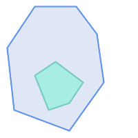
|
ST_Contains returns FALSE in the following situations:
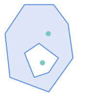
| 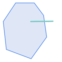
|
Due to the interior intersection condition ST_Contains returns FALSE in the following situations (whereas ST_Covers returns TRUE):
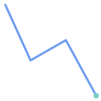
| 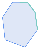
|
-- A circle within a circle
SELECT ST_Contains(smallc, bigc) As smallcontainsbig,
ST_Contains(bigc,smallc) As bigcontainssmall,
ST_Contains(bigc, ST_Union(smallc, bigc)) as bigcontainsunion,
ST_Equals(bigc, ST_Union(smallc, bigc)) as bigisunion,
ST_Covers(bigc, ST_ExteriorRing(bigc)) As bigcoversexterior,
ST_Contains(bigc, ST_ExteriorRing(bigc)) As bigcontainsexterior
FROM (SELECT ST_Buffer(ST_GeomFromText('POINT(1 2)'), 10) As smallc,
ST_Buffer(ST_GeomFromText('POINT(1 2)'), 20) As bigc) As foo;
-- Result
smallcontainsbig | bigcontainssmall | bigcontainsunion | bigisunion | bigcoversexterior | bigcontainsexterior
------------------+------------------+------------------+------------+-------------------+---------------------
f | t | t | t | t | f
-- Example demonstrating difference between contains and contains properly
SELECT ST_GeometryType(geomA) As geomtype, ST_Contains(geomA,geomA) AS acontainsa, ST_ContainsProperly(geomA, geomA) AS acontainspropa,
ST_Contains(geomA, ST_Boundary(geomA)) As acontainsba, ST_ContainsProperly(geomA, ST_Boundary(geomA)) As acontainspropba
FROM (VALUES ( ST_Buffer(ST_Point(1,1), 5,1) ),
( ST_MakeLine(ST_Point(1,1), ST_Point(-1,-1) ) ),
( ST_Point(1,1) )
) As foo(geomA);
geomtype | acontainsa | acontainspropa | acontainsba | acontainspropba
--------------+------------+----------------+-------------+-----------------
ST_Polygon | t | f | f | f
ST_LineString | t | f | f | f
ST_Point | t | t | f | f
Veja também
ST_Boundary, ST_ContainsProperly, ST_Covers, ST_CoveredBy, ST_Equals, ST_Within
Name
ST_ContainsProperly — Tests if every point of B lies in the interior of A
Synopsis
boolean ST_ContainsProperly(geometry geomA, geometry geomB);
Descrição
Returns true if every point of B lies in the interior of A (or equivalently, no point of B lies in the the boundary or exterior of A).
In mathematical terms: ST_ContainsProperly(A, B) ⇔ Int(A) ⋂ B = B
A contains B properly if the DE-9IM Intersection Matrix for the two geometries matches [T**FF*FF*]
A does not properly contain itself, but does contain itself.
A use for this predicate is computing the intersections of a set of geometries with a large polygonal geometry. Since intersection is a fairly slow operation, it can be more efficient to use containsProperly to filter out test geometries which lie fully inside the area. In these cases the intersection is known a priori to be exactly the original test geometry.
| |
This function automatically includes a bounding box comparison that makes use of any spatial indexes that are available on the geometries. To avoid index use, use the function |
| |
The advantage of this predicate over ST_Contains and ST_Intersects is that it can be computed more efficiently, with no need to compute topology at individual points. |
Desempenhado pelo módulo GEOS.
Disponibilidade: 1.4.0
| |
Enhanced: 3.0.0 enabled support for |
| |
Do not use this function with invalid geometries. You will get unexpected results. |
Exemplos
--a circle within a circle
SELECT ST_ContainsProperly(smallc, bigc) As smallcontainspropbig,
ST_ContainsProperly(bigc,smallc) As bigcontainspropsmall,
ST_ContainsProperly(bigc, ST_Union(smallc, bigc)) as bigcontainspropunion,
ST_Equals(bigc, ST_Union(smallc, bigc)) as bigisunion,
ST_Covers(bigc, ST_ExteriorRing(bigc)) As bigcoversexterior,
ST_ContainsProperly(bigc, ST_ExteriorRing(bigc)) As bigcontainsexterior
FROM (SELECT ST_Buffer(ST_GeomFromText('POINT(1 2)'), 10) As smallc,
ST_Buffer(ST_GeomFromText('POINT(1 2)'), 20) As bigc) As foo;
--Result
smallcontainspropbig | bigcontainspropsmall | bigcontainspropunion | bigisunion | bigcoversexterior | bigcontainsexterior
------------------+------------------+------------------+------------+-------------------+---------------------
f | t | f | t | t | f
--example demonstrating difference between contains and contains properly
SELECT ST_GeometryType(geomA) As geomtype, ST_Contains(geomA,geomA) AS acontainsa, ST_ContainsProperly(geomA, geomA) AS acontainspropa,
ST_Contains(geomA, ST_Boundary(geomA)) As acontainsba, ST_ContainsProperly(geomA, ST_Boundary(geomA)) As acontainspropba
FROM (VALUES ( ST_Buffer(ST_Point(1,1), 5,1) ),
( ST_MakeLine(ST_Point(1,1), ST_Point(-1,-1) ) ),
( ST_Point(1,1) )
) As foo(geomA);
geomtype | acontainsa | acontainspropa | acontainsba | acontainspropba
--------------+------------+----------------+-------------+-----------------
ST_Polygon | t | f | f | f
ST_LineString | t | f | f | f
ST_Point | t | t | f | f
Veja também
ST_GeometryType, ST_Boundary, ST_Contains, ST_Covers, ST_CoveredBy, ST_Equals, ST_Relate, ST_Within
Name
ST_CoveredBy — Tests if every point of A lies in B
Synopsis
boolean ST_CoveredBy(geometry geomA, geometry geomB);
boolean ST_CoveredBy(geography geogA, geography geogB);
Descrição
Returns true if every point in Geometry/Geography A lies inside (i.e. intersects the interior or boundary of) Geometry/Geography B. Equivalently, tests that no point of A lies outside (in the exterior of) B.
In mathematical terms: ST_CoveredBy(A, B) ⇔ A ⋂ B = A
ST_CoveredBy is the converse of ST_Covers. So, ST_CoveredBy(A,B) = ST_Covers(B,A).
Generally this function should be used instead of ST_Within, since it has a simpler definition which does not have the quirk that "boundaries are not within their geometry".
| |
This function automatically includes a bounding box comparison that makes use of any spatial indexes that are available on the geometries. To avoid index use, use the function |
| |
Enhanced: 3.0.0 enabled support for |
| |
Do not use this function with invalid geometries. You will get unexpected results. |
Desempenhado pelo módulo GEOS
Disponibilidade: 1.2.2
NOTE: this is the "allowable" version that returns a boolean, not an integer.
Not an OGC standard, but Oracle has it too.
Exemplos
--a circle coveredby a circle
SELECT ST_CoveredBy(smallc,smallc) As smallinsmall,
ST_CoveredBy(smallc, bigc) As smallcoveredbybig,
ST_CoveredBy(ST_ExteriorRing(bigc), bigc) As exteriorcoveredbybig,
ST_Within(ST_ExteriorRing(bigc),bigc) As exeriorwithinbig
FROM (SELECT ST_Buffer(ST_GeomFromText('POINT(1 2)'), 10) As smallc,
ST_Buffer(ST_GeomFromText('POINT(1 2)'), 20) As bigc) As foo;
--Result
smallinsmall | smallcoveredbybig | exteriorcoveredbybig | exeriorwithinbig
--------------+-------------------+----------------------+------------------
t | t | t | f
(1 row) Veja também
Name
ST_Covers — Tests if every point of B lies in A
Synopsis
boolean ST_Covers(geometry geomA, geometry geomB);
boolean ST_Covers(geography geogpolyA, geography geogpointB);
Descrição
Returns true if every point in Geometry/Geography B lies inside (i.e. intersects the interior or boundary of) Geometry/Geography A. Equivalently, tests that no point of B lies outside (in the exterior of) A.
In mathematical terms: ST_Covers(A, B) ⇔ A ⋂ B = B
ST_Covers is the converse of ST_CoveredBy. So, ST_Covers(A,B) = ST_CoveredBy(B,A).
Generally this function should be used instead of ST_Contains, since it has a simpler definition which does not have the quirk that "geometries do not contain their boundary".
| |
This function automatically includes a bounding box comparison that makes use of any spatial indexes that are available on the geometries. To avoid index use, use the function |
| |
Enhanced: 3.0.0 enabled support for |
| |
Do not use this function with invalid geometries. You will get unexpected results. |
Desempenhado pelo módulo GEOS
Enhanced: 2.4.0 Support for polygon in polygon and line in polygon added for geography type
Enhanced: 2.3.0 Enhancement to PIP short-circuit for geometry extended to support MultiPoints with few points. Prior versions only supported point in polygon.
Disponibilidade: 1.5 - suporte para geografia foi introduzido.
Disponibilidade: 1.2.2
NOTE: this is the "allowable" version that returns a boolean, not an integer.
Not an OGC standard, but Oracle has it too.
Exemplos
Geometry example
--a circle covering a circle
SELECT ST_Covers(smallc,smallc) As smallinsmall,
ST_Covers(smallc, bigc) As smallcoversbig,
ST_Covers(bigc, ST_ExteriorRing(bigc)) As bigcoversexterior,
ST_Contains(bigc, ST_ExteriorRing(bigc)) As bigcontainsexterior
FROM (SELECT ST_Buffer(ST_GeomFromText('POINT(1 2)'), 10) As smallc,
ST_Buffer(ST_GeomFromText('POINT(1 2)'), 20) As bigc) As foo;
--Result
smallinsmall | smallcoversbig | bigcoversexterior | bigcontainsexterior
--------------+----------------+-------------------+---------------------
t | f | t | f
(1 row) Geeography Example
-- a point with a 300 meter buffer compared to a point, a point and its 10 meter buffer
SELECT ST_Covers(geog_poly, geog_pt) As poly_covers_pt,
ST_Covers(ST_Buffer(geog_pt,10), geog_pt) As buff_10m_covers_cent
FROM (SELECT ST_Buffer(ST_GeogFromText('SRID=4326;POINT(-99.327 31.4821)'), 300) As geog_poly,
ST_GeogFromText('SRID=4326;POINT(-99.33 31.483)') As geog_pt ) As foo;
poly_covers_pt | buff_10m_covers_cent
----------------+------------------
f | t
Veja também
Name
ST_Crosses — Tests if two geometries have some, but not all, interior points in common
Synopsis
boolean ST_Crosses(geometry g1, geometry g2);
Descrição
Compares two geometry objects and returns true if their intersection "spatially crosses"; that is, the geometries have some, but not all interior points in common. The intersection of the interiors of the geometries must be non-empty and must have dimension less than the maximum dimension of the two input geometries, and the intersection of the two geometries must not equal either geometry. Otherwise, it returns false. The crosses relation is symmetric and irreflexive.
In mathematical terms: ST_Crosses(A, B) ⇔ (dim( Int(A) ⋂ Int(B) ) < max( dim( Int(A) ), dim( Int(B) ) )) ∧ (A ⋂ B ≠ A) ∧ (A ⋂ B ≠ B)
Geometries cross if their DE-9IM Intersection Matrix matches:
T*T******for Point/Line, Point/Area, and Line/Area situationsT*****T**for Line/Point, Area/Point, and Area/Line situations0********for Line/Line situationsthe result is
falsefor Point/Point and Area/Area situations
| |
The OpenGIS Simple Features Specification defines this predicate only for Point/Line, Point/Area, Line/Line, and Line/Area situations. JTS / GEOS extends the definition to apply to Line/Point, Area/Point and Area/Line situations as well. This makes the relation symmetric. |
| |
This function automatically includes a bounding box comparison that makes use of any spatial indexes that are available on the geometries. |
| |
Enhanced: 3.0.0 enabled support for |
This method implements the OGC Simple Features Implementation Specification for SQL 1.1. s2.1.13.3
This method implements the SQL/MM specification. SQL-MM 3: 5.1.29
Exemplos
The following situations all return true.
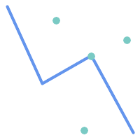
| 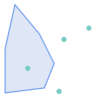
|
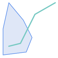
| 
|
Consider a situation where a user has two tables: a table of roads and a table of highways.
CREATE TABLE roads ( id serial NOT NULL, geom geometry, CONSTRAINT roads_pkey PRIMARY KEY (road_id) );
|
CREATE TABLE highways ( id serial NOT NULL, the_gem geometry, CONSTRAINT roads_pkey PRIMARY KEY (road_id) );
|
To determine a list of roads that cross a highway, use a query similar to:
SELECT roads.id FROM roads, highways WHERE ST_Crosses(roads.geom, highways.geom);
Veja também
Name
ST_Disjoint — Tests if two geometries have no points in common
Synopsis
boolean ST_Disjoint( geometry A , geometry B );
Descrição
Returns true if two geometries are disjoint. Geometries are disjoint if they have no point in common.
If any other spatial relationship is true for a pair of geometries, they are not disjoint. Disjoint implies that ST_Intersects is false.
In mathematical terms: ST_Disjoint(A, B) ⇔ A ⋂ B = ∅
| |
Enhanced: 3.0.0 enabled support for |
Desempenhado pelo módulo GEOS
| |
This function call does not use indexes. A negated ST_Intersects predicate can be used as a more performant alternative that uses indexes: |
| |
NOTE: this is the "allowable" version that returns a boolean, not an integer. |
This method implements the OGC Simple Features Implementation Specification for SQL 1.1. s2.1.1.2 //s2.1.13.3 - a.Relate(b, 'FF*FF****')
This method implements the SQL/MM specification. SQL-MM 3: 5.1.26
Exemplos
SELECT ST_Disjoint('POINT(0 0)'::geometry, 'LINESTRING ( 2 0, 0 2 )'::geometry);
st_disjoint
---------------
t
(1 row)
SELECT ST_Disjoint('POINT(0 0)'::geometry, 'LINESTRING ( 0 0, 0 2 )'::geometry);
st_disjoint
---------------
f
(1 row)
Veja também
Name
ST_Equals — Tests if two geometries include the same set of points
Synopsis
boolean ST_Equals(geometry A, geometry B);
Descrição
Returns true if the given geometries are "topologically equal". Use this for a 'better' answer than '='. Topological equality means that the geometries have the same dimension, and their point-sets occupy the same space. This means that the order of vertices may be different in topologically equal geometries. To verify the order of points is consistent use ST_OrderingEquals (it must be noted ST_OrderingEquals is a little more stringent than simply verifying order of points are the same).
In mathematical terms: ST_Equals(A, B) ⇔ A = B
The following relation holds: ST_Equals(A, B) ⇔ ST_Within(A,B) ∧ ST_Within(B,A)
| |
Enhanced: 3.0.0 enabled support for |
This method implements the OGC Simple Features Implementation Specification for SQL 1.1. s2.1.1.2
This method implements the SQL/MM specification. SQL-MM 3: 5.1.24
Changed: 2.2.0 Returns true even for invalid geometries if they are binary equal
Exemplos
SELECT ST_Equals(ST_GeomFromText('LINESTRING(0 0, 10 10)'),
ST_GeomFromText('LINESTRING(0 0, 5 5, 10 10)'));
st_equals
-----------
t
(1 row)
SELECT ST_Equals(ST_Reverse(ST_GeomFromText('LINESTRING(0 0, 10 10)')),
ST_GeomFromText('LINESTRING(0 0, 5 5, 10 10)'));
st_equals
-----------
t
(1 row)
Veja também
Name
ST_Intersects — Tests if two geometries intersect (they have at least one point in common)
Synopsis
boolean ST_Intersects( geometry geomA , geometry geomB );
boolean ST_Intersects( geography geogA , geography geogB );
Descrição
Returns true if two geometries intersect. Geometries intersect if they have any point in common.
For geography, a distance tolerance of 0.00001 meters is used (so points that are very close are considered to intersect).
In mathematical terms: ST_Intersects(A, B) ⇔ A ⋂ B ≠ ∅
Geometries intersect if their DE-9IM Intersection Matrix matches one of:
T*********T**********T*********T****
Spatial intersection is implied by all the other spatial relationship tests, except ST_Disjoint, which tests that geometries do NOT intersect.
| |
This function automatically includes a bounding box comparison that makes use of any spatial indexes that are available on the geometries. |
Changed: 3.0.0 SFCGAL version removed and native support for 2D TINS added.
Enhanced: 2.5.0 Supports GEOMETRYCOLLECTION.
Enhanced: 2.3.0 Enhancement to PIP short-circuit extended to support MultiPoints with few points. Prior versions only supported point in polygon.
Performed by the GEOS module (for geometry), geography is native
Availability: 1.5 support for geography was introduced.
| |
For geography, this function has a distance tolerance of about 0.00001 meters and uses the sphere rather than spheroid calculation. |
| |
NOTE: this is the "allowable" version that returns a boolean, not an integer. |
This method implements the OGC Simple Features Implementation Specification for SQL 1.1. s2.1.1.2 //s2.1.13.3 - ST_Intersects(g1, g2 ) --> Not (ST_Disjoint(g1, g2 ))
This method implements the SQL/MM specification. SQL-MM 3: 5.1.27
This method supports Circular Strings and Curves.
This function supports Triangles and Triangulated Irregular Network Surfaces (TIN).
Exemplos de Geometria
SELECT ST_Intersects('POINT(0 0)'::geometry, 'LINESTRING ( 2 0, 0 2 )'::geometry);
st_intersects
---------------
f
(1 row)
SELECT ST_Intersects('POINT(0 0)'::geometry, 'LINESTRING ( 0 0, 0 2 )'::geometry);
st_intersects
---------------
t
(1 row)
-- Look up in table. Make sure table has a GiST index on geometry column for faster lookup.
SELECT id, name FROM cities WHERE ST_Intersects(geom, 'SRID=4326;POLYGON((28 53,27.707 52.293,27 52,26.293 52.293,26 53,26.293 53.707,27 54,27.707 53.707,28 53))');
id | name
----+-------
2 | Minsk
(1 row)
Exemplos de Geografia
SELECT ST_Intersects(
'SRID=4326;LINESTRING(-43.23456 72.4567,-43.23456 72.4568)'::geography,
'SRID=4326;POINT(-43.23456 72.4567772)'::geography
);
st_intersects
---------------
t
Veja também
Name
ST_LineCrossingDirection — Returns a number indicating the crossing behavior of two LineStrings
Synopsis
integer ST_LineCrossingDirection(geometry linestringA, geometry linestringB);
Descrição
Given two linestrings returns an integer between -3 and 3 indicating what kind of crossing behavior exists between them. 0 indicates no crossing. This is only supported for LINESTRINGs.
The crossing number has the following meaning:
0: LINE NO CROSS
-1: LINE CROSS LEFT
1: LINE CROSS RIGHT
-2: LINE MULTICROSS END LEFT
2: LINE MULTICROSS END RIGHT
-3: LINE MULTICROSS END SAME FIRST LEFT
3: LINE MULTICROSS END SAME FIRST RIGHT
Availability: 1.4
Exemplos
Example: LINE CROSS LEFT and LINE CROSS RIGHT
Blue: Line A; Green: Line B
SELECT ST_LineCrossingDirection(lineA, lineB) As A_cross_B,
ST_LineCrossingDirection(lineB, lineA) As B_cross_A
FROM (SELECT
ST_GeomFromText('LINESTRING(25 169,89 114,40 70,86 43)') As lineA,
ST_GeomFromText('LINESTRING (20 140, 71 74, 161 53)') As lineB
) As foo;
A_cross_B | B_cross_A
-----------+-----------
-1 | 1
Example: LINE MULTICROSS END SAME FIRST LEFT and LINE MULTICROSS END SAME FIRST RIGHT
Blue: Line A; Green: Line B
SELECT ST_LineCrossingDirection(lineA, lineB) As A_cross_B,
ST_LineCrossingDirection(lineB, lineA) As B_cross_A
FROM (SELECT
ST_GeomFromText('LINESTRING(25 169,89 114,40 70,86 43)') As lineA,
ST_GeomFromText('LINESTRING(171 154,20 140,71 74,161 53)') As lineB
) As foo;
A_cross_B | B_cross_A
-----------+-----------
3 | -3
Example: LINE MULTICROSS END LEFT and LINE MULTICROSS END RIGHT
Blue: Line A; Green: Line B
SELECT ST_LineCrossingDirection(lineA, lineB) As A_cross_B,
ST_LineCrossingDirection(lineB, lineA) As B_cross_A
FROM (SELECT
ST_GeomFromText('LINESTRING(25 169,89 114,40 70,86 43)') As lineA,
ST_GeomFromText('LINESTRING(5 90, 71 74, 20 140, 171 154)') As lineB
) As foo;
A_cross_B | B_cross_A
-----------+-----------
-2 | 2
Example: Finds all streets that cross
SELECT s1.gid, s2.gid, ST_LineCrossingDirection(s1.geom, s2.geom)
FROM streets s1 CROSS JOIN streets s2
ON (s1.gid != s2.gid AND s1.geom && s2.geom )
WHERE ST_LineCrossingDirection(s1.geom, s2.geom)
> 0;
Veja também
Name
ST_OrderingEquals — Tests if two geometries represent the same geometry and have points in the same directional order
Synopsis
boolean ST_OrderingEquals(geometry A, geometry B);
Descrição
ST_OrderingEquals compares two geometries and returns t (TRUE) if the geometries are equal and the coordinates are in the same order; otherwise it returns f (FALSE).
| |
This function is implemented as per the ArcSDE SQL specification rather than SQL-MM. http://edndoc.esri.com/arcsde/9.1/sql_api/sqlapi3.htm#ST_OrderingEquals |
This method implements the SQL/MM specification. SQL-MM 3: 5.1.43
Exemplos
SELECT ST_OrderingEquals( 'LINESTRING(0 0, 10 10)', 'LINESTRING(0 0, 5 5, 10 10)'); st_orderingequals ----------- f SELECT ST_OrderingEquals( 'LINESTRING(0 0, 10 10)', 'LINESTRING(0 0, 10 10)'); st_orderingequals ----------- t SELECT ST_OrderingEquals( 'POLYGON((0 0, 0 1, 1 1, 1 0, 0 0))', 'POLYGON((0 0, 1 0, 1 1, 0 1, 0 0))'); st_orderingequals ----------- f
Veja também
Name
ST_Overlaps — Tests if two geometries have the same dimension and intersect, but each has at least one point not in the other
Synopsis
boolean ST_Overlaps(geometry A, geometry B);
Descrição
Returns TRUE if geometry A and B "spatially overlap". Two geometries overlap if they have the same dimension, their interiors intersect in that dimension. and each has at least one point inside the other (or equivalently, neither one covers the other). The overlaps relation is symmetric and irreflexive.
In mathematical terms: ST_Overlaps(A, B) ⇔ ( dim(A) = dim(B) = dim( Int(A) ⋂ Int(B) )) ∧ (A ⋂ B ≠ A) ∧ (A ⋂ B ≠ B)
| |
This function automatically includes a bounding box comparison that makes use of any spatial indexes that are available on the geometries. To avoid index use, use the function |
Desempenhado pelo módulo GEOS
| |
Enhanced: 3.0.0 enabled support for |
NOTE: this is the "allowable" version that returns a boolean, not an integer.
This method implements the OGC Simple Features Implementation Specification for SQL 1.1. s2.1.1.2 // s2.1.13.3
This method implements the SQL/MM specification. SQL-MM 3: 5.1.32
Exemplos
ST_Overlaps returns TRUE in the following situations:
| 
| 
|
A Point on a LineString is contained, but since it has lower dimension it does not overlap or cross.
SELECT ST_Overlaps(a,b) AS overlaps, ST_Crosses(a,b) AS crosses,
ST_Intersects(a, b) AS intersects, ST_Contains(b,a) AS b_contains_a
FROM (SELECT ST_GeomFromText('POINT (100 100)') As a,
ST_GeomFromText('LINESTRING (30 50, 40 160, 160 40, 180 160)') AS b) AS t
overlaps | crosses | intersects | b_contains_a
---------+----------------------+--------------
f | f | t | t
A LineString that partly covers a Polygon intersects and crosses, but does not overlap since it has different dimension.
SELECT ST_Overlaps(a,b) AS overlaps, ST_Crosses(a,b) AS crosses,
ST_Intersects(a, b) AS intersects, ST_Contains(a,b) AS contains
FROM (SELECT ST_GeomFromText('POLYGON ((40 170, 90 30, 180 100, 40 170))') AS a,
ST_GeomFromText('LINESTRING(10 10, 190 190)') AS b) AS t;
overlap | crosses | intersects | contains
---------+---------+------------+--------------
f | t | t | f
Two Polygons that intersect but with neither contained by the other overlap, but do not cross because their intersection has the same dimension.
SELECT ST_Overlaps(a,b) AS overlaps, ST_Crosses(a,b) AS crosses,
ST_Intersects(a, b) AS intersects, ST_Contains(b, a) AS b_contains_a,
ST_Dimension(a) AS dim_a, ST_Dimension(b) AS dim_b,
ST_Dimension(ST_Intersection(a,b)) AS dim_int
FROM (SELECT ST_GeomFromText('POLYGON ((40 170, 90 30, 180 100, 40 170))') AS a,
ST_GeomFromText('POLYGON ((110 180, 20 60, 130 90, 110 180))') AS b) As t;
overlaps | crosses | intersects | b_contains_a | dim_a | dim_b | dim_int
----------+---------+------------+--------------+-------+-------+-----------
t | f | t | f | 2 | 2 | 2
Veja também
Name
ST_Relate — Tests if two geometries have a topological relationship matching an Intersection Matrix pattern, or computes their Intersection Matrix
Synopsis
boolean ST_Relate(geometry geomA, geometry geomB, text intersectionMatrixPattern);
text ST_Relate(geometry geomA, geometry geomB);
text ST_Relate(geometry geomA, geometry geomB, integer boundaryNodeRule);
Descrição
These functions allow testing and evaluating the spatial (topological) relationship between two geometries, as defined by the Dimensionally Extended 9-Intersection Model (DE-9IM).
The DE-9IM is specified as a 9-element matrix indicating the dimension of the intersections between the Interior, Boundary and Exterior of two geometries. It is represented by a 9-character text string using the symbols 'F', '0', '1', '2' (e.g. 'FF1FF0102').
A specific kind of spatial relationship can be tested by matching the intersection matrix to an intersection matrix pattern. Patterns can include the additional symbols 'T' (meaning "intersection is non-empty") and '*' (meaning "any value"). Common spatial relationships are provided by the named functions ST_Contains, ST_ContainsProperly, ST_Covers, ST_CoveredBy, ST_Crosses, ST_Disjoint, ST_Equals, ST_Intersects, ST_Overlaps, ST_Touches, and ST_Within. Using an explicit pattern allows testing multiple conditions of intersects, crosses, etc in one step. It also allows testing spatial relationships which do not have a named spatial relationship function. For example, the relationship "Interior-Intersects" has the DE-9IM pattern T********, which is not evaluated by any named predicate.
For more information refer to Section 5.1, “Determining Spatial Relationships”.
Variant 1: Tests if two geometries are spatially related according to the given intersectionMatrixPattern.
| |
Unlike most of the named spatial relationship predicates, this does NOT automatically include an index call. The reason is that some relationships are true for geometries which do NOT intersect (e.g. Disjoint). If you are using a relationship pattern that requires intersection, then include the && index call. |
| |
It is better to use a named relationship function if available, since they automatically use a spatial index where one exists. Also, they may implement performance optimizations which are not available with full relate evaluation. |
Variant 2: Returns the DE-9IM matrix string for the spatial relationship between the two input geometries. The matrix string can be tested for matching a DE-9IM pattern using ST_RelateMatch.
Variant 3: Like variant 2, but allows specifying a Boundary Node Rule. A boundary node rule allows finer control over whether the endpoints of MultiLineStrings are considered to lie in the DE-9IM Interior or Boundary. The boundaryNodeRule values are:
1: OGC-Mod2 - line endpoints are in the Boundary if they occur an odd number of times. This is the rule defined by the OGC SFS standard, and is the default forST_Relate.2: Endpoint - all endpoints are in the Boundary.3: MultivalentEndpoint - endpoints are in the Boundary if they occur more than once. In other words, the boundary is all the "attached" or "inner" endpoints (but not the "unattached/outer" ones).4: MonovalentEndpoint - endpoints are in the Boundary if they occur only once. In other words, the boundary is all the "unattached" or "outer" endpoints.
This function is not in the OGC spec, but is implied. see s2.1.13.2
This method implements the OGC Simple Features Implementation Specification for SQL 1.1. s2.1.1.2 // s2.1.13.3
This method implements the SQL/MM specification. SQL-MM 3: 5.1.25
Desempenhado pelo módulo GEOS
Enhanced: 2.0.0 - added support for specifying boundary node rule.
| |
Enhanced: 3.0.0 enabled support for |
Exemplos
Using the boolean-valued function to test spatial relationships.
SELECT ST_Relate('POINT(1 2)', ST_Buffer( 'POINT(1 2)', 2), '0FFFFF212');
st_relate
-----------
t
SELECT ST_Relate(POINT(1 2)', ST_Buffer( 'POINT(1 2)', 2), '*FF*FF212');
st_relate
-----------
t
Testing a custom spatial relationship pattern as a query condition, with && to enable using a spatial index.
-- Find compounds that properly intersect (not just touch) a poly (Interior Intersects)
SELECT c.* , p.name As poly_name
FROM polys AS p
INNER JOIN compounds As c
ON c.geom && p.geom
AND ST_Relate(p.geom, c.geom,'T********');
Computing the intersection matrix for spatial relationships.
SELECT ST_Relate( 'POINT(1 2)',
ST_Buffer( 'POINT(1 2)', 2));
-----------
0FFFFF212
SELECT ST_Relate( 'LINESTRING(1 2, 3 4)',
'LINESTRING(5 6, 7 8)' );
-----------
FF1FF0102
Using different Boundary Node Rules to compute the spatial relationship between a LineString and a MultiLineString with a duplicate endpoint (3 3):
Using the OGC-Mod2 rule (1) the duplicate endpoint is in the interior of the MultiLineString, so the DE-9IM matrix entry [aB:bI] is
0and [aB:bB] isF.Using the Endpoint rule (2) the duplicate endpoint is in the boundary of the MultiLineString, so the DE-9IM matrix entry [aB:bI] is
Fand [aB:bB] is0.
WITH data AS (SELECT
'LINESTRING(1 1, 3 3)'::geometry AS a_line,
'MULTILINESTRING((3 3, 3 5), (3 3, 5 3))':: geometry AS b_multiline
)
SELECT ST_Relate( a_line, b_multiline, 1) AS bnr_mod2,
ST_Relate( a_line, b_multiline, 2) AS bnr_endpoint
FROM data;
bnr_mod2 | bnr_endpoint
-----------+--------------
FF10F0102 | FF1F00102
Name
ST_RelateMatch — Tests if a DE-9IM Intersection Matrix matches an Intersection Matrix pattern
Synopsis
boolean ST_RelateMatch(text intersectionMatrix, text intersectionMatrixPattern);
Descrição
Tests if a Dimensionally Extended 9-Intersection Model (DE-9IM) intersectionMatrix value satisfies an intersectionMatrixPattern. Intersection matrix values can be computed by ST_Relate.
For more information refer to Section 5.1, “Determining Spatial Relationships”.
Desempenhado pelo módulo GEOS
Disponibilidade: 2.0.0
Exemplos
SELECT ST_RelateMatch('101202FFF', 'TTTTTTFFF') ;
-- result --
t
Patterns for common spatial relationships matched against intersection matrix values, for a line in various positions relative to a polygon
SELECT pat.name AS relationship, pat.val AS pattern,
mat.name AS position, mat.val AS matrix,
ST_RelateMatch(mat.val, pat.val) AS match
FROM (VALUES ( 'Equality', 'T1FF1FFF1' ),
( 'Overlaps', 'T*T***T**' ),
( 'Within', 'T*F**F***' ),
( 'Disjoint', 'FF*FF****' )) AS pat(name,val)
CROSS JOIN
(VALUES ('non-intersecting', 'FF1FF0212'),
('overlapping', '1010F0212'),
('inside', '1FF0FF212')) AS mat(name,val);
relationship | pattern | position | matrix | match
--------------+-----------+------------------+-----------+-------
Equality | T1FF1FFF1 | non-intersecting | FF1FF0212 | f
Equality | T1FF1FFF1 | overlapping | 1010F0212 | f
Equality | T1FF1FFF1 | inside | 1FF0FF212 | f
Overlaps | T*T***T** | non-intersecting | FF1FF0212 | f
Overlaps | T*T***T** | overlapping | 1010F0212 | t
Overlaps | T*T***T** | inside | 1FF0FF212 | f
Within | T*F**F*** | non-intersecting | FF1FF0212 | f
Within | T*F**F*** | overlapping | 1010F0212 | f
Within | T*F**F*** | inside | 1FF0FF212 | t
Disjoint | FF*FF**** | non-intersecting | FF1FF0212 | t
Disjoint | FF*FF**** | overlapping | 1010F0212 | f
Disjoint | FF*FF**** | inside | 1FF0FF212 | f
Name
ST_Touches — Tests if two geometries have at least one point in common, but their interiors do not intersect
Synopsis
boolean ST_Touches(geometry A, geometry B);
Descrição
Returns TRUE if A and B intersect, but their interiors do not intersect. Equivalently, A and B have at least one point in common, and the common points lie in at least one boundary. For Point/Point inputs the relationship is always FALSE, since points do not have a boundary.
In mathematical terms: ST_Touches(A, B) ⇔ (Int(A) ⋂ Int(B) = ∅) ∧ (A ⋂ B ≠ ∅)
This relationship holds if the DE-9IM Intersection Matrix for the two geometries matches one of:
FT*******
F**T*****
F***T****
| |
This function automatically includes a bounding box comparison that makes use of any spatial indexes that are available on the geometries. To avoid using an index, use |
| |
Enhanced: 3.0.0 enabled support for |
This method implements the OGC Simple Features Implementation Specification for SQL 1.1. s2.1.1.2 // s2.1.13.3
This method implements the SQL/MM specification. SQL-MM 3: 5.1.28
Exemplos
The ST_Touches predicate returns TRUE in the following examples.
| 
| 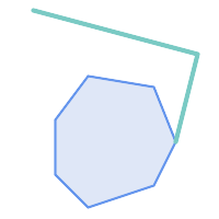
|
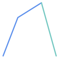
| 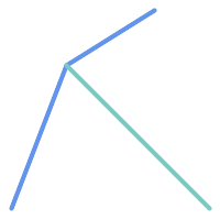
| 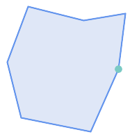
|
SELECT ST_Touches('LINESTRING(0 0, 1 1, 0 2)'::geometry, 'POINT(1 1)'::geometry);
st_touches
------------
f
(1 row)
SELECT ST_Touches('LINESTRING(0 0, 1 1, 0 2)'::geometry, 'POINT(0 2)'::geometry);
st_touches
------------
t
(1 row)Name
ST_Within — Tests if every point of A lies in B, and their interiors have a point in common
Synopsis
boolean ST_Within(geometry A, geometry B);
Descrição
Returns TRUE if geometry A is within geometry B. A is within B if and only if all points of A lie inside (i.e. in the interior or boundary of) B (or equivalently, no points of A lie in the exterior of B), and the interiors of A and B have at least one point in common.
For this function to make sense, the source geometries must both be of the same coordinate projection, having the same SRID.
In mathematical terms: ST_Within(A, B) ⇔ (A ⋂ B = A) ∧ (Int(A) ⋂ Int(B) ≠ ∅)
The within relation is reflexive: every geometry is within itself. The relation is antisymmetric: if ST_Within(A,B) = true and ST_Within(B,A) = true, then the two geometries must be topologically equal (ST_Equals(A,B) = true).
ST_Within is the converse of ST_Contains. So, ST_Within(A,B) = ST_Contains(B,A).
| |
Because the interiors must have a common point, a subtlety of the definition is that lines and points lying fully in the boundary of polygons or lines are not within the geometry. For further details see Subtleties of OGC Covers, Contains, Within. The ST_CoveredBy predicate provides a more inclusive relationship. |
| |
This function automatically includes a bounding box comparison that makes use of any spatial indexes that are available on the geometries. To avoid index use, use the function |
Desempenhado pelo módulo GEOS
Enhanced: 2.3.0 Enhancement to PIP short-circuit for geometry extended to support MultiPoints with few points. Prior versions only supported point in polygon.
| |
Enhanced: 3.0.0 enabled support for |
| |
Do not use this function with invalid geometries. You will get unexpected results. |
NOTE: this is the "allowable" version that returns a boolean, not an integer.
This method implements the OGC Simple Features Implementation Specification for SQL 1.1. s2.1.1.2 // s2.1.13.3 - a.Relate(b, 'T*F**F***')
This method implements the SQL/MM specification. SQL-MM 3: 5.1.30
Exemplos
--a circle within a circle
SELECT ST_Within(smallc,smallc) As smallinsmall,
ST_Within(smallc, bigc) As smallinbig,
ST_Within(bigc,smallc) As biginsmall,
ST_Within(ST_Union(smallc, bigc), bigc) as unioninbig,
ST_Within(bigc, ST_Union(smallc, bigc)) as biginunion,
ST_Equals(bigc, ST_Union(smallc, bigc)) as bigisunion
FROM
(
SELECT ST_Buffer(ST_GeomFromText('POINT(50 50)'), 20) As smallc,
ST_Buffer(ST_GeomFromText('POINT(50 50)'), 40) As bigc) As foo;
--Result
smallinsmall | smallinbig | biginsmall | unioninbig | biginunion | bigisunion
--------------+------------+------------+------------+------------+------------
t | t | f | t | t | t
(1 row)

Veja também
7.11.2. Distance Relationships
- ST_3DDWithin — Tests if two 3D geometries are within a given 3D distance
- ST_3DDFullyWithin — Tests if two 3D geometries are entirely within a given 3D distance
- ST_DFullyWithin — Tests if a geometry is entirely inside a distance of another
- ST_DWithin — Tests if two geometries are within a given distance
- ST_PointInsideCircle — Tests if a point geometry is inside a circle defined by a center and radius
Name
ST_3DDWithin — Tests if two 3D geometries are within a given 3D distance
Synopsis
boolean ST_3DDWithin(geometry g1, geometry g2, double precision distance_of_srid);
Descrição
Returns true if the 3D distance between two geometry values is no larger than distance distance_of_srid. The distance is specified in units defined by the spatial reference system of the geometries. For this function to make sense the source geometries must be in the same coordinate system (have the same SRID).
| |
This function automatically includes a bounding box comparison that makes use of any spatial indexes that are available on the geometries. |
This function supports 3d and will not drop the z-index.
This function supports Polyhedral surfaces.
This method implements the SQL/MM specification. SQL-MM ?
Disponibilidade: 2.0.0
Exemplos
-- Geometry example - units in meters (SRID: 2163 US National Atlas Equal area) (3D point and line compared 2D point and line)
-- Note: currently no vertical datum support so Z is not transformed and assumed to be same units as final.
SELECT ST_3DDWithin(
ST_Transform(ST_GeomFromEWKT('SRID=4326;POINT(-72.1235 42.3521 4)'),2163),
ST_Transform(ST_GeomFromEWKT('SRID=4326;LINESTRING(-72.1260 42.45 15, -72.123 42.1546 20)'),2163),
126.8
) As within_dist_3d,
ST_DWithin(
ST_Transform(ST_GeomFromEWKT('SRID=4326;POINT(-72.1235 42.3521 4)'),2163),
ST_Transform(ST_GeomFromEWKT('SRID=4326;LINESTRING(-72.1260 42.45 15, -72.123 42.1546 20)'),2163),
126.8
) As within_dist_2d;
within_dist_3d | within_dist_2d
----------------+----------------
f | t
Name
ST_3DDFullyWithin — Tests if two 3D geometries are entirely within a given 3D distance
Synopsis
boolean ST_3DDFullyWithin(geometry g1, geometry g2, double precision distance);
Descrição
Returns true if the 3D geometries are fully within the specified distance of one another. The distance is specified in units defined by the spatial reference system of the geometries. For this function to make sense, the source geometries must both be of the same coordinate projection, having the same SRID.
| |
This function automatically includes a bounding box comparison that makes use of any spatial indexes that are available on the geometries. |
Disponibilidade: 2.0.0
This function supports 3d and will not drop the z-index.
This function supports Polyhedral surfaces.
Exemplos
-- This compares the difference between fully within and distance within as well
-- as the distance fully within for the 2D footprint of the line/point vs. the 3d fully within
SELECT ST_3DDFullyWithin(geom_a, geom_b, 10) as D3DFullyWithin10, ST_3DDWithin(geom_a, geom_b, 10) as D3DWithin10,
ST_DFullyWithin(geom_a, geom_b, 20) as D2DFullyWithin20,
ST_3DDFullyWithin(geom_a, geom_b, 20) as D3DFullyWithin20 from
(select ST_GeomFromEWKT('POINT(1 1 2)') as geom_a,
ST_GeomFromEWKT('LINESTRING(1 5 2, 2 7 20, 1 9 100, 14 12 3)') as geom_b) t1;
d3dfullywithin10 | d3dwithin10 | d2dfullywithin20 | d3dfullywithin20
------------------+-------------+------------------+------------------
f | t | t | f Veja também
Name
ST_DFullyWithin — Tests if a geometry is entirely inside a distance of another
Synopsis
boolean ST_DFullyWithin(geometry g1, geometry g2, double precision distance);
Descrição
Returns true if g2 is entirely within distance of g1. Visually, the condition is true if g2 is contained within a distance buffer of g1. The distance is specified in units defined by the spatial reference system of the geometries.
| |
This function automatically includes a bounding box comparison that makes use of any spatial indexes that are available on the geometries. |
Disponibilidade: 1.5.0
Changed: 3.5.0 : the logic behind the function now uses a test of containment within a buffer, rather than the ST_MaxDistance algorithm. Results will differ from prior versions, but should be closer to user expectations.
Exemplos
SELECT
ST_DFullyWithin(geom_a, geom_b, 10) AS DFullyWithin10,
ST_DWithin(geom_a, geom_b, 10) AS DWithin10,
ST_DFullyWithin(geom_a, geom_b, 20) AS DFullyWithin20
FROM (VALUES
('POINT(1 1)', 'LINESTRING(1 5, 2 7, 1 9, 14 12)')
) AS v(geom_a, geom_b)
dfullywithin10 | dwithin10 | dfullywithin20
----------------+-----------+----------------
f | t | t
Veja também
Name
ST_DWithin — Tests if two geometries are within a given distance
Synopsis
boolean ST_DWithin(geometry g1, geometry g2, double precision distance_of_srid);
boolean ST_DWithin(geography gg1, geography gg2, double precision distance_meters, boolean use_spheroid = true);
Descrição
Returns true if the geometries are within a given distance
For geometry: The distance is specified in units defined by the spatial reference system of the geometries. For this function to make sense, the source geometries must be in the same coordinate system (have the same SRID).
For geography: units are in meters and distance measurement defaults to use_spheroid = true. For faster evaluation use use_spheroid = false to measure on the sphere.
| |
Use ST_3DDWithin for 3D geometries. |
| |
This function call includes a bounding box comparison that makes use of any indexes that are available on the geometries. |
This method implements the OGC Simple Features Implementation Specification for SQL 1.1.
Availability: 1.5.0 support for geography was introduced
Enhanced: 2.1.0 improved speed for geography. See Making Geography faster for details.
Enhanced: 2.1.0 support for curved geometries was introduced.
Prior to 1.3, ST_Expand was commonly used in conjunction with && and ST_Distance to test for distance, and in pre-1.3.4 this function used that logic. From 1.3.4, ST_DWithin uses a faster short-circuit distance function.
Exemplos
-- Find the nearest hospital to each school
-- that is within 3000 units of the school.
-- We do an ST_DWithin search to utilize indexes to limit our search list
-- that the non-indexable ST_Distance needs to process
-- If the units of the spatial reference is meters then units would be meters
SELECT DISTINCT ON (s.gid) s.gid, s.school_name, s.geom, h.hospital_name
FROM schools s
LEFT JOIN hospitals h ON ST_DWithin(s.geom, h.geom, 3000)
ORDER BY s.gid, ST_Distance(s.geom, h.geom);
-- The schools with no close hospitals
-- Find all schools with no hospital within 3000 units
-- away from the school. Units is in units of spatial ref (e.g. meters, feet, degrees)
SELECT s.gid, s.school_name
FROM schools s
LEFT JOIN hospitals h ON ST_DWithin(s.geom, h.geom, 3000)
WHERE h.gid IS NULL;
-- Find broadcasting towers that receiver with limited range can receive.
-- Data is geometry in Spherical Mercator (SRID=3857), ranges are approximate.
-- Create geometry index that will check proximity limit of user to tower
CREATE INDEX ON broadcasting_towers using gist (geom);
-- Create geometry index that will check proximity limit of tower to user
CREATE INDEX ON broadcasting_towers using gist (ST_Expand(geom, sending_range));
-- Query towers that 4-kilometer receiver in Minsk Hackerspace can get
-- Note: two conditions, because shorter LEAST(b.sending_range, 4000) will not use index.
SELECT b.tower_id, b.geom
FROM broadcasting_towers b
WHERE ST_DWithin(b.geom, 'SRID=3857;POINT(3072163.4 7159374.1)', 4000)
AND ST_DWithin(b.geom, 'SRID=3857;POINT(3072163.4 7159374.1)', b.sending_range);
Veja também
Name
ST_PointInsideCircle — Tests if a point geometry is inside a circle defined by a center and radius
Synopsis
boolean ST_PointInsideCircle(geometry a_point, float center_x, float center_y, float radius);
Descrição
Returns true if the geometry is a point and is inside the circle with center center_x,center_y and radius radius.
| |
Does not use spatial indexes. Use ST_DWithin instead. |
Availability: 1.2
Changed: 2.2.0 In prior versions this was called ST_Point_Inside_Circle
Exemplos
SELECT ST_PointInsideCircle(ST_Point(1,2), 0.5, 2, 3); st_pointinsidecircle ------------------------ t
Veja também
7.12. Measurement Functions
These functions compute measurements of distance, area and angles. There are also functions to compute geometry values determined by measurements.
- ST_Area — Retorna o centro geométrico de uma geometria.
- ST_Azimuth — Retorna a menor linha 2-dimensional entre duas geometrias
- ST_Angle — Retorna a linha 3-dimensional mais longa entre duas geometrias
- ST_ClosestPoint — Returns the 2D point on g1 that is closest to g2. This is the first point of the shortest line from one geometry to the other.
- ST_3DClosestPoint — Retorna o ponto 3 dimensional em g1 que é o mais próximo de g2. Este é o primeiro ponto da linha mais curta em três dimensões.
- ST_Distance — Retorna a linha 3-dimensional mais longa entre duas geometrias
- ST_3DDistance — Para tipo geometria, retorna a menor distância cartesiana 3-dimensional (baseado no sistema de referência espacial) entre duas geometrias em unidades projetadas.
- ST_DistanceSphere — Retorna a menor distância entre duas geometrias lon/lat dado um esferoide específico. As versões anteriores a 1.5 só suportam pontos.
- ST_DistanceSpheroid — Retorna a menor distância entre duas geometrias lon/lat dado um esferoide específico. As versões anteriores a 1.5 só suportam pontos.
- ST_FrechetDistance — Retorna a menor linha 3-dimensional entre duas geometrias
- ST_HausdorffDistance — Retorna a menor linha 3-dimensional entre duas geometrias
- ST_Length — Retorna o centro geométrico de uma geometria.
- ST_Length2D — Retorna o comprimento 2-dimensional da geometria se for uma linestring ou multi-linestring. Isto é um heterônimo para
ST_Length - ST_3DLength — Retorna o centro geométrico de uma geometria.
- ST_LengthSpheroid — Retorna o centro geométrico de uma geometria.
- ST_LongestLine — Retorna a linha 3-dimensional mais longa entre duas geometrias
- ST_3DLongestLine — Retorna a linha 3-dimensional mais longa entre duas geometrias
- ST_MaxDistance — Retorna a maior distância 2-dimensional entre duas geometrias em unidades projetadas.
- ST_3DMaxDistance — Para tipo de geometria retorna a maior distância 3-dimensional cartesiana (baseada na referência espacial) entre duas geometrias em unidade projetadas.
- ST_MinimumClearance — Retorna a liquidação mínima de uma geometria, uma medida de uma robustez de uma geometria.
- ST_MinimumClearanceLine — Retorna a LineString de dois pontos abrangendo a liquidação mínima de uma geometria.
- ST_Perimeter — Returns the length of the boundary of a polygonal geometry or geography.
- ST_Perimeter2D — Returns the 2D perimeter of a polygonal geometry. Alias for
ST_Perimeter. - ST_3DPerimeter — Retorna o centro geométrico de uma geometria.
- ST_ShortestLine — Retorna a menor linha 2-dimensional entre duas geometrias
- ST_3DShortestLine — Retorna a menor linha 3-dimensional entre duas geometrias
Name
ST_Area — Retorna o centro geométrico de uma geometria.
Synopsis
float ST_Area(geometry g1);
float ST_Area(geography geog, boolean use_spheroid = true);
Descrição
Retorna a área da geometria se for um polígono ou multipolígono. Retorna a medida do comprimento de um valor ST_Surface ou ST_MultiSurface. Para geometria, uma área cartesiana 2D é determinada com unidades especificadas pelo SRID. Para geografia, por padrão, ela é determinada em um esferoide com unidade em metros quadrados. Para medir a esfera mais rápida, mas menos precisa, use: ST_Area(geog,false).
Melhorias: 2.0.0 - suporte a superfícies 2D poliédricas foi introduzido.
Melhorias: 2.2.0 - medição em esferoides desempenhada com GeographicLib para uma melhor precisão e força. Requer Proj >= 4.9.0 para tirar vantagem da nova característica.
Changed: 3.0.0 - does not depend on SFCGAL anymore.
This method implements the OGC Simple Features Implementation Specification for SQL 1.1.
This method implements the SQL/MM specification. SQL-MM 3: 8.1.2, 9.5.3
This function supports Polyhedral surfaces.
| |
Para superfícies poliédricas, somente suporta superfícies poliédricas 2D (não 2.5D). Para 2.5D, pode ser dada uma resposta não zero, mas somente para as faces que se encaixam completamente no plano XY. |
Exemplos
Retorna uma área em pés quadrado para um terreno de Massachusetts e multiplica pela conversão para metros quadrados. Note que isto é em pés quadrados porque EPSG:2249 é o Massachusetts State Plane Feet
select ST_Area(geom) sqft,
ST_Area(geom) * 0.3048 ^ 2 sqm
from (
select 'SRID=2249;POLYGON((743238 2967416,743238 2967450,
743265 2967450,743265.625 2967416,743238 2967416))' :: geometry geom
) subquery;
┌─────────┬─────────────┐
│ sqft │ sqm │
├─────────┼─────────────┤
│ 928.625 │ 86.27208552 │
└─────────┴─────────────┘
Retorna uma área em pés quadrados e transforma para Massachusetts state plane em metros (EPSG:26986) para pegar metros quadrados. Note que ele é em pés quadrados, porque 2249 é Massachusetts State Plane Feet e a área transformada está em em metros quadrados já que EPSG:26986 é o state plane Massachusetts em metros
select ST_Area(geom) sqft,
ST_Area(ST_Transform(geom, 26986)) As sqm
from (
select
'SRID=2249;POLYGON((743238 2967416,743238 2967450,
743265 2967450,743265.625 2967416,743238 2967416))' :: geometry geom
) subquery;
┌─────────┬─────────────────┐
│ sqft │ sqm │
├─────────┼─────────────────┤
│ 928.625 │ 86.272430607008 │
└─────────┴─────────────────┘
Retorna uma área em pés quadrados e metros quadrados usado tipo de dados geografia. Note que transformamos nossa geometria para geografia (antes você pode certificar que sua geometria está em WGS 84 long lat 4326). A geografia sempre mede em metros. Isto é só para demonstração para comparar. Normalmente sua tabela já será armazenada no tipo de dados geografia.
select ST_Area(geog) / 0.3048 ^ 2 sqft_spheroid,
ST_Area(geog, false) / 0.3048 ^ 2 sqft_sphere,
ST_Area(geog) sqm_spheroid
from (
select ST_Transform(
'SRID=2249;POLYGON((743238 2967416,743238 2967450,743265 2967450,743265.625 2967416,743238 2967416))'::geometry,
4326
) :: geography geog
) as subquery;
┌──────────────────┬──────────────────┬──────────────────┐
│ sqft_spheroid │ sqft_sphere │ sqm_spheroid │
├──────────────────┼──────────────────┼──────────────────┤
│ 928.684405784452 │ 927.049336105925 │ 86.2776044979692 │
└──────────────────┴──────────────────┴──────────────────┘
If your data is in geography already:
select ST_Area(geog) / 0.3048 ^ 2 sqft,
ST_Area(the_geog) sqm
from somegeogtable;Veja também
ST_3DArea, ST_GeomFromEWKT, ST_LengthSpheroid, ST_Perimeter, ST_Transform
Name
ST_Azimuth — Retorna a menor linha 2-dimensional entre duas geometrias
Synopsis
float ST_Azimuth(geometry origin, geometry target);
float ST_Azimuth(geography origin, geography target);
Descrição
Returns the azimuth in radians of the target point from the origin point, or NULL if the two points are coincident. The azimuth angle is a positive clockwise angle referenced from the positive Y axis (geometry) or the North meridian (geography): North = 0; Northeast = π/4; East = π/2; Southeast = 3π/4; South = π; Southwest 5π/4; West = 3π/2; Northwest = 7π/4.
For the geography type, the azimuth solution is known as the inverse geodesic problem.
The azimuth is a mathematical concept defined as the angle between a reference vector and a point, with angular units in radians. The result value in radians can be converted to degrees using the PostgreSQL function degrees().
Azimute é especialmente útil em conjunto com ST_Translate para mudar um objeto ao longo do seu eixo perpendicular. Veja upgis_lineshift Plpgsqlfunctions PostGIS wiki section para um exemplo disto.
Disponibilidade: 1.1.0
Melhorias: 2.0.0 suporte para geografia foi introduzido.
Melhorias: 2.2.0 medição em esferoides desempenhada com GeographicLib para uma melhor precisão e força. Requer Proj >= 4.9.0 para tirar vantagem da nova característica.
Exemplos
Azimute da geometria em graus
SELECT degrees(ST_Azimuth( ST_Point(25, 45), ST_Point(75, 100))) AS degA_B,
degrees(ST_Azimuth( ST_Point(75, 100), ST_Point(25, 45) )) AS degB_A;
dega_b | degb_a
------------------+------------------
42.2736890060937 | 222.273689006094
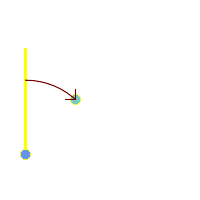 Blue: origin Point(25,45); Green: target Point(75, 100); Yellow: Y axis or North; Red: azimuth angle.
| 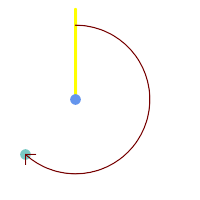 Blue: origin Point(75, 100); Green: target Point(25, 45); Yellow: Y axis or North; Red: azimuth angle.
|
Veja também
ST_Angle, ST_Translate, ST_Project, PostgreSQL Math Functions
Name
ST_Angle — Retorna a linha 3-dimensional mais longa entre duas geometrias
Synopsis
float ST_Angle(geometry point1, geometry point2, geometry point3, geometry point4);
float ST_Angle(geometry line1, geometry line2);
Descrição
Retorna a linha 3-dimensional mais longa entre duas geometrias
Variant 1: computes the angle enclosed by the points P1-P2-P3. If a 4th point provided computes the angle points P1-P2 and P3-P4
Variant 2: computes the angle between two vectors S1-E1 and S2-E2, defined by the start and end points of the input lines
O azimute é matematicamente conceituado como o ângulo entre um plano de referência e um ponto, com unidades angulares em radianos. As unidades podem ser convertidas para graus usando uma função PostgreSQL graus () embutida, como mostrado no exemplo.
Note that ST_Angle(P1,P2,P3) = ST_Angle(P2,P1,P2,P3).
Availability: 2.5.0
Exemplos
linha mais longa entre polígono e polígono
SELECT degrees( ST_Angle('POINT(0 0)', 'POINT(10 10)', 'POINT(20 0)') );
degrees
---------
270
Angle between vectors defined by four points
SELECT degrees( ST_Angle('POINT (10 10)', 'POINT (0 0)', 'POINT(90 90)', 'POINT (100 80)') );
degrees
-------------------
269.9999999999999
Angle between vectors defined by the start and end points of lines
SELECT degrees( ST_Angle('LINESTRING(0 0, 0.3 0.7, 1 1)', 'LINESTRING(0 0, 0.2 0.5, 1 0)') );
degrees
--------------
45
Veja também
Name
ST_ClosestPoint — Returns the 2D point on g1 that is closest to g2. This is the first point of the shortest line from one geometry to the other.
Synopsis
geometry ST_ClosestPoint(geometry geom1, geometry geom2);
geography ST_ClosestPoint(geography geom1, geography geom2, boolean use_spheroid = true);
Descrição
Returns the 2-dimensional point on geom1 that is closest to geom2. This is the first point of the shortest line between the geometries (as computed by ST_ShortestLine).
| |
Se você tem uma geometria 3D, talvez prefira usar ST_3DClosestPoint. |
Enhanced: 3.4.0 - Support for geography.
Disponibilidade: 1.5.0
Exemplos
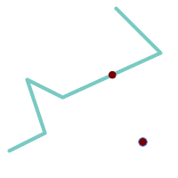
The closest point for a Point and a LineString is the point itself. The closest point for a LineString and a Point is a point on the line.
SELECT ST_AsText( ST_ClosestPoint(pt,line)) AS cp_pt_line,
ST_AsText( ST_ClosestPoint(line,pt)) AS cp_line_pt
FROM (SELECT 'POINT (160 40)'::geometry AS pt,
'LINESTRING (10 30, 50 50, 30 110, 70 90, 180 140, 130 190)'::geometry AS line ) AS t;
cp_pt_line | cp_line_pt
----------------+------------------------------------------
POINT(160 40) | POINT(125.75342465753425 115.34246575342466)
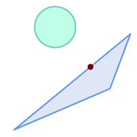
The closest point on polygon A to polygon B
SELECT ST_AsText( ST_ClosestPoint(
'POLYGON ((190 150, 20 10, 160 70, 190 150))',
ST_Buffer('POINT(80 160)', 30) )) As ptwkt;
------------------------------------------
POINT(131.59149149528952 101.89887534906197)
Veja também
ST_3DClosestPoint, ST_Distance, ST_LongestLine, ST_ShortestLine, ST_MaxDistance
Name
ST_3DClosestPoint — Retorna o ponto 3 dimensional em g1 que é o mais próximo de g2. Este é o primeiro ponto da linha mais curta em três dimensões.
Synopsis
geometry ST_3DClosestPoint(geometry g1, geometry g2);
Descrição
Retorne o ponto 3-dimensional no g1 que é mais perto ao g2. Esse é o primeiro ponto da menor linha 3D. O comprimento 3D da menor linha 3D é a distância 3D.
This function supports 3d and will not drop the z-index.
This function supports Polyhedral surfaces.
Disponibilidade: 2.0.0
Alterações: 2.2.0 - se 2 geometrias 2D são entradas, um ponto 2D retorna (em vez do antigo comportamento assumindo 0 para Z perdido). Em caso de 2D e 3D, o Z não é mais 0 para Z perdido.
Exemplos
linestring e ponto -- pontos 3d e 2d mais próximos SELECT ST_AsEWKT(ST_3DClosestPoint(line,pt)) AS cp3d_line_pt,
ST_AsEWKT(ST_ClosestPoint(line,pt)) As cp2d_line_pt
FROM (SELECT 'POINT(100 100 30)'::geometry As pt,
'LINESTRING (20 80 20, 98 190 1, 110 180 3, 50 75 1000)'::geometry As line
) As foo;
cp3d_line_pt | cp2d_line_pt
-----------------------------------------------------------+------------------------------------------
POINT(54.6993798867619 128.935022917228 11.5475869506606) | POINT(73.0769230769231 115.384615384615)
|
linestring e multiponto -- pontos 3d e 2d mais próximos SELECT ST_AsEWKT(ST_3DClosestPoint(line,pt)) AS cp3d_line_pt,
ST_AsEWKT(ST_ClosestPoint(line,pt)) As cp2d_line_pt
FROM (SELECT 'MULTIPOINT(100 100 30, 50 74 1000)'::geometry As pt,
'LINESTRING (20 80 20, 98 190 1, 110 180 3, 50 75 900)'::geometry As line
) As foo;
cp3d_line_pt | cp2d_line_pt
-----------------------------------------------------------+--------------
POINT(54.6993798867619 128.935022917228 11.5475869506606) | POINT(50 75)
|
Multilinestring e polígono pontos 3d e 2d mais próximos SELECT ST_AsEWKT(ST_3DClosestPoint(poly, mline)) As cp3d,
ST_AsEWKT(ST_ClosestPoint(poly, mline)) As cp2d
FROM (SELECT ST_GeomFromEWKT('POLYGON((175 150 5, 20 40 5, 35 45 5, 50 60 5, 100 100 5, 175 150 5))') As poly,
ST_GeomFromEWKT('MULTILINESTRING((175 155 2, 20 40 20, 50 60 -2, 125 100 1, 175 155 1),
(1 10 2, 5 20 1))') As mline ) As foo;
cp3d | cp2d
-------------------------------------------+--------------
POINT(39.993580415989 54.1889925532825 5) | POINT(20 40)
|
Veja também
ST_AsEWKT, ST_ClosestPoint, ST_3DDistance, ST_3DShortestLine
Name
ST_Distance — Retorna a linha 3-dimensional mais longa entre duas geometrias
Synopsis
float ST_Distance(geometry g1, geometry g2);
float ST_Distance(geography geog1, geography geog2, boolean use_spheroid = true);
Descrição
Para tipo geometria, retorna a menor distância cartesiana 3-dimensional entre duas geometrias em unidades projetadas (spatial ref units).
For geography types defaults to return the minimum geodesic distance between two geographies in meters, compute on the spheroid determined by the SRID. If use_spheroid is false, a faster spherical calculation is used.
This method implements the OGC Simple Features Implementation Specification for SQL 1.1.
This method implements the SQL/MM specification. SQL-MM 3: 5.1.23
This method supports Circular Strings and Curves.
Disponibilidade: 1.5.0 suporte de geografia foi introduzido em 1.5. Melhorias na velocidade para planar para lidar melhor com mais ou maiores vértices de geometrias.
Enhanced: 2.1.0 improved speed for geography. See Making Geography faster for details.
Melhorias: 2.1.0 - suporte para geometrias curvas foi introduzido.
Melhorias: 2.2.0 - medição em esferoides desempenhada com GeographicLib para uma melhor precisão e força. Requer Proj >= 4.9.0 para tirar vantagem da nova característica.
Changed: 3.0.0 - does not depend on SFCGAL anymore.
Exemplos de Geometria
Geometry example - units in planar degrees 4326 is WGS 84 long lat, units are degrees.
SELECT ST_Distance(
'SRID=4326;POINT(-72.1235 42.3521)'::geometry,
'SRID=4326;LINESTRING(-72.1260 42.45, -72.123 42.1546)'::geometry );
-----------------
0.00150567726382282Geometry example - units in meters (SRID: 3857, proportional to pixels on popular web maps). Although the value is off, nearby ones can be compared correctly, which makes it a good choice for algorithms like KNN or KMeans.
SELECT ST_Distance(
ST_Transform('SRID=4326;POINT(-72.1235 42.3521)'::geometry, 3857),
ST_Transform('SRID=4326;LINESTRING(-72.1260 42.45, -72.123 42.1546)'::geometry, 3857) );
-----------------
167.441410065196Geometry example - units in meters (SRID: 3857 as above, but corrected by cos(lat) to account for distortion)
SELECT ST_Distance(
ST_Transform('SRID=4326;POINT(-72.1235 42.3521)'::geometry, 3857),
ST_Transform('SRID=4326;LINESTRING(-72.1260 42.45, -72.123 42.1546)'::geometry, 3857)
) * cosd(42.3521);
-----------------
123.742351254151Geometry example - units in meters (SRID: 26986 Massachusetts state plane meters) (most accurate for Massachusetts)
SELECT ST_Distance(
ST_Transform('SRID=4326;POINT(-72.1235 42.3521)'::geometry, 26986),
ST_Transform('SRID=4326;LINESTRING(-72.1260 42.45, -72.123 42.1546)'::geometry, 26986) );
-----------------
123.797937878454Geometry example - units in meters (SRID: 2163 US National Atlas Equal area) (least accurate)
SELECT ST_Distance(
ST_Transform('SRID=4326;POINT(-72.1235 42.3521)'::geometry, 2163),
ST_Transform('SRID=4326;LINESTRING(-72.1260 42.45, -72.123 42.1546)'::geometry, 2163) );
------------------
126.664256056812Exemplos de Geografia
Same as geometry example but note units in meters - use sphere for slightly faster and less accurate computation.
SELECT ST_Distance(gg1, gg2) As spheroid_dist, ST_Distance(gg1, gg2, false) As sphere_dist
FROM (SELECT
'SRID=4326;POINT(-72.1235 42.3521)'::geography as gg1,
'SRID=4326;LINESTRING(-72.1260 42.45, -72.123 42.1546)'::geography as gg2
) As foo ;
spheroid_dist | sphere_dist
------------------+------------------
123.802076746848 | 123.475736916397Name
ST_3DDistance — Para tipo geometria, retorna a menor distância cartesiana 3-dimensional (baseado no sistema de referência espacial) entre duas geometrias em unidades projetadas.
Synopsis
float ST_3DDistance(geometry g1, geometry g2);
Descrição
Para tipo geometria, retorna a menor distância cartesiana 3-dimensional entre duas geometrias em unidades projetadas (spatial ref units).
This function supports 3d and will not drop the z-index.
This function supports Polyhedral surfaces.
This method implements the SQL/MM specification. SQL-MM ISO/IEC 13249-3
Disponibilidade: 2.0.0
Alterações: 2.2.0 - Em caso de 2D e 3D, o Z não é mais 0 para Z perdido.
Changed: 3.0.0 - SFCGAL version removed
Exemplos
-- Geometry example - units in meters (SRID: 2163 US National Atlas Equal area) (3D point and line compared 2D point and line)
-- Note: currently no vertical datum support so Z is not transformed and assumed to be same units as final.
SELECT ST_3DDistance(
ST_Transform('SRID=4326;POINT(-72.1235 42.3521 4)'::geometry,2163),
ST_Transform('SRID=4326;LINESTRING(-72.1260 42.45 15, -72.123 42.1546 20)'::geometry,2163)
) As dist_3d,
ST_Distance(
ST_Transform('SRID=4326;POINT(-72.1235 42.3521)'::geometry,2163),
ST_Transform('SRID=4326;LINESTRING(-72.1260 42.45, -72.123 42.1546)'::geometry,2163)
) As dist_2d;
dist_3d | dist_2d
------------------+-----------------
127.295059324629 | 126.66425605671
-- Multilinestring and polygon both 3d and 2d distance
-- Same example as 3D closest point example
SELECT ST_3DDistance(poly, mline) As dist3d,
ST_Distance(poly, mline) As dist2d
FROM (SELECT 'POLYGON((175 150 5, 20 40 5, 35 45 5, 50 60 5, 100 100 5, 175 150 5))'::geometry as poly,
'MULTILINESTRING((175 155 2, 20 40 20, 50 60 -2, 125 100 1, 175 155 1), (1 10 2, 5 20 1))'::geometry as mline) as foo;
dist3d | dist2d
-------------------+--------
0.716635696066337 | 0
Name
ST_DistanceSphere — Retorna a menor distância entre duas geometrias lon/lat dado um esferoide específico. As versões anteriores a 1.5 só suportam pontos.
Synopsis
float ST_DistanceSphere(geometry geomlonlatA, geometry geomlonlatB, float8 radius=6371008);
Descrição
Retorna a distância mínima em metros entre dois pontos long/lat. Usa uma terra esférica e raio derivado do esferoide definido pelo SRID. Mais rápido que ST_DistanceSpheroid, mas menos preciso. As versões do PostGIS anteriores a 1.5 só implementavam para pontos.
Disponibilidade: 1.5 - suporte para outros tipos de geometria além de pontos foi introduzido. As versões anteriores só funcionam com pontos.
Alterações: 2.2.0 Em versões anteriores era chamada de ST_Distance_Sphere
Exemplos
SELECT round(CAST(ST_DistanceSphere(ST_Centroid(geom), ST_GeomFromText('POINT(-118 38)',4326)) As numeric),2) As dist_meters,
round(CAST(ST_Distance(ST_Transform(ST_Centroid(geom),32611),
ST_Transform(ST_GeomFromText('POINT(-118 38)', 4326),32611)) As numeric),2) As dist_utm11_meters,
round(CAST(ST_Distance(ST_Centroid(geom), ST_GeomFromText('POINT(-118 38)', 4326)) As numeric),5) As dist_degrees,
round(CAST(ST_Distance(ST_Transform(geom,32611),
ST_Transform(ST_GeomFromText('POINT(-118 38)', 4326),32611)) As numeric),2) As min_dist_line_point_meters
FROM
(SELECT ST_GeomFromText('LINESTRING(-118.584 38.374,-118.583 38.5)', 4326) As geom) as foo;
dist_meters | dist_utm11_meters | dist_degrees | min_dist_line_point_meters
-------------+-------------------+--------------+----------------------------
70424.47 | 70438.00 | 0.72900 | 65871.18
Veja também
Name
ST_DistanceSpheroid — Retorna a menor distância entre duas geometrias lon/lat dado um esferoide específico. As versões anteriores a 1.5 só suportam pontos.
Synopsis
float ST_DistanceSpheroid(geometry geomlonlatA, geometry geomlonlatB, spheroid measurement_spheroid=WGS84);
Descrição
Retorna a distância mínima em metros entre duas geometrias long/lat dado um esferoide específico. Veja a explanação dos esferoides dados pela ST_LengthSpheroid. As versões do PostGIS anteriores a 1.5 só suportam pontos.
| |
Esta função não olha o SRID de uma geometria e sempre irá assumir que está representada nas coordenadas do esferoide passado. AS versões anteriores desta função só suportam pontos. |
Disponibilidade: 1.5 - suporte para outros tipos de geometria além de pontos foi introduzido. As versões anteriores só funcionam com pontos.
Alterações: 2.2.0 Em versões anteriores era chamada de ST_Distance_Spheroid
Exemplos
SELECT round(CAST(
ST_DistanceSpheroid(ST_Centroid(geom), ST_GeomFromText('POINT(-118 38)',4326), 'SPHEROID["WGS 84",6378137,298.257223563]')
As numeric),2) As dist_meters_spheroid,
round(CAST(ST_DistanceSphere(ST_Centroid(geom), ST_GeomFromText('POINT(-118 38)',4326)) As numeric),2) As dist_meters_sphere,
round(CAST(ST_Distance(ST_Transform(ST_Centroid(geom),32611),
ST_Transform(ST_GeomFromText('POINT(-118 38)', 4326),32611)) As numeric),2) As dist_utm11_meters
FROM
(SELECT ST_GeomFromText('LINESTRING(-118.584 38.374,-118.583 38.5)', 4326) As geom) as foo;
dist_meters_spheroid | dist_meters_sphere | dist_utm11_meters
----------------------+--------------------+-------------------
70454.92 | 70424.47 | 70438.00
Veja também
Name
ST_FrechetDistance — Retorna a menor linha 3-dimensional entre duas geometrias
Synopsis
float ST_FrechetDistance(geometry g1, geometry g2, float densifyFrac = -1);
Descrição
Implements algorithm for computing the Fréchet distance restricted to discrete points for both geometries, based on Computing Discrete Fréchet Distance. The Fréchet distance is a measure of similarity between curves that takes into account the location and ordering of the points along the curves. Therefore it is often better than the Hausdorff distance.
When the optional densifyFrac is specified, this function performs a segment densification before computing the discrete Fréchet distance. The densifyFrac parameter sets the fraction by which to densify each segment. Each segment will be split into a number of equal-length subsegments, whose fraction of the total length is closest to the given fraction.
Units are in the units of the spatial reference system of the geometries.
| |
A implementação atual suporta somente vértices como as localizações completas. Isto poderia ser expandido para permitir densidade arbitrária de pontos a serem usados. |
| |
The smaller densifyFrac we specify, the more accurate Fréchet distance we get. But, the computation time and the memory usage increase with the square of the number of subsegments. |
Desempenhado pelo módulo GEOS.
Availability: 2.4.0 - requires GEOS >= 3.7.0
Exemplos
postgres=# SELECT st_frechetdistance('LINESTRING (0 0, 100 0)'::geometry, 'LINESTRING (0 0, 50 50, 100 0)'::geometry);
st_frechetdistance
--------------------
70.7106781186548
(1 row)
SELECT st_frechetdistance('LINESTRING (0 0, 100 0)'::geometry, 'LINESTRING (0 0, 50 50, 100 0)'::geometry, 0.5);
st_frechetdistance
--------------------
50
(1 row)
Veja também
Name
ST_HausdorffDistance — Retorna a menor linha 3-dimensional entre duas geometrias
Synopsis
float ST_HausdorffDistance(geometry g1, geometry g2);
float ST_HausdorffDistance(geometry g1, geometry g2, float densifyFrac);
Descrição
Returns the Hausdorff distance between two geometries. The Hausdorff distance is a measure of how similar or dissimilar 2 geometries are.
The function actually computes the "Discrete Hausdorff Distance". This is the Hausdorff distance computed at discrete points on the geometries. The densifyFrac parameter can be specified, to provide a more accurate answer by densifying segments before computing the discrete Hausdorff distance. Each segment is split into a number of equal-length subsegments whose fraction of the segment length is closest to the given fraction.
Units are in the units of the spatial reference system of the geometries.
| |
This algorithm is NOT equivalent to the standard Hausdorff distance. However, it computes an approximation that is correct for a large subset of useful cases. One important case is Linestrings that are roughly parallel to each other, and roughly equal in length. This is a useful metric for line matching. |
Disponibilidade: 1.5.0
Exemplos
Hausdorff distance (red) and distance (yellow) between two lines
SELECT ST_HausdorffDistance(geomA, geomB),
ST_Distance(geomA, geomB)
FROM (SELECT 'LINESTRING (20 70, 70 60, 110 70, 170 70)'::geometry AS geomA,
'LINESTRING (20 90, 130 90, 60 100, 190 100)'::geometry AS geomB) AS t;
st_hausdorffdistance | st_distance
----------------------+-------------
37.26206567625497 | 20
Example: Hausdorff distance with densification.
SELECT ST_HausdorffDistance(
'LINESTRING (130 0, 0 0, 0 150)'::geometry,
'LINESTRING (10 10, 10 150, 130 10)'::geometry,
0.5);
----------------------
70
Example: For each building, find the parcel that best represents it. First we require that the parcel intersect with the building geometry. DISTINCT ON guarantees we get each building listed only once. ORDER BY .. ST_HausdorffDistance selects the parcel that is most similar to the building.
SELECT DISTINCT ON (buildings.gid) buildings.gid, parcels.parcel_id
FROM buildings
INNER JOIN parcels
ON ST_Intersects(buildings.geom, parcels.geom)
ORDER BY buildings.gid, ST_HausdorffDistance(buildings.geom, parcels.geom);
Veja também
Name
ST_Length — Retorna o centro geométrico de uma geometria.
Synopsis
float ST_Length(geometry a_2dlinestring);
float ST_Length(geography geog, boolean use_spheroid = true);
Descrição
Para geometria: Retorna o comprimento cartesiano 2D se for uma LineString, MultiLineString, ST_Curve, ST_MultiCurve. Retorna 0 para geometrias areais. Use ST_Perimeter. Para tipos de geometrias, unidades para medição de comprimento estão especificadas pelo sistema de referência espacial da geometria.
For geography types: computation is performed using the inverse geodesic calculation. Units of length are in meters. The spheroid is specified by the SRID; when no SRID is provided, WGS84 is used. If use_spheroid = false, then the calculation is based on a sphere instead of a spheroid.
No momento, para geometria, isto é heterômio para ST_Length2D, mas isto pode mudar para dimensões maiores.
| |
Alterações: 2.0.0 Quebrando a mudança -- nas versões anteriores aplicar isto a um MULTI/POLÍGONO de tipo de geografia lhe daria o perímetro do POLÍGONO/MULTIPOLÍGONO. Na 2.0.0 isso é alterado para retornar 0 a estar na linha com o comportamento da geometria. Por favor, utilize a ST_Perimeter se quiser o perímetro de um polígono |
| |
Para a medição de geografia o padrão é a medição do esferoide. Para usar a esfera mais rápida e menos precisa, use ST_Length(gg,false); |
This method implements the OGC Simple Features Implementation Specification for SQL 1.1. s2.1.5.1
This method implements the SQL/MM specification. SQL-MM 3: 7.1.2, 9.3.4
Disponibilidade: 1.5.0 suporte para geografia foi introduzido em 1.5.
Exemplos de Geometria
Retorna o comprimento em pés para line string. Note que é em pés, porque EPSG:2249 é Massachusetts State Plane Feet
SELECT ST_Length(ST_GeomFromText('LINESTRING(743238 2967416,743238 2967450,743265 2967450,
743265.625 2967416,743238 2967416)',2249));
st_length
---------
122.630744000095
--Transforming WGS 84 LineString to Massachusetts state plane meters
SELECT ST_Length(
ST_Transform(
ST_GeomFromEWKT('SRID=4326;LINESTRING(-72.1260 42.45, -72.1240 42.45666, -72.123 42.1546)'),
26986
)
);
st_length
---------
34309.4563576191
Exemplos de Geografia
Retorna o comprimento de WGS 84 linha de geografia
-- the default calculation uses a spheroid
SELECT ST_Length(the_geog) As length_spheroid, ST_Length(the_geog,false) As length_sphere
FROM (SELECT ST_GeographyFromText(
'SRID=4326;LINESTRING(-72.1260 42.45, -72.1240 42.45666, -72.123 42.1546)') As the_geog)
As foo;
length_spheroid | length_sphere
------------------+------------------
34310.5703627288 | 34346.2060960742
Veja também
ST_GeographyFromText, ST_GeomFromEWKT, ST_LengthSpheroid, ST_Perimeter, ST_Transform
Name
ST_Length2D — Retorna o comprimento 2-dimensional da geometria se for uma linestring ou multi-linestring. Isto é um heterônimo para ST_Length
Synopsis
float ST_Length2D(geometry a_2dlinestring);
Descrição
Retorna o comprimento 2-dimensional da geometria se for uma linestring ou multi-linestring. Isto é um heterônimo para ST_Length
Veja também
Name
ST_3DLength — Retorna o centro geométrico de uma geometria.
Synopsis
float ST_3DLength(geometry a_3dlinestring);
Descrição
Retorna o comprimento 3-dimensional ou 2-dimensional da geometria se for uma linestring ou multi-linestring. Para linhas 2-d, ela só retornará o comprimento 2-d (o mesmo da ST_Length e ST_Length2D)
This function supports 3d and will not drop the z-index.
This method implements the SQL/MM specification. SQL-MM IEC 13249-3: 7.1, 10.3
Alterações: 2.0.0 Nas versões anteriores era chamado de ST_Length3D
Exemplos
Retorna o comprimento em pés para um cabo 3D. Note que é em pés, porque EPSG:2249 é Massachusetts State Plane Feet
SELECT ST_3DLength(ST_GeomFromText('LINESTRING(743238 2967416 1,743238 2967450 1,743265 2967450 3,
743265.625 2967416 3,743238 2967416 3)',2249));
ST_3DLength
-----------
122.704716741457
Veja também
Name
ST_LengthSpheroid — Retorna o centro geométrico de uma geometria.
Synopsis
float ST_LengthSpheroid(geometry a_geometry, spheroid a_spheroid);
Descrição
Calcula o comprimento/perímetro de uma geometria em um elipsoide. É útil se as coordenadas da geometria estão em longitude/latitude e um comprimento é desejado sem reprojeção. O elipsoide é um tipo de banco de dados separado e pode ser construído como segue:
SPHEROID[<NAME
>,<SEMI-MAJOR AXIS
>,<INVERSE FLATTENING
>]
Exemplo de geometria
SPHEROID["GRS_1980",6378137,298.257222101]
Disponibilidade: 1.2.2
Alterações: 2.2.0 Em versões anteriores era chamada de ST_Length_Spheroid e costumava ter um heterônimo ST_3DLength_Spheroid
This function supports 3d and will not drop the z-index.
Exemplos
SELECT ST_LengthSpheroid( geometry_column,
'SPHEROID["GRS_1980",6378137,298.257222101]' )
FROM geometry_table;
SELECT ST_LengthSpheroid( geom, sph_m ) As tot_len,
ST_LengthSpheroid(ST_GeometryN(geom,1), sph_m) As len_line1,
ST_LengthSpheroid(ST_GeometryN(geom,2), sph_m) As len_line2
FROM (SELECT ST_GeomFromText('MULTILINESTRING((-118.584 38.374,-118.583 38.5),
(-71.05957 42.3589 , -71.061 43))') As geom,
CAST('SPHEROID["GRS_1980",6378137,298.257222101]' As spheroid) As sph_m) as foo;
tot_len | len_line1 | len_line2
------------------+------------------+------------------
85204.5207562955 | 13986.8725229309 | 71217.6482333646
--3D
SELECT ST_LengthSpheroid( geom, sph_m ) As tot_len,
ST_LengthSpheroid(ST_GeometryN(geom,1), sph_m) As len_line1,
ST_LengthSpheroid(ST_GeometryN(geom,2), sph_m) As len_line2
FROM (SELECT ST_GeomFromEWKT('MULTILINESTRING((-118.584 38.374 20,-118.583 38.5 30),
(-71.05957 42.3589 75, -71.061 43 90))') As geom,
CAST('SPHEROID["GRS_1980",6378137,298.257222101]' As spheroid) As sph_m) as foo;
tot_len | len_line1 | len_line2
------------------+-----------------+------------------
85204.5259107402 | 13986.876097711 | 71217.6498130292
Veja também
Name
ST_LongestLine — Retorna a linha 3-dimensional mais longa entre duas geometrias
Synopsis
geometry ST_LongestLine(geometry g1, geometry g2);
Descrição
Returns the 2-dimensional longest line between the points of two geometries. The line returned starts on g1 and ends on g2.
The longest line always occurs between two vertices. The function returns the first longest line if more than one is found. The length of the line is equal to the distance returned by ST_MaxDistance.
If g1 and g2 are the same geometry, returns the line between the two vertices farthest apart in the geometry. The endpoints of the line lie on the circle computed by ST_MinimumBoundingCircle.
Disponibilidade: 1.5.0
Exemplos
Linha mais longa entre ponto e linha
SELECT ST_AsText( ST_LongestLine(
'POINT (160 40)',
'LINESTRING (10 30, 50 50, 30 110, 70 90, 180 140, 130 190)' )
) AS lline;
-----------------
LINESTRING(160 40,130 190)
linha mais longa entre polígono e polígono
SELECT ST_AsText( ST_LongestLine(
'POLYGON ((190 150, 20 10, 160 70, 190 150))',
ST_Buffer('POINT(80 160)', 30)
) ) AS llinewkt;
-----------------
LINESTRING(20 10,105.3073372946034 186.95518130045156)

Longest line across a single geometry. The length of the line is equal to the Maximum Distance. The endpoints of the line lie on the Minimum Bounding Circle.
SELECT ST_AsText( ST_LongestLine( geom, geom)) AS llinewkt,
ST_MaxDistance( geom, geom) AS max_dist,
ST_Length( ST_LongestLine(geom, geom)) AS lenll
FROM (SELECT 'POLYGON ((40 180, 110 160, 180 180, 180 120, 140 90, 160 40, 80 10, 70 40, 20 50, 40 180),
(60 140, 99 77.5, 90 140, 60 140))'::geometry AS geom) AS t;
llinewkt | max_dist | lenll
---------------------------+--------------------+--------------------
LINESTRING(20 50,180 180) | 206.15528128088303 | 206.15528128088303
Name
ST_3DLongestLine — Retorna a linha 3-dimensional mais longa entre duas geometrias
Synopsis
geometry ST_3DLongestLine(geometry g1, geometry g2);
Descrição
Retorna a linha 3-dimensional mais longa entre duas geometrias. A função só retornará a primeira linha, se existirem mais de uma. A linha retornada sempre começará em g1 e acabará em g2. O comprimento da linha essa função sempre será o mesmo do ST_3DMaxDistance retorna para g1 e g2.
Disponibilidade: 2.0.0
Alterações: 2.2.0 - se 2 geometrias 2D são entradas, um ponto 2D retorna (em vez do antigo comportamento assumindo 0 para Z perdido). Em caso de 2D e 3D, o Z não é mais 0 para Z perdido.
This function supports 3d and will not drop the z-index.
This function supports Polyhedral surfaces.
Exemplos
linestring e ponto -- linhas 3d e 2d mais longas SELECT ST_AsEWKT(ST_3DLongestLine(line,pt)) AS lol3d_line_pt,
ST_AsEWKT(ST_LongestLine(line,pt)) As lol2d_line_pt
FROM (SELECT 'POINT(100 100 30)'::geometry As pt,
'LINESTRING (20 80 20, 98 190 1, 110 180 3, 50 75 1000)'::geometry As line
) As foo;
lol3d_line_pt | lol2d_line_pt
-----------------------------------+----------------------------
LINESTRING(50 75 1000,100 100 30) | LINESTRING(98 190,100 100)
|
linestring e multiponto -- linhas 3d e 2d mais longas SELECT ST_AsEWKT(ST_3DLongestLine(line,pt)) AS lol3d_line_pt,
ST_AsEWKT(ST_LongestLine(line,pt)) As lol2d_line_pt
FROM (SELECT 'MULTIPOINT(100 100 30, 50 74 1000)'::geometry As pt,
'LINESTRING (20 80 20, 98 190 1, 110 180 3, 50 75 900)'::geometry As line
) As foo;
lol3d_line_pt | lol2d_line_pt
---------------------------------+--------------------------
LINESTRING(98 190 1,50 74 1000) | LINESTRING(98 190,50 74)
|
Multilinestring e polígono linhas 3d e 2d mais longas SELECT ST_AsEWKT(ST_3DLongestLine(poly, mline)) As lol3d,
ST_AsEWKT(ST_LongestLine(poly, mline)) As lol2d
FROM (SELECT ST_GeomFromEWKT('POLYGON((175 150 5, 20 40 5, 35 45 5, 50 60 5, 100 100 5, 175 150 5))') As poly,
ST_GeomFromEWKT('MULTILINESTRING((175 155 2, 20 40 20, 50 60 -2, 125 100 1, 175 155 1),
(1 10 2, 5 20 1))') As mline ) As foo;
lol3d | lol2d
------------------------------+--------------------------
LINESTRING(175 150 5,1 10 2) | LINESTRING(175 150,1 10)
|
Name
ST_MaxDistance — Retorna a maior distância 2-dimensional entre duas geometrias em unidades projetadas.
Synopsis
float ST_MaxDistance(geometry g1, geometry g2);
Descrição
Retorna a distância 2-dimensional máxima entre duas geometrias em unidades projetadas. Se g1 e g2 forem a mesma geometria, a função retornará a distância entre os dois vértices mais longes um do outro naquela geometria.
Retorna a distância 2-dimensional máxima entre duas geometrias em unidades projetadas. Se g1 e g2 forem a mesma geometria, a função retornará a distância entre os dois vértices mais longes um do outro naquela geometria.
Disponibilidade: 1.5.0
Exemplos
Linha mais longa entre ponto e linha
SELECT ST_MaxDistance('POINT(0 0)'::geometry, 'LINESTRING ( 2 0, 0 2 )'::geometry);
-----------------
2
SELECT ST_MaxDistance('POINT(0 0)'::geometry, 'LINESTRING ( 2 2, 2 2 )'::geometry);
------------------
2.82842712474619
Maximum distance between vertices of a single geometry.
SELECT ST_MaxDistance('POLYGON ((10 10, 10 0, 0 0, 10 10))'::geometry,
'POLYGON ((10 10, 10 0, 0 0, 10 10))'::geometry);
------------------
14.142135623730951
Veja também
Name
ST_3DMaxDistance — Para tipo de geometria retorna a maior distância 3-dimensional cartesiana (baseada na referência espacial) entre duas geometrias em unidade projetadas.
Synopsis
float ST_3DMaxDistance(geometry g1, geometry g2);
Descrição
Para tipo geometria, retorna a menor distância cartesiana 3-dimensional entre duas geometrias em unidades projetadas (spatial ref units).
This function supports 3d and will not drop the z-index.
This function supports Polyhedral surfaces.
Disponibilidade: 2.0.0
Alterações: 2.2.0 - Em caso de 2D e 3D, o Z não é mais 0 para Z perdido.
Exemplos
-- Geometry example - units in meters (SRID: 2163 US National Atlas Equal area) (3D point and line compared 2D point and line)
-- Note: currently no vertical datum support so Z is not transformed and assumed to be same units as final.
SELECT ST_3DMaxDistance(
ST_Transform(ST_GeomFromEWKT('SRID=4326;POINT(-72.1235 42.3521 10000)'),2163),
ST_Transform(ST_GeomFromEWKT('SRID=4326;LINESTRING(-72.1260 42.45 15, -72.123 42.1546 20)'),2163)
) As dist_3d,
ST_MaxDistance(
ST_Transform(ST_GeomFromEWKT('SRID=4326;POINT(-72.1235 42.3521 10000)'),2163),
ST_Transform(ST_GeomFromEWKT('SRID=4326;LINESTRING(-72.1260 42.45 15, -72.123 42.1546 20)'),2163)
) As dist_2d;
dist_3d | dist_2d
------------------+------------------
24383.7467488441 | 22247.8472107251
Veja também
Name
ST_MinimumClearance — Retorna a liquidação mínima de uma geometria, uma medida de uma robustez de uma geometria.
Synopsis
float ST_MinimumClearance(geometry g);
Descrição
Não é incomum ter uma geometria que, enquanto o critério de validade de acordo com ST_IsValid (polígonos) ou ST_IsSimple (linhas), se tornaria inválida se um de seus vértices de movess por uma pequena distância, como pode acontecer durante uma conversão para formatos baseados em textos (como WKT, KML, GML GeoJSON), ou formatos binários que não usam coordenadas de pontos flutuantes de precisão dupla (MapInfo TAB).
The minimum clearance is a quantitative measure of a geometry's robustness to change in coordinate precision. It is the largest distance by which vertices of the geometry can be moved without creating an invalid geometry. Larger values of minimum clearance indicate greater robustness.
Se uma geometria tem uma liquidação mínima de e, pode ser dito que:
Dois vértices distintos na geometria não são separados por menos que
e.Nenhum vértice está mais perto que
ea um segmento de linha do qual ele não é o endpoint.
Se nenhuma liquidação existe para uma geometria (por exemplo, um único ponto, ou um multiponto cujos pontos são idênticos), então a retornará infinita.
To avoid validity issues caused by precision loss, ST_ReducePrecision can reduce coordinate precision while ensuring that polygonal geometry remains valid.
Disponibilidade: 2.3.0
Exemplos
SELECT ST_MinimumClearance('POLYGON ((0 0, 1 0, 1 1, 0.5 3.2e-4, 0 0))');
st_minimumclearance
---------------------
0.00032
Veja também
ST_MinimumClearanceLine, ST_Crosses, ST_Dimension, ST_Intersects
Name
ST_MinimumClearanceLine — Retorna a LineString de dois pontos abrangendo a liquidação mínima de uma geometria.
Synopsis
Geometry ST_MinimumClearanceLine(geometry g);
Descrição
Returns the two-point LineString spanning a geometry's minimum clearance. If the geometry does not have a minimum clearance, LINESTRING EMPTY is returned.
Desempenhado pelo módulo GEOS.
Disponibilidade: 2.3.0 - requer GEOS >= 3.6.0
Exemplos
SELECT ST_AsText(ST_MinimumClearanceLine('POLYGON ((0 0, 1 0, 1 1, 0.5 3.2e-4, 0 0))'));
-------------------------------
LINESTRING(0.5 0.00032,0.5 0)
Veja também
Name
ST_Perimeter — Returns the length of the boundary of a polygonal geometry or geography.
Synopsis
float ST_Perimeter(geometry g1);
float ST_Perimeter(geography geog, boolean use_spheroid = true);
Descrição
Retorna o perímetro 2D da geometria/geografia se for uma ST_Surface, ST_MultiSurface (Polygon, MultiPolygon). Retorna 0 para geometrias não areais. Para geometrias lineares, use ST_Length. Para tipos de geometria, unidades para medição de perímetro estão especificadas pelo sistema de referência espacial da geometria.
For geography types, the calculations are performed using the inverse geodesic problem, where perimeter units are in meters. The spheroid is specified by the SRID; when no SRID is provided, WGS84 is used. If use_spheroid = false, then calculations will approximate a sphere instead of a spheroid.
No momento isto é um heterônimo para ST_Perimeter2D, mas pode ser alterado para suportar dimensões maiores.
This method implements the OGC Simple Features Implementation Specification for SQL 1.1. s2.1.5.1
This method implements the SQL/MM specification. SQL-MM 3: 8.1.3, 9.5.4
Disponibilidade 2.0.0: Suporte para geografia foi introduzido
Exemplos: Geometria
Retorna o perímetro em pés para Polígono e Multipolígono. Note que é em pés, porque EPSG:2249 é Massachusetts State Plane Feet
SELECT ST_Perimeter(ST_GeomFromText('POLYGON((743238 2967416,743238 2967450,743265 2967450,
743265.625 2967416,743238 2967416))', 2249));
st_perimeter
---------
122.630744000095
(1 row)
SELECT ST_Perimeter(ST_GeomFromText('MULTIPOLYGON(((763104.471273676 2949418.44119003,
763104.477769673 2949418.42538203,
763104.189609677 2949418.22343004,763104.471273676 2949418.44119003)),
((763104.471273676 2949418.44119003,763095.804579742 2949436.33850239,
763086.132105649 2949451.46730207,763078.452329651 2949462.11549407,
763075.354136904 2949466.17407812,763064.362142565 2949477.64291974,
763059.953961626 2949481.28983009,762994.637609571 2949532.04103014,
762990.568508415 2949535.06640477,762986.710889563 2949539.61421415,
763117.237897679 2949709.50493431,763235.236617789 2949617.95619822,
763287.718121842 2949562.20592617,763111.553321674 2949423.91664605,
763104.471273676 2949418.44119003)))', 2249));
st_perimeter
---------
845.227713366825
(1 row)
Exemplos: Geografia
Retorna perímetro em metros e pés para Polígono e MultiPolígono. Note que isso é geografia (WGS 84 long lat)
SELECT ST_Perimeter(geog) As per_meters, ST_Perimeter(geog)/0.3048 As per_ft
FROM ST_GeogFromText('POLYGON((-71.1776848522251 42.3902896512902,-71.1776843766326 42.3903829478009,
-71.1775844305465 42.3903826677917,-71.1775825927231 42.3902893647987,-71.1776848522251 42.3902896512902))') As geog;
per_meters | per_ft
-----------------+------------------
37.3790462565251 | 122.634666195949
-- MultiPolygon example --
SELECT ST_Perimeter(geog) As per_meters, ST_Perimeter(geog,false) As per_sphere_meters, ST_Perimeter(geog)/0.3048 As per_ft
FROM ST_GeogFromText('MULTIPOLYGON(((-71.1044543107478 42.340674480411,-71.1044542869917 42.3406744369506,
-71.1044553562977 42.340673886454,-71.1044543107478 42.340674480411)),
((-71.1044543107478 42.340674480411,-71.1044860600303 42.3407237015564,-71.1045215770124 42.3407653385914,
-71.1045498002983 42.3407946553165,-71.1045611902745 42.3408058316308,-71.1046016507427 42.340837442371,
-71.104617893173 42.3408475056957,-71.1048586153981 42.3409875993595,-71.1048736143677 42.3409959528211,
-71.1048878050242 42.3410084812078,-71.1044020965803 42.3414730072048,
-71.1039672113619 42.3412202916693,-71.1037740497748 42.3410666421308,
-71.1044280218456 42.3406894151355,-71.1044543107478 42.340674480411)))') As geog;
per_meters | per_sphere_meters | per_ft
------------------+-------------------+------------------
257.634283683311 | 257.412311446337 | 845.256836231335
Veja também
Name
ST_Perimeter2D — Returns the 2D perimeter of a polygonal geometry. Alias for ST_Perimeter.
Synopsis
float ST_Perimeter2D(geometry geomA);
Descrição
Retorna o perímetro 2-dimensional da geometria, se for uma polígono ou multi-polígono.
| |
Isto é um heterônimo para ST_Perimeter. Nas próximas versões a ST_Perimeter. pode retornar a maior dimensão de perímetro para uma geometria. Continua abaixo de consideração |
Veja também
Name
ST_3DPerimeter — Retorna o centro geométrico de uma geometria.
Synopsis
float ST_3DPerimeter(geometry geomA);
Descrição
Retorna o perímetro 3-dimensional da geometria, se for um polígono ou multi-polígono. Se a geometria for 2-dimensional, então retorna o perímetro 2-dimensional.
This function supports 3d and will not drop the z-index.
This method implements the SQL/MM specification. SQL-MM ISO/IEC 13249-3: 8.1, 10.5
Alterações: 2.0.0 Nas versões anteriores era chamado de ST_Perimeter3D
Exemplos
O perímetro de um polígono levemente elevado no ar no Massachusetts state plane feet
SELECT ST_3DPerimeter(geom), ST_Perimeter2d(geom), ST_Perimeter(geom) FROM
(SELECT ST_GeomFromEWKT('SRID=2249;POLYGON((743238 2967416 2,743238 2967450 1,
743265.625 2967416 1,743238 2967416 2))') As geom) As foo;
ST_3DPerimeter | st_perimeter2d | st_perimeter
------------------+------------------+------------------
105.465793597674 | 105.432997272188 | 105.432997272188
Veja também
Name
ST_ShortestLine — Retorna a menor linha 2-dimensional entre duas geometrias
Synopsis
geometry ST_ShortestLine(geometry geom1, geometry geom2);
geography ST_ShortestLine(geography geom1, geography geom2, boolean use_spheroid = true);
Descrição
Returns the 2-dimensional shortest line between two geometries. The line returned starts in geom1 and ends in geom2. If geom1 and geom2 intersect the result is a line with start and end at an intersection point. The length of the line is the same as ST_Distance returns for g1 and g2.
Enhanced: 3.4.0 - support for geography.
Disponibilidade: 1.5.0
Exemplos
Shortest line between Point and LineString
SELECT ST_AsText( ST_ShortestLine(
'POINT (160 40)',
'LINESTRING (10 30, 50 50, 30 110, 70 90, 180 140, 130 190)')
) As sline;
---------------------------------------------------------
LINESTRING(160 40,125.75342465753425 115.34246575342466)
Shortest line between Polygons
SELECT ST_AsText( ST_ShortestLine(
'POLYGON ((190 150, 20 10, 160 70, 190 150))',
ST_Buffer('POINT(80 160)', 30)
) ) AS llinewkt;
-----------------
LINESTRING(131.59149149528952 101.89887534906197,101.21320343559644 138.78679656440357)
Veja também
ST_ClosestPoint, ST_Distance, ST_LongestLine, ST_MaxDistance
Name
ST_3DShortestLine — Retorna a menor linha 3-dimensional entre duas geometrias
Synopsis
geometry ST_3DShortestLine(geometry g1, geometry g2);
Descrição
Retorna a menor linha 3-dimensional entre duas geometrias, a função só irá retornar a primeira linha menor se houverem mais de um, este a função encontra. Se g1 e g2 intersecta em apenas um ponto, a função retornará uma linha com os pontos de interseção da direita e esquerda. Se g1 e g2 estão intersectando em mais de um ponto, a função retornará uma linha com começo e fim no mesmo ponto, mas também pode ser qualquer um dos outros pontos. A linha que retorna sempre começará com g2 e acabará em g2. O comprimento 3D da linha, os retornos desta função serão sempre os mesmos dos retornos para g1 e g2 ST_3DDistance.
Disponibilidade: 2.0.0
Alterações: 2.2.0 - se 2 geometrias 2D são entradas, um ponto 2D retorna (em vez do antigo comportamento assumindo 0 para Z perdido). Em caso de 2D e 3D, o Z não é mais 0 para Z perdido.
This function supports 3d and will not drop the z-index.
This function supports Polyhedral surfaces.
Exemplos
linestring e ponto -- linhas 3d e 2d mais curtas SELECT ST_AsEWKT(ST_3DShortestLine(line,pt)) AS shl3d_line_pt,
ST_AsEWKT(ST_ShortestLine(line,pt)) As shl2d_line_pt
FROM (SELECT 'POINT(100 100 30)'::geometry As pt,
'LINESTRING (20 80 20, 98 190 1, 110 180 3, 50 75 1000)'::geometry As line
) As foo;
shl3d_line_pt | shl2d_line_pt
----------------------------------------------------------------------------+------------------------------------------------------
LINESTRING(54.6993798867619 128.935022917228 11.5475869506606,100 100 30) | LINESTRING(73.0769230769231 115.384615384615,100 100)
|
linestring e multiponto -- linhas 3d e 2d mais curtas SELECT ST_AsEWKT(ST_3DShortestLine(line,pt)) AS shl3d_line_pt,
ST_AsEWKT(ST_ShortestLine(line,pt)) As shl2d_line_pt
FROM (SELECT 'MULTIPOINT(100 100 30, 50 74 1000)'::geometry As pt,
'LINESTRING (20 80 20, 98 190 1, 110 180 3, 50 75 900)'::geometry As line
) As foo;
shl3d_line_pt | shl2d_line_pt
---------------------------------------------------------------------------+------------------------
LINESTRING(54.6993798867619 128.935022917228 11.5475869506606,100 100 30) | LINESTRING(50 75,50 74)
|
Multilinestring e polígono linhas 3d e 2d mais curtas SELECT ST_AsEWKT(ST_3DShortestLine(poly, mline)) As shl3d,
ST_AsEWKT(ST_ShortestLine(poly, mline)) As shl2d
FROM (SELECT ST_GeomFromEWKT('POLYGON((175 150 5, 20 40 5, 35 45 5, 50 60 5, 100 100 5, 175 150 5))') As poly,
ST_GeomFromEWKT('MULTILINESTRING((175 155 2, 20 40 20, 50 60 -2, 125 100 1, 175 155 1),
(1 10 2, 5 20 1))') As mline ) As foo;
shl3d | shl2d
---------------------------------------------------------------------------------------------------+------------------------
LINESTRING(39.993580415989 54.1889925532825 5,40.4078575708294 53.6052383805529 5.03423778139177) | LINESTRING(20 40,20 40)
|
Veja também
ST_3DClosestPoint, ST_3DDistance, ST_LongestLine, ST_ShortestLine, ST_3DMaxDistance
7.13. Overlay Functions
These functions compute results arising from the overlay of two geometries. These are also known as point-set theoretic boolean operations. Some related functions are also provided.
- ST_ClipByBox2D — Computes the portion of a geometry falling within a rectangle.
- ST_Difference — Computes a geometry representing the part of geometry A that does not intersect geometry B.
- ST_Intersection — Computes a geometry representing the shared portion of geometries A and B.
- ST_MemUnion — Aggregate function which unions geometries in a memory-efficent but slower way
- ST_Node — Nodes a collection of lines.
- ST_Split — Returns a collection of geometries created by splitting a geometry by another geometry.
- ST_Subdivide — Computes a rectilinear subdivision of a geometry.
- ST_SymDifference — Computes a geometry representing the portions of geometries A and B that do not intersect.
- ST_UnaryUnion — Computes the union of the components of a single geometry.
- ST_Union — Computes a geometry representing the point-set union of the input geometries.
Name
ST_ClipByBox2D — Computes the portion of a geometry falling within a rectangle.
Synopsis
geometry ST_ClipByBox2D(geometry geom, box2d box);
Descrição
Clips a geometry by a 2D box in a fast and tolerant but possibly invalid way. Topologically invalid input geometries do not result in exceptions being thrown. The output geometry is not guaranteed to be valid (in particular, self-intersections for a polygon may be introduced).
Desempenhado pelo módulo GEOS.
Disponibilidade: 2.2.0
Exemplos
-- Rely on implicit cast from geometry to box2d for the second parameter
SELECT ST_ClipByBox2D(geom, ST_MakeEnvelope(0,0,10,10)) FROM mytab;
Veja também
Name
ST_Difference — Computes a geometry representing the part of geometry A that does not intersect geometry B.
Synopsis
geometry ST_Difference(geometry geomA, geometry geomB, float8 gridSize = -1);
Descrição
Returns a geometry representing the part of geometry A that does not intersect geometry B. This is equivalent to A - ST_Intersection(A,B). If A is completely contained in B then an empty atomic geometry of appropriate type is returned.
| |
This is the only overlay function where input order matters. ST_Difference(A, B) always returns a portion of A. |
If the optional gridSize parameter is given (GEOS-3.9.0 or higher required), all result vertices are guaranteed to fall on a grid of the specified size. For the operation to give predictable results all the input vertices must fall already on the specified grid, see ST_ReducePrecision.
Desempenhado pelo módulo GEOS
Enhanced: 3.1.0 accept a gridSize parameter.
Requires GEOS >= 3.9.0 to use the gridSize parameter.
This method implements the OGC Simple Features Implementation Specification for SQL 1.1. s2.1.1.3
This method implements the SQL/MM specification. SQL-MM 3: 5.1.20
This function supports 3d and will not drop the z-index. However, the result is computed using XY only. The result Z values are copied, averaged or interpolated.
Exemplos
|
 The input linestrings
|
 The difference of the two linestrings
|
The difference of 2D linestrings.
SELECT ST_AsText(
ST_Difference(
'LINESTRING(50 100, 50 200)'::geometry,
'LINESTRING(50 50, 50 150)'::geometry
)
);
st_astext
---------
LINESTRING(50 150,50 200)
The difference of 3D points.
SELECT ST_AsEWKT( ST_Difference(
'MULTIPOINT(-118.58 38.38 5,-118.60 38.329 6,-118.614 38.281 7)' :: geometry,
'POINT(-118.614 38.281 5)' :: geometry
) );
st_asewkt
---------
MULTIPOINT(-118.6 38.329 6,-118.58 38.38 5)
Veja também
ST_SymDifference, ST_Intersection, ST_Union, ST_ReducePrecision
Name
ST_Intersection — Computes a geometry representing the shared portion of geometries A and B.
Synopsis
geometry ST_Intersection( geometry geomA , geometry geomB , float8 gridSize = -1 );
geography ST_Intersection( geography geogA , geography geogB );
Descrição
Returns a geometry representing the point-set intersection of two geometries. In other words, that portion of geometry A and geometry B that is shared between the two geometries.
If the geometries have no points in common (i.e. are disjoint) then an empty atomic geometry of appropriate type is returned.
If the optional gridSize parameter is given (GEOS-3.9.0 or higher required), all result vertices are guaranteed to fall on a grid of the specified size. For the operation to give predictable results all the input vertices must fall already on the specified grid, see ST_ReducePrecision.
ST_Intersection in conjunction with ST_Intersects is useful for clipping geometries such as in bounding box, buffer, or region queries where you only require the portion of a geometry that is inside a country or region of interest.
| |
|
| |
This function will drop the M coordinate values if present. |
| |
If working with 3D geometries, you may want to use SFGCAL based ST_3DIntersection which does a proper 3D intersection for 3D geometries. Although this function works with Z-coordinate, it does an averaging of Z-Coordinate. |
Desempenhado pelo módulo GEOS
Enhanced: 3.1.0 accept a gridSize parameter
Requires GEOS >= 3.9.0 to use the gridSize parameter
Changed: 3.0.0 does not depend on SFCGAL.
Availability: 1.5 support for geography data type was introduced.
This method implements the OGC Simple Features Implementation Specification for SQL 1.1. s2.1.1.3
This method implements the SQL/MM specification. SQL-MM 3: 5.1.18
This function supports 3d and will not drop the z-index. However, the result is computed using XY only. The result Z values are copied, averaged or interpolated.
Exemplos
SELECT ST_AsText(ST_Intersection('POINT(0 0)'::geometry, 'LINESTRING ( 2 0, 0 2 )'::geometry));
st_astext
---------------
GEOMETRYCOLLECTION EMPTY
SELECT ST_AsText(ST_Intersection('POINT(0 0)'::geometry, 'LINESTRING ( 0 0, 0 2 )'::geometry));
st_astext
---------------
POINT(0 0)Clip all lines (trails) by country. Here we assume country geom are POLYGON or MULTIPOLYGONS. NOTE: we are only keeping intersections that result in a LINESTRING or MULTILINESTRING because we don't care about trails that just share a point. The dump is needed to expand a geometry collection into individual single MULT* parts. The below is fairly generic and will work for polys, etc. by just changing the where clause.
select clipped.gid, clipped.f_name, clipped_geom
from (
select trails.gid, trails.f_name,
(ST_Dump(ST_Intersection(country.geom, trails.geom))).geom clipped_geom
from country
inner join trails on ST_Intersects(country.geom, trails.geom)
) as clipped
where ST_Dimension(clipped.clipped_geom) = 1;For polys e.g. polygon landmarks, you can also use the sometimes faster hack that buffering anything by 0.0 except a polygon results in an empty geometry collection. (So a geometry collection containing polys, lines and points buffered by 0.0 would only leave the polygons and dissolve the collection shell.)
select poly.gid,
ST_Multi(
ST_Buffer(
ST_Intersection(country.geom, poly.geom),
0.0
)
) clipped_geom
from country
inner join poly on ST_Intersects(country.geom, poly.geom)
where not ST_IsEmpty(ST_Buffer(ST_Intersection(country.geom, poly.geom), 0.0));Examples: 2.5Dish
Note this is not a true intersection, compare to the same example using ST_3DIntersection.
select ST_AsText(ST_Intersection(linestring, polygon)) As wkt
from ST_GeomFromText('LINESTRING Z (2 2 6,1.5 1.5 7,1 1 8,0.5 0.5 8,0 0 10)') AS linestring
CROSS JOIN ST_GeomFromText('POLYGON((0 0 8, 0 1 8, 1 1 8, 1 0 8, 0 0 8))') AS polygon;
st_astext
---------------------------------------
LINESTRING Z (1 1 8,0.5 0.5 8,0 0 10)
Name
ST_MemUnion — Aggregate function which unions geometries in a memory-efficent but slower way
Synopsis
geometry ST_MemUnion(geometry set geomfield);
Descrição
An aggregate function that unions the input geometries, merging them to produce a result geometry with no overlaps. The output may be a single geometry, a MultiGeometry, or a Geometry Collection.
| |
Produces the same result as ST_Union, but uses less memory and more processor time. This aggregate function works by unioning the geometries incrementally, as opposed to the ST_Union aggregate which first accumulates an array and then unions the contents using a fast algorithm. |
This function supports 3d and will not drop the z-index. However, the result is computed using XY only. The result Z values are copied, averaged or interpolated.
Exemplos
SELECT id,
ST_MemUnion(geom) as singlegeom
FROM sometable f
GROUP BY id;
Veja também
Name
ST_Node — Nodes a collection of lines.
Synopsis
geometry ST_Node(geometry geom);
Descrição
Returns a (Multi)LineString representing the fully noded version of a collection of linestrings. The noding preserves all of the input nodes, and introduces the least possible number of new nodes. The resulting linework is dissolved (duplicate lines are removed).
This is a good way to create fully-noded linework suitable for use as input to ST_Polygonize.
ST_UnaryUnion can also be used to node and dissolve linework. It provides an option to specify a gridSize, which can provide simpler and more robust output. See also ST_Union for an aggregate variant.
This function supports 3d and will not drop the z-index.
Desempenhado pelo módulo GEOS.
Disponibilidade: 2.0.0
Changed: 2.4.0 this function uses GEOSNode internally instead of GEOSUnaryUnion. This may cause the resulting linestrings to have a different order and direction compared to PostGIS < 2.4.
Exemplos
Noding a 3D LineString which self-intersects
SELECT ST_AsText(
ST_Node('LINESTRINGZ(0 0 0, 10 10 10, 0 10 5, 10 0 3)'::geometry)
) As output;
output
-----------
MULTILINESTRING Z ((0 0 0,5 5 4.5),(5 5 4.5,10 10 10,0 10 5,5 5 4.5),(5 5 4.5,10 0 3))
Noding two LineStrings which share common linework. Note that the result linework is dissolved.
SELECT ST_AsText(
ST_Node('MULTILINESTRING ((2 5, 2 1, 7 1), (6 1, 4 1, 2 3, 2 5))'::geometry)
) As output;
output
-----------
MULTILINESTRING((2 5,2 3),(2 3,2 1,4 1),(4 1,2 3),(4 1,6 1),(6 1,7 1))
Veja também
Name
ST_Split — Returns a collection of geometries created by splitting a geometry by another geometry.
Synopsis
geometry ST_Split(geometry input, geometry blade);
Descrição
The function supports splitting a LineString by a (Multi)Point, (Multi)LineString or (Multi)Polygon boundary, or a (Multi)Polygon by a LineString. When a (Multi)Polygon is used as as the blade, its linear components (the boundary) are used for splitting the input. The result geometry is always a collection.
This function is in a sense the opposite of ST_Union. Applying ST_Union to the returned collection should theoretically yield the original geometry (although due to numerical rounding this may not be exactly the case).
| |
If the the input and blade do not intersect due to numerical precision issues, the input may not be split as expected. To avoid this situation it may be necessary to snap the input to the blade first, using ST_Snap with a small tolerance. |
Availability: 2.0.0 requires GEOS
Enhanced: 2.2.0 support for splitting a line by a multiline, a multipoint or (multi)polygon boundary was introduced.
Enhanced: 2.5.0 support for splitting a polygon by a multiline was introduced.
Exemplos
Split a Polygon by a Line.
|
 Before Split
|
 After split
|
SELECT ST_AsText( ST_Split(
ST_Buffer(ST_GeomFromText('POINT(100 90)'), 50), -- circle
ST_MakeLine(ST_Point(10, 10),ST_Point(190, 190)) -- line
));
-- result --
GEOMETRYCOLLECTION(
POLYGON((150 90,149.039264020162 80.2454838991936,146.193976625564 70.8658283817455,..),
POLYGON(..))
)
Split a MultiLineString by a Point, where the point lies exactly on both LineStrings elements.
|
 Before Split
|
 After split
|
SELECT ST_AsText(ST_Split(
'MULTILINESTRING((10 10, 190 190), (15 15, 30 30, 100 90))',
ST_Point(30,30))) As split;
split
------
GEOMETRYCOLLECTION(
LINESTRING(10 10,30 30),
LINESTRING(30 30,190 190),
LINESTRING(15 15,30 30),
LINESTRING(30 30,100 90)
)
Split a LineString by a Point, where the point does not lie exactly on the line. Shows using ST_Snap to snap the line to the point to allow it to be split.
WITH data AS (SELECT
'LINESTRING(0 0, 100 100)'::geometry AS line,
'POINT(51 50)':: geometry AS point
)
SELECT ST_AsText( ST_Split( ST_Snap(line, point, 1), point)) AS snapped_split,
ST_AsText( ST_Split(line, point)) AS not_snapped_not_split
FROM data;
snapped_split | not_snapped_not_split
---------------------------------------------------------------------+---------------------------------------------
GEOMETRYCOLLECTION(LINESTRING(0 0,51 50),LINESTRING(51 50,100 100)) | GEOMETRYCOLLECTION(LINESTRING(0 0,100 100))
Name
ST_Subdivide — Computes a rectilinear subdivision of a geometry.
Synopsis
setof geometry ST_Subdivide(geometry geom, integer max_vertices=256, float8 gridSize = -1);
Descrição
Returns a set of geometries that are the result of dividing geom into parts using rectilinear lines, with each part containing no more than max_vertices.
max_vertices must be 5 or more, as 5 points are needed to represent a closed box.
If the optional gridSize parameter is given (GEOS-3.9.0 or higher required), all result vertices are guaranteed to fall on a grid of the specified size. For the operation to give predictable results all the input vertices must fall already on the specified grid, see ST_ReducePrecision.
Point-in-polygon and other spatial operations are normally faster for indexed subdivided datasets. Since the bounding boxes for the parts usually cover a smaller area than the original geometry bbox, index queries produce fewer "hit" cases. The "hit" cases are faster because the spatial operations executed by the index recheck process fewer points.
| |
When casting a subdivided geometry to geography, the resulting geography may differ from the original. Subdivision adds vertices in planar (geometry) space. If vertices are inserted along the boundary, they will alter the geographical representation, where edges are interpreted as geodesic segments. To minimize distortion, first densify the geography using ST_Segmentize to add geodesic vertices, then cast to geometry before subdivision. |
| |
This is a set-returning function (SRF) that return a set of rows containing single geometry values. It can be used in a SELECT list or a FROM clause to produce a result set with one record for each result geometry. |
Desempenhado pelo módulo GEOS.
Disponibilidade: 2.2.0
Enhanced: 2.5.0 reuses existing points on polygon split, vertex count is lowered from 8 to 5.
Enhanced: 3.1.0 accept a gridSize parameter.
Requires GEOS >= 3.9.0 to use the gridSize parameter
Exemplos
Example: Subdivide a polygon into parts with no more than 10 vertices, and assign each part a unique id.
Subdivided to maximum 10 vertices
SELECT row_number() OVER() As rn, ST_AsText(geom) As wkt
FROM (SELECT ST_SubDivide(
'POLYGON((132 10,119 23,85 35,68 29,66 28,49 42,32 56,22 64,32 110,40 119,36 150,
57 158,75 171,92 182,114 184,132 186,146 178,176 184,179 162,184 141,190 122,
190 100,185 79,186 56,186 52,178 34,168 18,147 13,132 10))'::geometry,10)) AS f(geom);
rn │ wkt ────┼──────────────────────────────────────────────────────────────────────────────────────────────────────────────── 1 │ POLYGON((119 23,85 35,68 29,66 28,32 56,22 64,29.8260869565217 100,119 100,119 23)) 2 │ POLYGON((132 10,119 23,119 56,186 56,186 52,178 34,168 18,147 13,132 10)) 3 │ POLYGON((119 56,119 100,190 100,185 79,186 56,119 56)) 4 │ POLYGON((29.8260869565217 100,32 110,40 119,36 150,57 158,75 171,92 182,114 184,114 100,29.8260869565217 100)) 5 │ POLYGON((114 184,132 186,146 178,176 184,179 162,184 141,190 122,190 100,114 100,114 184))
Example: Densify a long geography line using ST_Segmentize(geography, distance), and use ST_Subdivide to split the resulting line into sublines of 8 vertices. Densification minimizes the impact of changes to the geography representation of a geometry when subdividing.
The densified and split lines.
SELECT ST_AsText( ST_Subdivide(
ST_Segmentize('LINESTRING(0 0, 85 85)'::geography,
1200000)::geometry, 8));
LINESTRING(0 0,0.487578359029357 5.57659056746196,0.984542144675897 11.1527721155093,1.50101059639722 16.7281035483571,1.94532113630331 21.25) LINESTRING(1.94532113630331 21.25,2.04869538062779 22.3020741387339,2.64204641967673 27.8740533545155,3.29994062412787 33.443216802941,4.04836719489742 39.0084282520239,4.59890468420694 42.5) LINESTRING(4.59890468420694 42.5,4.92498503922732 44.5680389206321,5.98737409390639 50.1195229244701,7.3290919767674 55.6587646879025,8.79638749938413 60.1969505994924) LINESTRING(8.79638749938413 60.1969505994924,9.11375579533779 61.1785363177625,11.6558166691368 66.6648504160202,15.642041247655 72.0867690601745,22.8716627200212 77.3609628116894,24.6991785131552 77.8939011989848) LINESTRING(24.6991785131552 77.8939011989848,39.4046096622744 82.1822848017636,44.7994523421035 82.5156766227011) LINESTRING(44.7994523421035 82.5156766227011,85 85)
Example: Subdivide the complex geometries of a table in-place. The original geometry records are deleted from the source table, and new records for each subdivided result geometry are inserted.
WITH complex_areas_to_subdivide AS (
DELETE from polygons_table
WHERE ST_NPoints(geom)
> 255
RETURNING id, column1, column2, column3, geom
)
INSERT INTO polygons_table (fid, column1, column2, column3, geom)
SELECT fid, column1, column2, column3,
ST_Subdivide(geom, 255) as geom
FROM complex_areas_to_subdivide;
Example: Create a new table containing subdivided geometries, retaining the key of the original geometry so that the new table can be joined to the source table. Since ST_Subdivide is a set-returning (table) function that returns a set of single-value rows, this syntax automatically produces a table with one row for each result part.
CREATE TABLE subdivided_geoms AS
SELECT pkey, ST_Subdivide(geom) AS geom
FROM original_geoms;
Veja também
ST_ClipByBox2D, ST_Segmentize, ST_Split, ST_NPoints, ST_ReducePrecision
Name
ST_SymDifference — Computes a geometry representing the portions of geometries A and B that do not intersect.
Synopsis
geometry ST_SymDifference(geometry geomA, geometry geomB, float8 gridSize = -1);
Descrição
Returns a geometry representing the portions of geonetries A and B that do not intersect. This is equivalent to ST_Union(A,B) - ST_Intersection(A,B). It is called a symmetric difference because ST_SymDifference(A,B) = ST_SymDifference(B,A).
If the optional gridSize parameter is given (GEOS-3.9.0 or higher required), all result vertices are guaranteed to fall on a grid of the specified size. For the operation to give predictable results all the input vertices must fall already on the specified grid, see ST_ReducePrecision.
Desempenhado pelo módulo GEOS
Enhanced: 3.1.0 accept a gridSize parameter.
Requires GEOS >= 3.9.0 to use the gridSize parameter
This method implements the OGC Simple Features Implementation Specification for SQL 1.1. s2.1.1.3
This method implements the SQL/MM specification. SQL-MM 3: 5.1.21
This function supports 3d and will not drop the z-index. However, the result is computed using XY only. The result Z values are copied, averaged or interpolated.
Exemplos
|
The original linestrings shown together
|
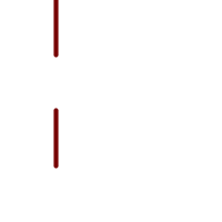 The symmetric difference of the two linestrings
|
--Safe for 2d - symmetric difference of 2 linestrings
SELECT ST_AsText(
ST_SymDifference(
ST_GeomFromText('LINESTRING(50 100, 50 200)'),
ST_GeomFromText('LINESTRING(50 50, 50 150)')
)
);
st_astext
---------
MULTILINESTRING((50 150,50 200),(50 50,50 100))
--When used in 3d doesn't quite do the right thing
SELECT ST_AsEWKT(ST_SymDifference(ST_GeomFromEWKT('LINESTRING(1 2 1, 1 4 2)'),
ST_GeomFromEWKT('LINESTRING(1 1 3, 1 3 4)')))
st_astext
------------
MULTILINESTRING((1 3 2.75,1 4 2),(1 1 3,1 2 2.25))
Veja também
ST_Difference, ST_Intersection, ST_Union, ST_ReducePrecision
Name
ST_UnaryUnion — Computes the union of the components of a single geometry.
Synopsis
geometry ST_UnaryUnion(geometry geom, float8 gridSize = -1);
Descrição
A single-input variant of ST_Union. The input may be a single geometry, a MultiGeometry, or a GeometryCollection. The union is applied to the individual elements of the input.
This function can be used to fix MultiPolygons which are invalid due to overlapping components. However, the input components must each be valid. An invalid input component such as a bow-tie polygon may cause an error. For this reason it may be better to use ST_MakeValid.
Another use of this function is to node and dissolve a collection of linestrings which cross or overlap to make them simple. (ST_Node also does this, but it does not provide the gridSize option.)
It is possible to combine ST_UnaryUnion with ST_Collect to fine-tune how many geometries are be unioned at once. This allows trading off between memory usage and compute time, striking a balance between ST_Union and ST_MemUnion.
If the optional gridSize parameter is given (GEOS-3.9.0 or higher required), all result vertices are guaranteed to fall on a grid of the specified size. For the operation to give predictable results all the input vertices must fall already on the specified grid, see ST_ReducePrecision.
This function supports 3d and will not drop the z-index. However, the result is computed using XY only. The result Z values are copied, averaged or interpolated.
Enhanced: 3.1.0 accept a gridSize parameter.
Requires GEOS >= 3.9.0 to use the gridSize parameter
Disponibilidade: 2.0.0
Veja também
ST_Union, ST_MemUnion, ST_MakeValid, ST_Collect, ST_Node, ST_ReducePrecision
Name
ST_Union — Computes a geometry representing the point-set union of the input geometries.
Synopsis
geometry ST_Union(geometry g1, geometry g2);
geometry ST_Union(geometry g1, geometry g2, float8 gridSize);
geometry ST_Union(geometry[] g1_array);
geometry ST_Union(geometry set g1field);
geometry ST_Union(geometry set g1field, float8 gridSize);
Descrição
Unions the input geometries, merging geometry to produce a result geometry with no overlaps. The output may be an atomic geometry, a MultiGeometry, or a Geometry Collection. Comes in several variants:
Two-input variant: returns a geometry that is the union of two input geometries. If either input is NULL, then NULL is returned.
Array variant: returns a geometry that is the union of an array of geometries.
Aggregate variant: returns a geometry that is the union of a rowset of geometries. The ST_Union() function is an "aggregate" function in the terminology of PostgreSQL. That means that it operates on rows of data, in the same way the SUM() and AVG() functions do and like most aggregates, it also ignores NULL geometries.
See ST_UnaryUnion for a non-aggregate, single-input variant.
The ST_Union array and set variants use the fast Cascaded Union algorithm described in http://blog.cleverelephant.ca/2009/01/must-faster-unions-in-postgis-14.html
If the optional gridSize parameter is given (GEOS-3.9.0 or higher required), all result vertices are guaranteed to fall on a grid of the specified size. For the operation to give predictable results all the input vertices must fall already on the specified grid, see ST_ReducePrecision.
| |
ST_Collect may sometimes be used in place of ST_Union, if the result is not required to be non-overlapping. ST_Collect is usually faster than ST_Union because it performs no processing on the collected geometries. |
Desempenhado pelo módulo GEOS.
ST_Union creates MultiLineString and does not sew LineStrings into a single LineString. Use ST_LineMerge to sew LineStrings.
NOTE: this function was formerly called GeomUnion(), which was renamed from "Union" because UNION is an SQL reserved word.
Enhanced: 3.1.0 accept a gridSize parameter.
Requires GEOS >= 3.9.0 to use the gridSize parameter
Changed: 3.0.0 does not depend on SFCGAL.
Availability: 1.4.0 - ST_Union was enhanced. ST_Union(geomarray) was introduced and also faster aggregate collection in PostgreSQL.
This method implements the OGC Simple Features Implementation Specification for SQL 1.1. s2.1.1.3
| |
Aggregate version is not explicitly defined in OGC SPEC. |
This method implements the SQL/MM specification. SQL-MM 3: 5.1.19 the z-index (elevation) when polygons are involved.
This function supports 3d and will not drop the z-index. However, the result is computed using XY only. The result Z values are copied, averaged or interpolated.
Exemplos
Aggregate example
SELECT id,
ST_Union(geom) as singlegeom
FROM sometable f
GROUP BY id;
Non-Aggregate example
select ST_AsText(ST_Union('POINT(1 2)' :: geometry, 'POINT(-2 3)' :: geometry))
st_astext
----------
MULTIPOINT(-2 3,1 2)
select ST_AsText(ST_Union('POINT(1 2)' :: geometry, 'POINT(1 2)' :: geometry))
st_astext
----------
POINT(1 2)3D example - sort of supports 3D (and with mixed dimensions!)
select ST_AsEWKT(ST_Union(geom))
from (
select 'POLYGON((-7 4.2,-7.1 4.2,-7.1 4.3, -7 4.2))'::geometry geom
union all
select 'POINT(5 5 5)'::geometry geom
union all
select 'POINT(-2 3 1)'::geometry geom
union all
select 'LINESTRING(5 5 5, 10 10 10)'::geometry geom
) as foo;
st_asewkt
---------
GEOMETRYCOLLECTION(POINT(-2 3 1),LINESTRING(5 5 5,10 10 10),POLYGON((-7 4.2 5,-7.1 4.2 5,-7.1 4.3 5,-7 4.2 5)));
3d example not mixing dimensions
select ST_AsEWKT(ST_Union(geom))
from (
select 'POLYGON((-7 4.2 2,-7.1 4.2 3,-7.1 4.3 2, -7 4.2 2))'::geometry geom
union all
select 'POINT(5 5 5)'::geometry geom
union all
select 'POINT(-2 3 1)'::geometry geom
union all
select 'LINESTRING(5 5 5, 10 10 10)'::geometry geom
) as foo;
st_asewkt
---------
GEOMETRYCOLLECTION(POINT(-2 3 1),LINESTRING(5 5 5,10 10 10),POLYGON((-7 4.2 2,-7.1 4.2 3,-7.1 4.3 2,-7 4.2 2)))
--Examples using new Array construct
SELECT ST_Union(ARRAY(SELECT geom FROM sometable));
SELECT ST_AsText(ST_Union(ARRAY[ST_GeomFromText('LINESTRING(1 2, 3 4)'),
ST_GeomFromText('LINESTRING(3 4, 4 5)')])) As wktunion;
--wktunion---
MULTILINESTRING((3 4,4 5),(1 2,3 4))
7.14. Processamento de Geometria
These functions compute geometric constructions, or alter geometry size or shape.
- ST_Buffer — Computes a geometry covering all points within a given distance from a geometry.
- ST_BuildArea — Creates a polygonal geometry formed by the linework of a geometry.
- ST_Centroid — Retorna o centro geométrico de uma geometria.
- ST_ChaikinSmoothing — Returns a smoothed version of a geometry, using the Chaikin algorithm
- ST_ConcaveHull — Computes a possibly concave geometry that contains all input geometry vertices
- ST_ConvexHull — Computes the convex hull of a geometry.
- ST_DelaunayTriangles — Returns the Delaunay triangulation of the vertices of a geometry.
- ST_FilterByM — Removes vertices based on their M value
- ST_GeneratePoints — Generates a multipoint of random points contained in a Polygon or MultiPolygon.
- ST_GeometricMedian — Retorna a mediana de um MultiPonto.
- ST_LineMerge — Return the lines formed by sewing together a MultiLineString.
- ST_MaximumInscribedCircle — Retorna o centro geométrico de uma geometria.
- ST_LargestEmptyCircle — Computes the largest circle not overlapping a geometry.
- ST_MinimumBoundingCircle — Returns the smallest circle polygon that contains a geometry.
- ST_MinimumBoundingRadius — Returns the center point and radius of the smallest circle that contains a geometry.
- ST_OrientedEnvelope — Returns a minimum-area rectangle containing a geometry.
- ST_OffsetCurve — Returns an offset line at a given distance and side from an input line.
- ST_PointOnSurface — Computes a point guaranteed to lie in a polygon, or on a geometry.
- ST_Polygonize — Computes a collection of polygons formed from the linework of a set of geometries.
- ST_ReducePrecision — Returns a valid geometry with points rounded to a grid tolerance.
- ST_SharedPaths — Retorna uma coleção contendo caminhos compartilhados pelas duas linestrings/multilinestrings de entrada.
- ST_Simplify — Returns a simplified representation of a geometry, using the Douglas-Peucker algorithm.
- ST_SimplifyPreserveTopology — Returns a simplified and valid representation of a geometry, using the Douglas-Peucker algorithm.
- ST_SimplifyPolygonHull — Computes a simplified topology-preserving outer or inner hull of a polygonal geometry.
- ST_SimplifyVW — Returns a simplified representation of a geometry, using the Visvalingam-Whyatt algorithm
- ST_SetEffectiveArea — Sets the effective area for each vertex, using the Visvalingam-Whyatt algorithm.
- ST_TriangulatePolygon — Computes the constrained Delaunay triangulation of polygons
- ST_VoronoiLines — Returns the boundaries of the Voronoi diagram of the vertices of a geometry.
- ST_VoronoiPolygons — Returns the cells of the Voronoi diagram of the vertices of a geometry.
Name
ST_Buffer — Computes a geometry covering all points within a given distance from a geometry.
Synopsis
geometry ST_Buffer(geometry g1, float radius_of_buffer, text buffer_style_parameters = '');
geometry ST_Buffer(geometry g1, float radius_of_buffer, integer num_seg_quarter_circle);
geography ST_Buffer(geography g1, float radius_of_buffer, text buffer_style_parameters);
geography ST_Buffer(geography g1, float radius_of_buffer, integer num_seg_quarter_circle);
Descrição
Computes a POLYGON or MULTIPOLYGON that represents all points whose distance from a geometry/geography is less than or equal to a given distance. A negative distance shrinks the geometry rather than expanding it. A negative distance may shrink a polygon completely, in which case POLYGON EMPTY is returned. For points and lines negative distances always return empty results.
For geometry, the distance is specified in the units of the Spatial Reference System of the geometry. For geography, the distance is specified in meters.
The optional third parameter controls the buffer accuracy and style. The accuracy of circular arcs in the buffer is specified as the number of line segments used to approximate a quarter circle (default is 8). The buffer style can be specified by providing a list of blank-separated key=value pairs as follows:
'quad_segs=#' : number of line segments used to approximate a quarter circle (default is 8).
'endcap=round|flat|square' : endcap style (defaults to "round"). 'butt' is accepted as a synonym for 'flat'.
'join=round|mitre|bevel' : join style (defaults to "round"). 'miter' is accepted as a synonym for 'mitre'.
'mitre_limit=#.#' : mitre ratio limit (only affects mitered join style). 'miter_limit' is accepted as a synonym for 'mitre_limit'.
'side=both|left|right' : defaults to 'both'. 'left' or 'right' performs a single-sided buffer on the geometry, with the buffered side relative to the direction of the line. This is only applicable to LINESTRING geometry and does not affect POINT or POLYGON geometries. By default end caps are square when 'left' or 'right' are specified.
| |
|
| |
Buffer can handle invalid inputs and the output is always a valid polygonal geometry. Buffering by distance 0 is sometimes used as a way of repairing invalid polygons. ST_MakeValid is more suitable for this process as it can handle multi-polygons. |
| |
Buffering is sometimes used to perform a within-distance search. For this use case it is more efficient to use ST_DWithin. |
| |
This function ignores the Z dimension. It always gives a 2D result even when used on a 3D geometry. |
Enhanced: 2.5.0 - ST_Buffer geometry support was enhanced to allow for side buffering specification side=both|left|right.
Availability: 1.5 - ST_Buffer was enhanced to support different endcaps and join types. These are useful for example to convert road linestrings into polygon roads with flat or square edges instead of rounded edges. Thin wrapper for geography was added.
Desempenhado pelo módulo GEOS.
This method implements the OGC Simple Features Implementation Specification for SQL 1.1. s2.1.1.3
This method implements the SQL/MM specification. SQL-MM IEC 13249-3: 5.1.30
Exemplos
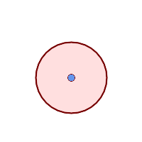 quad_segs=8 (default)
SELECT ST_Buffer(
ST_GeomFromText('POINT(100 90)'),
50, 'quad_segs=8');
| 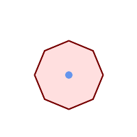 quad_segs=2 (lame)
SELECT ST_Buffer(
ST_GeomFromText('POINT(100 90)'),
50, 'quad_segs=2');
| |
 endcap=round join=round (default)
SELECT ST_Buffer(
ST_GeomFromText(
'LINESTRING(50 50,150 150,150 50)'
), 10, 'endcap=round join=round');
|  endcap=square
SELECT ST_Buffer(
ST_GeomFromText(
'LINESTRING(50 50,150 150,150 50)'
), 10, 'endcap=square join=round');
| 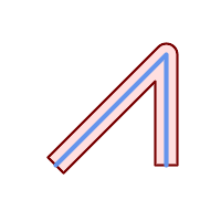 endcap=flat
SELECT ST_Buffer(
ST_GeomFromText(
'LINESTRING(50 50,150 150,150 50)'
), 10, 'endcap=flat join=round');
|
 join=bevel
SELECT ST_Buffer(
ST_GeomFromText(
'LINESTRING(50 50,150 150,150 50)'
), 10, 'join=bevel');
|  join=mitre mitre_limit=5.0 (default mitre limit)
SELECT ST_Buffer(
ST_GeomFromText(
'LINESTRING(50 50,150 150,150 50)'
), 10, 'join=mitre mitre_limit=5.0');
|  join=mitre mitre_limit=1
SELECT ST_Buffer(
ST_GeomFromText(
'LINESTRING(50 50,150 150,150 50)'
), 10, 'join=mitre mitre_limit=1.0');
|
 side=left
SELECT ST_Buffer(
ST_GeomFromText(
'LINESTRING(50 50,150 150,150 50)'
), 10, 'side=left');
|  side=right
SELECT ST_Buffer(
ST_GeomFromText(
'LINESTRING(50 50,150 150,150 50)'
), 10, 'side=right');
|  side=left join=mitre
SELECT ST_Buffer(
ST_GeomFromText(
'LINESTRING(50 50,150 150,150 50)'
), 10, 'side=left join=mitre');
|
 right-hand-winding, polygon boundary side=left
SELECT ST_Buffer(
ST_ForceRHR(
ST_Boundary(
ST_GeomFromText(
'POLYGON ((50 50, 50 150, 150 150, 150 50, 50 50))'))),
), 20, 'side=left');
|  right-hand-winding, polygon boundary side=right
SELECT ST_Buffer(
ST_ForceRHR(
ST_Boundary(
ST_GeomFromText(
'POLYGON ((50 50, 50 150, 150 150, 150 50, 50 50))'))
), 20,'side=right')
|
--A buffered point approximates a circle
-- A buffered point forcing approximation of (see diagram)
-- 2 points per quarter circle is poly with 8 sides (see diagram)
SELECT ST_NPoints(ST_Buffer(ST_GeomFromText('POINT(100 90)'), 50)) As promisingcircle_pcount,
ST_NPoints(ST_Buffer(ST_GeomFromText('POINT(100 90)'), 50, 2)) As lamecircle_pcount;
promisingcircle_pcount | lamecircle_pcount
------------------------+-------------------
33 | 9
--A lighter but lamer circle
-- only 2 points per quarter circle is an octagon
--Below is a 100 meter octagon
-- Note coordinates are in NAD 83 long lat which we transform
to Mass state plane meter and then buffer to get measurements in meters;
SELECT ST_AsText(ST_Buffer(
ST_Transform(
ST_SetSRID(ST_Point(-71.063526, 42.35785),4269), 26986)
,100,2)) As octagon;
----------------------
POLYGON((236057.59057465 900908.759918696,236028.301252769 900838.049240578,235
957.59057465 900808.759918696,235886.879896532 900838.049240578,235857.59057465
900908.759918696,235886.879896532 900979.470596815,235957.59057465 901008.759918
696,236028.301252769 900979.470596815,236057.59057465 900908.759918696))
Veja também
ST_Collect, ST_DWithin, ST_SetSRID, ST_Transform, ST_Union, ST_MakeValid
Name
ST_BuildArea — Creates a polygonal geometry formed by the linework of a geometry.
Synopsis
geometry ST_BuildArea(geometry geom);
Descrição
Creates an areal geometry formed by the constituent linework of the input geometry. The input can be a LineString, MultiLineString, Polygon, MultiPolygon or a GeometryCollection. The result is a Polygon or MultiPolygon, depending on input. If the input linework does not form polygons, NULL is returned.
Unlike ST_MakePolygon, this function accepts rings formed by multiple lines, and can form any number of polygons.
This function converts inner rings into holes. To turn inner rings into polygons as well, use ST_Polygonize.
| |
Input linework must be correctly noded for this function to work properly. ST_Node can be used to node lines. If the input linework crosses, this function will produce invalid polygons. ST_MakeValid can be used to ensure the output is valid. |
Disponibilidade: 1.1.0
Exemplos
 Input lines
|
 Area result
|
WITH data(geom) AS (VALUES
('LINESTRING (180 40, 30 20, 20 90)'::geometry)
,('LINESTRING (180 40, 160 160)'::geometry)
,('LINESTRING (160 160, 80 190, 80 120, 20 90)'::geometry)
,('LINESTRING (80 60, 120 130, 150 80)'::geometry)
,('LINESTRING (80 60, 150 80)'::geometry)
)
SELECT ST_AsText( ST_BuildArea( ST_Collect( geom )))
FROM data;
------------------------------------------------------------------------------------------
POLYGON((180 40,30 20,20 90,80 120,80 190,160 160,180 40),(150 80,120 130,80 60,150 80))

Create a donut from two circular polygons
SELECT ST_BuildArea(ST_Collect(inring,outring))
FROM (SELECT
ST_Buffer('POINT(100 90)', 25) As inring,
ST_Buffer('POINT(100 90)', 50) As outring) As t;
Veja também
ST_Collect, ST_MakePolygon, ST_MakeValid, ST_Node, ST_Polygonize, ST_BdPolyFromText, ST_BdMPolyFromText (wrappers to this function with standard OGC interface)
Name
ST_Centroid — Retorna o centro geométrico de uma geometria.
Synopsis
geometry ST_Centroid(geometry g1);
geography ST_Centroid(geography g1, boolean use_spheroid = true);
Descrição
Computes a point which is the geometric center of mass of a geometry. For [MULTI]POINTs, the centroid is the arithmetic mean of the input coordinates. For [MULTI]LINESTRINGs, the centroid is computed using the weighted length of each line segment. For [MULTI]POLYGONs, the centroid is computed in terms of area. If an empty geometry is supplied, an empty GEOMETRYCOLLECTION is returned. If NULL is supplied, NULL is returned. If CIRCULARSTRING or COMPOUNDCURVE are supplied, they are converted to linestring with CurveToLine first, then same than for LINESTRING
For mixed-dimension input, the result is equal to the centroid of the component Geometries of highest dimension (since the lower-dimension geometries contribute zero "weight" to the centroid).
Note that for polygonal geometries the centroid does not necessarily lie in the interior of the polygon. For example, see the diagram below of the centroid of a C-shaped polygon. To construct a point guaranteed to lie in the interior of a polygon use ST_PointOnSurface.
New in 2.3.0 : supports CIRCULARSTRING and COMPOUNDCURVE (using CurveToLine)
Availability: 2.4.0 support for geography was introduced.
This method implements the OGC Simple Features Implementation Specification for SQL 1.1.
This method implements the SQL/MM specification. SQL-MM 3: 8.1.4, 9.5.5
Exemplos
In the following illustrations the red dot is the centroid of the source geometry.
 Centroide de um |  Centroide de uma |
 Centroide de um |  Centroide de uma |
SELECT ST_AsText(ST_Centroid('MULTIPOINT ( -1 0, -1 2, -1 3, -1 4, -1 7, 0 1, 0 3, 1 1, 2 0, 6 0, 7 8, 9 8, 10 6 )'));
st_astext
------------------------------------------
POINT(2.30769230769231 3.30769230769231)
(1 row)
SELECT ST_AsText(ST_centroid(g))
FROM ST_GeomFromText('CIRCULARSTRING(0 2, -1 1,0 0, 0.5 0, 1 0, 2 1, 1 2, 0.5 2, 0 2)') AS g ;
------------------------------------------
POINT(0.5 1)
SELECT ST_AsText(ST_centroid(g))
FROM ST_GeomFromText('COMPOUNDCURVE(CIRCULARSTRING(0 2, -1 1,0 0),(0 0, 0.5 0, 1 0),CIRCULARSTRING( 1 0, 2 1, 1 2),(1 2, 0.5 2, 0 2))' ) AS g;
------------------------------------------
POINT(0.5 1)
Veja também
Name
ST_ChaikinSmoothing — Returns a smoothed version of a geometry, using the Chaikin algorithm
Synopsis
geometry ST_ChaikinSmoothing(geometry geom, integer nIterations = 1, boolean preserveEndPoints = false);
Descrição
Smoothes a linear or polygonal geometry using Chaikin's algorithm. The degree of smoothing is controlled by the nIterations parameter. On each iteration, each interior vertex is replaced by two vertices located at 1/4 of the length of the line segments before and after the vertex. A reasonable degree of smoothing is provided by 3 iterations; the maximum is limited to 5.
If preserveEndPoints is true, the endpoints of Polygon rings are not smoothed. The endpoints of LineStrings are always preserved.
| |
The number of vertices doubles with each iteration, so the result geometry may have many more points than the input. To reduce the number of points use a simplification function on the result (see ST_Simplify, ST_SimplifyPreserveTopology and ST_SimplifyVW). |
The result has interpolated values for the Z and M dimensions when present.
This function supports 3d and will not drop the z-index.
Availability: 2.5.0
Exemplos
Smoothing a triangle:
SELECT ST_AsText(ST_ChaikinSmoothing(geom)) smoothed
FROM (SELECT 'POLYGON((0 0, 8 8, 0 16, 0 0))'::geometry geom) AS foo;
smoothed
───────────────────────────────────────────
POLYGON((2 2,6 6,6 10,2 14,0 12,0 4,2 2))
Smoothing a Polygon using 1, 2 and 3 iterations:
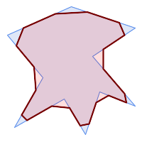 nIterations = 1 |  nIterations = 2 |  nIterations = 3 |
SELECT ST_ChaikinSmoothing(
'POLYGON ((20 20, 60 90, 10 150, 100 190, 190 160, 130 120, 190 50, 140 70, 120 10, 90 60, 20 20))',
generate_series(1, 3) );
Smoothing a LineString using 1, 2 and 3 iterations:
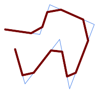 nIterations = 1 |  nIterations = 2 | 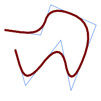 nIterations = 3 |
SELECT ST_ChaikinSmoothing(
'LINESTRING (10 140, 80 130, 100 190, 190 150, 140 20, 120 120, 50 30, 30 100)',
generate_series(1, 3) );
Veja também
Name
ST_ConcaveHull — Computes a possibly concave geometry that contains all input geometry vertices
Synopsis
geometry ST_ConcaveHull(geometry param_geom, float param_pctconvex, boolean param_allow_holes = false);
Descrição
A concave hull is a (usually) concave geometry which contains the input, and whose vertices are a subset of the input vertices. In the general case the concave hull is a Polygon. The concave hull of two or more collinear points is a two-point LineString. The concave hull of one or more identical points is a Point. The polygon will not contain holes unless the optional param_allow_holes argument is specified as true.
One can think of a concave hull as "shrink-wrapping" a set of points. This is different to the convex hull, which is more like wrapping a rubber band around the points. A concave hull generally has a smaller area and represents a more natural boundary for the input points.
The param_pctconvex controls the concaveness of the computed hull. A value of 1 produces the convex hull. Values between 1 and 0 produce hulls of increasing concaveness. A value of 0 produces a hull with maximum concaveness (but still a single polygon). Choosing a suitable value depends on the nature of the input data, but often values between 0.3 and 0.1 produce reasonable results.
| |
Technically, the |
For point and linear inputs, the hull will enclose all the points of the inputs. For polygonal inputs, the hull will enclose all the points of the input and also all the areas covered by the input. If you want a point-wise hull of a polygonal input, convert it to points first using ST_Points.
This is not an aggregate function. To compute the concave hull of a set of geometries use ST_Collect (e.g. ST_ConcaveHull( ST_Collect( geom ), 0.80).
Disponibilidade: 2.0.0
Enhanced: 3.3.0, GEOS native implementation enabled for GEOS 3.11+
Exemplos

Concave Hull of a MultiPoint
SELECT ST_AsText( ST_ConcaveHull(
'MULTIPOINT ((10 72), (53 76), (56 66), (63 58), (71 51), (81 48), (91 46), (101 45), (111 46), (121 47), (131 50), (140 55), (145 64), (144 74), (135 80), (125 83), (115 85), (105 87), (95 89), (85 91), (75 93), (65 95), (55 98), (45 102), (37 107), (29 114), (22 122), (19 132), (18 142), (21 151), (27 160), (35 167), (44 172), (54 175), (64 178), (74 180), (84 181), (94 181), (104 181), (114 181), (124 181), (134 179), (144 177), (153 173), (162 168), (171 162), (177 154), (182 145), (184 135), (139 132), (136 142), (128 149), (119 153), (109 155), (99 155), (89 155), (79 153), (69 150), (61 144), (63 134), (72 128), (82 125), (92 123), (102 121), (112 119), (122 118), (132 116), (142 113), (151 110), (161 106), (170 102), (178 96), (185 88), (189 78), (190 68), (189 58), (185 49), (179 41), (171 34), (162 29), (153 25), (143 23), (133 21), (123 19), (113 19), (102 19), (92 19), (82 19), (72 21), (62 22), (52 25), (43 29), (33 34), (25 41), (19 49), (14 58), (21 73), (31 74), (42 74), (173 134), (161 134), (150 133), (97 104), (52 117), (157 156), (94 171), (112 106), (169 73), (58 165), (149 40), (70 33), (147 157), (48 153), (140 96), (47 129), (173 55), (144 86), (159 67), (150 146), (38 136), (111 170), (124 94), (26 59), (60 41), (71 162), (41 64), (88 110), (122 34), (151 97), (157 56), (39 146), (88 33), (159 45), (47 56), (138 40), (129 165), (33 48), (106 31), (169 147), (37 122), (71 109), (163 89), (37 156), (82 170), (180 72), (29 142), (46 41), (59 155), (124 106), (157 80), (175 82), (56 50), (62 116), (113 95), (144 167))',
0.1 ) );
---st_astext--
POLYGON ((18 142, 21 151, 27 160, 35 167, 44 172, 54 175, 64 178, 74 180, 84 181, 94 181, 104 181, 114 181, 124 181, 134 179, 144 177, 153 173, 162 168, 171 162, 177 154, 182 145, 184 135, 173 134, 161 134, 150 133, 139 132, 136 142, 128 149, 119 153, 109 155, 99 155, 89 155, 79 153, 69 150, 61 144, 63 134, 72 128, 82 125, 92 123, 102 121, 112 119, 122 118, 132 116, 142 113, 151 110, 161 106, 170 102, 178 96, 185 88, 189 78, 190 68, 189 58, 185 49, 179 41, 171 34, 162 29, 153 25, 143 23, 133 21, 123 19, 113 19, 102 19, 92 19, 82 19, 72 21, 62 22, 52 25, 43 29, 33 34, 25 41, 19 49, 14 58, 10 72, 21 73, 31 74, 42 74, 53 76, 56 66, 63 58, 71 51, 81 48, 91 46, 101 45, 111 46, 121 47, 131 50, 140 55, 145 64, 144 74, 135 80, 125 83, 115 85, 105 87, 95 89, 85 91, 75 93, 65 95, 55 98, 45 102, 37 107, 29 114, 22 122, 19 132, 18 142))
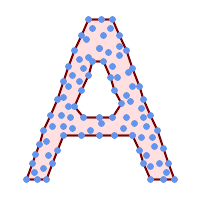
Concave Hull of a MultiPoint, allowing holes
SELECT ST_AsText( ST_ConcaveHull(
'MULTIPOINT ((132 64), (114 64), (99 64), (81 64), (63 64), (57 49), (52 36), (46 20), (37 20), (26 20), (32 36), (39 55), (43 69), (50 84), (57 100), (63 118), (68 133), (74 149), (81 164), (88 180), (101 180), (112 180), (119 164), (126 149), (132 131), (139 113), (143 100), (150 84), (157 69), (163 51), (168 36), (174 20), (163 20), (150 20), (143 36), (139 49), (132 64), (99 151), (92 138), (88 124), (81 109), (74 93), (70 82), (83 82), (99 82), (112 82), (126 82), (121 96), (114 109), (110 122), (103 138), (99 151), (34 27), (43 31), (48 44), (46 58), (52 73), (63 73), (61 84), (72 71), (90 69), (101 76), (123 71), (141 62), (166 27), (150 33), (159 36), (146 44), (154 53), (152 62), (146 73), (134 76), (143 82), (141 91), (130 98), (126 104), (132 113), (128 127), (117 122), (112 133), (119 144), (108 147), (119 153), (110 171), (103 164), (92 171), (86 160), (88 142), (79 140), (72 124), (83 131), (79 118), (68 113), (63 102), (68 93), (35 45))',
0.15, true ) );
---st_astext--
POLYGON ((43 69, 50 84, 57 100, 63 118, 68 133, 74 149, 81 164, 88 180, 101 180, 112 180, 119 164, 126 149, 132 131, 139 113, 143 100, 150 84, 157 69, 163 51, 168 36, 174 20, 163 20, 150 20, 143 36, 139 49, 132 64, 114 64, 99 64, 81 64, 63 64, 57 49, 52 36, 46 20, 37 20, 26 20, 32 36, 35 45, 39 55, 43 69), (88 124, 81 109, 74 93, 83 82, 99 82, 112 82, 121 96, 114 109, 110 122, 103 138, 92 138, 88 124))
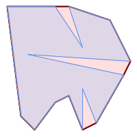
| 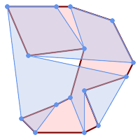
|
Comparing a concave hull of a Polygon to the concave hull of the constituent points. The hull respects the boundary of the polygon, whereas the points-based hull does not.
WITH data(geom) AS (VALUES
('POLYGON ((10 90, 39 85, 61 79, 50 90, 80 80, 95 55, 25 60, 90 45, 70 16, 63 38, 60 10, 50 30, 43 27, 30 10, 20 20, 10 90))'::geometry)
)
SELECT ST_ConcaveHull( geom, 0.1) AS polygon_hull,
ST_ConcaveHull( ST_Points(geom), 0.1) AS points_hull
FROM data;
Using with ST_Collect to compute the concave hull of a geometry set.
-- Compute estimate of infected area based on point observations
SELECT disease_type,
ST_ConcaveHull( ST_Collect(obs_pnt), 0.3 ) AS geom
FROM disease_obs
GROUP BY disease_type;
Veja também
ST_ConvexHull, ST_Collect, ST_AlphaShape, ST_OptimalAlphaShape
Name
ST_ConvexHull — Computes the convex hull of a geometry.
Synopsis
geometry ST_ConvexHull(geometry geomA);
Descrição
Computes the convex hull of a geometry. The convex hull is the smallest convex geometry that encloses all geometries in the input.
One can think of the convex hull as the geometry obtained by wrapping an rubber band around a set of geometries. This is different from a concave hull which is analogous to "shrink-wrapping" the geometries. A convex hull is often used to determine an affected area based on a set of point observations.
In the general case the convex hull is a Polygon. The convex hull of two or more collinear points is a two-point LineString. The convex hull of one or more identical points is a Point.
This is not an aggregate function. To compute the convex hull of a set of geometries, use ST_Collect to aggregate them into a geometry collection (e.g. ST_ConvexHull(ST_Collect(geom)).
Desempenhado pelo módulo GEOS
This method implements the OGC Simple Features Implementation Specification for SQL 1.1. s2.1.1.3
This method implements the SQL/MM specification. SQL-MM IEC 13249-3: 5.1.16
This function supports 3d and will not drop the z-index.
Exemplos
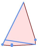
Convex Hull of a MultiLinestring and a MultiPoint
SELECT ST_AsText(ST_ConvexHull(
ST_Collect(
ST_GeomFromText('MULTILINESTRING((100 190,10 8),(150 10, 20 30))'),
ST_GeomFromText('MULTIPOINT(50 5, 150 30, 50 10, 10 10)')
)) );
---st_astext--
POLYGON((50 5,10 8,10 10,100 190,150 30,150 10,50 5))
Using with ST_Collect to compute the convex hulls of geometry sets.
--Get estimate of infected area based on point observations
SELECT d.disease_type,
ST_ConvexHull(ST_Collect(d.geom)) As geom
FROM disease_obs As d
GROUP BY d.disease_type;
Veja também
Name
ST_DelaunayTriangles — Returns the Delaunay triangulation of the vertices of a geometry.
Synopsis
geometry ST_DelaunayTriangles(geometry g1, float tolerance = 0.0, int4 flags = 0);
Descrição
Computes the Delaunay triangulation of the vertices of the input geometry. The optional tolerance can be used to snap nearby input vertices together, which improves robustness in some situations. The result geometry is bounded by the convex hull of the input vertices. The result geometry representation is determined by the flags code:
0- a GEOMETRYCOLLECTION of triangular POLYGONs (default)1- a MULTILINESTRING of the edges of the triangulation2- A TIN of the triangulation
Desempenhado pelo módulo GEOS.
Disponibilidade: 2.1.0
This function supports 3d and will not drop the z-index.
This function supports Triangles and Triangulated Irregular Network Surfaces (TIN).
Exemplos
 Polígonos originais our original geometry
ST_Union(ST_GeomFromText('POLYGON((175 150, 20 40,
50 60, 125 100, 175 150))'),
ST_Buffer(ST_GeomFromText('POINT(110 170)'), 20)
) |
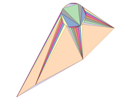 ST_DelaunayTriangles de 2 polígonos: polígonos da triangulação de Delaunay, cada triângulo de uma cor diferente
geometries overlaid multilinestring triangles
SELECT
ST_DelaunayTriangles(
ST_Union(ST_GeomFromText('POLYGON((175 150, 20 40,
50 60, 125 100, 175 150))'),
ST_Buffer(ST_GeomFromText('POINT(110 170)'), 20)
))
As dtriag;
|
 -- triângulos de Delaunay como multilinestring
SELECT
ST_DelaunayTriangles(
ST_Union(ST_GeomFromText('POLYGON((175 150, 20 40,
50 60, 125 100, 175 150))'),
ST_Buffer(ST_GeomFromText('POINT(110 170)'), 20)
),0.001,1)
As dtriag;
|
 -- triângulos delaunay de 45 pontos como 55 polígonos triangulares
this produces a table of 42 points that form an L shape SELECT (ST_DumpPoints(ST_GeomFromText( 'MULTIPOINT(14 14,34 14,54 14,74 14,94 14,114 14,134 14, 150 14,154 14,154 6,134 6,114 6,94 6,74 6,54 6,34 6, 14 6,10 6,8 6,7 7,6 8,6 10,6 30,6 50,6 70,6 90,6 110,6 130, 6 150,6 170,6 190,6 194,14 194,14 174,14 154,14 134,14 114, 14 94,14 74,14 54,14 34,14 14)'))).geom INTO TABLE l_shape; output as individual polygon triangles SELECT ST_AsText((ST_Dump(geom)).geom) As wkt FROM ( SELECT ST_DelaunayTriangles(ST_Collect(geom)) As geom FROM l_shape) As foo; wkt POLYGON((6 194,6 190,14 194,6 194)) POLYGON((14 194,6 190,14 174,14 194)) POLYGON((14 194,14 174,154 14,14 194)) POLYGON((154 14,14 174,14 154,154 14)) POLYGON((154 14,14 154,150 14,154 14)) POLYGON((154 14,150 14,154 6,154 14))
|
Example using vertices with Z values.
3D multipoint SELECT ST_AsText(ST_DelaunayTriangles(ST_GeomFromText( 'MULTIPOINT Z(14 14 10, 150 14 100,34 6 25, 20 10 150)'))) As wkt; wkt GEOMETRYCOLLECTION Z (POLYGON Z ((14 14 10,20 10 150,34 6 25,14 14 10)) ,POLYGON Z ((14 14 10,34 6 25,150 14 100,14 14 10)))
Name
ST_FilterByM — Removes vertices based on their M value
Synopsis
geometry ST_FilterByM(geometry geom, double precision min, double precision max = null, boolean returnM = false);
Descrição
Filters out vertex points based on their M-value. Returns a geometry with only vertex points that have a M-value larger or equal to the min value and smaller or equal to the max value. If max-value argument is left out only min value is considered. If fourth argument is left out the m-value will not be in the resulting geometry. If resulting geometry have too few vertex points left for its geometry type an empty geometry will be returned. In a geometry collection geometries without enough points will just be left out silently.
This function is mainly intended to be used in conjunction with ST_SetEffectiveArea. ST_EffectiveArea sets the effective area of a vertex in its m-value. With ST_FilterByM it then is possible to get a simplified version of the geometry without any calculations, just by filtering
| |
There is a difference in what ST_SimplifyVW returns when not enough points meet the criteria compared to ST_FilterByM. ST_SimplifyVW returns the geometry with enough points while ST_FilterByM returns an empty geometry |
| |
Note that the returned geometry might be invalid |
| |
This function returns all dimensions, including the Z and M values |
Availability: 2.5.0
Exemplos
A linestring is filtered
SELECT ST_AsText(ST_FilterByM(geom,30)) simplified
FROM (SELECT ST_SetEffectiveArea('LINESTRING(5 2, 3 8, 6 20, 7 25, 10 10)'::geometry) geom) As foo;
result
simplified
----------------------------
LINESTRING(5 2,7 25,10 10)
Veja também
Name
ST_GeneratePoints — Generates a multipoint of random points contained in a Polygon or MultiPolygon.
Synopsis
geometry ST_GeneratePoints(geometry g, integer npoints, integer seed = 0);
Descrição
ST_GeneratePoints generates a multipoint consisting of a given number of pseudo-random points which lie within the input area. The optional seed is used to regenerate a deterministic sequence of points, and must be greater than zero.
Disponibilidade: 2.3.0
Enhanced: 3.0.0, added seed parameter
Exemplos
Generated a multipoint consisting of 12 Points overlaid on top of original polygon using a random seed value 1996
SELECT ST_GeneratePoints(geom, 12, 1996)
FROM (
SELECT ST_Buffer(
ST_GeomFromText(
'LINESTRING(50 50,150 150,150 50)'),
10, 'endcap=round join=round') AS geom
) AS s;
Given a table of polygons s, return 12 individual points per polygon. Results will be different each time you run.
SELECT s.id, dp.path[1] AS pt_id, dp.geom FROM s, ST_DumpPoints(ST_GeneratePoints(s.geom,12)) AS dp;
Veja também
Name
ST_GeometricMedian — Retorna a mediana de um MultiPonto.
Synopsis
geometry ST_GeometricMedian ( geometry geom, float8 tolerance = NULL, int max_iter = 10000, boolean fail_if_not_converged = false);
Descrição
Computes the approximate geometric median of a MultiPoint geometry using the Weiszfeld algorithm. The geometric median is the point minimizing the sum of distances to the input points. It provides a centrality measure that is less sensitive to outlier points than the centroid (center of mass).
The algorithm iterates until the distance change between successive iterations is less than the supplied tolerance parameter. If this condition has not been met after max_iterations iterations, the function produces an error and exits, unless fail_if_not_converged is set to false (the default).
If a tolerance argument is not provided, the tolerance value is calculated based on the extent of the input geometry.
If present, the input point M values are interpreted as their relative weights.
Disponibilidade: 2.3.0
Enhanced: 2.5.0 Added support for M as weight of points.
This function supports 3d and will not drop the z-index.
This function supports M coordinates.
Exemplos
Comparison of the geometric median (red) and centroid (turquoise) of a MultiPoint.
WITH test AS (
SELECT 'MULTIPOINT((10 10), (10 40), (40 10), (190 190))'::geometry geom)
SELECT
ST_AsText(ST_Centroid(geom)) centroid,
ST_AsText(ST_GeometricMedian(geom)) median
FROM test;
centroid | median
--------------------+----------------------------------------
POINT(62.5 62.5) | POINT(25.01778421249728 25.01778421249728)
(1 row)
Veja também
Name
ST_LineMerge — Return the lines formed by sewing together a MultiLineString.
Synopsis
geometry ST_LineMerge(geometry amultilinestring);
geometry ST_LineMerge(geometry amultilinestring, boolean directed);
Descrição
Returns a LineString or MultiLineString formed by joining together the line elements of a MultiLineString. Lines are joined at their endpoints at 2-way intersections. Lines are not joined across intersections of 3-way or greater degree.
If directed is TRUE, then ST_LineMerge will not change point order within LineStrings, so lines with opposite directions will not be merged
| |
Only use with MultiLineString/LineStrings. Other geometry types return an empty GeometryCollection |
Desempenhado pelo módulo GEOS.
Enhanced: 3.3.0 accept a directed parameter.
Requires GEOS >= 3.11.0 to use the directed parameter.
Disponibilidade: 1.1.0
| |
This function strips the M dimension. |
Exemplos
Cardinality 2
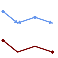
Nodes with cardinality 2 are merged away.
SELECT ST_AsText(ST_LineMerge(
'MULTILINESTRING((10 160, 60 120), (120 140, 60 120), (120 140, 180 120))'
));
--------------------------------------------
LINESTRING(10 160,60 120,120 140,180 120)
Cardinality 3 or More
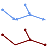
Lines are not merged across intersections with degree > 2.
SELECT ST_AsText(ST_LineMerge(
'MULTILINESTRING((10 160, 60 120), (120 140, 60 120), (120 140, 180 120), (100 180, 120 140))'
));
--------------------------------------------
MULTILINESTRING((10 160,60 120,120 140),(100 180,120 140),(120 140,180 120))
Non-Touching Lines
If merging is not possible due to non-touching lines, the original MultiLineString is returned.
SELECT ST_AsText(ST_LineMerge( 'MULTILINESTRING((-29 -27,-30 -29.7,-36 -31,-45 -33),(-45.2 -33.2,-46 -32))' )); ---------------- MULTILINESTRING((-45.2 -33.2,-46 -32),(-29 -27,-30 -29.7,-36 -31,-45 -33))
Directed Parameter
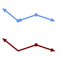
Lines with opposite directions are not merged if directed = TRUE.
SELECT ST_AsText(ST_LineMerge( 'MULTILINESTRING((60 30, 10 70), (120 50, 60 30), (120 50, 180 30))', TRUE)); ------------------------------------------------------- MULTILINESTRING((120 50,60 30,10 70),(120 50,180 30))
Z-dimension Handling
SELECT ST_AsText(ST_LineMerge(
'MULTILINESTRING((-29 -27 11,-30 -29.7 10,-36 -31 5,-45 -33 6), (-29 -27 12,-30 -29.7 5), (-45 -33 1,-46 -32 11))'
));
---------------------------------------------------------------------------------
LINESTRING Z (-30 -29.7 5,-29 -27 11,-30 -29.7 10,-36 -31 5,-45 -33 1,-46 -32 11)
Veja também
Name
ST_MaximumInscribedCircle — Retorna o centro geométrico de uma geometria.
Synopsis
(geometry, geometry, double precision) ST_MaximumInscribedCircle(geometry geom);
Descrição
Finds the largest circle that is contained within a (multi)polygon, or which does not overlap any lines and points. Returns a record with fields:
center- center point of the circlenearest- a point on the geometry nearest to the centerradius- radius of the circle
For polygonal inputs, the circle is inscribed within the boundary rings, using the internal rings as boundaries. For linear and point inputs, the circle is inscribed within the convex hull of the input, using the input lines and points as further boundaries.
Availability: 3.1.0.
Requires GEOS >= 3.9.0.
Exemplos
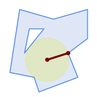
Maximum inscribed circle of a polygon. Center, nearest point, and radius are returned.
SELECT radius, ST_AsText(center) AS center, ST_AsText(nearest) AS nearest
FROM ST_MaximumInscribedCircle(
'POLYGON ((40 180, 110 160, 180 180, 180 120, 140 90, 160 40, 80 10, 70 40, 20 50, 40 180),
(60 140, 50 90, 90 140, 60 140))');
radius | center | nearest
-----------------+----------------------------+---------------
45.165845650018 | POINT(96.953125 76.328125) | POINT(140 90)
Maximum inscribed circle of a multi-linestring. Center, nearest point, and radius are returned.
Veja também
Name
ST_LargestEmptyCircle — Computes the largest circle not overlapping a geometry.
Synopsis
(geometry, geometry, double precision) ST_LargestEmptyCircle(geometry geom, double precision tolerance=0.0, geometry boundary=POINT EMPTY);
Descrição
Finds the largest circle which does not overlap a set of point and line obstacles. (Polygonal geometries may be included as obstacles, but only their boundary lines are used.) The center of the circle is constrained to lie inside a polygonal boundary, which by default is the convex hull of the input geometry. The circle center is the point in the interior of the boundary which has the farthest distance from the obstacles. The circle itself is provided by the center point and a nearest point lying on an obstacle determining the circle radius.
The circle center is determined to a given accuracy specified by a distance tolerance, using an iterative algorithm. If the accuracy distance is not specified a reasonable default is used.
Returns a record with fields:
center- center point of the circlenearest- a point on the geometry nearest to the centerradius- radius of the circle
To find the largest empty circle in the interior of a polygon, see ST_MaximumInscribedCircle.
Availability: 3.4.0.
Requires GEOS >= 3.9.0.
Exemplos
SELECT radius,
center,
nearest
FROM ST_LargestEmptyCircle(
'MULTILINESTRING (
(10 100, 60 180, 130 150, 190 160),
(20 50, 70 70, 90 20, 110 40),
(160 30, 100 100, 180 100))');Largest Empty Circle within a set of lines.
SELECT radius,
center,
nearest
FROM ST_LargestEmptyCircle(
ST_Collect(
'MULTIPOINT ((70 50), (60 130), (130 150), (80 90))'::geometry,
'POLYGON ((90 190, 10 100, 60 10, 190 40, 120 100, 190 180, 90 190))'::geometry),
0,
'POLYGON ((90 190, 10 100, 60 10, 190 40, 120 100, 190 180, 90 190))'::geometry
);Largest Empty Circle within a set of points, constrained to lie in a polygon. The constraint polygon boundary must be included as an obstacle, as well as specified as the constraint for the circle center.
Veja também
Name
ST_MinimumBoundingCircle — Returns the smallest circle polygon that contains a geometry.
Synopsis
geometry ST_MinimumBoundingCircle(geometry geomA, integer num_segs_per_qt_circ=48);
Descrição
Returns the smallest circle polygon that contains a geometry.
| |
O círculo é aproximado por um polígono com um padrão de 48 segmentos por quarto de círculo. Devido ao polígono ser uma aproximação do círculo delimitador, alguns pontos na geometria de entrada podem não estar contidos dentro do polígono. A aproximação pode ser melhorada pelo aumento do número de segmentos, com uma pequena penalidade de desempenho. Para aplicações nas quais uma aproximação poligonal não se encaixa, a ST_MinimumBoundingRadius pode ser usada. |
Use with ST_Collect to get the minimum bounding circle of a set of geometries.
To compute two points lying on the minimum circle (the "maximum diameter") use ST_LongestLine.
A razão da área de um polígono dividido pela área do seu menor círculo delimitador é referenciada com o teste Roeck.
Desempenhado pelo módulo GEOS.
Disponibilidade: 1.4.0
Exemplos
SELECT d.disease_type,
ST_MinimumBoundingCircle(ST_Collect(d.geom)) As geom
FROM disease_obs As d
GROUP BY d.disease_type;
Menor círculo delimitador de um ponto e linestring. Utilizando 8 segmentos para aproximar um quarto de círculo
SELECT ST_AsText(ST_MinimumBoundingCircle(
ST_Collect(
ST_GeomFromText('LINESTRING(55 75,125 150)'),
ST_Point(20, 80)), 8
)) As wktmbc;
wktmbc
-----------
POLYGON((135.59714732062 115,134.384753327498 102.690357210921,130.79416296937 90.8537670908995,124.963360620072 79.9451031602111,117.116420743937 70.3835792560632,107.554896839789 62.5366393799277,96.6462329091006 56.70583703063,84.8096427890789 53.115246672502,72.5000000000001 51.9028526793802,60.1903572109213 53.1152466725019,48.3537670908996 56.7058370306299,37.4451031602112 62.5366393799276,27.8835792560632 70.383579256063,20.0366393799278 79.9451031602109,14.20583703063 90.8537670908993,10.615246672502 102.690357210921,9.40285267938019 115,10.6152466725019 127.309642789079,14.2058370306299 139.1462329091,20.0366393799275 150.054896839789,27.883579256063 159.616420743937,
37.4451031602108 167.463360620072,48.3537670908992 173.29416296937,60.190357210921 176.884753327498,
72.4999999999998 178.09714732062,84.8096427890786 176.884753327498,96.6462329091003 173.29416296937,107.554896839789 167.463360620072,
117.116420743937 159.616420743937,124.963360620072 150.054896839789,130.79416296937 139.146232909101,134.384753327498 127.309642789079,135.59714732062 115))
Name
ST_MinimumBoundingRadius — Returns the center point and radius of the smallest circle that contains a geometry.
Synopsis
(geometry, double precision) ST_MinimumBoundingRadius(geometry geom);
Descrição
Computes the center point and radius of the smallest circle that contains a geometry. Returns a record with fields:
center- center point of the circleradius- radius of the circle
Use with ST_Collect to get the minimum bounding circle of a set of geometries.
To compute two points lying on the minimum circle (the "maximum diameter") use ST_LongestLine.
Disponibilidade - 2.3.0
Exemplos
SELECT ST_AsText(center), radius FROM ST_MinimumBoundingRadius('POLYGON((26426 65078,26531 65242,26075 65136,26096 65427,26426 65078))');
st_astext | radius
------------------------------------------+------------------
POINT(26284.8418027133 65267.1145090825) | 247.436045591407
Veja também
Name
ST_OrientedEnvelope — Returns a minimum-area rectangle containing a geometry.
Synopsis
geometry ST_OrientedEnvelope( geometry geom );
Descrição
Returns the minimum-area rotated rectangle enclosing a geometry. Note that more than one such rectangle may exist. May return a Point or LineString in the case of degenerate inputs.
Availability: 2.5.0.
Requires GEOS >= 3.6.0.
Exemplos
SELECT ST_AsText(ST_OrientedEnvelope('MULTIPOINT ((0 0), (-1 -1), (3 2))'));
st_astext
------------------------------------------------
POLYGON((3 2,2.88 2.16,-1.12 -0.84,-1 -1,3 2))
Oriented envelope of a point and linestring.
SELECT ST_AsText(ST_OrientedEnvelope(
ST_Collect(
ST_GeomFromText('LINESTRING(55 75,125 150)'),
ST_Point(20, 80))
)) As wktenv;
wktenv
-----------
POLYGON((19.9999999999997 79.9999999999999,33.0769230769229 60.3846153846152,138.076923076924 130.384615384616,125.000000000001 150.000000000001,19.9999999999997 79.9999999999999))
Veja também
Name
ST_OffsetCurve — Returns an offset line at a given distance and side from an input line.
Synopsis
geometry ST_OffsetCurve(geometry line, float signed_distance, text style_parameters='');
Descrição
Return an offset line at a given distance and side from an input line. All points of the returned geometries are not further than the given distance from the input geometry. Useful for computing parallel lines about a center line.
For positive distance the offset is on the left side of the input line and retains the same direction. For a negative distance it is on the right side and in the opposite direction.
Unidades de distância são medidas em unidades do sistema de referência espacial.
Note that output may be a MULTILINESTRING or EMPTY for some jigsaw-shaped input geometries.
O terceiro parâmetro opcional permite especificar uma lista de chave=valor em branco separados em pares para ajustar operações como segue:
'quad_segs=#' : número de segmentos usado para aproximar um quarto de círculo (leva a 8).
'join=round|mitre|bevel' : join style (padrão para "round"). 'miter' também é aceitado como sinônimo de 'mitre'.
'mitre_limit=#.#' : mitre ratio limit (só afeta o estilo mitred join). 'miter_limit' também é aceito como sinônimo para 'mitre_limit'.
Desempenhado pelo módulo GEOS.
Behavior changed in GEOS 3.11 so offset curves now have the same direction as the input line, for both positive and negative offsets.
Disponibilidade: 2.0
Enhanced: 2.5 - added support for GEOMETRYCOLLECTION and MULTILINESTRING
| |
This function ignores the Z dimension. It always gives a 2D result even when used on a 3D geometry. |
Exemplos
Calcula um buffer aberto em volta das ruas
SELECT ST_Union(
ST_OffsetCurve(f.geom, f.width/2, 'quad_segs=4 join=round'),
ST_OffsetCurve(f.geom, -f.width/2, 'quad_segs=4 join=round')
) as track
FROM someroadstable;
 15, 'quad_segs=4 join=round' original line and its offset 15 units.
SELECT ST_AsText(ST_OffsetCurve(ST_GeomFromText(
'LINESTRING(164 16,144 16,124 16,104 16,84 16,64 16,
44 16,24 16,20 16,18 16,17 17,
16 18,16 20,16 40,16 60,16 80,16 100,
16 120,16 140,16 160,16 180,16 195)'),
15, 'quad_segs=4 join=round'));
output
LINESTRING(164 1,18 1,12.2597485145237 2.1418070123307,
7.39339828220179 5.39339828220179,
5.39339828220179 7.39339828220179,
2.14180701233067 12.2597485145237,1 18,1 195)
|  -15, 'quad_segs=4 join=round' original line and its offset -15 units
SELECT ST_AsText(ST_OffsetCurve(geom,
-15, 'quad_segs=4 join=round')) As notsocurvy
FROM ST_GeomFromText(
'LINESTRING(164 16,144 16,124 16,104 16,84 16,64 16,
44 16,24 16,20 16,18 16,17 17,
16 18,16 20,16 40,16 60,16 80,16 100,
16 120,16 140,16 160,16 180,16 195)') As geom;
notsocurvy
LINESTRING(31 195,31 31,164 31)
|
 double-offset para ficar mais curvo, note que o primeiro reverte a direção, então -30 + 15 = -15
SELECT ST_AsText(ST_OffsetCurve(ST_OffsetCurve(geom,
-30, 'quad_segs=4 join=round'), -15, 'quad_segs=4 join=round')) As morecurvy
FROM ST_GeomFromText(
'LINESTRING(164 16,144 16,124 16,104 16,84 16,64 16,
44 16,24 16,20 16,18 16,17 17,
16 18,16 20,16 40,16 60,16 80,16 100,
16 120,16 140,16 160,16 180,16 195)') As geom;
morecurvy
LINESTRING(164 31,46 31,40.2597485145236 32.1418070123307,
35.3933982822018 35.3933982822018,
32.1418070123307 40.2597485145237,31 46,31 195)
|  double-offset para ficar mais curvo, combinado com offset 15 para obter linhas paralelas. Coberto com o original.
SELECT ST_AsText(ST_Collect(
ST_OffsetCurve(geom, 15, 'quad_segs=4 join=round'),
ST_OffsetCurve(ST_OffsetCurve(geom,
-30, 'quad_segs=4 join=round'), -15, 'quad_segs=4 join=round')
)
) As parallel_curves
FROM ST_GeomFromText(
'LINESTRING(164 16,144 16,124 16,104 16,84 16,64 16,
44 16,24 16,20 16,18 16,17 17,
16 18,16 20,16 40,16 60,16 80,16 100,
16 120,16 140,16 160,16 180,16 195)') As geom;
parallel curves
MULTILINESTRING((164 1,18 1,12.2597485145237 2.1418070123307,
7.39339828220179 5.39339828220179,5.39339828220179 7.39339828220179,
2.14180701233067 12.2597485145237,1 18,1 195),
(164 31,46 31,40.2597485145236 32.1418070123307,35.3933982822018 35.3933982822018,
32.1418070123307 40.2597485145237,31 46,31 195))
|
 15, 'quad_segs=4 join=bevel' mostrado com a linha original
SELECT ST_AsText(ST_OffsetCurve(ST_GeomFromText(
'LINESTRING(164 16,144 16,124 16,104 16,84 16,64 16,
44 16,24 16,20 16,18 16,17 17,
16 18,16 20,16 40,16 60,16 80,16 100,
16 120,16 140,16 160,16 180,16 195)'),
15, 'quad_segs=4 join=bevel'));
output
LINESTRING(164 1,18 1,7.39339828220179 5.39339828220179,
5.39339828220179 7.39339828220179,1 18,1 195)
|  15,-15 collected, join=mitre mitre_limit=2.1
SELECT ST_AsText(ST_Collect(
ST_OffsetCurve(geom, 15, 'quad_segs=4 join=mitre mitre_limit=2.2'),
ST_OffsetCurve(geom, -15, 'quad_segs=4 join=mitre mitre_limit=2.2')
) )
FROM ST_GeomFromText(
'LINESTRING(164 16,144 16,124 16,104 16,84 16,64 16,
44 16,24 16,20 16,18 16,17 17,
16 18,16 20,16 40,16 60,16 80,16 100,
16 120,16 140,16 160,16 180,16 195)') As geom;
output
MULTILINESTRING((164 1,11.7867965644036 1,1 11.7867965644036,1 195),
(31 195,31 31,164 31))
|
Veja também
Name
ST_PointOnSurface — Computes a point guaranteed to lie in a polygon, or on a geometry.
Synopsis
geometry ST_PointOnSurface(geometry g1);
Descrição
Returns a POINT which is guaranteed to lie in the interior of a surface (POLYGON, MULTIPOLYGON, and CURVEPOLYGON). In PostGIS this function also works on line and point geometries.
This method implements the OGC Simple Features Implementation Specification for SQL 1.1. s3.2.14.2 // s3.2.18.2
This method implements the SQL/MM specification. SQL-MM 3: 8.1.5, 9.5.6. The specifications define ST_PointOnSurface for surface geometries only. PostGIS extends the function to support all common geometry types. Other databases (Oracle, DB2, ArcSDE) seem to support this function only for surfaces. SQL Server 2008 supports all common geometry types.
This function supports 3d and will not drop the z-index.
Exemplos
 Point on surface of a |  Point on surface of a |
 Point on surface of a | 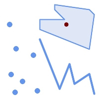 Point on surface of a |
SELECT ST_AsText(ST_PointOnSurface('POINT(0 5)'::geometry));
------------
POINT(0 5)
SELECT ST_AsText(ST_PointOnSurface('LINESTRING(0 5, 0 10)'::geometry));
------------
POINT(0 5)
SELECT ST_AsText(ST_PointOnSurface('POLYGON((0 0, 0 5, 5 5, 5 0, 0 0))'::geometry));
----------------
POINT(2.5 2.5)
SELECT ST_AsEWKT(ST_PointOnSurface(ST_GeomFromEWKT('LINESTRING(0 5 1, 0 0 1, 0 10 2)')));
----------------
POINT(0 0 1)
Example: The result of ST_PointOnSurface is guaranteed to lie within polygons, whereas the point computed by ST_Centroid may be outside.
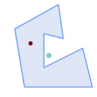
Red: point on surface; Green: centroid
SELECT ST_AsText(ST_PointOnSurface(geom)) AS pt_on_surf,
ST_AsText(ST_Centroid(geom)) AS centroid
FROM (SELECT 'POLYGON ((130 120, 120 190, 30 140, 50 20, 190 20,
170 100, 90 60, 90 130, 130 120))'::geometry AS geom) AS t;
pt_on_surf | centroid
-----------------+---------------------------------------------
POINT(62.5 110) | POINT(100.18264840182648 85.11415525114155)
Veja também
Name
ST_Polygonize — Computes a collection of polygons formed from the linework of a set of geometries.
Synopsis
geometry ST_Polygonize(geometry set geomfield);
geometry ST_Polygonize(geometry[] geom_array);
Descrição
Creates a GeometryCollection containing the polygons formed by the linework of a set of geometries. If the input linework does not form any polygons, an empty GeometryCollection is returned.
This function creates polygons covering all delimited areas. If the result is intended to form a valid polygonal geometry, use ST_BuildArea to prevent holes being filled.
| |
The input linework must be correctly noded for this function to work properly. To ensure input is noded use ST_Node on the input geometry before polygonizing. |
| |
GeometryCollections can be difficult to handle with external tools. Use ST_Dump to convert the polygonized result into separate polygons. |
Desempenhado pelo módulo GEOS.
Disponibilidade: 1.0.0RC1
Exemplos
 Input lines
|
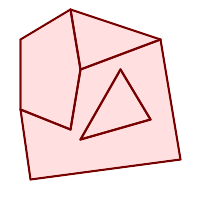 Polygonized result
|
WITH data(geom) AS (VALUES
('LINESTRING (180 40, 30 20, 20 90)'::geometry)
,('LINESTRING (180 40, 160 160)'::geometry)
,('LINESTRING (80 60, 120 130, 150 80)'::geometry)
,('LINESTRING (80 60, 150 80)'::geometry)
,('LINESTRING (20 90, 70 70, 80 130)'::geometry)
,('LINESTRING (80 130, 160 160)'::geometry)
,('LINESTRING (20 90, 20 160, 70 190)'::geometry)
,('LINESTRING (70 190, 80 130)'::geometry)
,('LINESTRING (70 190, 160 160)'::geometry)
)
SELECT ST_AsText( ST_Polygonize( geom ))
FROM data;
------------------------------------------------------------------------------------------
GEOMETRYCOLLECTION (POLYGON ((180 40, 30 20, 20 90, 70 70, 80 130, 160 160, 180 40), (150 80, 120 130, 80 60, 150 80)),
POLYGON ((20 90, 20 160, 70 190, 80 130, 70 70, 20 90)),
POLYGON ((160 160, 80 130, 70 190, 160 160)),
POLYGON ((80 60, 120 130, 150 80, 80 60)))
Polygonizing a table of linestrings:
SELECT ST_AsEWKT(ST_Polygonize(geom_4269)) As geomtextrep
FROM (SELECT geom_4269 FROM ma.suffolk_edges) As foo;
-------------------------------------
SRID=4269;GEOMETRYCOLLECTION(POLYGON((-71.040878 42.285678,-71.040943 42.2856,-71.04096 42.285752,-71.040878 42.285678)),
POLYGON((-71.17166 42.353675,-71.172026 42.354044,-71.17239 42.354358,-71.171794 42.354971,-71.170511 42.354855,
-71.17112 42.354238,-71.17166 42.353675)))
--Use ST_Dump to dump out the polygonize geoms into individual polygons
SELECT ST_AsEWKT((ST_Dump(t.polycoll)).geom) AS geomtextrep
FROM (SELECT ST_Polygonize(geom_4269) AS polycoll
FROM (SELECT geom_4269 FROM ma.suffolk_edges)
As foo) AS t;
------------------------
SRID=4269;POLYGON((-71.040878 42.285678,-71.040943 42.2856,-71.04096 42.285752,
-71.040878 42.285678))
SRID=4269;POLYGON((-71.17166 42.353675,-71.172026 42.354044,-71.17239 42.354358
,-71.171794 42.354971,-71.170511 42.354855,-71.17112 42.354238,-71.17166 42.353675))
Veja também
Name
ST_ReducePrecision — Returns a valid geometry with points rounded to a grid tolerance.
Synopsis
geometry ST_ReducePrecision(geometry g, float8 gridsize);
Descrição
Returns a valid geometry with all points rounded to the provided grid tolerance, and features below the tolerance removed.
Unlike ST_SnapToGrid the returned geometry will be valid, with no ring self-intersections or collapsed components.
Precision reduction can be used to:
match coordinate precision to the data accuracy
reduce the number of coordinates needed to represent a geometry
ensure valid geometry output to formats which use lower precision (e.g. text formats such as WKT, GeoJSON or KML when the number of output decimal places is limited).
export valid geometry to systems which use lower or limited precision (e.g. SDE, Oracle tolerance value)
Availability: 3.1.0.
Requires GEOS >= 3.9.0.
Exemplos
SELECT ST_AsText(ST_ReducePrecision('POINT(1.412 19.323)', 0.1));
st_astext
-----------------
POINT(1.4 19.3)
SELECT ST_AsText(ST_ReducePrecision('POINT(1.412 19.323)', 1.0));
st_astext
-------------
POINT(1 19)
SELECT ST_AsText(ST_ReducePrecision('POINT(1.412 19.323)', 10));
st_astext
-------------
POINT(0 20)
Precision reduction can reduce number of vertices
SELECT ST_AsText(ST_ReducePrecision('LINESTRING (10 10, 19.6 30.1, 20 30, 20.3 30, 40 40)', 1));
st_astext
-------------
LINESTRING (10 10, 20 30, 40 40)
Precision reduction splits polygons if needed to ensure validity
SELECT ST_AsText(ST_ReducePrecision('POLYGON ((10 10, 60 60.1, 70 30, 40 40, 50 10, 10 10))', 10));
st_astext
-------------
MULTIPOLYGON (((60 60, 70 30, 40 40, 60 60)), ((40 40, 50 10, 10 10, 40 40)))
Veja também
Name
ST_SharedPaths — Retorna uma coleção contendo caminhos compartilhados pelas duas linestrings/multilinestrings de entrada.
Synopsis
geometry ST_SharedPaths(geometry lineal1, geometry lineal2);
Descrição
Retorna uma coleção contendo caminhos compartilhados pelas duas geometrias de entrada. Aquelas indo na mesma direção estão no primeiro elemento da coleção, aquelas indo na direção oposta estão no segundo elemento. Os caminhos por si mesmos são dados na direção da primeira geometria.
Desempenhado pelo módulo GEOS.
Disponibilidade: 2.0.0
Exemplos: Encontrando caminhos compartilhados
 Uma multilinestring e uma linestring |
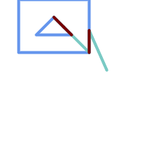 O caminho compartilhado de multilinestring e linestring revestido com as geometrias originais.
SELECT ST_AsText(
ST_SharedPaths(
ST_GeomFromText('MULTILINESTRING((26 125,26 200,126 200,126 125,26 125),
(51 150,101 150,76 175,51 150))'),
ST_GeomFromText('LINESTRING(151 100,126 156.25,126 125,90 161, 76 175)')
)
) As wkt
wkt
-------------------------------------------------------------
GEOMETRYCOLLECTION(MULTILINESTRING((126 156.25,126 125),
(101 150,90 161),(90 161,76 175)),MULTILINESTRING EMPTY)
|
same example but linestring orientation flipped
SELECT ST_AsText(
ST_SharedPaths(
ST_GeomFromText('LINESTRING(76 175,90 161,126 125,126 156.25,151 100)'),
ST_GeomFromText('MULTILINESTRING((26 125,26 200,126 200,126 125,26 125),
(51 150,101 150,76 175,51 150))')
)
) As wkt
wkt
-------------------------------------------------------------
GEOMETRYCOLLECTION(MULTILINESTRING EMPTY,
MULTILINESTRING((76 175,90 161),(90 161,101 150),(126 125,126 156.25)))
|
Veja também
Name
ST_Simplify — Returns a simplified representation of a geometry, using the Douglas-Peucker algorithm.
Synopsis
geometry ST_Simplify(geometry geom, float tolerance);
geometry ST_Simplify(geometry geom, float tolerance, boolean preserveCollapsed);
Descrição
Computes a simplified representation of a geometry using the Douglas-Peucker algorithm. The simplification tolerance is a distance value, in the units of the input SRS. Simplification removes vertices which are within the tolerance distance of the simplified linework. The result may not be valid even if the input is.
The function can be called with any kind of geometry (including GeometryCollections), but only line and polygon elements are simplified. Endpoints of linear geometry are preserved.
The preserveCollapsed flag retains small geometries that would otherwise be removed at the given tolerance. For example, if a 1m long line is simplified with a 10m tolerance, when preserveCollapsed is true the line will not disappear. This flag is useful for rendering purposes, to prevent very small features disappearing from a map.
| |
The returned geometry may lose its simplicity (see ST_IsSimple), topology may not be preserved, and polygonal results may be invalid (see ST_IsValid). Use ST_SimplifyPreserveTopology to preserve topology and ensure validity. |
| |
This function does not preserve boundaries shared between polygons. Use ST_CoverageSimplify if this is required. |
Disponibilidade: 1.2.2
Exemplos
Um círculo muito simplificado se torna um triângulo, médio um octágono,
SELECT ST_Npoints(geom) AS np_before,
ST_NPoints(ST_Simplify(geom, 0.1)) AS np01_notbadcircle,
ST_NPoints(ST_Simplify(geom, 0.5)) AS np05_notquitecircle,
ST_NPoints(ST_Simplify(geom, 1)) AS np1_octagon,
ST_NPoints(ST_Simplify(geom, 10)) AS np10_triangle,
(ST_Simplify(geom, 100) is null) AS np100_geometrygoesaway
FROM (SELECT ST_Buffer('POINT(1 3)', 10,12) As geom) AS t;
np_before | np01_notbadcircle | np05_notquitecircle | np1_octagon | np10_triangle | np100_geometrygoesaway
-----------+-------------------+---------------------+-------------+---------------+------------------------
49 | 33 | 17 | 9 | 4 | t
Simplifying a set of lines. Lines may intersect after simplification.
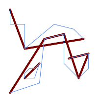
SELECT ST_Simplify(
'MULTILINESTRING ((20 180, 20 150, 50 150, 50 100, 110 150, 150 140, 170 120), (20 10, 80 30, 90 120), (90 120, 130 130), (130 130, 130 70, 160 40, 180 60, 180 90, 140 80), (50 40, 70 40, 80 70, 70 60, 60 60, 50 50, 50 40))',
40);
Simplifying a MultiPolygon. Polygonal results may be invalid.
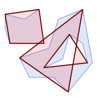
SELECT ST_Simplify(
'MULTIPOLYGON (((90 110, 80 180, 50 160, 10 170, 10 140, 20 110, 90 110)), ((40 80, 100 100, 120 160, 170 180, 190 70, 140 10, 110 40, 60 40, 40 80), (180 70, 170 110, 142.5 128.5, 128.5 77.5, 90 60, 180 70)))',
40);
Veja também
ST_IsSimple, ST_SimplifyPreserveTopology, ST_SimplifyVW, ST_CoverageSimplify, Topology ST_Simplify
Name
ST_SimplifyPreserveTopology — Returns a simplified and valid representation of a geometry, using the Douglas-Peucker algorithm.
Synopsis
geometry ST_SimplifyPreserveTopology(geometry geom, float tolerance);
Descrição
Computes a simplified representation of a geometry using a variant of the Douglas-Peucker algorithm which limits simplification to ensure the result has the same topology as the input. The simplification tolerance is a distance value, in the units of the input SRS. Simplification removes vertices which are within the tolerance distance of the simplified linework, as long as topology is preserved. The result will be valid and simple if the input is.
The function can be called with any kind of geometry (including GeometryCollections), but only line and polygon elements are simplified. For polygonal inputs, the result will have the same number of rings (shells and holes), and the rings will not cross. Ring endpoints may be simplified. For linear inputs, the result will have the same number of lines, and lines will not intersect if they did not do so in the original geometry. Endpoints of linear geometry are preserved.
| |
This function does not preserve boundaries shared between polygons. Use ST_CoverageSimplify if this is required. |
Desempenhado pelo módulo GEOS.
Disponibilidade: 1.3.3
Exemplos
For the same example as ST_Simplify, ST_SimplifyPreserveTopology prevents oversimplification. The circle can at most become a square.
SELECT ST_Npoints(geom) AS np_before,
ST_NPoints(ST_SimplifyPreserveTopology(geom, 0.1)) AS np01_notbadcircle,
ST_NPoints(ST_SimplifyPreserveTopology(geom, 0.5)) AS np05_notquitecircle,
ST_NPoints(ST_SimplifyPreserveTopology(geom, 1)) AS np1_octagon,
ST_NPoints(ST_SimplifyPreserveTopology(geom, 10)) AS np10_square,
ST_NPoints(ST_SimplifyPreserveTopology(geom, 100)) AS np100_stillsquare
FROM (SELECT ST_Buffer('POINT(1 3)', 10,12) AS geom) AS t;
np_before | np01_notbadcircle | np05_notquitecircle | np1_octagon | np10_square | np100_stillsquare
-----------+-------------------+---------------------+-------------+-------------+-------------------
49 | 33 | 17 | 9 | 5 | 5
Simplifying a set of lines, preserving topology of non-intersecting lines.
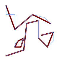
SELECT ST_SimplifyPreserveTopology(
'MULTILINESTRING ((20 180, 20 150, 50 150, 50 100, 110 150, 150 140, 170 120), (20 10, 80 30, 90 120), (90 120, 130 130), (130 130, 130 70, 160 40, 180 60, 180 90, 140 80), (50 40, 70 40, 80 70, 70 60, 60 60, 50 50, 50 40))',
40);
Simplifying a MultiPolygon, preserving topology of shells and holes.
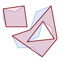
SELECT ST_SimplifyPreserveTopology(
'MULTIPOLYGON (((90 110, 80 180, 50 160, 10 170, 10 140, 20 110, 90 110)), ((40 80, 100 100, 120 160, 170 180, 190 70, 140 10, 110 40, 60 40, 40 80), (180 70, 170 110, 142.5 128.5, 128.5 77.5, 90 60, 180 70)))',
40);
Veja também
Name
ST_SimplifyPolygonHull — Computes a simplified topology-preserving outer or inner hull of a polygonal geometry.
Synopsis
geometry ST_SimplifyPolygonHull(geometry param_geom, float vertex_fraction, boolean is_outer = true);
Descrição
Computes a simplified topology-preserving outer or inner hull of a polygonal geometry. An outer hull completely covers the input geometry. An inner hull is completely covered by the input geometry. The result is a polygonal geometry formed by a subset of the input vertices. MultiPolygons and holes are handled and produce a result with the same structure as the input.
The reduction in vertex count is controlled by the vertex_fraction parameter, which is a number in the range 0 to 1. Lower values produce simpler results, with smaller vertex count and less concaveness. For both outer and inner hulls a vertex fraction of 1.0 produces the original geometry. For outer hulls a value of 0.0 produces the convex hull (for a single polygon); for inner hulls it produces a triangle.
The simplification process operates by progressively removing concave corners that contain the least amount of area, until the vertex count target is reached. It prevents edges from crossing, so the result is always a valid polygonal geometry.
To get better results with geometries that contain relatively long line segments, it might be necessary to "segmentize" the input, as shown below.
Desempenhado pelo módulo GEOS.
Availability: 3.3.0.
Requires GEOS >= 3.11.0.
Exemplos
Outer hull of a Polygon
SELECT ST_SimplifyPolygonHull(
'POLYGON ((131 158, 136 163, 161 165, 173 156, 179 148, 169 140, 186 144, 190 137, 185 131, 174 128, 174 124, 166 119, 158 121, 158 115, 165 107, 161 97, 166 88, 166 79, 158 57, 145 57, 112 53, 111 47, 93 43, 90 48, 88 40, 80 39, 68 32, 51 33, 40 31, 39 34, 49 38, 34 38, 25 34, 28 39, 36 40, 44 46, 24 41, 17 41, 14 46, 19 50, 33 54, 21 55, 13 52, 11 57, 22 60, 34 59, 41 68, 75 72, 62 77, 56 70, 46 72, 31 69, 46 76, 52 82, 47 84, 56 90, 66 90, 64 94, 56 91, 33 97, 36 100, 23 100, 22 107, 29 106, 31 112, 46 116, 36 118, 28 131, 53 132, 59 127, 62 131, 76 130, 80 135, 89 137, 87 143, 73 145, 80 150, 88 150, 85 157, 99 162, 116 158, 115 165, 123 165, 122 170, 134 164, 131 158))',
0.3);
Inner hull of a Polygon
SELECT ST_SimplifyPolygonHull(
'POLYGON ((131 158, 136 163, 161 165, 173 156, 179 148, 169 140, 186 144, 190 137, 185 131, 174 128, 174 124, 166 119, 158 121, 158 115, 165 107, 161 97, 166 88, 166 79, 158 57, 145 57, 112 53, 111 47, 93 43, 90 48, 88 40, 80 39, 68 32, 51 33, 40 31, 39 34, 49 38, 34 38, 25 34, 28 39, 36 40, 44 46, 24 41, 17 41, 14 46, 19 50, 33 54, 21 55, 13 52, 11 57, 22 60, 34 59, 41 68, 75 72, 62 77, 56 70, 46 72, 31 69, 46 76, 52 82, 47 84, 56 90, 66 90, 64 94, 56 91, 33 97, 36 100, 23 100, 22 107, 29 106, 31 112, 46 116, 36 118, 28 131, 53 132, 59 127, 62 131, 76 130, 80 135, 89 137, 87 143, 73 145, 80 150, 88 150, 85 157, 99 162, 116 158, 115 165, 123 165, 122 170, 134 164, 131 158))',
0.3, false);
Outer hull simplification of a MultiPolygon, with segmentization
SELECT ST_SimplifyPolygonHull(
ST_Segmentize(ST_Letters('xt'), 2.0),
0.1);
Veja também
Name
ST_SimplifyVW — Returns a simplified representation of a geometry, using the Visvalingam-Whyatt algorithm
Synopsis
geometry ST_SimplifyVW(geometry geom, float tolerance);
Descrição
Returns a simplified representation of a geometry using the Visvalingam-Whyatt algorithm. The simplification tolerance is an area value, in the units of the input SRS. Simplification removes vertices which form "corners" with area less than the tolerance. The result may not be valid even if the input is.
The function can be called with any kind of geometry (including GeometryCollections), but only line and polygon elements are simplified. Endpoints of linear geometry are preserved.
| |
The returned geometry may lose its simplicity (see ST_IsSimple), topology may not be preserved, and polygonal results may be invalid (see ST_IsValid). Use ST_SimplifyPreserveTopology to preserve topology and ensure validity. ST_CoverageSimplify also preserves topology and validity. |
| |
This function does not preserve boundaries shared between polygons. Use ST_CoverageSimplify if this is required. |
| |
Esta função lida com 3D e a terceira dimensão afetará o resultado. |
Disponibilidade: 2.2.0
Exemplos
A LineString is simplified with a minimum-area tolerance of 30.
SELECT ST_AsText(ST_SimplifyVW(geom,30)) simplified FROM (SELECT 'LINESTRING(5 2, 3 8, 6 20, 7 25, 10 10)'::geometry AS geom) AS t; simplified ------------------------------ LINESTRING(5 2,7 25,10 10)
Simplifying a line.
SELECT ST_SimplifyVW(
'LINESTRING (10 10, 50 40, 30 70, 50 60, 70 80, 50 110, 100 100, 90 140, 100 180, 150 170, 170 140, 190 90, 180 40, 110 40, 150 20)',
1600);
Simplifying a polygon.
SELECT ST_SimplifyVW(
'MULTIPOLYGON (((90 110, 80 180, 50 160, 10 170, 10 140, 20 110, 90 110)), ((40 80, 100 100, 120 160, 170 180, 190 70, 140 10, 110 40, 60 40, 40 80), (180 70, 170 110, 142.5 128.5, 128.5 77.5, 90 60, 180 70)))',
40);
Veja também
ST_SetEffectiveArea, ST_Simplify, ST_SimplifyPreserveTopology, ST_CoverageSimplify, Topology ST_Simplify
Name
ST_SetEffectiveArea — Sets the effective area for each vertex, using the Visvalingam-Whyatt algorithm.
Synopsis
geometry ST_SetEffectiveArea(geometry geom, float threshold = 0, integer set_area = 1);
Descrição
Define a área eficaz para cada vértice, usando o algorítimo Visvalingam-Whyatt. A área efetiva é armazenada como o valor-M do vértice. Se o parâmetro opcional "limiar" for usado, uma geometria simplificada vai retornar, contendo somente vértices com uma área efetiva maior ou igual ao valor limiar.
Esta função pode ser usada para simplificação do lado do servidor quando uma limiar estiver especificada. Outra opção é usar um valor limiar de zero. Neste caso, a geometria completa retornará com áreas eficazes como valores-M, que podem ser usados pelo cliente para simplifica rapidamente.
Só irá fazer algo com (multi)lines, (multi)polígonos e multipontos, mas você pode usar com qualquer tipo de geometria. Já que ocorre a simplificação em uma base objeto por objeto, você também pode alimentar uma GeometryCollection para esta função.
| |
Note que a geometria retornada pode perder sua simplicidade (veja ST_IsSimple) |
| |
Note que a topologia pode não ser preservada e resultar em geometrias inválidas. Use (veja ST_SimplifyPreserveTopology) para preservar a topologia. |
| |
A geometria de saída perderá todas as informações prévias nos valores-M |
| |
Esta função lida com 3D e a terceira dimensão afetará a área eficaz. |
Disponibilidade: 2.2.0
Exemplos
Calculando a área eficaz de uma LineString. Devido ao uso de um valor limiar zero, todos os vértices na geometria de entrada são retornados.
select ST_AsText(ST_SetEffectiveArea(geom)) all_pts, ST_AsText(ST_SetEffectiveArea(geom,30) ) thrshld_30
FROM (SELECT 'LINESTRING(5 2, 3 8, 6 20, 7 25, 10 10)'::geometry geom) As foo;
-result
all_pts | thrshld_30
-----------+-------------------+
LINESTRING M (5 2 3.40282346638529e+38,3 8 29,6 20 1.5,7 25 49.5,10 10 3.40282346638529e+38) | LINESTRING M (5 2 3.40282346638529e+38,7 25 49.5,10 10 3.40282346638529e+38)
Veja também
Name
ST_TriangulatePolygon — Computes the constrained Delaunay triangulation of polygons
Synopsis
geometry ST_TriangulatePolygon(geometry geom);
Descrição
Computes the constrained Delaunay triangulation of polygons. Holes and Multipolygons are supported.
The "constrained Delaunay triangulation" of a polygon is a set of triangles formed from the vertices of the polygon, and covering it exactly, with the maximum total interior angle over all possible triangulations. It provides the "best quality" triangulation of the polygon.
Availability: 3.3.0.
Requires GEOS >= 3.11.0.
Exemplo
Triangulation of a square.
SELECT ST_AsText(
ST_TriangulatePolygon('POLYGON((0 0, 0 1, 1 1, 1 0, 0 0))'));
st_astext
---------------------------------------------------------------------------
GEOMETRYCOLLECTION(POLYGON((0 0,0 1,1 1,0 0)),POLYGON((1 1,1 0,0 0,1 1)))
Exemplo
Triangulation of the letter P.
SELECT ST_AsText(ST_TriangulatePolygon(
'POLYGON ((26 17, 31 19, 34 21, 37 24, 38 29, 39 43, 39 161, 38 172, 36 176, 34 179, 30 181, 25 183, 10 185, 10 190, 100 190, 121 189, 139 187, 154 182, 167 177, 177 169, 184 161, 189 152, 190 141, 188 128, 186 123, 184 117, 180 113, 176 108, 170 104, 164 101, 151 96, 136 92, 119 89, 100 89, 86 89, 73 89, 73 39, 74 32, 75 27, 77 23, 79 20, 83 18, 89 17, 106 15, 106 10, 10 10, 10 15, 26 17), (152 147, 151 152, 149 157, 146 162, 142 166, 137 169, 132 172, 126 175, 118 177, 109 179, 99 180, 89 180, 80 179, 76 178, 74 176, 73 171, 73 100, 85 99, 91 99, 102 99, 112 100, 121 102, 128 104, 134 107, 139 110, 143 114, 147 118, 149 123, 151 128, 153 141, 152 147))'
));
Polygon Triangulation
Same example as ST_Tesselate
SELECT ST_TriangulatePolygon(
'POLYGON (( 10 190, 10 70, 80 70, 80 130, 50 160, 120 160, 120 190, 10 190 ))'::geometry
);ST_AsText output
GEOMETRYCOLLECTION(POLYGON((50 160,120 190,120 160,50 160))
,POLYGON((10 70,80 130,80 70,10 70))
,POLYGON((50 160,10 70,10 190,50 160))
,POLYGON((120 190,50 160,10 190,120 190))
,POLYGON((80 130,10 70,50 160,80 130)))
 Polígono original |
 Triangulated Polygon |
Name
ST_VoronoiLines — Returns the boundaries of the Voronoi diagram of the vertices of a geometry.
Synopsis
geometry ST_VoronoiLines( geometry geom , float8 tolerance = 0.0 , geometry extend_to = NULL );
Descrição
Computes a two-dimensional Voronoi diagram from the vertices of the supplied geometry and returns the boundaries between cells in the diagram as a MultiLineString. Returns null if input geometry is null. Returns an empty geometry collection if the input geometry contains only one vertex. Returns an empty geometry collection if the extend_to envelope has zero area.
Parâmetros opcionais:
tolerance: The distance within which vertices will be considered equivalent. Robustness of the algorithm can be improved by supplying a nonzero tolerance distance. (default = 0.0)extend_to: If present, the diagram is extended to cover the envelope of the supplied geometry, unless smaller than the default envelope (default = NULL, default envelope is the bounding box of the input expanded by about 50%).
Desempenhado pelo módulo GEOS.
Disponibilidade: 2.3.0
Exemplos
Voronoi diagram lines, with tolerance of 30 units
SELECT ST_VoronoiLines(
'MULTIPOINT (50 30, 60 30, 100 100,10 150, 110 120)'::geometry,
30) AS geom;
ST_AsText output
MULTILINESTRING((135.555555555556 270,36.8181818181818 92.2727272727273),(36.8181818181818 92.2727272727273,-110 43.3333333333333),(230 -45.7142857142858,36.8181818181818 92.2727272727273))
Veja também
Name
ST_VoronoiPolygons — Returns the cells of the Voronoi diagram of the vertices of a geometry.
Synopsis
geometry ST_VoronoiPolygons( geometry geom , float8 tolerance = 0.0 , geometry extend_to = NULL );
Descrição
Computes a two-dimensional Voronoi diagram from the vertices of the supplied geometry. The result is a GEOMETRYCOLLECTION of POLYGONs that covers an envelope larger than the extent of the input vertices. Returns null if input geometry is null. Returns an empty geometry collection if the input geometry contains only one vertex. Returns an empty geometry collection if the extend_to envelope has zero area.
Parâmetros opcionais:
tolerance: The distance within which vertices will be considered equivalent. Robustness of the algorithm can be improved by supplying a nonzero tolerance distance. (default = 0.0)extend_to: If present, the diagram is extended to cover the envelope of the supplied geometry, unless smaller than the default envelope (default = NULL, default envelope is the bounding box of the input expanded by about 50%).
Desempenhado pelo módulo GEOS.
Disponibilidade: 2.3.0
Exemplos
Points overlaid on top of Voronoi diagram
SELECT ST_VoronoiPolygons(
'MULTIPOINT (50 30, 60 30, 100 100,10 150, 110 120)'::geometry
) AS geom;
ST_AsText output
GEOMETRYCOLLECTION(POLYGON((-110 43.3333333333333,-110 270,100.5 270,59.3478260869565 132.826086956522,36.8181818181818 92.2727272727273,-110 43.3333333333333)),
POLYGON((55 -90,-110 -90,-110 43.3333333333333,36.8181818181818 92.2727272727273,55 79.2857142857143,55 -90)),
POLYGON((230 47.5,230 -20.7142857142857,55 79.2857142857143,36.8181818181818 92.2727272727273,59.3478260869565 132.826086956522,230 47.5)),POLYGON((230 -20.7142857142857,230 -90,55 -90,55 79.2857142857143,230 -20.7142857142857)),
POLYGON((100.5 270,230 270,230 47.5,59.3478260869565 132.826086956522,100.5 270)))
Voronoi diagram, with tolerance of 30 units
SELECT ST_VoronoiPolygons(
'MULTIPOINT (50 30, 60 30, 100 100,10 150, 110 120)'::geometry,
30) AS geom;
ST_AsText output
GEOMETRYCOLLECTION(POLYGON((-110 43.3333333333333,-110 270,100.5 270,59.3478260869565 132.826086956522,36.8181818181818 92.2727272727273,-110 43.3333333333333)),
POLYGON((230 47.5,230 -45.7142857142858,36.8181818181818 92.2727272727273,59.3478260869565 132.826086956522,230 47.5)),POLYGON((230 -45.7142857142858,230 -90,-110 -90,-110 43.3333333333333,36.8181818181818 92.2727272727273,230 -45.7142857142858)),
POLYGON((100.5 270,230 270,230 47.5,59.3478260869565 132.826086956522,100.5 270)))
Veja também
7.15. Coverages
These functions operate on sets of polygonal geometry that form "implicit coverages". To form a valid coverage polygons must not overlap, and the vertices of adjacent edges must match exactly. Coverages are fast to process, and can be operated on with window functions, which retain the coverage topology inside the window partition while altering the edges.
- ST_CoverageInvalidEdges — Window function that finds locations where polygons fail to form a valid coverage.
- ST_CoverageClean — Computes a clean (edge matched, non-overlapping, gap-cleared) polygonal coverage, given a non-clean input.
- ST_CoverageSimplify — Window function that simplifies the edges of a polygonal coverage.
- ST_CoverageUnion — Computes the union of a set of polygons forming a coverage by removing shared edges.
Name
ST_CoverageInvalidEdges — Window function that finds locations where polygons fail to form a valid coverage.
Synopsis
geometry ST_CoverageInvalidEdges(geometry winset geom, float8 tolerance = 0);
Descrição
A window function which checks if the polygons in the window partition form a valid polygonal coverage. It returns linear indicators showing the location of invalid edges (if any) in each polygon.
A set of valid polygons is a valid coverage if the following conditions hold:
Non-overlapping - polygons do not overlap (their interiors do not intersect)
Edge-Matched - vertices along shared edges are identical
As a window function a value is returned for every input polygon. For polygons which violate one or more of the validity conditions the return value is a MULTILINESTRING containing the problematic edges. Coverage-valid polygons return the value NULL. Non-polygonal or empty geometries also produce NULL values.
The conditions allow a valid coverage to contain holes (gaps between polygons), as long as the surrounding polygons are edge-matched. However, very narrow gaps are often undesirable. If the tolerance parameter is specified with a non-zero distance, edges forming narrower gaps will also be returned as invalid.
The polygons being checked for coverage validity must also be valid geometries. This can be checked with ST_IsValid.
Availability: 3.4.0
Requires GEOS >= 3.12.0
Exemplos
Invalid edges caused by overlap and non-matching vertices
WITH coverage(id, geom) AS (VALUES
(1, 'POLYGON ((10 190, 30 160, 40 110, 100 70, 120 10, 10 10, 10 190))'::geometry),
(2, 'POLYGON ((100 190, 10 190, 30 160, 40 110, 50 80, 74 110.5, 100 130, 140 120, 140 160, 100 190))'::geometry),
(3, 'POLYGON ((140 190, 190 190, 190 80, 140 80, 140 190))'::geometry),
(4, 'POLYGON ((180 40, 120 10, 100 70, 140 80, 190 80, 180 40))'::geometry)
)
SELECT id, ST_AsText(ST_CoverageInvalidEdges(geom) OVER ())
FROM coverage;
id | st_astext
----+---------------------------------------
1 | LINESTRING (40 110, 100 70)
2 | MULTILINESTRING ((100 130, 140 120, 140 160, 100 190), (40 110, 50 80, 74 110.5))
3 | LINESTRING (140 80, 140 190)
4 | null
-- Test entire table for coverage validity
SELECT true = ALL (
SELECT ST_CoverageInvalidEdges(geom) OVER () IS NULL
FROM coverage
);
Veja também
ST_IsValid, ST_CoverageUnion, ST_CoverageClean, ST_CoverageSimplify
Name
ST_CoverageClean — Computes a clean (edge matched, non-overlapping, gap-cleared) polygonal coverage, given a non-clean input.
Synopsis
geometry ST_CoverageClean(geometry winset geom, float8 gapMaximumWidth = 0, float8 snappingDistance = -1, text overlapMergeStrategy = 'MERGE_LONGEST_BORDER');
Descrição
A window function which adjusts the edges of a set of valid polygonal geometries to produce a clean coverage. Cleaning involves:
snapping vertices and edges to remove small discrepancies and ensure common edges are identically noded
merging overlaps into a parent polygon
merging narrow gaps into adjacent polygons
gapMaximumWidth controls which gaps between polygons are merged. Gaps with width <= this distance are merged into an adjacent polygon.
snappingDistance controls snapping of vertices and edges. The default (-1) automatically determines a snapping distance based on the input extent. Set to 0.0 to turn off snapping.
overlapMergeStrategy specifies how overlaps are merged into a parent polygon:
MERGE_LONGEST_BORDER- merges into polygon with longest common borderMERGE_MAX_AREA- merges into polygon with maximum areaMERGE_MIN_AREA- merges into polygon with minimum areaMERGE_MIN_INDEX- merges into polygon with smallest input index (defined by order of input polygons)
The result is a clean polygonal coverage that will pass validation by ST_CoverageInvalidEdges and can be input to coverage processing functions.
| |
To aid in determining a maximum gap width, gaps can be computed by cleaning with |
Availability: 3.6.0 - requires GEOS >= 3.14.0
Exemplos
-- Populate input table CREATE TABLE example AS SELECT * FROM (VALUES (1, 'POLYGON ((10 190, 30 160, 27 134.5, 40 110, 122 47, 120 10, 10 10, 10 190))'::geometry), (2, 'POLYGON ((150 190, 10 190, 30 160, 50 140, 40 110, 50 80, 130 70, 135 111, 140 130, 140 160, 150 190))'::geometry), (3, 'POLYGON ((140 190, 190 190, 190 80, 140 80, 140 190))'::geometry), (4, 'POLYGON ((190 10, 120 10, 97 77, 160 90, 170 70, 190 80, 190 10))'::geometry) ) AS v(id, geom);
Polygons with overlaps and gaps
-- Show it is an invalid coverage SELECT ST_AsText(ST_CoverageInvalidEdges(geom) OVER ()) FROM example;
Invalid coverage edges
-- Clean the coverage, merging gaps with width <= 1 CREATE TABLE example_clean AS SELECT id, ST_CoverageClean(geom, 1) OVER () AS GEOM FROM example;
Clean polygonal coverage, with overlaps and narrow gaps removed
Name
ST_CoverageSimplify — Window function that simplifies the edges of a polygonal coverage.
Synopsis
geometry ST_CoverageSimplify(geometry winset geom, float8 tolerance, boolean simplifyBoundary = true);
Descrição
A window function which simplifies the edges of polygons in a polygonal coverage. The simplification preserves the coverage topology. This means the simplified output polygons are consistent along shared edges, and still form a valid coverage.
The simplification uses a variant of the Visvalingam–Whyatt algorithm. The tolerance parameter has units of distance, and is roughly equal to the square root of triangular areas to be simplified.
To simplify only the "internal" edges of the coverage (those that are shared by two polygons) set the simplifyBoundary parameter to false.
| |
If the input is not a valid coverage there may be unexpected artifacts in the output (such as boundary intersections, or separated boundaries which appeared to be shared). Use ST_CoverageInvalidEdges to determine if a coverage is valid. |
Availability: 3.4.0
Requires GEOS >= 3.12.0
Exemplos
 Input coverage
|
 Simplified coverage
|
WITH coverage(id, geom) AS (VALUES
(1, 'POLYGON ((160 150, 110 130, 90 100, 90 70, 60 60, 50 10, 30 30, 40 50, 25 40, 10 60, 30 100, 30 120, 20 170, 60 180, 90 190, 130 180, 130 160, 160 150), (40 160, 50 140, 66 125, 60 100, 80 140, 90 170, 60 160, 40 160))'::geometry),
(2, 'POLYGON ((40 160, 60 160, 90 170, 80 140, 60 100, 66 125, 50 140, 40 160))'::geometry),
(3, 'POLYGON ((110 130, 160 50, 140 50, 120 33, 90 30, 50 10, 60 60, 90 70, 90 100, 110 130))'::geometry),
(4, 'POLYGON ((160 150, 150 120, 160 90, 160 50, 110 130, 160 150))'::geometry)
)
SELECT id, ST_AsText(ST_CoverageSimplify(geom, 30) OVER ())
FROM coverage;
id | st_astext
----+---------------------------------------
1 | POLYGON ((160 150, 110 130, 50 10, 10 60, 20 170, 90 190, 160 150), (40 160, 66 125, 90 170, 40 160))
2 | POLYGON ((40 160, 66 125, 90 170, 40 160))
3 | POLYGON ((110 130, 160 50, 50 10, 110 130))
4 | POLYGON ((160 150, 160 50, 110 130, 160 150))
Veja também
Name
ST_CoverageUnion — Computes the union of a set of polygons forming a coverage by removing shared edges.
Synopsis
geometry ST_CoverageUnion(geometry set geom);
Descrição
An aggregate function which unions a set of polygons forming a polygonal coverage. The result is a polygonal geometry covering the same area as the coverage. This function produces the same result as ST_Union, but uses the coverage structure to compute the union much faster.
| |
If the input is not a valid coverage there may be unexpected artifacts in the output (such as unmerged or overlapping polygons). Use ST_CoverageInvalidEdges to determine if a coverage is valid. |
Availability: 3.4.0 - requires GEOS >= 3.8.0
Exemplos
 Input coverage
|
 Union result
|
WITH coverage(id, geom) AS (VALUES
(1, 'POLYGON ((10 10, 10 150, 80 190, 110 150, 90 110, 40 110, 50 60, 10 10))'::geometry),
(2, 'POLYGON ((120 10, 10 10, 50 60, 100 70, 120 10))'::geometry),
(3, 'POLYGON ((140 80, 120 10, 100 70, 40 110, 90 110, 110 150, 140 80))'::geometry),
(4, 'POLYGON ((140 190, 120 170, 140 130, 160 150, 140 190))'::geometry),
(5, 'POLYGON ((180 160, 170 140, 140 130, 160 150, 140 190, 180 160))'::geometry)
)
SELECT ST_AsText(ST_CoverageUnion(geom))
FROM coverage;
--------------------------------------
MULTIPOLYGON (((10 150, 80 190, 110 150, 140 80, 120 10, 10 10, 10 150), (50 60, 100 70, 40 110, 50 60)), ((120 170, 140 190, 180 160, 170 140, 140 130, 120 170)))
Veja também
ST_CoverageInvalidEdges, ST_CoverageSimplify, ST_CoverageClean, ST_Union
7.16. Affine Transformations
These functions change the position and shape of geometries using affine transformations.
- ST_Affine — Apply a 3D affine transformation to a geometry.
- ST_Rotate — Rotates a geometry about an origin point.
- ST_RotateX — Rotates a geometry about the X axis.
- ST_RotateY — Rotates a geometry about the Y axis.
- ST_RotateZ — Rotates a geometry about the Z axis.
- ST_Scale — Scales a geometry by given factors.
- ST_Translate — Translates a geometry by given offsets.
- ST_TransScale — Translates and scales a geometry by given offsets and factors.
Name
ST_Affine — Apply a 3D affine transformation to a geometry.
Synopsis
geometry ST_Affine(geometry geomA, float a, float b, float c, float d, float e, float f, float g, float h, float i, float xoff, float yoff, float zoff);
geometry ST_Affine(geometry geomA, float a, float b, float d, float e, float xoff, float yoff);
Descrição
Applies a 3D affine transformation to the geometry to do things like translate, rotate, scale in one step.
Version 1: The call
ST_Affine(geom, a, b, c, d, e, f, g, h, i, xoff, yoff, zoff)
represents the transformation matrix
/ a b c xoff \ | d e f yoff | | g h i zoff | \ 0 0 0 1 /
and the vertices are transformed as follows:
x' = a*x + b*y + c*z + xoff y' = d*x + e*y + f*z + yoff z' = g*x + h*y + i*z + zoff
All of the translate / scale functions below are expressed via such an affine transformation.
Version 2: Applies a 2d affine transformation to the geometry. The call
ST_Affine(geom, a, b, d, e, xoff, yoff)
represents the transformation matrix
/ a b 0 xoff \ / a b xoff \ | d e 0 yoff | rsp. | d e yoff | | 0 0 1 0 | \ 0 0 1 / \ 0 0 0 1 /
and the vertices are transformed as follows:
x' = a*x + b*y + xoff y' = d*x + e*y + yoff z' = z
This method is a subcase of the 3D method above.
Melhorias: 2.0.0 suporte para superfícies poliédricas, triângulos e TIN introduzido.
Availability: 1.1.2. Name changed from Affine to ST_Affine in 1.2.2
| |
Anteriores a 1.3.4, essa função falha se usada com geometrias que contêm CURVAS. Isso é consertado em 1.3.4+ |
This function supports Polyhedral surfaces.
This function supports Triangles and Triangulated Irregular Network Surfaces (TIN).
This function supports 3d and will not drop the z-index.
This method supports Circular Strings and Curves.
Exemplos
--Rotate a 3d line 180 degrees about the z axis. Note this is long-hand for doing ST_Rotate();
SELECT ST_AsEWKT(ST_Affine(geom, cos(pi()), -sin(pi()), 0, sin(pi()), cos(pi()), 0, 0, 0, 1, 0, 0, 0)) As using_affine,
ST_AsEWKT(ST_Rotate(geom, pi())) As using_rotate
FROM (SELECT ST_GeomFromEWKT('LINESTRING(1 2 3, 1 4 3)') As geom) As foo;
using_affine | using_rotate
-----------------------------+-----------------------------
LINESTRING(-1 -2 3,-1 -4 3) | LINESTRING(-1 -2 3,-1 -4 3)
(1 row)
--Rotate a 3d line 180 degrees in both the x and z axis
SELECT ST_AsEWKT(ST_Affine(geom, cos(pi()), -sin(pi()), 0, sin(pi()), cos(pi()), -sin(pi()), 0, sin(pi()), cos(pi()), 0, 0, 0))
FROM (SELECT ST_GeomFromEWKT('LINESTRING(1 2 3, 1 4 3)') As geom) As foo;
st_asewkt
-------------------------------
LINESTRING(-1 -2 -3,-1 -4 -3)
(1 row)
Veja também
Name
ST_Rotate — Rotates a geometry about an origin point.
Synopsis
geometry ST_Rotate(geometry geomA, float rotRadians);
geometry ST_Rotate(geometry geomA, float rotRadians, float x0, float y0);
geometry ST_Rotate(geometry geomA, float rotRadians, geometry pointOrigin);
Descrição
Rotates geometry rotRadians counter-clockwise about the origin point. The rotation origin can be specified either as a POINT geometry, or as x and y coordinates. If the origin is not specified, the geometry is rotated about POINT(0 0).
Melhorias: 2.0.0 suporte para superfícies poliédricas, triângulos e TIN introduzido.
Enhanced: 2.0.0 additional parameters for specifying the origin of rotation were added.
Availability: 1.1.2. Name changed from Rotate to ST_Rotate in 1.2.2
This function supports 3d and will not drop the z-index.
This method supports Circular Strings and Curves.
This function supports Polyhedral surfaces.
This function supports Triangles and Triangulated Irregular Network Surfaces (TIN).
Exemplos
--Rotate 180 degrees
SELECT ST_AsEWKT(ST_Rotate('LINESTRING (50 160, 50 50, 100 50)', pi()));
st_asewkt
---------------------------------------
LINESTRING(-50 -160,-50 -50,-100 -50)
(1 row)
--Rotate 30 degrees counter-clockwise at x=50, y=160
SELECT ST_AsEWKT(ST_Rotate('LINESTRING (50 160, 50 50, 100 50)', pi()/6, 50, 160));
st_asewkt
---------------------------------------------------------------------------
LINESTRING(50 160,105 64.7372055837117,148.301270189222 89.7372055837117)
(1 row)
--Rotate 60 degrees clockwise from centroid
SELECT ST_AsEWKT(ST_Rotate(geom, -pi()/3, ST_Centroid(geom)))
FROM (SELECT 'LINESTRING (50 160, 50 50, 100 50)'::geometry AS geom) AS foo;
st_asewkt
--------------------------------------------------------------
LINESTRING(116.4225 130.6721,21.1597 75.6721,46.1597 32.3708)
(1 row)
Veja também
Name
ST_RotateX — Rotates a geometry about the X axis.
Synopsis
geometry ST_RotateX(geometry geomA, float rotRadians);
Descrição
Rotates a geometry geomA - rotRadians about the X axis.
| |
|
Melhorias: 2.0.0 suporte para superfícies poliédricas, triângulos e TIN introduzido.
Availability: 1.1.2. Name changed from RotateX to ST_RotateX in 1.2.2
This function supports Polyhedral surfaces.
This function supports 3d and will not drop the z-index.
This function supports Triangles and Triangulated Irregular Network Surfaces (TIN).
Exemplos
--Rotate a line 90 degrees along x-axis
SELECT ST_AsEWKT(ST_RotateX(ST_GeomFromEWKT('LINESTRING(1 2 3, 1 1 1)'), pi()/2));
st_asewkt
---------------------------
LINESTRING(1 -3 2,1 -1 1)
Veja também
Name
ST_RotateY — Rotates a geometry about the Y axis.
Synopsis
geometry ST_RotateY(geometry geomA, float rotRadians);
Descrição
Rotates a geometry geomA - rotRadians about the y axis.
| |
|
Availability: 1.1.2. Name changed from RotateY to ST_RotateY in 1.2.2
Melhorias: 2.0.0 suporte para superfícies poliédricas, triângulos e TIN introduzido.
This function supports Polyhedral surfaces.
This function supports 3d and will not drop the z-index.
This function supports Triangles and Triangulated Irregular Network Surfaces (TIN).
Exemplos
--Rotate a line 90 degrees along y-axis
SELECT ST_AsEWKT(ST_RotateY(ST_GeomFromEWKT('LINESTRING(1 2 3, 1 1 1)'), pi()/2));
st_asewkt
---------------------------
LINESTRING(3 2 -1,1 1 -1)
Veja também
Name
ST_RotateZ — Rotates a geometry about the Z axis.
Synopsis
geometry ST_RotateZ(geometry geomA, float rotRadians);
Descrição
Rotates a geometry geomA - rotRadians about the Z axis.
| |
This is a synonym for ST_Rotate |
| |
|
Melhorias: 2.0.0 suporte para superfícies poliédricas, triângulos e TIN introduzido.
Availability: 1.1.2. Name changed from RotateZ to ST_RotateZ in 1.2.2
| |
Anteriores a 1.3.4, essa função falha se usada com geometrias que contêm CURVAS. Isso é consertado em 1.3.4+ |
This function supports 3d and will not drop the z-index.
This method supports Circular Strings and Curves.
This function supports Polyhedral surfaces.
This function supports Triangles and Triangulated Irregular Network Surfaces (TIN).
Exemplos
--Rotate a line 90 degrees along z-axis
SELECT ST_AsEWKT(ST_RotateZ(ST_GeomFromEWKT('LINESTRING(1 2 3, 1 1 1)'), pi()/2));
st_asewkt
---------------------------
LINESTRING(-2 1 3,-1 1 1)
--Rotate a curved circle around z-axis
SELECT ST_AsEWKT(ST_RotateZ(geom, pi()/2))
FROM (SELECT ST_LineToCurve(ST_Buffer(ST_GeomFromText('POINT(234 567)'), 3)) As geom) As foo;
st_asewkt
----------------------------------------------------------------------------------------------------------------------------
CURVEPOLYGON(CIRCULARSTRING(-567 237,-564.87867965644 236.12132034356,-564 234,-569.12132034356 231.87867965644,-567 237))
Veja também
Name
ST_Scale — Scales a geometry by given factors.
Synopsis
geometry ST_Scale(geometry geomA, float XFactor, float YFactor, float ZFactor);
geometry ST_Scale(geometry geomA, float XFactor, float YFactor);
geometry ST_Scale(geometry geom, geometry factor);
geometry ST_Scale(geometry geom, geometry factor, geometry origin);
Descrição
Scales the geometry to a new size by multiplying the ordinates with the corresponding factor parameters.
The version taking a geometry as the factor parameter allows passing a 2d, 3dm, 3dz or 4d point to set scaling factor for all supported dimensions. Missing dimensions in the factor point are equivalent to no scaling the corresponding dimension.
The three-geometry variant allows a "false origin" for the scaling to be passed in. This allows "scaling in place", for example using the centroid of the geometry as the false origin. Without a false origin, scaling takes place relative to the actual origin, so all coordinates are just multiplied by the scale factor.
| |
Anteriores a 1.3.4, essa função falha se usada com geometrias que contêm CURVAS. Isso é consertado em 1.3.4+ |
Availability: 1.1.0.
Melhorias: 2.0.0 suporte para superfícies poliédricas, triângulos e TIN introduzido.
Enhanced: 2.2.0 support for scaling all dimension (factor parameter) was introduced.
Enhanced: 2.5.0 support for scaling relative to a local origin (origin parameter) was introduced.
This function supports Polyhedral surfaces.
This function supports 3d and will not drop the z-index.
This method supports Circular Strings and Curves.
This function supports Triangles and Triangulated Irregular Network Surfaces (TIN).
This function supports M coordinates.
Exemplos
--Version 1: scale X, Y, Z
SELECT ST_AsEWKT(ST_Scale(ST_GeomFromEWKT('LINESTRING(1 2 3, 1 1 1)'), 0.5, 0.75, 0.8));
st_asewkt
--------------------------------------
LINESTRING(0.5 1.5 2.4,0.5 0.75 0.8)
--Version 2: Scale X Y
SELECT ST_AsEWKT(ST_Scale(ST_GeomFromEWKT('LINESTRING(1 2 3, 1 1 1)'), 0.5, 0.75));
st_asewkt
----------------------------------
LINESTRING(0.5 1.5 3,0.5 0.75 1)
--Version 3: Scale X Y Z M
SELECT ST_AsEWKT(ST_Scale(ST_GeomFromEWKT('LINESTRING(1 2 3 4, 1 1 1 1)'),
ST_MakePoint(0.5, 0.75, 2, -1)));
st_asewkt
----------------------------------------
LINESTRING(0.5 1.5 6 -4,0.5 0.75 2 -1)
--Version 4: Scale X Y using false origin
SELECT ST_AsText(ST_Scale('LINESTRING(1 1, 2 2)', 'POINT(2 2)', 'POINT(1 1)'::geometry));
st_astext
---------------------
LINESTRING(1 1,3 3)
Veja também
Name
ST_Translate — Translates a geometry by given offsets.
Synopsis
geometry ST_Translate(geometry g1, float deltax, float deltay);
geometry ST_Translate(geometry g1, float deltax, float deltay, float deltaz);
Descrição
Returns a new geometry whose coordinates are translated delta x,delta y,delta z units. Units are based on the units defined in spatial reference (SRID) for this geometry.
| |
Anteriores a 1.3.4, essa função falha se usada com geometrias que contêm CURVAS. Isso é consertado em 1.3.4+ |
Disponibilidade: 1.2.2
This function supports 3d and will not drop the z-index.
This method supports Circular Strings and Curves.
Exemplos
Move a point 1 degree longitude
SELECT ST_AsText(ST_Translate(ST_GeomFromText('POINT(-71.01 42.37)',4326),1,0)) As wgs_transgeomtxt;
wgs_transgeomtxt
---------------------
POINT(-70.01 42.37)
Move a linestring 1 degree longitude and 1/2 degree latitude
SELECT ST_AsText(ST_Translate(ST_GeomFromText('LINESTRING(-71.01 42.37,-71.11 42.38)',4326),1,0.5)) As wgs_transgeomtxt;
wgs_transgeomtxt
---------------------------------------
LINESTRING(-70.01 42.87,-70.11 42.88)
Move a 3d point
SELECT ST_AsEWKT(ST_Translate(CAST('POINT(0 0 0)' As geometry), 5, 12,3));
st_asewkt
---------
POINT(5 12 3)
Move a curve and a point
SELECT ST_AsText(ST_Translate(ST_Collect('CURVEPOLYGON(CIRCULARSTRING(4 3,3.12 0.878,1 0,-1.121 5.1213,6 7, 8 9,4 3))','POINT(1 3)'),1,2));
st_astext
------------------------------------------------------------------------------------------------------------
GEOMETRYCOLLECTION(CURVEPOLYGON(CIRCULARSTRING(5 5,4.12 2.878,2 2,-0.121 7.1213,7 9,9 11,5 5)),POINT(2 5))
Veja também
Name
ST_TransScale — Translates and scales a geometry by given offsets and factors.
Synopsis
geometry ST_TransScale(geometry geomA, float deltaX, float deltaY, float XFactor, float YFactor);
Descrição
Translates the geometry using the deltaX and deltaY args, then scales it using the XFactor, YFactor args, working in 2D only.
| |
|
| |
Anteriores a 1.3.4, essa função falha se usada com geometrias que contêm CURVAS. Isso é consertado em 1.3.4+ |
Availability: 1.1.0.
This function supports 3d and will not drop the z-index.
This method supports Circular Strings and Curves.
Exemplos
SELECT ST_AsEWKT(ST_TransScale(ST_GeomFromEWKT('LINESTRING(1 2 3, 1 1 1)'), 0.5, 1, 1, 2));
st_asewkt
-----------------------------
LINESTRING(1.5 6 3,1.5 4 1)
--Buffer a point to get an approximation of a circle, convert to curve and then translate 1,2 and scale it 3,4
SELECT ST_AsText(ST_Transscale(ST_LineToCurve(ST_Buffer('POINT(234 567)', 3)),1,2,3,4));
st_astext
------------------------------------------------------------------------------------------------------------------------------
CURVEPOLYGON(CIRCULARSTRING(714 2276,711.363961030679 2267.51471862576,705 2264,698.636038969321 2284.48528137424,714 2276))
Veja também
7.17. Clustering Functions
These functions implement clustering algorithms for sets of geometries.
- ST_ClusterDBSCAN — Window function that returns a cluster id for each input geometry using the DBSCAN algorithm.
- ST_ClusterIntersecting — Aggregate function that clusters input geometries into connected sets.
- ST_ClusterIntersectingWin — Window function that returns a cluster id for each input geometry, clustering input geometries into connected sets.
- ST_ClusterKMeans — Window function that returns a cluster id for each input geometry using the K-means algorithm.
- ST_ClusterWithin — Aggregate function that clusters geometries by separation distance.
- ST_ClusterWithinWin — Window function that returns a cluster id for each input geometry, clustering using separation distance.
Name
ST_ClusterDBSCAN — Window function that returns a cluster id for each input geometry using the DBSCAN algorithm.
Synopsis
integer ST_ClusterDBSCAN(geometry winset geom, float8 eps, integer minpoints);
Descrição
A window function that returns a cluster number for each input geometry, using the 2D Density-based spatial clustering of applications with noise (DBSCAN) algorithm. Unlike ST_ClusterKMeans, it does not require the number of clusters to be specified, but instead uses the desired distance (eps) and density (minpoints) parameters to determine each cluster.
An input geometry is added to a cluster if it is either:
Note that border geometries may be within eps distance of core geometries in more than one cluster. Either assignment would be correct, so the border geometry will be arbitrarily assigned to one of the available clusters. In this situation it is possible for a correct cluster to be generated with fewer than minpoints geometries. To ensure deterministic assignment of border geometries (so that repeated calls to ST_ClusterDBSCAN will produce identical results) use an ORDER BY clause in the window definition. Ambiguous cluster assignments may differ from other DBSCAN implementations.
| |
Geometries that do not meet the criteria to join any cluster are assigned a cluster number of NULL. |
Disponibilidade: 2.3.0
This method supports Circular Strings and Curves.
Exemplos
Clustering polygon within 50 meters of each other, and requiring at least 2 polygons per cluster.
 Clusters within 50 meters with at least 2 items per cluster. Singletons have NULL for cid
SELECT name, ST_ClusterDBSCAN(geom, eps =
> 50, minpoints =
> 2) over () AS cid
FROM boston_polys
WHERE name
> '' AND building
> ''
AND ST_DWithin(geom,
ST_Transform(
ST_GeomFromText('POINT(-71.04054 42.35141)', 4326), 26986),
500);
|
name | bucket
-------------------------------------+--------
Manulife Tower | 0
Park Lane Seaport I | 0
Park Lane Seaport II | 0
Renaissance Boston Waterfront Hotel | 0
Seaport Boston Hotel | 0
Seaport Hotel & World Trade Center | 0
Waterside Place | 0
World Trade Center East | 0
100 Northern Avenue | 1
100 Pier 4 | 1
The Institute of Contemporary Art | 1
101 Seaport | 2
District Hall | 2
One Marina Park Drive | 2
Twenty Two Liberty | 2
Vertex | 2
Vertex | 2
Watermark Seaport | 2
Blue Hills Bank Pavilion | NULL
World Trade Center West | NULL
(20 rows)
|
A example showing combining parcels with the same cluster number into geometry collections.
SELECT cid, ST_Collect(geom) AS cluster_geom, array_agg(parcel_id) AS ids_in_cluster FROM (
SELECT parcel_id, ST_ClusterDBSCAN(geom, eps => 0.5, minpoints => 5) over () AS cid, geom
FROM parcels) sq
GROUP BY cid;
Name
ST_ClusterIntersecting — Aggregate function that clusters input geometries into connected sets.
Synopsis
geometry[] ST_ClusterIntersecting(geometry set g);
Descrição
An aggregate function that returns an array of GeometryCollections partitioning the input geometries into connected clusters that are disjoint. Each geometry in a cluster intersects at least one other geometry in the cluster, and does not intersect any geometry in other clusters.
Disponibilidade: 2.2.0
Exemplos
WITH testdata AS
(SELECT unnest(ARRAY['LINESTRING (0 0, 1 1)'::geometry,
'LINESTRING (5 5, 4 4)'::geometry,
'LINESTRING (6 6, 7 7)'::geometry,
'LINESTRING (0 0, -1 -1)'::geometry,
'POLYGON ((0 0, 4 0, 4 4, 0 4, 0 0))'::geometry]) AS geom)
SELECT ST_AsText(unnest(ST_ClusterIntersecting(geom))) FROM testdata;
--result
st_astext
---------
GEOMETRYCOLLECTION(LINESTRING(0 0,1 1),LINESTRING(5 5,4 4),LINESTRING(0 0,-1 -1),POLYGON((0 0,4 0,4 4,0 4,0 0)))
GEOMETRYCOLLECTION(LINESTRING(6 6,7 7))
Veja também
ST_ClusterIntersectingWin, ST_ClusterWithin, ST_ClusterWithinWin
Name
ST_ClusterIntersectingWin — Window function that returns a cluster id for each input geometry, clustering input geometries into connected sets.
Synopsis
integer ST_ClusterIntersectingWin(geometry winset geom);
Descrição
A window function that builds connected clusters of geometries that intersect. It is possible to traverse all geometries in a cluster without leaving the cluster. The return value is the cluster number that the geometry argument participates in, or null for null inputs.
Availability: 3.4.0
Exemplos
WITH testdata AS (
SELECT id, geom::geometry FROM (
VALUES (1, 'LINESTRING (0 0, 1 1)'),
(2, 'LINESTRING (5 5, 4 4)'),
(3, 'LINESTRING (6 6, 7 7)'),
(4, 'LINESTRING (0 0, -1 -1)'),
(5, 'POLYGON ((0 0, 4 0, 4 4, 0 4, 0 0))')) AS t(id, geom)
)
SELECT id,
ST_AsText(geom),
ST_ClusterIntersectingWin(geom) OVER () AS cluster
FROM testdata;
id | st_astext | cluster
----+--------------------------------+---------
1 | LINESTRING(0 0,1 1) | 0
2 | LINESTRING(5 5,4 4) | 0
3 | LINESTRING(6 6,7 7) | 1
4 | LINESTRING(0 0,-1 -1) | 0
5 | POLYGON((0 0,4 0,4 4,0 4,0 0)) | 0
Veja também
ST_ClusterIntersecting, ST_ClusterWithin, ST_ClusterWithinWin
Name
ST_ClusterKMeans — Window function that returns a cluster id for each input geometry using the K-means algorithm.
Synopsis
integer ST_ClusterKMeans( geometry winset geom , integer k , float8 max_radius );
Descrição
Returns K-means cluster number for each input geometry. The distance used for clustering is the distance between the centroids for 2D geometries, and distance between bounding box centers for 3D geometries. For POINT inputs, M coordinate will be treated as weight of input and has to be larger than 0.
max_radius, if set, will cause ST_ClusterKMeans to generate more clusters than k ensuring that no cluster in output has radius larger than max_radius. This is useful in reachability analysis.
Enhanced: 3.2.0 Support for max_radius
Enhanced: 3.1.0 Support for 3D geometries and weights
Disponibilidade: 2.3.0
Exemplos
Generate dummy set of parcels for examples:
CREATE TABLE parcels AS
SELECT lpad((row_number() over())::text,3,'0') As parcel_id, geom,
('{residential, commercial}'::text[])[1 + mod(row_number()OVER(),2)] As type
FROM
ST_Subdivide(ST_Buffer('SRID=3857;LINESTRING(40 100, 98 100, 100 150, 60 90)'::geometry,
40, 'endcap=square'),12) As geom;
Parcels color-coded by cluster number (cid)
SELECT ST_ClusterKMeans(geom, 3) OVER() AS cid, parcel_id, geom
FROM parcels;
cid | parcel_id | geom -----+-----------+--------------- 0 | 001 | 0103000000... 0 | 002 | 0103000000... 1 | 003 | 0103000000... 0 | 004 | 0103000000... 1 | 005 | 0103000000... 2 | 006 | 0103000000... 2 | 007 | 0103000000...
Partitioning parcel clusters by type:
SELECT ST_ClusterKMeans(geom, 3) over (PARTITION BY type) AS cid, parcel_id, type
FROM parcels;cid | parcel_id | type -----+-----------+------------- 1 | 005 | commercial 1 | 003 | commercial 2 | 007 | commercial 0 | 001 | commercial 1 | 004 | residential 0 | 002 | residential 2 | 006 | residential
Example: Clustering a preaggregated planetary-scale data population dataset using 3D clusering and weighting. Identify at least 20 regions based on Kontur Population Data that do not span more than 3000 km from their center:
create table kontur_population_3000km_clusters as
select
geom,
ST_ClusterKMeans(
ST_Force4D(
ST_Transform(ST_Force3D(geom), 4978), -- cluster in 3D XYZ CRS
mvalue => population -- set clustering to be weighed by population
),
20, -- aim to generate at least 20 clusters
max_radius => 3000000 -- but generate more to make each under 3000 km radius
) over () as cid
from
kontur_population;

World population clustered to above specs produces 46 clusters. Clusters are centered at well-populated regions (New York, Moscow). Greenland is one cluster. There are island clusters that span across the antimeridian. Cluster edges follow Earth's curvature.
Name
ST_ClusterWithin — Aggregate function that clusters geometries by separation distance.
Synopsis
geometry[] ST_ClusterWithin(geometry set g, float8 distance);
Descrição
An aggregate function that returns an array of GeometryCollections, where each collection is a cluster containing some input geometries. Clustering partitions the input geometries into sets in which each geometry is within the specified distance of at least one other geometry in the same cluster. Distances are Cartesian distances in the units of the SRID.
ST_ClusterWithin is equivalent to running ST_ClusterDBSCAN with minpoints => 0.
Disponibilidade: 2.2.0
This method supports Circular Strings and Curves.
Exemplos
WITH testdata AS
(SELECT unnest(ARRAY['LINESTRING (0 0, 1 1)'::geometry,
'LINESTRING (5 5, 4 4)'::geometry,
'LINESTRING (6 6, 7 7)'::geometry,
'LINESTRING (0 0, -1 -1)'::geometry,
'POLYGON ((0 0, 4 0, 4 4, 0 4, 0 0))'::geometry]) AS geom)
SELECT ST_AsText(unnest(ST_ClusterWithin(geom, 1.4))) FROM testdata;
--result
st_astext
---------
GEOMETRYCOLLECTION(LINESTRING(0 0,1 1),LINESTRING(5 5,4 4),LINESTRING(0 0,-1 -1),POLYGON((0 0,4 0,4 4,0 4,0 0)))
GEOMETRYCOLLECTION(LINESTRING(6 6,7 7))
Name
ST_ClusterWithinWin — Window function that returns a cluster id for each input geometry, clustering using separation distance.
Synopsis
integer ST_ClusterWithinWin(geometry winset geom, float8 distance);
Descrição
A window function that returns a cluster number for each input geometry. Clustering partitions the geometries into sets in which each geometry is within the specified distance of at least one other geometry in the same cluster. Distances are Cartesian distances in the units of the SRID.
ST_ClusterWithinWin is equivalent to running ST_ClusterDBSCAN with minpoints => 0.
Availability: 3.4.0
This method supports Circular Strings and Curves.
Exemplos
WITH testdata AS (
SELECT id, geom::geometry FROM (
VALUES (1, 'LINESTRING (0 0, 1 1)'),
(2, 'LINESTRING (5 5, 4 4)'),
(3, 'LINESTRING (6 6, 7 7)'),
(4, 'LINESTRING (0 0, -1 -1)'),
(5, 'POLYGON ((0 0, 4 0, 4 4, 0 4, 0 0))')) AS t(id, geom)
)
SELECT id,
ST_AsText(geom),
ST_ClusterWithinWin(geom, 1.4) OVER () AS cluster
FROM testdata;
id | st_astext | cluster
----+--------------------------------+---------
1 | LINESTRING(0 0,1 1) | 0
2 | LINESTRING(5 5,4 4) | 0
3 | LINESTRING(6 6,7 7) | 1
4 | LINESTRING(0 0,-1 -1) | 0
5 | POLYGON((0 0,4 0,4 4,0 4,0 0)) | 0
7.18. Bounding Box Functions
These functions produce or operate on bounding boxes. They can also provide and accept geometry values, by using automatic or explicit casts.
See also Section 13.7, “PostGIS Box Functions”.
- Box2D — Returns a BOX2D representing the 2D extent of a geometry.
- Box3D — Returns a BOX3D representing the 3D extent of a geometry.
- ST_EstimatedExtent — Returns the estimated extent of a spatial table.
- ST_Expand — Returns a bounding box expanded from another bounding box or a geometry.
- ST_Extent — Aggregate function that returns the bounding box of geometries.
- ST_3DExtent — Aggregate function that returns the 3D bounding box of geometries.
- ST_MakeBox2D — Creates a BOX2D defined by two 2D point geometries.
- ST_3DMakeBox — Creates a BOX3D defined by two 3D point geometries.
- ST_XMax — Returns the X maxima of a 2D or 3D bounding box or a geometry.
- ST_XMin — Returns the X minima of a 2D or 3D bounding box or a geometry.
- ST_YMax — Returns the Y maxima of a 2D or 3D bounding box or a geometry.
- ST_YMin — Returns the Y minima of a 2D or 3D bounding box or a geometry.
- ST_ZMax — Returns the Z maxima of a 2D or 3D bounding box or a geometry.
- ST_ZMin — Returns the Z minima of a 2D or 3D bounding box or a geometry.
- ST_MMin — Returns the M minima of a geometry.
- ST_MMax — Returns the M minima of a geometry.
Name
Box2D — Returns a BOX2D representing the 2D extent of a geometry.
Synopsis
box2d Box2D(geometry geom);
Descrição
Returns a box2d representing the 2D extent of the geometry.
Melhorias: 2.0.0 suporte para superfícies poliédricas, triângulos e TIN introduzido.
This method supports Circular Strings and Curves.
This function supports Polyhedral surfaces.
This function supports Triangles and Triangulated Irregular Network Surfaces (TIN).
Exemplos
SELECT Box2D(ST_GeomFromText('LINESTRING(1 2, 3 4, 5 6)'));
box2d
---------
BOX(1 2,5 6)
SELECT Box2D(ST_GeomFromText('CIRCULARSTRING(220268 150415,220227 150505,220227 150406)'));
box2d
--------
BOX(220186.984375 150406,220288.25 150506.140625)
Veja também
Name
Box3D — Returns a BOX3D representing the 3D extent of a geometry.
Synopsis
box3d Box3D(geometry geom);
Descrição
Returns a box3d representing the 3D extent of the geometry.
Melhorias: 2.0.0 suporte para superfícies poliédricas, triângulos e TIN introduzido.
This method supports Circular Strings and Curves.
This function supports Polyhedral surfaces.
This function supports Triangles and Triangulated Irregular Network Surfaces (TIN).
This function supports 3d and will not drop the z-index.
Exemplos
SELECT Box3D(ST_GeomFromEWKT('LINESTRING(1 2 3, 3 4 5, 5 6 5)'));
Box3d
---------
BOX3D(1 2 3,5 6 5)
SELECT Box3D(ST_GeomFromEWKT('CIRCULARSTRING(220268 150415 1,220227 150505 1,220227 150406 1)'));
Box3d
--------
BOX3D(220227 150406 1,220268 150415 1)
Veja também
Name
ST_EstimatedExtent — Returns the estimated extent of a spatial table.
Synopsis
box2d ST_EstimatedExtent(text schema_name, text table_name, text geocolumn_name, boolean parent_only);
box2d ST_EstimatedExtent(text schema_name, text table_name, text geocolumn_name);
box2d ST_EstimatedExtent(text table_name, text geocolumn_name);
Descrição
Returns the estimated extent of a spatial table as a box2d. The current schema is used if not specified. The estimated extent is taken from the geometry column's statistics. This is usually much faster than computing the exact extent of the table using ST_Extent or ST_3DExtent.
The default behavior is to also use statistics collected from child tables (tables with INHERITS) if available. If parent_only is set to TRUE, only statistics for the given table are used and child tables are ignored.
For PostgreSQL >= 8.0.0 statistics are gathered by VACUUM ANALYZE and the result extent will be about 95% of the actual one. For PostgreSQL < 8.0.0 statistics are gathered by running update_geometry_stats() and the result extent is exact.
| |
In the absence of statistics (empty table or no ANALYZE called) this function returns NULL. Prior to version 1.5.4 an exception was thrown instead. |
| |
Escaping names for tables and/or namespaces that include special characters and quotes may require special handling. A user notes: "For schemas and tables, use identifier escaping rules to produce a double-quoted string, and afterwards remove the first and last double-quote character. For geometry column pass as is." |
Disponibilidade: 1.0.0
Changed: 2.1.0. Up to 2.0.x this was called ST_Estimated_Extent.
This method supports Circular Strings and Curves.
Exemplos
SELECT ST_EstimatedExtent('ny', 'edges', 'geom');
--result--
BOX(-8877653 4912316,-8010225.5 5589284)
SELECT ST_EstimatedExtent('feature_poly', 'geom');
--result--
BOX(-124.659652709961 24.6830825805664,-67.7798080444336 49.0012092590332)
Veja também
Name
ST_Expand — Returns a bounding box expanded from another bounding box or a geometry.
Synopsis
geometry ST_Expand(geometry geom, float units_to_expand);
geometry ST_Expand(geometry geom, float dx, float dy, float dz=0, float dm=0);
box2d ST_Expand(box2d box, float units_to_expand);
box2d ST_Expand(box2d box, float dx, float dy);
box3d ST_Expand(box3d box, float units_to_expand);
box3d ST_Expand(box3d box, float dx, float dy, float dz=0);
Descrição
Returns a bounding box expanded from the bounding box of the input, either by specifying a single distance with which the box should be expanded on both axes, or by specifying an expansion distance for each axis. Uses double-precision. Can be used for distance queries, or to add a bounding box filter to a query to take advantage of a spatial index.
In addition to the version of ST_Expand accepting and returning a geometry, variants are provided that accept and return box2d and box3d data types.
Distances are in the units of the spatial reference system of the input.
ST_Expand is similar to ST_Buffer, except while buffering expands a geometry in all directions, ST_Expand expands the bounding box along each axis.
| |
Pre version 1.3, ST_Expand was used in conjunction with ST_Distance to do indexable distance queries. For example, |
Availability: 1.5.0 behavior changed to output double precision instead of float4 coordinates.
Melhorias: 2.0.0 suporte para superfícies poliédricas, triângulos e TIN introduzido.
Enhanced: 2.3.0 support was added to expand a box by different amounts in different dimensions.
This function supports Polyhedral surfaces.
This function supports Triangles and Triangulated Irregular Network Surfaces (TIN).
Exemplos
| |
Examples below use US National Atlas Equal Area (SRID=2163) which is a meter projection |
--10 meter expanded box around bbox of a linestring
SELECT CAST(ST_Expand(ST_GeomFromText('LINESTRING(2312980 110676,2312923 110701,2312892 110714)', 2163),10) As box2d);
st_expand
------------------------------------
BOX(2312882 110666,2312990 110724)
--10 meter expanded 3D box of a 3D box
SELECT ST_Expand(CAST('BOX3D(778783 2951741 1,794875 2970042.61545891 10)' As box3d),10)
st_expand
-----------------------------------------------------
BOX3D(778773 2951731 -9,794885 2970052.61545891 20)
--10 meter geometry astext rep of a expand box around a point geometry
SELECT ST_AsEWKT(ST_Expand(ST_GeomFromEWKT('SRID=2163;POINT(2312980 110676)'),10));
st_asewkt
-------------------------------------------------------------------------------------------------
SRID=2163;POLYGON((2312970 110666,2312970 110686,2312990 110686,2312990 110666,2312970 110666))
Veja também
Name
ST_Extent — Aggregate function that returns the bounding box of geometries.
Synopsis
box2d ST_Extent(geometry set geomfield);
Descrição
An aggregate function that returns a box2d bounding box that bounds a set of geometries.
The bounding box coordinates are in the spatial reference system of the input geometries.
ST_Extent is similar in concept to Oracle Spatial/Locator's SDO_AGGR_MBR.
| |
ST_Extent returns boxes with only X and Y ordinates even with 3D geometries. To return XYZ ordinates use ST_3DExtent. |
| |
The returned |
Melhorias: 2.0.0 suporte para superfícies poliédricas, triângulos e TIN introduzido.
This function supports Polyhedral surfaces.
This function supports Triangles and Triangulated Irregular Network Surfaces (TIN).
Exemplos
| |
Examples below use Massachusetts State Plane ft (SRID=2249) |
SELECT ST_Extent(geom) as bextent FROM sometable;
st_bextent
------------------------------------
BOX(739651.875 2908247.25,794875.8125 2970042.75)
--Return extent of each category of geometries
SELECT ST_Extent(geom) as bextent
FROM sometable
GROUP BY category ORDER BY category;
bextent | name
----------------------------------------------------+----------------
BOX(778783.5625 2951741.25,794875.8125 2970042.75) | A
BOX(751315.8125 2919164.75,765202.6875 2935417.25) | B
BOX(739651.875 2917394.75,756688.375 2935866) | C
--Force back into a geometry
-- and render the extended text representation of that geometry
SELECT ST_SetSRID(ST_Extent(geom),2249) as bextent FROM sometable;
bextent
--------------------------------------------------------------------------------
SRID=2249;POLYGON((739651.875 2908247.25,739651.875 2970042.75,794875.8125 2970042.75,
794875.8125 2908247.25,739651.875 2908247.25))
Veja também
Name
ST_3DExtent — Aggregate function that returns the 3D bounding box of geometries.
Synopsis
box3d ST_3DExtent(geometry set geomfield);
Descrição
An aggregate function that returns a box3d (includes Z ordinate) bounding box that bounds a set of geometries.
The bounding box coordinates are in the spatial reference system of the input geometries.
| |
The returned |
Melhorias: 2.0.0 suporte para superfícies poliédricas, triângulos e TIN introduzido.
Changed: 2.0.0 In prior versions this used to be called ST_Extent3D
This function supports 3d and will not drop the z-index.
This method supports Circular Strings and Curves.
This function supports Polyhedral surfaces.
This function supports Triangles and Triangulated Irregular Network Surfaces (TIN).
Exemplos
SELECT ST_3DExtent(foo.geom) As b3extent
FROM (SELECT ST_MakePoint(x,y,z) As geom
FROM generate_series(1,3) As x
CROSS JOIN generate_series(1,2) As y
CROSS JOIN generate_series(0,2) As Z) As foo;
b3extent
--------------------
BOX3D(1 1 0,3 2 2)
--Get the extent of various elevated circular strings
SELECT ST_3DExtent(foo.geom) As b3extent
FROM (SELECT ST_Translate(ST_Force_3DZ(ST_LineToCurve(ST_Buffer(ST_Point(x,y),1))),0,0,z) As geom
FROM generate_series(1,3) As x
CROSS JOIN generate_series(1,2) As y
CROSS JOIN generate_series(0,2) As Z) As foo;
b3extent
--------------------
BOX3D(1 0 0,4 2 2)
Veja também
Name
ST_MakeBox2D — Creates a BOX2D defined by two 2D point geometries.
Synopsis
box2d ST_MakeBox2D(geometry pointLowLeft, geometry pointUpRight);
Descrição
Creates a box2d defined by two Point geometries. This is useful for doing range queries.
Exemplos
--Return all features that fall reside or partly reside in a US national atlas coordinate bounding box
--It is assumed here that the geometries are stored with SRID = 2163 (US National atlas equal area)
SELECT feature_id, feature_name, geom
FROM features
WHERE geom && ST_SetSRID(ST_MakeBox2D(ST_Point(-989502.1875, 528439.5625),
ST_Point(-987121.375 ,529933.1875)),2163)
Veja também
Name
ST_3DMakeBox — Creates a BOX3D defined by two 3D point geometries.
Synopsis
box3d ST_3DMakeBox(geometry point3DLowLeftBottom, geometry point3DUpRightTop);
Descrição
Creates a box3d defined by two 3D Point geometries.
This function supports 3D and will not drop the z-index.
Changed: 2.0.0 In prior versions this used to be called ST_MakeBox3D
Exemplos
SELECT ST_3DMakeBox(ST_MakePoint(-989502.1875, 528439.5625, 10),
ST_MakePoint(-987121.375 ,529933.1875, 10)) As abb3d
--bb3d--
--------
BOX3D(-989502.1875 528439.5625 10,-987121.375 529933.1875 10)
Veja também
Name
ST_XMax — Returns the X maxima of a 2D or 3D bounding box or a geometry.
Synopsis
float ST_XMax(box3d aGeomorBox2DorBox3D);
Descrição
Returns the X maxima of a 2D or 3D bounding box or a geometry.
| |
Although this function is only defined for box3d, it also works for box2d and geometry values due to automatic casting. However, it will not accept a geometry or box2d text representation, since those do not auto-cast. |
This function supports 3d and will not drop the z-index.
This method supports Circular Strings and Curves.
Exemplos
SELECT ST_XMax('BOX3D(1 2 3, 4 5 6)');
st_xmax
-------
4
SELECT ST_XMax(ST_GeomFromText('LINESTRING(1 3 4, 5 6 7)'));
st_xmax
-------
5
SELECT ST_XMax(CAST('BOX(-3 2, 3 4)' As box2d));
st_xmax
-------
3
--Observe THIS DOES NOT WORK because it will try to auto-cast the string representation to a BOX3D
SELECT ST_XMax('LINESTRING(1 3, 5 6)');
--ERROR: BOX3D parser - doesn't start with BOX3D(
SELECT ST_XMax(ST_GeomFromEWKT('CIRCULARSTRING(220268 150415 1,220227 150505 2,220227 150406 3)'));
st_xmax
--------
220288.248780547
Name
ST_XMin — Returns the X minima of a 2D or 3D bounding box or a geometry.
Synopsis
float ST_XMin(box3d aGeomorBox2DorBox3D);
Descrição
Returns the X minima of a 2D or 3D bounding box or a geometry.
| |
Although this function is only defined for box3d, it also works for box2d and geometry values due to automatic casting. However it will not accept a geometry or box2d text representation, since those do not auto-cast. |
This function supports 3d and will not drop the z-index.
This method supports Circular Strings and Curves.
Exemplos
SELECT ST_XMin('BOX3D(1 2 3, 4 5 6)');
st_xmin
-------
1
SELECT ST_XMin(ST_GeomFromText('LINESTRING(1 3 4, 5 6 7)'));
st_xmin
-------
1
SELECT ST_XMin(CAST('BOX(-3 2, 3 4)' As box2d));
st_xmin
-------
-3
--Observe THIS DOES NOT WORK because it will try to auto-cast the string representation to a BOX3D
SELECT ST_XMin('LINESTRING(1 3, 5 6)');
--ERROR: BOX3D parser - doesn't start with BOX3D(
SELECT ST_XMin(ST_GeomFromEWKT('CIRCULARSTRING(220268 150415 1,220227 150505 2,220227 150406 3)'));
st_xmin
--------
220186.995121892
Name
ST_YMax — Returns the Y maxima of a 2D or 3D bounding box or a geometry.
Synopsis
float ST_YMax(box3d aGeomorBox2DorBox3D);
Descrição
Returns the Y maxima of a 2D or 3D bounding box or a geometry.
| |
Although this function is only defined for box3d, it also works for box2d and geometry values due to automatic casting. However it will not accept a geometry or box2d text representation, since those do not auto-cast. |
This function supports 3d and will not drop the z-index.
This method supports Circular Strings and Curves.
Exemplos
SELECT ST_YMax('BOX3D(1 2 3, 4 5 6)');
st_ymax
-------
5
SELECT ST_YMax(ST_GeomFromText('LINESTRING(1 3 4, 5 6 7)'));
st_ymax
-------
6
SELECT ST_YMax(CAST('BOX(-3 2, 3 4)' As box2d));
st_ymax
-------
4
--Observe THIS DOES NOT WORK because it will try to auto-cast the string representation to a BOX3D
SELECT ST_YMax('LINESTRING(1 3, 5 6)');
--ERROR: BOX3D parser - doesn't start with BOX3D(
SELECT ST_YMax(ST_GeomFromEWKT('CIRCULARSTRING(220268 150415 1,220227 150505 2,220227 150406 3)'));
st_ymax
--------
150506.126829327
Name
ST_YMin — Returns the Y minima of a 2D or 3D bounding box or a geometry.
Synopsis
float ST_YMin(box3d aGeomorBox2DorBox3D);
Descrição
Returns the Y minima of a 2D or 3D bounding box or a geometry.
| |
Although this function is only defined for box3d, it also works for box2d and geometry values due to automatic casting. However it will not accept a geometry or box2d text representation, since those do not auto-cast. |
This function supports 3d and will not drop the z-index.
This method supports Circular Strings and Curves.
Exemplos
SELECT ST_YMin('BOX3D(1 2 3, 4 5 6)');
st_ymin
-------
2
SELECT ST_YMin(ST_GeomFromText('LINESTRING(1 3 4, 5 6 7)'));
st_ymin
-------
3
SELECT ST_YMin(CAST('BOX(-3 2, 3 4)' As box2d));
st_ymin
-------
2
--Observe THIS DOES NOT WORK because it will try to auto-cast the string representation to a BOX3D
SELECT ST_YMin('LINESTRING(1 3, 5 6)');
--ERROR: BOX3D parser - doesn't start with BOX3D(
SELECT ST_YMin(ST_GeomFromEWKT('CIRCULARSTRING(220268 150415 1,220227 150505 2,220227 150406 3)'));
st_ymin
--------
150406
Name
ST_ZMax — Returns the Z maxima of a 2D or 3D bounding box or a geometry.
Synopsis
float ST_ZMax(box3d aGeomorBox2DorBox3D);
Descrição
Returns the Z maxima of a 2D or 3D bounding box or a geometry.
| |
Although this function is only defined for box3d, it also works for box2d and geometry values due to automatic casting. However it will not accept a geometry or box2d text representation, since those do not auto-cast. |
This function supports 3d and will not drop the z-index.
This method supports Circular Strings and Curves.
Exemplos
SELECT ST_ZMax('BOX3D(1 2 3, 4 5 6)');
st_zmax
-------
6
SELECT ST_ZMax(ST_GeomFromEWKT('LINESTRING(1 3 4, 5 6 7)'));
st_zmax
-------
7
SELECT ST_ZMax('BOX3D(-3 2 1, 3 4 1)' );
st_zmax
-------
1
--Observe THIS DOES NOT WORK because it will try to auto-cast the string representation to a BOX3D
SELECT ST_ZMax('LINESTRING(1 3 4, 5 6 7)');
--ERROR: BOX3D parser - doesn't start with BOX3D(
SELECT ST_ZMax(ST_GeomFromEWKT('CIRCULARSTRING(220268 150415 1,220227 150505 2,220227 150406 3)'));
st_zmax
--------
3
Name
ST_ZMin — Returns the Z minima of a 2D or 3D bounding box or a geometry.
Synopsis
float ST_ZMin(box3d aGeomorBox2DorBox3D);
Descrição
Returns the Z minima of a 2D or 3D bounding box or a geometry.
| |
Although this function is only defined for box3d, it also works for box2d and geometry values due to automatic casting. However it will not accept a geometry or box2d text representation, since those do not auto-cast. |
This function supports 3d and will not drop the z-index.
This method supports Circular Strings and Curves.
Exemplos
SELECT ST_ZMin('BOX3D(1 2 3, 4 5 6)');
st_zmin
-------
3
SELECT ST_ZMin(ST_GeomFromEWKT('LINESTRING(1 3 4, 5 6 7)'));
st_zmin
-------
4
SELECT ST_ZMin('BOX3D(-3 2 1, 3 4 1)' );
st_zmin
-------
1
--Observe THIS DOES NOT WORK because it will try to auto-cast the string representation to a BOX3D
SELECT ST_ZMin('LINESTRING(1 3 4, 5 6 7)');
--ERROR: BOX3D parser - doesn't start with BOX3D(
SELECT ST_ZMin(ST_GeomFromEWKT('CIRCULARSTRING(220268 150415 1,220227 150505 2,220227 150406 3)'));
st_zmin
--------
1
Veja também
ST_GeomFromEWKT, ST_GeomFromText, ST_XMin, ST_XMax, ST_YMin, ST_YMax, ST_ZMax, ST_MMin, ST_MMax
Name
ST_MMin — Returns the M minima of a geometry.
Synopsis
float ST_MMin(geometry geom);
Descrição
Returns the M minima of a geometry, or null of the geometry lacks M values.
This function supports 3d and will not drop the z-index.
This method supports Circular Strings and Curves.
Exemplos
SELECT ST_MMin('POINT M (1 2 3)');
st_mmin
-------
3
Name
ST_MMax — Returns the M minima of a geometry.
Synopsis
float ST_MMax(geometry geom);
Descrição
Returns the M minima of a geometry, or null of the geometry lacks M values.
This function supports 3d and will not drop the z-index.
This method supports Circular Strings and Curves.
Exemplos
SELECT ST_MMax('POINT M (1 2 3)');
st_mmax
-------
3 7.19. Referência linear
These functions measure and locate events along linear features. They support the classic linear referencing workflow of expressing positions as fractions or measures along routes and of projecting those measures back into spatial coordinates.
- ST_LineInterpolatePoint — Returns a point interpolated along a line at a fractional location.
- ST_3DLineInterpolatePoint — Returns a point interpolated along a 3D line at a fractional location.
- ST_LineInterpolatePoints — Returns points interpolated along a line at a fractional interval.
- ST_LineLocatePoint — Returns the fractional location of the closest point on a line to a point.
- ST_LineSubstring — Returns the part of a line between two fractional locations.
- ST_LocateAlong — Returns the point(s) on a geometry that match a measure value.
- ST_LocateBetween — Returns the portions of a geometry that match a measure range.
- ST_LocateBetweenElevations — Returns the portions of a geometry that lie in an elevation (Z) range.
- ST_InterpolatePoint — Retorna o valor da dimensão de medida da geometria no ponto fechado para o ponto fornecido.
- ST_AddMeasure — Interpolates measures along a linear geometry.
Name
ST_LineInterpolatePoint — Returns a point interpolated along a line at a fractional location.
Synopsis
geometry ST_LineInterpolatePoint(geometry a_linestring, float8 a_fraction);
geography ST_LineInterpolatePoint(geography a_linestring, float8 a_fraction, boolean use_spheroid = true);
Descrição
Retorna um ponto interpolar com uma linha. Primeiro argumento deve ser uma LINESTRING. Segundo argumento é um float8 entre 0 e 1 representando fração do comprimento total da linestring do ponto tem que ser localizado.
Veja ST_LineLocatePoint para computar a linha de localização mais perto de um ponto.
| |
This function computes points in 2D and then interpolates values for Z and M, while ST_3DLineInterpolatePoint computes points in 3D and only interpolates the M value. |
| |
Desde a liberação 1.1.1 essa função também interpola valores M e Z (quando presentes), enquanto as liberações anteriores configura eles para 0.0. |
Disponibilidade: 0.8.2, Suporte a Z e M adicionado em 1.1.1
Alterações: 2.1.0 para 2.0.x foi chamada ST_Line_Interpolate_Point.
This function supports 3d and will not drop the z-index.
Exemplos
Uma linestring com o ponto interpolado em uma posição de 20% (0.20)
-- The point 20% along a line
SELECT ST_AsEWKT( ST_LineInterpolatePoint(
'LINESTRING(25 50, 100 125, 150 190)',
0.2 ));
----------------
POINT(51.5974135047432 76.5974135047432)
The mid-point of a 3D line:
SELECT ST_AsEWKT( ST_LineInterpolatePoint('
LINESTRING(1 2 3, 4 5 6, 6 7 8)',
0.5 ));
--------------------
POINT(3.5 4.5 5.5)
The closest point on a line to a point:
SELECT ST_AsText( ST_LineInterpolatePoint( line.geom,
ST_LineLocatePoint( line.geom, 'POINT(4 3)')))
FROM (SELECT ST_GeomFromText('LINESTRING(1 2, 4 5, 6 7)') As geom) AS line;
------------
POINT(3 4)
Veja também
ST_LineInterpolatePoints, ST_LineInterpolatePoint, ST_LineMerge
Name
ST_3DLineInterpolatePoint — Returns a point interpolated along a 3D line at a fractional location.
Synopsis
geometry ST_3DLineInterpolatePoint(geometry a_linestring, float8 a_fraction);
Descrição
Retorna um ponto interpolar com uma linha. Primeiro argumento deve ser uma LINESTRING. Segundo argumento é um float8 entre 0 e 1 representando fração do comprimento total da linestring do ponto tem que ser localizado.
| |
ST_LineInterpolatePoint computes points in 2D and then interpolates the values for Z and M, while this function computes points in 3D and only interpolates the M value. |
Disponibilidade: 2.1.0
This function supports 3d and will not drop the z-index.
Exemplos
Return point 20% along 3D line
SELECT ST_AsText(
ST_3DLineInterpolatePoint('LINESTRING(25 50 70, 100 125 90, 150 190 200)',
0.20));
st_asetext
----------------
POINT Z (59.0675892910822 84.0675892910822 79.0846904776219)
Veja também
ST_LineInterpolatePoint, ST_LineInterpolatePoint, ST_LineMerge
Name
ST_LineInterpolatePoints — Returns points interpolated along a line at a fractional interval.
Synopsis
geometry ST_LineInterpolatePoints(geometry a_linestring, float8 a_fraction, boolean repeat);
geography ST_LineInterpolatePoints(geography a_linestring, float8 a_fraction, boolean use_spheroid = true, boolean repeat = true);
Descrição
Returns one or more points interpolated along a line at a fractional interval. The first argument must be a LINESTRING. The second argument is a float8 between 0 and 1 representing the spacing between the points as a fraction of line length. If the third argument is false, at most one point will be constructed (which is equivalent to ST_LineInterpolatePoint.)
If the result has zero or one points, it is returned as a POINT. If it has two or more points, it is returned as a MULTIPOINT.
Availability: 2.5.0
This function supports 3d and will not drop the z-index.
This function supports M coordinates.
Exemplos
A LineString with points interpolated every 20%
--Return points each 20% along a 2D line
SELECT ST_AsText(ST_LineInterpolatePoints('LINESTRING(25 50, 100 125, 150 190)', 0.20))
----------------
MULTIPOINT((51.5974135047432 76.5974135047432),(78.1948270094864 103.194827009486),(104.132163186446 130.37181214238),(127.066081593223 160.18590607119),(150 190))
Veja também
Name
ST_LineLocatePoint — Returns the fractional location of the closest point on a line to a point.
Synopsis
float8 ST_LineLocatePoint(geometry a_linestring, geometry a_point);
float8 ST_LineLocatePoint(geography a_linestring, geography a_point, boolean use_spheroid = true);
Descrição
Retorna um flutuador entre 0 e 1 representando a localização do ponto mai próximo na linestring do ponto dado, como uma fração de uma 2d line de comprimento total.
Você pode usar a localização retornada para extrair um ponto (ST_LineInterpolatePoint) ou uma substring (ST_LineSubstring).
Isso é útil para aproximar números de endereços
Disponibilidade: 1.1.0
Alterações: 2.1.0 para 2.0.x foi chamada ST_Line_Locate_Point.
Exemplos
--Rough approximation of finding the street number of a point along the street
--Note the whole foo thing is just to generate dummy data that looks
--like house centroids and street
--We use ST_DWithin to exclude
--houses too far away from the street to be considered on the street
SELECT ST_AsText(house_loc) As as_text_house_loc,
startstreet_num +
CAST( (endstreet_num - startstreet_num)
* ST_LineLocatePoint(street_line, house_loc) As integer) As street_num
FROM
(SELECT ST_GeomFromText('LINESTRING(1 2, 3 4)') As street_line,
ST_Point(x*1.01,y*1.03) As house_loc, 10 As startstreet_num,
20 As endstreet_num
FROM generate_series(1,3) x CROSS JOIN generate_series(2,4) As y)
As foo
WHERE ST_DWithin(street_line, house_loc, 0.2);
as_text_house_loc | street_num
-------------------+------------
POINT(1.01 2.06) | 10
POINT(2.02 3.09) | 15
POINT(3.03 4.12) | 20
--find closest point on a line to a point or other geometry
SELECT ST_AsText(ST_LineInterpolatePoint(foo.the_line, ST_LineLocatePoint(foo.the_line, ST_GeomFromText('POINT(4 3)'))))
FROM (SELECT ST_GeomFromText('LINESTRING(1 2, 4 5, 6 7)') As the_line) As foo;
st_astext
----------------
POINT(3 4)
Veja também
ST_DWithin, ST_Length2D, ST_LineInterpolatePoint, ST_LineSubstring
Name
ST_LineSubstring — Returns the part of a line between two fractional locations.
Synopsis
geometry ST_LineSubstring(geometry a_linestring, float8 startfraction, float8 endfraction);
geography ST_LineSubstring(geography a_linestring, float8 startfraction, float8 endfraction);
Descrição
Computes the line which is the section of the input line starting and ending at the given fractional locations. The first argument must be a LINESTRING. The second and third arguments are values in the range [0, 1] representing the start and end locations as fractions of line length. The Z and M values are interpolated for added endpoints if present.
Se "início" e "fim" tiverem o mesmo valor, isso é equivalente a ST_LineInterpolatePoint.
| |
This only works with LINESTRINGs. To use on contiguous MULTILINESTRINGs first join them with ST_LineMerge. |
| |
Desde a liberação 1.1.1 essa função também interpola valores M e Z (quando presentes), enquanto as liberações anteriores configura eles para valores não específicos. |
Enhanced: 3.4.0 - Support for geography was introduced.
Alterações: 2.1.0 para 2.0.x foi chamada ST_Line_Substring.
Disponibilidade: 1.1.0, Suporte a Z e M adicionado em 1.1.1
This function supports 3d and will not drop the z-index.
Exemplos
Uma linestring vista com 1/3 coberto (0.333, 0.666)
SELECT ST_AsText(ST_LineSubstring( 'LINESTRING (20 180, 50 20, 90 80, 120 40, 180 150)', 0.333, 0.666)); ------------------------------------------------------------------------------------------------ LINESTRING (45.17311810399485 45.74337011202746, 50 20, 90 80, 112.97593050157862 49.36542599789519)
If start and end locations are the same, the result is a POINT.
SELECT ST_AsText(ST_LineSubstring( 'LINESTRING(25 50, 100 125, 150 190)', 0.333, 0.333)); ------------------------------------------ POINT(69.2846934853974 94.2846934853974)
A query to cut a LineString into sections of length 100 or shorter. It uses generate_series() with a CROSS JOIN LATERAL to produce the equivalent of a FOR loop.
WITH data(id, geom) AS (VALUES
( 'A', 'LINESTRING( 0 0, 200 0)'::geometry ),
( 'B', 'LINESTRING( 0 100, 350 100)'::geometry ),
( 'C', 'LINESTRING( 0 200, 50 200)'::geometry )
)
SELECT id, i,
ST_AsText( ST_LineSubstring( geom, startfrac, LEAST( endfrac, 1 )) ) AS geom
FROM (
SELECT id, geom, ST_Length(geom) len, 100 sublen FROM data
) AS d
CROSS JOIN LATERAL (
SELECT i, (sublen * i) / len AS startfrac,
(sublen * (i+1)) / len AS endfrac
FROM generate_series(0, floor( len / sublen )::integer ) AS t(i)
-- skip last i if line length is exact multiple of sublen
WHERE (sublen * i) / len <
> 1.0
) AS d2;
id | i | geom
----+---+-----------------------------
A | 0 | LINESTRING(0 0,100 0)
A | 1 | LINESTRING(100 0,200 0)
B | 0 | LINESTRING(0 100,100 100)
B | 1 | LINESTRING(100 100,200 100)
B | 2 | LINESTRING(200 100,300 100)
B | 3 | LINESTRING(300 100,350 100)
C | 0 | LINESTRING(0 200,50 200)
Geography implementation measures along a spheroid, geometry along a line
SELECT ST_AsText(ST_LineSubstring( 'LINESTRING(-118.2436 34.0522, -71.0570 42.3611)'::geography, 0.333, 0.666),6) AS geog_sub
, ST_AsText(ST_LineSubstring('LINESTRING(-118.2436 34.0522, -71.0570 42.3611)'::geometry, 0.333, 0.666),6) AS geom_sub;
---------------------------------------------------------------
geog_sub | LINESTRING(-104.167064 38.854691,-87.674646 41.849854)
geom_sub | LINESTRING(-102.530462 36.819064,-86.817324 39.585927)
Veja também
ST_Length, ST_LineExtend, ST_LineInterpolatePoint, ST_LineMerge
Name
ST_LocateAlong — Returns the point(s) on a geometry that match a measure value.
Synopsis
geometry ST_LocateAlong(geometry geom_with_measure, float8 measure, float8 offset = 0);
Descrição
Returns the location(s) along a measured geometry that have the given measure values. The result is a Point or MultiPoint. Polygonal inputs are not supported.
If offset is provided, the result is offset to the left or right of the input line by the specified distance. A positive offset will be to the left, and a negative one to the right.
| |
Use this function only for linear geometries with an M component |
The semantic is specified by the ISO/IEC 13249-3 SQL/MM Spatial standard.
Disponibilidade: 1.1.0 pelo nome antigo ST_Locate_Along_Measure.
Alterações: 2.0.0 nas versões anteriores era chamado de ST_Locate_Along_Measure. O nome antigo foi menosprezado e será removido no futuro, mas ainda está disponível.
This function supports M coordinates.
This method implements the SQL/MM specification. SQL-MM IEC 13249-3: 5.1.13
Exemplos
SELECT ST_AsText(
ST_LocateAlong(
'MULTILINESTRINGM((1 2 3, 3 4 2, 9 4 3),(1 2 3, 5 4 5))'::geometry,
3 ));
----------------------------------
MULTIPOINT M ((1 2 3),(9 4 3),(1 2 3))
Name
ST_LocateBetween — Returns the portions of a geometry that match a measure range.
Synopsis
geometry ST_LocateBetween(geometry geom, float8 measure_start, float8 measure_end, float8 offset = 0);
Descrição
Retorna um valor de coleção de geometria derivado com elementos que combinam com a medida específica. Elementos polígonos não são suportados.
Se um deslocamento é fornecido, o resultado será o deslocamento para a direita ou para a esquerda da linha de entrada pelo número específico de unidades. Um deslocamento positivo será para a esquerda e um negativo para a direita.
Clipping a non-convex POLYGON may produce invalid geometry.
The semantic is specified by the ISO/IEC 13249-3 SQL/MM Spatial standard.
Disponibilidade: 1.1.0 pelo nome antigo ST_Locate_Between_Measures.
Alterações: 2.0.0 nas versões anteriores era chamado de ST_Locate_Along_Measure. O nome antigo foi menosprezado e será removido no futuro, mas ainda está disponível.
Enhanced: 3.0.0 - added support for POLYGON, TIN, TRIANGLE.
This function supports M coordinates.
This method implements the SQL/MM specification. SQL-MM IEC 13249-3: 5.1
Exemplos
SELECT ST_AsText(
ST_LocateBetween(
'MULTILINESTRING M ((1 2 3, 3 4 2, 9 4 3),(1 2 3, 5 4 5))':: geometry,
1.5, 3 ));
------------------------------------------------------------------------
GEOMETRYCOLLECTION M (LINESTRING M (1 2 3,3 4 2,9 4 3),POINT M (1 2 3))
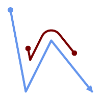
A LineString with the section between measures 2 and 8, offset to the left
SELECT ST_AsText( ST_LocateBetween(
ST_AddMeasure('LINESTRING (20 180, 50 20, 100 120, 180 20)', 0, 10),
2, 8,
20
));
------------------------------------------------------------------------
MULTILINESTRING((54.49835019899045 104.53426957938231,58.70056060327303 82.12248075654186,69.16695286779743 103.05526528559065,82.11145618000168 128.94427190999915,84.24893681714357 132.32493442618113,87.01636951231555 135.21267035596549,90.30307285299679 137.49198684843182,93.97759758337769 139.07172433557758,97.89298381958797 139.8887023914453,101.89263860095893 139.9102465862721,105.81659870902816 139.13549527600819,109.50792827749828 137.5954340631298,112.81899532549731 135.351656550512,115.6173761888606 132.49390095108848,145.31017306064817 95.37790486135405))
Veja também
Name
ST_LocateBetweenElevations — Returns the portions of a geometry that lie in an elevation (Z) range.
Synopsis
geometry ST_LocateBetweenElevations(geometry geom, float8 elevation_start, float8 elevation_end);
Descrição
Returns a geometry (collection) with the portions of a geometry that lie in an elevation (Z) range.
Clipping a non-convex POLYGON may produce invalid geometry.
Disponibilidade: 1.4.0
Enhanced: 3.0.0 - added support for POLYGON, TIN, TRIANGLE.
This function supports 3d and will not drop the z-index.
Exemplos
SELECT ST_AsText(
ST_LocateBetweenElevations(
'LINESTRING(1 2 3, 4 5 6)'::geometry,
2, 4 ));
st_astext
-----------------------------------
MULTILINESTRING Z ((1 2 3,2 3 4))
SELECT ST_AsText(
ST_LocateBetweenElevations(
'LINESTRING(1 2 6, 4 5 -1, 7 8 9)',
6, 9)) As ewelev;
ewelev
-----------------------------------------------------------------------
GEOMETRYCOLLECTION Z (POINT Z (1 2 6),LINESTRING Z (6.1 7.1 6,7 8 9))
Veja também
Name
ST_InterpolatePoint — Retorna o valor da dimensão de medida da geometria no ponto fechado para o ponto fornecido.
Synopsis
float8 ST_InterpolatePoint(geometry linear_geom_with_measure, geometry point);
Descrição
Returns an interpolated measure value of a linear measured geometry at the location closest to the given point.
| |
Use this function only for linear geometries with an M component |
Disponibilidade: 2.0.0
This function supports 3d and will not drop the z-index.
Exemplos
SELECT ST_InterpolatePoint('LINESTRING M (0 0 0, 10 0 20)', 'POINT(5 5)');
---------------------
10
Veja também
Name
ST_AddMeasure — Interpolates measures along a linear geometry.
Synopsis
geometry ST_AddMeasure(geometry geom_mline, float8 measure_start, float8 measure_end);
Descrição
Retorna uma geometria derivada com elementos de medida interpolados linearmente entre os pontos de início e de fim. Se a geometria não tem nenhuma dimensão de medida, uma é adicionada. Se a geometria tem dimensão de medida, é sobre escrita com novos valores. Somente LINESTRINGS e MULTILINESTRINGS são suportadas.
Disponibilidade: 1.5.0
This function supports 3d and will not drop the z-index.
Exemplos
SELECT ST_AsText(ST_AddMeasure(
ST_GeomFromEWKT('LINESTRING(1 0, 2 0, 4 0)'),1,4)) As ewelev;
ewelev
--------------------------------
LINESTRINGM(1 0 1,2 0 2,4 0 4)
SELECT ST_AsText(ST_AddMeasure(
ST_GeomFromEWKT('LINESTRING(1 0 4, 2 0 4, 4 0 4)'),10,40)) As ewelev;
ewelev
----------------------------------------
LINESTRING(1 0 4 10,2 0 4 20,4 0 4 40)
SELECT ST_AsText(ST_AddMeasure(
ST_GeomFromEWKT('LINESTRINGM(1 0 4, 2 0 4, 4 0 4)'),10,40)) As ewelev;
ewelev
----------------------------------------
LINESTRINGM(1 0 10,2 0 20,4 0 40)
SELECT ST_AsText(ST_AddMeasure(
ST_GeomFromEWKT('MULTILINESTRINGM((1 0 4, 2 0 4, 4 0 4),(1 0 4, 2 0 4, 4 0 4))'),10,70)) As ewelev;
ewelev
-----------------------------------------------------------------
MULTILINESTRINGM((1 0 10,2 0 20,4 0 40),(1 0 40,2 0 50,4 0 70))
7.20. Trajectory Functions
These functions support working with trajectories. A trajectory is a linear geometry with increasing measures (M value) on each coordinate. Spatio-temporal data can be modeled by using relative times (such as the epoch) as the measure values.
- ST_IsValidTrajectory — Tests if the geometry is a valid trajectory.
- ST_ClosestPointOfApproach — Returns a measure at the closest point of approach of two trajectories.
- ST_DistanceCPA — Returns the distance between the closest point of approach of two trajectories.
- ST_CPAWithin — Tests if the closest point of approach of two trajectories is within the specified distance.
Name
ST_IsValidTrajectory — Tests if the geometry is a valid trajectory.
Synopsis
boolean ST_IsValidTrajectory(geometry line);
Descrição
Tests if a geometry encodes a valid trajectory. A valid trajectory is represented as a LINESTRING with measures (M values). The measure values must increase from each vertex to the next.
Valid trajectories are expected as input to spatio-temporal functions like ST_ClosestPointOfApproach
Disponibilidade: 2.2.0
This function supports 3d and will not drop the z-index.
Exemplos
-- A valid trajectory SELECT ST_IsValidTrajectory(ST_MakeLine( ST_MakePointM(0,0,1), ST_MakePointM(0,1,2)) ); t -- An invalid trajectory SELECT ST_IsValidTrajectory(ST_MakeLine(ST_MakePointM(0,0,1), ST_MakePointM(0,1,0))); NOTICE: Measure of vertex 1 (0) not bigger than measure of vertex 0 (1) st_isvalidtrajectory ---------------------- f
Veja também
Name
ST_ClosestPointOfApproach — Returns a measure at the closest point of approach of two trajectories.
Synopsis
float8 ST_ClosestPointOfApproach(geometry track1, geometry track2);
Descrição
Returns the smallest measure at which points interpolated along the given trajectories are the least distance apart.
Inputs must be valid trajectories as checked by ST_IsValidTrajectory. Null is returned if the trajectories do not overlap in their M ranges.
To obtain the actual points at the computed measure use ST_LocateAlong .
Disponibilidade: 2.2.0
This function supports 3d and will not drop the z-index.
Exemplos
-- Return the time in which two objects moving between 10:00 and 11:00
-- are closest to each other and their distance at that point
WITH inp AS ( SELECT
ST_AddMeasure('LINESTRING Z (0 0 0, 10 0 5)'::geometry,
extract(epoch from '2015-05-26 10:00'::timestamptz),
extract(epoch from '2015-05-26 11:00'::timestamptz)
) a,
ST_AddMeasure('LINESTRING Z (0 2 10, 12 1 2)'::geometry,
extract(epoch from '2015-05-26 10:00'::timestamptz),
extract(epoch from '2015-05-26 11:00'::timestamptz)
) b
), cpa AS (
SELECT ST_ClosestPointOfApproach(a,b) m FROM inp
), points AS (
SELECT ST_GeometryN(ST_LocateAlong(a,m),1) pa,
ST_GeometryN(ST_LocateAlong(b,m),1) pb
FROM inp, cpa
)
SELECT to_timestamp(m) t,
ST_3DDistance(pa,pb) distance,
ST_AsText(pa, 2) AS pa, ST_AsText(pb, 2) AS pb
FROM points, cpa;
t | distance | pa | pb
-------------------------------+--------------------+--------------------------------------+----------------------------------------
2015-05-26 10:45:31.034483-07 | 1.9652147377620688 | POINT ZM (7.59 0 3.79 1432662331.03) | POINT ZM (9.1 1.24 3.93 1432662331.03)
Veja também
ST_IsValidTrajectory, ST_DistanceCPA, ST_LocateAlong, ST_AddMeasure
Name
ST_DistanceCPA — Returns the distance between the closest point of approach of two trajectories.
Synopsis
float8 ST_DistanceCPA(geometry track1, geometry track2);
Descrição
Returns the distance (in 2D) between two trajectories at their closest point of approach.
Inputs must be valid trajectories as checked by ST_IsValidTrajectory. Null is returned if the trajectories do not overlap in their M ranges.
Disponibilidade: 2.2.0
This function supports 3d and will not drop the z-index.
Exemplos
-- Return the minimum distance of two objects moving between 10:00 and 11:00
WITH inp AS ( SELECT
ST_AddMeasure('LINESTRING Z (0 0 0, 10 0 5)'::geometry,
extract(epoch from '2015-05-26 10:00'::timestamptz),
extract(epoch from '2015-05-26 11:00'::timestamptz)
) a,
ST_AddMeasure('LINESTRING Z (0 2 10, 12 1 2)'::geometry,
extract(epoch from '2015-05-26 10:00'::timestamptz),
extract(epoch from '2015-05-26 11:00'::timestamptz)
) b
)
SELECT ST_DistanceCPA(a,b) distance FROM inp;
distance
-------------------
1.965214737762069
Veja também
ST_IsValidTrajectory, ST_ClosestPointOfApproach, ST_AddMeasure, |=|
Name
ST_CPAWithin — Tests if the closest point of approach of two trajectories is within the specified distance.
Synopsis
boolean ST_CPAWithin(geometry track1, geometry track2, float8 dist);
Descrição
Tests whether two moving objects have ever been closer than the specified distance.
Inputs must be valid trajectories as checked by ST_IsValidTrajectory. False is returned if the trajectories do not overlap in their M ranges.
Disponibilidade: 2.2.0
This function supports 3d and will not drop the z-index.
Exemplos
WITH inp AS ( SELECT
ST_AddMeasure('LINESTRING Z (0 0 0, 10 0 5)'::geometry,
extract(epoch from '2015-05-26 10:00'::timestamptz),
extract(epoch from '2015-05-26 11:00'::timestamptz)
) a,
ST_AddMeasure('LINESTRING Z (0 2 10, 12 1 2)'::geometry,
extract(epoch from '2015-05-26 10:00'::timestamptz),
extract(epoch from '2015-05-26 11:00'::timestamptz)
) b
)
SELECT ST_CPAWithin(a,b,2), ST_DistanceCPA(a,b) distance FROM inp;
st_cpawithin | distance
--------------+------------------
t | 1.96521473776207
Veja também
ST_IsValidTrajectory, ST_ClosestPointOfApproach, ST_DistanceCPA, |=|
7.21. Version Functions
These functions report and upgrade PostGIS versions.
- PostGIS_Extensions_Upgrade — Packages and upgrades PostGIS extensions (e.g. postgis_raster, postgis_topology, postgis_sfcgal) to given or latest version.
- PostGIS_Full_Version — Reports full PostGIS version and build configuration infos.
- PostGIS_GEOS_Version — Returns the version number of the GEOS library.
- PostGIS_GEOS_Compiled_Version — Returns the version number of the GEOS library against which PostGIS was built.
- PostGIS_Liblwgeom_Version — Returns the version number of the liblwgeom library. This should match the version of PostGIS.
- PostGIS_LibXML_Version — Returns the version number of the libxml2 library.
- PostGIS_LibJSON_Version — Returns the version number of the libjson-c library.
- PostGIS_Lib_Build_Date — Returns build date of the PostGIS library.
- PostGIS_Lib_Version — Returns the version number of the PostGIS library.
- PostGIS_PROJ_Version — Returns the version number of the PROJ4 library.
- PostGIS_PROJ_Compiled_Version — Returns the version number of the PROJ library against which PostGIS was built.
- PostGIS_Wagyu_Version — Returns the version number of the internal Wagyu library.
- PostGIS_Scripts_Build_Date — Returns build date of the PostGIS scripts.
- PostGIS_Scripts_Installed — Returns version of the PostGIS scripts installed in this database.
- PostGIS_Scripts_Released — Returns the version number of the postgis.sql script released with the installed PostGIS lib.
- PostGIS_Version — Returns PostGIS version number and compile-time options.
Name
PostGIS_Extensions_Upgrade — Packages and upgrades PostGIS extensions (e.g. postgis_raster, postgis_topology, postgis_sfcgal) to given or latest version.
Synopsis
text PostGIS_Extensions_Upgrade(text target_version=null);
Descrição
Packages and upgrades PostGIS extensions to given or latest version. Only extensions you have installed in the database will be packaged and upgraded if needed. Reports full PostGIS version and build configuration infos after. This is short-hand for doing multiple CREATE EXTENSION .. FROM unpackaged and ALTER EXTENSION .. UPDATE for each PostGIS extension. Currently only tries to upgrade extensions postgis, postgis_raster, postgis_sfcgal, postgis_topology, and postgis_tiger_geocoder.
Availability: 2.5.0
| |
Changed: 3.4.0 to add target_version argument. Changed: 3.3.0 support for upgrades from any PostGIS version. Does not work on all systems. Changed: 3.0.0 to repackage loose extensions and support postgis_raster. |
Exemplos
SELECT PostGIS_Extensions_Upgrade();
NOTICE: Packaging extension postgis
NOTICE: Packaging extension postgis_raster
NOTICE: Packaging extension postgis_sfcgal
NOTICE: Extension postgis_topology is not available or not packagable for some reason
NOTICE: Extension postgis_tiger_geocoder is not available or not packagable for some reason
postgis_extensions_upgrade
-------------------------------------------------------------------
Upgrade completed, run SELECT postgis_full_version(); for details
(1 row)Name
PostGIS_Full_Version — Reports full PostGIS version and build configuration infos.
Synopsis
text PostGIS_Full_Version();
Descrição
Reports full PostGIS version and build configuration infos. Also informs about synchronization between libraries and scripts suggesting upgrades as needed.
Enhanced: 3.4.0 now includes extra PROJ configurations NETWORK_ENABLED, URL_ENDPOINT and DATABASE_PATH of proj.db location
Exemplos
SELECT PostGIS_Full_Version();
postgis_full_version
----------------------------------------------------------------------------------
POSTGIS="3.4.0dev 3.3.0rc2-993-g61bdf43a7" [EXTENSION] PGSQL="160" GEOS="3.12.0dev-CAPI-1.18.0" SFCGAL="1.3.8" PROJ="7.2.1 NETWORK_ENABLED=OFF URL_ENDPOINT=https://cdn.proj.org USER_WRITABLE_DIRECTORY=/tmp/proj DATABASE_PATH=/usr/share/proj/proj.db" GDAL="GDAL 3.2.2, released 2021/03/05" LIBXML="2.9.10" LIBJSON="0.15" LIBPROTOBUF="1.3.3" WAGYU="0.5.0 (Internal)" TOPOLOGY RASTER
(1 row)
Name
PostGIS_GEOS_Version — Returns the version number of the GEOS library.
Synopsis
text PostGIS_GEOS_Version();
Descrição
Returns the version number of the GEOS library, or NULL if GEOS support is not enabled.
Exemplos
SELECT PostGIS_GEOS_Version(); postgis_geos_version ---------------------- 3.12.0dev-CAPI-1.18.0 (1 row)
Name
PostGIS_GEOS_Compiled_Version — Returns the version number of the GEOS library against which PostGIS was built.
Synopsis
text PostGIS_GEOS_Compiled_Version();
Descrição
Returns the version number of the GEOS library, or against which PostGIS was built.
Availability: 3.4.0
Exemplos
SELECT PostGIS_GEOS_Compiled_Version(); postgis_geos_compiled_version ------------------------------- 3.12.0 (1 row)
Veja também
Name
PostGIS_Liblwgeom_Version — Returns the version number of the liblwgeom library. This should match the version of PostGIS.
Synopsis
text PostGIS_Liblwgeom_Version();
Descrição
Returns the version number of the liblwgeom library/
Exemplos
SELECT PostGIS_Liblwgeom_Version(); postgis_liblwgeom_version -------------------------- 3.4.0dev 3.3.0rc2-993-g61bdf43a7 (1 row)
Name
PostGIS_LibXML_Version — Returns the version number of the libxml2 library.
Synopsis
text PostGIS_LibXML_Version();
Descrição
Returns the version number of the LibXML2 library.
Disponibilidade: 1.5
Exemplos
SELECT PostGIS_LibXML_Version(); postgis_libxml_version ---------------------- 2.9.10 (1 row)
Name
PostGIS_LibJSON_Version — Returns the version number of the libjson-c library.
Synopsis
text PostGIS_LibJSON_Version();
Descrição
Returns the version number of the LibJSON-C library.
Exemplos
SELECT PostGIS_LibJSON_Version(); postgis_libjson_version ------------------------- 0.17
Name
PostGIS_Lib_Build_Date — Returns build date of the PostGIS library.
Synopsis
text PostGIS_Lib_Build_Date();
Descrição
Returns build date of the PostGIS library.
Exemplos
SELECT PostGIS_Lib_Build_Date(); postgis_lib_build_date ------------------------ 2023-06-22 03:56:11 (1 row)
Name
PostGIS_Lib_Version — Returns the version number of the PostGIS library.
Synopsis
text PostGIS_Lib_Version();
Descrição
Returns the version number of the PostGIS library.
Exemplos
SELECT PostGIS_Lib_Version(); postgis_lib_version --------------------- 3.4.0dev (1 row)
Name
PostGIS_PROJ_Version — Returns the version number of the PROJ4 library.
Synopsis
text PostGIS_PROJ_Version();
Descrição
Returns the version number of the PROJ library and some configuration options of proj.
Enhanced: 3.4.0 now includes NETWORK_ENABLED, URL_ENDPOINT and DATABASE_PATH of proj.db location
Exemplos
SELECT PostGIS_PROJ_Version(); postgis_proj_version ------------------------- 7.2.1 NETWORK_ENABLED=OFF URL_ENDPOINT=https://cdn.proj.org USER_WRITABLE_DIRECTORY=/tmp/proj DATABASE_PATH=/usr/share/proj/proj.db (1 row)
Name
PostGIS_PROJ_Compiled_Version — Returns the version number of the PROJ library against which PostGIS was built.
Synopsis
text PostGIS_PROJ_Compiled_Version();
Descrição
Returns the version number of the PROJ library, or against which PostGIS was built.
Availability: 3.5.0
Exemplos
SELECT PostGIS_PROJ_Compiled_Version(); postgis_proj_compiled_version ------------------------------- 9.1.1 (1 row)
Veja também
Name
PostGIS_Wagyu_Version — Returns the version number of the internal Wagyu library.
Synopsis
text PostGIS_Wagyu_Version();
Descrição
Returns the version number of the internal Wagyu library, or NULL if Wagyu support is not enabled.
Exemplos
SELECT PostGIS_Wagyu_Version(); postgis_wagyu_version ----------------------- 0.5.0 (Internal) (1 row)
Name
PostGIS_Scripts_Build_Date — Returns build date of the PostGIS scripts.
Synopsis
text PostGIS_Scripts_Build_Date();
Descrição
Returns build date of the PostGIS scripts.
Disponibilidade: 1.0.0RC1
Exemplos
SELECT PostGIS_Scripts_Build_Date(); postgis_scripts_build_date ------------------------- 2023-06-22 03:56:11 (1 row)
Name
PostGIS_Scripts_Installed — Returns version of the PostGIS scripts installed in this database.
Synopsis
text PostGIS_Scripts_Installed();
Descrição
Returns version of the PostGIS scripts installed in this database.
| |
If the output of this function doesn't match the output of PostGIS_Scripts_Released you probably missed to properly upgrade an existing database. See the Upgrading section for more info. |
Availability: 0.9.0
Exemplos
SELECT PostGIS_Scripts_Installed(); postgis_scripts_installed ------------------------- 3.4.0dev 3.3.0rc2-993-g61bdf43a7 (1 row)
Veja também
PostGIS_Full_Version, PostGIS_Scripts_Released, PostGIS_Version
Name
PostGIS_Scripts_Released — Returns the version number of the postgis.sql script released with the installed PostGIS lib.
Synopsis
text PostGIS_Scripts_Released();
Descrição
Returns the version number of the postgis.sql script released with the installed PostGIS lib.
| |
Starting with version 1.1.0 this function returns the same value of PostGIS_Lib_Version. Kept for backward compatibility. |
Availability: 0.9.0
Exemplos
SELECT PostGIS_Scripts_Released(); postgis_scripts_released ------------------------- 3.4.0dev 3.3.0rc2-993-g61bdf43a7 (1 row)
Name
PostGIS_Version — Returns PostGIS version number and compile-time options.
Synopsis
text PostGIS_Version();
Descrição
Returns PostGIS version number and compile-time options.
Exemplos
SELECT PostGIS_Version();
postgis_version
---------------------------------------
3.4 USE_GEOS=1 USE_PROJ=1 USE_STATS=1
(1 row)7.22. Grandes Variáveis Unificadas Personalizadas do PostGIS (GUCs)
Essa seção lista as Grandes Variáveis Unificadas Personalizadas (GUC) do PostGIS personalizado. Elas podem ser globalmente configuradas, por banco de dados, por sessão ou por transação. A melhor configuração a nível global ou database.
For more examples of usage refer to SQL SET and SQL ALTER SYSTEM
- postgis.gdal_datapath — Uma opção de configuração para designar o valor da opção GDAL_DATA do GDAL. Se não funcionar, a variável ambiental GDAL_DATA é usada.
- postgis.gdal_enabled_drivers — Uma opção de configuração para estabelecer os drivers GDAL ativados no ambiente POstGIS. Afeta a variável GDAL_SKIP do GDAL.
- postgis.enable_outdb_rasters — Uma opção de configuração booleana para ativar o acesso ao out-db raster bands.
- postgis.gdal_vsi_options — Uma opção de configuração booleana para ativar o acesso ao out-db raster bands.
- postgis.gdal_cpl_debug — A boolean configuration to turn logging of GDAL debug messages on and off.
Name
postgis.gdal_datapath — Uma opção de configuração para designar o valor da opção GDAL_DATA do GDAL. Se não funcionar, a variável ambiental GDAL_DATA é usada.
Descrição
Uma variável GUC do PostgreSQL para configurar o valor da opção GDAL_DATA do GDAL. O valor postgis.gdal_datapath deve ser o path físico completo para os arquivos de dados do GDAL.
Essa opção de configuração é mais usada para plataformas do Windows, onde os arquivos de dados path do GDAL's não estão hard-coded. Essa opção deve também ser configurada quando esses aquivos não estiverem no path esperado.
| |
Essa opção pode ser configurada no arquivo de configuração postgresql.conf. Pode ser configurado por conexão ou transação. |
Disponibilidade: 2.2.0
| |
Informação adicional sobre o GDAL_DATA está disponível em GDAL's Configuration Options. |
Exemplos
Configurar e resetar postgis.gdal_datapath
SET postgis.gdal_datapath TO '/usr/local/share/gdal.hidden';
SET postgis.gdal_datapath TO default;
Configurando no Windows para um banco de dados específico
ALTER DATABASE gisdb SET postgis.gdal_datapath = 'C:/Program Files/PostgreSQL/9.3/gdal-data';
Veja também
Name
postgis.gdal_enabled_drivers — Uma opção de configuração para estabelecer os drivers GDAL ativados no ambiente POstGIS. Afeta a variável GDAL_SKIP do GDAL.
Descrição
Uma opção de configuração para estabelecer os drivers GDAL ativados no PostGIS. Afeta a variável de configuração GDAL_SKIP. Essa opção pode ser estabelecida no arquivo de configuração do PostgreSQL: postgresql.conf. Ela também pode ser estabelecida por conexão ou transação.
O valor inicial do postgis.gdal_enabled_drivers também pode ser estabelecido passando a variável de ambiente POSTGIS_GDAL_ENABLED_DRIVERS com a lista de drivers ativados para o processo de começar o PostgreSQL.
Dispositivos ativados específicos GDAL podem ser especificados pelos dispositivos de nome ou código curto. Dispositivos com nomes ou códigos curtos podem ser encontrados emGDAL Raster Formats. Vários dispositivos podem ser encontrados, colocando um espaço entre cada um deles.
| |
Existem três códigos especiais disponíveis para
Quando |
| |
Na instalação padrão do PostGIS, |
| |
Informações adicionais sobre GDAL_SKIP estão disponíveis em Opções de Configuração. |
Disponibilidade: 2.2.0
Exemplos
To set and reset postgis.gdal_enabled_drivers for current session
SET postgis.gdal_enabled_drivers = 'ENABLE_ALL';
SET postgis.gdal_enabled_drivers = default;
Set for all new connections to a specific database to specific drivers
ALTER DATABASE mygisdb SET postgis.gdal_enabled_drivers TO 'GTiff PNG JPEG';
Setting for whole database cluster to enable all drivers. Requires super user access. Also note that database, session, and user settings override this.
--writes to postgres.auto.conf
ALTER SYSTEM SET postgis.gdal_enabled_drivers TO 'ENABLE_ALL';
--Reloads postgres conf
SELECT pg_reload_conf();
Name
postgis.enable_outdb_rasters — Uma opção de configuração booleana para ativar o acesso ao out-db raster bands.
Descrição
Uma opção de configuração booleana para ativar o acesso ao ut-db raster bands. Essa opção pode ser estabelecida no arquivo de configuração: postgresql.conf. Ela também pode ser estabelecida por conexão ou transação.
O valor inicial de postgis.enable_outdb_rasters também pode ser estabelecido passando a variável de ambiente POSTGIS_ENABLE_OUTDB_RASTERS com um valor não-zero para o processo de começar o PostgreSQL.
| |
Mesmo se |
| |
Na instalação padrão do PostGIS, |
Disponibilidade: 2.2.0
Exemplos
Configurar e resetar postgis.enable_outdb_rasters
SET postgis.enable_outdb_rasters TO True;
SET postgis.enable_outdb_rasters = default;
SET postgis.enable_outdb_rasters = True;
SET postgis.enable_outdb_rasters = False;
Set for all new connections to a specific database
ALTER DATABASE gisdb SET postgis.enable_outdb_rasters = true;
Setting for whole database cluster. Requires super user access. Also note that database, session, and user settings override this.
--writes to postgres.auto.conf
ALTER SYSTEM SET postgis.enable_outdb_rasters = true;
--Reloads postgres conf
SELECT pg_reload_conf();
Veja também
Name
postgis.gdal_vsi_options — Uma opção de configuração booleana para ativar o acesso ao out-db raster bands.
Descrição
A string configuration to set options used when working with an out-db raster. Configuration options control things like how much space GDAL allocates to local data cache, whether to read overviews, and what access keys to use for remote out-db data sources.
Availability: 3.2.0
Exemplos
Configurar e resetar postgis.enable_outdb_rasters
SET postgis.gdal_vsi_options = 'AWS_ACCESS_KEY_ID=xxxxxxxxxxxxxxx AWS_SECRET_ACCESS_KEY=yyyyyyyyyyyyyyyyyyyyyyyyyy';
Set postgis.gdal_vsi_options just for the current transaction using the LOCAL keyword:
SET LOCAL postgis.gdal_vsi_options = 'AWS_ACCESS_KEY_ID=xxxxxxxxxxxxxxx AWS_SECRET_ACCESS_KEY=yyyyyyyyyyyyyyyyyyyyyyyyyy';
Name
postgis.gdal_cpl_debug — A boolean configuration to turn logging of GDAL debug messages on and off.
Descrição
By default, GDAL logging is printed to stderr, and lower level debug messages are not printed at all. Turning this GUC to true will cause GDAL logging to be sent into the PostgreSQL logging stream, so you can see more or less of it by altering the client_min_message PostgreSQL GUC.
Availability: 3.6.0
7.23. Troubleshooting Functions
These functions are utilities for troubleshooting and repairing geometry data. They are only needed if the geometry data is corrupted in some way, which should never happen under normal circumstances.
- PostGIS_AddBBox — Adicionar o retângulo envolvente a geometria.
- PostGIS_DropBBox — Exclui o cache de retângulos envolventes da geometria.
- PostGIS_HasBBox — Retorna verdadeiro se o retângulo desta geometria está cacheado. FALSO caso contrário.
Name
PostGIS_AddBBox — Adicionar o retângulo envolvente a geometria.
Synopsis
geometry PostGIS_AddBBox(geometry geomA);
Descrição
Adiciona um retângulo envolvente a geometria. Isto faz pesquisas baseadas em retângulos envolventes mais rápidas, mas aumentará o tamanho da geometria.
| |
Retângulos envolventes são geometrias adicionadas automaticamente, portanto, em geral, isto não é necessário, a menos que o retângulo envolvente foi corrompido de alguma forma ou você possui uma instalação antiga que não possui suporte a retângulos envolventes. Então é necessário dropar os retângulos antigos e readicioná-los. |
This method supports Circular Strings and Curves.
Exemplos
UPDATE sometable SET geom = PostGIS_AddBBox(geom) WHERE PostGIS_HasBBox(geom) = false;
Veja também
Name
PostGIS_DropBBox — Exclui o cache de retângulos envolventes da geometria.
Synopsis
geometry PostGIS_DropBBox(geometry geomA);
Descrição
Exclui o cache de retângulos envolventes de uma geometria. Isto reduz o tamanho da geometria, mas torna as pesquisas baseadas em retângulos envolventes mais lentas. Um sinal claro de um cache corrompido é quando suas pesquisas de ST_Intersects e outras relações espaciais deixam de fora geometrias que deveriam retornar verdadeiro.
| |
Retângulos envolventes são automaticamente adicionandos as geometrias e melhoram a velocidade de pesquisas, então em geral, isto não é necessário, a menos que seu cache de retângulos envolventes tenha sido corrompido ou você possua uma instalação que não suportava esta funcionalidade. Este tipo de corrupção foi observado nas versões 8.3-8.3.6, onde os retângulos envolventes cacheados não eram sempre recalculados durante a alteração de uma geometria e o upgrade para uma nova versão, sem o uso de um processo de dump/reload não irá corrigir os retângulos corrompidos. Você pode corrigir isto manualmente, utilizando a função abaixo ou realizar um backup com processo de dump/reload. |
This method supports Circular Strings and Curves.
Exemplos
--This example drops bounding boxes where the cached box is not correct
--The force to ST_AsBinary before applying Box2D forces a recalculation of the box, and Box2D applied to the table geometry always
-- returns the cached bounding box.
UPDATE sometable
SET geom = PostGIS_DropBBox(geom)
WHERE Not (Box2D(ST_AsBinary(geom)) = Box2D(geom));
UPDATE sometable
SET geom = PostGIS_AddBBox(geom)
WHERE Not PostGIS_HasBBOX(geom);
Veja também
Name
PostGIS_HasBBox — Retorna verdadeiro se o retângulo desta geometria está cacheado. FALSO caso contrário.
Synopsis
boolean PostGIS_HasBBox(geometry geomA);
Descrição
Retorna verdadeiro se o retângulo envolvendo desta geometria está cacheado, falso caso contrário. Use PostGIS_AddBBox e PostGIS_DropBBox para controlar o cache.
This method supports Circular Strings and Curves.
Exemplos
SELECT geom FROM sometable WHERE PostGIS_HasBBox(geom) = false;
Veja também
Chapter 8. SFCGAL Functions Reference
SFCGAL é uma biblioteca wrapper C++ em torno do CGAL que fornece funções 2D e 3D avançadas. Para robustez, coordenadas de geometria têm a representação exata de número racional.
As instruções de instalação da biblioteca, podem ser encontradas na página inicial do SFCGAL http://www.sfcgal.org. Para carregar as funções, crie uma extensão postgis_sfcgal.
8.1. SFCGAL Management Functions
This section lists functions for determining version of SFCGAL and library dependencies you are running.
- postgis_sfcgal_version — retorna a versão do SFCGAL em uso
- postgis_sfcgal_full_version — Returns the full version of SFCGAL in use including CGAL and Boost versions
Name
postgis_sfcgal_version — retorna a versão do SFCGAL em uso
Synopsis
texto postgis_sfcgal_version(void);
Descrição
retorna a versão do SFCGAL em uso
Disponibilidade: 2.1.0
This method needs SFCGAL backend.
Veja também
Name
postgis_sfcgal_full_version — Returns the full version of SFCGAL in use including CGAL and Boost versions
Synopsis
texto postgis_sfcgal_version(void);
Descrição
Returns the full version of SFCGAL in use including CGAL and Boost versions
Availability: 3.3.0
This method needs SFCGAL backend.
Veja também
8.2. SFCGAL Accessors and Setters
These functions access or set properties of geometries. Geometries primarily supported by these functions are TINS and Polyhedral Surfaces.
- CG_ForceLHR — Orientação força LHR
- CG_IsPlanar — Verifique se a superfície é ou não planar
- CG_IsSolid — teste se a geometria é um sólido. Nenhuma verificação de validade é representada.
- CG_MakeSolid — Molde a geometria para um sólido. Nenhuma verificação é apresentada. Para obter um sólido válido, a geometria de entrada deve ser uma superfície poliédrica fechada ou um TIN fechado.
- CG_Orientation — Determine orientação da superfície
- CG_Area — Calculates the area of a geometry
- CG_3DArea — Computa a área de geometrias de superfície 3D. Irá retornar 0 para sólidos.
- CG_Volume — Computa o volume de um sólido 3D. Se aplicado a geometrias com superfícies (mesmo fechadas), irão retornar 0.
- ST_ForceLHR — Orientação força LHR
- ST_IsPlanar — Verifique se a superfície é ou não planar
- ST_IsSolid — teste se a geometria é um sólido. Nenhuma verificação de validade é representada.
- ST_MakeSolid — Molde a geometria para um sólido. Nenhuma verificação é apresentada. Para obter um sólido válido, a geometria de entrada deve ser uma superfície poliédrica fechada ou um TIN fechado.
- ST_Orientation — Determine orientação da superfície
- ST_3DArea — Computa a área de geometrias de superfície 3D. Irá retornar 0 para sólidos.
- ST_Volume — Computa o volume de um sólido 3D. Se aplicado a geometrias com superfícies (mesmo fechadas), irão retornar 0.
Name
CG_ForceLHR — Orientação força LHR
Synopsis
geometry CG_ForceLHR(geometry geom);
Descrição
Availability: 3.5.0
This method needs SFCGAL backend.
This function supports 3d and will not drop the z-index.
This function supports Polyhedral surfaces.
This function supports Triangles and Triangulated Irregular Network Surfaces (TIN).
Name
CG_IsPlanar — Verifique se a superfície é ou não planar
Synopsis
boolean CG_IsPlanar(geometry geom);
Descrição
Availability: 3.5.0
This method needs SFCGAL backend.
This function supports 3d and will not drop the z-index.
This function supports Polyhedral surfaces.
This function supports Triangles and Triangulated Irregular Network Surfaces (TIN).
Name
CG_IsSolid — teste se a geometria é um sólido. Nenhuma verificação de validade é representada.
Synopsis
boolean CG_IsSolid(geometry geom1);
Descrição
Availability: 3.5.0
This method needs SFCGAL backend.
This function supports 3d and will not drop the z-index.
This function supports Polyhedral surfaces.
This function supports Triangles and Triangulated Irregular Network Surfaces (TIN).
Name
CG_MakeSolid — Molde a geometria para um sólido. Nenhuma verificação é apresentada. Para obter um sólido válido, a geometria de entrada deve ser uma superfície poliédrica fechada ou um TIN fechado.
Synopsis
geometry CG_MakeSolid(geometry geom1);
Descrição
Availability: 3.5.0
This method needs SFCGAL backend.
This function supports 3d and will not drop the z-index.
This function supports Polyhedral surfaces.
This function supports Triangles and Triangulated Irregular Network Surfaces (TIN).
Name
CG_Orientation — Determine orientação da superfície
Synopsis
integer CG_Orientation(geometry geom);
Descrição
A função só se aplica a polígonos. Ela retorna -1 se o polígono estiver orientado no sentido anti-horário e 1 se estiver no sentido horário.
Availability: 3.5.0
This method needs SFCGAL backend.
This function supports 3d and will not drop the z-index.
Name
CG_Area — Calculates the area of a geometry
Synopsis
double precision CG_Area( geometry geom );
Descrição
Calculates the area of a geometry.
Performed by the SFCGAL module
| |
NOTE: this function returns a double precision value representing the area. |
Availability: 3.5.0
This method needs SFCGAL backend.
Exemplos de Geometria
SELECT CG_Area('Polygon ((0 0, 0 5, 5 5, 5 0, 0 0), (1 1, 2 1, 2 2, 1 2, 1 1), (3 3, 4 3, 4 4, 3 4, 3 3))');
cg_area
--------
25
(1 row)Name
CG_3DArea — Computa a área de geometrias de superfície 3D. Irá retornar 0 para sólidos.
Synopsis
floatCG_3DArea(geometry geom1);
Descrição
Availability: 3.5.0
This method needs SFCGAL backend.
This method implements the SQL/MM specification. SQL-MM IEC 13249-3: 8.1, 10.5
This function supports 3d and will not drop the z-index.
This function supports Polyhedral surfaces.
This function supports Triangles and Triangulated Irregular Network Surfaces (TIN).
Exemplos
Nota: Por padrão uma superfície poliédrica construída de um WKT, é uma superfície de geometria, não sólida. Ela, portanto, tem uma área de superfície. Uma vez convertido em sólido, não tem nenhuma área.
SELECT CG_3DArea(geom) As cube_surface_area,
CG_3DArea(CG_MakeSolid(geom)) As solid_surface_area
FROM (SELECT 'POLYHEDRALSURFACE( ((0 0 0, 0 0 1, 0 1 1, 0 1 0, 0 0 0)),
((0 0 0, 0 1 0, 1 1 0, 1 0 0, 0 0 0)),
((0 0 0, 1 0 0, 1 0 1, 0 0 1, 0 0 0)),
((1 1 0, 1 1 1, 1 0 1, 1 0 0, 1 1 0)),
((0 1 0, 0 1 1, 1 1 1, 1 1 0, 0 1 0)),
((0 0 1, 1 0 1, 1 1 1, 0 1 1, 0 0 1)) )'::geometry) As f(geom);
cube_surface_area | solid_surface_area
-------------------+--------------------
6 | 0 Veja também
Name
CG_Volume — Computa o volume de um sólido 3D. Se aplicado a geometrias com superfícies (mesmo fechadas), irão retornar 0.
Synopsis
float CG_Volume(geometry geom1);
Descrição
Availability: 3.5.0
This method needs SFCGAL backend.
This function supports 3d and will not drop the z-index.
This function supports Polyhedral surfaces.
This function supports Triangles and Triangulated Irregular Network Surfaces (TIN).
This method implements the SQL/MM specification. SQL-MM IEC 13249-3: 9.1 (same as CG_3DVolume)
Exemplo
When closed surfaces are created with WKT, they are treated as areal rather than solid. To make them solid, you need to use CG_MakeSolid. Areal geometries have no volume. Here is an example to demonstrate.
SELECT CG_Volume(geom) As cube_surface_vol,
CG_Volume(CG_MakeSolid(geom)) As solid_surface_vol
FROM (SELECT 'POLYHEDRALSURFACE( ((0 0 0, 0 0 1, 0 1 1, 0 1 0, 0 0 0)),
((0 0 0, 0 1 0, 1 1 0, 1 0 0, 0 0 0)),
((0 0 0, 1 0 0, 1 0 1, 0 0 1, 0 0 0)),
((1 1 0, 1 1 1, 1 0 1, 1 0 0, 1 1 0)),
((0 1 0, 0 1 1, 1 1 1, 1 1 0, 0 1 0)),
((0 0 1, 1 0 1, 1 1 1, 0 1 1, 0 0 1)) )'::geometry) As f(geom);
cube_surface_vol | solid_surface_vol
------------------+-------------------
0 | 1
Veja também
Name
ST_ForceLHR — Orientação força LHR
Synopsis
geometry ST_ForceLHR(geometry geom);
Descrição
| |
ST_ForceLHR is deprecated as of 3.5.0. Use CG_ForceLHR instead. |
Disponibilidade: 2.1.0
This method needs SFCGAL backend.
This function supports 3d and will not drop the z-index.
This function supports Polyhedral surfaces.
This function supports Triangles and Triangulated Irregular Network Surfaces (TIN).
Name
ST_IsPlanar — Verifique se a superfície é ou não planar
Synopsis
boolean ST_IsPlanar(geometry geom);
Descrição
| |
ST_IsPlanar is deprecated as of 3.5.0. Use CG_IsPlanar instead. |
Disponibilidade: 2.2.0: Isso foi documentado em 2.1.0, mas foi deixado de fora acidentalmente na 2.1.
This method needs SFCGAL backend.
This function supports 3d and will not drop the z-index.
This function supports Polyhedral surfaces.
This function supports Triangles and Triangulated Irregular Network Surfaces (TIN).
Name
ST_IsSolid — teste se a geometria é um sólido. Nenhuma verificação de validade é representada.
Synopsis
boolean ST_IsSolid(geometry geom1);
Descrição
| |
ST_IsSolid is deprecated as of 3.5.0. Use CG_IsSolid instead. |
Disponibilidade: 2.2.0
This method needs SFCGAL backend.
This function supports 3d and will not drop the z-index.
This function supports Polyhedral surfaces.
This function supports Triangles and Triangulated Irregular Network Surfaces (TIN).
Name
ST_MakeSolid — Molde a geometria para um sólido. Nenhuma verificação é apresentada. Para obter um sólido válido, a geometria de entrada deve ser uma superfície poliédrica fechada ou um TIN fechado.
Synopsis
geometry ST_MakeSolid(geometry geom1);
Descrição
| |
ST_MakeSolid is deprecated as of 3.5.0. Use CG_MakeSolid instead. |
Disponibilidade: 2.2.0
This method needs SFCGAL backend.
This function supports 3d and will not drop the z-index.
This function supports Polyhedral surfaces.
This function supports Triangles and Triangulated Irregular Network Surfaces (TIN).
Name
ST_Orientation — Determine orientação da superfície
Synopsis
integer ST_Orientation(geometry geom);
Descrição
| |
ST_Orientation is deprecated as of 3.5.0. Use CG_Orientation instead. |
A função só se aplica a polígonos. Ela retorna -1 se o polígono estiver orientado no sentido anti-horário e 1 se estiver no sentido horário.
Disponibilidade: 2.1.0
This method needs SFCGAL backend.
This function supports 3d and will not drop the z-index.
Name
ST_3DArea — Computa a área de geometrias de superfície 3D. Irá retornar 0 para sólidos.
Synopsis
floatST_3DArea(geometry geom1);
Descrição
Disponibilidade: 2.1.0
This method needs SFCGAL backend.
This method implements the SQL/MM specification. SQL-MM IEC 13249-3: 8.1, 10.5
This function supports 3d and will not drop the z-index.
This function supports Polyhedral surfaces.
This function supports Triangles and Triangulated Irregular Network Surfaces (TIN).
Exemplos
Nota: Por padrão uma superfície poliédrica construída de um WKT, é uma superfície de geometria, não sólida. Ela, portanto, tem uma área de superfície. Uma vez convertido em sólido, não tem nenhuma área.
SELECT ST_3DArea(geom) As cube_surface_area,
ST_3DArea(ST_MakeSolid(geom)) As solid_surface_area
FROM (SELECT 'POLYHEDRALSURFACE( ((0 0 0, 0 0 1, 0 1 1, 0 1 0, 0 0 0)),
((0 0 0, 0 1 0, 1 1 0, 1 0 0, 0 0 0)),
((0 0 0, 1 0 0, 1 0 1, 0 0 1, 0 0 0)),
((1 1 0, 1 1 1, 1 0 1, 1 0 0, 1 1 0)),
((0 1 0, 0 1 1, 1 1 1, 1 1 0, 0 1 0)),
((0 0 1, 1 0 1, 1 1 1, 0 1 1, 0 0 1)) )'::geometry) As f(geom);
cube_surface_area | solid_surface_area
-------------------+--------------------
6 | 0 Veja também
Name
ST_Volume — Computa o volume de um sólido 3D. Se aplicado a geometrias com superfícies (mesmo fechadas), irão retornar 0.
Synopsis
float ST_Volume(geometry geom1);
Descrição
Disponibilidade: 2.2.0
This method needs SFCGAL backend.
This function supports 3d and will not drop the z-index.
This function supports Polyhedral surfaces.
This function supports Triangles and Triangulated Irregular Network Surfaces (TIN).
This method implements the SQL/MM specification. SQL-MM IEC 13249-3: 9.1 (same as ST_3DVolume)
Exemplo
Quando superfícies fechadas são criadas com WKT, elas são tratadas como territoriais ao invés de sólido. Para torná-las sólidos, você precis usar ST_MakeSolid. Geometrias territoriais não têm volume. Aqui está um exemplo demonstrativo.
SELECT ST_Volume(geom) As cube_surface_vol,
ST_Volume(ST_MakeSolid(geom)) As solid_surface_vol
FROM (SELECT 'POLYHEDRALSURFACE( ((0 0 0, 0 0 1, 0 1 1, 0 1 0, 0 0 0)),
((0 0 0, 0 1 0, 1 1 0, 1 0 0, 0 0 0)),
((0 0 0, 1 0 0, 1 0 1, 0 0 1, 0 0 0)),
((1 1 0, 1 1 1, 1 0 1, 1 0 0, 1 1 0)),
((0 1 0, 0 1 1, 1 1 1, 1 1 0, 0 1 0)),
((0 0 1, 1 0 1, 1 1 1, 0 1 1, 0 0 1)) )'::geometry) As f(geom);
cube_surface_vol | solid_surface_vol
------------------+-------------------
0 | 1
Veja também
8.3. SFCGAL Processing and Relationship Functions
- CG_Intersection — Computes the intersection of two geometries
- CG_Intersects — Tests if two geometries intersect (they have at least one point in common)
- CG_3DIntersects — Tests if two 3D geometries intersect
- CG_Difference — Computes the geometric difference between two geometries
- ST_3DDifference — Representar diferença 3D
- CG_3DDifference — Representar diferença 3D
- CG_Distance — Computes the minimum distance between two geometries
- CG_3DDistance — Computes the minimum 3D distance between two geometries
- ST_3DConvexHull — Computa o eixo mediano aproximado de uma geometria territorial.
- CG_3DConvexHull — Computa o eixo mediano aproximado de uma geometria territorial.
- ST_3DIntersection — Representar intersecção 3D
- CG_3DIntersection — Representar intersecção 3D
- CG_Union — Computes the union of two geometries
- ST_3DUnion — Perform 3D union.
- CG_3DUnion — Perform 3D union using postgis_sfcgal.
- ST_AlphaShape — Computes an Alpha-shape enclosing a geometry
- CG_AlphaShape — Computes an Alpha-shape enclosing a geometry
- CG_ApproxConvexPartition — Computes approximal convex partition of the polygon geometry
- ST_ApproximateMedialAxis — Computa o eixo mediano aproximado de uma geometria territorial.
- CG_ApproximateMedialAxis — Computa o eixo mediano aproximado de uma geometria territorial.
- ST_ConstrainedDelaunayTriangles — Return a constrained Delaunay triangulation around the given input geometry.
- CG_ConstrainedDelaunayTriangles — Return a constrained Delaunay triangulation around the given input geometry.
- ST_Extrude — Extrude uma superfície a um volume relacionado
- CG_Extrude — Extrude uma superfície a um volume relacionado
- CG_ExtrudeStraightSkeleton — Straight Skeleton Extrusion
- CG_GreeneApproxConvexPartition — Computes approximal convex partition of the polygon geometry
- ST_MinkowskiSum — Representar soma Minkowski
- CG_MinkowskiSum — Representar soma Minkowski
- ST_OptimalAlphaShape — Computes an Alpha-shape enclosing a geometry using an "optimal" alpha value.
- CG_OptimalAlphaShape — Computes an Alpha-shape enclosing a geometry using an "optimal" alpha value.
- CG_OptimalConvexPartition — Computes an optimal convex partition of the polygon geometry
- CG_StraightSkeleton — Calcule um esqueleto em linha reta de uma geometria
- ST_StraightSkeleton — Calcule um esqueleto em linha reta de uma geometria
- ST_Tesselate — Representa superfície tesselação de um polígono ou superfície poliédrica e retorna como uma TIN ou coleção de TINS
- CG_Tesselate — Representa superfície tesselação de um polígono ou superfície poliédrica e retorna como uma TIN ou coleção de TINS
- CG_Triangulate — Triangulates a polygonal geometry
- CG_Visibility — Compute a visibility polygon from a point or a segment in a polygon geometry
- CG_YMonotonePartition — Computes y-monotone partition of the polygon geometry
- CG_StraightSkeletonPartition — Computes the straight skeleton partition of a polygon.
- CG_3DBuffer — Computes a 3D buffer around a geometry.
- CG_Rotate — Rotates a geometry by a given angle around the origin (0,0).
- CG_2DRotate — Rotates a geometry by a given angle around a specified point in 2D.
- CG_3DRotate — Rotates a geometry in 3D space around an axis vector.
- CG_RotateX — Rotates a geometry around the X-axis by a given angle.
- CG_RotateY — Rotates a geometry around the Y-axis by a given angle.
- CG_RotateZ — Rotates a geometry around the Z-axis by a given angle.
- CG_Scale — Scales a geometry uniformly in all dimensions by a given factor.
- CG_3DScale — Scales a geometry by separate factors along X, Y, and Z axes.
- CG_3DScaleAroundCenter — Scales a geometry in 3D space around a specified center point.
- CG_Translate — Translates (moves) a geometry by given offsets in 2D space.
- CG_3DTranslate — Translates (moves) a geometry by given offsets in 3D space.
- CG_Simplify — Reduces the complexity of a geometry while preserving essential features and Z/M values.
- CG_3DAlphaWrapping — Computes a 3D Alpha-wrapping strictly enclosing a geometry.
Name
CG_Intersection — Computes the intersection of two geometries
Synopsis
geometry CG_Intersection( geometry geomA , geometry geomB );
Descrição
Computes the intersection of two geometries.
Performed by the SFCGAL module
| |
NOTE: this function returns a geometry representing the intersection. |
Availability: 3.5.0
This method needs SFCGAL backend.
Exemplos de Geometria
SELECT ST_AsText(CG_Intersection('LINESTRING(0 0, 5 5)', 'LINESTRING(5 0, 0 5)'));
cg_intersection
-----------------
POINT(2.5 2.5)
(1 row)Veja também
Name
CG_Intersects — Tests if two geometries intersect (they have at least one point in common)
Synopsis
boolean CG_Intersects( geometry geomA , geometry geomB );
Descrição
Returns true if two geometries intersect. Geometries intersect if they have any point in common.
Performed by the SFCGAL module
| |
NOTE: this is the "allowable" version that returns a boolean, not an integer. |
Availability: 3.5.0
This method needs SFCGAL backend.
This function supports Triangles and Triangulated Irregular Network Surfaces (TIN).
Exemplos de Geometria
SELECT CG_Intersects('POINT(0 0)'::geometry, 'LINESTRING ( 2 0, 0 2 )'::geometry);
cg_intersects
---------------
f
(1 row)
SELECT CG_Intersects('POINT(0 0)'::geometry, 'LINESTRING ( 0 0, 0 2 )'::geometry);
cg_intersects
---------------
t
(1 row)
Veja também
CG_3DIntersects, ST_3DIntersects, ST_Intersects, ST_Disjoint
Name
CG_3DIntersects — Tests if two 3D geometries intersect
Synopsis
boolean CG_3DIntersects( geometry geomA , geometry geomB );
Descrição
Tests if two 3D geometries intersect. 3D geometries intersect if they have any point in common in the three-dimensional space.
Performed by the SFCGAL module
| |
NOTE: this is the "allowable" version that returns a boolean, not an integer. |
Availability: 3.5.0
This method needs SFCGAL backend.
This function supports Triangles and Triangulated Irregular Network Surfaces (TIN).
Exemplos de Geometria
SELECT CG_3DIntersects('POINT(1.2 0.1 0)','POLYHEDRALSURFACE(((0 0 0,0.5 0.5 0,1 0 0,1 1 0,0 1 0,0 0 0)),((1 0 0,2 0 0,2 1 0,1 1 0,1 0 0),(1.2 0.2 0,1.2 0.8 0,1.8 0.8 0,1.8 0.2 0,1.2 0.2 0)))');
cg_3dintersects
---------------
t
(1 row)
Veja também
Name
CG_Difference — Computes the geometric difference between two geometries
Synopsis
geometry CG_Difference( geometry geomA , geometry geomB );
Descrição
Computes the geometric difference between two geometries. The resulting geometry is a set of points that are present in geomA but not in geomB.
Performed by the SFCGAL module
| |
NOTE: this function returns a geometry. |
Availability: 3.5.0
This method needs SFCGAL backend.
This function supports Triangles and Triangulated Irregular Network Surfaces (TIN).
Exemplos de Geometria
SELECT ST_AsText(CG_Difference('POLYGON((0 0, 0 1, 1 1, 1 0, 0 0))'::geometry, 'LINESTRING(0 0, 2 2)'::geometry));
cg_difference
---------------
POLYGON((0 0,1 0,1 1,0 1,0 0))
(1 row)Veja também
Name
ST_3DDifference — Representar diferença 3D
Synopsis
geometry ST_3DDifference(geometry geom1, geometry geom2);
Descrição
| |
ST_3DDifference is deprecated as of 3.5.0. Use CG_3DDifference instead. |
Retorna aquela parte de geom1 que não faz parte de geom2.
Disponibilidade: 2.2.0
This method needs SFCGAL backend.
This method implements the SQL/MM specification. SQL-MM IEC 13249-3: 5.1
This function supports 3d and will not drop the z-index.
This function supports Polyhedral surfaces.
This function supports Triangles and Triangulated Irregular Network Surfaces (TIN).
Name
CG_3DDifference — Representar diferença 3D
Synopsis
geometry CG_3DDifference(geometry geom1, geometry geom2);
Descrição
Retorna aquela parte de geom1 que não faz parte de geom2.
Availability: 3.5.0
This method needs SFCGAL backend.
This method implements the SQL/MM specification. SQL-MM IEC 13249-3: 5.1
This function supports 3d and will not drop the z-index.
This function supports Polyhedral surfaces.
This function supports Triangles and Triangulated Irregular Network Surfaces (TIN).
Exemplos
As imagens 3D foram criadas usando o PostGIS xref linkend="ST_AsX3D"/> e interpretadas no HTML usando: X3Dom HTML Javascript rendering library.
SELECT CG_Extrude(ST_Buffer(ST_GeomFromText('POINT(100 90)'),
50, 'quad_segs=2'),0,0,30) AS geom1,
CG_Extrude(ST_Buffer(ST_GeomFromText('POINT(80 80)'),
50, 'quad_segs=1'),0,0,30) AS geom2;
 Geometrias 3D originais cobertas. geom2 é a parte que será removida. |
SELECT CG_3DDifference(geom1,geom2)
FROM ( SELECT CG_Extrude(ST_Buffer(ST_GeomFromText('POINT(100 90)'),
50, 'quad_segs=2'),0,0,30) AS geom1,
CG_Extrude(ST_Buffer(ST_GeomFromText('POINT(80 80)'),
50, 'quad_segs=1'),0,0,30) AS geom2 ) As t;
 O que restou depois de remover geom2 |
Veja também
Name
CG_Distance — Computes the minimum distance between two geometries
Synopsis
double precision CG_Distance( geometry geomA , geometry geomB );
Descrição
Computes the minimum distance between two geometries.
Performed by the SFCGAL module
| |
NOTE: this function returns a double precision value representing the distance. |
Availability: 3.5.0
This method needs SFCGAL backend.
This function supports Triangles and Triangulated Irregular Network Surfaces (TIN).
Exemplos de Geometria
SELECT CG_Distance('LINESTRING(0.0 0.0,-1.0 -1.0)', 'LINESTRING(3.0 4.0,4.0 5.0)');
cg_distance
-------------
2.0
(1 row)Veja também
Name
CG_3DDistance — Computes the minimum 3D distance between two geometries
Synopsis
double precision CG_3DDistance( geometry geomA , geometry geomB );
Descrição
Computes the minimum 3D distance between two geometries.
Performed by the SFCGAL module
| |
NOTE: this function returns a double precision value representing the 3D distance. |
Availability: 3.5.0
This method needs SFCGAL backend.
This function supports Triangles and Triangulated Irregular Network Surfaces (TIN).
Exemplos de Geometria
SELECT CG_3DDistance('LINESTRING(-1.0 0.0 2.0,1.0 0.0 3.0)', 'TRIANGLE((-4.0 0.0 1.0,4.0 0.0 1.0,0.0 4.0 1.0,-4.0 0.0 1.0))');
cg_3ddistance
----------------
1
(1 row)Veja também
Name
ST_3DConvexHull — Computa o eixo mediano aproximado de uma geometria territorial.
Synopsis
geometry ST_3DConvexHull(geometry geom1);
Descrição
| |
ST_3DConvexHull is deprecated as of 3.5.0. Use CG_3DConvexHull instead. |
Availability: 3.3.0
This method needs SFCGAL backend.
This function supports 3d and will not drop the z-index.
This function supports Polyhedral surfaces.
This function supports Triangles and Triangulated Irregular Network Surfaces (TIN).
Name
CG_3DConvexHull — Computa o eixo mediano aproximado de uma geometria territorial.
Synopsis
geometry CG_3DConvexHull(geometry geom1);
Descrição
Availability: 3.5.0
This method needs SFCGAL backend.
This function supports 3d and will not drop the z-index.
This function supports Polyhedral surfaces.
This function supports Triangles and Triangulated Irregular Network Surfaces (TIN).
Exemplos
SELECT ST_AsText(CG_3DConvexHull('LINESTRING Z(0 0 5, 1 5 3, 5 7 6, 9 5 3 , 5 7 5, 6 3 5)'::geometry));POLYHEDRALSURFACE Z (((1 5 3,9 5 3,0 0 5,1 5 3)),((1 5 3,0 0 5,5 7 6,1 5 3)),((5 7 6,5 7 5,1 5 3,5 7 6)),((0 0 5,6 3 5,5 7 6,0 0 5)),((6 3 5,9 5 3,5 7 6,6 3 5)),((0 0 5,9 5 3,6 3 5,0 0 5)),((9 5 3,5 7 5,5 7 6,9 5 3)),((1 5 3,5 7 5,9 5 3,1 5 3)))
WITH f AS (SELECT i, CG_Extrude(geom, 0,0, i ) AS geom
FROM ST_Subdivide(ST_Letters('CH'),5) WITH ORDINALITY AS sd(geom,i)
)
SELECT CG_3DConvexHull(ST_Collect(f.geom) )
FROM f;
Original geometry overlaid with 3D convex hull
Veja também
Name
ST_3DIntersection — Representar intersecção 3D
Synopsis
geometry ST_3DIntersection(geometry geom1, geometry geom2);
Descrição
| |
ST_3DIntersection is deprecated as of 3.5.0. Use CG_3DIntersection instead. |
Retorna uma geometria que é dividida entre geom1 e geom2
Disponibilidade: 2.1.0
This method needs SFCGAL backend.
This method implements the SQL/MM specification. SQL-MM IEC 13249-3: 5.1
This function supports 3d and will not drop the z-index.
This function supports Polyhedral surfaces.
This function supports Triangles and Triangulated Irregular Network Surfaces (TIN).
Name
CG_3DIntersection — Representar intersecção 3D
Synopsis
geometry CG_3DIntersection(geometry geom1, geometry geom2);
Descrição
Retorna uma geometria que é dividida entre geom1 e geom2
Availability: 3.5.0
This method needs SFCGAL backend.
This method implements the SQL/MM specification. SQL-MM IEC 13249-3: 5.1
This function supports 3d and will not drop the z-index.
This function supports Polyhedral surfaces.
This function supports Triangles and Triangulated Irregular Network Surfaces (TIN).
Exemplos
As imagens 3D foram criadas usando o PostGIS xref linkend="ST_AsX3D"/> e interpretadas no HTML usando: X3Dom HTML Javascript rendering library.
SELECT CG_Extrude(ST_Buffer(ST_GeomFromText('POINT(100 90)'),
50, 'quad_segs=2'),0,0,30) AS geom1,
CG_Extrude(ST_Buffer(ST_GeomFromText('POINT(80 80)'),
50, 'quad_segs=1'),0,0,30) AS geom2;
Geometrias 3D originais cobertas. geom2 é apresentada semitransparente |
SELECT CG_3DIntersection(geom1,geom2)
FROM ( SELECT CG_Extrude(ST_Buffer(ST_GeomFromText('POINT(100 90)'),
50, 'quad_segs=2'),0,0,30) AS geom1,
CG_Extrude(ST_Buffer(ST_GeomFromText('POINT(80 80)'),
50, 'quad_segs=1'),0,0,30) AS geom2 ) As t;
 Intersecção de geom1 e geom2 |
Linestrings 3D e polígonos
SELECT ST_AsText(CG_3DIntersection(linestring, polygon)) As wkt
FROM ST_GeomFromText('LINESTRING Z (2 2 6,1.5 1.5 7,1 1 8,0.5 0.5 8,0 0 10)') AS linestring
CROSS JOIN ST_GeomFromText('POLYGON((0 0 8, 0 1 8, 1 1 8, 1 0 8, 0 0 8))') AS polygon;
wkt
--------------------------------
LINESTRING Z (1 1 8,0.5 0.5 8)
Cubo (superfície poliédrica fechada) e polígono Z
SELECT ST_AsText(CG_3DIntersection(
ST_GeomFromText('POLYHEDRALSURFACE Z( ((0 0 0, 0 0 1, 0 1 1, 0 1 0, 0 0 0)),
((0 0 0, 0 1 0, 1 1 0, 1 0 0, 0 0 0)), ((0 0 0, 1 0 0, 1 0 1, 0 0 1, 0 0 0)),
((1 1 0, 1 1 1, 1 0 1, 1 0 0, 1 1 0)),
((0 1 0, 0 1 1, 1 1 1, 1 1 0, 0 1 0)), ((0 0 1, 1 0 1, 1 1 1, 0 1 1, 0 0 1)) )'),
'POLYGON Z ((0 0 0, 0 0 0.5, 0 0.5 0.5, 0 0.5 0, 0 0 0))'::geometry))TIN Z (((0 0 0,0 0 0.5,0 0.5 0.5,0 0 0)),((0 0.5 0,0 0 0,0 0.5 0.5,0 0.5 0)))
Intersecção de 2 sólidos, que resulta em uma intersecção volumétrica, também é um sólido (ST_Dimension retorna 3)
SELECT ST_AsText(CG_3DIntersection( CG_Extrude(ST_Buffer('POINT(10 20)'::geometry,10,1),0,0,30),
CG_Extrude(ST_Buffer('POINT(10 20)'::geometry,10,1),2,0,10) ));POLYHEDRALSURFACE Z (((13.3333333333333 13.3333333333333 10,20 20 0,20 20 10,13.3333333333333 13.3333333333333 10)),
((20 20 10,16.6666666666667 23.3333333333333 10,13.3333333333333 13.3333333333333 10,20 20 10)),
((20 20 0,16.6666666666667 23.3333333333333 10,20 20 10,20 20 0)),
((13.3333333333333 13.3333333333333 10,10 10 0,20 20 0,13.3333333333333 13.3333333333333 10)),
((16.6666666666667 23.3333333333333 10,12 28 10,13.3333333333333 13.3333333333333 10,16.6666666666667 23.3333333333333 10)),
((20 20 0,9.99999999999995 30 0,16.6666666666667 23.3333333333333 10,20 20 0)),
((10 10 0,9.99999999999995 30 0,20 20 0,10 10 0)),((13.3333333333333 13.3333333333333 10,12 12 10,10 10 0,13.3333333333333 13.3333333333333 10)),
((12 28 10,12 12 10,13.3333333333333 13.3333333333333 10,12 28 10)),
((16.6666666666667 23.3333333333333 10,9.99999999999995 30 0,12 28 10,16.6666666666667 23.3333333333333 10)),
((10 10 0,0 20 0,9.99999999999995 30 0,10 10 0)),
((12 12 10,11 11 10,10 10 0,12 12 10)),((12 28 10,11 11 10,12 12 10,12 28 10)),
((9.99999999999995 30 0,11 29 10,12 28 10,9.99999999999995 30 0)),((0 20 0,2 20 10,9.99999999999995 30 0,0 20 0)),
((10 10 0,2 20 10,0 20 0,10 10 0)),((11 11 10,2 20 10,10 10 0,11 11 10)),((12 28 10,11 29 10,11 11 10,12 28 10)),
((9.99999999999995 30 0,2 20 10,11 29 10,9.99999999999995 30 0)),((11 11 10,11 29 10,2 20 10,11 11 10)))Name
CG_Union — Computes the union of two geometries
Synopsis
geometry CG_Union( geometry geomA , geometry geomB );
Descrição
Computes the union of two geometries.
Performed by the SFCGAL module
| |
NOTE: this function returns a geometry representing the union. |
Availability: 3.5.0
This method needs SFCGAL backend.
Exemplos de Geometria
SELECT CG_Union('POINT(.5 0)', 'LINESTRING(-1 0,1 0)');
cg_union
-----------
LINESTRING(-1 0,0.5 0,1 0)
(1 row)Veja também
Name
ST_3DUnion — Perform 3D union.
Synopsis
geometry ST_3DUnion(geometry geom1, geometry geom2);
geometry ST_3DUnion(geometry set g1field);
Descrição
| |
ST_3DUnion is deprecated as of 3.5.0. Use CG_3DUnion instead. |
Disponibilidade: 2.2.0
Availability: 3.3.0 aggregate variant was added
This method needs SFCGAL backend.
This method implements the SQL/MM specification. SQL-MM IEC 13249-3: 5.1
This function supports 3d and will not drop the z-index.
This function supports Polyhedral surfaces.
This function supports Triangles and Triangulated Irregular Network Surfaces (TIN).
Aggregate variant: returns a geometry that is the 3D union of a rowset of geometries. The ST_3DUnion() function is an "aggregate" function in the terminology of PostgreSQL. That means that it operates on rows of data, in the same way the SUM() and AVG() functions do and like most aggregates, it also ignores NULL geometries.
Name
CG_3DUnion — Perform 3D union using postgis_sfcgal.
Synopsis
geometry CG_3DUnion(geometry geom1, geometry geom2);
geometry CG_3DUnion(geometry set g1field);
Descrição
Availability: 3.5.0
This method needs SFCGAL backend.
This method implements the SQL/MM specification. SQL-MM IEC 13249-3: 5.1
This function supports 3d and will not drop the z-index.
This function supports Polyhedral surfaces.
This function supports Triangles and Triangulated Irregular Network Surfaces (TIN).
Aggregate variant: returns a geometry that is the 3D union of a rowset of geometries. The CG_3DUnion() function is an "aggregate" function in the terminology of PostgreSQL. That means that it operates on rows of data, in the same way the SUM() and AVG() functions do and like most aggregates, it also ignores NULL geometries.
Exemplos
As imagens 3D foram criadas usando o PostGIS xref linkend="ST_AsX3D"/> e interpretadas no HTML usando: X3Dom HTML Javascript rendering library.
SELECT CG_Extrude(ST_Buffer(ST_GeomFromText('POINT(100 90)'),
50, 'quad_segs=2'),0,0,30) AS geom1,
CG_Extrude(ST_Buffer(ST_GeomFromText('POINT(80 80)'),
50, 'quad_segs=1'),0,0,30) AS geom2;
Geometrias 3D originais cobertas. geom2 é a com transparência. |
SELECT CG_3DUnion(geom1,geom2)
FROM ( SELECT CG_Extrude(ST_Buffer(ST_GeomFromText('POINT(100 90)'),
50, 'quad_segs=2'),0,0,30) AS geom1,
CG_Extrude(ST_Buffer(ST_GeomFromText('POINT(80 80)'),
50, 'quad_segs=1'),0,0,30) AS geom2 ) As t;
 União de geom1 e geom2 |
Veja também
Name
ST_AlphaShape — Computes an Alpha-shape enclosing a geometry
Synopsis
geometry ST_AlphaShape(geometry geom, float alpha, boolean allow_holes = false);
Descrição
| |
ST_AlphaShape is deprecated as of 3.5.0. Use CG_AlphaShape instead. |
Computes the Alpha-Shape of the points in a geometry. An alpha-shape is a (usually) concave polygonal geometry which contains all the vertices of the input, and whose vertices are a subset of the input vertices. An alpha-shape provides a closer fit to the shape of the input than the shape produced by the convex hull.
Name
CG_AlphaShape — Computes an Alpha-shape enclosing a geometry
Synopsis
geometry CG_AlphaShape(geometry geom, float alpha, boolean allow_holes = false);
Descrição
Computes the Alpha-Shape of the points in a geometry. An alpha-shape is a (usually) concave polygonal geometry which contains all the vertices of the input, and whose vertices are a subset of the input vertices. An alpha-shape provides a closer fit to the shape of the input than the shape produced by the convex hull.
The "closeness of fit" is controlled by the alpha parameter, which can have values from 0 to infinity. Smaller alpha values produce more concave results. Alpha values greater than some data-dependent value produce the convex hull of the input.
| |
Following the CGAL implementation, the alpha value is the square of the radius of the disc used in the Alpha-Shape algorithm to "erode" the Delaunay Triangulation of the input points. See CGAL Alpha-Shapes for more information. This is different from the original definition of alpha-shapes, which defines alpha as the radius of the eroding disc. |
The computed shape does not contain holes unless the optional allow_holes argument is specified as true.
This function effectively computes a concave hull of a geometry in a similar way to ST_ConcaveHull, but uses CGAL and a different algorithm.
Availability: 3.5.0 - requires SFCGAL >= 1.4.1.
This method needs SFCGAL backend.
Exemplos
Alpha-shape of a MultiPoint (same example As CG_OptimalAlphaShape)
SELECT ST_AsText(CG_AlphaShape('MULTIPOINT((63 84),(76 88),(68 73),(53 18),(91 50),(81 70),
(88 29),(24 82),(32 51),(37 23),(27 54),(84 19),(75 87),(44 42),(77 67),(90 30),(36 61),(32 65),
(81 47),(88 58),(68 73),(49 95),(81 60),(87 50),
(78 16),(79 21),(30 22),(78 43),(26 85),(48 34),(35 35),(36 40),(31 79),(83 29),(27 84),(52 98),(72 95),(85 71),
(75 84),(75 77),(81 29),(77 73),(41 42),(83 72),(23 36),(89 53),(27 57),(57 97),(27 77),(39 88),(60 81),
(80 72),(54 32),(55 26),(62 22),(70 20),(76 27),(84 35),(87 42),(82 54),(83 64),(69 86),(60 90),(50 86),(43 80),(36 73),
(36 68),(40 75),(24 67),(23 60),(26 44),(28 33),(40 32),(43 19),(65 16),(73 16),(38 46),(31 59),(34 86),(45 90),(64 97))'::geometry,80.2));
POLYGON((89 53,91 50,87 42,90 30,88 29,84 19,78 16,73 16,65 16,53 18,43 19,
37 23,30 22,28 33,23 36,26 44,27 54,23 60,24 67,27 77,
24 82,26 85,34 86,39 88,45 90,49 95,52 98,57 97,
64 97,72 95,76 88,75 84,83 72,85 71,88 58,89 53))
Alpha-shape of a MultiPoint, allowing holes (same example as CG_OptimalAlphaShape)
SELECT ST_AsText(CG_AlphaShape('MULTIPOINT((63 84),(76 88),(68 73),(53 18),(91 50),(81 70),(88 29),(24 82),(32 51),(37 23),(27 54),(84 19),(75 87),(44 42),(77 67),(90 30),(36 61),(32 65),(81 47),(88 58),(68 73),(49 95),(81 60),(87 50),
(78 16),(79 21),(30 22),(78 43),(26 85),(48 34),(35 35),(36 40),(31 79),(83 29),(27 84),(52 98),(72 95),(85 71),
(75 84),(75 77),(81 29),(77 73),(41 42),(83 72),(23 36),(89 53),(27 57),(57 97),(27 77),(39 88),(60 81),
(80 72),(54 32),(55 26),(62 22),(70 20),(76 27),(84 35),(87 42),(82 54),(83 64),(69 86),(60 90),(50 86),(43 80),(36 73),
(36 68),(40 75),(24 67),(23 60),(26 44),(28 33),(40 32),(43 19),(65 16),(73 16),(38 46),(31 59),(34 86),(45 90),(64 97))'::geometry, 100.1,true))
POLYGON((89 53,91 50,87 42,90 30,84 19,78 16,73 16,65 16,53 18,43 19,30 22,28 33,23 36, 26 44,27 54,23 60,24 67,27 77,24 82,26 85,34 86,39 88,45 90,49 95,52 98,57 97,64 97,72 95, 76 88,75 84,83 72,85 71,88 58,89 53),(36 61,36 68,40 75,43 80,60 81,68 73,77 67, 81 60,82 54,81 47,78 43,76 27,62 22,54 32,44 42,38 46,36 61))
Alpha-shape of a MultiPoint, allowing holes (same example as ST_ConcaveHull)
SELECT ST_AsText(CG_AlphaShape(
'MULTIPOINT ((132 64), (114 64), (99 64), (81 64), (63 64), (57 49), (52 36), (46 20), (37 20), (26 20), (32 36), (39 55), (43 69), (50 84), (57 100), (63 118), (68 133), (74 149), (81 164), (88 180), (101 180), (112 180), (119 164), (126 149), (132 131), (139 113), (143 100), (150 84), (157 69), (163 51), (168 36), (174 20), (163 20), (150 20), (143 36), (139 49), (132 64), (99 151), (92 138), (88 124), (81 109), (74 93), (70 82), (83 82), (99 82), (112 82), (126 82), (121 96), (114 109), (110 122), (103 138), (99 151), (34 27), (43 31), (48 44), (46 58), (52 73), (63 73), (61 84), (72 71), (90 69), (101 76), (123 71), (141 62), (166 27), (150 33), (159 36), (146 44), (154 53), (152 62), (146 73), (134 76), (143 82), (141 91), (130 98), (126 104), (132 113), (128 127), (117 122), (112 133), (119 144), (108 147), (119 153), (110 171), (103 164), (92 171), (86 160), (88 142), (79 140), (72 124), (83 131), (79 118), (68 113), (63 102), (68 93), (35 45))'::geometry,102.2, true));
POLYGON((26 20,32 36,35 45,39 55,43 69,50 84,57 100,63 118,68 133,74 149,81 164,88 180,
101 180,112 180,119 164,126 149,132 131,139 113,143 100,150 84,157 69,163 51,168 36,
174 20,163 20,150 20,143 36,139 49,132 64,114 64,99 64,90 69,81 64,63 64,57 49,52 36,46 20,37 20,26 20),
(74 93,81 109,88 124,92 138,103 138,110 122,114 109,121 96,112 82,99 82,83 82,74 93))
Veja também
Name
CG_ApproxConvexPartition — Computes approximal convex partition of the polygon geometry
Synopsis
geometry CG_ApproxConvexPartition(geometry geom);
Descrição
Computes approximal convex partition of the polygon geometry (using a triangulation).
| |
A partition of a polygon P is a set of polygons such that the interiors of the polygons do not intersect and the union of the polygons is equal to the interior of the original polygon P. CG_ApproxConvexPartition and CG_GreeneApproxConvexPartition functions produce approximately optimal convex partitions. Both these functions produce convex decompositions by first decomposing the polygon into simpler polygons; CG_ApproxConvexPartition uses a triangulation and CG_GreeneApproxConvexPartition a monotone partition. These two functions both guarantee that they will produce no more than four times the optimal number of convex pieces but they differ in their runtime complexities. Though the triangulation-based approximation algorithm often results in fewer convex pieces, this is not always the case. |
Availability: 3.5.0 - requires SFCGAL >= 1.5.0.
Requires SFCGAL >= 1.5.0
This method needs SFCGAL backend.
Exemplos
Approximal Convex Partition (same example As CG_YMonotonePartition, CG_GreeneApproxConvexPartition and CG_OptimalConvexPartition)
SELECT ST_AsText(CG_ApproxConvexPartition('POLYGON((156 150,83 181,89 131,148 120,107 61,32 159,0 45,41 86,45 1,177 2,67 24,109 31,170 60,180 110,156 150))'::geometry));
GEOMETRYCOLLECTION(POLYGON((156 150,83 181,89 131,148 120,156 150)),POLYGON((32 159,0 45,41 86,32 159)),POLYGON((107 61,32 159,41 86,107 61)),POLYGON((45 1,177 2,67 24,45 1)),POLYGON((41 86,45 1,67 24,41 86)),POLYGON((107 61,41 86,67 24,109 31,107 61)),POLYGON((148 120,107 61,109 31,170 60,148 120)),POLYGON((156 150,148 120,170 60,180 110,156 150)))
Name
ST_ApproximateMedialAxis — Computa o eixo mediano aproximado de uma geometria territorial.
Synopsis
geometry ST_ApproximateMedialAxis(geometry geom);
Descrição
| |
ST_ApproximateMedialAxis is deprecated as of 3.5.0. Use CG_ApproximateMedialAxis instead. |
Return an approximate medial axis for the areal input based on its straight skeleton. Uses an SFCGAL specific API when built against a capable version (1.2.0+). Otherwise the function is just a wrapper around CG_StraightSkeleton (slower case).
Disponibilidade: 2.2.0
This method needs SFCGAL backend.
This function supports 3d and will not drop the z-index.
This function supports Polyhedral surfaces.
This function supports Triangles and Triangulated Irregular Network Surfaces (TIN).
Name
CG_ApproximateMedialAxis — Computa o eixo mediano aproximado de uma geometria territorial.
Synopsis
geometry CG_ApproximateMedialAxis(geometry geom);
Descrição
Return an approximate medial axis for the areal input based on its straight skeleton. Uses an SFCGAL specific API when built against a capable version (1.2.0+). Otherwise the function is just a wrapper around CG_StraightSkeleton (slower case).
Availability: 3.5.0
| |
This function ignores the Z dimension. It always gives a 2D result even when used on a 3D geometry. |
This method needs SFCGAL backend.
This function supports Polyhedral surfaces.
This function supports Triangles and Triangulated Irregular Network Surfaces (TIN).
Exemplos
SELECT CG_ApproximateMedialAxis(ST_GeomFromText('POLYGON (( 190 190, 10 190, 10 10, 190 10, 190 20, 160 30, 60 30, 60 130, 190 140, 190 190 ))')); Um polígono e seu eixo mediano aproximado |
Veja também
Name
ST_ConstrainedDelaunayTriangles — Return a constrained Delaunay triangulation around the given input geometry.
Synopsis
geometry ST_ConstrainedDelaunayTriangles(geometry g1);
Descrição
| |
ST_ConstrainedDelaunayTriangles is deprecated as of 3.5.0. Use CG_ConstrainedDelaunayTriangles instead. |
Return a Constrained Delaunay triangulation around the vertices of the input geometry. Output is a TIN.
This method needs SFCGAL backend.
Disponibilidade: 2.1.0
This function supports 3d and will not drop the z-index.
Name
CG_ConstrainedDelaunayTriangles — Return a constrained Delaunay triangulation around the given input geometry.
Synopsis
geometry CG_ConstrainedDelaunayTriangles(geometry g1);
Descrição
Return a Constrained Delaunay triangulation around the vertices of the input geometry. Output is a TIN.
This method needs SFCGAL backend.
Disponibilidade: 2.1.0
This function supports 3d and will not drop the z-index.
Exemplos
 CG_ConstrainedDelaunayTriangles of 2 polygons
select CG_ConstrainedDelaunayTriangles(
ST_Union(
'POLYGON((175 150, 20 40, 50 60, 125 100, 175 150))'::geometry,
ST_Buffer('POINT(110 170)'::geometry, 20)
)
);
|  ST_DelaunayTriangles of 2 polygons. Triangle edges cross polygon boundaries.
select ST_DelaunayTriangles(
ST_Union(
'POLYGON((175 150, 20 40, 50 60, 125 100, 175 150))'::geometry,
ST_Buffer('POINT(110 170)'::geometry, 20)
)
);
|
Veja também
ST_DelaunayTriangles, ST_TriangulatePolygon, CG_Tesselate, ST_ConcaveHull, ST_Dump
Name
ST_Extrude — Extrude uma superfície a um volume relacionado
Synopsis
geometry ST_Extrude(geometry geom, float x, float y, float z);
Descrição
| |
ST_Extrude is deprecated as of 3.5.0. Use CG_Extrude instead. |
Disponibilidade: 2.1.0
This method needs SFCGAL backend.
This function supports 3d and will not drop the z-index.
This function supports Polyhedral surfaces.
This function supports Triangles and Triangulated Irregular Network Surfaces (TIN).
Name
CG_Extrude — Extrude uma superfície a um volume relacionado
Synopsis
geometry CG_Extrude(geometry geom, float x, float y, float z);
Descrição
Availability: 3.5.0
This method needs SFCGAL backend.
This function supports 3d and will not drop the z-index.
This function supports Polyhedral surfaces.
This function supports Triangles and Triangulated Irregular Network Surfaces (TIN).
Exemplos
As imagens 3D foram criadas usando o PostGIS xref linkend="ST_AsX3D"/> e interpretadas no HTML usando: X3Dom HTML Javascript rendering library.
SELECT ST_Buffer(ST_GeomFromText('POINT(100 90)'),
50, 'quad_segs=2'),0,0,30);
 Octágono original formado a partir do ponto buffering |
CG_Extrude(ST_Buffer(ST_GeomFromText('POINT(100 90)'),
50, 'quad_segs=2'),0,0,30);
 30 unidades expelidas do hexágono com Z produz uma PolyhedralSurfaceZ |
SELECT ST_GeomFromText('LINESTRING(50 50, 100 90, 95 150)')
 Linestring original |
SELECT CG_Extrude(
ST_GeomFromText('LINESTRING(50 50, 100 90, 95 150)'),0,0,10));
 Linestring expelida com Z produz uma PolyhedralSurfaceZ |
Veja também
Name
CG_ExtrudeStraightSkeleton — Straight Skeleton Extrusion
Synopsis
geometry CG_ExtrudeStraightSkeleton(geometry geom, float roof_height, float body_height = 0);
Descrição
Computes an extrusion with a maximal height of the polygon geometry.
| |
Perhaps the first (historically) use-case of straight skeletons: given a polygonal roof, the straight skeleton directly gives the layout of each tent. If each skeleton edge is lifted from the plane a height equal to its offset distance, the resulting roof is "correct" in that water will always fall down to the contour edges (the roof's border), regardless of where it falls on the roof. The function computes this extrusion aka "roof" on a polygon. If the argument body_height > 0, so the polygon is extruded like with CG_Extrude(polygon, 0, 0, body_height). The result is an union of these polyhedralsurfaces. |
Availability: 3.5.0 - requires SFCGAL >= 1.5.0.
Requires SFCGAL >= 1.5.0
This method needs SFCGAL backend.
Exemplos
SELECT ST_AsText(CG_ExtrudeStraightSkeleton('POLYGON (( 0 0, 5 0, 5 5, 4 5, 4 4, 0 4, 0 0 ), (1 1, 1 2,2 2, 2 1, 1 1))', 3.0, 2.0));
POLYHEDRALSURFACE Z (((0 0 0,0 4 0,4 4 0,4 5 0,5 5 0,5 0 0,0 0 0),(1 1 0,2 1 0,2 2 0,1 2 0,1 1 0)),((0 0 0,0 0 2,0 4 2,0 4 0,0 0 0)),((0 4 0,0 4 2,4 4 2,4 4 0,0 4 0)),((4 4 0,4 4 2,4 5 2,4 5 0,4 4 0)),((4 5 0,4 5 2,5 5 2,5 5 0,4 5 0)),((5 5 0,5 5 2,5 0 2,5 0 0,5 5 0)),((5 0 0,5 0 2,0 0 2,0 0 0,5 0 0)),((1 1 0,1 1 2,2 1 2,2 1 0,1 1 0)),((2 1 0,2 1 2,2 2 2,2 2 0,2 1 0)),((2 2 0,2 2 2,1 2 2,1 2 0,2 2 0)),((1 2 0,1 2 2,1 1 2,1 1 0,1 2 0)),((0.5 2.5 2.5,0 0 2,0.5 0.5 2.5,0.5 2.5 2.5)),((1 3 3,0 4 2,0.5 2.5 2.5,1 3 3)),((0.5 2.5 2.5,0 4 2,0 0 2,0.5 2.5 2.5)),((2.5 0.5 2.5,5 0 2,3.5 1.5 3.5,2.5 0.5 2.5)),((0 0 2,5 0 2,2.5 0.5 2.5,0 0 2)),((0.5 0.5 2.5,0 0 2,2.5 0.5 2.5,0.5 0.5 2.5)),((4.5 3.5 2.5,5 5 2,4.5 4.5 2.5,4.5 3.5 2.5)),((3.5 2.5 3.5,3.5 1.5 3.5,4.5 3.5 2.5,3.5 2.5 3.5)),((4.5 3.5 2.5,5 0 2,5 5 2,4.5 3.5 2.5)),((3.5 1.5 3.5,5 0 2,4.5 3.5 2.5,3.5 1.5 3.5)),((5 5 2,4 5 2,4.5 4.5 2.5,5 5 2)),((4.5 4.5 2.5,4 4 2,4.5 3.5 2.5,4.5 4.5 2.5)),((4.5 4.5 2.5,4 5 2,4 4 2,4.5 4.5 2.5)),((3 3 3,0 4 2,1 3 3,3 3 3)),((3.5 2.5 3.5,4.5 3.5 2.5,3 3 3,3.5 2.5 3.5)),((3 3 3,4 4 2,0 4 2,3 3 3)),((4.5 3.5 2.5,4 4 2,3 3 3,4.5 3.5 2.5)),((2 1 2,1 1 2,0.5 0.5 2.5,2 1 2)),((2.5 0.5 2.5,2 1 2,0.5 0.5 2.5,2.5 0.5 2.5)),((1 1 2,1 2 2,0.5 2.5 2.5,1 1 2)),((0.5 0.5 2.5,1 1 2,0.5 2.5 2.5,0.5 0.5 2.5)),((1 3 3,2 2 2,3 3 3,1 3 3)),((0.5 2.5 2.5,1 2 2,1 3 3,0.5 2.5 2.5)),((1 3 3,1 2 2,2 2 2,1 3 3)),((2 2 2,2 1 2,2.5 0.5 2.5,2 2 2)),((3.5 2.5 3.5,3 3 3,3.5 1.5 3.5,3.5 2.5 3.5)),((3.5 1.5 3.5,2 2 2,2.5 0.5 2.5,3.5 1.5 3.5)),((3 3 3,2 2 2,3.5 1.5 3.5,3 3 3)))
Name
CG_GreeneApproxConvexPartition — Computes approximal convex partition of the polygon geometry
Synopsis
geometry CG_GreeneApproxConvexPartition(geometry geom);
Descrição
Computes approximal monotone convex partition of the polygon geometry.
| |
A partition of a polygon P is a set of polygons such that the interiors of the polygons do not intersect and the union of the polygons is equal to the interior of the original polygon P. CG_ApproxConvexPartition and CG_GreeneApproxConvexPartition functions produce approximately optimal convex partitions. Both these functions produce convex decompositions by first decomposing the polygon into simpler polygons; CG_ApproxConvexPartition uses a triangulation and CG_GreeneApproxConvexPartition a monotone partition. These two functions both guarantee that they will produce no more than four times the optimal number of convex pieces but they differ in their runtime complexities. Though the triangulation-based approximation algorithm often results in fewer convex pieces, this is not always the case. |
Availability: 3.5.0 - requires SFCGAL >= 1.5.0.
Requires SFCGAL >= 1.5.0
This method needs SFCGAL backend.
Exemplos
Greene Approximal Convex Partition (same example As CG_YMonotonePartition, CG_ApproxConvexPartition and CG_OptimalConvexPartition)
SELECT ST_AsText(CG_GreeneApproxConvexPartition('POLYGON((156 150,83 181,89 131,148 120,107 61,32 159,0 45,41 86,45 1,177 2,67 24,109 31,170 60,180 110,156 150))'::geometry));
GEOMETRYCOLLECTION(POLYGON((32 159,0 45,41 86,32 159)),POLYGON((45 1,177 2,67 24,45 1)),POLYGON((67 24,109 31,170 60,107 61,67 24)),POLYGON((41 86,45 1,67 24,41 86)),POLYGON((107 61,32 159,41 86,67 24,107 61)),POLYGON((148 120,107 61,170 60,148 120)),POLYGON((148 120,170 60,180 110,156 150,148 120)),POLYGON((156 150,83 181,89 131,148 120,156 150)))
Name
ST_MinkowskiSum — Representar soma Minkowski
Synopsis
geometry ST_MinkowskiSum(geometry geom1, geometry geom2);
Descrição
| |
ST_MinkowskiSum is deprecated as of 3.5.0. Use CG_MinkowskiSum instead. |
Essa função representa uma soma minkowski 2D de um ponto, linha ou polígono com um polígono.
Uma soma minkowski de duas geometrias A e B é o conjunto de todos os pontos que estão somados a quaisquer pontos A e B. As somas minkowski são usadas em planos em movimento e design de ajuda de computadores. Maiores detalhes em Wikipedia Minkowski addition.
O primeiro parâmetro pode ser qualquer geometria 2D (ponto, linestring, polígono). Se uma geometria 3D é passada, ela será convertida para 2D forçando Z para 0, levando a possíveis casos de invalidade. O segundo parâmetro deve ser um polígono 2D.
Implementação utiliza CGAL 2D Minkowskisum.
Disponibilidade: 2.1.0
This method needs SFCGAL backend.
Name
CG_MinkowskiSum — Representar soma Minkowski
Synopsis
geometry CG_MinkowskiSum(geometry geom1, geometry geom2);
Descrição
Essa função representa uma soma minkowski 2D de um ponto, linha ou polígono com um polígono.
Uma soma minkowski de duas geometrias A e B é o conjunto de todos os pontos que estão somados a quaisquer pontos A e B. As somas minkowski são usadas em planos em movimento e design de ajuda de computadores. Maiores detalhes em Wikipedia Minkowski addition.
O primeiro parâmetro pode ser qualquer geometria 2D (ponto, linestring, polígono). Se uma geometria 3D é passada, ela será convertida para 2D forçando Z para 0, levando a possíveis casos de invalidade. O segundo parâmetro deve ser um polígono 2D.
Implementação utiliza CGAL 2D Minkowskisum.
Availability: 3.5.0
This method needs SFCGAL backend.
Exemplos
Soma minkowski de linestring e polígono circular onde a linestring corta através do círculo
|
 Antes da soma
|
 Depois de somar
|
SELECT CG_MinkowskiSum(line, circle))
FROM (SELECT
ST_MakeLine(ST_Point(10, 10),ST_Point(100, 100)) As line,
ST_Buffer(ST_GeomFromText('POINT(50 50)'), 30) As circle) As foo;
-- wkt --
MULTIPOLYGON(((30 59.9999999999999,30.5764415879031 54.1472903395161,32.2836140246614 48.5194970290472,35.0559116309237 43.3328930094119,38.7867965644036 38.7867965644035,43.332893009412 35.0559116309236,48.5194970290474 32.2836140246614,54.1472903395162 30.5764415879031,60.0000000000001 30,65.8527096604839 30.5764415879031,71.4805029709527 32.2836140246614,76.6671069905881 35.0559116309237,81.2132034355964 38.7867965644036,171.213203435596 128.786796564404,174.944088369076 133.332893009412,177.716385975339 138.519497029047,179.423558412097 144.147290339516,180 150,179.423558412097 155.852709660484,177.716385975339 161.480502970953,174.944088369076 166.667106990588,171.213203435596 171.213203435596,166.667106990588 174.944088369076,
161.480502970953 177.716385975339,155.852709660484 179.423558412097,150 180,144.147290339516 179.423558412097,138.519497029047 177.716385975339,133.332893009412 174.944088369076,128.786796564403 171.213203435596,38.7867965644035 81.2132034355963,35.0559116309236 76.667106990588,32.2836140246614 71.4805029709526,30.5764415879031 65.8527096604838,30 59.9999999999999)))
Soma minkowski de um polígono e multiponto
|
 Antes da soma
|
 Depois de somar: polígono é duplicado e transladado para posições de pontos
|
SELECT CG_MinkowskiSum(mp, poly)
FROM (SELECT 'MULTIPOINT(25 50,70 25)'::geometry As mp,
'POLYGON((130 150, 20 40, 50 60, 125 100, 130 150))'::geometry As poly
) As foo
-- wkt --
MULTIPOLYGON(
((70 115,100 135,175 175,225 225,70 115)),
((120 65,150 85,225 125,275 175,120 65))
)
Name
ST_OptimalAlphaShape — Computes an Alpha-shape enclosing a geometry using an "optimal" alpha value.
Synopsis
geometry ST_OptimalAlphaShape(geometry geom, boolean allow_holes = false, integer nb_components = 1);
Descrição
| |
ST_OptimalAlphaShape is deprecated as of 3.5.0. Use CG_OptimalAlphaShape instead. |
Computes the "optimal" alpha-shape of the points in a geometry. The alpha-shape is computed using a value of α chosen so that:
the number of polygon elements is equal to or smaller than
nb_components(which defaults to 1)all input points are contained in the shape
The result will not contain holes unless the optional allow_holes argument is specified as true.
Availability: 3.3.0 - requires SFCGAL >= 1.4.1.
This method needs SFCGAL backend.
Name
CG_OptimalAlphaShape — Computes an Alpha-shape enclosing a geometry using an "optimal" alpha value.
Synopsis
geometry CG_OptimalAlphaShape(geometry geom, boolean allow_holes = false, integer nb_components = 1);
Descrição
Computes the "optimal" alpha-shape of the points in a geometry. The alpha-shape is computed using a value of α chosen so that:
the number of polygon elements is equal to or smaller than
nb_components(which defaults to 1)all input points are contained in the shape
The result will not contain holes unless the optional allow_holes argument is specified as true.
Availability: 3.5.0 - requires SFCGAL >= 1.4.1.
This method needs SFCGAL backend.
Exemplos

Optimal alpha-shape of a MultiPoint (same example as CG_AlphaShape)
SELECT ST_AsText(CG_OptimalAlphaShape('MULTIPOINT((63 84),(76 88),(68 73),(53 18),(91 50),(81 70),
(88 29),(24 82),(32 51),(37 23),(27 54),(84 19),(75 87),(44 42),(77 67),(90 30),(36 61),(32 65),
(81 47),(88 58),(68 73),(49 95),(81 60),(87 50),
(78 16),(79 21),(30 22),(78 43),(26 85),(48 34),(35 35),(36 40),(31 79),(83 29),(27 84),(52 98),(72 95),(85 71),
(75 84),(75 77),(81 29),(77 73),(41 42),(83 72),(23 36),(89 53),(27 57),(57 97),(27 77),(39 88),(60 81),
(80 72),(54 32),(55 26),(62 22),(70 20),(76 27),(84 35),(87 42),(82 54),(83 64),(69 86),(60 90),(50 86),(43 80),(36 73),
(36 68),(40 75),(24 67),(23 60),(26 44),(28 33),(40 32),(43 19),(65 16),(73 16),(38 46),(31 59),(34 86),(45 90),(64 97))'::geometry));
POLYGON((89 53,91 50,87 42,90 30,88 29,84 19,78 16,73 16,65 16,53 18,43 19,37 23,30 22,28 33,23 36,
26 44,27 54,23 60,24 67,27 77,24 82,26 85,34 86,39 88,45 90,49 95,52 98,57 97,64 97,72 95,76 88,75 84,75 77,83 72,85 71,83 64,88 58,89 53))
Optimal alpha-shape of a MultiPoint, allowing holes (same example as CG_AlphaShape)
SELECT ST_AsText(CG_OptimalAlphaShape('MULTIPOINT((63 84),(76 88),(68 73),(53 18),(91 50),(81 70),(88 29),(24 82),(32 51),(37 23),(27 54),(84 19),(75 87),(44 42),(77 67),(90 30),(36 61),(32 65),(81 47),(88 58),(68 73),(49 95),(81 60),(87 50),
(78 16),(79 21),(30 22),(78 43),(26 85),(48 34),(35 35),(36 40),(31 79),(83 29),(27 84),(52 98),(72 95),(85 71),
(75 84),(75 77),(81 29),(77 73),(41 42),(83 72),(23 36),(89 53),(27 57),(57 97),(27 77),(39 88),(60 81),
(80 72),(54 32),(55 26),(62 22),(70 20),(76 27),(84 35),(87 42),(82 54),(83 64),(69 86),(60 90),(50 86),(43 80),(36 73),
(36 68),(40 75),(24 67),(23 60),(26 44),(28 33),(40 32),(43 19),(65 16),(73 16),(38 46),(31 59),(34 86),(45 90),(64 97))'::geometry, allow_holes => true));
POLYGON((89 53,91 50,87 42,90 30,88 29,84 19,78 16,73 16,65 16,53 18,43 19,37 23,30 22,28 33,23 36,26 44,27 54,23 60,24 67,27 77,24 82,26 85,34 86,39 88,45 90,49 95,52 98,57 97,64 97,72 95,76 88,75 84,75 77,83 72,85 71,83 64,88 58,89 53),(36 61,36 68,40 75,43 80,50 86,60 81,68 73,77 67,81 60,82 54,81 47,78 43,81 29,76 27,70 20,62 22,55 26,54 32,48 34,44 42,38 46,36 61))
Veja também
Name
CG_OptimalConvexPartition — Computes an optimal convex partition of the polygon geometry
Synopsis
geometry CG_OptimalConvexPartition(geometry geom);
Descrição
Computes an optimal convex partition of the polygon geometry.
| |
A partition of a polygon P is a set of polygons such that the interiors of the polygons do not intersect and the union of the polygons is equal to the interior of the original polygon P. CG_OptimalConvexPartition produces a partition that is optimal in the number of pieces. |
Availability: 3.5.0 - requires SFCGAL >= 1.5.0.
Requires SFCGAL >= 1.5.0
This method needs SFCGAL backend.
Exemplos
Optimal Convex Partition (same example As CG_YMonotonePartition, CG_ApproxConvexPartition and CG_GreeneApproxConvexPartition)
SELECT ST_AsText(CG_OptimalConvexPartition('POLYGON((156 150,83 181,89 131,148 120,107 61,32 159,0 45,41 86,45 1,177 2,67 24,109 31,170 60,180 110,156 150))'::geometry));
GEOMETRYCOLLECTION(POLYGON((156 150,83 181,89 131,148 120,156 150)),POLYGON((32 159,0 45,41 86,32 159)),POLYGON((45 1,177 2,67 24,45 1)),POLYGON((41 86,45 1,67 24,41 86)),POLYGON((107 61,32 159,41 86,67 24,109 31,107 61)),POLYGON((148 120,107 61,109 31,170 60,180 110,148 120)),POLYGON((156 150,148 120,180 110,156 150)))
Name
CG_StraightSkeleton — Calcule um esqueleto em linha reta de uma geometria
Synopsis
geometry CG_StraightSkeleton(geometry geom, boolean use_distance_as_m = false);
Descrição
Availability: 3.5.0
Requires SFCGAL >= 1.3.8 for option use_distance_as_m
This method needs SFCGAL backend.
This function supports 3d and will not drop the z-index.
This function supports Polyhedral surfaces.
This function supports Triangles and Triangulated Irregular Network Surfaces (TIN).
Exemplos
SELECT CG_StraightSkeleton(ST_GeomFromText('POLYGON (( 190 190, 10 190, 10 10, 190 10, 190 20, 160 30, 60 30, 60 130, 190 140, 190 190 ))'));SELECT ST_AsText(CG_StraightSkeleton('POLYGON((0 0,1 0,1 1,0 1,0 0))', true);
MULTILINESTRING M ((0 0 0,0.5 0.5 0.5),(1 0 0,0.5 0.5 0.5),(1 1 0,0.5 0.5 0.5),(0 1 0,0.5 0.5 0.5))Note that valid inputs with rings that touch at a single point will raise an error.
SELECT CG_StraightSkeleton( 'POLYGON((0 0, 3 0, 3 3, 0 3, 0 0), (0 0, 1 2, 2 1, 0 0))')); NOTICE: During straight_skeleton(A) : NOTICE: with A: POLYGON((0/1 0/1,3/1 0/1,3/1 3/1,0/1 3/1,0/1 0/1),(0/1 0/1,1/1 2/1,2/1 1/1,0/1 0/1)) ERROR: straight skeleton of Polygon with point touching rings is not implemented.
 Polígono original | 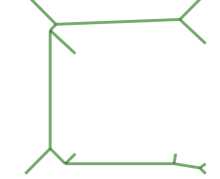 Esqueleto reto de polígono |
Name
ST_StraightSkeleton — Calcule um esqueleto em linha reta de uma geometria
Synopsis
geometry ST_StraightSkeleton(geometry geom);
Descrição
| |
ST_StraightSkeleton is deprecated as of 3.5.0. Use CG_StraightSkeleton instead. |
Disponibilidade: 2.1.0
This method needs SFCGAL backend.
This function supports 3d and will not drop the z-index.
This function supports Polyhedral surfaces.
This function supports Triangles and Triangulated Irregular Network Surfaces (TIN).
Exemplos
SELECT ST_StraightSkeleton(ST_GeomFromText('POLYGON (( 190 190, 10 190, 10 10, 190 10, 190 20, 160 30, 60 30, 60 130, 190 140, 190 190 ))'));Polígono original | Esqueleto reto de polígono |
Veja também
Name
ST_Tesselate — Representa superfície tesselação de um polígono ou superfície poliédrica e retorna como uma TIN ou coleção de TINS
Synopsis
geometry ST_Tesselate(geometry geom);
Descrição
| |
ST_Tesselate is deprecated as of 3.5.0. Use CG_Tesselate instead. |
Usa como entrada uma superfície como um MULTI(POLÍGONO) ou SUPERFÍCIEPOLIÉDRICA e retorna uma representação TIN via o processo de tesselação usando triângulos.
| |
ST_TriangulatePolygon does similar to this function except that it returns a geometry collection of polygons instead of a TIN and also only works with 2D geometries. |
Disponibilidade: 2.1.0
This method needs SFCGAL backend.
This function supports 3d and will not drop the z-index.
This function supports Polyhedral surfaces.
This function supports Triangles and Triangulated Irregular Network Surfaces (TIN).
Name
CG_Tesselate — Representa superfície tesselação de um polígono ou superfície poliédrica e retorna como uma TIN ou coleção de TINS
Synopsis
geometry CG_Tesselate(geometry geom);
Descrição
Usa como entrada uma superfície como um MULTI(POLÍGONO) ou SUPERFÍCIEPOLIÉDRICA e retorna uma representação TIN via o processo de tesselação usando triângulos.
| |
ST_TriangulatePolygon does similar to this function except that it returns a geometry collection of polygons instead of a TIN and also only works with 2D geometries. |
Availability: 3.5.0
This method needs SFCGAL backend.
This function supports 3d and will not drop the z-index.
This function supports Polyhedral surfaces.
This function supports Triangles and Triangulated Irregular Network Surfaces (TIN).
Exemplos
SELECT ST_GeomFromText('POLYHEDRALSURFACE Z( ((0 0 0, 0 0 1, 0 1 1, 0 1 0, 0 0 0)),
((0 0 0, 0 1 0, 1 1 0, 1 0 0, 0 0 0)), ((0 0 0, 1 0 0, 1 0 1, 0 0 1, 0 0 0)),
((1 1 0, 1 1 1, 1 0 1, 1 0 0, 1 1 0)),
((0 1 0, 0 1 1, 1 1 1, 1 1 0, 0 1 0)), ((0 0 1, 1 0 1, 1 1 1, 0 1 1, 0 0 1)) )');
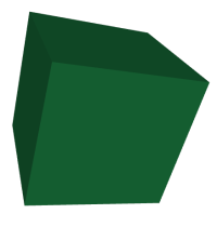 Cubo original |
SELECT CG_Tesselate(ST_GeomFromText('POLYHEDRALSURFACE Z( ((0 0 0, 0 0 1, 0 1 1, 0 1 0, 0 0 0)),
((0 0 0, 0 1 0, 1 1 0, 1 0 0, 0 0 0)), ((0 0 0, 1 0 0, 1 0 1, 0 0 1, 0 0 0)),
((1 1 0, 1 1 1, 1 0 1, 1 0 0, 1 1 0)),
((0 1 0, 0 1 1, 1 1 1, 1 1 0, 0 1 0)), ((0 0 1, 1 0 1, 1 1 1, 0 1 1, 0 0 1)) )'));
ST_AsText output: TIN Z (((0 0 0,0 0 1,0 1 1,0 0 0)),((0 1 0,0 0 0,0 1 1,0 1 0)),
((0 0 0,0 1 0,1 1 0,0 0 0)),
((1 0 0,0 0 0,1 1 0,1 0 0)),((0 0 1,1 0 0,1 0 1,0 0 1)),
((0 0 1,0 0 0,1 0 0,0 0 1)),
((1 1 0,1 1 1,1 0 1,1 1 0)),((1 0 0,1 1 0,1 0 1,1 0 0)),
((0 1 0,0 1 1,1 1 1,0 1 0)),((1 1 0,0 1 0,1 1 1,1 1 0)),
((0 1 1,1 0 1,1 1 1,0 1 1)),((0 1 1,0 0 1,1 0 1,0 1 1)))
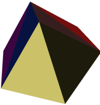 Cubo tesselado com triângulos coloridos |
SELECT 'POLYGON (( 10 190, 10 70, 80 70, 80 130, 50 160, 120 160, 120 190, 10 190 ))'::geometry;
Polígono original |
SELECT
CG_Tesselate('POLYGON (( 10 190, 10 70, 80 70, 80 130, 50 160, 120 160, 120 190, 10 190 ))'::geometry);
ST_AsText output TIN(((80 130,50 160,80 70,80 130)),((50 160,10 190,10 70,50 160)),
((80 70,50 160,10 70,80 70)),((120 160,120 190,50 160,120 160)),
((120 190,10 190,50 160,120 190)))
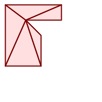 Polígono tesselado |
Name
CG_Triangulate — Triangulates a polygonal geometry
Synopsis
geometry CG_Triangulate( geometry geom );
Descrição
Triangulates a polygonal geometry.
Performed by the SFCGAL module
| |
NOTE: this function returns a geometry representing the triangulated result. |
Availability: 3.5.0
This method needs SFCGAL backend.
Exemplos de Geometria
SELECT CG_Triangulate('POLYGON((0.0 0.0,1.0 0.0,1.0 1.0,0.0 1.0,0.0 0.0),(0.2 0.2,0.2 0.8,0.8 0.8,0.8 0.2,0.2 0.2))');
cg_triangulate
----------------
TIN(((0.8 0.2,0.2 0.2,1 0,0.8 0.2)),((0.2 0.2,0 0,1 0,0.2 0.2)),((1 1,0.8 0.8,0.8 0.2,1 1)),((0 1,0 0,0.2 0.2,0 1)),((0 1,0.2 0.8,1 1,0 1)),((0 1,0.2 0.2,0.2 0.8,0 1)),((0.2 0.8,0.8 0.8,1 1,0.2 0.8)),((0.2 0.8,0.2 0.2,0.8 0.2,0.2 0.8)),((1 1,0.8 0.2,1 0,1 1)),((0.8 0.8,0.2 0.8,0.8 0.2,0.8 0.8)))
(1 row)Name
CG_Visibility — Compute a visibility polygon from a point or a segment in a polygon geometry
Synopsis
geometry CG_Visibility(geometry polygon, geometry point);
geometry CG_Visibility(geometry polygon, geometry pointA, geometry pointB);
Descrição
Availability: 3.5.0 - requires SFCGAL >= 1.5.0.
Requires SFCGAL >= 1.5.0
This method needs SFCGAL backend.
This function supports 3d and will not drop the z-index.
This function supports Polyhedral surfaces.
This function supports Triangles and Triangulated Irregular Network Surfaces (TIN).
Exemplos
SELECT CG_Visibility('POLYGON((23.5 23.5,23.5 173.5,173.5 173.5,173.5 23.5,23.5 23.5),(108 98,108 36,156 37,155 99,108 98),(107 157.5,107 106.5,135 107.5,133 127.5,143.5 127.5,143.5 108.5,153.5 109.5,151.5 166,107 157.5),(41 95.5,41 35,100.5 36,98.5 68,78.5 68,77.5 96.5,41 95.5),(39 150,40 104,97.5 106.5,95.5 152,39 150))'::geometry, 'POINT(91 87)'::geometry);SELECT CG_Visibility('POLYGON((23.5 23.5,23.5 173.5,173.5 173.5,173.5 23.5,23.5 23.5),(108 98,108 36,156 37,155 99,108 98),(107 157.5,107 106.5,135 107.5,133 127.5,143.5 127.5,143.5 108.5,153.5 109.5,151.5 166,107 157.5),(41 95.5,41 35,100.5 36,98.5 68,78.5 68,77.5 96.5,41 95.5),(39 150,40 104,97.5 106.5,95.5 152,39 150))'::geometry,'POINT(78.5 68)'::geometry, 'POINT(98.5 68)'::geometry); Polígono original |  Visibility from the point |  Visibility from the segment |
Name
CG_YMonotonePartition — Computes y-monotone partition of the polygon geometry
Synopsis
geometry CG_YMonotonePartition(geometry geom);
Descrição
Computes y-monotone partition of the polygon geometry.
| |
A partition of a polygon P is a set of polygons such that the interiors of the polygons do not intersect and the union of the polygons is equal to the interior of the original polygon P. A y-monotone polygon is a polygon whose vertices v1,…,vn can be divided into two chains v1,…,vk and vk,…,vn,v1, such that any horizontal line intersects either chain at most once. This algorithm does not guarantee a bound on the number of polygons produced with respect to the optimal number. |
Availability: 3.5.0 - requires SFCGAL >= 1.5.0.
Requires SFCGAL >= 1.5.0
This method needs SFCGAL backend.
Exemplos
 Polígono original |  Y-Monotone Partition (same example As CG_ApproxConvexPartition, CG_GreeneApproxConvexPartition and CG_OptimalConvexPartition) |
SELECT ST_AsText(CG_YMonotonePartition('POLYGON((156 150,83 181,89 131,148 120,107 61,32 159,0 45,41 86,45 1,177 2,67 24,109 31,170 60,180 110,156 150))'::geometry));
GEOMETRYCOLLECTION(POLYGON((32 159,0 45,41 86,32 159)),POLYGON((107 61,32 159,41 86,45 1,177 2,67 24,109 31,170 60,107 61)),POLYGON((156 150,83 181,89 131,148 120,107 61,170 60,180 110,156 150)))
Name
CG_StraightSkeletonPartition — Computes the straight skeleton partition of a polygon.
Synopsis
geometry CG_StraightSkeletonPartition(geometry geom, boolean auto_orientation);
Descrição
Computes the straight skeleton partition of the input polygon geometry geom. The straight skeleton is a partitioning of the polygon into faces formed by tracing the collapse of its edges. If auto_orientation is set to true, the function will automatically adjust the orientation of the input polygon to ensure correct results.
Availability: 3.6.0 - requires SFCGAL >= 2.0.0.
This method needs SFCGAL backend.
Exemplos
SELECT ST_AsText(CG_StraightSkeletonPartition('POLYGON((0 0, 4 0, 2 2, 0 0))', true));
-- Result: MULTIPOLYGON(((0 0,2 0.83,2 2)),((4 0,2 0.83,0 0)),((2 2,2 0.83,4 0)))SELECT CG_StraightSkeletonPartition(ST_GeomFromText('POLYGON (( 190 190, 10 190, 10 10, 190 10, 190 20
, 160 30, 60 30, 60 130, 190 140, 190 190 ))')
, true );Polígono original |  Straight Skeleton Partition of polygon |
Veja também
Name
CG_3DBuffer — Computes a 3D buffer around a geometry.
Synopsis
geometry CG_3DBuffer(geometry geom, float8 radius, integer segments, integer buffer_type);
Descrição
Generates a 3D buffer around the input geometry geom with a specified radius. The buffer is constructed in 3D space, creating a volumetric representation of the geometry's surroundings. The segments parameter defines the number of segments used to approximate the curved sections of the buffer, with a minimum value of 4 segments required. The buffer_type specifies the type of buffer to create: 0: Rounded buffer (default) 1: Flat buffer 2: Square buffer
Input geometry must be a Point or LineString.
Availability: 3.6.0 - requires SFCGAL >= 2.0.0
This method needs SFCGAL backend.
Exemplos
SELECT ST_AsText(CG_3DBuffer('POINT(0 0 0)', 1, 8, 0));
-- Result: POLYHEDRALSURFACE Z (((0 0 1, 0.5 -0.5 0.71, 0 -0.71 0.71, 0 0 1)), ... )The following images were rendered pasting the output of the ST_AsX3D query into X3D Viewer.
SELECT string_agg('<Shape
>' || ST_AsX3D(cgbuffer3d_output) || '<Appearance>
<Material diffuseColor="0 0.8 0.2" specularColor="0 1 0"/>
</Appearance>
</Shape
>', ''); segments=32 (rounded buffer)
SELECT CG_3DBuffer(ST_GeomFromText('POINT(100 90)'), 50,32,0);
|  5 segments rounded
SELECT CG_3DBuffer(
ST_GeomFromText('POINT(100 90)'),
50,5,0);
|
 32 segments, round
SELECT CG_3DBuffer(
ST_GeomFromText(
'LINESTRING(50 50,150 150,150 50)'
),
10,32,0);
|  32 segments, square
SELECT CG_3DBuffer(
ST_GeomFromText(
'LINESTRING(50 50,150 150,150 50)'
),
10,32,2);
|
Veja também
Name
CG_Rotate — Rotates a geometry by a given angle around the origin (0,0).
Synopsis
geometry CG_Rotate(geometry geom, float8 angle);
Descrição
Rotates the input geometry geom by angle radians around the origin point (0,0). The rotation is performed in 2D space; Z coordinates are not modified. Positive angles rotate the geometry counter-clockwise.
Availability: 3.6.0 - requires SFCGAL >= 2.0.0
This method needs SFCGAL backend.
Exemplos
SELECT ST_AsText(CG_Rotate('LINESTRING(1 0, 0 1)', pi()/2));
-- Result: LINESTRING(0 1, -1 0)Veja também
Name
CG_2DRotate — Rotates a geometry by a given angle around a specified point in 2D.
Synopsis
geometry CG_2DRotate(geometry geom, float8 angle, float8 cx, float8 cy);
Descrição
Rotates the input geometry geom by angle radians around the point (cx, cy). The rotation is performed in 2D space; Z coordinates are dropped. Positive angles rotate the geometry counter-clockwise.
Availability: 3.6.0 - requires SFCGAL >= 2.0.0
This method needs SFCGAL backend.
Exemplos
SELECT ST_AsText(CG_2DRotate('POINT(1 0)', pi()/2, 1, 1));
-- Result: POINT(2 1)Veja também
Name
CG_3DRotate — Rotates a geometry in 3D space around an axis vector.
Synopsis
geometry CG_3DRotate(geometry geom, float8 angle, float8 ax, float8 ay, float8 az);
Descrição
Rotates the input geometry geom by angle radians around an axis defined by the vector (ax, ay, az) passing through the origin (0,0,0).
Availability: 3.6.0 - requires SFCGAL >= 2.0.0
This method needs SFCGAL backend.
This function supports 3d and will not drop the z-index.
Exemplos
SELECT ST_AsText(CG_3DRotate('POINT(1 0 0)', pi()/2, 0, 0, 1));
-- Result: POINT(0 1 0)Veja também
Name
CG_RotateX — Rotates a geometry around the X-axis by a given angle.
Synopsis
geometry CG_RotateX(geometry geom, float8 angle);
Descrição
Rotates the input geometry geom by angle radians around the X-axis.
Availability: 3.6.0 - requires SFCGAL >= 2.0.0
This method needs SFCGAL backend.
This function supports 3d and will not drop the z-index.
Exemplos
SELECT ST_AsText(CG_RotateX('POINT(0 1 0)', pi()/2));
-- Result: POINT(0 0 1)Veja também
Name
CG_RotateY — Rotates a geometry around the Y-axis by a given angle.
Synopsis
geometry CG_RotateY(geometry geom, float8 angle);
Descrição
Rotates the input geometry geom by angle radians around the Y-axis passing.
Availability: 3.6.0 - requires SFCGAL >= 2.0.0
This method needs SFCGAL backend.
This function supports 3d and will not drop the z-index.
Exemplos
SELECT ST_AsText(CG_RotateY('POINT(1 0 0)', pi()/2));
-- Result: POINT(0 0 -1)Veja também
Name
CG_RotateZ — Rotates a geometry around the Z-axis by a given angle.
Synopsis
geometry CG_RotateZ(geometry geom, float8 angle);
Descrição
Rotates the input geometry geom by angle radians around the Z-axis.
Availability: 3.6.0 - requires SFCGAL >= 2.0.0
This method needs SFCGAL backend.
This function supports 3d and will not drop the z-index.
Exemplos
SELECT ST_AsText(CG_RotateZ('POINT(1 0 0)', pi()/2));
-- Result: POINT(0 1 0)Veja também
Name
CG_Scale — Scales a geometry uniformly in all dimensions by a given factor.
Synopsis
geometry CG_Scale(geometry geom, float8 factor);
Descrição
Scales the input geometry geom by a uniform scale factor in all dimensions (X, Y, and Z). The scaling is performed relative to the origin point (0,0,0).
Availability: 3.6.0 - requires SFCGAL >= 2.0.0
This method needs SFCGAL backend.
Exemplos
SELECT ST_AsText(CG_Scale('LINESTRING(1 1, 2 2)', 2));
-- Result: LINESTRING(2 2, 4 4)Veja também
Name
CG_3DScale — Scales a geometry by separate factors along X, Y, and Z axes.
Synopsis
geometry CG_3DScale(geometry geom, float8 factorX, float8 factorY, float8 factorZ);
Descrição
Scales the input geometry geom by different factors along the X, Y, and Z axes. The scaling is performed relative to the origin point (0,0,0).
Availability: 3.6.0 - requires SFCGAL >= 2.0.0
This method needs SFCGAL backend.
This function supports 3d and will not drop the z-index.
Exemplos
SELECT ST_AsText(CG_3DScale('POINT(1 1 1)', 2, 3, 4));
-- Result: POINT(2 3 4)Veja também
Name
CG_3DScaleAroundCenter — Scales a geometry in 3D space around a specified center point.
Synopsis
geometry CG_3DScaleAroundCenter(geometry geom, float8 factorX, float8 factorY, float8 factorZ, float8 centerX, float8 centerY, float8 centerZ);
Descrição
Scales the input geometry geom by different factors along the X, Y, and Z axes, relative to a specified center point (centerX, centerY, centerZ).
Availability: 3.6.0 - requires SFCGAL >= 2.0.0
This method needs SFCGAL backend.
This function supports 3d and will not drop the z-index.
Exemplos
SELECT ST_AsText(CG_3DScaleAroundCenter('POINT(2 2 2)', 0.5, 0.5, 0.5, 1, 1, 1));
-- Result: POINT(1.5 1.5 1.5)Veja também
Name
CG_Translate — Translates (moves) a geometry by given offsets in 2D space.
Synopsis
geometry CG_Translate(geometry geom, float8 deltaX, float8 deltaY);
Descrição
Translates the input geometry geom by adding deltaX to the X coordinates and deltaY to the Y coordinates. Z coordinates are dropped.
Availability: 3.6.0 - requires SFCGAL >= 2.0.0
This method needs SFCGAL backend.
Exemplos
SELECT ST_AsText(CG_Translate('LINESTRING(1 1, 2 2)', 1, -1));
-- Result: LINESTRING(2 0, 3 1)Veja também
Name
CG_3DTranslate — Translates (moves) a geometry by given offsets in 3D space.
Synopsis
geometry CG_3DTranslate(geometry geom, float8 deltaX, float8 deltaY, float8 deltaZ);
Descrição
Translates the input geometry geom by adding deltaX to the X coordinates, deltaY to the Y coordinates, and deltaZ to the Z coordinates.
Availability: 3.6.0 - requires SFCGAL >= 2.0.0
This method needs SFCGAL backend.
This function supports 3d and will not drop the z-index.
Exemplos
SELECT ST_AsText(CG_3DTranslate('POINT(1 1 1)', 1, -1, 2));
-- Result: POINT(2 0 3)Veja também
Name
CG_Simplify — Reduces the complexity of a geometry while preserving essential features and Z/M values.
Synopsis
geometry CG_Simplify(geometry geom, double precision threshold, boolean preserveTopology = false);
Descrição
Simplifies a geometry using SFCGAL's simplification algorithm, which reduces the number of points or vertices while preserving the essential features of the geometry. This function preserves Z and M values during simplification.
The algorithm is based on constrained triangulation and uses the CGAL Polyline Simplification 2 library with additional handling to preserve Z and M coordinates. When topology is preserved and geometries intersect, Z and M values are interpolated at intersection points.
This function works well with 3D terrain-like geometries (2.5D) but is not designed for vertical surfaces like walls.
Availability: 3.6.0 - requires SFCGAL >= 2.1.0
This method needs SFCGAL backend.
This function supports 3d and will not drop the z-index.
This function supports M coordinates.
Parameters
geomInput geometry
thresholdMaximum distance threshold (in geometry unit) for simplification. The higher this value, the more simplified the resulting geometry will be.
preserveTopologyIf set to true, the function ensures that the topology of the geometry is preserved. When geometries intersect in this mode, Z and M values at intersection points are interpolated. The default value is false.
Return Value
Returns a simplified geometry with preserved Z and M values.
Exemplos
-- Simplify a polygon with a threshold of 0.5
SELECT ST_AsText(CG_Simplify(ST_GeomFromText('POLYGON((0 0, 0 1, 0.1 1, 0.2 1, 0.3 1, 0.4 1, 0.5 1, 1 1, 1 0, 0 0))'), 0.5));
-- Simplify a 3D terrain geometry while preserving topology and Z values
SELECT ST_AsText(CG_Simplify(ST_GeomFromText('LINESTRING Z(0 0 0, 0 1 1, 0.1 1 1, 0.2 1 1, 0.3 1 1, 1 1 2)'), 0.2, true));
-- Simplify a geometry with both Z and M values
SELECT ST_AsText(CG_Simplify(ST_GeomFromText('LINESTRING ZM(0 0 0 1, 0 1 1 2, 0.1 1 1 3, 0.2 1 1 4, 0.3 1 1 5, 1 1 2 6)'), 0.2));
-- Simplify two geometry together preserving Z and M values, without topology
SELECT ST_AsText(CG_Simplify('GEOMETRYCOLLECTION ZM(LINESTRING ZM(-1 -1 3 4, 0 0 10 100, 1 1 20 200, 0 2 15 150, 0 5 30 300, 2 19 25 250, -4 20 15 150), POLYGON ZM((0 0 10 100, 1 1 20 200, 0 2 15 150, 0 5 30 300, 2 19 25 250, -4 20 15 150, 0 0 10 100)))', 2, false));
-- Simplify two geometry together preserving Z and M values, with topology
SELECT ST_AsText(CG_Simplify('GEOMETRYCOLLECTION ZM(LINESTRING ZM(-1 -1 3 4, 0 0 10 100, 1 1 20 200, 0 2 15 150, 0 5 30 300, 2 19 25 250, -4 20 15 150), POLYGON ZM((0 0 10 100, 1 1 20 200, 0 2 15 150, 0 5 30 300, 2 19 25 250, -4 20 15 150, 0 0 10 100)))', 2, true));
WITH depts_pds as (SELECT ST_GeomFromText('GEOMETRYCOLLECTION(
POLYGON((88.46 158.85,90.77 171.54,147.31 173.85,146.15 145,173.85 119.62,146.15 103.46,112.69 118.46,91.92 93.08,65.38 101.15,34.23 121.92,41.15 142.69,49.23 143.85,88.46 158.85)),
POLYGON((112.69 118.46,146.15 103.46,190 60.77,185.38 43.46,126.54 26.15,83.85 28.46,67.69 64.23,43.46 58.46,10 83.85,34.23 121.92,65.38 101.15,91.92 93.08,112.69 118.46)))
') as geom)
SELECT geom FROM depts_pds;
Originals geometries
WITH depts_pds as (SELECT ST_GeomFromText('GEOMETRYCOLLECTION(
POLYGON((88.46 158.85,90.77 171.54,147.31 173.85,146.15 145,173.85 119.62,146.15 103.46,112.69 118.46,91.92 93.08,65.38 101.15,34.23 121.92,41.15 142.69,49.23 143.85,88.46 158.85)),
POLYGON((112.69 118.46,146.15 103.46,190 60.77,185.38 43.46,126.54 26.15,83.85 28.46,67.69 64.23,43.46 58.46,10 83.85,34.23 121.92,65.38 101.15,91.92 93.08,112.69 118.46)))
') as geom)
SELECT (ST_Dump(CG_Simplify(geom, 0.5, true))).geom FROM depts_pds;
Simplification with 0.5 and topology preserved
WITH depts_pds as (SELECT ST_GeomFromText('GEOMETRYCOLLECTION(
POLYGON((88.46 158.85,90.77 171.54,147.31 173.85,146.15 145,173.85 119.62,146.15 103.46,112.69 118.46,91.92 93.08,65.38 101.15,34.23 121.92,41.15 142.69,49.23 143.85,88.46 158.85)),
POLYGON((112.69 118.46,146.15 103.46,190 60.77,185.38 43.46,126.54 26.15,83.85 28.46,67.69 64.23,43.46 58.46,10 83.85,34.23 121.92,65.38 101.15,91.92 93.08,112.69 118.46)))
') as geom)
SELECT (ST_Dump(CG_Simplify(geom, 0.5, false))).geom FROM depts_pds;
Simplification with 0.5 without topology preservation
Veja também
Name
CG_3DAlphaWrapping — Computes a 3D Alpha-wrapping strictly enclosing a geometry.
Synopsis
geometry CG_3DAlphaWrapping(geometry geom, integer relative_alpha, integer relative_offset);
Descrição
Computes the 3D Alpha Wrapping of the points in a geometry. An alpha wrapping is a watertight and orientable surface mesh that strictly encloses the input. It can be seen as an extension or refinement of an alpha-shape.
The relative_alpha parameter controls which features will appear in the output. It can can have values from 0 to infinity. Smaller relative_alpha values result in simpler outputs, but they are less accurate representations of the original input.
The relative_offset parameter controls the tightness of the result. It can can have values from 0 to infinity. If this parameter is set to 0, its value is automatically determined based on the relative_alpha parameter.
Availability: 3.6.0 - requires SFCGAL >= 2.1.0
This method needs SFCGAL backend.
This function supports 3d and will not drop the z-index.
Exemplos
SELECT CG_3DAlphaWrapping('MULTIPOINT((63 84),(76 88),(68 73),(53 18),(91 50),(81 70),
(88 29),(24 82),(32 51),(37 23),(27 54),(84 19),(75 87),(44 42),(77 67),(90 30),(36 61),(32 65),
(81 47),(88 58),(68 73),(49 95),(81 60),(87 50),(78 16),(79 21),(30 22),(78 43),(26 85),(48 34),
(35 35),(36 40),(31 79),(83 29),(27 84),(52 98),(72 95),(85 71),(75 84),(75 77),(81 29),(77 73),
(41 42),(83 72),(23 36),(89 53),(27 57),(57 97),(27 77),(39 88),(60 81),(80 72),(54 32),(55 26),
(62 22),(70 20),(76 27),(84 35),(87 42),(82 54),(83 64),(69 86),(60 90),(50 86),(43 80),(36 73),
(36 68),(40 75),(24 67),(23 60),(26 44),(28 33),(40 32),(43 19),(65 16),(73 16),(38 46),(31 59),
(34 86),(45 90),(64 97))'::geometry,10);
Alpha wrapping of a MultiPoint (same example As CG_OptimalAlphaShape)
SELECT CG_3DAlphaWrapping('MULTIPOINT((132 64),(114 64),(99 64),(81 64),(63 64),(57 49),
(52 36),(46 20),(37 20),(26 20),(32 36),(39 55),(43 69),(50 84),(57 100),(63 118),(68 133),(74 149),
(81 164),(88 180),(101 180),(112 180),(119 164),(126 149),(132 131),(139 113),(143 100),(150 84),(157 69),(163 51),
(168 36),(174 20),(163 20),(150 20),(143 36),(139 49),(132 64),(99 151),(92 138),(88 124),(81 109),(74 93),(70 82),
(83 82),(99 82),(112 82),(126 82),(121 96),(114 109),(110 122),(103 138),(99 151),(34 27),(43 31),(48 44),(46 58),
(52 73),(63 73),(61 84),(72 71),(90 69),(101 76),(123 71),(141 62),(166 27),(150 33),(159 36),(146 44),(154 53),
(152 62),(146 73),(134 76),(143 82),(141 91),(130 98),(126 104),(132 113),(128 127),(117 122),(112 133),(119 144),
(108 147),(119 153),(110 171),(103 164),(92 171),(86 160),(88 142),(79 140),(72 124),(83 131),(79 118),(68 113),
(63 102),(68 93),(35 45))'::geometry,14);
Alpha wrapping of a MultiPoint (same example as ST_ConcaveHull)
Effect of the relative_alpha parameter with values 5, 10 and 20. A value of 5 results in a coarse output. Increasing the parameter up to 20 significantly improves the precision and granularity of the result.
Veja também
Chapter 9. Topologia
- 9.1. Topology Primitive Tables
- 9.2. Tipos de topologia
- 9.3. Domínios de Topologia
- 9.4. Gerenciamento de Topologia e TopoGeometria
- 9.5. Topology Statistics Management
- 9.6. Construtores de topologia
- 9.7. Editores de Topologia
- 9.8. Assessores de Topologia
- 9.9. Processamento de Topologia
- 9.10. Construtores de TopoGeometria
- 9.11. Editores de TopoGeometria
- 9.12. Assessores de TopoGeometria
- 9.13. TopoGeometry Outputs
- 9.14. Relações de Topologia Espacial
- 9.15. Importing and exporting Topologies
Os tipos e as funções de topologia do PostGIS são usados para administrar objetos como: faces, bordas e nodos.
Sandro Santilli's presentation at PostGIS Day Paris 2011 conference gives a good synopsis of PostGIS Topology and where it is headed Topology with PostGIS 2.0 slide deck.
Vincent Picavet provides a good synopsis and overview of what is Topology, how is it used, and various FOSS4G tools that support it in PostGIS Topology PGConf EU 2012.
Um exemplo de um banco de dados GIS baseado topologicamente é o banco de dados US Census Topologically Integrated Geographic Encoding and Referencing System (TIGER). Se você quiser experimentar com a topologia POstGIS e precisa de alguns dados, confira Topology_Load_Tiger.
The PostGIS topology module has existed for a long time but was not always part of the official documentation. Extensive cleanup removed deprecated functions, fixed known usability issues, documented the features and functions, added new functionality, and improved SQL-MM compliance.
Detalhes deste projeto podem ser encontrados em PostGIS Topology Wiki
Todas as funções e tables associadas com este módulo estão instaladas em um esquema nomeado topology.
Funções que são definidas no padrão SQL/MM estão prefixadas com ST_ e funções específicas para o POstGIS não estão prefixadas.
Topology support is built by default and can be disabled by specifying the --without-topology configure option at build time as described in Chapter 2, Instalação do PostGIS
9.1. Topology Primitive Tables
The core primitives of any topology are stored in the edge_data, node, and face tables that live in the schema created by CreateTopology. Each row of edge_data represents an oriented edge: it records a directed curve from start_node to end_node together with the identifier of the face encountered on the left of that direction (left_face) and the face encountered on the right (right_face). The same geometric segment may therefore appear twice—once for each orientation—when it belongs to two faces.
The next_left_edge and next_right_edge columns complete this orientation information by encoding how to keep walking around a face. They store signed integers whose absolute value is the identifier of the next oriented edge and whose sign determines whether the stored orientation has to be followed as-is or reversed when traversing. Formally, the following rules hold for every edge e:
abs(next_left_edge)is the identifier of the edge reached by continuing around the face that lies to the left ofe. If the value is positive the walk continues from the end node ofealong the stored orientation of the referenced edge; if it is negative the referenced edge must be followed backwards so that the shared face remains on the walker’s left.abs(next_right_edge)analogously follows the boundary of the face located on the right ofe. A positive value means that the next edge is taken with its recorded orientation starting from the end node ofe, whereas a negative value instructs to traverse the referenced edge in reverse, starting from its end node, so that the right-hand face is preserved.A zero value indicates that the edge is dangling on the corresponding side (for example an isolated edge whose incident face is the universal face
0). Theabs_next_left_edgeandabs_next_right_edgecolumns exposed by theedgeview are convenience projections of these absolute values.
This representation is a variant of a doubly connected edge list and is exploited by many topology routines. Functions such as GetRingEdges and ValidateTopology rely on it to reconstruct face boundaries and to diagnose inconsistencies—hence the “invalid next_left_edge” and “invalid next_right_edge” diagnostics reported during validation. Constructors like AddEdge initialise the next_* attributes with trivial self references, while editing routines including ST_AddEdgeModFace and ST_RemEdgeModFace update the links as edges are inserted or removed. Other bulk operations (for example Polygonize) may intentionally leave the fields unset, which is why the documentation flags their behaviour explicitly.
9.2. Tipos de topologia
Essa seção lista os tipos de dados PostgreSQL instalados pela topologia PostGIS. Note que descrevemos o comportamento de distribuição de papeis desses, que são bastante importantes quando desenvolvem suas próprias funções.
- getfaceedges_returntype — A composite type that consists of a sequence number and an edge number.
- TopoGeometry — A composite type representing a topologically defined geometry.
- validatetopology_returntype — A composite type that consists of an error message and id1 and id2 to denote location of error. This is the return type for
ValidateTopology.
Name
getfaceedges_returntype — A composite type that consists of a sequence number and an edge number.
Descrição
A composite type that consists of a sequence number and an edge number. This is the return type for ST_GetFaceEdges and GetNodeEdges functions.
sequenceé um inteiro: Refere-se a uma topologia definida na table topology.topology que define o esquema e srid da topologia.edgeé um inteiro: O identificador de um limite.
Name
TopoGeometry — A composite type representing a topologically defined geometry.
Descrição
Um tipo composto que refere-se a uma geometria de topologia em uma camada específica da topologia, tendo um tipo e id específicos. Os elementos de uma TopoGeometry são as propriedades: topology_id, layer_id, inteireza id, inteireza do tipo.
topology_idé um inteiro: Refere-se a uma topologia definida na table topology.topology que define o esquema e srid da topologia.layer_idé um inteiro: A layer_id nas layers tables que a TopoGEometry pertence. A combinação de topology_id, layer_id fornece uma referência única na table topology.layers.idé um inteiro: a identidade é o número sequência autogerado que define a topogeometry na respectiva camada da topologia.typeinteiro entre 1 - 4 that define o tipo da geometria: 1:[multi]ponto, 2:[multi]linha, 3:[multi]poly, 4:coleção
Comportamento Casting
Esta seção lista os casts automáticos bem como os explícitos permitidos para esse tipo de dados
| Cast To | Comportamento |
| geometria | automático |
Veja também
Name
validatetopology_returntype — A composite type that consists of an error message and id1 and id2 to denote location of error. This is the return type for ValidateTopology.
Descrição
Um tipo composto que consiste em uma mensagem de erro e dois inteiros. A função ValidateTopology retorna um conjunto para indicar erros de validação e a id1 e id2 para indicar as ids dos objetos da topologia envolvidas no erro.
erroré varchar: Indica tipo de erro.A descrições de erro atuais são: nós coincidentes, limite cruza nó, limite não simples, geometria limite e nó que não combinam, limite começa e a geometria nó não combina, face sobrepõe face, face dentro de face,
id1é um inteiro: Indica identificador de limite / face / nós no erro.id2é um inteiro: Para erros que envolvem limite / ou nó secundário
Veja também
9.3. Domínios de Topologia
Esta seção lista os domínios do PostgreSQL instalados pela Topologia PostGIS. Os domínios podem ser usados como tipos objetos de funções ou table columns. A distinção entre um domínio e um tipo é que o domínio é um tipo existente com uma restrição verificada ligada a ele.
- TopoElement — Um arranjo de 2 inteiros geralmente usado para identificar um componente TopoGeometry.
- TopoElementArray — An array of TopoElement objects.
Name
TopoElement — Um arranjo de 2 inteiros geralmente usado para identificar um componente TopoGeometry.
Descrição
Um arranjo de 2 inteiros usados para representar um componente de um simples ou hierárquico TopoGeometry.
No caso de de uma TopoGeometria simples, o primeiro elemento do arranjo representa o identificador de um topológico primitivo, e o segundo elemento representa o tipo dele (1:nó, 2:limite, 3:face). No caso de uma TopoGeometria hierárquica o primeiro elemento do arranjo representa o identificador de uma TopoGeometria filha e o segundo elemento representa seu identificador de camada.
| |
Para qualquer uma das TopoGeometrias hierárquicas dadas, todos os elementos das TopoGeometrias filhas virão da mesma camada, assim com está especificado no relato topology.layer para a camada da TopoGeometria que está sendo definida. |
Exemplos
SELECT te[1] AS id, te[2] AS type FROM
( SELECT ARRAY[1,2]::topology.topoelement AS te ) f;
id | type
----+------
1 | 2
SELECT ARRAY[1,2]::topology.topoelement;
te
-------
{1,2}
--Example of what happens when you try to case a 3 element array to topoelement
-- NOTE: topoement has to be a 2 element array so fails dimension check
SELECT ARRAY[1,2,3]::topology.topoelement;
ERROR: value for domain topology.topoelement violates check constraint "dimensions"
Name
TopoElementArray — An array of TopoElement objects.
Descrição
Um arranjo de 1 ou mais objetos TopoGeometria, geralmente usado para circular componentes dos objetos de TopoGeometrias.
Exemplos
SELECT '{{1,2},{4,3}}'::topology.topoelementarray As tea;
tea
-------
{{1,2},{4,3}}
-- more verbose equivalent --
SELECT ARRAY[ARRAY[1,2], ARRAY[4,3]]::topology.topoelementarray As tea;
tea
-------
{{1,2},{4,3}}
--using the array agg function packaged with topology --
SELECT topology.TopoElementArray_Agg(ARRAY[e,t]) As tea
FROM generate_series(1,4) As e CROSS JOIN generate_series(1,3) As t;
tea
--------------------------------------------------------------------------
{{1,1},{1,2},{1,3},{2,1},{2,2},{2,3},{3,1},{3,2},{3,3},{4,1},{4,2},{4,3}}
SELECT '{{1,2,4},{3,4,5}}'::topology.topoelementarray As tea;
ERROR: value for domain topology.topoelementarray violates check constraint "dimensions"
Veja também
9.4. Gerenciamento de Topologia e TopoGeometria
Esta seção lista as funções da Topologia para construir novos esquemas de Topologia, validando topologias e gerenciar Colunas TopoGeometrias
- AddTopoGeometryColumn — Adiciona uma coluna topogeometria a uma table, registra essa coluna nova como uma camada topology.layer e retorna a nova layer_id.
- RenameTopoGeometryColumn — Renames a topogeometry column
- DropTopology — Cuidado ao usar: Derruba um esquema topologia e deleta sua referência da table topology.topology e referências para tables naquele esquema da table geometry_columns.
- RenameTopology — Renames a topology
- DropTopoGeometryColumn — Derruba a coluna topogeometry da table nomeada
table_nameno esquemaschema_namee tira os registros da - FixCorruptTopoGeometryColumn — Fixes topogeometry corruption caused by upgrade to postgis_topology 3.6.0 and higher
- Populate_Topology_Layer — Adds missing entries to topology.layer table by reading metadata from topo tables.
- TopologySummary — Takes a topology name and provides summary totals of types of objects in topology.
- ValidateTopology — Returns a set of validatetopology_returntype objects detailing issues with topology.
- ValidateTopologyRelation — Returns info about invalid topology relation records
- ValidateTopologyPrecision — Returns non-precise vertices in the topology.
- MakeTopologyPrecise — Snap topology vertices to precision grid.
- FindTopology — Returns a topology record by different means.
- FindLayer — Returns a topology.layer record by different means.
- TotalTopologySize — Total disk space used by the specified topology, including all indexes and TOAST data.
- UpgradeTopology — Upgrades the specified topology to support large ids (int8) for topology and primitive ids.
Name
AddTopoGeometryColumn — Adiciona uma coluna topogeometria a uma table, registra essa coluna nova como uma camada topology.layer e retorna a nova layer_id.
Synopsis
integer AddTopoGeometryColumn(name topology_name, name schema_name, name table_name, name column_name, varchar feature_type, integer child_layer);
integer AddTopoGeometryColumn(name topology_name, regclass tab, name column_name, integer layer_id, varchar feature_type, integer child_layer);
Descrição
Cada objeto TopoGeometria pertence à uma camada específica de uma Topologia específica. Antes de criar tal objeto, você precisa criar sua TopologyLayer. uma Camada de Topologia é uma associação de feature-table com a topologia. Também contém informações de tipo de hierárquicas. Nós criamos uma camada usando a função AddTopoGeometryColumn():
Esta função irá adicionar a coluna pedida e um relato para a table topology.layer com todas as informações dadas.
Se você não especificar [child_layer] (ou configurar para NULO) essa camada irá conter TopoGeometrias Básicas (compostas por elementos de topologia primitivos). Senão essa camada conterá TopoGeometrias hierárquicas (compostas por TopoGeometrias da child_layer).
Uma vez que a camada é criada (sua id retorna através da função AddTopoGeometryColumn) você pode construir objetos TopoGeometria nela.
Valid feature_types are: POINT, MULTIPOINT, LINE, MULTILINE, POLYGON, MULTIPOLYGON, COLLECTION
Availability: 1.1
Exemplos
-- Note for this example we created our new table in the ma_topo schema
-- though we could have created it in a different schema -- in which case topology_name and schema_name would be different
CREATE SCHEMA ma;
CREATE TABLE ma.parcels(gid serial, parcel_id varchar(20) PRIMARY KEY, address text);
SELECT topology.AddTopoGeometryColumn('ma_topo', 'ma', 'parcels', 'topo', 'POLYGON');CREATE SCHEMA ri;
CREATE TABLE ri.roads(gid serial PRIMARY KEY, road_name text);
SELECT topology.AddTopoGeometryColumn('ri_topo', 'ri', 'roads', 'topo', 'LINE');
Veja também
DropTopoGeometryColumn, toTopoGeom, CreateTopology, CreateTopoGeom
Name
RenameTopoGeometryColumn — Renames a topogeometry column
Synopsis
topology.layer RenameTopoGeometryColumn(regclass layer_table, name feature_column, name new_name);
Descrição
This function changes the name of an existing TopoGeometry column ensuring metadata information about it is updated accordingly.
Availability: 3.4.0
Exemplos
SELECT topology.RenameTopoGeometryColumn('public.parcels', 'topogeom', 'tgeom');
Veja também
Name
DropTopology — Cuidado ao usar: Derruba um esquema topologia e deleta sua referência da table topology.topology e referências para tables naquele esquema da table geometry_columns.
Synopsis
integer DropTopology(varchar topology_schema_name);
Descrição
Derruba um esquema topologia e deleta sua referência da table topology.topology e referências para tables naquele esquema da table geometry_columns.Esta função deve ser USADA COM CUIDADO, ela pode destruir algum dado importante. Se o esquema não existir. ela só remove entradas de referência do esquema nomeado.
Availability: 1.1
Exemplos
Cascata derruba o esquema ma_topo e remove todas as referências no topology.topology e geometry_columns.
SELECT topology.DropTopology('ma_topo');Veja também
Name
RenameTopology — Renames a topology
Synopsis
varchar RenameTopology(varchar old_name, varchar new_name);
Descrição
Renames a topology schema, updating its metadata record in the topology.topology table.
Availability: 3.4.0
Exemplos
Rename a topology from topo_stage to topo_prod.
SELECT topology.RenameTopology('topo_stage', 'topo_prod');Veja também
Name
DropTopoGeometryColumn — Derruba a coluna topogeometry da table nomeada table_name no esquema schema_name e tira os registros da
Synopsis
text DropTopoGeometryColumn(varchar schema_name, varchar table_name, varchar column_name);
Descrição
Derruba a coluna topogeometria da table nomeada table_name no esquema schema_name e tira os registros da colunas da table topology.layer. Retorna um resumo do drop status. NOTA: ela primeiro configura todos os valores para NULO antes de derrubar checks de integridade referencial.
Availability: 1.1
Exemplos
SELECT topology.DropTopoGeometryColumn('ma_topo', 'parcel_topo', 'topo');Veja também
Name
FixCorruptTopoGeometryColumn — Fixes topogeometry corruption caused by upgrade to postgis_topology 3.6.0 and higher
Synopsis
text FixCorruptTopoGeometryColumn(name layerSchema, name layerTable, name layerColumn );
Descrição
When upgrading from PostGIS topology <3.6.0 to version >3.6.0+, the topogeometry column definition was changed. This caused corruption in topogeometries created before the upgrade. This function fixes this corruption in affected tables.
Availability: 3.6.1
Exemplos
Fix all topology columns
SELECT topology.FixCorruptTopoGeometryColumn(schema_name, table_name, feature_column)
FROM topology.layer;
Veja também
Name
Populate_Topology_Layer — Adds missing entries to topology.layer table by reading metadata from topo tables.
Synopsis
setof record Populate_Topology_Layer();
Descrição
Adds missing entries to the topology.layer table by inspecting topology constraints on tables. This function is useful for fixing up entries in topology catalog after restores of schemas with topo data.
It returns the list of entries created. Returned columns are schema_name, table_name, feature_column.
Disponibilidade: 2.3.0
Exemplos
SELECT CreateTopology('strk_topo');
CREATE SCHEMA strk;
CREATE TABLE strk.parcels(gid serial, parcel_id varchar(20) PRIMARY KEY, address text);
SELECT topology.AddTopoGeometryColumn('strk_topo', 'strk', 'parcels', 'topo', 'POLYGON');
-- this will return no records because this feature is already registered
SELECT *
FROM topology.Populate_Topology_Layer();
-- let's rebuild
TRUNCATE TABLE topology.layer;
SELECT *
FROM topology.Populate_Topology_Layer();
SELECT topology_id,layer_id, schema_name As sn, table_name As tn, feature_column As fc
FROM topology.layer;
schema_name | table_name | feature_column
-------------+------------+----------------
strk | parcels | topo
(1 row)
topology_id | layer_id | sn | tn | fc
-------------+----------+------+---------+------
2 | 2 | strk | parcels | topo
(1 row)Veja também
Name
TopologySummary — Takes a topology name and provides summary totals of types of objects in topology.
Synopsis
text TopologySummary(varchar topology_schema_name);
Descrição
Takes a topology name and provides summary totals of types of objects in topology.
Disponibilidade: 2.0.0
Exemplos
SELECT topology.topologysummary('city_data');
topologysummary
--------------------------------------------------------
Topology city_data (329), SRID 4326, precision: 0
22 nodes, 24 edges, 10 faces, 29 topogeoms in 5 layers
Layer 1, type Polygonal (3), 9 topogeoms
Deploy: features.land_parcels.feature
Layer 2, type Puntal (1), 8 topogeoms
Deploy: features.traffic_signs.feature
Layer 3, type Lineal (2), 8 topogeoms
Deploy: features.city_streets.feature
Layer 4, type Polygonal (3), 3 topogeoms
Hierarchy level 1, child layer 1
Deploy: features.big_parcels.feature
Layer 5, type Puntal (1), 1 topogeoms
Hierarchy level 1, child layer 2
Deploy: features.big_signs.featureVeja também
Name
ValidateTopology — Returns a set of validatetopology_returntype objects detailing issues with topology.
Synopsis
setof validatetopology_returntype ValidateTopology(varchar toponame, geometry bbox);
Descrição
Returns a set of validatetopology_returntype objects detailing issues with topology, optionally limiting the check to the area specified by the bbox parameter.
List of possible errors, what they mean and what the returned ids represent are displayed below:
| Erro | id1 | id2 | Meaning |
|---|---|---|---|
| coincident nodes | Identifier of first node. | Identifier of second node. | Two nodes have the same geometry. |
| borda cruza nodo | Identifier of the edge. | Identifier of the node. | An edge has a node in its interior. See ST_Relate. |
| borda inválida | Identifier of the edge. | An edge geometry is invalid. See ST_IsValid. | |
| borda não simples | Identifier of the edge. | An edge geometry has self-intersections. See ST_IsSimple. | |
| borda cruza borda | Identifier of first edge. | Identifier of second edge. | Two edges have an interior intersection. See ST_Relate. |
| edge start node geometry mismatch | Identifier of the edge. | Identifier of the indicated start node. | The geometry of the node indicated as the starting node for an edge does not match the first point of the edge geometry. See ST_StartPoint. |
| edge end node geometry mismatch | Identifier of the edge. | Identifier of the indicated end node. | The geometry of the node indicated as the ending node for an edge does not match the last point of the edge geometry. See ST_EndPoint. |
| face sem bordas | Identifier of the orphaned face. | No edge reports an existing face on either of its sides (left_face, right_face). | |
| face sem anéis | Identifier of the partially-defined face. | Edges reporting a face on their sides do not form a ring. | |
| face has wrong mbr | Identifier of the face with wrong mbr cache. | Minimum bounding rectangle of a face does not match minimum bounding box of the collection of edges reporting the face on their sides. | |
| hole not in advertised face | Signed identifier of an edge, identifying the ring. See GetRingEdges. | A ring of edges reporting a face on its exterior is contained in different face. | |
| not-isolated node has not- containing_face | Identifier of the ill-defined node. | A node which is reported as being on the boundary of one or more edges is indicating a containing face. | |
| isolated node has containing_face | Identifier of the ill-defined node. | A node which is not reported as being on the boundary of any edges is lacking the indication of a containing face. | |
| isolated node has wrong containing_face | Identifier of the misrepresented node. | A node which is not reported as being on the boundary of any edges indicates a containing face which is not the actual face containing it. See GetFaceContainingPoint. | |
| invalid next_right_edge | Identifier of the misrepresented edge. | Signed id of the edge which should be indicated as the next right edge. | The edge indicated as the next edge encountered walking on the right side of an edge is wrong. |
| invalid next_left_edge | Identifier of the misrepresented edge. | Signed id of the edge which should be indicated as the next left edge. | The edge indicated as the next edge encountered walking on the left side of an edge is wrong. |
| mixed face labeling in ring | Signed identifier of an edge, identifying the ring. See GetRingEdges. | Edges in a ring indicate conflicting faces on the walking side. This is also known as a "Side Location Conflict". | |
| non-closed ring | Signed identifier of an edge, identifying the ring. See GetRingEdges. | A ring of edges formed by following next_left_edge/next_right_edge attributes starts and ends on different nodes. | |
| face has multiple shells | Identifier of the contended face. | Signed identifier of an edge, identifying the ring. See GetRingEdges. | More than a one ring of edges indicate the same face on its interior. |
Disponibilidade: 1.0.0
Melhorias: 2.0.0 limite mais eficiente cruzando detenção e consertos para falsos positivos que existiam em versões anteriores.
Alterações: 2.2.0 valores para id1 e id2 foram trocados para "limite cruza nó", para serem consistentes com a descrição do erro.
Changed: 3.2.0 added optional bbox parameter, perform face labeling and edge linking checks.
Exemplos
SELECT * FROM topology.ValidateTopology('ma_topo');
error | id1 | id2
-------------------+-----+-----
face without edges | 1 |
Veja também
Name
ValidateTopologyRelation — Returns info about invalid topology relation records
Synopsis
setof record ValidateTopologyRelation(varchar toponame);
Descrição
Returns a set records giving information about invalidities in the relation table of the topology.
Availability: 3.2.0
Veja também
Name
ValidateTopologyPrecision — Returns non-precise vertices in the topology.
Synopsis
geometry ValidateTopologyPrecision(name toponame, geometry bbox, float8 gridSize);
Descrição
Returns all vertices that are not rounded to the topology or given gridSize as a puntal geometry, optionally limiting the check to the area specified by the bbox parameter.
Availability: 3.6.0
Exemplos
SELECT ST_AsEWKT(g) FROM
topology.ValidateTopologyPrecision(
'city_data',
gridSize =
> 2,
bbox =
> ST_MakeEnvelope(0,0,20,20)
) g;
st_asewkt
----------------------
MULTIPOINT(9 6,9 14)
(1 row)
Veja também
Name
MakeTopologyPrecise — Snap topology vertices to precision grid.
Synopsis
void MakeTopologyPrecise(name toponame, geometry bbox, float8 gridSize);
Descrição
Snaps all vertices of a topology to the topology precision grid or to the grid whose size is specified with the gridSize parameter, optionally limiting the operation to the objects intersecting the area specified by the bbox parameter.
Using a gridSize larger than the smallest edge extent raises an exception rather than collapsing the edge into an empty geometry. This safeguards adjacent topological relationships by preventing precision snapping from removing primitives altogether.
| |
Snapping could make the topology invalid, so it is recommended to check the outcome of operation with ValidateTopology. |
Availability: 3.6.0
Exemplos
SELECT topology.MakeTopologyPrecise(
'city_data',
gridSize =
> 2
);
maketopologyprecise
---------------------
(1 row)
Veja também
Name
FindTopology — Returns a topology record by different means.
Synopsis
topology FindTopology(topogeometry topogeom);
topology FindTopology(regclass layerTable, name layerColumn);
topology FindTopology(name layerSchema, name layerTable, name layerColumn);
topology FindTopology(text topoName);
topology FindTopology(int id);
Descrição
Takes a topology identifier or the identifier of a topology-related object and returns a topology.topology record.
Availability: 3.2.0
Exemplos
SELECT name(findTopology('features.land_parcels', 'feature'));
name
-----------
city_data
(1 row)
Veja também
Name
FindLayer — Returns a topology.layer record by different means.
Synopsis
topology.layer FindLayer(topogeometry tg);
topology.layer FindLayer(regclass layer_table, name feature_column);
topology.layer FindLayer(name schema_name, name table_name, name feature_column);
topology.layer FindLayer(integer topology_id, integer layer_id);
Descrição
Takes a layer identifier or the identifier of a topology-related object and returns a topology.layer record.
Availability: 3.2.0
Exemplos
SELECT layer_id(findLayer('features.land_parcels', 'feature'));
layer_id
----------
1
(1 row)
Veja também
Name
TotalTopologySize — Total disk space used by the specified topology, including all indexes and TOAST data.
Synopsis
int8 TotalTopologySize(name toponame);
Descrição
Takes a topology name and provides the total disk space used by all its tables, including indexes and TOAST data.
Availability: 3.6.0
Exemplos
SELECT topology.topologysummary('city_data');
topologysummary
--------------------------------------------------------
Topology city_data (329), SRID 4326, precision: 0
22 nodes, 24 edges, 10 faces, 29 topogeoms in 5 layers
Layer 1, type Polygonal (3), 9 topogeoms
Deploy: features.land_parcels.feature
Layer 2, type Puntal (1), 8 topogeoms
Deploy: features.traffic_signs.feature
Layer 3, type Lineal (2), 8 topogeoms
Deploy: features.city_streets.feature
Layer 4, type Polygonal (3), 3 topogeoms
Hierarchy level 1, child layer 1
Deploy: features.big_parcels.feature
Layer 5, type Puntal (1), 1 topogeoms
Hierarchy level 1, child layer 2
Deploy: features.big_signs.featureVeja também
Name
UpgradeTopology — Upgrades the specified topology to support large ids (int8) for topology and primitive ids.
Synopsis
void UpgradeTopology(name toponame);
Descrição
Takes a topology name and upgrades it to support large ids (int8) for topology and primitive ids. The function upgrades the following: - face (face_id column from int4 to int8, face_id_seq from int4 to int8) - node (node_id column from int4 to int8, containing_face column from int4 to int8, node_id_seq from int4 to int8) - edge_data (edge_id column from int4 to int8, edge_data_edge_id_seq from int4 to int8, left_face and right_face columns from int4 to int8, start_node and end_node columns from int4 to int8, next_left_edge and next_right_edge columns from int4 to int8) - relation (topogeo_id column from int4 to int8, element_id from int4 to int8) - topology (useslargeids column set to true)
Availability: 3.6.0
Exemplos
SELECT topology.upgradetopology('city_data');
9.5. Topology Statistics Management
This section discusses management of database statistics during topology building.
Adding elements to a topology triggers many database queries for finding existing edges that will be split, adding nodes and updating edges that will node with the new linework. For this reason it is useful that statistics about the data in the topology tables are up-to-date.
PostGIS Topology population and editing functions do not automatically update the statistics because a updating stats after each and every change in a topology would be overkill, so it is the caller's duty to take care of that.
| |
That the statistics updated by autovacuum will NOT be visible to transactions which started before autovacuum process completed, so long-running transactions will need to run ANALYZE themselves, to use updated statistics. |
9.6. Construtores de topologia
Esta seção cobre as funções da topologia para criar novas topologias.
- CreateTopology — Creates a new topology schema and registers it in the topology.topology table.
- CopyTopology — Makes a copy of a topology (nodes, edges, faces, layers and TopoGeometries) into a new schema
- ST_InitTopoGeo — Creates a new topology schema and registers it in the topology.topology table.
- ST_CreateTopoGeo — Adiciona uma coleção de geometrias para uma dada topologia vazia e retorna uma mensagem detalhando sucesso.
- TopoGeo_AddPoint — Adiciona um ponto a uma topologia usando uma tolerância e possivelmente dividindo um limite existente.
- TopoGeo_AddLineString — Adds a linestring to an existing topology using a tolerance and possibly splitting existing edges/faces.
- TopoGeo_AddPolygon — Adds a polygon to an existing topology using a tolerance and possibly splitting existing edges/faces. Returns face identifiers.
- TopoGeo_LoadGeometry — Load a geometry into an existing topology, snapping and splitting as needed.
Name
CreateTopology — Creates a new topology schema and registers it in the topology.topology table.
Synopsis
integer CreateTopology(name topology_schema_name, integer srid, double precision prec=0, boolean hasz=false, integer topoid=0, boolean useslargeids=false);
Descrição
Creates a new topology schema with name topology_name and registers it in the topology.topology table. Topologies must be uniquely named. The topology tables (edge_data, face, node,and relation are created in the schema. It returns the id of the topology.
The srid is the spatial reference system SRID for the topology. The SRID defaults to -1 (unknown) if not specified.
The tolerance prec is measured in the units of the spatial reference system. The tolerance defaults to 0.
hasz defaults to false if not specified.
topoid optional explicit identifier (allows deterministic topology id assignment, needs to be unique)
useslargeids optional, defaults to false. If true, the topology will be created to support large ids (int8) for topology and primitive ids.
This is similar to the SQL/MM ST_InitTopoGeo but has more functionality.
Availability: 1.1
Enhanced: 2.0 added support for hasZ.
Enhanced: 3.6.0 added topoid and usesLargeIDs parameters.
Exemplos
Create a topology schema called ma_topo that stores edges and nodes in Massachusetts State Plane-meters (SRID = 26986). The tolerance represents 0.5 meters since the spatial reference system is meter-based.
SELECT topology.CreateTopology('ma_topo', 26986, 0.5);Create a topology for Rhode Island called ri_topo in spatial reference system State Plane-feet (SRID = 3438)
SELECT topology.CreateTopology('ri_topo', 3438) AS topoid;
topoid
------
2Name
CopyTopology — Makes a copy of a topology (nodes, edges, faces, layers and TopoGeometries) into a new schema
Synopsis
integer CopyTopology(varchar existing_topology_name, varchar new_name);
Descrição
Creates a new topology with name new_name, with SRID and precision copied from existing_topology_name The nodes, edges and faces in existing_topology_name are copied into the new topology, as well as Layers and their associated TopoGeometries.
| |
The new rows in the |
Disponibilidade: 2.0.0
Exemplos
Make a backup of a topology called ma_topo.
SELECT topology.CopyTopology('ma_topo', 'ma_topo_backup');Name
ST_InitTopoGeo — Creates a new topology schema and registers it in the topology.topology table.
Synopsis
text ST_InitTopoGeo(varchar topology_schema_name);
Descrição
This is the SQL-MM equivalent of CreateTopology. It lacks options for spatial reference system and tolerance. it returns a text description of the topology creation, instead of the topology id.
Availability: 1.1
This method implements the SQL/MM specification. SQL-MM 3 Topo-Geo and Topo-Net 3: Routine Details: X.3.17
Exemplos
SELECT topology.ST_InitTopoGeo('topo_schema_to_create') AS topocreation;
astopocreation
------------------------------------------------------------
Topology-Geometry 'topo_schema_to_create' (id:7) created.
Veja também
Name
ST_CreateTopoGeo — Adiciona uma coleção de geometrias para uma dada topologia vazia e retorna uma mensagem detalhando sucesso.
Synopsis
text ST_CreateTopoGeo(varchar atopology, geometry acollection);
Descrição
Adiciona uma coleção de geometrias para uma dada topologia vazia e retorna uma mensagem detalhando sucesso.
Útil para popular uma topologia vazia.
Disponibilidade: 2.0
This method implements the SQL/MM specification. SQL-MM: Topo-Geo and Topo-Net 3: Routine Details -- X.3.18
Exemplos
-- Populate topology --
SELECT topology.ST_CreateTopoGeo('ri_topo',
ST_GeomFromText('MULTILINESTRING((384744 236928,384750 236923,384769 236911,384799 236895,384811 236890,384833 236884,
384844 236882,384866 236881,384879 236883,384954 236898,385087 236932,385117 236938,
385167 236938,385203 236941,385224 236946,385233 236950,385241 236956,385254 236971,
385260 236979,385268 236999,385273 237018,385273 237037,385271 237047,385267 237057,
385225 237125,385210 237144,385192 237161,385167 237192,385162 237202,385159 237214,
385159 237227,385162 237241,385166 237256,385196 237324,385209 237345,385234 237375,
385237 237383,385238 237399,385236 237407,385227 237419,385213 237430,385193 237439,
385174 237451,385170 237455,385169 237460,385171 237475,385181 237503,385190 237521,
385200 237533,385206 237538,385213 237541,385221 237542,385235 237540,385242 237541,
385249 237544,385260 237555,385270 237570,385289 237584,385292 237589,385291 237596,385284 237630))',3438)
);
st_createtopogeo
----------------------------
Topology ri_topo populated
-- create tables and topo geometries --
CREATE TABLE ri.roads(gid serial PRIMARY KEY, road_name text);
SELECT topology.AddTopoGeometryColumn('ri_topo', 'ri', 'roads', 'topo', 'LINE');
Veja também
TopoGeo_LoadGeometry, AddTopoGeometryColumn, CreateTopology, DropTopology
Name
TopoGeo_AddPoint — Adiciona um ponto a uma topologia usando uma tolerância e possivelmente dividindo um limite existente.
Synopsis
bigint TopoGeo_AddPoint(varchar atopology, geometry apoint, float8 tolerance);
Descrição
Adds a point to an existing topology and returns its identifier. The given point will snap to existing nodes or edges within given tolerance. An existing edge may be split by the snapped point.
Disponibilidade: 2.0.0
Name
TopoGeo_AddLineString — Adds a linestring to an existing topology using a tolerance and possibly splitting existing edges/faces.
Synopsis
SETOF bigint TopoGeo_AddLineString(varchar atopology, geometry aline, float8 tolerance, int max_edges);
Descrição
Adds a linestring to an existing topology and returns a set of signed edge identifiers forming it up (negative identifies mean the edge goes in the opposite direction of the input linestring).
The given line will snap to existing nodes or edges within given tolerance. Existing edges and faces may be split by the line. New nodes and faces may be added, in addition to new edges.
The returned edge identifiers may be either existing edges or newly created edges as needed to fully represent the input line as closely as possible.
The number of newly created edges (either covering space previously uncovered or resulting from split of existing edges) may be limited by the max_edges parameter.
| |
Updating statistics about topologies being loaded via this function is up to caller, see maintaining statistics during topology editing and population. |
Disponibilidade: 2.0.0
Enhanced: 3.2.0 added support for returning signed identifier.
Enhanced: 3.7.0 added support for limiting the number of new edges created in the topology.
Veja também
TopoGeo_AddPoint, TopoGeo_AddPolygon, TopoGeo_LoadGeometry, AddEdge, CreateTopology
Name
TopoGeo_AddPolygon — Adds a polygon to an existing topology using a tolerance and possibly splitting existing edges/faces. Returns face identifiers.
Synopsis
SETOF bigint TopoGeo_AddPolygon(varchar atopology, geometry apoly, float8 tolerance);
Descrição
Adds a polygon to an existing topology and returns a set of face identifiers forming it up. The boundary of the given polygon will snap to existing nodes or edges within given tolerance. Existing edges and faces may be split by the boundary of the new polygon.
| |
Updating statistics about topologies being loaded via this function is up to caller, see maintaining statistics during topology editing and population. |
Disponibilidade: 2.0.0
Name
TopoGeo_LoadGeometry — Load a geometry into an existing topology, snapping and splitting as needed.
Synopsis
void TopoGeo_LoadGeometry(varchar atopology, geometry ageom, float8 tolerance);
Descrição
Loads a geometry into an existing topology. The given geometry will snap to existing nodes or edges within given tolerance. Existing edges and faces may be split as a consequence of the load.
| |
Updating statistics about topologies being loaded via this function is up to caller, see maintaining statistics during topology editing and population. |
Availability: 3.5.0
9.7. Editores de Topologia
Esta seção cobre as funções da topologia para adicionar, mover, deletar e dividir limites, faces e nós. Todas essas funções são definidas pelo ISO SQL/MM.
- ST_AddIsoNode — Adiciona um nó isolado a uma face em uma topologia e retorna a id do novo nó. Se a face é nula, o nó continua sendo criado.
- ST_AddIsoEdge — Adiciona um limite isolado definido pela geometria
alinestringa uma topologia conectando dois nós isoladosanodeeanothernodee retorna a nova id do novo limite. - ST_AddEdgeNewFaces — Adiciona um novo limite e, se uma face for dividida, deleta a face original e substitui por duas novas faces.
- ST_AddEdgeModFace — Adiciona um novo limite e, se uma face for dividida, modifica a face original e adiciona uma nova face.
- ST_RemEdgeNewFace — Remove um limite e, se o limite removido separava duas faces, deleta as faces originais e as substitui por uma nova face.
- ST_RemEdgeModFace — Removes an edge, and if the edge separates two faces deletes one face and modifies the other face to cover the space of both.
- ST_ChangeEdgeGeom — Modifica a forma de um limite sem afetar a estrutura da topologia.
- ST_ModEdgeSplit — Divide um limite criando um novo nó junto de um limite existente, modificando o limite original e adicionando um novo limite.
- ST_ModEdgeHeal — Heals two edges by deleting the node connecting them, modifying the first edge and deleting the second edge. Returns the id of the deleted node.
- ST_NewEdgeHeal — Heals two edges by deleting the node connecting them, deleting both edges, and replacing them with an edge whose direction is the same as the first edge provided.
- ST_MoveIsoNode — Moves an isolated node in a topology from one point to another. If new
apointgeometry exists as a node an error is thrown. Returns description of move. - ST_NewEdgesSplit — Divide um limite criando um novo nó ao longo do limite existente, deletando o limite original e substituindo-o por dois novos. Retorna a id do novo nó criado que integra os novos limites.
- ST_RemoveIsoNode — Remove um nó isolado e retorna descrição de ação. Se o nó não for isolado (for começo ou fim de um limite), então, uma exceção é lançada.
- ST_RemoveIsoEdge — Removes an isolated edge and returns description of action. If the edge is not isolated, then an exception is thrown.
Name
ST_AddIsoNode — Adiciona um nó isolado a uma face em uma topologia e retorna a id do novo nó. Se a face é nula, o nó continua sendo criado.
Synopsis
bigint ST_AddIsoNode(varchar atopology, bigint aface, geometry apoint);
Descrição
Adiciona um nó isolado com a localização do ponto apoint com uma face existente com faceid aface a uma topologia atopology e retorna a nodeid do novo nó.
O sistema de referência espacial (srid) da geometria pontual não é o mesmo que a topologia, o apoint não é uma geometria pontual, o ponto é nulo, ou o ponto intersecta um limite existente (mesmo nos limites), então uma exceção é aberta. Se o ponto já existe como um nó, uma exceção é aberta.
Se aface não é nula e o apoint não está dentro da face, então, uma exceção é aberta.
Availability: 1.1
This method implements the SQL/MM specification. SQL-MM: Topo-Net Routines: X+1.3.1
Exemplos
Veja também
Name
ST_AddIsoEdge — Adiciona um limite isolado definido pela geometria alinestring a uma topologia conectando dois nós isoladosanode e anothernode e retorna a nova id do novo limite.
Synopsis
bigint ST_AddIsoEdge(varchar atopology, bigint anode, bigint anothernode, geometry alinestring);
Descrição
Adiciona um limite isolado definido pela geometria alinestring a uma topologia conectando dois nós isoladosanode e anothernode e retorna a nova id do novo limite.
Se o sistema de referência espacial (srid) da geometria alinestring não for o mesmo da topologia, qualquer argumento de entrada é nulo, ou is nós estão contidos em mais de uma face, ou eles são o começo ou fim de um limite existente, então, uma exceção é aberta.
Se a alinestring não está dentro da face da face o anode e anothernode pertence, então, uma exceção é aberta.
Se o anode e anothernode não são os pontos de começo e fim da alinestring então, uma exceção é aberta.
Availability: 1.1
This method implements the SQL/MM specification. SQL-MM: Topo-Geo and Topo-Net 3: Routine Details: X.3.4
Exemplos
Veja também
Name
ST_AddEdgeNewFaces — Adiciona um novo limite e, se uma face for dividida, deleta a face original e substitui por duas novas faces.
Synopsis
bigint ST_AddEdgeNewFaces(varchar atopology, bigint anode, bigint anothernode, geometry acurve);
Descrição
Adiciona um novo limite e, se uma face for dividida, deleta a face original e substitui por duas novas faces. Retorna a id do novo limite adicionado.
Atualiza todos os limites existentes e relacionamentos em conformidade.
Se algum argumento for nulo, os nós são desconhecidos (devem existir na table node do esquema de topologia), a acurve não é uma LINESTRING, o anode e anothernode não são os pontos de começo e fim da acurve, logo, um erro é lançado.
Se o sistema de referência espacial (srid) da geometria acurve não for o mesmo da topologia, uma exceção é lançada.
Disponibilidade: 2.0
This method implements the SQL/MM specification. SQL-MM: Topo-Geo and Topo-Net 3: Routine Details: X.3.12
Exemplos
Name
ST_AddEdgeModFace — Adiciona um novo limite e, se uma face for dividida, modifica a face original e adiciona uma nova face.
Synopsis
bigint ST_AddEdgeModFace(varchar atopology, bigint anode, bigint anothernode, geometry acurve);
Descrição
Adiciona um novo limite e, se uma face for dividida, modifica a face original e adiciona uma nova.
| |
Se possível, a face nova será criada no lado esquerdo do novo limite. Isto não será possível se a face do lado esquerdo precisar ser a face universal (sem limites). |
Retorna a id do novo limite adicionado.
Atualiza todos os limites existentes e relacionamentos em conformidade.
Se algum argumento for nulo, os nós são desconhecidos (devem existir na table node do esquema de topologia), a acurve não é uma LINESTRING, o anode e anothernode não são os pontos de começo e fim da acurve, logo, um erro é lançado.
Se o sistema de referência espacial (srid) da geometria acurve não for o mesmo da topologia, uma exceção é lançada.
Disponibilidade: 2.0
This method implements the SQL/MM specification. SQL-MM: Topo-Geo and Topo-Net 3: Routine Details: X.3.13
Exemplos
Name
ST_RemEdgeNewFace — Remove um limite e, se o limite removido separava duas faces, deleta as faces originais e as substitui por uma nova face.
Synopsis
bigint ST_RemEdgeNewFace(varchar atopology, bigint anedge);
Descrição
Remove um limite e, se o limite removido separava duas faces, deleta as faces originais e as substitui por uma nova face.
Retorna a id de uma face nova criada ou NULA, se nenhuma face nova for criada. Nenhuma face nova é criada quando o limite removido está pendurado, isolado ou confinado na face universal (possivelmente fazendo a inundação universal dentro da face no outro lado).
Atualiza todos os limites existentes e relacionamentos em conformidade.
Refuses to remove an edge participating in the definition of an existing TopoGeometry. Refuses to heal two faces if any TopoGeometry is defined by only one of them (and not the other).
Se qualquer argumento for nulo, o limite dado é desconhecido (deve existir na table edge do esquema de topologia), o nome da topologia é inválido, logo, um erro é lançado.
Disponibilidade: 2.0
This method implements the SQL/MM specification. SQL-MM: Topo-Geo and Topo-Net 3: Routine Details: X.3.14
Exemplos
Name
ST_RemEdgeModFace — Removes an edge, and if the edge separates two faces deletes one face and modifies the other face to cover the space of both.
Synopsis
bigint ST_RemEdgeModFace(varchar atopology, bigint anedge);
Descrição
Removes an edge, and if the removed edge separates two faces deletes one face and modifies the other face to cover the space of both. Preferentially keeps the face on the right, to be consistent with ST_AddEdgeModFace. Returns the id of the face which is preserved.
Atualiza todos os limites existentes e relacionamentos em conformidade.
Refuses to remove an edge participating in the definition of an existing TopoGeometry. Refuses to heal two faces if any TopoGeometry is defined by only one of them (and not the other).
Se qualquer argumento for nulo, o limite dado é desconhecido (deve existir na table edge do esquema de topologia), o nome da topologia é inválido, logo, um erro é lançado.
Disponibilidade: 2.0
This method implements the SQL/MM specification. SQL-MM: Topo-Geo and Topo-Net 3: Routine Details: X.3.15
Exemplos
Name
ST_ChangeEdgeGeom — Modifica a forma de um limite sem afetar a estrutura da topologia.
Synopsis
text ST_ChangeEdgeGeom(varchar atopology, bigint anedge, geometry acurve);
Descrição
Modifica a forma de um limite sem afetar a estrutura da topologia.
If any arguments are null, the given edge does not exist in the edge table of the topology schema, the acurve is not a LINESTRING, or the modification would change the underlying topology then an error is thrown.
Se o sistema de referência espacial (srid) da geometria acurve não for o mesmo da topologia, uma exceção é lançada.
Se a nova acurve não for simples, um erro é lançado.
Se mover o limite de uma posição antiga acertar um obstáculo, um erro é lançado.
Disponibilidade: 1.1.0
Melhorias: 2.0.0 adiciona execução da consistência topológica
This method implements the SQL/MM specification. SQL-MM: Topo-Geo and Topo-Net 3: Routine Details X.3.6
Exemplos
SELECT topology.ST_ChangeEdgeGeom('ma_topo', 1,
ST_GeomFromText('LINESTRING(227591.9 893900.4,227622.6 893844.3,227641.6 893816.6, 227704.5 893778.5)', 26986) );
----
Edge 1 changedName
ST_ModEdgeSplit — Divide um limite criando um novo nó junto de um limite existente, modificando o limite original e adicionando um novo limite.
Synopsis
bigint ST_ModEdgeSplit(varchar atopology, bigint anedge, geometry apoint);
Descrição
Divide um limite criando um novo nó junto de um limite existente, modificando o limite original e adicionando um novo limite. Atualiza todos os limites e relacionamentos em conformidade. Retorna o identificador do novo nó adicionado.
Availability: 1.1
Alterações: 2.0 - Nas versões anteriores, isto recebia o nome errado ST_ModEdgesSplit
This method implements the SQL/MM specification. SQL-MM: Topo-Geo and Topo-Net 3: Routine Details: X.3.9
Exemplos
-- Add an edge --
SELECT topology.AddEdge('ma_topo', ST_GeomFromText('LINESTRING(227592 893910, 227600 893910)', 26986) ) As edgeid;
-- edgeid-
3
-- Split the edge --
SELECT topology.ST_ModEdgeSplit('ma_topo', 3, ST_SetSRID(ST_Point(227594,893910),26986) ) As node_id;
node_id
-------------------------
7
Veja também
Name
ST_ModEdgeHeal — Heals two edges by deleting the node connecting them, modifying the first edge and deleting the second edge. Returns the id of the deleted node.
Synopsis
bigint ST_ModEdgeHeal(varchar atopology, bigint anedge, bigint anotheredge);
Descrição
Heals two edges by deleting the node connecting them, modifying the first edge and deleting the second edge. Returns the id of the deleted node. Updates all existing joined edges and relationships accordingly.
Disponibilidade: 2.0
This method implements the SQL/MM specification. SQL-MM: Topo-Geo and Topo-Net 3: Routine Details: X.3.9
Veja também
Name
ST_NewEdgeHeal — Heals two edges by deleting the node connecting them, deleting both edges, and replacing them with an edge whose direction is the same as the first edge provided.
Synopsis
bigint ST_NewEdgeHeal(varchar atopology, bigint anedge, bigint anotheredge);
Descrição
Heals two edges by deleting the node connecting them, deleting both edges, and replacing them with an edge whose direction is the same as the first edge provided. Returns the id of the new edge replacing the healed ones. Updates all existing joined edges and relationships accordingly.
Disponibilidade: 2.0
This method implements the SQL/MM specification. SQL-MM: Topo-Geo and Topo-Net 3: Routine Details: X.3.9
Veja também
Name
ST_MoveIsoNode — Moves an isolated node in a topology from one point to another. If new apoint geometry exists as a node an error is thrown. Returns description of move.
Synopsis
text ST_MoveIsoNode(varchar atopology, bigint anode, geometry apoint);
Descrição
Move um nó isolado em uma topologia de um ponto para outro. Se nova geometria apoint existe como um nó, um erro é lançado.
If any arguments are null, the apoint is not a point, the existing node is not isolated (is a start or end point of an existing edge), new node location intersects an existing edge (even at the end points) or the new location is in a different face (since 3.2.0) then an exception is thrown.
Se o sistema de referência espacial (srid) da geometria pontual não for o mesmo da topologia, uma exceção é lançada.
Disponibilidade: 2.0.0
Enhanced: 3.2.0 ensures the nod cannot be moved in a different face
This method implements the SQL/MM specification. SQL-MM: Topo-Net Routines: X.3.2
Exemplos
-- Add an isolated node with no face --
SELECT topology.ST_AddIsoNode('ma_topo', NULL, ST_GeomFromText('POINT(227579 893916)', 26986) ) As nodeid;
nodeid
--------
7
-- Move the new node --
SELECT topology.ST_MoveIsoNode('ma_topo', 7, ST_GeomFromText('POINT(227579.5 893916.5)', 26986) ) As descrip;
descrip
----------------------------------------------------
Isolated Node 7 moved to location 227579.5,893916.5Veja também
Name
ST_NewEdgesSplit — Divide um limite criando um novo nó ao longo do limite existente, deletando o limite original e substituindo-o por dois novos. Retorna a id do novo nó criado que integra os novos limites.
Synopsis
bigint ST_NewEdgesSplit(varchar atopology, bigint anedge, geometry apoint);
Descrição
Divide um limite com uma id limite anedge criando um novo nó com uma localização de ponto apoint junto co i limite atual, deletando o limite original e substituindo-o por dois novos. Retorna a id do novo nó criado que se une aos novos limites. Atualiza todos os limites unidos e relacionamentos em conformidade.
Se o sistema de referência espacial (srid) da geometria pontual não é o mesmo que a topologia, o apoint não é uma geometria pontual, o ponto é nulo, o ponto já existe como um nó, o limite não corresponde a um limite existente ou o ponto não está dentro do limite, então, uma exceção é aberta.
Availability: 1.1
This method implements the SQL/MM specification. SQL-MM: Topo-Net Routines: X.3.8
Exemplos
-- Add an edge --
SELECT topology.AddEdge('ma_topo', ST_GeomFromText('LINESTRING(227575 893917,227592 893900)', 26986) ) As edgeid;
-- result-
edgeid
------
2
-- Split the new edge --
SELECT topology.ST_NewEdgesSplit('ma_topo', 2, ST_GeomFromText('POINT(227578.5 893913.5)', 26986) ) As newnodeid;
newnodeid
---------
6Veja também
Name
ST_RemoveIsoNode — Remove um nó isolado e retorna descrição de ação. Se o nó não for isolado (for começo ou fim de um limite), então, uma exceção é lançada.
Synopsis
text ST_RemoveIsoNode(varchar atopology, bigint anode);
Descrição
Remove um nó isolado e retorna descrição de ação. Se o nó não for isolado (for começo ou fim de um limite), então, uma exceção é lançada.
Availability: 1.1
This method implements the SQL/MM specification. SQL-MM: Topo-Geo and Topo-Net 3: Routine Details: X+1.3.3
Exemplos
-- Remove an isolated node with no face --
SELECT topology.ST_RemoveIsoNode('ma_topo', 7 ) As result;
result
-------------------------
Isolated node 7 removed
Veja também
Name
ST_RemoveIsoEdge — Removes an isolated edge and returns description of action. If the edge is not isolated, then an exception is thrown.
Synopsis
text ST_RemoveIsoEdge(varchar atopology, bigint anedge);
Descrição
Removes an isolated edge and returns description of action. If the edge is not isolated, then an exception is thrown.
Availability: 1.1
This method implements the SQL/MM specification. SQL-MM: Topo-Geo and Topo-Net 3: Routine Details: X+1.3.3
Exemplos
-- Remove an isolated node with no face --
SELECT topology.ST_RemoveIsoNode('ma_topo', 7 ) As result;
result
-------------------------
Isolated node 7 removed
Veja também
9.8. Assessores de Topologia
- GetEdgeByPoint — Finds the edge-id of an edge that intersects a given point.
- GetFaceByPoint — Finds face intersecting a given point.
- GetFaceContainingPoint — Finds the face containing a point.
- GetNodeByPoint — Finds the node-id of a node at a point location.
- GetTopologyID — Retorna a id de uma topologia na table topology.topology dado o nome da topologia.
- GetTopologySRID — Retorna o SRID de uma topologia na table topology.topology dado o nome da topologia.
- GetTopologyName — Retorna o nome de uma topologia (esquema) dada a id da topologia.
- ST_GetFaceEdges — Retorna um conjunto de limites ordenados que amarram
aface. - ST_GetFaceGeometry — Retorna o polígono na topologia dada com a id de face especificada.
- GetRingEdges — Retorna o conjunto ordenado de identificadores de limites assinados, conhecidos caminhando em um lado da beirada.
- GetNodeEdges — Retorna um conjunto ordenado de limites incidentes no dado nó.
Name
GetEdgeByPoint — Finds the edge-id of an edge that intersects a given point.
Synopsis
bigint GetEdgeByPoint(varchar atopology, geometry apoint, float8 tol1);
Descrição
Retrieves the id of an edge that intersects a Point.
A função retorna uma inteireza (id-limite) dada uma topologia, um PONTO e uma tolerância. Se tolerância = 0, o ponto tem que intersectar o limite.
If apoint doesn't intersect an edge, returns 0 (zero).
If use tolerance > 0 and there is more than one edge near the point then an exception is thrown.
| |
Se tolerância = 0, a função usa ST_Intersects, senão usa ST_DWithin. |
Desempenhado pelo módulo GEOS.
Disponibilidade: 2.0.0
Exemplos
Estes exemplos utilizam limites que criamos em
SELECT topology.GetEdgeByPoint('ma_topo',geom, 1) As with1mtol, topology.GetEdgeByPoint('ma_topo',geom,0) As withnotol
FROM ST_GeomFromEWKT('SRID=26986;POINT(227622.6 893843)') As geom;
with1mtol | withnotol
-----------+-----------
2 | 0
SELECT topology.GetEdgeByPoint('ma_topo',geom, 1) As nearnode
FROM ST_GeomFromEWKT('SRID=26986;POINT(227591.9 893900.4)') As geom;
-- get error --
ERROR: Two or more edges foundVeja também
Name
GetFaceByPoint — Finds face intersecting a given point.
Synopsis
bigint GetFaceByPoint(varchar atopology, geometry apoint, float8 tol1);
Descrição
Finds a face referenced by a Point, with given tolerance.
The function will effectively look for a face intersecting a circle having the point as center and the tolerance as radius.
If no face intersects the given query location, 0 is returned (universal face).
If more than one face intersect the query location an exception is thrown.
Disponibilidade: 2.0.0
Enhanced: 3.2.0 more efficient implementation and clearer contract, stops working with invalid topologies.
Exemplos
SELECT topology.GetFaceByPoint('ma_topo',geom, 10) As with1mtol, topology.GetFaceByPoint('ma_topo',geom,0) As withnotol
FROM ST_GeomFromEWKT('POINT(234604.6 899382.0)') As geom;
with1mtol | withnotol
-----------+-----------
1 | 0SELECT topology.GetFaceByPoint('ma_topo',geom, 1) As nearnode
FROM ST_GeomFromEWKT('POINT(227591.9 893900.4)') As geom;
-- get error --
ERROR: Two or more faces foundVeja também
GetFaceContainingPoint, AddFace, GetNodeByPoint, GetEdgeByPoint
Name
GetFaceContainingPoint — Finds the face containing a point.
Synopsis
bigint GetFaceContainingPoint(text atopology, geometry apoint);
Descrição
Returns the id of the face containing a point.
An exception is thrown if the point falls on a face boundary.
| |
The function relies on a valid topology, using edge linking and face labeling. |
Availability: 3.2.0
Veja também
Name
GetNodeByPoint — Finds the node-id of a node at a point location.
Synopsis
bigint GetNodeByPoint(varchar atopology, geometry apoint, float8 tol1);
Descrição
Retrieves the id of a node at a point location.
The function returns an integer (id-node) given a topology, a POINT and a tolerance. If tolerance = 0 means exact intersection, otherwise retrieves the node from an interval.
If apoint doesn't intersect a node, returns 0 (zero).
If use tolerance > 0 and there is more than one node near the point then an exception is thrown.
| |
Se tolerância = 0, a função usa ST_Intersects, senão usa ST_DWithin. |
Desempenhado pelo módulo GEOS.
Disponibilidade: 2.0.0
Exemplos
Estes exemplos utilizam limites que criamos em
SELECT topology.GetNodeByPoint('ma_topo',geom, 1) As nearnode
FROM ST_GeomFromEWKT('SRID=26986;POINT(227591.9 893900.4)') As geom;
nearnode
----------
2
SELECT topology.GetNodeByPoint('ma_topo',geom, 1000) As too_much_tolerance
FROM ST_GeomFromEWKT('SRID=26986;POINT(227591.9 893900.4)') As geom;
----get error--
ERROR: Two or more nodes found
Veja também
Name
GetTopologyID — Retorna a id de uma topologia na table topology.topology dado o nome da topologia.
Synopsis
integer GetTopologyID(varchar toponame);
Descrição
Retorna a id de uma topologia na table topology.topology dado o nome da topologia.
Availability: 1.1
Exemplos
SELECT topology.GetTopologyID('ma_topo') As topo_id;
topo_id
---------
1Veja também
CreateTopology, DropTopology, GetTopologyName, GetTopologySRID
Name
GetTopologySRID — Retorna o SRID de uma topologia na table topology.topology dado o nome da topologia.
Synopsis
integer GetTopologyID(varchar toponame);
Descrição
Retorna a id de referência espacial de uma topologia na table topology.topology dado o nome da topologia.
Disponibilidade: 2.0.0
Exemplos
SELECT topology.GetTopologySRID('ma_topo') As SRID;
SRID
-------
4326Veja também
CreateTopology, DropTopology, GetTopologyName, GetTopologyID
Name
GetTopologyName — Retorna o nome de uma topologia (esquema) dada a id da topologia.
Synopsis
varchar GetTopologyName(integer topology_id);
Descrição
Retorna o nome da topologia (esquema) de uma table topology.topology dada a id topologia dela.
Availability: 1.1
Exemplos
SELECT topology.GetTopologyName(1) As topo_name; topo_name ----------- ma_topo
Veja também
CreateTopology, DropTopology, GetTopologyID, GetTopologySRID
Name
ST_GetFaceEdges — Retorna um conjunto de limites ordenados que amarram aface.
Synopsis
getfaceedges_returntype ST_GetFaceEdges(varchar atopology, bigint aface);
Descrição
Retorna um conjunto de limites ordenados que amarram aface. Cada saída consiste em uma sequência e uma limiteid. Os números das sequências começam com o valor 1.
A enumeração dos limites de cada anel começa do limite com o menos identificador. A ordem de limites segue uma regra da mão esquerda (a face amarrada está a esquerda de cada limite direto).
Disponibilidade: 2.0
This method implements the SQL/MM specification. SQL-MM 3 Topo-Geo and Topo-Net 3: Routine Details: X.3.5
Exemplos
-- Returns the edges bounding face 1
SELECT (topology.ST_GetFaceEdges('tt', 1)).*;
-- result --
sequence | edge
----------+------
1 | -4
2 | 5
3 | 7
4 | -6
5 | 1
6 | 2
7 | 3
(7 rows)
-- Returns the sequence, edge id
-- and geometry of the edges that bound face 1
-- If you just need geom and seq, can use ST_GetFaceGeometry
SELECT t.seq, t.edge, geom
FROM topology.ST_GetFaceEdges('tt',1) As t(seq,edge)
INNER JOIN tt.edge AS e ON abs(t.edge) = e.edge_id;
Veja também
Name
ST_GetFaceGeometry — Retorna o polígono na topologia dada com a id de face especificada.
Synopsis
geometry ST_GetFaceGeometry(varchar atopology, bigint aface);
Descrição
Retorna o polígono na topologia dada com a id de face especificada. Constrói o polígono dos limites fazendo a face.
Availability: 1.1
This method implements the SQL/MM specification. SQL-MM 3 Topo-Geo and Topo-Net 3: Routine Details: X.3.16
Exemplos
-- Returns the wkt of the polygon added with AddFace
SELECT ST_AsText(topology.ST_GetFaceGeometry('ma_topo', 1)) As facegeomwkt;
-- result --
facegeomwkt
--------------------------------------------------------------------------------
POLYGON((234776.9 899563.7,234896.5 899456.7,234914 899436.4,234946.6 899356.9,
234872.5 899328.7,234891 899285.4,234992.5 899145,234890.6 899069,
234755.2 899255.4,234612.7 899379.4,234776.9 899563.7))
Veja também
Name
GetRingEdges — Retorna o conjunto ordenado de identificadores de limites assinados, conhecidos caminhando em um lado da beirada.
Synopsis
getfaceedges_returntype GetRingEdges(varchar atopology, bigint aring, integer max_edges=null);
Descrição
Retorna o conjunto ordenado de identificadores de limites assinados, conhecidos caminhando em um lado da beirada. Cada saída consiste em uma sequência e uma id limite assinada. Números em sequência começam com o valor 1.
Se você passa uma id limite positiva, a caminhada começa no lado esquerdo do limite correspondente e segue sua direção. Se você passa uma id limite negativa, a caminhada começa no lado direito dele e orienta-se para trás.
Se max_edges não é nulo, não mais que aqueles relatos são retornados pela função. Isto foi feito para ser um parâmetro seguro ao lidar com topologias possivelmente inválidas.
| |
Esta função utiliza anel limite vinculando metadados. |
Disponibilidade: 2.0.0
Veja também
Name
GetNodeEdges — Retorna um conjunto ordenado de limites incidentes no dado nó.
Synopsis
getfaceedges_returntype GetNodeEdges(varchar atopology, bigint anode);
Descrição
Retorna um conjunto de limites incidentes no dado nó. Cada saída consiste em uma sequência e uma id limite assinada. Os números sequência começam com o valor 1. Um limite positivo começa no dado nó. Um limite negativo termina no dado nó. Limites fechado aparecerão duas vezes (com ambos sinais). A ordem é sentido horário, começando do norte.
| |
Esta função computa ordenação em vez de derivação dos metadados e é, assim, útil para construir o vínculo do limite anel. |
Disponibilidade: 2.0
Veja também
9.9. Processamento de Topologia
Esta seção cobre as funções para processar topologias de maneiras não padronizadas.
- Polygonize — Finds and registers all faces defined by topology edges.
- AddNode — Adiciona um ponto nó na table nó no esquema topológico específico e retorna a nodeid do novo nó. Se o ponto já existe, a nodeid é retornada.
- AddEdge — Adiciona uma linestring limite à edge table e os pontos de início e fim associados à table ponto nó do esquema de topologia especificado usando a linestring geometria específica e retorna a bordaid da nova borda (ou da borda já existente).
- AddFace — Registra uma face primitiva a uma topologia e pega seu identificador.
- ST_Simplify — Retorna uma versão "simplificada" da geometria da dada TopoGeometria usando o algorítimo Douglas-Peucker.
- RemoveUnusedPrimitives — Removes topology primitives which not needed to define existing TopoGeometry objects.
Name
Polygonize — Finds and registers all faces defined by topology edges.
Synopsis
text Polygonize(varchar toponame);
Descrição
Registers all faces that can be built out a topology edge primitives.
A topologia alvo supostamente contém nenhuma borda que se auto intersecta.
| |
Faces já conhecidas são reconhecidas, logo, é seguro chamar Polygonize várias vezes na mesma topologia. |
| |
Esta função não utiliza os campos set the next_left_edge e next_right_edge da table limite. |
Disponibilidade: 2.0.0
Veja também
Name
AddNode — Adiciona um ponto nó na table nó no esquema topológico específico e retorna a nodeid do novo nó. Se o ponto já existe, a nodeid é retornada.
Synopsis
bigint AddNode(varchar toponame, geometry apoint, boolean allowEdgeSplitting=false, boolean computeContainingFace=false);
Descrição
Adiciona um ponto nó na table nó no esquema topológico específico. A função AddEdge automaticamente adiciona pontos de início e fim de um limite quando chamado, não é necessário adicionar nós de um limite explicitamente.
Se qualquer limite cruzando o nó é encontrado, ou uma exceção surge ou a borda é dividida, dependendo do valor do parâmetro allowEdgeSplitting.
Se computeContainingFace for verdade, um novo nó adicionado irá corrigir a face computada.
| |
Se a geometria |
Disponibilidade: 2.0.0
Exemplos
SELECT topology.AddNode('ma_topo', ST_GeomFromText('POINT(227641.6 893816.5)', 26986) ) As nodeid;
-- result --
nodeid
--------
4
Veja também
Name
AddEdge — Adiciona uma linestring limite à edge table e os pontos de início e fim associados à table ponto nó do esquema de topologia especificado usando a linestring geometria específica e retorna a bordaid da nova borda (ou da borda já existente).
Synopsis
bigint AddEdge(varchar toponame, geometry aline);
Descrição
Adiciona uma borda à edge table e nós associados às nodes tables do esquema toponame especificado, usando a linestring geometria específica e retorna a bordaid do novo ou já existente relato. A nova borda adicionada tem a face "universal" nos dois lados e se conecta com si mesma.
| |
Se a |
| |
A geometria da |
Desempenhado pelo módulo GEOS.
| |
AddEdge is deprecated as of 3.5.0. Use TopoGeo_AddLineString instead. |
Disponibilidade: 2.0.0
Exemplos
SELECT topology.AddEdge('ma_topo', ST_GeomFromText('LINESTRING(227575.8 893917.2,227591.9 893900.4)', 26986) ) As edgeid;
-- result-
edgeid
--------
1
SELECT topology.AddEdge('ma_topo', ST_GeomFromText('LINESTRING(227591.9 893900.4,227622.6 893844.2,227641.6 893816.5,
227704.5 893778.5)', 26986) ) As edgeid;
-- result --
edgeid
--------
2
SELECT topology.AddEdge('ma_topo', ST_GeomFromText('LINESTRING(227591.2 893900, 227591.9 893900.4,
227704.5 893778.5)', 26986) ) As edgeid;
-- gives error --
ERROR: Edge intersects (not on endpoints) with existing edge 1
Name
AddFace — Registra uma face primitiva a uma topologia e pega seu identificador.
Synopsis
bigint AddFace(varchar toponame, geometry apolygon, boolean force_new=false);
Descrição
Registra uma face primitiva a uma topologia e pega seu identificador.
Para uma nova face adicionada, as bordas formando seus limites e as contidas na face, serão atualizadas para ter valore corretos nos campos left_face e right_face. Os nós isolados contidos na face também serão atualizados para ter um valor correto do campo containing_face.
| |
Esta função não utiliza os campos set the next_left_edge e next_right_edge da table limite. |
A topologia alvo é supostamente válida (não contendo nenhuma borda auto intersectada). Uma exceção surge se: O limite do polígono não estiver completamente definido ou caso o polígono sobreponha uma face existente.
Se a apolygon geometria já existe como face, então: se force_new é falso (o padrão) a id da face da face existente retorna, se force_new é verdade uma nova id será assinada para a nova face registrada.
| |
Quando um no registro de uma face existente é representada (force_new=true), nenhuma ação será tomada para resolver referências pendentes a face existente na borda, nó e tables relacionadas, nem o relato do campo MBR será atualizado. Fica a critério do chamador lidar ou não com isso. |
| |
A geometria da |
Disponibilidade: 2.0.0
Exemplos
-- first add the edges we use generate_series as an iterator (the below
-- will only work for polygons with < 10000 points because of our max in gs)
SELECT topology.AddEdge('ma_topo', ST_MakeLine(ST_PointN(geom,i), ST_PointN(geom, i + 1) )) As edgeid
FROM (SELECT ST_NPoints(geom) AS npt, geom
FROM
(SELECT ST_Boundary(ST_GeomFromText('POLYGON((234896.5 899456.7,234914 899436.4,234946.6 899356.9,234872.5 899328.7,
234891 899285.4,234992.5 899145, 234890.6 899069,234755.2 899255.4,
234612.7 899379.4,234776.9 899563.7,234896.5 899456.7))', 26986) ) As geom
) As geoms) As facen CROSS JOIN generate_series(1,10000) As i
WHERE i < npt;
-- result --
edgeid
--------
3
4
5
6
7
8
9
10
11
12
(10 rows)
-- then add the face -
SELECT topology.AddFace('ma_topo',
ST_GeomFromText('POLYGON((234896.5 899456.7,234914 899436.4,234946.6 899356.9,234872.5 899328.7,
234891 899285.4,234992.5 899145, 234890.6 899069,234755.2 899255.4,
234612.7 899379.4,234776.9 899563.7,234896.5 899456.7))', 26986) ) As faceid;
-- result --
faceid
--------
1
Name
ST_Simplify — Retorna uma versão "simplificada" da geometria da dada TopoGeometria usando o algorítimo Douglas-Peucker.
Synopsis
geometry ST_Simplify(topogeometry tg, float8 tolerance);
Descrição
Retorna uma versão "simplificada" da geometria da dada TopoGeometria usando o algorítimo Douglas-Peucker em cada borda componente.
| |
A geometria retornada pode ser não simples ou não válida. Dividir bordas componentes pode ajudar a manter simplicidade/validade. |
Desempenhado pelo módulo GEOS.
Disponibilidade: 2.1.0
Veja também
Geometry ST_Simplify, ST_IsSimple, ST_IsValid, ST_ModEdgeSplit
Name
RemoveUnusedPrimitives — Removes topology primitives which not needed to define existing TopoGeometry objects.
Synopsis
bigint RemoveUnusedPrimitives(text topology_name, geometry bbox);
Descrição
Finds all primitives (nodes, edges, faces) that are not strictly needed to represent existing TopoGeometry objects and removes them, maintaining topology validity (edge linking, face labeling) and TopoGeometry space occupation.
No new primitive identifiers are created, but rather existing primitives are expanded to include merged faces (upon removing edges) or healed edges (upon removing nodes).
Availability: 3.3.0
Veja também
9.10. Construtores de TopoGeometria
Esta seção cobre as funções da topologia para criar novas topogeometrias.
- CreateTopoGeom — Cria uma novo objeto de topo geometria de um arranjo topo elemento - tg_type: 1:[multi]point, 2:[multi]line, 3:[multi]poly, 4:collection
- toTopoGeom — Converts a simple Geometry into a topo geometry.
- TopoElementArray_Agg — Returns a
topoelementarrayfor a set of element_id, type arrays (topoelements). - TopoElement — Converts a topogeometry to a topoelement.
Name
CreateTopoGeom — Cria uma novo objeto de topo geometria de um arranjo topo elemento - tg_type: 1:[multi]point, 2:[multi]line, 3:[multi]poly, 4:collection
Synopsis
topogeometry CreateTopoGeom(varchar toponame, integer tg_type, integer layer_id, topoelementarray tg_objs, bigint tg_id);
topogeometry CreateTopoGeom(varchar toponame, integer tg_type, integer layer_id);
Descrição
Creates a topogeometry object for layer denoted by layer_id and registers it in the relations table in the toponame schema.
tg_type is an integer: 1:[multi]point (punctal), 2:[multi]line (lineal), 3:[multi]poly (areal), 4:collection. layer_id is the layer id in the topology.layer table.
camadas pontuais são formadas a partir de um conjunto de nós, camadas lineares são formadas a partir de um conjunto de bordas, camadas areais são formadas a partir de um conjunto de faces e as coleções podem ser formadas a partir de uma mistura de nós, bordas e faces.
Omitir o arranjo de componentes gera um objeto TopoGeometria vazio.
Availability: 1.1
Exemplos: Formados de bordas existentes
Create a topogeom in ri_topo schema for layer 2 (our ri_roads), of type (2) LINE, for the first edge (we loaded in ST_CreateTopoGeo).
INSERT INTO ri.ri_roads(road_name, topo) VALUES('Unknown', topology.CreateTopoGeom('ri_topo',2,2,'{{1,2}}'::topology.topoelementarray);Exemplos: Converte uma geometria areal para uma topogeometria melhor
Digamos que tenhamos geometrias que deveriam ser formadas de uma coleção de faces. Nós temos, por exemplo, blockgroupos tables e queremos saber a topo geometria de cada block group. Se seus dados foram perfeitamente alinhados, podemos fazer isto:
-- create our topo geometry column --
SELECT topology.AddTopoGeometryColumn(
'topo_boston',
'boston', 'blockgroups', 'topo', 'POLYGON');
-- addtopgeometrycolumn --
1
-- update our column assuming
-- everything is perfectly aligned with our edges
UPDATE boston.blockgroups AS bg
SET topo = topology.CreateTopoGeom('topo_boston'
,3,1
, foo.bfaces)
FROM (SELECT b.gid, topology.TopoElementArray_Agg(ARRAY[f.face_id,3]) As bfaces
FROM boston.blockgroups As b
INNER JOIN topo_boston.face As f ON b.geom && f.mbr
WHERE ST_Covers(b.geom, topology.ST_GetFaceGeometry('topo_boston', f.face_id))
GROUP BY b.gid) As foo
WHERE foo.gid = bg.gid;
--the world is rarely perfect allow for some error
--count the face if 50% of it falls
-- within what we think is our blockgroup boundary
UPDATE boston.blockgroups AS bg
SET topo = topology.CreateTopoGeom('topo_boston'
,3,1
, foo.bfaces)
FROM (SELECT b.gid, topology.TopoElementArray_Agg(ARRAY[f.face_id,3]) As bfaces
FROM boston.blockgroups As b
INNER JOIN topo_boston.face As f ON b.geom && f.mbr
WHERE ST_Covers(b.geom, topology.ST_GetFaceGeometry('topo_boston', f.face_id))
OR
( ST_Intersects(b.geom, topology.ST_GetFaceGeometry('topo_boston', f.face_id))
AND ST_Area(ST_Intersection(b.geom, topology.ST_GetFaceGeometry('topo_boston', f.face_id) ) ) >
ST_Area(topology.ST_GetFaceGeometry('topo_boston', f.face_id))*0.5
)
GROUP BY b.gid) As foo
WHERE foo.gid = bg.gid;
-- and if we wanted to convert our topogeometry back
-- to a denormalized geometry aligned with our faces and edges
-- cast the topo to a geometry
-- The really cool thing is my new geometries
-- are now aligned with my tiger street centerlines
UPDATE boston.blockgroups SET new_geom = topo::geometry;
Name
toTopoGeom — Converts a simple Geometry into a topo geometry.
Synopsis
topogeometry toTopoGeom(geometry geom, varchar toponame, integer layer_id, float8 tolerance=-1);
topogeometry toTopoGeom(geometry geom, topogeometry topogeom, float8 tolerance=-1);
Descrição
Converte uma simples geometria em TopoGeometry.
Topológicos primitivos requeridos para representar a geometria de entrada será adicionada a topologia oculta, possivelmente dividindo as existentes, e elas serão associadas com a TopoGeometria de saída na table relation.
Objetos existentes de TopoGeometria (com a possível exceção de topogeom, se dada) manterão suas formas.
When tolerance is given it will be used to snap the input geometry to existing primitives. The special value -1 (default) means use the topology precision as tolerance.
Na primeira forma, uma nova TopoGeometria será criada para a dada camada (layer_id) da topologia (toponame)
Na segunda forma, as rpimitivs resultantes da conversão serão adicionadas a uma TopoGeometria pre existente (topogeom), adicionando, possivelmente, espaço à sua forma final. Para obter a nova forma completamente substituir a antiga, veja clearTopoGeom.
Disponibilidade: 2.0
Melhorias: 2.1.0 adiciona a versão pegando uma TopoGeometria existente.
Changed: 3.7.0 changes meaning of tolerance 0 to really mean 0 and -1 (new default) to request using the topology precision.
Exemplos
Este é um fluxo de trabalho auto contido completo
-- do this if you don't have a topology setup already
-- creates topology not allowing any tolerance
SELECT topology.CreateTopology('topo_boston_test', 2249);
-- create a new table
CREATE TABLE nei_topo(gid serial primary key, nei varchar(30));
--add a topogeometry column to it
SELECT topology.AddTopoGeometryColumn('topo_boston_test', 'public', 'nei_topo', 'topo', 'MULTIPOLYGON') As new_layer_id;
new_layer_id
-----------
1
-- use new layer id in populating the new topogeometry column
INSERT INTO nei_topo(nei, topo)
SELECT nei, topology.toTopoGeom(geom, 'topo_boston_test', 1)
FROM neighborhoods
WHERE gid BETWEEN 1 and 15;
--use to verify what has happened --
SELECT * FROM
topology.TopologySummary('topo_boston_test');
-- summary--
Topology topo_boston_test (5), SRID 2249, precision 0
61 nodes, 87 edges, 35 faces, 15 topogeoms in 1 layers
Layer 1, type Polygonal (3), 15 topogeoms
Deploy: public.nei_topo.topo
-- Shrink all TopoGeometry polygons by 10 meters
UPDATE nei_topo SET topo = toTopoGeom(ST_Buffer(topo, -10), clearTopoGeom(topo), 0);
-- Get the no-one-lands left by the above operation
-- I think GRASS calls this "polygon0 layer"
SELECT ST_GetFaceGeometry('topo_boston_test', f.face_id)
FROM topo_boston_test.face f
WHERE f.face_id
> 0 -- don't consider the universe face
AND NOT EXISTS ( -- check that no TopoGeometry references the face
SELECT * FROM topo_boston_test.relation
WHERE layer_id = 1 AND element_id = f.face_id
);
Name
TopoElementArray_Agg — Returns a topoelementarray for a set of element_id, type arrays (topoelements).
Synopsis
topoelementarray TopoElementArray_Agg(topoelement set tefield);
Exemplos
SELECT topology.TopoElementArray_Agg(ARRAY[e,t]) As tea
FROM generate_series(1,3) As e CROSS JOIN generate_series(1,4) As t;
tea
--------------------------------------------------------------------------
{{1,1},{1,2},{1,3},{1,4},{2,1},{2,2},{2,3},{2,4},{3,1},{3,2},{3,3},{3,4}}Veja também
Name
TopoElement — Converts a topogeometry to a topoelement.
Synopsis
topoelement TopoElement(topogeometry topo);
Exemplos
Este é um fluxo de trabalho auto contido completo
-- do this if you don't have a topology setup already -- Creates topology not allowing any tolerance SELECT TopoElement(topo) FROM neighborhoods;
-- using as cast SELECT topology.TopoElementArray_Agg(topo::topoelement) FROM neighborhoods GROUP BY city;
Veja também
9.11. Editores de TopoGeometria
Esta seção cobre as funções da topologia para editar topogeometrias existentes.
- clearTopoGeom — Clears the content of a topo geometry.
- TopoGeom_addElement — Adds an element to the definition of a TopoGeometry.
- TopoGeom_remElement — Removes an element from the definition of a TopoGeometry.
- TopoGeom_addTopoGeom — Adds element of a TopoGeometry to the definition of another TopoGeometry.
- toTopoGeom — Adds a geometry shape to an existing topo geometry.
Name
clearTopoGeom — Clears the content of a topo geometry.
Synopsis
topogeometry clearTopoGeom(topogeometry topogeom);
Descrição
Limpa o conteúdo de um TopoGeometry tornando-o vazio. Mais útil quando usado em conjunto com toTopoGeom para substituir o formato de objetos existentes e qualquer objeto dependente em níveis hierárquicos mais elevados.
Disponibilidade: 2.1
Exemplos
-- Shrink all TopoGeometry polygons by 10 meters
UPDATE nei_topo SET topo = toTopoGeom(ST_Buffer(topo, -10), clearTopoGeom(topo), 0);
Veja também
Name
TopoGeom_addElement — Adds an element to the definition of a TopoGeometry.
Synopsis
topogeometry TopoGeom_addElement(topogeometry tg, topoelement el);
Descrição
Adiciona um TopoElement à definição de um objeto de TopoGeometria. Não apresenta erro se o elemento já faz parte da definição.
Disponibilidade: 2.3
Exemplos
-- Add edge 5 to TopoGeometry tg
UPDATE mylayer SET tg = TopoGeom_addElement(tg, '{5,2}');
Veja também
Name
TopoGeom_remElement — Removes an element from the definition of a TopoGeometry.
Synopsis
topogeometry TopoGeom_remElement(topogeometry tg, topoelement el);
Descrição
Remove um TopoElement de uma definição de uma objeto de TopoGeometrias.
Disponibilidade: 2.3
Exemplos
-- Remove face 43 from TopoGeometry tg
UPDATE mylayer SET tg = TopoGeom_remElement(tg, '{43,3}');
Veja também
Name
TopoGeom_addTopoGeom — Adds element of a TopoGeometry to the definition of another TopoGeometry.
Synopsis
topogeometry TopoGeom_addTopoGeom(topogeometry tgt, topogeometry src);
Descrição
Adds the elements of a TopoGeometry to the definition of another TopoGeometry, possibly changing its cached type (type attribute) to a collection, if needed to hold all elements in the source object.
The two TopoGeometry objects need be defined against the *same* topology and, if hierarchically defined, need be composed by elements of the same child layer.
Availability: 3.2
Exemplos
-- Set an "overall" TopoGeometry value to be composed by all
-- elements of specific TopoGeometry values
UPDATE mylayer SET tg_overall = TopoGeom_addTopogeom(
TopoGeom_addTopoGeom(
clearTopoGeom(tg_overall),
tg_specific1
),
tg_specific2
);
Veja também
9.12. Assessores de TopoGeometria
- GetTopoGeomElementArray — Returns a
topoelementarray(an array of topoelements) containing the topological elements and type of the given TopoGeometry (primitive elements). - GetTopoGeomElements — Returns a set of
topoelementobjects containing the topological element_id,element_type of the given TopoGeometry (primitive elements). - ST_SRID — Returns the spatial reference identifier for a topogeometry.
Name
GetTopoGeomElementArray — Returns a topoelementarray (an array of topoelements) containing the topological elements and type of the given TopoGeometry (primitive elements).
Synopsis
topoelementarray GetTopoGeomElementArray(varchar toponame, integer layer_id, bigint tg_id);
topoelementarray GetTopoGeomElementArray(topogeometry tg);
Descrição
Retorna um TopoElementArray contendo os tipos e elementos da dada TopoGeometria (elementos primitivos). Isto é parecido com GetTopoGeomElements, mas em vez de retornar os elementos como dataset, retorna como um arranjo.
tg_id é a id topogeometria do objeto de topogeometria na camada indicada pela layer_id na topology.layer table.
Availability: 1.1
Exemplos
Veja também
Name
GetTopoGeomElements — Returns a set of topoelement objects containing the topological element_id,element_type of the given TopoGeometry (primitive elements).
Synopsis
setof topoelement GetTopoGeomElements(varchar toponame, integer layer_id, bigint tg_id);
setof topoelement GetTopoGeomElements(topogeometry tg);
Descrição
Returns a set of element_id,element_type (topoelements) corresponding to primitive topology elements TopoElement (1: nodes, 2: edges, 3: faces) that a given topogeometry object in toponame schema is composed of.
tg_id é a id topogeometria do objeto de topogeometria na camada indicada pela layer_id na topology.layer table.
Disponibilidade: 2.0.0
Exemplos
Name
ST_SRID — Returns the spatial reference identifier for a topogeometry.
Synopsis
integer ST_SRID(topogeometry tg);
Descrição
Returns the spatial reference identifier for the ST_Geometry as defined in spatial_ref_sys table. Section 4.5, “The SPATIAL_REF_SYS Table and Spatial Reference Systems”
| |
spatial_ref_sys table is a table that catalogs all spatial reference systems known to PostGIS and is used for transformations from one spatial reference system to another. So verifying you have the right spatial reference system identifier is important if you plan to ever transform your geometries. |
Availability: 3.2.0
This method implements the SQL/MM specification. SQL-MM 3: 14.1.5
Exemplos
SELECT ST_SRID(ST_GeomFromText('POINT(-71.1043 42.315)',4326));
--result
4326
9.13. TopoGeometry Outputs
- AsGML — Retorna a representação GML de uma topogeometria.
- AsTopoJSON — Retorna a representação TopoJSON de uma topogeometria.
Name
AsGML — Retorna a representação GML de uma topogeometria.
Synopsis
text AsGML(topogeometry tg);
text AsGML(topogeometry tg, text nsprefix_in);
text AsGML(topogeometry tg, regclass visitedTable);
text AsGML(topogeometry tg, regclass visitedTable, text nsprefix);
text AsGML(topogeometry tg, text nsprefix_in, integer precision, integer options);
text AsGML(topogeometry tg, text nsprefix_in, integer precision, integer options, regclass visitedTable);
text AsGML(topogeometry tg, text nsprefix_in, integer precision, integer options, regclass visitedTable, text idprefix);
text AsGML(topogeometry tg, text nsprefix_in, integer precision, integer options, regclass visitedTable, text idprefix, int gmlversion);
Descrição
Retorna a representação GML de uma topogeometria na versão GML3 format. Se o nsprefix_in não for especificado, então gml é usado. Passa em uma string vazia para nsprefix para pegar um espaço não qualificado. A precisão (padrão: 15) e parâmetros (padrão 1) de opções, se dados, são passados inalterados para a chamada subjacente para ST_AsGML.
O parâmetro visitedTable, se dado, é usado para manter o caminho dos elementos nó e borda visitados, assim como para usar referências-cruzadas (xlink:xref) em vez de definições duplicadas. É esperado que a tabela tenha (pelo menos) dois campos inteiros: 'element_type' e 'element_id'. O usuário visitante deve ter os privilégios escritos e lidos na dada tabela. Para uma melhor apresentação, um index deve ser definido no element_type e element_id, nesta ordem. Tal index será adicionado automaticamente ao adicionar uma única limitação aos campos. Exemplo:
CREATE TABLE visited ( element_type integer, element_id integer, unique(element_type, element_id) );
O parâmetro idprefix, se dado, será antecipado aos identificadores tag de bordas e nós.
O parâmetro gmlver, se dado, será passado à ST_AsGML subjacente. Padrões para 3.
Disponibilidade: 2.0.0
Exemplos
Isto usa a topo geometria que criamos em CreateTopoGeom
SELECT topology.AsGML(topo) As rdgml
FROM ri.roads
WHERE road_name = 'Unknown';
-- rdgml--
<gml:TopoCurve>
<gml:directedEdge>
<gml:Edge gml:id="E1">
<gml:directedNode orientation="-">
<gml:Node gml:id="N1"/>
</gml:directedNode>
<gml:directedNode
></gml:directedNode>
<gml:curveProperty>
<gml:Curve srsName="urn:ogc:def:crs:EPSG::3438">
<gml:segments>
<gml:LineStringSegment>
<gml:posList srsDimension="2"
>384744 236928 384750 236923 384769 236911 384799 236895 384811 236890
384833 236884 384844 236882 384866 236881 384879 236883 384954 236898 385087 236932 385117 236938
385167 236938 385203 236941 385224 236946 385233 236950 385241 236956 385254 236971
385260 236979 385268 236999 385273 237018 385273 237037 385271 237047 385267 237057 385225 237125
385210 237144 385192 237161 385167 237192 385162 237202 385159 237214 385159 237227 385162 237241
385166 237256 385196 237324 385209 237345 385234 237375 385237 237383 385238 237399 385236 237407
385227 237419 385213 237430 385193 237439 385174 237451 385170 237455 385169 237460 385171 237475
385181 237503 385190 237521 385200 237533 385206 237538 385213 237541 385221 237542 385235 237540 385242 237541
385249 237544 385260 237555 385270 237570 385289 237584 385292 237589 385291 237596 385284 237630</gml:posList>
</gml:LineStringSegment>
</gml:segments>
</gml:Curve>
</gml:curveProperty>
</gml:Edge>
</gml:directedEdge>
</gml:TopoCurve>
É o mesmo exercício do o anterior, mas sem o espaço para nome
SELECT topology.AsGML(topo,'') As rdgml
FROM ri.roads
WHERE road_name = 'Unknown';
-- rdgml--
<TopoCurve>
<directedEdge>
<Edge id="E1">
<directedNode orientation="-">
<Node id="N1"/>
</directedNode>
<directedNode
></directedNode>
<curveProperty>
<Curve srsName="urn:ogc:def:crs:EPSG::3438">
<segments>
<LineStringSegment>
<posList srsDimension="2"
>384744 236928 384750 236923 384769 236911 384799 236895 384811 236890
384833 236884 384844 236882 384866 236881 384879 236883 384954 236898 385087 236932 385117 236938
385167 236938 385203 236941 385224 236946 385233 236950 385241 236956 385254 236971
385260 236979 385268 236999 385273 237018 385273 237037 385271 237047 385267 237057 385225 237125
385210 237144 385192 237161 385167 237192 385162 237202 385159 237214 385159 237227 385162 237241
385166 237256 385196 237324 385209 237345 385234 237375 385237 237383 385238 237399 385236 237407
385227 237419 385213 237430 385193 237439 385174 237451 385170 237455 385169 237460 385171 237475
385181 237503 385190 237521 385200 237533 385206 237538 385213 237541 385221 237542 385235 237540 385242 237541
385249 237544 385260 237555 385270 237570 385289 237584 385292 237589 385291 237596 385284 237630</posList>
</LineStringSegment>
</segments>
</Curve>
</curveProperty>
</Edge>
</directedEdge>
</TopoCurve>
Veja também
Name
AsTopoJSON — Retorna a representação TopoJSON de uma topogeometria.
Synopsis
text AsTopoJSON(topogeometry tg, regclass edgeMapTable);
Descrição
Retorna a representação TopoJSON de uma topogeometria. Se a edgeMapTable não for nula, será usada como um mapeamento de pesquisa/armazenamento de identificadores de borda para índices de arcos. Isto é para permitir um arranjo compacto de "arcos" no documento final.
É esperado que a tabela, se dada, tenha um campo "arc_id" do tipo "serial" e uma "edge_id" de tipo inteiro; o código irá consultar a tabela para "edge_id", então é recomendado adicionar um index naquele campo.
| |
Os índices de arcos na saída TopoJSON são 0-baseados mas são 1-baseados na tabela "edgeMapTable". |
Um documento TopoJSON completo precisará conter, em soma com os fragmentos retornados por esta função, os arcos atuais mais alguns cabeçalhos. Veja a TopoJSON specification.
Disponibilidade: 2.1.0
Melhorias: 2.2.1 suporte para entradas pontuais adicionado
Veja também
Exemplos
CREATE TEMP TABLE edgemap(arc_id serial, edge_id int unique);
-- header
SELECT '{ "type": "Topology", "transform": { "scale": [1,1], "translate": [0,0] }, "objects": {'
-- objects
UNION ALL SELECT '"' || feature_name || '": ' || AsTopoJSON(feature, 'edgemap')
FROM features.big_parcels WHERE feature_name = 'P3P4';
-- arcs
WITH edges AS (
SELECT m.arc_id, e.geom FROM edgemap m, city_data.edge e
WHERE e.edge_id = m.edge_id
), points AS (
SELECT arc_id, (st_dumppoints(geom)).* FROM edges
), compare AS (
SELECT p2.arc_id,
CASE WHEN p1.path IS NULL THEN p2.geom
ELSE ST_Translate(p2.geom, -ST_X(p1.geom), -ST_Y(p1.geom))
END AS geom
FROM points p2 LEFT OUTER JOIN points p1
ON ( p1.arc_id = p2.arc_id AND p2.path[1] = p1.path[1]+1 )
ORDER BY arc_id, p2.path
), arcsdump AS (
SELECT arc_id, (regexp_matches( ST_AsGeoJSON(geom), '\[.*\]'))[1] as t
FROM compare
), arcs AS (
SELECT arc_id, '[' || array_to_string(array_agg(t), ',') || ']' as a FROM arcsdump
GROUP BY arc_id
ORDER BY arc_id
)
SELECT '}, "arcs": [' UNION ALL
SELECT array_to_string(array_agg(a), E',\n') from arcs
-- footer
UNION ALL SELECT ']}'::text as t;
-- Result:
{ "type": "Topology", "transform": { "scale": [1,1], "translate": [0,0] }, "objects": {
"P3P4": { "type": "MultiPolygon", "arcs": [[[-1]],[[6,5,-5,-4,-3,1]]]}
}, "arcs": [
[[25,30],[6,0],[0,10],[-14,0],[0,-10],[8,0]],
[[35,6],[0,8]],
[[35,6],[12,0]],
[[47,6],[0,8]],
[[47,14],[0,8]],
[[35,22],[12,0]],
[[35,14],[0,8]]
]}
9.14. Relações de Topologia Espacial
Esta seção lista as funções Topológicas usadas para verificar as relações entre topogeometrias e topologias primitivas
- Equals — Retorna verdade se duas topogeometrias forem compostas da mesma topologia primitiva
- Intersects — Retorna verdade se algum par de primitivos das duas topologias se intersectar.
Name
Equals — Retorna verdade se duas topogeometrias forem compostas da mesma topologia primitiva
Synopsis
boolean Equals(topogeometry tg1, topogeometry tg2);
Descrição
Retorna verdade se duas topogeometrias forem compostas das mesmas topologias primitivas: faces, bordas e nós.
| |
Esta função não é suportada por geometrias que são coleções de geometrias. Também não pode comparar topogeometrias de topologias diferentes. |
Disponibilidade: 1.1.0
This function supports 3d and will not drop the z-index.
Exemplos
Veja também
Name
Intersects — Retorna verdade se algum par de primitivos das duas topologias se intersectar.
Synopsis
boolean Intersects(topogeometry tg1, topogeometry tg2);
Descrição
Retorna verdade se algum par de primitivos das duas topologias se intersectar.
| |
This function not supported for topogeometries that are geometry collections. It also can not compare topogeometries from different topologies. Also not currently supported for hierarchical topogeometries (topogeometries composed of other topogeometries). |
Disponibilidade: 1.1.0
This function supports 3d and will not drop the z-index.
Exemplos
Veja também
9.15. Importing and exporting Topologies
Once you have created topologies, and maybe associated topological layers, you might want to export them into a file-based format for backup or transfer into another database.
Using the standard dump/restore tools of PostgreSQL is problematic because topologies are composed by a set of tables (4 for primitives, an arbitrary number for layers) and records in metadata tables (topology.topology and topology.layer). Additionally, topology identifiers are not univoque across databases so that parameter of your topology will need to be changes upon restoring it.
In order to simplify export/restore of topologies a pair of executables are provided: pgtopo_export and pgtopo_import. Example usage:
pgtopo_export dev_db topo1 | pgtopo_import topo1 | psql staging_db
9.15.1. Using the Topology exporter
The pgtopo_export script takes the name of a database and a topology and outputs a dump file which can be used to import the topology (and associated layers) into a new database.
By default pgtopo_export writes the dump file to the standard output so that it can be piped to pgtopo_import or redirected to a file (refusing to write to terminal). You can optionally specify an output filename with the -f commandline switch.
By default pgtopo_export includes a dump of all layers defined against the given topology. This may be more data than you need, or may be non-working (in case your layer tables have complex dependencies) in which case you can request skipping the layers with the --skip-layers switch and deal with those separately.
Invoking pgtopo_export with the --help (or -h for short) switch will always print short usage string.
The dump file format is a compressed tar archive of a pgtopo_export directory containing at least a pgtopo_dump_version file with format version info. As of version 1 the directory contains tab-delimited CSV files with data of the topology primitive tables (node, edge_data, face, relation), the topology and layer records associated with it and (unless --skip-layers is given) a custom-format PostgreSQL dump of tables reported as being layers of the given topology.
9.15.2. Using the Topology importer
The pgtopo_import script takes a pgtopo_export format topology dump and a name to give to the topology to be created and outputs an SQL script reconstructing the topology and associated layers.
The generated SQL file will contain statements that create a topology with the given name, load primitive data in it, restores and registers all topology layers by properly linking all TopoGeometry values to their correct topology.
By default pgtopo_import reads the dump from the standard input so that it can be used in conjunction with pgtopo_export in a pipeline. You can optionally specify an input filename with the -f commandline switch.
By default pgtopo_import includes in the output SQL file the code to restore all layers found in the dump.
This may be unwanted or non-working in case your target database already have tables with the same name as the ones in the dump. In that case you can request skipping the layers with the --skip-layers switch and deal with those separately (or later).
SQL to only load and link layers to a named topology can be generated using the --only-layers switch. This can be useful to load layers AFTER resolving the naming conflicts or to link layers to a different topology (say a spatially-simplified version of the starting topology).
If the target topology already exists and you want it dropped upfront you can pass the --drop-topology switch (since PostGIS-3.6.0).
Chapter 10. Gerência de dados raster, pesquisas e aplicações
10.1. Carregando e criando dados matriciais
Para a maioria dos casos, você usará a ferramenta raster2pgsql para carregar os dados matricias para o PostGIS.
10.1.1. Usando o raster2pgsql para carregar dados matricias
The raster2pgsql is a raster loader executable that loads GDAL supported raster formats into SQL suitable for loading into a PostGIS raster table. It is capable of loading folders of raster files as well as creating overviews of rasters.
Since the raster2pgsql is compiled as part of PostGIS most often (unless you compile your own GDAL library), the raster types supported by the executable will be the same as those compiled in the GDAL dependency library. To get a list of raster types your particular raster2pgsql supports use the -G switch.
| |
Na criação de overviews de um fator específico de um conjunto de rasters que estão alinhados, é possível que as overviews não se alinhem. Visite http://trac.osgeo.org/postgis/ticket/1764 para ver um exemplo onde as overviews não se alinham. |
10.1.1.1. Example Usage
Uma sessão de exemplo usando o carregador para criar um arquivo de entrada fazendo upload de seus azulejos fragmentados em 100x100, pode ficar parecido com:
# -s use srid 4326 # -I create spatial index # -C use standard raster constraints # -M vacuum analyze after load # *.tif load all these files # -F include a filename column in the raster table # -t tile the output 100x100 # public.demelevation load into this table raster2pgsql -s 4326 -I -C -M -F -t 100x100 *.tif public.demelevation > elev.sql # -d connect to this database # -f read this file after connecting psql -d gisdb -f elev.sql
| |
If you do not specify the schema as part of the target table name, the table will be created in the default schema of the database or user you are connecting with. |
Uma conversão e u upload podem ser feitos em apenas um passo usando encadeamento UNIX:
raster2pgsql -s 4326 -I -C -M *.tif -F -t 100x100 public.demelevation | psql -d gisdb
Carregue as tiles em metros dos rasters do estado plano de Massachusetts no esquema chamado: aerial e crie uma view completa,tabelas panoramas de níveis 2 e 4, use o modo cópia para inserir (sem arquivos intermediários), e -e não força tudo em uma transação (é bom se você quiser ver dados em tabelas sem esperar nada por isso). Quebre os rasters em 128x128 pixel tiles e aplique restrições de rasters. Utilize o modo cópia em vez da tabela inserida. (-F) Inclui um campo chamado filename para conter o nome do arquivo de onde as tiles cortam.
raster2pgsql -I -C -e -Y -F -s 26986 -t 128x128 -l 2,4 bostonaerials2008/*.jpg aerials.boston | psql -U postgres -d gisdb -h localhost -p 5432
--get a list of raster types supported: raster2pgsql -G
Os comandos -G geram uma lista parecida com
Available GDAL raster formats: Virtual Raster GeoTIFF National Imagery Transmission Format Raster Product Format TOC format ECRG TOC format Erdas Imagine Images (.img) CEOS SAR Image CEOS Image ... Arc/Info Export E00 GRID ZMap Plus Grid NOAA NGS Geoid Height Grids
10.1.1.2. raster2pgsql options
-?Tela de ajuda. A ajuda também é exibida se você não passar em nenhum argumento.
-GImprimir os formatos de raster suportados.
- (c|a|d|p) Essas são opções mutualmente exclusivas:
-cCriar nova table e popular ela com raster(s), esse é o modo padrão
-aAnexar raster(s) à uma table existente.
-dDerrubar table, criar nova e popular ela com raster(s)
-pPreparar modo, somente criar a table.
- Processo raster: Solicitando restrições para registro apropriado nos catálogos raster
-CSolicitar restrições raster -- srid, pixelsize etc. para assegurar que o raster está registrado corretamente na view
raster_columns.-xDesativar configuração da extensão de restrição máxima. Empregado somente se a bandeira -C também for.
-rConfigurar as restrições (espacialmente únicas e telha de cobertura) para bloqueio normal. Empregado somente se a bandeira -C também for.
- Processo raster: Parâmetros opcionais usados para manipular a entrada do conjunto de dados raster
-s <SRID>Saída raster designada com SRID específico. Se não for fornecida ou for zero, os metadados raster serão verificados para determinar um SRID apropriado.
-b BANDÍndice (1-base) da banda para extrair de raster. Para mais de um índice de banda, separe com vírgula(,). Se não especificado, todas as bandas de raster serão extraídas.
-t TILE_SIZECorte raster em ladrilhos para ser inserido um por fileira na tabela. O
TILE_SIZEé expressado como LARGURAxALTURA ou configurado para o valor "auto" para permitir o carregador computar um tamanho usando o primeiro raster e aplicando para os outros rasters.-PPreenche a maioria das tiles da direita e de baixo para garantir que todas as tiles tenham a mesma largura e peso.
-R, --registerRegistrar o raster como o sistema de arquivos raster (out-db).
Somente os metadados do raster e a localização do caminho para o raster estão armazenados no banco de dados (não os pixels).
-l OVERVIEW_FACTORCria uma visão geral do raster. Para mais de um fator, separe com a vírgula(,). A visão geral da tabela de nomes segue o modelo o_
overview factor_table, ondeoverview factoré um marcador de posição para um fator de visão geral numérico etableé substituído com a tabela de nome básica. A visão geral criada está armazenada no banco de dados e não é afetada por -R. Note que seu arquivo sql criado contém a tabela principal e as tabelas panoramas.-N NODATANODATA valor para usar em bandas sem um valor NODATA.
- Parâmetros opcionais usados para manipular objetos do banco de dados
-f COLUMNEspecificar nome de destinação da coluna raster, o padrão é 'rast'
-FAdicionar uma coluna com o nome do arquivo
-n COLUMNEspecificar o nome da coluna filename. Sugere -F.
-qIdentificadores wrap PostgreSQL em citações.
-ICria um índice GiST na coluna raster.
-MVácuo analise a tabela raster.
-kKeeps empty tiles and skips NODATA value checks for each raster band. Note you save time in checking, but could end up with far more junk rows in your database and those junk rows are not marked as empty tiles.
-T tablespaceEspecificar o espaço da tabela para a nova tabela. Note que os índices (incluindo a chave primária) continuarão sendo usados o espaço de tabela padrão, a menos que a bandeira -X também esteja sendo usada.
-X tablespaceEspecificar o espaço da tabela para a nova tabela. Isto se aplica à chave primária e ao índice espacial se a bandeira -I estiver sendo usada.
-Y max_rows_per_copy=50Use copy statements instead of insert statements. Optionally specify
max_rows_per_copy; default 50 when not specified.
-eExecute cada declaração individualmente, não use uma transação.
-E ENDIANControla endianidade da saída binária gerada do raster; especificamos 0 para XDR e 1 para NDR (padrão); somente a saída NDR é suportada agora
-V versionEspecificamos uma versão de formato de saída. O padrão é 0. Somente o 0 é suportado neste momento.
10.1.2. Criando rasters utilizando as funções rasters do PostGIS
Em várias ocasiões, você vai querer criar rasters e tabelas rasters no banco de dados. Existe uma superabundância de funções que fazem isto. Os passos gerais para seguir.
Cria uma tabela com uma coluna raster para segurar os novos relatos rasters que são efetuados com:
CREATE TABLE myrasters(rid serial primary key, rast raster);
Existem várias funções para auxiliar com este objetivo. Se você não estiver criando rasters como derivados de outros rasters, você precisará de começar com: ST_MakeEmptyRaster, seguido por ST_AddBand
Você também pode criar rasters de geometrias. Para alcançar seu objetivo, você irá querer usar ST_AsRaster talvez acompanhado com outras funções como: ST_Union ou ST_MapAlgebraFct ou qualquer um da família de outras funções álgebra de mapa.
Existem ainda mais opções para a criação de novas tabelas rasters a partir das tabelas existentes. Você pode criar uma tabela raster em uma projeção diferente de uma existente, por exemplo, utilizando: ST_Transform
Uma vez que você houver terminado de popular sua tabela inicialmente, você vai querer criar um índice espacial na coluna raster com algo parecido com:
CREATE INDEX myrasters_rast_st_convexhull_idx ON myrasters USING gist( ST_ConvexHull(rast) );
Note o uso do ST_ConvexHull já que a maioria dos operados raster são baseados no casco convexo dos rasters.
Versões pre-2.0 do raster PostGIS eram baseadas no envelope em vez do casco convexo, Para os índices espaciais funcionar propriamente, você precisará derrubar estes e substituí-los com índice de casco convexo.
Aplique restrições rasters usando
10.1.3. Using "out db" cloud rasters
The raster2pgsql tool uses GDAL to access raster data, and can take advantage of a key GDAL feature: the ability to read from rasters that are stored remotely in cloud "object stores" (e.g. AWS S3, Google Cloud Storage).
Efficient use of cloud stored rasters requires the use of a "cloud optimized" format. The most well-known and widely used is the "cloud optimized GeoTIFF" format. Using a non-cloud format, like a JPEG, or an un-tiled TIFF will result in very poor performance, as the system will have to download the entire raster each time it needs to access a subset.
First, load your raster into the cloud storage of your choice. Once it is loaded, you will have a URI to access it with, either an "http" URI, or sometimes a URI specific to the service. (e.g., "s3://bucket/object"). To access non-public buckets, you will need to supply GDAL config options to authenticate your connection. Note that this command is reading from the cloud raster and writing to the database.
AWS_ACCESS_KEY_ID=xxxxxxxxxxxxxxxxxxxx \ AWS_SECRET_ACCESS_KEY=xxxxxxxxxxxxxxxxxxxxxxxxxxxxxxxxxxxxxxxx \ raster2pgsql \ -s 990000 \ -t 256x256 \ -I \ -R \ /vsis3/your.bucket.com/your_file.tif \ your_table \ | psql your_db
Once the table is loaded, you need to give the database permission to read from remote rasters, by setting two permissions, postgis.enable_outdb_rasters and postgis.gdal_enabled_drivers.
SET postgis.enable_outdb_rasters = true;
SET postgis.gdal_enabled_drivers TO 'ENABLE_ALL';
To make the changes sticky, set them directly on your database. You will need to re-connect to experience the new settings.
ALTER DATABASE your_db SET postgis.enable_outdb_rasters = true;
ALTER DATABASE your_db SET postgis.gdal_enabled_drivers TO 'ENABLE_ALL';
For non-public rasters, you may have to provide access keys to read from the cloud rasters. The same keys you used to write the raster2pgsql call can be set for use inside the database, with the postgis.gdal_vsi_options configuration. Note that multiple options can be set by space-separating the key=value pairs.
SET postgis.gdal_vsi_options = 'AWS_ACCESS_KEY_ID=xxxxxxxxxxxxxxxxxxxx AWS_SECRET_ACCESS_KEY=xxxxxxxxxxxxxxxxxxxxxxxxxxxxxxxxxxxxxxxx';
Once you have the data loaded and permissions set you can interact with the raster table like any other raster table, using the same functions. The database will handle all the mechanics of connecting to the cloud data when it needs to read pixel data.
10.2. Catálogos Raster
Existem duas view raster catalogadas que vêm compactadas com o PostGIS. Ambas views utilizam informações embutidas em restrições das tabelas rasters. Como resultado as views catalogadas são sempre consistentes com os dados raster nas tabelas já que as restrições são impostas.
raster_columnsesta view cataloga todas os tabelas de colunas rasters no seu banco de dados.raster_overviewsesta view cataloga todos as tabelas de colunas raster no seu banco de dados que servem como um panorama para uma tabela granulada melhor. Tabelas deste tipo são geradas quando você utiliza o interruptor-ldurante o carregamento.
10.2.1. Catálogo de Colunas Raster
O raster_columns é um catálogo de todas as colunas de tabela raster no seu banco de dados que são do tipo raster. É uma view utilizando as restrições nas tabelas para que a informação seja sempre consistente, mesmo se você tiver restaurado uma tabela raster de um backup de outro banco de dados. As seguintes colunas existem no catálogo raster_columns.
Se você criou suas tabelas sem o carregador ou esqueceu de especificar a bandeira -C durante o carregamento, você pode forçar as restrições depois de usá-las de fato AddRasterConstraints para que o catálogo raster_columns registre as informações comuns sobre as tiles raster.
r_table_catalogO banco de dados que a tabela está. Isto irá sempre ler o banco de dados atual.r_table_schemaO esquema do banco de dados que o raster pertence.r_table_nameraster tabler_raster_columna coluna é ar_table_nametabela que é do tipo raster. Não há nada no PostGIS que previna múltiplas colunas raster por tabela, assim, é possível haver uma tabela raster listada várias vezes com uma coluna raster diferente pra cada uma.sridO identificador de referência espacial do raster. Deve ser uma entrada no Section 4.5, “The SPATIAL_REF_SYS Table and Spatial Reference Systems”.scale_xA escala entre coordenadas geométricas espaciais e pixel. Isto só está disponível se todas as tiles na coluna raster tiverem a mesmascale_xe esta restrição for aplicada. Recorra a ST_ScaleX para mais detalhes.scale_yA escala entre coordenadas geométricas espaciais e pixel. Isto só está disponível se todas as tiles na coluna raster tiverem a mesmascale_ye a restriçãoscale_yfor aplicada. Recorra a ST_ScaleY para mais detalhes.blocksize_xA largura (número de pixels obliquamente) de cada raster tile. Recorrer aST_Width para mais detalhes.blocksize_yA largura (número de pixels para baixo) de cada raster tile. Recorrer a ST_Height para mais detalhes.same_alignmentUma booleana que é verdade se todos os rasters tiles têm o mesmo alinhamento. Recorrer a ST_SameAlignment para mais detalhes.regular_blockingSe a coluna raster possui a espacialidade única e cobre restrições tiles, o valor com ela se torna VERDADE. Senão, será FALSO.num_bandsO número de bandas em cada tile do seu conjunto de raster. É a mesma informação da que é fornecida por ST_NumBandspixel_typesUm arranjo definindo o tipo de pixel para cada banda. Você terá o mesmo número de elementos e bandas nesse arranjo. Os pixel_types são uns dos definidos em ST_BandPixelType.nodata_valuesUm arranjo de números preciso dobrados indicando onodata_valuepara cada banda. Você terá o mesmo número de elementos e de bandas neste arranjo. Esses números definem o valor do pixel para cada banda que deveria ser ignorada para a maioria das operações. Uma informação parecida é fornecida por: ST_BandNoDataValue.out_dbUm arranjo de bandeiras booleanas indicando se os dados das bandas rasters são mantidos de fora do banco de dados. Você terá o mesmo número de elementos e bandas neste arranjo.extentIsto é uma extensão de todas as filas raster no sua configuração raster. Se você planeja carregar mais dados que irão modificar a extensão de configuração, precisará executar a função DropRasterConstraints antes de carregar e então reaplicar as restrições com AddRasterConstraints depois carregar.spatial_indexUma booleana que é verdade se uma coluna raster possui um índice espacial.
10.2.2. Panoramas Raster
raster_overviews cataloga informação sobre as colunas de tabelas raster usadas para panoramas e informações adicionais sobre elas, que são úteis para saber quando usar os panoramas. As tabelas de panoramas são catalogadas em raster_columns e raster_overviews, porque elas são raster, mas também têm um propósito especial de serem uma caricatura de baixa resolução de uma tabela de alta resolução. Elas são geradas ao longo do lado da tabela raster principal quando você usa a troca -l no carregamento raster ou podem ser geradas manualmente, utilizando: AddOverviewConstraints.
Tabelas resumidas contêm as mesmas restrições que as outras tabelas raster bem como informações adicionais somente restrições específicas para panoramas.
| |
A informação em |
Duas razões principais para panoramas são:
Baixa resolução das tabelas de núcleo comumente usadas para um mapeamento de aproximação mais rápido.
Os cálculos são, geralmente, mais rápidos de serem feitos em si mesmos que a resolução mais alta de seus parentes, porque são relatos menores e cada pixel cobre mais território. Embora os cálculos não são tão atuais quanto as tabelas high-res que eles suportam, eles pode ser suficientes em vários cálculos da regra do polegar.
O catálogo raster_overviews contém as seguintes colunas de informação.
o_table_catalogO banco de dados que o panorama está localizado. Isto sempre irá ler o banco de dados atual.o_table_schemaO esquema do banco de dados que a tabela do panorama raster pertence.o_table_namenome da tabela de panorama rastero_raster_columna coluna raster na tabela panoramar_table_catalogO banco de dados que a tabela raster que este panorama está. Isto sempre lerá o banco de dados atual.r_table_schemaO esquema do banco de dados da tabela raster que os serviços do panorama pertence.r_table_nametabela raster que este panorama fornece.r_raster_columna coluna raster que esta coluna panorama fornece.overview_factor- este é o nível da pirâmide da tabela panorama. Quanto maior o número menor a resolução da tabela. raster2pgsql se dada uma pasta de imagens, irá calcular panorama de cada arquivo de imagem e carregar separadamente. O nível 1 é assumido e sempre o arquivo original. Nível 2 terá que cada tile representa 4 do original. Então, por exemplo, se você tem uma pasta com arquivos de imagens de 5000x5000 pixel e você escolhe ordenar 125x125, para cada arquivo de imagem sua tabela base terá (5000*5000)/(125*125) records = 1600, your (l=2)o_2will have ceiling(1600/Power(2,2)) = 400 rows, your (l=3)o_3will have ceiling(1600/Power(2,3) ) = 200 rows. Se seus pixels não são visíveis pelo tamanho das suas tiles, você pegará algumas tiles sobras (que não estão completamente cheias). Note que cada tile panorama gerada pelo raster2pgsql tem o meso número de pixels de seus pais, mas é de uma resolução menor onde cada pixel dele representa (Power(2,overview_factor) pixels do original).
10.3. Construindo Aplicações Personalizadas com o PostGIS Raster
- 10.3.1. PHP Exemplo Outputting usando ST_AsPNG em consenso co outras funções raster
- 10.3.2. ASP.NET C# Exemplo gerado usando ST_AsPNG em consenso com outras funções raster
- 10.3.3. O app console Java que gera a consulta raster como arquivo de imagem
- 10.3.4. Use PLPython para excluir imagens via SQL
- 10.3.5. Rasters de saída com PSQL
The fact that PostGIS raster provides you with SQL functions to render rasters in known image formats gives you a lot of options for rendering them. For example you can use OpenOffice / LibreOffice for rendering as demonstrated in Rendering PostGIS Raster graphics with LibreOffice Base Reports. In addition you can use a wide variety of languages as demonstrated in this section.
10.3.1. PHP Exemplo Outputting usando ST_AsPNG em consenso co outras funções raster
Nesta seção, demonstraremos como usar o driver PHP PostgreSQL e a família ST_AsGDALRaster de funções para gerar banda 1,2,3 de um raster para um fluxo de solicitação PHP que pode ser inserido em uma img src html tag.
A consulta exemplo demonstra como combinar um conjunto de funções raster para apanhar todas as tiles que intersectam uma caixa delimitadora wgs 84 e então une com ST_Union as tiles intersectando retornando todas as bandas, transforma para projeção de usuário específico usando ST_Transform, e gera os resultados como um png usando ST_AsPNG.
Você poderia chamar o abaixo usando
http://mywebserver/test_raster.php?srid=2249
para obter a imagem raster no Massachusetts state plane feet.
<?php
/** contents of test_raster.php **/
$conn_str ='dbname=mydb host=localhost port=5432 user=myuser password=mypwd';
$dbconn = pg_connect($conn_str);
header('Content-Type: image/png');
/**If a particular projection was requested use it otherwise use mass state plane meters **/
if (!empty( $_REQUEST['srid'] ) && is_numeric( $_REQUEST['srid']) ){
$input_srid = intval($_REQUEST['srid']);
}
else { $input_srid = 26986; }
/** The set bytea_output ensures bytea values are returned using escape format. **/
$sql = "set bytea_output='escape';
SELECT ST_AsPNG(ST_Transform(
ST_AddBand(ST_Union(rast,1), ARRAY[ST_Union(rast,2),ST_Union(rast,3)])
,$input_srid) ) As new_rast
FROM aerials.boston
WHERE
ST_Intersects(rast, ST_Transform(ST_MakeEnvelope(-71.1217, 42.227, -71.1210, 42.218,4326),26986) )";
$result = pg_query($sql);
$row = pg_fetch_row($result);
pg_free_result($result);
if ($row === false) return;
echo pg_unescape_bytea($row[0]);
?>
10.3.2. ASP.NET C# Exemplo gerado usando ST_AsPNG em consenso com outras funções raster
Nesta seção, demonstraremos como usar o driver PHP PostgreSQL .NET driver e a família ST_AsGDALRaster de funções para gerar banda 1,2,3 de um raster para um fluxo de solicitação PHP que pode ser inserido em uma img src html tag.
Você precisará do driver npgsql .NET PostgreSQL para este exercício que pode ser obtido em: http://npgsql.projects.postgresql.org/. Apenas faça o download e coloque na sua pasta ASP.NET bin e você estará pronto.
A consulta exemplo demonstra como combinar um conjunto de funções raster para apanhar todas as tiles que intersectam uma caixa delimitadora wgs 84 e então une com ST_Union as tiles intersectando retornando todas as bandas, transforma para projeção de usuário específico usando ST_Transform, e gera os resultados como um png usando ST_AsPNG.
Este é o mesmo exemplo de Section 10.3.1, “PHP Exemplo Outputting usando ST_AsPNG em consenso co outras funções raster” exceto implementado em C#.
Você poderia chamar o abaixo usando
http://mywebserver/TestRaster.ashx?srid=2249
para obter a imagem raster no Massachusetts state plane feet.
-- web.config connection string section --
<connectionStrings>
<add name="DSN"
connectionString="server=localhost;database=mydb;Port=5432;User Id=myuser;password=mypwd"/>
</connectionStrings>
// Code for TestRaster.ashx
<%@ WebHandler Language="C#" Class="TestRaster" %>
using System;
using System.Data;
using System.Web;
using Npgsql;
public class TestRaster : IHttpHandler
{
public void ProcessRequest(HttpContext context)
{
context.Response.ContentType = "image/png";
context.Response.BinaryWrite(GetResults(context));
}
public bool IsReusable {
get { return false; }
}
public byte[] GetResults(HttpContext context)
{
byte[] result = null;
NpgsqlCommand command;
string sql = null;
int input_srid = 26986;
try {
using (NpgsqlConnection conn = new NpgsqlConnection(System.Configuration.ConfigurationManager.ConnectionStrings["DSN"].ConnectionString)) {
conn.Open();
if (context.Request["srid"] != null)
{
input_srid = Convert.ToInt32(context.Request["srid"]);
}
sql = @"SELECT ST_AsPNG(
ST_Transform(
ST_AddBand(
ST_Union(rast,1), ARRAY[ST_Union(rast,2),ST_Union(rast,3)])
,:input_srid) ) As new_rast
FROM aerials.boston
WHERE
ST_Intersects(rast,
ST_Transform(ST_MakeEnvelope(-71.1217, 42.227, -71.1210, 42.218,4326),26986) )";
command = new NpgsqlCommand(sql, conn);
command.Parameters.Add(new NpgsqlParameter("input_srid", input_srid));
result = (byte[]) command.ExecuteScalar();
conn.Close();
}
}
catch (Exception ex)
{
result = null;
context.Response.Write(ex.Message.Trim());
}
return result;
}
}
10.3.3. O app console Java que gera a consulta raster como arquivo de imagem
Este é um exemplo de aplicativo console java que utiliza uma consulta que retorna uma imagem e gera um arquivo específico.
Você pode baixar os últimos drivers PostgreSQL JDBC de http://jdbc.postgresql.org/download.html
Você pode compilar o código seguinte usando um comando como:
set env CLASSPATH .:..\postgresql-9.0-801.jdbc4.jar javac SaveQueryImage.java jar cfm SaveQueryImage.jar Manifest.txt *.class
E chama da linha de comando com algo tipo
java -jar SaveQueryImage.jar "SELECT ST_AsPNG(ST_AsRaster(ST_Buffer(ST_Point(1,5),10, 'quad_segs=2'),150, 150, '8BUI',100));" "test.png"
-- Manifest.txt -- Class-Path: postgresql-9.0-801.jdbc4.jar Main-Class: SaveQueryImage
// Code for SaveQueryImage.java
import java.sql.Connection;
import java.sql.SQLException;
import java.sql.PreparedStatement;
import java.sql.ResultSet;
import java.io.*;
public class SaveQueryImage {
public static void main(String[] argv) {
System.out.println("Checking if Driver is registered with DriverManager.");
try {
//java.sql.DriverManager.registerDriver (new org.postgresql.Driver());
Class.forName("org.postgresql.Driver");
}
catch (ClassNotFoundException cnfe) {
System.out.println("Couldn't find the driver!");
cnfe.printStackTrace();
System.exit(1);
}
Connection conn = null;
try {
conn = DriverManager.getConnection("jdbc:postgresql://localhost:5432/mydb","myuser", "mypwd");
conn.setAutoCommit(false);
PreparedStatement sGetImg = conn.prepareStatement(argv[0]);
ResultSet rs = sGetImg.executeQuery();
FileOutputStream fout;
try
{
rs.next();
/** Output to file name requested by user **/
fout = new FileOutputStream(new File(argv[1]) );
fout.write(rs.getBytes(1));
fout.close();
}
catch(Exception e)
{
System.out.println("Can't create file");
e.printStackTrace();
}
rs.close();
sGetImg.close();
conn.close();
}
catch (SQLException se) {
System.out.println("Couldn't connect: print out a stack trace and exit.");
se.printStackTrace();
System.exit(1);
}
}
}10.3.4. Use PLPython para excluir imagens via SQL
Esta é uma função plpython armazenada que cria um arquivo no diretório do servidor para cada relato. Requer que tenha instalado plpython. Deve funcionar bem com plpythonu e plpython3u.
CREATE OR REPLACE FUNCTION write_file (param_bytes bytea, param_filepath text) RETURNS text AS $$ f = open(param_filepath, 'wb+') f.write(param_bytes) return param_filepath $$ LANGUAGE plpythonu;
--write out 5 images to the PostgreSQL server in varying sizes
-- note the postgresql daemon account needs to have write access to folder
-- this echos back the file names created;
SELECT write_file(ST_AsPNG(
ST_AsRaster(ST_Buffer(ST_Point(1,5),j*5, 'quad_segs=2'),150*j, 150*j, '8BUI',100)),
'C:/temp/slices'|| j || '.png')
FROM generate_series(1,5) As j;
write_file
---------------------
C:/temp/slices1.png
C:/temp/slices2.png
C:/temp/slices3.png
C:/temp/slices4.png
C:/temp/slices5.png
10.3.5. Rasters de saída com PSQL
Infelizmente o PSQL não tem facilidade em usar funcionalidade embutida para binários gerados. Isto é um pequeno hack no legado PostgreSQL de suporte de objetos grandes. Para usar, primeiro lance sua linha de comando psql conectada no seu banco de dados.
Diferente da aproximação python, esta cria o arquivo no seu computador local.
SELECT oid, lowrite(lo_open(oid, 131072), png) As num_bytes
FROM
( VALUES (lo_create(0),
ST_AsPNG( (SELECT rast FROM aerials.boston WHERE rid=1) )
) ) As v(oid,png);
-- you'll get an output something like --
oid | num_bytes
---------+-----------
2630819 | 74860
-- next note the oid and do this replacing the c:/test.png to file path location
-- on your local computer
\lo_export 2630819 'C:/temp/aerial_samp.png'
-- this deletes the file from large object storage on db
SELECT lo_unlink(2630819);
Chapter 11. Referência Raster
- 11.1. Tipos de suporte de dados raster
- 11.2. Gerenciamento Raster
- 11.3. Construtores Raster
- 11.4. Assessores Raster
- 11.5. Assessores de banda raster
- 11.6. Assessores e Setters de Pixel Raster
- 11.7. Editores Raster
- 11.8. Editores de Banda Raster
- 11.9. Análises e Estatísticas de Banda Raster
- 11.10. Raster Inputs
- 11.11. Raster Outputs
- 11.12. Processamento Raster
- 11.13. Funções retorno de mapa algébrico embutido
- 11.14. Processamento Raster
- 11.15. Raster para Geometria
- 11.16. Operadores Raster
- 11.17. Relações raster e raster de banda espacial
- 11.18. Raster Tips
raster is a PostGIS type for storing and analyzing raster data.
Para carregar rasters de arquivos raster, por favor, vá para Section 10.1, “Carregando e criando dados matriciais”
Some examples in this reference use a raster table of dummy data, created with the following code:
CREATE TABLE dummy_rast(rid integer, rast raster);
INSERT INTO dummy_rast(rid, rast)
VALUES (1,
('01' -- little endian (uint8 ndr)
||
'0000' -- version (uint16 0)
||
'0000' -- nBands (uint16 0)
||
'0000000000000040' -- scaleX (float64 2)
||
'0000000000000840' -- scaleY (float64 3)
||
'000000000000E03F' -- ipX (float64 0.5)
||
'000000000000E03F' -- ipY (float64 0.5)
||
'0000000000000000' -- skewX (float64 0)
||
'0000000000000000' -- skewY (float64 0)
||
'00000000' -- SRID (int32 0)
||
'0A00' -- width (uint16 10)
||
'1400' -- height (uint16 20)
)::raster
),
-- Raster: 5 x 5 pixels, 3 bands, PT_8BUI pixel type, NODATA = 0
(2, ('01000003009A9999999999A93F9A9999999999A9BF000000E02B274A' ||
'41000000007719564100000000000000000000000000000000FFFFFFFF050005000400FDFEFDFEFEFDFEFEFDF9FAFEF' ||
'EFCF9FBFDFEFEFDFCFAFEFEFE04004E627AADD16076B4F9FE6370A9F5FE59637AB0E54F58617087040046566487A1506CA2E3FA5A6CAFFBFE4D566DA4CB3E454C5665')::raster);The functions below are ones which a user of PostGIS Raster is likely to need. There are other raster support functions which are not of interest to a general user.
11.1. Tipos de suporte de dados raster
Essa seção lista os tipos de dados PostgreSQL criados especificamente para suportar a funcionalidade raster.
- geomval — Um tipo de dado espacial com dois campos - geom (possuindo objeto geométrico) e val (possuindo um valor de pixel de precisão dupla de uma banda raster).
- addbandarg — Um tipo composto usado como entrada na função ST_AddBand definindo os atributos e valor inicial da nova banda.
- rastbandarg — Um tipo composto para usar quando for preciso expressar um raster e um índice de banda desse raster.
- raster — raster spatial data type.
- reclassarg — A composite type used as input into the ST_Reclass function defining the behavior of reclassification.
- summarystats — Um tipo composto retornado pelas funções ST_SummaryStats e ST_SummaryStatsAgg.
- unionarg — Um tipo composto usado como entrada dentro da função ST_Union definindo as bandas a serem processadas e o comportamento da operação UNIÃO.
Name
geomval — Um tipo de dado espacial com dois campos - geom (possuindo objeto geométrico) e val (possuindo um valor de pixel de precisão dupla de uma banda raster).
Descrição
geomval é uma mistura de tipo de dados que consiste em um objeto de geometria referenciado pelo campo .geom e val, um valor de precisão dupla que representa o valor do pixel em uma localização específica de geometria em uma banda raster. É usado por ST_DumpAsPolygon e a família de interseção raster de funções como um tipo de saída para explodir uma banda raster em polígonos.
Name
addbandarg — Um tipo composto usado como entrada na função ST_AddBand definindo os atributos e valor inicial da nova banda.
Descrição
Um tipo composto usado como entrada na função ST_AddBand definindo os atributos e valor inicial da nova banda.
index integerValor de 1-base indicando a posição onde a nova banda será adicionada no meio das bandas do raster. Se NULO, a nova banda será adicionada no fim das bandas do raster.
pixeltype texttipo do pixel da nova banda. Um dos tipos de pixel definidos como descrito em: ST_BandPixelType.
initialvalue double precisionValor inicial que todos os pixels da nova banda serão definidos.
nodataval double precisionValor NODATA da nova banda. Se NULA, a nova banda terá uma valor NODATA assinado.
Veja também
Name
rastbandarg — Um tipo composto para usar quando for preciso expressar um raster e um índice de banda desse raster.
Descrição
Um tipo composto para usar quando for preciso expressar um raster e um índice de banda desse raster.
rast rasterO raster em questão/
nband integerValor 1-base indicando a banda do raster
Veja também
Name
raster — raster spatial data type.
Descrição
raster is a spatial data type used to represent raster data such as those imported from JPEGs, TIFFs, PNGs, digital elevation models. Each raster has 1 or more bands each having a set of pixel values. Rasters can be georeferenced.
| |
Requer que o PostGIS esteja compilado com o suporte GDAL. Os rasters, atualmente, podem ser convertidos implicitamente para geometria, mas a conversão retorna a ST_ConvexHull do raster. Este auto casting pode ser removido em futuro próximo, então não confie muito nisto. |
Comportamento Casting
Esta seção lista os casts automáticos bem como os explícitos permitidos para esse tipo de dados
| Cast To | Comportamento |
| geometria | automático |
Veja também
Name
reclassarg — A composite type used as input into the ST_Reclass function defining the behavior of reclassification.
Descrição
A composite type used as input into the ST_Reclass function defining the behavior of reclassification.
nband integerO número banda para banda para reclassificar.
reclassexpr textexpressão de variação consistindo em mapeamentos range:map_range delimitados por vírgulas. : para definir mapeamento que esclarece como mapear valores antigos de banda para novos. ( means >, ) significa menor que, ] < ou igual, [ significa > ou igual
1. [a-b] = a <= x <= b 2. (a-b] = a < x <= b 3. [a-b) = a <= x < b 4. (a-b) = a < x < b
( notação é opcional então a-b significa o mesmo que (a-b)
pixeltype textUm dos tipos de pixel definidos como descrito em: ST_BandPixelType
nodataval double precisionValor para tratar como sem dados. Para saídas de imagens que suportam transparência, essas serão em branco.
Exemplo: Reclassificar banda 2 como um 8BUI onde 255 é o valor sem dados
SELECT ROW(2, '0-100:1-10, 101-500:11-150,501 - 10000: 151-254', '8BUI', 255)::reclassarg;
Exemplo: Reclassificar banda 1 como um 1BB e nenhum valor sem dados definido
SELECT ROW(1, '0-100]:0, (100-255:1', '1BB', NULL)::reclassarg;
Veja também
Name
summarystats — Um tipo composto retornado pelas funções ST_SummaryStats e ST_SummaryStatsAgg.
Descrição
Um tipo composto retornado pelas funções ST_SummaryStats e ST_SummaryStatsAgg.
- count integer
Número de pixels contados para as estatísticas resumo.
- sum double precision
Resumo de todos os valores contados de pixels.
- mean double precision
Significado aritmético de todos os valores de pixels.
- stddev double precision
Divergência parão de todos os valores contados de pixels.
- min double precision
Valor mínimo dos valores dos pixeis contados.
- max double precision
Valor máximo dos valores dos pixeis contados.
Veja também
Name
unionarg — Um tipo composto usado como entrada dentro da função ST_Union definindo as bandas a serem processadas e o comportamento da operação UNIÃO.
Descrição
Um tipo composto usado como entrada dentro da função ST_Union definindo as bandas a serem processadas e o comportamento da operação UNIÃO.
nband integerValor 1-baseado indicando a banda de cada raster de entrada a ser processado.
uniontype textTipo de operação de UNIÃO. Um dos tipos definidos como descritos em ST_Union.
Veja também
11.2. Gerenciamento Raster
- AddRasterConstraints — Adds raster constraints to a loaded raster table for a specific column that constrains spatial ref, scaling, blocksize, alignment, bands, band type and a flag to denote if raster column is regularly blocked. The table must be loaded with data for the constraints to be inferred. Returns true if the constraint setting was accomplished and issues a notice otherwise.
- DropRasterConstraints — Derruba as restrições raster PostGIS que se referem a uma tabela de coluna raster. É útil se você precisar recarregar dados ou atualizar os dados da sua coluna raster.
- AddOverviewConstraints — Marca uma coluna raster como sendo um resumo de outra.
- DropOverviewConstraints — Desmarca uma coluna raster de ser um resumo de outra.
- PostGIS_GDAL_Version — Relata a versão da biblioteca GDAL em uso pelo PostGIS
- PostGIS_Raster_Lib_Build_Date — Relata a data da biblioteca raster construída completa.
- PostGIS_Raster_Lib_Version — Relata a versão raster completa e constrói informações de configuração.
- ST_GDALDrivers — Returns a list of raster formats supported by PostGIS through GDAL. Only those formats with can_write=True can be used by ST_AsGDALRaster
- UpdateRasterSRID — Altera o SRID de todos os rasters na coluna e tabela do usuário especificado.
- ST_CreateOverview — Cria uma resolução de versão reduzida de uma dada cobertura raster.
Name
AddRasterConstraints — Adds raster constraints to a loaded raster table for a specific column that constrains spatial ref, scaling, blocksize, alignment, bands, band type and a flag to denote if raster column is regularly blocked. The table must be loaded with data for the constraints to be inferred. Returns true if the constraint setting was accomplished and issues a notice otherwise.
Synopsis
boolean AddRasterConstraints(name rasttable, name rastcolumn, boolean srid=true, boolean scale_x=true, boolean scale_y=true, boolean blocksize_x=true, boolean blocksize_y=true, boolean same_alignment=true, boolean regular_blocking=false, boolean num_bands=true , boolean pixel_types=true , boolean nodata_values=true , boolean out_db=true , boolean extent=true );
boolean AddRasterConstraints(name rasttable, name rastcolumn, text[] VARIADIC constraints);
boolean AddRasterConstraints(name rastschema, name rasttable, name rastcolumn, text[] VARIADIC constraints);
boolean AddRasterConstraints(name rastschema, name rasttable, name rastcolumn, boolean srid=true, boolean scale_x=true, boolean scale_y=true, boolean blocksize_x=true, boolean blocksize_y=true, boolean same_alignment=true, boolean regular_blocking=false, boolean num_bands=true, boolean pixel_types=true, boolean nodata_values=true , boolean out_db=true , boolean extent=true );
Descrição
Gera restrições em uma coluna raster que são usadas para expor informação no catálogo raster raster_columns. O rastschema é o nome da tabela esquema que a tabela está. O srid deve ser um valor inteiro referência a uma entrada na tabela SPATIAL_REF_SYS.
raster2pgsql o carregador usa esta função para registrar tabelas raster
Valida nomes restritos para passar: recorra a Section 10.2.1, “Catálogo de Colunas Raster” para mais detalhes.
blocksizecoloca X e Y blocksizeblocksize_xcoloca tile X (largura em pixeis de cada tile)blocksize_ycoloca tile Y (altura em pixeis de cada tile)extentcalcula a extensão da tabela toda e aplica restrições, todos os rasters devem estar dentro da extensãonum_bandsnúmero de bandaspixel_typeslê arranjo de tipos de pixeis para cada banda garantir que todas as bandas n tenham o mesmo tipo de pixelregular_blockingespacialmente único (dois rasters não podem ser espacialmente iguais) e restrições de tile de cobertura (raster é alinhado a uma cobertura)same_alignmentensures they all have same alignment meaning any two tiles you compare will return true for. Refer to ST_SameAlignment.sridassegura que todos tenham o mesmo sridMais -- qualquer um listado como entrada dentro das funções acima
| |
Esta função infere as restrições dos dados já presentes na tabela. Assim como para que ela funcione, você deve criar a coluna raster primeiro e então carregá-la com dados. |
| |
Se você precisar carregar mais dados nas suas tabelas depois de ter aplicado suas restrições, talvez queira executar as DropRasterConstraints se a extensão dos seus dados mudou. |
Disponibilidade: 2.0.0
Exemplos: Aplica todas as restrições possíveis em uma coluna baseada em dados
CREATE TABLE myrasters(rid SERIAL primary key, rast raster);
INSERT INTO myrasters(rast)
SELECT ST_AddBand(ST_MakeEmptyRaster(1000, 1000, 0.3, -0.3, 2, 2, 0, 0,4326), 1, '8BSI'::text, -129, NULL);
SELECT AddRasterConstraints('myrasters'::name, 'rast'::name);
-- verify if registered correctly in the raster_columns view --
SELECT srid, scale_x, scale_y, blocksize_x, blocksize_y, num_bands, pixel_types, nodata_values
FROM raster_columns
WHERE r_table_name = 'myrasters';
srid | scale_x | scale_y | blocksize_x | blocksize_y | num_bands | pixel_types| nodata_values
------+---------+---------+-------------+-------------+-----------+-------------+---------------
4326 | 2 | 2 | 1000 | 1000 | 1 | {8BSI} | {0}
Exemplos: Aplica uma única restrição
CREATE TABLE public.myrasters2(rid SERIAL primary key, rast raster);
INSERT INTO myrasters2(rast)
SELECT ST_AddBand(ST_MakeEmptyRaster(1000, 1000, 0.3, -0.3, 2, 2, 0, 0,4326), 1, '8BSI'::text, -129, NULL);
SELECT AddRasterConstraints('public'::name, 'myrasters2'::name, 'rast'::name,'regular_blocking', 'blocksize');
-- get notice--
NOTICE: Adding regular blocking constraint
NOTICE: Adding blocksize-X constraint
NOTICE: Adding blocksize-Y constraintName
DropRasterConstraints — Derruba as restrições raster PostGIS que se referem a uma tabela de coluna raster. É útil se você precisar recarregar dados ou atualizar os dados da sua coluna raster.
Synopsis
boolean DropRasterConstraints(name rasttable, name rastcolumn, boolean srid, boolean scale_x, boolean scale_y, boolean blocksize_x, boolean blocksize_y, boolean same_alignment, boolean regular_blocking, boolean num_bands=true, boolean pixel_types=true, boolean nodata_values=true, boolean out_db=true , boolean extent=true);
boolean DropRasterConstraints(name rastschema, name rasttable, name rastcolumn, boolean srid=true, boolean scale_x=true, boolean scale_y=true, boolean blocksize_x=true, boolean blocksize_y=true, boolean same_alignment=true, boolean regular_blocking=false, boolean num_bands=true, boolean pixel_types=true, boolean nodata_values=true, boolean out_db=true , boolean extent=true);
boolean DropRasterConstraints(name rastschema, name rasttable, name rastcolumn, text[] constraints);
Descrição
Derruba as restrições raster PostGIS que se referem a uma tabela de coluna raster que foram adicionadas pela AddRasterConstraints. É útil se você precisar recarregar dados ou atualizar os dados da sua coluna raster. Não é necessário fazer isso se quiser livrar-se de uma tabela ou coluna raster.
Para derrubar uma tabela raster use o padrão
DROP TABLE mytable
Para derrubar uma coluna raster e deixar o resto da tabela, use o SQL padrão
ALTER TABLE mytable DROP COLUMN rast
a tabela desparecerá do catálogo raster_columns se a coluna ou tabela for derrubada. Entretanto, se somente as restrições forem derrubadas, a coluna raster continuará sendo listada no catálogo raster_columns, mas não haverá nenhuma outra informação sobre isso à parte do nome da coluna e da tabela.
Disponibilidade: 2.0.0
Exemplos
SELECT DropRasterConstraints ('myrasters','rast');
----RESULT output ---
t
-- verify change in raster_columns --
SELECT srid, scale_x, scale_y, blocksize_x, blocksize_y, num_bands, pixel_types, nodata_values
FROM raster_columns
WHERE r_table_name = 'myrasters';
srid | scale_x | scale_y | blocksize_x | blocksize_y | num_bands | pixel_types| nodata_values
------+---------+---------+-------------+-------------+-----------+-------------+---------------
0 | | | | | | |
Veja também
Name
AddOverviewConstraints — Marca uma coluna raster como sendo um resumo de outra.
Synopsis
boolean AddOverviewConstraints(name ovschema, name ovtable, name ovcolumn, name refschema, name reftable, name refcolumn, int ovfactor);
boolean AddOverviewConstraints(name ovtable, name ovcolumn, name reftable, name refcolumn, int ovfactor);
Descrição
Adiciona restrições em uma coluna raster que são usadas para expor informações no catálogo raster_overviews raster.
O parâmetro ovfactor representa a escala multiplicadora na coluna resumo: fatores resumo mais altos possuem uma resolução menor.
Quando os parâmetros ovschema e refschema são omitidos, a primeira tabela encontrada escaneando o search_path será utilizada.
Disponibilidade: 2.0.0
Exemplos
CREATE TABLE res1 AS SELECT
ST_AddBand(
ST_MakeEmptyRaster(1000, 1000, 0, 0, 2),
1, '8BSI'::text, -129, NULL
) r1;
CREATE TABLE res2 AS SELECT
ST_AddBand(
ST_MakeEmptyRaster(500, 500, 0, 0, 4),
1, '8BSI'::text, -129, NULL
) r2;
SELECT AddOverviewConstraints('res2', 'r2', 'res1', 'r1', 2);
-- verify if registered correctly in the raster_overviews view --
SELECT o_table_name ot, o_raster_column oc,
r_table_name rt, r_raster_column rc,
overview_factor f
FROM raster_overviews WHERE o_table_name = 'res2';
ot | oc | rt | rc | f
------+----+------+----+---
res2 | r2 | res1 | r1 | 2
(1 row)
Name
DropOverviewConstraints — Desmarca uma coluna raster de ser um resumo de outra.
Synopsis
boolean DropOverviewConstraints(name ovschema, name ovtable, name ovcolumn);
boolean DropOverviewConstraints(name ovtable, name ovcolumn);
Descrição
Remove as restrições de uma coluna raster usadas para apresentá-la como um resumo de outra no catálogo raster_overviews raster.
Quando o parâmetro ovschema é omitido, a primeira tabela encontradas escaneando o search_path será utilizada.
Disponibilidade: 2.0.0
Name
PostGIS_GDAL_Version — Relata a versão da biblioteca GDAL em uso pelo PostGIS
Synopsis
text PostGIS_GDAL_Version();
Descrição
Relata a versão da biblioteca em uso pelo PostGIS. Também irá verificar e reportar se GDAL pode encontrar os dados de seus arquivos.
Exemplos
SELECT PostGIS_GDAL_Version();
postgis_gdal_version
-----------------------------------
GDAL 1.11dev, released 2013/04/13
Veja também
Name
PostGIS_Raster_Lib_Build_Date — Relata a data da biblioteca raster construída completa.
Synopsis
text PostGIS_Raster_Lib_Build_Date();
Descrição
Relata a data de construção raster
Exemplos
SELECT PostGIS_Raster_Lib_Build_Date(); postgis_raster_lib_build_date ----------------------------- 2010-04-28 21:15:10
Veja também
Name
PostGIS_Raster_Lib_Version — Relata a versão raster completa e constrói informações de configuração.
Synopsis
text PostGIS_Raster_Lib_Version();
Descrição
Relata a versão raster completa e constrói informações de configuração.
Exemplos
SELECT PostGIS_Raster_Lib_Version(); postgis_raster_lib_version ----------------------------- 2.0.0
Veja também
Name
ST_GDALDrivers — Returns a list of raster formats supported by PostGIS through GDAL. Only those formats with can_write=True can be used by ST_AsGDALRaster
Synopsis
setof record ST_GDALDrivers(integer OUT idx, text OUT short_name, text OUT long_name, text OUT can_read, text OUT can_write, text OUT create_options);
Descrição
Returns a list of raster formats short_name,long_name and creator options of each format supported by GDAL. Use the short_name as input in the format parameter of ST_AsGDALRaster. Options vary depending on what drivers your libgdal was compiled with. create_options returns an xml formatted set of CreationOptionList/Option consisting of name and optional type, description and set of VALUE for each creator option for the specific driver.
Changed: 2.5.0 - add can_read and can_write columns.
Alterações: 2.0.6, 2.1.3 - por padrão nenhum driver é ativado, a menos que GUC ou a variável ambiental gdal_enabled_drivers estejam colocadas.
Disponibilidade: 2.0.0 - requer GDAL >= 1.6.0.
Exemplos: Lista de Dispositivos
SET postgis.gdal_enabled_drivers = 'ENABLE_ALL'; SELECT short_name, long_name, can_write FROM st_gdaldrivers() ORDER BY short_name; short_name | long_name | can_write -----------------+-------------------------------------------------------------+----------- AAIGrid | Arc/Info ASCII Grid | t ACE2 | ACE2 | f ADRG | ARC Digitized Raster Graphics | f AIG | Arc/Info Binary Grid | f AirSAR | AirSAR Polarimetric Image | f ARG | Azavea Raster Grid format | t BAG | Bathymetry Attributed Grid | f BIGGIF | Graphics Interchange Format (.gif) | f BLX | Magellan topo (.blx) | t BMP | MS Windows Device Independent Bitmap | f BSB | Maptech BSB Nautical Charts | f PAux | PCI .aux Labelled | f PCIDSK | PCIDSK Database File | f PCRaster | PCRaster Raster File | f PDF | Geospatial PDF | f PDS | NASA Planetary Data System | f PDS4 | NASA Planetary Data System 4 | t PLMOSAIC | Planet Labs Mosaics API | f PLSCENES | Planet Labs Scenes API | f PNG | Portable Network Graphics | t PNM | Portable Pixmap Format (netpbm) | f PRF | Racurs PHOTOMOD PRF | f R | R Object Data Store | t Rasterlite | Rasterlite | t RDA | DigitalGlobe Raster Data Access driver | f RIK | Swedish Grid RIK (.rik) | f RMF | Raster Matrix Format | f ROI_PAC | ROI_PAC raster | f RPFTOC | Raster Product Format TOC format | f RRASTER | R Raster | f RS2 | RadarSat 2 XML Product | f RST | Idrisi Raster A.1 | t SAFE | Sentinel-1 SAR SAFE Product | f SAGA | SAGA GIS Binary Grid (.sdat, .sg-grd-z) | t SAR_CEOS | CEOS SAR Image | f SDTS | SDTS Raster | f SENTINEL2 | Sentinel 2 | f SGI | SGI Image File Format 1.0 | f SNODAS | Snow Data Assimilation System | f SRP | Standard Raster Product (ASRP/USRP) | f SRTMHGT | SRTMHGT File Format | t Terragen | Terragen heightfield | f TIL | EarthWatch .TIL | f TSX | TerraSAR-X Product | f USGSDEM | USGS Optional ASCII DEM (and CDED) | t VICAR | MIPL VICAR file | f VRT | Virtual Raster | t WCS | OGC Web Coverage Service | f WMS | OGC Web Map Service | t WMTS | OGC Web Map Tile Service | t XPM | X11 PixMap Format | t XYZ | ASCII Gridded XYZ | t ZMap | ZMap Plus Grid | t
Exemplo: Lista de opções para cada dispositivo
-- Output the create options XML column of JPEG as a table --
-- Note you can use these creator options in ST_AsGDALRaster options argument
SELECT (xpath('@name', g.opt))[1]::text As oname,
(xpath('@type', g.opt))[1]::text As otype,
(xpath('@description', g.opt))[1]::text As descrip
FROM (SELECT unnest(xpath('/CreationOptionList/Option', create_options::xml)) As opt
FROM st_gdaldrivers()
WHERE short_name = 'JPEG') As g;
oname | otype | descrip
--------------------+---------+-------------------------------------------------
PROGRESSIVE | boolean | whether to generate a progressive JPEG
QUALITY | int | good=100, bad=0, default=75
WORLDFILE | boolean | whether to generate a worldfile
INTERNAL_MASK | boolean | whether to generate a validity mask
COMMENT | string | Comment
SOURCE_ICC_PROFILE | string | ICC profile encoded in Base64
EXIF_THUMBNAIL | boolean | whether to generate an EXIF thumbnail(overview).
By default its max dimension will be 128
THUMBNAIL_WIDTH | int | Forced thumbnail width
THUMBNAIL_HEIGHT | int | Forced thumbnail height
(9 rows)
-- raw xml output for creator options for GeoTiff --
SELECT create_options
FROM st_gdaldrivers()
WHERE short_name = 'GTiff';
<CreationOptionList>
<Option name="COMPRESS" type="string-select">
<Value
>NONE</Value>
<Value
>LZW</Value>
<Value
>PACKBITS</Value>
<Value
>JPEG</Value>
<Value
>CCITTRLE</Value>
<Value
>CCITTFAX3</Value>
<Value
>CCITTFAX4</Value>
<Value
>DEFLATE</Value>
</Option>
<Option name="PREDICTOR" type="int" description="Predictor Type"/>
<Option name="JPEG_QUALITY" type="int" description="JPEG quality 1-100" default="75"/>
<Option name="ZLEVEL" type="int" description="DEFLATE compression level 1-9" default="6"/>
<Option name="NBITS" type="int" description="BITS for sub-byte files (1-7), sub-uint16 (9-15), sub-uint32 (17-31)"/>
<Option name="INTERLEAVE" type="string-select" default="PIXEL">
<Value
>BAND</Value>
<Value
>PIXEL</Value>
</Option>
<Option name="TILED" type="boolean" description="Switch to tiled format"/>
<Option name="TFW" type="boolean" description="Write out world file"/>
<Option name="RPB" type="boolean" description="Write out .RPB (RPC) file"/>
<Option name="BLOCKXSIZE" type="int" description="Tile Width"/>
<Option name="BLOCKYSIZE" type="int" description="Tile/Strip Height"/>
<Option name="PHOTOMETRIC" type="string-select">
<Value
>MINISBLACK</Value>
<Value
>MINISWHITE</Value>
<Value
>PALETTE</Value>
<Value
>RGB</Value>
<Value
>CMYK</Value>
<Value
>YCBCR</Value>
<Value
>CIELAB</Value>
<Value
>ICCLAB</Value>
<Value
>ITULAB</Value>
</Option>
<Option name="SPARSE_OK" type="boolean" description="Can newly created files have missing blocks?" default="FALSE"/>
<Option name="ALPHA" type="boolean" description="Mark first extrasample as being alpha"/>
<Option name="PROFILE" type="string-select" default="GDALGeoTIFF">
<Value
>GDALGeoTIFF</Value>
<Value
>GeoTIFF</Value>
<Value
>BASELINE</Value>
</Option>
<Option name="PIXELTYPE" type="string-select">
<Value
>DEFAULT</Value>
<Value
>SIGNEDBYTE</Value>
</Option>
<Option name="BIGTIFF" type="string-select" description="Force creation of BigTIFF file">
<Value
>YES</Value>
<Value
>NO</Value>
<Value
>IF_NEEDED</Value>
<Value
>IF_SAFER</Value>
</Option>
<Option name="ENDIANNESS" type="string-select" default="NATIVE" description="Force endianness of created file. For DEBUG purpose mostly">
<Value
>NATIVE</Value>
<Value
>INVERTED</Value>
<Value
>LITTLE</Value>
<Value
>BIG</Value>
</Option>
<Option name="COPY_SRC_OVERVIEWS" type="boolean" default="NO" description="Force copy of overviews of source dataset (CreateCopy())"/>
</CreationOptionList>
-- Output the create options XML column for GTiff as a table --
SELECT (xpath('@name', g.opt))[1]::text As oname,
(xpath('@type', g.opt))[1]::text As otype,
(xpath('@description', g.opt))[1]::text As descrip,
array_to_string(xpath('Value/text()', g.opt),', ') As vals
FROM (SELECT unnest(xpath('/CreationOptionList/Option', create_options::xml)) As opt
FROM st_gdaldrivers()
WHERE short_name = 'GTiff') As g;
oname | otype | descrip | vals
--------------------+---------------+----------------------------------------------------------------------+---------------------------------------------------------------------------
COMPRESS | string-select | | NONE, LZW, PACKBITS, JPEG, CCITTRLE, CCITTFAX3, CCITTFAX4, DEFLATE
PREDICTOR | int | Predictor Type |
JPEG_QUALITY | int | JPEG quality 1-100 |
ZLEVEL | int | DEFLATE compression level 1-9 |
NBITS | int | BITS for sub-byte files (1-7), sub-uint16 (9-15), sub-uint32 (17-31) |
INTERLEAVE | string-select | | BAND, PIXEL
TILED | boolean | Switch to tiled format |
TFW | boolean | Write out world file |
RPB | boolean | Write out .RPB (RPC) file |
BLOCKXSIZE | int | Tile Width |
BLOCKYSIZE | int | Tile/Strip Height |
PHOTOMETRIC | string-select | | MINISBLACK, MINISWHITE, PALETTE, RGB, CMYK, YCBCR, CIELAB, ICCLAB, ITULAB
SPARSE_OK | boolean | Can newly created files have missing blocks? |
ALPHA | boolean | Mark first extrasample as being alpha |
PROFILE | string-select | | GDALGeoTIFF, GeoTIFF, BASELINE
PIXELTYPE | string-select | | DEFAULT, SIGNEDBYTE
BIGTIFF | string-select | Force creation of BigTIFF file | YES, NO, IF_NEEDED, IF_SAFER
ENDIANNESS | string-select | Force endianness of created file. For DEBUG purpose mostly | NATIVE, INVERTED, LITTLE, BIG
COPY_SRC_OVERVIEWS | boolean | Force copy of overviews of source dataset (CreateCopy()) |
(19 rows)
Veja também
Name
UpdateRasterSRID — Altera o SRID de todos os rasters na coluna e tabela do usuário especificado.
Synopsis
raster UpdateRasterSRID(name schema_name, name table_name, name column_name, integer new_srid);
raster UpdateRasterSRID(name table_name, name column_name, integer new_srid);
Descrição
Altera o SRID de todos os rasters na coluna e tabela do usuário especificado. A função irá derrubar todas as restrições de colunas apropriadas (extensão, alinhamento e SRID) antes de modificar o SRID dos rasters específicos da coluna.
| |
Os dados (banda valores pixel) dos rasters não são mexidos por esta função. Somente os metadados do restar são alterados. |
Disponibilidade: 2.1.0
Veja também
Name
ST_CreateOverview — Cria uma resolução de versão reduzida de uma dada cobertura raster.
Synopsis
regclass ST_CreateOverview(regclass tab, name col, int factor, text algo='NearestNeighbor');
Descrição
Cria uma tabela panorama com resampled tiles da tabela fonte. AS tiles de saída terão o mesmo tamanho das de entrada e cobrirão a mesma extensão espacial com uma resolução mais baixa (tamanho do pixel será 1/factor do original em ambas direções).
A tabela panorama se tronará disponível no catálogo raster_overviews e terá restrições raster executadas.
As opções de algorítimo são: 'NearestNeighbor', 'Bilinear', 'Cubic', 'CubicSpline', e 'Lanczos'. Recorra a: GDAL Warp resampling methods para mais detalhes.
Disponibilidade: 2.2.0
Exemplo
Output to generally better quality but slower to product format
SELECT ST_CreateOverview('mydata.mytable'::regclass, 'rast', 2, 'Lanczos');Output to faster to process default nearest neighbor
SELECT ST_CreateOverview('mydata.mytable'::regclass, 'rast', 2);11.3. Construtores Raster
- ST_AddBand — Retorna um raster com nova banda(s) do tipo dado adicionado com o valor inicial com a localização do índice. Se nenhum índice for especificado, a banda é adicionada ao final.
- ST_AsRaster — Converte uma geometria PostGIS para um raster PostGIS.
- ST_AsRasterAgg — Aggregate. Renders PostGIS geometries into a new raster.
- ST_Band — Retorna uma ou mais bandas de um raster existente como um novo raster. Útil para a construção de novos rasters a partir de rasters existentes.
- ST_MakeEmptyCoverage — Cover georeferenced area with a grid of empty raster tiles.
- ST_MakeEmptyRaster — Retorna um raster vazio (sem bandas) das dimensões dadas (width & height), o X e Y do superior esquerdo, tamanho de pixel e rotação (scalex, scaley, skewx & skewy) e sistema de referência (srid). Se um raster passar, retorna um novo raster com o mesmo tamanho, alinhamento e SRID. Se o srid é deixado de fora, a referência espacial se torna desconhecida (0).
- ST_Tile — Retorna um conjunto de rasters resultante de uma divisão do raster de entrada baseado nas dimensões desejadas nos rasters de saída.
- ST_Retile — Retorna um conjunto de tiles configuradas de uma cobertura raster aleatória.
- ST_FromGDALRaster — Retorna um raster de um arquivo raster GDAL suportado.
Name
ST_AddBand — Retorna um raster com nova banda(s) do tipo dado adicionado com o valor inicial com a localização do índice. Se nenhum índice for especificado, a banda é adicionada ao final.
Synopsis
(1) raster ST_AddBand(raster rast, addbandarg[] addbandargset);
(2) raster ST_AddBand(raster rast, integer index, text pixeltype, double precision initialvalue=0, double precision nodataval=NULL);
(3) raster ST_AddBand(raster rast, text pixeltype, double precision initialvalue=0, double precision nodataval=NULL);
(4) raster ST_AddBand(raster torast, raster fromrast, integer fromband=1, integer torastindex=at_end);
(5) raster ST_AddBand(raster torast, raster[] fromrasts, integer fromband=1, integer torastindex=at_end);
(6) raster ST_AddBand(raster rast, integer index, text outdbfile, integer[] outdbindex, double precision nodataval=NULL);
(7) raster ST_AddBand(raster rast, text outdbfile, integer[] outdbindex, integer index=at_end, double precision nodataval=NULL);
Descrição
Returns a raster with a new band added in given position (index), of given type, of given initial value, and of given nodata value. If no index is specified, the band is added to the end. If no fromband is specified, band 1 is assumed. Pixel type is a string representation of one of the pixel types specified in ST_BandPixelType. If an existing index is specified all subsequent bands >= that index are incremented by 1. If an initial value greater than the max of the pixel type is specified, then the initial value is set to the highest value allowed by the pixel type.
Para a variante que pega um arranjo de addbandarg (Variante 1), um valor de índice addbandarg's específico é relativo ao raster no mesmo tempo que a banda é descrita por aquele addbandarg's está sendo adicionada ao raster. Veja o exemplo abaixo.
Para a variante que pega um arranjo de rasters (Variante 5), se torast é NULO então a fromband banda de cada raster no arranjo está acumulada dentro de um novo raster.
Para as variantes que pegam outdbfile (Variantes 6 e 7), o valor deve incluir o caminho completo para o arquivo raster. O arquivo deve ser acessível também pata o processo do servidor postgres.
Melhorias: 2.1.0 suporte para addbandarg adicionado.
Melhorias: 2.1.0 suporte para novas bandas out-db adicionado.
Exemplos: Nova banda única
-- Add another band of type 8 bit unsigned integer with pixels initialized to 200
UPDATE dummy_rast
SET rast = ST_AddBand(rast,'8BUI'::text,200)
WHERE rid = 1;
-- Create an empty raster 100x100 units, with upper left right at 0, add 2 bands (band 1 is 0/1 boolean bit switch, band2 allows values 0-15)
-- uses addbandargs
INSERT INTO dummy_rast(rid,rast)
VALUES(10, ST_AddBand(ST_MakeEmptyRaster(100, 100, 0, 0, 1, -1, 0, 0, 0),
ARRAY[
ROW(1, '1BB'::text, 0, NULL),
ROW(2, '4BUI'::text, 0, NULL)
]::addbandarg[]
)
);
-- output meta data of raster bands to verify all is right --
SELECT (bmd).*
FROM (SELECT ST_BandMetaData(rast,generate_series(1,2)) As bmd
FROM dummy_rast WHERE rid = 10) AS foo;
--result --
pixeltype | nodatavalue | isoutdb | path
-----------+----------------+-------------+---------+------
1BB | | f |
4BUI | | f |
-- output meta data of raster -
SELECT (rmd).width, (rmd).height, (rmd).numbands
FROM (SELECT ST_MetaData(rast) As rmd
FROM dummy_rast WHERE rid = 10) AS foo;
-- result --
upperleftx | upperlefty | width | height | scalex | scaley | skewx | skewy | srid | numbands
------------+------------+-------+--------+------------+------------+-------+-------+------+----------
0 | 0 | 100 | 100 | 1 | -1 | 0 | 0 | 0 | 2
Exemplos: Várias bandas novas
SELECT
*
FROM ST_BandMetadata(
ST_AddBand(
ST_MakeEmptyRaster(10, 10, 0, 0, 1, -1, 0, 0, 0),
ARRAY[
ROW(NULL, '8BUI', 255, 0),
ROW(NULL, '16BUI', 1, 2),
ROW(2, '32BUI', 100, 12),
ROW(2, '32BF', 3.14, -1)
]::addbandarg[]
),
ARRAY[]::integer[]
);
bandnum | pixeltype | nodatavalue | isoutdb | path
---------+-----------+-------------+---------+------
1 | 8BUI | 0 | f |
2 | 32BF | -1 | f |
3 | 32BUI | 12 | f |
4 | 16BUI | 2 | f |
-- Aggregate the 1st band of a table of like rasters into a single raster
-- with as many bands as there are test_types and as many rows (new rasters) as there are mice
-- NOTE: The ORDER BY test_type clause relies on aggregate ORDER BY support.
-- The resulting raster will have a band for each test_type alphabetical by test_type
-- For mouse lovers: No mice were harmed in this exercise
SELECT
mouse,
ST_AddBand(NULL, array_agg(rast ORDER BY test_type), 1) As rast
FROM mice_studies
GROUP BY mouse;
Exemplos: Nova banda out-db
SELECT
*
FROM ST_BandMetadata(
ST_AddBand(
ST_MakeEmptyRaster(10, 10, 0, 0, 1, -1, 0, 0, 0),
'/home/raster/mytestraster.tif'::text, NULL::int[]
),
ARRAY[]::integer[]
);
bandnum | pixeltype | nodatavalue | isoutdb | path
---------+-----------+-------------+---------+------
1 | 8BUI | | t | /home/raster/mytestraster.tif
2 | 8BUI | | t | /home/raster/mytestraster.tif
3 | 8BUI | | t | /home/raster/mytestraster.tif
Veja também
ST_BandMetaData, ST_BandPixelType, ST_MakeEmptyRaster, ST_MetaData, ST_NumBands, ST_Reclass
Name
ST_AsRaster — Converte uma geometria PostGIS para um raster PostGIS.
Synopsis
raster ST_AsRaster(geometry geom, raster ref, text pixeltype, double precision value=1, double precision nodataval=0, boolean touched=false);
raster ST_AsRaster(geometry geom, raster ref, text[] pixeltype=ARRAY['8BUI'], double precision[] value=ARRAY[1], double precision[] nodataval=ARRAY[0], boolean touched=false);
raster ST_AsRaster(geometry geom, double precision scalex, double precision scaley, double precision gridx, double precision gridy, text pixeltype, double precision value=1, double precision nodataval=0, double precision skewx=0, double precision skewy=0, boolean touched=false);
raster ST_AsRaster(geometry geom, double precision scalex, double precision scaley, double precision gridx=NULL, double precision gridy=NULL, text[] pixeltype=ARRAY['8BUI'], double precision[] value=ARRAY[1], double precision[] nodataval=ARRAY[0], double precision skewx=0, double precision skewy=0, boolean touched=false);
raster ST_AsRaster(geometry geom, double precision scalex, double precision scaley, text pixeltype, double precision value=1, double precision nodataval=0, double precision upperleftx=NULL, double precision upperlefty=NULL, double precision skewx=0, double precision skewy=0, boolean touched=false);
raster ST_AsRaster(geometry geom, double precision scalex, double precision scaley, text[] pixeltype, double precision[] value=ARRAY[1], double precision[] nodataval=ARRAY[0], double precision upperleftx=NULL, double precision upperlefty=NULL, double precision skewx=0, double precision skewy=0, boolean touched=false);
raster ST_AsRaster(geometry geom, integer width, integer height, double precision gridx, double precision gridy, text pixeltype, double precision value=1, double precision nodataval=0, double precision skewx=0, double precision skewy=0, boolean touched=false);
raster ST_AsRaster(geometry geom, integer width, integer height, double precision gridx=NULL, double precision gridy=NULL, text[] pixeltype=ARRAY['8BUI'], double precision[] value=ARRAY[1], double precision[] nodataval=ARRAY[0], double precision skewx=0, double precision skewy=0, boolean touched=false);
raster ST_AsRaster(geometry geom, integer width, integer height, text pixeltype, double precision value=1, double precision nodataval=0, double precision upperleftx=NULL, double precision upperlefty=NULL, double precision skewx=0, double precision skewy=0, boolean touched=false);
raster ST_AsRaster(geometry geom, integer width, integer height, text[] pixeltype, double precision[] value=ARRAY[1], double precision[] nodataval=ARRAY[0], double precision upperleftx=NULL, double precision upperlefty=NULL, double precision skewx=0, double precision skewy=0, boolean touched=false);
Descrição
Converte uma geometria PostGIS para um raster PostGIS. As diversas variantes oferecem três grupos de possibilidades para configurar o alinhamento e o tamanho do pixel do raster resultante.
O primeiro grupo, composto pelas duas primeiras variantes, produz um raster tendo o mesmo alinhamento (scalex, scaley, gridx e gridy), tipo pixel e valor nodata como foi fornecido pelo raster referência. Você geralmente passa este raster referência unindo a tabela que contém a geometria com a que contém o raster referência.
O segundo grupo, composto por quatro variantes, permite que você fixe dimensões do raster fornecendo os parâmetros do tamanho de um pixel (scalex & scaley e skewx & skewy). O width & height do raster resultante será ajustado para caber na extensão da geometria. Na maioria dos casos, você deve cast integer scalex & scaley argumentos para dobrar a precisão para que o PostgreSQL escolha a variante correta.
O terceiro grupo, composto por quatro variantes, permite que você conserte dimensões do raster fornecendo elas (width & height). Os parâmetros do tamanho do pixel (scalex & scaley and skewx & skewy) do raster resultante será ajustado para caber na extensão da geometria.
As duas primeiras variantes de cada um destes dois últimos grupos permite que você especifique o alinhamento com um canto aleatório da rede de alinhamento (gridx & gridy) e as duas últimas variantes pegam o canto esquerdo mais alto (upperleftx & upperlefty).
Cada grupo de variantes permite a produção de uma ou várias bandas raster. Para produzir várias, você deve fornecer um arranjo de tipos pixel (pixeltype[]), um arranjo de valores iniciais (value) e um de valores nodata (nodataval). Se não fornecidos pixeltyped torna-se 8BUI, valores para 1 e nodataval para 0.
O raster de saída terá a mesma referência espacial que a geometria fonte. A única exceção é para variantes com raster referência. Neste caso, o raster resultante terá o mesmo SRID do raster referência.
O parâmetro opcional touched é falso e mapeia a opção rasterização GDAL ALL_TOUCHED, a qual determina se pixeis tocados por linhas ou polígonos serão queimados. Não apenas aqueles no caminho de renderização de linha, ou aqueles cujo ponto central está dentro do polígono.
Isto é particularmente útil para renderizar jpegs e pngs de geometrias diretamente do banco de dados quando usando em conjunto com ST_AsPNG e outra família ST_AsGDALRaster de funções.
Disponibilidade: 2.0.0 - requer GDAL >= 1.6.0.
| |
Ainda não é capaz de renderizar geometrias complexas como: curvas, TINS, e superfícies poliédricas, mas deveria ser, já que GDAL consegue. |
Exemplos: Gera geometrias como arquivos PNG

círculo preto
-- this will output a black circle taking up 150 x 150 pixels -- SELECT ST_AsPNG(ST_AsRaster(ST_Buffer(ST_Point(1,5),10),150, 150));

exemplo de buffer renderizado só com o PostGIS
-- the bands map to RGB bands - the value (118,154,118) - teal --
SELECT ST_AsPNG(
ST_AsRaster(
ST_Buffer(
ST_GeomFromText('LINESTRING(50 50,150 150,150 50)'), 10,'join=bevel'),
200,200,ARRAY['8BUI', '8BUI', '8BUI'], ARRAY[118,154,118], ARRAY[0,0,0]));Veja também
ST_BandPixelType, ST_Buffer, ST_GDALDrivers, ST_AsGDALRaster, ST_AsPNG, ST_AsJPEG, ST_SRID
Name
ST_AsRasterAgg — Aggregate. Renders PostGIS geometries into a new raster.
Synopsis
raster ST_AsRasterAgg(geometry geom, double precision val, raster ref, text pixeltype, double precision nodataval, text uniontype, boolean touched);
Descrição
Returns a single-band raster containing the rendered version of all incoming geometries, each with its associated value.
Availability: 3.6.0
Exemplos
WITH inp(g,v) AS (
VALUES
( ST_Buffer(ST_MakePoint(10,0), 10), 1 ),
( ST_Buffer(ST_MakePoint(20,0), 10), 2 )
),
agg AS (
SELECT ST_AsRasterAgg(
g,
v,
ST_MakeEmptyRaster(0,0,0,0,1.0),
'8BUI',
99,
'SUM',
true
) r
FROM inp
)
SELECT
ST_Width(r) w,
ST_Height(r) h,
ST_Value(r,'POINT(5 0)') v5_0,
ST_Value(r,'POINT(15 0)') v15_0,
ST_Value(r,'POINT(25 0)') v25_0
FROM agg;
w | h | v5_0 | v15_0 | v25_0
----+----+------+-------+-------
30 | 20 | 1 | 3 | 2
(1 row)
Veja também
Name
ST_Band — Retorna uma ou mais bandas de um raster existente como um novo raster. Útil para a construção de novos rasters a partir de rasters existentes.
Synopsis
raster ST_Band(raster rast, integer[] nbands = ARRAY[1]);
raster ST_Band(raster rast, integer nband);
raster ST_Band(raster rast, text nbands, character delimiter=,);
Descrição
Returns one or more bands of an existing raster as a new raster. Useful for building new rasters from existing rasters or export of only selected bands of a raster or rearranging the order of bands in a raster. If no band is specified or any of specified bands does not exist in the raster, then all bands are returned. Used as a helper function in various functions such as for deleting a band.
| |
Para as |
Disponibilidade: 2.0.0
Exemplos
-- Make 2 new rasters: 1 containing band 1 of dummy, second containing band 2 of dummy and then reclassified as a 2BUI
SELECT ST_NumBands(rast1) As numb1, ST_BandPixelType(rast1) As pix1,
ST_NumBands(rast2) As numb2, ST_BandPixelType(rast2) As pix2
FROM (
SELECT ST_Band(rast) As rast1, ST_Reclass(ST_Band(rast,3), '100-200):1, [200-254:2', '2BUI') As rast2
FROM dummy_rast
WHERE rid = 2) As foo;
numb1 | pix1 | numb2 | pix2
-------+------+-------+------
1 | 8BUI | 1 | 2BUI
-- Return bands 2 and 3. Using array cast syntax
SELECT ST_NumBands(ST_Band(rast, '{2,3}'::int[])) As num_bands
FROM dummy_rast WHERE rid=2;
num_bands
----------
2
-- Return bands 2 and 3. Use array to define bands
SELECT ST_NumBands(ST_Band(rast, ARRAY[2,3])) As num_bands
FROM dummy_rast
WHERE rid=2;
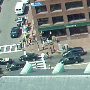 original (column rast) |  dupe_band |  sing_band |
--Make a new raster with 2nd band of original and 1st band repeated twice,
and another with just the third band
SELECT rast, ST_Band(rast, ARRAY[2,1,1]) As dupe_band,
ST_Band(rast, 3) As sing_band
FROM samples.than_chunked
WHERE rid=35;
Veja também
ST_AddBand, ST_NumBands, ST_Reclass, Chapter 11, Referência Raster
Name
ST_MakeEmptyCoverage — Cover georeferenced area with a grid of empty raster tiles.
Synopsis
raster ST_MakeEmptyCoverage(integer tilewidth, integer tileheight, integer width, integer height, double precision upperleftx, double precision upperlefty, double precision scalex, double precision scaley, double precision skewx, double precision skewy, integer srid=unknown);
Descrição
Create a set of raster tiles with ST_MakeEmptyRaster. Grid dimension is width & height. Tile dimension is tilewidth & tileheight. The covered georeferenced area is from upper left corner (upperleftx, upperlefty) to lower right corner (upperleftx + width * scalex, upperlefty + height * scaley).
| |
Note that scaley is generally negative for rasters and scalex is generally positive. So lower right corner will have a lower y value and higher x value than the upper left corner. |
Disponibilidade: 2.2.0
Exemplos básicos
Create 16 tiles in a 4x4 grid to cover the WGS84 area from upper left corner (22, 77) to lower right corner (55, 33).
SELECT (ST_MetaData(tile)).* FROM ST_MakeEmptyCoverage(1, 1, 4, 4, 22, 33, (55 - 22)/(4)::float, (33 - 77)/(4)::float, 0., 0., 4326) tile;
upperleftx | upperlefty | width | height | scalex | scaley | skewx | skewy | srid | numbands
-------------------------------------------------------------------------------------
22 | 33 | 1 | 1 | 8.25 | -11 | 0 | 0 | 4326 | 0
30.25 | 33 | 1 | 1 | 8.25 | -11 | 0 | 0 | 4326 | 0
38.5 | 33 | 1 | 1 | 8.25 | -11 | 0 | 0 | 4326 | 0
46.75 | 33 | 1 | 1 | 8.25 | -11 | 0 | 0 | 4326 | 0
22 | 22 | 1 | 1 | 8.25 | -11 | 0 | 0 | 4326 | 0
30.25 | 22 | 1 | 1 | 8.25 | -11 | 0 | 0 | 4326 | 0
38.5 | 22 | 1 | 1 | 8.25 | -11 | 0 | 0 | 4326 | 0
46.75 | 22 | 1 | 1 | 8.25 | -11 | 0 | 0 | 4326 | 0
22 | 11 | 1 | 1 | 8.25 | -11 | 0 | 0 | 4326 | 0
30.25 | 11 | 1 | 1 | 8.25 | -11 | 0 | 0 | 4326 | 0
38.5 | 11 | 1 | 1 | 8.25 | -11 | 0 | 0 | 4326 | 0
46.75 | 11 | 1 | 1 | 8.25 | -11 | 0 | 0 | 4326 | 0
22 | 0 | 1 | 1 | 8.25 | -11 | 0 | 0 | 4326 | 0
30.25 | 0 | 1 | 1 | 8.25 | -11 | 0 | 0 | 4326 | 0
38.5 | 0 | 1 | 1 | 8.25 | -11 | 0 | 0 | 4326 | 0
46.75 | 0 | 1 | 1 | 8.25 | -11 | 0 | 0 | 4326 | 0Veja também
Name
ST_MakeEmptyRaster — Retorna um raster vazio (sem bandas) das dimensões dadas (width & height), o X e Y do superior esquerdo, tamanho de pixel e rotação (scalex, scaley, skewx & skewy) e sistema de referência (srid). Se um raster passar, retorna um novo raster com o mesmo tamanho, alinhamento e SRID. Se o srid é deixado de fora, a referência espacial se torna desconhecida (0).
Synopsis
raster ST_MakeEmptyRaster(raster rast);
raster ST_MakeEmptyRaster(integer width, integer height, float8 upperleftx, float8 upperlefty, float8 scalex, float8 scaley, float8 skewx, float8 skewy, integer srid=unknown);
raster ST_MakeEmptyRaster(integer width, integer height, float8 upperleftx, float8 upperlefty, float8 pixelsize);
Descrição
Retorna um raster vazio (sem bandas) das dimensões dadas (width & height) e georeferenciado nas coordenadas espaciais (ou mundo) com o X esquerdo superior (upperleftx), Y superior esquerdo (upperlefty), tamanho de pixel e rotação (scalex, scaley, skewx & skewy) e sistema de referência (srid).
A última versão usa um único parâmetro para especificar o tamanho do pixel (pixelsize). scalex é estabelecida neste argumento e scaley é estabelecida no valor negativo deste argumento. skewx e skewy são 0.
Se um raster existente passar, ele retorna um novo raster com as mesmas configurações de meta dados (sem as bandas).
Se nenhum srid é especificado, é 0. Depois que você criou um raster vazio talvez queira adicionar bandas a ele e editá-lo. Recorra a ST_AddBand para definir bandas e ST_SetValue para valores iniciais de pixel.
Exemplos
INSERT INTO dummy_rast(rid,rast)
VALUES(3, ST_MakeEmptyRaster( 100, 100, 0.0005, 0.0005, 1, 1, 0, 0, 4326) );
--use an existing raster as template for new raster
INSERT INTO dummy_rast(rid,rast)
SELECT 4, ST_MakeEmptyRaster(rast)
FROM dummy_rast WHERE rid = 3;
-- output meta data of rasters we just added
SELECT rid, (md).*
FROM (SELECT rid, ST_MetaData(rast) As md
FROM dummy_rast
WHERE rid IN(3,4)) As foo;
-- output --
rid | upperleftx | upperlefty | width | height | scalex | scaley | skewx | skewy | srid | numbands
-----+------------+------------+-------+--------+------------+------------+-------+-------+------+----------
3 | 0.0005 | 0.0005 | 100 | 100 | 1 | 1 | 0 | 0 | 4326 | 0
4 | 0.0005 | 0.0005 | 100 | 100 | 1 | 1 | 0 | 0 | 4326 | 0
Veja também
ST_AddBand, ST_MetaData, ST_ScaleX, ST_ScaleY, ST_SetValue, ST_SkewX, , ST_SkewY
Name
ST_Tile — Retorna um conjunto de rasters resultante de uma divisão do raster de entrada baseado nas dimensões desejadas nos rasters de saída.
Synopsis
setof raster ST_Tile(raster rast, int[] nband, integer width, integer height, boolean padwithnodata=FALSE, double precision nodataval=NULL);
setof raster ST_Tile(raster rast, integer nband, integer width, integer height, boolean padwithnodata=FALSE, double precision nodataval=NULL);
setof raster ST_Tile(raster rast, integer width, integer height, boolean padwithnodata=FALSE, double precision nodataval=NULL);
Descrição
Retorna um conjunto de rasters resultante de uma divisão do raster de entrada baseado nas dimensões desejadas nos rasters de saída.
Se padwithnodata = FALSO, tiles limite no lado direito e inferior do raster podem ter dimensões diferentes do resto das tiles. Se padwithnodata = VERDADEIRO, todas as tiles terão a mesma dimensão com a possibilidade das tiles limites serem preenchidas com valores NODATA. Se a banda(s) não possui valor(es) NODATA especificado, pode ser especificado por nodataval.
| |
Se uma banda especificada do raster de entrada estiver out-of-db, a banda correspondente nos rasters de saída também estará. |
Disponibilidade: 2.1.0
Exemplos
WITH foo AS (
SELECT ST_AddBand(ST_AddBand(ST_MakeEmptyRaster(3, 3, 0, 0, 1, -1, 0, 0, 0), 1, '8BUI', 1, 0), 2, '8BUI', 10, 0) AS rast UNION ALL
SELECT ST_AddBand(ST_AddBand(ST_MakeEmptyRaster(3, 3, 3, 0, 1, -1, 0, 0, 0), 1, '8BUI', 2, 0), 2, '8BUI', 20, 0) AS rast UNION ALL
SELECT ST_AddBand(ST_AddBand(ST_MakeEmptyRaster(3, 3, 6, 0, 1, -1, 0, 0, 0), 1, '8BUI', 3, 0), 2, '8BUI', 30, 0) AS rast UNION ALL
SELECT ST_AddBand(ST_AddBand(ST_MakeEmptyRaster(3, 3, 0, -3, 1, -1, 0, 0, 0), 1, '8BUI', 4, 0), 2, '8BUI', 40, 0) AS rast UNION ALL
SELECT ST_AddBand(ST_AddBand(ST_MakeEmptyRaster(3, 3, 3, -3, 1, -1, 0, 0, 0), 1, '8BUI', 5, 0), 2, '8BUI', 50, 0) AS rast UNION ALL
SELECT ST_AddBand(ST_AddBand(ST_MakeEmptyRaster(3, 3, 6, -3, 1, -1, 0, 0, 0), 1, '8BUI', 6, 0), 2, '8BUI', 60, 0) AS rast UNION ALL
SELECT ST_AddBand(ST_AddBand(ST_MakeEmptyRaster(3, 3, 0, -6, 1, -1, 0, 0, 0), 1, '8BUI', 7, 0), 2, '8BUI', 70, 0) AS rast UNION ALL
SELECT ST_AddBand(ST_AddBand(ST_MakeEmptyRaster(3, 3, 3, -6, 1, -1, 0, 0, 0), 1, '8BUI', 8, 0), 2, '8BUI', 80, 0) AS rast UNION ALL
SELECT ST_AddBand(ST_AddBand(ST_MakeEmptyRaster(3, 3, 6, -6, 1, -1, 0, 0, 0), 1, '8BUI', 9, 0), 2, '8BUI', 90, 0) AS rast
), bar AS (
SELECT ST_Union(rast) AS rast FROM foo
), baz AS (
SELECT ST_Tile(rast, 3, 3, TRUE) AS rast FROM bar
)
SELECT
ST_DumpValues(rast)
FROM baz;
st_dumpvalues
------------------------------------------
(1,"{{1,1,1},{1,1,1},{1,1,1}}")
(2,"{{10,10,10},{10,10,10},{10,10,10}}")
(1,"{{2,2,2},{2,2,2},{2,2,2}}")
(2,"{{20,20,20},{20,20,20},{20,20,20}}")
(1,"{{3,3,3},{3,3,3},{3,3,3}}")
(2,"{{30,30,30},{30,30,30},{30,30,30}}")
(1,"{{4,4,4},{4,4,4},{4,4,4}}")
(2,"{{40,40,40},{40,40,40},{40,40,40}}")
(1,"{{5,5,5},{5,5,5},{5,5,5}}")
(2,"{{50,50,50},{50,50,50},{50,50,50}}")
(1,"{{6,6,6},{6,6,6},{6,6,6}}")
(2,"{{60,60,60},{60,60,60},{60,60,60}}")
(1,"{{7,7,7},{7,7,7},{7,7,7}}")
(2,"{{70,70,70},{70,70,70},{70,70,70}}")
(1,"{{8,8,8},{8,8,8},{8,8,8}}")
(2,"{{80,80,80},{80,80,80},{80,80,80}}")
(1,"{{9,9,9},{9,9,9},{9,9,9}}")
(2,"{{90,90,90},{90,90,90},{90,90,90}}")
(18 rows)
WITH foo AS (
SELECT ST_AddBand(ST_AddBand(ST_MakeEmptyRaster(3, 3, 0, 0, 1, -1, 0, 0, 0), 1, '8BUI', 1, 0), 2, '8BUI', 10, 0) AS rast UNION ALL
SELECT ST_AddBand(ST_AddBand(ST_MakeEmptyRaster(3, 3, 3, 0, 1, -1, 0, 0, 0), 1, '8BUI', 2, 0), 2, '8BUI', 20, 0) AS rast UNION ALL
SELECT ST_AddBand(ST_AddBand(ST_MakeEmptyRaster(3, 3, 6, 0, 1, -1, 0, 0, 0), 1, '8BUI', 3, 0), 2, '8BUI', 30, 0) AS rast UNION ALL
SELECT ST_AddBand(ST_AddBand(ST_MakeEmptyRaster(3, 3, 0, -3, 1, -1, 0, 0, 0), 1, '8BUI', 4, 0), 2, '8BUI', 40, 0) AS rast UNION ALL
SELECT ST_AddBand(ST_AddBand(ST_MakeEmptyRaster(3, 3, 3, -3, 1, -1, 0, 0, 0), 1, '8BUI', 5, 0), 2, '8BUI', 50, 0) AS rast UNION ALL
SELECT ST_AddBand(ST_AddBand(ST_MakeEmptyRaster(3, 3, 6, -3, 1, -1, 0, 0, 0), 1, '8BUI', 6, 0), 2, '8BUI', 60, 0) AS rast UNION ALL
SELECT ST_AddBand(ST_AddBand(ST_MakeEmptyRaster(3, 3, 0, -6, 1, -1, 0, 0, 0), 1, '8BUI', 7, 0), 2, '8BUI', 70, 0) AS rast UNION ALL
SELECT ST_AddBand(ST_AddBand(ST_MakeEmptyRaster(3, 3, 3, -6, 1, -1, 0, 0, 0), 1, '8BUI', 8, 0), 2, '8BUI', 80, 0) AS rast UNION ALL
SELECT ST_AddBand(ST_AddBand(ST_MakeEmptyRaster(3, 3, 6, -6, 1, -1, 0, 0, 0), 1, '8BUI', 9, 0), 2, '8BUI', 90, 0) AS rast
), bar AS (
SELECT ST_Union(rast) AS rast FROM foo
), baz AS (
SELECT ST_Tile(rast, 3, 3, 2) AS rast FROM bar
)
SELECT
ST_DumpValues(rast)
FROM baz;
st_dumpvalues
------------------------------------------
(1,"{{10,10,10},{10,10,10},{10,10,10}}")
(1,"{{20,20,20},{20,20,20},{20,20,20}}")
(1,"{{30,30,30},{30,30,30},{30,30,30}}")
(1,"{{40,40,40},{40,40,40},{40,40,40}}")
(1,"{{50,50,50},{50,50,50},{50,50,50}}")
(1,"{{60,60,60},{60,60,60},{60,60,60}}")
(1,"{{70,70,70},{70,70,70},{70,70,70}}")
(1,"{{80,80,80},{80,80,80},{80,80,80}}")
(1,"{{90,90,90},{90,90,90},{90,90,90}}")
(9 rows)
Name
ST_Retile — Retorna um conjunto de tiles configuradas de uma cobertura raster aleatória.
Synopsis
SETOF raster ST_Retile(regclass tab, name col, geometry ext, float8 sfx, float8 sfy, int tw, int th, text algo='NearestNeighbor');
Descrição
Retorna um conjunto de tiles tendo a escala especificada (sfx, sfy) e tamanho máximo (tw, th) e cobrindo a extensão especificada (ext) com os dados vindos da cobertura raster especificada (tab, col).
As opções de algorítimo são: 'NearestNeighbor', 'Bilinear', 'Cubic', 'CubicSpline', e 'Lanczos'. Recorra a: GDAL Warp resampling methods para mais detalhes.
Disponibilidade: 2.2.0
Veja também
Name
ST_FromGDALRaster — Retorna um raster de um arquivo raster GDAL suportado.
Synopsis
raster ST_FromGDALRaster(bytea gdaldata, integer srid=NULL);
Descrição
Retorna um raster de uma arquivo raster GDAL suportado. gdaldata é do tipo bytea e deve ser o conteúdo do arquivo raster GDAL.
Se srid for NULO, a função tentará designar automaticamente o SRID do raster GDAL. Se srid for fornecido, o valor fornecido irá exceder qualquer SRID designado automaticamente.
Disponibilidade: 2.1.0
Exemplos
WITH foo AS (
SELECT ST_AsPNG(ST_AddBand(ST_AddBand(ST_AddBand(ST_MakeEmptyRaster(2, 2, 0, 0, 0.1, -0.1, 0, 0, 4326), 1, '8BUI', 1, 0), 2, '8BUI', 2, 0), 3, '8BUI', 3, 0)) AS png
),
bar AS (
SELECT 1 AS rid, ST_FromGDALRaster(png) AS rast FROM foo
UNION ALL
SELECT 2 AS rid, ST_FromGDALRaster(png, 3310) AS rast FROM foo
)
SELECT
rid,
ST_Metadata(rast) AS metadata,
ST_SummaryStats(rast, 1) AS stats1,
ST_SummaryStats(rast, 2) AS stats2,
ST_SummaryStats(rast, 3) AS stats3
FROM bar
ORDER BY rid;
rid | metadata | stats1 | stats2 | stats3
-----+---------------------------+---------------+---------------+----------------
1 | (0,0,2,2,1,-1,0,0,0,3) | (4,4,1,0,1,1) | (4,8,2,0,2,2) | (4,12,3,0,3,3)
2 | (0,0,2,2,1,-1,0,0,3310,3) | (4,4,1,0,1,1) | (4,8,2,0,2,2) | (4,12,3,0,3,3)
(2 rows)
Veja também
11.4. Assessores Raster
- ST_GeoReference — Retorna os metadados georreferenciados no formato GDAL ou ESRI como é comumente visto em um arquivo mundo. O padrão é GDAL.
- ST_Height — Retorna a altura do raster em pixeis.
- ST_IsEmpty — Retorna verdadeiro se o raster estiver vazio (largura = 0 e altura = 0). Senão, retorna falso.
- ST_MemSize — Retorna a quantidade de espaço (em bytes) que o raster pega.
- ST_MetaData — Retorna metadados básicos sobre um objeto raster como um tanho pixel, rotação (skew), esquerda superior, inferior etc.
- ST_NumBands — Retorna o número de bandas no objeto raster.
- ST_PixelHeight — Retorna a altura do pixel em unidades geométricas do sistema de referência espacial.
- ST_PixelWidth — Retorna a largura do pixel em unidades geométricas do sistema de referência espacial.
- ST_ScaleX — Retorna o componente X da largura do pixel em unidades do sistema de referência coordenadas.
- ST_ScaleY — Retorna o componente Y da altura do pixel em unidades do sistema de referência coordenadas.
- ST_RasterToWorldCoord — Retorna o canto superior esquerdo do raster como X e Y geométricos (longitude e latitude) dada a coluna e linha. Coluna e linha começam em 1.
- ST_RasterToWorldCoordX — Retorna a coordenada geométrica X superior esquerda de um raster, coluna ou linha. A numeração das colunas e linhas começam no 1.
- ST_RasterToWorldCoordY — Retorna a coordenada geométrica Y superior esquerda de um raster, coluna e linha. A numeração das colunas e linhas começam no 1.
- ST_Rotation — Retorna a rotação do raster em radianos.
- ST_SkewX — Retorna o desvio X georreferência (ou parâmetro e rotação).
- ST_SkewY — Retorna o desvio Y georreferência (ou parâmetro e rotação).
- ST_SRID — Retorna o identificador de referência espacial como definido na tabela spatial_ref_sys.
- ST_Summary — Retorna um texto resumo dos conteúdos do raster.
- ST_UpperLeftX — Retorna a coordenada X superior esquerda na ref. espacial projetada.
- ST_UpperLeftY — Retorna a coordenada Y superior esquerda na ref. espacial projetada.
- ST_Width — Retorna a largura do raster em pixeis.
- ST_WorldToRasterCoord — Retorna o canto superior esquerdo como coluna e linha dados os X e Y geométricos (longitude e latitude) ou um ponto expressado na coordenada do sistema de referência espacial do raster.
- ST_WorldToRasterCoordX — Retorna a coluna no raster do ponto (pt) ou uma coordenada X e Y (xw, yw) representada no sistema de referência espacial mundial de raster.
- ST_WorldToRasterCoordY — Retorna a linha no raster do ponto (pt) ou uma coordenada X e Y (xw, yw) representada no sistema de referência espacial global de raster.
Name
ST_GeoReference — Retorna os metadados georreferenciados no formato GDAL ou ESRI como é comumente visto em um arquivo mundo. O padrão é GDAL.
Synopsis
text ST_GeoReference(raster rast, text format=GDAL);
Descrição
Retorna os metadados georreferenciados, incluindo transporte, no formato GDAL ou ESRI como visto no srid. O padrão é GDAL se nenhum tipo for especificado. O tipo é string 'GDAL' ou 'ESRI'.
A diferença entre representações de formatos é a seguinte:
GDAL:
scalex skewy skewx scaley upperleftx upperlefty
ESRI:
scalex skewy skewx scaley upperleftx + scalex*0.5 upperlefty + scaley*0.5
Exemplos
SELECT ST_GeoReference(rast, 'ESRI') As esri_ref, ST_GeoReference(rast, 'GDAL') As gdal_ref
FROM dummy_rast WHERE rid=1;
esri_ref | gdal_ref
--------------+--------------
2.0000000000 | 2.0000000000
0.0000000000 : 0.0000000000
0.0000000000 : 0.0000000000
3.0000000000 : 3.0000000000
1.5000000000 : 0.5000000000
2.0000000000 : 0.5000000000
Veja também
Name
ST_Height — Retorna a altura do raster em pixeis.
Synopsis
integer ST_Height(raster rast);
Descrição
Retorna a altura do raster.
Exemplos
SELECT rid, ST_Height(rast) As rastheight
FROM dummy_rast;
rid | rastheight
-----+------------
1 | 20
2 | 5
Veja também
Name
ST_IsEmpty — Retorna verdadeiro se o raster estiver vazio (largura = 0 e altura = 0). Senão, retorna falso.
Synopsis
boolean ST_IsEmpty(raster rast);
Descrição
Retorna verdadeiro se o raster estiver vazio (largura = 0 e altura = 0). Senão, retorna falso.
Disponibilidade: 2.0.0
Exemplos
SELECT ST_IsEmpty(ST_MakeEmptyRaster(100, 100, 0, 0, 0, 0, 0, 0))
st_isempty |
-----------+
f |
SELECT ST_IsEmpty(ST_MakeEmptyRaster(0, 0, 0, 0, 0, 0, 0, 0))
st_isempty |
-----------+
t |
Veja também
Name
ST_MemSize — Retorna a quantidade de espaço (em bytes) que o raster pega.
Synopsis
integer ST_MemSize(raster rast);
Descrição
Retorna a quantidade de espaço (em bytes) que o raster pega.
Isso é um ótimo elogio para o PostgreSQL construído nas funções pg_column_size, pg_size_pretty, pg_relation_size, pg_total_relation_size.
| |
pg_relation_size que fornece o tamanho em bytes de uma tabela, talvez retorne com o tamanho em byte menor que ST_MemSize. Isso acontece porque o pg_relation_size não adiciona contribuição de tabela toasted e grandes geometrias são guardadas em tabelas TOAST. g_column_size pode retornar menor porque retorna o tamanho comprimido. pg_total_relation_size - inclui, a tabela, as tabelas toasted, e os índices. |
Disponibilidade: 2.2.0
Exemplos
SELECT ST_MemSize(ST_AsRaster(ST_Buffer(ST_Point(1,5),10,1000),150, 150, '8BUI')) As rast_mem;
rast_mem
--------
22568
Veja também
Name
ST_MetaData — Retorna metadados básicos sobre um objeto raster como um tanho pixel, rotação (skew), esquerda superior, inferior etc.
Synopsis
record ST_MetaData(raster rast);
Descrição
Retorna metadados básicos sobre um objeto raster como um tanho pixel, rotação (skew), esquerda superior, inferior etc. Colunas retornadas: upperleftx | upperlefty | width | height | scalex | scaley | skewx | skewy | srid | numbands
Exemplos
SELECT rid, (foo.md).*
FROM (SELECT rid, ST_MetaData(rast) As md
FROM dummy_rast) As foo;
rid | upperleftx | upperlefty | width | height | scalex | scaley | skewx | skewy | srid | numbands
----+------------+------------+-------+--------+--------+-----------+-------+-------+------+-------
1 | 0.5 | 0.5 | 10 | 20 | 2 | 3 | 0 | 0 | 0 | 0
2 | 3427927.75 | 5793244 | 5 | 5 | 0.05 | -0.05 | 0 | 0 | 0 | 3
Veja também
Name
ST_NumBands — Retorna o número de bandas no objeto raster.
Synopsis
integer ST_NumBands(raster rast);
Descrição
Retorna o número de bandas no objeto raster.
Exemplos
SELECT rid, ST_NumBands(rast) As numbands
FROM dummy_rast;
rid | numbands
----+----------
1 | 0
2 | 3
Veja também
Name
ST_PixelHeight — Retorna a altura do pixel em unidades geométricas do sistema de referência espacial.
Synopsis
double precision ST_PixelHeight(raster rast);
Descrição
Retorna a altura do pixel em unidades geométricas do sistema de referência espacial. No caso comum onde não existem desvios, a altura do pixel é somente a escala de proporção entre coordenadas geométricas e pixeis raster.
Recorra a ST_PixelWidth para uma visualização diagramática da relação.
Exemplos: Rasters sem desvio
SELECT ST_Height(rast) As rastheight, ST_PixelHeight(rast) As pixheight,
ST_ScaleX(rast) As scalex, ST_ScaleY(rast) As scaley, ST_SkewX(rast) As skewx,
ST_SkewY(rast) As skewy
FROM dummy_rast;
rastheight | pixheight | scalex | scaley | skewx | skewy
------------+-----------+--------+--------+-------+----------
20 | 3 | 2 | 3 | 0 | 0
5 | 0.05 | 0.05 | -0.05 | 0 | 0
Exemplos: Rasters com desvio diferente de 0
SELECT ST_Height(rast) As rastheight, ST_PixelHeight(rast) As pixheight,
ST_ScaleX(rast) As scalex, ST_ScaleY(rast) As scaley, ST_SkewX(rast) As skewx,
ST_SkewY(rast) As skewy
FROM (SELECT ST_SetSKew(rast,0.5,0.5) As rast
FROM dummy_rast) As skewed;
rastheight | pixheight | scalex | scaley | skewx | skewy
-----------+-------------------+--------+--------+-------+----------
20 | 3.04138126514911 | 2 | 3 | 0.5 | 0.5
5 | 0.502493781056044 | 0.05 | -0.05 | 0.5 | 0.5
Veja também
Name
ST_PixelWidth — Retorna a largura do pixel em unidades geométricas do sistema de referência espacial.
Synopsis
double precision ST_PixelWidth(raster rast);
Descrição
Retorna a largura do pixel em unidades geométricas do sistema de referência espacial. No caso comum onde não existem desvios, a largura do pixel é somente a escala de proporção entre coordenadas geométricas e pixeis raster.
O diagrama a seguir demonstra a relação:
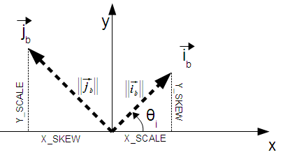
Largura do Pixel: tamanho do pixel na direção i
Altura do Pixel: tamanho do pixel na direção j
Exemplos: Rasters sem desvio
SELECT ST_Width(rast) As rastwidth, ST_PixelWidth(rast) As pixwidth,
ST_ScaleX(rast) As scalex, ST_ScaleY(rast) As scaley, ST_SkewX(rast) As skewx,
ST_SkewY(rast) As skewy
FROM dummy_rast;
rastwidth | pixwidth | scalex | scaley | skewx | skewy
-----------+----------+--------+--------+-------+----------
10 | 2 | 2 | 3 | 0 | 0
5 | 0.05 | 0.05 | -0.05 | 0 | 0
Exemplos: Rasters com desvio diferente de 0
SELECT ST_Width(rast) As rastwidth, ST_PixelWidth(rast) As pixwidth,
ST_ScaleX(rast) As scalex, ST_ScaleY(rast) As scaley, ST_SkewX(rast) As skewx,
ST_SkewY(rast) As skewy
FROM (SELECT ST_SetSkew(rast,0.5,0.5) As rast
FROM dummy_rast) As skewed;
rastwidth | pixwidth | scalex | scaley | skewx | skewy
-----------+-------------------+--------+--------+-------+----------
10 | 2.06155281280883 | 2 | 3 | 0.5 | 0.5
5 | 0.502493781056044 | 0.05 | -0.05 | 0.5 | 0.5
Veja também
Name
ST_ScaleX — Retorna o componente X da largura do pixel em unidades do sistema de referência coordenadas.
Synopsis
float8 ST_ScaleX(raster rast);
Descrição
Retorna o componente X da largura do pixel em unidades do sistema de referência coordenadas. Recorra a World File para mais detalhes.
Alterações: 2.0.0. Nas versões WKTRaster era chamado de ST_PixelSizeX.
Exemplos
SELECT rid, ST_ScaleX(rast) As rastpixwidth
FROM dummy_rast;
rid | rastpixwidth
-----+--------------
1 | 2
2 | 0.05
Veja também
Name
ST_ScaleY — Retorna o componente Y da altura do pixel em unidades do sistema de referência coordenadas.
Synopsis
float8 ST_ScaleY(raster rast);
Descrição
Retorna o componente Y da altura do pixel em unidades do sistema de referência coordenadas. Recorra a World File para mais detalhes.
Alterações: 2.0.0. Nas versões WKTRaster era chamado de ST_PixelSizeY.
Exemplos
SELECT rid, ST_ScaleY(rast) As rastpixheight
FROM dummy_rast;
rid | rastpixheight
-----+---------------
1 | 3
2 | -0.05
Veja também
Name
ST_RasterToWorldCoord — Retorna o canto superior esquerdo do raster como X e Y geométricos (longitude e latitude) dada a coluna e linha. Coluna e linha começam em 1.
Synopsis
record ST_RasterToWorldCoord(raster rast, integer xcolumn, integer yrow);
Descrição
Retorna o canto esquerdo superior como X e Y geométricos (longitude e latitude) dada a coluna e linha. o X e Y estão em unidades geométricas do raster georreferenciado. A numeração da coluna e da linha começa no 1, mas se algum passar como zero, um número negativo ou um maior que a respectiva dimensão do raster, retornará as coordenas fora do raster assumindo que a rede raster é aplicável fora dos limites do raster.
Disponibilidade: 2.1.0
Exemplos
-- non-skewed raster
SELECT
rid,
(ST_RasterToWorldCoord(rast,1, 1)).*,
(ST_RasterToWorldCoord(rast,2, 2)).*
FROM dummy_rast
rid | longitude | latitude | longitude | latitude
-----+------------+----------+-----------+------------
1 | 0.5 | 0.5 | 2.5 | 3.5
2 | 3427927.75 | 5793244 | 3427927.8 | 5793243.95
-- skewed raster
SELECT
rid,
(ST_RasterToWorldCoord(rast, 1, 1)).*,
(ST_RasterToWorldCoord(rast, 2, 3)).*
FROM (
SELECT
rid,
ST_SetSkew(rast, 100.5, 0) As rast
FROM dummy_rast
) As foo
rid | longitude | latitude | longitude | latitude
-----+------------+----------+-----------+-----------
1 | 0.5 | 0.5 | 203.5 | 6.5
2 | 3427927.75 | 5793244 | 3428128.8 | 5793243.9
Veja também
Name
ST_RasterToWorldCoordX — Retorna a coordenada geométrica X superior esquerda de um raster, coluna ou linha. A numeração das colunas e linhas começam no 1.
Synopsis
float8 ST_RasterToWorldCoordX(raster rast, integer xcolumn);
float8 ST_RasterToWorldCoordX(raster rast, integer xcolumn, integer yrow);
Descrição
Retorna a coordenada X superior esquerda de uma coluna raster em unidades geométricas do raster georreferenciado. A numeração da coluna e da linha começa no 1, mas se algum passar como zero, um número negativo ou um maior que a respectiva dimensão do raster, retornará as coordenas fora do raster para esquerda ou direita, assumindo que a skew e tamanhos do pixel são os mesmo que o raster selecionado.
| |
Para rasters sem desvio, fornecer a coluna X é suficiente. Para rasters com desvio, a coordenada georreferenciada é uma função da ST_ScaleX e ST_SkewX e linha e coluna. Um erro aparecerá se você der somente a coluna X para um raster desviado. |
Alterações: 2.1.0 Em versões anteriores, era chamado de ST_Raster2WorldCoordX
Exemplos
-- non-skewed raster providing column is sufficient
SELECT rid, ST_RasterToWorldCoordX(rast,1) As x1coord,
ST_RasterToWorldCoordX(rast,2) As x2coord,
ST_ScaleX(rast) As pixelx
FROM dummy_rast;
rid | x1coord | x2coord | pixelx
-----+------------+-----------+--------
1 | 0.5 | 2.5 | 2
2 | 3427927.75 | 3427927.8 | 0.05
-- for fun lets skew it
SELECT rid, ST_RasterToWorldCoordX(rast, 1, 1) As x1coord,
ST_RasterToWorldCoordX(rast, 2, 3) As x2coord,
ST_ScaleX(rast) As pixelx
FROM (SELECT rid, ST_SetSkew(rast, 100.5, 0) As rast FROM dummy_rast) As foo;
rid | x1coord | x2coord | pixelx
-----+------------+-----------+--------
1 | 0.5 | 203.5 | 2
2 | 3427927.75 | 3428128.8 | 0.05
Veja também
Name
ST_RasterToWorldCoordY — Retorna a coordenada geométrica Y superior esquerda de um raster, coluna e linha. A numeração das colunas e linhas começam no 1.
Synopsis
float8 ST_RasterToWorldCoordY(raster rast, integer yrow);
float8 ST_RasterToWorldCoordY(raster rast, integer xcolumn, integer yrow);
Descrição
Retorna a coordenada Y superior esquerda de uma coluna raster em unidades geométricas do raster georreferenciado. A numeração da coluna e da linha começa no 1, mas se algum passar como zero, um número negativo ou um maior que a respectiva dimensão do raster, retornará as coordenas fora do raster para esquerda ou direita, assumindo que o desvio e tamanhos do pixel são os mesmos que o raster selecionado.
| |
Para rasters sem desvio, fornecer a coluna Y é suficiente. Para rasters com desvio, a coordenada georreferenciada é uma função da ST_ScaleY e ST_SkewY e linha e coluna. Um erro aparecerá se você der somente a linha Y para um raster desviado. |
Alterações: 2.1.0 Em versões anteriores, era chamado de ST_Raster2WorldCoordY
Exemplos
-- non-skewed raster providing row is sufficient
SELECT rid, ST_RasterToWorldCoordY(rast,1) As y1coord,
ST_RasterToWorldCoordY(rast,3) As y2coord,
ST_ScaleY(rast) As pixely
FROM dummy_rast;
rid | y1coord | y2coord | pixely
-----+---------+-----------+--------
1 | 0.5 | 6.5 | 3
2 | 5793244 | 5793243.9 | -0.05
-- for fun lets skew it
SELECT rid, ST_RasterToWorldCoordY(rast,1,1) As y1coord,
ST_RasterToWorldCoordY(rast,2,3) As y2coord,
ST_ScaleY(rast) As pixely
FROM (SELECT rid, ST_SetSkew(rast,0,100.5) As rast FROM dummy_rast) As foo;
rid | y1coord | y2coord | pixely
-----+---------+-----------+--------
1 | 0.5 | 107 | 3
2 | 5793244 | 5793344.4 | -0.05
Veja também
Name
ST_Rotation — Retorna a rotação do raster em radianos.
Synopsis
float8 ST_Rotation(raster rast);
Descrição
Retorna a rotação uniforme do raster em radianos. Se um raster n ão tiver uma rotação uniforme, NaN retorna. Recorra a World File para mais detalhes.
Exemplos
SELECT rid, ST_Rotation(ST_SetScale(ST_SetSkew(rast, sqrt(2)), sqrt(2))) as rot FROM dummy_rast;
rid | rot
-----+-------------------
1 | 0.785398163397448
2 | 0.785398163397448
Veja também
Name
ST_SkewX — Retorna o desvio X georreferência (ou parâmetro e rotação).
Synopsis
float8 ST_SkewX(raster rast);
Descrição
Retorna o desvio X georreferência (ou parâmetro de rotação). Recorra a World File para mais detalhes.
Exemplos
SELECT rid, ST_SkewX(rast) As skewx, ST_SkewY(rast) As skewy,
ST_GeoReference(rast) as georef
FROM dummy_rast;
rid | skewx | skewy | georef
-----+-------+-------+--------------------
1 | 0 | 0 | 2.0000000000
: 0.0000000000
: 0.0000000000
: 3.0000000000
: 0.5000000000
: 0.5000000000
:
2 | 0 | 0 | 0.0500000000
: 0.0000000000
: 0.0000000000
: -0.0500000000
: 3427927.7500000000
: 5793244.0000000000
Veja também
Name
ST_SkewY — Retorna o desvio Y georreferência (ou parâmetro e rotação).
Synopsis
float8 ST_SkewY(raster rast);
Descrição
Retorna o desvio Y georreferência (ou parâmetro de rotação). Recorra a World File para mais detalhes.
Exemplos
SELECT rid, ST_SkewX(rast) As skewx, ST_SkewY(rast) As skewy,
ST_GeoReference(rast) as georef
FROM dummy_rast;
rid | skewx | skewy | georef
-----+-------+-------+--------------------
1 | 0 | 0 | 2.0000000000
: 0.0000000000
: 0.0000000000
: 3.0000000000
: 0.5000000000
: 0.5000000000
:
2 | 0 | 0 | 0.0500000000
: 0.0000000000
: 0.0000000000
: -0.0500000000
: 3427927.7500000000
: 5793244.0000000000
Veja também
Name
ST_SRID — Retorna o identificador de referência espacial como definido na tabela spatial_ref_sys.
Synopsis
integer ST_SRID(raster rast);
Descrição
Retorna o identificador de referência espacial do objeto raster como definido na tabela spatial_ref_sys.
| |
Non-georeferenced rasters and geometries use SRID 0. |
Exemplos
SELECT ST_SRID(rast) As srid
FROM dummy_rast WHERE rid=1;
srid
----------------
0
Name
ST_Summary — Retorna um texto resumo dos conteúdos do raster.
Synopsis
text ST_Summary(raster rast);
Descrição
Retorna um texto resumo dos conteúdos do raster.
Disponibilidade: 2.1.0
Exemplos
SELECT ST_Summary(
ST_AddBand(
ST_AddBand(
ST_AddBand(
ST_MakeEmptyRaster(10, 10, 0, 0, 1, -1, 0, 0, 0)
, 1, '8BUI', 1, 0
)
, 2, '32BF', 0, -9999
)
, 3, '16BSI', 0, NULL
)
);
st_summary
------------------------------------------------------------------
Raster of 10x10 pixels has 3 bands and extent of BOX(0 -10,10 0)+
band 1 of pixtype 8BUI is in-db with NODATA value of 0 +
band 2 of pixtype 32BF is in-db with NODATA value of -9999 +
band 3 of pixtype 16BSI is in-db with no NODATA value
(1 row)
Veja também
Name
ST_UpperLeftX — Retorna a coordenada X superior esquerda na ref. espacial projetada.
Synopsis
float8 ST_UpperLeftX(raster rast);
Descrição
Retorna a coordenada X superior esquerda na ref. espacial projetada.
Exemplos
SELECt rid, ST_UpperLeftX(rast) As ulx
FROM dummy_rast;
rid | ulx
-----+------------
1 | 0.5
2 | 3427927.75
Veja também
Name
ST_UpperLeftY — Retorna a coordenada Y superior esquerda na ref. espacial projetada.
Synopsis
float8 ST_UpperLeftY(raster rast);
Descrição
Retorna a coordenada Y superior esquerda na ref. espacial projetada.
Exemplos
SELECT rid, ST_UpperLeftY(rast) As uly
FROM dummy_rast;
rid | uly
-----+---------
1 | 0.5
2 | 5793244
Veja também
Name
ST_Width — Retorna a largura do raster em pixeis.
Synopsis
integer ST_Width(raster rast);
Descrição
Retorna a largura do raster em pixeis.
Exemplos
SELECT ST_Width(rast) As rastwidth
FROM dummy_rast WHERE rid=1;
rastwidth
----------------
10
Veja também
Name
ST_WorldToRasterCoord — Retorna o canto superior esquerdo como coluna e linha dados os X e Y geométricos (longitude e latitude) ou um ponto expressado na coordenada do sistema de referência espacial do raster.
Synopsis
record ST_WorldToRasterCoord(raster rast, geometry pt);
record ST_WorldToRasterCoord(raster rast, double precision longitude, double precision latitude);
Descrição
Retorna o canto superior esquerdo como coluna e linha dados os X e Y geométricos (longitude e latitude) ou um ponto. Esta função funciona se o X e Y geométricos ou ponto estiver fora da extensão do raster ou não. O X e Y geométricos devem ser expressados na coordenada do sistema de referência espacial do raster.
Disponibilidade: 2.1.0
Exemplos
SELECT
rid,
(ST_WorldToRasterCoord(rast,3427927.8,20.5)).*,
(ST_WorldToRasterCoord(rast,ST_GeomFromText('POINT(3427927.8 20.5)',ST_SRID(rast)))).*
FROM dummy_rast;
rid | columnx | rowy | columnx | rowy
-----+---------+-----------+---------+-----------
1 | 1713964 | 7 | 1713964 | 7
2 | 2 | 115864471 | 2 | 115864471
Name
ST_WorldToRasterCoordX — Retorna a coluna no raster do ponto (pt) ou uma coordenada X e Y (xw, yw) representada no sistema de referência espacial mundial de raster.
Synopsis
integer ST_WorldToRasterCoordX(raster rast, geometry pt);
integer ST_WorldToRasterCoordX(raster rast, double precision xw);
integer ST_WorldToRasterCoordX(raster rast, double precision xw, double precision yw);
Descrição
Retorna a coluna no raster do ponto (pt) ou uma coordenada X e Y (xw, yw). Um ponto, ou (ambas as coordenadas xw e yw são requeridas se um raster estiver desviado). Se um raster não estiver desviado, então xw é o suficiente. Coordenadas globais estão no sistema de coordenadas de referência espacial do raster.
Alterações: 2.1.0 Em versões anteriores, era chamado de ST_World2RasterCoordX
Exemplos
SELECT rid, ST_WorldToRasterCoordX(rast,3427927.8) As xcoord,
ST_WorldToRasterCoordX(rast,3427927.8,20.5) As xcoord_xwyw,
ST_WorldToRasterCoordX(rast,ST_GeomFromText('POINT(3427927.8 20.5)',ST_SRID(rast))) As ptxcoord
FROM dummy_rast;
rid | xcoord | xcoord_xwyw | ptxcoord
-----+---------+---------+----------
1 | 1713964 | 1713964 | 1713964
2 | 1 | 1 | 1
Veja também
Name
ST_WorldToRasterCoordY — Retorna a linha no raster do ponto (pt) ou uma coordenada X e Y (xw, yw) representada no sistema de referência espacial global de raster.
Synopsis
integer ST_WorldToRasterCoordY(raster rast, geometry pt);
integer ST_WorldToRasterCoordY(raster rast, double precision xw);
integer ST_WorldToRasterCoordY(raster rast, double precision xw, double precision yw);
Descrição
Retorna a linha no raster do ponto (pt) ou uma coordenada X e Y (xw, yw). Um ponto, ou (ambas as coordenadas xw e yw são requeridas se um raster estiver desviado). Se um raster não estiver desviado, então xw é o suficiente. Coordenadas globais estão no sistema de coordenadas de referência espacial do raster.
Alterações: 2.1.0 Em versões anteriores, era chamado de ST_World2RasterCoordY
Exemplos
SELECT rid, ST_WorldToRasterCoordY(rast,20.5) As ycoord,
ST_WorldToRasterCoordY(rast,3427927.8,20.5) As ycoord_xwyw,
ST_WorldToRasterCoordY(rast,ST_GeomFromText('POINT(3427927.8 20.5)',ST_SRID(rast))) As ptycoord
FROM dummy_rast;
rid | ycoord | ycoord_xwyw | ptycoord
-----+-----------+-------------+-----------
1 | 7 | 7 | 7
2 | 115864471 | 115864471 | 115864471
Veja também
11.5. Assessores de banda raster
- ST_BandMetaData — Retorna os metadados básicos para uma banda raster especificada. banda número 1 é assumida se nenhuma for especificada.
- ST_BandNoDataValue — Retorna o valor em uma dada banda que não representa nenhum valor. Se nenhuma banda número 1 for assumida.
- ST_BandIsNoData — Retorna verdadeiro se a banda estiver repleta somente de valores nodata.
- ST_BandPath — Retorna o caminho do arquivo do sistema para uma banda armazenada em um sistema de arquivos. Se nenhum número de banda for especificado, usa-se 1.
- ST_BandFileSize — Returns the file size of a band stored in file system. If no bandnum specified, 1 is assumed.
- ST_BandFileTimestamp — Returns the file timestamp of a band stored in file system. If no bandnum specified, 1 is assumed.
- ST_BandPixelType — Retorna o tipo pixel para uma dada banda. Se nenhum número de banda for especificado, usa-se 1.
- ST_MinPossibleValue — Retorna o número de bandas no objeto raster.
- ST_HasNoBand — Retorna verdade se não existirem bandas com números dados. Se nenhum número de banda for especificado, então assume-se a banda 1.
Name
ST_BandMetaData — Retorna os metadados básicos para uma banda raster especificada. banda número 1 é assumida se nenhuma for especificada.
Synopsis
(1) record ST_BandMetaData(raster rast, integer band=1);
(2) record ST_BandMetaData(raster rast, integer[] band);
Descrição
Returns basic meta data about a raster band. Columns returned: pixeltype, nodatavalue, isoutdb, path, outdbbandnum, filesize, filetimestamp.
| |
Se o raster não contém nenhuma banda, então surge um erro. |
| |
If band has no NODATA value, nodatavalue are NULL. |
| |
If isoutdb is False, path, outdbbandnum, filesize and filetimestamp are NULL. If outdb access is disabled, filesize and filetimestamp will also be NULL. |
Enhanced: 2.5.0 to include outdbbandnum, filesize and filetimestamp for outdb rasters.
Exemplos: Variante 1
SELECT
rid,
(foo.md).*
FROM (
SELECT
rid,
ST_BandMetaData(rast, 1) AS md
FROM dummy_rast
WHERE rid=2
) As foo;
rid | pixeltype | nodatavalue | isoutdb | path | outdbbandnum
-----+-----------+---- --------+---------+------+--------------
2 | 8BUI | 0 | f | |
Exemplos: Variant 2
WITH foo AS (
SELECT
ST_AddBand(NULL::raster, '/home/pele/devel/geo/postgis-git/raster/test/regress/loader/Projected.tif', NULL::int[]) AS rast
)
SELECT
*
FROM ST_BandMetadata(
(SELECT rast FROM foo),
ARRAY[1,3,2]::int[]
);
bandnum | pixeltype | nodatavalue | isoutdb | path | outdbbandnum | filesize | filetimestamp |
---------+-----------+-------------+---------+--------------------------------------------------------------------------------+---------------+----------+---------------+-
1 | 8BUI | | t | /home/pele/devel/geo/postgis-git/raster/test/regress/loader/Projected.tif | 1 | 12345 | 1521807257 |
3 | 8BUI | | t | /home/pele/devel/geo/postgis-git/raster/test/regress/loader/Projected.tif | 3 | 12345 | 1521807257 |
2 | 8BUI | | t | /home/pele/devel/geo/postgis-git/raster/test/regress/loader/Projected.tif | 2 | 12345 | 1521807257 |
Veja também
Name
ST_BandNoDataValue — Retorna o valor em uma dada banda que não representa nenhum valor. Se nenhuma banda número 1 for assumida.
Synopsis
double precision ST_BandNoDataValue(raster rast, integer bandnum=1);
Descrição
Retorna o valor que não representa nenhum dado para a banda
Exemplos
SELECT ST_BandNoDataValue(rast,1) As bnval1,
ST_BandNoDataValue(rast,2) As bnval2, ST_BandNoDataValue(rast,3) As bnval3
FROM dummy_rast
WHERE rid = 2;
bnval1 | bnval2 | bnval3
--------+--------+--------
0 | 0 | 0
Veja também
Name
ST_BandIsNoData — Retorna verdadeiro se a banda estiver repleta somente de valores nodata.
Synopsis
boolean ST_BandIsNoData(raster rast, integer band, boolean forceChecking=true);
boolean ST_BandIsNoData(raster rast, boolean forceChecking=true);
Descrição
Retorna verdadeiro se a banda estiver repleta apenas de valores nodata. Banda 1 é assumida se não especificada. Se o último argumento for VERDADEIRO, a banda toda é verificada pixel por pixel. Caso contrário, a função simplesmente retorna o valor da bandeira isnodata para a banda. O valor padrão para este parâmetro é FALSO, se não especificado.
Disponibilidade: 2.0.0
| |
Se a bandeira for suja (ou seja, o resultado for diferente usando VERDADEIRO como último parâmetro e não usando ele) você deveria atualizar o raster para tornar esta bandeira verdadeira, usando a ST_SetBandIsNodata(), ou ST_SetBandNodataValue() com VERDADEIRO como último argumento. Veja ST_SetBandIsNoData. |
Exemplos
-- Create dummy table with one raster column
create table dummy_rast (rid integer, rast raster);
-- Add raster with two bands, one pixel/band. In the first band, nodatavalue = pixel value = 3.
-- In the second band, nodatavalue = 13, pixel value = 4
insert into dummy_rast values(1,
(
'01' -- little endian (uint8 ndr)
||
'0000' -- version (uint16 0)
||
'0200' -- nBands (uint16 0)
||
'17263529ED684A3F' -- scaleX (float64 0.000805965234044584)
||
'F9253529ED684ABF' -- scaleY (float64 -0.00080596523404458)
||
'1C9F33CE69E352C0' -- ipX (float64 -75.5533328537098)
||
'718F0E9A27A44840' -- ipY (float64 49.2824585505576)
||
'ED50EB853EC32B3F' -- skewX (float64 0.000211812383858707)
||
'7550EB853EC32B3F' -- skewY (float64 0.000211812383858704)
||
'E6100000' -- SRID (int32 4326)
||
'0100' -- width (uint16 1)
||
'0100' -- height (uint16 1)
||
'6' -- hasnodatavalue and isnodata value set to true.
||
'2' -- first band type (4BUI)
||
'03' -- novalue==3
||
'03' -- pixel(0,0)==3 (same that nodata)
||
'0' -- hasnodatavalue set to false
||
'5' -- second band type (16BSI)
||
'0D00' -- novalue==13
||
'0400' -- pixel(0,0)==4
)::raster
);
select st_bandisnodata(rast, 1) from dummy_rast where rid = 1; -- Expected true
select st_bandisnodata(rast, 2) from dummy_rast where rid = 1; -- Expected false
Veja também
ST_BandNoDataValue, ST_NumBands, ST_SetBandNoDataValue, ST_SetBandIsNoData
Name
ST_BandPath — Retorna o caminho do arquivo do sistema para uma banda armazenada em um sistema de arquivos. Se nenhum número de banda for especificado, usa-se 1.
Synopsis
text ST_BandPath(raster rast, integer bandnum=1);
Descrição
Retorna o caminho do arquivo do sistema para uma banda. Surge um erro se for chamado com uma banda no banco de dados.
Exemplos
Veja também
Name
ST_BandFileSize — Returns the file size of a band stored in file system. If no bandnum specified, 1 is assumed.
Synopsis
bigint ST_BandFileSize(raster rast, integer bandnum=1);
Descrição
Returns the file size of a band stored in file system. Throws an error if called with an in db band, or if outdb access is not enabled.
This function is typically used in conjunction with ST_BandPath() and ST_BandFileTimestamp() so a client can determine if the filename of a outdb raster as seen by it is the same as the one seen by the server.
Availability: 2.5.0
Exemplos
SELECT ST_BandFileSize(rast,1) FROM dummy_rast WHERE rid = 1;
st_bandfilesize
-----------------
240574
Name
ST_BandFileTimestamp — Returns the file timestamp of a band stored in file system. If no bandnum specified, 1 is assumed.
Synopsis
bigint ST_BandFileTimestamp(raster rast, integer bandnum=1);
Descrição
Returns the file timestamp (number of seconds since Jan 1st 1970 00:00:00 UTC) of a band stored in file system. Throws an error if called with an in db band, or if outdb access is not enabled.
This function is typically used in conjunction with ST_BandPath() and ST_BandFileSize() so a client can determine if the filename of a outdb raster as seen by it is the same as the one seen by the server.
Availability: 2.5.0
Exemplos
SELECT ST_BandFileTimestamp(rast,1) FROM dummy_rast WHERE rid = 1;
st_bandfiletimestamp
----------------------
1521807257
Name
ST_BandPixelType — Retorna o tipo pixel para uma dada banda. Se nenhum número de banda for especificado, usa-se 1.
Synopsis
text ST_BandPixelType(raster rast, integer bandnum=1);
Descrição
Returns name describing data type and size of values stored in each cell of given band.
Existem 11 tipos de pixel. Os tipos suportados são os seguintes:
1BB - 1-bit boolean
2BUI - 2-bit inteiro não assinado
4BUI - 4-bit inteiro não assinado
8BSI - 8-bit inteiro assinado
8BUI - 8-bit inteiro não assinado
16BSI - 16-bit inteiro assinado
16BUI - 16-bit inteiro não assinado
32BSI - 32-bit inteiro assinado
32BUI - 32-bit inteiro não assinado
32BF - 32-bit float
64BF - 64-bit float
Exemplos
SELECT ST_BandPixelType(rast,1) As btype1,
ST_BandPixelType(rast,2) As btype2, ST_BandPixelType(rast,3) As btype3
FROM dummy_rast
WHERE rid = 2;
btype1 | btype2 | btype3
--------+--------+--------
8BUI | 8BUI | 8BUI
Veja também
Name
ST_MinPossibleValue — Retorna o número de bandas no objeto raster.
Synopsis
integer ST_MinPossibleValue(text pixeltype);
Descrição
Retorna o número de bandas no objeto raster.
Exemplos
SELECT ST_MinPossibleValue('16BSI');
st_minpossiblevalue
---------------------
-32768
SELECT ST_MinPossibleValue('8BUI');
st_minpossiblevalue
---------------------
0
Veja também
Name
ST_HasNoBand — Retorna verdade se não existirem bandas com números dados. Se nenhum número de banda for especificado, então assume-se a banda 1.
Synopsis
boolean ST_HasNoBand(raster rast, integer bandnum=1);
Descrição
Retorna verdade se não existirem bandas com números dados. Se nenhum número de banda for especificado, então assume-se a banda 1.
Disponibilidade: 2.0.0
Exemplos
SELECT rid, ST_HasNoBand(rast) As hb1, ST_HasNoBand(rast,2) as hb2,
ST_HasNoBand(rast,4) as hb4, ST_NumBands(rast) As numbands
FROM dummy_rast;
rid | hb1 | hb2 | hb4 | numbands
-----+-----+-----+-----+----------
1 | t | t | t | 0
2 | f | f | t | 3
Veja também
11.6. Assessores e Setters de Pixel Raster
- ST_PixelAsPolygon — Retorna o polígono que limita o pixel para uma linha e coluna específicas.
- ST_PixelAsPolygons — Retorna o polígono que limita cada pixel de uma banda raster ao longo do valor, as coordenadas raster X e Y de cada pixel.
- ST_PixelAsPoint — Retorna um ponto geométrico do canto superior esquerdo do pixel.
- ST_PixelAsPoints — Retorna um ponto geométrico para cada pixel de uma banda raster junto com o valor, as coordenas raster X e Y de cada pixel. As coordenadas do ponto são do ponto esquerdo superior do pixel.
- ST_PixelAsCentroid — Retorna o centroide (ponto) da área representada por um pixel.
- ST_PixelAsCentroids — Retorna o centroide (ponto geométrico) para cada pixel de uma banda raster junto com o valor, as coordenas raster X e Y de cada pixel. O ponto é o centroide da área representada por um pixel.
- ST_Value — Retorna o valor da banda dada com a colunax, linhay pixel ou em um ponto específico. Os números de banda começam em 1 e assumem-se 1 se não especificados. Se
exclude_nodata_valuefor falso, então todos os pixeis, inclusive osnodata, são considerados para intersectar e retornar valor. Seexclude_nodata_valuenão passar então lê dos metadados do raster. - ST_NearestValue — Retorna o valor não-
NODATAmais próximo de um dado pixel de banda especificado por uma colunax e linhay ou um ponto geométrico expressado no mesmo sistema de coordenada referência do raster. - ST_SetZ — Returns a geometry with the same X/Y coordinates as the input geometry, and values from the raster copied into the Z dimension using the requested resample algorithm.
- ST_SetM — Returns a geometry with the same X/Y coordinates as the input geometry, and values from the raster copied into the M dimension using the requested resample algorithm.
- ST_Neighborhood — Retorna um arranjo de precisão 2-D dobrada dos valores não-
NODATAem torno da banda de pixel especificada ou por uma colunaX e linhaY ou um ponto geométrico expressado no mesmo sistema de coordenada de referência especial como o raster. - ST_SetValue — Retorna o raster modificado resultante do valor de uma banda em uma dada colunax, linhay pixel ou os pixeis que intersectam uma geometria específica. Os números de banda começam no 1 e são assumidos como 1 se não estiverem especificados.
- ST_SetValues — Retorna o raster modificado resultante dos valores de uma dada banda.
- ST_DumpValues — Obtenha os valores da banda específica como um arranjo 2-dimensional.
- ST_PixelOfValue — Obtenha as coordenadas colunax, linhay do pixel cujos valores são iguais ao valor de pesquisa.
Name
ST_PixelAsPolygon — Retorna o polígono que limita o pixel para uma linha e coluna específicas.
Synopsis
geometry ST_PixelAsPolygon(raster rast, integer columnx, integer rowy);
Descrição
Retorna o polígono que limita o pixel para uma linha e coluna específicas.
Disponibilidade: 2.0.0
Exemplos
-- get raster pixel polygon
SELECT i,j, ST_AsText(ST_PixelAsPolygon(foo.rast, i,j)) As b1pgeom
FROM dummy_rast As foo
CROSS JOIN generate_series(1,2) As i
CROSS JOIN generate_series(1,1) As j
WHERE rid=2;
i | j | b1pgeom
---+---+-----------------------------------------------------------------------------
1 | 1 | POLYGON((3427927.75 5793244,3427927.8 5793244,3427927.8 5793243.95,...
2 | 1 | POLYGON((3427927.8 5793244,3427927.85 5793244,3427927.85 5793243.95, ..
Name
ST_PixelAsPolygons — Retorna o polígono que limita cada pixel de uma banda raster ao longo do valor, as coordenadas raster X e Y de cada pixel.
Synopsis
setof record ST_PixelAsPolygons(raster rast, integer band=1, boolean exclude_nodata_value=TRUE);
Descrição
Retorna o polígono que limita cada pixel de uma banda raster ao longo do valor (precisão dobrada), as coordenadas (inteiras) raster X e Y de cada pixel.
Return record format: geom geometry, val double precision, x integer, y integers.
| |
When |
| |
ST_PixelAsPolygons retorna um polígono para cada pixel. Isto é diferente da ST_DumpAsPolygons, onde cada geometria representa um ou mais pixeis com o mesmo valor. |
Disponibilidade: 2.0.0
Melhorias: 2.1.0 o argumento opcional exclude_nodata_value foi adicionado.
Alterações: 2.1.1 Mudança no comportamento do exclude_nodata_value.
Exemplos
-- get raster pixel polygon
SELECT (gv).x, (gv).y, (gv).val, ST_AsText((gv).geom) geom
FROM (SELECT ST_PixelAsPolygons(
ST_SetValue(ST_SetValue(ST_AddBand(ST_MakeEmptyRaster(2, 2, 0, 0, 0.001, -0.001, 0.001, 0.001, 4269),
'8BUI'::text, 1, 0),
2, 2, 10),
1, 1, NULL)
) gv
) foo;
x | y | val | geom
---+---+-----------------------------------------------------------------------------
1 | 1 | | POLYGON((0 0,0.001 0.001,0.002 0,0.001 -0.001,0 0))
1 | 2 | 1 | POLYGON((0.001 -0.001,0.002 0,0.003 -0.001,0.002 -0.002,0.001 -0.001))
2 | 1 | 1 | POLYGON((0.001 0.001,0.002 0.002,0.003 0.001,0.002 0,0.001 0.001))
2 | 2 | 10 | POLYGON((0.002 0,0.003 0.001,0.004 0,0.003 -0.001,0.002 0))
Name
ST_PixelAsPoint — Retorna um ponto geométrico do canto superior esquerdo do pixel.
Synopsis
geometry ST_PixelAsPoint(raster rast, integer columnx, integer rowy);
Descrição
Retorna um ponto geométrico do canto superior esquerdo do pixel.
Disponibilidade: 2.1.0
Exemplos
SELECT ST_AsText(ST_PixelAsPoint(rast, 1, 1)) FROM dummy_rast WHERE rid = 1;
st_astext
----------------
POINT(0.5 0.5)
Name
ST_PixelAsPoints — Retorna um ponto geométrico para cada pixel de uma banda raster junto com o valor, as coordenas raster X e Y de cada pixel. As coordenadas do ponto são do ponto esquerdo superior do pixel.
Synopsis
setof record ST_PixelAsPoints(raster rast, integer band=1, boolean exclude_nodata_value=TRUE);
Descrição
Retorna um ponto geométrico para cada pixel de uma banda raster junto com o valor, as coordenas raster X e Y de cada pixel. As coordenadas do ponto são do ponto esquerdo superior do pixel.
Return record format: geom geometry, val double precision, x integer, y integers.
| |
When |
Disponibilidade: 2.1.0
Alterações: 2.1.1 Mudança no comportamento do exclude_nodata_value.
Exemplos
SELECT x, y, val, ST_AsText(geom) FROM (SELECT (ST_PixelAsPoints(rast, 1)).* FROM dummy_rast WHERE rid = 2) foo;
x | y | val | st_astext
---+---+-----+------------------------------
1 | 1 | 253 | POINT(3427927.75 5793244)
2 | 1 | 254 | POINT(3427927.8 5793244)
3 | 1 | 253 | POINT(3427927.85 5793244)
4 | 1 | 254 | POINT(3427927.9 5793244)
5 | 1 | 254 | POINT(3427927.95 5793244)
1 | 2 | 253 | POINT(3427927.75 5793243.95)
2 | 2 | 254 | POINT(3427927.8 5793243.95)
3 | 2 | 254 | POINT(3427927.85 5793243.95)
4 | 2 | 253 | POINT(3427927.9 5793243.95)
5 | 2 | 249 | POINT(3427927.95 5793243.95)
1 | 3 | 250 | POINT(3427927.75 5793243.9)
2 | 3 | 254 | POINT(3427927.8 5793243.9)
3 | 3 | 254 | POINT(3427927.85 5793243.9)
4 | 3 | 252 | POINT(3427927.9 5793243.9)
5 | 3 | 249 | POINT(3427927.95 5793243.9)
1 | 4 | 251 | POINT(3427927.75 5793243.85)
2 | 4 | 253 | POINT(3427927.8 5793243.85)
3 | 4 | 254 | POINT(3427927.85 5793243.85)
4 | 4 | 254 | POINT(3427927.9 5793243.85)
5 | 4 | 253 | POINT(3427927.95 5793243.85)
1 | 5 | 252 | POINT(3427927.75 5793243.8)
2 | 5 | 250 | POINT(3427927.8 5793243.8)
3 | 5 | 254 | POINT(3427927.85 5793243.8)
4 | 5 | 254 | POINT(3427927.9 5793243.8)
5 | 5 | 254 | POINT(3427927.95 5793243.8)
Name
ST_PixelAsCentroid — Retorna o centroide (ponto) da área representada por um pixel.
Synopsis
geometry ST_PixelAsCentroid(raster rast, integer x, integer y);
Descrição
Retorna o centroide (ponto) da área representada por um pixel.
Melhorias: 2.1.0 Reescrito em C
Disponibilidade: 2.1.0
Exemplos
SELECT ST_AsText(ST_PixelAsCentroid(rast, 1, 1)) FROM dummy_rast WHERE rid = 1;
st_astext
--------------
POINT(1.5 2)
Name
ST_PixelAsCentroids — Retorna o centroide (ponto geométrico) para cada pixel de uma banda raster junto com o valor, as coordenas raster X e Y de cada pixel. O ponto é o centroide da área representada por um pixel.
Synopsis
setof record ST_PixelAsCentroids(raster rast, integer band=1, boolean exclude_nodata_value=TRUE);
Descrição
Retorna o centroide (ponto geométrico) para cada pixel de uma banda raster junto com o valor, as coordenas raster X e Y de cada pixel. O ponto é o centroide da área representada por um pixel.
Return record format: geom geometry, val double precision, x integer, y integers.
| |
When |
Melhorias: 2.1.0 Reescrito em C
Alterações: 2.1.1 Mudança no comportamento do exclude_nodata_value.
Disponibilidade: 2.1.0
Exemplos
-- Uses LATERAL syntax
SELECT x, y, val, ST_AsText(geom)
FROM (SELECT dp.* FROM dummy_rast, LATERAL ST_PixelAsCentroids(rast, 1) AS dp WHERE rid = 2) foo;
x | y | val | st_astext
---+---+-----+--------------------------------
1 | 1 | 253 | POINT(3427927.775 5793243.975)
2 | 1 | 254 | POINT(3427927.825 5793243.975)
3 | 1 | 253 | POINT(3427927.875 5793243.975)
4 | 1 | 254 | POINT(3427927.925 5793243.975)
5 | 1 | 254 | POINT(3427927.975 5793243.975)
1 | 2 | 253 | POINT(3427927.775 5793243.925)
2 | 2 | 254 | POINT(3427927.825 5793243.925)
3 | 2 | 254 | POINT(3427927.875 5793243.925)
4 | 2 | 253 | POINT(3427927.925 5793243.925)
5 | 2 | 249 | POINT(3427927.975 5793243.925)
1 | 3 | 250 | POINT(3427927.775 5793243.875)
2 | 3 | 254 | POINT(3427927.825 5793243.875)
3 | 3 | 254 | POINT(3427927.875 5793243.875)
4 | 3 | 252 | POINT(3427927.925 5793243.875)
5 | 3 | 249 | POINT(3427927.975 5793243.875)
1 | 4 | 251 | POINT(3427927.775 5793243.825)
2 | 4 | 253 | POINT(3427927.825 5793243.825)
3 | 4 | 254 | POINT(3427927.875 5793243.825)
4 | 4 | 254 | POINT(3427927.925 5793243.825)
5 | 4 | 253 | POINT(3427927.975 5793243.825)
1 | 5 | 252 | POINT(3427927.775 5793243.775)
2 | 5 | 250 | POINT(3427927.825 5793243.775)
3 | 5 | 254 | POINT(3427927.875 5793243.775)
4 | 5 | 254 | POINT(3427927.925 5793243.775)
5 | 5 | 254 | POINT(3427927.975 5793243.775)
Name
ST_Value — Retorna o valor da banda dada com a colunax, linhay pixel ou em um ponto específico. Os números de banda começam em 1 e assumem-se 1 se não especificados. Se exclude_nodata_value for falso, então todos os pixeis, inclusive os nodata, são considerados para intersectar e retornar valor. Se exclude_nodata_value não passar então lê dos metadados do raster.
Synopsis
double precision ST_Value(raster rast, geometry pt, boolean exclude_nodata_value=true);
double precision ST_Value(raster rast, integer band, geometry pt, boolean exclude_nodata_value=true, text resample='nearest');
double precision ST_Value(raster rast, integer x, integer y, boolean exclude_nodata_value=true);
double precision ST_Value(raster rast, integer band, integer x, integer y, boolean exclude_nodata_value=true);
Descrição
Retorna o raster modificado resultante do valor de uma banda em uma dada colunax, linhay pixel ou os pixeis que intersectam uma geometria específica. Os números de banda começam no 1 e são assumidos como 1 se não estiverem especificados.
Se exclude_nodata_value for verdade, contará apenas pixeis com valor diferente do valor nodata do raster. exclude_nodata_value é falso para contar todos os pixeis.
The allowed values of the resample parameter are "nearest" which performs the default nearest-neighbor resampling, and "bilinear" which performs a bilinear interpolation to estimate the value between pixel centers.
Melhorias: 2.1.0 o argumento opcional exclude_nodata_value foi adicionado.
Melhorias: 2.0.0 o argumento opcional exclude_nodata_value foi adicionado.
Exemplos
-- get raster values at particular postgis geometry points
-- the srid of your geometry should be same as for your raster
SELECT rid, ST_Value(rast, foo.pt_geom) As b1pval, ST_Value(rast, 2, foo.pt_geom) As b2pval
FROM dummy_rast CROSS JOIN (SELECT ST_SetSRID(ST_Point(3427927.77, 5793243.76), 0) As pt_geom) As foo
WHERE rid=2;
rid | b1pval | b2pval
-----+--------+--------
2 | 252 | 79
-- general fictitious example using a real table
SELECT rid, ST_Value(rast, 3, sometable.geom) As b3pval
FROM sometable
WHERE ST_Intersects(rast,sometable.geom);
SELECT rid, ST_Value(rast, 1, 1, 1) As b1pval,
ST_Value(rast, 2, 1, 1) As b2pval, ST_Value(rast, 3, 1, 1) As b3pval
FROM dummy_rast
WHERE rid=2;
rid | b1pval | b2pval | b3pval
-----+--------+--------+--------
2 | 253 | 78 | 70
--- Get all values in bands 1,2,3 of each pixel --
SELECT x, y, ST_Value(rast, 1, x, y) As b1val,
ST_Value(rast, 2, x, y) As b2val, ST_Value(rast, 3, x, y) As b3val
FROM dummy_rast CROSS JOIN
generate_series(1, 1000) As x CROSS JOIN generate_series(1, 1000) As y
WHERE rid = 2 AND x <= ST_Width(rast) AND y <= ST_Height(rast);
x | y | b1val | b2val | b3val
---+---+-------+-------+-------
1 | 1 | 253 | 78 | 70
1 | 2 | 253 | 96 | 80
1 | 3 | 250 | 99 | 90
1 | 4 | 251 | 89 | 77
1 | 5 | 252 | 79 | 62
2 | 1 | 254 | 98 | 86
2 | 2 | 254 | 118 | 108
:
:
--- Get all values in bands 1,2,3 of each pixel same as above but returning the upper left point point of each pixel --
SELECT ST_AsText(ST_SetSRID(
ST_Point(ST_UpperLeftX(rast) + ST_ScaleX(rast)*x,
ST_UpperLeftY(rast) + ST_ScaleY(rast)*y),
ST_SRID(rast))) As uplpt
, ST_Value(rast, 1, x, y) As b1val,
ST_Value(rast, 2, x, y) As b2val, ST_Value(rast, 3, x, y) As b3val
FROM dummy_rast CROSS JOIN
generate_series(1,1000) As x CROSS JOIN generate_series(1,1000) As y
WHERE rid = 2 AND x <= ST_Width(rast) AND y <= ST_Height(rast);
uplpt | b1val | b2val | b3val
-----------------------------+-------+-------+-------
POINT(3427929.25 5793245.5) | 253 | 78 | 70
POINT(3427929.25 5793247) | 253 | 96 | 80
POINT(3427929.25 5793248.5) | 250 | 99 | 90
:
--- Get a polygon formed by union of all pixels
that fall in a particular value range and intersect particular polygon --
SELECT ST_AsText(ST_Union(pixpolyg)) As shadow
FROM (SELECT ST_Translate(ST_MakeEnvelope(
ST_UpperLeftX(rast), ST_UpperLeftY(rast),
ST_UpperLeftX(rast) + ST_ScaleX(rast),
ST_UpperLeftY(rast) + ST_ScaleY(rast), 0
), ST_ScaleX(rast)*x, ST_ScaleY(rast)*y
) As pixpolyg, ST_Value(rast, 2, x, y) As b2val
FROM dummy_rast CROSS JOIN
generate_series(1,1000) As x CROSS JOIN generate_series(1,1000) As y
WHERE rid = 2
AND x <= ST_Width(rast) AND y <= ST_Height(rast)) As foo
WHERE
ST_Intersects(
pixpolyg,
ST_GeomFromText('POLYGON((3427928 5793244,3427927.75 5793243.75,3427928 5793243.75,3427928 5793244))',0)
) AND b2val != 254;
shadow
------------------------------------------------------------------------------------
MULTIPOLYGON(((3427928 5793243.9,3427928 5793243.85,3427927.95 5793243.85,3427927.95 5793243.9,
3427927.95 5793243.95,3427928 5793243.95,3427928.05 5793243.95,3427928.05 5793243.9,3427928 5793243.9)),((3427927.95 5793243.9,3427927.95 579324
3.85,3427927.9 5793243.85,3427927.85 5793243.85,3427927.85 5793243.9,3427927.9 5793243.9,3427927.9 5793243.95,
3427927.95 5793243.95,3427927.95 5793243.9)),((3427927.85 5793243.75,3427927.85 5793243.7,3427927.8 5793243.7,3427927.8 5793243.75
,3427927.8 5793243.8,3427927.8 5793243.85,3427927.85 5793243.85,3427927.85 5793243.8,3427927.85 5793243.75)),
((3427928.05 5793243.75,3427928.05 5793243.7,3427928 5793243.7,3427927.95 5793243.7,3427927.95 5793243.75,3427927.95 5793243.8,3427
927.95 5793243.85,3427928 5793243.85,3427928 5793243.8,3427928.05 5793243.8,
3427928.05 5793243.75)),((3427927.95 5793243.75,3427927.95 5793243.7,3427927.9 5793243.7,3427927.85 5793243.7,
3427927.85 5793243.75,3427927.85 5793243.8,3427927.85 5793243.85,3427927.9 5793243.85,
3427927.95 5793243.85,3427927.95 5793243.8,3427927.95 5793243.75)))
--- Checking all the pixels of a large raster tile can take a long time.
--- You can dramatically improve speed at some lose of precision by orders of magnitude
-- by sampling pixels using the step optional parameter of generate_series.
-- This next example does the same as previous but by checking 1 for every 4 (2x2) pixels and putting in the last checked
-- putting in the checked pixel as the value for subsequent 4
SELECT ST_AsText(ST_Union(pixpolyg)) As shadow
FROM (SELECT ST_Translate(ST_MakeEnvelope(
ST_UpperLeftX(rast), ST_UpperLeftY(rast),
ST_UpperLeftX(rast) + ST_ScaleX(rast)*2,
ST_UpperLeftY(rast) + ST_ScaleY(rast)*2, 0
), ST_ScaleX(rast)*x, ST_ScaleY(rast)*y
) As pixpolyg, ST_Value(rast, 2, x, y) As b2val
FROM dummy_rast CROSS JOIN
generate_series(1,1000,2) As x CROSS JOIN generate_series(1,1000,2) As y
WHERE rid = 2
AND x <= ST_Width(rast) AND y <= ST_Height(rast) ) As foo
WHERE
ST_Intersects(
pixpolyg,
ST_GeomFromText('POLYGON((3427928 5793244,3427927.75 5793243.75,3427928 5793243.75,3427928 5793244))',0)
) AND b2val != 254;
shadow
------------------------------------------------------------------------------------
MULTIPOLYGON(((3427927.9 5793243.85,3427927.8 5793243.85,3427927.8 5793243.95,
3427927.9 5793243.95,3427928 5793243.95,3427928.1 5793243.95,3427928.1 5793243.85,3427928 5793243.85,3427927.9 5793243.85)),
((3427927.9 5793243.65,3427927.8 5793243.65,3427927.8 5793243.75,3427927.8 5793243.85,3427927.9 5793243.85,
3427928 5793243.85,3427928 5793243.75,3427928.1 5793243.75,3427928.1 5793243.65,3427928 5793243.65,3427927.9 5793243.65)))
Name
ST_NearestValue — Retorna o valor não-NODATA mais próximo de um dado pixel de banda especificado por uma colunax e linhay ou um ponto geométrico expressado no mesmo sistema de coordenada referência do raster.
Synopsis
double precision ST_NearestValue(raster rast, integer bandnum, geometry pt, boolean exclude_nodata_value=true);
double precision ST_NearestValue(raster rast, geometry pt, boolean exclude_nodata_value=true);
double precision ST_NearestValue(raster rast, integer bandnum, integer columnx, integer rowy, boolean exclude_nodata_value=true);
double precision ST_NearestValue(raster rast, integer columnx, integer rowy, boolean exclude_nodata_value=true);
Descrição
Returns the nearest non-NODATA value of a given band in a given columnx, rowy pixel or at a specific geometric point. If the columnx, rowy pixel or the pixel at the specified geometric point is NODATA, the function will find the nearest pixel to the columnx, rowy pixel or geometric point whose value is not NODATA.
O número de banda começa no 1 e bandnum é assumido a ser 1 se não estiver especificado. Se exclude_nodata_value for falso, então todos os pixeis inclusive os pixeis nodata são considerados para intersectar e retornar valor. Se exclude_nodata_value não passar então lê dos metadados do raster.
Disponibilidade: 2.1.0
| |
ST_NearestValue é uma substituição drop-in para ST_Value. |
Exemplos
-- pixel 2x2 has value
SELECT
ST_Value(rast, 2, 2) AS value,
ST_NearestValue(rast, 2, 2) AS nearestvalue
FROM (
SELECT
ST_SetValue(
ST_SetValue(
ST_SetValue(
ST_SetValue(
ST_SetValue(
ST_AddBand(
ST_MakeEmptyRaster(5, 5, -2, 2, 1, -1, 0, 0, 0),
'8BUI'::text, 1, 0
),
1, 1, 0.
),
2, 3, 0.
),
3, 5, 0.
),
4, 2, 0.
),
5, 4, 0.
) AS rast
) AS foo
value | nearestvalue
-------+--------------
1 | 1
-- pixel 2x3 is NODATA
SELECT
ST_Value(rast, 2, 3) AS value,
ST_NearestValue(rast, 2, 3) AS nearestvalue
FROM (
SELECT
ST_SetValue(
ST_SetValue(
ST_SetValue(
ST_SetValue(
ST_SetValue(
ST_AddBand(
ST_MakeEmptyRaster(5, 5, -2, 2, 1, -1, 0, 0, 0),
'8BUI'::text, 1, 0
),
1, 1, 0.
),
2, 3, 0.
),
3, 5, 0.
),
4, 2, 0.
),
5, 4, 0.
) AS rast
) AS foo
value | nearestvalue
-------+--------------
| 1
Veja também
Name
ST_SetZ — Returns a geometry with the same X/Y coordinates as the input geometry, and values from the raster copied into the Z dimension using the requested resample algorithm.
Synopsis
geometry ST_SetZ(raster rast, geometry geom, text resample=nearest, integer band=1);
Descrição
Returns a geometry with the same X/Y coordinates as the input geometry, and values from the raster copied into the Z dimensions using the requested resample algorithm.
The resample parameter can be set to "nearest" to copy the values from the cell each vertex falls within, or "bilinear" to use bilinear interpolation to calculate a value that takes neighboring cells into account also.
Availability: 3.2.0
Exemplos
--
-- 2x2 test raster with values
--
-- 10 50
-- 40 20
--
WITH test_raster AS (
SELECT
ST_SetValues(
ST_AddBand(
ST_MakeEmptyRaster(width => 2, height => 2,
upperleftx => 0, upperlefty => 2,
scalex => 1.0, scaley => -1.0,
skewx => 0, skewy => 0, srid => 4326),
index => 1, pixeltype => '16BSI',
initialvalue => 0,
nodataval => -999),
1,1,1,
newvalueset =>ARRAY[ARRAY[10.0::float8, 50.0::float8], ARRAY[40.0::float8, 20.0::float8]]) AS rast
)
SELECT
ST_AsText(
ST_SetZ(
rast,
band => 1,
geom => 'SRID=4326;LINESTRING(1.0 1.9, 1.0 0.2)'::geometry,
resample => 'bilinear'
))
FROM test_raster
st_astext
----------------------------------
LINESTRING Z (1 1.9 38,1 0.2 27)Veja também
Name
ST_SetM — Returns a geometry with the same X/Y coordinates as the input geometry, and values from the raster copied into the M dimension using the requested resample algorithm.
Synopsis
geometry ST_SetM(raster rast, geometry geom, text resample=nearest, integer band=1);
Descrição
Returns a geometry with the same X/Y coordinates as the input geometry, and values from the raster copied into the M dimensions using the requested resample algorithm.
The resample parameter can be set to "nearest" to copy the values from the cell each vertex falls within, or "bilinear" to use bilinear interpolation to calculate a value that takes neighboring cells into account also.
Availability: 3.2.0
Exemplos
--
-- 2x2 test raster with values
--
-- 10 50
-- 40 20
--
WITH test_raster AS (
SELECT
ST_SetValues(
ST_AddBand(
ST_MakeEmptyRaster(width => 2, height => 2,
upperleftx => 0, upperlefty => 2,
scalex => 1.0, scaley => -1.0,
skewx => 0, skewy => 0, srid => 4326),
index => 1, pixeltype => '16BSI',
initialvalue => 0,
nodataval => -999),
1,1,1,
newvalueset =>ARRAY[ARRAY[10.0::float8, 50.0::float8], ARRAY[40.0::float8, 20.0::float8]]) AS rast
)
SELECT
ST_AsText(
ST_SetM(
rast,
band => 1,
geom => 'SRID=4326;LINESTRING(1.0 1.9, 1.0 0.2)'::geometry,
resample => 'bilinear'
))
FROM test_raster
st_astext
----------------------------------
LINESTRING M (1 1.9 38,1 0.2 27)Veja também
Name
ST_Neighborhood — Retorna um arranjo de precisão 2-D dobrada dos valores não-NODATA em torno da banda de pixel especificada ou por uma colunaX e linhaY ou um ponto geométrico expressado no mesmo sistema de coordenada de referência especial como o raster.
Synopsis
double precision[][] ST_Neighborhood(raster rast, integer bandnum, integer columnX, integer rowY, integer distanceX, integer distanceY, boolean exclude_nodata_value=true);
double precision[][] ST_Neighborhood(raster rast, integer columnX, integer rowY, integer distanceX, integer distanceY, boolean exclude_nodata_value=true);
double precision[][] ST_Neighborhood(raster rast, integer bandnum, geometry pt, integer distanceX, integer distanceY, boolean exclude_nodata_value=true);
double precision[][] ST_Neighborhood(raster rast, geometry pt, integer distanceX, integer distanceY, boolean exclude_nodata_value=true);
Descrição
Retorna um arranjo de precisão 2-D dobrada dos valores não-NODATA em torno da banda de pixel especificada ou por uma colunaX e linhaY ou um ponto geométrico expressado no mesmo sistema de coordenada de referência especial como o raster. Os parâmetros distanceX e distanceY definem o número de pixeis em torno do pixel especificado nos eixos X e Y, ex.: Quero todos os valores dentro de uma distância de 3 pixeis no eixo X e 2 pixeis de distância no eixo Y ao redor do meu pixel de interesse. O valor central do arranjo 2-D será o valor no pixel especificado pela colunaX e linhaY ou ponto geométrico.
O número de banda começa no 1 e bandnum é assumido a ser 1 se não estiver especificado. Se exclude_nodata_value for falso, então todos os pixeis inclusive os pixeis nodata são considerados para intersectar e retornar valor. Se exclude_nodata_value não passar então lê dos metadados do raster.
| |
O número de elementos ao longo de cada eixo do arranjo que está retornando 2-D é 2 * ( |
| |
A saída do arranjo 2-D pode ser passado para qualquer um dos processos raster de funções bultiin, ex.: ST_Min4ma, ST_Sum4ma, ST_Mean4ma. |
Disponibilidade: 2.1.0
Exemplos
-- pixel 2x2 has value
SELECT
ST_Neighborhood(rast, 2, 2, 1, 1)
FROM (
SELECT
ST_SetValues(
ST_AddBand(
ST_MakeEmptyRaster(5, 5, -2, 2, 1, -1, 0, 0, 0),
'8BUI'::text, 1, 0
),
1, 1, 1, ARRAY[
[0, 1, 1, 1, 1],
[1, 1, 1, 0, 1],
[1, 0, 1, 1, 1],
[1, 1, 1, 1, 0],
[1, 1, 0, 1, 1]
]::double precision[],
1
) AS rast
) AS foo
st_neighborhood
---------------------------------
{{NULL,1,1},{1,1,1},{1,NULL,1}}
-- pixel 2x3 is NODATA
SELECT
ST_Neighborhood(rast, 2, 3, 1, 1)
FROM (
SELECT
ST_SetValues(
ST_AddBand(
ST_MakeEmptyRaster(5, 5, -2, 2, 1, -1, 0, 0, 0),
'8BUI'::text, 1, 0
),
1, 1, 1, ARRAY[
[0, 1, 1, 1, 1],
[1, 1, 1, 0, 1],
[1, 0, 1, 1, 1],
[1, 1, 1, 1, 0],
[1, 1, 0, 1, 1]
]::double precision[],
1
) AS rast
) AS foo
st_neighborhood
------------------------------
{{1,1,1},{1,NULL,1},{1,1,1}}
-- pixel 3x3 has value
-- exclude_nodata_value = FALSE
SELECT
ST_Neighborhood(rast, 3, 3, 1, 1, false)
FROM ST_SetValues(
ST_AddBand(
ST_MakeEmptyRaster(5, 5, -2, 2, 1, -1, 0, 0, 0),
'8BUI'::text, 1, 0
),
1, 1, 1, ARRAY[
[0, 1, 1, 1, 1],
[1, 1, 1, 0, 1],
[1, 0, 1, 1, 1],
[1, 1, 1, 1, 0],
[1, 1, 0, 1, 1]
]::double precision[],
1
) AS rast
st_neighborhood
---------------------------
{{1,1,0},{0,1,1},{1,1,1}}
Veja também
ST_NearestValue, ST_Min4ma, ST_Max4ma, ST_Sum4ma, ST_Mean4ma, ST_Range4ma, ST_Distinct4ma, ST_StdDev4ma
Name
ST_SetValue — Retorna o raster modificado resultante do valor de uma banda em uma dada colunax, linhay pixel ou os pixeis que intersectam uma geometria específica. Os números de banda começam no 1 e são assumidos como 1 se não estiverem especificados.
Synopsis
raster ST_SetValue(raster rast, integer bandnum, geometry geom, double precision newvalue);
raster ST_SetValue(raster rast, geometry geom, double precision newvalue);
raster ST_SetValue(raster rast, integer bandnum, integer columnx, integer rowy, double precision newvalue);
raster ST_SetValue(raster rast, integer columnx, integer rowy, double precision newvalue);
Descrição
Returns modified raster resulting from setting the specified pixels' values to new value for the designated band given the raster's row and column or a geometry. If no band is specified, then band 1 is assumed.
Melhorias: 2.1.0 Variante geométrica ST_SetValue() agora suporta qualquer tipo de geometria, não apenas ponto. A variante geométrica é um envoltório em torno da variante geomval[] da ST_SetValues()
Exemplos
-- Geometry example
SELECT (foo.geomval).val, ST_AsText(ST_Union((foo.geomval).geom))
FROM (SELECT ST_DumpAsPolygons(
ST_SetValue(rast,1,
ST_Point(3427927.75, 5793243.95),
50)
) As geomval
FROM dummy_rast
where rid = 2) As foo
WHERE (foo.geomval).val < 250
GROUP BY (foo.geomval).val;
val | st_astext
-----+-------------------------------------------------------------------
50 | POLYGON((3427927.75 5793244,3427927.75 5793243.95,3427927.8 579324 ...
249 | POLYGON((3427927.95 5793243.95,3427927.95 5793243.85,3427928 57932 ...
-- Store the changed raster --
UPDATE dummy_rast SET rast = ST_SetValue(rast,1, ST_Point(3427927.75, 5793243.95),100)
WHERE rid = 2 ;
Veja também
Name
ST_SetValues — Retorna o raster modificado resultante dos valores de uma dada banda.
Synopsis
raster ST_SetValues(raster rast, integer nband, integer columnx, integer rowy, double precision[][] newvalueset, boolean[][] noset=NULL, boolean keepnodata=FALSE);
raster ST_SetValues(raster rast, integer nband, integer columnx, integer rowy, double precision[][] newvalueset, double precision nosetvalue, boolean keepnodata=FALSE);
raster ST_SetValues(raster rast, integer nband, integer columnx, integer rowy, integer width, integer height, double precision newvalue, boolean keepnodata=FALSE);
raster ST_SetValues(raster rast, integer columnx, integer rowy, integer width, integer height, double precision newvalue, boolean keepnodata=FALSE);
raster ST_SetValues(raster rast, integer nband, geomval[] geomvalset, boolean keepnodata=FALSE);
Descrição
Retorna o raster modificado resultante dos valores especificados do pixel para novo valor(es) para a banda designada.
Se keepnodata for VERDADE, aqueles pixeis cujos valores são NODATA não terão o valor correspondente em newvalueset.
Para Variante 1, os pixeis específicos são determinados pela columnx, rowy coordenadas pixel e as dimensões do arranjo newvalueset. noset pode ser usado para prevenir pixeis com valores presentes no newvalueset de serem estabelecidos ( PostgreSQL não permitindo arranjos ragged/jagged). Veja o exemplo de Variante 1.
Variante 2 é como a Variante 1, mas com uma precisão dupla simples nosetvalue em vez de um arranjo booleano noset. Elementos no newvalueset com o valor nosetvalue são pulados. Veja o exemplo da Variante 2.
Para Variante 3, os pixeis a serem estabelecidos são determinados pelas columnx, rowy coordenadas pixel, width e height. Veja o exemplo da Variante 3.
A Variante 4 é a mesma que a Variante 3, com a exceção de que ela assume que a primeira banda do pixel de rast será estabelecida.
Para a Variante 5, um arranjo de geomval é usado para determinar os pixeis específicos. Se todas as geometrias no arranjo forem do tipo PONTO ou MULTIPONTO, a função usa um atalho onde a longitude e latitude de cada ponto é usada para pôr um pixel diretamente. Caso contrário, as geometrias são convertidas para rasters e então iteradas através de um passo. Veja o exemplo de Variante 5.
Disponibilidade: 2.1.0
Exemplos: Variante 1
/*
The ST_SetValues() does the following...
+ - + - + - + + - + - + - +
| 1 | 1 | 1 | | 1 | 1 | 1 |
+ - + - + - + + - + - + - +
| 1 | 1 | 1 | =
> | 1 | 9 | 9 |
+ - + - + - + + - + - + - +
| 1 | 1 | 1 | | 1 | 9 | 9 |
+ - + - + - + + - + - + - +
*/
SELECT
(poly).x,
(poly).y,
(poly).val
FROM (
SELECT
ST_PixelAsPolygons(
ST_SetValues(
ST_AddBand(
ST_MakeEmptyRaster(3, 3, 0, 0, 1, -1, 0, 0, 0),
1, '8BUI', 1, 0
),
1, 2, 2, ARRAY[[9, 9], [9, 9]]::double precision[][]
)
) AS poly
) foo
ORDER BY 1, 2;
x | y | val
---+---+-----
1 | 1 | 1
1 | 2 | 1
1 | 3 | 1
2 | 1 | 1
2 | 2 | 9
2 | 3 | 9
3 | 1 | 1
3 | 2 | 9
3 | 3 | 9
/*
The ST_SetValues() does the following...
+ - + - + - + + - + - + - +
| 1 | 1 | 1 | | 9 | 9 | 9 |
+ - + - + - + + - + - + - +
| 1 | 1 | 1 | =
> | 9 | | 9 |
+ - + - + - + + - + - + - +
| 1 | 1 | 1 | | 9 | 9 | 9 |
+ - + - + - + + - + - + - +
*/
SELECT
(poly).x,
(poly).y,
(poly).val
FROM (
SELECT
ST_PixelAsPolygons(
ST_SetValues(
ST_AddBand(
ST_MakeEmptyRaster(3, 3, 0, 0, 1, -1, 0, 0, 0),
1, '8BUI', 1, 0
),
1, 1, 1, ARRAY[[9, 9, 9], [9, NULL, 9], [9, 9, 9]]::double precision[][]
)
) AS poly
) foo
ORDER BY 1, 2;
x | y | val
---+---+-----
1 | 1 | 9
1 | 2 | 9
1 | 3 | 9
2 | 1 | 9
2 | 2 |
2 | 3 | 9
3 | 1 | 9
3 | 2 | 9
3 | 3 | 9
/*
The ST_SetValues() does the following...
+ - + - + - + + - + - + - +
| 1 | 1 | 1 | | 9 | 9 | 9 |
+ - + - + - + + - + - + - +
| 1 | 1 | 1 | => | 1 | | 9 |
+ - + - + - + + - + - + - +
| 1 | 1 | 1 | | 9 | 9 | 9 |
+ - + - + - + + - + - + - +
*/
SELECT
(poly).x,
(poly).y,
(poly).val
FROM (
SELECT
ST_PixelAsPolygons(
ST_SetValues(
ST_AddBand(
ST_MakeEmptyRaster(3, 3, 0, 0, 1, -1, 0, 0, 0),
1, '8BUI', 1, 0
),
1, 1, 1,
ARRAY[[9, 9, 9], [9, NULL, 9], [9, 9, 9]]::double precision[][],
ARRAY[[false], [true]]::boolean[][]
)
) AS poly
) foo
ORDER BY 1, 2;
x | y | val
---+---+-----
1 | 1 | 9
1 | 2 | 1
1 | 3 | 9
2 | 1 | 9
2 | 2 |
2 | 3 | 9
3 | 1 | 9
3 | 2 | 9
3 | 3 | 9
/*
The ST_SetValues() does the following...
+ - + - + - + + - + - + - +
| | 1 | 1 | | | 9 | 9 |
+ - + - + - + + - + - + - +
| 1 | 1 | 1 | => | 1 | | 9 |
+ - + - + - + + - + - + - +
| 1 | 1 | 1 | | 9 | 9 | 9 |
+ - + - + - + + - + - + - +
*/
SELECT
(poly).x,
(poly).y,
(poly).val
FROM (
SELECT
ST_PixelAsPolygons(
ST_SetValues(
ST_SetValue(
ST_AddBand(
ST_MakeEmptyRaster(3, 3, 0, 0, 1, -1, 0, 0, 0),
1, '8BUI', 1, 0
),
1, 1, 1, NULL
),
1, 1, 1,
ARRAY[[9, 9, 9], [9, NULL, 9], [9, 9, 9]]::double precision[][],
ARRAY[[false], [true]]::boolean[][],
TRUE
)
) AS poly
) foo
ORDER BY 1, 2;
x | y | val
---+---+-----
1 | 1 |
1 | 2 | 1
1 | 3 | 9
2 | 1 | 9
2 | 2 |
2 | 3 | 9
3 | 1 | 9
3 | 2 | 9
3 | 3 | 9
Exemplos: Variant 2
/*
The ST_SetValues() does the following...
+ - + - + - + + - + - + - +
| 1 | 1 | 1 | | 1 | 1 | 1 |
+ - + - + - + + - + - + - +
| 1 | 1 | 1 | => | 1 | 9 | 9 |
+ - + - + - + + - + - + - +
| 1 | 1 | 1 | | 1 | 9 | 9 |
+ - + - + - + + - + - + - +
*/
SELECT
(poly).x,
(poly).y,
(poly).val
FROM (
SELECT
ST_PixelAsPolygons(
ST_SetValues(
ST_AddBand(
ST_MakeEmptyRaster(3, 3, 0, 0, 1, -1, 0, 0, 0),
1, '8BUI', 1, 0
),
1, 1, 1, ARRAY[[-1, -1, -1], [-1, 9, 9], [-1, 9, 9]]::double precision[][], -1
)
) AS poly
) foo
ORDER BY 1, 2;
x | y | val
---+---+-----
1 | 1 | 1
1 | 2 | 1
1 | 3 | 1
2 | 1 | 1
2 | 2 | 9
2 | 3 | 9
3 | 1 | 1
3 | 2 | 9
3 | 3 | 9
/*
This example is like the previous one. Instead of nosetvalue = -1, nosetvalue = NULL
The ST_SetValues() does the following...
+ - + - + - + + - + - + - +
| 1 | 1 | 1 | | 1 | 1 | 1 |
+ - + - + - + + - + - + - +
| 1 | 1 | 1 | => | 1 | 9 | 9 |
+ - + - + - + + - + - + - +
| 1 | 1 | 1 | | 1 | 9 | 9 |
+ - + - + - + + - + - + - +
*/
SELECT
(poly).x,
(poly).y,
(poly).val
FROM (
SELECT
ST_PixelAsPolygons(
ST_SetValues(
ST_AddBand(
ST_MakeEmptyRaster(3, 3, 0, 0, 1, -1, 0, 0, 0),
1, '8BUI', 1, 0
),
1, 1, 1, ARRAY[[NULL, NULL, NULL], [NULL, 9, 9], [NULL, 9, 9]]::double precision[][], NULL::double precision
)
) AS poly
) foo
ORDER BY 1, 2;
x | y | val
---+---+-----
1 | 1 | 1
1 | 2 | 1
1 | 3 | 1
2 | 1 | 1
2 | 2 | 9
2 | 3 | 9
3 | 1 | 1
3 | 2 | 9
3 | 3 | 9
Exemplos: Variante 3
/*
The ST_SetValues() does the following...
+ - + - + - + + - + - + - +
| 1 | 1 | 1 | | 1 | 1 | 1 |
+ - + - + - + + - + - + - +
| 1 | 1 | 1 | => | 1 | 9 | 9 |
+ - + - + - + + - + - + - +
| 1 | 1 | 1 | | 1 | 9 | 9 |
+ - + - + - + + - + - + - +
*/
SELECT
(poly).x,
(poly).y,
(poly).val
FROM (
SELECT
ST_PixelAsPolygons(
ST_SetValues(
ST_AddBand(
ST_MakeEmptyRaster(3, 3, 0, 0, 1, -1, 0, 0, 0),
1, '8BUI', 1, 0
),
1, 2, 2, 2, 2, 9
)
) AS poly
) foo
ORDER BY 1, 2;
x | y | val
---+---+-----
1 | 1 | 1
1 | 2 | 1
1 | 3 | 1
2 | 1 | 1
2 | 2 | 9
2 | 3 | 9
3 | 1 | 1
3 | 2 | 9
3 | 3 | 9
/*
The ST_SetValues() does the following...
+ - + - + - + + - + - + - +
| 1 | 1 | 1 | | 1 | 1 | 1 |
+ - + - + - + + - + - + - +
| 1 | | 1 | => | 1 | | 9 |
+ - + - + - + + - + - + - +
| 1 | 1 | 1 | | 1 | 9 | 9 |
+ - + - + - + + - + - + - +
*/
SELECT
(poly).x,
(poly).y,
(poly).val
FROM (
SELECT
ST_PixelAsPolygons(
ST_SetValues(
ST_SetValue(
ST_AddBand(
ST_MakeEmptyRaster(3, 3, 0, 0, 1, -1, 0, 0, 0),
1, '8BUI', 1, 0
),
1, 2, 2, NULL
),
1, 2, 2, 2, 2, 9, TRUE
)
) AS poly
) foo
ORDER BY 1, 2;
x | y | val
---+---+-----
1 | 1 | 1
1 | 2 | 1
1 | 3 | 1
2 | 1 | 1
2 | 2 |
2 | 3 | 9
3 | 1 | 1
3 | 2 | 9
3 | 3 | 9
Exemplos: Variante 5
WITH foo AS (
SELECT 1 AS rid, ST_AddBand(ST_MakeEmptyRaster(5, 5, 0, 0, 1, -1, 0, 0, 0), 1, '8BUI', 0, 0) AS rast
), bar AS (
SELECT 1 AS gid, 'SRID=0;POINT(2.5 -2.5)'::geometry geom UNION ALL
SELECT 2 AS gid, 'SRID=0;POLYGON((1 -1, 4 -1, 4 -4, 1 -4, 1 -1))'::geometry geom UNION ALL
SELECT 3 AS gid, 'SRID=0;POLYGON((0 0, 5 0, 5 -1, 1 -1, 1 -4, 0 -4, 0 0))'::geometry geom UNION ALL
SELECT 4 AS gid, 'SRID=0;MULTIPOINT(0 0, 4 4, 4 -4)'::geometry
)
SELECT
rid, gid, ST_DumpValues(ST_SetValue(rast, 1, geom, gid))
FROM foo t1
CROSS JOIN bar t2
ORDER BY rid, gid;
rid | gid | st_dumpvalues
-----+-----+---------------------------------------------------------------------------------------------------------------------------------------------
1 | 1 | (1,"{{NULL,NULL,NULL,NULL,NULL},{NULL,NULL,NULL,NULL,NULL},{NULL,NULL,1,NULL,NULL},{NULL,NULL,NULL,NULL,NULL},{NULL,NULL,NULL,NULL,NULL}}")
1 | 2 | (1,"{{NULL,NULL,NULL,NULL,NULL},{NULL,2,2,2,NULL},{NULL,2,2,2,NULL},{NULL,2,2,2,NULL},{NULL,NULL,NULL,NULL,NULL}}")
1 | 3 | (1,"{{3,3,3,3,3},{3,NULL,NULL,NULL,NULL},{3,NULL,NULL,NULL,NULL},{3,NULL,NULL,NULL,NULL},{NULL,NULL,NULL,NULL,NULL}}")
1 | 4 | (1,"{{4,NULL,NULL,NULL,NULL},{NULL,NULL,NULL,NULL,NULL},{NULL,NULL,NULL,NULL,NULL},{NULL,NULL,NULL,NULL,NULL},{NULL,NULL,NULL,NULL,4}}")
(4 rows)
A seguir está demonstrado que geomvals podem, mais tarde, sobrescrever no arranjo geomvals anteriores
WITH foo AS (
SELECT 1 AS rid, ST_AddBand(ST_MakeEmptyRaster(5, 5, 0, 0, 1, -1, 0, 0, 0), 1, '8BUI', 0, 0) AS rast
), bar AS (
SELECT 1 AS gid, 'SRID=0;POINT(2.5 -2.5)'::geometry geom UNION ALL
SELECT 2 AS gid, 'SRID=0;POLYGON((1 -1, 4 -1, 4 -4, 1 -4, 1 -1))'::geometry geom UNION ALL
SELECT 3 AS gid, 'SRID=0;POLYGON((0 0, 5 0, 5 -1, 1 -1, 1 -4, 0 -4, 0 0))'::geometry geom UNION ALL
SELECT 4 AS gid, 'SRID=0;MULTIPOINT(0 0, 4 4, 4 -4)'::geometry
)
SELECT
t1.rid, t2.gid, t3.gid, ST_DumpValues(ST_SetValues(rast, 1, ARRAY[ROW(t2.geom, t2.gid), ROW(t3.geom, t3.gid)]::geomval[]))
FROM foo t1
CROSS JOIN bar t2
CROSS JOIN bar t3
WHERE t2.gid = 1
AND t3.gid = 2
ORDER BY t1.rid, t2.gid, t3.gid;
rid | gid | gid | st_dumpvalues
-----+-----+-----+---------------------------------------------------------------------------------------------------------------------
1 | 1 | 2 | (1,"{{NULL,NULL,NULL,NULL,NULL},{NULL,2,2,2,NULL},{NULL,2,2,2,NULL},{NULL,2,2,2,NULL},{NULL,NULL,NULL,NULL,NULL}}")
(1 row)
Este exemplo é o oposto do exemplo anterior
WITH foo AS (
SELECT 1 AS rid, ST_AddBand(ST_MakeEmptyRaster(5, 5, 0, 0, 1, -1, 0, 0, 0), 1, '8BUI', 0, 0) AS rast
), bar AS (
SELECT 1 AS gid, 'SRID=0;POINT(2.5 -2.5)'::geometry geom UNION ALL
SELECT 2 AS gid, 'SRID=0;POLYGON((1 -1, 4 -1, 4 -4, 1 -4, 1 -1))'::geometry geom UNION ALL
SELECT 3 AS gid, 'SRID=0;POLYGON((0 0, 5 0, 5 -1, 1 -1, 1 -4, 0 -4, 0 0))'::geometry geom UNION ALL
SELECT 4 AS gid, 'SRID=0;MULTIPOINT(0 0, 4 4, 4 -4)'::geometry
)
SELECT
t1.rid, t2.gid, t3.gid, ST_DumpValues(ST_SetValues(rast, 1, ARRAY[ROW(t2.geom, t2.gid), ROW(t3.geom, t3.gid)]::geomval[]))
FROM foo t1
CROSS JOIN bar t2
CROSS JOIN bar t3
WHERE t2.gid = 2
AND t3.gid = 1
ORDER BY t1.rid, t2.gid, t3.gid;
rid | gid | gid | st_dumpvalues
-----+-----+-----+---------------------------------------------------------------------------------------------------------------------
1 | 2 | 1 | (1,"{{NULL,NULL,NULL,NULL,NULL},{NULL,2,2,2,NULL},{NULL,2,1,2,NULL},{NULL,2,2,2,NULL},{NULL,NULL,NULL,NULL,NULL}}")
(1 row)
Veja também
Name
ST_DumpValues — Obtenha os valores da banda específica como um arranjo 2-dimensional.
Synopsis
setof record ST_DumpValues( raster rast , integer[] nband=NULL , boolean exclude_nodata_value=true );
double precision[][] ST_DumpValues( raster rast , integer nband , boolean exclude_nodata_value=true );
Descrição
Obtenha os valores da banda especificada como um arranjo 2-dimensional (o primeiro índice é linha, o segundo é coluna). Se nband for NULO ou não for fornecido, todas as bandas raster serão processadas.
Disponibilidade: 2.1.0
Exemplos
WITH foo AS (
SELECT ST_AddBand(ST_AddBand(ST_AddBand(ST_MakeEmptyRaster(3, 3, 0, 0, 1, -1, 0, 0, 0), 1, '8BUI'::text, 1, 0), 2, '32BF'::text, 3, -9999), 3, '16BSI', 0, 0) AS rast
)
SELECT
(ST_DumpValues(rast)).*
FROM foo;
nband | valarray
-------+------------------------------------------------------
1 | {{1,1,1},{1,1,1},{1,1,1}}
2 | {{3,3,3},{3,3,3},{3,3,3}}
3 | {{NULL,NULL,NULL},{NULL,NULL,NULL},{NULL,NULL,NULL}}
(3 rows)
WITH foo AS (
SELECT ST_AddBand(ST_AddBand(ST_AddBand(ST_MakeEmptyRaster(3, 3, 0, 0, 1, -1, 0, 0, 0), 1, '8BUI'::text, 1, 0), 2, '32BF'::text, 3, -9999), 3, '16BSI', 0, 0) AS rast
)
SELECT
(ST_DumpValues(rast, ARRAY[3, 1])).*
FROM foo;
nband | valarray
-------+------------------------------------------------------
3 | {{NULL,NULL,NULL},{NULL,NULL,NULL},{NULL,NULL,NULL}}
1 | {{1,1,1},{1,1,1},{1,1,1}}
(2 rows)
WITH foo AS (
SELECT ST_SetValue(ST_AddBand(ST_MakeEmptyRaster(3, 3, 0, 0, 1, -1, 0, 0, 0), 1, '8BUI', 1, 0), 1, 2, 5) AS rast
)
SELECT
(ST_DumpValues(rast, 1))[2][1]
FROM foo;
st_dumpvalues
---------------
5
(1 row)
Veja também
Name
ST_PixelOfValue — Obtenha as coordenadas colunax, linhay do pixel cujos valores são iguais ao valor de pesquisa.
Synopsis
setof record ST_PixelOfValue( raster rast , integer nband , double precision[] search , boolean exclude_nodata_value=true );
setof record ST_PixelOfValue( raster rast , double precision[] search , boolean exclude_nodata_value=true );
setof record ST_PixelOfValue( raster rast , integer nband , double precision search , boolean exclude_nodata_value=true );
setof record ST_PixelOfValue( raster rast , double precision search , boolean exclude_nodata_value=true );
Descrição
Obtenha as coordenadas colunax, linhay do pixel cujos valores são iguais ao valor de pesquisa. Se nenhuma banda for especificada, então a banda 1 é assumida.
Disponibilidade: 2.1.0
Exemplos
SELECT
(pixels).*
FROM (
SELECT
ST_PixelOfValue(
ST_SetValue(
ST_SetValue(
ST_SetValue(
ST_SetValue(
ST_SetValue(
ST_AddBand(
ST_MakeEmptyRaster(5, 5, -2, 2, 1, -1, 0, 0, 0),
'8BUI'::text, 1, 0
),
1, 1, 0
),
2, 3, 0
),
3, 5, 0
),
4, 2, 0
),
5, 4, 255
)
, 1, ARRAY[1, 255]) AS pixels
) AS foo
val | x | y
-----+---+---
1 | 1 | 2
1 | 1 | 3
1 | 1 | 4
1 | 1 | 5
1 | 2 | 1
1 | 2 | 2
1 | 2 | 4
1 | 2 | 5
1 | 3 | 1
1 | 3 | 2
1 | 3 | 3
1 | 3 | 4
1 | 4 | 1
1 | 4 | 3
1 | 4 | 4
1 | 4 | 5
1 | 5 | 1
1 | 5 | 2
1 | 5 | 3
255 | 5 | 4
1 | 5 | 5
11.7. Editores Raster
- ST_SetGeoReference — Coloque os parâmetros Georeference 6 em uma única chamada. Os números deverão ser separadospor espaço branco. Aceita entrar no formato GDAL ou ESRI. O padrão é GDAL.
- ST_SetRotation — Põe a rotação do raster em radianos.
- ST_SetScale — Coloca os tamanhos X e Y dos pixeis em unidades do sistema referencial de coordenadas. Número unidades/pixel largura/altura.
- ST_SetSkew — Coloca as georreferências X e Y distorcidas (ou parâmetro de rotação). Se somente um passar, coloca o X e o Y no mesmo valor.
- ST_SetSRID — Coloca o SRID de um raster em um srid inteiro específico definido na tabela spatial_ref_sys.
- ST_SetUpperLeft — Sets the value of the upper left corner of the pixel of the raster to projected X and Y coordinates.
- ST_Resample — Resample um raster usando um algorítimo específico, novas dimensões, um canto aleatório da grade e um conjunto de rasters georreferenciando atributos definidos ou emprestados de outro raster.
- ST_Rescale — Resample a raster by adjusting only its scale (or pixel size). New pixel values are computed using the NearestNeighbor (english or american spelling), Bilinear, Cubic, CubicSpline, Lanczos, Max or Min resampling algorithm. Default is NearestNeighbor.
- ST_Reskew — Resample um raster ajustando somente sua inclinação (ou tamanho de pixel). Novos valores de pixel são calculados usando o algorítimo NearestNeighbor (english or american spelling), Bilinear, Cubic, CubicSpline ou Lanczos. O padrão é NearestNeighbor.
- ST_SnapToGrid — Resample um raster encaixando-o em uma grade. Novos valores de pixel são calculados usando o algorítimo NearestNeighbor (english or american spelling), Bilinear, Cubic, CubicSpline ou Lanczos. O padrão é NearestNeighbor.
- ST_Resize — Redimensiona largura/altura novas para um raster
- ST_Transform — Reprojeta um raster em um sistema de referência espacial conhecido para outro usando um algorítimo resampling especificado. As opções são NearestNeighbor, Bilinear, Cubic, CubicSpline, Lanczos com o padrão sendo NearestNeighbor.
Name
ST_SetGeoReference — Coloque os parâmetros Georeference 6 em uma única chamada. Os números deverão ser separadospor espaço branco. Aceita entrar no formato GDAL ou ESRI. O padrão é GDAL.
Synopsis
raster ST_SetGeoReference(raster rast, text georefcoords, text format=GDAL);
raster ST_SetGeoReference(raster rast, double precision upperleftx, double precision upperlefty, double precision scalex, double precision scaley, double precision skewx, double precision skewy);
Descrição
Coloca os parâmetros georreferência 6 em uma única chamada. Aceita entrar no formato GDAL ou ESRI. O padrão é GDAL. Se 6 coordenadas não forem fornecidas, retornará null.
A diferença entre representações de formatos é a seguinte:
GDAL:
scalex skewy skewx scaley upperleftx upperlefty
ESRI:
scalex skewy skewx scaley upperleftx + scalex*0.5 upperlefty + scaley*0.5
| |
Se o raster tiver bandas fora do banco de dados, alterar a georreferência pode resultar em acesso incorreto dos dados de banda armazenados externamente. |
Melhorias: 2.1.0 Adição da variante ST_SetGeoReference(raster, double precision, ...)
Exemplos
WITH foo AS (
SELECT ST_MakeEmptyRaster(5, 5, 0, 0, 1, -1, 0, 0, 0) AS rast
)
SELECT
0 AS rid, (ST_Metadata(rast)).*
FROM foo
UNION ALL
SELECT
1, (ST_Metadata(ST_SetGeoReference(rast, '10 0 0 -10 0.1 0.1', 'GDAL'))).*
FROM foo
UNION ALL
SELECT
2, (ST_Metadata(ST_SetGeoReference(rast, '10 0 0 -10 5.1 -4.9', 'ESRI'))).*
FROM foo
UNION ALL
SELECT
3, (ST_Metadata(ST_SetGeoReference(rast, 1, 1, 10, -10, 0.001, 0.001))).*
FROM foo
rid | upperleftx | upperlefty | width | height | scalex | scaley | skewx | skewy | srid | numbands
-----+--------------------+--------------------+-------+--------+--------+--------+-------+-------+------+----------
0 | 0 | 0 | 5 | 5 | 1 | -1 | 0 | 0 | 0 | 0
1 | 0.1 | 0.1 | 5 | 5 | 10 | -10 | 0 | 0 | 0 | 0
2 | 0.0999999999999996 | 0.0999999999999996 | 5 | 5 | 10 | -10 | 0 | 0 | 0 | 0
3 | 1 | 1 | 5 | 5 | 10 | -10 | 0.001 | 0.001 | 0 | 0
Veja também
ST_GeoReference, ST_ScaleX, ST_ScaleY, ST_UpperLeftX, ST_UpperLeftY
Name
ST_SetRotation — Põe a rotação do raster em radianos.
Synopsis
raster ST_SetRotation(raster rast, float8 rotation);
Descrição
Gira o raster uniformemente. A rotação é em radianos. Recorra a World File para mais detalhes.
Exemplos
SELECT
ST_ScaleX(rast1), ST_ScaleY(rast1), ST_SkewX(rast1), ST_SkewY(rast1),
ST_ScaleX(rast2), ST_ScaleY(rast2), ST_SkewX(rast2), ST_SkewY(rast2)
FROM (
SELECT ST_SetRotation(rast, 15) AS rast1, rast as rast2 FROM dummy_rast
) AS foo;
st_scalex | st_scaley | st_skewx | st_skewy | st_scalex | st_scaley | st_skewx | st_skewy
---------------------+---------------------+--------------------+--------------------+-----------+-----------+----------+----------
-1.51937582571764 | -2.27906373857646 | 1.95086352047135 | 1.30057568031423 | 2 | 3 | 0 | 0
-0.0379843956429411 | -0.0379843956429411 | 0.0325143920078558 | 0.0325143920078558 | 0.05 | -0.05 | 0 | 0
Veja também
Name
ST_SetScale — Coloca os tamanhos X e Y dos pixeis em unidades do sistema referencial de coordenadas. Número unidades/pixel largura/altura.
Synopsis
raster ST_SetScale(raster rast, float8 xy);
raster ST_SetScale(raster rast, float8 x, float8 y);
Descrição
Coloca os tamanhos X e Y dos pixeis em unidades do sistema referencial de coordenadas. Número unidades/pixel largura/altura. Se apenas uma unidade passar, o X e Y assumido são o mesmo número.
| |
ST_SetScale é diferente de ST_Rescale onde a ST_SetScale não resample o raster para combinar com a extensão. Apenas altera os metadados (ou georreferência) do raster, para corrigir uma escala originalmente mal especificada. A ST_SetScale resulta em um raster tendo largura e altura diferentes, calculadas para caber na extensão geográfica do raster de entrada. A ST_SetScale não modifica a largura, nem a altura do raster. |
Alterações: 2.0.0 Nas versões WKTRaster era chamado de ST_SetPixelSize. Foi modificado na 2.0.0.
Exemplos
UPDATE dummy_rast
SET rast = ST_SetScale(rast, 1.5)
WHERE rid = 2;
SELECT ST_ScaleX(rast) As pixx, ST_ScaleY(rast) As pixy, Box3D(rast) As newbox
FROM dummy_rast
WHERE rid = 2;
pixx | pixy | newbox
------+------+----------------------------------------------
1.5 | 1.5 | BOX(3427927.75 5793244 0, 3427935.25 5793251.5 0)
UPDATE dummy_rast
SET rast = ST_SetScale(rast, 1.5, 0.55)
WHERE rid = 2;
SELECT ST_ScaleX(rast) As pixx, ST_ScaleY(rast) As pixy, Box3D(rast) As newbox
FROM dummy_rast
WHERE rid = 2;
pixx | pixy | newbox
------+------+--------------------------------------------
1.5 | 0.55 | BOX(3427927.75 5793244 0,3427935.25 5793247 0)
Name
ST_SetSkew — Coloca as georreferências X e Y distorcidas (ou parâmetro de rotação). Se somente um passar, coloca o X e o Y no mesmo valor.
Synopsis
raster ST_SetSkew(raster rast, float8 skewxy);
raster ST_SetSkew(raster rast, float8 skewx, float8 skewy);
Descrição
Coloca as georreferências X e Y distorcidas (ou parâmetro de rotação). Se somente um passar, coloca o X e o Y no mesmo valor. Recorra a World File para mais detalhes.
Exemplos
-- Example 1
UPDATE dummy_rast SET rast = ST_SetSkew(rast,1,2) WHERE rid = 1;
SELECT rid, ST_SkewX(rast) As skewx, ST_SkewY(rast) As skewy,
ST_GeoReference(rast) as georef
FROM dummy_rast WHERE rid = 1;
rid | skewx | skewy | georef
----+-------+-------+--------------
1 | 1 | 2 | 2.0000000000
: 2.0000000000
: 1.0000000000
: 3.0000000000
: 0.5000000000
: 0.5000000000
-- Example 2 set both to same number:
UPDATE dummy_rast SET rast = ST_SetSkew(rast,0) WHERE rid = 1;
SELECT rid, ST_SkewX(rast) As skewx, ST_SkewY(rast) As skewy,
ST_GeoReference(rast) as georef
FROM dummy_rast WHERE rid = 1;
rid | skewx | skewy | georef
-----+-------+-------+--------------
1 | 0 | 0 | 2.0000000000
: 0.0000000000
: 0.0000000000
: 3.0000000000
: 0.5000000000
: 0.5000000000
Veja também
Name
ST_SetSRID — Coloca o SRID de um raster em um srid inteiro específico definido na tabela spatial_ref_sys.
Synopsis
raster ST_SetSRID(raster rast, integer srid);
Descrição
Coloca o SRID em um raster para um valor inteiro específico.
| |
Esta função não transforma o raster em forma alguma - simplesmente coloca metadados definindo a referência espacial do sistema de coordenadas referência que está sendo usado. É útil para futuras transformações. |
Name
ST_SetUpperLeft — Sets the value of the upper left corner of the pixel of the raster to projected X and Y coordinates.
Synopsis
raster ST_SetUpperLeft(raster rast, double precision x, double precision y);
Descrição
Set the value of the upper left corner of raster to the projected X and Y coordinates
Exemplos
SELECT ST_SetUpperLeft(rast,-71.01,42.37)
FROM dummy_rast
WHERE rid = 2;
Veja também
Name
ST_Resample — Resample um raster usando um algorítimo específico, novas dimensões, um canto aleatório da grade e um conjunto de rasters georreferenciando atributos definidos ou emprestados de outro raster.
Synopsis
raster ST_Resample(raster rast, integer width, integer height, double precision gridx=NULL, double precision gridy=NULL, double precision skewx=0, double precision skewy=0, text algorithm=NearestNeighbor, double precision maxerr=0.125);
raster ST_Resample(raster rast, double precision scalex=0, double precision scaley=0, double precision gridx=NULL, double precision gridy=NULL, double precision skewx=0, double precision skewy=0, text algorithm=NearestNeighbor, double precision maxerr=0.125);
raster ST_Resample(raster rast, raster ref, text algorithm=NearestNeighbor, double precision maxerr=0.125, boolean usescale=true);
raster ST_Resample(raster rast, raster ref, boolean usescale, text algorithm=NearestNeighbor, double precision maxerr=0.125);
Descrição
Resample um raster usando um algorítimo específico, novas dimensões (largura & altura), um canto de grade (gradex & gradey) e um conjunto de rasters georreferenciando atributos (scalex, scaley, skewx & skewy) definidos ou emprestados de outro raster. Se estiver utilizando uma referência raster, os dois rasters devem possuir o mesmo SRID.
New pixel values are computed using one of the following resampling algorithms:
NearestNeighbor (english or american spelling)
Bilinear
Cubic
CubicSpline
Lanczos
Max
Min
The default is NearestNeighbor which is the fastest but results in the worst interpolation.
Uma porcentagem maxerror de 0.125 é usada se nenhum maxerr for especificado.
| |
Recorra a: GDAL Warp resampling methods para mais detalhes. |
Disponibilidade: 2.0.0 Requer GDAL 1.6.1+
Enhanced: 3.4.0 max and min resampling options added
Exemplos
SELECT
ST_Width(orig) AS orig_width,
ST_Width(reduce_100) AS new_width
FROM (
SELECT
rast AS orig,
ST_Resample(rast,100,100) AS reduce_100
FROM aerials.boston
WHERE ST_Intersects(rast,
ST_Transform(
ST_MakeEnvelope(-71.128, 42.2392,-71.1277, 42.2397, 4326),26986)
)
LIMIT 1
) AS foo;
orig_width | new_width
------------+-------------
200 | 100
Veja também
Name
ST_Rescale — Resample a raster by adjusting only its scale (or pixel size). New pixel values are computed using the NearestNeighbor (english or american spelling), Bilinear, Cubic, CubicSpline, Lanczos, Max or Min resampling algorithm. Default is NearestNeighbor.
Synopsis
raster ST_Rescale(raster rast, double precision scalexy, text algorithm=NearestNeighbor, double precision maxerr=0.125);
raster ST_Rescale(raster rast, double precision scalex, double precision scaley, text algorithm=NearestNeighbor, double precision maxerr=0.125);
Descrição
Resample a raster by adjusting only its scale (or pixel size). New pixel values are computed using one of the following resampling algorithms:
NearestNeighbor (english or american spelling)
Bilinear
Cubic
CubicSpline
Lanczos
Max
Min
The default is NearestNeighbor which is the fastest but results in the worst interpolation.
scalex e scaley definem o tamanho do pixel. A escalay deve ser, geralmente, negativa para ser um raster bem orientado.
Quando a nova escalax ou escalay não é divisora da largura ou altura do raster, a extensão do raster resultante é expandido para encerrar a extensão do raster fornecido. Se quiser certificar-se de reter a entrada exata, veja ST_Resize
maxerr is the threshold for transformation approximation by the resampling algorithm (in pixel units). A default of 0.125 is used if no maxerr is specified, which is the same value used in GDAL gdalwarp utility. If set to zero, no approximation takes place.
| |
Recorra a: GDAL Warp resampling methods para mais detalhes. |
| |
ST_Rescale é diferente de ST_SetScale onde a ST_SetScale não resample o raster para combinar com a extensão. A ST_SetScale apenas altera os metadados (ou georreferência) do raster, para corrigir uma escala originalmente mal especificada. A ST_Rescale resulta em um raster tendo largura e altura diferentes, calculadas para caber na extensão geográfica do raster de entrada. A ST_SetScale não modifica a largura, nem a altura do raster. |
Disponibilidade: 2.0.0 Requer GDAL 1.6.1+
Enhanced: 3.4.0 max and min resampling options added
Alterações: 2.1.0 Funciona em rasters sem SRID
Exemplos
Um exemplo simples de reescalar um raster de um tamanho de pixel de 0.001 grau para um pixel de tamanho 0.0015 grau.
-- the original raster pixel size SELECT ST_PixelWidth(ST_AddBand(ST_MakeEmptyRaster(100, 100, 0, 0, 0.001, -0.001, 0, 0, 4269), '8BUI'::text, 1, 0)) width width ---------- 0.001 -- the rescaled raster raster pixel size SELECT ST_PixelWidth(ST_Rescale(ST_AddBand(ST_MakeEmptyRaster(100, 100, 0, 0, 0.001, -0.001, 0, 0, 4269), '8BUI'::text, 1, 0), 0.0015)) width width ---------- 0.0015
Veja também
ST_Resize, ST_Resample, ST_SetScale, ST_ScaleX, ST_ScaleY, ST_Transform
Name
ST_Reskew — Resample um raster ajustando somente sua inclinação (ou tamanho de pixel). Novos valores de pixel são calculados usando o algorítimo NearestNeighbor (english or american spelling), Bilinear, Cubic, CubicSpline ou Lanczos. O padrão é NearestNeighbor.
Synopsis
raster ST_Reskew(raster rast, double precision skewxy, text algorithm=NearestNeighbor, double precision maxerr=0.125);
raster ST_Reskew(raster rast, double precision skewx, double precision skewy, text algorithm=NearestNeighbor, double precision maxerr=0.125);
Descrição
Resample um raster ajustando somente sua inclinação (ou tamanho de pixel). Novos valores de pixel são calculados usando o algorítimo NearestNeighbor (english or american spelling), Bilinear, Cubic, CubicSpline ou Lanczos. O padrão é NearestNeighbor pois é o mais rápido, mas resulta na pior interpolação.
skewx e skewy definem a nova distorção.
A extensão do novo raster irá encerrar a extensão do raster fornecido.
Uma porcentagem maxerror de 0.125 se nenhum maxerr for especificado.
| |
Recorra a: GDAL Warp resampling methods para mais detalhes. |
| |
ST_Reskew é diferente de ST_SetSkew onde a ST_SetSkew não resample o raster para combinar com a extensão. A ST_SetScale apenas altera os metadados (ou georreferência) do raster, para corrigir uma escala originalmente mal especificada. A ST_Reskew resulta em um raster tendo largura e altura diferentes, calculadas para caber na extensão geográfica do raster de entrada. A ST_SetSkew não modifica a largura, nem a altura do raster. |
Disponibilidade: 2.0.0 Requer GDAL 1.6.1+
Alterações: 2.1.0 Funciona em rasters sem SRID
Exemplos
Um exemplo simples de reskewing um raster de uma inclinação de 0.0 para uma de 0.0015.
-- the original raster non-rotated SELECT ST_Rotation(ST_AddBand(ST_MakeEmptyRaster(100, 100, 0, 0, 0.001, -0.001, 0, 0, 4269), '8BUI'::text, 1, 0)); -- result 0 -- the reskewed raster raster rotation SELECT ST_Rotation(ST_Reskew(ST_AddBand(ST_MakeEmptyRaster(100, 100, 0, 0, 0.001, -0.001, 0, 0, 4269), '8BUI'::text, 1, 0), 0.0015)); -- result -0.982793723247329
Veja também
ST_Resample, ST_Rescale, ST_SetSkew, ST_SetRotation, ST_SkewX, ST_SkewY, ST_Transform
Name
ST_SnapToGrid — Resample um raster encaixando-o em uma grade. Novos valores de pixel são calculados usando o algorítimo NearestNeighbor (english or american spelling), Bilinear, Cubic, CubicSpline ou Lanczos. O padrão é NearestNeighbor.
Synopsis
raster ST_SnapToGrid(raster rast, double precision gridx, double precision gridy, text algorithm=NearestNeighbor, double precision maxerr=0.125, double precision scalex=DEFAULT 0, double precision scaley=DEFAULT 0);
raster ST_SnapToGrid(raster rast, double precision gridx, double precision gridy, double precision scalex, double precision scaley, text algorithm=NearestNeighbor, double precision maxerr=0.125);
raster ST_SnapToGrid(raster rast, double precision gridx, double precision gridy, double precision scalexy, text algorithm=NearestNeighbor, double precision maxerr=0.125);
Descrição
Resample um raster encaixando-o em uma grade definida por um pixel de canto (gridx & gridy) e opcionalmente um tamanho de pixel (scalex & scaley). Novos valores de pixel são calculados usando o algorítimo NearestNeighbor (english or american spelling), Bilinear, Cubic, CubicSpline ou Lanczos. O padrão é NearestNeighbor pois é o mais rápido, mas resulta na pior interpolação.
gridx e gridy definem um canto pixel aleatório da nova grade. Não é necessário o canto esquerdo superior do novo raster e não precisa estar dentro do limite da extensão do novo raster.
You can optionally define the pixel size of the new grid with scalex and scaley.
A extensão do novo raster irá encerrar a extensão do raster fornecido.
Uma porcentagem maxerror de 0.125 se nenhum maxerr for especificado.
| |
Recorra a: GDAL Warp resampling methods para mais detalhes. |
| |
Use ST_Resample se precisar de mais controle sobre os parâmetros da grade. |
Disponibilidade: 2.0.0 Requer GDAL 1.6.1+
Alterações: 2.1.0 Funciona em rasters sem SRID
Exemplos
Um exemplo simples movendo um raster para um grade um pouco diferente.
-- the original raster upper left X SELECT ST_UpperLeftX(ST_AddBand(ST_MakeEmptyRaster(10, 10, 0, 0, 0.001, -0.001, 0, 0, 4269), '8BUI'::text, 1, 0)); -- result 0 -- the upper left of raster after snapping SELECT ST_UpperLeftX(ST_SnapToGrid(ST_AddBand(ST_MakeEmptyRaster(10, 10, 0, 0, 0.001, -0.001, 0, 0, 4269), '8BUI'::text, 1, 0), 0.0002, 0.0002)); --result -0.0008
Veja também
Name
ST_Resize — Redimensiona largura/altura novas para um raster
Synopsis
raster ST_Resize(raster rast, integer width, integer height, text algorithm=NearestNeighbor, double precision maxerr=0.125);
raster ST_Resize(raster rast, double precision percentwidth, double precision percentheight, text algorithm=NearestNeighbor, double precision maxerr=0.125);
raster ST_Resize(raster rast, text width, text height, text algorithm=NearestNeighbor, double precision maxerr=0.125);
Descrição
Redimensiona novas largura/altura para um raster. Elas podem ser especificadas no número exato de pixeis ou uma porcentagem delas. A extensão do novo raster será a mesma da extensão do raster fornecido.
Novos valores de pixel são calculados usando o algorítimo NearestNeighbor (english or american spelling), Bilinear, Cubic, CubicSpline ou Lanczos. O padrão é NearestNeighbor por ser mais rápido, porém resulta na pior interpolação.
A Variante 1 espera a largura/altura atual do raster de saída.
A Variante 2 espera os valores decimais entre zero (0) e um (1) indicando a porcentagem da largura/altura do raster.
A Variante 3 pega qualquer largura/altura do raster de saída ou uma porcentagem textual ("20%") indicando a porcentagem da largura/altura do raster de entrada.
Disponibilidade: 2.1.0 Requer GDAL 1.6.1+
Exemplos
WITH foo AS(
SELECT
1 AS rid,
ST_Resize(
ST_AddBand(
ST_MakeEmptyRaster(1000, 1000, 0, 0, 1, -1, 0, 0, 0)
, 1, '8BUI', 255, 0
)
, '50%', '500') AS rast
UNION ALL
SELECT
2 AS rid,
ST_Resize(
ST_AddBand(
ST_MakeEmptyRaster(1000, 1000, 0, 0, 1, -1, 0, 0, 0)
, 1, '8BUI', 255, 0
)
, 500, 100) AS rast
UNION ALL
SELECT
3 AS rid,
ST_Resize(
ST_AddBand(
ST_MakeEmptyRaster(1000, 1000, 0, 0, 1, -1, 0, 0, 0)
, 1, '8BUI', 255, 0
)
, 0.25, 0.9) AS rast
), bar AS (
SELECT rid, ST_Metadata(rast) AS meta, rast FROM foo
)
SELECT rid, (meta).* FROM bar
rid | upperleftx | upperlefty | width | height | scalex | scaley | skewx | skewy | srid | numbands
-----+------------+------------+-------+--------+--------+--------+-------+-------+------+----------
1 | 0 | 0 | 500 | 500 | 1 | -1 | 0 | 0 | 0 | 1
2 | 0 | 0 | 500 | 100 | 1 | -1 | 0 | 0 | 0 | 1
3 | 0 | 0 | 250 | 900 | 1 | -1 | 0 | 0 | 0 | 1
(3 rows)
Veja também
Name
ST_Transform — Reprojeta um raster em um sistema de referência espacial conhecido para outro usando um algorítimo resampling especificado. As opções são NearestNeighbor, Bilinear, Cubic, CubicSpline, Lanczos com o padrão sendo NearestNeighbor.
Synopsis
raster ST_Transform(raster rast, integer srid, text algorithm=NearestNeighbor, double precision maxerr=0.125, double precision scalex, double precision scaley);
raster ST_Transform(raster rast, integer srid, double precision scalex, double precision scaley, text algorithm=NearestNeighbor, double precision maxerr=0.125);
raster ST_Transform(raster rast, raster alignto, text algorithm=NearestNeighbor, double precision maxerr=0.125);
Descrição
Reprojeta um raster em um sistema de referência espacial conhecido para outro usando um algorítimo pixel warping especificado. Usa "NearestNeighbor" se nenhum algorítimo for especificado e a porcentagem maxerror de 0.125 se nenhum maxerr for especificado.
As opções de algorítimo são: 'NearestNeighbor', 'Bilinear', 'Cubic', 'CubicSpline', e 'Lanczos'. Recorra a: GDAL Warp resampling methods para mais detalhes.
Geralmente, aST_Transform confundida com a ST_SetSRID(). Na verdade, a ST_Transform modifica as coordenadas de um raster (e resample os valores do pixel) de um sistema de referência espacial para outro, enquanto a ST_SetSRID() só altera o identificador de SRID do raster.
Diferente das outras variantes, a 3 requer um raster referência como alignto. O raster transformado será alterado para o sistema de referência espacial (SRID) do raster referência e será alinhado (ST_SameAlignment = VERDADE) ao raster referência.
| |
If you find your transformation support is not working right, you may need to set the environment variable PROJSO to the projection library your PostGIS build is using. This just needs to have the name of the file. So for example on windows, you would in Control Panel -> System -> Environment Variables add a system variable called |
| |
When transforming a coverage of tiles, you almost always want to use a reference raster to insure same alignment and no gaps in your tiles as demonstrated in example: Variant 3. |
Disponibilidade: 2.0.0 Requer GDAL 1.6.1+
Melhorias: 2.1.0 Adição da variante ST_Transform(rast, alignto)
Exemplos
SELECT ST_Width(mass_stm) As w_before, ST_Width(wgs_84) As w_after,
ST_Height(mass_stm) As h_before, ST_Height(wgs_84) As h_after
FROM
( SELECT rast As mass_stm, ST_Transform(rast,4326) As wgs_84
, ST_Transform(rast,4326, 'Bilinear') AS wgs_84_bilin
FROM aerials.o_2_boston
WHERE ST_Intersects(rast,
ST_Transform(ST_MakeEnvelope(-71.128, 42.2392,-71.1277, 42.2397, 4326),26986) )
LIMIT 1) As foo;
w_before | w_after | h_before | h_after
----------+---------+----------+---------
200 | 228 | 200 | 170
original mass state plane meters (mass_stm) | Depois transforma para wgs 84 long lat (wgs_84) | Depois transforma para wgs 84 long lat algorítimo bilinear em vez do padrão NN (wgs_84_bilin) |
Exemplos: Variante 3
A seguir está a diferença entre usar ST_Transform(raster, srid) e ST_Transform(raster, alignto)
WITH foo AS (
SELECT 0 AS rid, ST_AddBand(ST_MakeEmptyRaster(2, 2, -500000, 600000, 100, -100, 0, 0, 2163), 1, '16BUI', 1, 0) AS rast UNION ALL
SELECT 1, ST_AddBand(ST_MakeEmptyRaster(2, 2, -499800, 600000, 100, -100, 0, 0, 2163), 1, '16BUI', 2, 0) AS rast UNION ALL
SELECT 2, ST_AddBand(ST_MakeEmptyRaster(2, 2, -499600, 600000, 100, -100, 0, 0, 2163), 1, '16BUI', 3, 0) AS rast UNION ALL
SELECT 3, ST_AddBand(ST_MakeEmptyRaster(2, 2, -500000, 599800, 100, -100, 0, 0, 2163), 1, '16BUI', 10, 0) AS rast UNION ALL
SELECT 4, ST_AddBand(ST_MakeEmptyRaster(2, 2, -499800, 599800, 100, -100, 0, 0, 2163), 1, '16BUI', 20, 0) AS rast UNION ALL
SELECT 5, ST_AddBand(ST_MakeEmptyRaster(2, 2, -499600, 599800, 100, -100, 0, 0, 2163), 1, '16BUI', 30, 0) AS rast UNION ALL
SELECT 6, ST_AddBand(ST_MakeEmptyRaster(2, 2, -500000, 599600, 100, -100, 0, 0, 2163), 1, '16BUI', 100, 0) AS rast UNION ALL
SELECT 7, ST_AddBand(ST_MakeEmptyRaster(2, 2, -499800, 599600, 100, -100, 0, 0, 2163), 1, '16BUI', 200, 0) AS rast UNION ALL
SELECT 8, ST_AddBand(ST_MakeEmptyRaster(2, 2, -499600, 599600, 100, -100, 0, 0, 2163), 1, '16BUI', 300, 0) AS rast
), bar AS (
SELECT
ST_Transform(rast, 4269) AS alignto
FROM foo
LIMIT 1
), baz AS (
SELECT
rid,
rast,
ST_Transform(rast, 4269) AS not_aligned,
ST_Transform(rast, alignto) AS aligned
FROM foo
CROSS JOIN bar
)
SELECT
ST_SameAlignment(rast) AS rast,
ST_SameAlignment(not_aligned) AS not_aligned,
ST_SameAlignment(aligned) AS aligned
FROM baz
rast | not_aligned | aligned
------+-------------+---------
t | f | t
not_aligned
| aligned
|
Veja também
11.8. Editores de Banda Raster
- ST_SetBandNoDataValue — Coloca o valor da banda que não representa nenhum dado. A banda 1 é assumida se nenhuma banda for especificada. Para marcar uma banda como tendo nenhum valor nodata, coloca ele = NULL.
- ST_SetBandIsNoData — Coloca a bandeira isnodata da banda como VERDADE.
- ST_SetBandPath — Update the external path and band number of an out-db band
- ST_SetBandIndex — Update the external band number of an out-db band
Name
ST_SetBandNoDataValue — Coloca o valor da banda que não representa nenhum dado. A banda 1 é assumida se nenhuma banda for especificada. Para marcar uma banda como tendo nenhum valor nodata, coloca ele = NULL.
Synopsis
raster ST_SetBandNoDataValue(raster rast, double precision nodatavalue);
raster ST_SetBandNoDataValue(raster rast, integer band, double precision nodatavalue, boolean forcechecking=false);
Descrição
Coloca o valor que não representa nenhum dado para a banda. A banda 1 é assumida se não especificada. Isso irá afetar os resultados de ST_Polygon, ST_DumpAsPolygons, e as funções ST_PixelAs...().
Exemplos
-- change just first band no data value
UPDATE dummy_rast
SET rast = ST_SetBandNoDataValue(rast,1, 254)
WHERE rid = 2;
-- change no data band value of bands 1,2,3
UPDATE dummy_rast
SET rast =
ST_SetBandNoDataValue(
ST_SetBandNoDataValue(
ST_SetBandNoDataValue(
rast,1, 254)
,2,99),
3,108)
WHERE rid = 2;
-- wipe out the nodata value this will ensure all pixels are considered for all processing functions
UPDATE dummy_rast
SET rast = ST_SetBandNoDataValue(rast,1, NULL)
WHERE rid = 2;
Veja também
Name
ST_SetBandIsNoData — Coloca a bandeira isnodata da banda como VERDADE.
Synopsis
raster ST_SetBandIsNoData(raster rast, integer band=1);
Descrição
Coloca a bandeira isnodata para a banda como verdade. A banda 1 é assumida se não especificada. Esta função deveria ser chamada apenas quando a bandeira for considerada suja. Isto é, quando a chamada resultado ST_BandIsNoData for diferente usando VERDADEIRO como último argumento e sem usá-lo.
Disponibilidade: 2.0.0
Exemplos
-- Create dummy table with one raster column
create table dummy_rast (rid integer, rast raster);
-- Add raster with two bands, one pixel/band. In the first band, nodatavalue = pixel value = 3.
-- In the second band, nodatavalue = 13, pixel value = 4
insert into dummy_rast values(1,
(
'01' -- little endian (uint8 ndr)
||
'0000' -- version (uint16 0)
||
'0200' -- nBands (uint16 0)
||
'17263529ED684A3F' -- scaleX (float64 0.000805965234044584)
||
'F9253529ED684ABF' -- scaleY (float64 -0.00080596523404458)
||
'1C9F33CE69E352C0' -- ipX (float64 -75.5533328537098)
||
'718F0E9A27A44840' -- ipY (float64 49.2824585505576)
||
'ED50EB853EC32B3F' -- skewX (float64 0.000211812383858707)
||
'7550EB853EC32B3F' -- skewY (float64 0.000211812383858704)
||
'E6100000' -- SRID (int32 4326)
||
'0100' -- width (uint16 1)
||
'0100' -- height (uint16 1)
||
'4' -- hasnodatavalue set to true, isnodata value set to false (when it should be true)
||
'2' -- first band type (4BUI)
||
'03' -- novalue==3
||
'03' -- pixel(0,0)==3 (same that nodata)
||
'0' -- hasnodatavalue set to false
||
'5' -- second band type (16BSI)
||
'0D00' -- novalue==13
||
'0400' -- pixel(0,0)==4
)::raster
);
select st_bandisnodata(rast, 1) from dummy_rast where rid = 1; -- Expected false
select st_bandisnodata(rast, 1, TRUE) from dummy_rast where rid = 1; -- Expected true
-- The isnodata flag is dirty. We are going to set it to true
update dummy_rast set rast = st_setbandisnodata(rast, 1) where rid = 1;
select st_bandisnodata(rast, 1) from dummy_rast where rid = 1; -- Expected true
Veja também
ST_BandNoDataValue, ST_NumBands, ST_SetBandNoDataValue, ST_BandIsNoData
Name
ST_SetBandPath — Update the external path and band number of an out-db band
Synopsis
raster ST_SetBandPath(raster rast, integer band, text outdbpath, integer outdbindex, boolean force=false);
Descrição
Updates an out-db band's external raster file path and external band number.
| |
If |
Availability: 2.5.0
Exemplos
WITH foo AS (
SELECT
ST_AddBand(NULL::raster, '/home/pele/devel/geo/postgis-git/raster/test/regress/loader/Projected.tif', NULL::int[]) AS rast
)
SELECT
1 AS query,
*
FROM ST_BandMetadata(
(SELECT rast FROM foo),
ARRAY[1,3,2]::int[]
)
UNION ALL
SELECT
2,
*
FROM ST_BandMetadata(
(
SELECT
ST_SetBandPath(
rast,
2,
'/home/pele/devel/geo/postgis-git/raster/test/regress/loader/Projected2.tif',
1
) AS rast
FROM foo
),
ARRAY[1,3,2]::int[]
)
ORDER BY 1, 2;
query | bandnum | pixeltype | nodatavalue | isoutdb | path | outdbbandnum
-------+---------+-----------+-------------+---------+---------------------------------------------------------------------------------+--------------
1 | 1 | 8BUI | | t | /home/pele/devel/geo/postgis-git/raster/test/regress/loader/Projected.tif | 1
1 | 2 | 8BUI | | t | /home/pele/devel/geo/postgis-git/raster/test/regress/loader/Projected.tif | 2
1 | 3 | 8BUI | | t | /home/pele/devel/geo/postgis-git/raster/test/regress/loader/Projected.tif | 3
2 | 1 | 8BUI | | t | /home/pele/devel/geo/postgis-git/raster/test/regress/loader/Projected.tif | 1
2 | 2 | 8BUI | | t | /home/pele/devel/geo/postgis-git/raster/test/regress/loader/Projected2.tif | 1
2 | 3 | 8BUI | | t | /home/pele/devel/geo/postgis-git/raster/test/regress/loader/Projected.tif | 3
Veja também
Name
ST_SetBandIndex — Update the external band number of an out-db band
Synopsis
raster ST_SetBandIndex(raster rast, integer band, integer outdbindex, boolean force=false);
Descrição
Updates an out-db band's external band number. This does not touch the external raster file associated with the out-db band
| |
If |
| |
Internally, this method replaces the PostGIS raster's band at index |
Availability: 2.5.0
Exemplos
WITH foo AS (
SELECT
ST_AddBand(NULL::raster, '/home/pele/devel/geo/postgis-git/raster/test/regress/loader/Projected.tif', NULL::int[]) AS rast
)
SELECT
1 AS query,
*
FROM ST_BandMetadata(
(SELECT rast FROM foo),
ARRAY[1,3,2]::int[]
)
UNION ALL
SELECT
2,
*
FROM ST_BandMetadata(
(
SELECT
ST_SetBandIndex(
rast,
2,
1
) AS rast
FROM foo
),
ARRAY[1,3,2]::int[]
)
ORDER BY 1, 2;
query | bandnum | pixeltype | nodatavalue | isoutdb | path | outdbbandnum
-------+---------+-----------+-------------+---------+---------------------------------------------------------------------------------+--------------
1 | 1 | 8BUI | | t | /home/pele/devel/geo/postgis-git/raster/test/regress/loader/Projected.tif | 1
1 | 2 | 8BUI | | t | /home/pele/devel/geo/postgis-git/raster/test/regress/loader/Projected.tif | 2
1 | 3 | 8BUI | | t | /home/pele/devel/geo/postgis-git/raster/test/regress/loader/Projected.tif | 3
2 | 1 | 8BUI | | t | /home/pele/devel/geo/postgis-git/raster/test/regress/loader/Projected.tif | 1
2 | 2 | 8BUI | | t | /home/pele/devel/geo/postgis-git/raster/test/regress/loader/Projected.tif | 1
2 | 3 | 8BUI | | t | /home/pele/devel/geo/postgis-git/raster/test/regress/loader/Projected.tif | 3
Veja também
11.9. Análises e Estatísticas de Banda Raster
- ST_Count — Retorna o número de pixeis em uma banda dada de um raster ou cobertura raster. Se nenhuma banda for especificada, o padrão é usar a banda 1. Se exclude_nodata_value for verdade, contará somente pixeis que não são iguais ao valor nodata.
- ST_CountAgg — Agregado. Retorna o número de pixeis em uma banda dada de um raster ou cobertura raster. Se nenhuma banda for especificada, o padrão é usar a banda 1. Se exclude_nodata_value for verdade, contará somente pixeis que são diferentes ao valor NODATA.
- ST_Histogram — Retorna um conjunto de registros que resumem um raster ou distribuição de dados de cobertura raster intervalos bin separados. O número de bins é auto calculado.
- ST_Quantile — Calcula quantiles para um raster ou cobertura de tabela raster no contexto da amostra ou população. Assim, um valor poderia ser examinado para estar na porcentagem 25%, 50%, 75% do raster.
- ST_SummaryStats — Returns summarystats consisting of count, sum, mean, stddev, min, max for a given raster band of a raster or raster coverage. Band 1 is assumed if no band is specified.
- ST_SummaryStatsAgg — Aggregate. Returns summarystats consisting of count, sum, mean, stddev, min, max for a given raster band of a set of raster. Band 1 is assumed if no band is specified.
- ST_ValueCount — Retorna o conjunto de registros contendo uma banda pixel de valor e conta do número de pixeis em uma dada banda de um raster (ou uma cobertura raster) que tem um dado conjunto de valores. Usa-se a banda 1 se nenhuma for especificada. Por padrão pixeis de valor nodata não são contados. Todos os outros valores no pixel são saída e os valores de pixeis são arredondados para o inteiro mais próximo.
Name
ST_Count — Retorna o número de pixeis em uma banda dada de um raster ou cobertura raster. Se nenhuma banda for especificada, o padrão é usar a banda 1. Se exclude_nodata_value for verdade, contará somente pixeis que não são iguais ao valor nodata.
Synopsis
bigint ST_Count(raster rast, integer nband=1, boolean exclude_nodata_value=true);
bigint ST_Count(raster rast, boolean exclude_nodata_value);
Descrição
Retorna o número de pixeis em uma banda de um raster ou cobertura raster. Se nenhuma banda foi especificada nband usa-se 1.
| |
Se |
As variantes ST_Count(rastertable, rastercolumn, ...) são deprecadas como da 2.2.0. Ao contrário, use: ST_CountAgg.
Disponibilidade: 2.0.0
Exemplos
--example will count all pixels not 249 and one will count all pixels. --
SELECT rid, ST_Count(ST_SetBandNoDataValue(rast,249)) As exclude_nodata,
ST_Count(ST_SetBandNoDataValue(rast,249),false) As include_nodata
FROM dummy_rast WHERE rid=2;
rid | exclude_nodata | include_nodata
-----+----------------+----------------
2 | 23 | 25
Veja também
Name
ST_CountAgg — Agregado. Retorna o número de pixeis em uma banda dada de um raster ou cobertura raster. Se nenhuma banda for especificada, o padrão é usar a banda 1. Se exclude_nodata_value for verdade, contará somente pixeis que são diferentes ao valor NODATA.
Synopsis
bigint ST_CountAgg(raster rast, integer nband, boolean exclude_nodata_value, double precision sample_percent);
bigint ST_CountAgg(raster rast, integer nband, boolean exclude_nodata_value);
bigint ST_CountAgg(raster rast, boolean exclude_nodata_value);
Descrição
Retorna o número de pixeis em uma banda de um conjunto de rasters. Se nenhuma banda foi especificada nband usa-se 1.
Se exclude_nodata_value for verdade, contará apenas pixeis com valor diferente do valor NODATA do raster. exclude_nodata_value é falso para contar todos os pixeis.
Por padrão irá tomar todos os pixeis. Para obter uma resposta mais rápida, coloque sample_percent no valor entre zero (0) e um (1)
Disponibilidade: 2.2.0
Exemplos
WITH foo AS (
SELECT
rast.rast
FROM (
SELECT ST_SetValue(
ST_SetValue(
ST_SetValue(
ST_AddBand(
ST_MakeEmptyRaster(10, 10, 10, 10, 2, 2, 0, 0,0)
, 1, '64BF', 0, 0
)
, 1, 1, 1, -10
)
, 1, 5, 4, 0
)
, 1, 5, 5, 3.14159
) AS rast
) AS rast
FULL JOIN (
SELECT generate_series(1, 10) AS id
) AS id
ON 1 = 1
)
SELECT
ST_CountAgg(rast, 1, TRUE)
FROM foo;
st_countagg
-------------
20
(1 row)
Veja também
Name
ST_Histogram — Retorna um conjunto de registros que resumem um raster ou distribuição de dados de cobertura raster intervalos bin separados. O número de bins é auto calculado.
Synopsis
SETOF record ST_Histogram(raster rast, integer nband=1, boolean exclude_nodata_value=true, integer bins=autocomputed, double precision[] width=NULL, boolean right=false);
SETOF record ST_Histogram(raster rast, integer nband, integer bins, double precision[] width=NULL, boolean right=false);
SETOF record ST_Histogram(raster rast, integer nband, boolean exclude_nodata_value, integer bins, boolean right);
SETOF record ST_Histogram(raster rast, integer nband, integer bins, boolean right);
Descrição
retorna um conjunto de registros de porcentagens min, max, count, para uma banda raster dada para cada bin. Se nenhuma banda for especificada nband usa-se 1.
| |
Por padrão só considera valores de pixeis diferentes do valor |
widthlargura: um arranjo indicando a largura de cada categoria/bin. Se o número de bins for maior que o número de larguras, elas são repetidas.
Exemplo: 9 bins, larguras são [a, b, c] terão a saída como [a, b, c, a, b, c, a, b, c]
binsNúmero de fugas -- este é o número de registros que terá de volta da função especificada. Se não especificado, o número de fugas é auto calculado.
rightcalcula o histograma da direita ao invés do da esquerda (padrão). Isto altera o critério de avaliar um valor x de [a, b) para (a, b]
Changed: 3.1.0 Removed ST_Histogram(table_name, column_name) variant.
Disponibilidade: 2.0.0
Exemplo: Única raster tile - calcula histogramas para bandas 1, 2, 3 e auto calcula bins.
SELECT band, (stats).*
FROM (SELECT rid, band, ST_Histogram(rast, band) As stats
FROM dummy_rast CROSS JOIN generate_series(1,3) As band
WHERE rid=2) As foo;
band | min | max | count | percent
------+-------+-------+-------+---------
1 | 249 | 250 | 2 | 0.08
1 | 250 | 251 | 2 | 0.08
1 | 251 | 252 | 1 | 0.04
1 | 252 | 253 | 2 | 0.08
1 | 253 | 254 | 18 | 0.72
2 | 78 | 113.2 | 11 | 0.44
2 | 113.2 | 148.4 | 4 | 0.16
2 | 148.4 | 183.6 | 4 | 0.16
2 | 183.6 | 218.8 | 1 | 0.04
2 | 218.8 | 254 | 5 | 0.2
3 | 62 | 100.4 | 11 | 0.44
3 | 100.4 | 138.8 | 5 | 0.2
3 | 138.8 | 177.2 | 4 | 0.16
3 | 177.2 | 215.6 | 1 | 0.04
3 | 215.6 | 254 | 4 | 0.16Exemplo: Apenas banda 2 mas para 6 bins
SELECT (stats).*
FROM (SELECT rid, ST_Histogram(rast, 2,6) As stats
FROM dummy_rast
WHERE rid=2) As foo;
min | max | count | percent
------------+------------+-------+---------
78 | 107.333333 | 9 | 0.36
107.333333 | 136.666667 | 6 | 0.24
136.666667 | 166 | 0 | 0
166 | 195.333333 | 4 | 0.16
195.333333 | 224.666667 | 1 | 0.04
224.666667 | 254 | 5 | 0.2
(6 rows)
-- Same as previous but we explicitly control the pixel value range of each bin.
SELECT (stats).*
FROM (SELECT rid, ST_Histogram(rast, 2,6,ARRAY[0.5,1,4,100,5]) As stats
FROM dummy_rast
WHERE rid=2) As foo;
min | max | count | percent
-------+-------+-------+----------
78 | 78.5 | 1 | 0.08
78.5 | 79.5 | 1 | 0.04
79.5 | 83.5 | 0 | 0
83.5 | 183.5 | 17 | 0.0068
183.5 | 188.5 | 0 | 0
188.5 | 254 | 6 | 0.003664
(6 rows)Veja também
Name
ST_Quantile — Calcula quantiles para um raster ou cobertura de tabela raster no contexto da amostra ou população. Assim, um valor poderia ser examinado para estar na porcentagem 25%, 50%, 75% do raster.
Synopsis
SETOF record ST_Quantile(raster rast, integer nband=1, boolean exclude_nodata_value=true, double precision[] quantiles=NULL);
SETOF record ST_Quantile(raster rast, double precision[] quantiles);
SETOF record ST_Quantile(raster rast, integer nband, double precision[] quantiles);
double precision ST_Quantile(raster rast, double precision quantile);
double precision ST_Quantile(raster rast, boolean exclude_nodata_value, double precision quantile=NULL);
double precision ST_Quantile(raster rast, integer nband, double precision quantile);
double precision ST_Quantile(raster rast, integer nband, boolean exclude_nodata_value, double precision quantile);
double precision ST_Quantile(raster rast, integer nband, double precision quantile);
Descrição
Calcula quantiles para um raster ou cobertura de tabela raster no contexto da amostra ou população. Assim, um valor poderia ser examinado para estar na porcentagem 25%, 50%, 75% do raster.
| |
Se |
Changed: 3.1.0 Removed ST_Quantile(table_name, column_name) variant.
Disponibilidade: 2.0.0
Exemplos
UPDATE dummy_rast SET rast = ST_SetBandNoDataValue(rast,249) WHERE rid=2;
--Example will consider only pixels of band 1 that are not 249 and in named quantiles --
SELECT (pvq).*
FROM (SELECT ST_Quantile(rast, ARRAY[0.25,0.75]) As pvq
FROM dummy_rast WHERE rid=2) As foo
ORDER BY (pvq).quantile;
quantile | value
----------+-------
0.25 | 253
0.75 | 254
SELECT ST_Quantile(rast, 0.75) As value
FROM dummy_rast WHERE rid=2;
value
------
254
--real live example. Quantile of all pixels in band 2 intersecting a geometry
SELECT rid, (ST_Quantile(rast,2)).* As pvc
FROM o_4_boston
WHERE ST_Intersects(rast,
ST_GeomFromText('POLYGON((224486 892151,224486 892200,224706 892200,224706 892151,224486 892151))',26986)
)
ORDER BY value, quantile,rid
;
rid | quantile | value
-----+----------+-------
1 | 0 | 0
2 | 0 | 0
14 | 0 | 1
15 | 0 | 2
14 | 0.25 | 37
1 | 0.25 | 42
15 | 0.25 | 47
2 | 0.25 | 50
14 | 0.5 | 56
1 | 0.5 | 64
15 | 0.5 | 66
2 | 0.5 | 77
14 | 0.75 | 81
15 | 0.75 | 87
1 | 0.75 | 94
2 | 0.75 | 106
14 | 1 | 199
1 | 1 | 244
2 | 1 | 255
15 | 1 | 255
Veja também
ST_Count, ST_SummaryStats, ST_SummaryStatsAgg, ST_SetBandNoDataValue
Name
ST_SummaryStats — Returns summarystats consisting of count, sum, mean, stddev, min, max for a given raster band of a raster or raster coverage. Band 1 is assumed if no band is specified.
Synopsis
summarystats ST_SummaryStats(raster rast, boolean exclude_nodata_value);
summarystats ST_SummaryStats(raster rast, integer nband, boolean exclude_nodata_value);
Descrição
Retorna summarystats consistindo de count, sum, mean, stddev, min, max para uma dada banda raster de um raster ou cobertura raster. Se nenhuma banda for especificada nband usa-se a 1.
| |
Por padrão só considera valores de pixeis diferentes do valor |
| |
Por padrão irá tomar todos os pixeis. Para obter uma resposta mais rápida, use |
As variantes ST_SummaryStats(rastertable, rastercolumn, ...) são deprecadas como da 2.2.0. Ao contrário, use: ST_SummaryStatsAgg.
Disponibilidade: 2.0.0
Exemplo: Única tile raster
SELECT rid, band, (stats).*
FROM (SELECT rid, band, ST_SummaryStats(rast, band) As stats
FROM dummy_rast CROSS JOIN generate_series(1,3) As band
WHERE rid=2) As foo;
rid | band | count | sum | mean | stddev | min | max
-----+------+-------+------+------------+-----------+-----+-----
2 | 1 | 23 | 5821 | 253.086957 | 1.248061 | 250 | 254
2 | 2 | 25 | 3682 | 147.28 | 59.862188 | 78 | 254
2 | 3 | 25 | 3290 | 131.6 | 61.647384 | 62 | 254
Exemplo: Resuma pixeis que intersectam construções de interesse
Este exemplo tomou 574ms no PostGIS windows 64-bit com todas as construções de Boston e tiles aéreas (cada uma com 150x150 pixeis ~ 134,000 tiles), ~102,000 registros de construções
WITH
-- our features of interest
feat AS (SELECT gid As building_id, geom_26986 As geom FROM buildings AS b
WHERE gid IN(100, 103,150)
),
-- clip band 2 of raster tiles to boundaries of builds
-- then get stats for these clipped regions
b_stats AS
(SELECT building_id, (stats).*
FROM (SELECT building_id, ST_SummaryStats(ST_Clip(rast,2,geom)) As stats
FROM aerials.boston
INNER JOIN feat
ON ST_Intersects(feat.geom,rast)
) As foo
)
-- finally summarize stats
SELECT building_id, SUM(count) As num_pixels
, MIN(min) As min_pval
, MAX(max) As max_pval
, SUM(mean*count)/SUM(count) As avg_pval
FROM b_stats
WHERE count
> 0
GROUP BY building_id
ORDER BY building_id;
building_id | num_pixels | min_pval | max_pval | avg_pval
-------------+------------+----------+----------+------------------
100 | 1090 | 1 | 255 | 61.0697247706422
103 | 655 | 7 | 182 | 70.5038167938931
150 | 895 | 2 | 252 | 185.642458100559
Exemplo: Cobertura raster
-- stats for each band --
SELECT band, (stats).*
FROM (SELECT band, ST_SummaryStats('o_4_boston','rast', band) As stats
FROM generate_series(1,3) As band) As foo;
band | count | sum | mean | stddev | min | max
------+---------+--------+------------------+------------------+-----+-----
1 | 8450000 | 725799 | 82.7064349112426 | 45.6800222638537 | 0 | 255
2 | 8450000 | 700487 | 81.4197705325444 | 44.2161184161765 | 0 | 255
3 | 8450000 | 575943 | 74.682739408284 | 44.2143885481407 | 0 | 255
-- For a table -- will get better speed if set sampling to less than 100%
-- Here we set to 25% and get a much faster answer
SELECT band, (stats).*
FROM (SELECT band, ST_SummaryStats('o_4_boston','rast', band,true,0.25) As stats
FROM generate_series(1,3) As band) As foo;
band | count | sum | mean | stddev | min | max
------+---------+--------+------------------+------------------+-----+-----
1 | 2112500 | 180686 | 82.6890480473373 | 45.6961043857248 | 0 | 255
2 | 2112500 | 174571 | 81.448503668639 | 44.2252623171821 | 0 | 255
3 | 2112500 | 144364 | 74.6765884023669 | 44.2014869384578 | 0 | 255
Veja também
Name
ST_SummaryStatsAgg — Aggregate. Returns summarystats consisting of count, sum, mean, stddev, min, max for a given raster band of a set of raster. Band 1 is assumed if no band is specified.
Synopsis
summarystats ST_SummaryStatsAgg(raster rast, integer nband, boolean exclude_nodata_value, double precision sample_percent);
summarystats ST_SummaryStatsAgg(raster rast, boolean exclude_nodata_value, double precision sample_percent);
summarystats ST_SummaryStatsAgg(raster rast, integer nband, boolean exclude_nodata_value);
Descrição
Retorna summarystats consistindo de count, sum, mean, stddev, min, max para uma dada banda raster de um raster ou cobertura raster. Se nenhuma banda for especificada nband usa-se a 1.
| |
Por padrão só considera valores de pixeis diferentes do valor |
| |
Por padrão irá tomar todos os pixeis. Para obter uma resposta mais rápida, coloque |
Disponibilidade: 2.2.0
Exemplos
WITH foo AS (
SELECT
rast.rast
FROM (
SELECT ST_SetValue(
ST_SetValue(
ST_SetValue(
ST_AddBand(
ST_MakeEmptyRaster(10, 10, 10, 10, 2, 2, 0, 0,0)
, 1, '64BF', 0, 0
)
, 1, 1, 1, -10
)
, 1, 5, 4, 0
)
, 1, 5, 5, 3.14159
) AS rast
) AS rast
FULL JOIN (
SELECT generate_series(1, 10) AS id
) AS id
ON 1 = 1
)
SELECT
(stats).count,
round((stats).sum::numeric, 3),
round((stats).mean::numeric, 3),
round((stats).stddev::numeric, 3),
round((stats).min::numeric, 3),
round((stats).max::numeric, 3)
FROM (
SELECT
ST_SummaryStatsAgg(rast, 1, TRUE, 1) AS stats
FROM foo
) bar;
count | round | round | round | round | round
-------+---------+--------+-------+---------+-------
20 | -68.584 | -3.429 | 6.571 | -10.000 | 3.142
(1 row)
Veja também
Name
ST_ValueCount — Retorna o conjunto de registros contendo uma banda pixel de valor e conta do número de pixeis em uma dada banda de um raster (ou uma cobertura raster) que tem um dado conjunto de valores. Usa-se a banda 1 se nenhuma for especificada. Por padrão pixeis de valor nodata não são contados. Todos os outros valores no pixel são saída e os valores de pixeis são arredondados para o inteiro mais próximo.
Synopsis
SETOF record ST_ValueCount(raster rast, integer nband=1, boolean exclude_nodata_value=true, double precision[] searchvalues=NULL, double precision roundto=0, double precision OUT value, integer OUT count);
SETOF record ST_ValueCount(raster rast, integer nband, double precision[] searchvalues, double precision roundto=0, double precision OUT value, integer OUT count);
SETOF record ST_ValueCount(raster rast, double precision[] searchvalues, double precision roundto=0, double precision OUT value, integer OUT count);
bigint ST_ValueCount(raster rast, double precision searchvalue, double precision roundto=0);
bigint ST_ValueCount(raster rast, integer nband, boolean exclude_nodata_value, double precision searchvalue, double precision roundto=0);
bigint ST_ValueCount(raster rast, integer nband, double precision searchvalue, double precision roundto=0);
SETOF record ST_ValueCount(text rastertable, text rastercolumn, integer nband=1, boolean exclude_nodata_value=true, double precision[] searchvalues=NULL, double precision roundto=0, double precision OUT value, integer OUT count);
SETOF record ST_ValueCount(text rastertable, text rastercolumn, double precision[] searchvalues, double precision roundto=0, double precision OUT value, integer OUT count);
SETOF record ST_ValueCount(text rastertable, text rastercolumn, integer nband, double precision[] searchvalues, double precision roundto=0, double precision OUT value, integer OUT count);
bigintST_ValueCount(text rastertable, text rastercolumn, integer nband, boolean exclude_nodata_value, double precision searchvalue, double precision roundto=0);
bigint ST_ValueCount(text rastertable, text rastercolumn, double precision searchvalue, double precision roundto=0);
bigint ST_ValueCount(text rastertable, text rastercolumn, integer nband, double precision searchvalue, double precision roundto=0);
Descrição
Retorna um conjunto de registros com colunas value count que contêm o valor da banda pixel e soma de pixeis na tile raster ou cobertura raster da banda selecionada.
Se nenhuma banda for especificada nband usa-se 1. Se nenhum searchvalues for especificado, retornarão pixeis com valores encontrados no raster ou cobertura raster. Se um valor de pesquisa for dado, retornará um inteiro em vez de registros indicando a soma de pixeis que têm aquele valor de banda pixel
| |
Se |
Disponibilidade: 2.0.0
Exemplos
UPDATE dummy_rast SET rast = ST_SetBandNoDataValue(rast,249) WHERE rid=2;
--Example will count only pixels of band 1 that are not 249. --
SELECT (pvc).*
FROM (SELECT ST_ValueCount(rast) As pvc
FROM dummy_rast WHERE rid=2) As foo
ORDER BY (pvc).value;
value | count
-------+-------
250 | 2
251 | 1
252 | 2
253 | 6
254 | 12
-- Example will coount all pixels of band 1 including 249 --
SELECT (pvc).*
FROM (SELECT ST_ValueCount(rast,1,false) As pvc
FROM dummy_rast WHERE rid=2) As foo
ORDER BY (pvc).value;
value | count
-------+-------
249 | 2
250 | 2
251 | 1
252 | 2
253 | 6
254 | 12
-- Example will count only non-nodata value pixels of band 2
SELECT (pvc).*
FROM (SELECT ST_ValueCount(rast,2) As pvc
FROM dummy_rast WHERE rid=2) As foo
ORDER BY (pvc).value;
value | count
-------+-------
78 | 1
79 | 1
88 | 1
89 | 1
96 | 1
97 | 1
98 | 1
99 | 2
112 | 2
:
--real live example. Count all the pixels in an aerial raster tile band 2 intersecting a geometry
-- and return only the pixel band values that have a count > 500
SELECT (pvc).value, SUM((pvc).count) As total
FROM (SELECT ST_ValueCount(rast,2) As pvc
FROM o_4_boston
WHERE ST_Intersects(rast,
ST_GeomFromText('POLYGON((224486 892151,224486 892200,224706 892200,224706 892151,224486 892151))',26986)
)
) As foo
GROUP BY (pvc).value
HAVING SUM((pvc).count) > 500
ORDER BY (pvc).value;
value | total
-------+-----
51 | 502
54 | 521
-- Just return count of pixels in each raster tile that have value of 100 of tiles that intersect a specific geometry --
SELECT rid, ST_ValueCount(rast,2,100) As count
FROM o_4_boston
WHERE ST_Intersects(rast,
ST_GeomFromText('POLYGON((224486 892151,224486 892200,224706 892200,224706 892151,224486 892151))',26986)
) ;
rid | count
-----+-------
1 | 56
2 | 95
14 | 37
15 | 64
Veja também
11.10. Raster Inputs
- ST_RastFromWKB — Return a raster value from a Well-Known Binary (WKB) raster.
- ST_RastFromHexWKB — Return a raster value from a Hex representation of Well-Known Binary (WKB) raster.
Name
ST_RastFromWKB — Return a raster value from a Well-Known Binary (WKB) raster.
Synopsis
raster ST_RastFromWKB(bytea wkb);
Descrição
Given a Well-Known Binary (WKB) raster, return a raster.
Availability: 2.5.0
Exemplos
SELECT (ST_Metadata(
ST_RastFromWKB(
'\001\000\000\000\000\000\000\000\000\000\000\000@\000\000\000\000\000\000\010@\000\000\000\000\000\000\340?\000\000\000\000\000\000\340?\000\000\000\000\000\000\000\000\000\000\000\000\000\000\000\000\012\000\000\000\012\000\024\000'::bytea
)
)).* AS metadata;
upperleftx | upperlefty | width | height | scalex | scaley | skewx | skewy | srid | numbands
------------+------------+-------+--------+--------+--------+-------+-------+------+----------
0.5 | 0.5 | 10 | 20 | 2 | 3 | 0 | 0 | 10 | 0
Veja também
ST_MetaData, ST_RastFromHexWKB, ST_AsBinary/ST_AsWKB, ST_AsHexWKB
Name
ST_RastFromHexWKB — Return a raster value from a Hex representation of Well-Known Binary (WKB) raster.
Synopsis
raster ST_RastFromHexWKB(text wkb);
Descrição
Given a Well-Known Binary (WKB) raster in Hex representation, return a raster.
Availability: 2.5.0
Exemplos
SELECT (ST_Metadata(
ST_RastFromHexWKB(
'010000000000000000000000400000000000000840000000000000E03F000000000000E03F000000000000000000000000000000000A0000000A001400'
)
)).* AS metadata;
upperleftx | upperlefty | width | height | scalex | scaley | skewx | skewy | srid | numbands
------------+------------+-------+--------+--------+--------+-------+-------+------+----------
0.5 | 0.5 | 10 | 20 | 2 | 3 | 0 | 0 | 10 | 0
Veja também
ST_MetaData, ST_RastFromWKB, ST_AsBinary/ST_AsWKB, ST_AsHexWKB
11.11. Raster Outputs
- ST_AsBinary/ST_AsWKB — Return the Well-Known Binary (WKB) representation of the raster.
- ST_AsHexWKB — Return the Well-Known Binary (WKB) in Hex representation of the raster.
- ST_AsGDALRaster — Return the raster tile in the designated GDAL Raster format. Raster formats are one of those supported by your compiled library. Use ST_GDALDrivers() to get a list of formats supported by your library.
- ST_AsJPEG — Retorna as bandas tile raster selecionadas como uma única Joint Photographic Exports Group (JPEG) image (byte arranjo). Se nenhuma banda for especificada e 1 ou mais que 3 bandas, então somente a primeira banda é usada. Se somente 3 bandas, então todas as 3 bandas serão usadas para mapear par RGB.
- ST_AsPNG — Retorna as bandas tile raster selecionadas como um gráfico de rede portátil (PNG) imagem (byte array). Se as bandas raster 1, 3 ou 4 e nenhum banda for especificado, então todas as bandas são usadas. Se mais 2 ou mais que 4 bandas e nenhuma banda forem especificadas, então somente a banda 1 é usada. As bandas são mapeadas para espeço RGB ou RGBA.
- ST_AsTIFF — Return the raster selected bands as a single TIFF image (byte array). If no band is specified or any of specified bands does not exist in the raster, then will try to use all bands.
Name
ST_AsBinary/ST_AsWKB — Return the Well-Known Binary (WKB) representation of the raster.
Synopsis
bytea ST_AsBinary(raster rast, boolean outasin=FALSE);
bytea ST_AsWKB(raster rast, boolean outasin=FALSE);
Descrição
Returns the Binary representation of the raster. If outasin is TRUE, out-db bands are treated as in-db. Refer to raster/doc/RFC2-WellKnownBinaryFormat located in the PostGIS source folder for details of the representation.
Isso é útil em cursores binários para tirar dados do banco de dados sem converter para uma representação de string.
| |
Por padrão, saída WKB contém o caminho do arquivo externo para bandas fora do banco de dados. Se o cliente não tem acesso ao arquivo raster secreto uma banda fora do banco de dados, |
Melhorias: 2.1.0 Adição da outasin
Enhanced: 2.5.0 Addition of ST_AsWKB
Exemplos
SELECT ST_AsBinary(rast) As rastbin FROM dummy_rast WHERE rid=1;
rastbin
---------------------------------------------------------------------------------
\001\000\000\000\000\000\000\000\000\000\000\000@\000\000\000\000\000\000\010@\000\000\000\000\000\000\340?\000\000\000\000\000\000\340?\000\000\000\000\000\000\000\000\000\000\000\000\000\000\000\000\012\000\000\000\012\000\024\000
Veja também
Name
ST_AsHexWKB — Return the Well-Known Binary (WKB) in Hex representation of the raster.
Synopsis
bytea ST_AsHexWKB(raster rast, boolean outasin=FALSE);
Descrição
Returns the Binary representation in Hex representation of the raster. If outasin is TRUE, out-db bands are treated as in-db. Refer to raster/doc/RFC2-WellKnownBinaryFormat located in the PostGIS source folder for details of the representation.
| |
By default, Hex WKB output contains the external file path for out-db bands. If the client does not have access to the raster file underlying an out-db band, set |
Availability: 2.5.0
Exemplos
SELECT ST_AsHexWKB(rast) As rastbin FROM dummy_rast WHERE rid=1;
st_ashexwkb
----------------------------------------------------------------------------------------------------------------------------
010000000000000000000000400000000000000840000000000000E03F000000000000E03F000000000000000000000000000000000A0000000A001400
Veja também
Name
ST_AsGDALRaster — Return the raster tile in the designated GDAL Raster format. Raster formats are one of those supported by your compiled library. Use ST_GDALDrivers() to get a list of formats supported by your library.
Synopsis
bytea ST_AsGDALRaster(raster rast, text format, text[] options=NULL, integer srid=sameassource);
Descrição
Retorna a tile raster no formato designado. Os argumentos estão listados abaixo:
formatformato para saída. Isso depende dos drivers compilados na sua biblioteca libgdal. Estão normalmente disponíveis 'JPEG', 'GTIff', 'PNG'. Use ST_GDALDrivers para conseguir uma lista dos formatos suportados por sua biblioteca.optionstexto arranjo de opções GDAL. As opções válidas são dependentes do formato. Recorra a GDAL Raster format options para mais detalhes.srsO proj4text ou srtext (do spatial_ref_sys) para embutir na imagem
Disponibilidade: 2.0.0 - requer GDAL >= 1.6.0.
JPEG Output Example, multiple tiles as single raster
SELECT ST_AsGDALRaster(ST_Union(rast), 'JPEG', ARRAY['QUALITY=50']) As rastjpg FROM dummy_rast WHERE rast && ST_MakeEnvelope(10, 10, 11, 11);
Using PostgreSQL Large Object Support to export raster
One way to export raster into another format is using PostgreSQL large object export functions. We'lll repeat the prior example but also exporting. Note for this you'll need to have super user access to db since it uses server side lo functions. It will also export to path on server network. If you need export locally, use the psql equivalent lo_ functions which export to the local file system instead of the server file system.
DROP TABLE IF EXISTS tmp_out ;
CREATE TABLE tmp_out AS
SELECT lo_from_bytea(0,
ST_AsGDALRaster(ST_Union(rast), 'JPEG', ARRAY['QUALITY=50'])
) AS loid
FROM dummy_rast
WHERE rast && ST_MakeEnvelope(10, 10, 11, 11);
SELECT lo_export(loid, '/tmp/dummy.jpg')
FROM tmp_out;
SELECT lo_unlink(loid)
FROM tmp_out;
GTIFF Output Examples
SELECT ST_AsGDALRaster(rast, 'GTiff') As rastjpg
FROM dummy_rast WHERE rid=2;
-- Out GeoTiff with jpeg compression, 90% quality
SELECT ST_AsGDALRaster(rast, 'GTiff',
ARRAY['COMPRESS=JPEG', 'JPEG_QUALITY=90'],
4269) As rasttiff
FROM dummy_rast WHERE rid=2;
Name
ST_AsJPEG — Retorna as bandas tile raster selecionadas como uma única Joint Photographic Exports Group (JPEG) image (byte arranjo). Se nenhuma banda for especificada e 1 ou mais que 3 bandas, então somente a primeira banda é usada. Se somente 3 bandas, então todas as 3 bandas serão usadas para mapear par RGB.
Synopsis
bytea ST_AsJPEG(raster rast, text[] options=NULL);
bytea ST_AsJPEG(raster rast, integer nband, integer quality);
bytea ST_AsJPEG(raster rast, integer nband, text[] options=NULL);
bytea ST_AsJPEG(raster rast, integer[] nbands, text[] options=NULL);
bytea ST_AsJPEG(raster rast, integer[] nbands, integer quality);
Descrição
Retorna as bandas selecionadas do raster como uma única Joint Photographic Exports Group Image (JPEG). Use ST_AsGDALRaster se precisar exportar como tipos raster menos comuns. Se nenhuma banda for especificada e 1 ou mais que 3 bandas, então somente a primeira é usada. Se 3 bandas, então 3 bandas são usadas. Existem muitas variantes da função com várias opções. Elas estão listadas abaixo:
nbandé para exportação de uma única banda.nbandsé um arranjo para exportar (note que o máximo é 3 para JPEG) e a ordem das bandas é RGB. ex.: ARRAY[3,2,1] significa mapa banda 3 para Vermelho, banda 2 para verde e banda 1 para azul.qualitynúmero de 0 a 100. Quanto maior o número mais translúcida a imagem.optionsopções de textos Array of GDAL definidas para JPEG (veja em create_options para JPEG ST_GDALDrivers). Para JPEG válido eles sãoPROGRESSIVEON or OFF eQUALITYa range from 0 to 100 and default to 75. Recorra a GDAL Raster format options para mais dealhes.
Disponibilidade: 2.0.0 - requer GDAL >= 1.6.0.
Exemplos: Saída
-- output first 3 bands 75% quality
SELECT ST_AsJPEG(rast) As rastjpg
FROM dummy_rast WHERE rid=2;
-- output only first band as 90% quality
SELECT ST_AsJPEG(rast,1,90) As rastjpg
FROM dummy_rast WHERE rid=2;
-- output first 3 bands (but make band 2 Red, band 1 green, and band 3 blue, progressive and 90% quality
SELECT ST_AsJPEG(rast,ARRAY[2,1,3],ARRAY['QUALITY=90','PROGRESSIVE=ON']) As rastjpg
FROM dummy_rast WHERE rid=2;Name
ST_AsPNG — Retorna as bandas tile raster selecionadas como um gráfico de rede portátil (PNG) imagem (byte array). Se as bandas raster 1, 3 ou 4 e nenhum banda for especificado, então todas as bandas são usadas. Se mais 2 ou mais que 4 bandas e nenhuma banda forem especificadas, então somente a banda 1 é usada. As bandas são mapeadas para espeço RGB ou RGBA.
Synopsis
bytea ST_AsPNG(raster rast, text[] options=NULL);
bytea ST_AsPNG(raster rast, integer nband, integer compression);
bytea ST_AsPNG(raster rast, integer nband, text[] options=NULL);
bytea ST_AsPNG(raster rast, integer[] nbands, integer compression);
bytea ST_AsPNG(raster rast, integer[] nbands, text[] options=NULL);
Descrição
Retorna as bandas selecionadas do raster como uma única Portable Network Graphics Image (PNG). Use ST_AsGDALRaster se precisar exportar como os tipo de raster menos comuns. Se nenhuma banda for especificada, então as 3 primeiras bandas serão exportadas. Existem muitas variantes da função com várias opções. Se nenhum sridfor especificado, o srid do raster é usado. Eles estão listados abaixo:
nbandé para exportação de uma única banda.nbandsé um arranjo para exportar (note que o máximo é 4 para JPEG) e a ordem das bandas é RGB. ex.: ARRAY[3,2,1] significa mapa banda 3 para Vermelho, banda 2 para verde e banda 1 para azul.compressionnúmero de 1 a 9. Quanto maior o número melhor a compressão.optionsopções de textos do Arranjo do GDAL como definidas para PNG (veja em create_options para PNG da ST_GDALDrivers). Para PNG válido é somente ZLEVEL (porção de tempo para gastar na comprensão -- padrão 6) ex.: ARRAY['ZLEVEL=9']. WORLDFILE não é permitido já que a função teria que gerar duas saídas. Recorra a GDAL Raster format options para mais detalhes.
Disponibilidade: 2.0.0 - requer GDAL >= 1.6.0.
Exemplos
SELECT ST_AsPNG(rast) As rastpng
FROM dummy_rast WHERE rid=2;
-- export the first 3 bands and map band 3 to Red, band 1 to Green, band 2 to blue
SELECT ST_AsPNG(rast, ARRAY[3,1,2]) As rastpng
FROM dummy_rast WHERE rid=2;
Name
ST_AsTIFF — Return the raster selected bands as a single TIFF image (byte array). If no band is specified or any of specified bands does not exist in the raster, then will try to use all bands.
Synopsis
bytea ST_AsTIFF(raster rast, text[] options='', integer srid=sameassource);
bytea ST_AsTIFF(raster rast, text compression='', integer srid=sameassource);
bytea ST_AsTIFF(raster rast, integer[] nbands, text compression='', integer srid=sameassource);
bytea ST_AsTIFF(raster rast, integer[] nbands, text[] options, integer srid=sameassource);
Descrição
Retorna as bandas selecionadas do raster como um formato Tagged Image File Format (TIFF) único. Se nenhuma banda estiver especificada, tentaremos usar todas as bandas. Isto é uma envoltório em torno da ST_AsGDALRaster. Use ST_AsGDALRaster se precisar exportar como tipos raster menos comuns. Existem muitas variantes da função com diversas opções. Se nenhuma texto de referência espacial SRS estiver presente, a referência espacial do raster é usada. Elas estão listadas abaixo:
nbandsé um arranjo de bandas para exportar (note que o máximo é 3 para PNG) e a ordem das bandas é RGB. ex.: ARRAY[3,2,1] significa mapear banda 3 para vermelho, banda 2 para verde e banda 1 para azulcompressionExpressão de compressão -- JPEG90 (ou algum outro percentual), LZW, JPEG, DEFLATE9.optionstext Array of GDAL create options as defined for GTiff (look at create_options for GTiff of ST_GDALDrivers). or refer to GDAL Raster format options for more details.sridsrid do spatial_ref_sys do raster. É usado para popular a informação georreferência
Disponibilidade: 2.0.0 - requer GDAL >= 1.6.0.
Exemplo: Use jpeg compressão 90%
SELECT ST_AsTIFF(rast, 'JPEG90') As rasttiff
FROM dummy_rast WHERE rid=2;
Veja também
11.12. Processamento Raster
- ST_Clip — Returns the raster clipped by the input geometry. If band number is not specified, all bands are processed. If
cropis not specified or TRUE, the output raster is cropped. Iftouchedis set to TRUE, then touched pixels are included, otherwise only if the center of the pixel is in the geometry it is included. - ST_ColorMap — Cria um novo raster de até quatro bandas 8BUI (grayscale, RGB, RGBA) do raster fonte e uma banda específica. A banda 1 usada se não especificado.
- ST_Grayscale — Creates a new one-8BUI band raster from the source raster and specified bands representing Red, Green and Blue
- ST_Intersection — Retorna uma raster ou conjunto de pares de valores de pixeis de geometria representando a porção dividida de dois rasters ou a interseção geométrica de uma vetorização do raster e uma geometria.
- ST_MapAlgebra (callback function version) — Versão função retorno - Retorna um raster de uma banda dado um ou mais rasters de entrada, os índices e uma função retorno de um usuário específico.
- ST_MapAlgebra (expression version) — Versão expressão - Retorna um raster de uma banda dado um ou mais rasters de entrada, índices de banda e uma ou mais expressões SQL de usuários específicos.
- ST_MapAlgebraExpr — Versão de banda raster 1: Cria uma nova banda raster formada pela aplicação de ma operação algébrica válida do PostgreSQL na banda raster de entrada de um tipo de pixel fornecido. A banda 1 é assumida se nenhuma banda for especificada.
- ST_MapAlgebraExpr — Versão de banda raster 2: Cria uma banda raster nova formada pela aplicação de uma operação algébrica válida PostgreSQL nas duas bandas raster de entrada e do tipo de pixel fornecido. A banda 1 de cada raster é assumida se nenhum número de bandas for especificado. O raster resultante será alinhado (escala, inclinação e cantos de pixel) na grade definida pelo primeiro raster e tem sua extensão definida pelo parâmetro "extenttype". O valores para "extenttype" pode ser: INTERSEÇÃO, UNIÃO, PRIMEIRO, SEGUNDO.
- ST_MapAlgebraFct — Versão de banda raster 1: Cria uma nova banda raster formada pela aplicação de uma função válida do PostgreSQL na banda raster de entrada de um tipo de pixel fornecido. A banda 1 é assumida se nenhuma banda for especificada.
- ST_MapAlgebraFct — Versão de banda 2 - Cria uma nova banda raster um formada pela aplicação de uma função PostgreSQL na 2 entrada de bandas raster e do tipo de pixel fornecido. A banda 1 é assumida se nenhuma banda for especificada. Tipo de extensão torna-se INTERSEÇÃO se não especificada.
- ST_MapAlgebraFctNgb — Versão 1-banda: o vizinho mais próximo no mapa algébrico usando a função de usuário definido PostgreSQL. Retorna um raster cujos valores são o resultado de uma função usuário PLPGSQL envolvendo uma vizinhança de valores da banda raster de entrada.
- ST_Reclass — Cria um novo raster composto por tipos de banda reclassificados do original. A nband pode ser alterada. Se nenhuma nband for especificada, usa-se a 1. Todas as outras bandas são retornadas inalteradas. Use caso: converta uma banda 16BUI para 8BUI e então adiante para uma renderização mais simples como formatos visíveis.
- ST_ReclassExact — Creates a new raster composed of bands reclassified from original, using a 1:1 mapping from values in the original band to new values in the destination band.
- ST_Union — Retorna a união de um conjunto de tiles raster em um único raster composto de 1 ou mais bandas.
Name
ST_Clip — Returns the raster clipped by the input geometry. If band number is not specified, all bands are processed. If crop is not specified or TRUE, the output raster is cropped. If touched is set to TRUE, then touched pixels are included, otherwise only if the center of the pixel is in the geometry it is included.
Synopsis
raster ST_Clip(raster rast, integer[] nband, geometry geom, double precision[] nodataval=NULL, boolean crop=TRUE, boolean touched=FALSE);
raster ST_Clip(raster rast, integer nband, geometry geom, double precision nodataval, boolean crop=TRUE, boolean touched=FALSE);
raster ST_Clip(raster rast, integer nband, geometry geom, boolean crop, boolean touched=FALSE);
raster ST_Clip(raster rast, geometry geom, double precision[] nodataval=NULL, boolean crop=TRUE, boolean touched=FALSE);
raster ST_Clip(raster rast, geometry geom, double precision nodataval, boolean crop=TRUE, boolean touched=FALSE);
raster ST_Clip(raster rast, geometry geom, boolean crop, boolean touched=FALSE);
Descrição
Retorna um raster que é suprimido pela geometria de entrada geom. Se o índice de banda não for especificado, todas as bandas são processadas.
Os rasters resultantes da ST_Clip devem ter o valor nodata designado para as áreas suprimidas, um para cada banda. Se nenhum for promovido e o raster de entrada não tiver nenhum valor nodata definido, os valore nodata do raster resultante são ST_MinPossibleValue(ST_BandPixelType(rast, band)). Quando o número de valor nodata no arranjo é menor qua o número de banda, o último no arranjo é usado para as bandas que sobraram. Se o número de valor nodata for maior que o número de banda, os valores extras serão ignorados. Todas as variantes que aceitam um arranjo de valores nodata também aceitam um valor único, que pode ser designado para cada banda.
If crop is not specified, true is assumed meaning the output raster is cropped to the intersection of the geomand rast extents. If crop is set to false, the new raster gets the same extent as rast. If touched is set to true, then all pixels in the rast that intersect the geometry are selected.
| |
The default behavior is touched=false, which will only select pixels where the center of the pixel is covered by the geometry. |
Enhanced: 3.5.0 - touched argument added.
Disponibilidade: 2.0.0
Melhorias: 2.1.0 Reescrito em C
Examples here use Massachusetts aerial data available on MassGIS site MassGIS Aerial Orthos.
Examples: Comparing selecting all touched vs. not all touched
SELECT ST_Count(rast) AS count_pixels_in_orig, ST_Count(rast_touched) AS all_touched_pixels, ST_Count(rast_not_touched) AS default_clip
FROM ST_AsRaster(ST_Letters('R'), scalex =
> 1.0, scaley =
> -1.0) AS r(rast)
INNER JOIN ST_GeomFromText('LINESTRING(0 1, 5 6, 10 10)') AS g(geom)
ON ST_Intersects(r.rast,g.geom)
, ST_Clip(r.rast, g.geom, touched =
> true) AS rast_touched
, ST_Clip(r.rast, g.geom, touched =
> false) AS rast_not_touched;
count_pixels_in_orig | all_touched_pixels | default_clip
----------------------+--------------------+--------------
2605 | 16 | 10
(1 row)
Examples: 1 band clipping (not touched)
-- Clip the first band of an aerial tile by a 20 meter buffer.
SELECT ST_Clip(rast, 1,
ST_Buffer(ST_Centroid(ST_Envelope(rast)),20)
) from aerials.boston
WHERE rid = 4;
-- Demonstrate effect of crop on final dimensions of raster
-- Note how final extent is clipped to that of the geometry
-- if crop = true
SELECT ST_XMax(ST_Envelope(ST_Clip(rast, 1, clipper, true))) As xmax_w_trim,
ST_XMax(clipper) As xmax_clipper,
ST_XMax(ST_Envelope(ST_Clip(rast, 1, clipper, false))) As xmax_wo_trim,
ST_XMax(ST_Envelope(rast)) As xmax_rast_orig
FROM (SELECT rast, ST_Buffer(ST_Centroid(ST_Envelope(rast)),6) As clipper
FROM aerials.boston
WHERE rid = 6) As foo;
xmax_w_trim | xmax_clipper | xmax_wo_trim | xmax_rast_orig
------------------+------------------+------------------+------------------
230657.436173996 | 230657.436173996 | 230666.436173996 | 230666.436173996
|
 Tile raster completa antes se suprimir
|
 Depois de suprimir
|
Exemplos: 1 banda suprimindo sem cortes e adiciona de volta outras bandas inalteradas
-- Same example as before, but we need to set crop to false to be able to use ST_AddBand
-- because ST_AddBand requires all bands be the same Width and height
SELECT ST_AddBand(ST_Clip(rast, 1,
ST_Buffer(ST_Centroid(ST_Envelope(rast)),20),false
), ARRAY[ST_Band(rast,2),ST_Band(rast,3)] ) from aerials.boston
WHERE rid = 6;
|
 Tile raster completa antes se suprimir
|
 Depois de suprimir - surreal
|
Exemplos: Suprime todas as bandas
-- Clip all bands of an aerial tile by a 20 meter buffer.
-- Only difference is we don't specify a specific band to clip
-- so all bands are clipped
SELECT ST_Clip(rast,
ST_Buffer(ST_Centroid(ST_Envelope(rast)), 20),
false
) from aerials.boston
WHERE rid = 4;
|
Tile raster completa antes se suprimir
|
 Depois de suprimir
|
Name
ST_ColorMap — Cria um novo raster de até quatro bandas 8BUI (grayscale, RGB, RGBA) do raster fonte e uma banda específica. A banda 1 usada se não especificado.
Synopsis
raster ST_ColorMap(raster rast, integer nband=1, text colormap=grayscale, text method=INTERPOLATE);
raster ST_ColorMap(raster rast, text colormap, text method=INTERPOLATE);
Descrição
Aplica um colormap à banda na nband do rast resultando em um novo raster englobado com até quatro bandas 8BUI. O número de bandas 8BUI no novo raster é determinado pelo número de cores componentes definidas no colormap.
Se nband não for especificado, a banda 1 é assumida.
colormap pode ser uma palavra-chave de um colormap pré definido ou um conjunto de linhas definindo o valor e a cor dos componentes.
Palavra-chave válida do colormap pré definida:
grayscaleougreyscalepara uma banda raster 8BUI de tons de cinza.pseudocolorpara quatro bandas raster 8BUI (RGBA) com cores indo de azul para verde e para vermelho.firepara quatro bandas raster 8BUI (RGBA) com cores indo de preto para vermelho para amarelo claro.blueredpara quatro bandas raster 8BUI (RGBA) com cores indo de azul para branco para vermelho.
Os usuários podem passar um conjunto de entradas (uma por linha) para colormap para especificar colormaps personalizados. Cada entrada consiste de cinco valores: o valor de pixel e componentes Vermelho, Verde, Azul, Alfa correspondentes (entre 0 e 255). Valores de porcentagem podem ser usados em vez de valores de pixel onde 0% e 100% são os mínimos e os máximos encontrados na banda raster. Os valores podem ser separados por vírgulas (","), tabs, dois pontos (":") e/ou espaços. O valor do pixel pode ser nv, null ou nodata para o valor NODATA. Um exemplo é fornecido abaixo.
5 0 0 0 255
4 100:50 55 255
1 150,100 150 255
0% 255 255 255 255
nv 0 0 0 0
A sintaxe do colormap é parecida com com a do modo do auxílio de cor do GDAL gdaldem.
Palavras-chave válidas para method:
INTERPOLATEpara usar interpolação linear para misturar suavemente as cores entre os valores do pixelEXACTpara combinar estritamente somente aqueles valores de pixel encontrados no colormap. Os pixeis cujos valores não combinarem com uma entrada do colormap serão 0 0 0 0 (RGBA)NEARESTpara usar a entrada do colormap cujos valores são mais próximos ao valor do pixel
| |
Uma ótima referência para o colormap é ColorBrewer. |
| |
As bandas resultantes do novo raster não terá nenhum valor NODATA. Use ST_SetBandNoDataValue se precisar de um valor NODATA. |
Disponibilidade: 2.1.0
Exemplos
Esta não é uma boa tabela para desfrutar
-- setup test raster table --
DROP TABLE IF EXISTS funky_shapes;
CREATE TABLE funky_shapes(rast raster);
INSERT INTO funky_shapes(rast)
WITH ref AS (
SELECT ST_MakeEmptyRaster( 200, 200, 0, 200, 1, -1, 0, 0) AS rast
)
SELECT
ST_Union(rast)
FROM (
SELECT
ST_AsRaster(
ST_Rotate(
ST_Buffer(
ST_GeomFromText('LINESTRING(0 2,50 50,150 150,125 50)'),
i*2
),
pi() * i * 0.125, ST_Point(50,50)
),
ref.rast, '8BUI'::text, i * 5
) AS rast
FROM ref
CROSS JOIN generate_series(1, 10, 3) AS i
) AS shapes;
SELECT
ST_NumBands(rast) As n_orig,
ST_NumBands(ST_ColorMap(rast,1, 'greyscale')) As ngrey,
ST_NumBands(ST_ColorMap(rast,1, 'pseudocolor')) As npseudo,
ST_NumBands(ST_ColorMap(rast,1, 'fire')) As nfire,
ST_NumBands(ST_ColorMap(rast,1, 'bluered')) As nbluered,
ST_NumBands(ST_ColorMap(rast,1, '
100% 255 0 0
80% 160 0 0
50% 130 0 0
30% 30 0 0
20% 60 0 0
0% 0 0 0
nv 255 255 255
')) As nred
FROM funky_shapes;
n_orig | ngrey | npseudo | nfire | nbluered | nred
--------+-------+---------+-------+----------+------
1 | 1 | 4 | 4 | 4 | 3
Exemplos: Compara cores diferentes no mapa usando ST_AsPNG
SELECT
ST_AsPNG(rast) As orig_png,
ST_AsPNG(ST_ColorMap(rast,1,'greyscale')) As grey_png,
ST_AsPNG(ST_ColorMap(rast,1, 'pseudocolor')) As pseudo_png,
ST_AsPNG(ST_ColorMap(rast,1, 'nfire')) As fire_png,
ST_AsPNG(ST_ColorMap(rast,1, 'bluered')) As bluered_png,
ST_AsPNG(ST_ColorMap(rast,1, '
100% 255 0 0
80% 160 0 0
50% 130 0 0
30% 30 0 0
20% 60 0 0
0% 0 0 0
nv 255 255 255
')) As red_png
FROM funky_shapes;
|
 orig_png
|
 grey_png
|
 pseudo_png
|
|
 fire_png
|
 bluered_png
|
 red_png
|
Name
ST_Grayscale — Creates a new one-8BUI band raster from the source raster and specified bands representing Red, Green and Blue
Synopsis
(1) raster ST_Grayscale(raster rast, integer redband=1, integer greenband=2, integer blueband=3, text extenttype=INTERSECTION);
(2) raster ST_Grayscale(rastbandarg[] rastbandargset, text extenttype=INTERSECTION);
Descrição
Create a raster with one 8BUI band given three input bands (from one or more rasters). Any input band whose pixel type is not 8BUI will be reclassified using ST_Reclass.
| |
This function is not like ST_ColorMap with the |
Availability: 2.5.0
Exemplos: Variante 1
SET postgis.gdal_enabled_drivers = 'ENABLE_ALL';
SET postgis.enable_outdb_rasters = True;
WITH apple AS (
SELECT ST_AddBand(
ST_MakeEmptyRaster(350, 246, 0, 0, 1, -1, 0, 0, 0),
'/tmp/apple.png'::text,
NULL::int[]
) AS rast
)
SELECT
ST_AsPNG(rast) AS original_png,
ST_AsPNG(ST_Grayscale(rast)) AS grayscale_png
FROM apple;
|
 original_png
|
 grayscale_png
|
Exemplos: Variant 2
SET postgis.gdal_enabled_drivers = 'ENABLE_ALL';
SET postgis.enable_outdb_rasters = True;
WITH apple AS (
SELECT ST_AddBand(
ST_MakeEmptyRaster(350, 246, 0, 0, 1, -1, 0, 0, 0),
'/tmp/apple.png'::text,
NULL::int[]
) AS rast
)
SELECT
ST_AsPNG(rast) AS original_png,
ST_AsPNG(ST_Grayscale(
ARRAY[
ROW(rast, 1)::rastbandarg, -- red
ROW(rast, 2)::rastbandarg, -- green
ROW(rast, 3)::rastbandarg, -- blue
]::rastbandarg[]
)) AS grayscale_png
FROM apple;
Veja também
Name
ST_Intersection — Retorna uma raster ou conjunto de pares de valores de pixeis de geometria representando a porção dividida de dois rasters ou a interseção geométrica de uma vetorização do raster e uma geometria.
Synopsis
setof geomval ST_Intersection(geometry geom, raster rast, integer band_num=1);
setof geomval ST_Intersection(raster rast, geometry geom);
setof geomval ST_Intersection(raster rast, integer band, geometry geomin);
raster ST_Intersection(raster rast1, raster rast2, double precision[] nodataval);
raster ST_Intersection(raster rast1, raster rast2, text returnband, double precision[] nodataval);
raster ST_Intersection(raster rast1, integer band1, raster rast2, integer band2, double precision[] nodataval);
raster ST_Intersection(raster rast1, integer band1, raster rast2, integer band2, text returnband, double precision[] nodataval);
Descrição
Retorna uma raster ou conjunto de pares de valores de pixeis de geometria representando a porção dividida de dois rasters ou a interseção geométrica de uma vetorização do raster e uma geometria.
As primeiras três variantes, retornando um conjunto de geomval, funciona no espaço vetor. Primeiramente, o raster é vetorizado (usando a ST_DumpAsPolygon) dentro de linhas geomval e elas intersectam com a geometria usando a função PostGIS ST_Intersection(geometria, geometria). Somente as geometrias intersectando com uma área de valor nodata de um raster, retornam uma geometria vazia. Normalmente, elas são excluídas dos resultados pelo próprio uso da ST_Intersect na cláusula ONDE.
Você pode acessar a geometria e as partes do valor do conjunto geomval resultante colocando parênteses e adicionando '.geom' ou '.val' no fim da expressão. ex.: (ST_Intersection(rast, geom)).geom
As outras variantes, retornando um raster, funcionam no espaço raster. Elas estão usando a versão de dois raster da ST_MapAlgebraExp para representar a interseção.
A extensão do raster resultante corresponde à interseção geométrica das duas extensões raster. O raster resultante inclui 'BANDA1', 'BANDA2' ou 'AMBAS' as bandas, a seguir o que é passado como o parâmetro returnband. As áreas do valor nodata presentes em qualquer banda resultam áreas de valor nodata em todas as bandas do resultado. Em outras palavras, qualquer pixel intersectando com um pixel de valor nodata se torna um pixel de valor nodata no resultado.
Os rasters resultantes da ST_Intersection devem ter um valor nodata designado para áreas que não intersectam. Você pode definir ou substituir o valor nodata para qualquer banda resultante fornecendo um arranjo nodataval[] de um ou dois valores nodata, dependendo se solicitou 'BANDA1', 'BANDA2' ou 'AMBAS' as bandas. O primeiro valor no arranjo substitui o valor nodata na primeira banda e o segundo substitui o valor nodata na segunda banda. Se uma banda de entrada não possuir o valor nodata definido e nenhum for fornecido como arranjo, um é escolhido usando a função ST_MinPossibleValue. Todas as variantes que aceitam um arranjo com valor nodata também aceita um único valor que pode ser designado para cada banda pedida.
Em todas as variantes, se nenhum número de banda for especificado, a banda 1 é assumida. Se precisar de uma interseção entre um raster e uma geometria que retorna um raster, recorra a ST_Clip.
| |
Para ter mais controle na extensão resultante ou no que retorna quando encontra um valor nodata, use a versão de dois raster da ST_MapAlgebraExpr. |
| |
Para calcular a interseção de uma banda raster com uma geometria em um espaço raster, use ST_Clip. ST_Clip funciona em várias bandas rasters e não retorna uma banda correspondente para uma geometria rasterizada. |
| |
A ST_Intersection deveria ser usada em conjunto com a ST_Intersects e um índice na coluna raster e/ou na coluna geométrica. |
Melhorias: 2.0.0 - Interseção no espaço raster foi introduzida. Nas versões anteriores pre-2.0.0, somente a interseção apresentada no espaço do vetor era suportada.
Exemplos: Geometria, Raster -- resultando em geometria vals
SELECT
foo.rid,
foo.gid,
ST_AsText((foo.geomval).geom) As geomwkt,
(foo.geomval).val
FROM (
SELECT
A.rid,
g.gid,
ST_Intersection(A.rast, g.geom) As geomval
FROM dummy_rast AS A
CROSS JOIN (
VALUES
(1, ST_Point(3427928, 5793243.85) ),
(2, ST_GeomFromText('LINESTRING(3427927.85 5793243.75,3427927.8 5793243.75,3427927.8 5793243.8)')),
(3, ST_GeomFromText('LINESTRING(1 2, 3 4)'))
) As g(gid,geom)
WHERE A.rid = 2
) As foo;
rid | gid | geomwkt | val
-----+-----+---------------------------------------------------------------------------------------------
2 | 1 | POINT(3427928 5793243.85) | 249
2 | 1 | POINT(3427928 5793243.85) | 253
2 | 2 | POINT(3427927.85 5793243.75) | 254
2 | 2 | POINT(3427927.8 5793243.8) | 251
2 | 2 | POINT(3427927.8 5793243.8) | 253
2 | 2 | LINESTRING(3427927.8 5793243.75,3427927.8 5793243.8) | 252
2 | 2 | MULTILINESTRING((3427927.8 5793243.8,3427927.8 5793243.75),...) | 250
2 | 3 | GEOMETRYCOLLECTION EMPTY
Veja também
geomval, ST_Intersects, ST_MapAlgebraExpr, ST_Clip, ST_AsText
Name
ST_MapAlgebra (callback function version) — Versão função retorno - Retorna um raster de uma banda dado um ou mais rasters de entrada, os índices e uma função retorno de um usuário específico.
Synopsis
raster ST_MapAlgebra(rastbandarg[] rastbandargset, regprocedure callbackfunc, text pixeltype=NULL, text extenttype=INTERSECTION, raster customextent=NULL, integer distancex=0, integer distancey=0, text[] VARIADIC userargs=NULL);
raster ST_MapAlgebra(raster rast, integer[] nband, regprocedure callbackfunc, text pixeltype=NULL, text extenttype=FIRST, raster customextent=NULL, integer distancex=0, integer distancey=0, text[] VARIADIC userargs=NULL);
raster ST_MapAlgebra(raster rast, integer nband, regprocedure callbackfunc, text pixeltype=NULL, text extenttype=FIRST, raster customextent=NULL, integer distancex=0, integer distancey=0, text[] VARIADIC userargs=NULL);
raster ST_MapAlgebra(raster rast1, integer nband1, raster rast2, integer nband2, regprocedure callbackfunc, text pixeltype=NULL, text extenttype=INTERSECTION, raster customextent=NULL, integer distancex=0, integer distancey=0, text[] VARIADIC userargs=NULL);
raster ST_MapAlgebra(raster rast, integer nband, regprocedure callbackfunc, float8[] mask, boolean weighted, text pixeltype=NULL, text extenttype=INTERSECTION, raster customextent=NULL, text[] VARIADIC userargs=NULL);
Descrição
Retorna um raster de uma banda dado um ou mais rasters de entrada, os índices e uma função retorno de um usuário específico.
rast,rast1,rast2, rastbandargsetRasters onde o processo do mapa algébrico é avaliado.
rastbandargsetpermite o uso de uma operação do mapa algébrico em vários rasters e/ou bandas. Veja o exemplo da Variante 1.nband, nband1, nband2Os números de banda do raster a ser avaliado. nband pode ser um inteiro ou inteiro [] indicando as bandas. nband1 é uma banda no rast1 e nband2 é banda no rast2 para caso the 2 raster/2band.
callbackfuncThe
callbackfuncparameter must be the name and signature of an SQL or PL/pgSQL function, cast to a regprocedure. An example PL/pgSQL function example is:CREATE OR REPLACE FUNCTION sample_callbackfunc(value double precision[][][], position integer[][], VARIADIC userargs text[]) RETURNS double precision AS $$ BEGIN RETURN 0; END; $$ LANGUAGE 'plpgsql' IMMUTABLE;The
callbackfuncmust have three arguments: a 3-dimension double precision array, a 2-dimension integer array and a variadic 1-dimension text array. The first argumentvalueis the set of values (as double precision) from all input rasters. The three dimensions (where indexes are 1-based) are: raster #, row y, column x. The second argumentpositionis the set of pixel positions from the output raster and input rasters. The outer dimension (where indexes are 0-based) is the raster #. The position at outer dimension index 0 is the output raster's pixel position. For each outer dimension, there are two elements in the inner dimension for X and Y. The third argumentuserargsis for passing through any user-specified arguments.Passing a regprocedure argument to a SQL function requires the full function signature to be passed, then cast to a regprocedure type. To pass the above example PL/pgSQL function as an argument, the SQL for the argument is:
'sample_callbackfunc(double precision[], integer[], text[])'::regprocedureNote that the argument contains the name of the function, the types of the function arguments, quotes around the name and argument types, and a cast to a regprocedure.
maskAn n-dimensional array (matrix) of numbers used to filter what cells get passed to map algebra call-back function. 0 means a neighbor cell value should be treated as no-data and 1 means value should be treated as data. If weight is set to true, then the values, are used as multipliers to multiple the pixel value of that value in the neighborhood position.
weightedbooleano (verdadeiro/falso) para indicar se o valor da máscara deveria ser pesado (multiplicado pelo valor original) ou não (só se aplica para protocolo que usa máscara).
pixeltypeSe um
pixeltypefor passado, a banda do novo raster será desse tipo de pixel. Se ele passar NULO ou for deixado, a nova banda raster terá o mesmo tipo de pixel da banda especificada do primeiro raster (para tipos de extensão: INTERSEÇÃO, UNIÃO, PRIMEIRO, CUSTOM) ou da banda específica do raster apropriado (para tipos de extensão: SEGUNDO, ÚLTIMO). Se estiver em dúvida, sempre especifiquepixeltype.O tipo de pixel resultante do raster de saída devem ser listados em ST_BandPixelType ou deixado de fora ou NULO.
extenttypePossíveis valores são INTERSEÇÃO (padrão), UNIÃO, PRIMEIRO (padrão para uma variante raster), SEGUNDO, ÚLTIMO, CUSTOM.
customextentSe
extentypefor CUSTOM, um raster deve ser fornecido paracustomextent. Veja o exemplo 4 de Variante 1.distancexThe distance in pixels from the reference cell in x direction. So width of resulting matrix would be
2*distancex + 1.If not specified only the reference cell is considered (neighborhood of 0).distanceyA distância em pixeis da célula de referência na direção y. A altura da matriz resultante seria
2*distancey + 1. Se não especificada, apenas a célula referência é considerada (vizinhança de 0).userargsO terceiro argumento para a
callbackfuncé um arranjo variadic text. Todos os argumentos de caminho de texto são passados pelocallbackfuncespecificado, e são contados no argumentouserargs.
| |
Para maiores informações sobre a palavra-chave VARIADIC, por favor recorra à documentação do PostgreSQL e a seção "SQL Functions with Variable Numbers of Arguments" do Query Language (SQL) Functions. |
| |
O argumento text[] para a |
A Variante 1 aceita um arranjo de rastbandarg permitindo o uso da operação de mapa algébrico em vários rasters e/ou bandas. Veja o exemplo de Variante 1.
As Variantes 2 e 3 operam em uma ou mais bandas de um raster. Veja os exemplos das Variantes 2 e 3.
A Variante 4 opera em dois raster com uma banda por raster. Veja o exemplo da Variante 4.
Disponibilidade: 2.2.0: Habilidade de adicionar máscara
Disponibilidade: 2.1.0
Exemplos: Variante 1
Um raster, uma banda
WITH foo AS (
SELECT 1 AS rid, ST_AddBand(ST_MakeEmptyRaster(2, 2, 0, 0, 1, -1, 0, 0, 0), 1, '16BUI', 1, 0) AS rast
)
SELECT
ST_MapAlgebra(
ARRAY[ROW(rast, 1)]::rastbandarg[],
'sample_callbackfunc(double precision[], int[], text[])'::regprocedure
) AS rast
FROM foo
Um raster, várias bandas
WITH foo AS (
SELECT 1 AS rid, ST_AddBand(ST_AddBand(ST_AddBand(ST_MakeEmptyRaster(2, 2, 0, 0, 1, -1, 0, 0, 0), 1, '16BUI', 1, 0), 2, '8BUI', 10, 0), 3, '32BUI', 100, 0) AS rast
)
SELECT
ST_MapAlgebra(
ARRAY[ROW(rast, 3), ROW(rast, 1), ROW(rast, 3), ROW(rast, 2)]::rastbandarg[],
'sample_callbackfunc(double precision[], int[], text[])'::regprocedure
) AS rast
FROM foo
Vŕios rasters, várias bandas
WITH foo AS (
SELECT 1 AS rid, ST_AddBand(ST_AddBand(ST_AddBand(ST_MakeEmptyRaster(2, 2, 0, 0, 1, -1, 0, 0, 0), 1, '16BUI', 1, 0), 2, '8BUI', 10, 0), 3, '32BUI', 100, 0) AS rast UNION ALL
SELECT 2 AS rid, ST_AddBand(ST_AddBand(ST_AddBand(ST_MakeEmptyRaster(2, 2, 0, 1, 1, -1, 0, 0, 0), 1, '16BUI', 2, 0), 2, '8BUI', 20, 0), 3, '32BUI', 300, 0) AS rast
)
SELECT
ST_MapAlgebra(
ARRAY[ROW(t1.rast, 3), ROW(t2.rast, 1), ROW(t2.rast, 3), ROW(t1.rast, 2)]::rastbandarg[],
'sample_callbackfunc(double precision[], int[], text[])'::regprocedure
) AS rast
FROM foo t1
CROSS JOIN foo t2
WHERE t1.rid = 1
AND t2.rid = 2
Complete example of tiles of a coverage with neighborhood.
WITH foo AS (
SELECT 0 AS rid, ST_AddBand(ST_MakeEmptyRaster(2, 2, 0, 0, 1, -1, 0, 0, 0), 1, '16BUI', 1, 0) AS rast UNION ALL
SELECT 1, ST_AddBand(ST_MakeEmptyRaster(2, 2, 2, 0, 1, -1, 0, 0, 0), 1, '16BUI', 2, 0) AS rast UNION ALL
SELECT 2, ST_AddBand(ST_MakeEmptyRaster(2, 2, 4, 0, 1, -1, 0, 0, 0), 1, '16BUI', 3, 0) AS rast UNION ALL
SELECT 3, ST_AddBand(ST_MakeEmptyRaster(2, 2, 0, -2, 1, -1, 0, 0, 0), 1, '16BUI', 10, 0) AS rast UNION ALL
SELECT 4, ST_AddBand(ST_MakeEmptyRaster(2, 2, 2, -2, 1, -1, 0, 0, 0), 1, '16BUI', 20, 0) AS rast UNION ALL
SELECT 5, ST_AddBand(ST_MakeEmptyRaster(2, 2, 4, -2, 1, -1, 0, 0, 0), 1, '16BUI', 30, 0) AS rast UNION ALL
SELECT 6, ST_AddBand(ST_MakeEmptyRaster(2, 2, 0, -4, 1, -1, 0, 0, 0), 1, '16BUI', 100, 0) AS rast UNION ALL
SELECT 7, ST_AddBand(ST_MakeEmptyRaster(2, 2, 2, -4, 1, -1, 0, 0, 0), 1, '16BUI', 200, 0) AS rast UNION ALL
SELECT 8, ST_AddBand(ST_MakeEmptyRaster(2, 2, 4, -4, 1, -1, 0, 0, 0), 1, '16BUI', 300, 0) AS rast
)
SELECT
t1.rid,
ST_MapAlgebra(
ARRAY[ROW(ST_Union(t2.rast), 1)]::rastbandarg[],
'sample_callbackfunc(double precision[], int[], text[])'::regprocedure,
'32BUI',
'CUSTOM', t1.rast,
1, 1
) AS rast
FROM foo t1
CROSS JOIN foo t2
WHERE t1.rid = 4
AND t2.rid BETWEEN 0 AND 8
AND ST_Intersects(t1.rast, t2.rast)
GROUP BY t1.rid, t1.rast
Example like the prior one for tiles of a coverage with neighborhood but using only basic SQL features.
WITH src AS (
SELECT 0 AS rid, ST_AddBand(ST_MakeEmptyRaster(2, 2, 0, 0, 1, -1, 0, 0, 0), 1, '16BUI', 1, 0) AS rast UNION ALL
SELECT 1, ST_AddBand(ST_MakeEmptyRaster(2, 2, 2, 0, 1, -1, 0, 0, 0), 1, '16BUI', 2, 0) AS rast UNION ALL
SELECT 2, ST_AddBand(ST_MakeEmptyRaster(2, 2, 4, 0, 1, -1, 0, 0, 0), 1, '16BUI', 3, 0) AS rast UNION ALL
SELECT 3, ST_AddBand(ST_MakeEmptyRaster(2, 2, 0, -2, 1, -1, 0, 0, 0), 1, '16BUI', 10, 0) AS rast UNION ALL
SELECT 4, ST_AddBand(ST_MakeEmptyRaster(2, 2, 2, -2, 1, -1, 0, 0, 0), 1, '16BUI', 20, 0) AS rast UNION ALL
SELECT 5, ST_AddBand(ST_MakeEmptyRaster(2, 2, 4, -2, 1, -1, 0, 0, 0), 1, '16BUI', 30, 0) AS rast UNION ALL
SELECT 6, ST_AddBand(ST_MakeEmptyRaster(2, 2, 0, -4, 1, -1, 0, 0, 0), 1, '16BUI', 100, 0) AS rast UNION ALL
SELECT 7, ST_AddBand(ST_MakeEmptyRaster(2, 2, 2, -4, 1, -1, 0, 0, 0), 1, '16BUI', 200, 0) AS rast UNION ALL
SELECT 8, ST_AddBand(ST_MakeEmptyRaster(2, 2, 4, -4, 1, -1, 0, 0, 0), 1, '16BUI', 300, 0) AS rast
)
WITH foo AS (
SELECT
t1.rid,
ST_Union(t2.rast) AS rast
FROM src t1
JOIN src t2
ON ST_Intersects(t1.rast, t2.rast)
AND t2.rid BETWEEN 0 AND 8
WHERE t1.rid = 4
GROUP BY t1.rid
), bar AS (
SELECT
t1.rid,
ST_MapAlgebra(
ARRAY[ROW(t2.rast, 1)]::rastbandarg[],
'raster_nmapalgebra_test(double precision[], int[], text[])'::regprocedure,
'32BUI',
'CUSTOM', t1.rast,
1, 1
) AS rast
FROM src t1
JOIN foo t2
ON t1.rid = t2.rid
)
SELECT
rid,
(ST_Metadata(rast)),
(ST_BandMetadata(rast, 1)),
ST_Value(rast, 1, 1, 1)
FROM bar;
Exemplos: Variantes 2 e 3
Um raster, várias bandas
WITH foo AS (
SELECT 1 AS rid, ST_AddBand(ST_AddBand(ST_AddBand(ST_MakeEmptyRaster(2, 2, 0, 0, 1, -1, 0, 0, 0), 1, '16BUI', 1, 0), 2, '8BUI', 10, 0), 3, '32BUI', 100, 0) AS rast
)
SELECT
ST_MapAlgebra(
rast, ARRAY[3, 1, 3, 2]::integer[],
'sample_callbackfunc(double precision[], int[], text[])'::regprocedure
) AS rast
FROM foo
Um raster, uma banda
WITH foo AS (
SELECT 1 AS rid, ST_AddBand(ST_AddBand(ST_AddBand(ST_MakeEmptyRaster(2, 2, 0, 0, 1, -1, 0, 0, 0), 1, '16BUI', 1, 0), 2, '8BUI', 10, 0), 3, '32BUI', 100, 0) AS rast
)
SELECT
ST_MapAlgebra(
rast, 2,
'sample_callbackfunc(double precision[], int[], text[])'::regprocedure
) AS rast
FROM foo
Exemplos: Variante 4
Dois rasters, duas bandas
WITH foo AS (
SELECT 1 AS rid, ST_AddBand(ST_AddBand(ST_AddBand(ST_MakeEmptyRaster(2, 2, 0, 0, 1, -1, 0, 0, 0), 1, '16BUI', 1, 0), 2, '8BUI', 10, 0), 3, '32BUI', 100, 0) AS rast UNION ALL
SELECT 2 AS rid, ST_AddBand(ST_AddBand(ST_AddBand(ST_MakeEmptyRaster(2, 2, 0, 1, 1, -1, 0, 0, 0), 1, '16BUI', 2, 0), 2, '8BUI', 20, 0), 3, '32BUI', 300, 0) AS rast
)
SELECT
ST_MapAlgebra(
t1.rast, 2,
t2.rast, 1,
'sample_callbackfunc(double precision[], int[], text[])'::regprocedure
) AS rast
FROM foo t1
CROSS JOIN foo t2
WHERE t1.rid = 1
AND t2.rid = 2
Exemplos: Utilizando Máscaras
WITH foo AS (SELECT
ST_SetBandNoDataValue(
ST_SetValue(ST_SetValue(ST_AsRaster(
ST_Buffer(
ST_GeomFromText('LINESTRING(50 50,100 90,100 50)'), 5,'join=bevel'),
200,200,ARRAY['8BUI'], ARRAY[100], ARRAY[0]), ST_Buffer('POINT(70 70)'::geometry,10,'quad_segs=1') ,50),
'LINESTRING(20 20, 100 100, 150 98)'::geometry,1),0) AS rast )
SELECT 'original' AS title, rast
FROM foo
UNION ALL
SELECT 'no mask mean value' AS title, ST_MapAlgebra(rast,1,'ST_mean4ma(double precision[], int[], text[])'::regprocedure) AS rast
FROM foo
UNION ALL
SELECT 'mask only consider neighbors, exclude center' AS title, ST_MapAlgebra(rast,1,'ST_mean4ma(double precision[], int[], text[])'::regprocedure,
'{{1,1,1}, {1,0,1}, {1,1,1}}'::double precision[], false) As rast
FROM foo
UNION ALL
SELECT 'mask weighted only consider neighbors, exclude center multi other pixel values by 2' AS title, ST_MapAlgebra(rast,1,'ST_mean4ma(double precision[], int[], text[])'::regprocedure,
'{{2,2,2}, {2,0,2}, {2,2,2}}'::double precision[], true) As rast
FROM foo;
|
 original
|
 nenhuma máscara significa valor (é o mesmo que todos 1s na matriz máscara)
|
|
 máscara considera somente vizinhos, exclui centro
|
 máscara pesada considera somente vizinhos, exclui centro multi outros valores de pixel por 2
|
Veja também
Name
ST_MapAlgebra (expression version) — Versão expressão - Retorna um raster de uma banda dado um ou mais rasters de entrada, índices de banda e uma ou mais expressões SQL de usuários específicos.
Synopsis
raster ST_MapAlgebra(raster rast, integer nband, text pixeltype, text expression, double precision nodataval=NULL);
raster ST_MapAlgebra(raster rast, text pixeltype, text expression, double precision nodataval=NULL);
raster ST_MapAlgebra(raster rast1, integer nband1, raster rast2, integer nband2, text expression, text pixeltype=NULL, text extenttype=INTERSECTION, text nodata1expr=NULL, text nodata2expr=NULL, double precision nodatanodataval=NULL);
raster ST_MapAlgebra(raster rast1, raster rast2, text expression, text pixeltype=NULL, text extenttype=INTERSECTION, text nodata1expr=NULL, text nodata2expr=NULL, double precision nodatanodataval=NULL);
Descrição
Versão expressão - Retorna um raster de uma banda dado um ou mais rasters de entrada, índices de banda e uma ou mais expressões SQL de usuários específicos.
Disponibilidade: 2.1.0
Descrição: Variantes 1 e 2 (um raster)
Cria uma nova banda raster formada pela aplicação válida de uma operação algébrica PostgreSQL definida pela expression no raster de saída (rast). Se nband não for dado, a banda 1 é assumida. O novo raster terá a mesma georreferência, largura e altura que o raster original, mas só terá uma banda.
Se um pixeltype passar, então o novo raster terá a mesma banda dele. Se o tipo de pixel passar NULO, a nova banda raster terá o mesmo tipo de pixel que a banda de entrada rast.
Palavras-chave permitidas para
expression[rast]- Valor do pixel de interesse[rast.val]- Valor do pixel de interesse[rast.x]- coluna pixel 1-baseada do pixel de interesse[rast.y]- linha pixel 1-baseada do pixel de interesse
Descrição: Variantes 3 e 4 (dois rasters)
Cria uma nova banda raster formada pela aplicação válida de uma operação algébrica PostgreSQL definida pela expression no raster de saída (rast). Se nband, band2 não forem especificados, a banda 1 é assumida. O raster resultante será alinhado (escala, inclinação e cantos de pixel) na grade definida pelo primeiro raster. O raster resultante terá de ser definido pelo primeiro raster. O raster resultante terá a extensão definida pelo parâmetro extenttype.
expressionUma expressão algébrica PostgreSQL envolvendo dois rasters e funções/operadores PostgreSQL definidos que irão elucidar o valor do pixel quando eles se intersectarem. ex.: (([rast1] + [rast2])/2.0)::integer
pixeltypeO tipo de pixel resultante do raster de saída. Deve ser um listado em ST_BandPixelType, deixado de fora ou NULO. Se não passar ou for NULO, usa-se o tipo de pixel do primeiro raster.
extenttypeControla a extensão do raster resultante
INTERSECTION- A extensão do novo raster é a interseção de dois rasters. Este é o padrão.UNION- A extensão do novo raster é a união dos dois raster.FIRST- A extensão do novo raster é a mesma da do primeiro raster.SECOND- A extensão do novo raster é a mesma da do segundo raster.
nodata1exprUma expressão algébrica envolvendo somente
rast2ou uma constante que define o que retornar quando pixeis derast1são valores nodata e os pixeis rast2 têm valores.nodata2exprUma expressão algébrica envolvendo somente
rast1ou uma constante que define o que retornar quando pixeis derast2são valores nodata e os pixeis rast1 têm valores.nodatanodatavalUma constante numérica para retornar quando os pixeis rast1 e raste2 forem ambos valores nodata.
Palavras-chave permitidas em
expression,nodata1exprenodata2expr[rast1]- Valor do pixel de interesse dorast1[rast1.val]- Valor do pixel de interesse dorast1[rast1.x]- coluna pixel 1-based do pixel de interesse dorast1[rast1.y]- linha pixel 1-based do pixel de interesse dorast1[rast2]- Valor do pixel de interesse dorast2[rast2.val]- Valor do pixel de interesse dorast2[rast2.x]- coluna pixel 1-based do pixel de interesse dorast2[rast2.y]- linha pixel 1-based do pixel de interesse dorast2
Exemplos: Variantes 1 e 2
WITH foo AS (
SELECT ST_AddBand(ST_MakeEmptyRaster(10, 10, 0, 0, 1, 1, 0, 0, 0), '32BF'::text, 1, -1) AS rast
)
SELECT
ST_MapAlgebra(rast, 1, NULL, 'ceil([rast]*[rast.x]/[rast.y]+[rast.val])')
FROM foo;
Exemplos: Variantes 3 e 4
WITH foo AS (
SELECT 1 AS rid, ST_AddBand(ST_AddBand(ST_AddBand(ST_MakeEmptyRaster(2, 2, 0, 0, 1, -1, 0, 0, 0), 1, '16BUI', 1, 0), 2, '8BUI', 10, 0), 3, '32BUI'::text, 100, 0) AS rast UNION ALL
SELECT 2 AS rid, ST_AddBand(ST_AddBand(ST_AddBand(ST_MakeEmptyRaster(2, 2, 0, 1, 1, -1, 0, 0, 0), 1, '16BUI', 2, 0), 2, '8BUI', 20, 0), 3, '32BUI'::text, 300, 0) AS rast
)
SELECT
ST_MapAlgebra(
t1.rast, 2,
t2.rast, 1,
'([rast2] + [rast1.val]) / 2'
) AS rast
FROM foo t1
CROSS JOIN foo t2
WHERE t1.rid = 1
AND t2.rid = 2;
Veja também
rastbandarg, ST_Union, ST_MapAlgebra (callback function version)
Name
ST_MapAlgebraExpr — Versão de banda raster 1: Cria uma nova banda raster formada pela aplicação de ma operação algébrica válida do PostgreSQL na banda raster de entrada de um tipo de pixel fornecido. A banda 1 é assumida se nenhuma banda for especificada.
Synopsis
raster ST_MapAlgebraExpr(raster rast, integer band, text pixeltype, text expression, double precision nodataval=NULL);
raster ST_MapAlgebraExpr(raster rast, text pixeltype, text expression, double precision nodataval=NULL);
Descrição
| |
ST_MapAlgebraExpr é menosprezado como do 2.1.0. Use ST_MapAlgebra (expression version). |
Cria uma nova banda raster formada pela aplicação válida de uma operação algébrica PostgreSQL definida pela expression no raster de entrada (rast). Se band não for dado, a banda 1 é assumida. O novo raster terá a mesma georreferência, largura e altura que o raster original, mas só terá uma banda.
Se um pixeltype passar, então o novo raster terá a mesma banda dele. Se o tipo de pixel passar NULO, a nova banda raster terá o mesmo tipo de pixel que a banda de entrada rast.
Na expressão você pode usar o termo [rast] para referir o valor do pixel da banda original, [rast.x] para referir ao índice da coluna pixel 1-baseada, [rast.y] para referir ao índice da linha pixel 1-baseada.
Disponibilidade: 2.0.0
Exemplos
Cria uma nova banda raster 1 a partir da nossa original que é uma função de módulo 2 da banda raster original.
ALTER TABLE dummy_rast ADD COLUMN map_rast raster;
UPDATE dummy_rast SET map_rast = ST_MapAlgebraExpr(rast,NULL,'mod([rast]::numeric,2)') WHERE rid = 2;
SELECT
ST_Value(rast,1,i,j) As origval,
ST_Value(map_rast, 1, i, j) As mapval
FROM dummy_rast
CROSS JOIN generate_series(1, 3) AS i
CROSS JOIN generate_series(1,3) AS j
WHERE rid = 2;
origval | mapval
---------+--------
253 | 1
254 | 0
253 | 1
253 | 1
254 | 0
254 | 0
250 | 0
254 | 0
254 | 0
Cria uma nova banda raster 1 do tipo de pixel 2BUI a partir da nossa original que é reclassificada e obtém valor nodata 0.
ALTER TABLE dummy_rast ADD COLUMN map_rast2 raster;
UPDATE dummy_rast SET
map_rast2 = ST_MapAlgebraExpr(rast,'2BUI'::text,'CASE WHEN [rast] BETWEEN 100 and 250 THEN 1 WHEN [rast] = 252 THEN 2 WHEN [rast] BETWEEN 253 and 254 THEN 3 ELSE 0 END'::text, '0')
WHERE rid = 2;
SELECT DISTINCT
ST_Value(rast,1,i,j) As origval,
ST_Value(map_rast2, 1, i, j) As mapval
FROM dummy_rast
CROSS JOIN generate_series(1, 5) AS i
CROSS JOIN generate_series(1,5) AS j
WHERE rid = 2;
origval | mapval
---------+--------
249 | 1
250 | 1
251 |
252 | 2
253 | 3
254 | 3
SELECT
ST_BandPixelType(map_rast2) As b1pixtyp
FROM dummy_rast
WHERE rid = 2;
b1pixtyp
----------
2BUI
|
 original (column rast_view)
|
 rast_view_ma
|
Cria uma nova banda raster 3 do mesmo tipo de pixel da nossa banda 3 original, com a primeira banda alterada pelo mapa algébrico e 2 bandas permanecem inalteradas.
SELECT
ST_AddBand(
ST_AddBand(
ST_AddBand(
ST_MakeEmptyRaster(rast_view),
ST_MapAlgebraExpr(rast_view,1,NULL,'tan([rast])*[rast]')
),
ST_Band(rast_view,2)
),
ST_Band(rast_view, 3)
) As rast_view_ma
FROM wind
WHERE rid=167;
Veja também
ST_MapAlgebraExpr, ST_MapAlgebraFct, ST_BandPixelType, ST_GeoReference, ST_Value
Name
ST_MapAlgebraExpr — Versão de banda raster 2: Cria uma banda raster nova formada pela aplicação de uma operação algébrica válida PostgreSQL nas duas bandas raster de entrada e do tipo de pixel fornecido. A banda 1 de cada raster é assumida se nenhum número de bandas for especificado. O raster resultante será alinhado (escala, inclinação e cantos de pixel) na grade definida pelo primeiro raster e tem sua extensão definida pelo parâmetro "extenttype". O valores para "extenttype" pode ser: INTERSEÇÃO, UNIÃO, PRIMEIRO, SEGUNDO.
Synopsis
raster ST_MapAlgebraExpr(raster rast1, raster rast2, text expression, text pixeltype=same_as_rast1_band, text extenttype=INTERSECTION, text nodata1expr=NULL, text nodata2expr=NULL, double precision nodatanodataval=NULL);
raster ST_MapAlgebraExpr(raster rast1, integer band1, raster rast2, integer band2, text expression, text pixeltype=same_as_rast1_band, text extenttype=INTERSECTION, text nodata1expr=NULL, text nodata2expr=NULL, double precision nodatanodataval=NULL);
Descrição
| |
ST_MapAlgebraExpr é menosprezado como do 2.1.0. Use ST_MapAlgebra (expression version). |
Cria uma nova banda raster formada pela aplicação válida de uma operação algébrica PostgreSQL definida pela expression no raster de saída (rast). Se nband, band2 não forem especificados, a banda 1 é assumida. O raster resultante será alinhado (escala, inclinação e cantos de pixel) na grade definida pelo primeiro raster. O raster resultante terá de ser definido pelo primeiro raster. O raster resultante terá a extensão definida pelo parâmetro extenttype.
expressionUma expressão algébrica PostgreSQL envolvendo dois rasters e funções/operadores PostgreSQL definidos que irão elucidar o valor do pixel quando eles se intersectarem. ex.: (([rast1] + [rast2])/2.0)::integer
pixeltypeO tipo de pixel resultante do raster de saída. Deve ser um listado em ST_BandPixelType, deixado de fora ou NULO. Se não passar ou for NULO, usa-se o tipo de pixel do primeiro raster.
extenttypeControla a extensão do raster resultante
INTERSECTION- A extensão do novo raster é a interseção de dois rasters. Este é o padrão.UNION- A extensão do novo raster é a união dos dois raster.FIRST- A extensão do novo raster é a mesma da do primeiro raster.SECOND- A extensão do novo raster é a mesma da do segundo raster.
nodata1exprUma expressão algébrica envolvendo somente
rast2ou uma constante que define o que retornar quando pixeis derast1são valores nodata e os pixeis rast2 têm valores.nodata2exprUma expressão algébrica envolvendo somente
rast1ou uma constante que define o que retornar quando pixeis derast2são valores nodata e os pixeis rast1 têm valores.nodatanodatavalUma constante numérica para retornar quando os pixeis rast1 e raste2 forem ambos valores nodata.
Se pixeltype passar, o novo raster terá uma banda desse tipo de pixel. Se o tipo de pixel passar NULOou nenhum tipo for especificado, a nova banda raster terá o mesmo tipo de pixel da banda de entrada rast1.
Use o termo [rast1.val] [rast2.val] para referir-se ao valor de pixel das bandas rasters originais e [rast1.x], [rast1.y] etc. para referir-se à posição da coluna/linha dos pixeis.
Disponibilidade: 2.0.0
Exemplo: 2 Interseção de Banda e União
Cria uma nova banda raster 1 a partir da nossa original que é uma função de módulo 2 da banda raster original.
--Create a cool set of rasters --
DROP TABLE IF EXISTS fun_shapes;
CREATE TABLE fun_shapes(rid serial PRIMARY KEY, fun_name text, rast raster);
-- Insert some cool shapes around Boston in Massachusetts state plane meters --
INSERT INTO fun_shapes(fun_name, rast)
VALUES ('ref', ST_AsRaster(ST_MakeEnvelope(235229, 899970, 237229, 901930,26986),200,200,'8BUI',0,0));
INSERT INTO fun_shapes(fun_name,rast)
WITH ref(rast) AS (SELECT rast FROM fun_shapes WHERE fun_name = 'ref' )
SELECT 'area' AS fun_name, ST_AsRaster(ST_Buffer(ST_SetSRID(ST_Point(236229, 900930),26986), 1000),
ref.rast,'8BUI', 10, 0) As rast
FROM ref
UNION ALL
SELECT 'rand bubbles',
ST_AsRaster(
(SELECT ST_Collect(geom)
FROM (SELECT ST_Buffer(ST_SetSRID(ST_Point(236229 + i*random()*100, 900930 + j*random()*100),26986), random()*20) As geom
FROM generate_series(1,10) As i, generate_series(1,10) As j
) As foo ), ref.rast,'8BUI', 200, 0)
FROM ref;
--map them -
SELECT ST_MapAlgebraExpr(
area.rast, bub.rast, '[rast2.val]', '8BUI', 'INTERSECTION', '[rast2.val]', '[rast1.val]') As interrast,
ST_MapAlgebraExpr(
area.rast, bub.rast, '[rast2.val]', '8BUI', 'UNION', '[rast2.val]', '[rast1.val]') As unionrast
FROM
(SELECT rast FROM fun_shapes WHERE
fun_name = 'area') As area
CROSS JOIN (SELECT rast
FROM fun_shapes WHERE
fun_name = 'rand bubbles') As bub
|
 interseção de mapa algébrico
|
 união de mapa algébrico
|
Exemplo: Revestindo rasters em um quadro como bandas separadas
-- we use ST_AsPNG to render the image so all single band ones look grey --
WITH mygeoms
AS ( SELECT 2 As bnum, ST_Buffer(ST_Point(1,5),10) As geom
UNION ALL
SELECT 3 AS bnum,
ST_Buffer(ST_GeomFromText('LINESTRING(50 50,150 150,150 50)'), 10,'join=bevel') As geom
UNION ALL
SELECT 1 As bnum,
ST_Buffer(ST_GeomFromText('LINESTRING(60 50,150 150,150 50)'), 5,'join=bevel') As geom
),
-- define our canvas to be 1 to 1 pixel to geometry
canvas
AS (SELECT ST_AddBand(ST_MakeEmptyRaster(200,
200,
ST_XMin(e)::integer, ST_YMax(e)::integer, 1, -1, 0, 0) , '8BUI'::text,0) As rast
FROM (SELECT ST_Extent(geom) As e,
Max(ST_SRID(geom)) As srid
from mygeoms
) As foo
),
rbands AS (SELECT ARRAY(SELECT ST_MapAlgebraExpr(canvas.rast, ST_AsRaster(m.geom, canvas.rast, '8BUI', 100),
'[rast2.val]', '8BUI', 'FIRST', '[rast2.val]', '[rast1.val]') As rast
FROM mygeoms AS m CROSS JOIN canvas
ORDER BY m.bnum) As rasts
)
SELECT rasts[1] As rast1 , rasts[2] As rast2, rasts[3] As rast3, ST_AddBand(
ST_AddBand(rasts[1],rasts[2]), rasts[3]) As final_rast
FROM rbands;
|
 rast1
|
 rast2
|
|
 rast3
|
 final_rast
|
Exemplo: Cobre 2 metros de limite das parcelas selecionadas sobre uma área imaginária
-- Create new 3 band raster composed of first 2 clipped bands, and overlay of 3rd band with our geometry
-- This query took 3.6 seconds on PostGIS windows 64-bit install
WITH pr AS
-- Note the order of operation: we clip all the rasters to dimensions of our region
(SELECT ST_Clip(rast,ST_Expand(geom,50) ) As rast, g.geom
FROM aerials.o_2_boston AS r INNER JOIN
-- union our parcels of interest so they form a single geometry we can later intersect with
(SELECT ST_Union(ST_Transform(geom,26986)) AS geom
FROM landparcels WHERE pid IN('0303890000', '0303900000')) As g
ON ST_Intersects(rast::geometry, ST_Expand(g.geom,50))
),
-- we then union the raster shards together
-- ST_Union on raster is kinda of slow but much faster the smaller you can get the rasters
-- therefore we want to clip first and then union
prunion AS
(SELECT ST_AddBand(NULL, ARRAY[ST_Union(rast,1),ST_Union(rast,2),ST_Union(rast,3)] ) As clipped,geom
FROM pr
GROUP BY geom)
-- return our final raster which is the unioned shard with
-- with the overlay of our parcel boundaries
-- add first 2 bands, then mapalgebra of 3rd band + geometry
SELECT ST_AddBand(ST_Band(clipped,ARRAY[1,2])
, ST_MapAlgebraExpr(ST_Band(clipped,3), ST_AsRaster(ST_Buffer(ST_Boundary(geom),2),clipped, '8BUI',250),
'[rast2.val]', '8BUI', 'FIRST', '[rast2.val]', '[rast1.val]') ) As rast
FROM prunion;
|
 As linhas azuis são os limites das parcelas selecionadas
|
Name
ST_MapAlgebraFct — Versão de banda raster 1: Cria uma nova banda raster formada pela aplicação de uma função válida do PostgreSQL na banda raster de entrada de um tipo de pixel fornecido. A banda 1 é assumida se nenhuma banda for especificada.
Synopsis
raster ST_MapAlgebraFct(raster rast, regprocedure onerasteruserfunc);
raster ST_MapAlgebraFct(raster rast, regprocedure onerasteruserfunc, text[] VARIADIC args);
raster ST_MapAlgebraFct(raster rast, text pixeltype, regprocedure onerasteruserfunc);
raster ST_MapAlgebraFct(raster rast, text pixeltype, regprocedure onerasteruserfunc, text[] VARIADIC args);
raster ST_MapAlgebraFct(raster rast, integer band, regprocedure onerasteruserfunc);
raster ST_MapAlgebraFct(raster rast, integer band, regprocedure onerasteruserfunc, text[] VARIADIC args);
raster ST_MapAlgebraFct(raster rast, integer band, text pixeltype, regprocedure onerasteruserfunc);
raster ST_MapAlgebraFct(raster rast, integer band, text pixeltype, regprocedure onerasteruserfunc, text[] VARIADIC args);
Descrição
| |
ST_MapAlgebraFct é menosprezado como do 2.1.0. Use ST_MapAlgebra (callback function version). |
Cria uma nova banda raster formada pela aplicação válida de uma função PostgreSQL definida pela onerasteruserfunc no raster de entrada (rast). Se band não for dado, a banda 1 é assumida. O novo raster terá a mesma georreferência, largura e altura que o raster original, mas só terá uma banda.
Se um pixeltype passar, então o novo raster terá a mesma banda dele. Se o tipo de pixel passar NULO, a nova banda raster terá o mesmo tipo de pixel que a banda de entrada rast.
The onerasteruserfunc parameter must be the name and signature of a SQL or PL/pgSQL function, cast to a regprocedure. A very simple and quite useless PL/pgSQL function example is:
CREATE OR REPLACE FUNCTION simple_function(pixel FLOAT, pos INTEGER[], VARIADIC args TEXT[])
RETURNS FLOAT
AS $$ BEGIN
RETURN 0.0;
END; $$
LANGUAGE 'plpgsql' IMMUTABLE;The userfunction may accept two or three arguments: a float value, an optional integer array, and a variadic text array. The first argument is the value of an individual raster cell (regardless of the raster datatype). The second argument is the position of the current processing cell in the form '{x,y}'. The third argument indicates that all remaining parameters to ST_MapAlgebraFct shall be passed through to the userfunction.
Passing a regprodedure argument to a SQL function requires the full function signature to be passed, then cast to a regprocedure type. To pass the above example PL/pgSQL function as an argument, the SQL for the argument is:
'simple_function(float,integer[],text[])'::regprocedure
Note that the argument contains the name of the function, the types of the function arguments, quotes around the name and argument types, and a cast to a regprocedure.
O terceiro argumento para a userfunction é um variadic text arranjo. Todos os argumentos seguindo qualquer chamada ST_MapAlgebraFct passam pela userfunction especificada, e são contidos no argumento args.
| |
Para maiores informações sobre a palavra-chave VARIADIC, por favor recorra à documentação do PostgreSQL e a seção "SQL Functions with Variable Numbers of Arguments" do Query Language (SQL) Functions. |
| |
O argumento text[] para o |
Disponibilidade: 2.0.0
Exemplos
Cria uma nova banda raster 1 a partir da nossa original que é uma função de módulo 2 da banda raster original.
ALTER TABLE dummy_rast ADD COLUMN map_rast raster;
CREATE FUNCTION mod_fct(pixel float, pos integer[], variadic args text[])
RETURNS float
AS $$
BEGIN
RETURN pixel::integer % 2;
END;
$$
LANGUAGE 'plpgsql' IMMUTABLE;
UPDATE dummy_rast SET map_rast = ST_MapAlgebraFct(rast,NULL,'mod_fct(float,integer[],text[])'::regprocedure) WHERE rid = 2;
SELECT ST_Value(rast,1,i,j) As origval, ST_Value(map_rast, 1, i, j) As mapval
FROM dummy_rast CROSS JOIN generate_series(1, 3) AS i CROSS JOIN generate_series(1,3) AS j
WHERE rid = 2;
origval | mapval
---------+--------
253 | 1
254 | 0
253 | 1
253 | 1
254 | 0
254 | 0
250 | 0
254 | 0
254 | 0
Cria uma nova banda raster 1 de tipo pixel 2BUI da original que é reclassificada e adquire valor sem dados para uma parâmetro passado à função usuário (0).
ALTER TABLE dummy_rast ADD COLUMN map_rast2 raster;
CREATE FUNCTION classify_fct(pixel float, pos integer[], variadic args text[])
RETURNS float
AS
$$
DECLARE
nodata float := 0;
BEGIN
IF NOT args[1] IS NULL THEN
nodata := args[1];
END IF;
IF pixel < 251 THEN
RETURN 1;
ELSIF pixel = 252 THEN
RETURN 2;
ELSIF pixel
> 252 THEN
RETURN 3;
ELSE
RETURN nodata;
END IF;
END;
$$
LANGUAGE 'plpgsql';
UPDATE dummy_rast SET map_rast2 = ST_MapAlgebraFct(rast,'2BUI','classify_fct(float,integer[],text[])'::regprocedure, '0') WHERE rid = 2;
SELECT DISTINCT ST_Value(rast,1,i,j) As origval, ST_Value(map_rast2, 1, i, j) As mapval
FROM dummy_rast CROSS JOIN generate_series(1, 5) AS i CROSS JOIN generate_series(1,5) AS j
WHERE rid = 2;
origval | mapval
---------+--------
249 | 1
250 | 1
251 |
252 | 2
253 | 3
254 | 3
SELECT ST_BandPixelType(map_rast2) As b1pixtyp
FROM dummy_rast WHERE rid = 2;
b1pixtyp
----------
2BUI
original (column rast-view) | rast_view_ma |
Cria uma nova banda raster 3 do mesmo tipo de pixel da nossa banda 3 original, com a primeira banda alterada pelo mapa algébrico e 2 bandas permanecem inalteradas.
CREATE FUNCTION rast_plus_tan(pixel float, pos integer[], variadic args text[])
RETURNS float
AS
$$
BEGIN
RETURN tan(pixel) * pixel;
END;
$$
LANGUAGE 'plpgsql';
SELECT ST_AddBand(
ST_AddBand(
ST_AddBand(
ST_MakeEmptyRaster(rast_view),
ST_MapAlgebraFct(rast_view,1,NULL,'rast_plus_tan(float,integer[],text[])'::regprocedure)
),
ST_Band(rast_view,2)
),
ST_Band(rast_view, 3) As rast_view_ma
)
FROM wind
WHERE rid=167;
Veja também
ST_MapAlgebraExpr, ST_BandPixelType, ST_GeoReference, ST_SetValue
Name
ST_MapAlgebraFct — Versão de banda 2 - Cria uma nova banda raster um formada pela aplicação de uma função PostgreSQL na 2 entrada de bandas raster e do tipo de pixel fornecido. A banda 1 é assumida se nenhuma banda for especificada. Tipo de extensão torna-se INTERSEÇÃO se não especificada.
Synopsis
raster ST_MapAlgebraFct(raster rast1, raster rast2, regprocedure tworastuserfunc, text pixeltype=same_as_rast1, text extenttype=INTERSECTION, text[] VARIADIC userargs);
raster ST_MapAlgebraFct(raster rast1, integer band1, raster rast2, integer band2, regprocedure tworastuserfunc, text pixeltype=same_as_rast1, text extenttype=INTERSECTION, text[] VARIADIC userargs);
Descrição
| |
ST_MapAlgebraFct é menosprezado como do 2.1.0. Use ST_MapAlgebra (callback function version). |
Cria uma nova banda raster um formada pela aplicação válida de uma função PostgreSQL definida pela tworastuserfunc no raster de entrada rast1, rast1. Se band1 ou band2 não forem especificadas, a banda 1 é assumida. O novo raster terá a mesma georreferência, largura e altura que o raster original, mas só terá uma banda.
Se um pixeltype passar, então o novo raster terá a mesma banda dele. Se o tipo de pixel passar NULO, a nova banda raster terá o mesmo tipo de pixel que a banda de entrada rast1.
The tworastuserfunc parameter must be the name and signature of an SQL or PL/pgSQL function, cast to a regprocedure. An example PL/pgSQL function example is:
CREATE OR REPLACE FUNCTION simple_function_for_two_rasters(pixel1 FLOAT, pixel2 FLOAT, pos INTEGER[], VARIADIC args TEXT[])
RETURNS FLOAT
AS $$ BEGIN
RETURN 0.0;
END; $$
LANGUAGE 'plpgsql' IMMUTABLE;The tworastuserfunc may accept three or four arguments: a double precision value, a double precision value, an optional integer array, and a variadic text array. The first argument is the value of an individual raster cell in rast1 (regardless of the raster datatype). The second argument is an individual raster cell value in rast2. The third argument is the position of the current processing cell in the form '{x,y}'. The fourth argument indicates that all remaining parameters to ST_MapAlgebraFct shall be passed through to the tworastuserfunc.
Passing a regprodedure argument to a SQL function requires the full function signature to be passed, then cast to a regprocedure type. To pass the above example PL/pgSQL function as an argument, the SQL for the argument is:
'simple_function(double precision, double precision, integer[], text[])'::regprocedure
Note that the argument contains the name of the function, the types of the function arguments, quotes around the name and argument types, and a cast to a regprocedure.
The fourth argument to the tworastuserfunc is a variadic text array. All trailing text arguments to any ST_MapAlgebraFct call are passed through to the specified tworastuserfunc, and are contained in the userargs argument.
| |
Para maiores informações sobre a palavra-chave VARIADIC, por favor recorra à documentação do PostgreSQL e a seção "SQL Functions with Variable Numbers of Arguments" do Query Language (SQL) Functions. |
| |
O argumento text[] para a |
Disponibilidade: 2.0.0
Exemplo: Revestindo rasters em um quadro como bandas separadas
-- define our user defined function --
CREATE OR REPLACE FUNCTION raster_mapalgebra_union(
rast1 double precision,
rast2 double precision,
pos integer[],
VARIADIC userargs text[]
)
RETURNS double precision
AS $$
DECLARE
BEGIN
CASE
WHEN rast1 IS NOT NULL AND rast2 IS NOT NULL THEN
RETURN ((rast1 + rast2)/2.);
WHEN rast1 IS NULL AND rast2 IS NULL THEN
RETURN NULL;
WHEN rast1 IS NULL THEN
RETURN rast2;
ELSE
RETURN rast1;
END CASE;
RETURN NULL;
END;
$$ LANGUAGE 'plpgsql' IMMUTABLE COST 1000;
-- prep our test table of rasters
DROP TABLE IF EXISTS map_shapes;
CREATE TABLE map_shapes(rid serial PRIMARY KEY, rast raster, bnum integer, descrip text);
INSERT INTO map_shapes(rast,bnum, descrip)
WITH mygeoms
AS ( SELECT 2 As bnum, ST_Buffer(ST_Point(90,90),30) As geom, 'circle' As descrip
UNION ALL
SELECT 3 AS bnum,
ST_Buffer(ST_GeomFromText('LINESTRING(50 50,150 150,150 50)'), 15) As geom, 'big road' As descrip
UNION ALL
SELECT 1 As bnum,
ST_Translate(ST_Buffer(ST_GeomFromText('LINESTRING(60 50,150 150,150 50)'), 8,'join=bevel'), 10,-6) As geom, 'small road' As descrip
),
-- define our canvas to be 1 to 1 pixel to geometry
canvas
AS ( SELECT ST_AddBand(ST_MakeEmptyRaster(250,
250,
ST_XMin(e)::integer, ST_YMax(e)::integer, 1, -1, 0, 0 ) , '8BUI'::text,0) As rast
FROM (SELECT ST_Extent(geom) As e,
Max(ST_SRID(geom)) As srid
from mygeoms
) As foo
)
-- return our rasters aligned with our canvas
SELECT ST_AsRaster(m.geom, canvas.rast, '8BUI', 240) As rast, bnum, descrip
FROM mygeoms AS m CROSS JOIN canvas
UNION ALL
SELECT canvas.rast, 4, 'canvas'
FROM canvas;
-- Map algebra on single band rasters and then collect with ST_AddBand
INSERT INTO map_shapes(rast,bnum,descrip)
SELECT ST_AddBand(ST_AddBand(rasts[1], rasts[2]),rasts[3]), 4, 'map bands overlay fct union (canvas)'
FROM (SELECT ARRAY(SELECT ST_MapAlgebraFct(m1.rast, m2.rast,
'raster_mapalgebra_union(double precision, double precision, integer[], text[])'::regprocedure, '8BUI', 'FIRST')
FROM map_shapes As m1 CROSS JOIN map_shapes As m2
WHERE m1.descrip = 'canvas' AND m2.descrip <
> 'canvas' ORDER BY m2.bnum) As rasts) As foo;
|
 bandas mapa cobrem (quadro) (R: rua pequena, G: círculo, B: rua grande)
|
Função de usuário definido que toma argumentos extras
CREATE OR REPLACE FUNCTION raster_mapalgebra_userargs(
rast1 double precision,
rast2 double precision,
pos integer[],
VARIADIC userargs text[]
)
RETURNS double precision
AS $$
DECLARE
BEGIN
CASE
WHEN rast1 IS NOT NULL AND rast2 IS NOT NULL THEN
RETURN least(userargs[1]::integer,(rast1 + rast2)/2.);
WHEN rast1 IS NULL AND rast2 IS NULL THEN
RETURN userargs[2]::integer;
WHEN rast1 IS NULL THEN
RETURN greatest(rast2,random()*userargs[3]::integer)::integer;
ELSE
RETURN greatest(rast1, random()*userargs[4]::integer)::integer;
END CASE;
RETURN NULL;
END;
$$ LANGUAGE 'plpgsql' VOLATILE COST 1000;
SELECT ST_MapAlgebraFct(m1.rast, 1, m1.rast, 3,
'raster_mapalgebra_userargs(double precision, double precision, integer[], text[])'::regprocedure,
'8BUI', 'INTERSECT', '100','200','200','0')
FROM map_shapes As m1
WHERE m1.descrip = 'map bands overlay fct union (canvas)';
usuário definido com argumentos extras e bandas diferentes do mesmo raster
Veja também
ST_MapAlgebraExpr, ST_BandPixelType, ST_GeoReference, ST_SetValue
Name
ST_MapAlgebraFctNgb — Versão 1-banda: o vizinho mais próximo no mapa algébrico usando a função de usuário definido PostgreSQL. Retorna um raster cujos valores são o resultado de uma função usuário PLPGSQL envolvendo uma vizinhança de valores da banda raster de entrada.
Synopsis
raster ST_MapAlgebraFctNgb(raster rast, integer band, text pixeltype, integer ngbwidth, integer ngbheight, regprocedure onerastngbuserfunc, text nodatamode, text[] VARIADIC args);
Descrição
| |
ST_MapAlgebraFctNgb é menosprezado como do 2.1.0. Use ST_MapAlgebra (callback function version). |
(versão raster um) Retorna um raster cujos valores são o resultado de uma função usuário PLPGSQL envolvendo uma vizinhança de valores da banda raster de entrada. A função usuário toma a vizinhança de valores de pixel como um arranjo de números, para cada pixel, retorna o resultado da função usuário, substituindo o valor do pixel, inspecionado no momento, pelo resultado da função.
rastRaster no qual a função usuário é avaliada.
bandNúmero de banda do raster a ser avaliado. Padrão é 1.
pixeltypeO tipo de pixel resultante do raster de saída. Deve estar listado em ST_BandPixelType ou ser deixado de fora ou ser NULO. Se não passar ou não for NULO, o padrão será o tipo de pixel do
rast. Os resultados são cortados se eles forem maiores que o permitido para o tipo de pixel.ngbwidthA largura da vizinhança, nas células.
ngbheightA altura da vizinhança, nas células.
onerastngbuserfuncA função usuário PLPGSQL/psq para aplicar uma vizinhança de pixeis de uma única banda de um raster. O primeiro elemento é um arranjo 2-dimensional de números representando a vizinhança do pixel retangular
nodatamodeDefine qual valor passar para a função para uma vizinhança de pixel que é sem dados ou NULA
'ignore': quaisquer valores NODATA encontrados na vizinhança são ignorados pelo cálculo -- esta bandeira deve ser enviada para o retorno da função usuário, e ela decide como ignorar.
'NULL': quaisquer valores NODATA encontrados na vizinhança acusamos o pixel de ser NULL -- neste caso, o retorno da função usuário é pulado.
'value': quaisquer valores NODATA encontrados na vizinhança são substituídos pelo pixel referência (o no centro da vizinhança). Note que se este valor for NODATA, o comportamento é o mesmo ce 'NULL' (para a vizinhança afetada)
argsArgumentos para passar dentro da função usuário.
Disponibilidade: 2.0.0
Exemplos
Exemplos utilizam o raster katrina carregado como única tile descrita em https://gdal.org/user/drivers/raster/postgisraster.html e preparada nos exemplos ST_Rescale
--
-- A simple 'callback' user function that averages up all the values in a neighborhood.
--
CREATE OR REPLACE FUNCTION rast_avg(matrix float[][], nodatamode text, variadic args text[])
RETURNS float AS
$$
DECLARE
_matrix float[][];
x1 integer;
x2 integer;
y1 integer;
y2 integer;
sum float;
BEGIN
_matrix := matrix;
sum := 0;
FOR x in array_lower(matrix, 1)..array_upper(matrix, 1) LOOP
FOR y in array_lower(matrix, 2)..array_upper(matrix, 2) LOOP
sum := sum + _matrix[x][y];
END LOOP;
END LOOP;
RETURN (sum*1.0/(array_upper(matrix,1)*array_upper(matrix,2) ))::integer ;
END;
$$
LANGUAGE 'plpgsql' IMMUTABLE COST 1000;
-- now we apply to our raster averaging pixels within 2 pixels of each other in X and Y direction --
SELECT ST_MapAlgebraFctNgb(rast, 1, '8BUI', 4,4,
'rast_avg(float[][], text, text[])'::regprocedure, 'NULL', NULL) As nn_with_border
FROM katrinas_rescaled
limit 1;
|
 Primeira banda do nosso raster
|
 novo raster depois de calcular pixeis atando 4x4 pixeis de cada um
|
Veja também
Name
ST_Reclass — Cria um novo raster composto por tipos de banda reclassificados do original. A nband pode ser alterada. Se nenhuma nband for especificada, usa-se a 1. Todas as outras bandas são retornadas inalteradas. Use caso: converta uma banda 16BUI para 8BUI e então adiante para uma renderização mais simples como formatos visíveis.
Synopsis
raster ST_Reclass(raster rast, integer nband, text reclassexpr, text pixeltype, double precision nodataval=NULL);
raster ST_Reclass(raster rast, reclassarg[] VARIADIC reclassargset);
raster ST_Reclass(raster rast, text reclassexpr, text pixeltype);
Descrição
Creates a new raster formed by applying a reclassification operation defined by the reclassexpr on the input raster (rast). Refer to reclassarg for the description of reclassification expressions. If no band is specified band 1 is assumed.
The new raster will have the same georeference, width, and height as the original raster. The bands of the new raster have pixel type of pixeltype. If reclassargset is specified then each reclassarg defines the type of the target band. Bands not designated are returned unchanged.
Disponibilidade: 2.0.0
Example: Basic
Cria um novo raster a partir do original onde banda 2 é convertida de 8BUI para 4BUI e todos os valores de 101-254 são definidos para valor nodata.
ALTER TABLE dummy_rast ADD COLUMN reclass_rast raster;
UPDATE dummy_rast SET reclass_rast = ST_Reclass(rast,2,'0-87:1-10, 88-100:11-15, 101-254:0-0', '4BUI',0) WHERE rid = 2;
SELECT i as col, j as row, ST_Value(rast,2,i,j) As origval,
ST_Value(reclass_rast, 2, i, j) As reclassval,
ST_Value(reclass_rast, 2, i, j, false) As reclassval_include_nodata
FROM dummy_rast CROSS JOIN generate_series(1, 3) AS i CROSS JOIN generate_series(1,3) AS j
WHERE rid = 2;
col | row | origval | reclassval | reclassval_include_nodata
-----+-----+---------+------------+---------------------------
1 | 1 | 78 | 9 | 9
2 | 1 | 98 | 14 | 14
3 | 1 | 122 | | 0
1 | 2 | 96 | 14 | 14
2 | 2 | 118 | | 0
3 | 2 | 180 | | 0
1 | 3 | 99 | 15 | 15
2 | 3 | 112 | | 0
3 | 3 | 169 | | 0
Exemplo: Uso avançado de múltiplos reclassargs
Cria um novo raster do original onde banda 1,2,3 é convertida para 1BB, 4BUI, 4BUI respectivamente e reclassificada. Note que isto usa o argumento variado reclassarg que pode pegar como entrada e número indefinido de reclssargs (teoricamente quantas bandas tiver)
UPDATE dummy_rast SET reclass_rast =
ST_Reclass(rast,
ROW(2,'0-87]:1-10, (87-100]:11-15, (101-254]:0-0', '4BUI',NULL)::reclassarg,
ROW(1,'0-253]:1, 254:0', '1BB', NULL)::reclassarg,
ROW(3,'0-70]:1, (70-86:2, [86-150):3, [150-255:4', '4BUI', NULL)::reclassarg
) WHERE rid = 2;
SELECT i as col, j as row,ST_Value(rast,1,i,j) As ov1, ST_Value(reclass_rast, 1, i, j) As rv1,
ST_Value(rast,2,i,j) As ov2, ST_Value(reclass_rast, 2, i, j) As rv2,
ST_Value(rast,3,i,j) As ov3, ST_Value(reclass_rast, 3, i, j) As rv3
FROM dummy_rast CROSS JOIN generate_series(1, 3) AS i CROSS JOIN generate_series(1,3) AS j
WHERE rid = 2;
col | row | ov1 | rv1 | ov2 | rv2 | ov3 | rv3
----+-----+-----+-----+-----+-----+-----+-----
1 | 1 | 253 | 1 | 78 | 9 | 70 | 1
2 | 1 | 254 | 0 | 98 | 14 | 86 | 3
3 | 1 | 253 | 1 | 122 | 0 | 100 | 3
1 | 2 | 253 | 1 | 96 | 14 | 80 | 2
2 | 2 | 254 | 0 | 118 | 0 | 108 | 3
3 | 2 | 254 | 0 | 180 | 0 | 162 | 4
1 | 3 | 250 | 1 | 99 | 15 | 90 | 3
2 | 3 | 254 | 0 | 112 | 0 | 108 | 3
3 | 3 | 254 | 0 | 169 | 0 | 175 | 4
Exemplo: Mapeamento avançado de uma única banda raster 32BF para multiplicar bandas visíveis
Cria uma nova banda 3 (8BUI,8BUI,8BUI raster visível) a partir de um raster que tem apena uma banda 32bf
ALTER TABLE wind ADD COLUMN rast_view raster;
UPDATE wind
set rast_view = ST_AddBand( NULL,
ARRAY[
ST_Reclass(rast, 1,'0.1-10]:1-10,9-10]:11,(11-33:0'::text, '8BUI'::text,0),
ST_Reclass(rast,1, '11-33):0-255,[0-32:0,(34-1000:0'::text, '8BUI'::text,0),
ST_Reclass(rast,1,'0-32]:0,(32-100:100-255'::text, '8BUI'::text,0)
]
);
Veja também
ST_AddBand, ST_Band, ST_BandPixelType, ST_MakeEmptyRaster, reclassarg, ST_Value
Name
ST_ReclassExact — Creates a new raster composed of bands reclassified from original, using a 1:1 mapping from values in the original band to new values in the destination band.
Synopsis
raster ST_ReclassExact(raster rast, double precision[] inputvalues, double precision[] outputvalues, integer bandnumber=1, text pixeltype=32BF, double precision nodatavalue=NULL);
Descrição
Creates a new raster formed by applying a reclassification operation defined by the inputvalues and outputvalues arrays. Pixel values found in the input array are mapped to the corresponding value in the output array. All other pixel values are mapped to the nodatavalue.
The output pixel type defaults to float, but can be specified using the pixeltype parameter. If no bandnumber is specified band 1 is assumed.
The new raster will have the same georeference, width, and height as the original raster. Bands not designated are returned unchanged.
Availability: 3.6.0
Example: Basic
Create a small raster and map its pixels to new values.
CREATE TABLE reclassexact (
id integer,
rast raster
);
--
-- Create a raster with just four pixels
-- [1 2]
-- [3 4]
--
INSERT INTO reclassexact (id, rast)
SELECT 1, ST_SetValues(
ST_AddBand(
ST_MakeEmptyRaster(
2, -- width in pixels
2, -- height in pixels
0, -- upper-left x-coordinate
0, -- upper-left y-coordinate
1, -- pixel size in x-direction
-1, -- pixel size in y-direction (negative for north-up)
0, -- skew in x-direction
0, -- skew in y-direction
4326 -- SRID (e.g., WGS 84)
),
'32BUI'::text, -- pixel type (e.g., '32BF' for float, '8BUI' for unsigned 8-bit int)
0.0, -- initial value for the band (e.g., 0.0 or a no-data value)
-99 -- nodatavalue
),
1, -- band number (usually 1 for single-band rasters)
1, -- x origin for setting values (usually 1)
1, -- y origin for setting values (usually 1)
ARRAY[
ARRAY[1, 2],
ARRAY[3, 4]
]::double precision[][] -- 2D array of values
);
-- Reclass the values to new values
-- and dump the values of the new raster for display
WITH rc AS (
SELECT ST_ReclassExact(
rast, -- input raster
ARRAY[4,3,2,1], -- input map
ARRAY[14,13,12,11], -- output map
1, -- band number to remap
'32BUI' -- output raster pixtype
) AS rast
FROM reclassexact
WHERE id = 1
)
SELECT 'rce-1', (ST_DumpValues(rc.rast)).*
FROM rc;
Veja também
Name
ST_Union — Retorna a união de um conjunto de tiles raster em um único raster composto de 1 ou mais bandas.
Synopsis
raster ST_Union(setof raster rast);
raster ST_Union(setof raster rast, unionarg[] unionargset);
raster ST_Union(setof raster rast, integer nband);
raster ST_Union(setof raster rast, text uniontype);
raster ST_Union(setof raster rast, integer nband, text uniontype);
Descrição
Retorna a união de um conjunto de tiles raster em um único raster composto de pelo menos uma banda. A extensão resultante do raster é a extensão do conjunto todo. No caso da interseção, o valor resultante é definido pelo uniontype que é um dos seguintes: LAST (default), FIRST, MIN, MAX, COUNT, SUM, MEAN, RANGE.
| |
In order for rasters to be unioned, they must all have the same alignment. Use ST_SameAlignment and ST_NotSameAlignmentReason for more details and help. One way to fix alignment issues is to use ST_Resample and use the same reference raster for alignment. |
Disponibilidade: 2.0.0
Melhorias: 2.1.0 Velocidade aprimorada (fully C-Based)
Disponibilidade: 2.1.0 variante ST_Union(rast, unionarg) foi introduzida.
Melhorias: 2.1.0 uniões ST_Union(rast) (variante 1) todas as bandas de todos os rasters de entrada. As versões anteriores do PostGIS assumiam a primeira banda.
Melhorias: 2.1.0 ST_Union(rast, uniontype) (variante 4) uniões de todas as bandas de todos os rasters de entrada.
Exemplos: Reconstitui uma única tile banda raster em pedaços
-- this creates a single band from first band of raster tiles
-- that form the original file system tile
SELECT filename, ST_Union(rast,1) As file_rast
FROM sometable WHERE filename IN('dem01', 'dem02') GROUP BY filename;
Exemplos: Retorna uma multi banda raster que é a união de tiles intersectando geometrias
-- this creates a multi band raster collecting all the tiles that intersect a line
-- Note: In 2.0, this would have just returned a single band raster
-- , new union works on all bands by default
-- this is equivalent to unionarg: ARRAY[ROW(1, 'LAST'), ROW(2, 'LAST'), ROW(3, 'LAST')]::unionarg[]
SELECT ST_Union(rast)
FROM aerials.boston
WHERE ST_Intersects(rast, ST_GeomFromText('LINESTRING(230486 887771, 230500 88772)',26986) );
Exemplos: Retorna uma multi banda raster que é a união de tiles intersectando geometrias
Aqui, usamos a sintaxe mais longa se só queremos uma subset de bandas ou queremos alterar a ordem das bandas
-- this creates a multi band raster collecting all the tiles that intersect a line
SELECT ST_Union(rast,ARRAY[ROW(2, 'LAST'), ROW(1, 'LAST'), ROW(3, 'LAST')]::unionarg[])
FROM aerials.boston
WHERE ST_Intersects(rast, ST_GeomFromText('LINESTRING(230486 887771, 230500 88772)',26986) );
Veja também
11.13. Funções retorno de mapa algébrico embutido
- ST_Distinct4ma — Função de processamento raster que calcula o resumo de valores únicos de pixel em uma vizinhança.
- ST_InvDistWeight4ma — Função de processamento raster que interpola um valor de pixel de uma vizinhança.
- ST_Max4ma — Função de processamento raster que calcula o valor máximo de pixel em uma vizinhança.
- ST_Mean4ma — Função de processamento raster que calcula o menor valor de pixel em uma vizinhança.
- ST_Min4ma — Função de processamento raster que calcula o valor mínimo de pixel em uma vizinhança.
- ST_MinDist4ma — Função de processamento raster que retorna a distância mínima (em números de pixeis) entre o pixel de interesse e um pixel vizinho de interesse com valor.
- ST_Range4ma — Função de processamento raster que calcula a varição de valores de pixel em uma vizinhança.
- ST_StdDev4ma — Função de processamento raster que calcula o padrão de divergência de valores de pixel em uma vizinhança.
- ST_Sum4ma — Função de processamento raster que calcula o resumo de todos os valores de pixel em uma vizinhança.
Name
ST_Distinct4ma — Função de processamento raster que calcula o resumo de valores únicos de pixel em uma vizinhança.
Synopsis
float8 ST_Distinct4ma(float8[][] matrix, text nodatamode, text[] VARIADIC args);
double precision ST_Distinct4ma(double precision[][][] value, integer[][] pos, text[] VARIADIC userargs);
Descrição
Calcula o número de valores únicos de pixel em uma vizinhança.
| |
A variante 1 é uma função retorno especializada em uso como um parâmetro de retorno para ST_MapAlgebraFctNgb. |
| |
A variante 2 é uma função retorno especializada em uso como um parâmetro de retorno para ST_MapAlgebra (callback function version). |
| |
Uso da variante 1 é desencorajado desde que ST_MapAlgebraFctNgb foi menosprezada como de 2.1.0. |
Disponibilidade: 2.0.0
Melhorias: 2.1.0 Adição da variante 2
Exemplos
SELECT
rid,
st_value(
st_mapalgebrafctngb(rast, 1, NULL, 1, 1, 'st_distinct4ma(float[][],text,text[])'::regprocedure, 'ignore', NULL), 2, 2
)
FROM dummy_rast
WHERE rid = 2;
rid | st_value
-----+----------
2 | 3
(1 row)
Name
ST_InvDistWeight4ma — Função de processamento raster que interpola um valor de pixel de uma vizinhança.
Synopsis
double precision ST_InvDistWeight4ma(double precision[][][] value, integer[][] pos, text[] VARIADIC userargs);
Descrição
Calcula um valor interpolado para um pixel usando o método do inverso da potência das distâncias.
Existem dois parâmetros opcionais que podem ser passados pelos userargs. O primeiro parâmetro é o fator de força (variável k na equação abaixo) entre 0 e 1 usado na equação do inverso da potência das distâncias. Se não especificado, usa-se 1. O segundo parâmetro é a porcentagem aplicada somente quando o valor do pixel de interesse estiver incluso no valor da vizinhança. Se não especificado e o pixel de interesse possuir um valor, o valor é retornado.
A equação do inverso da potência das distâncias é:
k = fator força, um número real entre 0 e 1
| |
Esta função é uma função retorno especializada em uso como parâmetro de retorno para ST_MapAlgebra (callback function version). |
Disponibilidade: 2.1.0
Exemplos
-- NEEDS EXAMPLE
Name
ST_Max4ma — Função de processamento raster que calcula o valor máximo de pixel em uma vizinhança.
Synopsis
float8 ST_Max4ma(float8[][] matrix, text nodatamode, text[] VARIADIC args);
double precision ST_Max4ma(double precision[][][] value, integer[][] pos, text[] VARIADIC userargs);
Descrição
Calcula o valor de pixel máximo em uma vizinhança de pixeis.
Para Variante 2, um valor de substituição para pixeis NODATA podem ser especificados passando aquele valor para userargs.
| |
A variante 1 é uma função retorno especializada em uso como um parâmetro de retorno para ST_MapAlgebraFctNgb. |
| |
A variante 2 é uma função retorno especializada em uso como um parâmetro de retorno para ST_MapAlgebra (callback function version). |
| |
Uso da variante 1 é desencorajado desde que ST_MapAlgebraFctNgb foi menosprezada como de 2.1.0. |
Disponibilidade: 2.0.0
Melhorias: 2.1.0 Adição da variante 2
Exemplos
SELECT
rid,
st_value(
st_mapalgebrafctngb(rast, 1, NULL, 1, 1, 'st_max4ma(float[][],text,text[])'::regprocedure, 'ignore', NULL), 2, 2
)
FROM dummy_rast
WHERE rid = 2;
rid | st_value
-----+----------
2 | 254
(1 row)
Name
ST_Mean4ma — Função de processamento raster que calcula o menor valor de pixel em uma vizinhança.
Synopsis
float8 ST_Mean4ma(float8[][] matrix, text nodatamode, text[] VARIADIC args);
double precision ST_Mean4ma(double precision[][][] value, integer[][] pos, text[] VARIADIC userargs);
Descrição
Calcula o menor valor de pixel em uma vizinhança de pixeis.
Para Variante 2, um valor de substituição para pixeis NODATA podem ser especificados passando aquele valor para userargs.
| |
A variante 1 é uma função retorno especializada em uso como um parâmetro de retorno para ST_MapAlgebraFctNgb. |
| |
A variante 2 é uma função retorno especializada em uso como um parâmetro de retorno para ST_MapAlgebra (callback function version). |
| |
Uso da variante 1 é desencorajado desde que ST_MapAlgebraFctNgb foi menosprezada como de 2.1.0. |
Disponibilidade: 2.0.0
Melhorias: 2.1.0 Adição da variante 2
Exemplos: Variante 1
SELECT
rid,
st_value(
st_mapalgebrafctngb(rast, 1, '32BF', 1, 1, 'st_mean4ma(float[][],text,text[])'::regprocedure, 'ignore', NULL), 2, 2
)
FROM dummy_rast
WHERE rid = 2;
rid | st_value
-----+------------------
2 | 253.222229003906
(1 row)
Exemplos: Variant 2
SELECT
rid,
st_value(
ST_MapAlgebra(rast, 1, 'st_mean4ma(double precision[][][], integer[][], text[])'::regprocedure,'32BF', 'FIRST', NULL, 1, 1)
, 2, 2)
FROM dummy_rast
WHERE rid = 2;
rid | st_value
-----+------------------
2 | 253.222229003906
(1 row)Name
ST_Min4ma — Função de processamento raster que calcula o valor mínimo de pixel em uma vizinhança.
Synopsis
float8 ST_Min4ma(float8[][] matrix, text nodatamode, text[] VARIADIC args);
double precision ST_Min4ma(double precision[][][] value, integer[][] pos, text[] VARIADIC userargs);
Descrição
Calcula o valor de pixel mínimo em uma vizinhança de pixeis.
Para Variante 2, um valor de substituição para pixeis NODATA podem ser especificados passando aquele valor para userargs.
| |
A variante 1 é uma função retorno especializada em uso como um parâmetro de retorno para ST_MapAlgebraFctNgb. |
| |
A variante 2 é uma função retorno especializada em uso como um parâmetro de retorno para ST_MapAlgebra (callback function version). |
| |
Uso da variante 1 é desencorajado desde que ST_MapAlgebraFctNgb foi menosprezada como de 2.1.0. |
Disponibilidade: 2.0.0
Melhorias: 2.1.0 Adição da variante 2
Exemplos
SELECT
rid,
st_value(
st_mapalgebrafctngb(rast, 1, NULL, 1, 1, 'st_min4ma(float[][],text,text[])'::regprocedure, 'ignore', NULL), 2, 2
)
FROM dummy_rast
WHERE rid = 2;
rid | st_value
-----+----------
2 | 250
(1 row)
Name
ST_MinDist4ma — Função de processamento raster que retorna a distância mínima (em números de pixeis) entre o pixel de interesse e um pixel vizinho de interesse com valor.
Synopsis
double precision ST_MinDist4ma(double precision[][][] value, integer[][] pos, text[] VARIADIC userargs);
Descrição
Retorna a menor função (em números de pixeis) entre o pixel de interesse e o pixel mais próximo com valor na vizinhança.
| |
A intenção desta função é fornecer um ponto de dados informativos que ajude inferir a utilidade do valor interpolado do pixel de interesse da ST_InvDistWeight4ma. Esta função é particularmente útil quando a vizinhança é esparsamente populada. |
| |
Esta função é uma função retorno especializada em uso como parâmetro de retorno para ST_MapAlgebra (callback function version). |
Disponibilidade: 2.1.0
Exemplos
-- NEEDS EXAMPLE
Name
ST_Range4ma — Função de processamento raster que calcula a varição de valores de pixel em uma vizinhança.
Synopsis
float8 ST_Range4ma(float8[][] matrix, text nodatamode, text[] VARIADIC args);
double precision ST_Range4ma(double precision[][][] value, integer[][] pos, text[] VARIADIC userargs);
Descrição
Calcula a variação de valores de pixel em uma vizinhança de pixeis.
Para Variante 2, um valor de substituição para pixeis NODATA podem ser especificados passando aquele valor para userargs.
| |
A variante 1 é uma função retorno especializada em uso como um parâmetro de retorno para ST_MapAlgebraFctNgb. |
| |
A variante 2 é uma função retorno especializada em uso como um parâmetro de retorno para ST_MapAlgebra (callback function version). |
| |
Uso da variante 1 é desencorajado desde que ST_MapAlgebraFctNgb foi menosprezada como de 2.1.0. |
Disponibilidade: 2.0.0
Melhorias: 2.1.0 Adição da variante 2
Exemplos
SELECT
rid,
st_value(
st_mapalgebrafctngb(rast, 1, NULL, 1, 1, 'st_range4ma(float[][],text,text[])'::regprocedure, 'ignore', NULL), 2, 2
)
FROM dummy_rast
WHERE rid = 2;
rid | st_value
-----+----------
2 | 4
(1 row)
Name
ST_StdDev4ma — Função de processamento raster que calcula o padrão de divergência de valores de pixel em uma vizinhança.
Synopsis
float8 ST_StdDev4ma(float8[][] matrix, text nodatamode, text[] VARIADIC args);
double precision ST_StdDev4ma(double precision[][][] value, integer[][] pos, text[] VARIADIC userargs);
Descrição
Calcula o padrão de divergência de valores de pixel em uma vizinhança de pixeis.
| |
A variante 1 é uma função retorno especializada em uso como um parâmetro de retorno para ST_MapAlgebraFctNgb. |
| |
A variante 2 é uma função retorno especializada em uso como um parâmetro de retorno para ST_MapAlgebra (callback function version). |
| |
Uso da variante 1 é desencorajado desde que ST_MapAlgebraFctNgb foi menosprezada como de 2.1.0. |
Disponibilidade: 2.0.0
Melhorias: 2.1.0 Adição da variante 2
Exemplos
SELECT
rid,
st_value(
st_mapalgebrafctngb(rast, 1, '32BF', 1, 1, 'st_stddev4ma(float[][],text,text[])'::regprocedure, 'ignore', NULL), 2, 2
)
FROM dummy_rast
WHERE rid = 2;
rid | st_value
-----+------------------
2 | 1.30170822143555
(1 row)
Name
ST_Sum4ma — Função de processamento raster que calcula o resumo de todos os valores de pixel em uma vizinhança.
Synopsis
float8 ST_Sum4ma(float8[][] matrix, text nodatamode, text[] VARIADIC args);
double precision ST_Sum4ma(double precision[][][] value, integer[][] pos, text[] VARIADIC userargs);
Descrição
Calcula o resumo de todos os valores de pixel em uma vizinhança de pixeis.
Para Variante 2, um valor de substituição para pixeis NODATA podem ser especificados passando aquele valor para userargs.
| |
A variante 1 é uma função retorno especializada em uso como um parâmetro de retorno para ST_MapAlgebraFctNgb. |
| |
A variante 2 é uma função retorno especializada em uso como um parâmetro de retorno para ST_MapAlgebra (callback function version). |
| |
Uso da variante 1 é desencorajado desde que ST_MapAlgebraFctNgb foi menosprezada como de 2.1.0. |
Disponibilidade: 2.0.0
Melhorias: 2.1.0 Adição da variante 2
Exemplos
SELECT
rid,
st_value(
st_mapalgebrafctngb(rast, 1, '32BF', 1, 1, 'st_sum4ma(float[][],text,text[])'::regprocedure, 'ignore', NULL), 2, 2
)
FROM dummy_rast
WHERE rid = 2;
rid | st_value
-----+----------
2 | 2279
(1 row)
11.14. Processamento Raster
- ST_Aspect — Retorna o aspecto (em graus) de uma banda raster de elevação. Útil para analisar terrenos.
- ST_HillShade — Retorna a iluminação hipotética de uma banda raster de elevação usando as entradas de azimute, altitude, claridade e escala fornecidas.
- ST_Roughness — Retorna um raster com a "robustez" calculada de um DEM.
- ST_Slope — Retorna o declive (em graus) de uma banda raster de elevação. Útil para analisar terrenos.
- ST_TPI — Retorna um raster com o índice de posição topográfico calculado.
- ST_TRI — Retorna um raster com o índice de aspereza do terreno calculado.
- ST_InterpolateRaster — Interpolates a gridded surface based on an input set of 3-d points, using the X- and Y-values to position the points on the grid and the Z-value of the points as the surface elevation.
- ST_Contour — Generates a set of vector contours from the provided raster band, using the GDAL contouring algorithm.
Name
ST_Aspect — Retorna o aspecto (em graus) de uma banda raster de elevação. Útil para analisar terrenos.
Synopsis
raster ST_Aspect(raster rast, integer band=1, text pixeltype=32BF, text units=DEGREES, boolean interpolate_nodata=FALSE);
raster ST_Aspect(raster rast, integer band, raster customextent, text pixeltype=32BF, text units=DEGREES, boolean interpolate_nodata=FALSE);
Descrição
Retorna o aspecto (em graus) de uma banda raster de elevação. Utiliza mapa algébrico e aplica o aspecto de equação para pixeis vizinhos.
units indica as unidade do aspecto. Possíveis valores são: RADIANOS, GRAUS (padrão).
Quando units = RADIANOS, valoers são entre 0 e 2 * pi radianos medidos sentido horário a partir do Norte.
Quando units = GRAUS, valores são entre 0 e 360 graus medidos a partir do Norte.
Se o declive de pixel for zero, o aspecto do pixel é -1.
| |
Para maiores informações sobre declive, aspecto e sombreado, por favor recorra a ESRI - How hillshade works e ERDAS Field Guide - Aspect Images. |
Disponibilidade: 2.0.0
melhorias: 2.1.0 Usa ST_MapAlgebra() e foi adicionado uma função parâmetro opcional interpolate_nodata
Alterações: 2.1.0 Nas versões anteriores, os valores retornados eram em radianos. Agora, eles retornam em graus
Exemplos: Variante 1
WITH foo AS (
SELECT ST_SetValues(
ST_AddBand(ST_MakeEmptyRaster(5, 5, 0, 0, 1, -1, 0, 0, 0), 1, '32BF', 0, -9999),
1, 1, 1, ARRAY[
[1, 1, 1, 1, 1],
[1, 2, 2, 2, 1],
[1, 2, 3, 2, 1],
[1, 2, 2, 2, 1],
[1, 1, 1, 1, 1]
]::double precision[][]
) AS rast
)
SELECT
ST_DumpValues(ST_Aspect(rast, 1, '32BF'))
FROM foo
st_dumpvalues
------------------------------------------------------------------------------------------------------------------------------------------------------------------------------------
----------------------------------
(1,"{{315,341.565063476562,0,18.4349479675293,45},{288.434936523438,315,0,45,71.5650482177734},{270,270,-1,90,90},{251.565048217773,225,180,135,108.434951782227},{225,198.43495178
2227,180,161.565048217773,135}}")
(1 row)
Exemplos: Variant 2
Complete example of tiles of a coverage.
WITH foo AS (
SELECT ST_Tile(
ST_SetValues(
ST_AddBand(
ST_MakeEmptyRaster(6, 6, 0, 0, 1, -1, 0, 0, 0),
1, '32BF', 0, -9999
),
1, 1, 1, ARRAY[
[1, 1, 1, 1, 1, 1],
[1, 1, 1, 1, 2, 1],
[1, 2, 2, 3, 3, 1],
[1, 1, 3, 2, 1, 1],
[1, 2, 2, 1, 2, 1],
[1, 1, 1, 1, 1, 1]
]::double precision[]
),
2, 2
) AS rast
)
SELECT
t1.rast,
ST_Aspect(ST_Union(t2.rast), 1, t1.rast)
FROM foo t1
CROSS JOIN foo t2
WHERE ST_Intersects(t1.rast, t2.rast)
GROUP BY t1.rast;
Name
ST_HillShade — Retorna a iluminação hipotética de uma banda raster de elevação usando as entradas de azimute, altitude, claridade e escala fornecidas.
Synopsis
raster ST_HillShade(raster rast, integer band=1, text pixeltype=32BF, double precision azimuth=315, double precision altitude=45, double precision max_bright=255, double precision scale=1.0, boolean interpolate_nodata=FALSE);
raster ST_HillShade(raster rast, integer band, raster customextent, text pixeltype=32BF, double precision azimuth=315, double precision altitude=45, double precision max_bright=255, double precision scale=1.0, boolean interpolate_nodata=FALSE);
Descrição
Retorna a iluminação hipotética de uma banda raster de elevação usando as entradas de azimute, altitude, claridade e escala fornecidas. Utiliza mapa algébrico e aplica a equação sombreada nos pixeis vizinhos. Os valores de pixel retornados estão entre 0 e 255.
azimuth é um valor entre 0 e 360 graus medidos no sentido horário a partir do Norte.
altitude é um valor entre 0 e 90 graus onde 0 grau está no horizonte e 90 graus estão diretamente em cima.
max_bright é um valor entre 0 e 255 com 0 sendo nenhuma claridade e 255 sendo a claridade máxima.
scale is the ratio of vertical units to horizontal. For Feet:LatLon use scale=370400, for Meters:LatLon use scale=111120.
Se interpolate_nodata for VERDADE, valores para pixeis NODATA do raster de entrada serão interpolados usando ST_InvDistWeight4ma antes de calcular a iluminação sombreada.
| |
para maiores informações sobre sombreamento, por favor recorra a How hillshade works. |
Disponibilidade: 2.0.0
melhorias: 2.1.0 Usa ST_MapAlgebra() e foi adicionado uma função parâmetro opcional interpolate_nodata
Alterações: 2.1.0 Nas versões anteriores, o azimute e a altitude eram expressados em radianos. Agora, são representados em graus
Exemplos: Variante 1
WITH foo AS (
SELECT ST_SetValues(
ST_AddBand(ST_MakeEmptyRaster(5, 5, 0, 0, 1, -1, 0, 0, 0), 1, '32BF', 0, -9999),
1, 1, 1, ARRAY[
[1, 1, 1, 1, 1],
[1, 2, 2, 2, 1],
[1, 2, 3, 2, 1],
[1, 2, 2, 2, 1],
[1, 1, 1, 1, 1]
]::double precision[][]
) AS rast
)
SELECT
ST_DumpValues(ST_Hillshade(rast, 1, '32BF'))
FROM foo
st_dumpvalues
------------------------------------------------------------------------------------------------------------------------------------------------------------------------------------
-----------------------------------------------------------------------
(1,"{{NULL,NULL,NULL,NULL,NULL},{NULL,251.32763671875,220.749786376953,147.224319458008,NULL},{NULL,220.749786376953,180.312225341797,67.7497863769531,NULL},{NULL,147.224319458008
,67.7497863769531,43.1210060119629,NULL},{NULL,NULL,NULL,NULL,NULL}}")
(1 row)
Exemplos: Variant 2
Complete example of tiles of a coverage.
WITH foo AS (
SELECT ST_Tile(
ST_SetValues(
ST_AddBand(
ST_MakeEmptyRaster(6, 6, 0, 0, 1, -1, 0, 0, 0),
1, '32BF', 0, -9999
),
1, 1, 1, ARRAY[
[1, 1, 1, 1, 1, 1],
[1, 1, 1, 1, 2, 1],
[1, 2, 2, 3, 3, 1],
[1, 1, 3, 2, 1, 1],
[1, 2, 2, 1, 2, 1],
[1, 1, 1, 1, 1, 1]
]::double precision[]
),
2, 2
) AS rast
)
SELECT
t1.rast,
ST_Hillshade(ST_Union(t2.rast), 1, t1.rast)
FROM foo t1
CROSS JOIN foo t2
WHERE ST_Intersects(t1.rast, t2.rast)
GROUP BY t1.rast;
Veja também
ST_MapAlgebra (callback function version), ST_TRI, ST_TPI, ST_Roughness, ST_Aspect, ST_Slope
Name
ST_Roughness — Retorna um raster com a "robustez" calculada de um DEM.
Synopsis
raster ST_Roughness(raster rast, integer nband, raster customextent, text pixeltype="32BF" , boolean interpolate_nodata=FALSE );
Descrição
Calcula a "robustez" de um DEM, subtraindo o máximo do mínimo de uma dada área.
Disponibilidade: 2.1.0
Exemplos
-- needs examples
Veja também
ST_MapAlgebra (callback function version), ST_TRI, ST_TPI, ST_Slope, ST_HillShade, ST_Aspect
Name
ST_Slope — Retorna o declive (em graus) de uma banda raster de elevação. Útil para analisar terrenos.
Synopsis
raster ST_Slope(raster rast, integer nband=1, text pixeltype=32BF, text units=DEGREES, double precision scale=1.0, boolean interpolate_nodata=FALSE);
raster ST_Slope(raster rast, integer nband, raster customextent, text pixeltype=32BF, text units=DEGREES, double precision scale=1.0, boolean interpolate_nodata=FALSE);
Descrição
Retorna o declive (em graus) de uma banda raster de elevação. Utiliza mapa algébrico e aplica a equação de declive nos pixeis vizinhos.
units indica as unidades do declive. Possíveis valores são: RADIANOS, GRAUS (padrão), PORCENTAGEM.
scale is the ratio of vertical units to horizontal. For Feet:LatLon use scale=370400, for Meters:LatLon use scale=111120.
Se interpolate_nodata for VERDADE, valores para pixeis NODATA do raster de entrada serão interpolados usando ST_InvDistWeight4ma antes de calcular a superfície inclinada.
| |
Para maiores informações sobre declive, aspecto e sombreado, por favor recorra a ESRI - How hillshade works and ERDAS Field Guide - Slope Images. |
Disponibilidade: 2.0.0
Melhorias: 2.1.0 Usa ST_MapAlgebra() e foi adicionado a função parâmetros opcionais units, scale, interpolate_nodata
Alterações: 2.1.0 Nas versões anteriores, os valores retornados eram em radianos. Agora, eles retornam em graus
Exemplos: Variante 1
WITH foo AS (
SELECT ST_SetValues(
ST_AddBand(ST_MakeEmptyRaster(5, 5, 0, 0, 1, -1, 0, 0, 0), 1, '32BF', 0, -9999),
1, 1, 1, ARRAY[
[1, 1, 1, 1, 1],
[1, 2, 2, 2, 1],
[1, 2, 3, 2, 1],
[1, 2, 2, 2, 1],
[1, 1, 1, 1, 1]
]::double precision[][]
) AS rast
)
SELECT
ST_DumpValues(ST_Slope(rast, 1, '32BF'))
FROM foo
st_dumpvalues
------------------------------------------------------------------------------------------------------------------------------------------------------------------------------------
------------------------------------------------------------------------------------------------------------------------------------------------------------------------------------
---------------------------------------------------------------------
(1,"{{10.0249881744385,21.5681285858154,26.5650520324707,21.5681285858154,10.0249881744385},{21.5681285858154,35.2643890380859,36.8698959350586,35.2643890380859,21.5681285858154},
{26.5650520324707,36.8698959350586,0,36.8698959350586,26.5650520324707},{21.5681285858154,35.2643890380859,36.8698959350586,35.2643890380859,21.5681285858154},{10.0249881744385,21.
5681285858154,26.5650520324707,21.5681285858154,10.0249881744385}}")
(1 row)
Exemplos: Variant 2
Complete example of tiles of a coverage.
WITH foo AS (
SELECT ST_Tile(
ST_SetValues(
ST_AddBand(
ST_MakeEmptyRaster(6, 6, 0, 0, 1, -1, 0, 0, 0),
1, '32BF', 0, -9999
),
1, 1, 1, ARRAY[
[1, 1, 1, 1, 1, 1],
[1, 1, 1, 1, 2, 1],
[1, 2, 2, 3, 3, 1],
[1, 1, 3, 2, 1, 1],
[1, 2, 2, 1, 2, 1],
[1, 1, 1, 1, 1, 1]
]::double precision[]
),
2, 2
) AS rast
)
SELECT
t1.rast,
ST_Slope(ST_Union(t2.rast), 1, t1.rast)
FROM foo t1
CROSS JOIN foo t2
WHERE ST_Intersects(t1.rast, t2.rast)
GROUP BY t1.rast;
Name
ST_TPI — Retorna um raster com o índice de posição topográfico calculado.
Synopsis
raster ST_TPI(raster rast, integer nband, raster customextent, text pixeltype="32BF" , boolean interpolate_nodata=FALSE );
Descrição
Calculates the Topographic Position Index, which is defined as the focal mean with radius of one minus the center cell.
| |
Esta função suporta apenas o raio mínimo central. |
Disponibilidade: 2.1.0
Exemplos
-- needs examples
Name
ST_TRI — Retorna um raster com o índice de aspereza do terreno calculado.
Synopsis
raster ST_TRI(raster rast, integer nband, raster customextent, text pixeltype="32BF" , boolean interpolate_nodata=FALSE );
Descrição
O índice de aspereza do terreno é calculado pela comparação de um pixel central com seus vizinhos, pegando os valores absolutos das diferenças, e calculando o resultado.
| |
Esta função suporta apenas o raio mínimo central. |
Disponibilidade: 2.1.0
Exemplos
-- needs examples
Name
ST_InterpolateRaster — Interpolates a gridded surface based on an input set of 3-d points, using the X- and Y-values to position the points on the grid and the Z-value of the points as the surface elevation.
Synopsis
raster ST_InterpolateRaster(geometry input_points, text algorithm_options, raster template, integer template_band_num=1);
Descrição
Interpolates a gridded surface based on an input set of 3-d points, using the X- and Y-values to position the points on the grid and the Z-value of the points as the surface elevation. There are five interpolation algorithms available: inverse distance, inverse distance nearest-neighbor, moving average, nearest neighbor, and linear interpolation. See the gdal_grid documentation for more details on the algorithms and their parameters. For more information on how interpolations are calculated, see the GDAL grid tutorial.
Input parameters are:
input_pointsThe points to drive the interpolation. Any geometry with Z-values is acceptable, all points in the input will be used.
algorithm_optionsA string defining the algorithm and algorithm options, in the format used by gdal_grid. For example, for an inverse-distance interpolation with a smoothing of 2, you would use "invdist:smoothing=2.0"
templateA raster template to drive the geometry of the output raster. The width, height, pixel size, spatial extent and pixel type will be read from this template.
template_band_numBy default the first band in the template raster is used to drive the output raster, but that can be adjusted with this parameter.
Availability: 3.2.0
Exemplo
SELECT ST_InterpolateRaster(
'MULTIPOINT(10.5 9.5 1000, 11.5 8.5 1000, 10.5 8.5 500, 11.5 9.5 500)'::geometry,
'invdist:smoothing:2.0',
ST_AddBand(ST_MakeEmptyRaster(200, 400, 10, 10, 0.01, -0.005, 0, 0), '16BSI')
)Veja também
Name
ST_Contour — Generates a set of vector contours from the provided raster band, using the GDAL contouring algorithm.
Synopsis
setof record ST_Contour(raster rast, integer bandnumber=1, double precision level_interval=100.0, double precision level_base=0.0, double precision[] fixed_levels=ARRAY[], boolean polygonize=false);
Descrição
Generates a set of vector contours from the provided raster band, using the GDAL contouring algorithm.
When the fixed_levels parameter is a non-empty array, the level_interval and level_base parameters are ignored.
Input parameters are:
rastThe raster to generate the contour of
bandnumberThe band to generate the contour of
level_intervalThe elevation interval between contours generated
level_baseThe "base" relative to which contour intervals are applied, this is normally zero, but could be different. To generate 10m contours at 5, 15, 25, ... the LEVEL_BASE would be 5.
fixed_levelsThe elevation interval between contours generated
polygonizeIf
true, contour polygons will be created, rather than polygon lines.
Return values are a set of records with the following attributes:
geomThe geometry of the contour line.
idA unique identifier given to the contour line by GDAL.
valueThe raster value the line represents. For an elevation DEM input, this would be the elevation of the output contour.
Availability: 3.2.0
Exemplo
WITH c AS ( SELECT (ST_Contour(rast, 1, fixed_levels => ARRAY[100.0, 200.0, 300.0])).* FROM dem_grid WHERE rid = 1 ) SELECT st_astext(geom), id, value FROM c;
Veja também
11.15. Raster para Geometria
- Box3D — Retorna a representação da caixa 3d da caixa encerrada do raster.
- ST_ConvexHull — Retorna o casco convexo da geometria do raster incluindo valores iguais ao BandNoDataValue. Para rasters com formas normais e não desviadas, o resultado é o mesmo que ST_Envelope, então só é útil para rasters com formas irregulares ou desviados.
- ST_DumpAsPolygons — Retorna um conjunto de linhas geomval (geom,val), de uma dada banda raster. Se nenhum número de banda for especificado, o número de banda torna-se 1.
- ST_Envelope — Retorna a representação de polígono da extensão do raster.
- ST_MinConvexHull — Retorna a geometria de casco convexo do raster excluindo os pixeis SEM DADOS.
- ST_Polygon — Retorna um multipolígono formado pela união de pixeis que têm um valor que não é um valor sem dados. Se um número de banda for especificado, usa-se 1.
- ST_IntersectionFractions — Calculates the fraction of each raster cell that is covered by a given geometry.
Name
Box3D — Retorna a representação da caixa 3d da caixa encerrada do raster.
Synopsis
box3d Box3D(raster rast);
Descrição
Retorna a caixa representando a extensão do raster.
O polígono é definido pelos pontos de canto da caixa delimitadora ((MINX, MINY), (MAXX, MAXY))
Alterações: 2.0.0 Nas versões pre-2.0, costumava existir uma caixa2d em vez de uma caixa3d. Já que a caixa2d é um tipo inferior, foi alterado para caixa3d.
Exemplos
SELECT
rid,
Box3D(rast) AS rastbox
FROM dummy_rast;
rid | rastbox
----+-------------------------------------------------
1 | BOX3D(0.5 0.5 0,20.5 60.5 0)
2 | BOX3D(3427927.75 5793243.5 0,3427928 5793244 0)
Veja também
Name
ST_ConvexHull — Retorna o casco convexo da geometria do raster incluindo valores iguais ao BandNoDataValue. Para rasters com formas normais e não desviadas, o resultado é o mesmo que ST_Envelope, então só é útil para rasters com formas irregulares ou desviados.
Synopsis
geometry ST_ConvexHull(raster rast);
Descrição
Retorna o casco convexo da geometria do raster incluindo valores iguais ao NoDataBandValue pixeis banda. Para rasters com formas normais e não desviadas, o resultado é o mesmo que ST_Envelope, então só é útil para rasters com formas irregulares ou desviados.
| |
ST_Envelope derruba as coordenadas e por isso adiciona um pequeno buffer em torno do raster, então a resposta é um pouco diferente da ST_ConvexHull que não derruba. |
Exemplos
Recorra a PostGIS Raster Specification para um diagrama.
-- Note envelope and convexhull are more or less the same
SELECT ST_AsText(ST_ConvexHull(rast)) As convhull,
ST_AsText(ST_Envelope(rast)) As env
FROM dummy_rast WHERE rid=1;
convhull | env
--------------------------------------------------------+------------------------------------
POLYGON((0.5 0.5,20.5 0.5,20.5 60.5,0.5 60.5,0.5 0.5)) | POLYGON((0 0,20 0,20 60,0 60,0 0))
-- now we skew the raster
-- note how the convex hull and envelope are now different
SELECT ST_AsText(ST_ConvexHull(rast)) As convhull,
ST_AsText(ST_Envelope(rast)) As env
FROM (SELECT ST_SetRotation(rast, 0.1, 0.1) As rast
FROM dummy_rast WHERE rid=1) As foo;
convhull | env
--------------------------------------------------------+------------------------------------
POLYGON((0.5 0.5,20.5 1.5,22.5 61.5,2.5 60.5,0.5 0.5)) | POLYGON((0 0,22 0,22 61,0 61,0 0))
Veja também
Name
ST_DumpAsPolygons — Retorna um conjunto de linhas geomval (geom,val), de uma dada banda raster. Se nenhum número de banda for especificado, o número de banda torna-se 1.
Synopsis
setof geomval ST_DumpAsPolygons(raster rast, integer band_num=1, boolean exclude_nodata_value=TRUE);
Descrição
Esta é uma função retorno (SRF). Ela retorna um conjunto de linhas geomval, formadas por uma geometria (geom) e uma banda pixel valor (val). Cada polígono é a união de todos os pixeis para aquela banda que tem o mesmo valor de pixel indicado pelo val.
ST_DumpAsPolygon é útil para poligonizar rasters. É o reverso de um GRUPO POR onde cria novas filas. Por exemplo, pode ser usada para expandir um único raster em POLÍGONOS/MULTIPOLÍGONOS.
Changed 3.3.0, validation and fixing is disabled to improve performance. May result invalid geometries.
Changed 3.7.0, the polygonization honours PostgreSQL interrupts so cancellations and statement timeouts halt processing promptly.
Disponibilidade: Requer GDAL 1.7 ou superior.
| |
If there is a no data value set for a band, pixels with that value will not be returned except in the case of exclude_nodata_value=false. |
| |
Se você se importa somente com pixeis contados com um dado valor em um raster, é mais rápido usar: ST_ValueCount. |
| |
Isto é diferente da ST_PixelAsPolygons onde uma geometria retorna para cada pixel independente do valor do pixel. |
Exemplos
-- this syntax uses a LATERAL join
SELECT val, ST_AsText(geom) As geomwkt
FROM (
SELECT dp.*
FROM dummy_rast, LATERAL ST_DumpAsPolygons(rast) AS dp
WHERE rid = 2
) As foo
WHERE val BETWEEN 249 and 251
ORDER BY val;
val | geomwkt
-----+--------------------------------------------------------------------------
249 | POLYGON((3427927.95 5793243.95,3427927.95 5793243.85,3427928 5793243.85,
3427928 5793243.95,3427927.95 5793243.95))
250 | POLYGON((3427927.75 5793243.9,3427927.75 5793243.85,3427927.8 5793243.85,
3427927.8 5793243.9,3427927.75 5793243.9))
250 | POLYGON((3427927.8 5793243.8,3427927.8 5793243.75,3427927.85 5793243.75,
3427927.85 5793243.8, 3427927.8 5793243.8))
251 | POLYGON((3427927.75 5793243.85,3427927.75 5793243.8,3427927.8 5793243.8,
3427927.8 5793243.85,3427927.75 5793243.85))
Veja também
geomval, ST_AsRasterAgg, ST_Value, ST_Polygon, ST_ValueCount
Name
ST_Envelope — Retorna a representação de polígono da extensão do raster.
Synopsis
geometry ST_Envelope(raster rast);
Descrição
Retorna a representação de polígono da extensão do raster em unidades de coordenadas espaciais definidas pelo srid. É uma caixa delimitadora float8 mínima representada como um polígono.
O polígono é definido pelos pontos do canto da caixa delimitadora ((MINX, MINY), (MINX, MAXY), (MAXX, MAXY), (MAXX, MINY), (MINX, MINY))
Exemplos
SELECT rid, ST_AsText(ST_Envelope(rast)) As envgeomwkt
FROM dummy_rast;
rid | envgeomwkt
-----+--------------------------------------------------------------------
1 | POLYGON((0 0,20 0,20 60,0 60,0 0))
2 | POLYGON((3427927 5793243,3427928 5793243,
3427928 5793244,3427927 5793244, 3427927 5793243))
Veja também
Name
ST_MinConvexHull — Retorna a geometria de casco convexo do raster excluindo os pixeis SEM DADOS.
Synopsis
geometry ST_MinConvexHull(raster rast, integer nband=NULL);
Descrição
Retorna a geometria de casco convexo do raster excluindo os pixeis NODATA. Se nband for NULL, todas as bandas do raster serão consideradas.
Disponibilidade: 2.1.0
Exemplos
WITH foo AS (
SELECT
ST_SetValues(
ST_SetValues(
ST_AddBand(ST_AddBand(ST_MakeEmptyRaster(9, 9, 0, 0, 1, -1, 0, 0, 0), 1, '8BUI', 0, 0), 2, '8BUI', 1, 0),
1, 1, 1,
ARRAY[
[0, 0, 0, 0, 0, 0, 0, 0, 0],
[0, 0, 0, 0, 0, 0, 0, 0, 0],
[0, 0, 0, 0, 0, 0, 0, 0, 0],
[0, 0, 0, 1, 0, 0, 0, 0, 1],
[0, 0, 0, 1, 1, 0, 0, 0, 0],
[0, 0, 0, 1, 0, 0, 0, 0, 0],
[0, 0, 0, 0, 0, 0, 0, 0, 0],
[0, 0, 0, 0, 0, 0, 0, 0, 0],
[0, 0, 0, 0, 0, 0, 0, 0, 0]
]::double precision[][]
),
2, 1, 1,
ARRAY[
[0, 0, 0, 0, 0, 0, 0, 0, 0],
[0, 0, 0, 0, 0, 0, 0, 0, 0],
[0, 0, 0, 0, 0, 0, 0, 0, 0],
[1, 0, 0, 0, 0, 1, 0, 0, 0],
[0, 0, 0, 0, 1, 1, 0, 0, 0],
[0, 0, 0, 0, 0, 1, 0, 0, 0],
[0, 0, 0, 0, 0, 0, 0, 0, 0],
[0, 0, 0, 0, 0, 0, 0, 0, 0],
[0, 0, 1, 0, 0, 0, 0, 0, 0]
]::double precision[][]
) AS rast
)
SELECT
ST_AsText(ST_ConvexHull(rast)) AS hull,
ST_AsText(ST_MinConvexHull(rast)) AS mhull,
ST_AsText(ST_MinConvexHull(rast, 1)) AS mhull_1,
ST_AsText(ST_MinConvexHull(rast, 2)) AS mhull_2
FROM foo
hull | mhull | mhull_1 | mhull_2
----------------------------------+-------------------------------------+-------------------------------------+-------------------------------------
POLYGON((0 0,9 0,9 -9,0 -9,0 0)) | POLYGON((0 -3,9 -3,9 -9,0 -9,0 -3)) | POLYGON((3 -3,9 -3,9 -6,3 -6,3 -3)) | POLYGON((0 -3,6 -3,6 -9,0 -9,0 -3))
Veja também
Name
ST_Polygon — Retorna um multipolígono formado pela união de pixeis que têm um valor que não é um valor sem dados. Se um número de banda for especificado, usa-se 1.
Synopsis
geometry ST_Polygon(raster rast, integer band_num=1);
Descrição
Changed 3.3.0, validation and fixing is disabled to improve performance. May result invalid geometries.
Disponibilidade: 0.1.6 Requer GDAL 1.7 ou superior.
Melhorias: 2.1.0 Velocidade aprimorada (fully C-Based) e o multipolígono que retorna é assegurado como válido.
Alterações: 2.1.0 Nas versões anteriores retornaria polígono, foi alterado para sempre voltar multipolígono.
Exemplos
-- by default no data band value is 0 or not set, so polygon will return a square polygon
SELECT ST_AsText(ST_Polygon(rast)) As geomwkt
FROM dummy_rast
WHERE rid = 2;
geomwkt
--------------------------------------------
MULTIPOLYGON(((3427927.75 5793244,3427928 5793244,3427928 5793243.75,3427927.75 5793243.75,3427927.75 5793244)))
-- now we change the no data value of first band
UPDATE dummy_rast SET rast = ST_SetBandNoDataValue(rast,1,254)
WHERE rid = 2;
SELECt rid, ST_BandNoDataValue(rast)
from dummy_rast where rid = 2;
-- ST_Polygon excludes the pixel value 254 and returns a multipolygon
SELECT ST_AsText(ST_Polygon(rast)) As geomwkt
FROM dummy_rast
WHERE rid = 2;
geomwkt
---------------------------------------------------------
MULTIPOLYGON(((3427927.9 5793243.95,3427927.85 5793243.95,3427927.85 5793244,3427927.9 5793244,3427927.9 5793243.95)),((3427928 5793243.85,3427928 5793243.8,3427927.95 5793243.8,3427927.95 5793243.85,3427927.9 5793243.85,3427927.9 5793243.9,3427927.9 5793243.95,3427927.95 5793243.95,3427928 5793243.95,3427928 5793243.85)),((3427927.8 5793243.75,3427927.75 5793243.75,3427927.75 5793243.8,3427927.75 5793243.85,3427927.75 5793243.9,3427927.75 5793244,3427927.8 5793244,3427927.8 5793243.9,3427927.8 5793243.85,3427927.85 5793243.85,3427927.85 5793243.8,3427927.85 5793243.75,3427927.8 5793243.75)))
-- Or if you want the no data value different for just one time
SELECT ST_AsText(
ST_Polygon(
ST_SetBandNoDataValue(rast,1,252)
)
) As geomwkt
FROM dummy_rast
WHERE rid =2;
geomwkt
---------------------------------
MULTIPOLYGON(((3427928 5793243.85,3427928 5793243.8,3427928 5793243.75,3427927.85 5793243.75,3427927.8 5793243.75,3427927.8 5793243.8,3427927.75 5793243.8,3427927.75 5793243.85,3427927.75 5793243.9,3427927.75 5793244,3427927.8 5793244,3427927.85 5793244,3427927.9 5793244,3427928 5793244,3427928 5793243.95,3427928 5793243.85),(3427927.9 5793243.9,3427927.9 5793243.85,3427927.95 5793243.85,3427927.95 5793243.9,3427927.9 5793243.9)))
Veja também
Name
ST_IntersectionFractions — Calculates the fraction of each raster cell that is covered by a given geometry.
Synopsis
raster ST_IntersectionFractions(raster rast, geometry geom);
Descrição
Calculates the fraction of each raster cell that is covered by a given geometry. The first argument is a raster, which defines the grid geometry to use for the calculation. The extent and cell size are read from the raster parameter. The second argument is a geometry, which is overlaid with the grid, and each grid populated based on overlaying the geometry on the grid. For polygons, the value returned for each cell is the proportion of its area that is covered by the geometry. For linestrings, the value returned for each cell is the length contained in the cell.
Availability: 3.6.0 Requires GEOS 3.14 or higher.
Exemplos
CREATE TABLE raster_proportions_rast (
name text,
rast raster
);
INSERT INTO raster_proportions_rast (name, rast) VALUES (
'2x2 raster covering 0,0 to 10,10',
ST_MakeEmptyRaster(
2, 2, -- raster width/height in pixels
0, 10, -- upper-left corner x/y coordinates
5, -5, -- pixel width/height in ground units
0, 0, -- skew x/y
0 -- SRID
));
--
-- This rotated square polygon covers half of each cell in the
-- raster.
--
SELECT name, ST_DumpValues(
ST_IntersectionFractions(
rast,
'POLYGON((5 0, 0 5, 5 10, 10 5, 5 0))'::geometry),1)
FROM raster_proportions_rast;
2x2 raster covering 0,0 to 10,10
---------------------------------
{{0.5,0.5},{0.5,0.5}}
Veja também
11.16. Operadores Raster
- && — Retorna
VERDADEse a caixa limitadora de A intersecta a caixa limitadora de B. - &< — Retorna
VERDADEse uma caixa limitadora de A está à esquerda da de B. - &> — Retorna
VERDADEse uma caixa limitadora de A está à direita da de B. - = — Retorna
VERDADEse a caixa limitadora de A for a mesma de B. Utiliza precisão dupla de caixa limitadora. - @ — Retorna
VERDADEse a caixa limitadora de A estiver contida pela de B. Utiliza precisão dupla de caixa limitadora. - ~= — Retorna
VERDADEse a caixa limitadora de A é a mesma de B. - ~ — Retorna
TRUEse a caixa delimitadora de A estiver contida na do B. Utiliza caixa delimitadora de precisão dupla.
Name
&& — Retorna VERDADE se a caixa limitadora de A intersecta a caixa limitadora de B.
Synopsis
boolean &&( raster A , raster B );
boolean &&( raster A , geometry B );
boolean &&( geometry B , raster A );
Descrição
O operador && retorna TRUE se a caixa limitadora da geometria/raster A intersecta a caixa limitadora da geometria/raster B.
| |
Este operador fará uso de qualquer índice que pode estar disponível nos rasters. |
Disponibilidade: 2.0.0
Exemplos
SELECT A.rid As a_rid, B.rid As b_rid, A.rast && B.rast As intersect
FROM dummy_rast AS A CROSS JOIN dummy_rast AS B LIMIT 3;
a_rid | b_rid | intersect
-------+-------+---------
2 | 2 | t
2 | 3 | f
2 | 1 | f
Name
&< — Retorna VERDADE se uma caixa limitadora de A está à esquerda da de B.
Synopsis
boolean &<( raster A , raster B );
Descrição
O operador &< retorna VERDADE se a caixa limitadora da geometria A sobrepõe ou está à esquerda da caixa da geometria B, ou mais precisamente, sobrepõe ou NÃO está à direita da caixa limitadora da geometria B.
| |
Este operador fará uso de qualquer índice que pode estar disponível nos rasters. |
Exemplos
SELECT A.rid As a_rid, B.rid As b_rid, A.rast &< B.rast As overleft
FROM dummy_rast AS A CROSS JOIN dummy_rast AS B;
a_rid | b_rid | overleft
------+-------+----------
2 | 2 | t
2 | 3 | f
2 | 1 | f
3 | 2 | t
3 | 3 | t
3 | 1 | f
1 | 2 | t
1 | 3 | t
1 | 1 | t
Name
&> — Retorna VERDADE se uma caixa limitadora de A está à direita da de B.
Synopsis
boolean &>( raster A , raster B );
Descrição
O operador &> retorna TRUE se a caixa delimitadora do raster A sobrepuser ou estiver à direita da do raster B, ou mais precisamente, sobrepuser ou NÃO estiver à esquerda da do raster B.
| |
Esse operador fará uso de qualquer um dos indexes que talvez estejam disponíveis nas geometrias. |
Exemplos
SELECT A.rid As a_rid, B.rid As b_rid, A.rast &
> B.rast As overright
FROM dummy_rast AS A CROSS JOIN dummy_rast AS B;
a_rid | b_rid | overright
-------+-------+----------
2 | 2 | t
2 | 3 | t
2 | 1 | t
3 | 2 | f
3 | 3 | t
3 | 1 | f
1 | 2 | f
1 | 3 | t
1 | 1 | t
Name
= — Retorna VERDADEse a caixa limitadora de A for a mesma de B. Utiliza precisão dupla de caixa limitadora.
Synopsis
boolean =( raster A , raster B );
Descrição
O operador = retorna VERDADE se a caixa limitadora da geometria/geografia A é a mesma da de B. O PostgreSQL usa o operadores =, <, e > definidos para geometrias para representar ordens e comparações internas de geometrias (ex. em um GRUPO ou ORDEM por oração).
| |
Este operador NÃO fará uso de nenhum índice que podem estar disponíveis nos rasters. Use ~=. Este operador existe em sua maioria para poder ser agrupado pela coluna raster. |
Disponibilidade: 2.1.0
Veja também
Name
@ — Retorna VERDADEse a caixa limitadora de A estiver contida pela de B. Utiliza precisão dupla de caixa limitadora.
Synopsis
boolean @( raster A , raster B );
boolean @( geometry A , raster B );
boolean @( raster B , geometry A );
Descrição
O operador @ retorna TRUE se a caixa delimitadora do raster/geometria A estiver contida pela caixa delimitadora do raster/geometria B.
| |
Este operador usará índices espaciais nos rasters. |
Disponibilidade: 2.0.0 raster @ raster, raster @ geometria introduzida
Disponibilidade: 2.0.5 geometria @ raster introduzida
Veja também
Name
~= — Retorna VERDADE se a caixa limitadora de A é a mesma de B.
Synopsis
boolean ~=( raster A , raster B );
Descrição
O operador ~= retorna TRUE se a caixa delimitadora do raster A for a mesma da do raster B.
| |
Este operador fará uso de qualquer índice que pode estar disponível nos rasters. |
Disponibilidade: 2.0.0
Exemplos
Casos de uso muito úteis é pegar dois conjuntos de bandas raster únicas que são do mesmo pedaço, mas representam temas diferentes e criar uma multi banda raster
SELECT ST_AddBand(prec.rast, alt.rast) As new_rast
FROM prec INNER JOIN alt ON (prec.rast ~= alt.rast);
Veja também
Name
~ — Retorna TRUE se a caixa delimitadora de A estiver contida na do B. Utiliza caixa delimitadora de precisão dupla.
Synopsis
boolean ~( raster A , raster B );
boolean ~( geometry A , raster B );
boolean ~( raster B , geometry A );
Descrição
O operador ~ retorna TRUE se a caixa delimitadora do raster/geometria A estiver contida na caixa delimitadora do raster/geometria B.
| |
Este operador usará índices espaciais nos rasters. |
Disponibilidade: 2.0.0
Veja também
11.17. Relações raster e raster de banda espacial
- ST_Contains — Retorna verdade se nenhum ponto do raster rasteB estiver no exterior do raster rastA e pelo menos um ponto do interior do rastB estiver no interior do rastA.
- ST_ContainsProperly — Retorna verdade se o rastB intersectar o interior do rastA, mas não o limite ou exterior do ratA.
- ST_Covers — Retorna verdade se nenhum ponto do rastB estiver de fora do rastA.
- ST_CoveredBy — Retorna verdade se nenhum ponto do rastA estiver de fora do rastB.
- ST_Disjoint — Retorna verdade se raster rastA não intersectar espacialmente com o rastB.
- ST_Intersects — Retorna verdade se o raster rastA intersectar espacialmente com o raster rastB.
- ST_Overlaps — Retorna verdade se o raster rastA e rastB se intersectam, mas um deles não contém o outro completamente.
- ST_Touches — Retorna verdade se o raster rastA e rastB têm pelo menos um ponto em comum, mas seus interiores não se intersectarem.
- ST_SameAlignment — Retorna verdade se os rasters têm a mesma inclinação, escala, referência espacial, e deslocamento (pixeis podem ser colocados na mesma grade sem cortar eles) e falso se eles não notificarem problemas detalhados.
- ST_NotSameAlignmentReason — Retorna a declaração de texto se os rasters estiverem alinhados e se não tiverem, uma razão do porquê.
- ST_Within — Retorna verdade se nenhum ponto do raster rastA estiver no exterior do raster rastB e pelo menos um ponto do interior do rastA estiver no interior do rastB.
- ST_DWithin — Retorna verdade se os rasters rastA e rastB estiverem dentro da distância especificada de cada um.
- ST_DFullyWithin — Retorna verdade se os rasters rastA e rastB estiverem completamente dentro da distância especificada de cada um.
Name
ST_Contains — Retorna verdade se nenhum ponto do raster rasteB estiver no exterior do raster rastA e pelo menos um ponto do interior do rastB estiver no interior do rastA.
Synopsis
boolean ST_Contains( raster rastA , integer nbandA , raster rastB , integer nbandB );
boolean ST_Contains( raster rastA , raster rastB );
Descrição
O raster rastA contém o rastB se e somente se nenhum ponto do rastB estiver no exterior do rastA. Se o número de banda não for fornecido (ou for NULL), apenas o casco convexo do raster será considerado no teste. Se o número de banda for fornecido, somente aqueles pixeis com valor (não NODATA) são considerados no teste.
| |
Esta função fará uso de qualquer índice que possa estar disponível nos rasters. |
| |
Para testar a relação espacial de um raster e uma geometria, usa ST_Polygon no raster, ex.: ST_Contains(ST_Polygon(raster), geometria) ou ST_Contains(geometria, ST_Polygon(raster)). |
| |
ST_Contains() é o inverso da ST_Within(). Logo, ST_Contains(rastA, rastB) implica ST_Within(rastB, rastA). |
Disponibilidade: 2.1.0
Exemplos
-- specified band numbers
SELECT r1.rid, r2.rid, ST_Contains(r1.rast, 1, r2.rast, 1) FROM dummy_rast r1 CROSS JOIN dummy_rast r2 WHERE r1.rid = 1;
NOTICE: The first raster provided has no bands
rid | rid | st_contains
-----+-----+-------------
1 | 1 |
1 | 2 | f
-- no band numbers specified
SELECT r1.rid, r2.rid, ST_Contains(r1.rast, r2.rast) FROM dummy_rast r1 CROSS JOIN dummy_rast r2 WHERE r1.rid = 1;
rid | rid | st_contains
-----+-----+-------------
1 | 1 | t
1 | 2 | f
Veja também
Name
ST_ContainsProperly — Retorna verdade se o rastB intersectar o interior do rastA, mas não o limite ou exterior do ratA.
Synopsis
boolean ST_ContainsProperly( raster rastA , integer nbandA , raster rastB , integer nbandB );
boolean ST_ContainsProperly( raster rastA , raster rastB );
Descrição
O raster rastA contém devidamente o rastB se ele intersectar o interior do rastA, mas não o limite ou exterior do rastA. Se o número de banda não for fornecido (ou for NULL), apenas o casco convexo do raster será considerado no teste. Se o número de banda for fornecido, somente aqueles pixeis com valor (não NODATA) serão considerados no teste.
O rastA não se contém devidamente, mas se contém.
| |
Esta função fará uso de qualquer índice que possa estar disponível nos rasters. |
| |
Para testar a relação espacial de um raster e uma geometria, usa ST_Polygon no raster, ex.: ST_ContainsProperly(ST_Polygon(raster), geometria) ou ST_ContainsProperly(geometria, ST_Polygon(raster)). |
Disponibilidade: 2.1.0
Exemplos
SELECT r1.rid, r2.rid, ST_ContainsProperly(r1.rast, 1, r2.rast, 1) FROM dummy_rast r1 CROSS JOIN dummy_rast r2 WHERE r1.rid = 2;
rid | rid | st_containsproperly
-----+-----+---------------------
2 | 1 | f
2 | 2 | f
Veja também
Name
ST_Covers — Retorna verdade se nenhum ponto do rastB estiver de fora do rastA.
Synopsis
boolean ST_Covers( raster rastA , integer nbandA , raster rastB , integer nbandB );
boolean ST_Covers( raster rastA , raster rastB );
Descrição
O rastA cobre rastB se e somente se nenhum ponto do rastB estiver no exterior do rastA. Se o número de banda não for fornecido ( ou for NULO), apenas o casco convexo do raster é considerado no teste. Se o número de banda for fornecido, apenas aqueles pixeis com valor (não NODATA) serão considerados no teste.
| |
Esta função fará uso de qualquer índice que possa estar disponível nos rasters. |
| |
Para testar a relação espacial de um raster e uma geometria, usa ST_Polygon no raster, ex.: ST_Coveres(ST_Polygon(raster), geometria) ou ST_Coveres(geometria, ST_Polygon(raster)). |
Disponibilidade: 2.1.0
Exemplos
SELECT r1.rid, r2.rid, ST_Covers(r1.rast, 1, r2.rast, 1) FROM dummy_rast r1 CROSS JOIN dummy_rast r2 WHERE r1.rid = 2;
rid | rid | st_covers
-----+-----+-----------
2 | 1 | f
2 | 2 | t
Veja também
Name
ST_CoveredBy — Retorna verdade se nenhum ponto do rastA estiver de fora do rastB.
Synopsis
boolean ST_CoveredBy( raster rastA , integer nbandA , raster rastB , integer nbandB );
boolean ST_CoveredBy( raster rastA , raster rastB );
Descrição
O rastA está coberto pelo rastB se e somente se nenhum ponto do rastA estiver no exterior do rastB. Se o número de banda não for fornecido ( ou for NULO), apenas o casco convexo do raster é considerado no teste. Se o número de banda for fornecido, apenas aqueles pixeis com valor (não NODATA) serão considerados no teste.
| |
Esta função fará uso de qualquer índice que possa estar disponível nos rasters. |
| |
Para testar a relação espacial de um raster e uma geometria, usa ST_Polygon no raster, ex.: ST_CoveredBy(ST_Polygon(raster), geometria) ou ST_CoveredBy(geometria, ST_Polygon(raster)). |
Disponibilidade: 2.1.0
Exemplos
SELECT r1.rid, r2.rid, ST_CoveredBy(r1.rast, 1, r2.rast, 1) FROM dummy_rast r1 CROSS JOIN dummy_rast r2 WHERE r1.rid = 2;
rid | rid | st_coveredby
-----+-----+--------------
2 | 1 | f
2 | 2 | t
Veja também
Name
ST_Disjoint — Retorna verdade se raster rastA não intersectar espacialmente com o rastB.
Synopsis
boolean ST_Disjoint( raster rastA , integer nbandA , raster rastB , integer nbandB );
boolean ST_Disjoint( raster rastA , raster rastB );
Descrição
O rastA e rastB estarão disjuntos se eles não dividirem nenhum espaço. Se o número de banda não for fornecido ( ou for NULL), apenas o casco convexo do raster é considerado no teste. Se o número de banda for fornecido, apenas aqueles pixeis com valor (não NODATA) serão considerados no teste.
| |
Esta função NÃO usa nenhum índice. |
| |
Para testar a relação espacial de um raster e uma geometria, use ST_Polygon no raster, ex.: ST_Disjoint(ST_Polygon(raster), geometria). |
Disponibilidade: 2.1.0
Exemplos
-- rid = 1 has no bands, hence the NOTICE and the NULL value for st_disjoint
SELECT r1.rid, r2.rid, ST_Disjoint(r1.rast, 1, r2.rast, 1) FROM dummy_rast r1 CROSS JOIN dummy_rast r2 WHERE r1.rid = 2;
NOTICE: The second raster provided has no bands
rid | rid | st_disjoint
-----+-----+-------------
2 | 1 |
2 | 2 | f
-- this time, without specifying band numbers
SELECT r1.rid, r2.rid, ST_Disjoint(r1.rast, r2.rast) FROM dummy_rast r1 CROSS JOIN dummy_rast r2 WHERE r1.rid = 2;
rid | rid | st_disjoint
-----+-----+-------------
2 | 1 | t
2 | 2 | f
Veja também
Name
ST_Intersects — Retorna verdade se o raster rastA intersectar espacialmente com o raster rastB.
Synopsis
boolean ST_Intersects( raster rastA , integer nbandA , raster rastB , integer nbandB );
boolean ST_Intersects( raster rastA , raster rastB );
boolean ST_Intersects( raster rast , integer nband , geometry geommin );
boolean ST_Intersects( raster rast , geometry geommin , integer nband=NULL );
boolean ST_Intersects( geometry geommin , raster rast , integer nband=NULL );
Descrição
Retorna verdade se o rastA se intersectar espacialmente com o rastB. Se o número de banda não for fornecido ( ou for NULO), apenas o casco convexo do raster é considerado no teste. Se o número de banda for fornecido, apenas aqueles pixeis com valor (não NODATA) serão considerados no teste.
| |
Esta função fará uso de qualquer índice que possa estar disponível nos rasters. |
Melhorias: 2.0.0 suporte para interseções raster/raster foi introduzido.
| |
Alterações: 2.1.0 O comportamento das variantes ST_Intersects(raster, geometria) foi alterado para combinar com ST_Intersects(geometria, raster). |
Exemplos
-- different bands of same raster
SELECT ST_Intersects(rast, 2, rast, 3) FROM dummy_rast WHERE rid = 2;
st_intersects
---------------
t
Veja também
Name
ST_Overlaps — Retorna verdade se o raster rastA e rastB se intersectam, mas um deles não contém o outro completamente.
Synopsis
boolean ST_Overlaps( raster rastA , integer nbandA , raster rastB , integer nbandB );
boolean ST_Overlaps( raster rastA , raster rastB );
Descrição
Retorna verdade se o raster rastA tocar espacialmente o raster rastB. Isso significa que eles se intersectam, mas um não contém o outro completamente. Se o número banda não for fornecido (ou for NULO), apenas o casco convexo do raster é considerado no teste. Se o número de banda for fornecido, apenas os pixeis com valor (não NODATA) serão considerados no teste.
| |
Esta função fará uso de qualquer índice que possa estar disponível nos rasters. |
| |
Para testar a relação espacial de um raster e uma geometria, use ST_Polygon no raster, ex.: ST_Overlaps(ST_Polygon(raster), geometria). |
Disponibilidade: 2.1.0
Exemplos
-- comparing different bands of same raster
SELECT ST_Overlaps(rast, 1, rast, 2) FROM dummy_rast WHERE rid = 2;
st_overlaps
-------------
f
Veja também
Name
ST_Touches — Retorna verdade se o raster rastA e rastB têm pelo menos um ponto em comum, mas seus interiores não se intersectarem.
Synopsis
boolean ST_Touches( raster rastA , integer nbandA , raster rastB , integer nbandB );
boolean ST_Touches( raster rastA , raster rastB );
Descrição
Retorna verdade se o raster rastA tocar espacialmente o raster rastB. Isso significa que eles têm pelo menos um ponto em comum, mas seus interiores não se intersectam. Se o número banda não for fornecido (ou for NULO), apenas o casco convexo do raster é considerado no teste. Se o número de banda for fornecido, apenas os pixeis com valor (não NODATA) serão considerados no teste.
| |
Esta função fará uso de qualquer índice que possa estar disponível nos rasters. |
| |
Para testar a relação espacial de um raster e uma geometria, use ST_Polygon no raster, ex.: ST_Touches(ST_Polygon(raster), geometria). |
Disponibilidade: 2.1.0
Exemplos
SELECT r1.rid, r2.rid, ST_Touches(r1.rast, 1, r2.rast, 1) FROM dummy_rast r1 CROSS JOIN dummy_rast r2 WHERE r1.rid = 2;
rid | rid | st_touches
-----+-----+------------
2 | 1 | f
2 | 2 | f
Veja também
Name
ST_SameAlignment — Retorna verdade se os rasters têm a mesma inclinação, escala, referência espacial, e deslocamento (pixeis podem ser colocados na mesma grade sem cortar eles) e falso se eles não notificarem problemas detalhados.
Synopsis
boolean ST_SameAlignment( raster rastA , raster rastB );
boolean ST_SameAlignment( double precision ulx1 , double precision uly1 , double precision scalex1 , double precision scaley1 , double precision skewx1 , double precision skewy1 , double precision ulx2 , double precision uly2 , double precision scalex2 , double precision scaley2 , double precision skewx2 , double precision skewy2 );
boolean ST_SameAlignment( raster set rastfield );
Descrição
Versão não agregada (variantes 1 e 2): Retorna verdade se dois rasters (fornecidos diretamente ou feitos usando os valores esquerdo superior, escala, inclinação ou srid) têm a mesma escala, inclinação, srid e pelo menos um de qualquer dos quatro cantos de pixel de um raster cair em algum canto da grade do outro raster. Retorna falso se eles não e um AVISO detalhando o problema de alinhamento.
Versão agregada (variante 3): De um conjunto de rasters, retorna verdade se todos os rasters no conjunto estiverem alinhados. A função ST_SameAlignment() é "agregada" na terminologia do PostgreSQL. Isso significa que ela opera nas linhas de dados, da mesma maneira que as funções SUM() e AVG() operam.
Disponibilidade: 2.0.0
Melhorias: 2.1.0 adição da variante agregada
Exemplos: Rasters
SELECT ST_SameAlignment(
ST_MakeEmptyRaster(1, 1, 0, 0, 1, 1, 0, 0),
ST_MakeEmptyRaster(1, 1, 0, 0, 1, 1, 0, 0)
) as sm;
sm
----
t
SELECT ST_SameAlignment(A.rast,b.rast) FROM dummy_rast AS A CROSS JOIN dummy_rast AS B; NOTICE: The two rasters provided have different SRIDs NOTICE: The two rasters provided have different SRIDs st_samealignment ------------------ t f f f
Name
ST_NotSameAlignmentReason — Retorna a declaração de texto se os rasters estiverem alinhados e se não tiverem, uma razão do porquê.
Synopsis
text ST_NotSameAlignmentReason(raster rastA, raster rastB);
Descrição
Retorna a declaração de texto se os rasters estiverem alinhados e se não tiverem, uma razão do porquê.
| |
Se existem várias razões do porquê os rasters não estão alinhados, apenas uma razão (o primeiro teste a falhar) retornará. |
Disponibilidade: 2.1.0
Exemplos
SELECT
ST_SameAlignment(
ST_MakeEmptyRaster(1, 1, 0, 0, 1, 1, 0, 0),
ST_MakeEmptyRaster(1, 1, 0, 0, 1.1, 1.1, 0, 0)
),
ST_NotSameAlignmentReason(
ST_MakeEmptyRaster(1, 1, 0, 0, 1, 1, 0, 0),
ST_MakeEmptyRaster(1, 1, 0, 0, 1.1, 1.1, 0, 0)
)
;
st_samealignment | st_notsamealignmentreason
------------------+-------------------------------------------------
f | The rasters have different scales on the X axis
(1 row)
Name
ST_Within — Retorna verdade se nenhum ponto do raster rastA estiver no exterior do raster rastB e pelo menos um ponto do interior do rastA estiver no interior do rastB.
Synopsis
boolean ST_Within( raster rastA , integer nbandA , raster rastB , integer nbandB );
boolean ST_Within( raster rastA , raster rastB );
Descrição
O raster rastA está dentro do rastB se e somente se nenhum ponto do rastA estiver no exterior do rastB e pelo menos um ponto do interior do rastA estiver no interior do rastB. Se o número de banda não for fornecido (ou for NULL), apenas o casco convexo do raster será considerado no teste. Se o número de banda for fornecido, somente aqueles pixeis com valor (não NODATA) são considerados no teste.
| |
Este operador fará uso de qualquer índice que pode estar disponível nos rasters. |
| |
Para testar a relação espacial de um raster e uma geometria, usa ST_Polygon no raster, ex.: ST_Within(ST_Polygon(raster), geometria) ou ST_Within(geometria, ST_Polygon(raster)). |
| |
ST_Within() é o inverso da ST_Contains(). Logo, ST_Within(rastA, rastB) implica ST_Contains(rastB, rastA). |
Disponibilidade: 2.1.0
Exemplos
SELECT r1.rid, r2.rid, ST_Within(r1.rast, 1, r2.rast, 1) FROM dummy_rast r1 CROSS JOIN dummy_rast r2 WHERE r1.rid = 2;
rid | rid | st_within
-----+-----+-----------
2 | 1 | f
2 | 2 | t
Veja também
Name
ST_DWithin — Retorna verdade se os rasters rastA e rastB estiverem dentro da distância especificada de cada um.
Synopsis
boolean ST_DWithin( raster rastA , integer nbandA , raster rastB , integer nbandB , double precision distance_of_srid );
boolean ST_DWithin( raster rastA , raster rastB , double precision distance_of_srid );
Descrição
Retorna verdade se os rasters rastA e rastB estiverem dentro da distância especificada de cada um. Se o número de banda não for fornecido ( ou for NULO), apenas o casco convexo do raster é considerado no teste. Se o número de banda for fornecido, apenas aqueles pixeis com valor (não NODATA) serão considerados no teste.
A distância é especificada em unidades definidas pelo sistema de referência espacial dos rasters. Para esta função fazer sentido, os rasters fonte devem ser ambos da mesma projeção de coordenada, tendo o mesmo SRID.
| |
Este operador fará uso de qualquer índice que pode estar disponível nos rasters. |
| |
Para testar a relação espacial de um raster e uma geometria, use ST_Polygon no raster, ex.: ST_DWithin(ST_Polygon(raster), geometria). |
Disponibilidade: 2.1.0
Exemplos
SELECT r1.rid, r2.rid, ST_DWithin(r1.rast, 1, r2.rast, 1, 3.14) FROM dummy_rast r1 CROSS JOIN dummy_rast r2 WHERE r1.rid = 2;
rid | rid | st_dwithin
-----+-----+------------
2 | 1 | f
2 | 2 | t
Veja também
Name
ST_DFullyWithin — Retorna verdade se os rasters rastA e rastB estiverem completamente dentro da distância especificada de cada um.
Synopsis
boolean ST_DFullyWithin( raster rastA , integer nbandA , raster rastB , integer nbandB , double precision distance_of_srid );
boolean ST_DFullyWithin( raster rastA , raster rastB , double precision distance_of_srid );
Descrição
Retorna verdade se os rasters rastA e rastB estiverem completamente dentro da distância especificada de cada um. Se o número de banda não for fornecido (ou for NULO), apenas o casco convexo do raster é considerado no teste. Se o número de banda for fornecido, apenas aqueles pixeis com valor (não NODATA) serão considerados no teste.
A distância é especificada em unidades definidas pelo sistema de referência espacial dos rasters. Para esta função fazer sentido, os rasters fonte devem ser ambos da mesma projeção de coordenada, tendo o mesmo SRID.
| |
Este operador fará uso de qualquer índice que pode estar disponível nos rasters. |
| |
Para testar a relação espacial de um raster e uma geometria, use ST_Polygon no raster, ex.: ST_DFullyWithin(ST_Polygon(raster), geometria). |
Disponibilidade: 2.1.0
Exemplos
SELECT r1.rid, r2.rid, ST_DFullyWithin(r1.rast, 1, r2.rast, 1, 3.14) FROM dummy_rast r1 CROSS JOIN dummy_rast r2 WHERE r1.rid = 2;
rid | rid | st_dfullywithin
-----+-----+-----------------
2 | 1 | f
2 | 2 | t
Veja também
11.18. Raster Tips
This section documents various gotchas and tips related to PostGIS Raster.
11.18.1. Out-DB Rasters
11.18.1.1. Directory containing many files
When GDAL opens a file, GDAL eagerly scans the directory of that file to build a catalog of other files. If this directory contains many files (e.g. thousands, millions), opening that file becomes extremely slow (especially if that file happens to be on a network drive such as NFS).
To control this behavior, GDAL provides the following environment variable: GDAL_DISABLE_READDIR_ON_OPEN. Set GDAL_DISABLE_READDIR_ON_OPEN to TRUE to disable directory scanning.
In Ubuntu (and assuming you are using PostgreSQL's packages for Ubuntu), GDAL_DISABLE_READDIR_ON_OPEN can be set in /etc/postgresql/POSTGRESQL_VERSION/CLUSTER_NAME/environment (where POSTGRESQL_VERSION is the version of PostgreSQL, e.g. 9.6 and CLUSTER_NAME is the name of the cluster, e.g. maindb). You can also set PostGIS environment variables here as well.
# environment variables for postmaster process
# This file has the same syntax as postgresql.conf:
# VARIABLE = simple_value
# VARIABLE2 = 'any value!'
# I. e. you need to enclose any value which does not only consist of letters,
# numbers, and '-', '_', '.' in single quotes. Shell commands are not
# evaluated.
POSTGIS_GDAL_ENABLED_DRIVERS = 'ENABLE_ALL'
POSTGIS_ENABLE_OUTDB_RASTERS = 1
GDAL_DISABLE_READDIR_ON_OPEN = 'TRUE'
11.18.1.2. Maximum Number of Open Files
The maximum number of open files permitted by Linux and PostgreSQL are typically conservative (typically 1024 open files per process) given the assumption that the system is consumed by human users. For Out-DB Rasters, a single valid query can easily exceed this limit (e.g. a dataset of 10 year's worth of rasters with one raster for each day containing minimum and maximum temperatures and we want to know the absolute min and max value for a pixel in that dataset).
The easiest change to make is the following PostgreSQL setting: max_files_per_process. The default is set to 1000, which is far too low for Out-DB Rasters. A safe starting value could be 65536 but this really depends on your datasets and the queries run against those datasets. This setting can only be made on server start and probably only in the PostgreSQL configuration file (e.g. /etc/postgresql/POSTGRESQL_VERSION/CLUSTER_NAME/postgresql.conf in Ubuntu environments).
...
# - Kernel Resource Usage -
max_files_per_process = 65536 # min 25
# (change requires restart)
...
The major change to make is the Linux kernel's open files limits. There are two parts to this:
Maximum number of open files for the entire system
Maximum number of open files per process
11.18.1.2.1. Maximum number of open files for the entire system
You can inspect the current maximum number of open files for the entire system with the following example:
$ sysctl -a | grep fs.file-max
fs.file-max = 131072
If the value returned is not large enough, add a file to /etc/sysctl.d/ as per the following example:
$ echo "fs.file-max = 6145324" >> /etc/sysctl.d/fs.conf
$ cat /etc/sysctl.d/fs.conf
fs.file-max = 6145324
$ sysctl -p --system
* Applying /etc/sysctl.d/fs.conf ...
fs.file-max = 2097152
* Applying /etc/sysctl.conf ...
$ sysctl -a | grep fs.file-max
fs.file-max = 6145324
11.18.1.2.2. Maximum number of open files per process
We need to increase the maximum number of open files per process for the PostgreSQL server processes.
To see what the current PostgreSQL service processes are using for maximum number of open files, do as per the following example (make sure to have PostgreSQL running):
$ ps aux | grep postgres
postgres 31713 0.0 0.4 179012 17564 pts/0 S Dec26 0:03 /home/dustymugs/devel/postgresql/sandbox/10/usr/local/bin/postgres -D /home/dustymugs/devel/postgresql/sandbox/10/pgdata
postgres 31716 0.0 0.8 179776 33632 ? Ss Dec26 0:01 postgres: checkpointer process
postgres 31717 0.0 0.2 179144 9416 ? Ss Dec26 0:05 postgres: writer process
postgres 31718 0.0 0.2 179012 8708 ? Ss Dec26 0:06 postgres: wal writer process
postgres 31719 0.0 0.1 179568 7252 ? Ss Dec26 0:03 postgres: autovacuum launcher process
postgres 31720 0.0 0.1 34228 4124 ? Ss Dec26 0:09 postgres: stats collector process
postgres 31721 0.0 0.1 179308 6052 ? Ss Dec26 0:00 postgres: bgworker: logical replication launcher
$ cat /proc/31718/limits
Limit Soft Limit Hard Limit Units
Max cpu time unlimited unlimited seconds
Max file size unlimited unlimited bytes
Max data size unlimited unlimited bytes
Max stack size 8388608 unlimited bytes
Max core file size 0 unlimited bytes
Max resident set unlimited unlimited bytes
Max processes 15738 15738 processes
Max open files 1024 4096 files
Max locked memory 65536 65536 bytes
Max address space unlimited unlimited bytes
Max file locks unlimited unlimited locks
Max pending signals 15738 15738 signals
Max msgqueue size 819200 819200 bytes
Max nice priority 0 0
Max realtime priority 0 0
Max realtime timeout unlimited unlimited us
In the example above, we inspected the open files limit for Process 31718. It doesn't matter which PostgreSQL process, any of them will do. The response we are interested in is Max open files.
We want to increase Soft Limit and Hard Limit of Max open files to be greater than the value we specified for the PostgreSQL setting max_files_per_process. In our example, we set max_files_per_process to 65536.
In Ubuntu (and assuming you are using PostgreSQL's packages for Ubuntu), the easiest way to change the Soft Limit and Hard Limit is to edit /etc/init.d/postgresql (SysV) or /lib/systemd/system/postgresql*.service (systemd).
Let's first address the SysV Ubuntu case where we add ulimit -H -n 262144 and ulimit -n 131072 to /etc/init.d/postgresql.
...
case "$1" in
start|stop|restart|reload)
if [ "$1" = "start" ]; then
create_socket_directory
fi
if [ -z "`pg_lsclusters -h`" ]; then
log_warning_msg 'No PostgreSQL clusters exist; see "man pg_createcluster"'
exit 0
fi
ulimit -H -n 262144
ulimit -n 131072
for v in $versions; do
$1 $v || EXIT=$?
done
exit ${EXIT:-0}
;;
status)
...
Now to address the systemd Ubuntu case. We will add LimitNOFILE=131072 to every /lib/systemd/system/postgresql*.service file in the [Service] section.
...
[Service]
LimitNOFILE=131072
...
[Install]
WantedBy=multi-user.target
...
After making the necessary systemd changes, make sure to reload the daemon
systemctl daemon-reload
Chapter 12. PostGIS Extras
This chapter documents features found in the extras folder of the PostGIS source tarballs and source repository. These are not always packaged with PostGIS binary releases, but are usually PL/pgSQL based or standard shell scripts that can be run as is.
12.1. Padronizador de endereço
Essa é uma forquilha do padronizador PAGC (código original para essa porção era Padronizador de endereço PAGC PostgreSQL).
O padronizador de endereços é uma única linha de análise sintática que pega um endereço de entrada e o normaliza baseado em um conjunto de regras armazenado em uma table e helper lex e gaz tables.
O código é construído em uma uńica biblioteca de extensão chamada address_standardizer a qual pode ser instalada com CREATE EXTENSION address_standardizer;. Juntamente com a extensão address_standardizer, uma extensão amostra de dados chamada address_standardizer_data_us é construída, a qual contém gaz, lex e regras tables para dados dos EUA. Essas extensões podem ser instaladas via: CREATE EXTENSION address_standardizer_data_us;
O código para esta extensão pode ser encontrado no PostGIS extensions/address_standardizer e está atualmente autocontido.
Para instruções de instalação consulte: Section 2.3, “Instalando e usando o padronizador de endereço”.
12.1.1. Como o analisador sintático funciona
O analisador sintático funciona da direita para a esquerda observando primeiramente os macro elementos para CEP, estado/província, cidade e depois observando os micro elementos para determinar se estamos lidando com uma casa numerada em uma rua ou intersecção ou ponto de referência. Ele normalmente não procura pelo código ou nome do país, mas isso poderia ser introduzido no futuro.
- Código do país
Suposto de ser EUA ou CA com base em: CEP como EUA ou estado/província do Canadá como EUA ou Canadá outro EUA
- Caixa postal/CEP
Esses são reconhecidos utilizando expressões Perl compatíveis. Esses regexs estão atualmente no parseaddress-api.c e são relativamente fáceis de alterar, caso seja necessário.
- Estado/província
Esses são reconhecidos utilizando expressões Perl compatíveis. Esses regexs estão atualmente no parseaddress-api.c e são relativamente fáceis de alterar, caso seja necessário.
12.1.2. Tipos de padronizador de endereço
Essa seção lista os tipos de dados PostgreSQL instalados pela extensão do padronizador de endereço. Note que descrevemos o comportamento de distribuição de papeis desses que são bastante importantes especialmente quando desenvolvem suas próprias funções.
- stdaddr — Um tipo composto que consiste nos elementos de um endereço. Este é o tipo de retorno para
standardize_addressfunção.
Name
stdaddr — Um tipo composto que consiste nos elementos de um endereço. Este é o tipo de retorno para standardize_address função.
Descrição
Um tipo composto dos elementos de um endereço. Este é o tipo de retorno para standardize_address função. Algumas descrições para elementos são emprestadas de PAGC Postal Attributes.
Os números pegos denotam o número de referência da saída no rules table.
This method needs address_standardizer extension.
buildingé texto (token number
0): Refere ao número da construção ou nome. Identificadores e tipos de construções unparsed. Normalmente em branco para a maioria dos endereços.house_numé um texto (número token
1): Este é o número da rua em uma rua. Exemplo 75 em75 Rua State.prediré um texto (número token
2): NOME DA RUA PRE-DIRECTIONAL como Norte, Sul, Leste, Oeste etc.qualé um texto (número token
3): NOME DA RUA PRE-MODIFIER Exemplo VELHA em3715 ESTRADA VELHA 99.pretypeé um texto (número token
4): TIPO DE PREFIXO DA RUAnameé um texto (número token
5): NOME DA RUAsuftypeé um texto (número token
6): TIPO DE CORREIO DA RUA ex. R, Av, Cir. Um tipo de rua seguindo o nome raiz da rua. Exemplo RUA em75 Rua State.sufdiré um texto (número token
7): RUA POST-DIRECTIONAL Um modificador direcional que segue o nome da rua.. Exemplo OESTE em3715 DÉDIMA AVENIDA OESTE.ruralrouteis text (token number
8): RURAL ROUTE . Example 7 inRR 7.extraé texto: informação extra como número de pisos.
cityis text (token number
10): Exemplo Boston.stateis text (token number
11): ExemploMASSACHUSETTScountryis text (token number
12): ExemploUSApostcodeé texto CÓDIGO POSTAL (CÓDIGO ZIP) (número token
13): Exemplo02109boxis text POSTAL BOX NUMBER (token number
14 and 15): Example02109unité texto Número do apartamento ou Número da suíte (número token
17): Exemplo 3B emAPTO 3B.
12.1.3. Mesas de padronizador de endereço
Esta seção lista os formatos table utilizados pelo address_standardizer para normalização de endereços. Notar que essas tables não precisam ser nomeadas da mesma maneira que são referidas aqui. Você pode ter diferentes lex, gaz, regras tables para cada país por exemplo ou para seu geocoder de costume. Os nomes dessas table passam pelas funções do padronizador de endereços.
A extensão compactada address_standardizer_data_us contém dados para os padronizadores de endereço dos EUA.
- rules table — A mesa de regras contém um conjunto de regras que mapeia a sequência de tokens de entrada de endereço para a sequência de saída. Uma regra é definida como um conjunto de tokens de entrada seguido por -1 (terminator) seguido por conjunto de tokens de saída seguido por -1 seguido por um número que denota tipo de regra seguido por um ranking de regra.
- lex table — Uma gaz table é usada para classificar entrada e associado alfanumérico que entram com (a) tokens de entrada ( See the section called “Tokens de entrada”) e (b) representações padronizadas.
- gaz table — Uma gaz table é usada para padronizar nomes de lugares e associações que entram com (a) tokens de entrada ( See the section called “Tokens de entrada”) e (b) representações padronizadas.
Name
rules table — A mesa de regras contém um conjunto de regras que mapeia a sequência de tokens de entrada de endereço para a sequência de saída. Uma regra é definida como um conjunto de tokens de entrada seguido por -1 (terminator) seguido por conjunto de tokens de saída seguido por -1 seguido por um número que denota tipo de regra seguido por um ranking de regra.
Descrição
Uma tabel regras deve ter pelo menos as colunas a seguir, embora você tenha permissão para adicionar mais para seus usos pessoais.
idChave primária da tabela
rulecampo de texto indicando a regra. Detalhes em PAGC Registros da regra do padronizador de endereços.
Uma regra consiste em um conjunto de não negativos inteiros representando tokens de entrada, terminados por um -1, seguidos por um número igual de não negativos inteiros representando atributos postais, terminados por um -1, seguidos por um inteiro representando um tipo de regra, seguido por um inteiro representando o rank da regra. As regras são ranqueadas de 0 (menor) até 17 (maior).
Então por exemplo
2 0 2 22 3 -1 5 5 6 7 3 -1 2 6mapeia para a sequência de tokens de saída TYPE NUMBER TYPE DIRECT QUALIF para a sequência de saída STREET STREET SUFTYP SUFDIR QUALIF. A regra é uma ARC_C regra de rank 6.Números para tokens da saída correpondentes estão listados em stdaddr.
Tokens de entrada
Cada regra começa com um conjunto de tokens de entrada seguidos por um terminator-1. Tokens de entrada extraídos de PAGC Input Tokens estão como segue:
Tokens de entrada baseados na forma
AMPERS(13). O ampersand (&) é frequentemente utilizado para abreviar a palavra "e".
DASH(9). Um caractere de pontuação.
DOUBLE(21). Uma sequência de duas letras. Normalmente utilizadas como identificadoras.
FRACT(25). Frações são usadas algumas vezes em números cívicos ou de unidade.
MIXED(23). Uma string alfanumérica que contém ambos: letras e dígitos. Usado por identificadores.
NUMBER(0). Uma string de dígito.
ORD(15). Representações como Primeiro ou 1ro. Normalmente usada em nomes de ruas.
ORD(18). Uma única letra.
WORD(1). Uma palavra é uma string de letras de tamanho aleatório. Uma única letra pode ser os dois uma ÚNICA e uma PALAVRA.
Tokens de entrada baseados na função
BOXH(14). Palavras usadas para indicar caixas do correio. Por exemplo Caixa ou CO Caixa.
BUILDH(19). Palavras usadas para indicar prédios ou condomínios, normalmente como um prefixo. Por exemplo: Torre em Torre 7A.
BUILDT(24). Palavras e abreviações usadas para indicar prédios ou complexos de prédios, normalmente como um sufixo. Por exemplo: Shopping Center.
DIRECT(22). Palavras usadas para indicar direções, por exemplo Norte.
MILE(20). Palavras usadas para indicar endereços marco miliário.
ROAD(6). Palavras e abreviações usadas para indicar estradas e ruas. Po exemplo: a Interestadual em Interestadual 5
RR(8). Palavras e abreviações usadas para indicar rotas rurais. RR.
TYPE(2). Palavras e abreviação usadas para indicar tipos de ruas. Por exemplo: R or AV.
UNITH(16). palavras e abreviação usada para indicar sub endereços.Poe exemplo, APTO ou UNIDADE.
Tokens de entrada de tipo postal
QUINT(28). A 5 digit number. Identifies a ZIP code
QUAD(29). Um número de 4 dígitos. Identifica ZIP4.
PCH(27). Uma sequência de letra número letra de 3 caracteres. Identifica um FSA, os 3 primeiros caracteres de um código postal canadense.
PCT(26). Uma sequência de número letra número de 3 caracteres. Identifica um LDU, os 3 últimos caracteres de um código postal canadense.
Palavras vazias
PALAVRAS VAZIAS combinadas com PALAVRAS. Uma string de múltiplas PALAVRAs e PALAVRAs VAZIAS será representada por uma única PALAVRA token.
STOPWORD(7). Uma palavra com pouca significância lexical que pode ser omitida na análise sintática. Por exemplo: O.
Tokens de saída
Depois do primeiro-1 (terminator), segue os tokens de saída e sua ordem, seguido por um terminator -1. Números para tokens de saída correspondentes estão listados em stdaddr. Que estão permitidos é dependente em um tipo de regra. Tokens de saída válidos para cada tipo de regra estão listados em the section called “Tipos de Regra e Classificação”.
Tipos de Regra e Classificação
A parte final da regra é o tipo de regra que é denotado por um dos seguintes, seguido por uma regra rank. As regras são classificadas de 0 (menor) até 17 (maior).
MACRO_C
(token number = "0"). A classe de regras para as orações parsing MACRO como PLACE STATE ZIP
MACRO_C output tokens (excerpted from http://www.pagcgeo.org/docs/html/pagc-12.html#--r-typ--.
CITY(número token "10"). Exemplo "Albany"
STATE(número token "11"). Exemplo "NY"
NATION(número token "12"). Este atributo não é usado na maioria dos arquivos de referência. Exemplo "USA"
POSTAL(token number "13"). (SADS elements "ZIP CODE" , "PLUS 4" ). This attribute is used for both the US ZIP and the Canadian postal codes.
MICRO_C
(número token = "1"). A classe de regras para orações parsing full MICRO (such as House, street, sufdir, predir, pretyp, suftype, qualif) (ie ARC_C plus CIVIC_C). Essas regras não são usadas na construção da frase.
MICRO_C output tokens (excerpted from http://www.pagcgeo.org/docs/html/pagc-12.html#--r-typ--.
HOUSEé um texto (número token
1): Este é o número da rua em uma rua. Exemplo 75 em75 Rua State.prediré um texto (número token
2): NOME DA RUA PRE-DIRECTIONAL como Norte, Sul, Leste, Oeste etc.qualé um texto (número token
3): NOME DA RUA PRE-MODIFIER Exemplo VELHA em3715 ESTRADA VELHA 99.pretypeé um texto (número token
4): TIPO DE PREFIXO DA RUAstreeté um texto (número token
5): NOME DA RUAsuftypeé um texto (número token
6): TIPO DE CORREIO DA RUA ex. R, Av, Cir. Um tipo de rua seguindo o nome raiz da rua. Exemplo RUA em75 Rua State.sufdiré um texto (número token
7): RUA POST-DIRECTIONAL Um modificador direcional que segue o nome da rua.. Exemplo OESTE em3715 DÉDIMA AVENIDA OESTE.
ARC_C
(número token = "2"). A calsse de regras para orações parsing MICRO, excluindo o atributo CASA. Como usa o mesmo conjunto de tokens de saída como MICRO_C menos o token CASA.
CIVIC_C
(número token = "3"). A classe de regras para parsing o atributo da CASA.
EXTRA_C
(número token = "4"). A classe de regras para atributos parsing EXTRA - atributos excluídos do geocoding. Essas regras não são usadas na fase de construção.
EXTRA_C output tokens (excerpted from http://www.pagcgeo.org/docs/html/pagc-12.html#--r-typ--.
BLDNG(token number
0): Unparsed identificadores e tipos de construção.BOXH(token number
14): The BOX inBOX 3BBOXT(token number
15): The 3B inBOX 3BRR(token number
8): The RR inRR 7UNITH(token number
16): The APT inAPT 3BUNITT(token number
17): The 3B inAPT 3BUNKNWN(token number
9): Uma saída senão não classificada.
Name
lex table — Uma gaz table é usada para classificar entrada e associado alfanumérico que entram com (a) tokens de entrada ( See the section called “Tokens de entrada”) e (b) representações padronizadas.
Descrição
Uma lex (diminutivo para léxico) table é usada para classificar entrada alfanumérica e associar que entra com the section called “Tokens de entrada” e (b) representações padronizadas. Coisas que você encontrará nessas tables são UM mapeado para stdword: 1.
Um lex tem pelo menos as colunas seguintes na table. Você talvez adicione
idChave primária da tabela
seqinteiro: definição de número?
wordtexto: a palavra de entrada
stdwordtexto: a palavra substituta padronizada
tokeninteiro: o tipo de palavra ele é. Só se usado nesse contexto será substituído. Disponível em PAGC Tokens.
Name
gaz table — Uma gaz table é usada para padronizar nomes de lugares e associações que entram com (a) tokens de entrada ( See the section called “Tokens de entrada”) e (b) representações padronizadas.
Descrição
A gaz (short for gazeteer) table is used to standardize place names and associate that input with the section called “Tokens de entrada” and (b) standardized representations. For example if you are in US, you may load these with State Names and associated abbreviations.
Uma gaz table tem pelo menos as colunas a seguir na table. Você talvez adicione mais colunas para seus próprios propósitos.
idChave primária da tabela
seqinteiro: definição do número? - identificador usado para aquela ocasião da palavra
wordtexto: a palavra de entrada
stdwordtexto: a palavra substituta padronizada
tokeninteiro: o tipo de palavra ele é. Só se usado nesse contexto será substituído. Disponível em PAGC Tokens.
12.1.4. Funções do padronizador de endereços
- debug_standardize_address — Returns a json formatted text listing the parse tokens and standardizations
- parse_address — Pega um endereço linha 1 e quebra em partes
- standardize_address — Retorna uma forma stdaddr de um endereço de entrada utilizando lex, gaz e rule tables.
Name
debug_standardize_address — Returns a json formatted text listing the parse tokens and standardizations
Synopsis
text debug_standardize_address(text lextab, text gaztab, text rultab, text micro, text macro=NULL);
Descrição
This is a function for debugging address standardizer rules and lex/gaz mappings. It returns a json formatted text that includes the matching rules, mapping of tokens, and best standardized address stdaddr form of an input address utilizing lex table table name, gaz table, and rules table table names and an address.
For single line addresses use just micro
For two line address A micro consisting of standard first line of postal address e.g. house_num street, and a macro consisting of standard postal second line of an address e.g city, state postal_code country.
Elements returned in the json document are
input_tokensFor each word in the input address, returns the position of the word, token categorization of the word, and the standard word it is mapped to. Note that for some input words, you might get back multiple records because some inputs can be categorized as more than one thing.
rulesThe set of rules matching the input and the corresponding score for each. The first rule (highest scoring) is what is used for standardization
stdaddrThe standardized address elements stdaddr that would be returned when running standardize_address
Availability: 3.4.0
This method needs address_standardizer extension.
Exemplos
Using address_standardizer_data_us extension
CREATE EXTENSION address_standardizer_data_us; -- only needs to be done once
Variant 1: Single line address and returning the input tokens
SELECT it->>'pos' AS position, it->>'word' AS word, it->>'stdword' AS standardized_word,
it->>'token' AS token, it->>'token-code' AS token_code
FROM jsonb(
debug_standardize_address('us_lex',
'us_gaz', 'us_rules', 'One Devonshire Place, PH 301, Boston, MA 02109')
) AS s, jsonb_array_elements(s->'input_tokens') AS it;position | word | standardized_word | token | token_code ----------+------------+-------------------+--------+------------ 0 | ONE | 1 | NUMBER | 0 0 | ONE | 1 | WORD | 1 1 | DEVONSHIRE | DEVONSHIRE | WORD | 1 2 | PLACE | PLACE | TYPE | 2 3 | PH | PATH | TYPE | 2 3 | PH | PENTHOUSE | UNITT | 17 4 | 301 | 301 | NUMBER | 0 (7 rows)
Variant 2: Multi line address and returning first rule input mappings and score
SELECT (s->'rules'->0->>'score')::numeric AS score, it->>'pos' AS position,
it->>'input-word' AS word, it->>'input-token' AS input_token, it->>'mapped-word' AS standardized_word,
it->>'output-token' AS output_token
FROM jsonb(
debug_standardize_address('us_lex',
'us_gaz', 'us_rules', 'One Devonshire Place, PH 301', 'Boston, MA 02109')
) AS s, jsonb_array_elements(s->'rules'->0->'rule_tokens') AS it;score | position | word | input_token | standardized_word | output_token ----------+----------+------------+-------------+-------------------+-------------- 0.876250 | 0 | ONE | NUMBER | 1 | HOUSE 0.876250 | 1 | DEVONSHIRE | WORD | DEVONSHIRE | STREET 0.876250 | 2 | PLACE | TYPE | PLACE | SUFTYP 0.876250 | 3 | PH | UNITT | PENTHOUSE | UNITT 0.876250 | 4 | 301 | NUMBER | 301 | UNITT (5 rows)
Veja também
stdaddr, rules table, lex table, gaz table, Pagc_Normalize_Address
Name
parse_address — Pega um endereço linha 1 e quebra em partes
Synopsis
record parse_address(text address);
Descrição
Returns takes an address as input, and returns a record output consisting of fields num, street, street2, address1, city, state, zip, zipplus, country.
Disponibilidade: 2.2.0
This method needs address_standardizer extension.
Exemplos
Endereços Únicos
SELECT num, street, city, zip, zipplus
FROM parse_address('1 Devonshire Place, Boston, MA 02109-1234') AS a;num | street | city | zip | zipplus -----+------------------+--------+-------+--------- 1 | Devonshire Place | Boston | 02109 | 1234
Table de endereços
-- basic table
CREATE TABLE places(addid serial PRIMARY KEY, address text);
INSERT INTO places(address)
VALUES ('529 Main Street, Boston MA, 02129'),
('77 Massachusetts Avenue, Cambridge, MA 02139'),
('25 Wizard of Oz, Walaford, KS 99912323'),
('26 Capen Street, Medford, MA'),
('124 Mount Auburn St, Cambridge, Massachusetts 02138'),
('950 Main Street, Worcester, MA 01610');
-- parse the addresses
-- if you want all fields you can use (a).*
SELECT addid, (a).num, (a).street, (a).city, (a).state, (a).zip, (a).zipplus
FROM (SELECT addid, parse_address(address) As a
FROM places) AS p;addid | num | street | city | state | zip | zipplus
-------+-----+----------------------+-----------+-------+-------+---------
1 | 529 | Main Street | Boston | MA | 02129 |
2 | 77 | Massachusetts Avenue | Cambridge | MA | 02139 |
3 | 25 | Wizard of Oz | Walaford | KS | 99912 | 323
4 | 26 | Capen Street | Medford | MA | |
5 | 124 | Mount Auburn St | Cambridge | MA | 02138 |
6 | 950 | Main Street | Worcester | MA | 01610 |
(6 rows)Veja também
Name
standardize_address — Retorna uma forma stdaddr de um endereço de entrada utilizando lex, gaz e rule tables.
Synopsis
stdaddr standardize_address(text lextab, text gaztab, text rultab, text address);
stdaddr standardize_address(text lextab, text gaztab, text rultab, text micro, text macro);
Descrição
Retorna a uma stdaddr forma de um endereço de entrada utilizando lex table table nome, gaz table, e rules table table nomes e endereço.
Variante 1: Pega um endereço como uma única linha.
Variante 2: Pega o endereço em duas partes. Uma micro que consiste em padronizar a primeira linha do endereço postal ex. house_num street, e uma macro que consiste em adronizar a segunda linha de um endereço postal ex. city, state postal_code country.
Disponibilidade: 2.2.0
This method needs address_standardizer extension.
Exemplos
Using address_standardizer_data_us extension
CREATE EXTENSION address_standardizer_data_us; -- only needs to be done once
Variante 1: Única linha de endereço. Isso não funcionou bem com os endereços não-EUA
SELECT house_num, name, suftype, city, country, state, unit FROM standardize_address('us_lex',
'us_gaz', 'us_rules', 'One Devonshire Place, PH 301, Boston, MA 02109');house_num | name | suftype | city | country | state | unit ----------+------------+---------+--------+---------+---------------+----------------- 1 | DEVONSHIRE | PLACE | BOSTON | USA | MASSACHUSETTS | # PENTHOUSE 301
Utilizando tables compactadas com o geocoder tiger. Este exemplo só funciona se você instalou postgis_tiger_geocoder.
SELECT * FROM standardize_address('tiger.pagc_lex',
'tiger.pagc_gaz', 'tiger.pagc_rules', 'One Devonshire Place, PH 301, Boston, MA 02109-1234');Para tornar a leitura mais fácil nós iremos abandonar a saída usando a extensão hstore CREATE EXTENSION hstore; você vai precisar instalar
SELECT (each(hstore(p))).*
FROM standardize_address('tiger.pagc_lex', 'tiger.pagc_gaz',
'tiger.pagc_rules', 'One Devonshire Place, PH 301, Boston, MA 02109') As p;key | value
------------+-----------------
box |
city | BOSTON
name | DEVONSHIRE
qual |
unit | # PENTHOUSE 301
extra |
state | MA
predir |
sufdir |
country | USA
pretype |
suftype | PL
building |
postcode | 02109
house_num | 1
ruralroute |
(16 rows)
variante 2: Como um endereço de duas partes
SELECT (each(hstore(p))).*
FROM standardize_address('tiger.pagc_lex', 'tiger.pagc_gaz',
'tiger.pagc_rules', 'One Devonshire Place, PH 301', 'Boston, MA 02109, US') As p;key | value ------------+----------------- box | city | BOSTON name | DEVONSHIRE qual | unit | # PENTHOUSE 301 extra | state | MA predir | sufdir | country | USA pretype | suftype | PL building | postcode | 02109 house_num | 1 ruralroute | (16 rows)
Veja também
stdaddr, rules table, lex table, gaz table, Pagc_Normalize_Address
12.2. Tiger Geocoder
A plpgsql based geocoder written to work with the TIGER (Topologically Integrated Geographic Encoding and Referencing system ) / Line and Master Address database export released by the US Census Bureau.
Existem quatro componentes do geocoder: as funções do carregador de dados, o normalizador de endereço, o endereço geocoder e o geocoder inverso.
Embora seja desenvolvido especificamente pelos EUA, muitos conceitos e funções são aplicáveis e podem ser adaptados a trabalhar com endereços de outros países e outras road networks.
The script builds a schema called tiger to house all the TIGER-related functions, reusable lookup data such as road type prefixes, suffixes, states, various control tables for managing data load, and skeleton base tables from which all the TIGER-loaded tables inherit.
Another schema called tiger_data is also created which houses all the census data for each state that the loader downloads from the Census site and loads into the database. In the current model, each set of state tables is prefixed with the state code e.g ma_addr, ma_edges etc with constraints to enforce only that state data. Each of these tables inherits from the tables addr, faces, edges, etc located in the tiger schema.
All the geocode functions only reference the base tables, so there is no requirement that the data schema be called tiger_data or that data can't be further partitioned into other schemas -- e.g. a different schema for each state, as long as all the tables inherit from the tables in the tiger schema.
Para instruções de como ativar a extensão no seu banco de dados e também para carregar dados usando ela, vá para Section 2.4.1, “Tiger Geocoder Enabling your PostGIS database”.
| |
If you are using the TIGER Geocoder (tiger_2010), you can upgrade the scripts using the accompanying upgrade_geocoder.bat / .sh scripts in extras/tiger. One major change between |
| |
You can install the TIGER Geocoder with the PostgreSQL extension model. Refer to Section 2.4.1, “Tiger Geocoder Enabling your PostGIS database” for details. |
A função Pagc_Normalize_Address como uma queda na substituição para in-built Normalize_Address. Refira-se a Section 2.3, “Instalando e usando o padronizador de endereço” para compilar e para instruções de instalação.
Design:
O objetivo desse projeto é construir um geocoder completamente funcional que pode processar uma string eventual de endereço dos Estados Unidos e, usando os dados normalizados do censo TIGER, produzir um ponto de geometria e avaliação refletindo a localização do endereço dado e likeliness da localização. Quanto maior o número de avaliação, pior o resultado.
The reverse_geocode function is useful for deriving the street address and cross streets of a GPS location.
O geocoder deve ser simples de instalar e usar para qualquer pessoa familiar com o PotGIS, e deve ser mais fácil de instalar e usar em todas as plataformas suportadas pelo PostGIS.
Isso deve ser potente o suficiente para funcionar propriamente, apesar de erros de formatação e ortografia.
Isso deve ser extensível o suficiente para ser utilizado com dados de atualização futuras, ou fontes de dados alternativas com mudanças mínimas de coding.
| |
O esquema |
- Drop_Indexes_Generate_Script — Gera uma script que derruba todas as chaves não primárias e indexes não únicos no esquema tiger e esquema especificado de usuário. Padroniza esquema para:
tiger_datase nenhum esquema é especificado. - Drop_Nation_Tables_Generate_Script — Gera uma script que derruba todas as tables no esquema específico que começa com
county_all,state_allou código de estado seguido porcondadoouestado. - Drop_State_Tables_Generate_Script — Gera uma script que derruba todas as tables no esquema específico que estão prefixados com abreviação do estado. Padroniza o esquema para
tiger_datase nenhum esquema estiver especificado. - Geocode — Assimila um endereço como uma string (ou outro endereço normalizado) e gera um conjunto de localizações possíveis que inclui um ponto em NAD 83 long lat, um endereço normalizado para cada um e a avaliação. Quanto menor a avaliação, maior a chance de combinar. Os resultados são separados com menor avaliação em primeiro lugar. Pode passar no resultados máximos, até 10, e restrict_region (padrão NULO)
- Geocode_Intersection — Assimila 2 ruas que se intersectam e um estado, cidade, zip, e gera um conjunto de possíveis localizações no primeiro cruzamento que está na intersecção, também inclui um geomout como o ponto de localização em NAD 83 long lat, um
normalized_address(addy) para cada localização, e a avaliação. Quanto menor a avaliação, maior a chance de combinar. Os resultados são separados com menor avaliação em primeiro lugar. Pode passar nos resultados máximos, até 10. Usa dados Tiger (limites, faces, addr), string confusa do PostgreSQL (soundex, evenshtein). - Get_Geocode_Setting — Retorna a configuração de valor específico armazenada na table tiger.geocode_settings.
- Get_Tract — Retorna o trecho ou campo de uma tract table onde a geometria está localizada. Padrão para retornar um nome curto para o trecho.
- Install_Missing_Indexes — Encontra todas as tables com colunas chave usadas no ingresso geocoder e condições de filtros que estão perdendo os indexes usados nessas colunas e irão adicionar elas.
- Loader_Generate_Census_Script — Gera uma shell script para a plataforma específica para os estados que irão baixar o trecho do censo de estado Tiger, bg e dados de tables tabblocks, arranjar e carregar dentro do esquema
tiger_data. Cada state script retornou como um relato separado. - Loader_Generate_Script — Gera uma shell script para a plataforma específica para os estados que irão baixar dados Tiger, arranjar e carregar dentro do esquema
tiger_data. Cada state script retorna como um registro separado. A versão mais nova suporta mudanças estruturais do Tiger 2010 e também carrega trecho do censo, block groups, e block tables. - Loader_Generate_Nation_Script — Gerar uma script shell para a plataforma especificada que carrega as lookup tables de condado e estado.
- Missing_Indexes_Generate_Script — Encontra todas as tables com colunas chave usadas no ingresso geocoder que estão perdendo indexes nessas colunas e irão gerar o SQL DDL para definir o index para essas tables.
- Normalize_Address — Dado um endereço em texto de uma rua, retorna um tipo composto
norm_addyque não tem um sufixo, prefixo e tipo padronizado, rua, nome de rua etc. quebrado e, campos separados. Essa função irá funcionar com os dados lookup compactados com o tiger_geocoder (dados do censo tiger não são necessários). - Pagc_Normalize_Address — Dado um endereço em texto de uma rua, retorna um tipo composto
norm_addyque não tem um sufixo, prefixo e tipo padronizado, rua, nome de rua etc. quebrado e, campos separados. Essa função irá funcionar com os dados lookup compactados com o tiger_geocoder (dados do censo tiger não são necessários). Requer a extensão address_standardizer. - Pprint_Addy — Dado um objeto de tipo composto
norm_addy, retorna uma representação impressa dele. Normalmente, usado em conjunto com o normalize_address. - Reverse_Geocode — Pega um ponto em um sistema de referência espacial conehcido e retorna um relato que contém um banco de dados de, teoricamente, possíveis endereços e um banco de dados de ruas cruzadas. Se include_strnum_range = verdade, inclui o alcance da rua nas ruas cruzadas.
- Topology_Load_Tiger — Carrega uma região definida de dados tiger em uma Topologia PostGIS e transforma os dados tiger para referência espacial da topologia e rompe para a tolerância precisa da topologia.
- Set_Geocode_Setting — Estabelece uma configuração que afeta comportamento das funções geocoder.
There are a couple other open source geocoders for PostGIS, that unlike the TIGER Geocoder have the advantage of multi-country geocoding support
Nominatim uses OpenStreetMap gazeteer formatted data. It requires osm2pgsql for loading the data together with PostgreSQL and PostGIS. It is packaged as a webservice interface and seems designed to be called as a webservice. Just like the TIGER Geocoder, it has both a geocoder and a reverse geocoder component. From the documentation, it is unclear if it has a pure SQL interface like the TIGER Geocoder, or if a good deal of the logic is implemented in the web interface.
GIS Graphy can utilize PostGIS and like Nominatim uses OpenStreetMap (OSM) data along with some other sources. It comes with a loader to load OSM data and similar to Nominatim is capable of geocoding not just US. Much like Nominatim, it runs as a webservice and relies on Java 1.5, Servlet apps, Solr. GisGraphy is cross-platform and also has a reverse geocoder among some other neat features.
Name
Drop_Indexes_Generate_Script — Gera uma script que derruba todas as chaves não primárias e indexes não únicos no esquema tiger e esquema especificado de usuário. Padroniza esquema para: tiger_data se nenhum esquema é especificado.
Synopsis
text Drop_Indexes_Generate_Script(text param_schema=tiger_data);
Descrição
Gera uma script que derruba todas as chaves não primárias e indexes não únicos no esquema tiger e esquema especificado de usuário. Padroniza esquema para: tiger_data se nenhum esquema é especificado.
Isso é útil para minimizar o excesso de indexes que pode confundir o organizador de pesquisas ou ocupar um espaço desnecessário. Use combinado com Install_Missing_Indexes, para adicionar os indexes usados pelo geocoder.
Disponibilidade: 2.0.0
Exemplos
SELECT drop_indexes_generate_script() As actionsql; actionsql --------------------------------------------------------- DROP INDEX tiger.idx_tiger_countysub_lookup_lower_name; DROP INDEX tiger.idx_tiger_edges_countyfp; DROP INDEX tiger.idx_tiger_faces_countyfp; DROP INDEX tiger.tiger_place_the_geom_gist; DROP INDEX tiger.tiger_edges_the_geom_gist; DROP INDEX tiger.tiger_state_the_geom_gist; DROP INDEX tiger.idx_tiger_addr_least_address; DROP INDEX tiger.idx_tiger_addr_tlid; DROP INDEX tiger.idx_tiger_addr_zip; DROP INDEX tiger.idx_tiger_county_countyfp; DROP INDEX tiger.idx_tiger_county_lookup_lower_name; DROP INDEX tiger.idx_tiger_county_lookup_snd_name; DROP INDEX tiger.idx_tiger_county_lower_name; DROP INDEX tiger.idx_tiger_county_snd_name; DROP INDEX tiger.idx_tiger_county_the_geom_gist; DROP INDEX tiger.idx_tiger_countysub_lookup_snd_name; DROP INDEX tiger.idx_tiger_cousub_countyfp; DROP INDEX tiger.idx_tiger_cousub_cousubfp; DROP INDEX tiger.idx_tiger_cousub_lower_name; DROP INDEX tiger.idx_tiger_cousub_snd_name; DROP INDEX tiger.idx_tiger_cousub_the_geom_gist; DROP INDEX tiger_data.idx_tiger_data_ma_addr_least_address; DROP INDEX tiger_data.idx_tiger_data_ma_addr_tlid; DROP INDEX tiger_data.idx_tiger_data_ma_addr_zip; DROP INDEX tiger_data.idx_tiger_data_ma_county_countyfp; DROP INDEX tiger_data.idx_tiger_data_ma_county_lookup_lower_name; DROP INDEX tiger_data.idx_tiger_data_ma_county_lookup_snd_name; DROP INDEX tiger_data.idx_tiger_data_ma_county_lower_name; DROP INDEX tiger_data.idx_tiger_data_ma_county_snd_name; : :
Name
Drop_Nation_Tables_Generate_Script — Gera uma script que derruba todas as tables no esquema específico que começa com county_all, state_all ou código de estado seguido por condado ou estado.
Synopsis
text Drop_Nation_Tables_Generate_Script(text param_schema=tiger_data);
Descrição
Gera uma script que derruba todas as tables no esquema específico que começa com county_all, state_all ou código de estado seguido por condado ou estado. Isso é necessário se você está atualizando os dados do tiger_2010 para o tiger_2011.
Disponibilidade: 2.1.0
Exemplos
SELECT drop_nation_tables_generate_script(); DROP TABLE tiger_data.county_all; DROP TABLE tiger_data.county_all_lookup; DROP TABLE tiger_data.state_all; DROP TABLE tiger_data.ma_county; DROP TABLE tiger_data.ma_state;
Veja também
Name
Drop_State_Tables_Generate_Script — Gera uma script que derruba todas as tables no esquema específico que estão prefixados com abreviação do estado. Padroniza o esquema para tiger_data se nenhum esquema estiver especificado.
Synopsis
text Drop_State_Tables_Generate_Script(text param_state, text param_schema=tiger_data);
Descrição
Gera uma script que derruba todas as tables no esquema específico que estão prefixados com abreviação do estado. Padroniza o esquema para tiger_data se nenhum esquema estiver especificado. Essa função é útil para derrubar tables de um estado antes de recarregar um estado em caso de algo ter dado errado durante seu carregamento anterior.
Disponibilidade: 2.0.0
Exemplos
SELECT drop_state_tables_generate_script('PA');
DROP TABLE tiger_data.pa_addr;
DROP TABLE tiger_data.pa_county;
DROP TABLE tiger_data.pa_county_lookup;
DROP TABLE tiger_data.pa_cousub;
DROP TABLE tiger_data.pa_edges;
DROP TABLE tiger_data.pa_faces;
DROP TABLE tiger_data.pa_featnames;
DROP TABLE tiger_data.pa_place;
DROP TABLE tiger_data.pa_state;
DROP TABLE tiger_data.pa_zip_lookup_base;
DROP TABLE tiger_data.pa_zip_state;
DROP TABLE tiger_data.pa_zip_state_loc;
Veja também
Name
Geocode — Assimila um endereço como uma string (ou outro endereço normalizado) e gera um conjunto de localizações possíveis que inclui um ponto em NAD 83 long lat, um endereço normalizado para cada um e a avaliação. Quanto menor a avaliação, maior a chance de combinar. Os resultados são separados com menor avaliação em primeiro lugar. Pode passar no resultados máximos, até 10, e restrict_region (padrão NULO)
Synopsis
setof record geocode(varchar address, integer max_results=10, geometry restrict_region=NULL, norm_addy OUT addy, geometry OUT geomout, integer OUT rating);
setof record geocode(norm_addy in_addy, integer max_results=10, geometry restrict_region=NULL, norm_addy OUT addy, geometry OUT geomout, integer OUT rating);
Descrição
Assimila um endereço como uma string (ou endereço já normalizado) e gera uma série de possíveis localizações que inclui um ponto em NAD 83 long lat, um normalized_address (addy) para cada e a avaliação. Quanto menor a avaliação, maior a chance de combinar. Os resultados são separados com a menor avaliação em primeiro lugar. Usa os dados (limites, faces, addr) Tiger, uma string confusa PostgreSQL (soundex,levenshtein) linha de interpolação PostGIS para interpolar endereços ao longo dos limites do Tiger. Quanto maior a avaliação, menos o geocoder estará correto. O ponto geocodificado é padronizado para compensar 10 metros da lina central do lado (E/D) que o endereço da rua está localizado.
Melhorias: 2.0.0 para suportar o Tiger 2010, dados estruturados e lógica revisada para melhorar a velocidade, exatidão do geocoding e para compensar ponto da linha central para o lado do endereço que a rua está localizada. O novo parâmetro max_results é útil para especificar números dos melhores resultados ou apenas retornar o melhor resultado.
Exemplos: Básico
Combinações exatas são mais fáceis de computar (61ms)
SELECT g.rating, ST_X(g.geomout) As lon, ST_Y(g.geomout) As lat,
(addy).address As stno, (addy).streetname As street,
(addy).streettypeabbrev As styp, (addy).location As city, (addy).stateabbrev As st,(addy).zip
FROM geocode('75 State Street, Boston MA 02109', 1) As g;
rating | lon | lat | stno | street | styp | city | st | zip
--------+-------------------+----------------+------+--------+------+--------+----+-------
0 | -71.0557505845646 | 42.35897920691 | 75 | State | St | Boston | MA | 02109
Mesmo se o zip não tiver passado no geocode pode estimar (demorou cerca de 122-150 ms)
SELECT g.rating, ST_AsText(ST_SnapToGrid(g.geomout,0.00001)) As wktlonlat,
(addy).address As stno, (addy).streetname As street,
(addy).streettypeabbrev As styp, (addy).location As city, (addy).stateabbrev As st,(addy).zip
FROM geocode('226 Hanover Street, Boston, MA',1) As g;
rating | wktlonlat | stno | street | styp | city | st | zip
--------+---------------------------+------+---------+------+--------+----+-------
1 | POINT(-71.05528 42.36316) | 226 | Hanover | St | Boston | MA | 02113
Sabe lidar com erros de ortografia e fornece mair de uma possibilidade de solução com avaliações e tomadas maiores (500ms).
SELECT g.rating, ST_AsText(ST_SnapToGrid(g.geomout,0.00001)) As wktlonlat,
(addy).address As stno, (addy).streetname As street,
(addy).streettypeabbrev As styp, (addy).location As city, (addy).stateabbrev As st,(addy).zip
FROM geocode('31 - 37 Stewart Street, Boston, MA 02116',1) As g;
rating | wktlonlat | stno | street | styp | city | st | zip
--------+---------------------------+------+--------+------+--------+----+-------
70 | POINT(-71.06466 42.35114) | 31 | Stuart | St | Boston | MA | 02116
Utilizando para fazer um agrupamento geocode de endereços. Mais fácil para configurar max_results=1. Processa somente aqueles que ainda não foram geocodificados (não possuem avaliação).
CREATE TABLE addresses_to_geocode(addid serial PRIMARY KEY, address text,
lon numeric, lat numeric, new_address text, rating integer);
INSERT INTO addresses_to_geocode(address)
VALUES ('529 Main Street, Boston MA, 02129'),
('77 Massachusetts Avenue, Cambridge, MA 02139'),
('25 Wizard of Oz, Walaford, KS 99912323'),
('26 Capen Street, Medford, MA'),
('124 Mount Auburn St, Cambridge, Massachusetts 02138'),
('950 Main Street, Worcester, MA 01610');
-- only update the first 3 addresses (323-704 ms - there are caching and shared memory effects so first geocode you do is always slower) --
-- for large numbers of addresses you don't want to update all at once
-- since the whole geocode must commit at once
-- For this example we rejoin with LEFT JOIN
-- and set to rating to -1 rating if no match
-- to ensure we don't regeocode a bad address
UPDATE addresses_to_geocode
SET (rating, new_address, lon, lat)
= ( COALESCE(g.rating,-1), pprint_addy(g.addy),
ST_X(g.geomout)::numeric(8,5), ST_Y(g.geomout)::numeric(8,5) )
FROM (SELECT addid, address
FROM addresses_to_geocode
WHERE rating IS NULL ORDER BY addid LIMIT 3) As a
LEFT JOIN LATERAL geocode(a.address,1) As g ON true
WHERE a.addid = addresses_to_geocode.addid;
result
-----
Query returned successfully: 3 rows affected, 480 ms execution time.
SELECT * FROM addresses_to_geocode WHERE rating is not null;
addid | address | lon | lat | new_address | rating
-------+----------------------------------------------+-----------+----------+-------------------------------------------+--------
1 | 529 Main Street, Boston MA, 02129 | -71.07177 | 42.38357 | 529 Main St, Boston, MA 02129 | 0
2 | 77 Massachusetts Avenue, Cambridge, MA 02139 | -71.09396 | 42.35961 | 77 Massachusetts Ave, Cambridge, MA 02139 | 0
3 | 25 Wizard of Oz, Walaford, KS 99912323 | -97.92913 | 38.12717 | Willowbrook, KS 67502 | 108
(3 rows)Exemplos: Usando Filtros Geométricos
SELECT g.rating, ST_AsText(ST_SnapToGrid(g.geomout,0.00001)) As wktlonlat,
(addy).address As stno, (addy).streetname As street,
(addy).streettypeabbrev As styp,
(addy).location As city, (addy).stateabbrev As st,(addy).zip
FROM geocode('100 Federal Street, MA',
3,
(SELECT ST_Union(the_geom)
FROM place WHERE statefp = '25' AND name = 'Lynn')::geometry
) As g;
rating | wktlonlat | stno | street | styp | city | st | zip
--------+---------------------------+------+---------+------+------+----+-------
7 | POINT(-70.96796 42.4659) | 100 | Federal | St | Lynn | MA | 01905
16 | POINT(-70.96786 42.46853) | NULL | Federal | St | Lynn | MA | 01905
(2 rows)
Time: 622.939 ms
Veja também
Normalize_Address, Pprint_Addy, ST_AsText, ST_SnapToGrid, ST_X, ST_Y
Name
Geocode_Intersection — Assimila 2 ruas que se intersectam e um estado, cidade, zip, e gera um conjunto de possíveis localizações no primeiro cruzamento que está na intersecção, também inclui um geomout como o ponto de localização em NAD 83 long lat, um normalized_address (addy) para cada localização, e a avaliação. Quanto menor a avaliação, maior a chance de combinar. Os resultados são separados com menor avaliação em primeiro lugar. Pode passar nos resultados máximos, até 10. Usa dados Tiger (limites, faces, addr), string confusa do PostgreSQL (soundex, evenshtein).
Synopsis
setof record geocode_intersection(text roadway1, text roadway2, text in_state, text in_city, text in_zip, integer max_results=10, norm_addy OUT addy, geometry OUT geomout, integer OUT rating);
Descrição
Assimila 2 ruas que se intersectam e um estado, cidade, zip, e gera um conjunto de possíveis localizações no primeiro cruzamento que está na intersecção, também inclui um geomout como o ponto de localização em NAD 83 long lat para cada localização, e a avaliação. Quanto menor a avaliação, maior a chance de combinar. Os resultados são separados com menor avaliação em primeiro lugar. Pode passar nos resultados máximos, até 10. Retorna normalized_address (addy) para cada, geomout como o ponto da localização em nad 83 long lat, and the rating. Quanto menor a avaliação, maior a chance de combinar. Os resultados são separados com menor avaliação em primeiro lugar. Usa dados Tiger (limites, faces, addr), string confusa do PostgreSQL (soundex, evenshtein).
Disponibilidade: 2.0.0
Exemplos: Básico
SELECT pprint_addy(addy), st_astext(geomout),rating
FROM geocode_intersection( 'Haverford St','Germania St', 'MA', 'Boston', '02130',1);
pprint_addy | st_astext | rating
----------------------------------+----------------------------+--------
98 Haverford St, Boston, MA 02130 | POINT(-71.101375 42.31376) | 0
Mesmo se o zip não passar no geocoder pode estimar (demorou cerca de 3500 ms na caixa do windows 7), no o windows 2003 64-bit 741 ms
SELECT pprint_addy(addy), st_astext(geomout),rating
FROM geocode_intersection('Weld', 'School', 'MA', 'Boston');
pprint_addy | st_astext | rating
-------------------------------+--------------------------+--------
98 Weld Ave, Boston, MA 02119 | POINT(-71.099 42.314234) | 3
99 Weld Ave, Boston, MA 02119 | POINT(-71.099 42.314234) | 3
Veja também
Name
Get_Geocode_Setting — Retorna a configuração de valor específico armazenada na table tiger.geocode_settings.
Synopsis
text Get_Geocode_Setting(text setting_name);
Descrição
Retorna valor da configuração específica armazenada na table tiger.geocode_settings. As configurações te permitem comutar depuração de funções. Planos futuros serão para controlar a avaliação com as configurações. A seguir, a lista atual de configurações:
name | setting | unit | category | short_desc
--------------------------------+---------+---------+-----------+------------------------------------------------------------------------------------------------------------------------------
debug_geocode_address | false | boolean | debug | outputs debug information in notice log such as queries when geocode_address is called if true
debug_geocode_intersection | false | boolean | debug | outputs debug information in notice log such as queries when geocode_intersection is called if true
debug_normalize_address | false | boolean | debug | outputs debug information in notice log such as queries and intermediate expressions when normalize_address is called if true
debug_reverse_geocode | false | boolean | debug | if true, outputs debug information in notice log such as queries and intermediate expressions when reverse_geocode
reverse_geocode_numbered_roads | 0 | integer | rating | For state and county highways, 0 - no preference in name,
1 - prefer the numbered highway name, 2 - prefer local state/county name
use_pagc_address_parser | false | boolean | normalize | If set to true, will try to use the address_standardizer extension (via pagc_normalize_address)
instead of tiger normalize_address built one Alterações: 2.2.0 : configurações padrão são guardadas em uma table chamada geocode_settings_default. As configurações personalizadas estão em geocode_settings e só contém aquelas que foram configuradas pelo usuário.
Disponibilidade: 2.1.0
Exemplo da configuração de retornar depuração
SELECT get_geocode_setting('debug_geocode_address) As result;
result
---------
false
Veja também
Name
Get_Tract — Retorna o trecho ou campo de uma tract table onde a geometria está localizada. Padrão para retornar um nome curto para o trecho.
Synopsis
text get_tract(geometry loc_geom, text output_field=name);
Descrição
Uma dada geometria irá retornar o trecho da localização do censo daquela geometria. NAD 83 long lat é assumida se nenhum spatial ref sys estiver especificado.
| |
This function uses the census If you have not loaded your state data yet and want these additional tables loaded, do the following UPDATE tiger.loader_lookuptables SET load = true WHERE load = false AND lookup_name IN('tract', 'bg', 'tabblock');then they will be included by the Loader_Generate_Script. |
Disponibilidade: 2.0.0
Exemplos: Básico
SELECT get_tract(ST_Point(-71.101375, 42.31376) ) As tract_name;
tract_name
---------
1203.01
--this one returns the tiger geoid SELECT get_tract(ST_Point(-71.101375, 42.31376), 'tract_id' ) As tract_id; tract_id --------- 25025120301
Veja também
Name
Install_Missing_Indexes — Encontra todas as tables com colunas chave usadas no ingresso geocoder e condições de filtros que estão perdendo os indexes usados nessas colunas e irão adicionar elas.
Synopsis
boolean Install_Missing_Indexes();
Descrição
Encontra todas as tables nos esquemas tiger e tiger_data com as colunas chave usadas no ingresso e filtros do geocoder que estão perdendo indexes nessas colunas e irão gerar o SQL DDL para definir o index para aquelas tables e, então, executar a script gerada. Essa é uma função ajudante, que adiciona novos indexes necessários para pesquisas mais rápidas que podem ter sido perdidas durante o carregamento. Essa função é uma acompanhante para Missing_Indexes_Generate_Script, que somada à script que cria index, também a executa. Ela é uma parte da script de atualização update_geocode.sql.
Disponibilidade: 2.0.0
Exemplos
SELECT install_missing_indexes();
install_missing_indexes
-------------------------
t
Name
Loader_Generate_Census_Script — Gera uma shell script para a plataforma específica para os estados que irão baixar o trecho do censo de estado Tiger, bg e dados de tables tabblocks, arranjar e carregar dentro do esquema tiger_data. Cada state script retornou como um relato separado.
Synopsis
setof text loader_generate_census_script(text[] param_states, text os);
Descrição
Gera uma shell script para a plataforma específica para os estados que irão baixar tract do censo de estado Tiger, block groups bg e dados de tables tabblocks, arranja e carrega dentro do esquema tiger_data. Cada state script retornou como um relato separado.
Utiliza unzip no Linux (7-zip no Windows por padrão) e wget para fazer o download. Usa Section 4.7.2, “shp2pgsql: Using the ESRI Shapefile Loader” para carregar nos dados. Note que a menor unidade que ele faz é um estado inteiro. Ele só irá processar os arquivos nas pastas representativas e temporárias.
Isso usa as seguintes tables de controle para controlar o processo e diferentes variações de sintaxe OS shell.
loader_variablesarmazena pistas de várias variáveis como o site do censo, ano, dados e esquemas representativos.loader_platformperfis de numerosas plataformas e onde as várias executáveis estão localizadas. Está com o windows e linux. Mais pode ser adicionado.loader_lookuptablescada relato define um tipo de table (estado, condado), quer para processar relatos nelas ou para carregar eles. Define os passos para importar dados, dados de representação, adicionar, remove colunas, indexes e restrições para cada um. Cada table é prefixada com o estado de uma table em um esquema tiger. ex: criatiger_data.ma_faces, os quais herda dastiger.faces
Disponibilidade: 2.0.0
| |
Loader_Generate_Script includes this logic, but if you installed the TIGER Geocoder with older scripts, rerun it on the states you have already processed to get these additional tables. |
Exemplos
Gerar script para carregar dados para selecionar estados no formato script shell do Windows.
SELECT loader_generate_census_script(ARRAY['MA'], 'windows');
-- result --
set STATEDIR="\gisdata\www2.census.gov\geo\pvs\tiger2010st\25_Massachusetts"
set TMPDIR=\gisdata\temp\
set UNZIPTOOL="C:\Program Files\7-Zip\7z.exe"
set WGETTOOL="C:\wget\wget.exe"
set PGBIN=C:\projects\pg\pg[version]win\bin\
set PGPORT=5432
set PGHOST=localhost
set PGUSER=postgres
set PGPASSWORD=yourpasswordhere
set PGDATABASE=tiger_postgis20
set PSQL="%PGBIN%psql"
set SHP2PGSQL="%PGBIN%shp2pgsql"
cd \gisdata
%WGETTOOL% http://www2.census.gov/geo/pvs/tiger2010st/25_Massachusetts/25/ --no-parent --relative --accept=*bg10.zip,*tract10.zip,*tabblock10.zip --mirror --reject=html
del %TMPDIR%\*.* /Q
%PSQL% -c "DROP SCHEMA tiger_staging CASCADE;"
%PSQL% -c "CREATE SCHEMA tiger_staging;"
cd %STATEDIR%
for /r %%z in (*.zip) do %UNZIPTOOL% e %%z -o%TMPDIR%
cd %TMPDIR%
%PSQL% -c "CREATE TABLE tiger_data.MA_tract(CONSTRAINT pk_MA_tract PRIMARY KEY (tract_id) ) INHERITS(tiger.tract); "
%SHP2PGSQL% -c -s 4269 -g the_geom -W "latin1" tl_2010_25_tract10.dbf tiger_staging.ma_tract10 | %PSQL%
%PSQL% -c "ALTER TABLE tiger_staging.MA_tract10 RENAME geoid10 TO tract_id; SELECT loader_load_staged_data(lower('MA_tract10'), lower('MA_tract')); "
%PSQL% -c "CREATE INDEX tiger_data_MA_tract_the_geom_gist ON tiger_data.MA_tract USING gist(the_geom);"
%PSQL% -c "VACUUM ANALYZE tiger_data.MA_tract;"
%PSQL% -c "ALTER TABLE tiger_data.MA_tract ADD CONSTRAINT chk_statefp CHECK (statefp = '25');"
: Gerar script sh
STATEDIR="/gisdata/www2.census.gov/geo/pvs/tiger2010st/25_Massachusetts"
TMPDIR="/gisdata/temp/"
UNZIPTOOL=unzip
WGETTOOL="/usr/bin/wget"
export PGBIN=/usr/pgsql-[version]/bin
export PGPORT=5432
export PGHOST=localhost
export PGUSER=postgres
export PGPASSWORD=yourpasswordhere
export PGDATABASE=geocoder
PSQL=${PGBIN}/psql
SHP2PGSQL=${PGBIN}/shp2pgsql
cd /gisdata
wget http://www2.census.gov/geo/pvs/tiger2010st/25_Massachusetts/25/ --no-parent --relative --accept=*bg10.zip,*tract10.zip,*tabblock10.zip --mirror --reject=html
rm -f ${TMPDIR}/*.*
${PSQL} -c "DROP SCHEMA tiger_staging CASCADE;"
${PSQL} -c "CREATE SCHEMA tiger_staging;"
cd $STATEDIR
for z in *.zip; do $UNZIPTOOL -o -d $TMPDIR $z; done
:
: Veja também
Name
Loader_Generate_Script — Gera uma shell script para a plataforma específica para os estados que irão baixar dados Tiger, arranjar e carregar dentro do esquema tiger_data. Cada state script retorna como um registro separado. A versão mais nova suporta mudanças estruturais do Tiger 2010 e também carrega trecho do censo, block groups, e block tables.
Synopsis
setof text loader_generate_script(text[] param_states, text os);
Descrição
Gera uma shell script para a plataforma específica para os estados que irão baixar dados do Tiger, arranjar e carregar dentro do esquema tiger_data. Cada state script retorna como um registro separado.
Utiliza unzip no Linux (7-zip no Windows por padrão) e wget para fazer o download. Usa Section 4.7.2, “shp2pgsql: Using the ESRI Shapefile Loader” para carregar nos dados. Note que a menor unidade que ele faz é um estado inteiro, mas você pode sobrescrever baixando os arquivos por conta própria. Ele só irá processar os arquivos nas pastas representativas e temporárias.
Isso usa as seguintes tables de controle para controlar o processo e diferentes variações de sintaxe OS shell.
loader_variablesarmazena pistas de várias variáveis como o site do censo, ano, dados e esquemas representativos.loader_platformperfis de numerosas plataformas e onde as várias executáveis estão localizadas. Está com o windows e linux. Mais pode ser adicionado.loader_lookuptablescada relato define um tipo de table (estado, condado), quer para processar relatos nelas ou para carregar eles. Define os passos para importar dados, dados de representação, adicionar, remove colunas, indexes e restrições para cada um. Cada table é prefixada com o estado de uma table em um esquema tiger. ex: criatiger_data.ma_faces, os quais herda dastiger.faces
Disponibilidade: 2.0.0 para suportar tiger 2010 dados estruturados e carrega trecho (trecho) do censo , block groups (bg), e block (tabblocks) tables.
| |
If you are using pgAdmin 3, be warned that by default pgAdmin 3 truncates long text. To fix, change File -> Options -> Query Tool -> Query Editor - > Max. characters per column to larger than 50000 characters. |
Exemplos
Using psql where gistest is your database and /gisdata/data_load.sh is the file to create with the shell commands to run.
psql -U postgres -h localhost -d gistest -A -t \ -c "SELECT Loader_Generate_Script(ARRAY['MA'], 'gistest')" > /gisdata/data_load.sh;
Gerar script para carregar dados para 2 estados na script de formato shell do Windows.
SELECT loader_generate_script(ARRAY['MA','RI'], 'windows') AS result; -- result -- set TMPDIR=\gisdata\temp\ set UNZIPTOOL="C:\Program Files\7-Zip\7z.exe" set WGETTOOL="C:\wget\wget.exe" set PGBIN=C:\Program Files\PostgreSQL\[version]\bin\ set PGPORT=5432 set PGHOST=localhost set PGUSER=postgres set PGPASSWORD=yourpasswordhere set PGDATABASE=geocoder set PSQL="%PGBIN%psql" set SHP2PGSQL="%PGBIN%shp2pgsql" cd \gisdata cd \gisdata %WGETTOOL% ftp://ftp2.census.gov/geo/tiger/TIGER2015/PLACE/tl_*_25_* --no-parent --relative --recursive --level=2 --accept=zip --mirror --reject=html cd \gisdata/ftp2.census.gov/geo/tiger/TIGER2015/PLACE : :
Gerar script sh
SELECT loader_generate_script(ARRAY['MA','RI'], 'sh') AS result;
-- result --
TMPDIR="/gisdata/temp/"
UNZIPTOOL=unzip
WGETTOOL="/usr/bin/wget"
export PGBIN=/usr/lib/postgresql/[version]/bin
-- variables used by psql: https://www.postgresql.org/docs/current/static/libpq-envars.html
export PGPORT=5432
export PGHOST=localhost
export PGUSER=postgres
export PGPASSWORD=yourpasswordhere
export PGDATABASE=geocoder
PSQL=${PGBIN}/psql
SHP2PGSQL=${PGBIN}/shp2pgsql
cd /gisdata
cd /gisdata
wget ftp://ftp2.census.gov/geo/tiger/TIGER2015/PLACE/tl_*_25_* --no-parent --relative --recursive --level=2 --accept=zip --mirror --reject=html
cd /gisdata/ftp2.census.gov/geo/tiger/TIGER2015/PLACE
rm -f ${TMPDIR}/*.*
:
:Name
Loader_Generate_Nation_Script — Gerar uma script shell para a plataforma especificada que carrega as lookup tables de condado e estado.
Synopsis
text loader_generate_nation_script(text os);
Descrição
Gera uma script shell para a plataforma especificada que carrega as tables county_all, county_all_lookup, state_all dento do esquema tiger_data. Elas herdam respectivamente das tables county, county_lookup, state no esquema tiger.
Utiliza unzip no Linux (7-zip no Windows por padrão) e wget para fazer o download. Usa Section 4.7.2, “shp2pgsql: Using the ESRI Shapefile Loader” para carregar nos dados.
Utiliza as seguintes tables de controle: tiger.loader_platform, tiger.loader_variables, e tiger.loader_lookuptables para controlar o processo e diferentes variações de sintaxe OS shell.
loader_variablesarmazena pistas de várias variáveis como o site do censo, ano, dados e esquemas representativos.loader_platformperfis de numerosas plataformas e onde as várias executáveis estão localizadas. Está com o windows e linux/unix. Mais pode ser adicionado.loader_lookuptablescada relato define um tipo de table (estado, condado), quer para processar relatos nelas ou para carregar eles. Define os passos para importar dados, dados de representação, adicionar, remove colunas, indexes e restrições para cada um. Cada table é prefixada com o estado de uma table em um esquema tiger. ex: criatiger_data.ma_faces, os quais herda dastiger.faces
Enhanced: 2.4.1 ZIP Code 5 tabulation area (zcta5) load step was fixed and when enabled, zcta5 data is loaded as a single table called zcta5_all as part of the nation script load.
Disponibilidade: 2.1.0
| |
If you want ZIP Code 5 tabulation area (zcta5) to be included in your nation script load, do the following: UPDATE tiger.loader_lookuptables SET load = true WHERE table_name = 'zcta510'; |
| |
Se você estiver executando a versão |
Exemplos
Gerar script para carregar dados de uma nação no Windows.
SELECT loader_generate_nation_script('windows'); Gerar script para carregar dados para os sistemas Linux/Unix.
SELECT loader_generate_nation_script('sh'); Name
Missing_Indexes_Generate_Script — Encontra todas as tables com colunas chave usadas no ingresso geocoder que estão perdendo indexes nessas colunas e irão gerar o SQL DDL para definir o index para essas tables.
Synopsis
text Missing_Indexes_Generate_Script();
Descrição
Encontra todas as tables nos esquemas tiger e tiger_data com as colunas chave usadas no ingresso geocoder que está perdendo indexes nessas colunas e irão gerar SQL DDL para definir o index para essas tables. Essa é uma função ajudante que adiciona novos indexes necessários para pesquisas mais rápidas que podem ter sido perdidas no carregamento. Assim como o geocoder é melhorado, essa função será atualizada para acomodar novos indexes que estão sendo usados. Se essa função não gera nada, significa que suas tables possuem o que achamos ser os indexes chave no lugar certo.
Disponibilidade: 2.0.0
Exemplos
SELECT missing_indexes_generate_script();
-- output: This was run on a database that was created before many corrections were made to the loading script ---
CREATE INDEX idx_tiger_county_countyfp ON tiger.county USING btree(countyfp);
CREATE INDEX idx_tiger_cousub_countyfp ON tiger.cousub USING btree(countyfp);
CREATE INDEX idx_tiger_edges_tfidr ON tiger.edges USING btree(tfidr);
CREATE INDEX idx_tiger_edges_tfidl ON tiger.edges USING btree(tfidl);
CREATE INDEX idx_tiger_zip_lookup_all_zip ON tiger.zip_lookup_all USING btree(zip);
CREATE INDEX idx_tiger_data_ma_county_countyfp ON tiger_data.ma_county USING btree(countyfp);
CREATE INDEX idx_tiger_data_ma_cousub_countyfp ON tiger_data.ma_cousub USING btree(countyfp);
CREATE INDEX idx_tiger_data_ma_edges_countyfp ON tiger_data.ma_edges USING btree(countyfp);
CREATE INDEX idx_tiger_data_ma_faces_countyfp ON tiger_data.ma_faces USING btree(countyfp);
Veja também
Name
Normalize_Address — Dado um endereço em texto de uma rua, retorna um tipo composto norm_addy que não tem um sufixo, prefixo e tipo padronizado, rua, nome de rua etc. quebrado e, campos separados. Essa função irá funcionar com os dados lookup compactados com o tiger_geocoder (dados do censo tiger não são necessários).
Synopsis
norm_addy normalize_address(varchar in_address);
Descrição
Dado um endereço em texto de uma rua, retorna um tipo composto norm_addy que não tem um sufixo, prefixo e tipo padronizado, rua, nome de rua etc. quebrado e, campos separados. Esse é o primeiro passo no processo de geocodificação para tornar todos os endereços normalizados no formato postal. Nenhum outro dado é requerido à parte do que está compactado com o geocoder.
Essa função utiliza as várias lookup tables direção/estado/sufixo pré carregadas com o tiger_geocoder e localizadas no esquema tiger, então, você não precisa baixar os dados do censo tiger ou qualquer outro tipo de dados para utilizá-la. Talvez você ache necessário adicionar mais abreviações ou nomes alternativos para as lookup tables no esquema tiger.
Utiliza várias tables lookup de controle localizadas no esquema tiger para normalizar o endereço de entrada.
Campos no tipo de objeto norm_addy retornou pela função nessa ordem, onde () indica um campo requerido pelo geocoder, [] indica um campo opcional:
(address) [predirAbbrev] (streetName) [streetTypeAbbrev] [postdirAbbrev] [internal] [location] [stateAbbrev] [zip] [parsed] [zip4] [address_alphanumeric]
Enhanced: 2.4.0 norm_addy object includes additional fields zip4 and address_alphanumeric.
addressé um inteiro: O número da ruapredirAbbrevis varchar: Prefixo direcional para rua como N, S, L, O etc. Esse são controlados usando a tabledirection_lookup.streetNamevarcharA versão varchar
streetTypeAbbrevabreviada dos tipos de rua: ex: St., Av., Cir. Elas são controladas usando a tablesstreet_type_lookup.As direções varchar
postdirAbbrevabreviadas N, S, L, O etc. Elas são controladas utilizando a tabledirection_lookup.Varchar
internoendereço interno como um apartamento ou número de suíte.Varchar
localizaçãonormalmente uma cidade ou província governante.Os estados varchar
stateAbbrevdos EUA de dois caracteres. ex: MA, NY, MI. Estes são controlados pela tablestate_lookup.zipvarchar 5-digit zipcode. e.g. 02109.parsedbooleana - indica se um endereço foi formado pelo processo normalizador. A função normalize_address coloca isso como verdade antes de retornar o endereço.zip4last 4 digits of a 9 digit ZIP Code. Availability: PostGIS 2.4.0.address_alphanumericFull street number even if it has alpha characters like 17R. Parsing of this is better using Pagc_Normalize_Address function. Availability: PostGIS 2.4.0.
Exemplos
Gerar campos selecionados. Use Pprint_Addy se você quer uma saída textual.
SELECT address As orig, (g.na).streetname, (g.na).streettypeabbrev
FROM (SELECT address, normalize_address(address) As na
FROM addresses_to_geocode) As g;
orig | streetname | streettypeabbrev
-----------------------------------------------------+---------------+------------------
28 Capen Street, Medford, MA | Capen | St
124 Mount Auburn St, Cambridge, Massachusetts 02138 | Mount Auburn | St
950 Main Street, Worcester, MA 01610 | Main | St
529 Main Street, Boston MA, 02129 | Main | St
77 Massachusetts Avenue, Cambridge, MA 02139 | Massachusetts | Ave
25 Wizard of Oz, Walaford, KS 99912323 | Wizard of Oz |
Veja também
Name
Pagc_Normalize_Address — Dado um endereço em texto de uma rua, retorna um tipo composto norm_addy que não tem um sufixo, prefixo e tipo padronizado, rua, nome de rua etc. quebrado e, campos separados. Essa função irá funcionar com os dados lookup compactados com o tiger_geocoder (dados do censo tiger não são necessários). Requer a extensão address_standardizer.
Synopsis
norm_addy pagc_normalize_address(varchar in_address);
Descrição
Dado um endereço em texto de uma rua, retorna um tipo composto norm_addy que não tem um sufixo, prefixo e tipo padronizado, rua, nome de rua etc. quebrado e, campos separados. Esse é o primeiro passo no processo de geocodificação para tornar todos os endereços normalizados no formato postal. Nenhum outro dado é requerido à parte do que está compactado com o geocoder.
Essa função utiliza as várias lookup tables pagc_* pré carregadas com o tiger_geocoder e localizadas no esquema tiger, então, você não precisa baixar os dados do censo tiger ou qualquer outro tipo de dados para utilizá-la. Talvez você ache necessário adicionar mais abreviações ou nomes alternativos para as lookup tables no esquema tiger.
Utiliza várias tables lookup de controle localizadas no esquema tiger para normalizar o endereço de entrada.
Campos no tipo de objeto norm_addy retornou pela função nessa ordem, onde () indica um campo requerido pelo geocoder, [] indica um campo opcional:
Existem pequenas variações no revestimento e formatação do Normalize_Address.
Disponibilidade: 2.1.0
This method needs address_standardizer extension.
(address) [predirAbbrev] (streetName) [streetTypeAbbrev] [postdirAbbrev] [internal] [location] [stateAbbrev] [zip]
O standardaddr natural da extensão address_standardizer é um pouco mais rico que norm_addy, já que foi desenvolvido para suportar endereços internacionais (incluindo países). Os campos equivalentes do standardaddr são:
house_num,predir, name, suftype, sufdir, unit, city, state, postcode
Enhanced: 2.4.0 norm_addy object includes additional fields zip4 and address_alphanumeric.
addressé um inteiro: O número da ruapredirAbbrevis varchar: Prefixo direcional para rua como N, S, L, O etc. Esse são controlados usando a tabledirection_lookup.streetNamevarcharA versão varchar
streetTypeAbbrevabreviada dos tipos de rua: ex: St., Av., Cir. Elas são controladas usando a tablesstreet_type_lookup.As direções varchar
postdirAbbrevabreviadas N, S, L, O etc. Elas são controladas utilizando a tabledirection_lookup.Varchar
internoendereço interno como um apartamento ou número de suíte.Varchar
localizaçãonormalmente uma cidade ou província governante.Os estados varchar
stateAbbrevdos EUA de dois caracteres. ex: MA, NY, MI. Estes são controlados pela tablestate_lookup.zipvarchar 5-digit zipcode. e.g. 02109.parsedbooleana - indica se um endereço foi formado pelo processo normalizador. A função normalize_address coloca isso como verdade antes de retornar o endereço.zip4last 4 digits of a 9 digit ZIP Code. Availability: PostGIS 2.4.0.address_alphanumericFull street number even if it has alpha characters like 17R. Parsing of this is better using Pagc_Normalize_Address function. Availability: PostGIS 2.4.0.
Exemplos
Exemplo de chamada única
SELECT addy.*
FROM pagc_normalize_address('9000 E ROO ST STE 999, Springfield, CO') AS addy;
address | predirabbrev | streetname | streettypeabbrev | postdirabbrev | internal | location | stateabbrev | zip | parsed
---------+--------------+------------+------------------+---------------+-----------+-------------+-------------+-----+--------
9000 | E | ROO | ST | | SUITE 999 | SPRINGFIELD | CO | | tBatch call. Existem issues de velocidade com a forma que o postgis_tiger_geocoder empacota o address_standardizer. Elas serão solucionadas em edições posteriores. Para funcionar em volta delas, se você precisa de velocidade para geocodificação agrupada para gerar um normaddy em modo agrupado, você é instigado a usar a função address_standardizer standardize_address diretamente, como é mostrado abaixo, que é similar ao exercício que fizemos em Normalize_Address que usa os dados criados em Geocode.
WITH g AS (SELECT address, ROW((sa).house_num, (sa).predir, (sa).name
, (sa).suftype, (sa).sufdir, (sa).unit , (sa).city, (sa).state, (sa).postcode, true)::norm_addy As na
FROM (SELECT address, standardize_address('tiger.pagc_lex'
, 'tiger.pagc_gaz'
, 'tiger.pagc_rules', address) As sa
FROM addresses_to_geocode) As g)
SELECT address As orig, (g.na).streetname, (g.na).streettypeabbrev
FROM g;
orig | streetname | streettypeabbrev
-----------------------------------------------------+---------------+------------------
529 Main Street, Boston MA, 02129 | MAIN | ST
77 Massachusetts Avenue, Cambridge, MA 02139 | MASSACHUSETTS | AVE
25 Wizard of Oz, Walaford, KS 99912323 | WIZARD OF |
26 Capen Street, Medford, MA | CAPEN | ST
124 Mount Auburn St, Cambridge, Massachusetts 02138 | MOUNT AUBURN | ST
950 Main Street, Worcester, MA 01610 | MAIN | STVeja também
Name
Pprint_Addy — Dado um objeto de tipo composto norm_addy, retorna uma representação impressa dele. Normalmente, usado em conjunto com o normalize_address.
Synopsis
varchar pprint_addy(norm_addy in_addy);
Descrição
Dado um objeto de tipo composto norm_addy, retorna uma representação impressa dele. Não é necessário nenhum outro tipo de dados além do que estão compactados com o geocoder.
Usado, normalmente, em conjunto com Normalize_Address.
Exemplos
Pretty print a single address
SELECT pprint_addy(normalize_address('202 East Fremont Street, Las Vegas, Nevada 89101')) As pretty_address;
pretty_address
---------------------------------------
202 E Fremont St, Las Vegas, NV 89101
Pretty print address a table of addresses
SELECT address As orig, pprint_addy(normalize_address(address)) As pretty_address
FROM addresses_to_geocode;
orig | pretty_address
-----------------------------------------------------+-------------------------------------------
529 Main Street, Boston MA, 02129 | 529 Main St, Boston MA, 02129
77 Massachusetts Avenue, Cambridge, MA 02139 | 77 Massachusetts Ave, Cambridge, MA 02139
28 Capen Street, Medford, MA | 28 Capen St, Medford, MA
124 Mount Auburn St, Cambridge, Massachusetts 02138 | 124 Mount Auburn St, Cambridge, MA 02138
950 Main Street, Worcester, MA 01610 | 950 Main St, Worcester, MA 01610Veja também
Name
Reverse_Geocode — Pega um ponto em um sistema de referência espacial conehcido e retorna um relato que contém um banco de dados de, teoricamente, possíveis endereços e um banco de dados de ruas cruzadas. Se include_strnum_range = verdade, inclui o alcance da rua nas ruas cruzadas.
Synopsis
record Reverse_Geocode(geometry pt, boolean include_strnum_range=false, geometry[] OUT intpt, norm_addy[] OUT addy, varchar[] OUT street);
Descrição
Pega um ponto em um sistema de referência espacial conehcido e retorna um relato que contém um banco de dados de, teoricamente, possíveis endereços e um banco de dados de ruas cruzadas. Se include_strnum_range = verdade, inclui o alcance da rua nas ruas cruzadas. include_strnum_range se torna falso se não passar. Os endereços são separados de acordo com qual rua um ponto é mais próximo, então, o primeiro endereço é o mais certo.
Porque dizemos endereços hipotéticos em vez de reais. Os dados Tiger não possuem endereços reais, somente variedades de ruas. O suposto endereço é interpolado baseado na variedade de ruas, por exemplo. Bem como interpolar um dos meus endereços de retorno em 26 Court St. and 26 Court Sq., sendo que não existem tais endereços. Isso se dá porque um ponto pode estar na esquina de 2 ruas e assim a lógica interpola as duas ruas. A lógica também presume que os endereços são espaçados igualmente ao longo de uma rua, o que está errado já que você pode ter um edifício municipal ocupando boa parte de uma rua, enquanto o resto das construções estão todas agrupadas no fim dela.
Nota: Esta função confia nos dados Tiger. Se você não carregou dados cobrindo a região deste ponto, então, você terá que ter um relato cheio de NULOS.
Elementos que retornaram do relato são como segue:
intpté um arranjo de pontos: Estes são os pontos da linha central na rua mais próxima ao ponto de entrada. Existem vários pontos, assim com existem muitos endereços.addyé um arranjo de norm_addy (endereços normalizados): Estes são arranjos de possíveis endereços que se encaixam no ponto de entrada. O primeiro no arranjo é o que mais se encaixa. Geralmente, deveria ter apenas um, exceto no caso de um ponto que esteja na esquina de 2 ou 3 ruas, ou do ponto que esteja em algum lugar na estrada e não ao lado da rua.streetum arranjo de varchar: Estes são ruas cruzadas (ou a rua) (ruas que interseccionam ou são as ruas que o ponto está projetado).
Enhanced: 2.4.1 if optional zcta5 dataset is loaded, the reverse_geocode function can resolve to state and zip even if the specific state data is not loaded. Refer to Loader_Generate_Nation_Script for details on loading zcta5 data.
Disponibilidade: 2.0.0
Exemplos
Exemplo de um ponto na esquina de duas ruas, mas mais perto de uma delas. É uma localização de MIT: 77 Massachusetts Ave, Cambridge, MA 02139. Note que mesmo não tendo nenhuma das 3 ruas, o PostgreSQL só retornará nulo para entradas acima do nosso limite mais alto, então, é seguro usar. Inclui variedades de ruas
SELECT pprint_addy(r.addy[1]) As st1, pprint_addy(r.addy[2]) As st2, pprint_addy(r.addy[3]) As st3,
array_to_string(r.street, ',') As cross_streets
FROM reverse_geocode(ST_GeomFromText('POINT(-71.093902 42.359446)',4269),true) As r;
result
------
st1 | st2 | st3 | cross_streets
-------------------------------------------+-----+-----+----------------------------------------------
67 Massachusetts Ave, Cambridge, MA 02139 | | | 67 - 127 Massachusetts Ave,32 - 88 Vassar StAqui, nós escolhemos não incluir as variedades de endereços para as ruas cruzadas e escolhemos uma localização realmente próxima de uma esquina de 2 ruas, assim, pode ser conhecido por dois endereços diferentes.
SELECT pprint_addy(r.addy[1]) As st1, pprint_addy(r.addy[2]) As st2,
pprint_addy(r.addy[3]) As st3, array_to_string(r.street, ',') As cross_str
FROM reverse_geocode(ST_GeomFromText('POINT(-71.06941 42.34225)',4269)) As r;
result
--------
st1 | st2 | st3 | cross_str
---------------------------------+---------------------------------+-----+------------------------
5 Bradford St, Boston, MA 02118 | 49 Waltham St, Boston, MA 02118 | | Waltham St
Para este, nó reutilizamos nosso exemplo geocodificado de Geocode e só queremos o endereço primário e no máximo 2 ruas cruzadas.
SELECT actual_addr, lon, lat, pprint_addy((rg).addy[1]) As int_addr1,
(rg).street[1] As cross1, (rg).street[2] As cross2
FROM (SELECT address As actual_addr, lon, lat,
reverse_geocode( ST_SetSRID(ST_Point(lon,lat),4326) ) As rg
FROM addresses_to_geocode WHERE rating
> -1) As foo;
actual_addr | lon | lat | int_addr1 | cross1 | cross2
-----------------------------------------------------+-----------+----------+-------------------------------------------+-----------------+------------
529 Main Street, Boston MA, 02129 | -71.07181 | 42.38359 | 527 Main St, Boston, MA 02129 | Medford St |
77 Massachusetts Avenue, Cambridge, MA 02139 | -71.09428 | 42.35988 | 77 Massachusetts Ave, Cambridge, MA 02139 | Vassar St |
26 Capen Street, Medford, MA | -71.12377 | 42.41101 | 9 Edison Ave, Medford, MA 02155 | Capen St | Tesla Ave
124 Mount Auburn St, Cambridge, Massachusetts 02138 | -71.12304 | 42.37328 | 3 University Rd, Cambridge, MA 02138 | Mount Auburn St |
950 Main Street, Worcester, MA 01610 | -71.82368 | 42.24956 | 3 Maywood St, Worcester, MA 01603 | Main St | Maywood Pl
Veja também
Name
Topology_Load_Tiger — Carrega uma região definida de dados tiger em uma Topologia PostGIS e transforma os dados tiger para referência espacial da topologia e rompe para a tolerância precisa da topologia.
Synopsis
text Topology_Load_Tiger(varchar topo_name, varchar region_type, varchar region_id);
Descrição
Carrega uma região definida de dados tiger em uma Topologia PostGIS. As faces, nós e limites são transformados em um sistema de referência espacial de uma topologia alvo e pontos são estalados à tolerância da topologia alvo. As faces, nós e limites criados, mantêm as mesmas identidades dos originais dos dados Tiger, para os datasets serem reconciliados mais facilmente no futuro com os dados tiger. Retorna detalhes resumidos do processo.
Seria útil, por exemplo, para dividir em novos distritos os dados onde você requer que os polígonos formados sigam as linhas centrais das ruas e para os polígonos resultantes não se sobreporem.
| |
Esta função confia nos dados tiger, bem como o módulo de instalação da topologia do PostGIS. para maiores informações, veja: Chapter 9, Topologia e Section 2.2.3, “Configuração”. Se você não carregou os dados cobrindo a região de interesse, nenhum relato de topologia será criado, Esta função também falhará se você não tiver criado uma topologia usando as funções dela. |
| |
A maior parte dos erros de validação de topologia são resultados de issues de tolerância, nas quais depois da transformação os pontos limites não se alinham ou sobrepõem. Para remediar esta situação, você talvez queira aumentar ou diminuir a precisão, se você tiver falhas na validação da topologia. |
Argumentos obrigatórios:
topo_nameO nome de uma topologia PostGIS para carregar dados.region_typeO tipo de região limitadora. Atualmente, somenteplaceecountysão suportados. O plano é ter muitas mais. Esta é a table para investigar para definir os limites da região. ex:tiger.place,tiger.countyregion_idIsto é o que o Tiger chama de geoid. É o único identificador da região na table. Para lugar é aplcidfpcoluna emtiger.place. Para condado é acntyidfpcolunatiger.county
Disponibilidade: 2.0.0
Exemplo: Topologia de Boston, Massachusetts
Criar uma topologia para Boston, Massachusetts em Mass State Plane Feet (2249), com tolerância 0.25 feet e então carregar na cidade de Boston faces, limites e nós tiger.
SELECT topology.CreateTopology('topo_boston', 2249, 0.25);
createtopology
--------------
15
SELECT tiger.topology_load_tiger('topo_boston', 'place', '2507000');
-- topology_loader_tiger --
29722 edges holding in temporary. 11108 faces added. 1875 edges of faces added. 20576 nodes added.
19962 nodes contained in a face. 0 edge start end corrected. 31597 edges added.
-- 41 ms --
SELECT topology.TopologySummary('topo_boston');
-- topologysummary--
Topology topo_boston (15), SRID 2249, precision 0.25
20576 nodes, 31597 edges, 11109 faces, 0 topogeoms in 0 layers
-- 28,797 ms to validate yeh returned no errors --
SELECT * FROM
topology.ValidateTopology('topo_boston');
error | id1 | id2
-------------------+----------+-----------
Exemplo: Suffolk, topologia de Massachusetts
Criar uma topologia para uffolk, Massachusetts in Mass State Plane Meters (26986), com tolerância 0.25 metros e então carregar no condado de Suffolk faces, limites e nós tiger.
SELECT topology.CreateTopology('topo_suffolk', 26986, 0.25);
-- this took 56,275 ms ~ 1 minute on Windows 7 32-bit with 5 states of tiger loaded
-- must have been warmed up after loading boston
SELECT tiger.topology_load_tiger('topo_suffolk', 'county', '25025');
-- topology_loader_tiger --
36003 edges holding in temporary. 13518 faces added. 2172 edges of faces added.
24761 nodes added. 24075 nodes contained in a face. 0 edge start end corrected. 38175 edges added.
-- 31 ms --
SELECT topology.TopologySummary('topo_suffolk');
-- topologysummary--
Topology topo_suffolk (14), SRID 26986, precision 0.25
24761 nodes, 38175 edges, 13519 faces, 0 topogeoms in 0 layers
-- 33,606 ms to validate --
SELECT * FROM
topology.ValidateTopology('topo_suffolk');
error | id1 | id2
-------------------+----------+-----------
coincident nodes | 81045651 | 81064553
edge crosses node | 81045651 | 85737793
edge crosses node | 81045651 | 85742215
edge crosses node | 81045651 | 620628939
edge crosses node | 81064553 | 85697815
edge crosses node | 81064553 | 85728168
edge crosses node | 81064553 | 85733413
Veja também
CreateTopology, CreateTopoGeom, TopologySummary, ValidateTopology
Name
Set_Geocode_Setting — Estabelece uma configuração que afeta comportamento das funções geocoder.
Synopsis
text Set_Geocode_Setting(text setting_name, text setting_value);
Descrição
Estabelece valor de uma configuração específica armazenada na table tiger.geocode_settings. Configurações permitem que você comute depuração de funções. Os planos futuros serão para controlar avaliação com configurações. A lista atual de configurações está em Get_Geocode_Setting.
Disponibilidade: 2.1.0
Exemplo da configuração de retornar depuração
Se você executar Geocode quando esta função for verdade, o log NOTICE irá gerar horas e pesquisas.
SELECT set_geocode_setting('debug_geocode_address', 'true') As result;
result
---------
trueVeja também
Chapter 13. PostGIS Special Functions Index
- 13.1. PostGIS Aggregate Functions
- 13.2. PostGIS Window Functions
- 13.3. PostGIS SQL-MM Compliant Functions
- 13.4. PostGIS Geography Support Functions
- 13.5. PostGIS Raster Support Functions
- 13.6. PostGIS Geometry / Geography / Raster Dump Functions
- 13.7. PostGIS Box Functions
- 13.8. PostGIS Functions that support 3D
- 13.9. PostGIS Curved Geometry Support Functions
- 13.10. PostGIS Polyhedral Surface Support Functions
- 13.11. PostGIS Function Support Matrix
- 13.12. New, Enhanced or changed PostGIS Functions
13.1. PostGIS Aggregate Functions
The functions below are spatial aggregate functions that are used in the same way as SQL aggregate function such as sum and average.
- CG_3DUnion - Perform 3D union using postgis_sfcgal.
- ST_3DExtent - Aggregate function that returns the 3D bounding box of geometries.
- ST_3DUnion - Perform 3D union.
- ST_AsFlatGeobuf - Return a FlatGeobuf representation of a set of rows.
- ST_AsGeobuf - Return a Geobuf representation of a set of rows.
- ST_AsMVT - Aggregate function returning a MVT representation of a set of rows.
- ST_ClusterDBSCAN - Window function that returns a cluster id for each input geometry using the DBSCAN algorithm.
- ST_ClusterIntersecting - Aggregate function that clusters input geometries into connected sets.
- ST_ClusterIntersectingWin - Window function that returns a cluster id for each input geometry, clustering input geometries into connected sets.
- ST_ClusterKMeans - Window function that returns a cluster id for each input geometry using the K-means algorithm.
- ST_ClusterWithin - Aggregate function that clusters geometries by separation distance.
- ST_ClusterWithinWin - Window function that returns a cluster id for each input geometry, clustering using separation distance.
- ST_Collect - Creates a GeometryCollection or Multi* geometry from a set of geometries.
- ST_CoverageClean - Computes a clean (edge matched, non-overlapping, gap-cleared) polygonal coverage, given a non-clean input.
- ST_CoverageInvalidEdges - Window function that finds locations where polygons fail to form a valid coverage.
- ST_CoverageSimplify - Window function that simplifies the edges of a polygonal coverage.
- ST_CoverageUnion - Computes the union of a set of polygons forming a coverage by removing shared edges.
- ST_Extent - Aggregate function that returns the bounding box of geometries.
- ST_MakeLine - Cria uma Linestring de ponto, multiponto ou linha das geometrias.
- ST_MemUnion - Aggregate function which unions geometries in a memory-efficent but slower way
- ST_Polygonize - Computes a collection of polygons formed from the linework of a set of geometries.
- ST_SameAlignment - Retorna verdade se os rasters têm a mesma inclinação, escala, referência espacial, e deslocamento (pixeis podem ser colocados na mesma grade sem cortar eles) e falso se eles não notificarem problemas detalhados.
- ST_Union - Computes a geometry representing the point-set union of the input geometries.
- ST_Union - Retorna a união de um conjunto de tiles raster em um único raster composto de 1 ou mais bandas.
- TopoElementArray_Agg - Returns a topoelementarray for a set of element_id, type arrays (topoelements).
13.2. PostGIS Window Functions
The functions below are spatial window functions that are used in the same way as SQL window functions such as row_number(), lead(), and lag(). They must be followed by an OVER() clause.
- ST_ClusterDBSCAN - Window function that returns a cluster id for each input geometry using the DBSCAN algorithm.
- ST_ClusterIntersectingWin - Window function that returns a cluster id for each input geometry, clustering input geometries into connected sets.
- ST_ClusterKMeans - Window function that returns a cluster id for each input geometry using the K-means algorithm.
- ST_ClusterWithinWin - Window function that returns a cluster id for each input geometry, clustering using separation distance.
- ST_CoverageClean - Computes a clean (edge matched, non-overlapping, gap-cleared) polygonal coverage, given a non-clean input.
- ST_CoverageInvalidEdges - Window function that finds locations where polygons fail to form a valid coverage.
- ST_CoverageSimplify - Window function that simplifies the edges of a polygonal coverage.
13.3. PostGIS SQL-MM Compliant Functions
The functions given below are PostGIS functions that conform to the SQL/MM 3 standard
- CG_3DArea - Computa a área de geometrias de superfície 3D. Irá retornar 0 para sólidos.
- CG_3DDifference - Representar diferença 3D
- CG_3DIntersection - Representar intersecção 3D
- CG_3DUnion - Perform 3D union using postgis_sfcgal.
- CG_Volume - Computa o volume de um sólido 3D. Se aplicado a geometrias com superfícies (mesmo fechadas), irão retornar 0.
- ST_3DArea - Computa a área de geometrias de superfície 3D. Irá retornar 0 para sólidos.
- ST_3DDWithin - Tests if two 3D geometries are within a given 3D distance
- ST_3DDifference - Representar diferença 3D
- ST_3DDistance - Para tipo geometria, retorna a menor distância cartesiana 3-dimensional (baseado no sistema de referência espacial) entre duas geometrias em unidades projetadas.
- ST_3DIntersection - Representar intersecção 3D
- ST_3DIntersects - Tests if two geometries spatially intersect in 3D - only for points, linestrings, polygons, polyhedral surface (area)
- ST_3DLength - Retorna o centro geométrico de uma geometria.
- ST_3DPerimeter - Retorna o centro geométrico de uma geometria.
- ST_3DUnion - Perform 3D union.
- ST_AddEdgeModFace - Adiciona um novo limite e, se uma face for dividida, modifica a face original e adiciona uma nova face.
- ST_AddEdgeNewFaces - Adiciona um novo limite e, se uma face for dividida, deleta a face original e substitui por duas novas faces.
- ST_AddIsoEdge - Adiciona um limite isolado definido pela geometria alinestring a uma topologia conectando dois nós isoladosanode e anothernode e retorna a nova id do novo limite.
- ST_AddIsoNode - Adiciona um nó isolado a uma face em uma topologia e retorna a id do novo nó. Se a face é nula, o nó continua sendo criado.
- ST_Area - Retorna o centro geométrico de uma geometria.
- ST_AsBinary - Return the OGC/ISO Well-Known Binary (WKB) representation of the geometry/geography without SRID meta data.
- ST_AsGML - Retorna a geometria como uma versão GML com 2 ou 3 elementos.
- ST_AsText - Retorna a representação de texto bem conhecida (WKT) da geometria/geografia sem os meta dados do SRID.
- ST_Boundary - Retorna o encerramento da borda combinatória dessa geometria.
- ST_Buffer - Computes a geometry covering all points within a given distance from a geometry.
- ST_Centroid - Retorna o centro geométrico de uma geometria.
- ST_ChangeEdgeGeom - Modifica a forma de um limite sem afetar a estrutura da topologia.
- ST_Contains - Tests if every point of B lies in A, and their interiors have a point in common
- ST_ConvexHull - Computes the convex hull of a geometry.
- ST_CoordDim - Retorna a dimensão da coordenada do valor ST_Geometry.
- ST_CreateTopoGeo - Adiciona uma coleção de geometrias para uma dada topologia vazia e retorna uma mensagem detalhando sucesso.
- ST_Crosses - Tests if two geometries have some, but not all, interior points in common
- ST_CurveN - Returns the Nth component curve geometry of a CompoundCurve.
- ST_CurveToLine - Converts a geometry containing curves to a linear geometry.
- ST_Difference - Computes a geometry representing the part of geometry A that does not intersect geometry B.
- ST_Dimension - Retorna a dimensão da coordenada do valor ST_Geometry.
- ST_Disjoint - Tests if two geometries have no points in common
- ST_Distance - Retorna a linha 3-dimensional mais longa entre duas geometrias
- ST_EndPoint - Retorna o número de pontos em um valor ST_LineString ou ST_CircularString.
- ST_Envelope - Retorna uma geometria representando a precisão da dobrada (float8) da caixa limitada da geometria fornecida.
- ST_Equals - Tests if two geometries include the same set of points
- ST_ExteriorRing - Retorna o número de anéis interiores de um polígono.
- ST_GMLToSQL - Retorna um valor ST_Geometry específico da representação GML. Esse é um heterônimo para ST_GeomFromGML
- ST_GeomCollFromText - Makes a collection Geometry from collection WKT with the given SRID. If SRID is not given, it defaults to 0.
- ST_GeomFromText - Retorna um valor ST_Geometry específico da representação de texto bem conhecida (WKT).
- ST_GeomFromWKB - Criar uma geometria exemplo de um representação bem conhecida de geometria binária (WKB) e SRID opcional.
- ST_GeometryFromText - Retorna um valor ST_Geometry especifico da representação de texto estendida bem conhecida (EWKT). Isso é um heterônimo para ST_GeomFromText
- ST_GeometryN - Retorna o tipo de geometria de valor ST_Geometry.
- ST_GeometryType - Retorna o tipo de geometria de valor ST_Geometry.
- ST_GetFaceEdges - Retorna um conjunto de limites ordenados que amarram aface.
- ST_GetFaceGeometry - Retorna o polígono na topologia dada com a id de face especificada.
- ST_InitTopoGeo - Creates a new topology schema and registers it in the topology.topology table.
- ST_InteriorRingN - Retorna o número de anéis interiores de um polígono.
- ST_Intersection - Computes a geometry representing the shared portion of geometries A and B.
- ST_Intersects - Tests if two geometries intersect (they have at least one point in common)
- ST_IsClosed - Retorna VERDADEIRO se os pontos de começo e fim da LINESTRING são coincidentes. Para superfície poliédrica está fechada (volumétrica).
- ST_IsEmpty - Tests if a geometry is empty.
- ST_IsRing - Tests if a LineString is closed and simple.
- ST_IsSimple - Retorna (VERDADEIRA) se essa geometria não tem nenhum ponto irregular, como auto intersecção ou tangenciação.
- ST_IsValid - Tests if a geometry is well-formed in 2D.
- ST_Length - Retorna o centro geométrico de uma geometria.
- ST_LineFromText - Faz uma geometria de uma representação WKT com a SRID dada. Se a SRID não for dada, isso leva a 0.
- ST_LineFromWKB - Faz uma LINESTRING de uma WKB com o SRID dado
- ST_LinestringFromWKB - Faz uma geometria de uma WKB com o SRID dado.
- ST_LocateAlong - Returns the point(s) on a geometry that match a measure value.
- ST_LocateBetween - Returns the portions of a geometry that match a measure range.
- ST_M - Returns the M coordinate of a Point.
- ST_MLineFromText - Retorna um valor específico ST_MultiLineString de uma representação WKT.
- ST_MPointFromText - Makes a Geometry from WKT with the given SRID. If SRID is not given, it defaults to 0.
- ST_MPolyFromText - Makes a MultiPolygon Geometry from WKT with the given SRID. If SRID is not given, it defaults to 0.
- ST_ModEdgeHeal - Heals two edges by deleting the node connecting them, modifying the first edge and deleting the second edge. Returns the id of the deleted node.
- ST_ModEdgeSplit - Divide um limite criando um novo nó junto de um limite existente, modificando o limite original e adicionando um novo limite.
- ST_MoveIsoNode - Moves an isolated node in a topology from one point to another. If new apoint geometry exists as a node an error is thrown. Returns description of move.
- ST_NewEdgeHeal - Heals two edges by deleting the node connecting them, deleting both edges, and replacing them with an edge whose direction is the same as the first edge provided.
- ST_NewEdgesSplit - Divide um limite criando um novo nó ao longo do limite existente, deletando o limite original e substituindo-o por dois novos. Retorna a id do novo nó criado que integra os novos limites.
- ST_NumCurves - Return the number of component curves in a CompoundCurve.
- ST_NumGeometries - Retorna o número de pontos em uma geometria. Funciona para todas as geometrias.
- ST_NumInteriorRings - Retorna o número de anéis interiores de um polígono.
- ST_NumPatches - Retorna o número de faces em uma superfícies poliédrica. Retornará nulo para geometrias não poliédricas.
- ST_NumPoints - Retorna o número de pontos em um valor ST_LineString ou ST_CircularString.
- ST_OrderingEquals - Tests if two geometries represent the same geometry and have points in the same directional order
- ST_Overlaps - Tests if two geometries have the same dimension and intersect, but each has at least one point not in the other
- ST_PatchN - Retorna o tipo de geometria de valor ST_Geometry.
- ST_Perimeter - Returns the length of the boundary of a polygonal geometry or geography.
- ST_Point - Creates a Point with X, Y and SRID values.
- ST_PointFromText - Faz um ponto de um WKT com o SRID dado. Se o SRID não for dado, isso leva a desconhecido.
- ST_PointFromWKB - Faz uma geometria a partir de um WKB com o SRID dado
- ST_PointN - Retorna o número de pontos em um valor ST_LineString ou ST_CircularString.
- ST_PointOnSurface - Computes a point guaranteed to lie in a polygon, or on a geometry.
- ST_Polygon - Creates a Polygon from a LineString with a specified SRID.
- ST_PolygonFromText - Makes a Geometry from WKT with the given SRID. If SRID is not given, it defaults to 0.
- ST_Relate - Tests if two geometries have a topological relationship matching an Intersection Matrix pattern, or computes their Intersection Matrix
- ST_RemEdgeModFace - Removes an edge, and if the edge separates two faces deletes one face and modifies the other face to cover the space of both.
- ST_RemEdgeNewFace - Remove um limite e, se o limite removido separava duas faces, deleta as faces originais e as substitui por uma nova face.
- ST_RemoveIsoEdge - Removes an isolated edge and returns description of action. If the edge is not isolated, then an exception is thrown.
- ST_RemoveIsoNode - Remove um nó isolado e retorna descrição de ação. Se o nó não for isolado (for começo ou fim de um limite), então, uma exceção é lançada.
- ST_SRID - Returns the spatial reference identifier for a geometry.
- ST_StartPoint - Returns the first point of a LineString.
- ST_SymDifference - Computes a geometry representing the portions of geometries A and B that do not intersect.
- ST_Touches - Tests if two geometries have at least one point in common, but their interiors do not intersect
- ST_Transform - Return a new geometry with coordinates transformed to a different spatial reference system.
- ST_Union - Computes a geometry representing the point-set union of the input geometries.
- ST_Volume - Computa o volume de um sólido 3D. Se aplicado a geometrias com superfícies (mesmo fechadas), irão retornar 0.
- ST_WKBToSQL - Retorna um valor ST_Geometry especifico da representação de texto binário bem conhecida (WKB). Isso é um heterônimo para ST_GeomFromWKB que não pega nenhum srid
- ST_WKTToSQL - Retorna um valor ST_Geometry especifico da representação de texto estendida bem conhecida (EWKT). Isso é um heterônimo para ST_GeomFromText
- ST_Within - Tests if every point of A lies in B, and their interiors have a point in common
- ST_X - Returns the X coordinate of a Point.
- ST_Y - Returns the Y coordinate of a Point.
- ST_Z - Returns the Z coordinate of a Point.
- ST_SRID - Returns the spatial reference identifier for a topogeometry.
13.4. PostGIS Geography Support Functions
The functions and operators given below are PostGIS functions/operators that take as input or return as output a geography data type object.
| |
Functions with a (T) are not native geodetic functions, and use a ST_Transform call to and from geometry to do the operation. As a result, they may not behave as expected when going over dateline, poles, and for large geometries or geometry pairs that cover more than one UTM zone. Basic transform - (favoring UTM, Lambert Azimuthal (North/South), and falling back on mercator in worst case scenario) |
- ST_Area - Retorna o centro geométrico de uma geometria.
- ST_AsBinary - Return the OGC/ISO Well-Known Binary (WKB) representation of the geometry/geography without SRID meta data.
- ST_AsEWKT - Retorna a representação de texto bem conhecida (WKT) da geometria com os meta dados SRID.
- ST_AsGML - Retorna a geometria como uma versão GML com 2 ou 3 elementos.
- ST_AsGeoJSON - Return a geometry or feature in GeoJSON format.
- ST_AsKML - Retorna a geometria como uma versão GML com 2 ou 3 elementos.
- ST_AsSVG - Returns SVG path data for a geometry.
- ST_AsText - Retorna a representação de texto bem conhecida (WKT) da geometria/geografia sem os meta dados do SRID.
- ST_Azimuth - Retorna a menor linha 2-dimensional entre duas geometrias
- ST_Buffer - Computes a geometry covering all points within a given distance from a geometry.
- ST_Centroid - Retorna o centro geométrico de uma geometria.
- ST_ClosestPoint - Returns the 2D point on g1 that is closest to g2. This is the first point of the shortest line from one geometry to the other.
- ST_CoveredBy - Tests if every point of A lies in B
- ST_Covers - Tests if every point of B lies in A
- ST_DWithin - Tests if two geometries are within a given distance
- ST_Distance - Retorna a linha 3-dimensional mais longa entre duas geometrias
- ST_GeogFromText - Retorna um valor de geografia específico de uma representação bem conhecida de texto ou estendida (WKT).
- ST_GeogFromWKB - Cria uma ocasião geografia de uma geometria binária bem conhecida (WKB) ou binário estendido bem conhecido (EWKB).
- ST_GeographyFromText - Retorna um valor de geografia específico de uma representação bem conhecida de texto ou estendida (WKT).
- = - Returns TRUE if the coordinates and coordinate order geometry/geography A are the same as the coordinates and coordinate order of geometry/geography B.
- ST_Intersection - Computes a geometry representing the shared portion of geometries A and B.
- ST_Intersects - Tests if two geometries intersect (they have at least one point in common)
- ST_Length - Retorna o centro geométrico de uma geometria.
- ST_LineInterpolatePoint - Returns a point interpolated along a line at a fractional location.
- ST_LineInterpolatePoints - Returns points interpolated along a line at a fractional interval.
- ST_LineLocatePoint - Returns the fractional location of the closest point on a line to a point.
- ST_LineSubstring - Returns the part of a line between two fractional locations.
- ST_Perimeter - Returns the length of the boundary of a polygonal geometry or geography.
- ST_Project - Returns a point projected from a start point by a distance and bearing (azimuth).
- ST_Segmentize - Returns a modified geometry/geography having no segment longer than a given distance.
- ST_ShortestLine - Retorna a menor linha 2-dimensional entre duas geometrias
- ST_Summary - Retorna um texto resumo dos conteúdos da geometria.
- <-> - Retorna a distância 2D entre A e B.
- && - Retorna VERDADE se a caixa limitadora 2D de A intersecta a caixa limitadora 2D de B.
13.5. PostGIS Raster Support Functions
The functions and operators given below are PostGIS functions/operators that take as input or return as output a raster data type object. Listed in alphabetical order.
- Box3D - Retorna a representação da caixa 3d da caixa encerrada do raster.
- @ - Retorna VERDADEse a caixa limitadora de A estiver contida pela de B. Utiliza precisão dupla de caixa limitadora.
- ~ - Retorna TRUE se a caixa delimitadora de A estiver contida na do B. Utiliza caixa delimitadora de precisão dupla.
- = - Retorna VERDADEse a caixa limitadora de A for a mesma de B. Utiliza precisão dupla de caixa limitadora.
- && - Retorna VERDADE se a caixa limitadora de A intersecta a caixa limitadora de B.
- &< - Retorna VERDADE se uma caixa limitadora de A está à esquerda da de B.
- &> - Retorna VERDADE se uma caixa limitadora de A está à direita da de B.
- ~= - Retorna VERDADE se a caixa limitadora de A é a mesma de B.
- ST_Retile - Retorna um conjunto de tiles configuradas de uma cobertura raster aleatória.
- ST_AddBand - Retorna um raster com nova banda(s) do tipo dado adicionado com o valor inicial com a localização do índice. Se nenhum índice for especificado, a banda é adicionada ao final.
- ST_AsBinary/ST_AsWKB - Return the Well-Known Binary (WKB) representation of the raster.
- ST_AsGDALRaster - Return the raster tile in the designated GDAL Raster format. Raster formats are one of those supported by your compiled library. Use ST_GDALDrivers() to get a list of formats supported by your library.
- ST_AsHexWKB - Return the Well-Known Binary (WKB) in Hex representation of the raster.
- ST_AsJPEG - Retorna as bandas tile raster selecionadas como uma única Joint Photographic Exports Group (JPEG) image (byte arranjo). Se nenhuma banda for especificada e 1 ou mais que 3 bandas, então somente a primeira banda é usada. Se somente 3 bandas, então todas as 3 bandas serão usadas para mapear par RGB.
- ST_AsPNG - Retorna as bandas tile raster selecionadas como um gráfico de rede portátil (PNG) imagem (byte array). Se as bandas raster 1, 3 ou 4 e nenhum banda for especificado, então todas as bandas são usadas. Se mais 2 ou mais que 4 bandas e nenhuma banda forem especificadas, então somente a banda 1 é usada. As bandas são mapeadas para espeço RGB ou RGBA.
- ST_AsRaster - Converte uma geometria PostGIS para um raster PostGIS.
- ST_AsRasterAgg - Aggregate. Renders PostGIS geometries into a new raster.
- ST_AsTIFF - Return the raster selected bands as a single TIFF image (byte array). If no band is specified or any of specified bands does not exist in the raster, then will try to use all bands.
- ST_Aspect - Retorna o aspecto (em graus) de uma banda raster de elevação. Útil para analisar terrenos.
- ST_Band - Retorna uma ou mais bandas de um raster existente como um novo raster. Útil para a construção de novos rasters a partir de rasters existentes.
- ST_BandFileSize - Returns the file size of a band stored in file system. If no bandnum specified, 1 is assumed.
- ST_BandFileTimestamp - Returns the file timestamp of a band stored in file system. If no bandnum specified, 1 is assumed.
- ST_BandIsNoData - Retorna verdadeiro se a banda estiver repleta somente de valores nodata.
- ST_BandMetaData - Retorna os metadados básicos para uma banda raster especificada. banda número 1 é assumida se nenhuma for especificada.
- ST_BandNoDataValue - Retorna o valor em uma dada banda que não representa nenhum valor. Se nenhuma banda número 1 for assumida.
- ST_BandPath - Retorna o caminho do arquivo do sistema para uma banda armazenada em um sistema de arquivos. Se nenhum número de banda for especificado, usa-se 1.
- ST_BandPixelType - Retorna o tipo pixel para uma dada banda. Se nenhum número de banda for especificado, usa-se 1.
- ST_Clip - Returns the raster clipped by the input geometry. If band number is not specified, all bands are processed. If crop is not specified or TRUE, the output raster is cropped. If touched is set to TRUE, then touched pixels are included, otherwise only if the center of the pixel is in the geometry it is included.
- ST_ColorMap - Cria um novo raster de até quatro bandas 8BUI (grayscale, RGB, RGBA) do raster fonte e uma banda específica. A banda 1 usada se não especificado.
- ST_Contains - Retorna verdade se nenhum ponto do raster rasteB estiver no exterior do raster rastA e pelo menos um ponto do interior do rastB estiver no interior do rastA.
- ST_ContainsProperly - Retorna verdade se o rastB intersectar o interior do rastA, mas não o limite ou exterior do ratA.
- ST_Contour - Generates a set of vector contours from the provided raster band, using the GDAL contouring algorithm.
- ST_ConvexHull - Retorna o casco convexo da geometria do raster incluindo valores iguais ao BandNoDataValue. Para rasters com formas normais e não desviadas, o resultado é o mesmo que ST_Envelope, então só é útil para rasters com formas irregulares ou desviados.
- ST_Count - Retorna o número de pixeis em uma banda dada de um raster ou cobertura raster. Se nenhuma banda for especificada, o padrão é usar a banda 1. Se exclude_nodata_value for verdade, contará somente pixeis que não são iguais ao valor nodata.
- ST_CountAgg - Agregado. Retorna o número de pixeis em uma banda dada de um raster ou cobertura raster. Se nenhuma banda for especificada, o padrão é usar a banda 1. Se exclude_nodata_value for verdade, contará somente pixeis que são diferentes ao valor NODATA.
- ST_CoveredBy - Retorna verdade se nenhum ponto do rastA estiver de fora do rastB.
- ST_Covers - Retorna verdade se nenhum ponto do rastB estiver de fora do rastA.
- ST_DFullyWithin - Retorna verdade se os rasters rastA e rastB estiverem completamente dentro da distância especificada de cada um.
- ST_DWithin - Retorna verdade se os rasters rastA e rastB estiverem dentro da distância especificada de cada um.
- ST_Disjoint - Retorna verdade se raster rastA não intersectar espacialmente com o rastB.
- ST_DumpAsPolygons - Retorna um conjunto de linhas geomval (geom,val), de uma dada banda raster. Se nenhum número de banda for especificado, o número de banda torna-se 1.
- ST_DumpValues - Obtenha os valores da banda específica como um arranjo 2-dimensional.
- ST_Envelope - Retorna a representação de polígono da extensão do raster.
- ST_FromGDALRaster - Retorna um raster de um arquivo raster GDAL suportado.
- ST_GeoReference - Retorna os metadados georreferenciados no formato GDAL ou ESRI como é comumente visto em um arquivo mundo. O padrão é GDAL.
- ST_Grayscale - Creates a new one-8BUI band raster from the source raster and specified bands representing Red, Green and Blue
- ST_HasNoBand - Retorna verdade se não existirem bandas com números dados. Se nenhum número de banda for especificado, então assume-se a banda 1.
- ST_Height - Retorna a altura do raster em pixeis.
- ST_HillShade - Retorna a iluminação hipotética de uma banda raster de elevação usando as entradas de azimute, altitude, claridade e escala fornecidas.
- ST_Histogram - Retorna um conjunto de registros que resumem um raster ou distribuição de dados de cobertura raster intervalos bin separados. O número de bins é auto calculado.
- ST_InterpolateRaster - Interpolates a gridded surface based on an input set of 3-d points, using the X- and Y-values to position the points on the grid and the Z-value of the points as the surface elevation.
- ST_Intersection - Retorna uma raster ou conjunto de pares de valores de pixeis de geometria representando a porção dividida de dois rasters ou a interseção geométrica de uma vetorização do raster e uma geometria.
- ST_IntersectionFractions - Calculates the fraction of each raster cell that is covered by a given geometry.
- ST_Intersects - Retorna verdade se o raster rastA intersectar espacialmente com o raster rastB.
- ST_IsEmpty - Retorna verdadeiro se o raster estiver vazio (largura = 0 e altura = 0). Senão, retorna falso.
- ST_MakeEmptyCoverage - Cover georeferenced area with a grid of empty raster tiles.
- ST_MakeEmptyRaster - Retorna um raster vazio (sem bandas) das dimensões dadas (width & height), o X e Y do superior esquerdo, tamanho de pixel e rotação (scalex, scaley, skewx & skewy) e sistema de referência (srid). Se um raster passar, retorna um novo raster com o mesmo tamanho, alinhamento e SRID. Se o srid é deixado de fora, a referência espacial se torna desconhecida (0).
- ST_MapAlgebra (callback function version) - Versão função retorno - Retorna um raster de uma banda dado um ou mais rasters de entrada, os índices e uma função retorno de um usuário específico.
- ST_MapAlgebraExpr - Versão de banda raster 1: Cria uma nova banda raster formada pela aplicação de ma operação algébrica válida do PostgreSQL na banda raster de entrada de um tipo de pixel fornecido. A banda 1 é assumida se nenhuma banda for especificada.
- ST_MapAlgebraExpr - Versão de banda raster 2: Cria uma banda raster nova formada pela aplicação de uma operação algébrica válida PostgreSQL nas duas bandas raster de entrada e do tipo de pixel fornecido. A banda 1 de cada raster é assumida se nenhum número de bandas for especificado. O raster resultante será alinhado (escala, inclinação e cantos de pixel) na grade definida pelo primeiro raster e tem sua extensão definida pelo parâmetro "extenttype". O valores para "extenttype" pode ser: INTERSEÇÃO, UNIÃO, PRIMEIRO, SEGUNDO.
- ST_MapAlgebraFct - Versão de banda raster 1: Cria uma nova banda raster formada pela aplicação de uma função válida do PostgreSQL na banda raster de entrada de um tipo de pixel fornecido. A banda 1 é assumida se nenhuma banda for especificada.
- ST_MapAlgebraFct - Versão de banda 2 - Cria uma nova banda raster um formada pela aplicação de uma função PostgreSQL na 2 entrada de bandas raster e do tipo de pixel fornecido. A banda 1 é assumida se nenhuma banda for especificada. Tipo de extensão torna-se INTERSEÇÃO se não especificada.
- ST_MapAlgebraFctNgb - Versão 1-banda: o vizinho mais próximo no mapa algébrico usando a função de usuário definido PostgreSQL. Retorna um raster cujos valores são o resultado de uma função usuário PLPGSQL envolvendo uma vizinhança de valores da banda raster de entrada.
- ST_MapAlgebra (expression version) - Versão expressão - Retorna um raster de uma banda dado um ou mais rasters de entrada, índices de banda e uma ou mais expressões SQL de usuários específicos.
- ST_MemSize - Retorna a quantidade de espaço (em bytes) que o raster pega.
- ST_MetaData - Retorna metadados básicos sobre um objeto raster como um tanho pixel, rotação (skew), esquerda superior, inferior etc.
- ST_MinConvexHull - Retorna a geometria de casco convexo do raster excluindo os pixeis SEM DADOS.
- ST_NearestValue - Retorna o valor não-NODATA mais próximo de um dado pixel de banda especificado por uma colunax e linhay ou um ponto geométrico expressado no mesmo sistema de coordenada referência do raster.
- ST_Neighborhood - Retorna um arranjo de precisão 2-D dobrada dos valores não-NODATA em torno da banda de pixel especificada ou por uma colunaX e linhaY ou um ponto geométrico expressado no mesmo sistema de coordenada de referência especial como o raster.
- ST_NotSameAlignmentReason - Retorna a declaração de texto se os rasters estiverem alinhados e se não tiverem, uma razão do porquê.
- ST_NumBands - Retorna o número de bandas no objeto raster.
- ST_Overlaps - Retorna verdade se o raster rastA e rastB se intersectam, mas um deles não contém o outro completamente.
- ST_PixelAsCentroid - Retorna o centroide (ponto) da área representada por um pixel.
- ST_PixelAsCentroids - Retorna o centroide (ponto geométrico) para cada pixel de uma banda raster junto com o valor, as coordenas raster X e Y de cada pixel. O ponto é o centroide da área representada por um pixel.
- ST_PixelAsPoint - Retorna um ponto geométrico do canto superior esquerdo do pixel.
- ST_PixelAsPoints - Retorna um ponto geométrico para cada pixel de uma banda raster junto com o valor, as coordenas raster X e Y de cada pixel. As coordenadas do ponto são do ponto esquerdo superior do pixel.
- ST_PixelAsPolygon - Retorna o polígono que limita o pixel para uma linha e coluna específicas.
- ST_PixelAsPolygons - Retorna o polígono que limita cada pixel de uma banda raster ao longo do valor, as coordenadas raster X e Y de cada pixel.
- ST_PixelHeight - Retorna a altura do pixel em unidades geométricas do sistema de referência espacial.
- ST_PixelOfValue - Obtenha as coordenadas colunax, linhay do pixel cujos valores são iguais ao valor de pesquisa.
- ST_PixelWidth - Retorna a largura do pixel em unidades geométricas do sistema de referência espacial.
- ST_Polygon - Retorna um multipolígono formado pela união de pixeis que têm um valor que não é um valor sem dados. Se um número de banda for especificado, usa-se 1.
- ST_Quantile - Calcula quantiles para um raster ou cobertura de tabela raster no contexto da amostra ou população. Assim, um valor poderia ser examinado para estar na porcentagem 25%, 50%, 75% do raster.
- ST_RastFromHexWKB - Return a raster value from a Hex representation of Well-Known Binary (WKB) raster.
- ST_RastFromWKB - Return a raster value from a Well-Known Binary (WKB) raster.
- ST_RasterToWorldCoord - Retorna o canto superior esquerdo do raster como X e Y geométricos (longitude e latitude) dada a coluna e linha. Coluna e linha começam em 1.
- ST_RasterToWorldCoordX - Retorna a coordenada geométrica X superior esquerda de um raster, coluna ou linha. A numeração das colunas e linhas começam no 1.
- ST_RasterToWorldCoordY - Retorna a coordenada geométrica Y superior esquerda de um raster, coluna e linha. A numeração das colunas e linhas começam no 1.
- ST_Reclass - Cria um novo raster composto por tipos de banda reclassificados do original. A nband pode ser alterada. Se nenhuma nband for especificada, usa-se a 1. Todas as outras bandas são retornadas inalteradas. Use caso: converta uma banda 16BUI para 8BUI e então adiante para uma renderização mais simples como formatos visíveis.
- ST_ReclassExact - Creates a new raster composed of bands reclassified from original, using a 1:1 mapping from values in the original band to new values in the destination band.
- ST_Resample - Resample um raster usando um algorítimo específico, novas dimensões, um canto aleatório da grade e um conjunto de rasters georreferenciando atributos definidos ou emprestados de outro raster.
- ST_Rescale - Resample a raster by adjusting only its scale (or pixel size). New pixel values are computed using the NearestNeighbor (english or american spelling), Bilinear, Cubic, CubicSpline, Lanczos, Max or Min resampling algorithm. Default is NearestNeighbor.
- ST_Resize - Redimensiona largura/altura novas para um raster
- ST_Reskew - Resample um raster ajustando somente sua inclinação (ou tamanho de pixel). Novos valores de pixel são calculados usando o algorítimo NearestNeighbor (english or american spelling), Bilinear, Cubic, CubicSpline ou Lanczos. O padrão é NearestNeighbor.
- ST_Rotation - Retorna a rotação do raster em radianos.
- ST_Roughness - Retorna um raster com a "robustez" calculada de um DEM.
- ST_SRID - Retorna o identificador de referência espacial como definido na tabela spatial_ref_sys.
- ST_SameAlignment - Retorna verdade se os rasters têm a mesma inclinação, escala, referência espacial, e deslocamento (pixeis podem ser colocados na mesma grade sem cortar eles) e falso se eles não notificarem problemas detalhados.
- ST_ScaleX - Retorna o componente X da largura do pixel em unidades do sistema de referência coordenadas.
- ST_ScaleY - Retorna o componente Y da altura do pixel em unidades do sistema de referência coordenadas.
- ST_SetBandIndex - Update the external band number of an out-db band
- ST_SetBandIsNoData - Coloca a bandeira isnodata da banda como VERDADE.
- ST_SetBandNoDataValue - Coloca o valor da banda que não representa nenhum dado. A banda 1 é assumida se nenhuma banda for especificada. Para marcar uma banda como tendo nenhum valor nodata, coloca ele = NULL.
- ST_SetBandPath - Update the external path and band number of an out-db band
- ST_SetGeoReference - Coloque os parâmetros Georeference 6 em uma única chamada. Os números deverão ser separadospor espaço branco. Aceita entrar no formato GDAL ou ESRI. O padrão é GDAL.
- ST_SetM - Returns a geometry with the same X/Y coordinates as the input geometry, and values from the raster copied into the M dimension using the requested resample algorithm.
- ST_SetRotation - Põe a rotação do raster em radianos.
- ST_SetSRID - Coloca o SRID de um raster em um srid inteiro específico definido na tabela spatial_ref_sys.
- ST_SetScale - Coloca os tamanhos X e Y dos pixeis em unidades do sistema referencial de coordenadas. Número unidades/pixel largura/altura.
- ST_SetSkew - Coloca as georreferências X e Y distorcidas (ou parâmetro de rotação). Se somente um passar, coloca o X e o Y no mesmo valor.
- ST_SetUpperLeft - Sets the value of the upper left corner of the pixel of the raster to projected X and Y coordinates.
- ST_SetValue - Retorna o raster modificado resultante do valor de uma banda em uma dada colunax, linhay pixel ou os pixeis que intersectam uma geometria específica. Os números de banda começam no 1 e são assumidos como 1 se não estiverem especificados.
- ST_SetValues - Retorna o raster modificado resultante dos valores de uma dada banda.
- ST_SetZ - Returns a geometry with the same X/Y coordinates as the input geometry, and values from the raster copied into the Z dimension using the requested resample algorithm.
- ST_SkewX - Retorna o desvio X georreferência (ou parâmetro e rotação).
- ST_SkewY - Retorna o desvio Y georreferência (ou parâmetro e rotação).
- ST_Slope - Retorna o declive (em graus) de uma banda raster de elevação. Útil para analisar terrenos.
- ST_SnapToGrid - Resample um raster encaixando-o em uma grade. Novos valores de pixel são calculados usando o algorítimo NearestNeighbor (english or american spelling), Bilinear, Cubic, CubicSpline ou Lanczos. O padrão é NearestNeighbor.
- ST_Summary - Retorna um texto resumo dos conteúdos do raster.
- ST_SummaryStats - Returns summarystats consisting of count, sum, mean, stddev, min, max for a given raster band of a raster or raster coverage. Band 1 is assumed if no band is specified.
- ST_SummaryStatsAgg - Aggregate. Returns summarystats consisting of count, sum, mean, stddev, min, max for a given raster band of a set of raster. Band 1 is assumed if no band is specified.
- ST_TPI - Retorna um raster com o índice de posição topográfico calculado.
- ST_TRI - Retorna um raster com o índice de aspereza do terreno calculado.
- ST_Tile - Retorna um conjunto de rasters resultante de uma divisão do raster de entrada baseado nas dimensões desejadas nos rasters de saída.
- ST_Touches - Retorna verdade se o raster rastA e rastB têm pelo menos um ponto em comum, mas seus interiores não se intersectarem.
- ST_Transform - Reprojeta um raster em um sistema de referência espacial conhecido para outro usando um algorítimo resampling especificado. As opções são NearestNeighbor, Bilinear, Cubic, CubicSpline, Lanczos com o padrão sendo NearestNeighbor.
- ST_Union - Retorna a união de um conjunto de tiles raster em um único raster composto de 1 ou mais bandas.
- ST_UpperLeftX - Retorna a coordenada X superior esquerda na ref. espacial projetada.
- ST_UpperLeftY - Retorna a coordenada Y superior esquerda na ref. espacial projetada.
- ST_Value - Retorna o valor da banda dada com a colunax, linhay pixel ou em um ponto específico. Os números de banda começam em 1 e assumem-se 1 se não especificados. Se exclude_nodata_value for falso, então todos os pixeis, inclusive os nodata, são considerados para intersectar e retornar valor. Se exclude_nodata_value não passar então lê dos metadados do raster.
- ST_ValueCount - Retorna o conjunto de registros contendo uma banda pixel de valor e conta do número de pixeis em uma dada banda de um raster (ou uma cobertura raster) que tem um dado conjunto de valores. Usa-se a banda 1 se nenhuma for especificada. Por padrão pixeis de valor nodata não são contados. Todos os outros valores no pixel são saída e os valores de pixeis são arredondados para o inteiro mais próximo.
- ST_Width - Retorna a largura do raster em pixeis.
- ST_Within - Retorna verdade se nenhum ponto do raster rastA estiver no exterior do raster rastB e pelo menos um ponto do interior do rastA estiver no interior do rastB.
- ST_WorldToRasterCoord - Retorna o canto superior esquerdo como coluna e linha dados os X e Y geométricos (longitude e latitude) ou um ponto expressado na coordenada do sistema de referência espacial do raster.
- ST_WorldToRasterCoordX - Retorna a coluna no raster do ponto (pt) ou uma coordenada X e Y (xw, yw) representada no sistema de referência espacial mundial de raster.
- ST_WorldToRasterCoordY - Retorna a linha no raster do ponto (pt) ou uma coordenada X e Y (xw, yw) representada no sistema de referência espacial global de raster.
- UpdateRasterSRID - Altera o SRID de todos os rasters na coluna e tabela do usuário especificado.
13.6. PostGIS Geometry / Geography / Raster Dump Functions
The functions given below are PostGIS functions that take as input or return as output a set of or single geometry_dump or geomval data type object.
- ST_DumpAsPolygons - Retorna um conjunto de linhas geomval (geom,val), de uma dada banda raster. Se nenhum número de banda for especificado, o número de banda torna-se 1.
- ST_Intersection - Retorna uma raster ou conjunto de pares de valores de pixeis de geometria representando a porção dividida de dois rasters ou a interseção geométrica de uma vetorização do raster e uma geometria.
- ST_Dump - Returns a set of geometry_dump rows for the components of a geometry.
- ST_DumpPoints - Retorna um texto resumo dos conteúdos da geometria.
- ST_DumpRings - Returns a set of geometry_dump rows for the exterior and interior rings of a Polygon.
- ST_DumpSegments - Retorna um texto resumo dos conteúdos da geometria.
13.7. PostGIS Box Functions
The functions given below are PostGIS functions that take as input or return as output the box* family of PostGIS spatial types. The box family of types consists of box2d, and box3d
- Box2D - Returns a BOX2D representing the 2D extent of a geometry.
- Box3D - Returns a BOX3D representing the 3D extent of a geometry.
- MakeTopologyPrecise - Snap topology vertices to precision grid.
- Box3D - Retorna a representação da caixa 3d da caixa encerrada do raster.
- ST_3DExtent - Aggregate function that returns the 3D bounding box of geometries.
- ST_3DMakeBox - Creates a BOX3D defined by two 3D point geometries.
- ST_AsMVTGeom - Transforms a geometry into the coordinate space of a MVT tile.
- ST_AsTWKB - Retorna a geometria como TWKB, também conhecido como "Tiny Well-Known Binary"
- ST_Box2dFromGeoHash - Retorna uma CAIXA2D de uma string GeoHash.
- ST_ClipByBox2D - Computes the portion of a geometry falling within a rectangle.
- ST_EstimatedExtent - Returns the estimated extent of a spatial table.
- ST_Expand - Returns a bounding box expanded from another bounding box or a geometry.
- ST_Extent - Aggregate function that returns the bounding box of geometries.
- ST_MakeBox2D - Creates a BOX2D defined by two 2D point geometries.
- ST_RemoveIrrelevantPointsForView - Removes points that are irrelevant for rendering a specific rectangular view of a geometry.
- ST_XMax - Returns the X maxima of a 2D or 3D bounding box or a geometry.
- ST_XMin - Returns the X minima of a 2D or 3D bounding box or a geometry.
- ST_YMax - Returns the Y maxima of a 2D or 3D bounding box or a geometry.
- ST_YMin - Returns the Y minima of a 2D or 3D bounding box or a geometry.
- ST_ZMax - Returns the Z maxima of a 2D or 3D bounding box or a geometry.
- ST_ZMin - Returns the Z minima of a 2D or 3D bounding box or a geometry.
- RemoveUnusedPrimitives - Removes topology primitives which not needed to define existing TopoGeometry objects.
- ValidateTopology - Returns a set of validatetopology_returntype objects detailing issues with topology.
- ValidateTopologyPrecision - Returns non-precise vertices in the topology.
- ~(box2df,box2df) - Returns TRUE if a 2D float precision bounding box (BOX2DF) contains another 2D float precision bounding box (BOX2DF).
- ~(box2df,geometry) - Returns TRUE if a 2D float precision bounding box (BOX2DF) contains a geometry's 2D bonding box.
- ~(geometry,box2df) - Returns TRUE if a geometry's 2D bonding box contains a 2D float precision bounding box (GIDX).
- @(box2df,box2df) - Returns TRUE if a 2D float precision bounding box (BOX2DF) is contained into another 2D float precision bounding box.
- @(box2df,geometry) - Returns TRUE if a 2D float precision bounding box (BOX2DF) is contained into a geometry's 2D bounding box.
- @(geometry,box2df) - Returns TRUE if a geometry's 2D bounding box is contained into a 2D float precision bounding box (BOX2DF).
- &&(box2df,box2df) - Returns TRUE if two 2D float precision bounding boxes (BOX2DF) intersect each other.
- &&(box2df,geometry) - Returns TRUE if a 2D float precision bounding box (BOX2DF) intersects a geometry's (cached) 2D bounding box.
- &&(geometry,box2df) - Returns TRUE if a geometry's (cached) 2D bounding box intersects a 2D float precision bounding box (BOX2DF).
13.8. PostGIS Functions that support 3D
The functions given below are PostGIS functions that do not throw away the Z-Index.
- AddGeometryColumn - Remove uma coluna geometria de uma spatial table.
- Box3D - Returns a BOX3D representing the 3D extent of a geometry.
- CG_3DAlphaWrapping - Computes a 3D Alpha-wrapping strictly enclosing a geometry.
- CG_3DArea - Computa a área de geometrias de superfície 3D. Irá retornar 0 para sólidos.
- CG_3DConvexHull - Computa o eixo mediano aproximado de uma geometria territorial.
- CG_3DDifference - Representar diferença 3D
- CG_3DIntersection - Representar intersecção 3D
- CG_3DRotate - Rotates a geometry in 3D space around an axis vector.
- CG_3DScale - Scales a geometry by separate factors along X, Y, and Z axes.
- CG_3DScaleAroundCenter - Scales a geometry in 3D space around a specified center point.
- CG_3DTranslate - Translates (moves) a geometry by given offsets in 3D space.
- CG_3DUnion - Perform 3D union using postgis_sfcgal.
- CG_ConstrainedDelaunayTriangles - Return a constrained Delaunay triangulation around the given input geometry.
- CG_Extrude - Extrude uma superfície a um volume relacionado
- CG_ForceLHR - Orientação força LHR
- CG_IsPlanar - Verifique se a superfície é ou não planar
- CG_IsSolid - teste se a geometria é um sólido. Nenhuma verificação de validade é representada.
- CG_MakeSolid - Molde a geometria para um sólido. Nenhuma verificação é apresentada. Para obter um sólido válido, a geometria de entrada deve ser uma superfície poliédrica fechada ou um TIN fechado.
- CG_Orientation - Determine orientação da superfície
- CG_RotateX - Rotates a geometry around the X-axis by a given angle.
- CG_RotateY - Rotates a geometry around the Y-axis by a given angle.
- CG_RotateZ - Rotates a geometry around the Z-axis by a given angle.
- CG_Simplify - Reduces the complexity of a geometry while preserving essential features and Z/M values.
- CG_StraightSkeleton - Calcule um esqueleto em linha reta de uma geometria
- CG_Tesselate - Representa superfície tesselação de um polígono ou superfície poliédrica e retorna como uma TIN ou coleção de TINS
- CG_Visibility - Compute a visibility polygon from a point or a segment in a polygon geometry
- CG_Volume - Computa o volume de um sólido 3D. Se aplicado a geometrias com superfícies (mesmo fechadas), irão retornar 0.
- DropGeometryColumn - Remove uma coluna geometria de uma spatial table.
- GeometryType - Retorna o tipo de geometria de valor ST_Geometry.
- ST_3DArea - Computa a área de geometrias de superfície 3D. Irá retornar 0 para sólidos.
- ST_3DClosestPoint - Retorna o ponto 3 dimensional em g1 que é o mais próximo de g2. Este é o primeiro ponto da linha mais curta em três dimensões.
- ST_3DConvexHull - Computa o eixo mediano aproximado de uma geometria territorial.
- ST_3DDFullyWithin - Tests if two 3D geometries are entirely within a given 3D distance
- ST_3DDWithin - Tests if two 3D geometries are within a given 3D distance
- ST_3DDifference - Representar diferença 3D
- ST_3DDistance - Para tipo geometria, retorna a menor distância cartesiana 3-dimensional (baseado no sistema de referência espacial) entre duas geometrias em unidades projetadas.
- ST_3DExtent - Aggregate function that returns the 3D bounding box of geometries.
- ST_3DIntersection - Representar intersecção 3D
- ST_3DIntersects - Tests if two geometries spatially intersect in 3D - only for points, linestrings, polygons, polyhedral surface (area)
- ST_3DLength - Retorna o centro geométrico de uma geometria.
- ST_3DLineInterpolatePoint - Returns a point interpolated along a 3D line at a fractional location.
- ST_3DLongestLine - Retorna a linha 3-dimensional mais longa entre duas geometrias
- ST_3DMaxDistance - Para tipo de geometria retorna a maior distância 3-dimensional cartesiana (baseada na referência espacial) entre duas geometrias em unidade projetadas.
- ST_3DPerimeter - Retorna o centro geométrico de uma geometria.
- ST_3DShortestLine - Retorna a menor linha 3-dimensional entre duas geometrias
- ST_3DUnion - Perform 3D union.
- ST_AddMeasure - Interpolates measures along a linear geometry.
- ST_AddPoint - Adicione um ponto para uma LineString.
- ST_Affine - Apply a 3D affine transformation to a geometry.
- ST_ApproximateMedialAxis - Computa o eixo mediano aproximado de uma geometria territorial.
- ST_AsBinary - Return the OGC/ISO Well-Known Binary (WKB) representation of the geometry/geography without SRID meta data.
- ST_AsEWKB - Return the Extended Well-Known Binary (EWKB) representation of the geometry with SRID meta data.
- ST_AsEWKT - Retorna a representação de texto bem conhecida (WKT) da geometria com os meta dados SRID.
- ST_AsGML - Retorna a geometria como uma versão GML com 2 ou 3 elementos.
- ST_AsGeoJSON - Return a geometry or feature in GeoJSON format.
- ST_AsHEXEWKB - Retorna uma geometria no formato HEXEWKB (como texto) usando little-endian (NDR) ou big-endian (XDR) encoding.
- ST_AsKML - Retorna a geometria como uma versão GML com 2 ou 3 elementos.
- ST_AsX3D - Retorna uma geometria em X3D nó xml formato do elemento: ISO-IEC-19776-1.2-X3DEncodings-XML
- ST_Boundary - Retorna o encerramento da borda combinatória dessa geometria.
- ST_BoundingDiagonal - Retorna a diagonal da geometria fornecida da caixa limitada.
- ST_CPAWithin - Tests if the closest point of approach of two trajectories is within the specified distance.
- ST_ChaikinSmoothing - Returns a smoothed version of a geometry, using the Chaikin algorithm
- ST_ClosestPointOfApproach - Returns a measure at the closest point of approach of two trajectories.
- ST_Collect - Creates a GeometryCollection or Multi* geometry from a set of geometries.
- ST_ConstrainedDelaunayTriangles - Return a constrained Delaunay triangulation around the given input geometry.
- ST_ConvexHull - Computes the convex hull of a geometry.
- ST_CoordDim - Retorna a dimensão da coordenada do valor ST_Geometry.
- ST_CurveN - Returns the Nth component curve geometry of a CompoundCurve.
- ST_CurveToLine - Converts a geometry containing curves to a linear geometry.
- ST_DelaunayTriangles - Returns the Delaunay triangulation of the vertices of a geometry.
- ST_Difference - Computes a geometry representing the part of geometry A that does not intersect geometry B.
- ST_DistanceCPA - Returns the distance between the closest point of approach of two trajectories.
- ST_Dump - Returns a set of geometry_dump rows for the components of a geometry.
- ST_DumpPoints - Retorna um texto resumo dos conteúdos da geometria.
- ST_DumpRings - Returns a set of geometry_dump rows for the exterior and interior rings of a Polygon.
- ST_DumpSegments - Retorna um texto resumo dos conteúdos da geometria.
- ST_EndPoint - Retorna o número de pontos em um valor ST_LineString ou ST_CircularString.
- ST_ExteriorRing - Retorna o número de anéis interiores de um polígono.
- ST_Extrude - Extrude uma superfície a um volume relacionado
- ST_FlipCoordinates - Returns a version of a geometry with X and Y axis flipped.
- ST_Force2D - Força a geometria para o modo de 2 dimensões.
- ST_ForceCurve - Converte para cima uma geometria para seu tipo curvo, se aplicável.
- ST_ForceLHR - Orientação força LHR
- ST_ForcePolygonCCW - Orients all exterior rings counter-clockwise and all interior rings clockwise.
- ST_ForcePolygonCW - Orients all exterior rings clockwise and all interior rings counter-clockwise.
- ST_ForceRHR - Força a orientação dos vértices em um polígono a seguir a regra da mão direita.
- ST_ForceSFS - Força as geometrias a utilizarem os tipos disponíveis na especificação SFS 1.1.
- ST_Force3D - Força a geometria para um modo XYZ. Este é um apelido para a função ST_Force_3DZ.
- ST_Force3DZ - Força as geometrias para o modo XYZ.
- ST_Force4D - Força as geometrias para o modo XYZM.
- ST_ForceCollection - Converte a geometria para um GEOMETRYCOLLECTION.
- ST_GeomFromEWKB - Retorna um valor ST_Geometry especifico da representação binária estendida bem conhecida (EWKB).
- ST_GeomFromEWKT - Retorna um valor ST_Geometry especifico da representação de texto estendida bem conhecida (EWKT).
- ST_GeomFromGML - Utiliza como entrada uma representação GML de geometria e como saída um objeto de geometria PostGIS
- ST_GeomFromGeoJSON - Utiliza como entrada uma representação geojson de uma geometria e como saída um objeto de geometria PostGIS
- ST_GeomFromKML - Utiliza como entrada uma representação KML de geometria e como saída um objeto de geometria PostGIS
- ST_GeometricMedian - Retorna a mediana de um MultiPonto.
- ST_GeometryN - Retorna o tipo de geometria de valor ST_Geometry.
- ST_GeometryType - Retorna o tipo de geometria de valor ST_Geometry.
- ST_HasArc - Tests if a geometry contains a circular arc
- ST_HasM - Checks if a geometry has an M (measure) dimension.
- ST_HasZ - Checks if a geometry has a Z dimension.
- ST_InteriorRingN - Retorna o número de anéis interiores de um polígono.
- ST_InterpolatePoint - Retorna o valor da dimensão de medida da geometria no ponto fechado para o ponto fornecido.
- ST_Intersection - Computes a geometry representing the shared portion of geometries A and B.
- ST_IsClosed - Retorna VERDADEIRO se os pontos de começo e fim da LINESTRING são coincidentes. Para superfície poliédrica está fechada (volumétrica).
- ST_IsCollection - Retorna verdadeiro se essa geometria é uma coleção vazia, polígono, ponto etc.
- ST_IsPlanar - Verifique se a superfície é ou não planar
- ST_IsPolygonCCW - Tests if Polygons have exterior rings oriented counter-clockwise and interior rings oriented clockwise.
- ST_IsPolygonCW - Tests if Polygons have exterior rings oriented clockwise and interior rings oriented counter-clockwise.
- ST_IsSimple - Retorna (VERDADEIRA) se essa geometria não tem nenhum ponto irregular, como auto intersecção ou tangenciação.
- ST_IsSolid - teste se a geometria é um sólido. Nenhuma verificação de validade é representada.
- ST_IsValidTrajectory - Tests if the geometry is a valid trajectory.
- ST_LengthSpheroid - Retorna o centro geométrico de uma geometria.
- ST_LineFromMultiPoint - Cria uma linestring de um multiponto geométrico.
- ST_LineInterpolatePoint - Returns a point interpolated along a line at a fractional location.
- ST_LineInterpolatePoints - Returns points interpolated along a line at a fractional interval.
- ST_LineSubstring - Returns the part of a line between two fractional locations.
- ST_LineToCurve - Converts a linear geometry to a curved geometry.
- ST_LocateBetweenElevations - Returns the portions of a geometry that lie in an elevation (Z) range.
- ST_M - Returns the M coordinate of a Point.
- ST_MMax - Returns the M minima of a geometry.
- ST_MMin - Returns the M minima of a geometry.
- ST_MakeLine - Cria uma Linestring de ponto, multiponto ou linha das geometrias.
- ST_MakePoint - Creates a 2D, 3DZ or 4D Point.
- ST_MakePolygon - Creates a Polygon from a shell and optional list of holes.
- ST_MakeSolid - Molde a geometria para um sólido. Nenhuma verificação é apresentada. Para obter um sólido válido, a geometria de entrada deve ser uma superfície poliédrica fechada ou um TIN fechado.
- ST_MakeValid - Attempts to make an invalid geometry valid without losing vertices.
- ST_MemSize - Retorna o tipo de geometria de valor ST_Geometry.
- ST_MemUnion - Aggregate function which unions geometries in a memory-efficent but slower way
- ST_NDims - Retorna a dimensão da coordenada do valor ST_Geometry.
- ST_NPoints - Retorna o número de pontos (vértices) em uma geometria.
- ST_NRings - Retorna o número de anéis interiores de um polígono.
- ST_Node - Nodes a collection of lines.
- ST_NumCurves - Return the number of component curves in a CompoundCurve.
- ST_NumGeometries - Retorna o número de pontos em uma geometria. Funciona para todas as geometrias.
- ST_NumPatches - Retorna o número de faces em uma superfícies poliédrica. Retornará nulo para geometrias não poliédricas.
- ST_Orientation - Determine orientação da superfície
- ST_PatchN - Retorna o tipo de geometria de valor ST_Geometry.
- ST_PointFromWKB - Faz uma geometria a partir de um WKB com o SRID dado
- ST_PointN - Retorna o número de pontos em um valor ST_LineString ou ST_CircularString.
- ST_PointOnSurface - Computes a point guaranteed to lie in a polygon, or on a geometry.
- ST_Points - Retorna uma multilinestring contendo todas as coordenadas de uma geometria.
- ST_Polygon - Creates a Polygon from a LineString with a specified SRID.
- ST_RemovePoint - Remove a point from a linestring.
- ST_RemoveRepeatedPoints - Returns a version of a geometry with duplicate points removed.
- ST_Reverse - Retorna a geometria com a ordem dos vértices revertida.
- ST_Rotate - Rotates a geometry about an origin point.
- ST_RotateX - Rotates a geometry about the X axis.
- ST_RotateY - Rotates a geometry about the Y axis.
- ST_RotateZ - Rotates a geometry about the Z axis.
- ST_Scale - Scales a geometry by given factors.
- ST_Scroll - Change start point of a closed LineString.
- ST_SetPoint - Substitui ponto de uma linestring com um dado ponto.
- ST_ShiftLongitude - Shifts the longitude coordinates of a geometry between -180..180 and 0..360.
- ST_SnapToGrid - Rompe todos os pontos da geometria de entrada para uma rede regular.
- ST_StartPoint - Returns the first point of a LineString.
- ST_StraightSkeleton - Calcule um esqueleto em linha reta de uma geometria
- ST_SwapOrdinates - Retorna uma versão da geometria dada com os valores ordenados dados trocados.
- ST_SymDifference - Computes a geometry representing the portions of geometries A and B that do not intersect.
- ST_Tesselate - Representa superfície tesselação de um polígono ou superfície poliédrica e retorna como uma TIN ou coleção de TINS
- ST_TransScale - Translates and scales a geometry by given offsets and factors.
- ST_Translate - Translates a geometry by given offsets.
- ST_UnaryUnion - Computes the union of the components of a single geometry.
- ST_Union - Computes a geometry representing the point-set union of the input geometries.
- ST_Volume - Computa o volume de um sólido 3D. Se aplicado a geometrias com superfícies (mesmo fechadas), irão retornar 0.
- ST_WrapX - Envolve uma geometria em torno de um valor X.
- ST_X - Returns the X coordinate of a Point.
- ST_XMax - Returns the X maxima of a 2D or 3D bounding box or a geometry.
- ST_XMin - Returns the X minima of a 2D or 3D bounding box or a geometry.
- ST_Y - Returns the Y coordinate of a Point.
- ST_YMax - Returns the Y maxima of a 2D or 3D bounding box or a geometry.
- ST_YMin - Returns the Y minima of a 2D or 3D bounding box or a geometry.
- ST_Z - Returns the Z coordinate of a Point.
- ST_ZMax - Returns the Z maxima of a 2D or 3D bounding box or a geometry.
- ST_ZMin - Returns the Z minima of a 2D or 3D bounding box or a geometry.
- ST_Zmflag - Retorna a dimensão da coordenada do valor ST_Geometry.
- Equals - Retorna verdade se duas topogeometrias forem compostas da mesma topologia primitiva
- Intersects - Retorna verdade se algum par de primitivos das duas topologias se intersectar.
- UpdateGeometrySRID - Updates the SRID of all features in a geometry column, and the table metadata.
- &&& - Retorna VERDADE se a caixa limitadora n-D de A intersecta a caixa limitadora n-D de B.
- &&&(geometry,gidx) - Returns TRUE if a geometry's (cached) n-D bounding box intersects a n-D float precision bounding box (GIDX).
- &&&(gidx,geometry) - Returns TRUE if a n-D float precision bounding box (GIDX) intersects a geometry's (cached) n-D bounding box.
- &&&(gidx,gidx) - Returns TRUE if two n-D float precision bounding boxes (GIDX) intersect each other.
13.9. PostGIS Curved Geometry Support Functions
The functions given below are PostGIS functions that can use CIRCULARSTRING, CURVEPOLYGON, and other curved geometry types
- AddGeometryColumn - Remove uma coluna geometria de uma spatial table.
- Box2D - Returns a BOX2D representing the 2D extent of a geometry.
- Box3D - Returns a BOX3D representing the 3D extent of a geometry.
- DropGeometryColumn - Remove uma coluna geometria de uma spatial table.
- GeometryType - Retorna o tipo de geometria de valor ST_Geometry.
- PostGIS_AddBBox - Adicionar o retângulo envolvente a geometria.
- PostGIS_DropBBox - Exclui o cache de retângulos envolventes da geometria.
- PostGIS_HasBBox - Retorna verdadeiro se o retângulo desta geometria está cacheado. FALSO caso contrário.
- ST_3DExtent - Aggregate function that returns the 3D bounding box of geometries.
- ST_Affine - Apply a 3D affine transformation to a geometry.
- ST_AsBinary - Return the OGC/ISO Well-Known Binary (WKB) representation of the geometry/geography without SRID meta data.
- ST_AsEWKB - Return the Extended Well-Known Binary (EWKB) representation of the geometry with SRID meta data.
- ST_AsEWKT - Retorna a representação de texto bem conhecida (WKT) da geometria com os meta dados SRID.
- ST_AsHEXEWKB - Retorna uma geometria no formato HEXEWKB (como texto) usando little-endian (NDR) ou big-endian (XDR) encoding.
- ST_AsSVG - Returns SVG path data for a geometry.
- ST_AsText - Retorna a representação de texto bem conhecida (WKT) da geometria/geografia sem os meta dados do SRID.
- ST_ClusterDBSCAN - Window function that returns a cluster id for each input geometry using the DBSCAN algorithm.
- ST_ClusterWithin - Aggregate function that clusters geometries by separation distance.
- ST_ClusterWithinWin - Window function that returns a cluster id for each input geometry, clustering using separation distance.
- ST_Collect - Creates a GeometryCollection or Multi* geometry from a set of geometries.
- ST_CoordDim - Retorna a dimensão da coordenada do valor ST_Geometry.
- ST_CurveToLine - Converts a geometry containing curves to a linear geometry.
- ST_Distance - Retorna a linha 3-dimensional mais longa entre duas geometrias
- ST_Dump - Returns a set of geometry_dump rows for the components of a geometry.
- ST_DumpPoints - Retorna um texto resumo dos conteúdos da geometria.
- ST_EndPoint - Retorna o número de pontos em um valor ST_LineString ou ST_CircularString.
- ST_EstimatedExtent - Returns the estimated extent of a spatial table.
- ST_FlipCoordinates - Returns a version of a geometry with X and Y axis flipped.
- ST_Force2D - Força a geometria para o modo de 2 dimensões.
- ST_ForceCurve - Converte para cima uma geometria para seu tipo curvo, se aplicável.
- ST_ForceSFS - Força as geometrias a utilizarem os tipos disponíveis na especificação SFS 1.1.
- ST_Force3D - Força a geometria para um modo XYZ. Este é um apelido para a função ST_Force_3DZ.
- ST_Force3DM - Força as geometrias para o modo XYM.
- ST_Force3DZ - Força as geometrias para o modo XYZ.
- ST_Force4D - Força as geometrias para o modo XYZM.
- ST_ForceCollection - Converte a geometria para um GEOMETRYCOLLECTION.
- ST_GeoHash - Retorna uma representação GeoHash da geometria.
- ST_GeogFromWKB - Cria uma ocasião geografia de uma geometria binária bem conhecida (WKB) ou binário estendido bem conhecido (EWKB).
- ST_GeomFromEWKB - Retorna um valor ST_Geometry especifico da representação binária estendida bem conhecida (EWKB).
- ST_GeomFromEWKT - Retorna um valor ST_Geometry especifico da representação de texto estendida bem conhecida (EWKT).
- ST_GeomFromText - Retorna um valor ST_Geometry específico da representação de texto bem conhecida (WKT).
- ST_GeomFromWKB - Criar uma geometria exemplo de um representação bem conhecida de geometria binária (WKB) e SRID opcional.
- ST_GeometryN - Retorna o tipo de geometria de valor ST_Geometry.
- = - Returns TRUE if the coordinates and coordinate order geometry/geography A are the same as the coordinates and coordinate order of geometry/geography B.
- &<| - Retorna VERDADE se a caixa limitadora de A sobrepõe ou está abaixo de B.
- ST_HasArc - Tests if a geometry contains a circular arc
- ST_Intersects - Tests if two geometries intersect (they have at least one point in common)
- ST_IsClosed - Retorna VERDADEIRO se os pontos de começo e fim da LINESTRING são coincidentes. Para superfície poliédrica está fechada (volumétrica).
- ST_IsCollection - Retorna verdadeiro se essa geometria é uma coleção vazia, polígono, ponto etc.
- ST_IsEmpty - Tests if a geometry is empty.
- ST_LineToCurve - Converts a linear geometry to a curved geometry.
- ST_MMax - Returns the M minima of a geometry.
- ST_MMin - Returns the M minima of a geometry.
- ST_MemSize - Retorna o tipo de geometria de valor ST_Geometry.
- ST_NPoints - Retorna o número de pontos (vértices) em uma geometria.
- ST_NRings - Retorna o número de anéis interiores de um polígono.
- ST_PointFromWKB - Faz uma geometria a partir de um WKB com o SRID dado
- ST_PointN - Retorna o número de pontos em um valor ST_LineString ou ST_CircularString.
- ST_Points - Retorna uma multilinestring contendo todas as coordenadas de uma geometria.
- ST_Rotate - Rotates a geometry about an origin point.
- ST_RotateZ - Rotates a geometry about the Z axis.
- ST_SRID - Returns the spatial reference identifier for a geometry.
- ST_Scale - Scales a geometry by given factors.
- ST_SetSRID - Set the SRID on a geometry.
- ST_StartPoint - Returns the first point of a LineString.
- ST_Summary - Retorna um texto resumo dos conteúdos da geometria.
- ST_SwapOrdinates - Retorna uma versão da geometria dada com os valores ordenados dados trocados.
- ST_TransScale - Translates and scales a geometry by given offsets and factors.
- ST_Transform - Return a new geometry with coordinates transformed to a different spatial reference system.
- ST_Translate - Translates a geometry by given offsets.
- ST_XMax - Returns the X maxima of a 2D or 3D bounding box or a geometry.
- ST_XMin - Returns the X minima of a 2D or 3D bounding box or a geometry.
- ST_YMax - Returns the Y maxima of a 2D or 3D bounding box or a geometry.
- ST_YMin - Returns the Y minima of a 2D or 3D bounding box or a geometry.
- ST_ZMax - Returns the Z maxima of a 2D or 3D bounding box or a geometry.
- ST_ZMin - Returns the Z minima of a 2D or 3D bounding box or a geometry.
- ST_Zmflag - Retorna a dimensão da coordenada do valor ST_Geometry.
- UpdateGeometrySRID - Updates the SRID of all features in a geometry column, and the table metadata.
- ~(box2df,box2df) - Returns TRUE if a 2D float precision bounding box (BOX2DF) contains another 2D float precision bounding box (BOX2DF).
- ~(box2df,geometry) - Returns TRUE if a 2D float precision bounding box (BOX2DF) contains a geometry's 2D bonding box.
- ~(geometry,box2df) - Returns TRUE if a geometry's 2D bonding box contains a 2D float precision bounding box (GIDX).
- && - Retorna VERDADE se a caixa limitadora 2D de A intersecta a caixa limitadora 2D de B.
- &&& - Retorna VERDADE se a caixa limitadora n-D de A intersecta a caixa limitadora n-D de B.
- @(box2df,box2df) - Returns TRUE if a 2D float precision bounding box (BOX2DF) is contained into another 2D float precision bounding box.
- @(box2df,geometry) - Returns TRUE if a 2D float precision bounding box (BOX2DF) is contained into a geometry's 2D bounding box.
- @(geometry,box2df) - Returns TRUE if a geometry's 2D bounding box is contained into a 2D float precision bounding box (BOX2DF).
- &&(box2df,box2df) - Returns TRUE if two 2D float precision bounding boxes (BOX2DF) intersect each other.
- &&(box2df,geometry) - Returns TRUE if a 2D float precision bounding box (BOX2DF) intersects a geometry's (cached) 2D bounding box.
- &&(geometry,box2df) - Returns TRUE if a geometry's (cached) 2D bounding box intersects a 2D float precision bounding box (BOX2DF).
- &&&(geometry,gidx) - Returns TRUE if a geometry's (cached) n-D bounding box intersects a n-D float precision bounding box (GIDX).
- &&&(gidx,geometry) - Returns TRUE if a n-D float precision bounding box (GIDX) intersects a geometry's (cached) n-D bounding box.
- &&&(gidx,gidx) - Returns TRUE if two n-D float precision bounding boxes (GIDX) intersect each other.
13.10. PostGIS Polyhedral Surface Support Functions
The functions given below are PostGIS functions that can use POLYHEDRALSURFACE, POLYHEDRALSURFACEM geometries
- Box2D - Returns a BOX2D representing the 2D extent of a geometry.
- Box3D - Returns a BOX3D representing the 3D extent of a geometry.
- CG_3DArea - Computa a área de geometrias de superfície 3D. Irá retornar 0 para sólidos.
- CG_3DConvexHull - Computa o eixo mediano aproximado de uma geometria territorial.
- CG_3DDifference - Representar diferença 3D
- CG_3DIntersection - Representar intersecção 3D
- CG_3DUnion - Perform 3D union using postgis_sfcgal.
- CG_ApproximateMedialAxis - Computa o eixo mediano aproximado de uma geometria territorial.
- CG_Extrude - Extrude uma superfície a um volume relacionado
- CG_ForceLHR - Orientação força LHR
- CG_IsPlanar - Verifique se a superfície é ou não planar
- CG_IsSolid - teste se a geometria é um sólido. Nenhuma verificação de validade é representada.
- CG_MakeSolid - Molde a geometria para um sólido. Nenhuma verificação é apresentada. Para obter um sólido válido, a geometria de entrada deve ser uma superfície poliédrica fechada ou um TIN fechado.
- CG_StraightSkeleton - Calcule um esqueleto em linha reta de uma geometria
- CG_Tesselate - Representa superfície tesselação de um polígono ou superfície poliédrica e retorna como uma TIN ou coleção de TINS
- CG_Visibility - Compute a visibility polygon from a point or a segment in a polygon geometry
- CG_Volume - Computa o volume de um sólido 3D. Se aplicado a geometrias com superfícies (mesmo fechadas), irão retornar 0.
- GeometryType - Retorna o tipo de geometria de valor ST_Geometry.
- ST_3DArea - Computa a área de geometrias de superfície 3D. Irá retornar 0 para sólidos.
- ST_3DClosestPoint - Retorna o ponto 3 dimensional em g1 que é o mais próximo de g2. Este é o primeiro ponto da linha mais curta em três dimensões.
- ST_3DConvexHull - Computa o eixo mediano aproximado de uma geometria territorial.
- ST_3DDFullyWithin - Tests if two 3D geometries are entirely within a given 3D distance
- ST_3DDWithin - Tests if two 3D geometries are within a given 3D distance
- ST_3DDifference - Representar diferença 3D
- ST_3DDistance - Para tipo geometria, retorna a menor distância cartesiana 3-dimensional (baseado no sistema de referência espacial) entre duas geometrias em unidades projetadas.
- ST_3DExtent - Aggregate function that returns the 3D bounding box of geometries.
- ST_3DIntersection - Representar intersecção 3D
- ST_3DIntersects - Tests if two geometries spatially intersect in 3D - only for points, linestrings, polygons, polyhedral surface (area)
- ST_3DLongestLine - Retorna a linha 3-dimensional mais longa entre duas geometrias
- ST_3DMaxDistance - Para tipo de geometria retorna a maior distância 3-dimensional cartesiana (baseada na referência espacial) entre duas geometrias em unidade projetadas.
- ST_3DShortestLine - Retorna a menor linha 3-dimensional entre duas geometrias
- ST_3DUnion - Perform 3D union.
- ST_Affine - Apply a 3D affine transformation to a geometry.
- ST_ApproximateMedialAxis - Computa o eixo mediano aproximado de uma geometria territorial.
- ST_Area - Retorna o centro geométrico de uma geometria.
- ST_AsBinary - Return the OGC/ISO Well-Known Binary (WKB) representation of the geometry/geography without SRID meta data.
- ST_AsEWKB - Return the Extended Well-Known Binary (EWKB) representation of the geometry with SRID meta data.
- ST_AsEWKT - Retorna a representação de texto bem conhecida (WKT) da geometria com os meta dados SRID.
- ST_AsGML - Retorna a geometria como uma versão GML com 2 ou 3 elementos.
- ST_AsX3D - Retorna uma geometria em X3D nó xml formato do elemento: ISO-IEC-19776-1.2-X3DEncodings-XML
- ST_CoordDim - Retorna a dimensão da coordenada do valor ST_Geometry.
- ST_Dimension - Retorna a dimensão da coordenada do valor ST_Geometry.
- ST_Dump - Returns a set of geometry_dump rows for the components of a geometry.
- ST_DumpPoints - Retorna um texto resumo dos conteúdos da geometria.
- ST_Expand - Returns a bounding box expanded from another bounding box or a geometry.
- ST_Extent - Aggregate function that returns the bounding box of geometries.
- ST_Extrude - Extrude uma superfície a um volume relacionado
- ST_FlipCoordinates - Returns a version of a geometry with X and Y axis flipped.
- ST_Force2D - Força a geometria para o modo de 2 dimensões.
- ST_ForceLHR - Orientação força LHR
- ST_ForceRHR - Força a orientação dos vértices em um polígono a seguir a regra da mão direita.
- ST_ForceSFS - Força as geometrias a utilizarem os tipos disponíveis na especificação SFS 1.1.
- ST_Force3D - Força a geometria para um modo XYZ. Este é um apelido para a função ST_Force_3DZ.
- ST_Force3DZ - Força as geometrias para o modo XYZ.
- ST_ForceCollection - Converte a geometria para um GEOMETRYCOLLECTION.
- ST_GeomFromEWKB - Retorna um valor ST_Geometry especifico da representação binária estendida bem conhecida (EWKB).
- ST_GeomFromEWKT - Retorna um valor ST_Geometry especifico da representação de texto estendida bem conhecida (EWKT).
- ST_GeomFromGML - Utiliza como entrada uma representação GML de geometria e como saída um objeto de geometria PostGIS
- ST_GeometryN - Retorna o tipo de geometria de valor ST_Geometry.
- ST_GeometryType - Retorna o tipo de geometria de valor ST_Geometry.
- = - Returns TRUE if the coordinates and coordinate order geometry/geography A are the same as the coordinates and coordinate order of geometry/geography B.
- &<| - Retorna VERDADE se a caixa limitadora de A sobrepõe ou está abaixo de B.
- ~= - Retorna VERDADE se a caixa limitadora de A é a mesma de B.
- ST_IsClosed - Retorna VERDADEIRO se os pontos de começo e fim da LINESTRING são coincidentes. Para superfície poliédrica está fechada (volumétrica).
- ST_IsPlanar - Verifique se a superfície é ou não planar
- ST_IsSolid - teste se a geometria é um sólido. Nenhuma verificação de validade é representada.
- ST_MakeSolid - Molde a geometria para um sólido. Nenhuma verificação é apresentada. Para obter um sólido válido, a geometria de entrada deve ser uma superfície poliédrica fechada ou um TIN fechado.
- ST_MemSize - Retorna o tipo de geometria de valor ST_Geometry.
- ST_NPoints - Retorna o número de pontos (vértices) em uma geometria.
- ST_NumGeometries - Retorna o número de pontos em uma geometria. Funciona para todas as geometrias.
- ST_NumPatches - Retorna o número de faces em uma superfícies poliédrica. Retornará nulo para geometrias não poliédricas.
- ST_PatchN - Retorna o tipo de geometria de valor ST_Geometry.
- ST_RemoveRepeatedPoints - Returns a version of a geometry with duplicate points removed.
- ST_Reverse - Retorna a geometria com a ordem dos vértices revertida.
- ST_Rotate - Rotates a geometry about an origin point.
- ST_RotateX - Rotates a geometry about the X axis.
- ST_RotateY - Rotates a geometry about the Y axis.
- ST_RotateZ - Rotates a geometry about the Z axis.
- ST_Scale - Scales a geometry by given factors.
- ST_ShiftLongitude - Shifts the longitude coordinates of a geometry between -180..180 and 0..360.
- ST_StraightSkeleton - Calcule um esqueleto em linha reta de uma geometria
- ST_Summary - Retorna um texto resumo dos conteúdos da geometria.
- ST_SwapOrdinates - Retorna uma versão da geometria dada com os valores ordenados dados trocados.
- ST_Tesselate - Representa superfície tesselação de um polígono ou superfície poliédrica e retorna como uma TIN ou coleção de TINS
- ST_Transform - Return a new geometry with coordinates transformed to a different spatial reference system.
- ST_Volume - Computa o volume de um sólido 3D. Se aplicado a geometrias com superfícies (mesmo fechadas), irão retornar 0.
- ~(box2df,box2df) - Returns TRUE if a 2D float precision bounding box (BOX2DF) contains another 2D float precision bounding box (BOX2DF).
- ~(box2df,geometry) - Returns TRUE if a 2D float precision bounding box (BOX2DF) contains a geometry's 2D bonding box.
- ~(geometry,box2df) - Returns TRUE if a geometry's 2D bonding box contains a 2D float precision bounding box (GIDX).
- && - Retorna VERDADE se a caixa limitadora 2D de A intersecta a caixa limitadora 2D de B.
- &&& - Retorna VERDADE se a caixa limitadora n-D de A intersecta a caixa limitadora n-D de B.
- @(box2df,box2df) - Returns TRUE if a 2D float precision bounding box (BOX2DF) is contained into another 2D float precision bounding box.
- @(box2df,geometry) - Returns TRUE if a 2D float precision bounding box (BOX2DF) is contained into a geometry's 2D bounding box.
- @(geometry,box2df) - Returns TRUE if a geometry's 2D bounding box is contained into a 2D float precision bounding box (BOX2DF).
- &&(box2df,box2df) - Returns TRUE if two 2D float precision bounding boxes (BOX2DF) intersect each other.
- &&(box2df,geometry) - Returns TRUE if a 2D float precision bounding box (BOX2DF) intersects a geometry's (cached) 2D bounding box.
- &&(geometry,box2df) - Returns TRUE if a geometry's (cached) 2D bounding box intersects a 2D float precision bounding box (BOX2DF).
- &&&(geometry,gidx) - Returns TRUE if a geometry's (cached) n-D bounding box intersects a n-D float precision bounding box (GIDX).
- &&&(gidx,geometry) - Returns TRUE if a n-D float precision bounding box (GIDX) intersects a geometry's (cached) n-D bounding box.
- &&&(gidx,gidx) - Returns TRUE if two n-D float precision bounding boxes (GIDX) intersect each other.
13.11. PostGIS Function Support Matrix
Below is an alphabetical listing of spatial specific functions in PostGIS and the kinds of spatial types they work with or OGC/SQL compliance they try to conform to.
- A
 means the function works with the type or subtype natively.
 - A
 means it works but with a transform cast built-in using cast to geometry, transform to a "best srid" spatial ref and then cast back. Results may not be as expected for large areas or areas at poles and may accumulate floating point junk.
 - A
 means the function works with the type because of a auto-cast to another such as to box3d rather than direct type support.
 - A
 means the function only available if PostGIS compiled with SFCGAL support.
 - geom - Basic 2D geometry support (x,y).
- geog - Basic 2D geography support (x,y).
- 2.5D - basic 2D geometries in 3 D/4D space (has Z or M coord).
- PS - Polyhedral surfaces
- T - Triangles and Triangulated Irregular Network surfaces (TIN)
13.12. New, Enhanced or changed PostGIS Functions
- 13.12.1. PostGIS Functions new or enhanced in 3.6
- 13.12.2. PostGIS Functions new or enhanced in 3.6
- 13.12.3. PostGIS Functions new or enhanced in 3.5
- 13.12.4. PostGIS Functions new or enhanced in 3.4
- 13.12.5. PostGIS Functions new or enhanced in 3.3
- 13.12.6. PostGIS Functions new or enhanced in 3.2
- 13.12.7. PostGIS Functions new or enhanced in 3.1
- 13.12.8. PostGIS Functions new or enhanced in 3.0
- 13.12.9. PostGIS Functions new or enhanced in 2.5
- 13.12.10. PostGIS Functions new or enhanced in 2.4
- 13.12.11. PostGIS Functions new or enhanced in 2.3
- 13.12.12. PostGIS Functions new or enhanced in 2.2
- 13.12.13. PostGIS Functions new or enhanced in 2.1
- 13.12.14. PostGIS Functions new or enhanced in 2.0
- 13.12.15. PostGIS Functions new or enhanced in 1.5
- 13.12.16. PostGIS Functions new or enhanced in 1.4
- 13.12.17. PostGIS Functions new or enhanced in 1.3
13.12.1. PostGIS Functions new or enhanced in 3.6
The functions given below are PostGIS functions that were added or enhanced.
Functions new in PostGIS 3.6
- CG_2DRotate - Availability: 3.6.0 - requires SFCGAL >= 2.0.0 Rotates a geometry by a given angle around a specified point in 2D.
- CG_3DAlphaWrapping - Availability: 3.6.0 - requires SFCGAL >= 2.1.0 Computes a 3D Alpha-wrapping strictly enclosing a geometry.
- CG_3DBuffer - Availability: 3.6.0 - requires SFCGAL >= 2.0.0 Computes a 3D buffer around a geometry.
- CG_3DRotate - Availability: 3.6.0 - requires SFCGAL >= 2.0.0 Rotates a geometry in 3D space around an axis vector.
- CG_3DScale - Availability: 3.6.0 - requires SFCGAL >= 2.0.0 Scales a geometry by separate factors along X, Y, and Z axes.
- CG_3DScaleAroundCenter - Availability: 3.6.0 - requires SFCGAL >= 2.0.0 Scales a geometry in 3D space around a specified center point.
- CG_3DTranslate - Availability: 3.6.0 - requires SFCGAL >= 2.0.0 Translates (moves) a geometry by given offsets in 3D space.
- CG_Rotate - Availability: 3.6.0 - requires SFCGAL >= 2.0.0 Rotates a geometry by a given angle around the origin (0,0).
- CG_RotateX - Availability: 3.6.0 - requires SFCGAL >= 2.0.0 Rotates a geometry around the X-axis by a given angle.
- CG_RotateY - Availability: 3.6.0 - requires SFCGAL >= 2.0.0 Rotates a geometry around the Y-axis by a given angle.
- CG_RotateZ - Availability: 3.6.0 - requires SFCGAL >= 2.0.0 Rotates a geometry around the Z-axis by a given angle.
- CG_Scale - Availability: 3.6.0 - requires SFCGAL >= 2.0.0 Scales a geometry uniformly in all dimensions by a given factor.
- CG_Simplify - Availability: 3.6.0 - requires SFCGAL >= 2.1.0 Reduces the complexity of a geometry while preserving essential features and Z/M values.
- CG_StraightSkeletonPartition - Availability: 3.6.0 - requires SFCGAL >= 2.0.0. Computes the straight skeleton partition of a polygon.
- CG_Translate - Availability: 3.6.0 - requires SFCGAL >= 2.0.0 Translates (moves) a geometry by given offsets in 2D space.
- FixCorruptTopoGeometryColumn - Availability: 3.6.1 Fixes topogeometry corruption caused by upgrade to postgis_topology 3.6.0 and higher
- MakeTopologyPrecise - Availability: 3.6.0 Snap topology vertices to precision grid.
- ST_AsRasterAgg - Availability: 3.6.0 Aggregate. Renders PostGIS geometries into a new raster.
- ST_CoverageClean - Availability: 3.6.0 - requires GEOS >= 3.14.0 Computes a clean (edge matched, non-overlapping, gap-cleared) polygonal coverage, given a non-clean input.
- ST_IntersectionFractions - Availability: 3.6.0 Requires GEOS 3.14 or higher. Calculates the fraction of each raster cell that is covered by a given geometry.
- ST_ReclassExact - Availability: 3.6.0 Creates a new raster composed of bands reclassified from original, using a 1:1 mapping from values in the original band to new values in the destination band.
- TotalTopologySize - Availability: 3.6.0 Total disk space used by the specified topology, including all indexes and TOAST data.
- UpgradeTopology - Availability: 3.6.0 Upgrades the specified topology to support large ids (int8) for topology and primitive ids.
- ValidateTopologyPrecision - Availability: 3.6.0 Returns non-precise vertices in the topology.
- postgis.gdal_cpl_debug - Availability: 3.6.0 A boolean configuration to turn logging of GDAL debug messages on and off.
Functions enhanced in PostGIS 3.6
- CreateTopology - Enhanced: 3.6.0 added topoid and usesLargeIDs parameters. Creates a new topology schema and registers it in the topology.topology table.
13.12.2. PostGIS Functions new or enhanced in 3.6
The functions given below are PostGIS functions that were added or enhanced.
Functions new in PostGIS 3.6
- CG_2DRotate - Availability: 3.6.0 - requires SFCGAL >= 2.0.0 Rotates a geometry by a given angle around a specified point in 2D.
- CG_3DAlphaWrapping - Availability: 3.6.0 - requires SFCGAL >= 2.1.0 Computes a 3D Alpha-wrapping strictly enclosing a geometry.
- CG_3DBuffer - Availability: 3.6.0 - requires SFCGAL >= 2.0.0 Computes a 3D buffer around a geometry.
- CG_3DRotate - Availability: 3.6.0 - requires SFCGAL >= 2.0.0 Rotates a geometry in 3D space around an axis vector.
- CG_3DScale - Availability: 3.6.0 - requires SFCGAL >= 2.0.0 Scales a geometry by separate factors along X, Y, and Z axes.
- CG_3DScaleAroundCenter - Availability: 3.6.0 - requires SFCGAL >= 2.0.0 Scales a geometry in 3D space around a specified center point.
- CG_3DTranslate - Availability: 3.6.0 - requires SFCGAL >= 2.0.0 Translates (moves) a geometry by given offsets in 3D space.
- CG_Rotate - Availability: 3.6.0 - requires SFCGAL >= 2.0.0 Rotates a geometry by a given angle around the origin (0,0).
- CG_RotateX - Availability: 3.6.0 - requires SFCGAL >= 2.0.0 Rotates a geometry around the X-axis by a given angle.
- CG_RotateY - Availability: 3.6.0 - requires SFCGAL >= 2.0.0 Rotates a geometry around the Y-axis by a given angle.
- CG_RotateZ - Availability: 3.6.0 - requires SFCGAL >= 2.0.0 Rotates a geometry around the Z-axis by a given angle.
- CG_Scale - Availability: 3.6.0 - requires SFCGAL >= 2.0.0 Scales a geometry uniformly in all dimensions by a given factor.
- CG_Simplify - Availability: 3.6.0 - requires SFCGAL >= 2.1.0 Reduces the complexity of a geometry while preserving essential features and Z/M values.
- CG_StraightSkeletonPartition - Availability: 3.6.0 - requires SFCGAL >= 2.0.0. Computes the straight skeleton partition of a polygon.
- CG_Translate - Availability: 3.6.0 - requires SFCGAL >= 2.0.0 Translates (moves) a geometry by given offsets in 2D space.
- FixCorruptTopoGeometryColumn - Availability: 3.6.1 Fixes topogeometry corruption caused by upgrade to postgis_topology 3.6.0 and higher
- MakeTopologyPrecise - Availability: 3.6.0 Snap topology vertices to precision grid.
- ST_AsRasterAgg - Availability: 3.6.0 Aggregate. Renders PostGIS geometries into a new raster.
- ST_CoverageClean - Availability: 3.6.0 - requires GEOS >= 3.14.0 Computes a clean (edge matched, non-overlapping, gap-cleared) polygonal coverage, given a non-clean input.
- ST_IntersectionFractions - Availability: 3.6.0 Requires GEOS 3.14 or higher. Calculates the fraction of each raster cell that is covered by a given geometry.
- ST_ReclassExact - Availability: 3.6.0 Creates a new raster composed of bands reclassified from original, using a 1:1 mapping from values in the original band to new values in the destination band.
- TotalTopologySize - Availability: 3.6.0 Total disk space used by the specified topology, including all indexes and TOAST data.
- UpgradeTopology - Availability: 3.6.0 Upgrades the specified topology to support large ids (int8) for topology and primitive ids.
- ValidateTopologyPrecision - Availability: 3.6.0 Returns non-precise vertices in the topology.
- postgis.gdal_cpl_debug - Availability: 3.6.0 A boolean configuration to turn logging of GDAL debug messages on and off.
Functions enhanced in PostGIS 3.6
- CreateTopology - Enhanced: 3.6.0 added topoid and usesLargeIDs parameters. Creates a new topology schema and registers it in the topology.topology table.
13.12.3. PostGIS Functions new or enhanced in 3.5
The functions given below are PostGIS functions that were added or enhanced.
Functions new in PostGIS 3.5
- CG_3DArea - Availability: 3.5.0 Computa a área de geometrias de superfície 3D. Irá retornar 0 para sólidos.
- CG_3DConvexHull - Availability: 3.5.0 Computa o eixo mediano aproximado de uma geometria territorial.
- CG_3DDifference - Availability: 3.5.0 Representar diferença 3D
- CG_3DDistance - Availability: 3.5.0 Computes the minimum 3D distance between two geometries
- CG_3DIntersection - Availability: 3.5.0 Representar intersecção 3D
- CG_3DIntersects - Availability: 3.5.0 Tests if two 3D geometries intersect
- CG_3DUnion - Availability: 3.5.0 Perform 3D union using postgis_sfcgal.
- CG_AlphaShape - Availability: 3.5.0 - requires SFCGAL >= 1.4.1. Computes an Alpha-shape enclosing a geometry
- CG_ApproxConvexPartition - Availability: 3.5.0 - requires SFCGAL >= 1.5.0. Computes approximal convex partition of the polygon geometry
- CG_ApproximateMedialAxis - Availability: 3.5.0 Computa o eixo mediano aproximado de uma geometria territorial.
- CG_Area - Availability: 3.5.0 Calculates the area of a geometry
- CG_Difference - Availability: 3.5.0 Computes the geometric difference between two geometries
- CG_Distance - Availability: 3.5.0 Computes the minimum distance between two geometries
- CG_Extrude - Availability: 3.5.0 Extrude uma superfície a um volume relacionado
- CG_ExtrudeStraightSkeleton - Availability: 3.5.0 - requires SFCGAL >= 1.5.0. Straight Skeleton Extrusion
- CG_ForceLHR - Availability: 3.5.0 Orientação força LHR
- CG_GreeneApproxConvexPartition - Availability: 3.5.0 - requires SFCGAL >= 1.5.0. Computes approximal convex partition of the polygon geometry
- CG_Intersection - Availability: 3.5.0 Computes the intersection of two geometries
- CG_Intersects - Availability: 3.5.0 Tests if two geometries intersect (they have at least one point in common)
- CG_IsPlanar - Availability: 3.5.0 Verifique se a superfície é ou não planar
- CG_IsSolid - Availability: 3.5.0 teste se a geometria é um sólido. Nenhuma verificação de validade é representada.
- CG_MakeSolid - Availability: 3.5.0 Molde a geometria para um sólido. Nenhuma verificação é apresentada. Para obter um sólido válido, a geometria de entrada deve ser uma superfície poliédrica fechada ou um TIN fechado.
- CG_MinkowskiSum - Availability: 3.5.0 Representar soma Minkowski
- CG_OptimalAlphaShape - Availability: 3.5.0 - requires SFCGAL >= 1.4.1. Computes an Alpha-shape enclosing a geometry using an "optimal" alpha value.
- CG_OptimalConvexPartition - Availability: 3.5.0 - requires SFCGAL >= 1.5.0. Computes an optimal convex partition of the polygon geometry
- CG_Orientation - Availability: 3.5.0 Determine orientação da superfície
- CG_StraightSkeleton - Availability: 3.5.0 Calcule um esqueleto em linha reta de uma geometria
- CG_Tesselate - Availability: 3.5.0 Representa superfície tesselação de um polígono ou superfície poliédrica e retorna como uma TIN ou coleção de TINS
- CG_Triangulate - Availability: 3.5.0 Triangulates a polygonal geometry
- CG_Union - Availability: 3.5.0 Computes the union of two geometries
- CG_Visibility - Availability: 3.5.0 - requires SFCGAL >= 1.5.0. Compute a visibility polygon from a point or a segment in a polygon geometry
- CG_Volume - Availability: 3.5.0 Computa o volume de um sólido 3D. Se aplicado a geometrias com superfícies (mesmo fechadas), irão retornar 0.
- CG_YMonotonePartition - Availability: 3.5.0 - requires SFCGAL >= 1.5.0. Computes y-monotone partition of the polygon geometry
- ST_HasM - Availability: 3.5.0 Checks if a geometry has an M (measure) dimension.
- ST_HasZ - Availability: 3.5.0 Checks if a geometry has a Z dimension.
- ST_RemoveIrrelevantPointsForView - Availability: 3.5.0 Removes points that are irrelevant for rendering a specific rectangular view of a geometry.
- ST_RemoveSmallParts - Availability: 3.5.0 Removes small parts (polygon rings or linestrings) of a geometry.
- TopoGeo_LoadGeometry - Availability: 3.5.0 Load a geometry into an existing topology, snapping and splitting as needed.
Functions enhanced in PostGIS 3.5
- ST_Clip - Enhanced: 3.5.0 - touched argument added. Returns the raster clipped by the input geometry. If band number is not specified, all bands are processed. If crop is not specified or TRUE, the output raster is cropped. If touched is set to TRUE, then touched pixels are included, otherwise only if the center of the pixel is in the geometry it is included.
Functions changed in PostGIS 3.5
- ST_AsGeoJSON - Changed: 3.5.0 allow specifying the column containing the feature id Return a geometry or feature in GeoJSON format.
- ST_DFullyWithin - Changed: 3.5.0 : the logic behind the function now uses a test of containment within a buffer, rather than the ST_MaxDistance algorithm. Results will differ from prior versions, but should be closer to user expectations. Tests if a geometry is entirely inside a distance of another
13.12.4. PostGIS Functions new or enhanced in 3.4
The functions given below are PostGIS functions that were added or enhanced.
Functions new in PostGIS 3.4
- PostGIS_GEOS_Compiled_Version - Availability: 3.4.0 Returns the version number of the GEOS library against which PostGIS was built.
- PostGIS_PROJ_Compiled_Version - Availability: 3.5.0 Returns the version number of the PROJ library against which PostGIS was built.
- RenameTopoGeometryColumn - Availability: 3.4.0 Renames a topogeometry column
- RenameTopology - Availability: 3.4.0 Renames a topology
- ST_ClusterIntersectingWin - Availability: 3.4.0 Window function that returns a cluster id for each input geometry, clustering input geometries into connected sets.
- ST_ClusterWithinWin - Availability: 3.4.0 Window function that returns a cluster id for each input geometry, clustering using separation distance.
- ST_CoverageInvalidEdges - Availability: 3.4.0 Window function that finds locations where polygons fail to form a valid coverage.
- ST_CoverageSimplify - Availability: 3.4.0 Window function that simplifies the edges of a polygonal coverage.
- ST_CoverageUnion - Availability: 3.4.0 - requires GEOS >= 3.8.0 Computes the union of a set of polygons forming a coverage by removing shared edges.
- ST_InverseTransformPipeline - Availability: 3.4.0 Return a new geometry with coordinates transformed to a different spatial reference system using the inverse of a defined coordinate transformation pipeline.
- ST_LargestEmptyCircle - Availability: 3.4.0. Computes the largest circle not overlapping a geometry.
- ST_LineExtend - Availability: 3.4.0 Returns a line extended forwards and backwards by specified distances.
- ST_TransformPipeline - Availability: 3.4.0 Return a new geometry with coordinates transformed to a different spatial reference system using a defined coordinate transformation pipeline.
- TopoElement - Availability: 3.4.0 Converts a topogeometry to a topoelement.
- debug_standardize_address - Availability: 3.4.0 Returns a json formatted text listing the parse tokens and standardizations
- postgis_srs - Availability: 3.4.0 Return a metadata record for the requested authority and srid.
- postgis_srs_all - Availability: 3.4.0 Return metadata records for every spatial reference system in the underlying Proj database.
- postgis_srs_codes - Availability: 3.4.0 Return the list of SRS codes associated with the given authority.
- postgis_srs_search - Availability: 3.4.0 Return metadata records for projected coordinate systems that have areas of usage that fully contain the bounds parameter.
Functions enhanced in PostGIS 3.4
- PostGIS_Full_Version - Enhanced: 3.4.0 now includes extra PROJ configurations NETWORK_ENABLED, URL_ENDPOINT and DATABASE_PATH of proj.db location Reports full PostGIS version and build configuration infos.
- PostGIS_PROJ_Version - Enhanced: 3.4.0 now includes NETWORK_ENABLED, URL_ENDPOINT and DATABASE_PATH of proj.db location Returns the version number of the PROJ4 library.
- ST_AsSVG - Enhanced: 3.4.0 to support all curve types Returns SVG path data for a geometry.
- ST_ClosestPoint - Enhanced: 3.4.0 - Support for geography. Returns the 2D point on g1 that is closest to g2. This is the first point of the shortest line from one geometry to the other.
- ST_LineSubstring - Enhanced: 3.4.0 - Support for geography was introduced. Returns the part of a line between two fractional locations.
- ST_Project - Enhanced: 3.4.0 Allow geometry arguments and two-point form omitting azimuth. Returns a point projected from a start point by a distance and bearing (azimuth).
- ST_Resample - Enhanced: 3.4.0 max and min resampling options added Resample um raster usando um algorítimo específico, novas dimensões, um canto aleatório da grade e um conjunto de rasters georreferenciando atributos definidos ou emprestados de outro raster.
- ST_Rescale - Enhanced: 3.4.0 max and min resampling options added Resample a raster by adjusting only its scale (or pixel size). New pixel values are computed using the NearestNeighbor (english or american spelling), Bilinear, Cubic, CubicSpline, Lanczos, Max or Min resampling algorithm. Default is NearestNeighbor.
- ST_ShortestLine - Enhanced: 3.4.0 - support for geography. Retorna a menor linha 2-dimensional entre duas geometrias
Functions changed in PostGIS 3.4
- PostGIS_Extensions_Upgrade - Changed: 3.4.0 to add target_version argument. Packages and upgrades PostGIS extensions (e.g. postgis_raster, postgis_topology, postgis_sfcgal) to given or latest version.
13.12.5. PostGIS Functions new or enhanced in 3.3
The functions given below are PostGIS functions that were added or enhanced.
Functions new in PostGIS 3.3
- RemoveUnusedPrimitives - Availability: 3.3.0 Removes topology primitives which not needed to define existing TopoGeometry objects.
- ST_3DConvexHull - Availability: 3.3.0 Computa o eixo mediano aproximado de uma geometria territorial.
- ST_3DUnion - Availability: 3.3.0 aggregate variant was added Perform 3D union.
- ST_AsMARC21 - Availability: 3.3.0 Returns geometry as a MARC21/XML record with a geographic datafield (034).
- ST_GeomFromMARC21 - Availability: 3.3.0, requires libxml2 2.6+ Takes MARC21/XML geographic data as input and returns a PostGIS geometry object.
- ST_Letters - Availability: 3.3.0 Returns the input letters rendered as geometry with a default start position at the origin and default text height of 100.
- ST_OptimalAlphaShape - Availability: 3.3.0 - requires SFCGAL >= 1.4.1. Computes an Alpha-shape enclosing a geometry using an "optimal" alpha value.
- ST_SimplifyPolygonHull - Availability: 3.3.0. Computes a simplified topology-preserving outer or inner hull of a polygonal geometry.
- ST_TriangulatePolygon - Availability: 3.3.0. Computes the constrained Delaunay triangulation of polygons
- postgis_sfcgal_full_version - Availability: 3.3.0 Returns the full version of SFCGAL in use including CGAL and Boost versions
Functions enhanced in PostGIS 3.3
- ST_ConcaveHull - Enhanced: 3.3.0, GEOS native implementation enabled for GEOS 3.11+ Computes a possibly concave geometry that contains all input geometry vertices
- ST_LineMerge - Enhanced: 3.3.0 accept a directed parameter. Return the lines formed by sewing together a MultiLineString.
Functions changed in PostGIS 3.3
- PostGIS_Extensions_Upgrade - Changed: 3.3.0 support for upgrades from any PostGIS version. Does not work on all systems. Packages and upgrades PostGIS extensions (e.g. postgis_raster, postgis_topology, postgis_sfcgal) to given or latest version.
13.12.6. PostGIS Functions new or enhanced in 3.2
The functions given below are PostGIS functions that were added or enhanced.
Functions new in PostGIS 3.2
- FindLayer - Availability: 3.2.0 Returns a topology.layer record by different means.
- FindTopology - Availability: 3.2.0 Returns a topology record by different means.
- GetFaceContainingPoint - Availability: 3.2.0 Finds the face containing a point.
- ST_AsFlatGeobuf - Availability: 3.2.0 Return a FlatGeobuf representation of a set of rows.
- ST_Contour - Availability: 3.2.0 Generates a set of vector contours from the provided raster band, using the GDAL contouring algorithm.
- ST_DumpSegments - Availability: 3.2.0 Retorna um texto resumo dos conteúdos da geometria.
- ST_FromFlatGeobuf - Availability: 3.2.0 Reads FlatGeobuf data.
- ST_FromFlatGeobufToTable - Availability: 3.2.0 Creates a table based on the structure of FlatGeobuf data.
- ST_InterpolateRaster - Availability: 3.2.0 Interpolates a gridded surface based on an input set of 3-d points, using the X- and Y-values to position the points on the grid and the Z-value of the points as the surface elevation.
- ST_SRID - Availability: 3.2.0 Returns the spatial reference identifier for a topogeometry.
- ST_Scroll - Availability: 3.2.0 Change start point of a closed LineString.
- ST_SetM - Availability: 3.2.0 Returns a geometry with the same X/Y coordinates as the input geometry, and values from the raster copied into the M dimension using the requested resample algorithm.
- ST_SetZ - Availability: 3.2.0 Returns a geometry with the same X/Y coordinates as the input geometry, and values from the raster copied into the Z dimension using the requested resample algorithm.
- TopoGeom_addTopoGeom - Availability: 3.2 Adds element of a TopoGeometry to the definition of another TopoGeometry.
- ValidateTopologyRelation - Availability: 3.2.0 Returns info about invalid topology relation records
- postgis.gdal_vsi_options - Availability: 3.2.0 Uma opção de configuração booleana para ativar o acesso ao out-db raster bands.
Functions enhanced in PostGIS 3.2
- GetFaceByPoint - Enhanced: 3.2.0 more efficient implementation and clearer contract, stops working with invalid topologies. Finds face intersecting a given point.
- ST_ClusterKMeans - Enhanced: 3.2.0 Support for max_radius Window function that returns a cluster id for each input geometry using the K-means algorithm.
- ST_MakeValid - Enhanced: 3.2.0, added algorithm options, 'linework' and 'structure' which requires GEOS >= 3.10.0. Attempts to make an invalid geometry valid without losing vertices.
- ST_PixelAsCentroid - Melhorias: 2.1.0 Reescrito em C Retorna o centroide (ponto) da área representada por um pixel.
- ST_PixelAsCentroids - Melhorias: 2.1.0 Reescrito em C Retorna o centroide (ponto geométrico) para cada pixel de uma banda raster junto com o valor, as coordenas raster X e Y de cada pixel. O ponto é o centroide da área representada por um pixel.
- ST_Point - Enhanced: 3.2.0 srid as an extra optional argument was added. Older installs require combining with ST_SetSRID to mark the srid on the geometry. Creates a Point with X, Y and SRID values.
- ST_PointM - Enhanced: 3.2.0 srid as an extra optional argument was added. Older installs require combining with ST_SetSRID to mark the srid on the geometry. Creates a Point with X, Y, M and SRID values.
- ST_PointZ - Enhanced: 3.2.0 srid as an extra optional argument was added. Older installs require combining with ST_SetSRID to mark the srid on the geometry. Creates a Point with X, Y, Z and SRID values.
- ST_PointZM - Enhanced: 3.2.0 srid as an extra optional argument was added. Older installs require combining with ST_SetSRID to mark the srid on the geometry. Creates a Point with X, Y, Z, M and SRID values.
- ST_RemovePoint - Enhanced: 3.2.0 Remove a point from a linestring.
- ST_RemoveRepeatedPoints - Enhanced: 3.2.0 Returns a version of a geometry with duplicate points removed.
- ST_StartPoint - Enhanced: 3.2.0 returns a point for all geometries. Prior behavior returns NULLs if input was not a LineString. Returns the first point of a LineString.
- ST_Value - Melhorias: 2.1.0 o argumento opcional exclude_nodata_value foi adicionado. Retorna o valor da banda dada com a colunax, linhay pixel ou em um ponto específico. Os números de banda começam em 1 e assumem-se 1 se não especificados. Se exclude_nodata_value for falso, então todos os pixeis, inclusive os nodata, são considerados para intersectar e retornar valor. Se exclude_nodata_value não passar então lê dos metadados do raster.
- TopoGeo_AddLineString - Enhanced: 3.2.0 added support for returning signed identifier. Adds a linestring to an existing topology using a tolerance and possibly splitting existing edges/faces.
Functions changed in PostGIS 3.2
- ST_Boundary - Changed: 3.2.0 support for TIN, does not use geos, does not linearize curves Retorna o encerramento da borda combinatória dessa geometria.
- ValidateTopology - Changed: 3.2.0 added optional bbox parameter, perform face labeling and edge linking checks. Returns a set of validatetopology_returntype objects detailing issues with topology.
13.12.7. PostGIS Functions new or enhanced in 3.1
The functions given below are PostGIS functions that were added or enhanced.
Functions new in PostGIS 3.1
- ST_Hexagon - Disponibilidade: 2.1.0 Returns a single hexagon, using the provided edge size and cell coordinate within the hexagon grid space.
- ST_HexagonGrid - Disponibilidade: 2.1.0 Returns a set of hexagons and cell indices that completely cover the bounds of the geometry argument.
- ST_MaximumInscribedCircle - Availability: 3.1.0. Retorna o centro geométrico de uma geometria.
- ST_ReducePrecision - Availability: 3.1.0. Returns a valid geometry with points rounded to a grid tolerance.
- ST_Square - Disponibilidade: 2.1.0 Returns a single square, using the provided edge size and cell coordinate within the square grid space.
- ST_SquareGrid - Disponibilidade: 2.1.0 Returns a set of grid squares and cell indices that completely cover the bounds of the geometry argument.
Functions enhanced in PostGIS 3.1
- ST_AsEWKT - Enhanced: 3.1.0 support for optional precision parameter. Retorna a representação de texto bem conhecida (WKT) da geometria com os meta dados SRID.
- ST_ClusterKMeans - Enhanced: 3.1.0 Support for 3D geometries and weights Window function that returns a cluster id for each input geometry using the K-means algorithm.
- ST_Difference - Enhanced: 3.1.0 accept a gridSize parameter. Computes a geometry representing the part of geometry A that does not intersect geometry B.
- ST_Intersection - Enhanced: 3.1.0 accept a gridSize parameter Computes a geometry representing the shared portion of geometries A and B.
- ST_MakeValid - Enhanced: 3.1.0, added removal of Coordinates with NaN values. Attempts to make an invalid geometry valid without losing vertices.
- ST_Subdivide - Enhanced: 3.1.0 accept a gridSize parameter. Computes a rectilinear subdivision of a geometry.
- ST_SymDifference - Enhanced: 3.1.0 accept a gridSize parameter. Computes a geometry representing the portions of geometries A and B that do not intersect.
- ST_TileEnvelope - Melhorias: 2.0.0 parâmetro opcional padrão srid adicionado. Creates a rectangular Polygon in Web Mercator (SRID:3857) using the XYZ tile system.
- ST_UnaryUnion - Enhanced: 3.1.0 accept a gridSize parameter. Computes the union of the components of a single geometry.
- ST_Union - Enhanced: 3.1.0 accept a gridSize parameter. Computes a geometry representing the point-set union of the input geometries.
Functions changed in PostGIS 3.1
- ST_Count - As variantes ST_Count(rastertable, rastercolumn, ...) são deprecadas como da 2.2.0. Ao contrário, use: . Retorna o número de pixeis em uma banda dada de um raster ou cobertura raster. Se nenhuma banda for especificada, o padrão é usar a banda 1. Se exclude_nodata_value for verdade, contará somente pixeis que não são iguais ao valor nodata.
- ST_Force3D - Changed: 3.1.0. Added support for supplying a non-zero Z value. Força a geometria para um modo XYZ. Este é um apelido para a função ST_Force_3DZ.
- ST_Force3DM - Changed: 3.1.0. Added support for supplying a non-zero M value. Força as geometrias para o modo XYM.
- ST_Force3DZ - Changed: 3.1.0. Added support for supplying a non-zero Z value. Força as geometrias para o modo XYZ.
- ST_Force4D - Changed: 3.1.0. Added support for supplying non-zero Z and M values. Força as geometrias para o modo XYZM.
- ST_Histogram - Changed: 3.1.0 Removed ST_Histogram(table_name, column_name) variant. Retorna um conjunto de registros que resumem um raster ou distribuição de dados de cobertura raster intervalos bin separados. O número de bins é auto calculado.
- ST_Quantile - Changed: 3.1.0 Removed ST_Quantile(table_name, column_name) variant. Calcula quantiles para um raster ou cobertura de tabela raster no contexto da amostra ou população. Assim, um valor poderia ser examinado para estar na porcentagem 25%, 50%, 75% do raster.
- ST_SummaryStats - As variantes ST_SummaryStats(rastertable, rastercolumn, ...) são deprecadas como da 2.2.0. Ao contrário, use: . Returns summarystats consisting of count, sum, mean, stddev, min, max for a given raster band of a raster or raster coverage. Band 1 is assumed if no band is specified.
13.12.8. PostGIS Functions new or enhanced in 3.0
The functions given below are PostGIS functions that were added or enhanced.
Functions new in PostGIS 3.0
- CG_ConstrainedDelaunayTriangles - Disponibilidade: 2.1.0 Return a constrained Delaunay triangulation around the given input geometry.
- ST_3DLineInterpolatePoint - Disponibilidade: 2.1.0 Returns a point interpolated along a 3D line at a fractional location.
- ST_ConstrainedDelaunayTriangles - Disponibilidade: 2.1.0 Return a constrained Delaunay triangulation around the given input geometry.
- ST_TileEnvelope - Disponibilidade: 2.1.0 Creates a rectangular Polygon in Web Mercator (SRID:3857) using the XYZ tile system.
Functions enhanced in PostGIS 3.0
- ST_AsMVT - Enhanced: 3.0 - added support for Feature ID. Aggregate function returning a MVT representation of a set of rows.
- ST_Contains - Enhanced: 3.0.0 enabled support for GEOMETRYCOLLECTION Tests if every point of B lies in A, and their interiors have a point in common
- ST_ContainsProperly - Enhanced: 3.0.0 enabled support for GEOMETRYCOLLECTION Tests if every point of B lies in the interior of A
- ST_CoveredBy - Enhanced: 3.0.0 enabled support for GEOMETRYCOLLECTION Tests if every point of A lies in B
- ST_Covers - Enhanced: 3.0.0 enabled support for GEOMETRYCOLLECTION Tests if every point of B lies in A
- ST_Crosses - Enhanced: 3.0.0 enabled support for GEOMETRYCOLLECTION Tests if two geometries have some, but not all, interior points in common
- ST_CurveToLine - Enhanced: 3.0.0 implemented a minimum number of segments per linearized arc to prevent topological collapse. Converts a geometry containing curves to a linear geometry.
- ST_Disjoint - Enhanced: 3.0.0 enabled support for GEOMETRYCOLLECTION Tests if two geometries have no points in common
- ST_Equals - Enhanced: 3.0.0 enabled support for GEOMETRYCOLLECTION Tests if two geometries include the same set of points
- ST_GeneratePoints - Enhanced: 3.0.0, added seed parameter Generates a multipoint of random points contained in a Polygon or MultiPolygon.
- ST_GeomFromGeoJSON - Enhanced: 3.0.0 parsed geometry defaults to SRID=4326 if not specified otherwise. Utiliza como entrada uma representação geojson de uma geometria e como saída um objeto de geometria PostGIS
- ST_LocateBetween - Enhanced: 3.0.0 - added support for POLYGON, TIN, TRIANGLE. Returns the portions of a geometry that match a measure range.
- ST_LocateBetweenElevations - Enhanced: 3.0.0 - added support for POLYGON, TIN, TRIANGLE. Returns the portions of a geometry that lie in an elevation (Z) range.
- ST_Overlaps - Enhanced: 3.0.0 enabled support for GEOMETRYCOLLECTION Tests if two geometries have the same dimension and intersect, but each has at least one point not in the other
- ST_Relate - Enhanced: 3.0.0 enabled support for GEOMETRYCOLLECTION Tests if two geometries have a topological relationship matching an Intersection Matrix pattern, or computes their Intersection Matrix
- ST_Segmentize - Enhanced: 3.0.0 Segmentize geometry now produces equal-length subsegments Returns a modified geometry/geography having no segment longer than a given distance.
- ST_Touches - Enhanced: 3.0.0 enabled support for GEOMETRYCOLLECTION Tests if two geometries have at least one point in common, but their interiors do not intersect
- ST_Within - Enhanced: 3.0.0 enabled support for GEOMETRYCOLLECTION Tests if every point of A lies in B, and their interiors have a point in common
Functions changed in PostGIS 3.0
- PostGIS_Extensions_Upgrade - Changed: 3.0.0 to repackage loose extensions and support postgis_raster. Packages and upgrades PostGIS extensions (e.g. postgis_raster, postgis_topology, postgis_sfcgal) to given or latest version.
- ST_3DDistance - Changed: 3.0.0 - SFCGAL version removed Para tipo geometria, retorna a menor distância cartesiana 3-dimensional (baseado no sistema de referência espacial) entre duas geometrias em unidades projetadas.
- ST_3DIntersects - Changed: 3.0.0 SFCGAL backend removed, GEOS backend supports TINs. Tests if two geometries spatially intersect in 3D - only for points, linestrings, polygons, polyhedral surface (area)
- ST_Area - Changed: 3.0.0 - does not depend on SFCGAL anymore. Retorna o centro geométrico de uma geometria.
- ST_AsGeoJSON - Changed: 3.0.0 support records as input Return a geometry or feature in GeoJSON format.
- ST_AsGeoJSON - Changed: 3.0.0 output SRID if not EPSG:4326. Return a geometry or feature in GeoJSON format.
- ST_AsKML - Changed: 3.0.0 - Removed the "versioned" variant signature Retorna a geometria como uma versão GML com 2 ou 3 elementos.
- ST_Distance - Changed: 3.0.0 - does not depend on SFCGAL anymore. Retorna a linha 3-dimensional mais longa entre duas geometrias
- ST_Intersection - Changed: 3.0.0 does not depend on SFCGAL. Computes a geometry representing the shared portion of geometries A and B.
- ST_Intersects - Changed: 3.0.0 SFCGAL version removed and native support for 2D TINS added. Tests if two geometries intersect (they have at least one point in common)
- ST_Union - Changed: 3.0.0 does not depend on SFCGAL. Computes a geometry representing the point-set union of the input geometries.
13.12.9. PostGIS Functions new or enhanced in 2.5
The functions given below are PostGIS functions that were added or enhanced.
Functions new in PostGIS 2.5
- PostGIS_Extensions_Upgrade - Availability: 2.5.0 Packages and upgrades PostGIS extensions (e.g. postgis_raster, postgis_topology, postgis_sfcgal) to given or latest version.
- ST_Angle - Availability: 2.5.0 Retorna a linha 3-dimensional mais longa entre duas geometrias
- ST_AsHexWKB - Availability: 2.5.0 Return the Well-Known Binary (WKB) in Hex representation of the raster.
- ST_BandFileSize - Availability: 2.5.0 Returns the file size of a band stored in file system. If no bandnum specified, 1 is assumed.
- ST_BandFileTimestamp - Availability: 2.5.0 Returns the file timestamp of a band stored in file system. If no bandnum specified, 1 is assumed.
- ST_ChaikinSmoothing - Availability: 2.5.0 Returns a smoothed version of a geometry, using the Chaikin algorithm
- ST_FilterByM - Availability: 2.5.0 Removes vertices based on their M value
- ST_Grayscale - Availability: 2.5.0 Creates a new one-8BUI band raster from the source raster and specified bands representing Red, Green and Blue
- ST_LineInterpolatePoints - Availability: 2.5.0 Returns points interpolated along a line at a fractional interval.
- ST_OrientedEnvelope - Availability: 2.5.0. Returns a minimum-area rectangle containing a geometry.
- ST_QuantizeCoordinates - Availability: 2.5.0 Sets least significant bits of coordinates to zero
- ST_RastFromHexWKB - Availability: 2.5.0 Return a raster value from a Hex representation of Well-Known Binary (WKB) raster.
- ST_RastFromWKB - Availability: 2.5.0 Return a raster value from a Well-Known Binary (WKB) raster.
- ST_SetBandIndex - Availability: 2.5.0 Update the external band number of an out-db band
- ST_SetBandPath - Availability: 2.5.0 Update the external path and band number of an out-db band
Functions enhanced in PostGIS 2.5
- ST_AsBinary/ST_AsWKB - Enhanced: 2.5.0 Addition of ST_AsWKB Return the Well-Known Binary (WKB) representation of the raster.
- ST_AsMVT - Enhanced: 2.5.0 - added support parallel query. Aggregate function returning a MVT representation of a set of rows.
- ST_AsText - Enhanced: 2.5 - optional parameter precision introduced. Retorna a representação de texto bem conhecida (WKT) da geometria/geografia sem os meta dados do SRID.
- ST_BandMetaData - Enhanced: 2.5.0 to include outdbbandnum, filesize and filetimestamp for outdb rasters. Retorna os metadados básicos para uma banda raster especificada. banda número 1 é assumida se nenhuma for especificada.
- ST_Buffer - Enhanced: 2.5.0 - ST_Buffer geometry support was enhanced to allow for side buffering specification side=both|left|right. Computes a geometry covering all points within a given distance from a geometry.
- ST_GeomFromGeoJSON - Enhanced: 2.5.0 can now accept json and jsonb as inputs. Utiliza como entrada uma representação geojson de uma geometria e como saída um objeto de geometria PostGIS
- ST_GeometricMedian - Enhanced: 2.5.0 Added support for M as weight of points. Retorna a mediana de um MultiPonto.
- ST_Intersects - Enhanced: 2.5.0 Supports GEOMETRYCOLLECTION. Tests if two geometries intersect (they have at least one point in common)
- ST_OffsetCurve - Enhanced: 2.5 - added support for GEOMETRYCOLLECTION and MULTILINESTRING Returns an offset line at a given distance and side from an input line.
- ST_Scale - Enhanced: 2.5.0 support for scaling relative to a local origin (origin parameter) was introduced. Scales a geometry by given factors.
- ST_Split - Enhanced: 2.5.0 support for splitting a polygon by a multiline was introduced. Returns a collection of geometries created by splitting a geometry by another geometry.
- ST_Subdivide - Enhanced: 2.5.0 reuses existing points on polygon split, vertex count is lowered from 8 to 5. Computes a rectilinear subdivision of a geometry.
Functions changed in PostGIS 2.5
- ST_GDALDrivers - Changed: 2.5.0 - add can_read and can_write columns. Returns a list of raster formats supported by PostGIS through GDAL. Only those formats with can_write=True can be used by ST_AsGDALRaster
13.12.10. PostGIS Functions new or enhanced in 2.4
The functions given below are PostGIS functions that were added or enhanced.
Functions new in PostGIS 2.4
- ST_AsGeobuf - Disponibilidade: 2.2.0 Return a Geobuf representation of a set of rows.
- ST_AsMVT - Disponibilidade: 2.2.0 Aggregate function returning a MVT representation of a set of rows.
- ST_AsMVTGeom - Disponibilidade: 2.2.0 Transforms a geometry into the coordinate space of a MVT tile.
- ST_Centroid - Availability: 2.4.0 support for geography was introduced. Retorna o centro geométrico de uma geometria.
- ST_ForcePolygonCCW - Disponibilidade: 2.2.0 Orients all exterior rings counter-clockwise and all interior rings clockwise.
- ST_ForcePolygonCW - Disponibilidade: 2.2.0 Orients all exterior rings clockwise and all interior rings counter-clockwise.
- ST_FrechetDistance - Availability: 2.4.0 - requires GEOS >= 3.7.0 Retorna a menor linha 3-dimensional entre duas geometrias
- ST_IsPolygonCCW - Disponibilidade: 2.2.0 Tests if Polygons have exterior rings oriented counter-clockwise and interior rings oriented clockwise.
- ST_IsPolygonCW - Disponibilidade: 2.2.0 Tests if Polygons have exterior rings oriented clockwise and interior rings oriented counter-clockwise.
- ST_MakeEmptyCoverage - Disponibilidade: 2.2.0 Cover georeferenced area with a grid of empty raster tiles.
Functions enhanced in PostGIS 2.4
- Loader_Generate_Nation_Script - Enhanced: 2.4.1 ZIP Code 5 tabulation area (zcta5) load step was fixed and when enabled, zcta5 data is loaded as a single table called zcta5_all as part of the nation script load. Gerar uma script shell para a plataforma especificada que carrega as lookup tables de condado e estado.
- Normalize_Address - Enhanced: 2.4.0 norm_addy object includes additional fields zip4 and address_alphanumeric. Dado um endereço em texto de uma rua, retorna um tipo composto norm_addy que não tem um sufixo, prefixo e tipo padronizado, rua, nome de rua etc. quebrado e, campos separados. Essa função irá funcionar com os dados lookup compactados com o tiger_geocoder (dados do censo tiger não são necessários).
- Pagc_Normalize_Address - Enhanced: 2.4.0 norm_addy object includes additional fields zip4 and address_alphanumeric. Dado um endereço em texto de uma rua, retorna um tipo composto norm_addy que não tem um sufixo, prefixo e tipo padronizado, rua, nome de rua etc. quebrado e, campos separados. Essa função irá funcionar com os dados lookup compactados com o tiger_geocoder (dados do censo tiger não são necessários). Requer a extensão address_standardizer.
- Reverse_Geocode - Enhanced: 2.4.1 if optional zcta5 dataset is loaded, the reverse_geocode function can resolve to state and zip even if the specific state data is not loaded. Refer to for details on loading zcta5 data. Pega um ponto em um sistema de referência espacial conehcido e retorna um relato que contém um banco de dados de, teoricamente, possíveis endereços e um banco de dados de ruas cruzadas. Se include_strnum_range = verdade, inclui o alcance da rua nas ruas cruzadas.
- ST_AsTWKB - Enhanced: 2.4.0 memory and speed improvements. Retorna a geometria como TWKB, também conhecido como "Tiny Well-Known Binary"
- ST_Covers - Enhanced: 2.4.0 Support for polygon in polygon and line in polygon added for geography type Tests if every point of B lies in A
- ST_CurveToLine - Enhanced: 2.4.0 added support for max-deviation and max-angle tolerance, and for symmetric output. Converts a geometry containing curves to a linear geometry.
- ST_Project - Enhanced: 2.4.0 Allow negative distance and non-normalized azimuth. Returns a point projected from a start point by a distance and bearing (azimuth).
- ST_Reverse - Enhanced: 2.4.0 support for curves was introduced. Retorna a geometria com a ordem dos vértices revertida.
Functions changed in PostGIS 2.4
- = - Changed: 2.4.0, in prior versions this was bounding box equality not a geometric equality. If you need bounding box equality, use instead. Returns TRUE if the coordinates and coordinate order geometry/geography A are the same as the coordinates and coordinate order of geometry/geography B.
- ST_Node - Changed: 2.4.0 this function uses GEOSNode internally instead of GEOSUnaryUnion. This may cause the resulting linestrings to have a different order and direction compared to PostGIS < 2.4. Nodes a collection of lines.
13.12.11. PostGIS Functions new or enhanced in 2.3
The functions given below are PostGIS functions that were added or enhanced.
Functions new in PostGIS 2.3
- &&&(geometry,gidx) - Availability: 2.3.0 support for Block Range INdexes (BRIN) was introduced. Returns TRUE if a geometry's (cached) n-D bounding box intersects a n-D float precision bounding box (GIDX).
- &&&(gidx,geometry) - Availability: 2.3.0 support for Block Range INdexes (BRIN) was introduced. Returns TRUE if a n-D float precision bounding box (GIDX) intersects a geometry's (cached) n-D bounding box.
- &&&(gidx,gidx) - Availability: 2.3.0 support for Block Range INdexes (BRIN) was introduced. Returns TRUE if two n-D float precision bounding boxes (GIDX) intersect each other.
- &&(box2df,box2df) - Availability: 2.3.0 support for Block Range INdexes (BRIN) was introduced. Returns TRUE if two 2D float precision bounding boxes (BOX2DF) intersect each other.
- &&(box2df,geometry) - Availability: 2.3.0 support for Block Range INdexes (BRIN) was introduced. Returns TRUE if a 2D float precision bounding box (BOX2DF) intersects a geometry's (cached) 2D bounding box.
- &&(geometry,box2df) - Availability: 2.3.0 support for Block Range INdexes (BRIN) was introduced. Returns TRUE if a geometry's (cached) 2D bounding box intersects a 2D float precision bounding box (BOX2DF).
- @(box2df,box2df) - Availability: 2.3.0 support for Block Range INdexes (BRIN) was introduced. Returns TRUE if a 2D float precision bounding box (BOX2DF) is contained into another 2D float precision bounding box.
- @(box2df,geometry) - Availability: 2.3.0 support for Block Range INdexes (BRIN) was introduced. Returns TRUE if a 2D float precision bounding box (BOX2DF) is contained into a geometry's 2D bounding box.
- @(geometry,box2df) - Availability: 2.3.0 support for Block Range INdexes (BRIN) was introduced. Returns TRUE if a geometry's 2D bounding box is contained into a 2D float precision bounding box (BOX2DF).
- Populate_Topology_Layer - Disponibilidade: 2.3.0 Adds missing entries to topology.layer table by reading metadata from topo tables.
- ST_ClusterDBSCAN - Disponibilidade: 2.3.0 Window function that returns a cluster id for each input geometry using the DBSCAN algorithm.
- ST_ClusterKMeans - Disponibilidade: 2.3.0 Window function that returns a cluster id for each input geometry using the K-means algorithm.
- ST_GeneratePoints - Disponibilidade: 2.3.0 Generates a multipoint of random points contained in a Polygon or MultiPolygon.
- ST_GeometricMedian - Disponibilidade: 2.3.0 Retorna a mediana de um MultiPonto.
- ST_MakeLine - Disponibilidad: 2.0.0 - Suporte para elementos de entrada linestring foi introduzido Cria uma Linestring de ponto, multiponto ou linha das geometrias.
- ST_MinimumBoundingRadius - Disponibilidade - 2.3.0 Returns the center point and radius of the smallest circle that contains a geometry.
- ST_MinimumClearance - Disponibilidade: 2.3.0 Retorna a liquidação mínima de uma geometria, uma medida de uma robustez de uma geometria.
- ST_MinimumClearanceLine - Disponibilidade: 2.3.0 - requer GEOS >= 3.6.0 Retorna a LineString de dois pontos abrangendo a liquidação mínima de uma geometria.
- ST_Normalize - Disponibilidade: 2.3.0 Retorna a geometria na sua forma canônica.
- ST_Points - Disponibilidade: 2.3.0 Retorna uma multilinestring contendo todas as coordenadas de uma geometria.
- ST_VoronoiLines - Disponibilidade: 2.3.0 Returns the boundaries of the Voronoi diagram of the vertices of a geometry.
- ST_VoronoiPolygons - Disponibilidade: 2.3.0 Returns the cells of the Voronoi diagram of the vertices of a geometry.
- ST_WrapX - Availability: 2.3.0 requires GEOS Envolve uma geometria em torno de um valor X.
- TopoGeom_addElement - Disponibilidade: 2.3 Adds an element to the definition of a TopoGeometry.
- TopoGeom_remElement - Disponibilidade: 2.3 Removes an element from the definition of a TopoGeometry.
- ~(box2df,box2df) - Availability: 2.3.0 support for Block Range INdexes (BRIN) was introduced. Returns TRUE if a 2D float precision bounding box (BOX2DF) contains another 2D float precision bounding box (BOX2DF).
- ~(box2df,geometry) - Availability: 2.3.0 support for Block Range INdexes (BRIN) was introduced. Returns TRUE if a 2D float precision bounding box (BOX2DF) contains a geometry's 2D bonding box.
- ~(geometry,box2df) - Availability: 2.3.0 support for Block Range INdexes (BRIN) was introduced. Returns TRUE if a geometry's 2D bonding box contains a 2D float precision bounding box (GIDX).
Functions enhanced in PostGIS 2.3
- ST_Contains - Enhanced: 2.3.0 Enhancement to PIP short-circuit extended to support MultiPoints with few points. Prior versions only supported point in polygon. Tests if every point of B lies in A, and their interiors have a point in common
- ST_Covers - Enhanced: 2.3.0 Enhancement to PIP short-circuit for geometry extended to support MultiPoints with few points. Prior versions only supported point in polygon. Tests if every point of B lies in A
- ST_Expand - Enhanced: 2.3.0 support was added to expand a box by different amounts in different dimensions. Returns a bounding box expanded from another bounding box or a geometry.
- ST_Intersects - Enhanced: 2.3.0 Enhancement to PIP short-circuit extended to support MultiPoints with few points. Prior versions only supported point in polygon. Tests if two geometries intersect (they have at least one point in common)
- ST_Segmentize - Enhanced: 2.3.0 Segmentize geography now produces equal-length subsegments Returns a modified geometry/geography having no segment longer than a given distance.
- ST_Transform - Enhanced: 2.3.0 support for direct PROJ.4 text was introduced. Return a new geometry with coordinates transformed to a different spatial reference system.
- ST_Within - Enhanced: 2.3.0 Enhancement to PIP short-circuit for geometry extended to support MultiPoints with few points. Prior versions only supported point in polygon. Tests if every point of A lies in B, and their interiors have a point in common
Functions changed in PostGIS 2.3
- ST_PointN - Alterações: 2.3.0 : indexing negativo disponível (-1 é o último ponto) Retorna o número de pontos em um valor ST_LineString ou ST_CircularString.
13.12.12. PostGIS Functions new or enhanced in 2.2
The functions given below are PostGIS functions that were added or enhanced.
Functions new in PostGIS 2.2
- <<->> - Availability: 2.2.0. Returns the n-D distance between the A and B geometries or bounding boxes
- ST_3DDifference - Disponibilidade: 2.2.0 Representar diferença 3D
- ST_3DUnion - Disponibilidade: 2.2.0 Perform 3D union.
- ST_ApproximateMedialAxis - Disponibilidade: 2.2.0 Computa o eixo mediano aproximado de uma geometria territorial.
- ST_AsEncodedPolyline - Disponibilidade: 2.2.0 Retorna uma Polilinha Encoded de uma geometria LineString.
- ST_AsTWKB - Disponibilidade: 2.2.0 Retorna a geometria como TWKB, também conhecido como "Tiny Well-Known Binary"
- ST_BoundingDiagonal - Disponibilidade: 2.2.0 Retorna a diagonal da geometria fornecida da caixa limitada.
- ST_CPAWithin - Disponibilidade: 2.2.0 Tests if the closest point of approach of two trajectories is within the specified distance.
- ST_ClipByBox2D - Disponibilidade: 2.2.0 Computes the portion of a geometry falling within a rectangle.
- ST_ClosestPointOfApproach - Disponibilidade: 2.2.0 Returns a measure at the closest point of approach of two trajectories.
- ST_ClusterIntersecting - Disponibilidade: 2.2.0 Aggregate function that clusters input geometries into connected sets.
- ST_ClusterWithin - Disponibilidade: 2.2.0 Aggregate function that clusters geometries by separation distance.
- ST_CountAgg - Disponibilidade: 2.2.0 Agregado. Retorna o número de pixeis em uma banda dada de um raster ou cobertura raster. Se nenhuma banda for especificada, o padrão é usar a banda 1. Se exclude_nodata_value for verdade, contará somente pixeis que são diferentes ao valor NODATA.
- ST_CreateOverview - Disponibilidade: 2.2.0 Cria uma resolução de versão reduzida de uma dada cobertura raster.
- ST_DistanceCPA - Disponibilidade: 2.2.0 Returns the distance between the closest point of approach of two trajectories.
- ST_ForceCurve - Disponibilidade: 2.2.0 Converte para cima uma geometria para seu tipo curvo, se aplicável.
- ST_IsPlanar - Disponibilidade: 2.2.0: Isso foi documentado em 2.1.0, mas foi deixado de fora acidentalmente na 2.1. Verifique se a superfície é ou não planar
- ST_IsSolid - Disponibilidade: 2.2.0 teste se a geometria é um sólido. Nenhuma verificação de validade é representada.
- ST_IsValidTrajectory - Disponibilidade: 2.2.0 Tests if the geometry is a valid trajectory.
- ST_LineFromEncodedPolyline - Disponibilidade: 2.2.0 Cria uma LineString de uma Encoded Polyline.
- ST_MakeSolid - Disponibilidade: 2.2.0 Molde a geometria para um sólido. Nenhuma verificação é apresentada. Para obter um sólido válido, a geometria de entrada deve ser uma superfície poliédrica fechada ou um TIN fechado.
- ST_MapAlgebra (callback function version) - Disponibilidade: 2.2.0: Habilidade de adicionar máscara Versão função retorno - Retorna um raster de uma banda dado um ou mais rasters de entrada, os índices e uma função retorno de um usuário específico.
- ST_MemSize - Disponibilidade: 2.2.0 Retorna a quantidade de espaço (em bytes) que o raster pega.
- ST_RemoveRepeatedPoints - Disponibilidade: 2.2.0 Returns a version of a geometry with duplicate points removed.
- ST_Retile - Disponibilidade: 2.2.0 Retorna um conjunto de tiles configuradas de uma cobertura raster aleatória.
- ST_SetEffectiveArea - Disponibilidade: 2.2.0 Sets the effective area for each vertex, using the Visvalingam-Whyatt algorithm.
- ST_SimplifyVW - Disponibilidade: 2.2.0 Returns a simplified representation of a geometry, using the Visvalingam-Whyatt algorithm
- ST_Subdivide - Disponibilidade: 2.2.0 Computes a rectilinear subdivision of a geometry.
- ST_SummaryStatsAgg - Disponibilidade: 2.2.0 Aggregate. Returns summarystats consisting of count, sum, mean, stddev, min, max for a given raster band of a set of raster. Band 1 is assumed if no band is specified.
- ST_SwapOrdinates - Disponibilidade: 2.2.0 Retorna uma versão da geometria dada com os valores ordenados dados trocados.
- ST_Volume - Disponibilidade: 2.2.0 Computa o volume de um sólido 3D. Se aplicado a geometrias com superfícies (mesmo fechadas), irão retornar 0.
- parse_address - Disponibilidade: 2.2.0 Pega um endereço linha 1 e quebra em partes
- postgis.enable_outdb_rasters - Disponibilidade: 2.2.0 Uma opção de configuração booleana para ativar o acesso ao out-db raster bands.
- postgis.gdal_datapath - Disponibilidade: 2.2.0 Uma opção de configuração para designar o valor da opção GDAL_DATA do GDAL. Se não funcionar, a variável ambiental GDAL_DATA é usada.
- postgis.gdal_enabled_drivers - Disponibilidade: 2.2.0 Uma opção de configuração para estabelecer os drivers GDAL ativados no ambiente POstGIS. Afeta a variável GDAL_SKIP do GDAL.
- standardize_address - Disponibilidade: 2.2.0 Retorna uma forma stdaddr de um endereço de entrada utilizando lex, gaz e rule tables.
- |=| - Availability: 2.2.0. Retorna a distância entre As trajetórias A e B ao ponto de aproximação mais perto.
Functions enhanced in PostGIS 2.2
- <-> - Enhanced: 2.2.0 -- True KNN ("K nearest neighbor") behavior for geometry and geography. Note for geography KNN is based on sphere rather than spheroid. Retorna a distância 2D entre A e B.
- AsTopoJSON - Melhorias: 2.2.1 suporte para entradas pontuais adicionado Retorna a representação TopoJSON de uma topogeometria.
- ST_Area - Melhorias: 2.2.0 - medição em esferoides desempenhada com GeographicLib para uma melhor precisão e força. Requer Proj >= 4.9.0 para tirar vantagem da nova característica. Retorna o centro geométrico de uma geometria.
- ST_AsX3D - Melhorias: 2.2.0: Suporte para GeoCoordinates e eixos (x/y, long/lat) lançando. Observe as opções para mais detalhes. Retorna uma geometria em X3D nó xml formato do elemento: ISO-IEC-19776-1.2-X3DEncodings-XML
- ST_Azimuth - Melhorias: 2.2.0 medição em esferoides desempenhada com GeographicLib para uma melhor precisão e força. Requer Proj >= 4.9.0 para tirar vantagem da nova característica. Retorna a menor linha 2-dimensional entre duas geometrias
- ST_Distance - Melhorias: 2.2.0 - medição em esferoides desempenhada com GeographicLib para uma melhor precisão e força. Requer Proj >= 4.9.0 para tirar vantagem da nova característica. Retorna a linha 3-dimensional mais longa entre duas geometrias
- ST_Scale - Enhanced: 2.2.0 support for scaling all dimension (factor parameter) was introduced. Scales a geometry by given factors.
- ST_Split - Enhanced: 2.2.0 support for splitting a line by a multiline, a multipoint or (multi)polygon boundary was introduced. Returns a collection of geometries created by splitting a geometry by another geometry.
- ST_Summary - Melhorias: 2.2.0 Suporte para TIN e Curvas adicionado Retorna um texto resumo dos conteúdos da geometria.
Functions changed in PostGIS 2.2
- <-> - Changed: 2.2.0 -- Old hybrid-syntax workarounds may be slower once true KNN is available. See examples below. Retorna a distância 2D entre A e B.
- Get_Geocode_Setting - Alterações: 2.2.0 : configurações padrão são guardadas em uma table chamada geocode_settings_default. As configurações personalizadas estão em geocode_settings e só contém aquelas que foram configuradas pelo usuário. Retorna a configuração de valor específico armazenada na table tiger.geocode_settings.
- ST_3DClosestPoint - Alterações: 2.2.0 - se 2 geometrias 2D são entradas, um ponto 2D retorna (em vez do antigo comportamento assumindo 0 para Z perdido). Em caso de 2D e 3D, o Z não é mais 0 para Z perdido. Retorna o ponto 3 dimensional em g1 que é o mais próximo de g2. Este é o primeiro ponto da linha mais curta em três dimensões.
- ST_3DDistance - Alterações: 2.2.0 - Em caso de 2D e 3D, o Z não é mais 0 para Z perdido. Para tipo geometria, retorna a menor distância cartesiana 3-dimensional (baseado no sistema de referência espacial) entre duas geometrias em unidades projetadas.
- ST_3DLongestLine - Alterações: 2.2.0 - se 2 geometrias 2D são entradas, um ponto 2D retorna (em vez do antigo comportamento assumindo 0 para Z perdido). Em caso de 2D e 3D, o Z não é mais 0 para Z perdido. Retorna a linha 3-dimensional mais longa entre duas geometrias
- ST_3DMaxDistance - Alterações: 2.2.0 - Em caso de 2D e 3D, o Z não é mais 0 para Z perdido. Para tipo de geometria retorna a maior distância 3-dimensional cartesiana (baseada na referência espacial) entre duas geometrias em unidade projetadas.
- ST_3DShortestLine - Alterações: 2.2.0 - se 2 geometrias 2D são entradas, um ponto 2D retorna (em vez do antigo comportamento assumindo 0 para Z perdido). Em caso de 2D e 3D, o Z não é mais 0 para Z perdido. Retorna a menor linha 3-dimensional entre duas geometrias
- ST_DistanceSphere - Alterações: 2.2.0 Em versões anteriores era chamada de ST_Distance_Sphere Retorna a menor distância entre duas geometrias lon/lat dado um esferoide específico. As versões anteriores a 1.5 só suportam pontos.
- ST_DistanceSpheroid - Alterações: 2.2.0 Em versões anteriores era chamada de ST_Distance_Spheroid Retorna a menor distância entre duas geometrias lon/lat dado um esferoide específico. As versões anteriores a 1.5 só suportam pontos.
- ST_Equals - Changed: 2.2.0 Returns true even for invalid geometries if they are binary equal Tests if two geometries include the same set of points
- ST_LengthSpheroid - Alterações: 2.2.0 Em versões anteriores era chamada de ST_Length_Spheroid e costumava ter um heterônimo ST_3DLength_Spheroid Retorna o centro geométrico de uma geometria.
- ST_MemSize - Changed: 2.2.0 name changed to ST_MemSize to follow naming convention. Retorna o tipo de geometria de valor ST_Geometry.
- ST_PointInsideCircle - Changed: 2.2.0 In prior versions this was called ST_Point_Inside_Circle Tests if a point geometry is inside a circle defined by a center and radius
- ValidateTopology - Alterações: 2.2.0 valores para id1 e id2 foram trocados para "limite cruza nó", para serem consistentes com a descrição do erro. Returns a set of validatetopology_returntype objects detailing issues with topology.
13.12.13. PostGIS Functions new or enhanced in 2.1
The functions given below are PostGIS functions that were added or enhanced.
Functions new in PostGIS 2.1
- = - Disponibilidade: 2.1.0 Retorna VERDADEse a caixa limitadora de A for a mesma de B. Utiliza precisão dupla de caixa limitadora.
- AsTopoJSON - Disponibilidade: 2.1.0 Retorna a representação TopoJSON de uma topogeometria.
- Drop_Nation_Tables_Generate_Script - Disponibilidade: 2.1.0 Gera uma script que derruba todas as tables no esquema específico que começa com county_all, state_all ou código de estado seguido por condado ou estado.
- Get_Geocode_Setting - Disponibilidade: 2.1.0 Retorna a configuração de valor específico armazenada na table tiger.geocode_settings.
- Loader_Generate_Nation_Script - Disponibilidade: 2.1.0 Gerar uma script shell para a plataforma especificada que carrega as lookup tables de condado e estado.
- Pagc_Normalize_Address - Disponibilidade: 2.1.0 Dado um endereço em texto de uma rua, retorna um tipo composto norm_addy que não tem um sufixo, prefixo e tipo padronizado, rua, nome de rua etc. quebrado e, campos separados. Essa função irá funcionar com os dados lookup compactados com o tiger_geocoder (dados do censo tiger não são necessários). Requer a extensão address_standardizer.
- ST_3DArea - Disponibilidade: 2.1.0 Computa a área de geometrias de superfície 3D. Irá retornar 0 para sólidos.
- ST_3DIntersection - Disponibilidade: 2.1.0 Representar intersecção 3D
- ST_Box2dFromGeoHash - Disponibilidade: 2.1.0 Retorna uma CAIXA2D de uma string GeoHash.
- ST_ColorMap - Disponibilidade: 2.1.0 Cria um novo raster de até quatro bandas 8BUI (grayscale, RGB, RGBA) do raster fonte e uma banda específica. A banda 1 usada se não especificado.
- ST_Contains - Disponibilidade: 2.1.0 Retorna verdade se nenhum ponto do raster rasteB estiver no exterior do raster rastA e pelo menos um ponto do interior do rastB estiver no interior do rastA.
- ST_ContainsProperly - Disponibilidade: 2.1.0 Retorna verdade se o rastB intersectar o interior do rastA, mas não o limite ou exterior do ratA.
- ST_CoveredBy - Disponibilidade: 2.1.0 Retorna verdade se nenhum ponto do rastA estiver de fora do rastB.
- ST_Covers - Disponibilidade: 2.1.0 Retorna verdade se nenhum ponto do rastB estiver de fora do rastA.
- ST_DFullyWithin - Disponibilidade: 2.1.0 Retorna verdade se os rasters rastA e rastB estiverem completamente dentro da distância especificada de cada um.
- ST_DWithin - Disponibilidade: 2.1.0 Retorna verdade se os rasters rastA e rastB estiverem dentro da distância especificada de cada um.
- ST_DelaunayTriangles - Disponibilidade: 2.1.0 Returns the Delaunay triangulation of the vertices of a geometry.
- ST_Disjoint - Disponibilidade: 2.1.0 Retorna verdade se raster rastA não intersectar espacialmente com o rastB.
- ST_DumpValues - Disponibilidade: 2.1.0 Obtenha os valores da banda específica como um arranjo 2-dimensional.
- ST_Extrude - Disponibilidade: 2.1.0 Extrude uma superfície a um volume relacionado
- ST_ForceLHR - Disponibilidade: 2.1.0 Orientação força LHR
- ST_FromGDALRaster - Disponibilidade: 2.1.0 Retorna um raster de um arquivo raster GDAL suportado.
- ST_GeomFromGeoHash - Disponibilidade: 2.1.0 Retorna uma geometria de uma string GeoHash.
- ST_InvDistWeight4ma - Disponibilidade: 2.1.0 Função de processamento raster que interpola um valor de pixel de uma vizinhança.
- ST_MapAlgebra (callback function version) - Disponibilidade: 2.1.0 Versão função retorno - Retorna um raster de uma banda dado um ou mais rasters de entrada, os índices e uma função retorno de um usuário específico.
- ST_MapAlgebra (expression version) - Disponibilidade: 2.1.0 Versão expressão - Retorna um raster de uma banda dado um ou mais rasters de entrada, índices de banda e uma ou mais expressões SQL de usuários específicos.
- ST_MinConvexHull - Disponibilidade: 2.1.0 Retorna a geometria de casco convexo do raster excluindo os pixeis SEM DADOS.
- ST_MinDist4ma - Disponibilidade: 2.1.0 Função de processamento raster que retorna a distância mínima (em números de pixeis) entre o pixel de interesse e um pixel vizinho de interesse com valor.
- ST_MinkowskiSum - Disponibilidade: 2.1.0 Representar soma Minkowski
- ST_NearestValue - Disponibilidade: 2.1.0 Retorna o valor não-NODATA mais próximo de um dado pixel de banda especificado por uma colunax e linhay ou um ponto geométrico expressado no mesmo sistema de coordenada referência do raster.
- ST_Neighborhood - Disponibilidade: 2.1.0 Retorna um arranjo de precisão 2-D dobrada dos valores não-NODATA em torno da banda de pixel especificada ou por uma colunaX e linhaY ou um ponto geométrico expressado no mesmo sistema de coordenada de referência especial como o raster.
- ST_NotSameAlignmentReason - Disponibilidade: 2.1.0 Retorna a declaração de texto se os rasters estiverem alinhados e se não tiverem, uma razão do porquê.
- ST_Orientation - Disponibilidade: 2.1.0 Determine orientação da superfície
- ST_Overlaps - Disponibilidade: 2.1.0 Retorna verdade se o raster rastA e rastB se intersectam, mas um deles não contém o outro completamente.
- ST_PixelAsCentroid - Disponibilidade: 2.1.0 Retorna o centroide (ponto) da área representada por um pixel.
- ST_PixelAsCentroids - Disponibilidade: 2.1.0 Retorna o centroide (ponto geométrico) para cada pixel de uma banda raster junto com o valor, as coordenas raster X e Y de cada pixel. O ponto é o centroide da área representada por um pixel.
- ST_PixelAsPoint - Disponibilidade: 2.1.0 Retorna um ponto geométrico do canto superior esquerdo do pixel.
- ST_PixelAsPoints - Disponibilidade: 2.1.0 Retorna um ponto geométrico para cada pixel de uma banda raster junto com o valor, as coordenas raster X e Y de cada pixel. As coordenadas do ponto são do ponto esquerdo superior do pixel.
- ST_PixelOfValue - Disponibilidade: 2.1.0 Obtenha as coordenadas colunax, linhay do pixel cujos valores são iguais ao valor de pesquisa.
- ST_PointFromGeoHash - Disponibilidade: 2.1.0 Retorna um ponto de uma string GeoHash.
- ST_RasterToWorldCoord - Disponibilidade: 2.1.0 Retorna o canto superior esquerdo do raster como X e Y geométricos (longitude e latitude) dada a coluna e linha. Coluna e linha começam em 1.
- ST_Resize - Disponibilidade: 2.1.0 Requer GDAL 1.6.1+ Redimensiona largura/altura novas para um raster
- ST_Roughness - Disponibilidade: 2.1.0 Retorna um raster com a "robustez" calculada de um DEM.
- ST_SetValues - Disponibilidade: 2.1.0 Retorna o raster modificado resultante dos valores de uma dada banda.
- ST_Simplify - Disponibilidade: 2.1.0 Retorna uma versão "simplificada" da geometria da dada TopoGeometria usando o algorítimo Douglas-Peucker.
- ST_StraightSkeleton - Disponibilidade: 2.1.0 Calcule um esqueleto em linha reta de uma geometria
- ST_Summary - Disponibilidade: 2.1.0 Retorna um texto resumo dos conteúdos do raster.
- ST_TPI - Disponibilidade: 2.1.0 Retorna um raster com o índice de posição topográfico calculado.
- ST_TRI - Disponibilidade: 2.1.0 Retorna um raster com o índice de aspereza do terreno calculado.
- ST_Tesselate - Disponibilidade: 2.1.0 Representa superfície tesselação de um polígono ou superfície poliédrica e retorna como uma TIN ou coleção de TINS
- ST_Tile - Disponibilidade: 2.1.0 Retorna um conjunto de rasters resultante de uma divisão do raster de entrada baseado nas dimensões desejadas nos rasters de saída.
- ST_Touches - Disponibilidade: 2.1.0 Retorna verdade se o raster rastA e rastB têm pelo menos um ponto em comum, mas seus interiores não se intersectarem.
- ST_Union - Disponibilidade: 2.1.0 variante ST_Union(rast, unionarg) foi introduzida. Retorna a união de um conjunto de tiles raster em um único raster composto de 1 ou mais bandas.
- ST_Within - Disponibilidade: 2.1.0 Retorna verdade se nenhum ponto do raster rastA estiver no exterior do raster rastB e pelo menos um ponto do interior do rastA estiver no interior do rastB.
- ST_WorldToRasterCoord - Disponibilidade: 2.1.0 Retorna o canto superior esquerdo como coluna e linha dados os X e Y geométricos (longitude e latitude) ou um ponto expressado na coordenada do sistema de referência espacial do raster.
- Set_Geocode_Setting - Disponibilidade: 2.1.0 Estabelece uma configuração que afeta comportamento das funções geocoder.
- UpdateRasterSRID - Disponibilidade: 2.1.0 Altera o SRID de todos os rasters na coluna e tabela do usuário especificado.
- clearTopoGeom - Disponibilidade: 2.1 Clears the content of a topo geometry.
- postgis_sfcgal_version - Disponibilidade: 2.1.0 retorna a versão do SFCGAL em uso
Functions enhanced in PostGIS 2.1
- ST_AddBand - Melhorias: 2.1.0 suporte para addbandarg adicionado. Retorna um raster com nova banda(s) do tipo dado adicionado com o valor inicial com a localização do índice. Se nenhum índice for especificado, a banda é adicionada ao final.
- ST_AddBand - Melhorias: 2.1.0 suporte para novas bandas out-db adicionado. Retorna um raster com nova banda(s) do tipo dado adicionado com o valor inicial com a localização do índice. Se nenhum índice for especificado, a banda é adicionada ao final.
- ST_AsBinary/ST_AsWKB - Melhorias: 2.1.0 Adição da outasin Return the Well-Known Binary (WKB) representation of the raster.
- ST_AsGML - Melhorias: 2.1.0 suporte para id foi introduzido, para GML 3. Retorna a geometria como uma versão GML com 2 ou 3 elementos.
- ST_Aspect - melhorias: 2.1.0 Usa ST_MapAlgebra() e foi adicionado uma função parâmetro opcional interpolate_nodata Retorna o aspecto (em graus) de uma banda raster de elevação. Útil para analisar terrenos.
- ST_Boundary - Melhorias: 2.1.0 suporte para Triângulo foi introduzido Retorna o encerramento da borda combinatória dessa geometria.
- ST_Clip - Melhorias: 2.1.0 Reescrito em C Returns the raster clipped by the input geometry. If band number is not specified, all bands are processed. If crop is not specified or TRUE, the output raster is cropped. If touched is set to TRUE, then touched pixels are included, otherwise only if the center of the pixel is in the geometry it is included.
- ST_DWithin - Enhanced: 2.1.0 improved speed for geography. See Making Geography faster for details. Tests if two geometries are within a given distance
- ST_DWithin - Enhanced: 2.1.0 support for curved geometries was introduced. Tests if two geometries are within a given distance
- ST_Distance - Enhanced: 2.1.0 improved speed for geography. See Making Geography faster for details. Retorna a linha 3-dimensional mais longa entre duas geometrias
- ST_Distance - Melhorias: 2.1.0 - suporte para geometrias curvas foi introduzido. Retorna a linha 3-dimensional mais longa entre duas geometrias
- ST_Distinct4ma - Melhorias: 2.1.0 Adição da variante 2 Função de processamento raster que calcula o resumo de valores únicos de pixel em uma vizinhança.
- ST_DumpPoints - Enhanced: 2.1.0 Faster speed. Reimplemented as native-C. Retorna um texto resumo dos conteúdos da geometria.
- ST_HillShade - melhorias: 2.1.0 Usa ST_MapAlgebra() e foi adicionado uma função parâmetro opcional interpolate_nodata Retorna a iluminação hipotética de uma banda raster de elevação usando as entradas de azimute, altitude, claridade e escala fornecidas.
- ST_MakeValid - Enhanced: 2.1.0, added support for GEOMETRYCOLLECTION and MULTIPOINT. Attempts to make an invalid geometry valid without losing vertices.
- ST_Max4ma - Melhorias: 2.1.0 Adição da variante 2 Função de processamento raster que calcula o valor máximo de pixel em uma vizinhança.
- ST_Mean4ma - Melhorias: 2.1.0 Adição da variante 2 Função de processamento raster que calcula o menor valor de pixel em uma vizinhança.
- ST_Min4ma - Melhorias: 2.1.0 Adição da variante 2 Função de processamento raster que calcula o valor mínimo de pixel em uma vizinhança.
- ST_PixelAsPolygons - Melhorias: 2.1.0 o argumento opcional exclude_nodata_value foi adicionado. Retorna o polígono que limita cada pixel de uma banda raster ao longo do valor, as coordenadas raster X e Y de cada pixel.
- ST_Polygon - Melhorias: 2.1.0 Velocidade aprimorada (fully C-Based) e o multipolígono que retorna é assegurado como válido. Retorna um multipolígono formado pela união de pixeis que têm um valor que não é um valor sem dados. Se um número de banda for especificado, usa-se 1.
- ST_Range4ma - Melhorias: 2.1.0 Adição da variante 2 Função de processamento raster que calcula a varição de valores de pixel em uma vizinhança.
- ST_SameAlignment - Melhorias: 2.1.0 adição da variante agregada Retorna verdade se os rasters têm a mesma inclinação, escala, referência espacial, e deslocamento (pixeis podem ser colocados na mesma grade sem cortar eles) e falso se eles não notificarem problemas detalhados.
- ST_Segmentize - Melhorias: 2.1.0 suporte para geografia foi introduzido. Returns a modified geometry/geography having no segment longer than a given distance.
- ST_SetGeoReference - Melhorias: 2.1.0 Adição da variante ST_SetGeoReference(raster, double precision, ...) Coloque os parâmetros Georeference 6 em uma única chamada. Os números deverão ser separadospor espaço branco. Aceita entrar no formato GDAL ou ESRI. O padrão é GDAL.
- ST_SetValue - Melhorias: 2.1.0 Variante geométrica ST_SetValue() agora suporta qualquer tipo de geometria, não apenas ponto. A variante geométrica é um envoltório em torno da variante geomval[] da ST_SetValues() Retorna o raster modificado resultante do valor de uma banda em uma dada colunax, linhay pixel ou os pixeis que intersectam uma geometria específica. Os números de banda começam no 1 e são assumidos como 1 se não estiverem especificados.
- ST_Slope - Melhorias: 2.1.0 Usa ST_MapAlgebra() e foi adicionado a função parâmetros opcionais units, scale, interpolate_nodata Retorna o declive (em graus) de uma banda raster de elevação. Útil para analisar terrenos.
- ST_StdDev4ma - Melhorias: 2.1.0 Adição da variante 2 Função de processamento raster que calcula o padrão de divergência de valores de pixel em uma vizinhança.
- ST_Sum4ma - Melhorias: 2.1.0 Adição da variante 2 Função de processamento raster que calcula o resumo de todos os valores de pixel em uma vizinhança.
- ST_Summary - melhorias: 2.1.0 Bandeira S para indicar se existe um sistema de referência espacial conhecido Retorna um texto resumo dos conteúdos da geometria.
- ST_Transform - Melhorias: 2.1.0 Adição da variante ST_Transform(rast, alignto) Reprojeta um raster em um sistema de referência espacial conhecido para outro usando um algorítimo resampling especificado. As opções são NearestNeighbor, Bilinear, Cubic, CubicSpline, Lanczos com o padrão sendo NearestNeighbor.
- ST_Union - Melhorias: 2.1.0 Velocidade aprimorada (fully C-Based) Retorna a união de um conjunto de tiles raster em um único raster composto de 1 ou mais bandas.
- ST_Union - Melhorias: 2.1.0 uniões ST_Union(rast) (variante 1) todas as bandas de todos os rasters de entrada. As versões anteriores do PostGIS assumiam a primeira banda. Retorna a união de um conjunto de tiles raster em um único raster composto de 1 ou mais bandas.
- ST_Union - Melhorias: 2.1.0 ST_Union(rast, uniontype) (variante 4) uniões de todas as bandas de todos os rasters de entrada. Retorna a união de um conjunto de tiles raster em um único raster composto de 1 ou mais bandas.
- toTopoGeom - Melhorias: 2.1.0 adiciona a versão pegando uma TopoGeometria existente. Converts a simple Geometry into a topo geometry.
Functions changed in PostGIS 2.1
- ST_Aspect - Alterações: 2.1.0 Nas versões anteriores, os valores retornados eram em radianos. Agora, eles retornam em graus Retorna o aspecto (em graus) de uma banda raster de elevação. Útil para analisar terrenos.
- ST_EstimatedExtent - Changed: 2.1.0. Up to 2.0.x this was called ST_Estimated_Extent. Returns the estimated extent of a spatial table.
- ST_Force2D - Alterado: 2.1.0. Até versão 2.0.x isto era chamado de ST_Force_2D. Força a geometria para o modo de 2 dimensões.
- ST_Force3D - Alterado: 2.1.0. Até versão 2.0.x isto era chamado de ST_Force_3D. Força a geometria para um modo XYZ. Este é um apelido para a função ST_Force_3DZ.
- ST_Force3DM - Alterado: 2.1.0. Até a versão 2.0.x esta função era chamada de ST_Force_3DM. Força as geometrias para o modo XYM.
- ST_Force3DZ - Alterado: 2.1.0. Até versão 2.0.x isto era chamado de ST_Force_3DZ. Força as geometrias para o modo XYZ.
- ST_Force4D - Alterado: 2.1.0. Até a versão 2.0.x esta função era chamada ST_Force_4D. Força as geometrias para o modo XYZM.
- ST_ForceCollection - Alterado: 2.1.0. Até a versão 2.0.x esta função era chamada de ST_Force_Collection. Converte a geometria para um GEOMETRYCOLLECTION.
- ST_HillShade - Alterações: 2.1.0 Nas versões anteriores, o azimute e a altitude eram expressados em radianos. Agora, são representados em graus Retorna a iluminação hipotética de uma banda raster de elevação usando as entradas de azimute, altitude, claridade e escala fornecidas.
- ST_LineInterpolatePoint - Alterações: 2.1.0 para 2.0.x foi chamada ST_Line_Interpolate_Point. Returns a point interpolated along a line at a fractional location.
- ST_LineLocatePoint - Alterações: 2.1.0 para 2.0.x foi chamada ST_Line_Locate_Point. Returns the fractional location of the closest point on a line to a point.
- ST_LineSubstring - Alterações: 2.1.0 para 2.0.x foi chamada ST_Line_Substring. Returns the part of a line between two fractional locations.
- ST_PixelAsCentroids - Alterações: 2.1.1 Mudança no comportamento do exclude_nodata_value. Retorna o centroide (ponto geométrico) para cada pixel de uma banda raster junto com o valor, as coordenas raster X e Y de cada pixel. O ponto é o centroide da área representada por um pixel.
- ST_PixelAsPoints - Alterações: 2.1.1 Mudança no comportamento do exclude_nodata_value. Retorna um ponto geométrico para cada pixel de uma banda raster junto com o valor, as coordenas raster X e Y de cada pixel. As coordenadas do ponto são do ponto esquerdo superior do pixel.
- ST_PixelAsPolygons - Alterações: 2.1.1 Mudança no comportamento do exclude_nodata_value. Retorna o polígono que limita cada pixel de uma banda raster ao longo do valor, as coordenadas raster X e Y de cada pixel.
- ST_Polygon - Alterações: 2.1.0 Nas versões anteriores retornaria polígono, foi alterado para sempre voltar multipolígono. Retorna um multipolígono formado pela união de pixeis que têm um valor que não é um valor sem dados. Se um número de banda for especificado, usa-se 1.
- ST_RasterToWorldCoordX - Alterações: 2.1.0 Em versões anteriores, era chamado de ST_Raster2WorldCoordX Retorna a coordenada geométrica X superior esquerda de um raster, coluna ou linha. A numeração das colunas e linhas começam no 1.
- ST_RasterToWorldCoordY - Alterações: 2.1.0 Em versões anteriores, era chamado de ST_Raster2WorldCoordY Retorna a coordenada geométrica Y superior esquerda de um raster, coluna e linha. A numeração das colunas e linhas começam no 1.
- ST_Rescale - Alterações: 2.1.0 Funciona em rasters sem SRID Resample a raster by adjusting only its scale (or pixel size). New pixel values are computed using the NearestNeighbor (english or american spelling), Bilinear, Cubic, CubicSpline, Lanczos, Max or Min resampling algorithm. Default is NearestNeighbor.
- ST_Reskew - Alterações: 2.1.0 Funciona em rasters sem SRID Resample um raster ajustando somente sua inclinação (ou tamanho de pixel). Novos valores de pixel são calculados usando o algorítimo NearestNeighbor (english or american spelling), Bilinear, Cubic, CubicSpline ou Lanczos. O padrão é NearestNeighbor.
- ST_Segmentize - Changed: 2.1.0 As a result of the introduction of geography support, the usage ST_Segmentize('LINESTRING(1 2, 3 4)', 0.5) causes an ambiguous function error. The input needs to be properly typed as a geometry or geography. Use ST_GeomFromText, ST_GeogFromText or a cast to the required type (e.g. ST_Segmentize('LINESTRING(1 2, 3 4)'::geometry, 0.5) ) Returns a modified geometry/geography having no segment longer than a given distance.
- ST_Slope - Alterações: 2.1.0 Nas versões anteriores, os valores retornados eram em radianos. Agora, eles retornam em graus Retorna o declive (em graus) de uma banda raster de elevação. Útil para analisar terrenos.
- ST_SnapToGrid - Alterações: 2.1.0 Funciona em rasters sem SRID Resample um raster encaixando-o em uma grade. Novos valores de pixel são calculados usando o algorítimo NearestNeighbor (english or american spelling), Bilinear, Cubic, CubicSpline ou Lanczos. O padrão é NearestNeighbor.
- ST_WorldToRasterCoordX - Alterações: 2.1.0 Em versões anteriores, era chamado de ST_World2RasterCoordX Retorna a coluna no raster do ponto (pt) ou uma coordenada X e Y (xw, yw) representada no sistema de referência espacial mundial de raster.
- ST_WorldToRasterCoordY - Alterações: 2.1.0 Em versões anteriores, era chamado de ST_World2RasterCoordY Retorna a linha no raster do ponto (pt) ou uma coordenada X e Y (xw, yw) representada no sistema de referência espacial global de raster.
13.12.14. PostGIS Functions new or enhanced in 2.0
The functions given below are PostGIS functions that were added or enhanced.
Functions new in PostGIS 2.0
- && - Disponibilidade: 2.0.0 Retorna VERDADE se a caixa limitadora de A intersecta a caixa limitadora de B.
- &&& - Disponibilidade: 2.0.0 Retorna VERDADE se a caixa limitadora n-D de A intersecta a caixa limitadora n-D de B.
- <#> - Availability: 2.0.0. Retorna a distância 2D entre as caixas limitadoras de A e B.
- <-> - Availability: 2.0.0 -- Weak KNN provides nearest neighbors based on geometry centroid distances instead of true distances. Exact results for points, inexact for all other types. Retorna a distância 2D entre A e B.
- @ - Disponibilidade: 2.0.0 raster @ raster, raster @ geometria introduzida Retorna VERDADEse a caixa limitadora de A estiver contida pela de B. Utiliza precisão dupla de caixa limitadora.
- @ - Disponibilidade: 2.0.5 geometria @ raster introduzida Retorna VERDADEse a caixa limitadora de A estiver contida pela de B. Utiliza precisão dupla de caixa limitadora.
- AddEdge - Disponibilidade: 2.0.0 Adiciona uma linestring limite à edge table e os pontos de início e fim associados à table ponto nó do esquema de topologia especificado usando a linestring geometria específica e retorna a bordaid da nova borda (ou da borda já existente).
- AddFace - Disponibilidade: 2.0.0 Registra uma face primitiva a uma topologia e pega seu identificador.
- AddNode - Disponibilidade: 2.0.0 Adiciona um ponto nó na table nó no esquema topológico específico e retorna a nodeid do novo nó. Se o ponto já existe, a nodeid é retornada.
- AddOverviewConstraints - Disponibilidade: 2.0.0 Marca uma coluna raster como sendo um resumo de outra.
- AddRasterConstraints - Disponibilidade: 2.0.0 Adds raster constraints to a loaded raster table for a specific column that constrains spatial ref, scaling, blocksize, alignment, bands, band type and a flag to denote if raster column is regularly blocked. The table must be loaded with data for the constraints to be inferred. Returns true if the constraint setting was accomplished and issues a notice otherwise.
- AsGML - Disponibilidade: 2.0.0 Retorna a representação GML de uma topogeometria.
- CopyTopology - Disponibilidade: 2.0.0 Makes a copy of a topology (nodes, edges, faces, layers and TopoGeometries) into a new schema
- DropOverviewConstraints - Disponibilidade: 2.0.0 Desmarca uma coluna raster de ser um resumo de outra.
- DropRasterConstraints - Disponibilidade: 2.0.0 Derruba as restrições raster PostGIS que se referem a uma tabela de coluna raster. É útil se você precisar recarregar dados ou atualizar os dados da sua coluna raster.
- Drop_Indexes_Generate_Script - Disponibilidade: 2.0.0 Gera uma script que derruba todas as chaves não primárias e indexes não únicos no esquema tiger e esquema especificado de usuário. Padroniza esquema para: tiger_data se nenhum esquema é especificado.
- Drop_State_Tables_Generate_Script - Disponibilidade: 2.0.0 Gera uma script que derruba todas as tables no esquema específico que estão prefixados com abreviação do estado. Padroniza o esquema para tiger_data se nenhum esquema estiver especificado.
- Geocode_Intersection - Disponibilidade: 2.0.0 Assimila 2 ruas que se intersectam e um estado, cidade, zip, e gera um conjunto de possíveis localizações no primeiro cruzamento que está na intersecção, também inclui um geomout como o ponto de localização em NAD 83 long lat, um normalized_address (addy) para cada localização, e a avaliação. Quanto menor a avaliação, maior a chance de combinar. Os resultados são separados com menor avaliação em primeiro lugar. Pode passar nos resultados máximos, até 10. Usa dados Tiger (limites, faces, addr), string confusa do PostgreSQL (soundex, evenshtein).
- GetEdgeByPoint - Disponibilidade: 2.0.0 Finds the edge-id of an edge that intersects a given point.
- GetFaceByPoint - Disponibilidade: 2.0.0 Finds face intersecting a given point.
- GetNodeByPoint - Disponibilidade: 2.0.0 Finds the node-id of a node at a point location.
- GetNodeEdges - Disponibilidade: 2.0 Retorna um conjunto ordenado de limites incidentes no dado nó.
- GetRingEdges - Disponibilidade: 2.0.0 Retorna o conjunto ordenado de identificadores de limites assinados, conhecidos caminhando em um lado da beirada.
- GetTopoGeomElements - Disponibilidade: 2.0.0 Returns a set of topoelement objects containing the topological element_id,element_type of the given TopoGeometry (primitive elements).
- GetTopologySRID - Disponibilidade: 2.0.0 Retorna o SRID de uma topologia na table topology.topology dado o nome da topologia.
- Get_Tract - Disponibilidade: 2.0.0 Retorna o trecho ou campo de uma tract table onde a geometria está localizada. Padrão para retornar um nome curto para o trecho.
- Install_Missing_Indexes - Disponibilidade: 2.0.0 Encontra todas as tables com colunas chave usadas no ingresso geocoder e condições de filtros que estão perdendo os indexes usados nessas colunas e irão adicionar elas.
- Loader_Generate_Census_Script - Disponibilidade: 2.0.0 Gera uma shell script para a plataforma específica para os estados que irão baixar o trecho do censo de estado Tiger, bg e dados de tables tabblocks, arranjar e carregar dentro do esquema tiger_data. Cada state script retornou como um relato separado.
- Loader_Generate_Script - Disponibilidade: 2.0.0 para suportar tiger 2010 dados estruturados e carrega trecho (trecho) do censo , block groups (bg), e block (tabblocks) tables. Gera uma shell script para a plataforma específica para os estados que irão baixar dados Tiger, arranjar e carregar dentro do esquema tiger_data. Cada state script retorna como um registro separado. A versão mais nova suporta mudanças estruturais do Tiger 2010 e também carrega trecho do censo, block groups, e block tables.
- Missing_Indexes_Generate_Script - Disponibilidade: 2.0.0 Encontra todas as tables com colunas chave usadas no ingresso geocoder que estão perdendo indexes nessas colunas e irão gerar o SQL DDL para definir o index para essas tables.
- Polygonize - Disponibilidade: 2.0.0 Finds and registers all faces defined by topology edges.
- Reverse_Geocode - Disponibilidade: 2.0.0 Pega um ponto em um sistema de referência espacial conehcido e retorna um relato que contém um banco de dados de, teoricamente, possíveis endereços e um banco de dados de ruas cruzadas. Se include_strnum_range = verdade, inclui o alcance da rua nas ruas cruzadas.
- ST_3DClosestPoint - Disponibilidade: 2.0.0 Retorna o ponto 3 dimensional em g1 que é o mais próximo de g2. Este é o primeiro ponto da linha mais curta em três dimensões.
- ST_3DDFullyWithin - Disponibilidade: 2.0.0 Tests if two 3D geometries are entirely within a given 3D distance
- ST_3DDWithin - Disponibilidade: 2.0.0 Tests if two 3D geometries are within a given 3D distance
- ST_3DDistance - Disponibilidade: 2.0.0 Para tipo geometria, retorna a menor distância cartesiana 3-dimensional (baseado no sistema de referência espacial) entre duas geometrias em unidades projetadas.
- ST_3DIntersects - Disponibilidade: 2.0.0 Tests if two geometries spatially intersect in 3D - only for points, linestrings, polygons, polyhedral surface (area)
- ST_3DLongestLine - Disponibilidade: 2.0.0 Retorna a linha 3-dimensional mais longa entre duas geometrias
- ST_3DMaxDistance - Disponibilidade: 2.0.0 Para tipo de geometria retorna a maior distância 3-dimensional cartesiana (baseada na referência espacial) entre duas geometrias em unidade projetadas.
- ST_3DShortestLine - Disponibilidade: 2.0.0 Retorna a menor linha 3-dimensional entre duas geometrias
- ST_AddEdgeModFace - Disponibilidade: 2.0 Adiciona um novo limite e, se uma face for dividida, modifica a face original e adiciona uma nova face.
- ST_AddEdgeNewFaces - Disponibilidade: 2.0 Adiciona um novo limite e, se uma face for dividida, deleta a face original e substitui por duas novas faces.
- ST_AsGDALRaster - Disponibilidade: 2.0.0 - requer GDAL >= 1.6.0. Return the raster tile in the designated GDAL Raster format. Raster formats are one of those supported by your compiled library. Use ST_GDALDrivers() to get a list of formats supported by your library.
- ST_AsJPEG - Disponibilidade: 2.0.0 - requer GDAL >= 1.6.0. Retorna as bandas tile raster selecionadas como uma única Joint Photographic Exports Group (JPEG) image (byte arranjo). Se nenhuma banda for especificada e 1 ou mais que 3 bandas, então somente a primeira banda é usada. Se somente 3 bandas, então todas as 3 bandas serão usadas para mapear par RGB.
- ST_AsLatLonText - Disponibilidade: 2.0 Retorna a representação de Graus, Minutos, Segundos do ponto dado.
- ST_AsPNG - Disponibilidade: 2.0.0 - requer GDAL >= 1.6.0. Retorna as bandas tile raster selecionadas como um gráfico de rede portátil (PNG) imagem (byte array). Se as bandas raster 1, 3 ou 4 e nenhum banda for especificado, então todas as bandas são usadas. Se mais 2 ou mais que 4 bandas e nenhuma banda forem especificadas, então somente a banda 1 é usada. As bandas são mapeadas para espeço RGB ou RGBA.
- ST_AsRaster - Disponibilidade: 2.0.0 - requer GDAL >= 1.6.0. Converte uma geometria PostGIS para um raster PostGIS.
- ST_AsTIFF - Disponibilidade: 2.0.0 - requer GDAL >= 1.6.0. Return the raster selected bands as a single TIFF image (byte array). If no band is specified or any of specified bands does not exist in the raster, then will try to use all bands.
- ST_AsX3D - Disponibilidade: 2.0.0: ISO-IEC-19776-1.2-X3DEncodings-XML Retorna uma geometria em X3D nó xml formato do elemento: ISO-IEC-19776-1.2-X3DEncodings-XML
- ST_Aspect - Disponibilidade: 2.0.0 Retorna o aspecto (em graus) de uma banda raster de elevação. Útil para analisar terrenos.
- ST_Band - Disponibilidade: 2.0.0 Retorna uma ou mais bandas de um raster existente como um novo raster. Útil para a construção de novos rasters a partir de rasters existentes.
- ST_BandIsNoData - Disponibilidade: 2.0.0 Retorna verdadeiro se a banda estiver repleta somente de valores nodata.
- ST_Clip - Disponibilidade: 2.0.0 Returns the raster clipped by the input geometry. If band number is not specified, all bands are processed. If crop is not specified or TRUE, the output raster is cropped. If touched is set to TRUE, then touched pixels are included, otherwise only if the center of the pixel is in the geometry it is included.
- ST_CollectionHomogenize - Disponibilidade: 2.0.0 Returns the simplest representation of a geometry collection.
- ST_ConcaveHull - Disponibilidade: 2.0.0 Computes a possibly concave geometry that contains all input geometry vertices
- ST_Count - Disponibilidade: 2.0.0 Retorna o número de pixeis em uma banda dada de um raster ou cobertura raster. Se nenhuma banda for especificada, o padrão é usar a banda 1. Se exclude_nodata_value for verdade, contará somente pixeis que não são iguais ao valor nodata.
- ST_CreateTopoGeo - Disponibilidade: 2.0 Adiciona uma coleção de geometrias para uma dada topologia vazia e retorna uma mensagem detalhando sucesso.
- ST_Distinct4ma - Disponibilidade: 2.0.0 Função de processamento raster que calcula o resumo de valores únicos de pixel em uma vizinhança.
- ST_FlipCoordinates - Disponibilidade: 2.0.0 Returns a version of a geometry with X and Y axis flipped.
- ST_GDALDrivers - Disponibilidade: 2.0.0 - requer GDAL >= 1.6.0. Returns a list of raster formats supported by PostGIS through GDAL. Only those formats with can_write=True can be used by ST_AsGDALRaster
- ST_GeomFromGeoJSON - Disponibilidade: 2.0.0 requer - JSON-C >= 0.9 Utiliza como entrada uma representação geojson de uma geometria e como saída um objeto de geometria PostGIS
- ST_GetFaceEdges - Disponibilidade: 2.0 Retorna um conjunto de limites ordenados que amarram aface.
- ST_HasNoBand - Disponibilidade: 2.0.0 Retorna verdade se não existirem bandas com números dados. Se nenhum número de banda for especificado, então assume-se a banda 1.
- ST_HillShade - Disponibilidade: 2.0.0 Retorna a iluminação hipotética de uma banda raster de elevação usando as entradas de azimute, altitude, claridade e escala fornecidas.
- ST_Histogram - Disponibilidade: 2.0.0 Retorna um conjunto de registros que resumem um raster ou distribuição de dados de cobertura raster intervalos bin separados. O número de bins é auto calculado.
- ST_InterpolatePoint - Disponibilidade: 2.0.0 Retorna o valor da dimensão de medida da geometria no ponto fechado para o ponto fornecido.
- ST_IsEmpty - Disponibilidade: 2.0.0 Retorna verdadeiro se o raster estiver vazio (largura = 0 e altura = 0). Senão, retorna falso.
- ST_IsValidDetail - Disponibilidade: 2.0.0 Returns a valid_detail row stating if a geometry is valid or if not a reason and a location.
- ST_IsValidReason - Availability: 2.0 version taking flags. Returns text stating if a geometry is valid, or a reason for invalidity.
- ST_MakeLine - Disponibilidad: 2.0.0 - Suporte para elementos de entrada linestring foi introduzido Cria uma Linestring de ponto, multiponto ou linha das geometrias.
- ST_MakeValid - Disponibilidade: 2.0.0 Attempts to make an invalid geometry valid without losing vertices.
- ST_MapAlgebraExpr - Disponibilidade: 2.0.0 Versão de banda raster 1: Cria uma nova banda raster formada pela aplicação de ma operação algébrica válida do PostgreSQL na banda raster de entrada de um tipo de pixel fornecido. A banda 1 é assumida se nenhuma banda for especificada.
- ST_MapAlgebraExpr - Disponibilidade: 2.0.0 Versão de banda raster 2: Cria uma banda raster nova formada pela aplicação de uma operação algébrica válida PostgreSQL nas duas bandas raster de entrada e do tipo de pixel fornecido. A banda 1 de cada raster é assumida se nenhum número de bandas for especificado. O raster resultante será alinhado (escala, inclinação e cantos de pixel) na grade definida pelo primeiro raster e tem sua extensão definida pelo parâmetro "extenttype". O valores para "extenttype" pode ser: INTERSEÇÃO, UNIÃO, PRIMEIRO, SEGUNDO.
- ST_MapAlgebraFct - Disponibilidade: 2.0.0 Versão de banda raster 1: Cria uma nova banda raster formada pela aplicação de uma função válida do PostgreSQL na banda raster de entrada de um tipo de pixel fornecido. A banda 1 é assumida se nenhuma banda for especificada.
- ST_MapAlgebraFct - Disponibilidade: 2.0.0 Versão de banda 2 - Cria uma nova banda raster um formada pela aplicação de uma função PostgreSQL na 2 entrada de bandas raster e do tipo de pixel fornecido. A banda 1 é assumida se nenhuma banda for especificada. Tipo de extensão torna-se INTERSEÇÃO se não especificada.
- ST_MapAlgebraFctNgb - Disponibilidade: 2.0.0 Versão 1-banda: o vizinho mais próximo no mapa algébrico usando a função de usuário definido PostgreSQL. Retorna um raster cujos valores são o resultado de uma função usuário PLPGSQL envolvendo uma vizinhança de valores da banda raster de entrada.
- ST_Max4ma - Disponibilidade: 2.0.0 Função de processamento raster que calcula o valor máximo de pixel em uma vizinhança.
- ST_Mean4ma - Disponibilidade: 2.0.0 Função de processamento raster que calcula o menor valor de pixel em uma vizinhança.
- ST_Min4ma - Disponibilidade: 2.0.0 Função de processamento raster que calcula o valor mínimo de pixel em uma vizinhança.
- ST_ModEdgeHeal - Disponibilidade: 2.0 Heals two edges by deleting the node connecting them, modifying the first edge and deleting the second edge. Returns the id of the deleted node.
- ST_MoveIsoNode - Disponibilidade: 2.0.0 Moves an isolated node in a topology from one point to another. If new apoint geometry exists as a node an error is thrown. Returns description of move.
- ST_NewEdgeHeal - Disponibilidade: 2.0 Heals two edges by deleting the node connecting them, deleting both edges, and replacing them with an edge whose direction is the same as the first edge provided.
- ST_Node - Disponibilidade: 2.0.0 Nodes a collection of lines.
- ST_NumPatches - Disponibilidade: 2.0.0 Retorna o número de faces em uma superfícies poliédrica. Retornará nulo para geometrias não poliédricas.
- ST_OffsetCurve - Disponibilidade: 2.0 Returns an offset line at a given distance and side from an input line.
- ST_PatchN - Disponibilidade: 2.0.0 Retorna o tipo de geometria de valor ST_Geometry.
- ST_Perimeter - Disponibilidade 2.0.0: Suporte para geografia foi introduzido Returns the length of the boundary of a polygonal geometry or geography.
- ST_PixelAsPolygon - Disponibilidade: 2.0.0 Retorna o polígono que limita o pixel para uma linha e coluna específicas.
- ST_PixelAsPolygons - Disponibilidade: 2.0.0 Retorna o polígono que limita cada pixel de uma banda raster ao longo do valor, as coordenadas raster X e Y de cada pixel.
- ST_Project - Disponibilidade: 2.0.0 Returns a point projected from a start point by a distance and bearing (azimuth).
- ST_Quantile - Disponibilidade: 2.0.0 Calcula quantiles para um raster ou cobertura de tabela raster no contexto da amostra ou população. Assim, um valor poderia ser examinado para estar na porcentagem 25%, 50%, 75% do raster.
- ST_Range4ma - Disponibilidade: 2.0.0 Função de processamento raster que calcula a varição de valores de pixel em uma vizinhança.
- ST_Reclass - Disponibilidade: 2.0.0 Cria um novo raster composto por tipos de banda reclassificados do original. A nband pode ser alterada. Se nenhuma nband for especificada, usa-se a 1. Todas as outras bandas são retornadas inalteradas. Use caso: converta uma banda 16BUI para 8BUI e então adiante para uma renderização mais simples como formatos visíveis.
- ST_RelateMatch - Disponibilidade: 2.0.0 Tests if a DE-9IM Intersection Matrix matches an Intersection Matrix pattern
- ST_RemEdgeModFace - Disponibilidade: 2.0 Removes an edge, and if the edge separates two faces deletes one face and modifies the other face to cover the space of both.
- ST_RemEdgeNewFace - Disponibilidade: 2.0 Remove um limite e, se o limite removido separava duas faces, deleta as faces originais e as substitui por uma nova face.
- ST_Resample - Disponibilidade: 2.0.0 Requer GDAL 1.6.1+ Resample um raster usando um algorítimo específico, novas dimensões, um canto aleatório da grade e um conjunto de rasters georreferenciando atributos definidos ou emprestados de outro raster.
- ST_Rescale - Disponibilidade: 2.0.0 Requer GDAL 1.6.1+ Resample a raster by adjusting only its scale (or pixel size). New pixel values are computed using the NearestNeighbor (english or american spelling), Bilinear, Cubic, CubicSpline, Lanczos, Max or Min resampling algorithm. Default is NearestNeighbor.
- ST_Reskew - Disponibilidade: 2.0.0 Requer GDAL 1.6.1+ Resample um raster ajustando somente sua inclinação (ou tamanho de pixel). Novos valores de pixel são calculados usando o algorítimo NearestNeighbor (english or american spelling), Bilinear, Cubic, CubicSpline ou Lanczos. O padrão é NearestNeighbor.
- ST_SameAlignment - Disponibilidade: 2.0.0 Retorna verdade se os rasters têm a mesma inclinação, escala, referência espacial, e deslocamento (pixeis podem ser colocados na mesma grade sem cortar eles) e falso se eles não notificarem problemas detalhados.
- ST_SetBandIsNoData - Disponibilidade: 2.0.0 Coloca a bandeira isnodata da banda como VERDADE.
- ST_SharedPaths - Disponibilidade: 2.0.0 Retorna uma coleção contendo caminhos compartilhados pelas duas linestrings/multilinestrings de entrada.
- ST_Slope - Disponibilidade: 2.0.0 Retorna o declive (em graus) de uma banda raster de elevação. Útil para analisar terrenos.
- ST_Snap - Disponibilidade: 2.0.0 Rompe segmentos e vértices de geometria de entrada para vértices de uma geometria de referência.
- ST_SnapToGrid - Disponibilidade: 2.0.0 Requer GDAL 1.6.1+ Resample um raster encaixando-o em uma grade. Novos valores de pixel são calculados usando o algorítimo NearestNeighbor (english or american spelling), Bilinear, Cubic, CubicSpline ou Lanczos. O padrão é NearestNeighbor.
- ST_Split - Availability: 2.0.0 requires GEOS Returns a collection of geometries created by splitting a geometry by another geometry.
- ST_StdDev4ma - Disponibilidade: 2.0.0 Função de processamento raster que calcula o padrão de divergência de valores de pixel em uma vizinhança.
- ST_Sum4ma - Disponibilidade: 2.0.0 Função de processamento raster que calcula o resumo de todos os valores de pixel em uma vizinhança.
- ST_SummaryStats - Disponibilidade: 2.0.0 Returns summarystats consisting of count, sum, mean, stddev, min, max for a given raster band of a raster or raster coverage. Band 1 is assumed if no band is specified.
- ST_Transform - Disponibilidade: 2.0.0 Requer GDAL 1.6.1+ Reprojeta um raster em um sistema de referência espacial conhecido para outro usando um algorítimo resampling especificado. As opções são NearestNeighbor, Bilinear, Cubic, CubicSpline, Lanczos com o padrão sendo NearestNeighbor.
- ST_UnaryUnion - Disponibilidade: 2.0.0 Computes the union of the components of a single geometry.
- ST_Union - Disponibilidade: 2.0.0 Retorna a união de um conjunto de tiles raster em um único raster composto de 1 ou mais bandas.
- ST_ValueCount - Disponibilidade: 2.0.0 Retorna o conjunto de registros contendo uma banda pixel de valor e conta do número de pixeis em uma dada banda de um raster (ou uma cobertura raster) que tem um dado conjunto de valores. Usa-se a banda 1 se nenhuma for especificada. Por padrão pixeis de valor nodata não são contados. Todos os outros valores no pixel são saída e os valores de pixeis são arredondados para o inteiro mais próximo.
- TopoElementArray_Agg - Disponibilidade: 2.0.0 Returns a topoelementarray for a set of element_id, type arrays (topoelements).
- TopoGeo_AddLineString - Disponibilidade: 2.0.0 Adds a linestring to an existing topology using a tolerance and possibly splitting existing edges/faces.
- TopoGeo_AddPoint - Disponibilidade: 2.0.0 Adiciona um ponto a uma topologia usando uma tolerância e possivelmente dividindo um limite existente.
- TopoGeo_AddPolygon - Disponibilidade: 2.0.0 Adds a polygon to an existing topology using a tolerance and possibly splitting existing edges/faces. Returns face identifiers.
- TopologySummary - Disponibilidade: 2.0.0 Takes a topology name and provides summary totals of types of objects in topology.
- Topology_Load_Tiger - Disponibilidade: 2.0.0 Carrega uma região definida de dados tiger em uma Topologia PostGIS e transforma os dados tiger para referência espacial da topologia e rompe para a tolerância precisa da topologia.
- toTopoGeom - Disponibilidade: 2.0 Converts a simple Geometry into a topo geometry.
- ~ - Disponibilidade: 2.0.0 Retorna TRUE se a caixa delimitadora de A estiver contida na do B. Utiliza caixa delimitadora de precisão dupla.
- ~= - Disponibilidade: 2.0.0 Retorna VERDADE se a caixa limitadora de A é a mesma de B.
Functions enhanced in PostGIS 2.0
- && - Melhorias: 2.0.0 suporte a superfícies poliédricas foi introduzido. Retorna VERDADE se a caixa limitadora 2D de A intersecta a caixa limitadora 2D de B.
- AddGeometryColumn - Melhorias: 2.0.0 argumento use_typmod introduzido. Padrões para criar colunas de geometria typmod ao invés das baseadas em obstáculos. Remove uma coluna geometria de uma spatial table.
- Box2D - Melhorias: 2.0.0 suporte para superfícies poliédricas, triângulos e TIN introduzido. Returns a BOX2D representing the 2D extent of a geometry.
- Box3D - Melhorias: 2.0.0 suporte para superfícies poliédricas, triângulos e TIN introduzido. Returns a BOX3D representing the 3D extent of a geometry.
- CreateTopology - Enhanced: 2.0 added support for hasZ. Creates a new topology schema and registers it in the topology.topology table.
- Geocode - Melhorias: 2.0.0 para suportar o Tiger 2010, dados estruturados e lógica revisada para melhorar a velocidade, exatidão do geocoding e para compensar ponto da linha central para o lado do endereço que a rua está localizada. O novo parâmetro max_results é útil para especificar números dos melhores resultados ou apenas retornar o melhor resultado. Assimila um endereço como uma string (ou outro endereço normalizado) e gera um conjunto de localizações possíveis que inclui um ponto em NAD 83 long lat, um endereço normalizado para cada um e a avaliação. Quanto menor a avaliação, maior a chance de combinar. Os resultados são separados com menor avaliação em primeiro lugar. Pode passar no resultados máximos, até 10, e restrict_region (padrão NULO)
- GeometryType - Melhorias: 2.0.0 suporte para superfícies poliédricas, triângulos e TIN introduzido. Retorna o tipo de geometria de valor ST_Geometry.
- Populate_Geometry_Columns - Melhorias: 2.0.0 use_typmod argumento opcional foi introduzido, permitindo controlar se as colunas forem criadas com modificadores de tipo ou com verificação de restrições. Ensures geometry columns are defined with type modifiers or have appropriate spatial constraints.
- ST_3DExtent - Melhorias: 2.0.0 suporte para superfícies poliédricas, triângulos e TIN introduzido. Aggregate function that returns the 3D bounding box of geometries.
- ST_Affine - Melhorias: 2.0.0 suporte para superfícies poliédricas, triângulos e TIN introduzido. Apply a 3D affine transformation to a geometry.
- ST_Area - Melhorias: 2.0.0 - suporte a superfícies 2D poliédricas foi introduzido. Retorna o centro geométrico de uma geometria.
- ST_AsBinary - Melhorias: 2.0.0 suporte para superfícies poliédricas, triângulos e TIN introduzido. Return the OGC/ISO Well-Known Binary (WKB) representation of the geometry/geography without SRID meta data.
- ST_AsBinary - Melhorias: 2.0.0 suporte para maiores dimensões de coordenadas foi introduzido. Return the OGC/ISO Well-Known Binary (WKB) representation of the geometry/geography without SRID meta data.
- ST_AsBinary - Melhorias: 2.0.0 suporte para edian especificando com geografia foi introduzido. Return the OGC/ISO Well-Known Binary (WKB) representation of the geometry/geography without SRID meta data.
- ST_AsEWKB - Melhorias: 2.0.0 suporte para superfícies poliédricas, triângulos e TIN introduzido. Return the Extended Well-Known Binary (EWKB) representation of the geometry with SRID meta data.
- ST_AsEWKT - Melhorias: 2.0.0 suporte para geografia, superfícies poliédricas, triângulos e TIN foi introduzido. Retorna a representação de texto bem conhecida (WKT) da geometria com os meta dados SRID.
- ST_AsGML - Melhorias: 2.0.0 prefixo suportado foi introduzido. A opção 4 para o GML3 foi introduzida para permitir a utilização da LineString em vez da tag Curva para linhas. O suporte GML3 para superfícies poliédricas e TINS foi introduzidos. A Opção 32 foi introduzida para gerar a caixa. Retorna a geometria como uma versão GML com 2 ou 3 elementos.
- ST_AsKML - Melhorias: 2.0.0 - Adiciona namespace prefixo. O padrão é não ter nenhum prefixo Retorna a geometria como uma versão GML com 2 ou 3 elementos.
- ST_Azimuth - Melhorias: 2.0.0 suporte para geografia foi introduzido. Retorna a menor linha 2-dimensional entre duas geometrias
- ST_Dimension - Melhorias: 2.0.0 suporte para superfícies poliédricas e TINs foi introduzido. Não abre mais exceção se uma geometria vazia é dada. Retorna a dimensão da coordenada do valor ST_Geometry.
- ST_Dump - Melhorias: 2.0.0 suporte para superfícies poliédricas, triângulos e TIN introduzido. Returns a set of geometry_dump rows for the components of a geometry.
- ST_DumpPoints - Melhorias: 2.0.0 suporte para superfícies poliédricas, triângulos e TIN introduzido. Retorna um texto resumo dos conteúdos da geometria.
- ST_Expand - Melhorias: 2.0.0 suporte para superfícies poliédricas, triângulos e TIN introduzido. Returns a bounding box expanded from another bounding box or a geometry.
- ST_Extent - Melhorias: 2.0.0 suporte para superfícies poliédricas, triângulos e TIN introduzido. Aggregate function that returns the bounding box of geometries.
- ST_Force2D - Melhorias: 2.0.0 suporte a superfícies poliédricas foi introduzido. Força a geometria para o modo de 2 dimensões.
- ST_Force3D - Melhorias: 2.0.0 suporte a superfícies poliédricas foi introduzido. Força a geometria para um modo XYZ. Este é um apelido para a função ST_Force_3DZ.
- ST_Force3DZ - Melhorias: 2.0.0 suporte a superfícies poliédricas foi introduzido. Força as geometrias para o modo XYZ.
- ST_ForceCollection - Melhorias: 2.0.0 suporte a superfícies poliédricas foi introduzido. Converte a geometria para um GEOMETRYCOLLECTION.
- ST_ForceRHR - Melhorias: 2.0.0 suporte a superfícies poliédricas foi introduzido. Força a orientação dos vértices em um polígono a seguir a regra da mão direita.
- ST_GMLToSQL - Melhorias: 2.0.0 suporte para superfícies poliédricas e TIN foi introduzido. Retorna um valor ST_Geometry específico da representação GML. Esse é um heterônimo para ST_GeomFromGML
- ST_GMLToSQL - Melhorias: 2.0.0 parâmetro opcional padrão srid adicionado. Retorna um valor ST_Geometry específico da representação GML. Esse é um heterônimo para ST_GeomFromGML
- ST_GeomFromEWKB - Melhorias: 2.0.0 suporte para superfícies poliédricas e TIN foi introduzido. Retorna um valor ST_Geometry especifico da representação binária estendida bem conhecida (EWKB).
- ST_GeomFromEWKT - Melhorias: 2.0.0 suporte para superfícies poliédricas e TIN foi introduzido. Retorna um valor ST_Geometry especifico da representação de texto estendida bem conhecida (EWKT).
- ST_GeomFromGML - Melhorias: 2.0.0 suporte para superfícies poliédricas e TIN foi introduzido. Utiliza como entrada uma representação GML de geometria e como saída um objeto de geometria PostGIS
- ST_GeomFromGML - Melhorias: 2.0.0 parâmetro opcional padrão srid adicionado. Utiliza como entrada uma representação GML de geometria e como saída um objeto de geometria PostGIS
- ST_GeometryN - Melhorias: 2.0.0 suporte para superfícies poliédricas, triângulos e TIN introduzido. Retorna o tipo de geometria de valor ST_Geometry.
- ST_GeometryType - Melhorias: 2.0.0 suporte a superfícies poliédricas foi introduzido. Retorna o tipo de geometria de valor ST_Geometry.
- ST_IsClosed - Melhorias: 2.0.0 suporte a superfícies poliédricas foi introduzido. Retorna VERDADEIRO se os pontos de começo e fim da LINESTRING são coincidentes. Para superfície poliédrica está fechada (volumétrica).
- ST_MakeEnvelope - Melhorias: 2.0: Habilidade para especificar um pacote sem especificar um SRID foi introduzida. Cria um polígono retangular formado a partir dos mínimos e máximos dados. Os valores de entrada devem ser em SRS especificados pelo SRID.
- ST_MakeValid - Enhanced: 2.0.1, speed improvements Attempts to make an invalid geometry valid without losing vertices.
- ST_NPoints - Melhorias: 2.0.0 suporte a superfícies poliédricas foi introduzido. Retorna o número de pontos (vértices) em uma geometria.
- ST_NumGeometries - Melhorias: 2.0.0 suporte para superfícies poliédricas, triângulos e TIN introduzido. Retorna o número de pontos em uma geometria. Funciona para todas as geometrias.
- ST_Relate - Enhanced: 2.0.0 - added support for specifying boundary node rule. Tests if two geometries have a topological relationship matching an Intersection Matrix pattern, or computes their Intersection Matrix
- ST_Rotate - Melhorias: 2.0.0 suporte para superfícies poliédricas, triângulos e TIN introduzido. Rotates a geometry about an origin point.
- ST_Rotate - Enhanced: 2.0.0 additional parameters for specifying the origin of rotation were added. Rotates a geometry about an origin point.
- ST_RotateX - Melhorias: 2.0.0 suporte para superfícies poliédricas, triângulos e TIN introduzido. Rotates a geometry about the X axis.
- ST_RotateY - Melhorias: 2.0.0 suporte para superfícies poliédricas, triângulos e TIN introduzido. Rotates a geometry about the Y axis.
- ST_RotateZ - Melhorias: 2.0.0 suporte para superfícies poliédricas, triângulos e TIN introduzido. Rotates a geometry about the Z axis.
- ST_Scale - Melhorias: 2.0.0 suporte para superfícies poliédricas, triângulos e TIN introduzido. Scales a geometry by given factors.
- ST_ShiftLongitude - Melhorias: 2.0.0 suporte para superfícies poliédricas e TIN foi introduzido. Shifts the longitude coordinates of a geometry between -180..180 and 0..360.
- ST_Summary - Melhorias: 2.0.0 suporte para geografia adicionado Retorna um texto resumo dos conteúdos da geometria.
- ST_Transform - Melhorias: 2.0.0 suporte a superfícies poliédricas foi introduzido. Return a new geometry with coordinates transformed to a different spatial reference system.
- ST_Value - Melhorias: 2.0.0 o argumento opcional exclude_nodata_value foi adicionado. Retorna o valor da banda dada com a colunax, linhay pixel ou em um ponto específico. Os números de banda começam em 1 e assumem-se 1 se não especificados. Se exclude_nodata_value for falso, então todos os pixeis, inclusive os nodata, são considerados para intersectar e retornar valor. Se exclude_nodata_value não passar então lê dos metadados do raster.
- ValidateTopology - Melhorias: 2.0.0 limite mais eficiente cruzando detenção e consertos para falsos positivos que existiam em versões anteriores. Returns a set of validatetopology_returntype objects detailing issues with topology.
Functions changed in PostGIS 2.0
- AddGeometryColumn - Alterado: 2.0.0 Essa função não atualiza mais a geometry_columns desde que ela é a view que lê dos catálogos de sistema. Por padrão, isso não cria restrições, mas usa a construção no comportamento do tipo modificador do PostgreSQL. Então, por exemplo, construir uma coluna wgs84 POINT com essa função é equivalente a: ALTER TABLE some_table ADD COLUMN geom geometry(Point,4326); Remove uma coluna geometria de uma spatial table.
- AddGeometryColumn - Alterado: 2.0.0 Se você exige o comportamento antigo de restrições use o padrão use_typmod, mas configure isso para falso. Remove uma coluna geometria de uma spatial table.
- AddGeometryColumn - Alterações: 2.0.0 Views não podem ser registradas manualmente mais em geometry_columns, porém as views construídas contra as geometrias typmod tables e usadas sem as funções wrapper irão se registrar corretamente, porque elas herdam um comportamento typmod da table column mãe. As views que usam funções geométricas que fazem outras geometrias saírem, precisarão de ser lançadas para as geometrias typmod, para essas colunas serem registradas corretamente em geometry_columns. Use . Remove uma coluna geometria de uma spatial table.
- Box3D - Alterações: 2.0.0 Nas versões pre-2.0, costumava existir uma caixa2d em vez de uma caixa3d. Já que a caixa2d é um tipo inferior, foi alterado para caixa3d. Retorna a representação da caixa 3d da caixa encerrada do raster.
- DropGeometryColumn - Alterações: 2.0.0 Essa função é fornecida para compatibilidade atrasada. Desde que geometry_columns é uma view contra os sistemas catalogados, você pode derrubar uma coluna geométrica como qualquer outra table column usando ALTERAR TABLE Remove uma coluna geometria de uma spatial table.
- DropGeometryTable - Alterações: 2.0.0 Essa função é fornecida para compatibilidade atrasada. Desde que geometry_columns é uma view contra os sistemas catalogados, você pode derrubar uma table com colunas geométricas como qualquer outra table usando DERRUBAR TABLE Derruba uma table e todas suas referências em geometry_columns.
- Populate_Geometry_Columns - Alterações: 2.0.0 Por padrão, utilize modificadores de tipo ao invés de verificar restrições para restringir os tipos de geometria. Você pode verificar restrições de comportamento ao invés de usar o novo use_typmod e configurá-lo para falso. Ensures geometry columns are defined with type modifiers or have appropriate spatial constraints.
- ST_3DExtent - Changed: 2.0.0 In prior versions this used to be called ST_Extent3D Aggregate function that returns the 3D bounding box of geometries.
- ST_3DLength - Alterações: 2.0.0 Nas versões anteriores era chamado de ST_Length3D Retorna o centro geométrico de uma geometria.
- ST_3DMakeBox - Changed: 2.0.0 In prior versions this used to be called ST_MakeBox3D Creates a BOX3D defined by two 3D point geometries.
- ST_3DPerimeter - Alterações: 2.0.0 Nas versões anteriores era chamado de ST_Perimeter3D Retorna o centro geométrico de uma geometria.
- ST_AsBinary - Alterações: 2.0.0 Entrada para esta função não pode ser desconhecida -- deve ser geometria. Construções como ST_AsBinary('POINT(1 2)') não são mais válidas e você terá n st_asbinary(desconhecido) não é um erro único. Códigos assim, precisam ser alterados para ST_AsBinary('POINT(1 2)'::geometry);. Se não for possível, instale: legacy.sql. Return the OGC/ISO Well-Known Binary (WKB) representation of the geometry/geography without SRID meta data.
- ST_AsGML - Alterações: 2.0.0 use argumentos nomeados por padrão Retorna a geometria como uma versão GML com 2 ou 3 elementos.
- ST_AsGeoJSON - Alterações: 2.0.0 suporte padrão args e args nomeados. Return a geometry or feature in GeoJSON format.
- ST_AsSVG - Alterações: 2.0.0 para usar args padrão e suporta args nomeados Returns SVG path data for a geometry.
- ST_EndPoint - Alterações: 2.0.0 não funciona mais com geometrias de multilinestrings. Em verões mais antigas do PostGIS -- uma linha multilinestring sozinha trabalharia normalmente com essa função e voltaria o ponto de início. Na 2.0.0 ela retorna NULA como qualquer outra multilinestring. O antigo comportamento não foi uma característica documentada, mas as pessoas que consideravam que tinham seus dados armazenados como uma LINESTRING, agora podem experimentar essas que retornam NULAS em 2.0. Retorna o número de pontos em um valor ST_LineString ou ST_CircularString.
- ST_GDALDrivers - Alterações: 2.0.6, 2.1.3 - por padrão nenhum driver é ativado, a menos que GUC ou a variável ambiental gdal_enabled_drivers estejam colocadas. Returns a list of raster formats supported by PostGIS through GDAL. Only those formats with can_write=True can be used by ST_AsGDALRaster
- ST_GeomFromText - Alterações: 2.0.0 Nas primeiras versões do PostGIS, ST_GeomFromText('GEOMETRYCOLLECTION(EMPTY)') foi permitida. Ela agora é ilegal no PostGIS 2.0.0 para melhor se adequar aos padrões SQL/MM. Ela deverá se escrita como ST_GeomFromText('GEOMETRYCOLLECTION EMPTY') Retorna um valor ST_Geometry específico da representação de texto bem conhecida (WKT).
- ST_GeometryN - Alterações: 2.0.0. Versões anteriores voltariam NULAS para geometrias únicas. Isso foi alterado para volrtar a geometria para o caso ST_GeometryN(..,1). Retorna o tipo de geometria de valor ST_Geometry.
- ST_IsEmpty - Alterações: 2.0.0 Nas versões anteriores do PostGIS ST_GeomFromText('GEOMETRYCOLLECTION(EMPTY)') era permitido. Agora isso é ilegal no PostGIS 2.0.0 para se adequar aos padrões SQL/MM. Tests if a geometry is empty.
- ST_Length - Alterações: 2.0.0 Quebrando a mudança -- nas versões anteriores aplicar isto a um MULTI/POLÍGONO de tipo de geografia lhe daria o perímetro do POLÍGONO/MULTIPOLÍGONO. Na 2.0.0 isso é alterado para retornar 0 a estar na linha com o comportamento da geometria. Por favor, utilize a ST_Perimeter se quiser o perímetro de um polígono Retorna o centro geométrico de uma geometria.
- ST_LocateAlong - Alterações: 2.0.0 nas versões anteriores era chamado de ST_Locate_Along_Measure. O nome antigo foi menosprezado e será removido no futuro, mas ainda está disponível. Returns the point(s) on a geometry that match a measure value.
- ST_LocateBetween - Alterações: 2.0.0 nas versões anteriores era chamado de ST_Locate_Along_Measure. O nome antigo foi menosprezado e será removido no futuro, mas ainda está disponível. Returns the portions of a geometry that match a measure range.
- ST_ModEdgeSplit - Alterações: 2.0 - Nas versões anteriores, isto recebia o nome errado ST_ModEdgesSplit Divide um limite criando um novo nó junto de um limite existente, modificando o limite original e adicionando um novo limite.
- ST_NumGeometries - Alterações: 2.0.0 Em versões anteriores retornaria NULO se a geometria não fosse do tipo coleção/MULTI. 2.0.0+ agora retorna 1 para geometrias únicas ex: POLÍGONO, LINESTRING, PONTO. Retorna o número de pontos em uma geometria. Funciona para todas as geometrias.
- ST_NumInteriorRings - Alterações: 2.0.0 - nas versões anteriores isso permitiria um MULTIPOLÍGONO, retornando o número de anéis interiores do primeiro POLÍGONO. Retorna o número de anéis interiores de um polígono.
- ST_PointN - Alterações: 2.0.0 não funciona mais com geometrias multilinestrings únicas. Em verões mais antigas do PostGIS -- uma única linha multilinestring trabalharia normalmente e retornaria o ponto inicial. Na 2.0.0 só retorna NULA como qualquer outra multilinestring. Retorna o número de pontos em um valor ST_LineString ou ST_CircularString.
- ST_ScaleX - Alterações: 2.0.0. Nas versões WKTRaster era chamado de ST_PixelSizeX. Retorna o componente X da largura do pixel em unidades do sistema de referência coordenadas.
- ST_ScaleY - Alterações: 2.0.0. Nas versões WKTRaster era chamado de ST_PixelSizeY. Retorna o componente Y da altura do pixel em unidades do sistema de referência coordenadas.
- ST_SetScale - Alterações: 2.0.0 Nas versões WKTRaster era chamado de ST_SetPixelSize. Foi modificado na 2.0.0. Coloca os tamanhos X e Y dos pixeis em unidades do sistema referencial de coordenadas. Número unidades/pixel largura/altura.
- ST_StartPoint - Alterações: 2.0.0 não funciona mais com geometrias de multilinestrings. Em verões mais antigas do PostGIS -- uma linha multilinestring sozinha trabalharia normalmente com essa função e voltaria o ponto de início. Na 2.0.0 ela retorna NULA como qualquer outra multilinestring. O antigo comportamento não foi uma característica documentada, mas as pessoas que consideravam que tinham seus dados armazenados como uma LINESTRING, agora podem experimentar essas que retornam NULAS em 2.0. Returns the first point of a LineString.
13.12.15. PostGIS Functions new or enhanced in 1.5
The functions given below are PostGIS functions that were added or enhanced.
Functions new in PostGIS 1.5
- && - Disponibilidade: 1.5.0 Suporte para geografia foi introduzido Retorna VERDADE se a caixa limitadora 2D de A intersecta a caixa limitadora 2D de B.
- PostGIS_LibXML_Version - Disponibilidade: 1.5 Returns the version number of the libxml2 library.
- ST_AddMeasure - Disponibilidade: 1.5.0 Interpolates measures along a linear geometry.
- ST_AsBinary - Disponibilidade: 1.5.0 suporte para geografia foi introduzido. Return the OGC/ISO Well-Known Binary (WKB) representation of the geometry/geography without SRID meta data.
- ST_AsGML - Disponibilidade: 1.5.0 suporte para geografia foi introduzido. Retorna a geometria como uma versão GML com 2 ou 3 elementos.
- ST_AsGeoJSON - Disponibilidade: 1.5.0 suporte para geografia foi introduzido. Return a geometry or feature in GeoJSON format.
- ST_AsText - Disponibilidade: 1.5 - suporte para geografia foi introduzido. Retorna a representação de texto bem conhecida (WKT) da geometria/geografia sem os meta dados do SRID.
- ST_Buffer - Availability: 1.5 - ST_Buffer was enhanced to support different endcaps and join types. These are useful for example to convert road linestrings into polygon roads with flat or square edges instead of rounded edges. Thin wrapper for geography was added. Computes a geometry covering all points within a given distance from a geometry.
- ST_ClosestPoint - Disponibilidade: 1.5.0 Returns the 2D point on g1 that is closest to g2. This is the first point of the shortest line from one geometry to the other.
- ST_CollectionExtract - Disponibilidade: 1.5.0 Given a geometry collection, returns a multi-geometry containing only elements of a specified type.
- ST_Covers - Disponibilidade: 1.5 - suporte para geografia foi introduzido. Tests if every point of B lies in A
- ST_DFullyWithin - Disponibilidade: 1.5.0 Tests if a geometry is entirely inside a distance of another
- ST_DWithin - Availability: 1.5.0 support for geography was introduced Tests if two geometries are within a given distance
- ST_Distance - Disponibilidade: 1.5.0 suporte de geografia foi introduzido em 1.5. Melhorias na velocidade para planar para lidar melhor com mais ou maiores vértices de geometrias. Retorna a linha 3-dimensional mais longa entre duas geometrias
- ST_DistanceSphere - Disponibilidade: 1.5 - suporte para outros tipos de geometria além de pontos foi introduzido. As versões anteriores só funcionam com pontos. Retorna a menor distância entre duas geometrias lon/lat dado um esferoide específico. As versões anteriores a 1.5 só suportam pontos.
- ST_DistanceSpheroid - Disponibilidade: 1.5 - suporte para outros tipos de geometria além de pontos foi introduzido. As versões anteriores só funcionam com pontos. Retorna a menor distância entre duas geometrias lon/lat dado um esferoide específico. As versões anteriores a 1.5 só suportam pontos.
- ST_DumpPoints - Disponibilidade: 1.5.0 Retorna um texto resumo dos conteúdos da geometria.
- ST_Envelope - Disponibilidade: 1.5.0 comportamento alterado para saída de precisão dupla ao invés de float4 Retorna uma geometria representando a precisão da dobrada (float8) da caixa limitada da geometria fornecida.
- ST_Expand - Availability: 1.5.0 behavior changed to output double precision instead of float4 coordinates. Returns a bounding box expanded from another bounding box or a geometry.
- ST_GMLToSQL - Disponibilidade:1.5, requer libxml2 1.6+ Retorna um valor ST_Geometry específico da representação GML. Esse é um heterônimo para ST_GeomFromGML
- ST_GeomFromGML - Disponibilidade:1.5, requer libxml2 1.6+ Utiliza como entrada uma representação GML de geometria e como saída um objeto de geometria PostGIS
- ST_GeomFromKML - Availability: 1.5, requires libxml2 2.6+ Utiliza como entrada uma representação KML de geometria e como saída um objeto de geometria PostGIS
- ST_HausdorffDistance - Disponibilidade: 1.5.0 Retorna a menor linha 3-dimensional entre duas geometrias
- ST_Intersection - Availability: 1.5 support for geography data type was introduced. Computes a geometry representing the shared portion of geometries A and B.
- ST_Intersects - Availability: 1.5 support for geography was introduced. Tests if two geometries intersect (they have at least one point in common)
- ST_Length - Disponibilidade: 1.5.0 suporte para geografia foi introduzido em 1.5. Retorna o centro geométrico de uma geometria.
- ST_LongestLine - Disponibilidade: 1.5.0 Retorna a linha 3-dimensional mais longa entre duas geometrias
- ST_MakeEnvelope - Disponibilidade: 1.5 Cria um polígono retangular formado a partir dos mínimos e máximos dados. Os valores de entrada devem ser em SRS especificados pelo SRID.
- ST_MaxDistance - Disponibilidade: 1.5.0 Retorna a maior distância 2-dimensional entre duas geometrias em unidades projetadas.
- ST_ShortestLine - Disponibilidade: 1.5.0 Retorna a menor linha 2-dimensional entre duas geometrias
- ~= - Disponibilidade: 1.5.0 comportamento alterado Retorna VERDADE se a caixa limitadora de A é a mesma de B.
13.12.16. PostGIS Functions new or enhanced in 1.4
The functions given below are PostGIS functions that were added or enhanced.
Functions new in PostGIS 1.4
- Populate_Geometry_Columns - Disponibilidade: 1.4.0 Ensures geometry columns are defined with type modifiers or have appropriate spatial constraints.
- ST_Collect - Disponibilidade: 1.4.0 - ST_MakeLine(geomarray) foi introduzida. A ST_MakeLine agrega funções que foram melhoradas para lidar com mais pontos mais rápido. Creates a GeometryCollection or Multi* geometry from a set of geometries.
- ST_ContainsProperly - Disponibilidade: 1.4.0 Tests if every point of B lies in the interior of A
- ST_GeoHash - Disponibilidade: 1.4.0 Retorna uma representação GeoHash da geometria.
- ST_IsValidReason - Availability: 1.4 Returns text stating if a geometry is valid, or a reason for invalidity.
- ST_LineCrossingDirection - Availability: 1.4 Returns a number indicating the crossing behavior of two LineStrings
- ST_LocateBetweenElevations - Disponibilidade: 1.4.0 Returns the portions of a geometry that lie in an elevation (Z) range.
- ST_MakeLine - Disponibilidade: 1.4.0 - ST_MakeLine(geomarray) foi introduzida. A ST_MakeLine agrega funções que foram melhoradas para lidar com mais pontos mais rápido. Cria uma Linestring de ponto, multiponto ou linha das geometrias.
- ST_MinimumBoundingCircle - Disponibilidade: 1.4.0 Returns the smallest circle polygon that contains a geometry.
- ST_Union - Availability: 1.4.0 - ST_Union was enhanced. ST_Union(geomarray) was introduced and also faster aggregate collection in PostgreSQL. Computes a geometry representing the point-set union of the input geometries.
13.12.17. PostGIS Functions new or enhanced in 1.3
The functions given below are PostGIS functions that were added or enhanced.
Functions new in PostGIS 1.3
- ST_AsGML - Disponibilidade: 1.3.2 Retorna a geometria como uma versão GML com 2 ou 3 elementos.
- ST_AsGeoJSON - Disponibilidade: 1.3.4 Return a geometry or feature in GeoJSON format.
- ST_CurveToLine - Availability: 1.3.0 Converts a geometry containing curves to a linear geometry.
- ST_LineToCurve - Availability: 1.3.0 Converts a linear geometry to a curved geometry.
- ST_SimplifyPreserveTopology - Disponibilidade: 1.3.3 Returns a simplified and valid representation of a geometry, using the Douglas-Peucker algorithm.
Chapter 14. Reporting Problems
14.1. Reporting Software Bugs
Reporting bugs effectively is a fundamental way to help PostGIS development. The most effective bug report is that enabling PostGIS developers to reproduce it, so it would ideally contain a script triggering it and every information regarding the environment in which it was detected. Good enough info can be extracted running SELECT postgis_full_version() [for PostGIS] and SELECT version() [for postgresql].
If you aren't using the latest release, it's worth taking a look at its release changelog first, to find out if your bug has already been fixed.
Using the PostGIS bug tracker will ensure your reports are not discarded, and will keep you informed on its handling process. Before reporting a new bug please query the database to see if it is a known one, and if it is please add any new information you have about it.
You might want to read Simon Tatham's paper about How to Report Bugs Effectively before filing a new report.
14.2. Reporting Documentation Issues
The documentation should accurately reflect the features and behavior of the software. If it doesn't, it could be because of a software bug or because the documentation is in error or deficient.
Documentation issues can also be reported to the PostGIS bug tracker.
If your revision is trivial, just describe it in a new bug tracker issue, being specific about its location in the documentation.
If your changes are more extensive, a patch is definitely preferred. This is a four step process on Unix (assuming you already have git installed):
Clone the PostGIS' git repository. On Unix, type:
git clone https://git.osgeo.org/gitea/postgis/postgis.git
This will be stored in the directory postgis
Make your changes to the documentation with your favorite text editor. On Unix, type (for example):
vim doc/postgis.xml
Note that the documentation is written in DocBook XML rather than HTML, so if you are not familiar with it please follow the example of the rest of the documentation.
Make a patch file containing the differences from the master copy of the documentation. On Unix, type:
git diff doc/postgis.xml > doc.patch
Attach the patch to a new issue in bug tracker.
Appendix A. Apêndice
Notas de Lançamento
A.1. PostGIS 3.6.0rc2
2025/08/25
This version requires PostgreSQL 12-18beta3, GEOS 3.8 or higher, and Proj 6.1+. To take advantage of all features, GEOS 3.14+ is needed. To take advantage of all SFCGAL features, SFCGAL 2.2+ is needed.
Many thanks to our translation teams, in particular:
Teramoto Ikuhiro (Japanese Team)
Daniel Nylander (Swedish Team)
Dapeng Wang, Zuo Chenwei from HighGo (Chinese Team)
Denys Kovshun (Ukrainian Team)
Breaking Changes
#5799, make ST_TileEnvelope clips envelopes to tile plane extent (Paul Ramsey)
#5829, remove constraint checking from geometry_columns view (Paul Ramsey)
#3373, GT-255, [topology] Support for upgrading domains (Ayo Adesugba, U.S. Census Bureau)
GT-252, ST_NumGeometries/ST_GeometryN treat TIN and PolyhedralSurface as unitary geometries, use ST_NumPatches/ST_PatchN for patch access (Loïc Bartoletti)
#3110, GT-242, [topology] Support for bigint (Ayo Adesugba, U.S. Census Bureau)
#5359, #5897, GT-260 [tiger_geocoder] Use @extschema:extension@ for PG >= 16 to schema qualify dependent extensions, switch to use typmod for tiger tables (Regina Obe)
Removed / Deprecate signatures
#3110, GT-242, [topology] Support for bigint (Ayo Adesugba, U.S. Census Bureau)
#5498 Drop st_approxquantile(raster, double precision), wasn't usable as it triggered is not unique error when used (Regina Obe)
New Features
GH-803, [sfcgal] ADD CG_Simplify function (Loïc Bartoletti)
GH-805, [sfcgal] Add M support for SFCGAL >= 1.5.0 (Loïc Bartoletti)
GH-801, [sfcgal] ADD CG_3DAlphaWrapping function (Jean Felder)
#5894, [topology] TotalTopologySize (Sandro Santilli)
#5890, [topology] ValidateTopologyPrecision, MakeTopologyPrecise (Sandro Santilli)
#5861, [topology] Add --drop-topology switch to pgtopo_import (Sandro Santilli)
#1247, [raster] ST_AsRasterAgg (Sandro Santilli)
#5784, GT-223 Export circ_tree_distance_tree_internal for mobilitydb use (Maxime Schoemans)
GT-228 [sfcgal] Add new functions (Scale, Translate, Rotate, Buffer 3D and Straight Skeleton Partition) from SFCGAL 2 (Loïc Bartoletti)
[raster] New GUC postgis.gdal_cpl_debug, enables GDAL debugging messages and routes them into the PostgreSQL logging system. (Paul Ramsey)
#5841, Change interrupt handling to remove use of pqsignal to support PG 18 (Paul Ramsey)
Add ST_CoverageClean to edge match and gap remove polygonal coverages (Paul Ramsey) from GEOS 3.14 (Martin Davis)
#3110, GT-242 [topology] Support for bigint (Ayo Adesugba, U.S. Census Bureau)
[raster] Add ST_ReclassExact to quickly remap values in raster (Paul Ramsey)
#3110, GT-242, [topology] Support for bigint (Ayo Adesugba, U.S. Census Bureau)