Manual PostGIS 3.7.0dev
DEV (Mon May 11 03:56:23 PM UTC 2026 rev. ae72499 )
PostGIS es una extension del sistema de base de datos relacional PostgreSQL que permite almacenar objetos SIG (Sistemas de Información Geografica) en la base de datos. PostGIS incluye soporte de indices de tipos basados en GiST R-Tree, y funciones de análisis y procesado de objetos SIG.
![]()
![]()
Este es el manual de la version 3.7.0dev
 This work is licensed under a Creative Commons Attribution-Share Alike 3.0 License. Feel free to use this material any way you like, but we ask that you attribute credit to the PostGIS Project and wherever possible, a link back to https://postgis.net.
- 1. Introducción
- 2. Instalación de PostGIS
- 3. Administración de PostGIS
- 4. Data Management
- 5. Consulta Espacial
- 6. Consejos de rendimiento
- 7. Manual de Referencia PostGIS
- 7.1. Tipos Geometry/Geography/Box en PostgreSQL PostGIS
- 7.2. Funciones de Gestión
- 7.3. Contructores Geométricos
- 7.4. Métodos de Acceso a Geometrías
- 7.5. Editores de Geometría
- 7.6. Geometry Validation
- 7.7. Spatial Reference System Functions
- 7.8. Geometry Input
- 7.9. Geometry Output
- 7.10. Operadores
- 7.11. Spatial Relationships
- 7.12. Measurement Functions
- 7.13. Overlay Functions
- 7.14. Procesamiento de geometría
- 7.15. Coverages
- 7.16. Affine Transformations
- 7.17. Clustering Functions
- 7.18. Bounding Box Functions
- 7.19. Referencia Lineal
- 7.20. Trajectory Functions
- 7.21. Version Functions
- 7.22. Grand Unified Custom Variables (GUCs)
- 7.23. Troubleshooting Functions
- 8. SFCGAL Functions Reference
- 9. Topology
- 9.1. Topology Primitive Tables
- 9.2. Tipos en Topology
- 9.3. Dominios de Topology
- 9.4. Topología y Gestión de TopoGeometría
- 9.5. Topology Statistics Management
- 9.6. Constructores de Topología
- 9.7. Editores de Topología
- 9.8. Accesores de Topología
- 9.9. Procesamiento de Topología
- 9.10. Constructores de Geometría Topográfica
- 9.11. Editores TopoGeometry
- 9.12. Descriptores de Geometría Topográfica
- 9.13. Salidas de Geometría Topográfica
- 9.14. Relaciones espaciales de topología
- 9.15. Importing and exporting Topologies
- 10. Gestión, Consulta y Aplicaciones de Datos Raster
- 11. Raster Reference
- 11.1. Raster Support Data types
- 11.2. Raster Management
- 11.3. Raster Constructors
- 11.4. Raster Accessors
- 11.5. Raster Band Accessors
- 11.6. Raster Pixel Accessors and Setters
- 11.7. Raster Editors
- 11.8. Raster Band Editors
- 11.9. Raster Band Statistics and Analytics
- 11.10. Raster Inputs
- 11.11. Raster Outputs
- 11.12. Raster Processing: Map Algebra
- 11.13. Built-in Map Algebra Callback Functions
- 11.14. Raster Processing: DEM (Elevation)
- 11.15. Raster Processing: Raster to Geometry
- 11.16. Raster Operators
- 11.17. Raster and Raster Band Spatial Relationships
- 11.18. Raster Tips
- 12. Extras de PostGIS
- 13. PostGIS Special Functions Index
- 13.1. PostGIS Aggregate Functions
- 13.2. PostGIS Window Functions
- 13.3. PostGIS SQL-MM Compliant Functions
- 13.4. PostGIS Geography Support Functions
- 13.5. PostGIS Raster Support Functions
- 13.6. PostGIS Geometry / Geography / Raster Dump Functions
- 13.7. PostGIS Box Functions
- 13.8. PostGIS Functions that support 3D
- 13.9. PostGIS Curved Geometry Support Functions
- 13.10. PostGIS Polyhedral Surface Support Functions
- 13.11. PostGIS Function Support Matrix
- 13.12. New, Enhanced or changed PostGIS Functions
- 14. Informar de problemas
- A. Apéndice
Chapter 1. Introducción
PostGIS es una extensión espacial para la base de datos relacional PostgreSQL que fue creada por Refractions Research Inc, como un proyecto de investigación tecnológica de bases de datos espaciales. Refractions es una empresa consultora de SIG y bases de datos de Victoria, Columbia Británica (Canadá), especializada en integración de datos y desarrollo de software a medida.
PostGIS es ahora un proyecto de la Fundación OSGeo y es desarrollado y financiado por muchos desarrolladores FOSS4G y organizaciones de todo el mundo que obtienen grandes beneficios de su funcionalidad y versatilidad.
El grupo de desarrollo del proyecto PostGIS tiene previsto apoyar y mejorar PostGIS para que soporte mejor una serie de importantes funcionalidades SIG en las áreas de estándares espaciales OGC y SQL/MM, construcciones topológicas avanzadas (coberturas, superficies, redes), fuente de datos para herramientas de interfaz de usuario de escritorio para la visualización y edición de datos SIG, y herramientas de acceso basadas en web.
1.1. Comité de Dirección del Proyecto (Project Steering Committee)
El Comité de Dirección del Proyecto PostGIS (PSC por sus siglas en Ingles, Project Steering Committee) coordina la dirección general, ciclos de publicación,documentación, y el alcance de los esfuerzos para el proyecto PostGIS. Ademas el PSC da soporte general a usuarios, acepta y aprueba los parches de la comunidad general de PostGIS y vota sobre diversos asuntos relacionados con PostGIS como el acceso de nuevos desarrolladores, los nuevos miembros del PSC o cambios importantes en el API.
- Raúl Marín Rodríguez
Soporte MVT, Corrección de errores, Mejoras de rendimiento y estabilidad, GitHub curation, alineación de PostGIS con las versiones de PostgreSQL.
- Regina Obe
CI and website maintenance, Windows production and experimental builds, documentation, alignment of PostGIS with PostgreSQL releases, X3D support, management functions.
- Darafei Praliaskouski
Index improvements, bug fixing and geometry/geography function improvements, SFCGAL, raster, GitHub curation, and ci maintenance.
- Paul Ramsey (Chair)
Cofundador del proyecto PostGIS. Corrección general de errores, soporte geográfico, soporte de índices geográficos y geométricos (2D, 3D, índice nD y cualquier índice espacial), estructuras internas de geometría subyacente, integración de la funcionalidad GEOS y alineación con las versiones de GEOS, alineación de PostGIS con las versiones de PostgreSQL, cargador/dumper y cargador GUI Shapefile.
- Sandro Santilli
Bug fixes and maintenance, ci maintenance, git mirror management, management functions, integration of new GEOS functionality and alignment with GEOS releases, topology support, and raster framework and low level API functions.
1.2. Principales colaboradores presentes
- Nicklas Avén
Mejoras y adiciones en las funciones de distancia (incluidas las funciones de distancia y relación 3D), formato de salida Tiny WKB (TWKB) y asistencia general al usuario.
- Loïc Bartoletti
SFCGAL enhancements and maintenance and ci support
- Dan Baston
Incorporación de funciones de agrupamiento geométrico, mejoras en otros algoritmos geométricos, mejoras en GEOS y asistencia general al usuario.
- Martin Davis
Mejoras y documentación de GEOS
- Björn Harrtell
MapBox Vector Tile, GeoBuf, and Flatgeobuf functions. Gitea testing and GitLab experimentation.
- Aliaksandr Kalenik
Procesamiento de geometría, gist PostgreSQL, corrección general de errores
- Laurențiu Nicola
Bug fixes, maintenance, stability, and performance
1.3. Colaboradores principales Pasado
- Bborie Park
Miembro anterior del PSC. Desarrollo de raster, integración con GDAL, cargador de raster, soporte al usuario, corrección de errores en general, pruebas en varios sistemas operativos (Slackware, Mac, Windows, y más).
- Mark Cave-Ayland
Miembro anterior del CPS. Coordinó las tareas de corrección y mantenimiento de errores, selectividad y vinculación de índices espaciales, cargador/descargador y cargador GUI Shapefile, integración de nuevas funciones y mejoras.
- Jorge Arévalo
Desarrollo raster, soporte del driver GDAL, cargador
- Olivier Courtin
Entrada y salida XML (KML,GML)/Funciones GeoJSON, soporte 3D y corrección de errores.
- Chris Hodgson
Anterior miembro del PSC. Desarrollo en general, mantenimiento del sitio web y buildbot, gestor de la incubación en el OSGeo
- Mateusz Loskot
CMake soporte para PostGIS, construido original raster cargador en python y de bajo nivel raster funciones de la API
- Kevin Neufeld
Miembro anterior del PSC. Documentación y herramientas de apoyo a la documentación, mantenimiento de buildbot, apoyo a usuarios avanzados en el grupo de noticias PostGIS y mejoras de las funciones de mantenimiento de PostGIS.
- Dave Blasby
El desarrollado/Cofundador de PostGIS original. Dave escribió el código de los objetos del lado del servidor, enlaces de los indices y muchas otras funciones analíticas del lado del servidor.
- Jeff Lounsbury
Desarrollo original del cargador/descargador de ficheros Shape. Es el propietario representativo actual del proyecto PostGIS.
- Mark Leslie
Mantenimiento y desarrollo de funciones básicas. Soporte de la curva de mejora. Cargador de Shapefiles.
- Pierre Racine
Arquitecto de la implementación raster de PostGIS. Arquitectura general raster, creación de prototipos, soporte de programación.
- David Zwarg
Desarrollo de raster (principalmente funciones analíticas de álgebra de mapas)
1.4. Otros colaboradores
- Colaboradores individuales
Alex Bodnaru Gerald Fenoy Matthias Bay Alex Mayrhofer Gino Lucrezi Maxime Guillaud Andrea Peri Greg Troxel Maxime van Noppen Andreas Forø Tollefsen Guillaume Lelarge Maxime Schoemans Andreas Neumann Giuseppe Broccolo Megan Ma Andrew Gierth Han Wang Michael Fuhr Anne Ghisla Hans Lemuet Mike Toews Antoine Bajolet Haribabu Kommi Nathan Wagner Arthur Lesuisse Havard Tveite Nathaniel Clay Artur Zakirov IIDA Tetsushi Nikita Shulga Ayo Adesugba Ingvild Nystuen Norman Vine Barbara Phillipot Jackie Leng Patricia Tozer Ben Jubb James Addison Rafal Magda Bernhard Reiter James Marca Ralph Mason Björn Esser Jan Katins Rémi Cura Brian Hamlin Jan Tojnar Richard Greenwood Bruce Rindahl Jason Smith Robert Coup Bruno Wolff III Jeff Adams Roger Crew Bryce L. Nordgren Jelte Fennema Ron Mayer Carl Anderson Jim Jones Sam Peters Charlie Savage Joe Conway Sebastiaan Couwenberg Chris Mayo Jonne Savolainen Sergei Shoulbakov Christian Schroeder Jose Carlos Martinez Llari Sergey Fedoseev Christoph Berg Jörg Habenicht Shinichi Sugiyama Christoph Moench-Tegeder Julien Rouhaud Shoaib Burq Dane Springmeyer Kashif Rasul Silvio Grosso Daniel Nylander Klaus Foerster Stefan Corneliu Petrea Dapeng Wang Kris Jurka Steffen Macke Daryl Herzmann Laurențiu Nicola Stepan Kuzmin Dave Fuhry Laurenz Albe Stephen Frost David Garnier Lars Roessiger Steven Ottens David Skea Leo Hsu Talha Rizwan David Techer Loic Dachary Teramoto Ikuhiro Denys Kovshun Luca S. Percich Tom Glancy Dian M Fay Lucas C. Villa Real Tom van Tilburg Dmitry Vasilyev Maksim Korotkov Victor Collod Eduin Carrillo Maria Arias de Reyna Vincent Bre Esteban Zimanyi Marc Ducobu Vincent Mora Eugene Antimirov Mark Sondheim Vincent Picavet Even Rouault Markus Schaber Volf Tomáš Florian Weimer Markus Wanner Zuo Chenwei Frank Warmerdam Matt Amos George Silva Matt Bretl - Corporate Sponsors
Estas son compañías que han contribuido con tiempo de desarrollo, alojamiento o con aportes de capital económico al proyecto PostGIS
- Aiven
- Arrival 3D
- Associazione Italiana per l'Informazione Geografica Libera (GFOSS.it)
- AusVet
- Avencia
- Azavea
- Boundless
- Cadcorp
- Camptocamp
- Carto
- Crunchy Data
- City of Boston (DND)
- City of Helsinki
- Clever Elephant Solutions
- Cooperativa Alveo
- Deimos Space
- Faunalia
- Geographic Data BC
- HighGo
- Hunter Systems Group
- INIA-CSIC
- ISciences, LLC
- Kontur
- Lidwala Consulting Engineers
- LISAsoft
- Logical Tracking & Tracing International AG
- Maponics
- Michigan Tech Research Institute
- Natural Resources Canada
- Norwegian Forest and Landscape Institute
- Norwegian Institute of Bioeconomy Research (NIBIO)
- OSGeo
- Oslandia
- Palantir Technologies
- Paragon Corporation
- Postgres Pro
- R3 GIS
- Refractions Research
- Regione Toscana - SITA
- Safe Software
- Sirius Corporation plc
- Stadt Uster
- UC Davis Center for Vectorborne Diseases
- Université Laval
- U.S. Census Bureau
- U.S. Department of State (HIU)
- Zonar Systems
- Campañas de Crowd Funding
Crowd funding campaigns are campaigns we run to get badly wanted features funded that can service a large number of people. Each campaign is specifically focused on a particular feature or set of features. Each sponsor chips in a small fraction of the needed funding and with enough people/organizations contributing, we have the funds to pay for the work that will help many. If you have an idea for a feature you think many others would be willing to co-fund, please post to the PostGIS newsgroup your thoughts and together we can make it happen.
PostGIS has experimented with community fundraising for features in the past. We used PledgeBank and we got two successful campaigns out of it.
postgistopology - 10 patrocinadores contribuyeron con $ 250 USD cada uno para construir la función toTopoGeometry y con este apoyo, topología 2.0.0. Sucedió.
postgistopology - 10 patrocinadores contribuyeron con $ 250 USD cada uno para construir la función toTopoGeometry y con este apoyo, topología 2.0.0. Sucedió.
- Librerías de soporte importantes
The GEOS geometry operations library
The GDAL Geospatial Data Abstraction Library used to power much of the raster functionality introduced in PostGIS 2. In kind, improvements needed in GDAL to support PostGIS are contributed back to the GDAL project.
The PROJ cartographic projection library
Por ultimo pero no menos importante, PostgreSQL DBMS, El Gigante sobre el que se apoya PostGIS. Gran parte de la velocidad y la flexibilidad de PostGIS no sería viable sin la extensibilidad, gran planeador de consultas, el índice de GIST, y gran cantidad de funciones SQL que ofrece PostgreSQL.
Chapter 2. Instalación de PostGIS
En este capítulo se detallan los pasos necesarios para instalar PostGIS .
2.1. Versión corta
Para compilar asumiendo que tiene todas las dependencias en su ruta de búsqueda:
tar -xvzf postgis-3.7.0dev.tar.gz
cd postgis-3.7.0dev
./configure
make
make install
Una vez instalado PostGIS, es necesario habilitarlo (Section 3.3, “Creación de bases de datos espaciales”) o actualizarlo (Section 3.4, “Actualización de bases de datos espaciales”) en cada base de datos individual en la que desee utilizarlo.
2.2. Compilación e instalación desde el código fuente
![[Note]](images/note.png) | |
Muchos Sistemas Operativos incluyen ya paquetes precompilados PostgreSQL/PostGIS. En la mayoría de casos no es necesario compilar salvo si quieres las ultimas versiones o haces mantenimiento de paquetes. This section includes general compilation instructions, if you are compiling for Windows etc or another OS, you may find additional more detailed help at PostGIS User contributed compile guides and PostGIS Dev Wiki. Pre-Built Packages for various OS are listed in PostGIS Pre-built Packages Si eres usuario de Windows, puedes obtener versiones estables compiladas via Stackbuilder o el sitio de descargas de PostGIS para Windows También tenemos versiones experimentales para Windows que son publicadas normalmente una o dos veces por semana o cuando ocurre algo interesante. Puedes utilizar éstas para experimentar con las versiones de desarrollo de PostGIS |
The PostGIS module is an extension to the PostgreSQL backend server. As such, PostGIS 3.7.0dev requires full PostgreSQL server headers access in order to compile. It can be built against PostgreSQL versions 14 - 18. Earlier versions of PostgreSQL are not supported.
Refer to the PostgreSQL installation guides if you haven't already installed PostgreSQL. https://www.postgresql.org .
| |
Para tener compatibilidad con las funcionalidades GEOS, cuando instales PostgreSQL necesitar hacer un enlace explícito con la librería estándar C++: LDFLAGS=-lstdc++ ./configure [YOUR OPTIONS HERE] Esta es una solución para falsas excepciones C++ con herramientas de desarrollo antiguas. Prueba este truco si experimentas problemas extraños (backend cerrado inesperadamente o cosas similares). Porc supuesto, será necesario volver a compilar PostgreSQL desde cero. |
Los siguientes pasos describen la configuración y compilación del código fuente de PostGIS. Están escritas para usuarios Linux y no funcionarán con Windows o Mac.
2.2.1. Obteniendo el código fuente
Retrieve the PostGIS source archive from the downloads website https://postgis.net/stuff/postgis-3.7.0dev.tar.gz
wget https://postgis.net/stuff/postgis-3.7.0dev.tar.gz
tar -xvzf postgis-3.7.0dev.tar.gz
cd postgis-3.7.0dev
Esto creara un directorio llamado postgis-3.7.0dev en el directorio de trabajo actual.
De forma alternativa se puede obtener el código fuente del git repositorio https://git.osgeo.org/gitea/postgis/postgis/ .
git clone https://git.osgeo.org/gitea/postgis/postgis.git postgis
cd postgis
sh autogen.sh
Vaya al nuevo directorio postgis-3.7.0dev creado para continuar con la instalación.
./configure
2.2.2. Install Requirements
PostGIS tiene los siguientes requisitos para compilarlo y usarlo:
Requerido
PostgreSQL 14 - 18. A complete installation of PostgreSQL (including server headers) is required. PostgreSQL is available from https://www.postgresql.org 18 .
For a full PostgreSQL / PostGIS support matrix and PostGIS/GEOS support matrix refer to https://trac.osgeo.org/postgis/wiki/UsersWikiPostgreSQLPostGIS
compilador GNU C (
gcc). Otros compiladores ANSI C pueden utilizarse para compilar PostGIS, pero encontraremos menos problemas al compilar congcc.GNU Make (
gmakeormake). Para muchos sistemas , GNUmakees la versión por defecto de make. Para verificar la versión de make podemos ejecutar el siguiente comandomake -v. Otras versiones demakepueden no procesar el fichero PostGISMakefilede forma correcta.Proj reprojection library. Proj 6.1 or above is required. The Proj library is used to provide coordinate reprojection support within PostGIS. Proj is available for download from https://proj.org/ .
GEOS geometry library, version 3.8.0 or greater, but GEOS 3.14+ is required to take full advantage of all the new functions and features. GEOS is available for download from https://libgeos.org .
LibXML2, version 2.5.x or higher. LibXML2 is currently used in some imports functions (ST_GeomFromGML and ST_GeomFromKML). LibXML2 is available for download from https://gitlab.gnome.org/GNOME/libxml2/-/releases.
JSON-C, versión 0.9 o superior. JSON-C se utiliza actualmente para importar GeoJSON a través de la función ST_GeomFromGeoJson. JSON-C puede descargarse de https://github.com/json-c/json-c/releases/.
Se prefiere GDAL, versión 3+. Esto es necesario para el soporte raster. https://gdal.org/download.html.
Si se compila con PostgreSQL+JIT, se requiere la versión >=6 de LLVM https://trac.osgeo.org/postgis/ticket/4125.
Opcional
GDAL (pseudo opcional) solo si no quieres raster puedes dejarlo fuera. También asegúrese de habilitar los controladores que desea utilizar como se describe en Section 3.2, “Configuración del soporte raster”.
GTK (GTK+2.0, 2.8+ requerida) para compilar el cargador de shapefiles shp2pgsql-gui. http://www.gtk.org/ .
SFCGAL, 1.4.1 or higher is required and 2.1+ is needed to be able to use all functionality. SFCGAL can be used to provide additional 2D and 3D advanced analysis functions to PostGIS cf Chapter 8, SFCGAL Functions Reference. And also allow to use SFCGAL rather than GEOS for some 2D functions provided by both backends (like ST_Intersection or ST_Area, for instance). A PostgreSQL configuration variable
postgis.backendallow end user to control which backend he want to use if SFCGAL is installed (GEOS by default). Nota: SFCGAL 1.2 require at least CGAL 4.3 and Boost 1.54 (cf: https://sfcgal.org) https://gitlab.com/sfcgal/SFCGAL/.To enable ST_AsMVT protobuf-c library 1.1.0 or higher (for usage) and the protoc-c compiler (for building) are required. Also, pkg-config is required to verify the correct minimum version of protobuf-c. See protobuf-c. By default, Postgis will use Wagyu to validate MVT polygons faster which requires a c++11 compiler. It will use CXXFLAGS and the same compiler as the PostgreSQL installation. To disable this and use GEOS instead use the
--without-wagyuduring the configure step.CUnit (
CUnit). Se necesita para hacer test de regresión. http://cunit.sourceforge.net/DocBook (
xsltproc) es necesario para compilar la documentación. Docbook esta disponible en http://www.docbook.org/ .DBLatex (
dblatex) necesario para construir la documentación en formato PDF. DBLatex esta disponible en http://dblatex.sourceforge.net/ .GraphicsMagick (
gm convert) is required to generate the images used in the documentation. If GraphicsMagick is unavailable, ImageMagick (convertormagick convert) provides the same command-line syntax. GraphicsMagick is available from http://www.graphicsmagick.org/ and ImageMagick from https://imagemagick.org/ .
2.2.3. Configuración
Como en la gran mayoría de instalaciones Linux, el primer paso es generar el Makefile que se utilizara para compilar el código fuente. Esto se hace ejecutando el script de shell.
./configure
Sin parámetros adicionales, este comando intentara localizar los componentes y librerías necesarios para construir el código fuente PostGIS de forma automática en tu sistema. Aunque este es el uso mas común de ./configure, el script acepta varios parámetros para aquellos que han instalado las librerías y programas en lugares no standard.
La siguiente lista muestra los parámetros utilizados mas comunes. Para obtener una lista completa, puedes utilizar los parámetros --help o --help=short.
--with-library-minor-versionStarting with PostGIS 3.0, the library files generated by default will no longer have the minor version as part of the file name. This means all PostGIS 3 libs will end in
postgis-3. This was done to make pg_upgrade easier, with downside that you can only install one version PostGIS 3 series in your server. To get the old behavior of file including the minor version: e.g.postgis-3.0add this switch to your configure statement.--prefix=PREFIXEsta es la localización donde se instalaran las librerías PostGIS y los scripts SQL. Por defecto, esta localización es la misma que la detectada para la instalación PostgreSQL.
![[Caution]](images/caution.png)
Este parámetro está roto actualmente, ya que el paquete sólo se instalará en el directorio de instalación de PostgreSQL. Para seguir avence de este bug visita http://trac.osgeo.org/postgis/ticket/635
--with-pgconfig=FILEPostgreSQL tiene una herramienta llamada pg_config para activar extensiones como PostGIS o para localizar el directorio de instalación de PostgreSQL. Utiliza este parámetro (--with-pgconfig=/path/to/pg_config) para especificar una instalación personalizada de PostgreSQL de forma manual que PostGIS utilizara para compilar.
--with-gdalconfig=FILEGDAL, una biblioteca necesaria, proporciona la funcionalidad necesaria para el soporte de raster gdal-config para activar la instalación de software para localizar el directorio de instalación de GDAL. Utilice este parámetro ( - with-gdalconfig = / ruta /a/ gdal config-) para especificar manualmente una instalación de GDAL personalizada que PostGIS utilizara para compilar.
--with-geosconfig=FILEGEOS, libreria de geometrías requerida, tiene una utilidad llamada geos-config para activar la localización del directorio de instalación del software GEOS. Utiliza este parametro (--with-geosconfig=/path/to/geos-config) para especificar de forma manual una instalación personalizada de GEOS que PostGIS puede utilizar para compilar.
--with-xml2config=FILELibXML is the library required for doing GeomFromKML/GML processes. It normally is found if you have libxml installed, but if not or you want a specific version used, you'll need to point PostGIS at a specific
xml2-configconfi file to enable software installations to locate the LibXML installation directory. Use this parameter (>--with-xml2config=/path/to/xml2-config) to manually specify a particular LibXML installation that PostGIS will build against.--with-projdir=DIRProj4 es una libreria de reproyecciones necesaria de PostGIS. Utiliza el siguiente parametro (--with-projdir=/path/to/projdir) para definir manualmente una instalación personalizada de Proj4 para compilar PostGIS.
--with-libiconv=DIRDirectorio donde iconv esta instalado.
--with-jsondir=DIRJSON-Ces una libreria con licencia MIT-licensed JSON necesaria para dar soporte a PostGIS ST_GeomFromJSON. Utiliza este parametro (--with-jsondir=/path/to/jsondir) para especificar de forma manual el directorio de instalación personalizado de instalación de JSON-C que PostGIS utilizara para compilar.
--with-guiCompilar la GUI de importar datos (necesita GTK+2.0). Esto creara una interfaz gráfica shp2pgsql-gui para el comando shp2pgsql.
--without-rasterCompile without raster support.
--without-topologyCompile without topology support.
--with-gettext=noPostGIS intentara detectar soporte gettext y compilar con el por defecto, de todas formas si existen incompatibilidades que causan errores de carga, se puede desactivar por completo con este comando. Para ver un ejemplo de resolución de problemas configurando en gettext puedes ver el siguiente enlace http://trac.osgeo.org/postgis/ticket/748. NOTA: No te pierdes mucho si desactivas esta opción. Se utiliza principalmente para soporte de ayuda/etiquetas internacionales en la GUI de carga, que actualmente no esta documentada y sigue siendo experimental.
--with-sfcgal=PATHBy default PostGIS will not install with sfcgal support without this switch.
PATHis an optional argument that allows to specify an alternate PATH to sfcgal-config.--without-phony-revisionDisable updating postgis_revision.h to match current HEAD of the git repository.
| |
If you obtained PostGIS from the code repository , the first step is really to run the script ./autogen.sh Este Script generara el script configure que a su vez se utiliza para personalizar la instalación de PostGIS. Si, por el contrario, as obtenido PostGIS como tarball, ejecutar ./autogen.sh no es necesario ya que ya se ha generado configure. |
2.2.4. Compilando
Una vez generado el Makefile, compilar PostGIS es tan simple como ejecutar
make
La ultima linea de salida del terminal debe ser "PostGIS copilado con éxito. Listo para instalar."
All the functions have comments generated from the documentation. If you wish to install these comments into your spatial databases later, run the command which requires docbook. The postgis_comments.sql and other package comment files are also packaged in the tar.gz distribution in the doc folder so no need to make comments if installing from the tar ball. Comments are also included as part of the CREATE EXTENSION install.
make comments
The make cheatsheets target generates html cheat sheets suitable for quick reference or for student handouts. This requires xsltproc to build and will generate 4 files in doc folder topology_cheatsheet.html, raster_cheatsheet.html, postgis_cheatsheet.html
Puedes descargar algunos ya compilados en formato html o pdf en Guias de Estudio PostGIS / PostgreSQL
make cheatsheets
2.2.5. Compilando e Instalando Extensiones de PostGIS
The PostGIS extensions are built and installed automatically when PostgreSQL extension support is available.
Si estas compilando desde el repositorio de código fuente, necesitas compilar primero la función descriptions. Si tienes instaldo docbook ya esta compilado. También puedes compilarla manualmente con la sentencia:
make comments
Compilar los comentarios no es necesario si estas compilando desde un tar ya que están en el paquete pre-compilados con el tar.
Si estas compilando para PostgreSQL 9.1, la extension debería compilarse de forma automática como parte del proceso del comando make install. Si lo necesitas, puedes compilar la extensión desde las carpetas de la extensión o copiar los ficheros en un servidor diferente.
cd extensions
cd postgis
make clean
make
export PGUSER=postgres #overwrite psql variables
make check #to test before install
make install
# to test extensions
make check RUNTESTFLAGS=--extension
| |
|
Los ficheros de la extension serán siempre los mismos para la misma versión de PostgreSQL independientemente del Sistema Operativo, así que se pueden copiar los ficheros de la extensión de un Sistema Operativo a otro si ya tienes los binarios de PostGIS ya instalados en tus servidores.
Si quieres instalar la extensión de forma manual en un servidor separado de tu servidor de desarrollo, necesitas copiar los siguientes archivos de la carpeta de la extensión en la carpeta PostgreSQL / share / extension de la instalación de PostgreSQL y los binarios normales para PostGIS si no los tienes instalados en el servidor.
Estos son los ficheros de control que contienen información como la versión de la extensión a instalar si no lo has especificado.
postgis.control, postgis_topology.control.Todos los ficheros en la carpeta /sql de la extension. Estos ficheros deben ser copiados en la raiz de PostgreSQL en la carpeta share/extension
extensions/postgis/sql/*.sql,extensions/postgis_topology/sql/*.sql
Once you do that, you should see postgis, postgis_topology as available extensions in PgAdmin -> extensions.
Si estas utilizando psql, puedes verificar que las extensiones están instaladas ejecutando la siguiente sentencia:
SELECT name, default_version, installed_version
FROM pg_available_extensions WHERE name LIKE 'postgis%';

             name             | default_version | installed_version
------------------------------+-----------------+-------------------
 postgis                      | 3.7.0dev         | 3.7.0dev
 postgis_raster               | 3.7.0dev         | 3.7.0dev
 postgis_sfcgal               | 3.7.0dev         |
 postgis_topology             | 3.7.0dev         |
(6 rows)
Si tienes instalada una extension en la base de datos que estas consultando, deberías verla mencionada la columna installed_version. Si la consulta no devuelve ningún registro, significa que no tienes la extension PostGIS instalada en el servidor. PgAdmin III 1.14+ muestra esta información en la sección extensiones en el navegador de bases de datos y permite actualizar o instalar haciendo click derecho.
Si la extension esta disponible, puedes instalar la extension postgis en la base de datos de tu elección utilizando la interfaz de extensiones de pgAdmin o ejecutando la siguiente sentencia:
CREATE EXTENSION postgis;
CREATE EXTENSION postgis_raster;
CREATE EXTENSION postgis_sfcgal;
CREATE EXTENSION postgis_topology;
In psql you can use to see what versions you have installed and also what schema they are installed.
\connect mygisdb
\x
\dx postgis*
List of installed extensions
-[ RECORD 1 ]-------------------------------------------------
Name        | postgis
Version     | 3.7.0dev
Schema      | public
Description | PostGIS geometry, geography, and raster spat..
-[ RECORD 2 ]-------------------------------------------------
Name        | postgis_raster
Version     | 3.0.0dev
Schema      | public
Description | PostGIS raster types and functions
-[ RECORD 3 ]-------------------------------------------------
Name        | postgis_topology
Version     | 3.7.0dev
Schema      | topology
Description | PostGIS topology spatial types and functions
![[Warning]](images/warning.png) | |
Extension tables |
If you installed 3.7.0dev, without using our wonderful extension system, you can change it to be extension based by running the below commands to package the functions in their respective extension. Installing using `unpackaged` was removed in PostgreSQL 13, so you are advised to switch to an extension build before upgrading to PostgreSQL 13.
CREATE EXTENSION postgis FROM unpackaged;
CREATE EXTENSION postgis_raster FROM unpackaged;
CREATE EXTENSION postgis_topology FROM unpackaged;
2.2.6. Tests
Si quieres hacer un test en la compilación de PostGIS, ejecuta
make check
El comando anterior ejecutará varias comprobaciones y tests de regresión utilizando la librería generada para la version de base de datos PostgreSQL actual.
| |
Si ha configurado PostGIS utilizando ubicaciones no estándar de PostgreSQL, GEOS o Proj, puede que necesite añadir sus ubicaciones de biblioteca a la variable de entorno |
| |
Actualmente, el comando make check une las variables de entorno |
| |
Sandboxed build accounts that are not PostgreSQL superusers can delegate database ownership during the regression cycle by exporting These variables allow automated environments to exercise the full upgrade and extension install paths without promoting the calling account to superuser, provided the target PostgreSQL instance permits extension installation by those delegate roles. |
If successful, make check will produce the output of almost 500 tests. The results will look similar to the following (numerous lines omitted below):
CUnit - A unit testing framework for C - Version 2.1-3
     http://cunit.sourceforge.net/

  .
  .
  .

Run Summary:    Type  Total    Ran Passed Failed Inactive
              suites     44     44    n/a      0        0
               tests    300    300    300      0        0
             asserts   4215   4215   4215      0      n/a
Elapsed time =    0.229 seconds

  .
  .
  .

Running tests

  .
  .
  .

Run tests: 134
Failed: 0


-- if you build with SFCGAL

  .
  .
  .

Running tests

  .
  .
  .

Run tests: 13
Failed: 0

-- if you built with raster support

  .
  .
  .

Run Summary:    Type  Total    Ran Passed Failed Inactive
              suites     12     12    n/a      0        0
               tests     65     65     65      0        0
             asserts  45896  45896  45896      0      n/a


  .
  .
  .

Running tests

  .
  .
  .

Run tests: 101
Failed: 0

-- topology regress

.
.
.

Running tests

  .
  .
  .

Run tests: 51
Failed: 0

-- if you built --with-gui, you should see this too

     CUnit - A unit testing framework for C - Version 2.1-2
     http://cunit.sourceforge.net/

  .
  .
  .

Run Summary:    Type  Total    Ran Passed Failed Inactive
              suites      2      2    n/a      0        0
               tests      4      4      4      0        0
             asserts      4      4      4      0      n/a
output should look like:
============== dropping database "contrib_regression" ==============
DROP DATABASE
============== creating database "contrib_regression" ==============
CREATE DATABASE
ALTER DATABASE
============== installing fuzzystrmatch               ==============
CREATE EXTENSION
============== installing postgis                     ==============
CREATE EXTENSION
============== running regression test queries        ==============
test test-normalize_address   ... ok

=====================
All 2 tests passed.
=====================
2.2.7. Instalación
Para instalar PostGIS entre
make install
Esto copiará los ficheros de instalación de PostGIS en el subdirectorio especificado por el parámetro de configuración --prefix del comando . En particular:
Los archivos binarios de carga y dumper estarán instalados en
[prefix]/bin.Los archivos SQL, tal como
postgis.sql, están instalados en[prefix]/share/contrib.Las librerías de PostGIS estarán instaladas en
[prefix]/lib.
Si has ejecutado el comando make comments previamente para generar los ficheros postgis_comments.sql, raster_comments.sql, instala los ficheros sql ejecutando:
make comments-install
| |
|
2.3. Common Problems during installation
Hay varias cosas a comprobar cuando la instalación o actualización no han fusionado como se esperaba.
Comprueba que tienes instalado PostgreSQL 14 o posterior, y que estas compilando para esta version de PostgreSQL que estas utilizando. Se pueden producir confusiones cuando tu distribución (Linux)ya tiene instalada PostgreSQL, o has instalado antes PostgreSQL y lo has olvidado. PostGIS solo funcionará con PostgreSQL 14 o superior, y errores inesperados o extraños pueden ocurrir si utilizas una version mas antigua. Para comprobar la version de PostgreSQL que esta instalada y ejecutándose, conectare a la base de datos utilizando psql y ejecuta la siguiente consulta:
SELECT version();
Si estas ejecutando una version basada en una distribución RPM, puedes comprobar si existen paquetes pre-instalados utilizando el comando rpm como sigue: rpm -qa | grep postgresql
Si tienes errores en la actualización, asegúrate de que estas restaurando tu base de datos en una que tenga instalada PostGIS.
SELECT postgis_full_version();
Comprueba que tu configuración detecta la ubicación y la version correctas de PostgreSQL, la librería Proj4 y la librería GEOS.
La salida de configure se utiliza para generar el fichero
postgis_config.h. Comprueba que la variablesPOSTGIS_PGSQL_VERSION,POSTGIS_PROJ_VERSIONyPOSTGIS_GEOS_VERSION, han sido bien configuradas.
Chapter 3. Administración de PostGIS
3.1. Optimización del rendimiento
El ajuste del rendimiento de PostGIS es muy similar al ajuste de cualquier carga de trabajo de PostgreSQL. La única consideración adicional es que las geometrías y las ráster suelen ser grandes, por lo que las optimizaciones relacionadas con la memoria suelen tener un mayor impacto en PostGIS que en otros tipos de consultas de PostgreSQL.
Para obtener información general sobre cómo optimizar PostgreSQL, consulte Ajustar su servidor PostgreSQL.
PostgreSQL configuration can be set at the server level without touching postgresql.conf or postgresql.auto.conf by using the ALTER SYSTEM command.
ALTER SYSTEM SET work_mem = '256MB';
-- this forces non-startup configs to take effect for new connections
SELECT pg_reload_conf();
-- show current setting value
-- use SHOW ALL to see all settings
SHOW work_mem;
Además de la configuración de Postgres, PostGIS tiene algunas configuraciones personalizadas que se enumeran en Section 7.22, “Grand Unified Custom Variables (GUCs)”.
3.1.1. Inicio
Estos ajustes se configuran en postgresql.conf:
Predeterminado: partición
This is generally used for table partitioning. The default of "partition" forces the planner to only analyze tables for constraint consideration if they are in an inherited hierarchy and avoids paying the planner penalty otherwise.
Default: ~128MB
Configúre entre el 25 % y el 40 % de la RAM disponible. En Windows es posible que no pueda configurar un valor tan alto.
max_worker_processes controls the maximum number of background processes available to the server and therefore also bounds how many workers can participate in parallel queries.
Predeterminado: 18
Establece el número máximo de procesos en segundo plano que el sistema puede admitir. Este parámetro solo se puede configurar al iniciar el servidor.
3.1.2. Runtime
work_mem - sets the size of memory used for sort operations and complex queries
Default: 1-4MB
Adjust up for large dbs, complex queries, lots of RAM
Adjust down for many concurrent users or low RAM.
If you have lots of RAM and few developers:
SET work_mem TO '256MB';
maintenance_work_mem - the memory size used for VACUUM, CREATE INDEX, etc.
Default: 16-64MB
Generally too low - ties up I/O, locks objects while swapping memory
Recommend 32MB to 1GB on production servers w/lots of RAM, but depends on the # of concurrent users. If you have lots of RAM and few developers:
SET maintenance_work_mem TO '1GB';
max_parallel_workers_per_gather
Parallel query support in modern PostgreSQL and PostGIS uses this setting to decide how many workers a plan may request. If set to higher than 0, then some queries such as those involving relation functions like ST_Intersects can use multiple processes and can run more than twice as fast when doing so. If you have a lot of processors to spare, you should change the value of this to as many processors as you have. Also make sure to bump up max_worker_processes to at least as high as this number.
Default: 0
Sets the maximum number of workers that can be started by a single
Gathernode. Parallel workers are taken from the pool of processes established bymax_worker_processes. Note that the requested number of workers may not actually be available at run time. If this occurs, the plan will run with fewer workers than expected, which may be inefficient. Setting this value to 0, which is the default, disables parallel query execution.
3.2. Configuración del soporte raster
Si ha activado el soporte raster, le recomendamos que lea a continuación cómo configurarlo correctamente.
Out-of-db rasters and all raster drivers are disabled by default. In order to re-enable these, you need to set the following environment variables POSTGIS_GDAL_ENABLED_DRIVERS and POSTGIS_ENABLE_OUTDB_RASTERS in the server environment. You can also use the more cross-platform approach of setting the corresponding Section 7.22, “Grand Unified Custom Variables (GUCs)”.
Si desea activar raster sin conexión:
POSTGIS_ENABLE_OUTDB_RASTERS=1
Cualquier otro ajuste, o ningún ajuste, desactivará los rasters fuera de la db.
Para habilitar todos los controladores de GDAL disponibles en su instalación de GDAL, configure esta variable de entorno del siguiente modo
POSTGIS_GDAL_ENABLED_DRIVERS=ENABLE_ALL
Si sólo desea habilitar controladores específicos, configure su variable de entorno de la siguiente manera:
POSTGIS_GDAL_ENABLED_DRIVERS="GTiff PNG JPEG GIF XYZ"
| |
Si está en windows, no cite la lista de controladores |
Setting environment variables varies depending on OS. For PostgreSQL installed on Ubuntu or Debian via apt-postgresql, the preferred way is to edit /etc/postgresql/ where the placeholders refer to the PostgreSQL major version and cluster name.MAJOR/CLUSTER/environment
En Windows, si se ejecuta como un servicio, se puede configurar a través de las variables del sistema, a las que se puede acceder en Windows 7 haciendo clic con el botón derecho del ratón en Equipo-> Propiedades Configuración avanzada del sistema o en el explorador navegando hasta Panel de control\Todos los elementos del panel de control\Sistema. A continuación, haga clic en Configuración avanzada del sistema ->
> Avanzadas ->
> Variables de entorno y añada nuevas variables del sistema.
Después de configurar las variables de entorno, deberá reiniciar el servicio PostgreSQL para que los cambios surtan efecto.
3.3. Creación de bases de datos espaciales
3.3.1. Habilitar la base de datos espacial mediante EXTENSION
If you have compiled and installed the extensions/postgis modules, you can turn a database into a spatial one using the EXTENSION mechanism.
El núcleo de la extensión postgis incluye geometría, geografía, spatial_ref_sys y todas las funciones y comentarios. Raster y topología se empaquetan como una extensión separada.
Ejecute el siguiente fragmento de SQL en la base de datos que desee habilitar espacialmente:
CREATE EXTENSION IF NOT EXISTS plpgsql;
      CREATE EXTENSION postgis;
      CREATE EXTENSION postgis_raster; -- OPTIONAL
      CREATE EXTENSION postgis_topology; -- OPTIONAL
3.3.2. Habilitar espacialmente la base de datos sin utilizar EXTENSION (desaconsejado)
| |
Por lo general, esto sólo es necesario si no puede o no quiere tener PostGIS instalado en el directorio de extensión de PostgreSQL (por ejemplo, durante las pruebas, el desarrollo o en un entorno restringido). |
Para agregar objetos PostGIS y definiciones de funciones a su base de datos, cargue los distintos archivos sql ubicados en [prefix]/share/contrib, tal y como se especifica durante la fase de compilación.
Los objetos principales de PostGIS (tipos geométricos y geográficos, y sus funciones de soporte) se encuentran en el script postgis.sql. Los objetos ráster se encuentran en el script rtpostgis.sql. Los objetos topológicos se encuentran en el script topology.sql.
Para obtener un conjunto completo de identificadores de definición del sistema de coordenadas EPSG, también puede cargar el archivo de definiciones spatial_ref_sys.sql y rellenar la tabla spatial_ref_sys. Esto le permitirá realizar operaciones ST_Transform() en geometrías.
Si desea añadir comentarios a las funciones de PostGIS, los encontrará en el script postgis_comments.sql. Los comentarios se pueden ver simplemente escribiendo \dd [nombre_función] desde una ventana de terminal psql.
Ejecute los siguientes comandos Shell en su terminal:
DB=[yourdatabase]
    SCRIPTSDIR=`pg_config --sharedir`/contrib/postgis-3.6/

    # Core objects
    psql -d ${DB} -f ${SCRIPTSDIR}/postgis.sql
    psql -d ${DB} -f ${SCRIPTSDIR}/spatial_ref_sys.sql
    psql -d ${DB} -f ${SCRIPTSDIR}/postgis_comments.sql # OPTIONAL

    # Raster support (OPTIONAL)
    psql -d ${DB} -f ${SCRIPTSDIR}/rtpostgis.sql
    psql -d ${DB} -f ${SCRIPTSDIR}/raster_comments.sql # OPTIONAL

    # Topology support (OPTIONAL)
    psql -d ${DB} -f ${SCRIPTSDIR}/topology.sql
    psql -d ${DB} -f ${SCRIPTSDIR}/topology_comments.sql # OPTIONAL
3.4. Actualización de bases de datos espaciales
Actualizar las bases de datos espaciales existentes puede resultar complicado, ya que requiere sustituir o introducir nuevas definiciones de objetos PostGIS.
Desafortunadamente, no todas las definiciones se pueden reemplazar fácilmente en una base de datos activa, por lo que a veces la mejor opción es un proceso de volcado/recarga.
PostGIS proporciona un procedimiento de ACTUALIZACIÓN SUAVE para versiones menores o correcciones de errores, y un procedimiento de ACTUALIZACIÓN COMPLETA para versiones principales.
Antes de intentar actualizar PostGIS, siempre es recomendable hacer una copia de seguridad de sus datos. Si utiliza el indicador -Fc con pg_dump, siempre podrá restaurar el volcado con una ACTUALIZACIÓN DURO.
3.4.1. Actualización suave
Si instaló su base de datos utilizando extensiones, también deberá actualizarla utilizando el modelo de extensiones. Si la instaló utilizando el antiguo método de script sql, le recomendamos que cambie su instalación a extensiones, ya que el método de script ya no es compatible.
3.4.1.1. Soft upgrade using extensions
If you originally installed PostGIS with extensions, then you need to upgrade using extensions as well. Doing a minor upgrade with extensions is fairly painless.
Use the PostGIS_Extensions_Upgrade function to upgrade to the latest version you have installed.
SELECT postgis_extensions_upgrade();
If you are upgrading a database that still runs PostGIS 2.5, issue an ALTER EXTENSION followed by postgis_extensions_upgrade() to make sure the legacy postgis_raster objects are folded back into the main extension.
ALTER EXTENSION postgis UPDATE;
SELECT postgis_extensions_upgrade();
-- This second call is needed to rebundle postgis_raster extension
SELECT postgis_extensions_upgrade();
Si tiene varias versiones de PostGIS instaladas y no desea actualizar a la última, puede especificar explícitamente la versión de la siguiente manera:
ALTER EXTENSION postgis UPDATE TO "3.7.0dev";
ALTER EXTENSION postgis_topology UPDATE TO "3.7.0dev";
Si recibe un aviso de error similar al siguiente:
No migration path defined for … to 3.7.0dev
A continuación, deberá realizar una copia de seguridad de su base de datos, crear una nueva tal y como se describe en Section 3.3.1, “Habilitar la base de datos espacial mediante EXTENSION” y, a continuación, restaurar su copia de seguridad sobre esta nueva base de datos.
Si recibe un mensaje de aviso como:
Version "3.7.0dev" of extension "postgis" is already installed
Entonces todo estará ya actualizado y podrá ignorarlo sin problema. UNLESS que esté intentando actualizar de una versión de desarrollo a la siguiente (que no tiene un nuevo número de versión); en ese caso, puede añadir «next» a la cadena de la versión, y la próxima vez tendrá que eliminar el sufijo «next» de nuevo:
ALTER EXTENSION postgis UPDATE TO "3.7.0devnext";
ALTER EXTENSION postgis_topology UPDATE TO "3.7.0devnext";
| |
Si instaló PostGIS originalmente sin especificar una versión, a menudo puede omitir la reinstalación de la extensión postgis antes de restaurar, ya que la copia de seguridad solo tiene |
| |
Si está actualizando la extensión PostGIS desde una versión anterior a la 3.0.0, tendrá una nueva extensión postgis_raster que puede eliminar de forma segura si no necesita compatibilidad con ráster. Puede eliminarla de la siguiente manera: DROP EXTENSION postgis_raster; |
3.4.1.2. Soft upgrade without extensions
Extensions have been the supported installation method for many releases. If you still rely on an unpackaged installation, perform a HARD UPGRADE into a database created with extensions and migrate your data there.
3.4.1.3. Actualización difícil
Por ACTUALIZACIÓN COMPLETA nos referimos al volcado/recarga completa de bases de datos habilitadas para PostGIS. Necesita una ACTUALIZACIÓN COMPLETA cuando cambia el almacenamiento interno de los objetos PostGIS o cuando no es posible realizar una ACTUALIZACIÓN PARCIAL. El apéndice Notas de la versión indica para cada versión si es necesario realizar un volcado/recarga (ACTUALIZACIÓN COMPLETA) para actualizar.
El proceso de volcado/recarga cuenta con la ayuda del script postgis_restore, que se encarga de omitir del volcado todas las definiciones que pertenecen a PostGIS (incluidas las antiguas), lo que le permite restaurar sus esquemas y datos en una base de datos con PostGIS instalado sin obtener errores de símbolos duplicados ni transferir objetos obsoletos.
Las instrucciones complementarias para usuarios de Windows están disponibles en Windows Hard upgrade.
El procedimiento es el siguiente:
Cree un volcado con «formato personalizado» de la base de datos que desea actualizar (llamémosla
olddb) e incluya blobs binarios (-b) y salida detallada (-v). El usuario puede ser el propietario de la base de datos, no es necesario que sea la cuenta superusuario de Postgres.pg_dump -h localhost -p 5432 -U postgres -Fc -b -v -f "/somepath/olddb.backup" olddb
Realice una nueva instalación de PostGIS en una nueva base de datos; nos referiremos a esta base de datos como
newdb. Consulte Section 3.3.2, “Habilitar espacialmente la base de datos sin utilizar EXTENSION (desaconsejado)” y Section 3.3.1, “Habilitar la base de datos espacial mediante EXTENSION” para obtener instrucciones sobre cómo hacerlo.Las entradas spatial_ref_sys que se encuentren en su volcado se restaurarán, pero no sustituirán a las existentes en spatial_ref_sys. Esto es para garantizar que las correcciones del conjunto oficial se propaguen correctamente a las bases de datos restauradas. Si por cualquier motivo desea realmente sustituir las entradas estándar, simplemente no cargue el archivo spatial_ref_sys.sql al crear la nueva base de datos.
Si su base de datos es muy antigua o sabe que ha estado utilizando funciones obsoletas en sus vistas y funciones, es posible que tenga que cargar
legacy.sqlpara que todas sus funciones y vistas, etc., vuelvan a funcionar correctamente. Haga esto solo si es realmente necesario. Si es posible, considere actualizar sus vistas y funciones antes de realizar el volcado. Las funciones obsoletas se pueden eliminar posteriormente cargandouninstall_legacy.sql.Restaure su copia de seguridad en su nueva base de datos
newdbutilizando postgis_restore. Si se produce algún error inesperado, psql lo imprimirá en el flujo de errores estándar. Mantenga un registro de dichos errores.postgis_restore "/somepath/olddb.backup" | psql -h localhost -p 5432 -U postgres newdb 2> errors.txt
Pueden surgir errores en los siguientes casos:
Algunas de sus vistas o funciones utilizan objetos PostGIS obsoletos. Para solucionar esto, puede intentar cargar el script
legacy.sqlantes de restaurar o tendrá que restaurar a una versión de PostGIS que aún contenga esos objetos e intentar la migración de nuevo después de portar su código. Si la formalegacy.sqlle funciona, no olvide corregir su código para dejar de utilizar funciones obsoletas y eliminarlas cargandouninstall_legacy.sql.Algunos registros personalizados de spatial_ref_sys en el archivo de volcado tienen un valor SRID no válido. Los valores SRID válidos son mayores que 0 y menores que 999000. Los valores en el rango 999000.999999 están reservados para uso interno, mientras que los valores >999999 no se pueden utilizar en absoluto. Todos los registros personalizados con SRID no válidos se conservarán, y los valores > 999999 se moverán al rango reservado, pero la tabla spatial_ref_sys perdería una restricción de verificación que garantiza que se mantenga esa invariante y, posiblemente, también su clave principal (cuando varios SRID no válidos se convierten al mismo valor SRID reservado).
Para solucionar esto, debe copiar su SRS personalizado a un SRID con un valor válido (tal vez en el rango 910000..910999), convertir todas sus tablas al nuevo srid (consulte UpdateGeometrySRID), eliminar la entrada no válida de spatial_ref_sys y reconstruir las verificaciones con:
ALTER TABLE spatial_ref_sys ADD CONSTRAINT spatial_ref_sys_srid_check check (srid
> 0 AND srid < 999000 );
ALTER TABLE spatial_ref_sys ADD PRIMARY KEY(srid));Si está actualizando una base de datos antigua que contiene cartografía francesa IGN , es probable que los SRID estén fuera de rango y que, al importar la base de datos, aparezcan problemas como este:
WARNING: SRID 310642222 converted to 999175 (in reserved zone)
En este caso, puede intentar seguir los siguientes pasos: primero, elimine completamente el IGN del sql que resulta de postgis_restore. Por lo tanto, después de ejecutar:
postgis_restore "/somepath/olddb.backup" > olddb.sql
corre este comando:
grep -v IGNF olddb.sql > olddb-without-IGN.sql
Cree su nueva base de datos, active las extensiones Postgis necesarias e inserte correctamente el sistema francés IGN con: este script Después de estas operaciones, importe sus datos:
psql -h localhost -p 5432 -U postgres -d newdb -f olddb-without-IGN.sql 2> errors.txt
Chapter 4. Data Management
4.1. Spatial Data Model
4.1.1. OGC Geometry
The Open Geospatial Consortium (OGC) developed the Simple Features Access standard (SFA) to provide a model for geospatial data. It defines the fundamental spatial type of Geometry, along with operations which manipulate and transform geometry values to perform spatial analysis tasks. PostGIS implements the OGC Geometry model as the PostgreSQL data types geometry and geography.
Geometry is an abstract type. Geometry values belong to one of its concrete subtypes which represent various kinds and dimensions of geometric shapes. These include the atomic types Point, LineString, LinearRing and Polygon, and the collection types MultiPoint, MultiLineString, MultiPolygon and GeometryCollection. The Simple Features Access - Part 1: Common architecture v1.2.1 adds subtypes for the structures PolyhedralSurface, Triangle and TIN.
Geometry models shapes in the 2-dimensional Cartesian plane. The PolyhedralSurface, Triangle, and TIN types can also represent shapes in 3-dimensional space. The size and location of shapes are specified by their coordinates. Each coordinate has a X and Y ordinate value determining its location in the plane. Shapes are constructed from points or line segments, with points specified by a single coordinate, and line segments by two coordinates.
Coordinates may contain optional Z and M ordinate values. The Z ordinate is often used to represent elevation. The M ordinate contains a measure value, which may represent time or distance. If Z or M values are present in a geometry value, they must be defined for each point in the geometry. If a geometry has Z or M ordinates the coordinate dimension is 3D; if it has both Z and M the coordinate dimension is 4D. The coordinate dimension is at least 2, because every geometry has at least X and Y coordinates.
Geometry values are associated with a spatial reference system indicating the coordinate system in which it is embedded. The spatial reference system is identified by the geometry SRID number. The units of the X and Y axes are determined by the spatial reference system. In planar reference systems the X and Y coordinates typically represent easting and northing, while in geodetic systems they represent longitude and latitude. SRID 0 represents an infinite Cartesian plane with no units assigned to its axes. See Section 4.5, “Spatial Reference Systems”.
The geometry dimension is a property of geometry types. Point types have dimension 0, linear types have dimension 1, polygonal types have dimension 2, and solid types have dimension 3. Collections have the dimension of the maximum element dimension.
A geometry value may be empty. Empty values contain no vertices (for atomic geometry types) or no elements (for collections).
An important property of geometry values is their spatial extent or bounding box, which the OGC model calls envelope. This is the 2 or 3-dimensional box which encloses the coordinates of a geometry. It is an efficient way to represent a geometry's extent in coordinate space and to check whether two geometries interact.
The geometry model allows evaluating topological spatial relationships as described in Section 5.1.1, “Modelo de intersección 9 dimensionalmente extendido(DE-9IM)”. To support this the concepts of interior, boundary and exterior are defined for each geometry type. Geometries are topologically closed, so they always contain their boundary. The boundary is a geometry of dimension one less than that of the geometry itself. For example, the boundary of a Polygon is its rings (LineStrings), the boundary of a LineString is its endpoints (Points), and the boundary of a Point is empty.
The OGC geometry model defines validity rules for each geometry type. These rules ensure that geometry values represents realistic situations (e.g. it is possible to specify a polygon with a hole lying outside its shell, but this makes no sense geometrically and is thus invalid). PostGIS also allows storing and manipulating invalid geometry values. This allows detecting and fixing them if needed. See Section 4.4, “Geometry Validation”
4.1.1.1. Punto
A Point is a 0-dimensional geometry that represents a single location in coordinate space.
POINT (1 2)
POINT Z (1 2 3)
POINT ZM (1 2 3 4)
4.1.1.2. Cadena de caracteres.
A LineString is a 1-dimensional line formed by a contiguous sequence of line segments. Each line segment is defined by two points, with the end point of one segment forming the start point of the next segment. An OGC-valid LineString has either zero or two or more points, but PostGIS also allows single-point LineStrings. LineStrings may cross themselves (self-intersect). A LineString is closed if the start and end points are the same. A LineString is simple if it does not self-intersect.
LINESTRING (1 2, 3 4, 5 6)
4.1.1.3. LinearRing
A LinearRing is a LineString which is both closed and simple. The first and last points must be equal, and the line must not self-intersect.
LINEARRING (0 0 0, 4 0 0, 4 4 0, 0 4 0, 0 0 0)
4.1.1.4. Polígono
A Polygon is a 2-dimensional planar region, delimited by an exterior boundary (the shell) and zero or more interior boundaries (holes). Each boundary is a LinearRing.
POLYGON ((0 0 0,4 0 0,4 4 0,0 4 0,0 0 0),(1 1 0,2 1 0,2 2 0,1 2 0,1 1 0))
4.1.1.5. MultiPoint
A MultiPoint is a collection of Points.
MULTIPOINT ( (0 0), (1 2) )
4.1.1.6. MultiLineString
A MultiLineString is a collection of LineStrings. A MultiLineString is closed if each of its elements is closed.
MULTILINESTRING ( (0 0,1 1,1 2), (2 3,3 2,5 4) )
4.1.1.7. MultiPolygon
A MultiPolygon is a collection of non-overlapping, non-adjacent Polygons. Polygons in the collection may touch only at a finite number of points. (Two polygons are adjacent if they share an edge. They touch if they share only points or edges on their boundaries). For more details on MultiPolygon validity, see Section 4.4, “Geometry Validation”.
MULTIPOLYGON (((1 5, 5 5, 5 1, 1 1, 1 5)), ((6 5, 9 1, 6 1, 6 5)))
4.1.1.8. GeometryCollection
A GeometryCollection is a heterogeneous (mixed) collection of geometries.
GEOMETRYCOLLECTION ( POINT(2 3), LINESTRING(2 3, 3 4))
4.1.1.9. PolyhedralSurface
A PolyhedralSurface is a contiguous collection of patches or facets which share some edges. Each patch is a planar Polygon. If the Polygon coordinates have Z ordinates then the surface is 3-dimensional.
POLYHEDRALSURFACE Z (
  ((0 0 0, 0 0 1, 0 1 1, 0 1 0, 0 0 0)),
  ((0 0 0, 0 1 0, 1 1 0, 1 0 0, 0 0 0)),
  ((0 0 0, 1 0 0, 1 0 1, 0 0 1, 0 0 0)),
  ((1 1 0, 1 1 1, 1 0 1, 1 0 0, 1 1 0)),
  ((0 1 0, 0 1 1, 1 1 1, 1 1 0, 0 1 0)),
  ((0 0 1, 1 0 1, 1 1 1, 0 1 1, 0 0 1)) )
4.1.1.10. Triangle
A Triangle is a polygon defined by three distinct non-collinear vertices. Because a Triangle is a polygon it is specified by four coordinates, with the first and fourth being equal.
TRIANGLE ((0 0, 0 9, 9 0, 0 0))
4.1.1.11. TIN
A TIN is a collection of non-overlapping Triangles representing a Triangulated Irregular Network.
TIN Z ( ((0 0 0, 0 0 1, 0 1 0, 0 0 0)), ((0 0 0, 0 1 0, 1 1 0, 0 0 0)) )
4.1.2. SQL/MM Part 3 - Curves
The ISO/IEC 13249-3 SQL Multimedia - Spatial standard (SQL/MM) extends the OGC SFA to define Geometry subtypes containing curves with circular arcs. The SQL/MM types support 3DM, 3DZ and 4D coordinates.
| |
Todas las comparaciones de coma flotante en la implementación SQL-MM se desarrollan para una tolerancia específica, normalmente 1E-8. |
4.1.2.1. CircularString
CircularString is the basic curve type, similar to a LineString in the linear world. A single arc segment is specified by three points: the start and end points (first and third) and some other point on the arc. To specify a closed circle the start and end points are the same and the middle point is the opposite point on the circle diameter (which is the center of the arc). In a sequence of arcs the end point of the previous arc is the start point of the next arc, just like the segments of a LineString. This means that a CircularString must have an odd number of points greater than 1.
CIRCULARSTRING(0 0, 1 1, 1 0)

CIRCULARSTRING(0 0, 4 0, 4 4, 0 4, 0 0)
4.1.2.2. CompoundCurve
A CompoundCurve is a single continuous curve that may contain both circular arc segments and linear segments. That means that in addition to having well-formed components, the end point of every component (except the last) must be coincident with the start point of the following component.
COMPOUNDCURVE( CIRCULARSTRING(0 0, 1 1, 1 0),(1 0, 0 1))
4.1.2.3. CurvePolygon
A CurvePolygon is like a polygon, with an outer ring and zero or more inner rings. The difference is that a ring can be a CircularString or CompoundCurve as well as a LineString.
A partir de PostGIS 1.4, PostGIS soporta curvas compuestas en un polígono curvo.
CURVEPOLYGON(
  CIRCULARSTRING(0 0, 4 0, 4 4, 0 4, 0 0),
  (1 1, 3 3, 3 1, 1 1) )
Example: A CurvePolygon with the shell defined by a CompoundCurve containing a CircularString and a LineString, and a hole defined by a CircularString
CURVEPOLYGON(
  COMPOUNDCURVE( CIRCULARSTRING(0 0,2 0, 2 1, 2 3, 4 3),
                 (4 3, 4 5, 1 4, 0 0)),
  CIRCULARSTRING(1.7 1, 1.4 0.4, 1.6 0.4, 1.6 0.5, 1.7 1) )
4.1.2.4. MultiCurve
A MultiCurve is a collection of curves which can include LineStrings, CircularStrings or CompoundCurves.
MULTICURVE( (0 0, 5 5), CIRCULARSTRING(4 0, 4 4, 8 4))
4.1.2.5. MultiSurface
A MultiSurface is a collection of surfaces, which can be (linear) Polygons or CurvePolygons.
MULTISURFACE(
  CURVEPOLYGON(
    CIRCULARSTRING( 0 0, 4 0, 4 4, 0 4, 0 0),
    (1 1, 3 3, 3 1, 1 1)),
  ((10 10, 14 12, 11 10, 10 10), (11 11, 11.5 11, 11 11.5, 11 11)))
4.1.3. WKT and WKB
The OGC SFA specification defines two formats for representing geometry values for external use: Well-Known Text (WKT) and Well-Known Binary (WKB). Both WKT and WKB include information about the type of the object and the coordinates which define it.
Well-Known Text (WKT) provides a standard textual representation of spatial data. Examples of WKT representations of spatial objects are:
POINT(0 0)
POINT Z (0 0 0)
POINT ZM (0 0 0 0)
POINT EMPTY
LINESTRING(0 0,1 1,1 2)
LINESTRING EMPTY
POLYGON((0 0,4 0,4 4,0 4,0 0),(1 1, 2 1, 2 2, 1 2,1 1))
MULTIPOINT((0 0),(1 2))
MULTIPOINT Z ((0 0 0),(1 2 3))
MULTIPOINT EMPTY
MULTILINESTRING((0 0,1 1,1 2),(2 3,3 2,5 4))
MULTIPOLYGON(((0 0,4 0,4 4,0 4,0 0),(1 1,2 1,2 2,1 2,1 1)), ((-1 -1,-1 -2,-2 -2,-2 -1,-1 -1)))
GEOMETRYCOLLECTION(POINT(2 3),LINESTRING(2 3,3 4))
GEOMETRYCOLLECTION EMPTY
Input and output of WKT is provided by the functions ST_AsText and ST_GeomFromText:
text WKT = ST_AsText(geometry);
geometry = ST_GeomFromText(text WKT, SRID);
For example, a statement to create and insert a spatial object from WKT and a SRID is:
INSERT INTO geotable ( geom, name )
  VALUES ( ST_GeomFromText('POINT(-126.4 45.32)', 312), 'A Place'); -- 312 is the SRID
Well-Known Binary (WKB) provides a portable, full-precision representation of spatial data as binary data (arrays of bytes). Examples of the WKB representations of spatial objects are:
WKT: POINT(1 1)
WKB: 0101000000000000000000F03F000000000000F03
WKT: LINESTRING (2 2, 9 9)
WKB: 0102000000020000000000000000000040000000000000004000000000000022400000000000002240
Input and output of WKB is provided by the functions ST_AsBinary and ST_GeomFromWKB:
bytea WKB = ST_AsBinary(geometry);
geometry = ST_GeomFromWKB(bytea WKB, SRID);
For example, a statement to create and insert a spatial object from WKB is:
INSERT INTO geotable ( geom, name )
  VALUES ( ST_GeomFromWKB('\x0101000000000000000000f03f000000000000f03f', 312), 'A Place');
4.2. Geometry Data Type
PostGIS implements the OGC Simple Features model by defining a PostgreSQL data type called geometry. It represents all of the geometry subtypes by using an internal type code (see GeometryType and ST_GeometryType). This allows modelling spatial features as rows of tables defined with a column of type geometry.
The geometry data type is opaque, which means that all access is done via invoking functions on geometry values. Functions allow creating geometry objects, accessing or updating all internal fields, and computing new geometry values. PostGIS supports all the functions specified in the OGC Simple feature access - Part 2: SQL option (SFS) specification, as well many others. See Chapter 7, Manual de Referencia PostGIS for the full list of functions.
| |
PostGIS follows the SFA standard by prefixing spatial functions with "ST_". This was intended to stand for "Spatial and Temporal", but the temporal part of the standard was never developed. Instead it can be interpreted as "Spatial Type". |
The SFA standard specifies that spatial objects include a Spatial Reference System identifier (SRID). The SRID is required when creating spatial objects for insertion into the database (it may be defaulted to 0). See ST_SRID and Section 4.5, “Spatial Reference Systems”
To make querying geometry efficient PostGIS defines various kinds of spatial indexes, and spatial operators to use them. See Section 4.9, “Spatial Indexes” and Section 5.2, “Using Spatial Indexes” for details.
4.2.1. PostGIS EWKB and EWKT
OGC SFA specifications initially supported only 2D geometries, and the geometry SRID is not included in the input/output representations. The OGC SFA specification 1.2.1 (which aligns with the ISO 19125 standard) adds support for 3D (ZYZ) and measured (XYM and XYZM) coordinates, but still does not include the SRID value.
Because of these limitations PostGIS defined extended EWKB and EWKT formats. They provide 3D (XYZ and XYM) and 4D (XYZM) coordinate support and include SRID information. Including all geometry information allows PostGIS to use EWKB as the format of record (e.g. in DUMP files).
EWKB and EWKT are used for the "canonical forms" of PostGIS data objects. For input, the canonical form for binary data is EWKB, and for text data either EWKB or EWKT is accepted. This allows geometry values to be created by casting a text value in either HEXEWKB or EWKT to a geometry value using ::geometry. For output, the canonical form for binary is EWKB, and for text it is HEXEWKB (hex-encoded EWKB).
For example this statement creates a geometry by casting from an EWKT text value, and outputs it using the canonical form of HEXEWKB:
SELECT 'SRID=4;POINT(0 0)'::geometry;
  geometry
  ----------------------------------------------------
  01010000200400000000000000000000000000000000000000
PostGIS EWKT output has a few differences to OGC WKT:
For 3DZ geometries the Z qualifier is omitted:
OGC: POINT Z (1 2 3)
EWKT: POINT (1 2 3)
For 3DM geometries the M qualifier is included:
OGC: POINT M (1 2 3)
EWKT: POINTM (1 2 3)
For 4D geometries the ZM qualifier is omitted:
OGC: POINT ZM (1 2 3 4)
EWKT: POINT (1 2 3 4)
EWKT avoids over-specifying dimensionality and the inconsistencies that can occur with the OGC/ISO format, such as:
POINT ZM (1 1)
POINT ZM (1 1 1)
POINT (1 1 1 1)
| |
PostGIS extended formats are currently a superset of the OGC ones, so that every valid OGC WKB/WKT is also valid EWKB/EWKT. However, this might vary in the future, if the OGC extends a format in a way that conflicts with the PosGIS definition. Thus you SHOULD NOT rely on this compatibility! |
Examples of the EWKT text representation of spatial objects are:
POINT(0 0 0) -- XYZ
SRID=32632;POINT(0 0) -- XY with SRID
POINTM(0 0 0) -- XYM
POINT(0 0 0 0) -- XYZM
SRID=4326;MULTIPOINTM(0 0 0,1 2 1) -- XYM with SRID
MULTILINESTRING((0 0 0,1 1 0,1 2 1),(2 3 1,3 2 1,5 4 1))
POLYGON((0 0 0,4 0 0,4 4 0,0 4 0,0 0 0),(1 1 0,2 1 0,2 2 0,1 2 0,1 1 0))
MULTIPOLYGON(((0 0 0,4 0 0,4 4 0,0 4 0,0 0 0),(1 1 0,2 1 0,2 2 0,1 2 0,1 1 0)),((-1 -1 0,-1 -2 0,-2 -2 0,-2 -1 0,-1 -1 0)))
GEOMETRYCOLLECTIONM( POINTM(2 3 9), LINESTRINGM(2 3 4, 3 4 5) )
MULTICURVE( (0 0, 5 5), CIRCULARSTRING(4 0, 4 4, 8 4) )
POLYHEDRALSURFACE( ((0 0 0, 0 0 1, 0 1 1, 0 1 0, 0 0 0)), ((0 0 0, 0 1 0, 1 1 0, 1 0 0, 0 0 0)), ((0 0 0, 1 0 0, 1 0 1, 0 0 1, 0 0 0)), ((1 1 0, 1 1 1, 1 0 1, 1 0 0, 1 1 0)), ((0 1 0, 0 1 1, 1 1 1, 1 1 0, 0 1 0)), ((0 0 1, 1 0 1, 1 1 1, 0 1 1, 0 0 1)) )
TRIANGLE ((0 0, 0 10, 10 0, 0 0))
TIN( ((0 0 0, 0 0 1, 0 1 0, 0 0 0)), ((0 0 0, 0 1 0, 1 1 0, 0 0 0)) )
Input and output using these formats is available using the following functions:
bytea EWKB = ST_AsEWKB(geometry);
text EWKT = ST_AsEWKT(geometry);
geometry = ST_GeomFromEWKB(bytea EWKB);
geometry = ST_GeomFromEWKT(text EWKT);
For example, a statement to create and insert a PostGIS spatial object using EWKT is:
INSERT INTO geotable ( geom, name )
  VALUES ( ST_GeomFromEWKT('SRID=312;POINTM(-126.4 45.32 15)'), 'A Place' )
4.3. Geography Data Type
The PostGIS geography data type provides native support for spatial features represented on "geographic" coordinates (sometimes called "geodetic" coordinates, or "lat/lon", or "lon/lat"). Geographic coordinates are spherical coordinates expressed in angular units (degrees).
The basis for the PostGIS geometry data type is a plane. The shortest path between two points on the plane is a straight line. That means functions on geometries (areas, distances, lengths, intersections, etc) are calculated using straight line vectors and cartesian mathematics. This makes them simpler to implement and faster to execute, but also makes them inaccurate for data on the spheroidal surface of the earth.
The PostGIS geography data type is based on a spherical model. The shortest path between two points on the sphere is a great circle arc. Functions on geographies (areas, distances, lengths, intersections, etc) are calculated using arcs on the sphere. By taking the spheroidal shape of the world into account, the functions provide more accurate results.
Because the underlying mathematics is more complicated, there are fewer functions defined for the geography type than for the geometry type. Over time, as new algorithms are added the capabilities of the geography type will expand. As a workaround one can convert back and forth between geometry and geography types.
Like the geometry data type, geography data is associated with a spatial reference system via a spatial reference system identifier (SRID). Any geodetic (long/lat based) spatial reference system defined in the spatial_ref_sys table can be used. You can add your own custom geodetic spatial reference system as described in Section 4.5.2, “User-Defined Spatial Reference Systems”.
For all spatial reference systems the units returned by measurement functions (e.g. ST_Distance, ST_Length, ST_Perimeter, ST_Area) and for the distance argument of ST_DWithin are in meters.
4.3.1. Creating Geography Tables
You can create a table to store geography data using the CREATE TABLE SQL statement with a column of type geography. The following example creates a table with a geography column storing 2D LineStrings in the WGS84 geodetic coordinate system (SRID 4326):
CREATE TABLE global_points (
    id SERIAL PRIMARY KEY,
    name VARCHAR(64),
    location geography(POINT,4326)
  );
The geography type supports two optional type modifiers:
the spatial type modifier restricts the kind of shapes and dimensions allowed in the column. Values allowed for the spatial type are: POINT, LINESTRING, POLYGON, MULTIPOINT, MULTILINESTRING, MULTIPOLYGON, GEOMETRYCOLLECTION. The geography type does not support curves, TINS, or POLYHEDRALSURFACEs. The modifier supports coordinate dimensionality restrictions by adding suffixes: Z, M and ZM. For example, a modifier of 'LINESTRINGM' only allows linestrings with three dimensions, and treats the third dimension as a measure. Similarly, 'POINTZM' requires four dimensional (XYZM) data.
the SRID modifier restricts the spatial reference system SRID to a particular number. If omitted, the SRID defaults to 4326 (WGS84 geodetic), and all calculations are performed using WGS84.
Examples of creating tables with geography columns:
Create a table with 2D POINT geography with the default SRID 4326 (WGS84 long/lat):
CREATE TABLE ptgeogwgs(gid serial PRIMARY KEY, geog geography(POINT) );
Create a table with 2D POINT geography in NAD83 longlat:
CREATE TABLE ptgeognad83(gid serial PRIMARY KEY, geog geography(POINT,4269) );
Create a table with 3D (XYZ) POINTs and an explicit SRID of 4326:
CREATE TABLE ptzgeogwgs84(gid serial PRIMARY KEY, geog geography(POINTZ,4326) );
Create a table with 2D LINESTRING geography with the default SRID 4326:
CREATE TABLE lgeog(gid serial PRIMARY KEY, geog geography(LINESTRING) );
Create a table with 2D POLYGON geography with the SRID 4267 (NAD 1927 long lat):
CREATE TABLE lgeognad27(gid serial PRIMARY KEY, geog geography(POLYGON,4267) );
Geography fields are registered in the geography_columns system view. You can query the geography_columns view and see that the table is listed:
SELECT * FROM geography_columns;
Creating a spatial index works the same as for geometry columns. PostGIS will note that the column type is GEOGRAPHY and create an appropriate sphere-based index instead of the usual planar index used for GEOMETRY.
-- Index the test table with a spherical index
CREATE INDEX global_points_gix ON global_points USING GIST ( location );
4.3.2. Using Geography Tables
You can insert data into geography tables in the same way as geometry. Geometry data will autocast to the geography type if it has SRID 4326. The EWKT and EWKB formats can also be used to specify geography values.
-- Add some data into the test table
INSERT INTO global_points (name, location) VALUES ('Town', 'SRID=4326;POINT(-110 30)');
INSERT INTO global_points (name, location) VALUES ('Forest', 'SRID=4326;POINT(-109 29)');
INSERT INTO global_points (name, location) VALUES ('London', 'SRID=4326;POINT(0 49)');
Any geodetic (long/lat) spatial reference system listed in spatial_ref_sys table may be specified as a geography SRID. Non-geodetic coordinate systems raise an error if used.
-- NAD 83 lon/lat
SELECT 'SRID=4269;POINT(-123 34)'::geography;
                    geography
----------------------------------------------------
 0101000020AD1000000000000000C05EC00000000000004140
-- NAD27 lon/lat
SELECT 'SRID=4267;POINT(-123 34)'::geography;
                    geography
----------------------------------------------------
 0101000020AB1000000000000000C05EC00000000000004140
-- NAD83 UTM zone meters - gives an error since it is a meter-based planar projection
SELECT 'SRID=26910;POINT(-123 34)'::geography;

ERROR:  Only lon/lat coordinate systems are supported in geography.
Las consultas y las funciones de medidas utilizan metros cho unidad. Asi que los parámetros de distancia deben estar expresados en metros, y los valores devueltos deben estar expresados en metros (o metros cuadrados para áreas)
-- A distance query using a 1000km tolerance
SELECT name FROM global_points WHERE ST_DWithin(location, 'SRID=4326;POINT(-110 29)'::geography, 1000000);
You can see the power of geography in action by calculating how close a plane flying a great circle route from Seattle to London (LINESTRING(-122.33 47.606, 0.0 51.5)) comes to Reykjavik (POINT(-21.96 64.15)) (map the route).
The geography type calculates the true shortest distance of 122.235 km over the sphere between Reykjavik and the great circle flight path between Seattle and London.
-- Distance calculation using GEOGRAPHY
SELECT ST_Distance('LINESTRING(-122.33 47.606, 0.0 51.5)'::geography, 'POINT(-21.96 64.15)'::geography);
   st_distance
-----------------
 122235.23815667
The geometry type calculates a meaningless cartesian distance between Reykjavik and the straight line path from Seattle to London plotted on a flat map of the world. The nominal units of the result is "degrees", but the result doesn't correspond to any true angular difference between the points, so even calling them "degrees" is inaccurate.
-- Distance calculation using GEOMETRY
SELECT ST_Distance('LINESTRING(-122.33 47.606, 0.0 51.5)'::geometry, 'POINT(-21.96 64.15)'::geometry);
      st_distance
--------------------
 13.342271221453624
4.3.3. When to use the Geography data type
The geography data type allows you to store data in longitude/latitude coordinates, but at a cost: there are fewer functions defined on GEOGRAPHY than there are on GEOMETRY; those functions that are defined take more CPU time to execute.
The data type you choose should be determined by the expected working area of the application you are building. Will your data span the globe or a large continental area, or is it local to a state, county or municipality?
Si tus datos están un área pequeña, la mejor solución seria elegir una proyección adecuada y utilizando GEOMETRY, en términos de rendimiento y funcionalidades disponibles.
Si tus datos son globales o cubren una región continental, veras que GEOGRAPHY te permite construir un sistema sin tener que preocuparte sobre detalles de proyección. Almacenas tus datos en longitud/latitud, y utilizas las funciones definidas en GEOGRAPHY.
Si no entiendes las proyecciones, y no quieres aprender sobre ellas, y estas preparado a aceptar las funcionalidades limitadas disponibles en GEOGRAPHY, entonces sera mas fácil para ti, utilizar GEOGRAPHY en lugar de GEOMETRY. Simplemente carga tus datos como longitud/latitud y continua desde allí.
Para tener una comparación entre lo que esta soportado entre Geography y Geometry ve a Section 13.11, “PostGIS Function Support Matrix”. Para obtener una lista con la descripción de las funciones Geography ve a Section 13.4, “PostGIS Geography Support Functions”
4.3.4. Preguntas frecuentes Avanzadas de Geography
- 4.3.4.1. ¿Se calcula en la esfera o en el esferoide?
- 4.3.4.2. ¿Que ocurre con los husos horarios y los polos?
- 4.3.4.3. ¿Cual es el arco mas largo que se pude procesar?
- 4.3.4.4. ¿ Por que es tan lento el calculo del area de Europa / Rusia / añade una región geográfica grande aquí?
4.3.4.1. | ¿Se calcula en la esfera o en el esferoide? |
By default, all distance and area calculations are done on the spheroid. You should find that the results of calculations in local areas match up well with local planar results in good local projections. Over larger areas, the spheroidal calculations will be more accurate than any calculation done on a projected plane. The difference is that the spheroid takes into account the curvature and non-spherical shape of the Earth, whereas planar calculations assume a flat surface. Todas las funciones "geography" tienen la opción de utilizar el calculo sobre la esfera, seleccionando el parámetro final boleano a 'FALSE'. Esto puede acelerar los cálculos, particularmente en casos donde las geometrias son muy simples. | |
4.3.4.2. | ¿Que ocurre con los husos horarios y los polos? |
Todos los cálculos no tienen nociones de husos horarios o polos, las coordenadas son esféricas(longitud/latitud) así que una forma que atraviesa husos horarios no es, desde un punto de vista de los cálculos, a cualquier otra forma. | |
4.3.4.3. | ¿Cual es el arco mas largo que se pude procesar? |
Utilizamos grandes arcos de circulo como la "linea de interpolación" entre dos puntos. Esto significa que actualmente, dos puntos se unen de dos formas, dependiendo de la dirección del viaje sobre el arco. Todo nuestro código asume que los puntos están unidos por el *mas corto* de los dos caminos a traves del arco de circunferencia. Como consecuencia, las formas que tienen arcos mayores de 180 grados no serán modeladas correctamente. | |
4.3.4.4. | ¿ Por que es tan lento el calculo del area de Europa / Rusia / añade una región geográfica grande aquí? |
¡Por que el poligono es condenadamente grande! Las grandes áreas son malas por dos razones: Sus limites son grandes, así que el indice tiende a tirar de la función sin importar la consulta que estes ejecutando; el numero de vértices es grande, y los tests (distancia, de contención) tiene que recorrer la lista de vértices al menos una vez y a veces N veces ( con N igual al numero de vértices en el otro objeto candidato). As with GEOMETRY, we recommend that when you have very large polygons, but are doing queries in small areas, you "denormalize" your geometric data into smaller chunks so that the index can effectively subquery parts of the object and so queries don't have to pull out the whole object every time. Please consult ST_Subdivide function documentation. Just because you *can* store all of Europe in one polygon doesn't mean you *should*. |
4.4. Geometry Validation
PostGIS is compliant with the Open Geospatial Consortium’s (OGC) Simple Features specification. That standard defines the concepts of geometry being simple and valid. These definitions allow the Simple Features geometry model to represent spatial objects in a consistent and unambiguous way that supports efficient computation. (Note: the OGC SF and SQL/MM have the same definitions for simple and valid.)
4.4.1. Simple Geometry
A simple geometry is one that has no anomalous geometric points, such as self intersection or self tangency.
A POINT is inherently simple as a 0-dimensional geometry object.
MULTIPOINTs son simples simple si dos coordenadas (POINTs) no son iguales (tienen valores de coordenadas identicos).
A LINESTRING is simple if it does not pass through the same point twice, except for the endpoints. If the endpoints of a simple LineString are identical it is called closed and referred to as a Linear Ring.
(a) and (c) are simple |
 (a) |  (b) |
 (c) |  (d) |
A MULTILINESTRING is simple only if all of its elements are simple and the only intersection between any two elements occurs at points that are on the boundaries of both elements.
(e) and (f) are simple |
 (e) |  (f) |  (g) |
POLYGONs are formed from linear rings, so valid polygonal geometry is always simple.
To test if a geometry is simple use the ST_IsSimple function:
SELECT
   ST_IsSimple('LINESTRING(0 0, 100 100)') AS straight,
   ST_IsSimple('LINESTRING(0 0, 100 100, 100 0, 0 100)') AS crossing;

 straight | crossing
----------+----------
 t        | f
Generally, PostGIS functions do not require geometric arguments to be simple. Simplicity is primarily used as a basis for defining geometric validity. It is also a requirement for some kinds of spatial data models (for example, linear networks often disallow lines that cross). Multipoint and linear geometry can be made simple using ST_UnaryUnion.
4.4.2. Valid Geometry
Geometry validity primarily applies to 2-dimensional geometries (POLYGONs and MULTIPOLYGONs) . Validity is defined by rules that allow polygonal geometry to model planar areas unambiguously.
A POLYGON is valid if:
the polygon boundary rings (the exterior shell ring and interior hole rings) are simple (do not cross or self-touch). Because of this a polygon cannot have cut lines, spikes or loops. This implies that polygon holes must be represented as interior rings, rather than by the exterior ring self-touching (a so-called "inverted hole").
boundary rings do not cross
boundary rings may touch at points but only as a tangent (i.e. not in a line)
interior rings are contained in the exterior ring
the polygon interior is simply connected (i.e. the rings must not touch in a way that splits the polygon into more than one part)
(h) and (i) are valid |
 (h) |  (i) |  (j) |
 (k) |  (l) |  (m) |
A MULTIPOLYGON is valid if:
its element
POLYGONs are validelements do not overlap (i.e. their interiors must not intersect)
elements touch only at points (i.e. not along a line)
(n) is a valid |
 (n) |  (o) |  (p) |
These rules mean that valid polygonal geometry is also simple.
For linear geometry the only validity rule is that LINESTRINGs must have at least two points and have non-zero length (or equivalently, have at least two distinct points.) Note that non-simple (self-intersecting) lines are valid.
SELECT
   ST_IsValid('LINESTRING(0 0, 1 1)') AS len_nonzero,
   ST_IsValid('LINESTRING(0 0, 0 0, 0 0)') AS len_zero,
   ST_IsValid('LINESTRING(10 10, 150 150, 180 50, 20 130)') AS self_int;

 len_nonzero | len_zero | self_int
-------------+----------+----------
 t           | f        | t
POINT and MULTIPOINT geometries have no validity rules.
4.4.3. Managing Validity
PostGIS allows creating and storing both valid and invalid Geometry. This allows invalid geometry to be detected and flagged or fixed. There are also situations where the OGC validity rules are stricter than desired (examples of this are zero-length linestrings and polygons with inverted holes.)
Many of the functions provided by PostGIS rely on the assumption that geometry arguments are valid. For example, it does not make sense to calculate the area of a polygon that has a hole defined outside of the polygon, or to construct a polygon from a non-simple boundary line. Assuming valid geometric inputs allows functions to operate more efficiently, since they do not need to check for topological correctness. (Notable exceptions are that zero-length lines and polygons with inversions are generally handled correctly.) Also, most PostGIS functions produce valid geometry output if the inputs are valid. This allows PostGIS functions to be chained together safely.
If you encounter unexpected error messages when calling PostGIS functions (such as "GEOS Intersection() threw an error!"), you should first confirm that the function arguments are valid. If they are not, then consider using one of the techniques below to ensure the data you are processing is valid.
| |
If a function reports an error with valid inputs, then you may have found an error in either PostGIS or one of the libraries it uses, and you should report this to the PostGIS project. The same is true if a PostGIS function returns an invalid geometry for valid input. |
To test if a geometry is valid use the ST_IsValid function:
SELECT ST_IsValid('POLYGON ((20 180, 180 180, 180 20, 20 20, 20 180))');
-----------------
 t
Information about the nature and location of an geometry invalidity are provided by the ST_IsValidDetail function:
SELECT valid, reason, ST_AsText(location) AS location
    FROM ST_IsValidDetail('POLYGON ((20 20, 120 190, 50 190, 170 50, 20 20))') AS t;

 valid |      reason       |                  location
-------+-------------------+---------------------------------------------
 f     | Self-intersection | POINT(91.51162790697674 141.56976744186045)
In some situations it is desirable to correct invalid geometry automatically. Use the ST_MakeValid function to do this. (ST_MakeValid is a case of a spatial function that does allow invalid input!)
By default, PostGIS does not check for validity when loading geometry, because validity testing can take a lot of CPU time for complex geometries. If you do not trust your data sources, you can enforce a validity check on your tables by adding a check constraint:
ALTER TABLE mytable
  ADD CONSTRAINT geometry_valid_check
        CHECK (ST_IsValid(geom));
4.5. Spatial Reference Systems
A Spatial Reference System (SRS) (also called a Coordinate Reference System (CRS)) defines how geometry is referenced to locations on the Earth's surface. There are three types of SRS:
A geodetic SRS uses angular coordinates (longitude and latitude) which map directly to the surface of the earth.
A projected SRS uses a mathematical projection transformation to "flatten" the surface of the spheroidal earth onto a plane. It assigns location coordinates in a way that allows direct measurement of quantities such as distance, area, and angle. The coordinate system is Cartesian, which means it has a defined origin point and two perpendicular axes (usually oriented North and East). Each projected SRS uses a stated length unit (usually metres or feet). A projected SRS may be limited in its area of applicability to avoid distortion and fit within the defined coordinate bounds.
A local SRS is a Cartesian coordinate system which is not referenced to the earth's surface. In PostGIS this is specified by a SRID value of 0.
There are many different spatial reference systems in use. Common SRSes are standardized in the European Petroleum Survey Group EPSG database. For convenience PostGIS (and many other spatial systems) refers to SRS definitions using an integer identifier called a SRID.
A geometry is associated with a Spatial Reference System by its SRID value, which is accessed by ST_SRID. The SRID for a geometry can be assigned using ST_SetSRID. Some geometry constructor functions allow supplying a SRID (such as ST_Point and ST_MakeEnvelope). The EWKT format supports SRIDs with the SRID=n; prefix.
Spatial functions processing pairs of geometries (such as overlay and relationship functions) require that the input geometries are in the same spatial reference system (have the same SRID). Geometry data can be transformed into a different spatial reference system using ST_Transform and ST_TransformPipeline. Geometry returned from functions has the same SRS as the input geometries.
4.5.1. SPATIAL_REF_SYS Table
The SPATIAL_REF_SYS table used by PostGIS is an OGC-compliant database table that defines the available spatial reference systems. It holds the numeric SRIDs and textual descriptions of the coordinate systems.
The spatial_ref_sys table definition is:
CREATE TABLE spatial_ref_sys (
  srid       INTEGER NOT NULL PRIMARY KEY,
  auth_name  VARCHAR(256),
  auth_srid  INTEGER,
  srtext     VARCHAR(2048),
  proj4text  VARCHAR(2048)
)
The columns are:
sridAn integer code that uniquely identifies the Spatial Reference System (SRS) within the database.
auth_nameThe name of the standard or standards body that is being cited for this reference system. For example, "EPSG" is a valid
auth_name.auth_sridThe ID of the Spatial Reference System as defined by the Authority cited in the
auth_name. In the case of EPSG, this is the EPSG code.srtextLa representación Well-Known Text del Sistema de Referencia Espacial (SRS). Un ejemplo de representación WKT SRS es:
PROJCS["NAD83 / UTM Zone 10N",
  GEOGCS["NAD83",
        DATUM["North_American_Datum_1983",
          SPHEROID["GRS 1980",6378137,298.257222101]
        ],
        PRIMEM["Greenwich",0],
        UNIT["degree",0.0174532925199433]
  ],
  PROJECTION["Transverse_Mercator"],
  PARAMETER["latitude_of_origin",0],
  PARAMETER["central_meridian",-123],
  PARAMETER["scale_factor",0.9996],
  PARAMETER["false_easting",500000],
  PARAMETER["false_northing",0],
  UNIT["metre",1]
]
For a discussion of SRS WKT, see the OGC standard Well-known text representation of coordinate reference systems.
proj4textPostGIS uses the PROJ library to provide coordinate transformation capabilities. The
proj4textcolumn contains the PROJ coordinate definition string for a particular SRID. For example:+proj=utm +zone=10 +ellps=clrk66 +datum=NAD27 +units=m
For more information see the PROJ web site. The
spatial_ref_sys.sqlfile contains bothsrtextandproj4textdefinitions for all EPSG projections.
When retrieving spatial reference system definitions for use in transformations, PostGIS uses fhe following strategy:
If
auth_nameandauth_sridare present (non-NULL) use the PROJ SRS based on those entries (if one exists).If
srtextis present create a SRS using it, if possible.If
proj4textis present create a SRS using it, if possible.
4.5.2. User-Defined Spatial Reference Systems
The PostGIS spatial_ref_sys table contains over 3000 of the most common spatial reference system definitions that are handled by the PROJ projection library. But there are many coordinate systems that it does not contain. You can add SRS definitions to the table if you have the required information about the spatial reference system. Or, you can define your own custom spatial reference system if you are familiar with PROJ constructs. Keep in mind that most spatial reference systems are regional and have no meaning when used outside of the bounds they were intended for.
A resource for finding spatial reference systems not defined in the core set is http://spatialreference.org/
Some commonly used spatial reference systems are: 4326 - WGS 84 Long Lat, 4269 - NAD 83 Long Lat, 3395 - WGS 84 World Mercator, 2163 - US National Atlas Equal Area, and the 60 WGS84 UTM zones. UTM zones are one of the most ideal for measurement, but only cover 6-degree regions. (To determine which UTM zone to use for your area of interest, see the utmzone PostGIS plpgsql helper function.)
US states use State Plane spatial reference systems (meter or feet based) - usually one or 2 exists per state. Most of the meter-based ones are in the core set, but many of the feet-based ones or ESRI-created ones will need to be copied from spatialreference.org.
You can even define non-Earth-based coordinate systems, such as Mars 2000 This Mars coordinate system is non-planar (it's in degrees spheroidal), but you can use it with the geography type to obtain length and proximity measurements in meters instead of degrees.
Here is an example of loading a custom coordinate system using an unassigned SRID and the PROJ definition for a US-centric Lambert Conformal projection:
INSERT INTO spatial_ref_sys (srid, proj4text)
VALUES ( 990000,
  '+proj=lcc  +lon_0=-95 +lat_0=25 +lat_1=25 +lat_2=25 +x_0=0 +y_0=0 +datum=WGS84 +units=m +no_defs'
);
4.6. Spatial Tables
4.6.1. Crear una tabla espacial
You can create a table to store geometry data using the CREATE TABLE SQL statement with a column of type geometry. The following example creates a table with a geometry column storing 2D (XY) LineStrings in the BC-Albers coordinate system (SRID 3005):
CREATE TABLE roads (
    id SERIAL PRIMARY KEY,
    name VARCHAR(64),
    geom geometry(LINESTRING,3005)
  );
The geometry type supports two optional type modifiers:
the spatial type modifier restricts the kind of shapes and dimensions allowed in the column. The value can be any of the supported geometry subtypes (e.g. POINT, LINESTRING, POLYGON, MULTIPOINT, MULTILINESTRING, MULTIPOLYGON, GEOMETRYCOLLECTION, etc). The modifier supports coordinate dimensionality restrictions by adding suffixes: Z, M and ZM. For example, a modifier of 'LINESTRINGM' allows only linestrings with three dimensions, and treats the third dimension as a measure. Similarly, 'POINTZM' requires four dimensional (XYZM) data.
the SRID modifier restricts the spatial reference system SRID to a particular number. If omitted, the SRID defaults to 0.
Examples of creating tables with geometry columns:
Create a table holding any kind of geometry with the default SRID:
CREATE TABLE geoms(gid serial PRIMARY KEY, geom geometry );
Create a table with 2D POINT geometry with the default SRID:
CREATE TABLE pts(gid serial PRIMARY KEY, geom geometry(POINT) );
Create a table with 3D (XYZ) POINTs and an explicit SRID of 3005:
CREATE TABLE pts(gid serial PRIMARY KEY, geom geometry(POINTZ,3005) );
Create a table with 4D (XYZM) LINESTRING geometry with the default SRID:
CREATE TABLE lines(gid serial PRIMARY KEY, geom geometry(LINESTRINGZM) );
Create a table with 2D POLYGON geometry with the SRID 4267 (NAD 1927 long lat):
CREATE TABLE polys(gid serial PRIMARY KEY, geom geometry(POLYGON,4267) );
It is possible to have more than one geometry column in a table. This can be specified when the table is created, or a column can be added using the ALTER TABLE SQL statement. This example adds a column that can hold 3D LineStrings:
ALTER TABLE roads ADD COLUMN geom2 geometry(LINESTRINGZ,4326);
4.6.2. GEOMETRY_COLUMNS View
The OGC Simple Features Specification for SQL defines the GEOMETRY_COLUMNS metadata table to describe geometry table structure. In PostGIS geometry_columns is a view reading from database system catalog tables. This ensures that the spatial metadata information is always consistent with the currently defined tables and views. The view structure is:
\d geometry_columns
View "public.geometry_columns"
      Column       |          Type          | Modifiers
-------------------+------------------------+-----------
 f_table_catalog   | character varying(256) |
 f_table_schema    | character varying(256) |
 f_table_name      | character varying(256) |
 f_geometry_column | character varying(256) |
 coord_dimension   | integer                |
 srid              | integer                |
 type              | character varying(30)  |
The columns are:
f_table_catalog, f_table_schema, f_table_nameThe fully qualified name of the feature table containing the geometry column. There is no PostgreSQL analogue of "catalog" so that column is left blank. For "schema" the PostgreSQL schema name is used (
publicis the default).f_geometry_columnEl nombre de la columna de geometrías de la tabla de objetos espaciales.
coord_dimensionThe coordinate dimension (2, 3 or 4) of the column. The coordinate dimension is at least 2, representing X and Y coordinates.
sridThe ID of the spatial reference system used for the coordinate geometry in this table. It is a foreign key reference to the
spatial_ref_systable (see Section 4.5.1, “SPATIAL_REF_SYS Table”).typeEl tipo de objeto espacial. Para restringir la columna espacial a un tipo unico, utiliza uno de: POINT, LINESTRING, POLYGON, MULTIPOINT, MULTILINESTRING, MULTIPOLYGON, GEOMETRYCOLLECTION o su version correspondiente de XYM POINTM, LINESTRINGM, POLYGONM, MULTIPOINTM, MULTILINESTRINGM, MULTIPOLYGONM, GEOMETRYCOLLECTIONM. Para colecciones heterogéneas (tipos mixtos), puedes utilizar "GEOMETRY" como tipo.
4.6.3. Manually Registering Geometry Columns
Two of the cases where you may need this are the case of SQL Views and bulk inserts. For bulk insert case, you can correct the registration in the geometry_columns table by constraining the column or doing an alter table. For views, you could expose using a CAST operation. Note, if your column is typmod based, the creation process would register it correctly, so no need to do anything. Also views that have no spatial function applied to the geometry will register the same as the underlying table geometry column.
-- Lets say you have a view created like this
CREATE VIEW public.vwmytablemercator AS
        SELECT gid, ST_Transform(geom, 3395) As geom, f_name
        FROM public.mytable;

-- For it to register correctly
-- You need to cast the geometry
--
DROP VIEW public.vwmytablemercator;
CREATE VIEW  public.vwmytablemercator AS
        SELECT gid, ST_Transform(geom, 3395)::geometry(Geometry, 3395) As geom, f_name
        FROM public.mytable;

-- If you know the geometry type for sure is a 2D POLYGON then you could do
DROP VIEW public.vwmytablemercator;
CREATE VIEW  public.vwmytablemercator AS
        SELECT gid, ST_Transform(geom,3395)::geometry(Polygon, 3395) As geom, f_name
        FROM public.mytable;
--Lets say you created a derivative table by doing a bulk insert
SELECT poi.gid, poi.geom, citybounds.city_name
INTO myschema.my_special_pois
FROM poi INNER JOIN citybounds ON ST_Intersects(citybounds.geom, poi.geom);
-- Create 2D index on new table
CREATE INDEX idx_myschema_myspecialpois_geom_gist
ON myschema.my_special_pois USING gist(geom);
-- If your points are 3D points or 3M points,
-- then you might want to create an nd index instead of a 2D index
CREATE INDEX my_special_pois_geom_gist_nd
ON my_special_pois USING gist(geom gist_geometry_ops_nd);
-- To manually register this new table's geometry column in geometry_columns.
-- Note it will also change the underlying structure of the table to
-- to make the column typmod based.
SELECT populate_geometry_columns('myschema.my_special_pois'::regclass);
-- To retain the constraint-based definition behavior
-- (such as case of inherited tables where all children do not have the same type and srid)
-- set optional use_typmod argument to false
SELECT populate_geometry_columns('myschema.my_special_pois'::regclass, false); Although the old-constraint based method is still supported, a constraint-based geometry column used directly in a view, will not register correctly in geometry_columns, as will a typmod one. In this example we define a column using typmod and another using constraints.
CREATE TABLE pois_ny(gid SERIAL PRIMARY KEY, poi_name text, cat text, geom geometry(POINT,4326));
SELECT AddGeometryColumn('pois_ny', 'geom_2160', 2160, 'POINT', 2, false);
Si ejecutamos en psql
\d pois_ny;
Vemos que están definidas de forma diferente -- una es typmod, la otra por restricciones.
Table "public.pois_ny"
  Column   |         Type          |                       Modifiers

-----------+-----------------------+------------------------------------------------------
 gid       | integer               | not null default nextval('pois_ny_gid_seq'::regclass)
 poi_name  | text                  |
 cat       | character varying(20) |
 geom      | geometry(Point,4326)  |
 geom_2160 | geometry              |
Indexes:
    "pois_ny_pkey" PRIMARY KEY, btree (gid)
Check constraints:
    "enforce_dims_geom_2160" CHECK (st_ndims(geom_2160) = 2)
    "enforce_geotype_geom_2160" CHECK (geometrytype(geom_2160) = 'POINT'::text
        OR geom_2160 IS NULL)
    "enforce_srid_geom_2160" CHECK (st_srid(geom_2160) = 2160)
En geometry_columns, ambas se registran de forma correcta
SELECT f_table_name, f_geometry_column, srid, type
        FROM geometry_columns
        WHERE f_table_name = 'pois_ny';
f_table_name | f_geometry_column | srid | type -------------+-------------------+------+------- pois_ny | geom | 4326 | POINT pois_ny | geom_2160 | 2160 | POINT
De todas formas -- si queremos crear una vista de la siguiente forma
CREATE VIEW vw_pois_ny_parks AS
SELECT *
  FROM pois_ny
  WHERE cat='park';

SELECT f_table_name, f_geometry_column, srid, type
        FROM geometry_columns
        WHERE f_table_name = 'vw_pois_ny_parks';
La columna de la vista basada en typmos se registra de forma correcta, pero la basada en restricciones no.
f_table_name   | f_geometry_column | srid |   type
------------------+-------------------+------+----------
 vw_pois_ny_parks | geom              | 4326 | POINT
 vw_pois_ny_parks | geom_2160         |    0 | GEOMETRY
This may change in future versions of PostGIS, but for now to force the constraint-based view column to register correctly, you need to do this:
DROP VIEW vw_pois_ny_parks;
CREATE VIEW vw_pois_ny_parks AS
SELECT gid, poi_name, cat,
  geom,
  geom_2160::geometry(POINT,2160) As geom_2160
  FROM pois_ny
  WHERE cat = 'park';
SELECT f_table_name, f_geometry_column, srid, type
        FROM geometry_columns
        WHERE f_table_name = 'vw_pois_ny_parks';
f_table_name | f_geometry_column | srid | type ------------------+-------------------+------+------- vw_pois_ny_parks | geom | 4326 | POINT vw_pois_ny_parks | geom_2160 | 2160 | POINT
4.7. Loading Spatial Data
Once you have created a spatial table, you are ready to upload spatial data to the database. There are two built-in ways to get spatial data into a PostGIS/PostgreSQL database: using formatted SQL statements or using the Shapefile loader.
4.7.1. Using SQL to Load Data
If spatial data can be converted to a text representation (as either WKT or WKB), then using SQL might be the easiest way to get data into PostGIS. Data can be bulk-loaded into PostGIS/PostgreSQL by loading a text file of SQL INSERT statements using the psql SQL utility.
A SQL load file (roads.sql for example) might look like this:
BEGIN;
INSERT INTO roads (road_id, roads_geom, road_name)
  VALUES (1,'LINESTRING(191232 243118,191108 243242)','Jeff Rd');
INSERT INTO roads (road_id, roads_geom, road_name)
  VALUES (2,'LINESTRING(189141 244158,189265 244817)','Geordie Rd');
INSERT INTO roads (road_id, roads_geom, road_name)
  VALUES (3,'LINESTRING(192783 228138,192612 229814)','Paul St');
INSERT INTO roads (road_id, roads_geom, road_name)
  VALUES (4,'LINESTRING(189412 252431,189631 259122)','Graeme Ave');
INSERT INTO roads (road_id, roads_geom, road_name)
  VALUES (5,'LINESTRING(190131 224148,190871 228134)','Phil Tce');
INSERT INTO roads (road_id, roads_geom, road_name)
  VALUES (6,'LINESTRING(198231 263418,198213 268322)','Dave Cres');
COMMIT;
The SQL file can be loaded into PostgreSQL using psql:
psql -d [database] -f roads.sql
4.7.2. Using the Shapefile Loader
The shp2pgsql data loader converts Shapefiles into SQL suitable for insertion into a PostGIS/PostgreSQL database either in geometry or geography format. The loader has several operating modes selected by command line flags.
There is also a shp2pgsql-gui graphical interface with most of the options as the command-line loader. This may be easier to use for one-off non-scripted loading or if you are new to PostGIS. It can also be configured as a plugin to PgAdminIII.
- (c|a|d|p) Estas opciones son exclusivas entre ellas:
-cCreates a new table and populates it from the Shapefile. This is the default mode.
-aAppends data from the Shapefile into the database table. Note that to use this option to load multiple files, the files must have the same attributes and same data types.
-dDrops the database table before creating a new table with the data in the Shapefile.
-pSolo produce el código del comando SQL de creación de la tabla, sin añadir ningún dato. Esto puede utilizarse si necesitas separar completamente los pasos de creación de la tabla y de carga de datos
-?Muestra la ayuda en pantalla.
-DUtiliza el formato "dump" de PostgreSQL en la salida de datos. Esto puede combinarse con -a, -c, y -d. Es mucho mas rápido cargar este fichero "dump" que utilizando en comando SQL "INSERT" por defecto. Utiliza esto ara grandes conjuntos de datos.
-s [<FROM_SRID>:]<SRID>Creates and populates the geometry tables with the specified SRID. Optionally specifies that the input shapefile uses the given FROM_SRID, in which case the geometries will be reprojected to the target SRID.
-kMantiene las mayúsculas en los identificadores (columnas, esquemas y atributos). Observa que los atributos en los shapefiles están siempre en MAYÚSCULAS.
-iFuerza la creación de enteros a enteros estándar de 32-bits, no crea enteros bigint de 64-bits, aunque la firma de la cabecera del DBF parezca que lo garantiza.
-ICrea un indice GiST de la columna de geometrias.
-m-m
a_file_nameEspecifica un fichero que contiene un conjunto de asignaciones de nombres (largos) de columnas a nombres de columna DBF de 10 caracteres. El contenido del archivo es una o más líneas de dos nombres separados por espacios en blanco y no se arrastra o espacio inicial. Por ejemplo:COLUMNNAME DBFFIELD1 AVERYLONGCOLUMNNAME DBFFIELD2
-SGenera geometrías simples en lugar de MULTI geometrías. Solo funcionará si todas las geometrias son actualmente simples (I.E. un MULTIPOLYGON con una única capa, o un MULTIPOINT con un único vértice).
-t <dimensionality>Fuerza a que la geometría de salida tenga la dimensión especificada. Utiliza las siguientes cadenas para indicar la dimensión: 2D, 3DZ, 3DM, 4D.
Si la entrada tiene menos dimensiones de las especificadas, la salida tendrá estas dimensiones rellenas con ceros. Si la entrada tiene mas dimensiones de las especificadas, las dimensiones no deseadas se eliminarán.
-wSalida en formato WKT, en vez de WKB. Observa que esto puede introducir derivas en las coordenadas debido a la perdida de precisión.
-eEjecuta cada sentencia una por una, sin utilizar una transacción. Esto permite cargar la mayoría de datos correctos cuando existen algunas geometrías no validas que generan errores. Observa que esta opción no se puede utilizar con -D ya que el formato "dump" siempre utiliza transacciones.
-W <encoding>Especifica la codificación de los datos de entrada (fichero dbf). Cuando se utiliza, todos los atributos del fichero dbf son convertidos desde la codificación especificada a UTF8. La salida SQL resultante contendrá un comando
SET CLIENT_ENCODING to UTF8, así que el backend sera capaz de reconvertir desde UTF8 a cualquier codificación que este configurada en la base de datos para uso interno.-N <policy>Políticas de gestión de geometrías NULL (insert*, skip, abort)
-n-n solo importa los ficheros dbf. Si tus datos no tienen shapefiles correspondientes, se cambiara de forma automática a este modo y se cargara únicamente el dbf. Así que esta opción solo se necesita si lo unifico que quieres cargar son los atributos y no las geometrías.
-GUtiliza el tipo "geography" en lugar del tipo "geometry" (requiere datos en lon/lat) en WGS84 long lat (SRID=4326)
-T <tablespace>Especifica el "tablespace" para la nueva tabla.Los indices seguirán utilizando el "tablespace" por defecto a menos que el parámetro -X este en uso. La documentación de PostgreSQL tiene una buena descripción de los "tablespaces" personalizados.
-X <tablespace>Especifica el "tablespace" para los indices de la nueva tabla. Esto se aplica a los indices de clave primaria y a los indices espaciales GiST si se usa también la opción -l.
-ZWhen used, this flag will prevent the generation of
ANALYZEstatements. Without the -Z flag (default behavior), theANALYZEstatements will be generated.
An example session using the loader to create an input file and loading it might look like this:
# shp2pgsql -c -D -s 4269 -i -I shaperoads.shp myschema.roadstable
> roads.sql
# psql -d roadsdb -f roads.sql
A conversion and load can be done in one step using UNIX pipes:
# shp2pgsql shaperoads.shp myschema.roadstable | psql -d roadsdb
4.8. Extracting Spatial Data
Spatial data can be extracted from the database using either SQL or the Shapefile dumper. The section on SQL presents some of the functions available to do comparisons and queries on spatial tables.
4.8.1. Using SQL to Extract Data
The most straightforward way of extracting spatial data out of the database is to use a SQL SELECT query to define the data set to be extracted and dump the resulting columns into a parsable text file:
db=# SELECT road_id, ST_AsText(road_geom) AS geom, road_name FROM roads;

road_id | geom                                    | road_name
--------+-----------------------------------------+-----------
          1 | LINESTRING(191232 243118,191108 243242) | Jeff Rd
          2 | LINESTRING(189141 244158,189265 244817) | Geordie Rd
          3 | LINESTRING(192783 228138,192612 229814) | Paul St
          4 | LINESTRING(189412 252431,189631 259122) | Graeme Ave
          5 | LINESTRING(190131 224148,190871 228134) | Phil Tce
          6 | LINESTRING(198231 263418,198213 268322) | Dave Cres
          7 | LINESTRING(218421 284121,224123 241231) | Chris Way
(6 rows)
There will be times when some kind of restriction is necessary to cut down the number of records returned. In the case of attribute-based restrictions, use the same SQL syntax as used with a non-spatial table. In the case of spatial restrictions, the following functions are useful:
ST_IntersectsThis function tells whether two geometries share any space.
=Este test comprueba si dos geometrías son geométricamente idénticas. Por ejemplo, si 'POLYGON((0 0,1 1,1 0,0 0))' es la misma que 'POLYGON((0 0,1 1,1 0,0 0))' (si que lo es).
Next, you can use these operators in queries. Note that when specifying geometries and boxes on the SQL command line, you must explicitly turn the string representations into geometries function. The 312 is a fictitious spatial reference system that matches our data. So, for example:
SELECT road_id, road_name
  FROM roads
  WHERE roads_geom='SRID=312;LINESTRING(191232 243118,191108 243242)'::geometry;
La consulta anterior deberá devolver el único registro de la tabla "ROADS_GEOM" cuya geometría era igual a este valor.
To check whether some of the roads passes in the area defined by a polygon:
SELECT road_id, road_name
FROM roads
WHERE ST_Intersects(roads_geom, 'SRID=312;POLYGON((...))');
The most common spatial query will probably be a "frame-based" query, used by client software, like data browsers and web mappers, to grab a "map frame" worth of data for display.
Cuando utilizamos el operador "&&", puedes especificar ya sea un BOX3D como la función de comparación o una GEOMETRY. Cuando se especifica una geometría, sin embargo, se utiliza para la comparación su cuadro delimitador (bounding box).
Using a "BOX3D" object for the frame, such a query looks like this:
SELECT ST_AsText(roads_geom) AS geom
FROM roads
WHERE
  roads_geom && ST_MakeEnvelope(191232, 243117,191232, 243119,312);
Observa el uso del SRID 123, para espeficar la proyección de la envolvente.
4.8.2. Using the Shapefile Dumper
The pgsql2shp table dumper connects to the database and converts a table (possibly defined by a query) into a shape file. The basic syntax is:
pgsql2shp [<options
>] <database
> [<schema
>.]<table>
pgsql2shp [<options
>] <database
> <query>
Las opciones del comando son:
-f <filename>Escribe la salida en un fichero con un nombre particular
-h <host>Especifica el servidor al que conectarse.
-p <port>Especifica el puerto del servidor de la base de datos al que conectarse.
-P <password>La contraseña a utilizar en la conexión de la base de datos.
-u <user>El nombre del usuario a utilizar en la conexión a la base de datos.
-g <geometry column>En el caso que las tablas tengan varias columnas de geometrías, la columna de geometrías a utilizar cuando se escriba el fichero shape.
-bUtiliza un cursor binario. Esto hada las operaciones mas rápido, pero no funcionará si algún atributo NO-geométrico de la tabla carece de conversion a texto.
-rModo Raw. No suprime el campo
gid, o omite los nombres de las columnas.-m filenameReasignar los identificadores de diez nombres de los personajes. El contenido del archivo son líneas de dos símbolos separados por un único espacio en blanco y sin espacios al final, o al inicio: VERYLONGSYMBOL SHORTONE ANOTHERVERYLONGSYMBOL SHORTER etc.
4.9. Spatial Indexes
Spatial indexes make using a spatial database for large data sets possible. Without indexing, a search for features requires a sequential scan of every record in the database. Indexing speeds up searching by organizing the data into a structure which can be quickly traversed to find matching records.
The B-tree index method commonly used for attribute data is not very useful for spatial data, since it only supports storing and querying data in a single dimension. Data such as geometry (which has 2 or more dimensions) requires an index method that supports range query across all the data dimensions. One of the key advantages of PostgreSQL for spatial data handling is that it offers several kinds of index methods which work well for multi-dimensional data: GiST, BRIN and SP-GiST indexes.
GiST (Generalized Search Tree) indexes break up data into "things to one side", "things which overlap", "things which are inside" and can be used on a wide range of data-types, including GIS data. PostGIS uses an R-Tree index implemented on top of GiST to index spatial data. GiST is the most commonly-used and versatile spatial index method, and offers very good query performance.
BRIN (Block Range Index) indexes operate by summarizing the spatial extent of ranges of table records. Search is done via a scan of the ranges. BRIN is only appropriate for use for some kinds of data (spatially sorted, with infrequent or no update). But it provides much faster index create time, and much smaller index size.
SP-GiST (Space-Partitioned Generalized Search Tree) is a generic index method that supports partitioned search trees such as quad-trees, k-d trees, and radix trees (tries).
Spatial indexes store only the bounding box of geometries. Spatial queries use the index as a primary filter to quickly determine a set of geometries potentially matching the query condition. Most spatial queries require a secondary filter that uses a spatial predicate function to test a more specific spatial condition. For more information on queying with spatial predicates see Section 5.2, “Using Spatial Indexes”.
See also the PostGIS Workshop section on spatial indexes, and the PostgreSQL manual.
4.9.1. Indices GiST
GiST stands for "Generalized Search Tree" and is a generic form of indexing for multi-dimensional data. PostGIS uses an R-Tree index implemented on top of GiST to index spatial data. GiST is the most commonly-used and versatile spatial index method, and offers very good query performance. Other implementations of GiST are used to speed up searches on all kinds of irregular data structures (integer arrays, spectral data, etc) which are not amenable to normal B-Tree indexing. For more information see the PostgreSQL manual.
Once a spatial data table exceeds a few thousand rows, you will want to build an index to speed up spatial searches of the data (unless all your searches are based on attributes, in which case you'll want to build a normal index on the attribute fields).
La sintaxis para la creación de un indice GiST en una columna "geometry" es como sigue:
CREATE INDEX [indexname] ON [tablename] USING GIST ( [geometryfield] );
The above syntax will always build a 2D-index. To get the an n-dimensional index for the geometry type, you can create one using this syntax:
CREATE INDEX [indexname] ON [tablename] USING GIST ([geometryfield] gist_geometry_ops_nd);
Building a spatial index is a computationally intensive exercise. It also blocks write access to your table for the time it creates, so on a production system you may want to do in in a slower CONCURRENTLY-aware way:
CREATE INDEX CONCURRENTLY [indexname] ON [tablename] USING GIST ( [geometryfield] );
After building an index, it is sometimes helpful to force PostgreSQL to collect table statistics, which are used to optimize query plans:
VACUUM ANALYZE [table_name] [(column_name)];
4.9.2. BRIN Indexes
BRIN stands for "Block Range Index". It is a general-purpose index method provided by PostgreSQL. BRIN is a lossy index method, meaning that a secondary check is required to confirm that a record matches a given search condition (which is the case for all provided spatial indexes). It provides much faster index creation and much smaller index size, with reasonable read performance. Its primary purpose is to support indexing very large tables on columns which have a correlation with their physical location within the table. In addition to spatial indexing, BRIN can speed up searches on various kinds of attribute data structures (integer, arrays etc). For more information see the PostgreSQL manual.
Once a spatial table exceeds a few thousand rows, you will want to build an index to speed up spatial searches of the data. GiST indexes are very performant as long as their size doesn't exceed the amount of RAM available for the database, and as long as you can afford the index storage size, and the cost of index update on write. Otherwise, for very large tables BRIN index can be considered as an alternative.
A BRIN index stores the bounding box enclosing all the geometries contained in the rows in a contiguous set of table blocks, called a block range. When executing a query using the index the block ranges are scanned to find the ones that intersect the query extent. This is efficient only if the data is physically ordered so that the bounding boxes for block ranges have minimal overlap (and ideally are mutually exclusive). The resulting index is very small in size, but is typically less performant for read than a GiST index over the same data.
Building a BRIN index is much less CPU-intensive than building a GiST index. It's common to find that a BRIN index is ten times faster to build than a GiST index over the same data. And because a BRIN index stores only one bounding box for each range of table blocks, it's common to use up to a thousand times less disk space than a GiST index.
You can choose the number of blocks to summarize in a range. If you decrease this number, the index will be bigger but will probably provide better performance.
For BRIN to be effective, the table data should be stored in a physical order which minimizes the amount of block extent overlap. It may be that the data is already sorted appropriately (for instance, if it is loaded from another dataset that is already sorted in spatial order). Otherwise, this can be accomplished by sorting the data by a one-dimensional spatial key. One way to do this is to create a new table sorted by the geometry values (which in recent PostGIS versions uses an efficient Hilbert curve ordering):
CREATE TABLE table_sorted AS
   SELECT * FROM table  ORDER BY geom;
Alternatively, data can be sorted in-place by using a GeoHash as a (temporary) index, and clustering on that index:
CREATE INDEX idx_temp_geohash ON table
    USING btree (ST_GeoHash( ST_Transform( geom, 4326 ), 20));
CLUSTER table USING idx_temp_geohash;
The syntax for building a BRIN index on a geometry column is:
CREATE INDEX [indexname] ON [tablename] USING BRIN ( [geome_col] );
The above syntax builds a 2D index. To build a 3D-dimensional index, use this syntax:
CREATE INDEX [indexname] ON [tablename]
    USING BRIN ([geome_col] brin_geometry_inclusion_ops_3d);
You can also get a 4D-dimensional index using the 4D operator class:
CREATE INDEX [indexname] ON [tablename]
    USING BRIN ([geome_col] brin_geometry_inclusion_ops_4d);
The above commands use the default number of blocks in a range, which is 128. To specify the number of blocks to summarise in a range, use this syntax
CREATE INDEX [indexname] ON [tablename]
    USING BRIN ( [geome_col] ) WITH (pages_per_range = [number]);
Keep in mind that a BRIN index only stores one index entry for a large number of rows. If your table stores geometries with a mixed number of dimensions, it's likely that the resulting index will have poor performance. You can avoid this performance penalty by choosing the operator class with the least number of dimensions of the stored geometries
The geography datatype is supported for BRIN indexing. The syntax for building a BRIN index on a geography column is:
CREATE INDEX [indexname] ON [tablename] USING BRIN ( [geog_col] );
The above syntax builds a 2D-index for geospatial objects on the spheroid.
Currently, only "inclusion support" is provided, meaning that just the &&, ~ and @ operators can be used for the 2D cases (for both geometry and geography), and just the &&& operator for 3D geometries. There is currently no support for kNN searches.
An important difference between BRIN and other index types is that the database does not maintain the index dynamically. Changes to spatial data in the table are simply appended to the end of the index. This will cause index search performance to degrade over time. The index can be updated by performing a VACUUM, or by using a special function brin_summarize_new_values(regclass). For this reason BRIN may be most appropriate for use with data that is read-only, or only rarely changing. For more information refer to the manual.
To summarize using BRIN for spatial data:
Index build time is very fast, and index size is very small.
Index query time is slower than GiST, but can still be very acceptable.
Requires table data to be sorted in a spatial ordering.
Requires manual index maintenance.
Most appropriate for very large tables, with low or no overlap (e.g. points), which are static or change infrequently.
More effective for queries which return relatively large numbers of data records.
4.9.3. SP-GiST Indexes
SP-GiST stands for "Space-Partitioned Generalized Search Tree" and is a generic form of indexing for multi-dimensional data types that supports partitioned search trees, such as quad-trees, k-d trees, and radix trees (tries). The common feature of these data structures is that they repeatedly divide the search space into partitions that need not be of equal size. In addition to spatial indexing, SP-GiST is used to speed up searches on many kinds of data, such as phone routing, ip routing, substring search, etc. For more information see the PostgreSQL manual.
As it is the case for GiST indexes, SP-GiST indexes are lossy, in the sense that they store the bounding box enclosing spatial objects. SP-GiST indexes can be considered as an alternative to GiST indexes.
Once a GIS data table exceeds a few thousand rows, an SP-GiST index may be used to speed up spatial searches of the data. The syntax for building an SP-GiST index on a "geometry" column is as follows:
CREATE INDEX [indexname] ON [tablename] USING SPGIST ( [geometryfield] );
The above syntax will build a 2-dimensional index. A 3-dimensional index for the geometry type can be created using the 3D operator class:
CREATE INDEX [indexname] ON [tablename] USING SPGIST ([geometryfield] spgist_geometry_ops_3d);
Building a spatial index is a computationally intensive operation. It also blocks write access to your table for the time it creates, so on a production system you may want to do in in a slower CONCURRENTLY-aware way:
CREATE INDEX CONCURRENTLY [indexname] ON [tablename] USING SPGIST ( [geometryfield] );
After building an index, it is sometimes helpful to force PostgreSQL to collect table statistics, which are used to optimize query plans:
VACUUM ANALYZE [table_name] [(column_name)];
An SP-GiST index can accelerate queries involving the following operators:
<<, &<, &>, >>, <<|, &<|, |&>, |>>, &&, @>, <@, and ~=, for 2-dimensional indexes,
&/&, ~==, @>>, and <<@, for 3-dimensional indexes.
There is no support for kNN searches at the moment.
4.9.4. Tuning Index Usage
Ordinarily, indexes invisibly speed up data access: once an index is built, the PostgreSQL query planner automatically decides when to use it to improve query performance. But there are some situations where the planner does not choose to use existing indexes, so queries end up using slow sequential scans instead of a spatial index.
If you find your spatial indexes are not being used, there are a few things you can do:
Examine the query plan and check your query actually computes the thing you need. An erroneous JOIN, either forgotten or to the wrong table, can unexpectedly retrieve table records multiple times. To get the query plan, execute with
EXPLAINin front of the query.Make sure statistics are gathered about the number and distributions of values in a table, to provide the query planner with better information to make decisions around index usage. VACUUM ANALYZE will compute both.
You should regularly vacuum your databases anyways. Many PostgreSQL DBAs run VACUUM as an off-peak cron job on a regular basis.
If vacuuming does not help, you can temporarily force the planner to use the index information by using the command SET ENABLE_SEQSCAN TO OFF;. This way you can check whether the planner is at all able to generate an index-accelerated query plan for your query. You should only use this command for debugging; generally speaking, the planner knows better than you do about when to use indexes. Once you have run your query, do not forget to run SET ENABLE_SEQSCAN TO ON; so that the planner will operate normally for other queries.
If SET ENABLE_SEQSCAN TO OFF; helps your query to run faster, your Postgres is likely not tuned for your hardware. If you find the planner wrong about the cost of sequential versus index scans try reducing the value of
RANDOM_PAGE_COSTinpostgresql.conf, or use SET RANDOM_PAGE_COST TO 1.1;. The default value forRANDOM_PAGE_COSTis 4.0. Try setting it to 1.1 (for SSD) or 2.0 (for fast magnetic disks). Decreasing the value makes the planner more likely to use index scans.If SET ENABLE_SEQSCAN TO OFF; does not help your query, the query may be using a SQL construct that the Postgres planner is not yet able to optimize. It may be possible to rewrite the query in a way that the planner is able to handle. For example, a subquery with an inline SELECT may not produce an efficient plan, but could possibly be rewritten using a LATERAL JOIN.
For more information see the Postgres manual section on Query Planning.
Chapter 5. Consulta Espacial
The raison d'etre of spatial databases is to perform queries inside the database which would ordinarily require desktop GIS functionality. Using PostGIS effectively requires knowing what spatial functions are available, how to use them in queries, and ensuring that appropriate indexes are in place to provide good performance.
5.1. Determining Spatial Relationships
Spatial relationships indicate how two geometries interact with one another. They are a fundamental capability for querying geometry.
5.1.1. Modelo de intersección 9 dimensionalmente extendido(DE-9IM)
According to the OpenGIS Simple Features Implementation Specification for SQL, "the basic approach to comparing two geometries is to make pair-wise tests of the intersections between the Interiors, Boundaries and Exteriors of the two geometries and to classify the relationship between the two geometries based on the entries in the resulting 'intersection' matrix."
In the theory of point-set topology, the points in a geometry embedded in 2-dimensional space are categorized into three sets:
- Boundary
The boundary of a geometry is the set of geometries of the next lower dimension. For
POINTs, which have a dimension of 0, the boundary is the empty set. The boundary of aLINESTRINGis the two endpoints. ForPOLYGONs, the boundary is the linework of the exterior and interior rings.- Interior
The interior of a geometry are those points of a geometry that are not in the boundary. For
POINTs, the interior is the point itself. The interior of aLINESTRINGis the set of points between the endpoints. ForPOLYGONs, the interior is the areal surface inside the polygon.- Exterior
The exterior of a geometry is the rest of the space in which the geometry is embedded; in other words, all points not in the interior or on the boundary of the geometry. It is a 2-dimensional non-closed surface.
The Dimensionally Extended 9-Intersection Model (DE-9IM) describes the spatial relationship between two geometries by specifying the dimensions of the 9 intersections between the above sets for each geometry. The intersection dimensions can be formally represented in a 3x3 intersection matrix.
For a geometry g the Interior, Boundary, and Exterior are denoted using the notation I(g), B(g), and E(g). Also, dim(s) denotes the dimension of a set s with the domain of {0,1,2,F}:
0=> point1=> line2=> areaF=> empty set
Using this notation, the intersection matrix for two geometries a and b is:
| Interior | Boundary | Exterior | |
|---|---|---|---|
| Interior | dim( I(a) ∩ I(b) ) | dim( I(a) ∩ B(b) ) | dim( I(a) ∩ E(b) ) |
| Boundary | dim( B(a) ∩ I(b) ) | dim( B(a) ∩ B(b) ) | dim( B(a) ∩ E(b) ) |
| Exterior | dim( E(a) ∩ I(b) ) | dim( E(a) ∩ B(b) ) | dim( E(a) ∩ E(b) ) |
Visually, for two overlapping polygonal geometries, this looks like:
| ||||||||||||||||||
|
|


Reading from left to right and top to bottom, the intersection matrix is represented as the text string '212101212'.
For more information, refer to:
5.1.2. Named Spatial Relationships
To make it easy to determine common spatial relationships, the OGC SFS defines a set of named spatial relationship predicates. PostGIS provides these as the functions ST_Contains, ST_Crosses, ST_Disjoint, ST_Equals, ST_Intersects, ST_Overlaps, ST_Touches, ST_Within. It also defines the non-standard relationship predicates ST_Covers, ST_CoveredBy, and ST_ContainsProperly.
Spatial predicates are usually used as conditions in SQL WHERE or JOIN clauses. The named spatial predicates automatically use a spatial index if one is available, so there is no need to use the bounding box operator && as well. For example:
SELECT city.name, state.name, city.geom
FROM city JOIN state ON ST_Intersects(city.geom, state.geom);
For more details and illustrations, see the PostGIS Workshop.
5.1.3. General Spatial Relationships
In some cases the named spatial relationships are insufficient to provide a desired spatial filter condition.
 For example, consider a linear dataset representing a road network. It may be required to identify all road segments that cross each other, not at a point, but in a line (perhaps to validate a business rule such as ensuring that no two different roads share a common segment). In this case ST_Crosses does not provide the necessary spatial filter, since for linear features it returns A two-step solution would be to first compute the actual intersection (ST_Intersection) of pairs of road lines that spatially intersect (ST_Intersects), and then check if the intersection's ST_GeometryType is ' Clearly, a simpler and faster solution is desirable. |
 A second example is locating wharves that intersect a lake's boundary on a line and where one end of the wharf is up on shore. In other words, where a wharf is within but not completely contained by a lake, intersects the boundary of a lake on a line, and where exactly one of the wharf's endpoints is within or on the boundary of the lake. It is possible to use a combination of spatial predicates to find the required features:
|
These requirements can be met by computing the full DE-9IM intersection matrix. PostGIS provides the ST_Relate function to do this:
SELECT ST_Relate( 'LINESTRING (1 1, 5 5)',
                  'POLYGON ((3 3, 3 7, 7 7, 7 3, 3 3))' );
st_relate
-----------
1010F0212
To test a particular spatial relationship, an intersection matrix pattern is used. This is the matrix representation augmented with the additional symbols {T,*}:
T=> intersection dimension is non-empty; i.e. is in{0,1,2}*=> don't care
Using intersection matrix patterns, specific spatial relationships can be evaluated in a more succinct way. The ST_Relate and the ST_RelateMatch functions can be used to test intersection matrix patterns. For the first example above, the intersection matrix pattern specifying two lines intersecting in a line is '1*1***1**':
-- Find road segments that intersect in a line
SELECT a.id
FROM roads a, roads b
WHERE a.id != b.id
      AND a.geom && b.geom
      AND ST_Relate(a.geom, b.geom, '1*1***1**');
For the second example, the intersection matrix pattern specifying a line partly inside and partly outside a polygon is '102101FF2':
-- Find wharves partly on a lake's shoreline
SELECT a.lake_id, b.wharf_id
FROM lakes a, wharfs b
WHERE a.geom && b.geom
      AND ST_Relate(a.geom, b.geom, '102101FF2');
5.2. Using Spatial Indexes
When constructing queries using spatial conditions, for best performance it is important to ensure that a spatial index is used, if one exists (see Section 4.9, “Spatial Indexes”). To do this, a spatial operator or index-aware function must be used in a WHERE or ON clause of the query.
Spatial operators include the bounding box operators (of which the most commonly used is &&; see Section 7.10.1, “Bounding Box Operators” for the full list) and the distance operators used in nearest-neighbor queries (the most common being <->; see Section 7.10.2, “Operadores” for the full list.)
Index-aware functions automatically add a bounding box operator to the spatial condition. Index-aware functions include the named spatial relationship predicates ST_Contains, ST_ContainsProperly, ST_CoveredBy, ST_Covers, ST_Crosses, ST_Intersects, ST_Overlaps, ST_Touches, ST_Within, ST_Within, and ST_3DIntersects, and the distance predicates ST_DWithin, ST_DFullyWithin, ST_3DDFullyWithin, and ST_3DDWithin .)
Functions such as ST_Distance do not use indexes to optimize their operation. For example, the following query would be quite slow on a large table:
SELECT geom
FROM geom_table
WHERE ST_Distance( geom, 'SRID=312;POINT(100000 200000)' ) < 100
This query selects all the geometries in geom_table which are within 100 units of the point (100000, 200000). It will be slow because it is calculating the distance between each point in the table and the specified point, ie. one ST_Distance() calculation is computed for every row in the table.
The number of rows processed can be reduced substantially by using the index-aware function ST_DWithin:
SELECT geom
FROM geom_table
WHERE ST_DWithin( geom, 'SRID=312;POINT(100000 200000)', 100 )
This query selects the same geometries, but it does it in a more efficient way. This is enabled by ST_DWithin() using the && operator internally on an expanded bounding box of the query geometry. If there is a spatial index on geom, the query planner will recognize that it can use the index to reduce the number of rows scanned before calculating the distance. The spatial index allows retrieving only records with geometries whose bounding boxes overlap the expanded extent and hence which might be within the required distance. The actual distance is then computed to confirm whether to include the record in the result set.
For more information and examples see the PostGIS Workshop.
5.3. Examples of Spatial SQL
The examples in this section make use of a table of linear roads, and a table of polygonal municipality boundaries. The definition of the bc_roads table is:
Column    | Type              | Description
----------+-------------------+-------------------
gid       | integer           | Unique ID
name      | character varying | Road Name
geom      | geometry          | Location Geometry (Linestring)
The definition of the bc_municipality table is:
Column   | Type              | Description
---------+-------------------+-------------------
gid      | integer           | Unique ID
code     | integer           | Unique ID
name     | character varying | City / Town Name
geom     | geometry          | Location Geometry (Polygon)
- 5.3.1. What is the total length of all roads, expressed in kilometers?
- 5.3.2. How large is the city of Prince George, in hectares?
- 5.3.3. What is the largest municipality in the province, by area?
- 5.3.4. What is the length of roads fully contained within each municipality?
- 5.3.5. Create a new table with all the roads within the city of Prince George.
- 5.3.6. What is the length in kilometers of "Douglas St" in Victoria?
- 5.3.7. What is the largest municipality polygon that has a hole?
5.3.1. | What is the total length of all roads, expressed in kilometers? |
You can answer this question with a very simple piece of SQL: SELECT sum(ST_Length(geom))/1000 AS km_roads FROM bc_roads; km_roads ------------------ 70842.1243039643 | |
5.3.2. | How large is the city of Prince George, in hectares? |
This query combines an attribute condition (on the municipality name) with a spatial calculation (of the polygon area): SELECT ST_Area(geom)/10000 AS hectares FROM bc_municipality WHERE name = 'PRINCE GEORGE'; hectares ------------------ 32657.9103824927 | |
5.3.3. | What is the largest municipality in the province, by area? |
This query uses a spatial measurement as an ordering value. There are several ways of approaching this problem, but the most efficient is below: SELECT name, ST_Area(geom)/10000 AS hectares FROM bc_municipality ORDER BY hectares DESC LIMIT 1; name | hectares ---------------+----------------- TUMBLER RIDGE | 155020.02556131 Note that in order to answer this query we have to calculate the area of every polygon. If we were doing this a lot it would make sense to add an area column to the table that could be indexed for performance. By ordering the results in a descending direction, and them using the PostgreSQL "LIMIT" command we can easily select just the largest value without using an aggregate function like MAX(). | |
5.3.4. | What is the length of roads fully contained within each municipality? |
This is an example of a "spatial join", which brings together data from two tables (with a join) using a spatial interaction ("contained") as the join condition (rather than the usual relational approach of joining on a common key): SELECT m.name, sum(ST_Length(r.geom))/1000 as roads_km FROM bc_roads AS r JOIN bc_municipality AS m ON ST_Contains(m.geom, r.geom) GROUP BY m.name ORDER BY roads_km; name | roads_km ----------------------------+---------- SURREY | 1539.476 VANCOUVER | 1450.331 LANGLEY DISTRICT | 833.793 BURNABY | 773.769 PRINCE GEORGE | 694.376 ... This query takes a while, because every road in the table is summarized into the final result (about 250K roads for the example table). For smaller datasets (several thousand records on several hundred) the response can be very fast. | |
5.3.5. | Create a new table with all the roads within the city of Prince George. |
This is an example of an "overlay", which takes in two tables and outputs a new table that consists of spatially clipped or cut resultants. Unlike the "spatial join" demonstrated above, this query creates new geometries. An overlay is like a turbo-charged spatial join, and is useful for more exact analysis work: CREATE TABLE pg_roads as SELECT ST_Intersection(r.geom, m.geom) AS intersection_geom, ST_Length(r.geom) AS rd_orig_length, r.* FROM bc_roads AS r JOIN bc_municipality AS m ON ST_Intersects(r.geom, m.geom) WHERE m.name = 'PRINCE GEORGE'; | |
5.3.6. | What is the length in kilometers of "Douglas St" in Victoria? |
SELECT sum(ST_Length(r.geom))/1000 AS kilometers FROM bc_roads r JOIN bc_municipality m ON ST_Intersects(m.geom, r.geom WHERE r.name = 'Douglas St' AND m.name = 'VICTORIA'; kilometers ------------------ 4.89151904172838 | |
5.3.7. | What is the largest municipality polygon that has a hole? |
SELECT gid, name, ST_Area(geom) AS area FROM bc_municipality WHERE ST_NRings(geom) > 1 ORDER BY area DESC LIMIT 1; gid | name | area -----+--------------+------------------ 12 | SPALLUMCHEEN | 257374619.430216 |
Chapter 6. Consejos de rendimiento
6.1. Tablas pequeñas de geometrías grandes
6.1.1. Descripcion del problema
Current PostgreSQL versions suffer from a query optimizer weakness regarding TOAST tables. TOAST tables are a kind of "extension room" used to store large (in the sense of data size) values that do not fit into normal data pages (like long texts, images or complex geometries with lots of vertices), see the PostgreSQL Documentation for TOAST for more information).
El problema aparece si ocurre que tienes una tabla con geometrías bastante grandes, pero no demasiadas filas de ellas (como una tabla que contiene los límites de todos los países europeos en alta resolución). A continuación, la tabla en sí es pequeña, pero utiliza una gran cantidad de espacio TOAST. En nuestro caso de ejemplo, la tabla en sí tenía alrededor de 80 filas y se utiliza sólo 3 páginas de datos, pero la tabla TOAST utiliza 8225 páginas.
Ahora al emitir una consulta en la que utilizas el operador geométrico && para buscar un límite que coincide sólo unas pocas de esas filas, el optimizador de consultas ve que la tabla sólo tiene 3 páginas y 80 filas. Se estima que un escaseo secuencial en una tabla pequeña de este tipo es mucho más rápida que usando un índice. Y por lo que decide ignorar el índice de GIST. Por lo general, esta estimación es correcta. Pero en nuestro caso, el operador && tiene que buscar en cada geometría del disco la comparación de los limites, y leer todas las páginas TOAST también.
Para comprobar si padeces de este error, utiliza el comando "EXPLAIN ANALYZE" postgresql. Para obtener más información y los detalles técnicos, puedes leer el hilo en la lista de correo de rendimiento postgres: http://archives.postgresql.org/pgsql-performance/2005-02/msg00030.php
and newer thread on PostGIS https://lists.osgeo.org/pipermail/postgis-devel/2017-June/026209.html
6.1.2. Soluciones provisionales
La gente de PostgreSQL esta intentando resolver este problema haciendo la estimación de la consulta compatible con TOAST. Por el momento, aquí van dos soluciones provisionales:
La primera consiste en forzar la consulta a utilizar indices. Envia "SET enable_seqscan TO off;" al servidor antes de ejecutar la consulta. Esto, básicamente fuerza al planificador de consultas a evitar exploraciones secuenciales siempre que sea posible. Por lo tanto, utiliza el índice GIST como de costumbre. Pero este comando debe ser establecido en cada conexión, y hace que el planeador de consultas cometa errores de estimación en otros casos, por lo que debes enviar al servidor "SET enable_seqscan TO on;" después de la consulta.
La segunda solución es hacer el escaseo secuencia tan rápido como el planificador de consultas cree. Esto, se puede lograr creando una consulta que "cachee" los limites o bbox, y hacer coincidir en contra de esta. En nuestro ejemplo, los comandos son:
SELECT AddGeometryColumn('myschema','mytable','bbox','4326','GEOMETRY','2');
UPDATE mytable SET bbox = ST_Envelope(ST_Force2D(geom));
Ahora cambia tu consulta para utilizar el operador espacial && con bbox en vez de geom_column, así:
SELECT geom_column
FROM mytable
WHERE bbox && ST_SetSRID('BOX3D(0 0,1 1)'::box3d,4326);
Por supuesto, si añades o cambias filas de "mutable", tienes que mantener el campo bbox sincronizado. La forma mas transparente de hacerlo son los triggers o funciones disparadoras, pero también puedes modificar tu aplicación para mantener la columna bbox o ejecutar la consulta UPDATE siguiente después de cada modificación.
6.2. CLUSTERing o indices geométricos
Para las tablas que en su mayoría son de sólo lectura, y donde se utiliza un índice único para la mayoría de las consultas, PostgreSQL ofrece el comando CLUSTER. Este comando reordena físicamente todas las filas de datos en el mismo orden que los criterios de índice, dando dos ventajas de rendimiento: En primer lugar, para los recorridos de intervalo del índice, el número de búsquedas en la tabla de datos se reduce drásticamente. En segundo lugar, si el conjunto de trabajo se concentra en algunos intervalos pequeños en los índices, tienes un caché más eficiente porque las filas de datos se distribuyen a lo largo de un menor número de páginas de datos. (Te invitamos a leer la documentación de comandos CLUSTER del manual de PostgreSQL sobre este tema.)
De todas formas, PostgreSQL no permite el "clustering" en indices GiST de PostGIS por que los indices GiST simplemente ignoran los valores NULL, tendrás el siguiente mensaje de error:
lwgeom=# CLUSTER my_geom_index ON my_table;
ERROR: cannot cluster when index access method does not handle null values
HINT: You may be able to work around this by marking column "geom" NOT NULL.
Como sugiere el mensaje de ayuda, podemos evitar esta deficiencia añadiendo una restricción "not null" a la tabla:
lwgeom=# ALTER TABLE my_table ALTER COLUMN geom SET not null;
ALTER TABLE
Por supuesto, esto no funcionará si necesitas valores NULL en tu columna de geometrías. Adicionalmente, debes utilizar el método anterior para añadir la restricción, utilizando restricciones CHEK como "ALTER TABLE blubb ADD CHECK (geómetra is not nulo);" no funcionara.
6.3. Evitar la conversión de dimensión
A veces, sucede que tienes datos en 3D o 4D en tus tablas pero siempre, al acceder a ella utilizando funciones conformes con OpenGIS como ST_AsText () o ST_AsBinary (), sólo devuelven geometrías 2D de salida. Esto ocurre por que lo hacen llamando internamente a la función ST_Force_2d (), que introduce una sobrecarga significativa para geometrías grandes . Para evitar esta sobrecarga, puede ser factible comprobar la validez de suprimir esas dimensiones adicionales de una vez por todas:
UPDATE mytable SET geom = ST_Force2D(geom);
VACUUM FULL ANALYZE mytable;
Ten en cuenta que si las has añadido a tu columna de geometría utilizando addGeometryColumn () habrá una restricción en la dimensión de la geometría. Para pasar la restricción por alto tendrás que quitarla. Recuerda actualizar la entrada en la tabla geometry_columns y volver a crear la restricción después.
En el caso de tablas de gran tamaño, puede ser conveniente dividir este UPDATE en porciones más pequeñas, restringiendo la actualización de una parte de la tabla a través de una cláusula WHERE y su clave primaria o de otros criterios, y la ejecución de un simple "VACUUM"; entre los UPDATE. Esto reduce drásticamente la necesidad de espacio de disco temporal. Además, si has mezclado dimensiones de geometrías, que restringen el UPDATE con "WHERE dimension(the_geom)>2" salta la reescritura de geometrías que ya están en 2D.
Chapter 7. Manual de Referencia PostGIS
- 7.1. Tipos Geometry/Geography/Box en PostgreSQL PostGIS
- 7.2. Funciones de Gestión
- 7.3. Contructores Geométricos
- 7.4. Métodos de Acceso a Geometrías
- 7.5. Editores de Geometría
- 7.6. Geometry Validation
- 7.7. Spatial Reference System Functions
- 7.8. Geometry Input
- 7.9. Geometry Output
- 7.10. Operadores
- 7.11. Spatial Relationships
- 7.12. Measurement Functions
- 7.13. Overlay Functions
- 7.14. Procesamiento de geometría
- 7.15. Coverages
- 7.16. Affine Transformations
- 7.17. Clustering Functions
- 7.18. Bounding Box Functions
- 7.19. Referencia Lineal
- 7.20. Trajectory Functions
- 7.21. Version Functions
- 7.22. Grand Unified Custom Variables (GUCs)
- 7.23. Troubleshooting Functions
Las siguientes funciones son las que probablemente necesite un usuario PortGIS . Existen otras funciones de soporte necesarias para los objetos PostGIS que no se usan por la mayoría de usuarios.
| |
PostGIS ha comenzado una transición de la convención de nomenclatura existente, a una convención SQL-MM-céntrica. Como resultado, la mayoría de las funciones que conoces y adoras han sido renombradas usando el prefijo espacial estándar (ST). Funciones anteriores están todavía disponibles, aunque no se enumeran en este documento donde las funciones actualizadas son equivalentes. Las funciones no st_ no mencionadas en esta documentación están en desuso y se eliminarán en una versión futura de modo que DEJA DE UTILIZARLAS. |
7.1. Tipos Geometry/Geography/Box en PostgreSQL PostGIS
Esta sección detalla los tipos de dato de PostgreSQL instalados por PostGIS. Note que describimos el comportamiento de la conversión de tipos en los casos en los que es muy importante, especialmente cuando se diseñe sis propias funciones.
Each data type describes its type casting behavior. A type cast converts values of one data type into another type. PostgreSQL allows defining casting behavior for custom types, along with the functions used to convert type values. Casts can have automatic behavior, which allows automatic conversion of a function argument to a type supported by the function.
Some casts have explicit behavior, which means the cast must be specified using the syntax CAST(myval As sometype) or myval::sometype. Explicit casting avoids the issue of ambiguous casts, which can occur when using an overloaded function which does not support a given type. For example, a function may accept a box2d or a box3d, but not a geometry. Since geometry has an automatic cast to both box types, this produces an "ambiguous function" error. To prevent the error use an explicit cast to the desired box type.
All data types can be cast to text, so this does not need to be specified explicitly.
- box2d — The type representing a 2-dimensional bounding box.
- box3d — The type representing a 3-dimensional bounding box.
- geometry — geography es un tipo de dato espacial usado para representar una feature en un sistema de coordenadas de Tierra esférica.
- geometry_dump — A composite type used to describe the parts of complex geometry.
- geography — The type representing spatial features with geodetic (ellipsoidal) coordinate systems.
Name
box2d — The type representing a 2-dimensional bounding box.
Descripción
box2d es un tipo de dato espacial utilizado para representar el cuadro delimitador bidimensional que encierra una geometría o una colección de geometrías. Por ejemplo, la función agregada ST_Extent devuelve un objeto box2d.
The representation contains the values xmin, ymin, xmax, ymax. These are the minimum and maximum values of the X and Y extents.
box2d objects have a text representation which looks like BOX(1 2,5 6).
Comportamiento de la conversión de tipos de dato
Esta sección detalla los cambios de tipo automáticos y explícitos permitidos para este tipo de dato
| Convertir a | Comportamiento |
| box3d | automática |
| geometry | automática |
Ver también
Name
box3d — The type representing a 3-dimensional bounding box.
Descripción
box3d es un tipo de datos espaciales PostGIS que se utiliza para representar el cuadro delimitador tridimensional que encierra una geometría o una colección de geometrías. Por ejemplo, la función agregada ST_3DExtent devuelve un objeto box3d.
The representation contains the values xmin, ymin, zmin, xmax, ymax, zmax. These are the minimum and maximum values of the X, Y and Z extents.
box3d objects have a text representation which looks like BOX3D(1 2 3,5 6 5).
Comportamiento de la conversión de tipos de dato
Esta sección detalla los cambios de tipo automáticos y explícitos permitidos para este tipo de dato
| Convertir a | Comportamiento |
| box | automática |
| box2d | automática |
| geometry | automática |
Ver también
Name
geometry — geography es un tipo de dato espacial usado para representar una feature en un sistema de coordenadas de Tierra esférica.
Descripción
geometry es un tipo de dato espacial fundamental de PostGIS que se utiliza para representar una característica en sistemas de coordenadas planas (euclidianas).
All spatial operations on geometry use the units of the Spatial Reference System the geometry is in.
Comportamiento de la conversión de tipos de dato
Esta sección detalla los cambios de tipo automáticos y explícitos permitidos para este tipo de dato
| Convertir a | Comportamiento |
| box | automática |
| box2d | automática |
| box3d | automática |
| bytea | automática |
| geography | automática |
| text | automática |
Name
geometry_dump — A composite type used to describe the parts of complex geometry.
Descripción
geometry_dump is a composite data type containing the fields:
geom- a geometry representing a component of the dumped geometry. The geometry type depends on the originating function.path[]- an integer array that defines the navigation path within the dumped geometry to thegeomcomponent. The path array is 1-based (i.e.path[1]is the first element.)
It is used by the ST_Dump* family of functions as an output type to explode a complex geometry into its constituent parts.
Name
geography — The type representing spatial features with geodetic (ellipsoidal) coordinate systems.
Descripción
geografía es un tipo de dato espacial utilizado para representar un elemento en sistemas de coordenadas geodésicas. Los sistemas de coordenadas geodésicas modelan la Tierra mediante un elipsoide.
Spatial operations on the geography type provide more accurate results by taking the ellipsoidal model into account.
Comportamiento de la conversión de tipos de dato
Esta sección detalla los cambios de tipo automáticos y explícitos permitidos para este tipo de dato
| Convertir a | Comportamiento |
| geometry | explicit |
7.2. Funciones de Gestión
These functions assist in defining tables containing geometry columns.
- AddGeometryColumn — Suprime una columna de geometrías de una tabla espacial.
- DropGeometryColumn — Suprime una columna de geometrías de una tabla espacial.
- DropGeometryTable — Borra una tabla y todas sus referencias en la tabla geómetra_columns.
- Find_SRID — Returns the SRID defined for a geometry column.
- Populate_Geometry_Columns — Ensures geometry columns are defined with type modifiers or have appropriate spatial constraints.
- UpdateGeometrySRID — Updates the SRID of all features in a geometry column, and the table metadata.
Name
AddGeometryColumn — Suprime una columna de geometrías de una tabla espacial.
Synopsis
text AddGeometryColumn(varchar table_name, varchar column_name, integer srid, varchar type, integer dimension, boolean use_typmod=true);
text AddGeometryColumn(varchar schema_name, varchar table_name, varchar column_name, integer srid, varchar type, integer dimension, boolean use_typmod=true);
text AddGeometryColumn(varchar catalog_name, varchar schema_name, varchar table_name, varchar column_name, integer srid, varchar type, integer dimension, boolean use_typmod=true);
Descripción
Añade una columna de geometría a una tabla existente de atributos. schema_name es el nombre del esquema de la tabla. srid debe ser una referencia de valor entero a una entrada en la tabla SPATIAL_REF_SYS. type debe ser una cadena que corresponde al tipo de geometría, por ejemplo, 'POLYGON' or 'MULTILINESTRING'. Se lanza un error si no existe el schemaname (o no esta visible en el search_path actual) o el SRID, el tipo de geometría, o la dimensión no son validos.
| |
Cambiado: 2.0.0 Esta función ya no se actualiza desde geometry_columns ya que geometry_columns es una vista que se lee dede los catálogos del sistema. Por defecto tampoco crea las restricciones, sino que utiliza el modificador de tipo de PostgreSQL. Así que para la construcción de una columna de tipo POINT en wgs84 con esta función ejemplo que hoy es equivalente a: Cambiado: 2.0.0 Si necesitas el comportamiento antiguo de restricciones, utiliza el valor predeterminado |
| |
Cambiado: 2.0.0 Las Vistas ya no pueden ser registradas manualmente en geometry_columns, no obstante las vistas se que construyan a partir de geometrías typmod de las tablas de geometrías y sean utilizadas sin funciones wrapper se registraran correctamente porque heredan el comportamiento typmod de su columna de la tabla padre. Las vistas que utilizan funciones de geometría que devuelvan geometrías necesitarán de transformación cast a geometrías typmod para esta columnas de geometrías de la vista y que se registren correctamente en geometry_columns. Consulta Section 4.6.3, “Manually Registering Geometry Columns”. |
 This method implements the OGC Simple Features Implementation Specification for SQL 1.1.
This function supports 3d and will not drop the z-index.
This method supports Circular Strings and Curves.
Mejorada: 2.0.0 introducción del argumento use_typmod. El valor predeterminado es crearcolumnas de geometrías basadas en typmod en lugar de las basadas en restricciones.
Ejemplos
-- Create schema to hold data
CREATE SCHEMA my_schema;
-- Create a new simple PostgreSQL table
CREATE TABLE my_schema.my_spatial_table (id serial);

-- Describing the table shows a simple table with a single "id" column.
postgis=# \d my_schema.my_spatial_table
                                                         Table "my_schema.my_spatial_table"
 Column |  Type   |                                Modifiers
--------+---------+-------------------------------------------------------------------------
 id     | integer | not null default nextval('my_schema.my_spatial_table_id_seq'::regclass)

-- Add a spatial column to the table
SELECT AddGeometryColumn ('my_schema','my_spatial_table','geom',4326,'POINT',2);

-- Add a point using the old constraint based behavior
SELECT AddGeometryColumn ('my_schema','my_spatial_table','geom_c',4326,'POINT',2, false);

--Add a curvepolygon using old constraint behavior
SELECT AddGeometryColumn ('my_schema','my_spatial_table','geomcp_c',4326,'CURVEPOLYGON',2, false);

-- Describe the table again reveals the addition of a new geometry columns.
\d my_schema.my_spatial_table
                            addgeometrycolumn
-------------------------------------------------------------------------
 my_schema.my_spatial_table.geomcp_c SRID:4326 TYPE:CURVEPOLYGON DIMS:2
(1 row)

                                    Table "my_schema.my_spatial_table"
  Column  |         Type         |                                Modifiers
----------+----------------------+-------------------------------------------------------------------------
 id       | integer              | not null default nextval('my_schema.my_spatial_table_id_seq'::regclass)
 geom     | geometry(Point,4326) |
 geom_c   | geometry             |
 geomcp_c | geometry             |
Check constraints:
    "enforce_dims_geom_c" CHECK (st_ndims(geom_c) = 2)
    "enforce_dims_geomcp_c" CHECK (st_ndims(geomcp_c) = 2)
    "enforce_geotype_geom_c" CHECK (geometrytype(geom_c) = 'POINT'::text OR geom_c IS NULL)
    "enforce_geotype_geomcp_c" CHECK (geometrytype(geomcp_c) = 'CURVEPOLYGON'::text OR geomcp_c IS NULL)
    "enforce_srid_geom_c" CHECK (st_srid(geom_c) = 4326)
    "enforce_srid_geomcp_c" CHECK (st_srid(geomcp_c) = 4326)

-- geometry_columns view also registers the new columns --
SELECT f_geometry_column As col_name, type, srid, coord_dimension As ndims
    FROM geometry_columns
    WHERE f_table_name = 'my_spatial_table' AND f_table_schema = 'my_schema';

 col_name |     type     | srid | ndims
----------+--------------+------+-------
 geom     | Point        | 4326 |     2
 geom_c   | Point        | 4326 |     2
 geomcp_c | CurvePolygon | 4326 |     2
Name
DropGeometryColumn — Suprime una columna de geometrías de una tabla espacial.
Synopsis
text DropGeometryColumn(varchar table_name, varchar column_name);
text DropGeometryColumn(varchar schema_name, varchar table_name, varchar column_name);
text DropGeometryColumn(varchar catalog_name, varchar schema_name, varchar table_name, varchar column_name);
Descripción
Suprime una columna de geometrías de una tabla espacial. Observa que schema_name debe apuntar al campo f_table_schema del registro de la tabla geometry_columns.
This method implements the OGC Simple Features Implementation Specification for SQL 1.1.
This function supports 3d and will not drop the z-index.
This method supports Circular Strings and Curves.
| |
Cambiado: 2.0.0 Se proporciona esta función para la compatibilidad con versiones anteriores. Ahora que geometry_columns es una vista y no un catálogo del sistema, se puede eliminar una columna de geometría como cualquier otra columna de la tabla utilizando |
Ejemplos
SELECT DropGeometryColumn ('my_schema','my_spatial_table','geom');
                        ----RESULT output ---
                                          dropgeometrycolumn
------------------------------------------------------
 my_schema.my_spatial_table.geom effectively removed.

-- The above is also equivalent to the standard
-- ALTER TABLE command.  Both will deregister from geometry_columns
ALTER TABLE my_schema.my_spatial_table DROP column geom;
Name
DropGeometryTable — Borra una tabla y todas sus referencias en la tabla geómetra_columns.
Synopsis
boolean DropGeometryTable(varchar table_name);
boolean DropGeometryTable(varchar schema_name, varchar table_name);
boolean DropGeometryTable(varchar catalog_name, varchar schema_name, varchar table_name);
Descripción
Borra la tabla y todas sus referencias en la tabla geómetra_column. Nota: utiliza el esquema current_schema() de una instalación pgsql si el esquema no se especifica.
| |
Cambiado: 2.0.0 Se proporciona esta función para la compatibilidad con versiones anteriores. Ahora que geometry_columns es una vista y no un catálogo del sistema, se puede borrar una tabla con columnas de geometría como cualquier otra tabla utilizando |
Ejemplos
SELECT DropGeometryTable ('my_schema','my_spatial_table');
----RESULT output ---
my_schema.my_spatial_table dropped.

-- The above is now equivalent to --
DROP TABLE my_schema.my_spatial_table;
Name
Find_SRID — Returns the SRID defined for a geometry column.
Synopsis
integer Find_SRID(varchar a_schema_name, varchar a_table_name, varchar a_geomfield_name);
Descripción
Returns the integer SRID of the specified geometry column by searching through the GEOMETRY_COLUMNS table. If the geometry column has not been properly added (e.g. with the AddGeometryColumn function), this function will not work.
Ejemplos
SELECT Find_SRID('public', 'tiger_us_state_2007', 'geom_4269');
find_srid
----------
4269
Ver también
Name
Populate_Geometry_Columns — Ensures geometry columns are defined with type modifiers or have appropriate spatial constraints.
Synopsis
text Populate_Geometry_Columns(boolean use_typmod=true);
int Populate_Geometry_Columns(oid relation_oid, boolean use_typmod=true);
Descripción
Asegura que las columnas de geometría tienen los modificadores de tipo o restricciones espaciales apropiados para asegurar que se registran correctamente en la vista geometry_columns. Por defecto convertirá todas las columnas de geometría sin modificador de tipo en otras con modificadores de tipo.
Para la compatibilidad con versiones anteriores y para necesidades espaciales, como la herencia de tablas, donde cada tabla secundaria puede tener un tipo de geometría diferente, el comportamiento de restricción de comprobación anterior sigue siendo compatible. Si necesita el comportamiento antiguo, debe pasar el nuevo argumento opcional como falso use_typmod=false. Cuando se haga esto, las columnas de geometría se crearán sin modificadores de tipo pero tendrán 3 restricciones definidas. En particular, esto significa que cada columna geométrica que pertenezca a una tabla tiene al menos tres restricciones:
enforce_dims_the_geom- asegura que cada geometría posee la misma dimensión (mira en ST_NDims)enforce_geotype_the_geom- asegura que cada geometría es del mismo tipo (mira en GeometryType)enforce_srid_the_geom- asegura que cada geometría tiene la misma proyección (mira en ST_SRID)
Si se da una tabla oid, esta función trata de determinar el srid, la dimensión, y el tipo de geometría de todas las columnas de geometrías en la tabla, añadiendo las restricciones si es necesario. Si no hay errores, una fila apropiada se insertará en la tabla geometry_columns, si hay errores, se captura la excepción y se envía un mensaje de error con la descripción del problema.
Si se da una vista oíd, como en el caso de una tabla oíd, esta función trata de determinar el srid, la dimensión, y el tipo de geometría de todas las columnas de geometrías en la tabla, añadiendo las filas apropiadas tabla geometry_columns, pero no se ejecuta nada para hacer cumplir las restricciones.
La variante sin parámetros es un simple wrapper de la variante con parámetros que trunca y rellena la tabla geometry_columns para cada tabla y vista espacial de la base de datos, añadiendo restricciones espaciales apropiadas a cada tabla. Devuelve un sumario de los numero de columnas de geometrías detectadas en la base de datos y el numeroque se insertaron en la tabla geometry_columns. La versión con parámetros simplemente devuelve el numero de filas insertado en la tabla geometry_columns.
Disponibilidad: 1.4.0
Cambiado: 2.0.0 Por defecto, ahora utiliza modificadores de tipo en lugar de restricciones de tipo check para limitar los tipos de geometría. Puedes seguir utilizando el comportamiento de las restricciones check con el uso de la nueva variable use_typmod y estableciéndolo a false.
Mejorado: 2.0.0 el argumento opcional use_typmod fue introducido y permite controlar si las columnas se crean con modificadores de tipo o con restricciones de tipo check.
Ejemplos
CREATE TABLE public.myspatial_table(gid serial, geom geometry);
INSERT INTO myspatial_table(geom) VALUES(ST_GeomFromText('LINESTRING(1 2, 3 4)',4326) );
-- This will now use typ modifiers.  For this to work, there must exist data
SELECT Populate_Geometry_Columns('public.myspatial_table'::regclass);

populate_geometry_columns
--------------------------
                        1


\d myspatial_table

                                   Table "public.myspatial_table"
 Column |           Type            |                           Modifiers
--------+---------------------------+---------------------------------------------------------------
 gid    | integer                   | not null default nextval('myspatial_table_gid_seq'::regclass)
 geom   | geometry(LineString,4326) |
-- This will change the geometry columns to use constraints if they are not typmod or have constraints already.
--For this to work, there must exist data
CREATE TABLE public.myspatial_table_cs(gid serial, geom geometry);
INSERT INTO myspatial_table_cs(geom) VALUES(ST_GeomFromText('LINESTRING(1 2, 3 4)',4326) );
SELECT Populate_Geometry_Columns('public.myspatial_table_cs'::regclass, false);
populate_geometry_columns
--------------------------
                        1
\d myspatial_table_cs

                          Table "public.myspatial_table_cs"
 Column |   Type   |                            Modifiers
--------+----------+------------------------------------------------------------------
 gid    | integer  | not null default nextval('myspatial_table_cs_gid_seq'::regclass)
 geom   | geometry |
Check constraints:
    "enforce_dims_geom" CHECK (st_ndims(geom) = 2)
    "enforce_geotype_geom" CHECK (geometrytype(geom) = 'LINESTRING'::text OR geom IS NULL)
    "enforce_srid_geom" CHECK (st_srid(geom) = 4326)
Name
UpdateGeometrySRID — Updates the SRID of all features in a geometry column, and the table metadata.
Synopsis
text UpdateGeometrySRID(varchar table_name, varchar column_name, integer srid);
text UpdateGeometrySRID(varchar schema_name, varchar table_name, varchar column_name, integer srid);
text UpdateGeometrySRID(varchar catalog_name, varchar schema_name, varchar table_name, varchar column_name, integer srid);
Descripción
Actualiza el SRID de todos los registros de una columna de geometrías, actualizando las restricciones y referencias en geometry_columns. Nota: utiliza current_schema() en instalaciones pgsql que aceptan esquemas, si no se pasa ningún esquema.
This function supports 3d and will not drop the z-index.
This method supports Circular Strings and Curves.
Ejemplos
Insert geometries into roads table with a SRID set already using EWKT format:
COPY roads (geom) FROM STDIN;
SRID=4326;LINESTRING(0 0, 10 10)
SRID=4326;LINESTRING(10 10, 15 0)
\.
Esto cambiará el srid de la tabla de roads a 4326 de lo que era antes
SELECT UpdateGeometrySRID('roads','geom',4326);El ejemplo previo es equivalente a esta sentencia DDL
ALTER TABLE roads
  ALTER COLUMN geom TYPE geometry(MULTILINESTRING, 4326)
    USING ST_SetSRID(geom,4326);
Si se obtuvo la proyección incorrecta (o que se señala como desconocido) en la carga y que quería transformar a mercator web todo en una sola toma, puede hacer esto con DDL pero no hay ninguna función de gestión de PostGIS equivalente para hacerlo de una sola vez.
ALTER TABLE roads
 ALTER COLUMN geom TYPE geometry(MULTILINESTRING, 3857) USING ST_Transform(ST_SetSRID(geom,4326),3857) ;
Ver también
7.3. Contructores Geométricos
These functions instantiate new geometry or geography values. They assemble primitives, coordinate sequences, or existing geometries into well-formed spatial objects that can participate in subsequent analysis.
- ST_Collect — Creates a GeometryCollection or Multi* geometry from a set of geometries.
- ST_LineFromMultiPoint — Crea una LineString desde una geometría MultiPoint.
- ST_MakeEnvelope — Crea un polígono rectangular formado a partir de los mínimos y máximos especificados. Los valores de entrada deben estar en el SRS especificado en el SRID.
- ST_MakeLine — Crea una cadena de línea desde geometrías de punto, multipunto o de línea.
- ST_MakePoint — Creates a 2D, 3DZ or 4D Point.
- ST_MakePointM — Crea un punto con coordenadas x, y y un valor de medida.
- ST_MakePolygon — Creates a Polygon from a shell and optional list of holes.
- ST_Point — Creates a Point with X, Y and SRID values.
- ST_PointZ — Creates a Point with X, Y, Z and SRID values.
- ST_PointM — Creates a Point with X, Y, M and SRID values.
- ST_PointZM — Creates a Point with X, Y, Z, M and SRID values.
- ST_Polygon — Creates a Polygon from a LineString with a specified SRID.
- ST_TileEnvelope — Creates a rectangular Polygon in Web Mercator (SRID:3857) using the XYZ tile system.
- ST_HexagonGrid — Returns a set of hexagons and cell indices that completely cover the bounds of the geometry argument.
- ST_Hexagon — Returns a single hexagon, using the provided edge size and cell coordinate within the hexagon grid space.
- ST_SquareGrid — Returns a set of grid squares and cell indices that completely cover the bounds of the geometry argument.
- ST_Square — Returns a single square, using the provided edge size and cell coordinate within the square grid space.
- ST_Letters — Returns the input letters rendered as geometry with a default start position at the origin and default text height of 100.
Name
ST_Collect — Creates a GeometryCollection or Multi* geometry from a set of geometries.
Synopsis
geometry ST_Collect(geometry g1, geometry g2);
geometry ST_Collect(geometry[] g1_array);
geometry ST_Collect(geometry set g1field);
Descripción
Collects geometries into a geometry collection. The result is either a Multi* or a GeometryCollection, depending on whether the input geometries have the same or different types (homogeneous or heterogeneous). The input geometries are left unchanged within the collection.
Variant 1: accepts two input geometries
Variant 2: accepts an array of geometries
Variant 3: aggregate function accepting a rowset of geometries.
| |
If any of the input geometries are collections (Multi* or GeometryCollection) ST_Collect returns a GeometryCollection (since that is the only type which can contain nested collections). To prevent this, use ST_Dump in a subquery to expand the input collections to their atomic elements (see example below). |
| |
ST_Collect and ST_Union appear similar, but in fact operate quite differently. ST_Collect aggregates geometries into a collection without changing them in any way. ST_Union geometrically merges geometries where they overlap, and splits linestrings at intersections. It may return single geometries when it dissolves boundaries. |
Disponibilidad: 1.4.0 - ST_MakeLine (geomarray) fue introducido. Las Funciones agregadas ST_MakeLine se mejoraron para manejar más puntos más rápido.
This function supports 3d and will not drop the z-index.
This method supports Circular Strings and Curves.
Ejemplos - uso de XLink
Collect 2D points.
SELECT ST_AsText( ST_Collect( ST_GeomFromText('POINT(1 2)'),
    ST_GeomFromText('POINT(-2 3)') ));

st_astext
----------
MULTIPOINT((1 2),(-2 3))
Collect 3D points.
SELECT ST_AsEWKT( ST_Collect( ST_GeomFromEWKT('POINT(1 2 3)'),
        ST_GeomFromEWKT('POINT(1 2 4)') ) );

        st_asewkt
-------------------------
 MULTIPOINT(1 2 3,1 2 4)
Collect curves.
SELECT ST_AsText( ST_Collect( 'CIRCULARSTRING(220268 150415,220227 150505,220227 150406)',
        'CIRCULARSTRING(220227 150406,2220227 150407,220227 150406)'));

        st_astext
------------------------------------------------------------------------------------
MULTICURVE(CIRCULARSTRING(220268 150415,220227 150505,220227 150406),
 CIRCULARSTRING(220227 150406,2220227 150407,220227 150406))
Ejemplos: Utilizando la versión Array
Using an array constructor for a subquery.
SELECT ST_Collect( ARRAY( SELECT geom FROM sometable ) );
Using an array constructor for values.
SELECT ST_AsText(  ST_Collect(
        ARRAY[ ST_GeomFromText('LINESTRING(1 2, 3 4)'),
            ST_GeomFromText('LINESTRING(3 4, 4 5)') ] )) As wktcollect;

--wkt collect --
MULTILINESTRING((1 2,3 4),(3 4,4 5))
Ejemplos: Version Agregado Espacial
Creating multiple collections by grouping geometries in a table.
SELECT stusps, ST_Collect(f.geom) as geom
     FROM (SELECT stusps, (ST_Dump(geom)).geom As geom
                FROM
                somestatetable ) As f
    GROUP BY stusps
Ver también
Name
ST_LineFromMultiPoint — Crea una LineString desde una geometría MultiPoint.
Synopsis
geometry ST_LineFromMultiPoint(geometry aMultiPoint);
Descripción
Crea una LineString desde una geometría MultiPoint.
Use ST_MakeLine to create lines from Point or LineString inputs.
This function supports 3d and will not drop the z-index.
Ejemplos
Crea una LineString desde una geometría MultiPoint.
SELECT ST_AsEWKT(  ST_LineFromMultiPoint('MULTIPOINT(1 2 3, 4 5 6, 7 8 9)')  );

--result--
LINESTRING(1 2 3,4 5 6,7 8 9)
Name
ST_MakeEnvelope — Crea un polígono rectangular formado a partir de los mínimos y máximos especificados. Los valores de entrada deben estar en el SRS especificado en el SRID.
Synopsis
geometry ST_MakeEnvelope(float xmin, float ymin, float xmax, float ymax, integer srid=unknown);
Descripción
Crea un polígono rectangular formado a partir de los mínimos y máximos de la caja dada. Los valores de entrada deben estar en el SRS especificado por el SRID. Si no se especifica SRID se supone que el sistema de referencia espacial es desconocido.
Disponibilidad: 1.5
Mejorado: 2.0: Se introdujo capacidad de especificar una caja sin especificar un SRID.
Ejemplo: Contruir un poligono correspondiente a la bounding box
SELECT ST_AsText( ST_MakeEnvelope(10, 10, 11, 11, 4326) );

st_asewkt
-----------
POLYGON((10 10, 10 11, 11 11, 11 10, 10 10))
Ver también
Name
ST_MakeLine — Crea una cadena de línea desde geometrías de punto, multipunto o de línea.
Synopsis
geometry ST_MakeLine(geometry geom1, geometry geom2);
geometry ST_MakeLine(geometry[] geoms_array);
geometry ST_MakeLine(geometry set geoms);
Descripción
Creates a LineString containing the points of Point, MultiPoint, or LineString geometries. Other geometry types cause an error.
Variant 1: accepts two input geometries
Variant 2: accepts an array of geometries
Variant 3: aggregate function accepting a rowset of geometries. To ensure the order of the input geometries use ORDER BY in the function call, or a subquery with an ORDER BY clause.
Repeated nodes at the beginning of input LineStrings are collapsed to a single point. Repeated points in Point and MultiPoint inputs are not collapsed. Components of MultiLineString are handled in the order they appear in the collection. ST_RemoveRepeatedPoints can be used to collapse repeated points from the output LineString.
This function supports 3d and will not drop the z-index.
Availability: 3.7.0 - Support for MultiLineString input elements was introduced
Disponibilidad: 2.3.0 - Se introdujo soporte para elementos de entrada multipunto
Disponibilidad: 2.0.0 - Se introdujo el soporte de una cadena lineal como elemento de entrada
Disponibilidad: 1.4.0 - ST_MakeLine (geomarray) fue introducido. Las Funciones agregadas ST_MakeLine se mejoraron para manejar más puntos más rápido.
Ejemplos: Utilizando la versión Array
Create a line composed of two points.
SELECT ST_AsText( ST_MakeLine(ST_Point(1,2), ST_Point(3,4)) );

      st_astext
---------------------
 LINESTRING(1 2,3 4)
Crea una BOX3D definida por las geometrías puntuales 2 3D dadas.
SELECT ST_AsEWKT( ST_MakeLine(ST_MakePoint(1,2,3), ST_MakePoint(3,4,5) ));

        st_asewkt
-------------------------
 LINESTRING(1 2 3,3 4 5)
Crea una cadena de línea desde geometrías de punto, multipunto o de línea.
select ST_AsText( ST_MakeLine( 'LINESTRING(0 0, 1 1)', 'LINESTRING(2 2, 3 3)' ) );

          st_astext
-----------------------------
 LINESTRING(0 0,1 1,2 2,3 3)
Ejemplos: Utilizando la versión Array
Create a line from an array formed by a subquery with ordering.
SELECT ST_MakeLine( ARRAY( SELECT ST_Centroid(geom) FROM visit_locations ORDER BY visit_time) );
Create a 3D line from an array of 3D points
SELECT ST_AsEWKT( ST_MakeLine(
          ARRAY[ ST_MakePoint(1,2,3), ST_MakePoint(3,4,5), ST_MakePoint(6,6,6) ]  ));

        st_asewkt
-------------------------
LINESTRING(1 2 3,3 4 5,6 6 6)
Ejemplos: Version Agregado Espacial
Este ejemplo toma una secuencia de puntos GPS y crea un registro para cada trayecto GPS donde el campo geómetra es una cadena lineal compuesta de los puntos GPS en el orden del trayecto.
Using aggregate ORDER BY provides a correctly-ordered LineString.
SELECT gps.track_id, ST_MakeLine(gps.geom ORDER BY gps_time) As geom
    FROM gps_points As gps
    GROUP BY track_id;
When ordering within the aggregate is not possible, ordering in a subquery can be used. However, sometimes the query plan may not respect the order of the subquery.
SELECT gps.track_id, ST_MakeLine(gps.geom) As geom
    FROM ( SELECT track_id, gps_time, geom
            FROM gps_points ORDER BY track_id, gps_time ) As gps
    GROUP BY track_id;
Ver también
ST_RemoveRepeatedPoints, ST_AsEWKT, ST_AsText, ST_GeomFromText, ST_MakePoint, ST_Point
Name
ST_MakePoint — Creates a 2D, 3DZ or 4D Point.
Synopsis
geometry ST_MakePoint(float x, float y);
geometry ST_MakePoint(float x, float y, float z);
geometry ST_MakePoint(float x, float y, float z, float m);
Descripción
Creates a 2D XY, 3D XYZ or 4D XYZM Point geometry. Use ST_MakePointM to make points with XYM coordinates.
Use ST_SetSRID to specify a SRID for the created point.
While not OGC-compliant, ST_MakePoint is faster than ST_GeomFromText and ST_PointFromText. It is also easier to use for numeric coordinate values.
| |
For geodetic coordinates, |
| |
The functions ST_Point, ST_PointZ, ST_PointM, and ST_PointZM can be used to create points with a given SRID. |
This function supports 3d and will not drop the z-index.
Ejemplos
-- Create a point with unknown SRID
SELECT ST_MakePoint(-71.1043443253471, 42.3150676015829);

-- Create a point in the WGS 84 geodetic CRS
SELECT ST_SetSRID(ST_MakePoint(-71.1043443253471, 42.3150676015829),4326);

-- Create a 3D point (e.g. has altitude)
SELECT ST_MakePoint(1, 2,1.5);

-- Get z of point
SELECT ST_Z(ST_MakePoint(1, 2,1.5));
result
-------
1.5
Ver también
ST_GeomFromText, ST_PointFromText, ST_SetSRID, ST_MakePointM, ST_Point, ST_PointZ, ST_PointM, ST_PointZM
Name
ST_MakePointM — Crea un punto con coordenadas x, y y un valor de medida.
Synopsis
geometry ST_MakePointM(float x, float y, float m);
Descripción
Creates a point with X, Y and M (measure) ordinates. Use ST_MakePoint to make points with XY, XYZ, or XYZM coordinates.
Use ST_SetSRID to specify a SRID for the created point.
| |
For geodetic coordinates, |
| |
The functions ST_PointM, and ST_PointZM can be used to create points with an M value and a given SRID. |
Ejemplos
Create point with unknown SRID.
SELECT ST_AsEWKT(  ST_MakePointM(-71.1043443253471, 42.3150676015829, 10)  );

                   st_asewkt
-----------------------------------------------
 POINTM(-71.1043443253471 42.3150676015829 10)
Crea un punto con coordenadas x, y y un valor de medida.
SELECT ST_AsEWKT( ST_SetSRID(  ST_MakePointM(-71.104, 42.315, 10),  4326));

                        st_asewkt
---------------------------------------------------------
SRID=4326;POINTM(-71.104 42.315 10)
Get measure of created point.
SELECT ST_M(  ST_MakePointM(-71.104, 42.315, 10)  );

result
-------
10
Ver también
Name
ST_MakePolygon — Creates a Polygon from a shell and optional list of holes.
Synopsis
geometry ST_MakePolygon(geometry linestring);
geometry ST_MakePolygon(geometry outerlinestring, geometry[] interiorlinestrings);
Descripción
Crea un polígono formado por el contorno dado. Las geometrías de entrada deben ser LINESTRINGS cerradas.
Variant 1: Accepts one shell LineString.
Variant 2: Accepts a shell LineString and an array of inner (hole) LineStrings. A geometry array can be constructed using the PostgreSQL array_agg(), ARRAY[] or ARRAY() constructs.
| |
Esta función no acepta una MULTILINESTRING. Utiliza ST_LineMerge o ST_Dump para generar una linestring. |
This function supports 3d and will not drop the z-index.
Ejemplos: Utilizando la versión Array
Crea un LineString desde una cadena de polilínea codificada.
SELECT ST_MakePolygon( ST_GeomFromText('LINESTRING(75 29,77 29,77 29, 75 29)'));
Create a Polygon from an open LineString, using ST_StartPoint and ST_AddPoint to close it.
SELECT ST_MakePolygon( ST_AddPoint(foo.open_line, ST_StartPoint(foo.open_line)) )
FROM (
  SELECT ST_GeomFromText('LINESTRING(75 29,77 29,77 29, 75 29)') As open_line) As foo;
Crea un LineString desde una cadena de polilínea codificada.
SELECT ST_AsEWKT( ST_MakePolygon( 'LINESTRING(75.15 29.53 1,77 29 1,77.6 29.5 1, 75.15 29.53 1)'));

st_asewkt
-----------
POLYGON((75.15 29.53 1,77 29 1,77.6 29.5 1,75.15 29.53 1))
Create a Polygon from a LineString with measures
SELECT ST_AsEWKT( ST_MakePolygon( 'LINESTRINGM(75.15 29.53 1,77 29 1,77.6 29.5 2, 75.15 29.53 2)' ));

st_asewkt
----------
POLYGONM((75.15 29.53 1,77 29 1,77.6 29.5 2,75.15 29.53 2))
Ejemplos: carcasa exterior con carcasas interiores
Contruye un donut con un agujero de hormiga
SELECT ST_MakePolygon( ST_ExteriorRing( ST_Buffer(ring.line,10)),
    ARRAY[  ST_Translate(ring.line, 1, 1),
        ST_ExteriorRing(ST_Buffer(ST_Point(20,20),1)) ]
    )
FROM (SELECT ST_ExteriorRing(
    ST_Buffer(ST_Point(10,10),10,10)) AS line ) AS ring;
Create a set of province boundaries with holes representing lakes. The input is a table of province Polygons/MultiPolygons and a table of water linestrings. Lines forming lakes are determined by using ST_IsClosed. The province linework is extracted by using ST_Boundary. As required by ST_MakePolygon, the boundary is forced to be a single LineString by using ST_LineMerge. (However, note that if a province has more than one region or has islands this will produce an invalid polygon.) Using a LEFT JOIN ensures all provinces are included even if they have no lakes.
| |
El constructor CASE se utiliza porque la alimentación de una matriz nula en ST_MakePolygon resulta en NULL. |
SELECT p.gid, p.province_name,
    CASE WHEN array_agg(w.geom) IS NULL
    THEN p.geom
    ELSE  ST_MakePolygon( ST_LineMerge(ST_Boundary(p.geom)),
                        array_agg(w.geom)) END
FROM
    provinces p LEFT JOIN waterlines w
        ON (ST_Within(w.geom, p.geom) AND ST_IsClosed(w.geom))
GROUP BY p.gid, p.province_name, p.geom;
Another technique is to utilize a correlated subquery and the ARRAY() constructor that converts a row set to an array.
SELECT p.gid,  p.province_name,
    CASE WHEN EXISTS( SELECT w.geom
        FROM waterlines w
        WHERE ST_Within(w.geom, p.geom)
        AND ST_IsClosed(w.geom))
    THEN ST_MakePolygon(
        ST_LineMerge(ST_Boundary(p.geom)),
        ARRAY( SELECT w.geom
            FROM waterlines w
            WHERE ST_Within(w.geom, p.geom)
            AND ST_IsClosed(w.geom)))
    ELSE p.geom
    END AS geom
FROM provinces p;
Ver también
Name
ST_Point — Creates a Point with X, Y and SRID values.
Synopsis
geometry ST_Point(float x, float y);
geometry ST_Point(float x, float y, integer srid=unknown);
Descripción
Returns a Point with the given X and Y coordinate values. This is the SQL-MM equivalent for ST_MakePoint that takes just X and Y.
| |
For geodetic coordinates, |
Enhanced: 3.2.0 srid as an extra optional argument was added. Older installs require combining with ST_SetSRID to mark the srid on the geometry.
This method implements the SQL/MM specification. SQL-MM 3: 6.1.2
Ejemplos: Geometry
SELECT ST_Point( -71.104, 42.315);
Creating a point with SRID specified:
SELECT ST_Point( -71.104, 42.315, 4326);
Alternative way of specifying SRID:
SELECT ST_SetSRID( ST_Point( -71.104, 42.315), 4326);
Ejemplos: Geography
Create geography points using the :: cast syntax:
SELECT ST_Point( -71.104, 42.315, 4326)::geography;
Pre-PostGIS 3.2 code, using CAST:
SELECT CAST( ST_SetSRID(ST_Point( -71.104, 42.315), 4326) AS geography);
If the point coordinates are not in a geodetic coordinate system (such as WGS84), then they must be reprojected before casting to a geography. In this example a point in Pennsylvania State Plane feet (SRID 2273) is projected to WGS84 (SRID 4326).
SELECT ST_Transform( ST_Point( 3637510, 3014852, 2273), 4326)::geography;
Ver también
ST_MakePoint, ST_PointZ, ST_PointM, ST_PointZM, ST_SetSRID, ST_Transform
Name
ST_PointZ — Creates a Point with X, Y, Z and SRID values.
Synopsis
geometry ST_PointZ(float x, float y, float z, integer srid=unknown);
Descripción
Devuelve un ST_Point con el valor de coordenadas dado. Es un alias de ST_MakePoint del OGC.
Enhanced: 3.2.0 srid as an extra optional argument was added. Older installs require combining with ST_SetSRID to mark the srid on the geometry.
Ejemplos
SELECT ST_PointZ(-71.104, 42.315, 3.4, 4326)
SELECT ST_PointZ(-71.104, 42.315, 3.4, srid => 4326)
SELECT ST_PointZ(-71.104, 42.315, 3.4)
Ver también
Name
ST_PointM — Creates a Point with X, Y, M and SRID values.
Synopsis
geometry ST_PointM(float x, float y, float m, integer srid=unknown);
Descripción
Devuelve un ST_Point con el valor de coordenadas dado. Es un alias de ST_MakePoint del OGC.
Enhanced: 3.2.0 srid as an extra optional argument was added. Older installs require combining with ST_SetSRID to mark the srid on the geometry.
Ejemplos
SELECT ST_PointM(-71.104, 42.315, 3.4, 4326)
SELECT ST_PointM(-71.104, 42.315, 3.4, srid => 4326)
SELECT ST_PointM(-71.104, 42.315, 3.4)
Ver también
Name
ST_PointZM — Creates a Point with X, Y, Z, M and SRID values.
Synopsis
geometry ST_PointZM(float x, float y, float z, float m, integer srid=unknown);
Descripción
Devuelve un ST_Point con el valor de coordenadas dado. Es un alias de ST_MakePoint del OGC.
Enhanced: 3.2.0 srid as an extra optional argument was added. Older installs require combining with ST_SetSRID to mark the srid on the geometry.
Ejemplos
SELECT ST_PointZM(-71.104, 42.315, 3.4, 4.5, 4326)
SELECT ST_PointZM(-71.104, 42.315, 3.4, 4.5, srid => 4326)
SELECT ST_PointZM(-71.104, 42.315, 3.4, 4.5)
Ver también
Name
ST_Polygon — Creates a Polygon from a LineString with a specified SRID.
Synopsis
geometry ST_Polygon(geometry lineString, integer srid);
Descripción
Returns a polygon built from the given LineString and sets the spatial reference system from the srid.
ST_Polygon is similar to ST_MakePolygon Variant 1 with the addition of setting the SRID.
| |
Esta función no acepta una MULTILINESTRING. Utiliza ST_LineMerge o ST_Dump para generar una linestring. |
This method implements the OGC Simple Features Implementation Specification for SQL 1.1.
This method implements the SQL/MM specification. SQL-MM 3: 8.3.2
This function supports 3d and will not drop the z-index.
Ejemplos
Create a 2D polygon.
SELECT ST_AsText( ST_Polygon('LINESTRING(75 29, 77 29, 77 29, 75 29)'::geometry, 4326) );

-- result --
POLYGON((75 29, 77 29, 77 29, 75 29))
Create a 3D polygon.
SELECT ST_AsEWKT( ST_Polygon( ST_GeomFromEWKT('LINESTRING(75 29 1, 77 29 2, 77 29 3, 75 29 1)'), 4326) );

-- result --
SRID=4326;POLYGON((75 29 1, 77 29 2, 77 29 3, 75 29 1))
Ver también
ST_AsEWKT, ST_AsText, ST_GeomFromEWKT, ST_GeomFromText, ST_LineMerge, ST_MakePolygon
Name
ST_TileEnvelope — Creates a rectangular Polygon in Web Mercator (SRID:3857) using the XYZ tile system.
Synopsis
geometry ST_TileEnvelope(integer tileZoom, integer tileX, integer tileY, geometry bounds=SRID=3857;LINESTRING(-20037508.342789 -20037508.342789,20037508.342789 20037508.342789), float margin=0.0);
Descripción
Creates a rectangular Polygon giving the extent of a tile in the XYZ tile system. The tile is specified by the zoom level Z and the XY index of the tile in the grid at that level. Can be used to define the tile bounds required by ST_AsMVTGeom to convert geometry into the MVT tile coordinate space.
By default, the tile envelope is in the Web Mercator coordinate system (SRID:3857) using the standard range of the Web Mercator system (-20037508.342789, 20037508.342789). This is the most common coordinate system used for MVT tiles. The optional bounds parameter can be used to generate tiles in any coordinate system. It is a geometry that has the SRID and extent of the "Zoom Level zero" square within which the XYZ tile system is inscribed.
The optional margin parameter can be used to expand a tile by the given percentage. E.g. margin=0.125 expands the tile by 12.5%, which is equivalent to buffer=512 when the tile extent size is 4096, as used in ST_AsMVTGeom. This is useful to create a tile buffer to include data lying outside of the tile's visible area, but whose existence affects the tile rendering. For example, a city name (a point) could be near an edge of a tile, so its label should be rendered on two tiles, even though the point is located in the visible area of just one tile. Using expanded tiles in a query will include the city point in both tiles. Use a negative value to shrink the tile instead. Values less than -0.5 are prohibited because that would eliminate the tile completely. Do not specify a margin when using with ST_AsMVTGeom. See the example for ST_AsMVT.
Mejorada: 2.0.0 se agregó el parámetro por defecto opcional srid.
Disponibilidad: 2.1.0
Ejemplo: Contruir un poligono correspondiente a la bounding box
SELECT ST_AsText( ST_TileEnvelope(2, 1, 1) );

 st_astext
------------------------------
 POLYGON((-10018754.1713945 0,-10018754.1713945 10018754.1713945,0 10018754.1713945,0 0,-10018754.1713945 0))

SELECT ST_AsText( ST_TileEnvelope(3, 1, 1, ST_MakeEnvelope(-180, -90, 180, 90, 4326) ) );

                      st_astext
------------------------------------------------------
 POLYGON((-135 45,-135 67.5,-90 67.5,-90 45,-135 45))
Ver también
Name
ST_HexagonGrid — Returns a set of hexagons and cell indices that completely cover the bounds of the geometry argument.
Synopsis
setof record ST_HexagonGrid(float8 size, geometry bounds);
Descripción
Starts with the concept of a hexagon tiling of the plane. (Not a hexagon tiling of the globe, this is not the H3 tiling scheme.) For a given planar SRS, and a given edge size, starting at the origin of the SRS, there is one unique hexagonal tiling of the plane, Tiling(SRS, Size). This function answers the question: what hexagons in a given Tiling(SRS, Size) overlap with a given bounds.
The SRS for the output hexagons is the SRS provided by the bounds geometry.
Doubling or tripling the edge size of the hexagon generates a new parent tiling that fits with the origin tiling. Unfortunately, it is not possible to generate parent hexagon tilings that the child tiles perfectly fit inside.
Disponibilidad: 2.1.0
Ejemplos: Utilizando la versión Array
To do a point summary against a hexagonal tiling, generate a hexagon grid using the extent of the points as the bounds, then spatially join to that grid.
SELECT COUNT(*), hexes.geom
FROM
    ST_HexagonGrid(
        10000,
        ST_SetSRID(ST_EstimatedExtent('pointtable', 'geom'), 3857)
    ) AS hexes
    INNER JOIN
    pointtable AS pts
    ON ST_Intersects(pts.geom, hexes.geom)
GROUP BY hexes.geom;
Ejemplo: Contruir un poligono correspondiente a la bounding box
If we generate a set of hexagons for each polygon boundary and filter out those that do not intersect their hexagons, we end up with a tiling for each polygon.
Tiling states results in a hexagon coverage of each state, and multiple hexagons overlapping at the borders between states.
| |
The LATERAL keyword is implied for set-returning functions when referring to a prior table in the FROM list. So CROSS JOIN LATERAL, CROSS JOIN, or just plain , are equivalent constructs for this example. |
SELECT admin1.gid, hex.geom
FROM
    admin1
    CROSS JOIN
    ST_HexagonGrid(100000, admin1.geom) AS hex
WHERE
    adm0_a3 = 'USA'
    AND
    ST_Intersects(admin1.geom, hex.geom)
Ver también
Name
ST_Hexagon — Returns a single hexagon, using the provided edge size and cell coordinate within the hexagon grid space.
Synopsis
geometry ST_Hexagon(float8 size, integer cell_i, integer cell_j, geometry origin);
Descripción
Uses the same hexagon tiling concept as ST_HexagonGrid, but generates just one hexagon at the desired cell coordinate. Optionally, can adjust origin coordinate of the tiling, the default origin is at 0,0.
Hexagons are generated with no SRID set, so use ST_SetSRID to set the SRID to the one you expect.
Disponibilidad: 2.1.0
Example: Creating a hexagon at the origin
SELECT ST_AsText(ST_SetSRID(ST_Hexagon(1.0, 0, 0), 3857));

POLYGON((-1 0,-0.5
         -0.866025403784439,0.5
         -0.866025403784439,1
         0,0.5
         0.866025403784439,-0.5
         0.866025403784439,-1 0))
Ver también
Name
ST_SquareGrid — Returns a set of grid squares and cell indices that completely cover the bounds of the geometry argument.
Synopsis
setof record ST_SquareGrid(float8 size, geometry bounds);
Descripción
Starts with the concept of a square tiling of the plane. For a given planar SRS, and a given edge size, starting at the origin of the SRS, there is one unique square tiling of the plane, Tiling(SRS, Size). This function answers the question: what grids in a given Tiling(SRS, Size) overlap with a given bounds.
The SRS for the output squares is the SRS provided by the bounds geometry.
Doubling or edge size of the square generates a new parent tiling that perfectly fits with the original tiling. Standard web map tilings in mercator are just powers-of-two square grids in the mercator plane.
Disponibilidad: 2.1.0
Example: Generating a 1 degree grid for a country
The grid will fill the whole bounds of the country, so if you want just squares that touch the country you will have to filter afterwards with ST_Intersects.
WITH grid AS (
SELECT (ST_SquareGrid(1, ST_Transform(geom,4326))).*
FROM admin0 WHERE name = 'Canada'
)
  SELEcT ST_AsText(geom)
  FROM grid
Example: Counting points in squares (using single chopped grid)
To do a point summary against a square tiling, generate a square grid using the extent of the points as the bounds, then spatially join to that grid. Note the estimated extent might be off from actual extent, so be cautious and at very least make sure you've analyzed your table.
SELECT COUNT(*), squares.geom
    FROM
    pointtable AS pts
    INNER JOIN
    ST_SquareGrid(
        1000,
        ST_SetSRID(ST_EstimatedExtent('pointtable', 'geom'), 3857)
    ) AS squares
    ON ST_Intersects(pts.geom, squares.geom)
    GROUP BY squares.geom
Example: Counting points in squares using set of grid per point
This yields the same result as the first example but will be slower for a large number of points
SELECT COUNT(*), squares.geom
    FROM
    pointtable AS pts
    INNER JOIN
    ST_SquareGrid(
        1000,
       pts.geom
    ) AS squares
    ON ST_Intersects(pts.geom, squares.geom)
    GROUP BY squares.geom
Ver también
Name
ST_Square — Returns a single square, using the provided edge size and cell coordinate within the square grid space.
Synopsis
geometry ST_Square(float8 size, integer cell_i, integer cell_j, geometry origin='POINT(0 0)');
Descripción
Uses the same square tiling concept as ST_SquareGrid, but generates just one square at the desired cell coordinate. Optionally, can adjust origin coordinate of the tiling, the default origin is at 0,0.
Squares are generated with the SRID of the given origin. Use ST_SetSRID to set the SRID if the given origin has an unknown SRID (as is the case by default).
Disponibilidad: 2.1.0
Example: Creating a square at the origin
SELECT ST_AsText(ST_SetSRID(ST_Square(1.0, 0, 0), 3857));

 POLYGON((0 0,0 1,1 1,1 0,0 0))
Ver también
Name
ST_Letters — Returns the input letters rendered as geometry with a default start position at the origin and default text height of 100.
Synopsis
geometry ST_Letters(text letters, json font);
Descripción
Uses a built-in font to render out a string as a multipolygon geometry. The default text height is 100.0, the distance from the bottom of a descender to the top of a capital. The default start position places the start of the baseline at the origin. Over-riding the font involves passing in a json map, with a character as the key, and base64 encoded TWKB for the font shape, with the fonts having a height of 1000 units from the bottom of the descenders to the tops of the capitals.
The text is generated at the origin by default, so to reposition and resize the text, first apply the ST_Scale function and then apply the ST_Translate function.
Availability: 3.3.0
Ejemplo: Contruir un poligono correspondiente a la bounding box
SELECT ST_AsText(ST_Letters('Yo'));
Letters generated by ST_Letters
Example: Scaling and moving words
SELECT ST_Translate(ST_Scale(ST_Letters('Yo'), 10, 10), 100,100);Ver también
7.4. Métodos de Acceso a Geometrías
These functions expose structural information about an existing geometry without changing it. They provide access to metadata such as geometry type, dimensionality, or coordinate components so that spatial expressions can interrogate complex objects in a controlled way.
- GeometryType — Devuelve el tipo de geometría del valor de ST_Geometry.
- ST_Boundary — Devuelve el cierre del limite combinatorio de esta geometría.
- ST_BoundingDiagonal — Devuelve la diagonal del cuadro delimitador de la geometría suministrada.
- ST_CoordDim — Devuelve la dimensión de las coordenadas del valor de ST_Geometry.
- ST_Dimension — Devuelve la dimensión de las coordenadas del valor de ST_Geometry.
- ST_Dump — Returns a set of
geometry_dumprows for the components of a geometry. - ST_DumpPoints — Devuelve un conjunto de
geometry_dumpfilas para las coordenadas de una geometría. - ST_DumpSegments — Devuelve un conjunto de
geometry_dumpfilas para los segmentos de una geometría. - ST_DumpRings — Returns a set of
geometry_dumprows for the exterior and interior rings of a Polygon. - ST_EndPoint — Devuelve el número de puntos en un valor ST_LineString o ST_CircularString.
- ST_Envelope — Devuelve una geometría que representa la caja en doble precisión (float8) de la geometría dada.
- ST_ExteriorRing — Devuelva el número de anillos interiores de una geometría poligonal.
- ST_GeometryN — Devuelve el tipo de geometría del valor de ST_Geometry.
- ST_GeometryType — Devuelve el tipo de geometría del valor de ST_Geometry.
- ST_HasArc — Tests if a geometry contains a circular arc
- ST_InteriorRingN — Devuelva el número de anillos interiores de una geometría poligonal.
- ST_NumCurves — Return the number of component curves in a CompoundCurve.
- ST_CurveN — Returns the Nth component curve geometry of a CompoundCurve.
- ST_IsClosed — Devuelve
TRUEsi los puntos de inicio y final de unaLINESTRINGson coincidentes. Para superficies poliedricas si son cerradas (volumetricas). - ST_IsCollection — Devuelve True si la Geometría es una colección vacía, polígono vacio, punto vacío etc.
- ST_IsEmpty — Tests if a geometry is empty.
- ST_IsPolygonCCW — Devuelve true si todos los aros exteriores están orientados hacia la izquierda y todos los aros interiores están orientados hacia la derecha.
- ST_IsPolygonCW — Devuelve true si todos los aros exteriores están orientados hacia la derecha y todos los aros interiores están orientados en sentido contrario a las agujas del reloj.
- ST_IsRing — Tests if a LineString is closed and simple.
- ST_IsSimple — Devuelve (TRUE) si la geometría no tiene puntos geométricos anómalos, como auto intersecciones o tangencias.
- ST_M — Returns the M coordinate of a Point.
- ST_MemSize — Devuelve el tipo de geometría del valor de ST_Geometry.
- ST_NDims — Devuelve la dimensión de las coordenadas del valor de ST_Geometry.
- ST_NPoints — Devuelve el numero de puntos (vértices) en la geometría.
- ST_NRings — Devuelva el número de anillos interiores de una geometría poligonal.
- ST_NumGeometries — Devuelve el numero de puntos en la geometría. Funciona con todas las geometrías.
- ST_NumInteriorRings — Devuelva el número de anillos interiores de una geometría poligonal.
- ST_NumInteriorRing — Devuelve el número de anillos interiores de un polígono en la geometría. Sinónimo de ST_NumInteriorRings.
- ST_NumPatches — Devuelve el número de caras en una superficie poliédrica. Devolverá nulo para geometrías no poliédricas.
- ST_NumPoints — Devuelve el número de puntos en un valor ST_LineString o ST_CircularString.
- ST_PatchN — Devuelve el tipo de geometría del valor de ST_Geometry.
- ST_PointN — Devuelve el número de puntos en un valor ST_LineString o ST_CircularString.
- ST_Points — Devuelve un MultiPoint que contiene todas las coordenadas de una geometría.
- ST_StartPoint — Returns the first point of a LineString.
- ST_Summary — Devuelve un resumen de texto del contenido de la geometría.
- ST_X — Returns the X coordinate of a Point.
- ST_Y — Returns the Y coordinate of a Point.
- ST_Z — Returns the Z coordinate of a Point.
- ST_Zmflag — Devuelve la dimensión de las coordenadas del valor de ST_Geometry.
- ST_HasZ — Checks if a geometry has a Z dimension.
- ST_HasM — Checks if a geometry has an M (measure) dimension.
Name
GeometryType — Devuelve el tipo de geometría del valor de ST_Geometry.
Synopsis
text GeometryType(geometry geomA);
Descripción
Devuelve el tipo de geometría como una cadena de texto. Ej: 'LINESTRING', 'POLYGON', 'MULTIPOINT', etc.
OGC SPEC s2.1.1.1 - Devuelve el nombre del subtipo de la instancia de la geometría de la cual la instancia de la geometría es miembro. El nombre del subtipo de geometría de la instancia se devuelve en forma de cadena de texto.
| |
Esta función también indica si la geometría tiene valores de medida, devolviendo una cadena de tipo 'POINTM'. |
Mejorado: 2.0.0 se introdujo soporte para superficies poliédricas, Triangulos y TIN.
This method implements the OGC Simple Features Implementation Specification for SQL 1.1.
This method supports Circular Strings and Curves.
This function supports 3d and will not drop the z-index.
This function supports Polyhedral surfaces.
This function supports Triangles and Triangulated Irregular Network Surfaces (TIN).
Ejemplos
SELECT GeometryType(ST_GeomFromText('LINESTRING(77.29 29.07,77.42 29.26,77.27 29.31,77.29 29.07)'));
 geometrytype
--------------
 LINESTRING
SELECT ST_GeometryType(ST_GeomFromEWKT('POLYHEDRALSURFACE( ((0 0 0, 0 0 1, 0 1 1, 0 1 0, 0 0 0)),
                ((0 0 0, 0 1 0, 1 1 0, 1 0 0, 0 0 0)), ((0 0 0, 1 0 0, 1 0 1, 0 0 1, 0 0 0)),
                ((1 1 0, 1 1 1, 1 0 1, 1 0 0, 1 1 0)),
                ((0 1 0, 0 1 1, 1 1 1, 1 1 0, 0 1 0)), ((0 0 1, 1 0 1, 1 1 1, 0 1 1, 0 0 1)) )'));
                        --result
                        POLYHEDRALSURFACE
SELECT GeometryType(geom) as result
  FROM
    (SELECT
       ST_GeomFromEWKT('TIN (((
                0 0 0,
                0 0 1,
                0 1 0,
                0 0 0
            )), ((
                0 0 0,
                0 1 0,
                1 1 0,
                0 0 0
            ))
            )')  AS geom
    ) AS g;
 result
--------
 TIN
Ver también
Name
ST_Boundary — Devuelve el cierre del limite combinatorio de esta geometría.
Synopsis
geometry ST_Boundary(geometry geomA);
Descripción
Devuelve el cierre del limite combinatorio de esta geometría. El limite combinatorio esta definido como se describe en la sección 3.12.3.2 de la especificación OGC. Ya que el resultado de esta función es un cerco, y por lo tanto topológicamente cerrado, el límite resultante puede ser representado utilizando geometrías primitivas como se discute en la especificación OGC en la sección 3.12.2.
Realizado por el módulo de GEOS
| |
Anterior a la version 2.0.0, esta función lanza una excepción si se utiliza con |
This method implements the OGC Simple Features Implementation Specification for SQL 1.1. OGC SPEC s2.1.1.1
This method implements the SQL/MM specification. SQL-MM IEC 13249-3: 5.1.17
This function supports 3d and will not drop the z-index.
Mejorado: 2.1.0 Se ha introducido soporte para Triangle
Changed: 3.2.0 support for TIN, does not use geos, does not linearize curves
Ejemplos
 LineString con puntos de límite superpuestos
SELECT ST_Boundary(geom)
FROM (SELECT 'LINESTRING(100 150,50 60, 70 80, 160 170)'::geometry As geom) As f;
ST_AsText output

MULTIPOINT((100 150),(160 170))
|  Agujeros de polígono con límite multilinestring
SELECT ST_Boundary(geom)
FROM (SELECT
'POLYGON (( 10 130, 50 190, 110 190, 140 150, 150 80, 100 10, 20 40, 10 130 ),
        ( 70 40, 100 50, 120 80, 80 110, 50 90, 70 40 ))'::geometry As geom) As f;
ST_AsText output

MULTILINESTRING((10 130,50 190,110 190,140 150,150 80,100 10,20 40,10 130),
        (70 40,100 50,120 80,80 110,50 90,70 40))
|
SELECT ST_AsText(ST_Boundary(ST_GeomFromText('LINESTRING(1 1,0 0, -1 1)')));
st_astext
-----------
MULTIPOINT((1 1),(-1 1))

SELECT ST_AsText(ST_Boundary(ST_GeomFromText('POLYGON((1 1,0 0, -1 1, 1 1))')));
st_astext
----------
LINESTRING(1 1,0 0,-1 1,1 1)

--Using a 3d polygon
SELECT ST_AsEWKT(ST_Boundary(ST_GeomFromEWKT('POLYGON((1 1 1,0 0 1, -1 1 1, 1 1 1))')));

st_asewkt
-----------------------------------
LINESTRING(1 1 1,0 0 1,-1 1 1,1 1 1)

--Using a 3d multilinestring
SELECT ST_AsEWKT(ST_Boundary(ST_GeomFromEWKT('MULTILINESTRING((1 1 1,0 0 0.5, -1 1 1),(1 1 0.5,0 0 0.5, -1 1 0.5, 1 1 0.5) )')));

st_asewkt
----------
MULTIPOINT((1 1 1),(-1 1 1))
Ver también
Name
ST_BoundingDiagonal — Devuelve la diagonal del cuadro delimitador de la geometría suministrada.
Synopsis
geometry ST_BoundingDiagonal(geometry geom, boolean fits=false);
Descripción
Devuelve la diagonal del cuadro delimitador de la geometría suministrada como una cadena de línea. Si la geometría de entrada está vacía, la línea diagonal también está vacía, de lo contrario es una cadena de línea de 2 puntos con valores mínimos de cada dimensión en su punto de inicio y valores máximos en su punto final.
El parámetro fits especifica si se necesita el mejor ajuste. Si es false, se puede aceptar la diagonal de un cuadro delimitador algo más grande (es más rápido para obtener geometrías con muchos vértices). En cualquier caso, el cuadro delimitador de la línea diagonal devuelta siempre cubre la geometría de entrada.
La geometría cadena de línea devuelta siempre conserva SRID y dimensionalidad (z y m presente) de la geometría de entrada.
| |
En los casos degenerados (un solo vértice en la entrada) la cadena de líneas devuelta será topológicamente inválida (no interior). Esto no hace que el retorno sea semánticamente inválido. |
Disponibilidad: 2.2.0
This function supports 3d and will not drop the z-index.
This function supports M coordinates.
Ejemplos
-- Get the minimum X in a buffer around a point
SELECT ST_X(ST_StartPoint(ST_BoundingDiagonal(
  ST_Buffer(ST_Point(0,0),10)
)));
 st_x
------
  -10
Ver también
ST_StartPoint, ST_EndPoint, ST_X, ST_Y, ST_Z, ST_M, &&&
Name
ST_CoordDim — Devuelve la dimensión de las coordenadas del valor de ST_Geometry.
Synopsis
integer ST_CoordDim(geometry geomA);
Descripción
Devuelve la dimensión de las coordenadas del valor de ST_Geometry.
Es el alias de ST_NDims conforme a MM
This method implements the OGC Simple Features Implementation Specification for SQL 1.1.
This method implements the SQL/MM specification. SQL-MM 3: 5.1.3
This method supports Circular Strings and Curves.
This function supports 3d and will not drop the z-index.
This function supports Polyhedral surfaces.
This function supports Triangles and Triangulated Irregular Network Surfaces (TIN).
Ejemplos
SELECT ST_CoordDim('CIRCULARSTRING(1 2 3, 1 3 4, 5 6 7, 8 9 10, 11 12 13)');
                        ---result--
                                3

                                SELECT ST_CoordDim(ST_Point(1,2));
                        --result--
                                2
Ver también
Name
ST_Dimension — Devuelve la dimensión de las coordenadas del valor de ST_Geometry.
Synopsis
integer ST_Dimension(geometry g);
Descripción
Devuelve la dimensión topológica de este objeto Geometría, que debe ser menor o igual que la dimensión de coordenadas. OGC SPEC s2.1.1.1 - devuelve 0 para POINT, 1 para LINESTRING, 2 para POLYGON, y la mayor dimensión de los componentes de una GEOMETRYCOLLECTION. Si se desconoce la dimensión (por ejemplo, para una GEOMETRYCOLLECTION vacía) se devuelve 0.
This method implements the SQL/MM specification. SQL-MM 3: 5.1.2
Mejora: 2.0.0 se introdujeron soporte de superficies poliédricas y TIN. No lanza una excepción si se envia una geometría vacía.
| |
Anterior a la versión 2.0.0, esta función lanzaba una excepción si se enviaba una geometría vacía. |
This function supports Polyhedral surfaces.
This function supports Triangles and Triangulated Irregular Network Surfaces (TIN).
Ejemplos
SELECT ST_Dimension('GEOMETRYCOLLECTION(LINESTRING(1 1,0 0),POINT(0 0))');
ST_Dimension
-----------
1
Ver también
Name
ST_Dump — Returns a set of geometry_dump rows for the components of a geometry.
Synopsis
geometry_dump[] ST_Dump(geometry g1);
Descripción
A set-returning function (SRF) that extracts the components of a geometry. It returns a set of geometry_dump rows, each containing a geometry (geom field) and an array of integers (path field).
For an atomic geometry type (POINT,LINESTRING,POLYGON) a single record is returned with an empty path array and the input geometry as geom. For a collection or multi-geometry a record is returned for each of the collection components, and the path denotes the position of the component inside the collection.
ST_Dump is useful for expanding geometries. It is the inverse of a ST_Collect / GROUP BY, in that it creates new rows. For example it can be use to expand MULTIPOLYGONS into POLYGONS.
Mejorado: 2.0.0 se introdujo soporte para superficies poliédricas, Triangulos y TIN.
Availability: PostGIS 1.0.0RC1. Requires PostgreSQL 7.3 or higher.
| |
Anterior a 1.3.4, esta función daba errores si se utilizaba con geometrias que contenían CURVES. Esto se corrigió en 1.3.4+ |
This method supports Circular Strings and Curves.
This function supports Polyhedral surfaces.
This function supports Triangles and Triangulated Irregular Network Surfaces (TIN).
This function supports 3d and will not drop the z-index.
Ejemplos Estándar
SELECT sometable.field1, sometable.field1,
      (ST_Dump(sometable.geom)).geom AS geom
FROM sometable;

-- Break a compound curve into its constituent linestrings and circularstrings
SELECT ST_AsEWKT(a.geom), ST_HasArc(a.geom)
  FROM ( SELECT (ST_Dump(p_geom)).geom AS geom
         FROM (SELECT ST_GeomFromEWKT('COMPOUNDCURVE(CIRCULARSTRING(0 0, 1 1, 1 0),(1 0, 0 1))') AS p_geom) AS b
        ) AS a;
          st_asewkt          | st_hasarc
-----------------------------+----------
 CIRCULARSTRING(0 0,1 1,1 0) | t
 LINESTRING(1 0,0 1)         | f
(2 rows)
Ejemplos de superficies poliedricas, MDT y triángulos
-- Polyhedral surface example
-- Break a Polyhedral surface into its faces
SELECT (a.p_geom).path[1] As path, ST_AsEWKT((a.p_geom).geom) As geom_ewkt
  FROM (SELECT ST_Dump(ST_GeomFromEWKT('POLYHEDRALSURFACE(
((0 0 0, 0 0 1, 0 1 1, 0 1 0, 0 0 0)),
((0 0 0, 0 1 0, 1 1 0, 1 0 0, 0 0 0)), ((0 0 0, 1 0 0, 1 0 1, 0 0 1, 0 0 0)),  ((1 1 0, 1 1 1, 1 0 1, 1 0 0, 1 1 0)),
((0 1 0, 0 1 1, 1 1 1, 1 1 0, 0 1 0)),  ((0 0 1, 1 0 1, 1 1 1, 0 1 1, 0 0 1))
)') ) AS p_geom )  AS a;

 path |                geom_ewkt
------+------------------------------------------
    1 | POLYGON((0 0 0,0 0 1,0 1 1,0 1 0,0 0 0))
    2 | POLYGON((0 0 0,0 1 0,1 1 0,1 0 0,0 0 0))
    3 | POLYGON((0 0 0,1 0 0,1 0 1,0 0 1,0 0 0))
    4 | POLYGON((1 1 0,1 1 1,1 0 1,1 0 0,1 1 0))
    5 | POLYGON((0 1 0,0 1 1,1 1 1,1 1 0,0 1 0))
    6 | POLYGON((0 0 1,1 0 1,1 1 1,0 1 1,0 0 1))
-- TIN --
SELECT (g.gdump).path, ST_AsEWKT((g.gdump).geom) as wkt
FROM
(SELECT
ST_Dump( ST_GeomFromEWKT('TIN (((
0 0 0,
0 0 1,
0 1 0,
0 0 0
)), ((
0 0 0,
0 1 0,
1 1 0,
0 0 0
))
)') ) AS gdump
) AS g;
-- result --
path | wkt
------+-------------------------------------
{1} | TRIANGLE((0 0 0,0 0 1,0 1 0,0 0 0))
{2} | TRIANGLE((0 0 0,0 1 0,1 1 0,0 0 0))
Name
ST_DumpPoints — Devuelve un conjunto de geometry_dump filas para las coordenadas de una geometría.
Synopsis
geometry_dump[] ST_DumpPoints(geometry geom);
Descripción
A set-returning function (SRF) that extracts the coordinates (vertices) of a geometry. It returns a set of geometry_dump rows, each containing a geometry (geom field) and an array of integers (path field).
the
geomfieldPOINTs represent the coordinates of the supplied geometry.the
pathfield (aninteger[]) is an index enumerating the coordinate positions in the elements of the supplied geometry. The indices are 1-based. For example, for aLINESTRINGthe paths are{i}whereiis thenthcoordinate in theLINESTRING. For aPOLYGONthe paths are{i,j}whereiis the ring number (1 is outer; inner rings follow) andjis the coordinate position in the ring.
To obtain a single geometry containing the coordinates use ST_Points.
Enhanced: 2.1.0 Faster speed. Reimplemented as native-C.
Mejorado: 2.0.0 se introdujo soporte para superficies poliédricas, Triangulos y TIN.
Disponibilidad: 1.5.0
This method supports Circular Strings and Curves.
This function supports Polyhedral surfaces.
This function supports Triangles and Triangulated Irregular Network Surfaces (TIN).
This function supports 3d and will not drop the z-index.
Classic Explode a Table of LineStrings into nodes
SELECT edge_id, (dp).path[1] As index, ST_AsText((dp).geom) As wktnode
FROM (SELECT 1 As edge_id
        , ST_DumpPoints(ST_GeomFromText('LINESTRING(1 2, 3 4, 10 10)')) AS dp
     UNION ALL
     SELECT 2 As edge_id
        , ST_DumpPoints(ST_GeomFromText('LINESTRING(3 5, 5 6, 9 10)')) AS dp
   ) As foo;
 edge_id | index |    wktnode
---------+-------+--------------
       1 |     1 | POINT(1 2)
       1 |     2 | POINT(3 4)
       1 |     3 | POINT(10 10)
       2 |     1 | POINT(3 5)
       2 |     2 | POINT(5 6)
       2 |     3 | POINT(9 10)
Ejemplos Estándar
SELECT path, ST_AsText(geom)
FROM (
  SELECT (ST_DumpPoints(g.geom)).*
  FROM
    (SELECT
       'GEOMETRYCOLLECTION(
          POINT ( 0 1 ),
          LINESTRING ( 0 3, 3 4 ),
          POLYGON (( 2 0, 2 3, 0 2, 2 0 )),
          POLYGON (( 3 0, 3 3, 6 3, 6 0, 3 0 ),
                   ( 5 1, 4 2, 5 2, 5 1 )),
          MULTIPOLYGON (
                  (( 0 5, 0 8, 4 8, 4 5, 0 5 ),
                   ( 1 6, 3 6, 2 7, 1 6 )),
                  (( 5 4, 5 8, 6 7, 5 4 ))
          )
        )'::geometry AS geom
    ) AS g
  ) j;

   path    | st_astext
-----------+------------
 {1,1}     | POINT(0 1)
 {2,1}     | POINT(0 3)
 {2,2}     | POINT(3 4)
 {3,1,1}   | POINT(2 0)
 {3,1,2}   | POINT(2 3)
 {3,1,3}   | POINT(0 2)
 {3,1,4}   | POINT(2 0)
 {4,1,1}   | POINT(3 0)
 {4,1,2}   | POINT(3 3)
 {4,1,3}   | POINT(6 3)
 {4,1,4}   | POINT(6 0)
 {4,1,5}   | POINT(3 0)
 {4,2,1}   | POINT(5 1)
 {4,2,2}   | POINT(4 2)
 {4,2,3}   | POINT(5 2)
 {4,2,4}   | POINT(5 1)
 {5,1,1,1} | POINT(0 5)
 {5,1,1,2} | POINT(0 8)
 {5,1,1,3} | POINT(4 8)
 {5,1,1,4} | POINT(4 5)
 {5,1,1,5} | POINT(0 5)
 {5,1,2,1} | POINT(1 6)
 {5,1,2,2} | POINT(3 6)
 {5,1,2,3} | POINT(2 7)
 {5,1,2,4} | POINT(1 6)
 {5,2,1,1} | POINT(5 4)
 {5,2,1,2} | POINT(5 8)
 {5,2,1,3} | POINT(6 7)
 {5,2,1,4} | POINT(5 4)
(29 rows)
Ejemplos de superficies poliedricas, MDT y triángulos
-- Polyhedral surface cube --
SELECT (g.gdump).path, ST_AsEWKT((g.gdump).geom) as wkt
  FROM
    (SELECT
       ST_DumpPoints(ST_GeomFromEWKT('POLYHEDRALSURFACE( ((0 0 0, 0 0 1, 0 1 1, 0 1 0, 0 0 0)),
((0 0 0, 0 1 0, 1 1 0, 1 0 0, 0 0 0)), ((0 0 0, 1 0 0, 1 0 1, 0 0 1, 0 0 0)),
((1 1 0, 1 1 1, 1 0 1, 1 0 0, 1 1 0)),
((0 1 0, 0 1 1, 1 1 1, 1 1 0, 0 1 0)), ((0 0 1, 1 0 1, 1 1 1, 0 1 1, 0 0 1)) )') ) AS gdump
    ) AS g;
-- result --
  path   |     wkt
---------+--------------
 {1,1,1} | POINT(0 0 0)
 {1,1,2} | POINT(0 0 1)
 {1,1,3} | POINT(0 1 1)
 {1,1,4} | POINT(0 1 0)
 {1,1,5} | POINT(0 0 0)
 {2,1,1} | POINT(0 0 0)
 {2,1,2} | POINT(0 1 0)
 {2,1,3} | POINT(1 1 0)
 {2,1,4} | POINT(1 0 0)
 {2,1,5} | POINT(0 0 0)
 {3,1,1} | POINT(0 0 0)
 {3,1,2} | POINT(1 0 0)
 {3,1,3} | POINT(1 0 1)
 {3,1,4} | POINT(0 0 1)
 {3,1,5} | POINT(0 0 0)
 {4,1,1} | POINT(1 1 0)
 {4,1,2} | POINT(1 1 1)
 {4,1,3} | POINT(1 0 1)
 {4,1,4} | POINT(1 0 0)
 {4,1,5} | POINT(1 1 0)
 {5,1,1} | POINT(0 1 0)
 {5,1,2} | POINT(0 1 1)
 {5,1,3} | POINT(1 1 1)
 {5,1,4} | POINT(1 1 0)
 {5,1,5} | POINT(0 1 0)
 {6,1,1} | POINT(0 0 1)
 {6,1,2} | POINT(1 0 1)
 {6,1,3} | POINT(1 1 1)
 {6,1,4} | POINT(0 1 1)
 {6,1,5} | POINT(0 0 1)
(30 rows)
-- Triangle --
SELECT (g.gdump).path, ST_AsText((g.gdump).geom) as wkt
FROM
(SELECT
ST_DumpPoints( ST_GeomFromEWKT('TRIANGLE ((
0 0,
0 9,
9 0,
0 0
))') ) AS gdump
) AS g;
-- result --
path | wkt
------+------------
{1} | POINT(0 0)
{2} | POINT(0 9)
{3} | POINT(9 0)
{4} | POINT(0 0)
-- TIN --
SELECT (g.gdump).path, ST_AsEWKT((g.gdump).geom) as wkt
  FROM
    (SELECT
       ST_DumpPoints( ST_GeomFromEWKT('TIN (((
                0 0 0,
                0 0 1,
                0 1 0,
                0 0 0
            )), ((
                0 0 0,
                0 1 0,
                1 1 0,
                0 0 0
            ))
            )') ) AS gdump
    ) AS g;
-- result --
  path   |     wkt
---------+--------------
 {1,1,1} | POINT(0 0 0)
 {1,1,2} | POINT(0 0 1)
 {1,1,3} | POINT(0 1 0)
 {1,1,4} | POINT(0 0 0)
 {2,1,1} | POINT(0 0 0)
 {2,1,2} | POINT(0 1 0)
 {2,1,3} | POINT(1 1 0)
 {2,1,4} | POINT(0 0 0)
(8 rows)
Ver también
geometry_dump, ST_GeomFromEWKT, ST_Dump, ST_GeometryN, ST_NumGeometries
Name
ST_DumpSegments — Devuelve un conjunto de geometry_dump filas para los segmentos de una geometría.
Synopsis
geometry_dump[] ST_DumpSegments(geometry geom);
Descripción
A set-returning function (SRF) that extracts the segments of a geometry. It returns a set of geometry_dump rows, each containing a geometry (geom field) and an array of integers (path field).
the
geomfieldLINESTRINGs represent the linear segments of the supplied geometry, while theCIRCULARSTRINGs represent the arc segments.the
pathfield (aninteger[]) is an index enumerating the segment start point positions in the elements of the supplied geometry. The indices are 1-based. For example, for aLINESTRINGthe paths are{i}whereiis thenthsegment start point in theLINESTRING. For aPOLYGONthe paths are{i,j}whereiis the ring number (1 is outer; inner rings follow) andjis the segment start point position in the ring.
Availability: 3.2.0
This function supports Triangles and Triangulated Irregular Network Surfaces (TIN).
This function supports 3d and will not drop the z-index.
Ejemplos Estándar
SELECT path, ST_AsText(geom)
FROM (
    SELECT (ST_DumpSegments(g.geom)).*
    FROM (SELECT 'GEOMETRYCOLLECTION(
    LINESTRING(1 1, 3 3, 4 4),
    POLYGON((5 5, 6 6, 7 7, 5 5))
)'::geometry AS geom
        ) AS g
) j;

  path   │      st_astext
---------------------------------
 {1,1}   │ LINESTRING(1 1,3 3)
 {1,2}   │ LINESTRING(3 3,4 4)
 {2,1,1} │ LINESTRING(5 5,6 6)
 {2,1,2} │ LINESTRING(6 6,7 7)
 {2,1,3} │ LINESTRING(7 7,5 5)
(5 rows)
Ejemplos de superficies poliedricas, MDT y triángulos
-- Triangle --
SELECT path, ST_AsText(geom)
FROM (
    SELECT (ST_DumpSegments(g.geom)).*
    FROM (SELECT 'TRIANGLE((
        0 0,
        0 9,
        9 0,
        0 0
    ))'::geometry AS geom
        ) AS g
) j;

 path  │      st_astext
 ---------------------------------
 {1,1} │ LINESTRING(0 0,0 9)
 {1,2} │ LINESTRING(0 9,9 0)
 {1,3} │ LINESTRING(9 0,0 0)
(3 rows)
-- TIN --
SELECT path, ST_AsEWKT(geom)
FROM (
    SELECT (ST_DumpSegments(g.geom)).*
    FROM (SELECT 'TIN(((
        0 0 0,
        0 0 1,
        0 1 0,
        0 0 0
    )), ((
        0 0 0,
        0 1 0,
        1 1 0,
        0 0 0
    ))
    )'::geometry AS geom
        ) AS g
) j;

  path   │        st_asewkt
  ---------------------------------
 {1,1,1} │ LINESTRING(0 0 0,0 0 1)
 {1,1,2} │ LINESTRING(0 0 1,0 1 0)
 {1,1,3} │ LINESTRING(0 1 0,0 0 0)
 {2,1,1} │ LINESTRING(0 0 0,0 1 0)
 {2,1,2} │ LINESTRING(0 1 0,1 1 0)
 {2,1,3} │ LINESTRING(1 1 0,0 0 0)
(6 rows)
Ver también
Name
ST_DumpRings — Returns a set of geometry_dump rows for the exterior and interior rings of a Polygon.
Synopsis
geometry_dump[] ST_DumpRings(geometry a_polygon);
Descripción
A set-returning function (SRF) that extracts the rings of a polygon. It returns a set of geometry_dump rows, each containing a geometry (geom field) and an array of integers (path field).
The geom field contains each ring as a POLYGON. The path field is an integer array of length 1 containing the polygon ring index. The exterior ring (shell) has index 0. The interior rings (holes) have indices of 1 and higher.
| |
This only works for POLYGON geometries, not MULTIPOLYGONs. Use ST_Dump to extract polygon elements from polygonal geometries: |
Availability: PostGIS 1.1.3. Requires PostgreSQL 7.3 or higher.
This function supports 3d and will not drop the z-index.
Ejemplos
Extracting all rings as polygons.
SELECT polyTable.field1, polyTable.field1,
          (ST_DumpRings(polyTable.geom)).geom As geom
FROM polyTable
Extracting shell and holes from a polygon.
SELECT path, ST_AsText(geom) As geom
        FROM ST_DumpRings(
                    'POLYGON ((1 9, 9 9, 9 1, 1 1, 1 9), (2 2, 2 3, 3 3, 3 2, 2 2), (4 2, 4 4, 6 4, 6 2, 4 2))');

 path |              geom
------+--------------------------------
 {0}  | POLYGON((1 9,9 9,9 1,1 1,1 9))
 {1}  | POLYGON((2 2,2 3,3 3,3 2,2 2))
 {2}  | POLYGON((4 2,4 4,6 4,6 2,4 2))
Ver también
geometry_dump, ST_GeomFromEWKT, ST_Dump, ST_GeometryN, ST_NumGeometries
Name
ST_EndPoint — Devuelve el número de puntos en un valor ST_LineString o ST_CircularString.
Synopsis
geometry ST_EndPoint(geometry g);
Descripción
Devuelve el primer punto de una geometría LINESTRING o CIRCULARLINESTRING como un POINT o NULL si el parámetro de entrada no es un LINESTRING o CIRCULARLINESTRING.
This method implements the SQL/MM specification. SQL-MM 3: 7.1.4
This function supports 3d and will not drop the z-index.
This method supports Circular Strings and Curves.
| |
Cambiado: 2.0.0 ya no funciona con multilinestrings de geometrías simples. En versiones anteriores de PostGIS -- una linea simple multilinestring funciona sin problemas con esta función y devuelve el punto inicial. En la version 2.0.0 simplemente devuelve NULL como con cualquier multilinestring. La antigua version era una función sin documentar, pero la gente que asumía que tenia sus datos almacenados en LINESTRING pueden experimentar este comportamiento ahora de resultado NULL en la version 2.0. |
Ejemplos
End point of a LineString
postgis=# SELECT ST_AsText(ST_EndPoint('LINESTRING(1 1, 2 2, 3 3)'::geometry));
 st_astext
------------
 POINT(3 3)
End point of a non-LineString is NULL
SELECT ST_EndPoint('POINT(1 1)'::geometry) IS NULL AS is_null;
  is_null
----------
 t
End point of a 3D LineString
--3d endpoint
SELECT ST_AsEWKT(ST_EndPoint('LINESTRING(1 1 2, 1 2 3, 0 0 5)'));
  st_asewkt
--------------
 POINT(0 0 5)
Devuelve el número de puntos en un valor ST_LineString o ST_CircularString.
SELECT ST_AsText(ST_EndPoint('CIRCULARSTRING(5 2,-3 1.999999, -2 1, -4 2, 6 3)'::geometry));
 st_astext
------------
 POINT(6 3)
Ver también
Name
ST_Envelope — Devuelve una geometría que representa la caja en doble precisión (float8) de la geometría dada.
Synopsis
geometry ST_Envelope(geometry g1);
Descripción
Devuelve una geometría que representa la caja mínima en doble precisión (float8) de la geometría dada. El polígono definido por las esquinas de la caja ((MINX, MINY), (MINX, MAXY), (MAXX, MAXY), (MAXX, MINY), (MINX, MINY)). (PostGIS añadirá las coordenadas ZMIN/ZMAX también).
Algunos casos particulares(lineas verticales, puntos) devolverán una geometría de dimension menor que POLYGON, por ejemplo POINT o LINESTRING.
Disponibilidad: 1.5.0 comportamiento modificado para devolver doble precisión en vez de float4.
This method implements the OGC Simple Features Implementation Specification for SQL 1.1. s2.1.1.1
This method implements the SQL/MM specification. SQL-MM 3: 5.1.19
Ejemplos
SELECT ST_AsText(ST_Envelope('POINT(1 3)'::geometry));
 st_astext
------------
 POINT(1 3)
(1 row)


SELECT ST_AsText(ST_Envelope('LINESTRING(0 0, 1 3)'::geometry));
                   st_astext
--------------------------------
 POLYGON((0 0,0 3,1 3,1 0,0 0))
(1 row)


SELECT ST_AsText(ST_Envelope('POLYGON((0 0, 0 1, 1.0000001 1, 1.0000001 0, 0 0))'::geometry));
                                                  st_astext
--------------------------------------------------------------
 POLYGON((0 0,0 1,1.00000011920929 1,1.00000011920929 0,0 0))
(1 row)
SELECT ST_AsText(ST_Envelope('POLYGON((0 0, 0 1, 1.0000000001 1, 1.0000000001 0, 0 0))'::geometry));
                                                  st_astext
--------------------------------------------------------------
 POLYGON((0 0,0 1,1.00000011920929 1,1.00000011920929 0,0 0))
(1 row)

SELECT Box3D(geom), Box2D(geom), ST_AsText(ST_Envelope(geom)) As envelopewkt
        FROM (SELECT 'POLYGON((0 0, 0 1000012333334.34545678, 1.0000001 1, 1.0000001 0, 0 0))'::geometry As geom) As foo;
Envelope of a point and linestring.
SELECT ST_AsText(ST_Envelope(
                ST_Collect(
                        ST_GeomFromText('LINESTRING(55 75,125 150)'),
                                ST_Point(20, 80))
                                )) As wktenv;
wktenv
-----------
POLYGON((20 75,20 150,125 150,125 75,20 75))
Ver también
Name
ST_ExteriorRing — Devuelva el número de anillos interiores de una geometría poligonal.
Synopsis
geometry ST_ExteriorRing(geometry a_polygon);
Descripción
Devuelve una linestring representando el anillo exterior de una geometria tipo POLYGON. Devuelve NULL si la geometria no es un poligono. No funcionará con MULTIPOLYGON
| |
Esta función no admite MULTIPOLÍGONOS. Para MULTIPOLÍGONOS, utilícela junto con ST_GeometryN o ST_Dump |
This method implements the OGC Simple Features Implementation Specification for SQL 1.1. 2.1.5.1
This method implements the SQL/MM specification. SQL-MM 3: 8.2.3, 8.3.3
This function supports 3d and will not drop the z-index.
Ejemplos
--If you have a table of polygons
SELECT gid, ST_ExteriorRing(geom) AS ering
FROM sometable;

--If you have a table of MULTIPOLYGONs
--and want to return a MULTILINESTRING composed of the exterior rings of each polygon
SELECT gid, ST_Collect(ST_ExteriorRing(geom)) AS erings
        FROM (SELECT gid, (ST_Dump(geom)).geom As geom
                        FROM sometable) As foo
GROUP BY gid;

--3d Example
SELECT ST_AsEWKT(
        ST_ExteriorRing(
        ST_GeomFromEWKT('POLYGON((0 0 1, 1 1 1, 1 2 1, 1 1 1, 0 0 1))')
        )
);

st_asewkt
---------
LINESTRING(0 0 1,1 1 1,1 2 1,1 1 1,0 0 1)
Ver también
Name
ST_GeometryN — Devuelve el tipo de geometría del valor de ST_Geometry.
Synopsis
geometry ST_GeometryN(geometry geomA, integer n);
Descripción
Return the 1-based Nth element geometry of an input geometry which is a GEOMETRYCOLLECTION, MULTIPOINT, MULTILINESTRING, MULTICURVE, MULTIPOLYGON, or POLYHEDRALSURFACE. Otherwise, returns NULL.
| |
El indice es 1-based en la especificación OGC desde la version 0.8.0. Versiones anteriormente implementadas era de tipo 0-based. |
| |
Para extraer todos los elementos de una geometría, ST_Dump es más eficaz y funciona para geometrías atómicas. |
Mejorado: 2.0.0 se introdujo soporte para superficies poliédricas, Triangulos y TIN.
Cambiado: 2.0.0 Versiones anteriores devuelven NULL para geometrias simples. Esto ha sido cambiado para devolver la geometría en el caso de ST_GeometryN(..,1) .
This method implements the OGC Simple Features Implementation Specification for SQL 1.1.
This method implements the SQL/MM specification. SQL-MM 3: 9.1.5
This function supports 3d and will not drop the z-index.
This method supports Circular Strings and Curves.
This function supports Polyhedral surfaces.
This function supports Triangles and Triangulated Irregular Network Surfaces (TIN).
Ejemplos Estándar
--Extracting a subset of points from a 3d multipoint
SELECT n, ST_AsEWKT(ST_GeometryN(geom, n)) As geomewkt
FROM (
VALUES (ST_GeomFromEWKT('MULTIPOINT((1 2 7), (3 4 7), (5 6 7), (8 9 10))') ),
( ST_GeomFromEWKT('MULTICURVE(CIRCULARSTRING(2.5 2.5,4.5 2.5, 3.5 3.5), (10 11, 12 11))') )
        )As foo(geom)
        CROSS JOIN generate_series(1,100) n
WHERE n <= ST_NumGeometries(geom);

 n |               geomewkt
---+-----------------------------------------
 1 | POINT(1 2 7)
 2 | POINT(3 4 7)
 3 | POINT(5 6 7)
 4 | POINT(8 9 10)
 1 | CIRCULARSTRING(2.5 2.5,4.5 2.5,3.5 3.5)
 2 | LINESTRING(10 11,12 11)


--Extracting all geometries (useful when you want to assign an id)
SELECT gid, n, ST_GeometryN(geom, n)
FROM sometable CROSS JOIN generate_series(1,100) n
WHERE n <= ST_NumGeometries(geom);
Ejemplos de superficies poliedricas, MDT y triángulos
-- Polyhedral surface example
-- Break a Polyhedral surface into its faces
SELECT ST_AsEWKT(ST_GeometryN(p_geom,3)) As geom_ewkt
  FROM (SELECT ST_GeomFromEWKT('POLYHEDRALSURFACE(
((0 0 0, 0 0 1, 0 1 1, 0 1 0, 0 0 0)),
((0 0 0, 0 1 0, 1 1 0, 1 0 0, 0 0 0)),
((0 0 0, 1 0 0, 1 0 1, 0 0 1, 0 0 0)),
((1 1 0, 1 1 1, 1 0 1, 1 0 0, 1 1 0)),
((0 1 0, 0 1 1, 1 1 1, 1 1 0, 0 1 0)),
((0 0 1, 1 0 1, 1 1 1, 0 1 1, 0 0 1))
)')  AS p_geom )  AS a;

                geom_ewkt
------------------------------------------
 POLYGON((0 0 0,1 0 0,1 0 1,0 0 1,0 0 0))
-- TIN --
SELECT ST_AsEWKT(ST_GeometryN(geom,2)) as wkt
FROM
(SELECT
ST_GeomFromEWKT('TIN (((
0 0 0,
0 0 1,
0 1 0,
0 0 0
)), ((
0 0 0,
0 1 0,
1 1 0,
0 0 0
))
)') AS geom
) AS g;
-- result --
wkt
-------------------------------------
TRIANGLE((0 0 0,0 1 0,1 1 0,0 0 0))Ver también
Name
ST_GeometryType — Devuelve el tipo de geometría del valor de ST_Geometry.
Synopsis
text ST_GeometryType(geometry g1);
Descripción
Devuelve el tipo de geometría como una cadena de texto. Por Ejemplo: 'ST_LineString', 'ST_Polygon','ST_MultiPolygon' etc. Esta función difiere de GeometryType(geometría) en este caso se devuelve la cadena de texto y ST delante, como el hecho de que no indicará como se mide la geometría.
Mejora: 2.0.0 se introdujo soporte de superficies poliédricas.
This method implements the SQL/MM specification. SQL-MM 3: 5.1.4
This function supports 3d and will not drop the z-index.
This function supports Polyhedral surfaces.
Ejemplos
SELECT ST_GeometryType(ST_GeomFromText('LINESTRING(77.29 29.07,77.42 29.26,77.27 29.31,77.29 29.07)'));
                        --result
                        ST_LineString
SELECT ST_GeometryType(ST_GeomFromEWKT('POLYHEDRALSURFACE( ((0 0 0, 0 0 1, 0 1 1, 0 1 0, 0 0 0)),
((0 0 0, 0 1 0, 1 1 0, 1 0 0, 0 0 0)), ((0 0 0, 1 0 0, 1 0 1, 0 0 1, 0 0 0)),
((1 1 0, 1 1 1, 1 0 1, 1 0 0, 1 1 0)),
((0 1 0, 0 1 1, 1 1 1, 1 1 0, 0 1 0)), ((0 0 1, 1 0 1, 1 1 1, 0 1 1, 0 0 1)) )'));
--result
ST_PolyhedralSurfaceSELECT ST_GeometryType(ST_GeomFromEWKT('POLYHEDRALSURFACE( ((0 0 0, 0 0 1, 0 1 1, 0 1 0, 0 0 0)),
((0 0 0, 0 1 0, 1 1 0, 1 0 0, 0 0 0)), ((0 0 0, 1 0 0, 1 0 1, 0 0 1, 0 0 0)),
((1 1 0, 1 1 1, 1 0 1, 1 0 0, 1 1 0)),
((0 1 0, 0 1 1, 1 1 1, 1 1 0, 0 1 0)), ((0 0 1, 1 0 1, 1 1 1, 0 1 1, 0 0 1)) )'));
--result
ST_PolyhedralSurfaceSELECT ST_GeometryType(geom) as result
FROM
(SELECT
ST_GeomFromEWKT('TIN (((
0 0 0,
0 0 1,
0 1 0,
0 0 0
)), ((
0 0 0,
0 1 0,
1 1 0,
0 0 0
))
)') AS geom
) AS g;
result
--------
ST_Tin Ver también
Name
ST_HasArc — Tests if a geometry contains a circular arc
Synopsis
boolean ST_HasArc(geometry geomA);
Descripción
Devuelve True si la Geometría es una colección vacía, polígono vacio, punto vacío etc.
Disponibilidad: 1.2.2
This function supports 3d and will not drop the z-index.
This method supports Circular Strings and Curves.
Ejemplos
SELECT ST_HasArc(ST_Collect('LINESTRING(1 2, 3 4, 5 6)', 'CIRCULARSTRING(1 1, 2 3, 4 5, 6 7, 5 6)'));
                st_hasarc
                --------
                t
Ver también
Name
ST_InteriorRingN — Devuelva el número de anillos interiores de una geometría poligonal.
Synopsis
geometry ST_InteriorRingN(geometry a_polygon, integer n);
Descripción
Devuelve la cadena de texto del anillo interior N del poligono. Devuelve NULL si la geometría no es un polígono o el indice N dado esta fuera de rango.
| |
Esta función no admite MULTIPOLÍGONOS. Para MULTIPOLÍGONOS, utilícela junto con ST_GeometryN o ST_Dump |
This method implements the OGC Simple Features Implementation Specification for SQL 1.1.
This method implements the SQL/MM specification. SQL-MM 3: 8.2.6, 8.3.5
This function supports 3d and will not drop the z-index.
Ejemplos
SELECT ST_AsText(ST_InteriorRingN(geom, 1)) As geom
FROM (SELECT ST_BuildArea(
                ST_Collect(ST_Buffer(ST_Point(1,2), 20,3),
                        ST_Buffer(ST_Point(1, 2), 10,3))) As geom
                )  as foo;
Name
ST_NumCurves — Return the number of component curves in a CompoundCurve.
Synopsis
integer ST_NumCurves(geometry a_compoundcurve);
Descripción
Return the number of component curves in a CompoundCurve, zero for an empty CompoundCurve, or NULL for a non-CompoundCurve input.
This method implements the SQL/MM specification. SQL-MM 3: 8.2.6, 8.3.5
This function supports 3d and will not drop the z-index.
Ejemplos
-- Returns 3
SELECT ST_NumCurves('COMPOUNDCURVE(
    (2 2, 2.5 2.5),
    CIRCULARSTRING(2.5 2.5, 4.5 2.5, 3.5 3.5),
    (3.5 3.5, 2.5 4.5, 3 5, 2 2)
  )');

-- Returns 0
SELECT ST_NumCurves('COMPOUNDCURVE EMPTY');
Ver también
ST_CurveN, ST_Dump, ST_ExteriorRing, ST_NumInteriorRings, ST_NumGeometries
Name
ST_CurveN — Returns the Nth component curve geometry of a CompoundCurve.
Synopsis
geometry ST_CurveN(geometry a_compoundcurve, integer index);
Descripción
Returns the Nth component curve geometry of a CompoundCurve. The index starts at 1. Returns NULL if the geometry is not a CompoundCurve or the index is out of range.
This method implements the SQL/MM specification. SQL-MM 3: 8.2.6, 8.3.5
This function supports 3d and will not drop the z-index.
Ejemplos
SELECT ST_AsText(ST_CurveN('COMPOUNDCURVE(
    (2 2, 2.5 2.5),
    CIRCULARSTRING(2.5 2.5, 4.5 2.5, 3.5 3.5),
    (3.5 3.5, 2.5 4.5, 3 5, 2 2)
  )', 1));
Ver también
ST_NumCurves, ST_Dump, ST_ExteriorRing, ST_NumInteriorRings, ST_NumGeometries
Name
ST_IsClosed — Devuelve TRUE si los puntos de inicio y final de una LINESTRINGson coincidentes. Para superficies poliedricas si son cerradas (volumetricas).
Synopsis
boolean ST_IsClosed(geometry g);
Descripción
Devuelve TRUE si los puntos de inicio y final de una LINESTRINGson coincidentes. Para superficies poliédricas , te dice si las superficies son áreas (abiertas) o si son volumétricas (cerradas).
This method implements the OGC Simple Features Implementation Specification for SQL 1.1.
This method implements the SQL/MM specification. SQL-MM 3: 7.1.5, 9.3.3
| |
SQL-MM defines the result of |
This function supports 3d and will not drop the z-index.
This method supports Circular Strings and Curves.
Mejora: 2.0.0 se introdujo soporte de superficies poliédricas.
This function supports Polyhedral surfaces.
Ejemplos con lineas y puntos
postgis=# SELECT ST_IsClosed('LINESTRING(0 0, 1 1)'::geometry);
 st_isclosed
-------------
 f
(1 row)

postgis=# SELECT ST_IsClosed('LINESTRING(0 0, 0 1, 1 1, 0 0)'::geometry);
 st_isclosed
-------------
 t
(1 row)

postgis=# SELECT ST_IsClosed('MULTILINESTRING((0 0, 0 1, 1 1, 0 0),(0 0, 1 1))'::geometry);
 st_isclosed
-------------
 f
(1 row)

postgis=# SELECT ST_IsClosed('POINT(0 0)'::geometry);
 st_isclosed
-------------
 t
(1 row)

postgis=# SELECT ST_IsClosed('MULTIPOINT((0 0), (1 1))'::geometry);
 st_isclosed
-------------
 t
(1 row)
Ejemplos con superficies Poliédricas
-- A cube --
                SELECT ST_IsClosed(ST_GeomFromEWKT('POLYHEDRALSURFACE( ((0 0 0, 0 0 1, 0 1 1, 0 1 0, 0 0 0)),
                ((0 0 0, 0 1 0, 1 1 0, 1 0 0, 0 0 0)), ((0 0 0, 1 0 0, 1 0 1, 0 0 1, 0 0 0)),
                ((1 1 0, 1 1 1, 1 0 1, 1 0 0, 1 1 0)),
                ((0 1 0, 0 1 1, 1 1 1, 1 1 0, 0 1 0)), ((0 0 1, 1 0 1, 1 1 1, 0 1 1, 0 0 1)) )'));

 st_isclosed
-------------
 t


 -- Same as cube but missing a side --
 SELECT ST_IsClosed(ST_GeomFromEWKT('POLYHEDRALSURFACE( ((0 0 0, 0 0 1, 0 1 1, 0 1 0, 0 0 0)),
                ((0 0 0, 0 1 0, 1 1 0, 1 0 0, 0 0 0)), ((0 0 0, 1 0 0, 1 0 1, 0 0 1, 0 0 0)),
                ((1 1 0, 1 1 1, 1 0 1, 1 0 0, 1 1 0)),
                ((0 1 0, 0 1 1, 1 1 1, 1 1 0, 0 1 0)) )'));

 st_isclosed
-------------
 f
Ver también
Name
ST_IsCollection — Devuelve True si la Geometría es una colección vacía, polígono vacio, punto vacío etc.
Synopsis
boolean ST_IsCollection(geometry g);
Descripción
Devuelve TRUE si la geometría del argumento es:
GEOMETRYCOLLECTION
MULTI{POINT,POLYGON,LINESTRING,CURVE,SURFACE}
COMPOUNDCURVE
| |
Esta función analiza el tipo de geometría. Esto significa que devolverá |
This function supports 3d and will not drop the z-index.
This method supports Circular Strings and Curves.
Ejemplos
postgis=# SELECT ST_IsCollection('LINESTRING(0 0, 1 1)'::geometry);
 st_iscollection
-------------
 f
(1 row)

postgis=# SELECT ST_IsCollection('MULTIPOINT EMPTY'::geometry);
 st_iscollection
-------------
 t
(1 row)

postgis=# SELECT ST_IsCollection('MULTIPOINT((0 0))'::geometry);
 st_iscollection
-------------
 t
(1 row)

postgis=# SELECT ST_IsCollection('MULTIPOINT((0 0), (42 42))'::geometry);
 st_iscollection
-------------
 t
(1 row)

postgis=# SELECT ST_IsCollection('GEOMETRYCOLLECTION(POINT(0 0))'::geometry);
 st_iscollection
-------------
 t
(1 row)
Ver también
Name
ST_IsEmpty — Tests if a geometry is empty.
Synopsis
boolean ST_IsEmpty(geometry geomA);
Descripción
Devuelve True si la Geometría es una geometría vacía. Si es cierto, entonces esta Geometría representa una colección de geometrías vacías, polígonos vacíos, puntos vacíos, etc.
| |
SQL-MM define que el resultado de ST_IsEmpty(NULL) debe ser 0, mientras que PostGIS devuelve |
This method implements the OGC Simple Features Implementation Specification for SQL 1.1. s2.1.1.1
This method implements the SQL/MM specification. SQL-MM 3: 5.1.7
This method supports Circular Strings and Curves.
| |
Cambiado: 2.0.0 En las versiones anteriores de PostGIS ST_GeomFromText('GEOMETRYCOLLECTION(EMPTY)') estaba permitido. Esto no esta permitido ahora en PostGIS 2.0.0 para ajustarse mejor a las normas SQL/MM. |
Ejemplos
SELECT ST_IsEmpty(ST_GeomFromText('GEOMETRYCOLLECTION EMPTY'));
 st_isempty
------------
 t
(1 row)

 SELECT ST_IsEmpty(ST_GeomFromText('POLYGON EMPTY'));
 st_isempty
------------
 t
(1 row)

SELECT ST_IsEmpty(ST_GeomFromText('POLYGON((1 2, 3 4, 5 6, 1 2))'));

 st_isempty
------------
 f
(1 row)

 SELECT ST_IsEmpty(ST_GeomFromText('POLYGON((1 2, 3 4, 5 6, 1 2))')) = false;
 ?column?
----------
 t
(1 row)

 SELECT ST_IsEmpty(ST_GeomFromText('CIRCULARSTRING EMPTY'));
  st_isempty
------------
 t
(1 row)
Name
ST_IsPolygonCCW — Devuelve true si todos los aros exteriores están orientados hacia la izquierda y todos los aros interiores están orientados hacia la derecha.
Synopsis
boolean ST_IsPolygonCCW ( geometry geom );
Descripción
Devuelve true si todos los componentes poligonales de la geometría de entrada utilizan una orientación contraria a las manecillas del reloj para su aro exterior y una dirección en el sentido de las manecillas del reloj para todos los anillos interiores.
Devuelve true si la geometría no tiene componentes poligonales.
| |
Cadenas de líneas cerradas no se consideran componentes poligonales, por lo que aún obtendrá como devolución verdadero por pasar una sola cadena de líneas cerrada sin importar su orientación. |
| |
Si una geometría poligonal no utiliza la orientación inversa para los anillos interiores (es decir, si uno o más anillos interiores están orientados en la misma dirección que un anillo exterior), ambos ST_IsPolygonCW y ST_IsPolygonCCW devolverán false. |
Disponibilidad: 2.2.0
This function supports 3d and will not drop the z-index.
This function supports M coordinates.
Ver también
Name
ST_IsPolygonCW — Devuelve true si todos los aros exteriores están orientados hacia la derecha y todos los aros interiores están orientados en sentido contrario a las agujas del reloj.
Synopsis
boolean ST_IsPolygonCW ( geometry geom );
Descripción
Devuelve true si todos los componentes poligonales de la geometría de entrada utilizan una orientación horaria para su aro exterior y una dirección contraria a las manecillas del reloj para todos los anillos interiores.
Devuelve true si la geometría no tiene componentes poligonales.
| |
Cadenas de líneas cerradas no se consideran componentes poligonales, por lo que aún obtendrá como devolución verdadero por pasar una sola cadena de líneas cerrada sin importar su orientación. |
| |
Si una geometría poligonal no utiliza la orientación inversa para los anillos interiores (es decir, si uno o más anillos interiores están orientados en la misma dirección que un anillo exterior), ambos ST_IsPolygonCW y ST_IsPolygonCCW devolverán false. |
Disponibilidad: 2.2.0
This function supports 3d and will not drop the z-index.
This function supports M coordinates.
Ver también
Name
ST_IsRing — Tests if a LineString is closed and simple.
Synopsis
boolean ST_IsRing(geometry g);
Descripción
Returns TRUE if this LINESTRING is both ST_IsClosed (ST_StartPoint(g) ~= ST_Endpoint(g)) and ST_IsSimple (does not self intersect).
This method implements the OGC Simple Features Implementation Specification for SQL 1.1. 2.1.5.1
This method implements the SQL/MM specification. SQL-MM 3: 7.1.6
| |
SQL-MM defines the result of |
Ejemplos
SELECT ST_IsRing(geom), ST_IsClosed(geom), ST_IsSimple(geom)
FROM (SELECT 'LINESTRING(0 0, 0 1, 1 1, 1 0, 0 0)'::geometry AS geom) AS foo;
 st_isring | st_isclosed | st_issimple
-----------+-------------+-------------
 t         | t           | t
(1 row)

SELECT ST_IsRing(geom), ST_IsClosed(geom), ST_IsSimple(geom)
FROM (SELECT 'LINESTRING(0 0, 0 1, 1 0, 1 1, 0 0)'::geometry AS geom) AS foo;
 st_isring | st_isclosed | st_issimple
-----------+-------------+-------------
 f         | t           | f
(1 row)
Ver también
Name
ST_IsSimple — Devuelve (TRUE) si la geometría no tiene puntos geométricos anómalos, como auto intersecciones o tangencias.
Synopsis
boolean ST_IsSimple(geometry geomA);
Descripción
Devuelve TRUE si la geometría no tiene puntos geométricos anómalos, como auto intersecciones o tangencias. Para mas información sobre la definición del OGC de simplicidad y validez geométrica, visita el enlace "Ensuring OpenGIS compliance of geometries"
| |
SQL-MM define que el resultado de ST_IsSimple(NULL) debe ser 0, mientras que PostGIS devuelve NULL. |
This method implements the OGC Simple Features Implementation Specification for SQL 1.1. s2.1.1.1
This method implements the SQL/MM specification. SQL-MM 3: 5.1.8
This function supports 3d and will not drop the z-index.
Ejemplos
SELECT ST_IsSimple(ST_GeomFromText('POLYGON((1 2, 3 4, 5 6, 1 2))'));
 st_issimple
-------------
 f
(1 row)

 SELECT ST_IsSimple(ST_GeomFromText('LINESTRING(1 1,2 2,2 3.5,1 3,1 2,2 1)'));
 st_issimple
-------------
 f
(1 row)
Ver también
Name
ST_M — Returns the M coordinate of a Point.
Synopsis
float ST_M(geometry a_point);
Descripción
Devuelve la coordenada M del punto, o NULL si no seta disponible. La entrada debe ser un punto.
| |
Esto no es (todavía) parte de la especificación OGC, pero esta incluida aquí para completar la lista de extracción de coordenadas de un punto. |
This method implements the OGC Simple Features Implementation Specification for SQL 1.1.
This method implements the SQL/MM specification.
This function supports 3d and will not drop the z-index.
Ejemplos
SELECT ST_M(ST_GeomFromEWKT('POINT(1 2 3 4)'));
 st_m
------
        4
(1 row)
Ver también
Name
ST_MemSize — Devuelve el tipo de geometría del valor de ST_Geometry.
Synopsis
integer ST_MemSize(geometry geomA);
Descripción
Devuelve el tipo de geometría del valor de ST_Geometry.
This complements the PostgreSQL built-in database object functions pg_column_size, pg_size_pretty, pg_relation_size, pg_total_relation_size.
| |
pg_relation_size which gives the byte size of a table may return byte size lower than ST_MemSize. This is because pg_relation_size does not add toasted table contribution and large geometries are stored in TOAST tables. pg_total_relation_size - includes, the table, the toasted tables, and the indexes. pg_column_size returns how much space a geometry would take in a column considering compression, so may be lower than ST_MemSize |
This function supports 3d and will not drop the z-index.
This method supports Circular Strings and Curves.
This function supports Polyhedral surfaces.
This function supports Triangles and Triangulated Irregular Network Surfaces (TIN).
Changed: 2.2.0 name changed to ST_MemSize to follow naming convention.
Ejemplos
--Return how much byte space Boston takes up  in our Mass data set
SELECT pg_size_pretty(SUM(ST_MemSize(geom))) as totgeomsum,
pg_size_pretty(SUM(CASE WHEN town = 'BOSTON' THEN ST_MemSize(geom) ELSE 0 END)) As bossum,
CAST(SUM(CASE WHEN town = 'BOSTON' THEN ST_MemSize(geom) ELSE 0 END)*1.00 /
                SUM(ST_MemSize(geom))*100 As numeric(10,2)) As perbos
FROM towns;

totgeomsum        bossum        perbos
----------        ------        ------
1522 kB                30 kB        1.99


SELECT ST_MemSize(ST_GeomFromText('CIRCULARSTRING(220268 150415,220227 150505,220227 150406)'));

---
73

--What percentage of our table is taken up by just the geometry
SELECT pg_total_relation_size('public.neighborhoods') As fulltable_size, sum(ST_MemSize(geom)) As geomsize,
sum(ST_MemSize(geom))*1.00/pg_total_relation_size('public.neighborhoods')*100 As pergeom
FROM neighborhoods;
fulltable_size geomsize  pergeom
------------------------------------------------
262144         96238         36.71188354492187500000
Name
ST_NDims — Devuelve la dimensión de las coordenadas del valor de ST_Geometry.
Synopsis
integer ST_NDims(geometry g1);
Descripción
Devuelve la dimension de las coordenadas de la geometría. PostGIS soporta 2 - (x,y), 3 - (x,y,z) o 2D con medidas - x,y,m y 4 -3D con mediadas en el espacio x,y,z,m.
This function supports 3d and will not drop the z-index.
Ejemplos
SELECT ST_NDims(ST_GeomFromText('POINT(1 1)')) As d2point,
        ST_NDims(ST_GeomFromEWKT('POINT(1 1 2)')) As d3point,
        ST_NDims(ST_GeomFromEWKT('POINTM(1 1 0.5)')) As d2pointm;

         d2point | d3point | d2pointm
---------+---------+----------
           2 |       3 |        3
Ver también
Name
ST_NPoints — Devuelve el numero de puntos (vértices) en la geometría.
Synopsis
integer ST_NPoints(geometry g1);
Descripción
Devuelve el numero de puntos en la geometría. Funciona con todas las geometrías.
Mejora: 2.0.0 se introdujo soporte de superficies poliédricas.
| |
Anterior a 1.3.4, esta función daba errores si se utilizaba con geometrias que contenían CURVES. Esto se corrigió en 1.3.4+ |
This function supports 3d and will not drop the z-index.
This method supports Circular Strings and Curves.
This function supports Polyhedral surfaces.
Ejemplos
SELECT ST_NPoints(ST_GeomFromText('LINESTRING(77.29 29.07,77.42 29.26,77.27 29.31,77.29 29.07)'));
--result
4

--Polygon in 3D space
SELECT ST_NPoints(ST_GeomFromEWKT('LINESTRING(77.29 29.07 1,77.42 29.26 0,77.27 29.31 -1,77.29 29.07 3)'))
--result
4
Ver también
Name
ST_NRings — Devuelva el número de anillos interiores de una geometría poligonal.
Synopsis
integer ST_NRings(geometry geomA);
Descripción
Si la geometria es un polígono o un multi-polígono devuelve el numero de anillos. Al contrario que NumInteriorRings, cuenta el anille exterior tambien.
This function supports 3d and will not drop the z-index.
This method supports Circular Strings and Curves.
Ejemplos
SELECT ST_NRings(geom) As Nrings, ST_NumInteriorRings(geom) As ninterrings
                                        FROM (SELECT ST_GeomFromText('POLYGON((1 2, 3 4, 5 6, 1 2))') As geom) As foo;
         nrings | ninterrings
--------+-------------
          1 |           0
(1 row)
Ver también
Name
ST_NumGeometries — Devuelve el numero de puntos en la geometría. Funciona con todas las geometrías.
Synopsis
integer ST_NumGeometries(geometry geom);
Descripción
Returns the number of elements in a geometry collection (GEOMETRYCOLLECTION or MULTI*). For non-empty atomic geometries returns 1. For empty geometries returns 0.
Mejorado: 2.0.0 se introdujo soporte para superficies poliédricas, Triangulos y TIN.
Cambiado: 2.0.0 En versiones anteriores esto devolvería NULL si la geometría no era de tipo collection/MULTI. 2.0.0+ devuelve 1 para geometrías simples, por ejemplo, POLYGON, LINESTRING, POINT.
This method implements the SQL/MM specification. SQL-MM 3: 9.1.4
This function supports 3d and will not drop the z-index.
This function supports Polyhedral surfaces.
This function supports Triangles and Triangulated Irregular Network Surfaces (TIN).
Ejemplos
--Prior versions would have returned NULL for this -- in 2.0.0 this returns 1
SELECT ST_NumGeometries(ST_GeomFromText('LINESTRING(77.29 29.07,77.42 29.26,77.27 29.31,77.29 29.07)'));
--result
1

--Geometry Collection Example - multis count as one geom in a collection
SELECT ST_NumGeometries(ST_GeomFromEWKT('GEOMETRYCOLLECTION(MULTIPOINT((-2 3),(-2 2)),
LINESTRING(5 5 ,10 10),
POLYGON((-7 4.2,-7.1 5,-7.1 4.3,-7 4.2)))'));
--result
3
Ver también
Name
ST_NumInteriorRings — Devuelva el número de anillos interiores de una geometría poligonal.
Synopsis
integer ST_NumInteriorRings(geometry a_polygon);
Descripción
Devuelve el número de anillos interiores de una geometría poligonal. Devuelve NULL si la geometría no es un polígono.
This method implements the SQL/MM specification. SQL-MM 3: 8.2.5
Cambiado: 2.0.0 - En versiones anteriores permitiría pasar un multipolígono, devolviendo el número de anillos interiores de primer polígono.
Ejemplos
--If you have a regular polygon
SELECT gid, field1, field2, ST_NumInteriorRings(geom) AS numholes
FROM sometable;

--If you have multipolygons
--And you want to know the total number of interior rings in the MULTIPOLYGON
SELECT gid, field1, field2, SUM(ST_NumInteriorRings(geom)) AS numholes
FROM (SELECT gid, field1, field2, (ST_Dump(geom)).geom As geom
        FROM sometable) As foo
GROUP BY gid, field1,field2;
Ver también
Name
ST_NumInteriorRing — Devuelve el número de anillos interiores de un polígono en la geometría. Sinónimo de ST_NumInteriorRings.
Synopsis
integer ST_NumInteriorRing(geometry a_polygon);
Ver también
Name
ST_NumPatches — Devuelve el número de caras en una superficie poliédrica. Devolverá nulo para geometrías no poliédricas.
Synopsis
integer ST_NumPatches(geometry g1);
Descripción
Devuelve el número de caras en una superficie poliédrica. Devolverá nulo para geometrías no poliédricas. Esto es un alias para ST_NumGeometries para admitir nombres MM. Más rápido para usar ST_NumGeometries si no te importa la convención MM.
Disponibilidad: 2.0.0
This function supports 3d and will not drop the z-index.
This method implements the OGC Simple Features Implementation Specification for SQL 1.1.
This method implements the SQL/MM specification. SQL-MM ISO/IEC 13249-3: 8.5
This function supports Polyhedral surfaces.
Ejemplos
SELECT ST_NumPatches(ST_GeomFromEWKT('POLYHEDRALSURFACE( ((0 0 0, 0 0 1, 0 1 1, 0 1 0, 0 0 0)),
                ((0 0 0, 0 1 0, 1 1 0, 1 0 0, 0 0 0)), ((0 0 0, 1 0 0, 1 0 1, 0 0 1, 0 0 0)),
                ((1 1 0, 1 1 1, 1 0 1, 1 0 0, 1 1 0)),
                ((0 1 0, 0 1 1, 1 1 1, 1 1 0, 0 1 0)), ((0 0 1, 1 0 1, 1 1 1, 0 1 1, 0 0 1)) )'));
                --result
                6
Ver también
Name
ST_NumPoints — Devuelve el número de puntos en un valor ST_LineString o ST_CircularString.
Synopsis
integer ST_NumPoints(geometry g1);
Descripción
Devuelve el número de puntos en un valor ST_LineString o ST_CircularString. Antes de 1.4 sólo funcionaba con cadenas de línea como el estado de especificaciones. A partir de 1.4, esto es un alias para ST_NPoints que devuelve el número de vértices para no sólo las cadenas de línea. Considere el uso de ST_NPoints en su lugar, que es multiuso y funciona con muchos tipos de geometría.
This method implements the OGC Simple Features Implementation Specification for SQL 1.1.
This method implements the SQL/MM specification. SQL-MM 3: 7.2.4
Ejemplos
SELECT ST_NumPoints(ST_GeomFromText('LINESTRING(77.29 29.07,77.42 29.26,77.27 29.31,77.29 29.07)'));
                --result
                4
Ver también
Name
ST_PatchN — Devuelve el tipo de geometría del valor de ST_Geometry.
Synopsis
geometry ST_PatchN(geometry geomA, integer n);
Descripción
Devuelve la 1 geometría de base n-ésima (cara) si la geometría es un POLYHEDRALSURFACE, POLYHEDRALSURFACEM. De lo contrario, devuelve NULL. Esto devuelve la misma respuesta que ST_GeometryN para las superficies de poliedros. Usar ST_GemoetryN es más rápido.
| |
El índice está basado en 1. |
| |
Si desea extraer todos los elementos de una geometría ST_Dump es más eficaz. |
Disponibilidad: 2.0.0
This method implements the SQL/MM specification. SQL-MM ISO/IEC 13249-3: 8.5
This function supports 3d and will not drop the z-index.
This function supports Polyhedral surfaces.
Ejemplos
--Extract the 2nd face of the polyhedral surface
SELECT ST_AsEWKT(ST_PatchN(geom, 2)) As geomewkt
FROM (
VALUES (ST_GeomFromEWKT('POLYHEDRALSURFACE( ((0 0 0, 0 0 1, 0 1 1, 0 1 0, 0 0 0)),
        ((0 0 0, 0 1 0, 1 1 0, 1 0 0, 0 0 0)), ((0 0 0, 1 0 0, 1 0 1, 0 0 1, 0 0 0)),
        ((1 1 0, 1 1 1, 1 0 1, 1 0 0, 1 1 0)),
        ((0 1 0, 0 1 1, 1 1 1, 1 1 0, 0 1 0)), ((0 0 1, 1 0 1, 1 1 1, 0 1 1, 0 0 1)) )')) ) As foo(geom);

              geomewkt
---+-----------------------------------------
 POLYGON((0 0 0,0 1 0,1 1 0,1 0 0,0 0 0))
Ver también
ST_AsEWKT, ST_GeomFromEWKT, ST_Dump, ST_GeometryN, ST_NumGeometries
Name
ST_PointN — Devuelve el número de puntos en un valor ST_LineString o ST_CircularString.
Synopsis
geometry ST_PointN(geometry a_linestring, integer n);
Descripción
Devuelve el punto enésimo en una sola cadena de línea o cadena de línea circular en la geometría. Los valores negativos se contabilizan hacia atrás desde el final de la cadena de línea, por lo que -1 es el último punto. Devuelve NULL si no hay cadena de línea en la geometría.
| |
Index is 1-based as for OGC specs since version 0.8.0. Backward indexing (negative index) is not in OGC. Previous versions implemented this as 0-based instead. |
| |
Si desea obtener el punto n-ésimo de cada cadena de línea en una multiple cadena de línea, utilícelo en conjunción con ST_Dump |
This method implements the OGC Simple Features Implementation Specification for SQL 1.1.
This method implements the SQL/MM specification. SQL-MM 3: 7.2.5, 7.3.5
This function supports 3d and will not drop the z-index.
This method supports Circular Strings and Curves.
| |
Cambiado: 2.0.0 ya no funciona con una sola geometría multilinestrings. En versiones antiguas de PostGIS -- una sola línea MultiLineString trabajaría felizmente con esta función y regresaría el punto de inicio. En 2.0.0 sólo devuelve NULL como cualquier otro MultiLineString. Cambiado: 2.3.0: indexación negativa disponible (-1 es el último punto) |
Ejemplos
-- Extract all POINTs from a LINESTRING
SELECT ST_AsText(
   ST_PointN(
          column1,
          generate_series(1, ST_NPoints(column1))
   ))
FROM ( VALUES ('LINESTRING(0 0, 1 1, 2 2)'::geometry) ) AS foo;

 st_astext
------------
 POINT(0 0)
 POINT(1 1)
 POINT(2 2)
(3 rows)

--Example circular string
SELECT ST_AsText(ST_PointN(ST_GeomFromText('CIRCULARSTRING(1 2, 3 2, 1 2)'), 2));

 st_astext
------------
 POINT(3 2)
(1 row)

SELECT ST_AsText(f)
FROM ST_GeomFromText('LINESTRING(0 0 0, 1 1 1, 2 2 2)') AS g
  ,ST_PointN(g, -2) AS f; -- 1 based index

    st_astext
-----------------
 POINT Z (1 1 1)
(1 row)
Ver también
Name
ST_Points — Devuelve un MultiPoint que contiene todas las coordenadas de una geometría.
Synopsis
geometry ST_Points( geometry geom );
Descripción
Returns a MultiPoint containing all the coordinates of a geometry. Duplicate points are preserved, including the start and end points of ring geometries. (If desired, duplicate points can be removed by calling ST_RemoveRepeatedPoints on the result).
To obtain information about the position of each coordinate in the parent geometry use ST_DumpPoints.
M and Z coordinates are preserved if present.
This method supports Circular Strings and Curves.
This function supports 3d and will not drop the z-index.
Disponibilidad: 2.3.0
Ejemplos
SELECT ST_AsText(ST_Points('POLYGON Z ((30 10 4,10 30 5,40 40 6, 30 10))'));

--result
MULTIPOINT Z ((30 10 4),(10 30 5),(40 40 6),(30 10 4))
Ver también
Name
ST_StartPoint — Returns the first point of a LineString.
Synopsis
geometry ST_StartPoint(geometry geomA);
Descripción
Devuelve el primer punto de una geometría LINESTRING o CIRCULARLINESTRING como un POINT o NULL si el parámetro de entrada no es un LINESTRING o CIRCULARLINESTRING.
This method implements the SQL/MM specification. SQL-MM 3: 7.1.3
This function supports 3d and will not drop the z-index.
This method supports Circular Strings and Curves.
| |
Enhanced: 3.2.0 returns a point for all geometries. Prior behavior returns NULLs if input was not a LineString. Cambiado: 2.0.0 ya no funciona con multilinestrings de geometrías simples. En versiones anteriores de PostGIS -- una linea simple multilinestring funciona sin problemas con esta función y devuelve el punto inicial. En la version 2.0.0 simplemente devuelve NULL como con cualquier multilinestring. La antigua version era una función sin documentar, pero la gente que asumía que tenia sus datos almacenados en LINESTRING pueden experimentar este comportamiento ahora de resultado NULL en la version 2.0. |
Ejemplos
Start point of a LineString
SELECT ST_AsText(ST_StartPoint('LINESTRING(0 1, 0 2)'::geometry));
 st_astext
------------
 POINT(0 1)
Start point of a non-LineString is NULL
SELECT ST_StartPoint('POINT(0 1)'::geometry) IS NULL AS is_null;
  is_null
----------
 t
Start point of a 3D LineString
SELECT ST_AsEWKT(ST_StartPoint('LINESTRING(0 1 1, 0 2 2)'::geometry));
 st_asewkt
------------
 POINT(0 1 1)
Devuelve el número de puntos en un valor ST_LineString o ST_CircularString.
SELECT ST_AsText(ST_StartPoint('CIRCULARSTRING(5 2,-3 1.999999, -2 1, -4 2, 6 3)'::geometry));
 st_astext
------------
 POINT(5 2)
Ver también
Name
ST_Summary — Devuelve un resumen de texto del contenido de la geometría.
Synopsis
text ST_Summary(geometry g);
text ST_Summary(geography g);
Descripción
Devuelve un resumen de texto del contenido de la geometría.
Las banderas que se muestran entre corchetes después del tipo de geometría tienen el siguiente significado:
M: tiene ordenada M
Z: tiene ordenada Z
B: Tiene un cuadro de delimitación en caché
G: es geodésico (geography)
S: tiene un sistema de referencia espacial
This method supports Circular Strings and Curves.
This function supports Polyhedral surfaces.
This function supports Triangles and Triangulated Irregular Network Surfaces (TIN).
Disponibilidad: 1.2.2
Mejorado: 2.0.0 agregó soporte para geography
Mejorada: 2.1.0 Indicador S para señalar si tiene un sistema de referencia espacial conocido
Mejorado: 2.2.0 agregó soporte para TIN y curvas
Ejemplos
=# SELECT ST_Summary(ST_GeomFromText('LINESTRING(0 0, 1 1)')) as geom,
ST_Summary(ST_GeogFromText('POLYGON((0 0, 1 1, 1 2, 1 1, 0 0))')) geog;
geom | geog
-----------------------------+--------------------------
LineString[B] with 2 points | Polygon[BGS] with 1 rings
| ring 0 has 5 points
:
(1 row)
=# SELECT ST_Summary(ST_GeogFromText('LINESTRING(0 0 1, 1 1 1)')) As geog_line,
ST_Summary(ST_GeomFromText('SRID=4326;POLYGON((0 0 1, 1 1 2, 1 2 3, 1 1 1, 0 0 1))')) As geom_poly;
;
geog_line | geom_poly
-------------------------------- +--------------------------
LineString[ZBGS] with 2 points | Polygon[ZBS] with 1 rings
: ring 0 has 5 points
:
(1 row)
Name
ST_X — Returns the X coordinate of a Point.
Synopsis
float ST_X(geometry a_point);
Descripción
Devuelve la coordenada X del punto, o NULL si no está disponible. La entrada debe ser un punto.
| |
To get the minimum and maximum X value of geometry coordinates use the functions ST_XMin and ST_XMax. |
This method implements the SQL/MM specification. SQL-MM 3: 6.1.3
This function supports 3d and will not drop the z-index.
Ejemplos
SELECT ST_X(ST_GeomFromEWKT('POINT(1 2 3 4)'));
st_x
------
1
(1 row)
SELECT ST_Y(ST_Centroid(ST_GeomFromEWKT('LINESTRING(1 2 3 4, 1 1 1 1)')));
st_y
------
1.5
(1 row)
Ver también
ST_Centroid, ST_GeomFromEWKT, ST_M, ST_XMax, ST_XMin, ST_Y, ST_Z
Name
ST_Y — Returns the Y coordinate of a Point.
Synopsis
float ST_Y(geometry a_point);
Descripción
Devuelve la coordenada Y del punto, o NULL si no está disponible. La entrada debe ser un punto.
| |
To get the minimum and maximum Y value of geometry coordinates use the functions ST_YMin and ST_YMax. |
This method implements the OGC Simple Features Implementation Specification for SQL 1.1.
This method implements the SQL/MM specification. SQL-MM 3: 6.1.4
This function supports 3d and will not drop the z-index.
Ejemplos
SELECT ST_Y(ST_GeomFromEWKT('POINT(1 2 3 4)'));
st_y
------
2
(1 row)
SELECT ST_Y(ST_Centroid(ST_GeomFromEWKT('LINESTRING(1 2 3 4, 1 1 1 1)')));
st_y
------
1.5
(1 row)
Ver también
ST_Centroid, ST_GeomFromEWKT, ST_M, ST_X, ST_YMax, ST_YMin, ST_Z
Name
ST_Z — Returns the Z coordinate of a Point.
Synopsis
float ST_Z(geometry a_point);
Descripción
Devuelve la coordenada Z del punto, o NULL si no está disponible. La entrada debe ser un punto.
| |
To get the minimum and maximum Z value of geometry coordinates use the functions ST_ZMin and ST_ZMax. |
This method implements the SQL/MM specification.
This function supports 3d and will not drop the z-index.
Ejemplos
SELECT ST_Z(ST_GeomFromEWKT('POINT(1 2 3 4)'));
st_z
------
3
(1 row)
Name
ST_Zmflag — Devuelve la dimensión de las coordenadas del valor de ST_Geometry.
Synopsis
smallint ST_Zmflag(geometry geomA);
Descripción
Devuelve la dimensión de las coordenadas del valor de ST_Geometry.
Values are: 0 = 2D, 1 = 3D-M, 2 = 3D-Z, 3 = 4D.
This function supports 3d and will not drop the z-index.
This method supports Circular Strings and Curves.
Ejemplos
SELECT ST_Zmflag(ST_GeomFromEWKT('LINESTRING(1 2, 3 4)'));
st_zmflag
-----------
0
SELECT ST_Zmflag(ST_GeomFromEWKT('LINESTRINGM(1 2 3, 3 4 3)'));
st_zmflag
-----------
1
SELECT ST_Zmflag(ST_GeomFromEWKT('CIRCULARSTRING(1 2 3, 3 4 3, 5 6 3)'));
st_zmflag
-----------
2
SELECT ST_Zmflag(ST_GeomFromEWKT('POINT(1 2 3 4)'));
st_zmflag
-----------
3
Ver también
Name
ST_HasZ — Checks if a geometry has a Z dimension.
Synopsis
boolean ST_HasZ(geometry geom);
Descripción
Checks if the input geometry has a Z dimension and returns a boolean value. If the geometry has a Z dimension, it returns true; otherwise, it returns false.
Geometry objects with a Z dimension typically represent three-dimensional (3D) geometries, while those without it are two-dimensional (2D) geometries.
This function is useful for determining if a geometry has elevation or height information.
Availability: 3.5.0
This function supports 3d and will not drop the z-index.
This function supports M coordinates.
Ejemplos
SELECT ST_HasZ(ST_GeomFromText('POINT(1 2 3)'));
--result
true
SELECT ST_HasZ(ST_GeomFromText('LINESTRING(0 0, 1 1)'));
--result
false
Name
ST_HasM — Checks if a geometry has an M (measure) dimension.
Synopsis
boolean ST_HasM(geometry geom);
Descripción
Checks if the input geometry has an M (measure) dimension and returns a boolean value. If the geometry has an M dimension, it returns true; otherwise, it returns false.
Geometry objects with an M dimension typically represent measurements or additional data associated with spatial features.
This function is useful for determining if a geometry includes measure information.
Availability: 3.5.0
This function supports 3d and will not drop the z-index.
This function supports M coordinates.
Ejemplos
SELECT ST_HasM(ST_GeomFromText('POINTM(1 2 3)'));
--result
true
SELECT ST_HasM(ST_GeomFromText('LINESTRING(0 0, 1 1)'));
--result
false
7.5. Editores de Geometría
These functions create modified geometries by changing type, structure or vertices.
- ST_AddPoint — Añade un punto a una cadena de línea.
- ST_CollectionExtract — Given a geometry collection, returns a multi-geometry containing only elements of a specified type.
- ST_CollectionHomogenize — Returns the simplest representation of a geometry collection.
- ST_CurveToLine — Converts a geometry containing curves to a linear geometry.
- ST_Scroll — Change start point of a closed LineString.
- ST_FlipCoordinates — Returns a version of a geometry with X and Y axis flipped.
- ST_Force2D — Forzar las geometrías en un "modo de 2 dimensiones".
- ST_Force3D — Forzar las geometrías en modo XYZ. Este es un alias para ST_Force3DZ.
- ST_Force3DZ — Fuerza las geometrías en modo XYZ.
- ST_Force3DM — Fuerza las geometrías en modo XYM.
- ST_Force4D — Fuerza las geometrías en modo XYZM.
- ST_ForceCollection — Convertir la geometría en una GEOMETRYCOLLECTION.
- ST_ForceCurve — Relanzar una geometría en su tipo curvo, si corresponde.
- ST_ForcePolygonCCW — Orienta todos los aros exteriores en sentido contrario a las agujas del reloj y todos los aros interiores en sentido horario.
- ST_ForcePolygonCW — Orienta todos los anillos exteriores en el sentido de las agujas del reloj y todos los anillos interiores en sentido contrario a las agujas del reloj.
- ST_ForceSFS — Fuerza las geometrías para usar sólo los tipos de geometría SFS 1.1.
- ST_ForceRHR — Fuerza la orientación de los vértices en un polígono para seguir la regla de la mano derecha.
- ST_LineExtend — Returns a line extended forwards and backwards by specified distances.
- ST_LineToCurve — Converts a linear geometry to a curved geometry.
- ST_Multi — Devuelve la geometría como una geometría MULTI*.
- ST_Normalize — Devuelve la geometría en su forma canónica.
- ST_Project — Returns a point projected from a start point by a distance and bearing (azimuth).
- ST_QuantizeCoordinates — Sets least significant bits of coordinates to zero
- ST_RemovePoint — Remove a point from a linestring.
- ST_RemoveRepeatedPoints — Returns a version of a geometry with duplicate points removed.
- ST_RemoveIrrelevantPointsForView — Removes points that are irrelevant for rendering a specific rectangular view of a geometry.
- ST_RemoveSmallParts — Removes small parts (polygon rings or linestrings) of a geometry.
- ST_Reverse — Devuelve la geometría con el orden de vértice invertido.
- ST_Segmentize — Returns a modified geometry/geography having no segment longer than a given distance.
- ST_SetPoint — Reemplace el punto de una cadena de línea con un punto dado.
- ST_ShiftLongitude — Shifts the longitude coordinates of a geometry between -180..180 and 0..360.
- ST_WrapX — Wrap a geometry around an X value.
- ST_SnapToGrid — Ajusta todos los puntos de la geometría de entrada a una cuadrícula regular.
- ST_Snap — Ajusta segmentos y vértices de la geometría de entrada a vértices de una geometría de referencia.
- ST_SwapOrdinates — Returns a version of the given geometry with given ordinate values swapped.
Name
ST_AddPoint — Añade un punto a una cadena de línea.
Synopsis
geometry ST_AddPoint(geometry linestring, geometry point);
geometry ST_AddPoint(geometry linestring, geometry point, integer position = -1);
Descripción
Adds a point to a LineString before the index position (using a 0-based index). If the position parameter is omitted or is -1 the point is appended to the end of the LineString.
Disponibilidad: 1.1.0
This function supports 3d and will not drop the z-index.
Ejemplos
Add a point to the end of a 3D line
SELECT ST_AsEWKT(ST_AddPoint('LINESTRING(0 0 1, 1 1 1)', ST_MakePoint(1, 2, 3)));
st_asewkt
----------
LINESTRING(0 0 1,1 1 1,1 2 3)
Guarantee all lines in a table are closed by adding the start point of each line to the end of the line only for those that are not closed.
UPDATE sometable SET geom = ST_AddPoint(geom, ST_StartPoint(geom)) FROM sometable WHERE ST_IsClosed(geom) = false;
Ver también
Name
ST_CollectionExtract — Given a geometry collection, returns a multi-geometry containing only elements of a specified type.
Synopsis
geometry ST_CollectionExtract(geometry collection);
geometry ST_CollectionExtract(geometry collection, integer type);
Descripción
Given a geometry collection, returns a homogeneous multi-geometry.
If the type is not specified, returns a multi-geometry containing only geometries of the highest dimension. So polygons are preferred over lines, which are preferred over points.
If the type is specified, returns a multi-geometry containing only that type. If there are no sub-geometries of the right type, an EMPTY geometry is returned. Only points, lines and polygons are supported. The type numbers are:
1 == POINT
2 == LINESTRING
3 == POLYGON
For atomic geometry inputs, the geometry is returned unchanged if the input type matches the requested type. Otherwise, the result is an EMPTY geometry of the specified type. If required, these can be converted to multi-geometries using ST_Multi.
| |
MultiPolygon results are not checked for validity. If the polygon components are adjacent or overlapping the result will be invalid. (For example, this can occur when applying this function to an ST_Split result.) This situation can be checked with ST_IsValid and repaired with ST_MakeValid. |
Disponibilidad: 1.5.0
| |
Prior to 1.5.3 this function returned atomic inputs unchanged, no matter type. In 1.5.3 non-matching single geometries returned a NULL result. In 2.0.0 non-matching single geometries return an EMPTY result of the requested type. |
Ejemplos
Extract highest-dimension type:
SELECT ST_AsText(ST_CollectionExtract(
'GEOMETRYCOLLECTION( POINT(0 0), LINESTRING(1 1, 2 2) )'));
st_astext
---------------
MULTILINESTRING((1 1, 2 2))
Extract points (type 1 == POINT):
SELECT ST_AsText(ST_CollectionExtract(
'GEOMETRYCOLLECTION(GEOMETRYCOLLECTION(POINT(0 0)))',
1 ));
st_astext
---------------
MULTIPOINT((0 0))
Extract lines (type 2 == LINESTRING):
SELECT ST_AsText(ST_CollectionExtract(
'GEOMETRYCOLLECTION(GEOMETRYCOLLECTION(LINESTRING(0 0, 1 1)),LINESTRING(2 2, 3 3))',
2 ));
st_astext
---------------
MULTILINESTRING((0 0, 1 1), (2 2, 3 3))
Ver también
Name
ST_CollectionHomogenize — Returns the simplest representation of a geometry collection.
Synopsis
geometry ST_CollectionHomogenize(geometry collection);
Descripción
Given a geometry collection, returns the "simplest" representation of the contents.
Homogeneous (uniform) collections are returned as the appropriate multi-geometry.
Heterogeneous (mixed) collections are flattened into a single GeometryCollection.
Collections containing a single atomic element are returned as that element.
Atomic geometries are returned unchanged. If required, these can be converted to a multi-geometry using ST_Multi.
| |
This function does not ensure that the result is valid. In particular, a collection containing adjacent or overlapping Polygons will create an invalid MultiPolygon. This situation can be checked with ST_IsValid and repaired with ST_MakeValid. |
Disponibilidad: 2.0.0
Ejemplos
Single-element collection converted to an atomic geometry
SELECT ST_AsText(ST_CollectionHomogenize('GEOMETRYCOLLECTION(POINT(0 0))'));
st_astext
------------
POINT(0 0)
Nested single-element collection converted to an atomic geometry:
SELECT ST_AsText(ST_CollectionHomogenize('GEOMETRYCOLLECTION(MULTIPOINT((0 0)))'));
st_astext
------------
POINT(0 0)
Collection converted to a multi-geometry:
SELECT ST_AsText(ST_CollectionHomogenize('GEOMETRYCOLLECTION(POINT(0 0),POINT(1 1))'));
st_astext
---------------------
MULTIPOINT((0 0),(1 1))
Nested heterogeneous collection flattened to a GeometryCollection:
SELECT ST_AsText(ST_CollectionHomogenize('GEOMETRYCOLLECTION(POINT(0 0), GEOMETRYCOLLECTION( LINESTRING(1 1, 2 2)))'));
st_astext
---------------------
GEOMETRYCOLLECTION(POINT(0 0),LINESTRING(1 1,2 2))
Collection of Polygons converted to an (invalid) MultiPolygon:
SELECT ST_AsText(ST_CollectionHomogenize('GEOMETRYCOLLECTION (POLYGON ((10 50, 50 50, 50 10, 10 10, 10 50)), POLYGON ((90 50, 90 10, 50 10, 50 50, 90 50)))'));
st_astext
---------------------
MULTIPOLYGON(((10 50,50 50,50 10,10 10,10 50)),((90 50,90 10,50 10,50 50,90 50)))
Ver también
Name
ST_CurveToLine — Converts a geometry containing curves to a linear geometry.
Synopsis
geometry ST_CurveToLine(geometry curveGeom, float tolerance, integer tolerance_type, integer flags);
Descripción
Converts a CIRCULAR STRING to regular LINESTRING or CURVEPOLYGON to POLYGON or MULTISURFACE to MULTIPOLYGON. Useful for outputting to devices that can't support CIRCULARSTRING geometry types
Converts a given geometry to a linear geometry. Each curved geometry or segment is converted into a linear approximation using the given `tolerance` and options (32 segments per quadrant and no options by default).
The 'tolerance_type' argument determines interpretation of the `tolerance` argument. It can take the following values:
0 (default): Tolerance is max segments per quadrant.
1: Tolerance is max-deviation of line from curve, in source units.
2: Tolerance is max-angle, in radians, between generating radii.
The 'flags' argument is a bitfield. 0 by default. Supported bits are:
1: Symmetric (orientation independent) output.
2: Retain angle, avoids reducing angles (segment lengths) when producing symmetric output. Has no effect when Symmetric flag is off.
Availability: 1.3.0
Enhanced: 2.4.0 added support for max-deviation and max-angle tolerance, and for symmetric output.
Enhanced: 3.0.0 implemented a minimum number of segments per linearized arc to prevent topological collapse.
This method implements the OGC Simple Features Implementation Specification for SQL 1.1.
This method implements the SQL/MM specification. SQL-MM 3: 7.1.7
This function supports 3d and will not drop the z-index.
This method supports Circular Strings and Curves.
Ejemplos
SELECT ST_AsText(ST_CurveToLine(ST_GeomFromText('CIRCULARSTRING(220268 150415,220227 150505,220227 150406)')));
--Result --
LINESTRING(220268 150415,220269.95064912 150416.539364228,220271.823415575 150418.17258804,220273.613787707 150419.895736857,
220275.317452352 150421.704659462,220276.930305234 150423.594998003,220278.448460847 150425.562198489,
220279.868261823 150427.60152176,220281.186287736 150429.708054909,220282.399363347 150431.876723113,
220283.50456625 150434.10230186,220284.499233914 150436.379429536,220285.380970099 150438.702620341,220286.147650624 150441.066277505,
220286.797428488 150443.464706771,220287.328738321 150445.892130112,220287.740300149 150448.342699654,
220288.031122486 150450.810511759,220288.200504713 150453.289621251,220288.248038775 150455.77405574,
220288.173610157 150458.257830005,220287.977398166 150460.734960415,220287.659875492 150463.199479347,
220287.221807076 150465.64544956,220286.664248262 150468.066978495,220285.988542259 150470.458232479,220285.196316903 150472.81345077,
220284.289480732 150475.126959442,220283.270218395 150477.39318505,220282.140985384 150479.606668057,
220280.90450212 150481.762075989,220279.5637474 150483.85421628,220278.12195122 150485.87804878,
220276.582586992 150487.828697901,220274.949363179 150489.701464356,220273.226214362 150491.491836488,
220271.417291757 150493.195501133,220269.526953216 150494.808354014,220267.559752731 150496.326509628,
220265.520429459 150497.746310603,220263.41389631 150499.064336517,220261.245228106 150500.277412127,
220259.019649359 150501.38261503,220256.742521683 150502.377282695,220254.419330878 150503.259018879,
220252.055673714 150504.025699404,220249.657244448 150504.675477269,220247.229821107 150505.206787101,
220244.779251566 150505.61834893,220242.311439461 150505.909171266,220239.832329968 150506.078553494,
220237.347895479 150506.126087555,220234.864121215 150506.051658938,220232.386990804 150505.855446946,
220229.922471872 150505.537924272,220227.47650166 150505.099855856,220225.054972724 150504.542297043,
220222.663718741 150503.86659104,220220.308500449 150503.074365683,
220217.994991777 150502.167529512,220215.72876617 150501.148267175,
220213.515283163 150500.019034164,220211.35987523 150498.7825509,
220209.267734939 150497.441796181,220207.243902439 150496,
220205.293253319 150494.460635772,220203.420486864 150492.82741196,220201.630114732 150491.104263143,
220199.926450087 150489.295340538,220198.313597205 150487.405001997,220196.795441592 150485.437801511,
220195.375640616 150483.39847824,220194.057614703 150481.291945091,220192.844539092 150479.123276887,220191.739336189 150476.89769814,
220190.744668525 150474.620570464,220189.86293234 150472.297379659,220189.096251815 150469.933722495,
220188.446473951 150467.535293229,220187.915164118 150465.107869888,220187.50360229 150462.657300346,
220187.212779953 150460.189488241,220187.043397726 150457.710378749,220186.995863664 150455.22594426,
220187.070292282 150452.742169995,220187.266504273 150450.265039585,220187.584026947 150447.800520653,
220188.022095363 150445.35455044,220188.579654177 150442.933021505,220189.25536018 150440.541767521,
220190.047585536 150438.18654923,220190.954421707 150435.873040558,220191.973684044 150433.60681495,
220193.102917055 150431.393331943,220194.339400319 150429.237924011,220195.680155039 150427.14578372,220197.12195122 150425.12195122,
220198.661315447 150423.171302099,220200.29453926 150421.298535644,220202.017688077 150419.508163512,220203.826610682 150417.804498867,
220205.716949223 150416.191645986,220207.684149708 150414.673490372,220209.72347298 150413.253689397,220211.830006129 150411.935663483,
220213.998674333 150410.722587873,220216.22425308 150409.61738497,220218.501380756 150408.622717305,220220.824571561 150407.740981121,
220223.188228725 150406.974300596,220225.586657991 150406.324522731,220227 150406)
--3d example
SELECT ST_AsEWKT(ST_CurveToLine(ST_GeomFromEWKT('CIRCULARSTRING(220268 150415 1,220227 150505 2,220227 150406 3)')));
Output
------
LINESTRING(220268 150415 1,220269.95064912 150416.539364228 1.0181172856673,
220271.823415575 150418.17258804 1.03623457133459,220273.613787707 150419.895736857 1.05435185700189,....AD INFINITUM ....
220225.586657991 150406.324522731 1.32611114201132,220227 150406 3)
--use only 2 segments to approximate quarter circle
SELECT ST_AsText(ST_CurveToLine(ST_GeomFromText('CIRCULARSTRING(220268 150415,220227 150505,220227 150406)'),2));
st_astext
------------------------------
LINESTRING(220268 150415,220287.740300149 150448.342699654,220278.12195122 150485.87804878,
220244.779251566 150505.61834893,220207.243902439 150496,220187.50360229 150462.657300346,
220197.12195122 150425.12195122,220227 150406)
-- Ensure approximated line is no further than 20 units away from
-- original curve, and make the result direction-neutral
SELECT ST_AsText(ST_CurveToLine(
'CIRCULARSTRING(0 0,100 -100,200 0)'::geometry,
20, -- Tolerance
1, -- Above is max distance between curve and line
1 -- Symmetric flag
));
st_astext
-------------------------------------------------------------------------------------------
LINESTRING(0 0,50 -86.6025403784438,150 -86.6025403784439,200 -1.1331077795296e-13,200 0)
Ver también
Name
ST_Scroll — Change start point of a closed LineString.
Synopsis
geometry ST_Scroll(geometry linestring, geometry point);
Descripción
Changes the start/end point of a closed LineString to the given vertex point.
Availability: 3.2.0
This function supports 3d and will not drop the z-index.
This function supports M coordinates.
Ejemplos
Make e closed line start at its 3rd vertex
SELECT ST_AsEWKT(ST_Scroll('SRID=4326;LINESTRING(0 0 0 1, 10 0 2 0, 5 5 4 2,0 0 0 1)', 'POINT(5 5 4 2)'));
st_asewkt
----------
SRID=4326;LINESTRING(5 5 4 2,0 0 0 1,10 0 2 0,5 5 4 2)
Ver también
Name
ST_FlipCoordinates — Returns a version of a geometry with X and Y axis flipped.
Synopsis
geometry ST_FlipCoordinates(geometry geom);
Descripción
Returns a version of the given geometry with X and Y axis flipped. Useful for fixing geometries which contain coordinates expressed as latitude/longitude (Y,X).
Disponibilidad: 2.0.0
This method supports Circular Strings and Curves.
This function supports 3d and will not drop the z-index.
This function supports M coordinates.
This function supports Polyhedral surfaces.
This function supports Triangles and Triangulated Irregular Network Surfaces (TIN).
Ejemplo
SELECT ST_AsEWKT(ST_FlipCoordinates(GeomFromEWKT('POINT(1 2)')));
st_asewkt
------------
POINT(2 1)
Ver también
Name
ST_Force2D — Forzar las geometrías en un "modo de 2 dimensiones".
Synopsis
geometry ST_Force2D(geometry geomA);
Descripción
Forzar las geometrías en un "modo de 2 dimensiones" para que todas las representaciones de salida sólo tengan las coordenadas X e Y. Esto es útil para forzar la salida compatible con OGC (ya que OGC sólo especifica geometría 2D).
Mejora: 2.0.0 se introdujo soporte de superficies poliédricas.
Cambiado: 2.1.0. Hasta la 2.0.x esto se llamaba ST_Force_2D.
This method supports Circular Strings and Curves.
This function supports Polyhedral surfaces.
This function supports 3d and will not drop the z-index.
Ejemplos
SELECT ST_AsEWKT(ST_Force2D(ST_GeomFromEWKT('CIRCULARSTRING(1 1 2, 2 3 2, 4 5 2, 6 7 2, 5 6 2)')));
st_asewkt
-------------------------------------
CIRCULARSTRING(1 1,2 3,4 5,6 7,5 6)
SELECT ST_AsEWKT(ST_Force2D('POLYGON((0 0 2,0 5 2,5 0 2,0 0 2),(1 1 2,3 1 2,1 3 2,1 1 2))'));
st_asewkt
----------------------------------------------
POLYGON((0 0,0 5,5 0,0 0),(1 1,3 1,1 3,1 1))
Ver también
Name
ST_Force3D — Forzar las geometrías en modo XYZ. Este es un alias para ST_Force3DZ.
Synopsis
geometry ST_Force3D(geometry geomA, float Zvalue = 0.0);
Descripción
Forces the geometries into XYZ mode. This is an alias for ST_Force3DZ. If a geometry has no Z component, then a Zvalue Z coordinate is tacked on.
Mejora: 2.0.0 se introdujo soporte de superficies poliédricas.
Cambiado: 2.1.0. Hasta la 2.0.x esto se llamaba ST_Force_3D.
Changed: 3.1.0. Added support for supplying a non-zero Z value.
This function supports Polyhedral surfaces.
This method supports Circular Strings and Curves.
This function supports 3d and will not drop the z-index.
Ejemplos
--Nothing happens to an already 3D geometry
SELECT ST_AsEWKT(ST_Force3D(ST_GeomFromEWKT('CIRCULARSTRING(1 1 2, 2 3 2, 4 5 2, 6 7 2, 5 6 2)')));
st_asewkt
-----------------------------------------------
CIRCULARSTRING(1 1 2,2 3 2,4 5 2,6 7 2,5 6 2)
SELECT ST_AsEWKT(ST_Force3D('POLYGON((0 0,0 5,5 0,0 0),(1 1,3 1,1 3,1 1))'));
st_asewkt
--------------------------------------------------------------
POLYGON((0 0 0,0 5 0,5 0 0,0 0 0),(1 1 0,3 1 0,1 3 0,1 1 0))
Ver también
Name
ST_Force3DZ — Fuerza las geometrías en modo XYZ.
Synopsis
geometry ST_Force3DZ(geometry geomA, float Zvalue = 0.0);
Descripción
Forces the geometries into XYZ mode. If a geometry has no Z component, then a Zvalue Z coordinate is tacked on.
Mejora: 2.0.0 se introdujo soporte de superficies poliédricas.
Cambiado: 2.1.0. Hasta la 2.0.x esto se llamaba ST_Force_3DZ.
Changed: 3.1.0. Added support for supplying a non-zero Z value.
This function supports Polyhedral surfaces.
This function supports 3d and will not drop the z-index.
This method supports Circular Strings and Curves.
Ejemplos
--Nothing happens to an already 3D geometry
SELECT ST_AsEWKT(ST_Force3DZ(ST_GeomFromEWKT('CIRCULARSTRING(1 1 2, 2 3 2, 4 5 2, 6 7 2, 5 6 2)')));
st_asewkt
-----------------------------------------------
CIRCULARSTRING(1 1 2,2 3 2,4 5 2,6 7 2,5 6 2)
SELECT ST_AsEWKT(ST_Force3DZ('POLYGON((0 0,0 5,5 0,0 0),(1 1,3 1,1 3,1 1))'));
st_asewkt
--------------------------------------------------------------
POLYGON((0 0 0,0 5 0,5 0 0,0 0 0),(1 1 0,3 1 0,1 3 0,1 1 0))
Ver también
Name
ST_Force3DM — Fuerza las geometrías en modo XYM.
Synopsis
geometry ST_Force3DM(geometry geomA, float Mvalue = 0.0);
Descripción
Forces the geometries into XYM mode. If a geometry has no M component, then a Mvalue M coordinate is tacked on. If it has a Z component, then Z is removed
Cambiado: 2.1.0. Hasta la 2.0.x esto se llamaba ST_Force_3DM.
Changed: 3.1.0. Added support for supplying a non-zero M value.
This method supports Circular Strings and Curves.
Ejemplos
--Nothing happens to an already 3D geometry
SELECT ST_AsEWKT(ST_Force3DM(ST_GeomFromEWKT('CIRCULARSTRING(1 1 2, 2 3 2, 4 5 2, 6 7 2, 5 6 2)')));
st_asewkt
------------------------------------------------
CIRCULARSTRINGM(1 1 0,2 3 0,4 5 0,6 7 0,5 6 0)
SELECT ST_AsEWKT(ST_Force3DM('POLYGON((0 0 1,0 5 1,5 0 1,0 0 1),(1 1 1,3 1 1,1 3 1,1 1 1))'));
st_asewkt
---------------------------------------------------------------
POLYGONM((0 0 0,0 5 0,5 0 0,0 0 0),(1 1 0,3 1 0,1 3 0,1 1 0))
Ver también
ST_AsEWKT, ST_Force2D, ST_Force3DM, ST_Force3D, ST_GeomFromEWKT
Name
ST_Force4D — Fuerza las geometrías en modo XYZM.
Synopsis
geometry ST_Force4D(geometry geomA, float Zvalue = 0.0, float Mvalue = 0.0);
Descripción
Forces the geometries into XYZM mode. Zvalue and Mvalue is tacked on for missing Z and M dimensions, respectively.
Cambiado: 2.1.0. Hasta la 2.0.x esto se llamaba ST_Force_4D.
Changed: 3.1.0. Added support for supplying non-zero Z and M values.
This function supports 3d and will not drop the z-index.
This method supports Circular Strings and Curves.
Ejemplos
--Nothing happens to an already 3D geometry
SELECT ST_AsEWKT(ST_Force4D(ST_GeomFromEWKT('CIRCULARSTRING(1 1 2, 2 3 2, 4 5 2, 6 7 2, 5 6 2)')));
st_asewkt
---------------------------------------------------------
CIRCULARSTRING(1 1 2 0,2 3 2 0,4 5 2 0,6 7 2 0,5 6 2 0)
SELECT ST_AsEWKT(ST_Force4D('MULTILINESTRINGM((0 0 1,0 5 2,5 0 3,0 0 4),(1 1 1,3 1 1,1 3 1,1 1 1))'));
st_asewkt
--------------------------------------------------------------------------------------
MULTILINESTRING((0 0 0 1,0 5 0 2,5 0 0 3,0 0 0 4),(1 1 0 1,3 1 0 1,1 3 0 1,1 1 0 1))
Ver también
Name
ST_ForceCollection — Convertir la geometría en una GEOMETRYCOLLECTION.
Synopsis
geometry ST_ForceCollection(geometry geomA);
Descripción
Convierte la geometría en una GEOMETRYCOLLECTION. Esto es útil para simplificar la representación WKB.
Mejora: 2.0.0 se introdujo soporte de superficies poliédricas.
Disponibilidad: 1.2.2, antes de 1.3.4 esta función se bloqueará con curvas. Esto se fija en 1.3.4 +
Cambiado: 2.1.0. Hasta la 2.0.x esto se llamaba ST_Force_Collection.
This function supports Polyhedral surfaces.
This function supports 3d and will not drop the z-index.
This method supports Circular Strings and Curves.
Ejemplos
SELECT ST_AsEWKT(ST_ForceCollection('POLYGON((0 0 1,0 5 1,5 0 1,0 0 1),(1 1 1,3 1 1,1 3 1,1 1 1))'));
st_asewkt
----------------------------------------------------------------------------------
GEOMETRYCOLLECTION(POLYGON((0 0 1,0 5 1,5 0 1,0 0 1),(1 1 1,3 1 1,1 3 1,1 1 1)))
SELECT ST_AsText(ST_ForceCollection('CIRCULARSTRING(220227 150406,2220227 150407,220227 150406)'));
st_astext
--------------------------------------------------------------------------------
GEOMETRYCOLLECTION(CIRCULARSTRING(220227 150406,2220227 150407,220227 150406))
(1 row)
-- POLYHEDRAL example --
SELECT ST_AsEWKT(ST_ForceCollection('POLYHEDRALSURFACE(((0 0 0,0 0 1,0 1 1,0 1 0,0 0 0)),
((0 0 0,0 1 0,1 1 0,1 0 0,0 0 0)),
((0 0 0,1 0 0,1 0 1,0 0 1,0 0 0)),
((1 1 0,1 1 1,1 0 1,1 0 0,1 1 0)),
((0 1 0,0 1 1,1 1 1,1 1 0,0 1 0)),
((0 0 1,1 0 1,1 1 1,0 1 1,0 0 1)))'))
st_asewkt
----------------------------------------------------------------------------------
GEOMETRYCOLLECTION(
POLYGON((0 0 0,0 0 1,0 1 1,0 1 0,0 0 0)),
POLYGON((0 0 0,0 1 0,1 1 0,1 0 0,0 0 0)),
POLYGON((0 0 0,1 0 0,1 0 1,0 0 1,0 0 0)),
POLYGON((1 1 0,1 1 1,1 0 1,1 0 0,1 1 0)),
POLYGON((0 1 0,0 1 1,1 1 1,1 1 0,0 1 0)),
POLYGON((0 0 1,1 0 1,1 1 1,0 1 1,0 0 1))
)
Ver también
ST_AsEWKT, ST_Force2D, ST_Force3DM, ST_Force3D, ST_GeomFromEWKT
Name
ST_ForceCurve — Relanzar una geometría en su tipo curvo, si corresponde.
Synopsis
geometry ST_ForceCurve(geometry g);
Descripción
Convierte una geometría en su representación curvada, si corresponde: las líneas se convierten en curvas compuestas, las multilíneas se convierten en polígonos multicurvos se convierten en polígonos de curvas los multipolígonos se convierten en multisuperficies. Si la entrada de geometría es ya una representación curvada regresa igual que la entrada.
Disponibilidad: 2.2.0
This function supports 3d and will not drop the z-index.
This method supports Circular Strings and Curves.
Ejemplos
SELECT ST_AsText(
ST_ForceCurve(
'POLYGON((0 0 2, 5 0 2, 0 5 2, 0 0 2),(1 1 2, 1 3 2, 3 1 2, 1 1 2))'::geometry
)
);
st_astext
----------------------------------------------------------------------
CURVEPOLYGON Z ((0 0 2,5 0 2,0 5 2,0 0 2),(1 1 2,1 3 2,3 1 2,1 1 2))
(1 row)Ver también
Name
ST_ForcePolygonCCW — Orienta todos los aros exteriores en sentido contrario a las agujas del reloj y todos los aros interiores en sentido horario.
Synopsis
geometry ST_ForcePolygonCCW ( geometry geom );
Descripción
Fuerza (Multi)polígonos a utilizar una orientación en sentido contrario a las manecillas del reloj para su anillo exterior, y una orientación en el sentido de las agujas del reloj para sus anillos interiores. Las geometrías no poligonales se devuelven sin cambios.
Disponibilidad: 2.2.0
This function supports 3d and will not drop the z-index.
This function supports M coordinates.
Ver también
Name
ST_ForcePolygonCW — Orienta todos los anillos exteriores en el sentido de las agujas del reloj y todos los anillos interiores en sentido contrario a las agujas del reloj.
Synopsis
geometry ST_ForcePolygonCW ( geometry geom );
Descripción
Fuerza (Multi)Polígonos a utilizar una orientación en el sentido de las agujas del reloj para su anillo exterior, y una orientación en sentido contrario a las agujas del reloj para sus anillos interiores. Las geometrías no poligonales se devuelven sin cambios.
Disponibilidad: 2.2.0
This function supports 3d and will not drop the z-index.
This function supports M coordinates.
Ver también
Name
ST_ForceSFS — Fuerza las geometrías para usar sólo los tipos de geometría SFS 1.1.
Synopsis
geometry ST_ForceSFS(geometry geomA);
geometry ST_ForceSFS(geometry geomA, text version);
Descripción
This function supports Polyhedral surfaces.
This function supports Triangles and Triangulated Irregular Network Surfaces (TIN).
This method supports Circular Strings and Curves.
This function supports 3d and will not drop the z-index.
Name
ST_ForceRHR — Fuerza la orientación de los vértices en un polígono para seguir la regla de la mano derecha.
Synopsis
geometry ST_ForceRHR(geometry g);
Descripción
Fuerce la orientación de los vértices en un polígono para seguir la regla de la mano derecha, en el cual, el área que está delimitada por el polígono está a la derecha del límite. En particular, el anillo exterior está orientado en el sentido de las agujas del reloj y el interior está orientado en sentido contrario a las agujas del reloj. Esta función es sinónimo de ST_ForcePolygonCW
| |
La definición anterior de la regla de la derecha entra en conflicto con definiciones utilizadas en otros contextos. Para evitar la confusión, se recomienda utilizar ST_ForcePolygonCW. |
Mejora: 2.0.0 se introdujo soporte de superficies poliédricas.
This function supports 3d and will not drop the z-index.
This function supports Polyhedral surfaces.
Ejemplos
SELECT ST_AsEWKT(
ST_ForceRHR(
'POLYGON((0 0 2, 5 0 2, 0 5 2, 0 0 2),(1 1 2, 1 3 2, 3 1 2, 1 1 2))'
)
);
st_asewkt
--------------------------------------------------------------
POLYGON((0 0 2,0 5 2,5 0 2,0 0 2),(1 1 2,3 1 2,1 3 2,1 1 2))
(1 row)Ver también
ST_ForcePolygonCCW , ST_ForcePolygonCW , ST_IsPolygonCCW , ST_IsPolygonCW , ST_BuildArea, ST_Polygonize, ST_Reverse
Name
ST_LineExtend — Returns a line extended forwards and backwards by specified distances.
Synopsis
geometry ST_LineExtend(geometry line, float distance_forward, float distance_backward=0.0);
Descripción
Returns a line extended forwards and backwards by adding new start (and end) points at the given distance(s). A distance of zero does not add a point. Only non-negative distances are allowed. The direction(s) of the added point(s) is determined by the first (and last) two distinct points of the line. Duplicate points are ignored.
Availability: 3.4.0
Example: Extends a line 5 units forward and 6 units backward
SELECT ST_AsText(ST_LineExtend('LINESTRING(0 0, 0 10)'::geometry, 5, 6));
--------------------------------------------
LINESTRING(0 -6,0 0,0 10,0 15)
Ver también
Name
ST_LineToCurve — Converts a linear geometry to a curved geometry.
Synopsis
geometry ST_LineToCurve(geometry geomANoncircular);
Descripción
Converts plain LINESTRING/POLYGON to CIRCULAR STRINGs and Curved Polygons. Note much fewer points are needed to describe the curved equivalent.
| |
If the input LINESTRING/POLYGON is not curved enough to clearly represent a curve, the function will return the same input geometry. |
Availability: 1.3.0
This function supports 3d and will not drop the z-index.
This method supports Circular Strings and Curves.
Ejemplos
-- 2D Example
SELECT ST_AsText(ST_LineToCurve(foo.geom)) As curvedastext,ST_AsText(foo.geom) As non_curvedastext
FROM (SELECT ST_Buffer('POINT(1 3)'::geometry, 3) As geom) As foo;
curvedatext non_curvedastext
--------------------------------------------------------------------|-----------------------------------------------------------------
CURVEPOLYGON(CIRCULARSTRING(4 3,3.12132034355964 0.878679656440359, | POLYGON((4 3,3.94235584120969 2.41472903395162,3.77163859753386 1.85194970290473,
1 0,-1.12132034355965 5.12132034355963,4 3)) | 3.49440883690764 1.33328930094119,3.12132034355964 0.878679656440359,
| 2.66671069905881 0.505591163092366,2.14805029709527 0.228361402466141,
| 1.58527096604839 0.0576441587903094,1 0,
| 0.414729033951621 0.0576441587903077,-0.148050297095264 0.228361402466137,
| -0.666710699058802 0.505591163092361,-1.12132034355964 0.878679656440353,
| -1.49440883690763 1.33328930094119,-1.77163859753386 1.85194970290472
| --ETC-- ,3.94235584120969 3.58527096604839,4 3))
--3D example
SELECT ST_AsText(ST_LineToCurve(geom)) As curved, ST_AsText(geom) AS not_curved
FROM (SELECT ST_Translate(ST_Force3D(ST_Boundary(ST_Buffer(ST_Point(1,3), 2,2))),0,0,3) AS geom) AS foo;
curved | not_curved
------------------------------------------------------+---------------------------------------------------------------------
CIRCULARSTRING Z (3 3 3,-1 2.99999999999999 3,3 3 3) | LINESTRING Z (3 3 3,2.4142135623731 1.58578643762691 3,1 1 3,
| -0.414213562373092 1.5857864376269 3,-1 2.99999999999999 3,
| -0.414213562373101 4.41421356237309 3,
| 0.999999999999991 5 3,2.41421356237309 4.4142135623731 3,3 3 3)
(1 row)
Ver también
Name
ST_Multi — Devuelve la geometría como una geometría MULTI*.
Synopsis
geometry ST_Multi(geometry geom);
Descripción
Returns the geometry as a MULTI* geometry collection. If the geometry is already a collection, it is returned unchanged.
Ejemplos
SELECT ST_AsText(ST_Multi('POLYGON ((10 30, 30 30, 30 10, 10 10, 10 30))'));
st_astext
-------------------------------------------------
MULTIPOLYGON(((10 30,30 30,30 10,10 10,10 30)))
Ver también
Name
ST_Normalize — Devuelve la geometría en su forma canónica.
Synopsis
geometry ST_Normalize(geometry geom);
Descripción
Devuelve la geometría en su forma normalizada/canónica. Puede reordenar vértices en anillos poligonales, anillos en un polígono, elementos en un complejo de geometría múltiple.
Principalmente útil sólo para propósitos de prueba (comparando los resultados esperados y los obtenidos).
Disponibilidad: 2.3.0
Ejemplos
SELECT ST_AsText(ST_Normalize(ST_GeomFromText(
'GEOMETRYCOLLECTION(
POINT(2 3),
MULTILINESTRING((0 0, 1 1),(2 2, 3 3)),
POLYGON(
(0 10,0 0,10 0,10 10,0 10),
(4 2,2 2,2 4,4 4,4 2),
(6 8,8 8,8 6,6 6,6 8)
)
)'
)));
st_astext
----------------------------------------------------------------------------------------------------------------------------------------------------
GEOMETRYCOLLECTION(POLYGON((0 0,0 10,10 10,10 0,0 0),(6 6,8 6,8 8,6 8,6 6),(2 2,4 2,4 4,2 4,2 2)),MULTILINESTRING((2 2,3 3),(0 0,1 1)),POINT(2 3))
(1 row)
Ver también
Name
ST_Project — Returns a point projected from a start point by a distance and bearing (azimuth).
Synopsis
geometry ST_Project(geometry g1, float distance, float azimuth);
geometry ST_Project(geometry g1, geometry g2, float distance);
geography ST_Project(geography g1, float distance, float azimuth);
geography ST_Project(geography g1, geography g2, float distance);
Descripción
Returns a point projected from a point along a geodesic using a given distance and azimuth (bearing). This is known as the direct geodesic problem.
The two-point version uses the path from the first to the second point to implicitly define the azimuth and uses the distance as before.
The distance is given in meters. Negative values are supported.
The azimuth (also known as heading or bearing) is given in radians. It is measured clockwise from true north.
North is azimuth zero (0 degrees)
East is azimuth π/2 (90 degrees)
South is azimuth π (180 degrees)
West is azimuth 3π/2 (270 degrees)
Negative azimuth values and values greater than 2π (360 degrees) are supported.
Disponibilidad: 2.0.0
Enhanced: 2.4.0 Allow negative distance and non-normalized azimuth.
Enhanced: 3.4.0 Allow geometry arguments and two-point form omitting azimuth.
Example: Projected point at 100,000 meters and bearing 45 degrees
SELECT ST_AsText(ST_Project('POINT(0 0)'::geography, 100000, radians(45.0)));
--------------------------------------------
POINT(0.635231029125537 0.639472334729198)
Ver también
Name
ST_QuantizeCoordinates — Sets least significant bits of coordinates to zero
Synopsis
geometry ST_QuantizeCoordinates ( geometry g , int prec_x , int prec_y , int prec_z , int prec_m );
Descripción
ST_QuantizeCoordinates determines the number of bits (N) required to represent a coordinate value with a specified number of digits after the decimal point, and then sets all but the N most significant bits to zero. The resulting coordinate value will still round to the original value, but will have improved compressiblity. This can result in a significant disk usage reduction provided that the geometry column is using a compressible storage type. The function allows specification of a different number of digits after the decimal point in each dimension; unspecified dimensions are assumed to have the precision of the x dimension. Negative digits are interpreted to refer digits to the left of the decimal point, (i.e., prec_x=-2 will preserve coordinate values to the nearest 100.
The coordinates produced by ST_QuantizeCoordinates are independent of the geometry that contains those coordinates and the relative position of those coordinates within the geometry. As a result, existing topological relationships between geometries are unaffected by use of this function. The function may produce invalid geometry when it is called with a number of digits lower than the intrinsic precision of the geometry.
Availability: 2.5.0
Technical Background
PostGIS stores all coordinate values as double-precision floating point integers, which can reliably represent 15 significant digits. However, PostGIS may be used to manage data that intrinsically has fewer than 15 significant digits. An example is TIGER data, which is provided as geographic coordinates with six digits of precision after the decimal point (thus requiring only nine significant digits of longitude and eight significant digits of latitude.)
When 15 significant digits are available, there are many possible representations of a number with 9 significant digits. A double precision floating point number uses 52 explicit bits to represent the significand (mantissa) of the coordinate. Only 30 bits are needed to represent a mantissa with 9 significant digits, leaving 22 insignificant bits; we can set their value to anything we like and still end up with a number that rounds to our input value. For example, the value 100.123456 can be represented by the floating point numbers closest to 100.123456000000, 100.123456000001, and 100.123456432199. All are equally valid, in that ST_AsText(geom, 6) will return the same result with any of these inputs. As we can set these bits to any value, ST_QuantizeCoordinates sets the 22 insignificant bits to zero. For a long coordinate sequence this creates a pattern of blocks of consecutive zeros that is compressed by PostgreSQL more efficiently.
| |
Only the on-disk size of the geometry is potentially affected by |
Ejemplos
SELECT ST_AsText(ST_QuantizeCoordinates('POINT (100.123456 0)'::geometry, 4));
st_astext
-------------------------
POINT(100.123455047607 0)
WITH test AS (SELECT 'POINT (123.456789123456 123.456789123456)'::geometry AS geom) SELECT digits, encode(ST_QuantizeCoordinates(geom, digits), 'hex'), ST_AsText(ST_QuantizeCoordinates(geom, digits)) FROM test, generate_series(15, -15, -1) AS digits; digits | encode | st_astext --------+--------------------------------------------+------------------------------------------ 15 | 01010000005f9a72083cdd5e405f9a72083cdd5e40 | POINT(123.456789123456 123.456789123456) 14 | 01010000005f9a72083cdd5e405f9a72083cdd5e40 | POINT(123.456789123456 123.456789123456) 13 | 01010000005f9a72083cdd5e405f9a72083cdd5e40 | POINT(123.456789123456 123.456789123456) 12 | 01010000005c9a72083cdd5e405c9a72083cdd5e40 | POINT(123.456789123456 123.456789123456) 11 | 0101000000409a72083cdd5e40409a72083cdd5e40 | POINT(123.456789123456 123.456789123456) 10 | 0101000000009a72083cdd5e40009a72083cdd5e40 | POINT(123.456789123455 123.456789123455) 9 | 0101000000009072083cdd5e40009072083cdd5e40 | POINT(123.456789123418 123.456789123418) 8 | 0101000000008072083cdd5e40008072083cdd5e40 | POINT(123.45678912336 123.45678912336) 7 | 0101000000000070083cdd5e40000070083cdd5e40 | POINT(123.456789121032 123.456789121032) 6 | 0101000000000040083cdd5e40000040083cdd5e40 | POINT(123.456789076328 123.456789076328) 5 | 0101000000000000083cdd5e40000000083cdd5e40 | POINT(123.456789016724 123.456789016724) 4 | 0101000000000000003cdd5e40000000003cdd5e40 | POINT(123.456787109375 123.456787109375) 3 | 0101000000000000003cdd5e40000000003cdd5e40 | POINT(123.456787109375 123.456787109375) 2 | 01010000000000000038dd5e400000000038dd5e40 | POINT(123.45654296875 123.45654296875) 1 | 01010000000000000000dd5e400000000000dd5e40 | POINT(123.453125 123.453125) 0 | 01010000000000000000dc5e400000000000dc5e40 | POINT(123.4375 123.4375) -1 | 01010000000000000000c05e400000000000c05e40 | POINT(123 123) -2 | 01010000000000000000005e400000000000005e40 | POINT(120 120) -3 | 010100000000000000000058400000000000005840 | POINT(96 96) -4 | 010100000000000000000058400000000000005840 | POINT(96 96) -5 | 010100000000000000000058400000000000005840 | POINT(96 96) -6 | 010100000000000000000058400000000000005840 | POINT(96 96) -7 | 010100000000000000000058400000000000005840 | POINT(96 96) -8 | 010100000000000000000058400000000000005840 | POINT(96 96) -9 | 010100000000000000000058400000000000005840 | POINT(96 96) -10 | 010100000000000000000058400000000000005840 | POINT(96 96) -11 | 010100000000000000000058400000000000005840 | POINT(96 96) -12 | 010100000000000000000058400000000000005840 | POINT(96 96) -13 | 010100000000000000000058400000000000005840 | POINT(96 96) -14 | 010100000000000000000058400000000000005840 | POINT(96 96) -15 | 010100000000000000000058400000000000005840 | POINT(96 96)
Ver también
Name
ST_RemovePoint — Remove a point from a linestring.
Synopsis
geometry ST_RemovePoint(geometry linestring, integer offset);
Descripción
Removes a point from a LineString, given its index (0-based). Useful for turning a closed line (ring) into an open linestring.
Enhanced: 3.2.0
Disponibilidad: 1.1.0
This function supports 3d and will not drop the z-index.
Ejemplos
Guarantees no lines are closed by removing the end point of closed lines (rings). Assumes geom is of type LINESTRING
UPDATE sometable
SET geom = ST_RemovePoint(geom, ST_NPoints(geom) - 1)
FROM sometable
WHERE ST_IsClosed(geom);
Ver también
Name
ST_RemoveRepeatedPoints — Returns a version of a geometry with duplicate points removed.
Synopsis
geometry ST_RemoveRepeatedPoints(geometry geom, float8 tolerance = 0.0);
Descripción
Returns a version of the given geometry with duplicate consecutive points removed. The function processes only (Multi)LineStrings, (Multi)Polygons and MultiPoints but it can be called with any kind of geometry. Elements of GeometryCollections are processed individually. The endpoints of LineStrings are preserved.
If a non-zero tolerance parameter is provided, vertices within the tolerance distance of one another are considered to be duplicates. The distance is computed in 2D (XY plane).
Enhanced: 3.2.0
Disponibilidad: 2.2.0
This function supports Polyhedral surfaces.
This function supports 3d and will not drop the z-index.
Ejemplos
SELECT ST_AsText( ST_RemoveRepeatedPoints( 'MULTIPOINT ((1 1), (2 2), (3 3), (2 2))')); ------------------------- MULTIPOINT(1 1,2 2,3 3)
SELECT ST_AsText( ST_RemoveRepeatedPoints( 'LINESTRING (0 0, 0 0, 1 1, 0 0, 1 1, 2 2)')); --------------------------------- LINESTRING(0 0,1 1,0 0,1 1,2 2)
Example: Collection elements are processed individually.
SELECT ST_AsText( ST_RemoveRepeatedPoints( 'GEOMETRYCOLLECTION (LINESTRING (1 1, 2 2, 2 2, 3 3), POINT (4 4), POINT (4 4), POINT (5 5))')); ------------------------------------------------------------------------------ GEOMETRYCOLLECTION(LINESTRING(1 1,2 2,3 3),POINT(4 4),POINT(4 4),POINT(5 5))
Example: Repeated point removal with a distance tolerance.
SELECT ST_AsText( ST_RemoveRepeatedPoints( 'LINESTRING (0 0, 0 0, 1 1, 5 5, 1 1, 2 2)', 2)); ------------------------- LINESTRING(0 0,5 5,2 2)
Ver también
Name
ST_RemoveIrrelevantPointsForView — Removes points that are irrelevant for rendering a specific rectangular view of a geometry.
Synopsis
geometry ST_RemoveIrrelevantPointsForView(geometry geom, box2d bounds, boolean cartesian_hint = false);
Descripción
Returns a geometry without points being irrelevant for rendering the geometry within a given rectangular view.
This function can be used to quickly preprocess geometries that should be rendered only within certain bounds.
Only geometries of type (MULTI)POLYGON and (MULTI)LINESTRING are evaluated. Other geometries keep unchanged.
In contrast to ST_ClipByBox2D() this function
sorts out points without computing new intersection points which avoids rounding errors and usually increases performance,
returns a geometry with equal or similar point number,
leads to the same rendering result within the specified view, and
may introduce self-intersections which would make the resulting geometry invalid (see example below).
If cartesian_hint is set to true, the algorithm applies additional optimizations involving cartesian math to further reduce the resulting point number. Please note that using this option might introduce rendering artifacts if the resulting coordinates are projected into another (non-cartesian) coordinate system before rendering.
| |
For polygons, this function does currently not ensure that the result is valid. This situation can be checked with ST_IsValid and repaired with ST_MakeValid. |
Example: ST_RemoveIrrelevantPointsForView() applied to a polygon. Blue points remain, the rendering result (light-blue area) within the grey view box remains as well.
Example: Due to the fact that points are just sorted out and no new points are computed, the result of ST_RemoveIrrelevantPointsForView() may contain self-intersections.
Availability: 3.5.0
Ejemplos
SELECT ST_AsText(
ST_RemoveIrrelevantPointsForView(
ST_GeomFromText('MULTIPOLYGON(((10 10, 20 10, 30 10, 40 10, 20 20, 10 20, 10 10)),((10 10, 20 10, 20 20, 10 20, 10 10)))'),
ST_MakeEnvelope(12,12,18,18), true));
st_astext
---------
MULTIPOLYGON(((10 10,40 10,20 20,10 20,10 10)),((10 10,20 10,20 20,10 20,10 10)))
SELECT ST_AsText(
ST_RemoveIrrelevantPointsForView(
ST_GeomFromText('MULTILINESTRING((0 0, 10 0,20 0,30 0), (0 15, 5 15, 10 15, 15 15, 20 15, 25 15, 30 15, 40 15), (13 13,15 15,17 17))'),
ST_MakeEnvelope(12,12,18,18), true));
st_astext
---------
MULTILINESTRING((10 15,15 15,20 15),(13 13,15 15,17 17))
SELECT ST_AsText(
ST_RemoveIrrelevantPointsForView(
ST_GeomFromText('LINESTRING(0 0, 10 0,20 0,30 0)'),
ST_MakeEnvelope(12,12,18,18), true));
st_astext
---------
LINESTRING EMPTY
SELECT ST_AsText(
ST_RemoveIrrelevantPointsForView(
ST_GeomFromText('POLYGON((0 30, 15 30, 30 30, 30 0, 0 0, 0 30))'),
ST_MakeEnvelope(12,12,18,18), true));
st_astext
---------
POLYGON((15 30,30 0,0 0,15 30))
SELECT ST_AsText(
ST_RemoveIrrelevantPointsForView(
ST_GeomFromText('POLYGON((0 30, 15 30, 30 30, 30 0, 0 0, 0 30))'),
ST_MakeEnvelope(12,12,18,18)));
st_astext
---------
POLYGON((0 30,30 30,30 0,0 0,0 30))
Ver también
Name
ST_RemoveSmallParts — Removes small parts (polygon rings or linestrings) of a geometry.
Synopsis
geometry ST_RemoveSmallParts(geometry geom, double precision minSizeX, double precision minSizeY);
Descripción
Returns a geometry without small parts (exterior or interior polygon rings, or linestrings).
This function can be used as preprocessing step for creating simplified maps, e. g. to remove small islands or holes.
It evaluates only geometries of type (MULTI)POLYGON and (MULTI)LINESTRING. Other geometries remain unchanged.
If minSizeX is greater than 0, parts are sorted out if their width is smaller than minSizeX.
If minSizeY is greater than 0, parts are sorted out if their height is smaller than minSizeY.
Both minSizeX and minSizeY are measured in coordinate system units of the geometry.
For polygon types, evaluation is done separately for each ring which can lead to one of the following results:
the original geometry,
a POLYGON with all rings with less vertices,
a POLYGON with a reduced number of interior rings (having possibly less vertices),
a POLYGON EMPTY, or
a MULTIPOLYGON with a reduced number of polygons (having possibly less interior rings or vertices), or
a MULTIPOLYGON EMPTY.
For linestring types, evaluation is done for each linestring which can lead to one of the following results:
the original geometry,
a LINESTRING with a reduced number of vertices,
a LINESTRING EMPTY,
a MULTILINESTRING with a reduced number of linestrings (having possibly less vertices), or
a MULTILINESTRING EMPTY.
Example: ST_RemoveSmallParts() applied to a multi-polygon. Blue parts remain.
Availability: 3.5.0
Ejemplos
SELECT ST_AsText(
ST_RemoveSmallParts(
ST_GeomFromText('MULTIPOLYGON(
((60 160, 120 160, 120 220, 60 220, 60 160), (70 170, 70 210, 110 210, 110 170, 70 170)),
((85 75, 155 75, 155 145, 85 145, 85 75)),
((50 110, 70 110, 70 130, 50 130, 50 110)))'),
50, 50));
st_astext
---------
MULTIPOLYGON(((60 160,120 160,120 220,60 220,60 160)),((85 75,155 75,155 145,85 145,85 75)))
SELECT ST_AsText(
ST_RemoveSmallParts(
ST_GeomFromText('LINESTRING(10 10, 20 20)'),
50, 50));
st_astext
---------
LINESTRING EMPTY
Name
ST_Reverse — Devuelve la geometría con el orden de vértice invertido.
Synopsis
geometry ST_Reverse(geometry g1);
Descripción
Se puede utilizar en cualquier geometría e invierte el orden de los vértices.
Mejorada: 2.4.0 se introdujo el soporte para curvas.
This function supports 3d and will not drop the z-index.
This function supports Polyhedral surfaces.
Ejemplos
SELECT ST_AsText(geom) as line, ST_AsText(ST_Reverse(geom)) As reverseline
FROM ST_MakeLine(ST_Point(1,2), ST_Point(1,10)) As geom;
--result
line | reverseline
---------------------+----------------------
LINESTRING(1 2,1 10) | LINESTRING(1 10,1 2)
Name
ST_Segmentize — Returns a modified geometry/geography having no segment longer than a given distance.
Synopsis
geometry ST_Segmentize(geometry geom, float max_segment_length);
geography ST_Segmentize(geography geog, float max_segment_length);
Descripción
Returns a modified geometry/geography having no segment longer than max_segment_length. Length is computed in 2D. Segments are always split into equal-length subsegments.
For geometry, the maximum length is in the units of the spatial reference system.
For geography, the maximum length is in meters. Distances are computed on the sphere. Added vertices are created along the spherical great-circle arcs defined by segment endpoints.
| |
This only shortens long segments. It does not lengthen segments shorter than the maximum length. |
| |
For inputs containing long segments, specifying a relatively short |
Disponibilidad: 1.2.2
Enhanced: 3.0.0 Segmentize geometry now produces equal-length subsegments
Enhanced: 2.3.0 Segmentize geography now produces equal-length subsegments
Mejorada: 2.1.0 se introdujo el soporte para geography.
Changed: 2.1.0 As a result of the introduction of geography support, the usage ST_Segmentize('LINESTRING(1 2, 3 4)', 0.5) causes an ambiguous function error. The input needs to be properly typed as a geometry or geography. Use ST_GeomFromText, ST_GeogFromText or a cast to the required type (e.g. ST_Segmentize('LINESTRING(1 2, 3 4)'::geometry, 0.5) )
Ejemplos
Segmentizing a line. Long segments are split evenly, and short segments are not split.
SELECT ST_AsText(ST_Segmentize(
'MULTILINESTRING((0 0, 0 1, 0 9),(1 10, 1 18))'::geometry,
5 ) );
---------------------------------------------------
MULTILINESTRING((0 0,0 1,0 5,0 9),(1 10,1 14,1 18))
Segmentizing a polygon:
SELECT ST_AsText(
ST_Segmentize(('POLYGON((0 0, 0 8, 30 0, 0 0))'::geometry), 10));
-------------------------------------------------------
POLYGON((0 0,0 8,7.5 6,15 4,22.5 2,30 0,20 0,10 0,0 0))
Segmentizing a geographic line, using a maximum segment length of 2000 kilometers. Vertices are added along the great-circle arc connecting the endpoints.
SELECT ST_AsText(
ST_Segmentize(('LINESTRING (0 0, 60 60)'::geography), 2000000));
-------------------------------------------------------------
LINESTRING(0 0,4.252632294621186 8.43596525986862,8.69579947419404 16.824093489701564,13.550465473227048 25.107950473646188,19.1066053508691 33.21091076089908,25.779290201459894 41.01711439406505,34.188839517966954 48.337222885886,45.238153936612264 54.84733442373889,60 60)
A geographic line segmentized along a great circle arc
Ver también
Name
ST_SetPoint — Reemplace el punto de una cadena de línea con un punto dado.
Synopsis
geometry ST_SetPoint(geometry linestring, integer zerobasedposition, geometry point);
Descripción
Reemplace el punto N de una cadena de línea con el punto dado. El índice comineza en 0. El índice negativo se cuenta hacia atrás, por lo que -1 es el último punto. Esto es especialmente útil en los disparadores cuando se trata de mantener la relación de las articulaciones cuando un vértice se mueve.
Disponibilidad: 1.1.0
Actualizado 2.3.0: indexación negativa
This function supports 3d and will not drop the z-index.
Ejemplos
--Change first point in line string from -1 3 to -1 1
SELECT ST_AsText(ST_SetPoint('LINESTRING(-1 2,-1 3)', 0, 'POINT(-1 1)'));
st_astext
-----------------------
LINESTRING(-1 1,-1 3)
---Change last point in a line string (lets play with 3d linestring this time)
SELECT ST_AsEWKT(ST_SetPoint(foo.geom, ST_NumPoints(foo.geom) - 1, ST_GeomFromEWKT('POINT(-1 1 3)')))
FROM (SELECT ST_GeomFromEWKT('LINESTRING(-1 2 3,-1 3 4, 5 6 7)') As geom) As foo;
st_asewkt
-----------------------
LINESTRING(-1 2 3,-1 3 4,-1 1 3)
SELECT ST_AsText(ST_SetPoint(g, -3, p))
FROM ST_GEomFromText('LINESTRING(0 0, 1 1, 2 2, 3 3, 4 4)') AS g
, ST_PointN(g,1) as p;
st_astext
-----------------------
LINESTRING(0 0,1 1,0 0,3 3,4 4)
Ver también
ST_AddPoint, ST_NPoints, ST_NumPoints, ST_PointN, ST_RemovePoint
Name
ST_ShiftLongitude — Shifts the longitude coordinates of a geometry between -180..180 and 0..360.
Synopsis
geometry ST_ShiftLongitude(geometry geom);
Descripción
Reads every point/vertex in a geometry, and shifts its longitude coordinate from -180..0 to 180..360 and vice versa if between these ranges. This function is symmetrical so the result is a 0..360 representation of a -180..180 data and a -180..180 representation of a 0..360 data.
| |
This is only useful for data with coordinates in longitude/latitude; e.g. SRID 4326 (WGS 84 geographic) |
| |
Pre-1.3.4 bug prevented this from working for MULTIPOINT. 1.3.4+ works with MULTIPOINT as well. |
This function supports 3d and will not drop the z-index.
Mejora: 2.0.0 se introdujeron soporte de superficies poliédricas y TIN.
NOTE: this function was renamed from "ST_Shift_Longitude" in 2.2.0
This function supports Polyhedral surfaces.
This function supports Triangles and Triangulated Irregular Network Surfaces (TIN).
Ejemplos
--single point forward transformation
SELECT ST_AsText(ST_ShiftLongitude('SRID=4326;POINT(270 0)'::geometry))
st_astext
----------
POINT(-90 0)
--single point reverse transformation
SELECT ST_AsText(ST_ShiftLongitude('SRID=4326;POINT(-90 0)'::geometry))
st_astext
----------
POINT(270 0)
--for linestrings the functions affects only to the sufficient coordinates
SELECT ST_AsText(ST_ShiftLongitude('SRID=4326;LINESTRING(174 12, 182 13)'::geometry))
st_astext
----------
LINESTRING(174 12,-178 13)
Ver también
Name
ST_WrapX — Wrap a geometry around an X value.
Synopsis
geometry ST_WrapX(geometry geom, float8 wrap, float8 move);
Descripción
This function splits the input geometries and then moves every resulting component falling on the right (for negative 'move') or on the left (for positive 'move') of given 'wrap' line in the direction specified by the 'move' parameter, finally re-unioning the pieces together.
| |
This is useful to "recenter" long-lat input to have features of interest not spawned from one side to the other. |
Availability: 2.3.0 requires GEOS
This function supports 3d and will not drop the z-index.
Ejemplos
-- Move all components of the given geometries whose bounding box
-- falls completely on the left of x=0 to +360
select ST_WrapX(geom, 0, 360);
-- Move all components of the given geometries whose bounding box
-- falls completely on the left of x=-30 to +360
select ST_WrapX(geom, -30, 360);
Ver también
Name
ST_SnapToGrid — Ajusta todos los puntos de la geometría de entrada a una cuadrícula regular.
Synopsis
geometry ST_SnapToGrid(geometry geomA, float originX, float originY, float sizeX, float sizeY);
geometry ST_SnapToGrid(geometry geomA, float sizeX, float sizeY);
geometry ST_SnapToGrid(geometry geomA, float size);
geometry ST_SnapToGrid(geometry geomA, geometry pointOrigin, float sizeX, float sizeY, float sizeZ, float sizeM);
Descripción
Variante 1, 2, 3: ajusta todos los puntos de la geometría de entrada a la cuadrícula definida por su origen y tamaño de celda. Elimina los puntos consecutivos que caen en la misma celda, eventualmente devuelve NULL si los puntos de salida no son suficientes para definir una geometría del tipo dado. Las geometrías contraídas de una colección se despojan de ella. Útil para reducir la precisión.
Variante 4: introducido 1.1.0 - Ajusta todos los puntos de la geometría de entrada a la cuadrícula definida por su origen (el segundo argumento, debe ser un punto) y tamaños de celda. Especifique 0 como tamaño para cualquier dimensión que no desee ajustar a una cuadrícula.
| |
La geometría devuelta podría perder su simplicidad (ver ST_IsSimple). |
| |
Antes del lanzamiento 1.1.0 esta función siempre devolvió una geometría 2d. A partir de 1.1.0 la geometría devuelta tendrá la misma dimensionalidad que la entrada con valores de dimensión más altos sin tocar. Utilice la versión que toma un segundo argumento de geometría para definir todas las dimensiones de cuadrícula. |
Disponibilidad: 1.0.0RC1
Disponibilidad: 1.1.0 - soporte de Z y M
This function supports 3d and will not drop the z-index.
Ejemplos
--Snap your geometries to a precision grid of 10^-3
UPDATE mytable
SET geom = ST_SnapToGrid(geom, 0.001);
SELECT ST_AsText(ST_SnapToGrid(
ST_GeomFromText('LINESTRING(1.1115678 2.123, 4.111111 3.2374897, 4.11112 3.23748667)'),
0.001)
);
st_astext
-------------------------------------
LINESTRING(1.112 2.123,4.111 3.237)
--Snap a 4d geometry
SELECT ST_AsEWKT(ST_SnapToGrid(
ST_GeomFromEWKT('LINESTRING(-1.1115678 2.123 2.3456 1.11111,
4.111111 3.2374897 3.1234 1.1111, -1.11111112 2.123 2.3456 1.1111112)'),
ST_GeomFromEWKT('POINT(1.12 2.22 3.2 4.4444)'),
0.1, 0.1, 0.1, 0.01) );
st_asewkt
------------------------------------------------------------------------------
LINESTRING(-1.08 2.12 2.3 1.1144,4.12 3.22 3.1 1.1144,-1.08 2.12 2.3 1.1144)
--With a 4d geometry - the ST_SnapToGrid(geom,size) only touches x and y coords but keeps m and z the same
SELECT ST_AsEWKT(ST_SnapToGrid(ST_GeomFromEWKT('LINESTRING(-1.1115678 2.123 3 2.3456,
4.111111 3.2374897 3.1234 1.1111)'),
0.01) );
st_asewkt
---------------------------------------------------------
LINESTRING(-1.11 2.12 3 2.3456,4.11 3.24 3.1234 1.1111)
Ver también
ST_Snap, ST_AsEWKT, ST_AsText, ST_GeomFromText, ST_GeomFromEWKT, ST_Simplify
Name
ST_Snap — Ajusta segmentos y vértices de la geometría de entrada a vértices de una geometría de referencia.
Synopsis
geometry ST_Snap(geometry input, geometry reference, float tolerance);
Descripción
Snaps the vertices and segments of a geometry to another Geometry's vertices. A snap distance tolerance is used to control where snapping is performed. The result geometry is the input geometry with the vertices snapped. If no snapping occurs then the input geometry is returned unchanged.
El ajustar una geometría a otra puede mejorar la robustez de las operaciones de superposición eliminando los bordes casi coincidentes (que causan problemas durante el cálculo de noding y de intersección).
Un ajuste excesivo puede resultar en la creación de una topología no válida, por lo que el número y la ubicación de los vértices ajustados se deciden usando heurísticas para determinar cuándo es seguro ajustar. Sin embargo, esto puede resultar en que algunos potenciales ajustes se omitan.
| |
La geometría devuelta puede perder su simplicidad (ver ST_IsSimple) y su validez (ver ST_IsValid). |
Realizado por el módulo GEOS.
Disponibilidad: 2.0.0
Ejemplos
 Un multipolígono mostrado con una cadena de líneas (antes de cualquier ajuste) | |
 Un multipolígono se ajustó a una cadena de línea a la tolerancia: 1,01 de distancia. El nuevo multipolígono se muestra en referencia a la cadena de línea
SELECT ST_AsText(ST_Snap(poly,line, ST_Distance(poly,line)*1.01)) AS polysnapped
FROM (SELECT
ST_GeomFromText('MULTIPOLYGON(
((26 125, 26 200, 126 200, 126 125, 26 125 ),
( 51 150, 101 150, 76 175, 51 150 )),
(( 151 100, 151 200, 176 175, 151 100 )))') As poly,
ST_GeomFromText('LINESTRING (5 107, 54 84, 101 100)') As line
) As foo;
polysnapped
---------------------------------------------------------------------
MULTIPOLYGON(((26 125,26 200,126 200,126 125,101 100,26 125),
(51 150,101 150,76 175,51 150)),((151 100,151 200,176 175,151 100)))
|  Un multipolígono se ajustó a una cadena de línea a la tolerancia: 1,25 de distancia. El nuevo multipolígono se muestra en referencia a la cadena de línea
SELECT ST_AsText(
ST_Snap(poly,line, ST_Distance(poly,line)*1.25)
) AS polysnapped
FROM (SELECT
ST_GeomFromText('MULTIPOLYGON(
(( 26 125, 26 200, 126 200, 126 125, 26 125 ),
( 51 150, 101 150, 76 175, 51 150 )),
(( 151 100, 151 200, 176 175, 151 100 )))') As poly,
ST_GeomFromText('LINESTRING (5 107, 54 84, 101 100)') As line
) As foo;
polysnapped
---------------------------------------------------------------------
MULTIPOLYGON(((5 107,26 200,126 200,126 125,101 100,54 84,5 107),
(51 150,101 150,76 175,51 150)),((151 100,151 200,176 175,151 100)))
|
 La cadena de línea se ajustó al multipolígono original a la tolerancia 1,01 de distancia. La nueva cadena de línea se muestra con referencia al multipolígono
SELECT ST_AsText(
ST_Snap(line, poly, ST_Distance(poly,line)*1.01)
) AS linesnapped
FROM (SELECT
ST_GeomFromText('MULTIPOLYGON(
((26 125, 26 200, 126 200, 126 125, 26 125),
(51 150, 101 150, 76 175, 51 150 )),
((151 100, 151 200, 176 175, 151 100)))') As poly,
ST_GeomFromText('LINESTRING (5 107, 54 84, 101 100)') As line
) As foo;
linesnapped
----------------------------------------
LINESTRING(5 107,26 125,54 84,101 100)
|  La cadena de línea se ajustó al multipolígono original a la tolerancia 1,25 de distancia. La nueva cadena de línea se muestra con referencia al multipolígono
SELECT ST_AsText(
ST_Snap(line, poly, ST_Distance(poly,line)*1.25)
) AS linesnapped
FROM (SELECT
ST_GeomFromText('MULTIPOLYGON(
(( 26 125, 26 200, 126 200, 126 125, 26 125 ),
(51 150, 101 150, 76 175, 51 150 )),
((151 100, 151 200, 176 175, 151 100 )))') As poly,
ST_GeomFromText('LINESTRING (5 107, 54 84, 101 100)') As line
) As foo;
linesnapped
---------------------------------------
LINESTRING(26 125,54 84,101 100)
|
Ver también
Name
ST_SwapOrdinates — Returns a version of the given geometry with given ordinate values swapped.
Synopsis
geometry ST_SwapOrdinates(geometry geom, cstring ords);
Descripción
Returns a version of the given geometry with given ordinates swapped.
The ords parameter is a 2-characters string naming the ordinates to swap. Valid names are: x,y,z and m.
Disponibilidad: 2.2.0
This method supports Circular Strings and Curves.
This function supports 3d and will not drop the z-index.
This function supports M coordinates.
This function supports Polyhedral surfaces.
This function supports Triangles and Triangulated Irregular Network Surfaces (TIN).
Ejemplo
-- Scale M value by 2
SELECT ST_AsText(
ST_SwapOrdinates(
ST_Scale(
ST_SwapOrdinates(g,'xm'),
2, 1
),
'xm')
) FROM ( SELECT 'POINT ZM (0 0 0 2)'::geometry g ) foo;
st_astext
--------------------
POINT ZM (0 0 0 4)
Ver también
7.6. Geometry Validation
These functions test whether geometries are valid according to the OGC SFS standard. They also provide information about the nature and location of invalidity. There is also a function to create a valid geometry out of an invalid one.
- ST_IsValid — Tests if a geometry is well-formed in 2D.
- ST_IsValidDetail — Returns a
valid_detailrow stating if a geometry is valid or if not a reason and a location. - ST_IsValidReason — Returns text stating if a geometry is valid, or a reason for invalidity.
- ST_MakeValid — Attempts to make an invalid geometry valid without losing vertices.
Name
ST_IsValid — Tests if a geometry is well-formed in 2D.
Synopsis
boolean ST_IsValid(geometry g);
boolean ST_IsValid(geometry g, integer flags);
Descripción
Tests if an ST_Geometry value is well-formed and valid in 2D according to the OGC rules. For geometries with 3 and 4 dimensions, the validity is still only tested in 2 dimensions. For geometries that are invalid, a PostgreSQL NOTICE is emitted providing details of why it is not valid.
For the version with the flags parameter, supported values are documented in ST_IsValidDetail This version does not print a NOTICE explaining invalidity.
For more information on the definition of geometry validity, refer to Section 4.4, “Geometry Validation”
| |
SQL-MM defines the result of ST_IsValid(NULL) to be 0, while PostGIS returns NULL. |
Realizado por el módulo GEOS.
The version accepting flags is available starting with 2.0.0.
This method implements the OGC Simple Features Implementation Specification for SQL 1.1.
This method implements the SQL/MM specification. SQL-MM 3: 5.1.9
| |
Neither OGC-SFS nor SQL-MM specifications include a flag argument for ST_IsValid. The flag is a PostGIS extension. |
Ejemplos
SELECT ST_IsValid(ST_GeomFromText('LINESTRING(0 0, 1 1)')) As good_line,
ST_IsValid(ST_GeomFromText('POLYGON((0 0, 1 1, 1 2, 1 1, 0 0))')) As bad_poly
--results
NOTICE: Self-intersection at or near point 0 0
good_line | bad_poly
-----------+----------
t | f
Ver también
Name
ST_IsValidDetail — Returns a valid_detail row stating if a geometry is valid or if not a reason and a location.
Synopsis
valid_detail ST_IsValidDetail(geometry geom, integer flags);
Descripción
Returns a valid_detail row, containing a boolean (valid) stating if a geometry is valid, a varchar (reason) stating a reason why it is invalid and a geometry (location) pointing out where it is invalid.
Useful to improve on the combination of ST_IsValid and ST_IsValidReason to generate a detailed report of invalid geometries.
The optional flags parameter is a bitfield. It can have the following values:
0: Use usual OGC SFS validity semantics.
1: Consider certain kinds of self-touching rings (inverted shells and exverted holes) as valid. This is also known as "the ESRI flag", since this is the validity model used by those tools. Note that this is invalid under the OGC model.
Realizado por el módulo GEOS.
Disponibilidad: 2.0.0
Ejemplos
--First 3 Rejects from a successful quintuplet experiment
SELECT gid, reason(ST_IsValidDetail(geom)), ST_AsText(location(ST_IsValidDetail(geom))) as location
FROM
(SELECT ST_MakePolygon(ST_ExteriorRing(e.buff), array_agg(f.line)) As geom, gid
FROM (SELECT ST_Buffer(ST_Point(x1*10,y1), z1) As buff, x1*10 + y1*100 + z1*1000 As gid
FROM generate_series(-4,6) x1
CROSS JOIN generate_series(2,5) y1
CROSS JOIN generate_series(1,8) z1
WHERE x1
> y1*0.5 AND z1 < x1*y1) As e
INNER JOIN (SELECT ST_Translate(ST_ExteriorRing(ST_Buffer(ST_Point(x1*10,y1), z1)),y1*1, z1*2) As line
FROM generate_series(-3,6) x1
CROSS JOIN generate_series(2,5) y1
CROSS JOIN generate_series(1,10) z1
WHERE x1
> y1*0.75 AND z1 < x1*y1) As f
ON (ST_Area(e.buff)
> 78 AND ST_Contains(e.buff, f.line))
GROUP BY gid, e.buff) As quintuplet_experiment
WHERE ST_IsValid(geom) = false
ORDER BY gid
LIMIT 3;
gid | reason | location
------+-------------------+-------------
5330 | Self-intersection | POINT(32 5)
5340 | Self-intersection | POINT(42 5)
5350 | Self-intersection | POINT(52 5)
--simple example
SELECT * FROM ST_IsValidDetail('LINESTRING(220227 150406,2220227 150407,222020 150410)');
valid | reason | location
-------+--------+----------
t | |
Ver también
Name
ST_IsValidReason — Returns text stating if a geometry is valid, or a reason for invalidity.
Synopsis
text ST_IsValidReason(geometry geomA);
text ST_IsValidReason(geometry geomA, integer flags);
Descripción
Returns text stating if a geometry is valid, or if invalid a reason why.
Useful in combination with ST_IsValid to generate a detailed report of invalid geometries and reasons.
Allowed flags are documented in ST_IsValidDetail.
Realizado por el módulo GEOS.
Availability: 1.4
Availability: 2.0 version taking flags.
Ejemplos
-- invalid bow-tie polygon
SELECT ST_IsValidReason(
'POLYGON ((100 200, 100 100, 200 200,
200 100, 100 200))'::geometry) as validity_info;
validity_info
--------------------------
Self-intersection[150 150]
--First 3 Rejects from a successful quintuplet experiment
SELECT gid, ST_IsValidReason(geom) as validity_info
FROM
(SELECT ST_MakePolygon(ST_ExteriorRing(e.buff), array_agg(f.line)) As geom, gid
FROM (SELECT ST_Buffer(ST_Point(x1*10,y1), z1) As buff, x1*10 + y1*100 + z1*1000 As gid
FROM generate_series(-4,6) x1
CROSS JOIN generate_series(2,5) y1
CROSS JOIN generate_series(1,8) z1
WHERE x1
> y1*0.5 AND z1 < x1*y1) As e
INNER JOIN (SELECT ST_Translate(ST_ExteriorRing(ST_Buffer(ST_Point(x1*10,y1), z1)),y1*1, z1*2) As line
FROM generate_series(-3,6) x1
CROSS JOIN generate_series(2,5) y1
CROSS JOIN generate_series(1,10) z1
WHERE x1
> y1*0.75 AND z1 < x1*y1) As f
ON (ST_Area(e.buff)
> 78 AND ST_Contains(e.buff, f.line))
GROUP BY gid, e.buff) As quintuplet_experiment
WHERE ST_IsValid(geom) = false
ORDER BY gid
LIMIT 3;
gid | validity_info
------+--------------------------
5330 | Self-intersection [32 5]
5340 | Self-intersection [42 5]
5350 | Self-intersection [52 5]
--simple example
SELECT ST_IsValidReason('LINESTRING(220227 150406,2220227 150407,222020 150410)');
st_isvalidreason
------------------
Valid Geometry
Ver también
Name
ST_MakeValid — Attempts to make an invalid geometry valid without losing vertices.
Synopsis
geometry ST_MakeValid(geometry input);
geometry ST_MakeValid(geometry input, text params);
Descripción
The function attempts to create a valid representation of a given invalid geometry without losing any of the input vertices. Valid geometries are returned unchanged.
Supported inputs are: POINTS, MULTIPOINTS, LINESTRINGS, MULTILINESTRINGS, POLYGONS, MULTIPOLYGONS and GEOMETRYCOLLECTIONS containing any mix of them.
In case of full or partial dimensional collapses, the output geometry may be a collection of lower-to-equal dimension geometries, or a geometry of lower dimension.
Single polygons may become multi-geometries in case of self-intersections.
The params argument can be used to supply an options string to select the method to use for building valid geometry. The options string is in the format "method=linework|structure keepcollapsed=true|false". If no "params" argument is provided, the "linework" algorithm will be used as the default.
The "method" key has two values.
"linework" is the default algorithm, and builds valid geometries by first extracting all lines, noding that linework together, then building a value output from the linework. The requirement that no vertices are lost can generate complex collections as outputs.
"structure" is an algorithm that distinguishes between interior and exterior rings, building new geometry by unioning exterior rings, and then differencing all interior rings. The results tend to be more intuitive, where collapsed lines are discarded in the output.
The "keepcollapsed" key is only valid for the "structure" algorithm, and takes a value of "true" or "false".
Keep collapsed of "false" is the default, and means that geometry components that collapse to a lower dimensionality, for example a one-point linestring will be dropped.
Keep collapsed of "true" means geometry components that collapse to a lower dimensionality will be retained.
Realizado por el módulo GEOS.
Disponibilidad: 2.0.0
Enhanced: 2.0.1, speed improvements
Enhanced: 2.1.0, added support for GEOMETRYCOLLECTION and MULTIPOINT.
Enhanced: 3.1.0, added removal of Coordinates with NaN values.
Enhanced: 3.2.0, added algorithm options, 'linework' and 'structure' which requires GEOS >= 3.10.0.
This function supports 3d and will not drop the z-index.
Ejemplos
 before_geom: MULTIPOLYGON of 2 overlapping polygons
 after_geom: MULTIPOLYGON of 4 non-overlapping polygons
 after_geom_structure: MULTIPOLYGON of 1 non-overlapping polygon
SELECT f.geom AS before_geom, ST_MakeValid(f.geom) AS after_geom, ST_MakeValid(f.geom, 'method=structure') AS after_geom_structure FROM (SELECT 'MULTIPOLYGON(((186 194,187 194,188 195,189 195,190 195, 191 195,192 195,193 194,194 194,194 193,195 192,195 191, 195 190,195 189,195 188,194 187,194 186,14 6,13 6,12 5,11 5, 10 5,9 5,8 5,7 6,6 6,6 7,5 8,5 9,5 10,5 11,5 12,6 13,6 14,186 194)), ((150 90,149 80,146 71,142 62,135 55,128 48,119 44,110 41,100 40, 90 41,81 44,72 48,65 55,58 62,54 71,51 80,50 90,51 100, 54 109,58 118,65 125,72 132,81 136,90 139,100 140,110 139, 119 136,128 132,135 125,142 118,146 109,149 100,150 90)))'::geometry AS geom) AS f;
|
 before_geom: MULTIPOLYGON of 6 overlapping polygons
 after_geom: MULTIPOLYGON of 14 Non-overlapping polygons
 after_geom_structure: MULTIPOLYGON of 1 Non-overlapping polygon
SELECT c.geom AS before_geom,
ST_MakeValid(c.geom) AS after_geom,
ST_MakeValid(c.geom, 'method=structure') AS after_geom_structure
FROM (SELECT 'MULTIPOLYGON(((91 50,79 22,51 10,23 22,11 50,23 78,51 90,79 78,91 50)),
((91 100,79 72,51 60,23 72,11 100,23 128,51 140,79 128,91 100)),
((91 150,79 122,51 110,23 122,11 150,23 178,51 190,79 178,91 150)),
((141 50,129 22,101 10,73 22,61 50,73 78,101 90,129 78,141 50)),
((141 100,129 72,101 60,73 72,61 100,73 128,101 140,129 128,141 100)),
((141 150,129 122,101 110,73 122,61 150,73 178,101 190,129 178,141 150)))'::geometry AS geom) AS c;
|
Ejemplos
SELECT ST_AsText(ST_MakeValid(
'LINESTRING(0 0, 0 0)',
'method=structure keepcollapsed=true'
));
st_astext
------------
POINT(0 0)
SELECT ST_AsText(ST_MakeValid(
'LINESTRING(0 0, 0 0)',
'method=structure keepcollapsed=false'
));
st_astext
------------------
LINESTRING EMPTYVer también
7.7. Spatial Reference System Functions
These functions work with the Spatial Reference System of geometries as defined in the spatial_ref_sys table.
- ST_InverseTransformPipeline — Return a new geometry with coordinates transformed to a different spatial reference system using the inverse of a defined coordinate transformation pipeline.
- ST_SetSRID — Set the SRID on a geometry.
- ST_SRID — Returns the spatial reference identifier for a geometry.
- ST_Transform — Return a new geometry with coordinates transformed to a different spatial reference system.
- ST_TransformPipeline — Return a new geometry with coordinates transformed to a different spatial reference system using a defined coordinate transformation pipeline.
- postgis_srs_codes — Return the list of SRS codes associated with the given authority.
- postgis_srs — Return a metadata record for the requested authority and srid.
- postgis_srs_all — Return metadata records for every spatial reference system in the underlying Proj database.
- postgis_srs_search — Return metadata records for projected coordinate systems that have areas of usage that fully contain the bounds parameter.
Name
ST_InverseTransformPipeline — Return a new geometry with coordinates transformed to a different spatial reference system using the inverse of a defined coordinate transformation pipeline.
Synopsis
geometry ST_InverseTransformPipeline(geometry geom, text pipeline, integer to_srid);
Descripción
Return a new geometry with coordinates transformed to a different spatial reference system using a defined coordinate transformation pipeline to go in the inverse direction.
Refer to ST_TransformPipeline for details on writing a transformation pipeline.
Availability: 3.4.0
The SRID of the input geometry is ignored, and the SRID of the output geometry will be set to zero unless a value is provided via the optional to_srid parameter. When using ST_TransformPipeline the pipeline is executed in a forward direction. Using `ST_InverseTransformPipeline()` the pipeline is executed in the inverse direction.
Transforms using pipelines are a specialised version of ST_Transform. In most cases `ST_Transform` will choose the correct operations to convert between coordinate systems, and should be preferred.
Ejemplos
Change WGS 84 long lat to UTM 31N using the EPSG:16031 conversion
-- Inverse direction
SELECT ST_AsText(ST_InverseTransformPipeline('POINT(426857.9877165967 5427937.523342293)'::geometry,
'urn:ogc:def:coordinateOperation:EPSG::16031')) AS wgs_geom;
wgs_geom
----------------------------
POINT(2 48.99999999999999)
(1 row)
GDA2020 example.
-- using ST_Transform with automatic selection of a conversion pipeline.
SELECT ST_AsText(ST_Transform('SRID=4939;POINT(143.0 -37.0)'::geometry, 7844)) AS gda2020_auto;
gda2020_auto
-----------------------------------------------
POINT(143.00000635638918 -36.999986706128176)
(1 row)
Ver también
Name
ST_SetSRID — Set the SRID on a geometry.
Synopsis
geometry ST_SetSRID(geometry geom, integer srid);
Descripción
Sets the SRID on a geometry to a particular integer value. Useful in constructing bounding boxes for queries.
| |
This function does not transform the geometry coordinates in any way - it simply sets the meta data defining the spatial reference system the geometry is assumed to be in. Use ST_Transform if you want to transform the geometry into a new projection. |
This method implements the OGC Simple Features Implementation Specification for SQL 1.1.
This method supports Circular Strings and Curves.
Ejemplos
-- Mark a point as WGS 84 long lat --
SELECT ST_SetSRID(ST_Point(-123.365556, 48.428611),4326) As wgs84long_lat;
-- the ewkt representation (wrap with ST_AsEWKT) -
SRID=4326;POINT(-123.365556 48.428611)
-- Mark a point as WGS 84 long lat and then transform to web mercator (Spherical Mercator) --
SELECT ST_Transform(ST_SetSRID(ST_Point(-123.365556, 48.428611),4326),3785) As spere_merc;
-- the ewkt representation (wrap with ST_AsEWKT) -
SRID=3785;POINT(-13732990.8753491 6178458.96425423)
Name
ST_SRID — Returns the spatial reference identifier for a geometry.
Synopsis
integer ST_SRID(geometry g1);
Descripción
Returns the spatial reference identifier for the ST_Geometry as defined in spatial_ref_sys table. Section 4.5, “Spatial Reference Systems”
| |
spatial_ref_sys table is a table that catalogs all spatial reference systems known to PostGIS and is used for transformations from one spatial reference system to another. So verifying you have the right spatial reference system identifier is important if you plan to ever transform your geometries. |
This method implements the OGC Simple Features Implementation Specification for SQL 1.1. s2.1.1.1
This method implements the SQL/MM specification. SQL-MM 3: 5.1.5
This method supports Circular Strings and Curves.
Ejemplos
SELECT ST_SRID(ST_GeomFromText('POINT(-71.1043 42.315)',4326));
--result
4326
Ver también
Section 4.5, “Spatial Reference Systems”, ST_SetSRID, ST_Transform, ST_SRID, ST_SRID
Name
ST_Transform — Return a new geometry with coordinates transformed to a different spatial reference system.
Synopsis
geometry ST_Transform(geometry g1, integer srid);
geometry ST_Transform(geometry geom, text to_proj);
geometry ST_Transform(geometry geom, text from_proj, text to_proj);
geometry ST_Transform(geometry geom, text from_proj, integer to_srid);
Descripción
Returns a new geometry with its coordinates transformed to a different spatial reference system. The destination spatial reference to_srid may be identified by a valid SRID integer parameter (i.e. it must exist in the spatial_ref_sys table). Alternatively, a spatial reference defined as a PROJ.4 string can be used for to_proj and/or from_proj, however these methods are not optimized. If the destination spatial reference system is expressed with a PROJ.4 string instead of an SRID, the SRID of the output geometry will be set to zero. With the exception of functions with from_proj, input geometries must have a defined SRID.
ST_Transform is often confused with ST_SetSRID. ST_Transform actually changes the coordinates of a geometry from one spatial reference system to another, while ST_SetSRID() simply changes the SRID identifier of the geometry.
ST_Transform automatically selects a suitable conversion pipeline given the source and target spatial reference systems. To use a specific conversion method, use ST_TransformPipeline.
| |
Requires PostGIS be compiled with PROJ support. Use PostGIS_Full_Version to confirm you have PROJ support compiled in. |
| |
If using more than one transformation, it is useful to have a functional index on the commonly used transformations to take advantage of index usage. |
| |
Anterior a 1.3.4, esta función daba errores si se utilizaba con geometrias que contenían CURVES. Esto se corrigió en 1.3.4+ |
Mejora: 2.0.0 se introdujo soporte de superficies poliédricas.
Enhanced: 2.3.0 support for direct PROJ.4 text was introduced.
This method implements the SQL/MM specification. SQL-MM 3: 5.1.6
This method supports Circular Strings and Curves.
This function supports Polyhedral surfaces.
Ejemplos
Change Massachusetts state plane US feet geometry to WGS 84 long lat
SELECT ST_AsText(ST_Transform(ST_GeomFromText('POLYGON((743238 2967416,743238 2967450,
743265 2967450,743265.625 2967416,743238 2967416))',2249),4326)) As wgs_geom;
wgs_geom
---------------------------
POLYGON((-71.1776848522251 42.3902896512902,-71.1776843766326 42.3903829478009,
-71.1775844305465 42.3903826677917,-71.1775825927231 42.3902893647987,-71.177684
8522251 42.3902896512902));
(1 row)
--3D Circular String example
SELECT ST_AsEWKT(ST_Transform(ST_GeomFromEWKT('SRID=2249;CIRCULARSTRING(743238 2967416 1,743238 2967450 2,743265 2967450 3,743265.625 2967416 3,743238 2967416 4)'),4326));
st_asewkt
--------------------------------------------------------------------------------------
SRID=4326;CIRCULARSTRING(-71.1776848522251 42.3902896512902 1,-71.1776843766326 42.3903829478009 2,
-71.1775844305465 42.3903826677917 3,
-71.1775825927231 42.3902893647987 3,-71.1776848522251 42.3902896512902 4)
Example of creating a partial functional index. For tables where you are not sure all the geometries will be filled in, its best to use a partial index that leaves out null geometries which will both conserve space and make your index smaller and more efficient.
CREATE INDEX idx_geom_26986_parcels
ON parcels
USING gist
(ST_Transform(geom, 26986))
WHERE geom IS NOT NULL;
Examples of using PROJ.4 text to transform with custom spatial references.
-- Find intersection of two polygons near the North pole, using a custom Gnomic projection
-- See http://boundlessgeo.com/2012/02/flattening-the-peel/
WITH data AS (
SELECT
ST_GeomFromText('POLYGON((170 50,170 72,-130 72,-130 50,170 50))', 4326) AS p1,
ST_GeomFromText('POLYGON((-170 68,-170 90,-141 90,-141 68,-170 68))', 4326) AS p2,
'+proj=gnom +ellps=WGS84 +lat_0=70 +lon_0=-160 +no_defs'::text AS gnom
)
SELECT ST_AsText(
ST_Transform(
ST_Intersection(ST_Transform(p1, gnom), ST_Transform(p2, gnom)),
gnom, 4326))
FROM data;
st_astext
--------------------------------------------------------------------------------
POLYGON((-170 74.053793645338,-141 73.4268621378904,-141 68,-170 68,-170 74.053793645338))
Configuring transformation behavior
Sometimes coordinate transformation involving a grid-shift can fail, for example if PROJ.4 has not been built with grid-shift files or the coordinate does not lie within the range for which the grid shift is defined. By default, PostGIS will throw an error if a grid shift file is not present, but this behavior can be configured on a per-SRID basis either by testing different to_proj values of PROJ.4 text, or altering the proj4text value within the spatial_ref_sys table.
For example, the proj4text parameter +datum=NAD87 is a shorthand form for the following +nadgrids parameter:
+nadgrids=@conus,@alaska,@ntv2_0.gsb,@ntv1_can.dat
The @ prefix means no error is reported if the files are not present, but if the end of the list is reached with no file having been appropriate (ie. found and overlapping) then an error is issued.
If, conversely, you wanted to ensure that at least the standard files were present, but that if all files were scanned without a hit a null transformation is applied you could use:
+nadgrids=@conus,@alaska,@ntv2_0.gsb,@ntv1_can.dat,null
The null grid shift file is a valid grid shift file covering the whole world and applying no shift. So for a complete example, if you wanted to alter PostGIS so that transformations to SRID 4267 that didn't lie within the correct range did not throw an ERROR, you would use the following:
UPDATE spatial_ref_sys SET proj4text = '+proj=longlat +ellps=clrk66 +nadgrids=@conus,@alaska,@ntv2_0.gsb,@ntv1_can.dat,null +no_defs' WHERE srid = 4267;
Name
ST_TransformPipeline — Return a new geometry with coordinates transformed to a different spatial reference system using a defined coordinate transformation pipeline.
Synopsis
geometry ST_TransformPipeline(geometry g1, text pipeline, integer to_srid);
Descripción
Return a new geometry with coordinates transformed to a different spatial reference system using a defined coordinate transformation pipeline.
Transformation pipelines are defined using any of the following string formats:
urn:ogc:def:coordinateOperation:AUTHORITY::CODE. Note that a simpleEPSG:CODEstring does not uniquely identify a coordinate operation: the same EPSG code can be used for a CRS definition.A PROJ pipeline string of the form:
+proj=pipeline .... Automatic axis normalisation will not be applied, and if necessary the caller will need to add an additional pipeline step, or removeaxisswapsteps.Concatenated operations of the form:
urn:ogc:def:coordinateOperation,coordinateOperation:EPSG::3895,coordinateOperation:EPSG::1618.
Availability: 3.4.0
The SRID of the input geometry is ignored, and the SRID of the output geometry will be set to zero unless a value is provided via the optional to_srid parameter. When using `ST_TransformPipeline()` the pipeline is executed in a forward direction. Using ST_InverseTransformPipeline the pipeline is executed in the inverse direction.
Transforms using pipelines are a specialised version of ST_Transform. In most cases `ST_Transform` will choose the correct operations to convert between coordinate systems, and should be preferred.
Ejemplos
Change WGS 84 long lat to UTM 31N using the EPSG:16031 conversion
-- Forward direction
SELECT ST_AsText(ST_TransformPipeline('SRID=4326;POINT(2 49)'::geometry,
'urn:ogc:def:coordinateOperation:EPSG::16031')) AS utm_geom;
utm_geom
--------------------------------------------
POINT(426857.9877165967 5427937.523342293)
(1 row)
-- Inverse direction
SELECT ST_AsText(ST_InverseTransformPipeline('POINT(426857.9877165967 5427937.523342293)'::geometry,
'urn:ogc:def:coordinateOperation:EPSG::16031')) AS wgs_geom;
wgs_geom
----------------------------
POINT(2 48.99999999999999)
(1 row)
GDA2020 example.
-- using ST_Transform with automatic selection of a conversion pipeline.
SELECT ST_AsText(ST_Transform('SRID=4939;POINT(143.0 -37.0)'::geometry, 7844)) AS gda2020_auto;
gda2020_auto
-----------------------------------------------
POINT(143.00000635638918 -36.999986706128176)
(1 row)
-- using a defined conversion (EPSG:8447)
SELECT ST_AsText(ST_TransformPipeline('SRID=4939;POINT(143.0 -37.0)'::geometry,
'urn:ogc:def:coordinateOperation:EPSG::8447')) AS gda2020_code;
gda2020_code
----------------------------------------------
POINT(143.0000063280214 -36.999986718287545)
(1 row)
-- using a PROJ pipeline definition matching EPSG:8447, as returned from
-- 'projinfo -s EPSG:4939 -t EPSG:7844'.
-- NOTE: any 'axisswap' steps must be removed.
SELECT ST_AsText(ST_TransformPipeline('SRID=4939;POINT(143.0 -37.0)'::geometry,
'+proj=pipeline
+step +proj=unitconvert +xy_in=deg +xy_out=rad
+step +proj=hgridshift +grids=au_icsm_GDA94_GDA2020_conformal_and_distortion.tif
+step +proj=unitconvert +xy_in=rad +xy_out=deg')) AS gda2020_pipeline;
gda2020_pipeline
----------------------------------------------
POINT(143.0000063280214 -36.999986718287545)
(1 row)
Ver también
Name
postgis_srs_codes — Return the list of SRS codes associated with the given authority.
Synopsis
setof text postgis_srs_codes(text auth_name);
Descripción
Returns a set of all auth_srid for the given auth_name.
Availability: 3.4.0
Proj version 6+
Ejemplos
List the first ten codes associated with the EPSG authority.
SELECT * FROM postgis_srs_codes('EPSG') LIMIT 10;
postgis_srs_codes
-------------------
2000
20004
20005
20006
20007
20008
20009
2001
20010
20011
Ver también
Name
postgis_srs — Return a metadata record for the requested authority and srid.
Synopsis
setof record postgis_srs(text auth_name, text auth_srid);
Descripción
Returns a metadata record for the requested auth_srid for the given auth_name. The record will have the auth_name, auth_srid, srname, srtext, proj4text, and the corners of the area of usage, point_sw and point_ne.
Availability: 3.4.0
Proj version 6+
Ejemplos
Get the metadata for EPSG:3005.
SELECT * FROM postgis_srs('EPSG', '3005');
auth_name | EPSG
auth_srid | 3005
srname | NAD83 / BC Albers
srtext | PROJCS["NAD83 / BC Albers", ... ]]
proj4text | +proj=aea +lat_0=45 +lon_0=-126 +lat_1=50 +lat_2=58.5 +x_0=1000000 +y_0=0 +datum=NAD83 +units=m +no_defs +type=crs
point_sw | 0101000020E6100000E17A14AE476161C00000000000204840
point_ne | 0101000020E610000085EB51B81E855CC0E17A14AE47014E40
Ver también
Name
postgis_srs_all — Return metadata records for every spatial reference system in the underlying Proj database.
Synopsis
setof record postgis_srs_all(void);
Descripción
Returns a set of all metadata records in the underlying Proj database. The records will have the auth_name, auth_srid, srname, srtext, proj4text, and the corners of the area of usage, point_sw and point_ne.
Availability: 3.4.0
Proj version 6+
Ejemplos
Get the first 10 metadata records from the Proj database.
SELECT auth_name, auth_srid, srname FROM postgis_srs_all() LIMIT 10; auth_name | auth_srid | srname -----------+-----------+------------------------------------------ EPSG | 2000 | Anguilla 1957 / British West Indies Grid EPSG | 20004 | Pulkovo 1995 / Gauss-Kruger zone 4 EPSG | 20005 | Pulkovo 1995 / Gauss-Kruger zone 5 EPSG | 20006 | Pulkovo 1995 / Gauss-Kruger zone 6 EPSG | 20007 | Pulkovo 1995 / Gauss-Kruger zone 7 EPSG | 20008 | Pulkovo 1995 / Gauss-Kruger zone 8 EPSG | 20009 | Pulkovo 1995 / Gauss-Kruger zone 9 EPSG | 2001 | Antigua 1943 / British West Indies Grid EPSG | 20010 | Pulkovo 1995 / Gauss-Kruger zone 10 EPSG | 20011 | Pulkovo 1995 / Gauss-Kruger zone 11
Ver también
Name
postgis_srs_search — Return metadata records for projected coordinate systems that have areas of usage that fully contain the bounds parameter.
Synopsis
setof record postgis_srs_search(geometry bounds, text auth_name=EPSG);
Descripción
Return a set of metadata records for projected coordinate systems that have areas of usage that fully contain the bounds parameter. Each record will have the auth_name, auth_srid, srname, srtext, proj4text, and the corners of the area of usage, point_sw and point_ne.
The search only looks for projected coordinate systems, and is intended for users to explore the possible systems that work for the extent of their data.
Availability: 3.4.0
Proj version 6+
Ejemplos
Search for projected coordinate systems in Louisiana.
SELECT auth_name, auth_srid, srname,
ST_AsText(point_sw) AS point_sw,
ST_AsText(point_ne) AS point_ne
FROM postgis_srs_search('SRID=4326;LINESTRING(-90 30, -91 31)')
LIMIT 3;
auth_name | auth_srid | srname | point_sw | point_ne
-----------+-----------+--------------------------------------+---------------------+---------------------
EPSG | 2801 | NAD83(HARN) / Louisiana South | POINT(-93.94 28.85) | POINT(-88.75 31.07)
EPSG | 3452 | NAD83 / Louisiana South (ftUS) | POINT(-93.94 28.85) | POINT(-88.75 31.07)
EPSG | 3457 | NAD83(HARN) / Louisiana South (ftUS) | POINT(-93.94 28.85) | POINT(-88.75 31.07)
Scan a table for max extent and find projected coordinate systems that might suit.
WITH ext AS ( SELECT ST_Extent(geom) AS geom, Max(ST_SRID(geom)) AS srid FROM foo ) SELECT auth_name, auth_srid, srname, ST_AsText(point_sw) AS point_sw, ST_AsText(point_ne) AS point_ne FROM ext CROSS JOIN postgis_srs_search(ST_SetSRID(ext.geom, ext.srid)) LIMIT 3;
Ver también
7.8. Geometry Input
These functions create geometry objects from various textual or binary formats.
7.8.1. Well-Known Text (WKT)
- ST_BdPolyFromText — Construye un polígono dando una colección arbitraria de cadenas de líneas cerradas como representación "MultiLineString" de texto "Well-Known".
- ST_BdMPolyFromText — Construye un multipolígono dando una colección arbitraria de cadenas de líneas cerradas como representación "MultiLineString" de texto "Well-Known".
- ST_GeogFromText — Devuelve un valor especifico "geography" desde una representación "Well-Known Text" (WKT) o extendida.
- ST_GeographyFromText — Devuelve un valor especifico "geography" desde una representación "Well-Known Text" (WKT) o extendida.
- ST_GeomCollFromText — Hace una colección Geometry de la colección WKT con el SRID dado. Si no se da SRID, el valor predeterminado es 0.
- ST_GeomFromEWKT — Devuelve un valor especificado ST_Geometry desde una representación "Extended Well-Known Text" (EWKT).
- ST_GeomFromMARC21 — Takes MARC21/XML geographic data as input and returns a PostGIS geometry object.
- ST_GeometryFromText — Devuelve un valor especifico de ST_Geometry desde una representación "Well-Known Text" (WKT). Es un alias para ST_GeomFromText
- ST_GeomFromText — Devuelve un valor especifico de ST_Geometry desde una representación "Extended Well-Known Binary" (EWKB).
- ST_LineFromText — Hace una geometría de la representación WKT con el SRID dado. Si SRID no se da, el valor predeterminado es 0.
- ST_MLineFromText — Devuelve un valor especificado ST_MultiLineString desde una representación WKT.
- ST_MPointFromText — Hace una geometría desde un WKT con el SRID dado. Si no se da un SRID, el valor predeterminado es 0.
- ST_MPolyFromText — Hace una Geometría MultiPolygon desde un WKT con el SRID dado. Si no se da SRID, el valor predeterminado es 0.
- ST_PointFromText — Crea una geometría puntual desde un WKT con el SRID dado. Si no se especifica el SRID por defecto será unknown.
- ST_PolygonFromText — Hace una geometría desde un WKT con el SRID dado. Si no se da un SRID, el valor predeterminado es 0.
- ST_WKTToSQL — Devuelve un valor especifico de ST_Geometry desde una representación "Well-Known Text" (WKT). Es un alias para ST_GeomFromText
Name
ST_BdPolyFromText — Construye un polígono dando una colección arbitraria de cadenas de líneas cerradas como representación "MultiLineString" de texto "Well-Known".
Synopsis
geometry ST_BdPolyFromText(text WKT, integer srid);
Descripción
Construye un polígono dando una colección arbitraria de cadenas de líneas cerradas como representación "MultiLineString" de texto "Well-Known".
| |
Envia un error si la cadena WKT no representa una MULTILINESTRING. Envía un error si la salida es un MULTIPOLYGON; en este caso puedes utilizar ST_BdMPolyFromText, o mira ST_BuildArea() para un enfoque mas especifico de postgis. |
This method implements the OGC Simple Features Implementation Specification for SQL 1.1. s3.2.6.2
Realizado por el módulo GEOS.
Disponibilidad: 1.1.0
Ver también
Name
ST_BdMPolyFromText — Construye un multipolígono dando una colección arbitraria de cadenas de líneas cerradas como representación "MultiLineString" de texto "Well-Known".
Synopsis
geometry ST_BdMPolyFromText(text WKT, integer srid);
Descripción
Construye un Polígono dando una colección arbitraria de cadenas de líneas cerradas, polígonos, "MultiLineString" en formato de texto "Well-Known".
| |
Envia un error si el WKT no es una MULTILINESTRING. Fuerza una salida MULTIPOLYGON aunque el resultado este compuesto por un único POLYGON; puedes utilizar ST_BdPolyFromText si estas seguro que un único POLYGON será el resultado de la operación, o ver ST_BuildArea() para un enfoque mas especifico de postgis. |
This method implements the OGC Simple Features Implementation Specification for SQL 1.1. s3.2.6.2
Realizado por el módulo GEOS.
Disponibilidad: 1.1.0
Ver también
Name
ST_GeogFromText — Devuelve un valor especifico "geography" desde una representación "Well-Known Text" (WKT) o extendida.
Synopsis
geography ST_GeogFromText(text EWKT);
Descripción
Devuelve un objeto geográfico del texto bien conocido o de la representación bien conocida extendida. Se asume SRID 4326 si no se especifica. Este es un alias para ST_GeographyFromText. Los puntos se expresan siempre en forma latitud longitud.
Ejemplos
--- converting lon lat coords to geography
ALTER TABLE sometable ADD COLUMN geog geography(POINT,4326);
UPDATE sometable SET geog = ST_GeogFromText('SRID=4326;POINT(' || lon || ' ' || lat || ')');
--- specify a geography point using EPSG:4267, NAD27
SELECT ST_AsEWKT(ST_GeogFromText('SRID=4267;POINT(-77.0092 38.889588)'));
Ver también
Name
ST_GeographyFromText — Devuelve un valor especifico "geography" desde una representación "Well-Known Text" (WKT) o extendida.
Synopsis
geography ST_GeographyFromText(text EWKT);
Descripción
Devuelve un objeto geográfico de la representación bien conocida de texto. Se supone SRID 4326 si no se especifica.
Ver también
Name
ST_GeomCollFromText — Hace una colección Geometry de la colección WKT con el SRID dado. Si no se da SRID, el valor predeterminado es 0.
Synopsis
geometry ST_GeomCollFromText(text WKT, integer srid);
geometry ST_GeomCollFromText(text WKT);
Descripción
Hace una colección Geometry de la representación de texto conocido (WKT) con el SRID dado. Si no se da SRID, el valor predeterminado es 0.
OGC SPEC 3.2.6.2 - La opción SRID es del paquete de conformidad
Devuelve null si el WKT no es una GEOMETRYCOLLECTION
| |
Si estas completamente seguro que todas tus geometrias WKT son colecciones, no utilices esta función. Es mas lenta que ST_GeomFromText ya que añade pasos de validación adicionales. |
This method implements the OGC Simple Features Implementation Specification for SQL 1.1. s3.2.6.2
This method implements the SQL/MM specification.
Ejemplos
SELECT ST_GeomCollFromText('GEOMETRYCOLLECTION(POINT(1 2),LINESTRING(1 2, 3 4))');
Ver también
Name
ST_GeomFromEWKT — Devuelve un valor especificado ST_Geometry desde una representación "Extended Well-Known Text" (EWKT).
Synopsis
geometry ST_GeomFromEWKT(text EWKT);
Descripción
Construye un objeto PostGIS ST_Geometry desde una representación OGC "Extended Well-Known text" (EWKT).
| |
El formato EWKT no es un estándar OGC, sino un formato especifico PostGIS que incluye el identificador del sistema de referencia espacial (SRID). |
Mejora: 2.0.0 se introdujeron soporte de superficies poliédricas y TIN.
This function supports 3d and will not drop the z-index.
This method supports Circular Strings and Curves.
This function supports Polyhedral surfaces.
This function supports Triangles and Triangulated Irregular Network Surfaces (TIN).
Ejemplos
SELECT ST_GeomFromEWKT('SRID=4269;LINESTRING(-71.160281 42.258729,-71.160837 42.259113,-71.161144 42.25932)');
SELECT ST_GeomFromEWKT('SRID=4269;MULTILINESTRING((-71.160281 42.258729,-71.160837 42.259113,-71.161144 42.25932))');
SELECT ST_GeomFromEWKT('SRID=4269;POINT(-71.064544 42.28787)');
SELECT ST_GeomFromEWKT('SRID=4269;POLYGON((-71.1776585052917 42.3902909739571,-71.1776820268866 42.3903701743239,
-71.1776063012595 42.3903825660754,-71.1775826583081 42.3903033653531,-71.1776585052917 42.3902909739571))');
SELECT ST_GeomFromEWKT('SRID=4269;MULTIPOLYGON(((-71.1031880899493 42.3152774590236,
-71.1031627617667 42.3152960829043,-71.102923838298 42.3149156848307,
-71.1023097974109 42.3151969047397,-71.1019285062273 42.3147384934248,
-71.102505233663 42.3144722937587,-71.10277487471 42.3141658254797,
-71.103113945163 42.3142739188902,-71.10324876416 42.31402489987,
-71.1033002961013 42.3140393340215,-71.1033488797549 42.3139495090772,
-71.103396240451 42.3138632439557,-71.1041521907712 42.3141153348029,
-71.1041411411543 42.3141545014533,-71.1041287795912 42.3142114839058,
-71.1041188134329 42.3142693656241,-71.1041112482575 42.3143272556118,
-71.1041072845732 42.3143851580048,-71.1041057218871 42.3144430686681,
-71.1041065602059 42.3145009876017,-71.1041097995362 42.3145589148055,
-71.1041166403905 42.3146168544148,-71.1041258822717 42.3146748022936,
-71.1041375307579 42.3147318674446,-71.1041492906949 42.3147711126569,
-71.1041598612795 42.314808571739,-71.1042515013869 42.3151287620809,
-71.1041173835118 42.3150739481917,-71.1040809891419 42.3151344119048,
-71.1040438678912 42.3151191367447,-71.1040194562988 42.3151832057859,
-71.1038734225584 42.3151140942995,-71.1038446938243 42.3151006300338,
-71.1038315271889 42.315094347535,-71.1037393329282 42.315054824985,
-71.1035447555574 42.3152608696313,-71.1033436658644 42.3151648370544,
-71.1032580383161 42.3152269126061,-71.103223066939 42.3152517403219,
-71.1031880899493 42.3152774590236)),
((-71.1043632495873 42.315113108546,-71.1043583974082 42.3151211109857,
-71.1043443253471 42.3150676015829,-71.1043850704575 42.3150793250568,-71.1043632495873 42.315113108546)))');
--3d circular string
SELECT ST_GeomFromEWKT('CIRCULARSTRING(220268 150415 1,220227 150505 2,220227 150406 3)');
--Polyhedral Surface example
SELECT ST_GeomFromEWKT('POLYHEDRALSURFACE(
((0 0 0, 0 0 1, 0 1 1, 0 1 0, 0 0 0)),
((0 0 0, 0 1 0, 1 1 0, 1 0 0, 0 0 0)),
((0 0 0, 1 0 0, 1 0 1, 0 0 1, 0 0 0)),
((1 1 0, 1 1 1, 1 0 1, 1 0 0, 1 1 0)),
((0 1 0, 0 1 1, 1 1 1, 1 1 0, 0 1 0)),
((0 0 1, 1 0 1, 1 1 1, 0 1 1, 0 0 1))
)');
Ver también
Name
ST_GeomFromMARC21 — Takes MARC21/XML geographic data as input and returns a PostGIS geometry object.
Synopsis
geometry ST_GeomFromMARC21 ( text marcxml );
Descripción
This function creates a PostGIS geometry from a MARC21/XML record, which can contain a POINT or a POLYGON. In case of multiple geographic data entries in the same MARC21/XML record, a MULTIPOINT or MULTIPOLYGON will be returned. If the record contains mixed geometry types, a GEOMETRYCOLLECTION will be returned. It returns NULL if the MARC21/XML record does not contain any geographic data (datafield:034).
LOC MARC21/XML versions supported:
Availability: 3.3.0, requires libxml2 2.6+
| |
The MARC21/XML Coded Cartographic Mathematical Data currently does not provide any means to describe the Spatial Reference System of the encoded coordinates, so this function will always return a geometry with |
| |
Returned |
Ejemplos
Converting MARC21/XML geographic data containing a single POINT encoded as hddd.dddddd
SELECT
ST_AsText(
ST_GeomFromMARC21('
<record xmlns="http://www.loc.gov/MARC21/slim">
<leader
>00000nz a2200000nc 4500</leader>
<controlfield tag="001"
>040277569</controlfield>
<datafield tag="034" ind1=" " ind2=" ">
<subfield code="d"
>W004.500000</subfield>
<subfield code="e"
>W004.500000</subfield>
<subfield code="f"
>N054.250000</subfield>
<subfield code="g"
>N054.250000</subfield>
</datafield>
</record
>'));
st_astext
-------------------
POINT(-4.5 54.25)
(1 row)
Converting MARC21/XML geographic data containing a single POLYGON encoded as hdddmmss
SELECT
ST_AsText(
ST_GeomFromMARC21('
<record xmlns="http://www.loc.gov/MARC21/slim">
<leader
>01062cem a2200241 a 4500</leader>
<controlfield tag="001"
> 84696781 </controlfield>
<datafield tag="034" ind1="1" ind2=" ">
<subfield code="a"
>a</subfield>
<subfield code="b"
>50000</subfield>
<subfield code="d"
>E0130600</subfield>
<subfield code="e"
>E0133100</subfield>
<subfield code="f"
>N0523900</subfield>
<subfield code="g"
>N0522300</subfield>
</datafield>
</record
>'));
st_astext
-----------------------------------------------------------------------------------------------------------------------
POLYGON((13.1 52.65,13.516666666666667 52.65,13.516666666666667 52.38333333333333,13.1 52.38333333333333,13.1 52.65))
(1 row)
Converting MARC21/XML geographic data containing a POLYGON and a POINT:
SELECT
ST_AsText(
ST_GeomFromMARC21('
<record xmlns="http://www.loc.gov/MARC21/slim">
<datafield tag="034" ind1="1" ind2=" ">
<subfield code="a"
>a</subfield>
<subfield code="b"
>50000</subfield>
<subfield code="d"
>E0130600</subfield>
<subfield code="e"
>E0133100</subfield>
<subfield code="f"
>N0523900</subfield>
<subfield code="g"
>N0522300</subfield>
</datafield>
<datafield tag="034" ind1=" " ind2=" ">
<subfield code="d"
>W004.500000</subfield>
<subfield code="e"
>W004.500000</subfield>
<subfield code="f"
>N054.250000</subfield>
<subfield code="g"
>N054.250000</subfield>
</datafield>
</record
>'));
st_astext
-------------------------------------------------------------------------------------------------------------------------------------------------------------
GEOMETRYCOLLECTION(POLYGON((13.1 52.65,13.516666666666667 52.65,13.516666666666667 52.38333333333333,13.1 52.38333333333333,13.1 52.65)),POINT(-4.5 54.25))
(1 row)
Ver también
Name
ST_GeometryFromText — Devuelve un valor especifico de ST_Geometry desde una representación "Well-Known Text" (WKT). Es un alias para ST_GeomFromText
Synopsis
geometry ST_GeometryFromText(text WKT);
geometry ST_GeometryFromText(text WKT, integer srid);
Descripción
This method implements the OGC Simple Features Implementation Specification for SQL 1.1.
This method implements the SQL/MM specification. SQL-MM 3: 5.1.40
Ver también
Name
ST_GeomFromText — Devuelve un valor especifico de ST_Geometry desde una representación "Extended Well-Known Binary" (EWKB).
Synopsis
geometry ST_GeomFromText(text WKT);
geometry ST_GeomFromText(text WKT, integer srid);
Descripción
Construye un objeto ST_Geometry de PostGIS desde una representación OGC "Well-Known Text" (WKT).
| |
Hay dos variantes de la función ST_GeomFromText. El primero no toma SRID y devuelve una geometría sin sistema de referencia espacial definido (SRID = 0). La segunda toma un SRID como segundo argumento y devuelve una geometría que incluye esta SRID como parte de sus metadatos. |
This method implements the OGC Simple Features Implementation Specification for SQL 1.1. s3.2.6.2 - la opción SRID es de la suite de conformidad.
This method implements the SQL/MM specification. SQL-MM 3: 5.1.40
This method supports Circular Strings and Curves.
| |
While not OGC-compliant, ST_MakePoint is faster than ST_GeomFromText and ST_PointFromText. It is also easier to use for numeric coordinate values. ST_Point is another option similar in speed to ST_MakePoint and is OGC-compliant, but doesn't support anything but 2D points. |
| |
Cambiado: 2.0.0 En las versiones anteriores de PostGIS ST_GeomFromText('GEOMETRYCOLLECTION(EMPTY)') estaba permitido. Esto no esta permitido ahora en PostGIS 2.0.0 para ajustarse mejor a las normas SQL/MM. Esto debería ser escrito como ST_GeomFromText('GEOMETRYCOLLECTION EMPTY') |
Ejemplos
SELECT ST_GeomFromText('LINESTRING(-71.160281 42.258729,-71.160837 42.259113,-71.161144 42.25932)');
SELECT ST_GeomFromText('LINESTRING(-71.160281 42.258729,-71.160837 42.259113,-71.161144 42.25932)',4269);
SELECT ST_GeomFromText('MULTILINESTRING((-71.160281 42.258729,-71.160837 42.259113,-71.161144 42.25932))');
SELECT ST_GeomFromText('POINT(-71.064544 42.28787)');
SELECT ST_GeomFromText('POLYGON((-71.1776585052917 42.3902909739571,-71.1776820268866 42.3903701743239,
-71.1776063012595 42.3903825660754,-71.1775826583081 42.3903033653531,-71.1776585052917 42.3902909739571))');
SELECT ST_GeomFromText('MULTIPOLYGON(((-71.1031880899493 42.3152774590236,
-71.1031627617667 42.3152960829043,-71.102923838298 42.3149156848307,
-71.1023097974109 42.3151969047397,-71.1019285062273 42.3147384934248,
-71.102505233663 42.3144722937587,-71.10277487471 42.3141658254797,
-71.103113945163 42.3142739188902,-71.10324876416 42.31402489987,
-71.1033002961013 42.3140393340215,-71.1033488797549 42.3139495090772,
-71.103396240451 42.3138632439557,-71.1041521907712 42.3141153348029,
-71.1041411411543 42.3141545014533,-71.1041287795912 42.3142114839058,
-71.1041188134329 42.3142693656241,-71.1041112482575 42.3143272556118,
-71.1041072845732 42.3143851580048,-71.1041057218871 42.3144430686681,
-71.1041065602059 42.3145009876017,-71.1041097995362 42.3145589148055,
-71.1041166403905 42.3146168544148,-71.1041258822717 42.3146748022936,
-71.1041375307579 42.3147318674446,-71.1041492906949 42.3147711126569,
-71.1041598612795 42.314808571739,-71.1042515013869 42.3151287620809,
-71.1041173835118 42.3150739481917,-71.1040809891419 42.3151344119048,
-71.1040438678912 42.3151191367447,-71.1040194562988 42.3151832057859,
-71.1038734225584 42.3151140942995,-71.1038446938243 42.3151006300338,
-71.1038315271889 42.315094347535,-71.1037393329282 42.315054824985,
-71.1035447555574 42.3152608696313,-71.1033436658644 42.3151648370544,
-71.1032580383161 42.3152269126061,-71.103223066939 42.3152517403219,
-71.1031880899493 42.3152774590236)),
((-71.1043632495873 42.315113108546,-71.1043583974082 42.3151211109857,
-71.1043443253471 42.3150676015829,-71.1043850704575 42.3150793250568,-71.1043632495873 42.315113108546)))',4326);
SELECT ST_GeomFromText('CIRCULARSTRING(220268 150415,220227 150505,220227 150406)');
Ver también
Name
ST_LineFromText — Hace una geometría de la representación WKT con el SRID dado. Si SRID no se da, el valor predeterminado es 0.
Synopsis
geometry ST_LineFromText(text WKT);
geometry ST_LineFromText(text WKT, integer srid);
Descripción
Hace una Geometry desde un WKT con el SRID dado. Si no se da un SRID, el valor predeterminado es 0. Si el WKT pasado no es un LINESTRING, se devuelve null.
| |
OGC SPEC 3.2.6.2 - La opción SRID es del paquete de conformidad |
| |
Si sabes que todas tus geometrías son LINESTRING, es mas eficiente el uso de ST_GeomFromText. Esto llama únicamente a ST_GeomFromText y añade validaciones adicionales que devuelven un linestring. |
This method implements the OGC Simple Features Implementation Specification for SQL 1.1. s3.2.6.2
This method implements the SQL/MM specification. SQL-MM 3: 7.2.8
Ejemplos
SELECT ST_LineFromText('LINESTRING(1 2, 3 4)') AS aline, ST_LineFromText('POINT(1 2)') AS null_return;
aline | null_return
------------------------------------------------
010200000002000000000000000000F ... | t
Ver también
Name
ST_MLineFromText — Devuelve un valor especificado ST_MultiLineString desde una representación WKT.
Synopsis
geometry ST_MLineFromText(text WKT, integer srid);
geometry ST_MLineFromText(text WKT);
Descripción
Hace una Geometry desde el texto bien conocido (WKT) con el SRID dado. Si no se da un SRID, el valor predeterminado es 0.
OGC SPEC 3.2.6.2 - La opción SRID es del paquete de conformidad
Devuelve NULL si el WKT no es un MULTILINESTRING
| |
Si estas completamente seguro que todas tus geometrias WKT son puntos, no utilices esta función. Es mas lenta que ST_GeomFromText ya que añade algunos pasos de validación. |
This method implements the OGC Simple Features Implementation Specification for SQL 1.1. s3.2.6.2
This method implements the SQL/MM specification. SQL-MM 3: 9.4.4
Ejemplos
SELECT ST_MLineFromText('MULTILINESTRING((1 2, 3 4), (4 5, 6 7))');Ver también
Name
ST_MPointFromText — Hace una geometría desde un WKT con el SRID dado. Si no se da un SRID, el valor predeterminado es 0.
Synopsis
geometry ST_MPointFromText(text WKT, integer srid);
geometry ST_MPointFromText(text WKT);
Descripción
Hace una geometría desde un WKT con el SRID dado. Si no se da un SRID, el valor predeterminado es 0.
OGC SPEC 3.2.6.2 - La opción SRID es del paquete de conformidad
Devuelve NULL si el WKT no es un MULTIPUNTO
| |
Si estas completamente seguro que todas tus geometrias WKT son puntos, no utilices esta función. Es mas lenta que ST_GeomFromText ya que añade algunos pasos de validación. |
This method implements the OGC Simple Features Implementation Specification for SQL 1.1. 3.2.6.2
This method implements the SQL/MM specification. SQL-MM 3: 9.2.4
Ejemplos
SELECT ST_MPointFromText('MULTIPOINT((1 2),(3 4))');
SELECT ST_MPointFromText('MULTIPOINT((-70.9590 42.1180),(-70.9611 42.1223))', 4326);Ver también
Name
ST_MPolyFromText — Hace una Geometría MultiPolygon desde un WKT con el SRID dado. Si no se da SRID, el valor predeterminado es 0.
Synopsis
geometry ST_MPolyFromText(text WKT, integer srid);
geometry ST_MPolyFromText(text WKT);
Descripción
Hace un MultiPolygon desde un WKT con el SRID dado. Si no se da SRID, el valor predeterminado es 0.
OGC SPEC 3.2.6.2 - La opción SRID es del paquete de conformidad
Devuelve un error si el WKT no es un MULTIPOLYGON
| |
Si estas completamente seguro que todas tus geometrías WKT son multipolygon, no utilices esta función. Es mas lenta que ST_GeomFromText ya que añade algunos pasos de validación adicionales. |
This method implements the OGC Simple Features Implementation Specification for SQL 1.1. s3.2.6.2
This method implements the SQL/MM specification. SQL-MM 3: 9.6.4
Ejemplos
SELECT ST_MPolyFromText('MULTIPOLYGON(((0 0 1,20 0 1,20 20 1,0 20 1,0 0 1),(5 5 3,5 7 3,7 7 3,7 5 3,5 5 3)))');
SELECt ST_MPolyFromText('MULTIPOLYGON(((-70.916 42.1002,-70.9468 42.0946,-70.9765 42.0872,-70.9754 42.0875,-70.9749 42.0879,-70.9752 42.0881,-70.9754 42.0891,-70.9758 42.0894,-70.9759 42.0897,-70.9759 42.0899,-70.9754 42.0902,-70.9756 42.0906,-70.9753 42.0907,-70.9753 42.0917,-70.9757 42.0924,-70.9755 42.0928,-70.9755 42.0942,-70.9751 42.0948,-70.9755 42.0953,-70.9751 42.0958,-70.9751 42.0962,-70.9759 42.0983,-70.9767 42.0987,-70.9768 42.0991,-70.9771 42.0997,-70.9771 42.1003,-70.9768 42.1005,-70.977 42.1011,-70.9766 42.1019,-70.9768 42.1026,-70.9769 42.1033,-70.9775 42.1042,-70.9773 42.1043,-70.9776 42.1043,-70.9778 42.1048,-70.9773 42.1058,-70.9774 42.1061,-70.9779 42.1065,-70.9782 42.1078,-70.9788 42.1085,-70.9798 42.1087,-70.9806 42.109,-70.9807 42.1093,-70.9806 42.1099,-70.9809 42.1109,-70.9808 42.1112,-70.9798 42.1116,-70.9792 42.1127,-70.979 42.1129,-70.9787 42.1134,-70.979 42.1139,-70.9791 42.1141,-70.9987 42.1116,-71.0022 42.1273,
-70.9408 42.1513,-70.9315 42.1165,-70.916 42.1002)))',4326);
Ver también
Name
ST_PointFromText — Crea una geometría puntual desde un WKT con el SRID dado. Si no se especifica el SRID por defecto será unknown.
Synopsis
geometry ST_PointFromText(text WKT);
geometry ST_PointFromText(text WKT, integer srid);
Descripción
Construye un objeto de punto de PostGIS ST_GEOMETRY de la representación bien conocida del texto de OGC. Si no se da SRID, se omite a desconocido (actualmente 0). Si la geometría no es una representación de punto WKT, devuelve null. Si WKT es totalmente inválido, entonces lanza un error.
| |
Hay 2 variantes de la función ST_PointFromText, la primera no toma SRID y devuelve una geometría sin sistema de referencia espacial definido. La segunda toma un id de un sistema de referencia como segundo argumento y devuelve una ST_Geometry que incluye este srid como parte de sus metadatos. El srid debe estar definido en la tabla spatial_ref_sys. |
| |
Si estas completamente seguro que todas tus geometrias WKT son puntos, no utilices esta función. Es mas lenta que ST_GeomFromText ya que añade algunos pasos de validación. Si estas construyendo puntos desde coordenadas long lat y te interesan mas el rendimiento y la precisión que la conformidad con OGC, utiliza ST_MakePoint o el alias conforme al OGCST_Point. |
This method implements the OGC Simple Features Implementation Specification for SQL 1.1. s3.2.6.2 - la opción SRID es de la suite de conformidad.
This method implements the SQL/MM specification. SQL-MM 3: 6.1.8
Ejemplos
SELECT ST_PointFromText('POINT(-71.064544 42.28787)');
SELECT ST_PointFromText('POINT(-71.064544 42.28787)', 4326);
Ver también
Name
ST_PolygonFromText — Hace una geometría desde un WKT con el SRID dado. Si no se da un SRID, el valor predeterminado es 0.
Synopsis
geometry ST_PolygonFromText(text WKT);
geometry ST_PolygonFromText(text WKT, integer srid);
Descripción
Hace una geometría desde WKT con el SRID dado. Si no se da SRID, el valor predeterminado es 0. Devuelve null si WKT no es un polígono.
OGC SPEC 3.2.6.2 - La opción SRID es del paquete de conformidad
| |
Si estas completamente seguro que todas tus geometrías WKT son poligonos, no utilices esta función. Es mas lenta que ST_GeomFromText ya que añade algunos pasos de validación adicionales. |
This method implements the OGC Simple Features Implementation Specification for SQL 1.1. s3.2.6.2
This method implements the SQL/MM specification. SQL-MM 3: 8.3.6
Ejemplos
SELECT ST_PolygonFromText('POLYGON((-71.1776585052917 42.3902909739571,-71.1776820268866 42.3903701743239,
-71.1776063012595 42.3903825660754,-71.1775826583081 42.3903033653531,-71.1776585052917 42.3902909739571))');
st_polygonfromtext
------------------
010300000001000000050000006...
SELECT ST_PolygonFromText('POINT(1 2)') IS NULL as point_is_notpoly;
point_is_not_poly
----------
t
Ver también
Name
ST_WKTToSQL — Devuelve un valor especifico de ST_Geometry desde una representación "Well-Known Text" (WKT). Es un alias para ST_GeomFromText
Synopsis
geometry ST_WKTToSQL(text WKT);
Descripción
This method implements the SQL/MM specification. SQL-MM 3: 5.1.34
Ver también
7.8.2. Well-Known Binary (WKB)
- ST_GeogFromWKB — Crea una instancia "geography" desde la representación de una geometría en "Well-Known Binary" (WKB) o "Extended Well-Known Binary" (EWKB).
- ST_GeomFromEWKB — Devuelve un valor especifico de ST_Geometry desde una representación " Extended Well-Known Binary" (EWKB).
- ST_GeomFromWKB — Crea una instancia de geometría desde la representación de una geometría en "Well-Known Binary" (WKB) y un SRID opcional.
- ST_LineFromWKB — Crea un
LINESTRINGdesde un WKB con el SRID dado - ST_LinestringFromWKB — Crea una geometría desde un WKB con el SRID dado.
- ST_PointFromWKB — Crea una geometría desde un WKB con el SRID dado.
- ST_WKBToSQL — Devuelve un valor especifico de ST_Geometry desde una representación "Well-Known Binary" (WKB). Es un alias para ST_GeomFromWKB que no toma srid
Name
ST_GeogFromWKB — Crea una instancia "geography" desde la representación de una geometría en "Well-Known Binary" (WKB) o "Extended Well-Known Binary" (EWKB).
Synopsis
geography ST_GeogFromWKB(bytea wkb);
Descripción
La función ST_GeogFromWKB , toma una representación de una geometría en "Well-Known Binary" (WKB) o la versión extendida de PostGIS y crea la instancia apropiada de tipo "geography". Esta función juega el rol de "Geometry Factory" en SQL.
Si no se define un SRID, por defecto es 4326 (WGS 84 long lat).
This method supports Circular Strings and Curves.
Ejemplos
--Although bytea rep contains single \, these need to be escaped when inserting into a table
SELECT ST_AsText(
ST_GeogFromWKB(E'\\001\\002\\000\\000\\000\\002\\000\\000\\000\\037\\205\\353Q\\270~\\\\\\300\\323Mb\\020X\\231C@\\020X9\\264\\310~\\\\\\300)\\\\\\217\\302\\365\\230C@')
);
st_astext
------------------------------------------------------
LINESTRING(-113.98 39.198,-113.981 39.195)
(1 row)
Ver también
Name
ST_GeomFromEWKB — Devuelve un valor especifico de ST_Geometry desde una representación " Extended Well-Known Binary" (EWKB).
Synopsis
geometry ST_GeomFromEWKB(bytea EWKB);
Descripción
Construye un objeto ST_Geometry de PostGIS desde un formato OGC "Extended Well-Known Binary" (EWKB).
| |
El formato EWKB no es un estándar del OGC, sino un formato especifico de PostGIS que incluye el identificador del sistema de referencia espacial (SRID) |
Mejora: 2.0.0 se introdujeron soporte de superficies poliédricas y TIN.
This function supports 3d and will not drop the z-index.
This method supports Circular Strings and Curves.
This function supports Polyhedral surfaces.
This function supports Triangles and Triangulated Irregular Network Surfaces (TIN).
Ejemplos
Representación binaria de LINESTRING(-71.160281 42.258729,-71.160837 42.259113,-71.161144 42.25932) en NAD 83 long lat (4269).
| |
Nota: Aunque los arrays de bits están delimitados por \ y deben tener ', necesitaremos escapar ambos con \ y '' si el valor de standard_conforming_strings es off. Asi que esto puede no ser exactamente como la representación AsEWKB. |
SELECT ST_GeomFromEWKB(E'\\001\\002\\000\\000 \\255\\020\\000\\000\\003\\000\\000\\000\\344J=
\\013B\\312Q\\300n\\303(\\010\\036!E@''\\277E''K
\\312Q\\300\\366{b\\235*!E@\\225|\\354.P\\312Q
\\300p\\231\\323e1!E@'); | |
In PostgreSQL, standard_conforming_strings is set to on by default. You can change the default as needed for a single query or at the database or server level. Below is how you would do it with standard_conforming_strings = on. In this case we escape the ' with standard ANSI ', but slashes are not escaped |
set standard_conforming_strings = on;
SELECT ST_GeomFromEWKB('\001\002\000\000 \255\020\000\000\003\000\000\000\344J=\012\013B
\312Q\300n\303(\010\036!E@''\277E''K\012\312Q\300\366{b\235*!E@\225|\354.P\312Q\012\300p\231\323e1')Ver también
Name
ST_GeomFromWKB — Crea una instancia de geometría desde la representación de una geometría en "Well-Known Binary" (WKB) y un SRID opcional.
Synopsis
geometry ST_GeomFromWKB(bytea geom);
geometry ST_GeomFromWKB(bytea geom, integer srid);
Descripción
La función ST_GeomFromWKB, toma una representación binaria "well-known" de una geometría y un ID de un Sistema de Referencia Espacial (SRID) y crea una instancia del tipo de geometría adecuado. Esta función juega un rol de "Geometry Factory" en SQL. Es un nombre alternativo para ST_WKBToSQL.
Si no se especifica SRID, el valor predeterminado es 0 (desconocido).
This method implements the OGC Simple Features Implementation Specification for SQL 1.1. s3.2.7.2 - El SRID opcional es para el paquete de conformidad
This method implements the SQL/MM specification. SQL-MM 3: 5.1.41
This method supports Circular Strings and Curves.
Ejemplos
--Although bytea rep contains single \, these need to be escaped when inserting into a table
-- unless standard_conforming_strings is set to on.
SELECT ST_AsEWKT(
ST_GeomFromWKB(E'\\001\\002\\000\\000\\000\\002\\000\\000\\000\\037\\205\\353Q\\270~\\\\\\300\\323Mb\\020X\\231C@\\020X9\\264\\310~\\\\\\300)\\\\\\217\\302\\365\\230C@',4326)
);
st_asewkt
------------------------------------------------------
SRID=4326;LINESTRING(-113.98 39.198,-113.981 39.195)
(1 row)
SELECT
ST_AsText(
ST_GeomFromWKB(
ST_AsEWKB('POINT(2 5)'::geometry)
)
);
st_astext
------------
POINT(2 5)
(1 row)Ver también
Name
ST_LineFromWKB — Crea un LINESTRING desde un WKB con el SRID dado
Synopsis
geometry ST_LineFromWKB(bytea WKB);
geometry ST_LineFromWKB(bytea WKB, integer srid);
Descripción
La función ST_GeomFromWKB, toma una representación binaria "well-known" de una geometría y un ID de un Sistema de Referencia Espacial (SRID) y crea una instancia del tipo de geometría adecuado - en este caso una geometría LINESTRING. Esta función juega un rol de "Geometry Factory" en SQL.
Si no se especifica un SRID, el valor predeterminado es 0. NULL se devuelve si la entrada bytea no representa un LINESTRING.
| |
OGC SPEC 3.2.6.2 - La opción SRID es del paquete de conformidad |
| |
Si sabes que todas tus geometrías son |
This method implements the OGC Simple Features Implementation Specification for SQL 1.1. s3.2.6.2
This method implements the SQL/MM specification. SQL-MM 3: 7.2.9
Ejemplos
SELECT ST_LineFromWKB(ST_AsBinary(ST_GeomFromText('LINESTRING(1 2, 3 4)'))) AS aline,
ST_LineFromWKB(ST_AsBinary(ST_GeomFromText('POINT(1 2)'))) IS NULL AS null_return;
aline | null_return
------------------------------------------------
010200000002000000000000000000F ... | t
Ver también
Name
ST_LinestringFromWKB — Crea una geometría desde un WKB con el SRID dado.
Synopsis
geometry ST_LinestringFromWKB(bytea WKB);
geometry ST_LinestringFromWKB(bytea WKB, integer srid);
Descripción
La función ST_LinestringFromWKB, toma una representación de una geometría en "well-known binary" y un ID de un Sistema de Referencia Espacial (SRID) y crea una instancia del tipo apropiado de geometría - en este caso, una geometría LINESTRING. Esta función juega un rol de "Geometry Factory" en SQL.
Si no se especifica un SRID, el valor predeterminado es 0.NULL se devuelve si la entrada bytea no representa una geometría LINESTRING. Esto es un alias para ST_LineFromWKB.
| |
OGC SPEC 3.2.6.2 - La opción SRID es del paquete de conformidad |
| |
Si sabes que todas tus geometrías son |
This method implements the OGC Simple Features Implementation Specification for SQL 1.1. s3.2.6.2
This method implements the SQL/MM specification. SQL-MM 3: 7.2.9
Ejemplos
SELECT
ST_LineStringFromWKB(
ST_AsBinary(ST_GeomFromText('LINESTRING(1 2, 3 4)'))
) AS aline,
ST_LinestringFromWKB(
ST_AsBinary(ST_GeomFromText('POINT(1 2)'))
) IS NULL AS null_return;
aline | null_return
------------------------------------------------
010200000002000000000000000000F ... | tVer también
Name
ST_PointFromWKB — Crea una geometría desde un WKB con el SRID dado.
Synopsis
geometry ST_GeomFromWKB(bytea geom);
geometry ST_GeomFromWKB(bytea geom, integer srid);
Descripción
La función ST_PointFromWKB, toma una representación binaria "well-known" de una geometría y un ID de un Sistema de Referencia Espacial (SRID) y crea una instancia del tipo de geometría adecuado - en este caso una geometría POINT. Esta función juega un rol de "Geometry Factory" en SQL.
Si no se especifica un SRID, el valor predeterminado es 0. NULL se devuelve si la entrada bytea no representa una geometría de POINT.
This method implements the OGC Simple Features Implementation Specification for SQL 1.1. s3.2.7.2
This method implements the SQL/MM specification. SQL-MM 3: 6.1.9
This function supports 3d and will not drop the z-index.
This method supports Circular Strings and Curves.
Ejemplos
SELECT
ST_AsText(
ST_PointFromWKB(
ST_AsEWKB('POINT(2 5)'::geometry)
)
);
st_astext
------------
POINT(2 5)
(1 row)
SELECT
ST_AsText(
ST_PointFromWKB(
ST_AsEWKB('LINESTRING(2 5, 2 6)'::geometry)
)
);
st_astext
-----------
(1 row)Ver también
Name
ST_WKBToSQL — Devuelve un valor especifico de ST_Geometry desde una representación "Well-Known Binary" (WKB). Es un alias para ST_GeomFromWKB que no toma srid
Synopsis
geometry ST_WKBToSQL(bytea WKB);
Descripción
This method implements the SQL/MM specification. SQL-MM 3: 5.1.36
Ver también
7.8.3. Other Formats
- ST_Box2dFromGeoHash — Devuelve un BOX2D de una cadena de GeoHash.
- ST_GeomFromGeoHash — Devuelve una geometría de una cadena de GeoHash.
- ST_GeomFromGML — Toma una representación GML como entrada de una geometría y extrae un objeto geométrico PostGIS
- ST_GeomFromGeoJSON — Toma como entrada una representación geojson de una geometría y devuelve un objeto geométrico PostGIS
- ST_GeomFromKML — Toma una representación de una geometría KML de entrada y devuelve un objeto geométrico PostGIS
- ST_GeomFromTWKB — Crea una instancia de geometría de una representación geométrica TWKB ("Tiny Well-Known Binary").
- ST_GMLToSQL — Devuelve un valor especifico ST_Geometry desde una representación GML. Esto es un alias de ST_GeomFromGML
- ST_LineFromEncodedPolyline — Crea un LineString desde una polilínea codificada.
- ST_PointFromGeoHash — Devuelve un punto de una cadena de GeoHash.
- ST_FromFlatGeobufToTable — Creates a table based on the structure of FlatGeobuf data.
- ST_FromFlatGeobuf — Reads FlatGeobuf data.
Name
ST_Box2dFromGeoHash — Devuelve un BOX2D de una cadena de GeoHash.
Synopsis
box2d ST_Box2dFromGeoHash(text geohash, integer precision=full_precision_of_geohash);
Descripción
Devuelve un BOX2D de una cadena de GeoHash.
If no precision is specified ST_Box2dFromGeoHash returns a BOX2D based on full precision of the input GeoHash string.
Si es especificada la precisión ST_Box2dFromGeoHash utilizará muchos caracteres del GeoHash para crear el BOX2D. Los valores de precisión más bajos resultan en BOX2Ds más grandes y los valores más grandes aumentan la precisión.
Disponibilidad: 2.1.0
Ejemplos
SELECT ST_Box2dFromGeoHash('9qqj7nmxncgyy4d0dbxqz0');
st_geomfromgeohash
--------------------------------------------------
BOX(-115.172816 36.114646,-115.172816 36.114646)
SELECT ST_Box2dFromGeoHash('9qqj7nmxncgyy4d0dbxqz0', 0);
st_box2dfromgeohash
----------------------
BOX(-180 -90,180 90)
SELECT ST_Box2dFromGeoHash('9qqj7nmxncgyy4d0dbxqz0', 10);
st_box2dfromgeohash
---------------------------------------------------------------------------
BOX(-115.17282128334 36.1146408319473,-115.172810554504 36.1146461963654)
Ver también
Name
ST_GeomFromGeoHash — Devuelve una geometría de una cadena de GeoHash.
Synopsis
geometry ST_GeomFromGeoHash(text geohash, integer precision=full_precision_of_geohash);
Descripción
Devuelve una geometría de una cadena de GeoHash. La geometría será un polígono que representa los límites de GeoHash.
Si no se especifica ninguna precisión, ST_GeomFromGeoHash devuelve un polígono basándose en la precisión completa de la cadena de GeoHash de entrada.
Si se especifica la precisión, ST_GeomFromGeoHash utilizará muchos caracteres del GeoHash para crear el polígono.
Disponibilidad: 2.1.0
Ejemplos
SELECT ST_AsText(ST_GeomFromGeoHash('9qqj7nmxncgyy4d0dbxqz0'));
st_astext
--------------------------------------------------------------------------------------------------------------------------
POLYGON((-115.172816 36.114646,-115.172816 36.114646,-115.172816 36.114646,-115.172816 36.114646,-115.172816 36.114646))
SELECT ST_AsText(ST_GeomFromGeoHash('9qqj7nmxncgyy4d0dbxqz0', 4));
st_astext
------------------------------------------------------------------------------------------------------------------------------
POLYGON((-115.3125 36.03515625,-115.3125 36.2109375,-114.9609375 36.2109375,-114.9609375 36.03515625,-115.3125 36.03515625))
SELECT ST_AsText(ST_GeomFromGeoHash('9qqj7nmxncgyy4d0dbxqz0', 10));
st_astext
----------------------------------------------------------------------------------------------------------------------------------------------------------------------------------------
POLYGON((-115.17282128334 36.1146408319473,-115.17282128334 36.1146461963654,-115.172810554504 36.1146461963654,-115.172810554504 36.1146408319473,-115.17282128334 36.1146408319473))
Ver también
Name
ST_GeomFromGML — Toma una representación GML como entrada de una geometría y extrae un objeto geométrico PostGIS
Synopsis
geometry ST_GeomFromGML(text geomgml);
geometry ST_GeomFromGML(text geomgml, integer srid);
Descripción
Construye un objeto ST_Geometry de PostGIS desde una representación OGC GML.
ST_GeomFromGML funciona solamente para fragmentos geométricos GML. Lanza un error si intentas utilizar un documento GML completo.
Versiones OGC GML soportadas:
GML 3.2.1 Namespace
GML 3.1.1 Simple Features profile SF-2 (con GML 3.1.0 y 3.0.0 compatibilidad para versiones anteriores)
GML 2.1.2
OGC GML standards, cf: http://www.opengeospatial.org/standards/gml:
Disponibilidad: 1.5, requiere libxml2 1.6+
Mejora: 2.0.0 se introdujeron soporte de superficies poliédricas y TIN.
Mejorada: 2.0.0 se agregó el parámetro por defecto opcional srid.
This function supports 3d and will not drop the z-index.
This function supports Polyhedral surfaces.
This function supports Triangles and Triangulated Irregular Network Surfaces (TIN).
GML permite dimensiones mixtas (2D y 3D dentro de la misma MultiGeometry, por ejemplo). Como las geometrías PostGIS no lo hacen, ST_GeomFromGML convierte todas las geometrías a 2D si se encuentra una dimensión Z que falta.
GML soporta SRS diferentes en la misma MultiGeometry. Como las geometrías de PostGIS no lo hacen, ST_GeomFromGML, en este caso, reproyecta todas las subgeometrías al SRS del nodo padre. Si no esta disponible el atributo srsName en el nodo padre del GML, la función lanza un error.
La función ST_GeomFromGML no es muy estricta con los namespaces explícitos de un GML. Puedes evitar mencionarlos explícitamente para usos comunes. Pero lo necesitas si deseas utilizar la función XLink dentro del GML.
| |
La función ST_GeomFromGML no soporta geometrias curvas SQL/MM. |
Ejemplos - Una geometría simple con srsName
SELECT ST_GeomFromGML($$
<gml:LineString xmlns:gml="http://www.opengis.net/gml"
srsName="EPSG:4269">
<gml:coordinates>
-71.16028,42.258729 -71.160837,42.259112 -71.161143,42.25932
</gml:coordinates>
</gml:LineString>
$$);
Ejemplos - uso de XLink
SELECT ST_GeomFromGML($$
<gml:LineString xmlns:gml="http://www.opengis.net/gml"
xmlns:xlink="http://www.w3.org/1999/xlink"
srsName="urn:ogc:def:crs:EPSG::4269">
<gml:pointProperty>
<gml:Point gml:id="p1"
><gml:pos
>42.258729 -71.16028</gml:pos
></gml:Point>
</gml:pointProperty>
<gml:pos
>42.259112 -71.160837</gml:pos>
<gml:pointProperty>
<gml:Point xlink:type="simple" xlink:href="#p1"/>
</gml:pointProperty>
</gml:LineString>
$$);
Ejemplos - Superficie polihédrica
SELECT ST_AsEWKT(ST_GeomFromGML('
<gml:PolyhedralSurface xmlns:gml="http://www.opengis.net/gml">
<gml:polygonPatches>
<gml:PolygonPatch>
<gml:exterior>
<gml:LinearRing
><gml:posList srsDimension="3"
>0 0 0 0 0 1 0 1 1 0 1 0 0 0 0</gml:posList
></gml:LinearRing>
</gml:exterior>
</gml:PolygonPatch>
<gml:PolygonPatch>
<gml:exterior>
<gml:LinearRing
><gml:posList srsDimension="3"
>0 0 0 0 1 0 1 1 0 1 0 0 0 0 0</gml:posList
></gml:LinearRing>
</gml:exterior>
</gml:PolygonPatch>
<gml:PolygonPatch>
<gml:exterior>
<gml:LinearRing
><gml:posList srsDimension="3"
>0 0 0 1 0 0 1 0 1 0 0 1 0 0 0</gml:posList
></gml:LinearRing>
</gml:exterior>
</gml:PolygonPatch>
<gml:PolygonPatch>
<gml:exterior>
<gml:LinearRing
><gml:posList srsDimension="3"
>1 1 0 1 1 1 1 0 1 1 0 0 1 1 0</gml:posList
></gml:LinearRing>
</gml:exterior>
</gml:PolygonPatch>
<gml:PolygonPatch>
<gml:exterior>
<gml:LinearRing
><gml:posList srsDimension="3"
>0 1 0 0 1 1 1 1 1 1 1 0 0 1 0</gml:posList
></gml:LinearRing>
</gml:exterior>
</gml:PolygonPatch>
<gml:PolygonPatch>
<gml:exterior>
<gml:LinearRing
><gml:posList srsDimension="3"
>0 0 1 1 0 1 1 1 1 0 1 1 0 0 1</gml:posList
></gml:LinearRing>
</gml:exterior>
</gml:PolygonPatch>
</gml:polygonPatches>
</gml:PolyhedralSurface
>'));
-- result --
POLYHEDRALSURFACE(((0 0 0,0 0 1,0 1 1,0 1 0,0 0 0)),
((0 0 0,0 1 0,1 1 0,1 0 0,0 0 0)),
((0 0 0,1 0 0,1 0 1,0 0 1,0 0 0)),
((1 1 0,1 1 1,1 0 1,1 0 0,1 1 0)),
((0 1 0,0 1 1,1 1 1,1 1 0,0 1 0)),
((0 0 1,1 0 1,1 1 1,0 1 1,0 0 1)))
Ver también
Name
ST_GeomFromGeoJSON — Toma como entrada una representación geojson de una geometría y devuelve un objeto geométrico PostGIS
Synopsis
geometry ST_GeomFromGeoJSON(text geomjson);
geometry ST_GeomFromGeoJSON(json geomjson);
geometry ST_GeomFromGeoJSON(jsonb geomjson);
Descripción
Construye un objeto geométrico PostGIS desde una representación GeoJSON.
ST_GeomFromGeoJSON solo funciona con fragmentos geométricos JSON. Devolverá un error si intentas utilizar un documento JSON completo.
Enhanced: 3.0.0 parsed geometry defaults to SRID=4326 if not specified otherwise.
Enhanced: 2.5.0 can now accept json and jsonb as inputs.
Disponibilidad: 2.0.0 necesita de - JSON-C >= 0.9
| |
Si no tienes activado el soporte de JSON-C, tendrás un mensaje error en vez de ver la salida. Para activar el soporte JSON-C, ejecuta configure --with-jsondir=/path/to/json-c. Para mas detalles ve a Section 2.2.3, “Configuración”. |
This function supports 3d and will not drop the z-index.
Ejemplos
SELECT ST_AsText(ST_GeomFromGeoJSON('{"type":"Point","coordinates":[-48.23456,20.12345]}')) As wkt;
wkt
------
POINT(-48.23456 20.12345)
-- a 3D linestring
SELECT ST_AsText(ST_GeomFromGeoJSON('{"type":"LineString","coordinates":[[1,2,3],[4,5,6],[7,8,9]]}')) As wkt;
wkt
-------------------
LINESTRING(1 2,4 5,7 8)
Ver también
Name
ST_GeomFromKML — Toma una representación de una geometría KML de entrada y devuelve un objeto geométrico PostGIS
Synopsis
geometry ST_GeomFromKML(text geomkml);
Descripción
Construye un objeto ST_Geometry de PostGIS desde una representación OGC KML.
ST_GeomFromKML solo funciona con fragmentos geométricos KML. Devuelve un error si intentas utilizar un documento KML completo.
Versiones soportadas OGC KML:
KML 2.2.0 Namespace
OGC KML standards, cf: http://www.opengeospatial.org/standards/kml:
Availability: 1.5, requires libxml2 2.6+
This function supports 3d and will not drop the z-index.
| |
ST_GeomFromKML no soporta geometrías curvas SQL/MM. |
Ejemplos - Una geometría simple con srsName
SELECT ST_GeomFromKML($$
<LineString>
<coordinates
>-71.1663,42.2614
-71.1667,42.2616</coordinates>
</LineString>
$$);
Ver también
Name
ST_GeomFromTWKB — Crea una instancia de geometría de una representación geométrica TWKB ("Tiny Well-Known Binary").
Synopsis
geometry ST_GeomFromTWKB(bytea twkb);
Descripción
La función ST_GeomFromTWKB toma un TWKB ("Tiny Well-Known Binary") a una representación geométrica (WKB) y crea una instancia apropiada de un tipo de geometía.
Ejemplos
SELECT ST_AsText(ST_GeomFromTWKB(ST_AsTWKB('LINESTRING(126 34, 127 35)'::geometry)));
st_astext
-----------------------------
LINESTRING(126 34, 127 35)
(1 row)
SELECT ST_AsEWKT(
ST_GeomFromTWKB(E'\\x620002f7f40dbce4040105')
);
st_asewkt
------------------------------------------------------
LINESTRING(-113.98 39.198,-113.981 39.195)
(1 row)
Ver también
Name
ST_GMLToSQL — Devuelve un valor especifico ST_Geometry desde una representación GML. Esto es un alias de ST_GeomFromGML
Synopsis
geometry ST_GMLToSQL(text geomgml);
geometry ST_GMLToSQL(text geomgml, integer srid);
Descripción
This method implements the SQL/MM specification. SQL-MM 3: 5.1.50 (excepto para soporte de curvas).
Disponibilidad: 1.5, requiere libxml2 1.6+
Mejora: 2.0.0 se introdujeron soporte de superficies poliédricas y TIN.
Mejorada: 2.0.0 se agregó el parámetro por defecto opcional srid.
Ver también
Name
ST_LineFromEncodedPolyline — Crea un LineString desde una polilínea codificada.
Synopsis
geometry ST_LineFromEncodedPolyline(text polyline, integer precision=5);
Descripción
Crea un LineString desde una cadena de polilínea codificada.
Optional precision specifies how many decimal places will be preserved in Encoded Polyline. Value should be the same on encoding and decoding, or coordinates will be incorrect.
Ver http://developers.google.com/maps/documentation/utilities/polylinealgorithm
Disponibilidad: 2.2.0
Ejemplos
-- Create a line string from a polyline
SELECT ST_AsEWKT(ST_LineFromEncodedPolyline('_p~iF~ps|U_ulLnnqC_mqNvxq`@'));
-- result --
SRID=4326;LINESTRING(-120.2 38.5,-120.95 40.7,-126.453 43.252)
-- Select different precision that was used for polyline encoding
SELECT ST_AsEWKT(ST_LineFromEncodedPolyline('_p~iF~ps|U_ulLnnqC_mqNvxq`@',6));
-- result --
SRID=4326;LINESTRING(-12.02 3.85,-12.095 4.07,-12.6453 4.3252)
Ver también
Name
ST_PointFromGeoHash — Devuelve un punto de una cadena de GeoHash.
Synopsis
point ST_PointFromGeoHash(text geohash, integer precision=full_precision_of_geohash);
Descripción
Devuelve un punto de una cadena de GeoHash. El punto representa el punto central del GeoHash.
Si no se especifica ninguna precisión, ST_PointFromGeoHash devuelve un punto basándose en la precisión completa de la cadena de GeoHash de entrada.
Si precision es especificado ST_PointFromGeoHash utilizará muchos caracteres de GeoHash para crear el punto.
Disponibilidad: 2.1.0
Ejemplos
SELECT ST_AsText(ST_PointFromGeoHash('9qqj7nmxncgyy4d0dbxqz0'));
st_astext
------------------------------
POINT(-115.172816 36.114646)
SELECT ST_AsText(ST_PointFromGeoHash('9qqj7nmxncgyy4d0dbxqz0', 4));
st_astext
-----------------------------------
POINT(-115.13671875 36.123046875)
SELECT ST_AsText(ST_PointFromGeoHash('9qqj7nmxncgyy4d0dbxqz0', 10));
st_astext
-------------------------------------------
POINT(-115.172815918922 36.1146435141563)
Ver también
Name
ST_FromFlatGeobufToTable — Creates a table based on the structure of FlatGeobuf data.
Synopsis
void ST_FromFlatGeobufToTable(text schemaname, text tablename, bytea FlatGeobuf input data);
Descripción
Creates a table based on the structure of FlatGeobuf data. (http://flatgeobuf.org).
schema Schema name.
table Table name.
data Input FlatGeobuf data.
Availability: 3.2.0
Name
ST_FromFlatGeobuf — Reads FlatGeobuf data.
Synopsis
setof anyelement ST_FromFlatGeobuf(anyelement Table reference, bytea FlatGeobuf input data);
Descripción
Reads FlatGeobuf data (http://flatgeobuf.org). NOTE: PostgreSQL bytea cannot exceed 1GB.
tabletype reference to a table type.
data input FlatGeobuf data.
Availability: 3.2.0
7.9. Geometry Output
These functions convert geometry objects into various textual or binary formats.
7.9.1. Well-Known Text (WKT)
Name
ST_AsEWKT — Return the Well-Known Text (WKT) representation of the geometry with SRID meta data.
Synopsis
text ST_AsEWKT(geometry g1);
text ST_AsEWKT(geometry g1, integer maxdecimaldigits=15);
text ST_AsEWKT(geography g1);
text ST_AsEWKT(geography g1, integer maxdecimaldigits=15);
Descripción
Returns the Well-Known Text representation of the geometry prefixed with the SRID. The optional maxdecimaldigits argument may be used to reduce the maximum number of decimal digits after floating point used in output (defaults to 15).
To perform the inverse conversion of EWKT representation to PostGIS geometry use ST_GeomFromEWKT.
| |
Using the |
| |
The WKT spec does not include the SRID. To get the OGC WKT format use ST_AsText. |
| |
WKT format does not maintain precision so to prevent floating truncation, use ST_AsBinary or ST_AsEWKB format for transport. |
Enhanced: 3.1.0 support for optional precision parameter.
Enhanced: 2.0.0 support for Geography, Polyhedral surfaces, Triangles and TIN was introduced.
This function supports 3d and will not drop the z-index.
This method supports Circular Strings and Curves.
This function supports Polyhedral surfaces.
This function supports Triangles and Triangulated Irregular Network Surfaces (TIN).
Ejemplos
SELECT ST_AsEWKT('0103000020E61000000100000005000000000000
000000000000000000000000000000000000000000000000000000
F03F000000000000F03F000000000000F03F000000000000F03
F000000000000000000000000000000000000000000000000'::geometry);
st_asewkt
--------------------------------
SRID=4326;POLYGON((0 0,0 1,1 1,1 0,0 0))
(1 row)
SELECT ST_AsEWKT('0108000080030000000000000060E30A4100000000785C0241000000000000F03F0000000018
E20A4100000000485F024100000000000000400000000018
E20A4100000000305C02410000000000000840')
--st_asewkt---
CIRCULARSTRING(220268 150415 1,220227 150505 2,220227 150406 3)
Ver también
Name
ST_AsText — Return the Well-Known Text (WKT) representation of the geometry/geography without SRID metadata.
Synopsis
text ST_AsText(geometry g1);
text ST_AsText(geometry g1, integer maxdecimaldigits = 15);
text ST_AsText(geography g1);
text ST_AsText(geography g1, integer maxdecimaldigits = 15);
Descripción
Returns the OGC Well-Known Text (WKT) representation of the geometry/geography. The optional maxdecimaldigits argument may be used to limit the number of digits after the decimal point in output ordinates (defaults to 15).
To perform the inverse conversion of WKT representation to PostGIS geometry use ST_GeomFromText.
| |
The standard OGC WKT representation does not include the SRID. To include the SRID as part of the output representation, use the non-standard PostGIS function ST_AsEWKT |
| |
The textual representation of numbers in WKT may not maintain full floating-point precision. To ensure full accuracy for data storage or transport it is best to use Well-Known Binary (WKB) format (see ST_AsBinary and |
| |
Using the |
Availability: 1.5 - support for geography was introduced.
Enhanced: 2.5 - optional parameter precision introduced.
This method implements the OGC Simple Features Implementation Specification for SQL 1.1. s2.1.1.1
This method implements the SQL/MM specification. SQL-MM 3: 5.1.25
This method supports Circular Strings and Curves.
Ejemplos
SELECT ST_AsText('01030000000100000005000000000000000000
000000000000000000000000000000000000000000000000
F03F000000000000F03F000000000000F03F000000000000F03
F000000000000000000000000000000000000000000000000');
st_astext
--------------------------------
POLYGON((0 0,0 1,1 1,1 0,0 0))
Full precision output is the default.
SELECT ST_AsText('POINT(111.1111111 1.1111111)'));
st_astext
------------------------------
POINT(111.1111111 1.1111111)
The maxdecimaldigits argument can be used to limit output precision.
SELECT ST_AsText('POINT(111.1111111 1.1111111)'), 2);
st_astext
--------------------
POINT(111.11 1.11)
Ver también
7.9.2. Well-Known Binary (WKB)
- ST_AsBinary — Return the OGC/ISO Well-Known Binary (WKB) representation of the geometry/geography without SRID meta data.
- ST_AsEWKB — Return the Extended Well-Known Binary (EWKB) representation of the geometry with SRID meta data.
- ST_AsHEXEWKB — Returns a Geometry in HEXEWKB format (as text) using either little-endian (NDR) or big-endian (XDR) encoding.
Name
ST_AsBinary — Return the OGC/ISO Well-Known Binary (WKB) representation of the geometry/geography without SRID meta data.
Synopsis
bytea ST_AsBinary(geometry g1);
bytea ST_AsBinary(geometry g1, text NDR_or_XDR);
bytea ST_AsBinary(geography g1);
bytea ST_AsBinary(geography g1, text NDR_or_XDR);
Descripción
Returns the OGC/ISO Well-Known Binary (WKB) representation of the geometry. The first function variant defaults to encoding using server machine endian. The second function variant takes a text argument specifying the endian encoding: either 'NDR' for little-endian; or 'XDR' for big-endian. Supplying unknown arguments will result in little-endian output.
WKB format is useful to read geometry data from the database and maintaining full numeric precision. This avoids the precision rounding that can happen with text formats such as WKT.
To perform the inverse conversion of WKB to PostGIS geometry use ST_GeomFromWKB.
| |
The OGC/ISO WKB format does not include the SRID. To get the EWKB format which does include the SRID use ST_AsEWKB |
| |
PostgreSQL outputs |
Mejorado: 2.0.0 se introdujo soporte para superficies poliédricas, Triangulos y TIN.
Enhanced: 2.0.0 support for higher coordinate dimensions was introduced.
Enhanced: 2.0.0 support for specifying endian with geography was introduced.
Availability: 1.5.0 geography support was introduced.
Changed: 2.0.0 Inputs to this function can not be unknown -- must be geometry. Constructs such as ST_AsBinary('POINT(1 2)') are no longer valid and you will get an n st_asbinary(unknown) is not unique error. Code like that needs to be changed to ST_AsBinary('POINT(1 2)'::geometry);. If that is not possible, then install legacy.sql.
This method implements the OGC Simple Features Implementation Specification for SQL 1.1. s2.1.1.1
This method implements the SQL/MM specification. SQL-MM 3: 5.1.37
This method supports Circular Strings and Curves.
This function supports Polyhedral surfaces.
This function supports Triangles and Triangulated Irregular Network Surfaces (TIN).
This function supports 3d and will not drop the z-index.
Ejemplos
SELECT ST_AsBinary(ST_GeomFromText('POLYGON((0 0,0 1,1 1,1 0,0 0))',4326));
st_asbinary
--------------------------------
\x01030000000100000005000000000000000000000000000000000000000000000000000000000000
000000f03f000000000000f03f000000000000f03f000000000000f03f0000000000000000000000
00000000000000000000000000
SELECT ST_AsBinary(ST_GeomFromText('POLYGON((0 0,0 1,1 1,1 0,0 0))',4326), 'XDR');
st_asbinary
--------------------------------
\x000000000300000001000000050000000000000000000000000000000000000000000000003ff000
00000000003ff00000000000003ff00000000000003ff00000000000000000000000000000000000
00000000000000000000000000
Ver también
Name
ST_AsEWKB — Return the Extended Well-Known Binary (EWKB) representation of the geometry with SRID meta data.
Synopsis
bytea ST_AsEWKB(geometry g1);
bytea ST_AsEWKB(geometry g1, text NDR_or_XDR);
Descripción
Returns the Extended Well-Known Binary (EWKB) representation of the geometry with SRID metadata. The first function variant defaults to encoding using server machine endian. The second function variant takes a text argument specifying the endian encoding: either 'NDR' for little-endian; or 'XDR' for big-endian. Supplying unknown arguments will result in little-endian output.
WKB format is useful to read geometry data from the database and maintaining full numeric precision. This avoids the precision rounding that can happen with text formats such as WKT.
To perform the inverse conversion of EWKB to PostGIS geometry use ST_GeomFromEWKB.
| |
To get the OGC/ISO WKB format use ST_AsBinary. Note that OGC/ISO WKB format does not include the SRID. |
Mejorado: 2.0.0 se introdujo soporte para superficies poliédricas, Triangulos y TIN.
This function supports 3d and will not drop the z-index.
This method supports Circular Strings and Curves.
This function supports Polyhedral surfaces.
This function supports Triangles and Triangulated Irregular Network Surfaces (TIN).
Ejemplos
SELECT ST_AsEWKB(ST_GeomFromText('POLYGON((0 0,0 1,1 1,1 0,0 0))',4326));
st_asewkb
--------------------------------
\x0103000020e610000001000000050000000000000000000000000000000000000000000000000000
00000000000000f03f000000000000f03f000000000000f03f000000000000f03f00000000000000
0000000000000000000000000000000000
SELECT ST_AsEWKB(ST_GeomFromText('POLYGON((0 0,0 1,1 1,1 0,0 0))',4326), 'XDR');
st_asewkb
--------------------------------
\x0020000003000010e600000001000000050000000000000000000000000000000000000000000000
003ff00000000000003ff00000000000003ff00000000000003ff000000000000000000000000000
0000000000000000000000000000000000
Ver también
Name
ST_AsHEXEWKB — Returns a Geometry in HEXEWKB format (as text) using either little-endian (NDR) or big-endian (XDR) encoding.
Synopsis
text ST_AsHEXEWKB(geometry g1, text NDRorXDR);
text ST_AsHEXEWKB(geometry g1);
Descripción
Returns a Geometry in HEXEWKB format (as text) using either little-endian (NDR) or big-endian (XDR) encoding. If no encoding is specified, then NDR is used.
| |
Disponibilidad: 1.2.2 |
This function supports 3d and will not drop the z-index.
This method supports Circular Strings and Curves.
Ejemplos
SELECT ST_AsHEXEWKB(ST_GeomFromText('POLYGON((0 0,0 1,1 1,1 0,0 0))',4326));
which gives same answer as
SELECT ST_GeomFromText('POLYGON((0 0,0 1,1 1,1 0,0 0))',4326)::text;
st_ashexewkb
--------
0103000020E6100000010000000500
00000000000000000000000000000000
00000000000000000000000000000000F03F
000000000000F03F000000000000F03F000000000000F03
F0000000000000000000000000000000000000000000000007.9.3. Other Formats
- ST_AsEncodedPolyline — Returns an Encoded Polyline from a LineString geometry.
- ST_AsFlatGeobuf — Return a FlatGeobuf representation of a set of rows.
- ST_AsGeobuf — Return a Geobuf representation of a set of rows.
- ST_AsGeoJSON — Return a geometry or feature in GeoJSON format.
- ST_AsGML — Return the geometry as a GML version 2 or 3 element.
- ST_AsKML — Return the geometry as a KML element.
- ST_AsLatLonText — Return the Degrees, Minutes, Seconds representation of the given point.
- ST_AsMARC21 — Returns geometry as a MARC21/XML record with a geographic datafield (034).
- ST_AsMVTGeom — Transforms a geometry into the coordinate space of a MVT tile.
- ST_AsMVT — Aggregate function returning a MVT representation of a set of rows.
- ST_AsSVG — Returns SVG path data for a geometry.
- ST_AsTWKB — Returns the geometry as TWKB, aka "Tiny Well-Known Binary"
- ST_AsX3D — Returns a Geometry in X3D xml node element format: ISO-IEC-19776-1.2-X3DEncodings-XML
- ST_GeoHash — Return a GeoHash representation of the geometry.
Name
ST_AsEncodedPolyline — Returns an Encoded Polyline from a LineString geometry.
Synopsis
text ST_AsEncodedPolyline(geometry geom, integer precision=5);
Descripción
Returns the geometry as an Encoded Polyline. This format is used by Google Maps with precision=5 and by Open Source Routing Machine with precision=5 and 6.
Optional precision specifies how many decimal places will be preserved in Encoded Polyline. Value should be the same on encoding and decoding, or coordinates will be incorrect.
Disponibilidad: 2.2.0
Ejemplos
Básica
SELECT ST_AsEncodedPolyline(GeomFromEWKT('SRID=4326;LINESTRING(-120.2 38.5,-120.95 40.7,-126.453 43.252)'));
--result--
|_p~iF~ps|U_ulLnnqC_mqNvxq`@
Use in conjunction with geography linestring and geography segmentize, and put on google maps
-- the SQL for Boston to San Francisco, segments every 100 KM
SELECT ST_AsEncodedPolyline(
ST_Segmentize(
ST_GeogFromText('LINESTRING(-71.0519 42.4935,-122.4483 37.64)'),
100000)::geometry) As encodedFlightPath;javascript will look something like this where $ variable you replace with query result
<script type="text/javascript" src="http://maps.googleapis.com/maps/api/js?libraries=geometry"
></script>
<script type="text/javascript">
flightPath = new google.maps.Polyline({
path: google.maps.geometry.encoding.decodePath("$encodedFlightPath"),
map: map,
strokeColor: '#0000CC',
strokeOpacity: 1.0,
strokeWeight: 4
});
</script>
Ver también
Name
ST_AsFlatGeobuf — Return a FlatGeobuf representation of a set of rows.
Synopsis
bytea ST_AsFlatGeobuf(anyelement set row);
bytea ST_AsFlatGeobuf(anyelement row, bool index);
bytea ST_AsFlatGeobuf(anyelement row, bool index, text geom_name);
Descripción
Return a FlatGeobuf representation (http://flatgeobuf.org) of a set of rows corresponding to a FeatureCollection. NOTE: PostgreSQL bytea cannot exceed 1GB.
row row data with at least a geometry column.
index toggle spatial index creation. Default is false.
geom_name is the name of the geometry column in the row data. If NULL it will default to the first found geometry column.
Availability: 3.2.0
Name
ST_AsGeobuf — Return a Geobuf representation of a set of rows.
Synopsis
bytea ST_AsGeobuf(anyelement set row);
bytea ST_AsGeobuf(anyelement row, text geom_name);
Descripción
Return a Geobuf representation (https://github.com/mapbox/geobuf) of a set of rows corresponding to a FeatureCollection. Every input geometry is analyzed to determine maximum precision for optimal storage. Note that Geobuf in its current form cannot be streamed so the full output will be assembled in memory.
row row data with at least a geometry column.
geom_name is the name of the geometry column in the row data. If NULL it will default to the first found geometry column.
Disponibilidad: 2.2.0
Ejemplos
SELECT encode(ST_AsGeobuf(q, 'geom'), 'base64')
FROM (SELECT ST_GeomFromText('POLYGON((0 0,0 1,1 1,1 0,0 0))') AS geom) AS q;
st_asgeobuf
----------------------------------
GAAiEAoOCgwIBBoIAAAAAgIAAAE=
Name
ST_AsGeoJSON — Return a geometry or feature in GeoJSON format.
Synopsis
text ST_AsGeoJSON(record feature, text geom_column="", integer maxdecimaldigits=9, boolean pretty_bool=false, text id_column='');
text ST_AsGeoJSON(geometry geom, integer maxdecimaldigits=9, integer options=8);
text ST_AsGeoJSON(geography geog, integer maxdecimaldigits=9, integer options=0);
Descripción
Returns a geometry as a GeoJSON "geometry" object, or a row as a GeoJSON "feature" object.
The resulting GeoJSON geometry and feature representations conform with the GeoJSON specifications RFC 7946, except when the parsed geometries are referenced with a CRS other than WGS84 longitude and latitude (EPSG:4326, urn:ogc:def:crs:OGC::CRS84); the GeoJSON geometry object will then have a short CRS SRID identifier attached by default. 2D and 3D Geometries are both supported. GeoJSON only supports SFS 1.1 geometry types (no curve support for example).
The geom_column parameter is used to distinguish between multiple geometry columns. If omitted, the first geometry column in the record will be determined. Conversely, passing the parameter will save column type lookups.
The maxdecimaldigits argument may be used to reduce the maximum number of decimal places used in output (defaults to 9). If you are using EPSG:4326 and are outputting the geometry only for display, maxdecimaldigits=6 can be a good choice for many maps.
| |
Using the |
The options argument can be used to add BBOX or CRS in GeoJSON output:
0: means no option
1: GeoJSON BBOX
2: GeoJSON Short CRS (e.g EPSG:4326)
4: GeoJSON Long CRS (e.g urn:ogc:def:crs:EPSG::4326)
8: GeoJSON Short CRS if not EPSG:4326 (default)
The id_column parameter is used to set the "id" member of the returned GeoJSON features. As per GeoJSON RFC, this SHOULD be used whenever a feature has a commonly used identifier, such as a primary key. When not specified, the produced features will not get an "id" member and any columns other than the geometry, including any potential keys, will just end up inside the feature’s "properties" member.
When the input record includes duplicate column names, the resulting "properties" object will contain repeated keys. ST_AsGeoJSON raises a warning in that case because PostgreSQL jsonb keeps only the last value for duplicate keys.
The GeoJSON specification states that polygons are oriented using the Right-Hand Rule, and some clients require this orientation. This can be ensured by using ST_ForcePolygonCCW . The specification also requires that geometry be in the WGS84 coordinate system (SRID = 4326). If necessary geometry can be projected into WGS84 using ST_Transform: ST_Transform( geom, 4326 ).
GeoJSON can be tested and viewed online at geojson.io and geojsonlint.com. It is widely supported by web mapping frameworks:
Disponibilidad: 1.3.4
Availability: 1.5.0 geography support was introduced.
Changed: 2.0.0 support default args and named args.
Changed: 3.0.0 support records as input
Changed: 3.0.0 output SRID if not EPSG:4326.
Changed: 3.5.0 allow specifying the column containing the feature id
Changed: 3.7.0 added warning about duplicate keys
This function supports 3d and will not drop the z-index.
Ejemplos
Generate a FeatureCollection:
SELECT json_build_object(
'type', 'FeatureCollection',
'features', json_agg(ST_AsGeoJSON(t.*, id_column =
> 'id')::json)
)
FROM ( VALUES (1, 'one', 'POINT(1 1)'::geometry),
(2, 'two', 'POINT(2 2)'),
(3, 'three', 'POINT(3 3)')
) as t(id, name, geom);{"type" : "FeatureCollection", "features" : [{"type": "Feature", "geometry": {"type":"Point","coordinates":[1,1]}, "id": 1, "properties": {"name": "one"}}, {"type": "Feature", "geometry": {"type":"Point","coordinates":[2,2]}, "id": 2, "properties": {"name": "two"}}, {"type": "Feature", "geometry": {"type":"Point","coordinates":[3,3]}, "id": 3, "properties": {"name": "three"}}]}Generate a Feature:
SELECT ST_AsGeoJSON(t.*, id_column = > 'id') FROM (VALUES (1, 'one', 'POINT(1 1)'::geometry)) AS t(id, name, geom);
st_asgeojson
-----------------------------------------------------------------------------------------------------------------
{"type": "Feature", "geometry": {"type":"Point","coordinates":[1,1]}, "id": 1, "properties": {"name": "one"}}
Don't forget to transform your data to WGS84 longitude, latitude to conform with the GeoJSON specification:
SELECT ST_AsGeoJSON(ST_Transform(geom,4326)) from fe_edges limit 1;
st_asgeojson
-----------------------------------------------------------------------------------------------------------
{"type":"MultiLineString","coordinates":[[[-89.734634999999997,31.492072000000000],
[-89.734955999999997,31.492237999999997]]]}
3D geometries are supported:
SELECT ST_AsGeoJSON('LINESTRING(1 2 3, 4 5 6)');{"type":"LineString","coordinates":[[1,2,3],[4,5,6]]}Options argument can be used to add BBOX and CRS in GeoJSON output:
SELECT ST_AsGeoJSON(ST_SetSRID('POINT(1 1)'::geometry, 4326), 9, 4|1);{"type":"Point","crs":{"type":"name","properties":{"name":"urn:ogc:def:crs:EPSG::4326"}},"bbox":[1.000000000,1.000000000,1.000000000,1.000000000],"coordinates":[1,1]}
Ver también
Name
ST_AsGML — Return the geometry as a GML version 2 or 3 element.
Synopsis
text ST_AsGML(geometry geom, integer maxdecimaldigits=15, integer options=0);
text ST_AsGML(geography geog, integer maxdecimaldigits=15, integer options=0, text nprefix=null, text id=null);
text ST_AsGML(integer version, geometry geom, integer maxdecimaldigits=15, integer options=0, text nprefix=null, text id=null);
text ST_AsGML(integer version, geography geog, integer maxdecimaldigits=15, integer options=0, text nprefix=null, text id=null);
Descripción
Return the geometry as a Geography Markup Language (GML) element. The version parameter, if specified, may be either 2 or 3. If no version parameter is specified then the default is assumed to be 2. The maxdecimaldigits argument may be used to reduce the maximum number of decimal places used in output (defaults to 15).
| |
Using the |
GML 2 refer to 2.1.2 version, GML 3 to 3.1.1 version
The 'options' argument is a bitfield. It could be used to define CRS output type in GML output, and to declare data as lat/lon:
0: GML Short CRS (e.g EPSG:4326), default value
1: GML Long CRS (e.g urn:ogc:def:crs:EPSG::4326)
2: For GML 3 only, remove srsDimension attribute from output.
4: For GML 3 only, use <LineString> rather than <Curve> tag for lines.
16: Declare that data are lat/lon (e.g srid=4326). Default is to assume that data are planars. This option is useful for GML 3.1.1 output only, related to axis order. So if you set it, it will swap the coordinates so order is lat lon instead of database lon lat.
32: Output the box of the geometry (envelope).
The 'namespace prefix' argument may be used to specify a custom namespace prefix or no prefix (if empty). If null or omitted 'gml' prefix is used
Disponibilidad: 1.3.2
Availability: 1.5.0 geography support was introduced.
Enhanced: 2.0.0 prefix support was introduced. Option 4 for GML3 was introduced to allow using LineString instead of Curve tag for lines. GML3 Support for Polyhedral surfaces and TINS was introduced. Option 32 was introduced to output the box.
Changed: 2.0.0 use default named args
Enhanced: 2.1.0 id support was introduced, for GML 3.
| |
Only version 3+ of ST_AsGML supports Polyhedral Surfaces and TINS. |
This method implements the SQL/MM specification. SQL-MM IEC 13249-3: 17.2
This function supports 3d and will not drop the z-index.
This function supports Polyhedral surfaces.
This function supports Triangles and Triangulated Irregular Network Surfaces (TIN).
Ejemplos: Versión 2
SELECT ST_AsGML(ST_GeomFromText('POLYGON((0 0,0 1,1 1,1 0,0 0))',4326));
st_asgml
--------
<gml:Polygon srsName="EPSG:4326"
><gml:outerBoundaryIs
><gml:LinearRing
><gml:coordinates
>0,0 0,1 1,1 1,0 0,0</gml:coordinates
></gml:LinearRing
></gml:outerBoundaryIs
></gml:Polygon>
Ejemplos: Versión 3
-- Flip coordinates and output extended EPSG (16 | 1)--
SELECT ST_AsGML(3, ST_GeomFromText('POINT(5.234234233242 6.34534534534)',4326), 5, 17);
st_asgml
--------
<gml:Point srsName="urn:ogc:def:crs:EPSG::4326"
><gml:pos
>6.34535 5.23423</gml:pos
></gml:Point>
-- Output the envelope (32) --
SELECT ST_AsGML(3, ST_GeomFromText('LINESTRING(1 2, 3 4, 10 20)',4326), 5, 32);
st_asgml
--------
<gml:Envelope srsName="EPSG:4326">
<gml:lowerCorner
>1 2</gml:lowerCorner>
<gml:upperCorner
>10 20</gml:upperCorner>
</gml:Envelope>
-- Output the envelope (32) , reverse (lat lon instead of lon lat) (16), long srs (1)= 32 | 16 | 1 = 49 --
SELECT ST_AsGML(3, ST_GeomFromText('LINESTRING(1 2, 3 4, 10 20)',4326), 5, 49);
st_asgml
--------
<gml:Envelope srsName="urn:ogc:def:crs:EPSG::4326">
<gml:lowerCorner
>2 1</gml:lowerCorner>
<gml:upperCorner
>20 10</gml:upperCorner>
</gml:Envelope>
-- Polyhedral Example --
SELECT ST_AsGML(3, ST_GeomFromEWKT('POLYHEDRALSURFACE( ((0 0 0, 0 0 1, 0 1 1, 0 1 0, 0 0 0)),
((0 0 0, 0 1 0, 1 1 0, 1 0 0, 0 0 0)), ((0 0 0, 1 0 0, 1 0 1, 0 0 1, 0 0 0)),
((1 1 0, 1 1 1, 1 0 1, 1 0 0, 1 1 0)),
((0 1 0, 0 1 1, 1 1 1, 1 1 0, 0 1 0)), ((0 0 1, 1 0 1, 1 1 1, 0 1 1, 0 0 1)) )'));
st_asgml
--------
<gml:PolyhedralSurface>
<gml:polygonPatches>
<gml:PolygonPatch>
<gml:exterior>
<gml:LinearRing>
<gml:posList srsDimension="3"
>0 0 0 0 0 1 0 1 1 0 1 0 0 0 0</gml:posList>
</gml:LinearRing>
</gml:exterior>
</gml:PolygonPatch>
<gml:PolygonPatch>
<gml:exterior>
<gml:LinearRing>
<gml:posList srsDimension="3"
>0 0 0 0 1 0 1 1 0 1 0 0 0 0 0</gml:posList>
</gml:LinearRing>
</gml:exterior>
</gml:PolygonPatch>
<gml:PolygonPatch>
<gml:exterior>
<gml:LinearRing>
<gml:posList srsDimension="3"
>0 0 0 1 0 0 1 0 1 0 0 1 0 0 0</gml:posList>
</gml:LinearRing>
</gml:exterior>
</gml:PolygonPatch>
<gml:PolygonPatch>
<gml:exterior>
<gml:LinearRing>
<gml:posList srsDimension="3"
>1 1 0 1 1 1 1 0 1 1 0 0 1 1 0</gml:posList>
</gml:LinearRing>
</gml:exterior>
</gml:PolygonPatch>
<gml:PolygonPatch>
<gml:exterior>
<gml:LinearRing>
<gml:posList srsDimension="3"
>0 1 0 0 1 1 1 1 1 1 1 0 0 1 0</gml:posList>
</gml:LinearRing>
</gml:exterior>
</gml:PolygonPatch>
<gml:PolygonPatch>
<gml:exterior>
<gml:LinearRing>
<gml:posList srsDimension="3"
>0 0 1 1 0 1 1 1 1 0 1 1 0 0 1</gml:posList>
</gml:LinearRing>
</gml:exterior>
</gml:PolygonPatch>
</gml:polygonPatches>
</gml:PolyhedralSurface>
Ver también
Name
ST_AsKML — Return the geometry as a KML element.
Synopsis
text ST_AsKML(geometry geom, integer maxdecimaldigits=15, text nprefix=NULL);
text ST_AsKML(geography geog, integer maxdecimaldigits=15, text nprefix=NULL);
Descripción
Return the geometry as a Keyhole Markup Language (KML) element. default maximum number of decimal places is 15, default namespace is no prefix.
| |
Using the |
| |
Requiere que PostGIS sea compilado con soporte de Proj. Utilice PostGIS_Full_Version para confirmar que ha compilado el soporte de proyectos. |
| |
Availability: 1.2.2 - later variants that include version param came in 1.3.2 |
| |
Enhanced: 2.0.0 - Add prefix namespace, use default and named args |
| |
Changed: 3.0.0 - Removed the "versioned" variant signature |
| |
AsKML output will not work with geometries that do not have an SRID |
This function supports 3d and will not drop the z-index.
Ejemplos
SELECT ST_AsKML(ST_GeomFromText('POLYGON((0 0,0 1,1 1,1 0,0 0))',4326));
st_askml
--------
<Polygon
><outerBoundaryIs
><LinearRing
><coordinates
>0,0 0,1 1,1 1,0 0,0</coordinates
></LinearRing
></outerBoundaryIs
></Polygon>
--3d linestring
SELECT ST_AsKML('SRID=4326;LINESTRING(1 2 3, 4 5 6)');
<LineString
><coordinates
>1,2,3 4,5,6</coordinates
></LineString>
Name
ST_AsLatLonText — Return the Degrees, Minutes, Seconds representation of the given point.
Synopsis
text ST_AsLatLonText(geometry pt, text format='');
Descripción
Returns the Degrees, Minutes, Seconds representation of the point.
| |
It is assumed the point is in a lat/lon projection. The X (lon) and Y (lat) coordinates are normalized in the output to the "normal" range (-180 to +180 for lon, -90 to +90 for lat). |
The text parameter is a format string containing the format for the resulting text, similar to a date format string. Valid tokens are "D" for degrees, "M" for minutes, "S" for seconds, and "C" for cardinal direction (NSEW). DMS tokens may be repeated to indicate desired width and precision ("SSS.SSSS" means " 1.0023").
"M", "S", and "C" are optional. If "C" is omitted, degrees are shown with a "-" sign if south or west. If "S" is omitted, minutes will be shown as decimal with as many digits of precision as you specify. If "M" is also omitted, degrees are shown as decimal with as many digits precision as you specify.
If the format string is omitted (or zero-length) a default format will be used.
Disponibilidad: 2.0
Ejemplos
Default format.
SELECT (ST_AsLatLonText('POINT (-3.2342342 -2.32498)'));
st_aslatlontext
----------------------------
2°19'29.928"S 3°14'3.243"W
Providing a format (same as the default).
SELECT (ST_AsLatLonText('POINT (-3.2342342 -2.32498)', 'D°M''S.SSS"C'));
st_aslatlontext
----------------------------
2°19'29.928"S 3°14'3.243"W
Characters other than D, M, S, C and . are just passed through.
SELECT (ST_AsLatLonText('POINT (-3.2342342 -2.32498)', 'D degrees, M minutes, S seconds to the C'));
st_aslatlontext
--------------------------------------------------------------------------------------
2 degrees, 19 minutes, 30 seconds to the S 3 degrees, 14 minutes, 3 seconds to the W
Signed degrees instead of cardinal directions.
SELECT (ST_AsLatLonText('POINT (-3.2342342 -2.32498)', 'D°M''S.SSS"'));
st_aslatlontext
----------------------------
-2°19'29.928" -3°14'3.243"
Decimal degrees.
SELECT (ST_AsLatLonText('POINT (-3.2342342 -2.32498)', 'D.DDDD degrees C'));
st_aslatlontext
-----------------------------------
2.3250 degrees S 3.2342 degrees W
Excessively large values are normalized.
SELECT (ST_AsLatLonText('POINT (-302.2342342 -792.32498)'));
st_aslatlontext
-------------------------------
72°19'29.928"S 57°45'56.757"E
Name
ST_AsMARC21 — Returns geometry as a MARC21/XML record with a geographic datafield (034).
Synopsis
text ST_AsMARC21 ( geometry geom , text format='hdddmmss' );
Descripción
This function returns a MARC21/XML record with Coded Cartographic Mathematical Data representing the bounding box of a given geometry. The format parameter allows to encode the coordinates in subfields $d,$e,$f and $g in all formats supported by the MARC21/XML standard. Valid formats are:
cardinal direction, degrees, minutes and seconds (default):
hdddmmssdecimal degrees with cardinal direction:
hddd.dddddddecimal degrees without cardinal direction:
ddd.dddddddecimal minutes with cardinal direction:
hdddmm.mmmmdecimal minutes without cardinal direction:
dddmm.mmmmdecimal seconds with cardinal direction:
hdddmmss.sss
The decimal sign may be also a comma, e.g. hdddmm,mmmm.
The precision of decimal formats can be limited by the number of characters after the decimal sign, e.g. hdddmm.mm for decimal minutes with a precision of two decimals.
This function ignores the Z and M dimensions.
LOC MARC21/XML versions supported:
Availability: 3.3.0
| |
This function does not support non lon/lat geometries, as they are not supported by the MARC21/XML standard (Coded Cartographic Mathematical Data). |
| |
The MARC21/XML Standard does not provide any means to annotate the spatial reference system for Coded Cartographic Mathematical Data, which means that this information will be lost after conversion to MARC21/XML. |
Ejemplos
Converting a POINT to MARC21/XML formatted as hdddmmss (default)
SELECT ST_AsMARC21('SRID=4326;POINT(-4.504289 54.253312)'::geometry);
st_asmarc21
-------------------------------------------------
<record xmlns="http://www.loc.gov/MARC21/slim">
<datafield tag="034" ind1="1" ind2=" ">
<subfield code="a"
>a</subfield>
<subfield code="d"
>W0043015</subfield>
<subfield code="e"
>W0043015</subfield>
<subfield code="f"
>N0541512</subfield>
<subfield code="g"
>N0541512</subfield>
</datafield>
</record>
Converting a POLYGON to MARC21/XML formatted in decimal degrees
SELECT ST_AsMARC21('SRID=4326;POLYGON((-4.5792388916015625 54.18172660239091,-4.56756591796875 54.196993557130355,-4.546623229980469 54.18313300502024,-4.5792388916015625 54.18172660239091))'::geometry,'hddd.dddd');
<record xmlns="http://www.loc.gov/MARC21/slim">
<datafield tag="034" ind1="1" ind2=" ">
<subfield code="a"
>a</subfield>
<subfield code="d"
>W004.5792</subfield>
<subfield code="e"
>W004.5466</subfield>
<subfield code="f"
>N054.1970</subfield>
<subfield code="g"
>N054.1817</subfield>
</datafield>
</record>
Converting a GEOMETRYCOLLECTION to MARC21/XML formatted in decimal minutes. The geometries order in the MARC21/XML output correspond to their order in the collection.
SELECT ST_AsMARC21('SRID=4326;GEOMETRYCOLLECTION(POLYGON((13.1 52.65,13.516666666666667 52.65,13.516666666666667 52.38333333333333,13.1 52.38333333333333,13.1 52.65)),POINT(-4.5 54.25))'::geometry,'hdddmm.mmmm');
st_asmarc21
-------------------------------------------------
<record xmlns="http://www.loc.gov/MARC21/slim">
<datafield tag="034" ind1="1" ind2=" ">
<subfield code="a"
>a</subfield>
<subfield code="d"
>E01307.0000</subfield>
<subfield code="e"
>E01331.0000</subfield>
<subfield code="f"
>N05240.0000</subfield>
<subfield code="g"
>N05224.0000</subfield>
</datafield>
<datafield tag="034" ind1="1" ind2=" ">
<subfield code="a"
>a</subfield>
<subfield code="d"
>W00430.0000</subfield>
<subfield code="e"
>W00430.0000</subfield>
<subfield code="f"
>N05415.0000</subfield>
<subfield code="g"
>N05415.0000</subfield>
</datafield>
</record>
Ver también
Name
ST_AsMVTGeom — Transforms a geometry into the coordinate space of a MVT tile.
Synopsis
geometry ST_AsMVTGeom(geometry geom, box2d bounds, integer extent=4096, integer buffer=256, boolean clip_geom=true);
Descripción
Transforms a geometry into the coordinate space of a MVT (Mapbox Vector Tile) tile, clipping it to the tile bounds if required. The geometry must be in the coordinate system of the target map (using ST_Transform if needed). Commonly this is Web Mercator (SRID:3857).
The function attempts to preserve geometry validity, and corrects it if needed. This may cause the result geometry to collapse to a lower dimension.
The rectangular bounds of the tile in the target map coordinate space must be provided, so the geometry can be transformed, and clipped if required. The bounds can be generated using ST_TileEnvelope.
This function is used to convert geometry into the tile coordinate space required by ST_AsMVT.
geom is the geometry to transform, in the coordinate system of the target map.
bounds is the rectangular bounds of the tile in map coordinate space, with no buffer.
extent is the tile extent size in tile coordinate space as defined by the MVT specification. Defaults to 4096.
buffer is the buffer size in tile coordinate space for geometry clippig. Defaults to 256.
clip_geom is a boolean to control if geometries are clipped or encoded as-is. Defaults to true.
Disponibilidad: 2.2.0
| |
From 3.0, Wagyu can be chosen at configure time to clip and validate MVT polygons. This library is faster and produces more correct results than the GEOS default, but it might drop small polygons. |
Ejemplos
SELECT ST_AsText(ST_AsMVTGeom(
ST_GeomFromText('POLYGON ((0 0, 10 0, 10 5, 0 -5, 0 0))'),
ST_MakeBox2D(ST_Point(0, 0), ST_Point(4096, 4096)),
4096, 0, false));
st_astext
--------------------------------------------------------------------
MULTIPOLYGON(((5 4096,10 4091,10 4096,5 4096)),((5 4096,0 4101,0 4096,5 4096)))
Canonical example for a Web Mercator tile using a computed tile bounds to query and clip geometry. This assumes the data.geom column has srid of 4326.
SELECT ST_AsMVTGeom(
ST_Transform( geom, 3857 ),
ST_TileEnvelope(12, 513, 412), extent =
> 4096, buffer =
> 64) AS geom
FROM data
WHERE geom && ST_Transform(ST_TileEnvelope(12, 513, 412, margin =
> (64.0 / 4096)),4326)
Ver también
Name
ST_AsMVT — Aggregate function returning a MVT representation of a set of rows.
Synopsis
bytea ST_AsMVT(anyelement set row);
bytea ST_AsMVT(anyelement row, text name);
bytea ST_AsMVT(anyelement row, text name, integer extent);
bytea ST_AsMVT(anyelement row, text name, integer extent, text geom_name);
bytea ST_AsMVT(anyelement row, text name, integer extent, text geom_name, text feature_id_name);
Descripción
An aggregate function which returns a binary Mapbox Vector Tile representation of a set of rows corresponding to a tile layer. The rows must contain a geometry column which will be encoded as a feature geometry. The geometry must be in tile coordinate space and valid as per the MVT specification. ST_AsMVTGeom can be used to transform geometry into tile coordinate space. Other row columns are encoded as feature attributes.
The Mapbox Vector Tile format can store features with varying sets of attributes. To use this capability supply a JSONB column in the row data containing Json objects one level deep. The keys and values in the JSONB values will be encoded as feature attributes.
Tiles with multiple layers can be created by concatenating multiple calls to this function using || or STRING_AGG.
![[Important]](images/important.png) | |
Do not call with a |
row row data with at least a geometry column.
name is the name of the layer. Default is the string "default".
extent is the tile extent in screen space as defined by the specification. Default is 4096.
geom_name is the name of the geometry column in the row data. Default is the first geometry column. Note that PostgreSQL by default automatically folds unquoted identifiers to lower case, which means that unless the geometry column is quoted, e.g. "MyMVTGeom", this parameter must be provided as lowercase.
feature_id_name is the name of the Feature ID column in the row data. If NULL or negative the Feature ID is not set. The first column matching name and valid type (smallint, integer, bigint) will be used as Feature ID, and any subsequent column will be added as a property. JSON properties are not supported.
Enhanced: 3.0 - added support for Feature ID.
Enhanced: 2.5.0 - added support parallel query.
Disponibilidad: 2.2.0
Ejemplos
WITH mvtgeom AS
(
SELECT ST_AsMVTGeom(geom, ST_TileEnvelope(12, 513, 412), extent =
> 4096, buffer =
> 64) AS geom, name, description
FROM points_of_interest
WHERE geom && ST_TileEnvelope(12, 513, 412, margin =
> (64.0 / 4096))
)
SELECT ST_AsMVT(mvtgeom.*)
FROM mvtgeom;
Ver también
Name
ST_AsSVG — Returns SVG path data for a geometry.
Synopsis
text ST_AsSVG(geometry geom, integer rel=0, integer maxdecimaldigits=15);
text ST_AsSVG(geography geog, integer rel=0, integer maxdecimaldigits=15);
Descripción
Return the geometry as Scalar Vector Graphics (SVG) path data. Use 1 as second argument to have the path data implemented in terms of relative moves, the default (or 0) uses absolute moves. Third argument may be used to reduce the maximum number of decimal digits used in output (defaults to 15). Point geometries will be rendered as cx/cy when 'rel' arg is 0, x/y when 'rel' is 1. Multipoint geometries are delimited by commas (","), GeometryCollection geometries are delimited by semicolons (";").
For working with PostGIS SVG graphics, checkout pg_svg library which provides plpgsql functions for working with outputs from ST_AsSVG.
Enhanced: 3.4.0 to support all curve types
Changed: 2.0.0 to use default args and support named args
| |
Availability: 1.2.2. Availability: 1.4.0 Changed in PostGIS 1.4.0 to include L command in absolute path to conform to http://www.w3.org/TR/SVG/paths.html#PathDataBNF |
This method supports Circular Strings and Curves.
Ejemplos
SELECT ST_AsSVG('POLYGON((0 0,0 1,1 1,1 0,0 0))'::geometry);
st_assvg
--------
M 0 0 L 0 -1 1 -1 1 0 ZCircular string
SELECT ST_AsSVG( ST_GeomFromText('CIRCULARSTRING(-2 0,0 2,2 0,0 2,2 4)') );
st_assvg
--------
M -2 0 A 2 2 0 0 1 2 0 A 2 2 0 0 1 2 -4Multi-curve
SELECT ST_AsSVG('MULTICURVE((5 5,3 5,3 3,0 3),
CIRCULARSTRING(0 0,2 1,2 2))'::geometry, 0, 0);
st_assvg
------------------------------------------------
M 5 -5 L 3 -5 3 -3 0 -3 M 0 0 A 2 2 0 0 0 2 -2
Multi-surface
SELECT ST_AsSVG('MULTISURFACE(
CURVEPOLYGON(CIRCULARSTRING(-2 0,-1 -1,0 0,1 -1,2 0,0 2,-2 0),
(-1 0,0 0.5,1 0,0 1,-1 0)),
((7 8,10 10,6 14,4 11,7 8)))'::geometry, 0, 2);
st_assvg
---------------------------------------------------------
M -2 0 A 1 1 0 0 0 0 0 A 1 1 0 0 0 2 0 A 2 2 0 0 0 -2 0 Z
M -1 0 L 0 -0.5 1 0 0 -1 -1 0 Z
M 7 -8 L 10 -10 6 -14 4 -11 Z
Name
ST_AsTWKB — Returns the geometry as TWKB, aka "Tiny Well-Known Binary"
Synopsis
bytea ST_AsTWKB(geometry geom, integer prec=0, integer prec_z=0, integer prec_m=0, boolean with_sizes=false, boolean with_boxes=false);
bytea ST_AsTWKB(geometry[] geom, bigint[] ids, integer prec=0, integer prec_z=0, integer prec_m=0, boolean with_sizes=false, boolean with_boxes=false);
Descripción
Returns the geometry in TWKB (Tiny Well-Known Binary) format. TWKB is a compressed binary format with a focus on minimizing the size of the output.
The decimal digits parameters control how much precision is stored in the output. By default, values are rounded to the nearest unit before encoding. If you want to transfer more precision, increase the number. For example, a value of 1 implies that the first digit to the right of the decimal point will be preserved.
The sizes and bounding boxes parameters control whether optional information about the encoded length of the object and the bounds of the object are included in the output. By default they are not. Do not turn them on unless your client software has a use for them, as they just use up space (and saving space is the point of TWKB).
The array-input form of the function is used to convert a collection of geometries and unique identifiers into a TWKB collection that preserves the identifiers. This is useful for clients that expect to unpack a collection and then access further information about the objects inside. You can create the arrays using the array_agg function. The other parameters operate the same as for the simple form of the function.
| |
The format specification is available online at https://github.com/TWKB/Specification, and code for building a JavaScript client can be found at https://github.com/TWKB/twkb.js. |
Enhanced: 2.4.0 memory and speed improvements.
Disponibilidad: 2.2.0
Ejemplos
SELECT ST_AsTWKB('LINESTRING(1 1,5 5)'::geometry);
st_astwkb
--------------------------------------------
\x02000202020808
To create an aggregate TWKB object including identifiers aggregate the desired geometries and objects first, using "array_agg()", then call the appropriate TWKB function.
SELECT ST_AsTWKB(array_agg(geom), array_agg(gid)) FROM mytable;
st_astwkb
--------------------------------------------
\x040402020400000202
Ver también
ST_GeomFromTWKB, ST_AsBinary, ST_AsEWKB, ST_AsEWKT, ST_GeomFromText
Name
ST_AsX3D — Returns a Geometry in X3D xml node element format: ISO-IEC-19776-1.2-X3DEncodings-XML
Synopsis
text ST_AsX3D(geometry g1, integer maxdecimaldigits=15, integer options=0);
Descripción
Returns a geometry as an X3D xml formatted node element http://www.web3d.org/standards/number/19776-1. If maxdecimaldigits (precision) is not specified then defaults to 15.
| |
There are various options for translating PostGIS geometries to X3D since X3D geometry types don't map directly to PostGIS geometry types and some newer X3D types that might be better mappings we have avoided since most rendering tools don't currently support them. These are the mappings we have settled on. Feel free to post a bug ticket if you have thoughts on the idea or ways we can allow people to denote their preferred mappings. Below is how we currently map PostGIS 2D/3D types to X3D types |
The 'options' argument is a bitfield that denotes whether to represent coordinates with the X3D GeoCoordinates geospatial node and whether to flip the x/y axis. By default, ST_AsX3D outputs in database form (long,lat or X,Y), but the X3D default of lat/lon, y/x may be preferred.
0: X/Y in database order (e.g. long/lat = X,Y is standard database order), default value, and non-spatial coordinates (just regular old Coordinate tag).
1: Flip X and Y. If used in conjunction with the GeoCoordinate option switch, then output will be default "latitude_first" and coordinates will be flipped as well.
2: Output coordinates in GeoSpatial GeoCoordinates. This option will throw an error if geometries are not in WGS 84 long lat (srid: 4326). This is currently the only GeoCoordinate type supported. Refer to X3D specs specifying a spatial reference system.. Default output will be
GeoCoordinate geoSystem='"GD" "WE" "longitude_first"'. If you prefer the X3D default ofGeoCoordinate geoSystem='"GD" "WE" "latitude_first"'use(2 + 1)=3
| PostGIS Type | 2D X3D Type | 3D X3D Type |
|---|---|---|
| LINESTRING | not yet implemented - will be PolyLine2D | LineSet |
| MULTILINESTRING | not yet implemented - will be PolyLine2D | IndexedLineSet |
| MULTIPOINT | Polypoint2D | PointSet |
| POINT | outputs the space delimited coordinates | outputs the space delimited coordinates |
| (MULTI) POLYGON, POLYHEDRALSURFACE | Invalid X3D markup | IndexedFaceSet (inner rings currently output as another faceset) |
| TIN | TriangleSet2D (Not Yet Implemented) | IndexedTriangleSet |
| |
2D geometry support not yet complete. Inner rings currently just drawn as separate polygons. We are working on these. |
Lots of advancements happening in 3D space particularly with X3D Integration with HTML5
There is also a nice open source X3D viewer you can use to view rendered geometries. Free Wrl http://freewrl.sourceforge.net/ binaries available for Mac, Linux, and Windows. Use the FreeWRL_Launcher packaged to view the geometries.
Also check out PostGIS minimalist X3D viewer that utilizes this function and x3dDom html/js open source toolkit.
Availability: 2.0.0: ISO-IEC-19776-1.2-X3DEncodings-XML
Enhanced: 2.2.0: Support for GeoCoordinates and axis (x/y, long/lat) flipping. Look at options for details.
This function supports 3d and will not drop the z-index.
This function supports Polyhedral surfaces.
This function supports Triangles and Triangulated Irregular Network Surfaces (TIN).
Example: Create a fully functional X3D document - This will generate a cube that is viewable in FreeWrl and other X3D viewers.
SELECT '<?xml version="1.0" encoding="UTF-8"?>
<!DOCTYPE X3D PUBLIC "ISO//Web3D//DTD X3D 3.0//EN" "http://www.web3d.org/specifications/x3d-3.0.dtd">
<X3D>
<Scene>
<Transform>
<Shape>
<Appearance>
<Material emissiveColor=''0 0 1''/>
</Appearance
> ' ||
ST_AsX3D( ST_GeomFromEWKT('POLYHEDRALSURFACE( ((0 0 0, 0 0 1, 0 1 1, 0 1 0, 0 0 0)),
((0 0 0, 0 1 0, 1 1 0, 1 0 0, 0 0 0)), ((0 0 0, 1 0 0, 1 0 1, 0 0 1, 0 0 0)),
((1 1 0, 1 1 1, 1 0 1, 1 0 0, 1 1 0)),
((0 1 0, 0 1 1, 1 1 1, 1 1 0, 0 1 0)), ((0 0 1, 1 0 1, 1 1 1, 0 1 1, 0 0 1)) )')) ||
'</Shape>
</Transform>
</Scene>
</X3D
>' As x3ddoc;
x3ddoc
--------
<?xml version="1.0" encoding="UTF-8"?>
<!DOCTYPE X3D PUBLIC "ISO//Web3D//DTD X3D 3.0//EN" "http://www.web3d.org/specifications/x3d-3.0.dtd">
<X3D>
<Scene>
<Transform>
<Shape>
<Appearance>
<Material emissiveColor='0 0 1'/>
</Appearance>
<IndexedFaceSet coordIndex='0 1 2 3 -1 4 5 6 7 -1 8 9 10 11 -1 12 13 14 15 -1 16 17 18 19 -1 20 21 22 23'>
<Coordinate point='0 0 0 0 0 1 0 1 1 0 1 0 0 0 0 0 1 0 1 1 0 1 0 0 0 0 0 1 0 0 1 0 1 0 0 1 1 1 0 1 1 1 1 0 1 1 0 0 0 1 0 0 1 1 1 1 1 1 1 0 0 0 1 1 0 1 1 1 1 0 1 1' />
</IndexedFaceSet>
</Shape>
</Transform>
</Scene>
</X3D>
PostGIS buildings
Copy and paste the output of this query to x3d scene viewer and click Show
SELECT string_agg('<Shape
>' || ST_AsX3D(ST_Extrude(geom, 0,0, i*0.5)) ||
'<Appearance>
<Material diffuseColor="' || (0.01*i)::text || ' 0.8 0.2" specularColor="' || (0.05*i)::text || ' 0 0.5"/>
</Appearance>
</Shape
>', '')
FROM ST_Subdivide(ST_Letters('PostGIS'),20) WITH ORDINALITY AS f(geom,i);

Buildings formed by subdividing PostGIS and extrusion
Example: An Octagon elevated 3 Units and decimal precision of 6
SELECT ST_AsX3D(
ST_Translate(
ST_Force_3d(
ST_Buffer(ST_Point(10,10),5, 'quad_segs=2')), 0,0,
3)
,6) As x3dfrag;
x3dfrag
--------
<IndexedFaceSet coordIndex="0 1 2 3 4 5 6 7">
<Coordinate point="15 10 3 13.535534 6.464466 3 10 5 3 6.464466 6.464466 3 5 10 3 6.464466 13.535534 3 10 15 3 13.535534 13.535534 3 " />
</IndexedFaceSet>
Ejemplo: TIN
SELECT ST_AsX3D(ST_GeomFromEWKT('TIN (((
0 0 0,
0 0 1,
0 1 0,
0 0 0
)), ((
0 0 0,
0 1 0,
1 1 0,
0 0 0
))
)')) As x3dfrag;
x3dfrag
--------
<IndexedTriangleSet index='0 1 2 3 4 5'
><Coordinate point='0 0 0 0 0 1 0 1 0 0 0 0 0 1 0 1 1 0'/></IndexedTriangleSet>
Example: Closed multilinestring (the boundary of a polygon with holes)
SELECT ST_AsX3D(
ST_GeomFromEWKT('MULTILINESTRING((20 0 10,16 -12 10,0 -16 10,-12 -12 10,-20 0 10,-12 16 10,0 24 10,16 16 10,20 0 10),
(12 0 10,8 8 10,0 12 10,-8 8 10,-8 0 10,-8 -4 10,0 -8 10,8 -4 10,12 0 10))')
) As x3dfrag;
x3dfrag
--------
<IndexedLineSet coordIndex='0 1 2 3 4 5 6 7 0 -1 8 9 10 11 12 13 14 15 8'>
<Coordinate point='20 0 10 16 -12 10 0 -16 10 -12 -12 10 -20 0 10 -12 16 10 0 24 10 16 16 10 12 0 10 8 8 10 0 12 10 -8 8 10 -8 0 10 -8 -4 10 0 -8 10 8 -4 10 ' />
</IndexedLineSet>
Name
ST_GeoHash — Return a GeoHash representation of the geometry.
Synopsis
text ST_GeoHash(geometry geom, integer maxchars=full_precision_of_point);
Descripción
Computes a GeoHash representation of a geometry. A GeoHash encodes a geographic Point into a text form that is sortable and searchable based on prefixing. A shorter GeoHash is a less precise representation of a point. It can be thought of as a box that contains the point.
Non-point geometry values with non-zero extent can also be mapped to GeoHash codes. The precision of the code depends on the geographic extent of the geometry.
If maxchars is not specified, the returned GeoHash code is for the smallest cell containing the input geometry. Points return a GeoHash with 20 characters of precision (about enough to hold the full double precision of the input). Other geometric types may return a GeoHash with less precision, depending on the extent of the geometry. Larger geometries are represented with less precision, smaller ones with more precision. The box determined by the GeoHash code always contains the input feature.
If maxchars is specified the returned GeoHash code has at most that many characters. It maps to a (possibly) lower precision representation of the input geometry. For non-points, the starting point of the calculation is the center of the bounding box of the geometry.
Disponibilidad: 1.4.0
| |
ST_GeoHash requires input geometry to be in geographic (lon/lat) coordinates. |
This method supports Circular Strings and Curves.
Ejemplos
SELECT ST_GeoHash( ST_Point(-126,48) );
st_geohash
----------------------
c0w3hf1s70w3hf1s70w3
SELECT ST_GeoHash( ST_Point(-126,48), 5);
st_geohash
------------
c0w3h
-- This line contains the point, so the GeoHash is a prefix of the point code
SELECT ST_GeoHash('LINESTRING(-126 48, -126.1 48.1)'::geometry);
st_geohash
------------
c0w3
Ver también
ST_GeomFromGeoHash, ST_PointFromGeoHash, ST_Box2dFromGeoHash
7.10. Operadores
These entries document the spatial operators defined by PostGIS. Operators complement the function catalogue by supplying concise symbolic predicates for bounding-box interactions and spatial relationships. Their semantics follow the same geometric rules as the corresponding functions but are optimised for use in SQL expressions and index-supported filtering.
7.10.1. Bounding Box Operators
- && — Returns
TRUEif A's 2D bounding box intersects B's 2D bounding box. - &&(geometry,box2df) — Returns
TRUEif a geometry's (cached) 2D bounding box intersects a 2D float precision bounding box (BOX2DF). - &&(box2df,geometry) — Returns
TRUEif a 2D float precision bounding box (BOX2DF) intersects a geometry's (cached) 2D bounding box. - &&(box2df,box2df) — Returns
TRUEif two 2D float precision bounding boxes (BOX2DF) intersect each other. - &&& — Returns
TRUEif A's n-D bounding box intersects B's n-D bounding box. - &&&(geometry,gidx) — Returns
TRUEif a geometry's (cached) n-D bounding box intersects a n-D float precision bounding box (GIDX). - &&&(gidx,geometry) — Returns
TRUEif a n-D float precision bounding box (GIDX) intersects a geometry's (cached) n-D bounding box. - &&&(gidx,gidx) — Returns
TRUEif two n-D float precision bounding boxes (GIDX) intersect each other. - &< — Returns
TRUEif A's bounding box overlaps or is to the left of B's. - &<| — Returns
TRUEif A's bounding box overlaps or is below B's. - &> — Returns
TRUEif A' bounding box overlaps or is to the right of B's. - << — Returns
TRUEif A's bounding box is strictly to the left of B's. - <<| — Returns
TRUEif A's bounding box is strictly below B's. - = — Returns
TRUEif the coordinates and coordinate order geometry/geography A are the same as the coordinates and coordinate order of geometry/geography B. - >> — Returns
TRUEif A's bounding box is strictly to the right of B's. - @ — Returns
TRUEif A's bounding box is contained by B's. - @(geometry,box2df) — Returns
TRUEif a geometry's 2D bounding box is contained into a 2D float precision bounding box (BOX2DF). - @(box2df,geometry) — Returns
TRUEif a 2D float precision bounding box (BOX2DF) is contained into a geometry's 2D bounding box. - @(box2df,box2df) — Returns
TRUEif a 2D float precision bounding box (BOX2DF) is contained into another 2D float precision bounding box. - |&> — Returns
TRUEif A's bounding box overlaps or is above B's. - |>> — Returns
TRUEif A's bounding box is strictly above B's. - ~ — Returns
TRUEif A's bounding box contains B's. - ~(geometry,box2df) — Returns
TRUEif a geometry's 2D bonding box contains a 2D float precision bounding box (GIDX). - ~(box2df,geometry) — Returns
TRUEif a 2D float precision bounding box (BOX2DF) contains a geometry's 2D bonding box. - ~(box2df,box2df) — Returns
TRUEif a 2D float precision bounding box (BOX2DF) contains another 2D float precision bounding box (BOX2DF). - ~= — Returns
TRUEif A's bounding box is the same as B's.
Name
&& — Returns TRUE if A's 2D bounding box intersects B's 2D bounding box.
Synopsis
boolean &&( geometry A , geometry B );
boolean &&( geography A , geography B );
Descripción
The && operator returns TRUE if the 2D bounding box of geometry A intersects the 2D bounding box of geometry B.
| |
This operand will make use of any indexes that may be available on the geometries. |
Mejora: 2.0.0 se introdujo soporte de superficies poliédricas.
Availability: 1.5.0 support for geography was introduced.
This method supports Circular Strings and Curves.
This function supports Polyhedral surfaces.
Ejemplos
SELECT tbl1.column1, tbl2.column1, tbl1.column2 && tbl2.column2 AS overlaps
FROM ( VALUES
(1, 'LINESTRING(0 0, 3 3)'::geometry),
(2, 'LINESTRING(0 1, 0 5)'::geometry)) AS tbl1,
( VALUES
(3, 'LINESTRING(1 2, 4 6)'::geometry)) AS tbl2;
column1 | column1 | overlaps
---------+---------+----------
1 | 3 | t
2 | 3 | f
(2 rows)
Name
&&(geometry,box2df) — Returns TRUE if a geometry's (cached) 2D bounding box intersects a 2D float precision bounding box (BOX2DF).
Synopsis
boolean &&( geometry A , box2df B );
Descripción
The && operator returns TRUE if the cached 2D bounding box of geometry A intersects the 2D bounding box B, using float precision. This means that if B is a (double precision) box2d, it will be internally converted to a float precision 2D bounding box (BOX2DF)
| |
This operand is intended to be used internally by BRIN indexes, more than by users. |
Availability: 2.3.0 support for Block Range INdexes (BRIN) was introduced.
This method supports Circular Strings and Curves.
This function supports Polyhedral surfaces.
Ejemplos
SELECT ST_Point(1,1) && ST_MakeBox2D(ST_Point(0,0), ST_Point(2,2)) AS overlaps; overlaps ---------- t (1 row)
Name
&&(box2df,geometry) — Returns TRUE if a 2D float precision bounding box (BOX2DF) intersects a geometry's (cached) 2D bounding box.
Synopsis
boolean &&( box2df A , geometry B );
Descripción
The && operator returns TRUE if the 2D bounding box A intersects the cached 2D bounding box of geometry B, using float precision. This means that if A is a (double precision) box2d, it will be internally converted to a float precision 2D bounding box (BOX2DF)
| |
This operand is intended to be used internally by BRIN indexes, more than by users. |
Availability: 2.3.0 support for Block Range INdexes (BRIN) was introduced.
This method supports Circular Strings and Curves.
This function supports Polyhedral surfaces.
Ejemplos
SELECT ST_MakeBox2D(ST_Point(0,0), ST_Point(2,2)) && ST_Point(1,1) AS overlaps; overlaps ---------- t (1 row)
Name
&&(box2df,box2df) — Returns TRUE if two 2D float precision bounding boxes (BOX2DF) intersect each other.
Synopsis
boolean &&( box2df A , box2df B );
Descripción
The && operator returns TRUE if two 2D bounding boxes A and B intersect each other, using float precision. This means that if A (or B) is a (double precision) box2d, it will be internally converted to a float precision 2D bounding box (BOX2DF)
| |
This operator is intended to be used internally by BRIN indexes, more than by users. |
Availability: 2.3.0 support for Block Range INdexes (BRIN) was introduced.
This method supports Circular Strings and Curves.
This function supports Polyhedral surfaces.
Ejemplos
SELECT ST_MakeBox2D(ST_Point(0,0), ST_Point(2,2)) && ST_MakeBox2D(ST_Point(1,1), ST_Point(3,3)) AS overlaps; overlaps ---------- t (1 row)
Name
&&& — Returns TRUE if A's n-D bounding box intersects B's n-D bounding box.
Synopsis
boolean &&&( geometry A , geometry B );
Descripción
The &&& operator returns TRUE if the n-D bounding box of geometry A intersects the n-D bounding box of geometry B.
| |
This operand will make use of any indexes that may be available on the geometries. |
Disponibilidad: 2.0.0
This method supports Circular Strings and Curves.
This function supports Polyhedral surfaces.
This function supports Triangles and Triangulated Irregular Network Surfaces (TIN).
This function supports 3d and will not drop the z-index.
Examples: 3D LineStrings
SELECT tbl1.column1, tbl2.column1, tbl1.column2 &&& tbl2.column2 AS overlaps_3d,
tbl1.column2 && tbl2.column2 AS overlaps_2d
FROM ( VALUES
(1, 'LINESTRING Z(0 0 1, 3 3 2)'::geometry),
(2, 'LINESTRING Z(1 2 0, 0 5 -1)'::geometry)) AS tbl1,
( VALUES
(3, 'LINESTRING Z(1 2 1, 4 6 1)'::geometry)) AS tbl2;
column1 | column1 | overlaps_3d | overlaps_2d
---------+---------+-------------+-------------
1 | 3 | t | t
2 | 3 | f | t
Examples: 3M LineStrings
SELECT tbl1.column1, tbl2.column1, tbl1.column2 &&& tbl2.column2 AS overlaps_3zm,
tbl1.column2 && tbl2.column2 AS overlaps_2d
FROM ( VALUES
(1, 'LINESTRING M(0 0 1, 3 3 2)'::geometry),
(2, 'LINESTRING M(1 2 0, 0 5 -1)'::geometry)) AS tbl1,
( VALUES
(3, 'LINESTRING M(1 2 1, 4 6 1)'::geometry)) AS tbl2;
column1 | column1 | overlaps_3zm | overlaps_2d
---------+---------+-------------+-------------
1 | 3 | t | t
2 | 3 | f | t
Ver también
Name
&&&(geometry,gidx) — Returns TRUE if a geometry's (cached) n-D bounding box intersects a n-D float precision bounding box (GIDX).
Synopsis
boolean &&&( geometry A , gidx B );
Descripción
The &&& operator returns TRUE if the cached n-D bounding box of geometry A intersects the n-D bounding box B, using float precision. This means that if B is a (double precision) box3d, it will be internally converted to a float precision 3D bounding box (GIDX)
| |
This operator is intended to be used internally by BRIN indexes, more than by users. |
Availability: 2.3.0 support for Block Range INdexes (BRIN) was introduced.
This method supports Circular Strings and Curves.
This function supports Polyhedral surfaces.
This function supports Triangles and Triangulated Irregular Network Surfaces (TIN).
This function supports 3d and will not drop the z-index.
Ejemplos
SELECT ST_MakePoint(1,1,1) &&& ST_3DMakeBox(ST_MakePoint(0,0,0), ST_MakePoint(2,2,2)) AS overlaps; overlaps ---------- t (1 row)
Ver también
Name
&&&(gidx,geometry) — Returns TRUE if a n-D float precision bounding box (GIDX) intersects a geometry's (cached) n-D bounding box.
Synopsis
boolean &&&( gidx A , geometry B );
Descripción
The &&& operator returns TRUE if the n-D bounding box A intersects the cached n-D bounding box of geometry B, using float precision. This means that if A is a (double precision) box3d, it will be internally converted to a float precision 3D bounding box (GIDX)
| |
This operator is intended to be used internally by BRIN indexes, more than by users. |
Availability: 2.3.0 support for Block Range INdexes (BRIN) was introduced.
This method supports Circular Strings and Curves.
This function supports Polyhedral surfaces.
This function supports Triangles and Triangulated Irregular Network Surfaces (TIN).
This function supports 3d and will not drop the z-index.
Ejemplos
SELECT ST_3DMakeBox(ST_MakePoint(0,0,0), ST_MakePoint(2,2,2)) &&& ST_MakePoint(1,1,1) AS overlaps; overlaps ---------- t (1 row)
Ver también
Name
&&&(gidx,gidx) — Returns TRUE if two n-D float precision bounding boxes (GIDX) intersect each other.
Synopsis
boolean &&&( gidx A , gidx B );
Descripción
The &&& operator returns TRUE if two n-D bounding boxes A and B intersect each other, using float precision. This means that if A (or B) is a (double precision) box3d, it will be internally converted to a float precision 3D bounding box (GIDX)
| |
This operator is intended to be used internally by BRIN indexes, more than by users. |
Availability: 2.3.0 support for Block Range INdexes (BRIN) was introduced.
This method supports Circular Strings and Curves.
This function supports Polyhedral surfaces.
This function supports Triangles and Triangulated Irregular Network Surfaces (TIN).
This function supports 3d and will not drop the z-index.
Ejemplos
SELECT ST_3DMakeBox(ST_MakePoint(0,0,0), ST_MakePoint(2,2,2)) &&& ST_3DMakeBox(ST_MakePoint(1,1,1), ST_MakePoint(3,3,3)) AS overlaps; overlaps ---------- t (1 row)
Ver también
Name
&< — Returns TRUE if A's bounding box overlaps or is to the left of B's.
Synopsis
boolean &<( geometry A , geometry B );
Descripción
The &< operator returns TRUE if the bounding box of geometry A overlaps or is to the left of the bounding box of geometry B, or more accurately, overlaps or is NOT to the right of the bounding box of geometry B.
| |
This operand will make use of any indexes that may be available on the geometries. |
Ejemplos
SELECT tbl1.column1, tbl2.column1, tbl1.column2 &< tbl2.column2 AS overleft
FROM
( VALUES
(1, 'LINESTRING(1 2, 4 6)'::geometry)) AS tbl1,
( VALUES
(2, 'LINESTRING(0 0, 3 3)'::geometry),
(3, 'LINESTRING(0 1, 0 5)'::geometry),
(4, 'LINESTRING(6 0, 6 1)'::geometry)) AS tbl2;
column1 | column1 | overleft
---------+---------+----------
1 | 2 | f
1 | 3 | f
1 | 4 | t
(3 rows)
Name
&<| — Returns TRUE if A's bounding box overlaps or is below B's.
Synopsis
boolean &<|( geometry A , geometry B );
Descripción
The &<| operator returns TRUE if the bounding box of geometry A overlaps or is below of the bounding box of geometry B, or more accurately, overlaps or is NOT above the bounding box of geometry B.
This method supports Circular Strings and Curves.
This function supports Polyhedral surfaces.
| |
This operand will make use of any indexes that may be available on the geometries. |
Ejemplos
SELECT tbl1.column1, tbl2.column1, tbl1.column2 &<| tbl2.column2 AS overbelow
FROM
( VALUES
(1, 'LINESTRING(6 0, 6 4)'::geometry)) AS tbl1,
( VALUES
(2, 'LINESTRING(0 0, 3 3)'::geometry),
(3, 'LINESTRING(0 1, 0 5)'::geometry),
(4, 'LINESTRING(1 2, 4 6)'::geometry)) AS tbl2;
column1 | column1 | overbelow
---------+---------+-----------
1 | 2 | f
1 | 3 | t
1 | 4 | t
(3 rows)
Name
&> — Returns TRUE if A' bounding box overlaps or is to the right of B's.
Synopsis
boolean &>( geometry A , geometry B );
Descripción
The &> operator returns TRUE if the bounding box of geometry A overlaps or is to the right of the bounding box of geometry B, or more accurately, overlaps or is NOT to the left of the bounding box of geometry B.
| |
This operand will make use of any indexes that may be available on the geometries. |
Ejemplos
SELECT tbl1.column1, tbl2.column1, tbl1.column2 &
> tbl2.column2 AS overright
FROM
( VALUES
(1, 'LINESTRING(1 2, 4 6)'::geometry)) AS tbl1,
( VALUES
(2, 'LINESTRING(0 0, 3 3)'::geometry),
(3, 'LINESTRING(0 1, 0 5)'::geometry),
(4, 'LINESTRING(6 0, 6 1)'::geometry)) AS tbl2;
column1 | column1 | overright
---------+---------+-----------
1 | 2 | t
1 | 3 | t
1 | 4 | f
(3 rows)
Name
<< — Returns TRUE if A's bounding box is strictly to the left of B's.
Synopsis
boolean <<( geometry A , geometry B );
Descripción
The << operator returns TRUE if the bounding box of geometry A is strictly to the left of the bounding box of geometry B.
| |
This operand will make use of any indexes that may be available on the geometries. |
Ejemplos
SELECT tbl1.column1, tbl2.column1, tbl1.column2 << tbl2.column2 AS left
FROM
( VALUES
(1, 'LINESTRING (1 2, 1 5)'::geometry)) AS tbl1,
( VALUES
(2, 'LINESTRING (0 0, 4 3)'::geometry),
(3, 'LINESTRING (6 0, 6 5)'::geometry),
(4, 'LINESTRING (2 2, 5 6)'::geometry)) AS tbl2;
column1 | column1 | left
---------+---------+------
1 | 2 | f
1 | 3 | t
1 | 4 | t
(3 rows)
Name
<<| — Returns TRUE if A's bounding box is strictly below B's.
Synopsis
boolean <<|( geometry A , geometry B );
Descripción
The <<| operator returns TRUE if the bounding box of geometry A is strictly below the bounding box of geometry B.
| |
This operand will make use of any indexes that may be available on the geometries. |
Ejemplos
SELECT tbl1.column1, tbl2.column1, tbl1.column2 <<| tbl2.column2 AS below
FROM
( VALUES
(1, 'LINESTRING (0 0, 4 3)'::geometry)) AS tbl1,
( VALUES
(2, 'LINESTRING (1 4, 1 7)'::geometry),
(3, 'LINESTRING (6 1, 6 5)'::geometry),
(4, 'LINESTRING (2 3, 5 6)'::geometry)) AS tbl2;
column1 | column1 | below
---------+---------+-------
1 | 2 | t
1 | 3 | f
1 | 4 | f
(3 rows)
Name
= — Returns TRUE if the coordinates and coordinate order geometry/geography A are the same as the coordinates and coordinate order of geometry/geography B.
Synopsis
boolean =( geometry A , geometry B );
boolean =( geography A , geography B );
Descripción
The = operator returns TRUE if the coordinates and coordinate order geometry/geography A are the same as the coordinates and coordinate order of geometry/geography B. PostgreSQL uses the =, <, and > operators defined for geometries to perform internal orderings and comparison of geometries (ie. in a GROUP BY or ORDER BY clause).
| |
Only geometry/geography that are exactly equal in all respects, with the same coordinates, in the same order, are considered equal by this operator. For "spatial equality", that ignores things like coordinate order, and can detect features that cover the same spatial area with different representations, use ST_OrderingEquals or ST_Equals |
| |
This operand will NOT make use of any indexes that may be available on the geometries. For an index assisted exact equality test, combine = with &&. |
Changed: 2.4.0, in prior versions this was bounding box equality not a geometric equality. If you need bounding box equality, use ~= instead.
This method supports Circular Strings and Curves.
This function supports Polyhedral surfaces.
Ejemplos
SELECT 'LINESTRING(0 0, 0 1, 1 0)'::geometry = 'LINESTRING(1 1, 0 0)'::geometry;
?column?
----------
f
(1 row)
SELECT ST_AsText(column1)
FROM ( VALUES
('LINESTRING(0 0, 1 1)'::geometry),
('LINESTRING(1 1, 0 0)'::geometry)) AS foo;
st_astext
---------------------
LINESTRING(0 0,1 1)
LINESTRING(1 1,0 0)
(2 rows)
-- Note: the GROUP BY uses the "=" to compare for geometry equivalency.
SELECT ST_AsText(column1)
FROM ( VALUES
('LINESTRING(0 0, 1 1)'::geometry),
('LINESTRING(1 1, 0 0)'::geometry)) AS foo
GROUP BY column1;
st_astext
---------------------
LINESTRING(0 0,1 1)
LINESTRING(1 1,0 0)
(2 rows)
-- In versions prior to 2.0, this used to return true --
SELECT ST_GeomFromText('POINT(1707296.37 4820536.77)') =
ST_GeomFromText('POINT(1707296.27 4820536.87)') As pt_intersect;
--pt_intersect --
f
Ver también
Name
>> — Returns TRUE if A's bounding box is strictly to the right of B's.
Synopsis
boolean >>( geometry A , geometry B );
Descripción
The >> operator returns TRUE if the bounding box of geometry A is strictly to the right of the bounding box of geometry B.
| |
This operand will make use of any indexes that may be available on the geometries. |
Ejemplos
SELECT tbl1.column1, tbl2.column1, tbl1.column2
>
> tbl2.column2 AS right
FROM
( VALUES
(1, 'LINESTRING (2 3, 5 6)'::geometry)) AS tbl1,
( VALUES
(2, 'LINESTRING (1 4, 1 7)'::geometry),
(3, 'LINESTRING (6 1, 6 5)'::geometry),
(4, 'LINESTRING (0 0, 4 3)'::geometry)) AS tbl2;
column1 | column1 | right
---------+---------+-------
1 | 2 | t
1 | 3 | f
1 | 4 | f
(3 rows)
Name
@ — Returns TRUE if A's bounding box is contained by B's.
Synopsis
boolean @( geometry A , geometry B );
Descripción
The @ operator returns TRUE if the bounding box of geometry A is completely contained by the bounding box of geometry B.
| |
This operand will make use of any indexes that may be available on the geometries. |
Ejemplos
SELECT tbl1.column1, tbl2.column1, tbl1.column2 @ tbl2.column2 AS contained
FROM
( VALUES
(1, 'LINESTRING (1 1, 3 3)'::geometry)) AS tbl1,
( VALUES
(2, 'LINESTRING (0 0, 4 4)'::geometry),
(3, 'LINESTRING (2 2, 4 4)'::geometry),
(4, 'LINESTRING (1 1, 3 3)'::geometry)) AS tbl2;
column1 | column1 | contained
---------+---------+-----------
1 | 2 | t
1 | 3 | f
1 | 4 | t
(3 rows)
Name
@(geometry,box2df) — Returns TRUE if a geometry's 2D bounding box is contained into a 2D float precision bounding box (BOX2DF).
Synopsis
boolean @( geometry A , box2df B );
Descripción
The @ operator returns TRUE if the A geometry's 2D bounding box is contained the 2D bounding box B, using float precision. This means that if B is a (double precision) box2d, it will be internally converted to a float precision 2D bounding box (BOX2DF)
| |
This operand is intended to be used internally by BRIN indexes, more than by users. |
Availability: 2.3.0 support for Block Range INdexes (BRIN) was introduced.
This method supports Circular Strings and Curves.
This function supports Polyhedral surfaces.
Ejemplos
SELECT ST_Buffer(ST_GeomFromText('POINT(2 2)'), 1) @ ST_MakeBox2D(ST_Point(0,0), ST_Point(5,5)) AS is_contained;
is_contained
--------------
t
(1 row)Name
@(box2df,geometry) — Returns TRUE if a 2D float precision bounding box (BOX2DF) is contained into a geometry's 2D bounding box.
Synopsis
boolean @( box2df A , geometry B );
Descripción
The @ operator returns TRUE if the 2D bounding box A is contained into the B geometry's 2D bounding box, using float precision. This means that if B is a (double precision) box2d, it will be internally converted to a float precision 2D bounding box (BOX2DF)
| |
This operand is intended to be used internally by BRIN indexes, more than by users. |
Availability: 2.3.0 support for Block Range INdexes (BRIN) was introduced.
This method supports Circular Strings and Curves.
This function supports Polyhedral surfaces.
Ejemplos
SELECT ST_MakeBox2D(ST_Point(2,2), ST_Point(3,3)) @ ST_Buffer(ST_GeomFromText('POINT(1 1)'), 10) AS is_contained;
is_contained
--------------
t
(1 row)Name
@(box2df,box2df) — Returns TRUE if a 2D float precision bounding box (BOX2DF) is contained into another 2D float precision bounding box.
Synopsis
boolean @( box2df A , box2df B );
Descripción
The @ operator returns TRUE if the 2D bounding box A is contained into the 2D bounding box B, using float precision. This means that if A (or B) is a (double precision) box2d, it will be internally converted to a float precision 2D bounding box (BOX2DF)
| |
This operand is intended to be used internally by BRIN indexes, more than by users. |
Availability: 2.3.0 support for Block Range INdexes (BRIN) was introduced.
This method supports Circular Strings and Curves.
This function supports Polyhedral surfaces.
Ejemplos
SELECT ST_MakeBox2D(ST_Point(2,2), ST_Point(3,3)) @ ST_MakeBox2D(ST_Point(0,0), ST_Point(5,5)) AS is_contained; is_contained -------------- t (1 row)
Name
|&> — Returns TRUE if A's bounding box overlaps or is above B's.
Synopsis
boolean |&>( geometry A , geometry B );
Descripción
The |&> operator returns TRUE if the bounding box of geometry A overlaps or is above the bounding box of geometry B, or more accurately, overlaps or is NOT below the bounding box of geometry B.
| |
This operand will make use of any indexes that may be available on the geometries. |
Ejemplos
SELECT tbl1.column1, tbl2.column1, tbl1.column2 |&
> tbl2.column2 AS overabove
FROM
( VALUES
(1, 'LINESTRING(6 0, 6 4)'::geometry)) AS tbl1,
( VALUES
(2, 'LINESTRING(0 0, 3 3)'::geometry),
(3, 'LINESTRING(0 1, 0 5)'::geometry),
(4, 'LINESTRING(1 2, 4 6)'::geometry)) AS tbl2;
column1 | column1 | overabove
---------+---------+-----------
1 | 2 | t
1 | 3 | f
1 | 4 | f
(3 rows)
Name
|>> — Returns TRUE if A's bounding box is strictly above B's.
Synopsis
boolean |>>( geometry A , geometry B );
Descripción
The |>> operator returns TRUE if the bounding box of geometry A is strictly above the bounding box of geometry B.
| |
This operand will make use of any indexes that may be available on the geometries. |
Ejemplos
SELECT tbl1.column1, tbl2.column1, tbl1.column2 |>> tbl2.column2 AS above
FROM
( VALUES
(1, 'LINESTRING (1 4, 1 7)'::geometry)) AS tbl1,
( VALUES
(2, 'LINESTRING (0 0, 4 2)'::geometry),
(3, 'LINESTRING (6 1, 6 5)'::geometry),
(4, 'LINESTRING (2 3, 5 6)'::geometry)) AS tbl2;
column1 | column1 | above
---------+---------+-------
1 | 2 | t
1 | 3 | f
1 | 4 | f
(3 rows)Name
~ — Returns TRUE if A's bounding box contains B's.
Synopsis
boolean ~( geometry A , geometry B );
Descripción
The ~ operator returns TRUE if the bounding box of geometry A completely contains the bounding box of geometry B.
| |
This operand will make use of any indexes that may be available on the geometries. |
Ejemplos
SELECT tbl1.column1, tbl2.column1, tbl1.column2 ~ tbl2.column2 AS contains
FROM
( VALUES
(1, 'LINESTRING (0 0, 3 3)'::geometry)) AS tbl1,
( VALUES
(2, 'LINESTRING (0 0, 4 4)'::geometry),
(3, 'LINESTRING (1 1, 2 2)'::geometry),
(4, 'LINESTRING (0 0, 3 3)'::geometry)) AS tbl2;
column1 | column1 | contains
---------+---------+----------
1 | 2 | f
1 | 3 | t
1 | 4 | t
(3 rows)Name
~(geometry,box2df) — Returns TRUE if a geometry's 2D bonding box contains a 2D float precision bounding box (GIDX).
Synopsis
boolean ~( geometry A , box2df B );
Descripción
The ~ operator returns TRUE if the 2D bounding box of a geometry A contains the 2D bounding box B, using float precision. This means that if B is a (double precision) box2d, it will be internally converted to a float precision 2D bounding box (BOX2DF)
| |
This operand is intended to be used internally by BRIN indexes, more than by users. |
Availability: 2.3.0 support for Block Range INdexes (BRIN) was introduced.
This method supports Circular Strings and Curves.
This function supports Polyhedral surfaces.
Ejemplos
SELECT ST_Buffer(ST_GeomFromText('POINT(1 1)'), 10) ~ ST_MakeBox2D(ST_Point(0,0), ST_Point(2,2)) AS contains;
contains
----------
t
(1 row)Name
~(box2df,geometry) — Returns TRUE if a 2D float precision bounding box (BOX2DF) contains a geometry's 2D bonding box.
Synopsis
boolean ~( box2df A , geometry B );
Descripción
The ~ operator returns TRUE if the 2D bounding box A contains the B geometry's bounding box, using float precision. This means that if A is a (double precision) box2d, it will be internally converted to a float precision 2D bounding box (BOX2DF)
| |
This operand is intended to be used internally by BRIN indexes, more than by users. |
Availability: 2.3.0 support for Block Range INdexes (BRIN) was introduced.
This method supports Circular Strings and Curves.
This function supports Polyhedral surfaces.
Ejemplos
SELECT ST_MakeBox2D(ST_Point(0,0), ST_Point(5,5)) ~ ST_Buffer(ST_GeomFromText('POINT(2 2)'), 1) AS contains;
contains
----------
t
(1 row)Name
~(box2df,box2df) — Returns TRUE if a 2D float precision bounding box (BOX2DF) contains another 2D float precision bounding box (BOX2DF).
Synopsis
boolean ~( box2df A , box2df B );
Descripción
The ~ operator returns TRUE if the 2D bounding box A contains the 2D bounding box B, using float precision. This means that if A is a (double precision) box2d, it will be internally converted to a float precision 2D bounding box (BOX2DF)
| |
This operand is intended to be used internally by BRIN indexes, more than by users. |
Availability: 2.3.0 support for Block Range INdexes (BRIN) was introduced.
This method supports Circular Strings and Curves.
This function supports Polyhedral surfaces.
Ejemplos
SELECT ST_MakeBox2D(ST_Point(0,0), ST_Point(5,5)) ~ ST_MakeBox2D(ST_Point(2,2), ST_Point(3,3)) AS contains; contains ---------- t (1 row)
Name
~= — Returns TRUE if A's bounding box is the same as B's.
Synopsis
boolean ~=( geometry A , geometry B );
Descripción
The ~= operator returns TRUE if the bounding box of geometry/geography A is the same as the bounding box of geometry/geography B.
| |
This operand will make use of any indexes that may be available on the geometries. |
Availability: 1.5.0 changed behavior
This function supports Polyhedral surfaces.
| |
This operator has changed behavior in PostGIS 1.5 from testing for actual geometric equality to only checking for bounding box equality. To complicate things it also depends on if you have done a hard or soft upgrade which behavior your database has. To find out which behavior your database has you can run the query below. To check for true equality use ST_OrderingEquals or ST_Equals. |
Ejemplos
select 'LINESTRING(0 0, 1 1)'::geometry ~= 'LINESTRING(0 1, 1 0)'::geometry as equality;
equality |
-----------------+
t |
Ver también
7.10.2. Operadores
Name
<-> — Returns the 2D distance between A and B.
Synopsis
double precision <->( geometry A , geometry B );
double precision <->( geography A , geography B );
Descripción
The <-> operator returns the 2D distance between two geometries. Used in the "ORDER BY" clause provides index-assisted nearest-neighbor result sets with true KNN distance search for geometries, and distance on the sphere for geographies.
| |
This operand will make use of 2D GiST indexes that may be available on the geometries. It is different from other operators that use spatial indexes in that the spatial index is only used when the operator is in the ORDER BY clause. |
| |
Index only kicks in if one of the geometries is a constant (not in a subquery/cte). e.g. 'SRID=3005;POINT(1011102 450541)'::geometry instead of a.geom |
Refer to PostGIS workshop: Nearest-Neighbor Searching for a detailed example.
Enhanced: 2.2.0 -- True KNN ("K nearest neighbor") behavior for geometry and geography. Note for geography KNN is based on sphere rather than spheroid.
Changed: 2.2.0 -- Old hybrid-syntax workarounds may be slower once true KNN is available. See examples below.
Availability: 2.0.0 -- Weak KNN provides nearest neighbors based on geometry centroid distances instead of true distances. Exact results for points, inexact for all other types.
Ejemplos
SELECT ST_Distance(geom, 'SRID=3005;POINT(1011102 450541)'::geometry) as d,edabbr, vaabbr
FROM va2005
ORDER BY d limit 10;
d | edabbr | vaabbr
------------------+--------+--------
0 | ALQ | 128
5541.57712511724 | ALQ | 129A
5579.67450712005 | ALQ | 001
6083.4207708641 | ALQ | 131
7691.2205404848 | ALQ | 003
7900.75451037313 | ALQ | 122
8694.20710669982 | ALQ | 129B
9564.24289057111 | ALQ | 130
12089.665931705 | ALQ | 127
18472.5531479404 | ALQ | 002
(10 rows)
Then the KNN raw answer:
SELECT st_distance(geom, 'SRID=3005;POINT(1011102 450541)'::geometry) as d,edabbr, vaabbr
FROM va2005
ORDER BY geom <-> 'SRID=3005;POINT(1011102 450541)'::geometry limit 10;
d | edabbr | vaabbr
------------------+--------+--------
0 | ALQ | 128
5541.57712511724 | ALQ | 129A
5579.67450712005 | ALQ | 001
6083.4207708641 | ALQ | 131
7691.2205404848 | ALQ | 003
7900.75451037313 | ALQ | 122
8694.20710669982 | ALQ | 129B
9564.24289057111 | ALQ | 130
12089.665931705 | ALQ | 127
18472.5531479404 | ALQ | 002
(10 rows)
If you run "EXPLAIN ANALYZE" on the two queries you would see a performance improvement for the second.
When a plan cannot produce exact distances directly, use a hybrid query to find the true nearest neighbors. First a CTE query using the index-assisted KNN, then an exact query to get correct ordering:
WITH index_query AS (
SELECT ST_Distance(geom, 'SRID=3005;POINT(1011102 450541)'::geometry) as d,edabbr, vaabbr
FROM va2005
ORDER BY geom <-> 'SRID=3005;POINT(1011102 450541)'::geometry LIMIT 100)
SELECT *
FROM index_query
ORDER BY d limit 10;
d | edabbr | vaabbr
------------------+--------+--------
0 | ALQ | 128
5541.57712511724 | ALQ | 129A
5579.67450712005 | ALQ | 001
6083.4207708641 | ALQ | 131
7691.2205404848 | ALQ | 003
7900.75451037313 | ALQ | 122
8694.20710669982 | ALQ | 129B
9564.24289057111 | ALQ | 130
12089.665931705 | ALQ | 127
18472.5531479404 | ALQ | 002
(10 rows)
Ver también
Name
|=| — Returns the distance between A and B trajectories at their closest point of approach.
Synopsis
double precision |=|( geometry A , geometry B );
Descripción
The |=| operator returns the 3D distance between two trajectories (See ST_IsValidTrajectory). This is the same as ST_DistanceCPA but as an operator it can be used for doing nearest neighbor searches using an N-dimensional index.
| |
This operand will make use of ND GiST indexes that may be available on the geometries. It is different from other operators that use spatial indexes in that the spatial index is only used when the operator is in the ORDER BY clause. |
| |
Index only kicks in if one of the geometries is a constant (not in a subquery/cte). e.g. 'SRID=3005;LINESTRINGM(0 0 0,0 0 1)'::geometry instead of a.geom |
Availability: 2.2.0.
Ejemplos
-- Save a literal query trajectory in a psql variable...
\set qt 'ST_AddMeasure(ST_MakeLine(ST_MakePointM(-350,300,0),ST_MakePointM(-410,490,0)),10,20)'
-- Run the query !
SELECT track_id, dist FROM (
SELECT track_id, ST_DistanceCPA(tr,:qt) dist
FROM trajectories
ORDER BY tr |=| :qt
LIMIT 5
) foo;
track_id dist
----------+-------------------
395 | 0.576496831518066
380 | 5.06797130410151
390 | 7.72262293958322
385 | 9.8004461358071
405 | 10.9534397988433
(5 rows)
Ver también
ST_DistanceCPA, ST_ClosestPointOfApproach, ST_IsValidTrajectory
Name
<#> — Returns the 2D distance between A and B bounding boxes.
Synopsis
double precision <#>( geometry A , geometry B );
Descripción
The <#> operator returns distance between two floating point bounding boxes, possibly reading them from a spatial index. Useful for doing nearest neighbor approximate distance ordering.
| |
This operand will make use of any indexes that may be available on the geometries. It is different from other operators that use spatial indexes in that the spatial index is only used when the operator is in the ORDER BY clause. |
| |
Index only kicks in if one of the geometries is a constant e.g. ORDER BY (ST_GeomFromText('POINT(1 2)') <#> geom) instead of g1.geom <#>. |
Availability: 2.0.0.
Ejemplos
SELECT *
FROM (
SELECT b.tlid, b.mtfcc,
b.geom <#
> ST_GeomFromText('LINESTRING(746149 2948672,745954 2948576,
745787 2948499,745740 2948468,745712 2948438,
745690 2948384,745677 2948319)',2249) As b_dist,
ST_Distance(b.geom, ST_GeomFromText('LINESTRING(746149 2948672,745954 2948576,
745787 2948499,745740 2948468,745712 2948438,
745690 2948384,745677 2948319)',2249)) As act_dist
FROM bos_roads As b
ORDER BY b_dist, b.tlid
LIMIT 100) As foo
ORDER BY act_dist, tlid LIMIT 10;
tlid | mtfcc | b_dist | act_dist
-----------+-------+------------------+------------------
85732027 | S1400 | 0 | 0
85732029 | S1400 | 0 | 0
85732031 | S1400 | 0 | 0
85734335 | S1400 | 0 | 0
85736037 | S1400 | 0 | 0
624683742 | S1400 | 0 | 128.528874268666
85719343 | S1400 | 260.839270432962 | 260.839270432962
85741826 | S1400 | 164.759294123275 | 260.839270432962
85732032 | S1400 | 277.75 | 311.830282365264
85735592 | S1400 | 222.25 | 311.830282365264
(10 rows)
Ver también
Name
<<->> — Returns the n-D distance between the A and B geometries or bounding boxes
Synopsis
double precision <<->>( geometry A , geometry B );
Descripción
The <<->> operator returns the n-D (euclidean) distance between the centroids of the bounding boxes of two geometries. Useful for doing nearest neighbor approximate distance ordering.
| |
This operand will make use of n-D GiST indexes that may be available on the geometries. It is different from other operators that use spatial indexes in that the spatial index is only used when the operator is in the ORDER BY clause. |
| |
Index only kicks in if one of the geometries is a constant (not in a subquery/cte). e.g. 'SRID=3005;POINT(1011102 450541)'::geometry instead of a.geom |
Availability: 2.2.0.
Ver también
7.11. Spatial Relationships
These functions determine spatial relationships between geometries.
7.11.1. Topological Relationships
- ST_3DIntersects — Tests if two geometries spatially intersect in 3D - only for points, linestrings, polygons, polyhedral surface (area)
- ST_Contains — Tests if every point of B lies in A, and their interiors have a point in common
- ST_ContainsProperly — Tests if every point of B lies in the interior of A
- ST_CoveredBy — Tests if every point of A lies in B
- ST_Covers — Tests if every point of B lies in A
- ST_Crosses — Tests if two geometries have some, but not all, interior points in common
- ST_Disjoint — Tests if two geometries have no points in common
- ST_Equals — Tests if two geometries include the same set of points
- ST_Intersects — Tests if two geometries intersect (they have at least one point in common)
- ST_LineCrossingDirection — Returns a number indicating the crossing behavior of two LineStrings
- ST_OrderingEquals — Tests if two geometries represent the same geometry and have points in the same directional order
- ST_Overlaps — Tests if two geometries have the same dimension and intersect, but each has at least one point not in the other
- ST_Relate — Tests if two geometries have a topological relationship matching an Intersection Matrix pattern, or computes their Intersection Matrix
- ST_RelateMatch — Tests if a DE-9IM Intersection Matrix matches an Intersection Matrix pattern
- ST_Touches — Tests if two geometries have at least one point in common, but their interiors do not intersect
- ST_Within — Tests if every point of A lies in B, and their interiors have a point in common
Name
ST_3DIntersects — Tests if two geometries spatially intersect in 3D - only for points, linestrings, polygons, polyhedral surface (area)
Synopsis
boolean ST_3DIntersects( geometry geomA , geometry geomB );
Descripción
Overlaps, Touches, Within all imply spatial intersection. If any of the aforementioned returns true, then the geometries also spatially intersect. Disjoint implies false for spatial intersection.
| |
This function automatically includes a bounding box comparison that makes use of any spatial indexes that are available on the geometries. |
| |
Because of floating robustness failures, geometries don't always intersect as you'd expect them to after geometric processing. For example the closest point on a linestring to a geometry may not lie on the linestring. For these kind of issues where a distance of a centimeter you want to just consider as intersecting, use ST_3DDWithin. |
Changed: 3.0.0 SFCGAL backend removed, GEOS backend supports TINs.
Disponibilidad: 2.0.0
This function supports 3d and will not drop the z-index.
This function supports Polyhedral surfaces.
This function supports Triangles and Triangulated Irregular Network Surfaces (TIN).
This method implements the SQL/MM specification. SQL-MM IEC 13249-3: 5.1
Geometry Examples
SELECT ST_3DIntersects(pt, line), ST_Intersects(pt, line)
FROM (SELECT 'POINT(0 0 2)'::geometry As pt, 'LINESTRING (0 0 1, 0 2 3)'::geometry As line) As foo;
st_3dintersects | st_intersects
-----------------+---------------
f | t
(1 row)
TIN Examples
SELECT ST_3DIntersects('TIN(((0 0 0,1 0 0,0 1 0,0 0 0)))'::geometry, 'POINT(.1 .1 0)'::geometry);
st_3dintersects
-----------------
tVer también
Name
ST_Contains — Tests if every point of B lies in A, and their interiors have a point in common
Synopsis
boolean ST_Contains(geometry geomA, geometry geomB);
Descripción
Returns TRUE if geometry A contains geometry B. A contains B if and only if all points of B lie inside (i.e. in the interior or boundary of) A (or equivalently, no points of B lie in the exterior of A), and the interiors of A and B have at least one point in common.
In mathematical terms: ST_Contains(A, B) ⇔ (A ⋂ B = B) ∧ (Int(A) ⋂ Int(B) ≠ ∅)
The contains relationship is reflexive: every geometry contains itself. (In contrast, in the ST_ContainsProperly predicate a geometry does not properly contain itself.) The relationship is antisymmetric: if ST_Contains(A,B) = true and ST_Contains(B,A) = true, then the two geometries must be topologically equal (ST_Equals(A,B) = true).
ST_Contains is the converse of ST_Within. So, ST_Contains(A,B) = ST_Within(B,A).
| |
Because the interiors must have a common point, a subtlety of the definition is that polygons and lines do not contain lines and points lying fully in their boundary. For further details see Subtleties of OGC Covers, Contains, Within. The ST_Covers predicate provides a more inclusive relationship. |
| |
This function automatically includes a bounding box comparison that makes use of any spatial indexes that are available on the geometries. To avoid index use, use the function |
Realizado por el módulo de GEOS
Enhanced: 2.3.0 Enhancement to PIP short-circuit extended to support MultiPoints with few points. Prior versions only supported point in polygon.
| |
Enhanced: 3.0.0 enabled support for |
| |
Do not use this function with invalid geometries. You will get unexpected results. |
NOTE: this is the "allowable" version that returns a boolean, not an integer.
This method implements the OGC Simple Features Implementation Specification for SQL 1.1. s2.1.1.2 // s2.1.13.3 - same as within(geometry B, geometry A)
This method implements the SQL/MM specification. SQL-MM 3: 5.1.31
Ejemplos
ST_Contains returns TRUE in the following situations:
| 
|
| 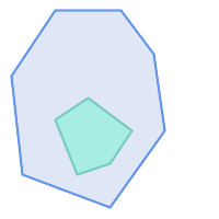
|
ST_Contains returns FALSE in the following situations:
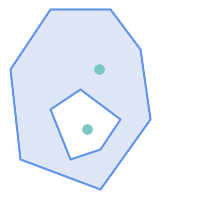
| 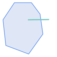
|
Due to the interior intersection condition ST_Contains returns FALSE in the following situations (whereas ST_Covers returns TRUE):
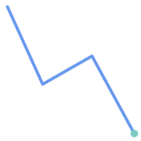
| 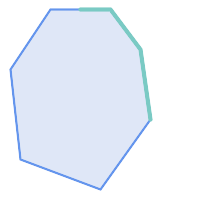
|
-- A circle within a circle
SELECT ST_Contains(smallc, bigc) As smallcontainsbig,
ST_Contains(bigc,smallc) As bigcontainssmall,
ST_Contains(bigc, ST_Union(smallc, bigc)) as bigcontainsunion,
ST_Equals(bigc, ST_Union(smallc, bigc)) as bigisunion,
ST_Covers(bigc, ST_ExteriorRing(bigc)) As bigcoversexterior,
ST_Contains(bigc, ST_ExteriorRing(bigc)) As bigcontainsexterior
FROM (SELECT ST_Buffer(ST_GeomFromText('POINT(1 2)'), 10) As smallc,
ST_Buffer(ST_GeomFromText('POINT(1 2)'), 20) As bigc) As foo;
-- Result
smallcontainsbig | bigcontainssmall | bigcontainsunion | bigisunion | bigcoversexterior | bigcontainsexterior
------------------+------------------+------------------+------------+-------------------+---------------------
f | t | t | t | t | f
-- Example demonstrating difference between contains and contains properly
SELECT ST_GeometryType(geomA) As geomtype, ST_Contains(geomA,geomA) AS acontainsa, ST_ContainsProperly(geomA, geomA) AS acontainspropa,
ST_Contains(geomA, ST_Boundary(geomA)) As acontainsba, ST_ContainsProperly(geomA, ST_Boundary(geomA)) As acontainspropba
FROM (VALUES ( ST_Buffer(ST_Point(1,1), 5,1) ),
( ST_MakeLine(ST_Point(1,1), ST_Point(-1,-1) ) ),
( ST_Point(1,1) )
) As foo(geomA);
geomtype | acontainsa | acontainspropa | acontainsba | acontainspropba
--------------+------------+----------------+-------------+-----------------
ST_Polygon | t | f | f | f
ST_LineString | t | f | f | f
ST_Point | t | t | f | f
Ver también
ST_Boundary, ST_ContainsProperly, ST_Covers, ST_CoveredBy, ST_Equals, ST_Within
Name
ST_ContainsProperly — Tests if every point of B lies in the interior of A
Synopsis
boolean ST_ContainsProperly(geometry geomA, geometry geomB);
Descripción
Returns true if every point of B lies in the interior of A (or equivalently, no point of B lies in the the boundary or exterior of A).
In mathematical terms: ST_ContainsProperly(A, B) ⇔ Int(A) ⋂ B = B
A contains B properly if the DE-9IM Intersection Matrix for the two geometries matches [T**FF*FF*]
A does not properly contain itself, but does contain itself.
A use for this predicate is computing the intersections of a set of geometries with a large polygonal geometry. Since intersection is a fairly slow operation, it can be more efficient to use containsProperly to filter out test geometries which lie fully inside the area. In these cases the intersection is known a priori to be exactly the original test geometry.
| |
This function automatically includes a bounding box comparison that makes use of any spatial indexes that are available on the geometries. To avoid index use, use the function |
| |
The advantage of this predicate over ST_Contains and ST_Intersects is that it can be computed more efficiently, with no need to compute topology at individual points. |
Realizado por el módulo GEOS.
Disponibilidad: 1.4.0
| |
Enhanced: 3.0.0 enabled support for |
| |
Do not use this function with invalid geometries. You will get unexpected results. |
Ejemplos
--a circle within a circle
SELECT ST_ContainsProperly(smallc, bigc) As smallcontainspropbig,
ST_ContainsProperly(bigc,smallc) As bigcontainspropsmall,
ST_ContainsProperly(bigc, ST_Union(smallc, bigc)) as bigcontainspropunion,
ST_Equals(bigc, ST_Union(smallc, bigc)) as bigisunion,
ST_Covers(bigc, ST_ExteriorRing(bigc)) As bigcoversexterior,
ST_ContainsProperly(bigc, ST_ExteriorRing(bigc)) As bigcontainsexterior
FROM (SELECT ST_Buffer(ST_GeomFromText('POINT(1 2)'), 10) As smallc,
ST_Buffer(ST_GeomFromText('POINT(1 2)'), 20) As bigc) As foo;
--Result
smallcontainspropbig | bigcontainspropsmall | bigcontainspropunion | bigisunion | bigcoversexterior | bigcontainsexterior
------------------+------------------+------------------+------------+-------------------+---------------------
f | t | f | t | t | f
--example demonstrating difference between contains and contains properly
SELECT ST_GeometryType(geomA) As geomtype, ST_Contains(geomA,geomA) AS acontainsa, ST_ContainsProperly(geomA, geomA) AS acontainspropa,
ST_Contains(geomA, ST_Boundary(geomA)) As acontainsba, ST_ContainsProperly(geomA, ST_Boundary(geomA)) As acontainspropba
FROM (VALUES ( ST_Buffer(ST_Point(1,1), 5,1) ),
( ST_MakeLine(ST_Point(1,1), ST_Point(-1,-1) ) ),
( ST_Point(1,1) )
) As foo(geomA);
geomtype | acontainsa | acontainspropa | acontainsba | acontainspropba
--------------+------------+----------------+-------------+-----------------
ST_Polygon | t | f | f | f
ST_LineString | t | f | f | f
ST_Point | t | t | f | f
Ver también
ST_GeometryType, ST_Boundary, ST_Contains, ST_Covers, ST_CoveredBy, ST_Equals, ST_Relate, ST_Within
Name
ST_CoveredBy — Tests if every point of A lies in B
Synopsis
boolean ST_CoveredBy(geometry geomA, geometry geomB);
boolean ST_CoveredBy(geography geogA, geography geogB);
Descripción
Returns true if every point in Geometry/Geography A lies inside (i.e. intersects the interior or boundary of) Geometry/Geography B. Equivalently, tests that no point of A lies outside (in the exterior of) B.
In mathematical terms: ST_CoveredBy(A, B) ⇔ A ⋂ B = A
ST_CoveredBy is the converse of ST_Covers. So, ST_CoveredBy(A,B) = ST_Covers(B,A).
Generally this function should be used instead of ST_Within, since it has a simpler definition which does not have the quirk that "boundaries are not within their geometry".
| |
This function automatically includes a bounding box comparison that makes use of any spatial indexes that are available on the geometries. To avoid index use, use the function |
| |
Enhanced: 3.0.0 enabled support for |
| |
Do not use this function with invalid geometries. You will get unexpected results. |
Realizado por el módulo de GEOS
Disponibilidad: 1.2.2
NOTE: this is the "allowable" version that returns a boolean, not an integer.
Not an OGC standard, but Oracle has it too.
Ejemplos
--a circle coveredby a circle
SELECT ST_CoveredBy(smallc,smallc) As smallinsmall,
ST_CoveredBy(smallc, bigc) As smallcoveredbybig,
ST_CoveredBy(ST_ExteriorRing(bigc), bigc) As exteriorcoveredbybig,
ST_Within(ST_ExteriorRing(bigc),bigc) As exeriorwithinbig
FROM (SELECT ST_Buffer(ST_GeomFromText('POINT(1 2)'), 10) As smallc,
ST_Buffer(ST_GeomFromText('POINT(1 2)'), 20) As bigc) As foo;
--Result
smallinsmall | smallcoveredbybig | exteriorcoveredbybig | exeriorwithinbig
--------------+-------------------+----------------------+------------------
t | t | t | f
(1 row) Ver también
Name
ST_Covers — Tests if every point of B lies in A
Synopsis
boolean ST_Covers(geometry geomA, geometry geomB);
boolean ST_Covers(geography geogpolyA, geography geogpointB);
Descripción
Returns true if every point in Geometry/Geography B lies inside (i.e. intersects the interior or boundary of) Geometry/Geography A. Equivalently, tests that no point of B lies outside (in the exterior of) A.
In mathematical terms: ST_Covers(A, B) ⇔ A ⋂ B = B
ST_Covers is the converse of ST_CoveredBy. So, ST_Covers(A,B) = ST_CoveredBy(B,A).
Generally this function should be used instead of ST_Contains, since it has a simpler definition which does not have the quirk that "geometries do not contain their boundary".
| |
This function automatically includes a bounding box comparison that makes use of any spatial indexes that are available on the geometries. To avoid index use, use the function |
| |
Enhanced: 3.0.0 enabled support for |
| |
Do not use this function with invalid geometries. You will get unexpected results. |
Realizado por el módulo de GEOS
Enhanced: 2.4.0 Support for polygon in polygon and line in polygon added for geography type
Enhanced: 2.3.0 Enhancement to PIP short-circuit for geometry extended to support MultiPoints with few points. Prior versions only supported point in polygon.
Availability: 1.5 - support for geography was introduced.
Disponibilidad: 1.2.2
NOTE: this is the "allowable" version that returns a boolean, not an integer.
Not an OGC standard, but Oracle has it too.
Ejemplos
Geometry example
--a circle covering a circle
SELECT ST_Covers(smallc,smallc) As smallinsmall,
ST_Covers(smallc, bigc) As smallcoversbig,
ST_Covers(bigc, ST_ExteriorRing(bigc)) As bigcoversexterior,
ST_Contains(bigc, ST_ExteriorRing(bigc)) As bigcontainsexterior
FROM (SELECT ST_Buffer(ST_GeomFromText('POINT(1 2)'), 10) As smallc,
ST_Buffer(ST_GeomFromText('POINT(1 2)'), 20) As bigc) As foo;
--Result
smallinsmall | smallcoversbig | bigcoversexterior | bigcontainsexterior
--------------+----------------+-------------------+---------------------
t | f | t | f
(1 row) Geeography Example
-- a point with a 300 meter buffer compared to a point, a point and its 10 meter buffer
SELECT ST_Covers(geog_poly, geog_pt) As poly_covers_pt,
ST_Covers(ST_Buffer(geog_pt,10), geog_pt) As buff_10m_covers_cent
FROM (SELECT ST_Buffer(ST_GeogFromText('SRID=4326;POINT(-99.327 31.4821)'), 300) As geog_poly,
ST_GeogFromText('SRID=4326;POINT(-99.33 31.483)') As geog_pt ) As foo;
poly_covers_pt | buff_10m_covers_cent
----------------+------------------
f | t
Ver también
Name
ST_Crosses — Tests if two geometries have some, but not all, interior points in common
Synopsis
boolean ST_Crosses(geometry g1, geometry g2);
Descripción
Compares two geometry objects and returns true if their intersection "spatially crosses"; that is, the geometries have some, but not all interior points in common. The intersection of the interiors of the geometries must be non-empty and must have dimension less than the maximum dimension of the two input geometries, and the intersection of the two geometries must not equal either geometry. Otherwise, it returns false. The crosses relation is symmetric and irreflexive.
In mathematical terms: ST_Crosses(A, B) ⇔ (dim( Int(A) ⋂ Int(B) ) < max( dim( Int(A) ), dim( Int(B) ) )) ∧ (A ⋂ B ≠ A) ∧ (A ⋂ B ≠ B)
Geometries cross if their DE-9IM Intersection Matrix matches:
T*T******for Point/Line, Point/Area, and Line/Area situationsT*****T**for Line/Point, Area/Point, and Area/Line situations0********for Line/Line situationsthe result is
falsefor Point/Point and Area/Area situations
| |
The OpenGIS Simple Features Specification defines this predicate only for Point/Line, Point/Area, Line/Line, and Line/Area situations. JTS / GEOS extends the definition to apply to Line/Point, Area/Point and Area/Line situations as well. This makes the relation symmetric. |
| |
This function automatically includes a bounding box comparison that makes use of any spatial indexes that are available on the geometries. |
| |
Enhanced: 3.0.0 enabled support for |
This method implements the OGC Simple Features Implementation Specification for SQL 1.1. s2.1.13.3
This method implements the SQL/MM specification. SQL-MM 3: 5.1.29
Ejemplos
The following situations all return true.
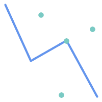
| 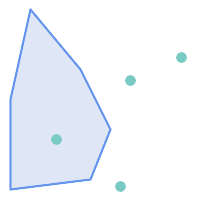
|
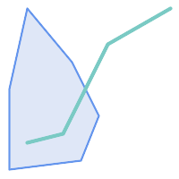
| 
|
Consider a situation where a user has two tables: a table of roads and a table of highways.
CREATE TABLE roads ( id serial NOT NULL, geom geometry, CONSTRAINT roads_pkey PRIMARY KEY (road_id) );
|
CREATE TABLE highways ( id serial NOT NULL, the_gem geometry, CONSTRAINT roads_pkey PRIMARY KEY (road_id) );
|
To determine a list of roads that cross a highway, use a query similar to:
SELECT roads.id FROM roads, highways WHERE ST_Crosses(roads.geom, highways.geom);
Ver también
Name
ST_Disjoint — Tests if two geometries have no points in common
Synopsis
boolean ST_Disjoint( geometry A , geometry B );
Descripción
Returns true if two geometries are disjoint. Geometries are disjoint if they have no point in common.
If any other spatial relationship is true for a pair of geometries, they are not disjoint. Disjoint implies that ST_Intersects is false.
In mathematical terms: ST_Disjoint(A, B) ⇔ A ⋂ B = ∅
| |
Enhanced: 3.0.0 enabled support for |
Realizado por el módulo de GEOS
| |
This function call does not use indexes. A negated ST_Intersects predicate can be used as a more performant alternative that uses indexes: |
| |
NOTE: this is the "allowable" version that returns a boolean, not an integer. |
This method implements the OGC Simple Features Implementation Specification for SQL 1.1. s2.1.1.2 //s2.1.13.3 - a.Relate(b, 'FF*FF****')
This method implements the SQL/MM specification. SQL-MM 3: 5.1.26
Ejemplos
SELECT ST_Disjoint('POINT(0 0)'::geometry, 'LINESTRING ( 2 0, 0 2 )'::geometry);
st_disjoint
---------------
t
(1 row)
SELECT ST_Disjoint('POINT(0 0)'::geometry, 'LINESTRING ( 0 0, 0 2 )'::geometry);
st_disjoint
---------------
f
(1 row)
Ver también
Name
ST_Equals — Tests if two geometries include the same set of points
Synopsis
boolean ST_Equals(geometry A, geometry B);
Descripción
Returns true if the given geometries are "topologically equal". Use this for a 'better' answer than '='. Topological equality means that the geometries have the same dimension, and their point-sets occupy the same space. This means that the order of vertices may be different in topologically equal geometries. To verify the order of points is consistent use ST_OrderingEquals (it must be noted ST_OrderingEquals is a little more stringent than simply verifying order of points are the same).
In mathematical terms: ST_Equals(A, B) ⇔ A = B
The following relation holds: ST_Equals(A, B) ⇔ ST_Within(A,B) ∧ ST_Within(B,A)
| |
Enhanced: 3.0.0 enabled support for |
This method implements the OGC Simple Features Implementation Specification for SQL 1.1. s2.1.1.2
This method implements the SQL/MM specification. SQL-MM 3: 5.1.24
Changed: 2.2.0 Returns true even for invalid geometries if they are binary equal
Ejemplos
SELECT ST_Equals(ST_GeomFromText('LINESTRING(0 0, 10 10)'),
ST_GeomFromText('LINESTRING(0 0, 5 5, 10 10)'));
st_equals
-----------
t
(1 row)
SELECT ST_Equals(ST_Reverse(ST_GeomFromText('LINESTRING(0 0, 10 10)')),
ST_GeomFromText('LINESTRING(0 0, 5 5, 10 10)'));
st_equals
-----------
t
(1 row)
Ver también
Name
ST_Intersects — Tests if two geometries intersect (they have at least one point in common)
Synopsis
boolean ST_Intersects( geometry geomA , geometry geomB );
boolean ST_Intersects( geography geogA , geography geogB );
Descripción
Returns true if two geometries intersect. Geometries intersect if they have any point in common.
For geography, a distance tolerance of 0.00001 meters is used (so points that are very close are considered to intersect).
In mathematical terms: ST_Intersects(A, B) ⇔ A ⋂ B ≠ ∅
Geometries intersect if their DE-9IM Intersection Matrix matches one of:
T*********T**********T*********T****
Spatial intersection is implied by all the other spatial relationship tests, except ST_Disjoint, which tests that geometries do NOT intersect.
| |
This function automatically includes a bounding box comparison that makes use of any spatial indexes that are available on the geometries. |
Changed: 3.0.0 SFCGAL version removed and native support for 2D TINS added.
Enhanced: 2.5.0 Supports GEOMETRYCOLLECTION.
Enhanced: 2.3.0 Enhancement to PIP short-circuit extended to support MultiPoints with few points. Prior versions only supported point in polygon.
Performed by the GEOS module (for geometry), geography is native
Availability: 1.5 support for geography was introduced.
| |
For geography, this function has a distance tolerance of about 0.00001 meters and uses the sphere rather than spheroid calculation. |
| |
NOTE: this is the "allowable" version that returns a boolean, not an integer. |
This method implements the OGC Simple Features Implementation Specification for SQL 1.1. s2.1.1.2 //s2.1.13.3 - ST_Intersects(g1, g2 ) --> Not (ST_Disjoint(g1, g2 ))
This method implements the SQL/MM specification. SQL-MM 3: 5.1.27
This method supports Circular Strings and Curves.
This function supports Triangles and Triangulated Irregular Network Surfaces (TIN).
Geometry Examples
SELECT ST_Intersects('POINT(0 0)'::geometry, 'LINESTRING ( 2 0, 0 2 )'::geometry);
st_intersects
---------------
f
(1 row)
SELECT ST_Intersects('POINT(0 0)'::geometry, 'LINESTRING ( 0 0, 0 2 )'::geometry);
st_intersects
---------------
t
(1 row)
-- Look up in table. Make sure table has a GiST index on geometry column for faster lookup.
SELECT id, name FROM cities WHERE ST_Intersects(geom, 'SRID=4326;POLYGON((28 53,27.707 52.293,27 52,26.293 52.293,26 53,26.293 53.707,27 54,27.707 53.707,28 53))');
id | name
----+-------
2 | Minsk
(1 row)
Geography Examples
SELECT ST_Intersects(
'SRID=4326;LINESTRING(-43.23456 72.4567,-43.23456 72.4568)'::geography,
'SRID=4326;POINT(-43.23456 72.4567772)'::geography
);
st_intersects
---------------
t
Ver también
Name
ST_LineCrossingDirection — Returns a number indicating the crossing behavior of two LineStrings
Synopsis
integer ST_LineCrossingDirection(geometry linestringA, geometry linestringB);
Descripción
Given two linestrings returns an integer between -3 and 3 indicating what kind of crossing behavior exists between them. 0 indicates no crossing. This is only supported for LINESTRINGs.
The crossing number has the following meaning:
0: LINE NO CROSS
-1: LINE CROSS LEFT
1: LINE CROSS RIGHT
-2: LINE MULTICROSS END LEFT
2: LINE MULTICROSS END RIGHT
-3: LINE MULTICROSS END SAME FIRST LEFT
3: LINE MULTICROSS END SAME FIRST RIGHT
Availability: 1.4
Ejemplos
Example: LINE CROSS LEFT and LINE CROSS RIGHT
Blue: Line A; Green: Line B
SELECT ST_LineCrossingDirection(lineA, lineB) As A_cross_B,
ST_LineCrossingDirection(lineB, lineA) As B_cross_A
FROM (SELECT
ST_GeomFromText('LINESTRING(25 169,89 114,40 70,86 43)') As lineA,
ST_GeomFromText('LINESTRING (20 140, 71 74, 161 53)') As lineB
) As foo;
A_cross_B | B_cross_A
-----------+-----------
-1 | 1
Example: LINE MULTICROSS END SAME FIRST LEFT and LINE MULTICROSS END SAME FIRST RIGHT
Blue: Line A; Green: Line B
SELECT ST_LineCrossingDirection(lineA, lineB) As A_cross_B,
ST_LineCrossingDirection(lineB, lineA) As B_cross_A
FROM (SELECT
ST_GeomFromText('LINESTRING(25 169,89 114,40 70,86 43)') As lineA,
ST_GeomFromText('LINESTRING(171 154,20 140,71 74,161 53)') As lineB
) As foo;
A_cross_B | B_cross_A
-----------+-----------
3 | -3
Example: LINE MULTICROSS END LEFT and LINE MULTICROSS END RIGHT
Blue: Line A; Green: Line B
SELECT ST_LineCrossingDirection(lineA, lineB) As A_cross_B,
ST_LineCrossingDirection(lineB, lineA) As B_cross_A
FROM (SELECT
ST_GeomFromText('LINESTRING(25 169,89 114,40 70,86 43)') As lineA,
ST_GeomFromText('LINESTRING(5 90, 71 74, 20 140, 171 154)') As lineB
) As foo;
A_cross_B | B_cross_A
-----------+-----------
-2 | 2
Example: Finds all streets that cross
SELECT s1.gid, s2.gid, ST_LineCrossingDirection(s1.geom, s2.geom)
FROM streets s1 CROSS JOIN streets s2
ON (s1.gid != s2.gid AND s1.geom && s2.geom )
WHERE ST_LineCrossingDirection(s1.geom, s2.geom)
> 0;
Ver también
Name
ST_OrderingEquals — Tests if two geometries represent the same geometry and have points in the same directional order
Synopsis
boolean ST_OrderingEquals(geometry A, geometry B);
Descripción
ST_OrderingEquals compares two geometries and returns t (TRUE) if the geometries are equal and the coordinates are in the same order; otherwise it returns f (FALSE).
| |
This function is implemented as per the ArcSDE SQL specification rather than SQL-MM. http://edndoc.esri.com/arcsde/9.1/sql_api/sqlapi3.htm#ST_OrderingEquals |
This method implements the SQL/MM specification. SQL-MM 3: 5.1.43
Ejemplos
SELECT ST_OrderingEquals( 'LINESTRING(0 0, 10 10)', 'LINESTRING(0 0, 5 5, 10 10)'); st_orderingequals ----------- f SELECT ST_OrderingEquals( 'LINESTRING(0 0, 10 10)', 'LINESTRING(0 0, 10 10)'); st_orderingequals ----------- t SELECT ST_OrderingEquals( 'POLYGON((0 0, 0 1, 1 1, 1 0, 0 0))', 'POLYGON((0 0, 1 0, 1 1, 0 1, 0 0))'); st_orderingequals ----------- f
Ver también
Name
ST_Overlaps — Tests if two geometries have the same dimension and intersect, but each has at least one point not in the other
Synopsis
boolean ST_Overlaps(geometry A, geometry B);
Descripción
Returns TRUE if geometry A and B "spatially overlap". Two geometries overlap if they have the same dimension, their interiors intersect in that dimension. and each has at least one point inside the other (or equivalently, neither one covers the other). The overlaps relation is symmetric and irreflexive.
In mathematical terms: ST_Overlaps(A, B) ⇔ ( dim(A) = dim(B) = dim( Int(A) ⋂ Int(B) )) ∧ (A ⋂ B ≠ A) ∧ (A ⋂ B ≠ B)
| |
This function automatically includes a bounding box comparison that makes use of any spatial indexes that are available on the geometries. To avoid index use, use the function |
Realizado por el módulo de GEOS
| |
Enhanced: 3.0.0 enabled support for |
NOTE: this is the "allowable" version that returns a boolean, not an integer.
This method implements the OGC Simple Features Implementation Specification for SQL 1.1. s2.1.1.2 // s2.1.13.3
This method implements the SQL/MM specification. SQL-MM 3: 5.1.32
Ejemplos
ST_Overlaps returns TRUE in the following situations:
| 
| 
|
A Point on a LineString is contained, but since it has lower dimension it does not overlap or cross.
SELECT ST_Overlaps(a,b) AS overlaps, ST_Crosses(a,b) AS crosses,
ST_Intersects(a, b) AS intersects, ST_Contains(b,a) AS b_contains_a
FROM (SELECT ST_GeomFromText('POINT (100 100)') As a,
ST_GeomFromText('LINESTRING (30 50, 40 160, 160 40, 180 160)') AS b) AS t
overlaps | crosses | intersects | b_contains_a
---------+----------------------+--------------
f | f | t | t
A LineString that partly covers a Polygon intersects and crosses, but does not overlap since it has different dimension.
SELECT ST_Overlaps(a,b) AS overlaps, ST_Crosses(a,b) AS crosses,
ST_Intersects(a, b) AS intersects, ST_Contains(a,b) AS contains
FROM (SELECT ST_GeomFromText('POLYGON ((40 170, 90 30, 180 100, 40 170))') AS a,
ST_GeomFromText('LINESTRING(10 10, 190 190)') AS b) AS t;
overlap | crosses | intersects | contains
---------+---------+------------+--------------
f | t | t | f
Two Polygons that intersect but with neither contained by the other overlap, but do not cross because their intersection has the same dimension.
SELECT ST_Overlaps(a,b) AS overlaps, ST_Crosses(a,b) AS crosses,
ST_Intersects(a, b) AS intersects, ST_Contains(b, a) AS b_contains_a,
ST_Dimension(a) AS dim_a, ST_Dimension(b) AS dim_b,
ST_Dimension(ST_Intersection(a,b)) AS dim_int
FROM (SELECT ST_GeomFromText('POLYGON ((40 170, 90 30, 180 100, 40 170))') AS a,
ST_GeomFromText('POLYGON ((110 180, 20 60, 130 90, 110 180))') AS b) As t;
overlaps | crosses | intersects | b_contains_a | dim_a | dim_b | dim_int
----------+---------+------------+--------------+-------+-------+-----------
t | f | t | f | 2 | 2 | 2
Ver también
Name
ST_Relate — Tests if two geometries have a topological relationship matching an Intersection Matrix pattern, or computes their Intersection Matrix
Synopsis
boolean ST_Relate(geometry geomA, geometry geomB, text intersectionMatrixPattern);
text ST_Relate(geometry geomA, geometry geomB);
text ST_Relate(geometry geomA, geometry geomB, integer boundaryNodeRule);
Descripción
These functions allow testing and evaluating the spatial (topological) relationship between two geometries, as defined by the Dimensionally Extended 9-Intersection Model (DE-9IM).
The DE-9IM is specified as a 9-element matrix indicating the dimension of the intersections between the Interior, Boundary and Exterior of two geometries. It is represented by a 9-character text string using the symbols 'F', '0', '1', '2' (e.g. 'FF1FF0102').
A specific kind of spatial relationship can be tested by matching the intersection matrix to an intersection matrix pattern. Patterns can include the additional symbols 'T' (meaning "intersection is non-empty") and '*' (meaning "any value"). Common spatial relationships are provided by the named functions ST_Contains, ST_ContainsProperly, ST_Covers, ST_CoveredBy, ST_Crosses, ST_Disjoint, ST_Equals, ST_Intersects, ST_Overlaps, ST_Touches, and ST_Within. Using an explicit pattern allows testing multiple conditions of intersects, crosses, etc in one step. It also allows testing spatial relationships which do not have a named spatial relationship function. For example, the relationship "Interior-Intersects" has the DE-9IM pattern T********, which is not evaluated by any named predicate.
For more information refer to Section 5.1, “Determining Spatial Relationships”.
Variant 1: Tests if two geometries are spatially related according to the given intersectionMatrixPattern.
| |
Unlike most of the named spatial relationship predicates, this does NOT automatically include an index call. The reason is that some relationships are true for geometries which do NOT intersect (e.g. Disjoint). If you are using a relationship pattern that requires intersection, then include the && index call. |
| |
It is better to use a named relationship function if available, since they automatically use a spatial index where one exists. Also, they may implement performance optimizations which are not available with full relate evaluation. |
Variant 2: Returns the DE-9IM matrix string for the spatial relationship between the two input geometries. The matrix string can be tested for matching a DE-9IM pattern using ST_RelateMatch.
Variant 3: Like variant 2, but allows specifying a Boundary Node Rule. A boundary node rule allows finer control over whether the endpoints of MultiLineStrings are considered to lie in the DE-9IM Interior or Boundary. The boundaryNodeRule values are:
1: OGC-Mod2 - line endpoints are in the Boundary if they occur an odd number of times. This is the rule defined by the OGC SFS standard, and is the default forST_Relate.2: Endpoint - all endpoints are in the Boundary.3: MultivalentEndpoint - endpoints are in the Boundary if they occur more than once. In other words, the boundary is all the "attached" or "inner" endpoints (but not the "unattached/outer" ones).4: MonovalentEndpoint - endpoints are in the Boundary if they occur only once. In other words, the boundary is all the "unattached" or "outer" endpoints.
This function is not in the OGC spec, but is implied. see s2.1.13.2
This method implements the OGC Simple Features Implementation Specification for SQL 1.1. s2.1.1.2 // s2.1.13.3
This method implements the SQL/MM specification. SQL-MM 3: 5.1.25
Realizado por el módulo de GEOS
Enhanced: 2.0.0 - added support for specifying boundary node rule.
| |
Enhanced: 3.0.0 enabled support for |
Ejemplos
Using the boolean-valued function to test spatial relationships.
SELECT ST_Relate('POINT(1 2)', ST_Buffer( 'POINT(1 2)', 2), '0FFFFF212');
st_relate
-----------
t
SELECT ST_Relate(POINT(1 2)', ST_Buffer( 'POINT(1 2)', 2), '*FF*FF212');
st_relate
-----------
t
Testing a custom spatial relationship pattern as a query condition, with && to enable using a spatial index.
-- Find compounds that properly intersect (not just touch) a poly (Interior Intersects)
SELECT c.* , p.name As poly_name
FROM polys AS p
INNER JOIN compounds As c
ON c.geom && p.geom
AND ST_Relate(p.geom, c.geom,'T********');
Computing the intersection matrix for spatial relationships.
SELECT ST_Relate( 'POINT(1 2)',
ST_Buffer( 'POINT(1 2)', 2));
-----------
0FFFFF212
SELECT ST_Relate( 'LINESTRING(1 2, 3 4)',
'LINESTRING(5 6, 7 8)' );
-----------
FF1FF0102
Using different Boundary Node Rules to compute the spatial relationship between a LineString and a MultiLineString with a duplicate endpoint (3 3):
Using the OGC-Mod2 rule (1) the duplicate endpoint is in the interior of the MultiLineString, so the DE-9IM matrix entry [aB:bI] is
0and [aB:bB] isF.Using the Endpoint rule (2) the duplicate endpoint is in the boundary of the MultiLineString, so the DE-9IM matrix entry [aB:bI] is
Fand [aB:bB] is0.
WITH data AS (SELECT
'LINESTRING(1 1, 3 3)'::geometry AS a_line,
'MULTILINESTRING((3 3, 3 5), (3 3, 5 3))':: geometry AS b_multiline
)
SELECT ST_Relate( a_line, b_multiline, 1) AS bnr_mod2,
ST_Relate( a_line, b_multiline, 2) AS bnr_endpoint
FROM data;
bnr_mod2 | bnr_endpoint
-----------+--------------
FF10F0102 | FF1F00102
Name
ST_RelateMatch — Tests if a DE-9IM Intersection Matrix matches an Intersection Matrix pattern
Synopsis
boolean ST_RelateMatch(text intersectionMatrix, text intersectionMatrixPattern);
Descripción
Tests if a Dimensionally Extended 9-Intersection Model (DE-9IM) intersectionMatrix value satisfies an intersectionMatrixPattern. Intersection matrix values can be computed by ST_Relate.
For more information refer to Section 5.1, “Determining Spatial Relationships”.
Realizado por el módulo de GEOS
Disponibilidad: 2.0.0
Ejemplos
SELECT ST_RelateMatch('101202FFF', 'TTTTTTFFF') ;
-- result --
t
Patterns for common spatial relationships matched against intersection matrix values, for a line in various positions relative to a polygon
SELECT pat.name AS relationship, pat.val AS pattern,
mat.name AS position, mat.val AS matrix,
ST_RelateMatch(mat.val, pat.val) AS match
FROM (VALUES ( 'Equality', 'T1FF1FFF1' ),
( 'Overlaps', 'T*T***T**' ),
( 'Within', 'T*F**F***' ),
( 'Disjoint', 'FF*FF****' )) AS pat(name,val)
CROSS JOIN
(VALUES ('non-intersecting', 'FF1FF0212'),
('overlapping', '1010F0212'),
('inside', '1FF0FF212')) AS mat(name,val);
relationship | pattern | position | matrix | match
--------------+-----------+------------------+-----------+-------
Equality | T1FF1FFF1 | non-intersecting | FF1FF0212 | f
Equality | T1FF1FFF1 | overlapping | 1010F0212 | f
Equality | T1FF1FFF1 | inside | 1FF0FF212 | f
Overlaps | T*T***T** | non-intersecting | FF1FF0212 | f
Overlaps | T*T***T** | overlapping | 1010F0212 | t
Overlaps | T*T***T** | inside | 1FF0FF212 | f
Within | T*F**F*** | non-intersecting | FF1FF0212 | f
Within | T*F**F*** | overlapping | 1010F0212 | f
Within | T*F**F*** | inside | 1FF0FF212 | t
Disjoint | FF*FF**** | non-intersecting | FF1FF0212 | t
Disjoint | FF*FF**** | overlapping | 1010F0212 | f
Disjoint | FF*FF**** | inside | 1FF0FF212 | f
Name
ST_Touches — Tests if two geometries have at least one point in common, but their interiors do not intersect
Synopsis
boolean ST_Touches(geometry A, geometry B);
Descripción
Returns TRUE if A and B intersect, but their interiors do not intersect. Equivalently, A and B have at least one point in common, and the common points lie in at least one boundary. For Point/Point inputs the relationship is always FALSE, since points do not have a boundary.
In mathematical terms: ST_Touches(A, B) ⇔ (Int(A) ⋂ Int(B) = ∅) ∧ (A ⋂ B ≠ ∅)
This relationship holds if the DE-9IM Intersection Matrix for the two geometries matches one of:
FT*******
F**T*****
F***T****
| |
This function automatically includes a bounding box comparison that makes use of any spatial indexes that are available on the geometries. To avoid using an index, use |
| |
Enhanced: 3.0.0 enabled support for |
This method implements the OGC Simple Features Implementation Specification for SQL 1.1. s2.1.1.2 // s2.1.13.3
This method implements the SQL/MM specification. SQL-MM 3: 5.1.28
Ejemplos
The ST_Touches predicate returns TRUE in the following examples.
| 
| 
|
| 
| 
|
SELECT ST_Touches('LINESTRING(0 0, 1 1, 0 2)'::geometry, 'POINT(1 1)'::geometry);
st_touches
------------
f
(1 row)
SELECT ST_Touches('LINESTRING(0 0, 1 1, 0 2)'::geometry, 'POINT(0 2)'::geometry);
st_touches
------------
t
(1 row)Name
ST_Within — Tests if every point of A lies in B, and their interiors have a point in common
Synopsis
boolean ST_Within(geometry A, geometry B);
Descripción
Returns TRUE if geometry A is within geometry B. A is within B if and only if all points of A lie inside (i.e. in the interior or boundary of) B (or equivalently, no points of A lie in the exterior of B), and the interiors of A and B have at least one point in common.
For this function to make sense, the source geometries must both be of the same coordinate projection, having the same SRID.
In mathematical terms: ST_Within(A, B) ⇔ (A ⋂ B = A) ∧ (Int(A) ⋂ Int(B) ≠ ∅)
The within relation is reflexive: every geometry is within itself. The relation is antisymmetric: if ST_Within(A,B) = true and ST_Within(B,A) = true, then the two geometries must be topologically equal (ST_Equals(A,B) = true).
ST_Within is the converse of ST_Contains. So, ST_Within(A,B) = ST_Contains(B,A).
| |
Because the interiors must have a common point, a subtlety of the definition is that lines and points lying fully in the boundary of polygons or lines are not within the geometry. For further details see Subtleties of OGC Covers, Contains, Within. The ST_CoveredBy predicate provides a more inclusive relationship. |
| |
This function automatically includes a bounding box comparison that makes use of any spatial indexes that are available on the geometries. To avoid index use, use the function |
Realizado por el módulo de GEOS
Enhanced: 2.3.0 Enhancement to PIP short-circuit for geometry extended to support MultiPoints with few points. Prior versions only supported point in polygon.
| |
Enhanced: 3.0.0 enabled support for |
| |
Do not use this function with invalid geometries. You will get unexpected results. |
NOTE: this is the "allowable" version that returns a boolean, not an integer.
This method implements the OGC Simple Features Implementation Specification for SQL 1.1. s2.1.1.2 // s2.1.13.3 - a.Relate(b, 'T*F**F***')
This method implements the SQL/MM specification. SQL-MM 3: 5.1.30
Ejemplos
--a circle within a circle
SELECT ST_Within(smallc,smallc) As smallinsmall,
ST_Within(smallc, bigc) As smallinbig,
ST_Within(bigc,smallc) As biginsmall,
ST_Within(ST_Union(smallc, bigc), bigc) as unioninbig,
ST_Within(bigc, ST_Union(smallc, bigc)) as biginunion,
ST_Equals(bigc, ST_Union(smallc, bigc)) as bigisunion
FROM
(
SELECT ST_Buffer(ST_GeomFromText('POINT(50 50)'), 20) As smallc,
ST_Buffer(ST_GeomFromText('POINT(50 50)'), 40) As bigc) As foo;
--Result
smallinsmall | smallinbig | biginsmall | unioninbig | biginunion | bigisunion
--------------+------------+------------+------------+------------+------------
t | t | f | t | t | t
(1 row)

Ver también
7.11.2. Distance Relationships
- ST_3DDWithin — Tests if two 3D geometries are within a given 3D distance
- ST_3DDFullyWithin — Tests if two 3D geometries are entirely within a given 3D distance
- ST_DFullyWithin — Tests if a geometry is entirely inside a distance of another
- ST_DWithin — Tests if two geometries are within a given distance
- ST_PointInsideCircle — Tests if a point geometry is inside a circle defined by a center and radius
Name
ST_3DDWithin — Tests if two 3D geometries are within a given 3D distance
Synopsis
boolean ST_3DDWithin(geometry g1, geometry g2, double precision distance_of_srid);
Descripción
Returns true if the 3D distance between two geometry values is no larger than distance distance_of_srid. The distance is specified in units defined by the spatial reference system of the geometries. For this function to make sense the source geometries must be in the same coordinate system (have the same SRID).
| |
This function automatically includes a bounding box comparison that makes use of any spatial indexes that are available on the geometries. |
This function supports 3d and will not drop the z-index.
This function supports Polyhedral surfaces.
This method implements the SQL/MM specification. SQL-MM ?
Disponibilidad: 2.0.0
Ejemplos
-- Geometry example - units in meters (SRID: 2163 US National Atlas Equal area) (3D point and line compared 2D point and line)
-- Note: currently no vertical datum support so Z is not transformed and assumed to be same units as final.
SELECT ST_3DDWithin(
ST_Transform(ST_GeomFromEWKT('SRID=4326;POINT(-72.1235 42.3521 4)'),2163),
ST_Transform(ST_GeomFromEWKT('SRID=4326;LINESTRING(-72.1260 42.45 15, -72.123 42.1546 20)'),2163),
126.8
) As within_dist_3d,
ST_DWithin(
ST_Transform(ST_GeomFromEWKT('SRID=4326;POINT(-72.1235 42.3521 4)'),2163),
ST_Transform(ST_GeomFromEWKT('SRID=4326;LINESTRING(-72.1260 42.45 15, -72.123 42.1546 20)'),2163),
126.8
) As within_dist_2d;
within_dist_3d | within_dist_2d
----------------+----------------
f | t
Name
ST_3DDFullyWithin — Tests if two 3D geometries are entirely within a given 3D distance
Synopsis
boolean ST_3DDFullyWithin(geometry g1, geometry g2, double precision distance);
Descripción
Returns true if the 3D geometries are fully within the specified distance of one another. The distance is specified in units defined by the spatial reference system of the geometries. For this function to make sense, the source geometries must both be of the same coordinate projection, having the same SRID.
| |
This function automatically includes a bounding box comparison that makes use of any spatial indexes that are available on the geometries. |
Disponibilidad: 2.0.0
This function supports 3d and will not drop the z-index.
This function supports Polyhedral surfaces.
Ejemplos
-- This compares the difference between fully within and distance within as well
-- as the distance fully within for the 2D footprint of the line/point vs. the 3d fully within
SELECT ST_3DDFullyWithin(geom_a, geom_b, 10) as D3DFullyWithin10, ST_3DDWithin(geom_a, geom_b, 10) as D3DWithin10,
ST_DFullyWithin(geom_a, geom_b, 20) as D2DFullyWithin20,
ST_3DDFullyWithin(geom_a, geom_b, 20) as D3DFullyWithin20 from
(select ST_GeomFromEWKT('POINT(1 1 2)') as geom_a,
ST_GeomFromEWKT('LINESTRING(1 5 2, 2 7 20, 1 9 100, 14 12 3)') as geom_b) t1;
d3dfullywithin10 | d3dwithin10 | d2dfullywithin20 | d3dfullywithin20
------------------+-------------+------------------+------------------
f | t | t | f Ver también
Name
ST_DFullyWithin — Tests if a geometry is entirely inside a distance of another
Synopsis
boolean ST_DFullyWithin(geometry g1, geometry g2, double precision distance);
Descripción
Returns true if g2 is entirely within distance of g1. Visually, the condition is true if g2 is contained within a distance buffer of g1. The distance is specified in units defined by the spatial reference system of the geometries.
| |
This function automatically includes a bounding box comparison that makes use of any spatial indexes that are available on the geometries. |
Disponibilidad: 1.5.0
Changed: 3.5.0 : the logic behind the function now uses a test of containment within a buffer, rather than the ST_MaxDistance algorithm. Results will differ from prior versions, but should be closer to user expectations.
Ejemplos
SELECT
ST_DFullyWithin(geom_a, geom_b, 10) AS DFullyWithin10,
ST_DWithin(geom_a, geom_b, 10) AS DWithin10,
ST_DFullyWithin(geom_a, geom_b, 20) AS DFullyWithin20
FROM (VALUES
('POINT(1 1)', 'LINESTRING(1 5, 2 7, 1 9, 14 12)')
) AS v(geom_a, geom_b)
dfullywithin10 | dwithin10 | dfullywithin20
----------------+-----------+----------------
f | t | t
Ver también
Name
ST_DWithin — Tests if two geometries are within a given distance
Synopsis
boolean ST_DWithin(geometry g1, geometry g2, double precision distance_of_srid);
boolean ST_DWithin(geography gg1, geography gg2, double precision distance_meters, boolean use_spheroid = true);
Descripción
Returns true if the geometries are within a given distance
For geometry: The distance is specified in units defined by the spatial reference system of the geometries. For this function to make sense, the source geometries must be in the same coordinate system (have the same SRID).
For geography: units are in meters and distance measurement defaults to use_spheroid = true. For faster evaluation use use_spheroid = false to measure on the sphere.
| |
Use ST_3DDWithin for 3D geometries. |
| |
This function call includes a bounding box comparison that makes use of any indexes that are available on the geometries. |
This method implements the OGC Simple Features Implementation Specification for SQL 1.1.
Availability: 1.5.0 support for geography was introduced
Enhanced: 2.1.0 improved speed for geography. See Making Geography faster for details.
Enhanced: 2.1.0 support for curved geometries was introduced.
Prior to 1.3, ST_Expand was commonly used in conjunction with && and ST_Distance to test for distance, and in pre-1.3.4 this function used that logic. From 1.3.4, ST_DWithin uses a faster short-circuit distance function.
Ejemplos
-- Find the nearest hospital to each school
-- that is within 3000 units of the school.
-- We do an ST_DWithin search to utilize indexes to limit our search list
-- that the non-indexable ST_Distance needs to process
-- If the units of the spatial reference is meters then units would be meters
SELECT DISTINCT ON (s.gid) s.gid, s.school_name, s.geom, h.hospital_name
FROM schools s
LEFT JOIN hospitals h ON ST_DWithin(s.geom, h.geom, 3000)
ORDER BY s.gid, ST_Distance(s.geom, h.geom);
-- The schools with no close hospitals
-- Find all schools with no hospital within 3000 units
-- away from the school. Units is in units of spatial ref (e.g. meters, feet, degrees)
SELECT s.gid, s.school_name
FROM schools s
LEFT JOIN hospitals h ON ST_DWithin(s.geom, h.geom, 3000)
WHERE h.gid IS NULL;
-- Find broadcasting towers that a receiver with limited range can receive.
-- Data is geometry in Spherical Mercator (SRID=3857), ranges are approximate.
-- Create geometry index that will check proximity limit of user to tower
CREATE INDEX ON broadcasting_towers using gist (geom);
-- Create geometry index that will check proximity limit of tower to user
CREATE INDEX ON broadcasting_towers using gist (ST_Expand(geom, sending_range));
-- Query towers that 4-kilometer receiver in Minsk Hackerspace can get
-- Note: two conditions, because shorter LEAST(b.sending_range, 4000) will not use index.
SELECT b.tower_id, b.geom
FROM broadcasting_towers b
WHERE ST_DWithin(b.geom, 'SRID=3857;POINT(3072163.4 7159374.1)', 4000)
AND ST_DWithin(b.geom, 'SRID=3857;POINT(3072163.4 7159374.1)', b.sending_range);
Ver también
Name
ST_PointInsideCircle — Tests if a point geometry is inside a circle defined by a center and radius
Synopsis
boolean ST_PointInsideCircle(geometry a_point, float center_x, float center_y, float radius);
Descripción
Returns true if the geometry is a point and is inside the circle with center center_x,center_y and radius radius.
| |
Does not use spatial indexes. Use ST_DWithin instead. |
Availability: 1.2
Changed: 2.2.0 In prior versions this was called ST_Point_Inside_Circle
Ejemplos
SELECT ST_PointInsideCircle(ST_Point(1,2), 0.5, 2, 3); st_pointinsidecircle ------------------------ t
Ver también
7.12. Measurement Functions
These functions compute measurements of distance, area and angles. There are also functions to compute geometry values determined by measurements.
- ST_Area — Returns the area of a polygonal geometry.
- ST_Azimuth — Returns the north-based azimuth of a line between two points.
- ST_Angle — Returns the angle between two vectors defined by 3 or 4 points, or 2 lines.
- ST_ClosestPoint — Returns the 2D point on g1 that is closest to g2. This is the first point of the shortest line from one geometry to the other.
- ST_3DClosestPoint — Returns the 3D point on g1 that is closest to g2. This is the first point of the 3D shortest line.
- ST_Distance — Returns the distance between two geometry or geography values.
- ST_3DDistance — Returns the 3D cartesian minimum distance (based on spatial ref) between two geometries in projected units.
- ST_DistanceSphere — Returns minimum distance in meters between two lon/lat geometries using a spherical earth model.
- ST_DistanceSpheroid — Returns the minimum distance between two lon/lat geometries using a spheroidal earth model.
- ST_FrechetDistance — Returns the Fréchet distance between two geometries.
- ST_HausdorffDistance — Returns the Hausdorff distance between two geometries.
- ST_Length — Returns the 2D length of a linear geometry.
- ST_Length2D — Returns the 2D length of a linear geometry. Alias for
ST_Length - ST_3DLength — Returns the 3D length of a linear geometry.
- ST_LengthSpheroid — Returns the 2D or 3D length/perimeter of a lon/lat geometry on a spheroid.
- ST_LongestLine — Returns the 2D longest line between two geometries.
- ST_3DLongestLine — Returns the 3D longest line between two geometries
- ST_MaxDistance — Returns the 2D largest distance between two geometries in projected units.
- ST_3DMaxDistance — Returns the 3D cartesian maximum distance (based on spatial ref) between two geometries in projected units.
- ST_MinimumClearance — Returns the minimum clearance of a geometry, a measure of a geometry's robustness.
- ST_MinimumClearanceLine — Returns the two-point LineString spanning a geometry's minimum clearance.
- ST_Perimeter — Returns the length of the boundary of a polygonal geometry or geography.
- ST_Perimeter2D — Returns the 2D perimeter of a polygonal geometry. Alias for
ST_Perimeter. - ST_3DPerimeter — Returns the 3D perimeter of a polygonal geometry.
- ST_ShortestLine — Returns the 2D shortest line between two geometries
- ST_3DShortestLine — Returns the 3D shortest line between two geometries
Name
ST_Area — Returns the area of a polygonal geometry.
Synopsis
float ST_Area(geometry g1);
float ST_Area(geography geog, boolean use_spheroid = true);
Descripción
Returns the area of a polygonal geometry. For geometry types a 2D Cartesian (planar) area is computed, with units specified by the SRID. For geography types by default area is determined on a spheroid with units in square meters. To compute the area using the faster but less accurate spherical model use ST_Area(geog,false).
Enhanced: 2.0.0 - support for 2D polyhedral surfaces was introduced.
Enhanced: 2.2.0 - measurement on spheroid performed with GeographicLib for improved accuracy and robustness. Requires PROJ >= 4.9.0 to take advantage of the new feature.
Changed: 3.0.0 - does not depend on SFCGAL anymore.
This method implements the OGC Simple Features Implementation Specification for SQL 1.1.
This method implements the SQL/MM specification. SQL-MM 3: 8.1.2, 9.5.3
This function supports Polyhedral surfaces.
| |
For polyhedral surfaces, only supports 2D polyhedral surfaces (not 2.5D). For 2.5D, may give a non-zero answer, but only for the faces that sit completely in XY plane. |
Ejemplos
Return area in square feet for a plot of Massachusetts land and multiply by conversion to get square meters. Note this is in square feet because EPSG:2249 is Massachusetts State Plane Feet
select ST_Area(geom) sqft,
ST_Area(geom) * 0.3048 ^ 2 sqm
from (
select 'SRID=2249;POLYGON((743238 2967416,743238 2967450,
743265 2967450,743265.625 2967416,743238 2967416))' :: geometry geom
) subquery;
┌─────────┬─────────────┐
│ sqft │ sqm │
├─────────┼─────────────┤
│ 928.625 │ 86.27208552 │
└─────────┴─────────────┘
Return area square feet and transform to Massachusetts state plane meters (EPSG:26986) to get square meters. Note this is in square feet because 2249 is Massachusetts State Plane Feet and transformed area is in square meters since EPSG:26986 is state plane Massachusetts meters.
select ST_Area(geom) sqft,
ST_Area(ST_Transform(geom, 26986)) As sqm
from (
select
'SRID=2249;POLYGON((743238 2967416,743238 2967450,
743265 2967450,743265.625 2967416,743238 2967416))' :: geometry geom
) subquery;
┌─────────┬─────────────────┐
│ sqft │ sqm │
├─────────┼─────────────────┤
│ 928.625 │ 86.272430607008 │
└─────────┴─────────────────┘
Return area square feet and square meters using geography data type. Note that we transform to our geometry to geography (before you can do that make sure your geometry is in WGS 84 long lat 4326). Geography always measures in meters. This is just for demonstration to compare. Normally your table will be stored in geography data type already.
select ST_Area(geog) / 0.3048 ^ 2 sqft_spheroid,
ST_Area(geog, false) / 0.3048 ^ 2 sqft_sphere,
ST_Area(geog) sqm_spheroid
from (
select ST_Transform(
'SRID=2249;POLYGON((743238 2967416,743238 2967450,743265 2967450,743265.625 2967416,743238 2967416))'::geometry,
4326
) :: geography geog
) as subquery;
┌──────────────────┬──────────────────┬──────────────────┐
│ sqft_spheroid │ sqft_sphere │ sqm_spheroid │
├──────────────────┼──────────────────┼──────────────────┤
│ 928.684405784452 │ 927.049336105925 │ 86.2776044979692 │
└──────────────────┴──────────────────┴──────────────────┘
If your data is in geography already:
select ST_Area(geog) / 0.3048 ^ 2 sqft,
ST_Area(the_geog) sqm
from somegeogtable;Ver también
ST_3DArea, ST_GeomFromText, ST_GeographyFromText, ST_SetSRID, ST_Transform
Name
ST_Azimuth — Returns the north-based azimuth of a line between two points.
Synopsis
float ST_Azimuth(geometry origin, geometry target);
float ST_Azimuth(geography origin, geography target);
Descripción
Returns the azimuth in radians of the target point from the origin point, or NULL if the two points are coincident. The azimuth angle is a positive clockwise angle referenced from the positive Y axis (geometry) or the North meridian (geography): North = 0; Northeast = π/4; East = π/2; Southeast = 3π/4; South = π; Southwest 5π/4; West = 3π/2; Northwest = 7π/4.
For the geography type, the azimuth solution is known as the inverse geodesic problem.
The azimuth is a mathematical concept defined as the angle between a reference vector and a point, with angular units in radians. The result value in radians can be converted to degrees using the PostgreSQL function degrees().
Azimuth can be used in conjunction with ST_Translate to shift an object along its perpendicular axis. See the upgis_lineshift() function in the PostGIS wiki for an implementation of this.
Disponibilidad: 1.1.0
Enhanced: 2.0.0 support for geography was introduced.
Enhanced: 2.2.0 measurement on spheroid performed with GeographicLib for improved accuracy and robustness. Requires PROJ >= 4.9.0 to take advantage of the new feature.
Ejemplos
Geometry Azimuth in degrees
SELECT degrees(ST_Azimuth( ST_Point(25, 45), ST_Point(75, 100))) AS degA_B,
degrees(ST_Azimuth( ST_Point(75, 100), ST_Point(25, 45) )) AS degB_A;
dega_b | degb_a
------------------+------------------
42.2736890060937 | 222.273689006094
 Blue: origin Point(25,45); Green: target Point(75, 100); Yellow: Y axis or North; Red: azimuth angle.
|  Blue: origin Point(75, 100); Green: target Point(25, 45); Yellow: Y axis or North; Red: azimuth angle.
|
Ver también
ST_Angle, ST_Point, ST_Translate, ST_Project, PostgreSQL Math Functions
Name
ST_Angle — Returns the angle between two vectors defined by 3 or 4 points, or 2 lines.
Synopsis
float ST_Angle(geometry point1, geometry point2, geometry point3, geometry point4);
float ST_Angle(geometry line1, geometry line2);
Descripción
Computes the clockwise angle between two vectors.
Variant 1: computes the angle enclosed by the points P1-P2-P3. If a 4th point provided computes the angle points P1-P2 and P3-P4
Variant 2: computes the angle between two vectors S1-E1 and S2-E2, defined by the start and end points of the input lines
The result is a positive angle between 0 and 2π radians. The radian result can be converted to degrees using the PostgreSQL function degrees().
Note that ST_Angle(P1,P2,P3) = ST_Angle(P2,P1,P2,P3).
Availability: 2.5.0
Ejemplos
Angle between three points
SELECT degrees( ST_Angle('POINT(0 0)', 'POINT(10 10)', 'POINT(20 0)') );
degrees
---------
270
Angle between vectors defined by four points
SELECT degrees( ST_Angle('POINT (10 10)', 'POINT (0 0)', 'POINT(90 90)', 'POINT (100 80)') );
degrees
-------------------
269.9999999999999
Angle between vectors defined by the start and end points of lines
SELECT degrees( ST_Angle('LINESTRING(0 0, 0.3 0.7, 1 1)', 'LINESTRING(0 0, 0.2 0.5, 1 0)') );
degrees
--------------
45
Ver también
Name
ST_ClosestPoint — Returns the 2D point on g1 that is closest to g2. This is the first point of the shortest line from one geometry to the other.
Synopsis
geometry ST_ClosestPoint(geometry geom1, geometry geom2);
geography ST_ClosestPoint(geography geom1, geography geom2, boolean use_spheroid = true);
Descripción
Returns the 2-dimensional point on geom1 that is closest to geom2. This is the first point of the shortest line between the geometries (as computed by ST_ShortestLine).
| |
If you have a 3D Geometry, you may prefer to use ST_3DClosestPoint. |
Enhanced: 3.4.0 - Support for geography.
Disponibilidad: 1.5.0
Ejemplos
The closest point for a Point and a LineString is the point itself. The closest point for a LineString and a Point is a point on the line.
SELECT ST_AsText( ST_ClosestPoint(pt,line)) AS cp_pt_line,
ST_AsText( ST_ClosestPoint(line,pt)) AS cp_line_pt
FROM (SELECT 'POINT (160 40)'::geometry AS pt,
'LINESTRING (10 30, 50 50, 30 110, 70 90, 180 140, 130 190)'::geometry AS line ) AS t;
cp_pt_line | cp_line_pt
----------------+------------------------------------------
POINT(160 40) | POINT(125.75342465753425 115.34246575342466)
The closest point on polygon A to polygon B
SELECT ST_AsText( ST_ClosestPoint(
'POLYGON ((190 150, 20 10, 160 70, 190 150))',
ST_Buffer('POINT(80 160)', 30) )) As ptwkt;
------------------------------------------
POINT(131.59149149528952 101.89887534906197)
Ver también
ST_3DClosestPoint, ST_Distance, ST_LongestLine, ST_ShortestLine, ST_MaxDistance
Name
ST_3DClosestPoint — Returns the 3D point on g1 that is closest to g2. This is the first point of the 3D shortest line.
Synopsis
geometry ST_3DClosestPoint(geometry g1, geometry g2);
Descripción
Returns the 3-dimensional point on g1 that is closest to g2. This is the first point of the 3D shortest line. The 3D length of the 3D shortest line is the 3D distance.
This function supports 3d and will not drop the z-index.
This function supports Polyhedral surfaces.
Disponibilidad: 2.0.0
Changed: 2.2.0 - if 2 2D geometries are input, a 2D point is returned (instead of old behavior assuming 0 for missing Z). In case of 2D and 3D, Z is no longer assumed to be 0 for missing Z.
Ejemplos
linestring and point -- both 3d and 2d closest point SELECT ST_AsEWKT(ST_3DClosestPoint(line,pt)) AS cp3d_line_pt,
ST_AsEWKT(ST_ClosestPoint(line,pt)) As cp2d_line_pt
FROM (SELECT 'POINT(100 100 30)'::geometry As pt,
'LINESTRING (20 80 20, 98 190 1, 110 180 3, 50 75 1000)'::geometry As line
) As foo;
cp3d_line_pt | cp2d_line_pt
-----------------------------------------------------------+------------------------------------------
POINT(54.6993798867619 128.935022917228 11.5475869506606) | POINT(73.0769230769231 115.384615384615)
|
linestring and multipoint -- both 3d and 2d closest point SELECT ST_AsEWKT(ST_3DClosestPoint(line,pt)) AS cp3d_line_pt,
ST_AsEWKT(ST_ClosestPoint(line,pt)) As cp2d_line_pt
FROM (SELECT 'MULTIPOINT(100 100 30, 50 74 1000)'::geometry As pt,
'LINESTRING (20 80 20, 98 190 1, 110 180 3, 50 75 900)'::geometry As line
) As foo;
cp3d_line_pt | cp2d_line_pt
-----------------------------------------------------------+--------------
POINT(54.6993798867619 128.935022917228 11.5475869506606) | POINT(50 75)
|
Multilinestring and polygon both 3d and 2d closest point SELECT ST_AsEWKT(ST_3DClosestPoint(poly, mline)) As cp3d,
ST_AsEWKT(ST_ClosestPoint(poly, mline)) As cp2d
FROM (SELECT ST_GeomFromEWKT('POLYGON((175 150 5, 20 40 5, 35 45 5, 50 60 5, 100 100 5, 175 150 5))') As poly,
ST_GeomFromEWKT('MULTILINESTRING((175 155 2, 20 40 20, 50 60 -2, 125 100 1, 175 155 1),
(1 10 2, 5 20 1))') As mline ) As foo;
cp3d | cp2d
-------------------------------------------+--------------
POINT(39.993580415989 54.1889925532825 5) | POINT(20 40)
|
Ver también
ST_AsEWKT, ST_ClosestPoint, ST_3DDistance, ST_3DShortestLine
Name
ST_Distance — Returns the distance between two geometry or geography values.
Synopsis
float ST_Distance(geometry g1, geometry g2);
float ST_Distance(geography geog1, geography geog2, boolean use_spheroid = true);
Descripción
For geometry types returns the minimum 2D Cartesian (planar) distance between two geometries, in projected units (spatial ref units).
For geography types defaults to return the minimum geodesic distance between two geographies in meters, compute on the spheroid determined by the SRID. If use_spheroid is false, a faster spherical calculation is used.
This method implements the OGC Simple Features Implementation Specification for SQL 1.1.
This method implements the SQL/MM specification. SQL-MM 3: 5.1.23
This method supports Circular Strings and Curves.
Availability: 1.5.0 geography support was introduced in 1.5. Speed improvements for planar to better handle large or many vertex geometries
Enhanced: 2.1.0 improved speed for geography. See Making Geography faster for details.
Enhanced: 2.1.0 - support for curved geometries was introduced.
Enhanced: 2.2.0 - measurement on spheroid performed with GeographicLib for improved accuracy and robustness. Requires PROJ >= 4.9.0 to take advantage of the new feature.
Changed: 3.0.0 - does not depend on SFCGAL anymore.
Geometry Examples
Geometry example - units in planar degrees 4326 is WGS 84 long lat, units are degrees.
SELECT ST_Distance(
'SRID=4326;POINT(-72.1235 42.3521)'::geometry,
'SRID=4326;LINESTRING(-72.1260 42.45, -72.123 42.1546)'::geometry );
-----------------
0.00150567726382282Geometry example - units in meters (SRID: 3857, proportional to pixels on popular web maps). Although the value is off, nearby ones can be compared correctly, which makes it a good choice for algorithms like KNN or KMeans.
SELECT ST_Distance(
ST_Transform('SRID=4326;POINT(-72.1235 42.3521)'::geometry, 3857),
ST_Transform('SRID=4326;LINESTRING(-72.1260 42.45, -72.123 42.1546)'::geometry, 3857) );
-----------------
167.441410065196Geometry example - units in meters (SRID: 3857 as above, but corrected by cos(lat) to account for distortion)
SELECT ST_Distance(
ST_Transform('SRID=4326;POINT(-72.1235 42.3521)'::geometry, 3857),
ST_Transform('SRID=4326;LINESTRING(-72.1260 42.45, -72.123 42.1546)'::geometry, 3857)
) * cosd(42.3521);
-----------------
123.742351254151Geometry example - units in meters (SRID: 26986 Massachusetts state plane meters) (most accurate for Massachusetts)
SELECT ST_Distance(
ST_Transform('SRID=4326;POINT(-72.1235 42.3521)'::geometry, 26986),
ST_Transform('SRID=4326;LINESTRING(-72.1260 42.45, -72.123 42.1546)'::geometry, 26986) );
-----------------
123.797937878454Geometry example - units in meters (SRID: 2163 US National Atlas Equal area) (least accurate)
SELECT ST_Distance(
ST_Transform('SRID=4326;POINT(-72.1235 42.3521)'::geometry, 2163),
ST_Transform('SRID=4326;LINESTRING(-72.1260 42.45, -72.123 42.1546)'::geometry, 2163) );
------------------
126.664256056812Geography Examples
Same as geometry example but note units in meters - use sphere for slightly faster and less accurate computation.
SELECT ST_Distance(gg1, gg2) As spheroid_dist, ST_Distance(gg1, gg2, false) As sphere_dist
FROM (SELECT
'SRID=4326;POINT(-72.1235 42.3521)'::geography as gg1,
'SRID=4326;LINESTRING(-72.1260 42.45, -72.123 42.1546)'::geography as gg2
) As foo ;
spheroid_dist | sphere_dist
------------------+------------------
123.802076746848 | 123.475736916397Name
ST_3DDistance — Returns the 3D cartesian minimum distance (based on spatial ref) between two geometries in projected units.
Synopsis
float ST_3DDistance(geometry g1, geometry g2);
Descripción
Returns the 3-dimensional minimum cartesian distance between two geometries in projected units (spatial ref units).
This function supports 3d and will not drop the z-index.
This function supports Polyhedral surfaces.
This method implements the SQL/MM specification. SQL-MM ISO/IEC 13249-3
Disponibilidad: 2.0.0
Changed: 2.2.0 - In case of 2D and 3D, Z is no longer assumed to be 0 for missing Z.
Changed: 3.0.0 - SFCGAL version removed
Ejemplos
-- Geometry example - units in meters (SRID: 2163 US National Atlas Equal area) (3D point and line compared 2D point and line)
-- Note: currently no vertical datum support so Z is not transformed and assumed to be same units as final.
SELECT ST_3DDistance(
ST_Transform('SRID=4326;POINT(-72.1235 42.3521 4)'::geometry,2163),
ST_Transform('SRID=4326;LINESTRING(-72.1260 42.45 15, -72.123 42.1546 20)'::geometry,2163)
) As dist_3d,
ST_Distance(
ST_Transform('SRID=4326;POINT(-72.1235 42.3521)'::geometry,2163),
ST_Transform('SRID=4326;LINESTRING(-72.1260 42.45, -72.123 42.1546)'::geometry,2163)
) As dist_2d;
dist_3d | dist_2d
------------------+-----------------
127.295059324629 | 126.66425605671
-- Multilinestring and polygon both 3d and 2d distance
-- Same example as 3D closest point example
SELECT ST_3DDistance(poly, mline) As dist3d,
ST_Distance(poly, mline) As dist2d
FROM (SELECT 'POLYGON((175 150 5, 20 40 5, 35 45 5, 50 60 5, 100 100 5, 175 150 5))'::geometry as poly,
'MULTILINESTRING((175 155 2, 20 40 20, 50 60 -2, 125 100 1, 175 155 1), (1 10 2, 5 20 1))'::geometry as mline) as foo;
dist3d | dist2d
-------------------+--------
0.716635696066337 | 0
Name
ST_DistanceSphere — Returns minimum distance in meters between two lon/lat geometries using a spherical earth model.
Synopsis
float ST_DistanceSphere(geometry geomlonlatA, geometry geomlonlatB, float8 radius=6371008);
Descripción
Returns minimum distance in meters between two lon/lat points. Uses a spherical earth and radius derived from the spheroid defined by the SRID. Faster than ST_DistanceSpheroid, but less accurate. PostGIS Versions prior to 1.5 only implemented for points.
Availability: 1.5 - support for other geometry types besides points was introduced. Prior versions only work with points.
Changed: 2.2.0 In prior versions this used to be called ST_Distance_Sphere
Ejemplos
SELECT round(CAST(ST_DistanceSphere(ST_Centroid(geom), ST_GeomFromText('POINT(-118 38)',4326)) As numeric),2) As dist_meters,
round(CAST(ST_Distance(ST_Transform(ST_Centroid(geom),32611),
ST_Transform(ST_GeomFromText('POINT(-118 38)', 4326),32611)) As numeric),2) As dist_utm11_meters,
round(CAST(ST_Distance(ST_Centroid(geom), ST_GeomFromText('POINT(-118 38)', 4326)) As numeric),5) As dist_degrees,
round(CAST(ST_Distance(ST_Transform(geom,32611),
ST_Transform(ST_GeomFromText('POINT(-118 38)', 4326),32611)) As numeric),2) As min_dist_line_point_meters
FROM
(SELECT ST_GeomFromText('LINESTRING(-118.584 38.374,-118.583 38.5)', 4326) As geom) as foo;
dist_meters | dist_utm11_meters | dist_degrees | min_dist_line_point_meters
-------------+-------------------+--------------+----------------------------
70424.47 | 70438.00 | 0.72900 | 65871.18
Ver también
Name
ST_DistanceSpheroid — Returns the minimum distance between two lon/lat geometries using a spheroidal earth model.
Synopsis
float ST_DistanceSpheroid(geometry geomlonlatA, geometry geomlonlatB, spheroid measurement_spheroid=WGS84);
Descripción
Returns minimum distance in meters between two lon/lat geometries given a particular spheroid. See the explanation of spheroids given for ST_LengthSpheroid.
| |
This function does not look at the SRID of the geometry. It assumes the geometry coordinates are based on the provided spheroid. |
Availability: 1.5 - support for other geometry types besides points was introduced. Prior versions only work with points.
Changed: 2.2.0 In prior versions this was called ST_Distance_Spheroid
Ejemplos
SELECT round(CAST(
ST_DistanceSpheroid(ST_Centroid(geom), ST_GeomFromText('POINT(-118 38)',4326), 'SPHEROID["WGS 84",6378137,298.257223563]')
As numeric),2) As dist_meters_spheroid,
round(CAST(ST_DistanceSphere(ST_Centroid(geom), ST_GeomFromText('POINT(-118 38)',4326)) As numeric),2) As dist_meters_sphere,
round(CAST(ST_Distance(ST_Transform(ST_Centroid(geom),32611),
ST_Transform(ST_GeomFromText('POINT(-118 38)', 4326),32611)) As numeric),2) As dist_utm11_meters
FROM
(SELECT ST_GeomFromText('LINESTRING(-118.584 38.374,-118.583 38.5)', 4326) As geom) as foo;
dist_meters_spheroid | dist_meters_sphere | dist_utm11_meters
----------------------+--------------------+-------------------
70454.92 | 70424.47 | 70438.00
Ver también
Name
ST_FrechetDistance — Returns the Fréchet distance between two geometries.
Synopsis
float ST_FrechetDistance(geometry g1, geometry g2, float densifyFrac = -1);
Descripción
Implements algorithm for computing the Fréchet distance restricted to discrete points for both geometries, based on Computing Discrete Fréchet Distance. The Fréchet distance is a measure of similarity between curves that takes into account the location and ordering of the points along the curves. Therefore it is often better than the Hausdorff distance.
When the optional densifyFrac is specified, this function performs a segment densification before computing the discrete Fréchet distance. The densifyFrac parameter sets the fraction by which to densify each segment. Each segment will be split into a number of equal-length subsegments, whose fraction of the total length is closest to the given fraction.
Units are in the units of the spatial reference system of the geometries.
| |
The current implementation supports only vertices as the discrete locations. This could be extended to allow an arbitrary density of points to be used. |
| |
The smaller densifyFrac we specify, the more accurate Fréchet distance we get. But, the computation time and the memory usage increase with the square of the number of subsegments. |
Realizado por el módulo GEOS.
Availability: 2.4.0 - requires GEOS >= 3.7.0
Ejemplos
postgres=# SELECT st_frechetdistance('LINESTRING (0 0, 100 0)'::geometry, 'LINESTRING (0 0, 50 50, 100 0)'::geometry);
st_frechetdistance
--------------------
70.7106781186548
(1 row)
SELECT st_frechetdistance('LINESTRING (0 0, 100 0)'::geometry, 'LINESTRING (0 0, 50 50, 100 0)'::geometry, 0.5);
st_frechetdistance
--------------------
50
(1 row)
Ver también
Name
ST_HausdorffDistance — Returns the Hausdorff distance between two geometries.
Synopsis
float ST_HausdorffDistance(geometry g1, geometry g2);
float ST_HausdorffDistance(geometry g1, geometry g2, float densifyFrac);
Descripción
Returns the Hausdorff distance between two geometries. The Hausdorff distance is a measure of how similar or dissimilar 2 geometries are.
The function actually computes the "Discrete Hausdorff Distance". This is the Hausdorff distance computed at discrete points on the geometries. The densifyFrac parameter can be specified, to provide a more accurate answer by densifying segments before computing the discrete Hausdorff distance. Each segment is split into a number of equal-length subsegments whose fraction of the segment length is closest to the given fraction.
Units are in the units of the spatial reference system of the geometries.
| |
This algorithm is NOT equivalent to the standard Hausdorff distance. However, it computes an approximation that is correct for a large subset of useful cases. One important case is Linestrings that are roughly parallel to each other, and roughly equal in length. This is a useful metric for line matching. |
Disponibilidad: 1.5.0
Ejemplos
Hausdorff distance (red) and distance (yellow) between two lines
SELECT ST_HausdorffDistance(geomA, geomB),
ST_Distance(geomA, geomB)
FROM (SELECT 'LINESTRING (20 70, 70 60, 110 70, 170 70)'::geometry AS geomA,
'LINESTRING (20 90, 130 90, 60 100, 190 100)'::geometry AS geomB) AS t;
st_hausdorffdistance | st_distance
----------------------+-------------
37.26206567625497 | 20
Example: Hausdorff distance with densification.
SELECT ST_HausdorffDistance(
'LINESTRING (130 0, 0 0, 0 150)'::geometry,
'LINESTRING (10 10, 10 150, 130 10)'::geometry,
0.5);
----------------------
70
Example: For each building, find the parcel that best represents it. First we require that the parcel intersect with the building geometry. DISTINCT ON guarantees we get each building listed only once. ORDER BY .. ST_HausdorffDistance selects the parcel that is most similar to the building.
SELECT DISTINCT ON (buildings.gid) buildings.gid, parcels.parcel_id
FROM buildings
INNER JOIN parcels
ON ST_Intersects(buildings.geom, parcels.geom)
ORDER BY buildings.gid, ST_HausdorffDistance(buildings.geom, parcels.geom);
Ver también
Name
ST_Length — Returns the 2D length of a linear geometry.
Synopsis
float ST_Length(geometry a_2dlinestring);
float ST_Length(geography geog, boolean use_spheroid = true);
Descripción
For geometry types: returns the 2D Cartesian length of the geometry if it is a LineString, MultiLineString, ST_Curve, ST_MultiCurve. For areal geometries 0 is returned; use ST_Perimeter instead. The units of length is determined by the spatial reference system of the geometry.
For geography types: computation is performed using the inverse geodesic calculation. Units of length are in meters. The spheroid is specified by the SRID; when no SRID is provided, WGS84 is used. If use_spheroid = false, then the calculation is based on a sphere instead of a spheroid.
Currently for geometry this is an alias for ST_Length2D, but this may change to support higher dimensions.
| |
Changed: 2.0.0 Breaking change -- in prior versions applying this to a MULTI/POLYGON of type geography would give you the perimeter of the POLYGON/MULTIPOLYGON. In 2.0.0 this was changed to return 0 to be in line with geometry behavior. Please use ST_Perimeter if you want the perimeter of a polygon |
| |
For geography the calculation defaults to using a spheroidal model. To use the faster but less accurate spherical calculation use ST_Length(gg,false); |
This method implements the OGC Simple Features Implementation Specification for SQL 1.1. s2.1.5.1
This method implements the SQL/MM specification. SQL-MM 3: 7.1.2, 9.3.4
Availability: 1.5.0 geography support was introduced in 1.5.
Geometry Examples
Return length in feet for line string. Note this is in feet because EPSG:2249 is Massachusetts State Plane Feet
SELECT ST_Length(ST_GeomFromText('LINESTRING(743238 2967416,743238 2967450,743265 2967450,
743265.625 2967416,743238 2967416)',2249));
st_length
---------
122.630744000095
--Transforming WGS 84 LineString to Massachusetts state plane meters
SELECT ST_Length(
ST_Transform(
ST_GeomFromEWKT('SRID=4326;LINESTRING(-72.1260 42.45, -72.1240 42.45666, -72.123 42.1546)'),
26986
)
);
st_length
---------
34309.4563576191
Geography Examples
Return length of WGS 84 geography line
-- the default calculation uses a spheroid
SELECT ST_Length(the_geog) As length_spheroid, ST_Length(the_geog,false) As length_sphere
FROM (SELECT ST_GeographyFromText(
'SRID=4326;LINESTRING(-72.1260 42.45, -72.1240 42.45666, -72.123 42.1546)') As the_geog)
As foo;
length_spheroid | length_sphere
------------------+------------------
34310.5703627288 | 34346.2060960742
Ver también
ST_GeographyFromText, ST_GeomFromEWKT, ST_LengthSpheroid, ST_Perimeter, ST_Transform
Name
ST_Length2D — Returns the 2D length of a linear geometry. Alias for ST_Length
Synopsis
float ST_Length2D(geometry a_2dlinestring);
Descripción
Returns the 2D length of the geometry if it is a linestring or multi-linestring. This is an alias for ST_Length
Ver también
Name
ST_3DLength — Returns the 3D length of a linear geometry.
Synopsis
float ST_3DLength(geometry a_3dlinestring);
Descripción
Returns the 3-dimensional or 2-dimensional length of the geometry if it is a LineString or MultiLineString. For 2-d lines it will just return the 2-d length (same as ST_Length and ST_Length2D)
This function supports 3d and will not drop the z-index.
This method implements the SQL/MM specification. SQL-MM IEC 13249-3: 7.1, 10.3
Changed: 2.0.0 In prior versions this used to be called ST_Length3D
Ejemplos
Return length in feet for a 3D cable. Note this is in feet because EPSG:2249 is Massachusetts State Plane Feet
SELECT ST_3DLength(ST_GeomFromText('LINESTRING(743238 2967416 1,743238 2967450 1,743265 2967450 3,
743265.625 2967416 3,743238 2967416 3)',2249));
ST_3DLength
-----------
122.704716741457
Ver también
Name
ST_LengthSpheroid — Returns the 2D or 3D length/perimeter of a lon/lat geometry on a spheroid.
Synopsis
float ST_LengthSpheroid(geometry a_geometry, spheroid a_spheroid);
Descripción
Calculates the length or perimeter of a geometry on a spheroid. This is useful if the coordinates of the geometry are in longitude/latitude and a length is desired without reprojection. The spheroid is specified by a text value as follows:
SPHEROID[<NAME
>,<SEMI-MAJOR AXIS
>,<INVERSE FLATTENING
>]
Ejemplos
SPHEROID["GRS_1980",6378137,298.257222101]
Disponibilidad: 1.2.2
Changed: 2.2.0 In prior versions this was called ST_Length_Spheroid and had the alias ST_3DLength_Spheroid
This function supports 3d and will not drop the z-index.
Ejemplos
SELECT ST_LengthSpheroid( geometry_column,
'SPHEROID["GRS_1980",6378137,298.257222101]' )
FROM geometry_table;
SELECT ST_LengthSpheroid( geom, sph_m ) As tot_len,
ST_LengthSpheroid(ST_GeometryN(geom,1), sph_m) As len_line1,
ST_LengthSpheroid(ST_GeometryN(geom,2), sph_m) As len_line2
FROM (SELECT ST_GeomFromText('MULTILINESTRING((-118.584 38.374,-118.583 38.5),
(-71.05957 42.3589 , -71.061 43))') As geom,
CAST('SPHEROID["GRS_1980",6378137,298.257222101]' As spheroid) As sph_m) as foo;
tot_len | len_line1 | len_line2
------------------+------------------+------------------
85204.5207562955 | 13986.8725229309 | 71217.6482333646
--3D
SELECT ST_LengthSpheroid( geom, sph_m ) As tot_len,
ST_LengthSpheroid(ST_GeometryN(geom,1), sph_m) As len_line1,
ST_LengthSpheroid(ST_GeometryN(geom,2), sph_m) As len_line2
FROM (SELECT ST_GeomFromEWKT('MULTILINESTRING((-118.584 38.374 20,-118.583 38.5 30),
(-71.05957 42.3589 75, -71.061 43 90))') As geom,
CAST('SPHEROID["GRS_1980",6378137,298.257222101]' As spheroid) As sph_m) as foo;
tot_len | len_line1 | len_line2
------------------+-----------------+------------------
85204.5259107402 | 13986.876097711 | 71217.6498130292
Ver también
Name
ST_LongestLine — Returns the 2D longest line between two geometries.
Synopsis
geometry ST_LongestLine(geometry g1, geometry g2);
Descripción
Returns the 2-dimensional longest line between the points of two geometries. The line returned starts on g1 and ends on g2.
The longest line always occurs between two vertices. The function returns the first longest line if more than one is found. The length of the line is equal to the distance returned by ST_MaxDistance.
If g1 and g2 are the same geometry, returns the line between the two vertices farthest apart in the geometry. The endpoints of the line lie on the circle computed by ST_MinimumBoundingCircle.
Disponibilidad: 1.5.0
Ejemplos
Longest line between a point and a line
SELECT ST_AsText( ST_LongestLine(
'POINT (160 40)',
'LINESTRING (10 30, 50 50, 30 110, 70 90, 180 140, 130 190)' )
) AS lline;
-----------------
LINESTRING(160 40,130 190)
Longest line between two polygons
SELECT ST_AsText( ST_LongestLine(
'POLYGON ((190 150, 20 10, 160 70, 190 150))',
ST_Buffer('POINT(80 160)', 30)
) ) AS llinewkt;
-----------------
LINESTRING(20 10,105.3073372946034 186.95518130045156)

Longest line across a single geometry. The length of the line is equal to the Maximum Distance. The endpoints of the line lie on the Minimum Bounding Circle.
SELECT ST_AsText( ST_LongestLine( geom, geom)) AS llinewkt,
ST_MaxDistance( geom, geom) AS max_dist,
ST_Length( ST_LongestLine(geom, geom)) AS lenll
FROM (SELECT 'POLYGON ((40 180, 110 160, 180 180, 180 120, 140 90, 160 40, 80 10, 70 40, 20 50, 40 180),
(60 140, 99 77.5, 90 140, 60 140))'::geometry AS geom) AS t;
llinewkt | max_dist | lenll
---------------------------+--------------------+--------------------
LINESTRING(20 50,180 180) | 206.15528128088303 | 206.15528128088303
Name
ST_3DLongestLine — Returns the 3D longest line between two geometries
Synopsis
geometry ST_3DLongestLine(geometry g1, geometry g2);
Descripción
Returns the 3-dimensional longest line between two geometries. The function returns the first longest line if more than one. The line returned starts in g1 and ends in g2. The 3D length of the line is equal to the distance returned by ST_3DMaxDistance.
Disponibilidad: 2.0.0
Changed: 2.2.0 - if 2 2D geometries are input, a 2D point is returned (instead of old behavior assuming 0 for missing Z). In case of 2D and 3D, Z is no longer assumed to be 0 for missing Z.
This function supports 3d and will not drop the z-index.
This function supports Polyhedral surfaces.
Ejemplos
linestring and point -- both 3d and 2d longest line SELECT ST_AsEWKT(ST_3DLongestLine(line,pt)) AS lol3d_line_pt,
ST_AsEWKT(ST_LongestLine(line,pt)) As lol2d_line_pt
FROM (SELECT 'POINT(100 100 30)'::geometry As pt,
'LINESTRING (20 80 20, 98 190 1, 110 180 3, 50 75 1000)'::geometry As line
) As foo;
lol3d_line_pt | lol2d_line_pt
-----------------------------------+----------------------------
LINESTRING(50 75 1000,100 100 30) | LINESTRING(98 190,100 100)
|
linestring and multipoint -- both 3d and 2d longest line SELECT ST_AsEWKT(ST_3DLongestLine(line,pt)) AS lol3d_line_pt,
ST_AsEWKT(ST_LongestLine(line,pt)) As lol2d_line_pt
FROM (SELECT 'MULTIPOINT(100 100 30, 50 74 1000)'::geometry As pt,
'LINESTRING (20 80 20, 98 190 1, 110 180 3, 50 75 900)'::geometry As line
) As foo;
lol3d_line_pt | lol2d_line_pt
---------------------------------+--------------------------
LINESTRING(98 190 1,50 74 1000) | LINESTRING(98 190,50 74)
|
MultiLineString and Polygon both 3d and 2d longest line SELECT ST_AsEWKT(ST_3DLongestLine(poly, mline)) As lol3d,
ST_AsEWKT(ST_LongestLine(poly, mline)) As lol2d
FROM (SELECT ST_GeomFromEWKT('POLYGON((175 150 5, 20 40 5, 35 45 5, 50 60 5, 100 100 5, 175 150 5))') As poly,
ST_GeomFromEWKT('MULTILINESTRING((175 155 2, 20 40 20, 50 60 -2, 125 100 1, 175 155 1),
(1 10 2, 5 20 1))') As mline ) As foo;
lol3d | lol2d
------------------------------+--------------------------
LINESTRING(175 150 5,1 10 2) | LINESTRING(175 150,1 10)
|
Name
ST_MaxDistance — Returns the 2D largest distance between two geometries in projected units.
Synopsis
float ST_MaxDistance(geometry g1, geometry g2);
Descripción
Returns the 2-dimensional maximum distance between two geometries, in projected units. The maximum distance always occurs between two vertices. This is the length of the line returned by ST_LongestLine.
If g1 and g2 are the same geometry, returns the distance between the two vertices farthest apart in that geometry.
Disponibilidad: 1.5.0
Ejemplos
Maximum distance between a point and lines.
SELECT ST_MaxDistance('POINT(0 0)'::geometry, 'LINESTRING ( 2 0, 0 2 )'::geometry);
-----------------
2
SELECT ST_MaxDistance('POINT(0 0)'::geometry, 'LINESTRING ( 2 2, 2 2 )'::geometry);
------------------
2.82842712474619
Maximum distance between vertices of a single geometry.
SELECT ST_MaxDistance('POLYGON ((10 10, 10 0, 0 0, 10 10))'::geometry,
'POLYGON ((10 10, 10 0, 0 0, 10 10))'::geometry);
------------------
14.142135623730951
Ver también
Name
ST_3DMaxDistance — Returns the 3D cartesian maximum distance (based on spatial ref) between two geometries in projected units.
Synopsis
float ST_3DMaxDistance(geometry g1, geometry g2);
Descripción
Returns the 3-dimensional maximum cartesian distance between two geometries in projected units (spatial ref units).
This function supports 3d and will not drop the z-index.
This function supports Polyhedral surfaces.
Disponibilidad: 2.0.0
Changed: 2.2.0 - In case of 2D and 3D, Z is no longer assumed to be 0 for missing Z.
Ejemplos
-- Geometry example - units in meters (SRID: 2163 US National Atlas Equal area) (3D point and line compared 2D point and line)
-- Note: currently no vertical datum support so Z is not transformed and assumed to be same units as final.
SELECT ST_3DMaxDistance(
ST_Transform(ST_GeomFromEWKT('SRID=4326;POINT(-72.1235 42.3521 10000)'),2163),
ST_Transform(ST_GeomFromEWKT('SRID=4326;LINESTRING(-72.1260 42.45 15, -72.123 42.1546 20)'),2163)
) As dist_3d,
ST_MaxDistance(
ST_Transform(ST_GeomFromEWKT('SRID=4326;POINT(-72.1235 42.3521 10000)'),2163),
ST_Transform(ST_GeomFromEWKT('SRID=4326;LINESTRING(-72.1260 42.45 15, -72.123 42.1546 20)'),2163)
) As dist_2d;
dist_3d | dist_2d
------------------+------------------
24383.7467488441 | 22247.8472107251
Ver también
Name
ST_MinimumClearance — Returns the minimum clearance of a geometry, a measure of a geometry's robustness.
Synopsis
float ST_MinimumClearance(geometry g);
Descripción
It is possible for a geometry to meet the criteria for validity according to ST_IsValid (polygons) or ST_IsSimple (lines), but to become invalid if one of its vertices is moved by a small distance. This can happen due to loss of precision during conversion to text formats (such as WKT, KML, GML, GeoJSON), or binary formats that do not use double-precision floating point coordinates (e.g. MapInfo TAB).
The minimum clearance is a quantitative measure of a geometry's robustness to change in coordinate precision. It is the largest distance by which vertices of the geometry can be moved without creating an invalid geometry. Larger values of minimum clearance indicate greater robustness.
If a geometry has a minimum clearance of e, then:
No two distinct vertices in the geometry are closer than the distance
e.No vertex is closer than
eto a line segment of which it is not an endpoint.
If no minimum clearance exists for a geometry (e.g. a single point, or a MultiPoint whose points are identical), the return value is Infinity.
To avoid validity issues caused by precision loss, ST_ReducePrecision can reduce coordinate precision while ensuring that polygonal geometry remains valid.
Disponibilidad: 2.3.0
Ejemplos
SELECT ST_MinimumClearance('POLYGON ((0 0, 1 0, 1 1, 0.5 3.2e-4, 0 0))');
st_minimumclearance
---------------------
0.00032
Ver también
ST_MinimumClearanceLine, ST_Distance, ST_LongestLine, ST_MaxDistance
Name
ST_MinimumClearanceLine — Returns the two-point LineString spanning a geometry's minimum clearance.
Synopsis
Geometry ST_MinimumClearanceLine(geometry g);
Descripción
Returns the two-point LineString spanning a geometry's minimum clearance. If the geometry does not have a minimum clearance, LINESTRING EMPTY is returned.
Realizado por el módulo GEOS.
Availability: 2.3.0 - requires GEOS >= 3.6.0
Ejemplos
SELECT ST_AsText(ST_MinimumClearanceLine('POLYGON ((0 0, 1 0, 1 1, 0.5 3.2e-4, 0 0))'));
-------------------------------
LINESTRING(0.5 0.00032,0.5 0)
Ver también
Name
ST_Perimeter — Returns the length of the boundary of a polygonal geometry or geography.
Synopsis
float ST_Perimeter(geometry g1);
float ST_Perimeter(geography geog, boolean use_spheroid = true);
Descripción
Returns the 2D perimeter of the geometry/geography if it is a ST_Surface, ST_MultiSurface (Polygon, MultiPolygon). 0 is returned for non-areal geometries. For linear geometries use ST_Length. For geometry types, units for perimeter measures are specified by the spatial reference system of the geometry.
For geography types, the calculations are performed using the inverse geodesic problem, where perimeter units are in meters. The spheroid is specified by the SRID; when no SRID is provided, WGS84 is used. If use_spheroid = false, then calculations will approximate a sphere instead of a spheroid.
Currently this is an alias for ST_Perimeter2D, but this may change to support higher dimensions.
This method implements the OGC Simple Features Implementation Specification for SQL 1.1. s2.1.5.1
This method implements the SQL/MM specification. SQL-MM 3: 8.1.3, 9.5.4
Availability 2.0.0: Support for geography was introduced
Ejemplos: Geometry
Return perimeter in feet for Polygon and MultiPolygon. Note this is in feet because EPSG:2249 is Massachusetts State Plane Feet
SELECT ST_Perimeter(ST_GeomFromText('POLYGON((743238 2967416,743238 2967450,743265 2967450,
743265.625 2967416,743238 2967416))', 2249));
st_perimeter
---------
122.630744000095
(1 row)
SELECT ST_Perimeter(ST_GeomFromText('MULTIPOLYGON(((763104.471273676 2949418.44119003,
763104.477769673 2949418.42538203,
763104.189609677 2949418.22343004,763104.471273676 2949418.44119003)),
((763104.471273676 2949418.44119003,763095.804579742 2949436.33850239,
763086.132105649 2949451.46730207,763078.452329651 2949462.11549407,
763075.354136904 2949466.17407812,763064.362142565 2949477.64291974,
763059.953961626 2949481.28983009,762994.637609571 2949532.04103014,
762990.568508415 2949535.06640477,762986.710889563 2949539.61421415,
763117.237897679 2949709.50493431,763235.236617789 2949617.95619822,
763287.718121842 2949562.20592617,763111.553321674 2949423.91664605,
763104.471273676 2949418.44119003)))', 2249));
st_perimeter
---------
845.227713366825
(1 row)
Ejemplos: Geography
Return perimeter in meters and feet for Polygon and MultiPolygon. Note this is geography (WGS 84 long lat)
SELECT ST_Perimeter(geog) As per_meters, ST_Perimeter(geog)/0.3048 As per_ft
FROM ST_GeogFromText('POLYGON((-71.1776848522251 42.3902896512902,-71.1776843766326 42.3903829478009,
-71.1775844305465 42.3903826677917,-71.1775825927231 42.3902893647987,-71.1776848522251 42.3902896512902))') As geog;
per_meters | per_ft
-----------------+------------------
37.3790462565251 | 122.634666195949
-- MultiPolygon example --
SELECT ST_Perimeter(geog) As per_meters, ST_Perimeter(geog,false) As per_sphere_meters, ST_Perimeter(geog)/0.3048 As per_ft
FROM ST_GeogFromText('MULTIPOLYGON(((-71.1044543107478 42.340674480411,-71.1044542869917 42.3406744369506,
-71.1044553562977 42.340673886454,-71.1044543107478 42.340674480411)),
((-71.1044543107478 42.340674480411,-71.1044860600303 42.3407237015564,-71.1045215770124 42.3407653385914,
-71.1045498002983 42.3407946553165,-71.1045611902745 42.3408058316308,-71.1046016507427 42.340837442371,
-71.104617893173 42.3408475056957,-71.1048586153981 42.3409875993595,-71.1048736143677 42.3409959528211,
-71.1048878050242 42.3410084812078,-71.1044020965803 42.3414730072048,
-71.1039672113619 42.3412202916693,-71.1037740497748 42.3410666421308,
-71.1044280218456 42.3406894151355,-71.1044543107478 42.340674480411)))') As geog;
per_meters | per_sphere_meters | per_ft
------------------+-------------------+------------------
257.634283683311 | 257.412311446337 | 845.256836231335
Ver también
Name
ST_Perimeter2D — Returns the 2D perimeter of a polygonal geometry. Alias for ST_Perimeter.
Synopsis
float ST_Perimeter2D(geometry geomA);
Descripción
Returns the 2-dimensional perimeter of a polygonal geometry.
| |
This is currently an alias for ST_Perimeter. In future versions ST_Perimeter may return the highest dimension perimeter for a geometry. This is still under consideration |
Ver también
Name
ST_3DPerimeter — Returns the 3D perimeter of a polygonal geometry.
Synopsis
float ST_3DPerimeter(geometry geomA);
Descripción
Returns the 3-dimensional perimeter of the geometry, if it is a polygon or multi-polygon. If the geometry is 2-dimensional, then the 2-dimensional perimeter is returned.
This function supports 3d and will not drop the z-index.
This method implements the SQL/MM specification. SQL-MM ISO/IEC 13249-3: 8.1, 10.5
Changed: 2.0.0 In prior versions this used to be called ST_Perimeter3D
Ejemplos
Perimeter of a slightly elevated polygon in the air in Massachusetts state plane feet
SELECT ST_3DPerimeter(geom), ST_Perimeter2d(geom), ST_Perimeter(geom) FROM
(SELECT ST_GeomFromEWKT('SRID=2249;POLYGON((743238 2967416 2,743238 2967450 1,
743265.625 2967416 1,743238 2967416 2))') As geom) As foo;
ST_3DPerimeter | st_perimeter2d | st_perimeter
------------------+------------------+------------------
105.465793597674 | 105.432997272188 | 105.432997272188
Ver también
Name
ST_ShortestLine — Returns the 2D shortest line between two geometries
Synopsis
geometry ST_ShortestLine(geometry geom1, geometry geom2);
geography ST_ShortestLine(geography geom1, geography geom2, boolean use_spheroid = true);
Descripción
Returns the 2-dimensional shortest line between two geometries. The line returned starts in geom1 and ends in geom2. If geom1 and geom2 intersect the result is a line with start and end at an intersection point. The length of the line is the same as ST_Distance returns for g1 and g2.
Enhanced: 3.4.0 - support for geography.
Disponibilidad: 1.5.0
Ejemplos
Shortest line between Point and LineString
SELECT ST_AsText( ST_ShortestLine(
'POINT (160 40)',
'LINESTRING (10 30, 50 50, 30 110, 70 90, 180 140, 130 190)')
) As sline;
---------------------------------------------------------
LINESTRING(160 40,125.75342465753425 115.34246575342466)
Shortest line between Polygons
SELECT ST_AsText( ST_ShortestLine(
'POLYGON ((190 150, 20 10, 160 70, 190 150))',
ST_Buffer('POINT(80 160)', 30)
) ) AS llinewkt;
-----------------
LINESTRING(131.59149149528952 101.89887534906197,101.21320343559644 138.78679656440357)
Ver también
ST_ClosestPoint, ST_Distance, ST_LongestLine, ST_MaxDistance
Name
ST_3DShortestLine — Returns the 3D shortest line between two geometries
Synopsis
geometry ST_3DShortestLine(geometry g1, geometry g2);
Descripción
Returns the 3-dimensional shortest line between two geometries. The function will only return the first shortest line if more than one, that the function finds. If g1 and g2 intersects in just one point the function will return a line with both start and end in that intersection-point. If g1 and g2 are intersecting with more than one point the function will return a line with start and end in the same point but it can be any of the intersecting points. The line returned will always start in g1 and end in g2. The 3D length of the line this function returns will always be the same as ST_3DDistance returns for g1 and g2.
Disponibilidad: 2.0.0
Changed: 2.2.0 - if 2 2D geometries are input, a 2D point is returned (instead of old behavior assuming 0 for missing Z). In case of 2D and 3D, Z is no longer assumed to be 0 for missing Z.
This function supports 3d and will not drop the z-index.
This function supports Polyhedral surfaces.
Ejemplos
linestring and point -- both 3d and 2d shortest line SELECT ST_AsEWKT(ST_3DShortestLine(line,pt)) AS shl3d_line_pt,
ST_AsEWKT(ST_ShortestLine(line,pt)) As shl2d_line_pt
FROM (SELECT 'POINT(100 100 30)'::geometry As pt,
'LINESTRING (20 80 20, 98 190 1, 110 180 3, 50 75 1000)'::geometry As line
) As foo;
shl3d_line_pt | shl2d_line_pt
----------------------------------------------------------------------------+------------------------------------------------------
LINESTRING(54.6993798867619 128.935022917228 11.5475869506606,100 100 30) | LINESTRING(73.0769230769231 115.384615384615,100 100)
|
linestring and multipoint -- both 3d and 2d shortest line SELECT ST_AsEWKT(ST_3DShortestLine(line,pt)) AS shl3d_line_pt,
ST_AsEWKT(ST_ShortestLine(line,pt)) As shl2d_line_pt
FROM (SELECT 'MULTIPOINT(100 100 30, 50 74 1000)'::geometry As pt,
'LINESTRING (20 80 20, 98 190 1, 110 180 3, 50 75 900)'::geometry As line
) As foo;
shl3d_line_pt | shl2d_line_pt
---------------------------------------------------------------------------+------------------------
LINESTRING(54.6993798867619 128.935022917228 11.5475869506606,100 100 30) | LINESTRING(50 75,50 74)
|
MultiLineString and polygon both 3d and 2d shortest line SELECT ST_AsEWKT(ST_3DShortestLine(poly, mline)) As shl3d,
ST_AsEWKT(ST_ShortestLine(poly, mline)) As shl2d
FROM (SELECT ST_GeomFromEWKT('POLYGON((175 150 5, 20 40 5, 35 45 5, 50 60 5, 100 100 5, 175 150 5))') As poly,
ST_GeomFromEWKT('MULTILINESTRING((175 155 2, 20 40 20, 50 60 -2, 125 100 1, 175 155 1),
(1 10 2, 5 20 1))') As mline ) As foo;
shl3d | shl2d
---------------------------------------------------------------------------------------------------+------------------------
LINESTRING(39.993580415989 54.1889925532825 5,40.4078575708294 53.6052383805529 5.03423778139177) | LINESTRING(20 40,20 40)
|
Ver también
ST_3DClosestPoint, ST_3DDistance, ST_LongestLine, ST_ShortestLine, ST_3DMaxDistance
7.13. Overlay Functions
These functions compute results arising from the overlay of two geometries. These are also known as point-set theoretic boolean operations. Some related functions are also provided.
- ST_ClipByBox2D — Computes the portion of a geometry falling within a rectangle.
- ST_Difference — Computes a geometry representing the part of geometry A that does not intersect geometry B.
- ST_Intersection — Computes a geometry representing the shared portion of geometries A and B.
- ST_MemUnion — Aggregate function which unions geometries in a memory-efficent but slower way
- ST_Node — Nodes a collection of lines.
- ST_Split — Returns a collection of geometries created by splitting a geometry by another geometry.
- ST_Subdivide — Computes a rectilinear subdivision of a geometry.
- ST_SymDifference — Computes a geometry representing the portions of geometries A and B that do not intersect.
- ST_UnaryUnion — Computes the union of the components of a single geometry.
- ST_Union — Computes a geometry representing the point-set union of the input geometries.
Name
ST_ClipByBox2D — Computes the portion of a geometry falling within a rectangle.
Synopsis
geometry ST_ClipByBox2D(geometry geom, box2d box);
Descripción
Clips a geometry by a 2D box in a fast and tolerant but possibly invalid way. Topologically invalid input geometries do not result in exceptions being thrown. The output geometry is not guaranteed to be valid (in particular, self-intersections for a polygon may be introduced).
Realizado por el módulo GEOS.
Disponibilidad: 2.2.0
Ejemplos
-- Rely on implicit cast from geometry to box2d for the second parameter
SELECT ST_ClipByBox2D(geom, ST_MakeEnvelope(0,0,10,10)) FROM mytab;
Ver también
Name
ST_Difference — Computes a geometry representing the part of geometry A that does not intersect geometry B.
Synopsis
geometry ST_Difference(geometry geomA, geometry geomB, float8 gridSize = -1);
Descripción
Returns a geometry representing the part of geometry A that does not intersect geometry B. This is equivalent to A - ST_Intersection(A,B). If A is completely contained in B then an empty atomic geometry of appropriate type is returned.
| |
This is the only overlay function where input order matters. ST_Difference(A, B) always returns a portion of A. |
If the optional gridSize parameter is given (GEOS-3.9.0 or higher required), all result vertices are guaranteed to fall on a snap-rounded grid of the specified size. Note that operations performed on a grid may contain small artifacts produced during grid alignment, see ST_ReducePrecision.
Realizado por el módulo de GEOS
Enhanced: 3.1.0 accept a gridSize parameter.
Requires GEOS >= 3.9.0 to use the gridSize parameter.
This method implements the OGC Simple Features Implementation Specification for SQL 1.1. s2.1.1.3
This method implements the SQL/MM specification. SQL-MM 3: 5.1.20
This function supports 3d and will not drop the z-index. However, the result is computed using XY only. The result Z values are copied, averaged or interpolated.
Ejemplos
|
 The input linestrings
|
 The difference of the two linestrings
|
The difference of 2D linestrings.
SELECT ST_AsText(
ST_Difference(
'LINESTRING(50 100, 50 200)'::geometry,
'LINESTRING(50 50, 50 150)'::geometry
)
);
st_astext
---------
LINESTRING(50 150,50 200)
The difference of 3D points.
SELECT ST_AsEWKT( ST_Difference(
'MULTIPOINT(-118.58 38.38 5,-118.60 38.329 6,-118.614 38.281 7)' :: geometry,
'POINT(-118.614 38.281 5)' :: geometry
) );
st_asewkt
---------
MULTIPOINT(-118.6 38.329 6,-118.58 38.38 5)
Ver también
ST_SymDifference, ST_Intersection, ST_Union, ST_ReducePrecision
Name
ST_Intersection — Computes a geometry representing the shared portion of geometries A and B.
Synopsis
geometry ST_Intersection( geometry geomA , geometry geomB , float8 gridSize = -1 );
geography ST_Intersection( geography geogA , geography geogB );
Descripción
Returns a geometry representing the point-set intersection of two geometries. In other words, that portion of geometry A and geometry B that is shared between the two geometries.
If the geometries have no points in common (i.e. are disjoint) then an empty atomic geometry of appropriate type is returned.
If the optional gridSize parameter is given (GEOS-3.9.0 or higher required), all result vertices are guaranteed to fall on a snap-rounded grid of the specified size. Note that operations performed on a grid may contain small artifacts produced during grid alignment, see ST_ReducePrecision.
ST_Intersection in conjunction with ST_Intersects is useful for clipping geometries such as in bounding box, buffer, or region queries where you only require the portion of a geometry that is inside a country or region of interest.
| |
|
| |
This function will drop the M coordinate values if present. |
| |
If working with 3D geometries, you may want to use SFGCAL based ST_3DIntersection which does a proper 3D intersection for 3D geometries. Although this function works with Z-coordinate, it does an averaging of Z-Coordinate. |
Realizado por el módulo de GEOS
Enhanced: 3.1.0 accept a gridSize parameter
Requires GEOS >= 3.9.0 to use the gridSize parameter
Changed: 3.0.0 does not depend on SFCGAL.
Availability: 1.5 support for geography data type was introduced.
This method implements the OGC Simple Features Implementation Specification for SQL 1.1. s2.1.1.3
This method implements the SQL/MM specification. SQL-MM 3: 5.1.18
This function supports 3d and will not drop the z-index. However, the result is computed using XY only. The result Z values are copied, averaged or interpolated.
Ejemplos
SELECT ST_AsText(ST_Intersection('POINT(0 0)'::geometry, 'LINESTRING ( 2 0, 0 2 )'::geometry));
st_astext
---------------
GEOMETRYCOLLECTION EMPTY
SELECT ST_AsText(ST_Intersection('POINT(0 0)'::geometry, 'LINESTRING ( 0 0, 0 2 )'::geometry));
st_astext
---------------
POINT(0 0)Clip all lines (trails) by country. Here we assume country geom are POLYGON or MULTIPOLYGONS. NOTE: we are only keeping intersections that result in a LINESTRING or MULTILINESTRING because we don't care about trails that just share a point. The dump is needed to expand a geometry collection into individual single MULT* parts. The below is fairly generic and will work for polys, etc. by just changing the where clause.
select clipped.gid, clipped.f_name, clipped_geom
from (
select trails.gid, trails.f_name,
(ST_Dump(ST_Intersection(country.geom, trails.geom))).geom clipped_geom
from country
inner join trails on ST_Intersects(country.geom, trails.geom)
) as clipped
where ST_Dimension(clipped.clipped_geom) = 1;For polys e.g. polygon landmarks, you can also use the sometimes faster hack that buffering anything by 0.0 except a polygon results in an empty geometry collection. (So a geometry collection containing polys, lines and points buffered by 0.0 would only leave the polygons and dissolve the collection shell.)
select poly.gid,
ST_Multi(
ST_Buffer(
ST_Intersection(country.geom, poly.geom),
0.0
)
) clipped_geom
from country
inner join poly on ST_Intersects(country.geom, poly.geom)
where not ST_IsEmpty(ST_Buffer(ST_Intersection(country.geom, poly.geom), 0.0));Examples: 2.5D geometries
Note this is not a true 3D intersection. It uses 2.5D geometries (geometries with Z ordinates, but where calculations are performed in 2D). Compare to the same example using ST_3DIntersection.
select ST_AsText(ST_Intersection(linestring, polygon)) As wkt
from ST_GeomFromText('LINESTRING Z (2 2 6,1.5 1.5 7,1 1 8,0.5 0.5 8,0 0 10)') AS linestring
CROSS JOIN ST_GeomFromText('POLYGON((0 0 8, 0 1 8, 1 1 8, 1 0 8, 0 0 8))') AS polygon;
st_astext
---------------------------------------
LINESTRING Z (1 1 8,0.5 0.5 8,0 0 10)
Name
ST_MemUnion — Aggregate function which unions geometries in a memory-efficent but slower way
Synopsis
geometry ST_MemUnion(geometry set geomfield);
Descripción
An aggregate function that unions the input geometries, merging them to produce a result geometry with no overlaps. The output may be a single geometry, a MultiGeometry, or a Geometry Collection.
| |
Produces the same result as ST_Union, but uses less memory and more processor time. This aggregate function works by unioning the geometries incrementally, as opposed to the ST_Union aggregate which first accumulates an array and then unions the contents using a fast algorithm. |
This function supports 3d and will not drop the z-index. However, the result is computed using XY only. The result Z values are copied, averaged or interpolated.
Ejemplos
SELECT id,
ST_MemUnion(geom) as singlegeom
FROM sometable f
GROUP BY id;
Ver también
Name
ST_Node — Nodes a collection of lines.
Synopsis
geometry ST_Node(geometry geom);
Descripción
Returns a (Multi)LineString representing the fully noded version of a collection of linestrings. The noding preserves all of the input nodes, and introduces the least possible number of new nodes. The resulting linework is dissolved (duplicate lines are removed).
This is a good way to create fully-noded linework suitable for use as input to ST_Polygonize.
ST_UnaryUnion can also be used to node and dissolve linework. It provides an option to specify a gridSize, which can provide simpler and more robust output. See also ST_Union for an aggregate variant.
This function supports 3d and will not drop the z-index.
Realizado por el módulo GEOS.
Disponibilidad: 2.0.0
Changed: 2.4.0 this function uses GEOSNode internally instead of GEOSUnaryUnion. This may cause the resulting linestrings to have a different order and direction compared to PostGIS < 2.4.
Ejemplos
Noding a 3D LineString which self-intersects
SELECT ST_AsText(
ST_Node('LINESTRINGZ(0 0 0, 10 10 10, 0 10 5, 10 0 3)'::geometry)
) As output;
output
-----------
MULTILINESTRING Z ((0 0 0,5 5 4.5),(5 5 4.5,10 10 10,0 10 5,5 5 4.5),(5 5 4.5,10 0 3))
Noding two LineStrings which share common linework. Note that the result linework is dissolved.
SELECT ST_AsText(
ST_Node('MULTILINESTRING ((2 5, 2 1, 7 1), (6 1, 4 1, 2 3, 2 5))'::geometry)
) As output;
output
-----------
MULTILINESTRING((2 5,2 3),(2 3,2 1,4 1),(4 1,2 3),(4 1,6 1),(6 1,7 1))
Ver también
Name
ST_Split — Returns a collection of geometries created by splitting a geometry by another geometry.
Synopsis
geometry ST_Split(geometry input, geometry blade);
Descripción
The function supports splitting a LineString by a (Multi)Point, (Multi)LineString or (Multi)Polygon boundary, or a (Multi)Polygon by a LineString. When a (Multi)Polygon is used as as the blade, its linear components (the boundary) are used for splitting the input. The result geometry is always a collection.
This function is in a sense the opposite of ST_Union. Applying ST_Union to the returned collection should theoretically yield the original geometry (although due to numerical rounding this may not be exactly the case).
| |
If the the input and blade do not intersect due to numerical precision issues, the input may not be split as expected. To avoid this situation it may be necessary to snap the input to the blade first, using ST_Snap with a small tolerance. |
Availability: 2.0.0 requires GEOS
Enhanced: 2.2.0 support for splitting a line by a multiline, a multipoint or (multi)polygon boundary was introduced.
Enhanced: 2.5.0 support for splitting a polygon by a multiline was introduced.
Ejemplos
Split a Polygon by a Line.
|
 Before Split
|
 After split
|
SELECT ST_AsText( ST_Split(
ST_Buffer(ST_GeomFromText('POINT(100 90)'), 50), -- circle
ST_MakeLine(ST_Point(10, 10),ST_Point(190, 190)) -- line
));
-- result --
GEOMETRYCOLLECTION(
POLYGON((150 90,149.039264020162 80.2454838991936,146.193976625564 70.8658283817455,..),
POLYGON(..))
)
Split a MultiLineString by a Point, where the point lies exactly on both LineStrings elements.
|
 Before Split
|
 After split
|
SELECT ST_AsText(ST_Split(
'MULTILINESTRING((10 10, 190 190), (15 15, 30 30, 100 90))',
ST_Point(30,30))) As split;
split
------
GEOMETRYCOLLECTION(
LINESTRING(10 10,30 30),
LINESTRING(30 30,190 190),
LINESTRING(15 15,30 30),
LINESTRING(30 30,100 90)
)
Split a LineString by a Point, where the point does not lie exactly on the line. Shows using ST_Snap to snap the line to the point to allow it to be split.
WITH data AS (SELECT
'LINESTRING(0 0, 100 100)'::geometry AS line,
'POINT(51 50)':: geometry AS point
)
SELECT ST_AsText( ST_Split( ST_Snap(line, point, 1), point)) AS snapped_split,
ST_AsText( ST_Split(line, point)) AS not_snapped_not_split
FROM data;
snapped_split | not_snapped_not_split
---------------------------------------------------------------------+---------------------------------------------
GEOMETRYCOLLECTION(LINESTRING(0 0,51 50),LINESTRING(51 50,100 100)) | GEOMETRYCOLLECTION(LINESTRING(0 0,100 100))
Ver también
Name
ST_Subdivide — Computes a rectilinear subdivision of a geometry.
Synopsis
setof geometry ST_Subdivide(geometry geom, integer max_vertices=256, float8 gridSize = -1);
Descripción
Returns a set of geometries that are the result of dividing geom into parts using rectilinear lines, with each part containing no more than max_vertices.
max_vertices must be 5 or more, as 5 points are needed to represent a closed box.
If the optional gridSize parameter is given (GEOS-3.9.0 or higher required), all result vertices are guaranteed to fall on a snap-rounded grid of the specified size. Note that operations performed on a grid may contain small artifacts produced during grid alignment, see ST_ReducePrecision.
Point-in-polygon and other spatial operations are normally faster for indexed subdivided datasets. Since the bounding boxes for the parts usually cover a smaller area than the original geometry bbox, index queries produce fewer "hit" cases. The "hit" cases are faster because the spatial operations executed by the index recheck process fewer points.
| |
When casting a subdivided geometry to geography, the resulting geography may differ from the original. Subdivision adds vertices in planar (geometry) space. If vertices are inserted along the boundary, they will alter the geographical representation, where edges are interpreted as geodesic segments. To minimize distortion, first densify the geography using ST_Segmentize to add geodesic vertices, then cast to geometry before subdivision. |
| |
This is a set-returning function (SRF) that return a set of rows containing single geometry values. It can be used in a SELECT list or a FROM clause to produce a result set with one record for each result geometry. |
Realizado por el módulo GEOS.
Disponibilidad: 2.2.0
Enhanced: 2.5.0 reuses existing points on polygon split, vertex count is lowered from 8 to 5.
Enhanced: 3.1.0 accept a gridSize parameter.
Requires GEOS >= 3.9.0 to use the gridSize parameter
Ejemplos
Example: Subdivide a polygon into parts with no more than 10 vertices, and assign each part a unique id.
Subdivided to maximum 10 vertices
SELECT row_number() OVER() As rn, ST_AsText(geom) As wkt
FROM (SELECT ST_SubDivide(
'POLYGON((132 10,119 23,85 35,68 29,66 28,49 42,32 56,22 64,32 110,40 119,36 150,
57 158,75 171,92 182,114 184,132 186,146 178,176 184,179 162,184 141,190 122,
190 100,185 79,186 56,186 52,178 34,168 18,147 13,132 10))'::geometry,10)) AS f(geom);
rn │ wkt ────┼──────────────────────────────────────────────────────────────────────────────────────────────────────────────── 1 │ POLYGON((119 23,85 35,68 29,66 28,32 56,22 64,29.8260869565217 100,119 100,119 23)) 2 │ POLYGON((132 10,119 23,119 56,186 56,186 52,178 34,168 18,147 13,132 10)) 3 │ POLYGON((119 56,119 100,190 100,185 79,186 56,119 56)) 4 │ POLYGON((29.8260869565217 100,32 110,40 119,36 150,57 158,75 171,92 182,114 184,114 100,29.8260869565217 100)) 5 │ POLYGON((114 184,132 186,146 178,176 184,179 162,184 141,190 122,190 100,114 100,114 184))
Example: Densify a long geography line using ST_Segmentize(geography, distance), and use ST_Subdivide to split the resulting line into sublines of 8 vertices. Densification minimizes the impact of changes to the geography representation of a geometry when subdividing.
The densified and split lines.
SELECT ST_AsText( ST_Subdivide(
ST_Segmentize('LINESTRING(0 0, 85 85)'::geography,
1200000)::geometry, 8));
LINESTRING(0 0,0.487578359029357 5.57659056746196,0.984542144675897 11.1527721155093,1.50101059639722 16.7281035483571,1.94532113630331 21.25) LINESTRING(1.94532113630331 21.25,2.04869538062779 22.3020741387339,2.64204641967673 27.8740533545155,3.29994062412787 33.443216802941,4.04836719489742 39.0084282520239,4.59890468420694 42.5) LINESTRING(4.59890468420694 42.5,4.92498503922732 44.5680389206321,5.98737409390639 50.1195229244701,7.3290919767674 55.6587646879025,8.79638749938413 60.1969505994924) LINESTRING(8.79638749938413 60.1969505994924,9.11375579533779 61.1785363177625,11.6558166691368 66.6648504160202,15.642041247655 72.0867690601745,22.8716627200212 77.3609628116894,24.6991785131552 77.8939011989848) LINESTRING(24.6991785131552 77.8939011989848,39.4046096622744 82.1822848017636,44.7994523421035 82.5156766227011) LINESTRING(44.7994523421035 82.5156766227011,85 85)
Example: Subdivide the complex geometries of a table in-place. The original geometry records are deleted from the source table, and new records for each subdivided result geometry are inserted.
WITH complex_areas_to_subdivide AS (
DELETE from polygons_table
WHERE ST_NPoints(geom)
> 255
RETURNING id, column1, column2, column3, geom
)
INSERT INTO polygons_table (fid, column1, column2, column3, geom)
SELECT fid, column1, column2, column3,
ST_Subdivide(geom, 255) as geom
FROM complex_areas_to_subdivide;
Example: Create a new table containing subdivided geometries, retaining the key of the original geometry so that the new table can be joined to the source table. Since ST_Subdivide is a set-returning (table) function that returns a set of single-value rows, this syntax automatically produces a table with one row for each result part.
CREATE TABLE subdivided_geoms AS
SELECT pkey, ST_Subdivide(geom) AS geom
FROM original_geoms;
Ver también
ST_ClipByBox2D, ST_Segmentize, ST_Split, ST_NPoints, ST_ReducePrecision
Name
ST_SymDifference — Computes a geometry representing the portions of geometries A and B that do not intersect.
Synopsis
geometry ST_SymDifference(geometry geomA, geometry geomB, float8 gridSize = -1);
Descripción
Returns a geometry representing the portions of geonetries A and B that do not intersect. This is equivalent to ST_Union(A,B) - ST_Intersection(A,B). It is called a symmetric difference because ST_SymDifference(A,B) = ST_SymDifference(B,A).
If the optional gridSize parameter is given (GEOS-3.9.0 or higher required), all result vertices are guaranteed to fall on a snap-rounded grid of the specified size. Note that operations performed on a grid may contain small artifacts produced during grid alignment, see ST_ReducePrecision.
Realizado por el módulo de GEOS
Enhanced: 3.1.0 accept a gridSize parameter.
Requires GEOS >= 3.9.0 to use the gridSize parameter
This method implements the OGC Simple Features Implementation Specification for SQL 1.1. s2.1.1.3
This method implements the SQL/MM specification. SQL-MM 3: 5.1.21
This function supports 3d and will not drop the z-index. However, the result is computed using XY only. The result Z values are copied, averaged or interpolated.
Ejemplos
|
The original linestrings shown together
|
 The symmetric difference of the two linestrings
|
--Safe for 2d - symmetric difference of 2 linestrings
SELECT ST_AsText(
ST_SymDifference(
ST_GeomFromText('LINESTRING(50 100, 50 200)'),
ST_GeomFromText('LINESTRING(50 50, 50 150)')
)
);
st_astext
---------
MULTILINESTRING((50 150,50 200),(50 50,50 100))
--When used in 3d doesn't quite do the right thing
SELECT ST_AsEWKT(ST_SymDifference(ST_GeomFromEWKT('LINESTRING(1 2 1, 1 4 2)'),
ST_GeomFromEWKT('LINESTRING(1 1 3, 1 3 4)')))
st_astext
------------
MULTILINESTRING((1 3 2.75,1 4 2),(1 1 3,1 2 2.25))
Ver también
ST_Difference, ST_Intersection, ST_Union, ST_ReducePrecision
Name
ST_UnaryUnion — Computes the union of the components of a single geometry.
Synopsis
geometry ST_UnaryUnion(geometry geom, float8 gridSize = -1);
Descripción
A single-input variant of ST_Union. The input may be a single geometry, a MultiGeometry, or a GeometryCollection. The union is applied to the individual elements of the input.
This function can be used to fix MultiPolygons which are invalid due to overlapping components. However, the input components must each be valid. An invalid input component such as a bow-tie polygon may cause an error. For this reason it may be better to use ST_MakeValid.
Another use of this function is to node and dissolve a collection of linestrings which cross or overlap to make them simple. (ST_Node also does this, but it does not provide the gridSize option.)
It is possible to combine ST_UnaryUnion with ST_Collect to fine-tune how many geometries are be unioned at once. This allows trading off between memory usage and compute time, striking a balance between ST_Union and ST_MemUnion.
If the optional gridSize parameter is given (GEOS-3.9.0 or higher required), all result vertices are guaranteed to fall on a snap-rounded grid of the specified size. Note that operations performed on a grid may contain small artifacts produced during grid alignment, see ST_ReducePrecision.
This function supports 3d and will not drop the z-index. However, the result is computed using XY only. The result Z values are copied, averaged or interpolated.
Enhanced: 3.1.0 accept a gridSize parameter.
Requires GEOS >= 3.9.0 to use the gridSize parameter
Disponibilidad: 2.0.0
Ver también
ST_Union, ST_MemUnion, ST_MakeValid, ST_Collect, ST_Node, ST_ReducePrecision
Name
ST_Union — Computes a geometry representing the point-set union of the input geometries.
Synopsis
geometry ST_Union(geometry g1, geometry g2);
geometry ST_Union(geometry g1, geometry g2, float8 gridSize);
geometry ST_Union(geometry[] g1_array);
geometry ST_Union(geometry set g1field);
geometry ST_Union(geometry set g1field, float8 gridSize);
Descripción
Unions the input geometries, merging geometry to produce a result geometry with no overlaps. The output may be an atomic geometry, a MultiGeometry, or a Geometry Collection. Comes in several variants:
Two-input variant: returns a geometry that is the union of two input geometries. If either input is NULL, then NULL is returned.
Array variant: returns a geometry that is the union of an array of geometries.
Aggregate variant: returns a geometry that is the union of a rowset of geometries. The ST_Union() function is an "aggregate" function in the terminology of PostgreSQL. That means that it operates on rows of data, in the same way the SUM() and AVG() functions do and like most aggregates, it also ignores NULL geometries.
See ST_UnaryUnion for a non-aggregate, single-input variant.
The ST_Union array and set variants use the fast Cascaded Union algorithm described in http://blog.cleverelephant.ca/2009/01/must-faster-unions-in-postgis-14.html
If the optional gridSize parameter is given (GEOS-3.9.0 or higher required), all result vertices are guaranteed to fall on a snap-rounded grid of the specified size. Note that operations performed on a grid may contain small artifacts produced during grid alignment, see ST_ReducePrecision.
| |
ST_Collect may sometimes be used in place of ST_Union, if the result is not required to be non-overlapping. ST_Collect is usually faster than ST_Union because it performs no processing on the collected geometries. |
Realizado por el módulo GEOS.
ST_Union creates MultiLineString and does not sew LineStrings into a single LineString. Use ST_LineMerge to sew LineStrings.
NOTE: this function was formerly called GeomUnion(), which was renamed from "Union" because UNION is an SQL reserved word.
Enhanced: 3.1.0 accept a gridSize parameter.
Requires GEOS >= 3.9.0 to use the gridSize parameter
Changed: 3.0.0 does not depend on SFCGAL.
Availability: 1.4.0 - ST_Union was enhanced. ST_Union(geomarray) was introduced and also faster aggregate collection in PostgreSQL.
This method implements the OGC Simple Features Implementation Specification for SQL 1.1. s2.1.1.3
| |
Aggregate version is not explicitly defined in OGC SPEC. |
This method implements the SQL/MM specification. SQL-MM 3: 5.1.19 the z-index (elevation) when polygons are involved.
This function supports 3d and will not drop the z-index. However, the result is computed using XY only. The result Z values are copied, averaged or interpolated.
Ejemplos
Aggregate example
SELECT id,
ST_Union(geom) as singlegeom
FROM sometable f
GROUP BY id;
Non-Aggregate example
select ST_AsText(ST_Union('POINT(1 2)' :: geometry, 'POINT(-2 3)' :: geometry))
st_astext
----------
MULTIPOINT(-2 3,1 2)
select ST_AsText(ST_Union('POINT(1 2)' :: geometry, 'POINT(1 2)' :: geometry))
st_astext
----------
POINT(1 2)3D example - sort of supports 3D (and with mixed dimensions!)
select ST_AsEWKT(ST_Union(geom))
from (
select 'POLYGON((-7 4.2,-7.1 4.2,-7.1 4.3, -7 4.2))'::geometry geom
union all
select 'POINT(5 5 5)'::geometry geom
union all
select 'POINT(-2 3 1)'::geometry geom
union all
select 'LINESTRING(5 5 5, 10 10 10)'::geometry geom
) as foo;
st_asewkt
---------
GEOMETRYCOLLECTION(POINT(-2 3 1),LINESTRING(5 5 5,10 10 10),POLYGON((-7 4.2 5,-7.1 4.2 5,-7.1 4.3 5,-7 4.2 5)));
3d example not mixing dimensions
select ST_AsEWKT(ST_Union(geom))
from (
select 'POLYGON((-7 4.2 2,-7.1 4.2 3,-7.1 4.3 2, -7 4.2 2))'::geometry geom
union all
select 'POINT(5 5 5)'::geometry geom
union all
select 'POINT(-2 3 1)'::geometry geom
union all
select 'LINESTRING(5 5 5, 10 10 10)'::geometry geom
) as foo;
st_asewkt
---------
GEOMETRYCOLLECTION(POINT(-2 3 1),LINESTRING(5 5 5,10 10 10),POLYGON((-7 4.2 2,-7.1 4.2 3,-7.1 4.3 2,-7 4.2 2)))
--Examples using new Array construct
SELECT ST_Union(ARRAY(SELECT geom FROM sometable));
SELECT ST_AsText(ST_Union(ARRAY[ST_GeomFromText('LINESTRING(1 2, 3 4)'),
ST_GeomFromText('LINESTRING(3 4, 4 5)')])) As wktunion;
--wktunion---
MULTILINESTRING((3 4,4 5),(1 2,3 4))
7.14. Procesamiento de geometría
These functions compute geometric constructions, or alter geometry size or shape.
- ST_Buffer — Computes a geometry covering all points within a given distance from a geometry.
- ST_BuildArea — Creates a polygonal geometry formed by the linework of a geometry.
- ST_Centroid — Returns the geometric center of a geometry.
- ST_ChaikinSmoothing — Returns a smoothed version of a geometry, using the Chaikin algorithm
- ST_CatmullRomSmoothing — Returns a smoothed version of a geometry, using the Catmull-Rom spline algorithm
- ST_ConcaveHull — Computes a possibly concave geometry that contains all input geometry vertices
- ST_ConvexHull — Computes the convex hull of a geometry.
- ST_DelaunayTriangles — Returns the Delaunay triangulation of the vertices of a geometry.
- ST_FilterByM — Removes vertices based on their M value
- ST_GeneratePoints — Generates a multipoint of random points contained in a Polygon or MultiPolygon.
- ST_GeometricMedian — Returns the geometric median of a MultiPoint.
- ST_LineMerge — Return the lines formed by sewing together a MultiLineString.
- ST_MaximumInscribedCircle — Computes the largest circle contained within a geometry.
- ST_LargestEmptyCircle — Computes the largest circle not overlapping a geometry.
- ST_MinimumBoundingCircle — Returns the smallest circle polygon that contains a geometry.
- ST_MinimumBoundingRadius — Returns the center point and radius of the smallest circle that contains a geometry.
- ST_OrientedEnvelope — Returns a minimum-area rectangle containing a geometry.
- ST_OffsetCurve — Returns an offset line at a given distance and side from an input line.
- ST_PointOnSurface — Computes a point guaranteed to lie in a polygon, or on a geometry.
- ST_Polygonize — Computes a collection of polygons formed from the linework of a set of geometries.
- ST_ReducePrecision — Returns a valid geometry with points rounded to a grid tolerance.
- ST_SharedPaths — Returns a collection containing paths shared by the two input linestrings/multilinestrings.
- ST_Simplify — Returns a simplified representation of a geometry, using the Douglas-Peucker algorithm.
- ST_SimplifyPreserveTopology — Returns a simplified and valid representation of a geometry, using the Douglas-Peucker algorithm.
- ST_SimplifyPolygonHull — Computes a simplified topology-preserving outer or inner hull of a polygonal geometry.
- ST_SimplifyVW — Returns a simplified representation of a geometry, using the Visvalingam-Whyatt algorithm
- ST_SetEffectiveArea — Sets the effective area for each vertex, using the Visvalingam-Whyatt algorithm.
- ST_TriangulatePolygon — Computes the constrained Delaunay triangulation of polygons
- ST_VoronoiLines — Returns the boundaries of the Voronoi diagram of the vertices of a geometry.
- ST_VoronoiPolygons — Returns the cells of the Voronoi diagram of the vertices of a geometry.
Name
ST_Buffer — Computes a geometry covering all points within a given distance from a geometry.
Synopsis
geometry ST_Buffer(geometry g1, float radius_of_buffer, text buffer_style_parameters = '');
geometry ST_Buffer(geometry g1, float radius_of_buffer, integer num_seg_quarter_circle);
geography ST_Buffer(geography g1, float radius_of_buffer, text buffer_style_parameters);
geography ST_Buffer(geography g1, float radius_of_buffer, integer num_seg_quarter_circle);
Descripción
Computes a POLYGON or MULTIPOLYGON that represents all points whose distance from a geometry/geography is less than or equal to a given distance. A negative distance shrinks the geometry rather than expanding it. A negative distance may shrink a polygon completely, in which case POLYGON EMPTY is returned. For points and lines negative distances always return empty results.
For geometry, the distance is specified in the units of the Spatial Reference System of the geometry. For geography, the distance is specified in meters.
The optional third parameter controls the buffer accuracy and style. The accuracy of circular arcs in the buffer is specified as the number of line segments used to approximate a quarter circle (default is 8). The buffer style can be specified by providing a list of blank-separated key=value pairs as follows:
'quad_segs=#' : number of line segments used to approximate a quarter circle (default is 8).
'endcap=round|flat|square' : endcap style (defaults to "round"). 'butt' is accepted as a synonym for 'flat'.
'join=round|mitre|bevel' : join style (defaults to "round"). 'miter' is accepted as a synonym for 'mitre'.
'mitre_limit=#.#' : mitre ratio limit (only affects mitered join style). 'miter_limit' is accepted as a synonym for 'mitre_limit'.
'side=both|left|right' : defaults to 'both'. 'left' or 'right' performs a single-sided buffer on the geometry, with the buffered side relative to the direction of the line. This is only applicable to LINESTRING geometry and does not affect POINT or POLYGON geometries. By default end caps are square when 'left' or 'right' are specified.
| |
|
| |
Buffer can handle invalid inputs and the output is always a valid polygonal geometry. Buffering by distance 0 is sometimes used as a way of repairing invalid polygons. ST_MakeValid is more suitable for this process as it can handle multi-polygons. |
| |
Buffering is sometimes used to perform a within-distance search. For this use case it is more efficient to use ST_DWithin. |
| |
This function ignores the Z dimension. It always gives a 2D result even when used on a 3D geometry. |
Enhanced: 2.5.0 - ST_Buffer geometry support was enhanced to allow for side buffering specification side=both|left|right.
Availability: 1.5 - ST_Buffer was enhanced to support different endcaps and join types. These are useful for example to convert road linestrings into polygon roads with flat or square edges instead of rounded edges. Thin wrapper for geography was added.
Realizado por el módulo GEOS.
This method implements the OGC Simple Features Implementation Specification for SQL 1.1. s2.1.1.3
This method implements the SQL/MM specification. SQL-MM IEC 13249-3: 5.1.30
Ejemplos
 quad_segs=8 (por defecto)
SELECT ST_Buffer(
ST_GeomFromText('POINT(100 90)'),
50, 'quad_segs=8');
|  quad_segs=2 (lame)
SELECT ST_Buffer(
ST_GeomFromText('POINT(100 90)'),
50, 'quad_segs=2');
| |
 endcap=round join=round (default)
SELECT ST_Buffer(
ST_GeomFromText(
'LINESTRING(50 50,150 150,150 50)'
), 10, 'endcap=round join=round');
|  endcap=square
SELECT ST_Buffer(
ST_GeomFromText(
'LINESTRING(50 50,150 150,150 50)'
), 10, 'endcap=square join=round');
|  endcap=flat
SELECT ST_Buffer(
ST_GeomFromText(
'LINESTRING(50 50,150 150,150 50)'
), 10, 'endcap=flat join=round');
|
 join=bevel
SELECT ST_Buffer(
ST_GeomFromText(
'LINESTRING(50 50,150 150,150 50)'
), 10, 'join=bevel');
|  join=mitre mitre_limit=5.0 (default mitre limit)
SELECT ST_Buffer(
ST_GeomFromText(
'LINESTRING(50 50,150 150,150 50)'
), 10, 'join=mitre mitre_limit=5.0');
|  join=mitre mitre_limit=1
SELECT ST_Buffer(
ST_GeomFromText(
'LINESTRING(50 50,150 150,150 50)'
), 10, 'join=mitre mitre_limit=1.0');
|
 side=left
SELECT ST_Buffer(
ST_GeomFromText(
'LINESTRING(50 50,150 150,150 50)'
), 10, 'side=left');
|  side=right
SELECT ST_Buffer(
ST_GeomFromText(
'LINESTRING(50 50,150 150,150 50)'
), 10, 'side=right');
|  side=left join=mitre
SELECT ST_Buffer(
ST_GeomFromText(
'LINESTRING(50 50,150 150,150 50)'
), 10, 'side=left join=mitre');
|
 right-hand-winding, polygon boundary side=left
SELECT ST_Buffer(
ST_ForceRHR(
ST_Boundary(
ST_GeomFromText(
'POLYGON ((50 50, 50 150, 150 150, 150 50, 50 50))'))),
), 20, 'side=left');
|  right-hand-winding, polygon boundary side=right
SELECT ST_Buffer(
ST_ForceRHR(
ST_Boundary(
ST_GeomFromText(
'POLYGON ((50 50, 50 150, 150 150, 150 50, 50 50))'))
), 20,'side=right')
|
--A buffered point approximates a circle
-- A buffered point forcing approximation of (see diagram)
-- 2 points per quarter circle is poly with 8 sides (see diagram)
SELECT ST_NPoints(ST_Buffer(ST_GeomFromText('POINT(100 90)'), 50)) As promisingcircle_pcount,
ST_NPoints(ST_Buffer(ST_GeomFromText('POINT(100 90)'), 50, 2)) As lamecircle_pcount;
promisingcircle_pcount | lamecircle_pcount
------------------------+-------------------
33 | 9
--A lighter but lamer circle
-- only 2 points per quarter circle is an octagon
--Below is a 100 meter octagon
-- Note coordinates are in NAD 83 long lat which we transform
to Mass state plane meter and then buffer to get measurements in meters;
SELECT ST_AsText(ST_Buffer(
ST_Transform(
ST_SetSRID(ST_Point(-71.063526, 42.35785),4269), 26986)
,100,2)) As octagon;
----------------------
POLYGON((236057.59057465 900908.759918696,236028.301252769 900838.049240578,235
957.59057465 900808.759918696,235886.879896532 900838.049240578,235857.59057465
900908.759918696,235886.879896532 900979.470596815,235957.59057465 901008.759918
696,236028.301252769 900979.470596815,236057.59057465 900908.759918696))
Ver también
ST_Collect, ST_DWithin, ST_SetSRID, ST_Transform, ST_Union, ST_MakeValid
Name
ST_BuildArea — Creates a polygonal geometry formed by the linework of a geometry.
Synopsis
geometry ST_BuildArea(geometry geom);
Descripción
Creates an areal geometry formed by the constituent linework of the input geometry. The input can be a LineString, MultiLineString, Polygon, MultiPolygon or a GeometryCollection. The result is a Polygon or MultiPolygon, depending on input. If the input linework does not form polygons, NULL is returned.
Unlike ST_MakePolygon, this function accepts rings formed by multiple lines, and can form any number of polygons.
This function converts inner rings into holes. To turn inner rings into polygons as well, use ST_Polygonize.
| |
Input linework must be correctly noded for this function to work properly. ST_Node can be used to node lines. If the input linework crosses, this function will produce invalid polygons. ST_MakeValid can be used to ensure the output is valid. |
Disponibilidad: 1.1.0
Ejemplos
 Input lines
|
 Area result
|
WITH data(geom) AS (VALUES
('LINESTRING (180 40, 30 20, 20 90)'::geometry)
,('LINESTRING (180 40, 160 160)'::geometry)
,('LINESTRING (160 160, 80 190, 80 120, 20 90)'::geometry)
,('LINESTRING (80 60, 120 130, 150 80)'::geometry)
,('LINESTRING (80 60, 150 80)'::geometry)
)
SELECT ST_AsText( ST_BuildArea( ST_Collect( geom )))
FROM data;
------------------------------------------------------------------------------------------
POLYGON((180 40,30 20,20 90,80 120,80 190,160 160,180 40),(150 80,120 130,80 60,150 80))

Create a donut from two circular polygons
SELECT ST_BuildArea(ST_Collect(inring,outring))
FROM (SELECT
ST_Buffer('POINT(100 90)', 25) As inring,
ST_Buffer('POINT(100 90)', 50) As outring) As t;
Ver también
ST_Collect, ST_MakePolygon, ST_MakeValid, ST_Node, ST_Polygonize, ST_BdPolyFromText, ST_BdMPolyFromText (wrappers to this function with standard OGC interface)
Name
ST_Centroid — Returns the geometric center of a geometry.
Synopsis
geometry ST_Centroid(geometry g1);
geography ST_Centroid(geography g1, boolean use_spheroid = true);
Descripción
Computes a point which is the geometric center of mass of a geometry. For [MULTI]POINTs, the centroid is the arithmetic mean of the input coordinates. For [MULTI]LINESTRINGs, the centroid is computed using the weighted length of each line segment. For [MULTI]POLYGONs, the centroid is computed in terms of area. If an empty geometry is supplied, an empty GEOMETRYCOLLECTION is returned. If NULL is supplied, NULL is returned. If CIRCULARSTRING or COMPOUNDCURVE are supplied, they are converted to linestring with CurveToLine first, then same than for LINESTRING
For mixed-dimension input, the result is equal to the centroid of the component Geometries of highest dimension (since the lower-dimension geometries contribute zero "weight" to the centroid).
Note that for polygonal geometries the centroid does not necessarily lie in the interior of the polygon. For example, see the diagram below of the centroid of a C-shaped polygon. To construct a point guaranteed to lie in the interior of a polygon use ST_PointOnSurface.
New in 2.3.0 : supports CIRCULARSTRING and COMPOUNDCURVE (using CurveToLine)
Availability: 2.4.0 support for geography was introduced.
This method implements the OGC Simple Features Implementation Specification for SQL 1.1.
This method implements the SQL/MM specification. SQL-MM 3: 8.1.4, 9.5.5
Ejemplos
In the following illustrations the red dot is the centroid of the source geometry.
 Centroid of a |  Centroid of a |
 Centroid of a |  Centroid of a |
SELECT ST_AsText(ST_Centroid('MULTIPOINT ( -1 0, -1 2, -1 3, -1 4, -1 7, 0 1, 0 3, 1 1, 2 0, 6 0, 7 8, 9 8, 10 6 )'));
st_astext
------------------------------------------
POINT(2.30769230769231 3.30769230769231)
(1 row)
SELECT ST_AsText(ST_centroid(g))
FROM ST_GeomFromText('CIRCULARSTRING(0 2, -1 1,0 0, 0.5 0, 1 0, 2 1, 1 2, 0.5 2, 0 2)') AS g ;
------------------------------------------
POINT(0.5 1)
SELECT ST_AsText(ST_centroid(g))
FROM ST_GeomFromText('COMPOUNDCURVE(CIRCULARSTRING(0 2, -1 1,0 0),(0 0, 0.5 0, 1 0),CIRCULARSTRING( 1 0, 2 1, 1 2),(1 2, 0.5 2, 0 2))' ) AS g;
------------------------------------------
POINT(0.5 1)
Ver también
Name
ST_ChaikinSmoothing — Returns a smoothed version of a geometry, using the Chaikin algorithm
Synopsis
geometry ST_ChaikinSmoothing(geometry geom, integer nIterations = 1, boolean preserveEndPoints = false);
Descripción
Smoothes a linear or polygonal geometry using Chaikin's algorithm. The degree of smoothing is controlled by the nIterations parameter. On each iteration, each interior vertex is replaced by two vertices located at 1/4 of the length of the line segments before and after the vertex. A reasonable degree of smoothing is provided by 3 iterations; the maximum is limited to 5.
If preserveEndPoints is true, the endpoints of Polygon rings are not smoothed. The endpoints of LineStrings are always preserved.
| |
The number of vertices doubles with each iteration, so the result geometry may have many more points than the input. To reduce the number of points use a simplification function on the result (see ST_Simplify, ST_SimplifyPreserveTopology and ST_SimplifyVW). |
The result has interpolated values for the Z and M dimensions when present.
This function supports 3d and will not drop the z-index.
Availability: 2.5.0
Ejemplos
Smoothing a triangle:
SELECT ST_AsText(ST_ChaikinSmoothing(geom)) smoothed
FROM (SELECT 'POLYGON((0 0, 8 8, 0 16, 0 0))'::geometry geom) AS foo;
smoothed
───────────────────────────────────────────
POLYGON((2 2,6 6,6 10,2 14,0 12,0 4,2 2))
Smoothing a Polygon using 1, 2 and 3 iterations:
 nIterations = 1 |  nIterations = 2 |  nIterations = 3 |
SELECT ST_ChaikinSmoothing(
'POLYGON ((20 20, 60 90, 10 150, 100 190, 190 160, 130 120, 190 50, 140 70, 120 10, 90 60, 20 20))',
generate_series(1, 3) );
Smoothing a LineString using 1, 2 and 3 iterations:
 nIterations = 1 |  nIterations = 2 |  nIterations = 3 |
SELECT ST_ChaikinSmoothing(
'LINESTRING (10 140, 80 130, 100 190, 190 150, 140 20, 120 120, 50 30, 30 100)',
generate_series(1, 3) );
Ver también
Name
ST_CatmullRomSmoothing — Returns a smoothed version of a geometry, using the Catmull-Rom spline algorithm
Synopsis
geometry ST_CatmullRomSmoothing(geometry geom, integer nSegments = 5);
Descripción
Smoothes a linear or polygonal geometry using the Catmull-Rom spline algorithm. Unlike ST_ChaikinSmoothing, this is an interpolating spline: the output curve passes through every original vertex. Between each pair of consecutive original vertices, nSegments - 1 new intermediate points are inserted.
The nSegments parameter controls the density of the output. With nSegments = 5 (the default), each original span is divided into 5 sub-segments (inserting 4 new points per span). The minimum value is 2.
At least 4 input vertices are required to apply smoothing; geometries with fewer vertices are returned unchanged. Points and multipoints are always returned unchanged.
| |
The output vertex count grows as |
The result has interpolated values for the Z and M dimensions when present.
This function supports 3d and will not drop the z-index.
Availability: 3.6.0
Ejemplos
Smoothing a 4-point collinear line with default nSegments=5:
SELECT ST_AsText(ST_CatmullRomSmoothing('LINESTRING(0 0, 5 0, 10 0, 15 0)'));
LINESTRING(0 0,1 0,2 0,3 0,4 0,5 0,6 0,7 0,8 0,9 0,10 0,11 0,12 0,13 0,14 0,15 0)
Smoothing a Polygon using nSegments = 5 and 10:
 nSegments = 5 |  nSegments = 10 |
SELECT ST_CatmullRomSmoothing(
'POLYGON ((20 20, 60 90, 10 150, 100 190, 190 160, 130 120, 190 50, 140 70, 120 10, 90 60, 20 20))',
generate_series(5, 10, 5) );
Smoothing a LineString using nSegments = 5 and 10:
 nSegments = 5 | 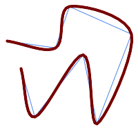 nSegments = 10 |
SELECT ST_CatmullRomSmoothing(
'LINESTRING (10 140, 80 130, 100 190, 190 150, 140 20, 120 120, 50 30, 30 100)',
generate_series(5, 10, 5) );
Name
ST_ConcaveHull — Computes a possibly concave geometry that contains all input geometry vertices
Synopsis
geometry ST_ConcaveHull(geometry param_geom, float param_pctconvex, boolean param_allow_holes = false);
Descripción
A concave hull is a (usually) concave geometry which contains the input, and whose vertices are a subset of the input vertices. In the general case the concave hull is a Polygon. The concave hull of two or more collinear points is a two-point LineString. The concave hull of one or more identical points is a Point. The polygon will not contain holes unless the optional param_allow_holes argument is specified as true.
One can think of a concave hull as "shrink-wrapping" a set of points. This is different to the convex hull, which is more like wrapping a rubber band around the points. A concave hull generally has a smaller area and represents a more natural boundary for the input points.
The param_pctconvex controls the concaveness of the computed hull. A value of 1 produces the convex hull. Values between 1 and 0 produce hulls of increasing concaveness. A value of 0 produces a hull with maximum concaveness (but still a single polygon). Choosing a suitable value depends on the nature of the input data, but often values between 0.3 and 0.1 produce reasonable results.
| |
Technically, the |
For point and linear inputs, the hull will enclose all the points of the inputs. For polygonal inputs, the hull will enclose all the points of the input and also all the areas covered by the input. If you want a point-wise hull of a polygonal input, convert it to points first using ST_Points.
This is not an aggregate function. To compute the concave hull of a set of geometries use ST_Collect (e.g. ST_ConcaveHull( ST_Collect( geom ), 0.80).
Disponibilidad: 2.0.0
Enhanced: 3.3.0, GEOS native implementation enabled for GEOS 3.11+
Ejemplos

Concave Hull of a MultiPoint
SELECT ST_AsText( ST_ConcaveHull(
'MULTIPOINT ((10 72), (53 76), (56 66), (63 58), (71 51), (81 48), (91 46), (101 45), (111 46), (121 47), (131 50), (140 55), (145 64), (144 74), (135 80), (125 83), (115 85), (105 87), (95 89), (85 91), (75 93), (65 95), (55 98), (45 102), (37 107), (29 114), (22 122), (19 132), (18 142), (21 151), (27 160), (35 167), (44 172), (54 175), (64 178), (74 180), (84 181), (94 181), (104 181), (114 181), (124 181), (134 179), (144 177), (153 173), (162 168), (171 162), (177 154), (182 145), (184 135), (139 132), (136 142), (128 149), (119 153), (109 155), (99 155), (89 155), (79 153), (69 150), (61 144), (63 134), (72 128), (82 125), (92 123), (102 121), (112 119), (122 118), (132 116), (142 113), (151 110), (161 106), (170 102), (178 96), (185 88), (189 78), (190 68), (189 58), (185 49), (179 41), (171 34), (162 29), (153 25), (143 23), (133 21), (123 19), (113 19), (102 19), (92 19), (82 19), (72 21), (62 22), (52 25), (43 29), (33 34), (25 41), (19 49), (14 58), (21 73), (31 74), (42 74), (173 134), (161 134), (150 133), (97 104), (52 117), (157 156), (94 171), (112 106), (169 73), (58 165), (149 40), (70 33), (147 157), (48 153), (140 96), (47 129), (173 55), (144 86), (159 67), (150 146), (38 136), (111 170), (124 94), (26 59), (60 41), (71 162), (41 64), (88 110), (122 34), (151 97), (157 56), (39 146), (88 33), (159 45), (47 56), (138 40), (129 165), (33 48), (106 31), (169 147), (37 122), (71 109), (163 89), (37 156), (82 170), (180 72), (29 142), (46 41), (59 155), (124 106), (157 80), (175 82), (56 50), (62 116), (113 95), (144 167))',
0.1 ) );
---st_astext--
POLYGON ((18 142, 21 151, 27 160, 35 167, 44 172, 54 175, 64 178, 74 180, 84 181, 94 181, 104 181, 114 181, 124 181, 134 179, 144 177, 153 173, 162 168, 171 162, 177 154, 182 145, 184 135, 173 134, 161 134, 150 133, 139 132, 136 142, 128 149, 119 153, 109 155, 99 155, 89 155, 79 153, 69 150, 61 144, 63 134, 72 128, 82 125, 92 123, 102 121, 112 119, 122 118, 132 116, 142 113, 151 110, 161 106, 170 102, 178 96, 185 88, 189 78, 190 68, 189 58, 185 49, 179 41, 171 34, 162 29, 153 25, 143 23, 133 21, 123 19, 113 19, 102 19, 92 19, 82 19, 72 21, 62 22, 52 25, 43 29, 33 34, 25 41, 19 49, 14 58, 10 72, 21 73, 31 74, 42 74, 53 76, 56 66, 63 58, 71 51, 81 48, 91 46, 101 45, 111 46, 121 47, 131 50, 140 55, 145 64, 144 74, 135 80, 125 83, 115 85, 105 87, 95 89, 85 91, 75 93, 65 95, 55 98, 45 102, 37 107, 29 114, 22 122, 19 132, 18 142))
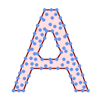
Concave Hull of a MultiPoint, allowing holes
SELECT ST_AsText( ST_ConcaveHull(
'MULTIPOINT ((132 64), (114 64), (99 64), (81 64), (63 64), (57 49), (52 36), (46 20), (37 20), (26 20), (32 36), (39 55), (43 69), (50 84), (57 100), (63 118), (68 133), (74 149), (81 164), (88 180), (101 180), (112 180), (119 164), (126 149), (132 131), (139 113), (143 100), (150 84), (157 69), (163 51), (168 36), (174 20), (163 20), (150 20), (143 36), (139 49), (132 64), (99 151), (92 138), (88 124), (81 109), (74 93), (70 82), (83 82), (99 82), (112 82), (126 82), (121 96), (114 109), (110 122), (103 138), (99 151), (34 27), (43 31), (48 44), (46 58), (52 73), (63 73), (61 84), (72 71), (90 69), (101 76), (123 71), (141 62), (166 27), (150 33), (159 36), (146 44), (154 53), (152 62), (146 73), (134 76), (143 82), (141 91), (130 98), (126 104), (132 113), (128 127), (117 122), (112 133), (119 144), (108 147), (119 153), (110 171), (103 164), (92 171), (86 160), (88 142), (79 140), (72 124), (83 131), (79 118), (68 113), (63 102), (68 93), (35 45))',
0.15, true ) );
---st_astext--
POLYGON ((43 69, 50 84, 57 100, 63 118, 68 133, 74 149, 81 164, 88 180, 101 180, 112 180, 119 164, 126 149, 132 131, 139 113, 143 100, 150 84, 157 69, 163 51, 168 36, 174 20, 163 20, 150 20, 143 36, 139 49, 132 64, 114 64, 99 64, 81 64, 63 64, 57 49, 52 36, 46 20, 37 20, 26 20, 32 36, 35 45, 39 55, 43 69), (88 124, 81 109, 74 93, 83 82, 99 82, 112 82, 121 96, 114 109, 110 122, 103 138, 92 138, 88 124))
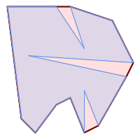
| 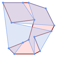
|
Comparing a concave hull of a Polygon to the concave hull of the constituent points. The hull respects the boundary of the polygon, whereas the points-based hull does not.
WITH data(geom) AS (VALUES
('POLYGON ((10 90, 39 85, 61 79, 50 90, 80 80, 95 55, 25 60, 90 45, 70 16, 63 38, 60 10, 50 30, 43 27, 30 10, 20 20, 10 90))'::geometry)
)
SELECT ST_ConcaveHull( geom, 0.1) AS polygon_hull,
ST_ConcaveHull( ST_Points(geom), 0.1) AS points_hull
FROM data;
Using with ST_Collect to compute the concave hull of a geometry set.
-- Compute estimate of infected area based on point observations
SELECT disease_type,
ST_ConcaveHull( ST_Collect(obs_pnt), 0.3 ) AS geom
FROM disease_obs
GROUP BY disease_type;
Ver también
ST_ConvexHull, ST_Collect, ST_AlphaShape, ST_OptimalAlphaShape
Name
ST_ConvexHull — Computes the convex hull of a geometry.
Synopsis
geometry ST_ConvexHull(geometry geomA);
Descripción
Computes the convex hull of a geometry. The convex hull is the smallest convex geometry that encloses all geometries in the input.
One can think of the convex hull as the geometry obtained by wrapping an rubber band around a set of geometries. This is different from a concave hull which is analogous to "shrink-wrapping" the geometries. A convex hull is often used to determine an affected area based on a set of point observations.
In the general case the convex hull is a Polygon. The convex hull of two or more collinear points is a two-point LineString. The convex hull of one or more identical points is a Point.
This is not an aggregate function. To compute the convex hull of a set of geometries, use ST_Collect to aggregate them into a geometry collection (e.g. ST_ConvexHull(ST_Collect(geom)).
Realizado por el módulo de GEOS
This method implements the OGC Simple Features Implementation Specification for SQL 1.1. s2.1.1.3
This method implements the SQL/MM specification. SQL-MM IEC 13249-3: 5.1.16
This function supports 3d and will not drop the z-index.
Ejemplos
Convex Hull of a MultiLinestring and a MultiPoint
SELECT ST_AsText(ST_ConvexHull(
ST_Collect(
ST_GeomFromText('MULTILINESTRING((100 190,10 8),(150 10, 20 30))'),
ST_GeomFromText('MULTIPOINT(50 5, 150 30, 50 10, 10 10)')
)) );
---st_astext--
POLYGON((50 5,10 8,10 10,100 190,150 30,150 10,50 5))
Using with ST_Collect to compute the convex hulls of geometry sets.
--Get estimate of infected area based on point observations
SELECT d.disease_type,
ST_ConvexHull(ST_Collect(d.geom)) As geom
FROM disease_obs As d
GROUP BY d.disease_type;
Ver también
Name
ST_DelaunayTriangles — Returns the Delaunay triangulation of the vertices of a geometry.
Synopsis
geometry ST_DelaunayTriangles(geometry g1, float tolerance = 0.0, int4 flags = 0);
Descripción
Computes the Delaunay triangulation of the vertices of the input geometry. The optional tolerance can be used to snap nearby input vertices together, which improves robustness in some situations. The result geometry is bounded by the convex hull of the input vertices. The result geometry representation is determined by the flags code:
0- a GEOMETRYCOLLECTION of triangular POLYGONs (default)1- a MULTILINESTRING of the edges of the triangulation2- A TIN of the triangulation
Realizado por el módulo GEOS.
Disponibilidad: 2.1.0
This function supports 3d and will not drop the z-index.
This function supports Triangles and Triangulated Irregular Network Surfaces (TIN).
Ejemplos
 Original polygons our original geometry
ST_Union(ST_GeomFromText('POLYGON((175 150, 20 40,
50 60, 125 100, 175 150))'),
ST_Buffer(ST_GeomFromText('POINT(110 170)'), 20)
) |
 ST_DelaunayTriangles of 2 polygons: delaunay triangle polygons each triangle themed in different color
geometries overlaid multilinestring triangles
SELECT
ST_DelaunayTriangles(
ST_Union(ST_GeomFromText('POLYGON((175 150, 20 40,
50 60, 125 100, 175 150))'),
ST_Buffer(ST_GeomFromText('POINT(110 170)'), 20)
))
As dtriag;
|
 -- delaunay triangles as multilinestring
SELECT
ST_DelaunayTriangles(
ST_Union(ST_GeomFromText('POLYGON((175 150, 20 40,
50 60, 125 100, 175 150))'),
ST_Buffer(ST_GeomFromText('POINT(110 170)'), 20)
),0.001,1)
As dtriag;
|
 -- delaunay triangles of 45 points as 55 triangle polygons
this produces a table of 42 points that form an L shape SELECT (ST_DumpPoints(ST_GeomFromText( 'MULTIPOINT(14 14,34 14,54 14,74 14,94 14,114 14,134 14, 150 14,154 14,154 6,134 6,114 6,94 6,74 6,54 6,34 6, 14 6,10 6,8 6,7 7,6 8,6 10,6 30,6 50,6 70,6 90,6 110,6 130, 6 150,6 170,6 190,6 194,14 194,14 174,14 154,14 134,14 114, 14 94,14 74,14 54,14 34,14 14)'))).geom INTO TABLE l_shape; output as individual polygon triangles SELECT ST_AsText((ST_Dump(geom)).geom) As wkt FROM ( SELECT ST_DelaunayTriangles(ST_Collect(geom)) As geom FROM l_shape) As foo; wkt POLYGON((6 194,6 190,14 194,6 194)) POLYGON((14 194,6 190,14 174,14 194)) POLYGON((14 194,14 174,154 14,14 194)) POLYGON((154 14,14 174,14 154,154 14)) POLYGON((154 14,14 154,150 14,154 14)) POLYGON((154 14,150 14,154 6,154 14))
|
Example using vertices with Z values.
3D multipoint SELECT ST_AsText(ST_DelaunayTriangles(ST_GeomFromText( 'MULTIPOINT Z(14 14 10, 150 14 100,34 6 25, 20 10 150)'))) As wkt; wkt GEOMETRYCOLLECTION Z (POLYGON Z ((14 14 10,20 10 150,34 6 25,14 14 10)) ,POLYGON Z ((14 14 10,34 6 25,150 14 100,14 14 10)))
Name
ST_FilterByM — Removes vertices based on their M value
Synopsis
geometry ST_FilterByM(geometry geom, double precision min, double precision max = null, boolean returnM = false);
Descripción
Filters out vertex points based on their M-value. Returns a geometry with only vertex points that have a M-value larger or equal to the min value and smaller or equal to the max value. If max-value argument is left out only min value is considered. If fourth argument is left out the m-value will not be in the resulting geometry. If resulting geometry have too few vertex points left for its geometry type an empty geometry will be returned. In a geometry collection geometries without enough points will just be left out silently.
This function is mainly intended to be used in conjunction with ST_SetEffectiveArea. ST_EffectiveArea sets the effective area of a vertex in its m-value. With ST_FilterByM it then is possible to get a simplified version of the geometry without any calculations, just by filtering
| |
There is a difference in what ST_SimplifyVW returns when not enough points meet the criteria compared to ST_FilterByM. ST_SimplifyVW returns the geometry with enough points while ST_FilterByM returns an empty geometry |
| |
Note that the returned geometry might be invalid |
| |
This function returns all dimensions, including the Z and M values |
Availability: 2.5.0
Ejemplos
A linestring is filtered
SELECT ST_AsText(ST_FilterByM(geom,30)) simplified
FROM (SELECT ST_SetEffectiveArea('LINESTRING(5 2, 3 8, 6 20, 7 25, 10 10)'::geometry) geom) As foo;
result
simplified
----------------------------
LINESTRING(5 2,7 25,10 10)
Ver también
Name
ST_GeneratePoints — Generates a multipoint of random points contained in a Polygon or MultiPolygon.
Synopsis
geometry ST_GeneratePoints(geometry g, integer npoints, integer seed = 0);
Descripción
ST_GeneratePoints generates a multipoint consisting of a given number of pseudo-random points which lie within the input area. The optional seed is used to regenerate a deterministic sequence of points, and must be greater than zero.
Disponibilidad: 2.3.0
Enhanced: 3.0.0, added seed parameter
Ejemplos
Generated a multipoint consisting of 12 Points overlaid on top of original polygon using a random seed value 1996
SELECT ST_GeneratePoints(geom, 12, 1996)
FROM (
SELECT ST_Buffer(
ST_GeomFromText(
'LINESTRING(50 50,150 150,150 50)'),
10, 'endcap=round join=round') AS geom
) AS s;
Given a table of polygons s, return 12 individual points per polygon. Results will be different each time you run.
SELECT s.id, dp.path[1] AS pt_id, dp.geom FROM s, ST_DumpPoints(ST_GeneratePoints(s.geom,12)) AS dp;
Ver también
Name
ST_GeometricMedian — Returns the geometric median of a MultiPoint.
Synopsis
geometry ST_GeometricMedian ( geometry geom, float8 tolerance = NULL, int max_iter = 10000, boolean fail_if_not_converged = false);
Descripción
Computes the approximate geometric median of a MultiPoint geometry using the Weiszfeld algorithm. The geometric median is the point minimizing the sum of distances to the input points. It provides a centrality measure that is less sensitive to outlier points than the centroid (center of mass).
The algorithm iterates until the distance change between successive iterations is less than the supplied tolerance parameter. If this condition has not been met after max_iterations iterations, the function produces an error and exits, unless fail_if_not_converged is set to false (the default).
If a tolerance argument is not provided, the tolerance value is calculated based on the extent of the input geometry.
If present, the input point M values are interpreted as their relative weights.
Disponibilidad: 2.3.0
Enhanced: 2.5.0 Added support for M as weight of points.
This function supports 3d and will not drop the z-index.
This function supports M coordinates.
Ejemplos
Comparison of the geometric median (red) and centroid (turquoise) of a MultiPoint.
WITH test AS (
SELECT 'MULTIPOINT((10 10), (10 40), (40 10), (190 190))'::geometry geom)
SELECT
ST_AsText(ST_Centroid(geom)) centroid,
ST_AsText(ST_GeometricMedian(geom)) median
FROM test;
centroid | median
--------------------+----------------------------------------
POINT(62.5 62.5) | POINT(25.01778421249728 25.01778421249728)
(1 row)
Ver también
Name
ST_LineMerge — Return the lines formed by sewing together a MultiLineString.
Synopsis
geometry ST_LineMerge(geometry amultilinestring);
geometry ST_LineMerge(geometry amultilinestring, boolean directed);
Descripción
Returns a LineString or MultiLineString formed by joining together the line elements of a MultiLineString. Lines are joined at their endpoints at 2-way intersections. Lines are not joined across intersections of 3-way or greater degree.
If directed is TRUE, then ST_LineMerge will not change point order within LineStrings, so lines with opposite directions will not be merged
| |
Only use with MultiLineString/LineStrings. Other geometry types return an empty GeometryCollection |
Realizado por el módulo GEOS.
Enhanced: 3.3.0 accept a directed parameter.
Requires GEOS >= 3.11.0 to use the directed parameter.
Disponibilidad: 1.1.0
| |
This function strips the M dimension. |
Ejemplos
Cardinality 2
Nodes with cardinality 2 are merged away.
SELECT ST_AsText(ST_LineMerge(
'MULTILINESTRING((10 160, 60 120), (120 140, 60 120), (120 140, 180 120))'
));
--------------------------------------------
LINESTRING(10 160,60 120,120 140,180 120)
Cardinality 3 or More
Lines are not merged across intersections with degree > 2.
SELECT ST_AsText(ST_LineMerge(
'MULTILINESTRING((10 160, 60 120), (120 140, 60 120), (120 140, 180 120), (100 180, 120 140))'
));
--------------------------------------------
MULTILINESTRING((10 160,60 120,120 140),(100 180,120 140),(120 140,180 120))
Non-Touching Lines
If merging is not possible due to non-touching lines, the original MultiLineString is returned.
SELECT ST_AsText(ST_LineMerge( 'MULTILINESTRING((-29 -27,-30 -29.7,-36 -31,-45 -33),(-45.2 -33.2,-46 -32))' )); ---------------- MULTILINESTRING((-45.2 -33.2,-46 -32),(-29 -27,-30 -29.7,-36 -31,-45 -33))
Directed Parameter
Lines with opposite directions are not merged if directed = TRUE.
SELECT ST_AsText(ST_LineMerge( 'MULTILINESTRING((60 30, 10 70), (120 50, 60 30), (120 50, 180 30))', TRUE)); ------------------------------------------------------- MULTILINESTRING((120 50,60 30,10 70),(120 50,180 30))
Z-dimension Handling
SELECT ST_AsText(ST_LineMerge(
'MULTILINESTRING((-29 -27 11,-30 -29.7 10,-36 -31 5,-45 -33 6), (-29 -27 12,-30 -29.7 5), (-45 -33 1,-46 -32 11))'
));
---------------------------------------------------------------------------------
LINESTRING Z (-30 -29.7 5,-29 -27 11,-30 -29.7 10,-36 -31 5,-45 -33 1,-46 -32 11)
Ver también
Name
ST_MaximumInscribedCircle — Computes the largest circle contained within a geometry.
Synopsis
(geometry, geometry, double precision) ST_MaximumInscribedCircle(geometry geom);
Descripción
Finds the largest circle that is contained within a (multi)polygon, or which does not overlap any lines and points. Returns a record with fields:
center- center point of the circlenearest- a point on the geometry nearest to the centerradius- radius of the circle
For polygonal inputs, the circle is inscribed within the boundary rings, using the internal rings as boundaries. For linear and point inputs, the circle is inscribed within the convex hull of the input, using the input lines and points as further boundaries.
Availability: 3.1.0.
Requires GEOS >= 3.9.0.
Ejemplos
Maximum inscribed circle of a polygon. Center, nearest point, and radius are returned.
SELECT radius, ST_AsText(center) AS center, ST_AsText(nearest) AS nearest
FROM ST_MaximumInscribedCircle(
'POLYGON ((40 180, 110 160, 180 180, 180 120, 140 90, 160 40, 80 10, 70 40, 20 50, 40 180),
(60 140, 50 90, 90 140, 60 140))');
radius | center | nearest
-----------------+----------------------------+---------------
45.165845650018 | POINT(96.953125 76.328125) | POINT(140 90)
Maximum inscribed circle of a multi-linestring. Center, nearest point, and radius are returned.
Ver también
Name
ST_LargestEmptyCircle — Computes the largest circle not overlapping a geometry.
Synopsis
(geometry, geometry, double precision) ST_LargestEmptyCircle(geometry geom, double precision tolerance=0.0, geometry boundary=POINT EMPTY);
Descripción
Finds the largest circle which does not overlap a set of point and line obstacles. (Polygonal geometries may be included as obstacles, but only their boundary lines are used.) The center of the circle is constrained to lie inside a polygonal boundary, which by default is the convex hull of the input geometry. The circle center is the point in the interior of the boundary which has the farthest distance from the obstacles. The circle itself is provided by the center point and a nearest point lying on an obstacle determining the circle radius.
The circle center is determined to a given accuracy specified by a distance tolerance, using an iterative algorithm. If the accuracy distance is not specified a reasonable default is used.
Returns a record with fields:
center- center point of the circlenearest- a point on the geometry nearest to the centerradius- radius of the circle
To find the largest empty circle in the interior of a polygon, see ST_MaximumInscribedCircle.
Availability: 3.4.0.
Requires GEOS >= 3.9.0.
Ejemplos
SELECT radius,
center,
nearest
FROM ST_LargestEmptyCircle(
'MULTILINESTRING (
(10 100, 60 180, 130 150, 190 160),
(20 50, 70 70, 90 20, 110 40),
(160 30, 100 100, 180 100))');Largest Empty Circle within a set of lines.
SELECT radius,
center,
nearest
FROM ST_LargestEmptyCircle(
ST_Collect(
'MULTIPOINT ((70 50), (60 130), (130 150), (80 90))'::geometry,
'POLYGON ((90 190, 10 100, 60 10, 190 40, 120 100, 190 180, 90 190))'::geometry),
0,
'POLYGON ((90 190, 10 100, 60 10, 190 40, 120 100, 190 180, 90 190))'::geometry
);Largest Empty Circle within a set of points, constrained to lie in a polygon. The constraint polygon boundary must be included as an obstacle, as well as specified as the constraint for the circle center.
Ver también
Name
ST_MinimumBoundingCircle — Returns the smallest circle polygon that contains a geometry.
Synopsis
geometry ST_MinimumBoundingCircle(geometry geomA, integer num_segs_per_qt_circ=48);
Descripción
Returns the smallest circle polygon that contains a geometry.
| |
The bounding circle is approximated by a polygon with a default of 48 segments per quarter circle. Because the polygon is an approximation of the minimum bounding circle, some points in the input geometry may not be contained within the polygon. The approximation can be improved by increasing the number of segments. For applications where an approximation is not suitable ST_MinimumBoundingRadius may be used. |
Use with ST_Collect to get the minimum bounding circle of a set of geometries.
To compute two points lying on the minimum circle (the "maximum diameter") use ST_LongestLine.
The ratio of the area of a polygon divided by the area of its Minimum Bounding Circle is referred to as the Reock compactness score.
Realizado por el módulo GEOS.
Disponibilidad: 1.4.0
Ejemplos
SELECT d.disease_type,
ST_MinimumBoundingCircle(ST_Collect(d.geom)) As geom
FROM disease_obs As d
GROUP BY d.disease_type;
Minimum bounding circle of a point and linestring. Using 8 segs to approximate a quarter circle
SELECT ST_AsText(ST_MinimumBoundingCircle(
ST_Collect(
ST_GeomFromText('LINESTRING(55 75,125 150)'),
ST_Point(20, 80)), 8
)) As wktmbc;
wktmbc
-----------
POLYGON((135.59714732062 115,134.384753327498 102.690357210921,130.79416296937 90.8537670908995,124.963360620072 79.9451031602111,117.116420743937 70.3835792560632,107.554896839789 62.5366393799277,96.6462329091006 56.70583703063,84.8096427890789 53.115246672502,72.5000000000001 51.9028526793802,60.1903572109213 53.1152466725019,48.3537670908996 56.7058370306299,37.4451031602112 62.5366393799276,27.8835792560632 70.383579256063,20.0366393799278 79.9451031602109,14.20583703063 90.8537670908993,10.615246672502 102.690357210921,9.40285267938019 115,10.6152466725019 127.309642789079,14.2058370306299 139.1462329091,20.0366393799275 150.054896839789,27.883579256063 159.616420743937,
37.4451031602108 167.463360620072,48.3537670908992 173.29416296937,60.190357210921 176.884753327498,
72.4999999999998 178.09714732062,84.8096427890786 176.884753327498,96.6462329091003 173.29416296937,107.554896839789 167.463360620072,
117.116420743937 159.616420743937,124.963360620072 150.054896839789,130.79416296937 139.146232909101,134.384753327498 127.309642789079,135.59714732062 115))
Name
ST_MinimumBoundingRadius — Returns the center point and radius of the smallest circle that contains a geometry.
Synopsis
(geometry, double precision) ST_MinimumBoundingRadius(geometry geom);
Descripción
Computes the center point and radius of the smallest circle that contains a geometry. Returns a record with fields:
center- center point of the circleradius- radius of the circle
Use with ST_Collect to get the minimum bounding circle of a set of geometries.
To compute two points lying on the minimum circle (the "maximum diameter") use ST_LongestLine.
Disponibilidad: 2.3.0
Ejemplos
SELECT ST_AsText(center), radius FROM ST_MinimumBoundingRadius('POLYGON((26426 65078,26531 65242,26075 65136,26096 65427,26426 65078))');
st_astext | radius
------------------------------------------+------------------
POINT(26284.8418027133 65267.1145090825) | 247.436045591407
Ver también
Name
ST_OrientedEnvelope — Returns a minimum-area rectangle containing a geometry.
Synopsis
geometry ST_OrientedEnvelope( geometry geom );
Descripción
Returns the minimum-area rotated rectangle enclosing a geometry. Note that more than one such rectangle may exist. May return a Point or LineString in the case of degenerate inputs.
Availability: 2.5.0.
Requires GEOS >= 3.6.0.
Ejemplos
SELECT ST_AsText(ST_OrientedEnvelope('MULTIPOINT ((0 0), (-1 -1), (3 2))'));
st_astext
------------------------------------------------
POLYGON((3 2,2.88 2.16,-1.12 -0.84,-1 -1,3 2))
Oriented envelope of a point and linestring.
SELECT ST_AsText(ST_OrientedEnvelope(
ST_Collect(
ST_GeomFromText('LINESTRING(55 75,125 150)'),
ST_Point(20, 80))
)) As wktenv;
wktenv
-----------
POLYGON((19.9999999999997 79.9999999999999,33.0769230769229 60.3846153846152,138.076923076924 130.384615384616,125.000000000001 150.000000000001,19.9999999999997 79.9999999999999))
Ver también
Name
ST_OffsetCurve — Returns an offset line at a given distance and side from an input line.
Synopsis
geometry ST_OffsetCurve(geometry line, float signed_distance, text style_parameters='');
Descripción
Return an offset line at a given distance and side from an input line. All points of the returned geometries are not further than the given distance from the input geometry. Useful for computing parallel lines about a center line.
For positive distance the offset is on the left side of the input line and retains the same direction. For a negative distance it is on the right side and in the opposite direction.
Units of distance are measured in units of the spatial reference system.
Note that output may be a MULTILINESTRING or EMPTY for some jigsaw-shaped input geometries.
The optional third parameter allows specifying a list of blank-separated key=value pairs to tweak operations as follows:
'quad_segs=#' : number of segments used to approximate a quarter circle (defaults to 8).
'join=round|mitre|bevel' : join style (defaults to "round"). 'miter' is also accepted as a synonym for 'mitre'.
'mitre_limit=#.#' : mitre ratio limit (only affects mitred join style). 'miter_limit' is also accepted as a synonym for 'mitre_limit'.
Realizado por el módulo GEOS.
Behavior changed in GEOS 3.11 so offset curves now have the same direction as the input line, for both positive and negative offsets.
Disponibilidad: 2.0
Enhanced: 2.5 - added support for GEOMETRYCOLLECTION and MULTILINESTRING
| |
This function ignores the Z dimension. It always gives a 2D result even when used on a 3D geometry. |
Ejemplos
Compute an open buffer around roads
SELECT ST_Union(
ST_OffsetCurve(f.geom, f.width/2, 'quad_segs=4 join=round'),
ST_OffsetCurve(f.geom, -f.width/2, 'quad_segs=4 join=round')
) as track
FROM someroadstable;
 15, 'quad_segs=4 join=round' original line and its offset 15 units.
SELECT ST_AsText(ST_OffsetCurve(ST_GeomFromText(
'LINESTRING(164 16,144 16,124 16,104 16,84 16,64 16,
44 16,24 16,20 16,18 16,17 17,
16 18,16 20,16 40,16 60,16 80,16 100,
16 120,16 140,16 160,16 180,16 195)'),
15, 'quad_segs=4 join=round'));
output
LINESTRING(164 1,18 1,12.2597485145237 2.1418070123307,
7.39339828220179 5.39339828220179,
5.39339828220179 7.39339828220179,
2.14180701233067 12.2597485145237,1 18,1 195)
|  -15, 'quad_segs=4 join=round' original line and its offset -15 units
SELECT ST_AsText(ST_OffsetCurve(geom,
-15, 'quad_segs=4 join=round')) As notsocurvy
FROM ST_GeomFromText(
'LINESTRING(164 16,144 16,124 16,104 16,84 16,64 16,
44 16,24 16,20 16,18 16,17 17,
16 18,16 20,16 40,16 60,16 80,16 100,
16 120,16 140,16 160,16 180,16 195)') As geom;
notsocurvy
LINESTRING(31 195,31 31,164 31)
|
 double-offset to get more curvy, note the first reverses direction, so -30 + 15 = -15
SELECT ST_AsText(ST_OffsetCurve(ST_OffsetCurve(geom,
-30, 'quad_segs=4 join=round'), -15, 'quad_segs=4 join=round')) As morecurvy
FROM ST_GeomFromText(
'LINESTRING(164 16,144 16,124 16,104 16,84 16,64 16,
44 16,24 16,20 16,18 16,17 17,
16 18,16 20,16 40,16 60,16 80,16 100,
16 120,16 140,16 160,16 180,16 195)') As geom;
morecurvy
LINESTRING(164 31,46 31,40.2597485145236 32.1418070123307,
35.3933982822018 35.3933982822018,
32.1418070123307 40.2597485145237,31 46,31 195)
|  double-offset to get more curvy,combined with regular offset 15 to get parallel lines. Overlaid with original.
SELECT ST_AsText(ST_Collect(
ST_OffsetCurve(geom, 15, 'quad_segs=4 join=round'),
ST_OffsetCurve(ST_OffsetCurve(geom,
-30, 'quad_segs=4 join=round'), -15, 'quad_segs=4 join=round')
)
) As parallel_curves
FROM ST_GeomFromText(
'LINESTRING(164 16,144 16,124 16,104 16,84 16,64 16,
44 16,24 16,20 16,18 16,17 17,
16 18,16 20,16 40,16 60,16 80,16 100,
16 120,16 140,16 160,16 180,16 195)') As geom;
parallel curves
MULTILINESTRING((164 1,18 1,12.2597485145237 2.1418070123307,
7.39339828220179 5.39339828220179,5.39339828220179 7.39339828220179,
2.14180701233067 12.2597485145237,1 18,1 195),
(164 31,46 31,40.2597485145236 32.1418070123307,35.3933982822018 35.3933982822018,
32.1418070123307 40.2597485145237,31 46,31 195))
|
 15, 'quad_segs=4 join=bevel' shown with original line
SELECT ST_AsText(ST_OffsetCurve(ST_GeomFromText(
'LINESTRING(164 16,144 16,124 16,104 16,84 16,64 16,
44 16,24 16,20 16,18 16,17 17,
16 18,16 20,16 40,16 60,16 80,16 100,
16 120,16 140,16 160,16 180,16 195)'),
15, 'quad_segs=4 join=bevel'));
output
LINESTRING(164 1,18 1,7.39339828220179 5.39339828220179,
5.39339828220179 7.39339828220179,1 18,1 195)
|  15,-15 collected, join=mitre mitre_limit=2.1
SELECT ST_AsText(ST_Collect(
ST_OffsetCurve(geom, 15, 'quad_segs=4 join=mitre mitre_limit=2.2'),
ST_OffsetCurve(geom, -15, 'quad_segs=4 join=mitre mitre_limit=2.2')
) )
FROM ST_GeomFromText(
'LINESTRING(164 16,144 16,124 16,104 16,84 16,64 16,
44 16,24 16,20 16,18 16,17 17,
16 18,16 20,16 40,16 60,16 80,16 100,
16 120,16 140,16 160,16 180,16 195)') As geom;
output
MULTILINESTRING((164 1,11.7867965644036 1,1 11.7867965644036,1 195),
(31 195,31 31,164 31))
|
Ver también
Name
ST_PointOnSurface — Computes a point guaranteed to lie in a polygon, or on a geometry.
Synopsis
geometry ST_PointOnSurface(geometry g1);
Descripción
Returns a POINT which is guaranteed to lie in the interior of a surface (POLYGON, MULTIPOLYGON, and CURVEPOLYGON). In PostGIS this function also works on line and point geometries.
This method implements the OGC Simple Features Implementation Specification for SQL 1.1. s3.2.14.2 // s3.2.18.2
This method implements the SQL/MM specification. SQL-MM 3: 8.1.5, 9.5.6. The specifications define ST_PointOnSurface for surface geometries only. PostGIS extends the function to support all common geometry types. Other databases (Oracle, DB2, ArcSDE) seem to support this function only for surfaces. SQL Server 2008 supports all common geometry types.
This function supports 3d and will not drop the z-index.
Ejemplos
 Point on surface of a | 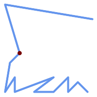 Point on surface of a |
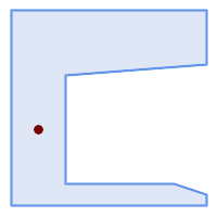 Point on surface of a | 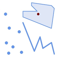 Point on surface of a |
SELECT ST_AsText(ST_PointOnSurface('POINT(0 5)'::geometry));
------------
POINT(0 5)
SELECT ST_AsText(ST_PointOnSurface('LINESTRING(0 5, 0 10)'::geometry));
------------
POINT(0 5)
SELECT ST_AsText(ST_PointOnSurface('POLYGON((0 0, 0 5, 5 5, 5 0, 0 0))'::geometry));
----------------
POINT(2.5 2.5)
SELECT ST_AsEWKT(ST_PointOnSurface(ST_GeomFromEWKT('LINESTRING(0 5 1, 0 0 1, 0 10 2)')));
----------------
POINT(0 0 1)
Example: The result of ST_PointOnSurface is guaranteed to lie within polygons, whereas the point computed by ST_Centroid may be outside.
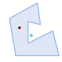
Red: point on surface; Green: centroid
SELECT ST_AsText(ST_PointOnSurface(geom)) AS pt_on_surf,
ST_AsText(ST_Centroid(geom)) AS centroid
FROM (SELECT 'POLYGON ((130 120, 120 190, 30 140, 50 20, 190 20,
170 100, 90 60, 90 130, 130 120))'::geometry AS geom) AS t;
pt_on_surf | centroid
-----------------+---------------------------------------------
POINT(62.5 110) | POINT(100.18264840182648 85.11415525114155)
Ver también
Name
ST_Polygonize — Computes a collection of polygons formed from the linework of a set of geometries.
Synopsis
geometry ST_Polygonize(geometry set geomfield);
geometry ST_Polygonize(geometry[] geom_array);
Descripción
Creates a GeometryCollection containing the polygons formed by the linework of a set of geometries. If the input linework does not form any polygons, an empty GeometryCollection is returned.
This function creates polygons covering all delimited areas. If the result is intended to form a valid polygonal geometry, use ST_BuildArea to prevent holes being filled.
| |
The input linework must be correctly noded for this function to work properly. To ensure input is noded use ST_Node on the input geometry before polygonizing. |
| |
GeometryCollections can be difficult to handle with external tools. Use ST_Dump to convert the polygonized result into separate polygons. |
Realizado por el módulo GEOS.
Disponibilidad: 1.0.0RC1
Ejemplos
 Input lines
|
 Polygonized result
|
WITH data(geom) AS (VALUES
('LINESTRING (180 40, 30 20, 20 90)'::geometry)
,('LINESTRING (180 40, 160 160)'::geometry)
,('LINESTRING (80 60, 120 130, 150 80)'::geometry)
,('LINESTRING (80 60, 150 80)'::geometry)
,('LINESTRING (20 90, 70 70, 80 130)'::geometry)
,('LINESTRING (80 130, 160 160)'::geometry)
,('LINESTRING (20 90, 20 160, 70 190)'::geometry)
,('LINESTRING (70 190, 80 130)'::geometry)
,('LINESTRING (70 190, 160 160)'::geometry)
)
SELECT ST_AsText( ST_Polygonize( geom ))
FROM data;
------------------------------------------------------------------------------------------
GEOMETRYCOLLECTION (POLYGON ((180 40, 30 20, 20 90, 70 70, 80 130, 160 160, 180 40), (150 80, 120 130, 80 60, 150 80)),
POLYGON ((20 90, 20 160, 70 190, 80 130, 70 70, 20 90)),
POLYGON ((160 160, 80 130, 70 190, 160 160)),
POLYGON ((80 60, 120 130, 150 80, 80 60)))
Polygonizing a table of linestrings:
SELECT ST_AsEWKT(ST_Polygonize(geom_4269)) As geomtextrep
FROM (SELECT geom_4269 FROM ma.suffolk_edges) As foo;
-------------------------------------
SRID=4269;GEOMETRYCOLLECTION(POLYGON((-71.040878 42.285678,-71.040943 42.2856,-71.04096 42.285752,-71.040878 42.285678)),
POLYGON((-71.17166 42.353675,-71.172026 42.354044,-71.17239 42.354358,-71.171794 42.354971,-71.170511 42.354855,
-71.17112 42.354238,-71.17166 42.353675)))
--Use ST_Dump to dump out the polygonize geoms into individual polygons
SELECT ST_AsEWKT((ST_Dump(t.polycoll)).geom) AS geomtextrep
FROM (SELECT ST_Polygonize(geom_4269) AS polycoll
FROM (SELECT geom_4269 FROM ma.suffolk_edges)
As foo) AS t;
------------------------
SRID=4269;POLYGON((-71.040878 42.285678,-71.040943 42.2856,-71.04096 42.285752,
-71.040878 42.285678))
SRID=4269;POLYGON((-71.17166 42.353675,-71.172026 42.354044,-71.17239 42.354358
,-71.171794 42.354971,-71.170511 42.354855,-71.17112 42.354238,-71.17166 42.353675))
Ver también
Name
ST_ReducePrecision — Returns a valid geometry with points rounded to a grid tolerance.
Synopsis
geometry ST_ReducePrecision(geometry g, float8 gridsize);
Descripción
Returns a valid geometry with all points rounded to the provided grid tolerance, and features below the tolerance removed.
Unlike ST_SnapToGrid the returned geometry will be valid, with no ring self-intersections or collapsed components.
Precision reduction can be used to:
match coordinate precision to the data accuracy
reduce the number of coordinates needed to represent a geometry
ensure valid geometry output to formats which use lower precision (e.g. text formats such as WKT, GeoJSON or KML when the number of output decimal places is limited).
export valid geometry to systems which use lower or limited precision (e.g. SDE, Oracle tolerance value)
Availability: 3.1.0.
Requires GEOS >= 3.9.0.
Ejemplos
SELECT ST_AsText(ST_ReducePrecision('POINT(1.412 19.323)', 0.1));
st_astext
-----------------
POINT(1.4 19.3)
SELECT ST_AsText(ST_ReducePrecision('POINT(1.412 19.323)', 1.0));
st_astext
-------------
POINT(1 19)
SELECT ST_AsText(ST_ReducePrecision('POINT(1.412 19.323)', 10));
st_astext
-------------
POINT(0 20)
Precision reduction can reduce number of vertices
SELECT ST_AsText(ST_ReducePrecision('LINESTRING (10 10, 19.6 30.1, 20 30, 20.3 30, 40 40)', 1));
st_astext
-------------
LINESTRING (10 10, 20 30, 40 40)
Precision reduction splits polygons if needed to ensure validity
SELECT ST_AsText(ST_ReducePrecision('POLYGON ((10 10, 60 60.1, 70 30, 40 40, 50 10, 10 10))', 10));
st_astext
-------------
MULTIPOLYGON (((60 60, 70 30, 40 40, 60 60)), ((40 40, 50 10, 10 10, 40 40)))
Ver también
Name
ST_SharedPaths — Returns a collection containing paths shared by the two input linestrings/multilinestrings.
Synopsis
geometry ST_SharedPaths(geometry lineal1, geometry lineal2);
Descripción
Returns a collection containing paths shared by the two input geometries. Those going in the same direction are in the first element of the collection, those going in the opposite direction are in the second element. The paths themselves are given in the direction of the first geometry.
Realizado por el módulo GEOS.
Disponibilidad: 2.0.0
Examples: Finding shared paths
 A multilinestring and a linestring |
 The shared path of multilinestring and linestring overlaid with original geometries.
SELECT ST_AsText(
ST_SharedPaths(
ST_GeomFromText('MULTILINESTRING((26 125,26 200,126 200,126 125,26 125),
(51 150,101 150,76 175,51 150))'),
ST_GeomFromText('LINESTRING(151 100,126 156.25,126 125,90 161, 76 175)')
)
) As wkt
wkt
-------------------------------------------------------------
GEOMETRYCOLLECTION(MULTILINESTRING((126 156.25,126 125),
(101 150,90 161),(90 161,76 175)),MULTILINESTRING EMPTY)
|
same example but linestring orientation flipped
SELECT ST_AsText(
ST_SharedPaths(
ST_GeomFromText('LINESTRING(76 175,90 161,126 125,126 156.25,151 100)'),
ST_GeomFromText('MULTILINESTRING((26 125,26 200,126 200,126 125,26 125),
(51 150,101 150,76 175,51 150))')
)
) As wkt
wkt
-------------------------------------------------------------
GEOMETRYCOLLECTION(MULTILINESTRING EMPTY,
MULTILINESTRING((76 175,90 161),(90 161,101 150),(126 125,126 156.25)))
|
Ver también
Name
ST_Simplify — Returns a simplified representation of a geometry, using the Douglas-Peucker algorithm.
Synopsis
geometry ST_Simplify(geometry geom, float tolerance);
geometry ST_Simplify(geometry geom, float tolerance, boolean preserveCollapsed);
Descripción
Computes a simplified representation of a geometry using the Douglas-Peucker algorithm. The simplification tolerance is a distance value, in the units of the input SRS. Simplification removes vertices which are within the tolerance distance of the simplified linework. The result may not be valid even if the input is.
The function can be called with any kind of geometry (including GeometryCollections), but only line and polygon elements are simplified. Endpoints of linear geometry are preserved.
The preserveCollapsed flag retains small geometries that would otherwise be removed at the given tolerance. For example, if a 1m long line is simplified with a 10m tolerance, when preserveCollapsed is true the line will not disappear. This flag is useful for rendering purposes, to prevent very small features disappearing from a map.
| |
The returned geometry may lose its simplicity (see ST_IsSimple), topology may not be preserved, and polygonal results may be invalid (see ST_IsValid). Use ST_SimplifyPreserveTopology to preserve topology and ensure validity. |
| |
This function does not preserve boundaries shared between polygons. Use ST_CoverageSimplify if this is required. |
Disponibilidad: 1.2.2
Ejemplos
A circle simplified too much becomes a triangle, medium an octagon,
SELECT ST_Npoints(geom) AS np_before,
ST_NPoints(ST_Simplify(geom, 0.1)) AS np01_notbadcircle,
ST_NPoints(ST_Simplify(geom, 0.5)) AS np05_notquitecircle,
ST_NPoints(ST_Simplify(geom, 1)) AS np1_octagon,
ST_NPoints(ST_Simplify(geom, 10)) AS np10_triangle,
(ST_Simplify(geom, 100) is null) AS np100_geometrygoesaway
FROM (SELECT ST_Buffer('POINT(1 3)', 10,12) As geom) AS t;
np_before | np01_notbadcircle | np05_notquitecircle | np1_octagon | np10_triangle | np100_geometrygoesaway
-----------+-------------------+---------------------+-------------+---------------+------------------------
49 | 33 | 17 | 9 | 4 | t
Simplifying a set of lines. Lines may intersect after simplification.
SELECT ST_Simplify(
'MULTILINESTRING ((20 180, 20 150, 50 150, 50 100, 110 150, 150 140, 170 120), (20 10, 80 30, 90 120), (90 120, 130 130), (130 130, 130 70, 160 40, 180 60, 180 90, 140 80), (50 40, 70 40, 80 70, 70 60, 60 60, 50 50, 50 40))',
40);
Simplifying a MultiPolygon. Polygonal results may be invalid.
SELECT ST_Simplify(
'MULTIPOLYGON (((90 110, 80 180, 50 160, 10 170, 10 140, 20 110, 90 110)), ((40 80, 100 100, 120 160, 170 180, 190 70, 140 10, 110 40, 60 40, 40 80), (180 70, 170 110, 142.5 128.5, 128.5 77.5, 90 60, 180 70)))',
40);
Ver también
ST_IsSimple, ST_SimplifyPreserveTopology, ST_SimplifyVW, ST_CoverageSimplify, Topology ST_Simplify
Name
ST_SimplifyPreserveTopology — Returns a simplified and valid representation of a geometry, using the Douglas-Peucker algorithm.
Synopsis
geometry ST_SimplifyPreserveTopology(geometry geom, float tolerance);
Descripción
Computes a simplified representation of a geometry using a variant of the Douglas-Peucker algorithm which limits simplification to ensure the result has the same topology as the input. The simplification tolerance is a distance value, in the units of the input SRS. Simplification removes vertices which are within the tolerance distance of the simplified linework, as long as topology is preserved. The result will be valid and simple if the input is.
The function can be called with any kind of geometry (including GeometryCollections), but only line and polygon elements are simplified. For polygonal inputs, the result will have the same number of rings (shells and holes), and the rings will not cross. Ring endpoints may be simplified. For linear inputs, the result will have the same number of lines, and lines will not intersect if they did not do so in the original geometry. Endpoints of linear geometry are preserved.
| |
This function does not preserve boundaries shared between polygons. Use ST_CoverageSimplify if this is required. |
Realizado por el módulo GEOS.
Disponibilidad: 1.3.3
Ejemplos
For the same example as ST_Simplify, ST_SimplifyPreserveTopology prevents oversimplification. The circle can at most become a square.
SELECT ST_Npoints(geom) AS np_before,
ST_NPoints(ST_SimplifyPreserveTopology(geom, 0.1)) AS np01_notbadcircle,
ST_NPoints(ST_SimplifyPreserveTopology(geom, 0.5)) AS np05_notquitecircle,
ST_NPoints(ST_SimplifyPreserveTopology(geom, 1)) AS np1_octagon,
ST_NPoints(ST_SimplifyPreserveTopology(geom, 10)) AS np10_square,
ST_NPoints(ST_SimplifyPreserveTopology(geom, 100)) AS np100_stillsquare
FROM (SELECT ST_Buffer('POINT(1 3)', 10,12) AS geom) AS t;
np_before | np01_notbadcircle | np05_notquitecircle | np1_octagon | np10_square | np100_stillsquare
-----------+-------------------+---------------------+-------------+-------------+-------------------
49 | 33 | 17 | 9 | 5 | 5
Simplifying a set of lines, preserving topology of non-intersecting lines.
SELECT ST_SimplifyPreserveTopology(
'MULTILINESTRING ((20 180, 20 150, 50 150, 50 100, 110 150, 150 140, 170 120), (20 10, 80 30, 90 120), (90 120, 130 130), (130 130, 130 70, 160 40, 180 60, 180 90, 140 80), (50 40, 70 40, 80 70, 70 60, 60 60, 50 50, 50 40))',
40);
Simplifying a MultiPolygon, preserving topology of shells and holes.
SELECT ST_SimplifyPreserveTopology(
'MULTIPOLYGON (((90 110, 80 180, 50 160, 10 170, 10 140, 20 110, 90 110)), ((40 80, 100 100, 120 160, 170 180, 190 70, 140 10, 110 40, 60 40, 40 80), (180 70, 170 110, 142.5 128.5, 128.5 77.5, 90 60, 180 70)))',
40);
Ver también
Name
ST_SimplifyPolygonHull — Computes a simplified topology-preserving outer or inner hull of a polygonal geometry.
Synopsis
geometry ST_SimplifyPolygonHull(geometry param_geom, float vertex_fraction, boolean is_outer = true);
Descripción
Computes a simplified topology-preserving outer or inner hull of a polygonal geometry. An outer hull completely covers the input geometry. An inner hull is completely covered by the input geometry. The result is a polygonal geometry formed by a subset of the input vertices. MultiPolygons and holes are handled and produce a result with the same structure as the input.
The reduction in vertex count is controlled by the vertex_fraction parameter, which is a number in the range 0 to 1. Lower values produce simpler results, with smaller vertex count and less concaveness. For both outer and inner hulls a vertex fraction of 1.0 produces the original geometry. For outer hulls a value of 0.0 produces the convex hull (for a single polygon); for inner hulls it produces a triangle.
The simplification process operates by progressively removing concave corners that contain the least amount of area, until the vertex count target is reached. It prevents edges from crossing, so the result is always a valid polygonal geometry.
To get better results with geometries that contain relatively long line segments, it might be necessary to "segmentize" the input, as shown below.
Realizado por el módulo GEOS.
Availability: 3.3.0.
Requires GEOS >= 3.11.0.
Ejemplos
Outer hull of a Polygon
SELECT ST_SimplifyPolygonHull(
'POLYGON ((131 158, 136 163, 161 165, 173 156, 179 148, 169 140, 186 144, 190 137, 185 131, 174 128, 174 124, 166 119, 158 121, 158 115, 165 107, 161 97, 166 88, 166 79, 158 57, 145 57, 112 53, 111 47, 93 43, 90 48, 88 40, 80 39, 68 32, 51 33, 40 31, 39 34, 49 38, 34 38, 25 34, 28 39, 36 40, 44 46, 24 41, 17 41, 14 46, 19 50, 33 54, 21 55, 13 52, 11 57, 22 60, 34 59, 41 68, 75 72, 62 77, 56 70, 46 72, 31 69, 46 76, 52 82, 47 84, 56 90, 66 90, 64 94, 56 91, 33 97, 36 100, 23 100, 22 107, 29 106, 31 112, 46 116, 36 118, 28 131, 53 132, 59 127, 62 131, 76 130, 80 135, 89 137, 87 143, 73 145, 80 150, 88 150, 85 157, 99 162, 116 158, 115 165, 123 165, 122 170, 134 164, 131 158))',
0.3);
Inner hull of a Polygon
SELECT ST_SimplifyPolygonHull(
'POLYGON ((131 158, 136 163, 161 165, 173 156, 179 148, 169 140, 186 144, 190 137, 185 131, 174 128, 174 124, 166 119, 158 121, 158 115, 165 107, 161 97, 166 88, 166 79, 158 57, 145 57, 112 53, 111 47, 93 43, 90 48, 88 40, 80 39, 68 32, 51 33, 40 31, 39 34, 49 38, 34 38, 25 34, 28 39, 36 40, 44 46, 24 41, 17 41, 14 46, 19 50, 33 54, 21 55, 13 52, 11 57, 22 60, 34 59, 41 68, 75 72, 62 77, 56 70, 46 72, 31 69, 46 76, 52 82, 47 84, 56 90, 66 90, 64 94, 56 91, 33 97, 36 100, 23 100, 22 107, 29 106, 31 112, 46 116, 36 118, 28 131, 53 132, 59 127, 62 131, 76 130, 80 135, 89 137, 87 143, 73 145, 80 150, 88 150, 85 157, 99 162, 116 158, 115 165, 123 165, 122 170, 134 164, 131 158))',
0.3, false);
Outer hull simplification of a MultiPolygon, with segmentization
SELECT ST_SimplifyPolygonHull(
ST_Segmentize(ST_Letters('xt'), 2.0),
0.1);
Ver también
Name
ST_SimplifyVW — Returns a simplified representation of a geometry, using the Visvalingam-Whyatt algorithm
Synopsis
geometry ST_SimplifyVW(geometry geom, float tolerance);
Descripción
Returns a simplified representation of a geometry using the Visvalingam-Whyatt algorithm. The simplification tolerance is an area value, in the units of the input SRS. Simplification removes vertices which form "corners" with area less than the tolerance. The result may not be valid even if the input is.
The function can be called with any kind of geometry (including GeometryCollections), but only line and polygon elements are simplified. Endpoints of linear geometry are preserved.
| |
The returned geometry may lose its simplicity (see ST_IsSimple), topology may not be preserved, and polygonal results may be invalid (see ST_IsValid). Use ST_SimplifyPreserveTopology to preserve topology and ensure validity. ST_CoverageSimplify also preserves topology and validity. |
| |
This function does not preserve boundaries shared between polygons. Use ST_CoverageSimplify if this is required. |
| |
This function handles 3D and the third dimension will affect the result. |
Disponibilidad: 2.2.0
Ejemplos
A LineString is simplified with a minimum-area tolerance of 30.
SELECT ST_AsText(ST_SimplifyVW(geom,30)) simplified FROM (SELECT 'LINESTRING(5 2, 3 8, 6 20, 7 25, 10 10)'::geometry AS geom) AS t; simplified ------------------------------ LINESTRING(5 2,7 25,10 10)
Simplifying a line.
SELECT ST_SimplifyVW(
'LINESTRING (10 10, 50 40, 30 70, 50 60, 70 80, 50 110, 100 100, 90 140, 100 180, 150 170, 170 140, 190 90, 180 40, 110 40, 150 20)',
1600);
Simplifying a polygon.
SELECT ST_SimplifyVW(
'MULTIPOLYGON (((90 110, 80 180, 50 160, 10 170, 10 140, 20 110, 90 110)), ((40 80, 100 100, 120 160, 170 180, 190 70, 140 10, 110 40, 60 40, 40 80), (180 70, 170 110, 142.5 128.5, 128.5 77.5, 90 60, 180 70)))',
40);
Ver también
ST_SetEffectiveArea, ST_Simplify, ST_SimplifyPreserveTopology, ST_CoverageSimplify, Topology ST_Simplify
Name
ST_SetEffectiveArea — Sets the effective area for each vertex, using the Visvalingam-Whyatt algorithm.
Synopsis
geometry ST_SetEffectiveArea(geometry geom, float threshold = 0, integer set_area = 1);
Descripción
Sets the effective area for each vertex, using the Visvalingam-Whyatt algorithm. The effective area is stored as the M-value of the vertex. If the optional "threshold" parameter is used, a simplified geometry will be returned, containing only vertices with an effective area greater than or equal to the threshold value.
This function can be used for server-side simplification when a threshold is specified. Another option is to use a threshold value of zero. In this case, the full geometry will be returned with effective areas as M-values, which can be used by the client to simplify very quickly.
Will actually do something only with (multi)lines and (multi)polygons but you can safely call it with any kind of geometry. Since simplification occurs on a object-by-object basis you can also feed a GeometryCollection to this function.
| |
Note that returned geometry might lose its simplicity (see ST_IsSimple) |
| |
Note topology may not be preserved and may result in invalid geometries. Use (see ST_SimplifyPreserveTopology) to preserve topology. |
| |
The output geometry will lose all previous information in the M-values |
| |
This function handles 3D and the third dimension will affect the effective area |
Disponibilidad: 2.2.0
Ejemplos
Calculating the effective area of a LineString. Because we use a threshold value of zero, all vertices in the input geometry are returned.
select ST_AsText(ST_SetEffectiveArea(geom)) all_pts, ST_AsText(ST_SetEffectiveArea(geom,30) ) thrshld_30
FROM (SELECT 'LINESTRING(5 2, 3 8, 6 20, 7 25, 10 10)'::geometry geom) As foo;
-result
all_pts | thrshld_30
-----------+-------------------+
LINESTRING M (5 2 3.40282346638529e+38,3 8 29,6 20 1.5,7 25 49.5,10 10 3.40282346638529e+38) | LINESTRING M (5 2 3.40282346638529e+38,7 25 49.5,10 10 3.40282346638529e+38)
Ver también
Name
ST_TriangulatePolygon — Computes the constrained Delaunay triangulation of polygons
Synopsis
geometry ST_TriangulatePolygon(geometry geom);
Descripción
Computes the constrained Delaunay triangulation of polygons. Holes and Multipolygons are supported.
The "constrained Delaunay triangulation" of a polygon is a set of triangles formed from the vertices of the polygon, and covering it exactly, with the maximum total interior angle over all possible triangulations. It provides the "best quality" triangulation of the polygon.
Availability: 3.3.0.
Requires GEOS >= 3.11.0.
Ejemplo
Triangulation of a square.
SELECT ST_AsText(
ST_TriangulatePolygon('POLYGON((0 0, 0 1, 1 1, 1 0, 0 0))'));
st_astext
---------------------------------------------------------------------------
GEOMETRYCOLLECTION(POLYGON((0 0,0 1,1 1,0 0)),POLYGON((1 1,1 0,0 0,1 1)))
Ejemplo
Triangulation of the letter P.
SELECT ST_AsText(ST_TriangulatePolygon(
'POLYGON ((26 17, 31 19, 34 21, 37 24, 38 29, 39 43, 39 161, 38 172, 36 176, 34 179, 30 181, 25 183, 10 185, 10 190, 100 190, 121 189, 139 187, 154 182, 167 177, 177 169, 184 161, 189 152, 190 141, 188 128, 186 123, 184 117, 180 113, 176 108, 170 104, 164 101, 151 96, 136 92, 119 89, 100 89, 86 89, 73 89, 73 39, 74 32, 75 27, 77 23, 79 20, 83 18, 89 17, 106 15, 106 10, 10 10, 10 15, 26 17), (152 147, 151 152, 149 157, 146 162, 142 166, 137 169, 132 172, 126 175, 118 177, 109 179, 99 180, 89 180, 80 179, 76 178, 74 176, 73 171, 73 100, 85 99, 91 99, 102 99, 112 100, 121 102, 128 104, 134 107, 139 110, 143 114, 147 118, 149 123, 151 128, 153 141, 152 147))'
));
Polygon Triangulation
Same example as ST_Tesselate
SELECT ST_TriangulatePolygon(
'POLYGON (( 10 190, 10 70, 80 70, 80 130, 50 160, 120 160, 120 190, 10 190 ))'::geometry
);ST_AsText output
GEOMETRYCOLLECTION(POLYGON((50 160,120 190,120 160,50 160))
,POLYGON((10 70,80 130,80 70,10 70))
,POLYGON((50 160,10 70,10 190,50 160))
,POLYGON((120 190,50 160,10 190,120 190))
,POLYGON((80 130,10 70,50 160,80 130)))
 Original polygon |
 Triangulated Polygon |
Name
ST_VoronoiLines — Returns the boundaries of the Voronoi diagram of the vertices of a geometry.
Synopsis
geometry ST_VoronoiLines( geometry geom , float8 tolerance = 0.0 , geometry extend_to = NULL );
Descripción
Computes a two-dimensional Voronoi diagram from the vertices of the supplied geometry and returns the boundaries between cells in the diagram as a MultiLineString. Returns null if input geometry is null. Returns an empty geometry collection if the input geometry contains only one vertex. Returns an empty geometry collection if the extend_to envelope has zero area.
Optional parameters:
tolerance: The distance within which vertices will be considered equivalent. Robustness of the algorithm can be improved by supplying a nonzero tolerance distance. (default = 0.0)extend_to: If present, the diagram is extended to cover the envelope of the supplied geometry, unless smaller than the default envelope (default = NULL, default envelope is the bounding box of the input expanded by about 50%).
Realizado por el módulo GEOS.
Disponibilidad: 2.3.0
Ejemplos
Voronoi diagram lines, with tolerance of 30 units
SELECT ST_VoronoiLines(
'MULTIPOINT (50 30, 60 30, 100 100,10 150, 110 120)'::geometry,
30) AS geom;
ST_AsText output
MULTILINESTRING((135.555555555556 270,36.8181818181818 92.2727272727273),(36.8181818181818 92.2727272727273,-110 43.3333333333333),(230 -45.7142857142858,36.8181818181818 92.2727272727273))
Ver también
Name
ST_VoronoiPolygons — Returns the cells of the Voronoi diagram of the vertices of a geometry.
Synopsis
geometry ST_VoronoiPolygons( geometry geom , float8 tolerance = 0.0 , geometry extend_to = NULL );
Descripción
Computes a two-dimensional Voronoi diagram from the vertices of the supplied geometry. The result is a GEOMETRYCOLLECTION of POLYGONs that covers an envelope larger than the extent of the input vertices. Returns null if input geometry is null. Returns an empty geometry collection if the input geometry contains only one vertex. Returns an empty geometry collection if the extend_to envelope has zero area.
Optional parameters:
tolerance: The distance within which vertices will be considered equivalent. Robustness of the algorithm can be improved by supplying a nonzero tolerance distance. (default = 0.0)extend_to: If present, the diagram is extended to cover the envelope of the supplied geometry, unless smaller than the default envelope (default = NULL, default envelope is the bounding box of the input expanded by about 50%).
Realizado por el módulo GEOS.
Disponibilidad: 2.3.0
Ejemplos
Points overlaid on top of Voronoi diagram
SELECT ST_VoronoiPolygons(
'MULTIPOINT (50 30, 60 30, 100 100,10 150, 110 120)'::geometry
) AS geom;
ST_AsText output
GEOMETRYCOLLECTION(POLYGON((-110 43.3333333333333,-110 270,100.5 270,59.3478260869565 132.826086956522,36.8181818181818 92.2727272727273,-110 43.3333333333333)),
POLYGON((55 -90,-110 -90,-110 43.3333333333333,36.8181818181818 92.2727272727273,55 79.2857142857143,55 -90)),
POLYGON((230 47.5,230 -20.7142857142857,55 79.2857142857143,36.8181818181818 92.2727272727273,59.3478260869565 132.826086956522,230 47.5)),POLYGON((230 -20.7142857142857,230 -90,55 -90,55 79.2857142857143,230 -20.7142857142857)),
POLYGON((100.5 270,230 270,230 47.5,59.3478260869565 132.826086956522,100.5 270)))
Voronoi diagram, with tolerance of 30 units
SELECT ST_VoronoiPolygons(
'MULTIPOINT (50 30, 60 30, 100 100,10 150, 110 120)'::geometry,
30) AS geom;
ST_AsText output
GEOMETRYCOLLECTION(POLYGON((-110 43.3333333333333,-110 270,100.5 270,59.3478260869565 132.826086956522,36.8181818181818 92.2727272727273,-110 43.3333333333333)),
POLYGON((230 47.5,230 -45.7142857142858,36.8181818181818 92.2727272727273,59.3478260869565 132.826086956522,230 47.5)),POLYGON((230 -45.7142857142858,230 -90,-110 -90,-110 43.3333333333333,36.8181818181818 92.2727272727273,230 -45.7142857142858)),
POLYGON((100.5 270,230 270,230 47.5,59.3478260869565 132.826086956522,100.5 270)))
Ver también
7.15. Coverages
These functions operate on sets of polygonal geometry that form "implicit coverages". To form a valid coverage polygons must not overlap, and the vertices of adjacent edges must match exactly. Coverages are fast to process, and can be operated on with window functions, which retain the coverage topology inside the window partition while altering the edges.
- ST_CoverageInvalidEdges — Window function that finds locations where polygons fail to form a valid coverage.
- ST_CoverageClean — Computes a clean (edge matched, non-overlapping, gap-cleared) polygonal coverage, given a non-clean input.
- ST_CoverageSimplify — Window function that simplifies the edges of a polygonal coverage.
- ST_CoverageEdges — Computes the unique edges of a polygonal coverage.
- ST_CoverageUnion — Computes the union of a set of polygons forming a coverage by removing shared edges.
Name
ST_CoverageInvalidEdges — Window function that finds locations where polygons fail to form a valid coverage.
Synopsis
geometry ST_CoverageInvalidEdges(geometry winset geom, float8 tolerance = 0);
Descripción
A window function which checks if the polygons in the window partition form a valid polygonal coverage. It returns linear indicators showing the location of invalid edges (if any) in each polygon.
A set of valid polygons is a valid coverage if the following conditions hold:
Non-overlapping - polygons do not overlap (their interiors do not intersect)
Edge-Matched - vertices along shared edges are identical
As a window function a value is returned for every input polygon. For polygons which violate one or more of the validity conditions the return value is a MULTILINESTRING containing the problematic edges. Coverage-valid polygons return the value NULL. Non-polygonal or empty geometries also produce NULL values.
The conditions allow a valid coverage to contain holes (gaps between polygons), as long as the surrounding polygons are edge-matched. However, very narrow gaps are often undesirable. If the tolerance parameter is specified with a non-zero distance, edges forming narrower gaps will also be returned as invalid.
The polygons being checked for coverage validity must also be valid geometries. This can be checked with ST_IsValid.
Availability: 3.4.0
Requires GEOS >= 3.12.0
Ejemplos
Invalid edges caused by overlap and non-matching vertices
WITH coverage(id, geom) AS (VALUES
(1, 'POLYGON ((10 190, 30 160, 40 110, 100 70, 120 10, 10 10, 10 190))'::geometry),
(2, 'POLYGON ((100 190, 10 190, 30 160, 40 110, 50 80, 74 110.5, 100 130, 140 120, 140 160, 100 190))'::geometry),
(3, 'POLYGON ((140 190, 190 190, 190 80, 140 80, 140 190))'::geometry),
(4, 'POLYGON ((180 40, 120 10, 100 70, 140 80, 190 80, 180 40))'::geometry)
)
SELECT id, ST_AsText(ST_CoverageInvalidEdges(geom) OVER ())
FROM coverage;
id | st_astext
----+---------------------------------------
1 | LINESTRING (40 110, 100 70)
2 | MULTILINESTRING ((100 130, 140 120, 140 160, 100 190), (40 110, 50 80, 74 110.5))
3 | LINESTRING (140 80, 140 190)
4 | null
-- Test entire table for coverage validity
SELECT true = ALL (
SELECT ST_CoverageInvalidEdges(geom) OVER () IS NULL
FROM coverage
);
Ver también
ST_IsValid, ST_CoverageUnion, ST_CoverageClean, ST_CoverageSimplify
Name
ST_CoverageClean — Computes a clean (edge matched, non-overlapping, gap-cleared) polygonal coverage, given a non-clean input.
Synopsis
geometry ST_CoverageClean(geometry winset geom, float8 gapMaximumWidth = 0, float8 snappingDistance = -1, text overlapMergeStrategy = 'MERGE_LONGEST_BORDER');
Descripción
A window function which adjusts the edges of a set of valid polygonal geometries to produce a clean coverage. Cleaning involves:
snapping vertices and edges to remove small discrepancies and ensure common edges are identically noded
merging overlaps into a parent polygon
merging narrow gaps into adjacent polygons
gapMaximumWidth controls which gaps between polygons are merged. Gaps with width <= this distance are merged into an adjacent polygon.
snappingDistance controls snapping of vertices and edges. The default (-1) automatically determines a snapping distance based on the input extent. Set to 0.0 to turn off snapping.
overlapMergeStrategy specifies how overlaps are merged into a parent polygon:
MERGE_LONGEST_BORDER- merges into polygon with longest common borderMERGE_MAX_AREA- merges into polygon with maximum areaMERGE_MIN_AREA- merges into polygon with minimum areaMERGE_MIN_INDEX- merges into polygon with smallest input index (defined by order of input polygons)
The result is a clean polygonal coverage that will pass validation by ST_CoverageInvalidEdges and can be input to coverage processing functions.
| |
To aid in determining a maximum gap width, gaps can be computed by cleaning with |
Availability: 3.6.0 - requires GEOS >= 3.14.0
Ejemplos
-- Populate input table CREATE TABLE example AS SELECT * FROM (VALUES (1, 'POLYGON ((10 190, 30 160, 27 134.5, 40 110, 122 47, 120 10, 10 10, 10 190))'::geometry), (2, 'POLYGON ((150 190, 10 190, 30 160, 50 140, 40 110, 50 80, 130 70, 135 111, 140 130, 140 160, 150 190))'::geometry), (3, 'POLYGON ((140 190, 190 190, 190 80, 140 80, 140 190))'::geometry), (4, 'POLYGON ((190 10, 120 10, 97 77, 160 90, 170 70, 190 80, 190 10))'::geometry) ) AS v(id, geom);
Polygons with overlaps and gaps
-- Show it is an invalid coverage SELECT ST_AsText(ST_CoverageInvalidEdges(geom) OVER ()) FROM example;
Invalid coverage edges
-- Clean the coverage, merging gaps with width <= 1 CREATE TABLE example_clean AS SELECT id, ST_CoverageClean(geom, 1) OVER () AS GEOM FROM example;
Clean polygonal coverage, with overlaps and narrow gaps removed
Name
ST_CoverageSimplify — Window function that simplifies the edges of a polygonal coverage.
Synopsis
geometry ST_CoverageSimplify(geometry winset geom, float8 tolerance, boolean simplifyBoundary = true);
Descripción
A window function which simplifies the edges of polygons in a polygonal coverage. The simplification preserves the coverage topology. This means the simplified output polygons are consistent along shared edges, and still form a valid coverage.
The simplification uses a variant of the Visvalingam–Whyatt algorithm. The tolerance parameter has units of distance, and is roughly equal to the square root of triangular areas to be simplified.
To simplify only the "internal" edges of the coverage (those that are shared by two polygons) set the simplifyBoundary parameter to false.
| |
If the input is not a valid coverage there may be unexpected artifacts in the output (such as boundary intersections, or separated boundaries which appeared to be shared). Use ST_CoverageInvalidEdges to determine if a coverage is valid. |
Availability: 3.4.0
Requires GEOS >= 3.12.0
Ejemplos
 Input coverage
|
 Simplified coverage
|
WITH coverage(id, geom) AS (VALUES
(1, 'POLYGON ((160 150, 110 130, 90 100, 90 70, 60 60, 50 10, 30 30, 40 50, 25 40, 10 60, 30 100, 30 120, 20 170, 60 180, 90 190, 130 180, 130 160, 160 150), (40 160, 50 140, 66 125, 60 100, 80 140, 90 170, 60 160, 40 160))'::geometry),
(2, 'POLYGON ((40 160, 60 160, 90 170, 80 140, 60 100, 66 125, 50 140, 40 160))'::geometry),
(3, 'POLYGON ((110 130, 160 50, 140 50, 120 33, 90 30, 50 10, 60 60, 90 70, 90 100, 110 130))'::geometry),
(4, 'POLYGON ((160 150, 150 120, 160 90, 160 50, 110 130, 160 150))'::geometry)
)
SELECT id, ST_AsText(ST_CoverageSimplify(geom, 30) OVER ())
FROM coverage;
id | st_astext
----+---------------------------------------
1 | POLYGON ((160 150, 110 130, 50 10, 10 60, 20 170, 90 190, 160 150), (40 160, 66 125, 90 170, 40 160))
2 | POLYGON ((40 160, 66 125, 90 170, 40 160))
3 | POLYGON ((110 130, 160 50, 50 10, 110 130))
4 | POLYGON ((160 150, 160 50, 110 130, 160 150))
Ver también
Name
ST_CoverageEdges — Computes the unique edges of a polygonal coverage.
Synopsis
geometry ST_CoverageEdges(geometry geom, integer edgetype = 0);
geometry ST_CoverageEdges(geometry[] geoms, integer edgetype = 0);
Descripción
Returns a MultiLineString representing the unique edges of a polygonal coverage. A polygonal coverage is a set of non-overlapping polygons where adjacent polygons have matching vertices along shared edges.
The edgetype parameter can be used to select which edges are returned:
0 (ALL) - all unique edges (default)
1 (EXTERIOR) - only exterior edges (non-shared)
2 (INTERIOR) - only interior edges (shared)
Availability: 3.7.0
Requires GEOS >= 3.15.0
Ejemplos
-- Get all unique edges of a coverage
SELECT ST_AsText(ST_CoverageEdges(ST_GeomFromText('GEOMETRYCOLLECTION(POLYGON((0 0, 10 0, 10 10, 0 10, 0 0)), POLYGON((10 0, 20 0, 20 10, 10 10, 10 0)))')));
--------------------------------------
MULTILINESTRING((0 0, 10 0), (10 0, 20 0), (20 0, 20 10), (20 10, 10 10), (10 10, 0 10), (0 10, 0 0), (10 0, 10 10))
-- Get only interior (shared) edges
SELECT ST_AsText(ST_CoverageEdges(ST_GeomFromText('GEOMETRYCOLLECTION(POLYGON((0 0, 10 0, 10 10, 0 10, 0 0)), POLYGON((10 0, 20 0, 20 10, 10 10, 10 0)))'), 2));
--------------------------------------
MULTILINESTRING((10 0, 10 10))
Ver también
ST_CoverageInvalidEdges, ST_CoverageSimplify, ST_CoverageUnion
Name
ST_CoverageUnion — Computes the union of a set of polygons forming a coverage by removing shared edges.
Synopsis
geometry ST_CoverageUnion(geometry set geom);
Descripción
An aggregate function which unions a set of polygons forming a polygonal coverage. The result is a polygonal geometry covering the same area as the coverage. This function produces the same result as ST_Union, but uses the coverage structure to compute the union much faster.
| |
If the input is not a valid coverage there may be unexpected artifacts in the output (such as unmerged or overlapping polygons). Use ST_CoverageInvalidEdges to determine if a coverage is valid. |
Availability: 3.4.0 - requires GEOS >= 3.8.0
Ejemplos
 Input coverage
|
 Union result
|
WITH coverage(id, geom) AS (VALUES
(1, 'POLYGON ((10 10, 10 150, 80 190, 110 150, 90 110, 40 110, 50 60, 10 10))'::geometry),
(2, 'POLYGON ((120 10, 10 10, 50 60, 100 70, 120 10))'::geometry),
(3, 'POLYGON ((140 80, 120 10, 100 70, 40 110, 90 110, 110 150, 140 80))'::geometry),
(4, 'POLYGON ((140 190, 120 170, 140 130, 160 150, 140 190))'::geometry),
(5, 'POLYGON ((180 160, 170 140, 140 130, 160 150, 140 190, 180 160))'::geometry)
)
SELECT ST_AsText(ST_CoverageUnion(geom))
FROM coverage;
--------------------------------------
MULTIPOLYGON (((10 150, 80 190, 110 150, 140 80, 120 10, 10 10, 10 150), (50 60, 100 70, 40 110, 50 60)), ((120 170, 140 190, 180 160, 170 140, 140 130, 120 170)))
Ver también
ST_CoverageInvalidEdges, ST_CoverageSimplify, ST_CoverageClean, ST_Union
7.16. Affine Transformations
Esta función modifica la posición y la forma de las geometrías usando transformación afín.
- ST_Affine — Apply a 3D affine transformation to a geometry.
- ST_Rotate — Rotates a geometry about an origin point.
- ST_RotateX — Rotates a geometry about the X axis.
- ST_RotateY — Rotates a geometry about the Y axis.
- ST_RotateZ — Rotates a geometry about the Z axis.
- ST_Scale — Scales a geometry by given factors.
- ST_Translate — Translates a geometry by given offsets.
- ST_TransScale — Translates and scales a geometry by given offsets and factors.
Name
ST_Affine — Apply a 3D affine transformation to a geometry.
Synopsis
geometry ST_Affine(geometry geomA, float a, float b, float c, float d, float e, float f, float g, float h, float i, float xoff, float yoff, float zoff);
geometry ST_Affine(geometry geomA, float a, float b, float d, float e, float xoff, float yoff);
Descripción
Applies a 3D affine transformation to the geometry to do things like translate, rotate, scale in one step.
Version 1: The call
ST_Affine(geom, a, b, c, d, e, f, g, h, i, xoff, yoff, zoff)
represents the transformation matrix
/ a b c xoff \ | d e f yoff | | g h i zoff | \ 0 0 0 1 /
and the vertices are transformed as follows:
x' = a*x + b*y + c*z + xoff y' = d*x + e*y + f*z + yoff z' = g*x + h*y + i*z + zoff
All of the translate / scale functions below are expressed via such an affine transformation.
Version 2: Applies a 2d affine transformation to the geometry. The call
ST_Affine(geom, a, b, d, e, xoff, yoff)
represents the transformation matrix
/ a b 0 xoff \ / a b xoff \ | d e 0 yoff | rsp. | d e yoff | | 0 0 1 0 | \ 0 0 1 / \ 0 0 0 1 /
and the vertices are transformed as follows:
x' = a*x + b*y + xoff y' = d*x + e*y + yoff z' = z
This method is a subcase of the 3D method above.
Mejorado: 2.0.0 se introdujo soporte para superficies poliédricas, Triangulos y TIN.
Availability: 1.1.2. Name changed from Affine to ST_Affine in 1.2.2
| |
Anterior a 1.3.4, esta función daba errores si se utilizaba con geometrias que contenían CURVES. Esto se corrigió en 1.3.4+ |
This function supports Polyhedral surfaces.
This function supports Triangles and Triangulated Irregular Network Surfaces (TIN).
This function supports 3d and will not drop the z-index.
This method supports Circular Strings and Curves.
Ejemplos
--Rotate a 3d line 180 degrees about the z axis. Note this is long-hand for doing ST_Rotate();
SELECT ST_AsEWKT(ST_Affine(geom, cos(pi()), -sin(pi()), 0, sin(pi()), cos(pi()), 0, 0, 0, 1, 0, 0, 0)) As using_affine,
ST_AsEWKT(ST_Rotate(geom, pi())) As using_rotate
FROM (SELECT ST_GeomFromEWKT('LINESTRING(1 2 3, 1 4 3)') As geom) As foo;
using_affine | using_rotate
-----------------------------+-----------------------------
LINESTRING(-1 -2 3,-1 -4 3) | LINESTRING(-1 -2 3,-1 -4 3)
(1 row)
--Rotate a 3d line 180 degrees in both the x and z axis
SELECT ST_AsEWKT(ST_Affine(geom, cos(pi()), -sin(pi()), 0, sin(pi()), cos(pi()), -sin(pi()), 0, sin(pi()), cos(pi()), 0, 0, 0))
FROM (SELECT ST_GeomFromEWKT('LINESTRING(1 2 3, 1 4 3)') As geom) As foo;
st_asewkt
-------------------------------
LINESTRING(-1 -2 -3,-1 -4 -3)
(1 row)
Ver también
Name
ST_Rotate — Rotates a geometry about an origin point.
Synopsis
geometry ST_Rotate(geometry geomA, float rotRadians);
geometry ST_Rotate(geometry geomA, float rotRadians, float x0, float y0);
geometry ST_Rotate(geometry geomA, float rotRadians, geometry pointOrigin);
Descripción
Rotates geometry rotRadians counter-clockwise about the origin point. The rotation origin can be specified either as a POINT geometry, or as x and y coordinates. If the origin is not specified, the geometry is rotated about POINT(0 0).
Mejorado: 2.0.0 se introdujo soporte para superficies poliédricas, Triangulos y TIN.
Enhanced: 2.0.0 additional parameters for specifying the origin of rotation were added.
Availability: 1.1.2. Name changed from Rotate to ST_Rotate in 1.2.2
This function supports 3d and will not drop the z-index.
This method supports Circular Strings and Curves.
This function supports Polyhedral surfaces.
This function supports Triangles and Triangulated Irregular Network Surfaces (TIN).
Ejemplos
--Rotate 180 degrees
SELECT ST_AsEWKT(ST_Rotate('LINESTRING (50 160, 50 50, 100 50)', pi()));
st_asewkt
---------------------------------------
LINESTRING(-50 -160,-50 -50,-100 -50)
(1 row)
--Rotate 30 degrees counter-clockwise at x=50, y=160
SELECT ST_AsEWKT(ST_Rotate('LINESTRING (50 160, 50 50, 100 50)', pi()/6, 50, 160));
st_asewkt
---------------------------------------------------------------------------
LINESTRING(50 160,105 64.7372055837117,148.301270189222 89.7372055837117)
(1 row)
--Rotate 60 degrees clockwise from centroid
SELECT ST_AsEWKT(ST_Rotate(geom, -pi()/3, ST_Centroid(geom)))
FROM (SELECT 'LINESTRING (50 160, 50 50, 100 50)'::geometry AS geom) AS foo;
st_asewkt
--------------------------------------------------------------
LINESTRING(116.4225 130.6721,21.1597 75.6721,46.1597 32.3708)
(1 row)
Ver también
Name
ST_RotateX — Rotates a geometry about the X axis.
Synopsis
geometry ST_RotateX(geometry geomA, float rotRadians);
Descripción
Rotates a geometry geomA - rotRadians about the X axis.
| |
|
Mejorado: 2.0.0 se introdujo soporte para superficies poliédricas, Triangulos y TIN.
Availability: 1.1.2. Name changed from RotateX to ST_RotateX in 1.2.2
This function supports Polyhedral surfaces.
This function supports 3d and will not drop the z-index.
This function supports Triangles and Triangulated Irregular Network Surfaces (TIN).
Ejemplos
--Rotate a line 90 degrees along x-axis
SELECT ST_AsEWKT(ST_RotateX(ST_GeomFromEWKT('LINESTRING(1 2 3, 1 1 1)'), pi()/2));
st_asewkt
---------------------------
LINESTRING(1 -3 2,1 -1 1)
Ver también
Name
ST_RotateY — Rotates a geometry about the Y axis.
Synopsis
geometry ST_RotateY(geometry geomA, float rotRadians);
Descripción
Rotates a geometry geomA - rotRadians about the y axis.
| |
|
Availability: 1.1.2. Name changed from RotateY to ST_RotateY in 1.2.2
Mejorado: 2.0.0 se introdujo soporte para superficies poliédricas, Triangulos y TIN.
This function supports Polyhedral surfaces.
This function supports 3d and will not drop the z-index.
This function supports Triangles and Triangulated Irregular Network Surfaces (TIN).
Ejemplos
--Rotate a line 90 degrees along y-axis
SELECT ST_AsEWKT(ST_RotateY(ST_GeomFromEWKT('LINESTRING(1 2 3, 1 1 1)'), pi()/2));
st_asewkt
---------------------------
LINESTRING(3 2 -1,1 1 -1)
Ver también
Name
ST_RotateZ — Rotates a geometry about the Z axis.
Synopsis
geometry ST_RotateZ(geometry geomA, float rotRadians);
Descripción
Rotates a geometry geomA - rotRadians about the Z axis.
| |
This is a synonym for ST_Rotate |
| |
|
Mejorado: 2.0.0 se introdujo soporte para superficies poliédricas, Triangulos y TIN.
Availability: 1.1.2. Name changed from RotateZ to ST_RotateZ in 1.2.2
| |
Anterior a 1.3.4, esta función daba errores si se utilizaba con geometrias que contenían CURVES. Esto se corrigió en 1.3.4+ |
This function supports 3d and will not drop the z-index.
This method supports Circular Strings and Curves.
This function supports Polyhedral surfaces.
This function supports Triangles and Triangulated Irregular Network Surfaces (TIN).
Ejemplos
--Rotate a line 90 degrees along z-axis
SELECT ST_AsEWKT(ST_RotateZ(ST_GeomFromEWKT('LINESTRING(1 2 3, 1 1 1)'), pi()/2));
st_asewkt
---------------------------
LINESTRING(-2 1 3,-1 1 1)
--Rotate a curved circle around z-axis
SELECT ST_AsEWKT(ST_RotateZ(geom, pi()/2))
FROM (SELECT ST_LineToCurve(ST_Buffer(ST_GeomFromText('POINT(234 567)'), 3)) As geom) As foo;
st_asewkt
----------------------------------------------------------------------------------------------------------------------------
CURVEPOLYGON(CIRCULARSTRING(-567 237,-564.87867965644 236.12132034356,-564 234,-569.12132034356 231.87867965644,-567 237))
Ver también
Name
ST_Scale — Scales a geometry by given factors.
Synopsis
geometry ST_Scale(geometry geomA, float XFactor, float YFactor, float ZFactor);
geometry ST_Scale(geometry geomA, float XFactor, float YFactor);
geometry ST_Scale(geometry geom, geometry factor);
geometry ST_Scale(geometry geom, geometry factor, geometry origin);
Descripción
Scales the geometry to a new size by multiplying the ordinates with the corresponding factor parameters.
The version taking a geometry as the factor parameter allows passing a 2d, 3dm, 3dz or 4d point to set scaling factor for all supported dimensions. Missing dimensions in the factor point are equivalent to no scaling the corresponding dimension.
The three-geometry variant allows a "false origin" for the scaling to be passed in. This allows "scaling in place", for example using the centroid of the geometry as the false origin. Without a false origin, scaling takes place relative to the actual origin, so all coordinates are just multiplied by the scale factor.
| |
Anterior a 1.3.4, esta función daba errores si se utilizaba con geometrias que contenían CURVES. Esto se corrigió en 1.3.4+ |
Availability: 1.1.0.
Mejorado: 2.0.0 se introdujo soporte para superficies poliédricas, Triangulos y TIN.
Enhanced: 2.2.0 support for scaling all dimension (factor parameter) was introduced.
Enhanced: 2.5.0 support for scaling relative to a local origin (origin parameter) was introduced.
This function supports Polyhedral surfaces.
This function supports 3d and will not drop the z-index.
This method supports Circular Strings and Curves.
This function supports Triangles and Triangulated Irregular Network Surfaces (TIN).
This function supports M coordinates.
Ejemplos
--Version 1: scale X, Y, Z
SELECT ST_AsEWKT(ST_Scale(ST_GeomFromEWKT('LINESTRING(1 2 3, 1 1 1)'), 0.5, 0.75, 0.8));
st_asewkt
--------------------------------------
LINESTRING(0.5 1.5 2.4,0.5 0.75 0.8)
--Version 2: Scale X Y
SELECT ST_AsEWKT(ST_Scale(ST_GeomFromEWKT('LINESTRING(1 2 3, 1 1 1)'), 0.5, 0.75));
st_asewkt
----------------------------------
LINESTRING(0.5 1.5 3,0.5 0.75 1)
--Version 3: Scale X Y Z M
SELECT ST_AsEWKT(ST_Scale(ST_GeomFromEWKT('LINESTRING(1 2 3 4, 1 1 1 1)'),
ST_MakePoint(0.5, 0.75, 2, -1)));
st_asewkt
----------------------------------------
LINESTRING(0.5 1.5 6 -4,0.5 0.75 2 -1)
--Version 4: Scale X Y using false origin
SELECT ST_AsText(ST_Scale('LINESTRING(1 1, 2 2)', 'POINT(2 2)', 'POINT(1 1)'::geometry));
st_astext
---------------------
LINESTRING(1 1,3 3)
Ver también
Name
ST_Translate — Translates a geometry by given offsets.
Synopsis
geometry ST_Translate(geometry g1, float deltax, float deltay);
geometry ST_Translate(geometry g1, float deltax, float deltay, float deltaz);
Descripción
Returns a new geometry whose coordinates are translated delta x,delta y,delta z units. Units are based on the units defined in spatial reference (SRID) for this geometry.
| |
Anterior a 1.3.4, esta función daba errores si se utilizaba con geometrias que contenían CURVES. Esto se corrigió en 1.3.4+ |
Disponibilidad: 1.2.2
This function supports 3d and will not drop the z-index.
This method supports Circular Strings and Curves.
Ejemplos
Move a point 1 degree longitude
SELECT ST_AsText(ST_Translate(ST_GeomFromText('POINT(-71.01 42.37)',4326),1,0)) As wgs_transgeomtxt;
wgs_transgeomtxt
---------------------
POINT(-70.01 42.37)
Move a linestring 1 degree longitude and 1/2 degree latitude
SELECT ST_AsText(ST_Translate(ST_GeomFromText('LINESTRING(-71.01 42.37,-71.11 42.38)',4326),1,0.5)) As wgs_transgeomtxt;
wgs_transgeomtxt
---------------------------------------
LINESTRING(-70.01 42.87,-70.11 42.88)
Move a 3d point
SELECT ST_AsEWKT(ST_Translate(CAST('POINT(0 0 0)' As geometry), 5, 12,3));
st_asewkt
---------
POINT(5 12 3)
Move a curve and a point
SELECT ST_AsText(ST_Translate(ST_Collect('CURVEPOLYGON(CIRCULARSTRING(4 3,3.12 0.878,1 0,-1.121 5.1213,6 7, 8 9,4 3))','POINT(1 3)'),1,2));
st_astext
------------------------------------------------------------------------------------------------------------
GEOMETRYCOLLECTION(CURVEPOLYGON(CIRCULARSTRING(5 5,4.12 2.878,2 2,-0.121 7.1213,7 9,9 11,5 5)),POINT(2 5))
Ver también
Name
ST_TransScale — Translates and scales a geometry by given offsets and factors.
Synopsis
geometry ST_TransScale(geometry geomA, float deltaX, float deltaY, float XFactor, float YFactor);
Descripción
Translates the geometry using the deltaX and deltaY args, then scales it using the XFactor, YFactor args, working in 2D only.
| |
|
| |
Anterior a 1.3.4, esta función daba errores si se utilizaba con geometrias que contenían CURVES. Esto se corrigió en 1.3.4+ |
Availability: 1.1.0.
This function supports 3d and will not drop the z-index.
This method supports Circular Strings and Curves.
Ejemplos
SELECT ST_AsEWKT(ST_TransScale(ST_GeomFromEWKT('LINESTRING(1 2 3, 1 1 1)'), 0.5, 1, 1, 2));
st_asewkt
-----------------------------
LINESTRING(1.5 6 3,1.5 4 1)
--Buffer a point to get an approximation of a circle, convert to curve and then translate 1,2 and scale it 3,4
SELECT ST_AsText(ST_Transscale(ST_LineToCurve(ST_Buffer('POINT(234 567)', 3)),1,2,3,4));
st_astext
------------------------------------------------------------------------------------------------------------------------------
CURVEPOLYGON(CIRCULARSTRING(714 2276,711.363961030679 2267.51471862576,705 2264,698.636038969321 2284.48528137424,714 2276))
Ver también
7.17. Clustering Functions
These functions implement clustering algorithms for sets of geometries.
- ST_ClusterDBSCAN — Window function that returns a cluster id for each input geometry using the DBSCAN algorithm.
- ST_ClusterIntersecting — Aggregate function that clusters input geometries into connected sets.
- ST_ClusterIntersectingWin — Window function that returns a cluster id for each input geometry, clustering input geometries into connected sets.
- ST_ClusterRelateWin — Window function that returns a cluster id for each input geometry, clustering input geometries into connected sets using the relate pattern to determine whether the geometries are connected.
- ST_MinimumSpanningTree — Window function that returns a tree id for each input geometry, clustering input geometries into connected trees using the Minimum Spanning Tree algorithm.
- ST_ClusterKMeans — Window function that returns a cluster id for each input geometry using the K-means algorithm.
- ST_ClusterWithin — Aggregate function that clusters geometries by separation distance.
- ST_ClusterWithinWin — Window function that returns a cluster id for each input geometry, clustering using separation distance.
Name
ST_ClusterDBSCAN — Window function that returns a cluster id for each input geometry using the DBSCAN algorithm.
Synopsis
integer ST_ClusterDBSCAN(geometry winset geom, float8 eps, integer minpoints);
Descripción
A window function that returns a cluster number for each input geometry, using the 2D Density-based spatial clustering of applications with noise (DBSCAN) algorithm. Unlike ST_ClusterKMeans, it does not require the number of clusters to be specified, but instead uses the desired distance (eps) and density (minpoints) parameters to determine each cluster.
An input geometry is added to a cluster if it is either:
Note that border geometries may be within eps distance of core geometries in more than one cluster. Either assignment would be correct, so the border geometry will be arbitrarily assigned to one of the available clusters. In this situation it is possible for a correct cluster to be generated with fewer than minpoints geometries. To ensure deterministic assignment of border geometries (so that repeated calls to ST_ClusterDBSCAN will produce identical results) use an ORDER BY clause in the window definition. Ambiguous cluster assignments may differ from other DBSCAN implementations.
| |
Geometries that do not meet the criteria to join any cluster are assigned a cluster number of NULL. |
Disponibilidad: 2.3.0
This method supports Circular Strings and Curves.
Ejemplos
Clustering polygon within 50 meters of each other, and requiring at least 2 polygons per cluster.
 Clusters within 50 meters with at least 2 items per cluster. Singletons have NULL for cid
SELECT name, ST_ClusterDBSCAN(geom, eps =
> 50, minpoints =
> 2) over () AS cid
FROM boston_polys
WHERE name
> '' AND building
> ''
AND ST_DWithin(geom,
ST_Transform(
ST_GeomFromText('POINT(-71.04054 42.35141)', 4326), 26986),
500);
|
name | bucket
-------------------------------------+--------
Manulife Tower | 0
Park Lane Seaport I | 0
Park Lane Seaport II | 0
Renaissance Boston Waterfront Hotel | 0
Seaport Boston Hotel | 0
Seaport Hotel & World Trade Center | 0
Waterside Place | 0
World Trade Center East | 0
100 Northern Avenue | 1
100 Pier 4 | 1
The Institute of Contemporary Art | 1
101 Seaport | 2
District Hall | 2
One Marina Park Drive | 2
Twenty Two Liberty | 2
Vertex | 2
Vertex | 2
Watermark Seaport | 2
Blue Hills Bank Pavilion | NULL
World Trade Center West | NULL
(20 rows)
|
A example showing combining parcels with the same cluster number into geometry collections.
SELECT cid, ST_Collect(geom) AS cluster_geom, array_agg(parcel_id) AS ids_in_cluster FROM (
SELECT parcel_id, ST_ClusterDBSCAN(geom, eps => 0.5, minpoints => 5) over () AS cid, geom
FROM parcels) sq
GROUP BY cid;
Name
ST_ClusterIntersecting — Aggregate function that clusters input geometries into connected sets.
Synopsis
geometry[] ST_ClusterIntersecting(geometry set g);
Descripción
An aggregate function that returns an array of GeometryCollections partitioning the input geometries into connected clusters that are disjoint. Each geometry in a cluster intersects at least one other geometry in the cluster, and does not intersect any geometry in other clusters.
Disponibilidad: 2.2.0
Ejemplos
WITH testdata AS
(SELECT unnest(ARRAY['LINESTRING (0 0, 1 1)'::geometry,
'LINESTRING (5 5, 4 4)'::geometry,
'LINESTRING (6 6, 7 7)'::geometry,
'LINESTRING (0 0, -1 -1)'::geometry,
'POLYGON ((0 0, 4 0, 4 4, 0 4, 0 0))'::geometry]) AS geom)
SELECT ST_AsText(unnest(ST_ClusterIntersecting(geom))) FROM testdata;
--result
st_astext
---------
GEOMETRYCOLLECTION(LINESTRING(0 0,1 1),LINESTRING(5 5,4 4),LINESTRING(0 0,-1 -1),POLYGON((0 0,4 0,4 4,0 4,0 0)))
GEOMETRYCOLLECTION(LINESTRING(6 6,7 7))
Ver también
ST_ClusterIntersectingWin, ST_ClusterWithin, ST_ClusterWithinWin
Name
ST_ClusterIntersectingWin — Window function that returns a cluster id for each input geometry, clustering input geometries into connected sets.
Synopsis
integer ST_ClusterIntersectingWin(geometry winset geom);
Descripción
A window function that builds connected clusters of geometries that intersect. It is possible to traverse all geometries in a cluster without leaving the cluster. The return value is the cluster number that the geometry argument participates in, or null for null inputs.
Availability: 3.4.0
Ejemplos
WITH testdata AS (
SELECT id, geom::geometry FROM (
VALUES (1, 'LINESTRING (0 0, 1 1)'),
(2, 'LINESTRING (5 5, 4 4)'),
(3, 'LINESTRING (6 6, 7 7)'),
(4, 'LINESTRING (0 0, -1 -1)'),
(5, 'POLYGON ((0 0, 4 0, 4 4, 0 4, 0 0))')) AS t(id, geom)
)
SELECT id,
ST_AsText(geom),
ST_ClusterIntersectingWin(geom) OVER () AS cluster
FROM testdata;
id | st_astext | cluster
----+--------------------------------+---------
1 | LINESTRING(0 0,1 1) | 0
2 | LINESTRING(5 5,4 4) | 0
3 | LINESTRING(6 6,7 7) | 1
4 | LINESTRING(0 0,-1 -1) | 0
5 | POLYGON((0 0,4 0,4 4,0 4,0 0)) | 0
Ver también
ST_ClusterIntersecting, ST_ClusterWithin, ST_ClusterWithinWin
Name
ST_ClusterRelateWin — Window function that returns a cluster id for each input geometry, clustering input geometries into connected sets using the relate pattern to determine whether the geometries are connected.
Synopsis
integer ST_ClusterRelateWin(geometry winset geom, text relate_matrix);
Descripción
A window function that builds connected clusters of geometries that intersect. Geometries are added to a cluster if they share a pairwise DE9IM relationship with another member of the cluster. With this function it is possible to build a cluster of all objects that touch at boundaries, but exclude those that merely overlap.
Availability: 3.7.0
Ejemplos
This collection of line strings would form a single cluster using ST_ClusterIntersectingWin, but using ST_ClusterRelateWin can be clustered into three groups that connect only via their end points.
Connected and overlapping linestrings
CREATE TABLE clusterrelate (
id serial,
geom geometry);
INSERT INTO clusterrelate (geom)
VALUES
('LINESTRING(0 0,1 1)'),
('LINESTRING(2 2,1 1)'),
('LINESTRING(0 1,1 0)'),
('LINESTRING(0 1,0 4)'),
('LINESTRING(2 2,2 4)'),
('LINESTRING(1.5 2.5,2.5 3.5)');
SELECT id,
ST_AsText(geom),
ST_ClusterRelateWin(geom, '****0****') OVER () AS cluster
FROM clusterrelate;
id | st_astext | cluster
----+-----------------------------+---------
1 | LINESTRING(0 0,1 1) | 0
2 | LINESTRING(2 2,1 1) | 0
3 | LINESTRING(0 1,1 0) | 1
4 | LINESTRING(0 1,0 4) | 1
5 | LINESTRING(2 2,2 4) | 0
6 | LINESTRING(1.5 2.5,2.5 3.5) | 2
Ver también
Name
ST_MinimumSpanningTree — Window function that returns a tree id for each input geometry, clustering input geometries into connected trees using the Minimum Spanning Tree algorithm.
Synopsis
integer ST_MinimumSpanningTree(geometry winset geom);
Descripción
A window function that builds connected graphs of line strings based on the Minimum Spanning Tree (MST) of the input geometries. The return value is the cluster number that the geometry argument participates in, or zero if it is not part of the minimum tree.
The Minimum Spanning Tree connects all geometries in the window partition such that the total length of the connecting lines is minimized. If the graph is not fully connected (e.g. infinite distance between some geometries), it produces a Minimum Spanning Forest, and each connected component is assigned a unique tree ID.
Availability: 3.7.0
Requires GEOS >= 3.15.0
Ejemplos
SELECT id, ST_AsText(geom), ST_MinimumSpanningTree(geom) OVER () AS msp
FROM (VALUES
(1, 'LINESTRING(0 0,1 0)'::geometry),
(2, 'LINESTRING(0 0,0 1)'::geometry),
(3, 'LINESTRING(1 1,0 1)'::geometry),
(4, 'LINESTRING(1 1,1 0)'::geometry),
(5, 'LINESTRING(0 0,1 1)'::geometry),
(6, 'LINESTRING(1 0,0 1)'::geometry)
) AS t(id, geom);
id | st_astext | msp
----+---------------------+-----
1 | LINESTRING(0 0,1 0) | 1
2 | LINESTRING(0 0,0 1) | 1
3 | LINESTRING(1 1,0 1) | 1
4 | LINESTRING(1 1,1 0) | 0
5 | LINESTRING(0 0,1 1) | 0
6 | LINESTRING(1 0,0 1) | 0
Ver también
ST_ClusterDBSCAN, ST_ClusterKMeans, ST_ClusterIntersectingWin
Name
ST_ClusterKMeans — Window function that returns a cluster id for each input geometry using the K-means algorithm.
Synopsis
integer ST_ClusterKMeans( geometry winset geom , integer k , float8 max_radius );
Descripción
Returns K-means cluster number for each input geometry. The distance used for clustering is the distance between the centroids for 2D geometries, and distance between bounding box centers for 3D geometries. For POINT inputs, M coordinate will be treated as weight of input and has to be larger than 0.
max_radius, if set, will cause ST_ClusterKMeans to generate more clusters than k ensuring that no cluster in output has radius larger than max_radius. This is useful in reachability analysis.
Enhanced: 3.2.0 Support for max_radius
Enhanced: 3.1.0 Support for 3D geometries and weights
Disponibilidad: 2.3.0
Ejemplos
Generate dummy set of parcels for examples:
CREATE TABLE parcels AS
SELECT lpad((row_number() over())::text,3,'0') As parcel_id, geom,
('{residential, commercial}'::text[])[1 + mod(row_number()OVER(),2)] As type
FROM
ST_Subdivide(ST_Buffer('SRID=3857;LINESTRING(40 100, 98 100, 100 150, 60 90)'::geometry,
40, 'endcap=square'),12) As geom;
Parcels color-coded by cluster number (cid)
SELECT ST_ClusterKMeans(geom, 3) OVER() AS cid, parcel_id, geom
FROM parcels;
cid | parcel_id | geom -----+-----------+--------------- 0 | 001 | 0103000000... 0 | 002 | 0103000000... 1 | 003 | 0103000000... 0 | 004 | 0103000000... 1 | 005 | 0103000000... 2 | 006 | 0103000000... 2 | 007 | 0103000000...
Partitioning parcel clusters by type:
SELECT ST_ClusterKMeans(geom, 3) over (PARTITION BY type) AS cid, parcel_id, type
FROM parcels;cid | parcel_id | type -----+-----------+------------- 1 | 005 | commercial 1 | 003 | commercial 2 | 007 | commercial 0 | 001 | commercial 1 | 004 | residential 0 | 002 | residential 2 | 006 | residential
Example: Clustering a preaggregated planetary-scale data population dataset using 3D clusering and weighting. Identify at least 20 regions based on Kontur Population Data that do not span more than 3000 km from their center:
create table kontur_population_3000km_clusters as
select
geom,
ST_ClusterKMeans(
ST_Force4D(
ST_Transform(ST_Force3D(geom), 4978), -- cluster in 3D XYZ CRS
mvalue => population -- set clustering to be weighed by population
),
20, -- aim to generate at least 20 clusters
max_radius => 3000000 -- but generate more to make each under 3000 km radius
) over () as cid
from
kontur_population;

World population clustered to above specs produces 46 clusters. Clusters are centered at well-populated regions (New York, Moscow). Greenland is one cluster. There are island clusters that span across the antimeridian. Cluster edges follow Earth's curvature.
Name
ST_ClusterWithin — Aggregate function that clusters geometries by separation distance.
Synopsis
geometry[] ST_ClusterWithin(geometry set g, float8 distance);
Descripción
An aggregate function that returns an array of GeometryCollections, where each collection is a cluster containing some input geometries. Clustering partitions the input geometries into sets in which each geometry is within the specified distance of at least one other geometry in the same cluster. Distances are Cartesian distances in the units of the SRID.
ST_ClusterWithin is equivalent to running ST_ClusterDBSCAN with minpoints => 0.
Disponibilidad: 2.2.0
This method supports Circular Strings and Curves.
Ejemplos
WITH testdata AS
(SELECT unnest(ARRAY['LINESTRING (0 0, 1 1)'::geometry,
'LINESTRING (5 5, 4 4)'::geometry,
'LINESTRING (6 6, 7 7)'::geometry,
'LINESTRING (0 0, -1 -1)'::geometry,
'POLYGON ((0 0, 4 0, 4 4, 0 4, 0 0))'::geometry]) AS geom)
SELECT ST_AsText(unnest(ST_ClusterWithin(geom, 1.4))) FROM testdata;
--result
st_astext
---------
GEOMETRYCOLLECTION(LINESTRING(0 0,1 1),LINESTRING(5 5,4 4),LINESTRING(0 0,-1 -1),POLYGON((0 0,4 0,4 4,0 4,0 0)))
GEOMETRYCOLLECTION(LINESTRING(6 6,7 7))
Name
ST_ClusterWithinWin — Window function that returns a cluster id for each input geometry, clustering using separation distance.
Synopsis
integer ST_ClusterWithinWin(geometry winset geom, float8 distance);
Descripción
A window function that returns a cluster number for each input geometry. Clustering partitions the geometries into sets in which each geometry is within the specified distance of at least one other geometry in the same cluster. Distances are Cartesian distances in the units of the SRID.
ST_ClusterWithinWin is equivalent to running ST_ClusterDBSCAN with minpoints => 0.
Availability: 3.4.0
This method supports Circular Strings and Curves.
Ejemplos
WITH testdata AS (
SELECT id, geom::geometry FROM (
VALUES (1, 'LINESTRING (0 0, 1 1)'),
(2, 'LINESTRING (5 5, 4 4)'),
(3, 'LINESTRING (6 6, 7 7)'),
(4, 'LINESTRING (0 0, -1 -1)'),
(5, 'POLYGON ((0 0, 4 0, 4 4, 0 4, 0 0))')) AS t(id, geom)
)
SELECT id,
ST_AsText(geom),
ST_ClusterWithinWin(geom, 1.4) OVER () AS cluster
FROM testdata;
id | st_astext | cluster
----+--------------------------------+---------
1 | LINESTRING(0 0,1 1) | 0
2 | LINESTRING(5 5,4 4) | 0
3 | LINESTRING(6 6,7 7) | 1
4 | LINESTRING(0 0,-1 -1) | 0
5 | POLYGON((0 0,4 0,4 4,0 4,0 0)) | 0
7.18. Bounding Box Functions
These functions produce or operate on bounding boxes. They can also provide and accept geometry values, by using automatic or explicit casts.
See also Section 13.7, “PostGIS Box Functions”.
- Box2D — Returns a BOX2D representing the 2D extent of a geometry.
- Box3D — Returns a BOX3D representing the 3D extent of a geometry.
- ST_EstimatedExtent — Returns the estimated extent of a spatial table.
- ST_Expand — Returns a bounding box expanded from another bounding box or a geometry.
- ST_Extent — Aggregate function that returns the bounding box of geometries.
- ST_3DExtent — Aggregate function that returns the 3D bounding box of geometries.
- ST_MakeBox2D — Creates a BOX2D defined by two 2D point geometries.
- ST_3DMakeBox — Creates a BOX3D defined by two 3D point geometries.
- ST_XMax — Returns the X maxima of a 2D or 3D bounding box or a geometry.
- ST_XMin — Returns the X minima of a 2D or 3D bounding box or a geometry.
- ST_YMax — Returns the Y maxima of a 2D or 3D bounding box or a geometry.
- ST_YMin — Returns the Y minima of a 2D or 3D bounding box or a geometry.
- ST_ZMax — Returns the Z maxima of a 2D or 3D bounding box or a geometry.
- ST_ZMin — Returns the Z minima of a 2D or 3D bounding box or a geometry.
- ST_MMin — Returns the M minima of a geometry.
- ST_MMax — Returns the M minima of a geometry.
Name
Box2D — Returns a BOX2D representing the 2D extent of a geometry.
Synopsis
box2d Box2D(geometry geom);
Descripción
Returns a box2d representing the 2D extent of the geometry.
Mejorado: 2.0.0 se introdujo soporte para superficies poliédricas, Triangulos y TIN.
This method supports Circular Strings and Curves.
This function supports Polyhedral surfaces.
This function supports Triangles and Triangulated Irregular Network Surfaces (TIN).
Ejemplos
SELECT Box2D(ST_GeomFromText('LINESTRING(1 2, 3 4, 5 6)'));
box2d
---------
BOX(1 2,5 6)
SELECT Box2D(ST_GeomFromText('CIRCULARSTRING(220268 150415,220227 150505,220227 150406)'));
box2d
--------
BOX(220186.984375 150406,220288.25 150506.140625)
Ver también
Name
Box3D — Returns a BOX3D representing the 3D extent of a geometry.
Synopsis
box3d Box3D(geometry geom);
Descripción
Returns a box3d representing the 3D extent of the geometry.
Mejorado: 2.0.0 se introdujo soporte para superficies poliédricas, Triangulos y TIN.
This method supports Circular Strings and Curves.
This function supports Polyhedral surfaces.
This function supports Triangles and Triangulated Irregular Network Surfaces (TIN).
This function supports 3d and will not drop the z-index.
Ejemplos
SELECT Box3D(ST_GeomFromEWKT('LINESTRING(1 2 3, 3 4 5, 5 6 5)'));
Box3d
---------
BOX3D(1 2 3,5 6 5)
SELECT Box3D(ST_GeomFromEWKT('CIRCULARSTRING(220268 150415 1,220227 150505 1,220227 150406 1)'));
Box3d
--------
BOX3D(220227 150406 1,220268 150415 1)
Ver también
Name
ST_EstimatedExtent — Returns the estimated extent of a spatial table.
Synopsis
box2d ST_EstimatedExtent(text schema_name, text table_name, text geocolumn_name, boolean parent_only);
box2d ST_EstimatedExtent(text schema_name, text table_name, text geocolumn_name);
box2d ST_EstimatedExtent(text table_name, text geocolumn_name);
Descripción
Returns the estimated extent of a spatial table as a box2d. The current schema is used if not specified. The estimated extent is taken from the geometry column's statistics. This is usually much faster than computing the exact extent of the table using ST_Extent or ST_3DExtent.
The default behavior is to also use statistics collected from child tables (tables with INHERITS) if available. If parent_only is set to TRUE, only statistics for the given table are used and child tables are ignored.
For PostgreSQL >= 8.0.0 statistics are gathered by VACUUM ANALYZE and the result extent will be about 95% of the actual one. For PostgreSQL < 8.0.0 statistics are gathered by running update_geometry_stats() and the result extent is exact.
| |
In the absence of statistics (empty table or no ANALYZE called) this function returns NULL. Prior to version 1.5.4 an exception was thrown instead. |
| |
Escaping names for tables and/or namespaces that include special characters and quotes may require special handling. A user notes: "For schemas and tables, use identifier escaping rules to produce a double-quoted string, and afterwards remove the first and last double-quote character. For geometry column pass as is." |
Disponibilidad: 1.0.0
Changed: 2.1.0. Up to 2.0.x this was called ST_Estimated_Extent.
This method supports Circular Strings and Curves.
Ejemplos
SELECT ST_EstimatedExtent('ny', 'edges', 'geom');
--result--
BOX(-8877653 4912316,-8010225.5 5589284)
SELECT ST_EstimatedExtent('feature_poly', 'geom');
--result--
BOX(-124.659652709961 24.6830825805664,-67.7798080444336 49.0012092590332)
Ver también
Name
ST_Expand — Returns a bounding box expanded from another bounding box or a geometry.
Synopsis
geometry ST_Expand(geometry geom, float units_to_expand);
geometry ST_Expand(geometry geom, float dx, float dy, float dz=0, float dm=0);
box2d ST_Expand(box2d box, float units_to_expand);
box2d ST_Expand(box2d box, float dx, float dy);
box3d ST_Expand(box3d box, float units_to_expand);
box3d ST_Expand(box3d box, float dx, float dy, float dz=0);
Descripción
Returns a bounding box expanded from the bounding box of the input, either by specifying a single distance with which the box should be expanded on both axes, or by specifying an expansion distance for each axis. Uses double-precision. Can be used for distance queries, or to add a bounding box filter to a query to take advantage of a spatial index.
In addition to the version of ST_Expand accepting and returning a geometry, variants are provided that accept and return box2d and box3d data types.
Distances are in the units of the spatial reference system of the input.
ST_Expand is similar to ST_Buffer, except while buffering expands a geometry in all directions, ST_Expand expands the bounding box along each axis.
| |
Pre version 1.3, ST_Expand was used in conjunction with ST_Distance to do indexable distance queries. For example, |
Availability: 1.5.0 behavior changed to output double precision instead of float4 coordinates.
Mejorado: 2.0.0 se introdujo soporte para superficies poliédricas, Triangulos y TIN.
Enhanced: 2.3.0 support was added to expand a box by different amounts in different dimensions.
This function supports Polyhedral surfaces.
This function supports Triangles and Triangulated Irregular Network Surfaces (TIN).
Ejemplos
| |
Examples below use US National Atlas Equal Area (SRID=2163) which is a meter projection |
--10 meter expanded box around bbox of a linestring
SELECT CAST(ST_Expand(ST_GeomFromText('LINESTRING(2312980 110676,2312923 110701,2312892 110714)', 2163),10) As box2d);
st_expand
------------------------------------
BOX(2312882 110666,2312990 110724)
--10 meter expanded 3D box of a 3D box
SELECT ST_Expand(CAST('BOX3D(778783 2951741 1,794875 2970042.61545891 10)' As box3d),10)
st_expand
-----------------------------------------------------
BOX3D(778773 2951731 -9,794885 2970052.61545891 20)
--10 meter geometry astext rep of a expand box around a point geometry
SELECT ST_AsEWKT(ST_Expand(ST_GeomFromEWKT('SRID=2163;POINT(2312980 110676)'),10));
st_asewkt
-------------------------------------------------------------------------------------------------
SRID=2163;POLYGON((2312970 110666,2312970 110686,2312990 110686,2312990 110666,2312970 110666))
Ver también
Name
ST_Extent — Aggregate function that returns the bounding box of geometries.
Synopsis
box2d ST_Extent(geometry set geomfield);
Descripción
An aggregate function that returns a box2d bounding box that bounds a set of geometries.
The bounding box coordinates are in the spatial reference system of the input geometries.
ST_Extent is similar in concept to Oracle Spatial/Locator's SDO_AGGR_MBR.
| |
ST_Extent returns boxes with only X and Y ordinates even with 3D geometries. To return XYZ ordinates use ST_3DExtent. |
| |
The returned |
Mejorado: 2.0.0 se introdujo soporte para superficies poliédricas, Triangulos y TIN.
This function supports Polyhedral surfaces.
This function supports Triangles and Triangulated Irregular Network Surfaces (TIN).
Ejemplos
| |
Examples below use Massachusetts State Plane ft (SRID=2249) |
SELECT ST_Extent(geom) as bextent FROM sometable;
st_bextent
------------------------------------
BOX(739651.875 2908247.25,794875.8125 2970042.75)
--Return extent of each category of geometries
SELECT ST_Extent(geom) as bextent
FROM sometable
GROUP BY category ORDER BY category;
bextent | name
----------------------------------------------------+----------------
BOX(778783.5625 2951741.25,794875.8125 2970042.75) | A
BOX(751315.8125 2919164.75,765202.6875 2935417.25) | B
BOX(739651.875 2917394.75,756688.375 2935866) | C
--Force back into a geometry
-- and render the extended text representation of that geometry
SELECT ST_SetSRID(ST_Extent(geom),2249) as bextent FROM sometable;
bextent
--------------------------------------------------------------------------------
SRID=2249;POLYGON((739651.875 2908247.25,739651.875 2970042.75,794875.8125 2970042.75,
794875.8125 2908247.25,739651.875 2908247.25))
Ver también
Name
ST_3DExtent — Aggregate function that returns the 3D bounding box of geometries.
Synopsis
box3d ST_3DExtent(geometry set geomfield);
Descripción
An aggregate function that returns a box3d (includes Z ordinate) bounding box that bounds a set of geometries.
The bounding box coordinates are in the spatial reference system of the input geometries.
| |
The returned |
Mejorado: 2.0.0 se introdujo soporte para superficies poliédricas, Triangulos y TIN.
Changed: 2.0.0 In prior versions this used to be called ST_Extent3D
This function supports 3d and will not drop the z-index.
This method supports Circular Strings and Curves.
This function supports Polyhedral surfaces.
This function supports Triangles and Triangulated Irregular Network Surfaces (TIN).
Ejemplos
SELECT ST_3DExtent(foo.geom) As b3extent
FROM (SELECT ST_MakePoint(x,y,z) As geom
FROM generate_series(1,3) As x
CROSS JOIN generate_series(1,2) As y
CROSS JOIN generate_series(0,2) As Z) As foo;
b3extent
--------------------
BOX3D(1 1 0,3 2 2)
--Get the extent of various elevated circular strings
SELECT ST_3DExtent(foo.geom) As b3extent
FROM (SELECT ST_Translate(ST_Force_3DZ(ST_LineToCurve(ST_Buffer(ST_Point(x,y),1))),0,0,z) As geom
FROM generate_series(1,3) As x
CROSS JOIN generate_series(1,2) As y
CROSS JOIN generate_series(0,2) As Z) As foo;
b3extent
--------------------
BOX3D(1 0 0,4 2 2)
Ver también
Name
ST_MakeBox2D — Creates a BOX2D defined by two 2D point geometries.
Synopsis
box2d ST_MakeBox2D(geometry pointLowLeft, geometry pointUpRight);
Descripción
Creates a box2d defined by two Point geometries. This is useful for doing range queries.
Ejemplos
--Return all features that fall reside or partly reside in a US national atlas coordinate bounding box
--It is assumed here that the geometries are stored with SRID = 2163 (US National atlas equal area)
SELECT feature_id, feature_name, geom
FROM features
WHERE geom && ST_SetSRID(ST_MakeBox2D(ST_Point(-989502.1875, 528439.5625),
ST_Point(-987121.375 ,529933.1875)),2163)
Ver también
Name
ST_3DMakeBox — Creates a BOX3D defined by two 3D point geometries.
Synopsis
box3d ST_3DMakeBox(geometry point3DLowLeftBottom, geometry point3DUpRightTop);
Descripción
Creates a box3d defined by two 3D Point geometries.
This function supports 3D and will not drop the z-index.
Changed: 2.0.0 In prior versions this used to be called ST_MakeBox3D
Ejemplos
SELECT ST_3DMakeBox(ST_MakePoint(-989502.1875, 528439.5625, 10),
ST_MakePoint(-987121.375 ,529933.1875, 10)) As abb3d
--bb3d--
--------
BOX3D(-989502.1875 528439.5625 10,-987121.375 529933.1875 10)
Ver también
Name
ST_XMax — Returns the X maxima of a 2D or 3D bounding box or a geometry.
Synopsis
float ST_XMax(box3d aGeomorBox2DorBox3D);
Descripción
Returns the X maxima of a 2D or 3D bounding box or a geometry.
| |
Although this function is only defined for box3d, it also works for box2d and geometry values due to automatic casting. However, it will not accept a geometry or box2d text representation, since those do not auto-cast. |
This function supports 3d and will not drop the z-index.
This method supports Circular Strings and Curves.
Ejemplos
SELECT ST_XMax('BOX3D(1 2 3, 4 5 6)');
st_xmax
-------
4
SELECT ST_XMax(ST_GeomFromText('LINESTRING(1 3 4, 5 6 7)'));
st_xmax
-------
5
SELECT ST_XMax(CAST('BOX(-3 2, 3 4)' As box2d));
st_xmax
-------
3
--Observe THIS DOES NOT WORK because it will try to auto-cast the string representation to a BOX3D
SELECT ST_XMax('LINESTRING(1 3, 5 6)');
--ERROR: BOX3D parser - doesn't start with BOX3D(
SELECT ST_XMax(ST_GeomFromEWKT('CIRCULARSTRING(220268 150415 1,220227 150505 2,220227 150406 3)'));
st_xmax
--------
220288.248780547
Name
ST_XMin — Returns the X minima of a 2D or 3D bounding box or a geometry.
Synopsis
float ST_XMin(box3d aGeomorBox2DorBox3D);
Descripción
Returns the X minima of a 2D or 3D bounding box or a geometry.
| |
Although this function is only defined for box3d, it also works for box2d and geometry values due to automatic casting. However it will not accept a geometry or box2d text representation, since those do not auto-cast. |
This function supports 3d and will not drop the z-index.
This method supports Circular Strings and Curves.
Ejemplos
SELECT ST_XMin('BOX3D(1 2 3, 4 5 6)');
st_xmin
-------
1
SELECT ST_XMin(ST_GeomFromText('LINESTRING(1 3 4, 5 6 7)'));
st_xmin
-------
1
SELECT ST_XMin(CAST('BOX(-3 2, 3 4)' As box2d));
st_xmin
-------
-3
--Observe THIS DOES NOT WORK because it will try to auto-cast the string representation to a BOX3D
SELECT ST_XMin('LINESTRING(1 3, 5 6)');
--ERROR: BOX3D parser - doesn't start with BOX3D(
SELECT ST_XMin(ST_GeomFromEWKT('CIRCULARSTRING(220268 150415 1,220227 150505 2,220227 150406 3)'));
st_xmin
--------
220186.995121892
Name
ST_YMax — Returns the Y maxima of a 2D or 3D bounding box or a geometry.
Synopsis
float ST_YMax(box3d aGeomorBox2DorBox3D);
Descripción
Returns the Y maxima of a 2D or 3D bounding box or a geometry.
| |
Although this function is only defined for box3d, it also works for box2d and geometry values due to automatic casting. However it will not accept a geometry or box2d text representation, since those do not auto-cast. |
This function supports 3d and will not drop the z-index.
This method supports Circular Strings and Curves.
Ejemplos
SELECT ST_YMax('BOX3D(1 2 3, 4 5 6)');
st_ymax
-------
5
SELECT ST_YMax(ST_GeomFromText('LINESTRING(1 3 4, 5 6 7)'));
st_ymax
-------
6
SELECT ST_YMax(CAST('BOX(-3 2, 3 4)' As box2d));
st_ymax
-------
4
--Observe THIS DOES NOT WORK because it will try to auto-cast the string representation to a BOX3D
SELECT ST_YMax('LINESTRING(1 3, 5 6)');
--ERROR: BOX3D parser - doesn't start with BOX3D(
SELECT ST_YMax(ST_GeomFromEWKT('CIRCULARSTRING(220268 150415 1,220227 150505 2,220227 150406 3)'));
st_ymax
--------
150506.126829327
Name
ST_YMin — Returns the Y minima of a 2D or 3D bounding box or a geometry.
Synopsis
float ST_YMin(box3d aGeomorBox2DorBox3D);
Descripción
Returns the Y minima of a 2D or 3D bounding box or a geometry.
| |
Although this function is only defined for box3d, it also works for box2d and geometry values due to automatic casting. However it will not accept a geometry or box2d text representation, since those do not auto-cast. |
This function supports 3d and will not drop the z-index.
This method supports Circular Strings and Curves.
Ejemplos
SELECT ST_YMin('BOX3D(1 2 3, 4 5 6)');
st_ymin
-------
2
SELECT ST_YMin(ST_GeomFromText('LINESTRING(1 3 4, 5 6 7)'));
st_ymin
-------
3
SELECT ST_YMin(CAST('BOX(-3 2, 3 4)' As box2d));
st_ymin
-------
2
--Observe THIS DOES NOT WORK because it will try to auto-cast the string representation to a BOX3D
SELECT ST_YMin('LINESTRING(1 3, 5 6)');
--ERROR: BOX3D parser - doesn't start with BOX3D(
SELECT ST_YMin(ST_GeomFromEWKT('CIRCULARSTRING(220268 150415 1,220227 150505 2,220227 150406 3)'));
st_ymin
--------
150406
Name
ST_ZMax — Returns the Z maxima of a 2D or 3D bounding box or a geometry.
Synopsis
float ST_ZMax(box3d aGeomorBox2DorBox3D);
Descripción
Returns the Z maxima of a 2D or 3D bounding box or a geometry.
| |
Although this function is only defined for box3d, it also works for box2d and geometry values due to automatic casting. However it will not accept a geometry or box2d text representation, since those do not auto-cast. |
This function supports 3d and will not drop the z-index.
This method supports Circular Strings and Curves.
Ejemplos
SELECT ST_ZMax('BOX3D(1 2 3, 4 5 6)');
st_zmax
-------
6
SELECT ST_ZMax(ST_GeomFromEWKT('LINESTRING(1 3 4, 5 6 7)'));
st_zmax
-------
7
SELECT ST_ZMax('BOX3D(-3 2 1, 3 4 1)' );
st_zmax
-------
1
--Observe THIS DOES NOT WORK because it will try to auto-cast the string representation to a BOX3D
SELECT ST_ZMax('LINESTRING(1 3 4, 5 6 7)');
--ERROR: BOX3D parser - doesn't start with BOX3D(
SELECT ST_ZMax(ST_GeomFromEWKT('CIRCULARSTRING(220268 150415 1,220227 150505 2,220227 150406 3)'));
st_zmax
--------
3
Name
ST_ZMin — Returns the Z minima of a 2D or 3D bounding box or a geometry.
Synopsis
float ST_ZMin(box3d aGeomorBox2DorBox3D);
Descripción
Returns the Z minima of a 2D or 3D bounding box or a geometry.
| |
Although this function is only defined for box3d, it also works for box2d and geometry values due to automatic casting. However it will not accept a geometry or box2d text representation, since those do not auto-cast. |
This function supports 3d and will not drop the z-index.
This method supports Circular Strings and Curves.
Ejemplos
SELECT ST_ZMin('BOX3D(1 2 3, 4 5 6)');
st_zmin
-------
3
SELECT ST_ZMin(ST_GeomFromEWKT('LINESTRING(1 3 4, 5 6 7)'));
st_zmin
-------
4
SELECT ST_ZMin('BOX3D(-3 2 1, 3 4 1)' );
st_zmin
-------
1
--Observe THIS DOES NOT WORK because it will try to auto-cast the string representation to a BOX3D
SELECT ST_ZMin('LINESTRING(1 3 4, 5 6 7)');
--ERROR: BOX3D parser - doesn't start with BOX3D(
SELECT ST_ZMin(ST_GeomFromEWKT('CIRCULARSTRING(220268 150415 1,220227 150505 2,220227 150406 3)'));
st_zmin
--------
1
Ver también
ST_GeomFromEWKT, ST_GeomFromText, ST_XMin, ST_XMax, ST_YMin, ST_YMax, ST_ZMax, ST_MMin, ST_MMax
Name
ST_MMin — Returns the M minima of a geometry.
Synopsis
float ST_MMin(geometry geom);
Descripción
Returns the M minima of a geometry, or null of the geometry lacks M values.
This function supports 3d and will not drop the z-index.
This method supports Circular Strings and Curves.
Ejemplos
SELECT ST_MMin('POINT M (1 2 3)');
st_mmin
-------
3
Name
ST_MMax — Returns the M minima of a geometry.
Synopsis
float ST_MMax(geometry geom);
Descripción
Returns the M minima of a geometry, or null of the geometry lacks M values.
This function supports 3d and will not drop the z-index.
This method supports Circular Strings and Curves.
Ejemplos
SELECT ST_MMax('POINT M (1 2 3)');
st_mmax
-------
3 7.19. Referencia Lineal
These functions measure and locate events along linear features. They support the classic linear referencing workflow of expressing positions as fractions or measures along routes and of projecting those measures back into spatial coordinates.
- ST_LineInterpolatePoint — Returns a point interpolated along a line at a fractional location.
- ST_3DLineInterpolatePoint — Returns a point interpolated along a 3D line at a fractional location.
- ST_LineInterpolatePoints — Returns points interpolated along a line at a fractional interval.
- ST_LineLocatePoint — Returns the fractional location of the closest point on a line to a point.
- ST_LineSubstring — Returns the part of a line between two fractional locations.
- ST_LocateAlong — Returns the point(s) on a geometry that match a measure value.
- ST_LocateBetween — Returns the portions of a geometry that match a measure range.
- ST_LocateBetweenElevations — Returns the portions of a geometry that lie in an elevation (Z) range.
- ST_InterpolatePoint — Devuelve el valor de la dimensión medida de una geometría en el punto cerrado al punto proporcionado.
- ST_AddMeasure — Interpolates measures along a linear geometry.
Name
ST_LineInterpolatePoint — Returns a point interpolated along a line at a fractional location.
Synopsis
geometry ST_LineInterpolatePoint(geometry a_linestring, float8 a_fraction);
geography ST_LineInterpolatePoint(geography a_linestring, float8 a_fraction, boolean use_spheroid = true);
Descripción
Devuelve un punto interpolado a lo largo de una línea. El primer argumento debe ser un LINESTRING. El segundo argumento es un float8 entre 0 y 1 que representa la fracción de la longitud total de la cadena de línea del punto tiene que ser localizado.
Ver ST_LineLocatePoint para calcular la ubicación de la línea más cercana a un punto.
| |
This function computes points in 2D and then interpolates values for Z and M, while ST_3DLineInterpolatePoint computes points in 3D and only interpolates the M value. |
| |
Desde la versión 1.1.1 esta función también interpola los valores M y Z (cuando están presentes), mientras que las versiones anteriores las establecen en 0.0. |
Disponibilidad: 0.8.2, Z y M soportados añadidos en 1.1.1
Cambiado: 2.1.0. Hasta 2.0. x esto se llamaba ST_Line_Interpolate_Point.
This function supports 3d and will not drop the z-index.
Ejemplos
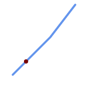
Una cadena de línea con el punto interpolado en la posición del 20% (0,20)
-- The point 20% along a line
SELECT ST_AsEWKT( ST_LineInterpolatePoint(
'LINESTRING(25 50, 100 125, 150 190)',
0.2 ));
----------------
POINT(51.5974135047432 76.5974135047432)
The mid-point of a 3D line:
SELECT ST_AsEWKT( ST_LineInterpolatePoint('
LINESTRING(1 2 3, 4 5 6, 6 7 8)',
0.5 ));
--------------------
POINT(3.5 4.5 5.5)
The closest point on a line to a point:
SELECT ST_AsText( ST_LineInterpolatePoint( line.geom,
ST_LineLocatePoint( line.geom, 'POINT(4 3)')))
FROM (SELECT ST_GeomFromText('LINESTRING(1 2, 4 5, 6 7)') As geom) AS line;
------------
POINT(3 4)
Ver también
ST_LineInterpolatePoints, ST_LineInterpolatePoint, ST_LineMerge
Name
ST_3DLineInterpolatePoint — Returns a point interpolated along a 3D line at a fractional location.
Synopsis
geometry ST_3DLineInterpolatePoint(geometry a_linestring, float8 a_fraction);
Descripción
Devuelve un punto interpolado a lo largo de una línea. El primer argumento debe ser un LINESTRING. El segundo argumento es un float8 entre 0 y 1 que representa la fracción de la longitud total de la cadena de línea del punto tiene que ser localizado.
| |
ST_LineInterpolatePoint computes points in 2D and then interpolates the values for Z and M, while this function computes points in 3D and only interpolates the M value. |
Disponibilidad: 2.1.0
This function supports 3d and will not drop the z-index.
Ejemplos
Return point 20% along 3D line
SELECT ST_AsText(
ST_3DLineInterpolatePoint('LINESTRING(25 50 70, 100 125 90, 150 190 200)',
0.20));
st_asetext
----------------
POINT Z (59.0675892910822 84.0675892910822 79.0846904776219)
Ver también
ST_LineInterpolatePoint, ST_LineInterpolatePoint, ST_LineMerge
Name
ST_LineInterpolatePoints — Returns points interpolated along a line at a fractional interval.
Synopsis
geometry ST_LineInterpolatePoints(geometry a_linestring, float8 a_fraction, boolean repeat);
geography ST_LineInterpolatePoints(geography a_linestring, float8 a_fraction, boolean use_spheroid = true, boolean repeat = true);
Descripción
Returns one or more points interpolated along a line at a fractional interval. The first argument must be a LINESTRING. The second argument is a float8 between 0 and 1 representing the spacing between the points as a fraction of line length. If the third argument is false, at most one point will be constructed (which is equivalent to ST_LineInterpolatePoint.)
If the result has zero or one points, it is returned as a POINT. If it has two or more points, it is returned as a MULTIPOINT.
Availability: 2.5.0
This function supports 3d and will not drop the z-index.
This function supports M coordinates.
Ejemplos
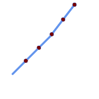
A LineString with points interpolated every 20%
--Return points each 20% along a 2D line
SELECT ST_AsText(ST_LineInterpolatePoints('LINESTRING(25 50, 100 125, 150 190)', 0.20))
----------------
MULTIPOINT((51.5974135047432 76.5974135047432),(78.1948270094864 103.194827009486),(104.132163186446 130.37181214238),(127.066081593223 160.18590607119),(150 190))
Ver también
Name
ST_LineLocatePoint — Returns the fractional location of the closest point on a line to a point.
Synopsis
float8 ST_LineLocatePoint(geometry a_linestring, geometry a_point);
float8 ST_LineLocatePoint(geography a_linestring, geography a_point, boolean use_spheroid = true);
Descripción
Devuelve un float entre 0 y 1 que representa la ubicación del punto más cercano en la cadena de línea al punto dado, como una fracción de la longitud total de la 2d line.
Puede utilizar la ubicación devuelta para extraer un punto (ST_LineInterpolatePoint) o una subcadena (ST_LineSubstring).
Esto es útil para aproximar números de direcciones
Disponibilidad: 1.1.0
Modificado: 2.1.0. Hasta 2.0.x esto se llamaba ST_Line_Locate_Point.
Ejemplos
--Rough approximation of finding the street number of a point along the street
--Note the whole foo thing is just to generate dummy data that looks
--like house centroids and street
--We use ST_DWithin to exclude
--houses too far away from the street to be considered on the street
SELECT ST_AsText(house_loc) As as_text_house_loc,
startstreet_num +
CAST( (endstreet_num - startstreet_num)
* ST_LineLocatePoint(street_line, house_loc) As integer) As street_num
FROM
(SELECT ST_GeomFromText('LINESTRING(1 2, 3 4)') As street_line,
ST_Point(x*1.01,y*1.03) As house_loc, 10 As startstreet_num,
20 As endstreet_num
FROM generate_series(1,3) x CROSS JOIN generate_series(2,4) As y)
As foo
WHERE ST_DWithin(street_line, house_loc, 0.2);
as_text_house_loc | street_num
-------------------+------------
POINT(1.01 2.06) | 10
POINT(2.02 3.09) | 15
POINT(3.03 4.12) | 20
--find closest point on a line to a point or other geometry
SELECT ST_AsText(ST_LineInterpolatePoint(foo.the_line, ST_LineLocatePoint(foo.the_line, ST_GeomFromText('POINT(4 3)'))))
FROM (SELECT ST_GeomFromText('LINESTRING(1 2, 4 5, 6 7)') As the_line) As foo;
st_astext
----------------
POINT(3 4)
Ver también
ST_DWithin, ST_Length2D, ST_LineInterpolatePoint, ST_LineSubstring
Name
ST_LineSubstring — Returns the part of a line between two fractional locations.
Synopsis
geometry ST_LineSubstring(geometry a_linestring, float8 startfraction, float8 endfraction);
geography ST_LineSubstring(geography a_linestring, float8 startfraction, float8 endfraction);
Descripción
Computes the line which is the section of the input line starting and ending at the given fractional locations. The first argument must be a LINESTRING. The second and third arguments are values in the range [0, 1] representing the start and end locations as fractions of line length. The Z and M values are interpolated for added endpoints if present.
Si startfraction y endfraction tienen el mismo valor, esto equivale a ST_LineInterpolatePoint.
| |
This only works with LINESTRINGs. To use on contiguous MULTILINESTRINGs first join them with ST_LineMerge. |
| |
Desde la versión 1.1.1 esta función también interpola los valores M y Z (cuando están presentes), mientras que las versiones anteriores las establecen en valores no especificados. |
Enhanced: 3.4.0 - Support for geography was introduced.
Modificado: 2.1.0. Hasta 2.0.x esto se llamaba ST_Line_Substring.
Disponibilidad: 1.1.0, Soporte de Z y M, añadido en 1.1.1
This function supports 3d and will not drop the z-index.
Ejemplos
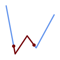
Una cadena de línea vista con 1/3 de rango medio superpuestos (0,333, 0,666)
SELECT ST_AsText(ST_LineSubstring( 'LINESTRING (20 180, 50 20, 90 80, 120 40, 180 150)', 0.333, 0.666)); ------------------------------------------------------------------------------------------------ LINESTRING (45.17311810399485 45.74337011202746, 50 20, 90 80, 112.97593050157862 49.36542599789519)
If start and end locations are the same, the result is a POINT.
SELECT ST_AsText(ST_LineSubstring( 'LINESTRING(25 50, 100 125, 150 190)', 0.333, 0.333)); ------------------------------------------ POINT(69.2846934853974 94.2846934853974)
A query to cut a LineString into sections of length 100 or shorter. It uses generate_series() with a CROSS JOIN LATERAL to produce the equivalent of a FOR loop.
WITH data(id, geom) AS (VALUES
( 'A', 'LINESTRING( 0 0, 200 0)'::geometry ),
( 'B', 'LINESTRING( 0 100, 350 100)'::geometry ),
( 'C', 'LINESTRING( 0 200, 50 200)'::geometry )
)
SELECT id, i,
ST_AsText( ST_LineSubstring( geom, startfrac, LEAST( endfrac, 1 )) ) AS geom
FROM (
SELECT id, geom, ST_Length(geom) len, 100 sublen FROM data
) AS d
CROSS JOIN LATERAL (
SELECT i, (sublen * i) / len AS startfrac,
(sublen * (i+1)) / len AS endfrac
FROM generate_series(0, floor( len / sublen )::integer ) AS t(i)
-- skip last i if line length is exact multiple of sublen
WHERE (sublen * i) / len <
> 1.0
) AS d2;
id | i | geom
----+---+-----------------------------
A | 0 | LINESTRING(0 0,100 0)
A | 1 | LINESTRING(100 0,200 0)
B | 0 | LINESTRING(0 100,100 100)
B | 1 | LINESTRING(100 100,200 100)
B | 2 | LINESTRING(200 100,300 100)
B | 3 | LINESTRING(300 100,350 100)
C | 0 | LINESTRING(0 200,50 200)
Geography implementation measures along a spheroid, geometry along a line
SELECT ST_AsText(ST_LineSubstring( 'LINESTRING(-118.2436 34.0522, -71.0570 42.3611)'::geography, 0.333, 0.666),6) AS geog_sub
, ST_AsText(ST_LineSubstring('LINESTRING(-118.2436 34.0522, -71.0570 42.3611)'::geometry, 0.333, 0.666),6) AS geom_sub;
---------------------------------------------------------------
geog_sub | LINESTRING(-104.167064 38.854691,-87.674646 41.849854)
geom_sub | LINESTRING(-102.530462 36.819064,-86.817324 39.585927)
Ver también
ST_Length, ST_LineExtend, ST_LineInterpolatePoint, ST_LineMerge
Name
ST_LocateAlong — Returns the point(s) on a geometry that match a measure value.
Synopsis
geometry ST_LocateAlong(geometry geom_with_measure, float8 measure, float8 offset = 0);
Descripción
Returns the location(s) along a measured geometry that have the given measure values. The result is a Point or MultiPoint. Polygonal inputs are not supported.
If offset is provided, the result is offset to the left or right of the input line by the specified distance. A positive offset will be to the left, and a negative one to the right.
| |
Use this function only for linear geometries with an M component |
The semantic is specified by the ISO/IEC 13249-3 SQL/MM Spatial standard.
Disponibilidad: 1.1.0 por antiguo nombre ST_Locate_Along_Measure.
Modificado: 2.0.0 en versiones anteriores éste solía llamarse ST_Locate_Along_Measure. El nombre anterior ha quedado obsoleto y se eliminará en el futuro, pero aún está disponible.
This function supports M coordinates.
This method implements the SQL/MM specification. SQL-MM IEC 13249-3: 5.1.13
Ejemplos
SELECT ST_AsText(
ST_LocateAlong(
'MULTILINESTRINGM((1 2 3, 3 4 2, 9 4 3),(1 2 3, 5 4 5))'::geometry,
3 ));
----------------------------------
MULTIPOINT M ((1 2 3),(9 4 3),(1 2 3))
Name
ST_LocateBetween — Returns the portions of a geometry that match a measure range.
Synopsis
geometry ST_LocateBetween(geometry geom, float8 measure_start, float8 measure_end, float8 offset = 0);
Descripción
Devuelve un valor de la colección Geometry derivado con elementos que coinciden con la medida especificada. No se admiten elementos poligonales.
Si se proporciona offset, el resultado se desplaza a la izquierda o a la derecha de la línea de entrada la distancia especificada. Un desplazamiento positivo será hacia la izquierda, y uno negativo hacia la derecha.
Clipping a non-convex POLYGON may produce invalid geometry.
The semantic is specified by the ISO/IEC 13249-3 SQL/MM Spatial standard.
Disponibilidad: 1.1.0 por nombre antiguo ST_Locate_Between_Measures.
Modificado: 2.0.0 en versiones anteriores éste solía llamarse ST_Locate_Along_Measure. El nombre anterior ha quedado obsoleto y se eliminará en el futuro, pero aún está disponible.
Enhanced: 3.0.0 - added support for POLYGON, TIN, TRIANGLE.
This function supports M coordinates.
This method implements the SQL/MM specification. SQL-MM IEC 13249-3: 5.1
Ejemplos
SELECT ST_AsText(
ST_LocateBetween(
'MULTILINESTRING M ((1 2 3, 3 4 2, 9 4 3),(1 2 3, 5 4 5))':: geometry,
1.5, 3 ));
------------------------------------------------------------------------
GEOMETRYCOLLECTION M (LINESTRING M (1 2 3,3 4 2,9 4 3),POINT M (1 2 3))
A LineString with the section between measures 2 and 8, offset to the left
SELECT ST_AsText( ST_LocateBetween(
ST_AddMeasure('LINESTRING (20 180, 50 20, 100 120, 180 20)', 0, 10),
2, 8,
20
));
------------------------------------------------------------------------
MULTILINESTRING((54.49835019899045 104.53426957938231,58.70056060327303 82.12248075654186,69.16695286779743 103.05526528559065,82.11145618000168 128.94427190999915,84.24893681714357 132.32493442618113,87.01636951231555 135.21267035596549,90.30307285299679 137.49198684843182,93.97759758337769 139.07172433557758,97.89298381958797 139.8887023914453,101.89263860095893 139.9102465862721,105.81659870902816 139.13549527600819,109.50792827749828 137.5954340631298,112.81899532549731 135.351656550512,115.6173761888606 132.49390095108848,145.31017306064817 95.37790486135405))
Ver también
Name
ST_LocateBetweenElevations — Returns the portions of a geometry that lie in an elevation (Z) range.
Synopsis
geometry ST_LocateBetweenElevations(geometry geom, float8 elevation_start, float8 elevation_end);
Descripción
Returns a geometry (collection) with the portions of a geometry that lie in an elevation (Z) range.
Clipping a non-convex POLYGON may produce invalid geometry.
Disponibilidad: 1.4.0
Enhanced: 3.0.0 - added support for POLYGON, TIN, TRIANGLE.
This function supports 3d and will not drop the z-index.
Ejemplos
SELECT ST_AsText(
ST_LocateBetweenElevations(
'LINESTRING(1 2 3, 4 5 6)'::geometry,
2, 4 ));
st_astext
-----------------------------------
MULTILINESTRING Z ((1 2 3,2 3 4))
SELECT ST_AsText(
ST_LocateBetweenElevations(
'LINESTRING(1 2 6, 4 5 -1, 7 8 9)',
6, 9)) As ewelev;
ewelev
-----------------------------------------------------------------------
GEOMETRYCOLLECTION Z (POINT Z (1 2 6),LINESTRING Z (6.1 7.1 6,7 8 9))
Ver también
Name
ST_InterpolatePoint — Devuelve el valor de la dimensión medida de una geometría en el punto cerrado al punto proporcionado.
Synopsis
float8 ST_InterpolatePoint(geometry linear_geom_with_measure, geometry point);
Descripción
Returns an interpolated measure value of a linear measured geometry at the location closest to the given point.
| |
Use this function only for linear geometries with an M component |
Disponibilidad: 2.0.0
This function supports 3d and will not drop the z-index.
Ejemplos
SELECT ST_InterpolatePoint('LINESTRING M (0 0 0, 10 0 20)', 'POINT(5 5)');
---------------------
10
Ver también
Name
ST_AddMeasure — Interpolates measures along a linear geometry.
Synopsis
geometry ST_AddMeasure(geometry geom_mline, float8 measure_start, float8 measure_end);
Descripción
Devuelve una geometría derivada con elementos de medida interpolados linealmente entre los puntos inicial y final. Si la geometría no tiene una dimensión de medida, se añadirá una. Si la geometría tiene una dimensión de medida, se sobrescribe con nuevos valores. Sólo se admiten LINESTRINGS y MULTILINESTRINGS.
Disponibilidad: 1.5.0
This function supports 3d and will not drop the z-index.
Ejemplos
SELECT ST_AsText(ST_AddMeasure(
ST_GeomFromEWKT('LINESTRING(1 0, 2 0, 4 0)'),1,4)) As ewelev;
ewelev
--------------------------------
LINESTRINGM(1 0 1,2 0 2,4 0 4)
SELECT ST_AsText(ST_AddMeasure(
ST_GeomFromEWKT('LINESTRING(1 0 4, 2 0 4, 4 0 4)'),10,40)) As ewelev;
ewelev
----------------------------------------
LINESTRING(1 0 4 10,2 0 4 20,4 0 4 40)
SELECT ST_AsText(ST_AddMeasure(
ST_GeomFromEWKT('LINESTRINGM(1 0 4, 2 0 4, 4 0 4)'),10,40)) As ewelev;
ewelev
----------------------------------------
LINESTRINGM(1 0 10,2 0 20,4 0 40)
SELECT ST_AsText(ST_AddMeasure(
ST_GeomFromEWKT('MULTILINESTRINGM((1 0 4, 2 0 4, 4 0 4),(1 0 4, 2 0 4, 4 0 4))'),10,70)) As ewelev;
ewelev
-----------------------------------------------------------------
MULTILINESTRINGM((1 0 10,2 0 20,4 0 40),(1 0 40,2 0 50,4 0 70))
7.20. Trajectory Functions
These functions support working with trajectories. A trajectory is a linear geometry with increasing measures (M value) on each coordinate. Spatio-temporal data can be modeled by using relative times (such as the epoch) as the measure values.
- ST_IsValidTrajectory — Tests if the geometry is a valid trajectory.
- ST_ClosestPointOfApproach — Returns a measure at the closest point of approach of two trajectories.
- ST_DistanceCPA — Returns the distance between the closest point of approach of two trajectories.
- ST_CPAWithin — Tests if the closest point of approach of two trajectories is within the specified distance.
Name
ST_IsValidTrajectory — Tests if the geometry is a valid trajectory.
Synopsis
boolean ST_IsValidTrajectory(geometry line);
Descripción
Tests if a geometry encodes a valid trajectory. A valid trajectory is represented as a LINESTRING with measures (M values). The measure values must increase from each vertex to the next.
Valid trajectories are expected as input to spatio-temporal functions like ST_ClosestPointOfApproach
Disponibilidad: 2.2.0
This function supports 3d and will not drop the z-index.
Ejemplos
-- A valid trajectory SELECT ST_IsValidTrajectory(ST_MakeLine( ST_MakePointM(0,0,1), ST_MakePointM(0,1,2)) ); t -- An invalid trajectory SELECT ST_IsValidTrajectory(ST_MakeLine(ST_MakePointM(0,0,1), ST_MakePointM(0,1,0))); NOTICE: Measure of vertex 1 (0) not bigger than measure of vertex 0 (1) st_isvalidtrajectory ---------------------- f
Ver también
Name
ST_ClosestPointOfApproach — Returns a measure at the closest point of approach of two trajectories.
Synopsis
float8 ST_ClosestPointOfApproach(geometry track1, geometry track2);
Descripción
Returns the smallest measure at which points interpolated along the given trajectories are the least distance apart.
Inputs must be valid trajectories as checked by ST_IsValidTrajectory. Null is returned if the trajectories do not overlap in their M ranges.
To obtain the actual points at the computed measure use ST_LocateAlong .
Disponibilidad: 2.2.0
This function supports 3d and will not drop the z-index.
Ejemplos
-- Return the time in which two objects moving between 10:00 and 11:00
-- are closest to each other and their distance at that point
WITH inp AS ( SELECT
ST_AddMeasure('LINESTRING Z (0 0 0, 10 0 5)'::geometry,
extract(epoch from '2015-05-26 10:00'::timestamptz),
extract(epoch from '2015-05-26 11:00'::timestamptz)
) a,
ST_AddMeasure('LINESTRING Z (0 2 10, 12 1 2)'::geometry,
extract(epoch from '2015-05-26 10:00'::timestamptz),
extract(epoch from '2015-05-26 11:00'::timestamptz)
) b
), cpa AS (
SELECT ST_ClosestPointOfApproach(a,b) m FROM inp
), points AS (
SELECT ST_GeometryN(ST_LocateAlong(a,m),1) pa,
ST_GeometryN(ST_LocateAlong(b,m),1) pb
FROM inp, cpa
)
SELECT to_timestamp(m) t,
ST_3DDistance(pa,pb) distance,
ST_AsText(pa, 2) AS pa, ST_AsText(pb, 2) AS pb
FROM points, cpa;
t | distance | pa | pb
-------------------------------+--------------------+--------------------------------------+----------------------------------------
2015-05-26 10:45:31.034483-07 | 1.9652147377620688 | POINT ZM (7.59 0 3.79 1432662331.03) | POINT ZM (9.1 1.24 3.93 1432662331.03)
Ver también
ST_IsValidTrajectory, ST_DistanceCPA, ST_LocateAlong, ST_AddMeasure
Name
ST_DistanceCPA — Returns the distance between the closest point of approach of two trajectories.
Synopsis
float8 ST_DistanceCPA(geometry track1, geometry track2);
Descripción
Returns the distance (in 2D) between two trajectories at their closest point of approach.
Inputs must be valid trajectories as checked by ST_IsValidTrajectory. Null is returned if the trajectories do not overlap in their M ranges.
Disponibilidad: 2.2.0
This function supports 3d and will not drop the z-index.
Ejemplos
-- Return the minimum distance of two objects moving between 10:00 and 11:00
WITH inp AS ( SELECT
ST_AddMeasure('LINESTRING Z (0 0 0, 10 0 5)'::geometry,
extract(epoch from '2015-05-26 10:00'::timestamptz),
extract(epoch from '2015-05-26 11:00'::timestamptz)
) a,
ST_AddMeasure('LINESTRING Z (0 2 10, 12 1 2)'::geometry,
extract(epoch from '2015-05-26 10:00'::timestamptz),
extract(epoch from '2015-05-26 11:00'::timestamptz)
) b
)
SELECT ST_DistanceCPA(a,b) distance FROM inp;
distance
-------------------
1.965214737762069
Ver también
ST_IsValidTrajectory, ST_ClosestPointOfApproach, ST_AddMeasure, |=|
Name
ST_CPAWithin — Tests if the closest point of approach of two trajectories is within the specified distance.
Synopsis
boolean ST_CPAWithin(geometry track1, geometry track2, float8 dist);
Descripción
Tests whether two moving objects have ever been closer than the specified distance.
Inputs must be valid trajectories as checked by ST_IsValidTrajectory. False is returned if the trajectories do not overlap in their M ranges.
Disponibilidad: 2.2.0
This function supports 3d and will not drop the z-index.
Ejemplos
WITH inp AS ( SELECT
ST_AddMeasure('LINESTRING Z (0 0 0, 10 0 5)'::geometry,
extract(epoch from '2015-05-26 10:00'::timestamptz),
extract(epoch from '2015-05-26 11:00'::timestamptz)
) a,
ST_AddMeasure('LINESTRING Z (0 2 10, 12 1 2)'::geometry,
extract(epoch from '2015-05-26 10:00'::timestamptz),
extract(epoch from '2015-05-26 11:00'::timestamptz)
) b
)
SELECT ST_CPAWithin(a,b,2), ST_DistanceCPA(a,b) distance FROM inp;
st_cpawithin | distance
--------------+------------------
t | 1.96521473776207
Ver también
ST_IsValidTrajectory, ST_ClosestPointOfApproach, ST_DistanceCPA, |=|
7.21. Version Functions
Esta función informa y actualiza versiones de PostGIS.
- PostGIS_Extensions_Upgrade — Packages and upgrades PostGIS extensions (e.g. postgis_raster, postgis_topology, postgis_sfcgal) to given or latest version.
- PostGIS_Full_Version — Reports full PostGIS version and build configuration infos.
- PostGIS_GEOS_Version — Returns the version number of the GEOS library.
- PostGIS_GEOS_Compiled_Version — Returns the version number of the GEOS library against which PostGIS was built.
- PostGIS_Liblwgeom_Version — Returns the version number of the liblwgeom library. This should match the version of PostGIS.
- PostGIS_LibXML_Version — Returns the version number of the libxml2 library.
- PostGIS_LibJSON_Version — Returns the version number of the libjson-c library.
- PostGIS_Lib_Build_Date — Returns build date of the PostGIS library.
- PostGIS_Lib_Version — Returns the version number of the PostGIS library.
- PostGIS_PROJ_Version — Returns the version number of the PROJ4 library.
- PostGIS_PROJ_Compiled_Version — Returns the version number of the PROJ library against which PostGIS was built.
- PostGIS_Wagyu_Version — Returns the version number of the internal Wagyu library.
- PostGIS_Scripts_Build_Date — Returns build date of the PostGIS scripts.
- PostGIS_Scripts_Installed — Returns version of the PostGIS scripts installed in this database.
- PostGIS_Scripts_Released — Returns the version number of the postgis.sql script released with the installed PostGIS lib.
- PostGIS_Version — Returns PostGIS version number and compile-time options.
Name
PostGIS_Extensions_Upgrade — Packages and upgrades PostGIS extensions (e.g. postgis_raster, postgis_topology, postgis_sfcgal) to given or latest version.
Synopsis
text PostGIS_Extensions_Upgrade(text target_version=null);
Descripción
Packages and upgrades PostGIS extensions to given or latest version. Only extensions you have installed in the database will be packaged and upgraded if needed. Reports full PostGIS version and build configuration infos after. This is short-hand for doing multiple CREATE EXTENSION .. FROM unpackaged and ALTER EXTENSION .. UPDATE for each PostGIS extension. Currently only tries to upgrade extensions postgis, postgis_raster, postgis_sfcgal, and postgis_topology.
Availability: 2.5.0
| |
Changed: 3.4.0 to add target_version argument. Changed: 3.3.0 support for upgrades from any PostGIS version. Does not work on all systems. Changed: 3.0.0 to repackage loose extensions and support postgis_raster. |
Ejemplos
SELECT PostGIS_Extensions_Upgrade();
NOTICE: Packaging extension postgis NOTICE: Packaging extension postgis_raster NOTICE: Packaging extension postgis_sfcgal NOTICE: Extension postgis_topology is not available or not packagable for some reason
Name
PostGIS_Full_Version — Reports full PostGIS version and build configuration infos.
Synopsis
text PostGIS_Full_Version();
Descripción
Reports full PostGIS version and build configuration infos. Also informs about synchronization between libraries and scripts suggesting upgrades as needed.
Enhanced: 3.4.0 now includes extra PROJ configurations NETWORK_ENABLED, URL_ENDPOINT and DATABASE_PATH of proj.db location
Ejemplos
SELECT PostGIS_Full_Version();
postgis_full_version
----------------------------------------------------------------------------------
POSTGIS="3.4.0dev 3.3.0rc2-993-g61bdf43a7" [EXTENSION] PGSQL="160" GEOS="3.12.0dev-CAPI-1.18.0" SFCGAL="1.3.8" PROJ="7.2.1 NETWORK_ENABLED=OFF URL_ENDPOINT=https://cdn.proj.org USER_WRITABLE_DIRECTORY=/tmp/proj DATABASE_PATH=/usr/share/proj/proj.db" GDAL="GDAL 3.2.2, released 2021/03/05" LIBXML="2.9.10" LIBJSON="0.15" LIBPROTOBUF="1.3.3" WAGYU="0.5.0 (Internal)" TOPOLOGY RASTER
(1 row)
Name
PostGIS_GEOS_Version — Returns the version number of the GEOS library.
Synopsis
text PostGIS_GEOS_Version();
Descripción
Returns the version number of the GEOS library, or NULL if GEOS support is not enabled.
Ejemplos
SELECT PostGIS_GEOS_Version(); postgis_geos_version ---------------------- 3.12.0dev-CAPI-1.18.0 (1 row)
Name
PostGIS_GEOS_Compiled_Version — Returns the version number of the GEOS library against which PostGIS was built.
Synopsis
text PostGIS_GEOS_Compiled_Version();
Descripción
Returns the version number of the GEOS library, or against which PostGIS was built.
Availability: 3.4.0
Ejemplos
SELECT PostGIS_GEOS_Compiled_Version(); postgis_geos_compiled_version ------------------------------- 3.12.0 (1 row)
Ver también
Name
PostGIS_Liblwgeom_Version — Returns the version number of the liblwgeom library. This should match the version of PostGIS.
Synopsis
text PostGIS_Liblwgeom_Version();
Descripción
Returns the version number of the liblwgeom library/
Ejemplos
SELECT PostGIS_Liblwgeom_Version(); postgis_liblwgeom_version -------------------------- 3.4.0dev 3.3.0rc2-993-g61bdf43a7 (1 row)
Name
PostGIS_LibXML_Version — Returns the version number of the libxml2 library.
Synopsis
text PostGIS_LibXML_Version();
Descripción
Returns the version number of the LibXML2 library.
Disponibilidad: 1.5
Ejemplos
SELECT PostGIS_LibXML_Version(); postgis_libxml_version ---------------------- 2.9.10 (1 row)
Name
PostGIS_LibJSON_Version — Returns the version number of the libjson-c library.
Synopsis
text PostGIS_LibJSON_Version();
Descripción
Returns the version number of the LibJSON-C library.
Ejemplos
SELECT PostGIS_LibJSON_Version(); postgis_libjson_version ------------------------- 0.17
Name
PostGIS_Lib_Build_Date — Returns build date of the PostGIS library.
Synopsis
text PostGIS_Lib_Build_Date();
Descripción
Returns build date of the PostGIS library.
Ejemplos
SELECT PostGIS_Lib_Build_Date(); postgis_lib_build_date ------------------------ 2023-06-22 03:56:11 (1 row)
Name
PostGIS_Lib_Version — Returns the version number of the PostGIS library.
Synopsis
text PostGIS_Lib_Version();
Descripción
Returns the version number of the PostGIS library.
Ejemplos
SELECT PostGIS_Lib_Version(); postgis_lib_version --------------------- 3.4.0dev (1 row)
Name
PostGIS_PROJ_Version — Returns the version number of the PROJ4 library.
Synopsis
text PostGIS_PROJ_Version();
Descripción
Returns the version number of the PROJ library and some configuration options of proj.
Enhanced: 3.4.0 now includes NETWORK_ENABLED, URL_ENDPOINT and DATABASE_PATH of proj.db location
Ejemplos
SELECT PostGIS_PROJ_Version(); postgis_proj_version ------------------------- 7.2.1 NETWORK_ENABLED=OFF URL_ENDPOINT=https://cdn.proj.org USER_WRITABLE_DIRECTORY=/tmp/proj DATABASE_PATH=/usr/share/proj/proj.db (1 row)
Name
PostGIS_PROJ_Compiled_Version — Returns the version number of the PROJ library against which PostGIS was built.
Synopsis
text PostGIS_PROJ_Compiled_Version();
Descripción
Returns the version number of the PROJ library, or against which PostGIS was built.
Availability: 3.5.0
Ejemplos
SELECT PostGIS_PROJ_Compiled_Version(); postgis_proj_compiled_version ------------------------------- 9.1.1 (1 row)
Ver también
Name
PostGIS_Wagyu_Version — Returns the version number of the internal Wagyu library.
Synopsis
text PostGIS_Wagyu_Version();
Descripción
Returns the version number of the internal Wagyu library, or NULL if Wagyu support is not enabled.
Ejemplos
SELECT PostGIS_Wagyu_Version(); postgis_wagyu_version ----------------------- 0.5.0 (Internal) (1 row)
Name
PostGIS_Scripts_Build_Date — Returns build date of the PostGIS scripts.
Synopsis
text PostGIS_Scripts_Build_Date();
Descripción
Returns build date of the PostGIS scripts.
Disponibilidad: 1.0.0RC1
Ejemplos
SELECT PostGIS_Scripts_Build_Date(); postgis_scripts_build_date ------------------------- 2023-06-22 03:56:11 (1 row)
Name
PostGIS_Scripts_Installed — Returns version of the PostGIS scripts installed in this database.
Synopsis
text PostGIS_Scripts_Installed();
Descripción
Returns version of the PostGIS scripts installed in this database.
| |
If the output of this function doesn't match the output of PostGIS_Scripts_Released you probably missed to properly upgrade an existing database. See the Upgrading section for more info. |
Availability: 0.9.0
Ejemplos
SELECT PostGIS_Scripts_Installed(); postgis_scripts_installed ------------------------- 3.4.0dev 3.3.0rc2-993-g61bdf43a7 (1 row)
Ver también
PostGIS_Full_Version, PostGIS_Scripts_Released, PostGIS_Version
Name
PostGIS_Scripts_Released — Returns the version number of the postgis.sql script released with the installed PostGIS lib.
Synopsis
text PostGIS_Scripts_Released();
Descripción
Returns the version number of the postgis.sql script released with the installed PostGIS lib.
| |
Starting with version 1.1.0 this function returns the same value of PostGIS_Lib_Version. Kept for backward compatibility. |
Availability: 0.9.0
Ejemplos
SELECT PostGIS_Scripts_Released(); postgis_scripts_released ------------------------- 3.4.0dev 3.3.0rc2-993-g61bdf43a7 (1 row)
Name
PostGIS_Version — Returns PostGIS version number and compile-time options.
Synopsis
text PostGIS_Version();
Descripción
Returns PostGIS version number and compile-time options.
Ejemplos
SELECT PostGIS_Version();
postgis_version
---------------------------------------
3.4 USE_GEOS=1 USE_PROJ=1 USE_STATS=1
(1 row)7.22. Grand Unified Custom Variables (GUCs)
This section lists custom PostGIS Grand Unified Custom Variables (GUC). These can be set globally, by database, by session or by transaction. Best set at global or database level.
For more examples of usage refer to SQL SET and SQL ALTER SYSTEM
- postgis.gdal_datapath — A configuration option to assign the value of GDAL's GDAL_DATA option. If not set, the environmentally set GDAL_DATA variable is used.
- postgis.gdal_enabled_drivers — A configuration option to set the enabled GDAL drivers in the PostGIS environment. Affects the GDAL configuration variable GDAL_SKIP.
- postgis.enable_outdb_rasters — A boolean configuration option to enable access to out-db raster bands.
- postgis.gdal_vsi_options — A string configuration to set options used when working with an out-db raster.
- postgis.gdal_cpl_debug — A boolean configuration to turn logging of GDAL debug messages on and off.
Name
postgis.gdal_datapath — A configuration option to assign the value of GDAL's GDAL_DATA option. If not set, the environmentally set GDAL_DATA variable is used.
Descripción
A PostgreSQL GUC variable for setting the value of GDAL's GDAL_DATA option. The postgis.gdal_datapath value should be the complete physical path to GDAL's data files.
This configuration option is of most use for Windows platforms where GDAL's data files path is not hard-coded. This option should also be set when GDAL's data files are not located in GDAL's expected path.
| |
This option can be set in PostgreSQL's configuration file postgresql.conf. It can also be set by connection or transaction. |
Disponibilidad: 2.2.0
| |
Additional information about GDAL_DATA is available at GDAL's Configuration Options. |
Ejemplos
Set and reset postgis.gdal_datapath
SET postgis.gdal_datapath TO '/usr/local/share/gdal.hidden';
SET postgis.gdal_datapath TO default;
Setting on windows for a particular database
ALTER DATABASE gisdb SET postgis.gdal_datapath = 'C:/Program Files/PostgreSQL/9.3/gdal-data';
Ver también
Name
postgis.gdal_enabled_drivers — A configuration option to set the enabled GDAL drivers in the PostGIS environment. Affects the GDAL configuration variable GDAL_SKIP.
Descripción
A configuration option to set the enabled GDAL drivers in the PostGIS environment. Affects the GDAL configuration variable GDAL_SKIP. This option can be set in PostgreSQL's configuration file: postgresql.conf. It can also be set by connection or transaction.
The initial value of postgis.gdal_enabled_drivers may also be set by passing the environment variable POSTGIS_GDAL_ENABLED_DRIVERS with the list of enabled drivers to the process starting PostgreSQL.
Enabled GDAL specified drivers can be specified by the driver's short-name or code. Driver short-names or codes can be found at GDAL Raster Formats. Multiple drivers can be specified by putting a space between each driver.
| |
There are three special codes available for
When |
| |
In the standard PostGIS installation, |
| |
Additional information about GDAL_SKIP is available at GDAL's Configuration Options. |
Disponibilidad: 2.2.0
Ejemplos
To set and reset postgis.gdal_enabled_drivers for current session
SET postgis.gdal_enabled_drivers = 'ENABLE_ALL';
SET postgis.gdal_enabled_drivers = default;
Set for all new connections to a specific database to specific drivers
ALTER DATABASE mygisdb SET postgis.gdal_enabled_drivers TO 'GTiff PNG JPEG';
Setting for whole database cluster to enable all drivers. Requires super user access. Also note that database, session, and user settings override this.
--writes to postgres.auto.conf
ALTER SYSTEM SET postgis.gdal_enabled_drivers TO 'ENABLE_ALL';
--Reloads postgres conf
SELECT pg_reload_conf();
Name
postgis.enable_outdb_rasters — A boolean configuration option to enable access to out-db raster bands.
Descripción
A boolean configuration option to enable access to out-db raster bands. This option can be set in PostgreSQL's configuration file: postgresql.conf. It can also be set by connection or transaction.
The initial value of postgis.enable_outdb_rasters may also be set by passing the environment variable POSTGIS_ENABLE_OUTDB_RASTERS with a non-zero value to the process starting PostgreSQL.
| |
Even if |
| |
In the standard PostGIS installation, |
Disponibilidad: 2.2.0
Ejemplos
Set and reset postgis.enable_outdb_rasters for current session
SET postgis.enable_outdb_rasters TO True;
SET postgis.enable_outdb_rasters = default;
SET postgis.enable_outdb_rasters = True;
SET postgis.enable_outdb_rasters = False;
Set for all new connections to a specific database
ALTER DATABASE gisdb SET postgis.enable_outdb_rasters = true;
Setting for whole database cluster. Requires super user access. Also note that database, session, and user settings override this.
--writes to postgres.auto.conf
ALTER SYSTEM SET postgis.enable_outdb_rasters = true;
--Reloads postgres conf
SELECT pg_reload_conf();
Ver también
Name
postgis.gdal_vsi_options — A string configuration to set options used when working with an out-db raster.
Descripción
A string configuration to set options used when working with an out-db raster. Configuration options control things like how much space GDAL allocates to local data cache, whether to read overviews, and what access keys to use for remote out-db data sources.
Availability: 3.2.0
Ejemplos
Set postgis.gdal_vsi_options for current session:
SET postgis.gdal_vsi_options = 'AWS_ACCESS_KEY_ID=xxxxxxxxxxxxxxx AWS_SECRET_ACCESS_KEY=yyyyyyyyyyyyyyyyyyyyyyyyyy';
Set postgis.gdal_vsi_options just for the current transaction using the LOCAL keyword:
SET LOCAL postgis.gdal_vsi_options = 'AWS_ACCESS_KEY_ID=xxxxxxxxxxxxxxx AWS_SECRET_ACCESS_KEY=yyyyyyyyyyyyyyyyyyyyyyyyyy';
Name
postgis.gdal_cpl_debug — A boolean configuration to turn logging of GDAL debug messages on and off.
Descripción
By default, GDAL logging is printed to stderr, and lower level debug messages are not printed at all. Turning this GUC to true will cause GDAL logging to be sent into the PostgreSQL logging stream, so you can see more or less of it by altering the client_min_message PostgreSQL GUC.
Availability: 3.6.0
7.23. Troubleshooting Functions
These functions are utilities for troubleshooting and repairing geometry data. They are only needed if the geometry data is corrupted in some way, which should never happen under normal circumstances.
- PostGIS_AddBBox — Agregue el cuadro delimitador a la geometría.
- PostGIS_DropBBox — Elimina el caché de cuadro delimitador de la geometría.
- PostGIS_HasBBox — Devuelve TRUE si el bbox de la geometría está almacenado en caché, FALSE de lo contrario.
Name
PostGIS_AddBBox — Agregue el cuadro delimitador a la geometría.
Synopsis
geometry PostGIS_AddBBox(geometry geomA);
Descripción
Agregue el cuadro delimitador a la geometría. Esto haría que las consultas basadas en cuadros delimitadores se agilizaran, pero aumentarían el tamaño de la geometría.
| |
Los cuadros delimitadores se agregan automáticamente a las geometrías por lo que en general esto no es necesario a menos que el cuadro de delimitación generado de alguna manera se corrompe o se tiene una instalación antigua que carece de cuadros delimitadores. Entonces usted necesita eliminar el viejo y reagregar. |
This method supports Circular Strings and Curves.
Ejemplos
UPDATE sometable SET geom = PostGIS_AddBBox(geom) WHERE PostGIS_HasBBox(geom) = false;
Ver también
Name
PostGIS_DropBBox — Elimina el caché de cuadro delimitador de la geometría.
Synopsis
geometry PostGIS_DropBBox(geometry geomA);
Descripción
Elimina el caché de cuadro delimitador de la geometría. Esto reduce el tamaño de la geometría, pero hace más lentas las consultas basadas en el cuadro delimitador. También se utiliza para eliminar un cuadro delimitador corrupto. Un signo tale-tell de un cuadro delimitador dañado en caché es cuando su ST_Intersects y otras consultas de relación dejan fuera las geometrías que legítimamente deben devolver true.
| |
Los cuadros delimitadores se agregan automáticamente a las geometrías y mejoran la velocidad de las consultas, por lo que en general esto no es necesario a menos que el cuadro delimitador generado de alguna manera se corrompa o tenga una instalación antigua que carezca de cuadros delimitadores. Entonces usted necesita eliminar el viejo y reagregar. Este tipo de corrupción se ha observado en la serie 8.3-8.3.6, por la cual las bboxes cacheadas no siempre se recalcularon cuando una geometría cambió y la actualización a una versión más reciente sin una recarga de volcado no corregirá las cajas ya corruptas. También uno puede corregir manualmente usando bajar y reagregar el Bbox o hace una recarga de la descarga. |
This method supports Circular Strings and Curves.
Ejemplos
--This example drops bounding boxes where the cached box is not correct
--The force to ST_AsBinary before applying Box2D forces a recalculation of the box, and Box2D applied to the table geometry always
-- returns the cached bounding box.
UPDATE sometable
SET geom = PostGIS_DropBBox(geom)
WHERE Not (Box2D(ST_AsBinary(geom)) = Box2D(geom));
UPDATE sometable
SET geom = PostGIS_AddBBox(geom)
WHERE Not PostGIS_HasBBOX(geom);
Ver también
Name
PostGIS_HasBBox — Devuelve TRUE si el bbox de la geometría está almacenado en caché, FALSE de lo contrario.
Synopsis
boolean PostGIS_HasBBox(geometry geomA);
Descripción
Devuelve TRUE si el bbox de la geometría está almacenado en caché, FALSE de lo contrario. Utilice PostGIS_AddBBox y PostGIS_DropBBox para controlar el almacenamiento en caché.
This method supports Circular Strings and Curves.
Ejemplos
SELECT geom FROM sometable WHERE PostGIS_HasBBox(geom) = false;
Ver también
Chapter 8. SFCGAL Functions Reference
SFCGAL is a C++ wrapper library around CGAL that provides advanced 2D and 3D spatial functions. For robustness, geometry coordinates have an exact rational number representation.
Las instrucciones de instalación de la biblioteca se pueden encontrar en la página principal de SFCGAL http://www.sfcgal.org. Para cargar las funciones crear la extensión postgis_sfcgal.
8.1. SFCGAL Management Functions
This section lists functions for determining version of SFCGAL and library dependencies you are running.
- postgis_sfcgal_version — Returns the version of SFCGAL in use
- postgis_sfcgal_full_version — Returns the full version of SFCGAL in use including CGAL and Boost versions
Name
postgis_sfcgal_version — Returns the version of SFCGAL in use
Synopsis
text postgis_sfcgal_version(void);
Descripción
Returns the version of SFCGAL in use
Disponibilidad: 2.1.0
This method needs SFCGAL backend.
Ver también
Name
postgis_sfcgal_full_version — Returns the full version of SFCGAL in use including CGAL and Boost versions
Synopsis
text postgis_sfcgal_full_version(void);
Descripción
Returns the full version of SFCGAL in use including CGAL and Boost versions
Availability: 3.3.0
This method needs SFCGAL backend.
Ver también
8.2. SFCGAL Accessors and Setters
These functions access or set properties of geometries. Geometries primarily supported by these functions are TINS and Polyhedral Surfaces.
- CG_ForceLHR — Force LHR orientation
- CG_IsPlanar — Check if a surface is or not planar
- CG_IsSolid — Test if the geometry is a solid. No validity check is performed.
- CG_MakeSolid — Cast the geometry into a solid. No check is performed. To obtain a valid solid, the input geometry must be a closed Polyhedral Surface or a closed TIN.
- CG_Orientation — Determine surface orientation
- CG_Area — Calculates the area of a geometry
- CG_3DArea — Computes area of 3D surface geometries. Will return 0 for solids.
- CG_Volume — Computes the volume of a 3D solid. If applied to surface (even closed) geometries will return 0.
- ST_ForceLHR — Force LHR orientation
- ST_IsPlanar — Check if a surface is or not planar
- ST_IsSolid — Test if the geometry is a solid. No validity check is performed.
- ST_MakeSolid — Cast the geometry into a solid. No check is performed. To obtain a valid solid, the input geometry must be a closed Polyhedral Surface or a closed TIN.
- ST_Orientation — Determine surface orientation
- ST_3DArea — Computes area of 3D surface geometries. Will return 0 for solids.
- ST_Volume — Computes the volume of a 3D solid. If applied to surface (even closed) geometries will return 0.
Name
CG_ForceLHR — Force LHR orientation
Synopsis
geometry CG_ForceLHR(geometry geom);
Descripción
Availability: 3.5.0
This method needs SFCGAL backend.
This function supports 3d and will not drop the z-index.
This function supports Polyhedral surfaces.
This function supports Triangles and Triangulated Irregular Network Surfaces (TIN).
Name
CG_IsPlanar — Check if a surface is or not planar
Synopsis
boolean CG_IsPlanar(geometry geom);
Descripción
Availability: 3.5.0
This method needs SFCGAL backend.
This function supports 3d and will not drop the z-index.
This function supports Polyhedral surfaces.
This function supports Triangles and Triangulated Irregular Network Surfaces (TIN).
Name
CG_IsSolid — Test if the geometry is a solid. No validity check is performed.
Synopsis
boolean CG_IsSolid(geometry geom1);
Descripción
Availability: 3.5.0
This method needs SFCGAL backend.
This function supports 3d and will not drop the z-index.
This function supports Polyhedral surfaces.
This function supports Triangles and Triangulated Irregular Network Surfaces (TIN).
Name
CG_MakeSolid — Cast the geometry into a solid. No check is performed. To obtain a valid solid, the input geometry must be a closed Polyhedral Surface or a closed TIN.
Synopsis
geometry CG_MakeSolid(geometry geom1);
Descripción
Availability: 3.5.0
This method needs SFCGAL backend.
This function supports 3d and will not drop the z-index.
This function supports Polyhedral surfaces.
This function supports Triangles and Triangulated Irregular Network Surfaces (TIN).
Name
CG_Orientation — Determine surface orientation
Synopsis
integer CG_Orientation(geometry geom);
Descripción
The function only applies to polygons. It returns -1 if the polygon is counterclockwise oriented and 1 if the polygon is clockwise oriented.
Availability: 3.5.0
This method needs SFCGAL backend.
This function supports 3d and will not drop the z-index.
Name
CG_Area — Calculates the area of a geometry
Synopsis
double precision CG_Area( geometry geom );
Descripción
Calculates the area of a geometry.
Performed by the SFCGAL module
| |
NOTE: this function returns a double precision value representing the area. |
Availability: 3.5.0
This method needs SFCGAL backend.
Geometry Examples
SELECT CG_Area('Polygon ((0 0, 0 5, 5 5, 5 0, 0 0), (1 1, 2 1, 2 2, 1 2, 1 1), (3 3, 4 3, 4 4, 3 4, 3 3))');
cg_area
--------
25
(1 row)Name
CG_3DArea — Computes area of 3D surface geometries. Will return 0 for solids.
Synopsis
floatCG_3DArea(geometry geom1);
Descripción
Availability: 3.5.0
This method needs SFCGAL backend.
This method implements the SQL/MM specification. SQL-MM IEC 13249-3: 8.1, 10.5
This function supports 3d and will not drop the z-index.
This function supports Polyhedral surfaces.
This function supports Triangles and Triangulated Irregular Network Surfaces (TIN).
Ejemplos
Note: By default a PolyhedralSurface built from WKT is a surface geometry, not solid. It therefore has surface area. Once converted to a solid, no area.
SELECT CG_3DArea(geom) As cube_surface_area,
CG_3DArea(CG_MakeSolid(geom)) As solid_surface_area
FROM (SELECT 'POLYHEDRALSURFACE( ((0 0 0, 0 0 1, 0 1 1, 0 1 0, 0 0 0)),
((0 0 0, 0 1 0, 1 1 0, 1 0 0, 0 0 0)),
((0 0 0, 1 0 0, 1 0 1, 0 0 1, 0 0 0)),
((1 1 0, 1 1 1, 1 0 1, 1 0 0, 1 1 0)),
((0 1 0, 0 1 1, 1 1 1, 1 1 0, 0 1 0)),
((0 0 1, 1 0 1, 1 1 1, 0 1 1, 0 0 1)) )'::geometry) As f(geom);
cube_surface_area | solid_surface_area
-------------------+--------------------
6 | 0 Ver también
Name
CG_Volume — Computes the volume of a 3D solid. If applied to surface (even closed) geometries will return 0.
Synopsis
float CG_Volume(geometry geom1);
Descripción
Availability: 3.5.0
This method needs SFCGAL backend.
This function supports 3d and will not drop the z-index.
This function supports Polyhedral surfaces.
This function supports Triangles and Triangulated Irregular Network Surfaces (TIN).
This method implements the SQL/MM specification. SQL-MM IEC 13249-3: 9.1 (same as CG_3DVolume)
Ejemplo
When closed surfaces are created with WKT, they are treated as areal rather than solid. To make them solid, you need to use CG_MakeSolid. Areal geometries have no volume. Here is an example to demonstrate.
SELECT CG_Volume(geom) As cube_surface_vol,
CG_Volume(CG_MakeSolid(geom)) As solid_surface_vol
FROM (SELECT 'POLYHEDRALSURFACE( ((0 0 0, 0 0 1, 0 1 1, 0 1 0, 0 0 0)),
((0 0 0, 0 1 0, 1 1 0, 1 0 0, 0 0 0)),
((0 0 0, 1 0 0, 1 0 1, 0 0 1, 0 0 0)),
((1 1 0, 1 1 1, 1 0 1, 1 0 0, 1 1 0)),
((0 1 0, 0 1 1, 1 1 1, 1 1 0, 0 1 0)),
((0 0 1, 1 0 1, 1 1 1, 0 1 1, 0 0 1)) )'::geometry) As f(geom);
cube_surface_vol | solid_surface_vol
------------------+-------------------
0 | 1
Ver también
Name
ST_ForceLHR — Force LHR orientation
Synopsis
geometry ST_ForceLHR(geometry geom);
Descripción
| |
ST_ForceLHR is deprecated as of 3.5.0. Use CG_ForceLHR instead. |
Disponibilidad: 2.1.0
This method needs SFCGAL backend.
This function supports 3d and will not drop the z-index.
This function supports Polyhedral surfaces.
This function supports Triangles and Triangulated Irregular Network Surfaces (TIN).
Name
ST_IsPlanar — Check if a surface is or not planar
Synopsis
boolean ST_IsPlanar(geometry geom);
Descripción
| |
ST_IsPlanar is deprecated as of 3.5.0. Use CG_IsPlanar instead. |
Availability: 2.2.0: This was documented in 2.1.0 but got accidentally left out in 2.1 release.
This method needs SFCGAL backend.
This function supports 3d and will not drop the z-index.
This function supports Polyhedral surfaces.
This function supports Triangles and Triangulated Irregular Network Surfaces (TIN).
Name
ST_IsSolid — Test if the geometry is a solid. No validity check is performed.
Synopsis
boolean ST_IsSolid(geometry geom1);
Descripción
| |
ST_IsSolid is deprecated as of 3.5.0. Use CG_IsSolid instead. |
Disponibilidad: 2.2.0
This method needs SFCGAL backend.
This function supports 3d and will not drop the z-index.
This function supports Polyhedral surfaces.
This function supports Triangles and Triangulated Irregular Network Surfaces (TIN).
Name
ST_MakeSolid — Cast the geometry into a solid. No check is performed. To obtain a valid solid, the input geometry must be a closed Polyhedral Surface or a closed TIN.
Synopsis
geometry ST_MakeSolid(geometry geom1);
Descripción
| |
ST_MakeSolid is deprecated as of 3.5.0. Use CG_MakeSolid instead. |
Disponibilidad: 2.2.0
This method needs SFCGAL backend.
This function supports 3d and will not drop the z-index.
This function supports Polyhedral surfaces.
This function supports Triangles and Triangulated Irregular Network Surfaces (TIN).
Name
ST_Orientation — Determine surface orientation
Synopsis
integer ST_Orientation(geometry geom);
Descripción
| |
ST_Orientation is deprecated as of 3.5.0. Use CG_Orientation instead. |
The function only applies to polygons. It returns -1 if the polygon is counterclockwise oriented and 1 if the polygon is clockwise oriented.
Disponibilidad: 2.1.0
This method needs SFCGAL backend.
This function supports 3d and will not drop the z-index.
Name
ST_3DArea — Computes area of 3D surface geometries. Will return 0 for solids.
Synopsis
floatST_3DArea(geometry geom1);
Descripción
Disponibilidad: 2.1.0
This method needs SFCGAL backend.
This method implements the SQL/MM specification. SQL-MM IEC 13249-3: 8.1, 10.5
This function supports 3d and will not drop the z-index.
This function supports Polyhedral surfaces.
This function supports Triangles and Triangulated Irregular Network Surfaces (TIN).
Ejemplos
Note: By default a PolyhedralSurface built from WKT is a surface geometry, not solid. It therefore has surface area. Once converted to a solid, no area.
SELECT ST_3DArea(geom) As cube_surface_area,
ST_3DArea(ST_MakeSolid(geom)) As solid_surface_area
FROM (SELECT 'POLYHEDRALSURFACE( ((0 0 0, 0 0 1, 0 1 1, 0 1 0, 0 0 0)),
((0 0 0, 0 1 0, 1 1 0, 1 0 0, 0 0 0)),
((0 0 0, 1 0 0, 1 0 1, 0 0 1, 0 0 0)),
((1 1 0, 1 1 1, 1 0 1, 1 0 0, 1 1 0)),
((0 1 0, 0 1 1, 1 1 1, 1 1 0, 0 1 0)),
((0 0 1, 1 0 1, 1 1 1, 0 1 1, 0 0 1)) )'::geometry) As f(geom);
cube_surface_area | solid_surface_area
-------------------+--------------------
6 | 0 Ver también
Name
ST_Volume — Computes the volume of a 3D solid. If applied to surface (even closed) geometries will return 0.
Synopsis
float ST_Volume(geometry geom1);
Descripción
Disponibilidad: 2.2.0
This method needs SFCGAL backend.
This function supports 3d and will not drop the z-index.
This function supports Polyhedral surfaces.
This function supports Triangles and Triangulated Irregular Network Surfaces (TIN).
This method implements the SQL/MM specification. SQL-MM IEC 13249-3: 9.1 (same as ST_3DVolume)
Ejemplo
When closed surfaces are created with WKT, they are treated as areal rather than solid. To make them solid, you need to use ST_MakeSolid. Areal geometries have no volume. Here is an example to demonstrate.
SELECT ST_Volume(geom) As cube_surface_vol,
ST_Volume(ST_MakeSolid(geom)) As solid_surface_vol
FROM (SELECT 'POLYHEDRALSURFACE( ((0 0 0, 0 0 1, 0 1 1, 0 1 0, 0 0 0)),
((0 0 0, 0 1 0, 1 1 0, 1 0 0, 0 0 0)),
((0 0 0, 1 0 0, 1 0 1, 0 0 1, 0 0 0)),
((1 1 0, 1 1 1, 1 0 1, 1 0 0, 1 1 0)),
((0 1 0, 0 1 1, 1 1 1, 1 1 0, 0 1 0)),
((0 0 1, 1 0 1, 1 1 1, 0 1 1, 0 0 1)) )'::geometry) As f(geom);
cube_surface_vol | solid_surface_vol
------------------+-------------------
0 | 1
Ver también
8.3. SFCGAL Processing and Relationship Functions
- CG_Intersection — Computes the intersection of two geometries
- CG_Intersects — Tests if two geometries intersect (they have at least one point in common)
- CG_3DIntersects — Tests if two 3D geometries intersect
- CG_Difference — Computes the geometric difference between two geometries
- ST_3DDifference — Perform 3D difference
- CG_3DDifference — Perform 3D difference
- CG_Distance — Computes the minimum distance between two geometries
- CG_3DDistance — Computes the minimum 3D distance between two geometries
- ST_3DConvexHull — Computes the 3D convex hull of a geometry.
- CG_3DConvexHull — Computes the 3D convex hull of a geometry.
- ST_3DIntersection — Perform 3D intersection
- CG_3DIntersection — Perform 3D intersection
- CG_Union — Computes the union of two geometries
- ST_3DUnion — Perform 3D union.
- CG_3DUnion — Perform 3D union using postgis_sfcgal.
- ST_AlphaShape — Computes an Alpha-shape enclosing a geometry
- CG_AlphaShape — Computes an Alpha-shape enclosing a geometry
- CG_ApproxConvexPartition — Computes approximal convex partition of the polygon geometry
- ST_ApproximateMedialAxis — Compute the approximate medial axis of an areal geometry.
- CG_ApproximateMedialAxis — Compute the approximate medial axis of an areal geometry.
- ST_ConstrainedDelaunayTriangles — Return a constrained Delaunay triangulation around the given input geometry.
- CG_ConstrainedDelaunayTriangles — Return a constrained Delaunay triangulation around the given input geometry.
- ST_Extrude — Extrude a surface to a related volume
- CG_Extrude — Extrude a surface to a related volume
- CG_ExtrudeStraightSkeleton — Straight Skeleton Extrusion
- CG_GreeneApproxConvexPartition — Computes approximal convex partition of the polygon geometry
- ST_MinkowskiSum — Performs Minkowski sum
- CG_MinkowskiSum — Performs Minkowski sum
- ST_OptimalAlphaShape — Computes an Alpha-shape enclosing a geometry using an "optimal" alpha value.
- CG_OptimalAlphaShape — Computes an Alpha-shape enclosing a geometry using an "optimal" alpha value.
- CG_OptimalConvexPartition — Computes an optimal convex partition of the polygon geometry
- CG_StraightSkeleton — Compute a straight skeleton from a geometry
- ST_StraightSkeleton — Compute a straight skeleton from a geometry
- ST_Tesselate — Perform surface Tessellation of a polygon or polyhedralsurface and returns as a TIN or collection of TINS
- CG_Tesselate — Perform surface Tessellation of a polygon or polyhedralsurface and returns as a TIN or collection of TINS
- CG_Triangulate — Triangulates a polygonal geometry
- CG_Visibility — Compute a visibility polygon from a point or a segment in a polygon geometry
- CG_YMonotonePartition — Computes y-monotone partition of the polygon geometry
- CG_StraightSkeletonPartition — Computes the straight skeleton partition of a polygon.
- CG_3DBuffer — Computes a 3D buffer around a geometry.
- CG_Rotate — Rotates a geometry by a given angle around the origin (0,0).
- CG_2DRotate — Rotates a geometry by a given angle around a specified point in 2D.
- CG_3DRotate — Rotates a geometry in 3D space around an axis vector.
- CG_RotateX — Rotates a geometry around the X-axis by a given angle.
- CG_RotateY — Rotates a geometry around the Y-axis by a given angle.
- CG_RotateZ — Rotates a geometry around the Z-axis by a given angle.
- CG_Scale — Scales a geometry uniformly in all dimensions by a given factor.
- CG_3DScale — Scales a geometry by separate factors along X, Y, and Z axes.
- CG_3DScaleAroundCenter — Scales a geometry in 3D space around a specified center point.
- CG_Translate — Translates (moves) a geometry by given offsets in 2D space.
- CG_3DTranslate — Translates (moves) a geometry by given offsets in 3D space.
- CG_Simplify — Reduces the complexity of a geometry while preserving essential features and Z/M values.
- CG_3DAlphaWrapping — Computes a 3D Alpha-wrapping strictly enclosing a geometry.
Name
CG_Intersection — Computes the intersection of two geometries
Synopsis
geometry CG_Intersection( geometry geomA , geometry geomB );
Descripción
Computes the intersection of two geometries.
Performed by the SFCGAL module
| |
NOTE: this function returns a geometry representing the intersection. |
Availability: 3.5.0
This method needs SFCGAL backend.
Geometry Examples
SELECT ST_AsText(CG_Intersection('LINESTRING(0 0, 5 5)', 'LINESTRING(5 0, 0 5)'));
cg_intersection
-----------------
POINT(2.5 2.5)
(1 row)Ver también
Name
CG_Intersects — Tests if two geometries intersect (they have at least one point in common)
Synopsis
boolean CG_Intersects( geometry geomA , geometry geomB );
Descripción
Returns true if two geometries intersect. Geometries intersect if they have any point in common.
Performed by the SFCGAL module
| |
NOTE: this is the "allowable" version that returns a boolean, not an integer. |
Availability: 3.5.0
This method needs SFCGAL backend.
This function supports Triangles and Triangulated Irregular Network Surfaces (TIN).
Geometry Examples
SELECT CG_Intersects('POINT(0 0)'::geometry, 'LINESTRING ( 2 0, 0 2 )'::geometry);
cg_intersects
---------------
f
(1 row)
SELECT CG_Intersects('POINT(0 0)'::geometry, 'LINESTRING ( 0 0, 0 2 )'::geometry);
cg_intersects
---------------
t
(1 row)
Ver también
CG_3DIntersects, ST_3DIntersects, ST_Intersects, ST_Disjoint
Name
CG_3DIntersects — Tests if two 3D geometries intersect
Synopsis
boolean CG_3DIntersects( geometry geomA , geometry geomB );
Descripción
Tests if two 3D geometries intersect. 3D geometries intersect if they have any point in common in the three-dimensional space.
Performed by the SFCGAL module
| |
NOTE: this is the "allowable" version that returns a boolean, not an integer. |
Availability: 3.5.0
This method needs SFCGAL backend.
This function supports Triangles and Triangulated Irregular Network Surfaces (TIN).
Geometry Examples
SELECT CG_3DIntersects('POINT(1.2 0.1 0)','POLYHEDRALSURFACE(((0 0 0,0.5 0.5 0,1 0 0,1 1 0,0 1 0,0 0 0)),((1 0 0,2 0 0,2 1 0,1 1 0,1 0 0),(1.2 0.2 0,1.2 0.8 0,1.8 0.8 0,1.8 0.2 0,1.2 0.2 0)))');
cg_3dintersects
---------------
t
(1 row)
Ver también
Name
CG_Difference — Computes the geometric difference between two geometries
Synopsis
geometry CG_Difference( geometry geomA , geometry geomB );
Descripción
Computes the geometric difference between two geometries. The resulting geometry is a set of points that are present in geomA but not in geomB.
Performed by the SFCGAL module
| |
NOTE: this function returns a geometry. |
Availability: 3.5.0
This method needs SFCGAL backend.
This function supports Triangles and Triangulated Irregular Network Surfaces (TIN).
Geometry Examples
SELECT ST_AsText(CG_Difference('POLYGON((0 0, 0 1, 1 1, 1 0, 0 0))'::geometry, 'LINESTRING(0 0, 2 2)'::geometry));
cg_difference
---------------
POLYGON((0 0,1 0,1 1,0 1,0 0))
(1 row)Ver también
Name
ST_3DDifference — Perform 3D difference
Synopsis
geometry ST_3DDifference(geometry geom1, geometry geom2);
Descripción
| |
ST_3DDifference is deprecated as of 3.5.0. Use CG_3DDifference instead. |
Returns that part of geom1 that is not part of geom2.
Disponibilidad: 2.2.0
This method needs SFCGAL backend.
This method implements the SQL/MM specification. SQL-MM IEC 13249-3: 5.1
This function supports 3d and will not drop the z-index.
This function supports Polyhedral surfaces.
This function supports Triangles and Triangulated Irregular Network Surfaces (TIN).
Name
CG_3DDifference — Perform 3D difference
Synopsis
geometry CG_3DDifference(geometry geom1, geometry geom2);
Descripción
Returns that part of geom1 that is not part of geom2.
Availability: 3.5.0
This method needs SFCGAL backend.
This method implements the SQL/MM specification. SQL-MM IEC 13249-3: 5.1
This function supports 3d and will not drop the z-index.
This function supports Polyhedral surfaces.
This function supports Triangles and Triangulated Irregular Network Surfaces (TIN).
Ejemplos
3D images were generated using PostGIS ST_AsX3D and rendering in HTML using X3Dom HTML Javascript rendering library.
SELECT CG_Extrude(ST_Buffer(ST_GeomFromText('POINT(100 90)'),
50, 'quad_segs=2'),0,0,30) AS geom1,
CG_Extrude(ST_Buffer(ST_GeomFromText('POINT(80 80)'),
50, 'quad_segs=1'),0,0,30) AS geom2;
 Original 3D geometries overlaid. geom2 is the part that will be removed. |
SELECT CG_3DDifference(geom1,geom2)
FROM ( SELECT CG_Extrude(ST_Buffer(ST_GeomFromText('POINT(100 90)'),
50, 'quad_segs=2'),0,0,30) AS geom1,
CG_Extrude(ST_Buffer(ST_GeomFromText('POINT(80 80)'),
50, 'quad_segs=1'),0,0,30) AS geom2 ) As t;
 What's left after removing geom2 |
Ver también
Name
CG_Distance — Computes the minimum distance between two geometries
Synopsis
double precision CG_Distance( geometry geomA , geometry geomB );
Descripción
Computes the minimum distance between two geometries.
Performed by the SFCGAL module
| |
NOTE: this function returns a double precision value representing the distance. |
Availability: 3.5.0
This method needs SFCGAL backend.
This function supports Triangles and Triangulated Irregular Network Surfaces (TIN).
Geometry Examples
SELECT CG_Distance('LINESTRING(0.0 0.0,-1.0 -1.0)', 'LINESTRING(3.0 4.0,4.0 5.0)');
cg_distance
-------------
2.0
(1 row)Ver también
Name
CG_3DDistance — Computes the minimum 3D distance between two geometries
Synopsis
double precision CG_3DDistance( geometry geomA , geometry geomB );
Descripción
Computes the minimum 3D distance between two geometries.
Performed by the SFCGAL module
| |
NOTE: this function returns a double precision value representing the 3D distance. |
Availability: 3.5.0
This method needs SFCGAL backend.
This function supports Triangles and Triangulated Irregular Network Surfaces (TIN).
Geometry Examples
SELECT CG_3DDistance('LINESTRING(-1.0 0.0 2.0,1.0 0.0 3.0)', 'TRIANGLE((-4.0 0.0 1.0,4.0 0.0 1.0,0.0 4.0 1.0,-4.0 0.0 1.0))');
cg_3ddistance
----------------
1
(1 row)Ver también
Name
ST_3DConvexHull — Computes the 3D convex hull of a geometry.
Synopsis
geometry ST_3DConvexHull(geometry geom1);
Descripción
| |
ST_3DConvexHull is deprecated as of 3.5.0. Use CG_3DConvexHull instead. |
Availability: 3.3.0
This method needs SFCGAL backend.
This function supports 3d and will not drop the z-index.
This function supports Polyhedral surfaces.
This function supports Triangles and Triangulated Irregular Network Surfaces (TIN).
Name
CG_3DConvexHull — Computes the 3D convex hull of a geometry.
Synopsis
geometry CG_3DConvexHull(geometry geom1);
Descripción
Availability: 3.5.0
This method needs SFCGAL backend.
This function supports 3d and will not drop the z-index.
This function supports Polyhedral surfaces.
This function supports Triangles and Triangulated Irregular Network Surfaces (TIN).
Ejemplos
SELECT ST_AsText(CG_3DConvexHull('LINESTRING Z(0 0 5, 1 5 3, 5 7 6, 9 5 3 , 5 7 5, 6 3 5)'::geometry));POLYHEDRALSURFACE Z (((1 5 3,9 5 3,0 0 5,1 5 3)),((1 5 3,0 0 5,5 7 6,1 5 3)),((5 7 6,5 7 5,1 5 3,5 7 6)),((0 0 5,6 3 5,5 7 6,0 0 5)),((6 3 5,9 5 3,5 7 6,6 3 5)),((0 0 5,9 5 3,6 3 5,0 0 5)),((9 5 3,5 7 5,5 7 6,9 5 3)),((1 5 3,5 7 5,9 5 3,1 5 3)))
WITH f AS (SELECT i, CG_Extrude(geom, 0,0, i ) AS geom
FROM ST_Subdivide(ST_Letters('CH'),5) WITH ORDINALITY AS sd(geom,i)
)
SELECT CG_3DConvexHull(ST_Collect(f.geom) )
FROM f;
Original geometry overlaid with 3D convex hull
Ver también
Name
ST_3DIntersection — Perform 3D intersection
Synopsis
geometry ST_3DIntersection(geometry geom1, geometry geom2);
Descripción
| |
ST_3DIntersection is deprecated as of 3.5.0. Use CG_3DIntersection instead. |
Return a geometry that is the shared portion between geom1 and geom2.
Disponibilidad: 2.1.0
This method needs SFCGAL backend.
This method implements the SQL/MM specification. SQL-MM IEC 13249-3: 5.1
This function supports 3d and will not drop the z-index.
This function supports Polyhedral surfaces.
This function supports Triangles and Triangulated Irregular Network Surfaces (TIN).
Name
CG_3DIntersection — Perform 3D intersection
Synopsis
geometry CG_3DIntersection(geometry geom1, geometry geom2);
Descripción
Return a geometry that is the shared portion between geom1 and geom2.
Availability: 3.5.0
This method needs SFCGAL backend.
This method implements the SQL/MM specification. SQL-MM IEC 13249-3: 5.1
This function supports 3d and will not drop the z-index.
This function supports Polyhedral surfaces.
This function supports Triangles and Triangulated Irregular Network Surfaces (TIN).
Ejemplos
3D images were generated using PostGIS ST_AsX3D and rendering in HTML using X3Dom HTML Javascript rendering library.
SELECT CG_Extrude(ST_Buffer(ST_GeomFromText('POINT(100 90)'),
50, 'quad_segs=2'),0,0,30) AS geom1,
CG_Extrude(ST_Buffer(ST_GeomFromText('POINT(80 80)'),
50, 'quad_segs=1'),0,0,30) AS geom2;
Original 3D geometries overlaid. geom2 is shown semi-transparent |
SELECT CG_3DIntersection(geom1,geom2)
FROM ( SELECT CG_Extrude(ST_Buffer(ST_GeomFromText('POINT(100 90)'),
50, 'quad_segs=2'),0,0,30) AS geom1,
CG_Extrude(ST_Buffer(ST_GeomFromText('POINT(80 80)'),
50, 'quad_segs=1'),0,0,30) AS geom2 ) As t;
 Intersection of geom1 and geom2 |
3D linestrings and polygons
SELECT ST_AsText(CG_3DIntersection(linestring, polygon)) As wkt
FROM ST_GeomFromText('LINESTRING Z (2 2 6,1.5 1.5 7,1 1 8,0.5 0.5 8,0 0 10)') AS linestring
CROSS JOIN ST_GeomFromText('POLYGON((0 0 8, 0 1 8, 1 1 8, 1 0 8, 0 0 8))') AS polygon;
wkt
--------------------------------
LINESTRING Z (1 1 8,0.5 0.5 8)
Cube (closed Polyhedral Surface) and Polygon Z
SELECT ST_AsText(CG_3DIntersection(
ST_GeomFromText('POLYHEDRALSURFACE Z( ((0 0 0, 0 0 1, 0 1 1, 0 1 0, 0 0 0)),
((0 0 0, 0 1 0, 1 1 0, 1 0 0, 0 0 0)), ((0 0 0, 1 0 0, 1 0 1, 0 0 1, 0 0 0)),
((1 1 0, 1 1 1, 1 0 1, 1 0 0, 1 1 0)),
((0 1 0, 0 1 1, 1 1 1, 1 1 0, 0 1 0)), ((0 0 1, 1 0 1, 1 1 1, 0 1 1, 0 0 1)) )'),
'POLYGON Z ((0 0 0, 0 0 0.5, 0 0.5 0.5, 0 0.5 0, 0 0 0))'::geometry))TIN Z (((0 0 0,0 0 0.5,0 0.5 0.5,0 0 0)),((0 0.5 0,0 0 0,0 0.5 0.5,0 0.5 0)))
Intersection of 2 solids that result in volumetric intersection is also a solid (ST_Dimension returns 3)
SELECT ST_AsText(CG_3DIntersection( CG_Extrude(ST_Buffer('POINT(10 20)'::geometry,10,1),0,0,30),
CG_Extrude(ST_Buffer('POINT(10 20)'::geometry,10,1),2,0,10) ));POLYHEDRALSURFACE Z (((13.3333333333333 13.3333333333333 10,20 20 0,20 20 10,13.3333333333333 13.3333333333333 10)),
((20 20 10,16.6666666666667 23.3333333333333 10,13.3333333333333 13.3333333333333 10,20 20 10)),
((20 20 0,16.6666666666667 23.3333333333333 10,20 20 10,20 20 0)),
((13.3333333333333 13.3333333333333 10,10 10 0,20 20 0,13.3333333333333 13.3333333333333 10)),
((16.6666666666667 23.3333333333333 10,12 28 10,13.3333333333333 13.3333333333333 10,16.6666666666667 23.3333333333333 10)),
((20 20 0,9.99999999999995 30 0,16.6666666666667 23.3333333333333 10,20 20 0)),
((10 10 0,9.99999999999995 30 0,20 20 0,10 10 0)),((13.3333333333333 13.3333333333333 10,12 12 10,10 10 0,13.3333333333333 13.3333333333333 10)),
((12 28 10,12 12 10,13.3333333333333 13.3333333333333 10,12 28 10)),
((16.6666666666667 23.3333333333333 10,9.99999999999995 30 0,12 28 10,16.6666666666667 23.3333333333333 10)),
((10 10 0,0 20 0,9.99999999999995 30 0,10 10 0)),
((12 12 10,11 11 10,10 10 0,12 12 10)),((12 28 10,11 11 10,12 12 10,12 28 10)),
((9.99999999999995 30 0,11 29 10,12 28 10,9.99999999999995 30 0)),((0 20 0,2 20 10,9.99999999999995 30 0,0 20 0)),
((10 10 0,2 20 10,0 20 0,10 10 0)),((11 11 10,2 20 10,10 10 0,11 11 10)),((12 28 10,11 29 10,11 11 10,12 28 10)),
((9.99999999999995 30 0,2 20 10,11 29 10,9.99999999999995 30 0)),((11 11 10,11 29 10,2 20 10,11 11 10)))Name
CG_Union — Computes the union of two geometries
Synopsis
geometry CG_Union( geometry geomA , geometry geomB );
Descripción
Computes the union of two geometries.
Performed by the SFCGAL module
| |
NOTE: this function returns a geometry representing the union. |
Availability: 3.5.0
This method needs SFCGAL backend.
Geometry Examples
SELECT CG_Union('POINT(.5 0)', 'LINESTRING(-1 0,1 0)');
cg_union
-----------
LINESTRING(-1 0,0.5 0,1 0)
(1 row)Ver también
Name
ST_3DUnion — Perform 3D union.
Synopsis
geometry ST_3DUnion(geometry geom1, geometry geom2);
geometry ST_3DUnion(geometry set g1field);
Descripción
| |
ST_3DUnion is deprecated as of 3.5.0. Use CG_3DUnion instead. |
Disponibilidad: 2.2.0
Availability: 3.3.0 aggregate variant was added
This method needs SFCGAL backend.
This method implements the SQL/MM specification. SQL-MM IEC 13249-3: 5.1
This function supports 3d and will not drop the z-index.
This function supports Polyhedral surfaces.
This function supports Triangles and Triangulated Irregular Network Surfaces (TIN).
Aggregate variant: returns a geometry that is the 3D union of a rowset of geometries. The ST_3DUnion() function is an "aggregate" function in the terminology of PostgreSQL. That means that it operates on rows of data, in the same way the SUM() and AVG() functions do and like most aggregates, it also ignores NULL geometries.
Name
CG_3DUnion — Perform 3D union using postgis_sfcgal.
Synopsis
geometry CG_3DUnion(geometry geom1, geometry geom2);
geometry CG_3DUnion(geometry set g1field);
Descripción
Availability: 3.5.0
This method needs SFCGAL backend.
This method implements the SQL/MM specification. SQL-MM IEC 13249-3: 5.1
This function supports 3d and will not drop the z-index.
This function supports Polyhedral surfaces.
This function supports Triangles and Triangulated Irregular Network Surfaces (TIN).
Aggregate variant: returns a geometry that is the 3D union of a rowset of geometries. The CG_3DUnion() function is an "aggregate" function in the terminology of PostgreSQL. That means that it operates on rows of data, in the same way the SUM() and AVG() functions do and like most aggregates, it also ignores NULL geometries.
Ejemplos
3D images were generated using PostGIS ST_AsX3D and rendering in HTML using X3Dom HTML Javascript rendering library.
SELECT CG_Extrude(ST_Buffer(ST_GeomFromText('POINT(100 90)'),
50, 'quad_segs=2'),0,0,30) AS geom1,
CG_Extrude(ST_Buffer(ST_GeomFromText('POINT(80 80)'),
50, 'quad_segs=1'),0,0,30) AS geom2;
Original 3D geometries overlaid. geom2 is the one with transparency. |
SELECT CG_3DUnion(geom1,geom2)
FROM ( SELECT CG_Extrude(ST_Buffer(ST_GeomFromText('POINT(100 90)'),
50, 'quad_segs=2'),0,0,30) AS geom1,
CG_Extrude(ST_Buffer(ST_GeomFromText('POINT(80 80)'),
50, 'quad_segs=1'),0,0,30) AS geom2 ) As t;
 Union of geom1 and geom2 |
Ver también
Name
ST_AlphaShape — Computes an Alpha-shape enclosing a geometry
Synopsis
geometry ST_AlphaShape(geometry geom, float alpha, boolean allow_holes = false);
Descripción
| |
ST_AlphaShape is deprecated as of 3.5.0. Use CG_AlphaShape instead. |
Computes the Alpha-Shape of the points in a geometry. An alpha-shape is a (usually) concave polygonal geometry which contains all the vertices of the input, and whose vertices are a subset of the input vertices. An alpha-shape provides a closer fit to the shape of the input than the shape produced by the convex hull.
Name
CG_AlphaShape — Computes an Alpha-shape enclosing a geometry
Synopsis
geometry CG_AlphaShape(geometry geom, float alpha, boolean allow_holes = false);
Descripción
Computes the Alpha-Shape of the points in a geometry. An alpha-shape is a (usually) concave polygonal geometry which contains all the vertices of the input, and whose vertices are a subset of the input vertices. An alpha-shape provides a closer fit to the shape of the input than the shape produced by the convex hull.
The "closeness of fit" is controlled by the alpha parameter, which can have values from 0 to infinity. Smaller alpha values produce more concave results. Alpha values greater than some data-dependent value produce the convex hull of the input.
| |
Following the CGAL implementation, the alpha value is the square of the radius of the disc used in the Alpha-Shape algorithm to "erode" the Delaunay Triangulation of the input points. See CGAL Alpha-Shapes for more information. This is different from the original definition of alpha-shapes, which defines alpha as the radius of the eroding disc. |
The computed shape does not contain holes unless the optional allow_holes argument is specified as true.
This function effectively computes a concave hull of a geometry in a similar way to ST_ConcaveHull, but uses CGAL and a different algorithm.
Availability: 3.5.0 - requires SFCGAL >= 1.4.1.
This method needs SFCGAL backend.
Ejemplos
Alpha-shape of a MultiPoint (same example As CG_OptimalAlphaShape)
SELECT ST_AsText(CG_AlphaShape('MULTIPOINT((63 84),(76 88),(68 73),(53 18),(91 50),(81 70),
(88 29),(24 82),(32 51),(37 23),(27 54),(84 19),(75 87),(44 42),(77 67),(90 30),(36 61),(32 65),
(81 47),(88 58),(68 73),(49 95),(81 60),(87 50),
(78 16),(79 21),(30 22),(78 43),(26 85),(48 34),(35 35),(36 40),(31 79),(83 29),(27 84),(52 98),(72 95),(85 71),
(75 84),(75 77),(81 29),(77 73),(41 42),(83 72),(23 36),(89 53),(27 57),(57 97),(27 77),(39 88),(60 81),
(80 72),(54 32),(55 26),(62 22),(70 20),(76 27),(84 35),(87 42),(82 54),(83 64),(69 86),(60 90),(50 86),(43 80),(36 73),
(36 68),(40 75),(24 67),(23 60),(26 44),(28 33),(40 32),(43 19),(65 16),(73 16),(38 46),(31 59),(34 86),(45 90),(64 97))'::geometry,80.2));
MULTIPOLYGON(((89 53,88 58,85 71,83 72,75 84,76 88,72 95,64 97,57 97,52 98,49 95,45 90,39 88,34 86,26 85,24 82,27 77,24 67,23 60,27 54,26 44,23 36,28 33,30 22,37 23,43 19,53 18,65 16,73 16,78 16,84 19,88 29,90 30,87 42,91 50,89 53)))
Alpha-shape of a MultiPoint, allowing holes (same example as CG_OptimalAlphaShape)
SELECT ST_AsText(CG_AlphaShape('MULTIPOINT((63 84),(76 88),(68 73),(53 18),(91 50),(81 70),(88 29),(24 82),(32 51),(37 23),(27 54),(84 19),(75 87),(44 42),(77 67),(90 30),(36 61),(32 65),(81 47),(88 58),(68 73),(49 95),(81 60),(87 50),
(78 16),(79 21),(30 22),(78 43),(26 85),(48 34),(35 35),(36 40),(31 79),(83 29),(27 84),(52 98),(72 95),(85 71),
(75 84),(75 77),(81 29),(77 73),(41 42),(83 72),(23 36),(89 53),(27 57),(57 97),(27 77),(39 88),(60 81),
(80 72),(54 32),(55 26),(62 22),(70 20),(76 27),(84 35),(87 42),(82 54),(83 64),(69 86),(60 90),(50 86),(43 80),(36 73),
(36 68),(40 75),(24 67),(23 60),(26 44),(28 33),(40 32),(43 19),(65 16),(73 16),(38 46),(31 59),(34 86),(45 90),(64 97))'::geometry, 100.1,true))
MULTIPOLYGON(((89 53,88 58,85 71,83 72,75 84,76 88,72 95,64 97,57 97,52 98,49 95,45 90,39 88,34 86,26 85,24 82,27 77,24 67,23 60,27 54,26 44,23 36,28 33,30 22,43 19,53 18,65 16,73 16,78 16,84 19,90 30,87 42,91 50,89 53),(36 68,40 75,43 80,60 81,68 73,77 67,81 60,82 54,81 47,78 43,76 27,62 22,54 32,44 42,38 46,36 61,36 68)))
Alpha-shape of a MultiPoint, allowing holes (same example as ST_ConcaveHull)
SELECT ST_AsText(CG_AlphaShape(
'MULTIPOINT ((132 64), (114 64), (99 64), (81 64), (63 64), (57 49), (52 36), (46 20), (37 20), (26 20), (32 36), (39 55), (43 69), (50 84), (57 100), (63 118), (68 133), (74 149), (81 164), (88 180), (101 180), (112 180), (119 164), (126 149), (132 131), (139 113), (143 100), (150 84), (157 69), (163 51), (168 36), (174 20), (163 20), (150 20), (143 36), (139 49), (132 64), (99 151), (92 138), (88 124), (81 109), (74 93), (70 82), (83 82), (99 82), (112 82), (126 82), (121 96), (114 109), (110 122), (103 138), (99 151), (34 27), (43 31), (48 44), (46 58), (52 73), (63 73), (61 84), (72 71), (90 69), (101 76), (123 71), (141 62), (166 27), (150 33), (159 36), (146 44), (154 53), (152 62), (146 73), (134 76), (143 82), (141 91), (130 98), (126 104), (132 113), (128 127), (117 122), (112 133), (119 144), (108 147), (119 153), (110 171), (103 164), (92 171), (86 160), (88 142), (79 140), (72 124), (83 131), (79 118), (68 113), (63 102), (68 93), (35 45))'::geometry,102.2, true));
MULTIPOLYGON(((168 36,163 51,157 69,150 84,143 100,139 113,132 131,126 149,119 164,112 180,101 180,88 180,81 164,74 149,68 133,63 118,57 100,50 84,43 69,39 55,35 45,32 36,26 20,37 20,46 20,52 36,57 49,63 64,81 64,90 69,99 64,114 64,132 64,139 49,143 36,150 20,163 20,174 20,168 36),(81 109,88 124,92 138,103 138,110 122,114 109,121 96,112 82,99 82,83 82,74 93,81 109)))
Ver también
Name
CG_ApproxConvexPartition — Computes approximal convex partition of the polygon geometry
Synopsis
geometry CG_ApproxConvexPartition(geometry geom);
Descripción
Computes approximal convex partition of the polygon geometry (using a triangulation).
| |
A partition of a polygon P is a set of polygons such that the interiors of the polygons do not intersect and the union of the polygons is equal to the interior of the original polygon P. CG_ApproxConvexPartition and CG_GreeneApproxConvexPartition functions produce approximately optimal convex partitions. Both these functions produce convex decompositions by first decomposing the polygon into simpler polygons; CG_ApproxConvexPartition uses a triangulation and CG_GreeneApproxConvexPartition a monotone partition. These two functions both guarantee that they will produce no more than four times the optimal number of convex pieces but they differ in their runtime complexities. Though the triangulation-based approximation algorithm often results in fewer convex pieces, this is not always the case. |
Availability: 3.5.0 - requires SFCGAL >= 1.5.0.
Requires SFCGAL >= 1.5.0
This method needs SFCGAL backend.
Ejemplos
Approximal Convex Partition (same example As CG_YMonotonePartition, CG_GreeneApproxConvexPartition and CG_OptimalConvexPartition)
SELECT ST_AsText(CG_ApproxConvexPartition('POLYGON((156 150,83 181,89 131,148 120,107 61,32 159,0 45,41 86,45 1,177 2,67 24,109 31,170 60,180 110,156 150))'::geometry));
GEOMETRYCOLLECTION(POLYGON((156 150,83 181,89 131,148 120,156 150)),POLYGON((32 159,0 45,41 86,32 159)),POLYGON((107 61,32 159,41 86,107 61)),POLYGON((45 1,177 2,67 24,45 1)),POLYGON((41 86,45 1,67 24,41 86)),POLYGON((107 61,41 86,67 24,109 31,107 61)),POLYGON((148 120,107 61,109 31,170 60,148 120)),POLYGON((156 150,148 120,170 60,180 110,156 150)))
Name
ST_ApproximateMedialAxis — Compute the approximate medial axis of an areal geometry.
Synopsis
geometry ST_ApproximateMedialAxis(geometry geom);
Descripción
| |
ST_ApproximateMedialAxis is deprecated as of 3.5.0. Use CG_ApproximateMedialAxis instead. |
Return an approximate medial axis for the areal input based on its straight skeleton. Uses an SFCGAL specific API when built against a capable version (1.2.0+). Otherwise the function is just a wrapper around CG_StraightSkeleton (slower case).
Disponibilidad: 2.2.0
This method needs SFCGAL backend.
This function supports 3d and will not drop the z-index.
This function supports Polyhedral surfaces.
This function supports Triangles and Triangulated Irregular Network Surfaces (TIN).
Name
CG_ApproximateMedialAxis — Compute the approximate medial axis of an areal geometry.
Synopsis
geometry CG_ApproximateMedialAxis(geometry geom);
Descripción
Return an approximate medial axis for the areal input based on its straight skeleton. Uses an SFCGAL specific API when built against a capable version (1.2.0+). Otherwise the function is just a wrapper around CG_StraightSkeleton (slower case).
Availability: 3.5.0
| |
This function ignores the Z dimension. It always gives a 2D result even when used on a 3D geometry. |
This method needs SFCGAL backend.
This function supports Polyhedral surfaces.
This function supports Triangles and Triangulated Irregular Network Surfaces (TIN).
Ejemplos
SELECT CG_ApproximateMedialAxis(ST_GeomFromText('POLYGON (( 190 190, 10 190, 10 10, 190 10, 190 20, 160 30, 60 30, 60 130, 190 140, 190 190 ))')); A polygon and its approximate medial axis |
Ver también
Name
ST_ConstrainedDelaunayTriangles — Return a constrained Delaunay triangulation around the given input geometry.
Synopsis
geometry ST_ConstrainedDelaunayTriangles(geometry g1);
Descripción
| |
ST_ConstrainedDelaunayTriangles is deprecated as of 3.5.0. Use CG_ConstrainedDelaunayTriangles instead. |
Return a Constrained Delaunay triangulation around the vertices of the input geometry. Output is a TIN.
This method needs SFCGAL backend.
Disponibilidad: 2.1.0
This function supports 3d and will not drop the z-index.
Name
CG_ConstrainedDelaunayTriangles — Return a constrained Delaunay triangulation around the given input geometry.
Synopsis
geometry CG_ConstrainedDelaunayTriangles(geometry g1);
Descripción
Return a Constrained Delaunay triangulation around the vertices of the input geometry. Output is a TIN.
This method needs SFCGAL backend.
Disponibilidad: 2.1.0
This function supports 3d and will not drop the z-index.
Ejemplos
 CG_ConstrainedDelaunayTriangles of 2 polygons
select CG_ConstrainedDelaunayTriangles(
ST_Union(
'POLYGON((175 150, 20 40, 50 60, 125 100, 175 150))'::geometry,
ST_Buffer('POINT(110 170)'::geometry, 20)
)
);
|  ST_DelaunayTriangles of 2 polygons. Triangle edges cross polygon boundaries.
select ST_DelaunayTriangles(
ST_Union(
'POLYGON((175 150, 20 40, 50 60, 125 100, 175 150))'::geometry,
ST_Buffer('POINT(110 170)'::geometry, 20)
)
);
|
Ver también
ST_DelaunayTriangles, ST_TriangulatePolygon, CG_Tesselate, ST_ConcaveHull, ST_Dump
Name
ST_Extrude — Extrude a surface to a related volume
Synopsis
geometry ST_Extrude(geometry geom, float x, float y, float z);
Descripción
| |
ST_Extrude is deprecated as of 3.5.0. Use CG_Extrude instead. |
Disponibilidad: 2.1.0
This method needs SFCGAL backend.
This function supports 3d and will not drop the z-index.
This function supports Polyhedral surfaces.
This function supports Triangles and Triangulated Irregular Network Surfaces (TIN).
Name
CG_Extrude — Extrude a surface to a related volume
Synopsis
geometry CG_Extrude(geometry geom, float x, float y, float z);
Descripción
Availability: 3.5.0
This method needs SFCGAL backend.
This function supports 3d and will not drop the z-index.
This function supports Polyhedral surfaces.
This function supports Triangles and Triangulated Irregular Network Surfaces (TIN).
Ejemplos
3D images were generated using PostGIS ST_AsX3D and rendering in HTML using X3Dom HTML Javascript rendering library.
SELECT ST_Buffer(ST_GeomFromText('POINT(100 90)'),
50, 'quad_segs=2'),0,0,30);
 Original octagon formed from buffering point |
CG_Extrude(ST_Buffer(ST_GeomFromText('POINT(100 90)'),
50, 'quad_segs=2'),0,0,30);
 Hexagon extruded 30 units along Z produces a PolyhedralSurfaceZ |
SELECT ST_GeomFromText('LINESTRING(50 50, 100 90, 95 150)')
 Original linestring |
SELECT CG_Extrude(
ST_GeomFromText('LINESTRING(50 50, 100 90, 95 150)'),0,0,10));
 LineString Extruded along Z produces a PolyhedralSurfaceZ |
Ver también
Name
CG_ExtrudeStraightSkeleton — Straight Skeleton Extrusion
Synopsis
geometry CG_ExtrudeStraightSkeleton(geometry geom, float roof_height, float body_height = 0);
Descripción
Computes an extrusion with a maximal height of the polygon geometry.
| |
Perhaps the first (historically) use-case of straight skeletons: given a polygonal roof, the straight skeleton directly gives the layout of each tent. If each skeleton edge is lifted from the plane a height equal to its offset distance, the resulting roof is "correct" in that water will always fall down to the contour edges (the roof's border), regardless of where it falls on the roof. The function computes this extrusion aka "roof" on a polygon. If the argument body_height > 0, so the polygon is extruded like with CG_Extrude(polygon, 0, 0, body_height). The result is an union of these polyhedralsurfaces. |
Availability: 3.5.0 - requires SFCGAL >= 1.5.0.
Requires SFCGAL >= 1.5.0
This method needs SFCGAL backend.
Ejemplos
SELECT ST_AsText(CG_ExtrudeStraightSkeleton('POLYGON (( 0 0, 5 0, 5 5, 4 5, 4 4, 0 4, 0 0 ), (1 1, 1 2,2 2, 2 1, 1 1))', 3.0, 2.0));
POLYHEDRALSURFACE Z (((0 0 0,0 4 0,4 4 0,4 5 0,5 5 0,5 0 0,0 0 0),(1 1 0,2 1 0,2 2 0,1 2 0,1 1 0)),((0 0 0,0 0 2,0 4 2,0 4 0,0 0 0)),((0 4 0,0 4 2,4 4 2,4 4 0,0 4 0)),((4 4 0,4 4 2,4 5 2,4 5 0,4 4 0)),((4 5 0,4 5 2,5 5 2,5 5 0,4 5 0)),((5 5 0,5 5 2,5 0 2,5 0 0,5 5 0)),((5 0 0,5 0 2,0 0 2,0 0 0,5 0 0)),((1 1 0,1 1 2,2 1 2,2 1 0,1 1 0)),((2 1 0,2 1 2,2 2 2,2 2 0,2 1 0)),((2 2 0,2 2 2,1 2 2,1 2 0,2 2 0)),((1 2 0,1 2 2,1 1 2,1 1 0,1 2 0)),((0 4 2,0 0 2,0.5 0.5 2.5,0.5 2.5 2.5,1 3 3,0 4 2)),((0 0 2,5 0 2,3.5 1.5 3.5,2.5 0.5 2.5,0.5 0.5 2.5,0 0 2)),((5 0 2,5 5 2,4.5 4.5 2.5,4.5 3.5 2.5,3.5 2.5 3.5,3.5 1.5 3.5,5 0 2)),((5 5 2,4 5 2,4.5 4.5 2.5,5 5 2)),((4 5 2,4 4 2,4.5 3.5 2.5,4.5 4.5 2.5,4 5 2)),((4 4 2,0 4 2,1 3 3,3 3 3,3.5 2.5 3.5,4.5 3.5 2.5,4 4 2)),((2 1 2,1 1 2,0.5 0.5 2.5,2.5 0.5 2.5,2 1 2)),((1 1 2,1 2 2,0.5 2.5 2.5,0.5 0.5 2.5,1 1 2)),((1 2 2,2 2 2,3 3 3,1 3 3,0.5 2.5 2.5,1 2 2)),((2 2 2,2 1 2,2.5 0.5 2.5,3.5 1.5 3.5,3.5 2.5 3.5,3 3 3,2 2 2)))
Name
CG_GreeneApproxConvexPartition — Computes approximal convex partition of the polygon geometry
Synopsis
geometry CG_GreeneApproxConvexPartition(geometry geom);
Descripción
Computes approximal monotone convex partition of the polygon geometry.
| |
A partition of a polygon P is a set of polygons such that the interiors of the polygons do not intersect and the union of the polygons is equal to the interior of the original polygon P. CG_ApproxConvexPartition and CG_GreeneApproxConvexPartition functions produce approximately optimal convex partitions. Both these functions produce convex decompositions by first decomposing the polygon into simpler polygons; CG_ApproxConvexPartition uses a triangulation and CG_GreeneApproxConvexPartition a monotone partition. These two functions both guarantee that they will produce no more than four times the optimal number of convex pieces but they differ in their runtime complexities. Though the triangulation-based approximation algorithm often results in fewer convex pieces, this is not always the case. |
Availability: 3.5.0 - requires SFCGAL >= 1.5.0.
Requires SFCGAL >= 1.5.0
This method needs SFCGAL backend.
Ejemplos
Greene Approximal Convex Partition (same example As CG_YMonotonePartition, CG_ApproxConvexPartition and CG_OptimalConvexPartition)
SELECT ST_AsText(CG_GreeneApproxConvexPartition('POLYGON((156 150,83 181,89 131,148 120,107 61,32 159,0 45,41 86,45 1,177 2,67 24,109 31,170 60,180 110,156 150))'::geometry));
GEOMETRYCOLLECTION(POLYGON((32 159,0 45,41 86,32 159)),POLYGON((45 1,177 2,67 24,45 1)),POLYGON((67 24,109 31,170 60,107 61,67 24)),POLYGON((41 86,45 1,67 24,41 86)),POLYGON((107 61,32 159,41 86,67 24,107 61)),POLYGON((148 120,107 61,170 60,148 120)),POLYGON((148 120,170 60,180 110,156 150,148 120)),POLYGON((156 150,83 181,89 131,148 120,156 150)))
Name
ST_MinkowskiSum — Performs Minkowski sum
Synopsis
geometry ST_MinkowskiSum(geometry geom1, geometry geom2);
Descripción
| |
ST_MinkowskiSum is deprecated as of 3.5.0. Use CG_MinkowskiSum instead. |
This function performs a 2D minkowski sum of a point, line or polygon with a polygon.
A minkowski sum of two geometries A and B is the set of all points that are the sum of any point in A and B. Minkowski sums are often used in motion planning and computer-aided design. More details on Wikipedia Minkowski addition.
The first parameter can be any 2D geometry (point, linestring, polygon). If a 3D geometry is passed, it will be converted to 2D by forcing Z to 0, leading to possible cases of invalidity. The second parameter must be a 2D polygon.
Implementation utilizes CGAL 2D Minkowskisum.
Disponibilidad: 2.1.0
This method needs SFCGAL backend.
Name
CG_MinkowskiSum — Performs Minkowski sum
Synopsis
geometry CG_MinkowskiSum(geometry geom1, geometry geom2);
Descripción
This function performs a 2D minkowski sum of a point, line or polygon with a polygon.
A minkowski sum of two geometries A and B is the set of all points that are the sum of any point in A and B. Minkowski sums are often used in motion planning and computer-aided design. More details on Wikipedia Minkowski addition.
The first parameter can be any 2D geometry (point, linestring, polygon). If a 3D geometry is passed, it will be converted to 2D by forcing Z to 0, leading to possible cases of invalidity. The second parameter must be a 2D polygon.
Implementation utilizes CGAL 2D Minkowskisum.
Availability: 3.5.0
This method needs SFCGAL backend.
Ejemplos
Minkowski Sum of Linestring and circle polygon where Linestring cuts thru the circle
|
 Before Summing
|
 After summing
|
SELECT CG_MinkowskiSum(line, circle))
FROM (SELECT
ST_MakeLine(ST_Point(10, 10),ST_Point(100, 100)) As line,
ST_Buffer(ST_GeomFromText('POINT(50 50)'), 30) As circle) As foo;
-- wkt --
MULTIPOLYGON(((30 59.9999999999999,30.5764415879031 54.1472903395161,32.2836140246614 48.5194970290472,35.0559116309237 43.3328930094119,38.7867965644036 38.7867965644035,43.332893009412 35.0559116309236,48.5194970290474 32.2836140246614,54.1472903395162 30.5764415879031,60.0000000000001 30,65.8527096604839 30.5764415879031,71.4805029709527 32.2836140246614,76.6671069905881 35.0559116309237,81.2132034355964 38.7867965644036,171.213203435596 128.786796564404,174.944088369076 133.332893009412,177.716385975339 138.519497029047,179.423558412097 144.147290339516,180 150,179.423558412097 155.852709660484,177.716385975339 161.480502970953,174.944088369076 166.667106990588,171.213203435596 171.213203435596,166.667106990588 174.944088369076,
161.480502970953 177.716385975339,155.852709660484 179.423558412097,150 180,144.147290339516 179.423558412097,138.519497029047 177.716385975339,133.332893009412 174.944088369076,128.786796564403 171.213203435596,38.7867965644035 81.2132034355963,35.0559116309236 76.667106990588,32.2836140246614 71.4805029709526,30.5764415879031 65.8527096604838,30 59.9999999999999)))
Minkowski Sum of a polygon and multipoint
|
 Before Summing
|
 After summing: polygon is duplicated and translated to position of points
|
SELECT CG_MinkowskiSum(mp, poly)
FROM (SELECT 'MULTIPOINT(25 50,70 25)'::geometry As mp,
'POLYGON((130 150, 20 40, 50 60, 125 100, 130 150))'::geometry As poly
) As foo
-- wkt --
MULTIPOLYGON(
((70 115,100 135,175 175,225 225,70 115)),
((120 65,150 85,225 125,275 175,120 65))
)
Name
ST_OptimalAlphaShape — Computes an Alpha-shape enclosing a geometry using an "optimal" alpha value.
Synopsis
geometry ST_OptimalAlphaShape(geometry geom, boolean allow_holes = false, integer nb_components = 1);
Descripción
| |
ST_OptimalAlphaShape is deprecated as of 3.5.0. Use CG_OptimalAlphaShape instead. |
Computes the "optimal" alpha-shape of the points in a geometry. The alpha-shape is computed using a value of α chosen so that:
the number of polygon elements is equal to or smaller than
nb_components(which defaults to 1)all input points are contained in the shape
The result will not contain holes unless the optional allow_holes argument is specified as true.
Availability: 3.3.0 - requires SFCGAL >= 1.4.1.
This method needs SFCGAL backend.
Name
CG_OptimalAlphaShape — Computes an Alpha-shape enclosing a geometry using an "optimal" alpha value.
Synopsis
geometry CG_OptimalAlphaShape(geometry geom, boolean allow_holes = false, integer nb_components = 1);
Descripción
Computes the "optimal" alpha-shape of the points in a geometry. The alpha-shape is computed using a value of α chosen so that:
the number of polygon elements is equal to or smaller than
nb_components(which defaults to 1)all input points are contained in the shape
The result will not contain holes unless the optional allow_holes argument is specified as true.
Availability: 3.5.0 - requires SFCGAL >= 1.4.1.
This method needs SFCGAL backend.
Ejemplos

Optimal alpha-shape of a MultiPoint (same example as CG_AlphaShape)
SELECT ST_AsText(CG_OptimalAlphaShape('MULTIPOINT((63 84),(76 88),(68 73),(53 18),(91 50),(81 70),
(88 29),(24 82),(32 51),(37 23),(27 54),(84 19),(75 87),(44 42),(77 67),(90 30),(36 61),(32 65),
(81 47),(88 58),(68 73),(49 95),(81 60),(87 50),
(78 16),(79 21),(30 22),(78 43),(26 85),(48 34),(35 35),(36 40),(31 79),(83 29),(27 84),(52 98),(72 95),(85 71),
(75 84),(75 77),(81 29),(77 73),(41 42),(83 72),(23 36),(89 53),(27 57),(57 97),(27 77),(39 88),(60 81),
(80 72),(54 32),(55 26),(62 22),(70 20),(76 27),(84 35),(87 42),(82 54),(83 64),(69 86),(60 90),(50 86),(43 80),(36 73),
(36 68),(40 75),(24 67),(23 60),(26 44),(28 33),(40 32),(43 19),(65 16),(73 16),(38 46),(31 59),(34 86),(45 90),(64 97))'::geometry));
MULTIPOLYGON(((89 53,88 58,83 64,85 71,83 72,75 77,75 84,76 88,72 95,64 97,57 97,52 98,49 95,45 90,39 88,34 86,26 85,24 82,27 77,24 67,23 60,27 54,26 44,23 36,28 33,30 22,37 23,43 19,53 18,65 16,73 16,78 16,84 19,88 29,90 30,87 42,91 50,89 53)))
Optimal alpha-shape of a MultiPoint, allowing holes (same example as CG_AlphaShape)
SELECT ST_AsText(CG_OptimalAlphaShape('MULTIPOINT((63 84),(76 88),(68 73),(53 18),(91 50),(81 70),(88 29),(24 82),(32 51),(37 23),(27 54),(84 19),(75 87),(44 42),(77 67),(90 30),(36 61),(32 65),(81 47),(88 58),(68 73),(49 95),(81 60),(87 50),
(78 16),(79 21),(30 22),(78 43),(26 85),(48 34),(35 35),(36 40),(31 79),(83 29),(27 84),(52 98),(72 95),(85 71),
(75 84),(75 77),(81 29),(77 73),(41 42),(83 72),(23 36),(89 53),(27 57),(57 97),(27 77),(39 88),(60 81),
(80 72),(54 32),(55 26),(62 22),(70 20),(76 27),(84 35),(87 42),(82 54),(83 64),(69 86),(60 90),(50 86),(43 80),(36 73),
(36 68),(40 75),(24 67),(23 60),(26 44),(28 33),(40 32),(43 19),(65 16),(73 16),(38 46),(31 59),(34 86),(45 90),(64 97))'::geometry, allow_holes => true));
MULTIPOLYGON(((89 53,88 58,83 64,85 71,83 72,75 77,75 84,76 88,72 95,64 97,57 97,52 98,49 95,45 90,39 88,34 86,26 85,24 82,27 77,24 67,23 60,27 54,26 44,23 36,28 33,30 22,37 23,43 19,53 18,65 16,73 16,78 16,84 19,88 29,90 30,87 42,91 50,89 53),(36 68,40 75,43 80,50 86,60 81,68 73,77 67,81 60,82 54,81 47,78 43,81 29,76 27,70 20,62 22,55 26,54 32,48 34,44 42,38 46,36 61,36 68)))
Ver también
Name
CG_OptimalConvexPartition — Computes an optimal convex partition of the polygon geometry
Synopsis
geometry CG_OptimalConvexPartition(geometry geom);
Descripción
Computes an optimal convex partition of the polygon geometry.
| |
A partition of a polygon P is a set of polygons such that the interiors of the polygons do not intersect and the union of the polygons is equal to the interior of the original polygon P. CG_OptimalConvexPartition produces a partition that is optimal in the number of pieces. |
Availability: 3.5.0 - requires SFCGAL >= 1.5.0.
Requires SFCGAL >= 1.5.0
This method needs SFCGAL backend.
Ejemplos
Optimal Convex Partition (same example As CG_YMonotonePartition, CG_ApproxConvexPartition and CG_GreeneApproxConvexPartition)
SELECT ST_AsText(CG_OptimalConvexPartition('POLYGON((156 150,83 181,89 131,148 120,107 61,32 159,0 45,41 86,45 1,177 2,67 24,109 31,170 60,180 110,156 150))'::geometry));
GEOMETRYCOLLECTION(POLYGON((156 150,83 181,89 131,148 120,156 150)),POLYGON((32 159,0 45,41 86,32 159)),POLYGON((45 1,177 2,67 24,45 1)),POLYGON((41 86,45 1,67 24,41 86)),POLYGON((107 61,32 159,41 86,67 24,109 31,107 61)),POLYGON((148 120,107 61,109 31,170 60,180 110,148 120)),POLYGON((156 150,148 120,180 110,156 150)))
Name
CG_StraightSkeleton — Compute a straight skeleton from a geometry
Synopsis
geometry CG_StraightSkeleton(geometry geom, boolean use_distance_as_m = false);
Descripción
Availability: 3.5.0
Requires SFCGAL >= 1.3.8 for option use_distance_as_m
This method needs SFCGAL backend.
This function supports 3d and will not drop the z-index.
This function supports Polyhedral surfaces.
This function supports Triangles and Triangulated Irregular Network Surfaces (TIN).
Ejemplos
SELECT CG_StraightSkeleton(ST_GeomFromText('POLYGON (( 190 190, 10 190, 10 10, 190 10, 190 20, 160 30, 60 30, 60 130, 190 140, 190 190 ))'));SELECT ST_AsText(CG_StraightSkeleton('POLYGON((0 0,1 0,1 1,0 1,0 0))', true);
MULTILINESTRING M ((0 0 0,0.5 0.5 0.5),(1 0 0,0.5 0.5 0.5),(1 1 0,0.5 0.5 0.5),(0 1 0,0.5 0.5 0.5))Note that valid inputs with rings that touch at a single point will raise an error.
SELECT CG_StraightSkeleton( 'POLYGON((0 0, 3 0, 3 3, 0 3, 0 0), (0 0, 1 2, 2 1, 0 0))')); NOTICE: During straight_skeleton(A) : NOTICE: with A: POLYGON((0/1 0/1,3/1 0/1,3/1 3/1,0/1 3/1,0/1 0/1),(0/1 0/1,1/1 2/1,2/1 1/1,0/1 0/1)) ERROR: straight skeleton of Polygon with point touching rings is not implemented.
 Original polygon |  Straight Skeleton of polygon |
Name
ST_StraightSkeleton — Compute a straight skeleton from a geometry
Synopsis
geometry ST_StraightSkeleton(geometry geom);
Descripción
| |
ST_StraightSkeleton is deprecated as of 3.5.0. Use CG_StraightSkeleton instead. |
Disponibilidad: 2.1.0
This method needs SFCGAL backend.
This function supports 3d and will not drop the z-index.
This function supports Polyhedral surfaces.
This function supports Triangles and Triangulated Irregular Network Surfaces (TIN).
Ejemplos
SELECT ST_StraightSkeleton(ST_GeomFromText('POLYGON (( 190 190, 10 190, 10 10, 190 10, 190 20, 160 30, 60 30, 60 130, 190 140, 190 190 ))'));Original polygon | Straight Skeleton of polygon |
Ver también
Name
ST_Tesselate — Perform surface Tessellation of a polygon or polyhedralsurface and returns as a TIN or collection of TINS
Synopsis
geometry ST_Tesselate(geometry geom);
Descripción
| |
ST_Tesselate is deprecated as of 3.5.0. Use CG_Tesselate instead. |
Takes as input a surface such a MULTI(POLYGON) or POLYHEDRALSURFACE and returns a TIN representation via the process of tessellation using triangles.
| |
ST_TriangulatePolygon does similar to this function except that it returns a geometry collection of polygons instead of a TIN and also only works with 2D geometries. |
Disponibilidad: 2.1.0
This method needs SFCGAL backend.
This function supports 3d and will not drop the z-index.
This function supports Polyhedral surfaces.
This function supports Triangles and Triangulated Irregular Network Surfaces (TIN).
Name
CG_Tesselate — Perform surface Tessellation of a polygon or polyhedralsurface and returns as a TIN or collection of TINS
Synopsis
geometry CG_Tesselate(geometry geom);
Descripción
Takes as input a surface such a MULTI(POLYGON) or POLYHEDRALSURFACE and returns a TIN representation via the process of tessellation using triangles.
| |
ST_TriangulatePolygon does similar to this function except that it returns a geometry collection of polygons instead of a TIN and also only works with 2D geometries. |
Availability: 3.5.0
This method needs SFCGAL backend.
This function supports 3d and will not drop the z-index.
This function supports Polyhedral surfaces.
This function supports Triangles and Triangulated Irregular Network Surfaces (TIN).
Ejemplos
SELECT ST_GeomFromText('POLYHEDRALSURFACE Z( ((0 0 0, 0 0 1, 0 1 1, 0 1 0, 0 0 0)),
((0 0 0, 0 1 0, 1 1 0, 1 0 0, 0 0 0)), ((0 0 0, 1 0 0, 1 0 1, 0 0 1, 0 0 0)),
((1 1 0, 1 1 1, 1 0 1, 1 0 0, 1 1 0)),
((0 1 0, 0 1 1, 1 1 1, 1 1 0, 0 1 0)), ((0 0 1, 1 0 1, 1 1 1, 0 1 1, 0 0 1)) )');
 Original Cube |
SELECT CG_Tesselate(ST_GeomFromText('POLYHEDRALSURFACE Z( ((0 0 0, 0 0 1, 0 1 1, 0 1 0, 0 0 0)),
((0 0 0, 0 1 0, 1 1 0, 1 0 0, 0 0 0)), ((0 0 0, 1 0 0, 1 0 1, 0 0 1, 0 0 0)),
((1 1 0, 1 1 1, 1 0 1, 1 0 0, 1 1 0)),
((0 1 0, 0 1 1, 1 1 1, 1 1 0, 0 1 0)), ((0 0 1, 1 0 1, 1 1 1, 0 1 1, 0 0 1)) )'));
ST_AsText output: TIN Z (((0 0 0,0 0 1,0 1 1,0 0 0)),((0 1 0,0 0 0,0 1 1,0 1 0)),
((0 0 0,0 1 0,1 1 0,0 0 0)),
((1 0 0,0 0 0,1 1 0,1 0 0)),((0 0 1,1 0 0,1 0 1,0 0 1)),
((0 0 1,0 0 0,1 0 0,0 0 1)),
((1 1 0,1 1 1,1 0 1,1 1 0)),((1 0 0,1 1 0,1 0 1,1 0 0)),
((0 1 0,0 1 1,1 1 1,0 1 0)),((1 1 0,0 1 0,1 1 1,1 1 0)),
((0 1 1,1 0 1,1 1 1,0 1 1)),((0 1 1,0 0 1,1 0 1,0 1 1)))
 Tessellated Cube with triangles colored |
SELECT 'POLYGON (( 10 190, 10 70, 80 70, 80 130, 50 160, 120 160, 120 190, 10 190 ))'::geometry;
Original polygon |
SELECT
CG_Tesselate('POLYGON (( 10 190, 10 70, 80 70, 80 130, 50 160, 120 160, 120 190, 10 190 ))'::geometry);
ST_AsText output TIN(((80 130,50 160,80 70,80 130)),((50 160,10 190,10 70,50 160)),
((80 70,50 160,10 70,80 70)),((120 160,120 190,50 160,120 160)),
((120 190,10 190,50 160,120 190)))
 Tessellated Polygon |
Name
CG_Triangulate — Triangulates a polygonal geometry
Synopsis
geometry CG_Triangulate( geometry geom );
Descripción
Triangulates a polygonal geometry.
Performed by the SFCGAL module
| |
NOTE: this function returns a geometry representing the triangulated result. |
Availability: 3.5.0
This method needs SFCGAL backend.
Geometry Examples
SELECT CG_Triangulate('POLYGON((0.0 0.0,1.0 0.0,1.0 1.0,0.0 1.0,0.0 0.0),(0.2 0.2,0.2 0.8,0.8 0.8,0.8 0.2,0.2 0.2))');
cg_triangulate
----------------
TIN(((0.8 0.2,0.2 0.2,1 0,0.8 0.2)),((0.2 0.2,0 0,1 0,0.2 0.2)),((1 1,0.8 0.8,0.8 0.2,1 1)),((0 1,0 0,0.2 0.2,0 1)),((0 1,0.2 0.8,1 1,0 1)),((0 1,0.2 0.2,0.2 0.8,0 1)),((0.2 0.8,0.8 0.8,1 1,0.2 0.8)),((0.2 0.8,0.2 0.2,0.8 0.2,0.2 0.8)),((1 1,0.8 0.2,1 0,1 1)),((0.8 0.8,0.2 0.8,0.8 0.2,0.8 0.8)))
(1 row)Name
CG_Visibility — Compute a visibility polygon from a point or a segment in a polygon geometry
Synopsis
geometry CG_Visibility(geometry polygon, geometry point);
geometry CG_Visibility(geometry polygon, geometry pointA, geometry pointB);
Descripción
Availability: 3.5.0 - requires SFCGAL >= 1.5.0.
Requires SFCGAL >= 1.5.0
This method needs SFCGAL backend.
This function supports 3d and will not drop the z-index.
This function supports Polyhedral surfaces.
This function supports Triangles and Triangulated Irregular Network Surfaces (TIN).
Ejemplos
SELECT CG_Visibility('POLYGON((23.5 23.5,23.5 173.5,173.5 173.5,173.5 23.5,23.5 23.5),(108 98,108 36,156 37,155 99,108 98),(107 157.5,107 106.5,135 107.5,133 127.5,143.5 127.5,143.5 108.5,153.5 109.5,151.5 166,107 157.5),(41 95.5,41 35,100.5 36,98.5 68,78.5 68,77.5 96.5,41 95.5),(39 150,40 104,97.5 106.5,95.5 152,39 150))'::geometry, 'POINT(91 87)'::geometry);SELECT CG_Visibility('POLYGON((23.5 23.5,23.5 173.5,173.5 173.5,173.5 23.5,23.5 23.5),(108 98,108 36,156 37,155 99,108 98),(107 157.5,107 106.5,135 107.5,133 127.5,143.5 127.5,143.5 108.5,153.5 109.5,151.5 166,107 157.5),(41 95.5,41 35,100.5 36,98.5 68,78.5 68,77.5 96.5,41 95.5),(39 150,40 104,97.5 106.5,95.5 152,39 150))'::geometry,'POINT(78.5 68)'::geometry, 'POINT(98.5 68)'::geometry); Original polygon |  Visibility from the point |  Visibility from the segment |
Name
CG_YMonotonePartition — Computes y-monotone partition of the polygon geometry
Synopsis
geometry CG_YMonotonePartition(geometry geom);
Descripción
Computes y-monotone partition of the polygon geometry.
| |
A partition of a polygon P is a set of polygons such that the interiors of the polygons do not intersect and the union of the polygons is equal to the interior of the original polygon P. A y-monotone polygon is a polygon whose vertices v1,…,vn can be divided into two chains v1,…,vk and vk,…,vn,v1, such that any horizontal line intersects either chain at most once. This algorithm does not guarantee a bound on the number of polygons produced with respect to the optimal number. |
Availability: 3.5.0 - requires SFCGAL >= 1.5.0.
Requires SFCGAL >= 1.5.0
This method needs SFCGAL backend.
Ejemplos
 Original polygon |  Y-Monotone Partition (same example As CG_ApproxConvexPartition, CG_GreeneApproxConvexPartition and CG_OptimalConvexPartition) |
SELECT ST_AsText(CG_YMonotonePartition('POLYGON((156 150,83 181,89 131,148 120,107 61,32 159,0 45,41 86,45 1,177 2,67 24,109 31,170 60,180 110,156 150))'::geometry));
GEOMETRYCOLLECTION(POLYGON((32 159,0 45,41 86,32 159)),POLYGON((107 61,32 159,41 86,45 1,177 2,67 24,109 31,170 60,107 61)),POLYGON((156 150,83 181,89 131,148 120,107 61,170 60,180 110,156 150)))
Name
CG_StraightSkeletonPartition — Computes the straight skeleton partition of a polygon.
Synopsis
geometry CG_StraightSkeletonPartition(geometry geom, boolean auto_orientation);
Descripción
Computes the straight skeleton partition of the input polygon geometry geom. The straight skeleton is a partitioning of the polygon into faces formed by tracing the collapse of its edges. If auto_orientation is set to true, the function will automatically adjust the orientation of the input polygon to ensure correct results.
Availability: 3.6.0 - requires SFCGAL >= 2.0.0.
This method needs SFCGAL backend.
Ejemplos
SELECT ST_AsText(CG_StraightSkeletonPartition('POLYGON((0 0, 4 0, 2 2, 0 0))', true));
-- Result: MULTIPOLYGON(((0 0,2 0.83,2 2)),((4 0,2 0.83,0 0)),((2 2,2 0.83,4 0)))SELECT CG_StraightSkeletonPartition(ST_GeomFromText('POLYGON (( 190 190, 10 190, 10 10, 190 10, 190 20
, 160 30, 60 30, 60 130, 190 140, 190 190 ))')
, true );Original polygon |  Straight Skeleton Partition of polygon |
Ver también
Name
CG_3DBuffer — Computes a 3D buffer around a geometry.
Synopsis
geometry CG_3DBuffer(geometry geom, float8 radius, integer segments, integer buffer_type);
Descripción
Generates a 3D buffer around the input geometry geom with a specified radius. The buffer is constructed in 3D space, creating a volumetric representation of the geometry's surroundings. The segments parameter defines the number of segments used to approximate the curved sections of the buffer, with a minimum value of 4 segments required. The buffer_type specifies the type of buffer to create: 0: Rounded buffer (default) 1: Flat buffer 2: Square buffer
Input geometry must be a Point or LineString.
Availability: 3.6.0 - requires SFCGAL >= 2.0.0
This method needs SFCGAL backend.
Ejemplos
SELECT ST_AsText(CG_3DBuffer('POINT(0 0 0)', 1, 8, 0));
-- Result: POLYHEDRALSURFACE Z (((0 0 1, 0.5 -0.5 0.71, 0 -0.71 0.71, 0 0 1)), ... )The following images were rendered pasting the output of the ST_AsX3D query into X3D Viewer.
SELECT string_agg('<Shape
>' || ST_AsX3D(cgbuffer3d_output) || '<Appearance>
<Material diffuseColor="0 0.8 0.2" specularColor="0 1 0"/>
</Appearance>
</Shape
>', ''); segments=32 (rounded buffer)
SELECT CG_3DBuffer(ST_GeomFromText('POINT(100 90)'), 50,32,0);
|  5 segments rounded
SELECT CG_3DBuffer(
ST_GeomFromText('POINT(100 90)'),
50,5,0);
|
 32 segments, round
SELECT CG_3DBuffer(
ST_GeomFromText(
'LINESTRING(50 50,150 150,150 50)'
),
10,32,0);
|  32 segments, square
SELECT CG_3DBuffer(
ST_GeomFromText(
'LINESTRING(50 50,150 150,150 50)'
),
10,32,2);
|
Ver también
Name
CG_Rotate — Rotates a geometry by a given angle around the origin (0,0).
Synopsis
geometry CG_Rotate(geometry geom, float8 angle);
Descripción
Rotates the input geometry geom by angle radians around the origin point (0,0). The rotation is performed in 2D space; Z coordinates are not modified. Positive angles rotate the geometry counter-clockwise.
Availability: 3.6.0 - requires SFCGAL >= 2.0.0
This method needs SFCGAL backend.
Ejemplos
SELECT ST_AsText(CG_Rotate('LINESTRING(1 0, 0 1)', pi()/2));
-- Result: LINESTRING(0 1, -1 0)Ver también
Name
CG_2DRotate — Rotates a geometry by a given angle around a specified point in 2D.
Synopsis
geometry CG_2DRotate(geometry geom, float8 angle, float8 cx, float8 cy);
Descripción
Rotates the input geometry geom by angle radians around the point (cx, cy). The rotation is performed in 2D space; Z coordinates are dropped. Positive angles rotate the geometry counter-clockwise.
Availability: 3.6.0 - requires SFCGAL >= 2.0.0
This method needs SFCGAL backend.
Ejemplos
SELECT ST_AsText(CG_2DRotate('POINT(1 0)', pi()/2, 1, 1));
-- Result: POINT(2 1)Ver también
Name
CG_3DRotate — Rotates a geometry in 3D space around an axis vector.
Synopsis
geometry CG_3DRotate(geometry geom, float8 angle, float8 ax, float8 ay, float8 az);
Descripción
Rotates the input geometry geom by angle radians around an axis defined by the vector (ax, ay, az) passing through the origin (0,0,0).
Availability: 3.6.0 - requires SFCGAL >= 2.0.0
This method needs SFCGAL backend.
This function supports 3d and will not drop the z-index.
Ejemplos
SELECT ST_AsText(CG_3DRotate('POINT(1 0 0)', pi()/2, 0, 0, 1));
-- Result: POINT(0 1 0)Ver también
Name
CG_RotateX — Rotates a geometry around the X-axis by a given angle.
Synopsis
geometry CG_RotateX(geometry geom, float8 angle);
Descripción
Rotates the input geometry geom by angle radians around the X-axis.
Availability: 3.6.0 - requires SFCGAL >= 2.0.0
This method needs SFCGAL backend.
This function supports 3d and will not drop the z-index.
Ejemplos
SELECT ST_AsText(CG_RotateX('POINT(0 1 0)', pi()/2));
-- Result: POINT(0 0 1)Ver también
Name
CG_RotateY — Rotates a geometry around the Y-axis by a given angle.
Synopsis
geometry CG_RotateY(geometry geom, float8 angle);
Descripción
Rotates the input geometry geom by angle radians around the Y-axis passing.
Availability: 3.6.0 - requires SFCGAL >= 2.0.0
This method needs SFCGAL backend.
This function supports 3d and will not drop the z-index.
Ejemplos
SELECT ST_AsText(CG_RotateY('POINT(1 0 0)', pi()/2));
-- Result: POINT(0 0 -1)Ver también
Name
CG_RotateZ — Rotates a geometry around the Z-axis by a given angle.
Synopsis
geometry CG_RotateZ(geometry geom, float8 angle);
Descripción
Rotates the input geometry geom by angle radians around the Z-axis.
Availability: 3.6.0 - requires SFCGAL >= 2.0.0
This method needs SFCGAL backend.
This function supports 3d and will not drop the z-index.
Ejemplos
SELECT ST_AsText(CG_RotateZ('POINT(1 0 0)', pi()/2));
-- Result: POINT(0 1 0)Ver también
Name
CG_Scale — Scales a geometry uniformly in all dimensions by a given factor.
Synopsis
geometry CG_Scale(geometry geom, float8 factor);
Descripción
Scales the input geometry geom by a uniform scale factor in all dimensions (X, Y, and Z). The scaling is performed relative to the origin point (0,0,0).
Availability: 3.6.0 - requires SFCGAL >= 2.0.0
This method needs SFCGAL backend.
Ejemplos
SELECT ST_AsText(CG_Scale('LINESTRING(1 1, 2 2)', 2));
-- Result: LINESTRING(2 2, 4 4)Ver también
Name
CG_3DScale — Scales a geometry by separate factors along X, Y, and Z axes.
Synopsis
geometry CG_3DScale(geometry geom, float8 factorX, float8 factorY, float8 factorZ);
Descripción
Scales the input geometry geom by different factors along the X, Y, and Z axes. The scaling is performed relative to the origin point (0,0,0).
Availability: 3.6.0 - requires SFCGAL >= 2.0.0
This method needs SFCGAL backend.
This function supports 3d and will not drop the z-index.
Ejemplos
SELECT ST_AsText(CG_3DScale('POINT(1 1 1)', 2, 3, 4));
-- Result: POINT(2 3 4)Ver también
Name
CG_3DScaleAroundCenter — Scales a geometry in 3D space around a specified center point.
Synopsis
geometry CG_3DScaleAroundCenter(geometry geom, float8 factorX, float8 factorY, float8 factorZ, float8 centerX, float8 centerY, float8 centerZ);
Descripción
Scales the input geometry geom by different factors along the X, Y, and Z axes, relative to a specified center point (centerX, centerY, centerZ).
Availability: 3.6.0 - requires SFCGAL >= 2.0.0
This method needs SFCGAL backend.
This function supports 3d and will not drop the z-index.
Ejemplos
SELECT ST_AsText(CG_3DScaleAroundCenter('POINT(2 2 2)', 0.5, 0.5, 0.5, 1, 1, 1));
-- Result: POINT(1.5 1.5 1.5)Ver también
Name
CG_Translate — Translates (moves) a geometry by given offsets in 2D space.
Synopsis
geometry CG_Translate(geometry geom, float8 deltaX, float8 deltaY);
Descripción
Translates the input geometry geom by adding deltaX to the X coordinates and deltaY to the Y coordinates. Z coordinates are dropped.
Availability: 3.6.0 - requires SFCGAL >= 2.0.0
This method needs SFCGAL backend.
Ejemplos
SELECT ST_AsText(CG_Translate('LINESTRING(1 1, 2 2)', 1, -1));
-- Result: LINESTRING(2 0, 3 1)Ver también
Name
CG_3DTranslate — Translates (moves) a geometry by given offsets in 3D space.
Synopsis
geometry CG_3DTranslate(geometry geom, float8 deltaX, float8 deltaY, float8 deltaZ);
Descripción
Translates the input geometry geom by adding deltaX to the X coordinates, deltaY to the Y coordinates, and deltaZ to the Z coordinates.
Availability: 3.6.0 - requires SFCGAL >= 2.0.0
This method needs SFCGAL backend.
This function supports 3d and will not drop the z-index.
Ejemplos
SELECT ST_AsText(CG_3DTranslate('POINT(1 1 1)', 1, -1, 2));
-- Result: POINT(2 0 3)Ver también
Name
CG_Simplify — Reduces the complexity of a geometry while preserving essential features and Z/M values.
Synopsis
geometry CG_Simplify(geometry geom, double precision threshold, boolean preserveTopology = false);
Descripción
Simplifies a geometry using SFCGAL's simplification algorithm, which reduces the number of points or vertices while preserving the essential features of the geometry. This function preserves Z and M values during simplification.
The algorithm is based on constrained triangulation and uses the CGAL Polyline Simplification 2 library with additional handling to preserve Z and M coordinates. When topology is preserved and geometries intersect, Z and M values are interpolated at intersection points.
This function works well with 3D terrain-like geometries (2.5D) but is not designed for vertical surfaces like walls.
Availability: 3.6.0 - requires SFCGAL >= 2.1.0
This method needs SFCGAL backend.
This function supports 3d and will not drop the z-index.
This function supports M coordinates.
Parameters
geomInput geometry
thresholdMaximum distance threshold (in geometry unit) for simplification. The higher this value, the more simplified the resulting geometry will be.
preserveTopologyIf set to true, the function ensures that the topology of the geometry is preserved. When geometries intersect in this mode, Z and M values at intersection points are interpolated. The default value is false.
Return Value
Returns a simplified geometry with preserved Z and M values.
Ejemplos
-- Simplify a polygon with a threshold of 0.5
SELECT ST_AsText(CG_Simplify(ST_GeomFromText('POLYGON((0 0, 0 1, 0.1 1, 0.2 1, 0.3 1, 0.4 1, 0.5 1, 1 1, 1 0, 0 0))'), 0.5));
-- Simplify a 3D terrain geometry while preserving topology and Z values
SELECT ST_AsText(CG_Simplify(ST_GeomFromText('LINESTRING Z(0 0 0, 0 1 1, 0.1 1 1, 0.2 1 1, 0.3 1 1, 1 1 2)'), 0.2, true));
-- Simplify a geometry with both Z and M values
SELECT ST_AsText(CG_Simplify(ST_GeomFromText('LINESTRING ZM(0 0 0 1, 0 1 1 2, 0.1 1 1 3, 0.2 1 1 4, 0.3 1 1 5, 1 1 2 6)'), 0.2));
-- Simplify two geometry together preserving Z and M values, without topology
SELECT ST_AsText(CG_Simplify('GEOMETRYCOLLECTION ZM(LINESTRING ZM(-1 -1 3 4, 0 0 10 100, 1 1 20 200, 0 2 15 150, 0 5 30 300, 2 19 25 250, -4 20 15 150), POLYGON ZM((0 0 10 100, 1 1 20 200, 0 2 15 150, 0 5 30 300, 2 19 25 250, -4 20 15 150, 0 0 10 100)))', 2, false));
-- Simplify two geometry together preserving Z and M values, with topology
SELECT ST_AsText(CG_Simplify('GEOMETRYCOLLECTION ZM(LINESTRING ZM(-1 -1 3 4, 0 0 10 100, 1 1 20 200, 0 2 15 150, 0 5 30 300, 2 19 25 250, -4 20 15 150), POLYGON ZM((0 0 10 100, 1 1 20 200, 0 2 15 150, 0 5 30 300, 2 19 25 250, -4 20 15 150, 0 0 10 100)))', 2, true));
WITH depts_pds as (SELECT ST_GeomFromText('GEOMETRYCOLLECTION(
POLYGON((88.46 158.85,90.77 171.54,147.31 173.85,146.15 145,173.85 119.62,146.15 103.46,112.69 118.46,91.92 93.08,65.38 101.15,34.23 121.92,41.15 142.69,49.23 143.85,88.46 158.85)),
POLYGON((112.69 118.46,146.15 103.46,190 60.77,185.38 43.46,126.54 26.15,83.85 28.46,67.69 64.23,43.46 58.46,10 83.85,34.23 121.92,65.38 101.15,91.92 93.08,112.69 118.46)))
') as geom)
SELECT geom FROM depts_pds;
Originals geometries
WITH depts_pds as (SELECT ST_GeomFromText('GEOMETRYCOLLECTION(
POLYGON((88.46 158.85,90.77 171.54,147.31 173.85,146.15 145,173.85 119.62,146.15 103.46,112.69 118.46,91.92 93.08,65.38 101.15,34.23 121.92,41.15 142.69,49.23 143.85,88.46 158.85)),
POLYGON((112.69 118.46,146.15 103.46,190 60.77,185.38 43.46,126.54 26.15,83.85 28.46,67.69 64.23,43.46 58.46,10 83.85,34.23 121.92,65.38 101.15,91.92 93.08,112.69 118.46)))
') as geom)
SELECT (ST_Dump(CG_Simplify(geom, 0.5, true))).geom FROM depts_pds;
Simplification with 0.5 and topology preserved
WITH depts_pds as (SELECT ST_GeomFromText('GEOMETRYCOLLECTION(
POLYGON((88.46 158.85,90.77 171.54,147.31 173.85,146.15 145,173.85 119.62,146.15 103.46,112.69 118.46,91.92 93.08,65.38 101.15,34.23 121.92,41.15 142.69,49.23 143.85,88.46 158.85)),
POLYGON((112.69 118.46,146.15 103.46,190 60.77,185.38 43.46,126.54 26.15,83.85 28.46,67.69 64.23,43.46 58.46,10 83.85,34.23 121.92,65.38 101.15,91.92 93.08,112.69 118.46)))
') as geom)
SELECT (ST_Dump(CG_Simplify(geom, 0.5, false))).geom FROM depts_pds;
Simplification with 0.5 without topology preservation
Ver también
Name
CG_3DAlphaWrapping — Computes a 3D Alpha-wrapping strictly enclosing a geometry.
Synopsis
geometry CG_3DAlphaWrapping(geometry geom, integer relative_alpha, integer relative_offset);
Descripción
Computes the 3D Alpha Wrapping of the points in a geometry. An alpha wrapping is a watertight and orientable surface mesh that strictly encloses the input. It can be seen as an extension or refinement of an alpha-shape.
The relative_alpha parameter controls which features will appear in the output. It can can have values from 0 to infinity. Smaller relative_alpha values result in simpler outputs, but they are less accurate representations of the original input.
The relative_offset parameter controls the tightness of the result. It can can have values from 0 to infinity. If this parameter is set to 0, its value is automatically determined based on the relative_alpha parameter.
Availability: 3.6.0 - requires SFCGAL >= 2.1.0
This method needs SFCGAL backend.
This function supports 3d and will not drop the z-index.
Ejemplos
SELECT CG_3DAlphaWrapping('MULTIPOINT((63 84),(76 88),(68 73),(53 18),(91 50),(81 70),
(88 29),(24 82),(32 51),(37 23),(27 54),(84 19),(75 87),(44 42),(77 67),(90 30),(36 61),(32 65),
(81 47),(88 58),(68 73),(49 95),(81 60),(87 50),(78 16),(79 21),(30 22),(78 43),(26 85),(48 34),
(35 35),(36 40),(31 79),(83 29),(27 84),(52 98),(72 95),(85 71),(75 84),(75 77),(81 29),(77 73),
(41 42),(83 72),(23 36),(89 53),(27 57),(57 97),(27 77),(39 88),(60 81),(80 72),(54 32),(55 26),
(62 22),(70 20),(76 27),(84 35),(87 42),(82 54),(83 64),(69 86),(60 90),(50 86),(43 80),(36 73),
(36 68),(40 75),(24 67),(23 60),(26 44),(28 33),(40 32),(43 19),(65 16),(73 16),(38 46),(31 59),
(34 86),(45 90),(64 97))'::geometry,10);
Alpha wrapping of a MultiPoint (same example As CG_OptimalAlphaShape)
SELECT CG_3DAlphaWrapping('MULTIPOINT((132 64),(114 64),(99 64),(81 64),(63 64),(57 49),
(52 36),(46 20),(37 20),(26 20),(32 36),(39 55),(43 69),(50 84),(57 100),(63 118),(68 133),(74 149),
(81 164),(88 180),(101 180),(112 180),(119 164),(126 149),(132 131),(139 113),(143 100),(150 84),(157 69),(163 51),
(168 36),(174 20),(163 20),(150 20),(143 36),(139 49),(132 64),(99 151),(92 138),(88 124),(81 109),(74 93),(70 82),
(83 82),(99 82),(112 82),(126 82),(121 96),(114 109),(110 122),(103 138),(99 151),(34 27),(43 31),(48 44),(46 58),
(52 73),(63 73),(61 84),(72 71),(90 69),(101 76),(123 71),(141 62),(166 27),(150 33),(159 36),(146 44),(154 53),
(152 62),(146 73),(134 76),(143 82),(141 91),(130 98),(126 104),(132 113),(128 127),(117 122),(112 133),(119 144),
(108 147),(119 153),(110 171),(103 164),(92 171),(86 160),(88 142),(79 140),(72 124),(83 131),(79 118),(68 113),
(63 102),(68 93),(35 45))'::geometry,14);
Alpha wrapping of a MultiPoint (same example as ST_ConcaveHull)
Effect of the relative_alpha parameter with values 5, 10 and 20. A value of 5 results in a coarse output. Increasing the parameter up to 20 significantly improves the precision and granularity of the result.
Ver también
Chapter 9. Topology
- 9.1. Topology Primitive Tables
- 9.2. Tipos en Topology
- 9.3. Dominios de Topology
- 9.4. Topología y Gestión de TopoGeometría
- 9.5. Topology Statistics Management
- 9.6. Constructores de Topología
- 9.7. Editores de Topología
- 9.8. Accesores de Topología
- 9.9. Procesamiento de Topología
- 9.10. Constructores de Geometría Topográfica
- 9.11. Editores TopoGeometry
- 9.12. Descriptores de Geometría Topográfica
- 9.13. Salidas de Geometría Topográfica
- 9.14. Relaciones espaciales de topología
- 9.15. Importing and exporting Topologies
Los tipos y funciones de PostGIS Topology son usados para manejar objetos topológicos tales como caras, bordes y nodos.
La presentación de Sandro Santilli en la conferencia PostGIS Day Paris 2011 da una buena sinopsis de la Topología PostGIS y hacia donde se dirige Topology with PostGIS 2.0 slide deck.
Vincent Picavet provides a good synopsis and overview of what is Topology, how is it used, and various FOSS4G tools that support it in PostGIS Topology PGConf EU 2012.
An example of a topologically based GIS database is the US Census Topologically Integrated Geographic Encoding and Referencing System (TIGER) database. If you want to experiment with PostGIS topology and need some data.
The PostGIS topology module has existed for a long time but was not always part of the official documentation. Extensive cleanup removed deprecated functions, fixed known usability issues, documented the features and functions, added new functionality, and improved SQL-MM compliance.
Detalles de este proyecto pueden encontrarse en PostGIS Topology Wiki
Todas las funciones y tablas asociadas con este módulo son instaladas en un esquema llamado topology
Las funciones que son definidas bajo el estandar SQL/MM son prefijadas con ST_ y las funciones específicas a PostGIS no son prefijadas.
Topology support is built by default and can be disabled by specifying the --without-topology configure option at build time as described in Chapter 2, Instalación de PostGIS
9.1. Topology Primitive Tables
The core primitives of any topology are stored in the edge_data, node, and face tables that live in the schema created by CreateTopology. Each row of edge_data represents an oriented edge: it records a directed curve from start_node to end_node together with the identifier of the face encountered on the left of that direction (left_face) and the face encountered on the right (right_face). The same geometric segment may therefore appear twice—once for each orientation—when it belongs to two faces.
The next_left_edge and next_right_edge columns complete this orientation information by encoding how to keep walking around a face. They store signed integers whose absolute value is the identifier of the next oriented edge and whose sign determines whether the stored orientation has to be followed as-is or reversed when traversing. Formally, the following rules hold for every edge e:
abs(next_left_edge)is the identifier of the edge reached by continuing around the face that lies to the left ofe. If the value is positive the walk continues from the end node ofealong the stored orientation of the referenced edge; if it is negative the referenced edge must be followed backwards so that the shared face remains on the walker’s left.abs(next_right_edge)analogously follows the boundary of the face located on the right ofe. A positive value means that the next edge is taken with its recorded orientation starting from the end node ofe, whereas a negative value instructs to traverse the referenced edge in reverse, starting from its end node, so that the right-hand face is preserved.A zero value indicates that the edge is dangling on the corresponding side (for example an isolated edge whose incident face is the universal face
0). Theabs_next_left_edgeandabs_next_right_edgecolumns exposed by theedgeview are convenience projections of these absolute values.
This representation is a variant of a doubly connected edge list and is exploited by many topology routines. Functions such as GetRingEdges and ValidateTopology rely on it to reconstruct face boundaries and to diagnose inconsistencies—hence the “invalid next_left_edge” and “invalid next_right_edge” diagnostics reported during validation. Constructors like AddEdge initialise the next_* attributes with trivial self references, while editing routines including ST_AddEdgeModFace and ST_RemEdgeModFace update the links as edges are inserted or removed. Other bulk operations (for example Polygonize) may intentionally leave the fields unset, which is why the documentation flags their behaviour explicitly.
9.2. Tipos en Topology
Esta sección lista los tipos de datos de PostgreSQL instalados por PostGIS Topology. Note que describimos el comportamiento de la conversión de estos, lo cual es muy importante especialmente cuando diseñe sus propias funciones.
- getfaceedges_returntype — Un tipo compuesto que necesita un número de secuencia y un número de eje.
- TopoGeometry — Un tipo compuesto que representa una geometría topológicamente definida.
- validatetopology_returntype — Un tipo compuesto que consta de un mensaje de error e id1 e id2 para denotar la ubicación del error. Este es el tipo de valor devuelto por
ValidateTopology.
Name
getfaceedges_returntype — Un tipo compuesto que necesita un número de secuencia y un número de eje.
Descripción
Un tipo compuesto que consiste de un número de secuencia y de un número de eje. Es el tipo devuelto por las funciones ST_GetFaceEdges y GetNodeEdges .
sequencees un entero: Se refiere a una topología definida en la tabla topology.topology la cual define el esquema y el srid de la topología.edgees un entero. El identificador de un borde.
Name
TopoGeometry — Un tipo compuesto que representa una geometría topológicamente definida.
Descripción
Un tipo compuesto que se refiere a una geometría de topología en una capa específica de la topología, con un tipo y un id específicos. Los elementos de una TopoGeometry son las propiedades: topology_id, layer_id, id integer, type integer.
topology_ides un entero: Se refiere a una topología definida en la tabla topology.topology, la cual define el esquema y el srid de la topología.layer_ides un entero: El layer_id en la tabla layers a la que pertenece TopoGeometry. La combinación de topology_id y layer_id provee una referencia única en la tabla topology.layers.ides un entero: El id es el númerico autogenerado secuencialmente que define de manera única la topogeometría en la respectiva capa de topología.typeentero entre 1 y 4 que define el tipo de geometría: 1:[multi]punto, 2:[multi]línea, 3:[multi]polinomio, 4:colección.
Comportamiento de la conversión de tipos de dato
Esta sección lista las conversiones tanto automáticas como explícitas para este tipo de datos.
| Convertir a | Comportamiento |
| geometría | automática |
Ver también
Name
validatetopology_returntype — Un tipo compuesto que consta de un mensaje de error e id1 e id2 para denotar la ubicación del error. Este es el tipo de valor devuelto por ValidateTopology.
Descripción
Un tipo compuesto que consiste de un mensaje de error y dos enteros. La función ValidateTopology devuelve un conjunto de estos para indicar errores en la validacion y el id1 e id2 para indicar los identificadores de los objetos topológicos involucrados en el error.
errores varchar: Indica el tipo de error.Los descriptores de error actuales son: nodos coincidentes, edge crosses node, borde no simple, edge end node geometry mismatch, edge start node geometry mismatch, cara solapada, cara dentro de cara,
id1es un integer: Indica el identificador del borde / cara / nodo en error.id2es un integer: Para errores que involucren 2 objetos indica el borde o nodo secundario.
Ver también
9.3. Dominios de Topology
Esta sección enumera los dominios de PostgreSQL instalados por la topología de PostGIS. Los dominios pueden utilizarse como tipos de objetos como retorno de funciones o columnas de la tabla. La distinción entre un dominio y un tipo es que un dominio es un tipo existente con una restricción de control limitado a él.
- TopoElement — Una matriz de 2 enteros usada generalmente para identificar un componente TopoGeometry
- TopoElementArray — Matriz de objetos TopoElement.
Name
TopoElement — Una matriz de 2 enteros usada generalmente para identificar un componente TopoGeometry
Descripción
Una matriz de 2 enteros usada para representar un componente de una TopoGeometry simple o jerárquica.
En el caso de una simple TopoGeometry el primer elemento de la matriz representa el identificador de una primitiva topológica y el segundo elemento representa su tipo (1: nodo, 2: borde, 3: cara). En el caso de una TopoGeometry jerárquica el primer elemento de la matriz representa el identificador de una TopoGeometry hijo y el segundo elemento representa su identificador de capa.
| |
Para cualqueir TopoGeometry jerarquica dada todos los elementos TopoGeometry secundarios vendrán de la misma capa secundaria, tal como se especifica en el registro topology.layer para la capa de la TopoGeometry que se está definiendo. |
Ejemplos
SELECT te[1] AS id, te[2] AS type FROM
( SELECT ARRAY[1,2]::topology.topoelement AS te ) f;
id | type
----+------
1 | 2
SELECT ARRAY[1,2]::topology.topoelement;
te
-------
{1,2}
--Example of what happens when you try to case a 3 element array to topoelement
-- NOTE: topoement has to be a 2 element array so fails dimension check
SELECT ARRAY[1,2,3]::topology.topoelement;
ERROR: value for domain topology.topoelement violates check constraint "dimensions"
Name
TopoElementArray — Matriz de objetos TopoElement.
Descripción
Una matriz de 1 o más objetos TopoElement, generalmente usada para pasar al rededor de componentes de objetos TopoGeometry.
Ejemplos
SELECT '{{1,2},{4,3}}'::topology.topoelementarray As tea;
tea
-------
{{1,2},{4,3}}
-- more verbose equivalent --
SELECT ARRAY[ARRAY[1,2], ARRAY[4,3]]::topology.topoelementarray As tea;
tea
-------
{{1,2},{4,3}}
--using the array agg function packaged with topology --
SELECT topology.TopoElementArray_Agg(ARRAY[e,t]) As tea
FROM generate_series(1,4) As e CROSS JOIN generate_series(1,3) As t;
tea
--------------------------------------------------------------------------
{{1,1},{1,2},{1,3},{2,1},{2,2},{2,3},{3,1},{3,2},{3,3},{4,1},{4,2},{4,3}}
SELECT '{{1,2,4},{3,4,5}}'::topology.topoelementarray As tea;
ERROR: value for domain topology.topoelementarray violates check constraint "dimensions"
Ver también
9.4. Topología y Gestión de TopoGeometría
Esta sección lista las funciones de Topología para construir nuevos esquemas Topology, validar las topologías, y manipular las columnas TopoGeometry.
- AddTopoGeometryColumn — Agrega una columna topogeometry a una tabla existente, registra esta nueva columna como una capa en topology.layer y devuelve el nuevo layer_id
- RenameTopoGeometryColumn — Renames a topogeometry column
- DropTopology — Usar con precaución: Permite eliminar un esquema de topología y elimina su referencia de la talbla topology.topology y referencias a las tablas en ese esquema desde la tabla geometry_columns
- RenameTopology — Renames a topology
- DropTopoGeometryColumn — Elimina la columna topogeometry de la tabla nombrada en
table_nameen el esquemaschema_namey anula el registro de las columnas de la tabla topology.layer. - FixCorruptTopoGeometryColumn — Fixes topogeometry corruption caused by upgrade to postgis_topology 3.6.0 and higher
- Populate_Topology_Layer — Agrega entradas faltantes a la tabla topology.layer mediante la lectura de metadatos de las tablas de topo.
- TopologySummary — Toma un nombre de topología y proporciona totales de resumen de tipos de objetos en la topología.
- ValidateTopology — Devuelve un conjunto de objetos validatetopology_returntype que detallan problemas con la topología.
- ValidateTopologyRelation — Returns info about invalid topology relation records
- ValidateTopologyPrecision — Returns non-precise vertices in the topology.
- MakeTopologyPrecise — Snap topology vertices to precision grid.
- FindTopology — Returns a topology record by different means.
- FindLayer — Returns a topology.layer record by different means.
- TotalTopologySize — Total disk space used by the specified topology, including all indexes and TOAST data.
- UpgradeTopology — Upgrades the specified topology to support large ids (int8) for topology and primitive ids.
Name
AddTopoGeometryColumn — Agrega una columna topogeometry a una tabla existente, registra esta nueva columna como una capa en topology.layer y devuelve el nuevo layer_id
Synopsis
integer AddTopoGeometryColumn(name topology_name, name schema_name, name table_name, name column_name, varchar feature_type, integer child_layer);
integer AddTopoGeometryColumn(name topology_name, regclass tab, name column_name, integer layer_id, varchar feature_type, integer child_layer);
Descripción
Cada objeto TopoGeometry pertenece a una capa específica de una topología específica. Antes de crear un objeto TopoGeometry usted necesita crear un TopologyLaye. Una capa de topología es una asociación de una tabla de características con la topología. También contiene información de tipo y jerarquía. Se crea una capa usando la función AddTopoGeometryColumn()
Esta función agregará la columna solicitada a la tabla y agregará un registro a la tabla topology.layer con toda la información dada.
Si no especifica [child_layer] (o lo establece en NULL), esta capa contendrá TopoGeometrías Básicas (compuesta por elementos de topología primitiva). De lo contrario, esta capa contendrá TopoGeometrias jerárquicas (compuestas por TopoGeometrias de la child_layer).
Una vez creada la capa (su id es devuelto por la función AddTopoGeometryColumn), ya está listo para construir objetos TopoGeometry
Valid feature_types are: POINT, MULTIPOINT, LINE, MULTILINE, POLYGON, MULTIPOLYGON, COLLECTION
Availability: 1.1
Ejemplos
-- Note for this example we created our new table in the ma_topo schema
-- though we could have created it in a different schema -- in which case topology_name and schema_name would be different
CREATE SCHEMA ma;
CREATE TABLE ma.parcels(gid serial, parcel_id varchar(20) PRIMARY KEY, address text);
SELECT topology.AddTopoGeometryColumn('ma_topo', 'ma', 'parcels', 'topo', 'POLYGON');CREATE SCHEMA ri;
CREATE TABLE ri.roads(gid serial PRIMARY KEY, road_name text);
SELECT topology.AddTopoGeometryColumn('ri_topo', 'ri', 'roads', 'topo', 'LINE');
Ver también
DropTopoGeometryColumn, toTopoGeom, CreateTopology, CreateTopoGeom
Name
RenameTopoGeometryColumn — Renames a topogeometry column
Synopsis
topology.layer RenameTopoGeometryColumn(regclass layer_table, name feature_column, name new_name);
Descripción
This function changes the name of an existing TopoGeometry column ensuring metadata information about it is updated accordingly.
Availability: 3.4.0
Ejemplos
SELECT topology.RenameTopoGeometryColumn('public.parcels', 'topogeom', 'tgeom');
Ver también
Name
DropTopology — Usar con precaución: Permite eliminar un esquema de topología y elimina su referencia de la talbla topology.topology y referencias a las tablas en ese esquema desde la tabla geometry_columns
Synopsis
integer DropTopology(varchar topology_schema_name);
Descripción
Permite elimiar un esquema de topología y elimina esta referencia de la tabla topology.topology y referencias a tablas en este esquema desde la tabla geometry_columns. Esta función se debe USAR CON PRECAUCION, ya que podría destruir los datos que le interesan. Si el esquema no existe, simplemente elimina las entradas de referencia del esquema nombrado.
Availability: 1.1
Ejemplos
Elimina en cascada el esquema ma_topo y remueve todas las referencias a él en topology.topology y geometry_columns.
SELECT topology.DropTopology('ma_topo');Ver también
Name
RenameTopology — Renames a topology
Synopsis
varchar RenameTopology(varchar old_name, varchar new_name);
Descripción
Renames a topology schema, updating its metadata record in the topology.topology table.
Availability: 3.4.0
Ejemplos
Rename a topology from topo_stage to topo_prod.
SELECT topology.RenameTopology('topo_stage', 'topo_prod');Ver también
Name
DropTopoGeometryColumn — Elimina la columna topogeometry de la tabla nombrada en table_name en el esquema schema_name y anula el registro de las columnas de la tabla topology.layer.
Synopsis
text DropTopoGeometryColumn(varchar schema_name, varchar table_name, varchar column_name);
Descripción
Borra la columna de topogeometría de la tabla denominada table_name en el esquema schema_name y anula el registro de las columnas de la tabla topology.layer. Devuelve el resumen del estado de la eliminación. NOTA: Primero establece todos los valores en NULL antes de eliminar para omitir comprobaciones de integridad referencial.
Availability: 1.1
Ejemplos
SELECT topology.DropTopoGeometryColumn('ma_topo', 'parcel_topo', 'topo');Ver también
Name
FixCorruptTopoGeometryColumn — Fixes topogeometry corruption caused by upgrade to postgis_topology 3.6.0 and higher
Synopsis
text FixCorruptTopoGeometryColumn(name layerSchema, name layerTable, name layerColumn );
Descripción
When upgrading from PostGIS topology <3.6.0 to version >3.6.0+, the topogeometry column definition was changed. This caused corruption in topogeometries created before the upgrade. This function fixes this corruption in affected tables.
Availability: 3.6.1
Ejemplos
Fix all topology columns
SELECT topology.FixCorruptTopoGeometryColumn(schema_name, table_name, feature_column)
FROM topology.layer;
Ver también
Name
Populate_Topology_Layer — Agrega entradas faltantes a la tabla topology.layer mediante la lectura de metadatos de las tablas de topo.
Synopsis
setof record Populate_Topology_Layer();
Descripción
Agrega las entradas faltantes a la tabla topology.layer inspeccionando las restricciones de topología en las tablas. Esta función es útil para arreglar las entradas de catálogo de topología después de la restauración de esquemas con datos topo.
Devuelve la lista de entradas creadas. Las columnas devueltas son schema_name, table_name, feature_column.
Disponibilidad: 2.3.0
Ejemplos
SELECT CreateTopology('strk_topo');
CREATE SCHEMA strk;
CREATE TABLE strk.parcels(gid serial, parcel_id varchar(20) PRIMARY KEY, address text);
SELECT topology.AddTopoGeometryColumn('strk_topo', 'strk', 'parcels', 'topo', 'POLYGON');
-- this will return no records because this feature is already registered
SELECT *
FROM topology.Populate_Topology_Layer();
-- let's rebuild
TRUNCATE TABLE topology.layer;
SELECT *
FROM topology.Populate_Topology_Layer();
SELECT topology_id,layer_id, schema_name As sn, table_name As tn, feature_column As fc
FROM topology.layer;
schema_name | table_name | feature_column
-------------+------------+----------------
strk | parcels | topo
(1 row)
topology_id | layer_id | sn | tn | fc
-------------+----------+------+---------+------
2 | 2 | strk | parcels | topo
(1 row)Ver también
Name
TopologySummary — Toma un nombre de topología y proporciona totales de resumen de tipos de objetos en la topología.
Synopsis
text TopologySummary(varchar topology_schema_name);
Descripción
Toma un nombre de topología y proporciona totales de resumen de tipos de objetos en la topología.
Disponibilidad: 2.0.0
Ejemplos
SELECT topology.topologysummary('city_data');
topologysummary
--------------------------------------------------------
Topology city_data (329), SRID 4326, precision: 0
22 nodes, 24 edges, 10 faces, 29 topogeoms in 5 layers
Layer 1, type Polygonal (3), 9 topogeoms
Deploy: features.land_parcels.feature
Layer 2, type Puntal (1), 8 topogeoms
Deploy: features.traffic_signs.feature
Layer 3, type Lineal (2), 8 topogeoms
Deploy: features.city_streets.feature
Layer 4, type Polygonal (3), 3 topogeoms
Hierarchy level 1, child layer 1
Deploy: features.big_parcels.feature
Layer 5, type Puntal (1), 1 topogeoms
Hierarchy level 1, child layer 2
Deploy: features.big_signs.featureName
ValidateTopology — Devuelve un conjunto de objetos validatetopology_returntype que detallan problemas con la topología.
Synopsis
setof validatetopology_returntype ValidateTopology(varchar toponame, geometry bbox);
Descripción
Returns a set of validatetopology_returntype objects detailing issues with topology, optionally limiting the check to the area specified by the bbox parameter.
List of possible errors, what they mean and what the returned ids represent are displayed below:
| Error | id1 | id2 | Meaning |
|---|---|---|---|
| coincident nodes | Identifier of first node. | Identifier of second node. | Two nodes have the same geometry. |
| Borde curza nodo | Identificador de la arista. | Identifier of the node. | An edge has a node in its interior. See ST_Relate. |
| borde inválido | Identificador de la arista. | An edge geometry is invalid. See ST_IsValid. | |
| borde no simple | Identificador de la arista. | An edge geometry has self-intersections. See ST_IsSimple. | |
| borde cruza borde | Identifier of first edge. | Identifier of second edge. | Two edges have an interior intersection. See ST_Relate. |
| No coincide la geometría del nodo inicial de la arista | Identificador de la arista. | Identifier of the indicated start node. | The geometry of the node indicated as the starting node for an edge does not match the first point of the edge geometry. See ST_StartPoint. |
| No coincide la geometría del nodo final de la arista | Identificador de la arista. | Identifier of the indicated end node. | The geometry of the node indicated as the ending node for an edge does not match the last point of the edge geometry. See ST_EndPoint. |
| Cara sin bordes | Identifier of the orphaned face. | No edge reports an existing face on either of its sides (left_face, right_face). | |
| cara no tiene anillos | Identifier of the partially-defined face. | Edges reporting a face on their sides do not form a ring. | |
| face has wrong mbr | Identifier of the face with wrong mbr cache. | Minimum bounding rectangle of a face does not match minimum bounding box of the collection of edges reporting the face on their sides. | |
| hole not in advertised face | Signed identifier of an edge, identifying the ring. See GetRingEdges. | A ring of edges reporting a face on its exterior is contained in different face. | |
| not-isolated node has not- containing_face | Identifier of the ill-defined node. | A node which is reported as being on the boundary of one or more edges is indicating a containing face. | |
| isolated node has containing_face | Identifier of the ill-defined node. | A node which is not reported as being on the boundary of any edges is lacking the indication of a containing face. | |
| isolated node has wrong containing_face | Identifier of the misrepresented node. | A node which is not reported as being on the boundary of any edges indicates a containing face which is not the actual face containing it. See GetFaceContainingPoint. | |
| invalid next_right_edge | Identifier of the misrepresented edge. | Signed id of the edge which should be indicated as the next right edge. | The edge indicated as the next edge encountered walking on the right side of an edge is wrong. |
| invalid next_left_edge | Identifier of the misrepresented edge. | Signed id of the edge which should be indicated as the next left edge. | The edge indicated as the next edge encountered walking on the left side of an edge is wrong. |
| mixed face labeling in ring | Signed identifier of an edge, identifying the ring. See GetRingEdges. | Edges in a ring indicate conflicting faces on the walking side. This is also known as a "Side Location Conflict". | |
| non-closed ring | Signed identifier of an edge, identifying the ring. See GetRingEdges. | A ring of edges formed by following next_left_edge/next_right_edge attributes starts and ends on different nodes. | |
| face has multiple shells | Identifier of the contended face. | Signed identifier of an edge, identifying the ring. See GetRingEdges. | More than a one ring of edges indicate the same face on its interior. |
Disponibilidad: 1.0.0
Mejorado: 2.0.0 detección de cruces de borde más eficiente y corrección de falsos positivos que existían en versiones anteriores.
Modificado: 2.2.0 los valores para id1 e id2 se intercambiaron para 'borde cruza nodo' para ser consistente con la descripción del error.
Changed: 3.2.0 added optional bbox parameter, perform face labeling and edge linking checks.
Ejemplos
SELECT * FROM topology.ValidateTopology('ma_topo');
error | id1 | id2
-------------------+-----+-----
face without edges | 1 |
Ver también
Name
ValidateTopologyRelation — Returns info about invalid topology relation records
Synopsis
setof record ValidateTopologyRelation(varchar toponame);
Descripción
Returns a set records giving information about invalidities in the relation table of the topology.
Availability: 3.2.0
Ver también
Name
ValidateTopologyPrecision — Returns non-precise vertices in the topology.
Synopsis
geometry ValidateTopologyPrecision(name toponame, geometry bbox, float8 gridSize);
Descripción
Returns all vertices that are not rounded to the topology or given gridSize as a puntal geometry, optionally limiting the check to the area specified by the bbox parameter.
Availability: 3.6.0
Ejemplos
SELECT ST_AsEWKT(g) FROM
topology.ValidateTopologyPrecision(
'city_data',
gridSize =
> 2,
bbox =
> ST_MakeEnvelope(0,0,20,20)
) g;
st_asewkt
----------------------
MULTIPOINT(9 6,9 14)
(1 row)
Ver también
Name
MakeTopologyPrecise — Snap topology vertices to precision grid.
Synopsis
void MakeTopologyPrecise(name toponame, geometry bbox, float8 gridSize);
Descripción
Snaps all vertices of a topology to the topology precision grid or to the grid whose size is specified with the gridSize parameter, optionally limiting the operation to the objects intersecting the area specified by the bbox parameter.
Using a gridSize larger than the smallest edge extent raises an exception rather than collapsing the edge into an empty geometry. This safeguards adjacent topological relationships by preventing precision snapping from removing primitives altogether.
| |
Snapping could make the topology invalid, so it is recommended to check the outcome of operation with ValidateTopology. |
Availability: 3.6.0
Ejemplos
SELECT topology.MakeTopologyPrecise(
'city_data',
gridSize =
> 2
);
maketopologyprecise
---------------------
(1 row)
Ver también
Name
FindTopology — Returns a topology record by different means.
Synopsis
topology FindTopology(topogeometry topogeom);
topology FindTopology(regclass layerTable, name layerColumn);
topology FindTopology(name layerSchema, name layerTable, name layerColumn);
topology FindTopology(text topoName);
topology FindTopology(int id);
Descripción
Takes a topology identifier or the identifier of a topology-related object and returns a topology.topology record.
Availability: 3.2.0
Ejemplos
SELECT name(findTopology('features.land_parcels', 'feature'));
name
-----------
city_data
(1 row)
Ver también
Name
FindLayer — Returns a topology.layer record by different means.
Synopsis
topology.layer FindLayer(topogeometry tg);
topology.layer FindLayer(regclass layer_table, name feature_column);
topology.layer FindLayer(name schema_name, name table_name, name feature_column);
topology.layer FindLayer(integer topology_id, integer layer_id);
Descripción
Takes a layer identifier or the identifier of a topology-related object and returns a topology.layer record.
Availability: 3.2.0
Ejemplos
SELECT layer_id(findLayer('features.land_parcels', 'feature'));
layer_id
----------
1
(1 row)
Ver también
Name
TotalTopologySize — Total disk space used by the specified topology, including all indexes and TOAST data.
Synopsis
int8 TotalTopologySize(name toponame);
Descripción
Takes a topology name and provides the total disk space used by all its tables, including indexes and TOAST data.
Availability: 3.6.0
Ejemplos
SELECT topology.topologysummary('city_data');
topologysummary
--------------------------------------------------------
Topology city_data (329), SRID 4326, precision: 0
22 nodes, 24 edges, 10 faces, 29 topogeoms in 5 layers
Layer 1, type Polygonal (3), 9 topogeoms
Deploy: features.land_parcels.feature
Layer 2, type Puntal (1), 8 topogeoms
Deploy: features.traffic_signs.feature
Layer 3, type Lineal (2), 8 topogeoms
Deploy: features.city_streets.feature
Layer 4, type Polygonal (3), 3 topogeoms
Hierarchy level 1, child layer 1
Deploy: features.big_parcels.feature
Layer 5, type Puntal (1), 1 topogeoms
Hierarchy level 1, child layer 2
Deploy: features.big_signs.featureName
UpgradeTopology — Upgrades the specified topology to support large ids (int8) for topology and primitive ids.
Synopsis
void UpgradeTopology(name toponame);
Descripción
Takes a topology name and upgrades it to support large ids (int8) for topology and primitive ids. The function upgrades the following: - face (face_id column from int4 to int8, face_id_seq from int4 to int8) - node (node_id column from int4 to int8, containing_face column from int4 to int8, node_id_seq from int4 to int8) - edge_data (edge_id column from int4 to int8, edge_data_edge_id_seq from int4 to int8, left_face and right_face columns from int4 to int8, start_node and end_node columns from int4 to int8, next_left_edge and next_right_edge columns from int4 to int8) - relation (topogeo_id column from int4 to int8, element_id from int4 to int8) - topology (useslargeids column set to true)
Availability: 3.6.0
Ejemplos
SELECT topology.upgradetopology('city_data');
9.5. Topology Statistics Management
This section discusses management of database statistics during topology building.
Adding elements to a topology triggers many database queries for finding existing edges that will be split, adding nodes and updating edges that will node with the new linework. For this reason it is useful that statistics about the data in the topology tables are up-to-date.
PostGIS Topology population and editing functions do not automatically update the statistics because a updating stats after each and every change in a topology would be overkill, so it is the caller's duty to take care of that.
| |
That the statistics updated by autovacuum will NOT be visible to transactions which started before autovacuum process completed, so long-running transactions will need to run ANALYZE themselves, to use updated statistics. |
9.6. Constructores de Topología
Esta sección cubre las funciones de topología para crear nuevas topologías.
- CreateTopology — Creates a new topology schema and registers it in the topology.topology table.
- CopyTopology — Makes a copy of a topology (nodes, edges, faces, layers and TopoGeometries) into a new schema
- ST_InitTopoGeo — Creates a new topology schema and registers it in the topology.topology table.
- ST_CreateTopoGeo — Agrega una colección de geometrías a una topología vacía dada y devuelve un mensaje que detalla el éxito.
- TopoGeo_AddPoint — Agrega un punto a una topología existente utilizando una tolerancia y posiblemente dividiendo un borde existente.
- TopoGeo_AddLineString — Adds a linestring to an existing topology using a tolerance and possibly splitting existing edges/faces.
- TopoGeo_AddPolygon — Agrega un polígono a una topología existente utilizando una tolerancia y posiblemente dividiendo las aristas/caras existentes. Devuelve identificadores de cara.
- TopoGeo_LoadGeometry — Load a geometry into an existing topology, snapping and splitting as needed.
Name
CreateTopology — Creates a new topology schema and registers it in the topology.topology table.
Synopsis
integer CreateTopology(name topology_schema_name, integer srid, double precision prec=0, boolean hasz=false, integer topoid=0, boolean useslargeids=false);
Descripción
Creates a new topology schema with name topology_name and registers it in the topology.topology table. Topologies must be uniquely named. The topology tables (edge_data, face, node,and relation are created in the schema. It returns the id of the topology.
The srid is the spatial reference system SRID for the topology. The SRID defaults to -1 (unknown) if not specified.
The tolerance prec is measured in the units of the spatial reference system. The tolerance defaults to 0.
hasz defaults to false if not specified.
topoid optional explicit identifier (allows deterministic topology id assignment, needs to be unique)
useslargeids optional, defaults to false. If true, the topology will be created to support large ids (int8) for topology and primitive ids.
This is similar to the SQL/MM ST_InitTopoGeo but has more functionality.
Availability: 1.1
Enhanced: 2.0 added support for hasZ.
Enhanced: 3.6.0 added topoid and usesLargeIDs parameters.
Ejemplos
Create a topology schema called ma_topo that stores edges and nodes in Massachusetts State Plane-meters (SRID = 26986). The tolerance represents 0.5 meters since the spatial reference system is meter-based.
SELECT topology.CreateTopology('ma_topo', 26986, 0.5);Create a topology for Rhode Island called ri_topo in spatial reference system State Plane-feet (SRID = 3438)
SELECT topology.CreateTopology('ri_topo', 3438) AS topoid;
topoid
------
2Name
CopyTopology — Makes a copy of a topology (nodes, edges, faces, layers and TopoGeometries) into a new schema
Synopsis
integer CopyTopology(varchar existing_topology_name, varchar new_name);
Descripción
Creates a new topology with name new_name, with SRID and precision copied from existing_topology_name The nodes, edges and faces in existing_topology_name are copied into the new topology, as well as Layers and their associated TopoGeometries.
| |
The new rows in the |
Disponibilidad: 2.0.0
Ejemplos
Make a backup of a topology called ma_topo.
SELECT topology.CopyTopology('ma_topo', 'ma_topo_backup');Name
ST_InitTopoGeo — Creates a new topology schema and registers it in the topology.topology table.
Synopsis
text ST_InitTopoGeo(varchar topology_schema_name);
Descripción
This is the SQL-MM equivalent of CreateTopology. It lacks options for spatial reference system and tolerance. it returns a text description of the topology creation, instead of the topology id.
Availability: 1.1
This method implements the SQL/MM specification. SQL-MM 3 Topo-Geo y Topo-Net 3: Detalles de la rutina: X.3.17
Ejemplos
SELECT topology.ST_InitTopoGeo('topo_schema_to_create') AS topocreation;
astopocreation
------------------------------------------------------------
Topology-Geometry 'topo_schema_to_create' (id:7) created.
Ver también
Name
ST_CreateTopoGeo — Agrega una colección de geometrías a una topología vacía dada y devuelve un mensaje que detalla el éxito.
Synopsis
text ST_CreateTopoGeo(varchar atopology, geometry acollection);
Descripción
Agrega una colección de geometrías a una topología vacía dada y devuelve un mensaje que detalla el éxito.
Útil para rellenar una topología vacía.
Disponibilidad: 2.0
This method implements the SQL/MM specification. SQL-MM: Topo-Geo y Topo-Net 3: Detalles de la rutina -- X.3.18
Ejemplos
-- Populate topology --
SELECT topology.ST_CreateTopoGeo('ri_topo',
ST_GeomFromText('MULTILINESTRING((384744 236928,384750 236923,384769 236911,384799 236895,384811 236890,384833 236884,
384844 236882,384866 236881,384879 236883,384954 236898,385087 236932,385117 236938,
385167 236938,385203 236941,385224 236946,385233 236950,385241 236956,385254 236971,
385260 236979,385268 236999,385273 237018,385273 237037,385271 237047,385267 237057,
385225 237125,385210 237144,385192 237161,385167 237192,385162 237202,385159 237214,
385159 237227,385162 237241,385166 237256,385196 237324,385209 237345,385234 237375,
385237 237383,385238 237399,385236 237407,385227 237419,385213 237430,385193 237439,
385174 237451,385170 237455,385169 237460,385171 237475,385181 237503,385190 237521,
385200 237533,385206 237538,385213 237541,385221 237542,385235 237540,385242 237541,
385249 237544,385260 237555,385270 237570,385289 237584,385292 237589,385291 237596,385284 237630))',3438)
);
st_createtopogeo
----------------------------
Topology ri_topo populated
-- create tables and topo geometries --
CREATE TABLE ri.roads(gid serial PRIMARY KEY, road_name text);
SELECT topology.AddTopoGeometryColumn('ri_topo', 'ri', 'roads', 'topo', 'LINE');
Ver también
TopoGeo_LoadGeometry, AddTopoGeometryColumn, CreateTopology, DropTopology
Name
TopoGeo_AddPoint — Agrega un punto a una topología existente utilizando una tolerancia y posiblemente dividiendo un borde existente.
Synopsis
bigint TopoGeo_AddPoint(varchar atopology, geometry apoint, float8 tolerance);
Descripción
Agrega un punto a una topología existente y devuelve su identificador. El punto dado se ajustará a los nodos o aristas existentes dentro de la tolerancia dada. Una arista existente se puede dividir por el punto de ajuste.
Disponibilidad: 2.0.0
Name
TopoGeo_AddLineString — Adds a linestring to an existing topology using a tolerance and possibly splitting existing edges/faces.
Synopsis
SETOF bigint TopoGeo_AddLineString(varchar atopology, geometry aline, float8 tolerance, int max_edges);
Descripción
Adds a linestring to an existing topology and returns a set of signed edge identifiers forming it up (negative identifies mean the edge goes in the opposite direction of the input linestring).
The given line will snap to existing nodes or edges within given tolerance. Existing edges and faces may be split by the line. New nodes and faces may be added, in addition to new edges.
The returned edge identifiers may be either existing edges or newly created edges as needed to fully represent the input line as closely as possible.
The number of newly created edges (either covering space previously uncovered or resulting from split of existing edges) may be limited by the max_edges parameter.
| |
Updating statistics about topologies being loaded via this function is up to caller, see maintaining statistics during topology editing and population. |
Disponibilidad: 2.0.0
Enhanced: 3.2.0 added support for returning signed identifier.
Enhanced: 3.7.0 added support for limiting the number of new edges created in the topology.
Ver también
TopoGeo_AddPoint, TopoGeo_AddPolygon, TopoGeo_LoadGeometry, AddEdge, CreateTopology
Name
TopoGeo_AddPolygon — Agrega un polígono a una topología existente utilizando una tolerancia y posiblemente dividiendo las aristas/caras existentes. Devuelve identificadores de cara.
Synopsis
SETOF bigint TopoGeo_AddPolygon(varchar atopology, geometry apoly, float8 tolerance);
Descripción
Agrega un polígono a una topología existente y devuelve un conjunto de identificadores de cara que lo forman. El límite del polígono dado se ajustará a los nodos o aristas existentes dentro de la tolerancia dada. Las aristas y caras existentes se pueden dividir por el límite del nuevo polígono.
| |
Updating statistics about topologies being loaded via this function is up to caller, see maintaining statistics during topology editing and population. |
Disponibilidad: 2.0.0
Name
TopoGeo_LoadGeometry — Load a geometry into an existing topology, snapping and splitting as needed.
Synopsis
void TopoGeo_LoadGeometry(varchar atopology, geometry ageom, float8 tolerance);
Descripción
Loads a geometry into an existing topology. The given geometry will snap to existing nodes or edges within given tolerance. Existing edges and faces may be split as a consequence of the load.
| |
Updating statistics about topologies being loaded via this function is up to caller, see maintaining statistics during topology editing and population. |
Availability: 3.5.0
9.7. Editores de Topología
Esta sección cubre las funciones de topología para agregar, mover, eliminar y dividir aristas, caras y nodos. Todas estas funciones están definidas por ISO SQL/MM.
- ST_AddIsoNode — Agrega un nodo aislado a una cara de una topología y devuelve el identificardor de nodo del nuevo nodo. Si la cara es nula, el nodo es creado de todas maneras.
- ST_AddIsoEdge — Agrega un borde aislado definido por la geometría
alinestringa una topología que conecta dos nodos aislados existentesanodeyanothernodey devuelve el identificador de borde del nuevo borde. - ST_AddEdgeNewFaces — Agrega un nuevo borde y, si al hacerlo divide una cara, se elimina la cara original y es reemplazada con dos nuevas caras.
- ST_AddEdgeModFace — Añada un nuevo borde y, si al hacerlo, divide una cara, modifica la cara original y añade una nueva cara.
- ST_RemEdgeNewFace — Elimina un borde y, si el borde eliminado separa dos caras, borra las caras originales y las reemplaza con una nueva cara.
- ST_RemEdgeModFace — Removes an edge, and if the edge separates two faces deletes one face and modifies the other face to cover the space of both.
- ST_ChangeEdgeGeom — Cambia la forma de un borde sin afectar la estructura de la topología.
- ST_ModEdgeSplit — Dividir un borde creando un nuevo nodo a lo largo de un borde existente, modificando el borde original y agregando un nuevo borde.
- ST_ModEdgeHeal — Cura dos aristas eliminando el nodo que las conecta, modificando la primera arista y eliminando la segunda arista. Devuelve el identificador del nodo eliminado.
- ST_NewEdgeHeal — Cura dos aristas eliminando el nodo que las conecta, eliminando ambas aristas y sustituyéndolas por una arista cuya dirección sea la misma que la primera arista proporcionada.
- ST_MoveIsoNode — Mueve un nodo aislado en una topología de un punto a otro. Si la nueva geometría
apointexiste como nodo se lanza un error. Devuelve la descripción del movimiento. - ST_NewEdgesSplit — Divide un borde creando un nuevo nodo a lo largo de un borde existente, eliminando el borde original y reemplazandolo con dos bordes nuevos. Devuelve el identificador del nuevo nodo creado que une los nuevos bordes.
- ST_RemoveIsoNode — Elimina un nodo aislado y devuelve la descripción de la acción. Si el nodo no está aislado (es el inicio o el final de un borde), entonces se lanza una excepción.
- ST_RemoveIsoEdge — Elimina un borde aislado y devuelve la descripción de la acción. Si el borde no está aislado, se lanza una excepción.
Name
ST_AddIsoNode — Agrega un nodo aislado a una cara de una topología y devuelve el identificardor de nodo del nuevo nodo. Si la cara es nula, el nodo es creado de todas maneras.
Synopsis
bigint ST_AddIsoNode(varchar atopology, bigint aface, geometry apoint);
Descripción
Agrega un nodo aislado con la localización del punto apoint a una cara existente con identificador de cara aface a una topología atopology y devuelve el identificador de nodo de el nuevo nodo.
Si el sistema de referencia espacial (SRID) de la geometría de punto no es el mismo que el de la topología, el apoint no es una geometía de punto, el punto es nulo, o el punto intersecta un borde existente (incluso en los límites) entonces una excepción es lanzada. Si el punto ya existe como un nodo, se produce una excepción.
Si aface no es nulo y el apoint no está dentro de la cara, entonces una excepción es lanzada.
Availability: 1.1
This method implements the SQL/MM specification. SQL-MM: Topo-Net Rutinas: X+1.3.1
Ejemplos
Ver también
Name
ST_AddIsoEdge — Agrega un borde aislado definido por la geometría alinestring a una topología que conecta dos nodos aislados existentes anode y anothernode y devuelve el identificador de borde del nuevo borde.
Synopsis
bigint ST_AddIsoEdge(varchar atopology, bigint anode, bigint anothernode, geometry alinestring);
Descripción
Agrega un borde aislado definido por la geometría alinestring a una topología que conecta dos nodos aislados existentes anode y anothernode y devuelve el identificador de borde del nuevo borde.
Si el sistema de referencia espacial (SRID) de la geometría alinestring no es el mismo que la topología, cualquiera de los argumentos de entrada son nulos, o los nodos se contienen en más de una cara, o los nodos son el inicio o fin de los nodos de un borde existente, entonces una excepción es lanzada.
Si el alinestring no está dentro de la cara de la cara a la que pertenece anode y anothernode, entonces una excepción es lanzada.
Si el anode y anothernode no son los puntos de inicion y final de la alinestring entonces una excepción es lanzada.
Availability: 1.1
This method implements the SQL/MM specification. SQL-MM: Topo-Geo y Topo-Net 3: Detalles de rutina: X.3.4
Ejemplos
Ver también
Name
ST_AddEdgeNewFaces — Agrega un nuevo borde y, si al hacerlo divide una cara, se elimina la cara original y es reemplazada con dos nuevas caras.
Synopsis
bigint ST_AddEdgeNewFaces(varchar atopology, bigint anode, bigint anothernode, geometry acurve);
Descripción
Agrega un nuevo borde y, si al hacerlo divide una cara, se elimina la cara original y es reemplazada con dos nuevas caras. Devuelve el identificador del borde recientemente agregado.
Actualiza todos los bordes unidos y relaciones en consecuencia existentes.
Si cualquier argumento es nulo, los nodos dados son desconocidos (ya deben existir en la tabla node del esquema de topología) , el acurve no es un LINESTRING, el anode y anothernode no son el punto de inicio y final de acurve entonces un error es lanzado.
Si el sistema de referencia espacial (SRID) de la geometría acurve no es el mismo que la topología se lanza una excepción.
Disponibilidad: 2.0
This method implements the SQL/MM specification. SQL-MM: Topo-Geo y Topo-Net 3: Detalles de Rutina: X.3.12
Ejemplos
Name
ST_AddEdgeModFace — Añada un nuevo borde y, si al hacerlo, divide una cara, modifica la cara original y añade una nueva cara.
Synopsis
bigint ST_AddEdgeModFace(varchar atopology, bigint anode, bigint anothernode, geometry acurve);
Descripción
Añade un nuevo borde y, si al hacerlo, se divide una cara, modifica la cara original y añade una nueva.
| |
Si es posible, la nueva cara se creará en el lado izquierdo del nuevo borde. Esto no será posible si la cara del lado izquierdo necesita ser Universe face (sin límites). |
Devuelve el identificador del borde recientemente añadido.
Actualiza todos los bordes unidos y relaciones en consecuencia existentes.
Si cualquier argumento es nulo, los nodos dados son desconocidos (ya deben existir en la tabla node del esquema de topología) , el acurve no es un LINESTRING, el anode y anothernode no son el punto de inicio y final de acurve entonces un error es lanzado.
Si el sistema de referencia espacial (SRID) de la geometría acurve no es el mismo que la topología se lanza una excepción.
Disponibilidad: 2.0
This method implements the SQL/MM specification. SQL-MM: Topo-Geo y Topo-Net 3: Detalle de Rutina: X.3.13
Ejemplos
Name
ST_RemEdgeNewFace — Elimina un borde y, si el borde eliminado separa dos caras, borra las caras originales y las reemplaza con una nueva cara.
Synopsis
bigint ST_RemEdgeNewFace(varchar atopology, bigint anedge);
Descripción
Elimina un borde y, si el borde eliminado separa dos caras, borra las caras originales y las reemplaza con una nueva cara.
Devuelve el identificador de una cara creada recientemente o NULL, si no se crea ninguna nueva cara. No se crea ninguna nueva cara cuando el borde eliminado está colgando o aislado o confinado con la cara del universo (posiblemente haciendo que el universo se inunde en la cara del otro lado).
Actualiza todos los bordes unidos y relaciones en consecuencia existentes.
Se niega a eliminar un borde que participa en la definición de un TopoGeometry existente. Se niega a sanear dos caras si cualquier TopoGeometry es definido por sólo uno de ellos (y no el otro).
Si algún argumento es null, se desconoce el borde dado (debe existir ya en la tabla edge del esquema de topología), el nombre de la topología no es válido entonces se produce un error.
Disponibilidad: 2.0
This method implements the SQL/MM specification. SQL-MM: Topo-Geo y Topo-Net 3: Detalles de Rutina: X.3.14
Ejemplos
Name
ST_RemEdgeModFace — Removes an edge, and if the edge separates two faces deletes one face and modifies the other face to cover the space of both.
Synopsis
bigint ST_RemEdgeModFace(varchar atopology, bigint anedge);
Descripción
Removes an edge, and if the removed edge separates two faces deletes one face and modifies the other face to cover the space of both. Preferentially keeps the face on the right, to be consistent with ST_AddEdgeModFace. Returns the id of the face which is preserved.
Actualiza todos los bordes unidos y relaciones en consecuencia existentes.
Se niega a eliminar un borde que participa en la definición de un TopoGeometry existente. Se niega a sanear dos caras si cualquier TopoGeometry es definido por sólo uno de ellos (y no el otro).
Si algún argumento es null, se desconoce el borde dado (debe existir ya en la tabla edge del esquema de topología), el nombre de la topología no es válido entonces se produce un error.
Disponibilidad: 2.0
This method implements the SQL/MM specification. SQL-MM: Topo-Geo y Topo-Net 3: Detalles de Rutina: X.3.15
Ejemplos
Name
ST_ChangeEdgeGeom — Cambia la forma de un borde sin afectar la estructura de la topología.
Synopsis
text ST_ChangeEdgeGeom(varchar atopology, bigint anedge, geometry acurve);
Descripción
Cambia la forma de un borde sin afectar la estructura de la topología.
If any arguments are null, the given edge does not exist in the edge table of the topology schema, the acurve is not a LINESTRING, or the modification would change the underlying topology then an error is thrown.
Si el sistema de referencia espacial (SRID) de la geometría acurve no es el mismo que la topología se lanza una excepción.
Si el nuevo acurve no es simple, entonces un error es lanzado.
Si al mover el borde de la vieja a la nueva posición golpease un obstáculo entonces se produce un error.
Disponibilidad: 1.1.0
Mejorado: 2.0.0 agrega aplicación de consistencia topológica
This method implements the SQL/MM specification. SQL-MM: Topo-Geo y Topo-Net 3: Detalle de Rutina X.3.6
Ejemplos
SELECT topology.ST_ChangeEdgeGeom('ma_topo', 1,
ST_GeomFromText('LINESTRING(227591.9 893900.4,227622.6 893844.3,227641.6 893816.6, 227704.5 893778.5)', 26986) );
----
Edge 1 changedName
ST_ModEdgeSplit — Dividir un borde creando un nuevo nodo a lo largo de un borde existente, modificando el borde original y agregando un nuevo borde.
Synopsis
bigint ST_ModEdgeSplit(varchar atopology, bigint anedge, geometry apoint);
Descripción
Dividir un borde creando un nuevo nodo a lo largo de un borde existente, modificando el borde original y agregando un nuevo borde. Actualiza todos los bordes unidos existentes y relaciones en consecuencia. Devuelve el identificador del nodo recientemente agregado.
Availability: 1.1
Cambiado: 2.0 - En versiones anteriores, esto fue mal llamado ST_ModEdgesSplit
This method implements the SQL/MM specification. SQL-MM: Topo-Geo y Topo-Net 3: Detalles de Rutina: X.3.9
Ejemplos
-- Add an edge --
SELECT topology.AddEdge('ma_topo', ST_GeomFromText('LINESTRING(227592 893910, 227600 893910)', 26986) ) As edgeid;
-- edgeid-
3
-- Split the edge --
SELECT topology.ST_ModEdgeSplit('ma_topo', 3, ST_SetSRID(ST_Point(227594,893910),26986) ) As node_id;
node_id
-------------------------
7
Ver también
Name
ST_ModEdgeHeal — Cura dos aristas eliminando el nodo que las conecta, modificando la primera arista y eliminando la segunda arista. Devuelve el identificador del nodo eliminado.
Synopsis
bigint ST_ModEdgeHeal(varchar atopology, bigint anedge, bigint anotheredge);
Descripción
Cura dos aristas eliminando el nodo que las conecta, modificando la primera arista y eliminando la segunda arista. Devuelve el identificador del nodo eliminado. Actualiza todos los bordes y relaciones unidos existentes en consecuencia.
Disponibilidad: 2.0
This method implements the SQL/MM specification. SQL-MM: Topo-Geo y Topo-Net 3: Detalles de Rutina: X.3.9
Ver también
Name
ST_NewEdgeHeal — Cura dos aristas eliminando el nodo que las conecta, eliminando ambas aristas y sustituyéndolas por una arista cuya dirección sea la misma que la primera arista proporcionada.
Synopsis
bigint ST_NewEdgeHeal(varchar atopology, bigint anedge, bigint anotheredge);
Descripción
Cura dos aristas eliminando el nodo que las conecta, eliminando ambas aristas y sustituyéndolas por una arista cuya dirección sea la misma que la primera arista proporcionada. Devuelve el identificador de la nueva aristas reemplazante de las curadas. Actualiza todas las aristas y relaciones unidos existentes en consecuencia.
Disponibilidad: 2.0
This method implements the SQL/MM specification. SQL-MM: Topo-Geo y Topo-Net 3: Detalles de Rutina: X.3.9
Ver también
Name
ST_MoveIsoNode — Mueve un nodo aislado en una topología de un punto a otro. Si la nueva geometría apoint existe como nodo se lanza un error. Devuelve la descripción del movimiento.
Synopsis
text ST_MoveIsoNode(varchar atopology, bigint anode, geometry apoint);
Descripción
Mueve un nodo aislado en una topología de un punto a otro. Si la nueva geometría apoint existe como un nodo un error es lanzado.
If any arguments are null, the apoint is not a point, the existing node is not isolated (is a start or end point of an existing edge), new node location intersects an existing edge (even at the end points) or the new location is in a different face (since 3.2.0) then an exception is thrown.
Si el sistema de referencia espacial (SRID) de la geometría de punto no es el mismo que el de la topología se lanza una excepción.
Disponibilidad: 2.0.0
Enhanced: 3.2.0 ensures the nod cannot be moved in a different face
This method implements the SQL/MM specification. SQL-MM: Topo-Net Rutina: X.3.2
Ejemplos
-- Add an isolated node with no face --
SELECT topology.ST_AddIsoNode('ma_topo', NULL, ST_GeomFromText('POINT(227579 893916)', 26986) ) As nodeid;
nodeid
--------
7
-- Move the new node --
SELECT topology.ST_MoveIsoNode('ma_topo', 7, ST_GeomFromText('POINT(227579.5 893916.5)', 26986) ) As descrip;
descrip
----------------------------------------------------
Isolated Node 7 moved to location 227579.5,893916.5Ver también
Name
ST_NewEdgesSplit — Divide un borde creando un nuevo nodo a lo largo de un borde existente, eliminando el borde original y reemplazandolo con dos bordes nuevos. Devuelve el identificador del nuevo nodo creado que une los nuevos bordes.
Synopsis
bigint ST_NewEdgesSplit(varchar atopology, bigint anedge, geometry apoint);
Descripción
Divide un borde con el identificador de borde anedge creando un nodo nuevo con la localización del punto apoint a lo largo del borde actual, eliminando el borde original y reemplazando con dos bordes nuevos. Devuelve el identificador del nuevo nodo creado que une los nuevos bordes. Actualiza todos los bordes unidos existentes y relaciones en consecuencia.
Si el sistema de referencia espacial (SRID) de la geometría de punto no es el mismo que el de la topología, el apoint no es una geometría de punto, el punto es nulo, el punto ya existe como un nodo, el borde no corresponde a un borde existente o el punto no está dentro del borde entonces se lanza una excepción.
Availability: 1.1
This method implements the SQL/MM specification. SQL-MM: Topo-Net Rutina: X.3.8
Ejemplos
-- Add an edge --
SELECT topology.AddEdge('ma_topo', ST_GeomFromText('LINESTRING(227575 893917,227592 893900)', 26986) ) As edgeid;
-- result-
edgeid
------
2
-- Split the new edge --
SELECT topology.ST_NewEdgesSplit('ma_topo', 2, ST_GeomFromText('POINT(227578.5 893913.5)', 26986) ) As newnodeid;
newnodeid
---------
6Ver también
Name
ST_RemoveIsoNode — Elimina un nodo aislado y devuelve la descripción de la acción. Si el nodo no está aislado (es el inicio o el final de un borde), entonces se lanza una excepción.
Synopsis
text ST_RemoveIsoNode(varchar atopology, bigint anode);
Descripción
Elimina un nodo aislado y devuelve la descripción de la acción. Si el nodo no está aislado (es el inicio o el final de un borde), entonces se lanza una excepción.
Availability: 1.1
This method implements the SQL/MM specification. SQL-MM: Topo-Geo y Topo-Net 3: Detelles de Rutina: X+1.3.3
Ejemplos
-- Remove an isolated node with no face --
SELECT topology.ST_RemoveIsoNode('ma_topo', 7 ) As result;
result
-------------------------
Isolated node 7 removed
Ver también
Name
ST_RemoveIsoEdge — Elimina un borde aislado y devuelve la descripción de la acción. Si el borde no está aislado, se lanza una excepción.
Synopsis
text ST_RemoveIsoEdge(varchar atopology, bigint anedge);
Descripción
Elimina un borde aislado y devuelve la descripción de la acción. Si el borde no está aislado, se lanza una excepción.
Availability: 1.1
This method implements the SQL/MM specification. SQL-MM: Topo-Geo y Topo-Net 3: Detelles de Rutina: X+1.3.3
Ejemplos
-- Remove an isolated node with no face --
SELECT topology.ST_RemoveIsoNode('ma_topo', 7 ) As result;
result
-------------------------
Isolated node 7 removed
Ver también
9.8. Accesores de Topología
- GetEdgeByPoint — Busca el identificador de arista de una arista que cruza un punto determinado.
- GetFaceByPoint — Finds face intersecting a given point.
- GetFaceContainingPoint — Finds the face containing a point.
- GetNodeByPoint — Busca el identificador de nodo de un nodo en un punto de ubicación.
- GetTopologyID — Devuelve el identificador de una topología en la tabla topology.topology dado el nombre de la topología.
- GetTopologySRID — Devuelve el SRID de una topología en la tabla topology.topology dado el nombre de la topología.
- GetTopologyName — Devuelve el nombre de una topología (esquema) dado el identificador de la topología.
- ST_GetFaceEdges — Devuelve un conjunto de bordes ordenados que ligan
aface. - ST_GetFaceGeometry — Devuelve el polígono en la topología dada con el identificador de la cara especificada.
- GetRingEdges — Devuelve el conjunto ordenado de identificadores de borde con signo asignado al caminar en un lado de borde dado.
- GetNodeEdges — Devuelve un conjunto ordenado de aristas incidente al nodo dado.
- FindVertexSegmentPairsBelowDistance — Find pairs of topology vertex/segment that are closer than tolerated distance
Name
GetEdgeByPoint — Busca el identificador de arista de una arista que cruza un punto determinado.
Synopsis
bigint GetEdgeByPoint(varchar atopology, geometry apoint, float8 tol1);
Descripción
Recupera el identificador de una arista que cruza con un point.
La función devuelve un entero (identificador de borde) dada una topología, un POINT y una tolerancia. Si la tolerancia = 0 el punto tiene que intersectar el borde.
Si un apoint no intersecta una arista, devuelve 0 (cero).
If use tolerance > 0 and there is more than one edge near the point then an exception is thrown.
| |
Si la tolerancia = 0, la función utiliza ST_Intersects de otra manera utiliza ST_DWithin. |
Realizado por el módulo GEOS.
Disponibilidad: 2.0.0
Ejemplos
Estos ejemplos utilizan los bordes que hemos creado en AddEdge
SELECT topology.GetEdgeByPoint('ma_topo',geom, 1) As with1mtol, topology.GetEdgeByPoint('ma_topo',geom,0) As withnotol
FROM ST_GeomFromEWKT('SRID=26986;POINT(227622.6 893843)') As geom;
with1mtol | withnotol
-----------+-----------
2 | 0
SELECT topology.GetEdgeByPoint('ma_topo',geom, 1) As nearnode
FROM ST_GeomFromEWKT('SRID=26986;POINT(227591.9 893900.4)') As geom;
-- get error --
ERROR: Two or more edges foundVer también
Name
GetFaceByPoint — Finds face intersecting a given point.
Synopsis
bigint GetFaceByPoint(varchar atopology, geometry apoint, float8 tol1);
Descripción
Finds a face referenced by a Point, with given tolerance.
The function will effectively look for a face intersecting a circle having the point as center and the tolerance as radius.
If no face intersects the given query location, 0 is returned (universal face).
If more than one face intersect the query location an exception is thrown.
Disponibilidad: 2.0.0
Enhanced: 3.2.0 more efficient implementation and clearer contract, stops working with invalid topologies.
Ejemplos
SELECT topology.GetFaceByPoint('ma_topo',geom, 10) As with1mtol, topology.GetFaceByPoint('ma_topo',geom,0) As withnotol
FROM ST_GeomFromEWKT('POINT(234604.6 899382.0)') As geom;
with1mtol | withnotol
-----------+-----------
1 | 0SELECT topology.GetFaceByPoint('ma_topo',geom, 1) As nearnode
FROM ST_GeomFromEWKT('POINT(227591.9 893900.4)') As geom;
-- get error --
ERROR: Two or more faces foundVer también
GetFaceContainingPoint, AddFace, GetNodeByPoint, GetEdgeByPoint
Name
GetFaceContainingPoint — Finds the face containing a point.
Synopsis
bigint GetFaceContainingPoint(text atopology, geometry apoint);
Descripción
Returns the id of the face containing a point.
An exception is thrown if the point falls on a face boundary.
| |
The function relies on a valid topology, using edge linking and face labeling. |
Availability: 3.2.0
Ver también
Name
GetNodeByPoint — Busca el identificador de nodo de un nodo en un punto de ubicación.
Synopsis
bigint GetNodeByPoint(varchar atopology, geometry apoint, float8 tol1);
Descripción
Recupera el identificador de un nodo en un punto de ubicación.
La función devuelve un entero (identificador de nodo) dada una topología, un POINT y una tolerancia. Si la tolerancia es 0 significa intersección exacta, de lo contrario recupera el nodo de un intervalo.
Si apoint no intersecta un nodo, devuelve 0 (cero).
If use tolerance > 0 and there is more than one node near the point then an exception is thrown.
| |
Si la tolerancia = 0, la función utiliza ST_Intersects de otra manera utiliza ST_DWithin. |
Realizado por el módulo GEOS.
Disponibilidad: 2.0.0
Ejemplos
Estos ejemplos utilizan los bordes que hemos creado en AddEdge
SELECT topology.GetNodeByPoint('ma_topo',geom, 1) As nearnode
FROM ST_GeomFromEWKT('SRID=26986;POINT(227591.9 893900.4)') As geom;
nearnode
----------
2
SELECT topology.GetNodeByPoint('ma_topo',geom, 1000) As too_much_tolerance
FROM ST_GeomFromEWKT('SRID=26986;POINT(227591.9 893900.4)') As geom;
----get error--
ERROR: Two or more nodes found
Ver también
Name
GetTopologyID — Devuelve el identificador de una topología en la tabla topology.topology dado el nombre de la topología.
Synopsis
integer GetTopologyID(varchar toponame);
Descripción
Devuelve el identificador de una topología en la tabla topology.topology dado el nombre de la topología.
Availability: 1.1
Ejemplos
SELECT topology.GetTopologyID('ma_topo') As topo_id;
topo_id
---------
1Ver también
CreateTopology, DropTopology, GetTopologyName, GetTopologySRID
Name
GetTopologySRID — Devuelve el SRID de una topología en la tabla topology.topology dado el nombre de la topología.
Synopsis
integer GetTopologyID(varchar toponame);
Descripción
Devuelve el identificador del sistema de referencia de una topología en la tabla topology.topology dado el nombre de la topología.
Disponibilidad: 2.0.0
Ejemplos
SELECT topology.GetTopologySRID('ma_topo') As SRID;
SRID
-------
4326Ver también
CreateTopology, DropTopology, GetTopologyName, GetTopologyID
Name
GetTopologyName — Devuelve el nombre de una topología (esquema) dado el identificador de la topología.
Synopsis
varchar GetTopologyName(integer topology_id);
Descripción
Devuelve el nombre de topología (esquema) de una topología de la tabla topology.topology dado el identificador de topología de la topología.
Availability: 1.1
Ejemplos
SELECT topology.GetTopologyName(1) As topo_name; topo_name ----------- ma_topo
Ver también
CreateTopology, DropTopology, GetTopologyID, GetTopologySRID
Name
ST_GetFaceEdges — Devuelve un conjunto de bordes ordenados que ligan aface.
Synopsis
getfaceedges_returntype ST_GetFaceEdges(varchar atopology, bigint aface);
Descripción
Devuelve un conjunto de bordes ordenados que ligan aface. Cada salida consta de una secuencia e identificador de borde. Los números de secuencia comienzan con el valor 1.
La enumeración de los bordes de cada anillo comienza desde el borde con el identificador más pequeño. El orden de los bordes sigue la regla de la izquierda (la cara enmarcada está a la izquierda de cada borde dirigido).
Disponibilidad: 2.0
This method implements the SQL/MM specification. SQL-MM 3 Topo-Geo y Topo-Net 3: Detalles de Rutina: X.3.5
Ejemplos
-- Returns the edges bounding face 1
SELECT (topology.ST_GetFaceEdges('tt', 1)).*;
-- result --
sequence | edge
----------+------
1 | -4
2 | 5
3 | 7
4 | -6
5 | 1
6 | 2
7 | 3
(7 rows)
-- Returns the sequence, edge id
-- and geometry of the edges that bound face 1
-- If you just need geom and seq, can use ST_GetFaceGeometry
SELECT t.seq, t.edge, geom
FROM topology.ST_GetFaceEdges('tt',1) As t(seq,edge)
INNER JOIN tt.edge AS e ON abs(t.edge) = e.edge_id;
Ver también
Name
ST_GetFaceGeometry — Devuelve el polígono en la topología dada con el identificador de la cara especificada.
Synopsis
geometry ST_GetFaceGeometry(varchar atopology, bigint aface);
Descripción
Devuelve el polígono en la topología dada con el identificador de cara especificado. Construye el polígono de los bordes que componen la cara.
Availability: 1.1
This method implements the SQL/MM specification. SQL-MM 3 Topo-Geo y Topo-Net 3: Detalles de Rutina: X.3.16
Ejemplos
-- Returns the wkt of the polygon added with AddFace
SELECT ST_AsText(topology.ST_GetFaceGeometry('ma_topo', 1)) As facegeomwkt;
-- result --
facegeomwkt
--------------------------------------------------------------------------------
POLYGON((234776.9 899563.7,234896.5 899456.7,234914 899436.4,234946.6 899356.9,
234872.5 899328.7,234891 899285.4,234992.5 899145,234890.6 899069,
234755.2 899255.4,234612.7 899379.4,234776.9 899563.7))
Ver también
Name
GetRingEdges — Devuelve el conjunto ordenado de identificadores de borde con signo asignado al caminar en un lado de borde dado.
Synopsis
getfaceedges_returntype GetRingEdges(varchar atopology, bigint aring, integer max_edges=null);
Descripción
Devuelve el conjunto ordenado de identificadores de borde con signo asignado al caminar en un lado de borde dado. Cada salida consta de una secuencia y un identificador de borde con signo. Los números de secuencia comienzan con el valor 1.
Si pasa un identificador de borde positivo, la caminata comienza en el lado izquierdo del borde correspondiente y sigue la dirección del borde. Si pasa un identificador de borde negativo, el paseo comienza en el lado derecho de la misma y retrocede.
Si max_edges no es nulo no más que esos registros son devueltos por esa función. Esto se supone que es un parámetro de seguridad cuando se trata de topologías posiblemente inválidas.
| |
Esta función utiliza metadatos enlazados de anillo de borde. |
Disponibilidad: 2.0.0
Ver también
Name
GetNodeEdges — Devuelve un conjunto ordenado de aristas incidente al nodo dado.
Synopsis
getfaceedges_returntype GetNodeEdges(varchar atopology, bigint anode);
Descripción
Devuelve un conjunto ordenado de aristas incidente al nodo dado. Cada salida consta de una secuencia y un identificador de arista con signo. Los números de secuencia comienzan con el valor 1. Una arista positiva comienza en el nodo dado. Una arista negativa termina en el nodo dado. Las aristas cerradas aparecerán dos veces (con ambos signos). El orden es en sentido horario empezando desde el norte.
| |
Esta función calcula pedidos en lugar de derivar de metadatos y es así útil para construir el bode de anillo de vinculación. |
Disponibilidad: 2.0
Ver también
Name
FindVertexSegmentPairsBelowDistance — Find pairs of topology vertex/segment that are closer than tolerated distance
Synopsis
setof record FindVertexSegmentPairsBelowDistance(varchar atopology, float8 tolerance);
Descripción
Returns a relation in which each tuple is a pair of vertex/segment where the vertex is NOT an endpoint of the segment but the distance between them is below the given tolerance.
Availability: 3.7
Ver también
9.9. Procesamiento de Topología
Esta sección cubre las funciones para el procesamiento de topologías de formas no estándar.
- Polygonize — Busca y registra todas las caras definidas por aristas de topología.
- AddNode — Agrega un nodo de punto a la tabla de nodos del esquema de topología especificado y devuelve el identificador de nodo del nuevo nodo. Si el punto ya existe como nodo, se devuelve el identificador de nodo existente.
- AddEdge — Agrega una arista de LineString a la tabla de arista y los puntos de inicio y fin asociados a la tabla nodos de puntos del esquema de topología usando la geometría LineString especificada y devuelve el identificador de arista de la arista nueva (o existente).
- AddFace — Registra una primitiva de cara a una topología y obtiene su identificador.
- ST_Simplify — Devuelve una versión "simplificada" de la geometría de la TopoGeometry dada usando el algoritmo de Douglas-Peucker.
- RemoveUnusedPrimitives — Removes topology primitives which not needed to define existing TopoGeometry objects.
Name
Polygonize — Busca y registra todas las caras definidas por aristas de topología.
Synopsis
text Polygonize(varchar toponame);
Descripción
Registra todas las caras que se pueden crear como primitivas de borde de topología.
Se supone que la topología de destino no contiene bordes que se intersectan a sí mismos.
| |
Se reconocen caras ya conocidas, por lo que es seguro llamar a Polygonize varias veces en la misma topología. |
| |
Esta función no utiliza ni establece los campos next_left_edge y next_right_edge de la tabla Edge. |
Disponibilidad: 2.0.0
Ver también
Name
AddNode — Agrega un nodo de punto a la tabla de nodos del esquema de topología especificado y devuelve el identificador de nodo del nuevo nodo. Si el punto ya existe como nodo, se devuelve el identificador de nodo existente.
Synopsis
bigint AddNode(varchar toponame, geometry apoint, boolean allowEdgeSplitting=false, boolean computeContainingFace=false);
Descripción
Agrega un nodo de punto a la tabla de nodos en el esquema de topología especificado. La función AddEdge agrega automáticamente los puntos de inicio y fin de una arista cuando se le llama por lo tanto no es necesario agregar nodos de arista de forma explícita.
Si se encuentra alguna arista que cruza el nodo, se produce una excepción o se divide la arista, dependiendo del valor del parámetro allowEdgeSplitting.
Si computeContainingFace es verdadero un nodo recién añadido obtendrá la cara de contención correcta calculada.
| |
Si la geometría |
Disponibilidad: 2.0.0
Ejemplos
SELECT topology.AddNode('ma_topo', ST_GeomFromText('POINT(227641.6 893816.5)', 26986) ) As nodeid;
-- result --
nodeid
--------
4
Ver también
Name
AddEdge — Agrega una arista de LineString a la tabla de arista y los puntos de inicio y fin asociados a la tabla nodos de puntos del esquema de topología usando la geometría LineString especificada y devuelve el identificador de arista de la arista nueva (o existente).
Synopsis
bigint AddEdge(varchar toponame, geometry aline);
Descripción
Agrega un borde a la tabla arista y los nodos asociados a la tabla nodos del esquema toponame especificado usando la geometría LineString especificada y devuelve el identificador de arista del registro nuevo o existente. El borde recién añadido tiene la cara de "universo" en ambos lados y enlaces a sí mismo.
| |
Si la geometría |
| |
La geometría de |
Realizado por el módulo GEOS.
| |
AddEdge is deprecated as of 3.5.0. Use TopoGeo_AddLineString instead. |
Disponibilidad: 2.0.0
Ejemplos
SELECT topology.AddEdge('ma_topo', ST_GeomFromText('LINESTRING(227575.8 893917.2,227591.9 893900.4)', 26986) ) As edgeid;
-- result-
edgeid
--------
1
SELECT topology.AddEdge('ma_topo', ST_GeomFromText('LINESTRING(227591.9 893900.4,227622.6 893844.2,227641.6 893816.5,
227704.5 893778.5)', 26986) ) As edgeid;
-- result --
edgeid
--------
2
SELECT topology.AddEdge('ma_topo', ST_GeomFromText('LINESTRING(227591.2 893900, 227591.9 893900.4,
227704.5 893778.5)', 26986) ) As edgeid;
-- gives error --
ERROR: Edge intersects (not on endpoints) with existing edge 1
Name
AddFace — Registra una primitiva de cara a una topología y obtiene su identificador.
Synopsis
bigint AddFace(varchar toponame, geometry apolygon, boolean force_new=false);
Descripción
Registra una primitiva de cara a una topología y obtiene su identificador.
Para una cara recién agregada, los bordes que forman sus límites y los contenidos en la cara se actualizarán para tener valores correctos en los campos left_face y right_face. Los nodos aislados contenidos en la cara también se actualizarán para tener un valor del campo containing_face.
| |
Esta función no utiliza ni establece los campos next_left_edge y next_right_edge de la tabla Edge. |
Se supone que la topología de destino es válida (que no contiene aristas de intersección). Se plantea una excepción si: el límite del polígono no está definido completamente por los bordes existentes o el polígono se superpone con una cara existente.
Si la geometría apolygon ya existe como cara, entonces: si force_new es falso (el valor predeterminado) se devuelve el id de cara de la cara existente; si force_new es verdadero; , se asignará un nuevo identificador a la cara recién registrada.
| |
Cuando se realiza un nuevo registro de una cara existente (force_new=true), no se tomará ninguna acción para resolver las referencias pendientes a la cara existente en la arista, nodo y a tablas de relación, ni se actualizará el campo MBR del registro de cara existente. Depende de la persona que llama hacerse cargo de ello. |
| |
La geometría |
Disponibilidad: 2.0.0
Ejemplos
-- first add the edges we use generate_series as an iterator (the below
-- will only work for polygons with < 10000 points because of our max in gs)
SELECT topology.AddEdge('ma_topo', ST_MakeLine(ST_PointN(geom,i), ST_PointN(geom, i + 1) )) As edgeid
FROM (SELECT ST_NPoints(geom) AS npt, geom
FROM
(SELECT ST_Boundary(ST_GeomFromText('POLYGON((234896.5 899456.7,234914 899436.4,234946.6 899356.9,234872.5 899328.7,
234891 899285.4,234992.5 899145, 234890.6 899069,234755.2 899255.4,
234612.7 899379.4,234776.9 899563.7,234896.5 899456.7))', 26986) ) As geom
) As geoms) As facen CROSS JOIN generate_series(1,10000) As i
WHERE i < npt;
-- result --
edgeid
--------
3
4
5
6
7
8
9
10
11
12
(10 rows)
-- then add the face -
SELECT topology.AddFace('ma_topo',
ST_GeomFromText('POLYGON((234896.5 899456.7,234914 899436.4,234946.6 899356.9,234872.5 899328.7,
234891 899285.4,234992.5 899145, 234890.6 899069,234755.2 899255.4,
234612.7 899379.4,234776.9 899563.7,234896.5 899456.7))', 26986) ) As faceid;
-- result --
faceid
--------
1
Name
ST_Simplify — Devuelve una versión "simplificada" de la geometría de la TopoGeometry dada usando el algoritmo de Douglas-Peucker.
Synopsis
geometry ST_Simplify(topogeometry tg, float8 tolerance);
Descripción
Devuelve una versión "simplificada" de la geometría de la TopoGeometry dada usando el algoritmo de Douglas-Peucker en cada arista componente.
| |
La geometría devuelta puede ser no simple o no válida. Dividir las aristas de los componentes puede ayudar a conservar la simplicidad/validez. |
Realizado por el módulo GEOS.
Disponibilidad: 2.1.0
Ver también
Geometría ST_Simplify, ST_IsSimple, ST_IsValid, ST_ModEdgeSplit
Name
RemoveUnusedPrimitives — Removes topology primitives which not needed to define existing TopoGeometry objects.
Synopsis
bigint RemoveUnusedPrimitives(text topology_name, geometry bbox);
Descripción
Finds all primitives (nodes, edges, faces) that are not strictly needed to represent existing TopoGeometry objects and removes them, maintaining topology validity (edge linking, face labeling) and TopoGeometry space occupation.
No new primitive identifiers are created, but rather existing primitives are expanded to include merged faces (upon removing edges) or healed edges (upon removing nodes).
Availability: 3.3.0
Ver también
9.10. Constructores de Geometría Topográfica
Esta sección cubre las funciones de topología para la creación de nuevos topogeometries.
- CreateTopoGeom — Crea un nuevo objeto de geometría topo de la matriz de elementos topo - tg_type: 1:[multi]point, 2:[multi]line, 3:[multi]poly, 4:collection
- toTopoGeom — Convierte un Geometry simple en una geometría topo.
- TopoElementArray_Agg — Devuelve un
topoelementarraypara un conjunto de element_id, matriz de tipo (topoelements). - TopoElement — Converts a topogeometry to a topoelement.
Name
CreateTopoGeom — Crea un nuevo objeto de geometría topo de la matriz de elementos topo - tg_type: 1:[multi]point, 2:[multi]line, 3:[multi]poly, 4:collection
Synopsis
topogeometry CreateTopoGeom(varchar toponame, integer tg_type, integer layer_id, topoelementarray tg_objs, bigint tg_id);
topogeometry CreateTopoGeom(varchar toponame, integer tg_type, integer layer_id);
Descripción
Crea un objeto de topogeometría para la capa indicada por layer_id y lo registra en la tabla relations del esquema toponame.
tg_type es un entero: 1:[multi]point (punctal), 2:[multi]line (lineal), 3:[multi]poly (areal), 4:collection. layer_id es el identificador de capa de la tabla topology.layer.
las capas puntuales se forman a partir de un conjunto de nodos, las capas lineales se forman a partir de un conjunto de aristas, las capas de área se forman a partir de un conjunto de caras, y las colecciones se pueden formar a partir de una mezcla de nodos, aristas y caras.
Omitir la matriz de componentes genera un objeto TopoGeometry vacío.
Availability: 1.1
Ejemplos: formulario de aristas existentes
Crea un topogeom en el esquema ri_topo para la capa 2 (nuestra ri_roads), de tipo (2) LINE, para el primer borde (cargamos en ST_CreateTopoGeo).
INSERT INTO ri.ri_roads(road_name, topo) VALUES('Unknown', topology.CreateTopoGeom('ri_topo',2,2,'{{1,2}}'::topology.topoelementarray);Ejemplos: Convierte una geometría de área a una topogeometría
Digamos que tenemos geometrías que deben ser formadas a partir de una colección de caras. Tenemos por ejemplo la tabla blockgroups y queremos conocer la geometría topo de cada grupo de bloques. Si nuestros datos estuvieran perfectamente alineados, podríamos hacer esto:
-- create our topo geometry column --
SELECT topology.AddTopoGeometryColumn(
'topo_boston',
'boston', 'blockgroups', 'topo', 'POLYGON');
-- addtopgeometrycolumn --
1
-- update our column assuming
-- everything is perfectly aligned with our edges
UPDATE boston.blockgroups AS bg
SET topo = topology.CreateTopoGeom('topo_boston'
,3,1
, foo.bfaces)
FROM (SELECT b.gid, topology.TopoElementArray_Agg(ARRAY[f.face_id,3]) As bfaces
FROM boston.blockgroups As b
INNER JOIN topo_boston.face As f ON b.geom && f.mbr
WHERE ST_Covers(b.geom, topology.ST_GetFaceGeometry('topo_boston', f.face_id))
GROUP BY b.gid) As foo
WHERE foo.gid = bg.gid;
--the world is rarely perfect allow for some error
--count the face if 50% of it falls
-- within what we think is our blockgroup boundary
UPDATE boston.blockgroups AS bg
SET topo = topology.CreateTopoGeom('topo_boston'
,3,1
, foo.bfaces)
FROM (SELECT b.gid, topology.TopoElementArray_Agg(ARRAY[f.face_id,3]) As bfaces
FROM boston.blockgroups As b
INNER JOIN topo_boston.face As f ON b.geom && f.mbr
WHERE ST_Covers(b.geom, topology.ST_GetFaceGeometry('topo_boston', f.face_id))
OR
( ST_Intersects(b.geom, topology.ST_GetFaceGeometry('topo_boston', f.face_id))
AND ST_Area(ST_Intersection(b.geom, topology.ST_GetFaceGeometry('topo_boston', f.face_id) ) ) >
ST_Area(topology.ST_GetFaceGeometry('topo_boston', f.face_id))*0.5
)
GROUP BY b.gid) As foo
WHERE foo.gid = bg.gid;
-- and if we wanted to convert our topogeometry back
-- to a denormalized geometry aligned with our faces and edges
-- cast the topo to a geometry
-- The really cool thing is my new geometries
-- are now aligned with my tiger street centerlines
UPDATE boston.blockgroups SET new_geom = topo::geometry;
Name
toTopoGeom — Convierte un Geometry simple en una geometría topo.
Synopsis
topogeometry toTopoGeom(geometry geom, varchar toponame, integer layer_id, float8 tolerance=-1);
topogeometry toTopoGeom(geometry geom, topogeometry topogeom, float8 tolerance=-1);
Descripción
Convierte una geometría simple en un TopoGeometry.
Las primitivas topológicas necesarias para representar la geometría de entrada se añadirán a la topología subyacente, posiblemente dividiendo los existentes, y se asociarán con la salida TopoGeometry en la tabla relation.
Los objetos TopoGeometry existentes (con la posible excepción de topogeomsi se les da) conservarán sus formas.
When tolerance is given it will be used to snap the input geometry to existing primitives. The special value -1 (default) means use the topology precision as tolerance.
En la primera forma se creará un nuevo TopoGeometry para la capa dada (layer_id) de la topología dada (toponame).
En la segunda forma las primitivas resultantes de la conversión se añadirán a la TopoGeometry preexistente (topogeom), añadiendo posiblemente espacio a su forma final. Para que la nueva forma Reemplace completamente la antigua ver clearTopoGeom.
Disponibilidad: 2.0
Mejorado: 2.1.0 agrega la versión tomando una TopoGeometry existente.
Changed: 3.7.0 changes meaning of tolerance 0 to really mean 0 and -1 (new default) to request using the topology precision.
Ejemplos
Se trata de un flujo de trabajo autónomo completo
-- do this if you don't have a topology setup already
-- creates topology not allowing any tolerance
SELECT topology.CreateTopology('topo_boston_test', 2249);
-- create a new table
CREATE TABLE nei_topo(gid serial primary key, nei varchar(30));
--add a topogeometry column to it
SELECT topology.AddTopoGeometryColumn('topo_boston_test', 'public', 'nei_topo', 'topo', 'MULTIPOLYGON') As new_layer_id;
new_layer_id
-----------
1
-- use new layer id in populating the new topogeometry column
INSERT INTO nei_topo(nei, topo)
SELECT nei, topology.toTopoGeom(geom, 'topo_boston_test', 1)
FROM neighborhoods
WHERE gid BETWEEN 1 and 15;
--use to verify what has happened --
SELECT * FROM
topology.TopologySummary('topo_boston_test');
-- summary--
Topology topo_boston_test (5), SRID 2249, precision 0
61 nodes, 87 edges, 35 faces, 15 topogeoms in 1 layers
Layer 1, type Polygonal (3), 15 topogeoms
Deploy: public.nei_topo.topo
-- Shrink all TopoGeometry polygons by 10 meters
UPDATE nei_topo SET topo = toTopoGeom(ST_Buffer(topo, -10), clearTopoGeom(topo), 0);
-- Get the no-one-lands left by the above operation
-- I think GRASS calls this "polygon0 layer"
SELECT ST_GetFaceGeometry('topo_boston_test', f.face_id)
FROM topo_boston_test.face f
WHERE f.face_id
> 0 -- don't consider the universe face
AND NOT EXISTS ( -- check that no TopoGeometry references the face
SELECT * FROM topo_boston_test.relation
WHERE layer_id = 1 AND element_id = f.face_id
);
Name
TopoElementArray_Agg — Devuelve un topoelementarray para un conjunto de element_id, matriz de tipo (topoelements).
Synopsis
topoelementarray TopoElementArray_Agg(topoelement set tefield);
Descripción
Usado para crear una TopoElementArray desde un conjunto de TopoElement.
Disponibilidad: 2.0.0
Ejemplos
SELECT topology.TopoElementArray_Agg(ARRAY[e,t]) As tea
FROM generate_series(1,3) As e CROSS JOIN generate_series(1,4) As t;
tea
--------------------------------------------------------------------------
{{1,1},{1,2},{1,3},{1,4},{2,1},{2,2},{2,3},{2,4},{3,1},{3,2},{3,3},{3,4}}Ver también
Name
TopoElement — Converts a topogeometry to a topoelement.
Synopsis
topoelement TopoElement(topogeometry topo);
Ejemplos
Se trata de un flujo de trabajo autónomo completo
-- do this if you don't have a topology setup already -- Creates topology not allowing any tolerance SELECT TopoElement(topo) FROM neighborhoods;
-- using as cast SELECT topology.TopoElementArray_Agg(topo::topoelement) FROM neighborhoods GROUP BY city;
Ver también
9.11. Editores TopoGeometry
Esta sección cubre las funciones de topología para editar topogeometries existentes.
- clearTopoGeom — Borra el contenido de una topo geometry.
- TopoGeom_addElement — Agrega un elemento a la definición de una TopoGeometry.
- TopoGeom_remElement — Quita un elemento de la definición de una TopoGeometry.
- TopoGeom_addTopoGeom — Adds element of a TopoGeometry to the definition of another TopoGeometry.
- toTopoGeom — Agrega una forma de geometría a una geometría topográfica existente.
Name
clearTopoGeom — Borra el contenido de una topo geometry.
Synopsis
topogeometry clearTopoGeom(topogeometry topogeom);
Descripción
Borra el contenido de un TopoGeometry convirtiéndolo en uno vacío. Sobre todo útil en conjunción con toTopoGeom para substituir la forma de objetos existentes y de cualquier objeto dependiente en niveles jerárquicos más altos.
Disponibilidad: 2.1
Ejemplos
-- Shrink all TopoGeometry polygons by 10 meters
UPDATE nei_topo SET topo = toTopoGeom(ST_Buffer(topo, -10), clearTopoGeom(topo), 0);
Ver también
Name
TopoGeom_addElement — Agrega un elemento a la definición de una TopoGeometry.
Synopsis
topogeometry TopoGeom_addElement(topogeometry tg, topoelement el);
Descripción
Agrega un TopoElement a la definición de un objeto TopoGeometry. No se produce un error si el elemento ya forma parte de la definición.
Disponibilidad: 2.3
Ejemplos
-- Add edge 5 to TopoGeometry tg
UPDATE mylayer SET tg = TopoGeom_addElement(tg, '{5,2}');
Ver también
Name
TopoGeom_remElement — Quita un elemento de la definición de una TopoGeometry.
Synopsis
topogeometry TopoGeom_remElement(topogeometry tg, topoelement el);
Ejemplos
-- Remove face 43 from TopoGeometry tg
UPDATE mylayer SET tg = TopoGeom_remElement(tg, '{43,3}');
Ver también
Name
TopoGeom_addTopoGeom — Adds element of a TopoGeometry to the definition of another TopoGeometry.
Synopsis
topogeometry TopoGeom_addTopoGeom(topogeometry tgt, topogeometry src);
Descripción
Adds the elements of a TopoGeometry to the definition of another TopoGeometry, possibly changing its cached type (type attribute) to a collection, if needed to hold all elements in the source object.
The two TopoGeometry objects need be defined against the *same* topology and, if hierarchically defined, need be composed by elements of the same child layer.
Availability: 3.2
Ejemplos
-- Set an "overall" TopoGeometry value to be composed by all
-- elements of specific TopoGeometry values
UPDATE mylayer SET tg_overall = TopoGeom_addTopogeom(
TopoGeom_addTopoGeom(
clearTopoGeom(tg_overall),
tg_specific1
),
tg_specific2
);
Ver también
Name
toTopoGeom — Agrega una forma de geometría a una geometría topográfica existente.
Descripción
Consulte toTopoGeom.
9.12. Descriptores de Geometría Topográfica
- GetTopoGeomElementArray — Devuelve un
topoelementarray(una matriz de topoelements) que contiene los elementos topológicos y el tipo de la TopoGeometry (elementos primitivos) especificados. - GetTopoGeomElements — Devuelve un conjunto de objetos
topoelementque contienen el element_id topológico, element_type de la TopoGeometry (elementos primitivos) especificados. - ST_SRID — Returns the spatial reference identifier for a topogeometry.
Name
GetTopoGeomElementArray — Devuelve un topoelementarray (una matriz de topoelements) que contiene los elementos topológicos y el tipo de la TopoGeometry (elementos primitivos) especificados.
Synopsis
topoelementarray GetTopoGeomElementArray(varchar toponame, integer layer_id, bigint tg_id);
topoelementarray GetTopoGeomElementArray(topogeometry tg);
Descripción
Devuelve un TopoElementArray que contiene los elementos topológicos y el tipo de los TopoGeometry dados (elementos primitivos). Esto es similar a GetTopoGeomElements, excepto que devuelve los elementos como un array en lugar de un conjunto de datos.
tg_id es el identificador topogeometry del objeto topogeometry en la topología de la capa denotada por layer_id en la tabla topology.layer.
Availability: 1.1
Ejemplos
Ver también
Name
GetTopoGeomElements — Devuelve un conjunto de objetos topoelement que contienen el element_id topológico, element_type de la TopoGeometry (elementos primitivos) especificados.
Synopsis
setof topoelement GetTopoGeomElements(varchar toponame, integer layer_id, bigint tg_id);
setof topoelement GetTopoGeomElements(topogeometry tg);
Descripción
Returns a set of element_id,element_type (topoelements) corresponding to primitive topology elements TopoElement (1: nodes, 2: edges, 3: faces) that a given topogeometry object in toponame schema is composed of.
tg_id es el identificador topogeometry del objeto topogeometry en la topología de la capa denotada por layer_id en la tabla topology.layer.
Disponibilidad: 2.0.0
Ejemplos
Name
ST_SRID — Returns the spatial reference identifier for a topogeometry.
Synopsis
integer ST_SRID(topogeometry tg);
Descripción
Returns the spatial reference identifier for the ST_Geometry as defined in spatial_ref_sys table. Section 4.5, “Spatial Reference Systems”
| |
spatial_ref_sys table is a table that catalogs all spatial reference systems known to PostGIS and is used for transformations from one spatial reference system to another. So verifying you have the right spatial reference system identifier is important if you plan to ever transform your geometries. |
Availability: 3.2.0
This method implements the SQL/MM specification. SQL-MM 3: 14.1.5
Ejemplos
SELECT ST_SRID(ST_GeomFromText('POINT(-71.1043 42.315)',4326));
--result
4326
9.13. Salidas de Geometría Topográfica
- AsGML — Devuelve una representación GML de una geometría topográfica.
- AsTopoJSON — Devuelve la representación TopoJSON de una topogeometry.
Name
AsGML — Devuelve una representación GML de una geometría topográfica.
Synopsis
text AsGML(topogeometry tg);
text AsGML(topogeometry tg, text nsprefix_in);
text AsGML(topogeometry tg, regclass visitedTable);
text AsGML(topogeometry tg, regclass visitedTable, text nsprefix);
text AsGML(topogeometry tg, text nsprefix_in, integer precision, integer options);
text AsGML(topogeometry tg, text nsprefix_in, integer precision, integer options, regclass visitedTable);
text AsGML(topogeometry tg, text nsprefix_in, integer precision, integer options, regclass visitedTable, text idprefix);
text AsGML(topogeometry tg, text nsprefix_in, integer precision, integer options, regclass visitedTable, text idprefix, int gmlversion);
Descripción
Devuelve la representación GML de un topogeometry en formato de versión GML3. Si no se especifica ningún nsprefix_in entonces se utiliza gml. Pase una cadena vacía a nsprefix para obtener un espacio de nombre no cualificado. Los parámetros de precisión (predeterminado: 15) y opciones (predeterminado 1), si se dan, se pasan sin tocar a la llamada subyacente a ST_AsGML.
El parámetro visitedTable se utiliza para realizar un seguimiento de los elementos de nodo y arista visitados de modo que se utilicen referencias cruzadas (xlink:xref) en lugar de duplicar las definiciones. Se espera que la tabla tenga (al menos) dos campos enteros: 'element_type' y 'element_id'. El usuario que llama debe tener privilegios de lectura y escritura en la tabla dada. Para el mejor funcionamiento, un índice se debe definir en element_type y element_id, en ese orden. Dicho índice se crearía automáticamente añadiendo una restricción única a los campos. Ejemplo:
CREATE TABLE visited ( element_type integer, element_id integer, unique(element_type, element_id) );
El parámetro idprefix , si se da, se añadirá a los identificadores de etiquetas Edge y Node.
El parámetro gmlver, si se da, se pasará al ST_AsGML subyacente. Valor predeterminado a 3.
Disponibilidad: 2.0.0
Ejemplos
Este usa la geometría topográfica creada en CreateTopoGeom
SELECT topology.AsGML(topo) As rdgml
FROM ri.roads
WHERE road_name = 'Unknown';
-- rdgml--
<gml:TopoCurve>
<gml:directedEdge>
<gml:Edge gml:id="E1">
<gml:directedNode orientation="-">
<gml:Node gml:id="N1"/>
</gml:directedNode>
<gml:directedNode
></gml:directedNode>
<gml:curveProperty>
<gml:Curve srsName="urn:ogc:def:crs:EPSG::3438">
<gml:segments>
<gml:LineStringSegment>
<gml:posList srsDimension="2"
>384744 236928 384750 236923 384769 236911 384799 236895 384811 236890
384833 236884 384844 236882 384866 236881 384879 236883 384954 236898 385087 236932 385117 236938
385167 236938 385203 236941 385224 236946 385233 236950 385241 236956 385254 236971
385260 236979 385268 236999 385273 237018 385273 237037 385271 237047 385267 237057 385225 237125
385210 237144 385192 237161 385167 237192 385162 237202 385159 237214 385159 237227 385162 237241
385166 237256 385196 237324 385209 237345 385234 237375 385237 237383 385238 237399 385236 237407
385227 237419 385213 237430 385193 237439 385174 237451 385170 237455 385169 237460 385171 237475
385181 237503 385190 237521 385200 237533 385206 237538 385213 237541 385221 237542 385235 237540 385242 237541
385249 237544 385260 237555 385270 237570 385289 237584 385292 237589 385291 237596 385284 237630</gml:posList>
</gml:LineStringSegment>
</gml:segments>
</gml:Curve>
</gml:curveProperty>
</gml:Edge>
</gml:directedEdge>
</gml:TopoCurve>
Mismo ejercicio que el anterior sin espacio de nombre.
SELECT topology.AsGML(topo,'') As rdgml
FROM ri.roads
WHERE road_name = 'Unknown';
-- rdgml--
<TopoCurve>
<directedEdge>
<Edge id="E1">
<directedNode orientation="-">
<Node id="N1"/>
</directedNode>
<directedNode
></directedNode>
<curveProperty>
<Curve srsName="urn:ogc:def:crs:EPSG::3438">
<segments>
<LineStringSegment>
<posList srsDimension="2"
>384744 236928 384750 236923 384769 236911 384799 236895 384811 236890
384833 236884 384844 236882 384866 236881 384879 236883 384954 236898 385087 236932 385117 236938
385167 236938 385203 236941 385224 236946 385233 236950 385241 236956 385254 236971
385260 236979 385268 236999 385273 237018 385273 237037 385271 237047 385267 237057 385225 237125
385210 237144 385192 237161 385167 237192 385162 237202 385159 237214 385159 237227 385162 237241
385166 237256 385196 237324 385209 237345 385234 237375 385237 237383 385238 237399 385236 237407
385227 237419 385213 237430 385193 237439 385174 237451 385170 237455 385169 237460 385171 237475
385181 237503 385190 237521 385200 237533 385206 237538 385213 237541 385221 237542 385235 237540 385242 237541
385249 237544 385260 237555 385270 237570 385289 237584 385292 237589 385291 237596 385284 237630</posList>
</LineStringSegment>
</segments>
</Curve>
</curveProperty>
</Edge>
</directedEdge>
</TopoCurve>
Ver también
Name
AsTopoJSON — Devuelve la representación TopoJSON de una topogeometry.
Synopsis
text AsTopoJSON(topogeometry tg, regclass edgeMapTable);
Descripción
Devuelve la representación TopoJSON de un topogeometry. Si edgeMapTable no es nulo, se utilizará como una asignación de búsqueda/almacenamiento de identificadores de arista para los índices de arco.. Esto es para poder permitir un array compacto de "arcos" en el documento final.
Se espera que la tabla, si se da, tenga un campo "arc_id" de tipo "serial" y un "edge_id" de tipo entero; el código consultará la tabla para "edge_id", por lo que se recomienda agregar un índice en ese campo.
| |
Los índices de arco en la salida TopoJSON son de base 0, pero están en base 1 en la tabla "edgeMapTable". |
Un documento completo de TopoJSON será necesario contener, además de los fragmentos devueltos por esta función, los arcos reales más algunos encabezados. Ver también la especificación TopoJSON.
Disponibilidad: 2.1.0
Mejora: 2.2.1 agrega soporte para entradas puntuales.
Ver también
Ejemplos
CREATE TEMP TABLE edgemap(arc_id serial, edge_id int unique);
-- header
SELECT '{ "type": "Topology", "transform": { "scale": [1,1], "translate": [0,0] }, "objects": {'
-- objects
UNION ALL SELECT '"' || feature_name || '": ' || AsTopoJSON(feature, 'edgemap')
FROM features.big_parcels WHERE feature_name = 'P3P4';
-- arcs
WITH edges AS (
SELECT m.arc_id, e.geom FROM edgemap m, city_data.edge e
WHERE e.edge_id = m.edge_id
), points AS (
SELECT arc_id, (st_dumppoints(geom)).* FROM edges
), compare AS (
SELECT p2.arc_id,
CASE WHEN p1.path IS NULL THEN p2.geom
ELSE ST_Translate(p2.geom, -ST_X(p1.geom), -ST_Y(p1.geom))
END AS geom
FROM points p2 LEFT OUTER JOIN points p1
ON ( p1.arc_id = p2.arc_id AND p2.path[1] = p1.path[1]+1 )
ORDER BY arc_id, p2.path
), arcsdump AS (
SELECT arc_id, (regexp_matches( ST_AsGeoJSON(geom), '\[.*\]'))[1] as t
FROM compare
), arcs AS (
SELECT arc_id, '[' || array_to_string(array_agg(t), ',') || ']' as a FROM arcsdump
GROUP BY arc_id
ORDER BY arc_id
)
SELECT '}, "arcs": [' UNION ALL
SELECT array_to_string(array_agg(a), E',\n') from arcs
-- footer
UNION ALL SELECT ']}'::text as t;
-- Result:
{ "type": "Topology", "transform": { "scale": [1,1], "translate": [0,0] }, "objects": {
"P3P4": { "type": "MultiPolygon", "arcs": [[[-1]],[[6,5,-5,-4,-3,1]]]}
}, "arcs": [
[[25,30],[6,0],[0,10],[-14,0],[0,-10],[8,0]],
[[35,6],[0,8]],
[[35,6],[12,0]],
[[47,6],[0,8]],
[[47,14],[0,8]],
[[35,22],[12,0]],
[[35,14],[0,8]]
]}
9.14. Relaciones espaciales de topología
En esta sección se enumeran las funciones de topología utilizadas para comprobar las relaciones entre topogeometries y primitivas de topología
- Equals — Devuelve true si dos topogeometries están compuestas de las mismas primitivas topologicas.
- Intersects — Devuelve verdadero si cualquier par de primitivas de las dos topogeometries se intersectan.
Name
Equals — Devuelve true si dos topogeometries están compuestas de las mismas primitivas topologicas.
Synopsis
boolean Equals(topogeometry tg1, topogeometry tg2);
Descripción
Devuelve verdadero si dos topogeometries se componen de las mismas primitivas de topología: caras, aristas, nodos.
| |
Esta función no es compatible con topogeometries que son colecciones de geometría. Tampoco puede comparar topogeometries de diferentes topologías. |
Disponibilidad: 1.1.0
This function supports 3d and will not drop the z-index.
Ejemplos
Ver también
Name
Intersects — Devuelve verdadero si cualquier par de primitivas de las dos topogeometries se intersectan.
Synopsis
boolean Intersects(topogeometry tg1, topogeometry tg2);
Descripción
Devuelve verdadero si cualquier par de primitivas de las dos topogeometries se intersectan.
| |
This function not supported for topogeometries that are geometry collections. It also can not compare topogeometries from different topologies. Also not currently supported for hierarchical topogeometries (topogeometries composed of other topogeometries). |
Disponibilidad: 1.1.0
This function supports 3d and will not drop the z-index.
Ejemplos
Ver también
9.15. Importing and exporting Topologies
Once you have created topologies, and maybe associated topological layers, you might want to export them into a file-based format for backup or transfer into another database.
Using the standard dump/restore tools of PostgreSQL is problematic because topologies are composed by a set of tables (4 for primitives, an arbitrary number for layers) and records in metadata tables (topology.topology and topology.layer). Additionally, topology identifiers are not univoque across databases so that parameter of your topology will need to be changes upon restoring it.
In order to simplify export/restore of topologies a pair of executables are provided: pgtopo_export and pgtopo_import. Example usage:
pgtopo_export dev_db topo1 | pgtopo_import topo1 | psql staging_db
9.15.1. Using the Topology exporter
The pgtopo_export script takes the name of a database and a topology and outputs a dump file which can be used to import the topology (and associated layers) into a new database.
By default pgtopo_export writes the dump file to the standard output so that it can be piped to pgtopo_import or redirected to a file (refusing to write to terminal). You can optionally specify an output filename with the -f commandline switch.
By default pgtopo_export includes a dump of all layers defined against the given topology. This may be more data than you need, or may be non-working (in case your layer tables have complex dependencies) in which case you can request skipping the layers with the --skip-layers switch and deal with those separately.
Invoking pgtopo_export with the --help (or -h for short) switch will always print short usage string.
The dump file format is a compressed tar archive of a pgtopo_export directory containing at least a pgtopo_dump_version file with format version info. As of version 1 the directory contains tab-delimited CSV files with data of the topology primitive tables (node, edge_data, face, relation), the topology and layer records associated with it and (unless --skip-layers is given) a custom-format PostgreSQL dump of tables reported as being layers of the given topology.
9.15.2. Using the Topology importer
The pgtopo_import script takes a pgtopo_export format topology dump and a name to give to the topology to be created and outputs an SQL script reconstructing the topology and associated layers.
The generated SQL file will contain statements that create a topology with the given name, load primitive data in it, restores and registers all topology layers by properly linking all TopoGeometry values to their correct topology.
By default pgtopo_import reads the dump from the standard input so that it can be used in conjunction with pgtopo_export in a pipeline. You can optionally specify an input filename with the -f commandline switch.
By default pgtopo_import includes in the output SQL file the code to restore all layers found in the dump.
This may be unwanted or non-working in case your target database already have tables with the same name as the ones in the dump. In that case you can request skipping the layers with the --skip-layers switch and deal with those separately (or later).
SQL to only load and link layers to a named topology can be generated using the --only-layers switch. This can be useful to load layers AFTER resolving the naming conflicts or to link layers to a different topology (say a spatially-simplified version of the starting topology).
If the target topology already exists and you want it dropped upfront you can pass the --drop-topology switch (since PostGIS-3.6.0).
Chapter 10. Gestión, Consulta y Aplicaciones de Datos Raster
10.1. Cargando y Creando Rasters
En la mayoría de casos, crearás rasters PostGIS cargando un fichero raster utilizando el paquete de carga raster raster2pgsql.
10.1.1. Utilizar el paquete raster2pgsql para cargar rasters
The raster2pgsql is a raster loader executable that loads GDAL supported raster formats into SQL suitable for loading into a PostGIS raster table. It is capable of loading folders of raster files as well as creating overviews of rasters.
Since the raster2pgsql is compiled as part of PostGIS most often (unless you compile your own GDAL library), the raster types supported by the executable will be the same as those compiled in the GDAL dependency library. To get a list of raster types your particular raster2pgsql supports use the -G switch.
| |
Cuando creamos previsualizaciones de un factor específico de un conjunto de rasters que están alineados, es posible que las previsualizaciones no estén alineadas. Visita http://trac.osgeo.org/postgis/ticket/1764 para un ejemplo donde las previsualizaciones no se alinean. |
10.1.1.1. Example Usage
Un ejemplo de sesión utilizando el cargador para crear un fichero de entrada y cargarlo cortado en teselas de 100x100 debería parecerse a:
# -s use srid 4326 # -I create spatial index # -C use standard raster constraints # -M vacuum analyze after load # *.tif load all these files # -F include a filename column in the raster table # -t tile the output 100x100 # public.demelevation load into this table raster2pgsql -s 4326 -I -C -M -F -t 100x100 *.tif public.demelevation > elev.sql # -d connect to this database # -f read this file after connecting psql -d gisdb -f elev.sql
| |
If you do not specify the schema as part of the target table name, the table will be created in the default schema of the database or user you are connecting with. |
Se puede hacer una conversion y carga en un solo paso con el caracter "|" en sistemas UNIX:
raster2pgsql -s 4326 -I -C -M *.tif -F -t 100x100 public.demelevation | psql -d gisdb
Carga las teselas planas métricas aéreas de los Raster del estado Massachusetts en un esquema denominado aerial y crear una vista completa, y previsualizaciones de niveles 2 y 4, utiliza el modo de copia para insertar (sin archivo intermedio sólo directamente a db), y -e no fuerces todo en una transacción (bueno si quieres ver datos en tablas de inmediato sin tener que esperar). Divide los raster en teselas de 128x128 píxeles y aplica las restricciones de raster. Utiliza el modo copia en lugar de insertar en la tabla.(-F) Incluye un campo llamado nombre de archivo para contener el nombre del archivo de las teselas de donde proceden los cortes.
raster2pgsql -I -C -e -Y -F -s 26986 -t 128x128 -l 2,4 bostonaerials2008/*.jpg aerials.boston | psql -U postgres -d gisdb -h localhost -p 5432
--get a list of raster types supported: raster2pgsql -G
El comando -G extrae una lista similar a esta:
Available GDAL raster formats: Virtual Raster GeoTIFF National Imagery Transmission Format Raster Product Format TOC format ECRG TOC format Erdas Imagine Images (.img) CEOS SAR Image CEOS Image ... Arc/Info Export E00 GRID ZMap Plus Grid NOAA NGS Geoid Height Grids
10.1.1.2. raster2pgsql options
-?Muestra la pantalla de ayuda. También se mostrará la ayuda si no incluyes ningún argumento.
-GImprime los formatos raster soportados.
- (c|a|d|p) Estas opciones son exclusivas entre ellas:
-cCrea una nueva tabla y la rellena con el raster(s). Esta es la opción por defecto.
-aAñade el/los raster/s a una tabla existente.
-dBorra la tabla, crea una nueva y la rellena con el/los raster(s)
-pModo preparación, solo crea la tabla.
- Procesamiento Raster: Añade condiciones para registrar de forma limpia en el catalogo raster
-CAñade restricciones raster --srid, tamaño del pixel, etc. para asegurar que el raster es registrado de forma correcta en la vista
raster_columns.-xDesactiva la opción de restricción de maxima extensión. Solo se aplica si la opción -C esta en uso.
-rEstablezca las restricciones (espacialmente única y tesela de cobertura) para el bloqueo regular. Sólo se aplica si la la bandera -C también está en uso.
- Procesado Raster: Parámetros opcionales utilizados para manipular la entrada de datos raster
-s <SRID>Asigna un SRID especifico al raster de salida. Si no se especifica o es igual a 0, se comprueban los metadatos del raster para determinar un SRID apropiado.
-b BANDIndice (en base 1) de la banda para extraer del raster. Para indices de mas de una banda, separalo con comas(,). Si no se especifica, se extraerán todas las bandas del raster.
-t TILE_SIZECortar el ráster en teselas para ser insertadas una por una en registros de la tabla.
TILE_SIZEse expresa como ANCHOxALTO o establecer el valor "auto" para permitir que se cargue a la computadora en un tamaño de tesela apropiado utilizando el primer ráster y aplicarlo a todos los rásters.-PPad right-most and bottom-most tiles to guarantee that all tiles have the same width and height.
-R, --registerRegistra el raster como un fichero de sistema (out-db) raster.
Solo los metadatos del raster y el camino de acceso al raster se almacenan en la base de datos (no los pixeles).
-l OVERVIEW_FACTORCrear una previsualización del ráster. Para más de un factor, separar con coma(,). El nombre de la tabla de la previsualización sigue el patrón o_
factor de previsualización_tabla, dondefactor previsualizaciónes un marcador de posición para el factor de previsualización numérica ytablase reemplaza con el nombre de la tabla base. La previsualización creada es almacenada en la base de datos y no se afecta por -R. Tenga en cuenta que su archivo sql generado contendrá ambas, la tabla principal y las tablas de previsualización.-N NODATAValor NODATA para utilizar en bandas con valores NODATA.
- Parametros opcionales para manipular objetos de la base de datos
-f COLUMNEspecifica el nombre de la columna raster de destino , por defecto es 'rast'
-FAñade una columna con el nombre del fichero
-n COLUMNSpecify the name of the filename column. Implies -F.
-qWrap PostgreSQL identifiers in quotes.
-ICrea un indice GiST de la columna raster.
-MEjecuta Vacuum analyze en la tabla raster.
-kKeeps empty tiles and skips NODATA value checks for each raster band. Note you save time in checking, but could end up with far more junk rows in your database and those junk rows are not marked as empty tiles.
-T tablespaceEspecifica el "tablespace" de la nueva tabla. Observa que los indices (incluyendo el de clave primaria) seguirá utilizando en "tablespace" a menos que se utilice también la opción -X.
-X tablespaceEspecifica el "tablespace" para el nuevo indice de la tabla. Esto se aplica a los indices de claves primarias y indices espaciales si la opción -I se esta usando.
-Y max_rows_per_copy=50Use copy statements instead of insert statements. Optionally specify
max_rows_per_copy; default 50 when not specified.
-eEjecuta cada comando de forma individual, no utiliza transacciones.
-E ENDIANControla el formato en el que se almacenan los datos de más de un byte (endianness) de la salida binaria generada del raster; especifica 0 para XDR y 1 para NDR(por defecto); solo las salidas NDR están soportadas actualmente.
-V versionEspecifica la version del formato de salida. Por defecto es 0. Solo 0 esta soportado actualmente.
10.1.2. Crear rastrees utilizando las funciones raster de PostGIS
En muchas ocasiones, querrás crear tablas raster en la base de datos. Existen una gran cantidad de funciones para hacerlo. Los pasos generales a seguir.
Crear una tabla con una columna raster para almacenar los nuevos registros raster se puede hacer de la siguiente manera:
CREATE TABLE myrasters(rid serial primary key, rast raster);
Existen muchas funciones de ayuda. Si no estas creando rasters con derivados de otro raster, entonces deberías comenzar con: ST_MakeEmptyRaster, seguido de ST_AddBand
También puedes crear rasters a partir de geometrias. Para conseguir esto deberás utilizar ST_AsRaster quizás acompañado de otras funciones como ST_Union o ST_MapAlgebraFct o cualquier otra de la familia de funciones de álgebra de mapas.
Incluso hay muchas más opciones para crear nuevas tablas raster a partir de las tablas existentes. Por ejemplo, puede crear una tabla raster en una proyección diferente de una existente utilizando ST_Transform
Una vez que hayas terminado de llenar la tabla, tendrás que crear un índice espacial en la columna raster con algo similar a:
CREATE INDEX myrasters_rast_st_convexhull_idx ON myrasters USING gist( ST_ConvexHull(rast) );
Observa que utilizamos ST_ConvexHull ya que muchas de las operaciones raster se basan en la envolvente convexa del raster.
En versiones anteriores a PostGIS 2.0 los raster se basaban en la envolvente y no en la envolvente convexa. Para que los indices espaciales funcionen correctamente necesitaras borrarlos y reemplazarlos por los indices basados en la envolvente convexa.
Aplica las restricciones raster con AddRasterConstraints
10.1.3. Using "out db" cloud rasters
The raster2pgsql tool uses GDAL to access raster data, and can take advantage of a key GDAL feature: the ability to read from rasters that are stored remotely in cloud "object stores" (e.g. AWS S3, Google Cloud Storage).
Efficient use of cloud stored rasters requires the use of a "cloud optimized" format. The most well-known and widely used is the "cloud optimized GeoTIFF" format. Using a non-cloud format, like a JPEG, or an un-tiled TIFF will result in very poor performance, as the system will have to download the entire raster each time it needs to access a subset.
First, load your raster into the cloud storage of your choice. Once it is loaded, you will have a URI to access it with, either an "http" URI, or sometimes a URI specific to the service. (e.g., "s3://bucket/object"). To access non-public buckets, you will need to supply GDAL config options to authenticate your connection. Note that this command is reading from the cloud raster and writing to the database.
AWS_ACCESS_KEY_ID=xxxxxxxxxxxxxxxxxxxx \ AWS_SECRET_ACCESS_KEY=xxxxxxxxxxxxxxxxxxxxxxxxxxxxxxxxxxxxxxxx \ raster2pgsql \ -s 990000 \ -t 256x256 \ -I \ -R \ /vsis3/your.bucket.com/your_file.tif \ your_table \ | psql your_db
Once the table is loaded, you need to give the database permission to read from remote rasters, by setting two permissions, postgis.enable_outdb_rasters and postgis.gdal_enabled_drivers.
SET postgis.enable_outdb_rasters = true;
SET postgis.gdal_enabled_drivers TO 'ENABLE_ALL';
To make the changes sticky, set them directly on your database. You will need to re-connect to experience the new settings.
ALTER DATABASE your_db SET postgis.enable_outdb_rasters = true;
ALTER DATABASE your_db SET postgis.gdal_enabled_drivers TO 'ENABLE_ALL';
For non-public rasters, you may have to provide access keys to read from the cloud rasters. The same keys you used to write the raster2pgsql call can be set for use inside the database, with the postgis.gdal_vsi_options configuration. Note that multiple options can be set by space-separating the key=value pairs.
SET postgis.gdal_vsi_options = 'AWS_ACCESS_KEY_ID=xxxxxxxxxxxxxxxxxxxx AWS_SECRET_ACCESS_KEY=xxxxxxxxxxxxxxxxxxxxxxxxxxxxxxxxxxxxxxxx';
Once you have the data loaded and permissions set you can interact with the raster table like any other raster table, using the same functions. The database will handle all the mechanics of connecting to the cloud data when it needs to read pixel data.
10.2. Catalogos raster
Existen dos vistas de catalogo raster que vienen en el paquete PostGIS. Ambas vistas utilizan información de las restricciones de las tablas raster. Como resultado, las vistas de catálogo tienen siempre consistencia con los datos raster de las tablas mientras que las restricciones son reforzadas.
La vista
raster_columnscataloga todas las columnas raster de todas las tablas de la base de datos.La vista
raster_overviewscataloga todas las columnas raster de las tablas de la base de datos que sirven como previsualizaciones de tablas de grano más fino. Las tablas de este tipo se generan cuando utilizas la opción-ldurante la carga.
10.2.1. Catalogo de columnas raster
El catálogo raster_columns es un catálogo de todas las columnas de la tablas raster en la base de datos que son de tipo raster. Es una vista que utiliza las restricciones de las tablas por lo que la información es siempre consistente, incluso si se restaura una tabla raster de una copia de seguridad de otra base de datos. Existen las siguientes columnas en el catálogo raster_columns.
Si has creado tus tablas sin el cargador o has olvidado especificar la variable -C del comando de carga durante la carga, puedes hacer cumplir las restricciones por defecto utilizando AddRasterConstraints, de este modo el catálogo raster_columns guardará la información mas común de tus teselas raster.
r_table_catalogContienen la tabla de la base de datos. Esto siempre leerá la base de datos actual.r_table_schemaEsquema al que pertenece la tabla.r_table_nametabla rasterr_raster_columnColumna de la tablar_table_nameque es de tipo raster. No hay nada en PostGIS que impida tener múltiples columnas raster por tabla así que es posible tener varias veces la misma tabla raster en la lista con diferentes columnas cada vez.sridEl identificador del sistema de referencia espacial del raster. Debe ser una de las entradas de la tabla Section 4.5, “Spatial Reference Systems”.scale_xEscala entre las coordenadas espaciales geométricas y el pixel. Esto esta disponible únicamente si todas las teselas de la columna raster tienen el mismo valorscale_xy se aplica la restricción. Para mas detalles visita ST_ScaleX .scale_yEscala entre las coordenadas espaciales geométricas y el pixel. Esto esta disponible únicamente si todas las teselas de la columna raster tienen el mismo valorscale_yy se aplica la restricciónscale_y. Para mas detalles visita ST_ScaleY .blocksize_xEs el ancho (numero de pixeles en horizontal) de cada tesela raster.Para mas detalles visita ST_Width.blocksize_yEs el ancho (numero de pixeles en vertical hacia abajo) de cada tesela raster.Para mas detalles visita ST_Height.same_alignmentValor booleano que valdrá "True" si todas las teselas raster tienen el mismo alineamiento. Visita ST_SameAlignment para más información.regular_blockingSi la columna del ráster tiene las limitaciones de espacio único y de cobertura de tesela, el valor es TRUE. De lo contrario, será FALSE.num_bandsNumero de bandas por tesela del conjunto de rasters. Es la misma información que la devuelta por ST_NumBandspixel_typesUn array definiendo el tipo de pixel de cada banda. Tendrás el mismo numero de elementos en este array que el numero de bandas. Los pixel_types son uno de los definidos en ST_BandPixelType.nodata_valuesUn array de números de doble precisión que define el valornodata_valuede cada banda. En este array deberás tener el mismo numero de elementos que el numero de bandas. Este numero define el valor de los pixeles de cada banda que deben ignorarse para la mayoría de operaciones. Esta información es similar a la proporcionada por ST_BandNoDataValue.out_dbUna colección de banderas booleanas indican si los datos de las bandas del ráster se mantienen fuera de la base de datos. Se tendrá el mismo número de elementos en esta colección como se tiene número de bandas.extentEsta es la extensión de todas las columnas raster en tu conjunto raster. Si planeas cargar mas datos que cambiarán la extensión del conjunto, deberás ejecutar la función DropRasterConstraints antes de la carga y después de la carga restablecer las restricciones con AddRasterConstraints.spatial_indexUn boolean es verdadero si la columna del ráster tiene un índice espacial.
10.2.2. Previsualizaciones raster
raster_overviews Los catálogos de información acerca de las columnas de tablas ráster utilizadas para las previsualizaciones e información adicional de ellos que son útiles para conocer cuando utilizar vistas generales. Las tablas de previsualización Overview tables están catalogados tanto en raster_columns y raster_overviews porque son rásters en su propio derecho pero también sirven a un propósito especial adicional de ser una caricatura de resolución baja o de una tabla de resolución alta. Estos se generan a lo largo de la tabla ráster principal cuando se utiliza el -l interuptor en la carga del ráster o se puede generar manualmente utilizando AddOverviewConstraints.
Las tablas de previsualización contienen las mismas restricciones que cualquier tabla raster además de restricciones adicionales especificas a las previsualizaciones.
| |
La información de la tabla |
Las dos principales razones de crear previsualizaciones son:
Tener una representación de baja resolución de las tablas principales para tener una respuesta rápida en operaciones de zoom-out.
Los cálculos son generalmente más rápidos en las previsualizaciones que en las imágenes de mayor resolución porque hay menos registros y cada pixel cubre más territorio. Aunque los cálculos no son tan precisos como en las tablas de alta resolución de las que provienen, pueden ser suficientes en muchos cálculos empíricos.
El catálogo raster_overviews contiene las siguientes columnas de información.
o_table_catalogLa base de datos a la cual pertenece la tabla de previsualizaciones. Esto siempre leerá la base de datos actual.o_table_schemaEl esquema de la base de datos al cual pertenece la tabla de previsualizaciones.o_table_nameEl nombre de la tala de previsualizaciones.o_raster_columnLa columna raster de la tabla de previsualizaciones.r_table_catalogLa base de datos de la tabla raster para la cual esta previsualización sirve. Esto siempre va a leer la base de datos actual.r_table_schemaEl esquema de la base de datos de la tabla ráster al cual pertenecen estas previsualizaciones.r_table_nametabla raster para la cual sirven las previsualizaciones.r_raster_columnla columna raster para la cual sirven estas previsualizaciones.overview_factor- este es el nivel de pirámide de la tabla de previsualizaciones . Cuanto más alto sea el número, más baja es la resolución de la tabla. Si se le da una carpeta de imágenes al comando raster2pgsql, se calcularán previsualizaciones de cada archivo de imagen y se cargarán por separado. El Nivel 1 supone siempre el archivo original. Nivel 2 tendrá cada tesela representada por 4 de la original. Por ejemplo, si tienes una carpeta de archivos de imagen de 5000x5000 pixeles que decidiste dividir en imágenes de 125x125 , para presentar cada imagen tu tabla base tendrá (5000*5000)/(125*125)=1.600 registros , tu tabla (l=2)o_2tendrá un tope de (1600/Potencia (2,2))=400 filas , tu (l=3)o_3tendrá un tope de (1600/Potencia (2,3)) = 200 filas. Si los píxeles no son divisibles por el tamaño de tus teselas , obtendrás algunas de relleno (teselas no completamente llenas ) . Ten en cuenta que cada tesela de previsualización generada por el comando raster2pgsql tiene el mismo número de pixeles que la tesela de origen , pero es de menor resolución que cada pixel de la que representa (Potencia(2,factor_de_previsualizacion) pixeles del original) .
10.3. Contruyendo aplicaciones personalizadas con PostGIS Raster
- 10.3.1. Ejemplo de salida utilizando ST_AsPNG junto con otras opciones raster en PHP
- 10.3.2. Ejemplo de salida utilizando ST_AsPNG junto con otras opciones raster en ASP.NET C#
- 10.3.3. Aplicación de consola Java que extrae un raster como un fichero de imagen
- 10.3.4. Utilizar PLPython para extraer imágenes vía SQL
- 10.3.5. Extraer un raster con PSQL
The fact that PostGIS raster provides you with SQL functions to render rasters in known image formats gives you a lot of options for rendering them. For example you can use OpenOffice / LibreOffice for rendering as demonstrated in Rendering PostGIS Raster graphics with LibreOffice Base Reports. In addition you can use a wide variety of languages as demonstrated in this section.
10.3.1. Ejemplo de salida utilizando ST_AsPNG junto con otras opciones raster en PHP
En esta sección, mostraremos como utilizar el driver PHP PostgreSQL y la familia de funciones ST_AsGDALRaster para extraer las nadas 1,2,3 de un raster a una consulta PHP que puede incluirse como una marca html img src.
La consulta de ejemplo muestra cómo combinar un montón de funciones de mapa de bits juntos para obtener todas las teselas que se cruzan con un cuadro delimitador en wgs84 en particular y luego unimos las teselas que intersectan con ST_Union devolviendo todas las bandas, transformadas al sistema de proyección especifico del usuario con ST_Transform, y luego enviamos el resultado como un png con ST_AsPNG.
Se podría llamar a la continuación utilizando
http://mywebserver/test_raster.php?srid=2249
para obtener la imagen raster en pies del estado de Massachusetts.
<?php
/** contents of test_raster.php **/
$conn_str ='dbname=mydb host=localhost port=5432 user=myuser password=mypwd';
$dbconn = pg_connect($conn_str);
header('Content-Type: image/png');
/**If a particular projection was requested use it otherwise use mass state plane meters **/
if (!empty( $_REQUEST['srid'] ) && is_numeric( $_REQUEST['srid']) ){
$input_srid = intval($_REQUEST['srid']);
}
else { $input_srid = 26986; }
/** The set bytea_output ensures bytea values are returned using escape format. **/
$sql = "set bytea_output='escape';
SELECT ST_AsPNG(ST_Transform(
ST_AddBand(ST_Union(rast,1), ARRAY[ST_Union(rast,2),ST_Union(rast,3)])
,$input_srid) ) As new_rast
FROM aerials.boston
WHERE
ST_Intersects(rast, ST_Transform(ST_MakeEnvelope(-71.1217, 42.227, -71.1210, 42.218,4326),26986) )";
$result = pg_query($sql);
$row = pg_fetch_row($result);
pg_free_result($result);
if ($row === false) return;
echo pg_unescape_bytea($row[0]);
?>
10.3.2. Ejemplo de salida utilizando ST_AsPNG junto con otras opciones raster en ASP.NET C#
En esta sección, mostraremos como utilizar el driver Npgsql PostgreSQL .NET y la familia de funciones ST_AsGDALRaster para extraer las nadas 1,2,3 de un raster a una consulta PHP que puede incluirse como una marca html imv src.
Necesitarás el driver npgsql .NET PostgreSQL para este ejercicio que puedes obtener en http://npgsql.projects.postgresql.org/ en su ultima versión. Simplemente descarga la última versión y copialo en tu carpeta bin de ASP.NET y ya estarás listo para seguir.
La consulta de ejemplo muestra cómo combinar un montón de funciones de mapa de bits juntos para obtener todas las teselas que se cruzan con un cuadro delimitador en wgs84 en particular y luego unimos las teselas que intersectan con ST_Union devolviendo todas las bandas, transformadas al sistema de proyección especifico del usuario con ST_Transform, y luego enviamos el resultado como un png con ST_AsPNG.
Este ejemplo es el mismo que el ejemplo Section 10.3.1, “Ejemplo de salida utilizando ST_AsPNG junto con otras opciones raster en PHP” salvo que este esta implementado en C#.
Puedes llamar a este método utilizando
http://mywebserver/TestRaster.ashx?srid=2249
para obtener la imagen raster en coordenadas planas en pies del estado de Massachusetts.
-- web.config connection string section --
<connectionStrings>
<add name="DSN"
connectionString="server=localhost;database=mydb;Port=5432;User Id=myuser;password=mypwd"/>
</connectionStrings>
// Code for TestRaster.ashx
<%@ WebHandler Language="C#" Class="TestRaster" %>
using System;
using System.Data;
using System.Web;
using Npgsql;
public class TestRaster : IHttpHandler
{
public void ProcessRequest(HttpContext context)
{
context.Response.ContentType = "image/png";
context.Response.BinaryWrite(GetResults(context));
}
public bool IsReusable {
get { return false; }
}
public byte[] GetResults(HttpContext context)
{
byte[] result = null;
NpgsqlCommand command;
string sql = null;
int input_srid = 26986;
try {
using (NpgsqlConnection conn = new NpgsqlConnection(System.Configuration.ConfigurationManager.ConnectionStrings["DSN"].ConnectionString)) {
conn.Open();
if (context.Request["srid"] != null)
{
input_srid = Convert.ToInt32(context.Request["srid"]);
}
sql = @"SELECT ST_AsPNG(
ST_Transform(
ST_AddBand(
ST_Union(rast,1), ARRAY[ST_Union(rast,2),ST_Union(rast,3)])
,:input_srid) ) As new_rast
FROM aerials.boston
WHERE
ST_Intersects(rast,
ST_Transform(ST_MakeEnvelope(-71.1217, 42.227, -71.1210, 42.218,4326),26986) )";
command = new NpgsqlCommand(sql, conn);
command.Parameters.Add(new NpgsqlParameter("input_srid", input_srid));
result = (byte[]) command.ExecuteScalar();
conn.Close();
}
}
catch (Exception ex)
{
result = null;
context.Response.Write(ex.Message.Trim());
}
return result;
}
}
10.3.3. Aplicación de consola Java que extrae un raster como un fichero de imagen
Esta es una aplicación simple de la consola java que toma una consulta y devuelve una imagen y la extrae a un fichero especificado.
Puedes descargar el último driver PostgreSQL JDBC desde http://jdbc.postgresql.org/download.html
Puedes compilar el siguiente código utilizando un comando similar a este:
set env CLASSPATH .:..\postgresql-9.0-801.jdbc4.jar javac SaveQueryImage.java jar cfm SaveQueryImage.jar Manifest.txt *.class
Y llamarlo desde la linea de comandos de forma similar a:
java -jar SaveQueryImage.jar "SELECT ST_AsPNG(ST_AsRaster(ST_Buffer(ST_Point(1,5),10, 'quad_segs=2'),150, 150, '8BUI',100));" "test.png"
-- Manifest.txt -- Class-Path: postgresql-9.0-801.jdbc4.jar Main-Class: SaveQueryImage
// Code for SaveQueryImage.java
import java.sql.Connection;
import java.sql.SQLException;
import java.sql.PreparedStatement;
import java.sql.ResultSet;
import java.io.*;
public class SaveQueryImage {
public static void main(String[] argv) {
System.out.println("Checking if Driver is registered with DriverManager.");
try {
//java.sql.DriverManager.registerDriver (new org.postgresql.Driver());
Class.forName("org.postgresql.Driver");
}
catch (ClassNotFoundException cnfe) {
System.out.println("Couldn't find the driver!");
cnfe.printStackTrace();
System.exit(1);
}
Connection conn = null;
try {
conn = DriverManager.getConnection("jdbc:postgresql://localhost:5432/mydb","myuser", "mypwd");
conn.setAutoCommit(false);
PreparedStatement sGetImg = conn.prepareStatement(argv[0]);
ResultSet rs = sGetImg.executeQuery();
FileOutputStream fout;
try
{
rs.next();
/** Output to file name requested by user **/
fout = new FileOutputStream(new File(argv[1]) );
fout.write(rs.getBytes(1));
fout.close();
}
catch(Exception e)
{
System.out.println("Can't create file");
e.printStackTrace();
}
rs.close();
sGetImg.close();
conn.close();
}
catch (SQLException se) {
System.out.println("Couldn't connect: print out a stack trace and exit.");
se.printStackTrace();
System.exit(1);
}
}
}10.3.4. Utilizar PLPython para extraer imágenes vía SQL
Este es una función de almacenamiento plpython que crea un archivo en el directorio del servidor por cada registro. Requiere que tenga instalado plpython. Deberá trabajar bien con ambos plpythonu y plpython3u.
CREATE OR REPLACE FUNCTION write_file (param_bytes bytea, param_filepath text) RETURNS text AS $$ f = open(param_filepath, 'wb+') f.write(param_bytes) return param_filepath $$ LANGUAGE plpythonu;
--write out 5 images to the PostgreSQL server in varying sizes
-- note the postgresql daemon account needs to have write access to folder
-- this echos back the file names created;
SELECT write_file(ST_AsPNG(
ST_AsRaster(ST_Buffer(ST_Point(1,5),j*5, 'quad_segs=2'),150*j, 150*j, '8BUI',100)),
'C:/temp/slices'|| j || '.png')
FROM generate_series(1,5) As j;
write_file
---------------------
C:/temp/slices1.png
C:/temp/slices2.png
C:/temp/slices3.png
C:/temp/slices4.png
C:/temp/slices5.png
10.3.5. Extraer un raster con PSQL
Sadly PSQL doesn't have easy to use built-in functionality for outputting binaries. This is a bit of a hack that piggy backs on PostgreSQL somewhat legacy large object support. To use first launch your psql commandline connected to your database.
A diferencia del enfoque de python, este, crea el fichero en tu equipo local.
SELECT oid, lowrite(lo_open(oid, 131072), png) As num_bytes
FROM
( VALUES (lo_create(0),
ST_AsPNG( (SELECT rast FROM aerials.boston WHERE rid=1) )
) ) As v(oid,png);
-- you'll get an output something like --
oid | num_bytes
---------+-----------
2630819 | 74860
-- next note the oid and do this replacing the c:/test.png to file path location
-- on your local computer
\lo_export 2630819 'C:/temp/aerial_samp.png'
-- this deletes the file from large object storage on db
SELECT lo_unlink(2630819);
Chapter 11. Raster Reference
- 11.1. Raster Support Data types
- 11.2. Raster Management
- 11.3. Raster Constructors
- 11.4. Raster Accessors
- 11.5. Raster Band Accessors
- 11.6. Raster Pixel Accessors and Setters
- 11.7. Raster Editors
- 11.8. Raster Band Editors
- 11.9. Raster Band Statistics and Analytics
- 11.10. Raster Inputs
- 11.11. Raster Outputs
- 11.12. Raster Processing: Map Algebra
- 11.13. Built-in Map Algebra Callback Functions
- 11.14. Raster Processing: DEM (Elevation)
- 11.15. Raster Processing: Raster to Geometry
- 11.16. Raster Operators
- 11.17. Raster and Raster Band Spatial Relationships
- 11.18. Raster Tips
raster is a PostGIS type for storing and analyzing raster data.
For loading rasters from raster files please refer to Section 10.1, “Cargando y Creando Rasters”
Some examples in this reference use a raster table of dummy data, created with the following code:
CREATE TABLE dummy_rast(rid integer, rast raster);
INSERT INTO dummy_rast(rid, rast)
VALUES (1,
('01' -- little endian (uint8 ndr)
||
'0000' -- version (uint16 0)
||
'0000' -- nBands (uint16 0)
||
'0000000000000040' -- scaleX (float64 2)
||
'0000000000000840' -- scaleY (float64 3)
||
'000000000000E03F' -- ipX (float64 0.5)
||
'000000000000E03F' -- ipY (float64 0.5)
||
'0000000000000000' -- skewX (float64 0)
||
'0000000000000000' -- skewY (float64 0)
||
'00000000' -- SRID (int32 0)
||
'0A00' -- width (uint16 10)
||
'1400' -- height (uint16 20)
)::raster
),
-- Raster: 5 x 5 pixels, 3 bands, PT_8BUI pixel type, NODATA = 0
(2, ('01000003009A9999999999A93F9A9999999999A9BF000000E02B274A' ||
'41000000007719564100000000000000000000000000000000FFFFFFFF050005000400FDFEFDFEFEFDFEFEFDF9FAFEF' ||
'EFCF9FBFDFEFEFDFCFAFEFEFE04004E627AADD16076B4F9FE6370A9F5FE59637AB0E54F58617087040046566487A1506CA2E3FA5A6CAFFBFE4D566DA4CB3E454C5665')::raster);The functions below are ones which a user of PostGIS Raster is likely to need. There are other raster support functions which are not of interest to a general user.
11.1. Raster Support Data types
This section lists the PostgreSQL data types specifically created to support raster functionality.
- geomval — A spatial datatype with two fields - geom (holding a geometry object) and val (holding a double precision pixel value from a raster band).
- addbandarg — A composite type used as input into the ST_AddBand function defining the attributes and initial value of the new band.
- rastbandarg — A composite type for use when needing to express a raster and a band index of that raster.
- raster — raster spatial data type.
- reclassarg — A composite type used as input into the ST_Reclass function defining the behavior of reclassification.
- summarystats — A composite type returned by the ST_SummaryStats and ST_SummaryStatsAgg functions.
- unionarg — A composite type used as input into the ST_Union function defining the bands to be processed and behavior of the UNION operation.
Name
geomval — A spatial datatype with two fields - geom (holding a geometry object) and val (holding a double precision pixel value from a raster band).
Descripción
geomval is a compound data type consisting of a geometry object referenced by the .geom field and val, a double precision value that represents the pixel value at a particular geometric location in a raster band. It is used by the ST_DumpAsPolygon and Raster intersection family of functions as an output type to explode a raster band into geometry polygons.
Name
addbandarg — A composite type used as input into the ST_AddBand function defining the attributes and initial value of the new band.
Descripción
A composite type used as input into the ST_AddBand function defining the attributes and initial value of the new band.
index integer1-based value indicating the position where the new band will be added amongst the raster's bands. If NULL, the new band will be added at the end of the raster's bands.
pixeltype textPixel type of the new band. One of defined pixel types as described in ST_BandPixelType.
initialvalue double precisionInitial value that all pixels of new band will be set to.
nodataval double precisionNODATA value of the new band. If NULL, the new band will not have a NODATA value assigned.
Ver también
Name
rastbandarg — A composite type for use when needing to express a raster and a band index of that raster.
Descripción
A composite type for use when needing to express a raster and a band index of that raster.
rast rasterThe raster in question/
nband integer1-based value indicating the band of raster
Ver también
Name
raster — raster spatial data type.
Descripción
raster is a spatial data type used to represent raster data such as those imported from JPEGs, TIFFs, PNGs, digital elevation models. Each raster has 1 or more bands each having a set of pixel values. Rasters can be georeferenced.
| |
Requires PostGIS be compiled with GDAL support. Currently rasters can be implicitly converted to geometry type, but the conversion returns the ST_ConvexHull of the raster. This auto casting may be removed in the near future so don't rely on it. |
Comportamiento de la conversión de tipos de dato
Esta sección lista las conversiones tanto automáticas como explícitas para este tipo de datos.
| Convertir a | Comportamiento |
| geometría | automática |
Ver también
Name
reclassarg — A composite type used as input into the ST_Reclass function defining the behavior of reclassification.
Descripción
A composite type used as input into the ST_Reclass function defining the behavior of reclassification.
nband integerThe band number of band to reclassify.
reclassexpr textrange expression consisting of comma delimited range:map_range mappings. : to define mapping that defines how to map old band values to new band values. ( means >, ) means less than, ] < or equal, [ means > or equal
1. [a-b] = a <= x <= b 2. (a-b] = a < x <= b 3. [a-b) = a <= x < b 4. (a-b) = a < x < b
( notation is optional so a-b means the same as (a-b)
pixeltype textOne of defined pixel types as described in ST_BandPixelType
nodataval double precisionValue to treat as no data. For image outputs that support transparency, these will be blank.
Example: Reclassify band 2 as an 8BUI where 255 is nodata value
SELECT ROW(2, '0-100:1-10, 101-500:11-150,501 - 10000: 151-254', '8BUI', 255)::reclassarg;
Example: Reclassify band 1 as an 1BB and no nodata value defined
SELECT ROW(1, '0-100]:0, (100-255:1', '1BB', NULL)::reclassarg;
Ver también
Name
summarystats — A composite type returned by the ST_SummaryStats and ST_SummaryStatsAgg functions.
Descripción
A composite type returned by the ST_SummaryStats and ST_SummaryStatsAgg functions.
- count integer
Number of pixels counted for the summary statistics.
- sum double precision
Sum of all counted pixel values.
- mean double precision
Arithmetic mean of all counted pixel values.
- stddev double precision
Standard deviation of all counted pixel values.
- min double precision
Minimum value of counted pixel values.
- max double precision
Maximum value of counted pixel values.
Ver también
Name
unionarg — A composite type used as input into the ST_Union function defining the bands to be processed and behavior of the UNION operation.
Descripción
A composite type used as input into the ST_Union function defining the bands to be processed and behavior of the UNION operation.
nband integer1-based value indicating the band of each input raster to be processed.
uniontype textType of UNION operation. One of defined types as described in ST_Union.
Ver también
11.2. Raster Management
- AddRasterConstraints — Adds raster constraints to a loaded raster table for a specific column that constrains spatial ref, scaling, blocksize, alignment, bands, band type and a flag to denote if raster column is regularly blocked. The table must be loaded with data for the constraints to be inferred. Returns true if the constraint setting was accomplished and issues a notice otherwise.
- DropRasterConstraints — Drops PostGIS raster constraints that refer to a raster table column. Useful if you need to reload data or update your raster column data.
- AddOverviewConstraints — Tag a raster column as being an overview of another.
- DropOverviewConstraints — Untag a raster column from being an overview of another.
- PostGIS_GDAL_Version — Reports the version of the GDAL library in use by PostGIS.
- PostGIS_Raster_Lib_Build_Date — Reports full raster library build date.
- PostGIS_Raster_Lib_Version — Reports full raster version and build configuration infos.
- ST_GDALDrivers — Returns a list of raster formats supported by PostGIS through GDAL. Only those formats with can_write=True can be used by ST_AsGDALRaster
- UpdateRasterSRID — Change the SRID of all rasters in the user-specified column and table.
- ST_CreateOverview — Create an reduced resolution version of a given raster coverage.
Name
AddRasterConstraints — Adds raster constraints to a loaded raster table for a specific column that constrains spatial ref, scaling, blocksize, alignment, bands, band type and a flag to denote if raster column is regularly blocked. The table must be loaded with data for the constraints to be inferred. Returns true if the constraint setting was accomplished and issues a notice otherwise.
Synopsis
boolean AddRasterConstraints(name rasttable, name rastcolumn, boolean srid=true, boolean scale_x=true, boolean scale_y=true, boolean blocksize_x=true, boolean blocksize_y=true, boolean same_alignment=true, boolean regular_blocking=false, boolean num_bands=true , boolean pixel_types=true , boolean nodata_values=true , boolean out_db=true , boolean extent=true );
boolean AddRasterConstraints(name rasttable, name rastcolumn, text[] VARIADIC constraints);
boolean AddRasterConstraints(name rastschema, name rasttable, name rastcolumn, text[] VARIADIC constraints);
boolean AddRasterConstraints(name rastschema, name rasttable, name rastcolumn, boolean srid=true, boolean scale_x=true, boolean scale_y=true, boolean blocksize_x=true, boolean blocksize_y=true, boolean same_alignment=true, boolean regular_blocking=false, boolean num_bands=true, boolean pixel_types=true, boolean nodata_values=true , boolean out_db=true , boolean extent=true );
Descripción
Generates constraints on a raster column that are used to display information in the raster_columns raster catalog. The rastschema is the name of the table schema the table resides in. The srid must be an integer value reference to an entry in the SPATIAL_REF_SYS table.
raster2pgsql loader uses this function to register raster tables
Valid constraint names to pass in: refer to Section 10.2.1, “Catalogo de columnas raster” for more details.
blocksizesets both X and Y blocksizeblocksize_xsets X tile (width in pixels of each tile)blocksize_ysets Y tile (height in pixels of each tile)extentcomputes extent of whole table and applies constraint all rasters must be within that extentnum_bandsnumber of bandspixel_typesreads array of pixel types for each band ensure all band n have same pixel typeregular_blockingsets spatially unique (no two rasters can be spatially the same) and coverage tile (raster is aligned to a coverage) constraintssame_alignmentensures they all have same alignment meaning any two tiles you compare will return true for. Refer to ST_SameAlignment.sridensures all have same sridMore -- any listed as inputs into the above functions
| |
This function infers the constraints from the data already present in the table. As such for it to work, you must create the raster column first and then load it with data. |
| |
If you need to load more data in your tables after you have already applied constraints, you may want to run the DropRasterConstraints if the extent of your data has changed. |
Disponibilidad: 2.0.0
Examples: Apply all possible constraints on column based on data
CREATE TABLE myrasters(rid SERIAL primary key, rast raster);
INSERT INTO myrasters(rast)
SELECT ST_AddBand(ST_MakeEmptyRaster(1000, 1000, 0.3, -0.3, 2, 2, 0, 0,4326), 1, '8BSI'::text, -129, NULL);
SELECT AddRasterConstraints('myrasters'::name, 'rast'::name);
-- verify if registered correctly in the raster_columns view --
SELECT srid, scale_x, scale_y, blocksize_x, blocksize_y, num_bands, pixel_types, nodata_values
FROM raster_columns
WHERE r_table_name = 'myrasters';
srid | scale_x | scale_y | blocksize_x | blocksize_y | num_bands | pixel_types| nodata_values
------+---------+---------+-------------+-------------+-----------+-------------+---------------
4326 | 2 | 2 | 1000 | 1000 | 1 | {8BSI} | {0}
Examples: Apply single constraint
CREATE TABLE public.myrasters2(rid SERIAL primary key, rast raster);
INSERT INTO myrasters2(rast)
SELECT ST_AddBand(ST_MakeEmptyRaster(1000, 1000, 0.3, -0.3, 2, 2, 0, 0,4326), 1, '8BSI'::text, -129, NULL);
SELECT AddRasterConstraints('public'::name, 'myrasters2'::name, 'rast'::name,'regular_blocking', 'blocksize');
-- get notice--
NOTICE: Adding regular blocking constraint
NOTICE: Adding blocksize-X constraint
NOTICE: Adding blocksize-Y constraintName
DropRasterConstraints — Drops PostGIS raster constraints that refer to a raster table column. Useful if you need to reload data or update your raster column data.
Synopsis
boolean DropRasterConstraints(name rasttable, name rastcolumn, boolean srid, boolean scale_x, boolean scale_y, boolean blocksize_x, boolean blocksize_y, boolean same_alignment, boolean regular_blocking, boolean num_bands=true, boolean pixel_types=true, boolean nodata_values=true, boolean out_db=true , boolean extent=true);
boolean DropRasterConstraints(name rastschema, name rasttable, name rastcolumn, boolean srid=true, boolean scale_x=true, boolean scale_y=true, boolean blocksize_x=true, boolean blocksize_y=true, boolean same_alignment=true, boolean regular_blocking=false, boolean num_bands=true, boolean pixel_types=true, boolean nodata_values=true, boolean out_db=true , boolean extent=true);
boolean DropRasterConstraints(name rastschema, name rasttable, name rastcolumn, text[] constraints);
Descripción
Drops PostGIS raster constraints that refer to a raster table column that were added by AddRasterConstraints. Useful if you need to load more data or update your raster column data. You do not need to do this if you want to get rid of a raster table or a raster column.
To drop a raster table use the standard
DROP TABLE mytable
To drop just a raster column and leave the rest of the table, use standard SQL
ALTER TABLE mytable DROP COLUMN rast
the table will disappear from the raster_columns catalog if the column or table is dropped. However if only the constraints are dropped, the raster column will still be listed in the raster_columns catalog, but there will be no other information about it aside from the column name and table.
Disponibilidad: 2.0.0
Ejemplos
SELECT DropRasterConstraints ('myrasters','rast');
----RESULT output ---
t
-- verify change in raster_columns --
SELECT srid, scale_x, scale_y, blocksize_x, blocksize_y, num_bands, pixel_types, nodata_values
FROM raster_columns
WHERE r_table_name = 'myrasters';
srid | scale_x | scale_y | blocksize_x | blocksize_y | num_bands | pixel_types| nodata_values
------+---------+---------+-------------+-------------+-----------+-------------+---------------
0 | | | | | | |
Ver también
Name
AddOverviewConstraints — Tag a raster column as being an overview of another.
Synopsis
boolean AddOverviewConstraints(name ovschema, name ovtable, name ovcolumn, name refschema, name reftable, name refcolumn, int ovfactor);
boolean AddOverviewConstraints(name ovtable, name ovcolumn, name reftable, name refcolumn, int ovfactor);
Descripción
Adds constraints on a raster column that are used to display information in the raster_overviews raster catalog.
The ovfactor parameter represents the scale multiplier in the overview column: higher overview factors have lower resolution.
When the ovschema and refschema parameters are omitted, the first table found scanning the search_path will be used.
Disponibilidad: 2.0.0
Ejemplos
CREATE TABLE res1 AS SELECT
ST_AddBand(
ST_MakeEmptyRaster(1000, 1000, 0, 0, 2),
1, '8BSI'::text, -129, NULL
) r1;
CREATE TABLE res2 AS SELECT
ST_AddBand(
ST_MakeEmptyRaster(500, 500, 0, 0, 4),
1, '8BSI'::text, -129, NULL
) r2;
SELECT AddOverviewConstraints('res2', 'r2', 'res1', 'r1', 2);
-- verify if registered correctly in the raster_overviews view --
SELECT o_table_name ot, o_raster_column oc,
r_table_name rt, r_raster_column rc,
overview_factor f
FROM raster_overviews WHERE o_table_name = 'res2';
ot | oc | rt | rc | f
------+----+------+----+---
res2 | r2 | res1 | r1 | 2
(1 row)
Name
DropOverviewConstraints — Untag a raster column from being an overview of another.
Synopsis
boolean DropOverviewConstraints(name ovschema, name ovtable, name ovcolumn);
boolean DropOverviewConstraints(name ovtable, name ovcolumn);
Descripción
Remove from a raster column the constraints used to show it as being an overview of another in the raster_overviews raster catalog.
When the ovschema parameter is omitted, the first table found scanning the search_path will be used.
Disponibilidad: 2.0.0
Name
PostGIS_GDAL_Version — Reports the version of the GDAL library in use by PostGIS.
Synopsis
text PostGIS_GDAL_Version();
Descripción
Reports the version of the GDAL library in use by PostGIS. Will also check and report if GDAL can find its data files.
Ejemplos
SELECT PostGIS_GDAL_Version();
postgis_gdal_version
-----------------------------------
GDAL 1.11dev, released 2013/04/13
Ver también
Name
PostGIS_Raster_Lib_Build_Date — Reports full raster library build date.
Synopsis
text PostGIS_Raster_Lib_Build_Date();
Descripción
Reports raster build date
Ejemplos
SELECT PostGIS_Raster_Lib_Build_Date(); postgis_raster_lib_build_date ----------------------------- 2010-04-28 21:15:10
Ver también
Name
PostGIS_Raster_Lib_Version — Reports full raster version and build configuration infos.
Synopsis
text PostGIS_Raster_Lib_Version();
Descripción
Reports full raster version and build configuration infos.
Ejemplos
SELECT PostGIS_Raster_Lib_Version(); postgis_raster_lib_version ----------------------------- 2.0.0
Ver también
Name
ST_GDALDrivers — Returns a list of raster formats supported by PostGIS through GDAL. Only those formats with can_write=True can be used by ST_AsGDALRaster
Synopsis
setof record ST_GDALDrivers(integer OUT idx, text OUT short_name, text OUT long_name, text OUT can_read, text OUT can_write, text OUT create_options);
Descripción
Returns a list of raster formats short_name,long_name and creator options of each format supported by GDAL. Use the short_name as input in the format parameter of ST_AsGDALRaster. Options vary depending on what drivers your libgdal was compiled with. create_options returns an xml formatted set of CreationOptionList/Option consisting of name and optional type, description and set of VALUE for each creator option for the specific driver.
Changed: 2.5.0 - add can_read and can_write columns.
Changed: 2.0.6, 2.1.3 - by default no drivers are enabled, unless GUC or Environment variable gdal_enabled_drivers is set.
Availability: 2.0.0 - requires GDAL >= 1.6.0.
Examples: List of Drivers
SET postgis.gdal_enabled_drivers = 'ENABLE_ALL'; SELECT short_name, long_name, can_write FROM st_gdaldrivers() ORDER BY short_name; short_name | long_name | can_write -----------------+-------------------------------------------------------------+----------- AAIGrid | Arc/Info ASCII Grid | t ACE2 | ACE2 | f ADRG | ARC Digitized Raster Graphics | f AIG | Arc/Info Binary Grid | f AirSAR | AirSAR Polarimetric Image | f ARG | Azavea Raster Grid format | t BAG | Bathymetry Attributed Grid | f BIGGIF | Graphics Interchange Format (.gif) | f BLX | Magellan topo (.blx) | t BMP | MS Windows Device Independent Bitmap | f BSB | Maptech BSB Nautical Charts | f PAux | PCI .aux Labelled | f PCIDSK | PCIDSK Database File | f PCRaster | PCRaster Raster File | f PDF | Geospatial PDF | f PDS | NASA Planetary Data System | f PDS4 | NASA Planetary Data System 4 | t PLMOSAIC | Planet Labs Mosaics API | f PLSCENES | Planet Labs Scenes API | f PNG | Portable Network Graphics | t PNM | Portable Pixmap Format (netpbm) | f PRF | Racurs PHOTOMOD PRF | f R | R Object Data Store | t Rasterlite | Rasterlite | t RDA | DigitalGlobe Raster Data Access driver | f RIK | Swedish Grid RIK (.rik) | f RMF | Raster Matrix Format | f ROI_PAC | ROI_PAC raster | f RPFTOC | Raster Product Format TOC format | f RRASTER | R Raster | f RS2 | RadarSat 2 XML Product | f RST | Idrisi Raster A.1 | t SAFE | Sentinel-1 SAR SAFE Product | f SAGA | SAGA GIS Binary Grid (.sdat, .sg-grd-z) | t SAR_CEOS | CEOS SAR Image | f SDTS | SDTS Raster | f SENTINEL2 | Sentinel 2 | f SGI | SGI Image File Format 1.0 | f SNODAS | Snow Data Assimilation System | f SRP | Standard Raster Product (ASRP/USRP) | f SRTMHGT | SRTMHGT File Format | t Terragen | Terragen heightfield | f TIL | EarthWatch .TIL | f TSX | TerraSAR-X Product | f USGSDEM | USGS Optional ASCII DEM (and CDED) | t VICAR | MIPL VICAR file | f VRT | Virtual Raster | t WCS | OGC Web Coverage Service | f WMS | OGC Web Map Service | t WMTS | OGC Web Map Tile Service | t XPM | X11 PixMap Format | t XYZ | ASCII Gridded XYZ | t ZMap | ZMap Plus Grid | t
Example: List of options for each driver
-- Output the create options XML column of JPEG as a table --
-- Note you can use these creator options in ST_AsGDALRaster options argument
SELECT (xpath('@name', g.opt))[1]::text As oname,
(xpath('@type', g.opt))[1]::text As otype,
(xpath('@description', g.opt))[1]::text As descrip
FROM (SELECT unnest(xpath('/CreationOptionList/Option', create_options::xml)) As opt
FROM st_gdaldrivers()
WHERE short_name = 'JPEG') As g;
oname | otype | descrip
--------------------+---------+-------------------------------------------------
PROGRESSIVE | boolean | whether to generate a progressive JPEG
QUALITY | int | good=100, bad=0, default=75
WORLDFILE | boolean | whether to generate a worldfile
INTERNAL_MASK | boolean | whether to generate a validity mask
COMMENT | string | Comment
SOURCE_ICC_PROFILE | string | ICC profile encoded in Base64
EXIF_THUMBNAIL | boolean | whether to generate an EXIF thumbnail(overview).
By default its max dimension will be 128
THUMBNAIL_WIDTH | int | Forced thumbnail width
THUMBNAIL_HEIGHT | int | Forced thumbnail height
(9 rows)
-- raw xml output for creator options for GeoTiff --
SELECT create_options
FROM st_gdaldrivers()
WHERE short_name = 'GTiff';
<CreationOptionList>
<Option name="COMPRESS" type="string-select">
<Value
>NONE</Value>
<Value
>LZW</Value>
<Value
>PACKBITS</Value>
<Value
>JPEG</Value>
<Value
>CCITTRLE</Value>
<Value
>CCITTFAX3</Value>
<Value
>CCITTFAX4</Value>
<Value
>DEFLATE</Value>
</Option>
<Option name="PREDICTOR" type="int" description="Predictor Type"/>
<Option name="JPEG_QUALITY" type="int" description="JPEG quality 1-100" default="75"/>
<Option name="ZLEVEL" type="int" description="DEFLATE compression level 1-9" default="6"/>
<Option name="NBITS" type="int" description="BITS for sub-byte files (1-7), sub-uint16 (9-15), sub-uint32 (17-31)"/>
<Option name="INTERLEAVE" type="string-select" default="PIXEL">
<Value
>BAND</Value>
<Value
>PIXEL</Value>
</Option>
<Option name="TILED" type="boolean" description="Switch to tiled format"/>
<Option name="TFW" type="boolean" description="Write out world file"/>
<Option name="RPB" type="boolean" description="Write out .RPB (RPC) file"/>
<Option name="BLOCKXSIZE" type="int" description="Tile Width"/>
<Option name="BLOCKYSIZE" type="int" description="Tile/Strip Height"/>
<Option name="PHOTOMETRIC" type="string-select">
<Value
>MINISBLACK</Value>
<Value
>MINISWHITE</Value>
<Value
>PALETTE</Value>
<Value
>RGB</Value>
<Value
>CMYK</Value>
<Value
>YCBCR</Value>
<Value
>CIELAB</Value>
<Value
>ICCLAB</Value>
<Value
>ITULAB</Value>
</Option>
<Option name="SPARSE_OK" type="boolean" description="Can newly created files have missing blocks?" default="FALSE"/>
<Option name="ALPHA" type="boolean" description="Mark first extrasample as being alpha"/>
<Option name="PROFILE" type="string-select" default="GDALGeoTIFF">
<Value
>GDALGeoTIFF</Value>
<Value
>GeoTIFF</Value>
<Value
>BASELINE</Value>
</Option>
<Option name="PIXELTYPE" type="string-select">
<Value
>DEFAULT</Value>
<Value
>SIGNEDBYTE</Value>
</Option>
<Option name="BIGTIFF" type="string-select" description="Force creation of BigTIFF file">
<Value
>YES</Value>
<Value
>NO</Value>
<Value
>IF_NEEDED</Value>
<Value
>IF_SAFER</Value>
</Option>
<Option name="ENDIANNESS" type="string-select" default="NATIVE" description="Force endianness of created file. For DEBUG purpose mostly">
<Value
>NATIVE</Value>
<Value
>INVERTED</Value>
<Value
>LITTLE</Value>
<Value
>BIG</Value>
</Option>
<Option name="COPY_SRC_OVERVIEWS" type="boolean" default="NO" description="Force copy of overviews of source dataset (CreateCopy())"/>
</CreationOptionList>
-- Output the create options XML column for GTiff as a table --
SELECT (xpath('@name', g.opt))[1]::text As oname,
(xpath('@type', g.opt))[1]::text As otype,
(xpath('@description', g.opt))[1]::text As descrip,
array_to_string(xpath('Value/text()', g.opt),', ') As vals
FROM (SELECT unnest(xpath('/CreationOptionList/Option', create_options::xml)) As opt
FROM st_gdaldrivers()
WHERE short_name = 'GTiff') As g;
oname | otype | descrip | vals
--------------------+---------------+----------------------------------------------------------------------+---------------------------------------------------------------------------
COMPRESS | string-select | | NONE, LZW, PACKBITS, JPEG, CCITTRLE, CCITTFAX3, CCITTFAX4, DEFLATE
PREDICTOR | int | Predictor Type |
JPEG_QUALITY | int | JPEG quality 1-100 |
ZLEVEL | int | DEFLATE compression level 1-9 |
NBITS | int | BITS for sub-byte files (1-7), sub-uint16 (9-15), sub-uint32 (17-31) |
INTERLEAVE | string-select | | BAND, PIXEL
TILED | boolean | Switch to tiled format |
TFW | boolean | Write out world file |
RPB | boolean | Write out .RPB (RPC) file |
BLOCKXSIZE | int | Tile Width |
BLOCKYSIZE | int | Tile/Strip Height |
PHOTOMETRIC | string-select | | MINISBLACK, MINISWHITE, PALETTE, RGB, CMYK, YCBCR, CIELAB, ICCLAB, ITULAB
SPARSE_OK | boolean | Can newly created files have missing blocks? |
ALPHA | boolean | Mark first extrasample as being alpha |
PROFILE | string-select | | GDALGeoTIFF, GeoTIFF, BASELINE
PIXELTYPE | string-select | | DEFAULT, SIGNEDBYTE
BIGTIFF | string-select | Force creation of BigTIFF file | YES, NO, IF_NEEDED, IF_SAFER
ENDIANNESS | string-select | Force endianness of created file. For DEBUG purpose mostly | NATIVE, INVERTED, LITTLE, BIG
COPY_SRC_OVERVIEWS | boolean | Force copy of overviews of source dataset (CreateCopy()) |
(19 rows)
Ver también
Name
UpdateRasterSRID — Change the SRID of all rasters in the user-specified column and table.
Synopsis
raster UpdateRasterSRID(name schema_name, name table_name, name column_name, integer new_srid);
raster UpdateRasterSRID(name table_name, name column_name, integer new_srid);
Descripción
Change the SRID of all rasters in the user-specified column and table. The function will drop all appropriate column constraints (extent, alignment and SRID) before changing the SRID of the specified column's rasters.
| |
The data (band pixel values) of the rasters are not touched by this function. Only the raster's metadata is changed. |
Disponibilidad: 2.1.0
Ver también
Name
ST_CreateOverview — Create an reduced resolution version of a given raster coverage.
Synopsis
regclass ST_CreateOverview(regclass tab, name col, int factor, text algo='NearestNeighbor');
Descripción
Create an overview table with resampled tiles from the source table. Output tiles will have the same size of input tiles and cover the same spatial extent with a lower resolution (pixel size will be 1/factor of the original in both directions).
The overview table will be made available in the raster_overviews catalog and will have raster constraints enforced.
Algorithm options are: 'NearestNeighbor', 'Bilinear', 'Cubic', 'CubicSpline', and 'Lanczos'. Refer to: GDAL Warp resampling methods for more details.
Disponibilidad: 2.2.0
Ejemplo
Output to generally better quality but slower to product format
SELECT ST_CreateOverview('mydata.mytable'::regclass, 'rast', 2, 'Lanczos');Output to faster to process default nearest neighbor
SELECT ST_CreateOverview('mydata.mytable'::regclass, 'rast', 2);11.3. Raster Constructors
- ST_AddBand — Returns a raster with the new band(s) of given type added with given initial value in the given index location. If no index is specified, the band is added to the end.
- ST_AsRaster — Converts a PostGIS geometry to a PostGIS raster.
- ST_AsRasterAgg — Aggregate. Renders PostGIS geometries into a new raster.
- ST_Band — Returns one or more bands of an existing raster as a new raster. Useful for building new rasters from existing rasters.
- ST_MakeEmptyCoverage — Cover georeferenced area with a grid of empty raster tiles.
- ST_MakeEmptyRaster — Returns an empty raster (having no bands) of given dimensions (width & height), upperleft X and Y, pixel size and rotation (scalex, scaley, skewx & skewy) and reference system (srid). If a raster is passed in, returns a new raster with the same size, alignment and SRID. If srid is left out, the spatial ref is set to unknown (0).
- ST_Tile — Returns a set of rasters resulting from the split of the input raster based upon the desired dimensions of the output rasters.
- ST_Retile — Return a set of configured tiles from an arbitrarily tiled raster coverage.
- ST_FromGDALRaster — Returns a raster from a supported GDAL raster file.
Name
ST_AddBand — Returns a raster with the new band(s) of given type added with given initial value in the given index location. If no index is specified, the band is added to the end.
Synopsis
(1) raster ST_AddBand(raster rast, addbandarg[] addbandargset);
(2) raster ST_AddBand(raster rast, integer index, text pixeltype, double precision initialvalue=0, double precision nodataval=NULL);
(3) raster ST_AddBand(raster rast, text pixeltype, double precision initialvalue=0, double precision nodataval=NULL);
(4) raster ST_AddBand(raster torast, raster fromrast, integer fromband=1, integer torastindex=at_end);
(5) raster ST_AddBand(raster torast, raster[] fromrasts, integer fromband=1, integer torastindex=at_end);
(6) raster ST_AddBand(raster rast, integer index, text outdbfile, integer[] outdbindex, double precision nodataval=NULL);
(7) raster ST_AddBand(raster rast, text outdbfile, integer[] outdbindex, integer index=at_end, double precision nodataval=NULL);
Descripción
Returns a raster with a new band added in given position (index), of given type, of given initial value, and of given nodata value. If no index is specified, the band is added to the end. If no fromband is specified, band 1 is assumed. Pixel type is a string representation of one of the pixel types specified in ST_BandPixelType. If an existing index is specified all subsequent bands >= that index are incremented by 1. If an initial value greater than the max of the pixel type is specified, then the initial value is set to the highest value allowed by the pixel type.
For the variant that takes an array of addbandarg (Variant 1), a specific addbandarg's index value is relative to the raster at the time when the band described by that addbandarg is being added to the raster. See the Multiple New Bands example below.
For the variant that takes an array of rasters (Variant 5), if torast is NULL then the fromband band of each raster in the array is accumulated into a new raster.
For the variants that take outdbfile (Variants 6 and 7), the value must include the full path to the raster file. The file must also be accessible to the postgres server process.
Enhanced: 2.1.0 support for addbandarg added.
Enhanced: 2.1.0 support for new out-db bands added.
Examples: Single New Band
-- Add another band of type 8 bit unsigned integer with pixels initialized to 200
UPDATE dummy_rast
SET rast = ST_AddBand(rast,'8BUI'::text,200)
WHERE rid = 1;
-- Create an empty raster 100x100 units, with upper left right at 0, add 2 bands (band 1 is 0/1 boolean bit switch, band2 allows values 0-15)
-- uses addbandargs
INSERT INTO dummy_rast(rid,rast)
VALUES(10, ST_AddBand(ST_MakeEmptyRaster(100, 100, 0, 0, 1, -1, 0, 0, 0),
ARRAY[
ROW(1, '1BB'::text, 0, NULL),
ROW(2, '4BUI'::text, 0, NULL)
]::addbandarg[]
)
);
-- output meta data of raster bands to verify all is right --
SELECT (bmd).*
FROM (SELECT ST_BandMetaData(rast,generate_series(1,2)) As bmd
FROM dummy_rast WHERE rid = 10) AS foo;
--result --
pixeltype | nodatavalue | isoutdb | path
-----------+----------------+-------------+---------+------
1BB | | f |
4BUI | | f |
-- output meta data of raster -
SELECT (rmd).width, (rmd).height, (rmd).numbands
FROM (SELECT ST_MetaData(rast) As rmd
FROM dummy_rast WHERE rid = 10) AS foo;
-- result --
upperleftx | upperlefty | width | height | scalex | scaley | skewx | skewy | srid | numbands
------------+------------+-------+--------+------------+------------+-------+-------+------+----------
0 | 0 | 100 | 100 | 1 | -1 | 0 | 0 | 0 | 2
Examples: Multiple New Bands
SELECT
*
FROM ST_BandMetadata(
ST_AddBand(
ST_MakeEmptyRaster(10, 10, 0, 0, 1, -1, 0, 0, 0),
ARRAY[
ROW(NULL, '8BUI', 255, 0),
ROW(NULL, '16BUI', 1, 2),
ROW(2, '32BUI', 100, 12),
ROW(2, '32BF', 3.14, -1)
]::addbandarg[]
),
ARRAY[]::integer[]
);
bandnum | pixeltype | nodatavalue | isoutdb | path
---------+-----------+-------------+---------+------
1 | 8BUI | 0 | f |
2 | 32BF | -1 | f |
3 | 32BUI | 12 | f |
4 | 16BUI | 2 | f |
-- Aggregate the 1st band of a table of like rasters into a single raster
-- with as many bands as there are test_types and as many rows (new rasters) as there are mice
-- NOTE: The ORDER BY test_type clause relies on aggregate ORDER BY support.
-- The resulting raster will have a band for each test_type alphabetical by test_type
-- For mouse lovers: No mice were harmed in this exercise
SELECT
mouse,
ST_AddBand(NULL, array_agg(rast ORDER BY test_type), 1) As rast
FROM mice_studies
GROUP BY mouse;
Examples: New Out-db band
SELECT
*
FROM ST_BandMetadata(
ST_AddBand(
ST_MakeEmptyRaster(10, 10, 0, 0, 1, -1, 0, 0, 0),
'/home/raster/mytestraster.tif'::text, NULL::int[]
),
ARRAY[]::integer[]
);
bandnum | pixeltype | nodatavalue | isoutdb | path
---------+-----------+-------------+---------+------
1 | 8BUI | | t | /home/raster/mytestraster.tif
2 | 8BUI | | t | /home/raster/mytestraster.tif
3 | 8BUI | | t | /home/raster/mytestraster.tif
Ver también
ST_BandMetaData, ST_BandPixelType, ST_MakeEmptyRaster, ST_MetaData, ST_NumBands, ST_Reclass
Name
ST_AsRaster — Converts a PostGIS geometry to a PostGIS raster.
Synopsis
raster ST_AsRaster(geometry geom, raster ref, text pixeltype, double precision value=1, double precision nodataval=0, boolean touched=false);
raster ST_AsRaster(geometry geom, raster ref, text[] pixeltype=ARRAY['8BUI'], double precision[] value=ARRAY[1], double precision[] nodataval=ARRAY[0], boolean touched=false);
raster ST_AsRaster(geometry geom, double precision scalex, double precision scaley, double precision gridx, double precision gridy, text pixeltype, double precision value=1, double precision nodataval=0, double precision skewx=0, double precision skewy=0, boolean touched=false);
raster ST_AsRaster(geometry geom, double precision scalex, double precision scaley, double precision gridx=NULL, double precision gridy=NULL, text[] pixeltype=ARRAY['8BUI'], double precision[] value=ARRAY[1], double precision[] nodataval=ARRAY[0], double precision skewx=0, double precision skewy=0, boolean touched=false);
raster ST_AsRaster(geometry geom, double precision scalex, double precision scaley, text pixeltype, double precision value=1, double precision nodataval=0, double precision upperleftx=NULL, double precision upperlefty=NULL, double precision skewx=0, double precision skewy=0, boolean touched=false);
raster ST_AsRaster(geometry geom, double precision scalex, double precision scaley, text[] pixeltype, double precision[] value=ARRAY[1], double precision[] nodataval=ARRAY[0], double precision upperleftx=NULL, double precision upperlefty=NULL, double precision skewx=0, double precision skewy=0, boolean touched=false);
raster ST_AsRaster(geometry geom, integer width, integer height, double precision gridx, double precision gridy, text pixeltype, double precision value=1, double precision nodataval=0, double precision skewx=0, double precision skewy=0, boolean touched=false);
raster ST_AsRaster(geometry geom, integer width, integer height, double precision gridx=NULL, double precision gridy=NULL, text[] pixeltype=ARRAY['8BUI'], double precision[] value=ARRAY[1], double precision[] nodataval=ARRAY[0], double precision skewx=0, double precision skewy=0, boolean touched=false);
raster ST_AsRaster(geometry geom, integer width, integer height, text pixeltype, double precision value=1, double precision nodataval=0, double precision upperleftx=NULL, double precision upperlefty=NULL, double precision skewx=0, double precision skewy=0, boolean touched=false);
raster ST_AsRaster(geometry geom, integer width, integer height, text[] pixeltype, double precision[] value=ARRAY[1], double precision[] nodataval=ARRAY[0], double precision upperleftx=NULL, double precision upperlefty=NULL, double precision skewx=0, double precision skewy=0, boolean touched=false);
Descripción
Converts a PostGIS geometry to a PostGIS raster. The many variants offers three groups of possibilities for setting the alignment and pixelsize of the resulting raster.
The first group, composed of the two first variants, produce a raster having the same alignment (scalex, scaley, gridx and gridy), pixel type and nodata value as the provided reference raster. You generally pass this reference raster by joining the table containing the geometry with the table containing the reference raster.
The second group, composed of four variants, let you set the dimensions of the raster by providing the parameters of a pixel size (scalex & scaley and skewx & skewy). The width & height of the resulting raster will be adjusted to fit the extent of the geometry. In most cases, you must cast integer scalex & scaley arguments to double precision so that PostgreSQL choose the right variant.
The third group, composed of four variants, let you fix the dimensions of the raster by providing the dimensions of the raster (width & height). The parameters of the pixel size (scalex & scaley and skewx & skewy) of the resulting raster will be adjusted to fit the extent of the geometry.
The two first variants of each of those two last groups let you specify the alignment with an arbitrary corner of the alignment grid (gridx & gridy) and the two last variants takes the upper left corner (upperleftx & upperlefty).
Each group of variant allows producing a one band raster or a multiple bands raster. To produce a multiple bands raster, you must provide an array of pixel types (pixeltype[]), an array of initial values (value) and an array of nodata values (nodataval). If not provided pixeltyped defaults to 8BUI, values to 1 and nodataval to 0.
The output raster will be in the same spatial reference as the source geometry. The only exception is for variants with a reference raster. In this case the resulting raster will get the same SRID as the reference raster.
The optional touched parameter defaults to false and maps to the GDAL ALL_TOUCHED rasterization option, which determines if pixels touched by lines or polygons will be burned. Not just those on the line render path, or whose center point is within the polygon.
This is particularly useful for rendering jpegs and pngs of geometries directly from the database when using in combination with ST_AsPNG and other ST_AsGDALRaster family of functions.
Availability: 2.0.0 - requires GDAL >= 1.6.0.
| |
Not yet capable of rendering complex geometry types such as curves, TINS, and PolyhedralSurfaces, but should be able too once GDAL can. |
Examples: Output geometries as PNG files

black circle
-- this will output a black circle taking up 150 x 150 pixels -- SELECT ST_AsPNG(ST_AsRaster(ST_Buffer(ST_Point(1,5),10),150, 150));

example from buffer rendered with just PostGIS
-- the bands map to RGB bands - the value (118,154,118) - teal --
SELECT ST_AsPNG(
ST_AsRaster(
ST_Buffer(
ST_GeomFromText('LINESTRING(50 50,150 150,150 50)'), 10,'join=bevel'),
200,200,ARRAY['8BUI', '8BUI', '8BUI'], ARRAY[118,154,118], ARRAY[0,0,0]));Ver también
ST_BandPixelType, ST_Buffer, ST_GDALDrivers, ST_AsGDALRaster, ST_AsPNG, ST_AsJPEG, ST_SRID
Name
ST_AsRasterAgg — Aggregate. Renders PostGIS geometries into a new raster.
Synopsis
raster ST_AsRasterAgg(geometry geom, double precision val, raster ref, text pixeltype, double precision nodataval, text uniontype, boolean touched);
Descripción
Returns a single-band raster containing the rendered version of all incoming geometries, each with its associated value.
Availability: 3.6.0
Ejemplos
WITH inp(g,v) AS (
VALUES
( ST_Buffer(ST_MakePoint(10,0), 10), 1 ),
( ST_Buffer(ST_MakePoint(20,0), 10), 2 )
),
agg AS (
SELECT ST_AsRasterAgg(
g,
v,
ST_MakeEmptyRaster(0,0,0,0,1.0),
'8BUI',
99,
'SUM',
true
) r
FROM inp
)
SELECT
ST_Width(r) w,
ST_Height(r) h,
ST_Value(r,'POINT(5 0)') v5_0,
ST_Value(r,'POINT(15 0)') v15_0,
ST_Value(r,'POINT(25 0)') v25_0
FROM agg;
w | h | v5_0 | v15_0 | v25_0
----+----+------+-------+-------
30 | 20 | 1 | 3 | 2
(1 row)
Ver también
Name
ST_Band — Returns one or more bands of an existing raster as a new raster. Useful for building new rasters from existing rasters.
Synopsis
raster ST_Band(raster rast, integer[] nbands = ARRAY[1]);
raster ST_Band(raster rast, integer nband);
raster ST_Band(raster rast, text nbands, character delimiter=,);
Descripción
Returns one or more bands of an existing raster as a new raster. Useful for building new rasters from existing rasters or export of only selected bands of a raster or rearranging the order of bands in a raster. If no band is specified or any of specified bands does not exist in the raster, then all bands are returned. Used as a helper function in various functions such as for deleting a band.
| |
For the |
Disponibilidad: 2.0.0
Ejemplos
-- Make 2 new rasters: 1 containing band 1 of dummy, second containing band 2 of dummy and then reclassified as a 2BUI
SELECT ST_NumBands(rast1) As numb1, ST_BandPixelType(rast1) As pix1,
ST_NumBands(rast2) As numb2, ST_BandPixelType(rast2) As pix2
FROM (
SELECT ST_Band(rast) As rast1, ST_Reclass(ST_Band(rast,3), '100-200):1, [200-254:2', '2BUI') As rast2
FROM dummy_rast
WHERE rid = 2) As foo;
numb1 | pix1 | numb2 | pix2
-------+------+-------+------
1 | 8BUI | 1 | 2BUI
-- Return bands 2 and 3. Using array cast syntax
SELECT ST_NumBands(ST_Band(rast, '{2,3}'::int[])) As num_bands
FROM dummy_rast WHERE rid=2;
num_bands
----------
2
-- Return bands 2 and 3. Use array to define bands
SELECT ST_NumBands(ST_Band(rast, ARRAY[2,3])) As num_bands
FROM dummy_rast
WHERE rid=2;
 original (column rast) |  dupe_band |  sing_band |
--Make a new raster with 2nd band of original and 1st band repeated twice,
and another with just the third band
SELECT rast, ST_Band(rast, ARRAY[2,1,1]) As dupe_band,
ST_Band(rast, 3) As sing_band
FROM samples.than_chunked
WHERE rid=35;
Ver también
ST_AddBand, ST_NumBands, ST_Reclass, Chapter 11, Raster Reference
Name
ST_MakeEmptyCoverage — Cover georeferenced area with a grid of empty raster tiles.
Synopsis
raster ST_MakeEmptyCoverage(integer tilewidth, integer tileheight, integer width, integer height, double precision upperleftx, double precision upperlefty, double precision scalex, double precision scaley, double precision skewx, double precision skewy, integer srid=unknown);
Descripción
Create a set of raster tiles with ST_MakeEmptyRaster. Grid dimension is width & height. Tile dimension is tilewidth & tileheight. The covered georeferenced area is from upper left corner (upperleftx, upperlefty) to lower right corner (upperleftx + width * scalex, upperlefty + height * scaley).
| |
Note that scaley is generally negative for rasters and scalex is generally positive. So lower right corner will have a lower y value and higher x value than the upper left corner. |
Disponibilidad: 2.2.0
Examples Basic
Create 16 tiles in a 4x4 grid to cover the WGS84 area from upper left corner (22, 77) to lower right corner (55, 33).
SELECT (ST_MetaData(tile)).* FROM ST_MakeEmptyCoverage(1, 1, 4, 4, 22, 33, (55 - 22)/(4)::float, (33 - 77)/(4)::float, 0., 0., 4326) tile;
upperleftx | upperlefty | width | height | scalex | scaley | skewx | skewy | srid | numbands
-------------------------------------------------------------------------------------
22 | 33 | 1 | 1 | 8.25 | -11 | 0 | 0 | 4326 | 0
30.25 | 33 | 1 | 1 | 8.25 | -11 | 0 | 0 | 4326 | 0
38.5 | 33 | 1 | 1 | 8.25 | -11 | 0 | 0 | 4326 | 0
46.75 | 33 | 1 | 1 | 8.25 | -11 | 0 | 0 | 4326 | 0
22 | 22 | 1 | 1 | 8.25 | -11 | 0 | 0 | 4326 | 0
30.25 | 22 | 1 | 1 | 8.25 | -11 | 0 | 0 | 4326 | 0
38.5 | 22 | 1 | 1 | 8.25 | -11 | 0 | 0 | 4326 | 0
46.75 | 22 | 1 | 1 | 8.25 | -11 | 0 | 0 | 4326 | 0
22 | 11 | 1 | 1 | 8.25 | -11 | 0 | 0 | 4326 | 0
30.25 | 11 | 1 | 1 | 8.25 | -11 | 0 | 0 | 4326 | 0
38.5 | 11 | 1 | 1 | 8.25 | -11 | 0 | 0 | 4326 | 0
46.75 | 11 | 1 | 1 | 8.25 | -11 | 0 | 0 | 4326 | 0
22 | 0 | 1 | 1 | 8.25 | -11 | 0 | 0 | 4326 | 0
30.25 | 0 | 1 | 1 | 8.25 | -11 | 0 | 0 | 4326 | 0
38.5 | 0 | 1 | 1 | 8.25 | -11 | 0 | 0 | 4326 | 0
46.75 | 0 | 1 | 1 | 8.25 | -11 | 0 | 0 | 4326 | 0Ver también
Name
ST_MakeEmptyRaster — Returns an empty raster (having no bands) of given dimensions (width & height), upperleft X and Y, pixel size and rotation (scalex, scaley, skewx & skewy) and reference system (srid). If a raster is passed in, returns a new raster with the same size, alignment and SRID. If srid is left out, the spatial ref is set to unknown (0).
Synopsis
raster ST_MakeEmptyRaster(raster rast);
raster ST_MakeEmptyRaster(integer width, integer height, float8 upperleftx, float8 upperlefty, float8 scalex, float8 scaley, float8 skewx, float8 skewy, integer srid=unknown);
raster ST_MakeEmptyRaster(integer width, integer height, float8 upperleftx, float8 upperlefty, float8 pixelsize);
Descripción
Returns an empty raster (having no band) of given dimensions (width & height) and georeferenced in spatial (or world) coordinates with upper left X (upperleftx), upper left Y (upperlefty), pixel size and rotation (scalex, scaley, skewx & skewy) and reference system (srid).
The last version use a single parameter to specify the pixel size (pixelsize). scalex is set to this argument and scaley is set to the negative value of this argument. skewx and skewy are set to 0.
If an existing raster is passed in, it returns a new raster with the same meta data settings (without the bands).
If no srid is specified it defaults to 0. After you create an empty raster you probably want to add bands to it and maybe edit it. Refer to ST_AddBand to define bands and ST_SetValue to set initial pixel values.
Ejemplos
INSERT INTO dummy_rast(rid,rast)
VALUES(3, ST_MakeEmptyRaster( 100, 100, 0.0005, 0.0005, 1, 1, 0, 0, 4326) );
--use an existing raster as template for new raster
INSERT INTO dummy_rast(rid,rast)
SELECT 4, ST_MakeEmptyRaster(rast)
FROM dummy_rast WHERE rid = 3;
-- output meta data of rasters we just added
SELECT rid, (md).*
FROM (SELECT rid, ST_MetaData(rast) As md
FROM dummy_rast
WHERE rid IN(3,4)) As foo;
-- output --
rid | upperleftx | upperlefty | width | height | scalex | scaley | skewx | skewy | srid | numbands
-----+------------+------------+-------+--------+------------+------------+-------+-------+------+----------
3 | 0.0005 | 0.0005 | 100 | 100 | 1 | 1 | 0 | 0 | 4326 | 0
4 | 0.0005 | 0.0005 | 100 | 100 | 1 | 1 | 0 | 0 | 4326 | 0
Ver también
ST_AddBand, ST_MetaData, ST_ScaleX, ST_ScaleY, ST_SetValue, ST_SkewX, , ST_SkewY
Name
ST_Tile — Returns a set of rasters resulting from the split of the input raster based upon the desired dimensions of the output rasters.
Synopsis
setof raster ST_Tile(raster rast, int[] nband, integer width, integer height, boolean padwithnodata=FALSE, double precision nodataval=NULL);
setof raster ST_Tile(raster rast, integer nband, integer width, integer height, boolean padwithnodata=FALSE, double precision nodataval=NULL);
setof raster ST_Tile(raster rast, integer width, integer height, boolean padwithnodata=FALSE, double precision nodataval=NULL);
Descripción
Returns a set of rasters resulting from the split of the input raster based upon the desired dimensions of the output rasters.
If padwithnodata = FALSE, edge tiles on the right and bottom sides of the raster may have different dimensions than the rest of the tiles. If padwithnodata = TRUE, all tiles will have the same dimensions with the possibility that edge tiles being padded with NODATA values. If raster band(s) do not have NODATA value(s) specified, one can be specified by setting nodataval.
| |
If a specified band of the input raster is out-of-db, the corresponding band in the output rasters will also be out-of-db. |
Disponibilidad: 2.1.0
Ejemplos
WITH foo AS (
SELECT ST_AddBand(ST_AddBand(ST_MakeEmptyRaster(3, 3, 0, 0, 1, -1, 0, 0, 0), 1, '8BUI', 1, 0), 2, '8BUI', 10, 0) AS rast UNION ALL
SELECT ST_AddBand(ST_AddBand(ST_MakeEmptyRaster(3, 3, 3, 0, 1, -1, 0, 0, 0), 1, '8BUI', 2, 0), 2, '8BUI', 20, 0) AS rast UNION ALL
SELECT ST_AddBand(ST_AddBand(ST_MakeEmptyRaster(3, 3, 6, 0, 1, -1, 0, 0, 0), 1, '8BUI', 3, 0), 2, '8BUI', 30, 0) AS rast UNION ALL
SELECT ST_AddBand(ST_AddBand(ST_MakeEmptyRaster(3, 3, 0, -3, 1, -1, 0, 0, 0), 1, '8BUI', 4, 0), 2, '8BUI', 40, 0) AS rast UNION ALL
SELECT ST_AddBand(ST_AddBand(ST_MakeEmptyRaster(3, 3, 3, -3, 1, -1, 0, 0, 0), 1, '8BUI', 5, 0), 2, '8BUI', 50, 0) AS rast UNION ALL
SELECT ST_AddBand(ST_AddBand(ST_MakeEmptyRaster(3, 3, 6, -3, 1, -1, 0, 0, 0), 1, '8BUI', 6, 0), 2, '8BUI', 60, 0) AS rast UNION ALL
SELECT ST_AddBand(ST_AddBand(ST_MakeEmptyRaster(3, 3, 0, -6, 1, -1, 0, 0, 0), 1, '8BUI', 7, 0), 2, '8BUI', 70, 0) AS rast UNION ALL
SELECT ST_AddBand(ST_AddBand(ST_MakeEmptyRaster(3, 3, 3, -6, 1, -1, 0, 0, 0), 1, '8BUI', 8, 0), 2, '8BUI', 80, 0) AS rast UNION ALL
SELECT ST_AddBand(ST_AddBand(ST_MakeEmptyRaster(3, 3, 6, -6, 1, -1, 0, 0, 0), 1, '8BUI', 9, 0), 2, '8BUI', 90, 0) AS rast
), bar AS (
SELECT ST_Union(rast) AS rast FROM foo
), baz AS (
SELECT ST_Tile(rast, 3, 3, TRUE) AS rast FROM bar
)
SELECT
ST_DumpValues(rast)
FROM baz;
st_dumpvalues
------------------------------------------
(1,"{{1,1,1},{1,1,1},{1,1,1}}")
(2,"{{10,10,10},{10,10,10},{10,10,10}}")
(1,"{{2,2,2},{2,2,2},{2,2,2}}")
(2,"{{20,20,20},{20,20,20},{20,20,20}}")
(1,"{{3,3,3},{3,3,3},{3,3,3}}")
(2,"{{30,30,30},{30,30,30},{30,30,30}}")
(1,"{{4,4,4},{4,4,4},{4,4,4}}")
(2,"{{40,40,40},{40,40,40},{40,40,40}}")
(1,"{{5,5,5},{5,5,5},{5,5,5}}")
(2,"{{50,50,50},{50,50,50},{50,50,50}}")
(1,"{{6,6,6},{6,6,6},{6,6,6}}")
(2,"{{60,60,60},{60,60,60},{60,60,60}}")
(1,"{{7,7,7},{7,7,7},{7,7,7}}")
(2,"{{70,70,70},{70,70,70},{70,70,70}}")
(1,"{{8,8,8},{8,8,8},{8,8,8}}")
(2,"{{80,80,80},{80,80,80},{80,80,80}}")
(1,"{{9,9,9},{9,9,9},{9,9,9}}")
(2,"{{90,90,90},{90,90,90},{90,90,90}}")
(18 rows)
WITH foo AS (
SELECT ST_AddBand(ST_AddBand(ST_MakeEmptyRaster(3, 3, 0, 0, 1, -1, 0, 0, 0), 1, '8BUI', 1, 0), 2, '8BUI', 10, 0) AS rast UNION ALL
SELECT ST_AddBand(ST_AddBand(ST_MakeEmptyRaster(3, 3, 3, 0, 1, -1, 0, 0, 0), 1, '8BUI', 2, 0), 2, '8BUI', 20, 0) AS rast UNION ALL
SELECT ST_AddBand(ST_AddBand(ST_MakeEmptyRaster(3, 3, 6, 0, 1, -1, 0, 0, 0), 1, '8BUI', 3, 0), 2, '8BUI', 30, 0) AS rast UNION ALL
SELECT ST_AddBand(ST_AddBand(ST_MakeEmptyRaster(3, 3, 0, -3, 1, -1, 0, 0, 0), 1, '8BUI', 4, 0), 2, '8BUI', 40, 0) AS rast UNION ALL
SELECT ST_AddBand(ST_AddBand(ST_MakeEmptyRaster(3, 3, 3, -3, 1, -1, 0, 0, 0), 1, '8BUI', 5, 0), 2, '8BUI', 50, 0) AS rast UNION ALL
SELECT ST_AddBand(ST_AddBand(ST_MakeEmptyRaster(3, 3, 6, -3, 1, -1, 0, 0, 0), 1, '8BUI', 6, 0), 2, '8BUI', 60, 0) AS rast UNION ALL
SELECT ST_AddBand(ST_AddBand(ST_MakeEmptyRaster(3, 3, 0, -6, 1, -1, 0, 0, 0), 1, '8BUI', 7, 0), 2, '8BUI', 70, 0) AS rast UNION ALL
SELECT ST_AddBand(ST_AddBand(ST_MakeEmptyRaster(3, 3, 3, -6, 1, -1, 0, 0, 0), 1, '8BUI', 8, 0), 2, '8BUI', 80, 0) AS rast UNION ALL
SELECT ST_AddBand(ST_AddBand(ST_MakeEmptyRaster(3, 3, 6, -6, 1, -1, 0, 0, 0), 1, '8BUI', 9, 0), 2, '8BUI', 90, 0) AS rast
), bar AS (
SELECT ST_Union(rast) AS rast FROM foo
), baz AS (
SELECT ST_Tile(rast, 3, 3, 2) AS rast FROM bar
)
SELECT
ST_DumpValues(rast)
FROM baz;
st_dumpvalues
------------------------------------------
(1,"{{10,10,10},{10,10,10},{10,10,10}}")
(1,"{{20,20,20},{20,20,20},{20,20,20}}")
(1,"{{30,30,30},{30,30,30},{30,30,30}}")
(1,"{{40,40,40},{40,40,40},{40,40,40}}")
(1,"{{50,50,50},{50,50,50},{50,50,50}}")
(1,"{{60,60,60},{60,60,60},{60,60,60}}")
(1,"{{70,70,70},{70,70,70},{70,70,70}}")
(1,"{{80,80,80},{80,80,80},{80,80,80}}")
(1,"{{90,90,90},{90,90,90},{90,90,90}}")
(9 rows)
Name
ST_Retile — Return a set of configured tiles from an arbitrarily tiled raster coverage.
Synopsis
SETOF raster ST_Retile(regclass tab, name col, geometry ext, float8 sfx, float8 sfy, int tw, int th, text algo='NearestNeighbor');
Descripción
Return a set of tiles having the specified scale (sfx, sfy) and max size (tw, th) and covering the specified extent (ext) with data coming from the specified raster coverage (tab, col).
Algorithm options are: 'NearestNeighbor', 'Bilinear', 'Cubic', 'CubicSpline', and 'Lanczos'. Refer to: GDAL Warp resampling methods for more details.
Disponibilidad: 2.2.0
Ver también
Name
ST_FromGDALRaster — Returns a raster from a supported GDAL raster file.
Synopsis
raster ST_FromGDALRaster(bytea gdaldata, integer srid=NULL);
Descripción
Returns a raster from a supported GDAL raster file. gdaldata is of type bytea and should be the contents of the GDAL raster file.
If srid is NULL, the function will try to automatically assign the SRID from the GDAL raster. If srid is provided, the value provided will override any automatically assigned SRID.
Disponibilidad: 2.1.0
Ejemplos
WITH foo AS (
SELECT ST_AsPNG(ST_AddBand(ST_AddBand(ST_AddBand(ST_MakeEmptyRaster(2, 2, 0, 0, 0.1, -0.1, 0, 0, 4326), 1, '8BUI', 1, 0), 2, '8BUI', 2, 0), 3, '8BUI', 3, 0)) AS png
),
bar AS (
SELECT 1 AS rid, ST_FromGDALRaster(png) AS rast FROM foo
UNION ALL
SELECT 2 AS rid, ST_FromGDALRaster(png, 3310) AS rast FROM foo
)
SELECT
rid,
ST_Metadata(rast) AS metadata,
ST_SummaryStats(rast, 1) AS stats1,
ST_SummaryStats(rast, 2) AS stats2,
ST_SummaryStats(rast, 3) AS stats3
FROM bar
ORDER BY rid;
rid | metadata | stats1 | stats2 | stats3
-----+---------------------------+---------------+---------------+----------------
1 | (0,0,2,2,1,-1,0,0,0,3) | (4,4,1,0,1,1) | (4,8,2,0,2,2) | (4,12,3,0,3,3)
2 | (0,0,2,2,1,-1,0,0,3310,3) | (4,4,1,0,1,1) | (4,8,2,0,2,2) | (4,12,3,0,3,3)
(2 rows)
Ver también
11.4. Raster Accessors
- ST_GeoReference — Returns the georeference meta data in GDAL or ESRI format as commonly seen in a world file. Default is GDAL.
- ST_Height — Returns the height of the raster in pixels.
- ST_IsEmpty — Returns true if the raster is empty (width = 0 and height = 0). Otherwise, returns false.
- ST_MemSize — Returns the amount of space (in bytes) the raster takes.
- ST_MetaData — Returns basic meta data about a raster object such as pixel size, rotation (skew), upper, lower left, etc.
- ST_NumBands — Returns the number of bands in the raster object.
- ST_PixelHeight — Returns the pixel height in geometric units of the spatial reference system.
- ST_PixelWidth — Returns the pixel width in geometric units of the spatial reference system.
- ST_ScaleX — Returns the X component of the pixel width in units of coordinate reference system.
- ST_ScaleY — Returns the Y component of the pixel height in units of coordinate reference system.
- ST_RasterToWorldCoord — Returns the raster's upper left corner as geometric X and Y (longitude and latitude) given a column and row. Column and row starts at 1.
- ST_RasterToWorldCoordX — Returns the geometric X coordinate upper left of a raster, column and row. Numbering of columns and rows starts at 1.
- ST_RasterToWorldCoordY — Returns the geometric Y coordinate upper left corner of a raster, column and row. Numbering of columns and rows starts at 1.
- ST_Rotation — Returns the rotation of the raster in radian.
- ST_SkewX — Returns the georeference X skew (or rotation parameter).
- ST_SkewY — Returns the georeference Y skew (or rotation parameter).
- ST_SRID — Returns the spatial reference identifier of the raster as defined in spatial_ref_sys table.
- ST_Summary — Returns a text summary of the contents of the raster.
- ST_UpperLeftX — Returns the upper left X coordinate of raster in projected spatial ref.
- ST_UpperLeftY — Returns the upper left Y coordinate of raster in projected spatial ref.
- ST_Width — Returns the width of the raster in pixels.
- ST_WorldToRasterCoord — Returns the upper left corner as column and row given geometric X and Y (longitude and latitude) or a point geometry expressed in the spatial reference coordinate system of the raster.
- ST_WorldToRasterCoordX — Returns the column in the raster of the point geometry (pt) or a X and Y world coordinate (xw, yw) represented in world spatial reference system of raster.
- ST_WorldToRasterCoordY — Returns the row in the raster of the point geometry (pt) or a X and Y world coordinate (xw, yw) represented in world spatial reference system of raster.
Name
ST_GeoReference — Returns the georeference meta data in GDAL or ESRI format as commonly seen in a world file. Default is GDAL.
Synopsis
text ST_GeoReference(raster rast, text format=GDAL);
Descripción
Returns the georeference meta data including carriage return in GDAL or ESRI format as commonly seen in a world file. Default is GDAL if no type specified. type is string 'GDAL' or 'ESRI'.
Difference between format representations is as follows:
GDAL:
scalex skewy skewx scaley upperleftx upperlefty
ESRI:
scalex skewy skewx scaley upperleftx + scalex*0.5 upperlefty + scaley*0.5
Ejemplos
SELECT ST_GeoReference(rast, 'ESRI') As esri_ref, ST_GeoReference(rast, 'GDAL') As gdal_ref
FROM dummy_rast WHERE rid=1;
esri_ref | gdal_ref
--------------+--------------
2.0000000000 | 2.0000000000
0.0000000000 : 0.0000000000
0.0000000000 : 0.0000000000
3.0000000000 : 3.0000000000
1.5000000000 : 0.5000000000
2.0000000000 : 0.5000000000
Ver también
Name
ST_Height — Returns the height of the raster in pixels.
Synopsis
integer ST_Height(raster rast);
Descripción
Returns the height of the raster.
Ejemplos
SELECT rid, ST_Height(rast) As rastheight
FROM dummy_rast;
rid | rastheight
-----+------------
1 | 20
2 | 5
Ver también
Name
ST_IsEmpty — Returns true if the raster is empty (width = 0 and height = 0). Otherwise, returns false.
Synopsis
boolean ST_IsEmpty(raster rast);
Descripción
Returns true if the raster is empty (width = 0 and height = 0). Otherwise, returns false.
Disponibilidad: 2.0.0
Ejemplos
SELECT ST_IsEmpty(ST_MakeEmptyRaster(100, 100, 0, 0, 0, 0, 0, 0))
st_isempty |
-----------+
f |
SELECT ST_IsEmpty(ST_MakeEmptyRaster(0, 0, 0, 0, 0, 0, 0, 0))
st_isempty |
-----------+
t |
Ver también
Name
ST_MemSize — Returns the amount of space (in bytes) the raster takes.
Synopsis
integer ST_MemSize(raster rast);
Descripción
Returns the amount of space (in bytes) the raster takes.
This is a nice compliment to PostgreSQL built in functions pg_column_size, pg_size_pretty, pg_relation_size, pg_total_relation_size.
| |
pg_relation_size which gives the byte size of a table may return byte size lower than ST_MemSize. This is because pg_relation_size does not add toasted table contribution and large geometries are stored in TOAST tables. pg_column_size might return lower because it returns the compressed size. pg_total_relation_size - includes, the table, the toasted tables, and the indexes. |
Disponibilidad: 2.2.0
Ejemplos
SELECT ST_MemSize(ST_AsRaster(ST_Buffer(ST_Point(1,5),10,1000),150, 150, '8BUI')) As rast_mem;
rast_mem
--------
22568
Ver también
Name
ST_MetaData — Returns basic meta data about a raster object such as pixel size, rotation (skew), upper, lower left, etc.
Synopsis
record ST_MetaData(raster rast);
Descripción
Returns basic meta data about a raster object such as pixel size, rotation (skew), upper, lower left, etc. Columns returned: upperleftx | upperlefty | width | height | scalex | scaley | skewx | skewy | srid | numbands
Ejemplos
SELECT rid, (foo.md).*
FROM (SELECT rid, ST_MetaData(rast) As md
FROM dummy_rast) As foo;
rid | upperleftx | upperlefty | width | height | scalex | scaley | skewx | skewy | srid | numbands
----+------------+------------+-------+--------+--------+-----------+-------+-------+------+-------
1 | 0.5 | 0.5 | 10 | 20 | 2 | 3 | 0 | 0 | 0 | 0
2 | 3427927.75 | 5793244 | 5 | 5 | 0.05 | -0.05 | 0 | 0 | 0 | 3
Ver también
Name
ST_NumBands — Returns the number of bands in the raster object.
Synopsis
integer ST_NumBands(raster rast);
Descripción
Returns the number of bands in the raster object.
Ejemplos
SELECT rid, ST_NumBands(rast) As numbands
FROM dummy_rast;
rid | numbands
----+----------
1 | 0
2 | 3
Ver también
Name
ST_PixelHeight — Returns the pixel height in geometric units of the spatial reference system.
Synopsis
double precision ST_PixelHeight(raster rast);
Descripción
Returns the height of a pixel in geometric units of the spatial reference system. In the common case where there is no skew, the pixel height is just the scale ratio between geometric coordinates and raster pixels.
Refer to ST_PixelWidth for a diagrammatic visualization of the relationship.
Examples: Rasters with no skew
SELECT ST_Height(rast) As rastheight, ST_PixelHeight(rast) As pixheight,
ST_ScaleX(rast) As scalex, ST_ScaleY(rast) As scaley, ST_SkewX(rast) As skewx,
ST_SkewY(rast) As skewy
FROM dummy_rast;
rastheight | pixheight | scalex | scaley | skewx | skewy
------------+-----------+--------+--------+-------+----------
20 | 3 | 2 | 3 | 0 | 0
5 | 0.05 | 0.05 | -0.05 | 0 | 0
Examples: Rasters with skew different than 0
SELECT ST_Height(rast) As rastheight, ST_PixelHeight(rast) As pixheight,
ST_ScaleX(rast) As scalex, ST_ScaleY(rast) As scaley, ST_SkewX(rast) As skewx,
ST_SkewY(rast) As skewy
FROM (SELECT ST_SetSKew(rast,0.5,0.5) As rast
FROM dummy_rast) As skewed;
rastheight | pixheight | scalex | scaley | skewx | skewy
-----------+-------------------+--------+--------+-------+----------
20 | 3.04138126514911 | 2 | 3 | 0.5 | 0.5
5 | 0.502493781056044 | 0.05 | -0.05 | 0.5 | 0.5
Ver también
Name
ST_PixelWidth — Returns the pixel width in geometric units of the spatial reference system.
Synopsis
double precision ST_PixelWidth(raster rast);
Descripción
Returns the width of a pixel in geometric units of the spatial reference system. In the common case where there is no skew, the pixel width is just the scale ratio between geometric coordinates and raster pixels.
The following diagram demonstrates the relationship:
Pixel Width: Pixel size in the i direction
Pixel Height: Pixel size in the j direction
Examples: Rasters with no skew
SELECT ST_Width(rast) As rastwidth, ST_PixelWidth(rast) As pixwidth,
ST_ScaleX(rast) As scalex, ST_ScaleY(rast) As scaley, ST_SkewX(rast) As skewx,
ST_SkewY(rast) As skewy
FROM dummy_rast;
rastwidth | pixwidth | scalex | scaley | skewx | skewy
-----------+----------+--------+--------+-------+----------
10 | 2 | 2 | 3 | 0 | 0
5 | 0.05 | 0.05 | -0.05 | 0 | 0
Examples: Rasters with skew different than 0
SELECT ST_Width(rast) As rastwidth, ST_PixelWidth(rast) As pixwidth,
ST_ScaleX(rast) As scalex, ST_ScaleY(rast) As scaley, ST_SkewX(rast) As skewx,
ST_SkewY(rast) As skewy
FROM (SELECT ST_SetSkew(rast,0.5,0.5) As rast
FROM dummy_rast) As skewed;
rastwidth | pixwidth | scalex | scaley | skewx | skewy
-----------+-------------------+--------+--------+-------+----------
10 | 2.06155281280883 | 2 | 3 | 0.5 | 0.5
5 | 0.502493781056044 | 0.05 | -0.05 | 0.5 | 0.5
Ver también
Name
ST_ScaleX — Returns the X component of the pixel width in units of coordinate reference system.
Synopsis
float8 ST_ScaleX(raster rast);
Descripción
Returns the X component of the pixel width in units of coordinate reference system. Refer to World File for more details.
Changed: 2.0.0. In WKTRaster versions this was called ST_PixelSizeX.
Ejemplos
SELECT rid, ST_ScaleX(rast) As rastpixwidth
FROM dummy_rast;
rid | rastpixwidth
-----+--------------
1 | 2
2 | 0.05
Ver también
Name
ST_ScaleY — Returns the Y component of the pixel height in units of coordinate reference system.
Synopsis
float8 ST_ScaleY(raster rast);
Descripción
Returns the Y component of the pixel height in units of coordinate reference system. May be negative. Refer to World File for more details.
Changed: 2.0.0. In WKTRaster versions this was called ST_PixelSizeY.
Ejemplos
SELECT rid, ST_ScaleY(rast) As rastpixheight
FROM dummy_rast;
rid | rastpixheight
-----+---------------
1 | 3
2 | -0.05
Ver también
Name
ST_RasterToWorldCoord — Returns the raster's upper left corner as geometric X and Y (longitude and latitude) given a column and row. Column and row starts at 1.
Synopsis
record ST_RasterToWorldCoord(raster rast, integer xcolumn, integer yrow);
Descripción
Returns the upper left corner as geometric X and Y (longitude and latitude) given a column and row. Returned X and Y are in geometric units of the georeferenced raster. Numbering of column and row starts at 1 but if either parameter is passed a zero, a negative number or a number greater than the respective dimension of the raster, it will return coordinates outside of the raster assuming the raster's grid is applicable outside the raster's bounds.
Disponibilidad: 2.1.0
Ejemplos
-- non-skewed raster
SELECT
rid,
(ST_RasterToWorldCoord(rast,1, 1)).*,
(ST_RasterToWorldCoord(rast,2, 2)).*
FROM dummy_rast
rid | longitude | latitude | longitude | latitude
-----+------------+----------+-----------+------------
1 | 0.5 | 0.5 | 2.5 | 3.5
2 | 3427927.75 | 5793244 | 3427927.8 | 5793243.95
-- skewed raster
SELECT
rid,
(ST_RasterToWorldCoord(rast, 1, 1)).*,
(ST_RasterToWorldCoord(rast, 2, 3)).*
FROM (
SELECT
rid,
ST_SetSkew(rast, 100.5, 0) As rast
FROM dummy_rast
) As foo
rid | longitude | latitude | longitude | latitude
-----+------------+----------+-----------+-----------
1 | 0.5 | 0.5 | 203.5 | 6.5
2 | 3427927.75 | 5793244 | 3428128.8 | 5793243.9
Ver también
Name
ST_RasterToWorldCoordX — Returns the geometric X coordinate upper left of a raster, column and row. Numbering of columns and rows starts at 1.
Synopsis
float8 ST_RasterToWorldCoordX(raster rast, integer xcolumn);
float8 ST_RasterToWorldCoordX(raster rast, integer xcolumn, integer yrow);
Descripción
Returns the upper left X coordinate of a raster column row in geometric units of the georeferenced raster. Numbering of columns and rows starts at 1 but if you pass in a negative number or number higher than number of columns in raster, it will give you coordinates outside of the raster file to left or right with the assumption that the skew and pixel sizes are same as selected raster.
| |
For non-skewed rasters, providing the X column is sufficient. For skewed rasters, the georeferenced coordinate is a function of the ST_ScaleX and ST_SkewX and row and column. An error will be raised if you give just the X column for a skewed raster. |
Changed: 2.1.0 In prior versions, this was called ST_Raster2WorldCoordX
Ejemplos
-- non-skewed raster providing column is sufficient
SELECT rid, ST_RasterToWorldCoordX(rast,1) As x1coord,
ST_RasterToWorldCoordX(rast,2) As x2coord,
ST_ScaleX(rast) As pixelx
FROM dummy_rast;
rid | x1coord | x2coord | pixelx
-----+------------+-----------+--------
1 | 0.5 | 2.5 | 2
2 | 3427927.75 | 3427927.8 | 0.05
-- for fun lets skew it
SELECT rid, ST_RasterToWorldCoordX(rast, 1, 1) As x1coord,
ST_RasterToWorldCoordX(rast, 2, 3) As x2coord,
ST_ScaleX(rast) As pixelx
FROM (SELECT rid, ST_SetSkew(rast, 100.5, 0) As rast FROM dummy_rast) As foo;
rid | x1coord | x2coord | pixelx
-----+------------+-----------+--------
1 | 0.5 | 203.5 | 2
2 | 3427927.75 | 3428128.8 | 0.05
Ver también
Name
ST_RasterToWorldCoordY — Returns the geometric Y coordinate upper left corner of a raster, column and row. Numbering of columns and rows starts at 1.
Synopsis
float8 ST_RasterToWorldCoordY(raster rast, integer yrow);
float8 ST_RasterToWorldCoordY(raster rast, integer xcolumn, integer yrow);
Descripción
Returns the upper left Y coordinate of a raster column row in geometric units of the georeferenced raster. Numbering of columns and rows starts at 1 but if you pass in a negative number or number higher than number of columns/rows in raster, it will give you coordinates outside of the raster file to left or right with the assumption that the skew and pixel sizes are same as selected raster tile.
| |
For non-skewed rasters, providing the Y column is sufficient. For skewed rasters, the georeferenced coordinate is a function of the ST_ScaleY and ST_SkewY and row and column. An error will be raised if you give just the Y row for a skewed raster. |
Changed: 2.1.0 In prior versions, this was called ST_Raster2WorldCoordY
Ejemplos
-- non-skewed raster providing row is sufficient
SELECT rid, ST_RasterToWorldCoordY(rast,1) As y1coord,
ST_RasterToWorldCoordY(rast,3) As y2coord,
ST_ScaleY(rast) As pixely
FROM dummy_rast;
rid | y1coord | y2coord | pixely
-----+---------+-----------+--------
1 | 0.5 | 6.5 | 3
2 | 5793244 | 5793243.9 | -0.05
-- for fun lets skew it
SELECT rid, ST_RasterToWorldCoordY(rast,1,1) As y1coord,
ST_RasterToWorldCoordY(rast,2,3) As y2coord,
ST_ScaleY(rast) As pixely
FROM (SELECT rid, ST_SetSkew(rast,0,100.5) As rast FROM dummy_rast) As foo;
rid | y1coord | y2coord | pixely
-----+---------+-----------+--------
1 | 0.5 | 107 | 3
2 | 5793244 | 5793344.4 | -0.05
Ver también
Name
ST_Rotation — Returns the rotation of the raster in radian.
Synopsis
float8 ST_Rotation(raster rast);
Descripción
Returns the uniform rotation of the raster in radian. If a raster does not have uniform rotation, NaN is returned. Refer to World File for more details.
Ejemplos
SELECT rid, ST_Rotation(ST_SetScale(ST_SetSkew(rast, sqrt(2)), sqrt(2))) as rot FROM dummy_rast;
rid | rot
-----+-------------------
1 | 0.785398163397448
2 | 0.785398163397448
Ver también
Name
ST_SkewX — Returns the georeference X skew (or rotation parameter).
Synopsis
float8 ST_SkewX(raster rast);
Descripción
Returns the georeference X skew (or rotation parameter). Refer to World File for more details.
Ejemplos
SELECT rid, ST_SkewX(rast) As skewx, ST_SkewY(rast) As skewy,
ST_GeoReference(rast) as georef
FROM dummy_rast;
rid | skewx | skewy | georef
-----+-------+-------+--------------------
1 | 0 | 0 | 2.0000000000
: 0.0000000000
: 0.0000000000
: 3.0000000000
: 0.5000000000
: 0.5000000000
:
2 | 0 | 0 | 0.0500000000
: 0.0000000000
: 0.0000000000
: -0.0500000000
: 3427927.7500000000
: 5793244.0000000000
Ver también
Name
ST_SkewY — Returns the georeference Y skew (or rotation parameter).
Synopsis
float8 ST_SkewY(raster rast);
Descripción
Returns the georeference Y skew (or rotation parameter). Refer to World File for more details.
Ejemplos
SELECT rid, ST_SkewX(rast) As skewx, ST_SkewY(rast) As skewy,
ST_GeoReference(rast) as georef
FROM dummy_rast;
rid | skewx | skewy | georef
-----+-------+-------+--------------------
1 | 0 | 0 | 2.0000000000
: 0.0000000000
: 0.0000000000
: 3.0000000000
: 0.5000000000
: 0.5000000000
:
2 | 0 | 0 | 0.0500000000
: 0.0000000000
: 0.0000000000
: -0.0500000000
: 3427927.7500000000
: 5793244.0000000000
Ver también
Name
ST_SRID — Returns the spatial reference identifier of the raster as defined in spatial_ref_sys table.
Synopsis
integer ST_SRID(raster rast);
Descripción
Returns the spatial reference identifier of the raster object as defined in the spatial_ref_sys table.
| |
Non-georeferenced rasters and geometries use SRID 0. |
Ejemplos
SELECT ST_SRID(rast) As srid
FROM dummy_rast WHERE rid=1;
srid
----------------
0
Ver también
Name
ST_Summary — Returns a text summary of the contents of the raster.
Synopsis
text ST_Summary(raster rast);
Descripción
Returns a text summary of the contents of the raster.
Disponibilidad: 2.1.0
Ejemplos
SELECT ST_Summary(
ST_AddBand(
ST_AddBand(
ST_AddBand(
ST_MakeEmptyRaster(10, 10, 0, 0, 1, -1, 0, 0, 0)
, 1, '8BUI', 1, 0
)
, 2, '32BF', 0, -9999
)
, 3, '16BSI', 0, NULL
)
);
st_summary
------------------------------------------------------------------
Raster of 10x10 pixels has 3 bands and extent of BOX(0 -10,10 0)+
band 1 of pixtype 8BUI is in-db with NODATA value of 0 +
band 2 of pixtype 32BF is in-db with NODATA value of -9999 +
band 3 of pixtype 16BSI is in-db with no NODATA value
(1 row)
Ver también
Name
ST_UpperLeftX — Returns the upper left X coordinate of raster in projected spatial ref.
Synopsis
float8 ST_UpperLeftX(raster rast);
Descripción
Returns the upper left X coordinate of raster in projected spatial ref.
Ejemplos
SELECt rid, ST_UpperLeftX(rast) As ulx
FROM dummy_rast;
rid | ulx
-----+------------
1 | 0.5
2 | 3427927.75
Ver también
Name
ST_UpperLeftY — Returns the upper left Y coordinate of raster in projected spatial ref.
Synopsis
float8 ST_UpperLeftY(raster rast);
Descripción
Returns the upper left Y coordinate of raster in projected spatial ref.
Ejemplos
SELECT rid, ST_UpperLeftY(rast) As uly
FROM dummy_rast;
rid | uly
-----+---------
1 | 0.5
2 | 5793244
Ver también
Name
ST_Width — Returns the width of the raster in pixels.
Synopsis
integer ST_Width(raster rast);
Descripción
Returns the width of the raster in pixels.
Ejemplos
SELECT ST_Width(rast) As rastwidth
FROM dummy_rast WHERE rid=1;
rastwidth
----------------
10
Ver también
Name
ST_WorldToRasterCoord — Returns the upper left corner as column and row given geometric X and Y (longitude and latitude) or a point geometry expressed in the spatial reference coordinate system of the raster.
Synopsis
record ST_WorldToRasterCoord(raster rast, geometry pt);
record ST_WorldToRasterCoord(raster rast, double precision longitude, double precision latitude);
Descripción
Returns the upper left corner as column and row given geometric X and Y (longitude and latitude) or a point geometry. This function works regardless of whether or not the geometric X and Y or point geometry is outside the extent of the raster. Geometric X and Y must be expressed in the spatial reference coordinate system of the raster.
Disponibilidad: 2.1.0
Ejemplos
SELECT
rid,
(ST_WorldToRasterCoord(rast,3427927.8,20.5)).*,
(ST_WorldToRasterCoord(rast,ST_GeomFromText('POINT(3427927.8 20.5)',ST_SRID(rast)))).*
FROM dummy_rast;
rid | columnx | rowy | columnx | rowy
-----+---------+-----------+---------+-----------
1 | 1713964 | 7 | 1713964 | 7
2 | 2 | 115864471 | 2 | 115864471
Name
ST_WorldToRasterCoordX — Returns the column in the raster of the point geometry (pt) or a X and Y world coordinate (xw, yw) represented in world spatial reference system of raster.
Synopsis
integer ST_WorldToRasterCoordX(raster rast, geometry pt);
integer ST_WorldToRasterCoordX(raster rast, double precision xw);
integer ST_WorldToRasterCoordX(raster rast, double precision xw, double precision yw);
Descripción
Returns the column in the raster of the point geometry (pt) or a X and Y world coordinate (xw, yw). A point, or (both xw and yw world coordinates are required if a raster is skewed). If a raster is not skewed then xw is sufficient. World coordinates are in the spatial reference coordinate system of the raster.
Changed: 2.1.0 In prior versions, this was called ST_World2RasterCoordX
Ejemplos
SELECT rid, ST_WorldToRasterCoordX(rast,3427927.8) As xcoord,
ST_WorldToRasterCoordX(rast,3427927.8,20.5) As xcoord_xwyw,
ST_WorldToRasterCoordX(rast,ST_GeomFromText('POINT(3427927.8 20.5)',ST_SRID(rast))) As ptxcoord
FROM dummy_rast;
rid | xcoord | xcoord_xwyw | ptxcoord
-----+---------+---------+----------
1 | 1713964 | 1713964 | 1713964
2 | 1 | 1 | 1
Ver también
Name
ST_WorldToRasterCoordY — Returns the row in the raster of the point geometry (pt) or a X and Y world coordinate (xw, yw) represented in world spatial reference system of raster.
Synopsis
integer ST_WorldToRasterCoordY(raster rast, geometry pt);
integer ST_WorldToRasterCoordY(raster rast, double precision xw);
integer ST_WorldToRasterCoordY(raster rast, double precision xw, double precision yw);
Descripción
Returns the row in the raster of the point geometry (pt) or a X and Y world coordinate (xw, yw). A point, or (both xw and yw world coordinates are required if a raster is skewed). If a raster is not skewed then xw is sufficient. World coordinates are in the spatial reference coordinate system of the raster.
Changed: 2.1.0 In prior versions, this was called ST_World2RasterCoordY
Ejemplos
SELECT rid, ST_WorldToRasterCoordY(rast,20.5) As ycoord,
ST_WorldToRasterCoordY(rast,3427927.8,20.5) As ycoord_xwyw,
ST_WorldToRasterCoordY(rast,ST_GeomFromText('POINT(3427927.8 20.5)',ST_SRID(rast))) As ptycoord
FROM dummy_rast;
rid | ycoord | ycoord_xwyw | ptycoord
-----+-----------+-------------+-----------
1 | 7 | 7 | 7
2 | 115864471 | 115864471 | 115864471
Ver también
11.5. Raster Band Accessors
- ST_BandMetaData — Returns basic meta data for a specific raster band. band num 1 is assumed if none-specified.
- ST_BandNoDataValue — Returns the value in a given band that represents no data. If no band num 1 is assumed.
- ST_BandIsNoData — Returns true if the band is filled with only nodata values.
- ST_BandPath — Returns system file path to a band stored in file system. If no bandnum specified, 1 is assumed.
- ST_BandFileSize — Returns the file size of a band stored in file system. If no bandnum specified, 1 is assumed.
- ST_BandFileTimestamp — Returns the file timestamp of a band stored in file system. If no bandnum specified, 1 is assumed.
- ST_BandPixelType — Returns the type of pixel for given band. If no bandnum specified, 1 is assumed.
- ST_MinPossibleValue — Returns the minimum value this pixeltype can store.
- ST_HasNoBand — Returns true if there is no band with given band number. If no band number is specified, then band number 1 is assumed.
Name
ST_BandMetaData — Returns basic meta data for a specific raster band. band num 1 is assumed if none-specified.
Synopsis
(1) record ST_BandMetaData(raster rast, integer band=1);
(2) record ST_BandMetaData(raster rast, integer[] band);
Descripción
Returns basic meta data about a raster band. Columns returned: pixeltype, nodatavalue, isoutdb, path, outdbbandnum, filesize, filetimestamp.
| |
If raster contains no bands then an error is thrown. |
| |
If band has no NODATA value, nodatavalue are NULL. |
| |
If isoutdb is False, path, outdbbandnum, filesize and filetimestamp are NULL. If outdb access is disabled, filesize and filetimestamp will also be NULL. |
Enhanced: 2.5.0 to include outdbbandnum, filesize and filetimestamp for outdb rasters.
Examples: Variant 1
SELECT
rid,
(foo.md).*
FROM (
SELECT
rid,
ST_BandMetaData(rast, 1) AS md
FROM dummy_rast
WHERE rid=2
) As foo;
rid | pixeltype | nodatavalue | isoutdb | path | outdbbandnum
-----+-----------+---- --------+---------+------+--------------
2 | 8BUI | 0 | f | |
Examples: Variant 2
WITH foo AS (
SELECT
ST_AddBand(NULL::raster, '/home/pele/devel/geo/postgis-git/raster/test/regress/loader/Projected.tif', NULL::int[]) AS rast
)
SELECT
*
FROM ST_BandMetadata(
(SELECT rast FROM foo),
ARRAY[1,3,2]::int[]
);
bandnum | pixeltype | nodatavalue | isoutdb | path | outdbbandnum | filesize | filetimestamp |
---------+-----------+-------------+---------+--------------------------------------------------------------------------------+---------------+----------+---------------+-
1 | 8BUI | | t | /home/pele/devel/geo/postgis-git/raster/test/regress/loader/Projected.tif | 1 | 12345 | 1521807257 |
3 | 8BUI | | t | /home/pele/devel/geo/postgis-git/raster/test/regress/loader/Projected.tif | 3 | 12345 | 1521807257 |
2 | 8BUI | | t | /home/pele/devel/geo/postgis-git/raster/test/regress/loader/Projected.tif | 2 | 12345 | 1521807257 |
Ver también
Name
ST_BandNoDataValue — Returns the value in a given band that represents no data. If no band num 1 is assumed.
Synopsis
double precision ST_BandNoDataValue(raster rast, integer bandnum=1);
Descripción
Returns the value that represents no data for the band
Ejemplos
SELECT ST_BandNoDataValue(rast,1) As bnval1,
ST_BandNoDataValue(rast,2) As bnval2, ST_BandNoDataValue(rast,3) As bnval3
FROM dummy_rast
WHERE rid = 2;
bnval1 | bnval2 | bnval3
--------+--------+--------
0 | 0 | 0
Ver también
Name
ST_BandIsNoData — Returns true if the band is filled with only nodata values.
Synopsis
boolean ST_BandIsNoData(raster rast, integer band, boolean forceChecking=true);
boolean ST_BandIsNoData(raster rast, boolean forceChecking=true);
Descripción
Returns true if the band is filled with only nodata values. Band 1 is assumed if not specified. If the last argument is TRUE, the entire band is checked pixel by pixel. Otherwise, the function simply returns the value of the isnodata flag for the band. The default value for this parameter is FALSE, if not specified.
Disponibilidad: 2.0.0
| |
If the flag is dirty (this is, the result is different using TRUE as last parameter and not using it) you should update the raster to set this flag to true, by using ST_SetBandIsNodata(), or ST_SetBandNodataValue() with TRUE as last argument. See ST_SetBandIsNoData. |
Ejemplos
-- Create dummy table with one raster column
create table dummy_rast (rid integer, rast raster);
-- Add raster with two bands, one pixel/band. In the first band, nodatavalue = pixel value = 3.
-- In the second band, nodatavalue = 13, pixel value = 4
insert into dummy_rast values(1,
(
'01' -- little endian (uint8 ndr)
||
'0000' -- version (uint16 0)
||
'0200' -- nBands (uint16 0)
||
'17263529ED684A3F' -- scaleX (float64 0.000805965234044584)
||
'F9253529ED684ABF' -- scaleY (float64 -0.00080596523404458)
||
'1C9F33CE69E352C0' -- ipX (float64 -75.5533328537098)
||
'718F0E9A27A44840' -- ipY (float64 49.2824585505576)
||
'ED50EB853EC32B3F' -- skewX (float64 0.000211812383858707)
||
'7550EB853EC32B3F' -- skewY (float64 0.000211812383858704)
||
'E6100000' -- SRID (int32 4326)
||
'0100' -- width (uint16 1)
||
'0100' -- height (uint16 1)
||
'6' -- hasnodatavalue and isnodata value set to true.
||
'2' -- first band type (4BUI)
||
'03' -- novalue==3
||
'03' -- pixel(0,0)==3 (same that nodata)
||
'0' -- hasnodatavalue set to false
||
'5' -- second band type (16BSI)
||
'0D00' -- novalue==13
||
'0400' -- pixel(0,0)==4
)::raster
);
select st_bandisnodata(rast, 1) from dummy_rast where rid = 1; -- Expected true
select st_bandisnodata(rast, 2) from dummy_rast where rid = 1; -- Expected false
Ver también
ST_BandNoDataValue, ST_NumBands, ST_SetBandNoDataValue, ST_SetBandIsNoData
Name
ST_BandPath — Returns system file path to a band stored in file system. If no bandnum specified, 1 is assumed.
Synopsis
text ST_BandPath(raster rast, integer bandnum=1);
Descripción
Returns system file path to a band. Throws an error if called with an in db band.
Ejemplos
Ver también
Name
ST_BandFileSize — Returns the file size of a band stored in file system. If no bandnum specified, 1 is assumed.
Synopsis
bigint ST_BandFileSize(raster rast, integer bandnum=1);
Descripción
Returns the file size of a band stored in file system. Throws an error if called with an in db band, or if outdb access is not enabled.
This function is typically used in conjunction with ST_BandPath() and ST_BandFileTimestamp() so a client can determine if the filename of a outdb raster as seen by it is the same as the one seen by the server.
Availability: 2.5.0
Ejemplos
SELECT ST_BandFileSize(rast,1) FROM dummy_rast WHERE rid = 1;
st_bandfilesize
-----------------
240574
Name
ST_BandFileTimestamp — Returns the file timestamp of a band stored in file system. If no bandnum specified, 1 is assumed.
Synopsis
bigint ST_BandFileTimestamp(raster rast, integer bandnum=1);
Descripción
Returns the file timestamp (number of seconds since Jan 1st 1970 00:00:00 UTC) of a band stored in file system. Throws an error if called with an in db band, or if outdb access is not enabled.
This function is typically used in conjunction with ST_BandPath() and ST_BandFileSize() so a client can determine if the filename of a outdb raster as seen by it is the same as the one seen by the server.
Availability: 2.5.0
Ejemplos
SELECT ST_BandFileTimestamp(rast,1) FROM dummy_rast WHERE rid = 1;
st_bandfiletimestamp
----------------------
1521807257
Name
ST_BandPixelType — Returns the type of pixel for given band. If no bandnum specified, 1 is assumed.
Synopsis
text ST_BandPixelType(raster rast, integer bandnum=1);
Descripción
Returns name describing data type and size of values stored in each cell of given band.
There are 11 pixel types. Pixel Types supported are as follows:
1BB - 1-bit boolean
2BUI - 2-bit unsigned integer
4BUI - 4-bit unsigned integer
8BSI - 8-bit signed integer
8BUI - 8-bit unsigned integer
16BSI - 16-bit signed integer
16BUI - 16-bit unsigned integer
32BSI - 32-bit signed integer
32BUI - 32-bit unsigned integer
32BF - 32-bit float
64BF - 64-bit float
Ejemplos
SELECT ST_BandPixelType(rast,1) As btype1,
ST_BandPixelType(rast,2) As btype2, ST_BandPixelType(rast,3) As btype3
FROM dummy_rast
WHERE rid = 2;
btype1 | btype2 | btype3
--------+--------+--------
8BUI | 8BUI | 8BUI
Ver también
Name
ST_MinPossibleValue — Returns the minimum value this pixeltype can store.
Synopsis
integer ST_MinPossibleValue(text pixeltype);
Descripción
Returns the minimum value this pixeltype can store.
Ejemplos
SELECT ST_MinPossibleValue('16BSI');
st_minpossiblevalue
---------------------
-32768
SELECT ST_MinPossibleValue('8BUI');
st_minpossiblevalue
---------------------
0
Ver también
Name
ST_HasNoBand — Returns true if there is no band with given band number. If no band number is specified, then band number 1 is assumed.
Synopsis
boolean ST_HasNoBand(raster rast, integer bandnum=1);
Descripción
Returns true if there is no band with given band number. If no band number is specified, then band number 1 is assumed.
Disponibilidad: 2.0.0
Ejemplos
SELECT rid, ST_HasNoBand(rast) As hb1, ST_HasNoBand(rast,2) as hb2,
ST_HasNoBand(rast,4) as hb4, ST_NumBands(rast) As numbands
FROM dummy_rast;
rid | hb1 | hb2 | hb4 | numbands
-----+-----+-----+-----+----------
1 | t | t | t | 0
2 | f | f | t | 3
Ver también
11.6. Raster Pixel Accessors and Setters
- ST_PixelAsPolygon — Returns the polygon geometry that bounds the pixel for a particular row and column.
- ST_PixelAsPolygons — Returns the polygon geometry that bounds every pixel of a raster band along with the value, the X and the Y raster coordinates of each pixel.
- ST_PixelAsPoint — Returns a point geometry of the pixel's upper-left corner.
- ST_PixelAsPoints — Returns a point geometry for each pixel of a raster band along with the value, the X and the Y raster coordinates of each pixel. The coordinates of the point geometry are of the pixel's upper-left corner.
- ST_PixelAsCentroid — Returns the centroid (point geometry) of the area represented by a pixel.
- ST_PixelAsCentroids — Returns the centroid (point geometry) for each pixel of a raster band along with the value, the X and the Y raster coordinates of each pixel. The point geometry is the centroid of the area represented by a pixel.
- ST_Value — Returns the value of a given band in a given columnx, rowy pixel or at a particular geometric point. Band numbers start at 1 and assumed to be 1 if not specified. If
exclude_nodata_valueis set to false, then all pixels includenodatapixels are considered to intersect and return value. Ifexclude_nodata_valueis not passed in then reads it from metadata of raster. - ST_NearestValue — Returns the nearest non-
NODATAvalue of a given band's pixel specified by a columnx and rowy or a geometric point expressed in the same spatial reference coordinate system as the raster. - ST_SetZ — Returns a geometry with the same X/Y coordinates as the input geometry, and values from the raster copied into the Z dimension using the requested resample algorithm.
- ST_SetM — Returns a geometry with the same X/Y coordinates as the input geometry, and values from the raster copied into the M dimension using the requested resample algorithm.
- ST_Neighborhood — Returns a 2-D double precision array of the non-
NODATAvalues around a given band's pixel specified by either a columnX and rowY or a geometric point expressed in the same spatial reference coordinate system as the raster. - ST_SetValue — Returns modified raster resulting from setting the value of a given band in a given columnx, rowy pixel or the pixels that intersect a particular geometry. Band numbers start at 1 and assumed to be 1 if not specified.
- ST_SetValues — Returns modified raster resulting from setting the values of a given band.
- ST_DumpValues — Get the values of the specified band as a 2-dimension array.
- ST_PixelOfValue — Get the columnx, rowy coordinates of the pixel whose value equals the search value.
Name
ST_PixelAsPolygon — Returns the polygon geometry that bounds the pixel for a particular row and column.
Synopsis
geometry ST_PixelAsPolygon(raster rast, integer columnx, integer rowy);
Descripción
Returns the polygon geometry that bounds the pixel for a particular row and column.
Disponibilidad: 2.0.0
Ejemplos
-- get raster pixel polygon
SELECT i,j, ST_AsText(ST_PixelAsPolygon(foo.rast, i,j)) As b1pgeom
FROM dummy_rast As foo
CROSS JOIN generate_series(1,2) As i
CROSS JOIN generate_series(1,1) As j
WHERE rid=2;
i | j | b1pgeom
---+---+-----------------------------------------------------------------------------
1 | 1 | POLYGON((3427927.75 5793244,3427927.8 5793244,3427927.8 5793243.95,...
2 | 1 | POLYGON((3427927.8 5793244,3427927.85 5793244,3427927.85 5793243.95, ..
Name
ST_PixelAsPolygons — Returns the polygon geometry that bounds every pixel of a raster band along with the value, the X and the Y raster coordinates of each pixel.
Synopsis
setof record ST_PixelAsPolygons(raster rast, integer band=1, boolean exclude_nodata_value=TRUE);
Descripción
Returns the polygon geometry that bounds every pixel of a raster band along with the value (double precision), the X and the Y raster coordinates (integers) of each pixel.
Return record format: geom geometry, val double precision, x integer, y integers.
| |
When |
| |
ST_PixelAsPolygons returns one polygon geometry for every pixel. This is different than ST_DumpAsPolygons where each geometry represents one or more pixels with the same pixel value. |
Disponibilidad: 2.0.0
Enhanced: 2.1.0 exclude_nodata_value optional argument was added.
Changed: 2.1.1 Changed behavior of exclude_nodata_value.
Ejemplos
-- get raster pixel polygon
SELECT (gv).x, (gv).y, (gv).val, ST_AsText((gv).geom) geom
FROM (SELECT ST_PixelAsPolygons(
ST_SetValue(ST_SetValue(ST_AddBand(ST_MakeEmptyRaster(2, 2, 0, 0, 0.001, -0.001, 0.001, 0.001, 4269),
'8BUI'::text, 1, 0),
2, 2, 10),
1, 1, NULL)
) gv
) foo;
x | y | val | geom
---+---+-----------------------------------------------------------------------------
1 | 1 | | POLYGON((0 0,0.001 0.001,0.002 0,0.001 -0.001,0 0))
1 | 2 | 1 | POLYGON((0.001 -0.001,0.002 0,0.003 -0.001,0.002 -0.002,0.001 -0.001))
2 | 1 | 1 | POLYGON((0.001 0.001,0.002 0.002,0.003 0.001,0.002 0,0.001 0.001))
2 | 2 | 10 | POLYGON((0.002 0,0.003 0.001,0.004 0,0.003 -0.001,0.002 0))
Name
ST_PixelAsPoint — Returns a point geometry of the pixel's upper-left corner.
Synopsis
geometry ST_PixelAsPoint(raster rast, integer columnx, integer rowy);
Descripción
Returns a point geometry of the pixel's upper-left corner.
Disponibilidad: 2.1.0
Ejemplos
SELECT ST_AsText(ST_PixelAsPoint(rast, 1, 1)) FROM dummy_rast WHERE rid = 1;
st_astext
----------------
POINT(0.5 0.5)
Name
ST_PixelAsPoints — Returns a point geometry for each pixel of a raster band along with the value, the X and the Y raster coordinates of each pixel. The coordinates of the point geometry are of the pixel's upper-left corner.
Synopsis
setof record ST_PixelAsPoints(raster rast, integer band=1, boolean exclude_nodata_value=TRUE);
Descripción
Returns a point geometry for each pixel of a raster band along with the value, the X and the Y raster coordinates of each pixel. The coordinates of the point geometry are of the pixel's upper-left corner.
Return record format: geom geometry, val double precision, x integer, y integers.
| |
When |
Disponibilidad: 2.1.0
Changed: 2.1.1 Changed behavior of exclude_nodata_value.
Ejemplos
SELECT x, y, val, ST_AsText(geom) FROM (SELECT (ST_PixelAsPoints(rast, 1)).* FROM dummy_rast WHERE rid = 2) foo;
x | y | val | st_astext
---+---+-----+------------------------------
1 | 1 | 253 | POINT(3427927.75 5793244)
2 | 1 | 254 | POINT(3427927.8 5793244)
3 | 1 | 253 | POINT(3427927.85 5793244)
4 | 1 | 254 | POINT(3427927.9 5793244)
5 | 1 | 254 | POINT(3427927.95 5793244)
1 | 2 | 253 | POINT(3427927.75 5793243.95)
2 | 2 | 254 | POINT(3427927.8 5793243.95)
3 | 2 | 254 | POINT(3427927.85 5793243.95)
4 | 2 | 253 | POINT(3427927.9 5793243.95)
5 | 2 | 249 | POINT(3427927.95 5793243.95)
1 | 3 | 250 | POINT(3427927.75 5793243.9)
2 | 3 | 254 | POINT(3427927.8 5793243.9)
3 | 3 | 254 | POINT(3427927.85 5793243.9)
4 | 3 | 252 | POINT(3427927.9 5793243.9)
5 | 3 | 249 | POINT(3427927.95 5793243.9)
1 | 4 | 251 | POINT(3427927.75 5793243.85)
2 | 4 | 253 | POINT(3427927.8 5793243.85)
3 | 4 | 254 | POINT(3427927.85 5793243.85)
4 | 4 | 254 | POINT(3427927.9 5793243.85)
5 | 4 | 253 | POINT(3427927.95 5793243.85)
1 | 5 | 252 | POINT(3427927.75 5793243.8)
2 | 5 | 250 | POINT(3427927.8 5793243.8)
3 | 5 | 254 | POINT(3427927.85 5793243.8)
4 | 5 | 254 | POINT(3427927.9 5793243.8)
5 | 5 | 254 | POINT(3427927.95 5793243.8)
Name
ST_PixelAsCentroid — Returns the centroid (point geometry) of the area represented by a pixel.
Synopsis
geometry ST_PixelAsCentroid(raster rast, integer x, integer y);
Descripción
Returns the centroid (point geometry) of the area represented by a pixel.
Enhanced: 3.2.0 Faster now implemented in C.
Disponibilidad: 2.1.0
Ejemplos
SELECT ST_AsText(ST_PixelAsCentroid(rast, 1, 1)) FROM dummy_rast WHERE rid = 1;
st_astext
--------------
POINT(1.5 2)
Name
ST_PixelAsCentroids — Returns the centroid (point geometry) for each pixel of a raster band along with the value, the X and the Y raster coordinates of each pixel. The point geometry is the centroid of the area represented by a pixel.
Synopsis
setof record ST_PixelAsCentroids(raster rast, integer band=1, boolean exclude_nodata_value=TRUE);
Descripción
Returns the centroid (point geometry) for each pixel of a raster band along with the value, the X and the Y raster coordinates of each pixel. The point geometry is the centroid of the area represented by a pixel.
Return record format: geom geometry, val double precision, x integer, y integers.
| |
When |
Enhanced: 3.2.0 Faster now implemented in C.
Changed: 2.1.1 Changed behavior of exclude_nodata_value.
Disponibilidad: 2.1.0
Ejemplos
-- Uses LATERAL syntax
SELECT x, y, val, ST_AsText(geom)
FROM (SELECT dp.* FROM dummy_rast, LATERAL ST_PixelAsCentroids(rast, 1) AS dp WHERE rid = 2) foo;
x | y | val | st_astext
---+---+-----+--------------------------------
1 | 1 | 253 | POINT(3427927.775 5793243.975)
2 | 1 | 254 | POINT(3427927.825 5793243.975)
3 | 1 | 253 | POINT(3427927.875 5793243.975)
4 | 1 | 254 | POINT(3427927.925 5793243.975)
5 | 1 | 254 | POINT(3427927.975 5793243.975)
1 | 2 | 253 | POINT(3427927.775 5793243.925)
2 | 2 | 254 | POINT(3427927.825 5793243.925)
3 | 2 | 254 | POINT(3427927.875 5793243.925)
4 | 2 | 253 | POINT(3427927.925 5793243.925)
5 | 2 | 249 | POINT(3427927.975 5793243.925)
1 | 3 | 250 | POINT(3427927.775 5793243.875)
2 | 3 | 254 | POINT(3427927.825 5793243.875)
3 | 3 | 254 | POINT(3427927.875 5793243.875)
4 | 3 | 252 | POINT(3427927.925 5793243.875)
5 | 3 | 249 | POINT(3427927.975 5793243.875)
1 | 4 | 251 | POINT(3427927.775 5793243.825)
2 | 4 | 253 | POINT(3427927.825 5793243.825)
3 | 4 | 254 | POINT(3427927.875 5793243.825)
4 | 4 | 254 | POINT(3427927.925 5793243.825)
5 | 4 | 253 | POINT(3427927.975 5793243.825)
1 | 5 | 252 | POINT(3427927.775 5793243.775)
2 | 5 | 250 | POINT(3427927.825 5793243.775)
3 | 5 | 254 | POINT(3427927.875 5793243.775)
4 | 5 | 254 | POINT(3427927.925 5793243.775)
5 | 5 | 254 | POINT(3427927.975 5793243.775)
Name
ST_Value — Returns the value of a given band in a given columnx, rowy pixel or at a particular geometric point. Band numbers start at 1 and assumed to be 1 if not specified. If exclude_nodata_value is set to false, then all pixels include nodata pixels are considered to intersect and return value. If exclude_nodata_value is not passed in then reads it from metadata of raster.
Synopsis
double precision ST_Value(raster rast, geometry pt, boolean exclude_nodata_value=true);
double precision ST_Value(raster rast, integer band, geometry pt, boolean exclude_nodata_value=true, text resample='nearest');
double precision ST_Value(raster rast, integer x, integer y, boolean exclude_nodata_value=true);
double precision ST_Value(raster rast, integer band, integer x, integer y, boolean exclude_nodata_value=true);
Descripción
Returns the value of a given band in a given columnx, rowy pixel or at a given geometry point. Band numbers start at 1 and band is assumed to be 1 if not specified.
If exclude_nodata_value is set to true, then only non nodata pixels are considered. If exclude_nodata_value is set to false, then all pixels are considered.
The allowed values of the resample parameter are "nearest" which performs the default nearest-neighbor resampling, and "bilinear" which performs a bilinear interpolation to estimate the value between pixel centers.
Enhanced: 3.2.0 resample optional argument was added.
Enhanced: 2.0.0 exclude_nodata_value optional argument was added.
Ejemplos
-- get raster values at particular postgis geometry points
-- the srid of your geometry should be same as for your raster
SELECT rid, ST_Value(rast, foo.pt_geom) As b1pval, ST_Value(rast, 2, foo.pt_geom) As b2pval
FROM dummy_rast CROSS JOIN (SELECT ST_SetSRID(ST_Point(3427927.77, 5793243.76), 0) As pt_geom) As foo
WHERE rid=2;
rid | b1pval | b2pval
-----+--------+--------
2 | 252 | 79
-- general fictitious example using a real table
SELECT rid, ST_Value(rast, 3, sometable.geom) As b3pval
FROM sometable
WHERE ST_Intersects(rast,sometable.geom);
SELECT rid, ST_Value(rast, 1, 1, 1) As b1pval,
ST_Value(rast, 2, 1, 1) As b2pval, ST_Value(rast, 3, 1, 1) As b3pval
FROM dummy_rast
WHERE rid=2;
rid | b1pval | b2pval | b3pval
-----+--------+--------+--------
2 | 253 | 78 | 70
--- Get all values in bands 1,2,3 of each pixel --
SELECT x, y, ST_Value(rast, 1, x, y) As b1val,
ST_Value(rast, 2, x, y) As b2val, ST_Value(rast, 3, x, y) As b3val
FROM dummy_rast CROSS JOIN
generate_series(1, 1000) As x CROSS JOIN generate_series(1, 1000) As y
WHERE rid = 2 AND x <= ST_Width(rast) AND y <= ST_Height(rast);
x | y | b1val | b2val | b3val
---+---+-------+-------+-------
1 | 1 | 253 | 78 | 70
1 | 2 | 253 | 96 | 80
1 | 3 | 250 | 99 | 90
1 | 4 | 251 | 89 | 77
1 | 5 | 252 | 79 | 62
2 | 1 | 254 | 98 | 86
2 | 2 | 254 | 118 | 108
:
:
--- Get all values in bands 1,2,3 of each pixel same as above but returning the upper left point point of each pixel --
SELECT ST_AsText(ST_SetSRID(
ST_Point(ST_UpperLeftX(rast) + ST_ScaleX(rast)*x,
ST_UpperLeftY(rast) + ST_ScaleY(rast)*y),
ST_SRID(rast))) As uplpt
, ST_Value(rast, 1, x, y) As b1val,
ST_Value(rast, 2, x, y) As b2val, ST_Value(rast, 3, x, y) As b3val
FROM dummy_rast CROSS JOIN
generate_series(1,1000) As x CROSS JOIN generate_series(1,1000) As y
WHERE rid = 2 AND x <= ST_Width(rast) AND y <= ST_Height(rast);
uplpt | b1val | b2val | b3val
-----------------------------+-------+-------+-------
POINT(3427929.25 5793245.5) | 253 | 78 | 70
POINT(3427929.25 5793247) | 253 | 96 | 80
POINT(3427929.25 5793248.5) | 250 | 99 | 90
:
--- Get a polygon formed by union of all pixels
that fall in a particular value range and intersect particular polygon --
SELECT ST_AsText(ST_Union(pixpolyg)) As shadow
FROM (SELECT ST_Translate(ST_MakeEnvelope(
ST_UpperLeftX(rast), ST_UpperLeftY(rast),
ST_UpperLeftX(rast) + ST_ScaleX(rast),
ST_UpperLeftY(rast) + ST_ScaleY(rast), 0
), ST_ScaleX(rast)*x, ST_ScaleY(rast)*y
) As pixpolyg, ST_Value(rast, 2, x, y) As b2val
FROM dummy_rast CROSS JOIN
generate_series(1,1000) As x CROSS JOIN generate_series(1,1000) As y
WHERE rid = 2
AND x <= ST_Width(rast) AND y <= ST_Height(rast)) As foo
WHERE
ST_Intersects(
pixpolyg,
ST_GeomFromText('POLYGON((3427928 5793244,3427927.75 5793243.75,3427928 5793243.75,3427928 5793244))',0)
) AND b2val != 254;
shadow
------------------------------------------------------------------------------------
MULTIPOLYGON(((3427928 5793243.9,3427928 5793243.85,3427927.95 5793243.85,3427927.95 5793243.9,
3427927.95 5793243.95,3427928 5793243.95,3427928.05 5793243.95,3427928.05 5793243.9,3427928 5793243.9)),((3427927.95 5793243.9,3427927.95 579324
3.85,3427927.9 5793243.85,3427927.85 5793243.85,3427927.85 5793243.9,3427927.9 5793243.9,3427927.9 5793243.95,
3427927.95 5793243.95,3427927.95 5793243.9)),((3427927.85 5793243.75,3427927.85 5793243.7,3427927.8 5793243.7,3427927.8 5793243.75
,3427927.8 5793243.8,3427927.8 5793243.85,3427927.85 5793243.85,3427927.85 5793243.8,3427927.85 5793243.75)),
((3427928.05 5793243.75,3427928.05 5793243.7,3427928 5793243.7,3427927.95 5793243.7,3427927.95 5793243.75,3427927.95 5793243.8,3427
927.95 5793243.85,3427928 5793243.85,3427928 5793243.8,3427928.05 5793243.8,
3427928.05 5793243.75)),((3427927.95 5793243.75,3427927.95 5793243.7,3427927.9 5793243.7,3427927.85 5793243.7,
3427927.85 5793243.75,3427927.85 5793243.8,3427927.85 5793243.85,3427927.9 5793243.85,
3427927.95 5793243.85,3427927.95 5793243.8,3427927.95 5793243.75)))
--- Checking all the pixels of a large raster tile can take a long time.
--- You can dramatically improve speed at some lose of precision by orders of magnitude
-- by sampling pixels using the step optional parameter of generate_series.
-- This next example does the same as previous but by checking 1 for every 4 (2x2) pixels and putting in the last checked
-- putting in the checked pixel as the value for subsequent 4
SELECT ST_AsText(ST_Union(pixpolyg)) As shadow
FROM (SELECT ST_Translate(ST_MakeEnvelope(
ST_UpperLeftX(rast), ST_UpperLeftY(rast),
ST_UpperLeftX(rast) + ST_ScaleX(rast)*2,
ST_UpperLeftY(rast) + ST_ScaleY(rast)*2, 0
), ST_ScaleX(rast)*x, ST_ScaleY(rast)*y
) As pixpolyg, ST_Value(rast, 2, x, y) As b2val
FROM dummy_rast CROSS JOIN
generate_series(1,1000,2) As x CROSS JOIN generate_series(1,1000,2) As y
WHERE rid = 2
AND x <= ST_Width(rast) AND y <= ST_Height(rast) ) As foo
WHERE
ST_Intersects(
pixpolyg,
ST_GeomFromText('POLYGON((3427928 5793244,3427927.75 5793243.75,3427928 5793243.75,3427928 5793244))',0)
) AND b2val != 254;
shadow
------------------------------------------------------------------------------------
MULTIPOLYGON(((3427927.9 5793243.85,3427927.8 5793243.85,3427927.8 5793243.95,
3427927.9 5793243.95,3427928 5793243.95,3427928.1 5793243.95,3427928.1 5793243.85,3427928 5793243.85,3427927.9 5793243.85)),
((3427927.9 5793243.65,3427927.8 5793243.65,3427927.8 5793243.75,3427927.8 5793243.85,3427927.9 5793243.85,
3427928 5793243.85,3427928 5793243.75,3427928.1 5793243.75,3427928.1 5793243.65,3427928 5793243.65,3427927.9 5793243.65)))
Name
ST_NearestValue — Returns the nearest non-NODATA value of a given band's pixel specified by a columnx and rowy or a geometric point expressed in the same spatial reference coordinate system as the raster.
Synopsis
double precision ST_NearestValue(raster rast, integer bandnum, geometry pt, boolean exclude_nodata_value=true);
double precision ST_NearestValue(raster rast, geometry pt, boolean exclude_nodata_value=true);
double precision ST_NearestValue(raster rast, integer bandnum, integer columnx, integer rowy, boolean exclude_nodata_value=true);
double precision ST_NearestValue(raster rast, integer columnx, integer rowy, boolean exclude_nodata_value=true);
Descripción
Returns the nearest non-NODATA value of a given band in a given columnx, rowy pixel or at a specific geometric point. If the columnx, rowy pixel or the pixel at the specified geometric point is NODATA, the function will find the nearest pixel to the columnx, rowy pixel or geometric point whose value is not NODATA.
Band numbers start at 1 and bandnum is assumed to be 1 if not specified. If exclude_nodata_value is set to false, then all pixels include nodata pixels are considered to intersect and return value. If exclude_nodata_value is not passed in then reads it from metadata of raster.
Disponibilidad: 2.1.0
| |
ST_NearestValue is a drop-in replacement for ST_Value. |
Ejemplos
-- pixel 2x2 has value
SELECT
ST_Value(rast, 2, 2) AS value,
ST_NearestValue(rast, 2, 2) AS nearestvalue
FROM (
SELECT
ST_SetValue(
ST_SetValue(
ST_SetValue(
ST_SetValue(
ST_SetValue(
ST_AddBand(
ST_MakeEmptyRaster(5, 5, -2, 2, 1, -1, 0, 0, 0),
'8BUI'::text, 1, 0
),
1, 1, 0.
),
2, 3, 0.
),
3, 5, 0.
),
4, 2, 0.
),
5, 4, 0.
) AS rast
) AS foo
value | nearestvalue
-------+--------------
1 | 1
-- pixel 2x3 is NODATA
SELECT
ST_Value(rast, 2, 3) AS value,
ST_NearestValue(rast, 2, 3) AS nearestvalue
FROM (
SELECT
ST_SetValue(
ST_SetValue(
ST_SetValue(
ST_SetValue(
ST_SetValue(
ST_AddBand(
ST_MakeEmptyRaster(5, 5, -2, 2, 1, -1, 0, 0, 0),
'8BUI'::text, 1, 0
),
1, 1, 0.
),
2, 3, 0.
),
3, 5, 0.
),
4, 2, 0.
),
5, 4, 0.
) AS rast
) AS foo
value | nearestvalue
-------+--------------
| 1
Ver también
Name
ST_SetZ — Returns a geometry with the same X/Y coordinates as the input geometry, and values from the raster copied into the Z dimension using the requested resample algorithm.
Synopsis
geometry ST_SetZ(raster rast, geometry geom, text resample=nearest, integer band=1);
Descripción
Returns a geometry with the same X/Y coordinates as the input geometry, and values from the raster copied into the Z dimensions using the requested resample algorithm.
The resample parameter can be set to "nearest" to copy the values from the cell each vertex falls within, or "bilinear" to use bilinear interpolation to calculate a value that takes neighboring cells into account also.
Availability: 3.2.0
Ejemplos
--
-- 2x2 test raster with values
--
-- 10 50
-- 40 20
--
WITH test_raster AS (
SELECT
ST_SetValues(
ST_AddBand(
ST_MakeEmptyRaster(width => 2, height => 2,
upperleftx => 0, upperlefty => 2,
scalex => 1.0, scaley => -1.0,
skewx => 0, skewy => 0, srid => 4326),
index => 1, pixeltype => '16BSI',
initialvalue => 0,
nodataval => -999),
1,1,1,
newvalueset =>ARRAY[ARRAY[10.0::float8, 50.0::float8], ARRAY[40.0::float8, 20.0::float8]]) AS rast
)
SELECT
ST_AsText(
ST_SetZ(
rast,
band => 1,
geom => 'SRID=4326;LINESTRING(1.0 1.9, 1.0 0.2)'::geometry,
resample => 'bilinear'
))
FROM test_raster
st_astext
----------------------------------
LINESTRING Z (1 1.9 38,1 0.2 27)Name
ST_SetM — Returns a geometry with the same X/Y coordinates as the input geometry, and values from the raster copied into the M dimension using the requested resample algorithm.
Synopsis
geometry ST_SetM(raster rast, geometry geom, text resample=nearest, integer band=1);
Descripción
Returns a geometry with the same X/Y coordinates as the input geometry, and values from the raster copied into the M dimensions using the requested resample algorithm.
The resample parameter can be set to "nearest" to copy the values from the cell each vertex falls within, or "bilinear" to use bilinear interpolation to calculate a value that takes neighboring cells into account also.
Availability: 3.2.0
Ejemplos
--
-- 2x2 test raster with values
--
-- 10 50
-- 40 20
--
WITH test_raster AS (
SELECT
ST_SetValues(
ST_AddBand(
ST_MakeEmptyRaster(width => 2, height => 2,
upperleftx => 0, upperlefty => 2,
scalex => 1.0, scaley => -1.0,
skewx => 0, skewy => 0, srid => 4326),
index => 1, pixeltype => '16BSI',
initialvalue => 0,
nodataval => -999),
1,1,1,
newvalueset =>ARRAY[ARRAY[10.0::float8, 50.0::float8], ARRAY[40.0::float8, 20.0::float8]]) AS rast
)
SELECT
ST_AsText(
ST_SetM(
rast,
band => 1,
geom => 'SRID=4326;LINESTRING(1.0 1.9, 1.0 0.2)'::geometry,
resample => 'bilinear'
))
FROM test_raster
st_astext
----------------------------------
LINESTRING M (1 1.9 38,1 0.2 27)Name
ST_Neighborhood — Returns a 2-D double precision array of the non-NODATA values around a given band's pixel specified by either a columnX and rowY or a geometric point expressed in the same spatial reference coordinate system as the raster.
Synopsis
double precision[][] ST_Neighborhood(raster rast, integer bandnum, integer columnX, integer rowY, integer distanceX, integer distanceY, boolean exclude_nodata_value=true);
double precision[][] ST_Neighborhood(raster rast, integer columnX, integer rowY, integer distanceX, integer distanceY, boolean exclude_nodata_value=true);
double precision[][] ST_Neighborhood(raster rast, integer bandnum, geometry pt, integer distanceX, integer distanceY, boolean exclude_nodata_value=true);
double precision[][] ST_Neighborhood(raster rast, geometry pt, integer distanceX, integer distanceY, boolean exclude_nodata_value=true);
Descripción
Returns a 2-D double precision array of the non-NODATA values around a given band's pixel specified by either a columnX and rowY or a geometric point expressed in the same spatial reference coordinate system as the raster. The distanceX and distanceY parameters define the number of pixels around the specified pixel in the X and Y axes, e.g. I want all values within 3 pixel distance along the X axis and 2 pixel distance along the Y axis around my pixel of interest. The center value of the 2-D array will be the value at the pixel specified by the columnX and rowY or the geometric point.
Band numbers start at 1 and bandnum is assumed to be 1 if not specified. If exclude_nodata_value is set to false, then all pixels include nodata pixels are considered to intersect and return value. If exclude_nodata_value is not passed in then reads it from metadata of raster.
| |
The number of elements along each axis of the returning 2-D array is 2 * ( |
| |
The 2-D array output can be passed to any of the raster processing builtin functions, e.g. ST_Min4ma, ST_Sum4ma, ST_Mean4ma. |
Disponibilidad: 2.1.0
Ejemplos
-- pixel 2x2 has value
SELECT
ST_Neighborhood(rast, 2, 2, 1, 1)
FROM (
SELECT
ST_SetValues(
ST_AddBand(
ST_MakeEmptyRaster(5, 5, -2, 2, 1, -1, 0, 0, 0),
'8BUI'::text, 1, 0
),
1, 1, 1, ARRAY[
[0, 1, 1, 1, 1],
[1, 1, 1, 0, 1],
[1, 0, 1, 1, 1],
[1, 1, 1, 1, 0],
[1, 1, 0, 1, 1]
]::double precision[],
1
) AS rast
) AS foo
st_neighborhood
---------------------------------
{{NULL,1,1},{1,1,1},{1,NULL,1}}
-- pixel 2x3 is NODATA
SELECT
ST_Neighborhood(rast, 2, 3, 1, 1)
FROM (
SELECT
ST_SetValues(
ST_AddBand(
ST_MakeEmptyRaster(5, 5, -2, 2, 1, -1, 0, 0, 0),
'8BUI'::text, 1, 0
),
1, 1, 1, ARRAY[
[0, 1, 1, 1, 1],
[1, 1, 1, 0, 1],
[1, 0, 1, 1, 1],
[1, 1, 1, 1, 0],
[1, 1, 0, 1, 1]
]::double precision[],
1
) AS rast
) AS foo
st_neighborhood
------------------------------
{{1,1,1},{1,NULL,1},{1,1,1}}
-- pixel 3x3 has value
-- exclude_nodata_value = FALSE
SELECT
ST_Neighborhood(rast, 3, 3, 1, 1, false)
FROM ST_SetValues(
ST_AddBand(
ST_MakeEmptyRaster(5, 5, -2, 2, 1, -1, 0, 0, 0),
'8BUI'::text, 1, 0
),
1, 1, 1, ARRAY[
[0, 1, 1, 1, 1],
[1, 1, 1, 0, 1],
[1, 0, 1, 1, 1],
[1, 1, 1, 1, 0],
[1, 1, 0, 1, 1]
]::double precision[],
1
) AS rast
st_neighborhood
---------------------------
{{1,1,0},{0,1,1},{1,1,1}}
Ver también
ST_NearestValue, ST_Min4ma, ST_Max4ma, ST_Sum4ma, ST_Mean4ma, ST_Range4ma, ST_Distinct4ma, ST_StdDev4ma
Name
ST_SetValue — Returns modified raster resulting from setting the value of a given band in a given columnx, rowy pixel or the pixels that intersect a particular geometry. Band numbers start at 1 and assumed to be 1 if not specified.
Synopsis
raster ST_SetValue(raster rast, integer bandnum, geometry geom, double precision newvalue);
raster ST_SetValue(raster rast, geometry geom, double precision newvalue);
raster ST_SetValue(raster rast, integer bandnum, integer columnx, integer rowy, double precision newvalue);
raster ST_SetValue(raster rast, integer columnx, integer rowy, double precision newvalue);
Descripción
Returns modified raster resulting from setting the specified pixels' values to new value for the designated band given the raster's row and column or a geometry. If no band is specified, then band 1 is assumed.
Enhanced: 2.1.0 Geometry variant of ST_SetValue() now supports any geometry type, not just point. The geometry variant is a wrapper around the geomval[] variant of ST_SetValues()
Ejemplos
-- Geometry example
SELECT (foo.geomval).val, ST_AsText(ST_Union((foo.geomval).geom))
FROM (SELECT ST_DumpAsPolygons(
ST_SetValue(rast,1,
ST_Point(3427927.75, 5793243.95),
50)
) As geomval
FROM dummy_rast
where rid = 2) As foo
WHERE (foo.geomval).val < 250
GROUP BY (foo.geomval).val;
val | st_astext
-----+-------------------------------------------------------------------
50 | POLYGON((3427927.75 5793244,3427927.75 5793243.95,3427927.8 579324 ...
249 | POLYGON((3427927.95 5793243.95,3427927.95 5793243.85,3427928 57932 ...
-- Store the changed raster --
UPDATE dummy_rast SET rast = ST_SetValue(rast,1, ST_Point(3427927.75, 5793243.95),100)
WHERE rid = 2 ;
Ver también
Name
ST_SetValues — Returns modified raster resulting from setting the values of a given band.
Synopsis
raster ST_SetValues(raster rast, integer nband, integer columnx, integer rowy, double precision[][] newvalueset, boolean[][] noset=NULL, boolean keepnodata=FALSE);
raster ST_SetValues(raster rast, integer nband, integer columnx, integer rowy, double precision[][] newvalueset, double precision nosetvalue, boolean keepnodata=FALSE);
raster ST_SetValues(raster rast, integer nband, integer columnx, integer rowy, integer width, integer height, double precision newvalue, boolean keepnodata=FALSE);
raster ST_SetValues(raster rast, integer columnx, integer rowy, integer width, integer height, double precision newvalue, boolean keepnodata=FALSE);
raster ST_SetValues(raster rast, integer nband, geomval[] geomvalset, boolean keepnodata=FALSE);
Descripción
Returns modified raster resulting from setting specified pixels to new value(s) for the designated band. columnx and rowy are 1-indexed.
If keepnodata is TRUE, those pixels whose values are NODATA will not be set with the corresponding value in newvalueset.
For Variant 1, the specific pixels to be set are determined by the columnx, rowy pixel coordinates and the dimensions of the newvalueset array. noset can be used to prevent pixels with values present in newvalueset from being set (due to PostgreSQL not permitting ragged/jagged arrays). See example Variant 1.
Variant 2 is like Variant 1 but with a simple double precision nosetvalue instead of a boolean noset array. Elements in newvalueset with the nosetvalue value with be skipped. See example Variant 2.
For Variant 3, the specific pixels to be set are determined by the columnx, rowy pixel coordinates, width and height. See example Variant 3.
Variant 4 is the same as Variant 3 with the exception that it assumes that the first band's pixels of rast will be set.
For Variant 5, an array of geomval is used to determine the specific pixels to be set. If all the geometries in the array are of type POINT or MULTIPOINT, the function uses a shortcut where the longitude and latitude of each point is used to set a pixel directly. Otherwise, the geometries are converted to rasters and then iterated through in one pass. See example Variant 5.
Disponibilidad: 2.1.0
Examples: Variant 1
/*
The ST_SetValues() does the following...
+ - + - + - + + - + - + - +
| 1 | 1 | 1 | | 1 | 1 | 1 |
+ - + - + - + + - + - + - +
| 1 | 1 | 1 | =
> | 1 | 9 | 9 |
+ - + - + - + + - + - + - +
| 1 | 1 | 1 | | 1 | 9 | 9 |
+ - + - + - + + - + - + - +
*/
SELECT
(poly).x,
(poly).y,
(poly).val
FROM (
SELECT
ST_PixelAsPolygons(
ST_SetValues(
ST_AddBand(
ST_MakeEmptyRaster(3, 3, 0, 0, 1, -1, 0, 0, 0),
1, '8BUI', 1, 0
),
1, 2, 2, ARRAY[[9, 9], [9, 9]]::double precision[][]
)
) AS poly
) foo
ORDER BY 1, 2;
x | y | val
---+---+-----
1 | 1 | 1
1 | 2 | 1
1 | 3 | 1
2 | 1 | 1
2 | 2 | 9
2 | 3 | 9
3 | 1 | 1
3 | 2 | 9
3 | 3 | 9
/*
The ST_SetValues() does the following...
+ - + - + - + + - + - + - +
| 1 | 1 | 1 | | 9 | 9 | 9 |
+ - + - + - + + - + - + - +
| 1 | 1 | 1 | =
> | 9 | | 9 |
+ - + - + - + + - + - + - +
| 1 | 1 | 1 | | 9 | 9 | 9 |
+ - + - + - + + - + - + - +
*/
SELECT
(poly).x,
(poly).y,
(poly).val
FROM (
SELECT
ST_PixelAsPolygons(
ST_SetValues(
ST_AddBand(
ST_MakeEmptyRaster(3, 3, 0, 0, 1, -1, 0, 0, 0),
1, '8BUI', 1, 0
),
1, 1, 1, ARRAY[[9, 9, 9], [9, NULL, 9], [9, 9, 9]]::double precision[][]
)
) AS poly
) foo
ORDER BY 1, 2;
x | y | val
---+---+-----
1 | 1 | 9
1 | 2 | 9
1 | 3 | 9
2 | 1 | 9
2 | 2 |
2 | 3 | 9
3 | 1 | 9
3 | 2 | 9
3 | 3 | 9
/*
The ST_SetValues() does the following...
+ - + - + - + + - + - + - +
| 1 | 1 | 1 | | 9 | 9 | 9 |
+ - + - + - + + - + - + - +
| 1 | 1 | 1 | => | 1 | | 9 |
+ - + - + - + + - + - + - +
| 1 | 1 | 1 | | 9 | 9 | 9 |
+ - + - + - + + - + - + - +
*/
SELECT
(poly).x,
(poly).y,
(poly).val
FROM (
SELECT
ST_PixelAsPolygons(
ST_SetValues(
ST_AddBand(
ST_MakeEmptyRaster(3, 3, 0, 0, 1, -1, 0, 0, 0),
1, '8BUI', 1, 0
),
1, 1, 1,
ARRAY[[9, 9, 9], [9, NULL, 9], [9, 9, 9]]::double precision[][],
ARRAY[[false], [true]]::boolean[][]
)
) AS poly
) foo
ORDER BY 1, 2;
x | y | val
---+---+-----
1 | 1 | 9
1 | 2 | 1
1 | 3 | 9
2 | 1 | 9
2 | 2 |
2 | 3 | 9
3 | 1 | 9
3 | 2 | 9
3 | 3 | 9
/*
The ST_SetValues() does the following...
+ - + - + - + + - + - + - +
| | 1 | 1 | | | 9 | 9 |
+ - + - + - + + - + - + - +
| 1 | 1 | 1 | => | 1 | | 9 |
+ - + - + - + + - + - + - +
| 1 | 1 | 1 | | 9 | 9 | 9 |
+ - + - + - + + - + - + - +
*/
SELECT
(poly).x,
(poly).y,
(poly).val
FROM (
SELECT
ST_PixelAsPolygons(
ST_SetValues(
ST_SetValue(
ST_AddBand(
ST_MakeEmptyRaster(3, 3, 0, 0, 1, -1, 0, 0, 0),
1, '8BUI', 1, 0
),
1, 1, 1, NULL
),
1, 1, 1,
ARRAY[[9, 9, 9], [9, NULL, 9], [9, 9, 9]]::double precision[][],
ARRAY[[false], [true]]::boolean[][],
TRUE
)
) AS poly
) foo
ORDER BY 1, 2;
x | y | val
---+---+-----
1 | 1 |
1 | 2 | 1
1 | 3 | 9
2 | 1 | 9
2 | 2 |
2 | 3 | 9
3 | 1 | 9
3 | 2 | 9
3 | 3 | 9
Examples: Variant 2
/*
The ST_SetValues() does the following...
+ - + - + - + + - + - + - +
| 1 | 1 | 1 | | 1 | 1 | 1 |
+ - + - + - + + - + - + - +
| 1 | 1 | 1 | => | 1 | 9 | 9 |
+ - + - + - + + - + - + - +
| 1 | 1 | 1 | | 1 | 9 | 9 |
+ - + - + - + + - + - + - +
*/
SELECT
(poly).x,
(poly).y,
(poly).val
FROM (
SELECT
ST_PixelAsPolygons(
ST_SetValues(
ST_AddBand(
ST_MakeEmptyRaster(3, 3, 0, 0, 1, -1, 0, 0, 0),
1, '8BUI', 1, 0
),
1, 1, 1, ARRAY[[-1, -1, -1], [-1, 9, 9], [-1, 9, 9]]::double precision[][], -1
)
) AS poly
) foo
ORDER BY 1, 2;
x | y | val
---+---+-----
1 | 1 | 1
1 | 2 | 1
1 | 3 | 1
2 | 1 | 1
2 | 2 | 9
2 | 3 | 9
3 | 1 | 1
3 | 2 | 9
3 | 3 | 9
/*
This example is like the previous one. Instead of nosetvalue = -1, nosetvalue = NULL
The ST_SetValues() does the following...
+ - + - + - + + - + - + - +
| 1 | 1 | 1 | | 1 | 1 | 1 |
+ - + - + - + + - + - + - +
| 1 | 1 | 1 | => | 1 | 9 | 9 |
+ - + - + - + + - + - + - +
| 1 | 1 | 1 | | 1 | 9 | 9 |
+ - + - + - + + - + - + - +
*/
SELECT
(poly).x,
(poly).y,
(poly).val
FROM (
SELECT
ST_PixelAsPolygons(
ST_SetValues(
ST_AddBand(
ST_MakeEmptyRaster(3, 3, 0, 0, 1, -1, 0, 0, 0),
1, '8BUI', 1, 0
),
1, 1, 1, ARRAY[[NULL, NULL, NULL], [NULL, 9, 9], [NULL, 9, 9]]::double precision[][], NULL::double precision
)
) AS poly
) foo
ORDER BY 1, 2;
x | y | val
---+---+-----
1 | 1 | 1
1 | 2 | 1
1 | 3 | 1
2 | 1 | 1
2 | 2 | 9
2 | 3 | 9
3 | 1 | 1
3 | 2 | 9
3 | 3 | 9
Examples: Variant 3
/*
The ST_SetValues() does the following...
+ - + - + - + + - + - + - +
| 1 | 1 | 1 | | 1 | 1 | 1 |
+ - + - + - + + - + - + - +
| 1 | 1 | 1 | => | 1 | 9 | 9 |
+ - + - + - + + - + - + - +
| 1 | 1 | 1 | | 1 | 9 | 9 |
+ - + - + - + + - + - + - +
*/
SELECT
(poly).x,
(poly).y,
(poly).val
FROM (
SELECT
ST_PixelAsPolygons(
ST_SetValues(
ST_AddBand(
ST_MakeEmptyRaster(3, 3, 0, 0, 1, -1, 0, 0, 0),
1, '8BUI', 1, 0
),
1, 2, 2, 2, 2, 9
)
) AS poly
) foo
ORDER BY 1, 2;
x | y | val
---+---+-----
1 | 1 | 1
1 | 2 | 1
1 | 3 | 1
2 | 1 | 1
2 | 2 | 9
2 | 3 | 9
3 | 1 | 1
3 | 2 | 9
3 | 3 | 9
/*
The ST_SetValues() does the following...
+ - + - + - + + - + - + - +
| 1 | 1 | 1 | | 1 | 1 | 1 |
+ - + - + - + + - + - + - +
| 1 | | 1 | => | 1 | | 9 |
+ - + - + - + + - + - + - +
| 1 | 1 | 1 | | 1 | 9 | 9 |
+ - + - + - + + - + - + - +
*/
SELECT
(poly).x,
(poly).y,
(poly).val
FROM (
SELECT
ST_PixelAsPolygons(
ST_SetValues(
ST_SetValue(
ST_AddBand(
ST_MakeEmptyRaster(3, 3, 0, 0, 1, -1, 0, 0, 0),
1, '8BUI', 1, 0
),
1, 2, 2, NULL
),
1, 2, 2, 2, 2, 9, TRUE
)
) AS poly
) foo
ORDER BY 1, 2;
x | y | val
---+---+-----
1 | 1 | 1
1 | 2 | 1
1 | 3 | 1
2 | 1 | 1
2 | 2 |
2 | 3 | 9
3 | 1 | 1
3 | 2 | 9
3 | 3 | 9
Examples: Variant 5
WITH foo AS (
SELECT 1 AS rid, ST_AddBand(ST_MakeEmptyRaster(5, 5, 0, 0, 1, -1, 0, 0, 0), 1, '8BUI', 0, 0) AS rast
), bar AS (
SELECT 1 AS gid, 'SRID=0;POINT(2.5 -2.5)'::geometry geom UNION ALL
SELECT 2 AS gid, 'SRID=0;POLYGON((1 -1, 4 -1, 4 -4, 1 -4, 1 -1))'::geometry geom UNION ALL
SELECT 3 AS gid, 'SRID=0;POLYGON((0 0, 5 0, 5 -1, 1 -1, 1 -4, 0 -4, 0 0))'::geometry geom UNION ALL
SELECT 4 AS gid, 'SRID=0;MULTIPOINT(0 0, 4 4, 4 -4)'::geometry
)
SELECT
rid, gid, ST_DumpValues(ST_SetValue(rast, 1, geom, gid))
FROM foo t1
CROSS JOIN bar t2
ORDER BY rid, gid;
rid | gid | st_dumpvalues
-----+-----+---------------------------------------------------------------------------------------------------------------------------------------------
1 | 1 | (1,"{{NULL,NULL,NULL,NULL,NULL},{NULL,NULL,NULL,NULL,NULL},{NULL,NULL,1,NULL,NULL},{NULL,NULL,NULL,NULL,NULL},{NULL,NULL,NULL,NULL,NULL}}")
1 | 2 | (1,"{{NULL,NULL,NULL,NULL,NULL},{NULL,2,2,2,NULL},{NULL,2,2,2,NULL},{NULL,2,2,2,NULL},{NULL,NULL,NULL,NULL,NULL}}")
1 | 3 | (1,"{{3,3,3,3,3},{3,NULL,NULL,NULL,NULL},{3,NULL,NULL,NULL,NULL},{3,NULL,NULL,NULL,NULL},{NULL,NULL,NULL,NULL,NULL}}")
1 | 4 | (1,"{{4,NULL,NULL,NULL,NULL},{NULL,NULL,NULL,NULL,NULL},{NULL,NULL,NULL,NULL,NULL},{NULL,NULL,NULL,NULL,NULL},{NULL,NULL,NULL,NULL,4}}")
(4 rows)
The following shows that geomvals later in the array can overwrite prior geomvals
WITH foo AS (
SELECT 1 AS rid, ST_AddBand(ST_MakeEmptyRaster(5, 5, 0, 0, 1, -1, 0, 0, 0), 1, '8BUI', 0, 0) AS rast
), bar AS (
SELECT 1 AS gid, 'SRID=0;POINT(2.5 -2.5)'::geometry geom UNION ALL
SELECT 2 AS gid, 'SRID=0;POLYGON((1 -1, 4 -1, 4 -4, 1 -4, 1 -1))'::geometry geom UNION ALL
SELECT 3 AS gid, 'SRID=0;POLYGON((0 0, 5 0, 5 -1, 1 -1, 1 -4, 0 -4, 0 0))'::geometry geom UNION ALL
SELECT 4 AS gid, 'SRID=0;MULTIPOINT(0 0, 4 4, 4 -4)'::geometry
)
SELECT
t1.rid, t2.gid, t3.gid, ST_DumpValues(ST_SetValues(rast, 1, ARRAY[ROW(t2.geom, t2.gid), ROW(t3.geom, t3.gid)]::geomval[]))
FROM foo t1
CROSS JOIN bar t2
CROSS JOIN bar t3
WHERE t2.gid = 1
AND t3.gid = 2
ORDER BY t1.rid, t2.gid, t3.gid;
rid | gid | gid | st_dumpvalues
-----+-----+-----+---------------------------------------------------------------------------------------------------------------------
1 | 1 | 2 | (1,"{{NULL,NULL,NULL,NULL,NULL},{NULL,2,2,2,NULL},{NULL,2,2,2,NULL},{NULL,2,2,2,NULL},{NULL,NULL,NULL,NULL,NULL}}")
(1 row)
This example is the opposite of the prior example
WITH foo AS (
SELECT 1 AS rid, ST_AddBand(ST_MakeEmptyRaster(5, 5, 0, 0, 1, -1, 0, 0, 0), 1, '8BUI', 0, 0) AS rast
), bar AS (
SELECT 1 AS gid, 'SRID=0;POINT(2.5 -2.5)'::geometry geom UNION ALL
SELECT 2 AS gid, 'SRID=0;POLYGON((1 -1, 4 -1, 4 -4, 1 -4, 1 -1))'::geometry geom UNION ALL
SELECT 3 AS gid, 'SRID=0;POLYGON((0 0, 5 0, 5 -1, 1 -1, 1 -4, 0 -4, 0 0))'::geometry geom UNION ALL
SELECT 4 AS gid, 'SRID=0;MULTIPOINT(0 0, 4 4, 4 -4)'::geometry
)
SELECT
t1.rid, t2.gid, t3.gid, ST_DumpValues(ST_SetValues(rast, 1, ARRAY[ROW(t2.geom, t2.gid), ROW(t3.geom, t3.gid)]::geomval[]))
FROM foo t1
CROSS JOIN bar t2
CROSS JOIN bar t3
WHERE t2.gid = 2
AND t3.gid = 1
ORDER BY t1.rid, t2.gid, t3.gid;
rid | gid | gid | st_dumpvalues
-----+-----+-----+---------------------------------------------------------------------------------------------------------------------
1 | 2 | 1 | (1,"{{NULL,NULL,NULL,NULL,NULL},{NULL,2,2,2,NULL},{NULL,2,1,2,NULL},{NULL,2,2,2,NULL},{NULL,NULL,NULL,NULL,NULL}}")
(1 row)
Ver también
Name
ST_DumpValues — Get the values of the specified band as a 2-dimension array.
Synopsis
setof record ST_DumpValues( raster rast , integer[] nband=NULL , boolean exclude_nodata_value=true );
double precision[][] ST_DumpValues( raster rast , integer nband , boolean exclude_nodata_value=true );
Descripción
Get the values of the specified band as a 2-dimension array (first index is row, second is column). If nband is NULL or not provided, all raster bands are processed.
Disponibilidad: 2.1.0
Ejemplos
WITH foo AS (
SELECT ST_AddBand(ST_AddBand(ST_AddBand(ST_MakeEmptyRaster(3, 3, 0, 0, 1, -1, 0, 0, 0), 1, '8BUI'::text, 1, 0), 2, '32BF'::text, 3, -9999), 3, '16BSI', 0, 0) AS rast
)
SELECT
(ST_DumpValues(rast)).*
FROM foo;
nband | valarray
-------+------------------------------------------------------
1 | {{1,1,1},{1,1,1},{1,1,1}}
2 | {{3,3,3},{3,3,3},{3,3,3}}
3 | {{NULL,NULL,NULL},{NULL,NULL,NULL},{NULL,NULL,NULL}}
(3 rows)
WITH foo AS (
SELECT ST_AddBand(ST_AddBand(ST_AddBand(ST_MakeEmptyRaster(3, 3, 0, 0, 1, -1, 0, 0, 0), 1, '8BUI'::text, 1, 0), 2, '32BF'::text, 3, -9999), 3, '16BSI', 0, 0) AS rast
)
SELECT
(ST_DumpValues(rast, ARRAY[3, 1])).*
FROM foo;
nband | valarray
-------+------------------------------------------------------
3 | {{NULL,NULL,NULL},{NULL,NULL,NULL},{NULL,NULL,NULL}}
1 | {{1,1,1},{1,1,1},{1,1,1}}
(2 rows)
WITH foo AS (
SELECT ST_SetValue(ST_AddBand(ST_MakeEmptyRaster(3, 3, 0, 0, 1, -1, 0, 0, 0), 1, '8BUI', 1, 0), 1, 2, 5) AS rast
)
SELECT
(ST_DumpValues(rast, 1))[2][1]
FROM foo;
st_dumpvalues
---------------
5
(1 row)
Ver también
Name
ST_PixelOfValue — Get the columnx, rowy coordinates of the pixel whose value equals the search value.
Synopsis
setof record ST_PixelOfValue( raster rast , integer nband , double precision[] search , boolean exclude_nodata_value=true );
setof record ST_PixelOfValue( raster rast , double precision[] search , boolean exclude_nodata_value=true );
setof record ST_PixelOfValue( raster rast , integer nband , double precision search , boolean exclude_nodata_value=true );
setof record ST_PixelOfValue( raster rast , double precision search , boolean exclude_nodata_value=true );
Descripción
Get the columnx, rowy coordinates of the pixel whose value equals the search value. If no band is specified, then band 1 is assumed.
Disponibilidad: 2.1.0
Ejemplos
SELECT
(pixels).*
FROM (
SELECT
ST_PixelOfValue(
ST_SetValue(
ST_SetValue(
ST_SetValue(
ST_SetValue(
ST_SetValue(
ST_AddBand(
ST_MakeEmptyRaster(5, 5, -2, 2, 1, -1, 0, 0, 0),
'8BUI'::text, 1, 0
),
1, 1, 0
),
2, 3, 0
),
3, 5, 0
),
4, 2, 0
),
5, 4, 255
)
, 1, ARRAY[1, 255]) AS pixels
) AS foo
val | x | y
-----+---+---
1 | 1 | 2
1 | 1 | 3
1 | 1 | 4
1 | 1 | 5
1 | 2 | 1
1 | 2 | 2
1 | 2 | 4
1 | 2 | 5
1 | 3 | 1
1 | 3 | 2
1 | 3 | 3
1 | 3 | 4
1 | 4 | 1
1 | 4 | 3
1 | 4 | 4
1 | 4 | 5
1 | 5 | 1
1 | 5 | 2
1 | 5 | 3
255 | 5 | 4
1 | 5 | 5
11.7. Raster Editors
- ST_SetGeoReference — Set Georeference 6 georeference parameters in a single call. Numbers should be separated by white space. Accepts inputs in GDAL or ESRI format. Default is GDAL.
- ST_SetRotation — Set the rotation of the raster in radian.
- ST_SetScale — Sets the X and Y size of pixels in units of coordinate reference system. Number units/pixel width/height.
- ST_SetSkew — Sets the georeference X and Y skew (or rotation parameter). If only one is passed in, sets X and Y to the same value.
- ST_SetSRID — Sets the SRID of a raster to a particular integer srid defined in the spatial_ref_sys table.
- ST_SetUpperLeft — Sets the value of the upper left corner of the pixel of the raster to projected X and Y coordinates.
- ST_Resample — Resample a raster using a specified resampling algorithm, new dimensions, an arbitrary grid corner and a set of raster georeferencing attributes defined or borrowed from another raster.
- ST_Rescale — Resample a raster by adjusting only its scale (or pixel size). New pixel values are computed using the NearestNeighbor (english or american spelling), Bilinear, Cubic, CubicSpline, Lanczos, Max or Min resampling algorithm. Default is NearestNeighbor.
- ST_Reskew — Resample a raster by adjusting only its skew (or rotation parameters). New pixel values are computed using the NearestNeighbor (english or american spelling), Bilinear, Cubic, CubicSpline or Lanczos resampling algorithm. Default is NearestNeighbor.
- ST_SnapToGrid — Resample a raster by snapping it to a grid. New pixel values are computed using the NearestNeighbor (english or american spelling), Bilinear, Cubic, CubicSpline or Lanczos resampling algorithm. Default is NearestNeighbor.
- ST_Resize — Resize a raster to a new width/height
- ST_Transform — Reprojects a raster in a known spatial reference system to another known spatial reference system using specified resampling algorithm. Options are NearestNeighbor, Bilinear, Cubic, CubicSpline, Lanczos defaulting to NearestNeighbor.
Name
ST_SetGeoReference — Set Georeference 6 georeference parameters in a single call. Numbers should be separated by white space. Accepts inputs in GDAL or ESRI format. Default is GDAL.
Synopsis
raster ST_SetGeoReference(raster rast, text georefcoords, text format=GDAL);
raster ST_SetGeoReference(raster rast, double precision upperleftx, double precision upperlefty, double precision scalex, double precision scaley, double precision skewx, double precision skewy);
Descripción
Set Georeference 6 georeference parameters in a single call. Accepts inputs in 'GDAL' or 'ESRI' format. Default is GDAL. If 6 coordinates are not provided will return null.
Difference between format representations is as follows:
GDAL:
scalex skewy skewx scaley upperleftx upperlefty
ESRI:
scalex skewy skewx scaley upperleftx + scalex*0.5 upperlefty + scaley*0.5
| |
If the raster has out-db bands, changing the georeference may result in incorrect access of the band's externally stored data. |
Enhanced: 2.1.0 Addition of ST_SetGeoReference(raster, double precision, ...) variant
Ejemplos
WITH foo AS (
SELECT ST_MakeEmptyRaster(5, 5, 0, 0, 1, -1, 0, 0, 0) AS rast
)
SELECT
0 AS rid, (ST_Metadata(rast)).*
FROM foo
UNION ALL
SELECT
1, (ST_Metadata(ST_SetGeoReference(rast, '10 0 0 -10 0.1 0.1', 'GDAL'))).*
FROM foo
UNION ALL
SELECT
2, (ST_Metadata(ST_SetGeoReference(rast, '10 0 0 -10 5.1 -4.9', 'ESRI'))).*
FROM foo
UNION ALL
SELECT
3, (ST_Metadata(ST_SetGeoReference(rast, 1, 1, 10, -10, 0.001, 0.001))).*
FROM foo
rid | upperleftx | upperlefty | width | height | scalex | scaley | skewx | skewy | srid | numbands
-----+--------------------+--------------------+-------+--------+--------+--------+-------+-------+------+----------
0 | 0 | 0 | 5 | 5 | 1 | -1 | 0 | 0 | 0 | 0
1 | 0.1 | 0.1 | 5 | 5 | 10 | -10 | 0 | 0 | 0 | 0
2 | 0.0999999999999996 | 0.0999999999999996 | 5 | 5 | 10 | -10 | 0 | 0 | 0 | 0
3 | 1 | 1 | 5 | 5 | 10 | -10 | 0.001 | 0.001 | 0 | 0
Ver también
ST_GeoReference, ST_ScaleX, ST_ScaleY, ST_UpperLeftX, ST_UpperLeftY
Name
ST_SetRotation — Set the rotation of the raster in radian.
Synopsis
raster ST_SetRotation(raster rast, float8 rotation);
Descripción
Uniformly rotate the raster. Rotation is in radian. Refer to World File for more details.
Ejemplos
SELECT
ST_ScaleX(rast1), ST_ScaleY(rast1), ST_SkewX(rast1), ST_SkewY(rast1),
ST_ScaleX(rast2), ST_ScaleY(rast2), ST_SkewX(rast2), ST_SkewY(rast2)
FROM (
SELECT ST_SetRotation(rast, 15) AS rast1, rast as rast2 FROM dummy_rast
) AS foo;
st_scalex | st_scaley | st_skewx | st_skewy | st_scalex | st_scaley | st_skewx | st_skewy
---------------------+---------------------+--------------------+--------------------+-----------+-----------+----------+----------
-1.51937582571764 | -2.27906373857646 | 1.95086352047135 | 1.30057568031423 | 2 | 3 | 0 | 0
-0.0379843956429411 | -0.0379843956429411 | 0.0325143920078558 | 0.0325143920078558 | 0.05 | -0.05 | 0 | 0
Ver también
Name
ST_SetScale — Sets the X and Y size of pixels in units of coordinate reference system. Number units/pixel width/height.
Synopsis
raster ST_SetScale(raster rast, float8 xy);
raster ST_SetScale(raster rast, float8 x, float8 y);
Descripción
Sets the X and Y size of pixels in units of coordinate reference system. Number units/pixel width/height. If only one unit passed in, assumed X and Y are the same number.
| |
ST_SetScale is different from ST_Rescale in that ST_SetScale do not resample the raster to match the raster extent. It only changes the metadata (or georeference) of the raster to correct an originally mis-specified scaling. ST_Rescale results in a raster having different width and height computed to fit the geographic extent of the input raster. ST_SetScale do not modify the width, nor the height of the raster. |
Changed: 2.0.0 In WKTRaster versions this was called ST_SetPixelSize. This was changed in 2.0.0.
Ejemplos
UPDATE dummy_rast
SET rast = ST_SetScale(rast, 1.5)
WHERE rid = 2;
SELECT ST_ScaleX(rast) As pixx, ST_ScaleY(rast) As pixy, Box3D(rast) As newbox
FROM dummy_rast
WHERE rid = 2;
pixx | pixy | newbox
------+------+----------------------------------------------
1.5 | 1.5 | BOX(3427927.75 5793244 0, 3427935.25 5793251.5 0)
UPDATE dummy_rast
SET rast = ST_SetScale(rast, 1.5, 0.55)
WHERE rid = 2;
SELECT ST_ScaleX(rast) As pixx, ST_ScaleY(rast) As pixy, Box3D(rast) As newbox
FROM dummy_rast
WHERE rid = 2;
pixx | pixy | newbox
------+------+--------------------------------------------
1.5 | 0.55 | BOX(3427927.75 5793244 0,3427935.25 5793247 0)
Name
ST_SetSkew — Sets the georeference X and Y skew (or rotation parameter). If only one is passed in, sets X and Y to the same value.
Synopsis
raster ST_SetSkew(raster rast, float8 skewxy);
raster ST_SetSkew(raster rast, float8 skewx, float8 skewy);
Descripción
Sets the georeference X and Y skew (or rotation parameter). If only one is passed in, sets X and Y to the same value. Refer to World File for more details.
Ejemplos
-- Example 1
UPDATE dummy_rast SET rast = ST_SetSkew(rast,1,2) WHERE rid = 1;
SELECT rid, ST_SkewX(rast) As skewx, ST_SkewY(rast) As skewy,
ST_GeoReference(rast) as georef
FROM dummy_rast WHERE rid = 1;
rid | skewx | skewy | georef
----+-------+-------+--------------
1 | 1 | 2 | 2.0000000000
: 2.0000000000
: 1.0000000000
: 3.0000000000
: 0.5000000000
: 0.5000000000
-- Example 2 set both to same number:
UPDATE dummy_rast SET rast = ST_SetSkew(rast,0) WHERE rid = 1;
SELECT rid, ST_SkewX(rast) As skewx, ST_SkewY(rast) As skewy,
ST_GeoReference(rast) as georef
FROM dummy_rast WHERE rid = 1;
rid | skewx | skewy | georef
-----+-------+-------+--------------
1 | 0 | 0 | 2.0000000000
: 0.0000000000
: 0.0000000000
: 3.0000000000
: 0.5000000000
: 0.5000000000
Ver también
Name
ST_SetSRID — Sets the SRID of a raster to a particular integer srid defined in the spatial_ref_sys table.
Synopsis
raster ST_SetSRID(raster rast, integer srid);
Descripción
Sets the SRID on a raster to a particular integer value.
| |
This function does not transform the raster in any way - it simply sets meta data defining the spatial ref of the coordinate reference system that it's currently in. Useful for transformations later. |
Ver también
Name
ST_SetUpperLeft — Sets the value of the upper left corner of the pixel of the raster to projected X and Y coordinates.
Synopsis
raster ST_SetUpperLeft(raster rast, double precision x, double precision y);
Descripción
Set the value of the upper left corner of raster to the projected X and Y coordinates
Ejemplos
SELECT ST_SetUpperLeft(rast,-71.01,42.37)
FROM dummy_rast
WHERE rid = 2;
Ver también
Name
ST_Resample — Resample a raster using a specified resampling algorithm, new dimensions, an arbitrary grid corner and a set of raster georeferencing attributes defined or borrowed from another raster.
Synopsis
raster ST_Resample(raster rast, integer width, integer height, double precision gridx=NULL, double precision gridy=NULL, double precision skewx=0, double precision skewy=0, text algorithm=NearestNeighbor, double precision maxerr=0.125);
raster ST_Resample(raster rast, double precision scalex=0, double precision scaley=0, double precision gridx=NULL, double precision gridy=NULL, double precision skewx=0, double precision skewy=0, text algorithm=NearestNeighbor, double precision maxerr=0.125);
raster ST_Resample(raster rast, raster ref, text algorithm=NearestNeighbor, double precision maxerr=0.125, boolean usescale=true);
raster ST_Resample(raster rast, raster ref, boolean usescale, text algorithm=NearestNeighbor, double precision maxerr=0.125);
Descripción
Resample a raster using a specified resampling algorithm, new dimensions (width & height), a grid corner (gridx & gridy) and a set of raster georeferencing attributes (scalex, scaley, skewx & skewy) defined or borrowed from another raster. If using a reference raster, the two rasters must have the same SRID.
New pixel values are computed using one of the following resampling algorithms:
NearestNeighbor (english or american spelling)
Bilineal
Cubic
CubicSpline
Lanczos
Max
Min
The default is NearestNeighbor which is the fastest but results in the worst interpolation.
A maxerror percent of 0.125 is used if no maxerr is specified.
| |
Refer to: GDAL Warp resampling methods for more details. |
Availability: 2.0.0 Requires GDAL 1.6.1+
Enhanced: 3.4.0 max and min resampling options added
Ejemplos
SELECT
ST_Width(orig) AS orig_width,
ST_Width(reduce_100) AS new_width
FROM (
SELECT
rast AS orig,
ST_Resample(rast,100,100) AS reduce_100
FROM aerials.boston
WHERE ST_Intersects(rast,
ST_Transform(
ST_MakeEnvelope(-71.128, 42.2392,-71.1277, 42.2397, 4326),26986)
)
LIMIT 1
) AS foo;
orig_width | new_width
------------+-------------
200 | 100
Ver también
Name
ST_Rescale — Resample a raster by adjusting only its scale (or pixel size). New pixel values are computed using the NearestNeighbor (english or american spelling), Bilinear, Cubic, CubicSpline, Lanczos, Max or Min resampling algorithm. Default is NearestNeighbor.
Synopsis
raster ST_Rescale(raster rast, double precision scalexy, text algorithm=NearestNeighbor, double precision maxerr=0.125);
raster ST_Rescale(raster rast, double precision scalex, double precision scaley, text algorithm=NearestNeighbor, double precision maxerr=0.125);
Descripción
Resample a raster by adjusting only its scale (or pixel size). New pixel values are computed using one of the following resampling algorithms:
NearestNeighbor (english or american spelling)
Bilineal
Cubic
CubicSpline
Lanczos
Max
Min
The default is NearestNeighbor which is the fastest but results in the worst interpolation.
scalex and scaley define the new pixel size. scaley must often be negative to get well oriented raster.
When the new scalex or scaley is not a divisor of the raster width or height, the extent of the resulting raster is expanded to encompass the extent of the provided raster. If you want to be sure to retain exact input extent see ST_Resize
maxerr is the threshold for transformation approximation by the resampling algorithm (in pixel units). A default of 0.125 is used if no maxerr is specified, which is the same value used in GDAL gdalwarp utility. If set to zero, no approximation takes place.
| |
Refer to: GDAL Warp resampling methods for more details. |
| |
ST_Rescale is different from ST_SetScale in that ST_SetScale do not resample the raster to match the raster extent. ST_SetScale only changes the metadata (or georeference) of the raster to correct an originally mis-specified scaling. ST_Rescale results in a raster having different width and height computed to fit the geographic extent of the input raster. ST_SetScale do not modify the width, nor the height of the raster. |
Availability: 2.0.0 Requires GDAL 1.6.1+
Enhanced: 3.4.0 max and min resampling options added
Changed: 2.1.0 Works on rasters with no SRID
Ejemplos
A simple example rescaling a raster from a pixel size of 0.001 degree to a pixel size of 0.0015 degree.
-- the original raster pixel size SELECT ST_PixelWidth(ST_AddBand(ST_MakeEmptyRaster(100, 100, 0, 0, 0.001, -0.001, 0, 0, 4269), '8BUI'::text, 1, 0)) width width ---------- 0.001 -- the rescaled raster raster pixel size SELECT ST_PixelWidth(ST_Rescale(ST_AddBand(ST_MakeEmptyRaster(100, 100, 0, 0, 0.001, -0.001, 0, 0, 4269), '8BUI'::text, 1, 0), 0.0015)) width width ---------- 0.0015
Ver también
ST_Resize, ST_Resample, ST_SetScale, ST_ScaleX, ST_ScaleY, ST_Transform
Name
ST_Reskew — Resample a raster by adjusting only its skew (or rotation parameters). New pixel values are computed using the NearestNeighbor (english or american spelling), Bilinear, Cubic, CubicSpline or Lanczos resampling algorithm. Default is NearestNeighbor.
Synopsis
raster ST_Reskew(raster rast, double precision skewxy, text algorithm=NearestNeighbor, double precision maxerr=0.125);
raster ST_Reskew(raster rast, double precision skewx, double precision skewy, text algorithm=NearestNeighbor, double precision maxerr=0.125);
Descripción
Resample a raster by adjusting only its skew (or rotation parameters). New pixel values are computed using the NearestNeighbor (english or american spelling), Bilinear, Cubic, CubicSpline or Lanczos resampling algorithm. The default is NearestNeighbor which is the fastest but results in the worst interpolation.
skewx and skewy define the new skew.
The extent of the new raster will encompass the extent of the provided raster.
A maxerror percent of 0.125 if no maxerr is specified.
| |
Refer to: GDAL Warp resampling methods for more details. |
| |
ST_Reskew is different from ST_SetSkew in that ST_SetSkew do not resample the raster to match the raster extent. ST_SetSkew only changes the metadata (or georeference) of the raster to correct an originally mis-specified skew. ST_Reskew results in a raster having different width and height computed to fit the geographic extent of the input raster. ST_SetSkew do not modify the width, nor the height of the raster. |
Availability: 2.0.0 Requires GDAL 1.6.1+
Changed: 2.1.0 Works on rasters with no SRID
Ejemplos
A simple example reskewing a raster from a skew of 0.0 to a skew of 0.0015.
-- the original raster non-rotated SELECT ST_Rotation(ST_AddBand(ST_MakeEmptyRaster(100, 100, 0, 0, 0.001, -0.001, 0, 0, 4269), '8BUI'::text, 1, 0)); -- result 0 -- the reskewed raster raster rotation SELECT ST_Rotation(ST_Reskew(ST_AddBand(ST_MakeEmptyRaster(100, 100, 0, 0, 0.001, -0.001, 0, 0, 4269), '8BUI'::text, 1, 0), 0.0015)); -- result -0.982793723247329
Ver también
ST_Resample, ST_Rescale, ST_SetSkew, ST_SetRotation, ST_SkewX, ST_SkewY, ST_Transform
Name
ST_SnapToGrid — Resample a raster by snapping it to a grid. New pixel values are computed using the NearestNeighbor (english or american spelling), Bilinear, Cubic, CubicSpline or Lanczos resampling algorithm. Default is NearestNeighbor.
Synopsis
raster ST_SnapToGrid(raster rast, double precision gridx, double precision gridy, text algorithm=NearestNeighbor, double precision maxerr=0.125, double precision scalex=DEFAULT 0, double precision scaley=DEFAULT 0);
raster ST_SnapToGrid(raster rast, double precision gridx, double precision gridy, double precision scalex, double precision scaley, text algorithm=NearestNeighbor, double precision maxerr=0.125);
raster ST_SnapToGrid(raster rast, double precision gridx, double precision gridy, double precision scalexy, text algorithm=NearestNeighbor, double precision maxerr=0.125);
Descripción
Resample a raster by snapping it to a grid defined by an arbitrary pixel corner (gridx & gridy) and optionally a pixel size (scalex & scaley). New pixel values are computed using the NearestNeighbor (english or american spelling), Bilinear, Cubic, CubicSpline or Lanczos resampling algorithm. The default is NearestNeighbor which is the fastest but results in the worst interpolation.
gridx and gridy define any arbitrary pixel corner of the new grid. This is not necessarily the upper left corner of the new raster and it does not have to be inside or on the edge of the new raster extent.
You can optionally define the pixel size of the new grid with scalex and scaley.
The extent of the new raster will encompass the extent of the provided raster.
A maxerror percent of 0.125 if no maxerr is specified.
| |
Refer to: GDAL Warp resampling methods for more details. |
| |
Use ST_Resample if you need more control over the grid parameters. |
Availability: 2.0.0 Requires GDAL 1.6.1+
Changed: 2.1.0 Works on rasters with no SRID
Ejemplos
A simple example snapping a raster to a slightly different grid.
-- the original raster upper left X SELECT ST_UpperLeftX(ST_AddBand(ST_MakeEmptyRaster(10, 10, 0, 0, 0.001, -0.001, 0, 0, 4269), '8BUI'::text, 1, 0)); -- result 0 -- the upper left of raster after snapping SELECT ST_UpperLeftX(ST_SnapToGrid(ST_AddBand(ST_MakeEmptyRaster(10, 10, 0, 0, 0.001, -0.001, 0, 0, 4269), '8BUI'::text, 1, 0), 0.0002, 0.0002)); --result -0.0008
Ver también
Name
ST_Resize — Resize a raster to a new width/height
Synopsis
raster ST_Resize(raster rast, integer width, integer height, text algorithm=NearestNeighbor, double precision maxerr=0.125);
raster ST_Resize(raster rast, double precision percentwidth, double precision percentheight, text algorithm=NearestNeighbor, double precision maxerr=0.125);
raster ST_Resize(raster rast, text width, text height, text algorithm=NearestNeighbor, double precision maxerr=0.125);
Descripción
Resize a raster to a new width/height. The new width/height can be specified in exact number of pixels or a percentage of the raster's width/height. The extent of the the new raster will be the same as the extent of the provided raster.
New pixel values are computed using the NearestNeighbor (english or american spelling), Bilinear, Cubic, CubicSpline or Lanczos resampling algorithm. The default is NearestNeighbor which is the fastest but results in the worst interpolation.
Variant 1 expects the actual width/height of the output raster.
Variant 2 expects decimal values between zero (0) and one (1) indicating the percentage of the input raster's width/height.
Variant 3 takes either the actual width/height of the output raster or a textual percentage ("20%") indicating the percentage of the input raster's width/height.
Availability: 2.1.0 Requires GDAL 1.6.1+
Ejemplos
WITH foo AS(
SELECT
1 AS rid,
ST_Resize(
ST_AddBand(
ST_MakeEmptyRaster(1000, 1000, 0, 0, 1, -1, 0, 0, 0)
, 1, '8BUI', 255, 0
)
, '50%', '500') AS rast
UNION ALL
SELECT
2 AS rid,
ST_Resize(
ST_AddBand(
ST_MakeEmptyRaster(1000, 1000, 0, 0, 1, -1, 0, 0, 0)
, 1, '8BUI', 255, 0
)
, 500, 100) AS rast
UNION ALL
SELECT
3 AS rid,
ST_Resize(
ST_AddBand(
ST_MakeEmptyRaster(1000, 1000, 0, 0, 1, -1, 0, 0, 0)
, 1, '8BUI', 255, 0
)
, 0.25, 0.9) AS rast
), bar AS (
SELECT rid, ST_Metadata(rast) AS meta, rast FROM foo
)
SELECT rid, (meta).* FROM bar
rid | upperleftx | upperlefty | width | height | scalex | scaley | skewx | skewy | srid | numbands
-----+------------+------------+-------+--------+--------+--------+-------+-------+------+----------
1 | 0 | 0 | 500 | 500 | 1 | -1 | 0 | 0 | 0 | 1
2 | 0 | 0 | 500 | 100 | 1 | -1 | 0 | 0 | 0 | 1
3 | 0 | 0 | 250 | 900 | 1 | -1 | 0 | 0 | 0 | 1
(3 rows)
Ver también
Name
ST_Transform — Reprojects a raster in a known spatial reference system to another known spatial reference system using specified resampling algorithm. Options are NearestNeighbor, Bilinear, Cubic, CubicSpline, Lanczos defaulting to NearestNeighbor.
Synopsis
raster ST_Transform(raster rast, integer srid, text algorithm=NearestNeighbor, double precision maxerr=0.125, double precision scalex, double precision scaley);
raster ST_Transform(raster rast, integer srid, double precision scalex, double precision scaley, text algorithm=NearestNeighbor, double precision maxerr=0.125);
raster ST_Transform(raster rast, raster alignto, text algorithm=NearestNeighbor, double precision maxerr=0.125);
Descripción
Reprojects a raster in a known spatial reference system to another known spatial reference system using specified pixel warping algorithm. Uses 'NearestNeighbor' if no algorithm is specified and maxerror percent of 0.125 if no maxerr is specified.
Algorithm options are: 'NearestNeighbor', 'Bilinear', 'Cubic', 'CubicSpline', and 'Lanczos'. Refer to: GDAL Warp resampling methods for more details.
ST_Transform is often confused with ST_SetSRID(). ST_Transform actually changes the coordinates of a raster (and resamples the pixel values) from one spatial reference system to another, while ST_SetSRID() simply changes the SRID identifier of the raster.
Unlike the other variants, Variant 3 requires a reference raster as alignto. The transformed raster will be transformed to the spatial reference system (SRID) of the reference raster and be aligned (ST_SameAlignment = TRUE) to the reference raster.
| |
If you find your transformation support is not working right, you may need to set the environment variable PROJSO to the projection library your PostGIS build is using. This just needs to have the name of the file. So for example on windows, you would in Control Panel -> System -> Environment Variables add a system variable called |
| |
When transforming a coverage of tiles, you almost always want to use a reference raster to insure same alignment and no gaps in your tiles as demonstrated in example: Variant 3. |
Availability: 2.0.0 Requires GDAL 1.6.1+
Enhanced: 2.1.0 Addition of ST_Transform(rast, alignto) variant
Ejemplos
SELECT ST_Width(mass_stm) As w_before, ST_Width(wgs_84) As w_after,
ST_Height(mass_stm) As h_before, ST_Height(wgs_84) As h_after
FROM
( SELECT rast As mass_stm, ST_Transform(rast,4326) As wgs_84
, ST_Transform(rast,4326, 'Bilinear') AS wgs_84_bilin
FROM aerials.o_2_boston
WHERE ST_Intersects(rast,
ST_Transform(ST_MakeEnvelope(-71.128, 42.2392,-71.1277, 42.2397, 4326),26986) )
LIMIT 1) As foo;
w_before | w_after | h_before | h_after
----------+---------+----------+---------
200 | 228 | 200 | 170
original mass state plane meters (mass_stm) | After transform to wgs 84 long lat (wgs_84) | After transform to wgs 84 long lat with bilinear algorithm instead of NN default (wgs_84_bilin) |
Examples: Variant 3
The following shows the difference between using ST_Transform(raster, srid) and ST_Transform(raster, alignto)
WITH foo AS (
SELECT 0 AS rid, ST_AddBand(ST_MakeEmptyRaster(2, 2, -500000, 600000, 100, -100, 0, 0, 2163), 1, '16BUI', 1, 0) AS rast UNION ALL
SELECT 1, ST_AddBand(ST_MakeEmptyRaster(2, 2, -499800, 600000, 100, -100, 0, 0, 2163), 1, '16BUI', 2, 0) AS rast UNION ALL
SELECT 2, ST_AddBand(ST_MakeEmptyRaster(2, 2, -499600, 600000, 100, -100, 0, 0, 2163), 1, '16BUI', 3, 0) AS rast UNION ALL
SELECT 3, ST_AddBand(ST_MakeEmptyRaster(2, 2, -500000, 599800, 100, -100, 0, 0, 2163), 1, '16BUI', 10, 0) AS rast UNION ALL
SELECT 4, ST_AddBand(ST_MakeEmptyRaster(2, 2, -499800, 599800, 100, -100, 0, 0, 2163), 1, '16BUI', 20, 0) AS rast UNION ALL
SELECT 5, ST_AddBand(ST_MakeEmptyRaster(2, 2, -499600, 599800, 100, -100, 0, 0, 2163), 1, '16BUI', 30, 0) AS rast UNION ALL
SELECT 6, ST_AddBand(ST_MakeEmptyRaster(2, 2, -500000, 599600, 100, -100, 0, 0, 2163), 1, '16BUI', 100, 0) AS rast UNION ALL
SELECT 7, ST_AddBand(ST_MakeEmptyRaster(2, 2, -499800, 599600, 100, -100, 0, 0, 2163), 1, '16BUI', 200, 0) AS rast UNION ALL
SELECT 8, ST_AddBand(ST_MakeEmptyRaster(2, 2, -499600, 599600, 100, -100, 0, 0, 2163), 1, '16BUI', 300, 0) AS rast
), bar AS (
SELECT
ST_Transform(rast, 4269) AS alignto
FROM foo
LIMIT 1
), baz AS (
SELECT
rid,
rast,
ST_Transform(rast, 4269) AS not_aligned,
ST_Transform(rast, alignto) AS aligned
FROM foo
CROSS JOIN bar
)
SELECT
ST_SameAlignment(rast) AS rast,
ST_SameAlignment(not_aligned) AS not_aligned,
ST_SameAlignment(aligned) AS aligned
FROM baz
rast | not_aligned | aligned
------+-------------+---------
t | f | t
not_aligned
| aligned
|
Ver también
11.8. Raster Band Editors
- ST_SetBandNoDataValue — Sets the value for the given band that represents no data. Band 1 is assumed if no band is specified. To mark a band as having no nodata value, set the nodata value = NULL.
- ST_SetBandIsNoData — Sets the isnodata flag of the band to TRUE.
- ST_SetBandPath — Update the external path and band number of an out-db band
- ST_SetBandIndex — Update the external band number of an out-db band
Name
ST_SetBandNoDataValue — Sets the value for the given band that represents no data. Band 1 is assumed if no band is specified. To mark a band as having no nodata value, set the nodata value = NULL.
Synopsis
raster ST_SetBandNoDataValue(raster rast, double precision nodatavalue);
raster ST_SetBandNoDataValue(raster rast, integer band, double precision nodatavalue, boolean forcechecking=false);
Descripción
Sets the value that represents no data for the band. Band 1 is assumed if not specified. This will affect results from ST_Polygon, ST_DumpAsPolygons, and the ST_PixelAs...() functions.
Ejemplos
-- change just first band no data value
UPDATE dummy_rast
SET rast = ST_SetBandNoDataValue(rast,1, 254)
WHERE rid = 2;
-- change no data band value of bands 1,2,3
UPDATE dummy_rast
SET rast =
ST_SetBandNoDataValue(
ST_SetBandNoDataValue(
ST_SetBandNoDataValue(
rast,1, 254)
,2,99),
3,108)
WHERE rid = 2;
-- wipe out the nodata value this will ensure all pixels are considered for all processing functions
UPDATE dummy_rast
SET rast = ST_SetBandNoDataValue(rast,1, NULL)
WHERE rid = 2;
Ver también
Name
ST_SetBandIsNoData — Sets the isnodata flag of the band to TRUE.
Synopsis
raster ST_SetBandIsNoData(raster rast, integer band=1);
Descripción
Sets the isnodata flag for the band to true. Band 1 is assumed if not specified. This function should be called only when the flag is considered dirty. That is, when the result calling ST_BandIsNoData is different using TRUE as last argument and without using it
Disponibilidad: 2.0.0
Ejemplos
-- Create dummy table with one raster column
create table dummy_rast (rid integer, rast raster);
-- Add raster with two bands, one pixel/band. In the first band, nodatavalue = pixel value = 3.
-- In the second band, nodatavalue = 13, pixel value = 4
insert into dummy_rast values(1,
(
'01' -- little endian (uint8 ndr)
||
'0000' -- version (uint16 0)
||
'0200' -- nBands (uint16 0)
||
'17263529ED684A3F' -- scaleX (float64 0.000805965234044584)
||
'F9253529ED684ABF' -- scaleY (float64 -0.00080596523404458)
||
'1C9F33CE69E352C0' -- ipX (float64 -75.5533328537098)
||
'718F0E9A27A44840' -- ipY (float64 49.2824585505576)
||
'ED50EB853EC32B3F' -- skewX (float64 0.000211812383858707)
||
'7550EB853EC32B3F' -- skewY (float64 0.000211812383858704)
||
'E6100000' -- SRID (int32 4326)
||
'0100' -- width (uint16 1)
||
'0100' -- height (uint16 1)
||
'4' -- hasnodatavalue set to true, isnodata value set to false (when it should be true)
||
'2' -- first band type (4BUI)
||
'03' -- novalue==3
||
'03' -- pixel(0,0)==3 (same that nodata)
||
'0' -- hasnodatavalue set to false
||
'5' -- second band type (16BSI)
||
'0D00' -- novalue==13
||
'0400' -- pixel(0,0)==4
)::raster
);
select st_bandisnodata(rast, 1) from dummy_rast where rid = 1; -- Expected false
select st_bandisnodata(rast, 1, TRUE) from dummy_rast where rid = 1; -- Expected true
-- The isnodata flag is dirty. We are going to set it to true
update dummy_rast set rast = st_setbandisnodata(rast, 1) where rid = 1;
select st_bandisnodata(rast, 1) from dummy_rast where rid = 1; -- Expected true
Ver también
ST_BandNoDataValue, ST_NumBands, ST_SetBandNoDataValue, ST_BandIsNoData
Name
ST_SetBandPath — Update the external path and band number of an out-db band
Synopsis
raster ST_SetBandPath(raster rast, integer band, text outdbpath, integer outdbindex, boolean force=false);
Descripción
Updates an out-db band's external raster file path and external band number.
| |
If |
Availability: 2.5.0
Ejemplos
WITH foo AS (
SELECT
ST_AddBand(NULL::raster, '/home/pele/devel/geo/postgis-git/raster/test/regress/loader/Projected.tif', NULL::int[]) AS rast
)
SELECT
1 AS query,
*
FROM ST_BandMetadata(
(SELECT rast FROM foo),
ARRAY[1,3,2]::int[]
)
UNION ALL
SELECT
2,
*
FROM ST_BandMetadata(
(
SELECT
ST_SetBandPath(
rast,
2,
'/home/pele/devel/geo/postgis-git/raster/test/regress/loader/Projected2.tif',
1
) AS rast
FROM foo
),
ARRAY[1,3,2]::int[]
)
ORDER BY 1, 2;
query | bandnum | pixeltype | nodatavalue | isoutdb | path | outdbbandnum
-------+---------+-----------+-------------+---------+---------------------------------------------------------------------------------+--------------
1 | 1 | 8BUI | | t | /home/pele/devel/geo/postgis-git/raster/test/regress/loader/Projected.tif | 1
1 | 2 | 8BUI | | t | /home/pele/devel/geo/postgis-git/raster/test/regress/loader/Projected.tif | 2
1 | 3 | 8BUI | | t | /home/pele/devel/geo/postgis-git/raster/test/regress/loader/Projected.tif | 3
2 | 1 | 8BUI | | t | /home/pele/devel/geo/postgis-git/raster/test/regress/loader/Projected.tif | 1
2 | 2 | 8BUI | | t | /home/pele/devel/geo/postgis-git/raster/test/regress/loader/Projected2.tif | 1
2 | 3 | 8BUI | | t | /home/pele/devel/geo/postgis-git/raster/test/regress/loader/Projected.tif | 3
Ver también
Name
ST_SetBandIndex — Update the external band number of an out-db band
Synopsis
raster ST_SetBandIndex(raster rast, integer band, integer outdbindex, boolean force=false);
Descripción
Updates an out-db band's external band number. This does not touch the external raster file associated with the out-db band
| |
If |
| |
Internally, this method replaces the PostGIS raster's band at index |
Availability: 2.5.0
Ejemplos
WITH foo AS (
SELECT
ST_AddBand(NULL::raster, '/home/pele/devel/geo/postgis-git/raster/test/regress/loader/Projected.tif', NULL::int[]) AS rast
)
SELECT
1 AS query,
*
FROM ST_BandMetadata(
(SELECT rast FROM foo),
ARRAY[1,3,2]::int[]
)
UNION ALL
SELECT
2,
*
FROM ST_BandMetadata(
(
SELECT
ST_SetBandIndex(
rast,
2,
1
) AS rast
FROM foo
),
ARRAY[1,3,2]::int[]
)
ORDER BY 1, 2;
query | bandnum | pixeltype | nodatavalue | isoutdb | path | outdbbandnum
-------+---------+-----------+-------------+---------+---------------------------------------------------------------------------------+--------------
1 | 1 | 8BUI | | t | /home/pele/devel/geo/postgis-git/raster/test/regress/loader/Projected.tif | 1
1 | 2 | 8BUI | | t | /home/pele/devel/geo/postgis-git/raster/test/regress/loader/Projected.tif | 2
1 | 3 | 8BUI | | t | /home/pele/devel/geo/postgis-git/raster/test/regress/loader/Projected.tif | 3
2 | 1 | 8BUI | | t | /home/pele/devel/geo/postgis-git/raster/test/regress/loader/Projected.tif | 1
2 | 2 | 8BUI | | t | /home/pele/devel/geo/postgis-git/raster/test/regress/loader/Projected.tif | 1
2 | 3 | 8BUI | | t | /home/pele/devel/geo/postgis-git/raster/test/regress/loader/Projected.tif | 3
Ver también
11.9. Raster Band Statistics and Analytics
- ST_Count — Returns the number of pixels in a given band of a raster or raster coverage. If no band is specified defaults to band 1. If exclude_nodata_value is set to true, will only count pixels that are not equal to the nodata value.
- ST_CountAgg — Aggregate. Returns the number of pixels in a given band of a set of rasters. If no band is specified defaults to band 1. If exclude_nodata_value is set to true, will only count pixels that are not equal to the NODATA value.
- ST_Histogram — Returns a set of record summarizing a raster or raster coverage data distribution separate bin ranges. Number of bins are autocomputed if not specified.
- ST_Quantile — Compute quantiles for a raster or raster table coverage in the context of the sample or population. Thus, a value could be examined to be at the raster's 25%, 50%, 75% percentile.
- ST_SummaryStats — Returns summarystats consisting of count, sum, mean, stddev, min, max for a given raster band of a raster or raster coverage. Band 1 is assumed if no band is specified.
- ST_SummaryStatsAgg — Aggregate. Returns summarystats consisting of count, sum, mean, stddev, min, max for a given raster band of a set of raster. Band 1 is assumed if no band is specified.
- ST_ValueCount — Returns a set of records containing a pixel band value and count of the number of pixels in a given band of a raster (or a raster coverage) that have a given set of values. If no band is specified defaults to band 1. By default nodata value pixels are not counted. and all other values in the pixel are output and pixel band values are rounded to the nearest integer.
Name
ST_Count — Returns the number of pixels in a given band of a raster or raster coverage. If no band is specified defaults to band 1. If exclude_nodata_value is set to true, will only count pixels that are not equal to the nodata value.
Synopsis
bigint ST_Count(raster rast, integer nband=1, boolean exclude_nodata_value=true);
bigint ST_Count(raster rast, boolean exclude_nodata_value);
Descripción
Returns the number of pixels in a given band of a raster or raster coverage. If no band is specified nband defaults to 1.
| |
If |
Changed: 3.1.0 - The ST_Count(rastertable, rastercolumn, ...) variants removed. Use ST_CountAgg instead.
Disponibilidad: 2.0.0
Ejemplos
--example will count all pixels not 249 and one will count all pixels. --
SELECT rid, ST_Count(ST_SetBandNoDataValue(rast,249)) As exclude_nodata,
ST_Count(ST_SetBandNoDataValue(rast,249),false) As include_nodata
FROM dummy_rast WHERE rid=2;
rid | exclude_nodata | include_nodata
-----+----------------+----------------
2 | 23 | 25
Ver también
Name
ST_CountAgg — Aggregate. Returns the number of pixels in a given band of a set of rasters. If no band is specified defaults to band 1. If exclude_nodata_value is set to true, will only count pixels that are not equal to the NODATA value.
Synopsis
bigint ST_CountAgg(raster rast, integer nband, boolean exclude_nodata_value, double precision sample_percent);
bigint ST_CountAgg(raster rast, integer nband, boolean exclude_nodata_value);
bigint ST_CountAgg(raster rast, boolean exclude_nodata_value);
Descripción
Returns the number of pixels in a given band of a set of rasters. If no band is specified nband defaults to 1.
If exclude_nodata_value is set to true, will only count pixels with value not equal to the NODATA value of the raster. Set exclude_nodata_value to false to get count all pixels
By default will sample all pixels. To get faster response, set sample_percent to value between zero (0) and one (1)
Disponibilidad: 2.2.0
Ejemplos
WITH foo AS (
SELECT
rast.rast
FROM (
SELECT ST_SetValue(
ST_SetValue(
ST_SetValue(
ST_AddBand(
ST_MakeEmptyRaster(10, 10, 10, 10, 2, 2, 0, 0,0)
, 1, '64BF', 0, 0
)
, 1, 1, 1, -10
)
, 1, 5, 4, 0
)
, 1, 5, 5, 3.14159
) AS rast
) AS rast
FULL JOIN (
SELECT generate_series(1, 10) AS id
) AS id
ON 1 = 1
)
SELECT
ST_CountAgg(rast, 1, TRUE)
FROM foo;
st_countagg
-------------
20
(1 row)
Ver también
Name
ST_Histogram — Returns a set of record summarizing a raster or raster coverage data distribution separate bin ranges. Number of bins are autocomputed if not specified.
Synopsis
SETOF record ST_Histogram(raster rast, integer nband=1, boolean exclude_nodata_value=true, integer bins=autocomputed, double precision[] width=NULL, boolean right=false);
SETOF record ST_Histogram(raster rast, integer nband, integer bins, double precision[] width=NULL, boolean right=false);
SETOF record ST_Histogram(raster rast, integer nband, boolean exclude_nodata_value, integer bins, boolean right);
SETOF record ST_Histogram(raster rast, integer nband, integer bins, boolean right);
Descripción
Returns set of records consisting of min, max, count, percent for a given raster band for each bin. If no band is specified nband defaults to 1.
| |
By default only considers pixel values not equal to the |
widthwidth: an array indicating the width of each category/bin. If the number of bins is greater than the number of widths, the widths are repeated.
Example: 9 bins, widths are [a, b, c] will have the output be [a, b, c, a, b, c, a, b, c]
binsNumber of breakouts -- this is the number of records you'll get back from the function if specified. If not specified then the number of breakouts is autocomputed.
rightcompute the histogram from the right rather than from the left (default). This changes the criteria for evaluating a value x from [a, b) to (a, b]
Changed: 3.1.0 Removed ST_Histogram(table_name, column_name) variant.
Disponibilidad: 2.0.0
Example: Single raster tile - compute histograms for bands 1, 2, 3 and autocompute bins
SELECT band, (stats).*
FROM (SELECT rid, band, ST_Histogram(rast, band) As stats
FROM dummy_rast CROSS JOIN generate_series(1,3) As band
WHERE rid=2) As foo;
band | min | max | count | percent
------+-------+-------+-------+---------
1 | 249 | 250 | 2 | 0.08
1 | 250 | 251 | 2 | 0.08
1 | 251 | 252 | 1 | 0.04
1 | 252 | 253 | 2 | 0.08
1 | 253 | 254 | 18 | 0.72
2 | 78 | 113.2 | 11 | 0.44
2 | 113.2 | 148.4 | 4 | 0.16
2 | 148.4 | 183.6 | 4 | 0.16
2 | 183.6 | 218.8 | 1 | 0.04
2 | 218.8 | 254 | 5 | 0.2
3 | 62 | 100.4 | 11 | 0.44
3 | 100.4 | 138.8 | 5 | 0.2
3 | 138.8 | 177.2 | 4 | 0.16
3 | 177.2 | 215.6 | 1 | 0.04
3 | 215.6 | 254 | 4 | 0.16Example: Just band 2 but for 6 bins
SELECT (stats).*
FROM (SELECT rid, ST_Histogram(rast, 2,6) As stats
FROM dummy_rast
WHERE rid=2) As foo;
min | max | count | percent
------------+------------+-------+---------
78 | 107.333333 | 9 | 0.36
107.333333 | 136.666667 | 6 | 0.24
136.666667 | 166 | 0 | 0
166 | 195.333333 | 4 | 0.16
195.333333 | 224.666667 | 1 | 0.04
224.666667 | 254 | 5 | 0.2
(6 rows)
-- Same as previous but we explicitly control the pixel value range of each bin.
SELECT (stats).*
FROM (SELECT rid, ST_Histogram(rast, 2,6,ARRAY[0.5,1,4,100,5]) As stats
FROM dummy_rast
WHERE rid=2) As foo;
min | max | count | percent
-------+-------+-------+----------
78 | 78.5 | 1 | 0.08
78.5 | 79.5 | 1 | 0.04
79.5 | 83.5 | 0 | 0
83.5 | 183.5 | 17 | 0.0068
183.5 | 188.5 | 0 | 0
188.5 | 254 | 6 | 0.003664
(6 rows)Ver también
Name
ST_Quantile — Compute quantiles for a raster or raster table coverage in the context of the sample or population. Thus, a value could be examined to be at the raster's 25%, 50%, 75% percentile.
Synopsis
SETOF record ST_Quantile(raster rast, integer nband=1, boolean exclude_nodata_value=true, double precision[] quantiles=NULL);
SETOF record ST_Quantile(raster rast, double precision[] quantiles);
SETOF record ST_Quantile(raster rast, integer nband, double precision[] quantiles);
double precision ST_Quantile(raster rast, double precision quantile);
double precision ST_Quantile(raster rast, boolean exclude_nodata_value, double precision quantile=NULL);
double precision ST_Quantile(raster rast, integer nband, double precision quantile);
double precision ST_Quantile(raster rast, integer nband, boolean exclude_nodata_value, double precision quantile);
double precision ST_Quantile(raster rast, integer nband, double precision quantile);
Descripción
Compute quantiles for a raster or raster table coverage in the context of the sample or population. Thus, a value could be examined to be at the raster's 25%, 50%, 75% percentile.
| |
If |
Changed: 3.1.0 Removed ST_Quantile(table_name, column_name) variant.
Disponibilidad: 2.0.0
Ejemplos
UPDATE dummy_rast SET rast = ST_SetBandNoDataValue(rast,249) WHERE rid=2;
--Example will consider only pixels of band 1 that are not 249 and in named quantiles --
SELECT (pvq).*
FROM (SELECT ST_Quantile(rast, ARRAY[0.25,0.75]) As pvq
FROM dummy_rast WHERE rid=2) As foo
ORDER BY (pvq).quantile;
quantile | value
----------+-------
0.25 | 253
0.75 | 254
SELECT ST_Quantile(rast, 0.75) As value
FROM dummy_rast WHERE rid=2;
value
------
254
--real live example. Quantile of all pixels in band 2 intersecting a geometry
SELECT rid, (ST_Quantile(rast,2)).* As pvc
FROM o_4_boston
WHERE ST_Intersects(rast,
ST_GeomFromText('POLYGON((224486 892151,224486 892200,224706 892200,224706 892151,224486 892151))',26986)
)
ORDER BY value, quantile,rid
;
rid | quantile | value
-----+----------+-------
1 | 0 | 0
2 | 0 | 0
14 | 0 | 1
15 | 0 | 2
14 | 0.25 | 37
1 | 0.25 | 42
15 | 0.25 | 47
2 | 0.25 | 50
14 | 0.5 | 56
1 | 0.5 | 64
15 | 0.5 | 66
2 | 0.5 | 77
14 | 0.75 | 81
15 | 0.75 | 87
1 | 0.75 | 94
2 | 0.75 | 106
14 | 1 | 199
1 | 1 | 244
2 | 1 | 255
15 | 1 | 255
Ver también
ST_Count, ST_SummaryStats, ST_SummaryStatsAgg, ST_SetBandNoDataValue
Name
ST_SummaryStats — Returns summarystats consisting of count, sum, mean, stddev, min, max for a given raster band of a raster or raster coverage. Band 1 is assumed if no band is specified.
Synopsis
summarystats ST_SummaryStats(raster rast, boolean exclude_nodata_value);
summarystats ST_SummaryStats(raster rast, integer nband, boolean exclude_nodata_value);
Descripción
Returns summarystats consisting of count, sum, mean, stddev, min, max for a given raster band of a raster or raster coverage. If no band is specified nband defaults to 1.
| |
By default only considers pixel values not equal to the |
| |
By default will sample all pixels. To get faster response, set |
Changed: 3.1.0 ST_SummaryStats(rastertable, rastercolumn, ...) variants are removed. Use ST_SummaryStatsAgg instead.
Disponibilidad: 2.0.0
Example: Single raster tile
SELECT rid, band, (stats).*
FROM (SELECT rid, band, ST_SummaryStats(rast, band) As stats
FROM dummy_rast CROSS JOIN generate_series(1,3) As band
WHERE rid=2) As foo;
rid | band | count | sum | mean | stddev | min | max
-----+------+-------+------+------------+-----------+-----+-----
2 | 1 | 23 | 5821 | 253.086957 | 1.248061 | 250 | 254
2 | 2 | 25 | 3682 | 147.28 | 59.862188 | 78 | 254
2 | 3 | 25 | 3290 | 131.6 | 61.647384 | 62 | 254
Example: Summarize pixels that intersect buildings of interest
This example took 574ms on PostGIS windows 64-bit with all of Boston Buildings and aerial Tiles (tiles each 150x150 pixels ~ 134,000 tiles), ~102,000 building records
WITH
-- our features of interest
feat AS (SELECT gid As building_id, geom_26986 As geom FROM buildings AS b
WHERE gid IN(100, 103,150)
),
-- clip band 2 of raster tiles to boundaries of builds
-- then get stats for these clipped regions
b_stats AS
(SELECT building_id, (stats).*
FROM (SELECT building_id, ST_SummaryStats(ST_Clip(rast,2,geom)) As stats
FROM aerials.boston
INNER JOIN feat
ON ST_Intersects(feat.geom,rast)
) As foo
)
-- finally summarize stats
SELECT building_id, SUM(count) As num_pixels
, MIN(min) As min_pval
, MAX(max) As max_pval
, SUM(mean*count)/SUM(count) As avg_pval
FROM b_stats
WHERE count
> 0
GROUP BY building_id
ORDER BY building_id;
building_id | num_pixels | min_pval | max_pval | avg_pval
-------------+------------+----------+----------+------------------
100 | 1090 | 1 | 255 | 61.0697247706422
103 | 655 | 7 | 182 | 70.5038167938931
150 | 895 | 2 | 252 | 185.642458100559
Example: Raster coverage
-- stats for each band --
SELECT band, (stats).*
FROM (SELECT band, ST_SummaryStats('o_4_boston','rast', band) As stats
FROM generate_series(1,3) As band) As foo;
band | count | sum | mean | stddev | min | max
------+---------+--------+------------------+------------------+-----+-----
1 | 8450000 | 725799 | 82.7064349112426 | 45.6800222638537 | 0 | 255
2 | 8450000 | 700487 | 81.4197705325444 | 44.2161184161765 | 0 | 255
3 | 8450000 | 575943 | 74.682739408284 | 44.2143885481407 | 0 | 255
-- For a table -- will get better speed if set sampling to less than 100%
-- Here we set to 25% and get a much faster answer
SELECT band, (stats).*
FROM (SELECT band, ST_SummaryStats('o_4_boston','rast', band,true,0.25) As stats
FROM generate_series(1,3) As band) As foo;
band | count | sum | mean | stddev | min | max
------+---------+--------+------------------+------------------+-----+-----
1 | 2112500 | 180686 | 82.6890480473373 | 45.6961043857248 | 0 | 255
2 | 2112500 | 174571 | 81.448503668639 | 44.2252623171821 | 0 | 255
3 | 2112500 | 144364 | 74.6765884023669 | 44.2014869384578 | 0 | 255
Ver también
Name
ST_SummaryStatsAgg — Aggregate. Returns summarystats consisting of count, sum, mean, stddev, min, max for a given raster band of a set of raster. Band 1 is assumed if no band is specified.
Synopsis
summarystats ST_SummaryStatsAgg(raster rast, integer nband, boolean exclude_nodata_value, double precision sample_percent);
summarystats ST_SummaryStatsAgg(raster rast, boolean exclude_nodata_value, double precision sample_percent);
summarystats ST_SummaryStatsAgg(raster rast, integer nband, boolean exclude_nodata_value);
Descripción
Returns summarystats consisting of count, sum, mean, stddev, min, max for a given raster band of a raster or raster coverage. If no band is specified nband defaults to 1.
| |
By default only considers pixel values not equal to the |
| |
By default will sample all pixels. To get faster response, set |
Disponibilidad: 2.2.0
Ejemplos
WITH foo AS (
SELECT
rast.rast
FROM (
SELECT ST_SetValue(
ST_SetValue(
ST_SetValue(
ST_AddBand(
ST_MakeEmptyRaster(10, 10, 10, 10, 2, 2, 0, 0,0)
, 1, '64BF', 0, 0
)
, 1, 1, 1, -10
)
, 1, 5, 4, 0
)
, 1, 5, 5, 3.14159
) AS rast
) AS rast
FULL JOIN (
SELECT generate_series(1, 10) AS id
) AS id
ON 1 = 1
)
SELECT
(stats).count,
round((stats).sum::numeric, 3),
round((stats).mean::numeric, 3),
round((stats).stddev::numeric, 3),
round((stats).min::numeric, 3),
round((stats).max::numeric, 3)
FROM (
SELECT
ST_SummaryStatsAgg(rast, 1, TRUE, 1) AS stats
FROM foo
) bar;
count | round | round | round | round | round
-------+---------+--------+-------+---------+-------
20 | -68.584 | -3.429 | 6.571 | -10.000 | 3.142
(1 row)
Ver también
Name
ST_ValueCount — Returns a set of records containing a pixel band value and count of the number of pixels in a given band of a raster (or a raster coverage) that have a given set of values. If no band is specified defaults to band 1. By default nodata value pixels are not counted. and all other values in the pixel are output and pixel band values are rounded to the nearest integer.
Synopsis
SETOF record ST_ValueCount(raster rast, integer nband=1, boolean exclude_nodata_value=true, double precision[] searchvalues=NULL, double precision roundto=0, double precision OUT value, integer OUT count);
SETOF record ST_ValueCount(raster rast, integer nband, double precision[] searchvalues, double precision roundto=0, double precision OUT value, integer OUT count);
SETOF record ST_ValueCount(raster rast, double precision[] searchvalues, double precision roundto=0, double precision OUT value, integer OUT count);
bigint ST_ValueCount(raster rast, double precision searchvalue, double precision roundto=0);
bigint ST_ValueCount(raster rast, integer nband, boolean exclude_nodata_value, double precision searchvalue, double precision roundto=0);
bigint ST_ValueCount(raster rast, integer nband, double precision searchvalue, double precision roundto=0);
SETOF record ST_ValueCount(text rastertable, text rastercolumn, integer nband=1, boolean exclude_nodata_value=true, double precision[] searchvalues=NULL, double precision roundto=0, double precision OUT value, integer OUT count);
SETOF record ST_ValueCount(text rastertable, text rastercolumn, double precision[] searchvalues, double precision roundto=0, double precision OUT value, integer OUT count);
SETOF record ST_ValueCount(text rastertable, text rastercolumn, integer nband, double precision[] searchvalues, double precision roundto=0, double precision OUT value, integer OUT count);
bigintST_ValueCount(text rastertable, text rastercolumn, integer nband, boolean exclude_nodata_value, double precision searchvalue, double precision roundto=0);
bigint ST_ValueCount(text rastertable, text rastercolumn, double precision searchvalue, double precision roundto=0);
bigint ST_ValueCount(text rastertable, text rastercolumn, integer nband, double precision searchvalue, double precision roundto=0);
Descripción
Returns a set of records with columns value count which contain the pixel band value and count of pixels in the raster tile or raster coverage of selected band.
If no band is specified nband defaults to 1. If no searchvalues are specified, will return all pixel values found in the raster or raster coverage. If one searchvalue is given, will return an integer instead of records denoting the count of pixels having that pixel band value
| |
If |
Disponibilidad: 2.0.0
Ejemplos
UPDATE dummy_rast SET rast = ST_SetBandNoDataValue(rast,249) WHERE rid=2;
--Example will count only pixels of band 1 that are not 249. --
SELECT (pvc).*
FROM (SELECT ST_ValueCount(rast) As pvc
FROM dummy_rast WHERE rid=2) As foo
ORDER BY (pvc).value;
value | count
-------+-------
250 | 2
251 | 1
252 | 2
253 | 6
254 | 12
-- Example will coount all pixels of band 1 including 249 --
SELECT (pvc).*
FROM (SELECT ST_ValueCount(rast,1,false) As pvc
FROM dummy_rast WHERE rid=2) As foo
ORDER BY (pvc).value;
value | count
-------+-------
249 | 2
250 | 2
251 | 1
252 | 2
253 | 6
254 | 12
-- Example will count only non-nodata value pixels of band 2
SELECT (pvc).*
FROM (SELECT ST_ValueCount(rast,2) As pvc
FROM dummy_rast WHERE rid=2) As foo
ORDER BY (pvc).value;
value | count
-------+-------
78 | 1
79 | 1
88 | 1
89 | 1
96 | 1
97 | 1
98 | 1
99 | 2
112 | 2
:
--real live example. Count all the pixels in an aerial raster tile band 2 intersecting a geometry
-- and return only the pixel band values that have a count > 500
SELECT (pvc).value, SUM((pvc).count) As total
FROM (SELECT ST_ValueCount(rast,2) As pvc
FROM o_4_boston
WHERE ST_Intersects(rast,
ST_GeomFromText('POLYGON((224486 892151,224486 892200,224706 892200,224706 892151,224486 892151))',26986)
)
) As foo
GROUP BY (pvc).value
HAVING SUM((pvc).count) > 500
ORDER BY (pvc).value;
value | total
-------+-----
51 | 502
54 | 521
-- Just return count of pixels in each raster tile that have value of 100 of tiles that intersect a specific geometry --
SELECT rid, ST_ValueCount(rast,2,100) As count
FROM o_4_boston
WHERE ST_Intersects(rast,
ST_GeomFromText('POLYGON((224486 892151,224486 892200,224706 892200,224706 892151,224486 892151))',26986)
) ;
rid | count
-----+-------
1 | 56
2 | 95
14 | 37
15 | 64
Ver también
11.10. Raster Inputs
- ST_RastFromWKB — Return a raster value from a Well-Known Binary (WKB) raster.
- ST_RastFromHexWKB — Return a raster value from a Hex representation of Well-Known Binary (WKB) raster.
Name
ST_RastFromWKB — Return a raster value from a Well-Known Binary (WKB) raster.
Synopsis
raster ST_RastFromWKB(bytea wkb);
Descripción
Given a Well-Known Binary (WKB) raster, return a raster.
Availability: 2.5.0
Ejemplos
SELECT (ST_Metadata(
ST_RastFromWKB(
'\001\000\000\000\000\000\000\000\000\000\000\000@\000\000\000\000\000\000\010@\000\000\000\000\000\000\340?\000\000\000\000\000\000\340?\000\000\000\000\000\000\000\000\000\000\000\000\000\000\000\000\012\000\000\000\012\000\024\000'::bytea
)
)).* AS metadata;
upperleftx | upperlefty | width | height | scalex | scaley | skewx | skewy | srid | numbands
------------+------------+-------+--------+--------+--------+-------+-------+------+----------
0.5 | 0.5 | 10 | 20 | 2 | 3 | 0 | 0 | 10 | 0
Ver también
ST_MetaData, ST_RastFromHexWKB, ST_AsBinary/ST_AsWKB, ST_AsHexWKB
Name
ST_RastFromHexWKB — Return a raster value from a Hex representation of Well-Known Binary (WKB) raster.
Synopsis
raster ST_RastFromHexWKB(text wkb);
Descripción
Given a Well-Known Binary (WKB) raster in Hex representation, return a raster.
Availability: 2.5.0
Ejemplos
SELECT (ST_Metadata(
ST_RastFromHexWKB(
'010000000000000000000000400000000000000840000000000000E03F000000000000E03F000000000000000000000000000000000A0000000A001400'
)
)).* AS metadata;
upperleftx | upperlefty | width | height | scalex | scaley | skewx | skewy | srid | numbands
------------+------------+-------+--------+--------+--------+-------+-------+------+----------
0.5 | 0.5 | 10 | 20 | 2 | 3 | 0 | 0 | 10 | 0
Ver también
ST_MetaData, ST_RastFromWKB, ST_AsBinary/ST_AsWKB, ST_AsHexWKB
11.11. Raster Outputs
- ST_AsBinary/ST_AsWKB — Return the Well-Known Binary (WKB) representation of the raster.
- ST_AsHexWKB — Return the Well-Known Binary (WKB) in Hex representation of the raster.
- ST_AsGDALRaster — Return the raster tile in the designated GDAL Raster format. Raster formats are one of those supported by your compiled library. Use ST_GDALDrivers() to get a list of formats supported by your library.
- ST_AsJPEG — Return the raster tile selected bands as a single Joint Photographic Exports Group (JPEG) image (byte array). If no band is specified and 1 or more than 3 bands, then only the first band is used. If only 3 bands then all 3 bands are used and mapped to RGB.
- ST_AsPNG — Return the raster tile selected bands as a single portable network graphics (PNG) image (byte array). If 1, 3, or 4 bands in raster and no bands are specified, then all bands are used. If more 2 or more than 4 bands and no bands specified, then only band 1 is used. Bands are mapped to RGB or RGBA space.
- ST_AsTIFF — Return the raster selected bands as a single TIFF image (byte array). If no band is specified or any of specified bands does not exist in the raster, then will try to use all bands.
Name
ST_AsBinary/ST_AsWKB — Return the Well-Known Binary (WKB) representation of the raster.
Synopsis
bytea ST_AsBinary(raster rast, boolean outasin=FALSE);
bytea ST_AsWKB(raster rast, boolean outasin=FALSE);
Descripción
Returns the Binary representation of the raster. If outasin is TRUE, out-db bands are treated as in-db. Refer to raster/doc/RFC2-WellKnownBinaryFormat located in the PostGIS source folder for details of the representation.
This is useful in binary cursors to pull data out of the database without converting it to a string representation.
| |
By default, WKB output contains the external file path for out-db bands. If the client does not have access to the raster file underlying an out-db band, set |
Enhanced: 2.1.0 Addition of outasin
Enhanced: 2.5.0 Addition of ST_AsWKB
Ejemplos
SELECT ST_AsBinary(rast) As rastbin FROM dummy_rast WHERE rid=1;
rastbin
---------------------------------------------------------------------------------
\001\000\000\000\000\000\000\000\000\000\000\000@\000\000\000\000\000\000\010@\000\000\000\000\000\000\340?\000\000\000\000\000\000\340?\000\000\000\000\000\000\000\000\000\000\000\000\000\000\000\000\012\000\000\000\012\000\024\000
Ver también
Name
ST_AsHexWKB — Return the Well-Known Binary (WKB) in Hex representation of the raster.
Synopsis
bytea ST_AsHexWKB(raster rast, boolean outasin=FALSE);
Descripción
Returns the Binary representation in Hex representation of the raster. If outasin is TRUE, out-db bands are treated as in-db. Refer to raster/doc/RFC2-WellKnownBinaryFormat located in the PostGIS source folder for details of the representation.
| |
By default, Hex WKB output contains the external file path for out-db bands. If the client does not have access to the raster file underlying an out-db band, set |
Availability: 2.5.0
Ejemplos
SELECT ST_AsHexWKB(rast) As rastbin FROM dummy_rast WHERE rid=1;
st_ashexwkb
----------------------------------------------------------------------------------------------------------------------------
010000000000000000000000400000000000000840000000000000E03F000000000000E03F000000000000000000000000000000000A0000000A001400
Ver también
Name
ST_AsGDALRaster — Return the raster tile in the designated GDAL Raster format. Raster formats are one of those supported by your compiled library. Use ST_GDALDrivers() to get a list of formats supported by your library.
Synopsis
bytea ST_AsGDALRaster(raster rast, text format, text[] options=NULL, integer srid=sameassource);
Descripción
Returns the raster tile in the designated format. Arguments are itemized below:
formatformat to output. This is dependent on the drivers compiled in your libgdal library. Generally available are 'JPEG', 'GTIff', 'PNG'. Use ST_GDALDrivers to get a list of formats supported by your library.optionstext array of GDAL options. Valid options are dependent on the format. Refer to GDAL Raster format options for more details.srsThe proj4text or srtext (from spatial_ref_sys) to embed in the image
Availability: 2.0.0 - requires GDAL >= 1.6.0.
JPEG Output Example, multiple tiles as single raster
SELECT ST_AsGDALRaster(ST_Union(rast), 'JPEG', ARRAY['QUALITY=50']) As rastjpg FROM dummy_rast WHERE rast && ST_MakeEnvelope(10, 10, 11, 11);
Using PostgreSQL Large Object Support to export raster
One way to export raster into another format is using PostgreSQL large object export functions. We'lll repeat the prior example but also exporting. Note for this you'll need to have super user access to db since it uses server side lo functions. It will also export to path on server network. If you need export locally, use the psql equivalent lo_ functions which export to the local file system instead of the server file system.
DROP TABLE IF EXISTS tmp_out ;
CREATE TABLE tmp_out AS
SELECT lo_from_bytea(0,
ST_AsGDALRaster(ST_Union(rast), 'JPEG', ARRAY['QUALITY=50'])
) AS loid
FROM dummy_rast
WHERE rast && ST_MakeEnvelope(10, 10, 11, 11);
SELECT lo_export(loid, '/tmp/dummy.jpg')
FROM tmp_out;
SELECT lo_unlink(loid)
FROM tmp_out;
GTIFF Output Examples
SELECT ST_AsGDALRaster(rast, 'GTiff') As rastjpg
FROM dummy_rast WHERE rid=2;
-- Out GeoTiff with jpeg compression, 90% quality
SELECT ST_AsGDALRaster(rast, 'GTiff',
ARRAY['COMPRESS=JPEG', 'JPEG_QUALITY=90'],
4269) As rasttiff
FROM dummy_rast WHERE rid=2;
Name
ST_AsJPEG — Return the raster tile selected bands as a single Joint Photographic Exports Group (JPEG) image (byte array). If no band is specified and 1 or more than 3 bands, then only the first band is used. If only 3 bands then all 3 bands are used and mapped to RGB.
Synopsis
bytea ST_AsJPEG(raster rast, text[] options=NULL);
bytea ST_AsJPEG(raster rast, integer nband, integer quality);
bytea ST_AsJPEG(raster rast, integer nband, text[] options=NULL);
bytea ST_AsJPEG(raster rast, integer[] nbands, text[] options=NULL);
bytea ST_AsJPEG(raster rast, integer[] nbands, integer quality);
Descripción
Returns the selected bands of the raster as a single Joint Photographic Exports Group Image (JPEG). Use ST_AsGDALRaster if you need to export as less common raster types. If no band is specified and 1 or more than 3 bands, then only the first band is used. If 3 bands then all 3 bands are used. There are many variants of the function with many options. These are itemized below:
nbandis for single band exports.nbandsis an array of bands to export (note that max is 3 for JPEG) and the order of the bands is RGB. e.g ARRAY[3,2,1] means map band 3 to Red, band 2 to green and band 1 to bluequalitynumber from 0 to 100. The higher the number the crisper the image.optionstext Array of GDAL options as defined for JPEG (look at create_options for JPEG ST_GDALDrivers). For JPEG valid ones arePROGRESSIVEON or OFF andQUALITYa range from 0 to 100 and default to 75. Refer to GDAL Raster format options for more details.
Availability: 2.0.0 - requires GDAL >= 1.6.0.
Examples: Output
-- output first 3 bands 75% quality
SELECT ST_AsJPEG(rast) As rastjpg
FROM dummy_rast WHERE rid=2;
-- output only first band as 90% quality
SELECT ST_AsJPEG(rast,1,90) As rastjpg
FROM dummy_rast WHERE rid=2;
-- output first 3 bands (but make band 2 Red, band 1 green, and band 3 blue, progressive and 90% quality
SELECT ST_AsJPEG(rast,ARRAY[2,1,3],ARRAY['QUALITY=90','PROGRESSIVE=ON']) As rastjpg
FROM dummy_rast WHERE rid=2;Name
ST_AsPNG — Return the raster tile selected bands as a single portable network graphics (PNG) image (byte array). If 1, 3, or 4 bands in raster and no bands are specified, then all bands are used. If more 2 or more than 4 bands and no bands specified, then only band 1 is used. Bands are mapped to RGB or RGBA space.
Synopsis
bytea ST_AsPNG(raster rast, text[] options=NULL);
bytea ST_AsPNG(raster rast, integer nband, integer compression);
bytea ST_AsPNG(raster rast, integer nband, text[] options=NULL);
bytea ST_AsPNG(raster rast, integer[] nbands, integer compression);
bytea ST_AsPNG(raster rast, integer[] nbands, text[] options=NULL);
Descripción
Returns the selected bands of the raster as a single Portable Network Graphics Image (PNG). Use ST_AsGDALRaster if you need to export as less common raster types. If no band is specified, then the first 3 bands are exported. There are many variants of the function with many options. If no srid is specified then then srid of the raster is used. These are itemized below:
nbandis for single band exports.nbandsis an array of bands to export (note that max is 4 for PNG) and the order of the bands is RGBA. e.g ARRAY[3,2,1] means map band 3 to Red, band 2 to green and band 1 to bluecompressionnumber from 1 to 9. The higher the number the greater the compression.optionstext Array of GDAL options as defined for PNG (look at create_options for PNG of ST_GDALDrivers). For PNG valid one is only ZLEVEL (amount of time to spend on compression -- default 6) e.g. ARRAY['ZLEVEL=9']. WORLDFILE is not allowed since the function would have to output two outputs. Refer to GDAL Raster format options for more details.
Availability: 2.0.0 - requires GDAL >= 1.6.0.
Ejemplos
SELECT ST_AsPNG(rast) As rastpng
FROM dummy_rast WHERE rid=2;
-- export the first 3 bands and map band 3 to Red, band 1 to Green, band 2 to blue
SELECT ST_AsPNG(rast, ARRAY[3,1,2]) As rastpng
FROM dummy_rast WHERE rid=2;
Name
ST_AsTIFF — Return the raster selected bands as a single TIFF image (byte array). If no band is specified or any of specified bands does not exist in the raster, then will try to use all bands.
Synopsis
bytea ST_AsTIFF(raster rast, text[] options='', integer srid=sameassource);
bytea ST_AsTIFF(raster rast, text compression='', integer srid=sameassource);
bytea ST_AsTIFF(raster rast, integer[] nbands, text compression='', integer srid=sameassource);
bytea ST_AsTIFF(raster rast, integer[] nbands, text[] options, integer srid=sameassource);
Descripción
Returns the selected bands of the raster as a single Tagged Image File Format (TIFF). If no band is specified, will try to use all bands. This is a wrapper around ST_AsGDALRaster. Use ST_AsGDALRaster if you need to export as less common raster types. There are many variants of the function with many options. If no spatial reference SRS text is present, the spatial reference of the raster is used. These are itemized below:
nbandsis an array of bands to export (note that max is 3 for PNG) and the order of the bands is RGB. e.g ARRAY[3,2,1] means map band 3 to Red, band 2 to green and band 1 to bluecompressionCompression expression -- JPEG90 (or some other percent), LZW, JPEG, DEFLATE9.optionstext Array of GDAL create options as defined for GTiff (look at create_options for GTiff of ST_GDALDrivers). or refer to GDAL Raster format options for more details.sridsrid of spatial_ref_sys of the raster. This is used to populate the georeference information
Availability: 2.0.0 - requires GDAL >= 1.6.0.
Examples: Use jpeg compression 90%
SELECT ST_AsTIFF(rast, 'JPEG90') As rasttiff
FROM dummy_rast WHERE rid=2;
Ver también
11.12. Raster Processing: Map Algebra
- ST_Clip — Returns the raster clipped by the input geometry. If band number is not specified, all bands are processed. If
cropis not specified or TRUE, the output raster is cropped. Iftouchedis set to TRUE, then touched pixels are included, otherwise only if the center of the pixel is in the geometry it is included. - ST_ColorMap — Creates a new raster of up to four 8BUI bands (grayscale, RGB, RGBA) from the source raster and a specified band. Band 1 is assumed if not specified.
- ST_Grayscale — Creates a new one-8BUI band raster from the source raster and specified bands representing Red, Green and Blue
- ST_Intersection — Returns a raster or a set of geometry-pixelvalue pairs representing the shared portion of two rasters or the geometrical intersection of a vectorization of the raster and a geometry.
- ST_MapAlgebra (callback function version) — Callback function version - Returns a one-band raster given one or more input rasters, band indexes and one user-specified callback function.
- ST_MapAlgebra (expression version) — Expression version - Returns a one-band raster given one or two input rasters, band indexes and one or more user-specified SQL expressions.
- ST_MapAlgebraExpr — 1 raster band version: Creates a new one band raster formed by applying a valid PostgreSQL algebraic operation on the input raster band and of pixeltype provided. Band 1 is assumed if no band is specified.
- ST_MapAlgebraExpr — 2 raster band version: Creates a new one band raster formed by applying a valid PostgreSQL algebraic operation on the two input raster bands and of pixeltype provided. band 1 of each raster is assumed if no band numbers are specified. The resulting raster will be aligned (scale, skew and pixel corners) on the grid defined by the first raster and have its extent defined by the "extenttype" parameter. Values for "extenttype" can be: INTERSECTION, UNION, FIRST, SECOND.
- ST_MapAlgebraFct — 1 band version - Creates a new one band raster formed by applying a valid PostgreSQL function on the input raster band and of pixeltype provided. Band 1 is assumed if no band is specified.
- ST_MapAlgebraFct — 2 band version - Creates a new one band raster formed by applying a valid PostgreSQL function on the 2 input raster bands and of pixeltype provided. Band 1 is assumed if no band is specified. Extent type defaults to INTERSECTION if not specified.
- ST_MapAlgebraFctNgb — 1-band version: Map Algebra Nearest Neighbor using user-defined PostgreSQL function. Return a raster which values are the result of a PLPGSQL user function involving a neighborhood of values from the input raster band.
- ST_Reclass — Creates a new raster composed of band types reclassified from original. The nband is the band to be changed. If nband is not specified assumed to be 1. All other bands are returned unchanged. Use case: convert a 16BUI band to a 8BUI and so forth for simpler rendering as viewable formats.
- ST_ReclassExact — Creates a new raster composed of bands reclassified from original, using a 1:1 mapping from values in the original band to new values in the destination band.
- ST_Union — Returns the union of a set of raster tiles into a single raster composed of 1 or more bands.
Name
ST_Clip — Returns the raster clipped by the input geometry. If band number is not specified, all bands are processed. If crop is not specified or TRUE, the output raster is cropped. If touched is set to TRUE, then touched pixels are included, otherwise only if the center of the pixel is in the geometry it is included.
Synopsis
raster ST_Clip(raster rast, integer[] nband, geometry geom, double precision[] nodataval=NULL, boolean crop=TRUE, boolean touched=FALSE);
raster ST_Clip(raster rast, integer nband, geometry geom, double precision nodataval, boolean crop=TRUE, boolean touched=FALSE);
raster ST_Clip(raster rast, integer nband, geometry geom, boolean crop, boolean touched=FALSE);
raster ST_Clip(raster rast, geometry geom, double precision[] nodataval=NULL, boolean crop=TRUE, boolean touched=FALSE);
raster ST_Clip(raster rast, geometry geom, double precision nodataval, boolean crop=TRUE, boolean touched=FALSE);
raster ST_Clip(raster rast, geometry geom, boolean crop, boolean touched=FALSE);
Descripción
Returns a raster that is clipped by the input geometry geom. If band index is not specified, all bands are processed.
Rasters resulting from ST_Clip must have a nodata value assigned for areas clipped, one for each band. If none are provided and the input raster do not have a nodata value defined, nodata values of the resulting raster are set to ST_MinPossibleValue(ST_BandPixelType(rast, band)). When the number of nodata value in the array is smaller than the number of band, the last one in the array is used for the remaining bands. If the number of nodata value is greater than the number of band, the extra nodata values are ignored. All variants accepting an array of nodata values also accept a single value which will be assigned to each band.
If crop is not specified, true is assumed meaning the output raster is cropped to the intersection of the geomand rast extents. If crop is set to false, the new raster gets the same extent as rast. If touched is set to true, then all pixels in the rast that intersect the geometry are selected.
| |
The default behavior is touched=false, which will only select pixels where the center of the pixel is covered by the geometry. |
Enhanced: 3.5.0 - touched argument added.
Disponibilidad: 2.0.0
Enhanced: 2.1.0 Rewritten in C
Examples here use Massachusetts aerial data available on MassGIS site MassGIS Aerial Orthos.
Examples: Comparing selecting all touched vs. not all touched
SELECT ST_Count(rast) AS count_pixels_in_orig, ST_Count(rast_touched) AS all_touched_pixels, ST_Count(rast_not_touched) AS default_clip
FROM ST_AsRaster(ST_Letters('R'), scalex =
> 1.0, scaley =
> -1.0) AS r(rast)
INNER JOIN ST_GeomFromText('LINESTRING(0 1, 5 6, 10 10)') AS g(geom)
ON ST_Intersects(r.rast,g.geom)
, ST_Clip(r.rast, g.geom, touched =
> true) AS rast_touched
, ST_Clip(r.rast, g.geom, touched =
> false) AS rast_not_touched;
count_pixels_in_orig | all_touched_pixels | default_clip
----------------------+--------------------+--------------
2605 | 16 | 10
(1 row)
Examples: 1 band clipping (not touched)
-- Clip the first band of an aerial tile by a 20 meter buffer.
SELECT ST_Clip(rast, 1,
ST_Buffer(ST_Centroid(ST_Envelope(rast)),20)
) from aerials.boston
WHERE rid = 4;
-- Demonstrate effect of crop on final dimensions of raster
-- Note how final extent is clipped to that of the geometry
-- if crop = true
SELECT ST_XMax(ST_Envelope(ST_Clip(rast, 1, clipper, true))) As xmax_w_trim,
ST_XMax(clipper) As xmax_clipper,
ST_XMax(ST_Envelope(ST_Clip(rast, 1, clipper, false))) As xmax_wo_trim,
ST_XMax(ST_Envelope(rast)) As xmax_rast_orig
FROM (SELECT rast, ST_Buffer(ST_Centroid(ST_Envelope(rast)),6) As clipper
FROM aerials.boston
WHERE rid = 6) As foo;
xmax_w_trim | xmax_clipper | xmax_wo_trim | xmax_rast_orig
------------------+------------------+------------------+------------------
230657.436173996 | 230657.436173996 | 230666.436173996 | 230666.436173996
|
 Full raster tile before clipping
|
 After Clipping
|
Examples: 1 band clipping with no crop and add back other bands unchanged
-- Same example as before, but we need to set crop to false to be able to use ST_AddBand
-- because ST_AddBand requires all bands be the same Width and height
SELECT ST_AddBand(ST_Clip(rast, 1,
ST_Buffer(ST_Centroid(ST_Envelope(rast)),20),false
), ARRAY[ST_Band(rast,2),ST_Band(rast,3)] ) from aerials.boston
WHERE rid = 6;
|
 Full raster tile before clipping
|
 After Clipping - surreal
|
Examples: Clip all bands
-- Clip all bands of an aerial tile by a 20 meter buffer.
-- Only difference is we don't specify a specific band to clip
-- so all bands are clipped
SELECT ST_Clip(rast,
ST_Buffer(ST_Centroid(ST_Envelope(rast)), 20),
false
) from aerials.boston
WHERE rid = 4;
|
Full raster tile before clipping
|
 After Clipping
|
Name
ST_ColorMap — Creates a new raster of up to four 8BUI bands (grayscale, RGB, RGBA) from the source raster and a specified band. Band 1 is assumed if not specified.
Synopsis
raster ST_ColorMap(raster rast, integer nband=1, text colormap=grayscale, text method=INTERPOLATE);
raster ST_ColorMap(raster rast, text colormap, text method=INTERPOLATE);
Descripción
Apply a colormap to the band at nband of rast resulting a new raster comprised of up to four 8BUI bands. The number of 8BUI bands in the new raster is determined by the number of color components defined in colormap.
If nband is not specified, then band 1 is assumed.
colormap can be a keyword of a pre-defined colormap or a set of lines defining the value and the color components.
Valid pre-defined colormap keyword:
grayscaleorgreyscalefor a one 8BUI band raster of shades of gray.pseudocolorfor a four 8BUI (RGBA) band raster with colors going from blue to green to red.firefor a four 8BUI (RGBA) band raster with colors going from black to red to pale yellow.blueredfor a four 8BUI (RGBA) band raster with colors going from blue to pale white to red.
Users can pass a set of entries (one per line) to colormap to specify custom colormaps. Each entry generally consists of five values: the pixel value and corresponding Red, Green, Blue, Alpha components (color components between 0 and 255). Percent values can be used instead of pixel values where 0% and 100% are the minimum and maximum values found in the raster band. Values can be separated with commas (','), tabs, colons (':') and/or spaces. The pixel value can be set to nv, null or nodata for the NODATA value. An example is provided below.
5 0 0 0 255
4 100:50 55 255
1 150,100 150 255
0% 255 255 255 255
nv 0 0 0 0
The syntax of colormap is similar to that of the color-relief mode of GDAL gdaldem.
Valid keywords for method:
INTERPOLATEto use linear interpolation to smoothly blend the colors between the given pixel valuesEXACTto strictly match only those pixels values found in the colormap. Pixels whose value does not match a colormap entry will be set to 0 0 0 0 (RGBA)NEARESTto use the colormap entry whose value is closest to the pixel value
| |
A great reference for colormaps is ColorBrewer. |
| |
The resulting bands of new raster will have no NODATA value set. Use ST_SetBandNoDataValue to set a NODATA value if one is needed. |
Disponibilidad: 2.1.0
Ejemplos
This is a junk table to play with
-- setup test raster table --
DROP TABLE IF EXISTS funky_shapes;
CREATE TABLE funky_shapes(rast raster);
INSERT INTO funky_shapes(rast)
WITH ref AS (
SELECT ST_MakeEmptyRaster( 200, 200, 0, 200, 1, -1, 0, 0) AS rast
)
SELECT
ST_Union(rast)
FROM (
SELECT
ST_AsRaster(
ST_Rotate(
ST_Buffer(
ST_GeomFromText('LINESTRING(0 2,50 50,150 150,125 50)'),
i*2
),
pi() * i * 0.125, ST_Point(50,50)
),
ref.rast, '8BUI'::text, i * 5
) AS rast
FROM ref
CROSS JOIN generate_series(1, 10, 3) AS i
) AS shapes;
SELECT
ST_NumBands(rast) As n_orig,
ST_NumBands(ST_ColorMap(rast,1, 'greyscale')) As ngrey,
ST_NumBands(ST_ColorMap(rast,1, 'pseudocolor')) As npseudo,
ST_NumBands(ST_ColorMap(rast,1, 'fire')) As nfire,
ST_NumBands(ST_ColorMap(rast,1, 'bluered')) As nbluered,
ST_NumBands(ST_ColorMap(rast,1, '
100% 255 0 0
80% 160 0 0
50% 130 0 0
30% 30 0 0
20% 60 0 0
0% 0 0 0
nv 255 255 255
')) As nred
FROM funky_shapes;
n_orig | ngrey | npseudo | nfire | nbluered | nred
--------+-------+---------+-------+----------+------
1 | 1 | 4 | 4 | 4 | 3
Examples: Compare different color map looks using ST_AsPNG
SELECT
ST_AsPNG(rast) As orig_png,
ST_AsPNG(ST_ColorMap(rast,1,'greyscale')) As grey_png,
ST_AsPNG(ST_ColorMap(rast,1, 'pseudocolor')) As pseudo_png,
ST_AsPNG(ST_ColorMap(rast,1, 'nfire')) As fire_png,
ST_AsPNG(ST_ColorMap(rast,1, 'bluered')) As bluered_png,
ST_AsPNG(ST_ColorMap(rast,1, '
100% 255 0 0
80% 160 0 0
50% 130 0 0
30% 30 0 0
20% 60 0 0
0% 0 0 0
nv 255 255 255
')) As red_png
FROM funky_shapes;
|
 orig_png
|
 grey_png
|
 pseudo_png
|
|
 fire_png
|
 bluered_png
|
 red_png
|
Name
ST_Grayscale — Creates a new one-8BUI band raster from the source raster and specified bands representing Red, Green and Blue
Synopsis
(1) raster ST_Grayscale(raster rast, integer redband=1, integer greenband=2, integer blueband=3, text extenttype=INTERSECTION);
(2) raster ST_Grayscale(rastbandarg[] rastbandargset, text extenttype=INTERSECTION);
Descripción
Create a raster with one 8BUI band given three input bands (from one or more rasters). Any input band whose pixel type is not 8BUI will be reclassified using ST_Reclass.
| |
This function is not like ST_ColorMap with the |
Availability: 2.5.0
Examples: Variant 1
SET postgis.gdal_enabled_drivers = 'ENABLE_ALL';
SET postgis.enable_outdb_rasters = True;
WITH apple AS (
SELECT ST_AddBand(
ST_MakeEmptyRaster(350, 246, 0, 0, 1, -1, 0, 0, 0),
'/tmp/apple.png'::text,
NULL::int[]
) AS rast
)
SELECT
ST_AsPNG(rast) AS original_png,
ST_AsPNG(ST_Grayscale(rast)) AS grayscale_png
FROM apple;
|
 original_png
|
 grayscale_png
|
Examples: Variant 2
SET postgis.gdal_enabled_drivers = 'ENABLE_ALL';
SET postgis.enable_outdb_rasters = True;
WITH apple AS (
SELECT ST_AddBand(
ST_MakeEmptyRaster(350, 246, 0, 0, 1, -1, 0, 0, 0),
'/tmp/apple.png'::text,
NULL::int[]
) AS rast
)
SELECT
ST_AsPNG(rast) AS original_png,
ST_AsPNG(ST_Grayscale(
ARRAY[
ROW(rast, 1)::rastbandarg, -- red
ROW(rast, 2)::rastbandarg, -- green
ROW(rast, 3)::rastbandarg, -- blue
]::rastbandarg[]
)) AS grayscale_png
FROM apple;
Ver también
Name
ST_Intersection — Returns a raster or a set of geometry-pixelvalue pairs representing the shared portion of two rasters or the geometrical intersection of a vectorization of the raster and a geometry.
Synopsis
setof geomval ST_Intersection(geometry geom, raster rast, integer band_num=1);
setof geomval ST_Intersection(raster rast, geometry geom);
setof geomval ST_Intersection(raster rast, integer band, geometry geomin);
raster ST_Intersection(raster rast1, raster rast2, double precision[] nodataval);
raster ST_Intersection(raster rast1, raster rast2, text returnband, double precision[] nodataval);
raster ST_Intersection(raster rast1, integer band1, raster rast2, integer band2, double precision[] nodataval);
raster ST_Intersection(raster rast1, integer band1, raster rast2, integer band2, text returnband, double precision[] nodataval);
Descripción
Returns a raster or a set of geometry-pixelvalue pairs representing the shared portion of two rasters or the geometrical intersection of a vectorization of the raster and a geometry.
The first three variants, returning a setof geomval, works in vector space. The raster is first vectorized (using ST_DumpAsPolygons) into a set of geomval rows and those rows are then intersected with the geometry using the ST_Intersection (geometry, geometry) PostGIS function. Geometries intersecting only with a nodata value area of a raster returns an empty geometry. They are normally excluded from the results by the proper usage of ST_Intersects in the WHERE clause.
You can access the geometry and the value parts of the resulting set of geomval by surrounding them with parenthesis and adding '.geom' or '.val' at the end of the expression. e.g. (ST_Intersection(rast, geom)).geom
The other variants, returning a raster, works in raster space. They are using the two rasters version of ST_MapAlgebraExpr to perform the intersection.
The extent of the resulting raster corresponds to the geometrical intersection of the two raster extents. The resulting raster includes 'BAND1', 'BAND2' or 'BOTH' bands, following what is passed as the returnband parameter. Nodata value areas present in any band results in nodata value areas in every bands of the result. In other words, any pixel intersecting with a nodata value pixel becomes a nodata value pixel in the result.
Rasters resulting from ST_Intersection must have a nodata value assigned for areas not intersecting. You can define or replace the nodata value for any resulting band by providing a nodataval[] array of one or two nodata values depending if you request 'BAND1', 'BAND2' or 'BOTH' bands. The first value in the array replace the nodata value in the first band and the second value replace the nodata value in the second band. If one input band do not have a nodata value defined and none are provided as an array, one is chosen using the ST_MinPossibleValue function. All variant accepting an array of nodata value can also accept a single value which will be assigned to each requested band.
In all variants, if no band number is specified band 1 is assumed. If you need an intersection between a raster and geometry that returns a raster, refer to ST_Clip.
| |
To get more control on the resulting extent or on what to return when encountering a nodata value, use the two rasters version of ST_MapAlgebraExpr. |
| |
To compute the intersection of a raster band with a geometry in raster space, use ST_Clip. ST_Clip works on multiple bands rasters and does not return a band corresponding to the rasterized geometry. |
| |
ST_Intersection should be used in conjunction with ST_Intersects and an index on the raster column and/or the geometry column. |
Enhanced: 2.0.0 - Intersection in the raster space was introduced. In earlier pre-2.0.0 versions, only intersection performed in vector space were supported.
Examples: Geometry, Raster -- resulting in geometry vals
SELECT
foo.rid,
foo.gid,
ST_AsText((foo.geomval).geom) As geomwkt,
(foo.geomval).val
FROM (
SELECT
A.rid,
g.gid,
ST_Intersection(A.rast, g.geom) As geomval
FROM dummy_rast AS A
CROSS JOIN (
VALUES
(1, ST_Point(3427928, 5793243.85) ),
(2, ST_GeomFromText('LINESTRING(3427927.85 5793243.75,3427927.8 5793243.75,3427927.8 5793243.8)')),
(3, ST_GeomFromText('LINESTRING(1 2, 3 4)'))
) As g(gid,geom)
WHERE A.rid = 2
) As foo;
rid | gid | geomwkt | val
-----+-----+---------------------------------------------------------------------------------------------
2 | 1 | POINT(3427928 5793243.85) | 249
2 | 1 | POINT(3427928 5793243.85) | 253
2 | 2 | POINT(3427927.85 5793243.75) | 254
2 | 2 | POINT(3427927.8 5793243.8) | 251
2 | 2 | POINT(3427927.8 5793243.8) | 253
2 | 2 | LINESTRING(3427927.8 5793243.75,3427927.8 5793243.8) | 252
2 | 2 | MULTILINESTRING((3427927.8 5793243.8,3427927.8 5793243.75),...) | 250
2 | 3 | GEOMETRYCOLLECTION EMPTY
Ver también
geomval, ST_Intersects, ST_MapAlgebraExpr, ST_Clip, ST_AsText
Name
ST_MapAlgebra (callback function version) — Callback function version - Returns a one-band raster given one or more input rasters, band indexes and one user-specified callback function.
Synopsis
raster ST_MapAlgebra(rastbandarg[] rastbandargset, regprocedure callbackfunc, text pixeltype=NULL, text extenttype=INTERSECTION, raster customextent=NULL, integer distancex=0, integer distancey=0, text[] VARIADIC userargs=NULL);
raster ST_MapAlgebra(raster rast, integer[] nband, regprocedure callbackfunc, text pixeltype=NULL, text extenttype=FIRST, raster customextent=NULL, integer distancex=0, integer distancey=0, text[] VARIADIC userargs=NULL);
raster ST_MapAlgebra(raster rast, integer nband, regprocedure callbackfunc, text pixeltype=NULL, text extenttype=FIRST, raster customextent=NULL, integer distancex=0, integer distancey=0, text[] VARIADIC userargs=NULL);
raster ST_MapAlgebra(raster rast1, integer nband1, raster rast2, integer nband2, regprocedure callbackfunc, text pixeltype=NULL, text extenttype=INTERSECTION, raster customextent=NULL, integer distancex=0, integer distancey=0, text[] VARIADIC userargs=NULL);
raster ST_MapAlgebra(raster rast, integer nband, regprocedure callbackfunc, float8[] mask, boolean weighted, text pixeltype=NULL, text extenttype=INTERSECTION, raster customextent=NULL, text[] VARIADIC userargs=NULL);
Descripción
Returns a one-band raster given one or more input rasters, band indexes and one user-specified callback function.
rast,rast1,rast2, rastbandargsetRasters on which the map algebra process is evaluated.
rastbandargsetallows the use of a map algebra operation on many rasters and/or many bands. See example Variant 1.nband, nband1, nband2Band numbers of the raster to be evaluated. nband can be an integer or integer[] denoting the bands. nband1 is band on rast1 and nband2 is band on rast2 for the 2 raster/2band case.
callbackfuncThe
callbackfuncparameter must be the name and signature of an SQL or PL/pgSQL function, cast to a regprocedure. An example PL/pgSQL function example is:CREATE OR REPLACE FUNCTION sample_callbackfunc(value double precision[][][], position integer[][], VARIADIC userargs text[]) RETURNS double precision AS $$ BEGIN RETURN 0; END; $$ LANGUAGE 'plpgsql' IMMUTABLE;The
callbackfuncmust have three arguments: a 3-dimension double precision array, a 2-dimension integer array and a variadic 1-dimension text array. The first argumentvalueis the set of values (as double precision) from all input rasters. The three dimensions (where indexes are 1-based) are: raster #, row y, column x. The second argumentpositionis the set of pixel positions from the output raster and input rasters. The outer dimension (where indexes are 0-based) is the raster #. The position at outer dimension index 0 is the output raster's pixel position. For each outer dimension, there are two elements in the inner dimension for X and Y. The third argumentuserargsis for passing through any user-specified arguments.Passing a regprocedure argument to a SQL function requires the full function signature to be passed, then cast to a regprocedure type. To pass the above example PL/pgSQL function as an argument, the SQL for the argument is:
'sample_callbackfunc(double precision[], integer[], text[])'::regprocedureNote that the argument contains the name of the function, the types of the function arguments, quotes around the name and argument types, and a cast to a regprocedure.
maskAn n-dimensional array (matrix) of numbers used to filter what cells get passed to map algebra call-back function. 0 means a neighbor cell value should be treated as no-data and 1 means value should be treated as data. If weight is set to true, then the values, are used as multipliers to multiple the pixel value of that value in the neighborhood position.
weightedboolean (true/false) to denote if a mask value should be weighted (multiplied by original value) or not (only applies to proto that takes a mask).
pixeltypeIf
pixeltypeis passed in, the one band of the new raster will be of that pixeltype. If pixeltype is passed NULL or left out, the new raster band will have the same pixeltype as the specified band of the first raster (for extent types: INTERSECTION, UNION, FIRST, CUSTOM) or the specified band of the appropriate raster (for extent types: SECOND, LAST). If in doubt, always specifypixeltype.The resulting pixel type of the output raster must be one listed in ST_BandPixelType or left out or set to NULL.
extenttypePossible values are INTERSECTION (default), UNION, FIRST (default for one raster variants), SECOND, LAST, CUSTOM.
customextentIf
extentypeis CUSTOM, a raster must be provided forcustomextent. See example 4 of Variant 1.distancexThe distance in pixels from the reference cell in x direction. So width of resulting matrix would be
2*distancex + 1.If not specified only the reference cell is considered (neighborhood of 0).distanceyThe distance in pixels from reference cell in y direction. Height of resulting matrix would be
2*distancey + 1.If not specified only the reference cell is considered (neighborhood of 0).userargsThe third argument to the
callbackfuncis a variadic text array. All trailing text arguments are passed through to the specifiedcallbackfunc, and are contained in theuserargsargument.
| |
For more information about the VARIADIC keyword, please refer to the PostgreSQL documentation and the "SQL Functions with Variable Numbers of Arguments" section of Query Language (SQL) Functions. |
| |
The text[] argument to the |
Variant 1 accepts an array of rastbandarg allowing the use of a map algebra operation on many rasters and/or many bands. See example Variant 1.
Variants 2 and 3 operate upon one or more bands of one raster. See example Variant 2 and 3.
Variant 4 operate upon two rasters with one band per raster. See example Variant 4.
Availability: 2.2.0: Ability to add a mask
Disponibilidad: 2.1.0
Examples: Variant 1
One raster, one band
WITH foo AS (
SELECT 1 AS rid, ST_AddBand(ST_MakeEmptyRaster(2, 2, 0, 0, 1, -1, 0, 0, 0), 1, '16BUI', 1, 0) AS rast
)
SELECT
ST_MapAlgebra(
ARRAY[ROW(rast, 1)]::rastbandarg[],
'sample_callbackfunc(double precision[], int[], text[])'::regprocedure
) AS rast
FROM foo
One raster, several bands
WITH foo AS (
SELECT 1 AS rid, ST_AddBand(ST_AddBand(ST_AddBand(ST_MakeEmptyRaster(2, 2, 0, 0, 1, -1, 0, 0, 0), 1, '16BUI', 1, 0), 2, '8BUI', 10, 0), 3, '32BUI', 100, 0) AS rast
)
SELECT
ST_MapAlgebra(
ARRAY[ROW(rast, 3), ROW(rast, 1), ROW(rast, 3), ROW(rast, 2)]::rastbandarg[],
'sample_callbackfunc(double precision[], int[], text[])'::regprocedure
) AS rast
FROM foo
Several rasters, several bands
WITH foo AS (
SELECT 1 AS rid, ST_AddBand(ST_AddBand(ST_AddBand(ST_MakeEmptyRaster(2, 2, 0, 0, 1, -1, 0, 0, 0), 1, '16BUI', 1, 0), 2, '8BUI', 10, 0), 3, '32BUI', 100, 0) AS rast UNION ALL
SELECT 2 AS rid, ST_AddBand(ST_AddBand(ST_AddBand(ST_MakeEmptyRaster(2, 2, 0, 1, 1, -1, 0, 0, 0), 1, '16BUI', 2, 0), 2, '8BUI', 20, 0), 3, '32BUI', 300, 0) AS rast
)
SELECT
ST_MapAlgebra(
ARRAY[ROW(t1.rast, 3), ROW(t2.rast, 1), ROW(t2.rast, 3), ROW(t1.rast, 2)]::rastbandarg[],
'sample_callbackfunc(double precision[], int[], text[])'::regprocedure
) AS rast
FROM foo t1
CROSS JOIN foo t2
WHERE t1.rid = 1
AND t2.rid = 2
Complete example of tiles of a coverage with neighborhood.
WITH foo AS (
SELECT 0 AS rid, ST_AddBand(ST_MakeEmptyRaster(2, 2, 0, 0, 1, -1, 0, 0, 0), 1, '16BUI', 1, 0) AS rast UNION ALL
SELECT 1, ST_AddBand(ST_MakeEmptyRaster(2, 2, 2, 0, 1, -1, 0, 0, 0), 1, '16BUI', 2, 0) AS rast UNION ALL
SELECT 2, ST_AddBand(ST_MakeEmptyRaster(2, 2, 4, 0, 1, -1, 0, 0, 0), 1, '16BUI', 3, 0) AS rast UNION ALL
SELECT 3, ST_AddBand(ST_MakeEmptyRaster(2, 2, 0, -2, 1, -1, 0, 0, 0), 1, '16BUI', 10, 0) AS rast UNION ALL
SELECT 4, ST_AddBand(ST_MakeEmptyRaster(2, 2, 2, -2, 1, -1, 0, 0, 0), 1, '16BUI', 20, 0) AS rast UNION ALL
SELECT 5, ST_AddBand(ST_MakeEmptyRaster(2, 2, 4, -2, 1, -1, 0, 0, 0), 1, '16BUI', 30, 0) AS rast UNION ALL
SELECT 6, ST_AddBand(ST_MakeEmptyRaster(2, 2, 0, -4, 1, -1, 0, 0, 0), 1, '16BUI', 100, 0) AS rast UNION ALL
SELECT 7, ST_AddBand(ST_MakeEmptyRaster(2, 2, 2, -4, 1, -1, 0, 0, 0), 1, '16BUI', 200, 0) AS rast UNION ALL
SELECT 8, ST_AddBand(ST_MakeEmptyRaster(2, 2, 4, -4, 1, -1, 0, 0, 0), 1, '16BUI', 300, 0) AS rast
)
SELECT
t1.rid,
ST_MapAlgebra(
ARRAY[ROW(ST_Union(t2.rast), 1)]::rastbandarg[],
'sample_callbackfunc(double precision[], int[], text[])'::regprocedure,
'32BUI',
'CUSTOM', t1.rast,
1, 1
) AS rast
FROM foo t1
CROSS JOIN foo t2
WHERE t1.rid = 4
AND t2.rid BETWEEN 0 AND 8
AND ST_Intersects(t1.rast, t2.rast)
GROUP BY t1.rid, t1.rast
Example like the prior one for tiles of a coverage with neighborhood but using only basic SQL features.
WITH src AS (
SELECT 0 AS rid, ST_AddBand(ST_MakeEmptyRaster(2, 2, 0, 0, 1, -1, 0, 0, 0), 1, '16BUI', 1, 0) AS rast UNION ALL
SELECT 1, ST_AddBand(ST_MakeEmptyRaster(2, 2, 2, 0, 1, -1, 0, 0, 0), 1, '16BUI', 2, 0) AS rast UNION ALL
SELECT 2, ST_AddBand(ST_MakeEmptyRaster(2, 2, 4, 0, 1, -1, 0, 0, 0), 1, '16BUI', 3, 0) AS rast UNION ALL
SELECT 3, ST_AddBand(ST_MakeEmptyRaster(2, 2, 0, -2, 1, -1, 0, 0, 0), 1, '16BUI', 10, 0) AS rast UNION ALL
SELECT 4, ST_AddBand(ST_MakeEmptyRaster(2, 2, 2, -2, 1, -1, 0, 0, 0), 1, '16BUI', 20, 0) AS rast UNION ALL
SELECT 5, ST_AddBand(ST_MakeEmptyRaster(2, 2, 4, -2, 1, -1, 0, 0, 0), 1, '16BUI', 30, 0) AS rast UNION ALL
SELECT 6, ST_AddBand(ST_MakeEmptyRaster(2, 2, 0, -4, 1, -1, 0, 0, 0), 1, '16BUI', 100, 0) AS rast UNION ALL
SELECT 7, ST_AddBand(ST_MakeEmptyRaster(2, 2, 2, -4, 1, -1, 0, 0, 0), 1, '16BUI', 200, 0) AS rast UNION ALL
SELECT 8, ST_AddBand(ST_MakeEmptyRaster(2, 2, 4, -4, 1, -1, 0, 0, 0), 1, '16BUI', 300, 0) AS rast
)
WITH foo AS (
SELECT
t1.rid,
ST_Union(t2.rast) AS rast
FROM src t1
JOIN src t2
ON ST_Intersects(t1.rast, t2.rast)
AND t2.rid BETWEEN 0 AND 8
WHERE t1.rid = 4
GROUP BY t1.rid
), bar AS (
SELECT
t1.rid,
ST_MapAlgebra(
ARRAY[ROW(t2.rast, 1)]::rastbandarg[],
'raster_nmapalgebra_test(double precision[], int[], text[])'::regprocedure,
'32BUI',
'CUSTOM', t1.rast,
1, 1
) AS rast
FROM src t1
JOIN foo t2
ON t1.rid = t2.rid
)
SELECT
rid,
(ST_Metadata(rast)),
(ST_BandMetadata(rast, 1)),
ST_Value(rast, 1, 1, 1)
FROM bar;
Examples: Variants 2 and 3
One raster, several bands
WITH foo AS (
SELECT 1 AS rid, ST_AddBand(ST_AddBand(ST_AddBand(ST_MakeEmptyRaster(2, 2, 0, 0, 1, -1, 0, 0, 0), 1, '16BUI', 1, 0), 2, '8BUI', 10, 0), 3, '32BUI', 100, 0) AS rast
)
SELECT
ST_MapAlgebra(
rast, ARRAY[3, 1, 3, 2]::integer[],
'sample_callbackfunc(double precision[], int[], text[])'::regprocedure
) AS rast
FROM foo
One raster, one band
WITH foo AS (
SELECT 1 AS rid, ST_AddBand(ST_AddBand(ST_AddBand(ST_MakeEmptyRaster(2, 2, 0, 0, 1, -1, 0, 0, 0), 1, '16BUI', 1, 0), 2, '8BUI', 10, 0), 3, '32BUI', 100, 0) AS rast
)
SELECT
ST_MapAlgebra(
rast, 2,
'sample_callbackfunc(double precision[], int[], text[])'::regprocedure
) AS rast
FROM foo
Examples: Variant 4
Two rasters, two bands
WITH foo AS (
SELECT 1 AS rid, ST_AddBand(ST_AddBand(ST_AddBand(ST_MakeEmptyRaster(2, 2, 0, 0, 1, -1, 0, 0, 0), 1, '16BUI', 1, 0), 2, '8BUI', 10, 0), 3, '32BUI', 100, 0) AS rast UNION ALL
SELECT 2 AS rid, ST_AddBand(ST_AddBand(ST_AddBand(ST_MakeEmptyRaster(2, 2, 0, 1, 1, -1, 0, 0, 0), 1, '16BUI', 2, 0), 2, '8BUI', 20, 0), 3, '32BUI', 300, 0) AS rast
)
SELECT
ST_MapAlgebra(
t1.rast, 2,
t2.rast, 1,
'sample_callbackfunc(double precision[], int[], text[])'::regprocedure
) AS rast
FROM foo t1
CROSS JOIN foo t2
WHERE t1.rid = 1
AND t2.rid = 2
Examples: Using Masks
WITH foo AS (SELECT
ST_SetBandNoDataValue(
ST_SetValue(ST_SetValue(ST_AsRaster(
ST_Buffer(
ST_GeomFromText('LINESTRING(50 50,100 90,100 50)'), 5,'join=bevel'),
200,200,ARRAY['8BUI'], ARRAY[100], ARRAY[0]), ST_Buffer('POINT(70 70)'::geometry,10,'quad_segs=1') ,50),
'LINESTRING(20 20, 100 100, 150 98)'::geometry,1),0) AS rast )
SELECT 'original' AS title, rast
FROM foo
UNION ALL
SELECT 'no mask mean value' AS title, ST_MapAlgebra(rast,1,'ST_mean4ma(double precision[], int[], text[])'::regprocedure) AS rast
FROM foo
UNION ALL
SELECT 'mask only consider neighbors, exclude center' AS title, ST_MapAlgebra(rast,1,'ST_mean4ma(double precision[], int[], text[])'::regprocedure,
'{{1,1,1}, {1,0,1}, {1,1,1}}'::double precision[], false) As rast
FROM foo
UNION ALL
SELECT 'mask weighted only consider neighbors, exclude center multi other pixel values by 2' AS title, ST_MapAlgebra(rast,1,'ST_mean4ma(double precision[], int[], text[])'::regprocedure,
'{{2,2,2}, {2,0,2}, {2,2,2}}'::double precision[], true) As rast
FROM foo;
|
 original
|
 no mask mean value (same as having all 1s in mask matrix)
|
|
 mask only consider neighbors, exclude center
|
 mask weighted only consider neighbors, exclude center multi other pixel values by 2
|
Ver también
Name
ST_MapAlgebra (expression version) — Expression version - Returns a one-band raster given one or two input rasters, band indexes and one or more user-specified SQL expressions.
Synopsis
raster ST_MapAlgebra(raster rast, integer nband, text pixeltype, text expression, double precision nodataval=NULL);
raster ST_MapAlgebra(raster rast, text pixeltype, text expression, double precision nodataval=NULL);
raster ST_MapAlgebra(raster rast1, integer nband1, raster rast2, integer nband2, text expression, text pixeltype=NULL, text extenttype=INTERSECTION, text nodata1expr=NULL, text nodata2expr=NULL, double precision nodatanodataval=NULL);
raster ST_MapAlgebra(raster rast1, raster rast2, text expression, text pixeltype=NULL, text extenttype=INTERSECTION, text nodata1expr=NULL, text nodata2expr=NULL, double precision nodatanodataval=NULL);
Descripción
Expression version - Returns a one-band raster given one or two input rasters, band indexes and one or more user-specified SQL expressions.
Disponibilidad: 2.1.0
Description: Variants 1 and 2 (one raster)
Creates a new one band raster formed by applying a valid PostgreSQL algebraic operation defined by the expression on the input raster (rast). If nband is not provided, band 1 is assumed. The new raster will have the same georeference, width, and height as the original raster but will only have one band.
If pixeltype is passed in, then the new raster will have a band of that pixeltype. If pixeltype is passed NULL, then the new raster band will have the same pixeltype as the input rast band.
Keywords permitted for
expression[rast]- Pixel value of the pixel of interest[rast.val]- Pixel value of the pixel of interest[rast.x]- 1-based pixel column of the pixel of interest[rast.y]- 1-based pixel row of the pixel of interest
Description: Variants 3 and 4 (two raster)
Creates a new one band raster formed by applying a valid PostgreSQL algebraic operation to the two bands defined by the expression on the two input raster bands rast1, (rast2). If no band1, band2 is specified band 1 is assumed. The resulting raster will be aligned (scale, skew and pixel corners) on the grid defined by the first raster. The resulting raster will have the extent defined by the extenttype parameter.
expressionA PostgreSQL algebraic expression involving the two rasters and PostgreSQL defined functions/operators that will define the pixel value when pixels intersect. e.g. (([rast1] + [rast2])/2.0)::integer
pixeltypeThe resulting pixel type of the output raster. Must be one listed in ST_BandPixelType, left out or set to NULL. If not passed in or set to NULL, will default to the pixeltype of the first raster.
extenttypeControls the extent of resulting raster
INTERSECTION- The extent of the new raster is the intersection of the two rasters. This is the default.UNION- The extent of the new raster is the union of the two rasters.FIRST- The extent of the new raster is the same as the one of the first raster.SECOND- The extent of the new raster is the same as the one of the second raster.
nodata1exprAn algebraic expression involving only
rast2or a constant that defines what to return when pixels ofrast1are nodata values and spatially corresponding rast2 pixels have values.nodata2exprAn algebraic expression involving only
rast1or a constant that defines what to return when pixels ofrast2are nodata values and spatially corresponding rast1 pixels have values.nodatanodatavalA numeric constant to return when spatially corresponding rast1 and rast2 pixels are both nodata values.
Keywords permitted in
expression,nodata1exprandnodata2expr[rast1]- Pixel value of the pixel of interest fromrast1[rast1.val]- Pixel value of the pixel of interest fromrast1[rast1.x]- 1-based pixel column of the pixel of interest fromrast1[rast1.y]- 1-based pixel row of the pixel of interest fromrast1[rast2]- Pixel value of the pixel of interest fromrast2[rast2.val]- Pixel value of the pixel of interest fromrast2[rast2.x]- 1-based pixel column of the pixel of interest fromrast2[rast2.y]- 1-based pixel row of the pixel of interest fromrast2
Examples: Variants 1 and 2
WITH foo AS (
SELECT ST_AddBand(ST_MakeEmptyRaster(10, 10, 0, 0, 1, 1, 0, 0, 0), '32BF'::text, 1, -1) AS rast
)
SELECT
ST_MapAlgebra(rast, 1, NULL, 'ceil([rast]*[rast.x]/[rast.y]+[rast.val])')
FROM foo;
Examples: Variant 3 and 4
WITH foo AS (
SELECT 1 AS rid, ST_AddBand(ST_AddBand(ST_AddBand(ST_MakeEmptyRaster(2, 2, 0, 0, 1, -1, 0, 0, 0), 1, '16BUI', 1, 0), 2, '8BUI', 10, 0), 3, '32BUI'::text, 100, 0) AS rast UNION ALL
SELECT 2 AS rid, ST_AddBand(ST_AddBand(ST_AddBand(ST_MakeEmptyRaster(2, 2, 0, 1, 1, -1, 0, 0, 0), 1, '16BUI', 2, 0), 2, '8BUI', 20, 0), 3, '32BUI'::text, 300, 0) AS rast
)
SELECT
ST_MapAlgebra(
t1.rast, 2,
t2.rast, 1,
'([rast2] + [rast1.val]) / 2'
) AS rast
FROM foo t1
CROSS JOIN foo t2
WHERE t1.rid = 1
AND t2.rid = 2;
Ver también
rastbandarg, ST_Union, ST_MapAlgebra (callback function version)
Name
ST_MapAlgebraExpr — 1 raster band version: Creates a new one band raster formed by applying a valid PostgreSQL algebraic operation on the input raster band and of pixeltype provided. Band 1 is assumed if no band is specified.
Synopsis
raster ST_MapAlgebraExpr(raster rast, integer band, text pixeltype, text expression, double precision nodataval=NULL);
raster ST_MapAlgebraExpr(raster rast, text pixeltype, text expression, double precision nodataval=NULL);
Descripción
| |
ST_MapAlgebraExpr is deprecated as of 2.1.0. Use ST_MapAlgebra (expression version) instead. |
Creates a new one band raster formed by applying a valid PostgreSQL algebraic operation defined by the expression on the input raster (rast). If no band is specified band 1 is assumed. The new raster will have the same georeference, width, and height as the original raster but will only have one band.
If pixeltype is passed in, then the new raster will have a band of that pixeltype. If pixeltype is passed NULL, then the new raster band will have the same pixeltype as the input rast band.
In the expression you can use the term [rast] to refer to the pixel value of the original band, [rast.x] to refer to the 1-based pixel column index, [rast.y] to refer to the 1-based pixel row index.
Disponibilidad: 2.0.0
Ejemplos
Create a new 1 band raster from our original that is a function of modulo 2 of the original raster band.
ALTER TABLE dummy_rast ADD COLUMN map_rast raster;
UPDATE dummy_rast SET map_rast = ST_MapAlgebraExpr(rast,NULL,'mod([rast]::numeric,2)') WHERE rid = 2;
SELECT
ST_Value(rast,1,i,j) As origval,
ST_Value(map_rast, 1, i, j) As mapval
FROM dummy_rast
CROSS JOIN generate_series(1, 3) AS i
CROSS JOIN generate_series(1,3) AS j
WHERE rid = 2;
origval | mapval
---------+--------
253 | 1
254 | 0
253 | 1
253 | 1
254 | 0
254 | 0
250 | 0
254 | 0
254 | 0
Create a new 1 band raster of pixel-type 2BUI from our original that is reclassified and set the nodata value to be 0.
ALTER TABLE dummy_rast ADD COLUMN map_rast2 raster;
UPDATE dummy_rast SET
map_rast2 = ST_MapAlgebraExpr(rast,'2BUI'::text,'CASE WHEN [rast] BETWEEN 100 and 250 THEN 1 WHEN [rast] = 252 THEN 2 WHEN [rast] BETWEEN 253 and 254 THEN 3 ELSE 0 END'::text, '0')
WHERE rid = 2;
SELECT DISTINCT
ST_Value(rast,1,i,j) As origval,
ST_Value(map_rast2, 1, i, j) As mapval
FROM dummy_rast
CROSS JOIN generate_series(1, 5) AS i
CROSS JOIN generate_series(1,5) AS j
WHERE rid = 2;
origval | mapval
---------+--------
249 | 1
250 | 1
251 |
252 | 2
253 | 3
254 | 3
SELECT
ST_BandPixelType(map_rast2) As b1pixtyp
FROM dummy_rast
WHERE rid = 2;
b1pixtyp
----------
2BUI
|
 original (column rast_view)
|
 rast_view_ma
|
Create a new 3 band raster same pixel type from our original 3 band raster with first band altered by map algebra and remaining 2 bands unaltered.
SELECT
ST_AddBand(
ST_AddBand(
ST_AddBand(
ST_MakeEmptyRaster(rast_view),
ST_MapAlgebraExpr(rast_view,1,NULL,'tan([rast])*[rast]')
),
ST_Band(rast_view,2)
),
ST_Band(rast_view, 3)
) As rast_view_ma
FROM wind
WHERE rid=167;
Ver también
ST_MapAlgebraExpr, ST_MapAlgebraFct, ST_BandPixelType, ST_GeoReference, ST_Value
Name
ST_MapAlgebraExpr — 2 raster band version: Creates a new one band raster formed by applying a valid PostgreSQL algebraic operation on the two input raster bands and of pixeltype provided. band 1 of each raster is assumed if no band numbers are specified. The resulting raster will be aligned (scale, skew and pixel corners) on the grid defined by the first raster and have its extent defined by the "extenttype" parameter. Values for "extenttype" can be: INTERSECTION, UNION, FIRST, SECOND.
Synopsis
raster ST_MapAlgebraExpr(raster rast1, raster rast2, text expression, text pixeltype=same_as_rast1_band, text extenttype=INTERSECTION, text nodata1expr=NULL, text nodata2expr=NULL, double precision nodatanodataval=NULL);
raster ST_MapAlgebraExpr(raster rast1, integer band1, raster rast2, integer band2, text expression, text pixeltype=same_as_rast1_band, text extenttype=INTERSECTION, text nodata1expr=NULL, text nodata2expr=NULL, double precision nodatanodataval=NULL);
Descripción
| |
ST_MapAlgebraExpr is deprecated as of 2.1.0. Use ST_MapAlgebra (expression version) instead. |
Creates a new one band raster formed by applying a valid PostgreSQL algebraic operation to the two bands defined by the expression on the two input raster bands rast1, (rast2). If no band1, band2 is specified band 1 is assumed. The resulting raster will be aligned (scale, skew and pixel corners) on the grid defined by the first raster. The resulting raster will have the extent defined by the extenttype parameter.
expressionA PostgreSQL algebraic expression involving the two rasters and PostgreSQL defined functions/operators that will define the pixel value when pixels intersect. e.g. (([rast1] + [rast2])/2.0)::integer
pixeltypeThe resulting pixel type of the output raster. Must be one listed in ST_BandPixelType, left out or set to NULL. If not passed in or set to NULL, will default to the pixeltype of the first raster.
extenttypeControls the extent of resulting raster
INTERSECTION- The extent of the new raster is the intersection of the two rasters. This is the default.UNION- The extent of the new raster is the union of the two rasters.FIRST- The extent of the new raster is the same as the one of the first raster.SECOND- The extent of the new raster is the same as the one of the second raster.
nodata1exprAn algebraic expression involving only
rast2or a constant that defines what to return when pixels ofrast1are nodata values and spatially corresponding rast2 pixels have values.nodata2exprAn algebraic expression involving only
rast1or a constant that defines what to return when pixels ofrast2are nodata values and spatially corresponding rast1 pixels have values.nodatanodatavalA numeric constant to return when spatially corresponding rast1 and rast2 pixels are both nodata values.
If pixeltype is passed in, then the new raster will have a band of that pixeltype. If pixeltype is passed NULL or no pixel type specified, then the new raster band will have the same pixeltype as the input rast1 band.
Use the term [rast1.val] [rast2.val] to refer to the pixel value of the original raster bands and [rast1.x], [rast1.y] etc. to refer to the column / row positions of the pixels.
Disponibilidad: 2.0.0
Example: 2 Band Intersection and Union
Create a new 1 band raster from our original that is a function of modulo 2 of the original raster band.
--Create a cool set of rasters --
DROP TABLE IF EXISTS fun_shapes;
CREATE TABLE fun_shapes(rid serial PRIMARY KEY, fun_name text, rast raster);
-- Insert some cool shapes around Boston in Massachusetts state plane meters --
INSERT INTO fun_shapes(fun_name, rast)
VALUES ('ref', ST_AsRaster(ST_MakeEnvelope(235229, 899970, 237229, 901930,26986),200,200,'8BUI',0,0));
INSERT INTO fun_shapes(fun_name,rast)
WITH ref(rast) AS (SELECT rast FROM fun_shapes WHERE fun_name = 'ref' )
SELECT 'area' AS fun_name, ST_AsRaster(ST_Buffer(ST_SetSRID(ST_Point(236229, 900930),26986), 1000),
ref.rast,'8BUI', 10, 0) As rast
FROM ref
UNION ALL
SELECT 'rand bubbles',
ST_AsRaster(
(SELECT ST_Collect(geom)
FROM (SELECT ST_Buffer(ST_SetSRID(ST_Point(236229 + i*random()*100, 900930 + j*random()*100),26986), random()*20) As geom
FROM generate_series(1,10) As i, generate_series(1,10) As j
) As foo ), ref.rast,'8BUI', 200, 0)
FROM ref;
--map them -
SELECT ST_MapAlgebraExpr(
area.rast, bub.rast, '[rast2.val]', '8BUI', 'INTERSECTION', '[rast2.val]', '[rast1.val]') As interrast,
ST_MapAlgebraExpr(
area.rast, bub.rast, '[rast2.val]', '8BUI', 'UNION', '[rast2.val]', '[rast1.val]') As unionrast
FROM
(SELECT rast FROM fun_shapes WHERE
fun_name = 'area') As area
CROSS JOIN (SELECT rast
FROM fun_shapes WHERE
fun_name = 'rand bubbles') As bub
|
 mapalgebra intersection
|
 map algebra union
|
Example: Overlaying rasters on a canvas as separate bands
-- we use ST_AsPNG to render the image so all single band ones look grey --
WITH mygeoms
AS ( SELECT 2 As bnum, ST_Buffer(ST_Point(1,5),10) As geom
UNION ALL
SELECT 3 AS bnum,
ST_Buffer(ST_GeomFromText('LINESTRING(50 50,150 150,150 50)'), 10,'join=bevel') As geom
UNION ALL
SELECT 1 As bnum,
ST_Buffer(ST_GeomFromText('LINESTRING(60 50,150 150,150 50)'), 5,'join=bevel') As geom
),
-- define our canvas to be 1 to 1 pixel to geometry
canvas
AS (SELECT ST_AddBand(ST_MakeEmptyRaster(200,
200,
ST_XMin(e)::integer, ST_YMax(e)::integer, 1, -1, 0, 0) , '8BUI'::text,0) As rast
FROM (SELECT ST_Extent(geom) As e,
Max(ST_SRID(geom)) As srid
from mygeoms
) As foo
),
rbands AS (SELECT ARRAY(SELECT ST_MapAlgebraExpr(canvas.rast, ST_AsRaster(m.geom, canvas.rast, '8BUI', 100),
'[rast2.val]', '8BUI', 'FIRST', '[rast2.val]', '[rast1.val]') As rast
FROM mygeoms AS m CROSS JOIN canvas
ORDER BY m.bnum) As rasts
)
SELECT rasts[1] As rast1 , rasts[2] As rast2, rasts[3] As rast3, ST_AddBand(
ST_AddBand(rasts[1],rasts[2]), rasts[3]) As final_rast
FROM rbands;
|
 rast1
|
 rast2
|
|
 rast3
|
 final_rast
|
Example: Overlay 2 meter boundary of select parcels over an aerial imagery
-- Create new 3 band raster composed of first 2 clipped bands, and overlay of 3rd band with our geometry
-- This query took 3.6 seconds on PostGIS windows 64-bit install
WITH pr AS
-- Note the order of operation: we clip all the rasters to dimensions of our region
(SELECT ST_Clip(rast,ST_Expand(geom,50) ) As rast, g.geom
FROM aerials.o_2_boston AS r INNER JOIN
-- union our parcels of interest so they form a single geometry we can later intersect with
(SELECT ST_Union(ST_Transform(geom,26986)) AS geom
FROM landparcels WHERE pid IN('0303890000', '0303900000')) As g
ON ST_Intersects(rast::geometry, ST_Expand(g.geom,50))
),
-- we then union the raster shards together
-- ST_Union on raster is kinda of slow but much faster the smaller you can get the rasters
-- therefore we want to clip first and then union
prunion AS
(SELECT ST_AddBand(NULL, ARRAY[ST_Union(rast,1),ST_Union(rast,2),ST_Union(rast,3)] ) As clipped,geom
FROM pr
GROUP BY geom)
-- return our final raster which is the unioned shard with
-- with the overlay of our parcel boundaries
-- add first 2 bands, then mapalgebra of 3rd band + geometry
SELECT ST_AddBand(ST_Band(clipped,ARRAY[1,2])
, ST_MapAlgebraExpr(ST_Band(clipped,3), ST_AsRaster(ST_Buffer(ST_Boundary(geom),2),clipped, '8BUI',250),
'[rast2.val]', '8BUI', 'FIRST', '[rast2.val]', '[rast1.val]') ) As rast
FROM prunion;
|
 The blue lines are the boundaries of select parcels
|
Name
ST_MapAlgebraFct — 1 band version - Creates a new one band raster formed by applying a valid PostgreSQL function on the input raster band and of pixeltype provided. Band 1 is assumed if no band is specified.
Synopsis
raster ST_MapAlgebraFct(raster rast, regprocedure onerasteruserfunc);
raster ST_MapAlgebraFct(raster rast, regprocedure onerasteruserfunc, text[] VARIADIC args);
raster ST_MapAlgebraFct(raster rast, text pixeltype, regprocedure onerasteruserfunc);
raster ST_MapAlgebraFct(raster rast, text pixeltype, regprocedure onerasteruserfunc, text[] VARIADIC args);
raster ST_MapAlgebraFct(raster rast, integer band, regprocedure onerasteruserfunc);
raster ST_MapAlgebraFct(raster rast, integer band, regprocedure onerasteruserfunc, text[] VARIADIC args);
raster ST_MapAlgebraFct(raster rast, integer band, text pixeltype, regprocedure onerasteruserfunc);
raster ST_MapAlgebraFct(raster rast, integer band, text pixeltype, regprocedure onerasteruserfunc, text[] VARIADIC args);
Descripción
| |
ST_MapAlgebraFct is deprecated as of 2.1.0. Use ST_MapAlgebra (callback function version) instead. |
Creates a new one band raster formed by applying a valid PostgreSQL function specified by the onerasteruserfunc on the input raster (rast). If no band is specified, band 1 is assumed. The new raster will have the same georeference, width, and height as the original raster but will only have one band.
If pixeltype is passed in, then the new raster will have a band of that pixeltype. If pixeltype is passed NULL, then the new raster band will have the same pixeltype as the input rast band.
The onerasteruserfunc parameter must be the name and signature of a SQL or PL/pgSQL function, cast to a regprocedure. A very simple and quite useless PL/pgSQL function example is:
CREATE OR REPLACE FUNCTION simple_function(pixel FLOAT, pos INTEGER[], VARIADIC args TEXT[])
RETURNS FLOAT
AS $$ BEGIN
RETURN 0.0;
END; $$
LANGUAGE 'plpgsql' IMMUTABLE;The userfunction may accept two or three arguments: a float value, an optional integer array, and a variadic text array. The first argument is the value of an individual raster cell (regardless of the raster datatype). The second argument is the position of the current processing cell in the form '{x,y}'. The third argument indicates that all remaining parameters to ST_MapAlgebraFct shall be passed through to the userfunction.
Passing a regprodedure argument to a SQL function requires the full function signature to be passed, then cast to a regprocedure type. To pass the above example PL/pgSQL function as an argument, the SQL for the argument is:
'simple_function(float,integer[],text[])'::regprocedure
Note that the argument contains the name of the function, the types of the function arguments, quotes around the name and argument types, and a cast to a regprocedure.
The third argument to the userfunction is a variadic text array. All trailing text arguments to any ST_MapAlgebraFct call are passed through to the specified userfunction, and are contained in the args argument.
| |
For more information about the VARIADIC keyword, please refer to the PostgreSQL documentation and the "SQL Functions with Variable Numbers of Arguments" section of Query Language (SQL) Functions. |
| |
The text[] argument to the |
Disponibilidad: 2.0.0
Ejemplos
Create a new 1 band raster from our original that is a function of modulo 2 of the original raster band.
ALTER TABLE dummy_rast ADD COLUMN map_rast raster;
CREATE FUNCTION mod_fct(pixel float, pos integer[], variadic args text[])
RETURNS float
AS $$
BEGIN
RETURN pixel::integer % 2;
END;
$$
LANGUAGE 'plpgsql' IMMUTABLE;
UPDATE dummy_rast SET map_rast = ST_MapAlgebraFct(rast,NULL,'mod_fct(float,integer[],text[])'::regprocedure) WHERE rid = 2;
SELECT ST_Value(rast,1,i,j) As origval, ST_Value(map_rast, 1, i, j) As mapval
FROM dummy_rast CROSS JOIN generate_series(1, 3) AS i CROSS JOIN generate_series(1,3) AS j
WHERE rid = 2;
origval | mapval
---------+--------
253 | 1
254 | 0
253 | 1
253 | 1
254 | 0
254 | 0
250 | 0
254 | 0
254 | 0
Create a new 1 band raster of pixel-type 2BUI from our original that is reclassified and set the nodata value to a passed parameter to the user function (0).
ALTER TABLE dummy_rast ADD COLUMN map_rast2 raster;
CREATE FUNCTION classify_fct(pixel float, pos integer[], variadic args text[])
RETURNS float
AS
$$
DECLARE
nodata float := 0;
BEGIN
IF NOT args[1] IS NULL THEN
nodata := args[1];
END IF;
IF pixel < 251 THEN
RETURN 1;
ELSIF pixel = 252 THEN
RETURN 2;
ELSIF pixel
> 252 THEN
RETURN 3;
ELSE
RETURN nodata;
END IF;
END;
$$
LANGUAGE 'plpgsql';
UPDATE dummy_rast SET map_rast2 = ST_MapAlgebraFct(rast,'2BUI','classify_fct(float,integer[],text[])'::regprocedure, '0') WHERE rid = 2;
SELECT DISTINCT ST_Value(rast,1,i,j) As origval, ST_Value(map_rast2, 1, i, j) As mapval
FROM dummy_rast CROSS JOIN generate_series(1, 5) AS i CROSS JOIN generate_series(1,5) AS j
WHERE rid = 2;
origval | mapval
---------+--------
249 | 1
250 | 1
251 |
252 | 2
253 | 3
254 | 3
SELECT ST_BandPixelType(map_rast2) As b1pixtyp
FROM dummy_rast WHERE rid = 2;
b1pixtyp
----------
2BUI
original (column rast-view) | rast_view_ma |
Create a new 3 band raster same pixel type from our original 3 band raster with first band altered by map algebra and remaining 2 bands unaltered.
CREATE FUNCTION rast_plus_tan(pixel float, pos integer[], variadic args text[])
RETURNS float
AS
$$
BEGIN
RETURN tan(pixel) * pixel;
END;
$$
LANGUAGE 'plpgsql';
SELECT ST_AddBand(
ST_AddBand(
ST_AddBand(
ST_MakeEmptyRaster(rast_view),
ST_MapAlgebraFct(rast_view,1,NULL,'rast_plus_tan(float,integer[],text[])'::regprocedure)
),
ST_Band(rast_view,2)
),
ST_Band(rast_view, 3) As rast_view_ma
)
FROM wind
WHERE rid=167;
Ver también
ST_MapAlgebraExpr, ST_BandPixelType, ST_GeoReference, ST_SetValue
Name
ST_MapAlgebraFct — 2 band version - Creates a new one band raster formed by applying a valid PostgreSQL function on the 2 input raster bands and of pixeltype provided. Band 1 is assumed if no band is specified. Extent type defaults to INTERSECTION if not specified.
Synopsis
raster ST_MapAlgebraFct(raster rast1, raster rast2, regprocedure tworastuserfunc, text pixeltype=same_as_rast1, text extenttype=INTERSECTION, text[] VARIADIC userargs);
raster ST_MapAlgebraFct(raster rast1, integer band1, raster rast2, integer band2, regprocedure tworastuserfunc, text pixeltype=same_as_rast1, text extenttype=INTERSECTION, text[] VARIADIC userargs);
Descripción
| |
ST_MapAlgebraFct is deprecated as of 2.1.0. Use ST_MapAlgebra (callback function version) instead. |
Creates a new one band raster formed by applying a valid PostgreSQL function specified by the tworastuserfunc on the input raster rast1, rast2. If no band1 or band2 is specified, band 1 is assumed. The new raster will have the same georeference, width, and height as the original rasters but will only have one band.
If pixeltype is passed in, then the new raster will have a band of that pixeltype. If pixeltype is passed NULL or left out, then the new raster band will have the same pixeltype as the input rast1 band.
The tworastuserfunc parameter must be the name and signature of an SQL or PL/pgSQL function, cast to a regprocedure. An example PL/pgSQL function example is:
CREATE OR REPLACE FUNCTION simple_function_for_two_rasters(pixel1 FLOAT, pixel2 FLOAT, pos INTEGER[], VARIADIC args TEXT[])
RETURNS FLOAT
AS $$ BEGIN
RETURN 0.0;
END; $$
LANGUAGE 'plpgsql' IMMUTABLE;The tworastuserfunc may accept three or four arguments: a double precision value, a double precision value, an optional integer array, and a variadic text array. The first argument is the value of an individual raster cell in rast1 (regardless of the raster datatype). The second argument is an individual raster cell value in rast2. The third argument is the position of the current processing cell in the form '{x,y}'. The fourth argument indicates that all remaining parameters to ST_MapAlgebraFct shall be passed through to the tworastuserfunc.
Passing a regprodedure argument to a SQL function requires the full function signature to be passed, then cast to a regprocedure type. To pass the above example PL/pgSQL function as an argument, the SQL for the argument is:
'simple_function(double precision, double precision, integer[], text[])'::regprocedure
Note that the argument contains the name of the function, the types of the function arguments, quotes around the name and argument types, and a cast to a regprocedure.
The fourth argument to the tworastuserfunc is a variadic text array. All trailing text arguments to any ST_MapAlgebraFct call are passed through to the specified tworastuserfunc, and are contained in the userargs argument.
| |
For more information about the VARIADIC keyword, please refer to the PostgreSQL documentation and the "SQL Functions with Variable Numbers of Arguments" section of Query Language (SQL) Functions. |
| |
The text[] argument to the |
Disponibilidad: 2.0.0
Example: Overlaying rasters on a canvas as separate bands
-- define our user defined function --
CREATE OR REPLACE FUNCTION raster_mapalgebra_union(
rast1 double precision,
rast2 double precision,
pos integer[],
VARIADIC userargs text[]
)
RETURNS double precision
AS $$
DECLARE
BEGIN
CASE
WHEN rast1 IS NOT NULL AND rast2 IS NOT NULL THEN
RETURN ((rast1 + rast2)/2.);
WHEN rast1 IS NULL AND rast2 IS NULL THEN
RETURN NULL;
WHEN rast1 IS NULL THEN
RETURN rast2;
ELSE
RETURN rast1;
END CASE;
RETURN NULL;
END;
$$ LANGUAGE 'plpgsql' IMMUTABLE COST 1000;
-- prep our test table of rasters
DROP TABLE IF EXISTS map_shapes;
CREATE TABLE map_shapes(rid serial PRIMARY KEY, rast raster, bnum integer, descrip text);
INSERT INTO map_shapes(rast,bnum, descrip)
WITH mygeoms
AS ( SELECT 2 As bnum, ST_Buffer(ST_Point(90,90),30) As geom, 'circle' As descrip
UNION ALL
SELECT 3 AS bnum,
ST_Buffer(ST_GeomFromText('LINESTRING(50 50,150 150,150 50)'), 15) As geom, 'big road' As descrip
UNION ALL
SELECT 1 As bnum,
ST_Translate(ST_Buffer(ST_GeomFromText('LINESTRING(60 50,150 150,150 50)'), 8,'join=bevel'), 10,-6) As geom, 'small road' As descrip
),
-- define our canvas to be 1 to 1 pixel to geometry
canvas
AS ( SELECT ST_AddBand(ST_MakeEmptyRaster(250,
250,
ST_XMin(e)::integer, ST_YMax(e)::integer, 1, -1, 0, 0 ) , '8BUI'::text,0) As rast
FROM (SELECT ST_Extent(geom) As e,
Max(ST_SRID(geom)) As srid
from mygeoms
) As foo
)
-- return our rasters aligned with our canvas
SELECT ST_AsRaster(m.geom, canvas.rast, '8BUI', 240) As rast, bnum, descrip
FROM mygeoms AS m CROSS JOIN canvas
UNION ALL
SELECT canvas.rast, 4, 'canvas'
FROM canvas;
-- Map algebra on single band rasters and then collect with ST_AddBand
INSERT INTO map_shapes(rast,bnum,descrip)
SELECT ST_AddBand(ST_AddBand(rasts[1], rasts[2]),rasts[3]), 4, 'map bands overlay fct union (canvas)'
FROM (SELECT ARRAY(SELECT ST_MapAlgebraFct(m1.rast, m2.rast,
'raster_mapalgebra_union(double precision, double precision, integer[], text[])'::regprocedure, '8BUI', 'FIRST')
FROM map_shapes As m1 CROSS JOIN map_shapes As m2
WHERE m1.descrip = 'canvas' AND m2.descrip <
> 'canvas' ORDER BY m2.bnum) As rasts) As foo;
|
 map bands overlay (canvas) (R: small road, G: circle, B: big road)
|
User Defined function that takes extra args
CREATE OR REPLACE FUNCTION raster_mapalgebra_userargs(
rast1 double precision,
rast2 double precision,
pos integer[],
VARIADIC userargs text[]
)
RETURNS double precision
AS $$
DECLARE
BEGIN
CASE
WHEN rast1 IS NOT NULL AND rast2 IS NOT NULL THEN
RETURN least(userargs[1]::integer,(rast1 + rast2)/2.);
WHEN rast1 IS NULL AND rast2 IS NULL THEN
RETURN userargs[2]::integer;
WHEN rast1 IS NULL THEN
RETURN greatest(rast2,random()*userargs[3]::integer)::integer;
ELSE
RETURN greatest(rast1, random()*userargs[4]::integer)::integer;
END CASE;
RETURN NULL;
END;
$$ LANGUAGE 'plpgsql' VOLATILE COST 1000;
SELECT ST_MapAlgebraFct(m1.rast, 1, m1.rast, 3,
'raster_mapalgebra_userargs(double precision, double precision, integer[], text[])'::regprocedure,
'8BUI', 'INTERSECT', '100','200','200','0')
FROM map_shapes As m1
WHERE m1.descrip = 'map bands overlay fct union (canvas)';
user defined with extra args and different bands from same raster
Ver también
ST_MapAlgebraExpr, ST_BandPixelType, ST_GeoReference, ST_SetValue
Name
ST_MapAlgebraFctNgb — 1-band version: Map Algebra Nearest Neighbor using user-defined PostgreSQL function. Return a raster which values are the result of a PLPGSQL user function involving a neighborhood of values from the input raster band.
Synopsis
raster ST_MapAlgebraFctNgb(raster rast, integer band, text pixeltype, integer ngbwidth, integer ngbheight, regprocedure onerastngbuserfunc, text nodatamode, text[] VARIADIC args);
Descripción
| |
ST_MapAlgebraFctNgb is deprecated as of 2.1.0. Use ST_MapAlgebra (callback function version) instead. |
(one raster version) Return a raster which values are the result of a PLPGSQL user function involving a neighborhood of values from the input raster band. The user function takes the neighborhood of pixel values as an array of numbers, for each pixel, returns the result from the user function, replacing pixel value of currently inspected pixel with the function result.
rastRaster on which the user function is evaluated.
bandBand number of the raster to be evaluated. Default to 1.
pixeltypeThe resulting pixel type of the output raster. Must be one listed in ST_BandPixelType or left out or set to NULL. If not passed in or set to NULL, will default to the pixeltype of the
rast. Results are truncated if they are larger than what is allowed for the pixeltype.ngbwidthThe width of the neighborhood, in cells.
ngbheightThe height of the neighborhood, in cells.
onerastngbuserfuncPLPGSQL/psql user function to apply to neighborhood pixels of a single band of a raster. The first element is a 2-dimensional array of numbers representing the rectangular pixel neighborhood
nodatamodeDefines what value to pass to the function for a neighborhood pixel that is nodata or NULL
'ignore': any NODATA values encountered in the neighborhood are ignored by the computation -- this flag must be sent to the user callback function, and the user function decides how to ignore it.
'NULL': any NODATA values encountered in the neighborhood will cause the resulting pixel to be NULL -- the user callback function is skipped in this case.
'value': any NODATA values encountered in the neighborhood are replaced by the reference pixel (the one in the center of the neighborhood). Note that if this value is NODATA, the behavior is the same as 'NULL' (for the affected neighborhood)
argsArguments to pass into the user function.
Disponibilidad: 2.0.0
Ejemplos
Examples utilize the katrina raster loaded as a single tile described in https://gdal.org/user/drivers/raster/postgisraster.html and then prepared in the ST_Rescale examples
--
-- A simple 'callback' user function that averages up all the values in a neighborhood.
--
CREATE OR REPLACE FUNCTION rast_avg(matrix float[][], nodatamode text, variadic args text[])
RETURNS float AS
$$
DECLARE
_matrix float[][];
x1 integer;
x2 integer;
y1 integer;
y2 integer;
sum float;
BEGIN
_matrix := matrix;
sum := 0;
FOR x in array_lower(matrix, 1)..array_upper(matrix, 1) LOOP
FOR y in array_lower(matrix, 2)..array_upper(matrix, 2) LOOP
sum := sum + _matrix[x][y];
END LOOP;
END LOOP;
RETURN (sum*1.0/(array_upper(matrix,1)*array_upper(matrix,2) ))::integer ;
END;
$$
LANGUAGE 'plpgsql' IMMUTABLE COST 1000;
-- now we apply to our raster averaging pixels within 2 pixels of each other in X and Y direction --
SELECT ST_MapAlgebraFctNgb(rast, 1, '8BUI', 4,4,
'rast_avg(float[][], text, text[])'::regprocedure, 'NULL', NULL) As nn_with_border
FROM katrinas_rescaled
limit 1;
|
 First band of our raster
|
 new raster after averaging pixels within 4x4 pixels of each other
|
Ver también
Name
ST_Reclass — Creates a new raster composed of band types reclassified from original. The nband is the band to be changed. If nband is not specified assumed to be 1. All other bands are returned unchanged. Use case: convert a 16BUI band to a 8BUI and so forth for simpler rendering as viewable formats.
Synopsis
raster ST_Reclass(raster rast, integer nband, text reclassexpr, text pixeltype, double precision nodataval=NULL);
raster ST_Reclass(raster rast, reclassarg[] VARIADIC reclassargset);
raster ST_Reclass(raster rast, text reclassexpr, text pixeltype);
Descripción
Creates a new raster formed by applying a reclassification operation defined by the reclassexpr on the input raster (rast). Refer to reclassarg for the description of reclassification expressions. If no band is specified band 1 is assumed.
The new raster will have the same georeference, width, and height as the original raster. The bands of the new raster have pixel type of pixeltype. If reclassargset is specified then each reclassarg defines the type of the target band. Bands not designated are returned unchanged.
Disponibilidad: 2.0.0
Example: Basic
Create a new raster from the original where band 2 is converted from 8BUI to 4BUI and all values from 101-254 are set to nodata value.
ALTER TABLE dummy_rast ADD COLUMN reclass_rast raster;
UPDATE dummy_rast SET reclass_rast = ST_Reclass(rast,2,'0-87:1-10, 88-100:11-15, 101-254:0-0', '4BUI',0) WHERE rid = 2;
SELECT i as col, j as row, ST_Value(rast,2,i,j) As origval,
ST_Value(reclass_rast, 2, i, j) As reclassval,
ST_Value(reclass_rast, 2, i, j, false) As reclassval_include_nodata
FROM dummy_rast CROSS JOIN generate_series(1, 3) AS i CROSS JOIN generate_series(1,3) AS j
WHERE rid = 2;
col | row | origval | reclassval | reclassval_include_nodata
-----+-----+---------+------------+---------------------------
1 | 1 | 78 | 9 | 9
2 | 1 | 98 | 14 | 14
3 | 1 | 122 | | 0
1 | 2 | 96 | 14 | 14
2 | 2 | 118 | | 0
3 | 2 | 180 | | 0
1 | 3 | 99 | 15 | 15
2 | 3 | 112 | | 0
3 | 3 | 169 | | 0
Example: Advanced using multiple reclassargs
Create a new raster from the original where band 1,2,3 is converted to 1BB,4BUI, 4BUI respectively and reclassified. Note this uses the variadic reclassarg argument which can take as input an indefinite number of reclassargs (theoretically as many bands as you have)
UPDATE dummy_rast SET reclass_rast =
ST_Reclass(rast,
ROW(2,'0-87]:1-10, (87-100]:11-15, (101-254]:0-0', '4BUI',NULL)::reclassarg,
ROW(1,'0-253]:1, 254:0', '1BB', NULL)::reclassarg,
ROW(3,'0-70]:1, (70-86:2, [86-150):3, [150-255:4', '4BUI', NULL)::reclassarg
) WHERE rid = 2;
SELECT i as col, j as row,ST_Value(rast,1,i,j) As ov1, ST_Value(reclass_rast, 1, i, j) As rv1,
ST_Value(rast,2,i,j) As ov2, ST_Value(reclass_rast, 2, i, j) As rv2,
ST_Value(rast,3,i,j) As ov3, ST_Value(reclass_rast, 3, i, j) As rv3
FROM dummy_rast CROSS JOIN generate_series(1, 3) AS i CROSS JOIN generate_series(1,3) AS j
WHERE rid = 2;
col | row | ov1 | rv1 | ov2 | rv2 | ov3 | rv3
----+-----+-----+-----+-----+-----+-----+-----
1 | 1 | 253 | 1 | 78 | 9 | 70 | 1
2 | 1 | 254 | 0 | 98 | 14 | 86 | 3
3 | 1 | 253 | 1 | 122 | 0 | 100 | 3
1 | 2 | 253 | 1 | 96 | 14 | 80 | 2
2 | 2 | 254 | 0 | 118 | 0 | 108 | 3
3 | 2 | 254 | 0 | 180 | 0 | 162 | 4
1 | 3 | 250 | 1 | 99 | 15 | 90 | 3
2 | 3 | 254 | 0 | 112 | 0 | 108 | 3
3 | 3 | 254 | 0 | 169 | 0 | 175 | 4
Example: Advanced Map a single band 32BF raster to multiple viewable bands
Create a new 3 band (8BUI,8BUI,8BUI viewable raster) from a raster that has only one 32bf band
ALTER TABLE wind ADD COLUMN rast_view raster;
UPDATE wind
set rast_view = ST_AddBand( NULL,
ARRAY[
ST_Reclass(rast, 1,'0.1-10]:1-10,9-10]:11,(11-33:0'::text, '8BUI'::text,0),
ST_Reclass(rast,1, '11-33):0-255,[0-32:0,(34-1000:0'::text, '8BUI'::text,0),
ST_Reclass(rast,1,'0-32]:0,(32-100:100-255'::text, '8BUI'::text,0)
]
);
Ver también
ST_AddBand, ST_Band, ST_BandPixelType, ST_MakeEmptyRaster, reclassarg, ST_Value
Name
ST_ReclassExact — Creates a new raster composed of bands reclassified from original, using a 1:1 mapping from values in the original band to new values in the destination band.
Synopsis
raster ST_ReclassExact(raster rast, double precision[] inputvalues, double precision[] outputvalues, integer bandnumber=1, text pixeltype=32BF, double precision nodatavalue=NULL);
Descripción
Creates a new raster formed by applying a reclassification operation defined by the inputvalues and outputvalues arrays. Pixel values found in the input array are mapped to the corresponding value in the output array. All other pixel values are mapped to the nodatavalue.
The output pixel type defaults to float, but can be specified using the pixeltype parameter. If no bandnumber is specified band 1 is assumed.
The new raster will have the same georeference, width, and height as the original raster. Bands not designated are returned unchanged.
Availability: 3.6.0
Example: Basic
Create a small raster and map its pixels to new values.
CREATE TABLE reclassexact (
id integer,
rast raster
);
--
-- Create a raster with just four pixels
-- [1 2]
-- [3 4]
--
INSERT INTO reclassexact (id, rast)
SELECT 1, ST_SetValues(
ST_AddBand(
ST_MakeEmptyRaster(
2, -- width in pixels
2, -- height in pixels
0, -- upper-left x-coordinate
0, -- upper-left y-coordinate
1, -- pixel size in x-direction
-1, -- pixel size in y-direction (negative for north-up)
0, -- skew in x-direction
0, -- skew in y-direction
4326 -- SRID (e.g., WGS 84)
),
'32BUI'::text, -- pixel type (e.g., '32BF' for float, '8BUI' for unsigned 8-bit int)
0.0, -- initial value for the band (e.g., 0.0 or a no-data value)
-99 -- nodatavalue
),
1, -- band number (usually 1 for single-band rasters)
1, -- x origin for setting values (usually 1)
1, -- y origin for setting values (usually 1)
ARRAY[
ARRAY[1, 2],
ARRAY[3, 4]
]::double precision[][] -- 2D array of values
);
-- Reclass the values to new values
-- and dump the values of the new raster for display
WITH rc AS (
SELECT ST_ReclassExact(
rast, -- input raster
ARRAY[4,3,2,1], -- input map
ARRAY[14,13,12,11], -- output map
1, -- band number to remap
'32BUI' -- output raster pixtype
) AS rast
FROM reclassexact
WHERE id = 1
)
SELECT 'rce-1', (ST_DumpValues(rc.rast)).*
FROM rc;
Ver también
Name
ST_Union — Returns the union of a set of raster tiles into a single raster composed of 1 or more bands.
Synopsis
raster ST_Union(setof raster rast);
raster ST_Union(setof raster rast, unionarg[] unionargset);
raster ST_Union(setof raster rast, integer nband);
raster ST_Union(setof raster rast, text uniontype);
raster ST_Union(setof raster rast, integer nband, text uniontype);
Descripción
Returns the union of a set of raster tiles into a single raster composed of at least one band. The resulting raster's extent is the extent of the whole set. In the case of intersection, the resulting value is defined by uniontype which is one of the following: LAST (default), FIRST, MIN, MAX, COUNT, SUM, MEAN, RANGE.
| |
In order for rasters to be unioned, they must all have the same alignment. Use ST_SameAlignment and ST_NotSameAlignmentReason for more details and help. One way to fix alignment issues is to use ST_Resample and use the same reference raster for alignment. |
Disponibilidad: 2.0.0
Enhanced: 2.1.0 Improved Speed (fully C-Based).
Availability: 2.1.0 ST_Union(rast, unionarg) variant was introduced.
Enhanced: 2.1.0 ST_Union(rast) (variant 1) unions all bands of all input rasters. Prior versions of PostGIS assumed the first band.
Enhanced: 2.1.0 ST_Union(rast, uniontype) (variant 4) unions all bands of all input rasters.
Examples: Reconstitute a single band chunked raster tile
-- this creates a single band from first band of raster tiles
-- that form the original file system tile
SELECT filename, ST_Union(rast,1) As file_rast
FROM sometable WHERE filename IN('dem01', 'dem02') GROUP BY filename;
Examples: Return a multi-band raster that is the union of tiles intersecting geometry
-- this creates a multi band raster collecting all the tiles that intersect a line
-- Note: In 2.0, this would have just returned a single band raster
-- , new union works on all bands by default
-- this is equivalent to unionarg: ARRAY[ROW(1, 'LAST'), ROW(2, 'LAST'), ROW(3, 'LAST')]::unionarg[]
SELECT ST_Union(rast)
FROM aerials.boston
WHERE ST_Intersects(rast, ST_GeomFromText('LINESTRING(230486 887771, 230500 88772)',26986) );
Examples: Return a multi-band raster that is the union of tiles intersecting geometry
Here we use the longer syntax if we only wanted a subset of bands or we want to change order of bands
-- this creates a multi band raster collecting all the tiles that intersect a line
SELECT ST_Union(rast,ARRAY[ROW(2, 'LAST'), ROW(1, 'LAST'), ROW(3, 'LAST')]::unionarg[])
FROM aerials.boston
WHERE ST_Intersects(rast, ST_GeomFromText('LINESTRING(230486 887771, 230500 88772)',26986) );
Ver también
11.13. Built-in Map Algebra Callback Functions
- ST_Distinct4ma — Raster processing function that calculates the number of unique pixel values in a neighborhood.
- ST_InvDistWeight4ma — Raster processing function that interpolates a pixel's value from the pixel's neighborhood.
- ST_Max4ma — Raster processing function that calculates the maximum pixel value in a neighborhood.
- ST_Mean4ma — Raster processing function that calculates the mean pixel value in a neighborhood.
- ST_Min4ma — Raster processing function that calculates the minimum pixel value in a neighborhood.
- ST_MinDist4ma — Raster processing function that returns the minimum distance (in number of pixels) between the pixel of interest and a neighboring pixel with value.
- ST_Range4ma — Raster processing function that calculates the range of pixel values in a neighborhood.
- ST_StdDev4ma — Raster processing function that calculates the standard deviation of pixel values in a neighborhood.
- ST_Sum4ma — Raster processing function that calculates the sum of all pixel values in a neighborhood.
Name
ST_Distinct4ma — Raster processing function that calculates the number of unique pixel values in a neighborhood.
Synopsis
float8 ST_Distinct4ma(float8[][] matrix, text nodatamode, text[] VARIADIC args);
double precision ST_Distinct4ma(double precision[][][] value, integer[][] pos, text[] VARIADIC userargs);
Descripción
Calculate the number of unique pixel values in a neighborhood of pixels.
| |
Variant 1 is a specialized callback function for use as a callback parameter to ST_MapAlgebraFctNgb. |
| |
Variant 2 is a specialized callback function for use as a callback parameter to ST_MapAlgebra (callback function version). |
| |
Use of Variant 1 is discouraged since ST_MapAlgebraFctNgb has been deprecated as of 2.1.0. |
Disponibilidad: 2.0.0
Enhanced: 2.1.0 Addition of Variant 2
Ejemplos
SELECT
rid,
st_value(
st_mapalgebrafctngb(rast, 1, NULL, 1, 1, 'st_distinct4ma(float[][],text,text[])'::regprocedure, 'ignore', NULL), 2, 2
)
FROM dummy_rast
WHERE rid = 2;
rid | st_value
-----+----------
2 | 3
(1 row)
Name
ST_InvDistWeight4ma — Raster processing function that interpolates a pixel's value from the pixel's neighborhood.
Synopsis
double precision ST_InvDistWeight4ma(double precision[][][] value, integer[][] pos, text[] VARIADIC userargs);
Descripción
Calculate an interpolated value for a pixel using the Inverse Distance Weighted method.
There are two optional parameters that can be passed through userargs. The first parameter is the power factor (variable k in the equation below) between 0 and 1 used in the Inverse Distance Weighted equation. If not specified, default value is 1. The second parameter is the weight percentage applied only when the value of the pixel of interest is included with the interpolated value from the neighborhood. If not specified and the pixel of interest has a value, that value is returned.
The basic inverse distance weight equation is:
k = power factor, a real number between 0 and 1
| |
This function is a specialized callback function for use as a callback parameter to ST_MapAlgebra (callback function version). |
Disponibilidad: 2.1.0
Ejemplos
-- NEEDS EXAMPLE
Name
ST_Max4ma — Raster processing function that calculates the maximum pixel value in a neighborhood.
Synopsis
float8 ST_Max4ma(float8[][] matrix, text nodatamode, text[] VARIADIC args);
double precision ST_Max4ma(double precision[][][] value, integer[][] pos, text[] VARIADIC userargs);
Descripción
Calculate the maximum pixel value in a neighborhood of pixels.
For Variant 2, a substitution value for NODATA pixels can be specified by passing that value to userargs.
| |
Variant 1 is a specialized callback function for use as a callback parameter to ST_MapAlgebraFctNgb. |
| |
Variant 2 is a specialized callback function for use as a callback parameter to ST_MapAlgebra (callback function version). |
| |
Use of Variant 1 is discouraged since ST_MapAlgebraFctNgb has been deprecated as of 2.1.0. |
Disponibilidad: 2.0.0
Enhanced: 2.1.0 Addition of Variant 2
Ejemplos
SELECT
rid,
st_value(
st_mapalgebrafctngb(rast, 1, NULL, 1, 1, 'st_max4ma(float[][],text,text[])'::regprocedure, 'ignore', NULL), 2, 2
)
FROM dummy_rast
WHERE rid = 2;
rid | st_value
-----+----------
2 | 254
(1 row)
Name
ST_Mean4ma — Raster processing function that calculates the mean pixel value in a neighborhood.
Synopsis
float8 ST_Mean4ma(float8[][] matrix, text nodatamode, text[] VARIADIC args);
double precision ST_Mean4ma(double precision[][][] value, integer[][] pos, text[] VARIADIC userargs);
Descripción
Calculate the mean pixel value in a neighborhood of pixels.
For Variant 2, a substitution value for NODATA pixels can be specified by passing that value to userargs.
| |
Variant 1 is a specialized callback function for use as a callback parameter to ST_MapAlgebraFctNgb. |
| |
Variant 2 is a specialized callback function for use as a callback parameter to ST_MapAlgebra (callback function version). |
| |
Use of Variant 1 is discouraged since ST_MapAlgebraFctNgb has been deprecated as of 2.1.0. |
Disponibilidad: 2.0.0
Enhanced: 2.1.0 Addition of Variant 2
Examples: Variant 1
SELECT
rid,
st_value(
st_mapalgebrafctngb(rast, 1, '32BF', 1, 1, 'st_mean4ma(float[][],text,text[])'::regprocedure, 'ignore', NULL), 2, 2
)
FROM dummy_rast
WHERE rid = 2;
rid | st_value
-----+------------------
2 | 253.222229003906
(1 row)
Examples: Variant 2
SELECT
rid,
st_value(
ST_MapAlgebra(rast, 1, 'st_mean4ma(double precision[][][], integer[][], text[])'::regprocedure,'32BF', 'FIRST', NULL, 1, 1)
, 2, 2)
FROM dummy_rast
WHERE rid = 2;
rid | st_value
-----+------------------
2 | 253.222229003906
(1 row)Name
ST_Min4ma — Raster processing function that calculates the minimum pixel value in a neighborhood.
Synopsis
float8 ST_Min4ma(float8[][] matrix, text nodatamode, text[] VARIADIC args);
double precision ST_Min4ma(double precision[][][] value, integer[][] pos, text[] VARIADIC userargs);
Descripción
Calculate the minimum pixel value in a neighborhood of pixels.
For Variant 2, a substitution value for NODATA pixels can be specified by passing that value to userargs.
| |
Variant 1 is a specialized callback function for use as a callback parameter to ST_MapAlgebraFctNgb. |
| |
Variant 2 is a specialized callback function for use as a callback parameter to ST_MapAlgebra (callback function version). |
| |
Use of Variant 1 is discouraged since ST_MapAlgebraFctNgb has been deprecated as of 2.1.0. |
Disponibilidad: 2.0.0
Enhanced: 2.1.0 Addition of Variant 2
Ejemplos
SELECT
rid,
st_value(
st_mapalgebrafctngb(rast, 1, NULL, 1, 1, 'st_min4ma(float[][],text,text[])'::regprocedure, 'ignore', NULL), 2, 2
)
FROM dummy_rast
WHERE rid = 2;
rid | st_value
-----+----------
2 | 250
(1 row)
Name
ST_MinDist4ma — Raster processing function that returns the minimum distance (in number of pixels) between the pixel of interest and a neighboring pixel with value.
Synopsis
double precision ST_MinDist4ma(double precision[][][] value, integer[][] pos, text[] VARIADIC userargs);
Descripción
Return the shortest distance (in number of pixels) between the pixel of interest and the closest pixel with value in the neighborhood.
| |
The intent of this function is to provide an informative data point that helps infer the usefulness of the pixel of interest's interpolated value from ST_InvDistWeight4ma. This function is particularly useful when the neighborhood is sparsely populated. |
| |
This function is a specialized callback function for use as a callback parameter to ST_MapAlgebra (callback function version). |
Disponibilidad: 2.1.0
Ejemplos
-- NEEDS EXAMPLE
Name
ST_Range4ma — Raster processing function that calculates the range of pixel values in a neighborhood.
Synopsis
float8 ST_Range4ma(float8[][] matrix, text nodatamode, text[] VARIADIC args);
double precision ST_Range4ma(double precision[][][] value, integer[][] pos, text[] VARIADIC userargs);
Descripción
Calculate the range of pixel values in a neighborhood of pixels.
For Variant 2, a substitution value for NODATA pixels can be specified by passing that value to userargs.
| |
Variant 1 is a specialized callback function for use as a callback parameter to ST_MapAlgebraFctNgb. |
| |
Variant 2 is a specialized callback function for use as a callback parameter to ST_MapAlgebra (callback function version). |
| |
Use of Variant 1 is discouraged since ST_MapAlgebraFctNgb has been deprecated as of 2.1.0. |
Disponibilidad: 2.0.0
Enhanced: 2.1.0 Addition of Variant 2
Ejemplos
SELECT
rid,
st_value(
st_mapalgebrafctngb(rast, 1, NULL, 1, 1, 'st_range4ma(float[][],text,text[])'::regprocedure, 'ignore', NULL), 2, 2
)
FROM dummy_rast
WHERE rid = 2;
rid | st_value
-----+----------
2 | 4
(1 row)
Name
ST_StdDev4ma — Raster processing function that calculates the standard deviation of pixel values in a neighborhood.
Synopsis
float8 ST_StdDev4ma(float8[][] matrix, text nodatamode, text[] VARIADIC args);
double precision ST_StdDev4ma(double precision[][][] value, integer[][] pos, text[] VARIADIC userargs);
Descripción
Calculate the standard deviation of pixel values in a neighborhood of pixels.
| |
Variant 1 is a specialized callback function for use as a callback parameter to ST_MapAlgebraFctNgb. |
| |
Variant 2 is a specialized callback function for use as a callback parameter to ST_MapAlgebra (callback function version). |
| |
Use of Variant 1 is discouraged since ST_MapAlgebraFctNgb has been deprecated as of 2.1.0. |
Disponibilidad: 2.0.0
Enhanced: 2.1.0 Addition of Variant 2
Ejemplos
SELECT
rid,
st_value(
st_mapalgebrafctngb(rast, 1, '32BF', 1, 1, 'st_stddev4ma(float[][],text,text[])'::regprocedure, 'ignore', NULL), 2, 2
)
FROM dummy_rast
WHERE rid = 2;
rid | st_value
-----+------------------
2 | 1.30170822143555
(1 row)
Name
ST_Sum4ma — Raster processing function that calculates the sum of all pixel values in a neighborhood.
Synopsis
float8 ST_Sum4ma(float8[][] matrix, text nodatamode, text[] VARIADIC args);
double precision ST_Sum4ma(double precision[][][] value, integer[][] pos, text[] VARIADIC userargs);
Descripción
Calculate the sum of all pixel values in a neighborhood of pixels.
For Variant 2, a substitution value for NODATA pixels can be specified by passing that value to userargs.
| |
Variant 1 is a specialized callback function for use as a callback parameter to ST_MapAlgebraFctNgb. |
| |
Variant 2 is a specialized callback function for use as a callback parameter to ST_MapAlgebra (callback function version). |
| |
Use of Variant 1 is discouraged since ST_MapAlgebraFctNgb has been deprecated as of 2.1.0. |
Disponibilidad: 2.0.0
Enhanced: 2.1.0 Addition of Variant 2
Ejemplos
SELECT
rid,
st_value(
st_mapalgebrafctngb(rast, 1, '32BF', 1, 1, 'st_sum4ma(float[][],text,text[])'::regprocedure, 'ignore', NULL), 2, 2
)
FROM dummy_rast
WHERE rid = 2;
rid | st_value
-----+----------
2 | 2279
(1 row)
11.14. Raster Processing: DEM (Elevation)
- ST_Aspect — Returns the aspect (in degrees by default) of an elevation raster band. Useful for analyzing terrain.
- ST_HillShade — Returns the hypothetical illumination of an elevation raster band using provided azimuth, altitude, brightness and scale inputs.
- ST_Roughness — Returns a raster with the calculated "roughness" of a DEM.
- ST_Slope — Returns the slope (in degrees by default) of an elevation raster band. Useful for analyzing terrain.
- ST_TPI — Returns a raster with the calculated Topographic Position Index.
- ST_TRI — Returns a raster with the calculated Terrain Ruggedness Index.
- ST_InterpolateRaster — Interpolates a gridded surface based on an input set of 3-d points, using the X- and Y-values to position the points on the grid and the Z-value of the points as the surface elevation.
- ST_Contour — Generates a set of vector contours from the provided raster band, using the GDAL contouring algorithm.
Name
ST_Aspect — Returns the aspect (in degrees by default) of an elevation raster band. Useful for analyzing terrain.
Synopsis
raster ST_Aspect(raster rast, integer band=1, text pixeltype=32BF, text units=DEGREES, boolean interpolate_nodata=FALSE);
raster ST_Aspect(raster rast, integer band, raster customextent, text pixeltype=32BF, text units=DEGREES, boolean interpolate_nodata=FALSE);
Descripción
Returns the aspect (in degrees by default) of an elevation raster band. Utilizes map algebra and applies the aspect equation to neighboring pixels.
units indicates the units of the aspect. Possible values are: RADIANS, DEGREES (default).
When units = RADIANS, values are between 0 and 2 * pi radians measured clockwise from North.
When units = DEGREES, values are between 0 and 360 degrees measured clockwise from North.
If slope of pixel is zero, aspect of pixel is -1.
| |
For more information about Slope, Aspect and Hillshade, please refer to ESRI - How hillshade works and ERDAS Field Guide - Aspect Images. |
Disponibilidad: 2.0.0
Enhanced: 2.1.0 Uses ST_MapAlgebra() and added optional interpolate_nodata function parameter
Changed: 2.1.0 In prior versions, return values were in radians. Now, return values default to degrees
Examples: Variant 1
WITH foo AS (
SELECT ST_SetValues(
ST_AddBand(ST_MakeEmptyRaster(5, 5, 0, 0, 1, -1, 0, 0, 0), 1, '32BF', 0, -9999),
1, 1, 1, ARRAY[
[1, 1, 1, 1, 1],
[1, 2, 2, 2, 1],
[1, 2, 3, 2, 1],
[1, 2, 2, 2, 1],
[1, 1, 1, 1, 1]
]::double precision[][]
) AS rast
)
SELECT
ST_DumpValues(ST_Aspect(rast, 1, '32BF'))
FROM foo
st_dumpvalues
------------------------------------------------------------------------------------------------------------------------------------------------------------------------------------
----------------------------------
(1,"{{315,341.565063476562,0,18.4349479675293,45},{288.434936523438,315,0,45,71.5650482177734},{270,270,-1,90,90},{251.565048217773,225,180,135,108.434951782227},{225,198.43495178
2227,180,161.565048217773,135}}")
(1 row)
Examples: Variant 2
Complete example of tiles of a coverage.
WITH foo AS (
SELECT ST_Tile(
ST_SetValues(
ST_AddBand(
ST_MakeEmptyRaster(6, 6, 0, 0, 1, -1, 0, 0, 0),
1, '32BF', 0, -9999
),
1, 1, 1, ARRAY[
[1, 1, 1, 1, 1, 1],
[1, 1, 1, 1, 2, 1],
[1, 2, 2, 3, 3, 1],
[1, 1, 3, 2, 1, 1],
[1, 2, 2, 1, 2, 1],
[1, 1, 1, 1, 1, 1]
]::double precision[]
),
2, 2
) AS rast
)
SELECT
t1.rast,
ST_Aspect(ST_Union(t2.rast), 1, t1.rast)
FROM foo t1
CROSS JOIN foo t2
WHERE ST_Intersects(t1.rast, t2.rast)
GROUP BY t1.rast;
Name
ST_HillShade — Returns the hypothetical illumination of an elevation raster band using provided azimuth, altitude, brightness and scale inputs.
Synopsis
raster ST_HillShade(raster rast, integer band=1, text pixeltype=32BF, double precision azimuth=315, double precision altitude=45, double precision max_bright=255, double precision scale=1.0, boolean interpolate_nodata=FALSE);
raster ST_HillShade(raster rast, integer band, raster customextent, text pixeltype=32BF, double precision azimuth=315, double precision altitude=45, double precision max_bright=255, double precision scale=1.0, boolean interpolate_nodata=FALSE);
Descripción
Returns the hypothetical illumination of an elevation raster band using the azimuth, altitude, brightness, and scale inputs. Utilizes map algebra and applies the hill shade equation to neighboring pixels. Return pixel values are between 0 and 255.
azimuth is a value between 0 and 360 degrees measured clockwise from North.
altitude is a value between 0 and 90 degrees where 0 degrees is at the horizon and 90 degrees is directly overhead.
max_bright is a value between 0 and 255 with 0 as no brightness and 255 as max brightness.
scale is the ratio of vertical units to horizontal. For Feet:LatLon use scale=370400, for Meters:LatLon use scale=111120.
If interpolate_nodata is TRUE, values for NODATA pixels from the input raster will be interpolated using ST_InvDistWeight4ma before computing the hillshade illumination.
| |
For more information about Hillshade, please refer to How hillshade works. |
Disponibilidad: 2.0.0
Enhanced: 2.1.0 Uses ST_MapAlgebra() and added optional interpolate_nodata function parameter
Changed: 2.1.0 In prior versions, azimuth and altitude were expressed in radians. Now, azimuth and altitude are expressed in degrees
Examples: Variant 1
WITH foo AS (
SELECT ST_SetValues(
ST_AddBand(ST_MakeEmptyRaster(5, 5, 0, 0, 1, -1, 0, 0, 0), 1, '32BF', 0, -9999),
1, 1, 1, ARRAY[
[1, 1, 1, 1, 1],
[1, 2, 2, 2, 1],
[1, 2, 3, 2, 1],
[1, 2, 2, 2, 1],
[1, 1, 1, 1, 1]
]::double precision[][]
) AS rast
)
SELECT
ST_DumpValues(ST_Hillshade(rast, 1, '32BF'))
FROM foo
st_dumpvalues
------------------------------------------------------------------------------------------------------------------------------------------------------------------------------------
-----------------------------------------------------------------------
(1,"{{NULL,NULL,NULL,NULL,NULL},{NULL,251.32763671875,220.749786376953,147.224319458008,NULL},{NULL,220.749786376953,180.312225341797,67.7497863769531,NULL},{NULL,147.224319458008
,67.7497863769531,43.1210060119629,NULL},{NULL,NULL,NULL,NULL,NULL}}")
(1 row)
Examples: Variant 2
Complete example of tiles of a coverage.
WITH foo AS (
SELECT ST_Tile(
ST_SetValues(
ST_AddBand(
ST_MakeEmptyRaster(6, 6, 0, 0, 1, -1, 0, 0, 0),
1, '32BF', 0, -9999
),
1, 1, 1, ARRAY[
[1, 1, 1, 1, 1, 1],
[1, 1, 1, 1, 2, 1],
[1, 2, 2, 3, 3, 1],
[1, 1, 3, 2, 1, 1],
[1, 2, 2, 1, 2, 1],
[1, 1, 1, 1, 1, 1]
]::double precision[]
),
2, 2
) AS rast
)
SELECT
t1.rast,
ST_Hillshade(ST_Union(t2.rast), 1, t1.rast)
FROM foo t1
CROSS JOIN foo t2
WHERE ST_Intersects(t1.rast, t2.rast)
GROUP BY t1.rast;
Ver también
ST_MapAlgebra (callback function version), ST_TRI, ST_TPI, ST_Roughness, ST_Aspect, ST_Slope
Name
ST_Roughness — Returns a raster with the calculated "roughness" of a DEM.
Synopsis
raster ST_Roughness(raster rast, integer nband, raster customextent, text pixeltype="32BF" , boolean interpolate_nodata=FALSE );
Descripción
Calculates the "roughness" of a DEM, by subtracting the maximum from the minimum for a given area.
Disponibilidad: 2.1.0
Ejemplos
-- needs examples
Ver también
ST_MapAlgebra (callback function version), ST_TRI, ST_TPI, ST_Slope, ST_HillShade, ST_Aspect
Name
ST_Slope — Returns the slope (in degrees by default) of an elevation raster band. Useful for analyzing terrain.
Synopsis
raster ST_Slope(raster rast, integer nband=1, text pixeltype=32BF, text units=DEGREES, double precision scale=1.0, boolean interpolate_nodata=FALSE);
raster ST_Slope(raster rast, integer nband, raster customextent, text pixeltype=32BF, text units=DEGREES, double precision scale=1.0, boolean interpolate_nodata=FALSE);
Descripción
Returns the slope (in degrees by default) of an elevation raster band. Utilizes map algebra and applies the slope equation to neighboring pixels.
units indicates the units of the slope. Possible values are: RADIANS, DEGREES (default), PERCENT.
scale is the ratio of vertical units to horizontal. For Feet:LatLon use scale=370400, for Meters:LatLon use scale=111120.
If interpolate_nodata is TRUE, values for NODATA pixels from the input raster will be interpolated using ST_InvDistWeight4ma before computing the surface slope.
| |
For more information about Slope, Aspect and Hillshade, please refer to ESRI - How hillshade works and ERDAS Field Guide - Slope Images. |
Disponibilidad: 2.0.0
Enhanced: 2.1.0 Uses ST_MapAlgebra() and added optional units, scale, interpolate_nodata function parameters
Changed: 2.1.0 In prior versions, return values were in radians. Now, return values default to degrees
Examples: Variant 1
WITH foo AS (
SELECT ST_SetValues(
ST_AddBand(ST_MakeEmptyRaster(5, 5, 0, 0, 1, -1, 0, 0, 0), 1, '32BF', 0, -9999),
1, 1, 1, ARRAY[
[1, 1, 1, 1, 1],
[1, 2, 2, 2, 1],
[1, 2, 3, 2, 1],
[1, 2, 2, 2, 1],
[1, 1, 1, 1, 1]
]::double precision[][]
) AS rast
)
SELECT
ST_DumpValues(ST_Slope(rast, 1, '32BF'))
FROM foo
st_dumpvalues
------------------------------------------------------------------------------------------------------------------------------------------------------------------------------------
------------------------------------------------------------------------------------------------------------------------------------------------------------------------------------
---------------------------------------------------------------------
(1,"{{10.0249881744385,21.5681285858154,26.5650520324707,21.5681285858154,10.0249881744385},{21.5681285858154,35.2643890380859,36.8698959350586,35.2643890380859,21.5681285858154},
{26.5650520324707,36.8698959350586,0,36.8698959350586,26.5650520324707},{21.5681285858154,35.2643890380859,36.8698959350586,35.2643890380859,21.5681285858154},{10.0249881744385,21.
5681285858154,26.5650520324707,21.5681285858154,10.0249881744385}}")
(1 row)
Examples: Variant 2
Complete example of tiles of a coverage.
WITH foo AS (
SELECT ST_Tile(
ST_SetValues(
ST_AddBand(
ST_MakeEmptyRaster(6, 6, 0, 0, 1, -1, 0, 0, 0),
1, '32BF', 0, -9999
),
1, 1, 1, ARRAY[
[1, 1, 1, 1, 1, 1],
[1, 1, 1, 1, 2, 1],
[1, 2, 2, 3, 3, 1],
[1, 1, 3, 2, 1, 1],
[1, 2, 2, 1, 2, 1],
[1, 1, 1, 1, 1, 1]
]::double precision[]
),
2, 2
) AS rast
)
SELECT
t1.rast,
ST_Slope(ST_Union(t2.rast), 1, t1.rast)
FROM foo t1
CROSS JOIN foo t2
WHERE ST_Intersects(t1.rast, t2.rast)
GROUP BY t1.rast;
Name
ST_TPI — Returns a raster with the calculated Topographic Position Index.
Synopsis
raster ST_TPI(raster rast, integer nband, raster customextent, text pixeltype="32BF" , boolean interpolate_nodata=FALSE );
Descripción
Calculates the Topographic Position Index, which is defined as the focal mean with radius of one minus the center cell.
| |
This function only supports a focalmean radius of one. |
Disponibilidad: 2.1.0
Ejemplos
-- needs examples
Name
ST_TRI — Returns a raster with the calculated Terrain Ruggedness Index.
Synopsis
raster ST_TRI(raster rast, integer nband, raster customextent, text pixeltype="32BF" , boolean interpolate_nodata=FALSE );
Descripción
Terrain Ruggedness Index is calculated by comparing a central pixel with its neighbors, taking the absolute values of the differences, and averaging the result.
| |
This function only supports a focalmean radius of one. |
Disponibilidad: 2.1.0
Ejemplos
-- needs examples
Name
ST_InterpolateRaster — Interpolates a gridded surface based on an input set of 3-d points, using the X- and Y-values to position the points on the grid and the Z-value of the points as the surface elevation.
Synopsis
raster ST_InterpolateRaster(geometry input_points, text algorithm_options, raster template, integer template_band_num=1);
Descripción
Interpolates a gridded surface based on an input set of 3-d points, using the X- and Y-values to position the points on the grid and the Z-value of the points as the surface elevation. There are five interpolation algorithms available: inverse distance, inverse distance nearest-neighbor, moving average, nearest neighbor, and linear interpolation. See the gdal_grid documentation for more details on the algorithms and their parameters. For more information on how interpolations are calculated, see the GDAL grid tutorial.
Input parameters are:
input_pointsThe points to drive the interpolation. Any geometry with Z-values is acceptable, all points in the input will be used.
algorithm_optionsA string defining the algorithm and algorithm options, in the format used by gdal_grid. For example, for an inverse-distance interpolation with a smoothing of 2, you would use "invdist:smoothing=2.0"
templateA raster template to drive the geometry of the output raster. The width, height, pixel size, spatial extent and pixel type will be read from this template.
template_band_numBy default the first band in the template raster is used to drive the output raster, but that can be adjusted with this parameter.
Availability: 3.2.0
Ejemplo
SELECT ST_InterpolateRaster(
'MULTIPOINT(10.5 9.5 1000, 11.5 8.5 1000, 10.5 8.5 500, 11.5 9.5 500)'::geometry,
'invdist:smoothing:2.0',
ST_AddBand(ST_MakeEmptyRaster(200, 400, 10, 10, 0.01, -0.005, 0, 0), '16BSI')
)Ver también
Name
ST_Contour — Generates a set of vector contours from the provided raster band, using the GDAL contouring algorithm.
Synopsis
setof record ST_Contour(raster rast, integer bandnumber=1, double precision level_interval=100.0, double precision level_base=0.0, double precision[] fixed_levels=ARRAY[], boolean polygonize=false);
Descripción
Generates a set of vector contours from the provided raster band, using the GDAL contouring algorithm.
When the fixed_levels parameter is a non-empty array, the level_interval and level_base parameters are ignored.
Input parameters are:
rastThe raster to generate the contour of
bandnumberThe band to generate the contour of
level_intervalThe elevation interval between contours generated
level_baseThe "base" relative to which contour intervals are applied, this is normally zero, but could be different. To generate 10m contours at 5, 15, 25, ... the LEVEL_BASE would be 5.
fixed_levelsThe elevation interval between contours generated
polygonizeIf
true, contour polygons will be created, rather than polygon lines.
Return values are a set of records with the following attributes:
geomThe geometry of the contour line.
idA unique identifier given to the contour line by GDAL.
valueThe raster value the line represents. For an elevation DEM input, this would be the elevation of the output contour.
Availability: 3.2.0
Ejemplo
WITH c AS ( SELECT (ST_Contour(rast, 1, fixed_levels => ARRAY[100.0, 200.0, 300.0])).* FROM dem_grid WHERE rid = 1 ) SELECT st_astext(geom), id, value FROM c;
Ver también
11.15. Raster Processing: Raster to Geometry
- Box3D — Returns the box 3d representation of the enclosing box of the raster.
- ST_ConvexHull — Return the convex hull geometry of the raster including pixel values equal to BandNoDataValue. For regular shaped and non-skewed rasters, this gives the same result as ST_Envelope so only useful for irregularly shaped or skewed rasters.
- ST_DumpAsPolygons — Returns a set of geomval (geom,val) rows, from a given raster band. If no band number is specified, band num defaults to 1.
- ST_Envelope — Returns the polygon representation of the extent of the raster.
- ST_MinConvexHull — Return the convex hull geometry of the raster excluding NODATA pixels.
- ST_Polygon — Returns a multipolygon geometry formed by the union of pixels that have a pixel value that is not no data value. If no band number is specified, band num defaults to 1.
- ST_IntersectionFractions — Calculates the fraction of each raster cell that is covered by a given geometry.
Name
Box3D — Returns the box 3d representation of the enclosing box of the raster.
Synopsis
box3d Box3D(raster rast);
Descripción
Returns the box representing the extent of the raster.
The polygon is defined by the corner points of the bounding box ((MINX, MINY), (MAXX, MAXY))
Changed: 2.0.0 In pre-2.0 versions, there used to be a box2d instead of box3d. Since box2d is a deprecated type, this was changed to box3d.
Ejemplos
SELECT
rid,
Box3D(rast) AS rastbox
FROM dummy_rast;
rid | rastbox
----+-------------------------------------------------
1 | BOX3D(0.5 0.5 0,20.5 60.5 0)
2 | BOX3D(3427927.75 5793243.5 0,3427928 5793244 0)
Ver también
Name
ST_ConvexHull — Return the convex hull geometry of the raster including pixel values equal to BandNoDataValue. For regular shaped and non-skewed rasters, this gives the same result as ST_Envelope so only useful for irregularly shaped or skewed rasters.
Synopsis
geometry ST_ConvexHull(raster rast);
Descripción
Return the convex hull geometry of the raster including the NoDataBandValue band pixels. For regular shaped and non-skewed rasters, this gives more or less the same result as ST_Envelope so only useful for irregularly shaped or skewed rasters.
| |
ST_Envelope floors the coordinates and hence add a little buffer around the raster so the answer is subtly different from ST_ConvexHull which does not floor. |
Ejemplos
Refer to PostGIS Raster Specification for a diagram of this.
-- Note envelope and convexhull are more or less the same
SELECT ST_AsText(ST_ConvexHull(rast)) As convhull,
ST_AsText(ST_Envelope(rast)) As env
FROM dummy_rast WHERE rid=1;
convhull | env
--------------------------------------------------------+------------------------------------
POLYGON((0.5 0.5,20.5 0.5,20.5 60.5,0.5 60.5,0.5 0.5)) | POLYGON((0 0,20 0,20 60,0 60,0 0))
-- now we skew the raster
-- note how the convex hull and envelope are now different
SELECT ST_AsText(ST_ConvexHull(rast)) As convhull,
ST_AsText(ST_Envelope(rast)) As env
FROM (SELECT ST_SetRotation(rast, 0.1, 0.1) As rast
FROM dummy_rast WHERE rid=1) As foo;
convhull | env
--------------------------------------------------------+------------------------------------
POLYGON((0.5 0.5,20.5 1.5,22.5 61.5,2.5 60.5,0.5 0.5)) | POLYGON((0 0,22 0,22 61,0 61,0 0))
Ver también
Name
ST_DumpAsPolygons — Returns a set of geomval (geom,val) rows, from a given raster band. If no band number is specified, band num defaults to 1.
Synopsis
setof geomval ST_DumpAsPolygons(raster rast, integer band_num=1, boolean exclude_nodata_value=TRUE);
Descripción
This is a set-returning function (SRF). It returns a set of geomval rows, formed by a geometry (geom) and a pixel band value (val). Each polygon is the union of all pixels for that band that have the same pixel value denoted by val.
ST_DumpAsPolygon is useful for polygonizing rasters. It is the reverse of a GROUP BY in that it creates new rows. For example it can be used to expand a single raster into multiple POLYGONS/MULTIPOLYGONS.
Changed 3.3.0, validation and fixing is disabled to improve performance. May result invalid geometries.
Changed 3.7.0, the polygonization honours PostgreSQL interrupts so cancellations and statement timeouts halt processing promptly.
Availability: Requires GDAL 1.7 or higher.
| |
If there is a no data value set for a band, pixels with that value will not be returned except in the case of exclude_nodata_value=false. |
| |
If you only care about count of pixels with a given value in a raster, it is faster to use ST_ValueCount. |
| |
This is different than ST_PixelAsPolygons where one geometry is returned for each pixel regardless of pixel value. |
Ejemplos
-- this syntax uses a LATERAL join
SELECT val, ST_AsText(geom) As geomwkt
FROM (
SELECT dp.*
FROM dummy_rast, LATERAL ST_DumpAsPolygons(rast) AS dp
WHERE rid = 2
) As foo
WHERE val BETWEEN 249 and 251
ORDER BY val;
val | geomwkt
-----+--------------------------------------------------------------------------
249 | POLYGON((3427927.95 5793243.95,3427927.95 5793243.85,3427928 5793243.85,
3427928 5793243.95,3427927.95 5793243.95))
250 | POLYGON((3427927.75 5793243.9,3427927.75 5793243.85,3427927.8 5793243.85,
3427927.8 5793243.9,3427927.75 5793243.9))
250 | POLYGON((3427927.8 5793243.8,3427927.8 5793243.75,3427927.85 5793243.75,
3427927.85 5793243.8, 3427927.8 5793243.8))
251 | POLYGON((3427927.75 5793243.85,3427927.75 5793243.8,3427927.8 5793243.8,
3427927.8 5793243.85,3427927.75 5793243.85))
Ver también
geomval, ST_AsRasterAgg, ST_Value, ST_Polygon, ST_ValueCount
Name
ST_Envelope — Returns the polygon representation of the extent of the raster.
Synopsis
geometry ST_Envelope(raster rast);
Descripción
Returns the polygon representation of the extent of the raster in spatial coordinate units defined by srid. It is a float8 minimum bounding box represented as a polygon.
The polygon is defined by the corner points of the bounding box ((MINX, MINY), (MINX, MAXY), (MAXX, MAXY), (MAXX, MINY), (MINX, MINY))
Ejemplos
SELECT rid, ST_AsText(ST_Envelope(rast)) As envgeomwkt
FROM dummy_rast;
rid | envgeomwkt
-----+--------------------------------------------------------------------
1 | POLYGON((0 0,20 0,20 60,0 60,0 0))
2 | POLYGON((3427927 5793243,3427928 5793243,
3427928 5793244,3427927 5793244, 3427927 5793243))
Ver también
Name
ST_MinConvexHull — Return the convex hull geometry of the raster excluding NODATA pixels.
Synopsis
geometry ST_MinConvexHull(raster rast, integer nband=NULL);
Descripción
Return the convex hull geometry of the raster excluding NODATA pixels. If nband is NULL, all bands of the raster are considered.
Disponibilidad: 2.1.0
Ejemplos
WITH foo AS (
SELECT
ST_SetValues(
ST_SetValues(
ST_AddBand(ST_AddBand(ST_MakeEmptyRaster(9, 9, 0, 0, 1, -1, 0, 0, 0), 1, '8BUI', 0, 0), 2, '8BUI', 1, 0),
1, 1, 1,
ARRAY[
[0, 0, 0, 0, 0, 0, 0, 0, 0],
[0, 0, 0, 0, 0, 0, 0, 0, 0],
[0, 0, 0, 0, 0, 0, 0, 0, 0],
[0, 0, 0, 1, 0, 0, 0, 0, 1],
[0, 0, 0, 1, 1, 0, 0, 0, 0],
[0, 0, 0, 1, 0, 0, 0, 0, 0],
[0, 0, 0, 0, 0, 0, 0, 0, 0],
[0, 0, 0, 0, 0, 0, 0, 0, 0],
[0, 0, 0, 0, 0, 0, 0, 0, 0]
]::double precision[][]
),
2, 1, 1,
ARRAY[
[0, 0, 0, 0, 0, 0, 0, 0, 0],
[0, 0, 0, 0, 0, 0, 0, 0, 0],
[0, 0, 0, 0, 0, 0, 0, 0, 0],
[1, 0, 0, 0, 0, 1, 0, 0, 0],
[0, 0, 0, 0, 1, 1, 0, 0, 0],
[0, 0, 0, 0, 0, 1, 0, 0, 0],
[0, 0, 0, 0, 0, 0, 0, 0, 0],
[0, 0, 0, 0, 0, 0, 0, 0, 0],
[0, 0, 1, 0, 0, 0, 0, 0, 0]
]::double precision[][]
) AS rast
)
SELECT
ST_AsText(ST_ConvexHull(rast)) AS hull,
ST_AsText(ST_MinConvexHull(rast)) AS mhull,
ST_AsText(ST_MinConvexHull(rast, 1)) AS mhull_1,
ST_AsText(ST_MinConvexHull(rast, 2)) AS mhull_2
FROM foo
hull | mhull | mhull_1 | mhull_2
----------------------------------+-------------------------------------+-------------------------------------+-------------------------------------
POLYGON((0 0,9 0,9 -9,0 -9,0 0)) | POLYGON((0 -3,9 -3,9 -9,0 -9,0 -3)) | POLYGON((3 -3,9 -3,9 -6,3 -6,3 -3)) | POLYGON((0 -3,6 -3,6 -9,0 -9,0 -3))
Ver también
Name
ST_Polygon — Returns a multipolygon geometry formed by the union of pixels that have a pixel value that is not no data value. If no band number is specified, band num defaults to 1.
Synopsis
geometry ST_Polygon(raster rast, integer band_num=1);
Descripción
Changed 3.3.0, validation and fixing is disabled to improve performance. May result invalid geometries.
Availability: 0.1.6 Requires GDAL 1.7 or higher.
Enhanced: 2.1.0 Improved Speed (fully C-Based) and the returning multipolygon is ensured to be valid.
Changed: 2.1.0 In prior versions would sometimes return a polygon, changed to always return multipolygon.
Ejemplos
-- by default no data band value is 0 or not set, so polygon will return a square polygon
SELECT ST_AsText(ST_Polygon(rast)) As geomwkt
FROM dummy_rast
WHERE rid = 2;
geomwkt
--------------------------------------------
MULTIPOLYGON(((3427927.75 5793244,3427928 5793244,3427928 5793243.75,3427927.75 5793243.75,3427927.75 5793244)))
-- now we change the no data value of first band
UPDATE dummy_rast SET rast = ST_SetBandNoDataValue(rast,1,254)
WHERE rid = 2;
SELECt rid, ST_BandNoDataValue(rast)
from dummy_rast where rid = 2;
-- ST_Polygon excludes the pixel value 254 and returns a multipolygon
SELECT ST_AsText(ST_Polygon(rast)) As geomwkt
FROM dummy_rast
WHERE rid = 2;
geomwkt
---------------------------------------------------------
MULTIPOLYGON(((3427927.9 5793243.95,3427927.85 5793243.95,3427927.85 5793244,3427927.9 5793244,3427927.9 5793243.95)),((3427928 5793243.85,3427928 5793243.8,3427927.95 5793243.8,3427927.95 5793243.85,3427927.9 5793243.85,3427927.9 5793243.9,3427927.9 5793243.95,3427927.95 5793243.95,3427928 5793243.95,3427928 5793243.85)),((3427927.8 5793243.75,3427927.75 5793243.75,3427927.75 5793243.8,3427927.75 5793243.85,3427927.75 5793243.9,3427927.75 5793244,3427927.8 5793244,3427927.8 5793243.9,3427927.8 5793243.85,3427927.85 5793243.85,3427927.85 5793243.8,3427927.85 5793243.75,3427927.8 5793243.75)))
-- Or if you want the no data value different for just one time
SELECT ST_AsText(
ST_Polygon(
ST_SetBandNoDataValue(rast,1,252)
)
) As geomwkt
FROM dummy_rast
WHERE rid =2;
geomwkt
---------------------------------
MULTIPOLYGON(((3427928 5793243.85,3427928 5793243.8,3427928 5793243.75,3427927.85 5793243.75,3427927.8 5793243.75,3427927.8 5793243.8,3427927.75 5793243.8,3427927.75 5793243.85,3427927.75 5793243.9,3427927.75 5793244,3427927.8 5793244,3427927.85 5793244,3427927.9 5793244,3427928 5793244,3427928 5793243.95,3427928 5793243.85),(3427927.9 5793243.9,3427927.9 5793243.85,3427927.95 5793243.85,3427927.95 5793243.9,3427927.9 5793243.9)))
Ver también
Name
ST_IntersectionFractions — Calculates the fraction of each raster cell that is covered by a given geometry.
Synopsis
raster ST_IntersectionFractions(raster rast, geometry geom);
Descripción
Calculates the fraction of each raster cell that is covered by a given geometry. The first argument is a raster, which defines the grid geometry to use for the calculation. The extent and cell size are read from the raster parameter. The second argument is a geometry, which is overlaid with the grid, and each grid populated based on overlaying the geometry on the grid. For polygons, the value returned for each cell is the proportion of its area that is covered by the geometry. For linestrings, the value returned for each cell is the length contained in the cell.
Availability: 3.6.0 Requires GEOS 3.14 or higher.
Ejemplos
CREATE TABLE raster_proportions_rast (
name text,
rast raster
);
INSERT INTO raster_proportions_rast (name, rast) VALUES (
'2x2 raster covering 0,0 to 10,10',
ST_MakeEmptyRaster(
2, 2, -- raster width/height in pixels
0, 10, -- upper-left corner x/y coordinates
5, -5, -- pixel width/height in ground units
0, 0, -- skew x/y
0 -- SRID
));
--
-- This rotated square polygon covers half of each cell in the
-- raster.
--
SELECT name, ST_DumpValues(
ST_IntersectionFractions(
rast,
'POLYGON((5 0, 0 5, 5 10, 10 5, 5 0))'::geometry),1)
FROM raster_proportions_rast;
2x2 raster covering 0,0 to 10,10
---------------------------------
{{0.5,0.5},{0.5,0.5}}
Ver también
11.16. Raster Operators
- && — Returns
TRUEif A's bounding box intersects B's bounding box. - &< — Returns
TRUEif A's bounding box is to the left of B's. - &> — Returns
TRUEif A's bounding box is to the right of B's. - = — Returns
TRUEif A's bounding box is the same as B's. Uses double precision bounding box. - @ — Returns
TRUEif A's bounding box is contained by B's. Uses double precision bounding box. - ~= — Returns
TRUEif A's bounding box is the same as B's. - ~ — Returns
TRUEif A's bounding box is contains B's. Uses double precision bounding box.
Name
&& — Returns TRUE if A's bounding box intersects B's bounding box.
Synopsis
boolean &&( raster A , raster B );
boolean &&( raster A , geometry B );
boolean &&( geometry B , raster A );
Descripción
The && operator returns TRUE if the bounding box of raster/geometr A intersects the bounding box of raster/geometr B.
| |
This operand will make use of any indexes that may be available on the rasters. |
Disponibilidad: 2.0.0
Ejemplos
SELECT A.rid As a_rid, B.rid As b_rid, A.rast && B.rast As intersect
FROM dummy_rast AS A CROSS JOIN dummy_rast AS B LIMIT 3;
a_rid | b_rid | intersect
-------+-------+---------
2 | 2 | t
2 | 3 | f
2 | 1 | f
Name
&< — Returns TRUE if A's bounding box is to the left of B's.
Synopsis
boolean &<( raster A , raster B );
Descripción
The &< operator returns TRUE if the bounding box of raster A overlaps or is to the left of the bounding box of raster B, or more accurately, overlaps or is NOT to the right of the bounding box of raster B.
| |
This operand will make use of any indexes that may be available on the rasters. |
Ejemplos
SELECT A.rid As a_rid, B.rid As b_rid, A.rast &< B.rast As overleft
FROM dummy_rast AS A CROSS JOIN dummy_rast AS B;
a_rid | b_rid | overleft
------+-------+----------
2 | 2 | t
2 | 3 | f
2 | 1 | f
3 | 2 | t
3 | 3 | t
3 | 1 | f
1 | 2 | t
1 | 3 | t
1 | 1 | t
Name
&> — Returns TRUE if A's bounding box is to the right of B's.
Synopsis
boolean &>( raster A , raster B );
Descripción
The &> operator returns TRUE if the bounding box of raster A overlaps or is to the right of the bounding box of raster B, or more accurately, overlaps or is NOT to the left of the bounding box of raster B.
| |
This operand will make use of any indexes that may be available on the geometries. |
Ejemplos
SELECT A.rid As a_rid, B.rid As b_rid, A.rast &
> B.rast As overright
FROM dummy_rast AS A CROSS JOIN dummy_rast AS B;
a_rid | b_rid | overright
-------+-------+----------
2 | 2 | t
2 | 3 | t
2 | 1 | t
3 | 2 | f
3 | 3 | t
3 | 1 | f
1 | 2 | f
1 | 3 | t
1 | 1 | t
Name
= — Returns TRUE if A's bounding box is the same as B's. Uses double precision bounding box.
Synopsis
boolean =( raster A , raster B );
Descripción
The = operator returns TRUE if the bounding box of raster A is the same as the bounding box of raster B. PostgreSQL uses the =, <, and > operators defined for rasters to perform internal orderings and comparison of rasters (ie. in a GROUP BY or ORDER BY clause).
| |
This operand will NOT make use of any indexes that may be available on the rasters. Use ~= instead. This operator exists mostly so one can group by the raster column. |
Disponibilidad: 2.1.0
Ver también
Name
@ — Returns TRUE if A's bounding box is contained by B's. Uses double precision bounding box.
Synopsis
boolean @( raster A , raster B );
boolean @( geometry A , raster B );
boolean @( raster B , geometry A );
Descripción
The @ operator returns TRUE if the bounding box of raster/geometry A is contained by bounding box of raster/geometr B.
| |
This operand will use spatial indexes on the rasters. |
Availability: 2.0.0 raster @ raster, raster @ geometry introduced
Availability: 2.0.5 geometry @ raster introduced
Ver también
Name
~= — Returns TRUE if A's bounding box is the same as B's.
Synopsis
boolean ~=( raster A , raster B );
Descripción
The ~= operator returns TRUE if the bounding box of raster A is the same as the bounding box of raster B.
| |
This operand will make use of any indexes that may be available on the rasters. |
Disponibilidad: 2.0.0
Ejemplos
Very useful usecase is for taking two sets of single band rasters that are of the same chunk but represent different themes and creating a multi-band raster
SELECT ST_AddBand(prec.rast, alt.rast) As new_rast
FROM prec INNER JOIN alt ON (prec.rast ~= alt.rast);
Ver también
Name
~ — Returns TRUE if A's bounding box is contains B's. Uses double precision bounding box.
Synopsis
boolean ~( raster A , raster B );
boolean ~( geometry A , raster B );
boolean ~( raster B , geometry A );
Descripción
The ~ operator returns TRUE if the bounding box of raster/geometry A is contains bounding box of raster/geometr B.
| |
This operand will use spatial indexes on the rasters. |
Disponibilidad: 2.0.0
Ver también
11.17. Raster and Raster Band Spatial Relationships
- ST_Contains — Return true if no points of raster rastB lie in the exterior of raster rastA and at least one point of the interior of rastB lies in the interior of rastA.
- ST_ContainsProperly — Return true if rastB intersects the interior of rastA but not the boundary or exterior of rastA.
- ST_Covers — Return true if no points of raster rastB lie outside raster rastA.
- ST_CoveredBy — Return true if no points of raster rastA lie outside raster rastB.
- ST_Disjoint — Return true if raster rastA does not spatially intersect rastB.
- ST_Intersects — Return true if raster rastA spatially intersects raster rastB.
- ST_Overlaps — Return true if raster rastA and rastB intersect but one does not completely contain the other.
- ST_Touches — Return true if raster rastA and rastB have at least one point in common but their interiors do not intersect.
- ST_SameAlignment — Returns true if rasters have same skew, scale, spatial ref, and offset (pixels can be put on same grid without cutting into pixels) and false if they don't with notice detailing issue.
- ST_NotSameAlignmentReason — Returns text stating if rasters are aligned and if not aligned, a reason why.
- ST_Within — Return true if no points of raster rastA lie in the exterior of raster rastB and at least one point of the interior of rastA lies in the interior of rastB.
- ST_DWithin — Return true if rasters rastA and rastB are within the specified distance of each other.
- ST_DFullyWithin — Return true if rasters rastA and rastB are fully within the specified distance of each other.
Name
ST_Contains — Return true if no points of raster rastB lie in the exterior of raster rastA and at least one point of the interior of rastB lies in the interior of rastA.
Synopsis
boolean ST_Contains( raster rastA , integer nbandA , raster rastB , integer nbandB );
boolean ST_Contains( raster rastA , raster rastB );
Descripción
Raster rastA contains rastB if and only if no points of rastB lie in the exterior of rastA and at least one point of the interior of rastB lies in the interior of rastA. If the band number is not provided (or set to NULL), only the convex hull of the raster is considered in the test. If the band number is provided, only those pixels with value (not NODATA) are considered in the test.
| |
This function will make use of any indexes that may be available on the rasters. |
| |
To test the spatial relationship of a raster and a geometry, use ST_Polygon on the raster, e.g. ST_Contains(ST_Polygon(raster), geometry) or ST_Contains(geometry, ST_Polygon(raster)). |
| |
ST_Contains() is the inverse of ST_Within(). So, ST_Contains(rastA, rastB) implies ST_Within(rastB, rastA). |
Disponibilidad: 2.1.0
Ejemplos
-- specified band numbers
SELECT r1.rid, r2.rid, ST_Contains(r1.rast, 1, r2.rast, 1) FROM dummy_rast r1 CROSS JOIN dummy_rast r2 WHERE r1.rid = 1;
NOTICE: The first raster provided has no bands
rid | rid | st_contains
-----+-----+-------------
1 | 1 |
1 | 2 | f
-- no band numbers specified
SELECT r1.rid, r2.rid, ST_Contains(r1.rast, r2.rast) FROM dummy_rast r1 CROSS JOIN dummy_rast r2 WHERE r1.rid = 1;
rid | rid | st_contains
-----+-----+-------------
1 | 1 | t
1 | 2 | f
Ver también
Name
ST_ContainsProperly — Return true if rastB intersects the interior of rastA but not the boundary or exterior of rastA.
Synopsis
boolean ST_ContainsProperly( raster rastA , integer nbandA , raster rastB , integer nbandB );
boolean ST_ContainsProperly( raster rastA , raster rastB );
Descripción
Raster rastA contains properly rastB if rastB intersects the interior of rastA but not the boundary or exterior of rastA. If the band number is not provided (or set to NULL), only the convex hull of the raster is considered in the test. If the band number is provided, only those pixels with value (not NODATA) are considered in the test.
Raster rastA does not contain properly itself but does contain itself.
| |
This function will make use of any indexes that may be available on the rasters. |
| |
To test the spatial relationship of a raster and a geometry, use ST_Polygon on the raster, e.g. ST_ContainsProperly(ST_Polygon(raster), geometry) or ST_ContainsProperly(geometry, ST_Polygon(raster)). |
Disponibilidad: 2.1.0
Ejemplos
SELECT r1.rid, r2.rid, ST_ContainsProperly(r1.rast, 1, r2.rast, 1) FROM dummy_rast r1 CROSS JOIN dummy_rast r2 WHERE r1.rid = 2;
rid | rid | st_containsproperly
-----+-----+---------------------
2 | 1 | f
2 | 2 | f
Ver también
Name
ST_Covers — Return true if no points of raster rastB lie outside raster rastA.
Synopsis
boolean ST_Covers( raster rastA , integer nbandA , raster rastB , integer nbandB );
boolean ST_Covers( raster rastA , raster rastB );
Descripción
Raster rastA covers rastB if and only if no points of rastB lie in the exterior of rastA. If the band number is not provided (or set to NULL), only the convex hull of the raster is considered in the test. If the band number is provided, only those pixels with value (not NODATA) are considered in the test.
| |
This function will make use of any indexes that may be available on the rasters. |
| |
To test the spatial relationship of a raster and a geometry, use ST_Polygon on the raster, e.g. ST_Covers(ST_Polygon(raster), geometry) or ST_Covers(geometry, ST_Polygon(raster)). |
Disponibilidad: 2.1.0
Ejemplos
SELECT r1.rid, r2.rid, ST_Covers(r1.rast, 1, r2.rast, 1) FROM dummy_rast r1 CROSS JOIN dummy_rast r2 WHERE r1.rid = 2;
rid | rid | st_covers
-----+-----+-----------
2 | 1 | f
2 | 2 | t
Ver también
Name
ST_CoveredBy — Return true if no points of raster rastA lie outside raster rastB.
Synopsis
boolean ST_CoveredBy( raster rastA , integer nbandA , raster rastB , integer nbandB );
boolean ST_CoveredBy( raster rastA , raster rastB );
Descripción
Raster rastA is covered by rastB if and only if no points of rastA lie in the exterior of rastB. If the band number is not provided (or set to NULL), only the convex hull of the raster is considered in the test. If the band number is provided, only those pixels with value (not NODATA) are considered in the test.
| |
This function will make use of any indexes that may be available on the rasters. |
| |
To test the spatial relationship of a raster and a geometry, use ST_Polygon on the raster, e.g. ST_CoveredBy(ST_Polygon(raster), geometry) or ST_CoveredBy(geometry, ST_Polygon(raster)). |
Disponibilidad: 2.1.0
Ejemplos
SELECT r1.rid, r2.rid, ST_CoveredBy(r1.rast, 1, r2.rast, 1) FROM dummy_rast r1 CROSS JOIN dummy_rast r2 WHERE r1.rid = 2;
rid | rid | st_coveredby
-----+-----+--------------
2 | 1 | f
2 | 2 | t
Ver también
Name
ST_Disjoint — Return true if raster rastA does not spatially intersect rastB.
Synopsis
boolean ST_Disjoint( raster rastA , integer nbandA , raster rastB , integer nbandB );
boolean ST_Disjoint( raster rastA , raster rastB );
Descripción
Raster rastA and rastB are disjointed if they do not share any space together. If the band number is not provided (or set to NULL), only the convex hull of the raster is considered in the test. If the band number is provided, only those pixels with value (not NODATA) are considered in the test.
| |
This function does NOT use any indexes. |
| |
To test the spatial relationship of a raster and a geometry, use ST_Polygon on the raster, e.g. ST_Disjoint(ST_Polygon(raster), geometry). |
Disponibilidad: 2.1.0
Ejemplos
-- rid = 1 has no bands, hence the NOTICE and the NULL value for st_disjoint
SELECT r1.rid, r2.rid, ST_Disjoint(r1.rast, 1, r2.rast, 1) FROM dummy_rast r1 CROSS JOIN dummy_rast r2 WHERE r1.rid = 2;
NOTICE: The second raster provided has no bands
rid | rid | st_disjoint
-----+-----+-------------
2 | 1 |
2 | 2 | f
-- this time, without specifying band numbers
SELECT r1.rid, r2.rid, ST_Disjoint(r1.rast, r2.rast) FROM dummy_rast r1 CROSS JOIN dummy_rast r2 WHERE r1.rid = 2;
rid | rid | st_disjoint
-----+-----+-------------
2 | 1 | t
2 | 2 | f
Ver también
Name
ST_Intersects — Return true if raster rastA spatially intersects raster rastB.
Synopsis
boolean ST_Intersects( raster rastA , integer nbandA , raster rastB , integer nbandB );
boolean ST_Intersects( raster rastA , raster rastB );
boolean ST_Intersects( raster rast , integer nband , geometry geommin );
boolean ST_Intersects( raster rast , geometry geommin , integer nband=NULL );
boolean ST_Intersects( geometry geommin , raster rast , integer nband=NULL );
Descripción
Return true if raster rastA spatially intersects raster rastB. If the band number is not provided (or set to NULL), only the convex hull of the raster is considered in the test. If the band number is provided, only those pixels with value (not NODATA) are considered in the test.
| |
This function will make use of any indexes that may be available on the rasters. |
Enhanced: 2.0.0 support raster/raster intersects was introduced.
| |
Changed: 2.1.0 The behavior of the ST_Intersects(raster, geometry) variants changed to match that of ST_Intersects(geometry, raster). |
Ejemplos
-- different bands of same raster
SELECT ST_Intersects(rast, 2, rast, 3) FROM dummy_rast WHERE rid = 2;
st_intersects
---------------
t
Ver también
Name
ST_Overlaps — Return true if raster rastA and rastB intersect but one does not completely contain the other.
Synopsis
boolean ST_Overlaps( raster rastA , integer nbandA , raster rastB , integer nbandB );
boolean ST_Overlaps( raster rastA , raster rastB );
Descripción
Return true if raster rastA spatially overlaps raster rastB. This means that rastA and rastB intersect but one does not completely contain the other. If the band number is not provided (or set to NULL), only the convex hull of the raster is considered in the test. If the band number is provided, only those pixels with value (not NODATA) are considered in the test.
| |
This function will make use of any indexes that may be available on the rasters. |
| |
To test the spatial relationship of a raster and a geometry, use ST_Polygon on the raster, e.g. ST_Overlaps(ST_Polygon(raster), geometry). |
Disponibilidad: 2.1.0
Ejemplos
-- comparing different bands of same raster
SELECT ST_Overlaps(rast, 1, rast, 2) FROM dummy_rast WHERE rid = 2;
st_overlaps
-------------
f
Ver también
Name
ST_Touches — Return true if raster rastA and rastB have at least one point in common but their interiors do not intersect.
Synopsis
boolean ST_Touches( raster rastA , integer nbandA , raster rastB , integer nbandB );
boolean ST_Touches( raster rastA , raster rastB );
Descripción
Return true if raster rastA spatially touches raster rastB. This means that rastA and rastB have at least one point in common but their interiors do not intersect. If the band number is not provided (or set to NULL), only the convex hull of the raster is considered in the test. If the band number is provided, only those pixels with value (not NODATA) are considered in the test.
| |
This function will make use of any indexes that may be available on the rasters. |
| |
To test the spatial relationship of a raster and a geometry, use ST_Polygon on the raster, e.g. ST_Touches(ST_Polygon(raster), geometry). |
Disponibilidad: 2.1.0
Ejemplos
SELECT r1.rid, r2.rid, ST_Touches(r1.rast, 1, r2.rast, 1) FROM dummy_rast r1 CROSS JOIN dummy_rast r2 WHERE r1.rid = 2;
rid | rid | st_touches
-----+-----+------------
2 | 1 | f
2 | 2 | f
Ver también
Name
ST_SameAlignment — Returns true if rasters have same skew, scale, spatial ref, and offset (pixels can be put on same grid without cutting into pixels) and false if they don't with notice detailing issue.
Synopsis
boolean ST_SameAlignment( raster rastA , raster rastB );
boolean ST_SameAlignment( double precision ulx1 , double precision uly1 , double precision scalex1 , double precision scaley1 , double precision skewx1 , double precision skewy1 , double precision ulx2 , double precision uly2 , double precision scalex2 , double precision scaley2 , double precision skewx2 , double precision skewy2 );
boolean ST_SameAlignment( raster set rastfield );
Descripción
Non-Aggregate version (Variants 1 and 2): Returns true if the two rasters (either provided directly or made using the values for upperleft, scale, skew and srid) have the same scale, skew, srid and at least one of any of the four corners of any pixel of one raster falls on any corner of the grid of the other raster. Returns false if they don't and a NOTICE detailing the alignment issue.
Aggregate version (Variant 3): From a set of rasters, returns true if all rasters in the set are aligned. The ST_SameAlignment() function is an "aggregate" function in the terminology of PostgreSQL. That means that it operates on rows of data, in the same way the SUM() and AVG() functions do.
Disponibilidad: 2.0.0
Enhanced: 2.1.0 addition of Aggregate variant
Examples: Rasters
SELECT ST_SameAlignment(
ST_MakeEmptyRaster(1, 1, 0, 0, 1, 1, 0, 0),
ST_MakeEmptyRaster(1, 1, 0, 0, 1, 1, 0, 0)
) as sm;
sm
----
t
SELECT ST_SameAlignment(A.rast,b.rast) FROM dummy_rast AS A CROSS JOIN dummy_rast AS B; NOTICE: The two rasters provided have different SRIDs NOTICE: The two rasters provided have different SRIDs st_samealignment ------------------ t f f f
Name
ST_NotSameAlignmentReason — Returns text stating if rasters are aligned and if not aligned, a reason why.
Synopsis
text ST_NotSameAlignmentReason(raster rastA, raster rastB);
Descripción
Returns text stating if rasters are aligned and if not aligned, a reason why.
| |
If there are several reasons why the rasters are not aligned, only one reason (the first test to fail) will be returned. |
Disponibilidad: 2.1.0
Ejemplos
SELECT
ST_SameAlignment(
ST_MakeEmptyRaster(1, 1, 0, 0, 1, 1, 0, 0),
ST_MakeEmptyRaster(1, 1, 0, 0, 1.1, 1.1, 0, 0)
),
ST_NotSameAlignmentReason(
ST_MakeEmptyRaster(1, 1, 0, 0, 1, 1, 0, 0),
ST_MakeEmptyRaster(1, 1, 0, 0, 1.1, 1.1, 0, 0)
)
;
st_samealignment | st_notsamealignmentreason
------------------+-------------------------------------------------
f | The rasters have different scales on the X axis
(1 row)
Name
ST_Within — Return true if no points of raster rastA lie in the exterior of raster rastB and at least one point of the interior of rastA lies in the interior of rastB.
Synopsis
boolean ST_Within( raster rastA , integer nbandA , raster rastB , integer nbandB );
boolean ST_Within( raster rastA , raster rastB );
Descripción
Raster rastA is within rastB if and only if no points of rastA lie in the exterior of rastB and at least one point of the interior of rastA lies in the interior of rastB. If the band number is not provided (or set to NULL), only the convex hull of the raster is considered in the test. If the band number is provided, only those pixels with value (not NODATA) are considered in the test.
| |
This operand will make use of any indexes that may be available on the rasters. |
| |
To test the spatial relationship of a raster and a geometry, use ST_Polygon on the raster, e.g. ST_Within(ST_Polygon(raster), geometry) or ST_Within(geometry, ST_Polygon(raster)). |
| |
ST_Within() is the inverse of ST_Contains(). So, ST_Within(rastA, rastB) implies ST_Contains(rastB, rastA). |
Disponibilidad: 2.1.0
Ejemplos
SELECT r1.rid, r2.rid, ST_Within(r1.rast, 1, r2.rast, 1) FROM dummy_rast r1 CROSS JOIN dummy_rast r2 WHERE r1.rid = 2;
rid | rid | st_within
-----+-----+-----------
2 | 1 | f
2 | 2 | t
Ver también
Name
ST_DWithin — Return true if rasters rastA and rastB are within the specified distance of each other.
Synopsis
boolean ST_DWithin( raster rastA , integer nbandA , raster rastB , integer nbandB , double precision distance_of_srid );
boolean ST_DWithin( raster rastA , raster rastB , double precision distance_of_srid );
Descripción
Return true if rasters rastA and rastB are within the specified distance of each other. If the band number is not provided (or set to NULL), only the convex hull of the raster is considered in the test. If the band number is provided, only those pixels with value (not NODATA) are considered in the test.
The distance is specified in units defined by the spatial reference system of the rasters. For this function to make sense, the source rasters must both be of the same coordinate projection, having the same SRID.
| |
This operand will make use of any indexes that may be available on the rasters. |
| |
To test the spatial relationship of a raster and a geometry, use ST_Polygon on the raster, e.g. ST_DWithin(ST_Polygon(raster), geometry). |
Disponibilidad: 2.1.0
Ejemplos
SELECT r1.rid, r2.rid, ST_DWithin(r1.rast, 1, r2.rast, 1, 3.14) FROM dummy_rast r1 CROSS JOIN dummy_rast r2 WHERE r1.rid = 2;
rid | rid | st_dwithin
-----+-----+------------
2 | 1 | f
2 | 2 | t
Ver también
Name
ST_DFullyWithin — Return true if rasters rastA and rastB are fully within the specified distance of each other.
Synopsis
boolean ST_DFullyWithin( raster rastA , integer nbandA , raster rastB , integer nbandB , double precision distance_of_srid );
boolean ST_DFullyWithin( raster rastA , raster rastB , double precision distance_of_srid );
Descripción
Return true if rasters rastA and rastB are fully within the specified distance of each other. If the band number is not provided (or set to NULL), only the convex hull of the raster is considered in the test. If the band number is provided, only those pixels with value (not NODATA) are considered in the test.
The distance is specified in units defined by the spatial reference system of the rasters. For this function to make sense, the source rasters must both be of the same coordinate projection, having the same SRID.
| |
This operand will make use of any indexes that may be available on the rasters. |
| |
To test the spatial relationship of a raster and a geometry, use ST_Polygon on the raster, e.g. ST_DFullyWithin(ST_Polygon(raster), geometry). |
Disponibilidad: 2.1.0
Ejemplos
SELECT r1.rid, r2.rid, ST_DFullyWithin(r1.rast, 1, r2.rast, 1, 3.14) FROM dummy_rast r1 CROSS JOIN dummy_rast r2 WHERE r1.rid = 2;
rid | rid | st_dfullywithin
-----+-----+-----------------
2 | 1 | f
2 | 2 | t
Ver también
11.18. Raster Tips
This section documents various gotchas and tips related to PostGIS Raster.
11.18.1. Out-DB Rasters
11.18.1.1. Directory containing many files
When GDAL opens a file, GDAL eagerly scans the directory of that file to build a catalog of other files. If this directory contains many files (e.g. thousands, millions), opening that file becomes extremely slow (especially if that file happens to be on a network drive such as NFS).
To control this behavior, GDAL provides the following environment variable: GDAL_DISABLE_READDIR_ON_OPEN. Set GDAL_DISABLE_READDIR_ON_OPEN to TRUE to disable directory scanning.
In Ubuntu (and assuming you are using PostgreSQL's packages for Ubuntu), GDAL_DISABLE_READDIR_ON_OPEN can be set in /etc/postgresql/POSTGRESQL_VERSION/CLUSTER_NAME/environment (where POSTGRESQL_VERSION is the version of PostgreSQL, e.g. 9.6 and CLUSTER_NAME is the name of the cluster, e.g. maindb). You can also set PostGIS environment variables here as well.
# environment variables for postmaster process
# This file has the same syntax as postgresql.conf:
# VARIABLE = simple_value
# VARIABLE2 = 'any value!'
# I. e. you need to enclose any value which does not only consist of letters,
# numbers, and '-', '_', '.' in single quotes. Shell commands are not
# evaluated.
POSTGIS_GDAL_ENABLED_DRIVERS = 'ENABLE_ALL'
POSTGIS_ENABLE_OUTDB_RASTERS = 1
GDAL_DISABLE_READDIR_ON_OPEN = 'TRUE'
11.18.1.2. Maximum Number of Open Files
The maximum number of open files permitted by Linux and PostgreSQL are typically conservative (typically 1024 open files per process) given the assumption that the system is consumed by human users. For Out-DB Rasters, a single valid query can easily exceed this limit (e.g. a dataset of 10 year's worth of rasters with one raster for each day containing minimum and maximum temperatures and we want to know the absolute min and max value for a pixel in that dataset).
The easiest change to make is the following PostgreSQL setting: max_files_per_process. The default is set to 1000, which is far too low for Out-DB Rasters. A safe starting value could be 65536 but this really depends on your datasets and the queries run against those datasets. This setting can only be made on server start and probably only in the PostgreSQL configuration file (e.g. /etc/postgresql/POSTGRESQL_VERSION/CLUSTER_NAME/postgresql.conf in Ubuntu environments).
...
# - Kernel Resource Usage -
max_files_per_process = 65536 # min 25
# (change requires restart)
...
The major change to make is the Linux kernel's open files limits. There are two parts to this:
Maximum number of open files for the entire system
Maximum number of open files per process
11.18.1.2.1. Maximum number of open files for the entire system
You can inspect the current maximum number of open files for the entire system with the following example:
$ sysctl -a | grep fs.file-max
fs.file-max = 131072
If the value returned is not large enough, add a file to /etc/sysctl.d/ as per the following example:
$ echo "fs.file-max = 6145324" >> /etc/sysctl.d/fs.conf
$ cat /etc/sysctl.d/fs.conf
fs.file-max = 6145324
$ sysctl -p --system
* Applying /etc/sysctl.d/fs.conf ...
fs.file-max = 2097152
* Applying /etc/sysctl.conf ...
$ sysctl -a | grep fs.file-max
fs.file-max = 6145324
11.18.1.2.2. Maximum number of open files per process
We need to increase the maximum number of open files per process for the PostgreSQL server processes.
To see what the current PostgreSQL service processes are using for maximum number of open files, do as per the following example (make sure to have PostgreSQL running):
$ ps aux | grep postgres
postgres 31713 0.0 0.4 179012 17564 pts/0 S Dec26 0:03 /home/dustymugs/devel/postgresql/sandbox/10/usr/local/bin/postgres -D /home/dustymugs/devel/postgresql/sandbox/10/pgdata
postgres 31716 0.0 0.8 179776 33632 ? Ss Dec26 0:01 postgres: checkpointer process
postgres 31717 0.0 0.2 179144 9416 ? Ss Dec26 0:05 postgres: writer process
postgres 31718 0.0 0.2 179012 8708 ? Ss Dec26 0:06 postgres: wal writer process
postgres 31719 0.0 0.1 179568 7252 ? Ss Dec26 0:03 postgres: autovacuum launcher process
postgres 31720 0.0 0.1 34228 4124 ? Ss Dec26 0:09 postgres: stats collector process
postgres 31721 0.0 0.1 179308 6052 ? Ss Dec26 0:00 postgres: bgworker: logical replication launcher
$ cat /proc/31718/limits
Limit Soft Limit Hard Limit Units
Max cpu time unlimited unlimited seconds
Max file size unlimited unlimited bytes
Max data size unlimited unlimited bytes
Max stack size 8388608 unlimited bytes
Max core file size 0 unlimited bytes
Max resident set unlimited unlimited bytes
Max processes 15738 15738 processes
Max open files 1024 4096 files
Max locked memory 65536 65536 bytes
Max address space unlimited unlimited bytes
Max file locks unlimited unlimited locks
Max pending signals 15738 15738 signals
Max msgqueue size 819200 819200 bytes
Max nice priority 0 0
Max realtime priority 0 0
Max realtime timeout unlimited unlimited us
In the example above, we inspected the open files limit for Process 31718. It doesn't matter which PostgreSQL process, any of them will do. The response we are interested in is Max open files.
We want to increase Soft Limit and Hard Limit of Max open files to be greater than the value we specified for the PostgreSQL setting max_files_per_process. In our example, we set max_files_per_process to 65536.
In Ubuntu (and assuming you are using PostgreSQL's packages for Ubuntu), the easiest way to change the Soft Limit and Hard Limit is to edit /etc/init.d/postgresql (SysV) or /lib/systemd/system/postgresql*.service (systemd).
Let's first address the SysV Ubuntu case where we add ulimit -H -n 262144 and ulimit -n 131072 to /etc/init.d/postgresql.
...
case "$1" in
start|stop|restart|reload)
if [ "$1" = "start" ]; then
create_socket_directory
fi
if [ -z "`pg_lsclusters -h`" ]; then
log_warning_msg 'No PostgreSQL clusters exist; see "man pg_createcluster"'
exit 0
fi
ulimit -H -n 262144
ulimit -n 131072
for v in $versions; do
$1 $v || EXIT=$?
done
exit ${EXIT:-0}
;;
status)
...
Now to address the systemd Ubuntu case. We will add LimitNOFILE=131072 to every /lib/systemd/system/postgresql*.service file in the [Service] section.
...
[Service]
LimitNOFILE=131072
...
[Install]
WantedBy=multi-user.target
...
After making the necessary systemd changes, make sure to reload the daemon
systemctl daemon-reload
Chapter 12. Extras de PostGIS
Este capítulo documenta las características encontradas en la carpeta Extras de fuente de tarballs y fuente de repositorio de PostGIS. Estos no siempre son empaquetados con las versiones binarias de PostGIS, pero son generalmente plpgsql básicos o scripts de shell estándar que pueden ser ejectuados tal cual.
Chapter 13. PostGIS Special Functions Index
- 13.1. PostGIS Aggregate Functions
- 13.2. PostGIS Window Functions
- 13.3. PostGIS SQL-MM Compliant Functions
- 13.4. PostGIS Geography Support Functions
- 13.5. PostGIS Raster Support Functions
- 13.6. PostGIS Geometry / Geography / Raster Dump Functions
- 13.7. PostGIS Box Functions
- 13.8. PostGIS Functions that support 3D
- 13.9. PostGIS Curved Geometry Support Functions
- 13.10. PostGIS Polyhedral Surface Support Functions
- 13.11. PostGIS Function Support Matrix
- 13.12. New, Enhanced or changed PostGIS Functions
13.1. PostGIS Aggregate Functions
The functions below are spatial aggregate functions that are used in the same way as SQL aggregate function such as sum and average.
- CG_3DUnion - Perform 3D union using postgis_sfcgal.
- ST_3DExtent - Aggregate function that returns the 3D bounding box of geometries.
- ST_3DUnion - Perform 3D union.
- ST_AsFlatGeobuf - Return a FlatGeobuf representation of a set of rows.
- ST_AsGeobuf - Return a Geobuf representation of a set of rows.
- ST_AsMVT - Aggregate function returning a MVT representation of a set of rows.
- ST_ClusterDBSCAN - Window function that returns a cluster id for each input geometry using the DBSCAN algorithm.
- ST_ClusterIntersecting - Aggregate function that clusters input geometries into connected sets.
- ST_ClusterIntersectingWin - Window function that returns a cluster id for each input geometry, clustering input geometries into connected sets.
- ST_ClusterKMeans - Window function that returns a cluster id for each input geometry using the K-means algorithm.
- ST_ClusterRelateWin - Window function that returns a cluster id for each input geometry, clustering input geometries into connected sets using the relate pattern to determine whether the geometries are connected.
- ST_ClusterWithin - Aggregate function that clusters geometries by separation distance.
- ST_ClusterWithinWin - Window function that returns a cluster id for each input geometry, clustering using separation distance.
- ST_Collect - Creates a GeometryCollection or Multi* geometry from a set of geometries.
- ST_CoverageClean - Computes a clean (edge matched, non-overlapping, gap-cleared) polygonal coverage, given a non-clean input.
- ST_CoverageInvalidEdges - Window function that finds locations where polygons fail to form a valid coverage.
- ST_CoverageSimplify - Window function that simplifies the edges of a polygonal coverage.
- ST_CoverageUnion - Computes the union of a set of polygons forming a coverage by removing shared edges.
- ST_Extent - Aggregate function that returns the bounding box of geometries.
- ST_MakeLine - Crea una cadena de línea desde geometrías de punto, multipunto o de línea.
- ST_MemUnion - Aggregate function which unions geometries in a memory-efficent but slower way
- ST_MinimumSpanningTree - Window function that returns a tree id for each input geometry, clustering input geometries into connected trees using the Minimum Spanning Tree algorithm.
- ST_Polygonize - Computes a collection of polygons formed from the linework of a set of geometries.
- ST_SameAlignment - Returns true if rasters have same skew, scale, spatial ref, and offset (pixels can be put on same grid without cutting into pixels) and false if they don't with notice detailing issue.
- ST_Union - Computes a geometry representing the point-set union of the input geometries.
- ST_Union - Returns the union of a set of raster tiles into a single raster composed of 1 or more bands.
- TopoElementArray_Agg - Devuelve un topoelementarray para un conjunto de element_id, matriz de tipo (topoelements).
13.2. PostGIS Window Functions
The functions below are spatial window functions that are used in the same way as SQL window functions such as row_number(), lead(), and lag(). They must be followed by an OVER() clause.
- ST_ClusterDBSCAN - Window function that returns a cluster id for each input geometry using the DBSCAN algorithm.
- ST_ClusterIntersectingWin - Window function that returns a cluster id for each input geometry, clustering input geometries into connected sets.
- ST_ClusterKMeans - Window function that returns a cluster id for each input geometry using the K-means algorithm.
- ST_ClusterRelateWin - Window function that returns a cluster id for each input geometry, clustering input geometries into connected sets using the relate pattern to determine whether the geometries are connected.
- ST_ClusterWithinWin - Window function that returns a cluster id for each input geometry, clustering using separation distance.
- ST_CoverageClean - Computes a clean (edge matched, non-overlapping, gap-cleared) polygonal coverage, given a non-clean input.
- ST_CoverageInvalidEdges - Window function that finds locations where polygons fail to form a valid coverage.
- ST_CoverageSimplify - Window function that simplifies the edges of a polygonal coverage.
- ST_MinimumSpanningTree - Window function that returns a tree id for each input geometry, clustering input geometries into connected trees using the Minimum Spanning Tree algorithm.
13.3. PostGIS SQL-MM Compliant Functions
The functions given below are PostGIS functions that conform to the SQL/MM 3 standard
- CG_3DArea - Computes area of 3D surface geometries. Will return 0 for solids.
- CG_3DDifference - Perform 3D difference
- CG_3DIntersection - Perform 3D intersection
- CG_3DUnion - Perform 3D union using postgis_sfcgal.
- CG_Volume - Computes the volume of a 3D solid. If applied to surface (even closed) geometries will return 0.
- ST_3DArea - Computes area of 3D surface geometries. Will return 0 for solids.
- ST_3DDWithin - Tests if two 3D geometries are within a given 3D distance
- ST_3DDifference - Perform 3D difference
- ST_3DDistance - Returns the 3D cartesian minimum distance (based on spatial ref) between two geometries in projected units.
- ST_3DIntersection - Perform 3D intersection
- ST_3DIntersects - Tests if two geometries spatially intersect in 3D - only for points, linestrings, polygons, polyhedral surface (area)
- ST_3DLength - Returns the 3D length of a linear geometry.
- ST_3DPerimeter - Returns the 3D perimeter of a polygonal geometry.
- ST_3DUnion - Perform 3D union.
- ST_AddEdgeModFace - Añada un nuevo borde y, si al hacerlo, divide una cara, modifica la cara original y añade una nueva cara.
- ST_AddEdgeNewFaces - Agrega un nuevo borde y, si al hacerlo divide una cara, se elimina la cara original y es reemplazada con dos nuevas caras.
- ST_AddIsoEdge - Agrega un borde aislado definido por la geometría alinestring a una topología que conecta dos nodos aislados existentes anode y anothernode y devuelve el identificador de borde del nuevo borde.
- ST_AddIsoNode - Agrega un nodo aislado a una cara de una topología y devuelve el identificardor de nodo del nuevo nodo. Si la cara es nula, el nodo es creado de todas maneras.
- ST_Area - Returns the area of a polygonal geometry.
- ST_AsBinary - Return the OGC/ISO Well-Known Binary (WKB) representation of the geometry/geography without SRID meta data.
- ST_AsGML - Return the geometry as a GML version 2 or 3 element.
- ST_AsText - Return the Well-Known Text (WKT) representation of the geometry/geography without SRID metadata.
- ST_Boundary - Devuelve el cierre del limite combinatorio de esta geometría.
- ST_Buffer - Computes a geometry covering all points within a given distance from a geometry.
- ST_Centroid - Returns the geometric center of a geometry.
- ST_ChangeEdgeGeom - Cambia la forma de un borde sin afectar la estructura de la topología.
- ST_Contains - Tests if every point of B lies in A, and their interiors have a point in common
- ST_ConvexHull - Computes the convex hull of a geometry.
- ST_CoordDim - Devuelve la dimensión de las coordenadas del valor de ST_Geometry.
- ST_CreateTopoGeo - Agrega una colección de geometrías a una topología vacía dada y devuelve un mensaje que detalla el éxito.
- ST_Crosses - Tests if two geometries have some, but not all, interior points in common
- ST_CurveN - Returns the Nth component curve geometry of a CompoundCurve.
- ST_CurveToLine - Converts a geometry containing curves to a linear geometry.
- ST_Difference - Computes a geometry representing the part of geometry A that does not intersect geometry B.
- ST_Dimension - Devuelve la dimensión de las coordenadas del valor de ST_Geometry.
- ST_Disjoint - Tests if two geometries have no points in common
- ST_Distance - Returns the distance between two geometry or geography values.
- ST_EndPoint - Devuelve el número de puntos en un valor ST_LineString o ST_CircularString.
- ST_Envelope - Devuelve una geometría que representa la caja en doble precisión (float8) de la geometría dada.
- ST_Equals - Tests if two geometries include the same set of points
- ST_ExteriorRing - Devuelva el número de anillos interiores de una geometría poligonal.
- ST_GMLToSQL - Devuelve un valor especifico ST_Geometry desde una representación GML. Esto es un alias de ST_GeomFromGML
- ST_GeomCollFromText - Hace una colección Geometry de la colección WKT con el SRID dado. Si no se da SRID, el valor predeterminado es 0.
- ST_GeomFromText - Devuelve un valor especifico de ST_Geometry desde una representación "Extended Well-Known Binary" (EWKB).
- ST_GeomFromWKB - Crea una instancia de geometría desde la representación de una geometría en "Well-Known Binary" (WKB) y un SRID opcional.
- ST_GeometryFromText - Devuelve un valor especifico de ST_Geometry desde una representación "Well-Known Text" (WKT). Es un alias para ST_GeomFromText
- ST_GeometryN - Devuelve el tipo de geometría del valor de ST_Geometry.
- ST_GeometryType - Devuelve el tipo de geometría del valor de ST_Geometry.
- ST_GetFaceEdges - Devuelve un conjunto de bordes ordenados que ligan aface.
- ST_GetFaceGeometry - Devuelve el polígono en la topología dada con el identificador de la cara especificada.
- ST_InitTopoGeo - Creates a new topology schema and registers it in the topology.topology table.
- ST_InteriorRingN - Devuelva el número de anillos interiores de una geometría poligonal.
- ST_Intersection - Computes a geometry representing the shared portion of geometries A and B.
- ST_Intersects - Tests if two geometries intersect (they have at least one point in common)
- ST_IsClosed - Devuelve TRUE si los puntos de inicio y final de una LINESTRINGson coincidentes. Para superficies poliedricas si son cerradas (volumetricas).
- ST_IsEmpty - Tests if a geometry is empty.
- ST_IsRing - Tests if a LineString is closed and simple.
- ST_IsSimple - Devuelve (TRUE) si la geometría no tiene puntos geométricos anómalos, como auto intersecciones o tangencias.
- ST_IsValid - Tests if a geometry is well-formed in 2D.
- ST_Length - Returns the 2D length of a linear geometry.
- ST_LineFromText - Hace una geometría de la representación WKT con el SRID dado. Si SRID no se da, el valor predeterminado es 0.
- ST_LineFromWKB - Crea un LINESTRING desde un WKB con el SRID dado
- ST_LinestringFromWKB - Crea una geometría desde un WKB con el SRID dado.
- ST_LocateAlong - Returns the point(s) on a geometry that match a measure value.
- ST_LocateBetween - Returns the portions of a geometry that match a measure range.
- ST_M - Returns the M coordinate of a Point.
- ST_MLineFromText - Devuelve un valor especificado ST_MultiLineString desde una representación WKT.
- ST_MPointFromText - Hace una geometría desde un WKT con el SRID dado. Si no se da un SRID, el valor predeterminado es 0.
- ST_MPolyFromText - Hace una Geometría MultiPolygon desde un WKT con el SRID dado. Si no se da SRID, el valor predeterminado es 0.
- ST_ModEdgeHeal - Cura dos aristas eliminando el nodo que las conecta, modificando la primera arista y eliminando la segunda arista. Devuelve el identificador del nodo eliminado.
- ST_ModEdgeSplit - Dividir un borde creando un nuevo nodo a lo largo de un borde existente, modificando el borde original y agregando un nuevo borde.
- ST_MoveIsoNode - Mueve un nodo aislado en una topología de un punto a otro. Si la nueva geometría apoint existe como nodo se lanza un error. Devuelve la descripción del movimiento.
- ST_NewEdgeHeal - Cura dos aristas eliminando el nodo que las conecta, eliminando ambas aristas y sustituyéndolas por una arista cuya dirección sea la misma que la primera arista proporcionada.
- ST_NewEdgesSplit - Divide un borde creando un nuevo nodo a lo largo de un borde existente, eliminando el borde original y reemplazandolo con dos bordes nuevos. Devuelve el identificador del nuevo nodo creado que une los nuevos bordes.
- ST_NumCurves - Return the number of component curves in a CompoundCurve.
- ST_NumGeometries - Devuelve el numero de puntos en la geometría. Funciona con todas las geometrías.
- ST_NumInteriorRings - Devuelva el número de anillos interiores de una geometría poligonal.
- ST_NumPatches - Devuelve el número de caras en una superficie poliédrica. Devolverá nulo para geometrías no poliédricas.
- ST_NumPoints - Devuelve el número de puntos en un valor ST_LineString o ST_CircularString.
- ST_OrderingEquals - Tests if two geometries represent the same geometry and have points in the same directional order
- ST_Overlaps - Tests if two geometries have the same dimension and intersect, but each has at least one point not in the other
- ST_PatchN - Devuelve el tipo de geometría del valor de ST_Geometry.
- ST_Perimeter - Returns the length of the boundary of a polygonal geometry or geography.
- ST_Point - Creates a Point with X, Y and SRID values.
- ST_PointFromText - Crea una geometría puntual desde un WKT con el SRID dado. Si no se especifica el SRID por defecto será unknown.
- ST_PointFromWKB - Crea una geometría desde un WKB con el SRID dado.
- ST_PointN - Devuelve el número de puntos en un valor ST_LineString o ST_CircularString.
- ST_PointOnSurface - Computes a point guaranteed to lie in a polygon, or on a geometry.
- ST_Polygon - Creates a Polygon from a LineString with a specified SRID.
- ST_PolygonFromText - Hace una geometría desde un WKT con el SRID dado. Si no se da un SRID, el valor predeterminado es 0.
- ST_Relate - Tests if two geometries have a topological relationship matching an Intersection Matrix pattern, or computes their Intersection Matrix
- ST_RemEdgeModFace - Removes an edge, and if the edge separates two faces deletes one face and modifies the other face to cover the space of both.
- ST_RemEdgeNewFace - Elimina un borde y, si el borde eliminado separa dos caras, borra las caras originales y las reemplaza con una nueva cara.
- ST_RemoveIsoEdge - Elimina un borde aislado y devuelve la descripción de la acción. Si el borde no está aislado, se lanza una excepción.
- ST_RemoveIsoNode - Elimina un nodo aislado y devuelve la descripción de la acción. Si el nodo no está aislado (es el inicio o el final de un borde), entonces se lanza una excepción.
- ST_SRID - Returns the spatial reference identifier for a geometry.
- ST_StartPoint - Returns the first point of a LineString.
- ST_SymDifference - Computes a geometry representing the portions of geometries A and B that do not intersect.
- ST_Touches - Tests if two geometries have at least one point in common, but their interiors do not intersect
- ST_Transform - Return a new geometry with coordinates transformed to a different spatial reference system.
- ST_Union - Computes a geometry representing the point-set union of the input geometries.
- ST_Volume - Computes the volume of a 3D solid. If applied to surface (even closed) geometries will return 0.
- ST_WKBToSQL - Devuelve un valor especifico de ST_Geometry desde una representación "Well-Known Binary" (WKB). Es un alias para ST_GeomFromWKB que no toma srid
- ST_WKTToSQL - Devuelve un valor especifico de ST_Geometry desde una representación "Well-Known Text" (WKT). Es un alias para ST_GeomFromText
- ST_Within - Tests if every point of A lies in B, and their interiors have a point in common
- ST_X - Returns the X coordinate of a Point.
- ST_Y - Returns the Y coordinate of a Point.
- ST_Z - Returns the Z coordinate of a Point.
- ST_SRID - Returns the spatial reference identifier for a topogeometry.
13.4. PostGIS Geography Support Functions
The functions and operators given below are PostGIS functions/operators that take as input or return as output a geography data type object.
| |
Functions with a (T) are not native geodetic functions, and use a ST_Transform call to and from geometry to do the operation. As a result, they may not behave as expected when going over dateline, poles, and for large geometries or geometry pairs that cover more than one UTM zone. Basic transform - (favoring UTM, Lambert Azimuthal (North/South), and falling back on mercator in worst case scenario) |
- ST_Area - Returns the area of a polygonal geometry.
- ST_AsBinary - Return the OGC/ISO Well-Known Binary (WKB) representation of the geometry/geography without SRID meta data.
- ST_AsEWKT - Return the Well-Known Text (WKT) representation of the geometry with SRID meta data.
- ST_AsGML - Return the geometry as a GML version 2 or 3 element.
- ST_AsGeoJSON - Return a geometry or feature in GeoJSON format.
- ST_AsKML - Return the geometry as a KML element.
- ST_AsSVG - Returns SVG path data for a geometry.
- ST_AsText - Return the Well-Known Text (WKT) representation of the geometry/geography without SRID metadata.
- ST_Azimuth - Returns the north-based azimuth of a line between two points.
- ST_Buffer - Computes a geometry covering all points within a given distance from a geometry.
- ST_Centroid - Returns the geometric center of a geometry.
- ST_ClosestPoint - Returns the 2D point on g1 that is closest to g2. This is the first point of the shortest line from one geometry to the other.
- ST_CoveredBy - Tests if every point of A lies in B
- ST_Covers - Tests if every point of B lies in A
- ST_DWithin - Tests if two geometries are within a given distance
- ST_Distance - Returns the distance between two geometry or geography values.
- ST_GeogFromText - Devuelve un valor especifico "geography" desde una representación "Well-Known Text" (WKT) o extendida.
- ST_GeogFromWKB - Crea una instancia "geography" desde la representación de una geometría en "Well-Known Binary" (WKB) o "Extended Well-Known Binary" (EWKB).
- ST_GeographyFromText - Devuelve un valor especifico "geography" desde una representación "Well-Known Text" (WKT) o extendida.
- = - Returns TRUE if the coordinates and coordinate order geometry/geography A are the same as the coordinates and coordinate order of geometry/geography B.
- ST_Intersection - Computes a geometry representing the shared portion of geometries A and B.
- ST_Intersects - Tests if two geometries intersect (they have at least one point in common)
- ST_Length - Returns the 2D length of a linear geometry.
- ST_LineInterpolatePoint - Returns a point interpolated along a line at a fractional location.
- ST_LineInterpolatePoints - Returns points interpolated along a line at a fractional interval.
- ST_LineLocatePoint - Returns the fractional location of the closest point on a line to a point.
- ST_LineSubstring - Returns the part of a line between two fractional locations.
- ST_Perimeter - Returns the length of the boundary of a polygonal geometry or geography.
- ST_Project - Returns a point projected from a start point by a distance and bearing (azimuth).
- ST_Segmentize - Returns a modified geometry/geography having no segment longer than a given distance.
- ST_ShortestLine - Returns the 2D shortest line between two geometries
- ST_Summary - Devuelve un resumen de texto del contenido de la geometría.
- <-> - Returns the 2D distance between A and B.
- && - Returns TRUE if A's 2D bounding box intersects B's 2D bounding box.
13.5. PostGIS Raster Support Functions
The functions and operators given below are PostGIS functions/operators that take as input or return as output a raster data type object. Listed in alphabetical order.
- Box3D - Returns the box 3d representation of the enclosing box of the raster.
- @ - Returns TRUE if A's bounding box is contained by B's. Uses double precision bounding box.
- ~ - Returns TRUE if A's bounding box is contains B's. Uses double precision bounding box.
- = - Returns TRUE if A's bounding box is the same as B's. Uses double precision bounding box.
- && - Returns TRUE if A's bounding box intersects B's bounding box.
- &< - Returns TRUE if A's bounding box is to the left of B's.
- &> - Returns TRUE if A's bounding box is to the right of B's.
- ~= - Returns TRUE if A's bounding box is the same as B's.
- ST_Retile - Return a set of configured tiles from an arbitrarily tiled raster coverage.
- ST_AddBand - Returns a raster with the new band(s) of given type added with given initial value in the given index location. If no index is specified, the band is added to the end.
- ST_AsBinary/ST_AsWKB - Return the Well-Known Binary (WKB) representation of the raster.
- ST_AsGDALRaster - Return the raster tile in the designated GDAL Raster format. Raster formats are one of those supported by your compiled library. Use ST_GDALDrivers() to get a list of formats supported by your library.
- ST_AsHexWKB - Return the Well-Known Binary (WKB) in Hex representation of the raster.
- ST_AsJPEG - Return the raster tile selected bands as a single Joint Photographic Exports Group (JPEG) image (byte array). If no band is specified and 1 or more than 3 bands, then only the first band is used. If only 3 bands then all 3 bands are used and mapped to RGB.
- ST_AsPNG - Return the raster tile selected bands as a single portable network graphics (PNG) image (byte array). If 1, 3, or 4 bands in raster and no bands are specified, then all bands are used. If more 2 or more than 4 bands and no bands specified, then only band 1 is used. Bands are mapped to RGB or RGBA space.
- ST_AsRaster - Converts a PostGIS geometry to a PostGIS raster.
- ST_AsRasterAgg - Aggregate. Renders PostGIS geometries into a new raster.
- ST_AsTIFF - Return the raster selected bands as a single TIFF image (byte array). If no band is specified or any of specified bands does not exist in the raster, then will try to use all bands.
- ST_Aspect - Returns the aspect (in degrees by default) of an elevation raster band. Useful for analyzing terrain.
- ST_Band - Returns one or more bands of an existing raster as a new raster. Useful for building new rasters from existing rasters.
- ST_BandFileSize - Returns the file size of a band stored in file system. If no bandnum specified, 1 is assumed.
- ST_BandFileTimestamp - Returns the file timestamp of a band stored in file system. If no bandnum specified, 1 is assumed.
- ST_BandIsNoData - Returns true if the band is filled with only nodata values.
- ST_BandMetaData - Returns basic meta data for a specific raster band. band num 1 is assumed if none-specified.
- ST_BandNoDataValue - Returns the value in a given band that represents no data. If no band num 1 is assumed.
- ST_BandPath - Returns system file path to a band stored in file system. If no bandnum specified, 1 is assumed.
- ST_BandPixelType - Returns the type of pixel for given band. If no bandnum specified, 1 is assumed.
- ST_Clip - Returns the raster clipped by the input geometry. If band number is not specified, all bands are processed. If crop is not specified or TRUE, the output raster is cropped. If touched is set to TRUE, then touched pixels are included, otherwise only if the center of the pixel is in the geometry it is included.
- ST_ColorMap - Creates a new raster of up to four 8BUI bands (grayscale, RGB, RGBA) from the source raster and a specified band. Band 1 is assumed if not specified.
- ST_Contains - Return true if no points of raster rastB lie in the exterior of raster rastA and at least one point of the interior of rastB lies in the interior of rastA.
- ST_ContainsProperly - Return true if rastB intersects the interior of rastA but not the boundary or exterior of rastA.
- ST_Contour - Generates a set of vector contours from the provided raster band, using the GDAL contouring algorithm.
- ST_ConvexHull - Return the convex hull geometry of the raster including pixel values equal to BandNoDataValue. For regular shaped and non-skewed rasters, this gives the same result as ST_Envelope so only useful for irregularly shaped or skewed rasters.
- ST_Count - Returns the number of pixels in a given band of a raster or raster coverage. If no band is specified defaults to band 1. If exclude_nodata_value is set to true, will only count pixels that are not equal to the nodata value.
- ST_CountAgg - Aggregate. Returns the number of pixels in a given band of a set of rasters. If no band is specified defaults to band 1. If exclude_nodata_value is set to true, will only count pixels that are not equal to the NODATA value.
- ST_CoveredBy - Return true if no points of raster rastA lie outside raster rastB.
- ST_Covers - Return true if no points of raster rastB lie outside raster rastA.
- ST_DFullyWithin - Return true if rasters rastA and rastB are fully within the specified distance of each other.
- ST_DWithin - Return true if rasters rastA and rastB are within the specified distance of each other.
- ST_Disjoint - Return true if raster rastA does not spatially intersect rastB.
- ST_DumpAsPolygons - Returns a set of geomval (geom,val) rows, from a given raster band. If no band number is specified, band num defaults to 1.
- ST_DumpValues - Get the values of the specified band as a 2-dimension array.
- ST_Envelope - Returns the polygon representation of the extent of the raster.
- ST_FromGDALRaster - Returns a raster from a supported GDAL raster file.
- ST_GeoReference - Returns the georeference meta data in GDAL or ESRI format as commonly seen in a world file. Default is GDAL.
- ST_Grayscale - Creates a new one-8BUI band raster from the source raster and specified bands representing Red, Green and Blue
- ST_HasNoBand - Returns true if there is no band with given band number. If no band number is specified, then band number 1 is assumed.
- ST_Height - Returns the height of the raster in pixels.
- ST_HillShade - Returns the hypothetical illumination of an elevation raster band using provided azimuth, altitude, brightness and scale inputs.
- ST_Histogram - Returns a set of record summarizing a raster or raster coverage data distribution separate bin ranges. Number of bins are autocomputed if not specified.
- ST_InterpolateRaster - Interpolates a gridded surface based on an input set of 3-d points, using the X- and Y-values to position the points on the grid and the Z-value of the points as the surface elevation.
- ST_Intersection - Returns a raster or a set of geometry-pixelvalue pairs representing the shared portion of two rasters or the geometrical intersection of a vectorization of the raster and a geometry.
- ST_IntersectionFractions - Calculates the fraction of each raster cell that is covered by a given geometry.
- ST_Intersects - Return true if raster rastA spatially intersects raster rastB.
- ST_IsEmpty - Returns true if the raster is empty (width = 0 and height = 0). Otherwise, returns false.
- ST_MakeEmptyCoverage - Cover georeferenced area with a grid of empty raster tiles.
- ST_MakeEmptyRaster - Returns an empty raster (having no bands) of given dimensions (width & height), upperleft X and Y, pixel size and rotation (scalex, scaley, skewx & skewy) and reference system (srid). If a raster is passed in, returns a new raster with the same size, alignment and SRID. If srid is left out, the spatial ref is set to unknown (0).
- ST_MapAlgebra (callback function version) - Callback function version - Returns a one-band raster given one or more input rasters, band indexes and one user-specified callback function.
- ST_MapAlgebraExpr - 1 raster band version: Creates a new one band raster formed by applying a valid PostgreSQL algebraic operation on the input raster band and of pixeltype provided. Band 1 is assumed if no band is specified.
- ST_MapAlgebraExpr - 2 raster band version: Creates a new one band raster formed by applying a valid PostgreSQL algebraic operation on the two input raster bands and of pixeltype provided. band 1 of each raster is assumed if no band numbers are specified. The resulting raster will be aligned (scale, skew and pixel corners) on the grid defined by the first raster and have its extent defined by the "extenttype" parameter. Values for "extenttype" can be: INTERSECTION, UNION, FIRST, SECOND.
- ST_MapAlgebraFct - 1 band version - Creates a new one band raster formed by applying a valid PostgreSQL function on the input raster band and of pixeltype provided. Band 1 is assumed if no band is specified.
- ST_MapAlgebraFct - 2 band version - Creates a new one band raster formed by applying a valid PostgreSQL function on the 2 input raster bands and of pixeltype provided. Band 1 is assumed if no band is specified. Extent type defaults to INTERSECTION if not specified.
- ST_MapAlgebraFctNgb - 1-band version: Map Algebra Nearest Neighbor using user-defined PostgreSQL function. Return a raster which values are the result of a PLPGSQL user function involving a neighborhood of values from the input raster band.
- ST_MapAlgebra (expression version) - Expression version - Returns a one-band raster given one or two input rasters, band indexes and one or more user-specified SQL expressions.
- ST_MemSize - Returns the amount of space (in bytes) the raster takes.
- ST_MetaData - Returns basic meta data about a raster object such as pixel size, rotation (skew), upper, lower left, etc.
- ST_MinConvexHull - Return the convex hull geometry of the raster excluding NODATA pixels.
- ST_NearestValue - Returns the nearest non-NODATA value of a given band's pixel specified by a columnx and rowy or a geometric point expressed in the same spatial reference coordinate system as the raster.
- ST_Neighborhood - Returns a 2-D double precision array of the non-NODATA values around a given band's pixel specified by either a columnX and rowY or a geometric point expressed in the same spatial reference coordinate system as the raster.
- ST_NotSameAlignmentReason - Returns text stating if rasters are aligned and if not aligned, a reason why.
- ST_NumBands - Returns the number of bands in the raster object.
- ST_Overlaps - Return true if raster rastA and rastB intersect but one does not completely contain the other.
- ST_PixelAsCentroid - Returns the centroid (point geometry) of the area represented by a pixel.
- ST_PixelAsCentroids - Returns the centroid (point geometry) for each pixel of a raster band along with the value, the X and the Y raster coordinates of each pixel. The point geometry is the centroid of the area represented by a pixel.
- ST_PixelAsPoint - Returns a point geometry of the pixel's upper-left corner.
- ST_PixelAsPoints - Returns a point geometry for each pixel of a raster band along with the value, the X and the Y raster coordinates of each pixel. The coordinates of the point geometry are of the pixel's upper-left corner.
- ST_PixelAsPolygon - Returns the polygon geometry that bounds the pixel for a particular row and column.
- ST_PixelAsPolygons - Returns the polygon geometry that bounds every pixel of a raster band along with the value, the X and the Y raster coordinates of each pixel.
- ST_PixelHeight - Returns the pixel height in geometric units of the spatial reference system.
- ST_PixelOfValue - Get the columnx, rowy coordinates of the pixel whose value equals the search value.
- ST_PixelWidth - Returns the pixel width in geometric units of the spatial reference system.
- ST_Polygon - Returns a multipolygon geometry formed by the union of pixels that have a pixel value that is not no data value. If no band number is specified, band num defaults to 1.
- ST_Quantile - Compute quantiles for a raster or raster table coverage in the context of the sample or population. Thus, a value could be examined to be at the raster's 25%, 50%, 75% percentile.
- ST_RastFromHexWKB - Return a raster value from a Hex representation of Well-Known Binary (WKB) raster.
- ST_RastFromWKB - Return a raster value from a Well-Known Binary (WKB) raster.
- ST_RasterToWorldCoord - Returns the raster's upper left corner as geometric X and Y (longitude and latitude) given a column and row. Column and row starts at 1.
- ST_RasterToWorldCoordX - Returns the geometric X coordinate upper left of a raster, column and row. Numbering of columns and rows starts at 1.
- ST_RasterToWorldCoordY - Returns the geometric Y coordinate upper left corner of a raster, column and row. Numbering of columns and rows starts at 1.
- ST_Reclass - Creates a new raster composed of band types reclassified from original. The nband is the band to be changed. If nband is not specified assumed to be 1. All other bands are returned unchanged. Use case: convert a 16BUI band to a 8BUI and so forth for simpler rendering as viewable formats.
- ST_ReclassExact - Creates a new raster composed of bands reclassified from original, using a 1:1 mapping from values in the original band to new values in the destination band.
- ST_Resample - Resample a raster using a specified resampling algorithm, new dimensions, an arbitrary grid corner and a set of raster georeferencing attributes defined or borrowed from another raster.
- ST_Rescale - Resample a raster by adjusting only its scale (or pixel size). New pixel values are computed using the NearestNeighbor (english or american spelling), Bilinear, Cubic, CubicSpline, Lanczos, Max or Min resampling algorithm. Default is NearestNeighbor.
- ST_Resize - Resize a raster to a new width/height
- ST_Reskew - Resample a raster by adjusting only its skew (or rotation parameters). New pixel values are computed using the NearestNeighbor (english or american spelling), Bilinear, Cubic, CubicSpline or Lanczos resampling algorithm. Default is NearestNeighbor.
- ST_Rotation - Returns the rotation of the raster in radian.
- ST_Roughness - Returns a raster with the calculated "roughness" of a DEM.
- ST_SRID - Returns the spatial reference identifier of the raster as defined in spatial_ref_sys table.
- ST_SameAlignment - Returns true if rasters have same skew, scale, spatial ref, and offset (pixels can be put on same grid without cutting into pixels) and false if they don't with notice detailing issue.
- ST_ScaleX - Returns the X component of the pixel width in units of coordinate reference system.
- ST_ScaleY - Returns the Y component of the pixel height in units of coordinate reference system.
- ST_SetBandIndex - Update the external band number of an out-db band
- ST_SetBandIsNoData - Sets the isnodata flag of the band to TRUE.
- ST_SetBandNoDataValue - Sets the value for the given band that represents no data. Band 1 is assumed if no band is specified. To mark a band as having no nodata value, set the nodata value = NULL.
- ST_SetBandPath - Update the external path and band number of an out-db band
- ST_SetGeoReference - Set Georeference 6 georeference parameters in a single call. Numbers should be separated by white space. Accepts inputs in GDAL or ESRI format. Default is GDAL.
- ST_SetM - Returns a geometry with the same X/Y coordinates as the input geometry, and values from the raster copied into the M dimension using the requested resample algorithm.
- ST_SetRotation - Set the rotation of the raster in radian.
- ST_SetSRID - Sets the SRID of a raster to a particular integer srid defined in the spatial_ref_sys table.
- ST_SetScale - Sets the X and Y size of pixels in units of coordinate reference system. Number units/pixel width/height.
- ST_SetSkew - Sets the georeference X and Y skew (or rotation parameter). If only one is passed in, sets X and Y to the same value.
- ST_SetUpperLeft - Sets the value of the upper left corner of the pixel of the raster to projected X and Y coordinates.
- ST_SetValue - Returns modified raster resulting from setting the value of a given band in a given columnx, rowy pixel or the pixels that intersect a particular geometry. Band numbers start at 1 and assumed to be 1 if not specified.
- ST_SetValues - Returns modified raster resulting from setting the values of a given band.
- ST_SetZ - Returns a geometry with the same X/Y coordinates as the input geometry, and values from the raster copied into the Z dimension using the requested resample algorithm.
- ST_SkewX - Returns the georeference X skew (or rotation parameter).
- ST_SkewY - Returns the georeference Y skew (or rotation parameter).
- ST_Slope - Returns the slope (in degrees by default) of an elevation raster band. Useful for analyzing terrain.
- ST_SnapToGrid - Resample a raster by snapping it to a grid. New pixel values are computed using the NearestNeighbor (english or american spelling), Bilinear, Cubic, CubicSpline or Lanczos resampling algorithm. Default is NearestNeighbor.
- ST_Summary - Returns a text summary of the contents of the raster.
- ST_SummaryStats - Returns summarystats consisting of count, sum, mean, stddev, min, max for a given raster band of a raster or raster coverage. Band 1 is assumed if no band is specified.
- ST_SummaryStatsAgg - Aggregate. Returns summarystats consisting of count, sum, mean, stddev, min, max for a given raster band of a set of raster. Band 1 is assumed if no band is specified.
- ST_TPI - Returns a raster with the calculated Topographic Position Index.
- ST_TRI - Returns a raster with the calculated Terrain Ruggedness Index.
- ST_Tile - Returns a set of rasters resulting from the split of the input raster based upon the desired dimensions of the output rasters.
- ST_Touches - Return true if raster rastA and rastB have at least one point in common but their interiors do not intersect.
- ST_Transform - Reprojects a raster in a known spatial reference system to another known spatial reference system using specified resampling algorithm. Options are NearestNeighbor, Bilinear, Cubic, CubicSpline, Lanczos defaulting to NearestNeighbor.
- ST_Union - Returns the union of a set of raster tiles into a single raster composed of 1 or more bands.
- ST_UpperLeftX - Returns the upper left X coordinate of raster in projected spatial ref.
- ST_UpperLeftY - Returns the upper left Y coordinate of raster in projected spatial ref.
- ST_Value - Returns the value of a given band in a given columnx, rowy pixel or at a particular geometric point. Band numbers start at 1 and assumed to be 1 if not specified. If exclude_nodata_value is set to false, then all pixels include nodata pixels are considered to intersect and return value. If exclude_nodata_value is not passed in then reads it from metadata of raster.
- ST_ValueCount - Returns a set of records containing a pixel band value and count of the number of pixels in a given band of a raster (or a raster coverage) that have a given set of values. If no band is specified defaults to band 1. By default nodata value pixels are not counted. and all other values in the pixel are output and pixel band values are rounded to the nearest integer.
- ST_Width - Returns the width of the raster in pixels.
- ST_Within - Return true if no points of raster rastA lie in the exterior of raster rastB and at least one point of the interior of rastA lies in the interior of rastB.
- ST_WorldToRasterCoord - Returns the upper left corner as column and row given geometric X and Y (longitude and latitude) or a point geometry expressed in the spatial reference coordinate system of the raster.
- ST_WorldToRasterCoordX - Returns the column in the raster of the point geometry (pt) or a X and Y world coordinate (xw, yw) represented in world spatial reference system of raster.
- ST_WorldToRasterCoordY - Returns the row in the raster of the point geometry (pt) or a X and Y world coordinate (xw, yw) represented in world spatial reference system of raster.
- UpdateRasterSRID - Change the SRID of all rasters in the user-specified column and table.
13.6. PostGIS Geometry / Geography / Raster Dump Functions
The functions given below are PostGIS functions that take as input or return as output a set of or single geometry_dump or geomval data type object.
- ST_DumpAsPolygons - Returns a set of geomval (geom,val) rows, from a given raster band. If no band number is specified, band num defaults to 1.
- ST_Intersection - Returns a raster or a set of geometry-pixelvalue pairs representing the shared portion of two rasters or the geometrical intersection of a vectorization of the raster and a geometry.
- ST_Dump - Returns a set of geometry_dump rows for the components of a geometry.
- ST_DumpPoints - Devuelve un conjunto de geometry_dump filas para las coordenadas de una geometría.
- ST_DumpRings - Returns a set of geometry_dump rows for the exterior and interior rings of a Polygon.
- ST_DumpSegments - Devuelve un conjunto de geometry_dump filas para los segmentos de una geometría.
13.7. PostGIS Box Functions
The functions given below are PostGIS functions that take as input or return as output the box* family of PostGIS spatial types. The box family of types consists of box2d, and box3d
- Box2D - Returns a BOX2D representing the 2D extent of a geometry.
- Box3D - Returns a BOX3D representing the 3D extent of a geometry.
- MakeTopologyPrecise - Snap topology vertices to precision grid.
- Box3D - Returns the box 3d representation of the enclosing box of the raster.
- ST_3DExtent - Aggregate function that returns the 3D bounding box of geometries.
- ST_3DMakeBox - Creates a BOX3D defined by two 3D point geometries.
- ST_AsMVTGeom - Transforms a geometry into the coordinate space of a MVT tile.
- ST_AsTWKB - Returns the geometry as TWKB, aka "Tiny Well-Known Binary"
- ST_Box2dFromGeoHash - Devuelve un BOX2D de una cadena de GeoHash.
- ST_ClipByBox2D - Computes the portion of a geometry falling within a rectangle.
- ST_EstimatedExtent - Returns the estimated extent of a spatial table.
- ST_Expand - Returns a bounding box expanded from another bounding box or a geometry.
- ST_Extent - Aggregate function that returns the bounding box of geometries.
- ST_MakeBox2D - Creates a BOX2D defined by two 2D point geometries.
- ST_RemoveIrrelevantPointsForView - Removes points that are irrelevant for rendering a specific rectangular view of a geometry.
- ST_XMax - Returns the X maxima of a 2D or 3D bounding box or a geometry.
- ST_XMin - Returns the X minima of a 2D or 3D bounding box or a geometry.
- ST_YMax - Returns the Y maxima of a 2D or 3D bounding box or a geometry.
- ST_YMin - Returns the Y minima of a 2D or 3D bounding box or a geometry.
- ST_ZMax - Returns the Z maxima of a 2D or 3D bounding box or a geometry.
- ST_ZMin - Returns the Z minima of a 2D or 3D bounding box or a geometry.
- RemoveUnusedPrimitives - Removes topology primitives which not needed to define existing TopoGeometry objects.
- ValidateTopology - Devuelve un conjunto de objetos validatetopology_returntype que detallan problemas con la topología.
- ValidateTopologyPrecision - Returns non-precise vertices in the topology.
- ~(box2df,box2df) - Returns TRUE if a 2D float precision bounding box (BOX2DF) contains another 2D float precision bounding box (BOX2DF).
- ~(box2df,geometry) - Returns TRUE if a 2D float precision bounding box (BOX2DF) contains a geometry's 2D bonding box.
- ~(geometry,box2df) - Returns TRUE if a geometry's 2D bonding box contains a 2D float precision bounding box (GIDX).
- @(box2df,box2df) - Returns TRUE if a 2D float precision bounding box (BOX2DF) is contained into another 2D float precision bounding box.
- @(box2df,geometry) - Returns TRUE if a 2D float precision bounding box (BOX2DF) is contained into a geometry's 2D bounding box.
- @(geometry,box2df) - Returns TRUE if a geometry's 2D bounding box is contained into a 2D float precision bounding box (BOX2DF).
- &&(box2df,box2df) - Returns TRUE if two 2D float precision bounding boxes (BOX2DF) intersect each other.
- &&(box2df,geometry) - Returns TRUE if a 2D float precision bounding box (BOX2DF) intersects a geometry's (cached) 2D bounding box.
- &&(geometry,box2df) - Returns TRUE if a geometry's (cached) 2D bounding box intersects a 2D float precision bounding box (BOX2DF).
13.8. PostGIS Functions that support 3D
The functions given below are PostGIS functions that do not throw away the Z-Index.
- AddGeometryColumn - Suprime una columna de geometrías de una tabla espacial.
- Box3D - Returns a BOX3D representing the 3D extent of a geometry.
- CG_3DAlphaWrapping - Computes a 3D Alpha-wrapping strictly enclosing a geometry.
- CG_3DArea - Computes area of 3D surface geometries. Will return 0 for solids.
- CG_3DConvexHull - Computes the 3D convex hull of a geometry.
- CG_3DDifference - Perform 3D difference
- CG_3DIntersection - Perform 3D intersection
- CG_3DRotate - Rotates a geometry in 3D space around an axis vector.
- CG_3DScale - Scales a geometry by separate factors along X, Y, and Z axes.
- CG_3DScaleAroundCenter - Scales a geometry in 3D space around a specified center point.
- CG_3DTranslate - Translates (moves) a geometry by given offsets in 3D space.
- CG_3DUnion - Perform 3D union using postgis_sfcgal.
- CG_ConstrainedDelaunayTriangles - Return a constrained Delaunay triangulation around the given input geometry.
- CG_Extrude - Extrude a surface to a related volume
- CG_ForceLHR - Force LHR orientation
- CG_IsPlanar - Check if a surface is or not planar
- CG_IsSolid - Test if the geometry is a solid. No validity check is performed.
- CG_MakeSolid - Cast the geometry into a solid. No check is performed. To obtain a valid solid, the input geometry must be a closed Polyhedral Surface or a closed TIN.
- CG_Orientation - Determine surface orientation
- CG_RotateX - Rotates a geometry around the X-axis by a given angle.
- CG_RotateY - Rotates a geometry around the Y-axis by a given angle.
- CG_RotateZ - Rotates a geometry around the Z-axis by a given angle.
- CG_Simplify - Reduces the complexity of a geometry while preserving essential features and Z/M values.
- CG_StraightSkeleton - Compute a straight skeleton from a geometry
- CG_Tesselate - Perform surface Tessellation of a polygon or polyhedralsurface and returns as a TIN or collection of TINS
- CG_Visibility - Compute a visibility polygon from a point or a segment in a polygon geometry
- CG_Volume - Computes the volume of a 3D solid. If applied to surface (even closed) geometries will return 0.
- DropGeometryColumn - Suprime una columna de geometrías de una tabla espacial.
- GeometryType - Devuelve el tipo de geometría del valor de ST_Geometry.
- ST_3DArea - Computes area of 3D surface geometries. Will return 0 for solids.
- ST_3DClosestPoint - Returns the 3D point on g1 that is closest to g2. This is the first point of the 3D shortest line.
- ST_3DConvexHull - Computes the 3D convex hull of a geometry.
- ST_3DDFullyWithin - Tests if two 3D geometries are entirely within a given 3D distance
- ST_3DDWithin - Tests if two 3D geometries are within a given 3D distance
- ST_3DDifference - Perform 3D difference
- ST_3DDistance - Returns the 3D cartesian minimum distance (based on spatial ref) between two geometries in projected units.
- ST_3DExtent - Aggregate function that returns the 3D bounding box of geometries.
- ST_3DIntersection - Perform 3D intersection
- ST_3DIntersects - Tests if two geometries spatially intersect in 3D - only for points, linestrings, polygons, polyhedral surface (area)
- ST_3DLength - Returns the 3D length of a linear geometry.
- ST_3DLineInterpolatePoint - Returns a point interpolated along a 3D line at a fractional location.
- ST_3DLongestLine - Returns the 3D longest line between two geometries
- ST_3DMaxDistance - Returns the 3D cartesian maximum distance (based on spatial ref) between two geometries in projected units.
- ST_3DPerimeter - Returns the 3D perimeter of a polygonal geometry.
- ST_3DShortestLine - Returns the 3D shortest line between two geometries
- ST_3DUnion - Perform 3D union.
- ST_AddMeasure - Interpolates measures along a linear geometry.
- ST_AddPoint - Añade un punto a una cadena de línea.
- ST_Affine - Apply a 3D affine transformation to a geometry.
- ST_ApproximateMedialAxis - Compute the approximate medial axis of an areal geometry.
- ST_AsBinary - Return the OGC/ISO Well-Known Binary (WKB) representation of the geometry/geography without SRID meta data.
- ST_AsEWKB - Return the Extended Well-Known Binary (EWKB) representation of the geometry with SRID meta data.
- ST_AsEWKT - Return the Well-Known Text (WKT) representation of the geometry with SRID meta data.
- ST_AsGML - Return the geometry as a GML version 2 or 3 element.
- ST_AsGeoJSON - Return a geometry or feature in GeoJSON format.
- ST_AsHEXEWKB - Returns a Geometry in HEXEWKB format (as text) using either little-endian (NDR) or big-endian (XDR) encoding.
- ST_AsKML - Return the geometry as a KML element.
- ST_AsX3D - Returns a Geometry in X3D xml node element format: ISO-IEC-19776-1.2-X3DEncodings-XML
- ST_Boundary - Devuelve el cierre del limite combinatorio de esta geometría.
- ST_BoundingDiagonal - Devuelve la diagonal del cuadro delimitador de la geometría suministrada.
- ST_CPAWithin - Tests if the closest point of approach of two trajectories is within the specified distance.
- ST_CatmullRomSmoothing - Returns a smoothed version of a geometry, using the Catmull-Rom spline algorithm
- ST_ChaikinSmoothing - Returns a smoothed version of a geometry, using the Chaikin algorithm
- ST_ClosestPointOfApproach - Returns a measure at the closest point of approach of two trajectories.
- ST_Collect - Creates a GeometryCollection or Multi* geometry from a set of geometries.
- ST_ConstrainedDelaunayTriangles - Return a constrained Delaunay triangulation around the given input geometry.
- ST_ConvexHull - Computes the convex hull of a geometry.
- ST_CoordDim - Devuelve la dimensión de las coordenadas del valor de ST_Geometry.
- ST_CurveN - Returns the Nth component curve geometry of a CompoundCurve.
- ST_CurveToLine - Converts a geometry containing curves to a linear geometry.
- ST_DelaunayTriangles - Returns the Delaunay triangulation of the vertices of a geometry.
- ST_Difference - Computes a geometry representing the part of geometry A that does not intersect geometry B.
- ST_DistanceCPA - Returns the distance between the closest point of approach of two trajectories.
- ST_Dump - Returns a set of geometry_dump rows for the components of a geometry.
- ST_DumpPoints - Devuelve un conjunto de geometry_dump filas para las coordenadas de una geometría.
- ST_DumpRings - Returns a set of geometry_dump rows for the exterior and interior rings of a Polygon.
- ST_DumpSegments - Devuelve un conjunto de geometry_dump filas para los segmentos de una geometría.
- ST_EndPoint - Devuelve el número de puntos en un valor ST_LineString o ST_CircularString.
- ST_ExteriorRing - Devuelva el número de anillos interiores de una geometría poligonal.
- ST_Extrude - Extrude a surface to a related volume
- ST_FlipCoordinates - Returns a version of a geometry with X and Y axis flipped.
- ST_Force2D - Forzar las geometrías en un "modo de 2 dimensiones".
- ST_ForceCurve - Relanzar una geometría en su tipo curvo, si corresponde.
- ST_ForceLHR - Force LHR orientation
- ST_ForcePolygonCCW - Orienta todos los aros exteriores en sentido contrario a las agujas del reloj y todos los aros interiores en sentido horario.
- ST_ForcePolygonCW - Orienta todos los anillos exteriores en el sentido de las agujas del reloj y todos los anillos interiores en sentido contrario a las agujas del reloj.
- ST_ForceRHR - Fuerza la orientación de los vértices en un polígono para seguir la regla de la mano derecha.
- ST_ForceSFS - Fuerza las geometrías para usar sólo los tipos de geometría SFS 1.1.
- ST_Force3D - Forzar las geometrías en modo XYZ. Este es un alias para ST_Force3DZ.
- ST_Force3DZ - Fuerza las geometrías en modo XYZ.
- ST_Force4D - Fuerza las geometrías en modo XYZM.
- ST_ForceCollection - Convertir la geometría en una GEOMETRYCOLLECTION.
- ST_GeomFromEWKB - Devuelve un valor especifico de ST_Geometry desde una representación " Extended Well-Known Binary" (EWKB).
- ST_GeomFromEWKT - Devuelve un valor especificado ST_Geometry desde una representación "Extended Well-Known Text" (EWKT).
- ST_GeomFromGML - Toma una representación GML como entrada de una geometría y extrae un objeto geométrico PostGIS
- ST_GeomFromGeoJSON - Toma como entrada una representación geojson de una geometría y devuelve un objeto geométrico PostGIS
- ST_GeomFromKML - Toma una representación de una geometría KML de entrada y devuelve un objeto geométrico PostGIS
- ST_GeometricMedian - Returns the geometric median of a MultiPoint.
- ST_GeometryN - Devuelve el tipo de geometría del valor de ST_Geometry.
- ST_GeometryType - Devuelve el tipo de geometría del valor de ST_Geometry.
- ST_HasArc - Tests if a geometry contains a circular arc
- ST_HasM - Checks if a geometry has an M (measure) dimension.
- ST_HasZ - Checks if a geometry has a Z dimension.
- ST_InteriorRingN - Devuelva el número de anillos interiores de una geometría poligonal.
- ST_InterpolatePoint - Devuelve el valor de la dimensión medida de una geometría en el punto cerrado al punto proporcionado.
- ST_Intersection - Computes a geometry representing the shared portion of geometries A and B.
- ST_IsClosed - Devuelve TRUE si los puntos de inicio y final de una LINESTRINGson coincidentes. Para superficies poliedricas si son cerradas (volumetricas).
- ST_IsCollection - Devuelve True si la Geometría es una colección vacía, polígono vacio, punto vacío etc.
- ST_IsPlanar - Check if a surface is or not planar
- ST_IsPolygonCCW - Devuelve true si todos los aros exteriores están orientados hacia la izquierda y todos los aros interiores están orientados hacia la derecha.
- ST_IsPolygonCW - Devuelve true si todos los aros exteriores están orientados hacia la derecha y todos los aros interiores están orientados en sentido contrario a las agujas del reloj.
- ST_IsSimple - Devuelve (TRUE) si la geometría no tiene puntos geométricos anómalos, como auto intersecciones o tangencias.
- ST_IsSolid - Test if the geometry is a solid. No validity check is performed.
- ST_IsValidTrajectory - Tests if the geometry is a valid trajectory.
- ST_LengthSpheroid - Returns the 2D or 3D length/perimeter of a lon/lat geometry on a spheroid.
- ST_LineFromMultiPoint - Crea una LineString desde una geometría MultiPoint.
- ST_LineInterpolatePoint - Returns a point interpolated along a line at a fractional location.
- ST_LineInterpolatePoints - Returns points interpolated along a line at a fractional interval.
- ST_LineSubstring - Returns the part of a line between two fractional locations.
- ST_LineToCurve - Converts a linear geometry to a curved geometry.
- ST_LocateBetweenElevations - Returns the portions of a geometry that lie in an elevation (Z) range.
- ST_M - Returns the M coordinate of a Point.
- ST_MMax - Returns the M minima of a geometry.
- ST_MMin - Returns the M minima of a geometry.
- ST_MakeLine - Crea una cadena de línea desde geometrías de punto, multipunto o de línea.
- ST_MakePoint - Creates a 2D, 3DZ or 4D Point.
- ST_MakePolygon - Creates a Polygon from a shell and optional list of holes.
- ST_MakeSolid - Cast the geometry into a solid. No check is performed. To obtain a valid solid, the input geometry must be a closed Polyhedral Surface or a closed TIN.
- ST_MakeValid - Attempts to make an invalid geometry valid without losing vertices.
- ST_MemSize - Devuelve el tipo de geometría del valor de ST_Geometry.
- ST_MemUnion - Aggregate function which unions geometries in a memory-efficent but slower way
- ST_NDims - Devuelve la dimensión de las coordenadas del valor de ST_Geometry.
- ST_NPoints - Devuelve el numero de puntos (vértices) en la geometría.
- ST_NRings - Devuelva el número de anillos interiores de una geometría poligonal.
- ST_Node - Nodes a collection of lines.
- ST_NumCurves - Return the number of component curves in a CompoundCurve.
- ST_NumGeometries - Devuelve el numero de puntos en la geometría. Funciona con todas las geometrías.
- ST_NumPatches - Devuelve el número de caras en una superficie poliédrica. Devolverá nulo para geometrías no poliédricas.
- ST_Orientation - Determine surface orientation
- ST_PatchN - Devuelve el tipo de geometría del valor de ST_Geometry.
- ST_PointFromWKB - Crea una geometría desde un WKB con el SRID dado.
- ST_PointN - Devuelve el número de puntos en un valor ST_LineString o ST_CircularString.
- ST_PointOnSurface - Computes a point guaranteed to lie in a polygon, or on a geometry.
- ST_Points - Devuelve un MultiPoint que contiene todas las coordenadas de una geometría.
- ST_Polygon - Creates a Polygon from a LineString with a specified SRID.
- ST_RemovePoint - Remove a point from a linestring.
- ST_RemoveRepeatedPoints - Returns a version of a geometry with duplicate points removed.
- ST_Reverse - Devuelve la geometría con el orden de vértice invertido.
- ST_Rotate - Rotates a geometry about an origin point.
- ST_RotateX - Rotates a geometry about the X axis.
- ST_RotateY - Rotates a geometry about the Y axis.
- ST_RotateZ - Rotates a geometry about the Z axis.
- ST_Scale - Scales a geometry by given factors.
- ST_Scroll - Change start point of a closed LineString.
- ST_SetPoint - Reemplace el punto de una cadena de línea con un punto dado.
- ST_ShiftLongitude - Shifts the longitude coordinates of a geometry between -180..180 and 0..360.
- ST_SnapToGrid - Ajusta todos los puntos de la geometría de entrada a una cuadrícula regular.
- ST_StartPoint - Returns the first point of a LineString.
- ST_StraightSkeleton - Compute a straight skeleton from a geometry
- ST_SwapOrdinates - Returns a version of the given geometry with given ordinate values swapped.
- ST_SymDifference - Computes a geometry representing the portions of geometries A and B that do not intersect.
- ST_Tesselate - Perform surface Tessellation of a polygon or polyhedralsurface and returns as a TIN or collection of TINS
- ST_TransScale - Translates and scales a geometry by given offsets and factors.
- ST_Translate - Translates a geometry by given offsets.
- ST_UnaryUnion - Computes the union of the components of a single geometry.
- ST_Union - Computes a geometry representing the point-set union of the input geometries.
- ST_Volume - Computes the volume of a 3D solid. If applied to surface (even closed) geometries will return 0.
- ST_WrapX - Wrap a geometry around an X value.
- ST_X - Returns the X coordinate of a Point.
- ST_XMax - Returns the X maxima of a 2D or 3D bounding box or a geometry.
- ST_XMin - Returns the X minima of a 2D or 3D bounding box or a geometry.
- ST_Y - Returns the Y coordinate of a Point.
- ST_YMax - Returns the Y maxima of a 2D or 3D bounding box or a geometry.
- ST_YMin - Returns the Y minima of a 2D or 3D bounding box or a geometry.
- ST_Z - Returns the Z coordinate of a Point.
- ST_ZMax - Returns the Z maxima of a 2D or 3D bounding box or a geometry.
- ST_ZMin - Returns the Z minima of a 2D or 3D bounding box or a geometry.
- ST_Zmflag - Devuelve la dimensión de las coordenadas del valor de ST_Geometry.
- Equals - Devuelve true si dos topogeometries están compuestas de las mismas primitivas topologicas.
- Intersects - Devuelve verdadero si cualquier par de primitivas de las dos topogeometries se intersectan.
- UpdateGeometrySRID - Updates the SRID of all features in a geometry column, and the table metadata.
- &&& - Returns TRUE if A's n-D bounding box intersects B's n-D bounding box.
- &&&(geometry,gidx) - Returns TRUE if a geometry's (cached) n-D bounding box intersects a n-D float precision bounding box (GIDX).
- &&&(gidx,geometry) - Returns TRUE if a n-D float precision bounding box (GIDX) intersects a geometry's (cached) n-D bounding box.
- &&&(gidx,gidx) - Returns TRUE if two n-D float precision bounding boxes (GIDX) intersect each other.
13.9. PostGIS Curved Geometry Support Functions
The functions given below are PostGIS functions that can use CIRCULARSTRING, CURVEPOLYGON, and other curved geometry types
- AddGeometryColumn - Suprime una columna de geometrías de una tabla espacial.
- Box2D - Returns a BOX2D representing the 2D extent of a geometry.
- Box3D - Returns a BOX3D representing the 3D extent of a geometry.
- DropGeometryColumn - Suprime una columna de geometrías de una tabla espacial.
- GeometryType - Devuelve el tipo de geometría del valor de ST_Geometry.
- PostGIS_AddBBox - Agregue el cuadro delimitador a la geometría.
- PostGIS_DropBBox - Elimina el caché de cuadro delimitador de la geometría.
- PostGIS_HasBBox - Devuelve TRUE si el bbox de la geometría está almacenado en caché, FALSE de lo contrario.
- ST_3DExtent - Aggregate function that returns the 3D bounding box of geometries.
- ST_Affine - Apply a 3D affine transformation to a geometry.
- ST_AsBinary - Return the OGC/ISO Well-Known Binary (WKB) representation of the geometry/geography without SRID meta data.
- ST_AsEWKB - Return the Extended Well-Known Binary (EWKB) representation of the geometry with SRID meta data.
- ST_AsEWKT - Return the Well-Known Text (WKT) representation of the geometry with SRID meta data.
- ST_AsHEXEWKB - Returns a Geometry in HEXEWKB format (as text) using either little-endian (NDR) or big-endian (XDR) encoding.
- ST_AsSVG - Returns SVG path data for a geometry.
- ST_AsText - Return the Well-Known Text (WKT) representation of the geometry/geography without SRID metadata.
- ST_ClusterDBSCAN - Window function that returns a cluster id for each input geometry using the DBSCAN algorithm.
- ST_ClusterWithin - Aggregate function that clusters geometries by separation distance.
- ST_ClusterWithinWin - Window function that returns a cluster id for each input geometry, clustering using separation distance.
- ST_Collect - Creates a GeometryCollection or Multi* geometry from a set of geometries.
- ST_CoordDim - Devuelve la dimensión de las coordenadas del valor de ST_Geometry.
- ST_CurveToLine - Converts a geometry containing curves to a linear geometry.
- ST_Distance - Returns the distance between two geometry or geography values.
- ST_Dump - Returns a set of geometry_dump rows for the components of a geometry.
- ST_DumpPoints - Devuelve un conjunto de geometry_dump filas para las coordenadas de una geometría.
- ST_EndPoint - Devuelve el número de puntos en un valor ST_LineString o ST_CircularString.
- ST_EstimatedExtent - Returns the estimated extent of a spatial table.
- ST_FlipCoordinates - Returns a version of a geometry with X and Y axis flipped.
- ST_Force2D - Forzar las geometrías en un "modo de 2 dimensiones".
- ST_ForceCurve - Relanzar una geometría en su tipo curvo, si corresponde.
- ST_ForceSFS - Fuerza las geometrías para usar sólo los tipos de geometría SFS 1.1.
- ST_Force3D - Forzar las geometrías en modo XYZ. Este es un alias para ST_Force3DZ.
- ST_Force3DM - Fuerza las geometrías en modo XYM.
- ST_Force3DZ - Fuerza las geometrías en modo XYZ.
- ST_Force4D - Fuerza las geometrías en modo XYZM.
- ST_ForceCollection - Convertir la geometría en una GEOMETRYCOLLECTION.
- ST_GeoHash - Return a GeoHash representation of the geometry.
- ST_GeogFromWKB - Crea una instancia "geography" desde la representación de una geometría en "Well-Known Binary" (WKB) o "Extended Well-Known Binary" (EWKB).
- ST_GeomFromEWKB - Devuelve un valor especifico de ST_Geometry desde una representación " Extended Well-Known Binary" (EWKB).
- ST_GeomFromEWKT - Devuelve un valor especificado ST_Geometry desde una representación "Extended Well-Known Text" (EWKT).
- ST_GeomFromText - Devuelve un valor especifico de ST_Geometry desde una representación "Extended Well-Known Binary" (EWKB).
- ST_GeomFromWKB - Crea una instancia de geometría desde la representación de una geometría en "Well-Known Binary" (WKB) y un SRID opcional.
- ST_GeometryN - Devuelve el tipo de geometría del valor de ST_Geometry.
- = - Returns TRUE if the coordinates and coordinate order geometry/geography A are the same as the coordinates and coordinate order of geometry/geography B.
- &<| - Returns TRUE if A's bounding box overlaps or is below B's.
- ST_HasArc - Tests if a geometry contains a circular arc
- ST_Intersects - Tests if two geometries intersect (they have at least one point in common)
- ST_IsClosed - Devuelve TRUE si los puntos de inicio y final de una LINESTRINGson coincidentes. Para superficies poliedricas si son cerradas (volumetricas).
- ST_IsCollection - Devuelve True si la Geometría es una colección vacía, polígono vacio, punto vacío etc.
- ST_IsEmpty - Tests if a geometry is empty.
- ST_LineToCurve - Converts a linear geometry to a curved geometry.
- ST_MMax - Returns the M minima of a geometry.
- ST_MMin - Returns the M minima of a geometry.
- ST_MemSize - Devuelve el tipo de geometría del valor de ST_Geometry.
- ST_NPoints - Devuelve el numero de puntos (vértices) en la geometría.
- ST_NRings - Devuelva el número de anillos interiores de una geometría poligonal.
- ST_PointFromWKB - Crea una geometría desde un WKB con el SRID dado.
- ST_PointN - Devuelve el número de puntos en un valor ST_LineString o ST_CircularString.
- ST_Points - Devuelve un MultiPoint que contiene todas las coordenadas de una geometría.
- ST_Rotate - Rotates a geometry about an origin point.
- ST_RotateZ - Rotates a geometry about the Z axis.
- ST_SRID - Returns the spatial reference identifier for a geometry.
- ST_Scale - Scales a geometry by given factors.
- ST_SetSRID - Set the SRID on a geometry.
- ST_StartPoint - Returns the first point of a LineString.
- ST_Summary - Devuelve un resumen de texto del contenido de la geometría.
- ST_SwapOrdinates - Returns a version of the given geometry with given ordinate values swapped.
- ST_TransScale - Translates and scales a geometry by given offsets and factors.
- ST_Transform - Return a new geometry with coordinates transformed to a different spatial reference system.
- ST_Translate - Translates a geometry by given offsets.
- ST_XMax - Returns the X maxima of a 2D or 3D bounding box or a geometry.
- ST_XMin - Returns the X minima of a 2D or 3D bounding box or a geometry.
- ST_YMax - Returns the Y maxima of a 2D or 3D bounding box or a geometry.
- ST_YMin - Returns the Y minima of a 2D or 3D bounding box or a geometry.
- ST_ZMax - Returns the Z maxima of a 2D or 3D bounding box or a geometry.
- ST_ZMin - Returns the Z minima of a 2D or 3D bounding box or a geometry.
- ST_Zmflag - Devuelve la dimensión de las coordenadas del valor de ST_Geometry.
- UpdateGeometrySRID - Updates the SRID of all features in a geometry column, and the table metadata.
- ~(box2df,box2df) - Returns TRUE if a 2D float precision bounding box (BOX2DF) contains another 2D float precision bounding box (BOX2DF).
- ~(box2df,geometry) - Returns TRUE if a 2D float precision bounding box (BOX2DF) contains a geometry's 2D bonding box.
- ~(geometry,box2df) - Returns TRUE if a geometry's 2D bonding box contains a 2D float precision bounding box (GIDX).
- && - Returns TRUE if A's 2D bounding box intersects B's 2D bounding box.
- &&& - Returns TRUE if A's n-D bounding box intersects B's n-D bounding box.
- @(box2df,box2df) - Returns TRUE if a 2D float precision bounding box (BOX2DF) is contained into another 2D float precision bounding box.
- @(box2df,geometry) - Returns TRUE if a 2D float precision bounding box (BOX2DF) is contained into a geometry's 2D bounding box.
- @(geometry,box2df) - Returns TRUE if a geometry's 2D bounding box is contained into a 2D float precision bounding box (BOX2DF).
- &&(box2df,box2df) - Returns TRUE if two 2D float precision bounding boxes (BOX2DF) intersect each other.
- &&(box2df,geometry) - Returns TRUE if a 2D float precision bounding box (BOX2DF) intersects a geometry's (cached) 2D bounding box.
- &&(geometry,box2df) - Returns TRUE if a geometry's (cached) 2D bounding box intersects a 2D float precision bounding box (BOX2DF).
- &&&(geometry,gidx) - Returns TRUE if a geometry's (cached) n-D bounding box intersects a n-D float precision bounding box (GIDX).
- &&&(gidx,geometry) - Returns TRUE if a n-D float precision bounding box (GIDX) intersects a geometry's (cached) n-D bounding box.
- &&&(gidx,gidx) - Returns TRUE if two n-D float precision bounding boxes (GIDX) intersect each other.
13.10. PostGIS Polyhedral Surface Support Functions
The functions given below are PostGIS functions that can use POLYHEDRALSURFACE, POLYHEDRALSURFACEM geometries
- Box2D - Returns a BOX2D representing the 2D extent of a geometry.
- Box3D - Returns a BOX3D representing the 3D extent of a geometry.
- CG_3DArea - Computes area of 3D surface geometries. Will return 0 for solids.
- CG_3DConvexHull - Computes the 3D convex hull of a geometry.
- CG_3DDifference - Perform 3D difference
- CG_3DIntersection - Perform 3D intersection
- CG_3DUnion - Perform 3D union using postgis_sfcgal.
- CG_ApproximateMedialAxis - Compute the approximate medial axis of an areal geometry.
- CG_Extrude - Extrude a surface to a related volume
- CG_ForceLHR - Force LHR orientation
- CG_IsPlanar - Check if a surface is or not planar
- CG_IsSolid - Test if the geometry is a solid. No validity check is performed.
- CG_MakeSolid - Cast the geometry into a solid. No check is performed. To obtain a valid solid, the input geometry must be a closed Polyhedral Surface or a closed TIN.
- CG_StraightSkeleton - Compute a straight skeleton from a geometry
- CG_Tesselate - Perform surface Tessellation of a polygon or polyhedralsurface and returns as a TIN or collection of TINS
- CG_Visibility - Compute a visibility polygon from a point or a segment in a polygon geometry
- CG_Volume - Computes the volume of a 3D solid. If applied to surface (even closed) geometries will return 0.
- GeometryType - Devuelve el tipo de geometría del valor de ST_Geometry.
- ST_3DArea - Computes area of 3D surface geometries. Will return 0 for solids.
- ST_3DClosestPoint - Returns the 3D point on g1 that is closest to g2. This is the first point of the 3D shortest line.
- ST_3DConvexHull - Computes the 3D convex hull of a geometry.
- ST_3DDFullyWithin - Tests if two 3D geometries are entirely within a given 3D distance
- ST_3DDWithin - Tests if two 3D geometries are within a given 3D distance
- ST_3DDifference - Perform 3D difference
- ST_3DDistance - Returns the 3D cartesian minimum distance (based on spatial ref) between two geometries in projected units.
- ST_3DExtent - Aggregate function that returns the 3D bounding box of geometries.
- ST_3DIntersection - Perform 3D intersection
- ST_3DIntersects - Tests if two geometries spatially intersect in 3D - only for points, linestrings, polygons, polyhedral surface (area)
- ST_3DLongestLine - Returns the 3D longest line between two geometries
- ST_3DMaxDistance - Returns the 3D cartesian maximum distance (based on spatial ref) between two geometries in projected units.
- ST_3DShortestLine - Returns the 3D shortest line between two geometries
- ST_3DUnion - Perform 3D union.
- ST_Affine - Apply a 3D affine transformation to a geometry.
- ST_ApproximateMedialAxis - Compute the approximate medial axis of an areal geometry.
- ST_Area - Returns the area of a polygonal geometry.
- ST_AsBinary - Return the OGC/ISO Well-Known Binary (WKB) representation of the geometry/geography without SRID meta data.
- ST_AsEWKB - Return the Extended Well-Known Binary (EWKB) representation of the geometry with SRID meta data.
- ST_AsEWKT - Return the Well-Known Text (WKT) representation of the geometry with SRID meta data.
- ST_AsGML - Return the geometry as a GML version 2 or 3 element.
- ST_AsX3D - Returns a Geometry in X3D xml node element format: ISO-IEC-19776-1.2-X3DEncodings-XML
- ST_CoordDim - Devuelve la dimensión de las coordenadas del valor de ST_Geometry.
- ST_Dimension - Devuelve la dimensión de las coordenadas del valor de ST_Geometry.
- ST_Dump - Returns a set of geometry_dump rows for the components of a geometry.
- ST_DumpPoints - Devuelve un conjunto de geometry_dump filas para las coordenadas de una geometría.
- ST_Expand - Returns a bounding box expanded from another bounding box or a geometry.
- ST_Extent - Aggregate function that returns the bounding box of geometries.
- ST_Extrude - Extrude a surface to a related volume
- ST_FlipCoordinates - Returns a version of a geometry with X and Y axis flipped.
- ST_Force2D - Forzar las geometrías en un "modo de 2 dimensiones".
- ST_ForceLHR - Force LHR orientation
- ST_ForceRHR - Fuerza la orientación de los vértices en un polígono para seguir la regla de la mano derecha.
- ST_ForceSFS - Fuerza las geometrías para usar sólo los tipos de geometría SFS 1.1.
- ST_Force3D - Forzar las geometrías en modo XYZ. Este es un alias para ST_Force3DZ.
- ST_Force3DZ - Fuerza las geometrías en modo XYZ.
- ST_ForceCollection - Convertir la geometría en una GEOMETRYCOLLECTION.
- ST_GeomFromEWKB - Devuelve un valor especifico de ST_Geometry desde una representación " Extended Well-Known Binary" (EWKB).
- ST_GeomFromEWKT - Devuelve un valor especificado ST_Geometry desde una representación "Extended Well-Known Text" (EWKT).
- ST_GeomFromGML - Toma una representación GML como entrada de una geometría y extrae un objeto geométrico PostGIS
- ST_GeometryN - Devuelve el tipo de geometría del valor de ST_Geometry.
- ST_GeometryType - Devuelve el tipo de geometría del valor de ST_Geometry.
- = - Returns TRUE if the coordinates and coordinate order geometry/geography A are the same as the coordinates and coordinate order of geometry/geography B.
- &<| - Returns TRUE if A's bounding box overlaps or is below B's.
- ~= - Returns TRUE if A's bounding box is the same as B's.
- ST_IsClosed - Devuelve TRUE si los puntos de inicio y final de una LINESTRINGson coincidentes. Para superficies poliedricas si son cerradas (volumetricas).
- ST_IsPlanar - Check if a surface is or not planar
- ST_IsSolid - Test if the geometry is a solid. No validity check is performed.
- ST_MakeSolid - Cast the geometry into a solid. No check is performed. To obtain a valid solid, the input geometry must be a closed Polyhedral Surface or a closed TIN.
- ST_MemSize - Devuelve el tipo de geometría del valor de ST_Geometry.
- ST_NPoints - Devuelve el numero de puntos (vértices) en la geometría.
- ST_NumGeometries - Devuelve el numero de puntos en la geometría. Funciona con todas las geometrías.
- ST_NumPatches - Devuelve el número de caras en una superficie poliédrica. Devolverá nulo para geometrías no poliédricas.
- ST_PatchN - Devuelve el tipo de geometría del valor de ST_Geometry.
- ST_RemoveRepeatedPoints - Returns a version of a geometry with duplicate points removed.
- ST_Reverse - Devuelve la geometría con el orden de vértice invertido.
- ST_Rotate - Rotates a geometry about an origin point.
- ST_RotateX - Rotates a geometry about the X axis.
- ST_RotateY - Rotates a geometry about the Y axis.
- ST_RotateZ - Rotates a geometry about the Z axis.
- ST_Scale - Scales a geometry by given factors.
- ST_ShiftLongitude - Shifts the longitude coordinates of a geometry between -180..180 and 0..360.
- ST_StraightSkeleton - Compute a straight skeleton from a geometry
- ST_Summary - Devuelve un resumen de texto del contenido de la geometría.
- ST_SwapOrdinates - Returns a version of the given geometry with given ordinate values swapped.
- ST_Tesselate - Perform surface Tessellation of a polygon or polyhedralsurface and returns as a TIN or collection of TINS
- ST_Transform - Return a new geometry with coordinates transformed to a different spatial reference system.
- ST_Volume - Computes the volume of a 3D solid. If applied to surface (even closed) geometries will return 0.
- ~(box2df,box2df) - Returns TRUE if a 2D float precision bounding box (BOX2DF) contains another 2D float precision bounding box (BOX2DF).
- ~(box2df,geometry) - Returns TRUE if a 2D float precision bounding box (BOX2DF) contains a geometry's 2D bonding box.
- ~(geometry,box2df) - Returns TRUE if a geometry's 2D bonding box contains a 2D float precision bounding box (GIDX).
- && - Returns TRUE if A's 2D bounding box intersects B's 2D bounding box.
- &&& - Returns TRUE if A's n-D bounding box intersects B's n-D bounding box.
- @(box2df,box2df) - Returns TRUE if a 2D float precision bounding box (BOX2DF) is contained into another 2D float precision bounding box.
- @(box2df,geometry) - Returns TRUE if a 2D float precision bounding box (BOX2DF) is contained into a geometry's 2D bounding box.
- @(geometry,box2df) - Returns TRUE if a geometry's 2D bounding box is contained into a 2D float precision bounding box (BOX2DF).
- &&(box2df,box2df) - Returns TRUE if two 2D float precision bounding boxes (BOX2DF) intersect each other.
- &&(box2df,geometry) - Returns TRUE if a 2D float precision bounding box (BOX2DF) intersects a geometry's (cached) 2D bounding box.
- &&(geometry,box2df) - Returns TRUE if a geometry's (cached) 2D bounding box intersects a 2D float precision bounding box (BOX2DF).
- &&&(geometry,gidx) - Returns TRUE if a geometry's (cached) n-D bounding box intersects a n-D float precision bounding box (GIDX).
- &&&(gidx,geometry) - Returns TRUE if a n-D float precision bounding box (GIDX) intersects a geometry's (cached) n-D bounding box.
- &&&(gidx,gidx) - Returns TRUE if two n-D float precision bounding boxes (GIDX) intersect each other.
13.11. PostGIS Function Support Matrix
Below is an alphabetical listing of spatial specific functions in PostGIS and the kinds of spatial types they work with or OGC/SQL compliance they try to conform to.
- A
 means the function works with the type or subtype natively.
 - A
 means it works but with a transform cast built-in using cast to geometry, transform to a "best srid" spatial ref and then cast back. Results may not be as expected for large areas or areas at poles and may accumulate floating point junk.
 - A
 means the function works with the type because of a auto-cast to another such as to box3d rather than direct type support.
 - A
 means the function only available if PostGIS compiled with SFCGAL support.
 - geom - Basic 2D geometry support (x,y).
- geog - Basic 2D geography support (x,y).
- 2.5D - basic 2D geometries in 3 D/4D space (has Z or M coord).
- PS - Polyhedral surfaces
- T - Triangles and Triangulated Irregular Network surfaces (TIN)
13.12. New, Enhanced or changed PostGIS Functions
- 13.12.1. PostGIS Functions new or enhanced in 3.6
- 13.12.2. PostGIS Functions new or enhanced in 3.6
- 13.12.3. PostGIS Functions new or enhanced in 3.5
- 13.12.4. PostGIS Functions new or enhanced in 3.4
- 13.12.5. PostGIS Functions new or enhanced in 3.3
- 13.12.6. PostGIS Functions new or enhanced in 3.2
- 13.12.7. PostGIS Functions new or enhanced in 3.1
- 13.12.8. PostGIS Functions new or enhanced in 3.0
- 13.12.9. PostGIS Functions new or enhanced in 2.5
- 13.12.10. PostGIS Functions new or enhanced in 2.4
- 13.12.11. PostGIS Functions new or enhanced in 2.3
- 13.12.12. PostGIS Functions new or enhanced in 2.2
- 13.12.13. PostGIS Functions new or enhanced in 2.1
- 13.12.14. PostGIS Functions new or enhanced in 2.0
- 13.12.15. PostGIS Functions new or enhanced in 1.5
- 13.12.16. PostGIS Functions new or enhanced in 1.4
- 13.12.17. PostGIS Functions new or enhanced in 1.3
13.12.1. PostGIS Functions new or enhanced in 3.6
The functions given below are PostGIS functions that were added or enhanced.
Functions new in PostGIS 3.6
- CG_2DRotate - Availability: 3.6.0 - requires SFCGAL >= 2.0.0 Rotates a geometry by a given angle around a specified point in 2D.
- CG_3DAlphaWrapping - Availability: 3.6.0 - requires SFCGAL >= 2.1.0 Computes a 3D Alpha-wrapping strictly enclosing a geometry.
- CG_3DBuffer - Availability: 3.6.0 - requires SFCGAL >= 2.0.0 Computes a 3D buffer around a geometry.
- CG_3DRotate - Availability: 3.6.0 - requires SFCGAL >= 2.0.0 Rotates a geometry in 3D space around an axis vector.
- CG_3DScale - Availability: 3.6.0 - requires SFCGAL >= 2.0.0 Scales a geometry by separate factors along X, Y, and Z axes.
- CG_3DScaleAroundCenter - Availability: 3.6.0 - requires SFCGAL >= 2.0.0 Scales a geometry in 3D space around a specified center point.
- CG_3DTranslate - Availability: 3.6.0 - requires SFCGAL >= 2.0.0 Translates (moves) a geometry by given offsets in 3D space.
- CG_Rotate - Availability: 3.6.0 - requires SFCGAL >= 2.0.0 Rotates a geometry by a given angle around the origin (0,0).
- CG_RotateX - Availability: 3.6.0 - requires SFCGAL >= 2.0.0 Rotates a geometry around the X-axis by a given angle.
- CG_RotateY - Availability: 3.6.0 - requires SFCGAL >= 2.0.0 Rotates a geometry around the Y-axis by a given angle.
- CG_RotateZ - Availability: 3.6.0 - requires SFCGAL >= 2.0.0 Rotates a geometry around the Z-axis by a given angle.
- CG_Scale - Availability: 3.6.0 - requires SFCGAL >= 2.0.0 Scales a geometry uniformly in all dimensions by a given factor.
- CG_Simplify - Availability: 3.6.0 - requires SFCGAL >= 2.1.0 Reduces the complexity of a geometry while preserving essential features and Z/M values.
- CG_StraightSkeletonPartition - Availability: 3.6.0 - requires SFCGAL >= 2.0.0. Computes the straight skeleton partition of a polygon.
- CG_Translate - Availability: 3.6.0 - requires SFCGAL >= 2.0.0 Translates (moves) a geometry by given offsets in 2D space.
- FixCorruptTopoGeometryColumn - Availability: 3.6.1 Fixes topogeometry corruption caused by upgrade to postgis_topology 3.6.0 and higher
- MakeTopologyPrecise - Availability: 3.6.0 Snap topology vertices to precision grid.
- ST_AsRasterAgg - Availability: 3.6.0 Aggregate. Renders PostGIS geometries into a new raster.
- ST_CatmullRomSmoothing - Availability: 3.6.0 Returns a smoothed version of a geometry, using the Catmull-Rom spline algorithm
- ST_CoverageClean - Availability: 3.6.0 - requires GEOS >= 3.14.0 Computes a clean (edge matched, non-overlapping, gap-cleared) polygonal coverage, given a non-clean input.
- ST_IntersectionFractions - Availability: 3.6.0 Requires GEOS 3.14 or higher. Calculates the fraction of each raster cell that is covered by a given geometry.
- ST_ReclassExact - Availability: 3.6.0 Creates a new raster composed of bands reclassified from original, using a 1:1 mapping from values in the original band to new values in the destination band.
- TotalTopologySize - Availability: 3.6.0 Total disk space used by the specified topology, including all indexes and TOAST data.
- UpgradeTopology - Availability: 3.6.0 Upgrades the specified topology to support large ids (int8) for topology and primitive ids.
- ValidateTopologyPrecision - Availability: 3.6.0 Returns non-precise vertices in the topology.
- postgis.gdal_cpl_debug - Availability: 3.6.0 A boolean configuration to turn logging of GDAL debug messages on and off.
Functions enhanced in PostGIS 3.6
- CreateTopology - Enhanced: 3.6.0 added topoid and usesLargeIDs parameters. Creates a new topology schema and registers it in the topology.topology table.
13.12.2. PostGIS Functions new or enhanced in 3.6
The functions given below are PostGIS functions that were added or enhanced.
Functions new in PostGIS 3.6
- CG_2DRotate - Availability: 3.6.0 - requires SFCGAL >= 2.0.0 Rotates a geometry by a given angle around a specified point in 2D.
- CG_3DAlphaWrapping - Availability: 3.6.0 - requires SFCGAL >= 2.1.0 Computes a 3D Alpha-wrapping strictly enclosing a geometry.
- CG_3DBuffer - Availability: 3.6.0 - requires SFCGAL >= 2.0.0 Computes a 3D buffer around a geometry.
- CG_3DRotate - Availability: 3.6.0 - requires SFCGAL >= 2.0.0 Rotates a geometry in 3D space around an axis vector.
- CG_3DScale - Availability: 3.6.0 - requires SFCGAL >= 2.0.0 Scales a geometry by separate factors along X, Y, and Z axes.
- CG_3DScaleAroundCenter - Availability: 3.6.0 - requires SFCGAL >= 2.0.0 Scales a geometry in 3D space around a specified center point.
- CG_3DTranslate - Availability: 3.6.0 - requires SFCGAL >= 2.0.0 Translates (moves) a geometry by given offsets in 3D space.
- CG_Rotate - Availability: 3.6.0 - requires SFCGAL >= 2.0.0 Rotates a geometry by a given angle around the origin (0,0).
- CG_RotateX - Availability: 3.6.0 - requires SFCGAL >= 2.0.0 Rotates a geometry around the X-axis by a given angle.
- CG_RotateY - Availability: 3.6.0 - requires SFCGAL >= 2.0.0 Rotates a geometry around the Y-axis by a given angle.
- CG_RotateZ - Availability: 3.6.0 - requires SFCGAL >= 2.0.0 Rotates a geometry around the Z-axis by a given angle.
- CG_Scale - Availability: 3.6.0 - requires SFCGAL >= 2.0.0 Scales a geometry uniformly in all dimensions by a given factor.
- CG_Simplify - Availability: 3.6.0 - requires SFCGAL >= 2.1.0 Reduces the complexity of a geometry while preserving essential features and Z/M values.
- CG_StraightSkeletonPartition - Availability: 3.6.0 - requires SFCGAL >= 2.0.0. Computes the straight skeleton partition of a polygon.
- CG_Translate - Availability: 3.6.0 - requires SFCGAL >= 2.0.0 Translates (moves) a geometry by given offsets in 2D space.
- FixCorruptTopoGeometryColumn - Availability: 3.6.1 Fixes topogeometry corruption caused by upgrade to postgis_topology 3.6.0 and higher
- MakeTopologyPrecise - Availability: 3.6.0 Snap topology vertices to precision grid.
- ST_AsRasterAgg - Availability: 3.6.0 Aggregate. Renders PostGIS geometries into a new raster.
- ST_CatmullRomSmoothing - Availability: 3.6.0 Returns a smoothed version of a geometry, using the Catmull-Rom spline algorithm
- ST_CoverageClean - Availability: 3.6.0 - requires GEOS >= 3.14.0 Computes a clean (edge matched, non-overlapping, gap-cleared) polygonal coverage, given a non-clean input.
- ST_IntersectionFractions - Availability: 3.6.0 Requires GEOS 3.14 or higher. Calculates the fraction of each raster cell that is covered by a given geometry.
- ST_ReclassExact - Availability: 3.6.0 Creates a new raster composed of bands reclassified from original, using a 1:1 mapping from values in the original band to new values in the destination band.
- TotalTopologySize - Availability: 3.6.0 Total disk space used by the specified topology, including all indexes and TOAST data.
- UpgradeTopology - Availability: 3.6.0 Upgrades the specified topology to support large ids (int8) for topology and primitive ids.
- ValidateTopologyPrecision - Availability: 3.6.0 Returns non-precise vertices in the topology.
- postgis.gdal_cpl_debug - Availability: 3.6.0 A boolean configuration to turn logging of GDAL debug messages on and off.
Functions enhanced in PostGIS 3.6
- CreateTopology - Enhanced: 3.6.0 added topoid and usesLargeIDs parameters. Creates a new topology schema and registers it in the topology.topology table.
13.12.3. PostGIS Functions new or enhanced in 3.5
The functions given below are PostGIS functions that were added or enhanced.
Functions new in PostGIS 3.5
- CG_3DArea - Availability: 3.5.0 Computes area of 3D surface geometries. Will return 0 for solids.
- CG_3DConvexHull - Availability: 3.5.0 Computes the 3D convex hull of a geometry.
- CG_3DDifference - Availability: 3.5.0 Perform 3D difference
- CG_3DDistance - Availability: 3.5.0 Computes the minimum 3D distance between two geometries
- CG_3DIntersection - Availability: 3.5.0 Perform 3D intersection
- CG_3DIntersects - Availability: 3.5.0 Tests if two 3D geometries intersect
- CG_3DUnion - Availability: 3.5.0 Perform 3D union using postgis_sfcgal.
- CG_AlphaShape - Availability: 3.5.0 - requires SFCGAL >= 1.4.1. Computes an Alpha-shape enclosing a geometry
- CG_ApproxConvexPartition - Availability: 3.5.0 - requires SFCGAL >= 1.5.0. Computes approximal convex partition of the polygon geometry
- CG_ApproximateMedialAxis - Availability: 3.5.0 Compute the approximate medial axis of an areal geometry.
- CG_Area - Availability: 3.5.0 Calculates the area of a geometry
- CG_Difference - Availability: 3.5.0 Computes the geometric difference between two geometries
- CG_Distance - Availability: 3.5.0 Computes the minimum distance between two geometries
- CG_Extrude - Availability: 3.5.0 Extrude a surface to a related volume
- CG_ExtrudeStraightSkeleton - Availability: 3.5.0 - requires SFCGAL >= 1.5.0. Straight Skeleton Extrusion
- CG_ForceLHR - Availability: 3.5.0 Force LHR orientation
- CG_GreeneApproxConvexPartition - Availability: 3.5.0 - requires SFCGAL >= 1.5.0. Computes approximal convex partition of the polygon geometry
- CG_Intersection - Availability: 3.5.0 Computes the intersection of two geometries
- CG_Intersects - Availability: 3.5.0 Tests if two geometries intersect (they have at least one point in common)
- CG_IsPlanar - Availability: 3.5.0 Check if a surface is or not planar
- CG_IsSolid - Availability: 3.5.0 Test if the geometry is a solid. No validity check is performed.
- CG_MakeSolid - Availability: 3.5.0 Cast the geometry into a solid. No check is performed. To obtain a valid solid, the input geometry must be a closed Polyhedral Surface or a closed TIN.
- CG_MinkowskiSum - Availability: 3.5.0 Performs Minkowski sum
- CG_OptimalAlphaShape - Availability: 3.5.0 - requires SFCGAL >= 1.4.1. Computes an Alpha-shape enclosing a geometry using an "optimal" alpha value.
- CG_OptimalConvexPartition - Availability: 3.5.0 - requires SFCGAL >= 1.5.0. Computes an optimal convex partition of the polygon geometry
- CG_Orientation - Availability: 3.5.0 Determine surface orientation
- CG_StraightSkeleton - Availability: 3.5.0 Compute a straight skeleton from a geometry
- CG_Tesselate - Availability: 3.5.0 Perform surface Tessellation of a polygon or polyhedralsurface and returns as a TIN or collection of TINS
- CG_Triangulate - Availability: 3.5.0 Triangulates a polygonal geometry
- CG_Union - Availability: 3.5.0 Computes the union of two geometries
- CG_Visibility - Availability: 3.5.0 - requires SFCGAL >= 1.5.0. Compute a visibility polygon from a point or a segment in a polygon geometry
- CG_Volume - Availability: 3.5.0 Computes the volume of a 3D solid. If applied to surface (even closed) geometries will return 0.
- CG_YMonotonePartition - Availability: 3.5.0 - requires SFCGAL >= 1.5.0. Computes y-monotone partition of the polygon geometry
- ST_HasM - Availability: 3.5.0 Checks if a geometry has an M (measure) dimension.
- ST_HasZ - Availability: 3.5.0 Checks if a geometry has a Z dimension.
- ST_RemoveIrrelevantPointsForView - Availability: 3.5.0 Removes points that are irrelevant for rendering a specific rectangular view of a geometry.
- ST_RemoveSmallParts - Availability: 3.5.0 Removes small parts (polygon rings or linestrings) of a geometry.
- TopoGeo_LoadGeometry - Availability: 3.5.0 Load a geometry into an existing topology, snapping and splitting as needed.
Functions enhanced in PostGIS 3.5
- ST_Clip - Enhanced: 3.5.0 - touched argument added. Returns the raster clipped by the input geometry. If band number is not specified, all bands are processed. If crop is not specified or TRUE, the output raster is cropped. If touched is set to TRUE, then touched pixels are included, otherwise only if the center of the pixel is in the geometry it is included.
Functions changed in PostGIS 3.5
- ST_AsGeoJSON - Changed: 3.5.0 allow specifying the column containing the feature id Return a geometry or feature in GeoJSON format.
- ST_DFullyWithin - Changed: 3.5.0 : the logic behind the function now uses a test of containment within a buffer, rather than the ST_MaxDistance algorithm. Results will differ from prior versions, but should be closer to user expectations. Tests if a geometry is entirely inside a distance of another
13.12.4. PostGIS Functions new or enhanced in 3.4
The functions given below are PostGIS functions that were added or enhanced.
Functions new in PostGIS 3.4
- PostGIS_GEOS_Compiled_Version - Availability: 3.4.0 Returns the version number of the GEOS library against which PostGIS was built.
- PostGIS_PROJ_Compiled_Version - Availability: 3.5.0 Returns the version number of the PROJ library against which PostGIS was built.
- RenameTopoGeometryColumn - Availability: 3.4.0 Renames a topogeometry column
- RenameTopology - Availability: 3.4.0 Renames a topology
- ST_ClusterIntersectingWin - Availability: 3.4.0 Window function that returns a cluster id for each input geometry, clustering input geometries into connected sets.
- ST_ClusterWithinWin - Availability: 3.4.0 Window function that returns a cluster id for each input geometry, clustering using separation distance.
- ST_CoverageInvalidEdges - Availability: 3.4.0 Window function that finds locations where polygons fail to form a valid coverage.
- ST_CoverageSimplify - Availability: 3.4.0 Window function that simplifies the edges of a polygonal coverage.
- ST_CoverageUnion - Availability: 3.4.0 - requires GEOS >= 3.8.0 Computes the union of a set of polygons forming a coverage by removing shared edges.
- ST_InverseTransformPipeline - Availability: 3.4.0 Return a new geometry with coordinates transformed to a different spatial reference system using the inverse of a defined coordinate transformation pipeline.
- ST_LargestEmptyCircle - Availability: 3.4.0. Computes the largest circle not overlapping a geometry.
- ST_LineExtend - Availability: 3.4.0 Returns a line extended forwards and backwards by specified distances.
- ST_TransformPipeline - Availability: 3.4.0 Return a new geometry with coordinates transformed to a different spatial reference system using a defined coordinate transformation pipeline.
- TopoElement - Availability: 3.4.0 Converts a topogeometry to a topoelement.
- postgis_srs - Availability: 3.4.0 Return a metadata record for the requested authority and srid.
- postgis_srs_all - Availability: 3.4.0 Return metadata records for every spatial reference system in the underlying Proj database.
- postgis_srs_codes - Availability: 3.4.0 Return the list of SRS codes associated with the given authority.
- postgis_srs_search - Availability: 3.4.0 Return metadata records for projected coordinate systems that have areas of usage that fully contain the bounds parameter.
Functions enhanced in PostGIS 3.4
- PostGIS_Full_Version - Enhanced: 3.4.0 now includes extra PROJ configurations NETWORK_ENABLED, URL_ENDPOINT and DATABASE_PATH of proj.db location Reports full PostGIS version and build configuration infos.
- PostGIS_PROJ_Version - Enhanced: 3.4.0 now includes NETWORK_ENABLED, URL_ENDPOINT and DATABASE_PATH of proj.db location Returns the version number of the PROJ4 library.
- ST_AsSVG - Enhanced: 3.4.0 to support all curve types Returns SVG path data for a geometry.
- ST_ClosestPoint - Enhanced: 3.4.0 - Support for geography. Returns the 2D point on g1 that is closest to g2. This is the first point of the shortest line from one geometry to the other.
- ST_LineSubstring - Enhanced: 3.4.0 - Support for geography was introduced. Returns the part of a line between two fractional locations.
- ST_Project - Enhanced: 3.4.0 Allow geometry arguments and two-point form omitting azimuth. Returns a point projected from a start point by a distance and bearing (azimuth).
- ST_Resample - Enhanced: 3.4.0 max and min resampling options added Resample a raster using a specified resampling algorithm, new dimensions, an arbitrary grid corner and a set of raster georeferencing attributes defined or borrowed from another raster.
- ST_Rescale - Enhanced: 3.4.0 max and min resampling options added Resample a raster by adjusting only its scale (or pixel size). New pixel values are computed using the NearestNeighbor (english or american spelling), Bilinear, Cubic, CubicSpline, Lanczos, Max or Min resampling algorithm. Default is NearestNeighbor.
- ST_ShortestLine - Enhanced: 3.4.0 - support for geography. Returns the 2D shortest line between two geometries
Functions changed in PostGIS 3.4
- PostGIS_Extensions_Upgrade - Changed: 3.4.0 to add target_version argument. Packages and upgrades PostGIS extensions (e.g. postgis_raster, postgis_topology, postgis_sfcgal) to given or latest version.
13.12.5. PostGIS Functions new or enhanced in 3.3
The functions given below are PostGIS functions that were added or enhanced.
Functions new in PostGIS 3.3
- RemoveUnusedPrimitives - Availability: 3.3.0 Removes topology primitives which not needed to define existing TopoGeometry objects.
- ST_3DConvexHull - Availability: 3.3.0 Computes the 3D convex hull of a geometry.
- ST_3DUnion - Availability: 3.3.0 aggregate variant was added Perform 3D union.
- ST_AsMARC21 - Availability: 3.3.0 Returns geometry as a MARC21/XML record with a geographic datafield (034).
- ST_GeomFromMARC21 - Availability: 3.3.0, requires libxml2 2.6+ Takes MARC21/XML geographic data as input and returns a PostGIS geometry object.
- ST_Letters - Availability: 3.3.0 Returns the input letters rendered as geometry with a default start position at the origin and default text height of 100.
- ST_OptimalAlphaShape - Availability: 3.3.0 - requires SFCGAL >= 1.4.1. Computes an Alpha-shape enclosing a geometry using an "optimal" alpha value.
- ST_SimplifyPolygonHull - Availability: 3.3.0. Computes a simplified topology-preserving outer or inner hull of a polygonal geometry.
- ST_TriangulatePolygon - Availability: 3.3.0. Computes the constrained Delaunay triangulation of polygons
- postgis_sfcgal_full_version - Availability: 3.3.0 Returns the full version of SFCGAL in use including CGAL and Boost versions
Functions enhanced in PostGIS 3.3
- ST_ConcaveHull - Enhanced: 3.3.0, GEOS native implementation enabled for GEOS 3.11+ Computes a possibly concave geometry that contains all input geometry vertices
- ST_LineMerge - Enhanced: 3.3.0 accept a directed parameter. Return the lines formed by sewing together a MultiLineString.
Functions changed in PostGIS 3.3
- PostGIS_Extensions_Upgrade - Changed: 3.3.0 support for upgrades from any PostGIS version. Does not work on all systems. Packages and upgrades PostGIS extensions (e.g. postgis_raster, postgis_topology, postgis_sfcgal) to given or latest version.
13.12.6. PostGIS Functions new or enhanced in 3.2
The functions given below are PostGIS functions that were added or enhanced.
Functions new in PostGIS 3.2
- FindLayer - Availability: 3.2.0 Returns a topology.layer record by different means.
- FindTopology - Availability: 3.2.0 Returns a topology record by different means.
- GetFaceContainingPoint - Availability: 3.2.0 Finds the face containing a point.
- ST_AsFlatGeobuf - Availability: 3.2.0 Return a FlatGeobuf representation of a set of rows.
- ST_Contour - Availability: 3.2.0 Generates a set of vector contours from the provided raster band, using the GDAL contouring algorithm.
- ST_DumpSegments - Availability: 3.2.0 Devuelve un conjunto de geometry_dump filas para los segmentos de una geometría.
- ST_FromFlatGeobuf - Availability: 3.2.0 Reads FlatGeobuf data.
- ST_FromFlatGeobufToTable - Availability: 3.2.0 Creates a table based on the structure of FlatGeobuf data.
- ST_InterpolateRaster - Availability: 3.2.0 Interpolates a gridded surface based on an input set of 3-d points, using the X- and Y-values to position the points on the grid and the Z-value of the points as the surface elevation.
- ST_SRID - Availability: 3.2.0 Returns the spatial reference identifier for a topogeometry.
- ST_Scroll - Availability: 3.2.0 Change start point of a closed LineString.
- ST_SetM - Availability: 3.2.0 Returns a geometry with the same X/Y coordinates as the input geometry, and values from the raster copied into the M dimension using the requested resample algorithm.
- ST_SetZ - Availability: 3.2.0 Returns a geometry with the same X/Y coordinates as the input geometry, and values from the raster copied into the Z dimension using the requested resample algorithm.
- TopoGeom_addTopoGeom - Availability: 3.2 Adds element of a TopoGeometry to the definition of another TopoGeometry.
- ValidateTopologyRelation - Availability: 3.2.0 Returns info about invalid topology relation records
- postgis.gdal_vsi_options - Availability: 3.2.0 A string configuration to set options used when working with an out-db raster.
Functions enhanced in PostGIS 3.2
- GetFaceByPoint - Enhanced: 3.2.0 more efficient implementation and clearer contract, stops working with invalid topologies. Finds face intersecting a given point.
- ST_ClusterKMeans - Enhanced: 3.2.0 Support for max_radius Window function that returns a cluster id for each input geometry using the K-means algorithm.
- ST_MakeValid - Enhanced: 3.2.0, added algorithm options, 'linework' and 'structure' which requires GEOS >= 3.10.0. Attempts to make an invalid geometry valid without losing vertices.
- ST_PixelAsCentroid - Enhanced: 3.2.0 Faster now implemented in C. Returns the centroid (point geometry) of the area represented by a pixel.
- ST_PixelAsCentroids - Enhanced: 3.2.0 Faster now implemented in C. Returns the centroid (point geometry) for each pixel of a raster band along with the value, the X and the Y raster coordinates of each pixel. The point geometry is the centroid of the area represented by a pixel.
- ST_Point - Enhanced: 3.2.0 srid as an extra optional argument was added. Older installs require combining with ST_SetSRID to mark the srid on the geometry. Creates a Point with X, Y and SRID values.
- ST_PointM - Enhanced: 3.2.0 srid as an extra optional argument was added. Older installs require combining with ST_SetSRID to mark the srid on the geometry. Creates a Point with X, Y, M and SRID values.
- ST_PointZ - Enhanced: 3.2.0 srid as an extra optional argument was added. Older installs require combining with ST_SetSRID to mark the srid on the geometry. Creates a Point with X, Y, Z and SRID values.
- ST_PointZM - Enhanced: 3.2.0 srid as an extra optional argument was added. Older installs require combining with ST_SetSRID to mark the srid on the geometry. Creates a Point with X, Y, Z, M and SRID values.
- ST_RemovePoint - Enhanced: 3.2.0 Remove a point from a linestring.
- ST_RemoveRepeatedPoints - Enhanced: 3.2.0 Returns a version of a geometry with duplicate points removed.
- ST_StartPoint - Enhanced: 3.2.0 returns a point for all geometries. Prior behavior returns NULLs if input was not a LineString. Returns the first point of a LineString.
- ST_Value - Enhanced: 3.2.0 resample optional argument was added. Returns the value of a given band in a given columnx, rowy pixel or at a particular geometric point. Band numbers start at 1 and assumed to be 1 if not specified. If exclude_nodata_value is set to false, then all pixels include nodata pixels are considered to intersect and return value. If exclude_nodata_value is not passed in then reads it from metadata of raster.
- TopoGeo_AddLineString - Enhanced: 3.2.0 added support for returning signed identifier. Adds a linestring to an existing topology using a tolerance and possibly splitting existing edges/faces.
Functions changed in PostGIS 3.2
- ST_Boundary - Changed: 3.2.0 support for TIN, does not use geos, does not linearize curves Devuelve el cierre del limite combinatorio de esta geometría.
- ValidateTopology - Changed: 3.2.0 added optional bbox parameter, perform face labeling and edge linking checks. Devuelve un conjunto de objetos validatetopology_returntype que detallan problemas con la topología.
13.12.7. PostGIS Functions new or enhanced in 3.1
The functions given below are PostGIS functions that were added or enhanced.
Functions new in PostGIS 3.1
- ST_Hexagon - Disponibilidad: 2.1.0 Returns a single hexagon, using the provided edge size and cell coordinate within the hexagon grid space.
- ST_HexagonGrid - Disponibilidad: 2.1.0 Returns a set of hexagons and cell indices that completely cover the bounds of the geometry argument.
- ST_MaximumInscribedCircle - Availability: 3.1.0. Computes the largest circle contained within a geometry.
- ST_ReducePrecision - Availability: 3.1.0. Returns a valid geometry with points rounded to a grid tolerance.
- ST_Square - Disponibilidad: 2.1.0 Returns a single square, using the provided edge size and cell coordinate within the square grid space.
- ST_SquareGrid - Disponibilidad: 2.1.0 Returns a set of grid squares and cell indices that completely cover the bounds of the geometry argument.
Functions enhanced in PostGIS 3.1
- ST_AsEWKT - Enhanced: 3.1.0 support for optional precision parameter. Return the Well-Known Text (WKT) representation of the geometry with SRID meta data.
- ST_ClusterKMeans - Enhanced: 3.1.0 Support for 3D geometries and weights Window function that returns a cluster id for each input geometry using the K-means algorithm.
- ST_Difference - Enhanced: 3.1.0 accept a gridSize parameter. Computes a geometry representing the part of geometry A that does not intersect geometry B.
- ST_Intersection - Enhanced: 3.1.0 accept a gridSize parameter Computes a geometry representing the shared portion of geometries A and B.
- ST_MakeValid - Enhanced: 3.1.0, added removal of Coordinates with NaN values. Attempts to make an invalid geometry valid without losing vertices.
- ST_Subdivide - Enhanced: 3.1.0 accept a gridSize parameter. Computes a rectilinear subdivision of a geometry.
- ST_SymDifference - Enhanced: 3.1.0 accept a gridSize parameter. Computes a geometry representing the portions of geometries A and B that do not intersect.
- ST_TileEnvelope - Mejorada: 2.0.0 se agregó el parámetro por defecto opcional srid. Creates a rectangular Polygon in Web Mercator (SRID:3857) using the XYZ tile system.
- ST_UnaryUnion - Enhanced: 3.1.0 accept a gridSize parameter. Computes the union of the components of a single geometry.
- ST_Union - Enhanced: 3.1.0 accept a gridSize parameter. Computes a geometry representing the point-set union of the input geometries.
Functions changed in PostGIS 3.1
- ST_Count - Changed: 3.1.0 - The ST_Count(rastertable, rastercolumn, ...) variants removed. Use instead. Returns the number of pixels in a given band of a raster or raster coverage. If no band is specified defaults to band 1. If exclude_nodata_value is set to true, will only count pixels that are not equal to the nodata value.
- ST_Force3D - Changed: 3.1.0. Added support for supplying a non-zero Z value. Forzar las geometrías en modo XYZ. Este es un alias para ST_Force3DZ.
- ST_Force3DM - Changed: 3.1.0. Added support for supplying a non-zero M value. Fuerza las geometrías en modo XYM.
- ST_Force3DZ - Changed: 3.1.0. Added support for supplying a non-zero Z value. Fuerza las geometrías en modo XYZ.
- ST_Force4D - Changed: 3.1.0. Added support for supplying non-zero Z and M values. Fuerza las geometrías en modo XYZM.
- ST_Histogram - Changed: 3.1.0 Removed ST_Histogram(table_name, column_name) variant. Returns a set of record summarizing a raster or raster coverage data distribution separate bin ranges. Number of bins are autocomputed if not specified.
- ST_Quantile - Changed: 3.1.0 Removed ST_Quantile(table_name, column_name) variant. Compute quantiles for a raster or raster table coverage in the context of the sample or population. Thus, a value could be examined to be at the raster's 25%, 50%, 75% percentile.
- ST_SummaryStats - Changed: 3.1.0 ST_SummaryStats(rastertable, rastercolumn, ...) variants are removed. Use instead. Returns summarystats consisting of count, sum, mean, stddev, min, max for a given raster band of a raster or raster coverage. Band 1 is assumed if no band is specified.
13.12.8. PostGIS Functions new or enhanced in 3.0
The functions given below are PostGIS functions that were added or enhanced.
Functions new in PostGIS 3.0
- CG_ConstrainedDelaunayTriangles - Disponibilidad: 2.1.0 Return a constrained Delaunay triangulation around the given input geometry.
- ST_3DLineInterpolatePoint - Disponibilidad: 2.1.0 Returns a point interpolated along a 3D line at a fractional location.
- ST_ConstrainedDelaunayTriangles - Disponibilidad: 2.1.0 Return a constrained Delaunay triangulation around the given input geometry.
- ST_TileEnvelope - Disponibilidad: 2.1.0 Creates a rectangular Polygon in Web Mercator (SRID:3857) using the XYZ tile system.
Functions enhanced in PostGIS 3.0
- ST_AsMVT - Enhanced: 3.0 - added support for Feature ID. Aggregate function returning a MVT representation of a set of rows.
- ST_Contains - Enhanced: 3.0.0 enabled support for GEOMETRYCOLLECTION Tests if every point of B lies in A, and their interiors have a point in common
- ST_ContainsProperly - Enhanced: 3.0.0 enabled support for GEOMETRYCOLLECTION Tests if every point of B lies in the interior of A
- ST_CoveredBy - Enhanced: 3.0.0 enabled support for GEOMETRYCOLLECTION Tests if every point of A lies in B
- ST_Covers - Enhanced: 3.0.0 enabled support for GEOMETRYCOLLECTION Tests if every point of B lies in A
- ST_Crosses - Enhanced: 3.0.0 enabled support for GEOMETRYCOLLECTION Tests if two geometries have some, but not all, interior points in common
- ST_CurveToLine - Enhanced: 3.0.0 implemented a minimum number of segments per linearized arc to prevent topological collapse. Converts a geometry containing curves to a linear geometry.
- ST_Disjoint - Enhanced: 3.0.0 enabled support for GEOMETRYCOLLECTION Tests if two geometries have no points in common
- ST_Equals - Enhanced: 3.0.0 enabled support for GEOMETRYCOLLECTION Tests if two geometries include the same set of points
- ST_GeneratePoints - Enhanced: 3.0.0, added seed parameter Generates a multipoint of random points contained in a Polygon or MultiPolygon.
- ST_GeomFromGeoJSON - Enhanced: 3.0.0 parsed geometry defaults to SRID=4326 if not specified otherwise. Toma como entrada una representación geojson de una geometría y devuelve un objeto geométrico PostGIS
- ST_LocateBetween - Enhanced: 3.0.0 - added support for POLYGON, TIN, TRIANGLE. Returns the portions of a geometry that match a measure range.
- ST_LocateBetweenElevations - Enhanced: 3.0.0 - added support for POLYGON, TIN, TRIANGLE. Returns the portions of a geometry that lie in an elevation (Z) range.
- ST_Overlaps - Enhanced: 3.0.0 enabled support for GEOMETRYCOLLECTION Tests if two geometries have the same dimension and intersect, but each has at least one point not in the other
- ST_Relate - Enhanced: 3.0.0 enabled support for GEOMETRYCOLLECTION Tests if two geometries have a topological relationship matching an Intersection Matrix pattern, or computes their Intersection Matrix
- ST_Segmentize - Enhanced: 3.0.0 Segmentize geometry now produces equal-length subsegments Returns a modified geometry/geography having no segment longer than a given distance.
- ST_Touches - Enhanced: 3.0.0 enabled support for GEOMETRYCOLLECTION Tests if two geometries have at least one point in common, but their interiors do not intersect
- ST_Within - Enhanced: 3.0.0 enabled support for GEOMETRYCOLLECTION Tests if every point of A lies in B, and their interiors have a point in common
Functions changed in PostGIS 3.0
- PostGIS_Extensions_Upgrade - Changed: 3.0.0 to repackage loose extensions and support postgis_raster. Packages and upgrades PostGIS extensions (e.g. postgis_raster, postgis_topology, postgis_sfcgal) to given or latest version.
- ST_3DDistance - Changed: 3.0.0 - SFCGAL version removed Returns the 3D cartesian minimum distance (based on spatial ref) between two geometries in projected units.
- ST_3DIntersects - Changed: 3.0.0 SFCGAL backend removed, GEOS backend supports TINs. Tests if two geometries spatially intersect in 3D - only for points, linestrings, polygons, polyhedral surface (area)
- ST_Area - Changed: 3.0.0 - does not depend on SFCGAL anymore. Returns the area of a polygonal geometry.
- ST_AsGeoJSON - Changed: 3.0.0 support records as input Return a geometry or feature in GeoJSON format.
- ST_AsGeoJSON - Changed: 3.0.0 output SRID if not EPSG:4326. Return a geometry or feature in GeoJSON format.
- ST_AsKML - Changed: 3.0.0 - Removed the "versioned" variant signature Return the geometry as a KML element.
- ST_Distance - Changed: 3.0.0 - does not depend on SFCGAL anymore. Returns the distance between two geometry or geography values.
- ST_Intersection - Changed: 3.0.0 does not depend on SFCGAL. Computes a geometry representing the shared portion of geometries A and B.
- ST_Intersects - Changed: 3.0.0 SFCGAL version removed and native support for 2D TINS added. Tests if two geometries intersect (they have at least one point in common)
- ST_Union - Changed: 3.0.0 does not depend on SFCGAL. Computes a geometry representing the point-set union of the input geometries.
13.12.9. PostGIS Functions new or enhanced in 2.5
The functions given below are PostGIS functions that were added or enhanced.
Functions new in PostGIS 2.5
- PostGIS_Extensions_Upgrade - Availability: 2.5.0 Packages and upgrades PostGIS extensions (e.g. postgis_raster, postgis_topology, postgis_sfcgal) to given or latest version.
- ST_Angle - Availability: 2.5.0 Returns the angle between two vectors defined by 3 or 4 points, or 2 lines.
- ST_AsHexWKB - Availability: 2.5.0 Return the Well-Known Binary (WKB) in Hex representation of the raster.
- ST_BandFileSize - Availability: 2.5.0 Returns the file size of a band stored in file system. If no bandnum specified, 1 is assumed.
- ST_BandFileTimestamp - Availability: 2.5.0 Returns the file timestamp of a band stored in file system. If no bandnum specified, 1 is assumed.
- ST_ChaikinSmoothing - Availability: 2.5.0 Returns a smoothed version of a geometry, using the Chaikin algorithm
- ST_FilterByM - Availability: 2.5.0 Removes vertices based on their M value
- ST_Grayscale - Availability: 2.5.0 Creates a new one-8BUI band raster from the source raster and specified bands representing Red, Green and Blue
- ST_LineInterpolatePoints - Availability: 2.5.0 Returns points interpolated along a line at a fractional interval.
- ST_OrientedEnvelope - Availability: 2.5.0. Returns a minimum-area rectangle containing a geometry.
- ST_QuantizeCoordinates - Availability: 2.5.0 Sets least significant bits of coordinates to zero
- ST_RastFromHexWKB - Availability: 2.5.0 Return a raster value from a Hex representation of Well-Known Binary (WKB) raster.
- ST_RastFromWKB - Availability: 2.5.0 Return a raster value from a Well-Known Binary (WKB) raster.
- ST_SetBandIndex - Availability: 2.5.0 Update the external band number of an out-db band
- ST_SetBandPath - Availability: 2.5.0 Update the external path and band number of an out-db band
Functions enhanced in PostGIS 2.5
- ST_AsBinary/ST_AsWKB - Enhanced: 2.5.0 Addition of ST_AsWKB Return the Well-Known Binary (WKB) representation of the raster.
- ST_AsMVT - Enhanced: 2.5.0 - added support parallel query. Aggregate function returning a MVT representation of a set of rows.
- ST_AsText - Enhanced: 2.5 - optional parameter precision introduced. Return the Well-Known Text (WKT) representation of the geometry/geography without SRID metadata.
- ST_BandMetaData - Enhanced: 2.5.0 to include outdbbandnum, filesize and filetimestamp for outdb rasters. Returns basic meta data for a specific raster band. band num 1 is assumed if none-specified.
- ST_Buffer - Enhanced: 2.5.0 - ST_Buffer geometry support was enhanced to allow for side buffering specification side=both|left|right. Computes a geometry covering all points within a given distance from a geometry.
- ST_GeomFromGeoJSON - Enhanced: 2.5.0 can now accept json and jsonb as inputs. Toma como entrada una representación geojson de una geometría y devuelve un objeto geométrico PostGIS
- ST_GeometricMedian - Enhanced: 2.5.0 Added support for M as weight of points. Returns the geometric median of a MultiPoint.
- ST_Intersects - Enhanced: 2.5.0 Supports GEOMETRYCOLLECTION. Tests if two geometries intersect (they have at least one point in common)
- ST_OffsetCurve - Enhanced: 2.5 - added support for GEOMETRYCOLLECTION and MULTILINESTRING Returns an offset line at a given distance and side from an input line.
- ST_Scale - Enhanced: 2.5.0 support for scaling relative to a local origin (origin parameter) was introduced. Scales a geometry by given factors.
- ST_Split - Enhanced: 2.5.0 support for splitting a polygon by a multiline was introduced. Returns a collection of geometries created by splitting a geometry by another geometry.
- ST_Subdivide - Enhanced: 2.5.0 reuses existing points on polygon split, vertex count is lowered from 8 to 5. Computes a rectilinear subdivision of a geometry.
Functions changed in PostGIS 2.5
- ST_GDALDrivers - Changed: 2.5.0 - add can_read and can_write columns. Returns a list of raster formats supported by PostGIS through GDAL. Only those formats with can_write=True can be used by ST_AsGDALRaster
13.12.10. PostGIS Functions new or enhanced in 2.4
The functions given below are PostGIS functions that were added or enhanced.
Functions new in PostGIS 2.4
- ST_AsGeobuf - Disponibilidad: 2.2.0 Return a Geobuf representation of a set of rows.
- ST_AsMVT - Disponibilidad: 2.2.0 Aggregate function returning a MVT representation of a set of rows.
- ST_AsMVTGeom - Disponibilidad: 2.2.0 Transforms a geometry into the coordinate space of a MVT tile.
- ST_Centroid - Availability: 2.4.0 support for geography was introduced. Returns the geometric center of a geometry.
- ST_ForcePolygonCCW - Disponibilidad: 2.2.0 Orienta todos los aros exteriores en sentido contrario a las agujas del reloj y todos los aros interiores en sentido horario.
- ST_ForcePolygonCW - Disponibilidad: 2.2.0 Orienta todos los anillos exteriores en el sentido de las agujas del reloj y todos los anillos interiores en sentido contrario a las agujas del reloj.
- ST_FrechetDistance - Availability: 2.4.0 - requires GEOS >= 3.7.0 Returns the Fréchet distance between two geometries.
- ST_IsPolygonCCW - Disponibilidad: 2.2.0 Devuelve true si todos los aros exteriores están orientados hacia la izquierda y todos los aros interiores están orientados hacia la derecha.
- ST_IsPolygonCW - Disponibilidad: 2.2.0 Devuelve true si todos los aros exteriores están orientados hacia la derecha y todos los aros interiores están orientados en sentido contrario a las agujas del reloj.
- ST_MakeEmptyCoverage - Disponibilidad: 2.2.0 Cover georeferenced area with a grid of empty raster tiles.
Functions enhanced in PostGIS 2.4
- ST_AsTWKB - Enhanced: 2.4.0 memory and speed improvements. Returns the geometry as TWKB, aka "Tiny Well-Known Binary"
- ST_Covers - Enhanced: 2.4.0 Support for polygon in polygon and line in polygon added for geography type Tests if every point of B lies in A
- ST_CurveToLine - Enhanced: 2.4.0 added support for max-deviation and max-angle tolerance, and for symmetric output. Converts a geometry containing curves to a linear geometry.
- ST_Project - Enhanced: 2.4.0 Allow negative distance and non-normalized azimuth. Returns a point projected from a start point by a distance and bearing (azimuth).
- ST_Reverse - Mejorada: 2.4.0 se introdujo el soporte para curvas. Devuelve la geometría con el orden de vértice invertido.
Functions changed in PostGIS 2.4
- = - Changed: 2.4.0, in prior versions this was bounding box equality not a geometric equality. If you need bounding box equality, use instead. Returns TRUE if the coordinates and coordinate order geometry/geography A are the same as the coordinates and coordinate order of geometry/geography B.
- ST_Node - Changed: 2.4.0 this function uses GEOSNode internally instead of GEOSUnaryUnion. This may cause the resulting linestrings to have a different order and direction compared to PostGIS < 2.4. Nodes a collection of lines.
13.12.11. PostGIS Functions new or enhanced in 2.3
The functions given below are PostGIS functions that were added or enhanced.
Functions new in PostGIS 2.3
- &&&(geometry,gidx) - Availability: 2.3.0 support for Block Range INdexes (BRIN) was introduced. Returns TRUE if a geometry's (cached) n-D bounding box intersects a n-D float precision bounding box (GIDX).
- &&&(gidx,geometry) - Availability: 2.3.0 support for Block Range INdexes (BRIN) was introduced. Returns TRUE if a n-D float precision bounding box (GIDX) intersects a geometry's (cached) n-D bounding box.
- &&&(gidx,gidx) - Availability: 2.3.0 support for Block Range INdexes (BRIN) was introduced. Returns TRUE if two n-D float precision bounding boxes (GIDX) intersect each other.
- &&(box2df,box2df) - Availability: 2.3.0 support for Block Range INdexes (BRIN) was introduced. Returns TRUE if two 2D float precision bounding boxes (BOX2DF) intersect each other.
- &&(box2df,geometry) - Availability: 2.3.0 support for Block Range INdexes (BRIN) was introduced. Returns TRUE if a 2D float precision bounding box (BOX2DF) intersects a geometry's (cached) 2D bounding box.
- &&(geometry,box2df) - Availability: 2.3.0 support for Block Range INdexes (BRIN) was introduced. Returns TRUE if a geometry's (cached) 2D bounding box intersects a 2D float precision bounding box (BOX2DF).
- @(box2df,box2df) - Availability: 2.3.0 support for Block Range INdexes (BRIN) was introduced. Returns TRUE if a 2D float precision bounding box (BOX2DF) is contained into another 2D float precision bounding box.
- @(box2df,geometry) - Availability: 2.3.0 support for Block Range INdexes (BRIN) was introduced. Returns TRUE if a 2D float precision bounding box (BOX2DF) is contained into a geometry's 2D bounding box.
- @(geometry,box2df) - Availability: 2.3.0 support for Block Range INdexes (BRIN) was introduced. Returns TRUE if a geometry's 2D bounding box is contained into a 2D float precision bounding box (BOX2DF).
- Populate_Topology_Layer - Disponibilidad: 2.3.0 Agrega entradas faltantes a la tabla topology.layer mediante la lectura de metadatos de las tablas de topo.
- ST_ClusterDBSCAN - Disponibilidad: 2.3.0 Window function that returns a cluster id for each input geometry using the DBSCAN algorithm.
- ST_ClusterKMeans - Disponibilidad: 2.3.0 Window function that returns a cluster id for each input geometry using the K-means algorithm.
- ST_GeneratePoints - Disponibilidad: 2.3.0 Generates a multipoint of random points contained in a Polygon or MultiPolygon.
- ST_GeometricMedian - Disponibilidad: 2.3.0 Returns the geometric median of a MultiPoint.
- ST_MakeLine - Disponibilidad: 2.3.0 - Se introdujo soporte para elementos de entrada multipunto Crea una cadena de línea desde geometrías de punto, multipunto o de línea.
- ST_MinimumBoundingRadius - Disponibilidad: 2.3.0 Returns the center point and radius of the smallest circle that contains a geometry.
- ST_MinimumClearance - Disponibilidad: 2.3.0 Returns the minimum clearance of a geometry, a measure of a geometry's robustness.
- ST_MinimumClearanceLine - Availability: 2.3.0 - requires GEOS >= 3.6.0 Returns the two-point LineString spanning a geometry's minimum clearance.
- ST_Normalize - Disponibilidad: 2.3.0 Devuelve la geometría en su forma canónica.
- ST_Points - Disponibilidad: 2.3.0 Devuelve un MultiPoint que contiene todas las coordenadas de una geometría.
- ST_VoronoiLines - Disponibilidad: 2.3.0 Returns the boundaries of the Voronoi diagram of the vertices of a geometry.
- ST_VoronoiPolygons - Disponibilidad: 2.3.0 Returns the cells of the Voronoi diagram of the vertices of a geometry.
- ST_WrapX - Availability: 2.3.0 requires GEOS Wrap a geometry around an X value.
- TopoGeom_addElement - Disponibilidad: 2.3 Agrega un elemento a la definición de una TopoGeometry.
- TopoGeom_remElement - Disponibilidad: 2.3 Quita un elemento de la definición de una TopoGeometry.
- ~(box2df,box2df) - Availability: 2.3.0 support for Block Range INdexes (BRIN) was introduced. Returns TRUE if a 2D float precision bounding box (BOX2DF) contains another 2D float precision bounding box (BOX2DF).
- ~(box2df,geometry) - Availability: 2.3.0 support for Block Range INdexes (BRIN) was introduced. Returns TRUE if a 2D float precision bounding box (BOX2DF) contains a geometry's 2D bonding box.
- ~(geometry,box2df) - Availability: 2.3.0 support for Block Range INdexes (BRIN) was introduced. Returns TRUE if a geometry's 2D bonding box contains a 2D float precision bounding box (GIDX).
Functions enhanced in PostGIS 2.3
- ST_Contains - Enhanced: 2.3.0 Enhancement to PIP short-circuit extended to support MultiPoints with few points. Prior versions only supported point in polygon. Tests if every point of B lies in A, and their interiors have a point in common
- ST_Covers - Enhanced: 2.3.0 Enhancement to PIP short-circuit for geometry extended to support MultiPoints with few points. Prior versions only supported point in polygon. Tests if every point of B lies in A
- ST_Expand - Enhanced: 2.3.0 support was added to expand a box by different amounts in different dimensions. Returns a bounding box expanded from another bounding box or a geometry.
- ST_Intersects - Enhanced: 2.3.0 Enhancement to PIP short-circuit extended to support MultiPoints with few points. Prior versions only supported point in polygon. Tests if two geometries intersect (they have at least one point in common)
- ST_Segmentize - Enhanced: 2.3.0 Segmentize geography now produces equal-length subsegments Returns a modified geometry/geography having no segment longer than a given distance.
- ST_Transform - Enhanced: 2.3.0 support for direct PROJ.4 text was introduced. Return a new geometry with coordinates transformed to a different spatial reference system.
- ST_Within - Enhanced: 2.3.0 Enhancement to PIP short-circuit for geometry extended to support MultiPoints with few points. Prior versions only supported point in polygon. Tests if every point of A lies in B, and their interiors have a point in common
Functions changed in PostGIS 2.3
- ST_PointN - Cambiado: 2.3.0: indexación negativa disponible (-1 es el último punto) Devuelve el número de puntos en un valor ST_LineString o ST_CircularString.
13.12.12. PostGIS Functions new or enhanced in 2.2
The functions given below are PostGIS functions that were added or enhanced.
Functions new in PostGIS 2.2
- <<->> - Availability: 2.2.0. Returns the n-D distance between the A and B geometries or bounding boxes
- ST_3DDifference - Disponibilidad: 2.2.0 Perform 3D difference
- ST_3DUnion - Disponibilidad: 2.2.0 Perform 3D union.
- ST_ApproximateMedialAxis - Disponibilidad: 2.2.0 Compute the approximate medial axis of an areal geometry.
- ST_AsEncodedPolyline - Disponibilidad: 2.2.0 Returns an Encoded Polyline from a LineString geometry.
- ST_AsTWKB - Disponibilidad: 2.2.0 Returns the geometry as TWKB, aka "Tiny Well-Known Binary"
- ST_BoundingDiagonal - Disponibilidad: 2.2.0 Devuelve la diagonal del cuadro delimitador de la geometría suministrada.
- ST_CPAWithin - Disponibilidad: 2.2.0 Tests if the closest point of approach of two trajectories is within the specified distance.
- ST_ClipByBox2D - Disponibilidad: 2.2.0 Computes the portion of a geometry falling within a rectangle.
- ST_ClosestPointOfApproach - Disponibilidad: 2.2.0 Returns a measure at the closest point of approach of two trajectories.
- ST_ClusterIntersecting - Disponibilidad: 2.2.0 Aggregate function that clusters input geometries into connected sets.
- ST_ClusterWithin - Disponibilidad: 2.2.0 Aggregate function that clusters geometries by separation distance.
- ST_CountAgg - Disponibilidad: 2.2.0 Aggregate. Returns the number of pixels in a given band of a set of rasters. If no band is specified defaults to band 1. If exclude_nodata_value is set to true, will only count pixels that are not equal to the NODATA value.
- ST_CreateOverview - Disponibilidad: 2.2.0 Create an reduced resolution version of a given raster coverage.
- ST_DistanceCPA - Disponibilidad: 2.2.0 Returns the distance between the closest point of approach of two trajectories.
- ST_ForceCurve - Disponibilidad: 2.2.0 Relanzar una geometría en su tipo curvo, si corresponde.
- ST_IsPlanar - Availability: 2.2.0: This was documented in 2.1.0 but got accidentally left out in 2.1 release. Check if a surface is or not planar
- ST_IsSolid - Disponibilidad: 2.2.0 Test if the geometry is a solid. No validity check is performed.
- ST_IsValidTrajectory - Disponibilidad: 2.2.0 Tests if the geometry is a valid trajectory.
- ST_LineFromEncodedPolyline - Disponibilidad: 2.2.0 Crea un LineString desde una polilínea codificada.
- ST_MakeSolid - Disponibilidad: 2.2.0 Cast the geometry into a solid. No check is performed. To obtain a valid solid, the input geometry must be a closed Polyhedral Surface or a closed TIN.
- ST_MapAlgebra (callback function version) - Availability: 2.2.0: Ability to add a mask Callback function version - Returns a one-band raster given one or more input rasters, band indexes and one user-specified callback function.
- ST_MemSize - Disponibilidad: 2.2.0 Returns the amount of space (in bytes) the raster takes.
- ST_RemoveRepeatedPoints - Disponibilidad: 2.2.0 Returns a version of a geometry with duplicate points removed.
- ST_Retile - Disponibilidad: 2.2.0 Return a set of configured tiles from an arbitrarily tiled raster coverage.
- ST_SetEffectiveArea - Disponibilidad: 2.2.0 Sets the effective area for each vertex, using the Visvalingam-Whyatt algorithm.
- ST_SimplifyVW - Disponibilidad: 2.2.0 Returns a simplified representation of a geometry, using the Visvalingam-Whyatt algorithm
- ST_Subdivide - Disponibilidad: 2.2.0 Computes a rectilinear subdivision of a geometry.
- ST_SummaryStatsAgg - Disponibilidad: 2.2.0 Aggregate. Returns summarystats consisting of count, sum, mean, stddev, min, max for a given raster band of a set of raster. Band 1 is assumed if no band is specified.
- ST_SwapOrdinates - Disponibilidad: 2.2.0 Returns a version of the given geometry with given ordinate values swapped.
- ST_Volume - Disponibilidad: 2.2.0 Computes the volume of a 3D solid. If applied to surface (even closed) geometries will return 0.
- postgis.enable_outdb_rasters - Disponibilidad: 2.2.0 A boolean configuration option to enable access to out-db raster bands.
- postgis.gdal_datapath - Disponibilidad: 2.2.0 A configuration option to assign the value of GDAL's GDAL_DATA option. If not set, the environmentally set GDAL_DATA variable is used.
- postgis.gdal_enabled_drivers - Disponibilidad: 2.2.0 A configuration option to set the enabled GDAL drivers in the PostGIS environment. Affects the GDAL configuration variable GDAL_SKIP.
- |=| - Availability: 2.2.0. Returns the distance between A and B trajectories at their closest point of approach.
Functions enhanced in PostGIS 2.2
- <-> - Enhanced: 2.2.0 -- True KNN ("K nearest neighbor") behavior for geometry and geography. Note for geography KNN is based on sphere rather than spheroid. Returns the 2D distance between A and B.
- AsTopoJSON - Mejora: 2.2.1 agrega soporte para entradas puntuales. Devuelve la representación TopoJSON de una topogeometry.
- ST_Area - Enhanced: 2.2.0 - measurement on spheroid performed with GeographicLib for improved accuracy and robustness. Requires PROJ >= 4.9.0 to take advantage of the new feature. Returns the area of a polygonal geometry.
- ST_AsX3D - Enhanced: 2.2.0: Support for GeoCoordinates and axis (x/y, long/lat) flipping. Look at options for details. Returns a Geometry in X3D xml node element format: ISO-IEC-19776-1.2-X3DEncodings-XML
- ST_Azimuth - Enhanced: 2.2.0 measurement on spheroid performed with GeographicLib for improved accuracy and robustness. Requires PROJ >= 4.9.0 to take advantage of the new feature. Returns the north-based azimuth of a line between two points.
- ST_Distance - Enhanced: 2.2.0 - measurement on spheroid performed with GeographicLib for improved accuracy and robustness. Requires PROJ >= 4.9.0 to take advantage of the new feature. Returns the distance between two geometry or geography values.
- ST_Scale - Enhanced: 2.2.0 support for scaling all dimension (factor parameter) was introduced. Scales a geometry by given factors.
- ST_Split - Enhanced: 2.2.0 support for splitting a line by a multiline, a multipoint or (multi)polygon boundary was introduced. Returns a collection of geometries created by splitting a geometry by another geometry.
- ST_Summary - Mejorado: 2.2.0 agregó soporte para TIN y curvas Devuelve un resumen de texto del contenido de la geometría.
Functions changed in PostGIS 2.2
- <-> - Changed: 2.2.0 -- Old hybrid-syntax workarounds may be slower once true KNN is available. See examples below. Returns the 2D distance between A and B.
- ST_3DClosestPoint - Changed: 2.2.0 - if 2 2D geometries are input, a 2D point is returned (instead of old behavior assuming 0 for missing Z). In case of 2D and 3D, Z is no longer assumed to be 0 for missing Z. Returns the 3D point on g1 that is closest to g2. This is the first point of the 3D shortest line.
- ST_3DDistance - Changed: 2.2.0 - In case of 2D and 3D, Z is no longer assumed to be 0 for missing Z. Returns the 3D cartesian minimum distance (based on spatial ref) between two geometries in projected units.
- ST_3DLongestLine - Changed: 2.2.0 - if 2 2D geometries are input, a 2D point is returned (instead of old behavior assuming 0 for missing Z). In case of 2D and 3D, Z is no longer assumed to be 0 for missing Z. Returns the 3D longest line between two geometries
- ST_3DMaxDistance - Changed: 2.2.0 - In case of 2D and 3D, Z is no longer assumed to be 0 for missing Z. Returns the 3D cartesian maximum distance (based on spatial ref) between two geometries in projected units.
- ST_3DShortestLine - Changed: 2.2.0 - if 2 2D geometries are input, a 2D point is returned (instead of old behavior assuming 0 for missing Z). In case of 2D and 3D, Z is no longer assumed to be 0 for missing Z. Returns the 3D shortest line between two geometries
- ST_DistanceSphere - Changed: 2.2.0 In prior versions this used to be called ST_Distance_Sphere Returns minimum distance in meters between two lon/lat geometries using a spherical earth model.
- ST_DistanceSpheroid - Changed: 2.2.0 In prior versions this was called ST_Distance_Spheroid Returns the minimum distance between two lon/lat geometries using a spheroidal earth model.
- ST_Equals - Changed: 2.2.0 Returns true even for invalid geometries if they are binary equal Tests if two geometries include the same set of points
- ST_LengthSpheroid - Changed: 2.2.0 In prior versions this was called ST_Length_Spheroid and had the alias ST_3DLength_Spheroid Returns the 2D or 3D length/perimeter of a lon/lat geometry on a spheroid.
- ST_MemSize - Changed: 2.2.0 name changed to ST_MemSize to follow naming convention. Devuelve el tipo de geometría del valor de ST_Geometry.
- ST_PointInsideCircle - Changed: 2.2.0 In prior versions this was called ST_Point_Inside_Circle Tests if a point geometry is inside a circle defined by a center and radius
- ValidateTopology - Modificado: 2.2.0 los valores para id1 e id2 se intercambiaron para 'borde cruza nodo' para ser consistente con la descripción del error. Devuelve un conjunto de objetos validatetopology_returntype que detallan problemas con la topología.
13.12.13. PostGIS Functions new or enhanced in 2.1
The functions given below are PostGIS functions that were added or enhanced.
Functions new in PostGIS 2.1
- = - Disponibilidad: 2.1.0 Returns TRUE if A's bounding box is the same as B's. Uses double precision bounding box.
- AsTopoJSON - Disponibilidad: 2.1.0 Devuelve la representación TopoJSON de una topogeometry.
- ST_3DArea - Disponibilidad: 2.1.0 Computes area of 3D surface geometries. Will return 0 for solids.
- ST_3DIntersection - Disponibilidad: 2.1.0 Perform 3D intersection
- ST_Box2dFromGeoHash - Disponibilidad: 2.1.0 Devuelve un BOX2D de una cadena de GeoHash.
- ST_ColorMap - Disponibilidad: 2.1.0 Creates a new raster of up to four 8BUI bands (grayscale, RGB, RGBA) from the source raster and a specified band. Band 1 is assumed if not specified.
- ST_Contains - Disponibilidad: 2.1.0 Return true if no points of raster rastB lie in the exterior of raster rastA and at least one point of the interior of rastB lies in the interior of rastA.
- ST_ContainsProperly - Disponibilidad: 2.1.0 Return true if rastB intersects the interior of rastA but not the boundary or exterior of rastA.
- ST_CoveredBy - Disponibilidad: 2.1.0 Return true if no points of raster rastA lie outside raster rastB.
- ST_Covers - Disponibilidad: 2.1.0 Return true if no points of raster rastB lie outside raster rastA.
- ST_DFullyWithin - Disponibilidad: 2.1.0 Return true if rasters rastA and rastB are fully within the specified distance of each other.
- ST_DWithin - Disponibilidad: 2.1.0 Return true if rasters rastA and rastB are within the specified distance of each other.
- ST_DelaunayTriangles - Disponibilidad: 2.1.0 Returns the Delaunay triangulation of the vertices of a geometry.
- ST_Disjoint - Disponibilidad: 2.1.0 Return true if raster rastA does not spatially intersect rastB.
- ST_DumpValues - Disponibilidad: 2.1.0 Get the values of the specified band as a 2-dimension array.
- ST_Extrude - Disponibilidad: 2.1.0 Extrude a surface to a related volume
- ST_ForceLHR - Disponibilidad: 2.1.0 Force LHR orientation
- ST_FromGDALRaster - Disponibilidad: 2.1.0 Returns a raster from a supported GDAL raster file.
- ST_GeomFromGeoHash - Disponibilidad: 2.1.0 Devuelve una geometría de una cadena de GeoHash.
- ST_InvDistWeight4ma - Disponibilidad: 2.1.0 Raster processing function that interpolates a pixel's value from the pixel's neighborhood.
- ST_MapAlgebra (callback function version) - Disponibilidad: 2.1.0 Callback function version - Returns a one-band raster given one or more input rasters, band indexes and one user-specified callback function.
- ST_MapAlgebra (expression version) - Disponibilidad: 2.1.0 Expression version - Returns a one-band raster given one or two input rasters, band indexes and one or more user-specified SQL expressions.
- ST_MinConvexHull - Disponibilidad: 2.1.0 Return the convex hull geometry of the raster excluding NODATA pixels.
- ST_MinDist4ma - Disponibilidad: 2.1.0 Raster processing function that returns the minimum distance (in number of pixels) between the pixel of interest and a neighboring pixel with value.
- ST_MinkowskiSum - Disponibilidad: 2.1.0 Performs Minkowski sum
- ST_NearestValue - Disponibilidad: 2.1.0 Returns the nearest non-NODATA value of a given band's pixel specified by a columnx and rowy or a geometric point expressed in the same spatial reference coordinate system as the raster.
- ST_Neighborhood - Disponibilidad: 2.1.0 Returns a 2-D double precision array of the non-NODATA values around a given band's pixel specified by either a columnX and rowY or a geometric point expressed in the same spatial reference coordinate system as the raster.
- ST_NotSameAlignmentReason - Disponibilidad: 2.1.0 Returns text stating if rasters are aligned and if not aligned, a reason why.
- ST_Orientation - Disponibilidad: 2.1.0 Determine surface orientation
- ST_Overlaps - Disponibilidad: 2.1.0 Return true if raster rastA and rastB intersect but one does not completely contain the other.
- ST_PixelAsCentroid - Disponibilidad: 2.1.0 Returns the centroid (point geometry) of the area represented by a pixel.
- ST_PixelAsCentroids - Disponibilidad: 2.1.0 Returns the centroid (point geometry) for each pixel of a raster band along with the value, the X and the Y raster coordinates of each pixel. The point geometry is the centroid of the area represented by a pixel.
- ST_PixelAsPoint - Disponibilidad: 2.1.0 Returns a point geometry of the pixel's upper-left corner.
- ST_PixelAsPoints - Disponibilidad: 2.1.0 Returns a point geometry for each pixel of a raster band along with the value, the X and the Y raster coordinates of each pixel. The coordinates of the point geometry are of the pixel's upper-left corner.
- ST_PixelOfValue - Disponibilidad: 2.1.0 Get the columnx, rowy coordinates of the pixel whose value equals the search value.
- ST_PointFromGeoHash - Disponibilidad: 2.1.0 Devuelve un punto de una cadena de GeoHash.
- ST_RasterToWorldCoord - Disponibilidad: 2.1.0 Returns the raster's upper left corner as geometric X and Y (longitude and latitude) given a column and row. Column and row starts at 1.
- ST_Resize - Availability: 2.1.0 Requires GDAL 1.6.1+ Resize a raster to a new width/height
- ST_Roughness - Disponibilidad: 2.1.0 Returns a raster with the calculated "roughness" of a DEM.
- ST_SetValues - Disponibilidad: 2.1.0 Returns modified raster resulting from setting the values of a given band.
- ST_Simplify - Disponibilidad: 2.1.0 Devuelve una versión "simplificada" de la geometría de la TopoGeometry dada usando el algoritmo de Douglas-Peucker.
- ST_StraightSkeleton - Disponibilidad: 2.1.0 Compute a straight skeleton from a geometry
- ST_Summary - Disponibilidad: 2.1.0 Returns a text summary of the contents of the raster.
- ST_TPI - Disponibilidad: 2.1.0 Returns a raster with the calculated Topographic Position Index.
- ST_TRI - Disponibilidad: 2.1.0 Returns a raster with the calculated Terrain Ruggedness Index.
- ST_Tesselate - Disponibilidad: 2.1.0 Perform surface Tessellation of a polygon or polyhedralsurface and returns as a TIN or collection of TINS
- ST_Tile - Disponibilidad: 2.1.0 Returns a set of rasters resulting from the split of the input raster based upon the desired dimensions of the output rasters.
- ST_Touches - Disponibilidad: 2.1.0 Return true if raster rastA and rastB have at least one point in common but their interiors do not intersect.
- ST_Union - Availability: 2.1.0 ST_Union(rast, unionarg) variant was introduced. Returns the union of a set of raster tiles into a single raster composed of 1 or more bands.
- ST_Within - Disponibilidad: 2.1.0 Return true if no points of raster rastA lie in the exterior of raster rastB and at least one point of the interior of rastA lies in the interior of rastB.
- ST_WorldToRasterCoord - Disponibilidad: 2.1.0 Returns the upper left corner as column and row given geometric X and Y (longitude and latitude) or a point geometry expressed in the spatial reference coordinate system of the raster.
- UpdateRasterSRID - Disponibilidad: 2.1.0 Change the SRID of all rasters in the user-specified column and table.
- clearTopoGeom - Disponibilidad: 2.1 Borra el contenido de una topo geometry.
- postgis_sfcgal_version - Disponibilidad: 2.1.0 Returns the version of SFCGAL in use
Functions enhanced in PostGIS 2.1
- ST_AddBand - Enhanced: 2.1.0 support for addbandarg added. Returns a raster with the new band(s) of given type added with given initial value in the given index location. If no index is specified, the band is added to the end.
- ST_AddBand - Enhanced: 2.1.0 support for new out-db bands added. Returns a raster with the new band(s) of given type added with given initial value in the given index location. If no index is specified, the band is added to the end.
- ST_AsBinary/ST_AsWKB - Enhanced: 2.1.0 Addition of outasin Return the Well-Known Binary (WKB) representation of the raster.
- ST_AsGML - Enhanced: 2.1.0 id support was introduced, for GML 3. Return the geometry as a GML version 2 or 3 element.
- ST_Aspect - Enhanced: 2.1.0 Uses ST_MapAlgebra() and added optional interpolate_nodata function parameter Returns the aspect (in degrees by default) of an elevation raster band. Useful for analyzing terrain.
- ST_Boundary - Mejorado: 2.1.0 Se ha introducido soporte para Triangle Devuelve el cierre del limite combinatorio de esta geometría.
- ST_Clip - Enhanced: 2.1.0 Rewritten in C Returns the raster clipped by the input geometry. If band number is not specified, all bands are processed. If crop is not specified or TRUE, the output raster is cropped. If touched is set to TRUE, then touched pixels are included, otherwise only if the center of the pixel is in the geometry it is included.
- ST_DWithin - Enhanced: 2.1.0 improved speed for geography. See Making Geography faster for details. Tests if two geometries are within a given distance
- ST_DWithin - Enhanced: 2.1.0 support for curved geometries was introduced. Tests if two geometries are within a given distance
- ST_Distance - Enhanced: 2.1.0 improved speed for geography. See Making Geography faster for details. Returns the distance between two geometry or geography values.
- ST_Distance - Enhanced: 2.1.0 - support for curved geometries was introduced. Returns the distance between two geometry or geography values.
- ST_Distinct4ma - Enhanced: 2.1.0 Addition of Variant 2 Raster processing function that calculates the number of unique pixel values in a neighborhood.
- ST_DumpPoints - Enhanced: 2.1.0 Faster speed. Reimplemented as native-C. Devuelve un conjunto de geometry_dump filas para las coordenadas de una geometría.
- ST_HillShade - Enhanced: 2.1.0 Uses ST_MapAlgebra() and added optional interpolate_nodata function parameter Returns the hypothetical illumination of an elevation raster band using provided azimuth, altitude, brightness and scale inputs.
- ST_MakeValid - Enhanced: 2.1.0, added support for GEOMETRYCOLLECTION and MULTIPOINT. Attempts to make an invalid geometry valid without losing vertices.
- ST_Max4ma - Enhanced: 2.1.0 Addition of Variant 2 Raster processing function that calculates the maximum pixel value in a neighborhood.
- ST_Mean4ma - Enhanced: 2.1.0 Addition of Variant 2 Raster processing function that calculates the mean pixel value in a neighborhood.
- ST_Min4ma - Enhanced: 2.1.0 Addition of Variant 2 Raster processing function that calculates the minimum pixel value in a neighborhood.
- ST_PixelAsPolygons - Enhanced: 2.1.0 exclude_nodata_value optional argument was added. Returns the polygon geometry that bounds every pixel of a raster band along with the value, the X and the Y raster coordinates of each pixel.
- ST_Polygon - Enhanced: 2.1.0 Improved Speed (fully C-Based) and the returning multipolygon is ensured to be valid. Returns a multipolygon geometry formed by the union of pixels that have a pixel value that is not no data value. If no band number is specified, band num defaults to 1.
- ST_Range4ma - Enhanced: 2.1.0 Addition of Variant 2 Raster processing function that calculates the range of pixel values in a neighborhood.
- ST_SameAlignment - Enhanced: 2.1.0 addition of Aggregate variant Returns true if rasters have same skew, scale, spatial ref, and offset (pixels can be put on same grid without cutting into pixels) and false if they don't with notice detailing issue.
- ST_Segmentize - Mejorada: 2.1.0 se introdujo el soporte para geography. Returns a modified geometry/geography having no segment longer than a given distance.
- ST_SetGeoReference - Enhanced: 2.1.0 Addition of ST_SetGeoReference(raster, double precision, ...) variant Set Georeference 6 georeference parameters in a single call. Numbers should be separated by white space. Accepts inputs in GDAL or ESRI format. Default is GDAL.
- ST_SetValue - Enhanced: 2.1.0 Geometry variant of ST_SetValue() now supports any geometry type, not just point. The geometry variant is a wrapper around the geomval[] variant of ST_SetValues() Returns modified raster resulting from setting the value of a given band in a given columnx, rowy pixel or the pixels that intersect a particular geometry. Band numbers start at 1 and assumed to be 1 if not specified.
- ST_Slope - Enhanced: 2.1.0 Uses ST_MapAlgebra() and added optional units, scale, interpolate_nodata function parameters Returns the slope (in degrees by default) of an elevation raster band. Useful for analyzing terrain.
- ST_StdDev4ma - Enhanced: 2.1.0 Addition of Variant 2 Raster processing function that calculates the standard deviation of pixel values in a neighborhood.
- ST_Sum4ma - Enhanced: 2.1.0 Addition of Variant 2 Raster processing function that calculates the sum of all pixel values in a neighborhood.
- ST_Summary - Mejorada: 2.1.0 Indicador S para señalar si tiene un sistema de referencia espacial conocido Devuelve un resumen de texto del contenido de la geometría.
- ST_Transform - Enhanced: 2.1.0 Addition of ST_Transform(rast, alignto) variant Reprojects a raster in a known spatial reference system to another known spatial reference system using specified resampling algorithm. Options are NearestNeighbor, Bilinear, Cubic, CubicSpline, Lanczos defaulting to NearestNeighbor.
- ST_Union - Enhanced: 2.1.0 Improved Speed (fully C-Based). Returns the union of a set of raster tiles into a single raster composed of 1 or more bands.
- ST_Union - Enhanced: 2.1.0 ST_Union(rast) (variant 1) unions all bands of all input rasters. Prior versions of PostGIS assumed the first band. Returns the union of a set of raster tiles into a single raster composed of 1 or more bands.
- ST_Union - Enhanced: 2.1.0 ST_Union(rast, uniontype) (variant 4) unions all bands of all input rasters. Returns the union of a set of raster tiles into a single raster composed of 1 or more bands.
- toTopoGeom - Mejorado: 2.1.0 agrega la versión tomando una TopoGeometry existente. Convierte un Geometry simple en una geometría topo.
Functions changed in PostGIS 2.1
- ST_Aspect - Changed: 2.1.0 In prior versions, return values were in radians. Now, return values default to degrees Returns the aspect (in degrees by default) of an elevation raster band. Useful for analyzing terrain.
- ST_EstimatedExtent - Changed: 2.1.0. Up to 2.0.x this was called ST_Estimated_Extent. Returns the estimated extent of a spatial table.
- ST_Force2D - Cambiado: 2.1.0. Hasta la 2.0.x esto se llamaba ST_Force_2D. Forzar las geometrías en un "modo de 2 dimensiones".
- ST_Force3D - Cambiado: 2.1.0. Hasta la 2.0.x esto se llamaba ST_Force_3D. Forzar las geometrías en modo XYZ. Este es un alias para ST_Force3DZ.
- ST_Force3DM - Cambiado: 2.1.0. Hasta la 2.0.x esto se llamaba ST_Force_3DM. Fuerza las geometrías en modo XYM.
- ST_Force3DZ - Cambiado: 2.1.0. Hasta la 2.0.x esto se llamaba ST_Force_3DZ. Fuerza las geometrías en modo XYZ.
- ST_Force4D - Cambiado: 2.1.0. Hasta la 2.0.x esto se llamaba ST_Force_4D. Fuerza las geometrías en modo XYZM.
- ST_ForceCollection - Cambiado: 2.1.0. Hasta la 2.0.x esto se llamaba ST_Force_Collection. Convertir la geometría en una GEOMETRYCOLLECTION.
- ST_HillShade - Changed: 2.1.0 In prior versions, azimuth and altitude were expressed in radians. Now, azimuth and altitude are expressed in degrees Returns the hypothetical illumination of an elevation raster band using provided azimuth, altitude, brightness and scale inputs.
- ST_LineInterpolatePoint - Cambiado: 2.1.0. Hasta 2.0. x esto se llamaba ST_Line_Interpolate_Point. Returns a point interpolated along a line at a fractional location.
- ST_LineLocatePoint - Modificado: 2.1.0. Hasta 2.0.x esto se llamaba ST_Line_Locate_Point. Returns the fractional location of the closest point on a line to a point.
- ST_LineSubstring - Modificado: 2.1.0. Hasta 2.0.x esto se llamaba ST_Line_Substring. Returns the part of a line between two fractional locations.
- ST_PixelAsCentroids - Changed: 2.1.1 Changed behavior of exclude_nodata_value. Returns the centroid (point geometry) for each pixel of a raster band along with the value, the X and the Y raster coordinates of each pixel. The point geometry is the centroid of the area represented by a pixel.
- ST_PixelAsPoints - Changed: 2.1.1 Changed behavior of exclude_nodata_value. Returns a point geometry for each pixel of a raster band along with the value, the X and the Y raster coordinates of each pixel. The coordinates of the point geometry are of the pixel's upper-left corner.
- ST_PixelAsPolygons - Changed: 2.1.1 Changed behavior of exclude_nodata_value. Returns the polygon geometry that bounds every pixel of a raster band along with the value, the X and the Y raster coordinates of each pixel.
- ST_Polygon - Changed: 2.1.0 In prior versions would sometimes return a polygon, changed to always return multipolygon. Returns a multipolygon geometry formed by the union of pixels that have a pixel value that is not no data value. If no band number is specified, band num defaults to 1.
- ST_RasterToWorldCoordX - Changed: 2.1.0 In prior versions, this was called ST_Raster2WorldCoordX Returns the geometric X coordinate upper left of a raster, column and row. Numbering of columns and rows starts at 1.
- ST_RasterToWorldCoordY - Changed: 2.1.0 In prior versions, this was called ST_Raster2WorldCoordY Returns the geometric Y coordinate upper left corner of a raster, column and row. Numbering of columns and rows starts at 1.
- ST_Rescale - Changed: 2.1.0 Works on rasters with no SRID Resample a raster by adjusting only its scale (or pixel size). New pixel values are computed using the NearestNeighbor (english or american spelling), Bilinear, Cubic, CubicSpline, Lanczos, Max or Min resampling algorithm. Default is NearestNeighbor.
- ST_Reskew - Changed: 2.1.0 Works on rasters with no SRID Resample a raster by adjusting only its skew (or rotation parameters). New pixel values are computed using the NearestNeighbor (english or american spelling), Bilinear, Cubic, CubicSpline or Lanczos resampling algorithm. Default is NearestNeighbor.
- ST_Segmentize - Changed: 2.1.0 As a result of the introduction of geography support, the usage ST_Segmentize('LINESTRING(1 2, 3 4)', 0.5) causes an ambiguous function error. The input needs to be properly typed as a geometry or geography. Use ST_GeomFromText, ST_GeogFromText or a cast to the required type (e.g. ST_Segmentize('LINESTRING(1 2, 3 4)'::geometry, 0.5) ) Returns a modified geometry/geography having no segment longer than a given distance.
- ST_Slope - Changed: 2.1.0 In prior versions, return values were in radians. Now, return values default to degrees Returns the slope (in degrees by default) of an elevation raster band. Useful for analyzing terrain.
- ST_SnapToGrid - Changed: 2.1.0 Works on rasters with no SRID Resample a raster by snapping it to a grid. New pixel values are computed using the NearestNeighbor (english or american spelling), Bilinear, Cubic, CubicSpline or Lanczos resampling algorithm. Default is NearestNeighbor.
- ST_WorldToRasterCoordX - Changed: 2.1.0 In prior versions, this was called ST_World2RasterCoordX Returns the column in the raster of the point geometry (pt) or a X and Y world coordinate (xw, yw) represented in world spatial reference system of raster.
- ST_WorldToRasterCoordY - Changed: 2.1.0 In prior versions, this was called ST_World2RasterCoordY Returns the row in the raster of the point geometry (pt) or a X and Y world coordinate (xw, yw) represented in world spatial reference system of raster.
13.12.14. PostGIS Functions new or enhanced in 2.0
The functions given below are PostGIS functions that were added or enhanced.
Functions new in PostGIS 2.0
- && - Disponibilidad: 2.0.0 Returns TRUE if A's bounding box intersects B's bounding box.
- &&& - Disponibilidad: 2.0.0 Returns TRUE if A's n-D bounding box intersects B's n-D bounding box.
- <#> - Availability: 2.0.0. Returns the 2D distance between A and B bounding boxes.
- <-> - Availability: 2.0.0 -- Weak KNN provides nearest neighbors based on geometry centroid distances instead of true distances. Exact results for points, inexact for all other types. Returns the 2D distance between A and B.
- @ - Availability: 2.0.0 raster @ raster, raster @ geometry introduced Returns TRUE if A's bounding box is contained by B's. Uses double precision bounding box.
- @ - Availability: 2.0.5 geometry @ raster introduced Returns TRUE if A's bounding box is contained by B's. Uses double precision bounding box.
- AddEdge - Disponibilidad: 2.0.0 Agrega una arista de LineString a la tabla de arista y los puntos de inicio y fin asociados a la tabla nodos de puntos del esquema de topología usando la geometría LineString especificada y devuelve el identificador de arista de la arista nueva (o existente).
- AddFace - Disponibilidad: 2.0.0 Registra una primitiva de cara a una topología y obtiene su identificador.
- AddNode - Disponibilidad: 2.0.0 Agrega un nodo de punto a la tabla de nodos del esquema de topología especificado y devuelve el identificador de nodo del nuevo nodo. Si el punto ya existe como nodo, se devuelve el identificador de nodo existente.
- AddOverviewConstraints - Disponibilidad: 2.0.0 Tag a raster column as being an overview of another.
- AddRasterConstraints - Disponibilidad: 2.0.0 Adds raster constraints to a loaded raster table for a specific column that constrains spatial ref, scaling, blocksize, alignment, bands, band type and a flag to denote if raster column is regularly blocked. The table must be loaded with data for the constraints to be inferred. Returns true if the constraint setting was accomplished and issues a notice otherwise.
- AsGML - Disponibilidad: 2.0.0 Devuelve una representación GML de una geometría topográfica.
- CopyTopology - Disponibilidad: 2.0.0 Makes a copy of a topology (nodes, edges, faces, layers and TopoGeometries) into a new schema
- DropOverviewConstraints - Disponibilidad: 2.0.0 Untag a raster column from being an overview of another.
- DropRasterConstraints - Disponibilidad: 2.0.0 Drops PostGIS raster constraints that refer to a raster table column. Useful if you need to reload data or update your raster column data.
- GetEdgeByPoint - Disponibilidad: 2.0.0 Busca el identificador de arista de una arista que cruza un punto determinado.
- GetFaceByPoint - Disponibilidad: 2.0.0 Finds face intersecting a given point.
- GetNodeByPoint - Disponibilidad: 2.0.0 Busca el identificador de nodo de un nodo en un punto de ubicación.
- GetNodeEdges - Disponibilidad: 2.0 Devuelve un conjunto ordenado de aristas incidente al nodo dado.
- GetRingEdges - Disponibilidad: 2.0.0 Devuelve el conjunto ordenado de identificadores de borde con signo asignado al caminar en un lado de borde dado.
- GetTopoGeomElements - Disponibilidad: 2.0.0 Devuelve un conjunto de objetos topoelement que contienen el element_id topológico, element_type de la TopoGeometry (elementos primitivos) especificados.
- GetTopologySRID - Disponibilidad: 2.0.0 Devuelve el SRID de una topología en la tabla topology.topology dado el nombre de la topología.
- Polygonize - Disponibilidad: 2.0.0 Busca y registra todas las caras definidas por aristas de topología.
- ST_3DClosestPoint - Disponibilidad: 2.0.0 Returns the 3D point on g1 that is closest to g2. This is the first point of the 3D shortest line.
- ST_3DDFullyWithin - Disponibilidad: 2.0.0 Tests if two 3D geometries are entirely within a given 3D distance
- ST_3DDWithin - Disponibilidad: 2.0.0 Tests if two 3D geometries are within a given 3D distance
- ST_3DDistance - Disponibilidad: 2.0.0 Returns the 3D cartesian minimum distance (based on spatial ref) between two geometries in projected units.
- ST_3DIntersects - Disponibilidad: 2.0.0 Tests if two geometries spatially intersect in 3D - only for points, linestrings, polygons, polyhedral surface (area)
- ST_3DLongestLine - Disponibilidad: 2.0.0 Returns the 3D longest line between two geometries
- ST_3DMaxDistance - Disponibilidad: 2.0.0 Returns the 3D cartesian maximum distance (based on spatial ref) between two geometries in projected units.
- ST_3DShortestLine - Disponibilidad: 2.0.0 Returns the 3D shortest line between two geometries
- ST_AddEdgeModFace - Disponibilidad: 2.0 Añada un nuevo borde y, si al hacerlo, divide una cara, modifica la cara original y añade una nueva cara.
- ST_AddEdgeNewFaces - Disponibilidad: 2.0 Agrega un nuevo borde y, si al hacerlo divide una cara, se elimina la cara original y es reemplazada con dos nuevas caras.
- ST_AsGDALRaster - Availability: 2.0.0 - requires GDAL >= 1.6.0. Return the raster tile in the designated GDAL Raster format. Raster formats are one of those supported by your compiled library. Use ST_GDALDrivers() to get a list of formats supported by your library.
- ST_AsJPEG - Availability: 2.0.0 - requires GDAL >= 1.6.0. Return the raster tile selected bands as a single Joint Photographic Exports Group (JPEG) image (byte array). If no band is specified and 1 or more than 3 bands, then only the first band is used. If only 3 bands then all 3 bands are used and mapped to RGB.
- ST_AsLatLonText - Disponibilidad: 2.0 Return the Degrees, Minutes, Seconds representation of the given point.
- ST_AsPNG - Availability: 2.0.0 - requires GDAL >= 1.6.0. Return the raster tile selected bands as a single portable network graphics (PNG) image (byte array). If 1, 3, or 4 bands in raster and no bands are specified, then all bands are used. If more 2 or more than 4 bands and no bands specified, then only band 1 is used. Bands are mapped to RGB or RGBA space.
- ST_AsRaster - Availability: 2.0.0 - requires GDAL >= 1.6.0. Converts a PostGIS geometry to a PostGIS raster.
- ST_AsTIFF - Availability: 2.0.0 - requires GDAL >= 1.6.0. Return the raster selected bands as a single TIFF image (byte array). If no band is specified or any of specified bands does not exist in the raster, then will try to use all bands.
- ST_AsX3D - Availability: 2.0.0: ISO-IEC-19776-1.2-X3DEncodings-XML Returns a Geometry in X3D xml node element format: ISO-IEC-19776-1.2-X3DEncodings-XML
- ST_Aspect - Disponibilidad: 2.0.0 Returns the aspect (in degrees by default) of an elevation raster band. Useful for analyzing terrain.
- ST_Band - Disponibilidad: 2.0.0 Returns one or more bands of an existing raster as a new raster. Useful for building new rasters from existing rasters.
- ST_BandIsNoData - Disponibilidad: 2.0.0 Returns true if the band is filled with only nodata values.
- ST_Clip - Disponibilidad: 2.0.0 Returns the raster clipped by the input geometry. If band number is not specified, all bands are processed. If crop is not specified or TRUE, the output raster is cropped. If touched is set to TRUE, then touched pixels are included, otherwise only if the center of the pixel is in the geometry it is included.
- ST_CollectionHomogenize - Disponibilidad: 2.0.0 Returns the simplest representation of a geometry collection.
- ST_ConcaveHull - Disponibilidad: 2.0.0 Computes a possibly concave geometry that contains all input geometry vertices
- ST_Count - Disponibilidad: 2.0.0 Returns the number of pixels in a given band of a raster or raster coverage. If no band is specified defaults to band 1. If exclude_nodata_value is set to true, will only count pixels that are not equal to the nodata value.
- ST_CreateTopoGeo - Disponibilidad: 2.0 Agrega una colección de geometrías a una topología vacía dada y devuelve un mensaje que detalla el éxito.
- ST_Distinct4ma - Disponibilidad: 2.0.0 Raster processing function that calculates the number of unique pixel values in a neighborhood.
- ST_FlipCoordinates - Disponibilidad: 2.0.0 Returns a version of a geometry with X and Y axis flipped.
- ST_GDALDrivers - Availability: 2.0.0 - requires GDAL >= 1.6.0. Returns a list of raster formats supported by PostGIS through GDAL. Only those formats with can_write=True can be used by ST_AsGDALRaster
- ST_GeomFromGeoJSON - Disponibilidad: 2.0.0 necesita de - JSON-C >= 0.9 Toma como entrada una representación geojson de una geometría y devuelve un objeto geométrico PostGIS
- ST_GetFaceEdges - Disponibilidad: 2.0 Devuelve un conjunto de bordes ordenados que ligan aface.
- ST_HasNoBand - Disponibilidad: 2.0.0 Returns true if there is no band with given band number. If no band number is specified, then band number 1 is assumed.
- ST_HillShade - Disponibilidad: 2.0.0 Returns the hypothetical illumination of an elevation raster band using provided azimuth, altitude, brightness and scale inputs.
- ST_Histogram - Disponibilidad: 2.0.0 Returns a set of record summarizing a raster or raster coverage data distribution separate bin ranges. Number of bins are autocomputed if not specified.
- ST_InterpolatePoint - Disponibilidad: 2.0.0 Devuelve el valor de la dimensión medida de una geometría en el punto cerrado al punto proporcionado.
- ST_IsEmpty - Disponibilidad: 2.0.0 Returns true if the raster is empty (width = 0 and height = 0). Otherwise, returns false.
- ST_IsValidDetail - Disponibilidad: 2.0.0 Returns a valid_detail row stating if a geometry is valid or if not a reason and a location.
- ST_IsValidReason - Availability: 2.0 version taking flags. Returns text stating if a geometry is valid, or a reason for invalidity.
- ST_MakeLine - Disponibilidad: 2.0.0 - Se introdujo el soporte de una cadena lineal como elemento de entrada Crea una cadena de línea desde geometrías de punto, multipunto o de línea.
- ST_MakeValid - Disponibilidad: 2.0.0 Attempts to make an invalid geometry valid without losing vertices.
- ST_MapAlgebraExpr - Disponibilidad: 2.0.0 1 raster band version: Creates a new one band raster formed by applying a valid PostgreSQL algebraic operation on the input raster band and of pixeltype provided. Band 1 is assumed if no band is specified.
- ST_MapAlgebraExpr - Disponibilidad: 2.0.0 2 raster band version: Creates a new one band raster formed by applying a valid PostgreSQL algebraic operation on the two input raster bands and of pixeltype provided. band 1 of each raster is assumed if no band numbers are specified. The resulting raster will be aligned (scale, skew and pixel corners) on the grid defined by the first raster and have its extent defined by the "extenttype" parameter. Values for "extenttype" can be: INTERSECTION, UNION, FIRST, SECOND.
- ST_MapAlgebraFct - Disponibilidad: 2.0.0 1 band version - Creates a new one band raster formed by applying a valid PostgreSQL function on the input raster band and of pixeltype provided. Band 1 is assumed if no band is specified.
- ST_MapAlgebraFct - Disponibilidad: 2.0.0 2 band version - Creates a new one band raster formed by applying a valid PostgreSQL function on the 2 input raster bands and of pixeltype provided. Band 1 is assumed if no band is specified. Extent type defaults to INTERSECTION if not specified.
- ST_MapAlgebraFctNgb - Disponibilidad: 2.0.0 1-band version: Map Algebra Nearest Neighbor using user-defined PostgreSQL function. Return a raster which values are the result of a PLPGSQL user function involving a neighborhood of values from the input raster band.
- ST_Max4ma - Disponibilidad: 2.0.0 Raster processing function that calculates the maximum pixel value in a neighborhood.
- ST_Mean4ma - Disponibilidad: 2.0.0 Raster processing function that calculates the mean pixel value in a neighborhood.
- ST_Min4ma - Disponibilidad: 2.0.0 Raster processing function that calculates the minimum pixel value in a neighborhood.
- ST_ModEdgeHeal - Disponibilidad: 2.0 Cura dos aristas eliminando el nodo que las conecta, modificando la primera arista y eliminando la segunda arista. Devuelve el identificador del nodo eliminado.
- ST_MoveIsoNode - Disponibilidad: 2.0.0 Mueve un nodo aislado en una topología de un punto a otro. Si la nueva geometría apoint existe como nodo se lanza un error. Devuelve la descripción del movimiento.
- ST_NewEdgeHeal - Disponibilidad: 2.0 Cura dos aristas eliminando el nodo que las conecta, eliminando ambas aristas y sustituyéndolas por una arista cuya dirección sea la misma que la primera arista proporcionada.
- ST_Node - Disponibilidad: 2.0.0 Nodes a collection of lines.
- ST_NumPatches - Disponibilidad: 2.0.0 Devuelve el número de caras en una superficie poliédrica. Devolverá nulo para geometrías no poliédricas.
- ST_OffsetCurve - Disponibilidad: 2.0 Returns an offset line at a given distance and side from an input line.
- ST_PatchN - Disponibilidad: 2.0.0 Devuelve el tipo de geometría del valor de ST_Geometry.
- ST_Perimeter - Availability 2.0.0: Support for geography was introduced Returns the length of the boundary of a polygonal geometry or geography.
- ST_PixelAsPolygon - Disponibilidad: 2.0.0 Returns the polygon geometry that bounds the pixel for a particular row and column.
- ST_PixelAsPolygons - Disponibilidad: 2.0.0 Returns the polygon geometry that bounds every pixel of a raster band along with the value, the X and the Y raster coordinates of each pixel.
- ST_Project - Disponibilidad: 2.0.0 Returns a point projected from a start point by a distance and bearing (azimuth).
- ST_Quantile - Disponibilidad: 2.0.0 Compute quantiles for a raster or raster table coverage in the context of the sample or population. Thus, a value could be examined to be at the raster's 25%, 50%, 75% percentile.
- ST_Range4ma - Disponibilidad: 2.0.0 Raster processing function that calculates the range of pixel values in a neighborhood.
- ST_Reclass - Disponibilidad: 2.0.0 Creates a new raster composed of band types reclassified from original. The nband is the band to be changed. If nband is not specified assumed to be 1. All other bands are returned unchanged. Use case: convert a 16BUI band to a 8BUI and so forth for simpler rendering as viewable formats.
- ST_RelateMatch - Disponibilidad: 2.0.0 Tests if a DE-9IM Intersection Matrix matches an Intersection Matrix pattern
- ST_RemEdgeModFace - Disponibilidad: 2.0 Removes an edge, and if the edge separates two faces deletes one face and modifies the other face to cover the space of both.
- ST_RemEdgeNewFace - Disponibilidad: 2.0 Elimina un borde y, si el borde eliminado separa dos caras, borra las caras originales y las reemplaza con una nueva cara.
- ST_Resample - Availability: 2.0.0 Requires GDAL 1.6.1+ Resample a raster using a specified resampling algorithm, new dimensions, an arbitrary grid corner and a set of raster georeferencing attributes defined or borrowed from another raster.
- ST_Rescale - Availability: 2.0.0 Requires GDAL 1.6.1+ Resample a raster by adjusting only its scale (or pixel size). New pixel values are computed using the NearestNeighbor (english or american spelling), Bilinear, Cubic, CubicSpline, Lanczos, Max or Min resampling algorithm. Default is NearestNeighbor.
- ST_Reskew - Availability: 2.0.0 Requires GDAL 1.6.1+ Resample a raster by adjusting only its skew (or rotation parameters). New pixel values are computed using the NearestNeighbor (english or american spelling), Bilinear, Cubic, CubicSpline or Lanczos resampling algorithm. Default is NearestNeighbor.
- ST_SameAlignment - Disponibilidad: 2.0.0 Returns true if rasters have same skew, scale, spatial ref, and offset (pixels can be put on same grid without cutting into pixels) and false if they don't with notice detailing issue.
- ST_SetBandIsNoData - Disponibilidad: 2.0.0 Sets the isnodata flag of the band to TRUE.
- ST_SharedPaths - Disponibilidad: 2.0.0 Returns a collection containing paths shared by the two input linestrings/multilinestrings.
- ST_Slope - Disponibilidad: 2.0.0 Returns the slope (in degrees by default) of an elevation raster band. Useful for analyzing terrain.
- ST_Snap - Disponibilidad: 2.0.0 Ajusta segmentos y vértices de la geometría de entrada a vértices de una geometría de referencia.
- ST_SnapToGrid - Availability: 2.0.0 Requires GDAL 1.6.1+ Resample a raster by snapping it to a grid. New pixel values are computed using the NearestNeighbor (english or american spelling), Bilinear, Cubic, CubicSpline or Lanczos resampling algorithm. Default is NearestNeighbor.
- ST_Split - Availability: 2.0.0 requires GEOS Returns a collection of geometries created by splitting a geometry by another geometry.
- ST_StdDev4ma - Disponibilidad: 2.0.0 Raster processing function that calculates the standard deviation of pixel values in a neighborhood.
- ST_Sum4ma - Disponibilidad: 2.0.0 Raster processing function that calculates the sum of all pixel values in a neighborhood.
- ST_SummaryStats - Disponibilidad: 2.0.0 Returns summarystats consisting of count, sum, mean, stddev, min, max for a given raster band of a raster or raster coverage. Band 1 is assumed if no band is specified.
- ST_Transform - Availability: 2.0.0 Requires GDAL 1.6.1+ Reprojects a raster in a known spatial reference system to another known spatial reference system using specified resampling algorithm. Options are NearestNeighbor, Bilinear, Cubic, CubicSpline, Lanczos defaulting to NearestNeighbor.
- ST_UnaryUnion - Disponibilidad: 2.0.0 Computes the union of the components of a single geometry.
- ST_Union - Disponibilidad: 2.0.0 Returns the union of a set of raster tiles into a single raster composed of 1 or more bands.
- ST_ValueCount - Disponibilidad: 2.0.0 Returns a set of records containing a pixel band value and count of the number of pixels in a given band of a raster (or a raster coverage) that have a given set of values. If no band is specified defaults to band 1. By default nodata value pixels are not counted. and all other values in the pixel are output and pixel band values are rounded to the nearest integer.
- TopoElementArray_Agg - Disponibilidad: 2.0.0 Devuelve un topoelementarray para un conjunto de element_id, matriz de tipo (topoelements).
- TopoGeo_AddLineString - Disponibilidad: 2.0.0 Adds a linestring to an existing topology using a tolerance and possibly splitting existing edges/faces.
- TopoGeo_AddPoint - Disponibilidad: 2.0.0 Agrega un punto a una topología existente utilizando una tolerancia y posiblemente dividiendo un borde existente.
- TopoGeo_AddPolygon - Disponibilidad: 2.0.0 Agrega un polígono a una topología existente utilizando una tolerancia y posiblemente dividiendo las aristas/caras existentes. Devuelve identificadores de cara.
- TopologySummary - Disponibilidad: 2.0.0 Toma un nombre de topología y proporciona totales de resumen de tipos de objetos en la topología.
- toTopoGeom - Disponibilidad: 2.0 Convierte un Geometry simple en una geometría topo.
- ~ - Disponibilidad: 2.0.0 Returns TRUE if A's bounding box is contains B's. Uses double precision bounding box.
- ~= - Disponibilidad: 2.0.0 Returns TRUE if A's bounding box is the same as B's.
Functions enhanced in PostGIS 2.0
- && - Mejora: 2.0.0 se introdujo soporte de superficies poliédricas. Returns TRUE if A's 2D bounding box intersects B's 2D bounding box.
- AddGeometryColumn - Mejorada: 2.0.0 introducción del argumento use_typmod. El valor predeterminado es crearcolumnas de geometrías basadas en typmod en lugar de las basadas en restricciones. Suprime una columna de geometrías de una tabla espacial.
- Box2D - Mejorado: 2.0.0 se introdujo soporte para superficies poliédricas, Triangulos y TIN. Returns a BOX2D representing the 2D extent of a geometry.
- Box3D - Mejorado: 2.0.0 se introdujo soporte para superficies poliédricas, Triangulos y TIN. Returns a BOX3D representing the 3D extent of a geometry.
- CreateTopology - Enhanced: 2.0 added support for hasZ. Creates a new topology schema and registers it in the topology.topology table.
- GeometryType - Mejorado: 2.0.0 se introdujo soporte para superficies poliédricas, Triangulos y TIN. Devuelve el tipo de geometría del valor de ST_Geometry.
- Populate_Geometry_Columns - Mejorado: 2.0.0 el argumento opcional use_typmod fue introducido y permite controlar si las columnas se crean con modificadores de tipo o con restricciones de tipo check. Ensures geometry columns are defined with type modifiers or have appropriate spatial constraints.
- ST_3DExtent - Mejorado: 2.0.0 se introdujo soporte para superficies poliédricas, Triangulos y TIN. Aggregate function that returns the 3D bounding box of geometries.
- ST_Affine - Mejorado: 2.0.0 se introdujo soporte para superficies poliédricas, Triangulos y TIN. Apply a 3D affine transformation to a geometry.
- ST_Area - Enhanced: 2.0.0 - support for 2D polyhedral surfaces was introduced. Returns the area of a polygonal geometry.
- ST_AsBinary - Mejorado: 2.0.0 se introdujo soporte para superficies poliédricas, Triangulos y TIN. Return the OGC/ISO Well-Known Binary (WKB) representation of the geometry/geography without SRID meta data.
- ST_AsBinary - Enhanced: 2.0.0 support for higher coordinate dimensions was introduced. Return the OGC/ISO Well-Known Binary (WKB) representation of the geometry/geography without SRID meta data.
- ST_AsBinary - Enhanced: 2.0.0 support for specifying endian with geography was introduced. Return the OGC/ISO Well-Known Binary (WKB) representation of the geometry/geography without SRID meta data.
- ST_AsEWKB - Mejorado: 2.0.0 se introdujo soporte para superficies poliédricas, Triangulos y TIN. Return the Extended Well-Known Binary (EWKB) representation of the geometry with SRID meta data.
- ST_AsEWKT - Enhanced: 2.0.0 support for Geography, Polyhedral surfaces, Triangles and TIN was introduced. Return the Well-Known Text (WKT) representation of the geometry with SRID meta data.
- ST_AsGML - Enhanced: 2.0.0 prefix support was introduced. Option 4 for GML3 was introduced to allow using LineString instead of Curve tag for lines. GML3 Support for Polyhedral surfaces and TINS was introduced. Option 32 was introduced to output the box. Return the geometry as a GML version 2 or 3 element.
- ST_AsKML - Enhanced: 2.0.0 - Add prefix namespace, use default and named args Return the geometry as a KML element.
- ST_Azimuth - Enhanced: 2.0.0 support for geography was introduced. Returns the north-based azimuth of a line between two points.
- ST_Dimension - Mejora: 2.0.0 se introdujeron soporte de superficies poliédricas y TIN. No lanza una excepción si se envia una geometría vacía. Devuelve la dimensión de las coordenadas del valor de ST_Geometry.
- ST_Dump - Mejorado: 2.0.0 se introdujo soporte para superficies poliédricas, Triangulos y TIN. Returns a set of geometry_dump rows for the components of a geometry.
- ST_DumpPoints - Mejorado: 2.0.0 se introdujo soporte para superficies poliédricas, Triangulos y TIN. Devuelve un conjunto de geometry_dump filas para las coordenadas de una geometría.
- ST_Expand - Mejorado: 2.0.0 se introdujo soporte para superficies poliédricas, Triangulos y TIN. Returns a bounding box expanded from another bounding box or a geometry.
- ST_Extent - Mejorado: 2.0.0 se introdujo soporte para superficies poliédricas, Triangulos y TIN. Aggregate function that returns the bounding box of geometries.
- ST_Force2D - Mejora: 2.0.0 se introdujo soporte de superficies poliédricas. Forzar las geometrías en un "modo de 2 dimensiones".
- ST_Force3D - Mejora: 2.0.0 se introdujo soporte de superficies poliédricas. Forzar las geometrías en modo XYZ. Este es un alias para ST_Force3DZ.
- ST_Force3DZ - Mejora: 2.0.0 se introdujo soporte de superficies poliédricas. Fuerza las geometrías en modo XYZ.
- ST_ForceCollection - Mejora: 2.0.0 se introdujo soporte de superficies poliédricas. Convertir la geometría en una GEOMETRYCOLLECTION.
- ST_ForceRHR - Mejora: 2.0.0 se introdujo soporte de superficies poliédricas. Fuerza la orientación de los vértices en un polígono para seguir la regla de la mano derecha.
- ST_GMLToSQL - Mejora: 2.0.0 se introdujeron soporte de superficies poliédricas y TIN. Devuelve un valor especifico ST_Geometry desde una representación GML. Esto es un alias de ST_GeomFromGML
- ST_GMLToSQL - Mejorada: 2.0.0 se agregó el parámetro por defecto opcional srid. Devuelve un valor especifico ST_Geometry desde una representación GML. Esto es un alias de ST_GeomFromGML
- ST_GeomFromEWKB - Mejora: 2.0.0 se introdujeron soporte de superficies poliédricas y TIN. Devuelve un valor especifico de ST_Geometry desde una representación " Extended Well-Known Binary" (EWKB).
- ST_GeomFromEWKT - Mejora: 2.0.0 se introdujeron soporte de superficies poliédricas y TIN. Devuelve un valor especificado ST_Geometry desde una representación "Extended Well-Known Text" (EWKT).
- ST_GeomFromGML - Mejora: 2.0.0 se introdujeron soporte de superficies poliédricas y TIN. Toma una representación GML como entrada de una geometría y extrae un objeto geométrico PostGIS
- ST_GeomFromGML - Mejorada: 2.0.0 se agregó el parámetro por defecto opcional srid. Toma una representación GML como entrada de una geometría y extrae un objeto geométrico PostGIS
- ST_GeometryN - Mejorado: 2.0.0 se introdujo soporte para superficies poliédricas, Triangulos y TIN. Devuelve el tipo de geometría del valor de ST_Geometry.
- ST_GeometryType - Mejora: 2.0.0 se introdujo soporte de superficies poliédricas. Devuelve el tipo de geometría del valor de ST_Geometry.
- ST_IsClosed - Mejora: 2.0.0 se introdujo soporte de superficies poliédricas. Devuelve TRUE si los puntos de inicio y final de una LINESTRINGson coincidentes. Para superficies poliedricas si son cerradas (volumetricas).
- ST_MakeEnvelope - Mejorado: 2.0: Se introdujo capacidad de especificar una caja sin especificar un SRID. Crea un polígono rectangular formado a partir de los mínimos y máximos especificados. Los valores de entrada deben estar en el SRS especificado en el SRID.
- ST_MakeValid - Enhanced: 2.0.1, speed improvements Attempts to make an invalid geometry valid without losing vertices.
- ST_NPoints - Mejora: 2.0.0 se introdujo soporte de superficies poliédricas. Devuelve el numero de puntos (vértices) en la geometría.
- ST_NumGeometries - Mejorado: 2.0.0 se introdujo soporte para superficies poliédricas, Triangulos y TIN. Devuelve el numero de puntos en la geometría. Funciona con todas las geometrías.
- ST_Relate - Enhanced: 2.0.0 - added support for specifying boundary node rule. Tests if two geometries have a topological relationship matching an Intersection Matrix pattern, or computes their Intersection Matrix
- ST_Rotate - Mejorado: 2.0.0 se introdujo soporte para superficies poliédricas, Triangulos y TIN. Rotates a geometry about an origin point.
- ST_Rotate - Enhanced: 2.0.0 additional parameters for specifying the origin of rotation were added. Rotates a geometry about an origin point.
- ST_RotateX - Mejorado: 2.0.0 se introdujo soporte para superficies poliédricas, Triangulos y TIN. Rotates a geometry about the X axis.
- ST_RotateY - Mejorado: 2.0.0 se introdujo soporte para superficies poliédricas, Triangulos y TIN. Rotates a geometry about the Y axis.
- ST_RotateZ - Mejorado: 2.0.0 se introdujo soporte para superficies poliédricas, Triangulos y TIN. Rotates a geometry about the Z axis.
- ST_Scale - Mejorado: 2.0.0 se introdujo soporte para superficies poliédricas, Triangulos y TIN. Scales a geometry by given factors.
- ST_ShiftLongitude - Mejora: 2.0.0 se introdujeron soporte de superficies poliédricas y TIN. Shifts the longitude coordinates of a geometry between -180..180 and 0..360.
- ST_Summary - Mejorado: 2.0.0 agregó soporte para geography Devuelve un resumen de texto del contenido de la geometría.
- ST_Transform - Mejora: 2.0.0 se introdujo soporte de superficies poliédricas. Return a new geometry with coordinates transformed to a different spatial reference system.
- ST_Value - Enhanced: 2.0.0 exclude_nodata_value optional argument was added. Returns the value of a given band in a given columnx, rowy pixel or at a particular geometric point. Band numbers start at 1 and assumed to be 1 if not specified. If exclude_nodata_value is set to false, then all pixels include nodata pixels are considered to intersect and return value. If exclude_nodata_value is not passed in then reads it from metadata of raster.
- ValidateTopology - Mejorado: 2.0.0 detección de cruces de borde más eficiente y corrección de falsos positivos que existían en versiones anteriores. Devuelve un conjunto de objetos validatetopology_returntype que detallan problemas con la topología.
Functions changed in PostGIS 2.0
- AddGeometryColumn - Cambiado: 2.0.0 Esta función ya no se actualiza desde geometry_columns ya que geometry_columns es una vista que se lee dede los catálogos del sistema. Por defecto tampoco crea las restricciones, sino que utiliza el modificador de tipo de PostgreSQL. Así que para la construcción de una columna de tipo POINT en wgs84 con esta función ejemplo que hoy es equivalente a: ALTER TABLE some_table ADD COLUMN geom geometry(Point,4326); Suprime una columna de geometrías de una tabla espacial.
- AddGeometryColumn - Cambiado: 2.0.0 Si necesitas el comportamiento antiguo de restricciones, utiliza el valor predeterminado use_typmod, pero cambiala a false. Suprime una columna de geometrías de una tabla espacial.
- AddGeometryColumn - Cambiado: 2.0.0 Las Vistas ya no pueden ser registradas manualmente en geometry_columns, no obstante las vistas se que construyan a partir de geometrías typmod de las tablas de geometrías y sean utilizadas sin funciones wrapper se registraran correctamente porque heredan el comportamiento typmod de su columna de la tabla padre. Las vistas que utilizan funciones de geometría que devuelvan geometrías necesitarán de transformación cast a geometrías typmod para esta columnas de geometrías de la vista y que se registren correctamente en geometry_columns. Consulta . Suprime una columna de geometrías de una tabla espacial.
- Box3D - Changed: 2.0.0 In pre-2.0 versions, there used to be a box2d instead of box3d. Since box2d is a deprecated type, this was changed to box3d. Returns the box 3d representation of the enclosing box of the raster.
- DropGeometryColumn - Cambiado: 2.0.0 Se proporciona esta función para la compatibilidad con versiones anteriores. Ahora que geometry_columns es una vista y no un catálogo del sistema, se puede eliminar una columna de geometría como cualquier otra columna de la tabla utilizando ALTER TABLE Suprime una columna de geometrías de una tabla espacial.
- DropGeometryTable - Cambiado: 2.0.0 Se proporciona esta función para la compatibilidad con versiones anteriores. Ahora que geometry_columns es una vista y no un catálogo del sistema, se puede borrar una tabla con columnas de geometría como cualquier otra tabla utilizando DROP TABLE Borra una tabla y todas sus referencias en la tabla geómetra_columns.
- Populate_Geometry_Columns - Cambiado: 2.0.0 Por defecto, ahora utiliza modificadores de tipo en lugar de restricciones de tipo check para limitar los tipos de geometría. Puedes seguir utilizando el comportamiento de las restricciones check con el uso de la nueva variable use_typmod y estableciéndolo a false. Ensures geometry columns are defined with type modifiers or have appropriate spatial constraints.
- ST_3DExtent - Changed: 2.0.0 In prior versions this used to be called ST_Extent3D Aggregate function that returns the 3D bounding box of geometries.
- ST_3DLength - Changed: 2.0.0 In prior versions this used to be called ST_Length3D Returns the 3D length of a linear geometry.
- ST_3DMakeBox - Changed: 2.0.0 In prior versions this used to be called ST_MakeBox3D Creates a BOX3D defined by two 3D point geometries.
- ST_3DPerimeter - Changed: 2.0.0 In prior versions this used to be called ST_Perimeter3D Returns the 3D perimeter of a polygonal geometry.
- ST_AsBinary - Changed: 2.0.0 Inputs to this function can not be unknown -- must be geometry. Constructs such as ST_AsBinary('POINT(1 2)') are no longer valid and you will get an n st_asbinary(unknown) is not unique error. Code like that needs to be changed to ST_AsBinary('POINT(1 2)'::geometry);. If that is not possible, then install legacy.sql. Return the OGC/ISO Well-Known Binary (WKB) representation of the geometry/geography without SRID meta data.
- ST_AsGML - Changed: 2.0.0 use default named args Return the geometry as a GML version 2 or 3 element.
- ST_AsGeoJSON - Changed: 2.0.0 support default args and named args. Return a geometry or feature in GeoJSON format.
- ST_AsSVG - Changed: 2.0.0 to use default args and support named args Returns SVG path data for a geometry.
- ST_EndPoint - Cambiado: 2.0.0 ya no funciona con multilinestrings de geometrías simples. En versiones anteriores de PostGIS -- una linea simple multilinestring funciona sin problemas con esta función y devuelve el punto inicial. En la version 2.0.0 simplemente devuelve NULL como con cualquier multilinestring. La antigua version era una función sin documentar, pero la gente que asumía que tenia sus datos almacenados en LINESTRING pueden experimentar este comportamiento ahora de resultado NULL en la version 2.0. Devuelve el número de puntos en un valor ST_LineString o ST_CircularString.
- ST_GDALDrivers - Changed: 2.0.6, 2.1.3 - by default no drivers are enabled, unless GUC or Environment variable gdal_enabled_drivers is set. Returns a list of raster formats supported by PostGIS through GDAL. Only those formats with can_write=True can be used by ST_AsGDALRaster
- ST_GeomFromText - Cambiado: 2.0.0 En las versiones anteriores de PostGIS ST_GeomFromText('GEOMETRYCOLLECTION(EMPTY)') estaba permitido. Esto no esta permitido ahora en PostGIS 2.0.0 para ajustarse mejor a las normas SQL/MM. Esto debería ser escrito como ST_GeomFromText('GEOMETRYCOLLECTION EMPTY') Devuelve un valor especifico de ST_Geometry desde una representación "Extended Well-Known Binary" (EWKB).
- ST_GeometryN - Cambiado: 2.0.0 Versiones anteriores devuelven NULL para geometrias simples. Esto ha sido cambiado para devolver la geometría en el caso de ST_GeometryN(..,1) . Devuelve el tipo de geometría del valor de ST_Geometry.
- ST_IsEmpty - Cambiado: 2.0.0 En las versiones anteriores de PostGIS ST_GeomFromText('GEOMETRYCOLLECTION(EMPTY)') estaba permitido. Esto no esta permitido ahora en PostGIS 2.0.0 para ajustarse mejor a las normas SQL/MM. Tests if a geometry is empty.
- ST_Length - Changed: 2.0.0 Breaking change -- in prior versions applying this to a MULTI/POLYGON of type geography would give you the perimeter of the POLYGON/MULTIPOLYGON. In 2.0.0 this was changed to return 0 to be in line with geometry behavior. Please use ST_Perimeter if you want the perimeter of a polygon Returns the 2D length of a linear geometry.
- ST_LocateAlong - Modificado: 2.0.0 en versiones anteriores éste solía llamarse ST_Locate_Along_Measure. El nombre anterior ha quedado obsoleto y se eliminará en el futuro, pero aún está disponible. Returns the point(s) on a geometry that match a measure value.
- ST_LocateBetween - Modificado: 2.0.0 en versiones anteriores éste solía llamarse ST_Locate_Along_Measure. El nombre anterior ha quedado obsoleto y se eliminará en el futuro, pero aún está disponible. Returns the portions of a geometry that match a measure range.
- ST_ModEdgeSplit - Cambiado: 2.0 - En versiones anteriores, esto fue mal llamado ST_ModEdgesSplit Dividir un borde creando un nuevo nodo a lo largo de un borde existente, modificando el borde original y agregando un nuevo borde.
- ST_NumGeometries - Cambiado: 2.0.0 En versiones anteriores esto devolvería NULL si la geometría no era de tipo collection/MULTI. 2.0.0+ devuelve 1 para geometrías simples, por ejemplo, POLYGON, LINESTRING, POINT. Devuelve el numero de puntos en la geometría. Funciona con todas las geometrías.
- ST_NumInteriorRings - Cambiado: 2.0.0 - En versiones anteriores permitiría pasar un multipolígono, devolviendo el número de anillos interiores de primer polígono. Devuelva el número de anillos interiores de una geometría poligonal.
- ST_PointN - Cambiado: 2.0.0 ya no funciona con una sola geometría multilinestrings. En versiones antiguas de PostGIS -- una sola línea MultiLineString trabajaría felizmente con esta función y regresaría el punto de inicio. En 2.0.0 sólo devuelve NULL como cualquier otro MultiLineString. Devuelve el número de puntos en un valor ST_LineString o ST_CircularString.
- ST_ScaleX - Changed: 2.0.0. In WKTRaster versions this was called ST_PixelSizeX. Returns the X component of the pixel width in units of coordinate reference system.
- ST_ScaleY - Changed: 2.0.0. In WKTRaster versions this was called ST_PixelSizeY. Returns the Y component of the pixel height in units of coordinate reference system.
- ST_SetScale - Changed: 2.0.0 In WKTRaster versions this was called ST_SetPixelSize. This was changed in 2.0.0. Sets the X and Y size of pixels in units of coordinate reference system. Number units/pixel width/height.
- ST_StartPoint - Cambiado: 2.0.0 ya no funciona con multilinestrings de geometrías simples. En versiones anteriores de PostGIS -- una linea simple multilinestring funciona sin problemas con esta función y devuelve el punto inicial. En la version 2.0.0 simplemente devuelve NULL como con cualquier multilinestring. La antigua version era una función sin documentar, pero la gente que asumía que tenia sus datos almacenados en LINESTRING pueden experimentar este comportamiento ahora de resultado NULL en la version 2.0. Returns the first point of a LineString.
13.12.15. PostGIS Functions new or enhanced in 1.5
The functions given below are PostGIS functions that were added or enhanced.
Functions new in PostGIS 1.5
- && - Availability: 1.5.0 support for geography was introduced. Returns TRUE if A's 2D bounding box intersects B's 2D bounding box.
- PostGIS_LibXML_Version - Disponibilidad: 1.5 Returns the version number of the libxml2 library.
- ST_AddMeasure - Disponibilidad: 1.5.0 Interpolates measures along a linear geometry.
- ST_AsBinary - Availability: 1.5.0 geography support was introduced. Return the OGC/ISO Well-Known Binary (WKB) representation of the geometry/geography without SRID meta data.
- ST_AsGML - Availability: 1.5.0 geography support was introduced. Return the geometry as a GML version 2 or 3 element.
- ST_AsGeoJSON - Availability: 1.5.0 geography support was introduced. Return a geometry or feature in GeoJSON format.
- ST_AsText - Availability: 1.5 - support for geography was introduced. Return the Well-Known Text (WKT) representation of the geometry/geography without SRID metadata.
- ST_Buffer - Availability: 1.5 - ST_Buffer was enhanced to support different endcaps and join types. These are useful for example to convert road linestrings into polygon roads with flat or square edges instead of rounded edges. Thin wrapper for geography was added. Computes a geometry covering all points within a given distance from a geometry.
- ST_ClosestPoint - Disponibilidad: 1.5.0 Returns the 2D point on g1 that is closest to g2. This is the first point of the shortest line from one geometry to the other.
- ST_CollectionExtract - Disponibilidad: 1.5.0 Given a geometry collection, returns a multi-geometry containing only elements of a specified type.
- ST_Covers - Availability: 1.5 - support for geography was introduced. Tests if every point of B lies in A
- ST_DFullyWithin - Disponibilidad: 1.5.0 Tests if a geometry is entirely inside a distance of another
- ST_DWithin - Availability: 1.5.0 support for geography was introduced Tests if two geometries are within a given distance
- ST_Distance - Availability: 1.5.0 geography support was introduced in 1.5. Speed improvements for planar to better handle large or many vertex geometries Returns the distance between two geometry or geography values.
- ST_DistanceSphere - Availability: 1.5 - support for other geometry types besides points was introduced. Prior versions only work with points. Returns minimum distance in meters between two lon/lat geometries using a spherical earth model.
- ST_DistanceSpheroid - Availability: 1.5 - support for other geometry types besides points was introduced. Prior versions only work with points. Returns the minimum distance between two lon/lat geometries using a spheroidal earth model.
- ST_DumpPoints - Disponibilidad: 1.5.0 Devuelve un conjunto de geometry_dump filas para las coordenadas de una geometría.
- ST_Envelope - Disponibilidad: 1.5.0 comportamiento modificado para devolver doble precisión en vez de float4. Devuelve una geometría que representa la caja en doble precisión (float8) de la geometría dada.
- ST_Expand - Availability: 1.5.0 behavior changed to output double precision instead of float4 coordinates. Returns a bounding box expanded from another bounding box or a geometry.
- ST_GMLToSQL - Disponibilidad: 1.5, requiere libxml2 1.6+ Devuelve un valor especifico ST_Geometry desde una representación GML. Esto es un alias de ST_GeomFromGML
- ST_GeomFromGML - Disponibilidad: 1.5, requiere libxml2 1.6+ Toma una representación GML como entrada de una geometría y extrae un objeto geométrico PostGIS
- ST_GeomFromKML - Availability: 1.5, requires libxml2 2.6+ Toma una representación de una geometría KML de entrada y devuelve un objeto geométrico PostGIS
- ST_HausdorffDistance - Disponibilidad: 1.5.0 Returns the Hausdorff distance between two geometries.
- ST_Intersection - Availability: 1.5 support for geography data type was introduced. Computes a geometry representing the shared portion of geometries A and B.
- ST_Intersects - Availability: 1.5 support for geography was introduced. Tests if two geometries intersect (they have at least one point in common)
- ST_Length - Availability: 1.5.0 geography support was introduced in 1.5. Returns the 2D length of a linear geometry.
- ST_LongestLine - Disponibilidad: 1.5.0 Returns the 2D longest line between two geometries.
- ST_MakeEnvelope - Disponibilidad: 1.5 Crea un polígono rectangular formado a partir de los mínimos y máximos especificados. Los valores de entrada deben estar en el SRS especificado en el SRID.
- ST_MaxDistance - Disponibilidad: 1.5.0 Returns the 2D largest distance between two geometries in projected units.
- ST_ShortestLine - Disponibilidad: 1.5.0 Returns the 2D shortest line between two geometries
- ~= - Availability: 1.5.0 changed behavior Returns TRUE if A's bounding box is the same as B's.
13.12.16. PostGIS Functions new or enhanced in 1.4
The functions given below are PostGIS functions that were added or enhanced.
Functions new in PostGIS 1.4
- Populate_Geometry_Columns - Disponibilidad: 1.4.0 Ensures geometry columns are defined with type modifiers or have appropriate spatial constraints.
- ST_Collect - Disponibilidad: 1.4.0 - ST_MakeLine (geomarray) fue introducido. Las Funciones agregadas ST_MakeLine se mejoraron para manejar más puntos más rápido. Creates a GeometryCollection or Multi* geometry from a set of geometries.
- ST_ContainsProperly - Disponibilidad: 1.4.0 Tests if every point of B lies in the interior of A
- ST_GeoHash - Disponibilidad: 1.4.0 Return a GeoHash representation of the geometry.
- ST_IsValidReason - Availability: 1.4 Returns text stating if a geometry is valid, or a reason for invalidity.
- ST_LineCrossingDirection - Availability: 1.4 Returns a number indicating the crossing behavior of two LineStrings
- ST_LocateBetweenElevations - Disponibilidad: 1.4.0 Returns the portions of a geometry that lie in an elevation (Z) range.
- ST_MakeLine - Disponibilidad: 1.4.0 - ST_MakeLine (geomarray) fue introducido. Las Funciones agregadas ST_MakeLine se mejoraron para manejar más puntos más rápido. Crea una cadena de línea desde geometrías de punto, multipunto o de línea.
- ST_MinimumBoundingCircle - Disponibilidad: 1.4.0 Returns the smallest circle polygon that contains a geometry.
- ST_Union - Availability: 1.4.0 - ST_Union was enhanced. ST_Union(geomarray) was introduced and also faster aggregate collection in PostgreSQL. Computes a geometry representing the point-set union of the input geometries.
13.12.17. PostGIS Functions new or enhanced in 1.3
The functions given below are PostGIS functions that were added or enhanced.
Functions new in PostGIS 1.3
- ST_AsGML - Disponibilidad: 1.3.2 Return the geometry as a GML version 2 or 3 element.
- ST_AsGeoJSON - Disponibilidad: 1.3.4 Return a geometry or feature in GeoJSON format.
- ST_CurveToLine - Availability: 1.3.0 Converts a geometry containing curves to a linear geometry.
- ST_LineToCurve - Availability: 1.3.0 Converts a linear geometry to a curved geometry.
- ST_SimplifyPreserveTopology - Disponibilidad: 1.3.3 Returns a simplified and valid representation of a geometry, using the Douglas-Peucker algorithm.
Chapter 14. Informar de problemas
14.1. Informar sobre errores de software
Informar sobre errores efectivamente es una manera fundamental de ayudar en el desarrollo de PostGIS. El informe de errores más efectivo es el que permite a los desarrolladores de PostGIS reproducirlo, así que lo ideal sería que contenga un trozo de código que lo genere y toda la información posible del entorno en el que fue detectado. Una información bastante buena se puede obtener ejecutando SELECT postgis_full_version() [para postgis] y SELECT version() [para postgresql].
Si no está usando la última versión, vale la pena echar un vistazo a su lista de cambios en la versión primero, para ver si el error ya se ha solucionado.
Usar el seguimiento de errores de PostGIS servirá para asegurarnos de que nuestros informes no son descartados, y nos mantendrá informados de como progresa su gestión. Antes de informar acerca de un nuevo error por favor consulte la base de datos para ver si es uno ya conocido, y si lo es, por favor, agregue la nueva información que tenga sobre él.
Puede leer la documentación de Simon Tatham acerca de Cómo informar de errores de manera eficiente antes de rellenar un nuevo informe.
14.2. Informando sobre problemas de documentación
La documentación debería reflejar con precisión las características y comportamiento del software. Si no es así, podría deberse a un error del software, o porque la documentación es deficiente o errónea.
Los problemas con la documentación se pueden enviar también al Seguimiento de errores de PostGIS.
Si su revisión es de poca importancia, tan sólo descríbala en un nuevo asunto de la lista de seguimiento, y sea específico acerca de en que parte de la documentación se encuentra.
Si sus cambios son más extensos, es preferible un envío por Subversion. Este es un proceso en cuatro pasos en Unix (suponiendo que tiene instalado ya Subversion):
Consiga una copia de la rama de PostGIS en Subversion. En Unix, teclee:
git clone https://git.osgeo.org/gitea/postgis/postgis.git
Ésta se almacenará en la carpeta ./trunk
Haga los cambios a la documentación con su editor favorito. En Unix, teclee (por ejemplo):
vim doc/postgis.xml
Tenga en cuenta que la documentación está escrita en DocBook XML y no en HTML, así que si no está familiarizado con este formato por favor siga el ejemplo del resto de la documentación.
Haga un fichero para solucionarlo que contenga las diferencias desde la copia maestra de la documentación. En Unix, teclee:
git diff doc/postgis.xml > doc.patch
Adjunte la solución a un nuevo tema en el seguimiento de errores.
Appendix A. Apéndice
Notas de la versión
A.1. PostGIS 3.6.0rc2
2025/08/25
This version requires PostgreSQL 12-18beta3, GEOS 3.8 or higher, and Proj 6.1+. To take advantage of all features, GEOS 3.14+ is needed. To take advantage of all SFCGAL features, SFCGAL 2.2+ is needed.
Many thanks to our translation teams, in particular:
Teramoto Ikuhiro (Japanese Team)
Daniel Nylander (Swedish Team)
Dapeng Wang, Zuo Chenwei from HighGo (Chinese Team)
Denys Kovshun (Ukrainian Team)
Breaking Changes
#5799, make ST_TileEnvelope clips envelopes to tile plane extent (Paul Ramsey)
#5829, remove constraint checking from geometry_columns view (Paul Ramsey)
#3373, GT-255, [topology] Support for upgrading domains (Ayo Adesugba, U.S. Census Bureau)
GT-252, ST_NumGeometries/ST_GeometryN treat TIN and PolyhedralSurface as unitary geometries, use ST_NumPatches/ST_PatchN for patch access (Loïc Bartoletti)
#3110, GT-242, [topology] Support for bigint (Ayo Adesugba, U.S. Census Bureau)
#5359, #5897, GT-260 [tiger_geocoder] Use @extschema:extension@ for PG >= 16 to schema qualify dependent extensions, switch to use typmod for tiger tables (Regina Obe)
Removed / Deprecate signatures
#3110, GT-242, [topology] Support for bigint (Ayo Adesugba, U.S. Census Bureau)
#5498 Drop st_approxquantile(raster, double precision), wasn't usable as it triggered is not unique error when used (Regina Obe)
New Features
GH-803, [sfcgal] ADD CG_Simplify function (Loïc Bartoletti)
GH-805, [sfcgal] Add M support for SFCGAL >= 1.5.0 (Loïc Bartoletti)
GH-801, [sfcgal] ADD CG_3DAlphaWrapping function (Jean Felder)
#5894, [topology] TotalTopologySize (Sandro Santilli)
#5890, [topology] ValidateTopologyPrecision, MakeTopologyPrecise (Sandro Santilli)
#5861, [topology] Add --drop-topology switch to pgtopo_import (Sandro Santilli)
#1247, [raster] ST_AsRasterAgg (Sandro Santilli)
#5784, GT-223 Export circ_tree_distance_tree_internal for mobilitydb use (Maxime Schoemans)
GT-228 [sfcgal] Add new functions (Scale, Translate, Rotate, Buffer 3D and Straight Skeleton Partition) from SFCGAL 2 (Loïc Bartoletti)
[raster] New GUC postgis.gdal_cpl_debug, enables GDAL debugging messages and routes them into the PostgreSQL logging system. (Paul Ramsey)
#5841, Change interrupt handling to remove use of pqsignal to support PG 18 (Paul Ramsey)
Add ST_CoverageClean to edge match and gap remove polygonal coverages (Paul Ramsey) from GEOS 3.14 (Martin Davis)
#3110, GT-242 [topology] Support for bigint (Ayo Adesugba, U.S. Census Bureau)
[raster] Add ST_ReclassExact to quickly remap values in raster (Paul Ramsey)
#3110, GT-242, [topology] Support for bigint (Ayo Adesugba, U.S. Census Bureau)