Manuale di PostGIS 3.7.0dev
DEV (Sun 31 Aug 2025 09:47:43 PM UTC rev. 4f4ac9b )
PostGIS è un'estensione del database object-relational PostgreSQL che consente l'archiviazione di oggetti GIS (Geographic Information Systems). PostGIS comprende il supporto per gli indici spaziali R-Tree basati su GiST, e funzioni per l'analisi e l'elaborazione di oggetti GIS.
![]()
![]()
Questo è il manuale per la versione 3.7.0dev
 Questa opera è rilasciata con una licenza Creative Commons Attribution-Share Alike 3.0 License. Siete liberi di utilizzare questo materiale come volete, ma vi chiediamo di citare il progetto PostGIS come fonte e, ove possibile, di inserire un link a http://postgis.net.
- 1. Introduzione
- 2. Installazione PostGIS
- 3. Amministrazione di PostGIS
- 4. Data Management
- 5. Interrogazioni spaziali
- 6. Suggerimenti per le prestazioni
- 7. Guida a PostGIS
- 7.1. Tipi di dati PostGIS Geometria/Geografia/Box
- 7.2. Funzioni di gestione delle tabelle
- 7.3. Costruttori geometrici.
- 7.4. Accessori alla geometria
- 7.5. Editori di geometria
- 7.6. Geometry Validation
- 7.7. Spatial Reference System Functions
- 7.8. Ingresso geometria
- 7.9. Geometry Output
- 7.10. Operatori
- 7.11. Relazioni Spaziali
- 7.12. Measurement Functions
- 7.13. Overlay Functions
- 7.14. Geometry Processing
- 7.15. Coverages
- 7.16. Affine Transformations
- 7.17. Clustering Functions
- 7.18. Bounding Box Functions
- 7.19. Sistemi di riferimento lineare
- 7.20. Trajectory Functions
- 7.21. Version Functions
- 7.22. Grand Unified Custom Variables (GUCs)
- 7.23. Troubleshooting Functions
- 8. SFCGAL Functions Reference
- 9. Topologia
- 9.1. Tipi di dato topologici
- 9.2. Domini Topologici
- 9.3. Gestione di topologie e TopoGeometry
- 9.4. Topology Statistics Management
- 9.5. Topology Constructors
- 9.6. Topology Editors
- 9.7. Topology Accessors
- 9.8. Topology Processing
- 9.9. TopoGeometry Constructors
- 9.10. TopoGeometry Editors
- 9.11. TopoGeometry Accessors
- 9.12. TopoGeometry Outputs
- 9.13. Topology Spatial Relationships
- 9.14. Importing and exporting Topologies
- 10. Dati raster: gestione, interrogazione e applicazioni
- 11. Riferimento raster
- 11.1. Supporto raster Tipi di dati
- 11.2. Gestione dei raster
- 11.3. Raster Constructors
- 11.4. Accessori raster
- 11.5. Raster Band Accessors
- 11.6. Raster Pixel Accessors and Setters
- 11.7. Raster Editors
- 11.8. Raster Band Editors
- 11.9. Raster Band Statistics and Analytics
- 11.10. Raster Inputs
- 11.11. Raster Outputs
- 11.12. Raster Processing: Map Algebra
- 11.13. Built-in Map Algebra Callback Functions
- 11.14. Raster Processing: DEM (Elevation)
- 11.15. Raster Processing: Raster to Geometry
- 11.16. Raster Operators
- 11.17. Raster and Raster Band Spatial Relationships
- 11.18. Raster Tips
- 12. Extra di PostGIS
- 13. Indice delle funzioni speciali di PostGIS
- 13.1. Funzioni Aggregate PostGIS
- 13.2. Funzioni finestra PostGIS
- 13.3. Funzioni PostGIS compatibili con SQL-MM
- 13.4. Funzioni di supporto alla geografia PostGIS
- 13.5. Funzioni di supporto per i raster di PostGIS
- 13.6. Funzioni di dump Raster / Geometria / Geografia
- 13.7. Funzioni del box PostGIS
- 13.8. Funzioni PostGIS che supportano il 3D
- 13.9. Funzioni di supporto per la geometria curva di PostGIS
- 13.10. Funzioni di supporto per superfici poliedriche PostGIS
- 13.11. Matrice di supporto alle funzioni PostGIS
- 13.12. Funzioni PostGIS nuove, migliorate o modificate
- 14. Segnalare Problemi
- A. Appendix
Chapter 1. Introduzione
PostGIS è un'estensione spaziale per il database relazionale PostgreSQL creata da Refractions Research Inc. come progetto di ricerca tecnologica sui database spaziali. Refractions è una società di consulenza su GIS e basi di dati con base a Victoria, in British Columbia, Canada, specializzata nell'integrazione dei dati e nello sviluppo di software.
PostGIS ora è un progetto della OSGeo Foundation ed è sviluppato e finanziato da molti sviluppatori ed organizzazioni FOSS4G da tutto il mondo che beneficiano in modo significativo dalla sua funzionalità.
Il gruppo di sviluppo di PostGIS pianifica l e migliorie di necessarie a supportare meglio importanti funzionalita' GIS nelle aree degli standard spaziali OGC e SQL/MM, costrutti topologici avanzati (coperture, superfici, reti), sorgenti di dati per le interfacce utente da scrivania per visualizzare e modificare i dati GIS, e sistemi di accesso via web.
1.1. Comitato di Coordinamento del Progetto
Il comitato di coordinamento del progetto (in inglese Project Steering Commitee o PSC) coordina la direzione generale, i cicli di rilascio, la documentazione e le iniziative di divulgazione del progetto PostGIS. Inoltre il comitato fornisce supporto agli utenti, accetta e approva patch dalla comunità generale PostGIS e vota su questioni varie che coinvolgono PostGIS come l'accesso di commit per gli sviluppatori, i nuovi membri del comitato e modifiche della API.
- Raúl Marín Rodríguez
Supporto di MVT, risoluzione bachi, migliorie nelle performance e nella stabilità, cura di GitHub, allineamento di PostGIS con i rilasci di PostgreSQL
- Regina Obe
CI and website maintenance, Windows production and experimental builds, documentation, alignment of PostGIS with PostgreSQL releases, X3D support, TIGER geocoder support, management functions.
- Darafei Praliaskouski
Index improvements, bug fixing and geometry/geography function improvements, SFCGAL, raster, GitHub curation, and ci maintenance.
- Paul Ramsey (Coordinatore)
Co-fondatore del progetto PostGIS. Correzione di bug generali, supporto della geografia, supporto degli indici geografici e geometrici (2D, 3D, indice nD e qualsiasi indice spaziale), strutture interne della geometria sottostante, integrazione delle funzionalità GEOS e allineamento con le release GEOS, allineamento di PostGIS con le release PostgreSQL, loader/dumper e loader GUI Shapefile.
- Sandro Santilli
Bug fixes and maintenance, ci maintenance, git mirror management, management functions, integration of new GEOS functionality and alignment with GEOS releases, topology support, and raster framework and low level API functions.
1.2. Principali collaboratori attuali
- Nicklas Avén
Miglioramenti e aggiunte alle funzioni di distanza (comprese le funzioni di distanza e relazione 3D), formato di output Tiny WKB (TWKB) e supporto generale agli utenti.
- Loïc Bartoletti
SFCGAL enhancements and maintenance and ci support
- Dan Baston
Aggiunte di funzioni di clustering geometrico, miglioramenti di altri algoritmi geometrici, miglioramenti di GEOS e supporto generale agli utenti.
- Martin Davis
Miglioramenti e documentazione GEOS
- Björn Harrtell
MapBox Vector Tile, GeoBuf, and Flatgeobuf functions. Gitea testing and GitLab experimentation.
- Aliaksandr Kalenik
Elaborazione della geometria, gist PostgreSQL, correzione di bug generali
1.3. Principali collaboratori passati
- Bborie Park
Precedente membro del PSC. Sviluppo di raster, integrazione con GDAL, caricatore di raster, supporto agli utenti, correzione di bug generali, test su vari sistemi operativi (Slackware, Mac, Windows e altri).
- Mark Cave-Ayland
Precedente membro del PSC. Ha coordinato la correzione di bug e la manutenzione, la selettività e il binding degli indici spaziali, il caricatore/dumper e il caricatore di GUI Shapefile, l'integrazione di nuovi miglioramenti e nuove funzioni.
- Jorge Arévalo
Sviluppo raster, supporto per il driver GDAL, loader
- Olivier Courtin
Funzioni di input e ouput XML (KML,GML)/GeoJSON, supporto 3D e correzione di bug.
- Chris Hodgson
Ex-membro del comitato di coordinamento. Sviluppo generale, manutenzione del sito e del buildbot, gestione dell'incubazione OSGeo
- Mateusz Loskot
Supporto CMake per PostGIS, ha sviluppato il loader raster originale in python e le funzioni API raster di basso livello.
- Kevin Neufeld
Ex-membro del comitato di coordinamento. Documentazione e strumenti di supporto alla documentazione, manutenzione dei buildbot, supporto avanzato per gli utenti nel newsgroup PostGIS, miglioramenti alle funzioni di manutenzione PostGIS.
- Dave Blasby
Lo sviluppatore iniziale e uno dei cofondatori di PostGIS. Dave ha scritto il codice per gli oggetti lato server, il binding degli indici e molte delle funzioni analitiche lato server.
- Jeff Lounsbury
Sviluppo iniziale del loader/dumper per gli Shapefile. Attualmente rappresentante di Project Owner di PostGIS.
- Mark Leslie
Continuo sviluppo e manutenzione delle funzioni di base. Supporto avanzanto per le curve. Interfaccia grafica per il loader di Shapefile.
- Pierre Racine
Architetto dell'implementazione raster di PostGIS. Architettura generale dei raster, prototipazione, supporto alla programmazione.
- David Zwarg
Sviluppo raster (principalmente funzioni analitiche di map algebra)
1.4. Altri collaboratori
- Collaboratori individuali
Alex Bodnaru Gerald Fenoy Matthias Bay Alex Mayrhofer Gino Lucrezi Maxime Guillaud Andrea Peri Greg Troxel Maxime van Noppen Andreas Forø Tollefsen Guillaume Lelarge Maxime Schoemans Andreas Neumann Giuseppe Broccolo Megan Ma Andrew Gierth Han Wang Michael Fuhr Anne Ghisla Hans Lemuet Mike Toews Antoine Bajolet Haribabu Kommi Nathan Wagner Arthur Lesuisse Havard Tveite Nathaniel Clay Artur Zakirov IIDA Tetsushi Nikita Shulga Ayo Adesugba Ingvild Nystuen Norman Vine Barbara Phillipot Jackie Leng Patricia Tozer Ben Jubb James Addison Rafal Magda Bernhard Reiter James Marca Ralph Mason Björn Esser Jan Katins Rémi Cura Brian Hamlin Jan Tojnar Richard Greenwood Bruce Rindahl Jason Smith Robert Coup Bruno Wolff III Jeff Adams Roger Crew Bryce L. Nordgren Jelte Fennema Ron Mayer Carl Anderson Jim Jones Sam Peters Charlie Savage Joe Conway Sebastiaan Couwenberg Chris Mayo Jonne Savolainen Sergei Shoulbakov Christian Schroeder Jose Carlos Martinez Llari Sergey Fedoseev Christoph Berg Jörg Habenicht Shinichi Sugiyama Christoph Moench-Tegeder Julien Rouhaud Shoaib Burq Dane Springmeyer Kashif Rasul Silvio Grosso Daniel Nylander Klaus Foerster Stefan Corneliu Petrea Dapeng Wang Kris Jurka Steffen Macke Daryl Herzmann Laurențiu Nicola Stepan Kuzmin Dave Fuhry Laurenz Albe Stephen Frost David Garnier Lars Roessiger Steven Ottens David Skea Leo Hsu Talha Rizwan David Techer Loic Dachary Teramoto Ikuhiro Denys Kovshun Luca S. Percich Tom Glancy Dian M Fay Lucas C. Villa Real Tom van Tilburg Dmitry Vasilyev Maksim Korotkov Victor Collod Eduin Carrillo Maria Arias de Reyna Vincent Bre Esteban Zimanyi Marc Ducobu Vincent Mora Eugene Antimirov Mark Sondheim Vincent Picavet Even Rouault Markus Schaber Volf Tomáš Florian Weimer Markus Wanner Zuo Chenwei Frank Warmerdam Matt Amos George Silva Matt Bretl - Sponsor aziendali
Queste sono realtà aziendali o altre istituzioni che hanno contribuito al progetto PostGIS sotto forma di tempo sviluppatore, hosting o finanziamento economico
- Aiven
- Arrival 3D
- Associazione Italiana per l'Informazione Geografica Libera (GFOSS.it)
- AusVet
- Avencia
- Azavea
- Boundless
- Cadcorp
- Camptocamp
- Carto
- Crunchy Data
- City of Boston (DND)
- City of Helsinki
- Clever Elephant Solutions
- Cooperativa Alveo
- Deimos Space
- Faunalia
- Geographic Data BC
- HighGo
- Hunter Systems Group
- INIA-CSIC
- ISciences, LLC
- Kontur
- Lidwala Consulting Engineers
- LISAsoft
- Logical Tracking & Tracing International AG
- Maponics
- Michigan Tech Research Institute
- Natural Resources Canada
- Norwegian Forest and Landscape Institute
- Norwegian Institute of Bioeconomy Research (NIBIO)
- OSGeo
- Oslandia
- Palantir Technologies
- Paragon Corporation
- Postgres Pro
- R3 GIS
- Refractions Research
- Regione Toscana - SITA
- Safe Software
- Sirius Corporation plc
- Stadt Uster
- UC Davis Center for Vectorborne Diseases
- Université Laval
- U.S. Census Bureau
- U.S. Department of State (HIU)
- Zonar Systems
- Campagne di finanziamento diffuso
Crowd funding campaigns are campaigns we run to get badly wanted features funded that can service a large number of people. Each campaign is specifically focused on a particular feature or set of features. Each sponsor chips in a small fraction of the needed funding and with enough people/organizations contributing, we have the funds to pay for the work that will help many. If you have an idea for a feature you think many others would be willing to co-fund, please post to the PostGIS newsgroup your thoughts and together we can make it happen.
PostGIS 2.0.0 è stata la prima release con cui abbiamo tentato questa strategia. Abbiamo utilizzato PledgeBank, realizzando due campagne di successo.
postgistopology - Oltre 10 sponsor hanno contribuito con 250 USD ciascuno per realizzare la funzione TopoGeometry e per migliorare il supporto della topologia nella versione 2.0.0. E' successo.
postgis64windows - 20 e passa sponsor hanno contribuito con 100 USD ciascuno per retribuire il lavoro necessario per risolvere varie problematiche su PostGIS per Windows a 64 bit. E' successo. Ora abbiamo una versione per PostGIS 2.0.1 disponibile con lo stack builder PostgreSQL.
- Librerie di supporto importanti
The GEOS geometry operations library
The GDAL Geospatial Data Abstraction Library used to power much of the raster functionality introduced in PostGIS 2. In kind, improvements needed in GDAL to support PostGIS are contributed back to the GDAL project.
La libreria di proiezioni cartografiche PROJ
Ultimo, ma non ultimo, il database PostgreSQL, il gigante sulle cui spalle sta PostGIS. Molta della velolcità e flessibilità di PostGIS non sarebbe possibile senza l'estensibilità, il grande query planner, l'indice GIST, e la varietà di caratteristiche SQL rese disponibili da PostgreSQL.
Chapter 2. Installazione PostGIS
Questo capitolo elenca i passi necessari all'installazione di PostGIS.
2.1. Versione sintetica
Per compilare, assumendo di avere tutte le dipendenze nel percorso di ricerca:
tar -xvzf postgis-3.7.0dev.tar.gz
cd postgis-3.7.0dev
./configure
make
make install
Una volta installato PostGIS, bisogna abilitarlo (Section 3.3, “Creazione di database spaziali”) o aggiornarlo (Section 3.4, “Aggiornamento dei database spaziali”) individualmente nei database in cui si vuole usare.
2.2. Compilazione e installazione da sorgente
![[Note]](images/note.png) | |
Ormai molti sistemi operativi contengono pacchetti precompilati per PostgreSQL/PostGIS. In molti casi la compilazione è necessaria solamente se volete l'ultimissima versione o se siete uno dei manutentori dei pacchetti. Questa sezione include istruzioni generali per la compilazione; se si sta compilando per Windows o altri sistemi operativi, si può trovare un aiuto più dettagliato in Guide di compilazione fornite dagli utenti di PostGIS e PostGIS Dev Wiki. I pacchetti precostruiti per vari sistemi operativi sono elencati in Pacchetti precostruiti PostGIS Se siete utenti di Windows, potete ottenere le build stabili tramite Stackbuilder o il sito di download di PostGIS Windows Abbiamo anche c build sperimentali di Windows molto all'avanguardia che vengono create di solito una o due volte alla settimana o ogni volta che succede qualcosa di interessante. È possibile utilizzarle per sperimentare le versioni in corso di PostGIS |
Il modulo PostGIS è un'estensione del server backend PostgreSQL. Come tale, PostGIS 3.7.0dev richiede l'accesso completo alle intestazioni del server PostgreSQL per essere compilato. Può essere compilato con le versioni di PostgreSQL 12 - 18. Le versioni precedenti di PostgreSQL non sono supportate.
Se non avete ancora installato PostgreSQL, consultate le guide all'installazione di PostgreSQL. https://www.postgresql.org .
| |
Per le funzionalità legate a GEOS, quando installate PostgreSQL è possibile che dobbiate esplicitamente linkare PostgreSQL con la libreria C++ standard: LDFLAGS=-lstdc++ ./configure [YOUR OPTIONS HERE] Questa è una soluzione alla buona per l'interazione con finte eccezioni C++ con gli strumenti di sviluppo più datati. Se riscontrate problemi anomali (chiusura inattesa del server o casi simili), provate questo trucco. Ciò richiederà ovviamente di ricompilare PostgreSQL da zero. |
I passaggi seguenti ripercorrono la procedura per configurare e compilare il sorgente di PostGIS. Sono scritti per utenti Linux e non funzioneranno su Windows o Mac.
2.2.1. Reperire il codice sorgente
Recuperare l'archivio sorgente di PostGIS dal sito web dei download https://postgis.net/stuff/postgis-3.7.0dev.tar.gz
wget https://postgis.net/stuff/postgis-3.7.0dev.tar.gz
tar -xvzf postgis-3.7.0dev.tar.gz
cd postgis-3.7.0dev
Questo passaggio creerà una cartella denominata postgis-3.7.0dev nella cartella di lavoro attuale.
In alternativa, potete ottenere una copia del sorgente dalla repository git https://git.osgeo.org/gitea/postgis/postgis/ .
git clone https://git.osgeo.org/gitea/postgis/postgis.git postgis
cd postgis
sh autogen.sh
Passare alla cartella postgis appena creata per continuare l'installazione.
./configure
2.2.2. Requisiti di installazione
PostGIS necessita dei seguenti requisiti per la compilazione e l'utilizzo:
Necessari
PostgreSQL 12 - 18. A complete installation of PostgreSQL (including server headers) is required. PostgreSQL is available from https://www.postgresql.org 18 .
Per una matrice di supporto completa di PostgreSQL / PostGIS e per la matrice di supporto di PostGIS/GEOS, consultare https://trac.osgeo.org/postgis/wiki/UsersWikiPostgreSQLPostGIS
Compilatore GNU C (
gcc). Per la compilazione possono essere utilizzati anche altri compilatori ANSI C, ma abbiamo riscontrato molti meno problemi nella compilazione congcc.GNU Make (
gmakeormake). Per molti sistem, GNUmakeè la versione di default di make. Potete controllare la versione tramite il comandomake -v. Altre versioni dimakepotrebbero non elaborare ilMakefiledi PostGIS in modo corretto.Libreria di riproiezione Proj. È necessario Proj 6.1 o superiore. La libreria Proj viene utilizzata per fornire il supporto alla riproiezione delle coordinate all'interno di PostGIS. Proj è disponibile per il download da https://proj.org/ .
GEOS geometry library, version 3.8.0 or greater, but GEOS 3.14+ is required to take full advantage of all the new functions and features. GEOS is available for download from https://libgeos.org .
LibXML2, versione 2.5.x o superiore. LibXML2 è attualmente utilizzato in alcune funzioni di importazione (ST_GeomFromGML e ST_GeomFromKML). LibXML2 è disponibile per il download da https://gitlab.gnome.org/GNOME/libxml2/-/releases.
JSON-C, versione 0.9 o superiore. JSON-C viene attualmente utilizzato per importare GeoJSON tramite la funzione ST_GeomFromGeoJson. JSON-C è disponibile per il download da https://github.com/json-c/json-c/releases/.
GDAL, version 3+ is preferred. This is required for raster support. https://gdal.org/download.html.
Se si compila con PostgreSQL+JIT, e' necessaria una versione di LLVM >=6 https://trac.osgeo.org/postgis/ticket/4125.
Opzionali
GDAL (pseudo-opzionale) solo se non si vuole il raster si può omettere. Assicurarsi inoltre di abilitare i driver che si desidera utilizzare come descritto in Section 3.2, “Configurare il supporto raster”.
GTK (è necessario GTK+2.0, 2.8+) serve per compilare il loader shp2pgsql-gui shape. http://www.gtk.org/ .
SFCGAL, 1.4.1 or higher is required and 2.1+ is needed to be able to use all functionality. SFCGAL can be used to provide additional 2D and 3D advanced analysis functions to PostGIS cf Chapter 8, SFCGAL Functions Reference. And also allow to use SFCGAL rather than GEOS for some 2D functions provided by both backends (like ST_Intersection or ST_Area, for instance). A PostgreSQL configuration variable
postgis.backendallow end user to control which backend he want to use if SFCGAL is installed (GEOS by default). Nota: SFCGAL 1.2 require at least CGAL 4.3 and Boost 1.54 (cf: https://sfcgal.org) https://gitlab.com/sfcgal/SFCGAL/.In order to build the Section 12.1, “Standardizzatore di indirizzi” you will also need PCRE 1 or 2 http://www.pcre.org (which generally is already installed on nix systems). Section 12.1, “Standardizzatore di indirizzi” will automatically be built if it detects a PCRE library, or you pass in a valid
--with-pcre-dir=/path/to/pcreduring configure.Per abilitare ST_AsMVT sono necessari la libreria protobuf-c 1.1.0 o superiore (per l'uso) e il compilatore protoc-c (per la costruzione). Inoltre, è necessario pkg-config per verificare la versione minima corretta di protobuf-c. Vedere protobuf-c. Per impostazione predefinita, Postgis utilizza Wagyu per convalidare più velocemente i poligoni MVT, che richiede un compilatore c++11. Utilizzerà CXXFLAGS e lo stesso compilatore dell'installazione di PostgreSQL. Per disabilitare questa funzione e utilizzare invece GEOS, utilizzare l'opzione
--without-wagyudurante la fase di configurazione.CUnit (
CUnit). Serve per i collaudi di regressione. http://cunit.sourceforge.net/DocBook (
xsltproc) è necessario per creare la documentazione. Docbook è disponibile sul sito http://www.docbook.org/ .DBLatex (
dblatex) è necessario per creare la documentazione in formato PDF. DBLatex è disponibile dal sito http://dblatex.sourceforge.net/ .ImageMagick (
convert) viene utilizzato per generare le immagini utilizzate nella documentazione. ImageMagick è disponibile sul sito http://www.imagemagick.org/ .
2.2.3. Configurazione della compilazione
Come in molte installazioni Linux, il primo passo consiste nel generare il Makefile che sarà poi utilizzato che compilare il codice sorgente. Per questo si esegue lo script da shell
./configure
Se non si specificano parametri aggiuntivi, questo comando cercherà di individuare automaticamente le componenti e le librerie necessarie per compilare il codice sorgente PostGIS sul vostro sistema. Benché questa sia la modalità di utilizzo più comune per ./configure, lo script accetta vari parametri per coloro che tengono le librerie e i programmi necessari in percorsi non standard.
La lista seguente riporta solamente i parametri usati più di frequente. Per una lista completa, utilizzate i parametri --help o --help=short.
--with-library-minor-versionA partire da PostGIS 3.0, i file di libreria generati per impostazione predefinita non avranno più la versione minore come parte del nome del file. Questo significa che tutte le librerie di PostGIS 3 finiranno con
postgis-3. Questo è stato fatto per rendere più semplice l'aggiornamento di pg_upgrade, con l'inconveniente di poter installare una sola versione di PostGIS 3 nel proprio server. Per ottenere il vecchio comportamento dei file che includono la versione minore: per esempiopostgis-3.0aggiungere questo switch alla dichiarazione configure.--prefix=PREFIXQuesta è la posizione in cui verranno installati gli eseguibili del caricatore PostGIS e le librerie condivise. Per impostazione predefinita, questo percorso è lo stesso dell'installazione di PostgreSQL rilevata.
![[Caution]](images/caution.png)
Attualmente questo parametro non funzione, dato che il pacchetto si installerà solamente nella cartella di installazione di PostgreSQL. Potete visitare la pagina http://trac.osgeo.org/postgis/ticket/635 per seguire l'evoluzione di questo bug.
--with-pgconfig=FILEPostgreSQL fornisce una utility chiamata pg_config per consentire a estensioni quali PostGIS di individuare la cartella di installazione di PostgreSQL. Utilizzate questo parametro (--with-pgconfig=/path/to/pg_config) per specificare manualmente una particolare installazione di PostgreSQL per la quale PostGIS sarà compilato.
--with-gdalconfig=FILEGDAL è una libreria necessaria per il supporto raster. Utilizzare il comando gdal-config per consentire all'installazione di individuare la cartella di installazione di GDAL, oppure utilizzare il parametro --with-gdalconfig=/path/to/gdal-config per indicare manualmente specifica installazione di GDAL con cui compilare PostGIS.
--with-geosconfig=FILEGEOS, una libreria necessaria per gestire le geometrie, fornisce una utility chiamata geos-config per consentire alla procedura di installazione di individuare la cartella di installazione di GEOS. E' possibile utilizzare questo parametro (--with-geosconfig=/path/to/geos-config) per indicare manualmente una specifica installazione di GEO da utilizzare per la compilazione.
--with-xml2config=FILELibXML è la libreria necessaria per eseguire processi GeomFromKML/GML. Normalmente si trova se è installata libxml, ma se non lo è o se si vuole utilizzare una versione specifica, è necessario indicare a PostGIS uno specifico file
xml2-configconfi per consentire alle installazioni software di individuare la directory di installazione di LibXML. Usare questo parametro (>--with-xml2config=/path/to/xml2-config) per specificare manualmente una particolare installazione di LibXML su cui PostGIS si baserà.--with-projdir=DIRProj4 è una libreria di riproiezione richiesta da PostGIS. Utilizzate questo parametro (--with-projdir=/path/to/projdir) per indicare manualmente una specifica cartella di installazione di Proj4 per la compilazione di PostGIS.
--with-libiconv=DIRCartella di installazione di iconv.
--with-jsondir=DIRJSON-C è una libreria JSON con licenza MIR utilizzata da PostGIS per supportare ST_GeomFromJSON. Utilizzare questo parametro (--with-jsondir=/path/to/jsondir) per indicare manualmente una specifica cartella di installazione che PostGIS userà per la compilazione.
--with-pcredir=DIRPCRE è una libreria di espressioni regolari compatibile con Perl con licenza BSD, richiesta dall'estensione address_standardizer. Usare questo parametro (--with-pcredir=/path/to/pcredir) per specificare manualmente una particolare directory di installazione di PCRE che PostGIS compilerà.
--with-guiCompilare l'interfaccia grafica per l'importazione di dati (richiede GTK+2.0). Questo passaggio creerà shp2pgsql-gui, interfaccia grafica per shp2pgsql.
--without-rasterCompilazione senza supporto raster.
--without-tigerDisables tiger geocoder support.
--without-topologyCompile without topology support.
--with-gettext=noNormalmente PostGIS cercherà di rilevare il supporto per gettext e di utilizzarlo nella compilazione. Tuttavia, se risocontrate problemi di compatibilità che determinano interruzioni del loader, potete disabilitare il supporto con questo comando. Potete fare riferimento al ticket http://trac.osgeo.org/postgis/ticket/748 per un esempio di un caso risolto utilizzando questa particolare configurazione. NOTA: disattivanto questa opzione non vi perdete molto, dato che è utilizzata per il supporto internazionale o per le etichette nel loader, che non sono ancora ben documentate e in forma sperimentale.
--with-sfcgal=PATHPer impostazione predefinita, PostGIS non si installa con il supporto di sfcgal senza questo interruttore.
PATHè un argomento opzionale che consente di specificare un PATH alternativo a sfcgal-config.--without-phony-revisionDisabilita l'aggiornamento di postgis_revision.h per adattarlo all'HEAD corrente del repository git.
| |
Se avete ottenuto PostGIS dalla code repository , il primo passo consiste nell'eseguire lo script ./autogen.sh Questo script genererà lo script configure, che a sua volta viente utilizzato per personalizzare l'installazione di PostGIS. Se invece avete ottenuto PostGIS come file tar, non sarà necessario eseguire ./autogen.sh, dato che configure sarà già stato generato. |
2.2.4. Compilazione
Una volta creato il Makefile, compilare PostGIS è semplice come eseguire
make
L'ultima linea dei messaggi in uscita dovrebbe essere "PostGIS was built successfully. Ready to install."
A partire da PostGIS v1.4.0, tutte le funzioni hanno commenti generati dalla documentazione. Se si desidera installare questi commenti nei database spaziali in un secondo momento, eseguire il comando che richiede docbook. Il file postgis_comments.sql e gli altri file di commento del pacchetto raster_comments.sql, topology_comments.sql sono anch'essi contenuti nella distribuzione tar.gz nella cartella doc, quindi non è necessario creare commenti se si installa dal tar. I commenti sono inclusi anche nell'installazione di CREATE EXTENSION.
make comments
Introdotto in PostGIS 2.0. Questa opzione genera degli opuscoli riassuntivi in formato HTML, utili come riferimento speditivo o per distribuzione agli studenti. Richiede xsltproc e genererà 4 file della cartella doc: topology_cheatsheet.html, tiger_geocoder_cheatsheet.html, raster_cheatsheet.html, postgis_cheatsheet.html
Ne potete scaricare alcuni già pronti sia in formato HTML che PDF dalla pagina PostGIS / PostgreSQL Study Guides
make cheatsheets
2.2.5. Compilazione e installazione delle estensioni PostGIS
Le estensioni di PostGIS vengono compilate e installate automaticamente se state utilizzando PostgreSQL 9.1+.
Se state compilando a partire dalla repository del sorgente, dovete prima compilare le descrizioni delle funzioni. Queste vengono create se avete docbook installato. Potete anche eseguire la compilazione manualmente tramite il comando:
make comments
Creare i file dei commenti non è necessario se state compilando a partire dal file tar, dato che questi file sono inclusi nel file tar stesso.
Le estensioni dovrebbero essere create automaticamente come parte del processo di installazione di make. Se necessario, si possono creare dalle cartelle delle estensioni o copiare i file se servono su un altro server.
cd extensions
cd postgis
make clean
make
export PGUSER=postgres #overwrite psql variables
make check #to test before install
make install
# to test extensions
make check RUNTESTFLAGS=--extension
| |
|
I file di estensione saranno sempre gli stessi per la stessa versione di PostGIS e PostgreSQL, indipendentemente dal sistema operativo, quindi è possibile copiare i file di estensione da un sistema operativo all'altro, purché i binari di PostGIS siano già installati sui server.
Se volete installare le estensioni manualmente su un server separato, diverso da quello di sviluppo, dovete copiare i seguenti file dalla cartella delle estensioni nella cartella PostgreSQL / share / extension della vostra installazione PostgreSQL, così come i file binari per la versione normale di PostGIS, se questi già non sono presenti sul server.
Questi sono i file di controllo che indicano informazioni come la versione dell'estensione da installare, se non specificata.
postgis.control, postgis_topology.control.Tutti i file nella cartella /sql di ciascuna estensione. Da notare che quesi devono essere copiati nella cartella principale delle estensioni di PostgreSQL, share/extension
extensions/postgis/sql/*.sql,extensions/postgis_topology/sql/*.sql
Una volta fatto ciò, si dovrebbe vedere postgis, postgis_topology come estensioni disponibili in PgAdmin -> estensioni.
Se state utilizzando psql, potete verificare l'avvenuta installazione delle estensioni tramite questa query:
SELECT name, default_version,installed_version
FROM pg_available_extensions WHERE name LIKE 'postgis%' or name LIKE 'address%';

             name             | default_version | installed_version
------------------------------+-----------------+-------------------
 address_standardizer         | 3.7.0dev         | 3.7.0dev
 address_standardizer_data_us | 3.7.0dev         | 3.7.0dev
 postgis                      | 3.7.0dev         | 3.7.0dev
 postgis_raster               | 3.7.0dev         | 3.7.0dev
 postgis_sfcgal               | 3.7.0dev         |
 postgis_tiger_geocoder       | 3.7.0dev         | 3.7.0dev
 postgis_topology             | 3.7.0dev         |
(6 rows)
Se avete le estensioni installate nel database che state interrogando, vedrete questo fatto menzionato nella colonna installed_version. Se non vengono riportari record nel risultato, significa che non avete alcuna estensione installata sul server. PgAdmin III 1.14+ fornirà inoltre questa informazione nella sezione extensions dell'albero di navigazione del database e consentirà anche l'aggiornamento o la disinstallazione tramite clic del tasto destro del mouse.
Se le estensioni sono disponibili, potete installare l'estensione postgis nel database da voi scelto utilizzando l'interfaccia pgAdmin per le estensioni o eseguendo i seguenti comandi SQL:
CREATE EXTENSION postgis;
CREATE EXTENSION postgis_raster;
CREATE EXTENSION postgis_sfcgal;
CREATE EXTENSION fuzzystrmatch; --needed for postgis_tiger_geocoder
--optional used by postgis_tiger_geocoder, or can be used standalone
CREATE EXTENSION address_standardizer;
CREATE EXTENSION address_standardizer_data_us;
CREATE EXTENSION postgis_tiger_geocoder;
CREATE EXTENSION postgis_topology;
In psql è possibile vedere quali versioni sono installate e anche quali schemi sono installati.
\connect mygisdb
\x
\dx postgis*
List of installed extensions
-[ RECORD 1 ]-------------------------------------------------
Name        | postgis
Version     | 3.7.0dev
Schema      | public
Description | PostGIS geometry, geography, and raster spat..
-[ RECORD 2 ]-------------------------------------------------
Name        | postgis_raster
Version     | 3.0.0dev
Schema      | public
Description | PostGIS raster types and functions
-[ RECORD 3 ]-------------------------------------------------
Name        | postgis_tiger_geocoder
Version     | 3.7.0dev
Schema      | tiger
Description | PostGIS tiger geocoder and reverse geocoder
-[ RECORD 4 ]-------------------------------------------------
Name        | postgis_topology
Version     | 3.7.0dev
Schema      | topology
Description | PostGIS topology spatial types and functions
![[Warning]](images/warning.png) | |
Per le tabelle delle estensioni |
Se avete installato 3.7.0dev, senza usare il nostro meraviglioso sistema di estensioni, potete cambiarlo in un sistema basato sulle estensioni eseguendo i comandi seguenti per impacchettare le funzioni nelle rispettive estensioni. L'installazione con `unpackaged` è stata rimossa in PostgreSQL 13, quindi si consiglia di passare a una compilazione con estensione prima di aggiornare a PostgreSQL 13.
CREATE EXTENSION postgis FROM unpackaged;
CREATE EXTENSION postgis_raster FROM unpackaged;
CREATE EXTENSION postgis_topology FROM unpackaged;
CREATE EXTENSION postgis_tiger_geocoder FROM unpackaged;
2.2.6. Test
Se volete eseguire un test sul PostGIS compilato, eseguite
make check
Il comando di cui sopra eseguirà vari controlli e collaudi di regressione, utilizzando la libreria generata per un database PostgreSQL effettivo.
| |
Se avete configurato PostGIS utilizzando percorsi non standard per PostgreSQL, GEOS o Proj, potreste dover aggiungere il percorso di queste librerie nella variabile di ambiente |
| |
Attualmente il comando make check fa riferimento alle variabili di ambiente |
Se il test è positivo, l'uscita conterrà il risultato di molti test la schermata dovrebbe essere simile alla seguente (molte linee sono omesse):
CUnit - A unit testing framework for C - Version 2.1-3
     http://cunit.sourceforge.net/

        .
        .
        .

Run Summary:    Type  Total    Ran Passed Failed Inactive
              suites     44     44    n/a      0        0
               tests    300    300    300      0        0
             asserts   4215   4215   4215      0      n/a
Elapsed time =    0.229 seconds

        .
        .
        .

Running tests

        .
        .
        .

Run tests: 134
Failed: 0


-- if you build with SFCGAL

        .
        .
        .

Running tests

        .
        .
        .

Run tests: 13
Failed: 0

-- if you built with raster support

        .
        .
        .

Run Summary:    Type  Total    Ran Passed Failed Inactive
              suites     12     12    n/a      0        0
               tests     65     65     65      0        0
             asserts  45896  45896  45896      0      n/a


        .
        .
        .

Running tests

        .
        .
        .

Run tests: 101
Failed: 0

-- topology regress

.
.
.

Running tests

        .
        .
        .

Run tests: 51
Failed: 0

-- if you built --with-gui, you should see this too

     CUnit - A unit testing framework for C - Version 2.1-2
     http://cunit.sourceforge.net/

        .
        .
        .

Run Summary:    Type  Total    Ran Passed Failed Inactive
              suites      2      2    n/a      0        0
               tests      4      4      4      0        0
             asserts      4      4      4      0      n/a
Le estensioni postgis_tiger_geocoder e address_standardizer attualmente supportano solo l'installcheck standard di PostgreSQL. Per testarle, usare il seguente comando. Nota: il make install non è necessario se si è già eseguito il make install nella cartella principale del codice di PostGIS.
Per address_standardizer:
cd extensions/address_standardizer
make install
make installcheck
L'output dovrebbe essere simile a:
============== dropping database "contrib_regression" ==============
DROP DATABASE
============== creating database "contrib_regression" ==============
CREATE DATABASE
ALTER DATABASE
============== running regression test queries        ==============
test test-init-extensions     ... ok
test test-parseaddress        ... ok
test test-standardize_address_1 ... ok
test test-standardize_address_2 ... ok

=====================
 All 4 tests passed.
=====================
Per il geocoder tiger, assicurarsi di avere le estensioni postgis e fuzzystrmatch disponibili nella propria istanza PostgreSQL. I test di address_standardizer verranno eseguiti anche se si è costruito postgis con il supporto di address_standardizer:
cd extensions/postgis_tiger_geocoder
make install
make installcheck
L'output dovrebbe essere simile a:
============== dropping database "contrib_regression" ==============
DROP DATABASE
============== creating database "contrib_regression" ==============
CREATE DATABASE
ALTER DATABASE
============== installing fuzzystrmatch               ==============
CREATE EXTENSION
============== installing postgis                     ==============
CREATE EXTENSION
============== installing postgis_tiger_geocoder      ==============
CREATE EXTENSION
============== installing address_standardizer        ==============
CREATE EXTENSION
============== running regression test queries        ==============
test test-normalize_address   ... ok
test test-pagc_normalize_address ... ok

=====================
All 2 tests passed.
=====================
2.2.7. Installazione
Per installare PostGIS, digitate
make install
Questo comando copierà i file per l'installazione di PostGIS nelle cartelle appropriate, specificate tramite il parametro di configurazione --prefix. In particolare:
I file binari del loader e del dumper vengono installati in
[prefix]/bin.I file SQL, quali
postgis.sql, vengono installati in[prefix]/share/contrib.Le librerie PostGIS vengono installate in
[prefix]/lib.
Se avete eseguito il comando make comments per generare i file postgis_comments.sql e raster_comments.sql, installate i file SQL eseguendo
make comments-install
| |
|
2.3. Installazione e utilizzo dello standardizzatore di indirizzi
L'estensione address_standardizer era un pacchetto separato che doveva essere scaricato separatamente. A partire da PostGIS 2.2, è ora inclusa nel pacchetto. Per ulteriori informazioni su address_standardize, su cosa fa e su come configurarlo per le proprie esigenze, fare riferimento a Section 12.1, “Standardizzatore di indirizzi”.
Questo standardizzatore può essere usato in combinazione con l'estensione del geocodificatore PostGIS packaged tiger, in sostituzione di Normalize_Address, di cui si è parlato. Per utilizzarlo come sostituto, fare riferimento a Section 2.4.2, “Utilizzo dell'estensione Address Standardizer con il geocoder Tiger”. È anche possibile utilizzarlo come elemento costitutivo per il proprio geocoder o per standardizzare gli indirizzi per facilitarne il confronto.
Lo standardizzatore di indirizzi si basa su PCRE, che di solito è già installato su molti sistemi Nix, ma si può scaricare l'ultimo all'indirizzo: http://www.pcre.org. Se durante Section 2.2.3, “Configurazione della compilazione” viene trovato PCRE, l'estensione address standardizer verrà automaticamente compilata. Se invece si vuole usare un'installazione personalizzata di pcre, passare a configurare --with-pcredir=/path/to/pcre, dove /path/to/pcre è la cartella principale per le directory include e lib di pcre.
Per gli utenti di Windows, il bundle PostGIS 2.1+ è già confezionato con address_standardizer, quindi non è necessario compilare e si può passare direttamente al passo CREATE EXTENSION.
Una volta effettuata l'installazione, è possibile collegarsi al database ed eseguire l'SQL:
CREATE EXTENSION address_standardizer;
Il seguente test non richiede regole, gaz o tabelle lex
SELECT num, street, city, state, zip
 FROM parse_address('1 Devonshire Place PH301, Boston, MA 02109');
L'uscita dovrebbe essere
num |         street         |  city  | state |  zip
-----+------------------------+--------+-------+-------
 1   | Devonshire Place PH301 | Boston | MA    | 02109
2.4. Installazione, aggiornamento di Tiger Geocoder e caricamento dei dati
Extra come Tiger geocoder potrebbero non essere presenti nella distribuzione di PostGIS. Se manca l'estensione tiger geocoder o se si desidera una versione più recente di quella in dotazione, utilizzare i file share/extension/postgis_tiger_geocoder.* dai pacchetti della sezione Windows Unreleased Versions per la propria versione di PostgreSQL. Sebbene questi pacchetti siano per Windows, i file di estensione postgis_tiger_geocoder funzionano su qualsiasi sistema operativo, poiché l'estensione è solo SQL/plpgsql.
2.4.1. Tiger Geocoder Abilitazione del database PostGIS
Queste indicazioni presuppongono che l'installazione di PostgreSQL abbia già installato l'estensione postgis_tiger_geocoder.
Collegarsi al database tramite psql o pgAdmin o un altro strumento ed eseguire i seguenti comandi SQL. Si noti che se si sta installando in un database che ha già postgis, non è necessario eseguire il primo passo. Se l'estensione
fuzzystrmatchè già installata, non è necessario eseguire nemmeno il secondo passaggio.CREATE EXTENSION postgis; CREATE EXTENSION fuzzystrmatch; CREATE EXTENSION postgis_tiger_geocoder; --this one is optional if you want to use the rules based standardizer (pagc_normalize_address) CREATE EXTENSION address_standardizer;
Se avete già installato l'estensione postgis_tiger_geocoder e volete solo aggiornare all'ultima versione:
ALTER EXTENSION postgis UPDATE;
ALTER EXTENSION postgis_tiger_geocoder UPDATE;
Se sono state apportate voci o modifiche personalizzate a
tiger.loader_platformetiger.loader_variables, potrebbe essere necessario aggiornarle.Per confermare che l'installazione funziona correttamente, eseguire questo sql nel database:
SELECT na.address, na.streetname,na.streettypeabbrev, na.zip
        FROM normalize_address('1 Devonshire Place, Boston, MA 02109') AS na;
Che dovrebbe produrre
address | streetname | streettypeabbrev |  zip
---------+------------+------------------+-------
           1 | Devonshire | Pl               | 02109
Creare un nuovo record nella tabella
tiger.loader_platformcon i percorsi degli eseguibili e del server.Quindi, per esempio, per creare un profilo chiamato debbie che segue la convenzione
sh. Si dovrebbe fare:INSERT INTO tiger.loader_platform(os, declare_sect, pgbin, wget, unzip_command, psql, path_sep, loader, environ_set_command, county_process_command) SELECT 'debbie', declare_sect, pgbin, wget, unzip_command, psql, path_sep, loader, environ_set_command, county_process_command FROM tiger.loader_platform WHERE os = 'sh';Quindi modificare i percorsi nella colonna declare_sect in modo da adattarli ai percorsi di pg, unzip, shp2pgsql, psql, ecc. di Debbie.
Se non si modifica la tabella
loader_platform, essa conterrà solo le posizioni comuni degli elementi e si dovrà modificare lo script generato dopo che è stato generato.A partire da PostGIS 2.4.1, la fase di caricamento dell'area di tabulazione del codice Zip a 5 cifre
zcta5è stata rivista per caricare i dati zcta5 correnti e fa parte di Loader_Generate_Nation_Script quando è abilitata. È disattivato per impostazione predefinita perché richiede molto tempo per essere caricato (da 20 a 60 minuti), occupa molto spazio su disco e non viene usato spesso.Per attivarla, procedere come segue:
UPDATE tiger.loader_lookuptables SET load = true WHERE table_name = 'zcta520';
Se presente, la funzione Geocode può utilizzarla se viene aggiunto un filtro di delimitazione per limitare gli zip a quel confine. La funzione Reverse_Geocode lo utilizza se l'indirizzo restituito manca di un CAP, cosa che spesso accade con la geocodifica inversa delle autostrade.
Creare una cartella chiamata
gisdatanella root del server o sul pc locale se si dispone di una connessione di rete veloce al server. In questa cartella verranno scaricati ed elaborati i file tigre. Se non si è soddisfatti di avere la cartella nella radice del server o semplicemente si vuole cambiare la cartella di staging, modificare il campostaging_foldnella tabellatiger.loader_variables.Creare una cartella denominata temp nella cartella
gisdatao dove è stata designata la cartellastaging_fold. Questa sarà la cartella in cui il caricatore estrarrà i dati della tigre scaricati.Eseguire quindi la funzione Loader_Generate_Nation_Script SQL assicurandosi di utilizzare il nome del profilo personalizzato e copiare lo script in un file .sh o .bat. Quindi, per esempio, per costruire il carico della nazione:
psql -c "SELECT Loader_Generate_Nation_Script('debbie')" -d geocoder -tA > /gisdata/nation_script_load.shEseguire gli script da riga di comando generati per il caricamento della nazione.
cd /gisdata
sh nation_script_load.sh
Dopo aver eseguito lo script nazionale, si dovrebbero avere tre tabelle nello schema
tiger_datae dovrebbero essere riempite di dati. Per confermarlo, eseguire le seguenti query da psql o pgAdminSELECT count(*) FROM tiger_data.county_all;
count
-------
  3235
(1 row)
SELECT count(*) FROM tiger_data.state_all;
count
-------
    56
(1 row)
This will only have data if you marked zcta5 to be loaded
SELECT count(*) FROM tiger_data.zcta5_all;
count
-------
  33931
(1 row)
Per impostazione predefinita, le tabelle corrispondenti a
bg,tract,tabblock20non vengono caricate. Queste tabelle non sono utilizzate dal geocodificatore, ma sono usate da molti per le statistiche sulla popolazione. Se si desidera caricarle come parte dei carichi di stato, eseguire la seguente istruzione per abilitarle.UPDATE tiger.loader_lookuptables SET load = true WHERE load = false AND lookup_name IN('tract', 'bg', 'tabblock20');In alternativa, è possibile caricare solo queste tabelle dopo aver caricato i dati di stato utilizzando il metodo Loader_Generate_Census_Script
Per ogni stato per cui si desidera caricare i dati, generare uno script di stato Loader_Generate_Script.
NON generare lo script dello stato prima di aver caricato i dati della nazione, perché lo script dello stato utilizza l'elenco delle contee caricato dallo script della nazione.
psql -c "SELECT Loader_Generate_Script(ARRAY['MA'], 'debbie')" -d geocoder -tA > /gisdata/ma_load.sh
Eseguire gli script da riga di comando generati.
cd /gisdata
sh ma_load.sh
Una volta terminato il caricamento di tutti i dati o in un punto di arresto, è buona norma analizzare tutte le tabelle delle tigri per aggiornare le statistiche (includere le statistiche ereditate)
SELECT install_missing_indexes();
vacuum (analyze, verbose) tiger.addr;
vacuum (analyze, verbose) tiger.edges;
vacuum (analyze, verbose) tiger.faces;
vacuum (analyze, verbose) tiger.featnames;
vacuum (analyze, verbose) tiger.place;
vacuum (analyze, verbose) tiger.cousub;
vacuum (analyze, verbose) tiger.county;
vacuum (analyze, verbose) tiger.state;
vacuum (analyze, verbose) tiger.zcta5;
vacuum (analyze, verbose) tiger.zip_lookup_base;
vacuum (analyze, verbose) tiger.zip_state;
vacuum (analyze, verbose) tiger.zip_state_loc;
2.4.2. Utilizzo dell'estensione Address Standardizer con il geocoder Tiger
Una delle tante lamentele degli utenti è la funzione di normalizzazione degli indirizzi Normalize_Address che normalizza un indirizzo per la preparazione prima della geocodifica. Il normalizzatore è tutt'altro che perfetto e cercare di correggere le sue imperfezioni richiede una grande quantità di risorse. Per questo motivo ci siamo integrati con un altro progetto che ha un motore di normalizzazione degli indirizzi molto migliore. Per usare questo nuovo address_standardizer, si deve compilare l'estensione come descritto in Section 2.3, “Installazione e utilizzo dello standardizzatore di indirizzi” e installarla come estensione nel database.
Una volta installata questa estensione nello stesso database in cui è stato installato postgis_tiger_geocoder, è possibile utilizzare Pagc_Normalize_Address al posto di Normalize_Address. Questa estensione è agnostica rispetto a tiger, quindi può essere utilizzata con altre fonti di dati come gli indirizzi internazionali. L'estensione tiger geocoder viene fornita con le sue versioni personalizzate di rules table ( tiger.pagc_rules), gaz table (tiger.pagc_gaz) e lex table (tiger.pagc_lex). Queste possono essere aggiunte e aggiornate per migliorare l'esperienza di standardizzazione in base alle proprie esigenze.
2.4.3. Strumenti necessari per il caricamento dei dati Tiger
Il processo di caricamento scarica i dati per ciascuno stato richiesto dal sito del censimento, estrare i file, e li carica nelle rispettive tabelle. La tabella di ogni stato eredita le proprietà dalle tabelle definite nello schema tiger, per cui è sufficiente eseguire le interrogazioni su queste tabelle per accedere a tutti i dati. E' altresì possibile cancellare le tabelle per un dato stato tramite lo script Drop_State_Tables_Generate_Script, qualora aveste necessità di ricaricare uno stato o se questo non vi serve più.
Per caricare i dati avrete bisogno dei seguenti strumenti:
Uno strumento per decomprimere i file zip dal sito web dei censimenti.
Per sistemi tipo Unix: l'eseguibile
unzipè di soiito già installato.Per Windows, 7-zip è uno strumento libero di compressione/decompressione, che può essere scaricato dal sito http://www.7-zip.org/
Il programam da riga di comando
shp2pgsql, che viene installato di base quando nistallate PostGIS.wgetè uno strumento per la copia di file da web, solitamente installato nella maggior parte dei sistemi Unix/Linux.Se siete su Windows, potete reperire i file binari precompilati da http://gnuwin32.sourceforge.net/packages/wget.htm
Se si effettua l'aggiornamento da tiger_2010, è necessario generare ed eseguire prima Drop_Nation_Tables_Generate_Script. Prima di caricare i dati degli stati, è necessario caricare i dati dell'intera nazione, cosa che si fa con Loader_Generate_Nation_Script. Loader_Generate_Nation_Script è un'operazione che va eseguita una sola volta per l'aggiornamento (dai dati del censimento di tiger dell'anno precedente) e per le nuove installazioni.
Per caricare i dati degli stati, fare riferimento a Loader_Generate_Script per generare uno script di caricamento dei dati per la propria piattaforma per gli stati desiderati. Si noti che è possibile installare questi script in modo frammentario. Non è necessario caricare tutti gli stati desiderati in una volta sola. È possibile caricarli man mano che se ne ha bisogno.
Dopo aver caricato i dati per gli stati cui siete interessati, assicuratevi di eseguire:
SELECT install_missing_indexes();
come descritto in Install_Missing_Indexes.
Per vedere se le cose funzionano come dovrebbero, provate a eseguire la geocodifica di un indirizzo nel vostro stato utilizzando Geocode
2.4.4. Aggiornamento dell'installazione e dei dati di Tiger Geocoder
Per prima cosa aggiornare l'estensione postgis_tiger_geocoder come segue:
ALTER EXTENSION postgis_tiger_geocoder UPDATE;
Poi cancellate tutte le tabelle delle nazioni e caricate quelle nuove. Potete generare uno script per la cancellazione con il codice SQL illustrato in Drop_Nation_Tables_Generate_Script
SELECT drop_nation_tables_generate_script();
Eseguite i comandi SQL DROP che vengono generati.
Generate uno script per il caricamento di uno stato con l'istruzione SELECT come illustrato in Loader_Generate_Nation_Script
Per Windows
SELECT loader_generate_nation_script('windows'); Per unix/linux
SELECT loader_generate_nation_script('sh');Fare riferimento a Section 2.4.1, “Tiger Geocoder Abilitazione del database PostGIS” per le istruzioni su come eseguire lo script di generazione. Questa operazione deve essere eseguita una sola volta.
| |
È possibile avere un mix di tabelle di stato di anni diversi e aggiornare ogni stato separatamente. Prima di aggiornare uno stato, è necessario eliminare le tabelle di stato dell'anno precedente per quello stato utilizzando Drop_State_Tables_Generate_Script. |
2.5. Problemi comuni durante l'installazione
Quando l'installazione o l'aggiornamento non vanno come previsto, diverse cose vanno controllate.
Controllate di aver installato PostgreSQL 12 o più recente, e che state compilando con il sorgente PostgreSQL nella versione corrispondente alla versione di PostgreSQL che sta girando. Si possono verificare casi di confusione quando la vostra distribuzione (Linux) ha PostgreSQL già installao, o quando avete installato PostgreSQL in precedenza e ve ne siete dimenticati. PostGIS funzionerà solo con PostgreSQL 12 o più recente, e si potrebbero ricevere messaggi di errore strani o inattesi se utilizzate una versione più vecchia. Per verificare quale versione di PostgreSQL sta girando, collegatevi al database utilizzando psql ed eseguite la seguente query:
SELECT version();
Se state utilizzando una distribuzione basata su RPM, potete verificare la presenza di pacchetti preinstallati utilizzando il comando rpm con la seguente sintassi: rpm -qa | grep postgresql
Se l'aggiornamento non funziona, assicuratevi di eseguire il ripristino in un database che abbia già PostGIS installato.
SELECT postgis_full_version();
Verificare anche che configure abbia rilevato correttamente la posizione e la versione di PostgreSQL, della libreria Proj e della libreria GEOS.
L'uscita da configure viene utilizzata per generare il file
postgis_config.h. Controllate che le variabiliPOSTGIS_PGSQL_VERSION,POSTGIS_PROJ_VERSIONePOSTGIS_GEOS_VERSIONsiano assegnate correttamente.
Chapter 3. Amministrazione di PostGIS
3.1. Messa a punto delle prestazioni
La messa a punto delle prestazioni di PostGIS è simile a quella di qualsiasi altro carico di lavoro di PostgreSQL. L'unica considerazione aggiuntiva è che le geometrie e i raster sono solitamente di grandi dimensioni, quindi le ottimizzazioni relative alla memoria hanno generalmente un impatto maggiore su PostGIS rispetto ad altri tipi di query PostgreSQL.
Per informazioni generali sull'ottimizzazione di PostgreSQL, consultare Tuning your PostgreSQL Server.
Per PostgreSQL 9.4+ la configurazione può essere impostata a livello di server senza toccare postgresql.conf o postgresql.auto.conf usando il comando ALTER SYSTEM.
ALTER SYSTEM SET work_mem = '256MB';
-- this forces non-startup configs to take effect for new connections
SELECT pg_reload_conf();
-- show current setting value
-- use SHOW ALL to see all settings
SHOW work_mem;
Oltre alle impostazioni di Postgres, PostGIS ha alcune impostazioni personalizzate che sono elencate in Section 7.22, “Grand Unified Custom Variables (GUCs)”.
3.1.1. Avviamento
Queste impostazioni sono configurate in postgresql.conf:
Predefinito: partition
Questo è generalmente usato per il partizionamento delle tabelle. L'impostazione predefinita è "partition", ideale per PostgreSQL 8.4 e successivi, in quanto costringe il pianificatore ad analizzare le tabelle per la considerazione dei vincoli solo se si trovano in una gerarchia ereditata, senza penalizzare il pianificatore in caso contrario.
Predefinito: ~128MB in PostgreSQL 9.6
Impostate circa il 25%-40% della RAM disponibile. Su Windows potrebbe non essere possibile impostare un valore così alto.
max_worker_processes Questa impostazione è disponibile solo per PostgreSQL 9.4+. Per PostgreSQL 9.6+ questa impostazione ha un'importanza aggiuntiva in quanto controlla il numero massimo di processi che si possono avere per le query parallele.
Predefinito: 8
Imposta il numero massimo di processi in background che il sistema può supportare. Questo parametro può essere impostato solo all'avvio del server.
3.1.2. Tempo di esecuzione
work_mem - imposta la dimensione della memoria utilizzata per le operazioni di ordinamento e le query complesse
Predefinito: 1-4MB
Aumentate per database di grandi dimensioni, query complesse, molta RAM
Riducete in caso di molti utenti contemporanei o di poca RAM.
Se avete molta RAM e pochi sviluppatori:
SET work_mem TO '256MB';
maintenance_work_mem - la dimensione della memoria utilizzata per VACUUM, CREATE INDEX, ecc.
Predefinito: 16-64MB
Generalmente troppo basso - blocca l'I/O, blocca gli oggetti durante lo swapping della memoria
Consigliamo da 32 MB a 1 GB sui server di produzione con molta RAM, ma dipende dal numero di utenti contemporanei. Se avete molta RAM e pochi sviluppatori:
SET maintenance_work_mem TO '1GB';
max_parallel_workers_per_gather
Questa impostazione è disponibile solo per PostgreSQL 9.6+ e influisce solo su PostGIS 2.3+, poiché solo PostGIS 2.3+ supporta le query parallele. Se impostata su un valore superiore a 0, alcune query, ad esempio quelle che coinvolgono funzioni di relazione come ST_Intersects, possono utilizzare più processi ed essere eseguite a una velocità più che doppia. Se si hanno molti processori a disposizione, si dovrebbe modificare il valore di questo parametro in base al numero di processori di cui si dispone. Assicuratevi anche di aumentare max_worker_processes almeno fino a questo numero.
Predefinito: 0
Imposta il numero massimo di worker che possono essere avviati da un singolo nodo
Gather. I lavoratori paralleli vengono presi dal pool di processi stabilito damax_worker_processes. Si noti che il numero di lavoratori richiesto potrebbe non essere effettivamente disponibile al momento dell'esecuzione. In questo caso, il piano verrà eseguito con un numero di lavoratori inferiore a quello previsto, il che potrebbe essere inefficiente. Impostando questo valore a 0, che è quello predefinito, si disabilita l'esecuzione parallela delle query.
3.2. Configurare il supporto raster
Se hai abilitato il supporto per i raster vorrai leggere la prossima sezione per configurarlo correttamente.
A partire da PostGIS 2.1.3, per default sono disabilitati tutti i raster driver ed il supporto per i raster offline. Per ri-abilitarli, puoi dare un valore alle seguenti variabili ambientali (nell'ambiente del server): POSTGIS_GDAL_ENABLED_DRIVERS e POSTGIS_ENABLE_OUTDB_RASTERS.A partire da PostGIS 2.2, puoi usare l'approccio più combatibile tra varie piattaforme usando le Section 7.22, “Grand Unified Custom Variables (GUCs)” corrispondenti.
Se vuoi abilitare il supporto per i raster offline:
POSTGIS_ENABLE_OUTDB_RASTERS=1
Qualunque altro valore, o l'assenza di valore, disabilita il supporto per i raster offline (out-of-db).
Per abilitare tutti i driver GDAL disponibili nella tua installazione, valorizza la seguente variabile come segue
POSTGIS_GDAL_ENABLED_DRIVERS=ENABLE_ALL
Se vuoi abilitare solo degli specifici driver, valorizza la variabile cosí:
POSTGIS_GDAL_ENABLED_DRIVERS="GTiff PNG JPEG GIF XYZ"
| |
Su Windows, non usare le virgolette |
Come settare variabili ambientali dipende dal sistema operativo. Se postgreSQL è stato installato su Ubuntu o Debian via apt-postgresql, il metodo preferito è modificare /etc/postgresql/ dove 10 si riferisce alla versione di PostgreSQL e main si riferisce al nome del cluster.10/main/environment
Su Windows, se si esegue come servizio, è possibile impostare le variabili di sistema che, per Windows 7, si ottengono facendo clic con il pulsante destro del mouse su Computer->Proprietà Impostazioni di sistema avanzate o, in explorer, navigando su Pannello di controllo\Tutte le voci del pannello di controllo\Sistema. Quindi fare clic su Impostazioni di sistema avanzate ->Avanzate->Variabili d'ambiente e aggiungere nuove variabili di sistema.
Dopo aver settato le variabili ambientali, affinché le modifiche abbiano effetto dovrai far ripartire il servizio PostgreSQL.
3.3. Creazione di database spaziali
3.3.1. Abilitazione spaziale di database usando il metodo EXTENSION
Se usi PostgreSQL 9.1+ e hai compilato ed installato le estensioni postgis, puoi attivare il supporto spaziale in un database usando il meccanismo delle EXTENSION.
L'estensione principale di postgis include geometria, geografia, spatial_ref_sys e tutte le funzioni e i commenti. Raster e topologia sono confezionati come estensione separata.
Lancia il seguente codice SQL nel database in cui vuoi abilitare il supporto spaziale:
CREATE EXTENSION IF NOT EXISTS plpgsql;
      CREATE EXTENSION postgis;
      CREATE EXTENSION postgis_raster; -- OPTIONAL
      CREATE EXTENSION postgis_topology; -- OPTIONAL
3.3.2. Abilitare il database spazialmente senza usare l'ESTENSIONE (sconsigliato)
| |
Questo è generalmente necessario solo se non si può o non si vuole installare PostGIS nella directory delle estensioni di PostgreSQL (ad esempio durante i test, lo sviluppo o in un ambiente limitato). |
L'aggiunta degli oggetti e delle definizioni delle funzioni di PostGIS nel database avviene caricando i vari file sql che si trovano in [prefisso]/share/contrib come specificato durante la fase di compilazione.
Gli oggetti PostGIS di base (tipi di geometria e geografia e relative funzioni di supporto) si trovano nello script postgis.sql. Gli oggetti raster si trovano nello script rtpostgis.sql. Gli oggetti topologici si trovano nello script topology.sql.
Per un insieme completo di identificatori di definizione di sistemi di coordinate EPSG, è possibile anche caricare il file di definizioni spatial_ref_sys.sql e popolare la tabella spatial_ref_sys. In questo modo è possibile eseguire operazioni ST_Transform() sulle geometrie.
Se si desidera aggiungere commenti alle funzioni di PostGIS, è possibile trovarli nello script postgis_comments.sql. I commenti possono essere visualizzati semplicemente digitando \dd [nome_funzione] da una finestra di terminale psql.
Eseguire i seguenti comandi di Shell nel terminale:
DB=[yourdatabase]
    SCRIPTSDIR=`pg_config --sharedir`/contrib/postgis-3.4/

    # Core objects
    psql -d ${DB} -f ${SCRIPTSDIR}/postgis.sql
    psql -d ${DB} -f ${SCRIPTSDIR}/spatial_ref_sys.sql
    psql -d ${DB} -f ${SCRIPTSDIR}/postgis_comments.sql # OPTIONAL

    # Raster support (OPTIONAL)
    psql -d ${DB} -f ${SCRIPTSDIR}/rtpostgis.sql
    psql -d ${DB} -f ${SCRIPTSDIR}/raster_comments.sql # OPTIONAL

    # Topology support (OPTIONAL)
    psql -d ${DB} -f ${SCRIPTSDIR}/topology.sql
    psql -d ${DB} -f ${SCRIPTSDIR}/topology_comments.sql # OPTIONAL
3.4. Aggiornamento dei database spaziali
L'aggiornamento dei database spaziali esistenti può essere complicato perché richiede la sostituzione o l'introduzione di nuove definizioni di oggetti PostGIS.
Purtroppo non tutte le definizioni possono essere facilmente sostituite in un database attivo, quindi a volte la cosa migliore è un processo di dump/reload.
PostGIS prevede una procedura di SOFT UPGRADE per i rilasci minori o di bugfix e una procedura di HARD UPGRADE per i rilasci maggiori.
Prima di tentare un aggiornamento di PostGIS, è sempre opportuno eseguire un backup dei dati. Se si usa il flag -Fc per pg_dump, si potrà sempre ripristinare il dump con un HARD UPGRADE.
3.4.1. Aggiornamento soft
Se il database è stato installato utilizzando le estensioni, è necessario effettuare anche l'aggiornamento nello stesso modo. Se l'installazione è stata eseguita con il vecchio metodo degli script sql, si consiglia di passare alle estensioni perché il metodo degli script non è più supportato.
3.4.1.1. Soft Upgrade 9.1+ utilizzando le estensioni
Se originariamente PostGIS è stato installato con le estensioni, è necessario effettuare anche l'aggiornamento utilizzando le estensioni. L'aggiornamento minore con le estensioni è abbastanza indolore.
Se si utilizza PostGIS 3 o superiore, è necessario utilizzare la funzione PostGIS_Extensions_Upgrade per aggiornare all'ultima versione installata.
SELECT postgis_extensions_upgrade();
Se si utilizza PostGIS 2.5 o inferiore, procedere come segue:
ALTER EXTENSION postgis UPDATE;
SELECT postgis_extensions_upgrade();
-- This second call is needed to rebundle postgis_raster extension
SELECT postgis_extensions_upgrade();
Se sono installate più versioni di PostGIS e non si vuole aggiornare alla più recente, è possibile specificare esplicitamente la versione come segue:
ALTER EXTENSION postgis UPDATE TO "3.7.0dev";
ALTER EXTENSION postgis_topology UPDATE TO "3.7.0dev";
Se si ottiene un avviso di errore, qualcosa di simile a:
No migration path defined for … to 3.7.0dev
È quindi necessario eseguire un backup del database, crearne uno nuovo come descritto in Section 3.3.1, “Abilitazione spaziale di database usando il metodo EXTENSION” e quindi ripristinare il backup su questo nuovo database.
Se viene visualizzato un messaggio di avviso del tipo:
Version "3.7.0dev" of extension "postgis" is already installed
Allora tutto è già aggiornato e si può tranquillamente ignorare. A MENO CHE non si stia cercando di passare da una versione di sviluppo alla successiva (che non riceve un nuovo numero di versione); in questo caso si può aggiungere "next" alla stringa della versione e la prossima volta si dovrà eliminare il suffisso "next":
ALTER EXTENSION postgis UPDATE TO "3.7.0devnext";
ALTER EXTENSION postgis_topology UPDATE TO "3.7.0devnext";
| |
Se PostGIS è stato installato originariamente senza una versione specificata, spesso è possibile saltare la reinstallazione dell'estensione postgis prima del ripristino, poiché il backup ha solo |
| |
Se si aggiorna l'estensione di PostGIS da una versione precedente alla 3.0.0, si avrà una nuova estensione postgis_raster che si può tranquillamente abbandonare, se non si ha bisogno del supporto raster. Si può abbandonare come segue: DROP EXTENSION postgis_raster; |
3.4.1.2. Aggiornamento soft Pre 9.1+ o senza estensioni
Questa sezione si applica solo a chi ha installato PostGIS senza utilizzare le estensioni. Se si dispone di estensioni e si tenta di eseguire l'aggiornamento con questo approccio, si otterranno messaggi come:
can't drop … because postgis extension depends on it
NOTA: se si sta passando da PostGIS 1.* a PostGIS 2.* o da PostGIS 2.* precedente a r7409, non è possibile utilizzare questa procedura, ma è necessario eseguire un HARD UPGRADE.
Dopo la compilazione e l'installazione (make install) si dovrebbe trovare un insieme di file *_upgrade.sql nelle cartelle di installazione. È possibile elencarli tutti con:
ls `pg_config --sharedir`/contrib/postgis-3.7.0dev/*_upgrade.sql
Caricarli tutti in successione, a partire da postgis_upgrade.sql.
psql -f postgis_upgrade.sql -d your_spatial_database
La stessa procedura si applica alle estensioni raster, topology e sfcgal, con file di aggiornamento denominati rispettivamente rtpostgis_upgrade.sql, topology_upgrade.sql e sfcgal_upgrade.sql. Se ne avete bisogno:
psql -f rtpostgis_upgrade.sql -d your_spatial_database
psql -f topology_upgrade.sql -d your_spatial_database
psql -f sfcgal_upgrade.sql -d your_spatial_database
Si consiglia di passare a un'installazione basata sulle estensioni eseguendo
psql -c "SELECT postgis_extensions_upgrade();"
| |
Se non si riesce a trovare il file |
La funzione PostGIS_Full_Version dovrebbe informare della necessità di eseguire questo tipo di aggiornamento con un messaggio "procs need upgrade".
3.4.2. Aggiornamento hard
Per HARD UPGRADE si intende il dump/reload completo dei database abilitati a PostGIS. È necessario un HARD UPGRADE quando la memoria interna degli oggetti PostGIS cambia o quando non è possibile effettuare un SOFT UPGRADE. L'appendice Release Notes riporta per ogni versione se è necessario un dump/reload (HARD UPGRADE) per l'aggiornamento.
Il processo di dump/reload è assistito dallo script postgis_restore che si occupa di saltare dal dump tutte le definizioni che appartengono a PostGIS (comprese quelle vecchie), consentendo di ripristinare gli schemi e i dati in un database con PostGIS installato senza incorrere in errori di simboli duplicati o di portare avanti oggetti deprecati.
Le istruzioni supplementari per gli utenti di Windows sono disponibili all'indirizzo Windows Hard upgrade.
La procedura è la seguente:
Creare un dump in formato personalizzato del database che si vuole aggiornare (chiamiamolo
olddb), includendo l'output binario (-b) e verboso (-v). L'utente può essere il proprietario del database, non è necessario che sia il super account di postgres.pg_dump -h localhost -p 5432 -U postgres -Fc -b -v -f "/somepath/olddb.backup" olddb
Eseguire una nuova installazione di PostGIS in un nuovo database -- ci riferiremo a questo database come
newdb. Per le istruzioni su come fare, fare riferimento a Section 3.3.2, “Abilitare il database spazialmente senza usare l'ESTENSIONE (sconsigliato)” e Section 3.3.1, “Abilitazione spaziale di database usando il metodo EXTENSION”.Le voci di spatial_ref_sys trovate nel dump verranno ripristinate, ma non sovrascriveranno quelle esistenti in spatial_ref_sys. Questo per garantire che le correzioni del set ufficiale vengano propagate correttamente ai database ripristinati. Se per qualche motivo si desidera sovrascrivere le voci standard, è sufficiente non caricare il file spatial_ref_sys.sql durante la creazione del nuovo database.
Se il vostro database è molto vecchio o sapete di aver usato funzioni deprecate da tempo nelle vostre viste e funzioni, potreste aver bisogno di caricare
legacy.sqlaffinché tutte le vostre funzioni, viste ecc. tornino correttamente. Fatelo solo se è veramente necessario. Se possibile, si consiglia di aggiornare le viste e le funzioni prima di eseguire il dump. Le funzioni deprecate possono essere rimosse in seguito caricandouninstall_legacy.sql.Ripristinare il backup nel nuovo database
newdbutilizzando postgis_restore. Eventuali errori imprevisti saranno stampati da psql nel flusso di errore standard. Conservare un registro di questi errori.postgis_restore "/somepath/olddb.backup" | psql -h localhost -p 5432 -U postgres newdb 2> errors.txt
Gli errori possono verificarsi nei seguenti casi:
Alcune viste o funzioni fanno uso di oggetti PostGIS deprecati. Per risolvere questo problema si può provare a caricare lo script
legacy.sqlprima del ripristino, oppure si dovrà ripristinare una versione di PostGIS che contiene ancora questi oggetti e riprovare la migrazione dopo aver eseguito il porting del codice. Se il metodolegacy.sqlfunziona, non dimenticate di correggere il codice per smettere di usare le funzioni deprecate e di eliminarle caricandouninstall_legacy.sql.Alcuni record personalizzati di spatial_ref_sys nel file di dump hanno un valore SRID non valido. I valori SRID validi sono maggiori di 0 e minori di 999000. I valori nell'intervallo 999000.999999 sono riservati per uso interno, mentre i valori > 999999 non possono essere utilizzati. Tutti i record personalizzati con SRID non validi verranno mantenuti, con quelli > 999999 spostati nell'intervallo riservato, ma la tabella spatial_ref_sys perderà un vincolo di controllo che garantisce il mantenimento dell'invariante e forse anche la sua chiave primaria (quando più SRID non validi vengono convertiti nello stesso valore SRID riservato).
Per risolvere il problema è necessario copiare l'SRS personalizzato in un SRID con un valore valido (forse nell'intervallo 910000...910999), convertire tutte le tabelle nel nuovo SRS (vedere UpdateGeometrySRID), eliminare la voce non valida da spatial_ref_sys e ricostruire i controlli con:
ALTER TABLE spatial_ref_sys ADD CONSTRAINT spatial_ref_sys_srid_check check (srid
> 0 AND srid < 999000 );
ALTER TABLE spatial_ref_sys ADD PRIMARY KEY(srid));Se state aggiornando un vecchio database contenente la cartografia francese IGN , probabilmente i SRID sono fuori range e vedrete, quando importate il database, problemi come questo:
WARNING: SRID 310642222 converted to 999175 (in reserved zone)
In questo caso, si può provare a procedere come segue: per prima cosa eliminare completamente l'IGN dallo sql risultante da postgis_restore. Quindi, dopo aver eseguito :
postgis_restore "/somepath/olddb.backup" > olddb.sql
eseguire questo comando :
grep -v IGNF olddb.sql > olddb-without-IGN.sql
Creare quindi il proprio newdb, attivare le estensioni Postgis richieste e inserire correttamente l'IGN del sistema francese con: questo script Dopo queste operazioni, importare i dati:
psql -h localhost -p 5432 -U postgres -d newdb -f olddb-without-IGN.sql 2> errors.txt
Chapter 4. Data Management
4.1. Spatial Data Model
4.1.1. OGC Geometry
The Open Geospatial Consortium (OGC) developed the Simple Features Access standard (SFA) to provide a model for geospatial data. It defines the fundamental spatial type of Geometry, along with operations which manipulate and transform geometry values to perform spatial analysis tasks. PostGIS implements the OGC Geometry model as the PostgreSQL data types geometry and geography.
Geometry is an abstract type. Geometry values belong to one of its concrete subtypes which represent various kinds and dimensions of geometric shapes. These include the atomic types Point, LineString, LinearRing and Polygon, and the collection types MultiPoint, MultiLineString, MultiPolygon and GeometryCollection. The Simple Features Access - Part 1: Common architecture v1.2.1 adds subtypes for the structures PolyhedralSurface, Triangle and TIN.
Geometry models shapes in the 2-dimensional Cartesian plane. The PolyhedralSurface, Triangle, and TIN types can also represent shapes in 3-dimensional space. The size and location of shapes are specified by their coordinates. Each coordinate has a X and Y ordinate value determining its location in the plane. Shapes are constructed from points or line segments, with points specified by a single coordinate, and line segments by two coordinates.
Coordinates may contain optional Z and M ordinate values. The Z ordinate is often used to represent elevation. The M ordinate contains a measure value, which may represent time or distance. If Z or M values are present in a geometry value, they must be defined for each point in the geometry. If a geometry has Z or M ordinates the coordinate dimension is 3D; if it has both Z and M the coordinate dimension is 4D.
Geometry values are associated with a spatial reference system indicating the coordinate system in which it is embedded. The spatial reference system is identified by the geometry SRID number. The units of the X and Y axes are determined by the spatial reference system. In planar reference systems the X and Y coordinates typically represent easting and northing, while in geodetic systems they represent longitude and latitude. SRID 0 represents an infinite Cartesian plane with no units assigned to its axes. See Section 4.5, “Spatial Reference Systems”.
The geometry dimension is a property of geometry types. Point types have dimension 0, linear types have dimension 1, and polygonal types have dimension 2. Collections have the dimension of the maximum element dimension.
A geometry value may be empty. Empty values contain no vertices (for atomic geometry types) or no elements (for collections).
An important property of geometry values is their spatial extent or bounding box, which the OGC model calls envelope. This is the 2 or 3-dimensional box which encloses the coordinates of a geometry. It is an efficient way to represent a geometry's extent in coordinate space and to check whether two geometries interact.
The geometry model allows evaluating topological spatial relationships as described in Section 5.1.1, “Modello dimensionale esteso 9-Intersection”. To support this the concepts of interior, boundary and exterior are defined for each geometry type. Geometries are topologically closed, so they always contain their boundary. The boundary is a geometry of dimension one less than that of the geometry itself.
The OGC geometry model defines validity rules for each geometry type. These rules ensure that geometry values represents realistic situations (e.g. it is possible to specify a polygon with a hole lying outside the shell, but this makes no sense geometrically and is thus invalid). PostGIS also allows storing and manipulating invalid geometry values. This allows detecting and fixing them if needed. See Section 4.4, “Geometry Validation”
4.1.1.1. Punto
A Point is a 0-dimensional geometry that represents a single location in coordinate space.
POINT (1 2)
POINT Z (1 2 3)
POINT ZM (1 2 3 4)
4.1.1.2. LineString
A LineString is a 1-dimensional line formed by a contiguous sequence of line segments. Each line segment is defined by two points, with the end point of one segment forming the start point of the next segment. An OGC-valid LineString has either zero or two or more points, but PostGIS also allows single-point LineStrings. LineStrings may cross themselves (self-intersect). A LineString is closed if the start and end points are the same. A LineString is simple if it does not self-intersect.
LINESTRING (1 2, 3 4, 5 6)
4.1.1.3. LinearRing
A LinearRing is a LineString which is both closed and simple. The first and last points must be equal, and the line must not self-intersect.
LINEARRING (0 0 0, 4 0 0, 4 4 0, 0 4 0, 0 0 0)
4.1.1.4. Poligono
A Polygon is a 2-dimensional planar region, delimited by an exterior boundary (the shell) and zero or more interior boundaries (holes). Each boundary is a LinearRing.
POLYGON ((0 0 0,4 0 0,4 4 0,0 4 0,0 0 0),(1 1 0,2 1 0,2 2 0,1 2 0,1 1 0))
4.1.1.5. MultiPoint
A MultiPoint is a collection of Points.
MULTIPOINT ( (0 0), (1 2) )
4.1.1.6. MultiLineString
A MultiLineString is a collection of LineStrings. A MultiLineString is closed if each of its elements is closed.
MULTILINESTRING ( (0 0,1 1,1 2), (2 3,3 2,5 4) )
4.1.1.7. MultiPolygon
A MultiPolygon is a collection of non-overlapping, non-adjacent Polygons. Polygons in the collection may touch only at a finite number of points.
MULTIPOLYGON (((1 5, 5 5, 5 1, 1 1, 1 5)), ((6 5, 9 1, 6 1, 6 5)))
4.1.1.8. GeometryCollection
A GeometryCollection is a heterogeneous (mixed) collection of geometries.
GEOMETRYCOLLECTION ( POINT(2 3), LINESTRING(2 3, 3 4))
4.1.1.9. PolyhedralSurface
A PolyhedralSurface is a contiguous collection of patches or facets which share some edges. Each patch is a planar Polygon. If the Polygon coordinates have Z ordinates then the surface is 3-dimensional.
POLYHEDRALSURFACE Z (
  ((0 0 0, 0 0 1, 0 1 1, 0 1 0, 0 0 0)),
  ((0 0 0, 0 1 0, 1 1 0, 1 0 0, 0 0 0)),
  ((0 0 0, 1 0 0, 1 0 1, 0 0 1, 0 0 0)),
  ((1 1 0, 1 1 1, 1 0 1, 1 0 0, 1 1 0)),
  ((0 1 0, 0 1 1, 1 1 1, 1 1 0, 0 1 0)),
  ((0 0 1, 1 0 1, 1 1 1, 0 1 1, 0 0 1)) )
4.1.1.10. Triangle
A Triangle is a polygon defined by three distinct non-collinear vertices. Because a Triangle is a polygon it is specified by four coordinates, with the first and fourth being equal.
TRIANGLE ((0 0, 0 9, 9 0, 0 0))
4.1.1.11. TIN
A TIN is a collection of non-overlapping Triangles representing a Triangulated Irregular Network.
TIN Z ( ((0 0 0, 0 0 1, 0 1 0, 0 0 0)), ((0 0 0, 0 1 0, 1 1 0, 0 0 0)) )
4.1.2. SQL/MM Part 3 - Curves
The ISO/IEC 13249-3 SQL Multimedia - Spatial standard (SQL/MM) extends the OGC SFA to define Geometry subtypes containing curves with circular arcs. The SQL/MM types support 3DM, 3DZ and 4D coordinates.
| |
All floating point comparisons within the SQL-MM implementation are performed to a specified tolerance, currently 1E-8. |
4.1.2.1. CircularString
CircularString is the basic curve type, similar to a LineString in the linear world. A single arc segment is specified by three points: the start and end points (first and third) and some other point on the arc. To specify a closed circle the start and end points are the same and the middle point is the opposite point on the circle diameter (which is the center of the arc). In a sequence of arcs the end point of the previous arc is the start point of the next arc, just like the segments of a LineString. This means that a CircularString must have an odd number of points greater than 1.
CIRCULARSTRING(0 0, 1 1, 1 0)

CIRCULARSTRING(0 0, 4 0, 4 4, 0 4, 0 0)
4.1.2.2. CompoundCurve
A CompoundCurve is a single continuous curve that may contain both circular arc segments and linear segments. That means that in addition to having well-formed components, the end point of every component (except the last) must be coincident with the start point of the following component.
COMPOUNDCURVE( CIRCULARSTRING(0 0, 1 1, 1 0),(1 0, 0 1))
4.1.2.3. CurvePolygon
A CurvePolygon is like a polygon, with an outer ring and zero or more inner rings. The difference is that a ring can be a CircularString or CompoundCurve as well as a LineString.
As of PostGIS 1.4 PostGIS supports compound curves in a curve polygon.
CURVEPOLYGON(
  CIRCULARSTRING(0 0, 4 0, 4 4, 0 4, 0 0),
  (1 1, 3 3, 3 1, 1 1) )
Example: A CurvePolygon with the shell defined by a CompoundCurve containing a CircularString and a LineString, and a hole defined by a CircularString
CURVEPOLYGON(
  COMPOUNDCURVE( CIRCULARSTRING(0 0,2 0, 2 1, 2 3, 4 3),
                 (4 3, 4 5, 1 4, 0 0)),
  CIRCULARSTRING(1.7 1, 1.4 0.4, 1.6 0.4, 1.6 0.5, 1.7 1) )
4.1.2.4. MultiCurve
A MultiCurve is a collection of curves which can include LineStrings, CircularStrings or CompoundCurves.
MULTICURVE( (0 0, 5 5), CIRCULARSTRING(4 0, 4 4, 8 4))
4.1.2.5. MultiSurface
A MultiSurface is a collection of surfaces, which can be (linear) Polygons or CurvePolygons.
MULTISURFACE(
  CURVEPOLYGON(
    CIRCULARSTRING( 0 0, 4 0, 4 4, 0 4, 0 0),
    (1 1, 3 3, 3 1, 1 1)),
  ((10 10, 14 12, 11 10, 10 10), (11 11, 11.5 11, 11 11.5, 11 11)))
4.1.3. WKT and WKB
The OGC SFA specification defines two formats for representing geometry values for external use: Well-Known Text (WKT) and Well-Known Binary (WKB). Both WKT and WKB include information about the type of the object and the coordinates which define it.
Well-Known Text (WKT) provides a standard textual representation of spatial data. Examples of WKT representations of spatial objects are:
POINT(0 0)
POINT Z (0 0 0)
POINT ZM (0 0 0 0)
POINT EMPTY
LINESTRING(0 0,1 1,1 2)
LINESTRING EMPTY
POLYGON((0 0,4 0,4 4,0 4,0 0),(1 1, 2 1, 2 2, 1 2,1 1))
MULTIPOINT((0 0),(1 2))
MULTIPOINT Z ((0 0 0),(1 2 3))
MULTIPOINT EMPTY
MULTILINESTRING((0 0,1 1,1 2),(2 3,3 2,5 4))
MULTIPOLYGON(((0 0,4 0,4 4,0 4,0 0),(1 1,2 1,2 2,1 2,1 1)), ((-1 -1,-1 -2,-2 -2,-2 -1,-1 -1)))
GEOMETRYCOLLECTION(POINT(2 3),LINESTRING(2 3,3 4))
GEOMETRYCOLLECTION EMPTY
Input and output of WKT is provided by the functions ST_AsText and ST_GeomFromText:
text WKT = ST_AsText(geometry);
geometry = ST_GeomFromText(text WKT, SRID);
For example, a statement to create and insert a spatial object from WKT and a SRID is:
INSERT INTO geotable ( geom, name )
  VALUES ( ST_GeomFromText('POINT(-126.4 45.32)', 312), 'A Place');
Well-Known Binary (WKB) provides a portable, full-precision representation of spatial data as binary data (arrays of bytes). Examples of the WKB representations of spatial objects are:
WKT: POINT(1 1)
WKB: 0101000000000000000000F03F000000000000F03
WKT: LINESTRING (2 2, 9 9)
WKB: 0102000000020000000000000000000040000000000000004000000000000022400000000000002240
Input and output of WKB is provided by the functions ST_AsBinary and ST_GeomFromWKB:
bytea WKB = ST_AsBinary(geometry);
geometry = ST_GeomFromWKB(bytea WKB, SRID);
For example, a statement to create and insert a spatial object from WKB is:
INSERT INTO geotable ( geom, name )
  VALUES ( ST_GeomFromWKB('\x0101000000000000000000f03f000000000000f03f', 312), 'A Place');
4.2. Geometry Data Type
PostGIS implements the OGC Simple Features model by defining a PostgreSQL data type called geometry. It represents all of the geometry subtypes by using an internal type code (see GeometryType and ST_GeometryType). This allows modelling spatial features as rows of tables defined with a column of type geometry.
The geometry data type is opaque, which means that all access is done via invoking functions on geometry values. Functions allow creating geometry objects, accessing or updating all internal fields, and compute new geometry values. PostGIS supports all the functions specified in the OGC Simple feature access - Part 2: SQL option (SFS) specification, as well many others. See Chapter 7, Guida a PostGIS for the full list of functions.
| |
PostGIS follows the SFA standard by prefixing spatial functions with "ST_". This was intended to stand for "Spatial and Temporal", but the temporal part of the standard was never developed. Instead it can be interpreted as "Spatial Type". |
The SFA standard specifies that spatial objects include a Spatial Reference System identifier (SRID). The SRID is required when creating spatial objects for insertion into the database (it may be defaulted to 0). See ST_SRID and Section 4.5, “Spatial Reference Systems”
To make querying geometry efficient PostGIS defines various kinds of spatial indexes, and spatial operators to use them. See Section 4.9, “Spatial Indexes” and Section 5.2, “Using Spatial Indexes” for details.
4.2.1. PostGIS EWKB and EWKT
OGC SFA specifications initially supported only 2D geometries, and the geometry SRID is not included in the input/output representations. The OGC SFA specification 1.2.1 (which aligns with the ISO 19125 standard) adds support for 3D (ZYZ) and measured (XYM and XYZM) coordinates, but still does not include the SRID value.
Because of these limitations PostGIS defined extended EWKB and EWKT formats. They provide 3D (XYZ and XYM) and 4D (XYZM) coordinate support and include SRID information. Including all geometry information allows PostGIS to use EWKB as the format of record (e.g. in DUMP files).
EWKB and EWKT are used for the "canonical forms" of PostGIS data objects. For input, the canonical form for binary data is EWKB, and for text data either EWKB or EWKT is accepted. This allows geometry values to be created by casting a text value in either HEXEWKB or EWKT to a geometry value using ::geometry. For output, the canonical form for binary is EWKB, and for text it is HEXEWKB (hex-encoded EWKB).
For example this statement creates a geometry by casting from an EWKT text value, and outputs it using the canonical form of HEXEWKB:
SELECT 'SRID=4;POINT(0 0)'::geometry;
  geometry
  ----------------------------------------------------
  01010000200400000000000000000000000000000000000000
PostGIS EWKT output has a few differences to OGC WKT:
For 3DZ geometries the Z qualifier is omitted:
OGC: POINT Z (1 2 3)
EWKT: POINT (1 2 3)
For 3DM geometries the M qualifier is included:
OGC: POINT M (1 2 3)
EWKT: POINTM (1 2 3)
For 4D geometries the ZM qualifier is omitted:
OGC: POINT ZM (1 2 3 4)
EWKT: POINT (1 2 3 4)
EWKT avoids over-specifying dimensionality and the inconsistencies that can occur with the OGC/ISO format, such as:
POINT ZM (1 1)
POINT ZM (1 1 1)
POINT (1 1 1 1)
| |
PostGIS extended formats are currently a superset of the OGC ones, so that every valid OGC WKB/WKT is also valid EWKB/EWKT. However, this might vary in the future, if the OGC extends a format in a way that conflicts with the PosGIS definition. Thus you SHOULD NOT rely on this compatibility! |
Examples of the EWKT text representation of spatial objects are:
POINT(0 0 0) -- XYZ
SRID=32632;POINT(0 0) -- XY with SRID
POINTM(0 0 0) -- XYM
POINT(0 0 0 0) -- XYZM
SRID=4326;MULTIPOINTM(0 0 0,1 2 1) -- XYM with SRID
MULTILINESTRING((0 0 0,1 1 0,1 2 1),(2 3 1,3 2 1,5 4 1))
POLYGON((0 0 0,4 0 0,4 4 0,0 4 0,0 0 0),(1 1 0,2 1 0,2 2 0,1 2 0,1 1 0))
MULTIPOLYGON(((0 0 0,4 0 0,4 4 0,0 4 0,0 0 0),(1 1 0,2 1 0,2 2 0,1 2 0,1 1 0)),((-1 -1 0,-1 -2 0,-2 -2 0,-2 -1 0,-1 -1 0)))
GEOMETRYCOLLECTIONM( POINTM(2 3 9), LINESTRINGM(2 3 4, 3 4 5) )
MULTICURVE( (0 0, 5 5), CIRCULARSTRING(4 0, 4 4, 8 4) )
POLYHEDRALSURFACE( ((0 0 0, 0 0 1, 0 1 1, 0 1 0, 0 0 0)), ((0 0 0, 0 1 0, 1 1 0, 1 0 0, 0 0 0)), ((0 0 0, 1 0 0, 1 0 1, 0 0 1, 0 0 0)), ((1 1 0, 1 1 1, 1 0 1, 1 0 0, 1 1 0)), ((0 1 0, 0 1 1, 1 1 1, 1 1 0, 0 1 0)), ((0 0 1, 1 0 1, 1 1 1, 0 1 1, 0 0 1)) )
TRIANGLE ((0 0, 0 10, 10 0, 0 0))
TIN( ((0 0 0, 0 0 1, 0 1 0, 0 0 0)), ((0 0 0, 0 1 0, 1 1 0, 0 0 0)) )
Input and output using these formats is available using the following functions:
bytea EWKB = ST_AsEWKB(geometry);
text EWKT = ST_AsEWKT(geometry);
geometry = ST_GeomFromEWKB(bytea EWKB);
geometry = ST_GeomFromEWKT(text EWKT);
For example, a statement to create and insert a PostGIS spatial object using EWKT is:
INSERT INTO geotable ( geom, name )
  VALUES ( ST_GeomFromEWKT('SRID=312;POINTM(-126.4 45.32 15)'), 'A Place' )
4.3. Geography Data Type
The PostGIS geography data type provides native support for spatial features represented on "geographic" coordinates (sometimes called "geodetic" coordinates, or "lat/lon", or "lon/lat"). Geographic coordinates are spherical coordinates expressed in angular units (degrees).
The basis for the PostGIS geometry data type is a plane. The shortest path between two points on the plane is a straight line. That means functions on geometries (areas, distances, lengths, intersections, etc) are calculated using straight line vectors and cartesian mathematics. This makes them simpler to implement and faster to execute, but also makes them inaccurate for data on the spheroidal surface of the earth.
The PostGIS geography data type is based on a spherical model. The shortest path between two points on the sphere is a great circle arc. Functions on geographies (areas, distances, lengths, intersections, etc) are calculated using arcs on the sphere. By taking the spheroidal shape of the world into account, the functions provide more accurate results.
Because the underlying mathematics is more complicated, there are fewer functions defined for the geography type than for the geometry type. Over time, as new algorithms are added the capabilities of the geography type will expand. As a workaround one can convert back and forth between geometry and geography types.
Like the geometry data type, geography data is associated with a spatial reference system via a spatial reference system identifier (SRID). Any geodetic (long/lat based) spatial reference system defined in the spatial_ref_sys table can be used. (Prior to PostGIS 2.2, the geography type supported only WGS 84 geodetic (SRID:4326)). You can add your own custom geodetic spatial reference system as described in Section 4.5.2, “User-Defined Spatial Reference Systems”.
For all spatial reference systems the units returned by measurement functions (e.g. ST_Distance, ST_Length, ST_Perimeter, ST_Area) and for the distance argument of ST_DWithin are in meters.
4.3.1. Creating Geography Tables
You can create a table to store geography data using the CREATE TABLE SQL statement with a column of type geography. The following example creates a table with a geography column storing 2D LineStrings in the WGS84 geodetic coordinate system (SRID 4326):
CREATE TABLE global_points (
    id SERIAL PRIMARY KEY,
    name VARCHAR(64),
    location geography(POINT,4326)
  );
The geography type supports two optional type modifiers:
the spatial type modifier restricts the kind of shapes and dimensions allowed in the column. Values allowed for the spatial type are: POINT, LINESTRING, POLYGON, MULTIPOINT, MULTILINESTRING, MULTIPOLYGON, GEOMETRYCOLLECTION. The geography type does not support curves, TINS, or POLYHEDRALSURFACEs. The modifier supports coordinate dimensionality restrictions by adding suffixes: Z, M and ZM. For example, a modifier of 'LINESTRINGM' only allows linestrings with three dimensions, and treats the third dimension as a measure. Similarly, 'POINTZM' requires four dimensional (XYZM) data.
the SRID modifier restricts the spatial reference system SRID to a particular number. If omitted, the SRID defaults to 4326 (WGS84 geodetic), and all calculations are performed using WGS84.
Examples of creating tables with geography columns:
Create a table with 2D POINT geography with the default SRID 4326 (WGS84 long/lat):
CREATE TABLE ptgeogwgs(gid serial PRIMARY KEY, geog geography(POINT) );
Create a table with 2D POINT geography in NAD83 longlat:
CREATE TABLE ptgeognad83(gid serial PRIMARY KEY, geog geography(POINT,4269) );
Create a table with 3D (XYZ) POINTs and an explicit SRID of 4326:
CREATE TABLE ptzgeogwgs84(gid serial PRIMARY KEY, geog geography(POINTZ,4326) );
Create a table with 2D LINESTRING geography with the default SRID 4326:
CREATE TABLE lgeog(gid serial PRIMARY KEY, geog geography(LINESTRING) );
Create a table with 2D POLYGON geography with the SRID 4267 (NAD 1927 long lat):
CREATE TABLE lgeognad27(gid serial PRIMARY KEY, geog geography(POLYGON,4267) );
Geography fields are registered in the geography_columns system view. You can query the geography_columns view and see that the table is listed:
SELECT * FROM geography_columns;
Creating a spatial index works the same as for geometry columns. PostGIS will note that the column type is GEOGRAPHY and create an appropriate sphere-based index instead of the usual planar index used for GEOMETRY.
-- Index the test table with a spherical index
CREATE INDEX global_points_gix ON global_points USING GIST ( location );
4.3.2. Using Geography Tables
You can insert data into geography tables in the same way as geometry. Geometry data will autocast to the geography type if it has SRID 4326. The EWKT and EWKB formats can also be used to specify geography values.
-- Add some data into the test table
INSERT INTO global_points (name, location) VALUES ('Town', 'SRID=4326;POINT(-110 30)');
INSERT INTO global_points (name, location) VALUES ('Forest', 'SRID=4326;POINT(-109 29)');
INSERT INTO global_points (name, location) VALUES ('London', 'SRID=4326;POINT(0 49)');
Any geodetic (long/lat) spatial reference system listed in spatial_ref_sys table may be specified as a geography SRID. Non-geodetic coordinate systems raise an error if used.
-- NAD 83 lon/lat
SELECT 'SRID=4269;POINT(-123 34)'::geography;
                    geography
----------------------------------------------------
 0101000020AD1000000000000000C05EC00000000000004140
-- NAD27 lon/lat
SELECT 'SRID=4267;POINT(-123 34)'::geography;
                    geography
----------------------------------------------------
 0101000020AB1000000000000000C05EC00000000000004140
-- NAD83 UTM zone meters - gives an error since it is a meter-based planar projection
SELECT 'SRID=26910;POINT(-123 34)'::geography;

ERROR:  Only lon/lat coordinate systems are supported in geography.
Query and measurement functions use units of meters. So distance parameters should be expressed in meters, and return values should be expected in meters (or square meters for areas).
-- A distance query using a 1000km tolerance
SELECT name FROM global_points WHERE ST_DWithin(location, 'SRID=4326;POINT(-110 29)'::geography, 1000000);
You can see the power of geography in action by calculating how close a plane flying a great circle route from Seattle to London (LINESTRING(-122.33 47.606, 0.0 51.5)) comes to Reykjavik (POINT(-21.96 64.15)) (map the route).
The geography type calculates the true shortest distance of 122.235 km over the sphere between Reykjavik and the great circle flight path between Seattle and London.
-- Distance calculation using GEOGRAPHY
SELECT ST_Distance('LINESTRING(-122.33 47.606, 0.0 51.5)'::geography, 'POINT(-21.96 64.15)'::geography);
   st_distance
-----------------
 122235.23815667
The geometry type calculates a meaningless cartesian distance between Reykjavik and the straight line path from Seattle to London plotted on a flat map of the world. The nominal units of the result is "degrees", but the result doesn't correspond to any true angular difference between the points, so even calling them "degrees" is inaccurate.
-- Distance calculation using GEOMETRY
SELECT ST_Distance('LINESTRING(-122.33 47.606, 0.0 51.5)'::geometry, 'POINT(-21.96 64.15)'::geometry);
      st_distance
--------------------
 13.342271221453624
4.3.3. When to use the Geography data type
The geography data type allows you to store data in longitude/latitude coordinates, but at a cost: there are fewer functions defined on GEOGRAPHY than there are on GEOMETRY; those functions that are defined take more CPU time to execute.
The data type you choose should be determined by the expected working area of the application you are building. Will your data span the globe or a large continental area, or is it local to a state, county or municipality?
If your data is contained in a small area, you might find that choosing an appropriate projection and using GEOMETRY is the best solution, in terms of performance and functionality available.
If your data is global or covers a continental region, you may find that GEOGRAPHY allows you to build a system without having to worry about projection details. You store your data in longitude/latitude, and use the functions that have been defined on GEOGRAPHY.
If you don't understand projections, and you don't want to learn about them, and you're prepared to accept the limitations in functionality available in GEOGRAPHY, then it might be easier for you to use GEOGRAPHY than GEOMETRY. Simply load your data up as longitude/latitude and go from there.
Refer to Section 13.11, “Matrice di supporto alle funzioni PostGIS” for compare between what is supported for Geography vs. Geometry. For a brief listing and description of Geography functions, refer to Section 13.4, “Funzioni di supporto alla geografia PostGIS”
4.3.4. Geography Advanced FAQ
- 4.3.4.1. Do you calculate on the sphere or the spheroid?
- 4.3.4.2. What about the date-line and the poles?
- 4.3.4.3. What is the longest arc you can process?
- 4.3.4.4. Why is it so slow to calculate the area of Europe / Russia / insert big geographic region here ?
4.3.4.1. | Do you calculate on the sphere or the spheroid? |
By default, all distance and area calculations are done on the spheroid. You should find that the results of calculations in local areas match up will with local planar results in good local projections. Over larger areas, the spheroidal calculations will be more accurate than any calculation done on a projected plane. All the geography functions have the option of using a sphere calculation, by setting a final boolean parameter to 'FALSE'. This will somewhat speed up calculations, particularly for cases where the geometries are very simple. | |
4.3.4.2. | What about the date-line and the poles? |
All the calculations have no conception of date-line or poles, the coordinates are spherical (longitude/latitude) so a shape that crosses the dateline is, from a calculation point of view, no different from any other shape. | |
4.3.4.3. | What is the longest arc you can process? |
We use great circle arcs as the "interpolation line" between two points. That means any two points are actually joined up two ways, depending on which direction you travel along the great circle. All our code assumes that the points are joined by the *shorter* of the two paths along the great circle. As a consequence, shapes that have arcs of more than 180 degrees will not be correctly modelled. | |
4.3.4.4. | Why is it so slow to calculate the area of Europe / Russia / insert big geographic region here ? |
Because the polygon is so darned huge! Big areas are bad for two reasons: their bounds are huge, so the index tends to pull the feature no matter what query you run; the number of vertices is huge, and tests (distance, containment) have to traverse the vertex list at least once and sometimes N times (with N being the number of vertices in the other candidate feature). As with GEOMETRY, we recommend that when you have very large polygons, but are doing queries in small areas, you "denormalize" your geometric data into smaller chunks so that the index can effectively subquery parts of the object and so queries don't have to pull out the whole object every time. Please consult ST_Subdivide function documentation. Just because you *can* store all of Europe in one polygon doesn't mean you *should*. |
4.4. Geometry Validation
PostGIS is compliant with the Open Geospatial Consortium’s (OGC) Simple Features specification. That standard defines the concepts of geometry being simple and valid. These definitions allow the Simple Features geometry model to represent spatial objects in a consistent and unambiguous way that supports efficient computation. (Note: the OGC SF and SQL/MM have the same definitions for simple and valid.)
4.4.1. Simple Geometry
A simple geometry is one that has no anomalous geometric points, such as self intersection or self tangency.
A POINT is inherently simple as a 0-dimensional geometry object.
MULTIPOINTs are simple if no two coordinates (POINTs) are equal (have identical coordinate values).
A LINESTRING is simple if it does not pass through the same point twice, except for the endpoints. If the endpoints of a simple LineString are identical it is called closed and referred to as a Linear Ring.
(a) and (c) are simple |
 (a) |  (b) |
 (c) |  (d) |
A MULTILINESTRING is simple only if all of its elements are simple and the only intersection between any two elements occurs at points that are on the boundaries of both elements.
(e) and (f) are simple |
 (e) |  (f) |  (g) |
POLYGONs are formed from linear rings, so valid polygonal geometry is always simple.
To test if a geometry is simple use the ST_IsSimple function:
SELECT
   ST_IsSimple('LINESTRING(0 0, 100 100)') AS straight,
   ST_IsSimple('LINESTRING(0 0, 100 100, 100 0, 0 100)') AS crossing;

 straight | crossing
----------+----------
 t        | f
Generally, PostGIS functions do not require geometric arguments to be simple. Simplicity is primarily used as a basis for defining geometric validity. It is also a requirement for some kinds of spatial data models (for example, linear networks often disallow lines that cross). Multipoint and linear geometry can be made simple using ST_UnaryUnion.
4.4.2. Valid Geometry
Geometry validity primarily applies to 2-dimensional geometries (POLYGONs and MULTIPOLYGONs) . Validity is defined by rules that allow polygonal geometry to model planar areas unambiguously.
A POLYGON is valid if:
the polygon boundary rings (the exterior shell ring and interior hole rings) are simple (do not cross or self-touch). Because of this a polygon cannot have cut lines, spikes or loops. This implies that polygon holes must be represented as interior rings, rather than by the exterior ring self-touching (a so-called "inverted hole").
boundary rings do not cross
boundary rings may touch at points but only as a tangent (i.e. not in a line)
interior rings are contained in the exterior ring
the polygon interior is simply connected (i.e. the rings must not touch in a way that splits the polygon into more than one part)
(h) and (i) are valid |
 (h) |  (i) |  (j) |
 (k) |  (l) |  (m) |
A MULTIPOLYGON is valid if:
its element
POLYGONs are validelements do not overlap (i.e. their interiors must not intersect)
elements touch only at points (i.e. not along a line)
(n) is a valid |
 (n) |  (o) |  (p) |
These rules mean that valid polygonal geometry is also simple.
For linear geometry the only validity rule is that LINESTRINGs must have at least two points and have non-zero length (or equivalently, have at least two distinct points.) Note that non-simple (self-intersecting) lines are valid.
SELECT
   ST_IsValid('LINESTRING(0 0, 1 1)') AS len_nonzero,
   ST_IsValid('LINESTRING(0 0, 0 0, 0 0)') AS len_zero,
   ST_IsValid('LINESTRING(10 10, 150 150, 180 50, 20 130)') AS self_int;

 len_nonzero | len_zero | self_int
-------------+----------+----------
 t           | f        | t
POINT and MULTIPOINT geometries have no validity rules.
4.4.3. Managing Validity
PostGIS allows creating and storing both valid and invalid Geometry. This allows invalid geometry to be detected and flagged or fixed. There are also situations where the OGC validity rules are stricter than desired (examples of this are zero-length linestrings and polygons with inverted holes.)
Many of the functions provided by PostGIS rely on the assumption that geometry arguments are valid. For example, it does not make sense to calculate the area of a polygon that has a hole defined outside of the polygon, or to construct a polygon from a non-simple boundary line. Assuming valid geometric inputs allows functions to operate more efficiently, since they do not need to check for topological correctness. (Notable exceptions are that zero-length lines and polygons with inversions are generally handled correctly.) Also, most PostGIS functions produce valid geometry output if the inputs are valid. This allows PostGIS functions to be chained together safely.
If you encounter unexpected error messages when calling PostGIS functions (such as "GEOS Intersection() threw an error!"), you should first confirm that the function arguments are valid. If they are not, then consider using one of the techniques below to ensure the data you are processing is valid.
| |
If a function reports an error with valid inputs, then you may have found an error in either PostGIS or one of the libraries it uses, and you should report this to the PostGIS project. The same is true if a PostGIS function returns an invalid geometry for valid input. |
To test if a geometry is valid use the ST_IsValid function:
SELECT ST_IsValid('POLYGON ((20 180, 180 180, 180 20, 20 20, 20 180))');
-----------------
 t
Information about the nature and location of an geometry invalidity are provided by the ST_IsValidDetail function:
SELECT valid, reason, ST_AsText(location) AS location
    FROM ST_IsValidDetail('POLYGON ((20 20, 120 190, 50 190, 170 50, 20 20))') AS t;

 valid |      reason       |                  location
-------+-------------------+---------------------------------------------
 f     | Self-intersection | POINT(91.51162790697674 141.56976744186045)
In some situations it is desirable to correct invalid geometry automatically. Use the ST_MakeValid function to do this. (ST_MakeValid is a case of a spatial function that does allow invalid input!)
By default, PostGIS does not check for validity when loading geometry, because validity testing can take a lot of CPU time for complex geometries. If you do not trust your data sources, you can enforce a validity check on your tables by adding a check constraint:
ALTER TABLE mytable
  ADD CONSTRAINT geometry_valid_check
        CHECK (ST_IsValid(geom));
4.5. Spatial Reference Systems
A Spatial Reference System (SRS) (also called a Coordinate Reference System (CRS)) defines how geometry is referenced to locations on the Earth's surface. There are three types of SRS:
A geodetic SRS uses angular coordinates (longitude and latitude) which map directly to the surface of the earth.
A projected SRS uses a mathematical projection transformation to "flatten" the surface of the spheroidal earth onto a plane. It assigns location coordinates in a way that allows direct measurement of quantities such as distance, area, and angle. The coordinate system is Cartesian, which means it has a defined origin point and two perpendicular axes (usually oriented North and East). Each projected SRS uses a stated length unit (usually metres or feet). A projected SRS may be limited in its area of applicability to avoid distortion and fit within the defined coordinate bounds.
A local SRS is a Cartesian coordinate system which is not referenced to the earth's surface. In PostGIS this is specified by a SRID value of 0.
There are many different spatial reference systems in use. Common SRSes are standardized in the European Petroleum Survey Group EPSG database. For convenience PostGIS (and many other spatial systems) refers to SRS definitions using an integer identifier called a SRID.
A geometry is associated with a Spatial Reference System by its SRID value, which is accessed by ST_SRID. The SRID for a geometry can be assigned using ST_SetSRID. Some geometry constructor functions allow supplying a SRID (such as ST_Point and ST_MakeEnvelope). The EWKT format supports SRIDs with the SRID=n; prefix.
Spatial functions processing pairs of geometries (such as overlay and relationship functions) require that the input geometries are in the same spatial reference system (have the same SRID). Geometry data can be transformed into a different spatial reference system using ST_Transform and ST_TransformPipeline. Geometry returned from functions has the same SRS as the input geometries.
4.5.1. SPATIAL_REF_SYS Table
The SPATIAL_REF_SYS table used by PostGIS is an OGC-compliant database table that defines the available spatial reference systems. It holds the numeric SRIDs and textual descriptions of the coordinate systems.
The spatial_ref_sys table definition is:
CREATE TABLE spatial_ref_sys (
  srid       INTEGER NOT NULL PRIMARY KEY,
  auth_name  VARCHAR(256),
  auth_srid  INTEGER,
  srtext     VARCHAR(2048),
  proj4text  VARCHAR(2048)
)
The columns are:
sridAn integer code that uniquely identifies the Spatial Reference System (SRS) within the database.
auth_nameThe name of the standard or standards body that is being cited for this reference system. For example, "EPSG" is a valid
auth_name.auth_sridThe ID of the Spatial Reference System as defined by the Authority cited in the
auth_name. In the case of EPSG, this is the EPSG code.srtextThe Well-Known Text representation of the Spatial Reference System. An example of a WKT SRS representation is:
PROJCS["NAD83 / UTM Zone 10N",
  GEOGCS["NAD83",
        DATUM["North_American_Datum_1983",
          SPHEROID["GRS 1980",6378137,298.257222101]
        ],
        PRIMEM["Greenwich",0],
        UNIT["degree",0.0174532925199433]
  ],
  PROJECTION["Transverse_Mercator"],
  PARAMETER["latitude_of_origin",0],
  PARAMETER["central_meridian",-123],
  PARAMETER["scale_factor",0.9996],
  PARAMETER["false_easting",500000],
  PARAMETER["false_northing",0],
  UNIT["metre",1]
]
For a discussion of SRS WKT, see the OGC standard Well-known text representation of coordinate reference systems.
proj4textPostGIS uses the PROJ library to provide coordinate transformation capabilities. The
proj4textcolumn contains the PROJ coordinate definition string for a particular SRID. For example:+proj=utm +zone=10 +ellps=clrk66 +datum=NAD27 +units=m
For more information see the PROJ web site. The
spatial_ref_sys.sqlfile contains bothsrtextandproj4textdefinitions for all EPSG projections.
When retrieving spatial reference system definitions for use in transformations, PostGIS uses fhe following strategy:
If
auth_nameandauth_sridare present (non-NULL) use the PROJ SRS based on those entries (if one exists).If
srtextis present create a SRS using it, if possible.If
proj4textis present create a SRS using it, if possible.
4.5.2. User-Defined Spatial Reference Systems
The PostGIS spatial_ref_sys table contains over 3000 of the most common spatial reference system definitions that are handled by the PROJ projection library. But there are many coordinate systems that it does not contain. You can add SRS definitions to the table if you have the required information about the spatial reference system. Or, you can define your own custom spatial reference system if you are familiar with PROJ constructs. Keep in mind that most spatial reference systems are regional and have no meaning when used outside of the bounds they were intended for.
A resource for finding spatial reference systems not defined in the core set is http://spatialreference.org/
Some commonly used spatial reference systems are: 4326 - WGS 84 Long Lat, 4269 - NAD 83 Long Lat, 3395 - WGS 84 World Mercator, 2163 - US National Atlas Equal Area, and the 60 WGS84 UTM zones. UTM zones are one of the most ideal for measurement, but only cover 6-degree regions. (To determine which UTM zone to use for your area of interest, see the utmzone PostGIS plpgsql helper function.)
US states use State Plane spatial reference systems (meter or feet based) - usually one or 2 exists per state. Most of the meter-based ones are in the core set, but many of the feet-based ones or ESRI-created ones will need to be copied from spatialreference.org.
You can even define non-Earth-based coordinate systems, such as Mars 2000 This Mars coordinate system is non-planar (it's in degrees spheroidal), but you can use it with the geography type to obtain length and proximity measurements in meters instead of degrees.
Here is an example of loading a custom coordinate system using an unassigned SRID and the PROJ definition for a US-centric Lambert Conformal projection:
INSERT INTO spatial_ref_sys (srid, proj4text)
VALUES ( 990000,
  '+proj=lcc  +lon_0=-95 +lat_0=25 +lat_1=25 +lat_2=25 +x_0=0 +y_0=0 +datum=WGS84 +units=m +no_defs'
);
4.6. Spatial Tables
4.6.1. Creating a Spatial Table
You can create a table to store geometry data using the CREATE TABLE SQL statement with a column of type geometry. The following example creates a table with a geometry column storing 2D (XY) LineStrings in the BC-Albers coordinate system (SRID 3005):
CREATE TABLE roads (
    id SERIAL PRIMARY KEY,
    name VARCHAR(64),
    geom geometry(LINESTRING,3005)
  );
The geometry type supports two optional type modifiers:
the spatial type modifier restricts the kind of shapes and dimensions allowed in the column. The value can be any of the supported geometry subtypes (e.g. POINT, LINESTRING, POLYGON, MULTIPOINT, MULTILINESTRING, MULTIPOLYGON, GEOMETRYCOLLECTION, etc). The modifier supports coordinate dimensionality restrictions by adding suffixes: Z, M and ZM. For example, a modifier of 'LINESTRINGM' allows only linestrings with three dimensions, and treats the third dimension as a measure. Similarly, 'POINTZM' requires four dimensional (XYZM) data.
the SRID modifier restricts the spatial reference system SRID to a particular number. If omitted, the SRID defaults to 0.
Examples of creating tables with geometry columns:
Create a table holding any kind of geometry with the default SRID:
CREATE TABLE geoms(gid serial PRIMARY KEY, geom geometry );
Create a table with 2D POINT geometry with the default SRID:
CREATE TABLE pts(gid serial PRIMARY KEY, geom geometry(POINT) );
Create a table with 3D (XYZ) POINTs and an explicit SRID of 3005:
CREATE TABLE pts(gid serial PRIMARY KEY, geom geometry(POINTZ,3005) );
Create a table with 4D (XYZM) LINESTRING geometry with the default SRID:
CREATE TABLE lines(gid serial PRIMARY KEY, geom geometry(LINESTRINGZM) );
Create a table with 2D POLYGON geometry with the SRID 4267 (NAD 1927 long lat):
CREATE TABLE polys(gid serial PRIMARY KEY, geom geometry(POLYGON,4267) );
It is possible to have more than one geometry column in a table. This can be specified when the table is created, or a column can be added using the ALTER TABLE SQL statement. This example adds a column that can hold 3D LineStrings:
ALTER TABLE roads ADD COLUMN geom2 geometry(LINESTRINGZ,4326);
4.6.2. GEOMETRY_COLUMNS View
The OGC Simple Features Specification for SQL defines the GEOMETRY_COLUMNS metadata table to describe geometry table structure. In PostGIS geometry_columns is a view reading from database system catalog tables. This ensures that the spatial metadata information is always consistent with the currently defined tables and views. The view structure is:
\d geometry_columns
View "public.geometry_columns"
      Column       |          Type          | Modifiers
-------------------+------------------------+-----------
 f_table_catalog   | character varying(256) |
 f_table_schema    | character varying(256) |
 f_table_name      | character varying(256) |
 f_geometry_column | character varying(256) |
 coord_dimension   | integer                |
 srid              | integer                |
 type              | character varying(30)  |
The columns are:
f_table_catalog, f_table_schema, f_table_nameThe fully qualified name of the feature table containing the geometry column. There is no PostgreSQL analogue of "catalog" so that column is left blank. For "schema" the PostgreSQL schema name is used (
publicis the default).f_geometry_columnThe name of the geometry column in the feature table.
coord_dimensionThe coordinate dimension (2, 3 or 4) of the column.
sridThe ID of the spatial reference system used for the coordinate geometry in this table. It is a foreign key reference to the
spatial_ref_systable (see Section 4.5.1, “SPATIAL_REF_SYS Table”).typeThe type of the spatial object. To restrict the spatial column to a single type, use one of: POINT, LINESTRING, POLYGON, MULTIPOINT, MULTILINESTRING, MULTIPOLYGON, GEOMETRYCOLLECTION or corresponding XYM versions POINTM, LINESTRINGM, POLYGONM, MULTIPOINTM, MULTILINESTRINGM, MULTIPOLYGONM, GEOMETRYCOLLECTIONM. For heterogeneous (mixed-type) collections, you can use "GEOMETRY" as the type.
4.6.3. Manually Registering Geometry Columns
Two of the cases where you may need this are the case of SQL Views and bulk inserts. For bulk insert case, you can correct the registration in the geometry_columns table by constraining the column or doing an alter table. For views, you could expose using a CAST operation. Note, if your column is typmod based, the creation process would register it correctly, so no need to do anything. Also views that have no spatial function applied to the geometry will register the same as the underlying table geometry column.
-- Lets say you have a view created like this
CREATE VIEW public.vwmytablemercator AS
        SELECT gid, ST_Transform(geom, 3395) As geom, f_name
        FROM public.mytable;

-- For it to register correctly
-- You need to cast the geometry
--
DROP VIEW public.vwmytablemercator;
CREATE VIEW  public.vwmytablemercator AS
        SELECT gid, ST_Transform(geom, 3395)::geometry(Geometry, 3395) As geom, f_name
        FROM public.mytable;

-- If you know the geometry type for sure is a 2D POLYGON then you could do
DROP VIEW public.vwmytablemercator;
CREATE VIEW  public.vwmytablemercator AS
        SELECT gid, ST_Transform(geom,3395)::geometry(Polygon, 3395) As geom, f_name
        FROM public.mytable;
--Lets say you created a derivative table by doing a bulk insert
SELECT poi.gid, poi.geom, citybounds.city_name
INTO myschema.my_special_pois
FROM poi INNER JOIN citybounds ON ST_Intersects(citybounds.geom, poi.geom);
-- Create 2D index on new table
CREATE INDEX idx_myschema_myspecialpois_geom_gist
ON myschema.my_special_pois USING gist(geom);
-- If your points are 3D points or 3M points,
-- then you might want to create an nd index instead of a 2D index
CREATE INDEX my_special_pois_geom_gist_nd
ON my_special_pois USING gist(geom gist_geometry_ops_nd);
-- To manually register this new table's geometry column in geometry_columns.
-- Note it will also change the underlying structure of the table to
-- to make the column typmod based.
SELECT populate_geometry_columns('myschema.my_special_pois'::regclass);
-- If you are using PostGIS 2.0 and for whatever reason, you
-- you need the constraint based definition behavior
-- (such as case of inherited tables where all children do not have the same type and srid)
-- set optional use_typmod argument to false
SELECT populate_geometry_columns('myschema.my_special_pois'::regclass, false); Although the old-constraint based method is still supported, a constraint-based geometry column used directly in a view, will not register correctly in geometry_columns, as will a typmod one. In this example we define a column using typmod and another using constraints.
CREATE TABLE pois_ny(gid SERIAL PRIMARY KEY, poi_name text, cat text, geom geometry(POINT,4326));
SELECT AddGeometryColumn('pois_ny', 'geom_2160', 2160, 'POINT', 2, false);
If we run in psql
\d pois_ny;
We observe they are defined differently -- one is typmod, one is constraint
Table "public.pois_ny"
  Column   |         Type          |                       Modifiers

-----------+-----------------------+------------------------------------------------------
 gid       | integer               | not null default nextval('pois_ny_gid_seq'::regclass)
 poi_name  | text                  |
 cat       | character varying(20) |
 geom      | geometry(Point,4326)  |
 geom_2160 | geometry              |
Indexes:
    "pois_ny_pkey" PRIMARY KEY, btree (gid)
Check constraints:
    "enforce_dims_geom_2160" CHECK (st_ndims(geom_2160) = 2)
    "enforce_geotype_geom_2160" CHECK (geometrytype(geom_2160) = 'POINT'::text
        OR geom_2160 IS NULL)
    "enforce_srid_geom_2160" CHECK (st_srid(geom_2160) = 2160)
In geometry_columns, they both register correctly
SELECT f_table_name, f_geometry_column, srid, type
        FROM geometry_columns
        WHERE f_table_name = 'pois_ny';
f_table_name | f_geometry_column | srid | type -------------+-------------------+------+------- pois_ny | geom | 4326 | POINT pois_ny | geom_2160 | 2160 | POINT
However -- if we were to create a view like this
CREATE VIEW vw_pois_ny_parks AS
SELECT *
  FROM pois_ny
  WHERE cat='park';

SELECT f_table_name, f_geometry_column, srid, type
        FROM geometry_columns
        WHERE f_table_name = 'vw_pois_ny_parks';
The typmod based geom view column registers correctly, but the constraint based one does not.
f_table_name   | f_geometry_column | srid |   type
------------------+-------------------+------+----------
 vw_pois_ny_parks | geom              | 4326 | POINT
 vw_pois_ny_parks | geom_2160         |    0 | GEOMETRY
This may change in future versions of PostGIS, but for now to force the constraint-based view column to register correctly, you need to do this:
DROP VIEW vw_pois_ny_parks;
CREATE VIEW vw_pois_ny_parks AS
SELECT gid, poi_name, cat,
  geom,
  geom_2160::geometry(POINT,2160) As geom_2160
  FROM pois_ny
  WHERE cat = 'park';
SELECT f_table_name, f_geometry_column, srid, type
        FROM geometry_columns
        WHERE f_table_name = 'vw_pois_ny_parks';
f_table_name | f_geometry_column | srid | type ------------------+-------------------+------+------- vw_pois_ny_parks | geom | 4326 | POINT vw_pois_ny_parks | geom_2160 | 2160 | POINT
4.7. Loading Spatial Data
Once you have created a spatial table, you are ready to upload spatial data to the database. There are two built-in ways to get spatial data into a PostGIS/PostgreSQL database: using formatted SQL statements or using the Shapefile loader.
4.7.1. Using SQL to Load Data
If spatial data can be converted to a text representation (as either WKT or WKB), then using SQL might be the easiest way to get data into PostGIS. Data can be bulk-loaded into PostGIS/PostgreSQL by loading a text file of SQL INSERT statements using the psql SQL utility.
A SQL load file (roads.sql for example) might look like this:
BEGIN;
INSERT INTO roads (road_id, roads_geom, road_name)
  VALUES (1,'LINESTRING(191232 243118,191108 243242)','Jeff Rd');
INSERT INTO roads (road_id, roads_geom, road_name)
  VALUES (2,'LINESTRING(189141 244158,189265 244817)','Geordie Rd');
INSERT INTO roads (road_id, roads_geom, road_name)
  VALUES (3,'LINESTRING(192783 228138,192612 229814)','Paul St');
INSERT INTO roads (road_id, roads_geom, road_name)
  VALUES (4,'LINESTRING(189412 252431,189631 259122)','Graeme Ave');
INSERT INTO roads (road_id, roads_geom, road_name)
  VALUES (5,'LINESTRING(190131 224148,190871 228134)','Phil Tce');
INSERT INTO roads (road_id, roads_geom, road_name)
  VALUES (6,'LINESTRING(198231 263418,198213 268322)','Dave Cres');
COMMIT;
The SQL file can be loaded into PostgreSQL using psql:
psql -d [database] -f roads.sql
4.7.2. Using the Shapefile Loader
The shp2pgsql data loader converts Shapefiles into SQL suitable for insertion into a PostGIS/PostgreSQL database either in geometry or geography format. The loader has several operating modes selected by command line flags.
There is also a shp2pgsql-gui graphical interface with most of the options as the command-line loader. This may be easier to use for one-off non-scripted loading or if you are new to PostGIS. It can also be configured as a plugin to PgAdminIII.
- (c|a|d|p) sono opzioni che is escludono una con l'altra:
-cCreates a new table and populates it from the Shapefile. This is the default mode.
-aAppends data from the Shapefile into the database table. Note that to use this option to load multiple files, the files must have the same attributes and same data types.
-dDrops the database table before creating a new table with the data in the Shapefile.
-pOnly produces the table creation SQL code, without adding any actual data. This can be used if you need to completely separate the table creation and data loading steps.
-?Display help screen.
-DUse the PostgreSQL "dump" format for the output data. This can be combined with -a, -c and -d. It is much faster to load than the default "insert" SQL format. Use this for very large data sets.
-s [<FROM_SRID>:]<SRID>Creates and populates the geometry tables with the specified SRID. Optionally specifies that the input shapefile uses the given FROM_SRID, in which case the geometries will be reprojected to the target SRID.
-kKeep identifiers' case (column, schema and attributes). Note that attributes in Shapefile are all UPPERCASE.
-iCoerce all integers to standard 32-bit integers, do not create 64-bit bigints, even if the DBF header signature appears to warrant it.
-ICreate a GiST index on the geometry column.
-m-m
a_file_nameSpecify a file containing a set of mappings of (long) column names to 10 character DBF column names. The content of the file is one or more lines of two names separated by white space and no trailing or leading space. For example:COLUMNNAME DBFFIELD1 AVERYLONGCOLUMNNAME DBFFIELD2
-SGenerate simple geometries instead of MULTI geometries. Will only succeed if all the geometries are actually single (I.E. a MULTIPOLYGON with a single shell, or or a MULTIPOINT with a single vertex).
-t <dimensionality>Force the output geometry to have the specified dimensionality. Use the following strings to indicate the dimensionality: 2D, 3DZ, 3DM, 4D.
If the input has fewer dimensions that specified, the output will have those dimensions filled in with zeroes. If the input has more dimensions that specified, the unwanted dimensions will be stripped.
-wOutput WKT format, instead of WKB. Note that this can introduce coordinate drifts due to loss of precision.
-eExecute each statement on its own, without using a transaction. This allows loading of the majority of good data when there are some bad geometries that generate errors. Note that this cannot be used with the -D flag as the "dump" format always uses a transaction.
-W <encoding>Specify encoding of the input data (dbf file). When used, all attributes of the dbf are converted from the specified encoding to UTF8. The resulting SQL output will contain a
SET CLIENT_ENCODING to UTF8command, so that the backend will be able to reconvert from UTF8 to whatever encoding the database is configured to use internally.-N <policy>NULL geometries handling policy (insert*,skip,abort)
-n-n Only import DBF file. If your data has no corresponding shapefile, it will automatically switch to this mode and load just the dbf. So setting this flag is only needed if you have a full shapefile set, and you only want the attribute data and no geometry.
-GUse geography type instead of geometry (requires lon/lat data) in WGS84 long lat (SRID=4326)
-T <tablespace>Specify the tablespace for the new table. Indexes will still use the default tablespace unless the -X parameter is also used. The PostgreSQL documentation has a good description on when to use custom tablespaces.
-X <tablespace>Specify the tablespace for the new table's indexes. This applies to the primary key index, and the GIST spatial index if -I is also used.
-ZWhen used, this flag will prevent the generation of
ANALYZEstatements. Without the -Z flag (default behavior), theANALYZEstatements will be generated.
An example session using the loader to create an input file and loading it might look like this:
# shp2pgsql -c -D -s 4269 -i -I shaperoads.shp myschema.roadstable
> roads.sql
# psql -d roadsdb -f roads.sql
A conversion and load can be done in one step using UNIX pipes:
# shp2pgsql shaperoads.shp myschema.roadstable | psql -d roadsdb
4.8. Extracting Spatial Data
Spatial data can be extracted from the database using either SQL or the Shapefile dumper. The section on SQL presents some of the functions available to do comparisons and queries on spatial tables.
4.8.1. Using SQL to Extract Data
The most straightforward way of extracting spatial data out of the database is to use a SQL SELECT query to define the data set to be extracted and dump the resulting columns into a parsable text file:
db=# SELECT road_id, ST_AsText(road_geom) AS geom, road_name FROM roads;

road_id | geom                                    | road_name
--------+-----------------------------------------+-----------
          1 | LINESTRING(191232 243118,191108 243242) | Jeff Rd
          2 | LINESTRING(189141 244158,189265 244817) | Geordie Rd
          3 | LINESTRING(192783 228138,192612 229814) | Paul St
          4 | LINESTRING(189412 252431,189631 259122) | Graeme Ave
          5 | LINESTRING(190131 224148,190871 228134) | Phil Tce
          6 | LINESTRING(198231 263418,198213 268322) | Dave Cres
          7 | LINESTRING(218421 284121,224123 241231) | Chris Way
(6 rows)
There will be times when some kind of restriction is necessary to cut down the number of records returned. In the case of attribute-based restrictions, use the same SQL syntax as used with a non-spatial table. In the case of spatial restrictions, the following functions are useful:
ST_IntersectsThis function tells whether two geometries share any space.
=This tests whether two geometries are geometrically identical. For example, if 'POLYGON((0 0,1 1,1 0,0 0))' is the same as 'POLYGON((0 0,1 1,1 0,0 0))' (it is).
Next, you can use these operators in queries. Note that when specifying geometries and boxes on the SQL command line, you must explicitly turn the string representations into geometries function. The 312 is a fictitious spatial reference system that matches our data. So, for example:
SELECT road_id, road_name
  FROM roads
  WHERE roads_geom='SRID=312;LINESTRING(191232 243118,191108 243242)'::geometry;
The above query would return the single record from the "ROADS_GEOM" table in which the geometry was equal to that value.
To check whether some of the roads passes in the area defined by a polygon:
SELECT road_id, road_name
FROM roads
WHERE ST_Intersects(roads_geom, 'SRID=312;POLYGON((...))');
The most common spatial query will probably be a "frame-based" query, used by client software, like data browsers and web mappers, to grab a "map frame" worth of data for display.
When using the "&&" operator, you can specify either a BOX3D as the comparison feature or a GEOMETRY. When you specify a GEOMETRY, however, its bounding box will be used for the comparison.
Using a "BOX3D" object for the frame, such a query looks like this:
SELECT ST_AsText(roads_geom) AS geom
FROM roads
WHERE
  roads_geom && ST_MakeEnvelope(191232, 243117,191232, 243119,312);
Note the use of the SRID 312, to specify the projection of the envelope.
4.8.2. Using the Shapefile Dumper
The pgsql2shp table dumper connects to the database and converts a table (possibly defined by a query) into a shape file. The basic syntax is:
pgsql2shp [<options
>] <database
> [<schema
>.]<table>
pgsql2shp [<options
>] <database
> <query>
The commandline options are:
-f <filename>Write the output to a particular filename.
-h <host>The database host to connect to.
-p <port>The port to connect to on the database host.
-P <password>The password to use when connecting to the database.
-u <user>The username to use when connecting to the database.
-g <geometry column>In the case of tables with multiple geometry columns, the geometry column to use when writing the shape file.
-bUse a binary cursor. This will make the operation faster, but will not work if any NON-geometry attribute in the table lacks a cast to text.
-rRaw mode. Do not drop the
gidfield, or escape column names.-m filenameRemap identifiers to ten character names. The content of the file is lines of two symbols separated by a single white space and no trailing or leading space: VERYLONGSYMBOL SHORTONE ANOTHERVERYLONGSYMBOL SHORTER etc.
4.9. Spatial Indexes
Spatial indexes make using a spatial database for large data sets possible. Without indexing, a search for features requires a sequential scan of every record in the database. Indexing speeds up searching by organizing the data into a structure which can be quickly traversed to find matching records.
The B-tree index method commonly used for attribute data is not very useful for spatial data, since it only supports storing and querying data in a single dimension. Data such as geometry (which has 2 or more dimensions) requires an index method that supports range query across all the data dimensions. One of the key advantages of PostgreSQL for spatial data handling is that it offers several kinds of index methods which work well for multi-dimensional data: GiST, BRIN and SP-GiST indexes.
GiST (Generalized Search Tree) indexes break up data into "things to one side", "things which overlap", "things which are inside" and can be used on a wide range of data-types, including GIS data. PostGIS uses an R-Tree index implemented on top of GiST to index spatial data. GiST is the most commonly-used and versatile spatial index method, and offers very good query performance.
BRIN (Block Range Index) indexes operate by summarizing the spatial extent of ranges of table records. Search is done via a scan of the ranges. BRIN is only appropriate for use for some kinds of data (spatially sorted, with infrequent or no update). But it provides much faster index create time, and much smaller index size.
SP-GiST (Space-Partitioned Generalized Search Tree) is a generic index method that supports partitioned search trees such as quad-trees, k-d trees, and radix trees (tries).
Spatial indexes store only the bounding box of geometries. Spatial queries use the index as a primary filter to quickly determine a set of geometries potentially matching the query condition. Most spatial queries require a secondary filter that uses a spatial predicate function to test a more specific spatial condition. For more information on queying with spatial predicates see Section 5.2, “Using Spatial Indexes”.
See also the PostGIS Workshop section on spatial indexes, and the PostgreSQL manual.
4.9.1. GiST Indexes
GiST stands for "Generalized Search Tree" and is a generic form of indexing for multi-dimensional data. PostGIS uses an R-Tree index implemented on top of GiST to index spatial data. GiST is the most commonly-used and versatile spatial index method, and offers very good query performance. Other implementations of GiST are used to speed up searches on all kinds of irregular data structures (integer arrays, spectral data, etc) which are not amenable to normal B-Tree indexing. For more information see the PostgreSQL manual.
Once a spatial data table exceeds a few thousand rows, you will want to build an index to speed up spatial searches of the data (unless all your searches are based on attributes, in which case you'll want to build a normal index on the attribute fields).
The syntax for building a GiST index on a "geometry" column is as follows:
CREATE INDEX [indexname] ON [tablename] USING GIST ( [geometryfield] );
The above syntax will always build a 2D-index. To get the an n-dimensional index for the geometry type, you can create one using this syntax:
CREATE INDEX [indexname] ON [tablename] USING GIST ([geometryfield] gist_geometry_ops_nd);
Building a spatial index is a computationally intensive exercise. It also blocks write access to your table for the time it creates, so on a production system you may want to do in in a slower CONCURRENTLY-aware way:
CREATE INDEX CONCURRENTLY [indexname] ON [tablename] USING GIST ( [geometryfield] );
After building an index, it is sometimes helpful to force PostgreSQL to collect table statistics, which are used to optimize query plans:
VACUUM ANALYZE [table_name] [(column_name)];
4.9.2. BRIN Indexes
BRIN stands for "Block Range Index". It is a general-purpose index method introduced in PostgreSQL 9.5. BRIN is a lossy index method, meaning that a secondary check is required to confirm that a record matches a given search condition (which is the case for all provided spatial indexes). It provides much faster index creation and much smaller index size, with reasonable read performance. Its primary purpose is to support indexing very large tables on columns which have a correlation with their physical location within the table. In addition to spatial indexing, BRIN can speed up searches on various kinds of attribute data structures (integer, arrays etc). For more information see the PostgreSQL manual.
Once a spatial table exceeds a few thousand rows, you will want to build an index to speed up spatial searches of the data. GiST indexes are very performant as long as their size doesn't exceed the amount of RAM available for the database, and as long as you can afford the index storage size, and the cost of index update on write. Otherwise, for very large tables BRIN index can be considered as an alternative.
A BRIN index stores the bounding box enclosing all the geometries contained in the rows in a contiguous set of table blocks, called a block range. When executing a query using the index the block ranges are scanned to find the ones that intersect the query extent. This is efficient only if the data is physically ordered so that the bounding boxes for block ranges have minimal overlap (and ideally are mutually exclusive). The resulting index is very small in size, but is typically less performant for read than a GiST index over the same data.
Building a BRIN index is much less CPU-intensive than building a GiST index. It's common to find that a BRIN index is ten times faster to build than a GiST index over the same data. And because a BRIN index stores only one bounding box for each range of table blocks, it's common to use up to a thousand times less disk space than a GiST index.
You can choose the number of blocks to summarize in a range. If you decrease this number, the index will be bigger but will probably provide better performance.
For BRIN to be effective, the table data should be stored in a physical order which minimizes the amount of block extent overlap. It may be that the data is already sorted appropriately (for instance, if it is loaded from another dataset that is already sorted in spatial order). Otherwise, this can be accomplished by sorting the data by a one-dimensional spatial key. One way to do this is to create a new table sorted by the geometry values (which in recent PostGIS versions uses an efficient Hilbert curve ordering):
CREATE TABLE table_sorted AS
   SELECT * FROM table  ORDER BY geom;
Alternatively, data can be sorted in-place by using a GeoHash as a (temporary) index, and clustering on that index:
CREATE INDEX idx_temp_geohash ON table
    USING btree (ST_GeoHash( ST_Transform( geom, 4326 ), 20));
CLUSTER table USING idx_temp_geohash;
The syntax for building a BRIN index on a geometry column is:
CREATE INDEX [indexname] ON [tablename] USING BRIN ( [geome_col] );
The above syntax builds a 2D index. To build a 3D-dimensional index, use this syntax:
CREATE INDEX [indexname] ON [tablename]
    USING BRIN ([geome_col] brin_geometry_inclusion_ops_3d);
You can also get a 4D-dimensional index using the 4D operator class:
CREATE INDEX [indexname] ON [tablename]
    USING BRIN ([geome_col] brin_geometry_inclusion_ops_4d);
The above commands use the default number of blocks in a range, which is 128. To specify the number of blocks to summarise in a range, use this syntax
CREATE INDEX [indexname] ON [tablename]
    USING BRIN ( [geome_col] ) WITH (pages_per_range = [number]);
Keep in mind that a BRIN index only stores one index entry for a large number of rows. If your table stores geometries with a mixed number of dimensions, it's likely that the resulting index will have poor performance. You can avoid this performance penalty by choosing the operator class with the least number of dimensions of the stored geometries
The geography datatype is supported for BRIN indexing. The syntax for building a BRIN index on a geography column is:
CREATE INDEX [indexname] ON [tablename] USING BRIN ( [geog_col] );
The above syntax builds a 2D-index for geospatial objects on the spheroid.
Currently, only "inclusion support" is provided, meaning that just the &&, ~ and @ operators can be used for the 2D cases (for both geometry and geography), and just the &&& operator for 3D geometries. There is currently no support for kNN searches.
An important difference between BRIN and other index types is that the database does not maintain the index dynamically. Changes to spatial data in the table are simply appended to the end of the index. This will cause index search performance to degrade over time. The index can be updated by performing a VACUUM, or by using a special function brin_summarize_new_values(regclass). For this reason BRIN may be most appropriate for use with data that is read-only, or only rarely changing. For more information refer to the manual.
To summarize using BRIN for spatial data:
Index build time is very fast, and index size is very small.
Index query time is slower than GiST, but can still be very acceptable.
Requires table data to be sorted in a spatial ordering.
Requires manual index maintenance.
Most appropriate for very large tables, with low or no overlap (e.g. points), which are static or change infrequently.
More effective for queries which return relatively large numbers of data records.
4.9.3. SP-GiST Indexes
SP-GiST stands for "Space-Partitioned Generalized Search Tree" and is a generic form of indexing for multi-dimensional data types that supports partitioned search trees, such as quad-trees, k-d trees, and radix trees (tries). The common feature of these data structures is that they repeatedly divide the search space into partitions that need not be of equal size. In addition to spatial indexing, SP-GiST is used to speed up searches on many kinds of data, such as phone routing, ip routing, substring search, etc. For more information see the PostgreSQL manual.
As it is the case for GiST indexes, SP-GiST indexes are lossy, in the sense that they store the bounding box enclosing spatial objects. SP-GiST indexes can be considered as an alternative to GiST indexes.
Once a GIS data table exceeds a few thousand rows, an SP-GiST index may be used to speed up spatial searches of the data. The syntax for building an SP-GiST index on a "geometry" column is as follows:
CREATE INDEX [indexname] ON [tablename] USING SPGIST ( [geometryfield] );
The above syntax will build a 2-dimensional index. A 3-dimensional index for the geometry type can be created using the 3D operator class:
CREATE INDEX [indexname] ON [tablename] USING SPGIST ([geometryfield] spgist_geometry_ops_3d);
Building a spatial index is a computationally intensive operation. It also blocks write access to your table for the time it creates, so on a production system you may want to do in in a slower CONCURRENTLY-aware way:
CREATE INDEX CONCURRENTLY [indexname] ON [tablename] USING SPGIST ( [geometryfield] );
After building an index, it is sometimes helpful to force PostgreSQL to collect table statistics, which are used to optimize query plans:
VACUUM ANALYZE [table_name] [(column_name)];
An SP-GiST index can accelerate queries involving the following operators:
<<, &<, &>, >>, <<|, &<|, |&>, |>>, &&, @>, <@, and ~=, for 2-dimensional indexes,
&/&, ~==, @>>, and <<@, for 3-dimensional indexes.
There is no support for kNN searches at the moment.
4.9.4. Tuning Index Usage
Ordinarily, indexes invisibly speed up data access: once an index is built, the PostgreSQL query planner automatically decides when to use it to improve query performance. But there are some situations where the planner does not choose to use existing indexes, so queries end up using slow sequential scans instead of a spatial index.
If you find your spatial indexes are not being used, there are a few things you can do:
Examine the query plan and check your query actually computes the thing you need. An erroneous JOIN, either forgotten or to the wrong table, can unexpectedly retrieve table records multiple times. To get the query plan, execute with
EXPLAINin front of the query.Make sure statistics are gathered about the number and distributions of values in a table, to provide the query planner with better information to make decisions around index usage. VACUUM ANALYZE will compute both.
You should regularly vacuum your databases anyways. Many PostgreSQL DBAs run VACUUM as an off-peak cron job on a regular basis.
If vacuuming does not help, you can temporarily force the planner to use the index information by using the command SET ENABLE_SEQSCAN TO OFF;. This way you can check whether the planner is at all able to generate an index-accelerated query plan for your query. You should only use this command for debugging; generally speaking, the planner knows better than you do about when to use indexes. Once you have run your query, do not forget to run SET ENABLE_SEQSCAN TO ON; so that the planner will operate normally for other queries.
If SET ENABLE_SEQSCAN TO OFF; helps your query to run faster, your Postgres is likely not tuned for your hardware. If you find the planner wrong about the cost of sequential versus index scans try reducing the value of
RANDOM_PAGE_COSTinpostgresql.conf, or use SET RANDOM_PAGE_COST TO 1.1;. The default value forRANDOM_PAGE_COSTis 4.0. Try setting it to 1.1 (for SSD) or 2.0 (for fast magnetic disks). Decreasing the value makes the planner more likely to use index scans.If SET ENABLE_SEQSCAN TO OFF; does not help your query, the query may be using a SQL construct that the Postgres planner is not yet able to optimize. It may be possible to rewrite the query in a way that the planner is able to handle. For example, a subquery with an inline SELECT may not produce an efficient plan, but could possibly be rewritten using a LATERAL JOIN.
For more information see the Postgres manual section on Query Planning.
Chapter 5. Interrogazioni spaziali
La ragion d'essere delle basi di dati spaziali è quella di effettuare all'interno del database le interrogazioni che normalmente richiederebbero l'impiego di un sistema GIS desktop. Usare PostGIS in maniera efficace richiede la conoscienza di quali funzioni sono disponibili, come usarle nelle interrogazioni e la creazione di indici che garantiscano una buona performance.
5.1. Determinare le relazioni spaziali
Le relazioni spaziali indicano come due geometrie interagiscono tra loro. Rappresentano la principale capacità di interrogazione delle geometries.
5.1.1. Modello dimensionale esteso 9-Intersection
Secondo la specifica OpenGIS Simple Features Implementation Specification for SQL, "l'approccio di base per comparare due geometrie è quello di determinare l'interesezione tra gli interni, i confini e gli esterni di ognuna, classificando così la relazione tra le due geometrie attraverso la risultante matrice di 'intersezione'."
Nella teoria della topologia degli insiemi di punti, i punti di una geometria nello spazio bidimensionale sono categorizzate in 3 insiemi:
- Boundary
Il confine di una geometria è l'insieme di geometrie della dimensione immediatamente inferiore. Per i
POINT, che hanno dimensione 0, il confine è l'insieme vuoto. Il confine di unaLINESTRINGè l'insieme dei due punti estremi. Per iPOLYGON, il confine è l'insieme delle linee che ne formano il ring esterno e i ring interni.- Interior
L'interno di una geometria è costituito da quei punti della geometria che non sono parte del confine. Per i
POINT, l'interno è il punto stesso. L'interno di unaLINESTRINGè l'insieme dei punti tra i due estremi. Per iPOLYGON, l'interno è la superficie all'interno del poligono.- Exterior
L'esterno di una geometria è lo spazio attorno al quale la geometria è immersa; in altre parole, tutti i punti che non fanno parte dell'interno o del confine della geometria. È una superficie non chiusa a 2 dimensioni.
L'articolo Dimensionally Extended 9-Intersection Model (DE-9IM) descrive la relazione spatiale tra due geometrie specificando le dimensioni delle 9 intersezioni tra gli insiemi di punti sopracitati di ogni geometria. La dimensione dell'intersezione può essere formalmente rappresentata in una matrice d'intersezione 3x3.
Per una geometria g Interno, Confine e Esterno si denotano usando la notazione I(g), B(g) ed E(g). Inoltre, dim(s) denota la dimensione di un insieme s nel dominio {0,1,2,F}:
0=> point1=> line2=> areaF=> empty set
Usando questa notazione, la matrice d'intersezione per due geometrie a e b è:
| Interno | Confine | Esterno | |
|---|---|---|---|
| Interno | dim( I(a) ∩ I(b) ) | dim( I(a) ∩ B(b) ) | dim( I(a) ∩ E(b) ) |
| Confine | dim( B(a) ∩ I(b) ) | dim( B(a) ∩ B(b) ) | dim( B(a) ∩ E(b) ) |
| Esterno | dim( E(a) ∩ I(b) ) | dim( E(a) ∩ B(b) ) | dim( E(a) ∩ E(b) ) |
Visivamente, per due geometrie poligonali parzialmente sovrapposte, avrà questo aspetto:
| ||||||||||||||||||
|
|


Leggendola da sinistra a destra e dall'alto verso il basso, la matrice d'intersezione viene rappresentata come la stringa di testo '212101212'.
Per maggiori informazioni si veda:
5.1.2. Named Spatial Relationships
To make it easy to determine common spatial relationships, the OGC SFS defines a set of named spatial relationship predicates. PostGIS provides these as the functions ST_Contains, ST_Crosses, ST_Disjoint, ST_Equals, ST_Intersects, ST_Overlaps, ST_Touches, ST_Within. It also defines the non-standard relationship predicates ST_Covers, ST_CoveredBy, and ST_ContainsProperly.
Spatial predicates are usually used as conditions in SQL WHERE or JOIN clauses. The named spatial predicates automatically use a spatial index if one is available, so there is no need to use the bounding box operator && as well. For example:
SELECT city.name, state.name, city.geom
FROM city JOIN state ON ST_Intersects(city.geom, state.geom);
For more details and illustrations, see the PostGIS Workshop.
5.1.3. General Spatial Relationships
In some cases the named spatial relationships are insufficient to provide a desired spatial filter condition.
 For example, consider a linear dataset representing a road network. It may be required to identify all road segments that cross each other, not at a point, but in a line (perhaps to validate some business rule). In this case ST_Crosses does not provide the necessary spatial filter, since for linear features it returns A two-step solution would be to first compute the actual intersection (ST_Intersection) of pairs of road lines that spatially intersect (ST_Intersects), and then check if the intersection's ST_GeometryType is ' Clearly, a simpler and faster solution is desirable. |
 A second example is locating wharves that intersect a lake's boundary on a line and where one end of the wharf is up on shore. In other words, where a wharf is within but not completely contained by a lake, intersects the boundary of a lake on a line, and where exactly one of the wharf's endpoints is within or on the boundary of the lake. It is possible to use a combination of spatial predicates to find the required features:
|
These requirements can be met by computing the full DE-9IM intersection matrix. PostGIS provides the ST_Relate function to do this:
SELECT ST_Relate( 'LINESTRING (1 1, 5 5)',
                  'POLYGON ((3 3, 3 7, 7 7, 7 3, 3 3))' );
st_relate
-----------
1010F0212
To test a particular spatial relationship, an intersection matrix pattern is used. This is the matrix representation augmented with the additional symbols {T,*}:
T=> intersection dimension is non-empty; i.e. is in{0,1,2}*=> don't care
Using intersection matrix patterns, specific spatial relationships can be evaluated in a more succinct way. The ST_Relate and the ST_RelateMatch functions can be used to test intersection matrix patterns. For the first example above, the intersection matrix pattern specifying two lines intersecting in a line is '1*1***1**':
-- Find road segments that intersect in a line
SELECT a.id
FROM roads a, roads b
WHERE a.id != b.id
      AND a.geom && b.geom
      AND ST_Relate(a.geom, b.geom, '1*1***1**');
For the second example, the intersection matrix pattern specifying a line partly inside and partly outside a polygon is '102101FF2':
-- Find wharves partly on a lake's shoreline
SELECT a.lake_id, b.wharf_id
FROM lakes a, wharfs b
WHERE a.geom && b.geom
      AND ST_Relate(a.geom, b.geom, '102101FF2');
5.2. Using Spatial Indexes
When constructing queries using spatial conditions, for best performance it is important to ensure that a spatial index is used, if one exists (see Section 4.9, “Spatial Indexes”). To do this, a spatial operator or index-aware function must be used in a WHERE or ON clause of the query.
Spatial operators include the bounding box operators (of which the most commonly used is &&; see Section 7.10.1, “Bounding Box Operators” for the full list) and the distance operators used in nearest-neighbor queries (the most common being <->; see Section 7.10.2, “Operatori” for the full list.)
Index-aware functions automatically add a bounding box operator to the spatial condition. Index-aware functions include the named spatial relationship predicates ST_Contains, ST_ContainsProperly, ST_CoveredBy, ST_Covers, ST_Crosses, ST_Intersects, ST_Overlaps, ST_Touches, ST_Within, ST_Within, and ST_3DIntersects, and the distance predicates ST_DWithin, ST_DFullyWithin, ST_3DDFullyWithin, and ST_3DDWithin .)
Functions such as ST_Distance do not use indexes to optimize their operation. For example, the following query would be quite slow on a large table:
SELECT geom
FROM geom_table
WHERE ST_Distance( geom, 'SRID=312;POINT(100000 200000)' ) < 100
This query selects all the geometries in geom_table which are within 100 units of the point (100000, 200000). It will be slow because it is calculating the distance between each point in the table and the specified point, ie. one ST_Distance() calculation is computed for every row in the table.
The number of rows processed can be reduced substantially by using the index-aware function ST_DWithin:
SELECT geom
FROM geom_table
WHERE ST_DWithin( geom, 'SRID=312;POINT(100000 200000)', 100 )
This query selects the same geometries, but it does it in a more efficient way. This is enabled by ST_DWithin() using the && operator internally on an expanded bounding box of the query geometry. If there is a spatial index on geom, the query planner will recognize that it can use the index to reduce the number of rows scanned before calculating the distance. The spatial index allows retrieving only records with geometries whose bounding boxes overlap the expanded extent and hence which might be within the required distance. The actual distance is then computed to confirm whether to include the record in the result set.
For more information and examples see the PostGIS Workshop.
5.3. Examples of Spatial SQL
The examples in this section make use of a table of linear roads, and a table of polygonal municipality boundaries. The definition of the bc_roads table is:
Column    | Type              | Description
----------+-------------------+-------------------
gid       | integer           | Unique ID
name      | character varying | Road Name
geom      | geometry          | Location Geometry (Linestring)
The definition of the bc_municipality table is:
Column   | Type              | Description
---------+-------------------+-------------------
gid      | integer           | Unique ID
code     | integer           | Unique ID
name     | character varying | City / Town Name
geom     | geometry          | Location Geometry (Polygon)
- 5.3.1. What is the total length of all roads, expressed in kilometers?
- 5.3.2. How large is the city of Prince George, in hectares?
- 5.3.3. What is the largest municipality in the province, by area?
- 5.3.4. What is the length of roads fully contained within each municipality?
- 5.3.5. Create a new table with all the roads within the city of Prince George.
- 5.3.6. What is the length in kilometers of "Douglas St" in Victoria?
- 5.3.7. What is the largest municipality polygon that has a hole?
5.3.1. | What is the total length of all roads, expressed in kilometers? |
You can answer this question with a very simple piece of SQL: SELECT sum(ST_Length(geom))/1000 AS km_roads FROM bc_roads; km_roads ------------------ 70842.1243039643 | |
5.3.2. | How large is the city of Prince George, in hectares? |
This query combines an attribute condition (on the municipality name) with a spatial calculation (of the polygon area): SELECT ST_Area(geom)/10000 AS hectares FROM bc_municipality WHERE name = 'PRINCE GEORGE'; hectares ------------------ 32657.9103824927 | |
5.3.3. | What is the largest municipality in the province, by area? |
This query uses a spatial measurement as an ordering value. There are several ways of approaching this problem, but the most efficient is below: SELECT name, ST_Area(geom)/10000 AS hectares FROM bc_municipality ORDER BY hectares DESC LIMIT 1; name | hectares ---------------+----------------- TUMBLER RIDGE | 155020.02556131 Note that in order to answer this query we have to calculate the area of every polygon. If we were doing this a lot it would make sense to add an area column to the table that could be indexed for performance. By ordering the results in a descending direction, and them using the PostgreSQL "LIMIT" command we can easily select just the largest value without using an aggregate function like MAX(). | |
5.3.4. | What is the length of roads fully contained within each municipality? |
This is an example of a "spatial join", which brings together data from two tables (with a join) using a spatial interaction ("contained") as the join condition (rather than the usual relational approach of joining on a common key): SELECT m.name, sum(ST_Length(r.geom))/1000 as roads_km FROM bc_roads AS r JOIN bc_municipality AS m ON ST_Contains(m.geom, r.geom) GROUP BY m.name ORDER BY roads_km; name | roads_km ----------------------------+------------------ SURREY | 1539.47553551242 VANCOUVER | 1450.33093486576 LANGLEY DISTRICT | 833.793392535662 BURNABY | 773.769091404338 PRINCE GEORGE | 694.37554369147 ... This query takes a while, because every road in the table is summarized into the final result (about 250K roads for the example table). For smaller datasets (several thousand records on several hundred) the response can be very fast. | |
5.3.5. | Create a new table with all the roads within the city of Prince George. |
This is an example of an "overlay", which takes in two tables and outputs a new table that consists of spatially clipped or cut resultants. Unlike the "spatial join" demonstrated above, this query creates new geometries. An overlay is like a turbo-charged spatial join, and is useful for more exact analysis work: CREATE TABLE pg_roads as SELECT ST_Intersection(r.geom, m.geom) AS intersection_geom, ST_Length(r.geom) AS rd_orig_length, r.* FROM bc_roads AS r JOIN bc_municipality AS m ON ST_Intersects(r.geom, m.geom) WHERE m.name = 'PRINCE GEORGE'; | |
5.3.6. | What is the length in kilometers of "Douglas St" in Victoria? |
SELECT sum(ST_Length(r.geom))/1000 AS kilometers FROM bc_roads r JOIN bc_municipality m ON ST_Intersects(m.geom, r.geom WHERE r.name = 'Douglas St' AND m.name = 'VICTORIA'; kilometers ------------------ 4.89151904172838 | |
5.3.7. | What is the largest municipality polygon that has a hole? |
SELECT gid, name, ST_Area(geom) AS area FROM bc_municipality WHERE ST_NRings(geom) > 1 ORDER BY area DESC LIMIT 1; gid | name | area -----+--------------+------------------ 12 | SPALLUMCHEEN | 257374619.430216 |
Chapter 6. Suggerimenti per le prestazioni
6.1. Piccole tabelle contenenti geometrie di grandi dimensioni
6.1.1. Descrizione del problema
Le versioni attuali di PostgreSQL (compresa la 9.6) soffrono di una debolezza dell'ottimizzatore di query per quanto riguarda le tabelle TOAST. Le tabelle TOAST sono una sorta di "stanza di estensione" utilizzata per memorizzare valori di grandi dimensioni (nel senso della dimensione dei dati) che non si adattano alle normali pagine di dati (come testi lunghi, immagini o geometrie complesse con molti vertici), si veda la documentazione PostgreSQL per TOAST per maggiori informazioni).
Il problema si presenta se si ha una tabella con geometrie piuttosto grandi, ma non troppe righe (come una tabella contenente i confini di tutti i paesi europei in alta risoluzione). In questo caso, la tabella stessa è piccola, ma utilizza molto spazio TOAST. Nel nostro caso di esempio, la tabella stessa aveva circa 80 righe e utilizzava solo 3 pagine di dati, ma la tabella TOAST utilizzava 8225 pagine.
Ora si lanci una query che usi l'operatore && e che trovi solo poche righe. L'ottimizzatore di query ora vede che la tabella ha solo 3 pagine e 80 record. Stima che una scansione sequenziale su una tabella cosi' piccola e' molto piu' veloce rispetto all'uso di un indice, e quindi decide di ignorare l'indice GiST. Normalmente questa stima e' corretta, ma nel nostro caso l'operatorore && deve estrarre ogni geometria dal disco per confrontare i bounding box finendo con il leggere anche tutte le pagine TOAST.
Per controllare se i propri dati sono interessati da questo bug, si può usare il comando PostgreSQL "EXPLAIN ANALYZE". Per maggiori informazioni e dettagli tecnici consultare il corrispondente thread sulla mailing list di PostgreSQL: http://archives.postgresql.org/pgsql-performance/2005-02/msg00030.php
e una discussione più recente su PostGIS https://lists.osgeo.org/pipermail/postgis-devel/2017-June/026209.html
6.1.2. Possibili soluzioni
Gli sviluppatori di PostgreSQL stanno cercando di risolvere il problema rendendo la valutazione della query indipendente dalla tabella TOAST. Per ora ci sono due possibili soluzioni alternative:
La è forzare il query planner ad usare l'indice spaziale usando il comando "SET enable_seqscan TO off;" prima di lanciare la query. Questo comando impedisce al query planner di usare lo scan sequenziale della tabella se possibile e lo forza quindi ad usare l'indice GIST. Tuttavia il comando deve essere lanciato ad ogni connessione e, per evitare di confondere il query planner in altri casi, il parametro deve essere resettato dopo l'esecuzione della query interessata con il comando "SET enable_seqscan TO on;" .
Il secondo metodo è rendere lo scan sequenziale così veloce come il query planner si aspetta che sia. Questo può essere raggiunto aggiungendo una colonna addizionale in cui salvare la bounding box di ogni geometria. Nel nostro esempio i comandi sarebbero:
SELECT AddGeometryColumn('myschema','mytable','bbox','4326','GEOMETRY','2');
UPDATE mytable SET bbox = ST_Envelope(ST_Force2D(geom));
Ora la query deve essere modificata in modo da usare l'operatore && con la colonna bbox piuttosto che con la colonna geom_column:
SELECT geom_column
FROM mytable
WHERE bbox && ST_SetSRID('BOX3D(0 0,1 1)'::box3d,4326);
Ovviamente la colonna bbox deve essere mantenuta attuale quando si modificano o si aggiungono geometrie. La via più semplice per fare questo sarebbe con un trigger, oppure l'applicazione può essere modificata in modo da attualizzare anche la colonna bbox oppure si può lanciare l'UPDATE precedente dopo ogni modifica.
6.2. CLUSTERing di indici geometrici
Per tabelle che vengono per lo più solo lette, e dove un singolo indice è usato dalla maggior parte delle query, PostgreSQL offre il comando CLUSTER. Questo comando riordina fisicamente le righe in modo che l'ordine corrisponda a quello dell'indice. Con questo metodo si migliorano le prestazioni per due motivi: primo, il numero delle ricerche nella tabella dei dati è ridotto drasticamente. Secondo, se i dati interessati dalla query sono concentrati in un piccolo intervallo sull'indice, il processo di mettere in cache sarà più efficiente perché le righe saranno distribuite all'interno di poche pagine. (si invita a leggere la documentazione di PostgreSQL riguardante il comando CLUSTER).
Attualmente però, PostgreSQL non permette di usare il clustering con indici GIST, perché gli indici GIST ignorano i valori nulli:
lwgeom=# CLUSTER my_geom_index ON my_table;
ERROR: cannot cluster when index access method does not handle null values
HINT: You may be able to work around this by marking column "geom" NOT NULL.
Come suggerito dal messaggio di errore, è possibile aggirare il problema aggiungendo un vincolo "NOT NULL" alla tabella:
lwgeom=# ALTER TABLE my_table ALTER COLUMN geom SET not null;
ALTER TABLE
Ovviamente questo non funzionerà se la colonna the_geom già contiene valori nulli. Inoltre il vincolo dev'essere definito usando il comando precedente. Usare un vincolo CHECK del tipo "ALTER TABLE blubb ADD CHECK (geometry is not null);" non funzionerà.
6.3. Evitare la conversione della dimensione
A volte può accadere di avere dati in 3D o 4D, ma di accederli sempre usando funzioni che danno in output solo geometrie 2D come ST_AsText() oppure ST_AsBinary(). Queste funzioni processano internamente le geometrie eseguendo ST_Force2D() e questo può risultare in un peggioramento delle prestazioni significativo nel caso di geometrie di grandi dimensioni. Per evitare questo problema è consigliabile eliminare le dimensioni non utilizzate una volte e per sempre:
UPDATE mytable SET geom = ST_Force2D(geom);
VACUUM FULL ANALYZE mytable;
Se la colonna di tipo geometry è stata aggiunta usando la funzione AddGeometryColumn(), verrà creato anche un vincolo dimensionale sulla geometria. Per aggirare il vincolo sarà necessario cancellarlo. Ricorda di attualizzare il record nella tabella geometry_columns e di ricreare il vincolo successivamente.
Nel caso di tabelle di grandi dimensioni, può essere opportuno dividere l'UPDATE in porzioni più piccole, vincolando l'UPDATE a una parte della tabella tramite una clausola WHERE e la chiave primaria o un altro criterio fattibile ed eseguendo un semplice "VACUUM;" tra gli UPDATE. In questo modo si riduce drasticamente la necessità di spazio temporaneo su disco. Inoltre, se si hanno geometrie di dimensioni miste, limitando l'AGGIORNAMENTO con "WHERE dimension(geom)>2" si evita di riscrivere le geometrie che sono già in 2D.
Chapter 7. Guida a PostGIS
- 7.1. Tipi di dati PostGIS Geometria/Geografia/Box
- 7.2. Funzioni di gestione delle tabelle
- 7.3. Costruttori geometrici.
- 7.4. Accessori alla geometria
- 7.5. Editori di geometria
- 7.6. Geometry Validation
- 7.7. Spatial Reference System Functions
- 7.8. Ingresso geometria
- 7.9. Geometry Output
- 7.10. Operatori
- 7.11. Relazioni Spaziali
- 7.12. Measurement Functions
- 7.13. Overlay Functions
- 7.14. Geometry Processing
- 7.15. Coverages
- 7.16. Affine Transformations
- 7.17. Clustering Functions
- 7.18. Bounding Box Functions
- 7.19. Sistemi di riferimento lineare
- 7.20. Trajectory Functions
- 7.21. Version Functions
- 7.22. Grand Unified Custom Variables (GUCs)
- 7.23. Troubleshooting Functions
Le funzioni elencate sotto sono quelle di cui un utente PostGIS avrà più probabilmente bisogno. Ci sono altre funzioni, di supporto agli oggetti PostGIS, che non sono utili all'utente comune.
| |
PostGIS ha iniziato una transizione dalla namin convention esistente a una convenzione SQL-MM-centrica. Di conseguenza, molte funzioni di uso comune sono state rinominate usando il prefisso standard "spatial type" (ST). Le funzioni precedenti sono tuttora disponibili, anche se non elencate nel presente documento. Al loro posto sono presenti le funzioni aggiornate corrispondenti. Le funzioni non ST_ che mancano in questo documento sono deprecate e verranno eliminate in una futura release, quindi NON VANNO PIÙ USATE. |
7.1. Tipi di dati PostGIS Geometria/Geografia/Box
Questa sezione elenca i tipi di dati PostgreSQL personalizzati installati da PostGIS per rappresentare i dati spaziali.
Ogni tipo di dati descrive il suo comportamento di conversione di tipo. Un cast di tipo converte i valori di un tipo di dati in un altro tipo. PostgreSQL consente di definire il comportamento di conversione per i tipi personalizzati, insieme alle funzioni utilizzate per convertire i valori del tipo. I cast possono avere un comportamento automatico, che consente la conversione automatica di un argomento di funzione in un tipo supportato dalla funzione.
Alcuni cast hanno un comportamento esplicito, il che significa che il cast deve essere specificato usando la sintassi CAST(myval As sometype) o myval::sometype. Il casting esplicito evita il problema dei cast ambigui, che possono verificarsi quando si utilizza una funzione sovraccaricata che non supporta un determinato tipo. Ad esempio, una funzione può accettare un box2d o un box3d, ma non una geometria. Poiché la geometria ha un cast automatico per entrambi i tipi di box, questo produce un errore di "funzione ambigua". Per evitare l'errore, utilizzare un cast esplicito al tipo di box desiderato.
Tutti i tipi di dati possono essere convertiti in text, quindi non è necessario specificarlo esplicitamente.
- box2d — The type representing a 2-dimensional bounding box.
- box3d — The type representing a 3-dimensional bounding box.
- geometry — geography è un tipo spaziale usato per rappresentare un'entità in un sistema di coordinate sferico valido per l'intero pianeta.
- geometry_dump — A composite type used to describe the parts of complex geometry.
- geography — The type representing spatial features with geodetic (ellipsoidal) coordinate systems.
Name
box2d — The type representing a 2-dimensional bounding box.
Descrizione
box2d è un tipo di dato spaziale usato per rappresentare il rettangolo contente una geometria o un insieme di geometrie. La funzione aggregata ST_Extent, ad esempio, restituisce un oggetto box2d.
The representation contains the values xmin, ymin, xmax, ymax. These are the minimum and maximum values of the X and Y extents.
box2d objects have a text representation which looks like BOX(1 2,5 6).
Comportamento in caso di CAST
Questa sezione illustra le modalità di CAST - automatici e espliciti - permessi per questo tipo di dato
| Cast verso | Comportamento |
| box3d | automatico |
| geometry | automatico |
Si veda anche
Name
box3d — The type representing a 3-dimensional bounding box.
Descrizione
box3d è un tipo di dato spaziale di PostGIS usato per rappresentare il parallelepipedo contente una geometria o un insieme di geometrie. La funzione aggregata ST_3DExtent, ad esempio, ritorna un oggetto box3d.
The representation contains the values xmin, ymin, zmin, xmax, ymax, zmax. These are the minimum and maximum values of the X, Y and Z extents.
box3d objects have a text representation which looks like BOX3D(1 2 3,5 6 5).
Comportamento in caso di CAST
Questa sezione illustra le modalità di CAST - automatici e espliciti - permessi per questo tipo di dato
| Cast verso | Comportamento |
| box | automatico |
| box2d | automatico |
| geometry | automatico |
Si veda anche
Name
geometry — geography è un tipo spaziale usato per rappresentare un'entità in un sistema di coordinate sferico valido per l'intero pianeta.
Descrizione
Il tipo di dato geometry è un fondamentale tipo spaziale di PostGIS usato per rappresentare una entità in un sistema di coordinate euclideo.
All spatial operations on geometry use the units of the Spatial Reference System the geometry is in.
Comportamento in caso di CAST
Questa sezione illustra le modalità di CAST - automatici e espliciti - permessi per questo tipo di dato
| Cast verso | Comportamento |
| box | automatico |
| box2d | automatico |
| box3d | automatico |
| bytea | automatico |
| geography | automatico |
| text | automatico |
Name
geometry_dump — A composite type used to describe the parts of complex geometry.
Descrizione
geometry_dump is a composite data type containing the fields:
geom- a geometry representing a component of the dumped geometry. The geometry type depends on the originating function.path[]- an integer array that defines the navigation path within the dumped geometry to thegeomcomponent. The path array is 1-based (i.e.path[1]is the first element.)
It is used by the ST_Dump* family of functions as an output type to explode a complex geometry into its constituent parts.
Name
geography — The type representing spatial features with geodetic (ellipsoidal) coordinate systems.
Descrizione
geography è un tipo spaziale usato per rappresentare un'entità in un sistema di coordinate geodetico. I sistemi di coordinate geodetici utilizzano un modello ellipsoidale per il pianeta terra.
Spatial operations on the geography type provide more accurate results by taking the ellipsoidal model into account.
Comportamento in caso di CAST
Questa sezione illustra le modalità di CAST - automatici e espliciti - permessi per questo tipo di dato
| Cast verso | Comportamento |
| geometry | Esplicito |
7.2. Funzioni di gestione delle tabelle
Queste funzioni aiutano a definire tabelle contenenti colonne geometriche.
- AddGeometryColumn — Aggiunge una colonna geometrica a una tabella esistente.
- DropGeometryColumn — Rimuove una colonna geometry da una tabella spaziale
- DropGeometryTable — Rimuove una tabella e tutte le sue referenze da geometry_columns
- Find_SRID — Restituisce lo SRID di una colonna di tipo geometrico.
- Populate_Geometry_Columns — Garantisce che le colonne di tipo geometrico siano definite con dei modificatori di tipo o abbiano dei vincoli spaziali appropriati.
- UpdateGeometrySRID — Aggiorna lo SRID e di tutte le geometrie nella colonna specificata e i metadati di tabella.
Name
AddGeometryColumn — Aggiunge una colonna geometrica a una tabella esistente.
Synopsis
text AddGeometryColumn(varchar table_name, varchar column_name, integer srid, varchar type, integer dimension, boolean use_typmod=true);
text AddGeometryColumn(varchar schema_name, varchar table_name, varchar column_name, integer srid, varchar type, integer dimension, boolean use_typmod=true);
text AddGeometryColumn(varchar catalog_name, varchar schema_name, varchar table_name, varchar column_name, integer srid, varchar type, integer dimension, boolean use_typmod=true);
Descrizione
Aggiunge una colonna di tipo geometry ad una tabella già esistente. schema_name è il nome dello schema contenente la tabella. srid deve essere un numero intero che si riferisce a un record presente nella tabella SPATIAL_REF_SYS. type deve essere una stringa corrispondente al tipo di geometria, per esempio 'POLYGON' oppure 'MULTILINESTRING'. La funzione produce un errore se lo schema non esiste (oppure non è visibile nel search_path attual), o la SRID specificata, il tipo di geometria o la dimensione sono invalidi.
| |
Cambiamento nella versione 2.0.0: questa funzione non aggiorna più geometry_columns perché geometry_columns non è più una tabella ma una vista che estrae automaticamente le informazioni necessarie dal system catalog. Inoltre per default la funzione non crea vincoli ma usa il modificatore di tipi integrato in PostgreSQL. Per esempio: creare una colonna con tipo POINT e con SRID 4326 con questa funzione, ora è equivalente a: Cambiamento nella versione 2.0.0: il vecchio funzionamento con i vincoli può essere attivato passando alla funzione l'argomento |
| |
Cambiamento in versione 2.0.0: le viste non possono più essere registrate in geometry_columns, a meno che le colonne geometry a cui fanno riferimento non siano state generate con typmod e usate senza funzioni wrapper. In questo caso la vista sarà registrata correttamente in geometry_columns perché eredita il typmod dalla colonna geometry originale. Le viste che usano funzioni che ritornano geometrie verranno registrate correttamente se il tipo dell'output della funzione verrà definito esplicitamente con la funzione CAST come typmod geometry. Si veda Section 4.6.3, “Manually Registering Geometry Columns”. |
 Questo metodo implementa le OGC Simple Features Implementation Specification for SQL 1.1.
Questa funzione supporta il 3d e non distrugge gli z-index.
Questo metodo supporta le Curve e le Circular String.
Miglioramento nella version 2.0.0: introdotto il parametro use_typmod. Se settato su true (o se omesso) la funzione genererà una colonna geometry basata su typmod. Se settato su "false", la funzione genererà una colonna geometry con basata su vincoli geometrici.
Esempi
-- Create schema to hold data
CREATE SCHEMA my_schema;
-- Create a new simple PostgreSQL table
CREATE TABLE my_schema.my_spatial_table (id serial);

-- Describing the table shows a simple table with a single "id" column.
postgis=# \d my_schema.my_spatial_table
                                                         Table "my_schema.my_spatial_table"
 Column |  Type   |                                Modifiers
--------+---------+-------------------------------------------------------------------------
 id     | integer | not null default nextval('my_schema.my_spatial_table_id_seq'::regclass)

-- Add a spatial column to the table
SELECT AddGeometryColumn ('my_schema','my_spatial_table','geom',4326,'POINT',2);

-- Add a point using the old constraint based behavior
SELECT AddGeometryColumn ('my_schema','my_spatial_table','geom_c',4326,'POINT',2, false);

--Add a curvepolygon using old constraint behavior
SELECT AddGeometryColumn ('my_schema','my_spatial_table','geomcp_c',4326,'CURVEPOLYGON',2, false);

-- Describe the table again reveals the addition of a new geometry columns.
\d my_schema.my_spatial_table
                            addgeometrycolumn
-------------------------------------------------------------------------
 my_schema.my_spatial_table.geomcp_c SRID:4326 TYPE:CURVEPOLYGON DIMS:2
(1 row)

                                    Table "my_schema.my_spatial_table"
  Column  |         Type         |                                Modifiers
----------+----------------------+-------------------------------------------------------------------------
 id       | integer              | not null default nextval('my_schema.my_spatial_table_id_seq'::regclass)
 geom     | geometry(Point,4326) |
 geom_c   | geometry             |
 geomcp_c | geometry             |
Check constraints:
    "enforce_dims_geom_c" CHECK (st_ndims(geom_c) = 2)
    "enforce_dims_geomcp_c" CHECK (st_ndims(geomcp_c) = 2)
    "enforce_geotype_geom_c" CHECK (geometrytype(geom_c) = 'POINT'::text OR geom_c IS NULL)
    "enforce_geotype_geomcp_c" CHECK (geometrytype(geomcp_c) = 'CURVEPOLYGON'::text OR geomcp_c IS NULL)
    "enforce_srid_geom_c" CHECK (st_srid(geom_c) = 4326)
    "enforce_srid_geomcp_c" CHECK (st_srid(geomcp_c) = 4326)

-- geometry_columns view also registers the new columns --
SELECT f_geometry_column As col_name, type, srid, coord_dimension As ndims
    FROM geometry_columns
    WHERE f_table_name = 'my_spatial_table' AND f_table_schema = 'my_schema';

 col_name |     type     | srid | ndims
----------+--------------+------+-------
 geom     | Point        | 4326 |     2
 geom_c   | Point        | 4326 |     2
 geomcp_c | CurvePolygon | 4326 |     2
Name
DropGeometryColumn — Rimuove una colonna geometry da una tabella spaziale
Synopsis
text DropGeometryColumn(varchar table_name, varchar column_name);
text DropGeometryColumn(varchar schema_name, varchar table_name, varchar column_name);
text DropGeometryColumn(varchar catalog_name, varchar schema_name, varchar table_name, varchar column_name);
Descrizione
Rimuove una colonna geometry da una tabella spaziale. Il campo schema_name deve corrispondere al campo f_table_schema in geometry_columns.
Questo metodo implementa le OGC Simple Features Implementation Specification for SQL 1.1.
Questa funzione supporta il 3d e non distrugge gli z-index.
Questo metodo supporta le Curve e le Circular String.
| |
Cambiamento nella versione 2.0.0: questa funzione è mantenuta per retrocompatibilità. Attualmente, essendo geometry_columns una vista basata sul system catalog, una colonna geometry può essere rimossa come qualsiasi altra colonna con |
Esempi
SELECT DropGeometryColumn ('my_schema','my_spatial_table','geom');
                        ----RESULT output ---
                                          dropgeometrycolumn
------------------------------------------------------
 my_schema.my_spatial_table.geom effectively removed.

-- In PostGIS 2.0+ the above is also equivalent to the standard
-- the standard alter table.  Both will deregister from geometry_columns
ALTER TABLE my_schema.my_spatial_table DROP column geom;
Name
DropGeometryTable — Rimuove una tabella e tutte le sue referenze da geometry_columns
Synopsis
boolean DropGeometryTable(varchar table_name);
boolean DropGeometryTable(varchar schema_name, varchar table_name);
boolean DropGeometryTable(varchar catalog_name, varchar schema_name, varchar table_name);
Descrizione
Rimuove una tabella spaziale e tutte le sue referenze da geometry_columns. Nota: utilizza la funzione PostgreSQL current_schema() se lo schema non è passato come argomento.
| |
Cambiamento nella versione 2.0.0: questa funzione è mantenuta per retrocompatibilità. Attualmente, essendo geometry_columns una vista basata sul system catalog, una tabella spaziale può essere rimossa come qualsiasi altra tabella con |
Esempi
SELECT DropGeometryTable ('my_schema','my_spatial_table');
----RESULT output ---
my_schema.my_spatial_table dropped.

-- The above is now equivalent to --
DROP TABLE my_schema.my_spatial_table;
Name
Find_SRID — Restituisce lo SRID di una colonna di tipo geometrico.
Synopsis
integer Find_SRID(varchar a_schema_name, varchar a_table_name, varchar a_geomfield_name);
Descrizione
Restituisce lo SRID (un intero) della colonna geometrica specificata cercandolo nella tabella GEOMETRY_COLUMNS. Se la colonna geometrica non e' stata aggiunta correttamente (ad esempio con la funzione AddGeometryColumn), questa chiamata non funzionera'.
Esempi
SELECT Find_SRID('public', 'tiger_us_state_2007', 'geom_4269');
find_srid
----------
4269
Si veda anche
Name
Populate_Geometry_Columns — Garantisce che le colonne di tipo geometrico siano definite con dei modificatori di tipo o abbiano dei vincoli spaziali appropriati.
Synopsis
text Populate_Geometry_Columns(boolean use_typmod=true);
int Populate_Geometry_Columns(oid relation_oid, boolean use_typmod=true);
Descrizione
Si accerta che le colonne geometry siano definite con typemod oppure abbiano gli appropriati vincoli spaziali e conseguentemente siano correttamente registrate nella vista geometry_columns. Per default la funzione converte tutte le colonne geometry definite senza typemod in geometry con typemod.
Per retrocompatibilita' e per necessita' spaziali come l'ereditarieta' tabellare, in cui ogni tabella figlia puo' avere tipi geometrici differenti, il vecchio comportamento basato sui vincoli e' ancora sopportato. Se ti serve il vecchio comportamento puoi passare l'argomento opzionale use_typmod=false. In questo modo la colonna geometrica verra' creata senza modificatore di tipo ma avra' 3 vincoli definiti. In particolare questo vuol dire che ogni colonna geometrica appartenente ad una tabella avra' al meno tre vincoli:
enforce_dims_geom- assicura che ogni geometria abbia la stessa dimensione (vedere ST_NDims)enforce_geotype_the_geom- assicura che tutte le geometrie sono dello stesso tipo (vedi GeometryType)enforce_srid_the_geom- - assicura che tutte le geometrie hanno la stessa proiezione (vedi ST_SRID)
Se alla funzione viene passato l' oid di una tabella, questa cerca di determinare srid, dimensione e tipo della geometria di tutte le colonne geometry della tabella, aggiungendo i vincoli se necessario. In caso di successo, una riga viene inserita nella tabella geometry_columns, altrimenti viene lanciata un'eccezione con un messaggio che descrive il problema.
Se alla funzione viene passato l'oid di una vista, questa cerca di determinare srid, dimensione e tipo della geometria di tutte le colonne geometry della vista, inserendo le appropriate righe nella tabella geometry_columns. I vincoli spaziali non vengono controllati né definiti.
La variante senza parametri è un semplice wrapper per la variante parametrizzata, che prima svuota e poi riempie la tabella geometry_columns per ogni vista e tabella spaziale nel database, aggiungendo gli appropriate vincoli spaziali. La funzione ritorna un sommario con il numero delle colonne geometry trovate e di quelle inserite in geometry_columns. La versione parametrizzata ritorna semplicemente il numero di righe inserite nella tabella geometry_columns.
Disponibilità: 1.4.0
Cambiamento nella versione 2.0.0: Per default la funzione utilizza ora type modifier invece di controllare i vincoli spaziali. il meccanismo con i vincoli può essere comunque attivato passando il parametro use_typmod e settandolo come false.
Miglioramento nelle version 2.0.0: Il parametro opzionale use_typmod è stato introdotto per permettere di controllare se le colonne devono essere create con typmodifier oppure con i vincoli spaziali.
Esempi
CREATE TABLE public.myspatial_table(gid serial, geom geometry);
INSERT INTO myspatial_table(geom) VALUES(ST_GeomFromText('LINESTRING(1 2, 3 4)',4326) );
-- This will now use typ modifiers.  For this to work, there must exist data
SELECT Populate_Geometry_Columns('public.myspatial_table'::regclass);

populate_geometry_columns
--------------------------
                        1


\d myspatial_table

                                   Table "public.myspatial_table"
 Column |           Type            |                           Modifiers
--------+---------------------------+---------------------------------------------------------------
 gid    | integer                   | not null default nextval('myspatial_table_gid_seq'::regclass)
 geom   | geometry(LineString,4326) |
-- This will change the geometry columns to use constraints if they are not typmod or have constraints already.
--For this to work, there must exist data
CREATE TABLE public.myspatial_table_cs(gid serial, geom geometry);
INSERT INTO myspatial_table_cs(geom) VALUES(ST_GeomFromText('LINESTRING(1 2, 3 4)',4326) );
SELECT Populate_Geometry_Columns('public.myspatial_table_cs'::regclass, false);
populate_geometry_columns
--------------------------
                        1
\d myspatial_table_cs

                          Table "public.myspatial_table_cs"
 Column |   Type   |                            Modifiers
--------+----------+------------------------------------------------------------------
 gid    | integer  | not null default nextval('myspatial_table_cs_gid_seq'::regclass)
 geom   | geometry |
Check constraints:
    "enforce_dims_geom" CHECK (st_ndims(geom) = 2)
    "enforce_geotype_geom" CHECK (geometrytype(geom) = 'LINESTRING'::text OR geom IS NULL)
    "enforce_srid_geom" CHECK (st_srid(geom) = 4326)
Name
UpdateGeometrySRID — Aggiorna lo SRID e di tutte le geometrie nella colonna specificata e i metadati di tabella.
Synopsis
text UpdateGeometrySRID(varchar table_name, varchar column_name, integer srid);
text UpdateGeometrySRID(varchar schema_name, varchar table_name, varchar column_name, integer srid);
text UpdateGeometrySRID(varchar catalog_name, varchar schema_name, varchar table_name, varchar column_name, integer srid);
Descrizione
Aggiorna lo SRID di tutti i record in una colonna geometry, aggiornando anche geometry_columns e il vincolo SRID della colonna. Se la colonna era vincolata da una defininizione di tipo, tale definizione verrà cambiata. Nota: usa la funzione current_schema() se lo schema non è passato come argomento.
Questa funzione supporta il 3d e non distrugge gli z-index.
Questo metodo supporta le Curve e le Circular String.
Esempi
Insertisce geometrie nella tabella delle strade con uno SRID già specificato usando il formato EWKT:
COPY roads (geom) FROM STDIN;
SRID=4326;LINESTRING(0 0, 10 10)
SRID=4326;LINESTRING(10 10, 15 0)
\.
Cambierà lo SRID della tabella delle strade a 4326 da qualunque valore abbia avuto prima:
SELECT UpdateGeometrySRID('roads','geom',4326);L'esempio precedente è equivalente a questa dichiarazione DDL:
ALTER TABLE roads
  ALTER COLUMN geom TYPE geometry(MULTILINESTRING, 4326)
    USING ST_SetSRID(geom,4326);
Se si è sbagliata la proiezione (o la si è inserita come sconosciuta) nel caricamento e si vuole trasformare in web mercator in un colpo solo, è possibile farlo con il DDL, ma non esiste una funzione equivalente di gestione di PostGIS per farlo in un colpo solo.
ALTER TABLE roads
 ALTER COLUMN geom TYPE geometry(MULTILINESTRING, 3857) USING ST_Transform(ST_SetSRID(geom,4326),3857) ;
Si veda anche
7.3. Costruttori geometrici.
- ST_Collect — Creates a GeometryCollection or Multi* geometry from a set of geometries.
- ST_LineFromMultiPoint — Crea una LineString da una geometria MultiPoint.
- ST_MakeEnvelope — Creates a rectangular Polygon from minimum and maximum coordinates.
- ST_MakeLine — Crea una LineString da una geometria Point, MultiPoint o un set di LineString
- ST_MakePoint — Creates a 2D, 3DZ or 4D Point.
- ST_MakePointM — Creates a Point from X, Y and M values.
- ST_MakePolygon — Creates a Polygon from a shell and optional list of holes.
- ST_Point — Creates a Point with X, Y and SRID values.
- ST_PointZ — Creates a Point with X, Y, Z and SRID values.
- ST_PointM — Creates a Point with X, Y, M and SRID values.
- ST_PointZM — Creates a Point with X, Y, Z, M and SRID values.
- ST_Polygon — Creates a Polygon from a LineString with a specified SRID.
- ST_TileEnvelope — Creates a rectangular Polygon in Web Mercator (SRID:3857) using the XYZ tile system.
- ST_HexagonGrid — Returns a set of hexagons and cell indices that completely cover the bounds of the geometry argument.
- ST_Hexagon — Returns a single hexagon, using the provided edge size and cell coordinate within the hexagon grid space.
- ST_SquareGrid — Returns a set of grid squares and cell indices that completely cover the bounds of the geometry argument.
- ST_Square — Returns a single square, using the provided edge size and cell coordinate within the square grid space.
- ST_Letters — Returns the input letters rendered as geometry with a default start position at the origin and default text height of 100.
Name
ST_Collect — Creates a GeometryCollection or Multi* geometry from a set of geometries.
Synopsis
geometry ST_Collect(geometry g1, geometry g2);
geometry ST_Collect(geometry[] g1_array);
geometry ST_Collect(geometry set g1field);
Descrizione
Collects geometries into a geometry collection. The result is either a Multi* or a GeometryCollection, depending on whether the input geometries have the same or different types (homogeneous or heterogeneous). The input geometries are left unchanged within the collection.
Variant 1: accepts two input geometries
Variant 2: accepts an array of geometries
Variant 3: aggregate function accepting a rowset of geometries.
| |
If any of the input geometries are collections (Multi* or GeometryCollection) ST_Collect returns a GeometryCollection (since that is the only type which can contain nested collections). To prevent this, use ST_Dump in a subquery to expand the input collections to their atomic elements (see example below). |
| |
ST_Collect and ST_Union appear similar, but in fact operate quite differently. ST_Collect aggregates geometries into a collection without changing them in any way. ST_Union geometrically merges geometries where they overlap, and splits linestrings at intersections. It may return single geometries when it dissolves boundaries. |
Availability: 1.4.0 - ST_Collect(geomarray) was introduced. ST_Collect was enhanced to handle more geometries faster.
Questa funzione supporta il 3d e non distrugge gli z-index.
Questo metodo supporta le Curve e le Circular String.
Esempi - uso di XLink
Collect 2D points.
SELECT ST_AsText( ST_Collect( ST_GeomFromText('POINT(1 2)'),
        ST_GeomFromText('POINT(-2 3)') ));

st_astext
----------
MULTIPOINT((1 2),(-2 3))
Collect 3D points.
SELECT ST_AsEWKT( ST_Collect( ST_GeomFromEWKT('POINT(1 2 3)'),
                ST_GeomFromEWKT('POINT(1 2 4)') ) );

                st_asewkt
-------------------------
 MULTIPOINT(1 2 3,1 2 4)
Collect curves.
SELECT ST_AsText( ST_Collect( 'CIRCULARSTRING(220268 150415,220227 150505,220227 150406)',
                'CIRCULARSTRING(220227 150406,2220227 150407,220227 150406)'));

                st_astext
------------------------------------------------------------------------------------
MULTICURVE(CIRCULARSTRING(220268 150415,220227 150505,220227 150406),
 CIRCULARSTRING(220227 150406,2220227 150407,220227 150406))
Esempi - superficie poliedrica
Using an array constructor for a subquery.
SELECT ST_Collect( ARRAY( SELECT geom FROM sometable ) );
Using an array constructor for values.
SELECT ST_AsText(  ST_Collect(
                ARRAY[ ST_GeomFromText('LINESTRING(1 2, 3 4)'),
                        ST_GeomFromText('LINESTRING(3 4, 4 5)') ] )) As wktcollect;

--wkt collect --
MULTILINESTRING((1 2,3 4),(3 4,4 5))
Examples - Aggregate variant
Creating multiple collections by grouping geometries in a table.
SELECT stusps, ST_Collect(f.geom) as geom
         FROM (SELECT stusps, (ST_Dump(geom)).geom As geom
                                FROM
                                somestatetable ) As f
        GROUP BY stusps
Si veda anche
Name
ST_LineFromMultiPoint — Crea una LineString da una geometria MultiPoint.
Synopsis
geometry ST_LineFromMultiPoint(geometry aMultiPoint);
Descrizione
Crea una LineString da una geometria MultiPoint.
Use ST_MakeLine to create lines from Point or LineString inputs.
Questa funzione supporta il 3d e non distrugge gli z-index.
Esempi
Crea una LineString 3D da una geometria MultiPoint 3D.
SELECT ST_AsEWKT(  ST_LineFromMultiPoint('MULTIPOINT(1 2 3, 4 5 6, 7 8 9)')  );

--result--
LINESTRING(1 2 3,4 5 6,7 8 9)
Name
ST_MakeEnvelope — Creates a rectangular Polygon from minimum and maximum coordinates.
Synopsis
geometry ST_MakeEnvelope(float xmin, float ymin, float xmax, float ymax, integer srid=unknown);
Descrizione
Creates a rectangular Polygon from the minimum and maximum values for X and Y. Input values must be in the spatial reference system specified by the SRID. If no SRID is specified the unknown spatial reference system (SRID 0) is used.
Disponibilità: dalla versione 1.5.
Enhanced: 2.0: Ability to specify an envelope without specifying an SRID was introduced.
Example: Building a bounding box polygon
SELECT ST_AsText( ST_MakeEnvelope(10, 10, 11, 11, 4326) );

st_asewkt
-----------
POLYGON((10 10, 10 11, 11 11, 11 10, 10 10))
Si veda anche
Name
ST_MakeLine — Crea una LineString da una geometria Point, MultiPoint o un set di LineString
Synopsis
geometry ST_MakeLine(geometry geom1, geometry geom2);
geometry ST_MakeLine(geometry[] geoms_array);
geometry ST_MakeLine(geometry set geoms);
Descrizione
Creates a LineString containing the points of Point, MultiPoint, or LineString geometries. Other geometry types cause an error.
Variant 1: accepts two input geometries
Variant 2: accepts an array of geometries
Variant 3: aggregate function accepting a rowset of geometries. To ensure the order of the input geometries use ORDER BY in the function call, or a subquery with an ORDER BY clause.
Repeated nodes at the beginning of input LineStrings are collapsed to a single point. Repeated points in Point and MultiPoint inputs are not collapsed. ST_RemoveRepeatedPoints can be used to collapse repeated points from the output LineString.
Questa funzione supporta il 3d e non distrugge gli z-index.
Availability: 2.3.0 - Support for MultiPoint input elements was introduced
Availability: 2.0.0 - Support for LineString input elements was introduced
Availability: 1.4.0 - ST_MakeLine(geomarray) was introduced. ST_MakeLine aggregate functions was enhanced to handle more points faster.
Examples: Two-input variant
Create a line composed of two points.
SELECT ST_AsText( ST_MakeLine(ST_Point(1,2), ST_Point(3,4)) );

          st_astext
---------------------
 LINESTRING(1 2,3 4)
Crea una BOX3D definita dalle geometrie dei punti 3d dati.
SELECT ST_AsEWKT( ST_MakeLine(ST_MakePoint(1,2,3), ST_MakePoint(3,4,5) ));

                st_asewkt
-------------------------
 LINESTRING(1 2 3,3 4 5)
Create a line from two disjoint LineStrings.
select ST_AsText( ST_MakeLine( 'LINESTRING(0 0, 1 1)', 'LINESTRING(2 2, 3 3)' ) );

          st_astext
-----------------------------
 LINESTRING(0 0,1 1,2 2,3 3)
Examples: Array variant
Create a line from an array formed by a subquery with ordering.
SELECT ST_MakeLine( ARRAY( SELECT ST_Centroid(geom) FROM visit_locations ORDER BY visit_time) );
Create a 3D line from an array of 3D points
SELECT ST_AsEWKT( ST_MakeLine(
          ARRAY[ ST_MakePoint(1,2,3), ST_MakePoint(3,4,5), ST_MakePoint(6,6,6) ]  ));

                st_asewkt
-------------------------
LINESTRING(1 2 3,3 4 5,6 6 6)
Examples: Aggregate variant
This example queries time-based sequences of GPS points from a set of tracks and creates one record for each track. The result geometries are LineStrings composed of the GPS track points in the order of travel.
Using aggregate ORDER BY provides a correctly-ordered LineString.
SELECT gps.track_id, ST_MakeLine(gps.geom ORDER BY gps_time) As geom
        FROM gps_points As gps
        GROUP BY track_id;
Prior to PostgreSQL 9, ordering in a subquery can be used. However, sometimes the query plan may not respect the order of the subquery.
SELECT gps.track_id, ST_MakeLine(gps.geom) As geom
        FROM ( SELECT track_id, gps_time, geom
                        FROM gps_points ORDER BY track_id, gps_time ) As gps
        GROUP BY track_id;
Si veda anche
ST_RemoveRepeatedPoints, ST_AsEWKT, ST_AsText, ST_GeomFromText, ST_MakePoint, ST_Point
Name
ST_MakePoint — Creates a 2D, 3DZ or 4D Point.
Synopsis
geometry ST_MakePoint(float x, float y);
geometry ST_MakePoint(float x, float y, float z);
geometry ST_MakePoint(float x, float y, float z, float m);
Descrizione
Creates a 2D XY, 3D XYZ or 4D XYZM Point geometry. Use ST_MakePointM to make points with XYM coordinates.
Use ST_SetSRID to specify a SRID for the created point.
While not OGC-compliant, ST_MakePoint is faster than ST_GeomFromText and ST_PointFromText. It is also easier to use for numeric coordinate values.
| |
For geodetic coordinates, |
| |
The functions ST_Point, ST_PointZ, ST_PointM, and ST_PointZM can be used to create points with a given SRID. |
Questa funzione supporta il 3d e non distrugge gli z-index.
Esempi
-- Create a point with unknown SRID
SELECT ST_MakePoint(-71.1043443253471, 42.3150676015829);

-- Create a point in the WGS 84 geodetic CRS
SELECT ST_SetSRID(ST_MakePoint(-71.1043443253471, 42.3150676015829),4326);

-- Create a 3D point (e.g. has altitude)
SELECT ST_MakePoint(1, 2,1.5);

-- Get z of point
SELECT ST_Z(ST_MakePoint(1, 2,1.5));
result
-------
1.5
Si veda anche
ST_GeomFromText, ST_PointFromText, ST_SetSRID, ST_MakePointM, ST_Point, ST_PointZ, ST_PointM, ST_PointZM
Name
ST_MakePointM — Creates a Point from X, Y and M values.
Synopsis
geometry ST_MakePointM(float x, float y, float m);
Descrizione
Creates a point with X, Y and M (measure) ordinates. Use ST_MakePoint to make points with XY, XYZ, or XYZM coordinates.
Use ST_SetSRID to specify a SRID for the created point.
| |
For geodetic coordinates, |
| |
The functions ST_PointM, and ST_PointZM can be used to create points with an M value and a given SRID. |
Esempi
Create point with unknown SRID.
SELECT ST_AsEWKT(  ST_MakePointM(-71.1043443253471, 42.3150676015829, 10)  );

                                   st_asewkt
-----------------------------------------------
 POINTM(-71.1043443253471 42.3150676015829 10)
Create point with a measure in the WGS 84 geodetic coordinate system.
SELECT ST_AsEWKT( ST_SetSRID(  ST_MakePointM(-71.104, 42.315, 10),  4326));

                                                st_asewkt
---------------------------------------------------------
SRID=4326;POINTM(-71.104 42.315 10)
Get measure of created point.
SELECT ST_M(  ST_MakePointM(-71.104, 42.315, 10)  );

result
-------
10
Si veda anche
Name
ST_MakePolygon — Creates a Polygon from a shell and optional list of holes.
Synopsis
geometry ST_MakePolygon(geometry linestring);
geometry ST_MakePolygon(geometry outerlinestring, geometry[] interiorlinestrings);
Descrizione
Creates a Polygon formed by the given shell and optional array of holes. Input geometries must be closed LineStrings (rings).
Variant 1: Accepts one shell LineString.
Variant 2: Accepts a shell LineString and an array of inner (hole) LineStrings. A geometry array can be constructed using the PostgreSQL array_agg(), ARRAY[] or ARRAY() constructs.
| |
This function does not accept MultiLineStrings. Use ST_LineMerge to generate a LineString, or ST_Dump to extract LineStrings. |
Questa funzione supporta il 3d e non distrugge gli z-index.
Examples: Single input variant
Create a Polygon from a 2D LineString.
SELECT ST_MakePolygon( ST_GeomFromText('LINESTRING(75 29,77 29,77 29, 75 29)'));
Create a Polygon from an open LineString, using ST_StartPoint and ST_AddPoint to close it.
SELECT ST_MakePolygon( ST_AddPoint(foo.open_line, ST_StartPoint(foo.open_line)) )
FROM (
  SELECT ST_GeomFromText('LINESTRING(75 29,77 29,77 29, 75 29)') As open_line) As foo;
Create a Polygon from a 3D LineString
SELECT ST_AsEWKT( ST_MakePolygon( 'LINESTRING(75.15 29.53 1,77 29 1,77.6 29.5 1, 75.15 29.53 1)'));

st_asewkt
-----------
POLYGON((75.15 29.53 1,77 29 1,77.6 29.5 1,75.15 29.53 1))
Create a Polygon from a LineString with measures
SELECT ST_AsEWKT( ST_MakePolygon( 'LINESTRINGM(75.15 29.53 1,77 29 1,77.6 29.5 2, 75.15 29.53 2)' ));

st_asewkt
----------
POLYGONM((75.15 29.53 1,77 29 1,77.6 29.5 2,75.15 29.53 2))
Examples: Outer shell with inner holes variant
Create a donut Polygon with an extra hole
SELECT ST_MakePolygon( ST_ExteriorRing( ST_Buffer(ring.line,10)),
        ARRAY[  ST_Translate(ring.line, 1, 1),
                ST_ExteriorRing(ST_Buffer(ST_Point(20,20),1)) ]
        )
FROM (SELECT ST_ExteriorRing(
        ST_Buffer(ST_Point(10,10),10,10)) AS line ) AS ring;
Create a set of province boundaries with holes representing lakes. The input is a table of province Polygons/MultiPolygons and a table of water linestrings. Lines forming lakes are determined by using ST_IsClosed. The province linework is extracted by using ST_Boundary. As required by ST_MakePolygon, the boundary is forced to be a single LineString by using ST_LineMerge. (However, note that if a province has more than one region or has islands this will produce an invalid polygon.) Using a LEFT JOIN ensures all provinces are included even if they have no lakes.
| |
The CASE construct is used because passing a null array into ST_MakePolygon results in a NULL return value. |
SELECT p.gid, p.province_name,
        CASE WHEN array_agg(w.geom) IS NULL
        THEN p.geom
        ELSE  ST_MakePolygon( ST_LineMerge(ST_Boundary(p.geom)),
                        array_agg(w.geom)) END
FROM
        provinces p LEFT JOIN waterlines w
                ON (ST_Within(w.geom, p.geom) AND ST_IsClosed(w.geom))
GROUP BY p.gid, p.province_name, p.geom;
Another technique is to utilize a correlated subquery and the ARRAY() constructor that converts a row set to an array.
SELECT p.gid,  p.province_name,
    CASE WHEN EXISTS( SELECT w.geom
        FROM waterlines w
        WHERE ST_Within(w.geom, p.geom)
        AND ST_IsClosed(w.geom))
    THEN ST_MakePolygon(
        ST_LineMerge(ST_Boundary(p.geom)),
        ARRAY( SELECT w.geom
            FROM waterlines w
            WHERE ST_Within(w.geom, p.geom)
            AND ST_IsClosed(w.geom)))
    ELSE p.geom
    END AS geom
FROM provinces p;
Si veda anche
Name
ST_Point — Creates a Point with X, Y and SRID values.
Synopsis
geometry ST_Point(float x, float y);
geometry ST_Point(float x, float y, integer srid=unknown);
Descrizione
Returns a Point with the given X and Y coordinate values. This is the SQL-MM equivalent for ST_MakePoint that takes just X and Y.
| |
For geodetic coordinates, |
Enhanced: 3.2.0 srid as an extra optional argument was added. Older installs require combining with ST_SetSRID to mark the srid on the geometry.
Questo metodo implementa la specifica SQL/MM. SQL-MM 3: 6.1.2
Examples: Geometry
SELECT ST_Point( -71.104, 42.315);
Creating a point with SRID specified:
SELECT ST_Point( -71.104, 42.315, 4326);
Alternative way of specifying SRID:
SELECT ST_SetSRID( ST_Point( -71.104, 42.315), 4326);
Examples: Geography
Create geography points using the :: cast syntax:
SELECT ST_Point( -71.104, 42.315, 4326)::geography;
Pre-PostGIS 3.2 code, using CAST:
SELECT CAST( ST_SetSRID(ST_Point( -71.104, 42.315), 4326) AS geography);
If the point coordinates are not in a geodetic coordinate system (such as WGS84), then they must be reprojected before casting to a geography. In this example a point in Pennsylvania State Plane feet (SRID 2273) is projected to WGS84 (SRID 4326).
SELECT ST_Transform( ST_Point( 3637510, 3014852, 2273), 4326)::geography;
Si veda anche
ST_MakePoint, ST_PointZ, ST_PointM, ST_PointZM, ST_SetSRID, ST_Transform
Name
ST_PointZ — Creates a Point with X, Y, Z and SRID values.
Synopsis
geometry ST_PointZ(float x, float y, float z, integer srid=unknown);
Descrizione
Returns an Point with the given X, Y and Z coordinate values, and optionally an SRID number.
Enhanced: 3.2.0 srid as an extra optional argument was added. Older installs require combining with ST_SetSRID to mark the srid on the geometry.
Esempi
SELECT ST_PointZ(-71.104, 42.315, 3.4, 4326)
SELECT ST_PointZ(-71.104, 42.315, 3.4, srid => 4326)
SELECT ST_PointZ(-71.104, 42.315, 3.4)
Si veda anche
Name
ST_PointM — Creates a Point with X, Y, M and SRID values.
Synopsis
geometry ST_PointM(float x, float y, float m, integer srid=unknown);
Descrizione
Returns an Point with the given X, Y and M coordinate values, and optionally an SRID number.
Enhanced: 3.2.0 srid as an extra optional argument was added. Older installs require combining with ST_SetSRID to mark the srid on the geometry.
Esempi
SELECT ST_PointM(-71.104, 42.315, 3.4, 4326)
SELECT ST_PointM(-71.104, 42.315, 3.4, srid => 4326)
SELECT ST_PointM(-71.104, 42.315, 3.4)
Si veda anche
Name
ST_PointZM — Creates a Point with X, Y, Z, M and SRID values.
Synopsis
geometry ST_PointZM(float x, float y, float z, float m, integer srid=unknown);
Descrizione
Returns an Point with the given X, Y, Z and M coordinate values, and optionally an SRID number.
Enhanced: 3.2.0 srid as an extra optional argument was added. Older installs require combining with ST_SetSRID to mark the srid on the geometry.
Esempi
SELECT ST_PointZM(-71.104, 42.315, 3.4, 4.5, 4326)
SELECT ST_PointZM(-71.104, 42.315, 3.4, 4.5, srid => 4326)
SELECT ST_PointZM(-71.104, 42.315, 3.4, 4.5)
Si veda anche
Name
ST_Polygon — Creates a Polygon from a LineString with a specified SRID.
Synopsis
geometry ST_Polygon(geometry lineString, integer srid);
Descrizione
Returns a polygon built from the given LineString and sets the spatial reference system from the srid.
ST_Polygon is similar to ST_MakePolygon Variant 1 with the addition of setting the SRID.
| |
This function does not accept MultiLineStrings. Use ST_LineMerge to generate a LineString, or ST_Dump to extract LineStrings. |
Questo metodo implementa le OGC Simple Features Implementation Specification for SQL 1.1.
Questo metodo implementa la specifica SQL/MM. SQL-MM 3: 8.3.2
Questa funzione supporta il 3d e non distrugge gli z-index.
Esempi
Create a 2D polygon.
SELECT ST_AsText( ST_Polygon('LINESTRING(75 29, 77 29, 77 29, 75 29)'::geometry, 4326) );

-- result --
POLYGON((75 29, 77 29, 77 29, 75 29))
Create a 3D polygon.
SELECT ST_AsEWKT( ST_Polygon( ST_GeomFromEWKT('LINESTRING(75 29 1, 77 29 2, 77 29 3, 75 29 1)'), 4326) );

-- result --
SRID=4326;POLYGON((75 29 1, 77 29 2, 77 29 3, 75 29 1))
Si veda anche
ST_AsEWKT, ST_AsText, ST_GeomFromEWKT, ST_GeomFromText, ST_LineMerge, ST_MakePolygon
Name
ST_TileEnvelope — Creates a rectangular Polygon in Web Mercator (SRID:3857) using the XYZ tile system.
Synopsis
geometry ST_TileEnvelope(integer tileZoom, integer tileX, integer tileY, geometry bounds=SRID=3857;LINESTRING(-20037508.342789 -20037508.342789,20037508.342789 20037508.342789), float margin=0.0);
Descrizione
Creates a rectangular Polygon giving the extent of a tile in the XYZ tile system. The tile is specified by the zoom level Z and the XY index of the tile in the grid at that level. Can be used to define the tile bounds required by ST_AsMVTGeom to convert geometry into the MVT tile coordinate space.
By default, the tile envelope is in the Web Mercator coordinate system (SRID:3857) using the standard range of the Web Mercator system (-20037508.342789, 20037508.342789). This is the most common coordinate system used for MVT tiles. The optional bounds parameter can be used to generate tiles in any coordinate system. It is a geometry that has the SRID and extent of the "Zoom Level zero" square within which the XYZ tile system is inscribed.
The optional margin parameter can be used to expand a tile by the given percentage. E.g. margin=0.125 expands the tile by 12.5%, which is equivalent to buffer=512 when the tile extent size is 4096, as used in ST_AsMVTGeom. This is useful to create a tile buffer to include data lying outside of the tile's visible area, but whose existence affects the tile rendering. For example, a city name (a point) could be near an edge of a tile, so its label should be rendered on two tiles, even though the point is located in the visible area of just one tile. Using expanded tiles in a query will include the city point in both tiles. Use a negative value to shrink the tile instead. Values less than -0.5 are prohibited because that would eliminate the tile completely. Do not specify a margin when using with ST_AsMVTGeom. See the example for ST_AsMVT.
Miglioramento nella versione: 2.0.0 introdotto opzionale parametro SRID.
Disponibilità: dalla versione 1.5.
Example: Building a tile envelope
SELECT ST_AsText( ST_TileEnvelope(2, 1, 1) );

 st_astext
------------------------------
 POLYGON((-10018754.1713945 0,-10018754.1713945 10018754.1713945,0 10018754.1713945,0 0,-10018754.1713945 0))

SELECT ST_AsText( ST_TileEnvelope(3, 1, 1, ST_MakeEnvelope(-180, -90, 180, 90, 4326) ) );

                      st_astext
------------------------------------------------------
 POLYGON((-135 45,-135 67.5,-90 67.5,-90 45,-135 45))
Si veda anche
Name
ST_HexagonGrid — Returns a set of hexagons and cell indices that completely cover the bounds of the geometry argument.
Synopsis
setof record ST_HexagonGrid(float8 size, geometry bounds);
Descrizione
Starts with the concept of a hexagon tiling of the plane. (Not a hexagon tiling of the globe, this is not the H3 tiling scheme.) For a given planar SRS, and a given edge size, starting at the origin of the SRS, there is one unique hexagonal tiling of the plane, Tiling(SRS, Size). This function answers the question: what hexagons in a given Tiling(SRS, Size) overlap with a given bounds.
The SRS for the output hexagons is the SRS provided by the bounds geometry.
Doubling or tripling the edge size of the hexagon generates a new parent tiling that fits with the origin tiling. Unfortunately, it is not possible to generate parent hexagon tilings that the child tiles perfectly fit inside.
Disponibilità: dalla versione 1.5.
Example: Counting points in hexagons
To do a point summary against a hexagonal tiling, generate a hexagon grid using the extent of the points as the bounds, then spatially join to that grid.
SELECT COUNT(*), hexes.geom
FROM
    ST_HexagonGrid(
        10000,
        ST_SetSRID(ST_EstimatedExtent('pointtable', 'geom'), 3857)
    ) AS hexes
    INNER JOIN
    pointtable AS pts
    ON ST_Intersects(pts.geom, hexes.geom)
GROUP BY hexes.geom;
Example: Generating hex coverage of polygons
If we generate a set of hexagons for each polygon boundary and filter out those that do not intersect their hexagons, we end up with a tiling for each polygon.
Tiling states results in a hexagon coverage of each state, and multiple hexagons overlapping at the borders between states.
| |
The LATERAL keyword is implied for set-returning functions when referring to a prior table in the FROM list. So CROSS JOIN LATERAL, CROSS JOIN, or just plain , are equivalent constructs for this example. |
SELECT admin1.gid, hex.geom
FROM
    admin1
    CROSS JOIN
    ST_HexagonGrid(100000, admin1.geom) AS hex
WHERE
    adm0_a3 = 'USA'
    AND
    ST_Intersects(admin1.geom, hex.geom)
Si veda anche
Name
ST_Hexagon — Returns a single hexagon, using the provided edge size and cell coordinate within the hexagon grid space.
Synopsis
geometry ST_Hexagon(float8 size, integer cell_i, integer cell_j, geometry origin);
Descrizione
Uses the same hexagon tiling concept as ST_HexagonGrid, but generates just one hexagon at the desired cell coordinate. Optionally, can adjust origin coordinate of the tiling, the default origin is at 0,0.
Hexagons are generated with no SRID set, so use ST_SetSRID to set the SRID to the one you expect.
Disponibilità: dalla versione 1.5.
Example: Creating a hexagon at the origin
SELECT ST_AsText(ST_SetSRID(ST_Hexagon(1.0, 0, 0), 3857));

POLYGON((-1 0,-0.5
         -0.866025403784439,0.5
         -0.866025403784439,1
         0,0.5
         0.866025403784439,-0.5
         0.866025403784439,-1 0))
Si veda anche
Name
ST_SquareGrid — Returns a set of grid squares and cell indices that completely cover the bounds of the geometry argument.
Synopsis
setof record ST_SquareGrid(float8 size, geometry bounds);
Descrizione
Starts with the concept of a square tiling of the plane. For a given planar SRS, and a given edge size, starting at the origin of the SRS, there is one unique square tiling of the plane, Tiling(SRS, Size). This function answers the question: what grids in a given Tiling(SRS, Size) overlap with a given bounds.
The SRS for the output squares is the SRS provided by the bounds geometry.
Doubling or edge size of the square generates a new parent tiling that perfectly fits with the original tiling. Standard web map tilings in mercator are just powers-of-two square grids in the mercator plane.
Disponibilità: dalla versione 1.5.
Example: Generating a 1 degree grid for a country
The grid will fill the whole bounds of the country, so if you want just squares that touch the country you will have to filter afterwards with ST_Intersects.
WITH grid AS (
SELECT (ST_SquareGrid(1, ST_Transform(geom,4326))).*
FROM admin0 WHERE name = 'Canada'
)
  SELEcT ST_AsText(geom)
  FROM grid
Example: Counting points in squares (using single chopped grid)
To do a point summary against a square tiling, generate a square grid using the extent of the points as the bounds, then spatially join to that grid. Note the estimated extent might be off from actual extent, so be cautious and at very least make sure you've analyzed your table.
SELECT COUNT(*), squares.geom
    FROM
    pointtable AS pts
    INNER JOIN
    ST_SquareGrid(
        1000,
        ST_SetSRID(ST_EstimatedExtent('pointtable', 'geom'), 3857)
    ) AS squares
    ON ST_Intersects(pts.geom, squares.geom)
    GROUP BY squares.geom
Example: Counting points in squares using set of grid per point
This yields the same result as the first example but will be slower for a large number of points
SELECT COUNT(*), squares.geom
    FROM
    pointtable AS pts
    INNER JOIN
    ST_SquareGrid(
        1000,
       pts.geom
    ) AS squares
    ON ST_Intersects(pts.geom, squares.geom)
    GROUP BY squares.geom
Si veda anche
Name
ST_Square — Returns a single square, using the provided edge size and cell coordinate within the square grid space.
Synopsis
geometry ST_Square(float8 size, integer cell_i, integer cell_j, geometry origin='POINT(0 0)');
Descrizione
Uses the same square tiling concept as ST_SquareGrid, but generates just one square at the desired cell coordinate. Optionally, can adjust origin coordinate of the tiling, the default origin is at 0,0.
Squares are generated with the SRID of the given origin. Use ST_SetSRID to set the SRID if the given origin has an unknown SRID (as is the case by default).
Disponibilità: dalla versione 1.5.
Example: Creating a square at the origin
SELECT ST_AsText(ST_SetSRID(ST_Square(1.0, 0, 0), 3857));

 POLYGON((0 0,0 1,1 1,1 0,0 0))
Si veda anche
Name
ST_Letters — Returns the input letters rendered as geometry with a default start position at the origin and default text height of 100.
Synopsis
geometry ST_Letters(text letters, json font);
Descrizione
Uses a built-in font to render out a string as a multipolygon geometry. The default text height is 100.0, the distance from the bottom of a descender to the top of a capital. The default start position places the start of the baseline at the origin. Over-riding the font involves passing in a json map, with a character as the key, and base64 encoded TWKB for the font shape, with the fonts having a height of 1000 units from the bottom of the descenders to the tops of the capitals.
The text is generated at the origin by default, so to reposition and resize the text, first apply the ST_Scale function and then apply the ST_Translate function.
Availability: 3.3.0
Example: Generating the word 'Yo'
SELECT ST_AsText(ST_Letters('Yo'), 1);
Letters generated by ST_Letters
Example: Scaling and moving words
SELECT ST_Translate(ST_Scale(ST_Letters('Yo'), 10, 10), 100,100);Si veda anche
7.4. Accessori alla geometria
- GeometryType — Restituisce il tipo di geometria come testo.
- ST_Boundary — Restituisce il confine di una geometria.
- ST_BoundingDiagonal — Restituisce la diagonale del rettangolo di confine di una geometria.
- ST_CoordDim — Restituisce la dimensione delle coordinate di una geometrie.
- ST_Dimension — Restituisce la dimensione topologica di una geometria.
- ST_Dump — Returns a set of
geometry_dumprows for the components of a geometry. - ST_DumpPoints — Returns a set of
geometry_dumprows for the coordinates in a geometry. - ST_DumpSegments — Returns a set of
geometry_dumprows for the segments in a geometry. - ST_DumpRings — Returns a set of
geometry_dumprows for the exterior and interior rings of a Polygon. - ST_EndPoint — Returns the last point of a LineString or CircularLineString.
- ST_Envelope — Returns a geometry representing the bounding box of a geometry.
- ST_ExteriorRing — Returns a LineString representing the exterior ring of a Polygon.
- ST_GeometryN — Restituisce il tipo di geometria per il valore ST_Geometry.
- ST_GeometryType — Restituisce il tipo di geometria per il valore ST_Geometry.
- ST_HasArc — Tests if a geometry contains a circular arc
- ST_InteriorRingN — Returns the Nth interior ring (hole) of a Polygon.
- ST_NumCurves — Return the number of component curves in a CompoundCurve.
- ST_CurveN — Returns the Nth component curve geometry of a CompoundCurve.
- ST_IsClosed — Restituisce
TRUEse il punto iniziale e quello finale diLINESTRINGcoincidono. Per le superfici poliedriche indica una superficie chiusa (volumetrica). - ST_IsCollection — Restituisce TRUE se la geometria è una geometrycollection, un poligono o un punto vuoto, ecc.
- ST_IsEmpty — Tests if a geometry is empty.
- ST_IsPolygonCCW — Tests if Polygons have exterior rings oriented counter-clockwise and interior rings oriented clockwise.
- ST_IsPolygonCW — Tests if Polygons have exterior rings oriented clockwise and interior rings oriented counter-clockwise.
- ST_IsRing — Tests if a LineString is closed and simple.
- ST_IsSimple — Tests if a geometry has no points of self-intersection or self-tangency.
- ST_M — Returns the M coordinate of a Point.
- ST_MemSize — Restituisce il tipo di geometria per il valore ST_Geometry.
- ST_NDims — Restituisce la dimensione delle coordinate di una geometria.
- ST_NPoints — Returns the number of points (vertices) in a geometry.
- ST_NRings — Returns the number of rings in a polygonal geometry.
- ST_NumGeometries — Restituisce TRUE se la geometria è una geometrycollection, un poligono o un punto vuoto, ecc.
- ST_NumInteriorRings — Returns the number of interior rings (holes) of a Polygon.
- ST_NumInteriorRing — Returns the number of interior rings (holes) of a Polygon. Aias for ST_NumInteriorRings
- ST_NumPatches — Return the number of faces on a Polyhedral Surface. Will return null for non-polyhedral geometries.
- ST_NumPoints — Returns the number of points in a LineString or CircularString.
- ST_PatchN — Restituisce il tipo di geometria per il valore ST_Geometry.
- ST_PointN — Returns the Nth point in the first LineString or circular LineString in a geometry.
- ST_Points — Restituisce un MultiPoint contenente le coordinate di una geometria.
- ST_StartPoint — Returns the first point of a LineString.
- ST_Summary — Returns a text summary of the contents of a geometry.
- ST_X — Returns the X coordinate of a Point.
- ST_Y — Returns the Y coordinate of a Point.
- ST_Z — Returns the Z coordinate of a Point.
- ST_Zmflag — Restituisce un codice indicante le dimensioni ZM di una geometria.
- ST_HasZ — Checks if a geometry has a Z dimension.
- ST_HasM — Checks if a geometry has an M (measure) dimension.
Name
GeometryType — Restituisce il tipo di geometria come testo.
Synopsis
text GeometryType(geometry geomA);
Descrizione
Restituisce il tipo di geometria come stringa. Ad esempio: 'LINESTRING', 'POLYGON', 'MULTIPOINT', ecc.
OGC SPEC s2.1.1.1 - Restituisce il nome del sottotipo istanziabile di Geometry di cui questa istanza di Geometry è membro. Il nome del sottotipo istanziabile di Geometry viene restituito come stringa.
| |
Questa funzione indica anche se la geometria è misurata, restituendo una stringa nella forma 'POINTM'. |
Migliorato: Nella 2.0.0 è stato introdotto il supporto per le superfici poliedriche, i triangoli e i TIN.
Questo metodo implementa le OGC Simple Features Implementation Specification for SQL 1.1.
Questo metodo supporta le Curve e le Circular String.
Questa funzione supporta il 3d e non distrugge gli z-index.
Questa funzione supporta le Polyhedral Surface.
Questa funzione supporta i Triangoli e le Triangulated Irregular Network Surfaces (TIN).
Esempi
SELECT GeometryType(ST_GeomFromText('LINESTRING(77.29 29.07,77.42 29.26,77.27 29.31,77.29 29.07)'));
 geometrytype
--------------
 LINESTRING
SELECT ST_GeometryType(ST_GeomFromEWKT('POLYHEDRALSURFACE( ((0 0 0, 0 0 1, 0 1 1, 0 1 0, 0 0 0)),
                ((0 0 0, 0 1 0, 1 1 0, 1 0 0, 0 0 0)), ((0 0 0, 1 0 0, 1 0 1, 0 0 1, 0 0 0)),
                ((1 1 0, 1 1 1, 1 0 1, 1 0 0, 1 1 0)),
                ((0 1 0, 0 1 1, 1 1 1, 1 1 0, 0 1 0)), ((0 0 1, 1 0 1, 1 1 1, 0 1 1, 0 0 1)) )'));
                        --result
                        POLYHEDRALSURFACE
SELECT GeometryType(geom) as result
  FROM
    (SELECT
       ST_GeomFromEWKT('TIN (((
                0 0 0,
                0 0 1,
                0 1 0,
                0 0 0
            )), ((
                0 0 0,
                0 1 0,
                1 1 0,
                0 0 0
            ))
            )')  AS geom
    ) AS g;
 result
--------
 TIN
Si veda anche
Name
ST_Boundary — Restituisce il confine di una geometria.
Synopsis
geometry ST_Boundary(geometry geomA);
Descrizione
Restituisce la chiusura del confine combinatorio di questa geometria. Il confine combinatorio è definito come descritto nella sezione 3.12.3.2 di OGC SPEC. Poiché il risultato di questa funzione è una chiusura, e quindi topologicamente chiusa, il confine risultante può essere rappresentato utilizzando le primitive della geometria rappresentativa descritte nella sezione 3.12.2 di OGC SPEC.
Eseguito dal modulo GEOS
| |
Prma della 2.0.0, questa funzione dava un'eccezione se usata con |
Questo metodo implementa le OGC Simple Features Implementation Specification for SQL 1.1. OGC SPEC s2.1.1.1
Questo metodo implementa la specifica SQL/MM. SQL-MM IEC 13249-3: 5.1.17
Questa funzione supporta il 3d e non distrugge gli z-index.
Miglioramento: nella versione 2.1.0 è stato introdotto il supporto per Triangle
Modificato: dalla versione 3.2.0 supporta TIN, non usa geos, non linearizza le curve
Esempi
 Linestring con sovrapposizione dei punti di confine
SELECT ST_Boundary(geom)
FROM (SELECT 'LINESTRING(100 150,50 60, 70 80, 160 170)'::geometry As geom) As f;
ST_AsText output

MULTIPOINT((100 150),(160 170))
|  buchi di poligoni con confini multilinestring
SELECT ST_Boundary(geom)
FROM (SELECT
'POLYGON (( 10 130, 50 190, 110 190, 140 150, 150 80, 100 10, 20 40, 10 130 ),
        ( 70 40, 100 50, 120 80, 80 110, 50 90, 70 40 ))'::geometry As geom) As f;
ST_AsText output

MULTILINESTRING((10 130,50 190,110 190,140 150,150 80,100 10,20 40,10 130),
        (70 40,100 50,120 80,80 110,50 90,70 40))
|
SELECT ST_AsText(ST_Boundary(ST_GeomFromText('LINESTRING(1 1,0 0, -1 1)')));
st_astext
-----------
MULTIPOINT((1 1),(-1 1))

SELECT ST_AsText(ST_Boundary(ST_GeomFromText('POLYGON((1 1,0 0, -1 1, 1 1))')));
st_astext
----------
LINESTRING(1 1,0 0,-1 1,1 1)

--Using a 3d polygon
SELECT ST_AsEWKT(ST_Boundary(ST_GeomFromEWKT('POLYGON((1 1 1,0 0 1, -1 1 1, 1 1 1))')));

st_asewkt
-----------------------------------
LINESTRING(1 1 1,0 0 1,-1 1 1,1 1 1)

--Using a 3d multilinestring
SELECT ST_AsEWKT(ST_Boundary(ST_GeomFromEWKT('MULTILINESTRING((1 1 1,0 0 0.5, -1 1 1),(1 1 0.5,0 0 0.5, -1 1 0.5, 1 1 0.5) )')));

st_asewkt
----------
MULTIPOINT((-1 1 1),(1 1 0.75))
Si veda anche
Name
ST_BoundingDiagonal — Restituisce la diagonale del rettangolo di confine di una geometria.
Synopsis
geometry ST_BoundingDiagonal(geometry geom, boolean fits=false);
Descrizione
Restituisce la diagonale del rettangolo di selezione della geometria fornita come una LineString. La diagonale è una LineString a 2 punti con i valori minimi di ciascuna dimensione nel punto iniziale e i valori massimi nel punto finale. Se la geometria di input è vuota, la diagonale è una LINESTRING EMPTY.
Il parametro opzionale fits specifica se è necessario il miglior adattamento. Se false, può essere accettata la diagonale di un rettangolo di selezione un po' più grande (che è più veloce da calcolare per geometrie con molti vertici). In entrambi i casi, il rettangolo di selezione della linea diagonale restituita copre sempre la geometria in ingresso.
La geometria restituita conserva il SRID e la dimensionalità (presenza di Z e M) della geometria di input.
| |
Nei casi degenerati (cioè con un solo vertice in ingresso) la linestring restituita sarà formalmente non valida (nessun interno). Il risultato è comunque topologicamente valido. |
Disponibilità: 2.2.0
Questa funzione supporta il 3d e non distrugge gli z-index.
Questa funzione supporta le coordinate M.
Esempi
-- Get the minimum X in a buffer around a point
SELECT ST_X(ST_StartPoint(ST_BoundingDiagonal(
  ST_Buffer(ST_Point(0,0),10)
)));
 st_x
------
  -10
Si veda anche
ST_StartPoint, ST_EndPoint, ST_X, ST_Y, ST_Z, ST_M, ST_Envelope
Name
ST_CoordDim — Restituisce la dimensione delle coordinate di una geometrie.
Synopsis
integer ST_CoordDim(geometry geomA);
Descrizione
Restituisce la dimensione delle coordinate del valore della ST_Geometry.
Questo è il nome dell'alias conforme a MM per ST_NDims
Questo metodo implementa le OGC Simple Features Implementation Specification for SQL 1.1.
Questo metodo implementa la specifica SQL/MM. SQL-MM 3: 5.1.3
Questo metodo supporta le Curve e le Circular String.
Questa funzione supporta il 3d e non distrugge gli z-index.
Questa funzione supporta le Polyhedral Surface.
Questa funzione supporta i Triangoli e le Triangulated Irregular Network Surfaces (TIN).
Esempi
SELECT ST_CoordDim('CIRCULARSTRING(1 2 3, 1 3 4, 5 6 7, 8 9 10, 11 12 13)');
                        ---result--
                                3

                                SELECT ST_CoordDim(ST_Point(1,2));
                        --result--
                                2
Si veda anche
Name
ST_Dimension — Restituisce la dimensione topologica di una geometria.
Synopsis
integer ST_Dimension(geometry g);
Descrizione
La dimensione inerente a questo oggetto Geometry, che deve essere minore o uguale alla dimensione delle coordinate. La specifica OGC s2.1.1.1 restituisce 0 per POINT, 1 per LINESTRING, 2 per POLYGON, e la maggiore fra le dimensioni dei componenti di una GEOMETRYCOLLECTION. Se la geometria è sconosciuta (ad esempio per una GEOMETRYCOLLECTION vuota), viene restituito il valore 0.
Questo metodo implementa la specifica SQL/MM. SQL-MM 3: 5.1.2
Miglioramento: nella versione 2.0.0 è stato introdotto il supporto per le superfici poliedriche e i TIN. Non viene più generata un'eccezione se viene data una geometria vuota.
| |
Prima della 2.0.0, questa funzione dava un'eccezione se usata con una geometria vuota. |
Questa funzione supporta le Polyhedral Surface.
Questa funzione supporta i Triangoli e le Triangulated Irregular Network Surfaces (TIN).
Esempi
SELECT ST_Dimension('GEOMETRYCOLLECTION(LINESTRING(1 1,0 0),POINT(0 0))');
ST_Dimension
-----------
1
Si veda anche
Name
ST_Dump — Returns a set of geometry_dump rows for the components of a geometry.
Synopsis
geometry_dump[] ST_Dump(geometry g1);
Descrizione
A set-returning function (SRF) that extracts the components of a geometry. It returns a set of geometry_dump rows, each containing a geometry (geom field) and an array of integers (path field).
For an atomic geometry type (POINT,LINESTRING,POLYGON) a single record is returned with an empty path array and the input geometry as geom. For a collection or multi-geometry a record is returned for each of the collection components, and the path denotes the position of the component inside the collection.
ST_Dump is useful for expanding geometries. It is the inverse of a ST_Collect / GROUP BY, in that it creates new rows. For example it can be use to expand MULTIPOLYGONS into POLYGONS.
Migliorato: Nella 2.0.0 è stato introdotto il supporto per le superfici poliedriche, i triangoli e i TIN.
Availability: PostGIS 1.0.0RC1. Requires PostgreSQL 7.3 or higher.
| |
Prior to 1.3.4, this function crashes if used with geometries that contain CURVES. This is fixed in 1.3.4+ |
Questo metodo supporta le Curve e le Circular String.
Questa funzione supporta le Polyhedral Surface.
Questa funzione supporta i Triangoli e le Triangulated Irregular Network Surfaces (TIN).
Questa funzione supporta il 3d e non distrugge gli z-index.
Esempi standard
SELECT sometable.field1, sometable.field1,
      (ST_Dump(sometable.geom)).geom AS geom
FROM sometable;

-- Break a compound curve into its constituent linestrings and circularstrings
SELECT ST_AsEWKT(a.geom), ST_HasArc(a.geom)
  FROM ( SELECT (ST_Dump(p_geom)).geom AS geom
         FROM (SELECT ST_GeomFromEWKT('COMPOUNDCURVE(CIRCULARSTRING(0 0, 1 1, 1 0),(1 0, 0 1))') AS p_geom) AS b
        ) AS a;
          st_asewkt          | st_hasarc
-----------------------------+----------
 CIRCULARSTRING(0 0,1 1,1 0) | t
 LINESTRING(1 0,0 1)         | f
(2 rows)
Esempi con superfici poliedriche, TIN e triangoli
-- Polyhedral surface example
-- Break a Polyhedral surface into its faces
SELECT (a.p_geom).path[1] As path, ST_AsEWKT((a.p_geom).geom) As geom_ewkt
  FROM (SELECT ST_Dump(ST_GeomFromEWKT('POLYHEDRALSURFACE(
((0 0 0, 0 0 1, 0 1 1, 0 1 0, 0 0 0)),
((0 0 0, 0 1 0, 1 1 0, 1 0 0, 0 0 0)), ((0 0 0, 1 0 0, 1 0 1, 0 0 1, 0 0 0)),  ((1 1 0, 1 1 1, 1 0 1, 1 0 0, 1 1 0)),
((0 1 0, 0 1 1, 1 1 1, 1 1 0, 0 1 0)),  ((0 0 1, 1 0 1, 1 1 1, 0 1 1, 0 0 1))
)') ) AS p_geom )  AS a;

 path |                geom_ewkt
------+------------------------------------------
    1 | POLYGON((0 0 0,0 0 1,0 1 1,0 1 0,0 0 0))
    2 | POLYGON((0 0 0,0 1 0,1 1 0,1 0 0,0 0 0))
    3 | POLYGON((0 0 0,1 0 0,1 0 1,0 0 1,0 0 0))
    4 | POLYGON((1 1 0,1 1 1,1 0 1,1 0 0,1 1 0))
    5 | POLYGON((0 1 0,0 1 1,1 1 1,1 1 0,0 1 0))
    6 | POLYGON((0 0 1,1 0 1,1 1 1,0 1 1,0 0 1))
-- TIN --
SELECT (g.gdump).path, ST_AsEWKT((g.gdump).geom) as wkt
FROM
(SELECT
ST_Dump( ST_GeomFromEWKT('TIN (((
0 0 0,
0 0 1,
0 1 0,
0 0 0
)), ((
0 0 0,
0 1 0,
1 1 0,
0 0 0
))
)') ) AS gdump
) AS g;
-- result --
path | wkt
------+-------------------------------------
{1} | TRIANGLE((0 0 0,0 0 1,0 1 0,0 0 0))
{2} | TRIANGLE((0 0 0,0 1 0,1 1 0,0 0 0))
Name
ST_DumpPoints — Returns a set of geometry_dump rows for the coordinates in a geometry.
Synopsis
geometry_dump[] ST_DumpPoints(geometry geom);
Descrizione
A set-returning function (SRF) that extracts the coordinates (vertices) of a geometry. It returns a set of geometry_dump rows, each containing a geometry (geom field) and an array of integers (path field).
the
geomfieldPOINTs represent the coordinates of the supplied geometry.the
pathfield (aninteger[]) is an index enumerating the coordinate positions in the elements of the supplied geometry. The indices are 1-based. For example, for aLINESTRINGthe paths are{i}whereiis thenthcoordinate in theLINESTRING. For aPOLYGONthe paths are{i,j}whereiis the ring number (1 is outer; inner rings follow) andjis the coordinate position in the ring.
To obtain a single geometry containing the coordinates use ST_Points.
Enhanced: 2.1.0 Faster speed. Reimplemented as native-C.
Migliorato: Nella 2.0.0 è stato introdotto il supporto per le superfici poliedriche, i triangoli e i TIN.
Disponibilità: 1.5.0
Questo metodo supporta le Curve e le Circular String.
Questa funzione supporta le Polyhedral Surface.
Questa funzione supporta i Triangoli e le Triangulated Irregular Network Surfaces (TIN).
Questa funzione supporta il 3d e non distrugge gli z-index.
Classic Explode a Table of LineStrings into nodes
SELECT edge_id, (dp).path[1] As index, ST_AsText((dp).geom) As wktnode
FROM (SELECT 1 As edge_id
        , ST_DumpPoints(ST_GeomFromText('LINESTRING(1 2, 3 4, 10 10)')) AS dp
     UNION ALL
     SELECT 2 As edge_id
        , ST_DumpPoints(ST_GeomFromText('LINESTRING(3 5, 5 6, 9 10)')) AS dp
   ) As foo;
 edge_id | index |    wktnode
---------+-------+--------------
       1 |     1 | POINT(1 2)
       1 |     2 | POINT(3 4)
       1 |     3 | POINT(10 10)
       2 |     1 | POINT(3 5)
       2 |     2 | POINT(5 6)
       2 |     3 | POINT(9 10)
Esempi standard
SELECT path, ST_AsText(geom)
FROM (
  SELECT (ST_DumpPoints(g.geom)).*
  FROM
    (SELECT
       'GEOMETRYCOLLECTION(
          POINT ( 0 1 ),
          LINESTRING ( 0 3, 3 4 ),
          POLYGON (( 2 0, 2 3, 0 2, 2 0 )),
          POLYGON (( 3 0, 3 3, 6 3, 6 0, 3 0 ),
                   ( 5 1, 4 2, 5 2, 5 1 )),
          MULTIPOLYGON (
                  (( 0 5, 0 8, 4 8, 4 5, 0 5 ),
                   ( 1 6, 3 6, 2 7, 1 6 )),
                  (( 5 4, 5 8, 6 7, 5 4 ))
          )
        )'::geometry AS geom
    ) AS g
  ) j;

   path    | st_astext
-----------+------------
 {1,1}     | POINT(0 1)
 {2,1}     | POINT(0 3)
 {2,2}     | POINT(3 4)
 {3,1,1}   | POINT(2 0)
 {3,1,2}   | POINT(2 3)
 {3,1,3}   | POINT(0 2)
 {3,1,4}   | POINT(2 0)
 {4,1,1}   | POINT(3 0)
 {4,1,2}   | POINT(3 3)
 {4,1,3}   | POINT(6 3)
 {4,1,4}   | POINT(6 0)
 {4,1,5}   | POINT(3 0)
 {4,2,1}   | POINT(5 1)
 {4,2,2}   | POINT(4 2)
 {4,2,3}   | POINT(5 2)
 {4,2,4}   | POINT(5 1)
 {5,1,1,1} | POINT(0 5)
 {5,1,1,2} | POINT(0 8)
 {5,1,1,3} | POINT(4 8)
 {5,1,1,4} | POINT(4 5)
 {5,1,1,5} | POINT(0 5)
 {5,1,2,1} | POINT(1 6)
 {5,1,2,2} | POINT(3 6)
 {5,1,2,3} | POINT(2 7)
 {5,1,2,4} | POINT(1 6)
 {5,2,1,1} | POINT(5 4)
 {5,2,1,2} | POINT(5 8)
 {5,2,1,3} | POINT(6 7)
 {5,2,1,4} | POINT(5 4)
(29 rows)
Esempi con superfici poliedriche, TIN e triangoli
-- Polyhedral surface cube --
SELECT (g.gdump).path, ST_AsEWKT((g.gdump).geom) as wkt
  FROM
    (SELECT
       ST_DumpPoints(ST_GeomFromEWKT('POLYHEDRALSURFACE( ((0 0 0, 0 0 1, 0 1 1, 0 1 0, 0 0 0)),
((0 0 0, 0 1 0, 1 1 0, 1 0 0, 0 0 0)), ((0 0 0, 1 0 0, 1 0 1, 0 0 1, 0 0 0)),
((1 1 0, 1 1 1, 1 0 1, 1 0 0, 1 1 0)),
((0 1 0, 0 1 1, 1 1 1, 1 1 0, 0 1 0)), ((0 0 1, 1 0 1, 1 1 1, 0 1 1, 0 0 1)) )') ) AS gdump
    ) AS g;
-- result --
  path   |     wkt
---------+--------------
 {1,1,1} | POINT(0 0 0)
 {1,1,2} | POINT(0 0 1)
 {1,1,3} | POINT(0 1 1)
 {1,1,4} | POINT(0 1 0)
 {1,1,5} | POINT(0 0 0)
 {2,1,1} | POINT(0 0 0)
 {2,1,2} | POINT(0 1 0)
 {2,1,3} | POINT(1 1 0)
 {2,1,4} | POINT(1 0 0)
 {2,1,5} | POINT(0 0 0)
 {3,1,1} | POINT(0 0 0)
 {3,1,2} | POINT(1 0 0)
 {3,1,3} | POINT(1 0 1)
 {3,1,4} | POINT(0 0 1)
 {3,1,5} | POINT(0 0 0)
 {4,1,1} | POINT(1 1 0)
 {4,1,2} | POINT(1 1 1)
 {4,1,3} | POINT(1 0 1)
 {4,1,4} | POINT(1 0 0)
 {4,1,5} | POINT(1 1 0)
 {5,1,1} | POINT(0 1 0)
 {5,1,2} | POINT(0 1 1)
 {5,1,3} | POINT(1 1 1)
 {5,1,4} | POINT(1 1 0)
 {5,1,5} | POINT(0 1 0)
 {6,1,1} | POINT(0 0 1)
 {6,1,2} | POINT(1 0 1)
 {6,1,3} | POINT(1 1 1)
 {6,1,4} | POINT(0 1 1)
 {6,1,5} | POINT(0 0 1)
(30 rows)
-- Triangle --
SELECT (g.gdump).path, ST_AsText((g.gdump).geom) as wkt
FROM
(SELECT
ST_DumpPoints( ST_GeomFromEWKT('TRIANGLE ((
0 0,
0 9,
9 0,
0 0
))') ) AS gdump
) AS g;
-- result --
path | wkt
------+------------
{1} | POINT(0 0)
{2} | POINT(0 9)
{3} | POINT(9 0)
{4} | POINT(0 0)
-- TIN --
SELECT (g.gdump).path, ST_AsEWKT((g.gdump).geom) as wkt
  FROM
    (SELECT
       ST_DumpPoints( ST_GeomFromEWKT('TIN (((
                0 0 0,
                0 0 1,
                0 1 0,
                0 0 0
            )), ((
                0 0 0,
                0 1 0,
                1 1 0,
                0 0 0
            ))
            )') ) AS gdump
    ) AS g;
-- result --
  path   |     wkt
---------+--------------
 {1,1,1} | POINT(0 0 0)
 {1,1,2} | POINT(0 0 1)
 {1,1,3} | POINT(0 1 0)
 {1,1,4} | POINT(0 0 0)
 {2,1,1} | POINT(0 0 0)
 {2,1,2} | POINT(0 1 0)
 {2,1,3} | POINT(1 1 0)
 {2,1,4} | POINT(0 0 0)
(8 rows)
Si veda anche
geometry_dump, ST_GeomFromEWKT, ST_Dump, ST_GeometryN, ST_NumGeometries
Name
ST_DumpSegments — Returns a set of geometry_dump rows for the segments in a geometry.
Synopsis
geometry_dump[] ST_DumpSegments(geometry geom);
Descrizione
A set-returning function (SRF) that extracts the segments of a geometry. It returns a set of geometry_dump rows, each containing a geometry (geom field) and an array of integers (path field).
the
geomfieldLINESTRINGs represent the linear segments of the supplied geometry, while theCIRCULARSTRINGs represent the arc segments.the
pathfield (aninteger[]) is an index enumerating the segment start point positions in the elements of the supplied geometry. The indices are 1-based. For example, for aLINESTRINGthe paths are{i}whereiis thenthsegment start point in theLINESTRING. For aPOLYGONthe paths are{i,j}whereiis the ring number (1 is outer; inner rings follow) andjis the segment start point position in the ring.
Disponibilità: 3.2.0
Questa funzione supporta i Triangoli e le Triangulated Irregular Network Surfaces (TIN).
Questa funzione supporta il 3d e non distrugge gli z-index.
Esempi standard
SELECT path, ST_AsText(geom)
FROM (
    SELECT (ST_DumpSegments(g.geom)).*
    FROM (SELECT 'GEOMETRYCOLLECTION(
    LINESTRING(1 1, 3 3, 4 4),
    POLYGON((5 5, 6 6, 7 7, 5 5))
)'::geometry AS geom
        ) AS g
) j;

  path   │      st_astext
---------------------------------
 {1,1}   │ LINESTRING(1 1,3 3)
 {1,2}   │ LINESTRING(3 3,4 4)
 {2,1,1} │ LINESTRING(5 5,6 6)
 {2,1,2} │ LINESTRING(6 6,7 7)
 {2,1,3} │ LINESTRING(7 7,5 5)
(5 rows)
Esempi con superfici poliedriche, TIN e triangoli
-- Triangle --
SELECT path, ST_AsText(geom)
FROM (
    SELECT (ST_DumpSegments(g.geom)).*
    FROM (SELECT 'TRIANGLE((
        0 0,
        0 9,
        9 0,
        0 0
    ))'::geometry AS geom
        ) AS g
) j;

 path  │      st_astext
 ---------------------------------
 {1,1} │ LINESTRING(0 0,0 9)
 {1,2} │ LINESTRING(0 9,9 0)
 {1,3} │ LINESTRING(9 0,0 0)
(3 rows)
-- TIN --
SELECT path, ST_AsEWKT(geom)
FROM (
    SELECT (ST_DumpSegments(g.geom)).*
    FROM (SELECT 'TIN(((
        0 0 0,
        0 0 1,
        0 1 0,
        0 0 0
    )), ((
        0 0 0,
        0 1 0,
        1 1 0,
        0 0 0
    ))
    )'::geometry AS geom
        ) AS g
) j;

  path   │        st_asewkt
  ---------------------------------
 {1,1,1} │ LINESTRING(0 0 0,0 0 1)
 {1,1,2} │ LINESTRING(0 0 1,0 1 0)
 {1,1,3} │ LINESTRING(0 1 0,0 0 0)
 {2,1,1} │ LINESTRING(0 0 0,0 1 0)
 {2,1,2} │ LINESTRING(0 1 0,1 1 0)
 {2,1,3} │ LINESTRING(1 1 0,0 0 0)
(6 rows)
Si veda anche
Name
ST_DumpRings — Returns a set of geometry_dump rows for the exterior and interior rings of a Polygon.
Synopsis
geometry_dump[] ST_DumpRings(geometry a_polygon);
Descrizione
A set-returning function (SRF) that extracts the rings of a polygon. It returns a set of geometry_dump rows, each containing a geometry (geom field) and an array of integers (path field).
The geom field contains each ring as a POLYGON. The path field is an integer array of length 1 containing the polygon ring index. The exterior ring (shell) has index 0. The interior rings (holes) have indices of 1 and higher.
| |
Non funzionerà per i MULTIPOLYGON. Da utilizzare assieme a ST_Dump per i MULTIPOLYGON |
Availability: PostGIS 1.1.3. Requires PostgreSQL 7.3 or higher.
Questa funzione supporta il 3d e non distrugge gli z-index.
Esempi
General form of query.
SELECT polyTable.field1, polyTable.field1,
          (ST_DumpRings(polyTable.geom)).geom As geom
FROM polyTable;
A polygon with a single hole.
SELECT path, ST_AsEWKT(geom) As geom
        FROM ST_DumpRings(
                ST_GeomFromEWKT('POLYGON((-8149064 5133092 1,-8149064 5132986 1,-8148996 5132839 1,-8148972 5132767 1,-8148958 5132508 1,-8148941 5132466 1,-8148924 5132394 1,
                -8148903 5132210 1,-8148930 5131967 1,-8148992 5131978 1,-8149237 5132093 1,-8149404 5132211 1,-8149647 5132310 1,-8149757 5132394 1,
                -8150305 5132788 1,-8149064 5133092 1),
                (-8149362 5132394 1,-8149446 5132501 1,-8149548 5132597 1,-8149695 5132675 1,-8149362 5132394 1))')
                )  as foo;
 path |                                            geom
----------------------------------------------------------------------------------------------------------------
  {0} | POLYGON((-8149064 5133092 1,-8149064 5132986 1,-8148996 5132839 1,-8148972 5132767 1,-8148958 5132508 1,
          |          -8148941 5132466 1,-8148924 5132394 1,
          |          -8148903 5132210 1,-8148930 5131967 1,
          |          -8148992 5131978 1,-8149237 5132093 1,
          |          -8149404 5132211 1,-8149647 5132310 1,-8149757 5132394 1,-8150305 5132788 1,-8149064 5133092 1))
  {1} | POLYGON((-8149362 5132394 1,-8149446 5132501 1,
          |          -8149548 5132597 1,-8149695 5132675 1,-8149362 5132394 1))
Si veda anche
geometry_dump, ST_GeomFromEWKT, ST_Dump, ST_GeometryN, ST_NumGeometries
Name
ST_EndPoint — Returns the last point of a LineString or CircularLineString.
Synopsis
geometry ST_EndPoint(geometry g);
Descrizione
Restituisce l'ultimo punto di una geometria LINESTRING o CIRCULARLINESTRING come un POINT. Restituisce NULL se il parametro di input non è una LINESTRING o CIRCULARLINESTRING.
Questo metodo implementa la specifica SQL/MM. SQL-MM 3: 7.1.4
Questa funzione supporta il 3d e non distrugge gli z-index.
Questo metodo supporta le Curve e le Circular String.
| |
Modifica: La versione 2.0.0 non funziona più con geometrie singole di stringhe multilinea. Nelle versioni precedenti di PostGIS una stringa multilinea con una sola linea avrebbe funzionato tranquillamente con questa funzione, restituendo il punto di inizio. Nella versione 2.0.0 la funzione restituisce NULL come per qualsiasi altra stringa multilinea. Il comportamento precedente non era documentato, ma le persone che presumevano di avere i dati memorizzati come LINESTRING potrebbero trovare che questi ora restituiscono il valore NULL. |
Esempi
End point of a LineString
postgis=# SELECT ST_AsText(ST_EndPoint('LINESTRING(1 1, 2 2, 3 3)'::geometry));
 st_astext
------------
 POINT(3 3)
End point of a non-LineString is NULL
SELECT ST_EndPoint('POINT(1 1)'::geometry) IS NULL AS is_null;
  is_null
----------
 t
End point of a 3D LineString
--3d endpoint
SELECT ST_AsEWKT(ST_EndPoint('LINESTRING(1 1 2, 1 2 3, 0 0 5)'));
  st_asewkt
--------------
 POINT(0 0 5)
End point of a CircularString
SELECT ST_AsText(ST_EndPoint('CIRCULARSTRING(5 2,-3 1.999999, -2 1, -4 2, 6 3)'::geometry));
 st_astext
------------
 POINT(6 3)
Si veda anche
Name
ST_Envelope — Returns a geometry representing the bounding box of a geometry.
Synopsis
geometry ST_Envelope(geometry g1);
Descrizione
Returns the double-precision (float8) minimum bounding box for the supplied geometry, as a geometry. The polygon is defined by the corner points of the bounding box ((MINX, MINY), (MINX, MAXY), (MAXX, MAXY), (MAXX, MINY), (MINX, MINY)). (PostGIS will add a ZMIN/ZMAX coordinate as well).
I casi degeneri (linee verticali, punti) restituiranno una geometria di dimensione inferiore al POLYGON, cioè POINT o LINESTRING.
Disponibilità: il comportamento nella 1.5.0 è stato cambiato per dare in uscita numeri in precisione doppia anziche float4
Questo metodo implementa le OGC Simple Features Implementation Specification for SQL 1.1. s2.1.1.1
Questo metodo implementa la specifica SQL/MM. SQL-MM 3: 5.1.19
Esempi
SELECT ST_AsText(ST_Envelope('POINT(1 3)'::geometry));
 st_astext
------------
 POINT(1 3)
(1 row)


SELECT ST_AsText(ST_Envelope('LINESTRING(0 0, 1 3)'::geometry));
                   st_astext
--------------------------------
 POLYGON((0 0,0 3,1 3,1 0,0 0))
(1 row)


SELECT ST_AsText(ST_Envelope('POLYGON((0 0, 0 1, 1.0000001 1, 1.0000001 0, 0 0))'::geometry));
                                                  st_astext
--------------------------------------------------------------
 POLYGON((0 0,0 1,1.00000011920929 1,1.00000011920929 0,0 0))
(1 row)
SELECT ST_AsText(ST_Envelope('POLYGON((0 0, 0 1, 1.0000000001 1, 1.0000000001 0, 0 0))'::geometry));
                                                  st_astext
--------------------------------------------------------------
 POLYGON((0 0,0 1,1.00000011920929 1,1.00000011920929 0,0 0))
(1 row)

SELECT Box3D(geom), Box2D(geom), ST_AsText(ST_Envelope(geom)) As envelopewkt
        FROM (SELECT 'POLYGON((0 0, 0 1000012333334.34545678, 1.0000001 1, 1.0000001 0, 0 0))'::geometry As geom) As foo;
Envelope of a point and linestring.
SELECT ST_AsText(ST_Envelope(
                ST_Collect(
                        ST_GeomFromText('LINESTRING(55 75,125 150)'),
                                ST_Point(20, 80))
                                )) As wktenv;
wktenv
-----------
POLYGON((20 75,20 150,125 150,125 75,20 75))
Si veda anche
Name
ST_ExteriorRing — Returns a LineString representing the exterior ring of a Polygon.
Synopsis
geometry ST_ExteriorRing(geometry a_polygon);
Descrizione
Restituisce una LINESTRING che rappresenta l'anello esterno per una geometria POLYGON. Restituisce NULL se la geometria non è un poligono. Non funziona con MULTIPOLYGON
| |
Non funzionerà per i MULTIPOLYGON. Da utilizzare assieme a ST_GeometryN o ST_Dump per i MULTIPOLYGON |
Questo metodo implementa le OGC Simple Features Implementation Specification for SQL 1.1. 2.1.5.1
Questo metodo implementa la specifica SQL/MM. SQL-MM 3: 8.2.3, 8.3.3
Questa funzione supporta il 3d e non distrugge gli z-index.
Esempi
--If you have a table of polygons
SELECT gid, ST_ExteriorRing(geom) AS ering
FROM sometable;

--If you have a table of MULTIPOLYGONs
--and want to return a MULTILINESTRING composed of the exterior rings of each polygon
SELECT gid, ST_Collect(ST_ExteriorRing(geom)) AS erings
        FROM (SELECT gid, (ST_Dump(geom)).geom As geom
                        FROM sometable) As foo
GROUP BY gid;

--3d Example
SELECT ST_AsEWKT(
        ST_ExteriorRing(
        ST_GeomFromEWKT('POLYGON((0 0 1, 1 1 1, 1 2 1, 1 1 1, 0 0 1))')
        )
);

st_asewkt
---------
LINESTRING(0 0 1,1 1 1,1 2 1,1 1 1,0 0 1)
Si veda anche
Name
ST_GeometryN — Restituisce il tipo di geometria per il valore ST_Geometry.
Synopsis
geometry ST_GeometryN(geometry geomA, integer n);
Descrizione
Restituisce la geometria numero N (a partire da 1) se la geometria è una GEOMETRYCOLLECTION, (MULTI)POINT, (MULTI)LINESTRING, MULTICURVE o (MULTI)POLYGON, POLYHEDRALSURFACE. Altrimenti restituisce il valore NULL.
| |
L'indice parte da 1, come per le specifiche OGC a partire dalla versione 0.8.0. Le precedenti versioni invece implementavano un indice a partire da zero. |
| |
Se volete estrarre tutte le geometria, ST_Dump è più efficiente e funziona anche nel caso di geometrie singole. |
Migliorato: Nella 2.0.0 è stato introdotto il supporto per le superfici poliedriche, i triangoli e i TIN.
Changed: 2.0.0 Prior versions would return NULL for singular geometries. This was changed to return the geometry for ST_GeometryN(..,1) case.
Questo metodo implementa le OGC Simple Features Implementation Specification for SQL 1.1.
Questo metodo implementa la specifica SQL/MM. SQL-MM 3: 9.1.5
Questa funzione supporta il 3d e non distrugge gli z-index.
Questo metodo supporta le Curve e le Circular String.
Questa funzione supporta le Polyhedral Surface.
Questa funzione supporta i Triangoli e le Triangulated Irregular Network Surfaces (TIN).
Esempi standard
--Extracting a subset of points from a 3d multipoint
SELECT n, ST_AsEWKT(ST_GeometryN(geom, n)) As geomewkt
FROM (
VALUES (ST_GeomFromEWKT('MULTIPOINT((1 2 7), (3 4 7), (5 6 7), (8 9 10))') ),
( ST_GeomFromEWKT('MULTICURVE(CIRCULARSTRING(2.5 2.5,4.5 2.5, 3.5 3.5), (10 11, 12 11))') )
        )As foo(geom)
        CROSS JOIN generate_series(1,100) n
WHERE n <= ST_NumGeometries(geom);

 n |               geomewkt
---+-----------------------------------------
 1 | POINT(1 2 7)
 2 | POINT(3 4 7)
 3 | POINT(5 6 7)
 4 | POINT(8 9 10)
 1 | CIRCULARSTRING(2.5 2.5,4.5 2.5,3.5 3.5)
 2 | LINESTRING(10 11,12 11)


--Extracting all geometries (useful when you want to assign an id)
SELECT gid, n, ST_GeometryN(geom, n)
FROM sometable CROSS JOIN generate_series(1,100) n
WHERE n <= ST_NumGeometries(geom);
Esempi con superfici poliedriche, TIN e triangoli
-- Polyhedral surface example
-- Break a Polyhedral surface into its faces
SELECT ST_AsEWKT(ST_GeometryN(p_geom,3)) As geom_ewkt
  FROM (SELECT ST_GeomFromEWKT('POLYHEDRALSURFACE(
((0 0 0, 0 0 1, 0 1 1, 0 1 0, 0 0 0)),
((0 0 0, 0 1 0, 1 1 0, 1 0 0, 0 0 0)),
((0 0 0, 1 0 0, 1 0 1, 0 0 1, 0 0 0)),
((1 1 0, 1 1 1, 1 0 1, 1 0 0, 1 1 0)),
((0 1 0, 0 1 1, 1 1 1, 1 1 0, 0 1 0)),
((0 0 1, 1 0 1, 1 1 1, 0 1 1, 0 0 1))
)')  AS p_geom )  AS a;

                geom_ewkt
------------------------------------------
 POLYGON((0 0 0,1 0 0,1 0 1,0 0 1,0 0 0))
-- TIN --
SELECT ST_AsEWKT(ST_GeometryN(geom,2)) as wkt
FROM
(SELECT
ST_GeomFromEWKT('TIN (((
0 0 0,
0 0 1,
0 1 0,
0 0 0
)), ((
0 0 0,
0 1 0,
1 1 0,
0 0 0
))
)') AS geom
) AS g;
-- result --
wkt
-------------------------------------
TRIANGLE((0 0 0,0 1 0,1 1 0,0 0 0))Si veda anche
Name
ST_GeometryType — Restituisce il tipo di geometria per il valore ST_Geometry.
Synopsis
text ST_GeometryType(geometry g1);
Descrizione
Restituisce il tipo di geometria come stringa. P. es.: 'ST_LineString', 'ST_Polygon','ST_MultiPolygon' ecc. Questa funzione differisce da GeometryType(geometry) per il prefisso ST che viene restituito, così come per il fatto che non indica se la geometria è misurata.
Miglioramento: nella versione 2.0.0 è stato introdotto il supporto per le superfici poliedriche.
Questo metodo implementa la specifica SQL/MM. SQL-MM 3: 5.1.4
Questa funzione supporta il 3d e non distrugge gli z-index.
Questa funzione supporta le Polyhedral Surface.
Esempi
SELECT ST_GeometryType(ST_GeomFromText('LINESTRING(77.29 29.07,77.42 29.26,77.27 29.31,77.29 29.07)'));
                        --result
                        ST_LineString
SELECT ST_GeometryType(ST_GeomFromEWKT('POLYHEDRALSURFACE( ((0 0 0, 0 0 1, 0 1 1, 0 1 0, 0 0 0)),
((0 0 0, 0 1 0, 1 1 0, 1 0 0, 0 0 0)), ((0 0 0, 1 0 0, 1 0 1, 0 0 1, 0 0 0)),
((1 1 0, 1 1 1, 1 0 1, 1 0 0, 1 1 0)),
((0 1 0, 0 1 1, 1 1 1, 1 1 0, 0 1 0)), ((0 0 1, 1 0 1, 1 1 1, 0 1 1, 0 0 1)) )'));
--result
ST_PolyhedralSurfaceSELECT ST_GeometryType(ST_GeomFromEWKT('POLYHEDRALSURFACE( ((0 0 0, 0 0 1, 0 1 1, 0 1 0, 0 0 0)),
((0 0 0, 0 1 0, 1 1 0, 1 0 0, 0 0 0)), ((0 0 0, 1 0 0, 1 0 1, 0 0 1, 0 0 0)),
((1 1 0, 1 1 1, 1 0 1, 1 0 0, 1 1 0)),
((0 1 0, 0 1 1, 1 1 1, 1 1 0, 0 1 0)), ((0 0 1, 1 0 1, 1 1 1, 0 1 1, 0 0 1)) )'));
--result
ST_PolyhedralSurfaceSELECT ST_GeometryType(geom) as result
FROM
(SELECT
ST_GeomFromEWKT('TIN (((
0 0 0,
0 0 1,
0 1 0,
0 0 0
)), ((
0 0 0,
0 1 0,
1 1 0,
0 0 0
))
)') AS geom
) AS g;
result
--------
ST_Tin Si veda anche
Name
ST_HasArc — Tests if a geometry contains a circular arc
Synopsis
boolean ST_HasArc(geometry geomA);
Descrizione
Restituisce TRUE se la geometria è una geometrycollection, un poligono o un punto vuoto, ecc.
Disponibilità: 2.0
Questa funzione supporta il 3d e non distrugge gli z-index.
Questo metodo supporta le Curve e le Circular String.
Esempi
SELECT ST_HasArc(ST_Collect('LINESTRING(1 2, 3 4, 5 6)', 'CIRCULARSTRING(1 1, 2 3, 4 5, 6 7, 5 6)'));
                st_hasarc
                --------
                t
Si veda anche
Name
ST_InteriorRingN — Returns the Nth interior ring (hole) of a Polygon.
Synopsis
geometry ST_InteriorRingN(geometry a_polygon, integer n);
Descrizione
Restituisce una LINESTRING che rappresenta l'anello esterno per una geometria POLYGON. Restituisce NULL se la geometria non è un poligono. Non funziona con MULTIPOLYGON
| |
Non funzionerà per i MULTIPOLYGON. Da utilizzare assieme a ST_GeometryN o ST_Dump per i MULTIPOLYGON |
Questo metodo implementa le OGC Simple Features Implementation Specification for SQL 1.1.
Questo metodo implementa la specifica SQL/MM. SQL-MM 3: 8.2.6, 8.3.5
Questa funzione supporta il 3d e non distrugge gli z-index.
Esempi
SELECT ST_AsText(ST_InteriorRingN(geom, 1)) As geom
FROM (SELECT ST_BuildArea(
                ST_Collect(ST_Buffer(ST_Point(1,2), 20,3),
                        ST_Buffer(ST_Point(1, 2), 10,3))) As geom
                )  as foo;
Name
ST_NumCurves — Return the number of component curves in a CompoundCurve.
Synopsis
integer ST_NumCurves(geometry a_compoundcurve);
Descrizione
Return the number of component curves in a CompoundCurve, zero for an empty CompoundCurve, or NULL for a non-CompoundCurve input.
Questo metodo implementa la specifica SQL/MM. SQL-MM 3: 8.2.6, 8.3.5
Questa funzione supporta il 3d e non distrugge gli z-index.
Esempi
-- Returns 3
SELECT ST_NumCurves('COMPOUNDCURVE(
    (2 2, 2.5 2.5),
    CIRCULARSTRING(2.5 2.5, 4.5 2.5, 3.5 3.5),
    (3.5 3.5, 2.5 4.5, 3 5, 2 2)
  )');

-- Returns 0
SELECT ST_NumCurves('COMPOUNDCURVE EMPTY');
Si veda anche
ST_CurveN, ST_Dump, ST_ExteriorRing, ST_NumInteriorRings, ST_NumGeometries
Name
ST_CurveN — Returns the Nth component curve geometry of a CompoundCurve.
Synopsis
geometry ST_CurveN(geometry a_compoundcurve, integer index);
Descrizione
Returns the Nth component curve geometry of a CompoundCurve. The index starts at 1. Returns NULL if the geometry is not a CompoundCurve or the index is out of range.
Questo metodo implementa la specifica SQL/MM. SQL-MM 3: 8.2.6, 8.3.5
Questa funzione supporta il 3d e non distrugge gli z-index.
Esempi
SELECT ST_AsText(ST_CurveN('COMPOUNDCURVE(
    (2 2, 2.5 2.5),
    CIRCULARSTRING(2.5 2.5, 4.5 2.5, 3.5 3.5),
    (3.5 3.5, 2.5 4.5, 3 5, 2 2)
  )', 1));
Si veda anche
ST_NumCurves, ST_Dump, ST_ExteriorRing, ST_NumInteriorRings, ST_NumGeometries
Name
ST_IsClosed — Restituisce TRUE se il punto iniziale e quello finale di LINESTRING coincidono. Per le superfici poliedriche indica una superficie chiusa (volumetrica).
Synopsis
boolean ST_IsClosed(geometry g);
Descrizione
Restituisce TRUE se il punto iniziale e quello finale di LINESTRING coincidono. Per le superfici poliedriche indicase la superficie è un'area (aperta) o un volume (chiusa).
Questo metodo implementa le OGC Simple Features Implementation Specification for SQL 1.1.
Questo metodo implementa la specifica SQL/MM. SQL-MM 3: 7.1.5, 9.3.3
| |
SQL-MM defines the result of |
Questa funzione supporta il 3d e non distrugge gli z-index.
Questo metodo supporta le Curve e le Circular String.
Miglioramento: nella versione 2.0.0 è stato introdotto il supporto per le superfici poliedriche.
Questa funzione supporta le Polyhedral Surface.
Esempi con Stringhe di linee e punti
postgis=# SELECT ST_IsClosed('LINESTRING(0 0, 1 1)'::geometry);
 st_isclosed
-------------
 f
(1 row)

postgis=# SELECT ST_IsClosed('LINESTRING(0 0, 0 1, 1 1, 0 0)'::geometry);
 st_isclosed
-------------
 t
(1 row)

postgis=# SELECT ST_IsClosed('MULTILINESTRING((0 0, 0 1, 1 1, 0 0),(0 0, 1 1))'::geometry);
 st_isclosed
-------------
 f
(1 row)

postgis=# SELECT ST_IsClosed('POINT(0 0)'::geometry);
 st_isclosed
-------------
 t
(1 row)

postgis=# SELECT ST_IsClosed('MULTIPOINT((0 0), (1 1))'::geometry);
 st_isclosed
-------------
 t
(1 row)
Esempi con superfici poliedriche
-- A cube --
                SELECT ST_IsClosed(ST_GeomFromEWKT('POLYHEDRALSURFACE( ((0 0 0, 0 0 1, 0 1 1, 0 1 0, 0 0 0)),
                ((0 0 0, 0 1 0, 1 1 0, 1 0 0, 0 0 0)), ((0 0 0, 1 0 0, 1 0 1, 0 0 1, 0 0 0)),
                ((1 1 0, 1 1 1, 1 0 1, 1 0 0, 1 1 0)),
                ((0 1 0, 0 1 1, 1 1 1, 1 1 0, 0 1 0)), ((0 0 1, 1 0 1, 1 1 1, 0 1 1, 0 0 1)) )'));

 st_isclosed
-------------
 t


 -- Same as cube but missing a side --
 SELECT ST_IsClosed(ST_GeomFromEWKT('POLYHEDRALSURFACE( ((0 0 0, 0 0 1, 0 1 1, 0 1 0, 0 0 0)),
                ((0 0 0, 0 1 0, 1 1 0, 1 0 0, 0 0 0)), ((0 0 0, 1 0 0, 1 0 1, 0 0 1, 0 0 0)),
                ((1 1 0, 1 1 1, 1 0 1, 1 0 0, 1 1 0)),
                ((0 1 0, 0 1 1, 1 1 1, 1 1 0, 0 1 0)) )'));

 st_isclosed
-------------
 f
Si veda anche
Name
ST_IsCollection — Restituisce TRUE se la geometria è una geometrycollection, un poligono o un punto vuoto, ecc.
Synopsis
boolean ST_IsCollection(geometry g);
Descrizione
Restituisce TRUE se il tipo di geometria è uno tra:
GEOMETRYCOLLECTION
MULTI{POINT,POLYGON,LINESTRING,CURVE,SURFACE}
COMPOUNDCURVE
| |
Questa funzione analizza il tipo di geometria. Significa che restituirà |
Questa funzione supporta il 3d e non distrugge gli z-index.
Questo metodo supporta le Curve e le Circular String.
Esempi
postgis=# SELECT ST_IsCollection('LINESTRING(0 0, 1 1)'::geometry);
 st_iscollection
-------------
 f
(1 row)

postgis=# SELECT ST_IsCollection('MULTIPOINT EMPTY'::geometry);
 st_iscollection
-------------
 t
(1 row)

postgis=# SELECT ST_IsCollection('MULTIPOINT((0 0))'::geometry);
 st_iscollection
-------------
 t
(1 row)

postgis=# SELECT ST_IsCollection('MULTIPOINT((0 0), (42 42))'::geometry);
 st_iscollection
-------------
 t
(1 row)

postgis=# SELECT ST_IsCollection('GEOMETRYCOLLECTION(POINT(0 0))'::geometry);
 st_iscollection
-------------
 t
(1 row)
Si veda anche
Name
ST_IsEmpty — Tests if a geometry is empty.
Synopsis
boolean ST_IsEmpty(geometry geomA);
Descrizione
Restituisce TRUE se la Geometry è una geometria vuota. Se è TRUE, allora questa Geometry rappresenta una geometria vuota (una collezione, un poligono, un punto, ecc.)
| |
SQL-MM definisce il risultato di ST_IsEmpty(NULL) come 0, mentre PostGIS restituisce NULL. |
Questo metodo implementa le OGC Simple Features Implementation Specification for SQL 1.1. s2.1.1.1
Questo metodo implementa la specifica SQL/MM. SQL-MM 3: 5.1.7
Questo metodo supporta le Curve e le Circular String.
| |
Changed: 2.0.0 In prior versions of PostGIS ST_GeomFromText('GEOMETRYCOLLECTION(EMPTY)') was allowed. This is now illegal in PostGIS 2.0.0 to better conform with SQL/MM standards |
Esempi
SELECT ST_IsEmpty(ST_GeomFromText('GEOMETRYCOLLECTION EMPTY'));
 st_isempty
------------
 t
(1 row)

 SELECT ST_IsEmpty(ST_GeomFromText('POLYGON EMPTY'));
 st_isempty
------------
 t
(1 row)

SELECT ST_IsEmpty(ST_GeomFromText('POLYGON((1 2, 3 4, 5 6, 1 2))'));

 st_isempty
------------
 f
(1 row)

 SELECT ST_IsEmpty(ST_GeomFromText('POLYGON((1 2, 3 4, 5 6, 1 2))')) = false;
 ?column?
----------
 t
(1 row)

 SELECT ST_IsEmpty(ST_GeomFromText('CIRCULARSTRING EMPTY'));
  st_isempty
------------
 t
(1 row)
Name
ST_IsPolygonCCW — Tests if Polygons have exterior rings oriented counter-clockwise and interior rings oriented clockwise.
Synopsis
boolean ST_IsPolygonCCW ( geometry geom );
Descrizione
Returns true if all polygonal components of the input geometry use a counter-clockwise orientation for their exterior ring, and a clockwise direction for all interior rings.
Returns true if the geometry has no polygonal components.
| |
Closed linestrings are not considered polygonal components, so you would still get a true return by passing a single closed linestring no matter its orientation. |
| |
If a polygonal geometry does not use reversed orientation for interior rings (i.e., if one or more interior rings are oriented in the same direction as an exterior ring) then both ST_IsPolygonCW and ST_IsPolygonCCW will return false. |
Disponibilità: 2.4.0
Questa funzione supporta il 3d e non distrugge gli z-index.
Questa funzione supporta le coordinate M.
Si veda anche
Name
ST_IsPolygonCW — Tests if Polygons have exterior rings oriented clockwise and interior rings oriented counter-clockwise.
Synopsis
boolean ST_IsPolygonCW ( geometry geom );
Descrizione
Returns true if all polygonal components of the input geometry use a clockwise orientation for their exterior ring, and a counter-clockwise direction for all interior rings.
Returns true if the geometry has no polygonal components.
| |
Closed linestrings are not considered polygonal components, so you would still get a true return by passing a single closed linestring no matter its orientation. |
| |
If a polygonal geometry does not use reversed orientation for interior rings (i.e., if one or more interior rings are oriented in the same direction as an exterior ring) then both ST_IsPolygonCW and ST_IsPolygonCCW will return false. |
Disponibilità: 2.4.0
Questa funzione supporta il 3d e non distrugge gli z-index.
Questa funzione supporta le coordinate M.
Si veda anche
Name
ST_IsRing — Tests if a LineString is closed and simple.
Synopsis
boolean ST_IsRing(geometry g);
Descrizione
Returns TRUE if this LINESTRING is both ST_IsClosed (ST_StartPoint(g) ~= ST_Endpoint(g)) and ST_IsSimple (does not self intersect).
Questo metodo implementa le OGC Simple Features Implementation Specification for SQL 1.1. 2.1.5.1
Questo metodo implementa la specifica SQL/MM. SQL-MM 3: 7.1.6
| |
SQL-MM defines the result of |
Esempi
SELECT ST_IsRing(geom), ST_IsClosed(geom), ST_IsSimple(geom)
FROM (SELECT 'LINESTRING(0 0, 0 1, 1 1, 1 0, 0 0)'::geometry AS geom) AS foo;
 st_isring | st_isclosed | st_issimple
-----------+-------------+-------------
 t         | t           | t
(1 row)

SELECT ST_IsRing(geom), ST_IsClosed(geom), ST_IsSimple(geom)
FROM (SELECT 'LINESTRING(0 0, 0 1, 1 0, 1 1, 0 0)'::geometry AS geom) AS foo;
 st_isring | st_isclosed | st_issimple
-----------+-------------+-------------
 f         | t           | f
(1 row)
Si veda anche
Name
ST_IsSimple — Tests if a geometry has no points of self-intersection or self-tangency.
Synopsis
boolean ST_IsSimple(geometry geomA);
Descrizione
Returns true if this Geometry has no anomalous geometric points, such as self-intersection or self-tangency. For more information on the OGC's definition of geometry simplicity and validity, refer to "Ensuring OpenGIS compliance of geometries"
| |
SQL-MM defines the result of ST_IsSimple(NULL) to be 0, while PostGIS returns NULL. |
Questo metodo implementa le OGC Simple Features Implementation Specification for SQL 1.1. s2.1.1.1
Questo metodo implementa la specifica SQL/MM. SQL-MM 3: 5.1.8
Questa funzione supporta il 3d e non distrugge gli z-index.
Esempi
SELECT ST_IsSimple(ST_GeomFromText('POLYGON((1 2, 3 4, 5 6, 1 2))'));
 st_issimple
-------------
 f
(1 row)

 SELECT ST_IsSimple(ST_GeomFromText('LINESTRING(1 1,2 2,2 3.5,1 3,1 2,2 1)'));
 st_issimple
-------------
 f
(1 row)
Si veda anche
Name
ST_M — Returns the M coordinate of a Point.
Synopsis
float ST_M(geometry a_point);
Descrizione
Restituisce la coordinata M del punto, o NULL se non disponibile. L'input deve essere un punto.
| |
This is not (yet) part of the OGC spec, but is listed here to complete the point coordinate extractor function list. |
Questo metodo implementa le OGC Simple Features Implementation Specification for SQL 1.1.
Questo metodo implementa la specifica SQL/MM.
Questa funzione supporta il 3d e non distrugge gli z-index.
Esempi
SELECT ST_M(ST_GeomFromEWKT('POINT(1 2 3 4)'));
st_m
------
4
(1 row)
Si veda anche
Name
ST_MemSize — Restituisce il tipo di geometria per il valore ST_Geometry.
Synopsis
integer ST_MemSize(geometry geomA);
Descrizione
Restituisce il tipo di geometria per il valore ST_Geometry.
This complements the PostgreSQL built-in database object functions pg_column_size, pg_size_pretty, pg_relation_size, pg_total_relation_size.
| |
pg_relation_size which gives the byte size of a table may return byte size lower than ST_MemSize. This is because pg_relation_size does not add toasted table contribution and large geometries are stored in TOAST tables. pg_total_relation_size - includes, the table, the toasted tables, and the indexes. pg_column_size returns how much space a geometry would take in a column considering compression, so may be lower than ST_MemSize |
Questa funzione supporta il 3d e non distrugge gli z-index.
Questo metodo supporta le Curve e le Circular String.
Questa funzione supporta le Polyhedral Surface.
Questa funzione supporta i Triangoli e le Triangulated Irregular Network Surfaces (TIN).
Changed: 2.2.0 name changed to ST_MemSize to follow naming convention.
Esempi
--Return how much byte space Boston takes up in our Mass data set
SELECT pg_size_pretty(SUM(ST_MemSize(geom))) as totgeomsum,
pg_size_pretty(SUM(CASE WHEN town = 'BOSTON' THEN ST_MemSize(geom) ELSE 0 END)) As bossum,
CAST(SUM(CASE WHEN town = 'BOSTON' THEN ST_MemSize(geom) ELSE 0 END)*1.00 /
SUM(ST_MemSize(geom))*100 As numeric(10,2)) As perbos
FROM towns;
totgeomsum bossum perbos
---------- ------ ------
1522 kB 30 kB 1.99
SELECT ST_MemSize(ST_GeomFromText('CIRCULARSTRING(220268 150415,220227 150505,220227 150406)'));
---
73
--What percentage of our table is taken up by just the geometry
SELECT pg_total_relation_size('public.neighborhoods') As fulltable_size, sum(ST_MemSize(geom)) As geomsize,
sum(ST_MemSize(geom))*1.00/pg_total_relation_size('public.neighborhoods')*100 As pergeom
FROM neighborhoods;
fulltable_size geomsize pergeom
------------------------------------------------
262144 96238 36.71188354492187500000
Name
ST_NDims — Restituisce la dimensione delle coordinate di una geometria.
Synopsis
integer ST_NDims(geometry g1);
Descrizione
Returns the coordinate dimension of the geometry. PostGIS supports 2 - (x,y) , 3 - (x,y,z) or 2D with measure - x,y,m, and 4 - 3D with measure space x,y,z,m
Questa funzione supporta il 3d e non distrugge gli z-index.
Esempi
SELECT ST_NDims(ST_GeomFromText('POINT(1 1)')) As d2point,
ST_NDims(ST_GeomFromEWKT('POINT(1 1 2)')) As d3point,
ST_NDims(ST_GeomFromEWKT('POINTM(1 1 0.5)')) As d2pointm;
d2point | d3point | d2pointm
---------+---------+----------
2 | 3 | 3
Si veda anche
Name
ST_NPoints — Returns the number of points (vertices) in a geometry.
Synopsis
integer ST_NPoints(geometry g1);
Descrizione
Return the number of points in a geometry. Works for all geometries.
Miglioramento: nella versione 2.0.0 è stato introdotto il supporto per le superfici poliedriche.
| |
Prior to 1.3.4, this function crashes if used with geometries that contain CURVES. This is fixed in 1.3.4+ |
Questa funzione supporta il 3d e non distrugge gli z-index.
Questo metodo supporta le Curve e le Circular String.
Questa funzione supporta le Polyhedral Surface.
Esempi
SELECT ST_NPoints(ST_GeomFromText('LINESTRING(77.29 29.07,77.42 29.26,77.27 29.31,77.29 29.07)'));
--result
4
--Polygon in 3D space
SELECT ST_NPoints(ST_GeomFromEWKT('LINESTRING(77.29 29.07 1,77.42 29.26 0,77.27 29.31 -1,77.29 29.07 3)'))
--result
4Si veda anche
Name
ST_NRings — Returns the number of rings in a polygonal geometry.
Synopsis
integer ST_NRings(geometry geomA);
Descrizione
If the geometry is a polygon or multi-polygon returns the number of rings. Unlike NumInteriorRings, it counts the outer rings as well.
Questa funzione supporta il 3d e non distrugge gli z-index.
Questo metodo supporta le Curve e le Circular String.
Esempi
SELECT ST_NRings(geom) As Nrings, ST_NumInteriorRings(geom) As ninterrings
FROM (SELECT ST_GeomFromText('POLYGON((1 2, 3 4, 5 6, 1 2))') As geom) As foo;
nrings | ninterrings
--------+-------------
1 | 0
(1 row)
Si veda anche
Name
ST_NumGeometries — Restituisce TRUE se la geometria è una geometrycollection, un poligono o un punto vuoto, ecc.
Synopsis
integer ST_NumGeometries(geometry geom);
Descrizione
Returns the number of elements in a geometry collection (GEOMETRYCOLLECTION or MULTI*). For non-empty atomic geometries returns 1. For empty geometries returns 0.
Migliorato: Nella 2.0.0 è stato introdotto il supporto per le superfici poliedriche, i triangoli e i TIN.
Changed: 2.0.0 In prior versions this would return NULL if the geometry was not a collection/MULTI type. 2.0.0+ now returns 1 for single geometries e.g POLYGON, LINESTRING, POINT.
Questo metodo implementa la specifica SQL/MM. SQL-MM 3: 9.1.4
Questa funzione supporta il 3d e non distrugge gli z-index.
Questa funzione supporta le Polyhedral Surface.
Questa funzione supporta i Triangoli e le Triangulated Irregular Network Surfaces (TIN).
Esempi
--Prior versions would have returned NULL for this -- in 2.0.0 this returns 1
SELECT ST_NumGeometries(ST_GeomFromText('LINESTRING(77.29 29.07,77.42 29.26,77.27 29.31,77.29 29.07)'));
--result
1
--Geometry Collection Example - multis count as one geom in a collection
SELECT ST_NumGeometries(ST_GeomFromEWKT('GEOMETRYCOLLECTION(MULTIPOINT((-2 3),(-2 2)),
LINESTRING(5 5 ,10 10),
POLYGON((-7 4.2,-7.1 5,-7.1 4.3,-7 4.2)))'));
--result
3
Si veda anche
Name
ST_NumInteriorRings — Returns the number of interior rings (holes) of a Polygon.
Synopsis
integer ST_NumInteriorRings(geometry a_polygon);
Descrizione
Return the number of interior rings of a polygon geometry. Return NULL if the geometry is not a polygon.
Questo metodo implementa la specifica SQL/MM. SQL-MM 3: 8.2.5
Changed: 2.0.0 - in prior versions it would allow passing a MULTIPOLYGON, returning the number of interior rings of first POLYGON.
Esempi
--If you have a regular polygon
SELECT gid, field1, field2, ST_NumInteriorRings(geom) AS numholes
FROM sometable;
--If you have multipolygons
--And you want to know the total number of interior rings in the MULTIPOLYGON
SELECT gid, field1, field2, SUM(ST_NumInteriorRings(geom)) AS numholes
FROM (SELECT gid, field1, field2, (ST_Dump(geom)).geom As geom
FROM sometable) As foo
GROUP BY gid, field1,field2;
Si veda anche
Name
ST_NumInteriorRing — Returns the number of interior rings (holes) of a Polygon. Aias for ST_NumInteriorRings
Synopsis
integer ST_NumInteriorRing(geometry a_polygon);
Si veda anche
Name
ST_NumPatches — Return the number of faces on a Polyhedral Surface. Will return null for non-polyhedral geometries.
Synopsis
integer ST_NumPatches(geometry g1);
Descrizione
Return the number of faces on a Polyhedral Surface. Will return null for non-polyhedral geometries. This is an alias for ST_NumGeometries to support MM naming. Faster to use ST_NumGeometries if you don't care about MM convention.
Disponibilità: 2.0.0
Questa funzione supporta il 3d e non distrugge gli z-index.
Questo metodo implementa le OGC Simple Features Implementation Specification for SQL 1.1.
Questo metodo implementa la specifica SQL/MM. SQL-MM ISO/IEC 13249-3: 8.5
Questa funzione supporta le Polyhedral Surface.
Esempi
SELECT ST_NumPatches(ST_GeomFromEWKT('POLYHEDRALSURFACE( ((0 0 0, 0 0 1, 0 1 1, 0 1 0, 0 0 0)),
((0 0 0, 0 1 0, 1 1 0, 1 0 0, 0 0 0)), ((0 0 0, 1 0 0, 1 0 1, 0 0 1, 0 0 0)),
((1 1 0, 1 1 1, 1 0 1, 1 0 0, 1 1 0)),
((0 1 0, 0 1 1, 1 1 1, 1 1 0, 0 1 0)), ((0 0 1, 1 0 1, 1 1 1, 0 1 1, 0 0 1)) )'));
--result
6
Si veda anche
Name
ST_NumPoints — Returns the number of points in a LineString or CircularString.
Synopsis
integer ST_NumPoints(geometry g1);
Descrizione
Return the number of points in an ST_LineString or ST_CircularString value. Prior to 1.4 only works with linestrings as the specs state. From 1.4 forward this is an alias for ST_NPoints which returns number of vertices for not just linestrings. Consider using ST_NPoints instead which is multi-purpose and works with many geometry types.
Questo metodo implementa le OGC Simple Features Implementation Specification for SQL 1.1.
Questo metodo implementa la specifica SQL/MM. SQL-MM 3: 7.2.4
Esempi
SELECT ST_NumPoints(ST_GeomFromText('LINESTRING(77.29 29.07,77.42 29.26,77.27 29.31,77.29 29.07)'));
--result
4
Si veda anche
Name
ST_PatchN — Restituisce il tipo di geometria per il valore ST_Geometry.
Synopsis
geometry ST_PatchN(geometry geomA, integer n);
Descrizione
Returns the 1-based Nth geometry (face) if the geometry is a POLYHEDRALSURFACE or POLYHEDRALSURFACEM. Otherwise, returns NULL. This returns the same answer as ST_GeometryN for PolyhedralSurfaces. Using ST_GeometryN is faster.
| |
L'indice parte da 1. |
| |
Se volete estrarre tutte le geometria, ST_Dump è più efficiente e funziona anche nel caso di geometrie singole. |
Disponibilità: 2.0.0
Questo metodo implementa la specifica SQL/MM. SQL-MM ISO/IEC 13249-3: 8.5
Questa funzione supporta il 3d e non distrugge gli z-index.
Questa funzione supporta le Polyhedral Surface.
Esempi
--Extract the 2nd face of the polyhedral surface
SELECT ST_AsEWKT(ST_PatchN(geom, 2)) As geomewkt
FROM (
VALUES (ST_GeomFromEWKT('POLYHEDRALSURFACE( ((0 0 0, 0 0 1, 0 1 1, 0 1 0, 0 0 0)),
((0 0 0, 0 1 0, 1 1 0, 1 0 0, 0 0 0)), ((0 0 0, 1 0 0, 1 0 1, 0 0 1, 0 0 0)),
((1 1 0, 1 1 1, 1 0 1, 1 0 0, 1 1 0)),
((0 1 0, 0 1 1, 1 1 1, 1 1 0, 0 1 0)), ((0 0 1, 1 0 1, 1 1 1, 0 1 1, 0 0 1)) )')) ) As foo(geom);
geomewkt
---+-----------------------------------------
POLYGON((0 0 0,0 1 0,1 1 0,1 0 0,0 0 0))
Si veda anche
ST_AsEWKT, ST_GeomFromEWKT, ST_Dump, ST_GeometryN, ST_NumGeometries
Name
ST_PointN — Returns the Nth point in the first LineString or circular LineString in a geometry.
Synopsis
geometry ST_PointN(geometry a_linestring, integer n);
Descrizione
Return the Nth point in a single linestring or circular linestring in the geometry. Negative values are counted backwards from the end of the LineString, so that -1 is the last point. Returns NULL if there is no linestring in the geometry.
| |
Index is 1-based as for OGC specs since version 0.8.0. Backward indexing (negative index) is not in OGC Previous versions implemented this as 0-based instead. |
| |
If you want to get the Nth point of each LineString in a MultiLineString, use in conjunction with ST_Dump |
Questo metodo implementa le OGC Simple Features Implementation Specification for SQL 1.1.
Questo metodo implementa la specifica SQL/MM. SQL-MM 3: 7.2.5, 7.3.5
Questa funzione supporta il 3d e non distrugge gli z-index.
Questo metodo supporta le Curve e le Circular String.
| |
Changed: 2.0.0 no longer works with single geometry multilinestrings. In older versions of PostGIS -- a single line multilinestring would work happily with this function and return the start point. In 2.0.0 it just returns NULL like any other multilinestring. Changed: 2.3.0 : negative indexing available (-1 is last point) |
Esempi
-- Extract all POINTs from a LINESTRING
SELECT ST_AsText(
ST_PointN(
column1,
generate_series(1, ST_NPoints(column1))
))
FROM ( VALUES ('LINESTRING(0 0, 1 1, 2 2)'::geometry) ) AS foo;
st_astext
------------
POINT(0 0)
POINT(1 1)
POINT(2 2)
(3 rows)
--Example circular string
SELECT ST_AsText(ST_PointN(ST_GeomFromText('CIRCULARSTRING(1 2, 3 2, 1 2)'), 2));
st_astext
------------
POINT(3 2)
(1 row)
SELECT ST_AsText(f)
FROM ST_GeomFromText('LINESTRING(0 0 0, 1 1 1, 2 2 2)') AS g
,ST_PointN(g, -2) AS f; -- 1 based index
st_astext
-----------------
POINT Z (1 1 1)
(1 row)
Si veda anche
Name
ST_Points — Restituisce un MultiPoint contenente le coordinate di una geometria.
Synopsis
geometry ST_Points( geometry geom );
Descrizione
Returns a MultiPoint containing all the coordinates of a geometry. Duplicate points are preserved, including the start and end points of ring geometries. (If desired, duplicate points can be removed by calling ST_RemoveRepeatedPoints on the result).
To obtain information about the position of each coordinate in the parent geometry use ST_DumpPoints.
M and Z coordinates are preserved if present.
Questo metodo supporta le Curve e le Circular String.
Questa funzione supporta il 3d e non distrugge gli z-index.
Availability: 2.3.0
Esempi
SELECT ST_AsText(ST_Points('POLYGON Z ((30 10 4,10 30 5,40 40 6, 30 10))'));
--result
MULTIPOINT Z ((30 10 4),(10 30 5),(40 40 6),(30 10 4))
Si veda anche
Name
ST_StartPoint — Returns the first point of a LineString.
Synopsis
geometry ST_StartPoint(geometry geomA);
Descrizione
Returns the first point of a LINESTRING or CIRCULARLINESTRING geometry as a POINT. Returns NULL if the input is not a LINESTRING or CIRCULARLINESTRING.
Questo metodo implementa la specifica SQL/MM. SQL-MM 3: 7.1.3
Questa funzione supporta il 3d e non distrugge gli z-index.
Questo metodo supporta le Curve e le Circular String.
| |
Enhanced: 3.2.0 returns a point for all geometries. Prior behavior returns NULLs if input was not a LineString. Modifica: La versione 2.0.0 non funziona più con geometrie singole di stringhe multilinea. Nelle versioni precedenti di PostGIS una stringa multilinea con una sola linea avrebbe funzionato tranquillamente con questa funzione, restituendo il punto di inizio. Nella versione 2.0.0 la funzione restituisce NULL come per qualsiasi altra stringa multilinea. Il comportamento precedente non era documentato, ma le persone che presumevano di avere i dati memorizzati come LINESTRING potrebbero trovare che questi ora restituiscono il valore NULL. |
Esempi
Start point of a LineString
SELECT ST_AsText(ST_StartPoint('LINESTRING(0 1, 0 2)'::geometry));
st_astext
------------
POINT(0 1)
Start point of a non-LineString is NULL
SELECT ST_StartPoint('POINT(0 1)'::geometry) IS NULL AS is_null;
is_null
----------
t
Start point of a 3D LineString
SELECT ST_AsEWKT(ST_StartPoint('LINESTRING(0 1 1, 0 2 2)'::geometry));
st_asewkt
------------
POINT(0 1 1)
Start point of a CircularString
SELECT ST_AsText(ST_StartPoint('CIRCULARSTRING(5 2,-3 1.999999, -2 1, -4 2, 6 3)'::geometry));
st_astext
------------
POINT(5 2)
Si veda anche
Name
ST_Summary — Returns a text summary of the contents of a geometry.
Synopsis
text ST_Summary(geometry g);
text ST_Summary(geography g);
Descrizione
Restituisce il tipo di geometria per il valore ST_Geometry.
Flags shown square brackets after the geometry type have the following meaning:
M: has M coordinate
Z: has Z coordinate
B: has a cached bounding box
G: is geodetic (geography)
S: has spatial reference system
Questo metodo supporta le Curve e le Circular String.
Questa funzione supporta le Polyhedral Surface.
Questa funzione supporta i Triangoli e le Triangulated Irregular Network Surfaces (TIN).
Availability: 1.2.2
Enhanced: 2.0.0 added support for geography
Enhanced: 2.1.0 S flag to denote if has a known spatial reference system
Enhanced: 2.2.0 Added support for TIN and Curves
Esempi
=# SELECT ST_Summary(ST_GeomFromText('LINESTRING(0 0, 1 1)')) as geom,
ST_Summary(ST_GeogFromText('POLYGON((0 0, 1 1, 1 2, 1 1, 0 0))')) geog;
geom | geog
-----------------------------+--------------------------
LineString[B] with 2 points | Polygon[BGS] with 1 rings
| ring 0 has 5 points
:
(1 row)
=# SELECT ST_Summary(ST_GeogFromText('LINESTRING(0 0 1, 1 1 1)')) As geog_line,
ST_Summary(ST_GeomFromText('SRID=4326;POLYGON((0 0 1, 1 1 2, 1 2 3, 1 1 1, 0 0 1))')) As geom_poly;
;
geog_line | geom_poly
-------------------------------- +--------------------------
LineString[ZBGS] with 2 points | Polygon[ZBS] with 1 rings
: ring 0 has 5 points
:
(1 row)
Name
ST_X — Returns the X coordinate of a Point.
Synopsis
float ST_X(geometry a_point);
Descrizione
Restituisce la coordinata X del punto, o NULL se non disponibile. L'input deve essere un punto.
| |
To get the minimum and maximum X value of geometry coordinates use the functions ST_XMin and ST_XMax. |
Questo metodo implementa la specifica SQL/MM. SQL-MM 3: 6.1.3
Questa funzione supporta il 3d e non distrugge gli z-index.
Esempi
SELECT ST_X(ST_GeomFromEWKT('POINT(1 2 3 4)'));
st_x
------
1
(1 row)
SELECT ST_Y(ST_Centroid(ST_GeomFromEWKT('LINESTRING(1 2 3 4, 1 1 1 1)')));
st_y
------
1.5
(1 row)
Si veda anche
ST_Centroid, ST_GeomFromEWKT, ST_M, ST_XMax, ST_XMin, ST_Y, ST_Z
Name
ST_Y — Returns the Y coordinate of a Point.
Synopsis
float ST_Y(geometry a_point);
Descrizione
Restituisce la coordinata Y del punto, o NULL se non disponibile. L'input deve essere un punto.
| |
To get the minimum and maximum Y value of geometry coordinates use the functions ST_YMin and ST_YMax. |
Questo metodo implementa le OGC Simple Features Implementation Specification for SQL 1.1.
Questo metodo implementa la specifica SQL/MM. SQL-MM 3: 6.1.4
Questa funzione supporta il 3d e non distrugge gli z-index.
Esempi
SELECT ST_Y(ST_GeomFromEWKT('POINT(1 2 3 4)'));
st_y
------
2
(1 row)
SELECT ST_Y(ST_Centroid(ST_GeomFromEWKT('LINESTRING(1 2 3 4, 1 1 1 1)')));
st_y
------
1.5
(1 row)
Si veda anche
ST_Centroid, ST_GeomFromEWKT, ST_M, ST_X, ST_YMax, ST_YMin, ST_Z
Name
ST_Z — Returns the Z coordinate of a Point.
Synopsis
float ST_Z(geometry a_point);
Descrizione
Restituisce la coordinata Z del punto, o NULL se non disponibile. L'input deve essere un punto.
| |
To get the minimum and maximum Z value of geometry coordinates use the functions ST_ZMin and ST_ZMax. |
Questo metodo implementa la specifica SQL/MM.
Questa funzione supporta il 3d e non distrugge gli z-index.
Esempi
SELECT ST_Z(ST_GeomFromEWKT('POINT(1 2 3 4)'));
st_z
------
3
(1 row)
Name
ST_Zmflag — Restituisce un codice indicante le dimensioni ZM di una geometria.
Synopsis
smallint ST_Zmflag(geometry geomA);
Descrizione
Restituisce un codice indicante le dimensioni ZM di una geometria.
Values are: 0 = 2D, 1 = 3D-M, 2 = 3D-Z, 3 = 4D.
Questa funzione supporta il 3d e non distrugge gli z-index.
Questo metodo supporta le Curve e le Circular String.
Esempi
SELECT ST_Zmflag(ST_GeomFromEWKT('LINESTRING(1 2, 3 4)'));
st_zmflag
-----------
0
SELECT ST_Zmflag(ST_GeomFromEWKT('LINESTRINGM(1 2 3, 3 4 3)'));
st_zmflag
-----------
1
SELECT ST_Zmflag(ST_GeomFromEWKT('CIRCULARSTRING(1 2 3, 3 4 3, 5 6 3)'));
st_zmflag
-----------
2
SELECT ST_Zmflag(ST_GeomFromEWKT('POINT(1 2 3 4)'));
st_zmflag
-----------
3
Si veda anche
Name
ST_HasZ — Checks if a geometry has a Z dimension.
Synopsis
boolean ST_HasZ(geometry geom);
Descrizione
Checks if the input geometry has a Z dimension and returns a boolean value. If the geometry has a Z dimension, it returns true; otherwise, it returns false.
Geometry objects with a Z dimension typically represent three-dimensional (3D) geometries, while those without it are two-dimensional (2D) geometries.
This function is useful for determining if a geometry has elevation or height information.
Availability: 3.5.0
Questa funzione supporta il 3d e non distrugge gli z-index.
Questa funzione supporta le coordinate M.
Esempi
SELECT ST_HasZ(ST_GeomFromText('POINT(1 2 3)'));
--result
true
SELECT ST_HasZ(ST_GeomFromText('LINESTRING(0 0, 1 1)'));
--result
false
Name
ST_HasM — Checks if a geometry has an M (measure) dimension.
Synopsis
boolean ST_HasM(geometry geom);
Descrizione
Checks if the input geometry has an M (measure) dimension and returns a boolean value. If the geometry has an M dimension, it returns true; otherwise, it returns false.
Geometry objects with an M dimension typically represent measurements or additional data associated with spatial features.
This function is useful for determining if a geometry includes measure information.
Availability: 3.5.0
Questa funzione supporta il 3d e non distrugge gli z-index.
Questa funzione supporta le coordinate M.
Esempi
SELECT ST_HasM(ST_GeomFromText('POINTM(1 2 3)'));
--result
true
SELECT ST_HasM(ST_GeomFromText('LINESTRING(0 0, 1 1)'));
--result
false
7.5. Editori di geometria
Queste funzioni creano geometrie modificate cambiando tipo, struttura o vertici.
- ST_AddPoint — Aggiunge un punto a una stringa di linee.
- ST_CollectionExtract — Given a geometry collection, returns a multi-geometry containing only elements of a specified type.
- ST_CollectionHomogenize — Returns the simplest representation of a geometry collection.
- ST_CurveToLine — Converts a geometry containing curves to a linear geometry.
- ST_Scroll — Change start point of a closed LineString.
- ST_FlipCoordinates — Returns a version of a geometry with X and Y axis flipped.
- ST_Force2D — Force the geometries into a "2-dimensional mode".
- ST_Force3D — Force the geometries into XYZ mode. This is an alias for ST_Force3DZ.
- ST_Force3DZ — Force the geometries into XYZ mode.
- ST_Force3DM — Force the geometries into XYM mode.
- ST_Force4D — Force the geometries into XYZM mode.
- ST_ForceCollection — Convert the geometry into a GEOMETRYCOLLECTION.
- ST_ForceCurve — Upcast a geometry into its curved type, if applicable.
- ST_ForcePolygonCCW — Orients all exterior rings counter-clockwise and all interior rings clockwise.
- ST_ForcePolygonCW — Orients all exterior rings clockwise and all interior rings counter-clockwise.
- ST_ForceSFS — Force the geometries to use SFS 1.1 geometry types only.
- ST_ForceRHR — Force the orientation of the vertices in a polygon to follow the Right-Hand-Rule.
- ST_LineExtend — Returns a line extended forwards and backwards by specified distances.
- ST_LineToCurve — Converts a linear geometry to a curved geometry.
- ST_Multi — Return the geometry as a MULTI* geometry.
- ST_Normalize — Return the geometry in its canonical form.
- ST_Project — Returns a point projected from a start point by a distance and bearing (azimuth).
- ST_QuantizeCoordinates — Sets least significant bits of coordinates to zero
- ST_RemovePoint — Remove a point from a linestring.
- ST_RemoveRepeatedPoints — Returns a version of a geometry with duplicate points removed.
- ST_RemoveIrrelevantPointsForView — Removes points that are irrelevant for rendering a specific rectangular view of a geometry.
- ST_RemoveSmallParts — Removes small parts (polygon rings or linestrings) of a geometry.
- ST_Reverse — Return the geometry with vertex order reversed.
- ST_Segmentize — Returns a modified geometry/geography having no segment longer than a given distance.
- ST_SetPoint — Replace point of a linestring with a given point.
- ST_ShiftLongitude — Shifts the longitude coordinates of a geometry between -180..180 and 0..360.
- ST_WrapX — Wrap a geometry around an X value.
- ST_SnapToGrid — Snap all points of the input geometry to a regular grid.
- ST_Snap — Snap segments and vertices of input geometry to vertices of a reference geometry.
- ST_SwapOrdinates — Returns a version of the given geometry with given ordinate values swapped.
Name
ST_AddPoint — Aggiunge un punto a una stringa di linee.
Synopsis
geometry ST_AddPoint(geometry linestring, geometry point);
geometry ST_AddPoint(geometry linestring, geometry point, integer position = -1);
Descrizione
Aggiunge un punto a una stringa di linee prima dell'indice position (utilizzando un indice basato su 0). Se il parametro position è omesso o è -1, il punto viene aggiunto alla fine della stringa di linee.
Disponibilità: 1.1.0
Questa funzione supporta il 3d e non distrugge gli z-index.
Esempi
Add a point to the end of a 3D line
SELECT ST_AsEWKT(ST_AddPoint('LINESTRING(0 0 1, 1 1 1)', ST_MakePoint(1, 2, 3)));
st_asewkt
----------
LINESTRING(0 0 1,1 1 1,1 2 3)
Guarantee all lines in a table are closed by adding the start point of each line to the end of the line only for those that are not closed.
UPDATE sometable SET geom = ST_AddPoint(geom, ST_StartPoint(geom)) FROM sometable WHERE ST_IsClosed(geom) = false;
Si veda anche
Name
ST_CollectionExtract — Given a geometry collection, returns a multi-geometry containing only elements of a specified type.
Synopsis
geometry ST_CollectionExtract(geometry collection);
geometry ST_CollectionExtract(geometry collection, integer type);
Descrizione
Given a geometry collection, returns a homogeneous multi-geometry.
Se il tipo non è specificato, restituisce una multigeometria contenente solo geometrie della dimensione più alta. Quindi i poligoni sono preferiti alle linee, che sono preferite ai punti.
Se è specificato il tipo , restituisce una multigeometria contenente solo quel tipo. Se non ci sono sottogeometrie del tipo giusto, viene restituita una geometria VUOTA. Sono supportati solo punti, linee e poligoni. I numeri di tipo sono:
1 == POINT
2 == LINESTRING
3 == POLYGON
For atomic geometry inputs, the geometry is returned unchanged if the input type matches the requested type. Otherwise, the result is an EMPTY geometry of the specified type. If required, these can be converted to multi-geometries using ST_Multi.
| |
MultiPolygon results are not checked for validity. If the polygon components are adjacent or overlapping the result will be invalid. (For example, this can occur when applying this function to an ST_Split result.) This situation can be checked with ST_IsValid and repaired with ST_MakeValid. |
Disponibilità: 1.5.0
| |
Prior to 1.5.3 this function returned atomic inputs unchanged, no matter type. In 1.5.3 non-matching single geometries returned a NULL result. In 2.0.0 non-matching single geometries return an EMPTY result of the requested type. |
Esempi
Extract highest-dimension type:
SELECT ST_AsText(ST_CollectionExtract(
'GEOMETRYCOLLECTION( POINT(0 0), LINESTRING(1 1, 2 2) )'));
st_astext
---------------
MULTILINESTRING((1 1, 2 2))
Extract points (type 1 == POINT):
SELECT ST_AsText(ST_CollectionExtract(
'GEOMETRYCOLLECTION(GEOMETRYCOLLECTION(POINT(0 0)))',
1 ));
st_astext
---------------
MULTIPOINT((0 0))
Extract lines (type 2 == LINESTRING):
SELECT ST_AsText(ST_CollectionExtract(
'GEOMETRYCOLLECTION(GEOMETRYCOLLECTION(LINESTRING(0 0, 1 1)),LINESTRING(2 2, 3 3))',
2 ));
st_astext
---------------
MULTILINESTRING((0 0, 1 1), (2 2, 3 3))
Si veda anche
Name
ST_CollectionHomogenize — Returns the simplest representation of a geometry collection.
Synopsis
geometry ST_CollectionHomogenize(geometry collection);
Descrizione
Given a geometry collection, returns the "simplest" representation of the contents.
Homogeneous (uniform) collections are returned as the appropriate multi-geometry.
Heterogeneous (mixed) collections are flattened into a single GeometryCollection.
Collections containing a single atomic element are returned as that element.
Atomic geometries are returned unchanged. If required, these can be converted to a multi-geometry using ST_Multi.
| |
This function does not ensure that the result is valid. In particular, a collection containing adjacent or overlapping Polygons will create an invalid MultiPolygon. This situation can be checked with ST_IsValid and repaired with ST_MakeValid. |
Disponibilità: 2.0.0
Esempi
Single-element collection converted to an atomic geometry
SELECT ST_AsText(ST_CollectionHomogenize('GEOMETRYCOLLECTION(POINT(0 0))'));
st_astext
------------
POINT(0 0)
Nested single-element collection converted to an atomic geometry:
SELECT ST_AsText(ST_CollectionHomogenize('GEOMETRYCOLLECTION(MULTIPOINT((0 0)))'));
st_astext
------------
POINT(0 0)
Collection converted to a multi-geometry:
SELECT ST_AsText(ST_CollectionHomogenize('GEOMETRYCOLLECTION(POINT(0 0),POINT(1 1))'));
st_astext
---------------------
MULTIPOINT((0 0),(1 1))
Nested heterogeneous collection flattened to a GeometryCollection:
SELECT ST_AsText(ST_CollectionHomogenize('GEOMETRYCOLLECTION(POINT(0 0), GEOMETRYCOLLECTION( LINESTRING(1 1, 2 2)))'));
st_astext
---------------------
GEOMETRYCOLLECTION(POINT(0 0),LINESTRING(1 1,2 2))
Collection of Polygons converted to an (invalid) MultiPolygon:
SELECT ST_AsText(ST_CollectionHomogenize('GEOMETRYCOLLECTION (POLYGON ((10 50, 50 50, 50 10, 10 10, 10 50)), POLYGON ((90 50, 90 10, 50 10, 50 50, 90 50)))'));
st_astext
---------------------
MULTIPOLYGON(((10 50,50 50,50 10,10 10,10 50)),((90 50,90 10,50 10,50 50,90 50)))
Si veda anche
Name
ST_CurveToLine — Converts a geometry containing curves to a linear geometry.
Synopsis
geometry ST_CurveToLine(geometry curveGeom, float tolerance, integer tolerance_type, integer flags);
Descrizione
Converts a CIRCULAR STRING to regular LINESTRING or CURVEPOLYGON to POLYGON or MULTISURFACE to MULTIPOLYGON. Useful for outputting to devices that can't support CIRCULARSTRING geometry types
Converts a given geometry to a linear geometry. Each curved geometry or segment is converted into a linear approximation using the given `tolerance` and options (32 segments per quadrant and no options by default).
The 'tolerance_type' argument determines interpretation of the `tolerance` argument. It can take the following values:
0 (default): Tolerance is max segments per quadrant.
1: Tolerance is max-deviation of line from curve, in source units.
2: Tolerance is max-angle, in radians, between generating radii.
The 'flags' argument is a bitfield. 0 by default. Supported bits are:
1: Symmetric (orientation independent) output.
2: Retain angle, avoids reducing angles (segment lengths) when producing symmetric output. Has no effect when Symmetric flag is off.
Availability: 1.3.0
Enhanced: 2.4.0 added support for max-deviation and max-angle tolerance, and for symmetric output.
Enhanced: 3.0.0 implemented a minimum number of segments per linearized arc to prevent topological collapse.
Questo metodo implementa le OGC Simple Features Implementation Specification for SQL 1.1.
Questo metodo implementa la specifica SQL/MM. SQL-MM 3: 7.1.7
Questa funzione supporta il 3d e non distrugge gli z-index.
Questo metodo supporta le Curve e le Circular String.
Esempi
SELECT ST_AsText(ST_CurveToLine(ST_GeomFromText('CIRCULARSTRING(220268 150415,220227 150505,220227 150406)')));
--Result --
LINESTRING(220268 150415,220269.95064912 150416.539364228,220271.823415575 150418.17258804,220273.613787707 150419.895736857,
220275.317452352 150421.704659462,220276.930305234 150423.594998003,220278.448460847 150425.562198489,
220279.868261823 150427.60152176,220281.186287736 150429.708054909,220282.399363347 150431.876723113,
220283.50456625 150434.10230186,220284.499233914 150436.379429536,220285.380970099 150438.702620341,220286.147650624 150441.066277505,
220286.797428488 150443.464706771,220287.328738321 150445.892130112,220287.740300149 150448.342699654,
220288.031122486 150450.810511759,220288.200504713 150453.289621251,220288.248038775 150455.77405574,
220288.173610157 150458.257830005,220287.977398166 150460.734960415,220287.659875492 150463.199479347,
220287.221807076 150465.64544956,220286.664248262 150468.066978495,220285.988542259 150470.458232479,220285.196316903 150472.81345077,
220284.289480732 150475.126959442,220283.270218395 150477.39318505,220282.140985384 150479.606668057,
220280.90450212 150481.762075989,220279.5637474 150483.85421628,220278.12195122 150485.87804878,
220276.582586992 150487.828697901,220274.949363179 150489.701464356,220273.226214362 150491.491836488,
220271.417291757 150493.195501133,220269.526953216 150494.808354014,220267.559752731 150496.326509628,
220265.520429459 150497.746310603,220263.41389631 150499.064336517,220261.245228106 150500.277412127,
220259.019649359 150501.38261503,220256.742521683 150502.377282695,220254.419330878 150503.259018879,
220252.055673714 150504.025699404,220249.657244448 150504.675477269,220247.229821107 150505.206787101,
220244.779251566 150505.61834893,220242.311439461 150505.909171266,220239.832329968 150506.078553494,
220237.347895479 150506.126087555,220234.864121215 150506.051658938,220232.386990804 150505.855446946,
220229.922471872 150505.537924272,220227.47650166 150505.099855856,220225.054972724 150504.542297043,
220222.663718741 150503.86659104,220220.308500449 150503.074365683,
220217.994991777 150502.167529512,220215.72876617 150501.148267175,
220213.515283163 150500.019034164,220211.35987523 150498.7825509,
220209.267734939 150497.441796181,220207.243902439 150496,
220205.293253319 150494.460635772,220203.420486864 150492.82741196,220201.630114732 150491.104263143,
220199.926450087 150489.295340538,220198.313597205 150487.405001997,220196.795441592 150485.437801511,
220195.375640616 150483.39847824,220194.057614703 150481.291945091,220192.844539092 150479.123276887,220191.739336189 150476.89769814,
220190.744668525 150474.620570464,220189.86293234 150472.297379659,220189.096251815 150469.933722495,
220188.446473951 150467.535293229,220187.915164118 150465.107869888,220187.50360229 150462.657300346,
220187.212779953 150460.189488241,220187.043397726 150457.710378749,220186.995863664 150455.22594426,
220187.070292282 150452.742169995,220187.266504273 150450.265039585,220187.584026947 150447.800520653,
220188.022095363 150445.35455044,220188.579654177 150442.933021505,220189.25536018 150440.541767521,
220190.047585536 150438.18654923,220190.954421707 150435.873040558,220191.973684044 150433.60681495,
220193.102917055 150431.393331943,220194.339400319 150429.237924011,220195.680155039 150427.14578372,220197.12195122 150425.12195122,
220198.661315447 150423.171302099,220200.29453926 150421.298535644,220202.017688077 150419.508163512,220203.826610682 150417.804498867,
220205.716949223 150416.191645986,220207.684149708 150414.673490372,220209.72347298 150413.253689397,220211.830006129 150411.935663483,
220213.998674333 150410.722587873,220216.22425308 150409.61738497,220218.501380756 150408.622717305,220220.824571561 150407.740981121,
220223.188228725 150406.974300596,220225.586657991 150406.324522731,220227 150406)
--3d example
SELECT ST_AsEWKT(ST_CurveToLine(ST_GeomFromEWKT('CIRCULARSTRING(220268 150415 1,220227 150505 2,220227 150406 3)')));
Output
------
LINESTRING(220268 150415 1,220269.95064912 150416.539364228 1.0181172856673,
220271.823415575 150418.17258804 1.03623457133459,220273.613787707 150419.895736857 1.05435185700189,....AD INFINITUM ....
220225.586657991 150406.324522731 1.32611114201132,220227 150406 3)
--use only 2 segments to approximate quarter circle
SELECT ST_AsText(ST_CurveToLine(ST_GeomFromText('CIRCULARSTRING(220268 150415,220227 150505,220227 150406)'),2));
st_astext
------------------------------
LINESTRING(220268 150415,220287.740300149 150448.342699654,220278.12195122 150485.87804878,
220244.779251566 150505.61834893,220207.243902439 150496,220187.50360229 150462.657300346,
220197.12195122 150425.12195122,220227 150406)
-- Ensure approximated line is no further than 20 units away from
-- original curve, and make the result direction-neutral
SELECT ST_AsText(ST_CurveToLine(
'CIRCULARSTRING(0 0,100 -100,200 0)'::geometry,
20, -- Tolerance
1, -- Above is max distance between curve and line
1 -- Symmetric flag
));
st_astext
-------------------------------------------------------------------------------------------
LINESTRING(0 0,50 -86.6025403784438,150 -86.6025403784439,200 -1.1331077795296e-13,200 0)
Si veda anche
Name
ST_Scroll — Change start point of a closed LineString.
Synopsis
geometry ST_Scroll(geometry linestring, geometry point);
Descrizione
Changes the start/end point of a closed LineString to the given vertex point.
Disponibilità: 3.2.0
Questa funzione supporta il 3d e non distrugge gli z-index.
Questa funzione supporta le coordinate M.
Esempi
Make e closed line start at its 3rd vertex
SELECT ST_AsEWKT(ST_Scroll('SRID=4326;LINESTRING(0 0 0 1, 10 0 2 0, 5 5 4 2,0 0 0 1)', 'POINT(5 5 4 2)'));
st_asewkt
----------
SRID=4326;LINESTRING(5 5 4 2,0 0 0 1,10 0 2 0,5 5 4 2)
Si veda anche
Name
ST_FlipCoordinates — Returns a version of a geometry with X and Y axis flipped.
Synopsis
geometry ST_FlipCoordinates(geometry geom);
Descrizione
Returns a version of the given geometry with X and Y axis flipped. Useful for fixing geometries which contain coordinates expressed as latitude/longitude (Y,X).
Disponibilità: 2.0.0
Questo metodo supporta le Curve e le Circular String.
Questa funzione supporta il 3d e non distrugge gli z-index.
Questa funzione supporta le coordinate M.
Questa funzione supporta le Polyhedral Surface.
Questa funzione supporta i Triangoli e le Triangulated Irregular Network Surfaces (TIN).
Esempio
SELECT ST_AsEWKT(ST_FlipCoordinates(GeomFromEWKT('POINT(1 2)')));
st_asewkt
------------
POINT(2 1)
Si veda anche
Name
ST_Force2D — Force the geometries into a "2-dimensional mode".
Synopsis
geometry ST_Force2D(geometry geomA);
Descrizione
Forces the geometries into a "2-dimensional mode" so that all output representations will only have the X and Y coordinates. This is useful for force OGC-compliant output (since OGC only specifies 2-D geometries).
Miglioramento: nella versione 2.0.0 è stato introdotto il supporto per le superfici poliedriche.
Changed: 2.1.0. Up to 2.0.x this was called ST_Force_2D.
Questo metodo supporta le Curve e le Circular String.
Questa funzione supporta le Polyhedral Surface.
Questa funzione supporta il 3d e non distrugge gli z-index.
Esempi
SELECT ST_AsEWKT(ST_Force2D(ST_GeomFromEWKT('CIRCULARSTRING(1 1 2, 2 3 2, 4 5 2, 6 7 2, 5 6 2)')));
st_asewkt
-------------------------------------
CIRCULARSTRING(1 1,2 3,4 5,6 7,5 6)
SELECT ST_AsEWKT(ST_Force2D('POLYGON((0 0 2,0 5 2,5 0 2,0 0 2),(1 1 2,3 1 2,1 3 2,1 1 2))'));
st_asewkt
----------------------------------------------
POLYGON((0 0,0 5,5 0,0 0),(1 1,3 1,1 3,1 1))
Si veda anche
Name
ST_Force3D — Force the geometries into XYZ mode. This is an alias for ST_Force3DZ.
Synopsis
geometry ST_Force3D(geometry geomA, float Zvalue = 0.0);
Descrizione
Forces the geometries into XYZ mode. This is an alias for ST_Force3DZ. If a geometry has no Z component, then a Zvalue Z coordinate is tacked on.
Miglioramento: nella versione 2.0.0 è stato introdotto il supporto per le superfici poliedriche.
Changed: 2.1.0. Up to 2.0.x this was called ST_Force_3D.
Changed: 3.1.0. Added support for supplying a non-zero Z value.
Questa funzione supporta le Polyhedral Surface.
Questo metodo supporta le Curve e le Circular String.
Questa funzione supporta il 3d e non distrugge gli z-index.
Esempi
--Nothing happens to an already 3D geometry
SELECT ST_AsEWKT(ST_Force3D(ST_GeomFromEWKT('CIRCULARSTRING(1 1 2, 2 3 2, 4 5 2, 6 7 2, 5 6 2)')));
st_asewkt
-----------------------------------------------
CIRCULARSTRING(1 1 2,2 3 2,4 5 2,6 7 2,5 6 2)
SELECT ST_AsEWKT(ST_Force3D('POLYGON((0 0,0 5,5 0,0 0),(1 1,3 1,1 3,1 1))'));
st_asewkt
--------------------------------------------------------------
POLYGON((0 0 0,0 5 0,5 0 0,0 0 0),(1 1 0,3 1 0,1 3 0,1 1 0))
Si veda anche
Name
ST_Force3DZ — Force the geometries into XYZ mode.
Synopsis
geometry ST_Force3DZ(geometry geomA, float Zvalue = 0.0);
Descrizione
Forces the geometries into XYZ mode. If a geometry has no Z component, then a Zvalue Z coordinate is tacked on.
Miglioramento: nella versione 2.0.0 è stato introdotto il supporto per le superfici poliedriche.
Changed: 2.1.0. Up to 2.0.x this was called ST_Force_3DZ.
Changed: 3.1.0. Added support for supplying a non-zero Z value.
Questa funzione supporta le Polyhedral Surface.
Questa funzione supporta il 3d e non distrugge gli z-index.
Questo metodo supporta le Curve e le Circular String.
Esempi
--Nothing happens to an already 3D geometry
SELECT ST_AsEWKT(ST_Force3DZ(ST_GeomFromEWKT('CIRCULARSTRING(1 1 2, 2 3 2, 4 5 2, 6 7 2, 5 6 2)')));
st_asewkt
-----------------------------------------------
CIRCULARSTRING(1 1 2,2 3 2,4 5 2,6 7 2,5 6 2)
SELECT ST_AsEWKT(ST_Force3DZ('POLYGON((0 0,0 5,5 0,0 0),(1 1,3 1,1 3,1 1))'));
st_asewkt
--------------------------------------------------------------
POLYGON((0 0 0,0 5 0,5 0 0,0 0 0),(1 1 0,3 1 0,1 3 0,1 1 0))
Si veda anche
Name
ST_Force3DM — Force the geometries into XYM mode.
Synopsis
geometry ST_Force3DM(geometry geomA, float Mvalue = 0.0);
Descrizione
Forces the geometries into XYM mode. If a geometry has no M component, then a Mvalue M coordinate is tacked on. If it has a Z component, then Z is removed
Changed: 2.1.0. Up to 2.0.x this was called ST_Force_3DM.
Changed: 3.1.0. Added support for supplying a non-zero M value.
Questo metodo supporta le Curve e le Circular String.
Esempi
--Nothing happens to an already 3D geometry
SELECT ST_AsEWKT(ST_Force3DM(ST_GeomFromEWKT('CIRCULARSTRING(1 1 2, 2 3 2, 4 5 2, 6 7 2, 5 6 2)')));
st_asewkt
------------------------------------------------
CIRCULARSTRINGM(1 1 0,2 3 0,4 5 0,6 7 0,5 6 0)
SELECT ST_AsEWKT(ST_Force3DM('POLYGON((0 0 1,0 5 1,5 0 1,0 0 1),(1 1 1,3 1 1,1 3 1,1 1 1))'));
st_asewkt
---------------------------------------------------------------
POLYGONM((0 0 0,0 5 0,5 0 0,0 0 0),(1 1 0,3 1 0,1 3 0,1 1 0))
Si veda anche
ST_AsEWKT, ST_Force2D, ST_Force3DM, ST_Force3D, ST_GeomFromEWKT
Name
ST_Force4D — Force the geometries into XYZM mode.
Synopsis
geometry ST_Force4D(geometry geomA, float Zvalue = 0.0, float Mvalue = 0.0);
Descrizione
Forces the geometries into XYZM mode. Zvalue and Mvalue is tacked on for missing Z and M dimensions, respectively.
Changed: 2.1.0. Up to 2.0.x this was called ST_Force_4D.
Changed: 3.1.0. Added support for supplying non-zero Z and M values.
Questa funzione supporta il 3d e non distrugge gli z-index.
Questo metodo supporta le Curve e le Circular String.
Esempi
--Nothing happens to an already 3D geometry
SELECT ST_AsEWKT(ST_Force4D(ST_GeomFromEWKT('CIRCULARSTRING(1 1 2, 2 3 2, 4 5 2, 6 7 2, 5 6 2)')));
st_asewkt
---------------------------------------------------------
CIRCULARSTRING(1 1 2 0,2 3 2 0,4 5 2 0,6 7 2 0,5 6 2 0)
SELECT ST_AsEWKT(ST_Force4D('MULTILINESTRINGM((0 0 1,0 5 2,5 0 3,0 0 4),(1 1 1,3 1 1,1 3 1,1 1 1))'));
st_asewkt
--------------------------------------------------------------------------------------
MULTILINESTRING((0 0 0 1,0 5 0 2,5 0 0 3,0 0 0 4),(1 1 0 1,3 1 0 1,1 3 0 1,1 1 0 1))
Si veda anche
Name
ST_ForceCollection — Convert the geometry into a GEOMETRYCOLLECTION.
Synopsis
geometry ST_ForceCollection(geometry geomA);
Descrizione
Converts the geometry into a GEOMETRYCOLLECTION. This is useful for simplifying the WKB representation.
Miglioramento: nella versione 2.0.0 è stato introdotto il supporto per le superfici poliedriche.
Availability: 1.2.2, prior to 1.3.4 this function will crash with Curves. This is fixed in 1.3.4+
Changed: 2.1.0. Up to 2.0.x this was called ST_Force_Collection.
Questa funzione supporta le Polyhedral Surface.
Questa funzione supporta il 3d e non distrugge gli z-index.
Questo metodo supporta le Curve e le Circular String.
Esempi
SELECT ST_AsEWKT(ST_ForceCollection('POLYGON((0 0 1,0 5 1,5 0 1,0 0 1),(1 1 1,3 1 1,1 3 1,1 1 1))'));
st_asewkt
----------------------------------------------------------------------------------
GEOMETRYCOLLECTION(POLYGON((0 0 1,0 5 1,5 0 1,0 0 1),(1 1 1,3 1 1,1 3 1,1 1 1)))
SELECT ST_AsText(ST_ForceCollection('CIRCULARSTRING(220227 150406,2220227 150407,220227 150406)'));
st_astext
--------------------------------------------------------------------------------
GEOMETRYCOLLECTION(CIRCULARSTRING(220227 150406,2220227 150407,220227 150406))
(1 row)
-- POLYHEDRAL example --
SELECT ST_AsEWKT(ST_ForceCollection('POLYHEDRALSURFACE(((0 0 0,0 0 1,0 1 1,0 1 0,0 0 0)),
((0 0 0,0 1 0,1 1 0,1 0 0,0 0 0)),
((0 0 0,1 0 0,1 0 1,0 0 1,0 0 0)),
((1 1 0,1 1 1,1 0 1,1 0 0,1 1 0)),
((0 1 0,0 1 1,1 1 1,1 1 0,0 1 0)),
((0 0 1,1 0 1,1 1 1,0 1 1,0 0 1)))'))
st_asewkt
----------------------------------------------------------------------------------
GEOMETRYCOLLECTION(
POLYGON((0 0 0,0 0 1,0 1 1,0 1 0,0 0 0)),
POLYGON((0 0 0,0 1 0,1 1 0,1 0 0,0 0 0)),
POLYGON((0 0 0,1 0 0,1 0 1,0 0 1,0 0 0)),
POLYGON((1 1 0,1 1 1,1 0 1,1 0 0,1 1 0)),
POLYGON((0 1 0,0 1 1,1 1 1,1 1 0,0 1 0)),
POLYGON((0 0 1,1 0 1,1 1 1,0 1 1,0 0 1))
)
Si veda anche
ST_AsEWKT, ST_Force2D, ST_Force3DM, ST_Force3D, ST_GeomFromEWKT
Name
ST_ForceCurve — Upcast a geometry into its curved type, if applicable.
Synopsis
geometry ST_ForceCurve(geometry g);
Descrizione
Turns a geometry into its curved representation, if applicable: lines become compoundcurves, multilines become multicurves polygons become curvepolygons multipolygons become multisurfaces. If the geometry input is already a curved representation returns back same as input.
Disponibilità: 2.2.0
Questa funzione supporta il 3d e non distrugge gli z-index.
Questo metodo supporta le Curve e le Circular String.
Esempi
SELECT ST_AsText(
ST_ForceCurve(
'POLYGON((0 0 2, 5 0 2, 0 5 2, 0 0 2),(1 1 2, 1 3 2, 3 1 2, 1 1 2))'::geometry
)
);
st_astext
----------------------------------------------------------------------
CURVEPOLYGON Z ((0 0 2,5 0 2,0 5 2,0 0 2),(1 1 2,1 3 2,3 1 2,1 1 2))
(1 row)Si veda anche
Name
ST_ForcePolygonCCW — Orients all exterior rings counter-clockwise and all interior rings clockwise.
Synopsis
geometry ST_ForcePolygonCCW ( geometry geom );
Descrizione
Forces (Multi)Polygons to use a counter-clockwise orientation for their exterior ring, and a clockwise orientation for their interior rings. Non-polygonal geometries are returned unchanged.
Disponibilità: 2.4.0
Questa funzione supporta il 3d e non distrugge gli z-index.
Questa funzione supporta le coordinate M.
Si veda anche
Name
ST_ForcePolygonCW — Orients all exterior rings clockwise and all interior rings counter-clockwise.
Synopsis
geometry ST_ForcePolygonCW ( geometry geom );
Descrizione
Forces (Multi)Polygons to use a clockwise orientation for their exterior ring, and a counter-clockwise orientation for their interior rings. Non-polygonal geometries are returned unchanged.
Disponibilità: 2.4.0
Questa funzione supporta il 3d e non distrugge gli z-index.
Questa funzione supporta le coordinate M.
Si veda anche
Name
ST_ForceSFS — Force the geometries to use SFS 1.1 geometry types only.
Synopsis
geometry ST_ForceSFS(geometry geomA);
geometry ST_ForceSFS(geometry geomA, text version);
Descrizione
Questa funzione supporta le Polyhedral Surface.
Questa funzione supporta i Triangoli e le Triangulated Irregular Network Surfaces (TIN).
Questo metodo supporta le Curve e le Circular String.
Questa funzione supporta il 3d e non distrugge gli z-index.
Name
ST_ForceRHR — Force the orientation of the vertices in a polygon to follow the Right-Hand-Rule.
Synopsis
geometry ST_ForceRHR(geometry g);
Descrizione
Forces the orientation of the vertices in a polygon to follow a Right-Hand-Rule, in which the area that is bounded by the polygon is to the right of the boundary. In particular, the exterior ring is orientated in a clockwise direction and the interior rings in a counter-clockwise direction. This function is a synonym for ST_ForcePolygonCW
| |
The above definition of the Right-Hand-Rule conflicts with definitions used in other contexts. To avoid confusion, it is recommended to use ST_ForcePolygonCW. |
Miglioramento: nella versione 2.0.0 è stato introdotto il supporto per le superfici poliedriche.
Questa funzione supporta il 3d e non distrugge gli z-index.
Questa funzione supporta le Polyhedral Surface.
Esempi
SELECT ST_AsEWKT(
ST_ForceRHR(
'POLYGON((0 0 2, 5 0 2, 0 5 2, 0 0 2),(1 1 2, 1 3 2, 3 1 2, 1 1 2))'
)
);
st_asewkt
--------------------------------------------------------------
POLYGON((0 0 2,0 5 2,5 0 2,0 0 2),(1 1 2,3 1 2,1 3 2,1 1 2))
(1 row)Si veda anche
ST_ForcePolygonCCW , ST_ForcePolygonCW , ST_IsPolygonCCW , ST_IsPolygonCW , ST_BuildArea, ST_Polygonize, ST_Reverse
Name
ST_LineExtend — Returns a line extended forwards and backwards by specified distances.
Synopsis
geometry ST_LineExtend(geometry line, float distance_forward, float distance_backward=0.0);
Descrizione
Returns a line extended forwards and backwards by adding new start (and end) points at the given distance(s). A distance of zero does not add a point. Only non-negative distances are allowed. The direction(s) of the added point(s) is determined by the first (and last) two distinct points of the line. Duplicate points are ignored.
Disponibilità: 3.4.0
Example: Extends a line 5 units forward and 6 units backward
SELECT ST_AsText(ST_LineExtend('LINESTRING(0 0, 0 10)'::geometry, 5, 6));
--------------------------------------------
LINESTRING(0 -6,0 0,0 10,0 15)
Si veda anche
Name
ST_LineToCurve — Converts a linear geometry to a curved geometry.
Synopsis
geometry ST_LineToCurve(geometry geomANoncircular);
Descrizione
Converts plain LINESTRING/POLYGON to CIRCULAR STRINGs and Curved Polygons. Note much fewer points are needed to describe the curved equivalent.
| |
If the input LINESTRING/POLYGON is not curved enough to clearly represent a curve, the function will return the same input geometry. |
Availability: 1.3.0
Questa funzione supporta il 3d e non distrugge gli z-index.
Questo metodo supporta le Curve e le Circular String.
Esempi
-- 2D Example
SELECT ST_AsText(ST_LineToCurve(foo.geom)) As curvedastext,ST_AsText(foo.geom) As non_curvedastext
FROM (SELECT ST_Buffer('POINT(1 3)'::geometry, 3) As geom) As foo;
curvedatext non_curvedastext
--------------------------------------------------------------------|-----------------------------------------------------------------
CURVEPOLYGON(CIRCULARSTRING(4 3,3.12132034355964 0.878679656440359, | POLYGON((4 3,3.94235584120969 2.41472903395162,3.77163859753386 1.85194970290473,
1 0,-1.12132034355965 5.12132034355963,4 3)) | 3.49440883690764 1.33328930094119,3.12132034355964 0.878679656440359,
| 2.66671069905881 0.505591163092366,2.14805029709527 0.228361402466141,
| 1.58527096604839 0.0576441587903094,1 0,
| 0.414729033951621 0.0576441587903077,-0.148050297095264 0.228361402466137,
| -0.666710699058802 0.505591163092361,-1.12132034355964 0.878679656440353,
| -1.49440883690763 1.33328930094119,-1.77163859753386 1.85194970290472
| --ETC-- ,3.94235584120969 3.58527096604839,4 3))
--3D example
SELECT ST_AsText(ST_LineToCurve(geom)) As curved, ST_AsText(geom) AS not_curved
FROM (SELECT ST_Translate(ST_Force3D(ST_Boundary(ST_Buffer(ST_Point(1,3), 2,2))),0,0,3) AS geom) AS foo;
curved | not_curved
------------------------------------------------------+---------------------------------------------------------------------
CIRCULARSTRING Z (3 3 3,-1 2.99999999999999 3,3 3 3) | LINESTRING Z (3 3 3,2.4142135623731 1.58578643762691 3,1 1 3,
| -0.414213562373092 1.5857864376269 3,-1 2.99999999999999 3,
| -0.414213562373101 4.41421356237309 3,
| 0.999999999999991 5 3,2.41421356237309 4.4142135623731 3,3 3 3)
(1 row)
Si veda anche
Name
ST_Multi — Return the geometry as a MULTI* geometry.
Synopsis
geometry ST_Multi(geometry geom);
Descrizione
Returns the geometry as a MULTI* geometry collection. If the geometry is already a collection, it is returned unchanged.
Esempi
SELECT ST_AsText(ST_Multi('POLYGON ((10 30, 30 30, 30 10, 10 10, 10 30))'));
st_astext
-------------------------------------------------
MULTIPOLYGON(((10 30,30 30,30 10,10 10,10 30)))
Si veda anche
Name
ST_Normalize — Return the geometry in its canonical form.
Synopsis
geometry ST_Normalize(geometry geom);
Descrizione
Returns the geometry in its normalized/canonical form. May reorder vertices in polygon rings, rings in a polygon, elements in a multi-geometry complex.
Mostly only useful for testing purposes (comparing expected and obtained results).
Availability: 2.3.0
Esempi
SELECT ST_AsText(ST_Normalize(ST_GeomFromText(
'GEOMETRYCOLLECTION(
POINT(2 3),
MULTILINESTRING((0 0, 1 1),(2 2, 3 3)),
POLYGON(
(0 10,0 0,10 0,10 10,0 10),
(4 2,2 2,2 4,4 4,4 2),
(6 8,8 8,8 6,6 6,6 8)
)
)'
)));
st_astext
----------------------------------------------------------------------------------------------------------------------------------------------------
GEOMETRYCOLLECTION(POLYGON((0 0,0 10,10 10,10 0,0 0),(6 6,8 6,8 8,6 8,6 6),(2 2,4 2,4 4,2 4,2 2)),MULTILINESTRING((2 2,3 3),(0 0,1 1)),POINT(2 3))
(1 row)
Si veda anche
Name
ST_Project — Returns a point projected from a start point by a distance and bearing (azimuth).
Synopsis
geometry ST_Project(geometry g1, float distance, float azimuth);
geometry ST_Project(geometry g1, geometry g2, float distance);
geography ST_Project(geography g1, float distance, float azimuth);
geography ST_Project(geography g1, geography g2, float distance);
Descrizione
Returns a point projected from a point along a geodesic using a given distance and azimuth (bearing). This is known as the direct geodesic problem.
The two-point version uses the path from the first to the second point to implicitly define the azimuth and uses the distance as before.
The distance is given in meters. Negative values are supported.
The azimuth (also known as heading or bearing) is given in radians. It is measured clockwise from true north.
North is azimuth zero (0 degrees)
East is azimuth π/2 (90 degrees)
South is azimuth π (180 degrees)
West is azimuth 3π/2 (270 degrees)
Negative azimuth values and values greater than 2π (360 degrees) are supported.
Disponibilità: 2.0.0
Enhanced: 2.4.0 Allow negative distance and non-normalized azimuth.
Enhanced: 3.4.0 Allow geometry arguments and two-point form omitting azimuth.
Example: Projected point at 100,000 meters and bearing 45 degrees
SELECT ST_AsText(ST_Project('POINT(0 0)'::geography, 100000, radians(45.0)));
--------------------------------------------
POINT(0.635231029125537 0.639472334729198)
Si veda anche
Name
ST_QuantizeCoordinates — Sets least significant bits of coordinates to zero
Synopsis
geometry ST_QuantizeCoordinates ( geometry g , int prec_x , int prec_y , int prec_z , int prec_m );
Descrizione
ST_QuantizeCoordinates determines the number of bits (N) required to represent a coordinate value with a specified number of digits after the decimal point, and then sets all but the N most significant bits to zero. The resulting coordinate value will still round to the original value, but will have improved compressiblity. This can result in a significant disk usage reduction provided that the geometry column is using a compressible storage type. The function allows specification of a different number of digits after the decimal point in each dimension; unspecified dimensions are assumed to have the precision of the x dimension. Negative digits are interpreted to refer digits to the left of the decimal point, (i.e., prec_x=-2 will preserve coordinate values to the nearest 100.
The coordinates produced by ST_QuantizeCoordinates are independent of the geometry that contains those coordinates and the relative position of those coordinates within the geometry. As a result, existing topological relationships between geometries are unaffected by use of this function. The function may produce invalid geometry when it is called with a number of digits lower than the intrinsic precision of the geometry.
Availability: 2.5.0
Technical Background
PostGIS stores all coordinate values as double-precision floating point integers, which can reliably represent 15 significant digits. However, PostGIS may be used to manage data that intrinsically has fewer than 15 significant digits. An example is TIGER data, which is provided as geographic coordinates with six digits of precision after the decimal point (thus requiring only nine significant digits of longitude and eight significant digits of latitude.)
When 15 significant digits are available, there are many possible representations of a number with 9 significant digits. A double precision floating point number uses 52 explicit bits to represent the significand (mantissa) of the coordinate. Only 30 bits are needed to represent a mantissa with 9 significant digits, leaving 22 insignificant bits; we can set their value to anything we like and still end up with a number that rounds to our input value. For example, the value 100.123456 can be represented by the floating point numbers closest to 100.123456000000, 100.123456000001, and 100.123456432199. All are equally valid, in that ST_AsText(geom, 6) will return the same result with any of these inputs. As we can set these bits to any value, ST_QuantizeCoordinates sets the 22 insignificant bits to zero. For a long coordinate sequence this creates a pattern of blocks of consecutive zeros that is compressed by PostgreSQL more efficiently.
| |
Only the on-disk size of the geometry is potentially affected by |
Esempi
SELECT ST_AsText(ST_QuantizeCoordinates('POINT (100.123456 0)'::geometry, 4));
st_astext
-------------------------
POINT(100.123455047607 0)
WITH test AS (SELECT 'POINT (123.456789123456 123.456789123456)'::geometry AS geom) SELECT digits, encode(ST_QuantizeCoordinates(geom, digits), 'hex'), ST_AsText(ST_QuantizeCoordinates(geom, digits)) FROM test, generate_series(15, -15, -1) AS digits; digits | encode | st_astext --------+--------------------------------------------+------------------------------------------ 15 | 01010000005f9a72083cdd5e405f9a72083cdd5e40 | POINT(123.456789123456 123.456789123456) 14 | 01010000005f9a72083cdd5e405f9a72083cdd5e40 | POINT(123.456789123456 123.456789123456) 13 | 01010000005f9a72083cdd5e405f9a72083cdd5e40 | POINT(123.456789123456 123.456789123456) 12 | 01010000005c9a72083cdd5e405c9a72083cdd5e40 | POINT(123.456789123456 123.456789123456) 11 | 0101000000409a72083cdd5e40409a72083cdd5e40 | POINT(123.456789123456 123.456789123456) 10 | 0101000000009a72083cdd5e40009a72083cdd5e40 | POINT(123.456789123455 123.456789123455) 9 | 0101000000009072083cdd5e40009072083cdd5e40 | POINT(123.456789123418 123.456789123418) 8 | 0101000000008072083cdd5e40008072083cdd5e40 | POINT(123.45678912336 123.45678912336) 7 | 0101000000000070083cdd5e40000070083cdd5e40 | POINT(123.456789121032 123.456789121032) 6 | 0101000000000040083cdd5e40000040083cdd5e40 | POINT(123.456789076328 123.456789076328) 5 | 0101000000000000083cdd5e40000000083cdd5e40 | POINT(123.456789016724 123.456789016724) 4 | 0101000000000000003cdd5e40000000003cdd5e40 | POINT(123.456787109375 123.456787109375) 3 | 0101000000000000003cdd5e40000000003cdd5e40 | POINT(123.456787109375 123.456787109375) 2 | 01010000000000000038dd5e400000000038dd5e40 | POINT(123.45654296875 123.45654296875) 1 | 01010000000000000000dd5e400000000000dd5e40 | POINT(123.453125 123.453125) 0 | 01010000000000000000dc5e400000000000dc5e40 | POINT(123.4375 123.4375) -1 | 01010000000000000000c05e400000000000c05e40 | POINT(123 123) -2 | 01010000000000000000005e400000000000005e40 | POINT(120 120) -3 | 010100000000000000000058400000000000005840 | POINT(96 96) -4 | 010100000000000000000058400000000000005840 | POINT(96 96) -5 | 010100000000000000000058400000000000005840 | POINT(96 96) -6 | 010100000000000000000058400000000000005840 | POINT(96 96) -7 | 010100000000000000000058400000000000005840 | POINT(96 96) -8 | 010100000000000000000058400000000000005840 | POINT(96 96) -9 | 010100000000000000000058400000000000005840 | POINT(96 96) -10 | 010100000000000000000058400000000000005840 | POINT(96 96) -11 | 010100000000000000000058400000000000005840 | POINT(96 96) -12 | 010100000000000000000058400000000000005840 | POINT(96 96) -13 | 010100000000000000000058400000000000005840 | POINT(96 96) -14 | 010100000000000000000058400000000000005840 | POINT(96 96) -15 | 010100000000000000000058400000000000005840 | POINT(96 96)
Si veda anche
Name
ST_RemovePoint — Remove a point from a linestring.
Synopsis
geometry ST_RemovePoint(geometry linestring, integer offset);
Descrizione
Removes a point from a LineString, given its index (0-based). Useful for turning a closed line (ring) into an open linestring.
Enhanced: 3.2.0
Disponibilità: 1.1.0
Questa funzione supporta il 3d e non distrugge gli z-index.
Esempi
Guarantees no lines are closed by removing the end point of closed lines (rings). Assumes geom is of type LINESTRING
UPDATE sometable
SET geom = ST_RemovePoint(geom, ST_NPoints(geom) - 1)
FROM sometable
WHERE ST_IsClosed(geom);
Si veda anche
Name
ST_RemoveRepeatedPoints — Returns a version of a geometry with duplicate points removed.
Synopsis
geometry ST_RemoveRepeatedPoints(geometry geom, float8 tolerance = 0.0);
Descrizione
Returns a version of the given geometry with duplicate consecutive points removed. The function processes only (Multi)LineStrings, (Multi)Polygons and MultiPoints but it can be called with any kind of geometry. Elements of GeometryCollections are processed individually. The endpoints of LineStrings are preserved.
If a non-zero tolerance parameter is provided, vertices within the tolerance distance of one another are considered to be duplicates. The distance is computed in 2D (XY plane).
Enhanced: 3.2.0
Disponibilità: 2.2.0
Questa funzione supporta le Polyhedral Surface.
Questa funzione supporta il 3d e non distrugge gli z-index.
Esempi
SELECT ST_AsText( ST_RemoveRepeatedPoints( 'MULTIPOINT ((1 1), (2 2), (3 3), (2 2))')); ------------------------- MULTIPOINT(1 1,2 2,3 3)
SELECT ST_AsText( ST_RemoveRepeatedPoints( 'LINESTRING (0 0, 0 0, 1 1, 0 0, 1 1, 2 2)')); --------------------------------- LINESTRING(0 0,1 1,0 0,1 1,2 2)
Example: Collection elements are processed individually.
SELECT ST_AsText( ST_RemoveRepeatedPoints( 'GEOMETRYCOLLECTION (LINESTRING (1 1, 2 2, 2 2, 3 3), POINT (4 4), POINT (4 4), POINT (5 5))')); ------------------------------------------------------------------------------ GEOMETRYCOLLECTION(LINESTRING(1 1,2 2,3 3),POINT(4 4),POINT(4 4),POINT(5 5))
Example: Repeated point removal with a distance tolerance.
SELECT ST_AsText( ST_RemoveRepeatedPoints( 'LINESTRING (0 0, 0 0, 1 1, 5 5, 1 1, 2 2)', 2)); ------------------------- LINESTRING(0 0,5 5,2 2)
Si veda anche
Name
ST_RemoveIrrelevantPointsForView — Removes points that are irrelevant for rendering a specific rectangular view of a geometry.
Synopsis
geometry ST_RemoveIrrelevantPointsForView(geometry geom, box2d bounds, boolean cartesian_hint = false);
Descrizione
Returns a geometry without points being irrelevant for rendering the geometry within a given rectangular view.
This function can be used to quickly preprocess geometries that should be rendered only within certain bounds.
Only geometries of type (MULTI)POLYGON and (MULTI)LINESTRING are evaluated. Other geometries keep unchanged.
In contrast to ST_ClipByBox2D() this function
sorts out points without computing new intersection points which avoids rounding errors and usually increases performance,
returns a geometry with equal or similar point number,
leads to the same rendering result within the specified view, and
may introduce self-intersections which would make the resulting geometry invalid (see example below).
If cartesian_hint is set to true, the algorithm applies additional optimizations involving cartesian math to further reduce the resulting point number. Please note that using this option might introduce rendering artifacts if the resulting coordinates are projected into another (non-cartesian) coordinate system before rendering.
| |
For polygons, this function does currently not ensure that the result is valid. This situation can be checked with ST_IsValid and repaired with ST_MakeValid. |
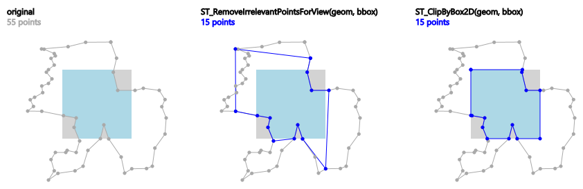
Example: ST_RemoveIrrelevantPointsForView() applied to a polygon. Blue points remain, the rendering result (light-blue area) within the grey view box remains as well.
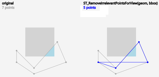
Example: Due to the fact that points are just sorted out and no new points are computed, the result of ST_RemoveIrrelevantPointsForView() may contain self-intersections.
Availability: 3.5.0
Esempi
SELECT ST_AsText(
ST_RemoveIrrelevantPointsForView(
ST_GeomFromText('MULTIPOLYGON(((10 10, 20 10, 30 10, 40 10, 20 20, 10 20, 10 10)),((10 10, 20 10, 20 20, 10 20, 10 10)))'),
ST_MakeEnvelope(12,12,18,18), true));
st_astext
---------
MULTIPOLYGON(((10 10,40 10,20 20,10 20,10 10)),((10 10,20 10,20 20,10 20,10 10)))
SELECT ST_AsText(
ST_RemoveIrrelevantPointsForView(
ST_GeomFromText('MULTILINESTRING((0 0, 10 0,20 0,30 0), (0 15, 5 15, 10 15, 15 15, 20 15, 25 15, 30 15, 40 15), (13 13,15 15,17 17))'),
ST_MakeEnvelope(12,12,18,18), true));
st_astext
---------
MULTILINESTRING((10 15,15 15,20 15),(13 13,15 15,17 17))
SELECT ST_AsText(
ST_RemoveIrrelevantPointsForView(
ST_GeomFromText('LINESTRING(0 0, 10 0,20 0,30 0)'),
ST_MakeEnvelope(12,12,18,18), true));
st_astext
---------
LINESTRING EMPTY
SELECT ST_AsText(
ST_RemoveIrrelevantPointsForView(
ST_GeomFromText('POLYGON((0 30, 15 30, 30 30, 30 0, 0 0, 0 30))'),
ST_MakeEnvelope(12,12,18,18), true));
st_astext
---------
POLYGON((15 30,30 0,0 0,15 30))
SELECT ST_AsText(
ST_RemoveIrrelevantPointsForView(
ST_GeomFromText('POLYGON((0 30, 15 30, 30 30, 30 0, 0 0, 0 30))'),
ST_MakeEnvelope(12,12,18,18)));
st_astext
---------
POLYGON((0 30,30 30,30 0,0 0,0 30))
Si veda anche
Name
ST_RemoveSmallParts — Removes small parts (polygon rings or linestrings) of a geometry.
Synopsis
geometry ST_RemoveSmallParts(geometry geom, double precision minSizeX, double precision minSizeY);
Descrizione
Returns a geometry without small parts (exterior or interior polygon rings, or linestrings).
This function can be used as preprocessing step for creating simplified maps, e. g. to remove small islands or holes.
It evaluates only geometries of type (MULTI)POLYGON and (MULTI)LINESTRING. Other geometries remain unchanged.
If minSizeX is greater than 0, parts are sorted out if their width is smaller than minSizeX.
If minSizeY is greater than 0, parts are sorted out if their height is smaller than minSizeY.
Both minSizeX and minSizeY are measured in coordinate system units of the geometry.
For polygon types, evaluation is done separately for each ring which can lead to one of the following results:
the original geometry,
a POLYGON with all rings with less vertices,
a POLYGON with a reduced number of interior rings (having possibly less vertices),
a POLYGON EMPTY, or
a MULTIPOLYGON with a reduced number of polygons (having possibly less interior rings or vertices), or
a MULTIPOLYGON EMPTY.
For linestring types, evaluation is done for each linestring which can lead to one of the following results:
the original geometry,
a LINESTRING with a reduced number of vertices,
a LINESTRING EMPTY,
a MULTILINESTRING with a reduced number of linestrings (having possibly less vertices), or
a MULTILINESTRING EMPTY.
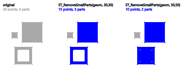
Example: ST_RemoveSmallParts() applied to a multi-polygon. Blue parts remain.
Availability: 3.5.0
Esempi
SELECT ST_AsText(
ST_RemoveSmallParts(
ST_GeomFromText('MULTIPOLYGON(
((60 160, 120 160, 120 220, 60 220, 60 160), (70 170, 70 210, 110 210, 110 170, 70 170)),
((85 75, 155 75, 155 145, 85 145, 85 75)),
((50 110, 70 110, 70 130, 50 130, 50 110)))'),
50, 50));
st_astext
---------
MULTIPOLYGON(((60 160,120 160,120 220,60 220,60 160)),((85 75,155 75,155 145,85 145,85 75)))
SELECT ST_AsText(
ST_RemoveSmallParts(
ST_GeomFromText('LINESTRING(10 10, 20 20)'),
50, 50));
st_astext
---------
LINESTRING EMPTY
Name
ST_Reverse — Return the geometry with vertex order reversed.
Synopsis
geometry ST_Reverse(geometry g1);
Descrizione
Can be used on any geometry and reverses the order of the vertices.
Enhanced: 2.4.0 support for curves was introduced.
Questa funzione supporta il 3d e non distrugge gli z-index.
Questa funzione supporta le Polyhedral Surface.
Esempi
SELECT ST_AsText(geom) as line, ST_AsText(ST_Reverse(geom)) As reverseline
FROM
(SELECT ST_MakeLine(ST_Point(1,2),
ST_Point(1,10)) As geom) as foo;
--result
line | reverseline
---------------------+----------------------
LINESTRING(1 2,1 10) | LINESTRING(1 10,1 2)
Name
ST_Segmentize — Returns a modified geometry/geography having no segment longer than a given distance.
Synopsis
geometry ST_Segmentize(geometry geom, float max_segment_length);
geography ST_Segmentize(geography geog, float max_segment_length);
Descrizione
Returns a modified geometry/geography having no segment longer than max_segment_length. Length is computed in 2D. Segments are always split into equal-length subsegments.
For geometry, the maximum length is in the units of the spatial reference system.
For geography, the maximum length is in meters. Distances are computed on the sphere. Added vertices are created along the spherical great-circle arcs defined by segment endpoints.
| |
This only shortens long segments. It does not lengthen segments shorter than the maximum length. |
| |
For inputs containing long segments, specifying a relatively short |
Availability: 1.2.2
Enhanced: 3.0.0 Segmentize geometry now produces equal-length subsegments
Enhanced: 2.3.0 Segmentize geography now produces equal-length subsegments
Enhanced: 2.1.0 support for geography was introduced.
Changed: 2.1.0 As a result of the introduction of geography support, the usage ST_Segmentize('LINESTRING(1 2, 3 4)', 0.5) causes an ambiguous function error. The input needs to be properly typed as a geometry or geography. Use ST_GeomFromText, ST_GeogFromText or a cast to the required type (e.g. ST_Segmentize('LINESTRING(1 2, 3 4)'::geometry, 0.5) )
Esempi
Segmentizing a line. Long segments are split evenly, and short segments are not split.
SELECT ST_AsText(ST_Segmentize(
'MULTILINESTRING((0 0, 0 1, 0 9),(1 10, 1 18))'::geometry,
5 ) );
---------------------------------------------------
MULTILINESTRING((0 0,0 1,0 5,0 9),(1 10,1 14,1 18))
Segmentizing a polygon:
SELECT ST_AsText(
ST_Segmentize(('POLYGON((0 0, 0 8, 30 0, 0 0))'::geometry), 10));
-------------------------------------------------------
POLYGON((0 0,0 8,7.5 6,15 4,22.5 2,30 0,20 0,10 0,0 0))
Segmentizing a geographic line, using a maximum segment length of 2000 kilometers. Vertices are added along the great-circle arc connecting the endpoints.
SELECT ST_AsText(
ST_Segmentize(('LINESTRING (0 0, 60 60)'::geography), 2000000));
-------------------------------------------------------------
LINESTRING(0 0,4.252632294621186 8.43596525986862,8.69579947419404 16.824093489701564,13.550465473227048 25.107950473646188,19.1066053508691 33.21091076089908,25.779290201459894 41.01711439406505,34.188839517966954 48.337222885886,45.238153936612264 54.84733442373889,60 60)
A geographic line segmentized along a great circle arc
Si veda anche
Name
ST_SetPoint — Replace point of a linestring with a given point.
Synopsis
geometry ST_SetPoint(geometry linestring, integer zerobasedposition, geometry point);
Descrizione
Replace point N of linestring with given point. Index is 0-based.Negative index are counted backwards, so that -1 is last point. This is especially useful in triggers when trying to maintain relationship of joints when one vertex moves.
Disponibilità: 1.1.0
Updated 2.3.0 : negative indexing
Questa funzione supporta il 3d e non distrugge gli z-index.
Esempi
--Change first point in line string from -1 3 to -1 1
SELECT ST_AsText(ST_SetPoint('LINESTRING(-1 2,-1 3)', 0, 'POINT(-1 1)'));
st_astext
-----------------------
LINESTRING(-1 1,-1 3)
---Change last point in a line string (lets play with 3d linestring this time)
SELECT ST_AsEWKT(ST_SetPoint(foo.geom, ST_NumPoints(foo.geom) - 1, ST_GeomFromEWKT('POINT(-1 1 3)')))
FROM (SELECT ST_GeomFromEWKT('LINESTRING(-1 2 3,-1 3 4, 5 6 7)') As geom) As foo;
st_asewkt
-----------------------
LINESTRING(-1 2 3,-1 3 4,-1 1 3)
SELECT ST_AsText(ST_SetPoint(g, -3, p))
FROM ST_GEomFromText('LINESTRING(0 0, 1 1, 2 2, 3 3, 4 4)') AS g
, ST_PointN(g,1) as p;
st_astext
-----------------------
LINESTRING(0 0,1 1,0 0,3 3,4 4)
Si veda anche
ST_AddPoint, ST_NPoints, ST_NumPoints, ST_PointN, ST_RemovePoint
Name
ST_ShiftLongitude — Shifts the longitude coordinates of a geometry between -180..180 and 0..360.
Synopsis
geometry ST_ShiftLongitude(geometry geom);
Descrizione
Reads every point/vertex in a geometry, and shifts its longitude coordinate from -180..0 to 180..360 and vice versa if between these ranges. This function is symmetrical so the result is a 0..360 representation of a -180..180 data and a -180..180 representation of a 0..360 data.
| |
This is only useful for data with coordinates in longitude/latitude; e.g. SRID 4326 (WGS 84 geographic) |
| |
Pre-1.3.4 bug prevented this from working for MULTIPOINT. 1.3.4+ works with MULTIPOINT as well. |
Questa funzione supporta il 3d e non distrugge gli z-index.
Miglioramento nella version 2.0.0: introdotto il supporto per superfici poliedriche e TIN.
NOTE: this function was renamed from "ST_Shift_Longitude" in 2.2.0
Questa funzione supporta le Polyhedral Surface.
Questa funzione supporta i Triangoli e le Triangulated Irregular Network Surfaces (TIN).
Esempi
--single point forward transformation
SELECT ST_AsText(ST_ShiftLongitude('SRID=4326;POINT(270 0)'::geometry))
st_astext
----------
POINT(-90 0)
--single point reverse transformation
SELECT ST_AsText(ST_ShiftLongitude('SRID=4326;POINT(-90 0)'::geometry))
st_astext
----------
POINT(270 0)
--for linestrings the functions affects only to the sufficient coordinates
SELECT ST_AsText(ST_ShiftLongitude('SRID=4326;LINESTRING(174 12, 182 13)'::geometry))
st_astext
----------
LINESTRING(174 12,-178 13)
Si veda anche
Name
ST_WrapX — Wrap a geometry around an X value.
Synopsis
geometry ST_WrapX(geometry geom, float8 wrap, float8 move);
Descrizione
This function splits the input geometries and then moves every resulting component falling on the right (for negative 'move') or on the left (for positive 'move') of given 'wrap' line in the direction specified by the 'move' parameter, finally re-unioning the pieces together.
| |
This is useful to "recenter" long-lat input to have features of interest not spawned from one side to the other. |
Availability: 2.3.0 requires GEOS
Questa funzione supporta il 3d e non distrugge gli z-index.
Esempi
-- Move all components of the given geometries whose bounding box
-- falls completely on the left of x=0 to +360
select ST_WrapX(geom, 0, 360);
-- Move all components of the given geometries whose bounding box
-- falls completely on the left of x=-30 to +360
select ST_WrapX(geom, -30, 360);
Si veda anche
Name
ST_SnapToGrid — Snap all points of the input geometry to a regular grid.
Synopsis
geometry ST_SnapToGrid(geometry geomA, float originX, float originY, float sizeX, float sizeY);
geometry ST_SnapToGrid(geometry geomA, float sizeX, float sizeY);
geometry ST_SnapToGrid(geometry geomA, float size);
geometry ST_SnapToGrid(geometry geomA, geometry pointOrigin, float sizeX, float sizeY, float sizeZ, float sizeM);
Descrizione
Variant 1,2,3: Snap all points of the input geometry to the grid defined by its origin and cell size. Remove consecutive points falling on the same cell, eventually returning NULL if output points are not enough to define a geometry of the given type. Collapsed geometries in a collection are stripped from it. Useful for reducing precision.
Variant 4: Introduced 1.1.0 - Snap all points of the input geometry to the grid defined by its origin (the second argument, must be a point) and cell sizes. Specify 0 as size for any dimension you don't want to snap to a grid.
| |
The returned geometry might lose its simplicity (see ST_IsSimple). |
| |
Before release 1.1.0 this function always returned a 2d geometry. Starting at 1.1.0 the returned geometry will have same dimensionality as the input one with higher dimension values untouched. Use the version taking a second geometry argument to define all grid dimensions. |
Disponibilità: dalla versione 1.0.0RC1
Availability: 1.1.0 - Z and M support
Questa funzione supporta il 3d e non distrugge gli z-index.
Esempi
--Snap your geometries to a precision grid of 10^-3
UPDATE mytable
SET geom = ST_SnapToGrid(geom, 0.001);
SELECT ST_AsText(ST_SnapToGrid(
ST_GeomFromText('LINESTRING(1.1115678 2.123, 4.111111 3.2374897, 4.11112 3.23748667)'),
0.001)
);
st_astext
-------------------------------------
LINESTRING(1.112 2.123,4.111 3.237)
--Snap a 4d geometry
SELECT ST_AsEWKT(ST_SnapToGrid(
ST_GeomFromEWKT('LINESTRING(-1.1115678 2.123 2.3456 1.11111,
4.111111 3.2374897 3.1234 1.1111, -1.11111112 2.123 2.3456 1.1111112)'),
ST_GeomFromEWKT('POINT(1.12 2.22 3.2 4.4444)'),
0.1, 0.1, 0.1, 0.01) );
st_asewkt
------------------------------------------------------------------------------
LINESTRING(-1.08 2.12 2.3 1.1144,4.12 3.22 3.1 1.1144,-1.08 2.12 2.3 1.1144)
--With a 4d geometry - the ST_SnapToGrid(geom,size) only touches x and y coords but keeps m and z the same
SELECT ST_AsEWKT(ST_SnapToGrid(ST_GeomFromEWKT('LINESTRING(-1.1115678 2.123 3 2.3456,
4.111111 3.2374897 3.1234 1.1111)'),
0.01) );
st_asewkt
---------------------------------------------------------
LINESTRING(-1.11 2.12 3 2.3456,4.11 3.24 3.1234 1.1111)
Si veda anche
ST_Snap, ST_AsEWKT, ST_AsText, ST_GeomFromText, ST_GeomFromEWKT, ST_Simplify
Name
ST_Snap — Snap segments and vertices of input geometry to vertices of a reference geometry.
Synopsis
geometry ST_Snap(geometry input, geometry reference, float tolerance);
Descrizione
Snaps the vertices and segments of a geometry to another Geometry's vertices. A snap distance tolerance is used to control where snapping is performed. The result geometry is the input geometry with the vertices snapped. If no snapping occurs then the input geometry is returned unchanged.
Snapping one geometry to another can improve robustness for overlay operations by eliminating nearly-coincident edges (which cause problems during noding and intersection calculation).
Too much snapping can result in invalid topology being created, so the number and location of snapped vertices is decided using heuristics to determine when it is safe to snap. This can result in some potential snaps being omitted, however.
| |
The returned geometry might lose its simplicity (see ST_IsSimple) and validity (see ST_IsValid). |
Eseguito dal modulo GEOS.
Disponibilità: 2.0.0
Esempi
 A multipolygon shown with a linestring (before any snapping) | |
 A multipolygon snapped to linestring to tolerance: 1.01 of distance. The new multipolygon is shown with reference linestring
SELECT ST_AsText(ST_Snap(poly,line, ST_Distance(poly,line)*1.01)) AS polysnapped
FROM (SELECT
ST_GeomFromText('MULTIPOLYGON(
((26 125, 26 200, 126 200, 126 125, 26 125 ),
( 51 150, 101 150, 76 175, 51 150 )),
(( 151 100, 151 200, 176 175, 151 100 )))') As poly,
ST_GeomFromText('LINESTRING (5 107, 54 84, 101 100)') As line
) As foo;
polysnapped
---------------------------------------------------------------------
MULTIPOLYGON(((26 125,26 200,126 200,126 125,101 100,26 125),
(51 150,101 150,76 175,51 150)),((151 100,151 200,176 175,151 100)))
|  A multipolygon snapped to linestring to tolerance: 1.25 of distance. The new multipolygon is shown with reference linestring
SELECT ST_AsText(
ST_Snap(poly,line, ST_Distance(poly,line)*1.25)
) AS polysnapped
FROM (SELECT
ST_GeomFromText('MULTIPOLYGON(
(( 26 125, 26 200, 126 200, 126 125, 26 125 ),
( 51 150, 101 150, 76 175, 51 150 )),
(( 151 100, 151 200, 176 175, 151 100 )))') As poly,
ST_GeomFromText('LINESTRING (5 107, 54 84, 101 100)') As line
) As foo;
polysnapped
---------------------------------------------------------------------
MULTIPOLYGON(((5 107,26 200,126 200,126 125,101 100,54 84,5 107),
(51 150,101 150,76 175,51 150)),((151 100,151 200,176 175,151 100)))
|
 The linestring snapped to the original multipolygon at tolerance 1.01 of distance. The new linestring is shown with reference multipolygon
SELECT ST_AsText(
ST_Snap(line, poly, ST_Distance(poly,line)*1.01)
) AS linesnapped
FROM (SELECT
ST_GeomFromText('MULTIPOLYGON(
((26 125, 26 200, 126 200, 126 125, 26 125),
(51 150, 101 150, 76 175, 51 150 )),
((151 100, 151 200, 176 175, 151 100)))') As poly,
ST_GeomFromText('LINESTRING (5 107, 54 84, 101 100)') As line
) As foo;
linesnapped
----------------------------------------
LINESTRING(5 107,26 125,54 84,101 100)
|  The linestring snapped to the original multipolygon at tolerance 1.25 of distance. The new linestring is shown with reference multipolygon
SELECT ST_AsText(
ST_Snap(line, poly, ST_Distance(poly,line)*1.25)
) AS linesnapped
FROM (SELECT
ST_GeomFromText('MULTIPOLYGON(
(( 26 125, 26 200, 126 200, 126 125, 26 125 ),
(51 150, 101 150, 76 175, 51 150 )),
((151 100, 151 200, 176 175, 151 100 )))') As poly,
ST_GeomFromText('LINESTRING (5 107, 54 84, 101 100)') As line
) As foo;
linesnapped
---------------------------------------
LINESTRING(26 125,54 84,101 100)
|
Si veda anche
Name
ST_SwapOrdinates — Returns a version of the given geometry with given ordinate values swapped.
Synopsis
geometry ST_SwapOrdinates(geometry geom, cstring ords);
Descrizione
Returns a version of the given geometry with given ordinates swapped.
The ords parameter is a 2-characters string naming the ordinates to swap. Valid names are: x,y,z and m.
Disponibilità: 2.2.0
Questo metodo supporta le Curve e le Circular String.
Questa funzione supporta il 3d e non distrugge gli z-index.
Questa funzione supporta le coordinate M.
Questa funzione supporta le Polyhedral Surface.
Questa funzione supporta i Triangoli e le Triangulated Irregular Network Surfaces (TIN).
Esempio
-- Scale M value by 2
SELECT ST_AsText(
ST_SwapOrdinates(
ST_Scale(
ST_SwapOrdinates(g,'xm'),
2, 1
),
'xm')
) FROM ( SELECT 'POINT ZM (0 0 0 2)'::geometry g ) foo;
st_astext
--------------------
POINT ZM (0 0 0 4)
Si veda anche
7.6. Geometry Validation
These functions test whether geometries are valid according to the OGC SFS standard. They also provide information about the nature and location of invalidity. There is also a function to create a valid geometry out of an invalid one.
- ST_IsValid — Tests if a geometry is well-formed in 2D.
- ST_IsValidDetail — Returns a
valid_detailrow stating if a geometry is valid or if not a reason and a location. - ST_IsValidReason — Returns text stating if a geometry is valid, or a reason for invalidity.
- ST_MakeValid — Attempts to make an invalid geometry valid without losing vertices.
Name
ST_IsValid — Tests if a geometry is well-formed in 2D.
Synopsis
boolean ST_IsValid(geometry g);
boolean ST_IsValid(geometry g, integer flags);
Descrizione
Tests if an ST_Geometry value is well-formed and valid in 2D according to the OGC rules. For geometries with 3 and 4 dimensions, the validity is still only tested in 2 dimensions. For geometries that are invalid, a PostgreSQL NOTICE is emitted providing details of why it is not valid.
For the version with the flags parameter, supported values are documented in ST_IsValidDetail This version does not print a NOTICE explaining invalidity.
For more information on the definition of geometry validity, refer to Section 4.4, “Geometry Validation”
| |
SQL-MM defines the result of ST_IsValid(NULL) to be 0, while PostGIS returns NULL. |
Eseguito dal modulo GEOS.
The version accepting flags is available starting with 2.0.0.
Questo metodo implementa le OGC Simple Features Implementation Specification for SQL 1.1.
Questo metodo implementa la specifica SQL/MM. SQL-MM 3: 5.1.9
| |
Neither OGC-SFS nor SQL-MM specifications include a flag argument for ST_IsValid. The flag is a PostGIS extension. |
Esempi
SELECT ST_IsValid(ST_GeomFromText('LINESTRING(0 0, 1 1)')) As good_line,
ST_IsValid(ST_GeomFromText('POLYGON((0 0, 1 1, 1 2, 1 1, 0 0))')) As bad_poly
--results
NOTICE: Self-intersection at or near point 0 0
good_line | bad_poly
-----------+----------
t | f
Si veda anche
Name
ST_IsValidDetail — Returns a valid_detail row stating if a geometry is valid or if not a reason and a location.
Synopsis
valid_detail ST_IsValidDetail(geometry geom, integer flags);
Descrizione
Returns a valid_detail row, containing a boolean (valid) stating if a geometry is valid, a varchar (reason) stating a reason why it is invalid and a geometry (location) pointing out where it is invalid.
Useful to improve on the combination of ST_IsValid and ST_IsValidReason to generate a detailed report of invalid geometries.
The optional flags parameter is a bitfield. It can have the following values:
0: Use usual OGC SFS validity semantics.
1: Consider certain kinds of self-touching rings (inverted shells and exverted holes) as valid. This is also known as "the ESRI flag", since this is the validity model used by those tools. Note that this is invalid under the OGC model.
Eseguito dal modulo GEOS.
Disponibilità: 2.0.0
Esempi
--First 3 Rejects from a successful quintuplet experiment
SELECT gid, reason(ST_IsValidDetail(geom)), ST_AsText(location(ST_IsValidDetail(geom))) as location
FROM
(SELECT ST_MakePolygon(ST_ExteriorRing(e.buff), array_agg(f.line)) As geom, gid
FROM (SELECT ST_Buffer(ST_Point(x1*10,y1), z1) As buff, x1*10 + y1*100 + z1*1000 As gid
FROM generate_series(-4,6) x1
CROSS JOIN generate_series(2,5) y1
CROSS JOIN generate_series(1,8) z1
WHERE x1
> y1*0.5 AND z1 < x1*y1) As e
INNER JOIN (SELECT ST_Translate(ST_ExteriorRing(ST_Buffer(ST_Point(x1*10,y1), z1)),y1*1, z1*2) As line
FROM generate_series(-3,6) x1
CROSS JOIN generate_series(2,5) y1
CROSS JOIN generate_series(1,10) z1
WHERE x1
> y1*0.75 AND z1 < x1*y1) As f
ON (ST_Area(e.buff)
> 78 AND ST_Contains(e.buff, f.line))
GROUP BY gid, e.buff) As quintuplet_experiment
WHERE ST_IsValid(geom) = false
ORDER BY gid
LIMIT 3;
gid | reason | location
------+-------------------+-------------
5330 | Self-intersection | POINT(32 5)
5340 | Self-intersection | POINT(42 5)
5350 | Self-intersection | POINT(52 5)
--simple example
SELECT * FROM ST_IsValidDetail('LINESTRING(220227 150406,2220227 150407,222020 150410)');
valid | reason | location
-------+--------+----------
t | |
Si veda anche
Name
ST_IsValidReason — Returns text stating if a geometry is valid, or a reason for invalidity.
Synopsis
text ST_IsValidReason(geometry geomA);
text ST_IsValidReason(geometry geomA, integer flags);
Descrizione
Returns text stating if a geometry is valid, or if invalid a reason why.
Useful in combination with ST_IsValid to generate a detailed report of invalid geometries and reasons.
Allowed flags are documented in ST_IsValidDetail.
Eseguito dal modulo GEOS.
Availability: 1.4
Availability: 2.0 version taking flags.
Esempi
-- invalid bow-tie polygon
SELECT ST_IsValidReason(
'POLYGON ((100 200, 100 100, 200 200,
200 100, 100 200))'::geometry) as validity_info;
validity_info
--------------------------
Self-intersection[150 150]
--First 3 Rejects from a successful quintuplet experiment
SELECT gid, ST_IsValidReason(geom) as validity_info
FROM
(SELECT ST_MakePolygon(ST_ExteriorRing(e.buff), array_agg(f.line)) As geom, gid
FROM (SELECT ST_Buffer(ST_Point(x1*10,y1), z1) As buff, x1*10 + y1*100 + z1*1000 As gid
FROM generate_series(-4,6) x1
CROSS JOIN generate_series(2,5) y1
CROSS JOIN generate_series(1,8) z1
WHERE x1
> y1*0.5 AND z1 < x1*y1) As e
INNER JOIN (SELECT ST_Translate(ST_ExteriorRing(ST_Buffer(ST_Point(x1*10,y1), z1)),y1*1, z1*2) As line
FROM generate_series(-3,6) x1
CROSS JOIN generate_series(2,5) y1
CROSS JOIN generate_series(1,10) z1
WHERE x1
> y1*0.75 AND z1 < x1*y1) As f
ON (ST_Area(e.buff)
> 78 AND ST_Contains(e.buff, f.line))
GROUP BY gid, e.buff) As quintuplet_experiment
WHERE ST_IsValid(geom) = false
ORDER BY gid
LIMIT 3;
gid | validity_info
------+--------------------------
5330 | Self-intersection [32 5]
5340 | Self-intersection [42 5]
5350 | Self-intersection [52 5]
--simple example
SELECT ST_IsValidReason('LINESTRING(220227 150406,2220227 150407,222020 150410)');
st_isvalidreason
------------------
Valid Geometry
Si veda anche
Name
ST_MakeValid — Attempts to make an invalid geometry valid without losing vertices.
Synopsis
geometry ST_MakeValid(geometry input);
geometry ST_MakeValid(geometry input, text params);
Descrizione
The function attempts to create a valid representation of a given invalid geometry without losing any of the input vertices. Valid geometries are returned unchanged.
Supported inputs are: POINTS, MULTIPOINTS, LINESTRINGS, MULTILINESTRINGS, POLYGONS, MULTIPOLYGONS and GEOMETRYCOLLECTIONS containing any mix of them.
In case of full or partial dimensional collapses, the output geometry may be a collection of lower-to-equal dimension geometries, or a geometry of lower dimension.
Single polygons may become multi-geometries in case of self-intersections.
The params argument can be used to supply an options string to select the method to use for building valid geometry. The options string is in the format "method=linework|structure keepcollapsed=true|false". If no "params" argument is provided, the "linework" algorithm will be used as the default.
The "method" key has two values.
"linework" is the original algorithm, and builds valid geometries by first extracting all lines, noding that linework together, then building a value output from the linework.
"structure" is an algorithm that distinguishes between interior and exterior rings, building new geometry by unioning exterior rings, and then differencing all interior rings.
The "keepcollapsed" key is only valid for the "structure" algorithm, and takes a value of "true" or "false". When set to "false", geometry components that collapse to a lower dimensionality, for example a one-point linestring would be dropped.
Eseguito dal modulo GEOS.
Disponibilità: 2.0.0
Enhanced: 2.0.1, speed improvements
Enhanced: 2.1.0, added support for GEOMETRYCOLLECTION and MULTIPOINT.
Enhanced: 3.1.0, added removal of Coordinates with NaN values.
Enhanced: 3.2.0, added algorithm options, 'linework' and 'structure' which requires GEOS >= 3.10.0.
Questa funzione supporta il 3d e non distrugge gli z-index.
Esempi
 before_geom: MULTIPOLYGON of 2 overlapping polygons
 after_geom: MULTIPOLYGON of 4 non-overlapping polygons
 after_geom_structure: MULTIPOLYGON of 1 non-overlapping polygon
SELECT f.geom AS before_geom, ST_MakeValid(f.geom) AS after_geom, ST_MakeValid(f.geom, 'method=structure') AS after_geom_structure FROM (SELECT 'MULTIPOLYGON(((186 194,187 194,188 195,189 195,190 195, 191 195,192 195,193 194,194 194,194 193,195 192,195 191, 195 190,195 189,195 188,194 187,194 186,14 6,13 6,12 5,11 5, 10 5,9 5,8 5,7 6,6 6,6 7,5 8,5 9,5 10,5 11,5 12,6 13,6 14,186 194)), ((150 90,149 80,146 71,142 62,135 55,128 48,119 44,110 41,100 40, 90 41,81 44,72 48,65 55,58 62,54 71,51 80,50 90,51 100, 54 109,58 118,65 125,72 132,81 136,90 139,100 140,110 139, 119 136,128 132,135 125,142 118,146 109,149 100,150 90)))'::geometry AS geom) AS f;
|
 before_geom: MULTIPOLYGON of 6 overlapping polygons
 after_geom: MULTIPOLYGON of 14 Non-overlapping polygons
 after_geom_structure: MULTIPOLYGON of 1 Non-overlapping polygon
SELECT c.geom AS before_geom,
ST_MakeValid(c.geom) AS after_geom,
ST_MakeValid(c.geom, 'method=structure') AS after_geom_structure
FROM (SELECT 'MULTIPOLYGON(((91 50,79 22,51 10,23 22,11 50,23 78,51 90,79 78,91 50)),
((91 100,79 72,51 60,23 72,11 100,23 128,51 140,79 128,91 100)),
((91 150,79 122,51 110,23 122,11 150,23 178,51 190,79 178,91 150)),
((141 50,129 22,101 10,73 22,61 50,73 78,101 90,129 78,141 50)),
((141 100,129 72,101 60,73 72,61 100,73 128,101 140,129 128,141 100)),
((141 150,129 122,101 110,73 122,61 150,73 178,101 190,129 178,141 150)))'::geometry AS geom) AS c;
|
Esempi
SELECT ST_AsText(ST_MakeValid(
'LINESTRING(0 0, 0 0)',
'method=structure keepcollapsed=true'
));
st_astext
------------
POINT(0 0)
SELECT ST_AsText(ST_MakeValid(
'LINESTRING(0 0, 0 0)',
'method=structure keepcollapsed=false'
));
st_astext
------------------
LINESTRING EMPTYSi veda anche
7.7. Spatial Reference System Functions
These functions work with the Spatial Reference System of geometries as defined in the spatial_ref_sys table.
- ST_InverseTransformPipeline — Return a new geometry with coordinates transformed to a different spatial reference system using the inverse of a defined coordinate transformation pipeline.
- ST_SetSRID — Set the SRID on a geometry.
- ST_SRID — Returns the spatial reference identifier for a geometry.
- ST_Transform — Return a new geometry with coordinates transformed to a different spatial reference system.
- ST_TransformPipeline — Return a new geometry with coordinates transformed to a different spatial reference system using a defined coordinate transformation pipeline.
- postgis_srs_codes — Return the list of SRS codes associated with the given authority.
- postgis_srs — Return a metadata record for the requested authority and srid.
- postgis_srs_all — Return metadata records for every spatial reference system in the underlying Proj database.
- postgis_srs_search — Return metadata records for projected coordinate systems that have areas of usage that fully contain the bounds parameter.
Name
ST_InverseTransformPipeline — Return a new geometry with coordinates transformed to a different spatial reference system using the inverse of a defined coordinate transformation pipeline.
Synopsis
geometry ST_InverseTransformPipeline(geometry geom, text pipeline, integer to_srid);
Descrizione
Return a new geometry with coordinates transformed to a different spatial reference system using a defined coordinate transformation pipeline to go in the inverse direction.
Refer to ST_TransformPipeline for details on writing a transformation pipeline.
Disponibilità: 3.4.0
The SRID of the input geometry is ignored, and the SRID of the output geometry will be set to zero unless a value is provided via the optional to_srid parameter. When using ST_TransformPipeline the pipeline is executed in a forward direction. Using `ST_InverseTransformPipeline()` the pipeline is executed in the inverse direction.
Transforms using pipelines are a specialised version of ST_Transform. In most cases `ST_Transform` will choose the correct operations to convert between coordinate systems, and should be preferred.
Esempi
Change WGS 84 long lat to UTM 31N using the EPSG:16031 conversion
-- Inverse direction
SELECT ST_AsText(ST_InverseTransformPipeline('POINT(426857.9877165967 5427937.523342293)'::geometry,
'urn:ogc:def:coordinateOperation:EPSG::16031')) AS wgs_geom;
wgs_geom
----------------------------
POINT(2 48.99999999999999)
(1 row)
GDA2020 example.
-- using ST_Transform with automatic selection of a conversion pipeline.
SELECT ST_AsText(ST_Transform('SRID=4939;POINT(143.0 -37.0)'::geometry, 7844)) AS gda2020_auto;
gda2020_auto
-----------------------------------------------
POINT(143.00000635638918 -36.999986706128176)
(1 row)
Si veda anche
Name
ST_SetSRID — Set the SRID on a geometry.
Synopsis
geometry ST_SetSRID(geometry geom, integer srid);
Descrizione
Sets the SRID on a geometry to a particular integer value. Useful in constructing bounding boxes for queries.
| |
This function does not transform the geometry coordinates in any way - it simply sets the meta data defining the spatial reference system the geometry is assumed to be in. Use ST_Transform if you want to transform the geometry into a new projection. |
Questo metodo implementa le OGC Simple Features Implementation Specification for SQL 1.1.
Questo metodo supporta le Curve e le Circular String.
Esempi
-- Mark a point as WGS 84 long lat --
SELECT ST_SetSRID(ST_Point(-123.365556, 48.428611),4326) As wgs84long_lat;
-- the ewkt representation (wrap with ST_AsEWKT) -
SRID=4326;POINT(-123.365556 48.428611)
-- Mark a point as WGS 84 long lat and then transform to web mercator (Spherical Mercator) --
SELECT ST_Transform(ST_SetSRID(ST_Point(-123.365556, 48.428611),4326),3785) As spere_merc;
-- the ewkt representation (wrap with ST_AsEWKT) -
SRID=3785;POINT(-13732990.8753491 6178458.96425423)
Name
ST_SRID — Returns the spatial reference identifier for a geometry.
Synopsis
integer ST_SRID(geometry g1);
Descrizione
Returns the spatial reference identifier for the ST_Geometry as defined in spatial_ref_sys table. Section 4.5, “Spatial Reference Systems”
| |
spatial_ref_sys table is a table that catalogs all spatial reference systems known to PostGIS and is used for transformations from one spatial reference system to another. So verifying you have the right spatial reference system identifier is important if you plan to ever transform your geometries. |
Questo metodo implementa le OGC Simple Features Implementation Specification for SQL 1.1. s2.1.1.1
Questo metodo implementa la specifica SQL/MM. SQL-MM 3: 5.1.5
Questo metodo supporta le Curve e le Circular String.
Esempi
SELECT ST_SRID(ST_GeomFromText('POINT(-71.1043 42.315)',4326));
--result
4326
Si veda anche
Section 4.5, “Spatial Reference Systems”, ST_SetSRID, ST_Transform, ST_SRID, ST_SRID
Name
ST_Transform — Return a new geometry with coordinates transformed to a different spatial reference system.
Synopsis
geometry ST_Transform(geometry g1, integer srid);
geometry ST_Transform(geometry geom, text to_proj);
geometry ST_Transform(geometry geom, text from_proj, text to_proj);
geometry ST_Transform(geometry geom, text from_proj, integer to_srid);
Descrizione
Returns a new geometry with its coordinates transformed to a different spatial reference system. The destination spatial reference to_srid may be identified by a valid SRID integer parameter (i.e. it must exist in the spatial_ref_sys table). Alternatively, a spatial reference defined as a PROJ.4 string can be used for to_proj and/or from_proj, however these methods are not optimized. If the destination spatial reference system is expressed with a PROJ.4 string instead of an SRID, the SRID of the output geometry will be set to zero. With the exception of functions with from_proj, input geometries must have a defined SRID.
ST_Transform is often confused with ST_SetSRID. ST_Transform actually changes the coordinates of a geometry from one spatial reference system to another, while ST_SetSRID() simply changes the SRID identifier of the geometry.
ST_Transform automatically selects a suitable conversion pipeline given the source and target spatial reference systems. To use a specific conversion method, use ST_TransformPipeline.
| |
Requires PostGIS be compiled with PROJ support. Use PostGIS_Full_Version to confirm you have PROJ support compiled in. |
| |
If using more than one transformation, it is useful to have a functional index on the commonly used transformations to take advantage of index usage. |
| |
Prior to 1.3.4, this function crashes if used with geometries that contain CURVES. This is fixed in 1.3.4+ |
Miglioramento: nella versione 2.0.0 è stato introdotto il supporto per le superfici poliedriche.
Enhanced: 2.3.0 support for direct PROJ.4 text was introduced.
Questo metodo implementa la specifica SQL/MM. SQL-MM 3: 5.1.6
Questo metodo supporta le Curve e le Circular String.
Questa funzione supporta le Polyhedral Surface.
Esempi
Change Massachusetts state plane US feet geometry to WGS 84 long lat
SELECT ST_AsText(ST_Transform(ST_GeomFromText('POLYGON((743238 2967416,743238 2967450,
743265 2967450,743265.625 2967416,743238 2967416))',2249),4326)) As wgs_geom;
wgs_geom
---------------------------
POLYGON((-71.1776848522251 42.3902896512902,-71.1776843766326 42.3903829478009,
-71.1775844305465 42.3903826677917,-71.1775825927231 42.3902893647987,-71.177684
8522251 42.3902896512902));
(1 row)
--3D Circular String example
SELECT ST_AsEWKT(ST_Transform(ST_GeomFromEWKT('SRID=2249;CIRCULARSTRING(743238 2967416 1,743238 2967450 2,743265 2967450 3,743265.625 2967416 3,743238 2967416 4)'),4326));
st_asewkt
--------------------------------------------------------------------------------------
SRID=4326;CIRCULARSTRING(-71.1776848522251 42.3902896512902 1,-71.1776843766326 42.3903829478009 2,
-71.1775844305465 42.3903826677917 3,
-71.1775825927231 42.3902893647987 3,-71.1776848522251 42.3902896512902 4)
Example of creating a partial functional index. For tables where you are not sure all the geometries will be filled in, its best to use a partial index that leaves out null geometries which will both conserve space and make your index smaller and more efficient.
CREATE INDEX idx_geom_26986_parcels
ON parcels
USING gist
(ST_Transform(geom, 26986))
WHERE geom IS NOT NULL;
Examples of using PROJ.4 text to transform with custom spatial references.
-- Find intersection of two polygons near the North pole, using a custom Gnomic projection
-- See http://boundlessgeo.com/2012/02/flattening-the-peel/
WITH data AS (
SELECT
ST_GeomFromText('POLYGON((170 50,170 72,-130 72,-130 50,170 50))', 4326) AS p1,
ST_GeomFromText('POLYGON((-170 68,-170 90,-141 90,-141 68,-170 68))', 4326) AS p2,
'+proj=gnom +ellps=WGS84 +lat_0=70 +lon_0=-160 +no_defs'::text AS gnom
)
SELECT ST_AsText(
ST_Transform(
ST_Intersection(ST_Transform(p1, gnom), ST_Transform(p2, gnom)),
gnom, 4326))
FROM data;
st_astext
--------------------------------------------------------------------------------
POLYGON((-170 74.053793645338,-141 73.4268621378904,-141 68,-170 68,-170 74.053793645338))
Configuring transformation behavior
Sometimes coordinate transformation involving a grid-shift can fail, for example if PROJ.4 has not been built with grid-shift files or the coordinate does not lie within the range for which the grid shift is defined. By default, PostGIS will throw an error if a grid shift file is not present, but this behavior can be configured on a per-SRID basis either by testing different to_proj values of PROJ.4 text, or altering the proj4text value within the spatial_ref_sys table.
For example, the proj4text parameter +datum=NAD87 is a shorthand form for the following +nadgrids parameter:
+nadgrids=@conus,@alaska,@ntv2_0.gsb,@ntv1_can.dat
The @ prefix means no error is reported if the files are not present, but if the end of the list is reached with no file having been appropriate (ie. found and overlapping) then an error is issued.
If, conversely, you wanted to ensure that at least the standard files were present, but that if all files were scanned without a hit a null transformation is applied you could use:
+nadgrids=@conus,@alaska,@ntv2_0.gsb,@ntv1_can.dat,null
The null grid shift file is a valid grid shift file covering the whole world and applying no shift. So for a complete example, if you wanted to alter PostGIS so that transformations to SRID 4267 that didn't lie within the correct range did not throw an ERROR, you would use the following:
UPDATE spatial_ref_sys SET proj4text = '+proj=longlat +ellps=clrk66 +nadgrids=@conus,@alaska,@ntv2_0.gsb,@ntv1_can.dat,null +no_defs' WHERE srid = 4267;
Name
ST_TransformPipeline — Return a new geometry with coordinates transformed to a different spatial reference system using a defined coordinate transformation pipeline.
Synopsis
geometry ST_TransformPipeline(geometry g1, text pipeline, integer to_srid);
Descrizione
Return a new geometry with coordinates transformed to a different spatial reference system using a defined coordinate transformation pipeline.
Transformation pipelines are defined using any of the following string formats:
urn:ogc:def:coordinateOperation:AUTHORITY::CODE. Note that a simpleEPSG:CODEstring does not uniquely identify a coordinate operation: the same EPSG code can be used for a CRS definition.A PROJ pipeline string of the form:
+proj=pipeline .... Automatic axis normalisation will not be applied, and if necessary the caller will need to add an additional pipeline step, or removeaxisswapsteps.Concatenated operations of the form:
urn:ogc:def:coordinateOperation,coordinateOperation:EPSG::3895,coordinateOperation:EPSG::1618.
Disponibilità: 3.4.0
The SRID of the input geometry is ignored, and the SRID of the output geometry will be set to zero unless a value is provided via the optional to_srid parameter. When using `ST_TransformPipeline()` the pipeline is executed in a forward direction. Using ST_InverseTransformPipeline the pipeline is executed in the inverse direction.
Transforms using pipelines are a specialised version of ST_Transform. In most cases `ST_Transform` will choose the correct operations to convert between coordinate systems, and should be preferred.
Esempi
Change WGS 84 long lat to UTM 31N using the EPSG:16031 conversion
-- Forward direction
SELECT ST_AsText(ST_TransformPipeline('SRID=4326;POINT(2 49)'::geometry,
'urn:ogc:def:coordinateOperation:EPSG::16031')) AS utm_geom;
utm_geom
--------------------------------------------
POINT(426857.9877165967 5427937.523342293)
(1 row)
-- Inverse direction
SELECT ST_AsText(ST_InverseTransformPipeline('POINT(426857.9877165967 5427937.523342293)'::geometry,
'urn:ogc:def:coordinateOperation:EPSG::16031')) AS wgs_geom;
wgs_geom
----------------------------
POINT(2 48.99999999999999)
(1 row)
GDA2020 example.
-- using ST_Transform with automatic selection of a conversion pipeline.
SELECT ST_AsText(ST_Transform('SRID=4939;POINT(143.0 -37.0)'::geometry, 7844)) AS gda2020_auto;
gda2020_auto
-----------------------------------------------
POINT(143.00000635638918 -36.999986706128176)
(1 row)
-- using a defined conversion (EPSG:8447)
SELECT ST_AsText(ST_TransformPipeline('SRID=4939;POINT(143.0 -37.0)'::geometry,
'urn:ogc:def:coordinateOperation:EPSG::8447')) AS gda2020_code;
gda2020_code
----------------------------------------------
POINT(143.0000063280214 -36.999986718287545)
(1 row)
-- using a PROJ pipeline definition matching EPSG:8447, as returned from
-- 'projinfo -s EPSG:4939 -t EPSG:7844'.
-- NOTE: any 'axisswap' steps must be removed.
SELECT ST_AsText(ST_TransformPipeline('SRID=4939;POINT(143.0 -37.0)'::geometry,
'+proj=pipeline
+step +proj=unitconvert +xy_in=deg +xy_out=rad
+step +proj=hgridshift +grids=au_icsm_GDA94_GDA2020_conformal_and_distortion.tif
+step +proj=unitconvert +xy_in=rad +xy_out=deg')) AS gda2020_pipeline;
gda2020_pipeline
----------------------------------------------
POINT(143.0000063280214 -36.999986718287545)
(1 row)
Si veda anche
Name
postgis_srs_codes — Return the list of SRS codes associated with the given authority.
Synopsis
setof text postgis_srs_codes(text auth_name);
Descrizione
Returns a set of all auth_srid for the given auth_name.
Disponibilità: 3.4.0
Proj version 6+
Esempi
List the first ten codes associated with the EPSG authority.
SELECT * FROM postgis_srs_codes('EPSG') LIMIT 10;
postgis_srs_codes
-------------------
2000
20004
20005
20006
20007
20008
20009
2001
20010
20011
Si veda anche
Name
postgis_srs — Return a metadata record for the requested authority and srid.
Synopsis
setof record postgis_srs(text auth_name, text auth_srid);
Descrizione
Returns a metadata record for the requested auth_srid for the given auth_name. The record will have the auth_name, auth_srid, srname, srtext, proj4text, and the corners of the area of usage, point_sw and point_ne.
Disponibilità: 3.4.0
Proj version 6+
Esempi
Get the metadata for EPSG:3005.
SELECT * FROM postgis_srs('EPSG', '3005');
auth_name | EPSG
auth_srid | 3005
srname | NAD83 / BC Albers
srtext | PROJCS["NAD83 / BC Albers", ... ]]
proj4text | +proj=aea +lat_0=45 +lon_0=-126 +lat_1=50 +lat_2=58.5 +x_0=1000000 +y_0=0 +datum=NAD83 +units=m +no_defs +type=crs
point_sw | 0101000020E6100000E17A14AE476161C00000000000204840
point_ne | 0101000020E610000085EB51B81E855CC0E17A14AE47014E40
Si veda anche
Name
postgis_srs_all — Return metadata records for every spatial reference system in the underlying Proj database.
Synopsis
setof record postgis_srs_all(void);
Descrizione
Returns a set of all metadata records in the underlying Proj database. The records will have the auth_name, auth_srid, srname, srtext, proj4text, and the corners of the area of usage, point_sw and point_ne.
Disponibilità: 3.4.0
Proj version 6+
Esempi
Get the first 10 metadata records from the Proj database.
SELECT auth_name, auth_srid, srname FROM postgis_srs_all() LIMIT 10; auth_name | auth_srid | srname -----------+-----------+------------------------------------------ EPSG | 2000 | Anguilla 1957 / British West Indies Grid EPSG | 20004 | Pulkovo 1995 / Gauss-Kruger zone 4 EPSG | 20005 | Pulkovo 1995 / Gauss-Kruger zone 5 EPSG | 20006 | Pulkovo 1995 / Gauss-Kruger zone 6 EPSG | 20007 | Pulkovo 1995 / Gauss-Kruger zone 7 EPSG | 20008 | Pulkovo 1995 / Gauss-Kruger zone 8 EPSG | 20009 | Pulkovo 1995 / Gauss-Kruger zone 9 EPSG | 2001 | Antigua 1943 / British West Indies Grid EPSG | 20010 | Pulkovo 1995 / Gauss-Kruger zone 10 EPSG | 20011 | Pulkovo 1995 / Gauss-Kruger zone 11
Si veda anche
Name
postgis_srs_search — Return metadata records for projected coordinate systems that have areas of usage that fully contain the bounds parameter.
Synopsis
setof record postgis_srs_search(geometry bounds, text auth_name=EPSG);
Descrizione
Return a set of metadata records for projected coordinate systems that have areas of usage that fully contain the bounds parameter. Each record will have the auth_name, auth_srid, srname, srtext, proj4text, and the corners of the area of usage, point_sw and point_ne.
The search only looks for projected coordinate systems, and is intended for users to explore the possible systems that work for the extent of their data.
Disponibilità: 3.4.0
Proj version 6+
Esempi
Search for projected coordinate systems in Louisiana.
SELECT auth_name, auth_srid, srname,
ST_AsText(point_sw) AS point_sw,
ST_AsText(point_ne) AS point_ne
FROM postgis_srs_search('SRID=4326;LINESTRING(-90 30, -91 31)')
LIMIT 3;
auth_name | auth_srid | srname | point_sw | point_ne
-----------+-----------+--------------------------------------+---------------------+---------------------
EPSG | 2801 | NAD83(HARN) / Louisiana South | POINT(-93.94 28.85) | POINT(-88.75 31.07)
EPSG | 3452 | NAD83 / Louisiana South (ftUS) | POINT(-93.94 28.85) | POINT(-88.75 31.07)
EPSG | 3457 | NAD83(HARN) / Louisiana South (ftUS) | POINT(-93.94 28.85) | POINT(-88.75 31.07)
Scan a table for max extent and find projected coordinate systems that might suit.
WITH ext AS ( SELECT ST_Extent(geom) AS geom, Max(ST_SRID(geom)) AS srid FROM foo ) SELECT auth_name, auth_srid, srname, ST_AsText(point_sw) AS point_sw, ST_AsText(point_ne) AS point_ne FROM ext CROSS JOIN postgis_srs_search(ST_SetSRID(ext.geom, ext.srid)) LIMIT 3;
Si veda anche
7.8. Ingresso geometria
Queste funzioni creano oggetti geometrici da vari formati testuali o binari.
7.8.1. Well-Known Text (WKT)
- ST_BdPolyFromText — Costruisce un poligono an partire da una collezione arbitraria di linee chiuse in forma di multilinee rappresentate come testo Well-Known
- ST_BdMPolyFromText — Costruisce un MultiPolygon a partire da una collezione arbitraria di linee chiuse sotto forma di MultiLineString in formato Well-Known-Text.
- ST_GeogFromText — Ritorna un valore geography sotto forma di Well-Know-Text (WKT) oppure di Extended-Well-Know-Text (EWKT)
- ST_GeographyFromText — Ritorna un valore geography sotto forma di Well-Know-Text (WKT) oppure di Extended-Well-Know-Text (EWKT)
- ST_GeomCollFromText — Crea una collezione Geometria dalla collezione WKT con il SRID indicato. Se SRID non è indicato, il valore predefinito è 0.
- ST_GeomFromEWKT — Ritorna un valore ST_Geometry a partire da una rappresentazione Extended Well-Known Text (EWKT).
- ST_GeomFromMARC21 — Prende in input i dati geografici MARC21/XML e restituisce un oggetto geometrico PostGIS.
- ST_GeometryFromText — Restituisce un valore ST_Geometry a partire da Well-Known-Text (WKT). È un alias per ST_GeomFromText
- ST_GeomFromText — Restituisce un valore ST_Geometry a partire da una rappresentazione Well-Known-Text (WKT)
- ST_LineFromText — Crea una geometria dalla rappresentazione WKT con il SRID indicato. Se SRID non viene indicato, il valore predefinito è 0.
- ST_MLineFromText — Restituisce un valore ST_MultiLineString specificato dalla rappresentazione WKT.
- ST_MPointFromText — Crea una geometria da WKT con il SRID indicato. Se SRID non viene indicato, il valore predefinito è 0.
- ST_MPolyFromText — Crea una geometria multipoligono da WKT con il SRID indicato. Se SRID non è indicato, l'impostazione predefinita è 0.
- ST_PointFromText — Crea una geometria di punti da WKT con il SRID indicato. Se SRID non è indicato, il valore predefinito è sconosciuto.
- ST_PolygonFromText — Crea una geometria da WKT con il SRID indicato. Se SRID non viene indicato, il valore predefinito è 0.
- ST_WKTToSQL — Restituisce un valore ST_Geometry a partire da Well-Known-Text (WKT). È un alias per ST_GeomFromText
Name
ST_BdPolyFromText — Costruisce un poligono an partire da una collezione arbitraria di linee chiuse in forma di multilinee rappresentate come testo Well-Known
Synopsis
geometry ST_BdPolyFromText(text WKT, integer srid);
Descrizione
Costruisce un poligono an partire da una collezione arbitraria di linee chiuse in forma di multilinee rappresentate come testo Well-Known
| |
Ritorna un errore se il testo WKT non è una MULTILINESTRING oppure se l'output è un MULTIPOLYGON; in questo caso si può usare ST_BdMPolyFromText oppure ST_BuildArea() per un approccio specifica postgis. |
Questo metodo implementa le OGC Simple Features Implementation Specification for SQL 1.1. s3.2.6.2
Eseguito dal modulo GEOS.
Disponibilità: 1.1.0
Si veda anche
Name
ST_BdMPolyFromText — Costruisce un MultiPolygon a partire da una collezione arbitraria di linee chiuse sotto forma di MultiLineString in formato Well-Known-Text.
Synopsis
geometry ST_BdMPolyFromText(text WKT, integer srid);
Descrizione
Costruisse un poligono a partire da una collezione arbitraria di linee chiuse, poligoni e MultiLineString in formato Well-Known-Text.
| |
Ritorna un errore se il WKT non è una MULTILINESTRING. L'output è MULTIPOLYGON anche se il risultato è un singolo poligono. Usare ST_BdPolyFromText se si è sicuri che il risultato è un singolo poligono oppure vedere ST_BuildArea() per un approccio specifico postgis. |
Questo metodo implementa le OGC Simple Features Implementation Specification for SQL 1.1. s3.2.6.2
Eseguito dal modulo GEOS.
Disponibilità: 1.1.0
Si veda anche
Name
ST_GeogFromText — Ritorna un valore geography sotto forma di Well-Know-Text (WKT) oppure di Extended-Well-Know-Text (EWKT)
Synopsis
geography ST_GeogFromText(text EWKT);
Descrizione
Restituisce un oggetto geografico dal testo noto o dalla rappresentazione nota estesa. Se non specificato, viene assunto il codice SRID 4326. Si tratta di un alias di ST_GeographyFromText. I punti sono sempre espressi in long lat.
Esempi
--- converting lon lat coords to geography
ALTER TABLE sometable ADD COLUMN geog geography(POINT,4326);
UPDATE sometable SET geog = ST_GeogFromText('SRID=4326;POINT(' || lon || ' ' || lat || ')');
--- specify a geography point using EPSG:4267, NAD27
SELECT ST_AsEWKT(ST_GeogFromText('SRID=4267;POINT(-77.0092 38.889588)'));
Si veda anche
Name
ST_GeographyFromText — Ritorna un valore geography sotto forma di Well-Know-Text (WKT) oppure di Extended-Well-Know-Text (EWKT)
Synopsis
geography ST_GeographyFromText(text EWKT);
Descrizione
Restituisce un oggetto geografico dalla rappresentazione testuale nota. Se non specificato, si assume il codice SRID 4326.
Si veda anche
Name
ST_GeomCollFromText — Crea una collezione Geometria dalla collezione WKT con il SRID indicato. Se SRID non è indicato, il valore predefinito è 0.
Synopsis
geometry ST_GeomCollFromText(text WKT, integer srid);
geometry ST_GeomCollFromText(text WKT);
Descrizione
Crea una collezione di geometrie dalla rappresentazione Well-Known-Text (WKT) con il SRID indicato. Se SRID non è indicato, il valore predefinito è 0.
OGC SPEC 3.2.6.2 - option SRID is from the conformance suite
Ritorna null se il WKT in input non è una GEOMETRYCOLLECTION
| |
Se si è sicuri che tutti i WKT in input sono effettivamente GEOMETRYCOLLECTION, è sconsigliato usare questa funzione. È più lenta di ST_GeomFromText perché effettua anche una validazione della geometria. |
Questo metodo implementa le OGC Simple Features Implementation Specification for SQL 1.1. s3.2.6.2
Questo metodo implementa la specifica SQL/MM.
Esempi
SELECT ST_GeomCollFromText('GEOMETRYCOLLECTION(POINT(1 2),LINESTRING(1 2, 3 4))');
Si veda anche
Name
ST_GeomFromEWKT — Ritorna un valore ST_Geometry a partire da una rappresentazione Extended Well-Known Text (EWKT).
Synopsis
geometry ST_GeomFromEWKT(text EWKT);
Descrizione
Costruisce un oggetto PostGIS ST_Geometry a partire da una rappresentazione OGC Extended Well-Known Text (EWKT).
| |
Il formato EWKT non è uno standard OGC ma un formato specifico di PostGIS che include il codice del sistema di riferimento spaziale (SRID). |
Miglioramento nella version 2.0.0: introdotto il supporto per superfici poliedriche e TIN.
Questa funzione supporta il 3d e non distrugge gli z-index.
Questo metodo supporta le Curve e le Circular String.
Questa funzione supporta le Polyhedral Surface.
Questa funzione supporta i Triangoli e le Triangulated Irregular Network Surfaces (TIN).
Esempi
SELECT ST_GeomFromEWKT('SRID=4269;LINESTRING(-71.160281 42.258729,-71.160837 42.259113,-71.161144 42.25932)');
SELECT ST_GeomFromEWKT('SRID=4269;MULTILINESTRING((-71.160281 42.258729,-71.160837 42.259113,-71.161144 42.25932))');
SELECT ST_GeomFromEWKT('SRID=4269;POINT(-71.064544 42.28787)');
SELECT ST_GeomFromEWKT('SRID=4269;POLYGON((-71.1776585052917 42.3902909739571,-71.1776820268866 42.3903701743239,
-71.1776063012595 42.3903825660754,-71.1775826583081 42.3903033653531,-71.1776585052917 42.3902909739571))');
SELECT ST_GeomFromEWKT('SRID=4269;MULTIPOLYGON(((-71.1031880899493 42.3152774590236,
-71.1031627617667 42.3152960829043,-71.102923838298 42.3149156848307,
-71.1023097974109 42.3151969047397,-71.1019285062273 42.3147384934248,
-71.102505233663 42.3144722937587,-71.10277487471 42.3141658254797,
-71.103113945163 42.3142739188902,-71.10324876416 42.31402489987,
-71.1033002961013 42.3140393340215,-71.1033488797549 42.3139495090772,
-71.103396240451 42.3138632439557,-71.1041521907712 42.3141153348029,
-71.1041411411543 42.3141545014533,-71.1041287795912 42.3142114839058,
-71.1041188134329 42.3142693656241,-71.1041112482575 42.3143272556118,
-71.1041072845732 42.3143851580048,-71.1041057218871 42.3144430686681,
-71.1041065602059 42.3145009876017,-71.1041097995362 42.3145589148055,
-71.1041166403905 42.3146168544148,-71.1041258822717 42.3146748022936,
-71.1041375307579 42.3147318674446,-71.1041492906949 42.3147711126569,
-71.1041598612795 42.314808571739,-71.1042515013869 42.3151287620809,
-71.1041173835118 42.3150739481917,-71.1040809891419 42.3151344119048,
-71.1040438678912 42.3151191367447,-71.1040194562988 42.3151832057859,
-71.1038734225584 42.3151140942995,-71.1038446938243 42.3151006300338,
-71.1038315271889 42.315094347535,-71.1037393329282 42.315054824985,
-71.1035447555574 42.3152608696313,-71.1033436658644 42.3151648370544,
-71.1032580383161 42.3152269126061,-71.103223066939 42.3152517403219,
-71.1031880899493 42.3152774590236)),
((-71.1043632495873 42.315113108546,-71.1043583974082 42.3151211109857,
-71.1043443253471 42.3150676015829,-71.1043850704575 42.3150793250568,-71.1043632495873 42.315113108546)))');
--3d circular string
SELECT ST_GeomFromEWKT('CIRCULARSTRING(220268 150415 1,220227 150505 2,220227 150406 3)');
--Polyhedral Surface example
SELECT ST_GeomFromEWKT('POLYHEDRALSURFACE(
((0 0 0, 0 0 1, 0 1 1, 0 1 0, 0 0 0)),
((0 0 0, 0 1 0, 1 1 0, 1 0 0, 0 0 0)),
((0 0 0, 1 0 0, 1 0 1, 0 0 1, 0 0 0)),
((1 1 0, 1 1 1, 1 0 1, 1 0 0, 1 1 0)),
((0 1 0, 0 1 1, 1 1 1, 1 1 0, 0 1 0)),
((0 0 1, 1 0 1, 1 1 1, 0 1 1, 0 0 1))
)');
Si veda anche
Name
ST_GeomFromMARC21 — Prende in input i dati geografici MARC21/XML e restituisce un oggetto geometrico PostGIS.
Synopsis
geometry ST_GeomFromMARC21 ( text marcxml );
Descrizione
Questa funzione crea una geometria PostGIS da un record MARC21/XML, che può contenere un POINT o un POLYGON. In caso di più voci di dati geografici nello stesso record MARC21/XML, verrà restituito un MULTIPOINT o MULTIPOLYGON. Se il record contiene tipi di geometria misti, viene restituito un GEOMETRYCOLLECTION. Se il record MARC21/XML non contiene dati geografici, restituisce NULL (campo dati:034).
Versioni LOC MARC21/XML supportate:
Disponibilità: 3.3.0, richiede libxml2 2.6+
| |
I dati cartografici matematici codificati MARC21/XML non forniscono attualmente alcun mezzo per descrivere il sistema di riferimento spaziale delle coordinate codificate, pertanto questa funzione restituirà sempre una geometria con |
| |
Le geometrie |
Esempi
Conversione di dati geografici MARC21/XML contenenti un singolo POINT codificato come hddd.dddddd
SELECT
ST_AsText(
ST_GeomFromMARC21('
<record xmlns="http://www.loc.gov/MARC21/slim">
<leader
>00000nz a2200000nc 4500</leader>
<controlfield tag="001"
>040277569</controlfield>
<datafield tag="034" ind1=" " ind2=" ">
<subfield code="d"
>W004.500000</subfield>
<subfield code="e"
>W004.500000</subfield>
<subfield code="f"
>N054.250000</subfield>
<subfield code="g"
>N054.250000</subfield>
</datafield>
</record
>'));
st_astext
-------------------
POINT(-4.5 54.25)
(1 row)
Conversione di dati geografici MARC21/XML contenenti un singolo POLYGON codificato come hdddmmss
SELECT
ST_AsText(
ST_GeomFromMARC21('
<record xmlns="http://www.loc.gov/MARC21/slim">
<leader
>01062cem a2200241 a 4500</leader>
<controlfield tag="001"
> 84696781 </controlfield>
<datafield tag="034" ind1="1" ind2=" ">
<subfield code="a"
>a</subfield>
<subfield code="b"
>50000</subfield>
<subfield code="d"
>E0130600</subfield>
<subfield code="e"
>E0133100</subfield>
<subfield code="f"
>N0523900</subfield>
<subfield code="g"
>N0522300</subfield>
</datafield>
</record
>'));
st_astext
-----------------------------------------------------------------------------------------------------------------------
POLYGON((13.1 52.65,13.516666666666667 52.65,13.516666666666667 52.38333333333333,13.1 52.38333333333333,13.1 52.65))
(1 row)
Conversione di dati geografici MARC21/XML contenenti un POLIGON e un POINT:
SELECT
ST_AsText(
ST_GeomFromMARC21('
<record xmlns="http://www.loc.gov/MARC21/slim">
<datafield tag="034" ind1="1" ind2=" ">
<subfield code="a"
>a</subfield>
<subfield code="b"
>50000</subfield>
<subfield code="d"
>E0130600</subfield>
<subfield code="e"
>E0133100</subfield>
<subfield code="f"
>N0523900</subfield>
<subfield code="g"
>N0522300</subfield>
</datafield>
<datafield tag="034" ind1=" " ind2=" ">
<subfield code="d"
>W004.500000</subfield>
<subfield code="e"
>W004.500000</subfield>
<subfield code="f"
>N054.250000</subfield>
<subfield code="g"
>N054.250000</subfield>
</datafield>
</record
>'));
st_astext
-------------------------------------------------------------------------------------------------------------------------------------------------------------
GEOMETRYCOLLECTION(POLYGON((13.1 52.65,13.516666666666667 52.65,13.516666666666667 52.38333333333333,13.1 52.38333333333333,13.1 52.65)),POINT(-4.5 54.25))
(1 row)
Si veda anche
Name
ST_GeometryFromText — Restituisce un valore ST_Geometry a partire da Well-Known-Text (WKT). È un alias per ST_GeomFromText
Synopsis
geometry ST_GeometryFromText(text WKT);
geometry ST_GeometryFromText(text WKT, integer srid);
Descrizione
Questo metodo implementa le OGC Simple Features Implementation Specification for SQL 1.1.
Questo metodo implementa la specifica SQL/MM. SQL-MM 3: 5.1.40
Si veda anche
Name
ST_GeomFromText — Restituisce un valore ST_Geometry a partire da una rappresentazione Well-Known-Text (WKT)
Synopsis
geometry ST_GeomFromText(text WKT);
geometry ST_GeomFromText(text WKT, integer srid);
Descrizione
Costruisce un oggetto PostGIS ST_Geometry a partire da geometria in formato OGC Well-Known-Text
| |
Esistono due varianti della funzione ST_GeomFromText. La prima non accetta alcun SRID e restituisce una geometria senza sistema di riferimento spaziale definito (SRID=0). La seconda accetta un SRID come secondo argomento e restituisce una geometria che include questo SRID come parte dei suoi metadati. |
Questo metodo implementa le OGC Simple Features Implementation Specification for SQL 1.1. s3.2.6.2 - l'opzione SRID proviene dalla suite di conformità.
Questo metodo implementa la specifica SQL/MM. SQL-MM 3: 5.1.40
Questo metodo supporta le Curve e le Circular String.
| |
Pur non essendo conforme a OGC, ST_MakePoint è più veloce di ST_GeomFromText e ST_PointFromText. È anche più facile da usare per i valori delle coordinate numeriche. ST_Point è un'altra opzione simile per velocità a ST_MakePoint ed è conforme a OGC, ma non supporta altro che i punti 2D. |
| |
Modificato: 2.0.0 Nelle versioni precedenti di PostGIS era consentito ST_GeomFromText('GEOMETRYCOLLECTION(EMPTY)'). Questo è ora illegale in PostGIS 2.0.0 per conformarsi meglio agli standard SQL/MM. Ora si dovrebbe scrivere ST_GeomFromText('GEOMETRYCOLLECTION EMPTY') |
Esempi
SELECT ST_GeomFromText('LINESTRING(-71.160281 42.258729,-71.160837 42.259113,-71.161144 42.25932)');
SELECT ST_GeomFromText('LINESTRING(-71.160281 42.258729,-71.160837 42.259113,-71.161144 42.25932)',4269);
SELECT ST_GeomFromText('MULTILINESTRING((-71.160281 42.258729,-71.160837 42.259113,-71.161144 42.25932))');
SELECT ST_GeomFromText('POINT(-71.064544 42.28787)');
SELECT ST_GeomFromText('POLYGON((-71.1776585052917 42.3902909739571,-71.1776820268866 42.3903701743239,
-71.1776063012595 42.3903825660754,-71.1775826583081 42.3903033653531,-71.1776585052917 42.3902909739571))');
SELECT ST_GeomFromText('MULTIPOLYGON(((-71.1031880899493 42.3152774590236,
-71.1031627617667 42.3152960829043,-71.102923838298 42.3149156848307,
-71.1023097974109 42.3151969047397,-71.1019285062273 42.3147384934248,
-71.102505233663 42.3144722937587,-71.10277487471 42.3141658254797,
-71.103113945163 42.3142739188902,-71.10324876416 42.31402489987,
-71.1033002961013 42.3140393340215,-71.1033488797549 42.3139495090772,
-71.103396240451 42.3138632439557,-71.1041521907712 42.3141153348029,
-71.1041411411543 42.3141545014533,-71.1041287795912 42.3142114839058,
-71.1041188134329 42.3142693656241,-71.1041112482575 42.3143272556118,
-71.1041072845732 42.3143851580048,-71.1041057218871 42.3144430686681,
-71.1041065602059 42.3145009876017,-71.1041097995362 42.3145589148055,
-71.1041166403905 42.3146168544148,-71.1041258822717 42.3146748022936,
-71.1041375307579 42.3147318674446,-71.1041492906949 42.3147711126569,
-71.1041598612795 42.314808571739,-71.1042515013869 42.3151287620809,
-71.1041173835118 42.3150739481917,-71.1040809891419 42.3151344119048,
-71.1040438678912 42.3151191367447,-71.1040194562988 42.3151832057859,
-71.1038734225584 42.3151140942995,-71.1038446938243 42.3151006300338,
-71.1038315271889 42.315094347535,-71.1037393329282 42.315054824985,
-71.1035447555574 42.3152608696313,-71.1033436658644 42.3151648370544,
-71.1032580383161 42.3152269126061,-71.103223066939 42.3152517403219,
-71.1031880899493 42.3152774590236)),
((-71.1043632495873 42.315113108546,-71.1043583974082 42.3151211109857,
-71.1043443253471 42.3150676015829,-71.1043850704575 42.3150793250568,-71.1043632495873 42.315113108546)))',4326);
SELECT ST_GeomFromText('CIRCULARSTRING(220268 150415,220227 150505,220227 150406)');
Si veda anche
Name
ST_LineFromText — Crea una geometria dalla rappresentazione WKT con il SRID indicato. Se SRID non viene indicato, il valore predefinito è 0.
Synopsis
geometry ST_LineFromText(text WKT);
geometry ST_LineFromText(text WKT, integer srid);
Descrizione
Crea una geometria da WKT con il SRID indicato. Se SRID non è indicato, il valore predefinito è 0. Se WKT passato non è una LINESTRING, viene restituito null.
| |
OGC SPEC 3.2.6.2 - l'opzione SRID proviene dalla suite di conformità. |
| |
Se si sa che tutte le geometrie sono LINESTRINGS, è più efficiente usare ST_GeomFromText. Questo richiama semplicemente ST_GeomFromText e aggiunge un'ulteriore convalida che restituisce una stringa di linee. |
Questo metodo implementa le OGC Simple Features Implementation Specification for SQL 1.1. s3.2.6.2
Questo metodo implementa la specifica SQL/MM. SQL-MM 3: 7.2.8
Esempi
SELECT ST_LineFromText('LINESTRING(1 2, 3 4)') AS aline, ST_LineFromText('POINT(1 2)') AS null_return;
aline | null_return
------------------------------------------------
010200000002000000000000000000F ... | t
Si veda anche
Name
ST_MLineFromText — Restituisce un valore ST_MultiLineString specificato dalla rappresentazione WKT.
Synopsis
geometry ST_MLineFromText(text WKT, integer srid);
geometry ST_MLineFromText(text WKT);
Descrizione
Crea una geometria dal Well-Known-Text (WKT) con il SRID indicato. Se SRID non è indicato, l'impostazione predefinita è 0.
OGC SPEC 3.2.6.2 - option SRID is from the conformance suite
Restituisce null se il WKT non è un MULTILINESTRING
| |
Se si è assolutamente certi che tutte le geometrie WKT siano punti, non utilizzare questa funzione. È più lenta di ST_GeomFromText poiché aggiunge un ulteriore passaggio di convalida. |
Questo metodo implementa le OGC Simple Features Implementation Specification for SQL 1.1. s3.2.6.2
Questo metodo implementa la specifica SQL/MM. SQL-MM 3: 9.4.4
Esempi
SELECT ST_MLineFromText('MULTILINESTRING((1 2, 3 4), (4 5, 6 7))');Si veda anche
Name
ST_MPointFromText — Crea una geometria da WKT con il SRID indicato. Se SRID non viene indicato, il valore predefinito è 0.
Synopsis
geometry ST_MPointFromText(text WKT, integer srid);
geometry ST_MPointFromText(text WKT);
Descrizione
Crea una geometria da WKT con il SRID indicato. Se SRID non viene indicato, il valore predefinito è 0.
OGC SPEC 3.2.6.2 - option SRID is from the conformance suite
Restituisce null se il WKT non è un MULTIPOINT
| |
Se si è assolutamente certi che tutte le geometrie WKT siano punti, non utilizzare questa funzione. È più lenta di ST_GeomFromText poiché aggiunge un ulteriore passaggio di convalida. |
Questo metodo implementa le OGC Simple Features Implementation Specification for SQL 1.1. 3.2.6.2
Questo metodo implementa la specifica SQL/MM. SQL-MM 3: 9.2.4
Esempi
SELECT ST_MPointFromText('MULTIPOINT((1 2),(3 4))');
SELECT ST_MPointFromText('MULTIPOINT((-70.9590 42.1180),(-70.9611 42.1223))', 4326);Si veda anche
Name
ST_MPolyFromText — Crea una geometria multipoligono da WKT con il SRID indicato. Se SRID non è indicato, l'impostazione predefinita è 0.
Synopsis
geometry ST_MPolyFromText(text WKT, integer srid);
geometry ST_MPolyFromText(text WKT);
Descrizione
Crea un multipoligono da WKT con il SRID indicato. Se SRID non viene indicato, il valore predefinito è 0.
OGC SPEC 3.2.6.2 - option SRID is from the conformance suite
Lancia un errore se il WKT non è un MULTIPOLIGONO
| |
Se si è assolutamente certi che tutte le geometrie WKT siano multipoligoni, non utilizzare questa funzione. È più lenta di ST_GeomFromText perché aggiunge un ulteriore passaggio di convalida. |
Questo metodo implementa le OGC Simple Features Implementation Specification for SQL 1.1. s3.2.6.2
Questo metodo implementa la specifica SQL/MM. SQL-MM 3: 9.6.4
Esempi
SELECT ST_MPolyFromText('MULTIPOLYGON(((0 0 1,20 0 1,20 20 1,0 20 1,0 0 1),(5 5 3,5 7 3,7 7 3,7 5 3,5 5 3)))');
SELECt ST_MPolyFromText('MULTIPOLYGON(((-70.916 42.1002,-70.9468 42.0946,-70.9765 42.0872,-70.9754 42.0875,-70.9749 42.0879,-70.9752 42.0881,-70.9754 42.0891,-70.9758 42.0894,-70.9759 42.0897,-70.9759 42.0899,-70.9754 42.0902,-70.9756 42.0906,-70.9753 42.0907,-70.9753 42.0917,-70.9757 42.0924,-70.9755 42.0928,-70.9755 42.0942,-70.9751 42.0948,-70.9755 42.0953,-70.9751 42.0958,-70.9751 42.0962,-70.9759 42.0983,-70.9767 42.0987,-70.9768 42.0991,-70.9771 42.0997,-70.9771 42.1003,-70.9768 42.1005,-70.977 42.1011,-70.9766 42.1019,-70.9768 42.1026,-70.9769 42.1033,-70.9775 42.1042,-70.9773 42.1043,-70.9776 42.1043,-70.9778 42.1048,-70.9773 42.1058,-70.9774 42.1061,-70.9779 42.1065,-70.9782 42.1078,-70.9788 42.1085,-70.9798 42.1087,-70.9806 42.109,-70.9807 42.1093,-70.9806 42.1099,-70.9809 42.1109,-70.9808 42.1112,-70.9798 42.1116,-70.9792 42.1127,-70.979 42.1129,-70.9787 42.1134,-70.979 42.1139,-70.9791 42.1141,-70.9987 42.1116,-71.0022 42.1273,
-70.9408 42.1513,-70.9315 42.1165,-70.916 42.1002)))',4326);
Si veda anche
Name
ST_PointFromText — Crea una geometria di punti da WKT con il SRID indicato. Se SRID non è indicato, il valore predefinito è sconosciuto.
Synopsis
geometry ST_PointFromText(text WKT);
geometry ST_PointFromText(text WKT, integer srid);
Descrizione
Costruisce un oggetto punto PostGIS ST_Geometry dalla rappresentazione testuale OGC Well-Known. Se SRID non è indicato, il valore predefinito è sconosciuto (attualmente 0). Se la geometria non è una rappresentazione di punto WKT, restituisce null. Se la WKT non è completamente valida, viene lanciato un errore.
| |
Esistono due varianti della funzione ST_PointFromText: la prima non accetta alcun SRID e restituisce una geometria senza sistema di riferimento spaziale definito. La seconda accetta un id di riferimento spaziale come secondo argomento e restituisce una ST_Geometry che include questo srid come parte dei suoi meta-dati. Il sistema di riferimento spaziale deve essere definito nella tabella spatial_ref_sys. |
| |
Se si è assolutamente certi che tutte le geometrie WKT siano punti, non utilizzare questa funzione. È più lenta di ST_GeomFromText poiché aggiunge un'ulteriore fase di convalida. Se si costruiscono punti da coordinate long lat e si è più attenti alle prestazioni e all'accuratezza che alla conformità OGC, utilizzare ST_MakePoint o l'alias conforme a OGC ST_Point. |
Questo metodo implementa le OGC Simple Features Implementation Specification for SQL 1.1. s3.2.6.2 - l'opzione SRID proviene dalla suite di conformità.
Questo metodo implementa la specifica SQL/MM. SQL-MM 3: 6.1.8
Esempi
SELECT ST_PointFromText('POINT(-71.064544 42.28787)');
SELECT ST_PointFromText('POINT(-71.064544 42.28787)', 4326);
Si veda anche
Name
ST_PolygonFromText — Crea una geometria da WKT con il SRID indicato. Se SRID non viene indicato, il valore predefinito è 0.
Synopsis
geometry ST_PolygonFromText(text WKT);
geometry ST_PolygonFromText(text WKT, integer srid);
Descrizione
Crea una geometria da WKT con il SRID indicato. Se SRID non è indicato, il valore predefinito è 0. Restituisce null se WKT non è un poligono.
OGC SPEC 3.2.6.2 - option SRID is from the conformance suite
| |
Se si è assolutamente certi che tutte le geometrie WKT siano poligoni, non utilizzare questa funzione. È più lenta di ST_GeomFromText poiché aggiunge un ulteriore passaggio di convalida. |
Questo metodo implementa le OGC Simple Features Implementation Specification for SQL 1.1. s3.2.6.2
Questo metodo implementa la specifica SQL/MM. SQL-MM 3: 8.3.6
Esempi
SELECT ST_PolygonFromText('POLYGON((-71.1776585052917 42.3902909739571,-71.1776820268866 42.3903701743239,
-71.1776063012595 42.3903825660754,-71.1775826583081 42.3903033653531,-71.1776585052917 42.3902909739571))');
st_polygonfromtext
------------------
010300000001000000050000006...
SELECT ST_PolygonFromText('POINT(1 2)') IS NULL as point_is_notpoly;
point_is_not_poly
----------
t
Si veda anche
Name
ST_WKTToSQL — Restituisce un valore ST_Geometry a partire da Well-Known-Text (WKT). È un alias per ST_GeomFromText
Synopsis
geometry ST_WKTToSQL(text WKT);
Descrizione
Questo metodo implementa la specifica SQL/MM. SQL-MM 3: 5.1.34
Si veda anche
7.8.2. Well-Known Binary (WKB)
- ST_GeogFromWKB — Crea un oggetto geography a partire da una geometria in Well-Known Binary (WKB) oppure Extended Well-Known Binary (EWKB).
- ST_GeomFromEWKB — Ritorna un valore ST_Geometry a partire da Extended Well-Known Binary (EWKB).
- ST_GeomFromWKB — Crea un'istanza di geometria da una rappresentazione geometrica Well-Known Binary (WKB) e da un SRID opzionale.
- ST_LineFromWKB — Crea un
LINESTRINGda WKB con il SRID indicato - ST_LinestringFromWKB — Crea una geometria da WKB con il SRID indicato.
- ST_PointFromWKB — Crea una geometria da WKB con il SRID indicato
- ST_WKBToSQL — Restituisce un valore ST_Geometry specificato dalla rappresentazione Well-Known Binary (WKB). Si tratta di un nome alias per ST_GeomFromWKB che non accetta srid
Name
ST_GeogFromWKB — Crea un oggetto geography a partire da una geometria in Well-Known Binary (WKB) oppure Extended Well-Known Binary (EWKB).
Synopsis
geography ST_GeogFromWKB(bytea wkb);
Descrizione
La funzione ST_GeogFromWKB accetta come argomento una geometria POstGIS in formato Well-Known-Binary (WKB) oppure Extended WKB a crea un oggetto dell'appropriato tipo geography. Questa funzione ha un ruolo nella Geometry Factory in SQL.
Se non specificato, lo SRID di default è 4326 (WGS 84 long lat).
Questo metodo supporta le Curve e le Circular String.
Esempi
--Although bytea rep contains single \, these need to be escaped when inserting into a table
SELECT ST_AsText(
ST_GeogFromWKB(E'\\001\\002\\000\\000\\000\\002\\000\\000\\000\\037\\205\\353Q\\270~\\\\\\300\\323Mb\\020X\\231C@\\020X9\\264\\310~\\\\\\300)\\\\\\217\\302\\365\\230C@')
);
st_astext
------------------------------------------------------
LINESTRING(-113.98 39.198,-113.981 39.195)
(1 row)
Si veda anche
Name
ST_GeomFromEWKB — Ritorna un valore ST_Geometry a partire da Extended Well-Known Binary (EWKB).
Synopsis
geometry ST_GeomFromEWKB(bytea EWKB);
Descrizione
Costruisce una ST_Geometry PostGIS a partire da OGC Extended Well-Known Binary (EWKT).
| |
Il EWKB non è uno standard OGC ma uno specifico formato di Postgis che include il codice del sistema di riferimento spaziale (SRID). |
Miglioramento nella version 2.0.0: introdotto il supporto per superfici poliedriche e TIN.
Questa funzione supporta il 3d e non distrugge gli z-index.
Questo metodo supporta le Curve e le Circular String.
Questa funzione supporta le Polyhedral Surface.
Questa funzione supporta i Triangoli e le Triangulated Irregular Network Surfaces (TIN).
Esempi
Rappresentazione binaria di LINESTRING(-71.160281 42.258729,-71.160837 42.259113,-71.161144 42.25932) in NAD 83 long lat (4269).
| |
NOTA: Anche se gli array di byte sono delimitati con \ e possono avere ', è necessario eseguire l'escape di entrambi con \ e '' se standard_conforming_strings è disattivato. Quindi non appare esattamente come la sua rappresentazione AsEWKB. |
SELECT ST_GeomFromEWKB(E'\\001\\002\\000\\000 \\255\\020\\000\\000\\003\\000\\000\\000\\344J=
\\013B\\312Q\\300n\\303(\\010\\036!E@''\\277E''K
\\312Q\\300\\366{b\\235*!E@\\225|\\354.P\\312Q
\\300p\\231\\323e1!E@'); | |
In PostgreSQL 9.1+ - standard_conforming_strings è impostato su on per impostazione predefinita, mentre nelle versioni precedenti era impostato su off. È possibile modificare i valori predefiniti a seconda delle necessità per una singola query o a livello di database o di server. Di seguito viene illustrata la procedura da seguire con standard_conforming_strings = on. In questo caso si esegue l'escape di ' con lo standard ansi ', ma non si esegue l'escape degli slash |
set standard_conforming_strings = on;
SELECT ST_GeomFromEWKB('\001\002\000\000 \255\020\000\000\003\000\000\000\344J=\012\013B
\312Q\300n\303(\010\036!E@''\277E''K\012\312Q\300\366{b\235*!E@\225|\354.P\312Q\012\300p\231\323e1')Si veda anche
Name
ST_GeomFromWKB — Crea un'istanza di geometria da una rappresentazione geometrica Well-Known Binary (WKB) e da un SRID opzionale.
Synopsis
geometry ST_GeomFromWKB(bytea geom);
geometry ST_GeomFromWKB(bytea geom, integer srid);
Descrizione
La funzione ST_GeomFromWKB prende una rappresentazione binaria nota di una geometria e un ID del sistema di riferimento spaziale (SRID) e crea un'istanza del tipo di geometria appropriato. Questa funzione svolge il ruolo di Geometry Factory in SQL. È un nome alternativo per ST_WKBToSQL.
Se SRID non è specificato, il valore predefinito è 0 (Sconosciuto).
Questo metodo implementa le OGC Simple Features Implementation Specification for SQL 1.1. s3.2.7.2 - l'SRID opzionale proviene dalla suite di conformità
Questo metodo implementa la specifica SQL/MM. SQL-MM 3: 5.1.41
Questo metodo supporta le Curve e le Circular String.
Esempi
--Although bytea rep contains single \, these need to be escaped when inserting into a table
-- unless standard_conforming_strings is set to on.
SELECT ST_AsEWKT(
ST_GeomFromWKB(E'\\001\\002\\000\\000\\000\\002\\000\\000\\000\\037\\205\\353Q\\270~\\\\\\300\\323Mb\\020X\\231C@\\020X9\\264\\310~\\\\\\300)\\\\\\217\\302\\365\\230C@',4326)
);
st_asewkt
------------------------------------------------------
SRID=4326;LINESTRING(-113.98 39.198,-113.981 39.195)
(1 row)
SELECT
ST_AsText(
ST_GeomFromWKB(
ST_AsEWKB('POINT(2 5)'::geometry)
)
);
st_astext
------------
POINT(2 5)
(1 row)Si veda anche
Name
ST_LineFromWKB — Crea un LINESTRING da WKB con il SRID indicato
Synopsis
geometry ST_LineFromWKB(bytea WKB);
geometry ST_LineFromWKB(bytea WKB, integer srid);
Descrizione
La funzione ST_LineFromWKB prende una rappresentazione binaria nota della geometria e un ID del sistema di riferimento spaziale (SRID) e crea un'istanza del tipo di geometria appropriato, in questo caso una geometria LINESTRING. Questa funzione svolge il ruolo di Geometry Factory in SQL.
Se non viene specificato un SRID, il valore predefinito è 0. NULL viene restituito se il bytea di ingresso non rappresenta un LINESTRING.
| |
OGC SPEC 3.2.6.2 - l'opzione SRID proviene dalla suite di conformità. |
| |
Se si sa che tutte le geometrie sono |
Questo metodo implementa le OGC Simple Features Implementation Specification for SQL 1.1. s3.2.6.2
Questo metodo implementa la specifica SQL/MM. SQL-MM 3: 7.2.9
Esempi
SELECT ST_LineFromWKB(ST_AsBinary(ST_GeomFromText('LINESTRING(1 2, 3 4)'))) AS aline,
ST_LineFromWKB(ST_AsBinary(ST_GeomFromText('POINT(1 2)'))) IS NULL AS null_return;
aline | null_return
------------------------------------------------
010200000002000000000000000000F ... | t
Si veda anche
Name
ST_LinestringFromWKB — Crea una geometria da WKB con il SRID indicato.
Synopsis
geometry ST_LinestringFromWKB(bytea WKB);
geometry ST_LinestringFromWKB(bytea WKB, integer srid);
Descrizione
La funzione ST_LinestringFromWKB prende una rappresentazione binaria ben nota della geometria e un ID del sistema di riferimento spaziale (SRID) e crea un'istanza del tipo di geometria appropriato, in questo caso una geometria LINESTRING. Questa funzione svolge il ruolo di Geometry Factory in SQL.
Se non viene specificato un SRID, il valore predefinito è 0. NULL viene restituito se il bytea di ingresso non rappresenta una geometria LINESTRING. È un alias di ST_LineFromWKB.
| |
OGC SPEC 3.2.6.2 - il SRID opzionale proviene dalla suite di conformità. |
| |
Se si sa che tutte le geometrie sono |
Questo metodo implementa le OGC Simple Features Implementation Specification for SQL 1.1. s3.2.6.2
Questo metodo implementa la specifica SQL/MM. SQL-MM 3: 7.2.9
Esempi
SELECT
ST_LineStringFromWKB(
ST_AsBinary(ST_GeomFromText('LINESTRING(1 2, 3 4)'))
) AS aline,
ST_LinestringFromWKB(
ST_AsBinary(ST_GeomFromText('POINT(1 2)'))
) IS NULL AS null_return;
aline | null_return
------------------------------------------------
010200000002000000000000000000F ... | tSi veda anche
Name
ST_PointFromWKB — Crea una geometria da WKB con il SRID indicato
Synopsis
geometry ST_GeomFromWKB(bytea geom);
geometry ST_GeomFromWKB(bytea geom, integer srid);
Descrizione
La funzione ST_PointFromWKB prende una rappresentazione binaria nota della geometria e un ID del sistema di riferimento spaziale (SRID) e crea un'istanza del tipo di geometria appropriato, in questo caso una geometria POINT. Questa funzione svolge il ruolo di Geometry Factory in SQL.
Se non viene specificato un SRID, il valore predefinito è 0. NULL viene restituito se il bytea di ingresso non rappresenta una geometria POINT.
Questo metodo implementa le OGC Simple Features Implementation Specification for SQL 1.1. s3.2.7.2
Questo metodo implementa la specifica SQL/MM. SQL-MM 3: 6.1.9
Questa funzione supporta il 3d e non distrugge gli z-index.
Questo metodo supporta le Curve e le Circular String.
Esempi
SELECT
ST_AsText(
ST_PointFromWKB(
ST_AsEWKB('POINT(2 5)'::geometry)
)
);
st_astext
------------
POINT(2 5)
(1 row)
SELECT
ST_AsText(
ST_PointFromWKB(
ST_AsEWKB('LINESTRING(2 5, 2 6)'::geometry)
)
);
st_astext
-----------
(1 row)Si veda anche
Name
ST_WKBToSQL — Restituisce un valore ST_Geometry specificato dalla rappresentazione Well-Known Binary (WKB). Si tratta di un nome alias per ST_GeomFromWKB che non accetta srid
Synopsis
geometry ST_WKBToSQL(bytea WKB);
Descrizione
Questo metodo implementa la specifica SQL/MM. SQL-MM 3: 5.1.36
Si veda anche
7.8.3. Altri formati
- ST_Box2dFromGeoHash — Restituisce un BOX2D da una stringa GeoHash.
- ST_GeomFromGeoHash — Restituisce una geometria da una stringa GeoHash.
- ST_GeomFromGML — Accetta una geometria in formato GML come input e restituisce un oggetto PostGIS geometry
- ST_GeomFromGeoJSON — Accetta come input la rappresentazione geojson di una geometria e restituisce una geometria PostGIS
- ST_GeomFromKML — Accetta come input una geometria in formato KML e restituisce una geometria PostGIS.
- ST_GeomFromTWKB — Crea un'istanza di geometria da una rappresentazione geometrica TWKB ("Tiny Well Known Binary").
- ST_GMLToSQL — Restituisce un valore ST_Geometry a partire da una rappresentazione GML. Questo è solo un alias per la funzione ST_GeomFromGML.
- ST_LineFromEncodedPolyline — Crea una stringa di linee da una polilinea codificata.
- ST_PointFromGeoHash — Restituisce un punto da una stringa GeoHash.
- ST_FromFlatGeobufToTable — Crea una tabella basata sulla struttura dei dati di FlatGeobuf.
- ST_FromFlatGeobuf — Legge i dati di FlatGeobuf.
Name
ST_Box2dFromGeoHash — Restituisce un BOX2D da una stringa GeoHash.
Synopsis
box2d ST_Box2dFromGeoHash(text geohash, integer precision=full_precision_of_geohash);
Descrizione
Restituisce un BOX2D da una stringa GeoHash.
Se non viene specificata la precisione ST_Box2dFromGeoHash restituisce un BOX2D basato sulla precisione completa della stringa GeoHash in ingresso.
Se viene specificata la precisione ST_Box2dFromGeoHash utilizzerà il numero di caratteri del GeoHash per creare il BOX2D. Valori di precisione più bassi producono BOX2D più grandi e valori più grandi aumentano la precisione.
Disponibilità: 2.1.0
Esempi
SELECT ST_Box2dFromGeoHash('9qqj7nmxncgyy4d0dbxqz0');
st_geomfromgeohash
--------------------------------------------------
BOX(-115.172816 36.114646,-115.172816 36.114646)
SELECT ST_Box2dFromGeoHash('9qqj7nmxncgyy4d0dbxqz0', 0);
st_box2dfromgeohash
----------------------
BOX(-180 -90,180 90)
SELECT ST_Box2dFromGeoHash('9qqj7nmxncgyy4d0dbxqz0', 10);
st_box2dfromgeohash
---------------------------------------------------------------------------
BOX(-115.17282128334 36.1146408319473,-115.172810554504 36.1146461963654)
Si veda anche
Name
ST_GeomFromGeoHash — Restituisce una geometria da una stringa GeoHash.
Synopsis
geometry ST_GeomFromGeoHash(text geohash, integer precision=full_precision_of_geohash);
Descrizione
Restituisce una geometria da una stringa GeoHash. La geometria sarà un poligono che rappresenta i limiti di GeoHash.
Se non viene specificata la precisione ST_GeomFromGeoHash restituisce un poligono basato sulla precisione completa della stringa GeoHash in ingresso.
Se viene specificata la precisione ST_GeomFromGeoHash utilizzerà il numero di caratteri del GeoHash per creare il poligono.
Disponibilità: 2.1.0
Esempi
SELECT ST_AsText(ST_GeomFromGeoHash('9qqj7nmxncgyy4d0dbxqz0'));
st_astext
--------------------------------------------------------------------------------------------------------------------------
POLYGON((-115.172816 36.114646,-115.172816 36.114646,-115.172816 36.114646,-115.172816 36.114646,-115.172816 36.114646))
SELECT ST_AsText(ST_GeomFromGeoHash('9qqj7nmxncgyy4d0dbxqz0', 4));
st_astext
------------------------------------------------------------------------------------------------------------------------------
POLYGON((-115.3125 36.03515625,-115.3125 36.2109375,-114.9609375 36.2109375,-114.9609375 36.03515625,-115.3125 36.03515625))
SELECT ST_AsText(ST_GeomFromGeoHash('9qqj7nmxncgyy4d0dbxqz0', 10));
st_astext
----------------------------------------------------------------------------------------------------------------------------------------------------------------------------------------
POLYGON((-115.17282128334 36.1146408319473,-115.17282128334 36.1146461963654,-115.172810554504 36.1146461963654,-115.172810554504 36.1146408319473,-115.17282128334 36.1146408319473))
Si veda anche
Name
ST_GeomFromGML — Accetta una geometria in formato GML come input e restituisce un oggetto PostGIS geometry
Synopsis
geometry ST_GeomFromGML(text geomgml);
geometry ST_GeomFromGML(text geomgml, integer srid);
Descrizione
Costruisce un oggetto PostGIS ST_Geometry a partire da una rappresentazione OGC GML
ST_GeomFromGML supporta solo singole geometrie in formato GML. Ritorna un errore se si cerca di usare l'intero documento GML.
Versioni di OGC GML supportate:
GML 3.2.1 Namespace
GML 3.1.1 Simple Features profile SF-2 (con retrocompatibilità GML 3.1.0 e 3.0.0)
GML 2.1.2
OGC GML standards, cf: http://www.opengeospatial.org/standards/gml:
Disponibilità: 1.5, richiede libxml2 1.6+
Miglioramento nella version 2.0.0: introdotto il supporto per superfici poliedriche e TIN.
Miglioramento nella versione: 2.0.0 introdotto opzionale parametro SRID.
Questa funzione supporta il 3d e non distrugge gli z-index.
Questa funzione supporta le Polyhedral Surface.
Questa funzione supporta i Triangoli e le Triangulated Irregular Network Surfaces (TIN).
In formato GML permette di combinare diverse dimensioni (per esempio la stessa multigeometria può contenere elementi in 2D e 3D contemporaneamente). Siccome le geometrie PostGIS non supportano la combinazione di diverse dimensioni, la funzione ST_GeomFromGML converte l'intera geometria in 2D se almeno un elemento è in 2D.
Il formato GML supporta la combinazione di diversi SRID all'interno della stessa multigeometria. Siccome le geometrie PostGIS non supportano questa combinazione, la funzione ST_GeomFromGML riproietta tutte le sottogeometrie nello SRID del nodo root. Se il nodo root non contiene l'attributo srsName, la funzione restituisce un errore.
La funzione ST_GeomFromGML non richiede dell'indicazione esplicita di un namespace GML. Nell'uso comune una indicazione specifica. non è necessaria. Il namespace deve però essere indicato esplicitamente se si vuole usare la feature XLink all'interno di GML.
| |
ST_GeomFromGML non supporta geometrie curve SQL/MM. |
Esempi - Una singola geometria con srsName
SELECT ST_GeomFromGML($$
<gml:LineString xmlns:gml="http://www.opengis.net/gml"
srsName="EPSG:4269">
<gml:coordinates>
-71.16028,42.258729 -71.160837,42.259112 -71.161143,42.25932
</gml:coordinates>
</gml:LineString>
$$);
Esempi - uso di XLink
SELECT ST_GeomFromGML($$
<gml:LineString xmlns:gml="http://www.opengis.net/gml"
xmlns:xlink="http://www.w3.org/1999/xlink"
srsName="urn:ogc:def:crs:EPSG::4269">
<gml:pointProperty>
<gml:Point gml:id="p1"
><gml:pos
>42.258729 -71.16028</gml:pos
></gml:Point>
</gml:pointProperty>
<gml:pos
>42.259112 -71.160837</gml:pos>
<gml:pointProperty>
<gml:Point xlink:type="simple" xlink:href="#p1"/>
</gml:pointProperty>
</gml:LineString>
$$);
Esempi - superficie poliedrica
SELECT ST_AsEWKT(ST_GeomFromGML('
<gml:PolyhedralSurface xmlns:gml="http://www.opengis.net/gml">
<gml:polygonPatches>
<gml:PolygonPatch>
<gml:exterior>
<gml:LinearRing
><gml:posList srsDimension="3"
>0 0 0 0 0 1 0 1 1 0 1 0 0 0 0</gml:posList
></gml:LinearRing>
</gml:exterior>
</gml:PolygonPatch>
<gml:PolygonPatch>
<gml:exterior>
<gml:LinearRing
><gml:posList srsDimension="3"
>0 0 0 0 1 0 1 1 0 1 0 0 0 0 0</gml:posList
></gml:LinearRing>
</gml:exterior>
</gml:PolygonPatch>
<gml:PolygonPatch>
<gml:exterior>
<gml:LinearRing
><gml:posList srsDimension="3"
>0 0 0 1 0 0 1 0 1 0 0 1 0 0 0</gml:posList
></gml:LinearRing>
</gml:exterior>
</gml:PolygonPatch>
<gml:PolygonPatch>
<gml:exterior>
<gml:LinearRing
><gml:posList srsDimension="3"
>1 1 0 1 1 1 1 0 1 1 0 0 1 1 0</gml:posList
></gml:LinearRing>
</gml:exterior>
</gml:PolygonPatch>
<gml:PolygonPatch>
<gml:exterior>
<gml:LinearRing
><gml:posList srsDimension="3"
>0 1 0 0 1 1 1 1 1 1 1 0 0 1 0</gml:posList
></gml:LinearRing>
</gml:exterior>
</gml:PolygonPatch>
<gml:PolygonPatch>
<gml:exterior>
<gml:LinearRing
><gml:posList srsDimension="3"
>0 0 1 1 0 1 1 1 1 0 1 1 0 0 1</gml:posList
></gml:LinearRing>
</gml:exterior>
</gml:PolygonPatch>
</gml:polygonPatches>
</gml:PolyhedralSurface
>'));
-- result --
POLYHEDRALSURFACE(((0 0 0,0 0 1,0 1 1,0 1 0,0 0 0)),
((0 0 0,0 1 0,1 1 0,1 0 0,0 0 0)),
((0 0 0,1 0 0,1 0 1,0 0 1,0 0 0)),
((1 1 0,1 1 1,1 0 1,1 0 0,1 1 0)),
((0 1 0,0 1 1,1 1 1,1 1 0,0 1 0)),
((0 0 1,1 0 1,1 1 1,0 1 1,0 0 1)))
Name
ST_GeomFromGeoJSON — Accetta come input la rappresentazione geojson di una geometria e restituisce una geometria PostGIS
Synopsis
geometry ST_GeomFromGeoJSON(text geomjson);
geometry ST_GeomFromGeoJSON(json geomjson);
geometry ST_GeomFromGeoJSON(jsonb geomjson);
Descrizione
Costruisce una geometria PostGIS a partire a una rappresentazione GeoJson
ST_GeomFromGeoJSON funzione solo con frammenti di geometrie GeoJson. Ritorna un errore se si cerca di usare un completo documento json.
Migliorato: 3.0.0 la geometria analizzata viene impostata come predefinita su SRID=4326 se non specificato altrimenti.
Miglioramento: 2.5.0 può ora accettare json e jsonb come input.
Disponibilità: 2.0.0. Richiede - JSON-C >= 0.9
| |
Se supporto JSON-C non è attivato, viene restituito un errore invece dell'output. Per attivare il supporto JSON-C, usare configure --with-jsondir=/path/to/json-c. Vedi Section 2.2.3, “Configurazione della compilazione” per dettagli. |
Questa funzione supporta il 3d e non distrugge gli z-index.
Esempi
SELECT ST_AsText(ST_GeomFromGeoJSON('{"type":"Point","coordinates":[-48.23456,20.12345]}')) As wkt;
wkt
------
POINT(-48.23456 20.12345)
-- a 3D linestring
SELECT ST_AsText(ST_GeomFromGeoJSON('{"type":"LineString","coordinates":[[1,2,3],[4,5,6],[7,8,9]]}')) As wkt;
wkt
-------------------
LINESTRING(1 2,4 5,7 8)
Name
ST_GeomFromKML — Accetta come input una geometria in formato KML e restituisce una geometria PostGIS.
Synopsis
geometry ST_GeomFromKML(text geomkml);
Descrizione
Costruisce un oggetto PostSIG ST_Geometry a partire da una geometria in formato OGC KML.
ST_GeomFromKML accetta solo frammenti di geometrie KML. Restituisce un errore se l'input consiste in un intero documento KML.
Versioni di OGC KML supportate:
KML 2.2.0 Namespace
OGC KML standards, cf: http://www.opengeospatial.org/standards/kml:
Disponibilità: 1.5, richiede libxml2 2.6+
Questa funzione supporta il 3d e non distrugge gli z-index.
| |
La funzione ST_GeomFromKML non supporta geometrie curve SQL/MM. |
Esempi - Una singola geometria con srsName
SELECT ST_GeomFromKML($$
<LineString>
<coordinates
>-71.1663,42.2614
-71.1667,42.2616</coordinates>
</LineString>
$$);
Si veda anche
Section 2.2.3, “Configurazione della compilazione”, ST_AsKML
Name
ST_GeomFromTWKB — Crea un'istanza di geometria da una rappresentazione geometrica TWKB ("Tiny Well Known Binary").
Synopsis
geometry ST_GeomFromTWKB(bytea twkb);
Descrizione
La funzione ST_GeomFromTWKB prende una rappresentazione geometrica TWKB ("Tiny Well-Known Binary") e crea un'istanza del tipo di geometria appropriato.
Esempi
SELECT ST_AsText(ST_GeomFromTWKB(ST_AsTWKB('LINESTRING(126 34, 127 35)'::geometry)));
st_astext
-----------------------------
LINESTRING(126 34, 127 35)
(1 row)
SELECT ST_AsEWKT(
ST_GeomFromTWKB(E'\\x620002f7f40dbce4040105')
);
st_asewkt
------------------------------------------------------
LINESTRING(-113.98 39.198,-113.981 39.195)
(1 row)
Si veda anche
Name
ST_GMLToSQL — Restituisce un valore ST_Geometry a partire da una rappresentazione GML. Questo è solo un alias per la funzione ST_GeomFromGML.
Synopsis
geometry ST_GMLToSQL(text geomgml);
geometry ST_GMLToSQL(text geomgml, integer srid);
Descrizione
Questo metodo implementa la specifica SQL/MM. SQL-MM 3: 5.1.50 (tranne che il supporto per le curve).
Disponibilità: 1.5, richiede libxml2 1.6+
Miglioramento nella version 2.0.0: introdotto il supporto per superfici poliedriche e TIN.
Miglioramento nella versione: 2.0.0 introdotto opzionale parametro SRID.
Name
ST_LineFromEncodedPolyline — Crea una stringa di linee da una polilinea codificata.
Synopsis
geometry ST_LineFromEncodedPolyline(text polyline, integer precision=5);
Descrizione
Crea una stringa di linea da una stringa di polilinea codificata.
Opzionale precision specifica quante cifre decimali saranno conservate nella polilinea codificata. Il valore deve essere lo stesso nella codifica e nella decodifica, altrimenti le coordinate non saranno corrette.
Vedere http://developers.google.com/maps/documentation/utilities/polylinealgorithm
Disponibilità: 2.2.0
Esempi
-- Create a line string from a polyline
SELECT ST_AsEWKT(ST_LineFromEncodedPolyline('_p~iF~ps|U_ulLnnqC_mqNvxq`@'));
-- result --
SRID=4326;LINESTRING(-120.2 38.5,-120.95 40.7,-126.453 43.252)
-- Select different precision that was used for polyline encoding
SELECT ST_AsEWKT(ST_LineFromEncodedPolyline('_p~iF~ps|U_ulLnnqC_mqNvxq`@',6));
-- result --
SRID=4326;LINESTRING(-12.02 3.85,-12.095 4.07,-12.6453 4.3252)
Si veda anche
Name
ST_PointFromGeoHash — Restituisce un punto da una stringa GeoHash.
Synopsis
point ST_PointFromGeoHash(text geohash, integer precision=full_precision_of_geohash);
Descrizione
Restituisce un punto da una stringa GeoHash. Il punto rappresenta il punto centrale del GeoHash.
Se non viene specificata la precisione ST_PointFromGeoHash restituisce un punto basato sulla precisione completa della stringa GeoHash in ingresso.
Se viene specificata la precisione ST_PointFromGeoHash utilizzerà il numero di caratteri del GeoHash per creare il punto.
Disponibilità: 2.1.0
Esempi
SELECT ST_AsText(ST_PointFromGeoHash('9qqj7nmxncgyy4d0dbxqz0'));
st_astext
------------------------------
POINT(-115.172816 36.114646)
SELECT ST_AsText(ST_PointFromGeoHash('9qqj7nmxncgyy4d0dbxqz0', 4));
st_astext
-----------------------------------
POINT(-115.13671875 36.123046875)
SELECT ST_AsText(ST_PointFromGeoHash('9qqj7nmxncgyy4d0dbxqz0', 10));
st_astext
-------------------------------------------
POINT(-115.172815918922 36.1146435141563)
Si veda anche
Name
ST_FromFlatGeobufToTable — Crea una tabella basata sulla struttura dei dati di FlatGeobuf.
Synopsis
void ST_FromFlatGeobufToTable(text schemaname, text tablename, bytea FlatGeobuf input data);
Descrizione
Crea una tabella basata sulla struttura dei dati di FlatGeobuf. (http://flatgeobuf.org).
schema Nome dello schema.
table Nome della tabella.
dati Dati FlatGeobuf in ingresso.
Disponibilità: 3.2.0
Name
ST_FromFlatGeobuf — Legge i dati di FlatGeobuf.
Synopsis
setof anyelement ST_FromFlatGeobuf(anyelement Table reference, bytea FlatGeobuf input data);
Descrizione
Legge i dati FlatGeobuf (http://flatgeobuf.org). NOTA: i bytea di PostgreSQL non possono superare 1 GB.
tabletype riferimento a un tipo di tabella.
data dati FlatGeobuf in ingresso.
Disponibilità: 3.2.0
7.9. Geometry Output
Queste funzioni convertono gli oggetti geometrici in vari formati testuali o binari.
7.9.1. Well-Known Text (WKT)
Name
ST_AsEWKT — Ritorna la rappresentazione Well-Known Text (WKT) della geometria con incluso lo SRID.
Synopsis
text ST_AsEWKT(geometry g1);
text ST_AsEWKT(geometry g1, integer maxdecimaldigits=15);
text ST_AsEWKT(geography g1);
text ST_AsEWKT(geography g1, integer maxdecimaldigits=15);
Descrizione
Returns the Well-Known Text representation of the geometry prefixed with the SRID. The optional maxdecimaldigits argument may be used to reduce the maximum number of decimal digits after floating point used in output (defaults to 15).
To perform the inverse conversion of EWKT representation to PostGIS geometry use ST_GeomFromEWKT.
| |
Using the |
| |
The WKT spec does not include the SRID. To get the OGC WKT format use ST_AsText. |
| |
WKT format does not maintain precision so to prevent floating truncation, use ST_AsBinary or ST_AsEWKB format for transport. |
Enhanced: 3.1.0 support for optional precision parameter.
Enhanced: 2.0.0 support for Geography, Polyhedral surfaces, Triangles and TIN was introduced.
Questa funzione supporta il 3d e non distrugge gli z-index.
Questo metodo supporta le Curve e le Circular String.
Questa funzione supporta le Polyhedral Surface.
Questa funzione supporta i Triangoli e le Triangulated Irregular Network Surfaces (TIN).
Esempi
SELECT ST_AsEWKT('0103000020E61000000100000005000000000000
000000000000000000000000000000000000000000000000000000
F03F000000000000F03F000000000000F03F000000000000F03
F000000000000000000000000000000000000000000000000'::geometry);
st_asewkt
--------------------------------
SRID=4326;POLYGON((0 0,0 1,1 1,1 0,0 0))
(1 row)
SELECT ST_AsEWKT('0108000080030000000000000060E30A4100000000785C0241000000000000F03F0000000018
E20A4100000000485F024100000000000000400000000018
E20A4100000000305C02410000000000000840')
--st_asewkt---
CIRCULARSTRING(220268 150415 1,220227 150505 2,220227 150406 3)
Si veda anche
Name
ST_AsText — Return the Well-Known Text (WKT) representation of the geometry/geography without SRID metadata.
Synopsis
text ST_AsText(geometry g1);
text ST_AsText(geometry g1, integer maxdecimaldigits = 15);
text ST_AsText(geography g1);
text ST_AsText(geography g1, integer maxdecimaldigits = 15);
Descrizione
Returns the OGC Well-Known Text (WKT) representation of the geometry/geography. The optional maxdecimaldigits argument may be used to limit the number of digits after the decimal point in output ordinates (defaults to 15).
To perform the inverse conversion of WKT representation to PostGIS geometry use ST_GeomFromText.
| |
The standard OGC WKT representation does not include the SRID. To include the SRID as part of the output representation, use the non-standard PostGIS function ST_AsEWKT |
| |
The textual representation of numbers in WKT may not maintain full floating-point precision. To ensure full accuracy for data storage or transport it is best to use Well-Known Binary (WKB) format (see ST_AsBinary and |
| |
Using the |
Availability: 1.5 - support for geography was introduced.
Enhanced: 2.5 - optional parameter precision introduced.
Questo metodo implementa le OGC Simple Features Implementation Specification for SQL 1.1. s2.1.1.1
Questo metodo implementa la specifica SQL/MM. SQL-MM 3: 5.1.25
Questo metodo supporta le Curve e le Circular String.
Esempi
SELECT ST_AsText('01030000000100000005000000000000000000
000000000000000000000000000000000000000000000000
F03F000000000000F03F000000000000F03F000000000000F03
F000000000000000000000000000000000000000000000000');
st_astext
--------------------------------
POLYGON((0 0,0 1,1 1,1 0,0 0))
Full precision output is the default.
SELECT ST_AsText('POINT(111.1111111 1.1111111)'));
st_astext
------------------------------
POINT(111.1111111 1.1111111)
The maxdecimaldigits argument can be used to limit output precision.
SELECT ST_AsText('POINT(111.1111111 1.1111111)'), 2);
st_astext
--------------------
POINT(111.11 1.11)
Si veda anche
7.9.2. Well-Known Binary (WKB)
- ST_AsBinary — Return the OGC/ISO Well-Known Binary (WKB) representation of the geometry/geography without SRID meta data.
- ST_AsEWKB — Return the Extended Well-Known Binary (EWKB) representation of the geometry with SRID meta data.
- ST_AsHEXEWKB — Returns a Geometry in HEXEWKB format (as text) using either little-endian (NDR) or big-endian (XDR) encoding.
Name
ST_AsBinary — Return the OGC/ISO Well-Known Binary (WKB) representation of the geometry/geography without SRID meta data.
Synopsis
bytea ST_AsBinary(geometry g1);
bytea ST_AsBinary(geometry g1, text NDR_or_XDR);
bytea ST_AsBinary(geography g1);
bytea ST_AsBinary(geography g1, text NDR_or_XDR);
Descrizione
Returns the OGC/ISO Well-Known Binary (WKB) representation of the geometry. The first function variant defaults to encoding using server machine endian. The second function variant takes a text argument specifying the endian encoding: either 'NDR' for little-endian; or 'XDR' for big-endian. Supplying unknown arguments will result in little-endian output.
WKB format is useful to read geometry data from the database and maintaining full numeric precision. This avoids the precision rounding that can happen with text formats such as WKT.
To perform the inverse conversion of WKB to PostGIS geometry use ST_GeomFromWKB.
| |
The OGC/ISO WKB format does not include the SRID. To get the EWKB format which does include the SRID use ST_AsEWKB |
| |
The default behavior in PostgreSQL 9.0 has been changed to output bytea in hex encoding. If your GUI tools require the old behavior, then SET bytea_output='escape' in your database. |
Migliorato: Nella 2.0.0 è stato introdotto il supporto per le superfici poliedriche, i triangoli e i TIN.
Enhanced: 2.0.0 support for higher coordinate dimensions was introduced.
Enhanced: 2.0.0 support for specifying endian with geography was introduced.
Availability: 1.5.0 geography support was introduced.
Changed: 2.0.0 Inputs to this function can not be unknown -- must be geometry. Constructs such as ST_AsBinary('POINT(1 2)') are no longer valid and you will get an n st_asbinary(unknown) is not unique error. Code like that needs to be changed to ST_AsBinary('POINT(1 2)'::geometry);. If that is not possible, then install legacy.sql.
Questo metodo implementa le OGC Simple Features Implementation Specification for SQL 1.1. s2.1.1.1
Questo metodo implementa la specifica SQL/MM. SQL-MM 3: 5.1.37
Questo metodo supporta le Curve e le Circular String.
Questa funzione supporta le Polyhedral Surface.
Questa funzione supporta i Triangoli e le Triangulated Irregular Network Surfaces (TIN).
Questa funzione supporta il 3d e non distrugge gli z-index.
Esempi
SELECT ST_AsBinary(ST_GeomFromText('POLYGON((0 0,0 1,1 1,1 0,0 0))',4326));
st_asbinary
--------------------------------
\x01030000000100000005000000000000000000000000000000000000000000000000000000000000
000000f03f000000000000f03f000000000000f03f000000000000f03f0000000000000000000000
00000000000000000000000000
SELECT ST_AsBinary(ST_GeomFromText('POLYGON((0 0,0 1,1 1,1 0,0 0))',4326), 'XDR');
st_asbinary
--------------------------------
\x000000000300000001000000050000000000000000000000000000000000000000000000003ff000
00000000003ff00000000000003ff00000000000003ff00000000000000000000000000000000000
00000000000000000000000000
Si veda anche
Name
ST_AsEWKB — Return the Extended Well-Known Binary (EWKB) representation of the geometry with SRID meta data.
Synopsis
bytea ST_AsEWKB(geometry g1);
bytea ST_AsEWKB(geometry g1, text NDR_or_XDR);
Descrizione
Returns the Extended Well-Known Binary (EWKB) representation of the geometry with SRID metadata. The first function variant defaults to encoding using server machine endian. The second function variant takes a text argument specifying the endian encoding: either 'NDR' for little-endian; or 'XDR' for big-endian. Supplying unknown arguments will result in little-endian output.
WKB format is useful to read geometry data from the database and maintaining full numeric precision. This avoids the precision rounding that can happen with text formats such as WKT.
To perform the inverse conversion of EWKB to PostGIS geometry use ST_GeomFromEWKB.
| |
To get the OGC/ISO WKB format use ST_AsBinary. Note that OGC/ISO WKB format does not include the SRID. |
Migliorato: Nella 2.0.0 è stato introdotto il supporto per le superfici poliedriche, i triangoli e i TIN.
Questa funzione supporta il 3d e non distrugge gli z-index.
Questo metodo supporta le Curve e le Circular String.
Questa funzione supporta le Polyhedral Surface.
Questa funzione supporta i Triangoli e le Triangulated Irregular Network Surfaces (TIN).
Esempi
SELECT ST_AsEWKB(ST_GeomFromText('POLYGON((0 0,0 1,1 1,1 0,0 0))',4326));
st_asewkb
--------------------------------
\x0103000020e610000001000000050000000000000000000000000000000000000000000000000000
00000000000000f03f000000000000f03f000000000000f03f000000000000f03f00000000000000
0000000000000000000000000000000000
SELECT ST_AsEWKB(ST_GeomFromText('POLYGON((0 0,0 1,1 1,1 0,0 0))',4326), 'XDR');
st_asewkb
--------------------------------
\x0020000003000010e600000001000000050000000000000000000000000000000000000000000000
003ff00000000000003ff00000000000003ff00000000000003ff000000000000000000000000000
0000000000000000000000000000000000
Si veda anche
Name
ST_AsHEXEWKB — Returns a Geometry in HEXEWKB format (as text) using either little-endian (NDR) or big-endian (XDR) encoding.
Synopsis
text ST_AsHEXEWKB(geometry g1, text NDRorXDR);
text ST_AsHEXEWKB(geometry g1);
Descrizione
Returns a Geometry in HEXEWKB format (as text) using either little-endian (NDR) or big-endian (XDR) encoding. If no encoding is specified, then NDR is used.
| |
Availability: 1.2.2 |
Questa funzione supporta il 3d e non distrugge gli z-index.
Questo metodo supporta le Curve e le Circular String.
Esempi
SELECT ST_AsHEXEWKB(ST_GeomFromText('POLYGON((0 0,0 1,1 1,1 0,0 0))',4326));
which gives same answer as
SELECT ST_GeomFromText('POLYGON((0 0,0 1,1 1,1 0,0 0))',4326)::text;
st_ashexewkb
--------
0103000020E6100000010000000500
00000000000000000000000000000000
00000000000000000000000000000000F03F
000000000000F03F000000000000F03F000000000000F03
F0000000000000000000000000000000000000000000000007.9.3. Altri formati
- ST_AsEncodedPolyline — Returns an Encoded Polyline from a LineString geometry.
- ST_AsFlatGeobuf — Return a FlatGeobuf representation of a set of rows.
- ST_AsGeobuf — Return a Geobuf representation of a set of rows.
- ST_AsGeoJSON — Return a geometry or feature in GeoJSON format.
- ST_AsGML — Return the geometry as a GML version 2 or 3 element.
- ST_AsKML — Return the geometry as a KML element.
- ST_AsLatLonText — Return the Degrees, Minutes, Seconds representation of the given point.
- ST_AsMARC21 — Returns geometry as a MARC21/XML record with a geographic datafield (034).
- ST_AsMVTGeom — Transforms a geometry into the coordinate space of a MVT tile.
- ST_AsMVT — Aggregate function returning a MVT representation of a set of rows.
- ST_AsSVG — Returns SVG path data for a geometry.
- ST_AsTWKB — Returns the geometry as TWKB, aka "Tiny Well-Known Binary"
- ST_AsX3D — Returns a Geometry in X3D xml node element format: ISO-IEC-19776-1.2-X3DEncodings-XML
- ST_GeoHash — Return a GeoHash representation of the geometry.
Name
ST_AsEncodedPolyline — Returns an Encoded Polyline from a LineString geometry.
Synopsis
text ST_AsEncodedPolyline(geometry geom, integer precision=5);
Descrizione
Returns the geometry as an Encoded Polyline. This format is used by Google Maps with precision=5 and by Open Source Routing Machine with precision=5 and 6.
Opzionale precision specifica quante cifre decimali saranno conservate nella polilinea codificata. Il valore deve essere lo stesso nella codifica e nella decodifica, altrimenti le coordinate non saranno corrette.
Disponibilità: 2.2.0
Esempi
Di base
SELECT ST_AsEncodedPolyline(GeomFromEWKT('SRID=4326;LINESTRING(-120.2 38.5,-120.95 40.7,-126.453 43.252)'));
--result--
|_p~iF~ps|U_ulLnnqC_mqNvxq`@
Use in conjunction with geography linestring and geography segmentize, and put on google maps
-- the SQL for Boston to San Francisco, segments every 100 KM
SELECT ST_AsEncodedPolyline(
ST_Segmentize(
ST_GeogFromText('LINESTRING(-71.0519 42.4935,-122.4483 37.64)'),
100000)::geometry) As encodedFlightPath;javascript will look something like this where $ variable you replace with query result
<script type="text/javascript" src="http://maps.googleapis.com/maps/api/js?libraries=geometry"
></script>
<script type="text/javascript">
flightPath = new google.maps.Polyline({
path: google.maps.geometry.encoding.decodePath("$encodedFlightPath"),
map: map,
strokeColor: '#0000CC',
strokeOpacity: 1.0,
strokeWeight: 4
});
</script>
Si veda anche
Name
ST_AsFlatGeobuf — Return a FlatGeobuf representation of a set of rows.
Synopsis
bytea ST_AsFlatGeobuf(anyelement set row);
bytea ST_AsFlatGeobuf(anyelement row, bool index);
bytea ST_AsFlatGeobuf(anyelement row, bool index, text geom_name);
Descrizione
Return a FlatGeobuf representation (http://flatgeobuf.org) of a set of rows corresponding to a FeatureCollection. NOTE: PostgreSQL bytea cannot exceed 1GB.
row row data with at least a geometry column.
index toggle spatial index creation. Default is false.
geom_name is the name of the geometry column in the row data. If NULL it will default to the first found geometry column.
Disponibilità: 3.2.0
Name
ST_AsGeobuf — Return a Geobuf representation of a set of rows.
Synopsis
bytea ST_AsGeobuf(anyelement set row);
bytea ST_AsGeobuf(anyelement row, text geom_name);
Descrizione
Return a Geobuf representation (https://github.com/mapbox/geobuf) of a set of rows corresponding to a FeatureCollection. Every input geometry is analyzed to determine maximum precision for optimal storage. Note that Geobuf in its current form cannot be streamed so the full output will be assembled in memory.
row row data with at least a geometry column.
geom_name is the name of the geometry column in the row data. If NULL it will default to the first found geometry column.
Disponibilità: 2.4.0
Esempi
SELECT encode(ST_AsGeobuf(q, 'geom'), 'base64')
FROM (SELECT ST_GeomFromText('POLYGON((0 0,0 1,1 1,1 0,0 0))') AS geom) AS q;
st_asgeobuf
----------------------------------
GAAiEAoOCgwIBBoIAAAAAgIAAAE=
Name
ST_AsGeoJSON — Return a geometry or feature in GeoJSON format.
Synopsis
text ST_AsGeoJSON(record feature, text geom_column="", integer maxdecimaldigits=9, boolean pretty_bool=false, text id_column='');
text ST_AsGeoJSON(geometry geom, integer maxdecimaldigits=9, integer options=8);
text ST_AsGeoJSON(geography geog, integer maxdecimaldigits=9, integer options=0);
Descrizione
Returns a geometry as a GeoJSON "geometry" object, or a row as a GeoJSON "feature" object.
The resulting GeoJSON geometry and feature representations conform with the GeoJSON specifications RFC 7946, except when the parsed geometries are referenced with a CRS other than WGS84 longitude and latitude (EPSG:4326, urn:ogc:def:crs:OGC::CRS84); the GeoJSON geometry object will then have a short CRS SRID identifier attached by default. 2D and 3D Geometries are both supported. GeoJSON only supports SFS 1.1 geometry types (no curve support for example).
The geom_column parameter is used to distinguish between multiple geometry columns. If omitted, the first geometry column in the record will be determined. Conversely, passing the parameter will save column type lookups.
The maxdecimaldigits argument may be used to reduce the maximum number of decimal places used in output (defaults to 9). If you are using EPSG:4326 and are outputting the geometry only for display, maxdecimaldigits=6 can be a good choice for many maps.
| |
Using the |
The options argument can be used to add BBOX or CRS in GeoJSON output:
0: means no option
1: GeoJSON BBOX
2: GeoJSON Short CRS (e.g EPSG:4326)
4: GeoJSON Long CRS (e.g urn:ogc:def:crs:EPSG::4326)
8: GeoJSON Short CRS if not EPSG:4326 (default)
The id_column parameter is used to set the "id" member of the returned GeoJSON features. As per GeoJSON RFC, this SHOULD be used whenever a feature has a commonly used identifier, such as a primary key. When not specified, the produced features will not get an "id" member and any columns other than the geometry, including any potential keys, will just end up inside the feature’s "properties" member.
The GeoJSON specification states that polygons are oriented using the Right-Hand Rule, and some clients require this orientation. This can be ensured by using ST_ForcePolygonCCW . The specification also requires that geometry be in the WGS84 coordinate system (SRID = 4326). If necessary geometry can be projected into WGS84 using ST_Transform: ST_Transform( geom, 4326 ).
GeoJSON can be tested and viewed online at geojson.io and geojsonlint.com. It is widely supported by web mapping frameworks:
Disponibilità: 1.3.4
Availability: 1.5.0 geography support was introduced.
Changed: 2.0.0 support default args and named args.
Changed: 3.0.0 support records as input
Changed: 3.0.0 output SRID if not EPSG:4326.
Changed: 3.5.0 allow specifying the column containing the feature id
Questa funzione supporta il 3d e non distrugge gli z-index.
Esempi
Generate a FeatureCollection:
SELECT json_build_object(
'type', 'FeatureCollection',
'features', json_agg(ST_AsGeoJSON(t.*, id_column =
> 'id')::json)
)
FROM ( VALUES (1, 'one', 'POINT(1 1)'::geometry),
(2, 'two', 'POINT(2 2)'),
(3, 'three', 'POINT(3 3)')
) as t(id, name, geom);{"type" : "FeatureCollection", "features" : [{"type": "Feature", "geometry": {"type":"Point","coordinates":[1,1]}, "id": 1, "properties": {"name": "one"}}, {"type": "Feature", "geometry": {"type":"Point","coordinates":[2,2]}, "id": 2, "properties": {"name": "two"}}, {"type": "Feature", "geometry": {"type":"Point","coordinates":[3,3]}, "id": 3, "properties": {"name": "three"}}]}Generate a Feature:
SELECT ST_AsGeoJSON(t.*, id_column = > 'id') FROM (VALUES (1, 'one', 'POINT(1 1)'::geometry)) AS t(id, name, geom);
st_asgeojson
-----------------------------------------------------------------------------------------------------------------
{"type": "Feature", "geometry": {"type":"Point","coordinates":[1,1]}, "id": 1, "properties": {"name": "one"}}
Don't forget to transform your data to WGS84 longitude, latitude to conform with the GeoJSON specification:
SELECT ST_AsGeoJSON(ST_Transform(geom,4326)) from fe_edges limit 1;
st_asgeojson
-----------------------------------------------------------------------------------------------------------
{"type":"MultiLineString","coordinates":[[[-89.734634999999997,31.492072000000000],
[-89.734955999999997,31.492237999999997]]]}
3D geometries are supported:
SELECT ST_AsGeoJSON('LINESTRING(1 2 3, 4 5 6)');{"type":"LineString","coordinates":[[1,2,3],[4,5,6]]}Options argument can be used to add BBOX and CRS in GeoJSON output:
SELECT ST_AsGeoJSON(ST_SetSRID('POINT(1 1)'::geometry, 4326), 9, 4|1);{"type":"Point","crs":{"type":"name","properties":{"name":"urn:ogc:def:crs:EPSG::4326"}},"bbox":[1.000000000,1.000000000,1.000000000,1.000000000],"coordinates":[1,1]}
Si veda anche
Name
ST_AsGML — Return the geometry as a GML version 2 or 3 element.
Synopsis
text ST_AsGML(geometry geom, integer maxdecimaldigits=15, integer options=0);
text ST_AsGML(geography geog, integer maxdecimaldigits=15, integer options=0, text nprefix=null, text id=null);
text ST_AsGML(integer version, geometry geom, integer maxdecimaldigits=15, integer options=0, text nprefix=null, text id=null);
text ST_AsGML(integer version, geography geog, integer maxdecimaldigits=15, integer options=0, text nprefix=null, text id=null);
Descrizione
Return the geometry as a Geography Markup Language (GML) element. The version parameter, if specified, may be either 2 or 3. If no version parameter is specified then the default is assumed to be 2. The maxdecimaldigits argument may be used to reduce the maximum number of decimal places used in output (defaults to 15).
| |
Using the |
GML 2 refer to 2.1.2 version, GML 3 to 3.1.1 version
The 'options' argument is a bitfield. It could be used to define CRS output type in GML output, and to declare data as lat/lon:
0: GML Short CRS (e.g EPSG:4326), default value
1: GML Long CRS (e.g urn:ogc:def:crs:EPSG::4326)
2: For GML 3 only, remove srsDimension attribute from output.
4: For GML 3 only, use <LineString> rather than <Curve> tag for lines.
16: Declare that data are lat/lon (e.g srid=4326). Default is to assume that data are planars. This option is useful for GML 3.1.1 output only, related to axis order. So if you set it, it will swap the coordinates so order is lat lon instead of database lon lat.
32: Output the box of the geometry (envelope).
The 'namespace prefix' argument may be used to specify a custom namespace prefix or no prefix (if empty). If null or omitted 'gml' prefix is used
Disponibilità: 1.3.2
Availability: 1.5.0 geography support was introduced.
Enhanced: 2.0.0 prefix support was introduced. Option 4 for GML3 was introduced to allow using LineString instead of Curve tag for lines. GML3 Support for Polyhedral surfaces and TINS was introduced. Option 32 was introduced to output the box.
Changed: 2.0.0 use default named args
Enhanced: 2.1.0 id support was introduced, for GML 3.
| |
Only version 3+ of ST_AsGML supports Polyhedral Surfaces and TINS. |
Questo metodo implementa la specifica SQL/MM. SQL-MM IEC 13249-3: 17.2
Questa funzione supporta il 3d e non distrugge gli z-index.
Questa funzione supporta le Polyhedral Surface.
Questa funzione supporta i Triangoli e le Triangulated Irregular Network Surfaces (TIN).
Examples: Version 2
SELECT ST_AsGML(ST_GeomFromText('POLYGON((0 0,0 1,1 1,1 0,0 0))',4326));
st_asgml
--------
<gml:Polygon srsName="EPSG:4326"
><gml:outerBoundaryIs
><gml:LinearRing
><gml:coordinates
>0,0 0,1 1,1 1,0 0,0</gml:coordinates
></gml:LinearRing
></gml:outerBoundaryIs
></gml:Polygon>
Esempi: Versione 3
-- Flip coordinates and output extended EPSG (16 | 1)--
SELECT ST_AsGML(3, ST_GeomFromText('POINT(5.234234233242 6.34534534534)',4326), 5, 17);
st_asgml
--------
<gml:Point srsName="urn:ogc:def:crs:EPSG::4326"
><gml:pos
>6.34535 5.23423</gml:pos
></gml:Point>
-- Output the envelope (32) --
SELECT ST_AsGML(3, ST_GeomFromText('LINESTRING(1 2, 3 4, 10 20)',4326), 5, 32);
st_asgml
--------
<gml:Envelope srsName="EPSG:4326">
<gml:lowerCorner
>1 2</gml:lowerCorner>
<gml:upperCorner
>10 20</gml:upperCorner>
</gml:Envelope>
-- Output the envelope (32) , reverse (lat lon instead of lon lat) (16), long srs (1)= 32 | 16 | 1 = 49 --
SELECT ST_AsGML(3, ST_GeomFromText('LINESTRING(1 2, 3 4, 10 20)',4326), 5, 49);
st_asgml
--------
<gml:Envelope srsName="urn:ogc:def:crs:EPSG::4326">
<gml:lowerCorner
>2 1</gml:lowerCorner>
<gml:upperCorner
>20 10</gml:upperCorner>
</gml:Envelope>
-- Polyhedral Example --
SELECT ST_AsGML(3, ST_GeomFromEWKT('POLYHEDRALSURFACE( ((0 0 0, 0 0 1, 0 1 1, 0 1 0, 0 0 0)),
((0 0 0, 0 1 0, 1 1 0, 1 0 0, 0 0 0)), ((0 0 0, 1 0 0, 1 0 1, 0 0 1, 0 0 0)),
((1 1 0, 1 1 1, 1 0 1, 1 0 0, 1 1 0)),
((0 1 0, 0 1 1, 1 1 1, 1 1 0, 0 1 0)), ((0 0 1, 1 0 1, 1 1 1, 0 1 1, 0 0 1)) )'));
st_asgml
--------
<gml:PolyhedralSurface>
<gml:polygonPatches>
<gml:PolygonPatch>
<gml:exterior>
<gml:LinearRing>
<gml:posList srsDimension="3"
>0 0 0 0 0 1 0 1 1 0 1 0 0 0 0</gml:posList>
</gml:LinearRing>
</gml:exterior>
</gml:PolygonPatch>
<gml:PolygonPatch>
<gml:exterior>
<gml:LinearRing>
<gml:posList srsDimension="3"
>0 0 0 0 1 0 1 1 0 1 0 0 0 0 0</gml:posList>
</gml:LinearRing>
</gml:exterior>
</gml:PolygonPatch>
<gml:PolygonPatch>
<gml:exterior>
<gml:LinearRing>
<gml:posList srsDimension="3"
>0 0 0 1 0 0 1 0 1 0 0 1 0 0 0</gml:posList>
</gml:LinearRing>
</gml:exterior>
</gml:PolygonPatch>
<gml:PolygonPatch>
<gml:exterior>
<gml:LinearRing>
<gml:posList srsDimension="3"
>1 1 0 1 1 1 1 0 1 1 0 0 1 1 0</gml:posList>
</gml:LinearRing>
</gml:exterior>
</gml:PolygonPatch>
<gml:PolygonPatch>
<gml:exterior>
<gml:LinearRing>
<gml:posList srsDimension="3"
>0 1 0 0 1 1 1 1 1 1 1 0 0 1 0</gml:posList>
</gml:LinearRing>
</gml:exterior>
</gml:PolygonPatch>
<gml:PolygonPatch>
<gml:exterior>
<gml:LinearRing>
<gml:posList srsDimension="3"
>0 0 1 1 0 1 1 1 1 0 1 1 0 0 1</gml:posList>
</gml:LinearRing>
</gml:exterior>
</gml:PolygonPatch>
</gml:polygonPatches>
</gml:PolyhedralSurface>
Si veda anche
Name
ST_AsKML — Return the geometry as a KML element.
Synopsis
text ST_AsKML(geometry geom, integer maxdecimaldigits=15, text nprefix=NULL);
text ST_AsKML(geography geog, integer maxdecimaldigits=15, text nprefix=NULL);
Descrizione
Return the geometry as a Keyhole Markup Language (KML) element. default maximum number of decimal places is 15, default namespace is no prefix.
| |
Using the |
| |
Requires PostGIS be compiled with Proj support. Use PostGIS_Full_Version to confirm you have proj support compiled in. |
| |
Availability: 1.2.2 - later variants that include version param came in 1.3.2 |
| |
Enhanced: 2.0.0 - Add prefix namespace, use default and named args |
| |
Changed: 3.0.0 - Removed the "versioned" variant signature |
| |
AsKML output will not work with geometries that do not have an SRID |
Questa funzione supporta il 3d e non distrugge gli z-index.
Esempi
SELECT ST_AsKML(ST_GeomFromText('POLYGON((0 0,0 1,1 1,1 0,0 0))',4326));
st_askml
--------
<Polygon
><outerBoundaryIs
><LinearRing
><coordinates
>0,0 0,1 1,1 1,0 0,0</coordinates
></LinearRing
></outerBoundaryIs
></Polygon>
--3d linestring
SELECT ST_AsKML('SRID=4326;LINESTRING(1 2 3, 4 5 6)');
<LineString
><coordinates
>1,2,3 4,5,6</coordinates
></LineString>
Name
ST_AsLatLonText — Return the Degrees, Minutes, Seconds representation of the given point.
Synopsis
text ST_AsLatLonText(geometry pt, text format='');
Descrizione
Returns the Degrees, Minutes, Seconds representation of the point.
| |
It is assumed the point is in a lat/lon projection. The X (lon) and Y (lat) coordinates are normalized in the output to the "normal" range (-180 to +180 for lon, -90 to +90 for lat). |
The text parameter is a format string containing the format for the resulting text, similar to a date format string. Valid tokens are "D" for degrees, "M" for minutes, "S" for seconds, and "C" for cardinal direction (NSEW). DMS tokens may be repeated to indicate desired width and precision ("SSS.SSSS" means " 1.0023").
"M", "S", and "C" are optional. If "C" is omitted, degrees are shown with a "-" sign if south or west. If "S" is omitted, minutes will be shown as decimal with as many digits of precision as you specify. If "M" is also omitted, degrees are shown as decimal with as many digits precision as you specify.
If the format string is omitted (or zero-length) a default format will be used.
Disponibilità: 2.0
Esempi
Default format.
SELECT (ST_AsLatLonText('POINT (-3.2342342 -2.32498)'));
st_aslatlontext
----------------------------
2°19'29.928"S 3°14'3.243"W
Providing a format (same as the default).
SELECT (ST_AsLatLonText('POINT (-3.2342342 -2.32498)', 'D°M''S.SSS"C'));
st_aslatlontext
----------------------------
2°19'29.928"S 3°14'3.243"W
Characters other than D, M, S, C and . are just passed through.
SELECT (ST_AsLatLonText('POINT (-3.2342342 -2.32498)', 'D degrees, M minutes, S seconds to the C'));
st_aslatlontext
--------------------------------------------------------------------------------------
2 degrees, 19 minutes, 30 seconds to the S 3 degrees, 14 minutes, 3 seconds to the W
Signed degrees instead of cardinal directions.
SELECT (ST_AsLatLonText('POINT (-3.2342342 -2.32498)', 'D°M''S.SSS"'));
st_aslatlontext
----------------------------
-2°19'29.928" -3°14'3.243"
Decimal degrees.
SELECT (ST_AsLatLonText('POINT (-3.2342342 -2.32498)', 'D.DDDD degrees C'));
st_aslatlontext
-----------------------------------
2.3250 degrees S 3.2342 degrees W
Excessively large values are normalized.
SELECT (ST_AsLatLonText('POINT (-302.2342342 -792.32498)'));
st_aslatlontext
-------------------------------
72°19'29.928"S 57°45'56.757"E
Name
ST_AsMARC21 — Returns geometry as a MARC21/XML record with a geographic datafield (034).
Synopsis
text ST_AsMARC21 ( geometry geom , text format='hdddmmss' );
Descrizione
This function returns a MARC21/XML record with Coded Cartographic Mathematical Data representing the bounding box of a given geometry. The format parameter allows to encode the coordinates in subfields $d,$e,$f and $g in all formats supported by the MARC21/XML standard. Valid formats are:
cardinal direction, degrees, minutes and seconds (default):
hdddmmssdecimal degrees with cardinal direction:
hddd.dddddddecimal degrees without cardinal direction:
ddd.dddddddecimal minutes with cardinal direction:
hdddmm.mmmmdecimal minutes without cardinal direction:
dddmm.mmmmdecimal seconds with cardinal direction:
hdddmmss.sss
The decimal sign may be also a comma, e.g. hdddmm,mmmm.
The precision of decimal formats can be limited by the number of characters after the decimal sign, e.g. hdddmm.mm for decimal minutes with a precision of two decimals.
This function ignores the Z and M dimensions.
Versioni LOC MARC21/XML supportate:
Availability: 3.3.0
| |
This function does not support non lon/lat geometries, as they are not supported by the MARC21/XML standard (Coded Cartographic Mathematical Data). |
| |
The MARC21/XML Standard does not provide any means to annotate the spatial reference system for Coded Cartographic Mathematical Data, which means that this information will be lost after conversion to MARC21/XML. |
Esempi
Converting a POINT to MARC21/XML formatted as hdddmmss (default)
SELECT ST_AsMARC21('SRID=4326;POINT(-4.504289 54.253312)'::geometry);
st_asmarc21
-------------------------------------------------
<record xmlns="http://www.loc.gov/MARC21/slim">
<datafield tag="034" ind1="1" ind2=" ">
<subfield code="a"
>a</subfield>
<subfield code="d"
>W0043015</subfield>
<subfield code="e"
>W0043015</subfield>
<subfield code="f"
>N0541512</subfield>
<subfield code="g"
>N0541512</subfield>
</datafield>
</record>
Converting a POLYGON to MARC21/XML formatted in decimal degrees
SELECT ST_AsMARC21('SRID=4326;POLYGON((-4.5792388916015625 54.18172660239091,-4.56756591796875 54.196993557130355,-4.546623229980469 54.18313300502024,-4.5792388916015625 54.18172660239091))'::geometry,'hddd.dddd');
<record xmlns="http://www.loc.gov/MARC21/slim">
<datafield tag="034" ind1="1" ind2=" ">
<subfield code="a"
>a</subfield>
<subfield code="d"
>W004.5792</subfield>
<subfield code="e"
>W004.5466</subfield>
<subfield code="f"
>N054.1970</subfield>
<subfield code="g"
>N054.1817</subfield>
</datafield>
</record>
Converting a GEOMETRYCOLLECTION to MARC21/XML formatted in decimal minutes. The geometries order in the MARC21/XML output correspond to their order in the collection.
SELECT ST_AsMARC21('SRID=4326;GEOMETRYCOLLECTION(POLYGON((13.1 52.65,13.516666666666667 52.65,13.516666666666667 52.38333333333333,13.1 52.38333333333333,13.1 52.65)),POINT(-4.5 54.25))'::geometry,'hdddmm.mmmm');
st_asmarc21
-------------------------------------------------
<record xmlns="http://www.loc.gov/MARC21/slim">
<datafield tag="034" ind1="1" ind2=" ">
<subfield code="a"
>a</subfield>
<subfield code="d"
>E01307.0000</subfield>
<subfield code="e"
>E01331.0000</subfield>
<subfield code="f"
>N05240.0000</subfield>
<subfield code="g"
>N05224.0000</subfield>
</datafield>
<datafield tag="034" ind1="1" ind2=" ">
<subfield code="a"
>a</subfield>
<subfield code="d"
>W00430.0000</subfield>
<subfield code="e"
>W00430.0000</subfield>
<subfield code="f"
>N05415.0000</subfield>
<subfield code="g"
>N05415.0000</subfield>
</datafield>
</record>
Si veda anche
Name
ST_AsMVTGeom — Transforms a geometry into the coordinate space of a MVT tile.
Synopsis
geometry ST_AsMVTGeom(geometry geom, box2d bounds, integer extent=4096, integer buffer=256, boolean clip_geom=true);
Descrizione
Transforms a geometry into the coordinate space of a MVT (Mapbox Vector Tile) tile, clipping it to the tile bounds if required. The geometry must be in the coordinate system of the target map (using ST_Transform if needed). Commonly this is Web Mercator (SRID:3857).
The function attempts to preserve geometry validity, and corrects it if needed. This may cause the result geometry to collapse to a lower dimension.
The rectangular bounds of the tile in the target map coordinate space must be provided, so the geometry can be transformed, and clipped if required. The bounds can be generated using ST_TileEnvelope.
This function is used to convert geometry into the tile coordinate space required by ST_AsMVT.
geom is the geometry to transform, in the coordinate system of the target map.
bounds is the rectangular bounds of the tile in map coordinate space, with no buffer.
extent is the tile extent size in tile coordinate space as defined by the MVT specification. Defaults to 4096.
buffer is the buffer size in tile coordinate space for geometry clippig. Defaults to 256.
clip_geom is a boolean to control if geometries are clipped or encoded as-is. Defaults to true.
Disponibilità: 2.4.0
| |
From 3.0, Wagyu can be chosen at configure time to clip and validate MVT polygons. This library is faster and produces more correct results than the GEOS default, but it might drop small polygons. |
Esempi
SELECT ST_AsText(ST_AsMVTGeom(
ST_GeomFromText('POLYGON ((0 0, 10 0, 10 5, 0 -5, 0 0))'),
ST_MakeBox2D(ST_Point(0, 0), ST_Point(4096, 4096)),
4096, 0, false));
st_astext
--------------------------------------------------------------------
MULTIPOLYGON(((5 4096,10 4091,10 4096,5 4096)),((5 4096,0 4101,0 4096,5 4096)))
Canonical example for a Web Mercator tile using a computed tile bounds to query and clip geometry. This assumes the data.geom column has srid of 4326.
SELECT ST_AsMVTGeom(
ST_Transform( geom, 3857 ),
ST_TileEnvelope(12, 513, 412), extent =
> 4096, buffer =
> 64) AS geom
FROM data
WHERE geom && ST_Transform(ST_TileEnvelope(12, 513, 412, margin =
> (64.0 / 4096)),4326)
Si veda anche
Name
ST_AsMVT — Aggregate function returning a MVT representation of a set of rows.
Synopsis
bytea ST_AsMVT(anyelement set row);
bytea ST_AsMVT(anyelement row, text name);
bytea ST_AsMVT(anyelement row, text name, integer extent);
bytea ST_AsMVT(anyelement row, text name, integer extent, text geom_name);
bytea ST_AsMVT(anyelement row, text name, integer extent, text geom_name, text feature_id_name);
Descrizione
An aggregate function which returns a binary Mapbox Vector Tile representation of a set of rows corresponding to a tile layer. The rows must contain a geometry column which will be encoded as a feature geometry. The geometry must be in tile coordinate space and valid as per the MVT specification. ST_AsMVTGeom can be used to transform geometry into tile coordinate space. Other row columns are encoded as feature attributes.
The Mapbox Vector Tile format can store features with varying sets of attributes. To use this capability supply a JSONB column in the row data containing Json objects one level deep. The keys and values in the JSONB values will be encoded as feature attributes.
Tiles with multiple layers can be created by concatenating multiple calls to this function using || or STRING_AGG.
![[Important]](images/important.png) | |
Do not call with a |
row row data with at least a geometry column.
name is the name of the layer. Default is the string "default".
extent is the tile extent in screen space as defined by the specification. Default is 4096.
geom_name is the name of the geometry column in the row data. Default is the first geometry column. Note that PostgreSQL by default automatically folds unquoted identifiers to lower case, which means that unless the geometry column is quoted, e.g. "MyMVTGeom", this parameter must be provided as lowercase.
feature_id_name is the name of the Feature ID column in the row data. If NULL or negative the Feature ID is not set. The first column matching name and valid type (smallint, integer, bigint) will be used as Feature ID, and any subsequent column will be added as a property. JSON properties are not supported.
Enhanced: 3.0 - added support for Feature ID.
Enhanced: 2.5.0 - added support parallel query.
Disponibilità: 2.4.0
Esempi
WITH mvtgeom AS
(
SELECT ST_AsMVTGeom(geom, ST_TileEnvelope(12, 513, 412), extent =
> 4096, buffer =
> 64) AS geom, name, description
FROM points_of_interest
WHERE geom && ST_TileEnvelope(12, 513, 412, margin =
> (64.0 / 4096))
)
SELECT ST_AsMVT(mvtgeom.*)
FROM mvtgeom;
Si veda anche
Name
ST_AsSVG — Returns SVG path data for a geometry.
Synopsis
text ST_AsSVG(geometry geom, integer rel=0, integer maxdecimaldigits=15);
text ST_AsSVG(geography geog, integer rel=0, integer maxdecimaldigits=15);
Descrizione
Return the geometry as Scalar Vector Graphics (SVG) path data. Use 1 as second argument to have the path data implemented in terms of relative moves, the default (or 0) uses absolute moves. Third argument may be used to reduce the maximum number of decimal digits used in output (defaults to 15). Point geometries will be rendered as cx/cy when 'rel' arg is 0, x/y when 'rel' is 1. Multipoint geometries are delimited by commas (","), GeometryCollection geometries are delimited by semicolons (";").
For working with PostGIS SVG graphics, checkout pg_svg library which provides plpgsql functions for working with outputs from ST_AsSVG.
Enhanced: 3.4.0 to support all curve types
Changed: 2.0.0 to use default args and support named args
| |
Availability: 1.2.2. Availability: 1.4.0 Changed in PostGIS 1.4.0 to include L command in absolute path to conform to http://www.w3.org/TR/SVG/paths.html#PathDataBNF |
Questo metodo supporta le Curve e le Circular String.
Esempi
SELECT ST_AsSVG('POLYGON((0 0,0 1,1 1,1 0,0 0))'::geometry);
st_assvg
--------
M 0 0 L 0 -1 1 -1 1 0 ZCircular string
SELECT ST_AsSVG( ST_GeomFromText('CIRCULARSTRING(-2 0,0 2,2 0,0 2,2 4)') );
st_assvg
--------
M -2 0 A 2 2 0 0 1 2 0 A 2 2 0 0 1 2 -4Multi-curve
SELECT ST_AsSVG('MULTICURVE((5 5,3 5,3 3,0 3),
CIRCULARSTRING(0 0,2 1,2 2))'::geometry, 0, 0);
st_assvg
------------------------------------------------
M 5 -5 L 3 -5 3 -3 0 -3 M 0 0 A 2 2 0 0 0 2 -2
Multi-surface
SELECT ST_AsSVG('MULTISURFACE(
CURVEPOLYGON(CIRCULARSTRING(-2 0,-1 -1,0 0,1 -1,2 0,0 2,-2 0),
(-1 0,0 0.5,1 0,0 1,-1 0)),
((7 8,10 10,6 14,4 11,7 8)))'::geometry, 0, 2);
st_assvg
---------------------------------------------------------
M -2 0 A 1 1 0 0 0 0 0 A 1 1 0 0 0 2 0 A 2 2 0 0 0 -2 0 Z
M -1 0 L 0 -0.5 1 0 0 -1 -1 0 Z
M 7 -8 L 10 -10 6 -14 4 -11 Z
Name
ST_AsTWKB — Returns the geometry as TWKB, aka "Tiny Well-Known Binary"
Synopsis
bytea ST_AsTWKB(geometry geom, integer prec=0, integer prec_z=0, integer prec_m=0, boolean with_sizes=false, boolean with_boxes=false);
bytea ST_AsTWKB(geometry[] geom, bigint[] ids, integer prec=0, integer prec_z=0, integer prec_m=0, boolean with_sizes=false, boolean with_boxes=false);
Descrizione
Returns the geometry in TWKB (Tiny Well-Known Binary) format. TWKB is a compressed binary format with a focus on minimizing the size of the output.
The decimal digits parameters control how much precision is stored in the output. By default, values are rounded to the nearest unit before encoding. If you want to transfer more precision, increase the number. For example, a value of 1 implies that the first digit to the right of the decimal point will be preserved.
The sizes and bounding boxes parameters control whether optional information about the encoded length of the object and the bounds of the object are included in the output. By default they are not. Do not turn them on unless your client software has a use for them, as they just use up space (and saving space is the point of TWKB).
The array-input form of the function is used to convert a collection of geometries and unique identifiers into a TWKB collection that preserves the identifiers. This is useful for clients that expect to unpack a collection and then access further information about the objects inside. You can create the arrays using the array_agg function. The other parameters operate the same as for the simple form of the function.
| |
The format specification is available online at https://github.com/TWKB/Specification, and code for building a JavaScript client can be found at https://github.com/TWKB/twkb.js. |
Enhanced: 2.4.0 memory and speed improvements.
Disponibilità: 2.2.0
Esempi
SELECT ST_AsTWKB('LINESTRING(1 1,5 5)'::geometry);
st_astwkb
--------------------------------------------
\x02000202020808
To create an aggregate TWKB object including identifiers aggregate the desired geometries and objects first, using "array_agg()", then call the appropriate TWKB function.
SELECT ST_AsTWKB(array_agg(geom), array_agg(gid)) FROM mytable;
st_astwkb
--------------------------------------------
\x040402020400000202
Si veda anche
ST_GeomFromTWKB, ST_AsBinary, ST_AsEWKB, ST_AsEWKT, ST_GeomFromText
Name
ST_AsX3D — Returns a Geometry in X3D xml node element format: ISO-IEC-19776-1.2-X3DEncodings-XML
Synopsis
text ST_AsX3D(geometry g1, integer maxdecimaldigits=15, integer options=0);
Descrizione
Returns a geometry as an X3D xml formatted node element http://www.web3d.org/standards/number/19776-1. If maxdecimaldigits (precision) is not specified then defaults to 15.
| |
There are various options for translating PostGIS geometries to X3D since X3D geometry types don't map directly to PostGIS geometry types and some newer X3D types that might be better mappings we have avoided since most rendering tools don't currently support them. These are the mappings we have settled on. Feel free to post a bug ticket if you have thoughts on the idea or ways we can allow people to denote their preferred mappings. Below is how we currently map PostGIS 2D/3D types to X3D types |
The 'options' argument is a bitfield. For PostGIS 2.2+, this is used to denote whether to represent coordinates with X3D GeoCoordinates Geospatial node and also whether to flip the x/y axis. By default, ST_AsX3D outputs in database form (long,lat or X,Y), but X3D default of lat/lon, y/x may be preferred.
0: X/Y in database order (e.g. long/lat = X,Y is standard database order), default value, and non-spatial coordinates (just regular old Coordinate tag).
1: Flip X and Y. If used in conjunction with the GeoCoordinate option switch, then output will be default "latitude_first" and coordinates will be flipped as well.
2: Output coordinates in GeoSpatial GeoCoordinates. This option will throw an error if geometries are not in WGS 84 long lat (srid: 4326). This is currently the only GeoCoordinate type supported. Refer to X3D specs specifying a spatial reference system.. Default output will be
GeoCoordinate geoSystem='"GD" "WE" "longitude_first"'. If you prefer the X3D default ofGeoCoordinate geoSystem='"GD" "WE" "latitude_first"'use(2 + 1)=3
| PostGIS Type | 2D X3D Type | 3D X3D Type |
|---|---|---|
| LINESTRING | not yet implemented - will be PolyLine2D | LineSet |
| MULTILINESTRING | not yet implemented - will be PolyLine2D | IndexedLineSet |
| MULTIPOINT | Polypoint2D | PointSet |
| POINT | outputs the space delimited coordinates | outputs the space delimited coordinates |
| (MULTI) POLYGON, POLYHEDRALSURFACE | Invalid X3D markup | IndexedFaceSet (inner rings currently output as another faceset) |
| TIN | TriangleSet2D (Not Yet Implemented) | IndexedTriangleSet |
| |
2D geometry support not yet complete. Inner rings currently just drawn as separate polygons. We are working on these. |
Lots of advancements happening in 3D space particularly with X3D Integration with HTML5
There is also a nice open source X3D viewer you can use to view rendered geometries. Free Wrl http://freewrl.sourceforge.net/ binaries available for Mac, Linux, and Windows. Use the FreeWRL_Launcher packaged to view the geometries.
Also check out PostGIS minimalist X3D viewer that utilizes this function and x3dDom html/js open source toolkit.
Availability: 2.0.0: ISO-IEC-19776-1.2-X3DEncodings-XML
Enhanced: 2.2.0: Support for GeoCoordinates and axis (x/y, long/lat) flipping. Look at options for details.
Questa funzione supporta il 3d e non distrugge gli z-index.
Questa funzione supporta le Polyhedral Surface.
Questa funzione supporta i Triangoli e le Triangulated Irregular Network Surfaces (TIN).
Example: Create a fully functional X3D document - This will generate a cube that is viewable in FreeWrl and other X3D viewers.
SELECT '<?xml version="1.0" encoding="UTF-8"?>
<!DOCTYPE X3D PUBLIC "ISO//Web3D//DTD X3D 3.0//EN" "http://www.web3d.org/specifications/x3d-3.0.dtd">
<X3D>
<Scene>
<Transform>
<Shape>
<Appearance>
<Material emissiveColor=''0 0 1''/>
</Appearance
> ' ||
ST_AsX3D( ST_GeomFromEWKT('POLYHEDRALSURFACE( ((0 0 0, 0 0 1, 0 1 1, 0 1 0, 0 0 0)),
((0 0 0, 0 1 0, 1 1 0, 1 0 0, 0 0 0)), ((0 0 0, 1 0 0, 1 0 1, 0 0 1, 0 0 0)),
((1 1 0, 1 1 1, 1 0 1, 1 0 0, 1 1 0)),
((0 1 0, 0 1 1, 1 1 1, 1 1 0, 0 1 0)), ((0 0 1, 1 0 1, 1 1 1, 0 1 1, 0 0 1)) )')) ||
'</Shape>
</Transform>
</Scene>
</X3D
>' As x3ddoc;
x3ddoc
--------
<?xml version="1.0" encoding="UTF-8"?>
<!DOCTYPE X3D PUBLIC "ISO//Web3D//DTD X3D 3.0//EN" "http://www.web3d.org/specifications/x3d-3.0.dtd">
<X3D>
<Scene>
<Transform>
<Shape>
<Appearance>
<Material emissiveColor='0 0 1'/>
</Appearance>
<IndexedFaceSet coordIndex='0 1 2 3 -1 4 5 6 7 -1 8 9 10 11 -1 12 13 14 15 -1 16 17 18 19 -1 20 21 22 23'>
<Coordinate point='0 0 0 0 0 1 0 1 1 0 1 0 0 0 0 0 1 0 1 1 0 1 0 0 0 0 0 1 0 0 1 0 1 0 0 1 1 1 0 1 1 1 1 0 1 1 0 0 0 1 0 0 1 1 1 1 1 1 1 0 0 0 1 1 0 1 1 1 1 0 1 1' />
</IndexedFaceSet>
</Shape>
</Transform>
</Scene>
</X3D>
PostGIS buildings
Copy and paste the output of this query to x3d scene viewer and click Show
SELECT string_agg('<Shape
>' || ST_AsX3D(ST_Extrude(geom, 0,0, i*0.5)) ||
'<Appearance>
<Material diffuseColor="' || (0.01*i)::text || ' 0.8 0.2" specularColor="' || (0.05*i)::text || ' 0 0.5"/>
</Appearance>
</Shape
>', '')
FROM ST_Subdivide(ST_Letters('PostGIS'),20) WITH ORDINALITY AS f(geom,i);

Buildings formed by subdividing PostGIS and extrusion
Example: An Octagon elevated 3 Units and decimal precision of 6
SELECT ST_AsX3D(
ST_Translate(
ST_Force_3d(
ST_Buffer(ST_Point(10,10),5, 'quad_segs=2')), 0,0,
3)
,6) As x3dfrag;
x3dfrag
--------
<IndexedFaceSet coordIndex="0 1 2 3 4 5 6 7">
<Coordinate point="15 10 3 13.535534 6.464466 3 10 5 3 6.464466 6.464466 3 5 10 3 6.464466 13.535534 3 10 15 3 13.535534 13.535534 3 " />
</IndexedFaceSet>
Esempio: TIN
SELECT ST_AsX3D(ST_GeomFromEWKT('TIN (((
0 0 0,
0 0 1,
0 1 0,
0 0 0
)), ((
0 0 0,
0 1 0,
1 1 0,
0 0 0
))
)')) As x3dfrag;
x3dfrag
--------
<IndexedTriangleSet index='0 1 2 3 4 5'
><Coordinate point='0 0 0 0 0 1 0 1 0 0 0 0 0 1 0 1 1 0'/></IndexedTriangleSet>
Example: Closed multilinestring (the boundary of a polygon with holes)
SELECT ST_AsX3D(
ST_GeomFromEWKT('MULTILINESTRING((20 0 10,16 -12 10,0 -16 10,-12 -12 10,-20 0 10,-12 16 10,0 24 10,16 16 10,20 0 10),
(12 0 10,8 8 10,0 12 10,-8 8 10,-8 0 10,-8 -4 10,0 -8 10,8 -4 10,12 0 10))')
) As x3dfrag;
x3dfrag
--------
<IndexedLineSet coordIndex='0 1 2 3 4 5 6 7 0 -1 8 9 10 11 12 13 14 15 8'>
<Coordinate point='20 0 10 16 -12 10 0 -16 10 -12 -12 10 -20 0 10 -12 16 10 0 24 10 16 16 10 12 0 10 8 8 10 0 12 10 -8 8 10 -8 0 10 -8 -4 10 0 -8 10 8 -4 10 ' />
</IndexedLineSet>
Name
ST_GeoHash — Return a GeoHash representation of the geometry.
Synopsis
text ST_GeoHash(geometry geom, integer maxchars=full_precision_of_point);
Descrizione
Computes a GeoHash representation of a geometry. A GeoHash encodes a geographic Point into a text form that is sortable and searchable based on prefixing. A shorter GeoHash is a less precise representation of a point. It can be thought of as a box that contains the point.
Non-point geometry values with non-zero extent can also be mapped to GeoHash codes. The precision of the code depends on the geographic extent of the geometry.
If maxchars is not specified, the returned GeoHash code is for the smallest cell containing the input geometry. Points return a GeoHash with 20 characters of precision (about enough to hold the full double precision of the input). Other geometric types may return a GeoHash with less precision, depending on the extent of the geometry. Larger geometries are represented with less precision, smaller ones with more precision. The box determined by the GeoHash code always contains the input feature.
If maxchars is specified the returned GeoHash code has at most that many characters. It maps to a (possibly) lower precision representation of the input geometry. For non-points, the starting point of the calculation is the center of the bounding box of the geometry.
Disponibilità: 1.4.0
| |
ST_GeoHash requires input geometry to be in geographic (lon/lat) coordinates. |
Questo metodo supporta le Curve e le Circular String.
Esempi
SELECT ST_GeoHash( ST_Point(-126,48) );
st_geohash
----------------------
c0w3hf1s70w3hf1s70w3
SELECT ST_GeoHash( ST_Point(-126,48), 5);
st_geohash
------------
c0w3h
-- This line contains the point, so the GeoHash is a prefix of the point code
SELECT ST_GeoHash('LINESTRING(-126 48, -126.1 48.1)'::geometry);
st_geohash
------------
c0w3
Si veda anche
ST_GeomFromGeoHash, ST_PointFromGeoHash, ST_Box2dFromGeoHash
7.10. Operatori
7.10.1. Bounding Box Operators
- && — Returns
TRUEif A's 2D bounding box intersects B's 2D bounding box. - &&(geometry,box2df) — Returns
TRUEif a geometry's (cached) 2D bounding box intersects a 2D float precision bounding box (BOX2DF). - &&(box2df,geometry) — Returns
TRUEif a 2D float precision bounding box (BOX2DF) intersects a geometry's (cached) 2D bounding box. - &&(box2df,box2df) — Returns
TRUEif two 2D float precision bounding boxes (BOX2DF) intersect each other. - &&& — Returns
TRUEif A's n-D bounding box intersects B's n-D bounding box. - &&&(geometry,gidx) — Returns
TRUEif a geometry's (cached) n-D bounding box intersects a n-D float precision bounding box (GIDX). - &&&(gidx,geometry) — Returns
TRUEif a n-D float precision bounding box (GIDX) intersects a geometry's (cached) n-D bounding box. - &&&(gidx,gidx) — Returns
TRUEif two n-D float precision bounding boxes (GIDX) intersect each other. - &< — Returns
TRUEif A's bounding box overlaps or is to the left of B's. - &<| — Returns
TRUEif A's bounding box overlaps or is below B's. - &> — Returns
TRUEif A' bounding box overlaps or is to the right of B's. - << — Returns
TRUEif A's bounding box is strictly to the left of B's. - <<| — Returns
TRUEif A's bounding box is strictly below B's. - = — Returns
TRUEif the coordinates and coordinate order geometry/geography A are the same as the coordinates and coordinate order of geometry/geography B. - >> — Returns
TRUEif A's bounding box is strictly to the right of B's. - @ — Returns
TRUEif A's bounding box is contained by B's. - @(geometry,box2df) — Returns
TRUEif a geometry's 2D bounding box is contained into a 2D float precision bounding box (BOX2DF). - @(box2df,geometry) — Returns
TRUEif a 2D float precision bounding box (BOX2DF) is contained into a geometry's 2D bounding box. - @(box2df,box2df) — Returns
TRUEif a 2D float precision bounding box (BOX2DF) is contained into another 2D float precision bounding box. - |&> — Returns
TRUEif A's bounding box overlaps or is above B's. - |>> — Returns
TRUEif A's bounding box is strictly above B's. - ~ — Returns
TRUEif A's bounding box contains B's. - ~(geometry,box2df) — Returns
TRUEif a geometry's 2D bonding box contains a 2D float precision bounding box (GIDX). - ~(box2df,geometry) — Returns
TRUEif a 2D float precision bounding box (BOX2DF) contains a geometry's 2D bonding box. - ~(box2df,box2df) — Returns
TRUEif a 2D float precision bounding box (BOX2DF) contains another 2D float precision bounding box (BOX2DF). - ~= — Returns
TRUEif A's bounding box is the same as B's.
Name
&& — Returns TRUE if A's 2D bounding box intersects B's 2D bounding box.
Synopsis
boolean &&( geometry A , geometry B );
boolean &&( geography A , geography B );
Descrizione
The && operator returns TRUE if the 2D bounding box of geometry A intersects the 2D bounding box of geometry B.
| |
This operand will make use of any indexes that may be available on the geometries. |
Miglioramento: nella versione 2.0.0 è stato introdotto il supporto per le superfici poliedriche.
Availability: 1.5.0 support for geography was introduced.
Questo metodo supporta le Curve e le Circular String.
Questa funzione supporta le Polyhedral Surface.
Esempi
SELECT tbl1.column1, tbl2.column1, tbl1.column2 && tbl2.column2 AS overlaps
FROM ( VALUES
(1, 'LINESTRING(0 0, 3 3)'::geometry),
(2, 'LINESTRING(0 1, 0 5)'::geometry)) AS tbl1,
( VALUES
(3, 'LINESTRING(1 2, 4 6)'::geometry)) AS tbl2;
column1 | column1 | overlaps
---------+---------+----------
1 | 3 | t
2 | 3 | f
(2 rows)
Name
&&(geometry,box2df) — Returns TRUE if a geometry's (cached) 2D bounding box intersects a 2D float precision bounding box (BOX2DF).
Synopsis
boolean &&( geometry A , box2df B );
Descrizione
The && operator returns TRUE if the cached 2D bounding box of geometry A intersects the 2D bounding box B, using float precision. This means that if B is a (double precision) box2d, it will be internally converted to a float precision 2D bounding box (BOX2DF)
| |
This operand is intended to be used internally by BRIN indexes, more than by users. |
Availability: 2.3.0 support for Block Range INdexes (BRIN) was introduced. Requires PostgreSQL 9.5+.
Questo metodo supporta le Curve e le Circular String.
Questa funzione supporta le Polyhedral Surface.
Esempi
SELECT ST_Point(1,1) && ST_MakeBox2D(ST_Point(0,0), ST_Point(2,2)) AS overlaps; overlaps ---------- t (1 row)
Name
&&(box2df,geometry) — Returns TRUE if a 2D float precision bounding box (BOX2DF) intersects a geometry's (cached) 2D bounding box.
Synopsis
boolean &&( box2df A , geometry B );
Descrizione
The && operator returns TRUE if the 2D bounding box A intersects the cached 2D bounding box of geometry B, using float precision. This means that if A is a (double precision) box2d, it will be internally converted to a float precision 2D bounding box (BOX2DF)
| |
This operand is intended to be used internally by BRIN indexes, more than by users. |
Availability: 2.3.0 support for Block Range INdexes (BRIN) was introduced. Requires PostgreSQL 9.5+.
Questo metodo supporta le Curve e le Circular String.
Questa funzione supporta le Polyhedral Surface.
Esempi
SELECT ST_MakeBox2D(ST_Point(0,0), ST_Point(2,2)) && ST_Point(1,1) AS overlaps; overlaps ---------- t (1 row)
Name
&&(box2df,box2df) — Returns TRUE if two 2D float precision bounding boxes (BOX2DF) intersect each other.
Synopsis
boolean &&( box2df A , box2df B );
Descrizione
The && operator returns TRUE if two 2D bounding boxes A and B intersect each other, using float precision. This means that if A (or B) is a (double precision) box2d, it will be internally converted to a float precision 2D bounding box (BOX2DF)
| |
This operator is intended to be used internally by BRIN indexes, more than by users. |
Availability: 2.3.0 support for Block Range INdexes (BRIN) was introduced. Requires PostgreSQL 9.5+.
Questo metodo supporta le Curve e le Circular String.
Questa funzione supporta le Polyhedral Surface.
Esempi
SELECT ST_MakeBox2D(ST_Point(0,0), ST_Point(2,2)) && ST_MakeBox2D(ST_Point(1,1), ST_Point(3,3)) AS overlaps; overlaps ---------- t (1 row)
Name
&&& — Returns TRUE if A's n-D bounding box intersects B's n-D bounding box.
Synopsis
boolean &&&( geometry A , geometry B );
Descrizione
The &&& operator returns TRUE if the n-D bounding box of geometry A intersects the n-D bounding box of geometry B.
| |
This operand will make use of any indexes that may be available on the geometries. |
Disponibilità: 2.0.0
Questo metodo supporta le Curve e le Circular String.
Questa funzione supporta le Polyhedral Surface.
Questa funzione supporta i Triangoli e le Triangulated Irregular Network Surfaces (TIN).
Questa funzione supporta il 3d e non distrugge gli z-index.
Examples: 3D LineStrings
SELECT tbl1.column1, tbl2.column1, tbl1.column2 &&& tbl2.column2 AS overlaps_3d,
tbl1.column2 && tbl2.column2 AS overlaps_2d
FROM ( VALUES
(1, 'LINESTRING Z(0 0 1, 3 3 2)'::geometry),
(2, 'LINESTRING Z(1 2 0, 0 5 -1)'::geometry)) AS tbl1,
( VALUES
(3, 'LINESTRING Z(1 2 1, 4 6 1)'::geometry)) AS tbl2;
column1 | column1 | overlaps_3d | overlaps_2d
---------+---------+-------------+-------------
1 | 3 | t | t
2 | 3 | f | t
Examples: 3M LineStrings
SELECT tbl1.column1, tbl2.column1, tbl1.column2 &&& tbl2.column2 AS overlaps_3zm,
tbl1.column2 && tbl2.column2 AS overlaps_2d
FROM ( VALUES
(1, 'LINESTRING M(0 0 1, 3 3 2)'::geometry),
(2, 'LINESTRING M(1 2 0, 0 5 -1)'::geometry)) AS tbl1,
( VALUES
(3, 'LINESTRING M(1 2 1, 4 6 1)'::geometry)) AS tbl2;
column1 | column1 | overlaps_3zm | overlaps_2d
---------+---------+-------------+-------------
1 | 3 | t | t
2 | 3 | f | t
Si veda anche
Name
&&&(geometry,gidx) — Returns TRUE if a geometry's (cached) n-D bounding box intersects a n-D float precision bounding box (GIDX).
Synopsis
boolean &&&( geometry A , gidx B );
Descrizione
The &&& operator returns TRUE if the cached n-D bounding box of geometry A intersects the n-D bounding box B, using float precision. This means that if B is a (double precision) box3d, it will be internally converted to a float precision 3D bounding box (GIDX)
| |
This operator is intended to be used internally by BRIN indexes, more than by users. |
Availability: 2.3.0 support for Block Range INdexes (BRIN) was introduced. Requires PostgreSQL 9.5+.
Questo metodo supporta le Curve e le Circular String.
Questa funzione supporta le Polyhedral Surface.
Questa funzione supporta i Triangoli e le Triangulated Irregular Network Surfaces (TIN).
Questa funzione supporta il 3d e non distrugge gli z-index.
Esempi
SELECT ST_MakePoint(1,1,1) &&& ST_3DMakeBox(ST_MakePoint(0,0,0), ST_MakePoint(2,2,2)) AS overlaps; overlaps ---------- t (1 row)
Si veda anche
Name
&&&(gidx,geometry) — Returns TRUE if a n-D float precision bounding box (GIDX) intersects a geometry's (cached) n-D bounding box.
Synopsis
boolean &&&( gidx A , geometry B );
Descrizione
The &&& operator returns TRUE if the n-D bounding box A intersects the cached n-D bounding box of geometry B, using float precision. This means that if A is a (double precision) box3d, it will be internally converted to a float precision 3D bounding box (GIDX)
| |
This operator is intended to be used internally by BRIN indexes, more than by users. |
Availability: 2.3.0 support for Block Range INdexes (BRIN) was introduced. Requires PostgreSQL 9.5+.
Questo metodo supporta le Curve e le Circular String.
Questa funzione supporta le Polyhedral Surface.
Questa funzione supporta i Triangoli e le Triangulated Irregular Network Surfaces (TIN).
Questa funzione supporta il 3d e non distrugge gli z-index.
Esempi
SELECT ST_3DMakeBox(ST_MakePoint(0,0,0), ST_MakePoint(2,2,2)) &&& ST_MakePoint(1,1,1) AS overlaps; overlaps ---------- t (1 row)
Si veda anche
Name
&&&(gidx,gidx) — Returns TRUE if two n-D float precision bounding boxes (GIDX) intersect each other.
Synopsis
boolean &&&( gidx A , gidx B );
Descrizione
The &&& operator returns TRUE if two n-D bounding boxes A and B intersect each other, using float precision. This means that if A (or B) is a (double precision) box3d, it will be internally converted to a float precision 3D bounding box (GIDX)
| |
This operator is intended to be used internally by BRIN indexes, more than by users. |
Availability: 2.3.0 support for Block Range INdexes (BRIN) was introduced. Requires PostgreSQL 9.5+.
Questo metodo supporta le Curve e le Circular String.
Questa funzione supporta le Polyhedral Surface.
Questa funzione supporta i Triangoli e le Triangulated Irregular Network Surfaces (TIN).
Questa funzione supporta il 3d e non distrugge gli z-index.
Esempi
SELECT ST_3DMakeBox(ST_MakePoint(0,0,0), ST_MakePoint(2,2,2)) &&& ST_3DMakeBox(ST_MakePoint(1,1,1), ST_MakePoint(3,3,3)) AS overlaps; overlaps ---------- t (1 row)
Si veda anche
Name
&< — Returns TRUE if A's bounding box overlaps or is to the left of B's.
Synopsis
boolean &<( geometry A , geometry B );
Descrizione
The &< operator returns TRUE if the bounding box of geometry A overlaps or is to the left of the bounding box of geometry B, or more accurately, overlaps or is NOT to the right of the bounding box of geometry B.
| |
This operand will make use of any indexes that may be available on the geometries. |
Esempi
SELECT tbl1.column1, tbl2.column1, tbl1.column2 &< tbl2.column2 AS overleft
FROM
( VALUES
(1, 'LINESTRING(1 2, 4 6)'::geometry)) AS tbl1,
( VALUES
(2, 'LINESTRING(0 0, 3 3)'::geometry),
(3, 'LINESTRING(0 1, 0 5)'::geometry),
(4, 'LINESTRING(6 0, 6 1)'::geometry)) AS tbl2;
column1 | column1 | overleft
---------+---------+----------
1 | 2 | f
1 | 3 | f
1 | 4 | t
(3 rows)
Name
&<| — Returns TRUE if A's bounding box overlaps or is below B's.
Synopsis
boolean &<|( geometry A , geometry B );
Descrizione
The &<| operator returns TRUE if the bounding box of geometry A overlaps or is below of the bounding box of geometry B, or more accurately, overlaps or is NOT above the bounding box of geometry B.
Questo metodo supporta le Curve e le Circular String.
Questa funzione supporta le Polyhedral Surface.
| |
This operand will make use of any indexes that may be available on the geometries. |
Esempi
SELECT tbl1.column1, tbl2.column1, tbl1.column2 &<| tbl2.column2 AS overbelow
FROM
( VALUES
(1, 'LINESTRING(6 0, 6 4)'::geometry)) AS tbl1,
( VALUES
(2, 'LINESTRING(0 0, 3 3)'::geometry),
(3, 'LINESTRING(0 1, 0 5)'::geometry),
(4, 'LINESTRING(1 2, 4 6)'::geometry)) AS tbl2;
column1 | column1 | overbelow
---------+---------+-----------
1 | 2 | f
1 | 3 | t
1 | 4 | t
(3 rows)
Name
&> — Returns TRUE if A' bounding box overlaps or is to the right of B's.
Synopsis
boolean &>( geometry A , geometry B );
Descrizione
The &> operator returns TRUE if the bounding box of geometry A overlaps or is to the right of the bounding box of geometry B, or more accurately, overlaps or is NOT to the left of the bounding box of geometry B.
| |
This operand will make use of any indexes that may be available on the geometries. |
Esempi
SELECT tbl1.column1, tbl2.column1, tbl1.column2 &
> tbl2.column2 AS overright
FROM
( VALUES
(1, 'LINESTRING(1 2, 4 6)'::geometry)) AS tbl1,
( VALUES
(2, 'LINESTRING(0 0, 3 3)'::geometry),
(3, 'LINESTRING(0 1, 0 5)'::geometry),
(4, 'LINESTRING(6 0, 6 1)'::geometry)) AS tbl2;
column1 | column1 | overright
---------+---------+-----------
1 | 2 | t
1 | 3 | t
1 | 4 | f
(3 rows)
Name
<< — Returns TRUE if A's bounding box is strictly to the left of B's.
Synopsis
boolean <<( geometry A , geometry B );
Descrizione
The << operator returns TRUE if the bounding box of geometry A is strictly to the left of the bounding box of geometry B.
| |
This operand will make use of any indexes that may be available on the geometries. |
Esempi
SELECT tbl1.column1, tbl2.column1, tbl1.column2 << tbl2.column2 AS left
FROM
( VALUES
(1, 'LINESTRING (1 2, 1 5)'::geometry)) AS tbl1,
( VALUES
(2, 'LINESTRING (0 0, 4 3)'::geometry),
(3, 'LINESTRING (6 0, 6 5)'::geometry),
(4, 'LINESTRING (2 2, 5 6)'::geometry)) AS tbl2;
column1 | column1 | left
---------+---------+------
1 | 2 | f
1 | 3 | t
1 | 4 | t
(3 rows)
Name
<<| — Returns TRUE if A's bounding box is strictly below B's.
Synopsis
boolean <<|( geometry A , geometry B );
Descrizione
The <<| operator returns TRUE if the bounding box of geometry A is strictly below the bounding box of geometry B.
| |
This operand will make use of any indexes that may be available on the geometries. |
Esempi
SELECT tbl1.column1, tbl2.column1, tbl1.column2 <<| tbl2.column2 AS below
FROM
( VALUES
(1, 'LINESTRING (0 0, 4 3)'::geometry)) AS tbl1,
( VALUES
(2, 'LINESTRING (1 4, 1 7)'::geometry),
(3, 'LINESTRING (6 1, 6 5)'::geometry),
(4, 'LINESTRING (2 3, 5 6)'::geometry)) AS tbl2;
column1 | column1 | below
---------+---------+-------
1 | 2 | t
1 | 3 | f
1 | 4 | f
(3 rows)
Name
= — Returns TRUE if the coordinates and coordinate order geometry/geography A are the same as the coordinates and coordinate order of geometry/geography B.
Synopsis
boolean =( geometry A , geometry B );
boolean =( geography A , geography B );
Descrizione
The = operator returns TRUE if the coordinates and coordinate order geometry/geography A are the same as the coordinates and coordinate order of geometry/geography B. PostgreSQL uses the =, <, and > operators defined for geometries to perform internal orderings and comparison of geometries (ie. in a GROUP BY or ORDER BY clause).
| |
Only geometry/geography that are exactly equal in all respects, with the same coordinates, in the same order, are considered equal by this operator. For "spatial equality", that ignores things like coordinate order, and can detect features that cover the same spatial area with different representations, use ST_OrderingEquals or ST_Equals |
| |
This operand will NOT make use of any indexes that may be available on the geometries. For an index assisted exact equality test, combine = with &&. |
Changed: 2.4.0, in prior versions this was bounding box equality not a geometric equality. If you need bounding box equality, use ~= instead.
Questo metodo supporta le Curve e le Circular String.
Questa funzione supporta le Polyhedral Surface.
Esempi
SELECT 'LINESTRING(0 0, 0 1, 1 0)'::geometry = 'LINESTRING(1 1, 0 0)'::geometry;
?column?
----------
f
(1 row)
SELECT ST_AsText(column1)
FROM ( VALUES
('LINESTRING(0 0, 1 1)'::geometry),
('LINESTRING(1 1, 0 0)'::geometry)) AS foo;
st_astext
---------------------
LINESTRING(0 0,1 1)
LINESTRING(1 1,0 0)
(2 rows)
-- Note: the GROUP BY uses the "=" to compare for geometry equivalency.
SELECT ST_AsText(column1)
FROM ( VALUES
('LINESTRING(0 0, 1 1)'::geometry),
('LINESTRING(1 1, 0 0)'::geometry)) AS foo
GROUP BY column1;
st_astext
---------------------
LINESTRING(0 0,1 1)
LINESTRING(1 1,0 0)
(2 rows)
-- In versions prior to 2.0, this used to return true --
SELECT ST_GeomFromText('POINT(1707296.37 4820536.77)') =
ST_GeomFromText('POINT(1707296.27 4820536.87)') As pt_intersect;
--pt_intersect --
f
Si veda anche
Name
>> — Returns TRUE if A's bounding box is strictly to the right of B's.
Synopsis
boolean >>( geometry A , geometry B );
Descrizione
The >> operator returns TRUE if the bounding box of geometry A is strictly to the right of the bounding box of geometry B.
| |
This operand will make use of any indexes that may be available on the geometries. |
Esempi
SELECT tbl1.column1, tbl2.column1, tbl1.column2
>
> tbl2.column2 AS right
FROM
( VALUES
(1, 'LINESTRING (2 3, 5 6)'::geometry)) AS tbl1,
( VALUES
(2, 'LINESTRING (1 4, 1 7)'::geometry),
(3, 'LINESTRING (6 1, 6 5)'::geometry),
(4, 'LINESTRING (0 0, 4 3)'::geometry)) AS tbl2;
column1 | column1 | right
---------+---------+-------
1 | 2 | t
1 | 3 | f
1 | 4 | f
(3 rows)
Name
@ — Returns TRUE if A's bounding box is contained by B's.
Synopsis
boolean @( geometry A , geometry B );
Descrizione
The @ operator returns TRUE if the bounding box of geometry A is completely contained by the bounding box of geometry B.
| |
This operand will make use of any indexes that may be available on the geometries. |
Esempi
SELECT tbl1.column1, tbl2.column1, tbl1.column2 @ tbl2.column2 AS contained
FROM
( VALUES
(1, 'LINESTRING (1 1, 3 3)'::geometry)) AS tbl1,
( VALUES
(2, 'LINESTRING (0 0, 4 4)'::geometry),
(3, 'LINESTRING (2 2, 4 4)'::geometry),
(4, 'LINESTRING (1 1, 3 3)'::geometry)) AS tbl2;
column1 | column1 | contained
---------+---------+-----------
1 | 2 | t
1 | 3 | f
1 | 4 | t
(3 rows)
Name
@(geometry,box2df) — Returns TRUE if a geometry's 2D bounding box is contained into a 2D float precision bounding box (BOX2DF).
Synopsis
boolean @( geometry A , box2df B );
Descrizione
The @ operator returns TRUE if the A geometry's 2D bounding box is contained the 2D bounding box B, using float precision. This means that if B is a (double precision) box2d, it will be internally converted to a float precision 2D bounding box (BOX2DF)
| |
This operand is intended to be used internally by BRIN indexes, more than by users. |
Availability: 2.3.0 support for Block Range INdexes (BRIN) was introduced. Requires PostgreSQL 9.5+.
Questo metodo supporta le Curve e le Circular String.
Questa funzione supporta le Polyhedral Surface.
Esempi
SELECT ST_Buffer(ST_GeomFromText('POINT(2 2)'), 1) @ ST_MakeBox2D(ST_Point(0,0), ST_Point(5,5)) AS is_contained;
is_contained
--------------
t
(1 row)Name
@(box2df,geometry) — Returns TRUE if a 2D float precision bounding box (BOX2DF) is contained into a geometry's 2D bounding box.
Synopsis
boolean @( box2df A , geometry B );
Descrizione
The @ operator returns TRUE if the 2D bounding box A is contained into the B geometry's 2D bounding box, using float precision. This means that if B is a (double precision) box2d, it will be internally converted to a float precision 2D bounding box (BOX2DF)
| |
This operand is intended to be used internally by BRIN indexes, more than by users. |
Availability: 2.3.0 support for Block Range INdexes (BRIN) was introduced. Requires PostgreSQL 9.5+.
Questo metodo supporta le Curve e le Circular String.
Questa funzione supporta le Polyhedral Surface.
Esempi
SELECT ST_MakeBox2D(ST_Point(2,2), ST_Point(3,3)) @ ST_Buffer(ST_GeomFromText('POINT(1 1)'), 10) AS is_contained;
is_contained
--------------
t
(1 row)Name
@(box2df,box2df) — Returns TRUE if a 2D float precision bounding box (BOX2DF) is contained into another 2D float precision bounding box.
Synopsis
boolean @( box2df A , box2df B );
Descrizione
The @ operator returns TRUE if the 2D bounding box A is contained into the 2D bounding box B, using float precision. This means that if A (or B) is a (double precision) box2d, it will be internally converted to a float precision 2D bounding box (BOX2DF)
| |
This operand is intended to be used internally by BRIN indexes, more than by users. |
Availability: 2.3.0 support for Block Range INdexes (BRIN) was introduced. Requires PostgreSQL 9.5+.
Questo metodo supporta le Curve e le Circular String.
Questa funzione supporta le Polyhedral Surface.
Esempi
SELECT ST_MakeBox2D(ST_Point(2,2), ST_Point(3,3)) @ ST_MakeBox2D(ST_Point(0,0), ST_Point(5,5)) AS is_contained; is_contained -------------- t (1 row)
Name
|&> — Returns TRUE if A's bounding box overlaps or is above B's.
Synopsis
boolean |&>( geometry A , geometry B );
Descrizione
The |&> operator returns TRUE if the bounding box of geometry A overlaps or is above the bounding box of geometry B, or more accurately, overlaps or is NOT below the bounding box of geometry B.
| |
This operand will make use of any indexes that may be available on the geometries. |
Esempi
SELECT tbl1.column1, tbl2.column1, tbl1.column2 |&
> tbl2.column2 AS overabove
FROM
( VALUES
(1, 'LINESTRING(6 0, 6 4)'::geometry)) AS tbl1,
( VALUES
(2, 'LINESTRING(0 0, 3 3)'::geometry),
(3, 'LINESTRING(0 1, 0 5)'::geometry),
(4, 'LINESTRING(1 2, 4 6)'::geometry)) AS tbl2;
column1 | column1 | overabove
---------+---------+-----------
1 | 2 | t
1 | 3 | f
1 | 4 | f
(3 rows)
Name
|>> — Returns TRUE if A's bounding box is strictly above B's.
Synopsis
boolean |>>( geometry A , geometry B );
Descrizione
The |>> operator returns TRUE if the bounding box of geometry A is strictly above the bounding box of geometry B.
| |
This operand will make use of any indexes that may be available on the geometries. |
Esempi
SELECT tbl1.column1, tbl2.column1, tbl1.column2 |>> tbl2.column2 AS above
FROM
( VALUES
(1, 'LINESTRING (1 4, 1 7)'::geometry)) AS tbl1,
( VALUES
(2, 'LINESTRING (0 0, 4 2)'::geometry),
(3, 'LINESTRING (6 1, 6 5)'::geometry),
(4, 'LINESTRING (2 3, 5 6)'::geometry)) AS tbl2;
column1 | column1 | above
---------+---------+-------
1 | 2 | t
1 | 3 | f
1 | 4 | f
(3 rows)Name
~ — Returns TRUE if A's bounding box contains B's.
Synopsis
boolean ~( geometry A , geometry B );
Descrizione
The ~ operator returns TRUE if the bounding box of geometry A completely contains the bounding box of geometry B.
| |
This operand will make use of any indexes that may be available on the geometries. |
Esempi
SELECT tbl1.column1, tbl2.column1, tbl1.column2 ~ tbl2.column2 AS contains
FROM
( VALUES
(1, 'LINESTRING (0 0, 3 3)'::geometry)) AS tbl1,
( VALUES
(2, 'LINESTRING (0 0, 4 4)'::geometry),
(3, 'LINESTRING (1 1, 2 2)'::geometry),
(4, 'LINESTRING (0 0, 3 3)'::geometry)) AS tbl2;
column1 | column1 | contains
---------+---------+----------
1 | 2 | f
1 | 3 | t
1 | 4 | t
(3 rows)Name
~(geometry,box2df) — Returns TRUE if a geometry's 2D bonding box contains a 2D float precision bounding box (GIDX).
Synopsis
boolean ~( geometry A , box2df B );
Descrizione
The ~ operator returns TRUE if the 2D bounding box of a geometry A contains the 2D bounding box B, using float precision. This means that if B is a (double precision) box2d, it will be internally converted to a float precision 2D bounding box (BOX2DF)
| |
This operand is intended to be used internally by BRIN indexes, more than by users. |
Availability: 2.3.0 support for Block Range INdexes (BRIN) was introduced. Requires PostgreSQL 9.5+.
Questo metodo supporta le Curve e le Circular String.
Questa funzione supporta le Polyhedral Surface.
Esempi
SELECT ST_Buffer(ST_GeomFromText('POINT(1 1)'), 10) ~ ST_MakeBox2D(ST_Point(0,0), ST_Point(2,2)) AS contains;
contains
----------
t
(1 row)Name
~(box2df,geometry) — Returns TRUE if a 2D float precision bounding box (BOX2DF) contains a geometry's 2D bonding box.
Synopsis
boolean ~( box2df A , geometry B );
Descrizione
The ~ operator returns TRUE if the 2D bounding box A contains the B geometry's bounding box, using float precision. This means that if A is a (double precision) box2d, it will be internally converted to a float precision 2D bounding box (BOX2DF)
| |
This operand is intended to be used internally by BRIN indexes, more than by users. |
Availability: 2.3.0 support for Block Range INdexes (BRIN) was introduced. Requires PostgreSQL 9.5+.
Questo metodo supporta le Curve e le Circular String.
Questa funzione supporta le Polyhedral Surface.
Esempi
SELECT ST_MakeBox2D(ST_Point(0,0), ST_Point(5,5)) ~ ST_Buffer(ST_GeomFromText('POINT(2 2)'), 1) AS contains;
contains
----------
t
(1 row)Name
~(box2df,box2df) — Returns TRUE if a 2D float precision bounding box (BOX2DF) contains another 2D float precision bounding box (BOX2DF).
Synopsis
boolean ~( box2df A , box2df B );
Descrizione
The ~ operator returns TRUE if the 2D bounding box A contains the 2D bounding box B, using float precision. This means that if A is a (double precision) box2d, it will be internally converted to a float precision 2D bounding box (BOX2DF)
| |
This operand is intended to be used internally by BRIN indexes, more than by users. |
Availability: 2.3.0 support for Block Range INdexes (BRIN) was introduced. Requires PostgreSQL 9.5+.
Questo metodo supporta le Curve e le Circular String.
Questa funzione supporta le Polyhedral Surface.
Esempi
SELECT ST_MakeBox2D(ST_Point(0,0), ST_Point(5,5)) ~ ST_MakeBox2D(ST_Point(2,2), ST_Point(3,3)) AS contains; contains ---------- t (1 row)
Name
~= — Returns TRUE if A's bounding box is the same as B's.
Synopsis
boolean ~=( geometry A , geometry B );
Descrizione
The ~= operator returns TRUE if the bounding box of geometry/geography A is the same as the bounding box of geometry/geography B.
| |
This operand will make use of any indexes that may be available on the geometries. |
Availability: 1.5.0 changed behavior
Questa funzione supporta le Polyhedral Surface.
| |
This operator has changed behavior in PostGIS 1.5 from testing for actual geometric equality to only checking for bounding box equality. To complicate things it also depends on if you have done a hard or soft upgrade which behavior your database has. To find out which behavior your database has you can run the query below. To check for true equality use ST_OrderingEquals or ST_Equals. |
Esempi
select 'LINESTRING(0 0, 1 1)'::geometry ~= 'LINESTRING(0 1, 1 0)'::geometry as equality;
equality |
-----------------+
t |
Si veda anche
7.10.2. Operatori
Name
<-> — Returns the 2D distance between A and B.
Synopsis
double precision <->( geometry A , geometry B );
double precision <->( geography A , geography B );
Descrizione
The <-> operator returns the 2D distance between two geometries. Used in the "ORDER BY" clause provides index-assisted nearest-neighbor result sets. For PostgreSQL below 9.5 only gives centroid distance of bounding boxes and for PostgreSQL 9.5+, does true KNN distance search giving true distance between geometries, and distance sphere for geographies.
| |
This operand will make use of 2D GiST indexes that may be available on the geometries. It is different from other operators that use spatial indexes in that the spatial index is only used when the operator is in the ORDER BY clause. |
| |
Index only kicks in if one of the geometries is a constant (not in a subquery/cte). e.g. 'SRID=3005;POINT(1011102 450541)'::geometry instead of a.geom |
Refer to PostGIS workshop: Nearest-Neighbor Searching for a detailed example.
Enhanced: 2.2.0 -- True KNN ("K nearest neighbor") behavior for geometry and geography for PostgreSQL 9.5+. Note for geography KNN is based on sphere rather than spheroid. For PostgreSQL 9.4 and below, geography support is new but only supports centroid box.
Changed: 2.2.0 -- For PostgreSQL 9.5 users, old Hybrid syntax may be slower, so you'll want to get rid of that hack if you are running your code only on PostGIS 2.2+ 9.5+. See examples below.
Availability: 2.0.0 -- Weak KNN provides nearest neighbors based on geometry centroid distances instead of true distances. Exact results for points, inexact for all other types. Available for PostgreSQL 9.1+
Esempi
SELECT ST_Distance(geom, 'SRID=3005;POINT(1011102 450541)'::geometry) as d,edabbr, vaabbr
FROM va2005
ORDER BY d limit 10;
d | edabbr | vaabbr
------------------+--------+--------
0 | ALQ | 128
5541.57712511724 | ALQ | 129A
5579.67450712005 | ALQ | 001
6083.4207708641 | ALQ | 131
7691.2205404848 | ALQ | 003
7900.75451037313 | ALQ | 122
8694.20710669982 | ALQ | 129B
9564.24289057111 | ALQ | 130
12089.665931705 | ALQ | 127
18472.5531479404 | ALQ | 002
(10 rows)
Then the KNN raw answer:
SELECT st_distance(geom, 'SRID=3005;POINT(1011102 450541)'::geometry) as d,edabbr, vaabbr
FROM va2005
ORDER BY geom <-> 'SRID=3005;POINT(1011102 450541)'::geometry limit 10;
d | edabbr | vaabbr
------------------+--------+--------
0 | ALQ | 128
5541.57712511724 | ALQ | 129A
5579.67450712005 | ALQ | 001
6083.4207708641 | ALQ | 131
7691.2205404848 | ALQ | 003
7900.75451037313 | ALQ | 122
8694.20710669982 | ALQ | 129B
9564.24289057111 | ALQ | 130
12089.665931705 | ALQ | 127
18472.5531479404 | ALQ | 002
(10 rows)
If you run "EXPLAIN ANALYZE" on the two queries you would see a performance improvement for the second.
For users running with PostgreSQL < 9.5, use a hybrid query to find the true nearest neighbors. First a CTE query using the index-assisted KNN, then an exact query to get correct ordering:
WITH index_query AS (
SELECT ST_Distance(geom, 'SRID=3005;POINT(1011102 450541)'::geometry) as d,edabbr, vaabbr
FROM va2005
ORDER BY geom <-> 'SRID=3005;POINT(1011102 450541)'::geometry LIMIT 100)
SELECT *
FROM index_query
ORDER BY d limit 10;
d | edabbr | vaabbr
------------------+--------+--------
0 | ALQ | 128
5541.57712511724 | ALQ | 129A
5579.67450712005 | ALQ | 001
6083.4207708641 | ALQ | 131
7691.2205404848 | ALQ | 003
7900.75451037313 | ALQ | 122
8694.20710669982 | ALQ | 129B
9564.24289057111 | ALQ | 130
12089.665931705 | ALQ | 127
18472.5531479404 | ALQ | 002
(10 rows)
Si veda anche
Name
|=| — Returns the distance between A and B trajectories at their closest point of approach.
Synopsis
double precision |=|( geometry A , geometry B );
Descrizione
The |=| operator returns the 3D distance between two trajectories (See ST_IsValidTrajectory). This is the same as ST_DistanceCPA but as an operator it can be used for doing nearest neighbor searches using an N-dimensional index (requires PostgreSQL 9.5.0 or higher).
| |
This operand will make use of ND GiST indexes that may be available on the geometries. It is different from other operators that use spatial indexes in that the spatial index is only used when the operator is in the ORDER BY clause. |
| |
Index only kicks in if one of the geometries is a constant (not in a subquery/cte). e.g. 'SRID=3005;LINESTRINGM(0 0 0,0 0 1)'::geometry instead of a.geom |
Availability: 2.2.0. Index-supported only available for PostgreSQL 9.5+
Esempi
-- Save a literal query trajectory in a psql variable...
\set qt 'ST_AddMeasure(ST_MakeLine(ST_MakePointM(-350,300,0),ST_MakePointM(-410,490,0)),10,20)'
-- Run the query !
SELECT track_id, dist FROM (
SELECT track_id, ST_DistanceCPA(tr,:qt) dist
FROM trajectories
ORDER BY tr |=| :qt
LIMIT 5
) foo;
track_id dist
----------+-------------------
395 | 0.576496831518066
380 | 5.06797130410151
390 | 7.72262293958322
385 | 9.8004461358071
405 | 10.9534397988433
(5 rows)
Si veda anche
ST_DistanceCPA, ST_ClosestPointOfApproach, ST_IsValidTrajectory
Name
<#> — Returns the 2D distance between A and B bounding boxes.
Synopsis
double precision <#>( geometry A , geometry B );
Descrizione
The <#> operator returns distance between two floating point bounding boxes, possibly reading them from a spatial index (PostgreSQL 9.1+ required). Useful for doing nearest neighbor approximate distance ordering.
| |
This operand will make use of any indexes that may be available on the geometries. It is different from other operators that use spatial indexes in that the spatial index is only used when the operator is in the ORDER BY clause. |
| |
Index only kicks in if one of the geometries is a constant e.g. ORDER BY (ST_GeomFromText('POINT(1 2)') <#> geom) instead of g1.geom <#>. |
Availability: 2.0.0 -- KNN only available for PostgreSQL 9.1+
Esempi
SELECT *
FROM (
SELECT b.tlid, b.mtfcc,
b.geom <#
> ST_GeomFromText('LINESTRING(746149 2948672,745954 2948576,
745787 2948499,745740 2948468,745712 2948438,
745690 2948384,745677 2948319)',2249) As b_dist,
ST_Distance(b.geom, ST_GeomFromText('LINESTRING(746149 2948672,745954 2948576,
745787 2948499,745740 2948468,745712 2948438,
745690 2948384,745677 2948319)',2249)) As act_dist
FROM bos_roads As b
ORDER BY b_dist, b.tlid
LIMIT 100) As foo
ORDER BY act_dist, tlid LIMIT 10;
tlid | mtfcc | b_dist | act_dist
-----------+-------+------------------+------------------
85732027 | S1400 | 0 | 0
85732029 | S1400 | 0 | 0
85732031 | S1400 | 0 | 0
85734335 | S1400 | 0 | 0
85736037 | S1400 | 0 | 0
624683742 | S1400 | 0 | 128.528874268666
85719343 | S1400 | 260.839270432962 | 260.839270432962
85741826 | S1400 | 164.759294123275 | 260.839270432962
85732032 | S1400 | 277.75 | 311.830282365264
85735592 | S1400 | 222.25 | 311.830282365264
(10 rows)
Si veda anche
Name
<<->> — Returns the n-D distance between the A and B geometries or bounding boxes
Synopsis
double precision <<->>( geometry A , geometry B );
Descrizione
The <<->> operator returns the n-D (euclidean) distance between the centroids of the bounding boxes of two geometries. Useful for doing nearest neighbor approximate distance ordering.
| |
This operand will make use of n-D GiST indexes that may be available on the geometries. It is different from other operators that use spatial indexes in that the spatial index is only used when the operator is in the ORDER BY clause. |
| |
Index only kicks in if one of the geometries is a constant (not in a subquery/cte). e.g. 'SRID=3005;POINT(1011102 450541)'::geometry instead of a.geom |
Availability: 2.2.0 -- KNN only available for PostgreSQL 9.1+
Si veda anche
7.11. Relazioni Spaziali
Queste funzioni determinano la relazione spaziale tra due geometrie.
7.11.1. Relazioni Topologiche
- ST_3DIntersects — Tests if two geometries spatially intersect in 3D - only for points, linestrings, polygons, polyhedral surface (area)
- ST_Contains — Tests if every point of B lies in A, and their interiors have a point in common
- ST_ContainsProperly — Tests if every point of B lies in the interior of A
- ST_CoveredBy — Tests if every point of A lies in B
- ST_Covers — Tests if every point of B lies in A
- ST_Crosses — Tests if two geometries have some, but not all, interior points in common
- ST_Disjoint — Tests if two geometries have no points in common
- ST_Equals — Tests if two geometries include the same set of points
- ST_Intersects — Tests if two geometries intersect (they have at least one point in common)
- ST_LineCrossingDirection — Returns a number indicating the crossing behavior of two LineStrings
- ST_OrderingEquals — Tests if two geometries represent the same geometry and have points in the same directional order
- ST_Overlaps — Tests if two geometries have the same dimension and intersect, but each has at least one point not in the other
- ST_Relate — Tests if two geometries have a topological relationship matching an Intersection Matrix pattern, or computes their Intersection Matrix
- ST_RelateMatch — Tests if a DE-9IM Intersection Matrix matches an Intersection Matrix pattern
- ST_Touches — Tests if two geometries have at least one point in common, but their interiors do not intersect
- ST_Within — Tests if every point of A lies in B, and their interiors have a point in common
Name
ST_3DIntersects — Tests if two geometries spatially intersect in 3D - only for points, linestrings, polygons, polyhedral surface (area)
Synopsis
boolean ST_3DIntersects( geometry geomA , geometry geomB );
Descrizione
Overlaps, Touches, Within all imply spatial intersection. If any of the aforementioned returns true, then the geometries also spatially intersect. Disjoint implies false for spatial intersection.
| |
Questa funzione incorpora l'uso di una comparazione tra i bounding box in modo da usare qualunque indice spaziale disponibile sulle geometrie. |
| |
Because of floating robustness failures, geometries don't always intersect as you'd expect them to after geometric processing. For example the closest point on a linestring to a geometry may not lie on the linestring. For these kind of issues where a distance of a centimeter you want to just consider as intersecting, use ST_3DDWithin. |
Changed: 3.0.0 SFCGAL backend removed, GEOS backend supports TINs.
Disponibilità: 2.0.0
Questa funzione supporta il 3d e non distrugge gli z-index.
Questa funzione supporta le Polyhedral Surface.
Questa funzione supporta i Triangoli e le Triangulated Irregular Network Surfaces (TIN).
Questo metodo implementa la specifica SQL/MM. SQL-MM IEC 13249-3: 5.1
Geometry Examples
SELECT ST_3DIntersects(pt, line), ST_Intersects(pt, line)
FROM (SELECT 'POINT(0 0 2)'::geometry As pt, 'LINESTRING (0 0 1, 0 2 3)'::geometry As line) As foo;
st_3dintersects | st_intersects
-----------------+---------------
f | t
(1 row)
TIN Examples
SELECT ST_3DIntersects('TIN(((0 0 0,1 0 0,0 1 0,0 0 0)))'::geometry, 'POINT(.1 .1 0)'::geometry);
st_3dintersects
-----------------
tSi veda anche
Name
ST_Contains — Tests if every point of B lies in A, and their interiors have a point in common
Synopsis
boolean ST_Contains(geometry geomA, geometry geomB);
Descrizione
Returns TRUE if geometry A contains geometry B. A contains B if and only if all points of B lie inside (i.e. in the interior or boundary of) A (or equivalently, no points of B lie in the exterior of A), and the interiors of A and B have at least one point in common.
In mathematical terms: ST_Contains(A, B) ⇔ (A ⋂ B = B) ∧ (Int(A) ⋂ Int(B) ≠ ∅)
The contains relationship is reflexive: every geometry contains itself. (In contrast, in the ST_ContainsProperly predicate a geometry does not properly contain itself.) The relationship is antisymmetric: if ST_Contains(A,B) = true and ST_Contains(B,A) = true, then the two geometries must be topologically equal (ST_Equals(A,B) = true).
ST_Contains is the converse of ST_Within. So, ST_Contains(A,B) = ST_Within(B,A).
| |
Because the interiors must have a common point, a subtlety of the definition is that polygons and lines do not contain lines and points lying fully in their boundary. For further details see Subtleties of OGC Covers, Contains, Within. The ST_Covers predicate provides a more inclusive relationship. |
| |
Questa funzione incorpora l'uso di una comparazione tra i bounding box in modo da usare qualunque indice spaziale disponibile sulle geometrie. To avoid index use, use the function |
Eseguito dal modulo GEOS
Enhanced: 2.3.0 Enhancement to PIP short-circuit extended to support MultiPoints with few points. Prior versions only supported point in polygon.
| |
Enhanced: 3.0.0 enabled support for |
| |
Do not use this function with invalid geometries. You will get unexpected results. |
NOTE: this is the "allowable" version that returns a boolean, not an integer.
Questo metodo implementa le OGC Simple Features Implementation Specification for SQL 1.1. s2.1.1.2 // s2.1.13.3 - same as within(geometry B, geometry A)
Questo metodo implementa la specifica SQL/MM. SQL-MM 3: 5.1.31
Esempi
ST_Contains returns TRUE in the following situations:
| 
|
| 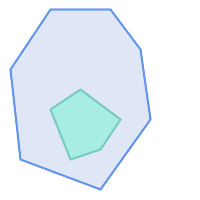
|
ST_Contains returns FALSE in the following situations:
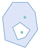
| 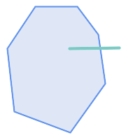
|
Due to the interior intersection condition ST_Contains returns FALSE in the following situations (whereas ST_Covers returns TRUE):
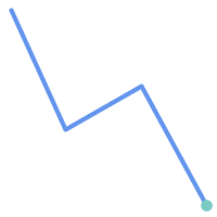
| 
|
-- A circle within a circle
SELECT ST_Contains(smallc, bigc) As smallcontainsbig,
ST_Contains(bigc,smallc) As bigcontainssmall,
ST_Contains(bigc, ST_Union(smallc, bigc)) as bigcontainsunion,
ST_Equals(bigc, ST_Union(smallc, bigc)) as bigisunion,
ST_Covers(bigc, ST_ExteriorRing(bigc)) As bigcoversexterior,
ST_Contains(bigc, ST_ExteriorRing(bigc)) As bigcontainsexterior
FROM (SELECT ST_Buffer(ST_GeomFromText('POINT(1 2)'), 10) As smallc,
ST_Buffer(ST_GeomFromText('POINT(1 2)'), 20) As bigc) As foo;
-- Result
smallcontainsbig | bigcontainssmall | bigcontainsunion | bigisunion | bigcoversexterior | bigcontainsexterior
------------------+------------------+------------------+------------+-------------------+---------------------
f | t | t | t | t | f
-- Example demonstrating difference between contains and contains properly
SELECT ST_GeometryType(geomA) As geomtype, ST_Contains(geomA,geomA) AS acontainsa, ST_ContainsProperly(geomA, geomA) AS acontainspropa,
ST_Contains(geomA, ST_Boundary(geomA)) As acontainsba, ST_ContainsProperly(geomA, ST_Boundary(geomA)) As acontainspropba
FROM (VALUES ( ST_Buffer(ST_Point(1,1), 5,1) ),
( ST_MakeLine(ST_Point(1,1), ST_Point(-1,-1) ) ),
( ST_Point(1,1) )
) As foo(geomA);
geomtype | acontainsa | acontainspropa | acontainsba | acontainspropba
--------------+------------+----------------+-------------+-----------------
ST_Polygon | t | f | f | f
ST_LineString | t | f | f | f
ST_Point | t | t | f | f
Si veda anche
ST_Boundary, ST_ContainsProperly, ST_Covers, ST_CoveredBy, ST_Equals, ST_Within
Name
ST_ContainsProperly — Tests if every point of B lies in the interior of A
Synopsis
boolean ST_ContainsProperly(geometry geomA, geometry geomB);
Descrizione
Returns true if every point of B lies in the interior of A (or equivalently, no point of B lies in the the boundary or exterior of A).
In mathematical terms: ST_ContainsProperly(A, B) ⇔ Int(A) ⋂ B = B
A contains B properly if the DE-9IM Intersection Matrix for the two geometries matches [T**FF*FF*]
A does not properly contain itself, but does contain itself.
A use for this predicate is computing the intersections of a set of geometries with a large polygonal geometry. Since intersection is a fairly slow operation, it can be more efficient to use containsProperly to filter out test geometries which lie fully inside the area. In these cases the intersection is known a priori to be exactly the original test geometry.
| |
Questa funzione incorpora l'uso di una comparazione tra i bounding box in modo da usare qualunque indice spaziale disponibile sulle geometrie. To avoid index use, use the function |
| |
The advantage of this predicate over ST_Contains and ST_Intersects is that it can be computed more efficiently, with no need to compute topology at individual points. |
Eseguito dal modulo GEOS.
Disponibilità: 1.4.0
| |
Enhanced: 3.0.0 enabled support for |
| |
Do not use this function with invalid geometries. You will get unexpected results. |
Esempi
--a circle within a circle
SELECT ST_ContainsProperly(smallc, bigc) As smallcontainspropbig,
ST_ContainsProperly(bigc,smallc) As bigcontainspropsmall,
ST_ContainsProperly(bigc, ST_Union(smallc, bigc)) as bigcontainspropunion,
ST_Equals(bigc, ST_Union(smallc, bigc)) as bigisunion,
ST_Covers(bigc, ST_ExteriorRing(bigc)) As bigcoversexterior,
ST_ContainsProperly(bigc, ST_ExteriorRing(bigc)) As bigcontainsexterior
FROM (SELECT ST_Buffer(ST_GeomFromText('POINT(1 2)'), 10) As smallc,
ST_Buffer(ST_GeomFromText('POINT(1 2)'), 20) As bigc) As foo;
--Result
smallcontainspropbig | bigcontainspropsmall | bigcontainspropunion | bigisunion | bigcoversexterior | bigcontainsexterior
------------------+------------------+------------------+------------+-------------------+---------------------
f | t | f | t | t | f
--example demonstrating difference between contains and contains properly
SELECT ST_GeometryType(geomA) As geomtype, ST_Contains(geomA,geomA) AS acontainsa, ST_ContainsProperly(geomA, geomA) AS acontainspropa,
ST_Contains(geomA, ST_Boundary(geomA)) As acontainsba, ST_ContainsProperly(geomA, ST_Boundary(geomA)) As acontainspropba
FROM (VALUES ( ST_Buffer(ST_Point(1,1), 5,1) ),
( ST_MakeLine(ST_Point(1,1), ST_Point(-1,-1) ) ),
( ST_Point(1,1) )
) As foo(geomA);
geomtype | acontainsa | acontainspropa | acontainsba | acontainspropba
--------------+------------+----------------+-------------+-----------------
ST_Polygon | t | f | f | f
ST_LineString | t | f | f | f
ST_Point | t | t | f | f
Si veda anche
ST_GeometryType, ST_Boundary, ST_Contains, ST_Covers, ST_CoveredBy, ST_Equals, ST_Relate, ST_Within
Name
ST_CoveredBy — Tests if every point of A lies in B
Synopsis
boolean ST_CoveredBy(geometry geomA, geometry geomB);
boolean ST_CoveredBy(geography geogA, geography geogB);
Descrizione
Returns true if every point in Geometry/Geography A lies inside (i.e. intersects the interior or boundary of) Geometry/Geography B. Equivalently, tests that no point of A lies outside (in the exterior of) B.
In mathematical terms: ST_CoveredBy(A, B) ⇔ A ⋂ B = A
ST_CoveredBy is the converse of ST_Covers. So, ST_CoveredBy(A,B) = ST_Covers(B,A).
Generally this function should be used instead of ST_Within, since it has a simpler definition which does not have the quirk that "boundaries are not within their geometry".
| |
Questa funzione incorpora l'uso di una comparazione tra i bounding box in modo da usare qualunque indice spaziale disponibile sulle geometrie. To avoid index use, use the function |
| |
Enhanced: 3.0.0 enabled support for |
| |
Do not use this function with invalid geometries. You will get unexpected results. |
Eseguito dal modulo GEOS
Availability: 1.2.2
NOTE: this is the "allowable" version that returns a boolean, not an integer.
Not an OGC standard, but Oracle has it too.
Esempi
--a circle coveredby a circle
SELECT ST_CoveredBy(smallc,smallc) As smallinsmall,
ST_CoveredBy(smallc, bigc) As smallcoveredbybig,
ST_CoveredBy(ST_ExteriorRing(bigc), bigc) As exteriorcoveredbybig,
ST_Within(ST_ExteriorRing(bigc),bigc) As exeriorwithinbig
FROM (SELECT ST_Buffer(ST_GeomFromText('POINT(1 2)'), 10) As smallc,
ST_Buffer(ST_GeomFromText('POINT(1 2)'), 20) As bigc) As foo;
--Result
smallinsmall | smallcoveredbybig | exteriorcoveredbybig | exeriorwithinbig
--------------+-------------------+----------------------+------------------
t | t | t | f
(1 row) Si veda anche
Name
ST_Covers — Tests if every point of B lies in A
Synopsis
boolean ST_Covers(geometry geomA, geometry geomB);
boolean ST_Covers(geography geogpolyA, geography geogpointB);
Descrizione
Returns true if every point in Geometry/Geography B lies inside (i.e. intersects the interior or boundary of) Geometry/Geography A. Equivalently, tests that no point of B lies outside (in the exterior of) A.
In mathematical terms: ST_Covers(A, B) ⇔ A ⋂ B = B
ST_Covers is the converse of ST_CoveredBy. So, ST_Covers(A,B) = ST_CoveredBy(B,A).
Generally this function should be used instead of ST_Contains, since it has a simpler definition which does not have the quirk that "geometries do not contain their boundary".
| |
Questa funzione incorpora l'uso di una comparazione tra i bounding box in modo da usare qualunque indice spaziale disponibile sulle geometrie. To avoid index use, use the function |
| |
Enhanced: 3.0.0 enabled support for |
| |
Do not use this function with invalid geometries. You will get unexpected results. |
Eseguito dal modulo GEOS
Enhanced: 2.4.0 Support for polygon in polygon and line in polygon added for geography type
Enhanced: 2.3.0 Enhancement to PIP short-circuit for geometry extended to support MultiPoints with few points. Prior versions only supported point in polygon.
Availability: 1.5 - support for geography was introduced.
Availability: 1.2.2
NOTE: this is the "allowable" version that returns a boolean, not an integer.
Not an OGC standard, but Oracle has it too.
Esempi
Geometry example
--a circle covering a circle
SELECT ST_Covers(smallc,smallc) As smallinsmall,
ST_Covers(smallc, bigc) As smallcoversbig,
ST_Covers(bigc, ST_ExteriorRing(bigc)) As bigcoversexterior,
ST_Contains(bigc, ST_ExteriorRing(bigc)) As bigcontainsexterior
FROM (SELECT ST_Buffer(ST_GeomFromText('POINT(1 2)'), 10) As smallc,
ST_Buffer(ST_GeomFromText('POINT(1 2)'), 20) As bigc) As foo;
--Result
smallinsmall | smallcoversbig | bigcoversexterior | bigcontainsexterior
--------------+----------------+-------------------+---------------------
t | f | t | f
(1 row) Geeography Example
-- a point with a 300 meter buffer compared to a point, a point and its 10 meter buffer
SELECT ST_Covers(geog_poly, geog_pt) As poly_covers_pt,
ST_Covers(ST_Buffer(geog_pt,10), geog_pt) As buff_10m_covers_cent
FROM (SELECT ST_Buffer(ST_GeogFromText('SRID=4326;POINT(-99.327 31.4821)'), 300) As geog_poly,
ST_GeogFromText('SRID=4326;POINT(-99.33 31.483)') As geog_pt ) As foo;
poly_covers_pt | buff_10m_covers_cent
----------------+------------------
f | t
Si veda anche
Name
ST_Crosses — Tests if two geometries have some, but not all, interior points in common
Synopsis
boolean ST_Crosses(geometry g1, geometry g2);
Descrizione
Compares two geometry objects and returns true if their intersection "spatially crosses"; that is, the geometries have some, but not all interior points in common. The intersection of the interiors of the geometries must be non-empty and must have dimension less than the maximum dimension of the two input geometries, and the intersection of the two geometries must not equal either geometry. Otherwise, it returns false. The crosses relation is symmetric and irreflexive.
In mathematical terms: ST_Crosses(A, B) ⇔ (dim( Int(A) ⋂ Int(B) ) < max( dim( Int(A) ), dim( Int(B) ) )) ∧ (A ⋂ B ≠ A) ∧ (A ⋂ B ≠ B)
Geometries cross if their DE-9IM Intersection Matrix matches:
T*T******for Point/Line, Point/Area, and Line/Area situationsT*****T**for Line/Point, Area/Point, and Area/Line situations0********for Line/Line situationsthe result is
falsefor Point/Point and Area/Area situations
| |
The OpenGIS Simple Features Specification defines this predicate only for Point/Line, Point/Area, Line/Line, and Line/Area situations. JTS / GEOS extends the definition to apply to Line/Point, Area/Point and Area/Line situations as well. This makes the relation symmetric. |
| |
Questa funzione incorpora l'uso di una comparazione tra i bounding box in modo da usare qualunque indice spaziale disponibile sulle geometrie. |
| |
Enhanced: 3.0.0 enabled support for |
Questo metodo implementa le OGC Simple Features Implementation Specification for SQL 1.1. s2.1.13.3
Questo metodo implementa la specifica SQL/MM. SQL-MM 3: 5.1.29
Esempi
The following situations all return true.
| 
|
| 
|
Consider a situation where a user has two tables: a table of roads and a table of highways.
CREATE TABLE roads ( id serial NOT NULL, geom geometry, CONSTRAINT roads_pkey PRIMARY KEY (road_id) );
|
CREATE TABLE highways ( id serial NOT NULL, the_gem geometry, CONSTRAINT roads_pkey PRIMARY KEY (road_id) );
|
To determine a list of roads that cross a highway, use a query similar to:
SELECT roads.id FROM roads, highways WHERE ST_Crosses(roads.geom, highways.geom);
Si veda anche
Name
ST_Disjoint — Tests if two geometries have no points in common
Synopsis
boolean ST_Disjoint( geometry A , geometry B );
Descrizione
Returns true if two geometries are disjoint. Geometries are disjoint if they have no point in common.
If any other spatial relationship is true for a pair of geometries, they are not disjoint. Disjoint implies that ST_Intersects is false.
In mathematical terms: ST_Disjoint(A, B) ⇔ A ⋂ B = ∅
| |
Enhanced: 3.0.0 enabled support for |
Eseguito dal modulo GEOS
| |
This function call does not use indexes. A negated ST_Intersects predicate can be used as a more performant alternative that uses indexes: |
| |
NOTE: this is the "allowable" version that returns a boolean, not an integer. |
Questo metodo implementa le OGC Simple Features Implementation Specification for SQL 1.1. s2.1.1.2 //s2.1.13.3 - a.Relate(b, 'FF*FF****')
Questo metodo implementa la specifica SQL/MM. SQL-MM 3: 5.1.26
Esempi
SELECT ST_Disjoint('POINT(0 0)'::geometry, 'LINESTRING ( 2 0, 0 2 )'::geometry);
st_disjoint
---------------
t
(1 row)
SELECT ST_Disjoint('POINT(0 0)'::geometry, 'LINESTRING ( 0 0, 0 2 )'::geometry);
st_disjoint
---------------
f
(1 row)
Si veda anche
Name
ST_Equals — Tests if two geometries include the same set of points
Synopsis
boolean ST_Equals(geometry A, geometry B);
Descrizione
Returns true if the given geometries are "topologically equal". Use this for a 'better' answer than '='. Topological equality means that the geometries have the same dimension, and their point-sets occupy the same space. This means that the order of vertices may be different in topologically equal geometries. To verify the order of points is consistent use ST_OrderingEquals (it must be noted ST_OrderingEquals is a little more stringent than simply verifying order of points are the same).
In mathematical terms: ST_Equals(A, B) ⇔ A = B
The following relation holds: ST_Equals(A, B) ⇔ ST_Within(A,B) ∧ ST_Within(B,A)
| |
Enhanced: 3.0.0 enabled support for |
Questo metodo implementa le OGC Simple Features Implementation Specification for SQL 1.1. s2.1.1.2
Questo metodo implementa la specifica SQL/MM. SQL-MM 3: 5.1.24
Changed: 2.2.0 Returns true even for invalid geometries if they are binary equal
Esempi
SELECT ST_Equals(ST_GeomFromText('LINESTRING(0 0, 10 10)'),
ST_GeomFromText('LINESTRING(0 0, 5 5, 10 10)'));
st_equals
-----------
t
(1 row)
SELECT ST_Equals(ST_Reverse(ST_GeomFromText('LINESTRING(0 0, 10 10)')),
ST_GeomFromText('LINESTRING(0 0, 5 5, 10 10)'));
st_equals
-----------
t
(1 row)
Si veda anche
Name
ST_Intersects — Tests if two geometries intersect (they have at least one point in common)
Synopsis
boolean ST_Intersects( geometry geomA , geometry geomB );
boolean ST_Intersects( geography geogA , geography geogB );
Descrizione
Returns true if two geometries intersect. Geometries intersect if they have any point in common.
For geography, a distance tolerance of 0.00001 meters is used (so points that are very close are considered to intersect).
In mathematical terms: ST_Intersects(A, B) ⇔ A ⋂ B ≠ ∅
Geometries intersect if their DE-9IM Intersection Matrix matches one of:
T*********T**********T*********T****
Spatial intersection is implied by all the other spatial relationship tests, except ST_Disjoint, which tests that geometries do NOT intersect.
| |
Questa funzione incorpora l'uso di una comparazione tra i bounding box in modo da usare qualunque indice spaziale disponibile sulle geometrie. |
Changed: 3.0.0 SFCGAL version removed and native support for 2D TINS added.
Enhanced: 2.5.0 Supports GEOMETRYCOLLECTION.
Enhanced: 2.3.0 Enhancement to PIP short-circuit extended to support MultiPoints with few points. Prior versions only supported point in polygon.
Performed by the GEOS module (for geometry), geography is native
Availability: 1.5 support for geography was introduced.
| |
For geography, this function has a distance tolerance of about 0.00001 meters and uses the sphere rather than spheroid calculation. |
| |
NOTE: this is the "allowable" version that returns a boolean, not an integer. |
Questo metodo implementa le OGC Simple Features Implementation Specification for SQL 1.1. s2.1.1.2 //s2.1.13.3 - ST_Intersects(g1, g2 ) --> Not (ST_Disjoint(g1, g2 ))
Questo metodo implementa la specifica SQL/MM. SQL-MM 3: 5.1.27
Questo metodo supporta le Curve e le Circular String.
Questa funzione supporta i Triangoli e le Triangulated Irregular Network Surfaces (TIN).
Geometry Examples
SELECT ST_Intersects('POINT(0 0)'::geometry, 'LINESTRING ( 2 0, 0 2 )'::geometry);
st_intersects
---------------
f
(1 row)
SELECT ST_Intersects('POINT(0 0)'::geometry, 'LINESTRING ( 0 0, 0 2 )'::geometry);
st_intersects
---------------
t
(1 row)
-- Look up in table. Make sure table has a GiST index on geometry column for faster lookup.
SELECT id, name FROM cities WHERE ST_Intersects(geom, 'SRID=4326;POLYGON((28 53,27.707 52.293,27 52,26.293 52.293,26 53,26.293 53.707,27 54,27.707 53.707,28 53))');
id | name
----+-------
2 | Minsk
(1 row)
Geography Examples
SELECT ST_Intersects(
'SRID=4326;LINESTRING(-43.23456 72.4567,-43.23456 72.4568)'::geography,
'SRID=4326;POINT(-43.23456 72.4567772)'::geography
);
st_intersects
---------------
t
Si veda anche
Name
ST_LineCrossingDirection — Returns a number indicating the crossing behavior of two LineStrings
Synopsis
integer ST_LineCrossingDirection(geometry linestringA, geometry linestringB);
Descrizione
Given two linestrings returns an integer between -3 and 3 indicating what kind of crossing behavior exists between them. 0 indicates no crossing. This is only supported for LINESTRINGs.
The crossing number has the following meaning:
0: LINE NO CROSS
-1: LINE CROSS LEFT
1: LINE CROSS RIGHT
-2: LINE MULTICROSS END LEFT
2: LINE MULTICROSS END RIGHT
-3: LINE MULTICROSS END SAME FIRST LEFT
3: LINE MULTICROSS END SAME FIRST RIGHT
Availability: 1.4
Esempi
Example: LINE CROSS LEFT and LINE CROSS RIGHT
Blue: Line A; Green: Line B
SELECT ST_LineCrossingDirection(lineA, lineB) As A_cross_B,
ST_LineCrossingDirection(lineB, lineA) As B_cross_A
FROM (SELECT
ST_GeomFromText('LINESTRING(25 169,89 114,40 70,86 43)') As lineA,
ST_GeomFromText('LINESTRING (20 140, 71 74, 161 53)') As lineB
) As foo;
A_cross_B | B_cross_A
-----------+-----------
-1 | 1
Example: LINE MULTICROSS END SAME FIRST LEFT and LINE MULTICROSS END SAME FIRST RIGHT
Blue: Line A; Green: Line B
SELECT ST_LineCrossingDirection(lineA, lineB) As A_cross_B,
ST_LineCrossingDirection(lineB, lineA) As B_cross_A
FROM (SELECT
ST_GeomFromText('LINESTRING(25 169,89 114,40 70,86 43)') As lineA,
ST_GeomFromText('LINESTRING(171 154,20 140,71 74,161 53)') As lineB
) As foo;
A_cross_B | B_cross_A
-----------+-----------
3 | -3
Example: LINE MULTICROSS END LEFT and LINE MULTICROSS END RIGHT
Blue: Line A; Green: Line B
SELECT ST_LineCrossingDirection(lineA, lineB) As A_cross_B,
ST_LineCrossingDirection(lineB, lineA) As B_cross_A
FROM (SELECT
ST_GeomFromText('LINESTRING(25 169,89 114,40 70,86 43)') As lineA,
ST_GeomFromText('LINESTRING(5 90, 71 74, 20 140, 171 154)') As lineB
) As foo;
A_cross_B | B_cross_A
-----------+-----------
-2 | 2
Example: Finds all streets that cross
SELECT s1.gid, s2.gid, ST_LineCrossingDirection(s1.geom, s2.geom)
FROM streets s1 CROSS JOIN streets s2
ON (s1.gid != s2.gid AND s1.geom && s2.geom )
WHERE ST_LineCrossingDirection(s1.geom, s2.geom)
> 0;
Si veda anche
Name
ST_OrderingEquals — Tests if two geometries represent the same geometry and have points in the same directional order
Synopsis
boolean ST_OrderingEquals(geometry A, geometry B);
Descrizione
ST_OrderingEquals compares two geometries and returns t (TRUE) if the geometries are equal and the coordinates are in the same order; otherwise it returns f (FALSE).
| |
This function is implemented as per the ArcSDE SQL specification rather than SQL-MM. http://edndoc.esri.com/arcsde/9.1/sql_api/sqlapi3.htm#ST_OrderingEquals |
Questo metodo implementa la specifica SQL/MM. SQL-MM 3: 5.1.43
Esempi
SELECT ST_OrderingEquals( 'LINESTRING(0 0, 10 10)', 'LINESTRING(0 0, 5 5, 10 10)'); st_orderingequals ----------- f SELECT ST_OrderingEquals( 'LINESTRING(0 0, 10 10)', 'LINESTRING(0 0, 10 10)'); st_orderingequals ----------- t SELECT ST_OrderingEquals( 'POLYGON((0 0, 0 1, 1 1, 1 0, 0 0))', 'POLYGON((0 0, 1 0, 1 1, 0 1, 0 0))'); st_orderingequals ----------- f
Si veda anche
Name
ST_Overlaps — Tests if two geometries have the same dimension and intersect, but each has at least one point not in the other
Synopsis
boolean ST_Overlaps(geometry A, geometry B);
Descrizione
Returns TRUE if geometry A and B "spatially overlap". Two geometries overlap if they have the same dimension, their interiors intersect in that dimension. and each has at least one point inside the other (or equivalently, neither one covers the other). The overlaps relation is symmetric and irreflexive.
In mathematical terms: ST_Overlaps(A, B) ⇔ ( dim(A) = dim(B) = dim( Int(A) ⋂ Int(B) )) ∧ (A ⋂ B ≠ A) ∧ (A ⋂ B ≠ B)
| |
Questa funzione incorpora l'uso di una comparazione tra i bounding box in modo da usare qualunque indice spaziale disponibile sulle geometrie. To avoid index use, use the function |
Eseguito dal modulo GEOS
| |
Enhanced: 3.0.0 enabled support for |
NOTE: this is the "allowable" version that returns a boolean, not an integer.
Questo metodo implementa le OGC Simple Features Implementation Specification for SQL 1.1. s2.1.1.2 // s2.1.13.3
Questo metodo implementa la specifica SQL/MM. SQL-MM 3: 5.1.32
Esempi
ST_Overlaps returns TRUE in the following situations:
| 
| 
|

A Point on a LineString is contained, but since it has lower dimension it does not overlap or cross.
SELECT ST_Overlaps(a,b) AS overlaps, ST_Crosses(a,b) AS crosses,
ST_Intersects(a, b) AS intersects, ST_Contains(b,a) AS b_contains_a
FROM (SELECT ST_GeomFromText('POINT (100 100)') As a,
ST_GeomFromText('LINESTRING (30 50, 40 160, 160 40, 180 160)') AS b) AS t
overlaps | crosses | intersects | b_contains_a
---------+----------------------+--------------
f | f | t | t
A LineString that partly covers a Polygon intersects and crosses, but does not overlap since it has different dimension.
SELECT ST_Overlaps(a,b) AS overlaps, ST_Crosses(a,b) AS crosses,
ST_Intersects(a, b) AS intersects, ST_Contains(a,b) AS contains
FROM (SELECT ST_GeomFromText('POLYGON ((40 170, 90 30, 180 100, 40 170))') AS a,
ST_GeomFromText('LINESTRING(10 10, 190 190)') AS b) AS t;
overlap | crosses | intersects | contains
---------+---------+------------+--------------
f | t | t | f
Two Polygons that intersect but with neither contained by the other overlap, but do not cross because their intersection has the same dimension.
SELECT ST_Overlaps(a,b) AS overlaps, ST_Crosses(a,b) AS crosses,
ST_Intersects(a, b) AS intersects, ST_Contains(b, a) AS b_contains_a,
ST_Dimension(a) AS dim_a, ST_Dimension(b) AS dim_b,
ST_Dimension(ST_Intersection(a,b)) AS dim_int
FROM (SELECT ST_GeomFromText('POLYGON ((40 170, 90 30, 180 100, 40 170))') AS a,
ST_GeomFromText('POLYGON ((110 180, 20 60, 130 90, 110 180))') AS b) As t;
overlaps | crosses | intersects | b_contains_a | dim_a | dim_b | dim_int
----------+---------+------------+--------------+-------+-------+-----------
t | f | t | f | 2 | 2 | 2
Si veda anche
Name
ST_Relate — Tests if two geometries have a topological relationship matching an Intersection Matrix pattern, or computes their Intersection Matrix
Synopsis
boolean ST_Relate(geometry geomA, geometry geomB, text intersectionMatrixPattern);
text ST_Relate(geometry geomA, geometry geomB);
text ST_Relate(geometry geomA, geometry geomB, integer boundaryNodeRule);
Descrizione
These functions allow testing and evaluating the spatial (topological) relationship between two geometries, as defined by the Dimensionally Extended 9-Intersection Model (DE-9IM).
The DE-9IM is specified as a 9-element matrix indicating the dimension of the intersections between the Interior, Boundary and Exterior of two geometries. It is represented by a 9-character text string using the symbols 'F', '0', '1', '2' (e.g. 'FF1FF0102').
A specific kind of spatial relationship can be tested by matching the intersection matrix to an intersection matrix pattern. Patterns can include the additional symbols 'T' (meaning "intersection is non-empty") and '*' (meaning "any value"). Common spatial relationships are provided by the named functions ST_Contains, ST_ContainsProperly, ST_Covers, ST_CoveredBy, ST_Crosses, ST_Disjoint, ST_Equals, ST_Intersects, ST_Overlaps, ST_Touches, and ST_Within. Using an explicit pattern allows testing multiple conditions of intersects, crosses, etc in one step. It also allows testing spatial relationships which do not have a named spatial relationship function. For example, the relationship "Interior-Intersects" has the DE-9IM pattern T********, which is not evaluated by any named predicate.
For more information refer to Section 5.1, “Determinare le relazioni spaziali”.
Variant 1: Tests if two geometries are spatially related according to the given intersectionMatrixPattern.
| |
Unlike most of the named spatial relationship predicates, this does NOT automatically include an index call. The reason is that some relationships are true for geometries which do NOT intersect (e.g. Disjoint). If you are using a relationship pattern that requires intersection, then include the && index call. |
| |
It is better to use a named relationship function if available, since they automatically use a spatial index where one exists. Also, they may implement performance optimizations which are not available with full relate evaluation. |
Variant 2: Returns the DE-9IM matrix string for the spatial relationship between the two input geometries. The matrix string can be tested for matching a DE-9IM pattern using ST_RelateMatch.
Variant 3: Like variant 2, but allows specifying a Boundary Node Rule. A boundary node rule allows finer control over whether the endpoints of MultiLineStrings are considered to lie in the DE-9IM Interior or Boundary. The boundaryNodeRule values are:
1: OGC-Mod2 - line endpoints are in the Boundary if they occur an odd number of times. This is the rule defined by the OGC SFS standard, and is the default forST_Relate.2: Endpoint - all endpoints are in the Boundary.3: MultivalentEndpoint - endpoints are in the Boundary if they occur more than once. In other words, the boundary is all the "attached" or "inner" endpoints (but not the "unattached/outer" ones).4: MonovalentEndpoint - endpoints are in the Boundary if they occur only once. In other words, the boundary is all the "unattached" or "outer" endpoints.
This function is not in the OGC spec, but is implied. see s2.1.13.2
Questo metodo implementa le OGC Simple Features Implementation Specification for SQL 1.1. s2.1.1.2 // s2.1.13.3
Questo metodo implementa la specifica SQL/MM. SQL-MM 3: 5.1.25
Eseguito dal modulo GEOS
Enhanced: 2.0.0 - added support for specifying boundary node rule.
| |
Enhanced: 3.0.0 enabled support for |
Esempi
Using the boolean-valued function to test spatial relationships.
SELECT ST_Relate('POINT(1 2)', ST_Buffer( 'POINT(1 2)', 2), '0FFFFF212');
st_relate
-----------
t
SELECT ST_Relate(POINT(1 2)', ST_Buffer( 'POINT(1 2)', 2), '*FF*FF212');
st_relate
-----------
t
Testing a custom spatial relationship pattern as a query condition, with && to enable using a spatial index.
-- Find compounds that properly intersect (not just touch) a poly (Interior Intersects)
SELECT c.* , p.name As poly_name
FROM polys AS p
INNER JOIN compounds As c
ON c.geom && p.geom
AND ST_Relate(p.geom, c.geom,'T********');
Computing the intersection matrix for spatial relationships.
SELECT ST_Relate( 'POINT(1 2)',
ST_Buffer( 'POINT(1 2)', 2));
-----------
0FFFFF212
SELECT ST_Relate( 'LINESTRING(1 2, 3 4)',
'LINESTRING(5 6, 7 8)' );
-----------
FF1FF0102
Using different Boundary Node Rules to compute the spatial relationship between a LineString and a MultiLineString with a duplicate endpoint (3 3):
Using the OGC-Mod2 rule (1) the duplicate endpoint is in the interior of the MultiLineString, so the DE-9IM matrix entry [aB:bI] is
0and [aB:bB] isF.Using the Endpoint rule (2) the duplicate endpoint is in the boundary of the MultiLineString, so the DE-9IM matrix entry [aB:bI] is
Fand [aB:bB] is0.
WITH data AS (SELECT
'LINESTRING(1 1, 3 3)'::geometry AS a_line,
'MULTILINESTRING((3 3, 3 5), (3 3, 5 3))':: geometry AS b_multiline
)
SELECT ST_Relate( a_line, b_multiline, 1) AS bnr_mod2,
ST_Relate( a_line, b_multiline, 2) AS bnr_endpoint
FROM data;
bnr_mod2 | bnr_endpoint
-----------+--------------
FF10F0102 | FF1F00102
Name
ST_RelateMatch — Tests if a DE-9IM Intersection Matrix matches an Intersection Matrix pattern
Synopsis
boolean ST_RelateMatch(text intersectionMatrix, text intersectionMatrixPattern);
Descrizione
Tests if a Dimensionally Extended 9-Intersection Model (DE-9IM) intersectionMatrix value satisfies an intersectionMatrixPattern. Intersection matrix values can be computed by ST_Relate.
For more information refer to Section 5.1, “Determinare le relazioni spaziali”.
Eseguito dal modulo GEOS
Disponibilità: 2.0.0
Esempi
SELECT ST_RelateMatch('101202FFF', 'TTTTTTFFF') ;
-- result --
t
Patterns for common spatial relationships matched against intersection matrix values, for a line in various positions relative to a polygon
SELECT pat.name AS relationship, pat.val AS pattern,
mat.name AS position, mat.val AS matrix,
ST_RelateMatch(mat.val, pat.val) AS match
FROM (VALUES ( 'Equality', 'T1FF1FFF1' ),
( 'Overlaps', 'T*T***T**' ),
( 'Within', 'T*F**F***' ),
( 'Disjoint', 'FF*FF****' )) AS pat(name,val)
CROSS JOIN
(VALUES ('non-intersecting', 'FF1FF0212'),
('overlapping', '1010F0212'),
('inside', '1FF0FF212')) AS mat(name,val);
relationship | pattern | position | matrix | match
--------------+-----------+------------------+-----------+-------
Equality | T1FF1FFF1 | non-intersecting | FF1FF0212 | f
Equality | T1FF1FFF1 | overlapping | 1010F0212 | f
Equality | T1FF1FFF1 | inside | 1FF0FF212 | f
Overlaps | T*T***T** | non-intersecting | FF1FF0212 | f
Overlaps | T*T***T** | overlapping | 1010F0212 | t
Overlaps | T*T***T** | inside | 1FF0FF212 | f
Within | T*F**F*** | non-intersecting | FF1FF0212 | f
Within | T*F**F*** | overlapping | 1010F0212 | f
Within | T*F**F*** | inside | 1FF0FF212 | t
Disjoint | FF*FF**** | non-intersecting | FF1FF0212 | t
Disjoint | FF*FF**** | overlapping | 1010F0212 | f
Disjoint | FF*FF**** | inside | 1FF0FF212 | f
Si veda anche
Name
ST_Touches — Tests if two geometries have at least one point in common, but their interiors do not intersect
Synopsis
boolean ST_Touches(geometry A, geometry B);
Descrizione
Returns TRUE if A and B intersect, but their interiors do not intersect. Equivalently, A and B have at least one point in common, and the common points lie in at least one boundary. For Point/Point inputs the relationship is always FALSE, since points do not have a boundary.
In mathematical terms: ST_Touches(A, B) ⇔ (Int(A) ⋂ Int(B) = ∅) ∧ (A ⋂ B ≠ ∅)
This relationship holds if the DE-9IM Intersection Matrix for the two geometries matches one of:
FT*******
F**T*****
F***T****
| |
Questa funzione incorpora l'uso di una comparazione tra i bounding box in modo da usare qualunque indice spaziale disponibile sulle geometrie. To avoid using an index, use |
| |
Enhanced: 3.0.0 enabled support for |
Questo metodo implementa le OGC Simple Features Implementation Specification for SQL 1.1. s2.1.1.2 // s2.1.13.3
Questo metodo implementa la specifica SQL/MM. SQL-MM 3: 5.1.28
Esempi
The ST_Touches predicate returns TRUE in the following examples.
| 
| 
|
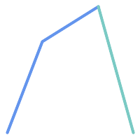
| 
| 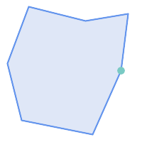
|
SELECT ST_Touches('LINESTRING(0 0, 1 1, 0 2)'::geometry, 'POINT(1 1)'::geometry);
st_touches
------------
f
(1 row)
SELECT ST_Touches('LINESTRING(0 0, 1 1, 0 2)'::geometry, 'POINT(0 2)'::geometry);
st_touches
------------
t
(1 row)Name
ST_Within — Tests if every point of A lies in B, and their interiors have a point in common
Synopsis
boolean ST_Within(geometry A, geometry B);
Descrizione
Returns TRUE if geometry A is within geometry B. A is within B if and only if all points of A lie inside (i.e. in the interior or boundary of) B (or equivalently, no points of A lie in the exterior of B), and the interiors of A and B have at least one point in common.
For this function to make sense, the source geometries must both be of the same coordinate projection, having the same SRID.
In mathematical terms: ST_Within(A, B) ⇔ (A ⋂ B = A) ∧ (Int(A) ⋂ Int(B) ≠ ∅)
The within relation is reflexive: every geometry is within itself. The relation is antisymmetric: if ST_Within(A,B) = true and ST_Within(B,A) = true, then the two geometries must be topologically equal (ST_Equals(A,B) = true).
ST_Within is the converse of ST_Contains. So, ST_Within(A,B) = ST_Contains(B,A).
| |
Because the interiors must have a common point, a subtlety of the definition is that lines and points lying fully in the boundary of polygons or lines are not within the geometry. For further details see Subtleties of OGC Covers, Contains, Within. The ST_CoveredBy predicate provides a more inclusive relationship. |
| |
Questa funzione incorpora l'uso di una comparazione tra i bounding box in modo da usare qualunque indice spaziale disponibile sulle geometrie. To avoid index use, use the function |
Eseguito dal modulo GEOS
Enhanced: 2.3.0 Enhancement to PIP short-circuit for geometry extended to support MultiPoints with few points. Prior versions only supported point in polygon.
| |
Enhanced: 3.0.0 enabled support for |
| |
Do not use this function with invalid geometries. You will get unexpected results. |
NOTE: this is the "allowable" version that returns a boolean, not an integer.
Questo metodo implementa le OGC Simple Features Implementation Specification for SQL 1.1. s2.1.1.2 // s2.1.13.3 - a.Relate(b, 'T*F**F***')
Questo metodo implementa la specifica SQL/MM. SQL-MM 3: 5.1.30
Esempi
--a circle within a circle
SELECT ST_Within(smallc,smallc) As smallinsmall,
ST_Within(smallc, bigc) As smallinbig,
ST_Within(bigc,smallc) As biginsmall,
ST_Within(ST_Union(smallc, bigc), bigc) as unioninbig,
ST_Within(bigc, ST_Union(smallc, bigc)) as biginunion,
ST_Equals(bigc, ST_Union(smallc, bigc)) as bigisunion
FROM
(
SELECT ST_Buffer(ST_GeomFromText('POINT(50 50)'), 20) As smallc,
ST_Buffer(ST_GeomFromText('POINT(50 50)'), 40) As bigc) As foo;
--Result
smallinsmall | smallinbig | biginsmall | unioninbig | biginunion | bigisunion
--------------+------------+------------+------------+------------+------------
t | t | f | t | t | t
(1 row)

Si veda anche
7.11.2. Distance Relationships
- ST_3DDWithin — Tests if two 3D geometries are within a given 3D distance
- ST_3DDFullyWithin — Tests if two 3D geometries are entirely within a given 3D distance
- ST_DFullyWithin — Tests if a geometry is entirely inside a distance of another
- ST_DWithin — Tests if two geometries are within a given distance
- ST_PointInsideCircle — Tests if a point geometry is inside a circle defined by a center and radius
Name
ST_3DDWithin — Tests if two 3D geometries are within a given 3D distance
Synopsis
boolean ST_3DDWithin(geometry g1, geometry g2, double precision distance_of_srid);
Descrizione
Returns true if the 3D distance between two geometry values is no larger than distance distance_of_srid. The distance is specified in units defined by the spatial reference system of the geometries. For this function to make sense the source geometries must be in the same coordinate system (have the same SRID).
| |
Questa funzione incorpora l'uso di una comparazione tra i bounding box in modo da usare qualunque indice spaziale disponibile sulle geometrie. |
Questa funzione supporta il 3d e non distrugge gli z-index.
Questa funzione supporta le Polyhedral Surface.
Questo metodo implementa la specifica SQL/MM. SQL-MM ?
Disponibilità: 2.0.0
Esempi
-- Geometry example - units in meters (SRID: 2163 US National Atlas Equal area) (3D point and line compared 2D point and line)
-- Note: currently no vertical datum support so Z is not transformed and assumed to be same units as final.
SELECT ST_3DDWithin(
ST_Transform(ST_GeomFromEWKT('SRID=4326;POINT(-72.1235 42.3521 4)'),2163),
ST_Transform(ST_GeomFromEWKT('SRID=4326;LINESTRING(-72.1260 42.45 15, -72.123 42.1546 20)'),2163),
126.8
) As within_dist_3d,
ST_DWithin(
ST_Transform(ST_GeomFromEWKT('SRID=4326;POINT(-72.1235 42.3521 4)'),2163),
ST_Transform(ST_GeomFromEWKT('SRID=4326;LINESTRING(-72.1260 42.45 15, -72.123 42.1546 20)'),2163),
126.8
) As within_dist_2d;
within_dist_3d | within_dist_2d
----------------+----------------
f | t
Si veda anche
ST_3DDFullyWithin, ST_DWithin, ST_DFullyWithin, ST_3DDistance, ST_Distance, ST_3DMaxDistance, ST_Transform
Name
ST_3DDFullyWithin — Tests if two 3D geometries are entirely within a given 3D distance
Synopsis
boolean ST_3DDFullyWithin(geometry g1, geometry g2, double precision distance);
Descrizione
Returns true if the 3D geometries are fully within the specified distance of one another. The distance is specified in units defined by the spatial reference system of the geometries. For this function to make sense, the source geometries must both be of the same coordinate projection, having the same SRID.
| |
Questa funzione incorpora l'uso di una comparazione tra i bounding box in modo da usare qualunque indice spaziale disponibile sulle geometrie. |
Disponibilità: 2.0.0
Questa funzione supporta il 3d e non distrugge gli z-index.
Questa funzione supporta le Polyhedral Surface.
Esempi
-- This compares the difference between fully within and distance within as well
-- as the distance fully within for the 2D footprint of the line/point vs. the 3d fully within
SELECT ST_3DDFullyWithin(geom_a, geom_b, 10) as D3DFullyWithin10, ST_3DDWithin(geom_a, geom_b, 10) as D3DWithin10,
ST_DFullyWithin(geom_a, geom_b, 20) as D2DFullyWithin20,
ST_3DDFullyWithin(geom_a, geom_b, 20) as D3DFullyWithin20 from
(select ST_GeomFromEWKT('POINT(1 1 2)') as geom_a,
ST_GeomFromEWKT('LINESTRING(1 5 2, 2 7 20, 1 9 100, 14 12 3)') as geom_b) t1;
d3dfullywithin10 | d3dwithin10 | d2dfullywithin20 | d3dfullywithin20
------------------+-------------+------------------+------------------
f | t | t | f Si veda anche
Name
ST_DFullyWithin — Tests if a geometry is entirely inside a distance of another
Synopsis
boolean ST_DFullyWithin(geometry g1, geometry g2, double precision distance);
Descrizione
Returns true if g2 is entirely within distance of g1. Visually, the condition is true if g2 is contained within a distance buffer of g1. The distance is specified in units defined by the spatial reference system of the geometries.
| |
Questa funzione incorpora l'uso di una comparazione tra i bounding box in modo da usare qualunque indice spaziale disponibile sulle geometrie. |
Disponibilità: 1.5.0
Changed: 3.5.0 : the logic behind the function now uses a test of containment within a buffer, rather than the ST_MaxDistance algorithm. Results will differ from prior versions, but should be closer to user expectations.
Esempi
SELECT
ST_DFullyWithin(geom_a, geom_b, 10) AS DFullyWithin10,
ST_DWithin(geom_a, geom_b, 10) AS DWithin10,
ST_DFullyWithin(geom_a, geom_b, 20) AS DFullyWithin20
FROM (VALUES
('POINT(1 1)', 'LINESTRING(1 5, 2 7, 1 9, 14 12)')
) AS v(geom_a, geom_b)
dfullywithin10 | dwithin10 | dfullywithin20
----------------+-----------+----------------
f | t | t
Si veda anche
Name
ST_DWithin — Tests if two geometries are within a given distance
Synopsis
boolean ST_DWithin(geometry g1, geometry g2, double precision distance_of_srid);
boolean ST_DWithin(geography gg1, geography gg2, double precision distance_meters, boolean use_spheroid = true);
Descrizione
Returns true if the geometries are within a given distance
For geometry: The distance is specified in units defined by the spatial reference system of the geometries. For this function to make sense, the source geometries must be in the same coordinate system (have the same SRID).
For geography: units are in meters and distance measurement defaults to use_spheroid = true. For faster evaluation use use_spheroid = false to measure on the sphere.
| |
Use ST_3DDWithin for 3D geometries. |
| |
This function call includes a bounding box comparison that makes use of any indexes that are available on the geometries. |
Questo metodo implementa le OGC Simple Features Implementation Specification for SQL 1.1.
Availability: 1.5.0 support for geography was introduced
Enhanced: 2.1.0 improved speed for geography. See Making Geography faster for details.
Enhanced: 2.1.0 support for curved geometries was introduced.
Prior to 1.3, ST_Expand was commonly used in conjunction with && and ST_Distance to test for distance, and in pre-1.3.4 this function used that logic. From 1.3.4, ST_DWithin uses a faster short-circuit distance function.
Esempi
-- Find the nearest hospital to each school
-- that is within 3000 units of the school.
-- We do an ST_DWithin search to utilize indexes to limit our search list
-- that the non-indexable ST_Distance needs to process
-- If the units of the spatial reference is meters then units would be meters
SELECT DISTINCT ON (s.gid) s.gid, s.school_name, s.geom, h.hospital_name
FROM schools s
LEFT JOIN hospitals h ON ST_DWithin(s.geom, h.geom, 3000)
ORDER BY s.gid, ST_Distance(s.geom, h.geom);
-- The schools with no close hospitals
-- Find all schools with no hospital within 3000 units
-- away from the school. Units is in units of spatial ref (e.g. meters, feet, degrees)
SELECT s.gid, s.school_name
FROM schools s
LEFT JOIN hospitals h ON ST_DWithin(s.geom, h.geom, 3000)
WHERE h.gid IS NULL;
-- Find broadcasting towers that receiver with limited range can receive.
-- Data is geometry in Spherical Mercator (SRID=3857), ranges are approximate.
-- Create geometry index that will check proximity limit of user to tower
CREATE INDEX ON broadcasting_towers using gist (geom);
-- Create geometry index that will check proximity limit of tower to user
CREATE INDEX ON broadcasting_towers using gist (ST_Expand(geom, sending_range));
-- Query towers that 4-kilometer receiver in Minsk Hackerspace can get
-- Note: two conditions, because shorter LEAST(b.sending_range, 4000) will not use index.
SELECT b.tower_id, b.geom
FROM broadcasting_towers b
WHERE ST_DWithin(b.geom, 'SRID=3857;POINT(3072163.4 7159374.1)', 4000)
AND ST_DWithin(b.geom, 'SRID=3857;POINT(3072163.4 7159374.1)', b.sending_range);
Si veda anche
Name
ST_PointInsideCircle — Tests if a point geometry is inside a circle defined by a center and radius
Synopsis
boolean ST_PointInsideCircle(geometry a_point, float center_x, float center_y, float radius);
Descrizione
Returns true if the geometry is a point and is inside the circle with center center_x,center_y and radius radius.
| |
Does not use spatial indexes. Use ST_DWithin instead. |
Availability: 1.2
Changed: 2.2.0 In prior versions this was called ST_Point_Inside_Circle
Esempi
SELECT ST_PointInsideCircle(ST_Point(1,2), 0.5, 2, 3); st_pointinsidecircle ------------------------ t
Si veda anche
7.12. Measurement Functions
These functions compute measurements of distance, area and angles. There are also functions to compute geometry values determined by measurements.
- ST_Area — Returns the area of a polygonal geometry.
- ST_Azimuth — Returns the north-based azimuth of a line between two points.
- ST_Angle — Returns the angle between two vectors defined by 3 or 4 points, or 2 lines.
- ST_ClosestPoint — Returns the 2D point on g1 that is closest to g2. This is the first point of the shortest line from one geometry to the other.
- ST_3DClosestPoint — Returns the 3D point on g1 that is closest to g2. This is the first point of the 3D shortest line.
- ST_Distance — Returns the distance between two geometry or geography values.
- ST_3DDistance — Returns the 3D cartesian minimum distance (based on spatial ref) between two geometries in projected units.
- ST_DistanceSphere — Returns minimum distance in meters between two lon/lat geometries using a spherical earth model.
- ST_DistanceSpheroid — Returns the minimum distance between two lon/lat geometries using a spheroidal earth model.
- ST_FrechetDistance — Returns the Fréchet distance between two geometries.
- ST_HausdorffDistance — Returns the Hausdorff distance between two geometries.
- ST_Length — Returns the 2D length of a linear geometry.
- ST_Length2D — Returns the 2D length of a linear geometry. Alias for
ST_Length - ST_3DLength — Returns the 3D length of a linear geometry.
- ST_LengthSpheroid — Returns the 2D or 3D length/perimeter of a lon/lat geometry on a spheroid.
- ST_LongestLine — Returns the 2D longest line between two geometries.
- ST_3DLongestLine — Returns the 3D longest line between two geometries
- ST_MaxDistance — Returns the 2D largest distance between two geometries in projected units.
- ST_3DMaxDistance — Returns the 3D cartesian maximum distance (based on spatial ref) between two geometries in projected units.
- ST_MinimumClearance — Returns the minimum clearance of a geometry, a measure of a geometry's robustness.
- ST_MinimumClearanceLine — Returns the two-point LineString spanning a geometry's minimum clearance.
- ST_Perimeter — Returns the length of the boundary of a polygonal geometry or geography.
- ST_Perimeter2D — Returns the 2D perimeter of a polygonal geometry. Alias for
ST_Perimeter. - ST_3DPerimeter — Returns the 3D perimeter of a polygonal geometry.
- ST_ShortestLine — Returns the 2D shortest line between two geometries
- ST_3DShortestLine — Returns the 3D shortest line between two geometries
Name
ST_Area — Returns the area of a polygonal geometry.
Synopsis
float ST_Area(geometry g1);
float ST_Area(geography geog, boolean use_spheroid = true);
Descrizione
Returns the area of a polygonal geometry. For geometry types a 2D Cartesian (planar) area is computed, with units specified by the SRID. For geography types by default area is determined on a spheroid with units in square meters. To compute the area using the faster but less accurate spherical model use ST_Area(geog,false).
Enhanced: 2.0.0 - support for 2D polyhedral surfaces was introduced.
Enhanced: 2.2.0 - measurement on spheroid performed with GeographicLib for improved accuracy and robustness. Requires PROJ >= 4.9.0 to take advantage of the new feature.
Changed: 3.0.0 - does not depend on SFCGAL anymore.
Questo metodo implementa le OGC Simple Features Implementation Specification for SQL 1.1.
Questo metodo implementa la specifica SQL/MM. SQL-MM 3: 8.1.2, 9.5.3
Questa funzione supporta le Polyhedral Surface.
| |
For polyhedral surfaces, only supports 2D polyhedral surfaces (not 2.5D). For 2.5D, may give a non-zero answer, but only for the faces that sit completely in XY plane. |
Esempi
Return area in square feet for a plot of Massachusetts land and multiply by conversion to get square meters. Note this is in square feet because EPSG:2249 is Massachusetts State Plane Feet
select ST_Area(geom) sqft,
ST_Area(geom) * 0.3048 ^ 2 sqm
from (
select 'SRID=2249;POLYGON((743238 2967416,743238 2967450,
743265 2967450,743265.625 2967416,743238 2967416))' :: geometry geom
) subquery;
┌─────────┬─────────────┐
│ sqft │ sqm │
├─────────┼─────────────┤
│ 928.625 │ 86.27208552 │
└─────────┴─────────────┘
Return area square feet and transform to Massachusetts state plane meters (EPSG:26986) to get square meters. Note this is in square feet because 2249 is Massachusetts State Plane Feet and transformed area is in square meters since EPSG:26986 is state plane Massachusetts meters
select ST_Area(geom) sqft,
ST_Area(ST_Transform(geom, 26986)) As sqm
from (
select
'SRID=2249;POLYGON((743238 2967416,743238 2967450,
743265 2967450,743265.625 2967416,743238 2967416))' :: geometry geom
) subquery;
┌─────────┬─────────────────┐
│ sqft │ sqm │
├─────────┼─────────────────┤
│ 928.625 │ 86.272430607008 │
└─────────┴─────────────────┘
Return area square feet and square meters using geography data type. Note that we transform to our geometry to geography (before you can do that make sure your geometry is in WGS 84 long lat 4326). Geography always measures in meters. This is just for demonstration to compare. Normally your table will be stored in geography data type already.
select ST_Area(geog) / 0.3048 ^ 2 sqft_spheroid,
ST_Area(geog, false) / 0.3048 ^ 2 sqft_sphere,
ST_Area(geog) sqm_spheroid
from (
select ST_Transform(
'SRID=2249;POLYGON((743238 2967416,743238 2967450,743265 2967450,743265.625 2967416,743238 2967416))'::geometry,
4326
) :: geography geog
) as subquery;
┌──────────────────┬──────────────────┬──────────────────┐
│ sqft_spheroid │ sqft_sphere │ sqm_spheroid │
├──────────────────┼──────────────────┼──────────────────┤
│ 928.684405784452 │ 927.049336105925 │ 86.2776044979692 │
└──────────────────┴──────────────────┴──────────────────┘
If your data is in geography already:
select ST_Area(geog) / 0.3048 ^ 2 sqft,
ST_Area(the_geog) sqm
from somegeogtable;Si veda anche
ST_3DArea, ST_GeomFromEWKT, ST_LengthSpheroid, ST_Perimeter, ST_Transform
Name
ST_Azimuth — Returns the north-based azimuth of a line between two points.
Synopsis
float ST_Azimuth(geometry origin, geometry target);
float ST_Azimuth(geography origin, geography target);
Descrizione
Returns the azimuth in radians of the target point from the origin point, or NULL if the two points are coincident. The azimuth angle is a positive clockwise angle referenced from the positive Y axis (geometry) or the North meridian (geography): North = 0; Northeast = π/4; East = π/2; Southeast = 3π/4; South = π; Southwest 5π/4; West = 3π/2; Northwest = 7π/4.
For the geography type, the azimuth solution is known as the inverse geodesic problem.
The azimuth is a mathematical concept defined as the angle between a reference vector and a point, with angular units in radians. The result value in radians can be converted to degrees using the PostgreSQL function degrees().
Azimuth can be used in conjunction with ST_Translate to shift an object along its perpendicular axis. See the upgis_lineshift() function in the PostGIS wiki for an implementation of this.
Disponibilità: 1.1.0
Enhanced: 2.0.0 support for geography was introduced.
Enhanced: 2.2.0 measurement on spheroid performed with GeographicLib for improved accuracy and robustness. Requires PROJ >= 4.9.0 to take advantage of the new feature.
Esempi
Geometry Azimuth in degrees
SELECT degrees(ST_Azimuth( ST_Point(25, 45), ST_Point(75, 100))) AS degA_B,
degrees(ST_Azimuth( ST_Point(75, 100), ST_Point(25, 45) )) AS degB_A;
dega_b | degb_a
------------------+------------------
42.2736890060937 | 222.273689006094
 Blue: origin Point(25,45); Green: target Point(75, 100); Yellow: Y axis or North; Red: azimuth angle.
|  Blue: origin Point(75, 100); Green: target Point(25, 45); Yellow: Y axis or North; Red: azimuth angle.
|
Si veda anche
ST_Angle, ST_Point, ST_Translate, ST_Project, PostgreSQL Math Functions
Name
ST_Angle — Returns the angle between two vectors defined by 3 or 4 points, or 2 lines.
Synopsis
float ST_Angle(geometry point1, geometry point2, geometry point3, geometry point4);
float ST_Angle(geometry line1, geometry line2);
Descrizione
Computes the clockwise angle between two vectors.
Variant 1: computes the angle enclosed by the points P1-P2-P3. If a 4th point provided computes the angle points P1-P2 and P3-P4
Variant 2: computes the angle between two vectors S1-E1 and S2-E2, defined by the start and end points of the input lines
The result is a positive angle between 0 and 2π radians. The radian result can be converted to degrees using the PostgreSQL function degrees().
Note that ST_Angle(P1,P2,P3) = ST_Angle(P2,P1,P2,P3).
Availability: 2.5.0
Esempi
Angle between three points
SELECT degrees( ST_Angle('POINT(0 0)', 'POINT(10 10)', 'POINT(20 0)') );
degrees
---------
270
Angle between vectors defined by four points
SELECT degrees( ST_Angle('POINT (10 10)', 'POINT (0 0)', 'POINT(90 90)', 'POINT (100 80)') );
degrees
-------------------
269.9999999999999
Angle between vectors defined by the start and end points of lines
SELECT degrees( ST_Angle('LINESTRING(0 0, 0.3 0.7, 1 1)', 'LINESTRING(0 0, 0.2 0.5, 1 0)') );
degrees
--------------
45
Si veda anche
Name
ST_ClosestPoint — Returns the 2D point on g1 that is closest to g2. This is the first point of the shortest line from one geometry to the other.
Synopsis
geometry ST_ClosestPoint(geometry geom1, geometry geom2);
geography ST_ClosestPoint(geography geom1, geography geom2, boolean use_spheroid = true);
Descrizione
Returns the 2-dimensional point on geom1 that is closest to geom2. This is the first point of the shortest line between the geometries (as computed by ST_ShortestLine).
| |
If you have a 3D Geometry, you may prefer to use ST_3DClosestPoint. |
Enhanced: 3.4.0 - Support for geography.
Disponibilità: 1.5.0
Esempi
The closest point for a Point and a LineString is the point itself. The closest point for a LineString and a Point is a point on the line.
SELECT ST_AsText( ST_ClosestPoint(pt,line)) AS cp_pt_line,
ST_AsText( ST_ClosestPoint(line,pt)) AS cp_line_pt
FROM (SELECT 'POINT (160 40)'::geometry AS pt,
'LINESTRING (10 30, 50 50, 30 110, 70 90, 180 140, 130 190)'::geometry AS line ) AS t;
cp_pt_line | cp_line_pt
----------------+------------------------------------------
POINT(160 40) | POINT(125.75342465753425 115.34246575342466)
The closest point on polygon A to polygon B
SELECT ST_AsText( ST_ClosestPoint(
'POLYGON ((190 150, 20 10, 160 70, 190 150))',
ST_Buffer('POINT(80 160)', 30) )) As ptwkt;
------------------------------------------
POINT(131.59149149528952 101.89887534906197)
Si veda anche
ST_3DClosestPoint, ST_Distance, ST_LongestLine, ST_ShortestLine, ST_MaxDistance
Name
ST_3DClosestPoint — Returns the 3D point on g1 that is closest to g2. This is the first point of the 3D shortest line.
Synopsis
geometry ST_3DClosestPoint(geometry g1, geometry g2);
Descrizione
Returns the 3-dimensional point on g1 that is closest to g2. This is the first point of the 3D shortest line. The 3D length of the 3D shortest line is the 3D distance.
Questa funzione supporta il 3d e non distrugge gli z-index.
Questa funzione supporta le Polyhedral Surface.
Disponibilità: 2.0.0
Changed: 2.2.0 - if 2 2D geometries are input, a 2D point is returned (instead of old behavior assuming 0 for missing Z). In case of 2D and 3D, Z is no longer assumed to be 0 for missing Z.
Esempi
linestring and point -- both 3d and 2d closest point SELECT ST_AsEWKT(ST_3DClosestPoint(line,pt)) AS cp3d_line_pt,
ST_AsEWKT(ST_ClosestPoint(line,pt)) As cp2d_line_pt
FROM (SELECT 'POINT(100 100 30)'::geometry As pt,
'LINESTRING (20 80 20, 98 190 1, 110 180 3, 50 75 1000)'::geometry As line
) As foo;
cp3d_line_pt | cp2d_line_pt
-----------------------------------------------------------+------------------------------------------
POINT(54.6993798867619 128.935022917228 11.5475869506606) | POINT(73.0769230769231 115.384615384615)
|
linestring and multipoint -- both 3d and 2d closest point SELECT ST_AsEWKT(ST_3DClosestPoint(line,pt)) AS cp3d_line_pt,
ST_AsEWKT(ST_ClosestPoint(line,pt)) As cp2d_line_pt
FROM (SELECT 'MULTIPOINT(100 100 30, 50 74 1000)'::geometry As pt,
'LINESTRING (20 80 20, 98 190 1, 110 180 3, 50 75 900)'::geometry As line
) As foo;
cp3d_line_pt | cp2d_line_pt
-----------------------------------------------------------+--------------
POINT(54.6993798867619 128.935022917228 11.5475869506606) | POINT(50 75)
|
Multilinestring and polygon both 3d and 2d closest point SELECT ST_AsEWKT(ST_3DClosestPoint(poly, mline)) As cp3d,
ST_AsEWKT(ST_ClosestPoint(poly, mline)) As cp2d
FROM (SELECT ST_GeomFromEWKT('POLYGON((175 150 5, 20 40 5, 35 45 5, 50 60 5, 100 100 5, 175 150 5))') As poly,
ST_GeomFromEWKT('MULTILINESTRING((175 155 2, 20 40 20, 50 60 -2, 125 100 1, 175 155 1),
(1 10 2, 5 20 1))') As mline ) As foo;
cp3d | cp2d
-------------------------------------------+--------------
POINT(39.993580415989 54.1889925532825 5) | POINT(20 40)
|
Si veda anche
ST_AsEWKT, ST_ClosestPoint, ST_3DDistance, ST_3DShortestLine
Name
ST_Distance — Returns the distance between two geometry or geography values.
Synopsis
float ST_Distance(geometry g1, geometry g2);
float ST_Distance(geography geog1, geography geog2, boolean use_spheroid = true);
Descrizione
For geometry types returns the minimum 2D Cartesian (planar) distance between two geometries, in projected units (spatial ref units).
For geography types defaults to return the minimum geodesic distance between two geographies in meters, compute on the spheroid determined by the SRID. If use_spheroid is false, a faster spherical calculation is used.
Questo metodo implementa le OGC Simple Features Implementation Specification for SQL 1.1.
Questo metodo implementa la specifica SQL/MM. SQL-MM 3: 5.1.23
Questo metodo supporta le Curve e le Circular String.
Availability: 1.5.0 geography support was introduced in 1.5. Speed improvements for planar to better handle large or many vertex geometries
Enhanced: 2.1.0 improved speed for geography. See Making Geography faster for details.
Enhanced: 2.1.0 - support for curved geometries was introduced.
Enhanced: 2.2.0 - measurement on spheroid performed with GeographicLib for improved accuracy and robustness. Requires PROJ >= 4.9.0 to take advantage of the new feature.
Changed: 3.0.0 - does not depend on SFCGAL anymore.
Geometry Examples
Geometry example - units in planar degrees 4326 is WGS 84 long lat, units are degrees.
SELECT ST_Distance(
'SRID=4326;POINT(-72.1235 42.3521)'::geometry,
'SRID=4326;LINESTRING(-72.1260 42.45, -72.123 42.1546)'::geometry );
-----------------
0.00150567726382282Geometry example - units in meters (SRID: 3857, proportional to pixels on popular web maps). Although the value is off, nearby ones can be compared correctly, which makes it a good choice for algorithms like KNN or KMeans.
SELECT ST_Distance(
ST_Transform('SRID=4326;POINT(-72.1235 42.3521)'::geometry, 3857),
ST_Transform('SRID=4326;LINESTRING(-72.1260 42.45, -72.123 42.1546)'::geometry, 3857) );
-----------------
167.441410065196Geometry example - units in meters (SRID: 3857 as above, but corrected by cos(lat) to account for distortion)
SELECT ST_Distance(
ST_Transform('SRID=4326;POINT(-72.1235 42.3521)'::geometry, 3857),
ST_Transform('SRID=4326;LINESTRING(-72.1260 42.45, -72.123 42.1546)'::geometry, 3857)
) * cosd(42.3521);
-----------------
123.742351254151Geometry example - units in meters (SRID: 26986 Massachusetts state plane meters) (most accurate for Massachusetts)
SELECT ST_Distance(
ST_Transform('SRID=4326;POINT(-72.1235 42.3521)'::geometry, 26986),
ST_Transform('SRID=4326;LINESTRING(-72.1260 42.45, -72.123 42.1546)'::geometry, 26986) );
-----------------
123.797937878454Geometry example - units in meters (SRID: 2163 US National Atlas Equal area) (least accurate)
SELECT ST_Distance(
ST_Transform('SRID=4326;POINT(-72.1235 42.3521)'::geometry, 2163),
ST_Transform('SRID=4326;LINESTRING(-72.1260 42.45, -72.123 42.1546)'::geometry, 2163) );
------------------
126.664256056812Geography Examples
Same as geometry example but note units in meters - use sphere for slightly faster and less accurate computation.
SELECT ST_Distance(gg1, gg2) As spheroid_dist, ST_Distance(gg1, gg2, false) As sphere_dist
FROM (SELECT
'SRID=4326;POINT(-72.1235 42.3521)'::geography as gg1,
'SRID=4326;LINESTRING(-72.1260 42.45, -72.123 42.1546)'::geography as gg2
) As foo ;
spheroid_dist | sphere_dist
------------------+------------------
123.802076746848 | 123.475736916397Si veda anche
ST_3DDistance, ST_Boundary, ST_Contains, ST_Covers, ST_CoveredBy, ST_Equals, ST_Relate, ST_Within
Name
ST_3DDistance — Returns the 3D cartesian minimum distance (based on spatial ref) between two geometries in projected units.
Synopsis
float ST_3DDistance(geometry g1, geometry g2);
Descrizione
Returns the 3-dimensional minimum cartesian distance between two geometries in projected units (spatial ref units).
Questa funzione supporta il 3d e non distrugge gli z-index.
Questa funzione supporta le Polyhedral Surface.
Questo metodo implementa la specifica SQL/MM. SQL-MM ISO/IEC 13249-3
Disponibilità: 2.0.0
Changed: 2.2.0 - In case of 2D and 3D, Z is no longer assumed to be 0 for missing Z.
Changed: 3.0.0 - SFCGAL version removed
Esempi
-- Geometry example - units in meters (SRID: 2163 US National Atlas Equal area) (3D point and line compared 2D point and line)
-- Note: currently no vertical datum support so Z is not transformed and assumed to be same units as final.
SELECT ST_3DDistance(
ST_Transform('SRID=4326;POINT(-72.1235 42.3521 4)'::geometry,2163),
ST_Transform('SRID=4326;LINESTRING(-72.1260 42.45 15, -72.123 42.1546 20)'::geometry,2163)
) As dist_3d,
ST_Distance(
ST_Transform('SRID=4326;POINT(-72.1235 42.3521)'::geometry,2163),
ST_Transform('SRID=4326;LINESTRING(-72.1260 42.45, -72.123 42.1546)'::geometry,2163)
) As dist_2d;
dist_3d | dist_2d
------------------+-----------------
127.295059324629 | 126.66425605671
-- Multilinestring and polygon both 3d and 2d distance
-- Same example as 3D closest point example
SELECT ST_3DDistance(poly, mline) As dist3d,
ST_Distance(poly, mline) As dist2d
FROM (SELECT 'POLYGON((175 150 5, 20 40 5, 35 45 5, 50 60 5, 100 100 5, 175 150 5))'::geometry as poly,
'MULTILINESTRING((175 155 2, 20 40 20, 50 60 -2, 125 100 1, 175 155 1), (1 10 2, 5 20 1))'::geometry as mline) as foo;
dist3d | dist2d
-------------------+--------
0.716635696066337 | 0
Si veda anche
ST_Distance, ST_3DClosestPoint, ST_3DDWithin, ST_3DMaxDistance, ST_3DShortestLine, ST_Transform
Name
ST_DistanceSphere — Returns minimum distance in meters between two lon/lat geometries using a spherical earth model.
Synopsis
float ST_DistanceSphere(geometry geomlonlatA, geometry geomlonlatB, float8 radius=6371008);
Descrizione
Returns minimum distance in meters between two lon/lat points. Uses a spherical earth and radius derived from the spheroid defined by the SRID. Faster than ST_DistanceSpheroid, but less accurate. PostGIS Versions prior to 1.5 only implemented for points.
Availability: 1.5 - support for other geometry types besides points was introduced. Prior versions only work with points.
Changed: 2.2.0 In prior versions this used to be called ST_Distance_Sphere
Esempi
SELECT round(CAST(ST_DistanceSphere(ST_Centroid(geom), ST_GeomFromText('POINT(-118 38)',4326)) As numeric),2) As dist_meters,
round(CAST(ST_Distance(ST_Transform(ST_Centroid(geom),32611),
ST_Transform(ST_GeomFromText('POINT(-118 38)', 4326),32611)) As numeric),2) As dist_utm11_meters,
round(CAST(ST_Distance(ST_Centroid(geom), ST_GeomFromText('POINT(-118 38)', 4326)) As numeric),5) As dist_degrees,
round(CAST(ST_Distance(ST_Transform(geom,32611),
ST_Transform(ST_GeomFromText('POINT(-118 38)', 4326),32611)) As numeric),2) As min_dist_line_point_meters
FROM
(SELECT ST_GeomFromText('LINESTRING(-118.584 38.374,-118.583 38.5)', 4326) As geom) as foo;
dist_meters | dist_utm11_meters | dist_degrees | min_dist_line_point_meters
-------------+-------------------+--------------+----------------------------
70424.47 | 70438.00 | 0.72900 | 65871.18
Si veda anche
Name
ST_DistanceSpheroid — Returns the minimum distance between two lon/lat geometries using a spheroidal earth model.
Synopsis
float ST_DistanceSpheroid(geometry geomlonlatA, geometry geomlonlatB, spheroid measurement_spheroid=WGS84);
Descrizione
Returns minimum distance in meters between two lon/lat geometries given a particular spheroid. See the explanation of spheroids given for ST_LengthSpheroid.
| |
This function does not look at the SRID of the geometry. It assumes the geometry coordinates are based on the provided spheroid. |
Availability: 1.5 - support for other geometry types besides points was introduced. Prior versions only work with points.
Changed: 2.2.0 In prior versions this was called ST_Distance_Spheroid
Esempi
SELECT round(CAST(
ST_DistanceSpheroid(ST_Centroid(geom), ST_GeomFromText('POINT(-118 38)',4326), 'SPHEROID["WGS 84",6378137,298.257223563]')
As numeric),2) As dist_meters_spheroid,
round(CAST(ST_DistanceSphere(ST_Centroid(geom), ST_GeomFromText('POINT(-118 38)',4326)) As numeric),2) As dist_meters_sphere,
round(CAST(ST_Distance(ST_Transform(ST_Centroid(geom),32611),
ST_Transform(ST_GeomFromText('POINT(-118 38)', 4326),32611)) As numeric),2) As dist_utm11_meters
FROM
(SELECT ST_GeomFromText('LINESTRING(-118.584 38.374,-118.583 38.5)', 4326) As geom) as foo;
dist_meters_spheroid | dist_meters_sphere | dist_utm11_meters
----------------------+--------------------+-------------------
70454.92 | 70424.47 | 70438.00
Si veda anche
Name
ST_FrechetDistance — Returns the Fréchet distance between two geometries.
Synopsis
float ST_FrechetDistance(geometry g1, geometry g2, float densifyFrac = -1);
Descrizione
Implements algorithm for computing the Fréchet distance restricted to discrete points for both geometries, based on Computing Discrete Fréchet Distance. The Fréchet distance is a measure of similarity between curves that takes into account the location and ordering of the points along the curves. Therefore it is often better than the Hausdorff distance.
When the optional densifyFrac is specified, this function performs a segment densification before computing the discrete Fréchet distance. The densifyFrac parameter sets the fraction by which to densify each segment. Each segment will be split into a number of equal-length subsegments, whose fraction of the total length is closest to the given fraction.
Units are in the units of the spatial reference system of the geometries.
| |
The current implementation supports only vertices as the discrete locations. This could be extended to allow an arbitrary density of points to be used. |
| |
The smaller densifyFrac we specify, the more accurate Fréchet distance we get. But, the computation time and the memory usage increase with the square of the number of subsegments. |
Eseguito dal modulo GEOS.
Disponibilità: 2.0
Esempi
postgres=# SELECT st_frechetdistance('LINESTRING (0 0, 100 0)'::geometry, 'LINESTRING (0 0, 50 50, 100 0)'::geometry);
st_frechetdistance
--------------------
70.7106781186548
(1 row)
SELECT st_frechetdistance('LINESTRING (0 0, 100 0)'::geometry, 'LINESTRING (0 0, 50 50, 100 0)'::geometry, 0.5);
st_frechetdistance
--------------------
50
(1 row)
Si veda anche
Name
ST_HausdorffDistance — Returns the Hausdorff distance between two geometries.
Synopsis
float ST_HausdorffDistance(geometry g1, geometry g2);
float ST_HausdorffDistance(geometry g1, geometry g2, float densifyFrac);
Descrizione
Returns the Hausdorff distance between two geometries. The Hausdorff distance is a measure of how similar or dissimilar 2 geometries are.
The function actually computes the "Discrete Hausdorff Distance". This is the Hausdorff distance computed at discrete points on the geometries. The densifyFrac parameter can be specified, to provide a more accurate answer by densifying segments before computing the discrete Hausdorff distance. Each segment is split into a number of equal-length subsegments whose fraction of the segment length is closest to the given fraction.
Units are in the units of the spatial reference system of the geometries.
| |
This algorithm is NOT equivalent to the standard Hausdorff distance. However, it computes an approximation that is correct for a large subset of useful cases. One important case is Linestrings that are roughly parallel to each other, and roughly equal in length. This is a useful metric for line matching. |
Disponibilità: 1.5.0
Esempi
Hausdorff distance (red) and distance (yellow) between two lines
SELECT ST_HausdorffDistance(geomA, geomB),
ST_Distance(geomA, geomB)
FROM (SELECT 'LINESTRING (20 70, 70 60, 110 70, 170 70)'::geometry AS geomA,
'LINESTRING (20 90, 130 90, 60 100, 190 100)'::geometry AS geomB) AS t;
st_hausdorffdistance | st_distance
----------------------+-------------
37.26206567625497 | 20
Example: Hausdorff distance with densification.
SELECT ST_HausdorffDistance(
'LINESTRING (130 0, 0 0, 0 150)'::geometry,
'LINESTRING (10 10, 10 150, 130 10)'::geometry,
0.5);
----------------------
70
Example: For each building, find the parcel that best represents it. First we require that the parcel intersect with the building geometry. DISTINCT ON guarantees we get each building listed only once. ORDER BY .. ST_HausdorffDistance selects the parcel that is most similar to the building.
SELECT DISTINCT ON (buildings.gid) buildings.gid, parcels.parcel_id
FROM buildings
INNER JOIN parcels
ON ST_Intersects(buildings.geom, parcels.geom)
ORDER BY buildings.gid, ST_HausdorffDistance(buildings.geom, parcels.geom);
Si veda anche
Name
ST_Length — Returns the 2D length of a linear geometry.
Synopsis
float ST_Length(geometry a_2dlinestring);
float ST_Length(geography geog, boolean use_spheroid = true);
Descrizione
For geometry types: returns the 2D Cartesian length of the geometry if it is a LineString, MultiLineString, ST_Curve, ST_MultiCurve. For areal geometries 0 is returned; use ST_Perimeter instead. The units of length is determined by the spatial reference system of the geometry.
For geography types: computation is performed using the inverse geodesic calculation. Units of length are in meters. If PostGIS is compiled with PROJ version 4.8.0 or later, the spheroid is specified by the SRID, otherwise it is exclusive to WGS84. If use_spheroid = false, then the calculation is based on a sphere instead of a spheroid.
Currently for geometry this is an alias for ST_Length2D, but this may change to support higher dimensions.
| |
Changed: 2.0.0 Breaking change -- in prior versions applying this to a MULTI/POLYGON of type geography would give you the perimeter of the POLYGON/MULTIPOLYGON. In 2.0.0 this was changed to return 0 to be in line with geometry behavior. Please use ST_Perimeter if you want the perimeter of a polygon |
| |
For geography the calculation defaults to using a spheroidal model. To use the faster but less accurate spherical calculation use ST_Length(gg,false); |
Questo metodo implementa le OGC Simple Features Implementation Specification for SQL 1.1. s2.1.5.1
Questo metodo implementa la specifica SQL/MM. SQL-MM 3: 7.1.2, 9.3.4
Availability: 1.5.0 geography support was introduced in 1.5.
Geometry Examples
Return length in feet for line string. Note this is in feet because EPSG:2249 is Massachusetts State Plane Feet
SELECT ST_Length(ST_GeomFromText('LINESTRING(743238 2967416,743238 2967450,743265 2967450,
743265.625 2967416,743238 2967416)',2249));
st_length
---------
122.630744000095
--Transforming WGS 84 LineString to Massachusetts state plane meters
SELECT ST_Length(
ST_Transform(
ST_GeomFromEWKT('SRID=4326;LINESTRING(-72.1260 42.45, -72.1240 42.45666, -72.123 42.1546)'),
26986
)
);
st_length
---------
34309.4563576191
Geography Examples
Return length of WGS 84 geography line
-- the default calculation uses a spheroid
SELECT ST_Length(the_geog) As length_spheroid, ST_Length(the_geog,false) As length_sphere
FROM (SELECT ST_GeographyFromText(
'SRID=4326;LINESTRING(-72.1260 42.45, -72.1240 42.45666, -72.123 42.1546)') As the_geog)
As foo;
length_spheroid | length_sphere
------------------+------------------
34310.5703627288 | 34346.2060960742
Si veda anche
ST_GeographyFromText, ST_GeomFromEWKT, ST_LengthSpheroid, ST_Perimeter, ST_Transform
Name
ST_Length2D — Returns the 2D length of a linear geometry. Alias for ST_Length
Synopsis
float ST_Length2D(geometry a_2dlinestring);
Descrizione
Returns the 2D length of the geometry if it is a linestring or multi-linestring. This is an alias for ST_Length
Si veda anche
Name
ST_3DLength — Returns the 3D length of a linear geometry.
Synopsis
float ST_3DLength(geometry a_3dlinestring);
Descrizione
Returns the 3-dimensional or 2-dimensional length of the geometry if it is a LineString or MultiLineString. For 2-d lines it will just return the 2-d length (same as ST_Length and ST_Length2D)
Questa funzione supporta il 3d e non distrugge gli z-index.
Questo metodo implementa la specifica SQL/MM. SQL-MM IEC 13249-3: 7.1, 10.3
Changed: 2.0.0 In prior versions this used to be called ST_Length3D
Esempi
Return length in feet for a 3D cable. Note this is in feet because EPSG:2249 is Massachusetts State Plane Feet
SELECT ST_3DLength(ST_GeomFromText('LINESTRING(743238 2967416 1,743238 2967450 1,743265 2967450 3,
743265.625 2967416 3,743238 2967416 3)',2249));
ST_3DLength
-----------
122.704716741457
Si veda anche
Name
ST_LengthSpheroid — Returns the 2D or 3D length/perimeter of a lon/lat geometry on a spheroid.
Synopsis
float ST_LengthSpheroid(geometry a_geometry, spheroid a_spheroid);
Descrizione
Calculates the length or perimeter of a geometry on an ellipsoid. This is useful if the coordinates of the geometry are in longitude/latitude and a length is desired without reprojection. The spheroid is specified by a text value as follows:
SPHEROID[<NAME
>,<SEMI-MAJOR AXIS
>,<INVERSE FLATTENING
>]
Esempi
SPHEROID["GRS_1980",6378137,298.257222101]
Availability: 1.2.2
Changed: 2.2.0 In prior versions this was called ST_Length_Spheroid and had the alias ST_3DLength_Spheroid
Questa funzione supporta il 3d e non distrugge gli z-index.
Esempi
SELECT ST_LengthSpheroid( geometry_column,
'SPHEROID["GRS_1980",6378137,298.257222101]' )
FROM geometry_table;
SELECT ST_LengthSpheroid( geom, sph_m ) As tot_len,
ST_LengthSpheroid(ST_GeometryN(geom,1), sph_m) As len_line1,
ST_LengthSpheroid(ST_GeometryN(geom,2), sph_m) As len_line2
FROM (SELECT ST_GeomFromText('MULTILINESTRING((-118.584 38.374,-118.583 38.5),
(-71.05957 42.3589 , -71.061 43))') As geom,
CAST('SPHEROID["GRS_1980",6378137,298.257222101]' As spheroid) As sph_m) as foo;
tot_len | len_line1 | len_line2
------------------+------------------+------------------
85204.5207562955 | 13986.8725229309 | 71217.6482333646
--3D
SELECT ST_LengthSpheroid( geom, sph_m ) As tot_len,
ST_LengthSpheroid(ST_GeometryN(geom,1), sph_m) As len_line1,
ST_LengthSpheroid(ST_GeometryN(geom,2), sph_m) As len_line2
FROM (SELECT ST_GeomFromEWKT('MULTILINESTRING((-118.584 38.374 20,-118.583 38.5 30),
(-71.05957 42.3589 75, -71.061 43 90))') As geom,
CAST('SPHEROID["GRS_1980",6378137,298.257222101]' As spheroid) As sph_m) as foo;
tot_len | len_line1 | len_line2
------------------+-----------------+------------------
85204.5259107402 | 13986.876097711 | 71217.6498130292
Si veda anche
Name
ST_LongestLine — Returns the 2D longest line between two geometries.
Synopsis
geometry ST_LongestLine(geometry g1, geometry g2);
Descrizione
Returns the 2-dimensional longest line between the points of two geometries. The line returned starts on g1 and ends on g2.
The longest line always occurs between two vertices. The function returns the first longest line if more than one is found. The length of the line is equal to the distance returned by ST_MaxDistance.
If g1 and g2 are the same geometry, returns the line between the two vertices farthest apart in the geometry. The endpoints of the line lie on the circle computed by ST_MinimumBoundingCircle.
Disponibilità: 1.5.0
Esempi
Longest line between a point and a line
SELECT ST_AsText( ST_LongestLine(
'POINT (160 40)',
'LINESTRING (10 30, 50 50, 30 110, 70 90, 180 140, 130 190)' )
) AS lline;
-----------------
LINESTRING(160 40,130 190)
Longest line between two polygons
SELECT ST_AsText( ST_LongestLine(
'POLYGON ((190 150, 20 10, 160 70, 190 150))',
ST_Buffer('POINT(80 160)', 30)
) ) AS llinewkt;
-----------------
LINESTRING(20 10,105.3073372946034 186.95518130045156)

Longest line across a single geometry. The length of the line is equal to the Maximum Distance. The endpoints of the line lie on the Minimum Bounding Circle.
SELECT ST_AsText( ST_LongestLine( geom, geom)) AS llinewkt,
ST_MaxDistance( geom, geom) AS max_dist,
ST_Length( ST_LongestLine(geom, geom)) AS lenll
FROM (SELECT 'POLYGON ((40 180, 110 160, 180 180, 180 120, 140 90, 160 40, 80 10, 70 40, 20 50, 40 180),
(60 140, 99 77.5, 90 140, 60 140))'::geometry AS geom) AS t;
llinewkt | max_dist | lenll
---------------------------+--------------------+--------------------
LINESTRING(20 50,180 180) | 206.15528128088303 | 206.15528128088303
Si veda anche
ST_MaxDistance, ST_ShortestLine, ST_3DLongestLine, ST_MinimumBoundingCircle
Name
ST_3DLongestLine — Returns the 3D longest line between two geometries
Synopsis
geometry ST_3DLongestLine(geometry g1, geometry g2);
Descrizione
Returns the 3-dimensional longest line between two geometries. The function returns the first longest line if more than one. The line returned starts in g1 and ends in g2. The 3D length of the line is equal to the distance returned by ST_3DMaxDistance.
Disponibilità: 2.0.0
Changed: 2.2.0 - if 2 2D geometries are input, a 2D point is returned (instead of old behavior assuming 0 for missing Z). In case of 2D and 3D, Z is no longer assumed to be 0 for missing Z.
Questa funzione supporta il 3d e non distrugge gli z-index.
Questa funzione supporta le Polyhedral Surface.
Esempi
linestring and point -- both 3d and 2d longest line SELECT ST_AsEWKT(ST_3DLongestLine(line,pt)) AS lol3d_line_pt,
ST_AsEWKT(ST_LongestLine(line,pt)) As lol2d_line_pt
FROM (SELECT 'POINT(100 100 30)'::geometry As pt,
'LINESTRING (20 80 20, 98 190 1, 110 180 3, 50 75 1000)'::geometry As line
) As foo;
lol3d_line_pt | lol2d_line_pt
-----------------------------------+----------------------------
LINESTRING(50 75 1000,100 100 30) | LINESTRING(98 190,100 100)
|
linestring and multipoint -- both 3d and 2d longest line SELECT ST_AsEWKT(ST_3DLongestLine(line,pt)) AS lol3d_line_pt,
ST_AsEWKT(ST_LongestLine(line,pt)) As lol2d_line_pt
FROM (SELECT 'MULTIPOINT(100 100 30, 50 74 1000)'::geometry As pt,
'LINESTRING (20 80 20, 98 190 1, 110 180 3, 50 75 900)'::geometry As line
) As foo;
lol3d_line_pt | lol2d_line_pt
---------------------------------+--------------------------
LINESTRING(98 190 1,50 74 1000) | LINESTRING(98 190,50 74)
|
MultiLineString and Polygon both 3d and 2d longest line SELECT ST_AsEWKT(ST_3DLongestLine(poly, mline)) As lol3d,
ST_AsEWKT(ST_LongestLine(poly, mline)) As lol2d
FROM (SELECT ST_GeomFromEWKT('POLYGON((175 150 5, 20 40 5, 35 45 5, 50 60 5, 100 100 5, 175 150 5))') As poly,
ST_GeomFromEWKT('MULTILINESTRING((175 155 2, 20 40 20, 50 60 -2, 125 100 1, 175 155 1),
(1 10 2, 5 20 1))') As mline ) As foo;
lol3d | lol2d
------------------------------+--------------------------
LINESTRING(175 150 5,1 10 2) | LINESTRING(175 150,1 10)
|
Si veda anche
ST_3DClosestPoint, ST_3DDistance, ST_LongestLine, ST_3DShortestLine, ST_3DMaxDistance
Name
ST_MaxDistance — Returns the 2D largest distance between two geometries in projected units.
Synopsis
float ST_MaxDistance(geometry g1, geometry g2);
Descrizione
Returns the 2-dimensional maximum distance between two geometries, in projected units. The maximum distance always occurs between two vertices. This is the length of the line returned by ST_LongestLine.
If g1 and g2 are the same geometry, returns the distance between the two vertices farthest apart in that geometry.
Disponibilità: 1.5.0
Esempi
Maximum distance between a point and lines.
SELECT ST_MaxDistance('POINT(0 0)'::geometry, 'LINESTRING ( 2 0, 0 2 )'::geometry);
-----------------
2
SELECT ST_MaxDistance('POINT(0 0)'::geometry, 'LINESTRING ( 2 2, 2 2 )'::geometry);
------------------
2.82842712474619
Maximum distance between vertices of a single geometry.
SELECT ST_MaxDistance('POLYGON ((10 10, 10 0, 0 0, 10 10))'::geometry,
'POLYGON ((10 10, 10 0, 0 0, 10 10))'::geometry);
------------------
14.142135623730951
Si veda anche
Name
ST_3DMaxDistance — Returns the 3D cartesian maximum distance (based on spatial ref) between two geometries in projected units.
Synopsis
float ST_3DMaxDistance(geometry g1, geometry g2);
Descrizione
Returns the 3-dimensional maximum cartesian distance between two geometries in projected units (spatial ref units).
Questa funzione supporta il 3d e non distrugge gli z-index.
Questa funzione supporta le Polyhedral Surface.
Disponibilità: 2.0.0
Changed: 2.2.0 - In case of 2D and 3D, Z is no longer assumed to be 0 for missing Z.
Esempi
-- Geometry example - units in meters (SRID: 2163 US National Atlas Equal area) (3D point and line compared 2D point and line)
-- Note: currently no vertical datum support so Z is not transformed and assumed to be same units as final.
SELECT ST_3DMaxDistance(
ST_Transform(ST_GeomFromEWKT('SRID=4326;POINT(-72.1235 42.3521 10000)'),2163),
ST_Transform(ST_GeomFromEWKT('SRID=4326;LINESTRING(-72.1260 42.45 15, -72.123 42.1546 20)'),2163)
) As dist_3d,
ST_MaxDistance(
ST_Transform(ST_GeomFromEWKT('SRID=4326;POINT(-72.1235 42.3521 10000)'),2163),
ST_Transform(ST_GeomFromEWKT('SRID=4326;LINESTRING(-72.1260 42.45 15, -72.123 42.1546 20)'),2163)
) As dist_2d;
dist_3d | dist_2d
------------------+------------------
24383.7467488441 | 22247.8472107251
Si veda anche
Name
ST_MinimumClearance — Returns the minimum clearance of a geometry, a measure of a geometry's robustness.
Synopsis
float ST_MinimumClearance(geometry g);
Descrizione
It is possible for a geometry to meet the criteria for validity according to ST_IsValid (polygons) or ST_IsSimple (lines), but to become invalid if one of its vertices is moved by a small distance. This can happen due to loss of precision during conversion to text formats (such as WKT, KML, GML, GeoJSON), or binary formats that do not use double-precision floating point coordinates (e.g. MapInfo TAB).
The minimum clearance is a quantitative measure of a geometry's robustness to change in coordinate precision. It is the largest distance by which vertices of the geometry can be moved without creating an invalid geometry. Larger values of minimum clearance indicate greater robustness.
If a geometry has a minimum clearance of e, then:
No two distinct vertices in the geometry are closer than the distance
e.No vertex is closer than
eto a line segment of which it is not an endpoint.
If no minimum clearance exists for a geometry (e.g. a single point, or a MultiPoint whose points are identical), the return value is Infinity.
To avoid validity issues caused by precision loss, ST_ReducePrecision can reduce coordinate precision while ensuring that polygonal geometry remains valid.
Availability: 2.3.0
Esempi
SELECT ST_MinimumClearance('POLYGON ((0 0, 1 0, 1 1, 0.5 3.2e-4, 0 0))');
st_minimumclearance
---------------------
0.00032
Si veda anche
ST_MinimumClearanceLine, ST_Crosses, ST_Dimension, ST_Intersects
Name
ST_MinimumClearanceLine — Returns the two-point LineString spanning a geometry's minimum clearance.
Synopsis
Geometry ST_MinimumClearanceLine(geometry g);
Descrizione
Returns the two-point LineString spanning a geometry's minimum clearance. If the geometry does not have a minimum clearance, LINESTRING EMPTY is returned.
Eseguito dal modulo GEOS.
Availability: 2.3.0 - requires GEOS >= 3.6.0
Esempi
SELECT ST_AsText(ST_MinimumClearanceLine('POLYGON ((0 0, 1 0, 1 1, 0.5 3.2e-4, 0 0))'));
-------------------------------
LINESTRING(0.5 0.00032,0.5 0)
Si veda anche
Name
ST_Perimeter — Returns the length of the boundary of a polygonal geometry or geography.
Synopsis
float ST_Perimeter(geometry g1);
float ST_Perimeter(geography geog, boolean use_spheroid = true);
Descrizione
Returns the 2D perimeter of the geometry/geography if it is a ST_Surface, ST_MultiSurface (Polygon, MultiPolygon). 0 is returned for non-areal geometries. For linear geometries use ST_Length. For geometry types, units for perimeter measures are specified by the spatial reference system of the geometry.
For geography types, the calculations are performed using the inverse geodesic problem, where perimeter units are in meters. If PostGIS is compiled with PROJ version 4.8.0 or later, the spheroid is specified by the SRID, otherwise it is exclusive to WGS84. If use_spheroid = false, then calculations will approximate a sphere instead of a spheroid.
Currently this is an alias for ST_Perimeter2D, but this may change to support higher dimensions.
Questo metodo implementa le OGC Simple Features Implementation Specification for SQL 1.1. s2.1.5.1
Questo metodo implementa la specifica SQL/MM. SQL-MM 3: 8.1.3, 9.5.4
Availability 2.0.0: Support for geography was introduced
Examples: Geometry
Return perimeter in feet for Polygon and MultiPolygon. Note this is in feet because EPSG:2249 is Massachusetts State Plane Feet
SELECT ST_Perimeter(ST_GeomFromText('POLYGON((743238 2967416,743238 2967450,743265 2967450,
743265.625 2967416,743238 2967416))', 2249));
st_perimeter
---------
122.630744000095
(1 row)
SELECT ST_Perimeter(ST_GeomFromText('MULTIPOLYGON(((763104.471273676 2949418.44119003,
763104.477769673 2949418.42538203,
763104.189609677 2949418.22343004,763104.471273676 2949418.44119003)),
((763104.471273676 2949418.44119003,763095.804579742 2949436.33850239,
763086.132105649 2949451.46730207,763078.452329651 2949462.11549407,
763075.354136904 2949466.17407812,763064.362142565 2949477.64291974,
763059.953961626 2949481.28983009,762994.637609571 2949532.04103014,
762990.568508415 2949535.06640477,762986.710889563 2949539.61421415,
763117.237897679 2949709.50493431,763235.236617789 2949617.95619822,
763287.718121842 2949562.20592617,763111.553321674 2949423.91664605,
763104.471273676 2949418.44119003)))', 2249));
st_perimeter
---------
845.227713366825
(1 row)
Examples: Geography
Return perimeter in meters and feet for Polygon and MultiPolygon. Note this is geography (WGS 84 long lat)
SELECT ST_Perimeter(geog) As per_meters, ST_Perimeter(geog)/0.3048 As per_ft
FROM ST_GeogFromText('POLYGON((-71.1776848522251 42.3902896512902,-71.1776843766326 42.3903829478009,
-71.1775844305465 42.3903826677917,-71.1775825927231 42.3902893647987,-71.1776848522251 42.3902896512902))') As geog;
per_meters | per_ft
-----------------+------------------
37.3790462565251 | 122.634666195949
-- MultiPolygon example --
SELECT ST_Perimeter(geog) As per_meters, ST_Perimeter(geog,false) As per_sphere_meters, ST_Perimeter(geog)/0.3048 As per_ft
FROM ST_GeogFromText('MULTIPOLYGON(((-71.1044543107478 42.340674480411,-71.1044542869917 42.3406744369506,
-71.1044553562977 42.340673886454,-71.1044543107478 42.340674480411)),
((-71.1044543107478 42.340674480411,-71.1044860600303 42.3407237015564,-71.1045215770124 42.3407653385914,
-71.1045498002983 42.3407946553165,-71.1045611902745 42.3408058316308,-71.1046016507427 42.340837442371,
-71.104617893173 42.3408475056957,-71.1048586153981 42.3409875993595,-71.1048736143677 42.3409959528211,
-71.1048878050242 42.3410084812078,-71.1044020965803 42.3414730072048,
-71.1039672113619 42.3412202916693,-71.1037740497748 42.3410666421308,
-71.1044280218456 42.3406894151355,-71.1044543107478 42.340674480411)))') As geog;
per_meters | per_sphere_meters | per_ft
------------------+-------------------+------------------
257.634283683311 | 257.412311446337 | 845.256836231335
Si veda anche
Name
ST_Perimeter2D — Returns the 2D perimeter of a polygonal geometry. Alias for ST_Perimeter.
Synopsis
float ST_Perimeter2D(geometry geomA);
Descrizione
Returns the 2-dimensional perimeter of a polygonal geometry.
| |
This is currently an alias for ST_Perimeter. In future versions ST_Perimeter may return the highest dimension perimeter for a geometry. This is still under consideration |
Si veda anche
Name
ST_3DPerimeter — Returns the 3D perimeter of a polygonal geometry.
Synopsis
float ST_3DPerimeter(geometry geomA);
Descrizione
Returns the 3-dimensional perimeter of the geometry, if it is a polygon or multi-polygon. If the geometry is 2-dimensional, then the 2-dimensional perimeter is returned.
Questa funzione supporta il 3d e non distrugge gli z-index.
Questo metodo implementa la specifica SQL/MM. SQL-MM ISO/IEC 13249-3: 8.1, 10.5
Changed: 2.0.0 In prior versions this used to be called ST_Perimeter3D
Esempi
Perimeter of a slightly elevated polygon in the air in Massachusetts state plane feet
SELECT ST_3DPerimeter(geom), ST_Perimeter2d(geom), ST_Perimeter(geom) FROM
(SELECT ST_GeomFromEWKT('SRID=2249;POLYGON((743238 2967416 2,743238 2967450 1,
743265.625 2967416 1,743238 2967416 2))') As geom) As foo;
ST_3DPerimeter | st_perimeter2d | st_perimeter
------------------+------------------+------------------
105.465793597674 | 105.432997272188 | 105.432997272188
Si veda anche
Name
ST_ShortestLine — Returns the 2D shortest line between two geometries
Synopsis
geometry ST_ShortestLine(geometry geom1, geometry geom2);
geography ST_ShortestLine(geography geom1, geography geom2, boolean use_spheroid = true);
Descrizione
Returns the 2-dimensional shortest line between two geometries. The line returned starts in geom1 and ends in geom2. If geom1 and geom2 intersect the result is a line with start and end at an intersection point. The length of the line is the same as ST_Distance returns for g1 and g2.
Enhanced: 3.4.0 - support for geography.
Disponibilità: 1.5.0
Esempi
Shortest line between Point and LineString
SELECT ST_AsText( ST_ShortestLine(
'POINT (160 40)',
'LINESTRING (10 30, 50 50, 30 110, 70 90, 180 140, 130 190)')
) As sline;
---------------------------------------------------------
LINESTRING(160 40,125.75342465753425 115.34246575342466)
Shortest line between Polygons
SELECT ST_AsText( ST_ShortestLine(
'POLYGON ((190 150, 20 10, 160 70, 190 150))',
ST_Buffer('POINT(80 160)', 30)
) ) AS llinewkt;
-----------------
LINESTRING(131.59149149528952 101.89887534906197,101.21320343559644 138.78679656440357)
Si veda anche
ST_ClosestPoint, ST_Distance, ST_LongestLine, ST_MaxDistance
Name
ST_3DShortestLine — Returns the 3D shortest line between two geometries
Synopsis
geometry ST_3DShortestLine(geometry g1, geometry g2);
Descrizione
Returns the 3-dimensional shortest line between two geometries. The function will only return the first shortest line if more than one, that the function finds. If g1 and g2 intersects in just one point the function will return a line with both start and end in that intersection-point. If g1 and g2 are intersecting with more than one point the function will return a line with start and end in the same point but it can be any of the intersecting points. The line returned will always start in g1 and end in g2. The 3D length of the line this function returns will always be the same as ST_3DDistance returns for g1 and g2.
Disponibilità: 2.0.0
Changed: 2.2.0 - if 2 2D geometries are input, a 2D point is returned (instead of old behavior assuming 0 for missing Z). In case of 2D and 3D, Z is no longer assumed to be 0 for missing Z.
Questa funzione supporta il 3d e non distrugge gli z-index.
Questa funzione supporta le Polyhedral Surface.
Esempi
linestring and point -- both 3d and 2d shortest line SELECT ST_AsEWKT(ST_3DShortestLine(line,pt)) AS shl3d_line_pt,
ST_AsEWKT(ST_ShortestLine(line,pt)) As shl2d_line_pt
FROM (SELECT 'POINT(100 100 30)'::geometry As pt,
'LINESTRING (20 80 20, 98 190 1, 110 180 3, 50 75 1000)'::geometry As line
) As foo;
shl3d_line_pt | shl2d_line_pt
----------------------------------------------------------------------------+------------------------------------------------------
LINESTRING(54.6993798867619 128.935022917228 11.5475869506606,100 100 30) | LINESTRING(73.0769230769231 115.384615384615,100 100)
|
linestring and multipoint -- both 3d and 2d shortest line SELECT ST_AsEWKT(ST_3DShortestLine(line,pt)) AS shl3d_line_pt,
ST_AsEWKT(ST_ShortestLine(line,pt)) As shl2d_line_pt
FROM (SELECT 'MULTIPOINT(100 100 30, 50 74 1000)'::geometry As pt,
'LINESTRING (20 80 20, 98 190 1, 110 180 3, 50 75 900)'::geometry As line
) As foo;
shl3d_line_pt | shl2d_line_pt
---------------------------------------------------------------------------+------------------------
LINESTRING(54.6993798867619 128.935022917228 11.5475869506606,100 100 30) | LINESTRING(50 75,50 74)
|
MultiLineString and polygon both 3d and 2d shortest line SELECT ST_AsEWKT(ST_3DShortestLine(poly, mline)) As shl3d,
ST_AsEWKT(ST_ShortestLine(poly, mline)) As shl2d
FROM (SELECT ST_GeomFromEWKT('POLYGON((175 150 5, 20 40 5, 35 45 5, 50 60 5, 100 100 5, 175 150 5))') As poly,
ST_GeomFromEWKT('MULTILINESTRING((175 155 2, 20 40 20, 50 60 -2, 125 100 1, 175 155 1),
(1 10 2, 5 20 1))') As mline ) As foo;
shl3d | shl2d
---------------------------------------------------------------------------------------------------+------------------------
LINESTRING(39.993580415989 54.1889925532825 5,40.4078575708294 53.6052383805529 5.03423778139177) | LINESTRING(20 40,20 40)
|
Si veda anche
ST_3DClosestPoint, ST_3DDistance, ST_LongestLine, ST_ShortestLine, ST_3DMaxDistance
7.13. Overlay Functions
These functions compute results arising from the overlay of two geometries. These are also known as point-set theoretic boolean operations. Some related functions are also provided.
- ST_ClipByBox2D — Computes the portion of a geometry falling within a rectangle.
- ST_Difference — Computes a geometry representing the part of geometry A that does not intersect geometry B.
- ST_Intersection — Computes a geometry representing the shared portion of geometries A and B.
- ST_MemUnion — Aggregate function which unions geometries in a memory-efficent but slower way
- ST_Node — Nodes a collection of lines.
- ST_Split — Returns a collection of geometries created by splitting a geometry by another geometry.
- ST_Subdivide — Computes a rectilinear subdivision of a geometry.
- ST_SymDifference — Computes a geometry representing the portions of geometries A and B that do not intersect.
- ST_UnaryUnion — Computes the union of the components of a single geometry.
- ST_Union — Computes a geometry representing the point-set union of the input geometries.
Name
ST_ClipByBox2D — Computes the portion of a geometry falling within a rectangle.
Synopsis
geometry ST_ClipByBox2D(geometry geom, box2d box);
Descrizione
Clips a geometry by a 2D box in a fast and tolerant but possibly invalid way. Topologically invalid input geometries do not result in exceptions being thrown. The output geometry is not guaranteed to be valid (in particular, self-intersections for a polygon may be introduced).
Eseguito dal modulo GEOS.
Disponibilità: 2.2.0
Esempi
-- Rely on implicit cast from geometry to box2d for the second parameter
SELECT ST_ClipByBox2D(geom, ST_MakeEnvelope(0,0,10,10)) FROM mytab;
Si veda anche
Name
ST_Difference — Computes a geometry representing the part of geometry A that does not intersect geometry B.
Synopsis
geometry ST_Difference(geometry geomA, geometry geomB, float8 gridSize = -1);
Descrizione
Returns a geometry representing the part of geometry A that does not intersect geometry B. This is equivalent to A - ST_Intersection(A,B). If A is completely contained in B then an empty atomic geometry of appropriate type is returned.
| |
This is the only overlay function where input order matters. ST_Difference(A, B) always returns a portion of A. |
If the optional gridSize parameter is given (GEOS-3.9.0 or higher required), all result vertices are guaranteed to fall on a grid of the specified size. For the operation to give predictable results all the input vertices must fall already on the specified grid, see ST_ReducePrecision.
Eseguito dal modulo GEOS
Enhanced: 3.1.0 accept a gridSize parameter.
Requires GEOS >= 3.9.0 to use the gridSize parameter.
Questo metodo implementa le OGC Simple Features Implementation Specification for SQL 1.1. s2.1.1.3
Questo metodo implementa la specifica SQL/MM. SQL-MM 3: 5.1.20
Questa funzione supporta il 3d e non distrugge gli z-index. However, the result is computed using XY only. The result Z values are copied, averaged or interpolated.
Esempi
|
 The input linestrings
|
 The difference of the two linestrings
|
The difference of 2D linestrings.
SELECT ST_AsText(
ST_Difference(
'LINESTRING(50 100, 50 200)'::geometry,
'LINESTRING(50 50, 50 150)'::geometry
)
);
st_astext
---------
LINESTRING(50 150,50 200)
The difference of 3D points.
SELECT ST_AsEWKT( ST_Difference(
'MULTIPOINT(-118.58 38.38 5,-118.60 38.329 6,-118.614 38.281 7)' :: geometry,
'POINT(-118.614 38.281 5)' :: geometry
) );
st_asewkt
---------
MULTIPOINT(-118.6 38.329 6,-118.58 38.38 5)
Si veda anche
ST_SymDifference, ST_Intersection, ST_Union, ST_ReducePrecision
Name
ST_Intersection — Computes a geometry representing the shared portion of geometries A and B.
Synopsis
geometry ST_Intersection( geometry geomA , geometry geomB , float8 gridSize = -1 );
geography ST_Intersection( geography geogA , geography geogB );
Descrizione
Returns a geometry representing the point-set intersection of two geometries. In other words, that portion of geometry A and geometry B that is shared between the two geometries.
If the geometries have no points in common (i.e. are disjoint) then an empty atomic geometry of appropriate type is returned.
If the optional gridSize parameter is given (GEOS-3.9.0 or higher required), all result vertices are guaranteed to fall on a grid of the specified size. For the operation to give predictable results all the input vertices must fall already on the specified grid, see ST_ReducePrecision.
ST_Intersection in conjunction with ST_Intersects is useful for clipping geometries such as in bounding box, buffer, or region queries where you only require the portion of a geometry that is inside a country or region of interest.
| |
|
| |
This function will drop the M coordinate values if present. |
| |
If working with 3D geometries, you may want to use SFGCAL based ST_3DIntersection which does a proper 3D intersection for 3D geometries. Although this function works with Z-coordinate, it does an averaging of Z-Coordinate. |
Eseguito dal modulo GEOS
Enhanced: 3.1.0 accept a gridSize parameter
Requires GEOS >= 3.9.0 to use the gridSize parameter
Changed: 3.0.0 does not depend on SFCGAL.
Availability: 1.5 support for geography data type was introduced.
Questo metodo implementa le OGC Simple Features Implementation Specification for SQL 1.1. s2.1.1.3
Questo metodo implementa la specifica SQL/MM. SQL-MM 3: 5.1.18
Questa funzione supporta il 3d e non distrugge gli z-index. However, the result is computed using XY only. The result Z values are copied, averaged or interpolated.
Esempi
SELECT ST_AsText(ST_Intersection('POINT(0 0)'::geometry, 'LINESTRING ( 2 0, 0 2 )'::geometry));
st_astext
---------------
GEOMETRYCOLLECTION EMPTY
SELECT ST_AsText(ST_Intersection('POINT(0 0)'::geometry, 'LINESTRING ( 0 0, 0 2 )'::geometry));
st_astext
---------------
POINT(0 0)Clip all lines (trails) by country. Here we assume country geom are POLYGON or MULTIPOLYGONS. NOTE: we are only keeping intersections that result in a LINESTRING or MULTILINESTRING because we don't care about trails that just share a point. The dump is needed to expand a geometry collection into individual single MULT* parts. The below is fairly generic and will work for polys, etc. by just changing the where clause.
select clipped.gid, clipped.f_name, clipped_geom
from (
select trails.gid, trails.f_name,
(ST_Dump(ST_Intersection(country.geom, trails.geom))).geom clipped_geom
from country
inner join trails on ST_Intersects(country.geom, trails.geom)
) as clipped
where ST_Dimension(clipped.clipped_geom) = 1;For polys e.g. polygon landmarks, you can also use the sometimes faster hack that buffering anything by 0.0 except a polygon results in an empty geometry collection. (So a geometry collection containing polys, lines and points buffered by 0.0 would only leave the polygons and dissolve the collection shell.)
select poly.gid,
ST_Multi(
ST_Buffer(
ST_Intersection(country.geom, poly.geom),
0.0
)
) clipped_geom
from country
inner join poly on ST_Intersects(country.geom, poly.geom)
where not ST_IsEmpty(ST_Buffer(ST_Intersection(country.geom, poly.geom), 0.0));Examples: 2.5Dish
Note this is not a true intersection, compare to the same example using ST_3DIntersection.
select ST_AsText(ST_Intersection(linestring, polygon)) As wkt
from ST_GeomFromText('LINESTRING Z (2 2 6,1.5 1.5 7,1 1 8,0.5 0.5 8,0 0 10)') AS linestring
CROSS JOIN ST_GeomFromText('POLYGON((0 0 8, 0 1 8, 1 1 8, 1 0 8, 0 0 8))') AS polygon;
st_astext
---------------------------------------
LINESTRING Z (1 1 8,0.5 0.5 8,0 0 10)
Name
ST_MemUnion — Aggregate function which unions geometries in a memory-efficent but slower way
Synopsis
geometry ST_MemUnion(geometry set geomfield);
Descrizione
An aggregate function that unions the input geometries, merging them to produce a result geometry with no overlaps. The output may be a single geometry, a MultiGeometry, or a Geometry Collection.
| |
Produces the same result as ST_Union, but uses less memory and more processor time. This aggregate function works by unioning the geometries incrementally, as opposed to the ST_Union aggregate which first accumulates an array and then unions the contents using a fast algorithm. |
Questa funzione supporta il 3d e non distrugge gli z-index. However, the result is computed using XY only. The result Z values are copied, averaged or interpolated.
Esempi
SELECT id,
ST_MemUnion(geom) as singlegeom
FROM sometable f
GROUP BY id;
Si veda anche
Name
ST_Node — Nodes a collection of lines.
Synopsis
geometry ST_Node(geometry geom);
Descrizione
Returns a (Multi)LineString representing the fully noded version of a collection of linestrings. The noding preserves all of the input nodes, and introduces the least possible number of new nodes. The resulting linework is dissolved (duplicate lines are removed).
This is a good way to create fully-noded linework suitable for use as input to ST_Polygonize.
ST_UnaryUnion can also be used to node and dissolve linework. It provides an option to specify a gridSize, which can provide simpler and more robust output. See also ST_Union for an aggregate variant.
Questa funzione supporta il 3d e non distrugge gli z-index.
Eseguito dal modulo GEOS.
Disponibilità: 2.0.0
Changed: 2.4.0 this function uses GEOSNode internally instead of GEOSUnaryUnion. This may cause the resulting linestrings to have a different order and direction compared to PostGIS < 2.4.
Esempi
Noding a 3D LineString which self-intersects
SELECT ST_AsText(
ST_Node('LINESTRINGZ(0 0 0, 10 10 10, 0 10 5, 10 0 3)'::geometry)
) As output;
output
-----------
MULTILINESTRING Z ((0 0 0,5 5 4.5),(5 5 4.5,10 10 10,0 10 5,5 5 4.5),(5 5 4.5,10 0 3))
Noding two LineStrings which share common linework. Note that the result linework is dissolved.
SELECT ST_AsText(
ST_Node('MULTILINESTRING ((2 5, 2 1, 7 1), (6 1, 4 1, 2 3, 2 5))'::geometry)
) As output;
output
-----------
MULTILINESTRING((2 5,2 3),(2 3,2 1,4 1),(4 1,2 3),(4 1,6 1),(6 1,7 1))
Si veda anche
Name
ST_Split — Returns a collection of geometries created by splitting a geometry by another geometry.
Synopsis
geometry ST_Split(geometry input, geometry blade);
Descrizione
The function supports splitting a LineString by a (Multi)Point, (Multi)LineString or (Multi)Polygon boundary, or a (Multi)Polygon by a LineString. When a (Multi)Polygon is used as as the blade, its linear components (the boundary) are used for splitting the input. The result geometry is always a collection.
This function is in a sense the opposite of ST_Union. Applying ST_Union to the returned collection should theoretically yield the original geometry (although due to numerical rounding this may not be exactly the case).
| |
If the the input and blade do not intersect due to numerical precision issues, the input may not be split as expected. To avoid this situation it may be necessary to snap the input to the blade first, using ST_Snap with a small tolerance. |
Availability: 2.0.0 requires GEOS
Enhanced: 2.2.0 support for splitting a line by a multiline, a multipoint or (multi)polygon boundary was introduced.
Enhanced: 2.5.0 support for splitting a polygon by a multiline was introduced.
Esempi
Split a Polygon by a Line.
|
 Before Split
|
 After split
|
SELECT ST_AsText( ST_Split(
ST_Buffer(ST_GeomFromText('POINT(100 90)'), 50), -- circle
ST_MakeLine(ST_Point(10, 10),ST_Point(190, 190)) -- line
));
-- result --
GEOMETRYCOLLECTION(
POLYGON((150 90,149.039264020162 80.2454838991936,146.193976625564 70.8658283817455,..),
POLYGON(..))
)
Split a MultiLineString by a Point, where the point lies exactly on both LineStrings elements.
|
 Before Split
|
 After split
|
SELECT ST_AsText(ST_Split(
'MULTILINESTRING((10 10, 190 190), (15 15, 30 30, 100 90))',
ST_Point(30,30))) As split;
split
------
GEOMETRYCOLLECTION(
LINESTRING(10 10,30 30),
LINESTRING(30 30,190 190),
LINESTRING(15 15,30 30),
LINESTRING(30 30,100 90)
)
Split a LineString by a Point, where the point does not lie exactly on the line. Shows using ST_Snap to snap the line to the point to allow it to be split.
WITH data AS (SELECT
'LINESTRING(0 0, 100 100)'::geometry AS line,
'POINT(51 50)':: geometry AS point
)
SELECT ST_AsText( ST_Split( ST_Snap(line, point, 1), point)) AS snapped_split,
ST_AsText( ST_Split(line, point)) AS not_snapped_not_split
FROM data;
snapped_split | not_snapped_not_split
---------------------------------------------------------------------+---------------------------------------------
GEOMETRYCOLLECTION(LINESTRING(0 0,51 50),LINESTRING(51 50,100 100)) | GEOMETRYCOLLECTION(LINESTRING(0 0,100 100))
Si veda anche
Name
ST_Subdivide — Computes a rectilinear subdivision of a geometry.
Synopsis
setof geometry ST_Subdivide(geometry geom, integer max_vertices=256, float8 gridSize = -1);
Descrizione
Returns a set of geometries that are the result of dividing geom into parts using rectilinear lines, with each part containing no more than max_vertices.
max_vertices must be 5 or more, as 5 points are needed to represent a closed box.
If the optional gridSize parameter is given (GEOS-3.9.0 or higher required), all result vertices are guaranteed to fall on a grid of the specified size. For the operation to give predictable results all the input vertices must fall already on the specified grid, see ST_ReducePrecision.
Point-in-polygon and other spatial operations are normally faster for indexed subdivided datasets. Since the bounding boxes for the parts usually cover a smaller area than the original geometry bbox, index queries produce fewer "hit" cases. The "hit" cases are faster because the spatial operations executed by the index recheck process fewer points.
| |
This is a set-returning function (SRF) that return a set of rows containing single geometry values. It can be used in a SELECT list or a FROM clause to produce a result set with one record for each result geometry. |
Eseguito dal modulo GEOS.
Disponibilità: 2.2.0
Enhanced: 2.5.0 reuses existing points on polygon split, vertex count is lowered from 8 to 5.
Enhanced: 3.1.0 accept a gridSize parameter.
Requires GEOS >= 3.9.0 to use the gridSize parameter
Esempi
Example: Subdivide a polygon into parts with no more than 10 vertices, and assign each part a unique id.
Subdivided to maximum 10 vertices
SELECT row_number() OVER() As rn, ST_AsText(geom) As wkt
FROM (SELECT ST_SubDivide(
'POLYGON((132 10,119 23,85 35,68 29,66 28,49 42,32 56,22 64,32 110,40 119,36 150,
57 158,75 171,92 182,114 184,132 186,146 178,176 184,179 162,184 141,190 122,
190 100,185 79,186 56,186 52,178 34,168 18,147 13,132 10))'::geometry,10)) AS f(geom);
rn │ wkt ────┼──────────────────────────────────────────────────────────────────────────────────────────────────────────────── 1 │ POLYGON((119 23,85 35,68 29,66 28,32 56,22 64,29.8260869565217 100,119 100,119 23)) 2 │ POLYGON((132 10,119 23,119 56,186 56,186 52,178 34,168 18,147 13,132 10)) 3 │ POLYGON((119 56,119 100,190 100,185 79,186 56,119 56)) 4 │ POLYGON((29.8260869565217 100,32 110,40 119,36 150,57 158,75 171,92 182,114 184,114 100,29.8260869565217 100)) 5 │ POLYGON((114 184,132 186,146 178,176 184,179 162,184 141,190 122,190 100,114 100,114 184))
Example: Densify a long geography line using ST_Segmentize(geography, distance), and use ST_Subdivide to split the resulting line into sublines of 8 vertices.
The densified and split lines.
SELECT ST_AsText( ST_Subdivide(
ST_Segmentize('LINESTRING(0 0, 85 85)'::geography,
1200000)::geometry, 8));
LINESTRING(0 0,0.487578359029357 5.57659056746196,0.984542144675897 11.1527721155093,1.50101059639722 16.7281035483571,1.94532113630331 21.25) LINESTRING(1.94532113630331 21.25,2.04869538062779 22.3020741387339,2.64204641967673 27.8740533545155,3.29994062412787 33.443216802941,4.04836719489742 39.0084282520239,4.59890468420694 42.5) LINESTRING(4.59890468420694 42.5,4.92498503922732 44.5680389206321,5.98737409390639 50.1195229244701,7.3290919767674 55.6587646879025,8.79638749938413 60.1969505994924) LINESTRING(8.79638749938413 60.1969505994924,9.11375579533779 61.1785363177625,11.6558166691368 66.6648504160202,15.642041247655 72.0867690601745,22.8716627200212 77.3609628116894,24.6991785131552 77.8939011989848) LINESTRING(24.6991785131552 77.8939011989848,39.4046096622744 82.1822848017636,44.7994523421035 82.5156766227011) LINESTRING(44.7994523421035 82.5156766227011,85 85)
Example: Subdivide the complex geometries of a table in-place. The original geometry records are deleted from the source table, and new records for each subdivided result geometry are inserted.
WITH complex_areas_to_subdivide AS (
DELETE from polygons_table
WHERE ST_NPoints(geom)
> 255
RETURNING id, column1, column2, column3, geom
)
INSERT INTO polygons_table (fid, column1, column2, column3, geom)
SELECT fid, column1, column2, column3,
ST_Subdivide(geom, 255) as geom
FROM complex_areas_to_subdivide;
Example: Create a new table containing subdivided geometries, retaining the key of the original geometry so that the new table can be joined to the source table. Since ST_Subdivide is a set-returning (table) function that returns a set of single-value rows, this syntax automatically produces a table with one row for each result part.
CREATE TABLE subdivided_geoms AS
SELECT pkey, ST_Subdivide(geom) AS geom
FROM original_geoms;
Si veda anche
ST_ClipByBox2D, ST_Segmentize, ST_Split, ST_NPoints, ST_ReducePrecision
Name
ST_SymDifference — Computes a geometry representing the portions of geometries A and B that do not intersect.
Synopsis
geometry ST_SymDifference(geometry geomA, geometry geomB, float8 gridSize = -1);
Descrizione
Returns a geometry representing the portions of geonetries A and B that do not intersect. This is equivalent to ST_Union(A,B) - ST_Intersection(A,B). It is called a symmetric difference because ST_SymDifference(A,B) = ST_SymDifference(B,A).
If the optional gridSize parameter is given (GEOS-3.9.0 or higher required), all result vertices are guaranteed to fall on a grid of the specified size. For the operation to give predictable results all the input vertices must fall already on the specified grid, see ST_ReducePrecision.
Eseguito dal modulo GEOS
Enhanced: 3.1.0 accept a gridSize parameter.
Requires GEOS >= 3.9.0 to use the gridSize parameter
Questo metodo implementa le OGC Simple Features Implementation Specification for SQL 1.1. s2.1.1.3
Questo metodo implementa la specifica SQL/MM. SQL-MM 3: 5.1.21
Questa funzione supporta il 3d e non distrugge gli z-index. However, the result is computed using XY only. The result Z values are copied, averaged or interpolated.
Esempi
|
The original linestrings shown together
|
 The symmetric difference of the two linestrings
|
--Safe for 2d - symmetric difference of 2 linestrings
SELECT ST_AsText(
ST_SymDifference(
ST_GeomFromText('LINESTRING(50 100, 50 200)'),
ST_GeomFromText('LINESTRING(50 50, 50 150)')
)
);
st_astext
---------
MULTILINESTRING((50 150,50 200),(50 50,50 100))
--When used in 3d doesn't quite do the right thing
SELECT ST_AsEWKT(ST_SymDifference(ST_GeomFromEWKT('LINESTRING(1 2 1, 1 4 2)'),
ST_GeomFromEWKT('LINESTRING(1 1 3, 1 3 4)')))
st_astext
------------
MULTILINESTRING((1 3 2.75,1 4 2),(1 1 3,1 2 2.25))
Si veda anche
ST_Difference, ST_Intersection, ST_Union, ST_ReducePrecision
Name
ST_UnaryUnion — Computes the union of the components of a single geometry.
Synopsis
geometry ST_UnaryUnion(geometry geom, float8 gridSize = -1);
Descrizione
A single-input variant of ST_Union. The input may be a single geometry, a MultiGeometry, or a GeometryCollection. The union is applied to the individual elements of the input.
This function can be used to fix MultiPolygons which are invalid due to overlapping components. However, the input components must each be valid. An invalid input component such as a bow-tie polygon may cause an error. For this reason it may be better to use ST_MakeValid.
Another use of this function is to node and dissolve a collection of linestrings which cross or overlap to make them simple. (ST_Node also does this, but it does not provide the gridSize option.)
It is possible to combine ST_UnaryUnion with ST_Collect to fine-tune how many geometries are be unioned at once. This allows trading off between memory usage and compute time, striking a balance between ST_Union and ST_MemUnion.
If the optional gridSize parameter is given (GEOS-3.9.0 or higher required), all result vertices are guaranteed to fall on a grid of the specified size. For the operation to give predictable results all the input vertices must fall already on the specified grid, see ST_ReducePrecision.
Questa funzione supporta il 3d e non distrugge gli z-index. However, the result is computed using XY only. The result Z values are copied, averaged or interpolated.
Enhanced: 3.1.0 accept a gridSize parameter.
Requires GEOS >= 3.9.0 to use the gridSize parameter
Disponibilità: 2.0.0
Si veda anche
ST_Union, ST_MemUnion, ST_MakeValid, ST_Collect, ST_Node, ST_ReducePrecision
Name
ST_Union — Computes a geometry representing the point-set union of the input geometries.
Synopsis
geometry ST_Union(geometry g1, geometry g2);
geometry ST_Union(geometry g1, geometry g2, float8 gridSize);
geometry ST_Union(geometry[] g1_array);
geometry ST_Union(geometry set g1field);
geometry ST_Union(geometry set g1field, float8 gridSize);
Descrizione
Unions the input geometries, merging geometry to produce a result geometry with no overlaps. The output may be an atomic geometry, a MultiGeometry, or a Geometry Collection. Comes in several variants:
Two-input variant: returns a geometry that is the union of two input geometries. If either input is NULL, then NULL is returned.
Array variant: returns a geometry that is the union of an array of geometries.
Aggregate variant: returns a geometry that is the union of a rowset of geometries. The ST_Union() function is an "aggregate" function in the terminology of PostgreSQL. That means that it operates on rows of data, in the same way the SUM() and AVG() functions do and like most aggregates, it also ignores NULL geometries.
See ST_UnaryUnion for a non-aggregate, single-input variant.
The ST_Union array and set variants use the fast Cascaded Union algorithm described in http://blog.cleverelephant.ca/2009/01/must-faster-unions-in-postgis-14.html
If the optional gridSize parameter is given (GEOS-3.9.0 or higher required), all result vertices are guaranteed to fall on a grid of the specified size. For the operation to give predictable results all the input vertices must fall already on the specified grid, see ST_ReducePrecision.
| |
ST_Collect may sometimes be used in place of ST_Union, if the result is not required to be non-overlapping. ST_Collect is usually faster than ST_Union because it performs no processing on the collected geometries. |
Eseguito dal modulo GEOS.
ST_Union creates MultiLineString and does not sew LineStrings into a single LineString. Use ST_LineMerge to sew LineStrings.
NOTE: this function was formerly called GeomUnion(), which was renamed from "Union" because UNION is an SQL reserved word.
Enhanced: 3.1.0 accept a gridSize parameter.
Requires GEOS >= 3.9.0 to use the gridSize parameter
Changed: 3.0.0 does not depend on SFCGAL.
Availability: 1.4.0 - ST_Union was enhanced. ST_Union(geomarray) was introduced and also faster aggregate collection in PostgreSQL.
Questo metodo implementa le OGC Simple Features Implementation Specification for SQL 1.1. s2.1.1.3
| |
Aggregate version is not explicitly defined in OGC SPEC. |
Questo metodo implementa la specifica SQL/MM. SQL-MM 3: 5.1.19 the z-index (elevation) when polygons are involved.
Questa funzione supporta il 3d e non distrugge gli z-index. However, the result is computed using XY only. The result Z values are copied, averaged or interpolated.
Esempi
Aggregate example
SELECT id,
ST_Union(geom) as singlegeom
FROM sometable f
GROUP BY id;
Non-Aggregate example
select ST_AsText(ST_Union('POINT(1 2)' :: geometry, 'POINT(-2 3)' :: geometry))
st_astext
----------
MULTIPOINT(-2 3,1 2)
select ST_AsText(ST_Union('POINT(1 2)' :: geometry, 'POINT(1 2)' :: geometry))
st_astext
----------
POINT(1 2)3D example - sort of supports 3D (and with mixed dimensions!)
select ST_AsEWKT(ST_Union(geom))
from (
select 'POLYGON((-7 4.2,-7.1 4.2,-7.1 4.3, -7 4.2))'::geometry geom
union all
select 'POINT(5 5 5)'::geometry geom
union all
select 'POINT(-2 3 1)'::geometry geom
union all
select 'LINESTRING(5 5 5, 10 10 10)'::geometry geom
) as foo;
st_asewkt
---------
GEOMETRYCOLLECTION(POINT(-2 3 1),LINESTRING(5 5 5,10 10 10),POLYGON((-7 4.2 5,-7.1 4.2 5,-7.1 4.3 5,-7 4.2 5)));
3d example not mixing dimensions
select ST_AsEWKT(ST_Union(geom))
from (
select 'POLYGON((-7 4.2 2,-7.1 4.2 3,-7.1 4.3 2, -7 4.2 2))'::geometry geom
union all
select 'POINT(5 5 5)'::geometry geom
union all
select 'POINT(-2 3 1)'::geometry geom
union all
select 'LINESTRING(5 5 5, 10 10 10)'::geometry geom
) as foo;
st_asewkt
---------
GEOMETRYCOLLECTION(POINT(-2 3 1),LINESTRING(5 5 5,10 10 10),POLYGON((-7 4.2 2,-7.1 4.2 3,-7.1 4.3 2,-7 4.2 2)))
--Examples using new Array construct
SELECT ST_Union(ARRAY(SELECT geom FROM sometable));
SELECT ST_AsText(ST_Union(ARRAY[ST_GeomFromText('LINESTRING(1 2, 3 4)'),
ST_GeomFromText('LINESTRING(3 4, 4 5)')])) As wktunion;
--wktunion---
MULTILINESTRING((3 4,4 5),(1 2,3 4))
Si veda anche
ST_Collect, ST_UnaryUnion, ST_MemUnion, ST_Intersection, ST_Difference, ST_SymDifference, ST_ReducePrecision
7.14. Geometry Processing
These functions compute geometric constructions, or alter geometry size or shape.
- ST_Buffer — Computes a geometry covering all points within a given distance from a geometry.
- ST_BuildArea — Creates a polygonal geometry formed by the linework of a geometry.
- ST_Centroid — Restituisce il centro geometrico di una geometria.
- ST_ChaikinSmoothing — Returns a smoothed version of a geometry, using the Chaikin algorithm
- ST_ConcaveHull — Computes a possibly concave geometry that contains all input geometry vertices
- ST_ConvexHull — Computes the convex hull of a geometry.
- ST_DelaunayTriangles — Returns the Delaunay triangulation of the vertices of a geometry.
- ST_FilterByM — Removes vertices based on their M value
- ST_GeneratePoints — Generates a multipoint of random points contained in a Polygon or MultiPolygon.
- ST_GeometricMedian — Returns the geometric median of a MultiPoint.
- ST_LineMerge — Return the lines formed by sewing together a MultiLineString.
- ST_MaximumInscribedCircle — Computes the largest circle contained within a geometry.
- ST_LargestEmptyCircle — Computes the largest circle not overlapping a geometry.
- ST_MinimumBoundingCircle — Returns the smallest circle polygon that contains a geometry.
- ST_MinimumBoundingRadius — Restituisce il punto centrale e il raggio del cerchio più piccolo che contiene una geometria.
- ST_OrientedEnvelope — Returns a minimum-area rectangle containing a geometry.
- ST_OffsetCurve — Returns an offset line at a given distance and side from an input line.
- ST_PointOnSurface — Calcola un punto che si trova in un poligono o su una geometria.
- ST_Polygonize — Calcola un insieme di poligoni formati dalle linee di un insieme di geometrie.
- ST_ReducePrecision — Restituisce una geometria valida con punti arrotondati alla tolleranza della griglia.
- ST_SharedPaths — Restituisce un insieme contenente i percorsi condivisi dalle due stringhe/multilinghe in ingresso.
- ST_Simplify — Returns a simplified representation of a geometry, using the Douglas-Peucker algorithm.
- ST_SimplifyPreserveTopology — Returns a simplified and valid representation of a geometry, using the Douglas-Peucker algorithm.
- ST_SimplifyPolygonHull — Computes a simplified topology-preserving outer or inner hull of a polygonal geometry.
- ST_SimplifyVW — Returns a simplified representation of a geometry, using the Visvalingam-Whyatt algorithm
- ST_SetEffectiveArea — Sets the effective area for each vertex, using the Visvalingam-Whyatt algorithm.
- ST_TriangulatePolygon — Computes the constrained Delaunay triangulation of polygons
- ST_VoronoiLines — Returns the boundaries of the Voronoi diagram of the vertices of a geometry.
- ST_VoronoiPolygons — Returns the cells of the Voronoi diagram of the vertices of a geometry.
Name
ST_Buffer — Computes a geometry covering all points within a given distance from a geometry.
Synopsis
geometry ST_Buffer(geometry g1, float radius_of_buffer, text buffer_style_parameters = '');
geometry ST_Buffer(geometry g1, float radius_of_buffer, integer num_seg_quarter_circle);
geography ST_Buffer(geography g1, float radius_of_buffer, text buffer_style_parameters);
geography ST_Buffer(geography g1, float radius_of_buffer, integer num_seg_quarter_circle);
Descrizione
Computes a POLYGON or MULTIPOLYGON that represents all points whose distance from a geometry/geography is less than or equal to a given distance. A negative distance shrinks the geometry rather than expanding it. A negative distance may shrink a polygon completely, in which case POLYGON EMPTY is returned. For points and lines negative distances always return empty results.
For geometry, the distance is specified in the units of the Spatial Reference System of the geometry. For geography, the distance is specified in meters.
The optional third parameter controls the buffer accuracy and style. The accuracy of circular arcs in the buffer is specified as the number of line segments used to approximate a quarter circle (default is 8). The buffer style can be specified by providing a list of blank-separated key=value pairs as follows:
'quad_segs=#' : number of line segments used to approximate a quarter circle (default is 8).
'endcap=round|flat|square' : endcap style (defaults to "round"). 'butt' is accepted as a synonym for 'flat'.
'join=round|mitre|bevel' : join style (defaults to "round"). 'miter' is accepted as a synonym for 'mitre'.
'mitre_limit=#.#' : mitre ratio limit (only affects mitered join style). 'miter_limit' is accepted as a synonym for 'mitre_limit'.
'side=both|left|right' : 'left' or 'right' performs a single-sided buffer on the geometry, with the buffered side relative to the direction of the line. This is only applicable to LINESTRING geometry and does not affect POINT or POLYGON geometries. By default end caps are square.
| |
|
| |
Buffer can handle invalid inputs and the output is always a valid polygonal geometry. Buffering by distance 0 is sometimes used as a way of repairing invalid polygons. ST_MakeValid is more suitable for this process as it can handle multi-polygons. |
| |
Buffering is sometimes used to perform a within-distance search. For this use case it is more efficient to use ST_DWithin. |
| |
This function ignores the Z dimension. It always gives a 2D result even when used on a 3D geometry. |
Enhanced: 2.5.0 - ST_Buffer geometry support was enhanced to allow for side buffering specification side=both|left|right.
Availability: 1.5 - ST_Buffer was enhanced to support different endcaps and join types. These are useful for example to convert road linestrings into polygon roads with flat or square edges instead of rounded edges. Thin wrapper for geography was added.
Eseguito dal modulo GEOS.
Questo metodo implementa le OGC Simple Features Implementation Specification for SQL 1.1. s2.1.1.3
Questo metodo implementa la specifica SQL/MM. SQL-MM IEC 13249-3: 5.1.30
Esempi
 quad_segs=8 (default)
SELECT ST_Buffer(
ST_GeomFromText('POINT(100 90)'),
50, 'quad_segs=8');
|  quad_segs=2 (lame)
SELECT ST_Buffer(
ST_GeomFromText('POINT(100 90)'),
50, 'quad_segs=2');
| |
 endcap=round join=round (default)
SELECT ST_Buffer(
ST_GeomFromText(
'LINESTRING(50 50,150 150,150 50)'
), 10, 'endcap=round join=round');
|  endcap=square
SELECT ST_Buffer(
ST_GeomFromText(
'LINESTRING(50 50,150 150,150 50)'
), 10, 'endcap=square join=round');
|  endcap=flat
SELECT ST_Buffer(
ST_GeomFromText(
'LINESTRING(50 50,150 150,150 50)'
), 10, 'endcap=flat join=round');
|
 join=bevel
SELECT ST_Buffer(
ST_GeomFromText(
'LINESTRING(50 50,150 150,150 50)'
), 10, 'join=bevel');
|  join=mitre mitre_limit=5.0 (default mitre limit)
SELECT ST_Buffer(
ST_GeomFromText(
'LINESTRING(50 50,150 150,150 50)'
), 10, 'join=mitre mitre_limit=5.0');
|  join=mitre mitre_limit=1
SELECT ST_Buffer(
ST_GeomFromText(
'LINESTRING(50 50,150 150,150 50)'
), 10, 'join=mitre mitre_limit=1.0');
|
 side=left
SELECT ST_Buffer(
ST_GeomFromText(
'LINESTRING(50 50,150 150,150 50)'
), 10, 'side=left');
|  side=right
SELECT ST_Buffer(
ST_GeomFromText(
'LINESTRING(50 50,150 150,150 50)'
), 10, 'side=right');
|  side=left join=mitre
SELECT ST_Buffer(
ST_GeomFromText(
'LINESTRING(50 50,150 150,150 50)'
), 10, 'side=left join=mitre');
|
 right-hand-winding, polygon boundary side=left
SELECT ST_Buffer(
ST_ForceRHR(
ST_Boundary(
ST_GeomFromText(
'POLYGON ((50 50, 50 150, 150 150, 150 50, 50 50))'))),
), 20, 'side=left');
|  right-hand-winding, polygon boundary side=right
SELECT ST_Buffer(
ST_ForceRHR(
ST_Boundary(
ST_GeomFromText(
'POLYGON ((50 50, 50 150, 150 150, 150 50, 50 50))'))
), 20,'side=right')
|
--A buffered point approximates a circle
-- A buffered point forcing approximation of (see diagram)
-- 2 points per quarter circle is poly with 8 sides (see diagram)
SELECT ST_NPoints(ST_Buffer(ST_GeomFromText('POINT(100 90)'), 50)) As promisingcircle_pcount,
ST_NPoints(ST_Buffer(ST_GeomFromText('POINT(100 90)'), 50, 2)) As lamecircle_pcount;
promisingcircle_pcount | lamecircle_pcount
------------------------+-------------------
33 | 9
--A lighter but lamer circle
-- only 2 points per quarter circle is an octagon
--Below is a 100 meter octagon
-- Note coordinates are in NAD 83 long lat which we transform
to Mass state plane meter and then buffer to get measurements in meters;
SELECT ST_AsText(ST_Buffer(
ST_Transform(
ST_SetSRID(ST_Point(-71.063526, 42.35785),4269), 26986)
,100,2)) As octagon;
----------------------
POLYGON((236057.59057465 900908.759918696,236028.301252769 900838.049240578,235
957.59057465 900808.759918696,235886.879896532 900838.049240578,235857.59057465
900908.759918696,235886.879896532 900979.470596815,235957.59057465 901008.759918
696,236028.301252769 900979.470596815,236057.59057465 900908.759918696))
Si veda anche
ST_Collect, ST_DWithin, ST_SetSRID, ST_Transform, ST_Union, ST_MakeValid
Name
ST_BuildArea — Creates a polygonal geometry formed by the linework of a geometry.
Synopsis
geometry ST_BuildArea(geometry geom);
Descrizione
Creates an areal geometry formed by the constituent linework of the input geometry. The input can be a LineString, MultiLineString, Polygon, MultiPolygon or a GeometryCollection. The result is a Polygon or MultiPolygon, depending on input. If the input linework does not form polygons, NULL is returned.
Unlike ST_MakePolygon, this function accepts rings formed by multiple lines, and can form any number of polygons.
This function converts inner rings into holes. To turn inner rings into polygons as well, use ST_Polygonize.
| |
Input linework must be correctly noded for this function to work properly. ST_Node can be used to node lines. If the input linework crosses, this function will produce invalid polygons. ST_MakeValid can be used to ensure the output is valid. |
Disponibilità: 1.1.0
Esempi
 Input lines
|
 Area result
|
WITH data(geom) AS (VALUES
('LINESTRING (180 40, 30 20, 20 90)'::geometry)
,('LINESTRING (180 40, 160 160)'::geometry)
,('LINESTRING (160 160, 80 190, 80 120, 20 90)'::geometry)
,('LINESTRING (80 60, 120 130, 150 80)'::geometry)
,('LINESTRING (80 60, 150 80)'::geometry)
)
SELECT ST_AsText( ST_BuildArea( ST_Collect( geom )))
FROM data;
------------------------------------------------------------------------------------------
POLYGON((180 40,30 20,20 90,80 120,80 190,160 160,180 40),(150 80,120 130,80 60,150 80))

Creare una ciambella da due poligoni circolari
SELECT ST_BuildArea(ST_Collect(inring,outring))
FROM (SELECT
ST_Buffer('POINT(100 90)', 25) As inring,
ST_Buffer('POINT(100 90)', 50) As outring) As t;
Si veda anche
ST_Collect, ST_MakePolygon, ST_MakeValid, ST_Node, ST_Polygonize, ST_BdPolyFromText, ST_BdMPolyFromText (wrapper a questa funzione con interfaccia standard OGC)
Name
ST_Centroid — Restituisce il centro geometrico di una geometria.
Synopsis
geometry ST_Centroid(geometry g1);
geography ST_Centroid(geography g1, boolean use_spheroid = true);
Descrizione
Calcola un punto che è il centro di massa geometrico di una geometria. Per [MULTI]POINTs, il centroide è la media aritmetica delle coordinate immesse. Per [MULTI]LINESTRINGs, il centroide viene calcolato utilizzando la lunghezza ponderata di ciascun segmento di linea. Per [MULTI]POLYGONs, il centroide viene calcolato in termini di area. Se viene fornita una geometria vuota, viene restituita una GEOMETRYCOLLECTION vuota. Se viene fornito NULL viene restituito NULL. Se vengono fornite CIRCULARSTRING o COMPOUNDCURVE, queste vengono convertite in linestring con CurveToLine e poi come per LINESTRING
Per gli input a dimensione mista, il risultato è uguale al centroide delle geometrie componenti di dimensione più elevata (poiché le geometrie di dimensione inferiore contribuiscono al centroide con un "peso" nullo).
Si noti che per le geometrie poligonali il centroide non si trova necessariamente all'interno del poligono. Ad esempio, si veda la figura seguente del centroide di un poligono a forma di C. Per costruire un punto con garanzia di giacenza nell'interno di un poligono si usa ST_PointOnSurface.
New in 2.3.0 : supports CIRCULARSTRING and COMPOUNDCURVE (using CurveToLine)
Availability: 2.4.0 support for geography was introduced.
Questo metodo implementa le OGC Simple Features Implementation Specification for SQL 1.1.
Questo metodo implementa la specifica SQL/MM. SQL-MM 3: 8.1.4, 9.5.5
Esempi
In the following illustrations the red dot is the centroid of the source geometry.
 Centroide di un | 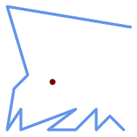 Centroide di una |
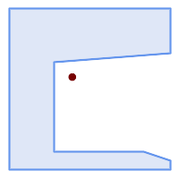 Centroide di un | 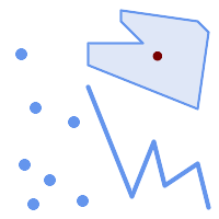 Centroide di una |
SELECT ST_AsText(ST_Centroid('MULTIPOINT ( -1 0, -1 2, -1 3, -1 4, -1 7, 0 1, 0 3, 1 1, 2 0, 6 0, 7 8, 9 8, 10 6 )'));
st_astext
------------------------------------------
POINT(2.30769230769231 3.30769230769231)
(1 row)
SELECT ST_AsText(ST_centroid(g))
FROM ST_GeomFromText('CIRCULARSTRING(0 2, -1 1,0 0, 0.5 0, 1 0, 2 1, 1 2, 0.5 2, 0 2)') AS g ;
------------------------------------------
POINT(0.5 1)
SELECT ST_AsText(ST_centroid(g))
FROM ST_GeomFromText('COMPOUNDCURVE(CIRCULARSTRING(0 2, -1 1,0 0),(0 0, 0.5 0, 1 0),CIRCULARSTRING( 1 0, 2 1, 1 2),(1 2, 0.5 2, 0 2))' ) AS g;
------------------------------------------
POINT(0.5 1)
Si veda anche
Name
ST_ChaikinSmoothing — Returns a smoothed version of a geometry, using the Chaikin algorithm
Synopsis
geometry ST_ChaikinSmoothing(geometry geom, integer nIterations = 1, boolean preserveEndPoints = false);
Descrizione
Smoothes a linear or polygonal geometry using Chaikin's algorithm. The degree of smoothing is controlled by the nIterations parameter. On each iteration, each interior vertex is replaced by two vertices located at 1/4 of the length of the line segments before and after the vertex. A reasonable degree of smoothing is provided by 3 iterations; the maximum is limited to 5.
Se preserveEndPoints è vero, i punti finali degli anelli poligonali non vengono smussati. I punti finali delle stringhe di linee sono sempre conservati.
| |
Il numero di vertici raddoppia a ogni iterazione, quindi la geometria risultante può avere molti più punti di quella in ingresso. Per ridurre il numero di punti, utilizzare una funzione di semplificazione sul risultato (vedere ST_Simplify, ST_SimplifyPreserveTopology e ST_SimplifyVW). |
The result has interpolated values for the Z and M dimensions when present.
Questa funzione supporta il 3d e non distrugge gli z-index.
Availability: 2.5.0
Esempi
Smoothing a triangle:
SELECT ST_AsText(ST_ChaikinSmoothing(geom)) smoothed
FROM (SELECT 'POLYGON((0 0, 8 8, 0 16, 0 0))'::geometry geom) AS foo;
smoothed
───────────────────────────────────────────
POLYGON((2 2,6 6,6 10,2 14,0 12,0 4,2 2))
Lisciatura di un poligono con 1, 2 e 3 iterazioni:
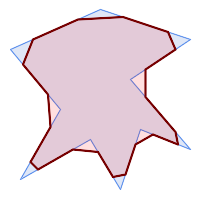 nIterations = 1 |  nIterations = 2 |  nIterations = 3 |
SELECT ST_ChaikinSmoothing(
'POLYGON ((20 20, 60 90, 10 150, 100 190, 190 160, 130 120, 190 50, 140 70, 120 10, 90 60, 20 20))',
generate_series(1, 3) );
Smoothing a LineString using 1, 2 and 3 iterations:
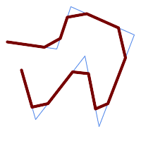 nIterations = 1 |  nIterations = 2 | 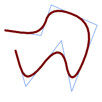 nIterations = 3 |
SELECT ST_ChaikinSmoothing(
'LINESTRING (10 140, 80 130, 100 190, 190 150, 140 20, 120 120, 50 30, 30 100)',
generate_series(1, 3) );
Si veda anche
Name
ST_ConcaveHull — Computes a possibly concave geometry that contains all input geometry vertices
Synopsis
geometry ST_ConcaveHull(geometry param_geom, float param_pctconvex, boolean param_allow_holes = false);
Descrizione
A concave hull is a (usually) concave geometry which contains the input, and whose vertices are a subset of the input vertices. In the general case the concave hull is a Polygon. The concave hull of two or more collinear points is a two-point LineString. The concave hull of one or more identical points is a Point. The polygon will not contain holes unless the optional param_allow_holes argument is specified as true.
One can think of a concave hull as "shrink-wrapping" a set of points. This is different to the convex hull, which is more like wrapping a rubber band around the points. A concave hull generally has a smaller area and represents a more natural boundary for the input points.
The param_pctconvex controls the concaveness of the computed hull. A value of 1 produces the convex hull. Values between 1 and 0 produce hulls of increasing concaveness. A value of 0 produces a hull with maximum concaveness (but still a single polygon). Choosing a suitable value depends on the nature of the input data, but often values between 0.3 and 0.1 produce reasonable results.
| |
Technically, the |
For point and linear inputs, the hull will enclose all the points of the inputs. For polygonal inputs, the hull will enclose all the points of the input and also all the areas covered by the input. If you want a point-wise hull of a polygonal input, convert it to points first using ST_Points.
This is not an aggregate function. To compute the concave hull of a set of geometries use ST_Collect (e.g. ST_ConcaveHull( ST_Collect( geom ), 0.80).
Disponibilità: 2.0.0
Enhanced: 3.3.0, GEOS native implementation enabled for GEOS 3.11+
Esempi

Concave Hull of a MultiPoint
SELECT ST_AsText( ST_ConcaveHull(
'MULTIPOINT ((10 72), (53 76), (56 66), (63 58), (71 51), (81 48), (91 46), (101 45), (111 46), (121 47), (131 50), (140 55), (145 64), (144 74), (135 80), (125 83), (115 85), (105 87), (95 89), (85 91), (75 93), (65 95), (55 98), (45 102), (37 107), (29 114), (22 122), (19 132), (18 142), (21 151), (27 160), (35 167), (44 172), (54 175), (64 178), (74 180), (84 181), (94 181), (104 181), (114 181), (124 181), (134 179), (144 177), (153 173), (162 168), (171 162), (177 154), (182 145), (184 135), (139 132), (136 142), (128 149), (119 153), (109 155), (99 155), (89 155), (79 153), (69 150), (61 144), (63 134), (72 128), (82 125), (92 123), (102 121), (112 119), (122 118), (132 116), (142 113), (151 110), (161 106), (170 102), (178 96), (185 88), (189 78), (190 68), (189 58), (185 49), (179 41), (171 34), (162 29), (153 25), (143 23), (133 21), (123 19), (113 19), (102 19), (92 19), (82 19), (72 21), (62 22), (52 25), (43 29), (33 34), (25 41), (19 49), (14 58), (21 73), (31 74), (42 74), (173 134), (161 134), (150 133), (97 104), (52 117), (157 156), (94 171), (112 106), (169 73), (58 165), (149 40), (70 33), (147 157), (48 153), (140 96), (47 129), (173 55), (144 86), (159 67), (150 146), (38 136), (111 170), (124 94), (26 59), (60 41), (71 162), (41 64), (88 110), (122 34), (151 97), (157 56), (39 146), (88 33), (159 45), (47 56), (138 40), (129 165), (33 48), (106 31), (169 147), (37 122), (71 109), (163 89), (37 156), (82 170), (180 72), (29 142), (46 41), (59 155), (124 106), (157 80), (175 82), (56 50), (62 116), (113 95), (144 167))',
0.1 ) );
---st_astext--
POLYGON ((18 142, 21 151, 27 160, 35 167, 44 172, 54 175, 64 178, 74 180, 84 181, 94 181, 104 181, 114 181, 124 181, 134 179, 144 177, 153 173, 162 168, 171 162, 177 154, 182 145, 184 135, 173 134, 161 134, 150 133, 139 132, 136 142, 128 149, 119 153, 109 155, 99 155, 89 155, 79 153, 69 150, 61 144, 63 134, 72 128, 82 125, 92 123, 102 121, 112 119, 122 118, 132 116, 142 113, 151 110, 161 106, 170 102, 178 96, 185 88, 189 78, 190 68, 189 58, 185 49, 179 41, 171 34, 162 29, 153 25, 143 23, 133 21, 123 19, 113 19, 102 19, 92 19, 82 19, 72 21, 62 22, 52 25, 43 29, 33 34, 25 41, 19 49, 14 58, 10 72, 21 73, 31 74, 42 74, 53 76, 56 66, 63 58, 71 51, 81 48, 91 46, 101 45, 111 46, 121 47, 131 50, 140 55, 145 64, 144 74, 135 80, 125 83, 115 85, 105 87, 95 89, 85 91, 75 93, 65 95, 55 98, 45 102, 37 107, 29 114, 22 122, 19 132, 18 142))
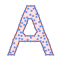
Concave Hull of a MultiPoint, allowing holes
SELECT ST_AsText( ST_ConcaveHull(
'MULTIPOINT ((132 64), (114 64), (99 64), (81 64), (63 64), (57 49), (52 36), (46 20), (37 20), (26 20), (32 36), (39 55), (43 69), (50 84), (57 100), (63 118), (68 133), (74 149), (81 164), (88 180), (101 180), (112 180), (119 164), (126 149), (132 131), (139 113), (143 100), (150 84), (157 69), (163 51), (168 36), (174 20), (163 20), (150 20), (143 36), (139 49), (132 64), (99 151), (92 138), (88 124), (81 109), (74 93), (70 82), (83 82), (99 82), (112 82), (126 82), (121 96), (114 109), (110 122), (103 138), (99 151), (34 27), (43 31), (48 44), (46 58), (52 73), (63 73), (61 84), (72 71), (90 69), (101 76), (123 71), (141 62), (166 27), (150 33), (159 36), (146 44), (154 53), (152 62), (146 73), (134 76), (143 82), (141 91), (130 98), (126 104), (132 113), (128 127), (117 122), (112 133), (119 144), (108 147), (119 153), (110 171), (103 164), (92 171), (86 160), (88 142), (79 140), (72 124), (83 131), (79 118), (68 113), (63 102), (68 93), (35 45))',
0.15, true ) );
---st_astext--
POLYGON ((43 69, 50 84, 57 100, 63 118, 68 133, 74 149, 81 164, 88 180, 101 180, 112 180, 119 164, 126 149, 132 131, 139 113, 143 100, 150 84, 157 69, 163 51, 168 36, 174 20, 163 20, 150 20, 143 36, 139 49, 132 64, 114 64, 99 64, 81 64, 63 64, 57 49, 52 36, 46 20, 37 20, 26 20, 32 36, 35 45, 39 55, 43 69), (88 124, 81 109, 74 93, 83 82, 99 82, 112 82, 121 96, 114 109, 110 122, 103 138, 92 138, 88 124))
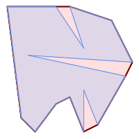
| 
|
Comparing a concave hull of a Polygon to the concave hull of the constituent points. The hull respects the boundary of the polygon, whereas the points-based hull does not.
WITH data(geom) AS (VALUES
('POLYGON ((10 90, 39 85, 61 79, 50 90, 80 80, 95 55, 25 60, 90 45, 70 16, 63 38, 60 10, 50 30, 43 27, 30 10, 20 20, 10 90))'::geometry)
)
SELECT ST_ConcaveHull( geom, 0.1) AS polygon_hull,
ST_ConcaveHull( ST_Points(geom), 0.1) AS points_hull
FROM data;
Using with ST_Collect to compute the concave hull of a geometry set.
-- Compute estimate of infected area based on point observations
SELECT disease_type,
ST_ConcaveHull( ST_Collect(obs_pnt), 0.3 ) AS geom
FROM disease_obs
GROUP BY disease_type;
Si veda anche
ST_ConvexHull, ST_Collect, ST_AlphaShape, ST_OptimalAlphaShape
Name
ST_ConvexHull — Computes the convex hull of a geometry.
Synopsis
geometry ST_ConvexHull(geometry geomA);
Descrizione
Computes the convex hull of a geometry. The convex hull is the smallest convex geometry that encloses all geometries in the input.
One can think of the convex hull as the geometry obtained by wrapping an rubber band around a set of geometries. This is different from a concave hull which is analogous to "shrink-wrapping" the geometries. A convex hull is often used to determine an affected area based on a set of point observations.
In the general case the convex hull is a Polygon. The convex hull of two or more collinear points is a two-point LineString. The convex hull of one or more identical points is a Point.
This is not an aggregate function. To compute the convex hull of a set of geometries, use ST_Collect to aggregate them into a geometry collection (e.g. ST_ConvexHull(ST_Collect(geom)).
Eseguito dal modulo GEOS
Questo metodo implementa le OGC Simple Features Implementation Specification for SQL 1.1. s2.1.1.3
Questo metodo implementa la specifica SQL/MM. SQL-MM IEC 13249-3: 5.1.16
Questa funzione supporta il 3d e non distrugge gli z-index.
Esempi
Convex Hull of a MultiLinestring and a MultiPoint
SELECT ST_AsText(ST_ConvexHull(
ST_Collect(
ST_GeomFromText('MULTILINESTRING((100 190,10 8),(150 10, 20 30))'),
ST_GeomFromText('MULTIPOINT(50 5, 150 30, 50 10, 10 10)')
)) );
---st_astext--
POLYGON((50 5,10 8,10 10,100 190,150 30,150 10,50 5))
Using with ST_Collect to compute the convex hulls of geometry sets.
--Get estimate of infected area based on point observations
SELECT d.disease_type,
ST_ConvexHull(ST_Collect(d.geom)) As geom
FROM disease_obs As d
GROUP BY d.disease_type;
Si veda anche
Name
ST_DelaunayTriangles — Returns the Delaunay triangulation of the vertices of a geometry.
Synopsis
geometry ST_DelaunayTriangles(geometry g1, float tolerance = 0.0, int4 flags = 0);
Descrizione
Computes the Delaunay triangulation of the vertices of the input geometry. The optional tolerance can be used to snap nearby input vertices together, which improves robustness in some situations. The result geometry is bounded by the convex hull of the input vertices. The result geometry representation is determined by the flags code:
0- a GEOMETRYCOLLECTION of triangular POLYGONs (default)1- a MULTILINESTRING of the edges of the triangulation2- A TIN of the triangulation
Eseguito dal modulo GEOS.
Disponibilità: 2.1.0
Questa funzione supporta il 3d e non distrugge gli z-index.
Questa funzione supporta i Triangoli e le Triangulated Irregular Network Surfaces (TIN).
Esempi
 Original polygons our original geometry
ST_Union(ST_GeomFromText('POLYGON((175 150, 20 40,
50 60, 125 100, 175 150))'),
ST_Buffer(ST_GeomFromText('POINT(110 170)'), 20)
) |
 ST_DelaunayTriangles of 2 polygons: delaunay triangle polygons each triangle themed in different color
geometries overlaid multilinestring triangles
SELECT
ST_DelaunayTriangles(
ST_Union(ST_GeomFromText('POLYGON((175 150, 20 40,
50 60, 125 100, 175 150))'),
ST_Buffer(ST_GeomFromText('POINT(110 170)'), 20)
))
As dtriag;
|
 -- delaunay triangles as multilinestring
SELECT
ST_DelaunayTriangles(
ST_Union(ST_GeomFromText('POLYGON((175 150, 20 40,
50 60, 125 100, 175 150))'),
ST_Buffer(ST_GeomFromText('POINT(110 170)'), 20)
),0.001,1)
As dtriag;
|
 -- delaunay triangles of 45 points as 55 triangle polygons
this produces a table of 42 points that form an L shape SELECT (ST_DumpPoints(ST_GeomFromText( 'MULTIPOINT(14 14,34 14,54 14,74 14,94 14,114 14,134 14, 150 14,154 14,154 6,134 6,114 6,94 6,74 6,54 6,34 6, 14 6,10 6,8 6,7 7,6 8,6 10,6 30,6 50,6 70,6 90,6 110,6 130, 6 150,6 170,6 190,6 194,14 194,14 174,14 154,14 134,14 114, 14 94,14 74,14 54,14 34,14 14)'))).geom INTO TABLE l_shape; output as individual polygon triangles SELECT ST_AsText((ST_Dump(geom)).geom) As wkt FROM ( SELECT ST_DelaunayTriangles(ST_Collect(geom)) As geom FROM l_shape) As foo; wkt POLYGON((6 194,6 190,14 194,6 194)) POLYGON((14 194,6 190,14 174,14 194)) POLYGON((14 194,14 174,154 14,14 194)) POLYGON((154 14,14 174,14 154,154 14)) POLYGON((154 14,14 154,150 14,154 14)) POLYGON((154 14,150 14,154 6,154 14))
|
Example using vertices with Z values.
3D multipoint SELECT ST_AsText(ST_DelaunayTriangles(ST_GeomFromText( 'MULTIPOINT Z(14 14 10, 150 14 100,34 6 25, 20 10 150)'))) As wkt; wkt GEOMETRYCOLLECTION Z (POLYGON Z ((14 14 10,20 10 150,34 6 25,14 14 10)) ,POLYGON Z ((14 14 10,34 6 25,150 14 100,14 14 10)))
Name
ST_FilterByM — Removes vertices based on their M value
Synopsis
geometry ST_FilterByM(geometry geom, double precision min, double precision max = null, boolean returnM = false);
Descrizione
Filters out vertex points based on their M-value. Returns a geometry with only vertex points that have a M-value larger or equal to the min value and smaller or equal to the max value. If max-value argument is left out only min value is considered. If fourth argument is left out the m-value will not be in the resulting geometry. If resulting geometry have too few vertex points left for its geometry type an empty geometry will be returned. In a geometry collection geometries without enough points will just be left out silently.
This function is mainly intended to be used in conjunction with ST_SetEffectiveArea. ST_EffectiveArea sets the effective area of a vertex in its m-value. With ST_FilterByM it then is possible to get a simplified version of the geometry without any calculations, just by filtering
| |
There is a difference in what ST_SimplifyVW returns when not enough points meet the criteria compared to ST_FilterByM. ST_SimplifyVW returns the geometry with enough points while ST_FilterByM returns an empty geometry |
| |
Note that the returned geometry might be invalid |
| |
This function returns all dimensions, including the Z and M values |
Availability: 2.5.0
Esempi
A linestring is filtered
SELECT ST_AsText(ST_FilterByM(geom,30)) simplified
FROM (SELECT ST_SetEffectiveArea('LINESTRING(5 2, 3 8, 6 20, 7 25, 10 10)'::geometry) geom) As foo;
result
simplified
----------------------------
LINESTRING(5 2,7 25,10 10)
Si veda anche
Name
ST_GeneratePoints — Generates a multipoint of random points contained in a Polygon or MultiPolygon.
Synopsis
geometry ST_GeneratePoints(geometry g, integer npoints, integer seed = 0);
Descrizione
ST_GeneratePoints generates a multipoint consisting of a given number of pseudo-random points which lie within the input area. The optional seed is used to regenerate a deterministic sequence of points, and must be greater than zero.
Availability: 2.3.0
Enhanced: 3.0.0, added seed parameter
Esempi
Generated a multipoint consisting of 12 Points overlaid on top of original polygon using a random seed value 1996
SELECT ST_GeneratePoints(geom, 12, 1996)
FROM (
SELECT ST_Buffer(
ST_GeomFromText(
'LINESTRING(50 50,150 150,150 50)'),
10, 'endcap=round join=round') AS geom
) AS s;
Given a table of polygons s, return 12 individual points per polygon. Results will be different each time you run.
SELECT s.id, dp.path[1] AS pt_id, dp.geom FROM s, ST_DumpPoints(ST_GeneratePoints(s.geom,12)) AS dp;
Si veda anche
Name
ST_GeometricMedian — Returns the geometric median of a MultiPoint.
Synopsis
geometry ST_GeometricMedian ( geometry geom, float8 tolerance = NULL, int max_iter = 10000, boolean fail_if_not_converged = false);
Descrizione
Computes the approximate geometric median of a MultiPoint geometry using the Weiszfeld algorithm. The geometric median is the point minimizing the sum of distances to the input points. It provides a centrality measure that is less sensitive to outlier points than the centroid (center of mass).
The algorithm iterates until the distance change between successive iterations is less than the supplied tolerance parameter. If this condition has not been met after max_iterations iterations, the function produces an error and exits, unless fail_if_not_converged is set to false (the default).
If a tolerance argument is not provided, the tolerance value is calculated based on the extent of the input geometry.
If present, the input point M values are interpreted as their relative weights.
Availability: 2.3.0
Enhanced: 2.5.0 Added support for M as weight of points.
Questa funzione supporta il 3d e non distrugge gli z-index.
Questa funzione supporta le coordinate M.
Esempi
Comparison of the geometric median (red) and centroid (turquoise) of a MultiPoint.
WITH test AS (
SELECT 'MULTIPOINT((10 10), (10 40), (40 10), (190 190))'::geometry geom)
SELECT
ST_AsText(ST_Centroid(geom)) centroid,
ST_AsText(ST_GeometricMedian(geom)) median
FROM test;
centroid | median
--------------------+----------------------------------------
POINT(62.5 62.5) | POINT(25.01778421249728 25.01778421249728)
(1 row)
Si veda anche
Name
ST_LineMerge — Return the lines formed by sewing together a MultiLineString.
Synopsis
geometry ST_LineMerge(geometry amultilinestring);
geometry ST_LineMerge(geometry amultilinestring, boolean directed);
Descrizione
Returns a LineString or MultiLineString formed by joining together the line elements of a MultiLineString. Lines are joined at their endpoints at 2-way intersections. Lines are not joined across intersections of 3-way or greater degree.
If directed is TRUE, then ST_LineMerge will not change point order within LineStrings, so lines with opposite directions will not be merged
| |
Only use with MultiLineString/LineStrings. Other geometry types return an empty GeometryCollection |
Eseguito dal modulo GEOS.
Enhanced: 3.3.0 accept a directed parameter.
Requires GEOS >= 3.11.0 to use the directed parameter.
Disponibilità: 1.1.0
| |
This function strips the M dimension. |
Esempi
Merging lines with different orientation.
SELECT ST_AsText(ST_LineMerge(
'MULTILINESTRING((10 160, 60 120), (120 140, 60 120), (120 140, 180 120))'
));
--------------------------------------------
LINESTRING(10 160,60 120,120 140,180 120)
Lines are not merged across intersections with degree > 2.
SELECT ST_AsText(ST_LineMerge(
'MULTILINESTRING((10 160, 60 120), (120 140, 60 120), (120 140, 180 120), (100 180, 120 140))'
));
--------------------------------------------
MULTILINESTRING((10 160,60 120,120 140),(100 180,120 140),(120 140,180 120))
If merging is not possible due to non-touching lines, the original MultiLineString is returned.
SELECT ST_AsText(ST_LineMerge( 'MULTILINESTRING((-29 -27,-30 -29.7,-36 -31,-45 -33),(-45.2 -33.2,-46 -32))' )); ---------------- MULTILINESTRING((-45.2 -33.2,-46 -32),(-29 -27,-30 -29.7,-36 -31,-45 -33))
Lines with opposite directions are not merged if directed = TRUE.
SELECT ST_AsText(ST_LineMerge( 'MULTILINESTRING((60 30, 10 70), (120 50, 60 30), (120 50, 180 30))', TRUE)); ------------------------------------------------------- MULTILINESTRING((120 50,60 30,10 70),(120 50,180 30))
Example showing Z-dimension handling.
SELECT ST_AsText(ST_LineMerge(
'MULTILINESTRING((-29 -27 11,-30 -29.7 10,-36 -31 5,-45 -33 6), (-29 -27 12,-30 -29.7 5), (-45 -33 1,-46 -32 11))'
));
--------------------------------------------------------------------------------------------------
LINESTRING Z (-30 -29.7 5,-29 -27 11,-30 -29.7 10,-36 -31 5,-45 -33 1,-46 -32 11)
Si veda anche
Name
ST_MaximumInscribedCircle — Computes the largest circle contained within a geometry.
Synopsis
(geometry, geometry, double precision) ST_MaximumInscribedCircle(geometry geom);
Descrizione
Finds the largest circle that is contained within a (multi)polygon, or which does not overlap any lines and points. Returns a record with fields:
center- center point of the circlenearest- a point on the geometry nearest to the centerradius- radius of the circle
For polygonal inputs, the circle is inscribed within the boundary rings, using the internal rings as boundaries. For linear and point inputs, the circle is inscribed within the convex hull of the input, using the input lines and points as further boundaries.
Availability: 3.1.0.
Requires GEOS >= 3.9.0.
Esempi
Maximum inscribed circle of a polygon. Center, nearest point, and radius are returned.
SELECT radius, ST_AsText(center) AS center, ST_AsText(nearest) AS nearest
FROM ST_MaximumInscribedCircle(
'POLYGON ((40 180, 110 160, 180 180, 180 120, 140 90, 160 40, 80 10, 70 40, 20 50, 40 180),
(60 140, 50 90, 90 140, 60 140))');
radius | center | nearest
-----------------+----------------------------+---------------
45.165845650018 | POINT(96.953125 76.328125) | POINT(140 90)
Maximum inscribed circle of a multi-linestring. Center, nearest point, and radius are returned.
Si veda anche
Name
ST_LargestEmptyCircle — Computes the largest circle not overlapping a geometry.
Synopsis
(geometry, geometry, double precision) ST_LargestEmptyCircle(geometry geom, double precision tolerance=0.0, geometry boundary=POINT EMPTY);
Descrizione
Finds the largest circle which does not overlap a set of point and line obstacles. (Polygonal geometries may be included as obstacles, but only their boundary lines are used.) The center of the circle is constrained to lie inside a polygonal boundary, which by default is the convex hull of the input geometry. The circle center is the point in the interior of the boundary which has the farthest distance from the obstacles. The circle itself is provided by the center point and a nearest point lying on an obstacle determining the circle radius.
Il centro del cerchio viene determinato con una determinata precisione specificata da una distanza di tolleranza, utilizzando un algoritmo iterativo. Se la distanza di precisione non è specificata, viene utilizzato un valore predefinito ragionevole.
Restituisce un record con i campi:
center- center point of the circlenearest- a point on the geometry nearest to the centerradius- radius of the circle
Per trovare il cerchio vuoto più grande all'interno di un poligono, vedere ST_MaximumInscribedCircle.
Disponibilità: 3.4.0.
Requires GEOS >= 3.9.0.
Esempi
SELECT radius,
center,
nearest
FROM ST_LargestEmptyCircle(
'MULTILINESTRING (
(10 100, 60 180, 130 150, 190 160),
(20 50, 70 70, 90 20, 110 40),
(160 30, 100 100, 180 100))');Il più grande cerchio vuoto all'interno di un insieme di linee.
SELECT radius,
center,
nearest
FROM ST_LargestEmptyCircle(
ST_Collect(
'MULTIPOINT ((70 50), (60 130), (130 150), (80 90))'::geometry,
'POLYGON ((90 190, 10 100, 60 10, 190 40, 120 100, 190 180, 90 190))'::geometry),
0,
'POLYGON ((90 190, 10 100, 60 10, 190 40, 120 100, 190 180, 90 190))'::geometry
);Cerchio vuoto più grande all'interno di un insieme di punti, vincolato a rientrare in un poligono. Il confine del poligono di vincolo deve essere incluso come ostacolo e specificato come vincolo per il centro del cerchio.
Si veda anche
Name
ST_MinimumBoundingCircle — Returns the smallest circle polygon that contains a geometry.
Synopsis
geometry ST_MinimumBoundingCircle(geometry geomA, integer num_segs_per_qt_circ=48);
Descrizione
Returns the smallest circle polygon that contains a geometry.
| |
Il cerchio di delimitazione è approssimato da un poligono con un valore predefinito di 48 segmenti per quarto di cerchio. Poiché il poligono è un'approssimazione del cerchio limite minimo, alcuni punti della geometria di input potrebbero non essere contenuti nel poligono. L'approssimazione può essere migliorata aumentando il numero di segmenti. Per le applicazioni in cui un'approssimazione non è adatta si può utilizzare ST_MinimumBoundingRadius. |
Si può usare con ST_Collect per ottenere il cerchio minimo di delimitazione di un insieme di geometrie.
Per calcolare due punti che giacciono sulla circonferenza minima (il "diametro massimo") si può usare ST_LongestLine.
Il rapporto tra l'area di un poligono divisa per l'area del suo Circolo Minimo Vincolato è indicato come il punteggio di compattezza Reock.
Eseguito dal modulo GEOS.
Disponibilità: 1.4.0
Esempi
SELECT d.disease_type,
ST_MinimumBoundingCircle(ST_Collect(d.geom)) As geom
FROM disease_obs As d
GROUP BY d.disease_type;
Cerchio minimo di un punto e di una linea. Utilizzo di 8 segmenti per approssimare un quarto di cerchio
SELECT ST_AsText(ST_MinimumBoundingCircle(
ST_Collect(
ST_GeomFromText('LINESTRING(55 75,125 150)'),
ST_Point(20, 80)), 8
)) As wktmbc;
wktmbc
-----------
POLYGON((135.59714732062 115,134.384753327498 102.690357210921,130.79416296937 90.8537670908995,124.963360620072 79.9451031602111,117.116420743937 70.3835792560632,107.554896839789 62.5366393799277,96.6462329091006 56.70583703063,84.8096427890789 53.115246672502,72.5000000000001 51.9028526793802,60.1903572109213 53.1152466725019,48.3537670908996 56.7058370306299,37.4451031602112 62.5366393799276,27.8835792560632 70.383579256063,20.0366393799278 79.9451031602109,14.20583703063 90.8537670908993,10.615246672502 102.690357210921,9.40285267938019 115,10.6152466725019 127.309642789079,14.2058370306299 139.1462329091,20.0366393799275 150.054896839789,27.883579256063 159.616420743937,
37.4451031602108 167.463360620072,48.3537670908992 173.29416296937,60.190357210921 176.884753327498,
72.4999999999998 178.09714732062,84.8096427890786 176.884753327498,96.6462329091003 173.29416296937,107.554896839789 167.463360620072,
117.116420743937 159.616420743937,124.963360620072 150.054896839789,130.79416296937 139.146232909101,134.384753327498 127.309642789079,135.59714732062 115))
Si veda anche
ST_Collect, ST_MinimumBoundingRadius, ST_LargestEmptyCircle, ST_LongestLine
Name
ST_MinimumBoundingRadius — Restituisce il punto centrale e il raggio del cerchio più piccolo che contiene una geometria.
Synopsis
(geometry, double precision) ST_MinimumBoundingRadius(geometry geom);
Descrizione
Calcola il punto centrale e il raggio del cerchio più piccolo che contiene una geometria. Restituisce un record con i campi:
center- center point of the circleradius- radius of the circle
Si può usare con ST_Collect per ottenere il cerchio minimo di delimitazione di un insieme di geometrie.
Per calcolare due punti che giacciono sulla circonferenza minima (il "diametro massimo") si può usare ST_LongestLine.
Disponibilità: 2.3.0
Esempi
SELECT ST_AsText(center), radius FROM ST_MinimumBoundingRadius('POLYGON((26426 65078,26531 65242,26075 65136,26096 65427,26426 65078))');
st_astext | radius
------------------------------------------+------------------
POINT(26284.8418027133 65267.1145090825) | 247.436045591407
Si veda anche
Name
ST_OrientedEnvelope — Returns a minimum-area rectangle containing a geometry.
Synopsis
geometry ST_OrientedEnvelope( geometry geom );
Descrizione
Returns the minimum-area rotated rectangle enclosing a geometry. Note that more than one such rectangle may exist. May return a Point or LineString in the case of degenerate inputs.
Availability: 2.5.0.
Requires GEOS >= 3.6.0.
Esempi
SELECT ST_AsText(ST_OrientedEnvelope('MULTIPOINT ((0 0), (-1 -1), (3 2))'));
st_astext
------------------------------------------------
POLYGON((3 2,2.88 2.16,-1.12 -0.84,-1 -1,3 2))
Oriented envelope of a point and linestring.
SELECT ST_AsText(ST_OrientedEnvelope(
ST_Collect(
ST_GeomFromText('LINESTRING(55 75,125 150)'),
ST_Point(20, 80))
)) As wktenv;
wktenv
-----------
POLYGON((19.9999999999997 79.9999999999999,33.0769230769229 60.3846153846152,138.076923076924 130.384615384616,125.000000000001 150.000000000001,19.9999999999997 79.9999999999999))
Si veda anche
Name
ST_OffsetCurve — Returns an offset line at a given distance and side from an input line.
Synopsis
geometry ST_OffsetCurve(geometry line, float signed_distance, text style_parameters='');
Descrizione
Return an offset line at a given distance and side from an input line. All points of the returned geometries are not further than the given distance from the input geometry. Useful for computing parallel lines about a center line.
For positive distance the offset is on the left side of the input line and retains the same direction. For a negative distance it is on the right side and in the opposite direction.
Units of distance are measured in units of the spatial reference system.
Note that output may be a MULTILINESTRING or EMPTY for some jigsaw-shaped input geometries.
The optional third parameter allows specifying a list of blank-separated key=value pairs to tweak operations as follows:
'quad_segs=#' : number of segments used to approximate a quarter circle (defaults to 8).
'join=round|mitre|bevel' : join style (defaults to "round"). 'miter' is also accepted as a synonym for 'mitre'.
'mitre_limit=#.#' : mitre ratio limit (only affects mitred join style). 'miter_limit' is also accepted as a synonym for 'mitre_limit'.
Eseguito dal modulo GEOS.
Behavior changed in GEOS 3.11 so offset curves now have the same direction as the input line, for both positive and negative offsets.
Disponibilità: 2.0
Migliorato: 2.5 - aggiunto il supporto per GEOMETRYCOLLECTION e MULTILINESTRING
| |
This function ignores the Z dimension. It always gives a 2D result even when used on a 3D geometry. |
Esempi
Calcolo di un buffer aperto intorno alle strade
SELECT ST_Union(
ST_OffsetCurve(f.geom, f.width/2, 'quad_segs=4 join=round'),
ST_OffsetCurve(f.geom, -f.width/2, 'quad_segs=4 join=round')
) as track
FROM someroadstable;
 15, 'quad_segs=4 join=round' linea originale e il suo spostamento di 15 unità.
SELECT ST_AsText(ST_OffsetCurve(ST_GeomFromText(
'LINESTRING(164 16,144 16,124 16,104 16,84 16,64 16,
44 16,24 16,20 16,18 16,17 17,
16 18,16 20,16 40,16 60,16 80,16 100,
16 120,16 140,16 160,16 180,16 195)'),
15, 'quad_segs=4 join=round'));
output
LINESTRING(164 1,18 1,12.2597485145237 2.1418070123307,
7.39339828220179 5.39339828220179,
5.39339828220179 7.39339828220179,
2.14180701233067 12.2597485145237,1 18,1 195)
|  -15, 'quad_segs=4 join=round' linea originale e suo offset -15 unità
SELECT ST_AsText(ST_OffsetCurve(geom,
-15, 'quad_segs=4 join=round')) As notsocurvy
FROM ST_GeomFromText(
'LINESTRING(164 16,144 16,124 16,104 16,84 16,64 16,
44 16,24 16,20 16,18 16,17 17,
16 18,16 20,16 40,16 60,16 80,16 100,
16 120,16 140,16 160,16 180,16 195)') As geom;
notsocurvy
LINESTRING(31 195,31 31,164 31)
|
 doppio offset per ottenere una maggiore curvatura, notare che il primo inverte la direzione, quindi -30 + 15 = -15
SELECT ST_AsText(ST_OffsetCurve(ST_OffsetCurve(geom,
-30, 'quad_segs=4 join=round'), -15, 'quad_segs=4 join=round')) As morecurvy
FROM ST_GeomFromText(
'LINESTRING(164 16,144 16,124 16,104 16,84 16,64 16,
44 16,24 16,20 16,18 16,17 17,
16 18,16 20,16 40,16 60,16 80,16 100,
16 120,16 140,16 160,16 180,16 195)') As geom;
morecurvy
LINESTRING(164 31,46 31,40.2597485145236 32.1418070123307,
35.3933982822018 35.3933982822018,
32.1418070123307 40.2597485145237,31 46,31 195)
|  doppio offset per ottenere una maggiore curvatura, combinato con l'offset regolare 15 per ottenere linee parallele. Sovrapposto all'originale.
SELECT ST_AsText(ST_Collect(
ST_OffsetCurve(geom, 15, 'quad_segs=4 join=round'),
ST_OffsetCurve(ST_OffsetCurve(geom,
-30, 'quad_segs=4 join=round'), -15, 'quad_segs=4 join=round')
)
) As parallel_curves
FROM ST_GeomFromText(
'LINESTRING(164 16,144 16,124 16,104 16,84 16,64 16,
44 16,24 16,20 16,18 16,17 17,
16 18,16 20,16 40,16 60,16 80,16 100,
16 120,16 140,16 160,16 180,16 195)') As geom;
parallel curves
MULTILINESTRING((164 1,18 1,12.2597485145237 2.1418070123307,
7.39339828220179 5.39339828220179,5.39339828220179 7.39339828220179,
2.14180701233067 12.2597485145237,1 18,1 195),
(164 31,46 31,40.2597485145236 32.1418070123307,35.3933982822018 35.3933982822018,
32.1418070123307 40.2597485145237,31 46,31 195))
|
 15, 'quad_segs=4 join=bevel' mostrato con la linea originale
SELECT ST_AsText(ST_OffsetCurve(ST_GeomFromText(
'LINESTRING(164 16,144 16,124 16,104 16,84 16,64 16,
44 16,24 16,20 16,18 16,17 17,
16 18,16 20,16 40,16 60,16 80,16 100,
16 120,16 140,16 160,16 180,16 195)'),
15, 'quad_segs=4 join=bevel'));
output
LINESTRING(164 1,18 1,7.39339828220179 5.39339828220179,
5.39339828220179 7.39339828220179,1 18,1 195)
|  15,-15 raccolto, join=mitre mitre mitre_limit=2.1
SELECT ST_AsText(ST_Collect(
ST_OffsetCurve(geom, 15, 'quad_segs=4 join=mitre mitre_limit=2.2'),
ST_OffsetCurve(geom, -15, 'quad_segs=4 join=mitre mitre_limit=2.2')
) )
FROM ST_GeomFromText(
'LINESTRING(164 16,144 16,124 16,104 16,84 16,64 16,
44 16,24 16,20 16,18 16,17 17,
16 18,16 20,16 40,16 60,16 80,16 100,
16 120,16 140,16 160,16 180,16 195)') As geom;
output
MULTILINESTRING((164 1,11.7867965644036 1,1 11.7867965644036,1 195),
(31 195,31 31,164 31))
|
Si veda anche
Name
ST_PointOnSurface — Calcola un punto che si trova in un poligono o su una geometria.
Synopsis
geometry ST_PointOnSurface(geometry g1);
Descrizione
Returns a POINT which is guaranteed to lie in the interior of a surface (POLYGON, MULTIPOLYGON, and CURVEPOLYGON). In PostGIS this function also works on line and point geometries.
Questo metodo implementa le OGC Simple Features Implementation Specification for SQL 1.1. s3.2.14.2 // s3.2.18.2
Questo metodo implementa la specifica SQL/MM. SQL-MM 3: 8.1.5, 9.5.6. Le specifiche definiscono ST_PointOnSurface solo per le geometrie di superficie. PostGIS estende la funzione per supportare tutti i tipi di geometria più comuni. Altri database (Oracle, DB2, ArcSDE) sembrano supportare questa funzione solo per le superfici. SQL Server 2008 supporta tutti i tipi di geometria più comuni.
Questa funzione supporta il 3d e non distrugge gli z-index.
Esempi
 Punto sulla superficie di |  Punto sulla superficie di un |
 Punto sulla superficie di un |  Punto sulla superficie di una |
SELECT ST_AsText(ST_PointOnSurface('POINT(0 5)'::geometry));
------------
POINT(0 5)
SELECT ST_AsText(ST_PointOnSurface('LINESTRING(0 5, 0 10)'::geometry));
------------
POINT(0 5)
SELECT ST_AsText(ST_PointOnSurface('POLYGON((0 0, 0 5, 5 5, 5 0, 0 0))'::geometry));
----------------
POINT(2.5 2.5)
SELECT ST_AsEWKT(ST_PointOnSurface(ST_GeomFromEWKT('LINESTRING(0 5 1, 0 0 1, 0 10 2)')));
----------------
POINT(0 0 1)
Esempio: Il risultato di ST_PointOnSurface è garantito all'interno dei poligoni, mentre il punto calcolato da ST_Centroid può essere esterno.
Rosso: punto sulla superficie; verde: centroide
SELECT ST_AsText(ST_PointOnSurface(geom)) AS pt_on_surf,
ST_AsText(ST_Centroid(geom)) AS centroid
FROM (SELECT 'POLYGON ((130 120, 120 190, 30 140, 50 20, 190 20,
170 100, 90 60, 90 130, 130 120))'::geometry AS geom) AS t;
pt_on_surf | centroid
-----------------+---------------------------------------------
POINT(62.5 110) | POINT(100.18264840182648 85.11415525114155)
Si veda anche
Name
ST_Polygonize — Calcola un insieme di poligoni formati dalle linee di un insieme di geometrie.
Synopsis
geometry ST_Polygonize(geometry set geomfield);
geometry ST_Polygonize(geometry[] geom_array);
Descrizione
Crea una GeometryCollection contenente i poligoni formati dalle linee di un insieme di geometrie. Se le linee di input non formano alcun poligono, viene restituita una GeometryCollection vuota.
Questa funzione crea poligoni che coprono tutte le aree delimitate. Se il risultato è destinato a formare una geometria poligonale valida, utilizzare ST_BuildArea per evitare che vengano riempiti dei buchi.
| |
Affinché questa funzione funzioni correttamente, il tracciato di input deve essere nodato. Per assicurarsi che lo sia, utilizzare ST_Node sulla geometria di input prima di poligonare. |
| |
Le GeometryCollections possono essere difficili da gestire con strumenti esterni. Utilizzare ST_Dump per convertire il risultato poligonizzato in poligoni separati. |
Eseguito dal modulo GEOS.
Disponibilità: dalla versione 1.0.0RC1
Esempi
 Input lines
|
 Risultato poligonizzato
|
WITH data(geom) AS (VALUES
('LINESTRING (180 40, 30 20, 20 90)'::geometry)
,('LINESTRING (180 40, 160 160)'::geometry)
,('LINESTRING (80 60, 120 130, 150 80)'::geometry)
,('LINESTRING (80 60, 150 80)'::geometry)
,('LINESTRING (20 90, 70 70, 80 130)'::geometry)
,('LINESTRING (80 130, 160 160)'::geometry)
,('LINESTRING (20 90, 20 160, 70 190)'::geometry)
,('LINESTRING (70 190, 80 130)'::geometry)
,('LINESTRING (70 190, 160 160)'::geometry)
)
SELECT ST_AsText( ST_Polygonize( geom ))
FROM data;
------------------------------------------------------------------------------------------
GEOMETRYCOLLECTION (POLYGON ((180 40, 30 20, 20 90, 70 70, 80 130, 160 160, 180 40), (150 80, 120 130, 80 60, 150 80)),
POLYGON ((20 90, 20 160, 70 190, 80 130, 70 70, 20 90)),
POLYGON ((160 160, 80 130, 70 190, 160 160)),
POLYGON ((80 60, 120 130, 150 80, 80 60)))
Poligonatura di una tabella di linee:
SELECT ST_AsEWKT(ST_Polygonize(geom_4269)) As geomtextrep
FROM (SELECT geom_4269 FROM ma.suffolk_edges) As foo;
-------------------------------------
SRID=4269;GEOMETRYCOLLECTION(POLYGON((-71.040878 42.285678,-71.040943 42.2856,-71.04096 42.285752,-71.040878 42.285678)),
POLYGON((-71.17166 42.353675,-71.172026 42.354044,-71.17239 42.354358,-71.171794 42.354971,-71.170511 42.354855,
-71.17112 42.354238,-71.17166 42.353675)))
--Use ST_Dump to dump out the polygonize geoms into individual polygons
SELECT ST_AsEWKT((ST_Dump(t.polycoll)).geom) AS geomtextrep
FROM (SELECT ST_Polygonize(geom_4269) AS polycoll
FROM (SELECT geom_4269 FROM ma.suffolk_edges)
As foo) AS t;
------------------------
SRID=4269;POLYGON((-71.040878 42.285678,-71.040943 42.2856,-71.04096 42.285752,
-71.040878 42.285678))
SRID=4269;POLYGON((-71.17166 42.353675,-71.172026 42.354044,-71.17239 42.354358
,-71.171794 42.354971,-71.170511 42.354855,-71.17112 42.354238,-71.17166 42.353675))
Si veda anche
Name
ST_ReducePrecision — Restituisce una geometria valida con punti arrotondati alla tolleranza della griglia.
Synopsis
geometry ST_ReducePrecision(geometry g, float8 gridsize);
Descrizione
Restituisce una geometria valida con tutti i punti arrotondati alla tolleranza della griglia fornita e gli elementi al di sotto della tolleranza rimossi.
A differenza di ST_SnapToGrid, la geometria restituita sarà valida, senza autointersecazioni di anelli o componenti collassati.
La riduzione di precisione può essere utilizzata per:
abbinare la precisione delle coordinate all'accuratezza dei dati
ridurre il numero di coordinate necessarie per rappresentare una geometria
garantire un output geometrico valido in formati che utilizzano una precisione inferiore (ad esempio, formati di testo come WKT, GeoJSON o KML quando il numero di cifre decimali in uscita è limitato).
esportare geometrie valide in sistemi che utilizzano una precisione inferiore o limitata (ad es. SDE, valore di tolleranza Oracle)
Availability: 3.1.0.
Requires GEOS >= 3.9.0.
Esempi
SELECT ST_AsText(ST_ReducePrecision('POINT(1.412 19.323)', 0.1));
st_astext
-----------------
POINT(1.4 19.3)
SELECT ST_AsText(ST_ReducePrecision('POINT(1.412 19.323)', 1.0));
st_astext
-------------
POINT(1 19)
SELECT ST_AsText(ST_ReducePrecision('POINT(1.412 19.323)', 10));
st_astext
-------------
POINT(0 20)
La riduzione della precisione può ridurre il numero di vertici
SELECT ST_AsText(ST_ReducePrecision('LINESTRING (10 10, 19.6 30.1, 20 30, 20.3 30, 40 40)', 1));
st_astext
-------------
LINESTRING (10 10, 20 30, 40 40)
La riduzione di precisione divide i poligoni, se necessario, per garantire la validità
SELECT ST_AsText(ST_ReducePrecision('POLYGON ((10 10, 60 60.1, 70 30, 40 40, 50 10, 10 10))', 10));
st_astext
-------------
MULTIPOLYGON (((60 60, 70 30, 40 40, 60 60)), ((40 40, 50 10, 10 10, 40 40)))
Si veda anche
Name
ST_SharedPaths — Restituisce un insieme contenente i percorsi condivisi dalle due stringhe/multilinghe in ingresso.
Synopsis
geometry ST_SharedPaths(geometry lineal1, geometry lineal2);
Descrizione
Restituisce un insieme contenente i percorsi condivisi dalle due geometrie in ingresso. Quelli che vanno nella stessa direzione sono nel primo elemento della collezione, quelli che vanno nella direzione opposta sono nel secondo elemento. I percorsi stessi sono dati nella direzione della prima geometria.
Eseguito dal modulo GEOS.
Disponibilità: 2.0.0
Esempi: Trovare percorsi condivisi
 Una multilinestring e una linestring |
 Il percorso condiviso di multilinestring e linestring sovrapposto alle geometrie originali.
SELECT ST_AsText(
ST_SharedPaths(
ST_GeomFromText('MULTILINESTRING((26 125,26 200,126 200,126 125,26 125),
(51 150,101 150,76 175,51 150))'),
ST_GeomFromText('LINESTRING(151 100,126 156.25,126 125,90 161, 76 175)')
)
) As wkt
wkt
-------------------------------------------------------------
GEOMETRYCOLLECTION(MULTILINESTRING((126 156.25,126 125),
(101 150,90 161),(90 161,76 175)),MULTILINESTRING EMPTY)
|
same example but linestring orientation flipped
SELECT ST_AsText(
ST_SharedPaths(
ST_GeomFromText('LINESTRING(76 175,90 161,126 125,126 156.25,151 100)'),
ST_GeomFromText('MULTILINESTRING((26 125,26 200,126 200,126 125,26 125),
(51 150,101 150,76 175,51 150))')
)
) As wkt
wkt
-------------------------------------------------------------
GEOMETRYCOLLECTION(MULTILINESTRING EMPTY,
MULTILINESTRING((76 175,90 161),(90 161,101 150),(126 125,126 156.25)))
|
Si veda anche
Name
ST_Simplify — Returns a simplified representation of a geometry, using the Douglas-Peucker algorithm.
Synopsis
geometry ST_Simplify(geometry geom, float tolerance);
geometry ST_Simplify(geometry geom, float tolerance, boolean preserveCollapsed);
Descrizione
Computes a simplified representation of a geometry using the Douglas-Peucker algorithm. The simplification tolerance is a distance value, in the units of the input SRS. Simplification removes vertices which are within the tolerance distance of the simplified linework. The result may not be valid even if the input is.
The function can be called with any kind of geometry (including GeometryCollections), but only line and polygon elements are simplified. Endpoints of linear geometry are preserved.
The preserveCollapsed flag retains small geometries that would otherwise be removed at the given tolerance. For example, if a 1m long line is simplified with a 10m tolerance, when preserveCollapsed is true the line will not disappear. This flag is useful for rendering purposes, to prevent very small features disappearing from a map.
| |
The returned geometry may lose its simplicity (see ST_IsSimple), topology may not be preserved, and polygonal results may be invalid (see ST_IsValid). Use ST_SimplifyPreserveTopology to preserve topology and ensure validity. |
| |
This function does not preserve boundaries shared between polygons. Use ST_CoverageSimplify if this is required. |
Availability: 1.2.2
Esempi
A circle simplified too much becomes a triangle, medium an octagon,
SELECT ST_Npoints(geom) AS np_before,
ST_NPoints(ST_Simplify(geom, 0.1)) AS np01_notbadcircle,
ST_NPoints(ST_Simplify(geom, 0.5)) AS np05_notquitecircle,
ST_NPoints(ST_Simplify(geom, 1)) AS np1_octagon,
ST_NPoints(ST_Simplify(geom, 10)) AS np10_triangle,
(ST_Simplify(geom, 100) is null) AS np100_geometrygoesaway
FROM (SELECT ST_Buffer('POINT(1 3)', 10,12) As geom) AS t;
np_before | np01_notbadcircle | np05_notquitecircle | np1_octagon | np10_triangle | np100_geometrygoesaway
-----------+-------------------+---------------------+-------------+---------------+------------------------
49 | 33 | 17 | 9 | 4 | t
Simplifying a set of lines. Lines may intersect after simplification.
SELECT ST_Simplify(
'MULTILINESTRING ((20 180, 20 150, 50 150, 50 100, 110 150, 150 140, 170 120), (20 10, 80 30, 90 120), (90 120, 130 130), (130 130, 130 70, 160 40, 180 60, 180 90, 140 80), (50 40, 70 40, 80 70, 70 60, 60 60, 50 50, 50 40))',
40);
Simplifying a MultiPolygon. Polygonal results may be invalid.
SELECT ST_Simplify(
'MULTIPOLYGON (((90 110, 80 180, 50 160, 10 170, 10 140, 20 110, 90 110)), ((40 80, 100 100, 120 160, 170 180, 190 70, 140 10, 110 40, 60 40, 40 80), (180 70, 170 110, 142.5 128.5, 128.5 77.5, 90 60, 180 70)))',
40);
Si veda anche
ST_IsSimple, ST_SimplifyPreserveTopology, ST_SimplifyVW, ST_CoverageSimplify, Topology ST_Simplify
Name
ST_SimplifyPreserveTopology — Returns a simplified and valid representation of a geometry, using the Douglas-Peucker algorithm.
Synopsis
geometry ST_SimplifyPreserveTopology(geometry geom, float tolerance);
Descrizione
Computes a simplified representation of a geometry using a variant of the Douglas-Peucker algorithm which limits simplification to ensure the result has the same topology as the input. The simplification tolerance is a distance value, in the units of the input SRS. Simplification removes vertices which are within the tolerance distance of the simplified linework, as long as topology is preserved. The result will be valid and simple if the input is.
The function can be called with any kind of geometry (including GeometryCollections), but only line and polygon elements are simplified. For polygonal inputs, the result will have the same number of rings (shells and holes), and the rings will not cross. Ring endpoints may be simplified. For linear inputs, the result will have the same number of lines, and lines will not intersect if they did not do so in the original geometry. Endpoints of linear geometry are preserved.
| |
This function does not preserve boundaries shared between polygons. Use ST_CoverageSimplify if this is required. |
Eseguito dal modulo GEOS.
Availability: 1.3.3
Esempi
For the same example as ST_Simplify, ST_SimplifyPreserveTopology prevents oversimplification. The circle can at most become a square.
SELECT ST_Npoints(geom) AS np_before,
ST_NPoints(ST_SimplifyPreserveTopology(geom, 0.1)) AS np01_notbadcircle,
ST_NPoints(ST_SimplifyPreserveTopology(geom, 0.5)) AS np05_notquitecircle,
ST_NPoints(ST_SimplifyPreserveTopology(geom, 1)) AS np1_octagon,
ST_NPoints(ST_SimplifyPreserveTopology(geom, 10)) AS np10_square,
ST_NPoints(ST_SimplifyPreserveTopology(geom, 100)) AS np100_stillsquare
FROM (SELECT ST_Buffer('POINT(1 3)', 10,12) AS geom) AS t;
np_before | np01_notbadcircle | np05_notquitecircle | np1_octagon | np10_square | np100_stillsquare
-----------+-------------------+---------------------+-------------+-------------+-------------------
49 | 33 | 17 | 9 | 5 | 5
Simplifying a set of lines, preserving topology of non-intersecting lines.
SELECT ST_SimplifyPreserveTopology(
'MULTILINESTRING ((20 180, 20 150, 50 150, 50 100, 110 150, 150 140, 170 120), (20 10, 80 30, 90 120), (90 120, 130 130), (130 130, 130 70, 160 40, 180 60, 180 90, 140 80), (50 40, 70 40, 80 70, 70 60, 60 60, 50 50, 50 40))',
40);
Simplifying a MultiPolygon, preserving topology of shells and holes.
SELECT ST_SimplifyPreserveTopology(
'MULTIPOLYGON (((90 110, 80 180, 50 160, 10 170, 10 140, 20 110, 90 110)), ((40 80, 100 100, 120 160, 170 180, 190 70, 140 10, 110 40, 60 40, 40 80), (180 70, 170 110, 142.5 128.5, 128.5 77.5, 90 60, 180 70)))',
40);
Si veda anche
Name
ST_SimplifyPolygonHull — Computes a simplified topology-preserving outer or inner hull of a polygonal geometry.
Synopsis
geometry ST_SimplifyPolygonHull(geometry param_geom, float vertex_fraction, boolean is_outer = true);
Descrizione
Computes a simplified topology-preserving outer or inner hull of a polygonal geometry. An outer hull completely covers the input geometry. An inner hull is completely covered by the input geometry. The result is a polygonal geometry formed by a subset of the input vertices. MultiPolygons and holes are handled and produce a result with the same structure as the input.
The reduction in vertex count is controlled by the vertex_fraction parameter, which is a number in the range 0 to 1. Lower values produce simpler results, with smaller vertex count and less concaveness. For both outer and inner hulls a vertex fraction of 1.0 produces the original geometry. For outer hulls a value of 0.0 produces the convex hull (for a single polygon); for inner hulls it produces a triangle.
The simplification process operates by progressively removing concave corners that contain the least amount of area, until the vertex count target is reached. It prevents edges from crossing, so the result is always a valid polygonal geometry.
To get better results with geometries that contain relatively long line segments, it might be necessary to "segmentize" the input, as shown below.
Eseguito dal modulo GEOS.
Availability: 3.3.0.
Requires GEOS >= 3.11.0.
Esempi
Outer hull of a Polygon
SELECT ST_SimplifyPolygonHull(
'POLYGON ((131 158, 136 163, 161 165, 173 156, 179 148, 169 140, 186 144, 190 137, 185 131, 174 128, 174 124, 166 119, 158 121, 158 115, 165 107, 161 97, 166 88, 166 79, 158 57, 145 57, 112 53, 111 47, 93 43, 90 48, 88 40, 80 39, 68 32, 51 33, 40 31, 39 34, 49 38, 34 38, 25 34, 28 39, 36 40, 44 46, 24 41, 17 41, 14 46, 19 50, 33 54, 21 55, 13 52, 11 57, 22 60, 34 59, 41 68, 75 72, 62 77, 56 70, 46 72, 31 69, 46 76, 52 82, 47 84, 56 90, 66 90, 64 94, 56 91, 33 97, 36 100, 23 100, 22 107, 29 106, 31 112, 46 116, 36 118, 28 131, 53 132, 59 127, 62 131, 76 130, 80 135, 89 137, 87 143, 73 145, 80 150, 88 150, 85 157, 99 162, 116 158, 115 165, 123 165, 122 170, 134 164, 131 158))',
0.3);
Inner hull of a Polygon
SELECT ST_SimplifyPolygonHull(
'POLYGON ((131 158, 136 163, 161 165, 173 156, 179 148, 169 140, 186 144, 190 137, 185 131, 174 128, 174 124, 166 119, 158 121, 158 115, 165 107, 161 97, 166 88, 166 79, 158 57, 145 57, 112 53, 111 47, 93 43, 90 48, 88 40, 80 39, 68 32, 51 33, 40 31, 39 34, 49 38, 34 38, 25 34, 28 39, 36 40, 44 46, 24 41, 17 41, 14 46, 19 50, 33 54, 21 55, 13 52, 11 57, 22 60, 34 59, 41 68, 75 72, 62 77, 56 70, 46 72, 31 69, 46 76, 52 82, 47 84, 56 90, 66 90, 64 94, 56 91, 33 97, 36 100, 23 100, 22 107, 29 106, 31 112, 46 116, 36 118, 28 131, 53 132, 59 127, 62 131, 76 130, 80 135, 89 137, 87 143, 73 145, 80 150, 88 150, 85 157, 99 162, 116 158, 115 165, 123 165, 122 170, 134 164, 131 158))',
0.3, false);
Outer hull simplification of a MultiPolygon, with segmentization
SELECT ST_SimplifyPolygonHull(
ST_Segmentize(ST_Letters('xt'), 2.0),
0.1);
Si veda anche
Name
ST_SimplifyVW — Returns a simplified representation of a geometry, using the Visvalingam-Whyatt algorithm
Synopsis
geometry ST_SimplifyVW(geometry geom, float tolerance);
Descrizione
Returns a simplified representation of a geometry using the Visvalingam-Whyatt algorithm. The simplification tolerance is an area value, in the units of the input SRS. Simplification removes vertices which form "corners" with area less than the tolerance. The result may not be valid even if the input is.
The function can be called with any kind of geometry (including GeometryCollections), but only line and polygon elements are simplified. Endpoints of linear geometry are preserved.
| |
The returned geometry may lose its simplicity (see ST_IsSimple), topology may not be preserved, and polygonal results may be invalid (see ST_IsValid). Use ST_SimplifyPreserveTopology to preserve topology and ensure validity. ST_CoverageSimplify also preserves topology and validity. |
| |
This function does not preserve boundaries shared between polygons. Use ST_CoverageSimplify if this is required. |
| |
This function handles 3D and the third dimension will affect the result. |
Disponibilità: 2.2.0
Esempi
A LineString is simplified with a minimum-area tolerance of 30.
SELECT ST_AsText(ST_SimplifyVW(geom,30)) simplified FROM (SELECT 'LINESTRING(5 2, 3 8, 6 20, 7 25, 10 10)'::geometry AS geom) AS t; simplified ------------------------------ LINESTRING(5 2,7 25,10 10)
Simplifying a line.
SELECT ST_SimplifyVW(
'LINESTRING (10 10, 50 40, 30 70, 50 60, 70 80, 50 110, 100 100, 90 140, 100 180, 150 170, 170 140, 190 90, 180 40, 110 40, 150 20)',
1600);
Simplifying a polygon.
SELECT ST_SimplifyVW(
'MULTIPOLYGON (((90 110, 80 180, 50 160, 10 170, 10 140, 20 110, 90 110)), ((40 80, 100 100, 120 160, 170 180, 190 70, 140 10, 110 40, 60 40, 40 80), (180 70, 170 110, 142.5 128.5, 128.5 77.5, 90 60, 180 70)))',
40);
Si veda anche
ST_SetEffectiveArea, ST_Simplify, ST_SimplifyPreserveTopology, ST_CoverageSimplify, Topology ST_Simplify
Name
ST_SetEffectiveArea — Sets the effective area for each vertex, using the Visvalingam-Whyatt algorithm.
Synopsis
geometry ST_SetEffectiveArea(geometry geom, float threshold = 0, integer set_area = 1);
Descrizione
Sets the effective area for each vertex, using the Visvalingam-Whyatt algorithm. The effective area is stored as the M-value of the vertex. If the optional "threshold" parameter is used, a simplified geometry will be returned, containing only vertices with an effective area greater than or equal to the threshold value.
This function can be used for server-side simplification when a threshold is specified. Another option is to use a threshold value of zero. In this case, the full geometry will be returned with effective areas as M-values, which can be used by the client to simplify very quickly.
Will actually do something only with (multi)lines and (multi)polygons but you can safely call it with any kind of geometry. Since simplification occurs on a object-by-object basis you can also feed a GeometryCollection to this function.
| |
Si noti che la geometria restituita potrebbe perdere la sua semplicità (si veda ST_IsSimple) |
| |
Note topology may not be preserved and may result in invalid geometries. Use (see ST_SimplifyPreserveTopology) to preserve topology. |
| |
The output geometry will lose all previous information in the M-values |
| |
This function handles 3D and the third dimension will affect the effective area |
Disponibilità: 2.2.0
Esempi
Calculating the effective area of a LineString. Because we use a threshold value of zero, all vertices in the input geometry are returned.
select ST_AsText(ST_SetEffectiveArea(geom)) all_pts, ST_AsText(ST_SetEffectiveArea(geom,30) ) thrshld_30
FROM (SELECT 'LINESTRING(5 2, 3 8, 6 20, 7 25, 10 10)'::geometry geom) As foo;
-result
all_pts | thrshld_30
-----------+-------------------+
LINESTRING M (5 2 3.40282346638529e+38,3 8 29,6 20 1.5,7 25 49.5,10 10 3.40282346638529e+38) | LINESTRING M (5 2 3.40282346638529e+38,7 25 49.5,10 10 3.40282346638529e+38)
Si veda anche
Name
ST_TriangulatePolygon — Computes the constrained Delaunay triangulation of polygons
Synopsis
geometry ST_TriangulatePolygon(geometry geom);
Descrizione
Computes the constrained Delaunay triangulation of polygons. Holes and Multipolygons are supported.
The "constrained Delaunay triangulation" of a polygon is a set of triangles formed from the vertices of the polygon, and covering it exactly, with the maximum total interior angle over all possible triangulations. It provides the "best quality" triangulation of the polygon.
Availability: 3.3.0.
Requires GEOS >= 3.11.0.
Esempio
Triangulation of a square.
SELECT ST_AsText(
ST_TriangulatePolygon('POLYGON((0 0, 0 1, 1 1, 1 0, 0 0))'));
st_astext
---------------------------------------------------------------------------
GEOMETRYCOLLECTION(POLYGON((0 0,0 1,1 1,0 0)),POLYGON((1 1,1 0,0 0,1 1)))
Esempio
Triangulation of the letter P.
SELECT ST_AsText(ST_TriangulatePolygon(
'POLYGON ((26 17, 31 19, 34 21, 37 24, 38 29, 39 43, 39 161, 38 172, 36 176, 34 179, 30 181, 25 183, 10 185, 10 190, 100 190, 121 189, 139 187, 154 182, 167 177, 177 169, 184 161, 189 152, 190 141, 188 128, 186 123, 184 117, 180 113, 176 108, 170 104, 164 101, 151 96, 136 92, 119 89, 100 89, 86 89, 73 89, 73 39, 74 32, 75 27, 77 23, 79 20, 83 18, 89 17, 106 15, 106 10, 10 10, 10 15, 26 17), (152 147, 151 152, 149 157, 146 162, 142 166, 137 169, 132 172, 126 175, 118 177, 109 179, 99 180, 89 180, 80 179, 76 178, 74 176, 73 171, 73 100, 85 99, 91 99, 102 99, 112 100, 121 102, 128 104, 134 107, 139 110, 143 114, 147 118, 149 123, 151 128, 153 141, 152 147))'
));
Polygon Triangulation
Same example as ST_Tesselate
SELECT ST_TriangulatePolygon(
'POLYGON (( 10 190, 10 70, 80 70, 80 130, 50 160, 120 160, 120 190, 10 190 ))'::geometry
);ST_AsText output
GEOMETRYCOLLECTION(POLYGON((50 160,120 190,120 160,50 160))
,POLYGON((10 70,80 130,80 70,10 70))
,POLYGON((50 160,10 70,10 190,50 160))
,POLYGON((120 190,50 160,10 190,120 190))
,POLYGON((80 130,10 70,50 160,80 130)))
 Original polygon |
 Triangulated Polygon |
Si veda anche
ST_ConstrainedDelaunayTriangles, ST_DelaunayTriangles, ST_Tesselate
Name
ST_VoronoiLines — Returns the boundaries of the Voronoi diagram of the vertices of a geometry.
Synopsis
geometry ST_VoronoiLines( geometry geom , float8 tolerance = 0.0 , geometry extend_to = NULL );
Descrizione
Computes a two-dimensional Voronoi diagram from the vertices of the supplied geometry and returns the boundaries between cells in the diagram as a MultiLineString. Returns null if input geometry is null. Returns an empty geometry collection if the input geometry contains only one vertex. Returns an empty geometry collection if the extend_to envelope has zero area.
Optional parameters:
tolerance: The distance within which vertices will be considered equivalent. Robustness of the algorithm can be improved by supplying a nonzero tolerance distance. (default = 0.0)extend_to: If present, the diagram is extended to cover the envelope of the supplied geometry, unless smaller than the default envelope (default = NULL, default envelope is the bounding box of the input expanded by about 50%).
Eseguito dal modulo GEOS.
Availability: 2.3.0
Esempi
Voronoi diagram lines, with tolerance of 30 units
SELECT ST_VoronoiLines(
'MULTIPOINT (50 30, 60 30, 100 100,10 150, 110 120)'::geometry,
30) AS geom;
ST_AsText output
MULTILINESTRING((135.555555555556 270,36.8181818181818 92.2727272727273),(36.8181818181818 92.2727272727273,-110 43.3333333333333),(230 -45.7142857142858,36.8181818181818 92.2727272727273))
Si veda anche
Name
ST_VoronoiPolygons — Returns the cells of the Voronoi diagram of the vertices of a geometry.
Synopsis
geometry ST_VoronoiPolygons( geometry geom , float8 tolerance = 0.0 , geometry extend_to = NULL );
Descrizione
Computes a two-dimensional Voronoi diagram from the vertices of the supplied geometry. The result is a GEOMETRYCOLLECTION of POLYGONs that covers an envelope larger than the extent of the input vertices. Returns null if input geometry is null. Returns an empty geometry collection if the input geometry contains only one vertex. Returns an empty geometry collection if the extend_to envelope has zero area.
Optional parameters:
tolerance: The distance within which vertices will be considered equivalent. Robustness of the algorithm can be improved by supplying a nonzero tolerance distance. (default = 0.0)extend_to: If present, the diagram is extended to cover the envelope of the supplied geometry, unless smaller than the default envelope (default = NULL, default envelope is the bounding box of the input expanded by about 50%).
Eseguito dal modulo GEOS.
Availability: 2.3.0
Esempi
Points overlaid on top of Voronoi diagram
SELECT ST_VoronoiPolygons(
'MULTIPOINT (50 30, 60 30, 100 100,10 150, 110 120)'::geometry
) AS geom;
ST_AsText output
GEOMETRYCOLLECTION(POLYGON((-110 43.3333333333333,-110 270,100.5 270,59.3478260869565 132.826086956522,36.8181818181818 92.2727272727273,-110 43.3333333333333)),
POLYGON((55 -90,-110 -90,-110 43.3333333333333,36.8181818181818 92.2727272727273,55 79.2857142857143,55 -90)),
POLYGON((230 47.5,230 -20.7142857142857,55 79.2857142857143,36.8181818181818 92.2727272727273,59.3478260869565 132.826086956522,230 47.5)),POLYGON((230 -20.7142857142857,230 -90,55 -90,55 79.2857142857143,230 -20.7142857142857)),
POLYGON((100.5 270,230 270,230 47.5,59.3478260869565 132.826086956522,100.5 270)))
Voronoi diagram, with tolerance of 30 units
SELECT ST_VoronoiPolygons(
'MULTIPOINT (50 30, 60 30, 100 100,10 150, 110 120)'::geometry,
30) AS geom;
ST_AsText output
GEOMETRYCOLLECTION(POLYGON((-110 43.3333333333333,-110 270,100.5 270,59.3478260869565 132.826086956522,36.8181818181818 92.2727272727273,-110 43.3333333333333)),
POLYGON((230 47.5,230 -45.7142857142858,36.8181818181818 92.2727272727273,59.3478260869565 132.826086956522,230 47.5)),POLYGON((230 -45.7142857142858,230 -90,-110 -90,-110 43.3333333333333,36.8181818181818 92.2727272727273,230 -45.7142857142858)),
POLYGON((100.5 270,230 270,230 47.5,59.3478260869565 132.826086956522,100.5 270)))
Si veda anche
7.15. Coverages
These functions operate on sets of polygonal geometry that form "implicit coverages". To form a valid coverage polygons must not overlap, and the vertices of adjacent edges must match exactly. Coverages are fast to process, and can be operated on with window functions, which retain the coverage topology inside the window partition while altering the edges.
- ST_CoverageInvalidEdges — Window function that finds locations where polygons fail to form a valid coverage.
- ST_CoverageSimplify — Window function that simplifies the edges of a polygonal coverage.
- ST_CoverageUnion — Computes the union of a set of polygons forming a coverage by removing shared edges.
- ST_CoverageClean — Computes a clean (edge matched, non-overlapping, gap-cleared) polygonal coverage, given a non-clean input.
Name
ST_CoverageInvalidEdges — Window function that finds locations where polygons fail to form a valid coverage.
Synopsis
geometry ST_CoverageInvalidEdges(geometry winset geom, float8 tolerance = 0);
Descrizione
A window function which checks if the polygons in the window partition form a valid polygonal coverage. It returns linear indicators showing the location of invalid edges (if any) in each polygon.
A set of valid polygons is a valid coverage if the following conditions hold:
Non-overlapping - polygons do not overlap (their interiors do not intersect)
Edge-Matched - vertices along shared edges are identical
As a window function a value is returned for every input polygon. For polygons which violate one or more of the validity conditions the return value is a MULTILINESTRING containing the problematic edges. Coverage-valid polygons return the value NULL. Non-polygonal or empty geometries also produce NULL values.
The conditions allow a valid coverage to contain holes (gaps between polygons), as long as the surrounding polygons are edge-matched. However, very narrow gaps are often undesirable. If the tolerance parameter is specified with a non-zero distance, edges forming narrower gaps will also be returned as invalid.
The polygons being checked for coverage validity must also be valid geometries. This can be checked with ST_IsValid.
Disponibilità: 3.4.0
Requires GEOS >= 3.12.0
Esempi
Invalid edges caused by overlap and non-matching vertices
WITH coverage(id, geom) AS (VALUES
(1, 'POLYGON ((10 190, 30 160, 40 110, 100 70, 120 10, 10 10, 10 190))'::geometry),
(2, 'POLYGON ((100 190, 10 190, 30 160, 40 110, 50 80, 74 110.5, 100 130, 140 120, 140 160, 100 190))'::geometry),
(3, 'POLYGON ((140 190, 190 190, 190 80, 140 80, 140 190))'::geometry),
(4, 'POLYGON ((180 40, 120 10, 100 70, 140 80, 190 80, 180 40))'::geometry)
)
SELECT id, ST_AsText(ST_CoverageInvalidEdges(geom) OVER ())
FROM coverage;
id | st_astext
----+---------------------------------------
1 | LINESTRING (40 110, 100 70)
2 | MULTILINESTRING ((100 130, 140 120, 140 160, 100 190), (40 110, 50 80, 74 110.5))
3 | LINESTRING (140 80, 140 190)
4 | null
-- Test entire table for coverage validity
SELECT true = ALL (
SELECT ST_CoverageInvalidEdges(geom) OVER () IS NULL
FROM coverage
);
Si veda anche
ST_IsValid, ST_CoverageUnion, ST_CoverageClean, ST_CoverageSimplify
Name
ST_CoverageSimplify — Window function that simplifies the edges of a polygonal coverage.
Synopsis
geometry ST_CoverageSimplify(geometry winset geom, float8 tolerance, boolean simplifyBoundary = true);
Descrizione
A window function which simplifies the edges of polygons in a polygonal coverage. The simplification preserves the coverage topology. This means the simplified output polygons are consistent along shared edges, and still form a valid coverage.
The simplification uses a variant of the Visvalingam–Whyatt algorithm. The tolerance parameter has units of distance, and is roughly equal to the square root of triangular areas to be simplified.
To simplify only the "internal" edges of the coverage (those that are shared by two polygons) set the simplifyBoundary parameter to false.
| |
If the input is not a valid coverage there may be unexpected artifacts in the output (such as boundary intersections, or separated boundaries which appeared to be shared). Use ST_CoverageInvalidEdges to determine if a coverage is valid. |
Disponibilità: 3.4.0
Requires GEOS >= 3.12.0
Esempi
 Input coverage
|
 Simplified coverage
|
WITH coverage(id, geom) AS (VALUES
(1, 'POLYGON ((160 150, 110 130, 90 100, 90 70, 60 60, 50 10, 30 30, 40 50, 25 40, 10 60, 30 100, 30 120, 20 170, 60 180, 90 190, 130 180, 130 160, 160 150), (40 160, 50 140, 66 125, 60 100, 80 140, 90 170, 60 160, 40 160))'::geometry),
(2, 'POLYGON ((40 160, 60 160, 90 170, 80 140, 60 100, 66 125, 50 140, 40 160))'::geometry),
(3, 'POLYGON ((110 130, 160 50, 140 50, 120 33, 90 30, 50 10, 60 60, 90 70, 90 100, 110 130))'::geometry),
(4, 'POLYGON ((160 150, 150 120, 160 90, 160 50, 110 130, 160 150))'::geometry)
)
SELECT id, ST_AsText(ST_CoverageSimplify(geom, 30) OVER ())
FROM coverage;
id | st_astext
----+---------------------------------------
1 | POLYGON ((160 150, 110 130, 50 10, 10 60, 20 170, 90 190, 160 150), (40 160, 66 125, 90 170, 40 160))
2 | POLYGON ((40 160, 66 125, 90 170, 40 160))
3 | POLYGON ((110 130, 160 50, 50 10, 110 130))
4 | POLYGON ((160 150, 160 50, 110 130, 160 150))
Si veda anche
Name
ST_CoverageUnion — Computes the union of a set of polygons forming a coverage by removing shared edges.
Synopsis
geometry ST_CoverageUnion(geometry set geom);
Descrizione
An aggregate function which unions a set of polygons forming a polygonal coverage. The result is a polygonal geometry covering the same area as the coverage. This function produces the same result as ST_Union, but uses the coverage structure to compute the union much faster.
| |
If the input is not a valid coverage there may be unexpected artifacts in the output (such as unmerged or overlapping polygons). Use ST_CoverageInvalidEdges to determine if a coverage is valid. |
Availability: 3.4.0 - requires GEOS >= 3.8.0
Esempi
 Input coverage
|
 Union result
|
WITH coverage(id, geom) AS (VALUES
(1, 'POLYGON ((10 10, 10 150, 80 190, 110 150, 90 110, 40 110, 50 60, 10 10))'::geometry),
(2, 'POLYGON ((120 10, 10 10, 50 60, 100 70, 120 10))'::geometry),
(3, 'POLYGON ((140 80, 120 10, 100 70, 40 110, 90 110, 110 150, 140 80))'::geometry),
(4, 'POLYGON ((140 190, 120 170, 140 130, 160 150, 140 190))'::geometry),
(5, 'POLYGON ((180 160, 170 140, 140 130, 160 150, 140 190, 180 160))'::geometry)
)
SELECT ST_AsText(ST_CoverageUnion(geom))
FROM coverage;
--------------------------------------
MULTIPOLYGON (((10 150, 80 190, 110 150, 140 80, 120 10, 10 10, 10 150), (50 60, 100 70, 40 110, 50 60)), ((120 170, 140 190, 180 160, 170 140, 140 130, 120 170)))
Si veda anche
ST_CoverageInvalidEdges, ST_CoverageSimplify, ST_CoverageClean, ST_Union
Name
ST_CoverageClean — Computes a clean (edge matched, non-overlapping, gap-cleared) polygonal coverage, given a non-clean input.
Synopsis
geometry ST_CoverageClean(geometry winset geom, float8 snappingDistance = -1, float8 gapMaximumWidth = 0, text overlapMergeStrategy = 'MERGE_LONGEST_BORDER');
Descrizione
A window function which alters the edges of a polygonal coverage to ensure that none of the polygons overlap, that small gaps are snapped away, and that all shared edges are exactly identical. The result is a clean coverage that will pass validation tests like ST_CoverageInvalidEdges
The gapMaximumWidth controls the cleaning of gaps between polygons. Gaps smaller than this tolerance will be closed.
The snappingDistance controls the node snapping step, when nearby vertices are snapped together. The default setting (-1) applies an automatic snapping distance based on an analysis of the input. Set to 0.0 to turn off all snapping.
The overlapMergeStrategy controls the algorithm used to determine which neighboring polygons to merge overlapping areas into.
MERGE_LONGEST_BORDER chooses polygon with longest common border
MERGE_MAX_AREA chooses polygon with maximum area
MERGE_MIN_AREA chooses polygon with minimum area
MERGE_MIN_INDEX chooses polygon with smallest input index
Availability: 3.6.0 - requires GEOS >= 3.14.0
Esempi
-- Populate demo table
CREATE TABLE example AS SELECT * FROM (VALUES
(1, 'POLYGON ((10 190, 30 160, 40 110, 100 70, 120 10, 10 10, 10 190))'::geometry),
(2, 'POLYGON ((100 190, 10 190, 30 160, 40 110, 50 80, 74 110.5, 100 130, 140 120, 140 160, 100 190))'::geometry),
(3, 'POLYGON ((140 190, 190 190, 190 80, 140 80, 140 190))'::geometry),
(4, 'POLYGON ((180 40, 120 10, 100 70, 140 80, 190 80, 180 40))'::geometry)
) AS v(id, geom);
-- Prove it is a dirty coverage
SELECT ST_AsText(ST_CoverageInvalidEdges(geom) OVER ())
FROM example;
-- Clean the coverage
CREATE TABLE example_clean AS
SELECT id, ST_CoverageClean(geom) OVER () AS GEOM
FROM example;
-- Prove it is a clean coverage
SELECT ST_AsText(ST_CoverageInvalidEdges(geom) OVER ())
FROM example_clean;
Si veda anche
7.16. Affine Transformations
These functions change the position and shape of geometries using affine transformations.
- ST_Affine — Apply a 3D affine transformation to a geometry.
- ST_Rotate — Rotates a geometry about an origin point.
- ST_RotateX — Rotates a geometry about the X axis.
- ST_RotateY — Rotates a geometry about the Y axis.
- ST_RotateZ — Rotates a geometry about the Z axis.
- ST_Scale — Scales a geometry by given factors.
- ST_Translate — Translates a geometry by given offsets.
- ST_TransScale — Translates and scales a geometry by given offsets and factors.
Name
ST_Affine — Apply a 3D affine transformation to a geometry.
Synopsis
geometry ST_Affine(geometry geomA, float a, float b, float c, float d, float e, float f, float g, float h, float i, float xoff, float yoff, float zoff);
geometry ST_Affine(geometry geomA, float a, float b, float d, float e, float xoff, float yoff);
Descrizione
Applies a 3D affine transformation to the geometry to do things like translate, rotate, scale in one step.
Version 1: The call
ST_Affine(geom, a, b, c, d, e, f, g, h, i, xoff, yoff, zoff)
represents the transformation matrix
/ a b c xoff \ | d e f yoff | | g h i zoff | \ 0 0 0 1 /
and the vertices are transformed as follows:
x' = a*x + b*y + c*z + xoff y' = d*x + e*y + f*z + yoff z' = g*x + h*y + i*z + zoff
All of the translate / scale functions below are expressed via such an affine transformation.
Version 2: Applies a 2d affine transformation to the geometry. The call
ST_Affine(geom, a, b, d, e, xoff, yoff)
represents the transformation matrix
/ a b 0 xoff \ / a b xoff \ | d e 0 yoff | rsp. | d e yoff | | 0 0 1 0 | \ 0 0 1 / \ 0 0 0 1 /
and the vertices are transformed as follows:
x' = a*x + b*y + xoff y' = d*x + e*y + yoff z' = z
This method is a subcase of the 3D method above.
Migliorato: Nella 2.0.0 è stato introdotto il supporto per le superfici poliedriche, i triangoli e i TIN.
Availability: 1.1.2. Name changed from Affine to ST_Affine in 1.2.2
| |
Prior to 1.3.4, this function crashes if used with geometries that contain CURVES. This is fixed in 1.3.4+ |
Questa funzione supporta le Polyhedral Surface.
Questa funzione supporta i Triangoli e le Triangulated Irregular Network Surfaces (TIN).
Questa funzione supporta il 3d e non distrugge gli z-index.
Questo metodo supporta le Curve e le Circular String.
Esempi
--Rotate a 3d line 180 degrees about the z axis. Note this is long-hand for doing ST_Rotate();
SELECT ST_AsEWKT(ST_Affine(geom, cos(pi()), -sin(pi()), 0, sin(pi()), cos(pi()), 0, 0, 0, 1, 0, 0, 0)) As using_affine,
ST_AsEWKT(ST_Rotate(geom, pi())) As using_rotate
FROM (SELECT ST_GeomFromEWKT('LINESTRING(1 2 3, 1 4 3)') As geom) As foo;
using_affine | using_rotate
-----------------------------+-----------------------------
LINESTRING(-1 -2 3,-1 -4 3) | LINESTRING(-1 -2 3,-1 -4 3)
(1 row)
--Rotate a 3d line 180 degrees in both the x and z axis
SELECT ST_AsEWKT(ST_Affine(geom, cos(pi()), -sin(pi()), 0, sin(pi()), cos(pi()), -sin(pi()), 0, sin(pi()), cos(pi()), 0, 0, 0))
FROM (SELECT ST_GeomFromEWKT('LINESTRING(1 2 3, 1 4 3)') As geom) As foo;
st_asewkt
-------------------------------
LINESTRING(-1 -2 -3,-1 -4 -3)
(1 row)
Si veda anche
Name
ST_Rotate — Rotates a geometry about an origin point.
Synopsis
geometry ST_Rotate(geometry geomA, float rotRadians);
geometry ST_Rotate(geometry geomA, float rotRadians, float x0, float y0);
geometry ST_Rotate(geometry geomA, float rotRadians, geometry pointOrigin);
Descrizione
Rotates geometry rotRadians counter-clockwise about the origin point. The rotation origin can be specified either as a POINT geometry, or as x and y coordinates. If the origin is not specified, the geometry is rotated about POINT(0 0).
Migliorato: Nella 2.0.0 è stato introdotto il supporto per le superfici poliedriche, i triangoli e i TIN.
Enhanced: 2.0.0 additional parameters for specifying the origin of rotation were added.
Availability: 1.1.2. Name changed from Rotate to ST_Rotate in 1.2.2
Questa funzione supporta il 3d e non distrugge gli z-index.
Questo metodo supporta le Curve e le Circular String.
Questa funzione supporta le Polyhedral Surface.
Questa funzione supporta i Triangoli e le Triangulated Irregular Network Surfaces (TIN).
Esempi
--Rotate 180 degrees
SELECT ST_AsEWKT(ST_Rotate('LINESTRING (50 160, 50 50, 100 50)', pi()));
st_asewkt
---------------------------------------
LINESTRING(-50 -160,-50 -50,-100 -50)
(1 row)
--Rotate 30 degrees counter-clockwise at x=50, y=160
SELECT ST_AsEWKT(ST_Rotate('LINESTRING (50 160, 50 50, 100 50)', pi()/6, 50, 160));
st_asewkt
---------------------------------------------------------------------------
LINESTRING(50 160,105 64.7372055837117,148.301270189222 89.7372055837117)
(1 row)
--Rotate 60 degrees clockwise from centroid
SELECT ST_AsEWKT(ST_Rotate(geom, -pi()/3, ST_Centroid(geom)))
FROM (SELECT 'LINESTRING (50 160, 50 50, 100 50)'::geometry AS geom) AS foo;
st_asewkt
--------------------------------------------------------------
LINESTRING(116.4225 130.6721,21.1597 75.6721,46.1597 32.3708)
(1 row)
Si veda anche
Name
ST_RotateX — Rotates a geometry about the X axis.
Synopsis
geometry ST_RotateX(geometry geomA, float rotRadians);
Descrizione
Rotates a geometry geomA - rotRadians about the X axis.
| |
|
Migliorato: Nella 2.0.0 è stato introdotto il supporto per le superfici poliedriche, i triangoli e i TIN.
Availability: 1.1.2. Name changed from RotateX to ST_RotateX in 1.2.2
Questa funzione supporta le Polyhedral Surface.
Questa funzione supporta il 3d e non distrugge gli z-index.
Questa funzione supporta i Triangoli e le Triangulated Irregular Network Surfaces (TIN).
Esempi
--Rotate a line 90 degrees along x-axis
SELECT ST_AsEWKT(ST_RotateX(ST_GeomFromEWKT('LINESTRING(1 2 3, 1 1 1)'), pi()/2));
st_asewkt
---------------------------
LINESTRING(1 -3 2,1 -1 1)
Si veda anche
Name
ST_RotateY — Rotates a geometry about the Y axis.
Synopsis
geometry ST_RotateY(geometry geomA, float rotRadians);
Descrizione
Rotates a geometry geomA - rotRadians about the y axis.
| |
|
Availability: 1.1.2. Name changed from RotateY to ST_RotateY in 1.2.2
Migliorato: Nella 2.0.0 è stato introdotto il supporto per le superfici poliedriche, i triangoli e i TIN.
Questa funzione supporta le Polyhedral Surface.
Questa funzione supporta il 3d e non distrugge gli z-index.
Questa funzione supporta i Triangoli e le Triangulated Irregular Network Surfaces (TIN).
Esempi
--Rotate a line 90 degrees along y-axis
SELECT ST_AsEWKT(ST_RotateY(ST_GeomFromEWKT('LINESTRING(1 2 3, 1 1 1)'), pi()/2));
st_asewkt
---------------------------
LINESTRING(3 2 -1,1 1 -1)
Si veda anche
Name
ST_RotateZ — Rotates a geometry about the Z axis.
Synopsis
geometry ST_RotateZ(geometry geomA, float rotRadians);
Descrizione
Rotates a geometry geomA - rotRadians about the Z axis.
| |
This is a synonym for ST_Rotate |
| |
|
Migliorato: Nella 2.0.0 è stato introdotto il supporto per le superfici poliedriche, i triangoli e i TIN.
Availability: 1.1.2. Name changed from RotateZ to ST_RotateZ in 1.2.2
| |
Prior to 1.3.4, this function crashes if used with geometries that contain CURVES. This is fixed in 1.3.4+ |
Questa funzione supporta il 3d e non distrugge gli z-index.
Questo metodo supporta le Curve e le Circular String.
Questa funzione supporta le Polyhedral Surface.
Questa funzione supporta i Triangoli e le Triangulated Irregular Network Surfaces (TIN).
Esempi
--Rotate a line 90 degrees along z-axis
SELECT ST_AsEWKT(ST_RotateZ(ST_GeomFromEWKT('LINESTRING(1 2 3, 1 1 1)'), pi()/2));
st_asewkt
---------------------------
LINESTRING(-2 1 3,-1 1 1)
--Rotate a curved circle around z-axis
SELECT ST_AsEWKT(ST_RotateZ(geom, pi()/2))
FROM (SELECT ST_LineToCurve(ST_Buffer(ST_GeomFromText('POINT(234 567)'), 3)) As geom) As foo;
st_asewkt
----------------------------------------------------------------------------------------------------------------------------
CURVEPOLYGON(CIRCULARSTRING(-567 237,-564.87867965644 236.12132034356,-564 234,-569.12132034356 231.87867965644,-567 237))
Si veda anche
Name
ST_Scale — Scales a geometry by given factors.
Synopsis
geometry ST_Scale(geometry geomA, float XFactor, float YFactor, float ZFactor);
geometry ST_Scale(geometry geomA, float XFactor, float YFactor);
geometry ST_Scale(geometry geom, geometry factor);
geometry ST_Scale(geometry geom, geometry factor, geometry origin);
Descrizione
Scales the geometry to a new size by multiplying the ordinates with the corresponding factor parameters.
The version taking a geometry as the factor parameter allows passing a 2d, 3dm, 3dz or 4d point to set scaling factor for all supported dimensions. Missing dimensions in the factor point are equivalent to no scaling the corresponding dimension.
The three-geometry variant allows a "false origin" for the scaling to be passed in. This allows "scaling in place", for example using the centroid of the geometry as the false origin. Without a false origin, scaling takes place relative to the actual origin, so all coordinates are just multiplied by the scale factor.
| |
Prior to 1.3.4, this function crashes if used with geometries that contain CURVES. This is fixed in 1.3.4+ |
Availability: 1.1.0.
Migliorato: Nella 2.0.0 è stato introdotto il supporto per le superfici poliedriche, i triangoli e i TIN.
Enhanced: 2.2.0 support for scaling all dimension (factor parameter) was introduced.
Enhanced: 2.5.0 support for scaling relative to a local origin (origin parameter) was introduced.
Questa funzione supporta le Polyhedral Surface.
Questa funzione supporta il 3d e non distrugge gli z-index.
Questo metodo supporta le Curve e le Circular String.
Questa funzione supporta i Triangoli e le Triangulated Irregular Network Surfaces (TIN).
Questa funzione supporta le coordinate M.
Esempi
--Version 1: scale X, Y, Z
SELECT ST_AsEWKT(ST_Scale(ST_GeomFromEWKT('LINESTRING(1 2 3, 1 1 1)'), 0.5, 0.75, 0.8));
st_asewkt
--------------------------------------
LINESTRING(0.5 1.5 2.4,0.5 0.75 0.8)
--Version 2: Scale X Y
SELECT ST_AsEWKT(ST_Scale(ST_GeomFromEWKT('LINESTRING(1 2 3, 1 1 1)'), 0.5, 0.75));
st_asewkt
----------------------------------
LINESTRING(0.5 1.5 3,0.5 0.75 1)
--Version 3: Scale X Y Z M
SELECT ST_AsEWKT(ST_Scale(ST_GeomFromEWKT('LINESTRING(1 2 3 4, 1 1 1 1)'),
ST_MakePoint(0.5, 0.75, 2, -1)));
st_asewkt
----------------------------------------
LINESTRING(0.5 1.5 6 -4,0.5 0.75 2 -1)
--Version 4: Scale X Y using false origin
SELECT ST_AsText(ST_Scale('LINESTRING(1 1, 2 2)', 'POINT(2 2)', 'POINT(1 1)'::geometry));
st_astext
---------------------
LINESTRING(1 1,3 3)
Si veda anche
Name
ST_Translate — Translates a geometry by given offsets.
Synopsis
geometry ST_Translate(geometry g1, float deltax, float deltay);
geometry ST_Translate(geometry g1, float deltax, float deltay, float deltaz);
Descrizione
Returns a new geometry whose coordinates are translated delta x,delta y,delta z units. Units are based on the units defined in spatial reference (SRID) for this geometry.
| |
Prior to 1.3.4, this function crashes if used with geometries that contain CURVES. This is fixed in 1.3.4+ |
Availability: 1.2.2
Questa funzione supporta il 3d e non distrugge gli z-index.
Questo metodo supporta le Curve e le Circular String.
Esempi
Move a point 1 degree longitude
SELECT ST_AsText(ST_Translate(ST_GeomFromText('POINT(-71.01 42.37)',4326),1,0)) As wgs_transgeomtxt;
wgs_transgeomtxt
---------------------
POINT(-70.01 42.37)
Move a linestring 1 degree longitude and 1/2 degree latitude
SELECT ST_AsText(ST_Translate(ST_GeomFromText('LINESTRING(-71.01 42.37,-71.11 42.38)',4326),1,0.5)) As wgs_transgeomtxt;
wgs_transgeomtxt
---------------------------------------
LINESTRING(-70.01 42.87,-70.11 42.88)
Move a 3d point
SELECT ST_AsEWKT(ST_Translate(CAST('POINT(0 0 0)' As geometry), 5, 12,3));
st_asewkt
---------
POINT(5 12 3)
Move a curve and a point
SELECT ST_AsText(ST_Translate(ST_Collect('CURVEPOLYGON(CIRCULARSTRING(4 3,3.12 0.878,1 0,-1.121 5.1213,6 7, 8 9,4 3))','POINT(1 3)'),1,2));
st_astext
------------------------------------------------------------------------------------------------------------
GEOMETRYCOLLECTION(CURVEPOLYGON(CIRCULARSTRING(5 5,4.12 2.878,2 2,-0.121 7.1213,7 9,9 11,5 5)),POINT(2 5))
Si veda anche
Name
ST_TransScale — Translates and scales a geometry by given offsets and factors.
Synopsis
geometry ST_TransScale(geometry geomA, float deltaX, float deltaY, float XFactor, float YFactor);
Descrizione
Translates the geometry using the deltaX and deltaY args, then scales it using the XFactor, YFactor args, working in 2D only.
| |
|
| |
Prior to 1.3.4, this function crashes if used with geometries that contain CURVES. This is fixed in 1.3.4+ |
Availability: 1.1.0.
Questa funzione supporta il 3d e non distrugge gli z-index.
Questo metodo supporta le Curve e le Circular String.
Esempi
SELECT ST_AsEWKT(ST_TransScale(ST_GeomFromEWKT('LINESTRING(1 2 3, 1 1 1)'), 0.5, 1, 1, 2));
st_asewkt
-----------------------------
LINESTRING(1.5 6 3,1.5 4 1)
--Buffer a point to get an approximation of a circle, convert to curve and then translate 1,2 and scale it 3,4
SELECT ST_AsText(ST_Transscale(ST_LineToCurve(ST_Buffer('POINT(234 567)', 3)),1,2,3,4));
st_astext
------------------------------------------------------------------------------------------------------------------------------
CURVEPOLYGON(CIRCULARSTRING(714 2276,711.363961030679 2267.51471862576,705 2264,698.636038969321 2284.48528137424,714 2276))
Si veda anche
7.17. Clustering Functions
These functions implement clustering algorithms for sets of geometries.
- ST_ClusterDBSCAN — Window function that returns a cluster id for each input geometry using the DBSCAN algorithm.
- ST_ClusterIntersecting — Aggregate function that clusters input geometries into connected sets.
- ST_ClusterIntersectingWin — Window function that returns a cluster id for each input geometry, clustering input geometries into connected sets.
- ST_ClusterKMeans — Window function that returns a cluster id for each input geometry using the K-means algorithm.
- ST_ClusterWithin — Aggregate function that clusters geometries by separation distance.
- ST_ClusterWithinWin — Window function that returns a cluster id for each input geometry, clustering using separation distance.
Name
ST_ClusterDBSCAN — Window function that returns a cluster id for each input geometry using the DBSCAN algorithm.
Synopsis
integer ST_ClusterDBSCAN(geometry winset geom, float8 eps, integer minpoints);
Descrizione
A window function that returns a cluster number for each input geometry, using the 2D Density-based spatial clustering of applications with noise (DBSCAN) algorithm. Unlike ST_ClusterKMeans, it does not require the number of clusters to be specified, but instead uses the desired distance (eps) and density (minpoints) parameters to determine each cluster.
An input geometry is added to a cluster if it is either:
Note that border geometries may be within eps distance of core geometries in more than one cluster. Either assignment would be correct, so the border geometry will be arbitrarily assigned to one of the available clusters. In this situation it is possible for a correct cluster to be generated with fewer than minpoints geometries. To ensure deterministic assignment of border geometries (so that repeated calls to ST_ClusterDBSCAN will produce identical results) use an ORDER BY clause in the window definition. Ambiguous cluster assignments may differ from other DBSCAN implementations.
| |
Geometries that do not meet the criteria to join any cluster are assigned a cluster number of NULL. |
Availability: 2.3.0
Questo metodo supporta le Curve e le Circular String.
Esempi
Clustering polygon within 50 meters of each other, and requiring at least 2 polygons per cluster.
 Clusters within 50 meters with at least 2 items per cluster. Singletons have NULL for cid
SELECT name, ST_ClusterDBSCAN(geom, eps =
> 50, minpoints =
> 2) over () AS cid
FROM boston_polys
WHERE name
> '' AND building
> ''
AND ST_DWithin(geom,
ST_Transform(
ST_GeomFromText('POINT(-71.04054 42.35141)', 4326), 26986),
500);
|
name | bucket
-------------------------------------+--------
Manulife Tower | 0
Park Lane Seaport I | 0
Park Lane Seaport II | 0
Renaissance Boston Waterfront Hotel | 0
Seaport Boston Hotel | 0
Seaport Hotel & World Trade Center | 0
Waterside Place | 0
World Trade Center East | 0
100 Northern Avenue | 1
100 Pier 4 | 1
The Institute of Contemporary Art | 1
101 Seaport | 2
District Hall | 2
One Marina Park Drive | 2
Twenty Two Liberty | 2
Vertex | 2
Vertex | 2
Watermark Seaport | 2
Blue Hills Bank Pavilion | NULL
World Trade Center West | NULL
(20 rows)
|
A example showing combining parcels with the same cluster number into geometry collections.
SELECT cid, ST_Collect(geom) AS cluster_geom, array_agg(parcel_id) AS ids_in_cluster FROM (
SELECT parcel_id, ST_ClusterDBSCAN(geom, eps => 0.5, minpoints => 5) over () AS cid, geom
FROM parcels) sq
GROUP BY cid;
Name
ST_ClusterIntersecting — Aggregate function that clusters input geometries into connected sets.
Synopsis
geometry[] ST_ClusterIntersecting(geometry set g);
Descrizione
An aggregate function that returns an array of GeometryCollections partitioning the input geometries into connected clusters that are disjoint. Each geometry in a cluster intersects at least one other geometry in the cluster, and does not intersect any geometry in other clusters.
Disponibilità: 2.2.0
Esempi
WITH testdata AS
(SELECT unnest(ARRAY['LINESTRING (0 0, 1 1)'::geometry,
'LINESTRING (5 5, 4 4)'::geometry,
'LINESTRING (6 6, 7 7)'::geometry,
'LINESTRING (0 0, -1 -1)'::geometry,
'POLYGON ((0 0, 4 0, 4 4, 0 4, 0 0))'::geometry]) AS geom)
SELECT ST_AsText(unnest(ST_ClusterIntersecting(geom))) FROM testdata;
--result
st_astext
---------
GEOMETRYCOLLECTION(LINESTRING(0 0,1 1),LINESTRING(5 5,4 4),LINESTRING(0 0,-1 -1),POLYGON((0 0,4 0,4 4,0 4,0 0)))
GEOMETRYCOLLECTION(LINESTRING(6 6,7 7))
Si veda anche
ST_ClusterIntersectingWin, ST_ClusterWithin, ST_ClusterWithinWin
Name
ST_ClusterIntersectingWin — Window function that returns a cluster id for each input geometry, clustering input geometries into connected sets.
Synopsis
integer ST_ClusterIntersectingWin(geometry winset geom);
Descrizione
A window function that builds connected clusters of geometries that intersect. It is possible to traverse all geometries in a cluster without leaving the cluster. The return value is the cluster number that the geometry argument participates in, or null for null inputs.
Disponibilità: 3.4.0
Esempi
WITH testdata AS (
SELECT id, geom::geometry FROM (
VALUES (1, 'LINESTRING (0 0, 1 1)'),
(2, 'LINESTRING (5 5, 4 4)'),
(3, 'LINESTRING (6 6, 7 7)'),
(4, 'LINESTRING (0 0, -1 -1)'),
(5, 'POLYGON ((0 0, 4 0, 4 4, 0 4, 0 0))')) AS t(id, geom)
)
SELECT id,
ST_AsText(geom),
ST_ClusterIntersectingWin(geom) OVER () AS cluster
FROM testdata;
id | st_astext | cluster
----+--------------------------------+---------
1 | LINESTRING(0 0,1 1) | 0
2 | LINESTRING(5 5,4 4) | 0
3 | LINESTRING(6 6,7 7) | 1
4 | LINESTRING(0 0,-1 -1) | 0
5 | POLYGON((0 0,4 0,4 4,0 4,0 0)) | 0
Si veda anche
ST_ClusterIntersecting, ST_ClusterWithin, ST_ClusterWithinWin
Name
ST_ClusterKMeans — Window function that returns a cluster id for each input geometry using the K-means algorithm.
Synopsis
integer ST_ClusterKMeans( geometry winset geom , integer k , float8 max_radius );
Descrizione
Returns K-means cluster number for each input geometry. The distance used for clustering is the distance between the centroids for 2D geometries, and distance between bounding box centers for 3D geometries. For POINT inputs, M coordinate will be treated as weight of input and has to be larger than 0.
max_radius, if set, will cause ST_ClusterKMeans to generate more clusters than k ensuring that no cluster in output has radius larger than max_radius. This is useful in reachability analysis.
Enhanced: 3.2.0 Support for max_radius
Enhanced: 3.1.0 Support for 3D geometries and weights
Availability: 2.3.0
Esempi
Generate dummy set of parcels for examples:
CREATE TABLE parcels AS
SELECT lpad((row_number() over())::text,3,'0') As parcel_id, geom,
('{residential, commercial}'::text[])[1 + mod(row_number()OVER(),2)] As type
FROM
ST_Subdivide(ST_Buffer('SRID=3857;LINESTRING(40 100, 98 100, 100 150, 60 90)'::geometry,
40, 'endcap=square'),12) As geom;
Parcels color-coded by cluster number (cid)
SELECT ST_ClusterKMeans(geom, 3) OVER() AS cid, parcel_id, geom
FROM parcels;
cid | parcel_id | geom -----+-----------+--------------- 0 | 001 | 0103000000... 0 | 002 | 0103000000... 1 | 003 | 0103000000... 0 | 004 | 0103000000... 1 | 005 | 0103000000... 2 | 006 | 0103000000... 2 | 007 | 0103000000...
Partitioning parcel clusters by type:
SELECT ST_ClusterKMeans(geom, 3) over (PARTITION BY type) AS cid, parcel_id, type
FROM parcels;cid | parcel_id | type -----+-----------+------------- 1 | 005 | commercial 1 | 003 | commercial 2 | 007 | commercial 0 | 001 | commercial 1 | 004 | residential 0 | 002 | residential 2 | 006 | residential
Example: Clustering a preaggregated planetary-scale data population dataset using 3D clusering and weighting. Identify at least 20 regions based on Kontur Population Data that do not span more than 3000 km from their center:
create table kontur_population_3000km_clusters as
select
geom,
ST_ClusterKMeans(
ST_Force4D(
ST_Transform(ST_Force3D(geom), 4978), -- cluster in 3D XYZ CRS
mvalue => population -- set clustering to be weighed by population
),
20, -- aim to generate at least 20 clusters
max_radius => 3000000 -- but generate more to make each under 3000 km radius
) over () as cid
from
kontur_population;

World population clustered to above specs produces 46 clusters. Clusters are centered at well-populated regions (New York, Moscow). Greenland is one cluster. There are island clusters that span across the antimeridian. Cluster edges follow Earth's curvature.
Name
ST_ClusterWithin — Aggregate function that clusters geometries by separation distance.
Synopsis
geometry[] ST_ClusterWithin(geometry set g, float8 distance);
Descrizione
An aggregate function that returns an array of GeometryCollections, where each collection is a cluster containing some input geometries. Clustering partitions the input geometries into sets in which each geometry is within the specified distance of at least one other geometry in the same cluster. Distances are Cartesian distances in the units of the SRID.
ST_ClusterWithin is equivalent to running ST_ClusterDBSCAN with minpoints => 0.
Disponibilità: 2.2.0
Questo metodo supporta le Curve e le Circular String.
Esempi
WITH testdata AS
(SELECT unnest(ARRAY['LINESTRING (0 0, 1 1)'::geometry,
'LINESTRING (5 5, 4 4)'::geometry,
'LINESTRING (6 6, 7 7)'::geometry,
'LINESTRING (0 0, -1 -1)'::geometry,
'POLYGON ((0 0, 4 0, 4 4, 0 4, 0 0))'::geometry]) AS geom)
SELECT ST_AsText(unnest(ST_ClusterWithin(geom, 1.4))) FROM testdata;
--result
st_astext
---------
GEOMETRYCOLLECTION(LINESTRING(0 0,1 1),LINESTRING(5 5,4 4),LINESTRING(0 0,-1 -1),POLYGON((0 0,4 0,4 4,0 4,0 0)))
GEOMETRYCOLLECTION(LINESTRING(6 6,7 7))
Name
ST_ClusterWithinWin — Window function that returns a cluster id for each input geometry, clustering using separation distance.
Synopsis
integer ST_ClusterWithinWin(geometry winset geom, float8 distance);
Descrizione
A window function that returns a cluster number for each input geometry. Clustering partitions the geometries into sets in which each geometry is within the specified distance of at least one other geometry in the same cluster. Distances are Cartesian distances in the units of the SRID.
ST_ClusterWithinWin is equivalent to running ST_ClusterDBSCAN with minpoints => 0.
Disponibilità: 3.4.0
Questo metodo supporta le Curve e le Circular String.
Esempi
WITH testdata AS (
SELECT id, geom::geometry FROM (
VALUES (1, 'LINESTRING (0 0, 1 1)'),
(2, 'LINESTRING (5 5, 4 4)'),
(3, 'LINESTRING (6 6, 7 7)'),
(4, 'LINESTRING (0 0, -1 -1)'),
(5, 'POLYGON ((0 0, 4 0, 4 4, 0 4, 0 0))')) AS t(id, geom)
)
SELECT id,
ST_AsText(geom),
ST_ClusterWithinWin(geom, 1.4) OVER () AS cluster
FROM testdata;
id | st_astext | cluster
----+--------------------------------+---------
1 | LINESTRING(0 0,1 1) | 0
2 | LINESTRING(5 5,4 4) | 0
3 | LINESTRING(6 6,7 7) | 1
4 | LINESTRING(0 0,-1 -1) | 0
5 | POLYGON((0 0,4 0,4 4,0 4,0 0)) | 0
Si veda anche
ST_ClusterWithin, ST_ClusterDBSCAN, ST_ClusterIntersecting, ST_ClusterIntersectingWin,
7.18. Bounding Box Functions
These functions produce or operate on bounding boxes. They can also provide and accept geometry values, by using automatic or explicit casts.
See also Section 13.7, “Funzioni del box PostGIS”.
- Box2D — Returns a BOX2D representing the 2D extent of a geometry.
- Box3D — Returns a BOX3D representing the 3D extent of a geometry.
- ST_EstimatedExtent — Returns the estimated extent of a spatial table.
- ST_Expand — Returns a bounding box expanded from another bounding box or a geometry.
- ST_Extent — Funzione aggregata che restituisce il rettangolo di selezione delle geometrie.
- ST_3DExtent — Funzione aggregata che restituisce il rettangolo di selezione 3D delle geometrie.
- ST_MakeBox2D — Crea un BOX2D definito da due geometrie di punti 2D.
- ST_3DMakeBox — Creates a BOX3D defined by two 3D point geometries.
- ST_XMax — Returns the X maxima of a 2D or 3D bounding box or a geometry.
- ST_XMin — Returns the X minima of a 2D or 3D bounding box or a geometry.
- ST_YMax — Returns the Y maxima of a 2D or 3D bounding box or a geometry.
- ST_YMin — Returns the Y minima of a 2D or 3D bounding box or a geometry.
- ST_ZMax — Returns the Z maxima of a 2D or 3D bounding box or a geometry.
- ST_ZMin — Returns the Z minima of a 2D or 3D bounding box or a geometry.
Name
Box2D — Returns a BOX2D representing the 2D extent of a geometry.
Synopsis
box2d Box2D(geometry geom);
Descrizione
Returns a box2d representing the 2D extent of the geometry.
Migliorato: Nella 2.0.0 è stato introdotto il supporto per le superfici poliedriche, i triangoli e i TIN.
Questo metodo supporta le Curve e le Circular String.
Questa funzione supporta le Polyhedral Surface.
Questa funzione supporta i Triangoli e le Triangulated Irregular Network Surfaces (TIN).
Esempi
SELECT Box2D(ST_GeomFromText('LINESTRING(1 2, 3 4, 5 6)'));
box2d
---------
BOX(1 2,5 6)
SELECT Box2D(ST_GeomFromText('CIRCULARSTRING(220268 150415,220227 150505,220227 150406)'));
box2d
--------
BOX(220186.984375 150406,220288.25 150506.140625)
Si veda anche
Name
Box3D — Returns a BOX3D representing the 3D extent of a geometry.
Synopsis
box3d Box3D(geometry geom);
Descrizione
Returns a box3d representing the 3D extent of the geometry.
Migliorato: Nella 2.0.0 è stato introdotto il supporto per le superfici poliedriche, i triangoli e i TIN.
Questo metodo supporta le Curve e le Circular String.
Questa funzione supporta le Polyhedral Surface.
Questa funzione supporta i Triangoli e le Triangulated Irregular Network Surfaces (TIN).
Questa funzione supporta il 3d e non distrugge gli z-index.
Esempi
SELECT Box3D(ST_GeomFromEWKT('LINESTRING(1 2 3, 3 4 5, 5 6 5)'));
Box3d
---------
BOX3D(1 2 3,5 6 5)
SELECT Box3D(ST_GeomFromEWKT('CIRCULARSTRING(220268 150415 1,220227 150505 1,220227 150406 1)'));
Box3d
--------
BOX3D(220227 150406 1,220268 150415 1)
Si veda anche
Name
ST_EstimatedExtent — Returns the estimated extent of a spatial table.
Synopsis
box2d ST_EstimatedExtent(text schema_name, text table_name, text geocolumn_name, boolean parent_only);
box2d ST_EstimatedExtent(text schema_name, text table_name, text geocolumn_name);
box2d ST_EstimatedExtent(text table_name, text geocolumn_name);
Descrizione
Returns the estimated extent of a spatial table as a box2d. The current schema is used if not specified. The estimated extent is taken from the geometry column's statistics. This is usually much faster than computing the exact extent of the table using ST_Extent or ST_3DExtent.
The default behavior is to also use statistics collected from child tables (tables with INHERITS) if available. If parent_only is set to TRUE, only statistics for the given table are used and child tables are ignored.
For PostgreSQL >= 8.0.0 statistics are gathered by VACUUM ANALYZE and the result extent will be about 95% of the actual one. For PostgreSQL < 8.0.0 statistics are gathered by running update_geometry_stats() and the result extent is exact.
| |
In the absence of statistics (empty table or no ANALYZE called) this function returns NULL. Prior to version 1.5.4 an exception was thrown instead. |
| |
Escaping names for tables and/or namespaces that include special characters and quotes may require special handling. A user notes: "For schemas and tables, use identifier escaping rules to produce a double-quoted string, and afterwards remove the first and last double-quote character. For geometry column pass as is." |
Availability: 1.0.0
Changed: 2.1.0. Up to 2.0.x this was called ST_Estimated_Extent.
Questo metodo supporta le Curve e le Circular String.
Esempi
SELECT ST_EstimatedExtent('ny', 'edges', 'geom');
--result--
BOX(-8877653 4912316,-8010225.5 5589284)
SELECT ST_EstimatedExtent('feature_poly', 'geom');
--result--
BOX(-124.659652709961 24.6830825805664,-67.7798080444336 49.0012092590332)
Si veda anche
Name
ST_Expand — Returns a bounding box expanded from another bounding box or a geometry.
Synopsis
geometry ST_Expand(geometry geom, float units_to_expand);
geometry ST_Expand(geometry geom, float dx, float dy, float dz=0, float dm=0);
box2d ST_Expand(box2d box, float units_to_expand);
box2d ST_Expand(box2d box, float dx, float dy);
box3d ST_Expand(box3d box, float units_to_expand);
box3d ST_Expand(box3d box, float dx, float dy, float dz=0);
Descrizione
Returns a bounding box expanded from the bounding box of the input, either by specifying a single distance with which the box should be expanded on both axes, or by specifying an expansion distance for each axis. Uses double-precision. Can be used for distance queries, or to add a bounding box filter to a query to take advantage of a spatial index.
In addition to the version of ST_Expand accepting and returning a geometry, variants are provided that accept and return box2d and box3d data types.
Distances are in the units of the spatial reference system of the input.
ST_Expand è simile a ST_Buffer, solo che mentre il buffering espande una geometria in tutte le direzioni, ST_Expand espande il rettangolo di selezione lungo ogni asse.
| |
Prima della versione 1.3, ST_Expand veniva utilizzato insieme a ST_Distance per eseguire query di distanza indicizzabili. Ad esempio, |
Disponibilità: 1.5.0 il comportamento è stato modificato per produrre coordinate a doppia precisione anziché float4.
Migliorato: Nella 2.0.0 è stato introdotto il supporto per le superfici poliedriche, i triangoli e i TIN.
Enhanced: 2.3.0 support was added to expand a box by different amounts in different dimensions.
Questa funzione supporta le Polyhedral Surface.
Questa funzione supporta i Triangoli e le Triangulated Irregular Network Surfaces (TIN).
Esempi
| |
Examples below use US National Atlas Equal Area (SRID=2163) which is a meter projection |
--10 meter expanded box around bbox of a linestring
SELECT CAST(ST_Expand(ST_GeomFromText('LINESTRING(2312980 110676,2312923 110701,2312892 110714)', 2163),10) As box2d);
st_expand
------------------------------------
BOX(2312882 110666,2312990 110724)
--10 meter expanded 3D box of a 3D box
SELECT ST_Expand(CAST('BOX3D(778783 2951741 1,794875 2970042.61545891 10)' As box3d),10)
st_expand
-----------------------------------------------------
BOX3D(778773 2951731 -9,794885 2970052.61545891 20)
--10 meter geometry astext rep of a expand box around a point geometry
SELECT ST_AsEWKT(ST_Expand(ST_GeomFromEWKT('SRID=2163;POINT(2312980 110676)'),10));
st_asewkt
-------------------------------------------------------------------------------------------------
SRID=2163;POLYGON((2312970 110666,2312970 110686,2312990 110686,2312990 110666,2312970 110666))
Si veda anche
Name
ST_Extent — Funzione aggregata che restituisce il rettangolo di selezione delle geometrie.
Synopsis
box2d ST_Extent(geometry set geomfield);
Descrizione
Una funzione aggregata che restituisce un rettangolo di selezione box2d che delimita un insieme di geometrie.
Le coordinate del rettangolo di selezione sono nel sistema di riferimento spaziale delle geometrie in ingresso.
ST_Extent è simile nel concetto a SDO_AGGR_MBR di Oracle Spatial/Locator.
| |
ST_Extent restituisce rettangoli con le sole ordinate X e Y anche con le geometrie 3D. Per restituire le ordinate XYZ, utilizzare ST_3DExtent. |
| |
Il valore |
Migliorato: Nella 2.0.0 è stato introdotto il supporto per le superfici poliedriche, i triangoli e i TIN.
Questa funzione supporta le Polyhedral Surface.
Questa funzione supporta i Triangoli e le Triangulated Irregular Network Surfaces (TIN).
Esempi
| |
Examples below use Massachusetts State Plane ft (SRID=2249) |
SELECT ST_Extent(geom) as bextent FROM sometable;
st_bextent
------------------------------------
BOX(739651.875 2908247.25,794875.8125 2970042.75)
--Return extent of each category of geometries
SELECT ST_Extent(geom) as bextent
FROM sometable
GROUP BY category ORDER BY category;
bextent | name
----------------------------------------------------+----------------
BOX(778783.5625 2951741.25,794875.8125 2970042.75) | A
BOX(751315.8125 2919164.75,765202.6875 2935417.25) | B
BOX(739651.875 2917394.75,756688.375 2935866) | C
--Force back into a geometry
-- and render the extended text representation of that geometry
SELECT ST_SetSRID(ST_Extent(geom),2249) as bextent FROM sometable;
bextent
--------------------------------------------------------------------------------
SRID=2249;POLYGON((739651.875 2908247.25,739651.875 2970042.75,794875.8125 2970042.75,
794875.8125 2908247.25,739651.875 2908247.25))
Si veda anche
Name
ST_3DExtent — Funzione aggregata che restituisce il rettangolo di selezione 3D delle geometrie.
Synopsis
box3d ST_3DExtent(geometry set geomfield);
Descrizione
Una funzione aggregata che restituisce un rettangolo di selezione box3d (include l'ordinata Z) che delimita un insieme di geometrie.
Le coordinate del rettangolo di selezione sono nel sistema di riferimento spaziale delle geometrie in ingresso.
| |
Il valore |
Migliorato: Nella 2.0.0 è stato introdotto il supporto per le superfici poliedriche, i triangoli e i TIN.
Modificato nella versione 2.0.0. Nelle versioni precedenti era chiamato ST_Extent3D
Questa funzione supporta il 3d e non distrugge gli z-index.
Questo metodo supporta le Curve e le Circular String.
Questa funzione supporta le Polyhedral Surface.
Questa funzione supporta i Triangoli e le Triangulated Irregular Network Surfaces (TIN).
Esempi
SELECT ST_3DExtent(foo.geom) As b3extent
FROM (SELECT ST_MakePoint(x,y,z) As geom
FROM generate_series(1,3) As x
CROSS JOIN generate_series(1,2) As y
CROSS JOIN generate_series(0,2) As Z) As foo;
b3extent
--------------------
BOX3D(1 1 0,3 2 2)
--Get the extent of various elevated circular strings
SELECT ST_3DExtent(foo.geom) As b3extent
FROM (SELECT ST_Translate(ST_Force_3DZ(ST_LineToCurve(ST_Buffer(ST_Point(x,y),1))),0,0,z) As geom
FROM generate_series(1,3) As x
CROSS JOIN generate_series(1,2) As y
CROSS JOIN generate_series(0,2) As Z) As foo;
b3extent
--------------------
BOX3D(1 0 0,4 2 2)
Si veda anche
Name
ST_MakeBox2D — Crea un BOX2D definito da due geometrie di punti 2D.
Synopsis
box2d ST_MakeBox2D(geometry pointLowLeft, geometry pointUpRight);
Descrizione
Creates a box2d defined by two Point geometries. This is useful for doing range queries.
Esempi
--Return all features that fall reside or partly reside in a US national atlas coordinate bounding box
--It is assumed here that the geometries are stored with SRID = 2163 (US National atlas equal area)
SELECT feature_id, feature_name, geom
FROM features
WHERE geom && ST_SetSRID(ST_MakeBox2D(ST_Point(-989502.1875, 528439.5625),
ST_Point(-987121.375 ,529933.1875)),2163)
Si veda anche
Name
ST_3DMakeBox — Creates a BOX3D defined by two 3D point geometries.
Synopsis
box3d ST_3DMakeBox(geometry point3DLowLeftBottom, geometry point3DUpRightTop);
Descrizione
Creates a box3d defined by two 3D Point geometries.
This function supports 3D and will not drop the z-index.
Changed: 2.0.0 In prior versions this used to be called ST_MakeBox3D
Esempi
SELECT ST_3DMakeBox(ST_MakePoint(-989502.1875, 528439.5625, 10),
ST_MakePoint(-987121.375 ,529933.1875, 10)) As abb3d
--bb3d--
--------
BOX3D(-989502.1875 528439.5625 10,-987121.375 529933.1875 10)
Si veda anche
Name
ST_XMax — Returns the X maxima of a 2D or 3D bounding box or a geometry.
Synopsis
float ST_XMax(box3d aGeomorBox2DorBox3D);
Descrizione
Returns the X maxima of a 2D or 3D bounding box or a geometry.
| |
Although this function is only defined for box3d, it also works for box2d and geometry values due to automatic casting. However, it will not accept a geometry or box2d text representation, since those do not auto-cast. |
Questa funzione supporta il 3d e non distrugge gli z-index.
Questo metodo supporta le Curve e le Circular String.
Esempi
SELECT ST_XMax('BOX3D(1 2 3, 4 5 6)');
st_xmax
-------
4
SELECT ST_XMax(ST_GeomFromText('LINESTRING(1 3 4, 5 6 7)'));
st_xmax
-------
5
SELECT ST_XMax(CAST('BOX(-3 2, 3 4)' As box2d));
st_xmax
-------
3
--Observe THIS DOES NOT WORK because it will try to auto-cast the string representation to a BOX3D
SELECT ST_XMax('LINESTRING(1 3, 5 6)');
--ERROR: BOX3D parser - doesn't start with BOX3D(
SELECT ST_XMax(ST_GeomFromEWKT('CIRCULARSTRING(220268 150415 1,220227 150505 2,220227 150406 3)'));
st_xmax
--------
220288.248780547
Name
ST_XMin — Returns the X minima of a 2D or 3D bounding box or a geometry.
Synopsis
float ST_XMin(box3d aGeomorBox2DorBox3D);
Descrizione
Returns the X minima of a 2D or 3D bounding box or a geometry.
| |
Although this function is only defined for box3d, it also works for box2d and geometry values due to automatic casting. However it will not accept a geometry or box2d text representation, since those do not auto-cast. |
Questa funzione supporta il 3d e non distrugge gli z-index.
Questo metodo supporta le Curve e le Circular String.
Esempi
SELECT ST_XMin('BOX3D(1 2 3, 4 5 6)');
st_xmin
-------
1
SELECT ST_XMin(ST_GeomFromText('LINESTRING(1 3 4, 5 6 7)'));
st_xmin
-------
1
SELECT ST_XMin(CAST('BOX(-3 2, 3 4)' As box2d));
st_xmin
-------
-3
--Observe THIS DOES NOT WORK because it will try to auto-cast the string representation to a BOX3D
SELECT ST_XMin('LINESTRING(1 3, 5 6)');
--ERROR: BOX3D parser - doesn't start with BOX3D(
SELECT ST_XMin(ST_GeomFromEWKT('CIRCULARSTRING(220268 150415 1,220227 150505 2,220227 150406 3)'));
st_xmin
--------
220186.995121892
Name
ST_YMax — Returns the Y maxima of a 2D or 3D bounding box or a geometry.
Synopsis
float ST_YMax(box3d aGeomorBox2DorBox3D);
Descrizione
Returns the Y maxima of a 2D or 3D bounding box or a geometry.
| |
Although this function is only defined for box3d, it also works for box2d and geometry values due to automatic casting. However it will not accept a geometry or box2d text representation, since those do not auto-cast. |
Questa funzione supporta il 3d e non distrugge gli z-index.
Questo metodo supporta le Curve e le Circular String.
Esempi
SELECT ST_YMax('BOX3D(1 2 3, 4 5 6)');
st_ymax
-------
5
SELECT ST_YMax(ST_GeomFromText('LINESTRING(1 3 4, 5 6 7)'));
st_ymax
-------
6
SELECT ST_YMax(CAST('BOX(-3 2, 3 4)' As box2d));
st_ymax
-------
4
--Observe THIS DOES NOT WORK because it will try to auto-cast the string representation to a BOX3D
SELECT ST_YMax('LINESTRING(1 3, 5 6)');
--ERROR: BOX3D parser - doesn't start with BOX3D(
SELECT ST_YMax(ST_GeomFromEWKT('CIRCULARSTRING(220268 150415 1,220227 150505 2,220227 150406 3)'));
st_ymax
--------
150506.126829327
Name
ST_YMin — Returns the Y minima of a 2D or 3D bounding box or a geometry.
Synopsis
float ST_YMin(box3d aGeomorBox2DorBox3D);
Descrizione
Returns the Y minima of a 2D or 3D bounding box or a geometry.
| |
Although this function is only defined for box3d, it also works for box2d and geometry values due to automatic casting. However it will not accept a geometry or box2d text representation, since those do not auto-cast. |
Questa funzione supporta il 3d e non distrugge gli z-index.
Questo metodo supporta le Curve e le Circular String.
Esempi
SELECT ST_YMin('BOX3D(1 2 3, 4 5 6)');
st_ymin
-------
2
SELECT ST_YMin(ST_GeomFromText('LINESTRING(1 3 4, 5 6 7)'));
st_ymin
-------
3
SELECT ST_YMin(CAST('BOX(-3 2, 3 4)' As box2d));
st_ymin
-------
2
--Observe THIS DOES NOT WORK because it will try to auto-cast the string representation to a BOX3D
SELECT ST_YMin('LINESTRING(1 3, 5 6)');
--ERROR: BOX3D parser - doesn't start with BOX3D(
SELECT ST_YMin(ST_GeomFromEWKT('CIRCULARSTRING(220268 150415 1,220227 150505 2,220227 150406 3)'));
st_ymin
--------
150406
Name
ST_ZMax — Returns the Z maxima of a 2D or 3D bounding box or a geometry.
Synopsis
float ST_ZMax(box3d aGeomorBox2DorBox3D);
Descrizione
Returns the Z maxima of a 2D or 3D bounding box or a geometry.
| |
Although this function is only defined for box3d, it also works for box2d and geometry values due to automatic casting. However it will not accept a geometry or box2d text representation, since those do not auto-cast. |
Questa funzione supporta il 3d e non distrugge gli z-index.
Questo metodo supporta le Curve e le Circular String.
Esempi
SELECT ST_ZMax('BOX3D(1 2 3, 4 5 6)');
st_zmax
-------
6
SELECT ST_ZMax(ST_GeomFromEWKT('LINESTRING(1 3 4, 5 6 7)'));
st_zmax
-------
7
SELECT ST_ZMax('BOX3D(-3 2 1, 3 4 1)' );
st_zmax
-------
1
--Observe THIS DOES NOT WORK because it will try to auto-cast the string representation to a BOX3D
SELECT ST_ZMax('LINESTRING(1 3 4, 5 6 7)');
--ERROR: BOX3D parser - doesn't start with BOX3D(
SELECT ST_ZMax(ST_GeomFromEWKT('CIRCULARSTRING(220268 150415 1,220227 150505 2,220227 150406 3)'));
st_zmax
--------
3
Name
ST_ZMin — Returns the Z minima of a 2D or 3D bounding box or a geometry.
Synopsis
float ST_ZMin(box3d aGeomorBox2DorBox3D);
Descrizione
Returns the Z minima of a 2D or 3D bounding box or a geometry.
| |
Although this function is only defined for box3d, it also works for box2d and geometry values due to automatic casting. However it will not accept a geometry or box2d text representation, since those do not auto-cast. |
Questa funzione supporta il 3d e non distrugge gli z-index.
Questo metodo supporta le Curve e le Circular String.
Esempi
SELECT ST_ZMin('BOX3D(1 2 3, 4 5 6)');
st_zmin
-------
3
SELECT ST_ZMin(ST_GeomFromEWKT('LINESTRING(1 3 4, 5 6 7)'));
st_zmin
-------
4
SELECT ST_ZMin('BOX3D(-3 2 1, 3 4 1)' );
st_zmin
-------
1
--Observe THIS DOES NOT WORK because it will try to auto-cast the string representation to a BOX3D
SELECT ST_ZMin('LINESTRING(1 3 4, 5 6 7)');
--ERROR: BOX3D parser - doesn't start with BOX3D(
SELECT ST_ZMin(ST_GeomFromEWKT('CIRCULARSTRING(220268 150415 1,220227 150505 2,220227 150406 3)'));
st_zmin
--------
1
Si veda anche
ST_GeomFromEWKT, ST_GeomFromText, ST_XMin, ST_XMax, ST_YMax, ST_YMin, ST_ZMax
7.19. Sistemi di riferimento lineare
- ST_LineInterpolatePoint — Returns a point interpolated along a line at a fractional location.
- ST_3DLineInterpolatePoint — Returns a point interpolated along a 3D line at a fractional location.
- ST_LineInterpolatePoints — Returns points interpolated along a line at a fractional interval.
- ST_LineLocatePoint — Returns the fractional location of the closest point on a line to a point.
- ST_LineSubstring — Returns the part of a line between two fractional locations.
- ST_LocateAlong — Returns the point(s) on a geometry that match a measure value.
- ST_LocateBetween — Returns the portions of a geometry that match a measure range.
- ST_LocateBetweenElevations — Returns the portions of a geometry that lie in an elevation (Z) range.
- ST_InterpolatePoint — Returns the interpolated measure of a geometry closest to a point.
- ST_AddMeasure — Interpolates measures along a linear geometry.
Name
ST_LineInterpolatePoint — Returns a point interpolated along a line at a fractional location.
Synopsis
geometry ST_LineInterpolatePoint(geometry a_linestring, float8 a_fraction);
geography ST_LineInterpolatePoint(geography a_linestring, float8 a_fraction, boolean use_spheroid = true);
Descrizione
Returns a point interpolated along a line at a fractional location. First argument must be a LINESTRING. Second argument is a float between 0 and 1 representing the fraction of line length where the point is to be located. The Z and M values are interpolated if present.
See ST_LineLocatePoint for computing the line location nearest to a Point.
| |
This function computes points in 2D and then interpolates values for Z and M, while ST_3DLineInterpolatePoint computes points in 3D and only interpolates the M value. |
| |
Since release 1.1.1 this function also interpolates M and Z values (when present), while prior releases set them to 0.0. |
Availability: 0.8.2, Z and M supported added in 1.1.1
Changed: 2.1.0. Up to 2.0.x this was called ST_Line_Interpolate_Point.
Questa funzione supporta il 3d e non distrugge gli z-index.
Esempi
A LineString with the interpolated point at 20% position (0.20)
-- The point 20% along a line
SELECT ST_AsEWKT( ST_LineInterpolatePoint(
'LINESTRING(25 50, 100 125, 150 190)',
0.2 ));
----------------
POINT(51.5974135047432 76.5974135047432)
The mid-point of a 3D line:
SELECT ST_AsEWKT( ST_LineInterpolatePoint('
LINESTRING(1 2 3, 4 5 6, 6 7 8)',
0.5 ));
--------------------
POINT(3.5 4.5 5.5)
The closest point on a line to a point:
SELECT ST_AsText( ST_LineInterpolatePoint( line.geom,
ST_LineLocatePoint( line.geom, 'POINT(4 3)')))
FROM (SELECT ST_GeomFromText('LINESTRING(1 2, 4 5, 6 7)') As geom) AS line;
------------
POINT(3 4)
Si veda anche
Name
ST_3DLineInterpolatePoint — Returns a point interpolated along a 3D line at a fractional location.
Synopsis
geometry ST_3DLineInterpolatePoint(geometry a_linestring, float8 a_fraction);
Descrizione
Returns a point interpolated along a 3D line at a fractional location. First argument must be a LINESTRING. Second argument is a float between 0 and 1 representing the point location as a fraction of line length. The M value is interpolated if present.
| |
ST_LineInterpolatePoint computes points in 2D and then interpolates the values for Z and M, while this function computes points in 3D and only interpolates the M value. |
Disponibilità: dalla versione 1.5.
Questa funzione supporta il 3d e non distrugge gli z-index.
Esempi
Return point 20% along 3D line
SELECT ST_AsText(
ST_3DLineInterpolatePoint('LINESTRING(25 50 70, 100 125 90, 150 190 200)',
0.20));
st_asetext
----------------
POINT Z (59.0675892910822 84.0675892910822 79.0846904776219)
Si veda anche
Name
ST_LineInterpolatePoints — Returns points interpolated along a line at a fractional interval.
Synopsis
geometry ST_LineInterpolatePoints(geometry a_linestring, float8 a_fraction, boolean repeat);
geography ST_LineInterpolatePoints(geography a_linestring, float8 a_fraction, boolean use_spheroid = true, boolean repeat = true);
Descrizione
Returns one or more points interpolated along a line at a fractional interval. The first argument must be a LINESTRING. The second argument is a float8 between 0 and 1 representing the spacing between the points as a fraction of line length. If the third argument is false, at most one point will be constructed (which is equivalent to ST_LineInterpolatePoint.)
If the result has zero or one points, it is returned as a POINT. If it has two or more points, it is returned as a MULTIPOINT.
Availability: 2.5.0
Questa funzione supporta il 3d e non distrugge gli z-index.
Questa funzione supporta le coordinate M.
Esempi
A LineString with points interpolated every 20%
--Return points each 20% along a 2D line
SELECT ST_AsText(ST_LineInterpolatePoints('LINESTRING(25 50, 100 125, 150 190)', 0.20))
----------------
MULTIPOINT((51.5974135047432 76.5974135047432),(78.1948270094864 103.194827009486),(104.132163186446 130.37181214238),(127.066081593223 160.18590607119),(150 190))
Si veda anche
Name
ST_LineLocatePoint — Returns the fractional location of the closest point on a line to a point.
Synopsis
float8 ST_LineLocatePoint(geometry a_linestring, geometry a_point);
float8 ST_LineLocatePoint(geography a_linestring, geography a_point, boolean use_spheroid = true);
Descrizione
Returns a float between 0 and 1 representing the location of the closest point on a LineString to the given Point, as a fraction of 2d line length.
You can use the returned location to extract a Point (ST_LineInterpolatePoint) or a substring (ST_LineSubstring).
This is useful for approximating numbers of addresses
Disponibilità: 1.1.0
Changed: 2.1.0. Up to 2.0.x this was called ST_Line_Locate_Point.
Esempi
--Rough approximation of finding the street number of a point along the street
--Note the whole foo thing is just to generate dummy data that looks
--like house centroids and street
--We use ST_DWithin to exclude
--houses too far away from the street to be considered on the street
SELECT ST_AsText(house_loc) As as_text_house_loc,
startstreet_num +
CAST( (endstreet_num - startstreet_num)
* ST_LineLocatePoint(street_line, house_loc) As integer) As street_num
FROM
(SELECT ST_GeomFromText('LINESTRING(1 2, 3 4)') As street_line,
ST_Point(x*1.01,y*1.03) As house_loc, 10 As startstreet_num,
20 As endstreet_num
FROM generate_series(1,3) x CROSS JOIN generate_series(2,4) As y)
As foo
WHERE ST_DWithin(street_line, house_loc, 0.2);
as_text_house_loc | street_num
-------------------+------------
POINT(1.01 2.06) | 10
POINT(2.02 3.09) | 15
POINT(3.03 4.12) | 20
--find closest point on a line to a point or other geometry
SELECT ST_AsText(ST_LineInterpolatePoint(foo.the_line, ST_LineLocatePoint(foo.the_line, ST_GeomFromText('POINT(4 3)'))))
FROM (SELECT ST_GeomFromText('LINESTRING(1 2, 4 5, 6 7)') As the_line) As foo;
st_astext
----------------
POINT(3 4)
Si veda anche
ST_DWithin, ST_Length2D, ST_LineInterpolatePoint, ST_LineSubstring
Name
ST_LineSubstring — Returns the part of a line between two fractional locations.
Synopsis
geometry ST_LineSubstring(geometry a_linestring, float8 startfraction, float8 endfraction);
geography ST_LineSubstring(geography a_linestring, float8 startfraction, float8 endfraction);
Descrizione
Computes the line which is the section of the input line starting and ending at the given fractional locations. The first argument must be a LINESTRING. The second and third arguments are values in the range [0, 1] representing the start and end locations as fractions of line length. The Z and M values are interpolated for added endpoints if present.
If startfraction and endfraction have the same value this is equivalent to ST_LineInterpolatePoint.
| |
This only works with LINESTRINGs. To use on contiguous MULTILINESTRINGs first join them with ST_LineMerge. |
| |
Since release 1.1.1 this function interpolates M and Z values. Prior releases set Z and M to unspecified values. |
Enhanced: 3.4.0 - Support for geography was introduced.
Changed: 2.1.0. Up to 2.0.x this was called ST_Line_Substring.
Availability: 1.1.0, Z and M supported added in 1.1.1
Questa funzione supporta il 3d e non distrugge gli z-index.
Esempi
A LineString seen with 1/3 midrange overlaid (0.333, 0.666)
SELECT ST_AsText(ST_LineSubstring( 'LINESTRING (20 180, 50 20, 90 80, 120 40, 180 150)', 0.333, 0.666)); ------------------------------------------------------------------------------------------------ LINESTRING (45.17311810399485 45.74337011202746, 50 20, 90 80, 112.97593050157862 49.36542599789519)
If start and end locations are the same, the result is a POINT.
SELECT ST_AsText(ST_LineSubstring( 'LINESTRING(25 50, 100 125, 150 190)', 0.333, 0.333)); ------------------------------------------ POINT(69.2846934853974 94.2846934853974)
A query to cut a LineString into sections of length 100 or shorter. It uses generate_series() with a CROSS JOIN LATERAL to produce the equivalent of a FOR loop.
WITH data(id, geom) AS (VALUES
( 'A', 'LINESTRING( 0 0, 200 0)'::geometry ),
( 'B', 'LINESTRING( 0 100, 350 100)'::geometry ),
( 'C', 'LINESTRING( 0 200, 50 200)'::geometry )
)
SELECT id, i,
ST_AsText( ST_LineSubstring( geom, startfrac, LEAST( endfrac, 1 )) ) AS geom
FROM (
SELECT id, geom, ST_Length(geom) len, 100 sublen FROM data
) AS d
CROSS JOIN LATERAL (
SELECT i, (sublen * i) / len AS startfrac,
(sublen * (i+1)) / len AS endfrac
FROM generate_series(0, floor( len / sublen )::integer ) AS t(i)
-- skip last i if line length is exact multiple of sublen
WHERE (sublen * i) / len <
> 1.0
) AS d2;
id | i | geom
----+---+-----------------------------
A | 0 | LINESTRING(0 0,100 0)
A | 1 | LINESTRING(100 0,200 0)
B | 0 | LINESTRING(0 100,100 100)
B | 1 | LINESTRING(100 100,200 100)
B | 2 | LINESTRING(200 100,300 100)
B | 3 | LINESTRING(300 100,350 100)
C | 0 | LINESTRING(0 200,50 200)
Geography implementation measures along a spheroid, geometry along a line
SELECT ST_AsText(ST_LineSubstring( 'LINESTRING(-118.2436 34.0522, -71.0570 42.3611)'::geography, 0.333, 0.666),6) AS geog_sub
, ST_AsText(ST_LineSubstring('LINESTRING(-118.2436 34.0522, -71.0570 42.3611)'::geometry, 0.333, 0.666),6) AS geom_sub;
---------------------------------------------------------------
geog_sub | LINESTRING(-104.167064 38.854691,-87.674646 41.849854)
geom_sub | LINESTRING(-102.530462 36.819064,-86.817324 39.585927)
Si veda anche
ST_Length, ST_LineExtend, ST_LineInterpolatePoint, ST_LineMerge
Name
ST_LocateAlong — Returns the point(s) on a geometry that match a measure value.
Synopsis
geometry ST_LocateAlong(geometry geom_with_measure, float8 measure, float8 offset = 0);
Descrizione
Returns the location(s) along a measured geometry that have the given measure values. The result is a Point or MultiPoint. Polygonal inputs are not supported.
If offset is provided, the result is offset to the left or right of the input line by the specified distance. A positive offset will be to the left, and a negative one to the right.
| |
Use this function only for linear geometries with an M component |
The semantic is specified by the ISO/IEC 13249-3 SQL/MM Spatial standard.
Availability: 1.1.0 by old name ST_Locate_Along_Measure.
Changed: 2.0.0 in prior versions this used to be called ST_Locate_Along_Measure.
Questa funzione supporta le coordinate M.
Questo metodo implementa la specifica SQL/MM. SQL-MM IEC 13249-3: 5.1.13
Esempi
SELECT ST_AsText(
ST_LocateAlong(
'MULTILINESTRINGM((1 2 3, 3 4 2, 9 4 3),(1 2 3, 5 4 5))'::geometry,
3 ));
----------------------------------
MULTIPOINT M ((1 2 3),(9 4 3),(1 2 3))
Si veda anche
ST_LocateBetween, ST_LocateBetweenElevations, ST_InterpolatePoint
Name
ST_LocateBetween — Returns the portions of a geometry that match a measure range.
Synopsis
geometry ST_LocateBetween(geometry geom, float8 measure_start, float8 measure_end, float8 offset = 0);
Descrizione
Return a geometry (collection) with the portions of the input measured geometry that match the specified measure range (inclusively).
If the offset is provided, the result is offset to the left or right of the input line by the specified distance. A positive offset will be to the left, and a negative one to the right.
Clipping a non-convex POLYGON may produce invalid geometry.
The semantic is specified by the ISO/IEC 13249-3 SQL/MM Spatial standard.
Availability: 1.1.0 by old name ST_Locate_Between_Measures.
Changed: 2.0.0 - in prior versions this used to be called ST_Locate_Between_Measures.
Enhanced: 3.0.0 - added support for POLYGON, TIN, TRIANGLE.
Questa funzione supporta le coordinate M.
Questo metodo implementa la specifica SQL/MM. SQL-MM IEC 13249-3: 5.1
Esempi
SELECT ST_AsText(
ST_LocateBetween(
'MULTILINESTRING M ((1 2 3, 3 4 2, 9 4 3),(1 2 3, 5 4 5))':: geometry,
1.5, 3 ));
------------------------------------------------------------------------
GEOMETRYCOLLECTION M (LINESTRING M (1 2 3,3 4 2,9 4 3),POINT M (1 2 3))
A LineString with the section between measures 2 and 8, offset to the left
SELECT ST_AsText( ST_LocateBetween(
ST_AddMeasure('LINESTRING (20 180, 50 20, 100 120, 180 20)', 0, 10),
2, 8,
20
));
------------------------------------------------------------------------
MULTILINESTRING((54.49835019899045 104.53426957938231,58.70056060327303 82.12248075654186,69.16695286779743 103.05526528559065,82.11145618000168 128.94427190999915,84.24893681714357 132.32493442618113,87.01636951231555 135.21267035596549,90.30307285299679 137.49198684843182,93.97759758337769 139.07172433557758,97.89298381958797 139.8887023914453,101.89263860095893 139.9102465862721,105.81659870902816 139.13549527600819,109.50792827749828 137.5954340631298,112.81899532549731 135.351656550512,115.6173761888606 132.49390095108848,145.31017306064817 95.37790486135405))
Si veda anche
Name
ST_LocateBetweenElevations — Returns the portions of a geometry that lie in an elevation (Z) range.
Synopsis
geometry ST_LocateBetweenElevations(geometry geom, float8 elevation_start, float8 elevation_end);
Descrizione
Returns a geometry (collection) with the portions of a geometry that lie in an elevation (Z) range.
Clipping a non-convex POLYGON may produce invalid geometry.
Disponibilità: 1.4.0
Enhanced: 3.0.0 - added support for POLYGON, TIN, TRIANGLE.
Questa funzione supporta il 3d e non distrugge gli z-index.
Esempi
SELECT ST_AsText(
ST_LocateBetweenElevations(
'LINESTRING(1 2 3, 4 5 6)'::geometry,
2, 4 ));
st_astext
-----------------------------------
MULTILINESTRING Z ((1 2 3,2 3 4))
SELECT ST_AsText(
ST_LocateBetweenElevations(
'LINESTRING(1 2 6, 4 5 -1, 7 8 9)',
6, 9)) As ewelev;
ewelev
-----------------------------------------------------------------------
GEOMETRYCOLLECTION Z (POINT Z (1 2 6),LINESTRING Z (6.1 7.1 6,7 8 9))
Si veda anche
Name
ST_InterpolatePoint — Returns the interpolated measure of a geometry closest to a point.
Synopsis
float8 ST_InterpolatePoint(geometry linear_geom_with_measure, geometry point);
Descrizione
Returns an interpolated measure value of a linear measured geometry at the location closest to the given point.
| |
Use this function only for linear geometries with an M component |
Disponibilità: 2.0.0
Questa funzione supporta il 3d e non distrugge gli z-index.
Esempi
SELECT ST_InterpolatePoint('LINESTRING M (0 0 0, 10 0 20)', 'POINT(5 5)');
---------------------
10
Si veda anche
Name
ST_AddMeasure — Interpolates measures along a linear geometry.
Synopsis
geometry ST_AddMeasure(geometry geom_mline, float8 measure_start, float8 measure_end);
Descrizione
Return a derived geometry with measure values linearly interpolated between the start and end points. If the geometry has no measure dimension, one is added. If the geometry has a measure dimension, it is over-written with new values. Only LINESTRINGS and MULTILINESTRINGS are supported.
Disponibilità: 1.5.0
Questa funzione supporta il 3d e non distrugge gli z-index.
Esempi
SELECT ST_AsText(ST_AddMeasure(
ST_GeomFromEWKT('LINESTRING(1 0, 2 0, 4 0)'),1,4)) As ewelev;
ewelev
--------------------------------
LINESTRINGM(1 0 1,2 0 2,4 0 4)
SELECT ST_AsText(ST_AddMeasure(
ST_GeomFromEWKT('LINESTRING(1 0 4, 2 0 4, 4 0 4)'),10,40)) As ewelev;
ewelev
----------------------------------------
LINESTRING(1 0 4 10,2 0 4 20,4 0 4 40)
SELECT ST_AsText(ST_AddMeasure(
ST_GeomFromEWKT('LINESTRINGM(1 0 4, 2 0 4, 4 0 4)'),10,40)) As ewelev;
ewelev
----------------------------------------
LINESTRINGM(1 0 10,2 0 20,4 0 40)
SELECT ST_AsText(ST_AddMeasure(
ST_GeomFromEWKT('MULTILINESTRINGM((1 0 4, 2 0 4, 4 0 4),(1 0 4, 2 0 4, 4 0 4))'),10,70)) As ewelev;
ewelev
-----------------------------------------------------------------
MULTILINESTRINGM((1 0 10,2 0 20,4 0 40),(1 0 40,2 0 50,4 0 70))
7.20. Trajectory Functions
These functions support working with trajectories. A trajectory is a linear geometry with increasing measures (M value) on each coordinate. Spatio-temporal data can be modeled by using relative times (such as the epoch) as the measure values.
- ST_IsValidTrajectory — Tests if the geometry is a valid trajectory.
- ST_ClosestPointOfApproach — Returns a measure at the closest point of approach of two trajectories.
- ST_DistanceCPA — Returns the distance between the closest point of approach of two trajectories.
- ST_CPAWithin — Tests if the closest point of approach of two trajectories is within the specified distance.
Name
ST_IsValidTrajectory — Tests if the geometry is a valid trajectory.
Synopsis
boolean ST_IsValidTrajectory(geometry line);
Descrizione
Tests if a geometry encodes a valid trajectory. A valid trajectory is represented as a LINESTRING with measures (M values). The measure values must increase from each vertex to the next.
Valid trajectories are expected as input to spatio-temporal functions like ST_ClosestPointOfApproach
Disponibilità: 2.2.0
Questa funzione supporta il 3d e non distrugge gli z-index.
Esempi
-- A valid trajectory SELECT ST_IsValidTrajectory(ST_MakeLine( ST_MakePointM(0,0,1), ST_MakePointM(0,1,2)) ); t -- An invalid trajectory SELECT ST_IsValidTrajectory(ST_MakeLine(ST_MakePointM(0,0,1), ST_MakePointM(0,1,0))); NOTICE: Measure of vertex 1 (0) not bigger than measure of vertex 0 (1) st_isvalidtrajectory ---------------------- f
Si veda anche
Name
ST_ClosestPointOfApproach — Returns a measure at the closest point of approach of two trajectories.
Synopsis
float8 ST_ClosestPointOfApproach(geometry track1, geometry track2);
Descrizione
Returns the smallest measure at which points interpolated along the given trajectories are the least distance apart.
Inputs must be valid trajectories as checked by ST_IsValidTrajectory. Null is returned if the trajectories do not overlap in their M ranges.
To obtain the actual points at the computed measure use ST_LocateAlong .
Disponibilità: 2.2.0
Questa funzione supporta il 3d e non distrugge gli z-index.
Esempi
-- Return the time in which two objects moving between 10:00 and 11:00
-- are closest to each other and their distance at that point
WITH inp AS ( SELECT
ST_AddMeasure('LINESTRING Z (0 0 0, 10 0 5)'::geometry,
extract(epoch from '2015-05-26 10:00'::timestamptz),
extract(epoch from '2015-05-26 11:00'::timestamptz)
) a,
ST_AddMeasure('LINESTRING Z (0 2 10, 12 1 2)'::geometry,
extract(epoch from '2015-05-26 10:00'::timestamptz),
extract(epoch from '2015-05-26 11:00'::timestamptz)
) b
), cpa AS (
SELECT ST_ClosestPointOfApproach(a,b) m FROM inp
), points AS (
SELECT ST_GeometryN(ST_LocateAlong(a,m),1) pa,
ST_GeometryN(ST_LocateAlong(b,m),1) pb
FROM inp, cpa
)
SELECT to_timestamp(m) t,
ST_3DDistance(pa,pb) distance,
ST_AsText(pa, 2) AS pa, ST_AsText(pb, 2) AS pb
FROM points, cpa;
t | distance | pa | pb
-------------------------------+--------------------+--------------------------------------+----------------------------------------
2015-05-26 10:45:31.034483-07 | 1.9652147377620688 | POINT ZM (7.59 0 3.79 1432662331.03) | POINT ZM (9.1 1.24 3.93 1432662331.03)
Si veda anche
ST_IsValidTrajectory, ST_DistanceCPA, ST_LocateAlong, ST_AddMeasure
Name
ST_DistanceCPA — Returns the distance between the closest point of approach of two trajectories.
Synopsis
float8 ST_DistanceCPA(geometry track1, geometry track2);
Descrizione
Returns the distance (in 2D) between two trajectories at their closest point of approach.
Inputs must be valid trajectories as checked by ST_IsValidTrajectory. Null is returned if the trajectories do not overlap in their M ranges.
Disponibilità: 2.2.0
Questa funzione supporta il 3d e non distrugge gli z-index.
Esempi
-- Return the minimum distance of two objects moving between 10:00 and 11:00
WITH inp AS ( SELECT
ST_AddMeasure('LINESTRING Z (0 0 0, 10 0 5)'::geometry,
extract(epoch from '2015-05-26 10:00'::timestamptz),
extract(epoch from '2015-05-26 11:00'::timestamptz)
) a,
ST_AddMeasure('LINESTRING Z (0 2 10, 12 1 2)'::geometry,
extract(epoch from '2015-05-26 10:00'::timestamptz),
extract(epoch from '2015-05-26 11:00'::timestamptz)
) b
)
SELECT ST_DistanceCPA(a,b) distance FROM inp;
distance
-------------------
1.965214737762069
Si veda anche
ST_IsValidTrajectory, ST_ClosestPointOfApproach, ST_AddMeasure, |=|
Name
ST_CPAWithin — Tests if the closest point of approach of two trajectories is within the specified distance.
Synopsis
boolean ST_CPAWithin(geometry track1, geometry track2, float8 dist);
Descrizione
Tests whether two moving objects have ever been closer than the specified distance.
Inputs must be valid trajectories as checked by ST_IsValidTrajectory. False is returned if the trajectories do not overlap in their M ranges.
Disponibilità: 2.2.0
Questa funzione supporta il 3d e non distrugge gli z-index.
Esempi
WITH inp AS ( SELECT
ST_AddMeasure('LINESTRING Z (0 0 0, 10 0 5)'::geometry,
extract(epoch from '2015-05-26 10:00'::timestamptz),
extract(epoch from '2015-05-26 11:00'::timestamptz)
) a,
ST_AddMeasure('LINESTRING Z (0 2 10, 12 1 2)'::geometry,
extract(epoch from '2015-05-26 10:00'::timestamptz),
extract(epoch from '2015-05-26 11:00'::timestamptz)
) b
)
SELECT ST_CPAWithin(a,b,2), ST_DistanceCPA(a,b) distance FROM inp;
st_cpawithin | distance
--------------+------------------
t | 1.96521473776207
Si veda anche
ST_IsValidTrajectory, ST_ClosestPointOfApproach, ST_DistanceCPA, |=|
7.21. Version Functions
These functions report and upgrade PostGIS versions.
- PostGIS_Extensions_Upgrade — Packages and upgrades PostGIS extensions (e.g. postgis_raster, postgis_topology, postgis_sfcgal) to given or latest version.
- PostGIS_Full_Version — Reports full PostGIS version and build configuration infos.
- PostGIS_GEOS_Version — Returns the version number of the GEOS library.
- PostGIS_GEOS_Compiled_Version — Returns the version number of the GEOS library against which PostGIS was built.
- PostGIS_Liblwgeom_Version — Returns the version number of the liblwgeom library. This should match the version of PostGIS.
- PostGIS_LibXML_Version — Returns the version number of the libxml2 library.
- PostGIS_LibJSON_Version — Returns the version number of the libjson-c library.
- PostGIS_Lib_Build_Date — Returns build date of the PostGIS library.
- PostGIS_Lib_Version — Returns the version number of the PostGIS library.
- PostGIS_PROJ_Version — Returns the version number of the PROJ4 library.
- PostGIS_PROJ_Compiled_Version — Returns the version number of the PROJ library against which PostGIS was built.
- PostGIS_Wagyu_Version — Returns the version number of the internal Wagyu library.
- PostGIS_Scripts_Build_Date — Returns build date of the PostGIS scripts.
- PostGIS_Scripts_Installed — Returns version of the PostGIS scripts installed in this database.
- PostGIS_Scripts_Released — Returns the version number of the postgis.sql script released with the installed PostGIS lib.
- PostGIS_Version — Returns PostGIS version number and compile-time options.
Name
PostGIS_Extensions_Upgrade — Packages and upgrades PostGIS extensions (e.g. postgis_raster, postgis_topology, postgis_sfcgal) to given or latest version.
Synopsis
text PostGIS_Extensions_Upgrade(text target_version=null);
Descrizione
Packages and upgrades PostGIS extensions to given or latest version. Only extensions you have installed in the database will be packaged and upgraded if needed. Reports full PostGIS version and build configuration infos after. This is short-hand for doing multiple CREATE EXTENSION .. FROM unpackaged and ALTER EXTENSION .. UPDATE for each PostGIS extension. Currently only tries to upgrade extensions postgis, postgis_raster, postgis_sfcgal, postgis_topology, and postgis_tiger_geocoder.
Availability: 2.5.0
| |
Changed: 3.4.0 to add target_version argument. Changed: 3.3.0 support for upgrades from any PostGIS version. Does not work on all systems. Changed: 3.0.0 to repackage loose extensions and support postgis_raster. |
Esempi
SELECT PostGIS_Extensions_Upgrade();
NOTICE: Packaging extension postgis
NOTICE: Packaging extension postgis_raster
NOTICE: Packaging extension postgis_sfcgal
NOTICE: Extension postgis_topology is not available or not packagable for some reason
NOTICE: Extension postgis_tiger_geocoder is not available or not packagable for some reason
postgis_extensions_upgrade
-------------------------------------------------------------------
Upgrade completed, run SELECT postgis_full_version(); for details
(1 row)Name
PostGIS_Full_Version — Reports full PostGIS version and build configuration infos.
Synopsis
text PostGIS_Full_Version();
Descrizione
Reports full PostGIS version and build configuration infos. Also informs about synchronization between libraries and scripts suggesting upgrades as needed.
Enhanced: 3.4.0 now includes extra PROJ configurations NETWORK_ENABLED, URL_ENDPOINT and DATABASE_PATH of proj.db location
Esempi
SELECT PostGIS_Full_Version();
postgis_full_version
----------------------------------------------------------------------------------
POSTGIS="3.4.0dev 3.3.0rc2-993-g61bdf43a7" [EXTENSION] PGSQL="160" GEOS="3.12.0dev-CAPI-1.18.0" SFCGAL="1.3.8" PROJ="7.2.1 NETWORK_ENABLED=OFF URL_ENDPOINT=https://cdn.proj.org USER_WRITABLE_DIRECTORY=/tmp/proj DATABASE_PATH=/usr/share/proj/proj.db" GDAL="GDAL 3.2.2, released 2021/03/05" LIBXML="2.9.10" LIBJSON="0.15" LIBPROTOBUF="1.3.3" WAGYU="0.5.0 (Internal)" TOPOLOGY RASTER
(1 row)
Name
PostGIS_GEOS_Version — Returns the version number of the GEOS library.
Synopsis
text PostGIS_GEOS_Version();
Descrizione
Returns the version number of the GEOS library, or NULL if GEOS support is not enabled.
Esempi
SELECT PostGIS_GEOS_Version(); postgis_geos_version ---------------------- 3.12.0dev-CAPI-1.18.0 (1 row)
Name
PostGIS_GEOS_Compiled_Version — Returns the version number of the GEOS library against which PostGIS was built.
Synopsis
text PostGIS_GEOS_Compiled_Version();
Descrizione
Returns the version number of the GEOS library, or against which PostGIS was built.
Disponibilità: 3.4.0
Esempi
SELECT PostGIS_GEOS_Compiled_Version(); postgis_geos_compiled_version ------------------------------- 3.12.0 (1 row)
Si veda anche
Name
PostGIS_Liblwgeom_Version — Returns the version number of the liblwgeom library. This should match the version of PostGIS.
Synopsis
text PostGIS_Liblwgeom_Version();
Descrizione
Returns the version number of the liblwgeom library/
Esempi
SELECT PostGIS_Liblwgeom_Version(); postgis_liblwgeom_version -------------------------- 3.4.0dev 3.3.0rc2-993-g61bdf43a7 (1 row)
Name
PostGIS_LibXML_Version — Returns the version number of the libxml2 library.
Synopsis
text PostGIS_LibXML_Version();
Descrizione
Returns the version number of the LibXML2 library.
Disponibilità: dalla versione 1.5.
Esempi
SELECT PostGIS_LibXML_Version(); postgis_libxml_version ---------------------- 2.9.10 (1 row)
Name
PostGIS_LibJSON_Version — Returns the version number of the libjson-c library.
Synopsis
text PostGIS_LibJSON_Version();
Descrizione
Returns the version number of the LibJSON-C library.
Esempi
SELECT PostGIS_LibJSON_Version(); postgis_libjson_version ------------------------- 0.17
Name
PostGIS_Lib_Build_Date — Returns build date of the PostGIS library.
Synopsis
text PostGIS_Lib_Build_Date();
Descrizione
Returns build date of the PostGIS library.
Esempi
SELECT PostGIS_Lib_Build_Date(); postgis_lib_build_date ------------------------ 2023-06-22 03:56:11 (1 row)
Name
PostGIS_Lib_Version — Returns the version number of the PostGIS library.
Synopsis
text PostGIS_Lib_Version();
Descrizione
Returns the version number of the PostGIS library.
Esempi
SELECT PostGIS_Lib_Version(); postgis_lib_version --------------------- 3.4.0dev (1 row)
Name
PostGIS_PROJ_Version — Returns the version number of the PROJ4 library.
Synopsis
text PostGIS_PROJ_Version();
Descrizione
Returns the version number of the PROJ library and some configuration options of proj.
Enhanced: 3.4.0 now includes NETWORK_ENABLED, URL_ENDPOINT and DATABASE_PATH of proj.db location
Esempi
SELECT PostGIS_PROJ_Version(); postgis_proj_version ------------------------- 7.2.1 NETWORK_ENABLED=OFF URL_ENDPOINT=https://cdn.proj.org USER_WRITABLE_DIRECTORY=/tmp/proj DATABASE_PATH=/usr/share/proj/proj.db (1 row)
Name
PostGIS_PROJ_Compiled_Version — Returns the version number of the PROJ library against which PostGIS was built.
Synopsis
text PostGIS_PROJ_Compiled_Version();
Descrizione
Returns the version number of the PROJ library, or against which PostGIS was built.
Availability: 3.5.0
Esempi
SELECT PostGIS_PROJ_Compiled_Version(); postgis_proj_compiled_version ------------------------------- 9.1.1 (1 row)
Si veda anche
Name
PostGIS_Wagyu_Version — Returns the version number of the internal Wagyu library.
Synopsis
text PostGIS_Wagyu_Version();
Descrizione
Returns the version number of the internal Wagyu library, or NULL if Wagyu support is not enabled.
Esempi
SELECT PostGIS_Wagyu_Version(); postgis_wagyu_version ----------------------- 0.5.0 (Internal) (1 row)
Name
PostGIS_Scripts_Build_Date — Returns build date of the PostGIS scripts.
Synopsis
text PostGIS_Scripts_Build_Date();
Descrizione
Returns build date of the PostGIS scripts.
Disponibilità: dalla versione 1.0.0RC1
Esempi
SELECT PostGIS_Scripts_Build_Date(); postgis_scripts_build_date ------------------------- 2023-06-22 03:56:11 (1 row)
Name
PostGIS_Scripts_Installed — Returns version of the PostGIS scripts installed in this database.
Synopsis
text PostGIS_Scripts_Installed();
Descrizione
Returns version of the PostGIS scripts installed in this database.
| |
If the output of this function doesn't match the output of PostGIS_Scripts_Released you probably missed to properly upgrade an existing database. See the Upgrading section for more info. |
Availability: 0.9.0
Esempi
SELECT PostGIS_Scripts_Installed(); postgis_scripts_installed ------------------------- 3.4.0dev 3.3.0rc2-993-g61bdf43a7 (1 row)
Si veda anche
PostGIS_Full_Version, PostGIS_Scripts_Released, PostGIS_Version
Name
PostGIS_Scripts_Released — Returns the version number of the postgis.sql script released with the installed PostGIS lib.
Synopsis
text PostGIS_Scripts_Released();
Descrizione
Returns the version number of the postgis.sql script released with the installed PostGIS lib.
| |
Starting with version 1.1.0 this function returns the same value of PostGIS_Lib_Version. Kept for backward compatibility. |
Availability: 0.9.0
Esempi
SELECT PostGIS_Scripts_Released(); postgis_scripts_released ------------------------- 3.4.0dev 3.3.0rc2-993-g61bdf43a7 (1 row)
Si veda anche
PostGIS_Full_Version, PostGIS_Scripts_Installed, PostGIS_Lib_Version
Name
PostGIS_Version — Returns PostGIS version number and compile-time options.
Synopsis
text PostGIS_Version();
Descrizione
Returns PostGIS version number and compile-time options.
Esempi
SELECT PostGIS_Version();
postgis_version
---------------------------------------
3.4 USE_GEOS=1 USE_PROJ=1 USE_STATS=1
(1 row)7.22. Grand Unified Custom Variables (GUCs)
This section lists custom PostGIS Grand Unified Custom Variables (GUC). These can be set globally, by database, by session or by transaction. Best set at global or database level.
For more examples of usage refer to SQL SET and SQL ALTER SYSTEM
- postgis.gdal_datapath — A configuration option to assign the value of GDAL's GDAL_DATA option. If not set, the environmentally set GDAL_DATA variable is used.
- postgis.gdal_enabled_drivers — A configuration option to set the enabled GDAL drivers in the PostGIS environment. Affects the GDAL configuration variable GDAL_SKIP.
- postgis.enable_outdb_rasters — A boolean configuration option to enable access to out-db raster bands.
- postgis.gdal_vsi_options — A string configuration to set options used when working with an out-db raster.
- postgis.gdal_cpl_debug — A boolean configuration to turn logging of GDAL debug messages on and off.
Name
postgis.gdal_datapath — A configuration option to assign the value of GDAL's GDAL_DATA option. If not set, the environmentally set GDAL_DATA variable is used.
Descrizione
A PostgreSQL GUC variable for setting the value of GDAL's GDAL_DATA option. The postgis.gdal_datapath value should be the complete physical path to GDAL's data files.
This configuration option is of most use for Windows platforms where GDAL's data files path is not hard-coded. This option should also be set when GDAL's data files are not located in GDAL's expected path.
| |
This option can be set in PostgreSQL's configuration file postgresql.conf. It can also be set by connection or transaction. |
Disponibilità: 2.2.0
| |
Additional information about GDAL_DATA is available at GDAL's Configuration Options. |
Esempi
Set and reset postgis.gdal_datapath
SET postgis.gdal_datapath TO '/usr/local/share/gdal.hidden';
SET postgis.gdal_datapath TO default;
Setting on windows for a particular database
ALTER DATABASE gisdb SET postgis.gdal_datapath = 'C:/Program Files/PostgreSQL/9.3/gdal-data';
Si veda anche
Name
postgis.gdal_enabled_drivers — A configuration option to set the enabled GDAL drivers in the PostGIS environment. Affects the GDAL configuration variable GDAL_SKIP.
Descrizione
A configuration option to set the enabled GDAL drivers in the PostGIS environment. Affects the GDAL configuration variable GDAL_SKIP. This option can be set in PostgreSQL's configuration file: postgresql.conf. It can also be set by connection or transaction.
The initial value of postgis.gdal_enabled_drivers may also be set by passing the environment variable POSTGIS_GDAL_ENABLED_DRIVERS with the list of enabled drivers to the process starting PostgreSQL.
Enabled GDAL specified drivers can be specified by the driver's short-name or code. Driver short-names or codes can be found at GDAL Raster Formats. Multiple drivers can be specified by putting a space between each driver.
| |
There are three special codes available for
When |
| |
In the standard PostGIS installation, |
| |
Additional information about GDAL_SKIP is available at GDAL's Configuration Options. |
Disponibilità: 2.2.0
Esempi
To set and reset postgis.gdal_enabled_drivers for current session
SET postgis.gdal_enabled_drivers = 'ENABLE_ALL';
SET postgis.gdal_enabled_drivers = default;
Set for all new connections to a specific database to specific drivers
ALTER DATABASE mygisdb SET postgis.gdal_enabled_drivers TO 'GTiff PNG JPEG';
Setting for whole database cluster to enable all drivers. Requires super user access. Also note that database, session, and user settings override this.
--writes to postgres.auto.conf
ALTER SYSTEM SET postgis.gdal_enabled_drivers TO 'ENABLE_ALL';
--Reloads postgres conf
SELECT pg_reload_conf();
Si veda anche
ST_FromGDALRaster, ST_AsGDALRaster, ST_AsTIFF, ST_AsPNG, ST_AsJPEG, postgis.enable_outdb_rasters
Name
postgis.enable_outdb_rasters — A boolean configuration option to enable access to out-db raster bands.
Descrizione
A boolean configuration option to enable access to out-db raster bands. This option can be set in PostgreSQL's configuration file: postgresql.conf. It can also be set by connection or transaction.
The initial value of postgis.enable_outdb_rasters may also be set by passing the environment variable POSTGIS_ENABLE_OUTDB_RASTERS with a non-zero value to the process starting PostgreSQL.
| |
Even if |
| |
In the standard PostGIS installation, |
Disponibilità: 2.2.0
Esempi
Set and reset postgis.enable_outdb_rasters for current session
SET postgis.enable_outdb_rasters TO True;
SET postgis.enable_outdb_rasters = default;
SET postgis.enable_outdb_rasters = True;
SET postgis.enable_outdb_rasters = False;
Set for all new connections to a specific database
ALTER DATABASE gisdb SET postgis.enable_outdb_rasters = true;
Setting for whole database cluster. Requires super user access. Also note that database, session, and user settings override this.
--writes to postgres.auto.conf
ALTER SYSTEM SET postgis.enable_outdb_rasters = true;
--Reloads postgres conf
SELECT pg_reload_conf();
Si veda anche
Name
postgis.gdal_vsi_options — A string configuration to set options used when working with an out-db raster.
Descrizione
A string configuration to set options used when working with an out-db raster. Configuration options control things like how much space GDAL allocates to local data cache, whether to read overviews, and what access keys to use for remote out-db data sources.
Disponibilità: 3.2.0
Esempi
Set postgis.gdal_vsi_options for current session:
SET postgis.gdal_vsi_options = 'AWS_ACCESS_KEY_ID=xxxxxxxxxxxxxxx AWS_SECRET_ACCESS_KEY=yyyyyyyyyyyyyyyyyyyyyyyyyy';
Set postgis.gdal_vsi_options just for the current transaction using the LOCAL keyword:
SET LOCAL postgis.gdal_vsi_options = 'AWS_ACCESS_KEY_ID=xxxxxxxxxxxxxxx AWS_SECRET_ACCESS_KEY=yyyyyyyyyyyyyyyyyyyyyyyyyy';
Si veda anche
Name
postgis.gdal_cpl_debug — A boolean configuration to turn logging of GDAL debug messages on and off.
Descrizione
By default, GDAL logging is printed to stderr, and lower level debug messages are not printed at all. Turning this GUC to true will cause GDAL logging to be sent into the PostgreSQL logging stream, so you can see more or less of it by altering the client_min_message PostgreSQL GUC.
Availability: 3.6.0
Si veda anche
7.23. Troubleshooting Functions
These functions are utilities for troubleshooting and repairing geometry data. They are only needed if the geometry data is corrupted in some way, which should never happen under normal circumstances.
- PostGIS_AddBBox — Add bounding box to the geometry.
- PostGIS_DropBBox — Drop the bounding box cache from the geometry.
- PostGIS_HasBBox — Returns TRUE if the bbox of this geometry is cached, FALSE otherwise.
Name
PostGIS_AddBBox — Add bounding box to the geometry.
Synopsis
geometry PostGIS_AddBBox(geometry geomA);
Descrizione
Add bounding box to the geometry. This would make bounding box based queries faster, but will increase the size of the geometry.
| |
Bounding boxes are automatically added to geometries so in general this is not needed unless the generated bounding box somehow becomes corrupted or you have an old install that is lacking bounding boxes. Then you need to drop the old and re-add. |
Questo metodo supporta le Curve e le Circular String.
Esempi
UPDATE sometable SET geom = PostGIS_AddBBox(geom) WHERE PostGIS_HasBBox(geom) = false;
Si veda anche
Name
PostGIS_DropBBox — Drop the bounding box cache from the geometry.
Synopsis
geometry PostGIS_DropBBox(geometry geomA);
Descrizione
Drop the bounding box cache from the geometry. This reduces geometry size, but makes bounding-box based queries slower. It is also used to drop a corrupt bounding box. A tale-tell sign of a corrupt cached bounding box is when your ST_Intersects and other relation queries leave out geometries that rightfully should return true.
| |
Bounding boxes are automatically added to geometries and improve speed of queries so in general this is not needed unless the generated bounding box somehow becomes corrupted or you have an old install that is lacking bounding boxes. Then you need to drop the old and re-add. This kind of corruption has been observed in 8.3-8.3.6 series whereby cached bboxes were not always recalculated when a geometry changed and upgrading to a newer version without a dump reload will not correct already corrupted boxes. So one can manually correct using below and re-add the bbox or do a dump reload. |
Questo metodo supporta le Curve e le Circular String.
Esempi
--This example drops bounding boxes where the cached box is not correct
--The force to ST_AsBinary before applying Box2D forces a recalculation of the box, and Box2D applied to the table geometry always
-- returns the cached bounding box.
UPDATE sometable
SET geom = PostGIS_DropBBox(geom)
WHERE Not (Box2D(ST_AsBinary(geom)) = Box2D(geom));
UPDATE sometable
SET geom = PostGIS_AddBBox(geom)
WHERE Not PostGIS_HasBBOX(geom);
Si veda anche
Name
PostGIS_HasBBox — Returns TRUE if the bbox of this geometry is cached, FALSE otherwise.
Synopsis
boolean PostGIS_HasBBox(geometry geomA);
Descrizione
Returns TRUE if the bbox of this geometry is cached, FALSE otherwise. Use PostGIS_AddBBox and PostGIS_DropBBox to control caching.
Questo metodo supporta le Curve e le Circular String.
Esempi
SELECT geom FROM sometable WHERE PostGIS_HasBBox(geom) = false;
Si veda anche
Chapter 8. SFCGAL Functions Reference
SFCGAL is a C++ wrapper library around CGAL that provides advanced 2D and 3D spatial functions. For robustness, geometry coordinates have an exact rational number representation.
Installation instructions for the library can be found on the SFCGAL home page (http://www.sfcgal.org). To enable the functions use create extension postgis_sfcgal.
8.1. SFCGAL Management Functions
This section lists functions for determining version of SFCGAL and library dependencies you are running.
- postgis_sfcgal_version — Returns the version of SFCGAL in use
- postgis_sfcgal_full_version — Returns the full version of SFCGAL in use including CGAL and Boost versions
Name
postgis_sfcgal_version — Returns the version of SFCGAL in use
Synopsis
text postgis_sfcgal_version(void);
Descrizione
Returns the version of SFCGAL in use
Disponibilità: 2.1.0
Questo metodo richiede il backend SFCGAL.
Si veda anche
Name
postgis_sfcgal_full_version — Returns the full version of SFCGAL in use including CGAL and Boost versions
Synopsis
text postgis_sfcgal_full_version(void);
Descrizione
Returns the full version of SFCGAL in use including CGAL and Boost versions
Availability: 3.3.0
Questo metodo richiede il backend SFCGAL.
Si veda anche
8.2. SFCGAL Accessors and Setters
These functions access or set properties of geometries. Geometries primarily supported by these functions are TINS and Polyhedral Surfaces.
- CG_ForceLHR — Forza l'orientazione di tipo LHR
- CG_IsPlanar — Verifica se una superficie è planare o meno.
- CG_IsSolid — Test if the geometry is a solid. No validity check is performed.
- CG_MakeSolid — Cast the geometry into a solid. No check is performed. To obtain a valid solid, the input geometry must be a closed Polyhedral Surface or a closed TIN.
- CG_Orientation — Determina l'orientazione di una superficie.
- CG_Area — Calculates the area of a geometry
- CG_3DArea — Computes area of 3D surface geometries. Will return 0 for solids.
- CG_Volume — Computes the volume of a 3D solid. If applied to surface (even closed) geometries will return 0.
- ST_ForceLHR — Forza l'orientazione di tipo LHR
- ST_IsPlanar — Verifica se una superficie è planare o meno.
- ST_IsSolid — Test if the geometry is a solid. No validity check is performed.
- ST_MakeSolid — Cast the geometry into a solid. No check is performed. To obtain a valid solid, the input geometry must be a closed Polyhedral Surface or a closed TIN.
- ST_Orientation — Determina l'orientazione di una superficie.
- ST_3DArea — Computes area of 3D surface geometries. Will return 0 for solids.
- ST_Volume — Computes the volume of a 3D solid. If applied to surface (even closed) geometries will return 0.
Name
CG_ForceLHR — Forza l'orientazione di tipo LHR
Synopsis
geometry CG_ForceLHR(geometry geom);
Descrizione
Availability: 3.5.0
Questo metodo richiede il backend SFCGAL.
Questa funzione supporta il 3d e non distrugge gli z-index.
Questa funzione supporta le Polyhedral Surface.
Questa funzione supporta i Triangoli e le Triangulated Irregular Network Surfaces (TIN).
Name
CG_IsPlanar — Verifica se una superficie è planare o meno.
Synopsis
boolean CG_IsPlanar(geometry geom);
Descrizione
Availability: 3.5.0
Questo metodo richiede il backend SFCGAL.
Questa funzione supporta il 3d e non distrugge gli z-index.
Questa funzione supporta le Polyhedral Surface.
Questa funzione supporta i Triangoli e le Triangulated Irregular Network Surfaces (TIN).
Name
CG_IsSolid — Test if the geometry is a solid. No validity check is performed.
Synopsis
boolean CG_IsSolid(geometry geom1);
Descrizione
Availability: 3.5.0
Questo metodo richiede il backend SFCGAL.
Questa funzione supporta il 3d e non distrugge gli z-index.
Questa funzione supporta le Polyhedral Surface.
Questa funzione supporta i Triangoli e le Triangulated Irregular Network Surfaces (TIN).
Name
CG_MakeSolid — Cast the geometry into a solid. No check is performed. To obtain a valid solid, the input geometry must be a closed Polyhedral Surface or a closed TIN.
Synopsis
geometry CG_MakeSolid(geometry geom1);
Descrizione
Availability: 3.5.0
Questo metodo richiede il backend SFCGAL.
Questa funzione supporta il 3d e non distrugge gli z-index.
Questa funzione supporta le Polyhedral Surface.
Questa funzione supporta i Triangoli e le Triangulated Irregular Network Surfaces (TIN).
Name
CG_Orientation — Determina l'orientazione di una superficie.
Synopsis
integer CG_Orientation(geometry geom);
Descrizione
The function only applies to polygons. It returns -1 if the polygon is counterclockwise oriented and 1 if the polygon is clockwise oriented.
Availability: 3.5.0
Questo metodo richiede il backend SFCGAL.
Questa funzione supporta il 3d e non distrugge gli z-index.
Name
CG_Area — Calculates the area of a geometry
Synopsis
double precision CG_Area( geometry geom );
Descrizione
Calculates the area of a geometry.
Performed by the SFCGAL module
| |
NOTE: this function returns a double precision value representing the area. |
Availability: 3.5.0
Questo metodo richiede il backend SFCGAL.
Geometry Examples
SELECT CG_Area('Polygon ((0 0, 0 5, 5 5, 5 0, 0 0), (1 1, 2 1, 2 2, 1 2, 1 1), (3 3, 4 3, 4 4, 3 4, 3 3))');
cg_area
--------
25
(1 row)Name
CG_3DArea — Computes area of 3D surface geometries. Will return 0 for solids.
Synopsis
floatCG_3DArea(geometry geom1);
Descrizione
Availability: 3.5.0
Questo metodo richiede il backend SFCGAL.
Questo metodo implementa la specifica SQL/MM. SQL-MM IEC 13249-3: 8.1, 10.5
Questa funzione supporta il 3d e non distrugge gli z-index.
Questa funzione supporta le Polyhedral Surface.
Questa funzione supporta i Triangoli e le Triangulated Irregular Network Surfaces (TIN).
Esempi
Note: By default a PolyhedralSurface built from WKT is a surface geometry, not solid. It therefore has surface area. Once converted to a solid, no area.
SELECT CG_3DArea(geom) As cube_surface_area,
CG_3DArea(CG_MakeSolid(geom)) As solid_surface_area
FROM (SELECT 'POLYHEDRALSURFACE( ((0 0 0, 0 0 1, 0 1 1, 0 1 0, 0 0 0)),
((0 0 0, 0 1 0, 1 1 0, 1 0 0, 0 0 0)),
((0 0 0, 1 0 0, 1 0 1, 0 0 1, 0 0 0)),
((1 1 0, 1 1 1, 1 0 1, 1 0 0, 1 1 0)),
((0 1 0, 0 1 1, 1 1 1, 1 1 0, 0 1 0)),
((0 0 1, 1 0 1, 1 1 1, 0 1 1, 0 0 1)) )'::geometry) As f(geom);
cube_surface_area | solid_surface_area
-------------------+--------------------
6 | 0 Si veda anche
Name
CG_Volume — Computes the volume of a 3D solid. If applied to surface (even closed) geometries will return 0.
Synopsis
float CG_Volume(geometry geom1);
Descrizione
Availability: 3.5.0
Questo metodo richiede il backend SFCGAL.
Questa funzione supporta il 3d e non distrugge gli z-index.
Questa funzione supporta le Polyhedral Surface.
Questa funzione supporta i Triangoli e le Triangulated Irregular Network Surfaces (TIN).
Questo metodo implementa la specifica SQL/MM. SQL-MM IEC 13249-3: 9.1 (same as CG_3DVolume)
Esempio
When closed surfaces are created with WKT, they are treated as areal rather than solid. To make them solid, you need to use CG_MakeSolid. Areal geometries have no volume. Here is an example to demonstrate.
SELECT CG_Volume(geom) As cube_surface_vol,
CG_Volume(CG_MakeSolid(geom)) As solid_surface_vol
FROM (SELECT 'POLYHEDRALSURFACE( ((0 0 0, 0 0 1, 0 1 1, 0 1 0, 0 0 0)),
((0 0 0, 0 1 0, 1 1 0, 1 0 0, 0 0 0)),
((0 0 0, 1 0 0, 1 0 1, 0 0 1, 0 0 0)),
((1 1 0, 1 1 1, 1 0 1, 1 0 0, 1 1 0)),
((0 1 0, 0 1 1, 1 1 1, 1 1 0, 0 1 0)),
((0 0 1, 1 0 1, 1 1 1, 0 1 1, 0 0 1)) )'::geometry) As f(geom);
cube_surface_vol | solid_surface_vol
------------------+-------------------
0 | 1
Si veda anche
Name
ST_ForceLHR — Forza l'orientazione di tipo LHR
Synopsis
geometry ST_ForceLHR(geometry geom);
Descrizione
| |
ST_ForceLHR is deprecated as of 3.5.0. Use CG_ForceLHR instead. |
Disponibilità: 2.1.0
Questo metodo richiede il backend SFCGAL.
Questa funzione supporta il 3d e non distrugge gli z-index.
Questa funzione supporta le Polyhedral Surface.
Questa funzione supporta i Triangoli e le Triangulated Irregular Network Surfaces (TIN).
Name
ST_IsPlanar — Verifica se una superficie è planare o meno.
Synopsis
boolean ST_IsPlanar(geometry geom);
Descrizione
| |
ST_IsPlanar is deprecated as of 3.5.0. Use CG_IsPlanar instead. |
Availability: 2.2.0: This was documented in 2.1.0 but got accidentally left out in 2.1 release.
Questo metodo richiede il backend SFCGAL.
Questa funzione supporta il 3d e non distrugge gli z-index.
Questa funzione supporta le Polyhedral Surface.
Questa funzione supporta i Triangoli e le Triangulated Irregular Network Surfaces (TIN).
Name
ST_IsSolid — Test if the geometry is a solid. No validity check is performed.
Synopsis
boolean ST_IsSolid(geometry geom1);
Descrizione
| |
ST_IsSolid is deprecated as of 3.5.0. Use CG_IsSolid instead. |
Disponibilità: 2.2.0
Questo metodo richiede il backend SFCGAL.
Questa funzione supporta il 3d e non distrugge gli z-index.
Questa funzione supporta le Polyhedral Surface.
Questa funzione supporta i Triangoli e le Triangulated Irregular Network Surfaces (TIN).
Name
ST_MakeSolid — Cast the geometry into a solid. No check is performed. To obtain a valid solid, the input geometry must be a closed Polyhedral Surface or a closed TIN.
Synopsis
geometry ST_MakeSolid(geometry geom1);
Descrizione
| |
ST_MakeSolid is deprecated as of 3.5.0. Use CG_MakeSolid instead. |
Disponibilità: 2.2.0
Questo metodo richiede il backend SFCGAL.
Questa funzione supporta il 3d e non distrugge gli z-index.
Questa funzione supporta le Polyhedral Surface.
Questa funzione supporta i Triangoli e le Triangulated Irregular Network Surfaces (TIN).
Name
ST_Orientation — Determina l'orientazione di una superficie.
Synopsis
integer ST_Orientation(geometry geom);
Descrizione
| |
ST_Orientation is deprecated as of 3.5.0. Use CG_Orientation instead. |
The function only applies to polygons. It returns -1 if the polygon is counterclockwise oriented and 1 if the polygon is clockwise oriented.
Disponibilità: 2.1.0
Questo metodo richiede il backend SFCGAL.
Questa funzione supporta il 3d e non distrugge gli z-index.
Name
ST_3DArea — Computes area of 3D surface geometries. Will return 0 for solids.
Synopsis
floatST_3DArea(geometry geom1);
Descrizione
Disponibilità: 2.1.0
Questo metodo richiede il backend SFCGAL.
Questo metodo implementa la specifica SQL/MM. SQL-MM IEC 13249-3: 8.1, 10.5
Questa funzione supporta il 3d e non distrugge gli z-index.
Questa funzione supporta le Polyhedral Surface.
Questa funzione supporta i Triangoli e le Triangulated Irregular Network Surfaces (TIN).
Esempi
Note: By default a PolyhedralSurface built from WKT is a surface geometry, not solid. It therefore has surface area. Once converted to a solid, no area.
SELECT ST_3DArea(geom) As cube_surface_area,
ST_3DArea(ST_MakeSolid(geom)) As solid_surface_area
FROM (SELECT 'POLYHEDRALSURFACE( ((0 0 0, 0 0 1, 0 1 1, 0 1 0, 0 0 0)),
((0 0 0, 0 1 0, 1 1 0, 1 0 0, 0 0 0)),
((0 0 0, 1 0 0, 1 0 1, 0 0 1, 0 0 0)),
((1 1 0, 1 1 1, 1 0 1, 1 0 0, 1 1 0)),
((0 1 0, 0 1 1, 1 1 1, 1 1 0, 0 1 0)),
((0 0 1, 1 0 1, 1 1 1, 0 1 1, 0 0 1)) )'::geometry) As f(geom);
cube_surface_area | solid_surface_area
-------------------+--------------------
6 | 0 Si veda anche
Name
ST_Volume — Computes the volume of a 3D solid. If applied to surface (even closed) geometries will return 0.
Synopsis
float ST_Volume(geometry geom1);
Descrizione
Disponibilità: 2.2.0
Questo metodo richiede il backend SFCGAL.
Questa funzione supporta il 3d e non distrugge gli z-index.
Questa funzione supporta le Polyhedral Surface.
Questa funzione supporta i Triangoli e le Triangulated Irregular Network Surfaces (TIN).
Questo metodo implementa la specifica SQL/MM. SQL-MM IEC 13249-3: 9.1 (same as ST_3DVolume)
Esempio
When closed surfaces are created with WKT, they are treated as areal rather than solid. To make them solid, you need to use ST_MakeSolid. Areal geometries have no volume. Here is an example to demonstrate.
SELECT ST_Volume(geom) As cube_surface_vol,
ST_Volume(ST_MakeSolid(geom)) As solid_surface_vol
FROM (SELECT 'POLYHEDRALSURFACE( ((0 0 0, 0 0 1, 0 1 1, 0 1 0, 0 0 0)),
((0 0 0, 0 1 0, 1 1 0, 1 0 0, 0 0 0)),
((0 0 0, 1 0 0, 1 0 1, 0 0 1, 0 0 0)),
((1 1 0, 1 1 1, 1 0 1, 1 0 0, 1 1 0)),
((0 1 0, 0 1 1, 1 1 1, 1 1 0, 0 1 0)),
((0 0 1, 1 0 1, 1 1 1, 0 1 1, 0 0 1)) )'::geometry) As f(geom);
cube_surface_vol | solid_surface_vol
------------------+-------------------
0 | 1
Si veda anche
8.3. SFCGAL Processing and Relationship Functions
- CG_Intersection — Computes the intersection of two geometries
- CG_Intersects — Tests if two geometries intersect (they have at least one point in common)
- CG_3DIntersects — Tests if two 3D geometries intersect
- CG_Difference — Computes the geometric difference between two geometries
- ST_3DDifference — Perform 3D difference
- CG_3DDifference — Perform 3D difference
- CG_Distance — Computes the minimum distance between two geometries
- CG_3DDistance — Computes the minimum 3D distance between two geometries
- ST_3DConvexHull — Computes the 3D convex hull of a geometry.
- CG_3DConvexHull — Computes the 3D convex hull of a geometry.
- ST_3DIntersection — Perform 3D intersection
- CG_3DIntersection — Perform 3D intersection
- CG_Union — Computes the union of two geometries
- ST_3DUnion — Perform 3D union.
- CG_3DUnion — Perform 3D union using postgis_sfcgal.
- ST_AlphaShape — Computes an Alpha-shape enclosing a geometry
- CG_AlphaShape — Computes an Alpha-shape enclosing a geometry
- CG_ApproxConvexPartition — Computes approximal convex partition of the polygon geometry
- ST_ApproximateMedialAxis — Compute the approximate medial axis of an areal geometry.
- CG_ApproximateMedialAxis — Compute the approximate medial axis of an areal geometry.
- ST_ConstrainedDelaunayTriangles — Return a constrained Delaunay triangulation around the given input geometry.
- CG_ConstrainedDelaunayTriangles — Return a constrained Delaunay triangulation around the given input geometry.
- ST_Extrude — Estrude una superficie a volume
- CG_Extrude — Estrude una superficie a volume
- CG_ExtrudeStraightSkeleton — Straight Skeleton Extrusion
- CG_GreeneApproxConvexPartition — Computes approximal convex partition of the polygon geometry
- ST_MinkowskiSum — Performs Minkowski sum
- CG_MinkowskiSum — Performs Minkowski sum
- ST_OptimalAlphaShape — Computes an Alpha-shape enclosing a geometry using an "optimal" alpha value.
- CG_OptimalAlphaShape — Computes an Alpha-shape enclosing a geometry using an "optimal" alpha value.
- CG_OptimalConvexPartition — Computes an optimal convex partition of the polygon geometry
- CG_StraightSkeleton — Compute a straight skeleton from a geometry
- ST_StraightSkeleton — Compute a straight skeleton from a geometry
- ST_Tesselate — Perform surface Tessellation of a polygon or polyhedralsurface and returns as a TIN or collection of TINS
- CG_Tesselate — Perform surface Tessellation of a polygon or polyhedralsurface and returns as a TIN or collection of TINS
- CG_Triangulate — Triangulates a polygonal geometry
- CG_Visibility — Compute a visibility polygon from a point or a segment in a polygon geometry
- CG_YMonotonePartition — Computes y-monotone partition of the polygon geometry
- CG_StraightSkeletonPartition — Computes the straight skeleton partition of a polygon.
- CG_3DBuffer — Computes a 3D buffer around a geometry.
- CG_Rotate — Rotates a geometry by a given angle around the origin (0,0).
- CG_2DRotate — Rotates a geometry by a given angle around a specified point in 2D.
- CG_3DRotate — Rotates a geometry in 3D space around an axis vector.
- CG_RotateX — Rotates a geometry around the X-axis by a given angle.
- CG_RotateY — Rotates a geometry around the Y-axis by a given angle.
- CG_RotateZ — Rotates a geometry around the Z-axis by a given angle.
- CG_Scale — Scales a geometry uniformly in all dimensions by a given factor.
- CG_3DScale — Scales a geometry by separate factors along X, Y, and Z axes.
- CG_3DScaleAroundCenter — Scales a geometry in 3D space around a specified center point.
- CG_Translate — Translates (moves) a geometry by given offsets in 2D space.
- CG_3DTranslate — Translates (moves) a geometry by given offsets in 3D space.
- CG_Simplify — Reduces the complexity of a geometry while preserving essential features and Z/M values.
- CG_3DAlphaWrapping — Computes a 3D Alpha-wrapping strictly enclosing a geometry.
Name
CG_Intersection — Computes the intersection of two geometries
Synopsis
geometry CG_Intersection( geometry geomA , geometry geomB );
Descrizione
Computes the intersection of two geometries.
Performed by the SFCGAL module
| |
NOTE: this function returns a geometry representing the intersection. |
Availability: 3.5.0
Questo metodo richiede il backend SFCGAL.
Geometry Examples
SELECT ST_AsText(CG_Intersection('LINESTRING(0 0, 5 5)', 'LINESTRING(5 0, 0 5)'));
cg_intersection
-----------------
POINT(2.5 2.5)
(1 row)Si veda anche
Name
CG_Intersects — Tests if two geometries intersect (they have at least one point in common)
Synopsis
boolean CG_Intersects( geometry geomA , geometry geomB );
Descrizione
Returns true if two geometries intersect. Geometries intersect if they have any point in common.
Performed by the SFCGAL module
| |
NOTE: this is the "allowable" version that returns a boolean, not an integer. |
Availability: 3.5.0
Questo metodo richiede il backend SFCGAL.
Questa funzione supporta i Triangoli e le Triangulated Irregular Network Surfaces (TIN).
Geometry Examples
SELECT CG_Intersects('POINT(0 0)'::geometry, 'LINESTRING ( 2 0, 0 2 )'::geometry);
cg_intersects
---------------
f
(1 row)
SELECT CG_Intersects('POINT(0 0)'::geometry, 'LINESTRING ( 0 0, 0 2 )'::geometry);
cg_intersects
---------------
t
(1 row)
Si veda anche
CG_3DIntersects, ST_3DIntersects, ST_Intersects, ST_Disjoint
Name
CG_3DIntersects — Tests if two 3D geometries intersect
Synopsis
boolean CG_3DIntersects( geometry geomA , geometry geomB );
Descrizione
Tests if two 3D geometries intersect. 3D geometries intersect if they have any point in common in the three-dimensional space.
Performed by the SFCGAL module
| |
NOTE: this is the "allowable" version that returns a boolean, not an integer. |
Availability: 3.5.0
Questo metodo richiede il backend SFCGAL.
Questa funzione supporta i Triangoli e le Triangulated Irregular Network Surfaces (TIN).
Geometry Examples
SELECT CG_3DIntersects('POINT(1.2 0.1 0)','POLYHEDRALSURFACE(((0 0 0,0.5 0.5 0,1 0 0,1 1 0,0 1 0,0 0 0)),((1 0 0,2 0 0,2 1 0,1 1 0,1 0 0),(1.2 0.2 0,1.2 0.8 0,1.8 0.8 0,1.8 0.2 0,1.2 0.2 0)))');
cg_3dintersects
---------------
t
(1 row)
Si veda anche
Name
CG_Difference — Computes the geometric difference between two geometries
Synopsis
geometry CG_Difference( geometry geomA , geometry geomB );
Descrizione
Computes the geometric difference between two geometries. The resulting geometry is a set of points that are present in geomA but not in geomB.
Performed by the SFCGAL module
| |
NOTE: this function returns a geometry. |
Availability: 3.5.0
Questo metodo richiede il backend SFCGAL.
Questa funzione supporta i Triangoli e le Triangulated Irregular Network Surfaces (TIN).
Geometry Examples
SELECT ST_AsText(CG_Difference('POLYGON((0 0, 0 1, 1 1, 1 0, 0 0))'::geometry, 'LINESTRING(0 0, 2 2)'::geometry));
cg_difference
---------------
POLYGON((0 0,1 0,1 1,0 1,0 0))
(1 row)Si veda anche
Name
ST_3DDifference — Perform 3D difference
Synopsis
geometry ST_3DDifference(geometry geom1, geometry geom2);
Descrizione
| |
ST_3DDifference is deprecated as of 3.5.0. Use CG_3DDifference instead. |
Returns that part of geom1 that is not part of geom2.
Disponibilità: 2.2.0
Questo metodo richiede il backend SFCGAL.
Questo metodo implementa la specifica SQL/MM. SQL-MM IEC 13249-3: 5.1
Questa funzione supporta il 3d e non distrugge gli z-index.
Questa funzione supporta le Polyhedral Surface.
Questa funzione supporta i Triangoli e le Triangulated Irregular Network Surfaces (TIN).
Name
CG_3DDifference — Perform 3D difference
Synopsis
geometry CG_3DDifference(geometry geom1, geometry geom2);
Descrizione
Returns that part of geom1 that is not part of geom2.
Availability: 3.5.0
Questo metodo richiede il backend SFCGAL.
Questo metodo implementa la specifica SQL/MM. SQL-MM IEC 13249-3: 5.1
Questa funzione supporta il 3d e non distrugge gli z-index.
Questa funzione supporta le Polyhedral Surface.
Questa funzione supporta i Triangoli e le Triangulated Irregular Network Surfaces (TIN).
Esempi
3D images were generated using PostGIS ST_AsX3D and rendering in HTML using X3Dom HTML Javascript rendering library.
SELECT CG_Extrude(ST_Buffer(ST_GeomFromText('POINT(100 90)'),
50, 'quad_segs=2'),0,0,30) AS geom1,
CG_Extrude(ST_Buffer(ST_GeomFromText('POINT(80 80)'),
50, 'quad_segs=1'),0,0,30) AS geom2;
 Original 3D geometries overlaid. geom2 is the part that will be removed. |
SELECT CG_3DDifference(geom1,geom2)
FROM ( SELECT CG_Extrude(ST_Buffer(ST_GeomFromText('POINT(100 90)'),
50, 'quad_segs=2'),0,0,30) AS geom1,
CG_Extrude(ST_Buffer(ST_GeomFromText('POINT(80 80)'),
50, 'quad_segs=1'),0,0,30) AS geom2 ) As t;
 What's left after removing geom2 |
Si veda anche
Name
CG_Distance — Computes the minimum distance between two geometries
Synopsis
double precision CG_Distance( geometry geomA , geometry geomB );
Descrizione
Computes the minimum distance between two geometries.
Performed by the SFCGAL module
| |
NOTE: this function returns a double precision value representing the distance. |
Availability: 3.5.0
Questo metodo richiede il backend SFCGAL.
Questa funzione supporta i Triangoli e le Triangulated Irregular Network Surfaces (TIN).
Geometry Examples
SELECT CG_Distance('LINESTRING(0.0 0.0,-1.0 -1.0)', 'LINESTRING(3.0 4.0,4.0 5.0)');
cg_distance
-------------
2.0
(1 row)Si veda anche
Name
CG_3DDistance — Computes the minimum 3D distance between two geometries
Synopsis
double precision CG_3DDistance( geometry geomA , geometry geomB );
Descrizione
Computes the minimum 3D distance between two geometries.
Performed by the SFCGAL module
| |
NOTE: this function returns a double precision value representing the 3D distance. |
Availability: 3.5.0
Questo metodo richiede il backend SFCGAL.
Questa funzione supporta i Triangoli e le Triangulated Irregular Network Surfaces (TIN).
Geometry Examples
SELECT CG_3DDistance('LINESTRING(-1.0 0.0 2.0,1.0 0.0 3.0)', 'TRIANGLE((-4.0 0.0 1.0,4.0 0.0 1.0,0.0 4.0 1.0,-4.0 0.0 1.0))');
cg_3ddistance
----------------
1
(1 row)Si veda anche
Name
ST_3DConvexHull — Computes the 3D convex hull of a geometry.
Synopsis
geometry ST_3DConvexHull(geometry geom1);
Descrizione
| |
ST_3DConvexHull is deprecated as of 3.5.0. Use CG_3DConvexHull instead. |
Availability: 3.3.0
Questo metodo richiede il backend SFCGAL.
Questa funzione supporta il 3d e non distrugge gli z-index.
Questa funzione supporta le Polyhedral Surface.
Questa funzione supporta i Triangoli e le Triangulated Irregular Network Surfaces (TIN).
Name
CG_3DConvexHull — Computes the 3D convex hull of a geometry.
Synopsis
geometry CG_3DConvexHull(geometry geom1);
Descrizione
Availability: 3.5.0
Questo metodo richiede il backend SFCGAL.
Questa funzione supporta il 3d e non distrugge gli z-index.
Questa funzione supporta le Polyhedral Surface.
Questa funzione supporta i Triangoli e le Triangulated Irregular Network Surfaces (TIN).
Esempi
SELECT ST_AsText(CG_3DConvexHull('LINESTRING Z(0 0 5, 1 5 3, 5 7 6, 9 5 3 , 5 7 5, 6 3 5)'::geometry));POLYHEDRALSURFACE Z (((1 5 3,9 5 3,0 0 5,1 5 3)),((1 5 3,0 0 5,5 7 6,1 5 3)),((5 7 6,5 7 5,1 5 3,5 7 6)),((0 0 5,6 3 5,5 7 6,0 0 5)),((6 3 5,9 5 3,5 7 6,6 3 5)),((0 0 5,9 5 3,6 3 5,0 0 5)),((9 5 3,5 7 5,5 7 6,9 5 3)),((1 5 3,5 7 5,9 5 3,1 5 3)))
WITH f AS (SELECT i, CG_Extrude(geom, 0,0, i ) AS geom
FROM ST_Subdivide(ST_Letters('CH'),5) WITH ORDINALITY AS sd(geom,i)
)
SELECT CG_3DConvexHull(ST_Collect(f.geom) )
FROM f;
Original geometry overlaid with 3D convex hull
Si veda anche
Name
ST_3DIntersection — Perform 3D intersection
Synopsis
geometry ST_3DIntersection(geometry geom1, geometry geom2);
Descrizione
| |
ST_3DIntersection is deprecated as of 3.5.0. Use CG_3DIntersection instead. |
Return a geometry that is the shared portion between geom1 and geom2.
Disponibilità: 2.1.0
Questo metodo richiede il backend SFCGAL.
Questo metodo implementa la specifica SQL/MM. SQL-MM IEC 13249-3: 5.1
Questa funzione supporta il 3d e non distrugge gli z-index.
Questa funzione supporta le Polyhedral Surface.
Questa funzione supporta i Triangoli e le Triangulated Irregular Network Surfaces (TIN).
Name
CG_3DIntersection — Perform 3D intersection
Synopsis
geometry CG_3DIntersection(geometry geom1, geometry geom2);
Descrizione
Return a geometry that is the shared portion between geom1 and geom2.
Availability: 3.5.0
Questo metodo richiede il backend SFCGAL.
Questo metodo implementa la specifica SQL/MM. SQL-MM IEC 13249-3: 5.1
Questa funzione supporta il 3d e non distrugge gli z-index.
Questa funzione supporta le Polyhedral Surface.
Questa funzione supporta i Triangoli e le Triangulated Irregular Network Surfaces (TIN).
Esempi
3D images were generated using PostGIS ST_AsX3D and rendering in HTML using X3Dom HTML Javascript rendering library.
SELECT CG_Extrude(ST_Buffer(ST_GeomFromText('POINT(100 90)'),
50, 'quad_segs=2'),0,0,30) AS geom1,
CG_Extrude(ST_Buffer(ST_GeomFromText('POINT(80 80)'),
50, 'quad_segs=1'),0,0,30) AS geom2;
Original 3D geometries overlaid. geom2 is shown semi-transparent |
SELECT CG_3DIntersection(geom1,geom2)
FROM ( SELECT CG_Extrude(ST_Buffer(ST_GeomFromText('POINT(100 90)'),
50, 'quad_segs=2'),0,0,30) AS geom1,
CG_Extrude(ST_Buffer(ST_GeomFromText('POINT(80 80)'),
50, 'quad_segs=1'),0,0,30) AS geom2 ) As t;
 Intersection of geom1 and geom2 |
3D linestrings and polygons
SELECT ST_AsText(CG_3DIntersection(linestring, polygon)) As wkt
FROM ST_GeomFromText('LINESTRING Z (2 2 6,1.5 1.5 7,1 1 8,0.5 0.5 8,0 0 10)') AS linestring
CROSS JOIN ST_GeomFromText('POLYGON((0 0 8, 0 1 8, 1 1 8, 1 0 8, 0 0 8))') AS polygon;
wkt
--------------------------------
LINESTRING Z (1 1 8,0.5 0.5 8)
Cube (closed Polyhedral Surface) and Polygon Z
SELECT ST_AsText(CG_3DIntersection(
ST_GeomFromText('POLYHEDRALSURFACE Z( ((0 0 0, 0 0 1, 0 1 1, 0 1 0, 0 0 0)),
((0 0 0, 0 1 0, 1 1 0, 1 0 0, 0 0 0)), ((0 0 0, 1 0 0, 1 0 1, 0 0 1, 0 0 0)),
((1 1 0, 1 1 1, 1 0 1, 1 0 0, 1 1 0)),
((0 1 0, 0 1 1, 1 1 1, 1 1 0, 0 1 0)), ((0 0 1, 1 0 1, 1 1 1, 0 1 1, 0 0 1)) )'),
'POLYGON Z ((0 0 0, 0 0 0.5, 0 0.5 0.5, 0 0.5 0, 0 0 0))'::geometry))TIN Z (((0 0 0,0 0 0.5,0 0.5 0.5,0 0 0)),((0 0.5 0,0 0 0,0 0.5 0.5,0 0.5 0)))
Intersection of 2 solids that result in volumetric intersection is also a solid (ST_Dimension returns 3)
SELECT ST_AsText(CG_3DIntersection( CG_Extrude(ST_Buffer('POINT(10 20)'::geometry,10,1),0,0,30),
CG_Extrude(ST_Buffer('POINT(10 20)'::geometry,10,1),2,0,10) ));POLYHEDRALSURFACE Z (((13.3333333333333 13.3333333333333 10,20 20 0,20 20 10,13.3333333333333 13.3333333333333 10)),
((20 20 10,16.6666666666667 23.3333333333333 10,13.3333333333333 13.3333333333333 10,20 20 10)),
((20 20 0,16.6666666666667 23.3333333333333 10,20 20 10,20 20 0)),
((13.3333333333333 13.3333333333333 10,10 10 0,20 20 0,13.3333333333333 13.3333333333333 10)),
((16.6666666666667 23.3333333333333 10,12 28 10,13.3333333333333 13.3333333333333 10,16.6666666666667 23.3333333333333 10)),
((20 20 0,9.99999999999995 30 0,16.6666666666667 23.3333333333333 10,20 20 0)),
((10 10 0,9.99999999999995 30 0,20 20 0,10 10 0)),((13.3333333333333 13.3333333333333 10,12 12 10,10 10 0,13.3333333333333 13.3333333333333 10)),
((12 28 10,12 12 10,13.3333333333333 13.3333333333333 10,12 28 10)),
((16.6666666666667 23.3333333333333 10,9.99999999999995 30 0,12 28 10,16.6666666666667 23.3333333333333 10)),
((10 10 0,0 20 0,9.99999999999995 30 0,10 10 0)),
((12 12 10,11 11 10,10 10 0,12 12 10)),((12 28 10,11 11 10,12 12 10,12 28 10)),
((9.99999999999995 30 0,11 29 10,12 28 10,9.99999999999995 30 0)),((0 20 0,2 20 10,9.99999999999995 30 0,0 20 0)),
((10 10 0,2 20 10,0 20 0,10 10 0)),((11 11 10,2 20 10,10 10 0,11 11 10)),((12 28 10,11 29 10,11 11 10,12 28 10)),
((9.99999999999995 30 0,2 20 10,11 29 10,9.99999999999995 30 0)),((11 11 10,11 29 10,2 20 10,11 11 10)))Name
CG_Union — Computes the union of two geometries
Synopsis
geometry CG_Union( geometry geomA , geometry geomB );
Descrizione
Computes the union of two geometries.
Performed by the SFCGAL module
| |
NOTE: this function returns a geometry representing the union. |
Availability: 3.5.0
Questo metodo richiede il backend SFCGAL.
Geometry Examples
SELECT CG_Union('POINT(.5 0)', 'LINESTRING(-1 0,1 0)');
cg_union
-----------
LINESTRING(-1 0,0.5 0,1 0)
(1 row)Si veda anche
Name
ST_3DUnion — Perform 3D union.
Synopsis
geometry ST_3DUnion(geometry geom1, geometry geom2);
geometry ST_3DUnion(geometry set g1field);
Descrizione
| |
ST_3DUnion is deprecated as of 3.5.0. Use CG_3DUnion instead. |
Disponibilità: 2.2.0
Availability: 3.3.0 aggregate variant was added
Questo metodo richiede il backend SFCGAL.
Questo metodo implementa la specifica SQL/MM. SQL-MM IEC 13249-3: 5.1
Questa funzione supporta il 3d e non distrugge gli z-index.
Questa funzione supporta le Polyhedral Surface.
Questa funzione supporta i Triangoli e le Triangulated Irregular Network Surfaces (TIN).
Aggregate variant: returns a geometry that is the 3D union of a rowset of geometries. The ST_3DUnion() function is an "aggregate" function in the terminology of PostgreSQL. That means that it operates on rows of data, in the same way the SUM() and AVG() functions do and like most aggregates, it also ignores NULL geometries.
Name
CG_3DUnion — Perform 3D union using postgis_sfcgal.
Synopsis
geometry CG_3DUnion(geometry geom1, geometry geom2);
geometry CG_3DUnion(geometry set g1field);
Descrizione
Availability: 3.5.0
Questo metodo richiede il backend SFCGAL.
Questo metodo implementa la specifica SQL/MM. SQL-MM IEC 13249-3: 5.1
Questa funzione supporta il 3d e non distrugge gli z-index.
Questa funzione supporta le Polyhedral Surface.
Questa funzione supporta i Triangoli e le Triangulated Irregular Network Surfaces (TIN).
Aggregate variant: returns a geometry that is the 3D union of a rowset of geometries. The CG_3DUnion() function is an "aggregate" function in the terminology of PostgreSQL. That means that it operates on rows of data, in the same way the SUM() and AVG() functions do and like most aggregates, it also ignores NULL geometries.
Esempi
3D images were generated using PostGIS ST_AsX3D and rendering in HTML using X3Dom HTML Javascript rendering library.
SELECT CG_Extrude(ST_Buffer(ST_GeomFromText('POINT(100 90)'),
50, 'quad_segs=2'),0,0,30) AS geom1,
CG_Extrude(ST_Buffer(ST_GeomFromText('POINT(80 80)'),
50, 'quad_segs=1'),0,0,30) AS geom2;
Original 3D geometries overlaid. geom2 is the one with transparency. |
SELECT CG_3DUnion(geom1,geom2)
FROM ( SELECT CG_Extrude(ST_Buffer(ST_GeomFromText('POINT(100 90)'),
50, 'quad_segs=2'),0,0,30) AS geom1,
CG_Extrude(ST_Buffer(ST_GeomFromText('POINT(80 80)'),
50, 'quad_segs=1'),0,0,30) AS geom2 ) As t;
 Union of geom1 and geom2 |
Si veda anche
Name
ST_AlphaShape — Computes an Alpha-shape enclosing a geometry
Synopsis
geometry ST_AlphaShape(geometry geom, float alpha, boolean allow_holes = false);
Descrizione
| |
ST_AlphaShape is deprecated as of 3.5.0. Use CG_AlphaShape instead. |
Computes the Alpha-Shape of the points in a geometry. An alpha-shape is a (usually) concave polygonal geometry which contains all the vertices of the input, and whose vertices are a subset of the input vertices. An alpha-shape provides a closer fit to the shape of the input than the shape produced by the convex hull.
Name
CG_AlphaShape — Computes an Alpha-shape enclosing a geometry
Synopsis
geometry CG_AlphaShape(geometry geom, float alpha, boolean allow_holes = false);
Descrizione
Computes the Alpha-Shape of the points in a geometry. An alpha-shape is a (usually) concave polygonal geometry which contains all the vertices of the input, and whose vertices are a subset of the input vertices. An alpha-shape provides a closer fit to the shape of the input than the shape produced by the convex hull.
The "closeness of fit" is controlled by the alpha parameter, which can have values from 0 to infinity. Smaller alpha values produce more concave results. Alpha values greater than some data-dependent value produce the convex hull of the input.
| |
Following the CGAL implementation, the alpha value is the square of the radius of the disc used in the Alpha-Shape algorithm to "erode" the Delaunay Triangulation of the input points. See CGAL Alpha-Shapes for more information. This is different from the original definition of alpha-shapes, which defines alpha as the radius of the eroding disc. |
The computed shape does not contain holes unless the optional allow_holes argument is specified as true.
This function effectively computes a concave hull of a geometry in a similar way to ST_ConcaveHull, but uses CGAL and a different algorithm.
Availability: 3.5.0 - requires SFCGAL >= 1.4.1.
Questo metodo richiede il backend SFCGAL.
Esempi
Alpha-shape of a MultiPoint (same example As CG_OptimalAlphaShape)
SELECT ST_AsText(CG_AlphaShape('MULTIPOINT((63 84),(76 88),(68 73),(53 18),(91 50),(81 70),
(88 29),(24 82),(32 51),(37 23),(27 54),(84 19),(75 87),(44 42),(77 67),(90 30),(36 61),(32 65),
(81 47),(88 58),(68 73),(49 95),(81 60),(87 50),
(78 16),(79 21),(30 22),(78 43),(26 85),(48 34),(35 35),(36 40),(31 79),(83 29),(27 84),(52 98),(72 95),(85 71),
(75 84),(75 77),(81 29),(77 73),(41 42),(83 72),(23 36),(89 53),(27 57),(57 97),(27 77),(39 88),(60 81),
(80 72),(54 32),(55 26),(62 22),(70 20),(76 27),(84 35),(87 42),(82 54),(83 64),(69 86),(60 90),(50 86),(43 80),(36 73),
(36 68),(40 75),(24 67),(23 60),(26 44),(28 33),(40 32),(43 19),(65 16),(73 16),(38 46),(31 59),(34 86),(45 90),(64 97))'::geometry,80.2));
POLYGON((89 53,91 50,87 42,90 30,88 29,84 19,78 16,73 16,65 16,53 18,43 19,
37 23,30 22,28 33,23 36,26 44,27 54,23 60,24 67,27 77,
24 82,26 85,34 86,39 88,45 90,49 95,52 98,57 97,
64 97,72 95,76 88,75 84,83 72,85 71,88 58,89 53))
Alpha-shape of a MultiPoint, allowing holes (same example as CG_OptimalAlphaShape)
SELECT ST_AsText(CG_AlphaShape('MULTIPOINT((63 84),(76 88),(68 73),(53 18),(91 50),(81 70),(88 29),(24 82),(32 51),(37 23),(27 54),(84 19),(75 87),(44 42),(77 67),(90 30),(36 61),(32 65),(81 47),(88 58),(68 73),(49 95),(81 60),(87 50),
(78 16),(79 21),(30 22),(78 43),(26 85),(48 34),(35 35),(36 40),(31 79),(83 29),(27 84),(52 98),(72 95),(85 71),
(75 84),(75 77),(81 29),(77 73),(41 42),(83 72),(23 36),(89 53),(27 57),(57 97),(27 77),(39 88),(60 81),
(80 72),(54 32),(55 26),(62 22),(70 20),(76 27),(84 35),(87 42),(82 54),(83 64),(69 86),(60 90),(50 86),(43 80),(36 73),
(36 68),(40 75),(24 67),(23 60),(26 44),(28 33),(40 32),(43 19),(65 16),(73 16),(38 46),(31 59),(34 86),(45 90),(64 97))'::geometry, 100.1,true))
POLYGON((89 53,91 50,87 42,90 30,84 19,78 16,73 16,65 16,53 18,43 19,30 22,28 33,23 36, 26 44,27 54,23 60,24 67,27 77,24 82,26 85,34 86,39 88,45 90,49 95,52 98,57 97,64 97,72 95, 76 88,75 84,83 72,85 71,88 58,89 53),(36 61,36 68,40 75,43 80,60 81,68 73,77 67, 81 60,82 54,81 47,78 43,76 27,62 22,54 32,44 42,38 46,36 61))
Alpha-shape of a MultiPoint, allowing holes (same example as ST_ConcaveHull)
SELECT ST_AsText(CG_AlphaShape(
'MULTIPOINT ((132 64), (114 64), (99 64), (81 64), (63 64), (57 49), (52 36), (46 20), (37 20), (26 20), (32 36), (39 55), (43 69), (50 84), (57 100), (63 118), (68 133), (74 149), (81 164), (88 180), (101 180), (112 180), (119 164), (126 149), (132 131), (139 113), (143 100), (150 84), (157 69), (163 51), (168 36), (174 20), (163 20), (150 20), (143 36), (139 49), (132 64), (99 151), (92 138), (88 124), (81 109), (74 93), (70 82), (83 82), (99 82), (112 82), (126 82), (121 96), (114 109), (110 122), (103 138), (99 151), (34 27), (43 31), (48 44), (46 58), (52 73), (63 73), (61 84), (72 71), (90 69), (101 76), (123 71), (141 62), (166 27), (150 33), (159 36), (146 44), (154 53), (152 62), (146 73), (134 76), (143 82), (141 91), (130 98), (126 104), (132 113), (128 127), (117 122), (112 133), (119 144), (108 147), (119 153), (110 171), (103 164), (92 171), (86 160), (88 142), (79 140), (72 124), (83 131), (79 118), (68 113), (63 102), (68 93), (35 45))'::geometry,102.2, true));
POLYGON((26 20,32 36,35 45,39 55,43 69,50 84,57 100,63 118,68 133,74 149,81 164,88 180,
101 180,112 180,119 164,126 149,132 131,139 113,143 100,150 84,157 69,163 51,168 36,
174 20,163 20,150 20,143 36,139 49,132 64,114 64,99 64,90 69,81 64,63 64,57 49,52 36,46 20,37 20,26 20),
(74 93,81 109,88 124,92 138,103 138,110 122,114 109,121 96,112 82,99 82,83 82,74 93))
Si veda anche
Name
CG_ApproxConvexPartition — Computes approximal convex partition of the polygon geometry
Synopsis
geometry CG_ApproxConvexPartition(geometry geom);
Descrizione
Computes approximal convex partition of the polygon geometry (using a triangulation).
| |
A partition of a polygon P is a set of polygons such that the interiors of the polygons do not intersect and the union of the polygons is equal to the interior of the original polygon P. CG_ApproxConvexPartition and CG_GreeneApproxConvexPartition functions produce approximately optimal convex partitions. Both these functions produce convex decompositions by first decomposing the polygon into simpler polygons; CG_ApproxConvexPartition uses a triangulation and CG_GreeneApproxConvexPartition a monotone partition. These two functions both guarantee that they will produce no more than four times the optimal number of convex pieces but they differ in their runtime complexities. Though the triangulation-based approximation algorithm often results in fewer convex pieces, this is not always the case. |
Availability: 3.5.0 - requires SFCGAL >= 1.5.0.
Requires SFCGAL >= 1.5.0
Questo metodo richiede il backend SFCGAL.
Esempi
Approximal Convex Partition (same example As CG_YMonotonePartition, CG_GreeneApproxConvexPartition and CG_OptimalConvexPartition)
SELECT ST_AsText(CG_ApproxConvexPartition('POLYGON((156 150,83 181,89 131,148 120,107 61,32 159,0 45,41 86,45 1,177 2,67 24,109 31,170 60,180 110,156 150))'::geometry));
GEOMETRYCOLLECTION(POLYGON((156 150,83 181,89 131,148 120,156 150)),POLYGON((32 159,0 45,41 86,32 159)),POLYGON((107 61,32 159,41 86,107 61)),POLYGON((45 1,177 2,67 24,45 1)),POLYGON((41 86,45 1,67 24,41 86)),POLYGON((107 61,41 86,67 24,109 31,107 61)),POLYGON((148 120,107 61,109 31,170 60,148 120)),POLYGON((156 150,148 120,170 60,180 110,156 150)))
Name
ST_ApproximateMedialAxis — Compute the approximate medial axis of an areal geometry.
Synopsis
geometry ST_ApproximateMedialAxis(geometry geom);
Descrizione
| |
ST_ApproximateMedialAxis is deprecated as of 3.5.0. Use CG_ApproximateMedialAxis instead. |
Return an approximate medial axis for the areal input based on its straight skeleton. Uses an SFCGAL specific API when built against a capable version (1.2.0+). Otherwise the function is just a wrapper around CG_StraightSkeleton (slower case).
Disponibilità: 2.2.0
Questo metodo richiede il backend SFCGAL.
Questa funzione supporta il 3d e non distrugge gli z-index.
Questa funzione supporta le Polyhedral Surface.
Questa funzione supporta i Triangoli e le Triangulated Irregular Network Surfaces (TIN).
Name
CG_ApproximateMedialAxis — Compute the approximate medial axis of an areal geometry.
Synopsis
geometry CG_ApproximateMedialAxis(geometry geom);
Descrizione
Return an approximate medial axis for the areal input based on its straight skeleton. Uses an SFCGAL specific API when built against a capable version (1.2.0+). Otherwise the function is just a wrapper around CG_StraightSkeleton (slower case).
Availability: 3.5.0
Questo metodo richiede il backend SFCGAL.
Questa funzione supporta il 3d e non distrugge gli z-index.
Questa funzione supporta le Polyhedral Surface.
Questa funzione supporta i Triangoli e le Triangulated Irregular Network Surfaces (TIN).
Esempi
SELECT CG_ApproximateMedialAxis(ST_GeomFromText('POLYGON (( 190 190, 10 190, 10 10, 190 10, 190 20, 160 30, 60 30, 60 130, 190 140, 190 190 ))')); A polygon and its approximate medial axis |
Si veda anche
Name
ST_ConstrainedDelaunayTriangles — Return a constrained Delaunay triangulation around the given input geometry.
Synopsis
geometry ST_ConstrainedDelaunayTriangles(geometry g1);
Descrizione
| |
ST_ConstrainedDelaunayTriangles is deprecated as of 3.5.0. Use CG_ConstrainedDelaunayTriangles instead. |
Return a Constrained Delaunay triangulation around the vertices of the input geometry. Output is a TIN.
Questo metodo richiede il backend SFCGAL.
Disponibilità: dalla versione 1.5.
Questa funzione supporta il 3d e non distrugge gli z-index.
Name
CG_ConstrainedDelaunayTriangles — Return a constrained Delaunay triangulation around the given input geometry.
Synopsis
geometry CG_ConstrainedDelaunayTriangles(geometry g1);
Descrizione
Return a Constrained Delaunay triangulation around the vertices of the input geometry. Output is a TIN.
Questo metodo richiede il backend SFCGAL.
Disponibilità: dalla versione 1.5.
Questa funzione supporta il 3d e non distrugge gli z-index.
Esempi
 CG_ConstrainedDelaunayTriangles of 2 polygons
select CG_ConstrainedDelaunayTriangles(
ST_Union(
'POLYGON((175 150, 20 40, 50 60, 125 100, 175 150))'::geometry,
ST_Buffer('POINT(110 170)'::geometry, 20)
)
);
|  ST_DelaunayTriangles of 2 polygons. Triangle edges cross polygon boundaries.
select ST_DelaunayTriangles(
ST_Union(
'POLYGON((175 150, 20 40, 50 60, 125 100, 175 150))'::geometry,
ST_Buffer('POINT(110 170)'::geometry, 20)
)
);
|
Si veda anche
ST_DelaunayTriangles, ST_TriangulatePolygon, CG_Tesselate, ST_ConcaveHull, ST_Dump
Name
ST_Extrude — Estrude una superficie a volume
Synopsis
geometry ST_Extrude(geometry geom, float x, float y, float z);
Descrizione
| |
ST_Extrude is deprecated as of 3.5.0. Use CG_Extrude instead. |
Disponibilità: 2.1.0
Questo metodo richiede il backend SFCGAL.
Questa funzione supporta il 3d e non distrugge gli z-index.
Questa funzione supporta le Polyhedral Surface.
Questa funzione supporta i Triangoli e le Triangulated Irregular Network Surfaces (TIN).
Name
CG_Extrude — Estrude una superficie a volume
Synopsis
geometry CG_Extrude(geometry geom, float x, float y, float z);
Descrizione
Availability: 3.5.0
Questo metodo richiede il backend SFCGAL.
Questa funzione supporta il 3d e non distrugge gli z-index.
Questa funzione supporta le Polyhedral Surface.
Questa funzione supporta i Triangoli e le Triangulated Irregular Network Surfaces (TIN).
Esempi
3D images were generated using PostGIS ST_AsX3D and rendering in HTML using X3Dom HTML Javascript rendering library.
SELECT ST_Buffer(ST_GeomFromText('POINT(100 90)'),
50, 'quad_segs=2'),0,0,30);
 Original octagon formed from buffering point |
CG_Extrude(ST_Buffer(ST_GeomFromText('POINT(100 90)'),
50, 'quad_segs=2'),0,0,30);
 Hexagon extruded 30 units along Z produces a PolyhedralSurfaceZ |
SELECT ST_GeomFromText('LINESTRING(50 50, 100 90, 95 150)')
 Original linestring |
SELECT CG_Extrude(
ST_GeomFromText('LINESTRING(50 50, 100 90, 95 150)'),0,0,10));
 LineString Extruded along Z produces a PolyhedralSurfaceZ |
Si veda anche
Name
CG_ExtrudeStraightSkeleton — Straight Skeleton Extrusion
Synopsis
geometry CG_ExtrudeStraightSkeleton(geometry geom, float roof_height, float body_height = 0);
Descrizione
Computes an extrusion with a maximal height of the polygon geometry.
| |
Perhaps the first (historically) use-case of straight skeletons: given a polygonal roof, the straight skeleton directly gives the layout of each tent. If each skeleton edge is lifted from the plane a height equal to its offset distance, the resulting roof is "correct" in that water will always fall down to the contour edges (the roof's border), regardless of where it falls on the roof. The function computes this extrusion aka "roof" on a polygon. If the argument body_height > 0, so the polygon is extruded like with CG_Extrude(polygon, 0, 0, body_height). The result is an union of these polyhedralsurfaces. |
Availability: 3.5.0 - requires SFCGAL >= 1.5.0.
Requires SFCGAL >= 1.5.0
Questo metodo richiede il backend SFCGAL.
Esempi
SELECT ST_AsText(CG_ExtrudeStraightSkeleton('POLYGON (( 0 0, 5 0, 5 5, 4 5, 4 4, 0 4, 0 0 ), (1 1, 1 2,2 2, 2 1, 1 1))', 3.0, 2.0));
POLYHEDRALSURFACE Z (((0 0 0,0 4 0,4 4 0,4 5 0,5 5 0,5 0 0,0 0 0),(1 1 0,2 1 0,2 2 0,1 2 0,1 1 0)),((0 0 0,0 0 2,0 4 2,0 4 0,0 0 0)),((0 4 0,0 4 2,4 4 2,4 4 0,0 4 0)),((4 4 0,4 4 2,4 5 2,4 5 0,4 4 0)),((4 5 0,4 5 2,5 5 2,5 5 0,4 5 0)),((5 5 0,5 5 2,5 0 2,5 0 0,5 5 0)),((5 0 0,5 0 2,0 0 2,0 0 0,5 0 0)),((1 1 0,1 1 2,2 1 2,2 1 0,1 1 0)),((2 1 0,2 1 2,2 2 2,2 2 0,2 1 0)),((2 2 0,2 2 2,1 2 2,1 2 0,2 2 0)),((1 2 0,1 2 2,1 1 2,1 1 0,1 2 0)),((0.5 2.5 2.5,0 0 2,0.5 0.5 2.5,0.5 2.5 2.5)),((1 3 3,0 4 2,0.5 2.5 2.5,1 3 3)),((0.5 2.5 2.5,0 4 2,0 0 2,0.5 2.5 2.5)),((2.5 0.5 2.5,5 0 2,3.5 1.5 3.5,2.5 0.5 2.5)),((0 0 2,5 0 2,2.5 0.5 2.5,0 0 2)),((0.5 0.5 2.5,0 0 2,2.5 0.5 2.5,0.5 0.5 2.5)),((4.5 3.5 2.5,5 5 2,4.5 4.5 2.5,4.5 3.5 2.5)),((3.5 2.5 3.5,3.5 1.5 3.5,4.5 3.5 2.5,3.5 2.5 3.5)),((4.5 3.5 2.5,5 0 2,5 5 2,4.5 3.5 2.5)),((3.5 1.5 3.5,5 0 2,4.5 3.5 2.5,3.5 1.5 3.5)),((5 5 2,4 5 2,4.5 4.5 2.5,5 5 2)),((4.5 4.5 2.5,4 4 2,4.5 3.5 2.5,4.5 4.5 2.5)),((4.5 4.5 2.5,4 5 2,4 4 2,4.5 4.5 2.5)),((3 3 3,0 4 2,1 3 3,3 3 3)),((3.5 2.5 3.5,4.5 3.5 2.5,3 3 3,3.5 2.5 3.5)),((3 3 3,4 4 2,0 4 2,3 3 3)),((4.5 3.5 2.5,4 4 2,3 3 3,4.5 3.5 2.5)),((2 1 2,1 1 2,0.5 0.5 2.5,2 1 2)),((2.5 0.5 2.5,2 1 2,0.5 0.5 2.5,2.5 0.5 2.5)),((1 1 2,1 2 2,0.5 2.5 2.5,1 1 2)),((0.5 0.5 2.5,1 1 2,0.5 2.5 2.5,0.5 0.5 2.5)),((1 3 3,2 2 2,3 3 3,1 3 3)),((0.5 2.5 2.5,1 2 2,1 3 3,0.5 2.5 2.5)),((1 3 3,1 2 2,2 2 2,1 3 3)),((2 2 2,2 1 2,2.5 0.5 2.5,2 2 2)),((3.5 2.5 3.5,3 3 3,3.5 1.5 3.5,3.5 2.5 3.5)),((3.5 1.5 3.5,2 2 2,2.5 0.5 2.5,3.5 1.5 3.5)),((3 3 3,2 2 2,3.5 1.5 3.5,3 3 3)))
Name
CG_GreeneApproxConvexPartition — Computes approximal convex partition of the polygon geometry
Synopsis
geometry CG_GreeneApproxConvexPartition(geometry geom);
Descrizione
Computes approximal monotone convex partition of the polygon geometry.
| |
A partition of a polygon P is a set of polygons such that the interiors of the polygons do not intersect and the union of the polygons is equal to the interior of the original polygon P. CG_ApproxConvexPartition and CG_GreeneApproxConvexPartition functions produce approximately optimal convex partitions. Both these functions produce convex decompositions by first decomposing the polygon into simpler polygons; CG_ApproxConvexPartition uses a triangulation and CG_GreeneApproxConvexPartition a monotone partition. These two functions both guarantee that they will produce no more than four times the optimal number of convex pieces but they differ in their runtime complexities. Though the triangulation-based approximation algorithm often results in fewer convex pieces, this is not always the case. |
Availability: 3.5.0 - requires SFCGAL >= 1.5.0.
Requires SFCGAL >= 1.5.0
Questo metodo richiede il backend SFCGAL.
Esempi
Greene Approximal Convex Partition (same example As CG_YMonotonePartition, CG_ApproxConvexPartition and CG_OptimalConvexPartition)
SELECT ST_AsText(CG_GreeneApproxConvexPartition('POLYGON((156 150,83 181,89 131,148 120,107 61,32 159,0 45,41 86,45 1,177 2,67 24,109 31,170 60,180 110,156 150))'::geometry));
GEOMETRYCOLLECTION(POLYGON((32 159,0 45,41 86,32 159)),POLYGON((45 1,177 2,67 24,45 1)),POLYGON((67 24,109 31,170 60,107 61,67 24)),POLYGON((41 86,45 1,67 24,41 86)),POLYGON((107 61,32 159,41 86,67 24,107 61)),POLYGON((148 120,107 61,170 60,148 120)),POLYGON((148 120,170 60,180 110,156 150,148 120)),POLYGON((156 150,83 181,89 131,148 120,156 150)))
Name
ST_MinkowskiSum — Performs Minkowski sum
Synopsis
geometry ST_MinkowskiSum(geometry geom1, geometry geom2);
Descrizione
| |
ST_MinkowskiSum is deprecated as of 3.5.0. Use CG_MinkowskiSum instead. |
This function performs a 2D minkowski sum of a point, line or polygon with a polygon.
A minkowski sum of two geometries A and B is the set of all points that are the sum of any point in A and B. Minkowski sums are often used in motion planning and computer-aided design. More details on Wikipedia Minkowski addition.
The first parameter can be any 2D geometry (point, linestring, polygon). If a 3D geometry is passed, it will be converted to 2D by forcing Z to 0, leading to possible cases of invalidity. The second parameter must be a 2D polygon.
Implementation utilizes CGAL 2D Minkowskisum.
Disponibilità: 2.1.0
Questo metodo richiede il backend SFCGAL.
Name
CG_MinkowskiSum — Performs Minkowski sum
Synopsis
geometry CG_MinkowskiSum(geometry geom1, geometry geom2);
Descrizione
This function performs a 2D minkowski sum of a point, line or polygon with a polygon.
A minkowski sum of two geometries A and B is the set of all points that are the sum of any point in A and B. Minkowski sums are often used in motion planning and computer-aided design. More details on Wikipedia Minkowski addition.
The first parameter can be any 2D geometry (point, linestring, polygon). If a 3D geometry is passed, it will be converted to 2D by forcing Z to 0, leading to possible cases of invalidity. The second parameter must be a 2D polygon.
Implementation utilizes CGAL 2D Minkowskisum.
Availability: 3.5.0
Questo metodo richiede il backend SFCGAL.
Esempi
Minkowski Sum of Linestring and circle polygon where Linestring cuts thru the circle
|
 Before Summing
|
 After summing
|
SELECT CG_MinkowskiSum(line, circle))
FROM (SELECT
ST_MakeLine(ST_Point(10, 10),ST_Point(100, 100)) As line,
ST_Buffer(ST_GeomFromText('POINT(50 50)'), 30) As circle) As foo;
-- wkt --
MULTIPOLYGON(((30 59.9999999999999,30.5764415879031 54.1472903395161,32.2836140246614 48.5194970290472,35.0559116309237 43.3328930094119,38.7867965644036 38.7867965644035,43.332893009412 35.0559116309236,48.5194970290474 32.2836140246614,54.1472903395162 30.5764415879031,60.0000000000001 30,65.8527096604839 30.5764415879031,71.4805029709527 32.2836140246614,76.6671069905881 35.0559116309237,81.2132034355964 38.7867965644036,171.213203435596 128.786796564404,174.944088369076 133.332893009412,177.716385975339 138.519497029047,179.423558412097 144.147290339516,180 150,179.423558412097 155.852709660484,177.716385975339 161.480502970953,174.944088369076 166.667106990588,171.213203435596 171.213203435596,166.667106990588 174.944088369076,
161.480502970953 177.716385975339,155.852709660484 179.423558412097,150 180,144.147290339516 179.423558412097,138.519497029047 177.716385975339,133.332893009412 174.944088369076,128.786796564403 171.213203435596,38.7867965644035 81.2132034355963,35.0559116309236 76.667106990588,32.2836140246614 71.4805029709526,30.5764415879031 65.8527096604838,30 59.9999999999999)))
Minkowski Sum of a polygon and multipoint
|
 Before Summing
|
 After summing: polygon is duplicated and translated to position of points
|
SELECT CG_MinkowskiSum(mp, poly)
FROM (SELECT 'MULTIPOINT(25 50,70 25)'::geometry As mp,
'POLYGON((130 150, 20 40, 50 60, 125 100, 130 150))'::geometry As poly
) As foo
-- wkt --
MULTIPOLYGON(
((70 115,100 135,175 175,225 225,70 115)),
((120 65,150 85,225 125,275 175,120 65))
)
Name
ST_OptimalAlphaShape — Computes an Alpha-shape enclosing a geometry using an "optimal" alpha value.
Synopsis
geometry ST_OptimalAlphaShape(geometry geom, boolean allow_holes = false, integer nb_components = 1);
Descrizione
| |
ST_OptimalAlphaShape is deprecated as of 3.5.0. Use CG_OptimalAlphaShape instead. |
Computes the "optimal" alpha-shape of the points in a geometry. The alpha-shape is computed using a value of α chosen so that:
the number of polygon elements is equal to or smaller than
nb_components(which defaults to 1)all input points are contained in the shape
The result will not contain holes unless the optional allow_holes argument is specified as true.
Availability: 3.3.0 - requires SFCGAL >= 1.4.1.
Questo metodo richiede il backend SFCGAL.
Name
CG_OptimalAlphaShape — Computes an Alpha-shape enclosing a geometry using an "optimal" alpha value.
Synopsis
geometry CG_OptimalAlphaShape(geometry geom, boolean allow_holes = false, integer nb_components = 1);
Descrizione
Computes the "optimal" alpha-shape of the points in a geometry. The alpha-shape is computed using a value of α chosen so that:
the number of polygon elements is equal to or smaller than
nb_components(which defaults to 1)all input points are contained in the shape
The result will not contain holes unless the optional allow_holes argument is specified as true.
Availability: 3.5.0 - requires SFCGAL >= 1.4.1.
Questo metodo richiede il backend SFCGAL.
Esempi

Optimal alpha-shape of a MultiPoint (same example as CG_AlphaShape)
SELECT ST_AsText(CG_OptimalAlphaShape('MULTIPOINT((63 84),(76 88),(68 73),(53 18),(91 50),(81 70),
(88 29),(24 82),(32 51),(37 23),(27 54),(84 19),(75 87),(44 42),(77 67),(90 30),(36 61),(32 65),
(81 47),(88 58),(68 73),(49 95),(81 60),(87 50),
(78 16),(79 21),(30 22),(78 43),(26 85),(48 34),(35 35),(36 40),(31 79),(83 29),(27 84),(52 98),(72 95),(85 71),
(75 84),(75 77),(81 29),(77 73),(41 42),(83 72),(23 36),(89 53),(27 57),(57 97),(27 77),(39 88),(60 81),
(80 72),(54 32),(55 26),(62 22),(70 20),(76 27),(84 35),(87 42),(82 54),(83 64),(69 86),(60 90),(50 86),(43 80),(36 73),
(36 68),(40 75),(24 67),(23 60),(26 44),(28 33),(40 32),(43 19),(65 16),(73 16),(38 46),(31 59),(34 86),(45 90),(64 97))'::geometry));
POLYGON((89 53,91 50,87 42,90 30,88 29,84 19,78 16,73 16,65 16,53 18,43 19,37 23,30 22,28 33,23 36,
26 44,27 54,23 60,24 67,27 77,24 82,26 85,34 86,39 88,45 90,49 95,52 98,57 97,64 97,72 95,76 88,75 84,75 77,83 72,85 71,83 64,88 58,89 53))
Optimal alpha-shape of a MultiPoint, allowing holes (same example as CG_AlphaShape)
SELECT ST_AsText(CG_OptimalAlphaShape('MULTIPOINT((63 84),(76 88),(68 73),(53 18),(91 50),(81 70),(88 29),(24 82),(32 51),(37 23),(27 54),(84 19),(75 87),(44 42),(77 67),(90 30),(36 61),(32 65),(81 47),(88 58),(68 73),(49 95),(81 60),(87 50),
(78 16),(79 21),(30 22),(78 43),(26 85),(48 34),(35 35),(36 40),(31 79),(83 29),(27 84),(52 98),(72 95),(85 71),
(75 84),(75 77),(81 29),(77 73),(41 42),(83 72),(23 36),(89 53),(27 57),(57 97),(27 77),(39 88),(60 81),
(80 72),(54 32),(55 26),(62 22),(70 20),(76 27),(84 35),(87 42),(82 54),(83 64),(69 86),(60 90),(50 86),(43 80),(36 73),
(36 68),(40 75),(24 67),(23 60),(26 44),(28 33),(40 32),(43 19),(65 16),(73 16),(38 46),(31 59),(34 86),(45 90),(64 97))'::geometry, allow_holes => true));
POLYGON((89 53,91 50,87 42,90 30,88 29,84 19,78 16,73 16,65 16,53 18,43 19,37 23,30 22,28 33,23 36,26 44,27 54,23 60,24 67,27 77,24 82,26 85,34 86,39 88,45 90,49 95,52 98,57 97,64 97,72 95,76 88,75 84,75 77,83 72,85 71,83 64,88 58,89 53),(36 61,36 68,40 75,43 80,50 86,60 81,68 73,77 67,81 60,82 54,81 47,78 43,81 29,76 27,70 20,62 22,55 26,54 32,48 34,44 42,38 46,36 61))
Si veda anche
Name
CG_OptimalConvexPartition — Computes an optimal convex partition of the polygon geometry
Synopsis
geometry CG_OptimalConvexPartition(geometry geom);
Descrizione
Computes an optimal convex partition of the polygon geometry.
| |
A partition of a polygon P is a set of polygons such that the interiors of the polygons do not intersect and the union of the polygons is equal to the interior of the original polygon P. CG_OptimalConvexPartition produces a partition that is optimal in the number of pieces. |
Availability: 3.5.0 - requires SFCGAL >= 1.5.0.
Requires SFCGAL >= 1.5.0
Questo metodo richiede il backend SFCGAL.
Esempi
Optimal Convex Partition (same example As CG_YMonotonePartition, CG_ApproxConvexPartition and CG_GreeneApproxConvexPartition)
SELECT ST_AsText(CG_OptimalConvexPartition('POLYGON((156 150,83 181,89 131,148 120,107 61,32 159,0 45,41 86,45 1,177 2,67 24,109 31,170 60,180 110,156 150))'::geometry));
GEOMETRYCOLLECTION(POLYGON((156 150,83 181,89 131,148 120,156 150)),POLYGON((32 159,0 45,41 86,32 159)),POLYGON((45 1,177 2,67 24,45 1)),POLYGON((41 86,45 1,67 24,41 86)),POLYGON((107 61,32 159,41 86,67 24,109 31,107 61)),POLYGON((148 120,107 61,109 31,170 60,180 110,148 120)),POLYGON((156 150,148 120,180 110,156 150)))
Name
CG_StraightSkeleton — Compute a straight skeleton from a geometry
Synopsis
geometry CG_StraightSkeleton(geometry geom, boolean use_distance_as_m = false);
Descrizione
Availability: 3.5.0
Requires SFCGAL >= 1.3.8 for option use_distance_as_m
Questo metodo richiede il backend SFCGAL.
Questa funzione supporta il 3d e non distrugge gli z-index.
Questa funzione supporta le Polyhedral Surface.
Questa funzione supporta i Triangoli e le Triangulated Irregular Network Surfaces (TIN).
Esempi
SELECT CG_StraightSkeleton(ST_GeomFromText('POLYGON (( 190 190, 10 190, 10 10, 190 10, 190 20, 160 30, 60 30, 60 130, 190 140, 190 190 ))'));SELECT ST_AsText(CG_StraightSkeleton('POLYGON((0 0,1 0,1 1,0 1,0 0))', true);
MULTILINESTRING M ((0 0 0,0.5 0.5 0.5),(1 0 0,0.5 0.5 0.5),(1 1 0,0.5 0.5 0.5),(0 1 0,0.5 0.5 0.5))Note that valid inputs with rings that touch at a single point will raise an error.
SELECT CG_StraightSkeleton( 'POLYGON((0 0, 3 0, 3 3, 0 3, 0 0), (0 0, 1 2, 2 1, 0 0))')); NOTICE: During straight_skeleton(A) : NOTICE: with A: POLYGON((0/1 0/1,3/1 0/1,3/1 3/1,0/1 3/1,0/1 0/1),(0/1 0/1,1/1 2/1,2/1 1/1,0/1 0/1)) ERROR: straight skeleton of Polygon with point touching rings is not implemented.
 Original polygon |  Straight Skeleton of polygon |
Si veda anche
Name
ST_StraightSkeleton — Compute a straight skeleton from a geometry
Synopsis
geometry ST_StraightSkeleton(geometry geom);
Descrizione
| |
ST_StraightSkeleton is deprecated as of 3.5.0. Use CG_StraightSkeleton instead. |
Disponibilità: 2.1.0
Questo metodo richiede il backend SFCGAL.
Questa funzione supporta il 3d e non distrugge gli z-index.
Questa funzione supporta le Polyhedral Surface.
Questa funzione supporta i Triangoli e le Triangulated Irregular Network Surfaces (TIN).
Esempi
SELECT ST_StraightSkeleton(ST_GeomFromText('POLYGON (( 190 190, 10 190, 10 10, 190 10, 190 20, 160 30, 60 30, 60 130, 190 140, 190 190 ))'));Original polygon | Straight Skeleton of polygon |
Si veda anche
Name
ST_Tesselate — Perform surface Tessellation of a polygon or polyhedralsurface and returns as a TIN or collection of TINS
Synopsis
geometry ST_Tesselate(geometry geom);
Descrizione
| |
ST_Tesselate is deprecated as of 3.5.0. Use CG_Tesselate instead. |
Takes as input a surface such a MULTI(POLYGON) or POLYHEDRALSURFACE and returns a TIN representation via the process of tessellation using triangles.
| |
ST_TriangulatePolygon does similar to this function except that it returns a geometry collection of polygons instead of a TIN and also only works with 2D geometries. |
Disponibilità: 2.1.0
Questo metodo richiede il backend SFCGAL.
Questa funzione supporta il 3d e non distrugge gli z-index.
Questa funzione supporta le Polyhedral Surface.
Questa funzione supporta i Triangoli e le Triangulated Irregular Network Surfaces (TIN).
Name
CG_Tesselate — Perform surface Tessellation of a polygon or polyhedralsurface and returns as a TIN or collection of TINS
Synopsis
geometry CG_Tesselate(geometry geom);
Descrizione
Takes as input a surface such a MULTI(POLYGON) or POLYHEDRALSURFACE and returns a TIN representation via the process of tessellation using triangles.
| |
ST_TriangulatePolygon does similar to this function except that it returns a geometry collection of polygons instead of a TIN and also only works with 2D geometries. |
Availability: 3.5.0
Questo metodo richiede il backend SFCGAL.
Questa funzione supporta il 3d e non distrugge gli z-index.
Questa funzione supporta le Polyhedral Surface.
Questa funzione supporta i Triangoli e le Triangulated Irregular Network Surfaces (TIN).
Esempi
SELECT ST_GeomFromText('POLYHEDRALSURFACE Z( ((0 0 0, 0 0 1, 0 1 1, 0 1 0, 0 0 0)),
((0 0 0, 0 1 0, 1 1 0, 1 0 0, 0 0 0)), ((0 0 0, 1 0 0, 1 0 1, 0 0 1, 0 0 0)),
((1 1 0, 1 1 1, 1 0 1, 1 0 0, 1 1 0)),
((0 1 0, 0 1 1, 1 1 1, 1 1 0, 0 1 0)), ((0 0 1, 1 0 1, 1 1 1, 0 1 1, 0 0 1)) )');
 Original Cube |
SELECT CG_Tesselate(ST_GeomFromText('POLYHEDRALSURFACE Z( ((0 0 0, 0 0 1, 0 1 1, 0 1 0, 0 0 0)),
((0 0 0, 0 1 0, 1 1 0, 1 0 0, 0 0 0)), ((0 0 0, 1 0 0, 1 0 1, 0 0 1, 0 0 0)),
((1 1 0, 1 1 1, 1 0 1, 1 0 0, 1 1 0)),
((0 1 0, 0 1 1, 1 1 1, 1 1 0, 0 1 0)), ((0 0 1, 1 0 1, 1 1 1, 0 1 1, 0 0 1)) )'));
ST_AsText output: TIN Z (((0 0 0,0 0 1,0 1 1,0 0 0)),((0 1 0,0 0 0,0 1 1,0 1 0)),
((0 0 0,0 1 0,1 1 0,0 0 0)),
((1 0 0,0 0 0,1 1 0,1 0 0)),((0 0 1,1 0 0,1 0 1,0 0 1)),
((0 0 1,0 0 0,1 0 0,0 0 1)),
((1 1 0,1 1 1,1 0 1,1 1 0)),((1 0 0,1 1 0,1 0 1,1 0 0)),
((0 1 0,0 1 1,1 1 1,0 1 0)),((1 1 0,0 1 0,1 1 1,1 1 0)),
((0 1 1,1 0 1,1 1 1,0 1 1)),((0 1 1,0 0 1,1 0 1,0 1 1)))
 Tessellated Cube with triangles colored |
SELECT 'POLYGON (( 10 190, 10 70, 80 70, 80 130, 50 160, 120 160, 120 190, 10 190 ))'::geometry;
Original polygon |
SELECT
CG_Tesselate('POLYGON (( 10 190, 10 70, 80 70, 80 130, 50 160, 120 160, 120 190, 10 190 ))'::geometry);
ST_AsText output TIN(((80 130,50 160,80 70,80 130)),((50 160,10 190,10 70,50 160)),
((80 70,50 160,10 70,80 70)),((120 160,120 190,50 160,120 160)),
((120 190,10 190,50 160,120 190)))
 Tessellated Polygon |
Name
CG_Triangulate — Triangulates a polygonal geometry
Synopsis
geometry CG_Triangulate( geometry geom );
Descrizione
Triangulates a polygonal geometry.
Performed by the SFCGAL module
| |
NOTE: this function returns a geometry representing the triangulated result. |
Availability: 3.5.0
Questo metodo richiede il backend SFCGAL.
Geometry Examples
SELECT CG_Triangulate('POLYGON((0.0 0.0,1.0 0.0,1.0 1.0,0.0 1.0,0.0 0.0),(0.2 0.2,0.2 0.8,0.8 0.8,0.8 0.2,0.2 0.2))');
cg_triangulate
----------------
TIN(((0.8 0.2,0.2 0.2,1 0,0.8 0.2)),((0.2 0.2,0 0,1 0,0.2 0.2)),((1 1,0.8 0.8,0.8 0.2,1 1)),((0 1,0 0,0.2 0.2,0 1)),((0 1,0.2 0.8,1 1,0 1)),((0 1,0.2 0.2,0.2 0.8,0 1)),((0.2 0.8,0.8 0.8,1 1,0.2 0.8)),((0.2 0.8,0.2 0.2,0.8 0.2,0.2 0.8)),((1 1,0.8 0.2,1 0,1 1)),((0.8 0.8,0.2 0.8,0.8 0.2,0.8 0.8)))
(1 row)Name
CG_Visibility — Compute a visibility polygon from a point or a segment in a polygon geometry
Synopsis
geometry CG_Visibility(geometry polygon, geometry point);
geometry CG_Visibility(geometry polygon, geometry pointA, geometry pointB);
Descrizione
Availability: 3.5.0 - requires SFCGAL >= 1.5.0.
Requires SFCGAL >= 1.5.0
Questo metodo richiede il backend SFCGAL.
Questa funzione supporta il 3d e non distrugge gli z-index.
Questa funzione supporta le Polyhedral Surface.
Questa funzione supporta i Triangoli e le Triangulated Irregular Network Surfaces (TIN).
Esempi
SELECT CG_Visibility('POLYGON((23.5 23.5,23.5 173.5,173.5 173.5,173.5 23.5,23.5 23.5),(108 98,108 36,156 37,155 99,108 98),(107 157.5,107 106.5,135 107.5,133 127.5,143.5 127.5,143.5 108.5,153.5 109.5,151.5 166,107 157.5),(41 95.5,41 35,100.5 36,98.5 68,78.5 68,77.5 96.5,41 95.5),(39 150,40 104,97.5 106.5,95.5 152,39 150))'::geometry, 'POINT(91 87)'::geometry);SELECT CG_Visibility('POLYGON((23.5 23.5,23.5 173.5,173.5 173.5,173.5 23.5,23.5 23.5),(108 98,108 36,156 37,155 99,108 98),(107 157.5,107 106.5,135 107.5,133 127.5,143.5 127.5,143.5 108.5,153.5 109.5,151.5 166,107 157.5),(41 95.5,41 35,100.5 36,98.5 68,78.5 68,77.5 96.5,41 95.5),(39 150,40 104,97.5 106.5,95.5 152,39 150))'::geometry,'POINT(78.5 68)'::geometry, 'POINT(98.5 68)'::geometry); Original polygon |  Visibility from the point |  Visibility from the segment |
Name
CG_YMonotonePartition — Computes y-monotone partition of the polygon geometry
Synopsis
geometry CG_YMonotonePartition(geometry geom);
Descrizione
Computes y-monotone partition of the polygon geometry.
| |
A partition of a polygon P is a set of polygons such that the interiors of the polygons do not intersect and the union of the polygons is equal to the interior of the original polygon P. A y-monotone polygon is a polygon whose vertices v1,…,vn can be divided into two chains v1,…,vk and vk,…,vn,v1, such that any horizontal line intersects either chain at most once. This algorithm does not guarantee a bound on the number of polygons produced with respect to the optimal number. |
Availability: 3.5.0 - requires SFCGAL >= 1.5.0.
Requires SFCGAL >= 1.5.0
Questo metodo richiede il backend SFCGAL.
Esempi
 Original polygon |  Y-Monotone Partition (same example As CG_ApproxConvexPartition, CG_GreeneApproxConvexPartition and CG_OptimalConvexPartition) |
SELECT ST_AsText(CG_YMonotonePartition('POLYGON((156 150,83 181,89 131,148 120,107 61,32 159,0 45,41 86,45 1,177 2,67 24,109 31,170 60,180 110,156 150))'::geometry));
GEOMETRYCOLLECTION(POLYGON((32 159,0 45,41 86,32 159)),POLYGON((107 61,32 159,41 86,45 1,177 2,67 24,109 31,170 60,107 61)),POLYGON((156 150,83 181,89 131,148 120,107 61,170 60,180 110,156 150)))
Name
CG_StraightSkeletonPartition — Computes the straight skeleton partition of a polygon.
Synopsis
geometry CG_StraightSkeletonPartition(geometry geom, boolean auto_orientation);
Descrizione
Computes the straight skeleton partition of the input polygon geometry geom. The straight skeleton is a partitioning of the polygon into faces formed by tracing the collapse of its edges. If auto_orientation is set to true, the function will automatically adjust the orientation of the input polygon to ensure correct results.
Availability: 3.6.0 - requires SFCGAL >= 2.0.0.
Questo metodo richiede il backend SFCGAL.
Esempi
SELECT ST_AsText(CG_StraightSkeletonPartition('POLYGON((0 0, 4 0, 2 2, 0 0))', true));
-- Result: MULTIPOLYGON(((0 0,2 0.83,2 2)),((4 0,2 0.83,0 0)),((2 2,2 0.83,4 0)))SELECT CG_StraightSkeletonPartition(ST_GeomFromText('POLYGON (( 190 190, 10 190, 10 10, 190 10, 190 20
, 160 30, 60 30, 60 130, 190 140, 190 190 ))')
, true );Original polygon |  Straight Skeleton Partition of polygon |
Si veda anche
Name
CG_3DBuffer — Computes a 3D buffer around a geometry.
Synopsis
geometry CG_3DBuffer(geometry geom, float8 radius, integer segments, integer buffer_type);
Descrizione
Generates a 3D buffer around the input geometry geom with a specified radius. The buffer is constructed in 3D space, creating a volumetric representation of the geometry's surroundings. The segments parameter defines the number of segments used to approximate the curved sections of the buffer, with a minimum value of 4 segments required. The buffer_type specifies the type of buffer to create: 0: Rounded buffer (default) 1: Flat buffer 2: Square buffer
Input geometry must be a Point or LineString.
Availability: 3.6.0 - requires SFCGAL >= 2.0.0
Questo metodo richiede il backend SFCGAL.
Esempi
SELECT ST_AsText(CG_3DBuffer('POINT(0 0 0)', 1, 8, 0));
-- Result: POLYHEDRALSURFACE Z (((0 0 1, 0.5 -0.5 0.71, 0 -0.71 0.71, 0 0 1)), ... )The following images were rendered pasting the output of the ST_AsX3D query into X3D Viewer.
SELECT string_agg('<Shape
>' || ST_AsX3D(cgbuffer3d_output) || '<Appearance>
<Material diffuseColor="0 0.8 0.2" specularColor="0 1 0"/>
</Appearance>
</Shape
>', ''); segments=32 (rounded buffer)
SELECT CG_3DBuffer(ST_GeomFromText('POINT(100 90)'), 50,32,0);
|  5 segments rounded
SELECT CG_3DBuffer(
ST_GeomFromText('POINT(100 90)'),
50,5,0);
|
 32 segments, round
SELECT CG_3DBuffer(
ST_GeomFromText(
'LINESTRING(50 50,150 150,150 50)'
),
10,32,0);
|  32 segments, square
SELECT CG_3DBuffer(
ST_GeomFromText(
'LINESTRING(50 50,150 150,150 50)'
),
10,32,2);
|
Si veda anche
Name
CG_Rotate — Rotates a geometry by a given angle around the origin (0,0).
Synopsis
geometry CG_Rotate(geometry geom, float8 angle);
Descrizione
Rotates the input geometry geom by angle radians around the origin point (0,0). The rotation is performed in 2D space; Z coordinates are not modified. Positive angles rotate the geometry counter-clockwise.
Availability: 3.6.0 - requires SFCGAL >= 2.0.0
Questo metodo richiede il backend SFCGAL.
Esempi
SELECT ST_AsText(CG_Rotate('LINESTRING(1 0, 0 1)', pi()/2));
-- Result: LINESTRING(0 1, -1 0)Si veda anche
Name
CG_2DRotate — Rotates a geometry by a given angle around a specified point in 2D.
Synopsis
geometry CG_2DRotate(geometry geom, float8 angle, float8 cx, float8 cy);
Descrizione
Rotates the input geometry geom by angle radians around the point (cx, cy). The rotation is performed in 2D space; Z coordinates are dropped. Positive angles rotate the geometry counter-clockwise.
Availability: 3.6.0 - requires SFCGAL >= 2.0.0
Questo metodo richiede il backend SFCGAL.
Esempi
SELECT ST_AsText(CG_2DRotate('POINT(1 0)', pi()/2, 1, 1));
-- Result: POINT(2 1)Si veda anche
Name
CG_3DRotate — Rotates a geometry in 3D space around an axis vector.
Synopsis
geometry CG_3DRotate(geometry geom, float8 angle, float8 ax, float8 ay, float8 az);
Descrizione
Rotates the input geometry geom by angle radians around an axis defined by the vector (ax, ay, az) passing through the origin (0,0,0).
Availability: 3.6.0 - requires SFCGAL >= 2.0.0
Questo metodo richiede il backend SFCGAL.
Questa funzione supporta il 3d e non distrugge gli z-index.
Esempi
SELECT ST_AsText(CG_3DRotate('POINT(1 0 0)', pi()/2, 0, 0, 1));
-- Result: POINT(0 1 0)Si veda anche
Name
CG_RotateX — Rotates a geometry around the X-axis by a given angle.
Synopsis
geometry CG_RotateX(geometry geom, float8 angle);
Descrizione
Rotates the input geometry geom by angle radians around the X-axis.
Availability: 3.6.0 - requires SFCGAL >= 2.0.0
Questo metodo richiede il backend SFCGAL.
Questa funzione supporta il 3d e non distrugge gli z-index.
Esempi
SELECT ST_AsText(CG_RotateX('POINT(0 1 0)', pi()/2));
-- Result: POINT(0 0 1)Si veda anche
Name
CG_RotateY — Rotates a geometry around the Y-axis by a given angle.
Synopsis
geometry CG_RotateY(geometry geom, float8 angle);
Descrizione
Rotates the input geometry geom by angle radians around the Y-axis passing.
Availability: 3.6.0 - requires SFCGAL >= 2.0.0
Questo metodo richiede il backend SFCGAL.
Questa funzione supporta il 3d e non distrugge gli z-index.
Esempi
SELECT ST_AsText(CG_RotateY('POINT(1 0 0)', pi()/2));
-- Result: POINT(0 0 -1)Si veda anche
Name
CG_RotateZ — Rotates a geometry around the Z-axis by a given angle.
Synopsis
geometry CG_RotateZ(geometry geom, float8 angle);
Descrizione
Rotates the input geometry geom by angle radians around the Z-axis.
Availability: 3.6.0 - requires SFCGAL >= 2.0.0
Questo metodo richiede il backend SFCGAL.
Questa funzione supporta il 3d e non distrugge gli z-index.
Esempi
SELECT ST_AsText(CG_RotateZ('POINT(1 0 0)', pi()/2));
-- Result: POINT(0 1 0)Si veda anche
Name
CG_Scale — Scales a geometry uniformly in all dimensions by a given factor.
Synopsis
geometry CG_Scale(geometry geom, float8 factor);
Descrizione
Scales the input geometry geom by a uniform scale factor in all dimensions (X, Y, and Z). The scaling is performed relative to the origin point (0,0,0).
Availability: 3.6.0 - requires SFCGAL >= 2.0.0
Questo metodo richiede il backend SFCGAL.
Esempi
SELECT ST_AsText(CG_Scale('LINESTRING(1 1, 2 2)', 2));
-- Result: LINESTRING(2 2, 4 4)Si veda anche
Name
CG_3DScale — Scales a geometry by separate factors along X, Y, and Z axes.
Synopsis
geometry CG_3DScale(geometry geom, float8 factorX, float8 factorY, float8 factorZ);
Descrizione
Scales the input geometry geom by different factors along the X, Y, and Z axes. The scaling is performed relative to the origin point (0,0,0).
Availability: 3.6.0 - requires SFCGAL >= 2.0.0
Questo metodo richiede il backend SFCGAL.
Questa funzione supporta il 3d e non distrugge gli z-index.
Esempi
SELECT ST_AsText(CG_3DScale('POINT(1 1 1)', 2, 3, 4));
-- Result: POINT(2 3 4)Si veda anche
Name
CG_3DScaleAroundCenter — Scales a geometry in 3D space around a specified center point.
Synopsis
geometry CG_3DScaleAroundCenter(geometry geom, float8 factorX, float8 factorY, float8 factorZ, float8 centerX, float8 centerY, float8 centerZ);
Descrizione
Scales the input geometry geom by different factors along the X, Y, and Z axes, relative to a specified center point (centerX, centerY, centerZ).
Availability: 3.6.0 - requires SFCGAL >= 2.0.0
Questo metodo richiede il backend SFCGAL.
Questa funzione supporta il 3d e non distrugge gli z-index.
Esempi
SELECT ST_AsText(CG_3DScaleAroundCenter('POINT(2 2 2)', 0.5, 0.5, 0.5, 1, 1, 1));
-- Result: POINT(1.5 1.5 1.5)Si veda anche
Name
CG_Translate — Translates (moves) a geometry by given offsets in 2D space.
Synopsis
geometry CG_Translate(geometry geom, float8 deltaX, float8 deltaY);
Descrizione
Translates the input geometry geom by adding deltaX to the X coordinates and deltaY to the Y coordinates. Z coordinates are dropped.
Availability: 3.6.0 - requires SFCGAL >= 2.0.0
Questo metodo richiede il backend SFCGAL.
Esempi
SELECT ST_AsText(CG_Translate('LINESTRING(1 1, 2 2)', 1, -1));
-- Result: LINESTRING(2 0, 3 1)Si veda anche
Name
CG_3DTranslate — Translates (moves) a geometry by given offsets in 3D space.
Synopsis
geometry CG_3DTranslate(geometry geom, float8 deltaX, float8 deltaY, float8 deltaZ);
Descrizione
Translates the input geometry geom by adding deltaX to the X coordinates, deltaY to the Y coordinates, and deltaZ to the Z coordinates.
Availability: 3.6.0 - requires SFCGAL >= 2.0.0
Questo metodo richiede il backend SFCGAL.
Questa funzione supporta il 3d e non distrugge gli z-index.
Esempi
SELECT ST_AsText(CG_3DTranslate('POINT(1 1 1)', 1, -1, 2));
-- Result: POINT(2 0 3)Si veda anche
Name
CG_Simplify — Reduces the complexity of a geometry while preserving essential features and Z/M values.
Synopsis
geometry CG_Simplify(geometry geom, double precision threshold, boolean preserveTopology = false);
Descrizione
Simplifies a geometry using SFCGAL's simplification algorithm, which reduces the number of points or vertices while preserving the essential features of the geometry. This function preserves Z and M values during simplification.
The algorithm is based on constrained triangulation and uses the CGAL Polyline Simplification 2 library with additional handling to preserve Z and M coordinates. When topology is preserved and geometries intersect, Z and M values are interpolated at intersection points.
This function works well with 3D terrain-like geometries (2.5D) but is not designed for vertical surfaces like walls.
Availability: 3.6.0 - requires SFCGAL >= 2.1.0
Questo metodo richiede il backend SFCGAL.
Questa funzione supporta il 3d e non distrugge gli z-index.
Questa funzione supporta le coordinate M.
Parameters
geomInput geometry
thresholdMaximum distance threshold (in geometry unit) for simplification. The higher this value, the more simplified the resulting geometry will be.
preserveTopologyIf set to true, the function ensures that the topology of the geometry is preserved. When geometries intersect in this mode, Z and M values at intersection points are interpolated. The default value is false.
Return Value
Returns a simplified geometry with preserved Z and M values.
Esempi
-- Simplify a polygon with a threshold of 0.5
SELECT ST_AsText(CG_Simplify(ST_GeomFromText('POLYGON((0 0, 0 1, 0.1 1, 0.2 1, 0.3 1, 0.4 1, 0.5 1, 1 1, 1 0, 0 0))'), 0.5));
-- Simplify a 3D terrain geometry while preserving topology and Z values
SELECT ST_AsText(CG_Simplify(ST_GeomFromText('LINESTRING Z(0 0 0, 0 1 1, 0.1 1 1, 0.2 1 1, 0.3 1 1, 1 1 2)'), 0.2, true));
-- Simplify a geometry with both Z and M values
SELECT ST_AsText(CG_Simplify(ST_GeomFromText('LINESTRING ZM(0 0 0 1, 0 1 1 2, 0.1 1 1 3, 0.2 1 1 4, 0.3 1 1 5, 1 1 2 6)'), 0.2));
-- Simplify two geometry together preserving Z and M values, without topology
SELECT ST_AsText(CG_Simplify('GEOMETRYCOLLECTION ZM(LINESTRING ZM(-1 -1 3 4, 0 0 10 100, 1 1 20 200, 0 2 15 150, 0 5 30 300, 2 19 25 250, -4 20 15 150), POLYGON ZM((0 0 10 100, 1 1 20 200, 0 2 15 150, 0 5 30 300, 2 19 25 250, -4 20 15 150, 0 0 10 100)))', 2, false));
-- Simplify two geometry together preserving Z and M values, with topology
SELECT ST_AsText(CG_Simplify('GEOMETRYCOLLECTION ZM(LINESTRING ZM(-1 -1 3 4, 0 0 10 100, 1 1 20 200, 0 2 15 150, 0 5 30 300, 2 19 25 250, -4 20 15 150), POLYGON ZM((0 0 10 100, 1 1 20 200, 0 2 15 150, 0 5 30 300, 2 19 25 250, -4 20 15 150, 0 0 10 100)))', 2, true));
WITH depts_pds as (SELECT ST_GeomFromText('GEOMETRYCOLLECTION(
POLYGON((88.46 158.85,90.77 171.54,147.31 173.85,146.15 145,173.85 119.62,146.15 103.46,112.69 118.46,91.92 93.08,65.38 101.15,34.23 121.92,41.15 142.69,49.23 143.85,88.46 158.85)),
POLYGON((112.69 118.46,146.15 103.46,190 60.77,185.38 43.46,126.54 26.15,83.85 28.46,67.69 64.23,43.46 58.46,10 83.85,34.23 121.92,65.38 101.15,91.92 93.08,112.69 118.46)))
') as geom)
SELECT geom FROM depts_pds;
Originals geometries
WITH depts_pds as (SELECT ST_GeomFromText('GEOMETRYCOLLECTION(
POLYGON((88.46 158.85,90.77 171.54,147.31 173.85,146.15 145,173.85 119.62,146.15 103.46,112.69 118.46,91.92 93.08,65.38 101.15,34.23 121.92,41.15 142.69,49.23 143.85,88.46 158.85)),
POLYGON((112.69 118.46,146.15 103.46,190 60.77,185.38 43.46,126.54 26.15,83.85 28.46,67.69 64.23,43.46 58.46,10 83.85,34.23 121.92,65.38 101.15,91.92 93.08,112.69 118.46)))
') as geom)
SELECT (ST_Dump(CG_Simplify(geom, 0.5, true))).geom FROM depts_pds;
Simplification with 0.5 and topology preserved
WITH depts_pds as (SELECT ST_GeomFromText('GEOMETRYCOLLECTION(
POLYGON((88.46 158.85,90.77 171.54,147.31 173.85,146.15 145,173.85 119.62,146.15 103.46,112.69 118.46,91.92 93.08,65.38 101.15,34.23 121.92,41.15 142.69,49.23 143.85,88.46 158.85)),
POLYGON((112.69 118.46,146.15 103.46,190 60.77,185.38 43.46,126.54 26.15,83.85 28.46,67.69 64.23,43.46 58.46,10 83.85,34.23 121.92,65.38 101.15,91.92 93.08,112.69 118.46)))
') as geom)
SELECT (ST_Dump(CG_Simplify(geom, 0.5, false))).geom FROM depts_pds;
Simplification with 0.5 without topology preservation
Si veda anche
Name
CG_3DAlphaWrapping — Computes a 3D Alpha-wrapping strictly enclosing a geometry.
Synopsis
geometry CG_3DAlphaWrapping(geometry geom, integer relative_alpha, integer relative_offset);
Descrizione
Computes the 3D Alpha Wrapping of the points in a geometry. An alpha wrapping is a watertight and orientable surface mesh that strictly encloses the input. It can be seen as an extension or refinement of an alpha-shape.
The relative_alpha parameter controls which features will appear in the output. It can can have values from 0 to infinity. Smaller relative_alpha values result in simpler outputs, but they are less accurate representations of the original input.
The relative_offset parameter controls the tightness of the result. It can can have values from 0 to infinity. If this parameter is set to 0, its value is automatically determined based on the relative_alpha parameter.
Availability: 3.6.0 - requires SFCGAL >= 2.1.0
Questo metodo richiede il backend SFCGAL.
Questa funzione supporta il 3d e non distrugge gli z-index.
Esempi
SELECT CG_3DAlphaWrapping('MULTIPOINT((63 84),(76 88),(68 73),(53 18),(91 50),(81 70),
(88 29),(24 82),(32 51),(37 23),(27 54),(84 19),(75 87),(44 42),(77 67),(90 30),(36 61),(32 65),
(81 47),(88 58),(68 73),(49 95),(81 60),(87 50),(78 16),(79 21),(30 22),(78 43),(26 85),(48 34),
(35 35),(36 40),(31 79),(83 29),(27 84),(52 98),(72 95),(85 71),(75 84),(75 77),(81 29),(77 73),
(41 42),(83 72),(23 36),(89 53),(27 57),(57 97),(27 77),(39 88),(60 81),(80 72),(54 32),(55 26),
(62 22),(70 20),(76 27),(84 35),(87 42),(82 54),(83 64),(69 86),(60 90),(50 86),(43 80),(36 73),
(36 68),(40 75),(24 67),(23 60),(26 44),(28 33),(40 32),(43 19),(65 16),(73 16),(38 46),(31 59),
(34 86),(45 90),(64 97))'::geometry,10);
Alpha wrapping of a MultiPoint (same example As CG_OptimalAlphaShape)
SELECT CG_3DAlphaWrapping('MULTIPOINT((132 64),(114 64),(99 64),(81 64),(63 64),(57 49),
(52 36),(46 20),(37 20),(26 20),(32 36),(39 55),(43 69),(50 84),(57 100),(63 118),(68 133),(74 149),
(81 164),(88 180),(101 180),(112 180),(119 164),(126 149),(132 131),(139 113),(143 100),(150 84),(157 69),(163 51),
(168 36),(174 20),(163 20),(150 20),(143 36),(139 49),(132 64),(99 151),(92 138),(88 124),(81 109),(74 93),(70 82),
(83 82),(99 82),(112 82),(126 82),(121 96),(114 109),(110 122),(103 138),(99 151),(34 27),(43 31),(48 44),(46 58),
(52 73),(63 73),(61 84),(72 71),(90 69),(101 76),(123 71),(141 62),(166 27),(150 33),(159 36),(146 44),(154 53),
(152 62),(146 73),(134 76),(143 82),(141 91),(130 98),(126 104),(132 113),(128 127),(117 122),(112 133),(119 144),
(108 147),(119 153),(110 171),(103 164),(92 171),(86 160),(88 142),(79 140),(72 124),(83 131),(79 118),(68 113),
(63 102),(68 93),(35 45))'::geometry,14);
Alpha wrapping of a MultiPoint (same example as ST_ConcaveHull)
Effect of the relative_alpha parameter with values 5, 10 and 20. A value of 5 results in a coarse output. Increasing the parameter up to 20 significantly improves the precision and granularity of the result.
Si veda anche
Chapter 9. Topologia
- 9.1. Tipi di dato topologici
- 9.2. Domini Topologici
- 9.3. Gestione di topologie e TopoGeometry
- 9.4. Topology Statistics Management
- 9.5. Topology Constructors
- 9.6. Topology Editors
- 9.7. Topology Accessors
- 9.8. Topology Processing
- 9.9. TopoGeometry Constructors
- 9.10. TopoGeometry Editors
- 9.11. TopoGeometry Accessors
- 9.12. TopoGeometry Outputs
- 9.13. Topology Spatial Relationships
- 9.14. Importing and exporting Topologies
I tipi e le funzioni della Topologia PostGIS si usano per gestire oggetti topologici quali facce, bordi e nodi.
La presentazione di Sandro Santilli alla conferenza PostGIS Day Paris 2011 fornisce una buona introduzione alla Topologia PostGIS Topology with PostGIS 2.0 slide deck.
Vincent Picavet provides a good synopsis and overview of what is Topology, how is it used, and various FOSS4G tools that support it in PostGIS Topology PGConf EU 2012.
Un esempio di database GIS topologico è il database del US Census Topologically Integrated Geographic Encoding and Referencing System (TIGER). Se vuoi sperimentare con la topologia PostGIS ed hai bisogno di dati, vedi Topology_Load_Tiger.
Il modulo topologico era presente in versioni precedenti di PostGIS ma non era mai stato parte della documentazione ufficiale. A partire da PostGIS 2.0.0 è in corso una ripulitura generale per rimuovere le funzioni deprecate, risolvere noti problemi di usabilità, migliorare la documentazione delle funzioni, aggiungere funzioni e aumentare la conformità con gli standard SQL-MM.
Dettagli del progetto si possono trovare sul PostGIS Topology Wiki
Tutte le funzioni e le tabelle associate con questo modulo sono installate in uno schema chiamato topology.
Le funzioni definite dallo standard SQL/MM hanno il prefisso ST_ e le funzioni specifiche di PostGIS sono senza prefisso.
Il supporto topologico è incluso di default a partire da PostGIS 2.0, a può essere disabilitato passando l'opzione --without-topology all'invocazione dello script configure al momento della compilazione, come descritto in Chapter 2, Installazione PostGIS
9.1. Tipi di dato topologici
Questa sezione contiene una lista dei tipi di dato PostgreSQL installati dalla Topologia PostGIS. Nota che sono descritti i comportamenti di conversione di questi tipi di dato, informazione molto importante nel progettazione di funzioni proprie.
- getfaceedges_returntype — Un tipo di dato composto che consiste in un numero sequenziale e un identificativo di edge.
- TopoGeometry — Un tipo di dato composto che rappresenta una geometria definita topologicamente.
- validatetopology_returntype — Un tipo di dato composto che consiste in un messaggio di errore e due identificativi (id1 e id2) che denotano la locazione spaziale dell'errore. Questo è il tipo di dato ritornato da
ValidateTopology.
Name
getfaceedges_returntype — Un tipo di dato composto che consiste in un numero sequenziale e un identificativo di edge.
Descrizione
Un tipo di dato composto che consisten in un numero sequenziale ed un identificativo di edge. Questo è il tipo di dato restituito dalle funzioni ST_GetFaceEdges e GetNodeEdges.
sequenceè un intero: si riferisce ad una topologia definita nella tabella topology.topology, che definisce lo schema e lo srid per la topologia.edgeè un intero: l'identificativo di un bordo.
Name
TopoGeometry — Un tipo di dato composto che rappresenta una geometria definita topologicamente.
Descrizione
Un tipo di dato composto che si riferisce ad una geometria topologica in uno specifico layer topologico, avente uno specifico tipo e identificativo. Gli elementi di una TopoGeometry sono le proprietà: topology_id, layer_id, id integer, type integer.
topology_idè un numero intero: si riferisce ad una topologia registrata nella tabella topology.topology, dove sono definiti lo schema e lo SRID della topologia.layer_idè un numero intero: il layer_id nella tabella dei layer a cui la TopoGeometry appartiene. La combinazione di topology_id e layer_id forniscono un riferimento unico nella tabella topology.layers.idè un numero intero: L'identificativo è un numero sequenziale autogenerato che identifica in maniera univoca una TopoGeometry nel rispettivo layer topologico.typeintero tra 1 e 4 che defnisce il tipo di geometria: 1:[multi]point, 2:[multi]line, 3:[multi]poly, 4:collection
Comportamento in caso di CAST
Questa sezione illustra le modalità di CAST - automatici e espliciti - permessi per questo tipo di dato
| Cast verso | Comportamento |
| geometry | automatico |
Si veda anche
Name
validatetopology_returntype — Un tipo di dato composto che consiste in un messaggio di errore e due identificativi (id1 e id2) che denotano la locazione spaziale dell'errore. Questo è il tipo di dato ritornato da ValidateTopology.
Descrizione
Un tipo di dato composto che consiste in un messaggio di errore e due numeri interi. La funzione ValidateTopology restituisce un insieme di valori di questo tipo per indicare errori di validazione topologica. I due numeri interi id1 e id2 denotano gli identificativi degli oggetti topologici coinvolti nell'errore.
erroreè di tipo varchar: descrive il tipo di errore.Gli errori descritti sono: coincident nodes, edge crosses node, edge not simple, edge end node geometry mismatch, edge start node geometry mismatch, face overlaps face,face within face,
id1è un numero intero: Denota l'identificativo di edge / face / nodes nell'errore.id2è un numero intero: Per errori che coinvolgono 2 oggetti denota l'identificativo del secondo edge / face / nodes
Si veda anche
9.2. Domini Topologici
Questa sezione contiene una lista dei domini PostgreSQL installati dalla Topologia PostGIS. I domini possono essere usati come tipo di dato per gli oggetti ritornati da alcune funzioni o utilizzati come colonne di tabelle. La distinzione tra un dominio e un tipo è che un dominio è un tipo esistente con dei vincoli di controllo associati.
- TopoElement — Una array di due interi generalmente usata per identificare una componente di una TopoGeometry.
- TopoElementArray — Un'array di oggetti di tipo TopoElement.
Name
TopoElement — Una array di due interi generalmente usata per identificare una componente di una TopoGeometry.
Descrizione
Una array di due interi usata per rapresentare una componente di una TopoGeometry semplice o gerarchica.
Nel caso di una TopoGeometry semplice il primo elemento dell'array rappresenta l'identificativo della primitiva topologica ed il secondo elemento rappresenta il suo tipo (1:node, 2:edge, 3:face). Nel caso di una TopoGeometry gerarchica il primo elemento dell'array rappresenta l'identificativo di una TopoGeometry figlia e il secondo elemento rappresenta l'identificativo del rispettivo layer.
| |
Per ogni TopoGeometry gerarchica tutti gli elementi TopoGeometry figli verranno dallo stesso layer figlio, come specificato nel record della tabella topology.layer relativo al layer della TopoGeometry definita. |
Esempi
SELECT te[1] AS id, te[2] AS type FROM
( SELECT ARRAY[1,2]::topology.topoelement AS te ) f;
id | type
----+------
1 | 2
SELECT ARRAY[1,2]::topology.topoelement;
te
-------
{1,2}
--Example of what happens when you try to case a 3 element array to topoelement
-- NOTE: topoement has to be a 2 element array so fails dimension check
SELECT ARRAY[1,2,3]::topology.topoelement;
ERROR: value for domain topology.topoelement violates check constraint "dimensions"
Name
TopoElementArray — Un'array di oggetti di tipo TopoElement.
Descrizione
Un'array di 1 o più oggetti di tipo TopoElement, generalmente usata per trasferire i componenti di oggetti di tipo TopoGeometry.
Esempi
SELECT '{{1,2},{4,3}}'::topology.topoelementarray As tea;
tea
-------
{{1,2},{4,3}}
-- more verbose equivalent --
SELECT ARRAY[ARRAY[1,2], ARRAY[4,3]]::topology.topoelementarray As tea;
tea
-------
{{1,2},{4,3}}
--using the array agg function packaged with topology --
SELECT topology.TopoElementArray_Agg(ARRAY[e,t]) As tea
FROM generate_series(1,4) As e CROSS JOIN generate_series(1,3) As t;
tea
--------------------------------------------------------------------------
{{1,1},{1,2},{1,3},{2,1},{2,2},{2,3},{3,1},{3,2},{3,3},{4,1},{4,2},{4,3}}
SELECT '{{1,2,4},{3,4,5}}'::topology.topoelementarray As tea;
ERROR: value for domain topology.topoelementarray violates check constraint "dimensions"
Si veda anche
9.3. Gestione di topologie e TopoGeometry
Questa sezione fornisce una lista delle funzioni topologiche usate per costruire nuovi schemi topologici, validare le topologie e gestire le colonne di tipo TopoGeometry
- AddTopoGeometryColumn — Aggiunge una colonna di tipo TopoGeometry ad una tabella esistente, registra la nuova colonna come layer nella tabella topology.layer e restituisce il nuovo layer_id.
- RenameTopoGeometryColumn — Renames a topogeometry column
- DropTopology — Usare con cautela: cancella uno schema topologico e cancella i riferimenti ad esso dalla tabella topology.topology e dalla vista geometry_columns.
- RenameTopology — Renames a topology
- DropTopoGeometryColumn — Drops the topogeometry column from the table named
table_namein schemaschema_nameand unregisters the columns from topology.layer table. - Populate_Topology_Layer — Adds missing entries to topology.layer table by reading metadata from topo tables.
- TopologySummary — Takes a topology name and provides summary totals of types of objects in topology.
- ValidateTopology — Returns a set of validatetopology_returntype objects detailing issues with topology.
- ValidateTopologyRelation — Returns info about invalid topology relation records
- ValidateTopologyPrecision — Returns non-precise vertices in the topology.
- MakeTopologyPrecise — Snap topology vertices to precision grid.
- FindTopology — Returns a topology record by different means.
- FindLayer — Returns a topology.layer record by different means.
- TotalTopologySize — Total disk space used by the specified topology, including all indexes and TOAST data.
- UpgradeTopology — Upgrades the specified topology to support large ids (int8) for topology and primitive ids.
Name
AddTopoGeometryColumn — Aggiunge una colonna di tipo TopoGeometry ad una tabella esistente, registra la nuova colonna come layer nella tabella topology.layer e restituisce il nuovo layer_id.
Synopsis
integer AddTopoGeometryColumn(name topology_name, name schema_name, name table_name, name column_name, varchar feature_type, integer child_layer);
integer AddTopoGeometryColumn(name topology_name, regclass tab, name column_name, integer layer_id, varchar feature_type, integer child_layer);
Descrizione
Ogni oggetto di tipo TopoGeometry appartiene ad uno specifico Layer di una specifica Topologia. Prima di creare un oggetto TopoGeometry devi creare il suo TopologyLayer. Un layer topologico è una associazione tra una tabella di features e la topologia che viene usata per rappresentarle. Contiene anche informazioni di tipo e di gerarchia. Creiamo un layer usando la funzione AddTopoGeometryColumn():
Questa funzione aggiunge la colonna richiesta alla tabella e aggiunge un record nella tabella topology.layer con le informazioni fornite.
Se non specifichi [child_layer] (o lo valorizzi come NULL) questo layer conterrà delle TopoGeometry semplici (composte da elementi topologici primitivi). Altrimenti questo layer conterrà TopoGeometry gerarchiche (composte da TopoGeometry del child_layer).
Una volte che il layer è creato (il suo identificativo è restituito dalla funzione AddTopoGeometryColumn) sei pronto a costruire degli oggetti TopoGeometry appartenenti a tale layer
Valid feature_types are: POINT, MULTIPOINT, LINE, MULTILINE, POLYGON, MULTIPOLYGON, COLLECTION
Availability: 1.1
Esempi
-- Note for this example we created our new table in the ma_topo schema
-- though we could have created it in a different schema -- in which case topology_name and schema_name would be different
CREATE SCHEMA ma;
CREATE TABLE ma.parcels(gid serial, parcel_id varchar(20) PRIMARY KEY, address text);
SELECT topology.AddTopoGeometryColumn('ma_topo', 'ma', 'parcels', 'topo', 'POLYGON');CREATE SCHEMA ri;
CREATE TABLE ri.roads(gid serial PRIMARY KEY, road_name text);
SELECT topology.AddTopoGeometryColumn('ri_topo', 'ri', 'roads', 'topo', 'LINE');
Si veda anche
DropTopoGeometryColumn, toTopoGeom, CreateTopology, CreateTopoGeom
Name
RenameTopoGeometryColumn — Renames a topogeometry column
Synopsis
topology.layer RenameTopoGeometryColumn(regclass layer_table, name feature_column, name new_name);
Descrizione
This function changes the name of an existing TopoGeometry column ensuring metadata information about it is updated accordingly.
Disponibilità: 3.4.0
Esempi
SELECT topology.RenameTopoGeometryColumn('public.parcels', 'topogeom', 'tgeom');
Si veda anche
Name
DropTopology — Usare con cautela: cancella uno schema topologico e cancella i riferimenti ad esso dalla tabella topology.topology e dalla vista geometry_columns.
Synopsis
integer DropTopology(varchar topology_schema_name);
Descrizione
Cancella uno schema topologico e i riferimenti ad esso dalla tabella topology.topology e dalla vista geometry_columns. Questa funzione dovrebbe essere USATA CON CAUTELA perché potrebbe distruggere dati importanti. Se lo schema non esiste, la funzione rimuoverà solamente i riferimenti dalle tabelle di metadati.
Availability: 1.1
Esempi
Rimuove a cascata lo schema ma_topo e tutti i riferimenti ad esso da topology.topology e geometry_columns.
SELECT topology.DropTopology('ma_topo');Si veda anche
Name
RenameTopology — Renames a topology
Synopsis
varchar RenameTopology(varchar old_name, varchar new_name);
Descrizione
Renames a topology schema, updating its metadata record in the topology.topology table.
Disponibilità: 3.4.0
Esempi
Rename a topology from topo_stage to topo_prod.
SELECT topology.RenameTopology('topo_stage', 'topo_prod');Si veda anche
Name
DropTopoGeometryColumn — Drops the topogeometry column from the table named table_name in schema schema_name and unregisters the columns from topology.layer table.
Synopsis
text DropTopoGeometryColumn(varchar schema_name, varchar table_name, varchar column_name);
Descrizione
Drops the topogeometry column from the table named table_name in schema schema_name and unregisters the columns from topology.layer table. Returns summary of drop status. NOTE: it first sets all values to NULL before dropping to bypass referential integrity checks.
Availability: 1.1
Esempi
SELECT topology.DropTopoGeometryColumn('ma_topo', 'parcel_topo', 'topo');Si veda anche
Name
Populate_Topology_Layer — Adds missing entries to topology.layer table by reading metadata from topo tables.
Synopsis
setof record Populate_Topology_Layer();
Descrizione
Adds missing entries to the topology.layer table by inspecting topology constraints on tables. This function is useful for fixing up entries in topology catalog after restores of schemas with topo data.
It returns the list of entries created. Returned columns are schema_name, table_name, feature_column.
Availability: 2.3.0
Esempi
SELECT CreateTopology('strk_topo');
CREATE SCHEMA strk;
CREATE TABLE strk.parcels(gid serial, parcel_id varchar(20) PRIMARY KEY, address text);
SELECT topology.AddTopoGeometryColumn('strk_topo', 'strk', 'parcels', 'topo', 'POLYGON');
-- this will return no records because this feature is already registered
SELECT *
FROM topology.Populate_Topology_Layer();
-- let's rebuild
TRUNCATE TABLE topology.layer;
SELECT *
FROM topology.Populate_Topology_Layer();
SELECT topology_id,layer_id, schema_name As sn, table_name As tn, feature_column As fc
FROM topology.layer;
schema_name | table_name | feature_column
-------------+------------+----------------
strk | parcels | topo
(1 row)
topology_id | layer_id | sn | tn | fc
-------------+----------+------+---------+------
2 | 2 | strk | parcels | topo
(1 row)Si veda anche
Name
TopologySummary — Takes a topology name and provides summary totals of types of objects in topology.
Synopsis
text TopologySummary(varchar topology_schema_name);
Descrizione
Takes a topology name and provides summary totals of types of objects in topology.
Disponibilità: 2.0.0
Esempi
SELECT topology.topologysummary('city_data');
topologysummary
--------------------------------------------------------
Topology city_data (329), SRID 4326, precision: 0
22 nodes, 24 edges, 10 faces, 29 topogeoms in 5 layers
Layer 1, type Polygonal (3), 9 topogeoms
Deploy: features.land_parcels.feature
Layer 2, type Puntal (1), 8 topogeoms
Deploy: features.traffic_signs.feature
Layer 3, type Lineal (2), 8 topogeoms
Deploy: features.city_streets.feature
Layer 4, type Polygonal (3), 3 topogeoms
Hierarchy level 1, child layer 1
Deploy: features.big_parcels.feature
Layer 5, type Puntal (1), 1 topogeoms
Hierarchy level 1, child layer 2
Deploy: features.big_signs.featureSi veda anche
Name
ValidateTopology — Returns a set of validatetopology_returntype objects detailing issues with topology.
Synopsis
setof validatetopology_returntype ValidateTopology(varchar toponame, geometry bbox);
Descrizione
Returns a set of validatetopology_returntype objects detailing issues with topology, optionally limiting the check to the area specified by the bbox parameter.
List of possible errors, what they mean and what the returned ids represent are displayed below:
| Errore | id1 | id2 | Meaning |
|---|---|---|---|
| coincident nodes | Identifier of first node. | Identifier of second node. | Two nodes have the same geometry. |
| edge crosses node | Identifier of the edge. | Identifier of the node. | An edge has a node in its interior. See ST_Relate. |
| invalid edge | Identifier of the edge. | An edge geometry is invalid. See ST_IsValid. | |
| edge not simple | Identifier of the edge. | An edge geometry has self-intersections. See ST_IsSimple. | |
| edge crosses edge | Identifier of first edge. | Identifier of second edge. | Two edges have an interior intersection. See ST_Relate. |
| edge start node geometry mismatch | Identifier of the edge. | Identifier of the indicated start node. | The geometry of the node indicated as the starting node for an edge does not match the first point of the edge geometry. See ST_StartPoint. |
| edge end node geometry mismatch | Identifier of the edge. | Identifier of the indicated end node. | The geometry of the node indicated as the ending node for an edge does not match the last point of the edge geometry. See ST_EndPoint. |
| face without edges | Identifier of the orphaned face. | No edge reports an existing face on either of its sides (left_face, right_face). | |
| face has no rings | Identifier of the partially-defined face. | Edges reporting a face on their sides do not form a ring. | |
| face has wrong mbr | Identifier of the face with wrong mbr cache. | Minimum bounding rectangle of a face does not match minimum bounding box of the collection of edges reporting the face on their sides. | |
| hole not in advertised face | Signed identifier of an edge, identifying the ring. See GetRingEdges. | A ring of edges reporting a face on its exterior is contained in different face. | |
| not-isolated node has not- containing_face | Identifier of the ill-defined node. | A node which is reported as being on the boundary of one or more edges is indicating a containing face. | |
| isolated node has containing_face | Identifier of the ill-defined node. | A node which is not reported as being on the boundary of any edges is lacking the indication of a containing face. | |
| isolated node has wrong containing_face | Identifier of the misrepresented node. | A node which is not reported as being on the boundary of any edges indicates a containing face which is not the actual face containing it. See GetFaceContainingPoint. | |
| invalid next_right_edge | Identifier of the misrepresented edge. | Signed id of the edge which should be indicated as the next right edge. | The edge indicated as the next edge encountered walking on the right side of an edge is wrong. |
| invalid next_left_edge | Identifier of the misrepresented edge. | Signed id of the edge which should be indicated as the next left edge. | The edge indicated as the next edge encountered walking on the left side of an edge is wrong. |
| mixed face labeling in ring | Signed identifier of an edge, identifying the ring. See GetRingEdges. | Edges in a ring indicate conflicting faces on the walking side. This is also known as a "Side Location Conflict". | |
| non-closed ring | Signed identifier of an edge, identifying the ring. See GetRingEdges. | A ring of edges formed by following next_left_edge/next_right_edge attributes starts and ends on different nodes. | |
| face has multiple shells | Identifier of the contended face. | Signed identifier of an edge, identifying the ring. See GetRingEdges. | More than a one ring of edges indicate the same face on its interior. |
Availability: 1.0.0
Enhanced: 2.0.0 more efficient edge crossing detection and fixes for false positives that were existent in prior versions.
Changed: 2.2.0 values for id1 and id2 were swapped for 'edge crosses node' to be consistent with error description.
Changed: 3.2.0 added optional bbox parameter, perform face labeling and edge linking checks.
Esempi
SELECT * FROM topology.ValidateTopology('ma_topo');
error | id1 | id2
-------------------+-----+-----
face without edges | 1 |
Si veda anche
Name
ValidateTopologyRelation — Returns info about invalid topology relation records
Synopsis
setof record ValidateTopologyRelation(varchar toponame);
Descrizione
Returns a set records giving information about invalidities in the relation table of the topology.
Disponibilità: 3.2.0
Si veda anche
Name
ValidateTopologyPrecision — Returns non-precise vertices in the topology.
Synopsis
geometry ValidateTopologyPrecision(name toponame, geometry bbox, float8 gridSize);
Descrizione
Returns all vertices that are not rounded to the topology or given gridSize as a puntal geometry, optionally limiting the check to the area specified by the bbox parameter.
Availability: 3.6.0
Esempi
SELECT ST_AsEWKT(g) FROM
topology.ValidateTopologyPrecision(
'city_data',
gridSize =
> 2,
bbox =
> ST_MakeEnvelope(0,0,20,20)
) g;
st_asewkt
----------------------
MULTIPOINT(9 6,9 14)
(1 row)
Si veda anche
Name
MakeTopologyPrecise — Snap topology vertices to precision grid.
Synopsis
void MakeTopologyPrecise(name toponame, geometry bbox, float8 gridSize);
Descrizione
Snaps all vertices of a topology to the topology precision grid or to the grid whose size is specified with the gridSize parameter, optionally limiting the operation to the objects intersecting the area specified by the bbox parameter.
| |
Snapping could make the topology invalid, so it is recommended to check the outcome of operation with ValidateTopology. |
Availability: 3.6.0
Esempi
SELECT topology.MakeTopologyPrecise(
'city_data',
gridSize =
> 2
);
maketopologyprecise
---------------------
(1 row)
Si veda anche
Name
FindTopology — Returns a topology record by different means.
Synopsis
topology FindTopology(topogeometry topogeom);
topology FindTopology(regclass layerTable, name layerColumn);
topology FindTopology(name layerSchema, name layerTable, name layerColumn);
topology FindTopology(text topoName);
topology FindTopology(int id);
Descrizione
Takes a topology identifier or the identifier of a topology-related object and returns a topology.topology record.
Disponibilità: 3.2.0
Esempi
SELECT name(findTopology('features.land_parcels', 'feature'));
name
-----------
city_data
(1 row)
Si veda anche
Name
FindLayer — Returns a topology.layer record by different means.
Synopsis
topology.layer FindLayer(topogeometry tg);
topology.layer FindLayer(regclass layer_table, name feature_column);
topology.layer FindLayer(name schema_name, name table_name, name feature_column);
topology.layer FindLayer(integer topology_id, integer layer_id);
Descrizione
Takes a layer identifier or the identifier of a topology-related object and returns a topology.layer record.
Disponibilità: 3.2.0
Esempi
SELECT layer_id(findLayer('features.land_parcels', 'feature'));
layer_id
----------
1
(1 row)
Si veda anche
Name
TotalTopologySize — Total disk space used by the specified topology, including all indexes and TOAST data.
Synopsis
int8 TotalTopologySize(name toponame);
Descrizione
Takes a topology name and provides the total disk space used by all its tables, including indexes and TOAST data.
Availability: 3.6.0
Esempi
SELECT topology.topologysummary('city_data');
topologysummary
--------------------------------------------------------
Topology city_data (329), SRID 4326, precision: 0
22 nodes, 24 edges, 10 faces, 29 topogeoms in 5 layers
Layer 1, type Polygonal (3), 9 topogeoms
Deploy: features.land_parcels.feature
Layer 2, type Puntal (1), 8 topogeoms
Deploy: features.traffic_signs.feature
Layer 3, type Lineal (2), 8 topogeoms
Deploy: features.city_streets.feature
Layer 4, type Polygonal (3), 3 topogeoms
Hierarchy level 1, child layer 1
Deploy: features.big_parcels.feature
Layer 5, type Puntal (1), 1 topogeoms
Hierarchy level 1, child layer 2
Deploy: features.big_signs.featureSi veda anche
Name
UpgradeTopology — Upgrades the specified topology to support large ids (int8) for topology and primitive ids.
Synopsis
void UpgradeTopology(name toponame);
Descrizione
Takes a topology name and upgrades it to support large ids (int8) for topology and primitive ids. The function upgrades the following: - face (face_id column from int4 to int8, face_id_seq from int4 to int8) - node (node_id column from int4 to int8, containing_face column from int4 to int8, node_id_seq from int4 to int8) - edge_data (edge_id column from int4 to int8, edge_data_edge_id_seq from int4 to int8, left_face and right_face columns from int4 to int8, start_node and end_node columns from int4 to int8, next_left_edge and next_right_edge columns from int4 to int8) - relation (topogeo_id column from int4 to int8, element_id from int4 to int8) - topology (useslargeids column set to true)
Availability: 3.6.0
Esempi
SELECT topology.upgradetopology('city_data');
9.4. Topology Statistics Management
This section discusses management of database statistics during topology building.
Adding elements to a topology triggers many database queries for finding existing edges that will be split, adding nodes and updating edges that will node with the new linework. For this reason it is useful that statistics about the data in the topology tables are up-to-date.
PostGIS Topology population and editing functions do not automatically update the statistics because a updating stats after each and every change in a topology would be overkill, so it is the caller's duty to take care of that.
| |
That the statistics updated by autovacuum will NOT be visible to transactions which started before autovacuum process completed, so long-running transactions will need to run ANALYZE themselves, to use updated statistics. |
9.5. Topology Constructors
This section covers the topology functions for creating new topologies.
- CreateTopology — Creates a new topology schema and registers it in the topology.topology table.
- CopyTopology — Makes a copy of a topology (nodes, edges, faces, layers and TopoGeometries) into a new schema
- ST_InitTopoGeo — Creates a new topology schema and registers it in the topology.topology table.
- ST_CreateTopoGeo — Adds a collection of geometries to a given empty topology and returns a message detailing success.
- TopoGeo_AddPoint — Adds a point to an existing topology using a tolerance and possibly splitting an existing edge.
- TopoGeo_AddLineString — Adds a linestring to an existing topology using a tolerance and possibly splitting existing edges/faces.
- TopoGeo_AddPolygon — Adds a polygon to an existing topology using a tolerance and possibly splitting existing edges/faces. Returns face identifiers.
- TopoGeo_LoadGeometry — Load a geometry into an existing topology, snapping and splitting as needed.
Name
CreateTopology — Creates a new topology schema and registers it in the topology.topology table.
Synopsis
integer CreateTopology(name topology_schema_name, integer srid, double precision prec, boolean hasz, integer topoid, boolean useslargeids);
Descrizione
Creates a new topology schema with name topology_name and registers it in the topology.topology table. Topologies must be uniquely named. The topology tables (edge_data, face, node,and relation are created in the schema. It returns the id of the topology.
The srid is the spatial reference system SRID for the topology. The SRID defaults to -1 (unknown) if not specified.
The tolerance prec is measured in the units of the spatial reference system. The tolerance defaults to 0.
hasz defaults to false if not specified.
topoid optional explicit identifier (allows deterministic topology id assignment, needs to be unique)
useslargeids optional, defaults to false. If true, the topology will be created to support large ids (int8) for topology and primitive ids.
This is similar to the SQL/MM ST_InitTopoGeo but has more functionality.
Availability: 1.1
Enhanced: 2.0 added the signature accepting hasZ
Esempi
Create a topology schema called ma_topo that stores edges and nodes in Massachusetts State Plane-meters (SRID = 26986). The tolerance represents 0.5 meters since the spatial reference system is meter-based.
SELECT topology.CreateTopology('ma_topo', 26986, 0.5);Create a topology for Rhode Island called ri_topo in spatial reference system State Plane-feet (SRID = 3438)
SELECT topology.CreateTopology('ri_topo', 3438) AS topoid;
topoid
------
2Name
CopyTopology — Makes a copy of a topology (nodes, edges, faces, layers and TopoGeometries) into a new schema
Synopsis
integer CopyTopology(varchar existing_topology_name, varchar new_name);
Descrizione
Creates a new topology with name new_name, with SRID and precision copied from existing_topology_name The nodes, edges and faces in existing_topology_name are copied into the new topology, as well as Layers and their associated TopoGeometries.
| |
The new rows in the |
Disponibilità: 2.0.0
Esempi
Make a backup of a topology called ma_topo.
SELECT topology.CopyTopology('ma_topo', 'ma_topo_backup');Si veda anche
Section 4.5, “Spatial Reference Systems”, CreateTopology, RenameTopology
Name
ST_InitTopoGeo — Creates a new topology schema and registers it in the topology.topology table.
Synopsis
text ST_InitTopoGeo(varchar topology_schema_name);
Descrizione
This is the SQL-MM equivalent of CreateTopology. It lacks options for spatial reference system and tolerance. it returns a text description of the topology creation, instead of the topology id.
Availability: 1.1
Questo metodo implementa la specifica SQL/MM. SQL-MM 3 Topo-Geo and Topo-Net 3: Routine Details: X.3.17
Esempi
SELECT topology.ST_InitTopoGeo('topo_schema_to_create') AS topocreation;
astopocreation
------------------------------------------------------------
Topology-Geometry 'topo_schema_to_create' (id:7) created.
Si veda anche
Name
ST_CreateTopoGeo — Adds a collection of geometries to a given empty topology and returns a message detailing success.
Synopsis
text ST_CreateTopoGeo(varchar atopology, geometry acollection);
Descrizione
Adds a collection of geometries to a given empty topology and returns a message detailing success.
Useful for populating an empty topology.
Disponibilità: 2.0
Questo metodo implementa la specifica SQL/MM. SQL-MM: Topo-Geo and Topo-Net 3: Routine Details -- X.3.18
Esempi
-- Populate topology --
SELECT topology.ST_CreateTopoGeo('ri_topo',
ST_GeomFromText('MULTILINESTRING((384744 236928,384750 236923,384769 236911,384799 236895,384811 236890,384833 236884,
384844 236882,384866 236881,384879 236883,384954 236898,385087 236932,385117 236938,
385167 236938,385203 236941,385224 236946,385233 236950,385241 236956,385254 236971,
385260 236979,385268 236999,385273 237018,385273 237037,385271 237047,385267 237057,
385225 237125,385210 237144,385192 237161,385167 237192,385162 237202,385159 237214,
385159 237227,385162 237241,385166 237256,385196 237324,385209 237345,385234 237375,
385237 237383,385238 237399,385236 237407,385227 237419,385213 237430,385193 237439,
385174 237451,385170 237455,385169 237460,385171 237475,385181 237503,385190 237521,
385200 237533,385206 237538,385213 237541,385221 237542,385235 237540,385242 237541,
385249 237544,385260 237555,385270 237570,385289 237584,385292 237589,385291 237596,385284 237630))',3438)
);
st_createtopogeo
----------------------------
Topology ri_topo populated
-- create tables and topo geometries --
CREATE TABLE ri.roads(gid serial PRIMARY KEY, road_name text);
SELECT topology.AddTopoGeometryColumn('ri_topo', 'ri', 'roads', 'topo', 'LINE');
Si veda anche
TopoGeo_LoadGeometry, AddTopoGeometryColumn, CreateTopology, DropTopology
Name
TopoGeo_AddPoint — Adds a point to an existing topology using a tolerance and possibly splitting an existing edge.
Synopsis
bigint TopoGeo_AddPoint(varchar atopology, geometry apoint, float8 tolerance);
Descrizione
Adds a point to an existing topology and returns its identifier. The given point will snap to existing nodes or edges within given tolerance. An existing edge may be split by the snapped point.
Disponibilità: 2.0.0
Si veda anche
TopoGeo_AddLineString, TopoGeo_AddPolygon, TopoGeo_LoadGeometry, AddNode, CreateTopology
Name
TopoGeo_AddLineString — Adds a linestring to an existing topology using a tolerance and possibly splitting existing edges/faces.
Synopsis
SETOF bigint TopoGeo_AddLineString(varchar atopology, geometry aline, float8 tolerance);
Descrizione
Adds a linestring to an existing topology and returns a set of signed edge identifiers forming it up (negative identifies mean the edge goes in the opposite direction of the input linestring). The given line will snap to existing nodes or edges within given tolerance. Existing edges and faces may be split by the line. New nodes and faces may be added.
| |
Updating statistics about topologies being loaded via this function is up to caller, see maintaining statistics during topology editing and population. |
Disponibilità: 2.0.0
Enhanced: 3.2.0 added support for returning signed identifier.
Si veda anche
TopoGeo_AddPoint, TopoGeo_AddPolygon, TopoGeo_LoadGeometry, AddEdge, CreateTopology
Name
TopoGeo_AddPolygon — Adds a polygon to an existing topology using a tolerance and possibly splitting existing edges/faces. Returns face identifiers.
Synopsis
SETOF bigint TopoGeo_AddPolygon(varchar atopology, geometry apoly, float8 tolerance);
Descrizione
Adds a polygon to an existing topology and returns a set of face identifiers forming it up. The boundary of the given polygon will snap to existing nodes or edges within given tolerance. Existing edges and faces may be split by the boundary of the new polygon.
| |
Updating statistics about topologies being loaded via this function is up to caller, see maintaining statistics during topology editing and population. |
Disponibilità: 2.0.0
Si veda anche
TopoGeo_AddPoint, TopoGeo_AddLineString, TopoGeo_LoadGeometry, AddFace, CreateTopology
Name
TopoGeo_LoadGeometry — Load a geometry into an existing topology, snapping and splitting as needed.
Synopsis
void TopoGeo_LoadGeometry(varchar atopology, geometry ageom, float8 tolerance);
Descrizione
Loads a geometry into an existing topology. The given geometry will snap to existing nodes or edges within given tolerance. Existing edges and faces may be split as a consequence of the load.
| |
Updating statistics about topologies being loaded via this function is up to caller, see maintaining statistics during topology editing and population. |
Availability: 3.5.0
Si veda anche
TopoGeo_AddPoint, TopoGeo_AddLineString, TopoGeo_AddPolygon, CreateTopology
9.6. Topology Editors
This section covers topology functions for adding, moving, deleting, and splitting edges, faces, and nodes. All of these functions are defined by ISO SQL/MM.
- ST_AddIsoNode — Adds an isolated node to a face in a topology and returns the nodeid of the new node. If face is null, the node is still created.
- ST_AddIsoEdge — Adds an isolated edge defined by geometry
alinestringto a topology connecting two existing isolated nodesanodeandanothernodeand returns the edge id of the new edge. - ST_AddEdgeNewFaces — Add a new edge and, if in doing so it splits a face, delete the original face and replace it with two new faces.
- ST_AddEdgeModFace — Add a new edge and, if in doing so it splits a face, modify the original face and add a new face.
- ST_RemEdgeNewFace — Removes an edge and, if the removed edge separated two faces, delete the original faces and replace them with a new face.
- ST_RemEdgeModFace — Removes an edge, and if the edge separates two faces deletes one face and modifies the other face to cover the space of both.
- ST_ChangeEdgeGeom — Changes the shape of an edge without affecting the topology structure.
- ST_ModEdgeSplit — Split an edge by creating a new node along an existing edge, modifying the original edge and adding a new edge.
- ST_ModEdgeHeal — Heals two edges by deleting the node connecting them, modifying the first edge and deleting the second edge. Returns the id of the deleted node.
- ST_NewEdgeHeal — Heals two edges by deleting the node connecting them, deleting both edges, and replacing them with an edge whose direction is the same as the first edge provided.
- ST_MoveIsoNode — Moves an isolated node in a topology from one point to another. If new
apointgeometry exists as a node an error is thrown. Returns description of move. - ST_NewEdgesSplit — Split an edge by creating a new node along an existing edge, deleting the original edge and replacing it with two new edges. Returns the id of the new node created that joins the new edges.
- ST_RemoveIsoNode — Removes an isolated node and returns description of action. If the node is not isolated (is start or end of an edge), then an exception is thrown.
- ST_RemoveIsoEdge — Removes an isolated edge and returns description of action. If the edge is not isolated, then an exception is thrown.
Name
ST_AddIsoNode — Adds an isolated node to a face in a topology and returns the nodeid of the new node. If face is null, the node is still created.
Synopsis
bigint ST_AddIsoNode(varchar atopology, bigint aface, geometry apoint);
Descrizione
Adds an isolated node with point location apoint to an existing face with faceid aface to a topology atopology and returns the nodeid of the new node.
If the spatial reference system (srid) of the point geometry is not the same as the topology, the apoint is not a point geometry, the point is null, or the point intersects an existing edge (even at the boundaries) then an exception is thrown. If the point already exists as a node, an exception is thrown.
If aface is not null and the apoint is not within the face, then an exception is thrown.
Availability: 1.1
Questo metodo implementa la specifica SQL/MM. SQL-MM: Topo-Net Routines: X+1.3.1
Esempi
Si veda anche
Name
ST_AddIsoEdge — Adds an isolated edge defined by geometry alinestring to a topology connecting two existing isolated nodes anode and anothernode and returns the edge id of the new edge.
Synopsis
bigint ST_AddIsoEdge(varchar atopology, bigint anode, bigint anothernode, geometry alinestring);
Descrizione
Adds an isolated edge defined by geometry alinestring to a topology connecting two existing isolated nodes anode and anothernode and returns the edge id of the new edge.
If the spatial reference system (srid) of the alinestring geometry is not the same as the topology, any of the input arguments are null, or the nodes are contained in more than one face, or the nodes are start or end nodes of an existing edge, then an exception is thrown.
If the alinestring is not within the face of the face the anode and anothernode belong to, then an exception is thrown.
If the anode and anothernode are not the start and end points of the alinestring then an exception is thrown.
Availability: 1.1
Questo metodo implementa la specifica SQL/MM. SQL-MM: Topo-Geo and Topo-Net 3: Routine Details: X.3.4
Esempi
Si veda anche
Name
ST_AddEdgeNewFaces — Add a new edge and, if in doing so it splits a face, delete the original face and replace it with two new faces.
Synopsis
bigint ST_AddEdgeNewFaces(varchar atopology, bigint anode, bigint anothernode, geometry acurve);
Descrizione
Add a new edge and, if in doing so it splits a face, delete the original face and replace it with two new faces. Returns the id of the newly added edge.
Updates all existing joined edges and relationships accordingly.
If any arguments are null, the given nodes are unknown (must already exist in the node table of the topology schema) , the acurve is not a LINESTRING, the anode and anothernode are not the start and endpoints of acurve then an error is thrown.
If the spatial reference system (srid) of the acurve geometry is not the same as the topology an exception is thrown.
Disponibilità: 2.0
Questo metodo implementa la specifica SQL/MM. SQL-MM: Topo-Geo and Topo-Net 3: Routine Details: X.3.12
Esempi
Name
ST_AddEdgeModFace — Add a new edge and, if in doing so it splits a face, modify the original face and add a new face.
Synopsis
bigint ST_AddEdgeModFace(varchar atopology, bigint anode, bigint anothernode, geometry acurve);
Descrizione
Add a new edge and, if doing so splits a face, modify the original face and add a new one.
| |
If possible, the new face will be created on left side of the new edge. This will not be possible if the face on the left side will need to be the Universe face (unbounded). |
Returns the id of the newly added edge.
Updates all existing joined edges and relationships accordingly.
If any arguments are null, the given nodes are unknown (must already exist in the node table of the topology schema) , the acurve is not a LINESTRING, the anode and anothernode are not the start and endpoints of acurve then an error is thrown.
If the spatial reference system (srid) of the acurve geometry is not the same as the topology an exception is thrown.
Disponibilità: 2.0
Questo metodo implementa la specifica SQL/MM. SQL-MM: Topo-Geo and Topo-Net 3: Routine Details: X.3.13
Esempi
Name
ST_RemEdgeNewFace — Removes an edge and, if the removed edge separated two faces, delete the original faces and replace them with a new face.
Synopsis
bigint ST_RemEdgeNewFace(varchar atopology, bigint anedge);
Descrizione
Removes an edge and, if the removed edge separated two faces, delete the original faces and replace them with a new face.
Returns the id of a newly created face or NULL, if no new face is created. No new face is created when the removed edge is dangling or isolated or confined with the universe face (possibly making the universe flood into the face on the other side).
Updates all existing joined edges and relationships accordingly.
Refuses to remove an edge participating in the definition of an existing TopoGeometry. Refuses to heal two faces if any TopoGeometry is defined by only one of them (and not the other).
If any arguments are null, the given edge is unknown (must already exist in the edge table of the topology schema), the topology name is invalid then an error is thrown.
Disponibilità: 2.0
Questo metodo implementa la specifica SQL/MM. SQL-MM: Topo-Geo and Topo-Net 3: Routine Details: X.3.14
Esempi
Name
ST_RemEdgeModFace — Removes an edge, and if the edge separates two faces deletes one face and modifies the other face to cover the space of both.
Synopsis
bigint ST_RemEdgeModFace(varchar atopology, bigint anedge);
Descrizione
Removes an edge, and if the removed edge separates two faces deletes one face and modifies the other face to cover the space of both. Preferentially keeps the face on the right, to be consistent with ST_AddEdgeModFace. Returns the id of the face which is preserved.
Updates all existing joined edges and relationships accordingly.
Refuses to remove an edge participating in the definition of an existing TopoGeometry. Refuses to heal two faces if any TopoGeometry is defined by only one of them (and not the other).
If any arguments are null, the given edge is unknown (must already exist in the edge table of the topology schema), the topology name is invalid then an error is thrown.
Disponibilità: 2.0
Questo metodo implementa la specifica SQL/MM. SQL-MM: Topo-Geo and Topo-Net 3: Routine Details: X.3.15
Esempi
Name
ST_ChangeEdgeGeom — Changes the shape of an edge without affecting the topology structure.
Synopsis
text ST_ChangeEdgeGeom(varchar atopology, bigint anedge, geometry acurve);
Descrizione
Changes the shape of an edge without affecting the topology structure.
If any arguments are null, the given edge does not exist in the edge table of the topology schema, the acurve is not a LINESTRING, or the modification would change the underlying topology then an error is thrown.
If the spatial reference system (srid) of the acurve geometry is not the same as the topology an exception is thrown.
If the new acurve is not simple, then an error is thrown.
If moving the edge from old to new position would hit an obstacle then an error is thrown.
Disponibilità: 1.1.0
Enhanced: 2.0.0 adds topological consistency enforcement
Questo metodo implementa la specifica SQL/MM. SQL-MM: Topo-Geo and Topo-Net 3: Routine Details X.3.6
Esempi
SELECT topology.ST_ChangeEdgeGeom('ma_topo', 1,
ST_GeomFromText('LINESTRING(227591.9 893900.4,227622.6 893844.3,227641.6 893816.6, 227704.5 893778.5)', 26986) );
----
Edge 1 changedName
ST_ModEdgeSplit — Split an edge by creating a new node along an existing edge, modifying the original edge and adding a new edge.
Synopsis
bigint ST_ModEdgeSplit(varchar atopology, bigint anedge, geometry apoint);
Descrizione
Split an edge by creating a new node along an existing edge, modifying the original edge and adding a new edge. Updates all existing joined edges and relationships accordingly. Returns the identifier of the newly added node.
Availability: 1.1
Changed: 2.0 - In prior versions, this was misnamed ST_ModEdgesSplit
Questo metodo implementa la specifica SQL/MM. SQL-MM: Topo-Geo and Topo-Net 3: Routine Details: X.3.9
Esempi
-- Add an edge --
SELECT topology.AddEdge('ma_topo', ST_GeomFromText('LINESTRING(227592 893910, 227600 893910)', 26986) ) As edgeid;
-- edgeid-
3
-- Split the edge --
SELECT topology.ST_ModEdgeSplit('ma_topo', 3, ST_SetSRID(ST_Point(227594,893910),26986) ) As node_id;
node_id
-------------------------
7
Si veda anche
Name
ST_ModEdgeHeal — Heals two edges by deleting the node connecting them, modifying the first edge and deleting the second edge. Returns the id of the deleted node.
Synopsis
bigint ST_ModEdgeHeal(varchar atopology, bigint anedge, bigint anotheredge);
Descrizione
Heals two edges by deleting the node connecting them, modifying the first edge and deleting the second edge. Returns the id of the deleted node. Updates all existing joined edges and relationships accordingly.
Disponibilità: 2.0
Questo metodo implementa la specifica SQL/MM. SQL-MM: Topo-Geo and Topo-Net 3: Routine Details: X.3.9
Si veda anche
Name
ST_NewEdgeHeal — Heals two edges by deleting the node connecting them, deleting both edges, and replacing them with an edge whose direction is the same as the first edge provided.
Synopsis
bigint ST_NewEdgeHeal(varchar atopology, bigint anedge, bigint anotheredge);
Descrizione
Heals two edges by deleting the node connecting them, deleting both edges, and replacing them with an edge whose direction is the same as the first edge provided. Returns the id of the new edge replacing the healed ones. Updates all existing joined edges and relationships accordingly.
Disponibilità: 2.0
Questo metodo implementa la specifica SQL/MM. SQL-MM: Topo-Geo and Topo-Net 3: Routine Details: X.3.9
Si veda anche
Name
ST_MoveIsoNode — Moves an isolated node in a topology from one point to another. If new apoint geometry exists as a node an error is thrown. Returns description of move.
Synopsis
text ST_MoveIsoNode(varchar atopology, bigint anode, geometry apoint);
Descrizione
Moves an isolated node in a topology from one point to another. If new apoint geometry exists as a node an error is thrown.
If any arguments are null, the apoint is not a point, the existing node is not isolated (is a start or end point of an existing edge), new node location intersects an existing edge (even at the end points) or the new location is in a different face (since 3.2.0) then an exception is thrown.
If the spatial reference system (srid) of the point geometry is not the same as the topology an exception is thrown.
Disponibilità: 2.0.0
Enhanced: 3.2.0 ensures the nod cannot be moved in a different face
Questo metodo implementa la specifica SQL/MM. SQL-MM: Topo-Net Routines: X.3.2
Esempi
-- Add an isolated node with no face --
SELECT topology.ST_AddIsoNode('ma_topo', NULL, ST_GeomFromText('POINT(227579 893916)', 26986) ) As nodeid;
nodeid
--------
7
-- Move the new node --
SELECT topology.ST_MoveIsoNode('ma_topo', 7, ST_GeomFromText('POINT(227579.5 893916.5)', 26986) ) As descrip;
descrip
----------------------------------------------------
Isolated Node 7 moved to location 227579.5,893916.5Si veda anche
Name
ST_NewEdgesSplit — Split an edge by creating a new node along an existing edge, deleting the original edge and replacing it with two new edges. Returns the id of the new node created that joins the new edges.
Synopsis
bigint ST_NewEdgesSplit(varchar atopology, bigint anedge, geometry apoint);
Descrizione
Split an edge with edge id anedge by creating a new node with point location apoint along current edge, deleting the original edge and replacing it with two new edges. Returns the id of the new node created that joins the new edges. Updates all existing joined edges and relationships accordingly.
If the spatial reference system (srid) of the point geometry is not the same as the topology, the apoint is not a point geometry, the point is null, the point already exists as a node, the edge does not correspond to an existing edge or the point is not within the edge then an exception is thrown.
Availability: 1.1
Questo metodo implementa la specifica SQL/MM. SQL-MM: Topo-Net Routines: X.3.8
Esempi
-- Add an edge --
SELECT topology.AddEdge('ma_topo', ST_GeomFromText('LINESTRING(227575 893917,227592 893900)', 26986) ) As edgeid;
-- result-
edgeid
------
2
-- Split the new edge --
SELECT topology.ST_NewEdgesSplit('ma_topo', 2, ST_GeomFromText('POINT(227578.5 893913.5)', 26986) ) As newnodeid;
newnodeid
---------
6Si veda anche
Name
ST_RemoveIsoNode — Removes an isolated node and returns description of action. If the node is not isolated (is start or end of an edge), then an exception is thrown.
Synopsis
text ST_RemoveIsoNode(varchar atopology, bigint anode);
Descrizione
Removes an isolated node and returns description of action. If the node is not isolated (is start or end of an edge), then an exception is thrown.
Availability: 1.1
Questo metodo implementa la specifica SQL/MM. SQL-MM: Topo-Geo and Topo-Net 3: Routine Details: X+1.3.3
Esempi
-- Remove an isolated node with no face --
SELECT topology.ST_RemoveIsoNode('ma_topo', 7 ) As result;
result
-------------------------
Isolated node 7 removed
Si veda anche
Name
ST_RemoveIsoEdge — Removes an isolated edge and returns description of action. If the edge is not isolated, then an exception is thrown.
Synopsis
text ST_RemoveIsoEdge(varchar atopology, bigint anedge);
Descrizione
Removes an isolated edge and returns description of action. If the edge is not isolated, then an exception is thrown.
Availability: 1.1
Questo metodo implementa la specifica SQL/MM. SQL-MM: Topo-Geo and Topo-Net 3: Routine Details: X+1.3.3
Esempi
-- Remove an isolated node with no face --
SELECT topology.ST_RemoveIsoNode('ma_topo', 7 ) As result;
result
-------------------------
Isolated node 7 removed
Si veda anche
9.7. Topology Accessors
- GetEdgeByPoint — Finds the edge-id of an edge that intersects a given point.
- GetFaceByPoint — Finds face intersecting a given point.
- GetFaceContainingPoint — Finds the face containing a point.
- GetNodeByPoint — Finds the node-id of a node at a point location.
- GetTopologyID — Returns the id of a topology in the topology.topology table given the name of the topology.
- GetTopologySRID — Returns the SRID of a topology in the topology.topology table given the name of the topology.
- GetTopologyName — Returns the name of a topology (schema) given the id of the topology.
- ST_GetFaceEdges — Returns a set of ordered edges that bound
aface. - ST_GetFaceGeometry — Returns the polygon in the given topology with the specified face id.
- GetRingEdges — Returns the ordered set of signed edge identifiers met by walking on an a given edge side.
- GetNodeEdges — Returns an ordered set of edges incident to the given node.
Name
GetEdgeByPoint — Finds the edge-id of an edge that intersects a given point.
Synopsis
bigint GetEdgeByPoint(varchar atopology, geometry apoint, float8 tol1);
Descrizione
Retrieves the id of an edge that intersects a Point.
The function returns an integer (id-edge) given a topology, a POINT and a tolerance. If tolerance = 0 then the point has to intersect the edge.
If apoint doesn't intersect an edge, returns 0 (zero).
If use tolerance > 0 and there is more than one edge near the point then an exception is thrown.
| |
If tolerance = 0, the function uses ST_Intersects otherwise uses ST_DWithin. |
Eseguito dal modulo GEOS.
Disponibilità: 2.0.0
Esempi
These examples use edges we created in AddEdge
SELECT topology.GetEdgeByPoint('ma_topo',geom, 1) As with1mtol, topology.GetEdgeByPoint('ma_topo',geom,0) As withnotol
FROM ST_GeomFromEWKT('SRID=26986;POINT(227622.6 893843)') As geom;
with1mtol | withnotol
-----------+-----------
2 | 0
SELECT topology.GetEdgeByPoint('ma_topo',geom, 1) As nearnode
FROM ST_GeomFromEWKT('SRID=26986;POINT(227591.9 893900.4)') As geom;
-- get error --
ERROR: Two or more edges foundSi veda anche
Name
GetFaceByPoint — Finds face intersecting a given point.
Synopsis
bigint GetFaceByPoint(varchar atopology, geometry apoint, float8 tol1);
Descrizione
Finds a face referenced by a Point, with given tolerance.
The function will effectively look for a face intersecting a circle having the point as center and the tolerance as radius.
If no face intersects the given query location, 0 is returned (universal face).
If more than one face intersect the query location an exception is thrown.
Disponibilità: 2.0.0
Enhanced: 3.2.0 more efficient implementation and clearer contract, stops working with invalid topologies.
Esempi
SELECT topology.GetFaceByPoint('ma_topo',geom, 10) As with1mtol, topology.GetFaceByPoint('ma_topo',geom,0) As withnotol
FROM ST_GeomFromEWKT('POINT(234604.6 899382.0)') As geom;
with1mtol | withnotol
-----------+-----------
1 | 0SELECT topology.GetFaceByPoint('ma_topo',geom, 1) As nearnode
FROM ST_GeomFromEWKT('POINT(227591.9 893900.4)') As geom;
-- get error --
ERROR: Two or more faces foundSi veda anche
GetFaceContainingPoint, AddFace, GetNodeByPoint, GetEdgeByPoint
Name
GetFaceContainingPoint — Finds the face containing a point.
Synopsis
bigint GetFaceContainingPoint(text atopology, geometry apoint);
Descrizione
Returns the id of the face containing a point.
An exception is thrown if the point falls on a face boundary.
| |
The function relies on a valid topology, using edge linking and face labeling. |
Disponibilità: 3.2.0
Si veda anche
Name
GetNodeByPoint — Finds the node-id of a node at a point location.
Synopsis
bigint GetNodeByPoint(varchar atopology, geometry apoint, float8 tol1);
Descrizione
Retrieves the id of a node at a point location.
The function returns an integer (id-node) given a topology, a POINT and a tolerance. If tolerance = 0 means exact intersection, otherwise retrieves the node from an interval.
If apoint doesn't intersect a node, returns 0 (zero).
If use tolerance > 0 and there is more than one node near the point then an exception is thrown.
| |
If tolerance = 0, the function uses ST_Intersects otherwise uses ST_DWithin. |
Eseguito dal modulo GEOS.
Disponibilità: 2.0.0
Esempi
These examples use edges we created in AddEdge
SELECT topology.GetNodeByPoint('ma_topo',geom, 1) As nearnode
FROM ST_GeomFromEWKT('SRID=26986;POINT(227591.9 893900.4)') As geom;
nearnode
----------
2
SELECT topology.GetNodeByPoint('ma_topo',geom, 1000) As too_much_tolerance
FROM ST_GeomFromEWKT('SRID=26986;POINT(227591.9 893900.4)') As geom;
----get error--
ERROR: Two or more nodes found
Si veda anche
Name
GetTopologyID — Returns the id of a topology in the topology.topology table given the name of the topology.
Synopsis
integer GetTopologyID(varchar toponame);
Descrizione
Returns the id of a topology in the topology.topology table given the name of the topology.
Availability: 1.1
Esempi
SELECT topology.GetTopologyID('ma_topo') As topo_id;
topo_id
---------
1Si veda anche
CreateTopology, DropTopology, GetTopologyName, GetTopologySRID
Name
GetTopologySRID — Returns the SRID of a topology in the topology.topology table given the name of the topology.
Synopsis
integer GetTopologyID(varchar toponame);
Descrizione
Returns the spatial reference id of a topology in the topology.topology table given the name of the topology.
Disponibilità: 2.0.0
Esempi
SELECT topology.GetTopologySRID('ma_topo') As SRID;
SRID
-------
4326Si veda anche
CreateTopology, DropTopology, GetTopologyName, GetTopologyID
Name
GetTopologyName — Returns the name of a topology (schema) given the id of the topology.
Synopsis
varchar GetTopologyName(integer topology_id);
Descrizione
Returns the topology name (schema) of a topology from the topology.topology table given the topology id of the topology.
Availability: 1.1
Esempi
SELECT topology.GetTopologyName(1) As topo_name; topo_name ----------- ma_topo
Si veda anche
CreateTopology, DropTopology, GetTopologyID, GetTopologySRID
Name
ST_GetFaceEdges — Returns a set of ordered edges that bound aface.
Synopsis
getfaceedges_returntype ST_GetFaceEdges(varchar atopology, bigint aface);
Descrizione
Returns a set of ordered edges that bound aface. Each output consists of a sequence and edgeid. Sequence numbers start with value 1.
Enumeration of each ring edges start from the edge with smallest identifier. Order of edges follows a left-hand-rule (bound face is on the left of each directed edge).
Disponibilità: 2.0
Questo metodo implementa la specifica SQL/MM. SQL-MM 3 Topo-Geo and Topo-Net 3: Routine Details: X.3.5
Esempi
-- Returns the edges bounding face 1
SELECT (topology.ST_GetFaceEdges('tt', 1)).*;
-- result --
sequence | edge
----------+------
1 | -4
2 | 5
3 | 7
4 | -6
5 | 1
6 | 2
7 | 3
(7 rows)
-- Returns the sequence, edge id
-- and geometry of the edges that bound face 1
-- If you just need geom and seq, can use ST_GetFaceGeometry
SELECT t.seq, t.edge, geom
FROM topology.ST_GetFaceEdges('tt',1) As t(seq,edge)
INNER JOIN tt.edge AS e ON abs(t.edge) = e.edge_id;
Si veda anche
Name
ST_GetFaceGeometry — Returns the polygon in the given topology with the specified face id.
Synopsis
geometry ST_GetFaceGeometry(varchar atopology, bigint aface);
Descrizione
Returns the polygon in the given topology with the specified face id. Builds the polygon from the edges making up the face.
Availability: 1.1
Questo metodo implementa la specifica SQL/MM. SQL-MM 3 Topo-Geo and Topo-Net 3: Routine Details: X.3.16
Esempi
-- Returns the wkt of the polygon added with AddFace
SELECT ST_AsText(topology.ST_GetFaceGeometry('ma_topo', 1)) As facegeomwkt;
-- result --
facegeomwkt
--------------------------------------------------------------------------------
POLYGON((234776.9 899563.7,234896.5 899456.7,234914 899436.4,234946.6 899356.9,
234872.5 899328.7,234891 899285.4,234992.5 899145,234890.6 899069,
234755.2 899255.4,234612.7 899379.4,234776.9 899563.7))
Si veda anche
Name
GetRingEdges — Returns the ordered set of signed edge identifiers met by walking on an a given edge side.
Synopsis
getfaceedges_returntype GetRingEdges(varchar atopology, bigint aring, integer max_edges=null);
Descrizione
Returns the ordered set of signed edge identifiers met by walking on an a given edge side. Each output consists of a sequence and a signed edge id. Sequence numbers start with value 1.
If you pass a positive edge id, the walk starts on the left side of the corresponding edge and follows the edge direction. If you pass a negative edge id, the walk starts on the right side of it and goes backward.
If max_edges is not null no more than those records are returned by that function. This is meant to be a safety parameter when dealing with possibly invalid topologies.
| |
This function uses edge ring linking metadata. |
Disponibilità: 2.0.0
Si veda anche
Name
GetNodeEdges — Returns an ordered set of edges incident to the given node.
Synopsis
getfaceedges_returntype GetNodeEdges(varchar atopology, bigint anode);
Descrizione
Returns an ordered set of edges incident to the given node. Each output consists of a sequence and a signed edge id. Sequence numbers start with value 1. A positive edge starts at the given node. A negative edge ends into the given node. Closed edges will appear twice (with both signs). Order is clockwise starting from northbound.
| |
This function computes ordering rather than deriving from metadata and is thus usable to build edge ring linking. |
Disponibilità: 2.0
Si veda anche
9.8. Topology Processing
This section covers the functions for processing topologies in non-standard ways.
- Polygonize — Finds and registers all faces defined by topology edges.
- AddNode — Adds a point node to the node table in the specified topology schema and returns the nodeid of new node. If point already exists as node, the existing nodeid is returned.
- AddEdge — Adds a linestring edge to the edge table and associated start and end points to the point nodes table of the specified topology schema using the specified linestring geometry and returns the edgeid of the new (or existing) edge.
- AddFace — Registers a face primitive to a topology and gets its identifier.
- ST_Simplify — Returns a "simplified" geometry version of the given TopoGeometry using the Douglas-Peucker algorithm.
- RemoveUnusedPrimitives — Removes topology primitives which not needed to define existing TopoGeometry objects.
Name
Polygonize — Finds and registers all faces defined by topology edges.
Synopsis
text Polygonize(varchar toponame);
Descrizione
Registers all faces that can be built out a topology edge primitives.
The target topology is assumed to contain no self-intersecting edges.
| |
Already known faces are recognized, so it is safe to call Polygonize multiple times on the same topology. |
| |
This function does not use nor set the next_left_edge and next_right_edge fields of the edge table. |
Disponibilità: 2.0.0
Si veda anche
Name
AddNode — Adds a point node to the node table in the specified topology schema and returns the nodeid of new node. If point already exists as node, the existing nodeid is returned.
Synopsis
bigint AddNode(varchar toponame, geometry apoint, boolean allowEdgeSplitting=false, boolean computeContainingFace=false);
Descrizione
Adds a point node to the node table in the specified topology schema. The AddEdge function automatically adds start and end points of an edge when called so not necessary to explicitly add nodes of an edge.
If any edge crossing the node is found either an exception is raised or the edge is split, depending on the allowEdgeSplitting parameter value.
If computeContainingFace is true a newly added node would get the correct containing face computed.
| |
If the |
Disponibilità: 2.0.0
Esempi
SELECT topology.AddNode('ma_topo', ST_GeomFromText('POINT(227641.6 893816.5)', 26986) ) As nodeid;
-- result --
nodeid
--------
4
Si veda anche
Name
AddEdge — Adds a linestring edge to the edge table and associated start and end points to the point nodes table of the specified topology schema using the specified linestring geometry and returns the edgeid of the new (or existing) edge.
Synopsis
bigint AddEdge(varchar toponame, geometry aline);
Descrizione
Adds an edge to the edge table and associated nodes to the nodes table of the specified toponame schema using the specified linestring geometry and returns the edgeid of the new or existing record. The newly added edge has "universe" face on both sides and links to itself.
| |
If the |
| |
The geometry of |
Eseguito dal modulo GEOS.
| |
AddEdge is deprecated as of 3.5.0. Use TopoGeo_AddLineString instead. |
Disponibilità: 2.0.0
Esempi
SELECT topology.AddEdge('ma_topo', ST_GeomFromText('LINESTRING(227575.8 893917.2,227591.9 893900.4)', 26986) ) As edgeid;
-- result-
edgeid
--------
1
SELECT topology.AddEdge('ma_topo', ST_GeomFromText('LINESTRING(227591.9 893900.4,227622.6 893844.2,227641.6 893816.5,
227704.5 893778.5)', 26986) ) As edgeid;
-- result --
edgeid
--------
2
SELECT topology.AddEdge('ma_topo', ST_GeomFromText('LINESTRING(227591.2 893900, 227591.9 893900.4,
227704.5 893778.5)', 26986) ) As edgeid;
-- gives error --
ERROR: Edge intersects (not on endpoints) with existing edge 1
Name
AddFace — Registers a face primitive to a topology and gets its identifier.
Synopsis
bigint AddFace(varchar toponame, geometry apolygon, boolean force_new=false);
Descrizione
Registers a face primitive to a topology and gets its identifier.
For a newly added face, the edges forming its boundaries and the ones contained in the face will be updated to have correct values in the left_face and right_face fields. Isolated nodes contained in the face will also be updated to have a correct containing_face field value.
| |
This function does not use nor set the next_left_edge and next_right_edge fields of the edge table. |
The target topology is assumed to be valid (containing no self-intersecting edges). An exception is raised if: The polygon boundary is not fully defined by existing edges or the polygon overlaps an existing face.
If the apolygon geometry already exists as a face, then: if force_new is false (the default) the face id of the existing face is returned; if force_new is true a new id will be assigned to the newly registered face.
| |
When a new registration of an existing face is performed (force_new=true), no action will be taken to resolve dangling references to the existing face in the edge, node an relation tables, nor will the MBR field of the existing face record be updated. It is up to the caller to deal with that. |
| |
The |
Disponibilità: 2.0.0
Esempi
-- first add the edges we use generate_series as an iterator (the below
-- will only work for polygons with < 10000 points because of our max in gs)
SELECT topology.AddEdge('ma_topo', ST_MakeLine(ST_PointN(geom,i), ST_PointN(geom, i + 1) )) As edgeid
FROM (SELECT ST_NPoints(geom) AS npt, geom
FROM
(SELECT ST_Boundary(ST_GeomFromText('POLYGON((234896.5 899456.7,234914 899436.4,234946.6 899356.9,234872.5 899328.7,
234891 899285.4,234992.5 899145, 234890.6 899069,234755.2 899255.4,
234612.7 899379.4,234776.9 899563.7,234896.5 899456.7))', 26986) ) As geom
) As geoms) As facen CROSS JOIN generate_series(1,10000) As i
WHERE i < npt;
-- result --
edgeid
--------
3
4
5
6
7
8
9
10
11
12
(10 rows)
-- then add the face -
SELECT topology.AddFace('ma_topo',
ST_GeomFromText('POLYGON((234896.5 899456.7,234914 899436.4,234946.6 899356.9,234872.5 899328.7,
234891 899285.4,234992.5 899145, 234890.6 899069,234755.2 899255.4,
234612.7 899379.4,234776.9 899563.7,234896.5 899456.7))', 26986) ) As faceid;
-- result --
faceid
--------
1
Si veda anche
AddEdge, CreateTopology, Section 4.5, “Spatial Reference Systems”
Name
ST_Simplify — Returns a "simplified" geometry version of the given TopoGeometry using the Douglas-Peucker algorithm.
Synopsis
geometry ST_Simplify(topogeometry tg, float8 tolerance);
Descrizione
Returns a "simplified" geometry version of the given TopoGeometry using the Douglas-Peucker algorithm on each component edge.
| |
The returned geometry may be non-simple or non-valid. Splitting component edges may help retaining simplicity/validity. |
Eseguito dal modulo GEOS.
Disponibilità: 2.1.0
Si veda anche
Geometry ST_Simplify, ST_IsSimple, ST_IsValid, ST_ModEdgeSplit
Name
RemoveUnusedPrimitives — Removes topology primitives which not needed to define existing TopoGeometry objects.
Synopsis
bigint RemoveUnusedPrimitives(text topology_name, geometry bbox);
Descrizione
Finds all primitives (nodes, edges, faces) that are not strictly needed to represent existing TopoGeometry objects and removes them, maintaining topology validity (edge linking, face labeling) and TopoGeometry space occupation.
No new primitive identifiers are created, but rather existing primitives are expanded to include merged faces (upon removing edges) or healed edges (upon removing nodes).
Availability: 3.3.0
Si veda anche
9.9. TopoGeometry Constructors
This section covers the topology functions for creating new topogeometries.
- CreateTopoGeom — Creates a new topo geometry object from topo element array - tg_type: 1:[multi]point, 2:[multi]line, 3:[multi]poly, 4:collection
- toTopoGeom — Converts a simple Geometry into a topo geometry.
- TopoElementArray_Agg — Returns a
topoelementarrayfor a set of element_id, type arrays (topoelements). - TopoElement — Converts a topogeometry to a topoelement.
Name
CreateTopoGeom — Creates a new topo geometry object from topo element array - tg_type: 1:[multi]point, 2:[multi]line, 3:[multi]poly, 4:collection
Synopsis
topogeometry CreateTopoGeom(varchar toponame, integer tg_type, integer layer_id, topoelementarray tg_objs, bigint tg_id);
topogeometry CreateTopoGeom(varchar toponame, integer tg_type, integer layer_id);
Descrizione
Creates a topogeometry object for layer denoted by layer_id and registers it in the relations table in the toponame schema.
tg_type is an integer: 1:[multi]point (punctal), 2:[multi]line (lineal), 3:[multi]poly (areal), 4:collection. layer_id is the layer id in the topology.layer table.
punctal layers are formed from set of nodes, lineal layers are formed from a set of edges, areal layers are formed from a set of faces, and collections can be formed from a mixture of nodes, edges, and faces.
Omitting the array of components generates an empty TopoGeometry object.
Availability: 1.1
Examples: Form from existing edges
Create a topogeom in ri_topo schema for layer 2 (our ri_roads), of type (2) LINE, for the first edge (we loaded in ST_CreateTopoGeo).
INSERT INTO ri.ri_roads(road_name, topo) VALUES('Unknown', topology.CreateTopoGeom('ri_topo',2,2,'{{1,2}}'::topology.topoelementarray);Examples: Convert an areal geometry to best guess topogeometry
Lets say we have geometries that should be formed from a collection of faces. We have for example blockgroups table and want to know the topo geometry of each block group. If our data was perfectly aligned, we could do this:
-- create our topo geometry column --
SELECT topology.AddTopoGeometryColumn(
'topo_boston',
'boston', 'blockgroups', 'topo', 'POLYGON');
-- addtopgeometrycolumn --
1
-- update our column assuming
-- everything is perfectly aligned with our edges
UPDATE boston.blockgroups AS bg
SET topo = topology.CreateTopoGeom('topo_boston'
,3,1
, foo.bfaces)
FROM (SELECT b.gid, topology.TopoElementArray_Agg(ARRAY[f.face_id,3]) As bfaces
FROM boston.blockgroups As b
INNER JOIN topo_boston.face As f ON b.geom && f.mbr
WHERE ST_Covers(b.geom, topology.ST_GetFaceGeometry('topo_boston', f.face_id))
GROUP BY b.gid) As foo
WHERE foo.gid = bg.gid;
--the world is rarely perfect allow for some error
--count the face if 50% of it falls
-- within what we think is our blockgroup boundary
UPDATE boston.blockgroups AS bg
SET topo = topology.CreateTopoGeom('topo_boston'
,3,1
, foo.bfaces)
FROM (SELECT b.gid, topology.TopoElementArray_Agg(ARRAY[f.face_id,3]) As bfaces
FROM boston.blockgroups As b
INNER JOIN topo_boston.face As f ON b.geom && f.mbr
WHERE ST_Covers(b.geom, topology.ST_GetFaceGeometry('topo_boston', f.face_id))
OR
( ST_Intersects(b.geom, topology.ST_GetFaceGeometry('topo_boston', f.face_id))
AND ST_Area(ST_Intersection(b.geom, topology.ST_GetFaceGeometry('topo_boston', f.face_id) ) ) >
ST_Area(topology.ST_GetFaceGeometry('topo_boston', f.face_id))*0.5
)
GROUP BY b.gid) As foo
WHERE foo.gid = bg.gid;
-- and if we wanted to convert our topogeometry back
-- to a denormalized geometry aligned with our faces and edges
-- cast the topo to a geometry
-- The really cool thing is my new geometries
-- are now aligned with my tiger street centerlines
UPDATE boston.blockgroups SET new_geom = topo::geometry;
Name
toTopoGeom — Converts a simple Geometry into a topo geometry.
Synopsis
topogeometry toTopoGeom(geometry geom, varchar toponame, integer layer_id, float8 tolerance);
topogeometry toTopoGeom(geometry geom, topogeometry topogeom, float8 tolerance);
Descrizione
Converts a simple Geometry into a TopoGeometry.
Topological primitives required to represent the input geometry will be added to the underlying topology, possibly splitting existing ones, and they will be associated with the output TopoGeometry in the relation table.
Existing TopoGeometry objects (with the possible exception of topogeom, if given) will retain their shapes.
When tolerance is given it will be used to snap the input geometry to existing primitives.
In the first form a new TopoGeometry will be created for the given layer (layer_id) of the given topology (toponame).
In the second form the primitives resulting from the conversion will be added to the pre-existing TopoGeometry (topogeom), possibly adding space to its final shape. To have the new shape completely replace the old one see clearTopoGeom.
Disponibilità: 2.0
Enhanced: 2.1.0 adds the version taking an existing TopoGeometry.
Esempi
This is a full self-contained workflow
-- do this if you don't have a topology setup already
-- creates topology not allowing any tolerance
SELECT topology.CreateTopology('topo_boston_test', 2249);
-- create a new table
CREATE TABLE nei_topo(gid serial primary key, nei varchar(30));
--add a topogeometry column to it
SELECT topology.AddTopoGeometryColumn('topo_boston_test', 'public', 'nei_topo', 'topo', 'MULTIPOLYGON') As new_layer_id;
new_layer_id
-----------
1
--use new layer id in populating the new topogeometry column
-- we add the topogeoms to the new layer with 0 tolerance
INSERT INTO nei_topo(nei, topo)
SELECT nei, topology.toTopoGeom(geom, 'topo_boston_test', 1)
FROM neighborhoods
WHERE gid BETWEEN 1 and 15;
--use to verify what has happened --
SELECT * FROM
topology.TopologySummary('topo_boston_test');
-- summary--
Topology topo_boston_test (5), SRID 2249, precision 0
61 nodes, 87 edges, 35 faces, 15 topogeoms in 1 layers
Layer 1, type Polygonal (3), 15 topogeoms
Deploy: public.nei_topo.topo
-- Shrink all TopoGeometry polygons by 10 meters
UPDATE nei_topo SET topo = toTopoGeom(ST_Buffer(topo, -10), clearTopoGeom(topo), 0);
-- Get the no-one-lands left by the above operation
-- I think GRASS calls this "polygon0 layer"
SELECT ST_GetFaceGeometry('topo_boston_test', f.face_id)
FROM topo_boston_test.face f
WHERE f.face_id
> 0 -- don't consider the universe face
AND NOT EXISTS ( -- check that no TopoGeometry references the face
SELECT * FROM topo_boston_test.relation
WHERE layer_id = 1 AND element_id = f.face_id
);
Si veda anche
CreateTopology, AddTopoGeometryColumn, CreateTopoGeom, TopologySummary, clearTopoGeom
Name
TopoElementArray_Agg — Returns a topoelementarray for a set of element_id, type arrays (topoelements).
Synopsis
topoelementarray TopoElementArray_Agg(topoelement set tefield);
Esempi
SELECT topology.TopoElementArray_Agg(ARRAY[e,t]) As tea
FROM generate_series(1,3) As e CROSS JOIN generate_series(1,4) As t;
tea
--------------------------------------------------------------------------
{{1,1},{1,2},{1,3},{1,4},{2,1},{2,2},{2,3},{2,4},{3,1},{3,2},{3,3},{3,4}}Si veda anche
Name
TopoElement — Converts a topogeometry to a topoelement.
Synopsis
topoelement TopoElement(topogeometry topo);
Esempi
This is a full self-contained workflow
-- do this if you don't have a topology setup already -- Creates topology not allowing any tolerance SELECT TopoElement(topo) FROM neighborhoods;
-- using as cast SELECT topology.TopoElementArray_Agg(topo::topoelement) FROM neighborhoods GROUP BY city;
Si veda anche
9.10. TopoGeometry Editors
This section covers the topology functions for editing existing topogeometries.
- clearTopoGeom — Clears the content of a topo geometry.
- TopoGeom_addElement — Adds an element to the definition of a TopoGeometry.
- TopoGeom_remElement — Removes an element from the definition of a TopoGeometry.
- TopoGeom_addTopoGeom — Adds element of a TopoGeometry to the definition of another TopoGeometry.
- toTopoGeom — Adds a geometry shape to an existing topo geometry.
Name
clearTopoGeom — Clears the content of a topo geometry.
Synopsis
topogeometry clearTopoGeom(topogeometry topogeom);
Descrizione
Clears the content a TopoGeometry turning it into an empty one. Mostly useful in conjunction with toTopoGeom to replace the shape of existing objects and any dependent object in higher hierarchical levels.
Availability: 2.1
Esempi
-- Shrink all TopoGeometry polygons by 10 meters
UPDATE nei_topo SET topo = toTopoGeom(ST_Buffer(topo, -10), clearTopoGeom(topo), 0);
Si veda anche
Name
TopoGeom_addElement — Adds an element to the definition of a TopoGeometry.
Synopsis
topogeometry TopoGeom_addElement(topogeometry tg, topoelement el);
Descrizione
Adds a TopoElement to the definition of a TopoGeometry object. Does not error out if the element is already part of the definition.
Availability: 2.3
Esempi
-- Add edge 5 to TopoGeometry tg
UPDATE mylayer SET tg = TopoGeom_addElement(tg, '{5,2}');
Si veda anche
Name
TopoGeom_remElement — Removes an element from the definition of a TopoGeometry.
Synopsis
topogeometry TopoGeom_remElement(topogeometry tg, topoelement el);
Esempi
-- Remove face 43 from TopoGeometry tg
UPDATE mylayer SET tg = TopoGeom_remElement(tg, '{43,3}');
Si veda anche
Name
TopoGeom_addTopoGeom — Adds element of a TopoGeometry to the definition of another TopoGeometry.
Synopsis
topogeometry TopoGeom_addTopoGeom(topogeometry tgt, topogeometry src);
Descrizione
Adds the elements of a TopoGeometry to the definition of another TopoGeometry, possibly changing its cached type (type attribute) to a collection, if needed to hold all elements in the source object.
The two TopoGeometry objects need be defined against the *same* topology and, if hierarchically defined, need be composed by elements of the same child layer.
Availability: 3.2
Esempi
-- Set an "overall" TopoGeometry value to be composed by all
-- elements of specific TopoGeometry values
UPDATE mylayer SET tg_overall = TopoGeom_addTopogeom(
TopoGeom_addTopoGeom(
clearTopoGeom(tg_overall),
tg_specific1
),
tg_specific2
);
Si veda anche
9.11. TopoGeometry Accessors
- GetTopoGeomElementArray — Returns a
topoelementarray(an array of topoelements) containing the topological elements and type of the given TopoGeometry (primitive elements). - GetTopoGeomElements — Returns a set of
topoelementobjects containing the topological element_id,element_type of the given TopoGeometry (primitive elements). - ST_SRID — Returns the spatial reference identifier for a topogeometry.
Name
GetTopoGeomElementArray — Returns a topoelementarray (an array of topoelements) containing the topological elements and type of the given TopoGeometry (primitive elements).
Synopsis
topoelementarray GetTopoGeomElementArray(varchar toponame, integer layer_id, bigint tg_id);
topoelementarray GetTopoGeomElementArray(topogeometry tg);
Descrizione
Returns a TopoElementArray containing the topological elements and type of the given TopoGeometry (primitive elements). This is similar to GetTopoGeomElements except it returns the elements as an array rather than as a dataset.
tg_id is the topogeometry id of the topogeometry object in the topology in the layer denoted by layer_id in the topology.layer table.
Availability: 1.1
Esempi
Si veda anche
Name
GetTopoGeomElements — Returns a set of topoelement objects containing the topological element_id,element_type of the given TopoGeometry (primitive elements).
Synopsis
setof topoelement GetTopoGeomElements(varchar toponame, integer layer_id, bigint tg_id);
setof topoelement GetTopoGeomElements(topogeometry tg);
Descrizione
Returns a set of element_id,element_type (topoelements) corresponding to primitive topology elements TopoElement (1: nodes, 2: edges, 3: faces) that a given topogeometry object in toponame schema is composed of.
tg_id is the topogeometry id of the topogeometry object in the topology in the layer denoted by layer_id in the topology.layer table.
Disponibilità: 2.0.0
Esempi
Si veda anche
GetTopoGeomElementArray, TopoElement, TopoGeom_addElement, TopoGeom_remElement
Name
ST_SRID — Returns the spatial reference identifier for a topogeometry.
Synopsis
integer ST_SRID(topogeometry tg);
Descrizione
Returns the spatial reference identifier for the ST_Geometry as defined in spatial_ref_sys table. Section 4.5, “Spatial Reference Systems”
| |
spatial_ref_sys table is a table that catalogs all spatial reference systems known to PostGIS and is used for transformations from one spatial reference system to another. So verifying you have the right spatial reference system identifier is important if you plan to ever transform your geometries. |
Disponibilità: 3.2.0
Questo metodo implementa la specifica SQL/MM. SQL-MM 3: 14.1.5
Esempi
SELECT ST_SRID(ST_GeomFromText('POINT(-71.1043 42.315)',4326));
--result
4326
Si veda anche
Section 4.5, “Spatial Reference Systems”, ST_SetSRID, ST_Transform, ST_SRID
9.12. TopoGeometry Outputs
- AsGML — Returns the GML representation of a topogeometry.
- AsTopoJSON — Returns the TopoJSON representation of a topogeometry.
Name
AsGML — Returns the GML representation of a topogeometry.
Synopsis
text AsGML(topogeometry tg);
text AsGML(topogeometry tg, text nsprefix_in);
text AsGML(topogeometry tg, regclass visitedTable);
text AsGML(topogeometry tg, regclass visitedTable, text nsprefix);
text AsGML(topogeometry tg, text nsprefix_in, integer precision, integer options);
text AsGML(topogeometry tg, text nsprefix_in, integer precision, integer options, regclass visitedTable);
text AsGML(topogeometry tg, text nsprefix_in, integer precision, integer options, regclass visitedTable, text idprefix);
text AsGML(topogeometry tg, text nsprefix_in, integer precision, integer options, regclass visitedTable, text idprefix, int gmlversion);
Descrizione
Returns the GML representation of a topogeometry in version GML3 format. If no nsprefix_in is specified then gml is used. Pass in an empty string for nsprefix to get a non-qualified name space. The precision (default: 15) and options (default 1) parameters, if given, are passed untouched to the underlying call to ST_AsGML.
The visitedTable parameter, if given, is used for keeping track of the visited Node and Edge elements so to use cross-references (xlink:xref) rather than duplicating definitions. The table is expected to have (at least) two integer fields: 'element_type' and 'element_id'. The calling user must have both read and write privileges on the given table. For best performance, an index should be defined on element_type and element_id, in that order. Such index would be created automatically by adding a unique constraint to the fields. Example:
CREATE TABLE visited ( element_type integer, element_id integer, unique(element_type, element_id) );
The idprefix parameter, if given, will be prepended to Edge and Node tag identifiers.
The gmlver parameter, if given, will be passed to the underlying ST_AsGML. Defaults to 3.
Disponibilità: 2.0.0
Esempi
This uses the topo geometry we created in CreateTopoGeom
SELECT topology.AsGML(topo) As rdgml
FROM ri.roads
WHERE road_name = 'Unknown';
-- rdgml--
<gml:TopoCurve>
<gml:directedEdge>
<gml:Edge gml:id="E1">
<gml:directedNode orientation="-">
<gml:Node gml:id="N1"/>
</gml:directedNode>
<gml:directedNode
></gml:directedNode>
<gml:curveProperty>
<gml:Curve srsName="urn:ogc:def:crs:EPSG::3438">
<gml:segments>
<gml:LineStringSegment>
<gml:posList srsDimension="2"
>384744 236928 384750 236923 384769 236911 384799 236895 384811 236890
384833 236884 384844 236882 384866 236881 384879 236883 384954 236898 385087 236932 385117 236938
385167 236938 385203 236941 385224 236946 385233 236950 385241 236956 385254 236971
385260 236979 385268 236999 385273 237018 385273 237037 385271 237047 385267 237057 385225 237125
385210 237144 385192 237161 385167 237192 385162 237202 385159 237214 385159 237227 385162 237241
385166 237256 385196 237324 385209 237345 385234 237375 385237 237383 385238 237399 385236 237407
385227 237419 385213 237430 385193 237439 385174 237451 385170 237455 385169 237460 385171 237475
385181 237503 385190 237521 385200 237533 385206 237538 385213 237541 385221 237542 385235 237540 385242 237541
385249 237544 385260 237555 385270 237570 385289 237584 385292 237589 385291 237596 385284 237630</gml:posList>
</gml:LineStringSegment>
</gml:segments>
</gml:Curve>
</gml:curveProperty>
</gml:Edge>
</gml:directedEdge>
</gml:TopoCurve>
Same exercise as previous without namespace
SELECT topology.AsGML(topo,'') As rdgml
FROM ri.roads
WHERE road_name = 'Unknown';
-- rdgml--
<TopoCurve>
<directedEdge>
<Edge id="E1">
<directedNode orientation="-">
<Node id="N1"/>
</directedNode>
<directedNode
></directedNode>
<curveProperty>
<Curve srsName="urn:ogc:def:crs:EPSG::3438">
<segments>
<LineStringSegment>
<posList srsDimension="2"
>384744 236928 384750 236923 384769 236911 384799 236895 384811 236890
384833 236884 384844 236882 384866 236881 384879 236883 384954 236898 385087 236932 385117 236938
385167 236938 385203 236941 385224 236946 385233 236950 385241 236956 385254 236971
385260 236979 385268 236999 385273 237018 385273 237037 385271 237047 385267 237057 385225 237125
385210 237144 385192 237161 385167 237192 385162 237202 385159 237214 385159 237227 385162 237241
385166 237256 385196 237324 385209 237345 385234 237375 385237 237383 385238 237399 385236 237407
385227 237419 385213 237430 385193 237439 385174 237451 385170 237455 385169 237460 385171 237475
385181 237503 385190 237521 385200 237533 385206 237538 385213 237541 385221 237542 385235 237540 385242 237541
385249 237544 385260 237555 385270 237570 385289 237584 385292 237589 385291 237596 385284 237630</posList>
</LineStringSegment>
</segments>
</Curve>
</curveProperty>
</Edge>
</directedEdge>
</TopoCurve>
Si veda anche
Name
AsTopoJSON — Returns the TopoJSON representation of a topogeometry.
Synopsis
text AsTopoJSON(topogeometry tg, regclass edgeMapTable);
Descrizione
Returns the TopoJSON representation of a topogeometry. If edgeMapTable is not null, it will be used as a lookup/storage mapping of edge identifiers to arc indices. This is to be able to allow for a compact "arcs" array in the final document.
The table, if given, is expected to have an "arc_id" field of type "serial" and an "edge_id" of type integer; the code will query the table for "edge_id" so it is recommended to add an index on that field.
| |
Arc indices in the TopoJSON output are 0-based but they are 1-based in the "edgeMapTable" table. |
A full TopoJSON document will be need to contain, in addition to the snippets returned by this function, the actual arcs plus some headers. See the TopoJSON specification.
Disponibilità: 2.1.0
Enhanced: 2.2.1 added support for puntal inputs
Si veda anche
Esempi
CREATE TEMP TABLE edgemap(arc_id serial, edge_id int unique);
-- header
SELECT '{ "type": "Topology", "transform": { "scale": [1,1], "translate": [0,0] }, "objects": {'
-- objects
UNION ALL SELECT '"' || feature_name || '": ' || AsTopoJSON(feature, 'edgemap')
FROM features.big_parcels WHERE feature_name = 'P3P4';
-- arcs
WITH edges AS (
SELECT m.arc_id, e.geom FROM edgemap m, city_data.edge e
WHERE e.edge_id = m.edge_id
), points AS (
SELECT arc_id, (st_dumppoints(geom)).* FROM edges
), compare AS (
SELECT p2.arc_id,
CASE WHEN p1.path IS NULL THEN p2.geom
ELSE ST_Translate(p2.geom, -ST_X(p1.geom), -ST_Y(p1.geom))
END AS geom
FROM points p2 LEFT OUTER JOIN points p1
ON ( p1.arc_id = p2.arc_id AND p2.path[1] = p1.path[1]+1 )
ORDER BY arc_id, p2.path
), arcsdump AS (
SELECT arc_id, (regexp_matches( ST_AsGeoJSON(geom), '\[.*\]'))[1] as t
FROM compare
), arcs AS (
SELECT arc_id, '[' || array_to_string(array_agg(t), ',') || ']' as a FROM arcsdump
GROUP BY arc_id
ORDER BY arc_id
)
SELECT '}, "arcs": [' UNION ALL
SELECT array_to_string(array_agg(a), E',\n') from arcs
-- footer
UNION ALL SELECT ']}'::text as t;
-- Result:
{ "type": "Topology", "transform": { "scale": [1,1], "translate": [0,0] }, "objects": {
"P3P4": { "type": "MultiPolygon", "arcs": [[[-1]],[[6,5,-5,-4,-3,1]]]}
}, "arcs": [
[[25,30],[6,0],[0,10],[-14,0],[0,-10],[8,0]],
[[35,6],[0,8]],
[[35,6],[12,0]],
[[47,6],[0,8]],
[[47,14],[0,8]],
[[35,22],[12,0]],
[[35,14],[0,8]]
]}
9.13. Topology Spatial Relationships
This section lists the Topology functions used to check relationships between topogeometries and topology primitives
- Equals — Returns true if two topogeometries are composed of the same topology primitives.
- Intersects — Returns true if any pair of primitives from the two topogeometries intersect.
Name
Equals — Returns true if two topogeometries are composed of the same topology primitives.
Synopsis
boolean Equals(topogeometry tg1, topogeometry tg2);
Descrizione
Returns true if two topogeometries are composed of the same topology primitives: faces, edges, nodes.
| |
This function not supported for topogeometries that are geometry collections. It also can not compare topogeometries from different topologies. |
Disponibilità: 1.1.0
Questa funzione supporta il 3d e non distrugge gli z-index.
Esempi
Si veda anche
Name
Intersects — Returns true if any pair of primitives from the two topogeometries intersect.
Synopsis
boolean Intersects(topogeometry tg1, topogeometry tg2);
Descrizione
Returns true if any pair of primitives from the two topogeometries intersect.
| |
This function not supported for topogeometries that are geometry collections. It also can not compare topogeometries from different topologies. Also not currently supported for hierarchical topogeometries (topogeometries composed of other topogeometries). |
Disponibilità: 1.1.0
Questa funzione supporta il 3d e non distrugge gli z-index.
Esempi
Si veda anche
9.14. Importing and exporting Topologies
Once you have created topologies, and maybe associated topological layers, you might want to export them into a file-based format for backup or transfer into another database.
Using the standard dump/restore tools of PostgreSQL is problematic because topologies are composed by a set of tables (4 for primitives, an arbitrary number for layers) and records in metadata tables (topology.topology and topology.layer). Additionally, topology identifiers are not univoque across databases so that parameter of your topology will need to be changes upon restoring it.
In order to simplify export/restore of topologies a pair of executables are provided: pgtopo_export and pgtopo_import. Example usage:
pgtopo_export dev_db topo1 | pgtopo_import topo1 | psql staging_db
9.14.1. Using the Topology exporter
The pgtopo_export script takes the name of a database and a topology and outputs a dump file which can be used to import the topology (and associated layers) into a new database.
By default pgtopo_export writes the dump file to the standard output so that it can be piped to pgtopo_import or redirected to a file (refusing to write to terminal). You can optionally specify an output filename with the -f commandline switch.
By default pgtopo_export includes a dump of all layers defined against the given topology. This may be more data than you need, or may be non-working (in case your layer tables have complex dependencies) in which case you can request skipping the layers with the --skip-layers switch and deal with those separately.
Invoking pgtopo_export with the --help (or -h for short) switch will always print short usage string.
The dump file format is a compressed tar archive of a pgtopo_export directory containing at least a pgtopo_dump_version file with format version info. As of version 1 the directory contains tab-delimited CSV files with data of the topology primitive tables (node, edge_data, face, relation), the topology and layer records associated with it and (unless --skip-layers is given) a custom-format PostgreSQL dump of tables reported as being layers of the given topology.
9.14.2. Using the Topology importer
The pgtopo_import script takes a pgtopo_export format topology dump and a name to give to the topology to be created and outputs an SQL script reconstructing the topology and associated layers.
The generated SQL file will contain statements that create a topology with the given name, load primitive data in it, restores and registers all topology layers by properly linking all TopoGeometry values to their correct topology.
By default pgtopo_import reads the dump from the standard input so that it can be used in conjunction with pgtopo_export in a pipeline. You can optionally specify an input filename with the -f commandline switch.
By default pgtopo_import includes in the output SQL file the code to restore all layers found in the dump.
This may be unwanted or non-working in case your target database already have tables with the same name as the ones in the dump. In that case you can request skipping the layers with the --skip-layers switch and deal with those separately (or later).
SQL to only load and link layers to a named topology can be generated using the --only-layers switch. This can be useful to load layers AFTER resolving the naming conflicts or to link layers to a different topology (say a spatially-simplified version of the starting topology).
If the target topology already exists and you want it dropped upfront you can pass the --drop-topology switch (since PostGIS-3.6.0).
Chapter 10. Dati raster: gestione, interrogazione e applicazioni
10.1. Caricare e creare raster
Nella maggior parte dei casi, creerete i raster PostGIS caricando file esterni tramite il raster loader raster2pgsql compreso nell'installazione.
10.1.1. Usare raster2pgsql per caricare i raster
The raster2pgsql is a raster loader executable that loads GDAL supported raster formats into SQL suitable for loading into a PostGIS raster table. It is capable of loading folders of raster files as well as creating overviews of rasters.
Since the raster2pgsql is compiled as part of PostGIS most often (unless you compile your own GDAL library), the raster types supported by the executable will be the same as those compiled in the GDAL dependency library. To get a list of raster types your particular raster2pgsql supports use the -G switch.
| |
When creating overviews of a specific factor from a set of rasters that are aligned, it is possible for the overviews to not align. Visit http://trac.osgeo.org/postgis/ticket/1764 for an example where the overviews do not align. |
10.1.1.1. Example Usage
Una sessione di esempio che utilizzi il loader per creare un file di input e per caricarlo a pezzi di tile 100x100 potrebbe essere il seguente:
# -s use srid 4326 # -I create spatial index # -C use standard raster constraints # -M vacuum analyze after load # *.tif load all these files # -F include a filename column in the raster table # -t tile the output 100x100 # public.demelevation load into this table raster2pgsql -s 4326 -I -C -M -F -t 100x100 *.tif public.demelevation > elev.sql # -d connect to this database # -f read this file after connecting psql -d gisdb -f elev.sql
| |
If you do not specify the schema as part of the target table name, the table will be created in the default schema of the database or user you are connecting with. |
La conversione e il caricamento possono essere eseguiti in un unico passaggio tramite le pipe UNIX:
raster2pgsql -s 4326 -I -C -M *.tif -F -t 100x100 public.demelevation | psql -d gisdb
Load rasters Massachusetts state plane meters aerial tiles into a schema called aerial and create a full view, 2 and 4 level overview tables, use copy mode for inserting (no intermediary file just straight to db), and -e don't force everything in a transaction (good if you want to see data in tables right away without waiting). Break up the rasters into 128x128 pixel tiles and apply raster constraints. Use copy mode instead of table insert. (-F) Include a field called filename to hold the name of the file the tiles were cut from.
raster2pgsql -I -C -e -Y -F -s 26986 -t 128x128 -l 2,4 bostonaerials2008/*.jpg aerials.boston | psql -U postgres -d gisdb -h localhost -p 5432
--get a list of raster types supported: raster2pgsql -G
Il parametro -G restituirà un elenco tipo
Available GDAL raster formats: Virtual Raster GeoTIFF National Imagery Transmission Format Raster Product Format TOC format ECRG TOC format Erdas Imagine Images (.img) CEOS SAR Image CEOS Image ... Arc/Info Export E00 GRID ZMap Plus Grid NOAA NGS Geoid Height Grids
10.1.1.2. raster2pgsql options
-?Mostra una schermata di aiuto. L'aiuto verra mostrato inoltre se non assegnate alcun parametro.
-GElenca i formati raster supportati.
- (c|a|d|p) sono opzioni che is escludono una con l'altra:
-cCrea una nuova tabella e carica in questa il/i raster. Questa è la modalita di default
-aAccoda il o i raster a una tabella esistente.
-dElimina la tabella, ne crea una nuova e vi carica il/i dati raster
-pModalità di preparazione. Crea solamente la tabella.
- Raster processing: Applying constraints for proper registering in raster catalogs
-CApply raster constraints -- srid, pixelsize etc. to ensure raster is properly registered in
raster_columnsview.-xDisable setting the max extent constraint. Only applied if -C flag is also used.
-rSet the constraints (spatially unique and coverage tile) for regular blocking. Only applied if -C flag is also used.
- Elaborazioni raster: parametri opzionali utilizzati nel trattamento dei dati raster in ingresso
-s <SRID>Assegna lo SRID specificato al raster in uscita. Se non fornito o uguale a zero, saranno controllati i metadati del raster per determinare uno SRID appropriato.
-b BANDIndice (a partire da 1) della banda da estrarre dal raster. Per specificare più di un indice di banda, separare con una virgola (,). Se non specificato, saranno estratte tutte le bande.
-t TILE_SIZECut raster into tiles to be inserted one per table row.
TILE_SIZEis expressed as WIDTHxHEIGHT or set to the value "auto" to allow the loader to compute an appropriate tile size using the first raster and applied to all rasters.-PPad right-most and bottom-most tiles to guarantee that all tiles have the same width and height.
-R, --registerRegister the raster as a filesystem (out-db) raster.
Nel database vengono salvati solo i metadati e il percorso del raster (non i pixel).
-l OVERVIEW_FACTORCreate overview of the raster. For more than one factor, separate with comma(,). Overview table name follows the pattern o_
overview factor_table, whereoverview factoris a placeholder for numerical overview factor andtableis replaced with the base table name. Created overview is stored in the database and is not affected by -R. Note that your generated sql file will contain both the main table and overview tables.-N NODATAValore da usare come NODATA per le bande senza un valore NODATA.
- Parametri opzionali usati per la manipolazione di oggetti del database
-f COLUMNSpecifica il nome della colonna di destinazione per i raster. Il default è 'rast'.
-FAggiunge una colonna con il nome del file
-n COLUMNSpecify the name of the filename column. Implies -F.
-qWrap PostgreSQL identifiers in quotes.
-ICrea un indice GiST sulla colonna raster.
-MVacuum analyze the raster table.
-kKeeps empty tiles and skips NODATA value checks for each raster band. Note you save time in checking, but could end up with far more junk rows in your database and those junk rows are not marked as empty tiles.
-T tablespaceSpecificare il tablespace per la nuova tabella. Notare che gli indici (compresa la chiave primaria) useranno sempre il tablespace di default, a meno che non venga usato anche il flag -X.
-X tablespaceSpecifica il tablespace per il nuovo indice della tabella. Si applica alla chiave primaria e all'indice spaziale se viene usato il flag -I
-Y max_rows_per_copy=50Use copy statements instead of insert statements. Optionally specify
max_rows_per_copy; default 50 when not specified.
-eEsegui ogni comando individualmente, non utilizzare una transazione.
-E ENDIANControlla l'ordine dei byte prodotti nell'output binario del raster: specificare 0 per XDR e 1 per NDR (il default). Al momento viene supportato solo lo NDR.
-V versionSpecifica la versione del formato in uscita. Il default è 0. Al momento 0 è l'unico supportato.
10.1.2. Creazione di raster tramite le funzioni raster di PostGIS
In varie occasioni vorrete creare raster e tabelle raster direttamente nel database. Per questo esiste una pletora di funzioni. Questi sono i passi generali da seguire.
Creare una tabella con una colonna raster per contenere i nuovi valori raster può essere ottenuto da:
CREATE TABLE myrasters(rid serial primary key, rast raster);
Esistono molte funzioni per assitervi verso questo obiettivo. Se state creando un raster non derivato da altri raster, inizierete con: ST_MakeEmptyRaster, seguito da ST_AddBand
Potete anche creare raster a partire dalle geometria. Per questo userete ST_AsRaster, magari accompagnato da altre funzioni come ST_Union o ST_MapAlgebraFct, o qualsiasi altra delle funzioni di algebra sulle mappe.
Vi sono poi ancora più opzioni per creare nuove tabelle raster a partire da tabelle esistenti. Per esempio potete creare una tabella raster in una proiezione diversa da una tabella esistente usando ST_Transform
Una volta inseriti dei valori iniziali nella tabella, vorrete creare un indice spaziale sulla colonna raster, con un comando tipo:
CREATE INDEX myrasters_rast_st_convexhull_idx ON myrasters USING gist( ST_ConvexHull(rast) );
Note the use of ST_ConvexHull since most raster operators are based on the convex hull of the rasters.
Pre-2.0 versions of PostGIS raster were based on the envelop rather than the convex hull. For the spatial indexes to work properly you'll need to drop those and replace with convex hull based index.
Apply raster constraints using AddRasterConstraints
10.1.3. Using "out db" cloud rasters
The raster2pgsql tool uses GDAL to access raster data, and can take advantage of a key GDAL feature: the ability to read from rasters that are stored remotely in cloud "object stores" (e.g. AWS S3, Google Cloud Storage).
Efficient use of cloud stored rasters requires the use of a "cloud optimized" format. The most well-known and widely used is the "cloud optimized GeoTIFF" format. Using a non-cloud format, like a JPEG, or an un-tiled TIFF will result in very poor performance, as the system will have to download the entire raster each time it needs to access a subset.
First, load your raster into the cloud storage of your choice. Once it is loaded, you will have a URI to access it with, either an "http" URI, or sometimes a URI specific to the service. (e.g., "s3://bucket/object"). To access non-public buckets, you will need to supply GDAL config options to authenticate your connection. Note that this command is reading from the cloud raster and writing to the database.
AWS_ACCESS_KEY_ID=xxxxxxxxxxxxxxxxxxxx \ AWS_SECRET_ACCESS_KEY=xxxxxxxxxxxxxxxxxxxxxxxxxxxxxxxxxxxxxxxx \ raster2pgsql \ -s 990000 \ -t 256x256 \ -I \ -R \ /vsis3/your.bucket.com/your_file.tif \ your_table \ | psql your_db
Once the table is loaded, you need to give the database permission to read from remote rasters, by setting two permissions, postgis.enable_outdb_rasters and postgis.gdal_enabled_drivers.
SET postgis.enable_outdb_rasters = true;
SET postgis.gdal_enabled_drivers TO 'ENABLE_ALL';
To make the changes sticky, set them directly on your database. You will need to re-connect to experience the new settings.
ALTER DATABASE your_db SET postgis.enable_outdb_rasters = true;
ALTER DATABASE your_db SET postgis.gdal_enabled_drivers TO 'ENABLE_ALL';
For non-public rasters, you may have to provide access keys to read from the cloud rasters. The same keys you used to write the raster2pgsql call can be set for use inside the database, with the postgis.gdal_vsi_options configuration. Note that multiple options can be set by space-separating the key=value pairs.
SET postgis.gdal_vsi_options = 'AWS_ACCESS_KEY_ID=xxxxxxxxxxxxxxxxxxxx AWS_SECRET_ACCESS_KEY=xxxxxxxxxxxxxxxxxxxxxxxxxxxxxxxxxxxxxxxx';
Once you have the data loaded and permissions set you can interact with the raster table like any other raster table, using the same functions. The database will handle all the mechanics of connecting to the cloud data when it needs to read pixel data.
10.2. Cataloghi raster
Esistono due tipi di viste dei cataloghi raster fornite con PostGIS. Entrambe le viste utilizzano informazioni contenute nei dati sui limiti delle tabelle raster. Da ciò risulta che le viste dei cataloghi sono sempre consistenti con i dati raster nelle tabelle, dato che sono considerati i limiti di queste.
raster_columnsquesta vista riporta il catalogo di tutte le colonne raster nel vostro database.raster_overviewsquesta vista elenca tutte le colonne raste di tabelle nel vostro database che sono utilizzate come vista d'insieme per una tabella con maggiori dettagli. Le tabelle di questo tipo sono generate quando utilizzate l'opzione-ldurante il caricamento.
10.2.1. Catalogo delle colonne raster
La vista raster_columns è un catalogo di tutte le colonne di tabelle che nel vostro database sono di tipo raster. È una vista che utilizza i limiti applicati alle tabelle, per cui le informazioni sono sempre congruenti, anche se ripristinate una tabella raster dal backup di un altro database. Il catalogo raster_columns contiene le seguenti colonne.
Se non avete creato le tabelle con il loader o vi siete dimenticati di specificare l'opzione -C durante il caricamento, potete far applicare i limiti a cose fatte utilizzando AddRasterConstraints, di modo che il catalogo raster_columns registri le informazioni sulle vostre tile raster.
r_table_catalogIl database in cui si trova la tabella. Conterrà sempre il database corrente.r_table_schemaLo schema database cui la tabella raster appartiene.r_table_nametabella rasterr_raster_columnla colonna nella tabellar_table_nameche è di tipo raster. Nulla in PostGIS vi impedisce di avere più colonne raster per tabella, per cui è possibile avere una tabella raster elencata più volte con il riferimento ogni volta a una colonna raster differente..sridL'identificatore del sistema di riferimento spaziale del raster. Dovrebbe essere una voce di Section 4.5, “Spatial Reference Systems”.scale_xIl rapporto di scala tra le coordinate geometriche e il pixel, disponibile solo se tutte le tile nella colonna raster hanno lo stesso valore discale_xe questo limite è applicato. Si rimanda è ST_ScaleX per ulteriori dettagli.scale_yIl rapporto di scala tra le coordinate geometriche e il pixel, disponibile solo se tutte le tile nella colonna raster hanno lo stesso valore discale_ye il vincolo suscale_yè applicato. Si rimanda a ST_ScaleY per ulteriori dettagli.blocksize_xLa larghezza (come numero di pixel in orizzontale) di ogni tile raster. Si rimanda a ST_Width per ulteriori dettagli.blocksize_yL'altezza (number of pixels in verticale) di ogni tile raster. Si rimanda a ST_Height per ulteriori dettagli.stesso_allineamentoVariabile booleana pari a "vero" se tutte le tile raster hanno lo stesso allineamento. Si rimanda a ST_SameAlignment per ulteriori dettagli.regular_blockingIf the raster column has the spatially unique and coverage tile constraints, the value with be TRUE. Otherwise, it will be FALSE.numero_bandeIl numero delle bande in ogni tile del set di raster. Questa è la stessa informazione fornita da ST_NumBandspixel_typesUn vettore che definisce il tipo di pixel per ciascuna banda. In questo vettore avrete un numero di elementi pari al numero delle bande. I valori di pixel_types possono essere tra quelli definiti in ST_BandPixelType.nodata_valuesUn vettore in doppia precisione che spefica i valorinodata_valueper ciascuna banda. Avrete in questo vettore un numero di elementi pari al numero di bande. Questi numeri definiscono il valore del pixel che per ciascuna banda deve essere ignorato nella maggior parte delle operazioni. L'informazion è simile a quella fornita da ST_BandNoDataValue.out_dbAn array of boolean flags indicating if the raster bands data is maintained outside the database. You will have the same number of elements in this array as you have number of bands.extentThis is the extent of all the raster rows in your raster set. If you plan to load more data that will change the extent of the set, you'll want to run the DropRasterConstraints function before load and then reapply constraints with AddRasterConstraints after load.spatial_indexA boolean that is true if raster column has a spatial index.
10.2.2. Raster Overviews
raster_overviews catalogs information about raster table columns used for overviews and additional information about them that is useful to know when utilizing overviews. Overview tables are cataloged in both raster_columns and raster_overviews because they are rasters in their own right but also serve an additional special purpose of being a lower resolution caricature of a higher resolution table. These are generated along-side the main raster table when you use the -l switch in raster loading or can be generated manually using AddOverviewConstraints.
Overview tables contain the same constraints as other raster tables as well as additional informational only constraints specific to overviews.
| |
The information in |
Two main reasons for overviews are:
Low resolution representation of the core tables commonly used for fast mapping zoom-out.
Computations are generally faster to do on them than their higher resolution parents because there are fewer records and each pixel covers more territory. Though the computations are not as accurate as the high-res tables they support, they can be sufficient in many rule-of-thumb computations.
The raster_overviews catalog contains the following columns of information.
o_table_catalogThe database the overview table is in. This will always read the current database.o_table_schemaThe database schema the overview raster table belongs to.o_table_nameraster overview table nameo_raster_columnthe raster column in the overview table.r_table_catalogThe database the raster table that this overview services is in. This will always read the current database.r_table_schemaThe database schema the raster table that this overview services belongs to.r_table_nameraster table that this overview services.r_raster_columnthe raster column that this overview column services.overview_factor- this is the pyramid level of the overview table. The higher the number the lower the resolution of the table. raster2pgsql if given a folder of images, will compute overview of each image file and load separately. Level 1 is assumed and always the original file. Level 2 is will have each tile represent 4 of the original. So for example if you have a folder of 5000x5000 pixel image files that you chose to chunk 125x125, for each image file your base table will have (5000*5000)/(125*125) records = 1600, your (l=2)o_2table will have ceiling(1600/Power(2,2)) = 400 rows, your (l=3)o_3will have ceiling(1600/Power(2,3) ) = 200 rows. If your pixels aren't divisible by the size of your tiles, you'll get some scrap tiles (tiles not completely filled). Note that each overview tile generated by raster2pgsql has the same number of pixels as its parent, but is of a lower resolution where each pixel of it represents (Power(2,overview_factor) pixels of the original).
10.3. Costruire applicazioni personalizzate con PostGIS Raster
- 10.3.1. Esempio di output in PHP, utilizzando ST_AsPNG assieme ad altre funzioni raster
- 10.3.2. Esempio ASP.NET C# di output con ST_AsPNG, assieme ad altre funzioni raster
- 10.3.3. app per Java console per esportare una query raster come file immagine
- 10.3.4. Utilizzare PLPython per esportare immagini tramite SQL
- 10.3.5. Produrre raster con PSQL
The fact that PostGIS raster provides you with SQL functions to render rasters in known image formats gives you a lot of options for rendering them. For example you can use OpenOffice / LibreOffice for rendering as demonstrated in Rendering PostGIS Raster graphics with LibreOffice Base Reports. In addition you can use a wide variety of languages as demonstrated in this section.
10.3.1. Esempio di output in PHP, utilizzando ST_AsPNG assieme ad altre funzioni raster
In questo paragrafo mostreremo come utilizzare il driver PHP PostgreSQL e la famiglia di funzioni ST_AsGDALRaster per estrarre le bande 1,2,3 di un raster a una richiesta PHP che poi può essere inserita in un tag src di un'immagine HTML.
La query di esempio mostra come combinare varie funzioni raster per recuperare tutte le tile che intersecano una data area rettangolare in wgs84, unisce le tile risultanti per tutte le bande con ST_Union, le trasforma in una proiezione specificata dall'utente con ST_Transform e infine crea un PNG in uscita tramite ST_AsPNG.
Andreste a chiamare il codice sotto utilizzando
http://mywebserver/test_raster.php?srid=2249
per ottenere l'immagine raster proiettata nel sistema di riferimento Massachusetts state plane feet.
<?php
/** contents of test_raster.php **/
$conn_str ='dbname=mydb host=localhost port=5432 user=myuser password=mypwd';
$dbconn = pg_connect($conn_str);
header('Content-Type: image/png');
/**If a particular projection was requested use it otherwise use mass state plane meters **/
if (!empty( $_REQUEST['srid'] ) && is_numeric( $_REQUEST['srid']) ){
$input_srid = intval($_REQUEST['srid']);
}
else { $input_srid = 26986; }
/** The set bytea_output may be needed for PostgreSQL 9.0+, but not for 8.4 **/
$sql = "set bytea_output='escape';
SELECT ST_AsPNG(ST_Transform(
ST_AddBand(ST_Union(rast,1), ARRAY[ST_Union(rast,2),ST_Union(rast,3)])
,$input_srid) ) As new_rast
FROM aerials.boston
WHERE
ST_Intersects(rast, ST_Transform(ST_MakeEnvelope(-71.1217, 42.227, -71.1210, 42.218,4326),26986) )";
$result = pg_query($sql);
$row = pg_fetch_row($result);
pg_free_result($result);
if ($row === false) return;
echo pg_unescape_bytea($row[0]);
?>
10.3.2. Esempio ASP.NET C# di output con ST_AsPNG, assieme ad altre funzioni raster
In questo paragrafo vi mostreremo come usare il driver .NET Npgsql e la famiglia di funzioni ST_AsGDALRaster per inviare in uscita le bande 1,2,3 di un raster a una richiesta PHP che può poi essere inserita nel tag src di un immagine html.
Per questo vi servirà il driver PostgreSQL npgsql .NET. Potete recuperare il più recente da http://npgsql.projects.postgresql.org/. Scaricatelo e salvatelo nella vostra cartella bin di ASP.NET per poter lavorare.
La query di esempio mostra come combinare varie funzioni raster per recuperare tutte le tile che intersecano una data area rettangolare in wgs84, unisce le tile risultanti per tutte le bande con ST_Union, le trasforma in una proiezione specificata dall'utente con ST_Transform e infine crea un PNG in uscita tramite ST_AsPNG.
Questo è lo stesso esempio illustrato in Section 10.3.1, “Esempio di output in PHP, utilizzando ST_AsPNG assieme ad altre funzioni raster”, implementato in C#.
Richiamerete il codice sotto come
http://mywebserver/TestRaster.ashx?srid=2249
per ottenere l'immagine raster nel sistema di riferimento Massachusetts state plane feet.
-- web.config connection string section --
<connectionStrings>
<add name="DSN"
connectionString="server=localhost;database=mydb;Port=5432;User Id=myuser;password=mypwd"/>
</connectionStrings>
// Code for TestRaster.ashx
<%@ WebHandler Language="C#" Class="TestRaster" %>
using System;
using System.Data;
using System.Web;
using Npgsql;
public class TestRaster : IHttpHandler
{
public void ProcessRequest(HttpContext context)
{
context.Response.ContentType = "image/png";
context.Response.BinaryWrite(GetResults(context));
}
public bool IsReusable {
get { return false; }
}
public byte[] GetResults(HttpContext context)
{
byte[] result = null;
NpgsqlCommand command;
string sql = null;
int input_srid = 26986;
try {
using (NpgsqlConnection conn = new NpgsqlConnection(System.Configuration.ConfigurationManager.ConnectionStrings["DSN"].ConnectionString)) {
conn.Open();
if (context.Request["srid"] != null)
{
input_srid = Convert.ToInt32(context.Request["srid"]);
}
sql = @"SELECT ST_AsPNG(
ST_Transform(
ST_AddBand(
ST_Union(rast,1), ARRAY[ST_Union(rast,2),ST_Union(rast,3)])
,:input_srid) ) As new_rast
FROM aerials.boston
WHERE
ST_Intersects(rast,
ST_Transform(ST_MakeEnvelope(-71.1217, 42.227, -71.1210, 42.218,4326),26986) )";
command = new NpgsqlCommand(sql, conn);
command.Parameters.Add(new NpgsqlParameter("input_srid", input_srid));
result = (byte[]) command.ExecuteScalar();
conn.Close();
}
}
catch (Exception ex)
{
result = null;
context.Response.Write(ex.Message.Trim());
}
return result;
}
}
10.3.3. app per Java console per esportare una query raster come file immagine
Questa è una semplice app per console java che prende una query, ne restituisce la corrispondente immagine e la scrive in un file specificato.
Potete scaricare i driver JDBC per PostgreSQL più recenti da http://jdbc.postgresql.org/download.html
Potete compilare il codice seguente con un comando tipo:
set env CLASSPATH .:..\postgresql-9.0-801.jdbc4.jar javac SaveQueryImage.java jar cfm SaveQueryImage.jar Manifest.txt *.class
E lanciarlo dalla riga di comando con un'istruzione tipo
java -jar SaveQueryImage.jar "SELECT ST_AsPNG(ST_AsRaster(ST_Buffer(ST_Point(1,5),10, 'quad_segs=2'),150, 150, '8BUI',100));" "test.png"
-- Manifest.txt -- Class-Path: postgresql-9.0-801.jdbc4.jar Main-Class: SaveQueryImage
// Code for SaveQueryImage.java
import java.sql.Connection;
import java.sql.SQLException;
import java.sql.PreparedStatement;
import java.sql.ResultSet;
import java.io.*;
public class SaveQueryImage {
public static void main(String[] argv) {
System.out.println("Checking if Driver is registered with DriverManager.");
try {
//java.sql.DriverManager.registerDriver (new org.postgresql.Driver());
Class.forName("org.postgresql.Driver");
}
catch (ClassNotFoundException cnfe) {
System.out.println("Couldn't find the driver!");
cnfe.printStackTrace();
System.exit(1);
}
Connection conn = null;
try {
conn = DriverManager.getConnection("jdbc:postgresql://localhost:5432/mydb","myuser", "mypwd");
conn.setAutoCommit(false);
PreparedStatement sGetImg = conn.prepareStatement(argv[0]);
ResultSet rs = sGetImg.executeQuery();
FileOutputStream fout;
try
{
rs.next();
/** Output to file name requested by user **/
fout = new FileOutputStream(new File(argv[1]) );
fout.write(rs.getBytes(1));
fout.close();
}
catch(Exception e)
{
System.out.println("Can't create file");
e.printStackTrace();
}
rs.close();
sGetImg.close();
conn.close();
}
catch (SQLException se) {
System.out.println("Couldn't connect: print out a stack trace and exit.");
se.printStackTrace();
System.exit(1);
}
}
}10.3.4. Utilizzare PLPython per esportare immagini tramite SQL
Si tratta di una funzione plpython che crea un file per ogni record nella directory del server. Richiede la presenza di plpython. Dovrebbe funzionare bene sia con plpythonu che plpython3u.
CREATE OR REPLACE FUNCTION write_file (param_bytes bytea, param_filepath text) RETURNS text AS $$ f = open(param_filepath, 'wb+') f.write(param_bytes) return param_filepath $$ LANGUAGE plpythonu;
--write out 5 images to the PostgreSQL server in varying sizes
-- note the postgresql daemon account needs to have write access to folder
-- this echos back the file names created;
SELECT write_file(ST_AsPNG(
ST_AsRaster(ST_Buffer(ST_Point(1,5),j*5, 'quad_segs=2'),150*j, 150*j, '8BUI',100)),
'C:/temp/slices'|| j || '.png')
FROM generate_series(1,5) As j;
write_file
---------------------
C:/temp/slices1.png
C:/temp/slices2.png
C:/temp/slices3.png
C:/temp/slices4.png
C:/temp/slices5.png
10.3.5. Produrre raster con PSQL
Purtroppo PSQL non ha una funzionalità integrata facile da usare per l'output dei binari. Si tratta di un piccolo hack che si appoggia al supporto per gli oggetti di grandi dimensioni di PostgreSQL, piuttosto datato. Per usarlo, lanciate prima la riga di comando di psql collegata al vostro database.
A differenza dell'approcio python, questo sistema crea il file in locale sul vostro computer.
SELECT oid, lowrite(lo_open(oid, 131072), png) As num_bytes
FROM
( VALUES (lo_create(0),
ST_AsPNG( (SELECT rast FROM aerials.boston WHERE rid=1) )
) ) As v(oid,png);
-- you'll get an output something like --
oid | num_bytes
---------+-----------
2630819 | 74860
-- next note the oid and do this replacing the c:/test.png to file path location
-- on your local computer
\lo_export 2630819 'C:/temp/aerial_samp.png'
-- this deletes the file from large object storage on db
SELECT lo_unlink(2630819);
Chapter 11. Riferimento raster
- 11.1. Supporto raster Tipi di dati
- 11.2. Gestione dei raster
- 11.3. Raster Constructors
- 11.4. Accessori raster
- 11.5. Raster Band Accessors
- 11.6. Raster Pixel Accessors and Setters
- 11.7. Raster Editors
- 11.8. Raster Band Editors
- 11.9. Raster Band Statistics and Analytics
- 11.10. Raster Inputs
- 11.11. Raster Outputs
- 11.12. Raster Processing: Map Algebra
- 11.13. Built-in Map Algebra Callback Functions
- 11.14. Raster Processing: DEM (Elevation)
- 11.15. Raster Processing: Raster to Geometry
- 11.16. Raster Operators
- 11.17. Raster and Raster Band Spatial Relationships
- 11.18. Raster Tips
raster is a PostGIS type for storing and analyzing raster data.
Per il caricamento di raster da file raster, fare riferimento a Section 10.1, “Caricare e creare raster”
Some examples in this reference use a raster table of dummy data, created with the following code:
CREATE TABLE dummy_rast(rid integer, rast raster);
INSERT INTO dummy_rast(rid, rast)
VALUES (1,
('01' -- little endian (uint8 ndr)
||
'0000' -- version (uint16 0)
||
'0000' -- nBands (uint16 0)
||
'0000000000000040' -- scaleX (float64 2)
||
'0000000000000840' -- scaleY (float64 3)
||
'000000000000E03F' -- ipX (float64 0.5)
||
'000000000000E03F' -- ipY (float64 0.5)
||
'0000000000000000' -- skewX (float64 0)
||
'0000000000000000' -- skewY (float64 0)
||
'00000000' -- SRID (int32 0)
||
'0A00' -- width (uint16 10)
||
'1400' -- height (uint16 20)
)::raster
),
-- Raster: 5 x 5 pixels, 3 bands, PT_8BUI pixel type, NODATA = 0
(2, ('01000003009A9999999999A93F9A9999999999A9BF000000E02B274A' ||
'41000000007719564100000000000000000000000000000000FFFFFFFF050005000400FDFEFDFEFEFDFEFEFDF9FAFEF' ||
'EFCF9FBFDFEFEFDFCFAFEFEFE04004E627AADD16076B4F9FE6370A9F5FE59637AB0E54F58617087040046566487A1506CA2E3FA5A6CAFFBFE4D566DA4CB3E454C5665')::raster);The functions below are ones which a user of PostGIS Raster is likely to need. There are other raster support functions which are not of interest to a general user.
11.1. Supporto raster Tipi di dati
Questa sezione elenca i tipi di dati PostgreSQL creati appositamente per supportare le funzionalità raster.
- geomval — Un tipo di dato spaziale con due campi: geom (che contiene un oggetto geometrico) e val (che contiene un valore di pixel a doppia precisione da una banda raster).
- addbandarg — Un tipo composito usato come input nella funzione ST_AddBand che definisce gli attributi e il valore iniziale della nuova banda.
- rastbandarg — A composite type for use when needing to express a raster and a band index of that raster.
- raster — raster spatial data type.
- reclassarg — A composite type used as input into the ST_Reclass function defining the behavior of reclassification.
- summarystats — A composite type returned by the ST_SummaryStats and ST_SummaryStatsAgg functions.
- unionarg — Un tipo composito usato come input nella funzione ST_Union che definisce le bande da elaborare e il comportamento dell'operazione UNION.
Name
geomval — Un tipo di dato spaziale con due campi: geom (che contiene un oggetto geometrico) e val (che contiene un valore di pixel a doppia precisione da una banda raster).
Descrizione
geomval è un tipo di dati composto costituito da un oggetto geometrico referenziato dal campo .geom e da val, un valore a doppia precisione che rappresenta il valore del pixel in una particolare posizione geometrica in una banda raster. Viene utilizzato dalla famiglia di funzioni ST_DumpAsPolygon e Raster intersection come tipo di output per esplodere una banda raster in poligoni geometrici.
Name
addbandarg — Un tipo composito usato come input nella funzione ST_AddBand che definisce gli attributi e il valore iniziale della nuova banda.
Descrizione
Un tipo composito usato come input nella funzione ST_AddBand che definisce gli attributi e il valore iniziale della nuova banda.
index integer1-based value indicating the position where the new band will be added amongst the raster's bands. If NULL, the new band will be added at the end of the raster's bands.
pixeltype textPixel type of the new band. One of defined pixel types as described in ST_BandPixelType.
initialvalue double precisionInitial value that all pixels of new band will be set to.
nodataval double precisionNODATA value of the new band. If NULL, the new band will not have a NODATA value assigned.
Si veda anche
Name
rastbandarg — A composite type for use when needing to express a raster and a band index of that raster.
Descrizione
A composite type for use when needing to express a raster and a band index of that raster.
rast rasterThe raster in question/
nband integer1-based value indicating the band of raster
Si veda anche
Name
raster — raster spatial data type.
Descrizione
raster is a spatial data type used to represent raster data such as those imported from JPEGs, TIFFs, PNGs, digital elevation models. Each raster has 1 or more bands each having a set of pixel values. Rasters can be georeferenced.
| |
Requires PostGIS be compiled with GDAL support. Currently rasters can be implicitly converted to geometry type, but the conversion returns the ST_ConvexHull of the raster. This auto casting may be removed in the near future so don't rely on it. |
Comportamento in caso di CAST
Questa sezione illustra le modalità di CAST - automatici e espliciti - permessi per questo tipo di dato
| Cast verso | Comportamento |
| geometry | automatico |
Si veda anche
Name
reclassarg — A composite type used as input into the ST_Reclass function defining the behavior of reclassification.
Descrizione
A composite type used as input into the ST_Reclass function defining the behavior of reclassification.
nband integerThe band number of band to reclassify.
reclassexpr textrange expression consisting of comma delimited range:map_range mappings. : to define mapping that defines how to map old band values to new band values. ( means >, ) means less than, ] < or equal, [ means > or equal
1. [a-b] = a <= x <= b 2. (a-b] = a < x <= b 3. [a-b) = a <= x < b 4. (a-b) = a < x < b
( notation is optional so a-b means the same as (a-b)
pixeltype textOne of defined pixel types as described in ST_BandPixelType
nodataval double precisionValue to treat as no data. For image outputs that support transparency, these will be blank.
Example: Reclassify band 2 as an 8BUI where 255 is nodata value
SELECT ROW(2, '0-100:1-10, 101-500:11-150,501 - 10000: 151-254', '8BUI', 255)::reclassarg;
Example: Reclassify band 1 as an 1BB and no nodata value defined
SELECT ROW(1, '0-100]:0, (100-255:1', '1BB', NULL)::reclassarg;
Si veda anche
Name
summarystats — A composite type returned by the ST_SummaryStats and ST_SummaryStatsAgg functions.
Descrizione
A composite type returned by the ST_SummaryStats and ST_SummaryStatsAgg functions.
- count integer
Number of pixels counted for the summary statistics.
- sum double precision
Sum of all counted pixel values.
- mean double precision
Arithmetic mean of all counted pixel values.
- stddev double precision
Deviazione standard di tutti i valori dei pixel contati.
- min double precision
Valore minimo dei valori dei pixel contati.
- max double precision
Valore massimo dei valori dei pixel contati.
Si veda anche
Name
unionarg — Un tipo composito usato come input nella funzione ST_Union che definisce le bande da elaborare e il comportamento dell'operazione UNION.
Descrizione
Un tipo composito usato come input nella funzione ST_Union che definisce le bande da elaborare e il comportamento dell'operazione UNION.
nband integerValore a base 1 che indica la banda di ciascun raster di input da elaborare.
uniontype textTipo di operazione UNION. Uno dei tipi definiti, come descritto in ST_Union.
Si veda anche
11.2. Gestione dei raster
- AddRasterConstraints — Aggiunge vincoli raster a una tabella raster caricata per una colonna specifica che vincola il rif spaziale, la scala, la dimensione del blocco, l'allineamento, le bande, il tipo di banda e un flag per indicare se la colonna raster è regolarmente bloccata. La tabella deve essere caricata con i dati per poter dedurre i vincoli. Restituisce true se l'impostazione dei vincoli è stata eseguita, altrimenti emette un avviso.
- DropRasterConstraints — Elimina i vincoli raster di PostGIS che fanno riferimento a una colonna della tabella raster. Utile se è necessario ricaricare i dati o aggiornare i dati delle colonne raster.
- AddOverviewConstraints — Etichetta una colonna raster come panoramica di un'altra.
- DropOverviewConstraints — Disetichetta una colonna raster come panoramica di un'altra.
- PostGIS_GDAL_Version — Riporta la versione della libreria GDAL utilizzata da PostGIS.
- PostGIS_Raster_Lib_Build_Date — Riporta la data di creazione della libreria raster completa.
- PostGIS_Raster_Lib_Version — Riporta la versione completa del raster e le informazioni sulla configurazione della build.
- ST_GDALDrivers — Restituisce un elenco dei formati raster supportati da PostGIS attraverso GDAL. Solo i formati con can_write=True possono essere utilizzati da ST_AsGDALRaste
- UpdateRasterSRID — Change the SRID of all rasters in the user-specified column and table.
- ST_CreateOverview — Create an reduced resolution version of a given raster coverage.
Name
AddRasterConstraints — Aggiunge vincoli raster a una tabella raster caricata per una colonna specifica che vincola il rif spaziale, la scala, la dimensione del blocco, l'allineamento, le bande, il tipo di banda e un flag per indicare se la colonna raster è regolarmente bloccata. La tabella deve essere caricata con i dati per poter dedurre i vincoli. Restituisce true se l'impostazione dei vincoli è stata eseguita, altrimenti emette un avviso.
Synopsis
boolean AddRasterConstraints(name rasttable, name rastcolumn, boolean srid=true, boolean scale_x=true, boolean scale_y=true, boolean blocksize_x=true, boolean blocksize_y=true, boolean same_alignment=true, boolean regular_blocking=false, boolean num_bands=true , boolean pixel_types=true , boolean nodata_values=true , boolean out_db=true , boolean extent=true );
boolean AddRasterConstraints(name rasttable, name rastcolumn, text[] VARIADIC constraints);
boolean AddRasterConstraints(name rastschema, name rasttable, name rastcolumn, text[] VARIADIC constraints);
boolean AddRasterConstraints(name rastschema, name rasttable, name rastcolumn, boolean srid=true, boolean scale_x=true, boolean scale_y=true, boolean blocksize_x=true, boolean blocksize_y=true, boolean same_alignment=true, boolean regular_blocking=false, boolean num_bands=true, boolean pixel_types=true, boolean nodata_values=true , boolean out_db=true , boolean extent=true );
Descrizione
Genera vincoli su una colonna raster che vengono utilizzati per visualizzare le informazioni nel catalogo raster raster_columns. rastschema è il nome dello schema della tabella in cui risiede la tabella. srid deve essere un valore intero di riferimento a una voce della tabella SPATIAL_REF_SYS.
raster2pgsql loader utilizza questa funzione per registrare le tabelle raster
Nomi di vincoli validi da inserire: fare riferimento a Section 10.2.1, “Catalogo delle colonne raster” per maggiori dettagli.
blocksizeimposta sia la dimensione del blocco X che Yblocksize_ximposta il riquadro X (larghezza in pixel di ogni riquadro)blocksize_yimposta il riquadro Y (altezza in pixel di ogni riquadro)extentcalcola l'estensione dell'intera tabella e applica il vincolo che tutti i raster devono rientrare in tale estensionenum_bandsnumero di bandepixel_typeslegge l'array di tipi di pixel per ogni banda, assicurando che tutte le bande n abbiano lo stesso tipo di pixelregular_blockingimposta i vincoli di unicità spaziale (non ci sono due raster uguali dal punto di vista spaziale) e di copertura (il raster è allineato a una copertura)same_alignmentassicura che tutte le tessere abbiano lo stesso allineamento, il che significa che ogni due tessere confrontate restituiranno true. Fare riferimento a ST_SameAlignment.sridassicura che tutti abbiano lo stesso sridAltro -- tutti quelli elencati come input delle funzioni precedenti
| |
Questa funzione infonde i vincoli dai dati già presenti nella tabella. Per questo motivo, affinché funzioni, è necessario creare prima la colonna raster e poi caricarla con i dati. |
| |
Se è necessario caricare altri dati nelle tabelle dopo aver applicato i vincoli, è possibile eseguire DropRasterConstraints se l'estensione dei dati è cambiata. |
Disponibilità: 2.0.0
Esempi: Applicare tutti i possibili vincoli alle colonne in base ai dati
CREATE TABLE myrasters(rid SERIAL primary key, rast raster);
INSERT INTO myrasters(rast)
SELECT ST_AddBand(ST_MakeEmptyRaster(1000, 1000, 0.3, -0.3, 2, 2, 0, 0,4326), 1, '8BSI'::text, -129, NULL);
SELECT AddRasterConstraints('myrasters'::name, 'rast'::name);
-- verify if registered correctly in the raster_columns view --
SELECT srid, scale_x, scale_y, blocksize_x, blocksize_y, num_bands, pixel_types, nodata_values
FROM raster_columns
WHERE r_table_name = 'myrasters';
srid | scale_x | scale_y | blocksize_x | blocksize_y | num_bands | pixel_types| nodata_values
------+---------+---------+-------------+-------------+-----------+-------------+---------------
4326 | 2 | 2 | 1000 | 1000 | 1 | {8BSI} | {0}
Esempi: Applicare un singolo vincolo
CREATE TABLE public.myrasters2(rid SERIAL primary key, rast raster);
INSERT INTO myrasters2(rast)
SELECT ST_AddBand(ST_MakeEmptyRaster(1000, 1000, 0.3, -0.3, 2, 2, 0, 0,4326), 1, '8BSI'::text, -129, NULL);
SELECT AddRasterConstraints('public'::name, 'myrasters2'::name, 'rast'::name,'regular_blocking', 'blocksize');
-- get notice--
NOTICE: Adding regular blocking constraint
NOTICE: Adding blocksize-X constraint
NOTICE: Adding blocksize-Y constraintName
DropRasterConstraints — Elimina i vincoli raster di PostGIS che fanno riferimento a una colonna della tabella raster. Utile se è necessario ricaricare i dati o aggiornare i dati delle colonne raster.
Synopsis
boolean DropRasterConstraints(name rasttable, name rastcolumn, boolean srid, boolean scale_x, boolean scale_y, boolean blocksize_x, boolean blocksize_y, boolean same_alignment, boolean regular_blocking, boolean num_bands=true, boolean pixel_types=true, boolean nodata_values=true, boolean out_db=true , boolean extent=true);
boolean DropRasterConstraints(name rastschema, name rasttable, name rastcolumn, boolean srid=true, boolean scale_x=true, boolean scale_y=true, boolean blocksize_x=true, boolean blocksize_y=true, boolean same_alignment=true, boolean regular_blocking=false, boolean num_bands=true, boolean pixel_types=true, boolean nodata_values=true, boolean out_db=true , boolean extent=true);
boolean DropRasterConstraints(name rastschema, name rasttable, name rastcolumn, text[] constraints);
Descrizione
Elimina i vincoli raster di PostGIS che fanno riferimento a una colonna della tabella raster, aggiunti da AddRasterConstraints. Utile se è necessario caricare altri dati o aggiornare i dati delle colonne raster. Non è necessario eseguire questa operazione se si vuole eliminare una tabella raster o una colonna raster.
Per eliminare una tabella raster, utilizzare il comando standard
DROP TABLE mytable
Per eliminare solo una colonna raster e lasciare il resto della tabella, utilizzare l'SQL standard
ALTER TABLE mytable DROP COLUMN rast
la tabella scomparirà dal catalogo raster_columns se la colonna o la tabella vengono eliminate. Tuttavia, se vengono eliminati solo i vincoli, la colonna raster sarà ancora elencata nel catalogo raster_columns, ma non ci saranno altre informazioni su di essa, a parte il nome della colonna e la tabella.
Disponibilità: 2.0.0
Esempi
SELECT DropRasterConstraints ('myrasters','rast');
----RESULT output ---
t
-- verify change in raster_columns --
SELECT srid, scale_x, scale_y, blocksize_x, blocksize_y, num_bands, pixel_types, nodata_values
FROM raster_columns
WHERE r_table_name = 'myrasters';
srid | scale_x | scale_y | blocksize_x | blocksize_y | num_bands | pixel_types| nodata_values
------+---------+---------+-------------+-------------+-----------+-------------+---------------
0 | | | | | | |
Si veda anche
Name
AddOverviewConstraints — Etichetta una colonna raster come panoramica di un'altra.
Synopsis
boolean AddOverviewConstraints(name ovschema, name ovtable, name ovcolumn, name refschema, name reftable, name refcolumn, int ovfactor);
boolean AddOverviewConstraints(name ovtable, name ovcolumn, name reftable, name refcolumn, int ovfactor);
Descrizione
Aggiunge vincoli su una colonna raster che vengono utilizzati per visualizzare le informazioni nel catalogo raster raster_overviews.
Il parametro ovfactor rappresenta il moltiplicatore di scala nella colonna della panoramica: fattori di panoramica più alti hanno una risoluzione inferiore.
Quando i parametri ovschema e refschema sono omessi, verrà utilizzata la prima tabella trovata scansionando il percorso search_path.
Disponibilità: 2.0.0
Esempi
CREATE TABLE res1 AS SELECT
ST_AddBand(
ST_MakeEmptyRaster(1000, 1000, 0, 0, 2),
1, '8BSI'::text, -129, NULL
) r1;
CREATE TABLE res2 AS SELECT
ST_AddBand(
ST_MakeEmptyRaster(500, 500, 0, 0, 4),
1, '8BSI'::text, -129, NULL
) r2;
SELECT AddOverviewConstraints('res2', 'r2', 'res1', 'r1', 2);
-- verify if registered correctly in the raster_overviews view --
SELECT o_table_name ot, o_raster_column oc,
r_table_name rt, r_raster_column rc,
overview_factor f
FROM raster_overviews WHERE o_table_name = 'res2';
ot | oc | rt | rc | f
------+----+------+----+---
res2 | r2 | res1 | r1 | 2
(1 row)
Name
DropOverviewConstraints — Disetichetta una colonna raster come panoramica di un'altra.
Synopsis
boolean DropOverviewConstraints(name ovschema, name ovtable, name ovcolumn);
boolean DropOverviewConstraints(name ovtable, name ovcolumn);
Descrizione
Rimuove da una colonna raster i vincoli utilizzati per mostrarla come panoramica di un'altra nel catalogo raster raster_overviews.
Quando il parametro ovschema viene omesso, verrà utilizzata la prima tabella trovata scansionando il percorso search_path.
Disponibilità: 2.0.0
Name
PostGIS_GDAL_Version — Riporta la versione della libreria GDAL utilizzata da PostGIS.
Synopsis
text PostGIS_GDAL_Version();
Descrizione
Riporta la versione della libreria GDAL in uso da PostGIS. Controlla e segnala anche se GDAL riesce a trovare i suoi file di dati.
Esempi
SELECT PostGIS_GDAL_Version();
postgis_gdal_version
-----------------------------------
GDAL 1.11dev, released 2013/04/13
Si veda anche
Name
PostGIS_Raster_Lib_Build_Date — Riporta la data di creazione della libreria raster completa.
Synopsis
text PostGIS_Raster_Lib_Build_Date();
Descrizione
Riporta la data di creazione del raster
Esempi
SELECT PostGIS_Raster_Lib_Build_Date(); postgis_raster_lib_build_date ----------------------------- 2010-04-28 21:15:10
Si veda anche
Name
PostGIS_Raster_Lib_Version — Riporta la versione completa del raster e le informazioni sulla configurazione della build.
Synopsis
text PostGIS_Raster_Lib_Version();
Descrizione
Riporta la versione completa del raster e le informazioni sulla configurazione della build.
Esempi
SELECT PostGIS_Raster_Lib_Version(); postgis_raster_lib_version ----------------------------- 2.0.0
Si veda anche
Name
ST_GDALDrivers — Restituisce un elenco dei formati raster supportati da PostGIS attraverso GDAL. Solo i formati con can_write=True possono essere utilizzati da ST_AsGDALRaste
Synopsis
setof record ST_GDALDrivers(integer OUT idx, text OUT short_name, text OUT long_name, text OUT can_read, text OUT can_write, text OUT create_options);
Descrizione
Restituisce un elenco di formati raster nome_corto, nome_lungo e opzioni del creatore di ciascun formato supportato da GDAL. Utilizzare il nome_breve come input nel parametro format di ST_AsGDALRaster. Le opzioni variano a seconda dei driver con cui è stata compilata libgdal. create_options restituisce un insieme formattato xml di CreationOptionList/Option composto da nome e tipo, descrizione e insieme di VALUE per ogni opzione di creazione per il driver specifico.
Changed: 2.5.0 - add can_read and can_write columns.
Changed: 2.0.6, 2.1.3 - by default no drivers are enabled, unless GUC or Environment variable gdal_enabled_drivers is set.
Availability: 2.0.0 - requires GDAL >= 1.6.0.
Examples: List of Drivers
SET postgis.gdal_enabled_drivers = 'ENABLE_ALL'; SELECT short_name, long_name, can_write FROM st_gdaldrivers() ORDER BY short_name; short_name | long_name | can_write -----------------+-------------------------------------------------------------+----------- AAIGrid | Arc/Info ASCII Grid | t ACE2 | ACE2 | f ADRG | ARC Digitized Raster Graphics | f AIG | Arc/Info Binary Grid | f AirSAR | AirSAR Polarimetric Image | f ARG | Azavea Raster Grid format | t BAG | Bathymetry Attributed Grid | f BIGGIF | Graphics Interchange Format (.gif) | f BLX | Magellan topo (.blx) | t BMP | MS Windows Device Independent Bitmap | f BSB | Maptech BSB Nautical Charts | f PAux | PCI .aux Labelled | f PCIDSK | PCIDSK Database File | f PCRaster | PCRaster Raster File | f PDF | Geospatial PDF | f PDS | NASA Planetary Data System | f PDS4 | NASA Planetary Data System 4 | t PLMOSAIC | Planet Labs Mosaics API | f PLSCENES | Planet Labs Scenes API | f PNG | Portable Network Graphics | t PNM | Portable Pixmap Format (netpbm) | f PRF | Racurs PHOTOMOD PRF | f R | R Object Data Store | t Rasterlite | Rasterlite | t RDA | DigitalGlobe Raster Data Access driver | f RIK | Swedish Grid RIK (.rik) | f RMF | Raster Matrix Format | f ROI_PAC | ROI_PAC raster | f RPFTOC | Raster Product Format TOC format | f RRASTER | R Raster | f RS2 | RadarSat 2 XML Product | f RST | Idrisi Raster A.1 | t SAFE | Sentinel-1 SAR SAFE Product | f SAGA | SAGA GIS Binary Grid (.sdat, .sg-grd-z) | t SAR_CEOS | CEOS SAR Image | f SDTS | SDTS Raster | f SENTINEL2 | Sentinel 2 | f SGI | SGI Image File Format 1.0 | f SNODAS | Snow Data Assimilation System | f SRP | Standard Raster Product (ASRP/USRP) | f SRTMHGT | SRTMHGT File Format | t Terragen | Terragen heightfield | f TIL | EarthWatch .TIL | f TSX | TerraSAR-X Product | f USGSDEM | USGS Optional ASCII DEM (and CDED) | t VICAR | MIPL VICAR file | f VRT | Virtual Raster | t WCS | OGC Web Coverage Service | f WMS | OGC Web Map Service | t WMTS | OGC Web Map Tile Service | t XPM | X11 PixMap Format | t XYZ | ASCII Gridded XYZ | t ZMap | ZMap Plus Grid | t
Example: List of options for each driver
-- Output the create options XML column of JPEG as a table --
-- Note you can use these creator options in ST_AsGDALRaster options argument
SELECT (xpath('@name', g.opt))[1]::text As oname,
(xpath('@type', g.opt))[1]::text As otype,
(xpath('@description', g.opt))[1]::text As descrip
FROM (SELECT unnest(xpath('/CreationOptionList/Option', create_options::xml)) As opt
FROM st_gdaldrivers()
WHERE short_name = 'JPEG') As g;
oname | otype | descrip
--------------------+---------+-------------------------------------------------
PROGRESSIVE | boolean | whether to generate a progressive JPEG
QUALITY | int | good=100, bad=0, default=75
WORLDFILE | boolean | whether to generate a worldfile
INTERNAL_MASK | boolean | whether to generate a validity mask
COMMENT | string | Comment
SOURCE_ICC_PROFILE | string | ICC profile encoded in Base64
EXIF_THUMBNAIL | boolean | whether to generate an EXIF thumbnail(overview).
By default its max dimension will be 128
THUMBNAIL_WIDTH | int | Forced thumbnail width
THUMBNAIL_HEIGHT | int | Forced thumbnail height
(9 rows)
-- raw xml output for creator options for GeoTiff --
SELECT create_options
FROM st_gdaldrivers()
WHERE short_name = 'GTiff';
<CreationOptionList>
<Option name="COMPRESS" type="string-select">
<Value
>NONE</Value>
<Value
>LZW</Value>
<Value
>PACKBITS</Value>
<Value
>JPEG</Value>
<Value
>CCITTRLE</Value>
<Value
>CCITTFAX3</Value>
<Value
>CCITTFAX4</Value>
<Value
>DEFLATE</Value>
</Option>
<Option name="PREDICTOR" type="int" description="Predictor Type"/>
<Option name="JPEG_QUALITY" type="int" description="JPEG quality 1-100" default="75"/>
<Option name="ZLEVEL" type="int" description="DEFLATE compression level 1-9" default="6"/>
<Option name="NBITS" type="int" description="BITS for sub-byte files (1-7), sub-uint16 (9-15), sub-uint32 (17-31)"/>
<Option name="INTERLEAVE" type="string-select" default="PIXEL">
<Value
>BAND</Value>
<Value
>PIXEL</Value>
</Option>
<Option name="TILED" type="boolean" description="Switch to tiled format"/>
<Option name="TFW" type="boolean" description="Write out world file"/>
<Option name="RPB" type="boolean" description="Write out .RPB (RPC) file"/>
<Option name="BLOCKXSIZE" type="int" description="Tile Width"/>
<Option name="BLOCKYSIZE" type="int" description="Tile/Strip Height"/>
<Option name="PHOTOMETRIC" type="string-select">
<Value
>MINISBLACK</Value>
<Value
>MINISWHITE</Value>
<Value
>PALETTE</Value>
<Value
>RGB</Value>
<Value
>CMYK</Value>
<Value
>YCBCR</Value>
<Value
>CIELAB</Value>
<Value
>ICCLAB</Value>
<Value
>ITULAB</Value>
</Option>
<Option name="SPARSE_OK" type="boolean" description="Can newly created files have missing blocks?" default="FALSE"/>
<Option name="ALPHA" type="boolean" description="Mark first extrasample as being alpha"/>
<Option name="PROFILE" type="string-select" default="GDALGeoTIFF">
<Value
>GDALGeoTIFF</Value>
<Value
>GeoTIFF</Value>
<Value
>BASELINE</Value>
</Option>
<Option name="PIXELTYPE" type="string-select">
<Value
>DEFAULT</Value>
<Value
>SIGNEDBYTE</Value>
</Option>
<Option name="BIGTIFF" type="string-select" description="Force creation of BigTIFF file">
<Value
>YES</Value>
<Value
>NO</Value>
<Value
>IF_NEEDED</Value>
<Value
>IF_SAFER</Value>
</Option>
<Option name="ENDIANNESS" type="string-select" default="NATIVE" description="Force endianness of created file. For DEBUG purpose mostly">
<Value
>NATIVE</Value>
<Value
>INVERTED</Value>
<Value
>LITTLE</Value>
<Value
>BIG</Value>
</Option>
<Option name="COPY_SRC_OVERVIEWS" type="boolean" default="NO" description="Force copy of overviews of source dataset (CreateCopy())"/>
</CreationOptionList>
-- Output the create options XML column for GTiff as a table --
SELECT (xpath('@name', g.opt))[1]::text As oname,
(xpath('@type', g.opt))[1]::text As otype,
(xpath('@description', g.opt))[1]::text As descrip,
array_to_string(xpath('Value/text()', g.opt),', ') As vals
FROM (SELECT unnest(xpath('/CreationOptionList/Option', create_options::xml)) As opt
FROM st_gdaldrivers()
WHERE short_name = 'GTiff') As g;
oname | otype | descrip | vals
--------------------+---------------+----------------------------------------------------------------------+---------------------------------------------------------------------------
COMPRESS | string-select | | NONE, LZW, PACKBITS, JPEG, CCITTRLE, CCITTFAX3, CCITTFAX4, DEFLATE
PREDICTOR | int | Predictor Type |
JPEG_QUALITY | int | JPEG quality 1-100 |
ZLEVEL | int | DEFLATE compression level 1-9 |
NBITS | int | BITS for sub-byte files (1-7), sub-uint16 (9-15), sub-uint32 (17-31) |
INTERLEAVE | string-select | | BAND, PIXEL
TILED | boolean | Switch to tiled format |
TFW | boolean | Write out world file |
RPB | boolean | Write out .RPB (RPC) file |
BLOCKXSIZE | int | Tile Width |
BLOCKYSIZE | int | Tile/Strip Height |
PHOTOMETRIC | string-select | | MINISBLACK, MINISWHITE, PALETTE, RGB, CMYK, YCBCR, CIELAB, ICCLAB, ITULAB
SPARSE_OK | boolean | Can newly created files have missing blocks? |
ALPHA | boolean | Mark first extrasample as being alpha |
PROFILE | string-select | | GDALGeoTIFF, GeoTIFF, BASELINE
PIXELTYPE | string-select | | DEFAULT, SIGNEDBYTE
BIGTIFF | string-select | Force creation of BigTIFF file | YES, NO, IF_NEEDED, IF_SAFER
ENDIANNESS | string-select | Force endianness of created file. For DEBUG purpose mostly | NATIVE, INVERTED, LITTLE, BIG
COPY_SRC_OVERVIEWS | boolean | Force copy of overviews of source dataset (CreateCopy()) |
(19 rows)
Si veda anche
Name
UpdateRasterSRID — Change the SRID of all rasters in the user-specified column and table.
Synopsis
raster UpdateRasterSRID(name schema_name, name table_name, name column_name, integer new_srid);
raster UpdateRasterSRID(name table_name, name column_name, integer new_srid);
Descrizione
Change the SRID of all rasters in the user-specified column and table. The function will drop all appropriate column constraints (extent, alignment and SRID) before changing the SRID of the specified column's rasters.
| |
The data (band pixel values) of the rasters are not touched by this function. Only the raster's metadata is changed. |
Disponibilità: 2.1.0
Si veda anche
Name
ST_CreateOverview — Create an reduced resolution version of a given raster coverage.
Synopsis
regclass ST_CreateOverview(regclass tab, name col, int factor, text algo='NearestNeighbor');
Descrizione
Create an overview table with resampled tiles from the source table. Output tiles will have the same size of input tiles and cover the same spatial extent with a lower resolution (pixel size will be 1/factor of the original in both directions).
The overview table will be made available in the raster_overviews catalog and will have raster constraints enforced.
Algorithm options are: 'NearestNeighbor', 'Bilinear', 'Cubic', 'CubicSpline', and 'Lanczos'. Refer to: GDAL Warp resampling methods for more details.
Disponibilità: 2.2.0
Esempio
Output to generally better quality but slower to product format
SELECT ST_CreateOverview('mydata.mytable'::regclass, 'rast', 2, 'Lanczos');Output to faster to process default nearest neighbor
SELECT ST_CreateOverview('mydata.mytable'::regclass, 'rast', 2);11.3. Raster Constructors
- ST_AddBand — Returns a raster with the new band(s) of given type added with given initial value in the given index location. If no index is specified, the band is added to the end.
- ST_AsRaster — Converts a PostGIS geometry to a PostGIS raster.
- ST_AsRasterAgg — Aggregate. Renders PostGIS geometries into a new raster.
- ST_Band — Restituisce una o più bande di un raster esistente come un nuovo raster. Utile per costruire nuovi raster da raster esistenti.
- ST_MakeEmptyCoverage — Copre l'area georeferenziata con una griglia di tessere raster vuote.
- ST_MakeEmptyRaster — Restituisce un raster vuoto (senza bande) di dimensioni date (larghezza & altezza), X e Y in alto a sinistra, dimensioni dei pixel e rotazione (scalex, scaley, skewx & skewy) e sistema di riferimento (srid). Se viene passato un raster, restituisce un nuovo raster con le stesse dimensioni, allineamento e SRID. Se srid viene omesso, il sistema di riferimento spaziale viene impostato su sconosciuto (0).
- ST_Tile — Restituisce un insieme di raster risultanti dalla suddivisione del raster di input in base alle dimensioni desiderate dei raster di output.
- ST_Retile — Restituisce un insieme di piastrelle configurate da una copertura raster piastrellata arbitrariamente.
- ST_FromGDALRaster — Restituisce un raster da un file raster GDAL supportato.
Name
ST_AddBand — Returns a raster with the new band(s) of given type added with given initial value in the given index location. If no index is specified, the band is added to the end.
Synopsis
(1) raster ST_AddBand(raster rast, addbandarg[] addbandargset);
(2) raster ST_AddBand(raster rast, integer index, text pixeltype, double precision initialvalue=0, double precision nodataval=NULL);
(3) raster ST_AddBand(raster rast, text pixeltype, double precision initialvalue=0, double precision nodataval=NULL);
(4) raster ST_AddBand(raster torast, raster fromrast, integer fromband=1, integer torastindex=at_end);
(5) raster ST_AddBand(raster torast, raster[] fromrasts, integer fromband=1, integer torastindex=at_end);
(6) raster ST_AddBand(raster rast, integer index, text outdbfile, integer[] outdbindex, double precision nodataval=NULL);
(7) raster ST_AddBand(raster rast, text outdbfile, integer[] outdbindex, integer index=at_end, double precision nodataval=NULL);
Descrizione
Returns a raster with a new band added in given position (index), of given type, of given initial value, and of given nodata value. If no index is specified, the band is added to the end. If no fromband is specified, band 1 is assumed. Pixel type is a string representation of one of the pixel types specified in ST_BandPixelType. If an existing index is specified all subsequent bands >= that index are incremented by 1. If an initial value greater than the max of the pixel type is specified, then the initial value is set to the highest value allowed by the pixel type.
For the variant that takes an array of addbandarg (Variant 1), a specific addbandarg's index value is relative to the raster at the time when the band described by that addbandarg is being added to the raster. See the Multiple New Bands example below.
For the variant that takes an array of rasters (Variant 5), if torast is NULL then the fromband band of each raster in the array is accumulated into a new raster.
For the variants that take outdbfile (Variants 6 and 7), the value must include the full path to the raster file. The file must also be accessible to the postgres server process.
Enhanced: 2.1.0 support for addbandarg added.
Enhanced: 2.1.0 support for new out-db bands added.
Examples: Single New Band
-- Add another band of type 8 bit unsigned integer with pixels initialized to 200
UPDATE dummy_rast
SET rast = ST_AddBand(rast,'8BUI'::text,200)
WHERE rid = 1;
-- Create an empty raster 100x100 units, with upper left right at 0, add 2 bands (band 1 is 0/1 boolean bit switch, band2 allows values 0-15)
-- uses addbandargs
INSERT INTO dummy_rast(rid,rast)
VALUES(10, ST_AddBand(ST_MakeEmptyRaster(100, 100, 0, 0, 1, -1, 0, 0, 0),
ARRAY[
ROW(1, '1BB'::text, 0, NULL),
ROW(2, '4BUI'::text, 0, NULL)
]::addbandarg[]
)
);
-- output meta data of raster bands to verify all is right --
SELECT (bmd).*
FROM (SELECT ST_BandMetaData(rast,generate_series(1,2)) As bmd
FROM dummy_rast WHERE rid = 10) AS foo;
--result --
pixeltype | nodatavalue | isoutdb | path
-----------+----------------+-------------+---------+------
1BB | | f |
4BUI | | f |
-- output meta data of raster -
SELECT (rmd).width, (rmd).height, (rmd).numbands
FROM (SELECT ST_MetaData(rast) As rmd
FROM dummy_rast WHERE rid = 10) AS foo;
-- result --
upperleftx | upperlefty | width | height | scalex | scaley | skewx | skewy | srid | numbands
------------+------------+-------+--------+------------+------------+-------+-------+------+----------
0 | 0 | 100 | 100 | 1 | -1 | 0 | 0 | 0 | 2
Examples: Multiple New Bands
SELECT
*
FROM ST_BandMetadata(
ST_AddBand(
ST_MakeEmptyRaster(10, 10, 0, 0, 1, -1, 0, 0, 0),
ARRAY[
ROW(NULL, '8BUI', 255, 0),
ROW(NULL, '16BUI', 1, 2),
ROW(2, '32BUI', 100, 12),
ROW(2, '32BF', 3.14, -1)
]::addbandarg[]
),
ARRAY[]::integer[]
);
bandnum | pixeltype | nodatavalue | isoutdb | path
---------+-----------+-------------+---------+------
1 | 8BUI | 0 | f |
2 | 32BF | -1 | f |
3 | 32BUI | 12 | f |
4 | 16BUI | 2 | f |
-- Aggregate the 1st band of a table of like rasters into a single raster
-- with as many bands as there are test_types and as many rows (new rasters) as there are mice
-- NOTE: The ORDER BY test_type is only supported in PostgreSQL 9.0+
-- for 8.4 and below it usually works to order your data in a subselect (but not guaranteed)
-- The resulting raster will have a band for each test_type alphabetical by test_type
-- For mouse lovers: No mice were harmed in this exercise
SELECT
mouse,
ST_AddBand(NULL, array_agg(rast ORDER BY test_type), 1) As rast
FROM mice_studies
GROUP BY mouse;
Examples: New Out-db band
SELECT
*
FROM ST_BandMetadata(
ST_AddBand(
ST_MakeEmptyRaster(10, 10, 0, 0, 1, -1, 0, 0, 0),
'/home/raster/mytestraster.tif'::text, NULL::int[]
),
ARRAY[]::integer[]
);
bandnum | pixeltype | nodatavalue | isoutdb | path
---------+-----------+-------------+---------+------
1 | 8BUI | | t | /home/raster/mytestraster.tif
2 | 8BUI | | t | /home/raster/mytestraster.tif
3 | 8BUI | | t | /home/raster/mytestraster.tif
Si veda anche
ST_BandMetaData, ST_BandPixelType, ST_MakeEmptyRaster, ST_MetaData, ST_NumBands, ST_Reclass
Name
ST_AsRaster — Converts a PostGIS geometry to a PostGIS raster.
Synopsis
raster ST_AsRaster(geometry geom, raster ref, text pixeltype, double precision value=1, double precision nodataval=0, boolean touched=false);
raster ST_AsRaster(geometry geom, raster ref, text[] pixeltype=ARRAY['8BUI'], double precision[] value=ARRAY[1], double precision[] nodataval=ARRAY[0], boolean touched=false);
raster ST_AsRaster(geometry geom, double precision scalex, double precision scaley, double precision gridx, double precision gridy, text pixeltype, double precision value=1, double precision nodataval=0, double precision skewx=0, double precision skewy=0, boolean touched=false);
raster ST_AsRaster(geometry geom, double precision scalex, double precision scaley, double precision gridx=NULL, double precision gridy=NULL, text[] pixeltype=ARRAY['8BUI'], double precision[] value=ARRAY[1], double precision[] nodataval=ARRAY[0], double precision skewx=0, double precision skewy=0, boolean touched=false);
raster ST_AsRaster(geometry geom, double precision scalex, double precision scaley, text pixeltype, double precision value=1, double precision nodataval=0, double precision upperleftx=NULL, double precision upperlefty=NULL, double precision skewx=0, double precision skewy=0, boolean touched=false);
raster ST_AsRaster(geometry geom, double precision scalex, double precision scaley, text[] pixeltype, double precision[] value=ARRAY[1], double precision[] nodataval=ARRAY[0], double precision upperleftx=NULL, double precision upperlefty=NULL, double precision skewx=0, double precision skewy=0, boolean touched=false);
raster ST_AsRaster(geometry geom, integer width, integer height, double precision gridx, double precision gridy, text pixeltype, double precision value=1, double precision nodataval=0, double precision skewx=0, double precision skewy=0, boolean touched=false);
raster ST_AsRaster(geometry geom, integer width, integer height, double precision gridx=NULL, double precision gridy=NULL, text[] pixeltype=ARRAY['8BUI'], double precision[] value=ARRAY[1], double precision[] nodataval=ARRAY[0], double precision skewx=0, double precision skewy=0, boolean touched=false);
raster ST_AsRaster(geometry geom, integer width, integer height, text pixeltype, double precision value=1, double precision nodataval=0, double precision upperleftx=NULL, double precision upperlefty=NULL, double precision skewx=0, double precision skewy=0, boolean touched=false);
raster ST_AsRaster(geometry geom, integer width, integer height, text[] pixeltype, double precision[] value=ARRAY[1], double precision[] nodataval=ARRAY[0], double precision upperleftx=NULL, double precision upperlefty=NULL, double precision skewx=0, double precision skewy=0, boolean touched=false);
Descrizione
Converts a PostGIS geometry to a PostGIS raster. The many variants offers three groups of possibilities for setting the alignment and pixelsize of the resulting raster.
The first group, composed of the two first variants, produce a raster having the same alignment (scalex, scaley, gridx and gridy), pixel type and nodata value as the provided reference raster. You generally pass this reference raster by joining the table containing the geometry with the table containing the reference raster.
The second group, composed of four variants, let you set the dimensions of the raster by providing the parameters of a pixel size (scalex & scaley and skewx & skewy). The width & height of the resulting raster will be adjusted to fit the extent of the geometry. In most cases, you must cast integer scalex & scaley arguments to double precision so that PostgreSQL choose the right variant.
The third group, composed of four variants, let you fix the dimensions of the raster by providing the dimensions of the raster (width & height). The parameters of the pixel size (scalex & scaley and skewx & skewy) of the resulting raster will be adjusted to fit the extent of the geometry.
The two first variants of each of those two last groups let you specify the alignment with an arbitrary corner of the alignment grid (gridx & gridy) and the two last variants takes the upper left corner (upperleftx & upperlefty).
Each group of variant allows producing a one band raster or a multiple bands raster. To produce a multiple bands raster, you must provide an array of pixel types (pixeltype[]), an array of initial values (value) and an array of nodata values (nodataval). If not provided pixeltyped defaults to 8BUI, values to 1 and nodataval to 0.
Il raster di uscita avrà lo stesso riferimento spaziale della geometria di origine. L'unica eccezione è rappresentata dalle varianti con un raster di riferimento. In questo caso il raster risultante avrà lo stesso SRID del raster di riferimento.
Il parametro opzionale touched è predefinito a false e corrisponde all'opzione di rasterizzazione GDAL ALL_TOUCHED, che determina se i pixel toccati da linee o poligoni saranno bruciati. Non solo quelli sul percorso di rendering della linea o il cui punto centrale è all'interno del poligono.
È particolarmente utile per il rendering di jpeg e png di geometrie direttamente dal database quando si usa in combinazione con ST_AsPNG e altre funzioni della famiglia ST_AsGDALRaster.
Availability: 2.0.0 - requires GDAL >= 1.6.0.
| |
Non è ancora in grado di renderizzare tipi di geometrie complesse come curve, TINS e superfici poliedriche, ma dovrebbe esserlo quando GDAL lo farà. |
Esempi: Geometrie in uscita come file PNG

cerchio nero
-- this will output a black circle taking up 150 x 150 pixels -- SELECT ST_AsPNG(ST_AsRaster(ST_Buffer(ST_Point(1,5),10),150, 150));

esempio di buffer renderizzato solo con PostGIS
-- the bands map to RGB bands - the value (118,154,118) - teal --
SELECT ST_AsPNG(
ST_AsRaster(
ST_Buffer(
ST_GeomFromText('LINESTRING(50 50,150 150,150 50)'), 10,'join=bevel'),
200,200,ARRAY['8BUI', '8BUI', '8BUI'], ARRAY[118,154,118], ARRAY[0,0,0]));Si veda anche
ST_BandPixelType, ST_Buffer, ST_GDALDrivers, ST_AsGDALRaster, ST_AsPNG, ST_AsJPEG, ST_SRID
Name
ST_AsRasterAgg — Aggregate. Renders PostGIS geometries into a new raster.
Synopsis
raster ST_AsRasterAgg(geometry geom, double precision val, raster ref, text pixeltype, double precision nodataval, text uniontype, boolean touched);
Descrizione
Returns a single-band raster containing the rendered version of all incoming geometries, each with its associated value.
Availability: 3.6.0
Esempi
WITH inp(g,v) AS (
VALUES
( ST_Buffer(ST_MakePoint(10,0), 10), 1 ),
( ST_Buffer(ST_MakePoint(20,0), 10), 2 )
),
agg AS (
SELECT ST_AsRasterAgg(
g,
v,
ST_MakeEmptyRaster(0,0,0,0,1.0),
'8BUI',
99,
'SUM',
true
) r
FROM inp
)
SELECT
ST_Width(r) w,
ST_Height(r) h,
ST_Value(r,'POINT(5 0)') v5_0,
ST_Value(r,'POINT(15 0)') v15_0,
ST_Value(r,'POINT(25 0)') v25_0
FROM agg;
w | h | v5_0 | v15_0 | v25_0
----+----+------+-------+-------
30 | 20 | 1 | 3 | 2
(1 row)
Si veda anche
Name
ST_Band — Restituisce una o più bande di un raster esistente come un nuovo raster. Utile per costruire nuovi raster da raster esistenti.
Synopsis
raster ST_Band(raster rast, integer[] nbands = ARRAY[1]);
raster ST_Band(raster rast, integer nband);
raster ST_Band(raster rast, text nbands, character delimiter=,);
Descrizione
Restituisce una o più bande di un raster esistente come un nuovo raster. Utile per creare nuovi raster da raster esistenti o per esportare solo bande selezionate di un raster o riorganizzare l'ordine delle bande in un raster. Se non viene specificata alcuna banda o se una delle bande specificate non esiste nel raster, vengono restituite tutte le bande. Utilizzata come funzione ausiliaria in varie funzioni, ad esempio per l'eliminazione di una banda.
| |
Per le |
Disponibilità: 2.0.0
Esempi
-- Make 2 new rasters: 1 containing band 1 of dummy, second containing band 2 of dummy and then reclassified as a 2BUI
SELECT ST_NumBands(rast1) As numb1, ST_BandPixelType(rast1) As pix1,
ST_NumBands(rast2) As numb2, ST_BandPixelType(rast2) As pix2
FROM (
SELECT ST_Band(rast) As rast1, ST_Reclass(ST_Band(rast,3), '100-200):1, [200-254:2', '2BUI') As rast2
FROM dummy_rast
WHERE rid = 2) As foo;
numb1 | pix1 | numb2 | pix2
-------+------+-------+------
1 | 8BUI | 1 | 2BUI
-- Return bands 2 and 3. Using array cast syntax
SELECT ST_NumBands(ST_Band(rast, '{2,3}'::int[])) As num_bands
FROM dummy_rast WHERE rid=2;
num_bands
----------
2
-- Return bands 2 and 3. Use array to define bands
SELECT ST_NumBands(ST_Band(rast, ARRAY[2,3])) As num_bands
FROM dummy_rast
WHERE rid=2;
 original (column rast) |  dupe_band |  sing_band |
--Make a new raster with 2nd band of original and 1st band repeated twice,
and another with just the third band
SELECT rast, ST_Band(rast, ARRAY[2,1,1]) As dupe_band,
ST_Band(rast, 3) As sing_band
FROM samples.than_chunked
WHERE rid=35;
Si veda anche
ST_AddBand, ST_NumBands, ST_Reclass, Chapter 11, Riferimento raster
Name
ST_MakeEmptyCoverage — Copre l'area georeferenziata con una griglia di tessere raster vuote.
Synopsis
raster ST_MakeEmptyCoverage(integer tilewidth, integer tileheight, integer width, integer height, double precision upperleftx, double precision upperlefty, double precision scalex, double precision scaley, double precision skewx, double precision skewy, integer srid=unknown);
Descrizione
Creare un insieme di mattonelle raster con ST_MakeEmptyRaster. La dimensione della griglia è width & height. La dimensione della piastrella è tilewidth & tileheight. L'area coperta georeferenziata va dall'angolo superiore sinistro (upperleftx, upperlefty) all'angolo inferiore destro (upperleftx + width * scalex, upperlefty + height * scaley).
| |
Si noti che scaley è generalmente negativo per i raster e scalex è generalmente positivo. Quindi l'angolo in basso a destra avrà un valore y più basso e un valore x più alto rispetto all'angolo in alto a sinistra. |
Disponibilità: 2.4.0
Esempi di base
Creare 16 piastrelle in una griglia 4x4 per coprire l'area WGS84 dall'angolo superiore sinistro (22, 77) all'angolo inferiore destro (55, 33).
SELECT (ST_MetaData(tile)).* FROM ST_MakeEmptyCoverage(1, 1, 4, 4, 22, 33, (55 - 22)/(4)::float, (33 - 77)/(4)::float, 0., 0., 4326) tile;
upperleftx | upperlefty | width | height | scalex | scaley | skewx | skewy | srid | numbands
-------------------------------------------------------------------------------------
22 | 33 | 1 | 1 | 8.25 | -11 | 0 | 0 | 4326 | 0
30.25 | 33 | 1 | 1 | 8.25 | -11 | 0 | 0 | 4326 | 0
38.5 | 33 | 1 | 1 | 8.25 | -11 | 0 | 0 | 4326 | 0
46.75 | 33 | 1 | 1 | 8.25 | -11 | 0 | 0 | 4326 | 0
22 | 22 | 1 | 1 | 8.25 | -11 | 0 | 0 | 4326 | 0
30.25 | 22 | 1 | 1 | 8.25 | -11 | 0 | 0 | 4326 | 0
38.5 | 22 | 1 | 1 | 8.25 | -11 | 0 | 0 | 4326 | 0
46.75 | 22 | 1 | 1 | 8.25 | -11 | 0 | 0 | 4326 | 0
22 | 11 | 1 | 1 | 8.25 | -11 | 0 | 0 | 4326 | 0
30.25 | 11 | 1 | 1 | 8.25 | -11 | 0 | 0 | 4326 | 0
38.5 | 11 | 1 | 1 | 8.25 | -11 | 0 | 0 | 4326 | 0
46.75 | 11 | 1 | 1 | 8.25 | -11 | 0 | 0 | 4326 | 0
22 | 0 | 1 | 1 | 8.25 | -11 | 0 | 0 | 4326 | 0
30.25 | 0 | 1 | 1 | 8.25 | -11 | 0 | 0 | 4326 | 0
38.5 | 0 | 1 | 1 | 8.25 | -11 | 0 | 0 | 4326 | 0
46.75 | 0 | 1 | 1 | 8.25 | -11 | 0 | 0 | 4326 | 0Si veda anche
Name
ST_MakeEmptyRaster — Restituisce un raster vuoto (senza bande) di dimensioni date (larghezza & altezza), X e Y in alto a sinistra, dimensioni dei pixel e rotazione (scalex, scaley, skewx & skewy) e sistema di riferimento (srid). Se viene passato un raster, restituisce un nuovo raster con le stesse dimensioni, allineamento e SRID. Se srid viene omesso, il sistema di riferimento spaziale viene impostato su sconosciuto (0).
Synopsis
raster ST_MakeEmptyRaster(raster rast);
raster ST_MakeEmptyRaster(integer width, integer height, float8 upperleftx, float8 upperlefty, float8 scalex, float8 scaley, float8 skewx, float8 skewy, integer srid=unknown);
raster ST_MakeEmptyRaster(integer width, integer height, float8 upperleftx, float8 upperlefty, float8 pixelsize);
Descrizione
Restituisce un raster vuoto (senza banda) di dimensioni date (larghezza & altezza) e georeferenziato in coordinate spaziali (o mondiali) con X superiore sinistro (upperleftx), Y superiore sinistro (upperlefty), dimensioni dei pixel e rotazione (scalex, scaley, skewx & skewy) e sistema di riferimento (srid).
L'ultima versione utilizza un singolo parametro per specificare la dimensione del pixel (pixelsize). scalex è impostato su questo argomento e scaley è impostato sul valore negativo di questo argomento. skewx e skewy sono impostati a 0.
Se viene passato un raster esistente, viene restituito un nuovo raster con le stesse impostazioni dei metadati (senza le bande).
Se non viene specificata alcuna srid, l'impostazione predefinita è 0. Dopo aver creato un raster vuoto, probabilmente si desidera aggiungervi delle bande e forse modificarlo. Fare riferimento a ST_AddBand per definire le bande e a ST_SetValue per impostare i valori iniziali dei pixel.
Esempi
INSERT INTO dummy_rast(rid,rast)
VALUES(3, ST_MakeEmptyRaster( 100, 100, 0.0005, 0.0005, 1, 1, 0, 0, 4326) );
--use an existing raster as template for new raster
INSERT INTO dummy_rast(rid,rast)
SELECT 4, ST_MakeEmptyRaster(rast)
FROM dummy_rast WHERE rid = 3;
-- output meta data of rasters we just added
SELECT rid, (md).*
FROM (SELECT rid, ST_MetaData(rast) As md
FROM dummy_rast
WHERE rid IN(3,4)) As foo;
-- output --
rid | upperleftx | upperlefty | width | height | scalex | scaley | skewx | skewy | srid | numbands
-----+------------+------------+-------+--------+------------+------------+-------+-------+------+----------
3 | 0.0005 | 0.0005 | 100 | 100 | 1 | 1 | 0 | 0 | 4326 | 0
4 | 0.0005 | 0.0005 | 100 | 100 | 1 | 1 | 0 | 0 | 4326 | 0
Si veda anche
ST_AddBand, ST_MetaData, ST_ScaleX, ST_ScaleY, ST_SetValue, ST_SkewX, , ST_SkewY
Name
ST_Tile — Restituisce un insieme di raster risultanti dalla suddivisione del raster di input in base alle dimensioni desiderate dei raster di output.
Synopsis
setof raster ST_Tile(raster rast, int[] nband, integer width, integer height, boolean padwithnodata=FALSE, double precision nodataval=NULL);
setof raster ST_Tile(raster rast, integer nband, integer width, integer height, boolean padwithnodata=FALSE, double precision nodataval=NULL);
setof raster ST_Tile(raster rast, integer width, integer height, boolean padwithnodata=FALSE, double precision nodataval=NULL);
Descrizione
Restituisce un insieme di raster risultanti dalla suddivisione del raster di input in base alle dimensioni desiderate dei raster di output.
Se padwithnodata = FALSE, le tessere dei bordi sui lati destro e inferiore del raster possono avere dimensioni diverse dal resto delle tessere. Se padwithnodata = TRUE, tutte le tessere avranno le stesse dimensioni, con la possibilità che le tessere dei bordi vengano imbottite con valori NODATA. Se le bande del raster non hanno valori NODATA specificati, è possibile specificarne uno impostando nodataval.
| |
Se una banda specificata del raster di input è fuori-db, anche la banda corrispondente nei raster di output sarà fuori-db. |
Disponibilità: 2.1.0
Esempi
WITH foo AS (
SELECT ST_AddBand(ST_AddBand(ST_MakeEmptyRaster(3, 3, 0, 0, 1, -1, 0, 0, 0), 1, '8BUI', 1, 0), 2, '8BUI', 10, 0) AS rast UNION ALL
SELECT ST_AddBand(ST_AddBand(ST_MakeEmptyRaster(3, 3, 3, 0, 1, -1, 0, 0, 0), 1, '8BUI', 2, 0), 2, '8BUI', 20, 0) AS rast UNION ALL
SELECT ST_AddBand(ST_AddBand(ST_MakeEmptyRaster(3, 3, 6, 0, 1, -1, 0, 0, 0), 1, '8BUI', 3, 0), 2, '8BUI', 30, 0) AS rast UNION ALL
SELECT ST_AddBand(ST_AddBand(ST_MakeEmptyRaster(3, 3, 0, -3, 1, -1, 0, 0, 0), 1, '8BUI', 4, 0), 2, '8BUI', 40, 0) AS rast UNION ALL
SELECT ST_AddBand(ST_AddBand(ST_MakeEmptyRaster(3, 3, 3, -3, 1, -1, 0, 0, 0), 1, '8BUI', 5, 0), 2, '8BUI', 50, 0) AS rast UNION ALL
SELECT ST_AddBand(ST_AddBand(ST_MakeEmptyRaster(3, 3, 6, -3, 1, -1, 0, 0, 0), 1, '8BUI', 6, 0), 2, '8BUI', 60, 0) AS rast UNION ALL
SELECT ST_AddBand(ST_AddBand(ST_MakeEmptyRaster(3, 3, 0, -6, 1, -1, 0, 0, 0), 1, '8BUI', 7, 0), 2, '8BUI', 70, 0) AS rast UNION ALL
SELECT ST_AddBand(ST_AddBand(ST_MakeEmptyRaster(3, 3, 3, -6, 1, -1, 0, 0, 0), 1, '8BUI', 8, 0), 2, '8BUI', 80, 0) AS rast UNION ALL
SELECT ST_AddBand(ST_AddBand(ST_MakeEmptyRaster(3, 3, 6, -6, 1, -1, 0, 0, 0), 1, '8BUI', 9, 0), 2, '8BUI', 90, 0) AS rast
), bar AS (
SELECT ST_Union(rast) AS rast FROM foo
), baz AS (
SELECT ST_Tile(rast, 3, 3, TRUE) AS rast FROM bar
)
SELECT
ST_DumpValues(rast)
FROM baz;
st_dumpvalues
------------------------------------------
(1,"{{1,1,1},{1,1,1},{1,1,1}}")
(2,"{{10,10,10},{10,10,10},{10,10,10}}")
(1,"{{2,2,2},{2,2,2},{2,2,2}}")
(2,"{{20,20,20},{20,20,20},{20,20,20}}")
(1,"{{3,3,3},{3,3,3},{3,3,3}}")
(2,"{{30,30,30},{30,30,30},{30,30,30}}")
(1,"{{4,4,4},{4,4,4},{4,4,4}}")
(2,"{{40,40,40},{40,40,40},{40,40,40}}")
(1,"{{5,5,5},{5,5,5},{5,5,5}}")
(2,"{{50,50,50},{50,50,50},{50,50,50}}")
(1,"{{6,6,6},{6,6,6},{6,6,6}}")
(2,"{{60,60,60},{60,60,60},{60,60,60}}")
(1,"{{7,7,7},{7,7,7},{7,7,7}}")
(2,"{{70,70,70},{70,70,70},{70,70,70}}")
(1,"{{8,8,8},{8,8,8},{8,8,8}}")
(2,"{{80,80,80},{80,80,80},{80,80,80}}")
(1,"{{9,9,9},{9,9,9},{9,9,9}}")
(2,"{{90,90,90},{90,90,90},{90,90,90}}")
(18 rows)
WITH foo AS (
SELECT ST_AddBand(ST_AddBand(ST_MakeEmptyRaster(3, 3, 0, 0, 1, -1, 0, 0, 0), 1, '8BUI', 1, 0), 2, '8BUI', 10, 0) AS rast UNION ALL
SELECT ST_AddBand(ST_AddBand(ST_MakeEmptyRaster(3, 3, 3, 0, 1, -1, 0, 0, 0), 1, '8BUI', 2, 0), 2, '8BUI', 20, 0) AS rast UNION ALL
SELECT ST_AddBand(ST_AddBand(ST_MakeEmptyRaster(3, 3, 6, 0, 1, -1, 0, 0, 0), 1, '8BUI', 3, 0), 2, '8BUI', 30, 0) AS rast UNION ALL
SELECT ST_AddBand(ST_AddBand(ST_MakeEmptyRaster(3, 3, 0, -3, 1, -1, 0, 0, 0), 1, '8BUI', 4, 0), 2, '8BUI', 40, 0) AS rast UNION ALL
SELECT ST_AddBand(ST_AddBand(ST_MakeEmptyRaster(3, 3, 3, -3, 1, -1, 0, 0, 0), 1, '8BUI', 5, 0), 2, '8BUI', 50, 0) AS rast UNION ALL
SELECT ST_AddBand(ST_AddBand(ST_MakeEmptyRaster(3, 3, 6, -3, 1, -1, 0, 0, 0), 1, '8BUI', 6, 0), 2, '8BUI', 60, 0) AS rast UNION ALL
SELECT ST_AddBand(ST_AddBand(ST_MakeEmptyRaster(3, 3, 0, -6, 1, -1, 0, 0, 0), 1, '8BUI', 7, 0), 2, '8BUI', 70, 0) AS rast UNION ALL
SELECT ST_AddBand(ST_AddBand(ST_MakeEmptyRaster(3, 3, 3, -6, 1, -1, 0, 0, 0), 1, '8BUI', 8, 0), 2, '8BUI', 80, 0) AS rast UNION ALL
SELECT ST_AddBand(ST_AddBand(ST_MakeEmptyRaster(3, 3, 6, -6, 1, -1, 0, 0, 0), 1, '8BUI', 9, 0), 2, '8BUI', 90, 0) AS rast
), bar AS (
SELECT ST_Union(rast) AS rast FROM foo
), baz AS (
SELECT ST_Tile(rast, 3, 3, 2) AS rast FROM bar
)
SELECT
ST_DumpValues(rast)
FROM baz;
st_dumpvalues
------------------------------------------
(1,"{{10,10,10},{10,10,10},{10,10,10}}")
(1,"{{20,20,20},{20,20,20},{20,20,20}}")
(1,"{{30,30,30},{30,30,30},{30,30,30}}")
(1,"{{40,40,40},{40,40,40},{40,40,40}}")
(1,"{{50,50,50},{50,50,50},{50,50,50}}")
(1,"{{60,60,60},{60,60,60},{60,60,60}}")
(1,"{{70,70,70},{70,70,70},{70,70,70}}")
(1,"{{80,80,80},{80,80,80},{80,80,80}}")
(1,"{{90,90,90},{90,90,90},{90,90,90}}")
(9 rows)
Name
ST_Retile — Restituisce un insieme di piastrelle configurate da una copertura raster piastrellata arbitrariamente.
Synopsis
SETOF raster ST_Retile(regclass tab, name col, geometry ext, float8 sfx, float8 sfy, int tw, int th, text algo='NearestNeighbor');
Descrizione
Restituisce un insieme di tessere con la scala specificata (sfx, sfy) e la dimensione massima (tw, th) e che coprono l'estensione specificata (ext) con dati provenienti dalla copertura raster specificata (tab, col).
Algorithm options are: 'NearestNeighbor', 'Bilinear', 'Cubic', 'CubicSpline', and 'Lanczos'. Refer to: GDAL Warp resampling methods for more details.
Disponibilità: 2.2.0
Si veda anche
Name
ST_FromGDALRaster — Restituisce un raster da un file raster GDAL supportato.
Synopsis
raster ST_FromGDALRaster(bytea gdaldata, integer srid=NULL);
Descrizione
Restituisce un raster da un file raster GDAL supportato. gdaldata è di tipo bytea e deve essere il contenuto del file raster GDAL.
Se srid è NULL, la funzione cercherà di assegnare automaticamente il SRID dal raster GDAL. Se srid è fornito, il valore fornito sovrascrive qualsiasi SRID assegnato automaticamente.
Disponibilità: 2.1.0
Esempi
WITH foo AS (
SELECT ST_AsPNG(ST_AddBand(ST_AddBand(ST_AddBand(ST_MakeEmptyRaster(2, 2, 0, 0, 0.1, -0.1, 0, 0, 4326), 1, '8BUI', 1, 0), 2, '8BUI', 2, 0), 3, '8BUI', 3, 0)) AS png
),
bar AS (
SELECT 1 AS rid, ST_FromGDALRaster(png) AS rast FROM foo
UNION ALL
SELECT 2 AS rid, ST_FromGDALRaster(png, 3310) AS rast FROM foo
)
SELECT
rid,
ST_Metadata(rast) AS metadata,
ST_SummaryStats(rast, 1) AS stats1,
ST_SummaryStats(rast, 2) AS stats2,
ST_SummaryStats(rast, 3) AS stats3
FROM bar
ORDER BY rid;
rid | metadata | stats1 | stats2 | stats3
-----+---------------------------+---------------+---------------+----------------
1 | (0,0,2,2,1,-1,0,0,0,3) | (4,4,1,0,1,1) | (4,8,2,0,2,2) | (4,12,3,0,3,3)
2 | (0,0,2,2,1,-1,0,0,3310,3) | (4,4,1,0,1,1) | (4,8,2,0,2,2) | (4,12,3,0,3,3)
(2 rows)
Si veda anche
11.4. Accessori raster
- ST_GeoReference — Restituisce i metadati di georeferenziazione in formato GDAL o ESRI, come si vede comunemente in un file world. L'impostazione predefinita è GDAL.
- ST_Height — Restituisce l'altezza del raster in pixel.
- ST_IsEmpty — Restituisce true se il raster è vuoto (larghezza = 0 e altezza = 0). Altrimenti, restituisce false.
- ST_MemSize — Restituisce la quantità di spazio (in byte) occupato dal raster.
- ST_MetaData — Returns basic meta data about a raster object such as pixel size, rotation (skew), upper, lower left, etc.
- ST_NumBands — Returns the number of bands in the raster object.
- ST_PixelHeight — Returns the pixel height in geometric units of the spatial reference system.
- ST_PixelWidth — Returns the pixel width in geometric units of the spatial reference system.
- ST_ScaleX — Returns the X component of the pixel width in units of coordinate reference system.
- ST_ScaleY — Returns the Y component of the pixel height in units of coordinate reference system.
- ST_RasterToWorldCoord — Returns the raster's upper left corner as geometric X and Y (longitude and latitude) given a column and row. Column and row starts at 1.
- ST_RasterToWorldCoordX — Returns the geometric X coordinate upper left of a raster, column and row. Numbering of columns and rows starts at 1.
- ST_RasterToWorldCoordY — Returns the geometric Y coordinate upper left corner of a raster, column and row. Numbering of columns and rows starts at 1.
- ST_Rotation — Returns the rotation of the raster in radian.
- ST_SkewX — Returns the georeference X skew (or rotation parameter).
- ST_SkewY — Returns the georeference Y skew (or rotation parameter).
- ST_SRID — Returns the spatial reference identifier of the raster as defined in spatial_ref_sys table.
- ST_Summary — Restituisce un testo riassuntivo del contenuto del raster.
- ST_UpperLeftX — Restituisce la coordinata X superiore sinistra del raster in proiezione spaziale.
- ST_UpperLeftY — Returns the upper left Y coordinate of raster in projected spatial ref.
- ST_Width — Returns the width of the raster in pixels.
- ST_WorldToRasterCoord — Returns the upper left corner as column and row given geometric X and Y (longitude and latitude) or a point geometry expressed in the spatial reference coordinate system of the raster.
- ST_WorldToRasterCoordX — Returns the column in the raster of the point geometry (pt) or a X and Y world coordinate (xw, yw) represented in world spatial reference system of raster.
- ST_WorldToRasterCoordY — Returns the row in the raster of the point geometry (pt) or a X and Y world coordinate (xw, yw) represented in world spatial reference system of raster.
Name
ST_GeoReference — Restituisce i metadati di georeferenziazione in formato GDAL o ESRI, come si vede comunemente in un file world. L'impostazione predefinita è GDAL.
Synopsis
text ST_GeoReference(raster rast, text format=GDAL);
Descrizione
Restituisce i meta-dati di georeferenziazione, compreso il ritorno a capo, in formato GDAL o ESRI, come si vede comunemente in un file del mondo. L'impostazione predefinita è GDAL se non viene specificato il tipo. il tipo è la stringa 'GDAL' o 'ESRI'.
La differenza tra le rappresentazioni di formato è la seguente:
GDAL:
scalex skewy skewx scaley upperleftx upperlefty
ESRI:
scalex skewy skewx scaley upperleftx + scalex*0.5 upperlefty + scaley*0.5
Esempi
SELECT ST_GeoReference(rast, 'ESRI') As esri_ref, ST_GeoReference(rast, 'GDAL') As gdal_ref
FROM dummy_rast WHERE rid=1;
esri_ref | gdal_ref
--------------+--------------
2.0000000000 | 2.0000000000
0.0000000000 : 0.0000000000
0.0000000000 : 0.0000000000
3.0000000000 : 3.0000000000
1.5000000000 : 0.5000000000
2.0000000000 : 0.5000000000
Si veda anche
Name
ST_Height — Restituisce l'altezza del raster in pixel.
Synopsis
integer ST_Height(raster rast);
Descrizione
Restituisce l'altezza del raster.
Esempi
SELECT rid, ST_Height(rast) As rastheight
FROM dummy_rast;
rid | rastheight
-----+------------
1 | 20
2 | 5
Si veda anche
Name
ST_IsEmpty — Restituisce true se il raster è vuoto (larghezza = 0 e altezza = 0). Altrimenti, restituisce false.
Synopsis
boolean ST_IsEmpty(raster rast);
Descrizione
Restituisce true se il raster è vuoto (larghezza = 0 e altezza = 0). Altrimenti, restituisce false.
Disponibilità: 2.0.0
Esempi
SELECT ST_IsEmpty(ST_MakeEmptyRaster(100, 100, 0, 0, 0, 0, 0, 0))
st_isempty |
-----------+
f |
SELECT ST_IsEmpty(ST_MakeEmptyRaster(0, 0, 0, 0, 0, 0, 0, 0))
st_isempty |
-----------+
t |
Si veda anche
Name
ST_MemSize — Restituisce la quantità di spazio (in byte) occupato dal raster.
Synopsis
integer ST_MemSize(raster rast);
Descrizione
Restituisce la quantità di spazio (in byte) occupato dal raster.
È un bel complemento alle funzioni di PostgreSQL pg_column_size, pg_size_pretty, pg_relation_size, pg_total_relation_size.
| |
pg_relation_size which gives the byte size of a table may return byte size lower than ST_MemSize. This is because pg_relation_size does not add toasted table contribution and large geometries are stored in TOAST tables. pg_column_size might return lower because it returns the compressed size. pg_total_relation_size - includes, the table, the toasted tables, and the indexes. |
Disponibilità: 2.2.0
Esempi
SELECT ST_MemSize(ST_AsRaster(ST_Buffer(ST_Point(1,5),10,1000),150, 150, '8BUI')) As rast_mem;
rast_mem
--------
22568
Si veda anche
Name
ST_MetaData — Returns basic meta data about a raster object such as pixel size, rotation (skew), upper, lower left, etc.
Synopsis
record ST_MetaData(raster rast);
Descrizione
Returns basic meta data about a raster object such as pixel size, rotation (skew), upper, lower left, etc. Columns returned: upperleftx | upperlefty | width | height | scalex | scaley | skewx | skewy | srid | numbands
Esempi
SELECT rid, (foo.md).*
FROM (SELECT rid, ST_MetaData(rast) As md
FROM dummy_rast) As foo;
rid | upperleftx | upperlefty | width | height | scalex | scaley | skewx | skewy | srid | numbands
----+------------+------------+-------+--------+--------+-----------+-------+-------+------+-------
1 | 0.5 | 0.5 | 10 | 20 | 2 | 3 | 0 | 0 | 0 | 0
2 | 3427927.75 | 5793244 | 5 | 5 | 0.05 | -0.05 | 0 | 0 | 0 | 3
Si veda anche
Name
ST_NumBands — Returns the number of bands in the raster object.
Synopsis
integer ST_NumBands(raster rast);
Descrizione
Returns the number of bands in the raster object.
Esempi
SELECT rid, ST_NumBands(rast) As numbands
FROM dummy_rast;
rid | numbands
----+----------
1 | 0
2 | 3
Si veda anche
Name
ST_PixelHeight — Returns the pixel height in geometric units of the spatial reference system.
Synopsis
double precision ST_PixelHeight(raster rast);
Descrizione
Returns the height of a pixel in geometric units of the spatial reference system. In the common case where there is no skew, the pixel height is just the scale ratio between geometric coordinates and raster pixels.
Refer to ST_PixelWidth for a diagrammatic visualization of the relationship.
Examples: Rasters with no skew
SELECT ST_Height(rast) As rastheight, ST_PixelHeight(rast) As pixheight,
ST_ScaleX(rast) As scalex, ST_ScaleY(rast) As scaley, ST_SkewX(rast) As skewx,
ST_SkewY(rast) As skewy
FROM dummy_rast;
rastheight | pixheight | scalex | scaley | skewx | skewy
------------+-----------+--------+--------+-------+----------
20 | 3 | 2 | 3 | 0 | 0
5 | 0.05 | 0.05 | -0.05 | 0 | 0
Examples: Rasters with skew different than 0
SELECT ST_Height(rast) As rastheight, ST_PixelHeight(rast) As pixheight,
ST_ScaleX(rast) As scalex, ST_ScaleY(rast) As scaley, ST_SkewX(rast) As skewx,
ST_SkewY(rast) As skewy
FROM (SELECT ST_SetSKew(rast,0.5,0.5) As rast
FROM dummy_rast) As skewed;
rastheight | pixheight | scalex | scaley | skewx | skewy
-----------+-------------------+--------+--------+-------+----------
20 | 3.04138126514911 | 2 | 3 | 0.5 | 0.5
5 | 0.502493781056044 | 0.05 | -0.05 | 0.5 | 0.5
Si veda anche
Name
ST_PixelWidth — Returns the pixel width in geometric units of the spatial reference system.
Synopsis
double precision ST_PixelWidth(raster rast);
Descrizione
Returns the width of a pixel in geometric units of the spatial reference system. In the common case where there is no skew, the pixel width is just the scale ratio between geometric coordinates and raster pixels.
The following diagram demonstrates the relationship:
Pixel Width: Pixel size in the i direction
Pixel Height: Pixel size in the j direction
Examples: Rasters with no skew
SELECT ST_Width(rast) As rastwidth, ST_PixelWidth(rast) As pixwidth,
ST_ScaleX(rast) As scalex, ST_ScaleY(rast) As scaley, ST_SkewX(rast) As skewx,
ST_SkewY(rast) As skewy
FROM dummy_rast;
rastwidth | pixwidth | scalex | scaley | skewx | skewy
-----------+----------+--------+--------+-------+----------
10 | 2 | 2 | 3 | 0 | 0
5 | 0.05 | 0.05 | -0.05 | 0 | 0
Examples: Rasters with skew different than 0
SELECT ST_Width(rast) As rastwidth, ST_PixelWidth(rast) As pixwidth,
ST_ScaleX(rast) As scalex, ST_ScaleY(rast) As scaley, ST_SkewX(rast) As skewx,
ST_SkewY(rast) As skewy
FROM (SELECT ST_SetSkew(rast,0.5,0.5) As rast
FROM dummy_rast) As skewed;
rastwidth | pixwidth | scalex | scaley | skewx | skewy
-----------+-------------------+--------+--------+-------+----------
10 | 2.06155281280883 | 2 | 3 | 0.5 | 0.5
5 | 0.502493781056044 | 0.05 | -0.05 | 0.5 | 0.5
Si veda anche
Name
ST_ScaleX — Returns the X component of the pixel width in units of coordinate reference system.
Synopsis
float8 ST_ScaleX(raster rast);
Descrizione
Returns the X component of the pixel width in units of coordinate reference system. Refer to World File for more details.
Changed: 2.0.0. In WKTRaster versions this was called ST_PixelSizeX.
Esempi
SELECT rid, ST_ScaleX(rast) As rastpixwidth
FROM dummy_rast;
rid | rastpixwidth
-----+--------------
1 | 2
2 | 0.05
Si veda anche
Name
ST_ScaleY — Returns the Y component of the pixel height in units of coordinate reference system.
Synopsis
float8 ST_ScaleY(raster rast);
Descrizione
Returns the Y component of the pixel height in units of coordinate reference system. May be negative. Refer to World File for more details.
Changed: 2.0.0. In WKTRaster versions this was called ST_PixelSizeY.
Esempi
SELECT rid, ST_ScaleY(rast) As rastpixheight
FROM dummy_rast;
rid | rastpixheight
-----+---------------
1 | 3
2 | -0.05
Si veda anche
Name
ST_RasterToWorldCoord — Returns the raster's upper left corner as geometric X and Y (longitude and latitude) given a column and row. Column and row starts at 1.
Synopsis
record ST_RasterToWorldCoord(raster rast, integer xcolumn, integer yrow);
Descrizione
Returns the upper left corner as geometric X and Y (longitude and latitude) given a column and row. Returned X and Y are in geometric units of the georeferenced raster. Numbering of column and row starts at 1 but if either parameter is passed a zero, a negative number or a number greater than the respective dimension of the raster, it will return coordinates outside of the raster assuming the raster's grid is applicable outside the raster's bounds.
Disponibilità: 2.1.0
Esempi
-- non-skewed raster
SELECT
rid,
(ST_RasterToWorldCoord(rast,1, 1)).*,
(ST_RasterToWorldCoord(rast,2, 2)).*
FROM dummy_rast
rid | longitude | latitude | longitude | latitude
-----+------------+----------+-----------+------------
1 | 0.5 | 0.5 | 2.5 | 3.5
2 | 3427927.75 | 5793244 | 3427927.8 | 5793243.95
-- skewed raster
SELECT
rid,
(ST_RasterToWorldCoord(rast, 1, 1)).*,
(ST_RasterToWorldCoord(rast, 2, 3)).*
FROM (
SELECT
rid,
ST_SetSkew(rast, 100.5, 0) As rast
FROM dummy_rast
) As foo
rid | longitude | latitude | longitude | latitude
-----+------------+----------+-----------+-----------
1 | 0.5 | 0.5 | 203.5 | 6.5
2 | 3427927.75 | 5793244 | 3428128.8 | 5793243.9
Si veda anche
Name
ST_RasterToWorldCoordX — Returns the geometric X coordinate upper left of a raster, column and row. Numbering of columns and rows starts at 1.
Synopsis
float8 ST_RasterToWorldCoordX(raster rast, integer xcolumn);
float8 ST_RasterToWorldCoordX(raster rast, integer xcolumn, integer yrow);
Descrizione
Returns the upper left X coordinate of a raster column row in geometric units of the georeferenced raster. Numbering of columns and rows starts at 1 but if you pass in a negative number or number higher than number of columns in raster, it will give you coordinates outside of the raster file to left or right with the assumption that the skew and pixel sizes are same as selected raster.
| |
For non-skewed rasters, providing the X column is sufficient. For skewed rasters, the georeferenced coordinate is a function of the ST_ScaleX and ST_SkewX and row and column. An error will be raised if you give just the X column for a skewed raster. |
Changed: 2.1.0 In prior versions, this was called ST_Raster2WorldCoordX
Esempi
-- non-skewed raster providing column is sufficient
SELECT rid, ST_RasterToWorldCoordX(rast,1) As x1coord,
ST_RasterToWorldCoordX(rast,2) As x2coord,
ST_ScaleX(rast) As pixelx
FROM dummy_rast;
rid | x1coord | x2coord | pixelx
-----+------------+-----------+--------
1 | 0.5 | 2.5 | 2
2 | 3427927.75 | 3427927.8 | 0.05
-- for fun lets skew it
SELECT rid, ST_RasterToWorldCoordX(rast, 1, 1) As x1coord,
ST_RasterToWorldCoordX(rast, 2, 3) As x2coord,
ST_ScaleX(rast) As pixelx
FROM (SELECT rid, ST_SetSkew(rast, 100.5, 0) As rast FROM dummy_rast) As foo;
rid | x1coord | x2coord | pixelx
-----+------------+-----------+--------
1 | 0.5 | 203.5 | 2
2 | 3427927.75 | 3428128.8 | 0.05
Si veda anche
Name
ST_RasterToWorldCoordY — Returns the geometric Y coordinate upper left corner of a raster, column and row. Numbering of columns and rows starts at 1.
Synopsis
float8 ST_RasterToWorldCoordY(raster rast, integer yrow);
float8 ST_RasterToWorldCoordY(raster rast, integer xcolumn, integer yrow);
Descrizione
Returns the upper left Y coordinate of a raster column row in geometric units of the georeferenced raster. Numbering of columns and rows starts at 1 but if you pass in a negative number or number higher than number of columns/rows in raster, it will give you coordinates outside of the raster file to left or right with the assumption that the skew and pixel sizes are same as selected raster tile.
| |
For non-skewed rasters, providing the Y column is sufficient. For skewed rasters, the georeferenced coordinate is a function of the ST_ScaleY and ST_SkewY and row and column. An error will be raised if you give just the Y row for a skewed raster. |
Changed: 2.1.0 In prior versions, this was called ST_Raster2WorldCoordY
Esempi
-- non-skewed raster providing row is sufficient
SELECT rid, ST_RasterToWorldCoordY(rast,1) As y1coord,
ST_RasterToWorldCoordY(rast,3) As y2coord,
ST_ScaleY(rast) As pixely
FROM dummy_rast;
rid | y1coord | y2coord | pixely
-----+---------+-----------+--------
1 | 0.5 | 6.5 | 3
2 | 5793244 | 5793243.9 | -0.05
-- for fun lets skew it
SELECT rid, ST_RasterToWorldCoordY(rast,1,1) As y1coord,
ST_RasterToWorldCoordY(rast,2,3) As y2coord,
ST_ScaleY(rast) As pixely
FROM (SELECT rid, ST_SetSkew(rast,0,100.5) As rast FROM dummy_rast) As foo;
rid | y1coord | y2coord | pixely
-----+---------+-----------+--------
1 | 0.5 | 107 | 3
2 | 5793244 | 5793344.4 | -0.05
Si veda anche
Name
ST_Rotation — Returns the rotation of the raster in radian.
Synopsis
float8 ST_Rotation(raster rast);
Descrizione
Returns the uniform rotation of the raster in radian. If a raster does not have uniform rotation, NaN is returned. Refer to World File for more details.
Esempi
SELECT rid, ST_Rotation(ST_SetScale(ST_SetSkew(rast, sqrt(2)), sqrt(2))) as rot FROM dummy_rast;
rid | rot
-----+-------------------
1 | 0.785398163397448
2 | 0.785398163397448
Si veda anche
Name
ST_SkewX — Returns the georeference X skew (or rotation parameter).
Synopsis
float8 ST_SkewX(raster rast);
Descrizione
Returns the georeference X skew (or rotation parameter). Refer to World File for more details.
Esempi
SELECT rid, ST_SkewX(rast) As skewx, ST_SkewY(rast) As skewy,
ST_GeoReference(rast) as georef
FROM dummy_rast;
rid | skewx | skewy | georef
-----+-------+-------+--------------------
1 | 0 | 0 | 2.0000000000
: 0.0000000000
: 0.0000000000
: 3.0000000000
: 0.5000000000
: 0.5000000000
:
2 | 0 | 0 | 0.0500000000
: 0.0000000000
: 0.0000000000
: -0.0500000000
: 3427927.7500000000
: 5793244.0000000000
Si veda anche
Name
ST_SkewY — Returns the georeference Y skew (or rotation parameter).
Synopsis
float8 ST_SkewY(raster rast);
Descrizione
Returns the georeference Y skew (or rotation parameter). Refer to World File for more details.
Esempi
SELECT rid, ST_SkewX(rast) As skewx, ST_SkewY(rast) As skewy,
ST_GeoReference(rast) as georef
FROM dummy_rast;
rid | skewx | skewy | georef
-----+-------+-------+--------------------
1 | 0 | 0 | 2.0000000000
: 0.0000000000
: 0.0000000000
: 3.0000000000
: 0.5000000000
: 0.5000000000
:
2 | 0 | 0 | 0.0500000000
: 0.0000000000
: 0.0000000000
: -0.0500000000
: 3427927.7500000000
: 5793244.0000000000
Si veda anche
Name
ST_SRID — Returns the spatial reference identifier of the raster as defined in spatial_ref_sys table.
Synopsis
integer ST_SRID(raster rast);
Descrizione
Restituisce l'identificatore di riferimento spaziale dell'oggetto raster come definito nella tabella spatial_ref_sys.
| |
Da PostGIS 2.0+ lo srid di un raster/geometria non georeferenziato è 0 invece del precedente -1. |
Esempi
SELECT ST_SRID(rast) As srid
FROM dummy_rast WHERE rid=1;
srid
----------------
0
Si veda anche
Name
ST_Summary — Restituisce un testo riassuntivo del contenuto del raster.
Synopsis
text ST_Summary(raster rast);
Descrizione
Restituisce un testo riassuntivo del contenuto del raster.
Disponibilità: 2.1.0
Esempi
SELECT ST_Summary(
ST_AddBand(
ST_AddBand(
ST_AddBand(
ST_MakeEmptyRaster(10, 10, 0, 0, 1, -1, 0, 0, 0)
, 1, '8BUI', 1, 0
)
, 2, '32BF', 0, -9999
)
, 3, '16BSI', 0, NULL
)
);
st_summary
------------------------------------------------------------------
Raster of 10x10 pixels has 3 bands and extent of BOX(0 -10,10 0)+
band 1 of pixtype 8BUI is in-db with NODATA value of 0 +
band 2 of pixtype 32BF is in-db with NODATA value of -9999 +
band 3 of pixtype 16BSI is in-db with no NODATA value
(1 row)
Si veda anche
Name
ST_UpperLeftX — Restituisce la coordinata X superiore sinistra del raster in proiezione spaziale.
Synopsis
float8 ST_UpperLeftX(raster rast);
Descrizione
Restituisce la coordinata X superiore sinistra del raster in proiezione spaziale.
Esempi
SELECt rid, ST_UpperLeftX(rast) As ulx
FROM dummy_rast;
rid | ulx
-----+------------
1 | 0.5
2 | 3427927.75
Si veda anche
Name
ST_UpperLeftY — Returns the upper left Y coordinate of raster in projected spatial ref.
Synopsis
float8 ST_UpperLeftY(raster rast);
Descrizione
Returns the upper left Y coordinate of raster in projected spatial ref.
Esempi
SELECT rid, ST_UpperLeftY(rast) As uly
FROM dummy_rast;
rid | uly
-----+---------
1 | 0.5
2 | 5793244
Si veda anche
Name
ST_Width — Returns the width of the raster in pixels.
Synopsis
integer ST_Width(raster rast);
Descrizione
Returns the width of the raster in pixels.
Esempi
SELECT ST_Width(rast) As rastwidth
FROM dummy_rast WHERE rid=1;
rastwidth
----------------
10
Si veda anche
Name
ST_WorldToRasterCoord — Returns the upper left corner as column and row given geometric X and Y (longitude and latitude) or a point geometry expressed in the spatial reference coordinate system of the raster.
Synopsis
record ST_WorldToRasterCoord(raster rast, geometry pt);
record ST_WorldToRasterCoord(raster rast, double precision longitude, double precision latitude);
Descrizione
Returns the upper left corner as column and row given geometric X and Y (longitude and latitude) or a point geometry. This function works regardless of whether or not the geometric X and Y or point geometry is outside the extent of the raster. Geometric X and Y must be expressed in the spatial reference coordinate system of the raster.
Disponibilità: 2.1.0
Esempi
SELECT
rid,
(ST_WorldToRasterCoord(rast,3427927.8,20.5)).*,
(ST_WorldToRasterCoord(rast,ST_GeomFromText('POINT(3427927.8 20.5)',ST_SRID(rast)))).*
FROM dummy_rast;
rid | columnx | rowy | columnx | rowy
-----+---------+-----------+---------+-----------
1 | 1713964 | 7 | 1713964 | 7
2 | 2 | 115864471 | 2 | 115864471
Name
ST_WorldToRasterCoordX — Returns the column in the raster of the point geometry (pt) or a X and Y world coordinate (xw, yw) represented in world spatial reference system of raster.
Synopsis
integer ST_WorldToRasterCoordX(raster rast, geometry pt);
integer ST_WorldToRasterCoordX(raster rast, double precision xw);
integer ST_WorldToRasterCoordX(raster rast, double precision xw, double precision yw);
Descrizione
Returns the column in the raster of the point geometry (pt) or a X and Y world coordinate (xw, yw). A point, or (both xw and yw world coordinates are required if a raster is skewed). If a raster is not skewed then xw is sufficient. World coordinates are in the spatial reference coordinate system of the raster.
Changed: 2.1.0 In prior versions, this was called ST_World2RasterCoordX
Esempi
SELECT rid, ST_WorldToRasterCoordX(rast,3427927.8) As xcoord,
ST_WorldToRasterCoordX(rast,3427927.8,20.5) As xcoord_xwyw,
ST_WorldToRasterCoordX(rast,ST_GeomFromText('POINT(3427927.8 20.5)',ST_SRID(rast))) As ptxcoord
FROM dummy_rast;
rid | xcoord | xcoord_xwyw | ptxcoord
-----+---------+---------+----------
1 | 1713964 | 1713964 | 1713964
2 | 1 | 1 | 1
Si veda anche
Name
ST_WorldToRasterCoordY — Returns the row in the raster of the point geometry (pt) or a X and Y world coordinate (xw, yw) represented in world spatial reference system of raster.
Synopsis
integer ST_WorldToRasterCoordY(raster rast, geometry pt);
integer ST_WorldToRasterCoordY(raster rast, double precision xw);
integer ST_WorldToRasterCoordY(raster rast, double precision xw, double precision yw);
Descrizione
Returns the row in the raster of the point geometry (pt) or a X and Y world coordinate (xw, yw). A point, or (both xw and yw world coordinates are required if a raster is skewed). If a raster is not skewed then xw is sufficient. World coordinates are in the spatial reference coordinate system of the raster.
Changed: 2.1.0 In prior versions, this was called ST_World2RasterCoordY
Esempi
SELECT rid, ST_WorldToRasterCoordY(rast,20.5) As ycoord,
ST_WorldToRasterCoordY(rast,3427927.8,20.5) As ycoord_xwyw,
ST_WorldToRasterCoordY(rast,ST_GeomFromText('POINT(3427927.8 20.5)',ST_SRID(rast))) As ptycoord
FROM dummy_rast;
rid | ycoord | ycoord_xwyw | ptycoord
-----+-----------+-------------+-----------
1 | 7 | 7 | 7
2 | 115864471 | 115864471 | 115864471
Si veda anche
11.5. Raster Band Accessors
- ST_BandMetaData — Returns basic meta data for a specific raster band. band num 1 is assumed if none-specified.
- ST_BandNoDataValue — Returns the value in a given band that represents no data. If no band num 1 is assumed.
- ST_BandIsNoData — Returns true if the band is filled with only nodata values.
- ST_BandPath — Returns system file path to a band stored in file system. If no bandnum specified, 1 is assumed.
- ST_BandFileSize — Returns the file size of a band stored in file system. If no bandnum specified, 1 is assumed.
- ST_BandFileTimestamp — Returns the file timestamp of a band stored in file system. If no bandnum specified, 1 is assumed.
- ST_BandPixelType — Returns the type of pixel for given band. If no bandnum specified, 1 is assumed.
- ST_MinPossibleValue — Returns the minimum value this pixeltype can store.
- ST_HasNoBand — Returns true if there is no band with given band number. If no band number is specified, then band number 1 is assumed.
Name
ST_BandMetaData — Returns basic meta data for a specific raster band. band num 1 is assumed if none-specified.
Synopsis
(1) record ST_BandMetaData(raster rast, integer band=1);
(2) record ST_BandMetaData(raster rast, integer[] band);
Descrizione
Returns basic meta data about a raster band. Columns returned: pixeltype, nodatavalue, isoutdb, path, outdbbandnum, filesize, filetimestamp.
| |
If raster contains no bands then an error is thrown. |
| |
If band has no NODATA value, nodatavalue are NULL. |
| |
If isoutdb is False, path, outdbbandnum, filesize and filetimestamp are NULL. If outdb access is disabled, filesize and filetimestamp will also be NULL. |
Enhanced: 2.5.0 to include outdbbandnum, filesize and filetimestamp for outdb rasters.
Examples: Variant 1
SELECT
rid,
(foo.md).*
FROM (
SELECT
rid,
ST_BandMetaData(rast, 1) AS md
FROM dummy_rast
WHERE rid=2
) As foo;
rid | pixeltype | nodatavalue | isoutdb | path | outdbbandnum
-----+-----------+---- --------+---------+------+--------------
2 | 8BUI | 0 | f | |
Examples: Variant 2
WITH foo AS (
SELECT
ST_AddBand(NULL::raster, '/home/pele/devel/geo/postgis-git/raster/test/regress/loader/Projected.tif', NULL::int[]) AS rast
)
SELECT
*
FROM ST_BandMetadata(
(SELECT rast FROM foo),
ARRAY[1,3,2]::int[]
);
bandnum | pixeltype | nodatavalue | isoutdb | path | outdbbandnum | filesize | filetimestamp |
---------+-----------+-------------+---------+--------------------------------------------------------------------------------+---------------+----------+---------------+-
1 | 8BUI | | t | /home/pele/devel/geo/postgis-git/raster/test/regress/loader/Projected.tif | 1 | 12345 | 1521807257 |
3 | 8BUI | | t | /home/pele/devel/geo/postgis-git/raster/test/regress/loader/Projected.tif | 3 | 12345 | 1521807257 |
2 | 8BUI | | t | /home/pele/devel/geo/postgis-git/raster/test/regress/loader/Projected.tif | 2 | 12345 | 1521807257 |
Si veda anche
Name
ST_BandNoDataValue — Returns the value in a given band that represents no data. If no band num 1 is assumed.
Synopsis
double precision ST_BandNoDataValue(raster rast, integer bandnum=1);
Descrizione
Returns the value that represents no data for the band
Esempi
SELECT ST_BandNoDataValue(rast,1) As bnval1,
ST_BandNoDataValue(rast,2) As bnval2, ST_BandNoDataValue(rast,3) As bnval3
FROM dummy_rast
WHERE rid = 2;
bnval1 | bnval2 | bnval3
--------+--------+--------
0 | 0 | 0
Si veda anche
Name
ST_BandIsNoData — Returns true if the band is filled with only nodata values.
Synopsis
boolean ST_BandIsNoData(raster rast, integer band, boolean forceChecking=true);
boolean ST_BandIsNoData(raster rast, boolean forceChecking=true);
Descrizione
Returns true if the band is filled with only nodata values. Band 1 is assumed if not specified. If the last argument is TRUE, the entire band is checked pixel by pixel. Otherwise, the function simply returns the value of the isnodata flag for the band. The default value for this parameter is FALSE, if not specified.
Disponibilità: 2.0.0
| |
If the flag is dirty (this is, the result is different using TRUE as last parameter and not using it) you should update the raster to set this flag to true, by using ST_SetBandIsNodata(), or ST_SetBandNodataValue() with TRUE as last argument. See ST_SetBandIsNoData. |
Esempi
-- Create dummy table with one raster column
create table dummy_rast (rid integer, rast raster);
-- Add raster with two bands, one pixel/band. In the first band, nodatavalue = pixel value = 3.
-- In the second band, nodatavalue = 13, pixel value = 4
insert into dummy_rast values(1,
(
'01' -- little endian (uint8 ndr)
||
'0000' -- version (uint16 0)
||
'0200' -- nBands (uint16 0)
||
'17263529ED684A3F' -- scaleX (float64 0.000805965234044584)
||
'F9253529ED684ABF' -- scaleY (float64 -0.00080596523404458)
||
'1C9F33CE69E352C0' -- ipX (float64 -75.5533328537098)
||
'718F0E9A27A44840' -- ipY (float64 49.2824585505576)
||
'ED50EB853EC32B3F' -- skewX (float64 0.000211812383858707)
||
'7550EB853EC32B3F' -- skewY (float64 0.000211812383858704)
||
'E6100000' -- SRID (int32 4326)
||
'0100' -- width (uint16 1)
||
'0100' -- height (uint16 1)
||
'6' -- hasnodatavalue and isnodata value set to true.
||
'2' -- first band type (4BUI)
||
'03' -- novalue==3
||
'03' -- pixel(0,0)==3 (same that nodata)
||
'0' -- hasnodatavalue set to false
||
'5' -- second band type (16BSI)
||
'0D00' -- novalue==13
||
'0400' -- pixel(0,0)==4
)::raster
);
select st_bandisnodata(rast, 1) from dummy_rast where rid = 1; -- Expected true
select st_bandisnodata(rast, 2) from dummy_rast where rid = 1; -- Expected false
Si veda anche
ST_BandNoDataValue, ST_NumBands, ST_SetBandNoDataValue, ST_SetBandIsNoData
Name
ST_BandPath — Returns system file path to a band stored in file system. If no bandnum specified, 1 is assumed.
Synopsis
text ST_BandPath(raster rast, integer bandnum=1);
Descrizione
Returns system file path to a band. Throws an error if called with an in db band.
Esempi
Si veda anche
Name
ST_BandFileSize — Returns the file size of a band stored in file system. If no bandnum specified, 1 is assumed.
Synopsis
bigint ST_BandFileSize(raster rast, integer bandnum=1);
Descrizione
Returns the file size of a band stored in file system. Throws an error if called with an in db band, or if outdb access is not enabled.
This function is typically used in conjunction with ST_BandPath() and ST_BandFileTimestamp() so a client can determine if the filename of a outdb raster as seen by it is the same as the one seen by the server.
Availability: 2.5.0
Esempi
SELECT ST_BandFileSize(rast,1) FROM dummy_rast WHERE rid = 1;
st_bandfilesize
-----------------
240574
Name
ST_BandFileTimestamp — Returns the file timestamp of a band stored in file system. If no bandnum specified, 1 is assumed.
Synopsis
bigint ST_BandFileTimestamp(raster rast, integer bandnum=1);
Descrizione
Returns the file timestamp (number of seconds since Jan 1st 1970 00:00:00 UTC) of a band stored in file system. Throws an error if called with an in db band, or if outdb access is not enabled.
This function is typically used in conjunction with ST_BandPath() and ST_BandFileSize() so a client can determine if the filename of a outdb raster as seen by it is the same as the one seen by the server.
Availability: 2.5.0
Esempi
SELECT ST_BandFileTimestamp(rast,1) FROM dummy_rast WHERE rid = 1;
st_bandfiletimestamp
----------------------
1521807257
Name
ST_BandPixelType — Returns the type of pixel for given band. If no bandnum specified, 1 is assumed.
Synopsis
text ST_BandPixelType(raster rast, integer bandnum=1);
Descrizione
Returns name describing data type and size of values stored in each cell of given band.
There are 11 pixel types. Pixel Types supported are as follows:
1BB - 1-bit boolean
2BUI - 2-bit unsigned integer
4BUI - 4-bit unsigned integer
8BSI - 8-bit signed integer
8BUI - 8-bit unsigned integer
16BSI - 16-bit signed integer
16BUI - 16-bit unsigned integer
32BSI - 32-bit signed integer
32BUI - 32-bit unsigned integer
32BF - 32-bit float
64BF - 64-bit float
Esempi
SELECT ST_BandPixelType(rast,1) As btype1,
ST_BandPixelType(rast,2) As btype2, ST_BandPixelType(rast,3) As btype3
FROM dummy_rast
WHERE rid = 2;
btype1 | btype2 | btype3
--------+--------+--------
8BUI | 8BUI | 8BUI
Si veda anche
Name
ST_MinPossibleValue — Returns the minimum value this pixeltype can store.
Synopsis
integer ST_MinPossibleValue(text pixeltype);
Descrizione
Returns the minimum value this pixeltype can store.
Esempi
SELECT ST_MinPossibleValue('16BSI');
st_minpossiblevalue
---------------------
-32768
SELECT ST_MinPossibleValue('8BUI');
st_minpossiblevalue
---------------------
0
Si veda anche
Name
ST_HasNoBand — Returns true if there is no band with given band number. If no band number is specified, then band number 1 is assumed.
Synopsis
boolean ST_HasNoBand(raster rast, integer bandnum=1);
Descrizione
Returns true if there is no band with given band number. If no band number is specified, then band number 1 is assumed.
Disponibilità: 2.0.0
Esempi
SELECT rid, ST_HasNoBand(rast) As hb1, ST_HasNoBand(rast,2) as hb2,
ST_HasNoBand(rast,4) as hb4, ST_NumBands(rast) As numbands
FROM dummy_rast;
rid | hb1 | hb2 | hb4 | numbands
-----+-----+-----+-----+----------
1 | t | t | t | 0
2 | f | f | t | 3
Si veda anche
11.6. Raster Pixel Accessors and Setters
- ST_PixelAsPolygon — Returns the polygon geometry that bounds the pixel for a particular row and column.
- ST_PixelAsPolygons — Returns the polygon geometry that bounds every pixel of a raster band along with the value, the X and the Y raster coordinates of each pixel.
- ST_PixelAsPoint — Returns a point geometry of the pixel's upper-left corner.
- ST_PixelAsPoints — Returns a point geometry for each pixel of a raster band along with the value, the X and the Y raster coordinates of each pixel. The coordinates of the point geometry are of the pixel's upper-left corner.
- ST_PixelAsCentroid — Returns the centroid (point geometry) of the area represented by a pixel.
- ST_PixelAsCentroids — Returns the centroid (point geometry) for each pixel of a raster band along with the value, the X and the Y raster coordinates of each pixel. The point geometry is the centroid of the area represented by a pixel.
- ST_Value — Returns the value of a given band in a given columnx, rowy pixel or at a particular geometric point. Band numbers start at 1 and assumed to be 1 if not specified. If
exclude_nodata_valueis set to false, then all pixels includenodatapixels are considered to intersect and return value. Ifexclude_nodata_valueis not passed in then reads it from metadata of raster. - ST_NearestValue — Returns the nearest non-
NODATAvalue of a given band's pixel specified by a columnx and rowy or a geometric point expressed in the same spatial reference coordinate system as the raster. - ST_SetZ — Returns a geometry with the same X/Y coordinates as the input geometry, and values from the raster copied into the Z dimension using the requested resample algorithm.
- ST_SetM — Returns a geometry with the same X/Y coordinates as the input geometry, and values from the raster copied into the M dimension using the requested resample algorithm.
- ST_Neighborhood — Returns a 2-D double precision array of the non-
NODATAvalues around a given band's pixel specified by either a columnX and rowY or a geometric point expressed in the same spatial reference coordinate system as the raster. - ST_SetValue — Returns modified raster resulting from setting the value of a given band in a given columnx, rowy pixel or the pixels that intersect a particular geometry. Band numbers start at 1 and assumed to be 1 if not specified.
- ST_SetValues — Returns modified raster resulting from setting the values of a given band.
- ST_DumpValues — Get the values of the specified band as a 2-dimension array.
- ST_PixelOfValue — Get the columnx, rowy coordinates of the pixel whose value equals the search value.
Name
ST_PixelAsPolygon — Returns the polygon geometry that bounds the pixel for a particular row and column.
Synopsis
geometry ST_PixelAsPolygon(raster rast, integer columnx, integer rowy);
Descrizione
Returns the polygon geometry that bounds the pixel for a particular row and column.
Disponibilità: 2.0.0
Esempi
-- get raster pixel polygon
SELECT i,j, ST_AsText(ST_PixelAsPolygon(foo.rast, i,j)) As b1pgeom
FROM dummy_rast As foo
CROSS JOIN generate_series(1,2) As i
CROSS JOIN generate_series(1,1) As j
WHERE rid=2;
i | j | b1pgeom
---+---+-----------------------------------------------------------------------------
1 | 1 | POLYGON((3427927.75 5793244,3427927.8 5793244,3427927.8 5793243.95,...
2 | 1 | POLYGON((3427927.8 5793244,3427927.85 5793244,3427927.85 5793243.95, ..
Name
ST_PixelAsPolygons — Returns the polygon geometry that bounds every pixel of a raster band along with the value, the X and the Y raster coordinates of each pixel.
Synopsis
setof record ST_PixelAsPolygons(raster rast, integer band=1, boolean exclude_nodata_value=TRUE);
Descrizione
Returns the polygon geometry that bounds every pixel of a raster band along with the value (double precision), the X and the Y raster coordinates (integers) of each pixel.
Return record format: geom geometry, val double precision, x integer, y integers.
| |
When |
| |
ST_PixelAsPolygons returns one polygon geometry for every pixel. This is different than ST_DumpAsPolygons where each geometry represents one or more pixels with the same pixel value. |
Disponibilità: 2.0.0
Enhanced: 2.1.0 exclude_nodata_value optional argument was added.
Changed: 2.1.1 Changed behavior of exclude_nodata_value.
Esempi
-- get raster pixel polygon
SELECT (gv).x, (gv).y, (gv).val, ST_AsText((gv).geom) geom
FROM (SELECT ST_PixelAsPolygons(
ST_SetValue(ST_SetValue(ST_AddBand(ST_MakeEmptyRaster(2, 2, 0, 0, 0.001, -0.001, 0.001, 0.001, 4269),
'8BUI'::text, 1, 0),
2, 2, 10),
1, 1, NULL)
) gv
) foo;
x | y | val | geom
---+---+-----------------------------------------------------------------------------
1 | 1 | | POLYGON((0 0,0.001 0.001,0.002 0,0.001 -0.001,0 0))
1 | 2 | 1 | POLYGON((0.001 -0.001,0.002 0,0.003 -0.001,0.002 -0.002,0.001 -0.001))
2 | 1 | 1 | POLYGON((0.001 0.001,0.002 0.002,0.003 0.001,0.002 0,0.001 0.001))
2 | 2 | 10 | POLYGON((0.002 0,0.003 0.001,0.004 0,0.003 -0.001,0.002 0))
Name
ST_PixelAsPoint — Returns a point geometry of the pixel's upper-left corner.
Synopsis
geometry ST_PixelAsPoint(raster rast, integer columnx, integer rowy);
Descrizione
Returns a point geometry of the pixel's upper-left corner.
Disponibilità: 2.1.0
Esempi
SELECT ST_AsText(ST_PixelAsPoint(rast, 1, 1)) FROM dummy_rast WHERE rid = 1;
st_astext
----------------
POINT(0.5 0.5)
Name
ST_PixelAsPoints — Returns a point geometry for each pixel of a raster band along with the value, the X and the Y raster coordinates of each pixel. The coordinates of the point geometry are of the pixel's upper-left corner.
Synopsis
setof record ST_PixelAsPoints(raster rast, integer band=1, boolean exclude_nodata_value=TRUE);
Descrizione
Returns a point geometry for each pixel of a raster band along with the value, the X and the Y raster coordinates of each pixel. The coordinates of the point geometry are of the pixel's upper-left corner.
Return record format: geom geometry, val double precision, x integer, y integers.
| |
When |
Disponibilità: 2.1.0
Changed: 2.1.1 Changed behavior of exclude_nodata_value.
Esempi
SELECT x, y, val, ST_AsText(geom) FROM (SELECT (ST_PixelAsPoints(rast, 1)).* FROM dummy_rast WHERE rid = 2) foo;
x | y | val | st_astext
---+---+-----+------------------------------
1 | 1 | 253 | POINT(3427927.75 5793244)
2 | 1 | 254 | POINT(3427927.8 5793244)
3 | 1 | 253 | POINT(3427927.85 5793244)
4 | 1 | 254 | POINT(3427927.9 5793244)
5 | 1 | 254 | POINT(3427927.95 5793244)
1 | 2 | 253 | POINT(3427927.75 5793243.95)
2 | 2 | 254 | POINT(3427927.8 5793243.95)
3 | 2 | 254 | POINT(3427927.85 5793243.95)
4 | 2 | 253 | POINT(3427927.9 5793243.95)
5 | 2 | 249 | POINT(3427927.95 5793243.95)
1 | 3 | 250 | POINT(3427927.75 5793243.9)
2 | 3 | 254 | POINT(3427927.8 5793243.9)
3 | 3 | 254 | POINT(3427927.85 5793243.9)
4 | 3 | 252 | POINT(3427927.9 5793243.9)
5 | 3 | 249 | POINT(3427927.95 5793243.9)
1 | 4 | 251 | POINT(3427927.75 5793243.85)
2 | 4 | 253 | POINT(3427927.8 5793243.85)
3 | 4 | 254 | POINT(3427927.85 5793243.85)
4 | 4 | 254 | POINT(3427927.9 5793243.85)
5 | 4 | 253 | POINT(3427927.95 5793243.85)
1 | 5 | 252 | POINT(3427927.75 5793243.8)
2 | 5 | 250 | POINT(3427927.8 5793243.8)
3 | 5 | 254 | POINT(3427927.85 5793243.8)
4 | 5 | 254 | POINT(3427927.9 5793243.8)
5 | 5 | 254 | POINT(3427927.95 5793243.8)
Name
ST_PixelAsCentroid — Returns the centroid (point geometry) of the area represented by a pixel.
Synopsis
geometry ST_PixelAsCentroid(raster rast, integer x, integer y);
Descrizione
Returns the centroid (point geometry) of the area represented by a pixel.
Enhanced: 3.2.0 Faster now implemented in C.
Disponibilità: 2.1.0
Esempi
SELECT ST_AsText(ST_PixelAsCentroid(rast, 1, 1)) FROM dummy_rast WHERE rid = 1;
st_astext
--------------
POINT(1.5 2)
Name
ST_PixelAsCentroids — Returns the centroid (point geometry) for each pixel of a raster band along with the value, the X and the Y raster coordinates of each pixel. The point geometry is the centroid of the area represented by a pixel.
Synopsis
setof record ST_PixelAsCentroids(raster rast, integer band=1, boolean exclude_nodata_value=TRUE);
Descrizione
Returns the centroid (point geometry) for each pixel of a raster band along with the value, the X and the Y raster coordinates of each pixel. The point geometry is the centroid of the area represented by a pixel.
Return record format: geom geometry, val double precision, x integer, y integers.
| |
When |
Enhanced: 3.2.0 Faster now implemented in C.
Changed: 2.1.1 Changed behavior of exclude_nodata_value.
Disponibilità: 2.1.0
Esempi
--LATERAL syntax requires PostgreSQL 9.3+
SELECT x, y, val, ST_AsText(geom)
FROM (SELECT dp.* FROM dummy_rast, LATERAL ST_PixelAsCentroids(rast, 1) AS dp WHERE rid = 2) foo;
x | y | val | st_astext
---+---+-----+--------------------------------
1 | 1 | 253 | POINT(3427927.775 5793243.975)
2 | 1 | 254 | POINT(3427927.825 5793243.975)
3 | 1 | 253 | POINT(3427927.875 5793243.975)
4 | 1 | 254 | POINT(3427927.925 5793243.975)
5 | 1 | 254 | POINT(3427927.975 5793243.975)
1 | 2 | 253 | POINT(3427927.775 5793243.925)
2 | 2 | 254 | POINT(3427927.825 5793243.925)
3 | 2 | 254 | POINT(3427927.875 5793243.925)
4 | 2 | 253 | POINT(3427927.925 5793243.925)
5 | 2 | 249 | POINT(3427927.975 5793243.925)
1 | 3 | 250 | POINT(3427927.775 5793243.875)
2 | 3 | 254 | POINT(3427927.825 5793243.875)
3 | 3 | 254 | POINT(3427927.875 5793243.875)
4 | 3 | 252 | POINT(3427927.925 5793243.875)
5 | 3 | 249 | POINT(3427927.975 5793243.875)
1 | 4 | 251 | POINT(3427927.775 5793243.825)
2 | 4 | 253 | POINT(3427927.825 5793243.825)
3 | 4 | 254 | POINT(3427927.875 5793243.825)
4 | 4 | 254 | POINT(3427927.925 5793243.825)
5 | 4 | 253 | POINT(3427927.975 5793243.825)
1 | 5 | 252 | POINT(3427927.775 5793243.775)
2 | 5 | 250 | POINT(3427927.825 5793243.775)
3 | 5 | 254 | POINT(3427927.875 5793243.775)
4 | 5 | 254 | POINT(3427927.925 5793243.775)
5 | 5 | 254 | POINT(3427927.975 5793243.775)
Name
ST_Value — Returns the value of a given band in a given columnx, rowy pixel or at a particular geometric point. Band numbers start at 1 and assumed to be 1 if not specified. If exclude_nodata_value is set to false, then all pixels include nodata pixels are considered to intersect and return value. If exclude_nodata_value is not passed in then reads it from metadata of raster.
Synopsis
double precision ST_Value(raster rast, geometry pt, boolean exclude_nodata_value=true);
double precision ST_Value(raster rast, integer band, geometry pt, boolean exclude_nodata_value=true, text resample='nearest');
double precision ST_Value(raster rast, integer x, integer y, boolean exclude_nodata_value=true);
double precision ST_Value(raster rast, integer band, integer x, integer y, boolean exclude_nodata_value=true);
Descrizione
Returns the value of a given band in a given columnx, rowy pixel or at a given geometry point. Band numbers start at 1 and band is assumed to be 1 if not specified.
If exclude_nodata_value is set to true, then only non nodata pixels are considered. If exclude_nodata_value is set to false, then all pixels are considered.
The allowed values of the resample parameter are "nearest" which performs the default nearest-neighbor resampling, and "bilinear" which performs a bilinear interpolation to estimate the value between pixel centers.
Enhanced: 3.2.0 resample optional argument was added.
Enhanced: 2.0.0 exclude_nodata_value optional argument was added.
Esempi
-- get raster values at particular postgis geometry points
-- the srid of your geometry should be same as for your raster
SELECT rid, ST_Value(rast, foo.pt_geom) As b1pval, ST_Value(rast, 2, foo.pt_geom) As b2pval
FROM dummy_rast CROSS JOIN (SELECT ST_SetSRID(ST_Point(3427927.77, 5793243.76), 0) As pt_geom) As foo
WHERE rid=2;
rid | b1pval | b2pval
-----+--------+--------
2 | 252 | 79
-- general fictitious example using a real table
SELECT rid, ST_Value(rast, 3, sometable.geom) As b3pval
FROM sometable
WHERE ST_Intersects(rast,sometable.geom);
SELECT rid, ST_Value(rast, 1, 1, 1) As b1pval,
ST_Value(rast, 2, 1, 1) As b2pval, ST_Value(rast, 3, 1, 1) As b3pval
FROM dummy_rast
WHERE rid=2;
rid | b1pval | b2pval | b3pval
-----+--------+--------+--------
2 | 253 | 78 | 70
--- Get all values in bands 1,2,3 of each pixel --
SELECT x, y, ST_Value(rast, 1, x, y) As b1val,
ST_Value(rast, 2, x, y) As b2val, ST_Value(rast, 3, x, y) As b3val
FROM dummy_rast CROSS JOIN
generate_series(1, 1000) As x CROSS JOIN generate_series(1, 1000) As y
WHERE rid = 2 AND x <= ST_Width(rast) AND y <= ST_Height(rast);
x | y | b1val | b2val | b3val
---+---+-------+-------+-------
1 | 1 | 253 | 78 | 70
1 | 2 | 253 | 96 | 80
1 | 3 | 250 | 99 | 90
1 | 4 | 251 | 89 | 77
1 | 5 | 252 | 79 | 62
2 | 1 | 254 | 98 | 86
2 | 2 | 254 | 118 | 108
:
:
--- Get all values in bands 1,2,3 of each pixel same as above but returning the upper left point point of each pixel --
SELECT ST_AsText(ST_SetSRID(
ST_Point(ST_UpperLeftX(rast) + ST_ScaleX(rast)*x,
ST_UpperLeftY(rast) + ST_ScaleY(rast)*y),
ST_SRID(rast))) As uplpt
, ST_Value(rast, 1, x, y) As b1val,
ST_Value(rast, 2, x, y) As b2val, ST_Value(rast, 3, x, y) As b3val
FROM dummy_rast CROSS JOIN
generate_series(1,1000) As x CROSS JOIN generate_series(1,1000) As y
WHERE rid = 2 AND x <= ST_Width(rast) AND y <= ST_Height(rast);
uplpt | b1val | b2val | b3val
-----------------------------+-------+-------+-------
POINT(3427929.25 5793245.5) | 253 | 78 | 70
POINT(3427929.25 5793247) | 253 | 96 | 80
POINT(3427929.25 5793248.5) | 250 | 99 | 90
:
--- Get a polygon formed by union of all pixels
that fall in a particular value range and intersect particular polygon --
SELECT ST_AsText(ST_Union(pixpolyg)) As shadow
FROM (SELECT ST_Translate(ST_MakeEnvelope(
ST_UpperLeftX(rast), ST_UpperLeftY(rast),
ST_UpperLeftX(rast) + ST_ScaleX(rast),
ST_UpperLeftY(rast) + ST_ScaleY(rast), 0
), ST_ScaleX(rast)*x, ST_ScaleY(rast)*y
) As pixpolyg, ST_Value(rast, 2, x, y) As b2val
FROM dummy_rast CROSS JOIN
generate_series(1,1000) As x CROSS JOIN generate_series(1,1000) As y
WHERE rid = 2
AND x <= ST_Width(rast) AND y <= ST_Height(rast)) As foo
WHERE
ST_Intersects(
pixpolyg,
ST_GeomFromText('POLYGON((3427928 5793244,3427927.75 5793243.75,3427928 5793243.75,3427928 5793244))',0)
) AND b2val != 254;
shadow
------------------------------------------------------------------------------------
MULTIPOLYGON(((3427928 5793243.9,3427928 5793243.85,3427927.95 5793243.85,3427927.95 5793243.9,
3427927.95 5793243.95,3427928 5793243.95,3427928.05 5793243.95,3427928.05 5793243.9,3427928 5793243.9)),((3427927.95 5793243.9,3427927.95 579324
3.85,3427927.9 5793243.85,3427927.85 5793243.85,3427927.85 5793243.9,3427927.9 5793243.9,3427927.9 5793243.95,
3427927.95 5793243.95,3427927.95 5793243.9)),((3427927.85 5793243.75,3427927.85 5793243.7,3427927.8 5793243.7,3427927.8 5793243.75
,3427927.8 5793243.8,3427927.8 5793243.85,3427927.85 5793243.85,3427927.85 5793243.8,3427927.85 5793243.75)),
((3427928.05 5793243.75,3427928.05 5793243.7,3427928 5793243.7,3427927.95 5793243.7,3427927.95 5793243.75,3427927.95 5793243.8,3427
927.95 5793243.85,3427928 5793243.85,3427928 5793243.8,3427928.05 5793243.8,
3427928.05 5793243.75)),((3427927.95 5793243.75,3427927.95 5793243.7,3427927.9 5793243.7,3427927.85 5793243.7,
3427927.85 5793243.75,3427927.85 5793243.8,3427927.85 5793243.85,3427927.9 5793243.85,
3427927.95 5793243.85,3427927.95 5793243.8,3427927.95 5793243.75)))
--- Checking all the pixels of a large raster tile can take a long time.
--- You can dramatically improve speed at some lose of precision by orders of magnitude
-- by sampling pixels using the step optional parameter of generate_series.
-- This next example does the same as previous but by checking 1 for every 4 (2x2) pixels and putting in the last checked
-- putting in the checked pixel as the value for subsequent 4
SELECT ST_AsText(ST_Union(pixpolyg)) As shadow
FROM (SELECT ST_Translate(ST_MakeEnvelope(
ST_UpperLeftX(rast), ST_UpperLeftY(rast),
ST_UpperLeftX(rast) + ST_ScaleX(rast)*2,
ST_UpperLeftY(rast) + ST_ScaleY(rast)*2, 0
), ST_ScaleX(rast)*x, ST_ScaleY(rast)*y
) As pixpolyg, ST_Value(rast, 2, x, y) As b2val
FROM dummy_rast CROSS JOIN
generate_series(1,1000,2) As x CROSS JOIN generate_series(1,1000,2) As y
WHERE rid = 2
AND x <= ST_Width(rast) AND y <= ST_Height(rast) ) As foo
WHERE
ST_Intersects(
pixpolyg,
ST_GeomFromText('POLYGON((3427928 5793244,3427927.75 5793243.75,3427928 5793243.75,3427928 5793244))',0)
) AND b2val != 254;
shadow
------------------------------------------------------------------------------------
MULTIPOLYGON(((3427927.9 5793243.85,3427927.8 5793243.85,3427927.8 5793243.95,
3427927.9 5793243.95,3427928 5793243.95,3427928.1 5793243.95,3427928.1 5793243.85,3427928 5793243.85,3427927.9 5793243.85)),
((3427927.9 5793243.65,3427927.8 5793243.65,3427927.8 5793243.75,3427927.8 5793243.85,3427927.9 5793243.85,
3427928 5793243.85,3427928 5793243.75,3427928.1 5793243.75,3427928.1 5793243.65,3427928 5793243.65,3427927.9 5793243.65)))
Name
ST_NearestValue — Returns the nearest non-NODATA value of a given band's pixel specified by a columnx and rowy or a geometric point expressed in the same spatial reference coordinate system as the raster.
Synopsis
double precision ST_NearestValue(raster rast, integer bandnum, geometry pt, boolean exclude_nodata_value=true);
double precision ST_NearestValue(raster rast, geometry pt, boolean exclude_nodata_value=true);
double precision ST_NearestValue(raster rast, integer bandnum, integer columnx, integer rowy, boolean exclude_nodata_value=true);
double precision ST_NearestValue(raster rast, integer columnx, integer rowy, boolean exclude_nodata_value=true);
Descrizione
Returns the nearest non-NODATA value of a given band in a given columnx, rowy pixel or at a specific geometric point. If the columnx, rowy pixel or the pixel at the specified geometric point is NODATA, the function will find the nearest pixel to the columnx, rowy pixel or geometric point whose value is not NODATA.
Band numbers start at 1 and bandnum is assumed to be 1 if not specified. If exclude_nodata_value is set to false, then all pixels include nodata pixels are considered to intersect and return value. If exclude_nodata_value is not passed in then reads it from metadata of raster.
Disponibilità: 2.1.0
| |
ST_NearestValue is a drop-in replacement for ST_Value. |
Esempi
-- pixel 2x2 has value
SELECT
ST_Value(rast, 2, 2) AS value,
ST_NearestValue(rast, 2, 2) AS nearestvalue
FROM (
SELECT
ST_SetValue(
ST_SetValue(
ST_SetValue(
ST_SetValue(
ST_SetValue(
ST_AddBand(
ST_MakeEmptyRaster(5, 5, -2, 2, 1, -1, 0, 0, 0),
'8BUI'::text, 1, 0
),
1, 1, 0.
),
2, 3, 0.
),
3, 5, 0.
),
4, 2, 0.
),
5, 4, 0.
) AS rast
) AS foo
value | nearestvalue
-------+--------------
1 | 1
-- pixel 2x3 is NODATA
SELECT
ST_Value(rast, 2, 3) AS value,
ST_NearestValue(rast, 2, 3) AS nearestvalue
FROM (
SELECT
ST_SetValue(
ST_SetValue(
ST_SetValue(
ST_SetValue(
ST_SetValue(
ST_AddBand(
ST_MakeEmptyRaster(5, 5, -2, 2, 1, -1, 0, 0, 0),
'8BUI'::text, 1, 0
),
1, 1, 0.
),
2, 3, 0.
),
3, 5, 0.
),
4, 2, 0.
),
5, 4, 0.
) AS rast
) AS foo
value | nearestvalue
-------+--------------
| 1
Si veda anche
Name
ST_SetZ — Returns a geometry with the same X/Y coordinates as the input geometry, and values from the raster copied into the Z dimension using the requested resample algorithm.
Synopsis
geometry ST_SetZ(raster rast, geometry geom, text resample=nearest, integer band=1);
Descrizione
Returns a geometry with the same X/Y coordinates as the input geometry, and values from the raster copied into the Z dimensions using the requested resample algorithm.
The resample parameter can be set to "nearest" to copy the values from the cell each vertex falls within, or "bilinear" to use bilinear interpolation to calculate a value that takes neighboring cells into account also.
Disponibilità: 3.2.0
Esempi
--
-- 2x2 test raster with values
--
-- 10 50
-- 40 20
--
WITH test_raster AS (
SELECT
ST_SetValues(
ST_AddBand(
ST_MakeEmptyRaster(width => 2, height => 2,
upperleftx => 0, upperlefty => 2,
scalex => 1.0, scaley => -1.0,
skewx => 0, skewy => 0, srid => 4326),
index => 1, pixeltype => '16BSI',
initialvalue => 0,
nodataval => -999),
1,1,1,
newvalueset =>ARRAY[ARRAY[10.0::float8, 50.0::float8], ARRAY[40.0::float8, 20.0::float8]]) AS rast
)
SELECT
ST_AsText(
ST_SetZ(
rast,
band => 1,
geom => 'SRID=4326;LINESTRING(1.0 1.9, 1.0 0.2)'::geometry,
resample => 'bilinear'
))
FROM test_raster
st_astext
----------------------------------
LINESTRING Z (1 1.9 38,1 0.2 27)Si veda anche
Name
ST_SetM — Returns a geometry with the same X/Y coordinates as the input geometry, and values from the raster copied into the M dimension using the requested resample algorithm.
Synopsis
geometry ST_SetM(raster rast, geometry geom, text resample=nearest, integer band=1);
Descrizione
Returns a geometry with the same X/Y coordinates as the input geometry, and values from the raster copied into the M dimensions using the requested resample algorithm.
The resample parameter can be set to "nearest" to copy the values from the cell each vertex falls within, or "bilinear" to use bilinear interpolation to calculate a value that takes neighboring cells into account also.
Disponibilità: 3.2.0
Esempi
--
-- 2x2 test raster with values
--
-- 10 50
-- 40 20
--
WITH test_raster AS (
SELECT
ST_SetValues(
ST_AddBand(
ST_MakeEmptyRaster(width => 2, height => 2,
upperleftx => 0, upperlefty => 2,
scalex => 1.0, scaley => -1.0,
skewx => 0, skewy => 0, srid => 4326),
index => 1, pixeltype => '16BSI',
initialvalue => 0,
nodataval => -999),
1,1,1,
newvalueset =>ARRAY[ARRAY[10.0::float8, 50.0::float8], ARRAY[40.0::float8, 20.0::float8]]) AS rast
)
SELECT
ST_AsText(
ST_SetM(
rast,
band => 1,
geom => 'SRID=4326;LINESTRING(1.0 1.9, 1.0 0.2)'::geometry,
resample => 'bilinear'
))
FROM test_raster
st_astext
----------------------------------
LINESTRING M (1 1.9 38,1 0.2 27)Si veda anche
Name
ST_Neighborhood — Returns a 2-D double precision array of the non-NODATA values around a given band's pixel specified by either a columnX and rowY or a geometric point expressed in the same spatial reference coordinate system as the raster.
Synopsis
double precision[][] ST_Neighborhood(raster rast, integer bandnum, integer columnX, integer rowY, integer distanceX, integer distanceY, boolean exclude_nodata_value=true);
double precision[][] ST_Neighborhood(raster rast, integer columnX, integer rowY, integer distanceX, integer distanceY, boolean exclude_nodata_value=true);
double precision[][] ST_Neighborhood(raster rast, integer bandnum, geometry pt, integer distanceX, integer distanceY, boolean exclude_nodata_value=true);
double precision[][] ST_Neighborhood(raster rast, geometry pt, integer distanceX, integer distanceY, boolean exclude_nodata_value=true);
Descrizione
Returns a 2-D double precision array of the non-NODATA values around a given band's pixel specified by either a columnX and rowY or a geometric point expressed in the same spatial reference coordinate system as the raster. The distanceX and distanceY parameters define the number of pixels around the specified pixel in the X and Y axes, e.g. I want all values within 3 pixel distance along the X axis and 2 pixel distance along the Y axis around my pixel of interest. The center value of the 2-D array will be the value at the pixel specified by the columnX and rowY or the geometric point.
Band numbers start at 1 and bandnum is assumed to be 1 if not specified. If exclude_nodata_value is set to false, then all pixels include nodata pixels are considered to intersect and return value. If exclude_nodata_value is not passed in then reads it from metadata of raster.
| |
The number of elements along each axis of the returning 2-D array is 2 * ( |
| |
The 2-D array output can be passed to any of the raster processing builtin functions, e.g. ST_Min4ma, ST_Sum4ma, ST_Mean4ma. |
Disponibilità: 2.1.0
Esempi
-- pixel 2x2 has value
SELECT
ST_Neighborhood(rast, 2, 2, 1, 1)
FROM (
SELECT
ST_SetValues(
ST_AddBand(
ST_MakeEmptyRaster(5, 5, -2, 2, 1, -1, 0, 0, 0),
'8BUI'::text, 1, 0
),
1, 1, 1, ARRAY[
[0, 1, 1, 1, 1],
[1, 1, 1, 0, 1],
[1, 0, 1, 1, 1],
[1, 1, 1, 1, 0],
[1, 1, 0, 1, 1]
]::double precision[],
1
) AS rast
) AS foo
st_neighborhood
---------------------------------
{{NULL,1,1},{1,1,1},{1,NULL,1}}
-- pixel 2x3 is NODATA
SELECT
ST_Neighborhood(rast, 2, 3, 1, 1)
FROM (
SELECT
ST_SetValues(
ST_AddBand(
ST_MakeEmptyRaster(5, 5, -2, 2, 1, -1, 0, 0, 0),
'8BUI'::text, 1, 0
),
1, 1, 1, ARRAY[
[0, 1, 1, 1, 1],
[1, 1, 1, 0, 1],
[1, 0, 1, 1, 1],
[1, 1, 1, 1, 0],
[1, 1, 0, 1, 1]
]::double precision[],
1
) AS rast
) AS foo
st_neighborhood
------------------------------
{{1,1,1},{1,NULL,1},{1,1,1}}
-- pixel 3x3 has value
-- exclude_nodata_value = FALSE
SELECT
ST_Neighborhood(rast, 3, 3, 1, 1, false)
FROM ST_SetValues(
ST_AddBand(
ST_MakeEmptyRaster(5, 5, -2, 2, 1, -1, 0, 0, 0),
'8BUI'::text, 1, 0
),
1, 1, 1, ARRAY[
[0, 1, 1, 1, 1],
[1, 1, 1, 0, 1],
[1, 0, 1, 1, 1],
[1, 1, 1, 1, 0],
[1, 1, 0, 1, 1]
]::double precision[],
1
) AS rast
st_neighborhood
---------------------------
{{1,1,0},{0,1,1},{1,1,1}}
Si veda anche
ST_NearestValue, ST_Min4ma, ST_Max4ma, ST_Sum4ma, ST_Mean4ma, ST_Range4ma, ST_Distinct4ma, ST_StdDev4ma
Name
ST_SetValue — Returns modified raster resulting from setting the value of a given band in a given columnx, rowy pixel or the pixels that intersect a particular geometry. Band numbers start at 1 and assumed to be 1 if not specified.
Synopsis
raster ST_SetValue(raster rast, integer bandnum, geometry geom, double precision newvalue);
raster ST_SetValue(raster rast, geometry geom, double precision newvalue);
raster ST_SetValue(raster rast, integer bandnum, integer columnx, integer rowy, double precision newvalue);
raster ST_SetValue(raster rast, integer columnx, integer rowy, double precision newvalue);
Descrizione
Returns modified raster resulting from setting the specified pixels' values to new value for the designated band given the raster's row and column or a geometry. If no band is specified, then band 1 is assumed.
Enhanced: 2.1.0 Geometry variant of ST_SetValue() now supports any geometry type, not just point. The geometry variant is a wrapper around the geomval[] variant of ST_SetValues()
Esempi
-- Geometry example
SELECT (foo.geomval).val, ST_AsText(ST_Union((foo.geomval).geom))
FROM (SELECT ST_DumpAsPolygons(
ST_SetValue(rast,1,
ST_Point(3427927.75, 5793243.95),
50)
) As geomval
FROM dummy_rast
where rid = 2) As foo
WHERE (foo.geomval).val < 250
GROUP BY (foo.geomval).val;
val | st_astext
-----+-------------------------------------------------------------------
50 | POLYGON((3427927.75 5793244,3427927.75 5793243.95,3427927.8 579324 ...
249 | POLYGON((3427927.95 5793243.95,3427927.95 5793243.85,3427928 57932 ...
-- Store the changed raster --
UPDATE dummy_rast SET rast = ST_SetValue(rast,1, ST_Point(3427927.75, 5793243.95),100)
WHERE rid = 2 ;
Si veda anche
Name
ST_SetValues — Returns modified raster resulting from setting the values of a given band.
Synopsis
raster ST_SetValues(raster rast, integer nband, integer columnx, integer rowy, double precision[][] newvalueset, boolean[][] noset=NULL, boolean keepnodata=FALSE);
raster ST_SetValues(raster rast, integer nband, integer columnx, integer rowy, double precision[][] newvalueset, double precision nosetvalue, boolean keepnodata=FALSE);
raster ST_SetValues(raster rast, integer nband, integer columnx, integer rowy, integer width, integer height, double precision newvalue, boolean keepnodata=FALSE);
raster ST_SetValues(raster rast, integer columnx, integer rowy, integer width, integer height, double precision newvalue, boolean keepnodata=FALSE);
raster ST_SetValues(raster rast, integer nband, geomval[] geomvalset, boolean keepnodata=FALSE);
Descrizione
Returns modified raster resulting from setting specified pixels to new value(s) for the designated band. columnx and rowy are 1-indexed.
If keepnodata is TRUE, those pixels whose values are NODATA will not be set with the corresponding value in newvalueset.
For Variant 1, the specific pixels to be set are determined by the columnx, rowy pixel coordinates and the dimensions of the newvalueset array. noset can be used to prevent pixels with values present in newvalueset from being set (due to PostgreSQL not permitting ragged/jagged arrays). See example Variant 1.
Variant 2 is like Variant 1 but with a simple double precision nosetvalue instead of a boolean noset array. Elements in newvalueset with the nosetvalue value with be skipped. See example Variant 2.
For Variant 3, the specific pixels to be set are determined by the columnx, rowy pixel coordinates, width and height. See example Variant 3.
Variant 4 is the same as Variant 3 with the exception that it assumes that the first band's pixels of rast will be set.
For Variant 5, an array of geomval is used to determine the specific pixels to be set. If all the geometries in the array are of type POINT or MULTIPOINT, the function uses a shortcut where the longitude and latitude of each point is used to set a pixel directly. Otherwise, the geometries are converted to rasters and then iterated through in one pass. See example Variant 5.
Disponibilità: 2.1.0
Examples: Variant 1
/*
The ST_SetValues() does the following...
+ - + - + - + + - + - + - +
| 1 | 1 | 1 | | 1 | 1 | 1 |
+ - + - + - + + - + - + - +
| 1 | 1 | 1 | =
> | 1 | 9 | 9 |
+ - + - + - + + - + - + - +
| 1 | 1 | 1 | | 1 | 9 | 9 |
+ - + - + - + + - + - + - +
*/
SELECT
(poly).x,
(poly).y,
(poly).val
FROM (
SELECT
ST_PixelAsPolygons(
ST_SetValues(
ST_AddBand(
ST_MakeEmptyRaster(3, 3, 0, 0, 1, -1, 0, 0, 0),
1, '8BUI', 1, 0
),
1, 2, 2, ARRAY[[9, 9], [9, 9]]::double precision[][]
)
) AS poly
) foo
ORDER BY 1, 2;
x | y | val
---+---+-----
1 | 1 | 1
1 | 2 | 1
1 | 3 | 1
2 | 1 | 1
2 | 2 | 9
2 | 3 | 9
3 | 1 | 1
3 | 2 | 9
3 | 3 | 9
/*
The ST_SetValues() does the following...
+ - + - + - + + - + - + - +
| 1 | 1 | 1 | | 9 | 9 | 9 |
+ - + - + - + + - + - + - +
| 1 | 1 | 1 | =
> | 9 | | 9 |
+ - + - + - + + - + - + - +
| 1 | 1 | 1 | | 9 | 9 | 9 |
+ - + - + - + + - + - + - +
*/
SELECT
(poly).x,
(poly).y,
(poly).val
FROM (
SELECT
ST_PixelAsPolygons(
ST_SetValues(
ST_AddBand(
ST_MakeEmptyRaster(3, 3, 0, 0, 1, -1, 0, 0, 0),
1, '8BUI', 1, 0
),
1, 1, 1, ARRAY[[9, 9, 9], [9, NULL, 9], [9, 9, 9]]::double precision[][]
)
) AS poly
) foo
ORDER BY 1, 2;
x | y | val
---+---+-----
1 | 1 | 9
1 | 2 | 9
1 | 3 | 9
2 | 1 | 9
2 | 2 |
2 | 3 | 9
3 | 1 | 9
3 | 2 | 9
3 | 3 | 9
/*
The ST_SetValues() does the following...
+ - + - + - + + - + - + - +
| 1 | 1 | 1 | | 9 | 9 | 9 |
+ - + - + - + + - + - + - +
| 1 | 1 | 1 | => | 1 | | 9 |
+ - + - + - + + - + - + - +
| 1 | 1 | 1 | | 9 | 9 | 9 |
+ - + - + - + + - + - + - +
*/
SELECT
(poly).x,
(poly).y,
(poly).val
FROM (
SELECT
ST_PixelAsPolygons(
ST_SetValues(
ST_AddBand(
ST_MakeEmptyRaster(3, 3, 0, 0, 1, -1, 0, 0, 0),
1, '8BUI', 1, 0
),
1, 1, 1,
ARRAY[[9, 9, 9], [9, NULL, 9], [9, 9, 9]]::double precision[][],
ARRAY[[false], [true]]::boolean[][]
)
) AS poly
) foo
ORDER BY 1, 2;
x | y | val
---+---+-----
1 | 1 | 9
1 | 2 | 1
1 | 3 | 9
2 | 1 | 9
2 | 2 |
2 | 3 | 9
3 | 1 | 9
3 | 2 | 9
3 | 3 | 9
/*
The ST_SetValues() does the following...
+ - + - + - + + - + - + - +
| | 1 | 1 | | | 9 | 9 |
+ - + - + - + + - + - + - +
| 1 | 1 | 1 | => | 1 | | 9 |
+ - + - + - + + - + - + - +
| 1 | 1 | 1 | | 9 | 9 | 9 |
+ - + - + - + + - + - + - +
*/
SELECT
(poly).x,
(poly).y,
(poly).val
FROM (
SELECT
ST_PixelAsPolygons(
ST_SetValues(
ST_SetValue(
ST_AddBand(
ST_MakeEmptyRaster(3, 3, 0, 0, 1, -1, 0, 0, 0),
1, '8BUI', 1, 0
),
1, 1, 1, NULL
),
1, 1, 1,
ARRAY[[9, 9, 9], [9, NULL, 9], [9, 9, 9]]::double precision[][],
ARRAY[[false], [true]]::boolean[][],
TRUE
)
) AS poly
) foo
ORDER BY 1, 2;
x | y | val
---+---+-----
1 | 1 |
1 | 2 | 1
1 | 3 | 9
2 | 1 | 9
2 | 2 |
2 | 3 | 9
3 | 1 | 9
3 | 2 | 9
3 | 3 | 9
Examples: Variant 2
/*
The ST_SetValues() does the following...
+ - + - + - + + - + - + - +
| 1 | 1 | 1 | | 1 | 1 | 1 |
+ - + - + - + + - + - + - +
| 1 | 1 | 1 | => | 1 | 9 | 9 |
+ - + - + - + + - + - + - +
| 1 | 1 | 1 | | 1 | 9 | 9 |
+ - + - + - + + - + - + - +
*/
SELECT
(poly).x,
(poly).y,
(poly).val
FROM (
SELECT
ST_PixelAsPolygons(
ST_SetValues(
ST_AddBand(
ST_MakeEmptyRaster(3, 3, 0, 0, 1, -1, 0, 0, 0),
1, '8BUI', 1, 0
),
1, 1, 1, ARRAY[[-1, -1, -1], [-1, 9, 9], [-1, 9, 9]]::double precision[][], -1
)
) AS poly
) foo
ORDER BY 1, 2;
x | y | val
---+---+-----
1 | 1 | 1
1 | 2 | 1
1 | 3 | 1
2 | 1 | 1
2 | 2 | 9
2 | 3 | 9
3 | 1 | 1
3 | 2 | 9
3 | 3 | 9
/*
This example is like the previous one. Instead of nosetvalue = -1, nosetvalue = NULL
The ST_SetValues() does the following...
+ - + - + - + + - + - + - +
| 1 | 1 | 1 | | 1 | 1 | 1 |
+ - + - + - + + - + - + - +
| 1 | 1 | 1 | => | 1 | 9 | 9 |
+ - + - + - + + - + - + - +
| 1 | 1 | 1 | | 1 | 9 | 9 |
+ - + - + - + + - + - + - +
*/
SELECT
(poly).x,
(poly).y,
(poly).val
FROM (
SELECT
ST_PixelAsPolygons(
ST_SetValues(
ST_AddBand(
ST_MakeEmptyRaster(3, 3, 0, 0, 1, -1, 0, 0, 0),
1, '8BUI', 1, 0
),
1, 1, 1, ARRAY[[NULL, NULL, NULL], [NULL, 9, 9], [NULL, 9, 9]]::double precision[][], NULL::double precision
)
) AS poly
) foo
ORDER BY 1, 2;
x | y | val
---+---+-----
1 | 1 | 1
1 | 2 | 1
1 | 3 | 1
2 | 1 | 1
2 | 2 | 9
2 | 3 | 9
3 | 1 | 1
3 | 2 | 9
3 | 3 | 9
Examples: Variant 3
/*
The ST_SetValues() does the following...
+ - + - + - + + - + - + - +
| 1 | 1 | 1 | | 1 | 1 | 1 |
+ - + - + - + + - + - + - +
| 1 | 1 | 1 | => | 1 | 9 | 9 |
+ - + - + - + + - + - + - +
| 1 | 1 | 1 | | 1 | 9 | 9 |
+ - + - + - + + - + - + - +
*/
SELECT
(poly).x,
(poly).y,
(poly).val
FROM (
SELECT
ST_PixelAsPolygons(
ST_SetValues(
ST_AddBand(
ST_MakeEmptyRaster(3, 3, 0, 0, 1, -1, 0, 0, 0),
1, '8BUI', 1, 0
),
1, 2, 2, 2, 2, 9
)
) AS poly
) foo
ORDER BY 1, 2;
x | y | val
---+---+-----
1 | 1 | 1
1 | 2 | 1
1 | 3 | 1
2 | 1 | 1
2 | 2 | 9
2 | 3 | 9
3 | 1 | 1
3 | 2 | 9
3 | 3 | 9
/*
The ST_SetValues() does the following...
+ - + - + - + + - + - + - +
| 1 | 1 | 1 | | 1 | 1 | 1 |
+ - + - + - + + - + - + - +
| 1 | | 1 | => | 1 | | 9 |
+ - + - + - + + - + - + - +
| 1 | 1 | 1 | | 1 | 9 | 9 |
+ - + - + - + + - + - + - +
*/
SELECT
(poly).x,
(poly).y,
(poly).val
FROM (
SELECT
ST_PixelAsPolygons(
ST_SetValues(
ST_SetValue(
ST_AddBand(
ST_MakeEmptyRaster(3, 3, 0, 0, 1, -1, 0, 0, 0),
1, '8BUI', 1, 0
),
1, 2, 2, NULL
),
1, 2, 2, 2, 2, 9, TRUE
)
) AS poly
) foo
ORDER BY 1, 2;
x | y | val
---+---+-----
1 | 1 | 1
1 | 2 | 1
1 | 3 | 1
2 | 1 | 1
2 | 2 |
2 | 3 | 9
3 | 1 | 1
3 | 2 | 9
3 | 3 | 9
Examples: Variant 5
WITH foo AS (
SELECT 1 AS rid, ST_AddBand(ST_MakeEmptyRaster(5, 5, 0, 0, 1, -1, 0, 0, 0), 1, '8BUI', 0, 0) AS rast
), bar AS (
SELECT 1 AS gid, 'SRID=0;POINT(2.5 -2.5)'::geometry geom UNION ALL
SELECT 2 AS gid, 'SRID=0;POLYGON((1 -1, 4 -1, 4 -4, 1 -4, 1 -1))'::geometry geom UNION ALL
SELECT 3 AS gid, 'SRID=0;POLYGON((0 0, 5 0, 5 -1, 1 -1, 1 -4, 0 -4, 0 0))'::geometry geom UNION ALL
SELECT 4 AS gid, 'SRID=0;MULTIPOINT(0 0, 4 4, 4 -4)'::geometry
)
SELECT
rid, gid, ST_DumpValues(ST_SetValue(rast, 1, geom, gid))
FROM foo t1
CROSS JOIN bar t2
ORDER BY rid, gid;
rid | gid | st_dumpvalues
-----+-----+---------------------------------------------------------------------------------------------------------------------------------------------
1 | 1 | (1,"{{NULL,NULL,NULL,NULL,NULL},{NULL,NULL,NULL,NULL,NULL},{NULL,NULL,1,NULL,NULL},{NULL,NULL,NULL,NULL,NULL},{NULL,NULL,NULL,NULL,NULL}}")
1 | 2 | (1,"{{NULL,NULL,NULL,NULL,NULL},{NULL,2,2,2,NULL},{NULL,2,2,2,NULL},{NULL,2,2,2,NULL},{NULL,NULL,NULL,NULL,NULL}}")
1 | 3 | (1,"{{3,3,3,3,3},{3,NULL,NULL,NULL,NULL},{3,NULL,NULL,NULL,NULL},{3,NULL,NULL,NULL,NULL},{NULL,NULL,NULL,NULL,NULL}}")
1 | 4 | (1,"{{4,NULL,NULL,NULL,NULL},{NULL,NULL,NULL,NULL,NULL},{NULL,NULL,NULL,NULL,NULL},{NULL,NULL,NULL,NULL,NULL},{NULL,NULL,NULL,NULL,4}}")
(4 rows)
The following shows that geomvals later in the array can overwrite prior geomvals
WITH foo AS (
SELECT 1 AS rid, ST_AddBand(ST_MakeEmptyRaster(5, 5, 0, 0, 1, -1, 0, 0, 0), 1, '8BUI', 0, 0) AS rast
), bar AS (
SELECT 1 AS gid, 'SRID=0;POINT(2.5 -2.5)'::geometry geom UNION ALL
SELECT 2 AS gid, 'SRID=0;POLYGON((1 -1, 4 -1, 4 -4, 1 -4, 1 -1))'::geometry geom UNION ALL
SELECT 3 AS gid, 'SRID=0;POLYGON((0 0, 5 0, 5 -1, 1 -1, 1 -4, 0 -4, 0 0))'::geometry geom UNION ALL
SELECT 4 AS gid, 'SRID=0;MULTIPOINT(0 0, 4 4, 4 -4)'::geometry
)
SELECT
t1.rid, t2.gid, t3.gid, ST_DumpValues(ST_SetValues(rast, 1, ARRAY[ROW(t2.geom, t2.gid), ROW(t3.geom, t3.gid)]::geomval[]))
FROM foo t1
CROSS JOIN bar t2
CROSS JOIN bar t3
WHERE t2.gid = 1
AND t3.gid = 2
ORDER BY t1.rid, t2.gid, t3.gid;
rid | gid | gid | st_dumpvalues
-----+-----+-----+---------------------------------------------------------------------------------------------------------------------
1 | 1 | 2 | (1,"{{NULL,NULL,NULL,NULL,NULL},{NULL,2,2,2,NULL},{NULL,2,2,2,NULL},{NULL,2,2,2,NULL},{NULL,NULL,NULL,NULL,NULL}}")
(1 row)
This example is the opposite of the prior example
WITH foo AS (
SELECT 1 AS rid, ST_AddBand(ST_MakeEmptyRaster(5, 5, 0, 0, 1, -1, 0, 0, 0), 1, '8BUI', 0, 0) AS rast
), bar AS (
SELECT 1 AS gid, 'SRID=0;POINT(2.5 -2.5)'::geometry geom UNION ALL
SELECT 2 AS gid, 'SRID=0;POLYGON((1 -1, 4 -1, 4 -4, 1 -4, 1 -1))'::geometry geom UNION ALL
SELECT 3 AS gid, 'SRID=0;POLYGON((0 0, 5 0, 5 -1, 1 -1, 1 -4, 0 -4, 0 0))'::geometry geom UNION ALL
SELECT 4 AS gid, 'SRID=0;MULTIPOINT(0 0, 4 4, 4 -4)'::geometry
)
SELECT
t1.rid, t2.gid, t3.gid, ST_DumpValues(ST_SetValues(rast, 1, ARRAY[ROW(t2.geom, t2.gid), ROW(t3.geom, t3.gid)]::geomval[]))
FROM foo t1
CROSS JOIN bar t2
CROSS JOIN bar t3
WHERE t2.gid = 2
AND t3.gid = 1
ORDER BY t1.rid, t2.gid, t3.gid;
rid | gid | gid | st_dumpvalues
-----+-----+-----+---------------------------------------------------------------------------------------------------------------------
1 | 2 | 1 | (1,"{{NULL,NULL,NULL,NULL,NULL},{NULL,2,2,2,NULL},{NULL,2,1,2,NULL},{NULL,2,2,2,NULL},{NULL,NULL,NULL,NULL,NULL}}")
(1 row)
Si veda anche
Name
ST_DumpValues — Get the values of the specified band as a 2-dimension array.
Synopsis
setof record ST_DumpValues( raster rast , integer[] nband=NULL , boolean exclude_nodata_value=true );
double precision[][] ST_DumpValues( raster rast , integer nband , boolean exclude_nodata_value=true );
Descrizione
Get the values of the specified band as a 2-dimension array (first index is row, second is column). If nband is NULL or not provided, all raster bands are processed.
Disponibilità: 2.1.0
Esempi
WITH foo AS (
SELECT ST_AddBand(ST_AddBand(ST_AddBand(ST_MakeEmptyRaster(3, 3, 0, 0, 1, -1, 0, 0, 0), 1, '8BUI'::text, 1, 0), 2, '32BF'::text, 3, -9999), 3, '16BSI', 0, 0) AS rast
)
SELECT
(ST_DumpValues(rast)).*
FROM foo;
nband | valarray
-------+------------------------------------------------------
1 | {{1,1,1},{1,1,1},{1,1,1}}
2 | {{3,3,3},{3,3,3},{3,3,3}}
3 | {{NULL,NULL,NULL},{NULL,NULL,NULL},{NULL,NULL,NULL}}
(3 rows)
WITH foo AS (
SELECT ST_AddBand(ST_AddBand(ST_AddBand(ST_MakeEmptyRaster(3, 3, 0, 0, 1, -1, 0, 0, 0), 1, '8BUI'::text, 1, 0), 2, '32BF'::text, 3, -9999), 3, '16BSI', 0, 0) AS rast
)
SELECT
(ST_DumpValues(rast, ARRAY[3, 1])).*
FROM foo;
nband | valarray
-------+------------------------------------------------------
3 | {{NULL,NULL,NULL},{NULL,NULL,NULL},{NULL,NULL,NULL}}
1 | {{1,1,1},{1,1,1},{1,1,1}}
(2 rows)
WITH foo AS (
SELECT ST_SetValue(ST_AddBand(ST_MakeEmptyRaster(3, 3, 0, 0, 1, -1, 0, 0, 0), 1, '8BUI', 1, 0), 1, 2, 5) AS rast
)
SELECT
(ST_DumpValues(rast, 1))[2][1]
FROM foo;
st_dumpvalues
---------------
5
(1 row)
Si veda anche
Name
ST_PixelOfValue — Get the columnx, rowy coordinates of the pixel whose value equals the search value.
Synopsis
setof record ST_PixelOfValue( raster rast , integer nband , double precision[] search , boolean exclude_nodata_value=true );
setof record ST_PixelOfValue( raster rast , double precision[] search , boolean exclude_nodata_value=true );
setof record ST_PixelOfValue( raster rast , integer nband , double precision search , boolean exclude_nodata_value=true );
setof record ST_PixelOfValue( raster rast , double precision search , boolean exclude_nodata_value=true );
Descrizione
Get the columnx, rowy coordinates of the pixel whose value equals the search value. If no band is specified, then band 1 is assumed.
Disponibilità: 2.1.0
Esempi
SELECT
(pixels).*
FROM (
SELECT
ST_PixelOfValue(
ST_SetValue(
ST_SetValue(
ST_SetValue(
ST_SetValue(
ST_SetValue(
ST_AddBand(
ST_MakeEmptyRaster(5, 5, -2, 2, 1, -1, 0, 0, 0),
'8BUI'::text, 1, 0
),
1, 1, 0
),
2, 3, 0
),
3, 5, 0
),
4, 2, 0
),
5, 4, 255
)
, 1, ARRAY[1, 255]) AS pixels
) AS foo
val | x | y
-----+---+---
1 | 1 | 2
1 | 1 | 3
1 | 1 | 4
1 | 1 | 5
1 | 2 | 1
1 | 2 | 2
1 | 2 | 4
1 | 2 | 5
1 | 3 | 1
1 | 3 | 2
1 | 3 | 3
1 | 3 | 4
1 | 4 | 1
1 | 4 | 3
1 | 4 | 4
1 | 4 | 5
1 | 5 | 1
1 | 5 | 2
1 | 5 | 3
255 | 5 | 4
1 | 5 | 5
11.7. Raster Editors
- ST_SetGeoReference — Set Georeference 6 georeference parameters in a single call. Numbers should be separated by white space. Accepts inputs in GDAL or ESRI format. Default is GDAL.
- ST_SetRotation — Set the rotation of the raster in radian.
- ST_SetScale — Sets the X and Y size of pixels in units of coordinate reference system. Number units/pixel width/height.
- ST_SetSkew — Sets the georeference X and Y skew (or rotation parameter). If only one is passed in, sets X and Y to the same value.
- ST_SetSRID — Sets the SRID of a raster to a particular integer srid defined in the spatial_ref_sys table.
- ST_SetUpperLeft — Sets the value of the upper left corner of the pixel of the raster to projected X and Y coordinates.
- ST_Resample — Resample a raster using a specified resampling algorithm, new dimensions, an arbitrary grid corner and a set of raster georeferencing attributes defined or borrowed from another raster.
- ST_Rescale — Resample a raster by adjusting only its scale (or pixel size). New pixel values are computed using the NearestNeighbor (english or american spelling), Bilinear, Cubic, CubicSpline, Lanczos, Max or Min resampling algorithm. Default is NearestNeighbor.
- ST_Reskew — Resample a raster by adjusting only its skew (or rotation parameters). New pixel values are computed using the NearestNeighbor (english or american spelling), Bilinear, Cubic, CubicSpline or Lanczos resampling algorithm. Default is NearestNeighbor.
- ST_SnapToGrid — Resample a raster by snapping it to a grid. New pixel values are computed using the NearestNeighbor (english or american spelling), Bilinear, Cubic, CubicSpline or Lanczos resampling algorithm. Default is NearestNeighbor.
- ST_Resize — Resize a raster to a new width/height
- ST_Transform — Reprojects a raster in a known spatial reference system to another known spatial reference system using specified resampling algorithm. Options are NearestNeighbor, Bilinear, Cubic, CubicSpline, Lanczos defaulting to NearestNeighbor.
Name
ST_SetGeoReference — Set Georeference 6 georeference parameters in a single call. Numbers should be separated by white space. Accepts inputs in GDAL or ESRI format. Default is GDAL.
Synopsis
raster ST_SetGeoReference(raster rast, text georefcoords, text format=GDAL);
raster ST_SetGeoReference(raster rast, double precision upperleftx, double precision upperlefty, double precision scalex, double precision scaley, double precision skewx, double precision skewy);
Descrizione
Set Georeference 6 georeference parameters in a single call. Accepts inputs in 'GDAL' or 'ESRI' format. Default is GDAL. If 6 coordinates are not provided will return null.
La differenza tra le rappresentazioni di formato è la seguente:
GDAL:
scalex skewy skewx scaley upperleftx upperlefty
ESRI:
scalex skewy skewx scaley upperleftx + scalex*0.5 upperlefty + scaley*0.5
| |
If the raster has out-db bands, changing the georeference may result in incorrect access of the band's externally stored data. |
Enhanced: 2.1.0 Addition of ST_SetGeoReference(raster, double precision, ...) variant
Esempi
WITH foo AS (
SELECT ST_MakeEmptyRaster(5, 5, 0, 0, 1, -1, 0, 0, 0) AS rast
)
SELECT
0 AS rid, (ST_Metadata(rast)).*
FROM foo
UNION ALL
SELECT
1, (ST_Metadata(ST_SetGeoReference(rast, '10 0 0 -10 0.1 0.1', 'GDAL'))).*
FROM foo
UNION ALL
SELECT
2, (ST_Metadata(ST_SetGeoReference(rast, '10 0 0 -10 5.1 -4.9', 'ESRI'))).*
FROM foo
UNION ALL
SELECT
3, (ST_Metadata(ST_SetGeoReference(rast, 1, 1, 10, -10, 0.001, 0.001))).*
FROM foo
rid | upperleftx | upperlefty | width | height | scalex | scaley | skewx | skewy | srid | numbands
-----+--------------------+--------------------+-------+--------+--------+--------+-------+-------+------+----------
0 | 0 | 0 | 5 | 5 | 1 | -1 | 0 | 0 | 0 | 0
1 | 0.1 | 0.1 | 5 | 5 | 10 | -10 | 0 | 0 | 0 | 0
2 | 0.0999999999999996 | 0.0999999999999996 | 5 | 5 | 10 | -10 | 0 | 0 | 0 | 0
3 | 1 | 1 | 5 | 5 | 10 | -10 | 0.001 | 0.001 | 0 | 0
Si veda anche
ST_GeoReference, ST_ScaleX, ST_ScaleY, ST_UpperLeftX, ST_UpperLeftY
Name
ST_SetRotation — Set the rotation of the raster in radian.
Synopsis
raster ST_SetRotation(raster rast, float8 rotation);
Descrizione
Uniformly rotate the raster. Rotation is in radian. Refer to World File for more details.
Esempi
SELECT
ST_ScaleX(rast1), ST_ScaleY(rast1), ST_SkewX(rast1), ST_SkewY(rast1),
ST_ScaleX(rast2), ST_ScaleY(rast2), ST_SkewX(rast2), ST_SkewY(rast2)
FROM (
SELECT ST_SetRotation(rast, 15) AS rast1, rast as rast2 FROM dummy_rast
) AS foo;
st_scalex | st_scaley | st_skewx | st_skewy | st_scalex | st_scaley | st_skewx | st_skewy
---------------------+---------------------+--------------------+--------------------+-----------+-----------+----------+----------
-1.51937582571764 | -2.27906373857646 | 1.95086352047135 | 1.30057568031423 | 2 | 3 | 0 | 0
-0.0379843956429411 | -0.0379843956429411 | 0.0325143920078558 | 0.0325143920078558 | 0.05 | -0.05 | 0 | 0
Si veda anche
Name
ST_SetScale — Sets the X and Y size of pixels in units of coordinate reference system. Number units/pixel width/height.
Synopsis
raster ST_SetScale(raster rast, float8 xy);
raster ST_SetScale(raster rast, float8 x, float8 y);
Descrizione
Sets the X and Y size of pixels in units of coordinate reference system. Number units/pixel width/height. If only one unit passed in, assumed X and Y are the same number.
| |
ST_SetScale is different from ST_Rescale in that ST_SetScale do not resample the raster to match the raster extent. It only changes the metadata (or georeference) of the raster to correct an originally mis-specified scaling. ST_Rescale results in a raster having different width and height computed to fit the geographic extent of the input raster. ST_SetScale do not modify the width, nor the height of the raster. |
Changed: 2.0.0 In WKTRaster versions this was called ST_SetPixelSize. This was changed in 2.0.0.
Esempi
UPDATE dummy_rast
SET rast = ST_SetScale(rast, 1.5)
WHERE rid = 2;
SELECT ST_ScaleX(rast) As pixx, ST_ScaleY(rast) As pixy, Box3D(rast) As newbox
FROM dummy_rast
WHERE rid = 2;
pixx | pixy | newbox
------+------+----------------------------------------------
1.5 | 1.5 | BOX(3427927.75 5793244 0, 3427935.25 5793251.5 0)
UPDATE dummy_rast
SET rast = ST_SetScale(rast, 1.5, 0.55)
WHERE rid = 2;
SELECT ST_ScaleX(rast) As pixx, ST_ScaleY(rast) As pixy, Box3D(rast) As newbox
FROM dummy_rast
WHERE rid = 2;
pixx | pixy | newbox
------+------+--------------------------------------------
1.5 | 0.55 | BOX(3427927.75 5793244 0,3427935.25 5793247 0)
Name
ST_SetSkew — Sets the georeference X and Y skew (or rotation parameter). If only one is passed in, sets X and Y to the same value.
Synopsis
raster ST_SetSkew(raster rast, float8 skewxy);
raster ST_SetSkew(raster rast, float8 skewx, float8 skewy);
Descrizione
Sets the georeference X and Y skew (or rotation parameter). If only one is passed in, sets X and Y to the same value. Refer to World File for more details.
Esempi
-- Example 1
UPDATE dummy_rast SET rast = ST_SetSkew(rast,1,2) WHERE rid = 1;
SELECT rid, ST_SkewX(rast) As skewx, ST_SkewY(rast) As skewy,
ST_GeoReference(rast) as georef
FROM dummy_rast WHERE rid = 1;
rid | skewx | skewy | georef
----+-------+-------+--------------
1 | 1 | 2 | 2.0000000000
: 2.0000000000
: 1.0000000000
: 3.0000000000
: 0.5000000000
: 0.5000000000
-- Example 2 set both to same number:
UPDATE dummy_rast SET rast = ST_SetSkew(rast,0) WHERE rid = 1;
SELECT rid, ST_SkewX(rast) As skewx, ST_SkewY(rast) As skewy,
ST_GeoReference(rast) as georef
FROM dummy_rast WHERE rid = 1;
rid | skewx | skewy | georef
-----+-------+-------+--------------
1 | 0 | 0 | 2.0000000000
: 0.0000000000
: 0.0000000000
: 3.0000000000
: 0.5000000000
: 0.5000000000
Si veda anche
Name
ST_SetSRID — Sets the SRID of a raster to a particular integer srid defined in the spatial_ref_sys table.
Synopsis
raster ST_SetSRID(raster rast, integer srid);
Descrizione
Sets the SRID on a raster to a particular integer value.
| |
This function does not transform the raster in any way - it simply sets meta data defining the spatial ref of the coordinate reference system that it's currently in. Useful for transformations later. |
Si veda anche
Name
ST_SetUpperLeft — Sets the value of the upper left corner of the pixel of the raster to projected X and Y coordinates.
Synopsis
raster ST_SetUpperLeft(raster rast, double precision x, double precision y);
Descrizione
Set the value of the upper left corner of raster to the projected X and Y coordinates
Esempi
SELECT ST_SetUpperLeft(rast,-71.01,42.37)
FROM dummy_rast
WHERE rid = 2;
Si veda anche
Name
ST_Resample — Resample a raster using a specified resampling algorithm, new dimensions, an arbitrary grid corner and a set of raster georeferencing attributes defined or borrowed from another raster.
Synopsis
raster ST_Resample(raster rast, integer width, integer height, double precision gridx=NULL, double precision gridy=NULL, double precision skewx=0, double precision skewy=0, text algorithm=NearestNeighbor, double precision maxerr=0.125);
raster ST_Resample(raster rast, double precision scalex=0, double precision scaley=0, double precision gridx=NULL, double precision gridy=NULL, double precision skewx=0, double precision skewy=0, text algorithm=NearestNeighbor, double precision maxerr=0.125);
raster ST_Resample(raster rast, raster ref, text algorithm=NearestNeighbor, double precision maxerr=0.125, boolean usescale=true);
raster ST_Resample(raster rast, raster ref, boolean usescale, text algorithm=NearestNeighbor, double precision maxerr=0.125);
Descrizione
Resample a raster using a specified resampling algorithm, new dimensions (width & height), a grid corner (gridx & gridy) and a set of raster georeferencing attributes (scalex, scaley, skewx & skewy) defined or borrowed from another raster. If using a reference raster, the two rasters must have the same SRID.
New pixel values are computed using one of the following resampling algorithms:
NearestNeighbor (english or american spelling)
Bilinear
Cubic
CubicSpline
Lanczos
Max
Min
The default is NearestNeighbor which is the fastest but results in the worst interpolation.
A maxerror percent of 0.125 is used if no maxerr is specified.
| |
Refer to: GDAL Warp resampling methods for more details. |
Availability: 2.0.0 Requires GDAL 1.6.1+
Enhanced: 3.4.0 max and min resampling options added
Esempi
SELECT
ST_Width(orig) AS orig_width,
ST_Width(reduce_100) AS new_width
FROM (
SELECT
rast AS orig,
ST_Resample(rast,100,100) AS reduce_100
FROM aerials.boston
WHERE ST_Intersects(rast,
ST_Transform(
ST_MakeEnvelope(-71.128, 42.2392,-71.1277, 42.2397, 4326),26986)
)
LIMIT 1
) AS foo;
orig_width | new_width
------------+-------------
200 | 100
Si veda anche
Name
ST_Rescale — Resample a raster by adjusting only its scale (or pixel size). New pixel values are computed using the NearestNeighbor (english or american spelling), Bilinear, Cubic, CubicSpline, Lanczos, Max or Min resampling algorithm. Default is NearestNeighbor.
Synopsis
raster ST_Rescale(raster rast, double precision scalexy, text algorithm=NearestNeighbor, double precision maxerr=0.125);
raster ST_Rescale(raster rast, double precision scalex, double precision scaley, text algorithm=NearestNeighbor, double precision maxerr=0.125);
Descrizione
Resample a raster by adjusting only its scale (or pixel size). New pixel values are computed using one of the following resampling algorithms:
NearestNeighbor (english or american spelling)
Bilinear
Cubic
CubicSpline
Lanczos
Max
Min
The default is NearestNeighbor which is the fastest but results in the worst interpolation.
scalex and scaley define the new pixel size. scaley must often be negative to get well oriented raster.
When the new scalex or scaley is not a divisor of the raster width or height, the extent of the resulting raster is expanded to encompass the extent of the provided raster. If you want to be sure to retain exact input extent see ST_Resize
maxerr is the threshold for transformation approximation by the resampling algorithm (in pixel units). A default of 0.125 is used if no maxerr is specified, which is the same value used in GDAL gdalwarp utility. If set to zero, no approximation takes place.
| |
Refer to: GDAL Warp resampling methods for more details. |
| |
ST_Rescale is different from ST_SetScale in that ST_SetScale do not resample the raster to match the raster extent. ST_SetScale only changes the metadata (or georeference) of the raster to correct an originally mis-specified scaling. ST_Rescale results in a raster having different width and height computed to fit the geographic extent of the input raster. ST_SetScale do not modify the width, nor the height of the raster. |
Availability: 2.0.0 Requires GDAL 1.6.1+
Enhanced: 3.4.0 max and min resampling options added
Changed: 2.1.0 Works on rasters with no SRID
Esempi
A simple example rescaling a raster from a pixel size of 0.001 degree to a pixel size of 0.0015 degree.
-- the original raster pixel size SELECT ST_PixelWidth(ST_AddBand(ST_MakeEmptyRaster(100, 100, 0, 0, 0.001, -0.001, 0, 0, 4269), '8BUI'::text, 1, 0)) width width ---------- 0.001 -- the rescaled raster raster pixel size SELECT ST_PixelWidth(ST_Rescale(ST_AddBand(ST_MakeEmptyRaster(100, 100, 0, 0, 0.001, -0.001, 0, 0, 4269), '8BUI'::text, 1, 0), 0.0015)) width width ---------- 0.0015
Si veda anche
ST_Resize, ST_Resample, ST_SetScale, ST_ScaleX, ST_ScaleY, ST_Transform
Name
ST_Reskew — Resample a raster by adjusting only its skew (or rotation parameters). New pixel values are computed using the NearestNeighbor (english or american spelling), Bilinear, Cubic, CubicSpline or Lanczos resampling algorithm. Default is NearestNeighbor.
Synopsis
raster ST_Reskew(raster rast, double precision skewxy, text algorithm=NearestNeighbor, double precision maxerr=0.125);
raster ST_Reskew(raster rast, double precision skewx, double precision skewy, text algorithm=NearestNeighbor, double precision maxerr=0.125);
Descrizione
Resample a raster by adjusting only its skew (or rotation parameters). New pixel values are computed using the NearestNeighbor (english or american spelling), Bilinear, Cubic, CubicSpline or Lanczos resampling algorithm. The default is NearestNeighbor which is the fastest but results in the worst interpolation.
skewx and skewy define the new skew.
The extent of the new raster will encompass the extent of the provided raster.
A maxerror percent of 0.125 if no maxerr is specified.
| |
Refer to: GDAL Warp resampling methods for more details. |
| |
ST_Reskew is different from ST_SetSkew in that ST_SetSkew do not resample the raster to match the raster extent. ST_SetSkew only changes the metadata (or georeference) of the raster to correct an originally mis-specified skew. ST_Reskew results in a raster having different width and height computed to fit the geographic extent of the input raster. ST_SetSkew do not modify the width, nor the height of the raster. |
Availability: 2.0.0 Requires GDAL 1.6.1+
Changed: 2.1.0 Works on rasters with no SRID
Esempi
A simple example reskewing a raster from a skew of 0.0 to a skew of 0.0015.
-- the original raster non-rotated SELECT ST_Rotation(ST_AddBand(ST_MakeEmptyRaster(100, 100, 0, 0, 0.001, -0.001, 0, 0, 4269), '8BUI'::text, 1, 0)); -- result 0 -- the reskewed raster raster rotation SELECT ST_Rotation(ST_Reskew(ST_AddBand(ST_MakeEmptyRaster(100, 100, 0, 0, 0.001, -0.001, 0, 0, 4269), '8BUI'::text, 1, 0), 0.0015)); -- result -0.982793723247329
Si veda anche
ST_Resample, ST_Rescale, ST_SetSkew, ST_SetRotation, ST_SkewX, ST_SkewY, ST_Transform
Name
ST_SnapToGrid — Resample a raster by snapping it to a grid. New pixel values are computed using the NearestNeighbor (english or american spelling), Bilinear, Cubic, CubicSpline or Lanczos resampling algorithm. Default is NearestNeighbor.
Synopsis
raster ST_SnapToGrid(raster rast, double precision gridx, double precision gridy, text algorithm=NearestNeighbor, double precision maxerr=0.125, double precision scalex=DEFAULT 0, double precision scaley=DEFAULT 0);
raster ST_SnapToGrid(raster rast, double precision gridx, double precision gridy, double precision scalex, double precision scaley, text algorithm=NearestNeighbor, double precision maxerr=0.125);
raster ST_SnapToGrid(raster rast, double precision gridx, double precision gridy, double precision scalexy, text algorithm=NearestNeighbor, double precision maxerr=0.125);
Descrizione
Resample a raster by snapping it to a grid defined by an arbitrary pixel corner (gridx & gridy) and optionally a pixel size (scalex & scaley). New pixel values are computed using the NearestNeighbor (english or american spelling), Bilinear, Cubic, CubicSpline or Lanczos resampling algorithm. The default is NearestNeighbor which is the fastest but results in the worst interpolation.
gridx and gridy define any arbitrary pixel corner of the new grid. This is not necessarily the upper left corner of the new raster and it does not have to be inside or on the edge of the new raster extent.
You can optionally define the pixel size of the new grid with scalex and scaley.
The extent of the new raster will encompass the extent of the provided raster.
A maxerror percent of 0.125 if no maxerr is specified.
| |
Refer to: GDAL Warp resampling methods for more details. |
| |
Use ST_Resample if you need more control over the grid parameters. |
Availability: 2.0.0 Requires GDAL 1.6.1+
Changed: 2.1.0 Works on rasters with no SRID
Esempi
A simple example snapping a raster to a slightly different grid.
-- the original raster upper left X SELECT ST_UpperLeftX(ST_AddBand(ST_MakeEmptyRaster(10, 10, 0, 0, 0.001, -0.001, 0, 0, 4269), '8BUI'::text, 1, 0)); -- result 0 -- the upper left of raster after snapping SELECT ST_UpperLeftX(ST_SnapToGrid(ST_AddBand(ST_MakeEmptyRaster(10, 10, 0, 0, 0.001, -0.001, 0, 0, 4269), '8BUI'::text, 1, 0), 0.0002, 0.0002)); --result -0.0008
Si veda anche
Name
ST_Resize — Resize a raster to a new width/height
Synopsis
raster ST_Resize(raster rast, integer width, integer height, text algorithm=NearestNeighbor, double precision maxerr=0.125);
raster ST_Resize(raster rast, double precision percentwidth, double precision percentheight, text algorithm=NearestNeighbor, double precision maxerr=0.125);
raster ST_Resize(raster rast, text width, text height, text algorithm=NearestNeighbor, double precision maxerr=0.125);
Descrizione
Resize a raster to a new width/height. The new width/height can be specified in exact number of pixels or a percentage of the raster's width/height. The extent of the the new raster will be the same as the extent of the provided raster.
New pixel values are computed using the NearestNeighbor (english or american spelling), Bilinear, Cubic, CubicSpline or Lanczos resampling algorithm. The default is NearestNeighbor which is the fastest but results in the worst interpolation.
Variant 1 expects the actual width/height of the output raster.
Variant 2 expects decimal values between zero (0) and one (1) indicating the percentage of the input raster's width/height.
Variant 3 takes either the actual width/height of the output raster or a textual percentage ("20%") indicating the percentage of the input raster's width/height.
Availability: 2.1.0 Requires GDAL 1.6.1+
Esempi
WITH foo AS(
SELECT
1 AS rid,
ST_Resize(
ST_AddBand(
ST_MakeEmptyRaster(1000, 1000, 0, 0, 1, -1, 0, 0, 0)
, 1, '8BUI', 255, 0
)
, '50%', '500') AS rast
UNION ALL
SELECT
2 AS rid,
ST_Resize(
ST_AddBand(
ST_MakeEmptyRaster(1000, 1000, 0, 0, 1, -1, 0, 0, 0)
, 1, '8BUI', 255, 0
)
, 500, 100) AS rast
UNION ALL
SELECT
3 AS rid,
ST_Resize(
ST_AddBand(
ST_MakeEmptyRaster(1000, 1000, 0, 0, 1, -1, 0, 0, 0)
, 1, '8BUI', 255, 0
)
, 0.25, 0.9) AS rast
), bar AS (
SELECT rid, ST_Metadata(rast) AS meta, rast FROM foo
)
SELECT rid, (meta).* FROM bar
rid | upperleftx | upperlefty | width | height | scalex | scaley | skewx | skewy | srid | numbands
-----+------------+------------+-------+--------+--------+--------+-------+-------+------+----------
1 | 0 | 0 | 500 | 500 | 1 | -1 | 0 | 0 | 0 | 1
2 | 0 | 0 | 500 | 100 | 1 | -1 | 0 | 0 | 0 | 1
3 | 0 | 0 | 250 | 900 | 1 | -1 | 0 | 0 | 0 | 1
(3 rows)
Si veda anche
Name
ST_Transform — Reprojects a raster in a known spatial reference system to another known spatial reference system using specified resampling algorithm. Options are NearestNeighbor, Bilinear, Cubic, CubicSpline, Lanczos defaulting to NearestNeighbor.
Synopsis
raster ST_Transform(raster rast, integer srid, text algorithm=NearestNeighbor, double precision maxerr=0.125, double precision scalex, double precision scaley);
raster ST_Transform(raster rast, integer srid, double precision scalex, double precision scaley, text algorithm=NearestNeighbor, double precision maxerr=0.125);
raster ST_Transform(raster rast, raster alignto, text algorithm=NearestNeighbor, double precision maxerr=0.125);
Descrizione
Reprojects a raster in a known spatial reference system to another known spatial reference system using specified pixel warping algorithm. Uses 'NearestNeighbor' if no algorithm is specified and maxerror percent of 0.125 if no maxerr is specified.
Algorithm options are: 'NearestNeighbor', 'Bilinear', 'Cubic', 'CubicSpline', and 'Lanczos'. Refer to: GDAL Warp resampling methods for more details.
ST_Transform is often confused with ST_SetSRID(). ST_Transform actually changes the coordinates of a raster (and resamples the pixel values) from one spatial reference system to another, while ST_SetSRID() simply changes the SRID identifier of the raster.
Unlike the other variants, Variant 3 requires a reference raster as alignto. The transformed raster will be transformed to the spatial reference system (SRID) of the reference raster and be aligned (ST_SameAlignment = TRUE) to the reference raster.
| |
If you find your transformation support is not working right, you may need to set the environment variable PROJSO to the .so or .dll projection library your PostGIS is using. This just needs to have the name of the file. So for example on windows, you would in Control Panel -> System -> Environment Variables add a system variable called |
| |
When transforming a coverage of tiles, you almost always want to use a reference raster to insure same alignment and no gaps in your tiles as demonstrated in example: Variant 3. |
Availability: 2.0.0 Requires GDAL 1.6.1+
Enhanced: 2.1.0 Addition of ST_Transform(rast, alignto) variant
Esempi
SELECT ST_Width(mass_stm) As w_before, ST_Width(wgs_84) As w_after,
ST_Height(mass_stm) As h_before, ST_Height(wgs_84) As h_after
FROM
( SELECT rast As mass_stm, ST_Transform(rast,4326) As wgs_84
, ST_Transform(rast,4326, 'Bilinear') AS wgs_84_bilin
FROM aerials.o_2_boston
WHERE ST_Intersects(rast,
ST_Transform(ST_MakeEnvelope(-71.128, 42.2392,-71.1277, 42.2397, 4326),26986) )
LIMIT 1) As foo;
w_before | w_after | h_before | h_after
----------+---------+----------+---------
200 | 228 | 200 | 170
original mass state plane meters (mass_stm) | After transform to wgs 84 long lat (wgs_84) | After transform to wgs 84 long lat with bilinear algorithm instead of NN default (wgs_84_bilin) |
Examples: Variant 3
The following shows the difference between using ST_Transform(raster, srid) and ST_Transform(raster, alignto)
WITH foo AS (
SELECT 0 AS rid, ST_AddBand(ST_MakeEmptyRaster(2, 2, -500000, 600000, 100, -100, 0, 0, 2163), 1, '16BUI', 1, 0) AS rast UNION ALL
SELECT 1, ST_AddBand(ST_MakeEmptyRaster(2, 2, -499800, 600000, 100, -100, 0, 0, 2163), 1, '16BUI', 2, 0) AS rast UNION ALL
SELECT 2, ST_AddBand(ST_MakeEmptyRaster(2, 2, -499600, 600000, 100, -100, 0, 0, 2163), 1, '16BUI', 3, 0) AS rast UNION ALL
SELECT 3, ST_AddBand(ST_MakeEmptyRaster(2, 2, -500000, 599800, 100, -100, 0, 0, 2163), 1, '16BUI', 10, 0) AS rast UNION ALL
SELECT 4, ST_AddBand(ST_MakeEmptyRaster(2, 2, -499800, 599800, 100, -100, 0, 0, 2163), 1, '16BUI', 20, 0) AS rast UNION ALL
SELECT 5, ST_AddBand(ST_MakeEmptyRaster(2, 2, -499600, 599800, 100, -100, 0, 0, 2163), 1, '16BUI', 30, 0) AS rast UNION ALL
SELECT 6, ST_AddBand(ST_MakeEmptyRaster(2, 2, -500000, 599600, 100, -100, 0, 0, 2163), 1, '16BUI', 100, 0) AS rast UNION ALL
SELECT 7, ST_AddBand(ST_MakeEmptyRaster(2, 2, -499800, 599600, 100, -100, 0, 0, 2163), 1, '16BUI', 200, 0) AS rast UNION ALL
SELECT 8, ST_AddBand(ST_MakeEmptyRaster(2, 2, -499600, 599600, 100, -100, 0, 0, 2163), 1, '16BUI', 300, 0) AS rast
), bar AS (
SELECT
ST_Transform(rast, 4269) AS alignto
FROM foo
LIMIT 1
), baz AS (
SELECT
rid,
rast,
ST_Transform(rast, 4269) AS not_aligned,
ST_Transform(rast, alignto) AS aligned
FROM foo
CROSS JOIN bar
)
SELECT
ST_SameAlignment(rast) AS rast,
ST_SameAlignment(not_aligned) AS not_aligned,
ST_SameAlignment(aligned) AS aligned
FROM baz
rast | not_aligned | aligned
------+-------------+---------
t | f | t
not_aligned
| aligned
|
Si veda anche
11.8. Raster Band Editors
- ST_SetBandNoDataValue — Sets the value for the given band that represents no data. Band 1 is assumed if no band is specified. To mark a band as having no nodata value, set the nodata value = NULL.
- ST_SetBandIsNoData — Sets the isnodata flag of the band to TRUE.
- ST_SetBandPath — Update the external path and band number of an out-db band
- ST_SetBandIndex — Update the external band number of an out-db band
Name
ST_SetBandNoDataValue — Sets the value for the given band that represents no data. Band 1 is assumed if no band is specified. To mark a band as having no nodata value, set the nodata value = NULL.
Synopsis
raster ST_SetBandNoDataValue(raster rast, double precision nodatavalue);
raster ST_SetBandNoDataValue(raster rast, integer band, double precision nodatavalue, boolean forcechecking=false);
Descrizione
Sets the value that represents no data for the band. Band 1 is assumed if not specified. This will affect results from ST_Polygon, ST_DumpAsPolygons, and the ST_PixelAs...() functions.
Esempi
-- change just first band no data value
UPDATE dummy_rast
SET rast = ST_SetBandNoDataValue(rast,1, 254)
WHERE rid = 2;
-- change no data band value of bands 1,2,3
UPDATE dummy_rast
SET rast =
ST_SetBandNoDataValue(
ST_SetBandNoDataValue(
ST_SetBandNoDataValue(
rast,1, 254)
,2,99),
3,108)
WHERE rid = 2;
-- wipe out the nodata value this will ensure all pixels are considered for all processing functions
UPDATE dummy_rast
SET rast = ST_SetBandNoDataValue(rast,1, NULL)
WHERE rid = 2;
Si veda anche
Name
ST_SetBandIsNoData — Sets the isnodata flag of the band to TRUE.
Synopsis
raster ST_SetBandIsNoData(raster rast, integer band=1);
Descrizione
Sets the isnodata flag for the band to true. Band 1 is assumed if not specified. This function should be called only when the flag is considered dirty. That is, when the result calling ST_BandIsNoData is different using TRUE as last argument and without using it
Disponibilità: 2.0.0
Esempi
-- Create dummy table with one raster column
create table dummy_rast (rid integer, rast raster);
-- Add raster with two bands, one pixel/band. In the first band, nodatavalue = pixel value = 3.
-- In the second band, nodatavalue = 13, pixel value = 4
insert into dummy_rast values(1,
(
'01' -- little endian (uint8 ndr)
||
'0000' -- version (uint16 0)
||
'0200' -- nBands (uint16 0)
||
'17263529ED684A3F' -- scaleX (float64 0.000805965234044584)
||
'F9253529ED684ABF' -- scaleY (float64 -0.00080596523404458)
||
'1C9F33CE69E352C0' -- ipX (float64 -75.5533328537098)
||
'718F0E9A27A44840' -- ipY (float64 49.2824585505576)
||
'ED50EB853EC32B3F' -- skewX (float64 0.000211812383858707)
||
'7550EB853EC32B3F' -- skewY (float64 0.000211812383858704)
||
'E6100000' -- SRID (int32 4326)
||
'0100' -- width (uint16 1)
||
'0100' -- height (uint16 1)
||
'4' -- hasnodatavalue set to true, isnodata value set to false (when it should be true)
||
'2' -- first band type (4BUI)
||
'03' -- novalue==3
||
'03' -- pixel(0,0)==3 (same that nodata)
||
'0' -- hasnodatavalue set to false
||
'5' -- second band type (16BSI)
||
'0D00' -- novalue==13
||
'0400' -- pixel(0,0)==4
)::raster
);
select st_bandisnodata(rast, 1) from dummy_rast where rid = 1; -- Expected false
select st_bandisnodata(rast, 1, TRUE) from dummy_rast where rid = 1; -- Expected true
-- The isnodata flag is dirty. We are going to set it to true
update dummy_rast set rast = st_setbandisnodata(rast, 1) where rid = 1;
select st_bandisnodata(rast, 1) from dummy_rast where rid = 1; -- Expected true
Si veda anche
ST_BandNoDataValue, ST_NumBands, ST_SetBandNoDataValue, ST_BandIsNoData
Name
ST_SetBandPath — Update the external path and band number of an out-db band
Synopsis
raster ST_SetBandPath(raster rast, integer band, text outdbpath, integer outdbindex, boolean force=false);
Descrizione
Updates an out-db band's external raster file path and external band number.
| |
If |
Availability: 2.5.0
Esempi
WITH foo AS (
SELECT
ST_AddBand(NULL::raster, '/home/pele/devel/geo/postgis-git/raster/test/regress/loader/Projected.tif', NULL::int[]) AS rast
)
SELECT
1 AS query,
*
FROM ST_BandMetadata(
(SELECT rast FROM foo),
ARRAY[1,3,2]::int[]
)
UNION ALL
SELECT
2,
*
FROM ST_BandMetadata(
(
SELECT
ST_SetBandPath(
rast,
2,
'/home/pele/devel/geo/postgis-git/raster/test/regress/loader/Projected2.tif',
1
) AS rast
FROM foo
),
ARRAY[1,3,2]::int[]
)
ORDER BY 1, 2;
query | bandnum | pixeltype | nodatavalue | isoutdb | path | outdbbandnum
-------+---------+-----------+-------------+---------+---------------------------------------------------------------------------------+--------------
1 | 1 | 8BUI | | t | /home/pele/devel/geo/postgis-git/raster/test/regress/loader/Projected.tif | 1
1 | 2 | 8BUI | | t | /home/pele/devel/geo/postgis-git/raster/test/regress/loader/Projected.tif | 2
1 | 3 | 8BUI | | t | /home/pele/devel/geo/postgis-git/raster/test/regress/loader/Projected.tif | 3
2 | 1 | 8BUI | | t | /home/pele/devel/geo/postgis-git/raster/test/regress/loader/Projected.tif | 1
2 | 2 | 8BUI | | t | /home/pele/devel/geo/postgis-git/raster/test/regress/loader/Projected2.tif | 1
2 | 3 | 8BUI | | t | /home/pele/devel/geo/postgis-git/raster/test/regress/loader/Projected.tif | 3
Si veda anche
Name
ST_SetBandIndex — Update the external band number of an out-db band
Synopsis
raster ST_SetBandIndex(raster rast, integer band, integer outdbindex, boolean force=false);
Descrizione
Updates an out-db band's external band number. This does not touch the external raster file associated with the out-db band
| |
If |
| |
Internally, this method replaces the PostGIS raster's band at index |
Availability: 2.5.0
Esempi
WITH foo AS (
SELECT
ST_AddBand(NULL::raster, '/home/pele/devel/geo/postgis-git/raster/test/regress/loader/Projected.tif', NULL::int[]) AS rast
)
SELECT
1 AS query,
*
FROM ST_BandMetadata(
(SELECT rast FROM foo),
ARRAY[1,3,2]::int[]
)
UNION ALL
SELECT
2,
*
FROM ST_BandMetadata(
(
SELECT
ST_SetBandIndex(
rast,
2,
1
) AS rast
FROM foo
),
ARRAY[1,3,2]::int[]
)
ORDER BY 1, 2;
query | bandnum | pixeltype | nodatavalue | isoutdb | path | outdbbandnum
-------+---------+-----------+-------------+---------+---------------------------------------------------------------------------------+--------------
1 | 1 | 8BUI | | t | /home/pele/devel/geo/postgis-git/raster/test/regress/loader/Projected.tif | 1
1 | 2 | 8BUI | | t | /home/pele/devel/geo/postgis-git/raster/test/regress/loader/Projected.tif | 2
1 | 3 | 8BUI | | t | /home/pele/devel/geo/postgis-git/raster/test/regress/loader/Projected.tif | 3
2 | 1 | 8BUI | | t | /home/pele/devel/geo/postgis-git/raster/test/regress/loader/Projected.tif | 1
2 | 2 | 8BUI | | t | /home/pele/devel/geo/postgis-git/raster/test/regress/loader/Projected.tif | 1
2 | 3 | 8BUI | | t | /home/pele/devel/geo/postgis-git/raster/test/regress/loader/Projected.tif | 3
Si veda anche
11.9. Raster Band Statistics and Analytics
- ST_Count — Returns the number of pixels in a given band of a raster or raster coverage. If no band is specified defaults to band 1. If exclude_nodata_value is set to true, will only count pixels that are not equal to the nodata value.
- ST_CountAgg — Aggregate. Returns the number of pixels in a given band of a set of rasters. If no band is specified defaults to band 1. If exclude_nodata_value is set to true, will only count pixels that are not equal to the NODATA value.
- ST_Histogram — Returns a set of record summarizing a raster or raster coverage data distribution separate bin ranges. Number of bins are autocomputed if not specified.
- ST_Quantile — Compute quantiles for a raster or raster table coverage in the context of the sample or population. Thus, a value could be examined to be at the raster's 25%, 50%, 75% percentile.
- ST_SummaryStats — Returns summarystats consisting of count, sum, mean, stddev, min, max for a given raster band of a raster or raster coverage. Band 1 is assumed if no band is specified.
- ST_SummaryStatsAgg — Aggregate. Returns summarystats consisting of count, sum, mean, stddev, min, max for a given raster band of a set of raster. Band 1 is assumed if no band is specified.
- ST_ValueCount — Returns a set of records containing a pixel band value and count of the number of pixels in a given band of a raster (or a raster coverage) that have a given set of values. If no band is specified defaults to band 1. By default nodata value pixels are not counted. and all other values in the pixel are output and pixel band values are rounded to the nearest integer.
Name
ST_Count — Returns the number of pixels in a given band of a raster or raster coverage. If no band is specified defaults to band 1. If exclude_nodata_value is set to true, will only count pixels that are not equal to the nodata value.
Synopsis
bigint ST_Count(raster rast, integer nband=1, boolean exclude_nodata_value=true);
bigint ST_Count(raster rast, boolean exclude_nodata_value);
Descrizione
Returns the number of pixels in a given band of a raster or raster coverage. If no band is specified nband defaults to 1.
| |
If |
Changed: 3.1.0 - The ST_Count(rastertable, rastercolumn, ...) variants removed. Use ST_CountAgg instead.
Disponibilità: 2.0.0
Esempi
--example will count all pixels not 249 and one will count all pixels. --
SELECT rid, ST_Count(ST_SetBandNoDataValue(rast,249)) As exclude_nodata,
ST_Count(ST_SetBandNoDataValue(rast,249),false) As include_nodata
FROM dummy_rast WHERE rid=2;
rid | exclude_nodata | include_nodata
-----+----------------+----------------
2 | 23 | 25
Si veda anche
Name
ST_CountAgg — Aggregate. Returns the number of pixels in a given band of a set of rasters. If no band is specified defaults to band 1. If exclude_nodata_value is set to true, will only count pixels that are not equal to the NODATA value.
Synopsis
bigint ST_CountAgg(raster rast, integer nband, boolean exclude_nodata_value, double precision sample_percent);
bigint ST_CountAgg(raster rast, integer nband, boolean exclude_nodata_value);
bigint ST_CountAgg(raster rast, boolean exclude_nodata_value);
Descrizione
Returns the number of pixels in a given band of a set of rasters. If no band is specified nband defaults to 1.
If exclude_nodata_value is set to true, will only count pixels with value not equal to the NODATA value of the raster. Set exclude_nodata_value to false to get count all pixels
By default will sample all pixels. To get faster response, set sample_percent to value between zero (0) and one (1)
Disponibilità: 2.2.0
Esempi
WITH foo AS (
SELECT
rast.rast
FROM (
SELECT ST_SetValue(
ST_SetValue(
ST_SetValue(
ST_AddBand(
ST_MakeEmptyRaster(10, 10, 10, 10, 2, 2, 0, 0,0)
, 1, '64BF', 0, 0
)
, 1, 1, 1, -10
)
, 1, 5, 4, 0
)
, 1, 5, 5, 3.14159
) AS rast
) AS rast
FULL JOIN (
SELECT generate_series(1, 10) AS id
) AS id
ON 1 = 1
)
SELECT
ST_CountAgg(rast, 1, TRUE)
FROM foo;
st_countagg
-------------
20
(1 row)
Si veda anche
Name
ST_Histogram — Returns a set of record summarizing a raster or raster coverage data distribution separate bin ranges. Number of bins are autocomputed if not specified.
Synopsis
SETOF record ST_Histogram(raster rast, integer nband=1, boolean exclude_nodata_value=true, integer bins=autocomputed, double precision[] width=NULL, boolean right=false);
SETOF record ST_Histogram(raster rast, integer nband, integer bins, double precision[] width=NULL, boolean right=false);
SETOF record ST_Histogram(raster rast, integer nband, boolean exclude_nodata_value, integer bins, boolean right);
SETOF record ST_Histogram(raster rast, integer nband, integer bins, boolean right);
Descrizione
Returns set of records consisting of min, max, count, percent for a given raster band for each bin. If no band is specified nband defaults to 1.
| |
By default only considers pixel values not equal to the |
widthwidth: an array indicating the width of each category/bin. If the number of bins is greater than the number of widths, the widths are repeated.
Example: 9 bins, widths are [a, b, c] will have the output be [a, b, c, a, b, c, a, b, c]
binsNumber of breakouts -- this is the number of records you'll get back from the function if specified. If not specified then the number of breakouts is autocomputed.
rightcompute the histogram from the right rather than from the left (default). This changes the criteria for evaluating a value x from [a, b) to (a, b]
Changed: 3.1.0 Removed ST_Histogram(table_name, column_name) variant.
Disponibilità: 2.0.0
Example: Single raster tile - compute histograms for bands 1, 2, 3 and autocompute bins
SELECT band, (stats).*
FROM (SELECT rid, band, ST_Histogram(rast, band) As stats
FROM dummy_rast CROSS JOIN generate_series(1,3) As band
WHERE rid=2) As foo;
band | min | max | count | percent
------+-------+-------+-------+---------
1 | 249 | 250 | 2 | 0.08
1 | 250 | 251 | 2 | 0.08
1 | 251 | 252 | 1 | 0.04
1 | 252 | 253 | 2 | 0.08
1 | 253 | 254 | 18 | 0.72
2 | 78 | 113.2 | 11 | 0.44
2 | 113.2 | 148.4 | 4 | 0.16
2 | 148.4 | 183.6 | 4 | 0.16
2 | 183.6 | 218.8 | 1 | 0.04
2 | 218.8 | 254 | 5 | 0.2
3 | 62 | 100.4 | 11 | 0.44
3 | 100.4 | 138.8 | 5 | 0.2
3 | 138.8 | 177.2 | 4 | 0.16
3 | 177.2 | 215.6 | 1 | 0.04
3 | 215.6 | 254 | 4 | 0.16Example: Just band 2 but for 6 bins
SELECT (stats).*
FROM (SELECT rid, ST_Histogram(rast, 2,6) As stats
FROM dummy_rast
WHERE rid=2) As foo;
min | max | count | percent
------------+------------+-------+---------
78 | 107.333333 | 9 | 0.36
107.333333 | 136.666667 | 6 | 0.24
136.666667 | 166 | 0 | 0
166 | 195.333333 | 4 | 0.16
195.333333 | 224.666667 | 1 | 0.04
224.666667 | 254 | 5 | 0.2
(6 rows)
-- Same as previous but we explicitly control the pixel value range of each bin.
SELECT (stats).*
FROM (SELECT rid, ST_Histogram(rast, 2,6,ARRAY[0.5,1,4,100,5]) As stats
FROM dummy_rast
WHERE rid=2) As foo;
min | max | count | percent
-------+-------+-------+----------
78 | 78.5 | 1 | 0.08
78.5 | 79.5 | 1 | 0.04
79.5 | 83.5 | 0 | 0
83.5 | 183.5 | 17 | 0.0068
183.5 | 188.5 | 0 | 0
188.5 | 254 | 6 | 0.003664
(6 rows)Si veda anche
Name
ST_Quantile — Compute quantiles for a raster or raster table coverage in the context of the sample or population. Thus, a value could be examined to be at the raster's 25%, 50%, 75% percentile.
Synopsis
SETOF record ST_Quantile(raster rast, integer nband=1, boolean exclude_nodata_value=true, double precision[] quantiles=NULL);
SETOF record ST_Quantile(raster rast, double precision[] quantiles);
SETOF record ST_Quantile(raster rast, integer nband, double precision[] quantiles);
double precision ST_Quantile(raster rast, double precision quantile);
double precision ST_Quantile(raster rast, boolean exclude_nodata_value, double precision quantile=NULL);
double precision ST_Quantile(raster rast, integer nband, double precision quantile);
double precision ST_Quantile(raster rast, integer nband, boolean exclude_nodata_value, double precision quantile);
double precision ST_Quantile(raster rast, integer nband, double precision quantile);
Descrizione
Compute quantiles for a raster or raster table coverage in the context of the sample or population. Thus, a value could be examined to be at the raster's 25%, 50%, 75% percentile.
| |
If |
Changed: 3.1.0 Removed ST_Quantile(table_name, column_name) variant.
Disponibilità: 2.0.0
Esempi
UPDATE dummy_rast SET rast = ST_SetBandNoDataValue(rast,249) WHERE rid=2;
--Example will consider only pixels of band 1 that are not 249 and in named quantiles --
SELECT (pvq).*
FROM (SELECT ST_Quantile(rast, ARRAY[0.25,0.75]) As pvq
FROM dummy_rast WHERE rid=2) As foo
ORDER BY (pvq).quantile;
quantile | value
----------+-------
0.25 | 253
0.75 | 254
SELECT ST_Quantile(rast, 0.75) As value
FROM dummy_rast WHERE rid=2;
value
------
254
--real live example. Quantile of all pixels in band 2 intersecting a geometry
SELECT rid, (ST_Quantile(rast,2)).* As pvc
FROM o_4_boston
WHERE ST_Intersects(rast,
ST_GeomFromText('POLYGON((224486 892151,224486 892200,224706 892200,224706 892151,224486 892151))',26986)
)
ORDER BY value, quantile,rid
;
rid | quantile | value
-----+----------+-------
1 | 0 | 0
2 | 0 | 0
14 | 0 | 1
15 | 0 | 2
14 | 0.25 | 37
1 | 0.25 | 42
15 | 0.25 | 47
2 | 0.25 | 50
14 | 0.5 | 56
1 | 0.5 | 64
15 | 0.5 | 66
2 | 0.5 | 77
14 | 0.75 | 81
15 | 0.75 | 87
1 | 0.75 | 94
2 | 0.75 | 106
14 | 1 | 199
1 | 1 | 244
2 | 1 | 255
15 | 1 | 255
Si veda anche
ST_Count, ST_SummaryStats, ST_SummaryStatsAgg, ST_SetBandNoDataValue
Name
ST_SummaryStats — Returns summarystats consisting of count, sum, mean, stddev, min, max for a given raster band of a raster or raster coverage. Band 1 is assumed if no band is specified.
Synopsis
summarystats ST_SummaryStats(raster rast, boolean exclude_nodata_value);
summarystats ST_SummaryStats(raster rast, integer nband, boolean exclude_nodata_value);
Descrizione
Returns summarystats consisting of count, sum, mean, stddev, min, max for a given raster band of a raster or raster coverage. If no band is specified nband defaults to 1.
| |
By default only considers pixel values not equal to the |
| |
By default will sample all pixels. To get faster response, set |
Changed: 3.1.0 ST_SummaryStats(rastertable, rastercolumn, ...) variants are removed. Use ST_SummaryStatsAgg instead.
Disponibilità: 2.0.0
Example: Single raster tile
SELECT rid, band, (stats).*
FROM (SELECT rid, band, ST_SummaryStats(rast, band) As stats
FROM dummy_rast CROSS JOIN generate_series(1,3) As band
WHERE rid=2) As foo;
rid | band | count | sum | mean | stddev | min | max
-----+------+-------+------+------------+-----------+-----+-----
2 | 1 | 23 | 5821 | 253.086957 | 1.248061 | 250 | 254
2 | 2 | 25 | 3682 | 147.28 | 59.862188 | 78 | 254
2 | 3 | 25 | 3290 | 131.6 | 61.647384 | 62 | 254
Example: Summarize pixels that intersect buildings of interest
This example took 574ms on PostGIS windows 64-bit with all of Boston Buildings and aerial Tiles (tiles each 150x150 pixels ~ 134,000 tiles), ~102,000 building records
WITH
-- our features of interest
feat AS (SELECT gid As building_id, geom_26986 As geom FROM buildings AS b
WHERE gid IN(100, 103,150)
),
-- clip band 2 of raster tiles to boundaries of builds
-- then get stats for these clipped regions
b_stats AS
(SELECT building_id, (stats).*
FROM (SELECT building_id, ST_SummaryStats(ST_Clip(rast,2,geom)) As stats
FROM aerials.boston
INNER JOIN feat
ON ST_Intersects(feat.geom,rast)
) As foo
)
-- finally summarize stats
SELECT building_id, SUM(count) As num_pixels
, MIN(min) As min_pval
, MAX(max) As max_pval
, SUM(mean*count)/SUM(count) As avg_pval
FROM b_stats
WHERE count
> 0
GROUP BY building_id
ORDER BY building_id;
building_id | num_pixels | min_pval | max_pval | avg_pval
-------------+------------+----------+----------+------------------
100 | 1090 | 1 | 255 | 61.0697247706422
103 | 655 | 7 | 182 | 70.5038167938931
150 | 895 | 2 | 252 | 185.642458100559
Example: Raster coverage
-- stats for each band --
SELECT band, (stats).*
FROM (SELECT band, ST_SummaryStats('o_4_boston','rast', band) As stats
FROM generate_series(1,3) As band) As foo;
band | count | sum | mean | stddev | min | max
------+---------+--------+------------------+------------------+-----+-----
1 | 8450000 | 725799 | 82.7064349112426 | 45.6800222638537 | 0 | 255
2 | 8450000 | 700487 | 81.4197705325444 | 44.2161184161765 | 0 | 255
3 | 8450000 | 575943 | 74.682739408284 | 44.2143885481407 | 0 | 255
-- For a table -- will get better speed if set sampling to less than 100%
-- Here we set to 25% and get a much faster answer
SELECT band, (stats).*
FROM (SELECT band, ST_SummaryStats('o_4_boston','rast', band,true,0.25) As stats
FROM generate_series(1,3) As band) As foo;
band | count | sum | mean | stddev | min | max
------+---------+--------+------------------+------------------+-----+-----
1 | 2112500 | 180686 | 82.6890480473373 | 45.6961043857248 | 0 | 255
2 | 2112500 | 174571 | 81.448503668639 | 44.2252623171821 | 0 | 255
3 | 2112500 | 144364 | 74.6765884023669 | 44.2014869384578 | 0 | 255
Si veda anche
Name
ST_SummaryStatsAgg — Aggregate. Returns summarystats consisting of count, sum, mean, stddev, min, max for a given raster band of a set of raster. Band 1 is assumed if no band is specified.
Synopsis
summarystats ST_SummaryStatsAgg(raster rast, integer nband, boolean exclude_nodata_value, double precision sample_percent);
summarystats ST_SummaryStatsAgg(raster rast, boolean exclude_nodata_value, double precision sample_percent);
summarystats ST_SummaryStatsAgg(raster rast, integer nband, boolean exclude_nodata_value);
Descrizione
Returns summarystats consisting of count, sum, mean, stddev, min, max for a given raster band of a raster or raster coverage. If no band is specified nband defaults to 1.
| |
By default only considers pixel values not equal to the |
| |
By default will sample all pixels. To get faster response, set |
Disponibilità: 2.2.0
Esempi
WITH foo AS (
SELECT
rast.rast
FROM (
SELECT ST_SetValue(
ST_SetValue(
ST_SetValue(
ST_AddBand(
ST_MakeEmptyRaster(10, 10, 10, 10, 2, 2, 0, 0,0)
, 1, '64BF', 0, 0
)
, 1, 1, 1, -10
)
, 1, 5, 4, 0
)
, 1, 5, 5, 3.14159
) AS rast
) AS rast
FULL JOIN (
SELECT generate_series(1, 10) AS id
) AS id
ON 1 = 1
)
SELECT
(stats).count,
round((stats).sum::numeric, 3),
round((stats).mean::numeric, 3),
round((stats).stddev::numeric, 3),
round((stats).min::numeric, 3),
round((stats).max::numeric, 3)
FROM (
SELECT
ST_SummaryStatsAgg(rast, 1, TRUE, 1) AS stats
FROM foo
) bar;
count | round | round | round | round | round
-------+---------+--------+-------+---------+-------
20 | -68.584 | -3.429 | 6.571 | -10.000 | 3.142
(1 row)
Si veda anche
Name
ST_ValueCount — Returns a set of records containing a pixel band value and count of the number of pixels in a given band of a raster (or a raster coverage) that have a given set of values. If no band is specified defaults to band 1. By default nodata value pixels are not counted. and all other values in the pixel are output and pixel band values are rounded to the nearest integer.
Synopsis
SETOF record ST_ValueCount(raster rast, integer nband=1, boolean exclude_nodata_value=true, double precision[] searchvalues=NULL, double precision roundto=0, double precision OUT value, integer OUT count);
SETOF record ST_ValueCount(raster rast, integer nband, double precision[] searchvalues, double precision roundto=0, double precision OUT value, integer OUT count);
SETOF record ST_ValueCount(raster rast, double precision[] searchvalues, double precision roundto=0, double precision OUT value, integer OUT count);
bigint ST_ValueCount(raster rast, double precision searchvalue, double precision roundto=0);
bigint ST_ValueCount(raster rast, integer nband, boolean exclude_nodata_value, double precision searchvalue, double precision roundto=0);
bigint ST_ValueCount(raster rast, integer nband, double precision searchvalue, double precision roundto=0);
SETOF record ST_ValueCount(text rastertable, text rastercolumn, integer nband=1, boolean exclude_nodata_value=true, double precision[] searchvalues=NULL, double precision roundto=0, double precision OUT value, integer OUT count);
SETOF record ST_ValueCount(text rastertable, text rastercolumn, double precision[] searchvalues, double precision roundto=0, double precision OUT value, integer OUT count);
SETOF record ST_ValueCount(text rastertable, text rastercolumn, integer nband, double precision[] searchvalues, double precision roundto=0, double precision OUT value, integer OUT count);
bigintST_ValueCount(text rastertable, text rastercolumn, integer nband, boolean exclude_nodata_value, double precision searchvalue, double precision roundto=0);
bigint ST_ValueCount(text rastertable, text rastercolumn, double precision searchvalue, double precision roundto=0);
bigint ST_ValueCount(text rastertable, text rastercolumn, integer nband, double precision searchvalue, double precision roundto=0);
Descrizione
Returns a set of records with columns value count which contain the pixel band value and count of pixels in the raster tile or raster coverage of selected band.
If no band is specified nband defaults to 1. If no searchvalues are specified, will return all pixel values found in the raster or raster coverage. If one searchvalue is given, will return an integer instead of records denoting the count of pixels having that pixel band value
| |
If |
Disponibilità: 2.0.0
Esempi
UPDATE dummy_rast SET rast = ST_SetBandNoDataValue(rast,249) WHERE rid=2;
--Example will count only pixels of band 1 that are not 249. --
SELECT (pvc).*
FROM (SELECT ST_ValueCount(rast) As pvc
FROM dummy_rast WHERE rid=2) As foo
ORDER BY (pvc).value;
value | count
-------+-------
250 | 2
251 | 1
252 | 2
253 | 6
254 | 12
-- Example will coount all pixels of band 1 including 249 --
SELECT (pvc).*
FROM (SELECT ST_ValueCount(rast,1,false) As pvc
FROM dummy_rast WHERE rid=2) As foo
ORDER BY (pvc).value;
value | count
-------+-------
249 | 2
250 | 2
251 | 1
252 | 2
253 | 6
254 | 12
-- Example will count only non-nodata value pixels of band 2
SELECT (pvc).*
FROM (SELECT ST_ValueCount(rast,2) As pvc
FROM dummy_rast WHERE rid=2) As foo
ORDER BY (pvc).value;
value | count
-------+-------
78 | 1
79 | 1
88 | 1
89 | 1
96 | 1
97 | 1
98 | 1
99 | 2
112 | 2
:
--real live example. Count all the pixels in an aerial raster tile band 2 intersecting a geometry
-- and return only the pixel band values that have a count > 500
SELECT (pvc).value, SUM((pvc).count) As total
FROM (SELECT ST_ValueCount(rast,2) As pvc
FROM o_4_boston
WHERE ST_Intersects(rast,
ST_GeomFromText('POLYGON((224486 892151,224486 892200,224706 892200,224706 892151,224486 892151))',26986)
)
) As foo
GROUP BY (pvc).value
HAVING SUM((pvc).count) > 500
ORDER BY (pvc).value;
value | total
-------+-----
51 | 502
54 | 521
-- Just return count of pixels in each raster tile that have value of 100 of tiles that intersect a specific geometry --
SELECT rid, ST_ValueCount(rast,2,100) As count
FROM o_4_boston
WHERE ST_Intersects(rast,
ST_GeomFromText('POLYGON((224486 892151,224486 892200,224706 892200,224706 892151,224486 892151))',26986)
) ;
rid | count
-----+-------
1 | 56
2 | 95
14 | 37
15 | 64
Si veda anche
11.10. Raster Inputs
- ST_RastFromWKB — Return a raster value from a Well-Known Binary (WKB) raster.
- ST_RastFromHexWKB — Return a raster value from a Hex representation of Well-Known Binary (WKB) raster.
Name
ST_RastFromWKB — Return a raster value from a Well-Known Binary (WKB) raster.
Synopsis
raster ST_RastFromWKB(bytea wkb);
Descrizione
Given a Well-Known Binary (WKB) raster, return a raster.
Availability: 2.5.0
Esempi
SELECT (ST_Metadata(
ST_RastFromWKB(
'\001\000\000\000\000\000\000\000\000\000\000\000@\000\000\000\000\000\000\010@\000\000\000\000\000\000\340?\000\000\000\000\000\000\340?\000\000\000\000\000\000\000\000\000\000\000\000\000\000\000\000\012\000\000\000\012\000\024\000'::bytea
)
)).* AS metadata;
upperleftx | upperlefty | width | height | scalex | scaley | skewx | skewy | srid | numbands
------------+------------+-------+--------+--------+--------+-------+-------+------+----------
0.5 | 0.5 | 10 | 20 | 2 | 3 | 0 | 0 | 10 | 0
Si veda anche
Name
ST_RastFromHexWKB — Return a raster value from a Hex representation of Well-Known Binary (WKB) raster.
Synopsis
raster ST_RastFromHexWKB(text wkb);
Descrizione
Given a Well-Known Binary (WKB) raster in Hex representation, return a raster.
Availability: 2.5.0
Esempi
SELECT (ST_Metadata(
ST_RastFromHexWKB(
'010000000000000000000000400000000000000840000000000000E03F000000000000E03F000000000000000000000000000000000A0000000A001400'
)
)).* AS metadata;
upperleftx | upperlefty | width | height | scalex | scaley | skewx | skewy | srid | numbands
------------+------------+-------+--------+--------+--------+-------+-------+------+----------
0.5 | 0.5 | 10 | 20 | 2 | 3 | 0 | 0 | 10 | 0
Si veda anche
11.11. Raster Outputs
- ST_AsBinary/ST_AsWKB — Return the Well-Known Binary (WKB) representation of the raster.
- ST_AsHexWKB — Return the Well-Known Binary (WKB) in Hex representation of the raster.
- ST_AsGDALRaster — Return the raster tile in the designated GDAL Raster format. Raster formats are one of those supported by your compiled library. Use ST_GDALDrivers() to get a list of formats supported by your library.
- ST_AsJPEG — Return the raster tile selected bands as a single Joint Photographic Exports Group (JPEG) image (byte array). If no band is specified and 1 or more than 3 bands, then only the first band is used. If only 3 bands then all 3 bands are used and mapped to RGB.
- ST_AsPNG — Return the raster tile selected bands as a single portable network graphics (PNG) image (byte array). If 1, 3, or 4 bands in raster and no bands are specified, then all bands are used. If more 2 or more than 4 bands and no bands specified, then only band 1 is used. Bands are mapped to RGB or RGBA space.
- ST_AsTIFF — Return the raster selected bands as a single TIFF image (byte array). If no band is specified or any of specified bands does not exist in the raster, then will try to use all bands.
Name
ST_AsBinary/ST_AsWKB — Return the Well-Known Binary (WKB) representation of the raster.
Synopsis
bytea ST_AsBinary(raster rast, boolean outasin=FALSE);
bytea ST_AsWKB(raster rast, boolean outasin=FALSE);
Descrizione
Returns the Binary representation of the raster. If outasin is TRUE, out-db bands are treated as in-db. Refer to raster/doc/RFC2-WellKnownBinaryFormat located in the PostGIS source folder for details of the representation.
This is useful in binary cursors to pull data out of the database without converting it to a string representation.
| |
By default, WKB output contains the external file path for out-db bands. If the client does not have access to the raster file underlying an out-db band, set |
Enhanced: 2.1.0 Addition of outasin
Enhanced: 2.5.0 Addition of ST_AsWKB
Esempi
SELECT ST_AsBinary(rast) As rastbin FROM dummy_rast WHERE rid=1;
rastbin
---------------------------------------------------------------------------------
\001\000\000\000\000\000\000\000\000\000\000\000@\000\000\000\000\000\000\010@\000\000\000\000\000\000\340?\000\000\000\000\000\000\340?\000\000\000\000\000\000\000\000\000\000\000\000\000\000\000\000\012\000\000\000\012\000\024\000
Si veda anche
Name
ST_AsHexWKB — Return the Well-Known Binary (WKB) in Hex representation of the raster.
Synopsis
bytea ST_AsHexWKB(raster rast, boolean outasin=FALSE);
Descrizione
Returns the Binary representation in Hex representation of the raster. If outasin is TRUE, out-db bands are treated as in-db. Refer to raster/doc/RFC2-WellKnownBinaryFormat located in the PostGIS source folder for details of the representation.
| |
By default, Hex WKB output contains the external file path for out-db bands. If the client does not have access to the raster file underlying an out-db band, set |
Availability: 2.5.0
Esempi
SELECT ST_AsHexWKB(rast) As rastbin FROM dummy_rast WHERE rid=1;
st_ashexwkb
----------------------------------------------------------------------------------------------------------------------------
010000000000000000000000400000000000000840000000000000E03F000000000000E03F000000000000000000000000000000000A0000000A001400
Si veda anche
Name
ST_AsGDALRaster — Return the raster tile in the designated GDAL Raster format. Raster formats are one of those supported by your compiled library. Use ST_GDALDrivers() to get a list of formats supported by your library.
Synopsis
bytea ST_AsGDALRaster(raster rast, text format, text[] options=NULL, integer srid=sameassource);
Descrizione
Returns the raster tile in the designated format. Arguments are itemized below:
formatformat to output. This is dependent on the drivers compiled in your libgdal library. Generally available are 'JPEG', 'GTIff', 'PNG'. Use ST_GDALDrivers to get a list of formats supported by your library.optionstext array of GDAL options. Valid options are dependent on the format. Refer to GDAL Raster format options for more details.srsThe proj4text or srtext (from spatial_ref_sys) to embed in the image
Availability: 2.0.0 - requires GDAL >= 1.6.0.
JPEG Output Example, multiple tiles as single raster
SELECT ST_AsGDALRaster(ST_Union(rast), 'JPEG', ARRAY['QUALITY=50']) As rastjpg FROM dummy_rast WHERE rast && ST_MakeEnvelope(10, 10, 11, 11);
Using PostgreSQL Large Object Support to export raster
One way to export raster into another format is using PostgreSQL large object export functions. We'lll repeat the prior example but also exporting. Note for this you'll need to have super user access to db since it uses server side lo functions. It will also export to path on server network. If you need export locally, use the psql equivalent lo_ functions which export to the local file system instead of the server file system.
DROP TABLE IF EXISTS tmp_out ;
CREATE TABLE tmp_out AS
SELECT lo_from_bytea(0,
ST_AsGDALRaster(ST_Union(rast), 'JPEG', ARRAY['QUALITY=50'])
) AS loid
FROM dummy_rast
WHERE rast && ST_MakeEnvelope(10, 10, 11, 11);
SELECT lo_export(loid, '/tmp/dummy.jpg')
FROM tmp_out;
SELECT lo_unlink(loid)
FROM tmp_out;
Esempio di uscita GTIFF
SELECT ST_AsGDALRaster(rast, 'GTiff') As rastjpg
FROM dummy_rast WHERE rid=2;
-- Out GeoTiff with jpeg compression, 90% quality
SELECT ST_AsGDALRaster(rast, 'GTiff',
ARRAY['COMPRESS=JPEG', 'JPEG_QUALITY=90'],
4269) As rasttiff
FROM dummy_rast WHERE rid=2;
Name
ST_AsJPEG — Return the raster tile selected bands as a single Joint Photographic Exports Group (JPEG) image (byte array). If no band is specified and 1 or more than 3 bands, then only the first band is used. If only 3 bands then all 3 bands are used and mapped to RGB.
Synopsis
bytea ST_AsJPEG(raster rast, text[] options=NULL);
bytea ST_AsJPEG(raster rast, integer nband, integer quality);
bytea ST_AsJPEG(raster rast, integer nband, text[] options=NULL);
bytea ST_AsJPEG(raster rast, integer[] nbands, text[] options=NULL);
bytea ST_AsJPEG(raster rast, integer[] nbands, integer quality);
Descrizione
Returns the selected bands of the raster as a single Joint Photographic Exports Group Image (JPEG). Use ST_AsGDALRaster if you need to export as less common raster types. If no band is specified and 1 or more than 3 bands, then only the first band is used. If 3 bands then all 3 bands are used. There are many variants of the function with many options. These are itemized below:
nbandis for single band exports.nbandsis an array of bands to export (note that max is 3 for JPEG) and the order of the bands is RGB. e.g ARRAY[3,2,1] means map band 3 to Red, band 2 to green and band 1 to bluequalitynumber from 0 to 100. The higher the number the crisper the image.optionstext Array of GDAL options as defined for JPEG (look at create_options for JPEG ST_GDALDrivers). For JPEG valid ones arePROGRESSIVEON or OFF andQUALITYa range from 0 to 100 and default to 75. Refer to GDAL Raster format options for more details.
Availability: 2.0.0 - requires GDAL >= 1.6.0.
Examples: Output
-- output first 3 bands 75% quality
SELECT ST_AsJPEG(rast) As rastjpg
FROM dummy_rast WHERE rid=2;
-- output only first band as 90% quality
SELECT ST_AsJPEG(rast,1,90) As rastjpg
FROM dummy_rast WHERE rid=2;
-- output first 3 bands (but make band 2 Red, band 1 green, and band 3 blue, progressive and 90% quality
SELECT ST_AsJPEG(rast,ARRAY[2,1,3],ARRAY['QUALITY=90','PROGRESSIVE=ON']) As rastjpg
FROM dummy_rast WHERE rid=2;Name
ST_AsPNG — Return the raster tile selected bands as a single portable network graphics (PNG) image (byte array). If 1, 3, or 4 bands in raster and no bands are specified, then all bands are used. If more 2 or more than 4 bands and no bands specified, then only band 1 is used. Bands are mapped to RGB or RGBA space.
Synopsis
bytea ST_AsPNG(raster rast, text[] options=NULL);
bytea ST_AsPNG(raster rast, integer nband, integer compression);
bytea ST_AsPNG(raster rast, integer nband, text[] options=NULL);
bytea ST_AsPNG(raster rast, integer[] nbands, integer compression);
bytea ST_AsPNG(raster rast, integer[] nbands, text[] options=NULL);
Descrizione
Returns the selected bands of the raster as a single Portable Network Graphics Image (PNG). Use ST_AsGDALRaster if you need to export as less common raster types. If no band is specified, then the first 3 bands are exported. There are many variants of the function with many options. If no srid is specified then then srid of the raster is used. These are itemized below:
nbandis for single band exports.nbandsis an array of bands to export (note that max is 4 for PNG) and the order of the bands is RGBA. e.g ARRAY[3,2,1] means map band 3 to Red, band 2 to green and band 1 to bluecompressionnumber from 1 to 9. The higher the number the greater the compression.optionstext Array of GDAL options as defined for PNG (look at create_options for PNG of ST_GDALDrivers). For PNG valid one is only ZLEVEL (amount of time to spend on compression -- default 6) e.g. ARRAY['ZLEVEL=9']. WORLDFILE is not allowed since the function would have to output two outputs. Refer to GDAL Raster format options for more details.
Availability: 2.0.0 - requires GDAL >= 1.6.0.
Esempi
SELECT ST_AsPNG(rast) As rastpng
FROM dummy_rast WHERE rid=2;
-- export the first 3 bands and map band 3 to Red, band 1 to Green, band 2 to blue
SELECT ST_AsPNG(rast, ARRAY[3,1,2]) As rastpng
FROM dummy_rast WHERE rid=2;
Name
ST_AsTIFF — Return the raster selected bands as a single TIFF image (byte array). If no band is specified or any of specified bands does not exist in the raster, then will try to use all bands.
Synopsis
bytea ST_AsTIFF(raster rast, text[] options='', integer srid=sameassource);
bytea ST_AsTIFF(raster rast, text compression='', integer srid=sameassource);
bytea ST_AsTIFF(raster rast, integer[] nbands, text compression='', integer srid=sameassource);
bytea ST_AsTIFF(raster rast, integer[] nbands, text[] options, integer srid=sameassource);
Descrizione
Returns the selected bands of the raster as a single Tagged Image File Format (TIFF). If no band is specified, will try to use all bands. This is a wrapper around ST_AsGDALRaster. Use ST_AsGDALRaster if you need to export as less common raster types. There are many variants of the function with many options. If no spatial reference SRS text is present, the spatial reference of the raster is used. These are itemized below:
nbandsis an array of bands to export (note that max is 3 for PNG) and the order of the bands is RGB. e.g ARRAY[3,2,1] means map band 3 to Red, band 2 to green and band 1 to bluecompressionCompression expression -- JPEG90 (or some other percent), LZW, JPEG, DEFLATE9.optionstext Array of GDAL create options as defined for GTiff (look at create_options for GTiff of ST_GDALDrivers). or refer to GDAL Raster format options for more details.sridsrid of spatial_ref_sys of the raster. This is used to populate the georeference information
Availability: 2.0.0 - requires GDAL >= 1.6.0.
Examples: Use jpeg compression 90%
SELECT ST_AsTIFF(rast, 'JPEG90') As rasttiff
FROM dummy_rast WHERE rid=2;
Si veda anche
11.12. Raster Processing: Map Algebra
- ST_Clip — Returns the raster clipped by the input geometry. If band number is not specified, all bands are processed. If
cropis not specified or TRUE, the output raster is cropped. Iftouchedis set to TRUE, then touched pixels are included, otherwise only if the center of the pixel is in the geometry it is included. - ST_ColorMap — Creates a new raster of up to four 8BUI bands (grayscale, RGB, RGBA) from the source raster and a specified band. Band 1 is assumed if not specified.
- ST_Grayscale — Creates a new one-8BUI band raster from the source raster and specified bands representing Red, Green and Blue
- ST_Intersection — Returns a raster or a set of geometry-pixelvalue pairs representing the shared portion of two rasters or the geometrical intersection of a vectorization of the raster and a geometry.
- ST_MapAlgebra (callback function version) — Callback function version - Returns a one-band raster given one or more input rasters, band indexes and one user-specified callback function.
- ST_MapAlgebra (expression version) — Expression version - Returns a one-band raster given one or two input rasters, band indexes and one or more user-specified SQL expressions.
- ST_MapAlgebraExpr — 1 raster band version: Creates a new one band raster formed by applying a valid PostgreSQL algebraic operation on the input raster band and of pixeltype provided. Band 1 is assumed if no band is specified.
- ST_MapAlgebraExpr — 2 raster band version: Creates a new one band raster formed by applying a valid PostgreSQL algebraic operation on the two input raster bands and of pixeltype provided. band 1 of each raster is assumed if no band numbers are specified. The resulting raster will be aligned (scale, skew and pixel corners) on the grid defined by the first raster and have its extent defined by the "extenttype" parameter. Values for "extenttype" can be: INTERSECTION, UNION, FIRST, SECOND.
- ST_MapAlgebraFct — 1 band version - Creates a new one band raster formed by applying a valid PostgreSQL function on the input raster band and of pixeltype provided. Band 1 is assumed if no band is specified.
- ST_MapAlgebraFct — 2 band version - Creates a new one band raster formed by applying a valid PostgreSQL function on the 2 input raster bands and of pixeltype provided. Band 1 is assumed if no band is specified. Extent type defaults to INTERSECTION if not specified.
- ST_MapAlgebraFctNgb — 1-band version: Map Algebra Nearest Neighbor using user-defined PostgreSQL function. Return a raster which values are the result of a PLPGSQL user function involving a neighborhood of values from the input raster band.
- ST_Reclass — Creates a new raster composed of band types reclassified from original. The nband is the band to be changed. If nband is not specified assumed to be 1. All other bands are returned unchanged. Use case: convert a 16BUI band to a 8BUI and so forth for simpler rendering as viewable formats.
- ST_ReclassExact — Creates a new raster composed of bands reclassified from original, using a 1:1 mapping from values in the original band to new values in the destination band.
- ST_Union — Returns the union of a set of raster tiles into a single raster composed of 1 or more bands.
Name
ST_Clip — Returns the raster clipped by the input geometry. If band number is not specified, all bands are processed. If crop is not specified or TRUE, the output raster is cropped. If touched is set to TRUE, then touched pixels are included, otherwise only if the center of the pixel is in the geometry it is included.
Synopsis
raster ST_Clip(raster rast, integer[] nband, geometry geom, double precision[] nodataval=NULL, boolean crop=TRUE, boolean touched=FALSE);
raster ST_Clip(raster rast, integer nband, geometry geom, double precision nodataval, boolean crop=TRUE, boolean touched=FALSE);
raster ST_Clip(raster rast, integer nband, geometry geom, boolean crop, boolean touched=FALSE);
raster ST_Clip(raster rast, geometry geom, double precision[] nodataval=NULL, boolean crop=TRUE, boolean touched=FALSE);
raster ST_Clip(raster rast, geometry geom, double precision nodataval, boolean crop=TRUE, boolean touched=FALSE);
raster ST_Clip(raster rast, geometry geom, boolean crop, boolean touched=FALSE);
Descrizione
Returns a raster that is clipped by the input geometry geom. If band index is not specified, all bands are processed.
Rasters resulting from ST_Clip must have a nodata value assigned for areas clipped, one for each band. If none are provided and the input raster do not have a nodata value defined, nodata values of the resulting raster are set to ST_MinPossibleValue(ST_BandPixelType(rast, band)). When the number of nodata value in the array is smaller than the number of band, the last one in the array is used for the remaining bands. If the number of nodata value is greater than the number of band, the extra nodata values are ignored. All variants accepting an array of nodata values also accept a single value which will be assigned to each band.
If crop is not specified, true is assumed meaning the output raster is cropped to the intersection of the geomand rast extents. If crop is set to false, the new raster gets the same extent as rast. If touched is set to true, then all pixels in the rast that intersect the geometry are selected.
| |
The default behavior is touched=false, which will only select pixels where the center of the pixel is covered by the geometry. |
Enhanced: 3.5.0 - touched argument added.
Disponibilità: 2.0.0
Enhanced: 2.1.0 Rewritten in C
Examples here use Massachusetts aerial data available on MassGIS site MassGIS Aerial Orthos.
Examples: Comparing selecting all touched vs. not all touched
SELECT ST_Count(rast) AS count_pixels_in_orig, ST_Count(rast_touched) AS all_touched_pixels, ST_Count(rast_not_touched) AS default_clip
FROM ST_AsRaster(ST_Letters('R'), scalex =
> 1.0, scaley =
> -1.0) AS r(rast)
INNER JOIN ST_GeomFromText('LINESTRING(0 1, 5 6, 10 10)') AS g(geom)
ON ST_Intersects(r.rast,g.geom)
, ST_Clip(r.rast, g.geom, touched =
> true) AS rast_touched
, ST_Clip(r.rast, g.geom, touched =
> false) AS rast_not_touched;
count_pixels_in_orig | all_touched_pixels | default_clip
----------------------+--------------------+--------------
2605 | 16 | 10
(1 row)
Examples: 1 band clipping (not touched)
-- Clip the first band of an aerial tile by a 20 meter buffer.
SELECT ST_Clip(rast, 1,
ST_Buffer(ST_Centroid(ST_Envelope(rast)),20)
) from aerials.boston
WHERE rid = 4;
-- Demonstrate effect of crop on final dimensions of raster
-- Note how final extent is clipped to that of the geometry
-- if crop = true
SELECT ST_XMax(ST_Envelope(ST_Clip(rast, 1, clipper, true))) As xmax_w_trim,
ST_XMax(clipper) As xmax_clipper,
ST_XMax(ST_Envelope(ST_Clip(rast, 1, clipper, false))) As xmax_wo_trim,
ST_XMax(ST_Envelope(rast)) As xmax_rast_orig
FROM (SELECT rast, ST_Buffer(ST_Centroid(ST_Envelope(rast)),6) As clipper
FROM aerials.boston
WHERE rid = 6) As foo;
xmax_w_trim | xmax_clipper | xmax_wo_trim | xmax_rast_orig
------------------+------------------+------------------+------------------
230657.436173996 | 230657.436173996 | 230666.436173996 | 230666.436173996
|
 Full raster tile before clipping
|
 After Clipping
|
Examples: 1 band clipping with no crop and add back other bands unchanged
-- Same example as before, but we need to set crop to false to be able to use ST_AddBand
-- because ST_AddBand requires all bands be the same Width and height
SELECT ST_AddBand(ST_Clip(rast, 1,
ST_Buffer(ST_Centroid(ST_Envelope(rast)),20),false
), ARRAY[ST_Band(rast,2),ST_Band(rast,3)] ) from aerials.boston
WHERE rid = 6;
|
 Full raster tile before clipping
|
 After Clipping - surreal
|
Examples: Clip all bands
-- Clip all bands of an aerial tile by a 20 meter buffer.
-- Only difference is we don't specify a specific band to clip
-- so all bands are clipped
SELECT ST_Clip(rast,
ST_Buffer(ST_Centroid(ST_Envelope(rast)), 20),
false
) from aerials.boston
WHERE rid = 4;
|
Full raster tile before clipping
|
 After Clipping
|
Si veda anche
ST_AddBand, ST_Count, ST_MapAlgebra (callback function version), ST_Intersection
Name
ST_ColorMap — Creates a new raster of up to four 8BUI bands (grayscale, RGB, RGBA) from the source raster and a specified band. Band 1 is assumed if not specified.
Synopsis
raster ST_ColorMap(raster rast, integer nband=1, text colormap=grayscale, text method=INTERPOLATE);
raster ST_ColorMap(raster rast, text colormap, text method=INTERPOLATE);
Descrizione
Apply a colormap to the band at nband of rast resulting a new raster comprised of up to four 8BUI bands. The number of 8BUI bands in the new raster is determined by the number of color components defined in colormap.
If nband is not specified, then band 1 is assumed.
colormap can be a keyword of a pre-defined colormap or a set of lines defining the value and the color components.
Valid pre-defined colormap keyword:
grayscaleorgreyscalefor a one 8BUI band raster of shades of gray.pseudocolorfor a four 8BUI (RGBA) band raster with colors going from blue to green to red.firefor a four 8BUI (RGBA) band raster with colors going from black to red to pale yellow.blueredfor a four 8BUI (RGBA) band raster with colors going from blue to pale white to red.
Users can pass a set of entries (one per line) to colormap to specify custom colormaps. Each entry generally consists of five values: the pixel value and corresponding Red, Green, Blue, Alpha components (color components between 0 and 255). Percent values can be used instead of pixel values where 0% and 100% are the minimum and maximum values found in the raster band. Values can be separated with commas (','), tabs, colons (':') and/or spaces. The pixel value can be set to nv, null or nodata for the NODATA value. An example is provided below.
5 0 0 0 255
4 100:50 55 255
1 150,100 150 255
0% 255 255 255 255
nv 0 0 0 0
The syntax of colormap is similar to that of the color-relief mode of GDAL gdaldem.
Valid keywords for method:
INTERPOLATEto use linear interpolation to smoothly blend the colors between the given pixel valuesEXACTto strictly match only those pixels values found in the colormap. Pixels whose value does not match a colormap entry will be set to 0 0 0 0 (RGBA)NEARESTto use the colormap entry whose value is closest to the pixel value
| |
A great reference for colormaps is ColorBrewer. |
| |
The resulting bands of new raster will have no NODATA value set. Use ST_SetBandNoDataValue to set a NODATA value if one is needed. |
Disponibilità: 2.1.0
Esempi
This is a junk table to play with
-- setup test raster table --
DROP TABLE IF EXISTS funky_shapes;
CREATE TABLE funky_shapes(rast raster);
INSERT INTO funky_shapes(rast)
WITH ref AS (
SELECT ST_MakeEmptyRaster( 200, 200, 0, 200, 1, -1, 0, 0) AS rast
)
SELECT
ST_Union(rast)
FROM (
SELECT
ST_AsRaster(
ST_Rotate(
ST_Buffer(
ST_GeomFromText('LINESTRING(0 2,50 50,150 150,125 50)'),
i*2
),
pi() * i * 0.125, ST_Point(50,50)
),
ref.rast, '8BUI'::text, i * 5
) AS rast
FROM ref
CROSS JOIN generate_series(1, 10, 3) AS i
) AS shapes;
SELECT
ST_NumBands(rast) As n_orig,
ST_NumBands(ST_ColorMap(rast,1, 'greyscale')) As ngrey,
ST_NumBands(ST_ColorMap(rast,1, 'pseudocolor')) As npseudo,
ST_NumBands(ST_ColorMap(rast,1, 'fire')) As nfire,
ST_NumBands(ST_ColorMap(rast,1, 'bluered')) As nbluered,
ST_NumBands(ST_ColorMap(rast,1, '
100% 255 0 0
80% 160 0 0
50% 130 0 0
30% 30 0 0
20% 60 0 0
0% 0 0 0
nv 255 255 255
')) As nred
FROM funky_shapes;
n_orig | ngrey | npseudo | nfire | nbluered | nred
--------+-------+---------+-------+----------+------
1 | 1 | 4 | 4 | 4 | 3
Examples: Compare different color map looks using ST_AsPNG
SELECT
ST_AsPNG(rast) As orig_png,
ST_AsPNG(ST_ColorMap(rast,1,'greyscale')) As grey_png,
ST_AsPNG(ST_ColorMap(rast,1, 'pseudocolor')) As pseudo_png,
ST_AsPNG(ST_ColorMap(rast,1, 'nfire')) As fire_png,
ST_AsPNG(ST_ColorMap(rast,1, 'bluered')) As bluered_png,
ST_AsPNG(ST_ColorMap(rast,1, '
100% 255 0 0
80% 160 0 0
50% 130 0 0
30% 30 0 0
20% 60 0 0
0% 0 0 0
nv 255 255 255
')) As red_png
FROM funky_shapes;
|
 orig_png
|
 grey_png
|
 pseudo_png
|
|
 fire_png
|
 bluered_png
|
 red_png
|
Si veda anche
ST_AsPNG, ST_Min4ma, ST_Max4ma, ST_Sum4ma, ST_Mean4ma, ST_Range4ma, ST_Distinct4ma, ST_StdDev4ma
Name
ST_Grayscale — Creates a new one-8BUI band raster from the source raster and specified bands representing Red, Green and Blue
Synopsis
(1) raster ST_Grayscale(raster rast, integer redband=1, integer greenband=2, integer blueband=3, text extenttype=INTERSECTION);
(2) raster ST_Grayscale(rastbandarg[] rastbandargset, text extenttype=INTERSECTION);
Descrizione
Create a raster with one 8BUI band given three input bands (from one or more rasters). Any input band whose pixel type is not 8BUI will be reclassified using ST_Reclass.
| |
This function is not like ST_ColorMap with the |
Availability: 2.5.0
Examples: Variant 1
SET postgis.gdal_enabled_drivers = 'ENABLE_ALL';
SET postgis.enable_outdb_rasters = True;
WITH apple AS (
SELECT ST_AddBand(
ST_MakeEmptyRaster(350, 246, 0, 0, 1, -1, 0, 0, 0),
'/tmp/apple.png'::text,
NULL::int[]
) AS rast
)
SELECT
ST_AsPNG(rast) AS original_png,
ST_AsPNG(ST_Grayscale(rast)) AS grayscale_png
FROM apple;
|
 original_png
|
 grayscale_png
|
Examples: Variant 2
SET postgis.gdal_enabled_drivers = 'ENABLE_ALL';
SET postgis.enable_outdb_rasters = True;
WITH apple AS (
SELECT ST_AddBand(
ST_MakeEmptyRaster(350, 246, 0, 0, 1, -1, 0, 0, 0),
'/tmp/apple.png'::text,
NULL::int[]
) AS rast
)
SELECT
ST_AsPNG(rast) AS original_png,
ST_AsPNG(ST_Grayscale(
ARRAY[
ROW(rast, 1)::rastbandarg, -- red
ROW(rast, 2)::rastbandarg, -- green
ROW(rast, 3)::rastbandarg, -- blue
]::rastbandarg[]
)) AS grayscale_png
FROM apple;
Name
ST_Intersection — Returns a raster or a set of geometry-pixelvalue pairs representing the shared portion of two rasters or the geometrical intersection of a vectorization of the raster and a geometry.
Synopsis
setof geomval ST_Intersection(geometry geom, raster rast, integer band_num=1);
setof geomval ST_Intersection(raster rast, geometry geom);
setof geomval ST_Intersection(raster rast, integer band, geometry geomin);
raster ST_Intersection(raster rast1, raster rast2, double precision[] nodataval);
raster ST_Intersection(raster rast1, raster rast2, text returnband, double precision[] nodataval);
raster ST_Intersection(raster rast1, integer band1, raster rast2, integer band2, double precision[] nodataval);
raster ST_Intersection(raster rast1, integer band1, raster rast2, integer band2, text returnband, double precision[] nodataval);
Descrizione
Returns a raster or a set of geometry-pixelvalue pairs representing the shared portion of two rasters or the geometrical intersection of a vectorization of the raster and a geometry.
The first three variants, returning a setof geomval, works in vector space. The raster is first vectorized (using ST_DumpAsPolygons) into a set of geomval rows and those rows are then intersected with the geometry using the ST_Intersection (geometry, geometry) PostGIS function. Geometries intersecting only with a nodata value area of a raster returns an empty geometry. They are normally excluded from the results by the proper usage of ST_Intersects in the WHERE clause.
You can access the geometry and the value parts of the resulting set of geomval by surrounding them with parenthesis and adding '.geom' or '.val' at the end of the expression. e.g. (ST_Intersection(rast, geom)).geom
The other variants, returning a raster, works in raster space. They are using the two rasters version of ST_MapAlgebraExpr to perform the intersection.
The extent of the resulting raster corresponds to the geometrical intersection of the two raster extents. The resulting raster includes 'BAND1', 'BAND2' or 'BOTH' bands, following what is passed as the returnband parameter. Nodata value areas present in any band results in nodata value areas in every bands of the result. In other words, any pixel intersecting with a nodata value pixel becomes a nodata value pixel in the result.
Rasters resulting from ST_Intersection must have a nodata value assigned for areas not intersecting. You can define or replace the nodata value for any resulting band by providing a nodataval[] array of one or two nodata values depending if you request 'BAND1', 'BAND2' or 'BOTH' bands. The first value in the array replace the nodata value in the first band and the second value replace the nodata value in the second band. If one input band do not have a nodata value defined and none are provided as an array, one is chosen using the ST_MinPossibleValue function. All variant accepting an array of nodata value can also accept a single value which will be assigned to each requested band.
In all variants, if no band number is specified band 1 is assumed. If you need an intersection between a raster and geometry that returns a raster, refer to ST_Clip.
| |
To get more control on the resulting extent or on what to return when encountering a nodata value, use the two rasters version of ST_MapAlgebraExpr. |
| |
To compute the intersection of a raster band with a geometry in raster space, use ST_Clip. ST_Clip works on multiple bands rasters and does not return a band corresponding to the rasterized geometry. |
| |
ST_Intersection should be used in conjunction with ST_Intersects and an index on the raster column and/or the geometry column. |
Enhanced: 2.0.0 - Intersection in the raster space was introduced. In earlier pre-2.0.0 versions, only intersection performed in vector space were supported.
Examples: Geometry, Raster -- resulting in geometry vals
SELECT
foo.rid,
foo.gid,
ST_AsText((foo.geomval).geom) As geomwkt,
(foo.geomval).val
FROM (
SELECT
A.rid,
g.gid,
ST_Intersection(A.rast, g.geom) As geomval
FROM dummy_rast AS A
CROSS JOIN (
VALUES
(1, ST_Point(3427928, 5793243.85) ),
(2, ST_GeomFromText('LINESTRING(3427927.85 5793243.75,3427927.8 5793243.75,3427927.8 5793243.8)')),
(3, ST_GeomFromText('LINESTRING(1 2, 3 4)'))
) As g(gid,geom)
WHERE A.rid = 2
) As foo;
rid | gid | geomwkt | val
-----+-----+---------------------------------------------------------------------------------------------
2 | 1 | POINT(3427928 5793243.85) | 249
2 | 1 | POINT(3427928 5793243.85) | 253
2 | 2 | POINT(3427927.85 5793243.75) | 254
2 | 2 | POINT(3427927.8 5793243.8) | 251
2 | 2 | POINT(3427927.8 5793243.8) | 253
2 | 2 | LINESTRING(3427927.8 5793243.75,3427927.8 5793243.8) | 252
2 | 2 | MULTILINESTRING((3427927.8 5793243.8,3427927.8 5793243.75),...) | 250
2 | 3 | GEOMETRYCOLLECTION EMPTY
Si veda anche
geomval, ST_Intersects, ST_MapAlgebraExpr, ST_Clip, ST_AsText
Name
ST_MapAlgebra (callback function version) — Callback function version - Returns a one-band raster given one or more input rasters, band indexes and one user-specified callback function.
Synopsis
raster ST_MapAlgebra(rastbandarg[] rastbandargset, regprocedure callbackfunc, text pixeltype=NULL, text extenttype=INTERSECTION, raster customextent=NULL, integer distancex=0, integer distancey=0, text[] VARIADIC userargs=NULL);
raster ST_MapAlgebra(raster rast, integer[] nband, regprocedure callbackfunc, text pixeltype=NULL, text extenttype=FIRST, raster customextent=NULL, integer distancex=0, integer distancey=0, text[] VARIADIC userargs=NULL);
raster ST_MapAlgebra(raster rast, integer nband, regprocedure callbackfunc, text pixeltype=NULL, text extenttype=FIRST, raster customextent=NULL, integer distancex=0, integer distancey=0, text[] VARIADIC userargs=NULL);
raster ST_MapAlgebra(raster rast1, integer nband1, raster rast2, integer nband2, regprocedure callbackfunc, text pixeltype=NULL, text extenttype=INTERSECTION, raster customextent=NULL, integer distancex=0, integer distancey=0, text[] VARIADIC userargs=NULL);
raster ST_MapAlgebra(raster rast, integer nband, regprocedure callbackfunc, float8[] mask, boolean weighted, text pixeltype=NULL, text extenttype=INTERSECTION, raster customextent=NULL, text[] VARIADIC userargs=NULL);
Descrizione
Returns a one-band raster given one or more input rasters, band indexes and one user-specified callback function.
rast,rast1,rast2, rastbandargsetRasters on which the map algebra process is evaluated.
rastbandargsetallows the use of a map algebra operation on many rasters and/or many bands. See example Variant 1.nband, nband1, nband2Band numbers of the raster to be evaluated. nband can be an integer or integer[] denoting the bands. nband1 is band on rast1 and nband2 is band on rast2 for the 2 raster/2band case.
callbackfuncThe
callbackfuncparameter must be the name and signature of an SQL or PL/pgSQL function, cast to a regprocedure. An example PL/pgSQL function example is:CREATE OR REPLACE FUNCTION sample_callbackfunc(value double precision[][][], position integer[][], VARIADIC userargs text[]) RETURNS double precision AS $$ BEGIN RETURN 0; END; $$ LANGUAGE 'plpgsql' IMMUTABLE;The
callbackfuncmust have three arguments: a 3-dimension double precision array, a 2-dimension integer array and a variadic 1-dimension text array. The first argumentvalueis the set of values (as double precision) from all input rasters. The three dimensions (where indexes are 1-based) are: raster #, row y, column x. The second argumentpositionis the set of pixel positions from the output raster and input rasters. The outer dimension (where indexes are 0-based) is the raster #. The position at outer dimension index 0 is the output raster's pixel position. For each outer dimension, there are two elements in the inner dimension for X and Y. The third argumentuserargsis for passing through any user-specified arguments.Passing a regprocedure argument to a SQL function requires the full function signature to be passed, then cast to a regprocedure type. To pass the above example PL/pgSQL function as an argument, the SQL for the argument is:
'sample_callbackfunc(double precision[], integer[], text[])'::regprocedureNote that the argument contains the name of the function, the types of the function arguments, quotes around the name and argument types, and a cast to a regprocedure.
maskAn n-dimensional array (matrix) of numbers used to filter what cells get passed to map algebra call-back function. 0 means a neighbor cell value should be treated as no-data and 1 means value should be treated as data. If weight is set to true, then the values, are used as multipliers to multiple the pixel value of that value in the neighborhood position.
weightedboolean (true/false) to denote if a mask value should be weighted (multiplied by original value) or not (only applies to proto that takes a mask).
pixeltypeIf
pixeltypeis passed in, the one band of the new raster will be of that pixeltype. If pixeltype is passed NULL or left out, the new raster band will have the same pixeltype as the specified band of the first raster (for extent types: INTERSECTION, UNION, FIRST, CUSTOM) or the specified band of the appropriate raster (for extent types: SECOND, LAST). If in doubt, always specifypixeltype.The resulting pixel type of the output raster must be one listed in ST_BandPixelType or left out or set to NULL.
extenttypePossible values are INTERSECTION (default), UNION, FIRST (default for one raster variants), SECOND, LAST, CUSTOM.
customextentIf
extentypeis CUSTOM, a raster must be provided forcustomextent. See example 4 of Variant 1.distancexThe distance in pixels from the reference cell in x direction. So width of resulting matrix would be
2*distancex + 1.If not specified only the reference cell is considered (neighborhood of 0).distanceyThe distance in pixels from reference cell in y direction. Height of resulting matrix would be
2*distancey + 1.If not specified only the reference cell is considered (neighborhood of 0).userargsThe third argument to the
callbackfuncis a variadic text array. All trailing text arguments are passed through to the specifiedcallbackfunc, and are contained in theuserargsargument.
| |
For more information about the VARIADIC keyword, please refer to the PostgreSQL documentation and the "SQL Functions with Variable Numbers of Arguments" section of Query Language (SQL) Functions. |
| |
The text[] argument to the |
Variant 1 accepts an array of rastbandarg allowing the use of a map algebra operation on many rasters and/or many bands. See example Variant 1.
Variants 2 and 3 operate upon one or more bands of one raster. See example Variant 2 and 3.
Variant 4 operate upon two rasters with one band per raster. See example Variant 4.
Availability: 2.2.0: Ability to add a mask
Disponibilità: 2.1.0
Examples: Variant 1
One raster, one band
WITH foo AS (
SELECT 1 AS rid, ST_AddBand(ST_MakeEmptyRaster(2, 2, 0, 0, 1, -1, 0, 0, 0), 1, '16BUI', 1, 0) AS rast
)
SELECT
ST_MapAlgebra(
ARRAY[ROW(rast, 1)]::rastbandarg[],
'sample_callbackfunc(double precision[], int[], text[])'::regprocedure
) AS rast
FROM foo
One raster, several bands
WITH foo AS (
SELECT 1 AS rid, ST_AddBand(ST_AddBand(ST_AddBand(ST_MakeEmptyRaster(2, 2, 0, 0, 1, -1, 0, 0, 0), 1, '16BUI', 1, 0), 2, '8BUI', 10, 0), 3, '32BUI', 100, 0) AS rast
)
SELECT
ST_MapAlgebra(
ARRAY[ROW(rast, 3), ROW(rast, 1), ROW(rast, 3), ROW(rast, 2)]::rastbandarg[],
'sample_callbackfunc(double precision[], int[], text[])'::regprocedure
) AS rast
FROM foo
Several rasters, several bands
WITH foo AS (
SELECT 1 AS rid, ST_AddBand(ST_AddBand(ST_AddBand(ST_MakeEmptyRaster(2, 2, 0, 0, 1, -1, 0, 0, 0), 1, '16BUI', 1, 0), 2, '8BUI', 10, 0), 3, '32BUI', 100, 0) AS rast UNION ALL
SELECT 2 AS rid, ST_AddBand(ST_AddBand(ST_AddBand(ST_MakeEmptyRaster(2, 2, 0, 1, 1, -1, 0, 0, 0), 1, '16BUI', 2, 0), 2, '8BUI', 20, 0), 3, '32BUI', 300, 0) AS rast
)
SELECT
ST_MapAlgebra(
ARRAY[ROW(t1.rast, 3), ROW(t2.rast, 1), ROW(t2.rast, 3), ROW(t1.rast, 2)]::rastbandarg[],
'sample_callbackfunc(double precision[], int[], text[])'::regprocedure
) AS rast
FROM foo t1
CROSS JOIN foo t2
WHERE t1.rid = 1
AND t2.rid = 2
Complete example of tiles of a coverage with neighborhood. This query only works with PostgreSQL 9.1 or higher.
WITH foo AS (
SELECT 0 AS rid, ST_AddBand(ST_MakeEmptyRaster(2, 2, 0, 0, 1, -1, 0, 0, 0), 1, '16BUI', 1, 0) AS rast UNION ALL
SELECT 1, ST_AddBand(ST_MakeEmptyRaster(2, 2, 2, 0, 1, -1, 0, 0, 0), 1, '16BUI', 2, 0) AS rast UNION ALL
SELECT 2, ST_AddBand(ST_MakeEmptyRaster(2, 2, 4, 0, 1, -1, 0, 0, 0), 1, '16BUI', 3, 0) AS rast UNION ALL
SELECT 3, ST_AddBand(ST_MakeEmptyRaster(2, 2, 0, -2, 1, -1, 0, 0, 0), 1, '16BUI', 10, 0) AS rast UNION ALL
SELECT 4, ST_AddBand(ST_MakeEmptyRaster(2, 2, 2, -2, 1, -1, 0, 0, 0), 1, '16BUI', 20, 0) AS rast UNION ALL
SELECT 5, ST_AddBand(ST_MakeEmptyRaster(2, 2, 4, -2, 1, -1, 0, 0, 0), 1, '16BUI', 30, 0) AS rast UNION ALL
SELECT 6, ST_AddBand(ST_MakeEmptyRaster(2, 2, 0, -4, 1, -1, 0, 0, 0), 1, '16BUI', 100, 0) AS rast UNION ALL
SELECT 7, ST_AddBand(ST_MakeEmptyRaster(2, 2, 2, -4, 1, -1, 0, 0, 0), 1, '16BUI', 200, 0) AS rast UNION ALL
SELECT 8, ST_AddBand(ST_MakeEmptyRaster(2, 2, 4, -4, 1, -1, 0, 0, 0), 1, '16BUI', 300, 0) AS rast
)
SELECT
t1.rid,
ST_MapAlgebra(
ARRAY[ROW(ST_Union(t2.rast), 1)]::rastbandarg[],
'sample_callbackfunc(double precision[], int[], text[])'::regprocedure,
'32BUI',
'CUSTOM', t1.rast,
1, 1
) AS rast
FROM foo t1
CROSS JOIN foo t2
WHERE t1.rid = 4
AND t2.rid BETWEEN 0 AND 8
AND ST_Intersects(t1.rast, t2.rast)
GROUP BY t1.rid, t1.rast
Example like the prior one for tiles of a coverage with neighborhood but works with PostgreSQL 9.0.
WITH src AS (
SELECT 0 AS rid, ST_AddBand(ST_MakeEmptyRaster(2, 2, 0, 0, 1, -1, 0, 0, 0), 1, '16BUI', 1, 0) AS rast UNION ALL
SELECT 1, ST_AddBand(ST_MakeEmptyRaster(2, 2, 2, 0, 1, -1, 0, 0, 0), 1, '16BUI', 2, 0) AS rast UNION ALL
SELECT 2, ST_AddBand(ST_MakeEmptyRaster(2, 2, 4, 0, 1, -1, 0, 0, 0), 1, '16BUI', 3, 0) AS rast UNION ALL
SELECT 3, ST_AddBand(ST_MakeEmptyRaster(2, 2, 0, -2, 1, -1, 0, 0, 0), 1, '16BUI', 10, 0) AS rast UNION ALL
SELECT 4, ST_AddBand(ST_MakeEmptyRaster(2, 2, 2, -2, 1, -1, 0, 0, 0), 1, '16BUI', 20, 0) AS rast UNION ALL
SELECT 5, ST_AddBand(ST_MakeEmptyRaster(2, 2, 4, -2, 1, -1, 0, 0, 0), 1, '16BUI', 30, 0) AS rast UNION ALL
SELECT 6, ST_AddBand(ST_MakeEmptyRaster(2, 2, 0, -4, 1, -1, 0, 0, 0), 1, '16BUI', 100, 0) AS rast UNION ALL
SELECT 7, ST_AddBand(ST_MakeEmptyRaster(2, 2, 2, -4, 1, -1, 0, 0, 0), 1, '16BUI', 200, 0) AS rast UNION ALL
SELECT 8, ST_AddBand(ST_MakeEmptyRaster(2, 2, 4, -4, 1, -1, 0, 0, 0), 1, '16BUI', 300, 0) AS rast
)
WITH foo AS (
SELECT
t1.rid,
ST_Union(t2.rast) AS rast
FROM src t1
JOIN src t2
ON ST_Intersects(t1.rast, t2.rast)
AND t2.rid BETWEEN 0 AND 8
WHERE t1.rid = 4
GROUP BY t1.rid
), bar AS (
SELECT
t1.rid,
ST_MapAlgebra(
ARRAY[ROW(t2.rast, 1)]::rastbandarg[],
'raster_nmapalgebra_test(double precision[], int[], text[])'::regprocedure,
'32BUI',
'CUSTOM', t1.rast,
1, 1
) AS rast
FROM src t1
JOIN foo t2
ON t1.rid = t2.rid
)
SELECT
rid,
(ST_Metadata(rast)),
(ST_BandMetadata(rast, 1)),
ST_Value(rast, 1, 1, 1)
FROM bar;
Examples: Variants 2 and 3
One raster, several bands
WITH foo AS (
SELECT 1 AS rid, ST_AddBand(ST_AddBand(ST_AddBand(ST_MakeEmptyRaster(2, 2, 0, 0, 1, -1, 0, 0, 0), 1, '16BUI', 1, 0), 2, '8BUI', 10, 0), 3, '32BUI', 100, 0) AS rast
)
SELECT
ST_MapAlgebra(
rast, ARRAY[3, 1, 3, 2]::integer[],
'sample_callbackfunc(double precision[], int[], text[])'::regprocedure
) AS rast
FROM foo
One raster, one band
WITH foo AS (
SELECT 1 AS rid, ST_AddBand(ST_AddBand(ST_AddBand(ST_MakeEmptyRaster(2, 2, 0, 0, 1, -1, 0, 0, 0), 1, '16BUI', 1, 0), 2, '8BUI', 10, 0), 3, '32BUI', 100, 0) AS rast
)
SELECT
ST_MapAlgebra(
rast, 2,
'sample_callbackfunc(double precision[], int[], text[])'::regprocedure
) AS rast
FROM foo
Examples: Variant 4
Two rasters, two bands
WITH foo AS (
SELECT 1 AS rid, ST_AddBand(ST_AddBand(ST_AddBand(ST_MakeEmptyRaster(2, 2, 0, 0, 1, -1, 0, 0, 0), 1, '16BUI', 1, 0), 2, '8BUI', 10, 0), 3, '32BUI', 100, 0) AS rast UNION ALL
SELECT 2 AS rid, ST_AddBand(ST_AddBand(ST_AddBand(ST_MakeEmptyRaster(2, 2, 0, 1, 1, -1, 0, 0, 0), 1, '16BUI', 2, 0), 2, '8BUI', 20, 0), 3, '32BUI', 300, 0) AS rast
)
SELECT
ST_MapAlgebra(
t1.rast, 2,
t2.rast, 1,
'sample_callbackfunc(double precision[], int[], text[])'::regprocedure
) AS rast
FROM foo t1
CROSS JOIN foo t2
WHERE t1.rid = 1
AND t2.rid = 2
Examples: Using Masks
WITH foo AS (SELECT
ST_SetBandNoDataValue(
ST_SetValue(ST_SetValue(ST_AsRaster(
ST_Buffer(
ST_GeomFromText('LINESTRING(50 50,100 90,100 50)'), 5,'join=bevel'),
200,200,ARRAY['8BUI'], ARRAY[100], ARRAY[0]), ST_Buffer('POINT(70 70)'::geometry,10,'quad_segs=1') ,50),
'LINESTRING(20 20, 100 100, 150 98)'::geometry,1),0) AS rast )
SELECT 'original' AS title, rast
FROM foo
UNION ALL
SELECT 'no mask mean value' AS title, ST_MapAlgebra(rast,1,'ST_mean4ma(double precision[], int[], text[])'::regprocedure) AS rast
FROM foo
UNION ALL
SELECT 'mask only consider neighbors, exclude center' AS title, ST_MapAlgebra(rast,1,'ST_mean4ma(double precision[], int[], text[])'::regprocedure,
'{{1,1,1}, {1,0,1}, {1,1,1}}'::double precision[], false) As rast
FROM foo
UNION ALL
SELECT 'mask weighted only consider neighbors, exclude center multi other pixel values by 2' AS title, ST_MapAlgebra(rast,1,'ST_mean4ma(double precision[], int[], text[])'::regprocedure,
'{{2,2,2}, {2,0,2}, {2,2,2}}'::double precision[], true) As rast
FROM foo;
|
 original
|
 no mask mean value (same as having all 1s in mask matrix)
|
|
 mask only consider neighbors, exclude center
|
 mask weighted only consider neighbors, exclude center multi other pixel values by 2
|
Si veda anche
Name
ST_MapAlgebra (expression version) — Expression version - Returns a one-band raster given one or two input rasters, band indexes and one or more user-specified SQL expressions.
Synopsis
raster ST_MapAlgebra(raster rast, integer nband, text pixeltype, text expression, double precision nodataval=NULL);
raster ST_MapAlgebra(raster rast, text pixeltype, text expression, double precision nodataval=NULL);
raster ST_MapAlgebra(raster rast1, integer nband1, raster rast2, integer nband2, text expression, text pixeltype=NULL, text extenttype=INTERSECTION, text nodata1expr=NULL, text nodata2expr=NULL, double precision nodatanodataval=NULL);
raster ST_MapAlgebra(raster rast1, raster rast2, text expression, text pixeltype=NULL, text extenttype=INTERSECTION, text nodata1expr=NULL, text nodata2expr=NULL, double precision nodatanodataval=NULL);
Descrizione
Expression version - Returns a one-band raster given one or two input rasters, band indexes and one or more user-specified SQL expressions.
Disponibilità: 2.1.0
Description: Variants 1 and 2 (one raster)
Creates a new one band raster formed by applying a valid PostgreSQL algebraic operation defined by the expression on the input raster (rast). If nband is not provided, band 1 is assumed. The new raster will have the same georeference, width, and height as the original raster but will only have one band.
If pixeltype is passed in, then the new raster will have a band of that pixeltype. If pixeltype is passed NULL, then the new raster band will have the same pixeltype as the input rast band.
Keywords permitted for
expression[rast]- Pixel value of the pixel of interest[rast.val]- Pixel value of the pixel of interest[rast.x]- 1-based pixel column of the pixel of interest[rast.y]- 1-based pixel row of the pixel of interest
Description: Variants 3 and 4 (two raster)
Creates a new one band raster formed by applying a valid PostgreSQL algebraic operation to the two bands defined by the expression on the two input raster bands rast1, (rast2). If no band1, band2 is specified band 1 is assumed. The resulting raster will be aligned (scale, skew and pixel corners) on the grid defined by the first raster. The resulting raster will have the extent defined by the extenttype parameter.
expressionA PostgreSQL algebraic expression involving the two rasters and PostgreSQL defined functions/operators that will define the pixel value when pixels intersect. e.g. (([rast1] + [rast2])/2.0)::integer
pixeltypeThe resulting pixel type of the output raster. Must be one listed in ST_BandPixelType, left out or set to NULL. If not passed in or set to NULL, will default to the pixeltype of the first raster.
extenttypeControls the extent of resulting raster
INTERSECTION- The extent of the new raster is the intersection of the two rasters. This is the default.UNION- The extent of the new raster is the union of the two rasters.FIRST- The extent of the new raster is the same as the one of the first raster.SECOND- The extent of the new raster is the same as the one of the second raster.
nodata1exprAn algebraic expression involving only
rast2or a constant that defines what to return when pixels ofrast1are nodata values and spatially corresponding rast2 pixels have values.nodata2exprAn algebraic expression involving only
rast1or a constant that defines what to return when pixels ofrast2are nodata values and spatially corresponding rast1 pixels have values.nodatanodatavalA numeric constant to return when spatially corresponding rast1 and rast2 pixels are both nodata values.
Keywords permitted in
expression,nodata1exprandnodata2expr[rast1]- Pixel value of the pixel of interest fromrast1[rast1.val]- Pixel value of the pixel of interest fromrast1[rast1.x]- 1-based pixel column of the pixel of interest fromrast1[rast1.y]- 1-based pixel row of the pixel of interest fromrast1[rast2]- Pixel value of the pixel of interest fromrast2[rast2.val]- Pixel value of the pixel of interest fromrast2[rast2.x]- 1-based pixel column of the pixel of interest fromrast2[rast2.y]- 1-based pixel row of the pixel of interest fromrast2
Examples: Variants 1 and 2
WITH foo AS (
SELECT ST_AddBand(ST_MakeEmptyRaster(10, 10, 0, 0, 1, 1, 0, 0, 0), '32BF'::text, 1, -1) AS rast
)
SELECT
ST_MapAlgebra(rast, 1, NULL, 'ceil([rast]*[rast.x]/[rast.y]+[rast.val])')
FROM foo;
Examples: Variant 3 and 4
WITH foo AS (
SELECT 1 AS rid, ST_AddBand(ST_AddBand(ST_AddBand(ST_MakeEmptyRaster(2, 2, 0, 0, 1, -1, 0, 0, 0), 1, '16BUI', 1, 0), 2, '8BUI', 10, 0), 3, '32BUI'::text, 100, 0) AS rast UNION ALL
SELECT 2 AS rid, ST_AddBand(ST_AddBand(ST_AddBand(ST_MakeEmptyRaster(2, 2, 0, 1, 1, -1, 0, 0, 0), 1, '16BUI', 2, 0), 2, '8BUI', 20, 0), 3, '32BUI'::text, 300, 0) AS rast
)
SELECT
ST_MapAlgebra(
t1.rast, 2,
t2.rast, 1,
'([rast2] + [rast1.val]) / 2'
) AS rast
FROM foo t1
CROSS JOIN foo t2
WHERE t1.rid = 1
AND t2.rid = 2;
Si veda anche
rastbandarg, ST_Union, ST_MapAlgebra (callback function version)
Name
ST_MapAlgebraExpr — 1 raster band version: Creates a new one band raster formed by applying a valid PostgreSQL algebraic operation on the input raster band and of pixeltype provided. Band 1 is assumed if no band is specified.
Synopsis
raster ST_MapAlgebraExpr(raster rast, integer band, text pixeltype, text expression, double precision nodataval=NULL);
raster ST_MapAlgebraExpr(raster rast, text pixeltype, text expression, double precision nodataval=NULL);
Descrizione
| |
ST_MapAlgebraExpr is deprecated as of 2.1.0. Use ST_MapAlgebra (expression version) instead. |
Creates a new one band raster formed by applying a valid PostgreSQL algebraic operation defined by the expression on the input raster (rast). If no band is specified band 1 is assumed. The new raster will have the same georeference, width, and height as the original raster but will only have one band.
If pixeltype is passed in, then the new raster will have a band of that pixeltype. If pixeltype is passed NULL, then the new raster band will have the same pixeltype as the input rast band.
In the expression you can use the term [rast] to refer to the pixel value of the original band, [rast.x] to refer to the 1-based pixel column index, [rast.y] to refer to the 1-based pixel row index.
Disponibilità: 2.0.0
Esempi
Create a new 1 band raster from our original that is a function of modulo 2 of the original raster band.
ALTER TABLE dummy_rast ADD COLUMN map_rast raster;
UPDATE dummy_rast SET map_rast = ST_MapAlgebraExpr(rast,NULL,'mod([rast]::numeric,2)') WHERE rid = 2;
SELECT
ST_Value(rast,1,i,j) As origval,
ST_Value(map_rast, 1, i, j) As mapval
FROM dummy_rast
CROSS JOIN generate_series(1, 3) AS i
CROSS JOIN generate_series(1,3) AS j
WHERE rid = 2;
origval | mapval
---------+--------
253 | 1
254 | 0
253 | 1
253 | 1
254 | 0
254 | 0
250 | 0
254 | 0
254 | 0
Create a new 1 band raster of pixel-type 2BUI from our original that is reclassified and set the nodata value to be 0.
ALTER TABLE dummy_rast ADD COLUMN map_rast2 raster;
UPDATE dummy_rast SET
map_rast2 = ST_MapAlgebraExpr(rast,'2BUI'::text,'CASE WHEN [rast] BETWEEN 100 and 250 THEN 1 WHEN [rast] = 252 THEN 2 WHEN [rast] BETWEEN 253 and 254 THEN 3 ELSE 0 END'::text, '0')
WHERE rid = 2;
SELECT DISTINCT
ST_Value(rast,1,i,j) As origval,
ST_Value(map_rast2, 1, i, j) As mapval
FROM dummy_rast
CROSS JOIN generate_series(1, 5) AS i
CROSS JOIN generate_series(1,5) AS j
WHERE rid = 2;
origval | mapval
---------+--------
249 | 1
250 | 1
251 |
252 | 2
253 | 3
254 | 3
SELECT
ST_BandPixelType(map_rast2) As b1pixtyp
FROM dummy_rast
WHERE rid = 2;
b1pixtyp
----------
2BUI
|
 original (column rast)
|
 rast_view_ma
|
Create a new 3 band raster same pixel type from our original 3 band raster with first band altered by map algebra and remaining 2 bands unaltered.
SELECT
ST_AddBand(
ST_AddBand(
ST_AddBand(
ST_MakeEmptyRaster(rast_view),
ST_MapAlgebraExpr(rast_view,1,NULL,'tan([rast])*[rast]')
),
ST_Band(rast_view,2)
),
ST_Band(rast_view, 3)
) As rast_view_ma
FROM wind
WHERE rid=167;
Si veda anche
ST_MapAlgebraExpr, ST_MapAlgebraFct, ST_BandPixelType, ST_GeoReference, ST_Value
Name
ST_MapAlgebraExpr — 2 raster band version: Creates a new one band raster formed by applying a valid PostgreSQL algebraic operation on the two input raster bands and of pixeltype provided. band 1 of each raster is assumed if no band numbers are specified. The resulting raster will be aligned (scale, skew and pixel corners) on the grid defined by the first raster and have its extent defined by the "extenttype" parameter. Values for "extenttype" can be: INTERSECTION, UNION, FIRST, SECOND.
Synopsis
raster ST_MapAlgebraExpr(raster rast1, raster rast2, text expression, text pixeltype=same_as_rast1_band, text extenttype=INTERSECTION, text nodata1expr=NULL, text nodata2expr=NULL, double precision nodatanodataval=NULL);
raster ST_MapAlgebraExpr(raster rast1, integer band1, raster rast2, integer band2, text expression, text pixeltype=same_as_rast1_band, text extenttype=INTERSECTION, text nodata1expr=NULL, text nodata2expr=NULL, double precision nodatanodataval=NULL);
Descrizione
| |
ST_MapAlgebraExpr is deprecated as of 2.1.0. Use ST_MapAlgebra (expression version) instead. |
Creates a new one band raster formed by applying a valid PostgreSQL algebraic operation to the two bands defined by the expression on the two input raster bands rast1, (rast2). If no band1, band2 is specified band 1 is assumed. The resulting raster will be aligned (scale, skew and pixel corners) on the grid defined by the first raster. The resulting raster will have the extent defined by the extenttype parameter.
expressionA PostgreSQL algebraic expression involving the two rasters and PostgreSQL defined functions/operators that will define the pixel value when pixels intersect. e.g. (([rast1] + [rast2])/2.0)::integer
pixeltypeThe resulting pixel type of the output raster. Must be one listed in ST_BandPixelType, left out or set to NULL. If not passed in or set to NULL, will default to the pixeltype of the first raster.
extenttypeControls the extent of resulting raster
INTERSECTION- The extent of the new raster is the intersection of the two rasters. This is the default.UNION- The extent of the new raster is the union of the two rasters.FIRST- The extent of the new raster is the same as the one of the first raster.SECOND- The extent of the new raster is the same as the one of the second raster.
nodata1exprAn algebraic expression involving only
rast2or a constant that defines what to return when pixels ofrast1are nodata values and spatially corresponding rast2 pixels have values.nodata2exprAn algebraic expression involving only
rast1or a constant that defines what to return when pixels ofrast2are nodata values and spatially corresponding rast1 pixels have values.nodatanodatavalA numeric constant to return when spatially corresponding rast1 and rast2 pixels are both nodata values.
If pixeltype is passed in, then the new raster will have a band of that pixeltype. If pixeltype is passed NULL or no pixel type specified, then the new raster band will have the same pixeltype as the input rast1 band.
Use the term [rast1.val] [rast2.val] to refer to the pixel value of the original raster bands and [rast1.x], [rast1.y] etc. to refer to the column / row positions of the pixels.
Disponibilità: 2.0.0
Example: 2 Band Intersection and Union
Create a new 1 band raster from our original that is a function of modulo 2 of the original raster band.
--Create a cool set of rasters --
DROP TABLE IF EXISTS fun_shapes;
CREATE TABLE fun_shapes(rid serial PRIMARY KEY, fun_name text, rast raster);
-- Insert some cool shapes around Boston in Massachusetts state plane meters --
INSERT INTO fun_shapes(fun_name, rast)
VALUES ('ref', ST_AsRaster(ST_MakeEnvelope(235229, 899970, 237229, 901930,26986),200,200,'8BUI',0,0));
INSERT INTO fun_shapes(fun_name,rast)
WITH ref(rast) AS (SELECT rast FROM fun_shapes WHERE fun_name = 'ref' )
SELECT 'area' AS fun_name, ST_AsRaster(ST_Buffer(ST_SetSRID(ST_Point(236229, 900930),26986), 1000),
ref.rast,'8BUI', 10, 0) As rast
FROM ref
UNION ALL
SELECT 'rand bubbles',
ST_AsRaster(
(SELECT ST_Collect(geom)
FROM (SELECT ST_Buffer(ST_SetSRID(ST_Point(236229 + i*random()*100, 900930 + j*random()*100),26986), random()*20) As geom
FROM generate_series(1,10) As i, generate_series(1,10) As j
) As foo ), ref.rast,'8BUI', 200, 0)
FROM ref;
--map them -
SELECT ST_MapAlgebraExpr(
area.rast, bub.rast, '[rast2.val]', '8BUI', 'INTERSECTION', '[rast2.val]', '[rast1.val]') As interrast,
ST_MapAlgebraExpr(
area.rast, bub.rast, '[rast2.val]', '8BUI', 'UNION', '[rast2.val]', '[rast1.val]') As unionrast
FROM
(SELECT rast FROM fun_shapes WHERE
fun_name = 'area') As area
CROSS JOIN (SELECT rast
FROM fun_shapes WHERE
fun_name = 'rand bubbles') As bub
|
 mapalgebra intersection
|
 map algebra union
|
Example: Overlaying rasters on a canvas as separate bands
-- we use ST_AsPNG to render the image so all single band ones look grey --
WITH mygeoms
AS ( SELECT 2 As bnum, ST_Buffer(ST_Point(1,5),10) As geom
UNION ALL
SELECT 3 AS bnum,
ST_Buffer(ST_GeomFromText('LINESTRING(50 50,150 150,150 50)'), 10,'join=bevel') As geom
UNION ALL
SELECT 1 As bnum,
ST_Buffer(ST_GeomFromText('LINESTRING(60 50,150 150,150 50)'), 5,'join=bevel') As geom
),
-- define our canvas to be 1 to 1 pixel to geometry
canvas
AS (SELECT ST_AddBand(ST_MakeEmptyRaster(200,
200,
ST_XMin(e)::integer, ST_YMax(e)::integer, 1, -1, 0, 0) , '8BUI'::text,0) As rast
FROM (SELECT ST_Extent(geom) As e,
Max(ST_SRID(geom)) As srid
from mygeoms
) As foo
),
rbands AS (SELECT ARRAY(SELECT ST_MapAlgebraExpr(canvas.rast, ST_AsRaster(m.geom, canvas.rast, '8BUI', 100),
'[rast2.val]', '8BUI', 'FIRST', '[rast2.val]', '[rast1.val]') As rast
FROM mygeoms AS m CROSS JOIN canvas
ORDER BY m.bnum) As rasts
)
SELECT rasts[1] As rast1 , rasts[2] As rast2, rasts[3] As rast3, ST_AddBand(
ST_AddBand(rasts[1],rasts[2]), rasts[3]) As final_rast
FROM rbands;
|
 rast1
|
 rast2
|
|
 rast3
|
 final_rast
|
Example: Overlay 2 meter boundary of select parcels over an aerial imagery
-- Create new 3 band raster composed of first 2 clipped bands, and overlay of 3rd band with our geometry
-- This query took 3.6 seconds on PostGIS windows 64-bit install
WITH pr AS
-- Note the order of operation: we clip all the rasters to dimensions of our region
(SELECT ST_Clip(rast,ST_Expand(geom,50) ) As rast, g.geom
FROM aerials.o_2_boston AS r INNER JOIN
-- union our parcels of interest so they form a single geometry we can later intersect with
(SELECT ST_Union(ST_Transform(geom,26986)) AS geom
FROM landparcels WHERE pid IN('0303890000', '0303900000')) As g
ON ST_Intersects(rast::geometry, ST_Expand(g.geom,50))
),
-- we then union the raster shards together
-- ST_Union on raster is kinda of slow but much faster the smaller you can get the rasters
-- therefore we want to clip first and then union
prunion AS
(SELECT ST_AddBand(NULL, ARRAY[ST_Union(rast,1),ST_Union(rast,2),ST_Union(rast,3)] ) As clipped,geom
FROM pr
GROUP BY geom)
-- return our final raster which is the unioned shard with
-- with the overlay of our parcel boundaries
-- add first 2 bands, then mapalgebra of 3rd band + geometry
SELECT ST_AddBand(ST_Band(clipped,ARRAY[1,2])
, ST_MapAlgebraExpr(ST_Band(clipped,3), ST_AsRaster(ST_Buffer(ST_Boundary(geom),2),clipped, '8BUI',250),
'[rast2.val]', '8BUI', 'FIRST', '[rast2.val]', '[rast1.val]') ) As rast
FROM prunion;
|
 The blue lines are the boundaries of select parcels
|
Si veda anche
ST_MapAlgebraExpr, ST_AddBand, ST_AsPNG, ST_AsRaster, ST_MapAlgebraFct, ST_BandPixelType, ST_GeoReference, ST_Value, ST_Union, ST_Union
Name
ST_MapAlgebraFct — 1 band version - Creates a new one band raster formed by applying a valid PostgreSQL function on the input raster band and of pixeltype provided. Band 1 is assumed if no band is specified.
Synopsis
raster ST_MapAlgebraFct(raster rast, regprocedure onerasteruserfunc);
raster ST_MapAlgebraFct(raster rast, regprocedure onerasteruserfunc, text[] VARIADIC args);
raster ST_MapAlgebraFct(raster rast, text pixeltype, regprocedure onerasteruserfunc);
raster ST_MapAlgebraFct(raster rast, text pixeltype, regprocedure onerasteruserfunc, text[] VARIADIC args);
raster ST_MapAlgebraFct(raster rast, integer band, regprocedure onerasteruserfunc);
raster ST_MapAlgebraFct(raster rast, integer band, regprocedure onerasteruserfunc, text[] VARIADIC args);
raster ST_MapAlgebraFct(raster rast, integer band, text pixeltype, regprocedure onerasteruserfunc);
raster ST_MapAlgebraFct(raster rast, integer band, text pixeltype, regprocedure onerasteruserfunc, text[] VARIADIC args);
Descrizione
| |
ST_MapAlgebraFct is deprecated as of 2.1.0. Use ST_MapAlgebra (callback function version) instead. |
Creates a new one band raster formed by applying a valid PostgreSQL function specified by the onerasteruserfunc on the input raster (rast). If no band is specified, band 1 is assumed. The new raster will have the same georeference, width, and height as the original raster but will only have one band.
If pixeltype is passed in, then the new raster will have a band of that pixeltype. If pixeltype is passed NULL, then the new raster band will have the same pixeltype as the input rast band.
The onerasteruserfunc parameter must be the name and signature of a SQL or PL/pgSQL function, cast to a regprocedure. A very simple and quite useless PL/pgSQL function example is:
CREATE OR REPLACE FUNCTION simple_function(pixel FLOAT, pos INTEGER[], VARIADIC args TEXT[])
RETURNS FLOAT
AS $$ BEGIN
RETURN 0.0;
END; $$
LANGUAGE 'plpgsql' IMMUTABLE;The userfunction may accept two or three arguments: a float value, an optional integer array, and a variadic text array. The first argument is the value of an individual raster cell (regardless of the raster datatype). The second argument is the position of the current processing cell in the form '{x,y}'. The third argument indicates that all remaining parameters to ST_MapAlgebraFct shall be passed through to the userfunction.
Passing a regprodedure argument to a SQL function requires the full function signature to be passed, then cast to a regprocedure type. To pass the above example PL/pgSQL function as an argument, the SQL for the argument is:
'simple_function(float,integer[],text[])'::regprocedure
Note that the argument contains the name of the function, the types of the function arguments, quotes around the name and argument types, and a cast to a regprocedure.
The third argument to the userfunction is a variadic text array. All trailing text arguments to any ST_MapAlgebraFct call are passed through to the specified userfunction, and are contained in the args argument.
| |
For more information about the VARIADIC keyword, please refer to the PostgreSQL documentation and the "SQL Functions with Variable Numbers of Arguments" section of Query Language (SQL) Functions. |
| |
The text[] argument to the |
Disponibilità: 2.0.0
Esempi
Create a new 1 band raster from our original that is a function of modulo 2 of the original raster band.
ALTER TABLE dummy_rast ADD COLUMN map_rast raster;
CREATE FUNCTION mod_fct(pixel float, pos integer[], variadic args text[])
RETURNS float
AS $$
BEGIN
RETURN pixel::integer % 2;
END;
$$
LANGUAGE 'plpgsql' IMMUTABLE;
UPDATE dummy_rast SET map_rast = ST_MapAlgebraFct(rast,NULL,'mod_fct(float,integer[],text[])'::regprocedure) WHERE rid = 2;
SELECT ST_Value(rast,1,i,j) As origval, ST_Value(map_rast, 1, i, j) As mapval
FROM dummy_rast CROSS JOIN generate_series(1, 3) AS i CROSS JOIN generate_series(1,3) AS j
WHERE rid = 2;
origval | mapval
---------+--------
253 | 1
254 | 0
253 | 1
253 | 1
254 | 0
254 | 0
250 | 0
254 | 0
254 | 0
Create a new 1 band raster of pixel-type 2BUI from our original that is reclassified and set the nodata value to a passed parameter to the user function (0).
ALTER TABLE dummy_rast ADD COLUMN map_rast2 raster;
CREATE FUNCTION classify_fct(pixel float, pos integer[], variadic args text[])
RETURNS float
AS
$$
DECLARE
nodata float := 0;
BEGIN
IF NOT args[1] IS NULL THEN
nodata := args[1];
END IF;
IF pixel < 251 THEN
RETURN 1;
ELSIF pixel = 252 THEN
RETURN 2;
ELSIF pixel
> 252 THEN
RETURN 3;
ELSE
RETURN nodata;
END IF;
END;
$$
LANGUAGE 'plpgsql';
UPDATE dummy_rast SET map_rast2 = ST_MapAlgebraFct(rast,'2BUI','classify_fct(float,integer[],text[])'::regprocedure, '0') WHERE rid = 2;
SELECT DISTINCT ST_Value(rast,1,i,j) As origval, ST_Value(map_rast2, 1, i, j) As mapval
FROM dummy_rast CROSS JOIN generate_series(1, 5) AS i CROSS JOIN generate_series(1,5) AS j
WHERE rid = 2;
origval | mapval
---------+--------
249 | 1
250 | 1
251 |
252 | 2
253 | 3
254 | 3
SELECT ST_BandPixelType(map_rast2) As b1pixtyp
FROM dummy_rast WHERE rid = 2;
b1pixtyp
----------
2BUI
original (column rast-view) | rast_view_ma |
Create a new 3 band raster same pixel type from our original 3 band raster with first band altered by map algebra and remaining 2 bands unaltered.
CREATE FUNCTION rast_plus_tan(pixel float, pos integer[], variadic args text[])
RETURNS float
AS
$$
BEGIN
RETURN tan(pixel) * pixel;
END;
$$
LANGUAGE 'plpgsql';
SELECT ST_AddBand(
ST_AddBand(
ST_AddBand(
ST_MakeEmptyRaster(rast_view),
ST_MapAlgebraFct(rast_view,1,NULL,'rast_plus_tan(float,integer[],text[])'::regprocedure)
),
ST_Band(rast_view,2)
),
ST_Band(rast_view, 3) As rast_view_ma
)
FROM wind
WHERE rid=167;
Si veda anche
ST_MapAlgebraExpr, ST_BandPixelType, ST_GeoReference, ST_SetValue
Name
ST_MapAlgebraFct — 2 band version - Creates a new one band raster formed by applying a valid PostgreSQL function on the 2 input raster bands and of pixeltype provided. Band 1 is assumed if no band is specified. Extent type defaults to INTERSECTION if not specified.
Synopsis
raster ST_MapAlgebraFct(raster rast1, raster rast2, regprocedure tworastuserfunc, text pixeltype=same_as_rast1, text extenttype=INTERSECTION, text[] VARIADIC userargs);
raster ST_MapAlgebraFct(raster rast1, integer band1, raster rast2, integer band2, regprocedure tworastuserfunc, text pixeltype=same_as_rast1, text extenttype=INTERSECTION, text[] VARIADIC userargs);
Descrizione
| |
ST_MapAlgebraFct is deprecated as of 2.1.0. Use ST_MapAlgebra (callback function version) instead. |
Creates a new one band raster formed by applying a valid PostgreSQL function specified by the tworastuserfunc on the input raster rast1, rast2. If no band1 or band2 is specified, band 1 is assumed. The new raster will have the same georeference, width, and height as the original rasters but will only have one band.
If pixeltype is passed in, then the new raster will have a band of that pixeltype. If pixeltype is passed NULL or left out, then the new raster band will have the same pixeltype as the input rast1 band.
The tworastuserfunc parameter must be the name and signature of an SQL or PL/pgSQL function, cast to a regprocedure. An example PL/pgSQL function example is:
CREATE OR REPLACE FUNCTION simple_function_for_two_rasters(pixel1 FLOAT, pixel2 FLOAT, pos INTEGER[], VARIADIC args TEXT[])
RETURNS FLOAT
AS $$ BEGIN
RETURN 0.0;
END; $$
LANGUAGE 'plpgsql' IMMUTABLE;The tworastuserfunc may accept three or four arguments: a double precision value, a double precision value, an optional integer array, and a variadic text array. The first argument is the value of an individual raster cell in rast1 (regardless of the raster datatype). The second argument is an individual raster cell value in rast2. The third argument is the position of the current processing cell in the form '{x,y}'. The fourth argument indicates that all remaining parameters to ST_MapAlgebraFct shall be passed through to the tworastuserfunc.
Passing a regprodedure argument to a SQL function requires the full function signature to be passed, then cast to a regprocedure type. To pass the above example PL/pgSQL function as an argument, the SQL for the argument is:
'simple_function(double precision, double precision, integer[], text[])'::regprocedure
Note that the argument contains the name of the function, the types of the function arguments, quotes around the name and argument types, and a cast to a regprocedure.
The fourth argument to the tworastuserfunc is a variadic text array. All trailing text arguments to any ST_MapAlgebraFct call are passed through to the specified tworastuserfunc, and are contained in the userargs argument.
| |
For more information about the VARIADIC keyword, please refer to the PostgreSQL documentation and the "SQL Functions with Variable Numbers of Arguments" section of Query Language (SQL) Functions. |
| |
The text[] argument to the |
Disponibilità: 2.0.0
Example: Overlaying rasters on a canvas as separate bands
-- define our user defined function --
CREATE OR REPLACE FUNCTION raster_mapalgebra_union(
rast1 double precision,
rast2 double precision,
pos integer[],
VARIADIC userargs text[]
)
RETURNS double precision
AS $$
DECLARE
BEGIN
CASE
WHEN rast1 IS NOT NULL AND rast2 IS NOT NULL THEN
RETURN ((rast1 + rast2)/2.);
WHEN rast1 IS NULL AND rast2 IS NULL THEN
RETURN NULL;
WHEN rast1 IS NULL THEN
RETURN rast2;
ELSE
RETURN rast1;
END CASE;
RETURN NULL;
END;
$$ LANGUAGE 'plpgsql' IMMUTABLE COST 1000;
-- prep our test table of rasters
DROP TABLE IF EXISTS map_shapes;
CREATE TABLE map_shapes(rid serial PRIMARY KEY, rast raster, bnum integer, descrip text);
INSERT INTO map_shapes(rast,bnum, descrip)
WITH mygeoms
AS ( SELECT 2 As bnum, ST_Buffer(ST_Point(90,90),30) As geom, 'circle' As descrip
UNION ALL
SELECT 3 AS bnum,
ST_Buffer(ST_GeomFromText('LINESTRING(50 50,150 150,150 50)'), 15) As geom, 'big road' As descrip
UNION ALL
SELECT 1 As bnum,
ST_Translate(ST_Buffer(ST_GeomFromText('LINESTRING(60 50,150 150,150 50)'), 8,'join=bevel'), 10,-6) As geom, 'small road' As descrip
),
-- define our canvas to be 1 to 1 pixel to geometry
canvas
AS ( SELECT ST_AddBand(ST_MakeEmptyRaster(250,
250,
ST_XMin(e)::integer, ST_YMax(e)::integer, 1, -1, 0, 0 ) , '8BUI'::text,0) As rast
FROM (SELECT ST_Extent(geom) As e,
Max(ST_SRID(geom)) As srid
from mygeoms
) As foo
)
-- return our rasters aligned with our canvas
SELECT ST_AsRaster(m.geom, canvas.rast, '8BUI', 240) As rast, bnum, descrip
FROM mygeoms AS m CROSS JOIN canvas
UNION ALL
SELECT canvas.rast, 4, 'canvas'
FROM canvas;
-- Map algebra on single band rasters and then collect with ST_AddBand
INSERT INTO map_shapes(rast,bnum,descrip)
SELECT ST_AddBand(ST_AddBand(rasts[1], rasts[2]),rasts[3]), 4, 'map bands overlay fct union (canvas)'
FROM (SELECT ARRAY(SELECT ST_MapAlgebraFct(m1.rast, m2.rast,
'raster_mapalgebra_union(double precision, double precision, integer[], text[])'::regprocedure, '8BUI', 'FIRST')
FROM map_shapes As m1 CROSS JOIN map_shapes As m2
WHERE m1.descrip = 'canvas' AND m2.descrip <
> 'canvas' ORDER BY m2.bnum) As rasts) As foo;
|
 map bands overlay (canvas) (R: small road, G: circle, B: big road)
|
User Defined function that takes extra args
CREATE OR REPLACE FUNCTION raster_mapalgebra_userargs(
rast1 double precision,
rast2 double precision,
pos integer[],
VARIADIC userargs text[]
)
RETURNS double precision
AS $$
DECLARE
BEGIN
CASE
WHEN rast1 IS NOT NULL AND rast2 IS NOT NULL THEN
RETURN least(userargs[1]::integer,(rast1 + rast2)/2.);
WHEN rast1 IS NULL AND rast2 IS NULL THEN
RETURN userargs[2]::integer;
WHEN rast1 IS NULL THEN
RETURN greatest(rast2,random()*userargs[3]::integer)::integer;
ELSE
RETURN greatest(rast1, random()*userargs[4]::integer)::integer;
END CASE;
RETURN NULL;
END;
$$ LANGUAGE 'plpgsql' VOLATILE COST 1000;
SELECT ST_MapAlgebraFct(m1.rast, 1, m1.rast, 3,
'raster_mapalgebra_userargs(double precision, double precision, integer[], text[])'::regprocedure,
'8BUI', 'INTERSECT', '100','200','200','0')
FROM map_shapes As m1
WHERE m1.descrip = 'map bands overlay fct union (canvas)';
user defined with extra args and different bands from same raster
Si veda anche
ST_MapAlgebraExpr, ST_BandPixelType, ST_GeoReference, ST_SetValue
Name
ST_MapAlgebraFctNgb — 1-band version: Map Algebra Nearest Neighbor using user-defined PostgreSQL function. Return a raster which values are the result of a PLPGSQL user function involving a neighborhood of values from the input raster band.
Synopsis
raster ST_MapAlgebraFctNgb(raster rast, integer band, text pixeltype, integer ngbwidth, integer ngbheight, regprocedure onerastngbuserfunc, text nodatamode, text[] VARIADIC args);
Descrizione
| |
ST_MapAlgebraFctNgb is deprecated as of 2.1.0. Use ST_MapAlgebra (callback function version) instead. |
(one raster version) Return a raster which values are the result of a PLPGSQL user function involving a neighborhood of values from the input raster band. The user function takes the neighborhood of pixel values as an array of numbers, for each pixel, returns the result from the user function, replacing pixel value of currently inspected pixel with the function result.
rastRaster on which the user function is evaluated.
bandBand number of the raster to be evaluated. Default to 1.
pixeltypeThe resulting pixel type of the output raster. Must be one listed in ST_BandPixelType or left out or set to NULL. If not passed in or set to NULL, will default to the pixeltype of the
rast. Results are truncated if they are larger than what is allowed for the pixeltype.ngbwidthLa larghezza dell'intorno, in celle.
ngbheightL'altezza dell'intorno, in celle.
onerastngbuserfuncPLPGSQL/psql user function to apply to neighborhood pixels of a single band of a raster. The first element is a 2-dimensional array of numbers representing the rectangular pixel neighborhood
nodatamodeDefines what value to pass to the function for a neighborhood pixel that is nodata or NULL
'ignore': any NODATA values encountered in the neighborhood are ignored by the computation -- this flag must be sent to the user callback function, and the user function decides how to ignore it.
'NULL': any NODATA values encountered in the neighborhood will cause the resulting pixel to be NULL -- the user callback function is skipped in this case.
'value': any NODATA values encountered in the neighborhood are replaced by the reference pixel (the one in the center of the neighborhood). Note that if this value is NODATA, the behavior is the same as 'NULL' (for the affected neighborhood)
argsargomenti da passare alla funzione utente.
Disponibilità: 2.0.0
Esempi
Examples utilize the katrina raster loaded as a single tile described in https://gdal.org/user/drivers/raster/postgisraster.html and then prepared in the ST_Rescale examples
--
-- A simple 'callback' user function that averages up all the values in a neighborhood.
--
CREATE OR REPLACE FUNCTION rast_avg(matrix float[][], nodatamode text, variadic args text[])
RETURNS float AS
$$
DECLARE
_matrix float[][];
x1 integer;
x2 integer;
y1 integer;
y2 integer;
sum float;
BEGIN
_matrix := matrix;
sum := 0;
FOR x in array_lower(matrix, 1)..array_upper(matrix, 1) LOOP
FOR y in array_lower(matrix, 2)..array_upper(matrix, 2) LOOP
sum := sum + _matrix[x][y];
END LOOP;
END LOOP;
RETURN (sum*1.0/(array_upper(matrix,1)*array_upper(matrix,2) ))::integer ;
END;
$$
LANGUAGE 'plpgsql' IMMUTABLE COST 1000;
-- now we apply to our raster averaging pixels within 2 pixels of each other in X and Y direction --
SELECT ST_MapAlgebraFctNgb(rast, 1, '8BUI', 4,4,
'rast_avg(float[][], text, text[])'::regprocedure, 'NULL', NULL) As nn_with_border
FROM katrinas_rescaled
limit 1;
|
 First band of our raster
|
 new raster after averaging pixels within 4x4 pixels of each other
|
Si veda anche
Name
ST_Reclass — Creates a new raster composed of band types reclassified from original. The nband is the band to be changed. If nband is not specified assumed to be 1. All other bands are returned unchanged. Use case: convert a 16BUI band to a 8BUI and so forth for simpler rendering as viewable formats.
Synopsis
raster ST_Reclass(raster rast, integer nband, text reclassexpr, text pixeltype, double precision nodataval=NULL);
raster ST_Reclass(raster rast, reclassarg[] VARIADIC reclassargset);
raster ST_Reclass(raster rast, text reclassexpr, text pixeltype);
Descrizione
Creates a new raster formed by applying a reclassification operation defined by the reclassexpr on the input raster (rast). Refer to reclassarg for the description of reclassification expressions. If no band is specified band 1 is assumed.
The new raster will have the same georeference, width, and height as the original raster. The bands of the new raster have pixel type of pixeltype. If reclassargset is specified then each reclassarg defines the type of the target band. Bands not designated are returned unchanged.
Disponibilità: 2.0.0
Example: Basic
Create a new raster from the original where band 2 is converted from 8BUI to 4BUI and all values from 101-254 are set to nodata value.
ALTER TABLE dummy_rast ADD COLUMN reclass_rast raster;
UPDATE dummy_rast SET reclass_rast = ST_Reclass(rast,2,'0-87:1-10, 88-100:11-15, 101-254:0-0', '4BUI',0) WHERE rid = 2;
SELECT i as col, j as row, ST_Value(rast,2,i,j) As origval,
ST_Value(reclass_rast, 2, i, j) As reclassval,
ST_Value(reclass_rast, 2, i, j, false) As reclassval_include_nodata
FROM dummy_rast CROSS JOIN generate_series(1, 3) AS i CROSS JOIN generate_series(1,3) AS j
WHERE rid = 2;
col | row | origval | reclassval | reclassval_include_nodata
-----+-----+---------+------------+---------------------------
1 | 1 | 78 | 9 | 9
2 | 1 | 98 | 14 | 14
3 | 1 | 122 | | 0
1 | 2 | 96 | 14 | 14
2 | 2 | 118 | | 0
3 | 2 | 180 | | 0
1 | 3 | 99 | 15 | 15
2 | 3 | 112 | | 0
3 | 3 | 169 | | 0
Example: Advanced using multiple reclassargs
Create a new raster from the original where band 1,2,3 is converted to 1BB,4BUI, 4BUI respectively and reclassified. Note this uses the variadic reclassarg argument which can take as input an indefinite number of reclassargs (theoretically as many bands as you have)
UPDATE dummy_rast SET reclass_rast =
ST_Reclass(rast,
ROW(2,'0-87]:1-10, (87-100]:11-15, (101-254]:0-0', '4BUI',NULL)::reclassarg,
ROW(1,'0-253]:1, 254:0', '1BB', NULL)::reclassarg,
ROW(3,'0-70]:1, (70-86:2, [86-150):3, [150-255:4', '4BUI', NULL)::reclassarg
) WHERE rid = 2;
SELECT i as col, j as row,ST_Value(rast,1,i,j) As ov1, ST_Value(reclass_rast, 1, i, j) As rv1,
ST_Value(rast,2,i,j) As ov2, ST_Value(reclass_rast, 2, i, j) As rv2,
ST_Value(rast,3,i,j) As ov3, ST_Value(reclass_rast, 3, i, j) As rv3
FROM dummy_rast CROSS JOIN generate_series(1, 3) AS i CROSS JOIN generate_series(1,3) AS j
WHERE rid = 2;
col | row | ov1 | rv1 | ov2 | rv2 | ov3 | rv3
----+-----+-----+-----+-----+-----+-----+-----
1 | 1 | 253 | 1 | 78 | 9 | 70 | 1
2 | 1 | 254 | 0 | 98 | 14 | 86 | 3
3 | 1 | 253 | 1 | 122 | 0 | 100 | 3
1 | 2 | 253 | 1 | 96 | 14 | 80 | 2
2 | 2 | 254 | 0 | 118 | 0 | 108 | 3
3 | 2 | 254 | 0 | 180 | 0 | 162 | 4
1 | 3 | 250 | 1 | 99 | 15 | 90 | 3
2 | 3 | 254 | 0 | 112 | 0 | 108 | 3
3 | 3 | 254 | 0 | 169 | 0 | 175 | 4
Example: Advanced Map a single band 32BF raster to multiple viewable bands
Create a new 3 band (8BUI,8BUI,8BUI viewable raster) from a raster that has only one 32bf band
ALTER TABLE wind ADD COLUMN rast_view raster;
UPDATE wind
set rast_view = ST_AddBand( NULL,
ARRAY[
ST_Reclass(rast, 1,'0.1-10]:1-10,9-10]:11,(11-33:0'::text, '8BUI'::text,0),
ST_Reclass(rast,1, '11-33):0-255,[0-32:0,(34-1000:0'::text, '8BUI'::text,0),
ST_Reclass(rast,1,'0-32]:0,(32-100:100-255'::text, '8BUI'::text,0)
]
);
Si veda anche
ST_AddBand, ST_Band, ST_BandPixelType, ST_MakeEmptyRaster, reclassarg, ST_Value
Name
ST_ReclassExact — Creates a new raster composed of bands reclassified from original, using a 1:1 mapping from values in the original band to new values in the destination band.
Synopsis
raster ST_ReclassExact(raster rast, double precision[] inputvalues, double precision[] outputvalues, integer bandnumber=1, text pixeltype=32BF, double precision nodatavalue=NULL);
Descrizione
Creates a new raster formed by applying a reclassification operation defined by the inputvalues and outputvalues arrays. Pixel values found in the input array are mapped to the corresponding value in the output array. All other pixel values are mapped to the nodatavalue.
The output pixel type defaults to float, but can be specified using the pixeltype parameter. If no bandnumber is specified band 1 is assumed.
The new raster will have the same georeference, width, and height as the original raster. Bands not designated are returned unchanged.
Availability: 3.6.0
Example: Basic
Create a small raster and map its pixels to new values.
CREATE TABLE reclassexact (
id integer,
rast raster
);
--
-- Create a raster with just four pixels
-- [1 2]
-- [3 4]
--
INSERT INTO reclassexact (id, rast)
SELECT 1, ST_SetValues(
ST_AddBand(
ST_MakeEmptyRaster(
2, -- width in pixels
2, -- height in pixels
0, -- upper-left x-coordinate
0, -- upper-left y-coordinate
1, -- pixel size in x-direction
-1, -- pixel size in y-direction (negative for north-up)
0, -- skew in x-direction
0, -- skew in y-direction
4326 -- SRID (e.g., WGS 84)
),
'32BUI'::text, -- pixel type (e.g., '32BF' for float, '8BUI' for unsigned 8-bit int)
0.0, -- initial value for the band (e.g., 0.0 or a no-data value)
-99 -- nodatavalue
),
1, -- band number (usually 1 for single-band rasters)
1, -- x origin for setting values (usually 1)
1, -- y origin for setting values (usually 1)
ARRAY[
ARRAY[1, 2],
ARRAY[3, 4]
]::double precision[][] -- 2D array of values
);
-- Reclass the values to new values
-- and dump the values of the new raster for display
WITH rc AS (
SELECT ST_ReclassExact(
rast, -- input raster
ARRAY[4,3,2,1], -- input map
ARRAY[14,13,12,11], -- output map
1, -- band number to remap
'32BUI' -- output raster pixtype
) AS rast
FROM reclassexact
WHERE id = 1
)
SELECT 'rce-1', (ST_DumpValues(rc.rast)).*
FROM rc;
Si veda anche
Name
ST_Union — Returns the union of a set of raster tiles into a single raster composed of 1 or more bands.
Synopsis
raster ST_Union(setof raster rast);
raster ST_Union(setof raster rast, unionarg[] unionargset);
raster ST_Union(setof raster rast, integer nband);
raster ST_Union(setof raster rast, text uniontype);
raster ST_Union(setof raster rast, integer nband, text uniontype);
Descrizione
Returns the union of a set of raster tiles into a single raster composed of at least one band. The resulting raster's extent is the extent of the whole set. In the case of intersection, the resulting value is defined by uniontype which is one of the following: LAST (default), FIRST, MIN, MAX, COUNT, SUM, MEAN, RANGE.
| |
In order for rasters to be unioned, they must all have the same alignment. Use ST_SameAlignment and ST_NotSameAlignmentReason for more details and help. One way to fix alignment issues is to use ST_Resample and use the same reference raster for alignment. |
Disponibilità: 2.0.0
Enhanced: 2.1.0 Improved Speed (fully C-Based).
Availability: 2.1.0 ST_Union(rast, unionarg) variant was introduced.
Enhanced: 2.1.0 ST_Union(rast) (variant 1) unions all bands of all input rasters. Prior versions of PostGIS assumed the first band.
Enhanced: 2.1.0 ST_Union(rast, uniontype) (variant 4) unions all bands of all input rasters.
Examples: Reconstitute a single band chunked raster tile
-- this creates a single band from first band of raster tiles
-- that form the original file system tile
SELECT filename, ST_Union(rast,1) As file_rast
FROM sometable WHERE filename IN('dem01', 'dem02') GROUP BY filename;
Examples: Return a multi-band raster that is the union of tiles intersecting geometry
-- this creates a multi band raster collecting all the tiles that intersect a line
-- Note: In 2.0, this would have just returned a single band raster
-- , new union works on all bands by default
-- this is equivalent to unionarg: ARRAY[ROW(1, 'LAST'), ROW(2, 'LAST'), ROW(3, 'LAST')]::unionarg[]
SELECT ST_Union(rast)
FROM aerials.boston
WHERE ST_Intersects(rast, ST_GeomFromText('LINESTRING(230486 887771, 230500 88772)',26986) );
Examples: Return a multi-band raster that is the union of tiles intersecting geometry
Here we use the longer syntax if we only wanted a subset of bands or we want to change order of bands
-- this creates a multi band raster collecting all the tiles that intersect a line
SELECT ST_Union(rast,ARRAY[ROW(2, 'LAST'), ROW(1, 'LAST'), ROW(3, 'LAST')]::unionarg[])
FROM aerials.boston
WHERE ST_Intersects(rast, ST_GeomFromText('LINESTRING(230486 887771, 230500 88772)',26986) );
Si veda anche
11.13. Built-in Map Algebra Callback Functions
- ST_Distinct4ma — Raster processing function that calculates the number of unique pixel values in a neighborhood.
- ST_InvDistWeight4ma — Raster processing function that interpolates a pixel's value from the pixel's neighborhood.
- ST_Max4ma — Raster processing function that calculates the maximum pixel value in a neighborhood.
- ST_Mean4ma — Raster processing function that calculates the mean pixel value in a neighborhood.
- ST_Min4ma — Raster processing function that calculates the minimum pixel value in a neighborhood.
- ST_MinDist4ma — Raster processing function that returns the minimum distance (in number of pixels) between the pixel of interest and a neighboring pixel with value.
- ST_Range4ma — Raster processing function that calculates the range of pixel values in a neighborhood.
- ST_StdDev4ma — Raster processing function that calculates the standard deviation of pixel values in a neighborhood.
- ST_Sum4ma — Raster processing function that calculates the sum of all pixel values in a neighborhood.
Name
ST_Distinct4ma — Raster processing function that calculates the number of unique pixel values in a neighborhood.
Synopsis
float8 ST_Distinct4ma(float8[][] matrix, text nodatamode, text[] VARIADIC args);
double precision ST_Distinct4ma(double precision[][][] value, integer[][] pos, text[] VARIADIC userargs);
Descrizione
Calculate the number of unique pixel values in a neighborhood of pixels.
| |
Variant 1 is a specialized callback function for use as a callback parameter to ST_MapAlgebraFctNgb. |
| |
Variant 2 is a specialized callback function for use as a callback parameter to ST_MapAlgebra (callback function version). |
| |
Use of Variant 1 is discouraged since ST_MapAlgebraFctNgb has been deprecated as of 2.1.0. |
Disponibilità: 2.0.0
Enhanced: 2.1.0 Addition of Variant 2
Esempi
SELECT
rid,
st_value(
st_mapalgebrafctngb(rast, 1, NULL, 1, 1, 'st_distinct4ma(float[][],text,text[])'::regprocedure, 'ignore', NULL), 2, 2
)
FROM dummy_rast
WHERE rid = 2;
rid | st_value
-----+----------
2 | 3
(1 row)
Name
ST_InvDistWeight4ma — Raster processing function that interpolates a pixel's value from the pixel's neighborhood.
Synopsis
double precision ST_InvDistWeight4ma(double precision[][][] value, integer[][] pos, text[] VARIADIC userargs);
Descrizione
Calculate an interpolated value for a pixel using the Inverse Distance Weighted method.
There are two optional parameters that can be passed through userargs. The first parameter is the power factor (variable k in the equation below) between 0 and 1 used in the Inverse Distance Weighted equation. If not specified, default value is 1. The second parameter is the weight percentage applied only when the value of the pixel of interest is included with the interpolated value from the neighborhood. If not specified and the pixel of interest has a value, that value is returned.
The basic inverse distance weight equation is:
k = power factor, a real number between 0 and 1
| |
This function is a specialized callback function for use as a callback parameter to ST_MapAlgebra (callback function version). |
Disponibilità: 2.1.0
Esempi
-- NEEDS EXAMPLE
Si veda anche
Name
ST_Max4ma — Raster processing function that calculates the maximum pixel value in a neighborhood.
Synopsis
float8 ST_Max4ma(float8[][] matrix, text nodatamode, text[] VARIADIC args);
double precision ST_Max4ma(double precision[][][] value, integer[][] pos, text[] VARIADIC userargs);
Descrizione
Calculate the maximum pixel value in a neighborhood of pixels.
For Variant 2, a substitution value for NODATA pixels can be specified by passing that value to userargs.
| |
Variant 1 is a specialized callback function for use as a callback parameter to ST_MapAlgebraFctNgb. |
| |
Variant 2 is a specialized callback function for use as a callback parameter to ST_MapAlgebra (callback function version). |
| |
Use of Variant 1 is discouraged since ST_MapAlgebraFctNgb has been deprecated as of 2.1.0. |
Disponibilità: 2.0.0
Enhanced: 2.1.0 Addition of Variant 2
Esempi
SELECT
rid,
st_value(
st_mapalgebrafctngb(rast, 1, NULL, 1, 1, 'st_max4ma(float[][],text,text[])'::regprocedure, 'ignore', NULL), 2, 2
)
FROM dummy_rast
WHERE rid = 2;
rid | st_value
-----+----------
2 | 254
(1 row)
Name
ST_Mean4ma — Raster processing function that calculates the mean pixel value in a neighborhood.
Synopsis
float8 ST_Mean4ma(float8[][] matrix, text nodatamode, text[] VARIADIC args);
double precision ST_Mean4ma(double precision[][][] value, integer[][] pos, text[] VARIADIC userargs);
Descrizione
Calculate the mean pixel value in a neighborhood of pixels.
For Variant 2, a substitution value for NODATA pixels can be specified by passing that value to userargs.
| |
Variant 1 is a specialized callback function for use as a callback parameter to ST_MapAlgebraFctNgb. |
| |
Variant 2 is a specialized callback function for use as a callback parameter to ST_MapAlgebra (callback function version). |
| |
Use of Variant 1 is discouraged since ST_MapAlgebraFctNgb has been deprecated as of 2.1.0. |
Disponibilità: 2.0.0
Enhanced: 2.1.0 Addition of Variant 2
Examples: Variant 1
SELECT
rid,
st_value(
st_mapalgebrafctngb(rast, 1, '32BF', 1, 1, 'st_mean4ma(float[][],text,text[])'::regprocedure, 'ignore', NULL), 2, 2
)
FROM dummy_rast
WHERE rid = 2;
rid | st_value
-----+------------------
2 | 253.222229003906
(1 row)
Examples: Variant 2
SELECT
rid,
st_value(
ST_MapAlgebra(rast, 1, 'st_mean4ma(double precision[][][], integer[][], text[])'::regprocedure,'32BF', 'FIRST', NULL, 1, 1)
, 2, 2)
FROM dummy_rast
WHERE rid = 2;
rid | st_value
-----+------------------
2 | 253.222229003906
(1 row)Name
ST_Min4ma — Raster processing function that calculates the minimum pixel value in a neighborhood.
Synopsis
float8 ST_Min4ma(float8[][] matrix, text nodatamode, text[] VARIADIC args);
double precision ST_Min4ma(double precision[][][] value, integer[][] pos, text[] VARIADIC userargs);
Descrizione
Calculate the minimum pixel value in a neighborhood of pixels.
For Variant 2, a substitution value for NODATA pixels can be specified by passing that value to userargs.
| |
Variant 1 is a specialized callback function for use as a callback parameter to ST_MapAlgebraFctNgb. |
| |
Variant 2 is a specialized callback function for use as a callback parameter to ST_MapAlgebra (callback function version). |
| |
Use of Variant 1 is discouraged since ST_MapAlgebraFctNgb has been deprecated as of 2.1.0. |
Disponibilità: 2.0.0
Enhanced: 2.1.0 Addition of Variant 2
Esempi
SELECT
rid,
st_value(
st_mapalgebrafctngb(rast, 1, NULL, 1, 1, 'st_min4ma(float[][],text,text[])'::regprocedure, 'ignore', NULL), 2, 2
)
FROM dummy_rast
WHERE rid = 2;
rid | st_value
-----+----------
2 | 250
(1 row)
Name
ST_MinDist4ma — Raster processing function that returns the minimum distance (in number of pixels) between the pixel of interest and a neighboring pixel with value.
Synopsis
double precision ST_MinDist4ma(double precision[][][] value, integer[][] pos, text[] VARIADIC userargs);
Descrizione
Return the shortest distance (in number of pixels) between the pixel of interest and the closest pixel with value in the neighborhood.
| |
The intent of this function is to provide an informative data point that helps infer the usefulness of the pixel of interest's interpolated value from ST_InvDistWeight4ma. This function is particularly useful when the neighborhood is sparsely populated. |
| |
This function is a specialized callback function for use as a callback parameter to ST_MapAlgebra (callback function version). |
Disponibilità: 2.1.0
Esempi
-- NEEDS EXAMPLE
Si veda anche
ST_MapAlgebra (callback function version), ST_InvDistWeight4ma
Name
ST_Range4ma — Raster processing function that calculates the range of pixel values in a neighborhood.
Synopsis
float8 ST_Range4ma(float8[][] matrix, text nodatamode, text[] VARIADIC args);
double precision ST_Range4ma(double precision[][][] value, integer[][] pos, text[] VARIADIC userargs);
Descrizione
Calculate the range of pixel values in a neighborhood of pixels.
For Variant 2, a substitution value for NODATA pixels can be specified by passing that value to userargs.
| |
Variant 1 is a specialized callback function for use as a callback parameter to ST_MapAlgebraFctNgb. |
| |
Variant 2 is a specialized callback function for use as a callback parameter to ST_MapAlgebra (callback function version). |
| |
Use of Variant 1 is discouraged since ST_MapAlgebraFctNgb has been deprecated as of 2.1.0. |
Disponibilità: 2.0.0
Enhanced: 2.1.0 Addition of Variant 2
Esempi
SELECT
rid,
st_value(
st_mapalgebrafctngb(rast, 1, NULL, 1, 1, 'st_range4ma(float[][],text,text[])'::regprocedure, 'ignore', NULL), 2, 2
)
FROM dummy_rast
WHERE rid = 2;
rid | st_value
-----+----------
2 | 4
(1 row)
Name
ST_StdDev4ma — Raster processing function that calculates the standard deviation of pixel values in a neighborhood.
Synopsis
float8 ST_StdDev4ma(float8[][] matrix, text nodatamode, text[] VARIADIC args);
double precision ST_StdDev4ma(double precision[][][] value, integer[][] pos, text[] VARIADIC userargs);
Descrizione
Calculate the standard deviation of pixel values in a neighborhood of pixels.
| |
Variant 1 is a specialized callback function for use as a callback parameter to ST_MapAlgebraFctNgb. |
| |
Variant 2 is a specialized callback function for use as a callback parameter to ST_MapAlgebra (callback function version). |
| |
Use of Variant 1 is discouraged since ST_MapAlgebraFctNgb has been deprecated as of 2.1.0. |
Disponibilità: 2.0.0
Enhanced: 2.1.0 Addition of Variant 2
Esempi
SELECT
rid,
st_value(
st_mapalgebrafctngb(rast, 1, '32BF', 1, 1, 'st_stddev4ma(float[][],text,text[])'::regprocedure, 'ignore', NULL), 2, 2
)
FROM dummy_rast
WHERE rid = 2;
rid | st_value
-----+------------------
2 | 1.30170822143555
(1 row)
Name
ST_Sum4ma — Raster processing function that calculates the sum of all pixel values in a neighborhood.
Synopsis
float8 ST_Sum4ma(float8[][] matrix, text nodatamode, text[] VARIADIC args);
double precision ST_Sum4ma(double precision[][][] value, integer[][] pos, text[] VARIADIC userargs);
Descrizione
Calculate the sum of all pixel values in a neighborhood of pixels.
For Variant 2, a substitution value for NODATA pixels can be specified by passing that value to userargs.
| |
Variant 1 is a specialized callback function for use as a callback parameter to ST_MapAlgebraFctNgb. |
| |
Variant 2 is a specialized callback function for use as a callback parameter to ST_MapAlgebra (callback function version). |
| |
Use of Variant 1 is discouraged since ST_MapAlgebraFctNgb has been deprecated as of 2.1.0. |
Disponibilità: 2.0.0
Enhanced: 2.1.0 Addition of Variant 2
Esempi
SELECT
rid,
st_value(
st_mapalgebrafctngb(rast, 1, '32BF', 1, 1, 'st_sum4ma(float[][],text,text[])'::regprocedure, 'ignore', NULL), 2, 2
)
FROM dummy_rast
WHERE rid = 2;
rid | st_value
-----+----------
2 | 2279
(1 row)
11.14. Raster Processing: DEM (Elevation)
- ST_Aspect — Returns the aspect (in degrees by default) of an elevation raster band. Useful for analyzing terrain.
- ST_HillShade — Returns the hypothetical illumination of an elevation raster band using provided azimuth, altitude, brightness and scale inputs.
- ST_Roughness — Returns a raster with the calculated "roughness" of a DEM.
- ST_Slope — Returns the slope (in degrees by default) of an elevation raster band. Useful for analyzing terrain.
- ST_TPI — Returns a raster with the calculated Topographic Position Index.
- ST_TRI — Returns a raster with the calculated Terrain Ruggedness Index.
- ST_InterpolateRaster — Interpolates a gridded surface based on an input set of 3-d points, using the X- and Y-values to position the points on the grid and the Z-value of the points as the surface elevation.
- ST_Contour — Generates a set of vector contours from the provided raster band, using the GDAL contouring algorithm.
Name
ST_Aspect — Returns the aspect (in degrees by default) of an elevation raster band. Useful for analyzing terrain.
Synopsis
raster ST_Aspect(raster rast, integer band=1, text pixeltype=32BF, text units=DEGREES, boolean interpolate_nodata=FALSE);
raster ST_Aspect(raster rast, integer band, raster customextent, text pixeltype=32BF, text units=DEGREES, boolean interpolate_nodata=FALSE);
Descrizione
Returns the aspect (in degrees by default) of an elevation raster band. Utilizes map algebra and applies the aspect equation to neighboring pixels.
units indicates the units of the aspect. Possible values are: RADIANS, DEGREES (default).
When units = RADIANS, values are between 0 and 2 * pi radians measured clockwise from North.
When units = DEGREES, values are between 0 and 360 degrees measured clockwise from North.
If slope of pixel is zero, aspect of pixel is -1.
| |
For more information about Slope, Aspect and Hillshade, please refer to ESRI - How hillshade works and ERDAS Field Guide - Aspect Images. |
Disponibilità: 2.0.0
Enhanced: 2.1.0 Uses ST_MapAlgebra() and added optional interpolate_nodata function parameter
Changed: 2.1.0 In prior versions, return values were in radians. Now, return values default to degrees
Examples: Variant 1
WITH foo AS (
SELECT ST_SetValues(
ST_AddBand(ST_MakeEmptyRaster(5, 5, 0, 0, 1, -1, 0, 0, 0), 1, '32BF', 0, -9999),
1, 1, 1, ARRAY[
[1, 1, 1, 1, 1],
[1, 2, 2, 2, 1],
[1, 2, 3, 2, 1],
[1, 2, 2, 2, 1],
[1, 1, 1, 1, 1]
]::double precision[][]
) AS rast
)
SELECT
ST_DumpValues(ST_Aspect(rast, 1, '32BF'))
FROM foo
st_dumpvalues
------------------------------------------------------------------------------------------------------------------------------------------------------------------------------------
----------------------------------
(1,"{{315,341.565063476562,0,18.4349479675293,45},{288.434936523438,315,0,45,71.5650482177734},{270,270,-1,90,90},{251.565048217773,225,180,135,108.434951782227},{225,198.43495178
2227,180,161.565048217773,135}}")
(1 row)
Examples: Variant 2
Complete example of tiles of a coverage. This query only works with PostgreSQL 9.1 or higher.
WITH foo AS (
SELECT ST_Tile(
ST_SetValues(
ST_AddBand(
ST_MakeEmptyRaster(6, 6, 0, 0, 1, -1, 0, 0, 0),
1, '32BF', 0, -9999
),
1, 1, 1, ARRAY[
[1, 1, 1, 1, 1, 1],
[1, 1, 1, 1, 2, 1],
[1, 2, 2, 3, 3, 1],
[1, 1, 3, 2, 1, 1],
[1, 2, 2, 1, 2, 1],
[1, 1, 1, 1, 1, 1]
]::double precision[]
),
2, 2
) AS rast
)
SELECT
t1.rast,
ST_Aspect(ST_Union(t2.rast), 1, t1.rast)
FROM foo t1
CROSS JOIN foo t2
WHERE ST_Intersects(t1.rast, t2.rast)
GROUP BY t1.rast;
Si veda anche
ST_MapAlgebra (callback function version), ST_TRI, ST_TPI, ST_Roughness, ST_HillShade, ST_Slope
Name
ST_HillShade — Returns the hypothetical illumination of an elevation raster band using provided azimuth, altitude, brightness and scale inputs.
Synopsis
raster ST_HillShade(raster rast, integer band=1, text pixeltype=32BF, double precision azimuth=315, double precision altitude=45, double precision max_bright=255, double precision scale=1.0, boolean interpolate_nodata=FALSE);
raster ST_HillShade(raster rast, integer band, raster customextent, text pixeltype=32BF, double precision azimuth=315, double precision altitude=45, double precision max_bright=255, double precision scale=1.0, boolean interpolate_nodata=FALSE);
Descrizione
Returns the hypothetical illumination of an elevation raster band using the azimuth, altitude, brightness, and scale inputs. Utilizes map algebra and applies the hill shade equation to neighboring pixels. Return pixel values are between 0 and 255.
azimuth is a value between 0 and 360 degrees measured clockwise from North.
altitude is a value between 0 and 90 degrees where 0 degrees is at the horizon and 90 degrees is directly overhead.
max_bright is a value between 0 and 255 with 0 as no brightness and 255 as max brightness.
scale is the ratio of vertical units to horizontal. For Feet:LatLon use scale=370400, for Meters:LatLon use scale=111120.
If interpolate_nodata is TRUE, values for NODATA pixels from the input raster will be interpolated using ST_InvDistWeight4ma before computing the hillshade illumination.
| |
For more information about Hillshade, please refer to How hillshade works. |
Disponibilità: 2.0.0
Enhanced: 2.1.0 Uses ST_MapAlgebra() and added optional interpolate_nodata function parameter
Changed: 2.1.0 In prior versions, azimuth and altitude were expressed in radians. Now, azimuth and altitude are expressed in degrees
Examples: Variant 1
WITH foo AS (
SELECT ST_SetValues(
ST_AddBand(ST_MakeEmptyRaster(5, 5, 0, 0, 1, -1, 0, 0, 0), 1, '32BF', 0, -9999),
1, 1, 1, ARRAY[
[1, 1, 1, 1, 1],
[1, 2, 2, 2, 1],
[1, 2, 3, 2, 1],
[1, 2, 2, 2, 1],
[1, 1, 1, 1, 1]
]::double precision[][]
) AS rast
)
SELECT
ST_DumpValues(ST_Hillshade(rast, 1, '32BF'))
FROM foo
st_dumpvalues
------------------------------------------------------------------------------------------------------------------------------------------------------------------------------------
-----------------------------------------------------------------------
(1,"{{NULL,NULL,NULL,NULL,NULL},{NULL,251.32763671875,220.749786376953,147.224319458008,NULL},{NULL,220.749786376953,180.312225341797,67.7497863769531,NULL},{NULL,147.224319458008
,67.7497863769531,43.1210060119629,NULL},{NULL,NULL,NULL,NULL,NULL}}")
(1 row)
Examples: Variant 2
Complete example of tiles of a coverage. This query only works with PostgreSQL 9.1 or higher.
WITH foo AS (
SELECT ST_Tile(
ST_SetValues(
ST_AddBand(
ST_MakeEmptyRaster(6, 6, 0, 0, 1, -1, 0, 0, 0),
1, '32BF', 0, -9999
),
1, 1, 1, ARRAY[
[1, 1, 1, 1, 1, 1],
[1, 1, 1, 1, 2, 1],
[1, 2, 2, 3, 3, 1],
[1, 1, 3, 2, 1, 1],
[1, 2, 2, 1, 2, 1],
[1, 1, 1, 1, 1, 1]
]::double precision[]
),
2, 2
) AS rast
)
SELECT
t1.rast,
ST_Hillshade(ST_Union(t2.rast), 1, t1.rast)
FROM foo t1
CROSS JOIN foo t2
WHERE ST_Intersects(t1.rast, t2.rast)
GROUP BY t1.rast;
Si veda anche
ST_MapAlgebra (callback function version), ST_TRI, ST_TPI, ST_Roughness, ST_Aspect, ST_Slope
Name
ST_Roughness — Returns a raster with the calculated "roughness" of a DEM.
Synopsis
raster ST_Roughness(raster rast, integer nband, raster customextent, text pixeltype="32BF" , boolean interpolate_nodata=FALSE );
Descrizione
Calculates the "roughness" of a DEM, by subtracting the maximum from the minimum for a given area.
Disponibilità: 2.1.0
Esempi
-- needs examples
Si veda anche
ST_MapAlgebra (callback function version), ST_TRI, ST_TPI, ST_Slope, ST_HillShade, ST_Aspect
Name
ST_Slope — Returns the slope (in degrees by default) of an elevation raster band. Useful for analyzing terrain.
Synopsis
raster ST_Slope(raster rast, integer nband=1, text pixeltype=32BF, text units=DEGREES, double precision scale=1.0, boolean interpolate_nodata=FALSE);
raster ST_Slope(raster rast, integer nband, raster customextent, text pixeltype=32BF, text units=DEGREES, double precision scale=1.0, boolean interpolate_nodata=FALSE);
Descrizione
Returns the slope (in degrees by default) of an elevation raster band. Utilizes map algebra and applies the slope equation to neighboring pixels.
units indicates the units of the slope. Possible values are: RADIANS, DEGREES (default), PERCENT.
scale is the ratio of vertical units to horizontal. For Feet:LatLon use scale=370400, for Meters:LatLon use scale=111120.
If interpolate_nodata is TRUE, values for NODATA pixels from the input raster will be interpolated using ST_InvDistWeight4ma before computing the surface slope.
| |
For more information about Slope, Aspect and Hillshade, please refer to ESRI - How hillshade works and ERDAS Field Guide - Slope Images. |
Disponibilità: 2.0.0
Enhanced: 2.1.0 Uses ST_MapAlgebra() and added optional units, scale, interpolate_nodata function parameters
Changed: 2.1.0 In prior versions, return values were in radians. Now, return values default to degrees
Examples: Variant 1
WITH foo AS (
SELECT ST_SetValues(
ST_AddBand(ST_MakeEmptyRaster(5, 5, 0, 0, 1, -1, 0, 0, 0), 1, '32BF', 0, -9999),
1, 1, 1, ARRAY[
[1, 1, 1, 1, 1],
[1, 2, 2, 2, 1],
[1, 2, 3, 2, 1],
[1, 2, 2, 2, 1],
[1, 1, 1, 1, 1]
]::double precision[][]
) AS rast
)
SELECT
ST_DumpValues(ST_Slope(rast, 1, '32BF'))
FROM foo
st_dumpvalues
------------------------------------------------------------------------------------------------------------------------------------------------------------------------------------
------------------------------------------------------------------------------------------------------------------------------------------------------------------------------------
---------------------------------------------------------------------
(1,"{{10.0249881744385,21.5681285858154,26.5650520324707,21.5681285858154,10.0249881744385},{21.5681285858154,35.2643890380859,36.8698959350586,35.2643890380859,21.5681285858154},
{26.5650520324707,36.8698959350586,0,36.8698959350586,26.5650520324707},{21.5681285858154,35.2643890380859,36.8698959350586,35.2643890380859,21.5681285858154},{10.0249881744385,21.
5681285858154,26.5650520324707,21.5681285858154,10.0249881744385}}")
(1 row)
Examples: Variant 2
Complete example of tiles of a coverage. This query only works with PostgreSQL 9.1 or higher.
WITH foo AS (
SELECT ST_Tile(
ST_SetValues(
ST_AddBand(
ST_MakeEmptyRaster(6, 6, 0, 0, 1, -1, 0, 0, 0),
1, '32BF', 0, -9999
),
1, 1, 1, ARRAY[
[1, 1, 1, 1, 1, 1],
[1, 1, 1, 1, 2, 1],
[1, 2, 2, 3, 3, 1],
[1, 1, 3, 2, 1, 1],
[1, 2, 2, 1, 2, 1],
[1, 1, 1, 1, 1, 1]
]::double precision[]
),
2, 2
) AS rast
)
SELECT
t1.rast,
ST_Slope(ST_Union(t2.rast), 1, t1.rast)
FROM foo t1
CROSS JOIN foo t2
WHERE ST_Intersects(t1.rast, t2.rast)
GROUP BY t1.rast;
Si veda anche
ST_MapAlgebra (callback function version), ST_TRI, ST_TPI, ST_Roughness, ST_HillShade, ST_Aspect
Name
ST_TPI — Returns a raster with the calculated Topographic Position Index.
Synopsis
raster ST_TPI(raster rast, integer nband, raster customextent, text pixeltype="32BF" , boolean interpolate_nodata=FALSE );
Descrizione
Calculates the Topographic Position Index, which is defined as the focal mean with radius of one minus the center cell.
| |
This function only supports a focalmean radius of one. |
Disponibilità: 2.1.0
Esempi
-- needs examples
Si veda anche
ST_MapAlgebra (callback function version), ST_TRI, ST_Roughness, ST_Slope, ST_HillShade, ST_Aspect
Name
ST_TRI — Returns a raster with the calculated Terrain Ruggedness Index.
Synopsis
raster ST_TRI(raster rast, integer nband, raster customextent, text pixeltype="32BF" , boolean interpolate_nodata=FALSE );
Descrizione
Terrain Ruggedness Index is calculated by comparing a central pixel with its neighbors, taking the absolute values of the differences, and averaging the result.
| |
This function only supports a focalmean radius of one. |
Disponibilità: 2.1.0
Esempi
-- needs examples
Si veda anche
ST_MapAlgebra (callback function version), ST_Roughness, ST_TPI, ST_Slope, ST_HillShade, ST_Aspect
Name
ST_InterpolateRaster — Interpolates a gridded surface based on an input set of 3-d points, using the X- and Y-values to position the points on the grid and the Z-value of the points as the surface elevation.
Synopsis
raster ST_InterpolateRaster(geometry input_points, text algorithm_options, raster template, integer template_band_num=1);
Descrizione
Interpolates a gridded surface based on an input set of 3-d points, using the X- and Y-values to position the points on the grid and the Z-value of the points as the surface elevation. There are five interpolation algorithms available: inverse distance, inverse distance nearest-neighbor, moving average, nearest neighbor, and linear interpolation. See the gdal_grid documentation for more details on the algorithms and their parameters. For more information on how interpolations are calculated, see the GDAL grid tutorial.
Input parameters are:
input_pointsThe points to drive the interpolation. Any geometry with Z-values is acceptable, all points in the input will be used.
algorithm_optionsA string defining the algorithm and algorithm options, in the format used by gdal_grid. For example, for an inverse-distance interpolation with a smoothing of 2, you would use "invdist:smoothing=2.0"
templateA raster template to drive the geometry of the output raster. The width, height, pixel size, spatial extent and pixel type will be read from this template.
template_band_numBy default the first band in the template raster is used to drive the output raster, but that can be adjusted with this parameter.
Disponibilità: 3.2.0
Esempio
SELECT ST_InterpolateRaster(
'MULTIPOINT(10.5 9.5 1000, 11.5 8.5 1000, 10.5 8.5 500, 11.5 9.5 500)'::geometry,
'invdist:smoothing:2.0',
ST_AddBand(ST_MakeEmptyRaster(200, 400, 10, 10, 0.01, -0.005, 0, 0), '16BSI')
)Si veda anche
Name
ST_Contour — Generates a set of vector contours from the provided raster band, using the GDAL contouring algorithm.
Synopsis
setof record ST_Contour(raster rast, integer bandnumber=1, double precision level_interval=100.0, double precision level_base=0.0, double precision[] fixed_levels=ARRAY[], boolean polygonize=false);
Descrizione
Generates a set of vector contours from the provided raster band, using the GDAL contouring algorithm.
When the fixed_levels parameter is a non-empty array, the level_interval and level_base parameters are ignored.
Input parameters are:
rastThe raster to generate the contour of
bandnumberThe band to generate the contour of
level_intervalThe elevation interval between contours generated
level_baseThe "base" relative to which contour intervals are applied, this is normally zero, but could be different. To generate 10m contours at 5, 15, 25, ... the LEVEL_BASE would be 5.
fixed_levelsThe elevation interval between contours generated
polygonizeIf
true, contour polygons will be created, rather than polygon lines.
Return values are a set of records with the following attributes:
geomThe geometry of the contour line.
idA unique identifier given to the contour line by GDAL.
valueThe raster value the line represents. For an elevation DEM input, this would be the elevation of the output contour.
Disponibilità: 3.2.0
Esempio
WITH c AS ( SELECT (ST_Contour(rast, 1, fixed_levels => ARRAY[100.0, 200.0, 300.0])).* FROM dem_grid WHERE rid = 1 ) SELECT st_astext(geom), id, value FROM c;
Si veda anche
11.15. Raster Processing: Raster to Geometry
- Box3D — Returns the box 3d representation of the enclosing box of the raster.
- ST_ConvexHull — Return the convex hull geometry of the raster including pixel values equal to BandNoDataValue. For regular shaped and non-skewed rasters, this gives the same result as ST_Envelope so only useful for irregularly shaped or skewed rasters.
- ST_DumpAsPolygons — Returns a set of geomval (geom,val) rows, from a given raster band. If no band number is specified, band num defaults to 1.
- ST_Envelope — Returns the polygon representation of the extent of the raster.
- ST_MinConvexHull — Return the convex hull geometry of the raster excluding NODATA pixels.
- ST_Polygon — Returns a multipolygon geometry formed by the union of pixels that have a pixel value that is not no data value. If no band number is specified, band num defaults to 1.
- ST_IntersectionFractions — Calculates the fraction of each raster cell that is covered by a given geometry.
Name
Box3D — Returns the box 3d representation of the enclosing box of the raster.
Synopsis
box3d Box3D(raster rast);
Descrizione
Returns the box representing the extent of the raster.
The polygon is defined by the corner points of the bounding box ((MINX, MINY), (MAXX, MAXY))
Changed: 2.0.0 In pre-2.0 versions, there used to be a box2d instead of box3d. Since box2d is a deprecated type, this was changed to box3d.
Esempi
SELECT
rid,
Box3D(rast) AS rastbox
FROM dummy_rast;
rid | rastbox
----+-------------------------------------------------
1 | BOX3D(0.5 0.5 0,20.5 60.5 0)
2 | BOX3D(3427927.75 5793243.5 0,3427928 5793244 0)
Si veda anche
Name
ST_ConvexHull — Return the convex hull geometry of the raster including pixel values equal to BandNoDataValue. For regular shaped and non-skewed rasters, this gives the same result as ST_Envelope so only useful for irregularly shaped or skewed rasters.
Synopsis
geometry ST_ConvexHull(raster rast);
Descrizione
Return the convex hull geometry of the raster including the NoDataBandValue band pixels. For regular shaped and non-skewed rasters, this gives more or less the same result as ST_Envelope so only useful for irregularly shaped or skewed rasters.
| |
ST_Envelope floors the coordinates and hence add a little buffer around the raster so the answer is subtly different from ST_ConvexHull which does not floor. |
Esempi
Refer to PostGIS Raster Specification for a diagram of this.
-- Note envelope and convexhull are more or less the same
SELECT ST_AsText(ST_ConvexHull(rast)) As convhull,
ST_AsText(ST_Envelope(rast)) As env
FROM dummy_rast WHERE rid=1;
convhull | env
--------------------------------------------------------+------------------------------------
POLYGON((0.5 0.5,20.5 0.5,20.5 60.5,0.5 60.5,0.5 0.5)) | POLYGON((0 0,20 0,20 60,0 60,0 0))
-- now we skew the raster
-- note how the convex hull and envelope are now different
SELECT ST_AsText(ST_ConvexHull(rast)) As convhull,
ST_AsText(ST_Envelope(rast)) As env
FROM (SELECT ST_SetRotation(rast, 0.1, 0.1) As rast
FROM dummy_rast WHERE rid=1) As foo;
convhull | env
--------------------------------------------------------+------------------------------------
POLYGON((0.5 0.5,20.5 1.5,22.5 61.5,2.5 60.5,0.5 0.5)) | POLYGON((0 0,22 0,22 61,0 61,0 0))
Si veda anche
Name
ST_DumpAsPolygons — Returns a set of geomval (geom,val) rows, from a given raster band. If no band number is specified, band num defaults to 1.
Synopsis
setof geomval ST_DumpAsPolygons(raster rast, integer band_num=1, boolean exclude_nodata_value=TRUE);
Descrizione
This is a set-returning function (SRF). It returns a set of geomval rows, formed by a geometry (geom) and a pixel band value (val). Each polygon is the union of all pixels for that band that have the same pixel value denoted by val.
ST_DumpAsPolygon is useful for polygonizing rasters. It is the reverse of a GROUP BY in that it creates new rows. For example it can be used to expand a single raster into multiple POLYGONS/MULTIPOLYGONS.
Changed 3.3.0, validation and fixing is disabled to improve performance. May result invalid geometries.
Availability: Requires GDAL 1.7 or higher.
| |
If there is a no data value set for a band, pixels with that value will not be returned except in the case of exclude_nodata_value=false. |
| |
If you only care about count of pixels with a given value in a raster, it is faster to use ST_ValueCount. |
| |
This is different than ST_PixelAsPolygons where one geometry is returned for each pixel regardless of pixel value. |
Esempi
-- this syntax requires PostgreSQL 9.3+
SELECT val, ST_AsText(geom) As geomwkt
FROM (
SELECT dp.*
FROM dummy_rast, LATERAL ST_DumpAsPolygons(rast) AS dp
WHERE rid = 2
) As foo
WHERE val BETWEEN 249 and 251
ORDER BY val;
val | geomwkt
-----+--------------------------------------------------------------------------
249 | POLYGON((3427927.95 5793243.95,3427927.95 5793243.85,3427928 5793243.85,
3427928 5793243.95,3427927.95 5793243.95))
250 | POLYGON((3427927.75 5793243.9,3427927.75 5793243.85,3427927.8 5793243.85,
3427927.8 5793243.9,3427927.75 5793243.9))
250 | POLYGON((3427927.8 5793243.8,3427927.8 5793243.75,3427927.85 5793243.75,
3427927.85 5793243.8, 3427927.8 5793243.8))
251 | POLYGON((3427927.75 5793243.85,3427927.75 5793243.8,3427927.8 5793243.8,
3427927.8 5793243.85,3427927.75 5793243.85))
Si veda anche
geomval, ST_AsRasterAgg, ST_Value, ST_Polygon, ST_ValueCount
Name
ST_Envelope — Returns the polygon representation of the extent of the raster.
Synopsis
geometry ST_Envelope(raster rast);
Descrizione
Returns the polygon representation of the extent of the raster in spatial coordinate units defined by srid. It is a float8 minimum bounding box represented as a polygon.
The polygon is defined by the corner points of the bounding box ((MINX, MINY), (MINX, MAXY), (MAXX, MAXY), (MAXX, MINY), (MINX, MINY))
Esempi
SELECT rid, ST_AsText(ST_Envelope(rast)) As envgeomwkt
FROM dummy_rast;
rid | envgeomwkt
-----+--------------------------------------------------------------------
1 | POLYGON((0 0,20 0,20 60,0 60,0 0))
2 | POLYGON((3427927 5793243,3427928 5793243,
3427928 5793244,3427927 5793244, 3427927 5793243))
Si veda anche
Name
ST_MinConvexHull — Return the convex hull geometry of the raster excluding NODATA pixels.
Synopsis
geometry ST_MinConvexHull(raster rast, integer nband=NULL);
Descrizione
Return the convex hull geometry of the raster excluding NODATA pixels. If nband is NULL, all bands of the raster are considered.
Disponibilità: 2.1.0
Esempi
WITH foo AS (
SELECT
ST_SetValues(
ST_SetValues(
ST_AddBand(ST_AddBand(ST_MakeEmptyRaster(9, 9, 0, 0, 1, -1, 0, 0, 0), 1, '8BUI', 0, 0), 2, '8BUI', 1, 0),
1, 1, 1,
ARRAY[
[0, 0, 0, 0, 0, 0, 0, 0, 0],
[0, 0, 0, 0, 0, 0, 0, 0, 0],
[0, 0, 0, 0, 0, 0, 0, 0, 0],
[0, 0, 0, 1, 0, 0, 0, 0, 1],
[0, 0, 0, 1, 1, 0, 0, 0, 0],
[0, 0, 0, 1, 0, 0, 0, 0, 0],
[0, 0, 0, 0, 0, 0, 0, 0, 0],
[0, 0, 0, 0, 0, 0, 0, 0, 0],
[0, 0, 0, 0, 0, 0, 0, 0, 0]
]::double precision[][]
),
2, 1, 1,
ARRAY[
[0, 0, 0, 0, 0, 0, 0, 0, 0],
[0, 0, 0, 0, 0, 0, 0, 0, 0],
[0, 0, 0, 0, 0, 0, 0, 0, 0],
[1, 0, 0, 0, 0, 1, 0, 0, 0],
[0, 0, 0, 0, 1, 1, 0, 0, 0],
[0, 0, 0, 0, 0, 1, 0, 0, 0],
[0, 0, 0, 0, 0, 0, 0, 0, 0],
[0, 0, 0, 0, 0, 0, 0, 0, 0],
[0, 0, 1, 0, 0, 0, 0, 0, 0]
]::double precision[][]
) AS rast
)
SELECT
ST_AsText(ST_ConvexHull(rast)) AS hull,
ST_AsText(ST_MinConvexHull(rast)) AS mhull,
ST_AsText(ST_MinConvexHull(rast, 1)) AS mhull_1,
ST_AsText(ST_MinConvexHull(rast, 2)) AS mhull_2
FROM foo
hull | mhull | mhull_1 | mhull_2
----------------------------------+-------------------------------------+-------------------------------------+-------------------------------------
POLYGON((0 0,9 0,9 -9,0 -9,0 0)) | POLYGON((0 -3,9 -3,9 -9,0 -9,0 -3)) | POLYGON((3 -3,9 -3,9 -6,3 -6,3 -3)) | POLYGON((0 -3,6 -3,6 -9,0 -9,0 -3))
Si veda anche
Name
ST_Polygon — Returns a multipolygon geometry formed by the union of pixels that have a pixel value that is not no data value. If no band number is specified, band num defaults to 1.
Synopsis
geometry ST_Polygon(raster rast, integer band_num=1);
Descrizione
Changed 3.3.0, validation and fixing is disabled to improve performance. May result invalid geometries.
Availability: 0.1.6 Requires GDAL 1.7 or higher.
Enhanced: 2.1.0 Improved Speed (fully C-Based) and the returning multipolygon is ensured to be valid.
Changed: 2.1.0 In prior versions would sometimes return a polygon, changed to always return multipolygon.
Esempi
-- by default no data band value is 0 or not set, so polygon will return a square polygon
SELECT ST_AsText(ST_Polygon(rast)) As geomwkt
FROM dummy_rast
WHERE rid = 2;
geomwkt
--------------------------------------------
MULTIPOLYGON(((3427927.75 5793244,3427928 5793244,3427928 5793243.75,3427927.75 5793243.75,3427927.75 5793244)))
-- now we change the no data value of first band
UPDATE dummy_rast SET rast = ST_SetBandNoDataValue(rast,1,254)
WHERE rid = 2;
SELECt rid, ST_BandNoDataValue(rast)
from dummy_rast where rid = 2;
-- ST_Polygon excludes the pixel value 254 and returns a multipolygon
SELECT ST_AsText(ST_Polygon(rast)) As geomwkt
FROM dummy_rast
WHERE rid = 2;
geomwkt
---------------------------------------------------------
MULTIPOLYGON(((3427927.9 5793243.95,3427927.85 5793243.95,3427927.85 5793244,3427927.9 5793244,3427927.9 5793243.95)),((3427928 5793243.85,3427928 5793243.8,3427927.95 5793243.8,3427927.95 5793243.85,3427927.9 5793243.85,3427927.9 5793243.9,3427927.9 5793243.95,3427927.95 5793243.95,3427928 5793243.95,3427928 5793243.85)),((3427927.8 5793243.75,3427927.75 5793243.75,3427927.75 5793243.8,3427927.75 5793243.85,3427927.75 5793243.9,3427927.75 5793244,3427927.8 5793244,3427927.8 5793243.9,3427927.8 5793243.85,3427927.85 5793243.85,3427927.85 5793243.8,3427927.85 5793243.75,3427927.8 5793243.75)))
-- Or if you want the no data value different for just one time
SELECT ST_AsText(
ST_Polygon(
ST_SetBandNoDataValue(rast,1,252)
)
) As geomwkt
FROM dummy_rast
WHERE rid =2;
geomwkt
---------------------------------
MULTIPOLYGON(((3427928 5793243.85,3427928 5793243.8,3427928 5793243.75,3427927.85 5793243.75,3427927.8 5793243.75,3427927.8 5793243.8,3427927.75 5793243.8,3427927.75 5793243.85,3427927.75 5793243.9,3427927.75 5793244,3427927.8 5793244,3427927.85 5793244,3427927.9 5793244,3427928 5793244,3427928 5793243.95,3427928 5793243.85),(3427927.9 5793243.9,3427927.9 5793243.85,3427927.95 5793243.85,3427927.95 5793243.9,3427927.9 5793243.9)))
Si veda anche
Name
ST_IntersectionFractions — Calculates the fraction of each raster cell that is covered by a given geometry.
Synopsis
raster ST_IntersectionFractions(raster rast, geometry geom);
Descrizione
Calculates the fraction of each raster cell that is covered by a given geometry. The first argument is a raster, which defines the grid geometry to use for the calculation. The extent and cell size are read from the raster parameter. The second argument is a geometry, which is overlaid with the grid, and each grid populated based on overlaying the geometry on the grid. For polygons, the value returned for each cell is the proportion of its area that is covered by the geometry. For linestrings, the value returned for each cell is the length contained in the cell.
Availability: 3.6.0 Requires GEOS 3.14 or higher.
Esempi
CREATE TABLE raster_proportions_rast (
name text,
rast raster
);
INSERT INTO raster_proportions_rast (name, rast) VALUES (
'2x2 raster covering 0,0 to 10,10',
ST_MakeEmptyRaster(
2, 2, -- raster width/height in pixels
0, 10, -- upper-left corner x/y coordinates
5, -5, -- pixel width/height in ground units
0, 0, -- skew x/y
0 -- SRID
));
--
-- This rotated square polygon covers half of each cell in the
-- raster.
--
SELECT name, ST_DumpValues(
ST_IntersectionFractions(
rast,
'POLYGON((5 0, 0 5, 5 10, 10 5, 5 0))'::geometry),1)
FROM raster_proportions_rast;
2x2 raster covering 0,0 to 10,10
---------------------------------
{{0.5,0.5},{0.5,0.5}}
Si veda anche
11.16. Raster Operators
- && — Returns
TRUEif A's bounding box intersects B's bounding box. - &< — Returns
TRUEif A's bounding box is to the left of B's. - &> — Returns
TRUEif A's bounding box is to the right of B's. - = — Returns
TRUEif A's bounding box is the same as B's. Uses double precision bounding box. - @ — Returns
TRUEif A's bounding box is contained by B's. Uses double precision bounding box. - ~= — Returns
TRUEif A's bounding box is the same as B's. - ~ — Returns
TRUEif A's bounding box is contains B's. Uses double precision bounding box.
Name
&& — Returns TRUE if A's bounding box intersects B's bounding box.
Synopsis
boolean &&( raster A , raster B );
boolean &&( raster A , geometry B );
boolean &&( geometry B , raster A );
Descrizione
The && operator returns TRUE if the bounding box of raster/geometr A intersects the bounding box of raster/geometr B.
| |
This operand will make use of any indexes that may be available on the rasters. |
Disponibilità: 2.0.0
Esempi
SELECT A.rid As a_rid, B.rid As b_rid, A.rast && B.rast As intersect
FROM dummy_rast AS A CROSS JOIN dummy_rast AS B LIMIT 3;
a_rid | b_rid | intersect
-------+-------+---------
2 | 2 | t
2 | 3 | f
2 | 1 | f
Name
&< — Returns TRUE if A's bounding box is to the left of B's.
Synopsis
boolean &<( raster A , raster B );
Descrizione
The &< operator returns TRUE if the bounding box of raster A overlaps or is to the left of the bounding box of raster B, or more accurately, overlaps or is NOT to the right of the bounding box of raster B.
| |
This operand will make use of any indexes that may be available on the rasters. |
Esempi
SELECT A.rid As a_rid, B.rid As b_rid, A.rast &< B.rast As overleft
FROM dummy_rast AS A CROSS JOIN dummy_rast AS B;
a_rid | b_rid | overleft
------+-------+----------
2 | 2 | t
2 | 3 | f
2 | 1 | f
3 | 2 | t
3 | 3 | t
3 | 1 | f
1 | 2 | t
1 | 3 | t
1 | 1 | t
Name
&> — Returns TRUE if A's bounding box is to the right of B's.
Synopsis
boolean &>( raster A , raster B );
Descrizione
The &> operator returns TRUE if the bounding box of raster A overlaps or is to the right of the bounding box of raster B, or more accurately, overlaps or is NOT to the left of the bounding box of raster B.
| |
This operand will make use of any indexes that may be available on the geometries. |
Esempi
SELECT A.rid As a_rid, B.rid As b_rid, A.rast &
> B.rast As overright
FROM dummy_rast AS A CROSS JOIN dummy_rast AS B;
a_rid | b_rid | overright
-------+-------+----------
2 | 2 | t
2 | 3 | t
2 | 1 | t
3 | 2 | f
3 | 3 | t
3 | 1 | f
1 | 2 | f
1 | 3 | t
1 | 1 | t
Name
= — Returns TRUE if A's bounding box is the same as B's. Uses double precision bounding box.
Synopsis
boolean =( raster A , raster B );
Descrizione
The = operator returns TRUE if the bounding box of raster A is the same as the bounding box of raster B. PostgreSQL uses the =, <, and > operators defined for rasters to perform internal orderings and comparison of rasters (ie. in a GROUP BY or ORDER BY clause).
| |
This operand will NOT make use of any indexes that may be available on the rasters. Use ~= instead. This operator exists mostly so one can group by the raster column. |
Disponibilità: 2.1.0
Si veda anche
Name
@ — Returns TRUE if A's bounding box is contained by B's. Uses double precision bounding box.
Synopsis
boolean @( raster A , raster B );
boolean @( geometry A , raster B );
boolean @( raster B , geometry A );
Descrizione
The @ operator returns TRUE if the bounding box of raster/geometry A is contained by bounding box of raster/geometr B.
| |
This operand will use spatial indexes on the rasters. |
Availability: 2.0.0 raster @ raster, raster @ geometry introduced
Availability: 2.0.5 geometry @ raster introduced
Si veda anche
Name
~= — Returns TRUE if A's bounding box is the same as B's.
Synopsis
boolean ~=( raster A , raster B );
Descrizione
The ~= operator returns TRUE if the bounding box of raster A is the same as the bounding box of raster B.
| |
This operand will make use of any indexes that may be available on the rasters. |
Disponibilità: 2.0.0
Esempi
Very useful usecase is for taking two sets of single band rasters that are of the same chunk but represent different themes and creating a multi-band raster
SELECT ST_AddBand(prec.rast, alt.rast) As new_rast
FROM prec INNER JOIN alt ON (prec.rast ~= alt.rast);
Si veda anche
Name
~ — Returns TRUE if A's bounding box is contains B's. Uses double precision bounding box.
Synopsis
boolean ~( raster A , raster B );
boolean ~( geometry A , raster B );
boolean ~( raster B , geometry A );
Descrizione
The ~ operator returns TRUE if the bounding box of raster/geometry A is contains bounding box of raster/geometr B.
| |
This operand will use spatial indexes on the rasters. |
Disponibilità: 2.0.0
Si veda anche
11.17. Raster and Raster Band Spatial Relationships
- ST_Contains — Return true if no points of raster rastB lie in the exterior of raster rastA and at least one point of the interior of rastB lies in the interior of rastA.
- ST_ContainsProperly — Return true if rastB intersects the interior of rastA but not the boundary or exterior of rastA.
- ST_Covers — Return true if no points of raster rastB lie outside raster rastA.
- ST_CoveredBy — Return true if no points of raster rastA lie outside raster rastB.
- ST_Disjoint — Return true if raster rastA does not spatially intersect rastB.
- ST_Intersects — Return true if raster rastA spatially intersects raster rastB.
- ST_Overlaps — Return true if raster rastA and rastB intersect but one does not completely contain the other.
- ST_Touches — Return true if raster rastA and rastB have at least one point in common but their interiors do not intersect.
- ST_SameAlignment — Returns true if rasters have same skew, scale, spatial ref, and offset (pixels can be put on same grid without cutting into pixels) and false if they don't with notice detailing issue.
- ST_NotSameAlignmentReason — Returns text stating if rasters are aligned and if not aligned, a reason why.
- ST_Within — Return true if no points of raster rastA lie in the exterior of raster rastB and at least one point of the interior of rastA lies in the interior of rastB.
- ST_DWithin — Return true if rasters rastA and rastB are within the specified distance of each other.
- ST_DFullyWithin — Return true if rasters rastA and rastB are fully within the specified distance of each other.
Name
ST_Contains — Return true if no points of raster rastB lie in the exterior of raster rastA and at least one point of the interior of rastB lies in the interior of rastA.
Synopsis
boolean ST_Contains( raster rastA , integer nbandA , raster rastB , integer nbandB );
boolean ST_Contains( raster rastA , raster rastB );
Descrizione
Raster rastA contains rastB if and only if no points of rastB lie in the exterior of rastA and at least one point of the interior of rastB lies in the interior of rastA. If the band number is not provided (or set to NULL), only the convex hull of the raster is considered in the test. If the band number is provided, only those pixels with value (not NODATA) are considered in the test.
| |
This function will make use of any indexes that may be available on the rasters. |
| |
To test the spatial relationship of a raster and a geometry, use ST_Polygon on the raster, e.g. ST_Contains(ST_Polygon(raster), geometry) or ST_Contains(geometry, ST_Polygon(raster)). |
| |
ST_Contains() is the inverse of ST_Within(). So, ST_Contains(rastA, rastB) implies ST_Within(rastB, rastA). |
Disponibilità: 2.1.0
Esempi
-- specified band numbers
SELECT r1.rid, r2.rid, ST_Contains(r1.rast, 1, r2.rast, 1) FROM dummy_rast r1 CROSS JOIN dummy_rast r2 WHERE r1.rid = 1;
NOTICE: The first raster provided has no bands
rid | rid | st_contains
-----+-----+-------------
1 | 1 |
1 | 2 | f
-- no band numbers specified
SELECT r1.rid, r2.rid, ST_Contains(r1.rast, r2.rast) FROM dummy_rast r1 CROSS JOIN dummy_rast r2 WHERE r1.rid = 1;
rid | rid | st_contains
-----+-----+-------------
1 | 1 | t
1 | 2 | f
Si veda anche
Name
ST_ContainsProperly — Return true if rastB intersects the interior of rastA but not the boundary or exterior of rastA.
Synopsis
boolean ST_ContainsProperly( raster rastA , integer nbandA , raster rastB , integer nbandB );
boolean ST_ContainsProperly( raster rastA , raster rastB );
Descrizione
Raster rastA contains properly rastB if rastB intersects the interior of rastA but not the boundary or exterior of rastA. If the band number is not provided (or set to NULL), only the convex hull of the raster is considered in the test. If the band number is provided, only those pixels with value (not NODATA) are considered in the test.
Raster rastA does not contain properly itself but does contain itself.
| |
This function will make use of any indexes that may be available on the rasters. |
| |
To test the spatial relationship of a raster and a geometry, use ST_Polygon on the raster, e.g. ST_ContainsProperly(ST_Polygon(raster), geometry) or ST_ContainsProperly(geometry, ST_Polygon(raster)). |
Disponibilità: 2.1.0
Esempi
SELECT r1.rid, r2.rid, ST_ContainsProperly(r1.rast, 1, r2.rast, 1) FROM dummy_rast r1 CROSS JOIN dummy_rast r2 WHERE r1.rid = 2;
rid | rid | st_containsproperly
-----+-----+---------------------
2 | 1 | f
2 | 2 | f
Si veda anche
Name
ST_Covers — Return true if no points of raster rastB lie outside raster rastA.
Synopsis
boolean ST_Covers( raster rastA , integer nbandA , raster rastB , integer nbandB );
boolean ST_Covers( raster rastA , raster rastB );
Descrizione
Raster rastA covers rastB if and only if no points of rastB lie in the exterior of rastA. If the band number is not provided (or set to NULL), only the convex hull of the raster is considered in the test. If the band number is provided, only those pixels with value (not NODATA) are considered in the test.
| |
This function will make use of any indexes that may be available on the rasters. |
| |
To test the spatial relationship of a raster and a geometry, use ST_Polygon on the raster, e.g. ST_Covers(ST_Polygon(raster), geometry) or ST_Covers(geometry, ST_Polygon(raster)). |
Disponibilità: 2.1.0
Esempi
SELECT r1.rid, r2.rid, ST_Covers(r1.rast, 1, r2.rast, 1) FROM dummy_rast r1 CROSS JOIN dummy_rast r2 WHERE r1.rid = 2;
rid | rid | st_covers
-----+-----+-----------
2 | 1 | f
2 | 2 | t
Si veda anche
Name
ST_CoveredBy — Return true if no points of raster rastA lie outside raster rastB.
Synopsis
boolean ST_CoveredBy( raster rastA , integer nbandA , raster rastB , integer nbandB );
boolean ST_CoveredBy( raster rastA , raster rastB );
Descrizione
Raster rastA is covered by rastB if and only if no points of rastA lie in the exterior of rastB. If the band number is not provided (or set to NULL), only the convex hull of the raster is considered in the test. If the band number is provided, only those pixels with value (not NODATA) are considered in the test.
| |
This function will make use of any indexes that may be available on the rasters. |
| |
To test the spatial relationship of a raster and a geometry, use ST_Polygon on the raster, e.g. ST_CoveredBy(ST_Polygon(raster), geometry) or ST_CoveredBy(geometry, ST_Polygon(raster)). |
Disponibilità: 2.1.0
Esempi
SELECT r1.rid, r2.rid, ST_CoveredBy(r1.rast, 1, r2.rast, 1) FROM dummy_rast r1 CROSS JOIN dummy_rast r2 WHERE r1.rid = 2;
rid | rid | st_coveredby
-----+-----+--------------
2 | 1 | f
2 | 2 | t
Si veda anche
Name
ST_Disjoint — Return true if raster rastA does not spatially intersect rastB.
Synopsis
boolean ST_Disjoint( raster rastA , integer nbandA , raster rastB , integer nbandB );
boolean ST_Disjoint( raster rastA , raster rastB );
Descrizione
Raster rastA and rastB are disjointed if they do not share any space together. If the band number is not provided (or set to NULL), only the convex hull of the raster is considered in the test. If the band number is provided, only those pixels with value (not NODATA) are considered in the test.
| |
This function does NOT use any indexes. |
| |
To test the spatial relationship of a raster and a geometry, use ST_Polygon on the raster, e.g. ST_Disjoint(ST_Polygon(raster), geometry). |
Disponibilità: 2.1.0
Esempi
-- rid = 1 has no bands, hence the NOTICE and the NULL value for st_disjoint
SELECT r1.rid, r2.rid, ST_Disjoint(r1.rast, 1, r2.rast, 1) FROM dummy_rast r1 CROSS JOIN dummy_rast r2 WHERE r1.rid = 2;
NOTICE: The second raster provided has no bands
rid | rid | st_disjoint
-----+-----+-------------
2 | 1 |
2 | 2 | f
-- this time, without specifying band numbers
SELECT r1.rid, r2.rid, ST_Disjoint(r1.rast, r2.rast) FROM dummy_rast r1 CROSS JOIN dummy_rast r2 WHERE r1.rid = 2;
rid | rid | st_disjoint
-----+-----+-------------
2 | 1 | t
2 | 2 | f
Si veda anche
Name
ST_Intersects — Return true if raster rastA spatially intersects raster rastB.
Synopsis
boolean ST_Intersects( raster rastA , integer nbandA , raster rastB , integer nbandB );
boolean ST_Intersects( raster rastA , raster rastB );
boolean ST_Intersects( raster rast , integer nband , geometry geommin );
boolean ST_Intersects( raster rast , geometry geommin , integer nband=NULL );
boolean ST_Intersects( geometry geommin , raster rast , integer nband=NULL );
Descrizione
Return true if raster rastA spatially intersects raster rastB. If the band number is not provided (or set to NULL), only the convex hull of the raster is considered in the test. If the band number is provided, only those pixels with value (not NODATA) are considered in the test.
| |
This function will make use of any indexes that may be available on the rasters. |
Enhanced: 2.0.0 support raster/raster intersects was introduced.
| |
Changed: 2.1.0 The behavior of the ST_Intersects(raster, geometry) variants changed to match that of ST_Intersects(geometry, raster). |
Esempi
-- different bands of same raster
SELECT ST_Intersects(rast, 2, rast, 3) FROM dummy_rast WHERE rid = 2;
st_intersects
---------------
t
Si veda anche
Name
ST_Overlaps — Return true if raster rastA and rastB intersect but one does not completely contain the other.
Synopsis
boolean ST_Overlaps( raster rastA , integer nbandA , raster rastB , integer nbandB );
boolean ST_Overlaps( raster rastA , raster rastB );
Descrizione
Return true if raster rastA spatially overlaps raster rastB. This means that rastA and rastB intersect but one does not completely contain the other. If the band number is not provided (or set to NULL), only the convex hull of the raster is considered in the test. If the band number is provided, only those pixels with value (not NODATA) are considered in the test.
| |
This function will make use of any indexes that may be available on the rasters. |
| |
To test the spatial relationship of a raster and a geometry, use ST_Polygon on the raster, e.g. ST_Overlaps(ST_Polygon(raster), geometry). |
Disponibilità: 2.1.0
Esempi
-- comparing different bands of same raster
SELECT ST_Overlaps(rast, 1, rast, 2) FROM dummy_rast WHERE rid = 2;
st_overlaps
-------------
f
Si veda anche
Name
ST_Touches — Return true if raster rastA and rastB have at least one point in common but their interiors do not intersect.
Synopsis
boolean ST_Touches( raster rastA , integer nbandA , raster rastB , integer nbandB );
boolean ST_Touches( raster rastA , raster rastB );
Descrizione
Return true if raster rastA spatially touches raster rastB. This means that rastA and rastB have at least one point in common but their interiors do not intersect. If the band number is not provided (or set to NULL), only the convex hull of the raster is considered in the test. If the band number is provided, only those pixels with value (not NODATA) are considered in the test.
| |
This function will make use of any indexes that may be available on the rasters. |
| |
To test the spatial relationship of a raster and a geometry, use ST_Polygon on the raster, e.g. ST_Touches(ST_Polygon(raster), geometry). |
Disponibilità: 2.1.0
Esempi
SELECT r1.rid, r2.rid, ST_Touches(r1.rast, 1, r2.rast, 1) FROM dummy_rast r1 CROSS JOIN dummy_rast r2 WHERE r1.rid = 2;
rid | rid | st_touches
-----+-----+------------
2 | 1 | f
2 | 2 | f
Si veda anche
Name
ST_SameAlignment — Returns true if rasters have same skew, scale, spatial ref, and offset (pixels can be put on same grid without cutting into pixels) and false if they don't with notice detailing issue.
Synopsis
boolean ST_SameAlignment( raster rastA , raster rastB );
boolean ST_SameAlignment( double precision ulx1 , double precision uly1 , double precision scalex1 , double precision scaley1 , double precision skewx1 , double precision skewy1 , double precision ulx2 , double precision uly2 , double precision scalex2 , double precision scaley2 , double precision skewx2 , double precision skewy2 );
boolean ST_SameAlignment( raster set rastfield );
Descrizione
Non-Aggregate version (Variants 1 and 2): Returns true if the two rasters (either provided directly or made using the values for upperleft, scale, skew and srid) have the same scale, skew, srid and at least one of any of the four corners of any pixel of one raster falls on any corner of the grid of the other raster. Returns false if they don't and a NOTICE detailing the alignment issue.
Aggregate version (Variant 3): From a set of rasters, returns true if all rasters in the set are aligned. The ST_SameAlignment() function is an "aggregate" function in the terminology of PostgreSQL. That means that it operates on rows of data, in the same way the SUM() and AVG() functions do.
Disponibilità: 2.0.0
Enhanced: 2.1.0 addition of Aggregate variant
Examples: Rasters
SELECT ST_SameAlignment(
ST_MakeEmptyRaster(1, 1, 0, 0, 1, 1, 0, 0),
ST_MakeEmptyRaster(1, 1, 0, 0, 1, 1, 0, 0)
) as sm;
sm
----
t
SELECT ST_SameAlignment(A.rast,b.rast) FROM dummy_rast AS A CROSS JOIN dummy_rast AS B; NOTICE: The two rasters provided have different SRIDs NOTICE: The two rasters provided have different SRIDs st_samealignment ------------------ t f f f
Name
ST_NotSameAlignmentReason — Returns text stating if rasters are aligned and if not aligned, a reason why.
Synopsis
text ST_NotSameAlignmentReason(raster rastA, raster rastB);
Descrizione
Returns text stating if rasters are aligned and if not aligned, a reason why.
| |
If there are several reasons why the rasters are not aligned, only one reason (the first test to fail) will be returned. |
Disponibilità: 2.1.0
Esempi
SELECT
ST_SameAlignment(
ST_MakeEmptyRaster(1, 1, 0, 0, 1, 1, 0, 0),
ST_MakeEmptyRaster(1, 1, 0, 0, 1.1, 1.1, 0, 0)
),
ST_NotSameAlignmentReason(
ST_MakeEmptyRaster(1, 1, 0, 0, 1, 1, 0, 0),
ST_MakeEmptyRaster(1, 1, 0, 0, 1.1, 1.1, 0, 0)
)
;
st_samealignment | st_notsamealignmentreason
------------------+-------------------------------------------------
f | The rasters have different scales on the X axis
(1 row)
Si veda anche
Name
ST_Within — Return true if no points of raster rastA lie in the exterior of raster rastB and at least one point of the interior of rastA lies in the interior of rastB.
Synopsis
boolean ST_Within( raster rastA , integer nbandA , raster rastB , integer nbandB );
boolean ST_Within( raster rastA , raster rastB );
Descrizione
Raster rastA is within rastB if and only if no points of rastA lie in the exterior of rastB and at least one point of the interior of rastA lies in the interior of rastB. If the band number is not provided (or set to NULL), only the convex hull of the raster is considered in the test. If the band number is provided, only those pixels with value (not NODATA) are considered in the test.
| |
This operand will make use of any indexes that may be available on the rasters. |
| |
To test the spatial relationship of a raster and a geometry, use ST_Polygon on the raster, e.g. ST_Within(ST_Polygon(raster), geometry) or ST_Within(geometry, ST_Polygon(raster)). |
| |
ST_Within() is the inverse of ST_Contains(). So, ST_Within(rastA, rastB) implies ST_Contains(rastB, rastA). |
Disponibilità: 2.1.0
Esempi
SELECT r1.rid, r2.rid, ST_Within(r1.rast, 1, r2.rast, 1) FROM dummy_rast r1 CROSS JOIN dummy_rast r2 WHERE r1.rid = 2;
rid | rid | st_within
-----+-----+-----------
2 | 1 | f
2 | 2 | t
Si veda anche
Name
ST_DWithin — Return true if rasters rastA and rastB are within the specified distance of each other.
Synopsis
boolean ST_DWithin( raster rastA , integer nbandA , raster rastB , integer nbandB , double precision distance_of_srid );
boolean ST_DWithin( raster rastA , raster rastB , double precision distance_of_srid );
Descrizione
Return true if rasters rastA and rastB are within the specified distance of each other. If the band number is not provided (or set to NULL), only the convex hull of the raster is considered in the test. If the band number is provided, only those pixels with value (not NODATA) are considered in the test.
The distance is specified in units defined by the spatial reference system of the rasters. For this function to make sense, the source rasters must both be of the same coordinate projection, having the same SRID.
| |
This operand will make use of any indexes that may be available on the rasters. |
| |
To test the spatial relationship of a raster and a geometry, use ST_Polygon on the raster, e.g. ST_DWithin(ST_Polygon(raster), geometry). |
Disponibilità: 2.1.0
Esempi
SELECT r1.rid, r2.rid, ST_DWithin(r1.rast, 1, r2.rast, 1, 3.14) FROM dummy_rast r1 CROSS JOIN dummy_rast r2 WHERE r1.rid = 2;
rid | rid | st_dwithin
-----+-----+------------
2 | 1 | f
2 | 2 | t
Si veda anche
Name
ST_DFullyWithin — Return true if rasters rastA and rastB are fully within the specified distance of each other.
Synopsis
boolean ST_DFullyWithin( raster rastA , integer nbandA , raster rastB , integer nbandB , double precision distance_of_srid );
boolean ST_DFullyWithin( raster rastA , raster rastB , double precision distance_of_srid );
Descrizione
Return true if rasters rastA and rastB are fully within the specified distance of each other. If the band number is not provided (or set to NULL), only the convex hull of the raster is considered in the test. If the band number is provided, only those pixels with value (not NODATA) are considered in the test.
The distance is specified in units defined by the spatial reference system of the rasters. For this function to make sense, the source rasters must both be of the same coordinate projection, having the same SRID.
| |
This operand will make use of any indexes that may be available on the rasters. |
| |
To test the spatial relationship of a raster and a geometry, use ST_Polygon on the raster, e.g. ST_DFullyWithin(ST_Polygon(raster), geometry). |
Disponibilità: 2.1.0
Esempi
SELECT r1.rid, r2.rid, ST_DFullyWithin(r1.rast, 1, r2.rast, 1, 3.14) FROM dummy_rast r1 CROSS JOIN dummy_rast r2 WHERE r1.rid = 2;
rid | rid | st_dfullywithin
-----+-----+-----------------
2 | 1 | f
2 | 2 | t
Si veda anche
11.18. Raster Tips
This section documents various gotchas and tips related to PostGIS Raster.
11.18.1. Out-DB Rasters
11.18.1.1. Directory containing many files
When GDAL opens a file, GDAL eagerly scans the directory of that file to build a catalog of other files. If this directory contains many files (e.g. thousands, millions), opening that file becomes extremely slow (especially if that file happens to be on a network drive such as NFS).
To control this behavior, GDAL provides the following environment variable: GDAL_DISABLE_READDIR_ON_OPEN. Set GDAL_DISABLE_READDIR_ON_OPEN to TRUE to disable directory scanning.
In Ubuntu (and assuming you are using PostgreSQL's packages for Ubuntu), GDAL_DISABLE_READDIR_ON_OPEN can be set in /etc/postgresql/POSTGRESQL_VERSION/CLUSTER_NAME/environment (where POSTGRESQL_VERSION is the version of PostgreSQL, e.g. 9.6 and CLUSTER_NAME is the name of the cluster, e.g. maindb). You can also set PostGIS environment variables here as well.
# environment variables for postmaster process
# This file has the same syntax as postgresql.conf:
# VARIABLE = simple_value
# VARIABLE2 = 'any value!'
# I. e. you need to enclose any value which does not only consist of letters,
# numbers, and '-', '_', '.' in single quotes. Shell commands are not
# evaluated.
POSTGIS_GDAL_ENABLED_DRIVERS = 'ENABLE_ALL'
POSTGIS_ENABLE_OUTDB_RASTERS = 1
GDAL_DISABLE_READDIR_ON_OPEN = 'TRUE'
11.18.1.2. Maximum Number of Open Files
The maximum number of open files permitted by Linux and PostgreSQL are typically conservative (typically 1024 open files per process) given the assumption that the system is consumed by human users. For Out-DB Rasters, a single valid query can easily exceed this limit (e.g. a dataset of 10 year's worth of rasters with one raster for each day containing minimum and maximum temperatures and we want to know the absolute min and max value for a pixel in that dataset).
The easiest change to make is the following PostgreSQL setting: max_files_per_process. The default is set to 1000, which is far too low for Out-DB Rasters. A safe starting value could be 65536 but this really depends on your datasets and the queries run against those datasets. This setting can only be made on server start and probably only in the PostgreSQL configuration file (e.g. /etc/postgresql/POSTGRESQL_VERSION/CLUSTER_NAME/postgresql.conf in Ubuntu environments).
...
# - Kernel Resource Usage -
max_files_per_process = 65536 # min 25
# (change requires restart)
...
The major change to make is the Linux kernel's open files limits. There are two parts to this:
Maximum number of open files for the entire system
Maximum number of open files per process
11.18.1.2.1. Maximum number of open files for the entire system
You can inspect the current maximum number of open files for the entire system with the following example:
$ sysctl -a | grep fs.file-max
fs.file-max = 131072
If the value returned is not large enough, add a file to /etc/sysctl.d/ as per the following example:
$ echo "fs.file-max = 6145324" >> /etc/sysctl.d/fs.conf
$ cat /etc/sysctl.d/fs.conf
fs.file-max = 6145324
$ sysctl -p --system
* Applying /etc/sysctl.d/fs.conf ...
fs.file-max = 2097152
* Applying /etc/sysctl.conf ...
$ sysctl -a | grep fs.file-max
fs.file-max = 6145324
11.18.1.2.2. Maximum number of open files per process
We need to increase the maximum number of open files per process for the PostgreSQL server processes.
To see what the current PostgreSQL service processes are using for maximum number of open files, do as per the following example (make sure to have PostgreSQL running):
$ ps aux | grep postgres
postgres 31713 0.0 0.4 179012 17564 pts/0 S Dec26 0:03 /home/dustymugs/devel/postgresql/sandbox/10/usr/local/bin/postgres -D /home/dustymugs/devel/postgresql/sandbox/10/pgdata
postgres 31716 0.0 0.8 179776 33632 ? Ss Dec26 0:01 postgres: checkpointer process
postgres 31717 0.0 0.2 179144 9416 ? Ss Dec26 0:05 postgres: writer process
postgres 31718 0.0 0.2 179012 8708 ? Ss Dec26 0:06 postgres: wal writer process
postgres 31719 0.0 0.1 179568 7252 ? Ss Dec26 0:03 postgres: autovacuum launcher process
postgres 31720 0.0 0.1 34228 4124 ? Ss Dec26 0:09 postgres: stats collector process
postgres 31721 0.0 0.1 179308 6052 ? Ss Dec26 0:00 postgres: bgworker: logical replication launcher
$ cat /proc/31718/limits
Limit Soft Limit Hard Limit Units
Max cpu time unlimited unlimited seconds
Max file size unlimited unlimited bytes
Max data size unlimited unlimited bytes
Max stack size 8388608 unlimited bytes
Max core file size 0 unlimited bytes
Max resident set unlimited unlimited bytes
Max processes 15738 15738 processes
Max open files 1024 4096 files
Max locked memory 65536 65536 bytes
Max address space unlimited unlimited bytes
Max file locks unlimited unlimited locks
Max pending signals 15738 15738 signals
Max msgqueue size 819200 819200 bytes
Max nice priority 0 0
Max realtime priority 0 0
Max realtime timeout unlimited unlimited us
In the example above, we inspected the open files limit for Process 31718. It doesn't matter which PostgreSQL process, any of them will do. The response we are interested in is Max open files.
We want to increase Soft Limit and Hard Limit of Max open files to be greater than the value we specified for the PostgreSQL setting max_files_per_process. In our example, we set max_files_per_process to 65536.
In Ubuntu (and assuming you are using PostgreSQL's packages for Ubuntu), the easiest way to change the Soft Limit and Hard Limit is to edit /etc/init.d/postgresql (SysV) or /lib/systemd/system/postgresql*.service (systemd).
Let's first address the SysV Ubuntu case where we add ulimit -H -n 262144 and ulimit -n 131072 to /etc/init.d/postgresql.
...
case "$1" in
start|stop|restart|reload)
if [ "$1" = "start" ]; then
create_socket_directory
fi
if [ -z "`pg_lsclusters -h`" ]; then
log_warning_msg 'No PostgreSQL clusters exist; see "man pg_createcluster"'
exit 0
fi
ulimit -H -n 262144
ulimit -n 131072
for v in $versions; do
$1 $v || EXIT=$?
done
exit ${EXIT:-0}
;;
status)
...
Now to address the systemd Ubuntu case. We will add LimitNOFILE=131072 to every /lib/systemd/system/postgresql*.service file in the [Service] section.
...
[Service]
LimitNOFILE=131072
...
[Install]
WantedBy=multi-user.target
...
After making the necessary systemd changes, make sure to reload the daemon
systemctl daemon-reload
Chapter 12. Extra di PostGIS
Questo capitolo documenta le funzioni presenti nella cartella extras dei tarball e del repository dei sorgenti di PostGIS. Queste funzioni non sono sempre incluse nelle versioni binarie di PostGIS, ma di solito sono basate su PL/pgSQL o su script di shell standard che possono essere eseguiti come tali.
12.1. Standardizzatore di indirizzi
Si tratta di un fork del PAGC standardizer (il codice originale per questa parte era PAGC PostgreSQL Address Standardizer).
Il normalizzatore di indirizzi è un parser di indirizzi a riga singola che prende un indirizzo in ingresso e lo normalizza in base a un insieme di regole memorizzate in una tabella e in tabelle helper lex e gaz.
Il codice è integrato in un'unica libreria di estensioni PostgreSQL chiamata address_standardizer che può essere installata con CREATE EXTENSION address_standardizer;. Oltre all'estensione address_standardizer, è stata creata un'estensione di esempio per i dati chiamata address_standardizer_data_us che contiene tabelle gaz, lex e regole per i dati degli Stati Uniti. Questa estensione può essere installata tramite: CREATE EXTENSION address_standardizer_data_us;
Il codice di questa estensione si trova in PostGIS extensions/address_standardizer ed è attualmente autonomo.
Per le istruzioni di installazione consultare: Section 2.3, “Installazione e utilizzo dello standardizzatore di indirizzi”.
12.1.1. Come funziona il parser
Il parser lavora da destra a sinistra, esaminando prima i macroelementi per il codice postale, lo stato/provincia, la città, quindi esamina i microelementi per determinare se si tratta di un numero civico, di una strada, di un incrocio o di un punto di riferimento. Attualmente non cerca il codice o il nome del paese, ma questo potrebbe essere introdotto in futuro.
- Codice paese
Si presume che sia USA o CA in base a: codice postale come USA o Canada stato/provincia come USA o Canada altro USA
- Codice postale
Questi vengono riconosciuti usando espressioni regolari compatibili con Perl. Queste regex sono attualmente contenute in parseaddress-api.c e sono relativamente semplici da modificare se necessario.
- Stato/provincia
Questi vengono riconosciuti usando espressioni regolari compatibili con Perl. Queste regex sono attualmente nel file parseaddress-api.c, ma in futuro potrebbero essere spostate in includes per facilitare la manutenzione.
12.1.2. Tipi di standardizzatori di indirizzi
Questa sezione contiene una lista dei tipi di dato PostgreSQL installati dalla estensione Address Standardizer. Nota che sono descritti i comportamenti di conversione di questi tipi di dato, informazione molto importante nella progettazione di funzioni proprie.
- stdaddr — Un tipo composito che consiste negli elementi di un indirizzo. È il tipo di ritorno della funzione
standardize_address.
Name
stdaddr — Un tipo composito che consiste negli elementi di un indirizzo. È il tipo di ritorno della funzione standardize_address.
Descrizione
Un tipo composito che consiste in elementi di un indirizzo. È il tipo di ritorno della funzione standardize_address. Alcune descrizioni degli elementi sono prese in prestito da PAGC Postal Attributes.
I numeri dei token indicano il numero di riferimento dell'uscita di rules table.
Questo metodo richiede l'estensione address_standardizer.
buildingè un testo (numero di token
0): Si riferisce al numero o al nome dell'edificio. Identificatori e tipi di edifici non analizzati. Generalmente vuoto per la maggior parte degli indirizzi.house_numè un testo (numero di token
1): È il numero civico di una strada. Esempio 75 in75 State Street.predirè un testo (numero di token
2): NOME DELLA STRADA PRE-DIRETTIVO come Nord, Sud, Est, Ovest ecc.qualè un testo (numero di token
3): NOME STRADA PRE-MODIFICATORE Esempio OLD in3715 OLD HIGHWAY 99.pretypeè un testo (numero di token
4): TIPO DI PREFISSO STRADALEnameè un testo (numero di token
5): NOME DELLA STRADAsuftypeè un testo (numero di token
6): TIPO DI STRADA, ad esempio St, Ave, Cir. Un tipo di strada che segue il nome della via principale. Esempio STREET in75 State Street.sufdirè un testo (numero di token
7): STREET POST-DIRECTIONAL Modificatore direzionale che segue il nome della strada. Esempio WEST in3715 TENTH AVENUE WEST.ruralrouteè un testo (numero di token
8): PERCORSO RURALE . Esempio 7 inRR 7.extraè un testo: Informazioni extra come il numero del piano.
cityè un testo (numero di token
10): Esempio Boston.stateè un testo (numero di token
11): EsempioMASSACHUSETTScountryè un testo (numero di token
12): EsempioUSApostcodeè il testo CODICE POSTALE (CAP) (numero di token
13): Esempio02109boxè il testo NUMERO DI CASELLA POSTALE (numero di token
14 e 15): Esempio02109unitè il testo Numero di appartamento o numero di suite (numero di token
17): Esempio 3B inAPT 3B.
12.1.3. Tabelle dello standardizzatore degli indirizzi
Questa sezione elenca i formati delle tabelle PostgreSQL utilizzate da address_standardizer per normalizzare gli indirizzi. Si noti che non è necessario che queste tabelle abbiano lo stesso nome di quelle a cui si fa riferimento qui. È possibile avere tabelle lex, gaz e rules diverse per ogni Paese, ad esempio, o per il proprio geocoder personalizzato. I nomi di queste tabelle vengono passati nelle funzioni di normalizzazione degli indirizzi.
L'estensione confezionata address_standardizer_data_us contiene i dati per la standardizzazione degli indirizzi statunitensi.
- rules table — La tabella delle regole contiene un insieme di regole che mappano i token della sequenza di input dell'indirizzo in una sequenza di output standardizzata. Una regola è definita come un insieme di token di ingresso seguiti da -1 (terminatore) seguito da un insieme di token di uscita seguiti da -1 seguito da un numero che denota il tipo di regola seguito da una classificazione della regola.
- lex table — A lex table is used to classify alphanumeric input and associate that input with (a) input tokens ( See the section called “Gettoni di ingresso”) and (b) standardized representations.
- gaz table — A gaz table is used to standardize place names and associate that input with (a) input tokens ( See the section called “Gettoni di ingresso”) and (b) standardized representations.
Name
rules table — La tabella delle regole contiene un insieme di regole che mappano i token della sequenza di input dell'indirizzo in una sequenza di output standardizzata. Una regola è definita come un insieme di token di ingresso seguiti da -1 (terminatore) seguito da un insieme di token di uscita seguiti da -1 seguito da un numero che denota il tipo di regola seguito da una classificazione della regola.
Descrizione
Una tabella delle regole deve avere almeno le seguenti colonne, anche se è possibile aggiungerne altre per i propri usi.
idChiave primaria della tabella
rulecampo di testo che indica la regola. I dettagli si trovano in Regole di normalizzazione degli indirizzi del PAGC.
Una regola consiste in un insieme di numeri interi non negativi che rappresentano i token di input, terminati da un -1, seguiti da un numero uguale di numeri interi non negativi che rappresentano gli attributi postali, terminati da un -1, seguiti da un numero intero che rappresenta un tipo di regola, seguito da un numero intero che rappresenta il rango della regola. Le regole sono classificate da 0 (minimo) a 17 (massimo).
Così, per esempio, la regola
2 0 2 22 3 -1 5 5 6 7 3 -1 2 6mappa la sequenza di token di uscita TYPE NUMBER TYPE DIRECT QUALIF alla sequenza di uscita STREET STREET SUFTYP SUFDIR QUALIF. La regola è una regola ARC_C di rango 6.I numeri dei corrispondenti token di uscita sono elencati in stdaddr.
Gettoni di ingresso
Ogni regola inizia con una serie di token di input seguiti da un terminatore -1. I token di input validi estratti da PAGC Input Tokens sono i seguenti:
Gettoni di ingresso basati su moduli
AMPERS(13). L'ampersand (&) è spesso usato per abbreviare la parola "e".
DASH(9). Un carattere di punteggiatura.
DOUBLE(21). Una sequenza di due lettere. Spesso utilizzato come identificativo.
FRACT(25). Le frazioni sono talvolta utilizzate nei numeri civici o nelle unità di misura.
MIXED(23). Una stringa alfanumerica che contiene sia lettere che cifre. Si usa per gli identificatori.
NUMBER(0). Una stringa di cifre.
ORD(15). Rappresentazioni come First o 1st. Spesso usato nei nomi delle strade.
ORD(18). Una sola lettera.
WORD(1). Una parola è una stringa di lettere di lunghezza arbitraria. Una singola lettera può essere sia una SINGOLA che una PAROLA.
Gettoni di ingresso basati su funzioni
BOXH(14). Parole usate per indicare le caselle postali. Ad esempio Box o PO Box.
BUILDH(19). Parole utilizzate per indicare edifici o complessi di edifici, di solito come prefisso. Ad esempio: Torre in Torre 7A.
BUILDT(24). Parole e abbreviazioni utilizzate per indicare edifici o complessi di edifici, di solito come suffisso. Ad esempio: Centro commerciale.
DIRECT(22). Parole usate per indicare le direzioni, ad esempio Nord.
MILE(20). Parole usate per indicare gli indirizzi delle pietre miliari.
ROAD(6). Parole e abbreviazioni utilizzate per indicare autostrade e strade. Ad esempio: la Interstate in Interstate 5
RR(8). Parole e abbreviazioni utilizzate per indicare i percorsi rurali. RR.
TYPE(2). Parole e abbreviazioni utilizzate per indicare le tipologie di strada. Ad esempio: ST o AVE.
UNITH(16). Parole e abbreviazioni usate per indicare i sottoindirizzi interni. Ad esempio, APT o UNIT.
Gettoni di ingresso di tipo postale
QUINT(28). Un numero di 5 cifre. Identifica un codice postale
QUAD(29). Un numero di 4 cifre. Identifica il CAP4.
PCH(27). Una sequenza di 3 caratteri di lettera numero lettera. Identifica un FSA, i primi 3 caratteri di un codice postale canadese.
PCT(26). Una sequenza di 3 caratteri di numero lettera numero. Identifica una LDU, gli ultimi 3 caratteri di un codice postale canadese.
Parole d'ordine
Le STOPWORDS si combinano con le WORDS. Nelle regole, una stringa di più PAROLE e STOPWORD sarà rappresentata da un singolo token PAROLA.
STOPWORD(7). Una parola di scarso significato lessicale, che può essere omessa nel parsing. Ad esempio: IL.
Gettoni di uscita
Dopo il primo -1 (terminatore), seguono i token di uscita e il loro ordine, seguito da un terminatore -1. I numeri dei corrispondenti token di uscita sono elencati in stdaddr. I numeri ammessi dipendono dal tipo di regola. I token di uscita validi per ogni tipo di regola sono elencati in the section called “Tipi di regole e rango”.
Tipi di regole e rango
La parte finale della regola è il tipo di regola, indicato da una delle seguenti lettere, seguita da un grado della regola. Le regole sono classificate da 0 (minimo) a 17 (massimo).
MACRO_C
(numero di token = "0"). La classe di regole per il parsing di clausole MACRO come PLACE STATE ZIP
Gettoni di uscita MACRO_C (estratto da http://www.pagcgeo.org/docs/html/pagc-12.html#--r-typ--.
CITY(numero di token "10"). Esempio "Albany"
STATE(numero di token "11"). Esempio "NY"
NATION(numero di token "12"). Questo attributo non viene utilizzato nella maggior parte dei file di riferimento. Esempio "USA"
POSTAL(numero di token "13"). (elementi SADS "ZIP CODE" , "PLUS 4" ). Questo attributo è utilizzato sia per i codici postali statunitensi che per quelli canadesi.
MICRO_C
(numero di token = "1"). La classe di regole per il parsing delle clausole MICRO complete (come House, street, sufdir, predir, pretyp, suftype, qualif) (cioè ARC_C più CIVIC_C). Queste regole non vengono utilizzate nella fase di compilazione.
Gettoni di uscita MICRO_C (estratto da http://www.pagcgeo.org/docs/html/pagc-12.html#--r-typ--.
HOUSEè un testo (numero di token
1): È il numero civico di una strada. Esempio 75 in75 State Street.predirè un testo (numero di token
2): NOME DELLA STRADA PRE-DIRETTIVO come Nord, Sud, Est, Ovest ecc.qualè un testo (numero di token
3): NOME STRADA PRE-MODIFICATORE Esempio OLD in3715 OLD HIGHWAY 99.pretypeè un testo (numero di token
4): TIPO DI PREFISSO STRADALEstreetè un testo (numero di token
5): NOME DELLA STRADAsuftypeè un testo (numero di token
6): TIPO DI STRADA, ad esempio St, Ave, Cir. Un tipo di strada che segue il nome della via principale. Esempio STREET in75 State Street.sufdirè un testo (numero di token
7): STREET POST-DIRECTIONAL Modificatore direzionale che segue il nome della strada. Esempio WEST in3715 TENTH AVENUE WEST.
ARC_C
(numero di token = "2"). Classe di regole per il parsing delle clausole MICRO, escluso l'attributo HOUSE. Come tale, utilizza lo stesso insieme di token di output di MICRO_C, meno il token HOUSE.
CIVIC_C
(numero di token = "3"). La classe di regole per il parsing dell'attributo HOUSE.
EXTRA_C
(numero di token = "4"). La classe di regole per il parsing degli attributi EXTRA - attributi esclusi dalla geocodifica. Queste regole non vengono utilizzate nella fase di costruzione.
Gettoni di uscita EXTRA_C (estratto da http://www.pagcgeo.org/docs/html/pagc-12.html#--r-typ--.
BLDNG(numero di token
0): Identificatori e tipi di edifici non analizzati.BOXH(Token-Nummer
14): Die BOX inBOX 3BBOXT(numero di token
15): Il 3B inBOX 3BRR(numero di token
8): Il RR inRR 7UNITH(numero di token
16): Il APT inAPT 3BUNITT(token number
17): The 3B inAPT 3BUNKNWN(token number
9): An otherwise unclassified output.
Name
lex table — A lex table is used to classify alphanumeric input and associate that input with (a) input tokens ( See the section called “Gettoni di ingresso”) and (b) standardized representations.
Descrizione
A lex (short for lexicon) table is used to classify alphanumeric input and associate that input with the section called “Gettoni di ingresso” and (b) standardized representations. Things you will find in these tables are ONE mapped to stdword: 1.
A lex has at least the following columns in the table. You may add
idChiave primaria della tabella
seqnumero intero: definizione di numero?
wordtext: the input word
stdwordtesto: la parola sostitutiva standardizzata
tokeninteger: the kind of word it is. Only if it is used in this context will it be replaced. Refer to PAGC Tokens.
Name
gaz table — A gaz table is used to standardize place names and associate that input with (a) input tokens ( See the section called “Gettoni di ingresso”) and (b) standardized representations.
Descrizione
A gaz (short for gazeteer) table is used to standardize place names and associate that input with the section called “Gettoni di ingresso” and (b) standardized representations. For example if you are in US, you may load these with State Names and associated abbreviations.
A gaz table has at least the following columns in the table. You may add more columns if you wish for your own purposes.
idChiave primaria della tabella
seqinteger: definition number? - identifier used for that instance of the word
wordtext: the input word
stdwordtesto: la parola sostitutiva standardizzata
tokeninteger: the kind of word it is. Only if it is used in this context will it be replaced. Refer to PAGC Tokens.
12.1.4. Funzioni di standardizzazione degli indirizzi
- debug_standardize_address — Restituisce un testo formattato json che elenca i token di parse e le standardizzazioni
- parse_address — Prende un indirizzo di 1 riga e lo suddivide in parti
- standardize_address — Returns an stdaddr form of an input address utilizing lex, gaz, and rule tables.
Name
debug_standardize_address — Restituisce un testo formattato json che elenca i token di parse e le standardizzazioni
Synopsis
text debug_standardize_address(text lextab, text gaztab, text rultab, text micro, text macro=NULL);
Descrizione
This is a function for debugging address standardizer rules and lex/gaz mappings. It returns a json formatted text that includes the matching rules, mapping of tokens, and best standardized address stdaddr form of an input address utilizing lex table table name, gaz table, and rules table table names and an address.
Per gli indirizzi a riga singola utilizzare solo micro
For two line address A micro consisting of standard first line of postal address e.g. house_num street, and a macro consisting of standard postal second line of an address e.g city, state postal_code country.
Gli elementi restituiti nel documento json sono
input_tokensFor each word in the input address, returns the position of the word, token categorization of the word, and the standard word it is mapped to. Note that for some input words, you might get back multiple records because some inputs can be categorized as more than one thing.
rulesL'insieme delle regole che corrispondono all'input e il punteggio relativo per ciascuna di esse. La prima regola (con il punteggio più alto) è quella utilizzata per la standardizzazione.
stdaddrGli elementi di indirizzo standardizzati stdaddr che verrebbero restituiti durante l'esecuzione di standardize_address
Disponibilità: 3.4.0
Questo metodo richiede l'estensione address_standardizer.
Esempi
Utilizzo dell'estensione address_standardizer_data_us
CREATE EXTENSION address_standardizer_data_us; -- only needs to be done once
Variante 1: indirizzo a riga singola e restituzione dei token di ingresso
SELECT it->>'pos' AS position, it->>'word' AS word, it->>'stdword' AS standardized_word,
it->>'token' AS token, it->>'token-code' AS token_code
FROM jsonb(
debug_standardize_address('us_lex',
'us_gaz', 'us_rules', 'One Devonshire Place, PH 301, Boston, MA 02109')
) AS s, jsonb_array_elements(s->'input_tokens') AS it;position | word | standardized_word | token | token_code ----------+------------+-------------------+--------+------------ 0 | ONE | 1 | NUMBER | 0 0 | ONE | 1 | WORD | 1 1 | DEVONSHIRE | DEVONSHIRE | WORD | 1 2 | PLACE | PLACE | TYPE | 2 3 | PH | PATH | TYPE | 2 3 | PH | PENTHOUSE | UNITT | 17 4 | 301 | 301 | NUMBER | 0 (7 rows)
Variante 2: indirizzo multilinea e restituzione delle mappature di ingresso della prima regola e del punteggio
SELECT (s->'rules'->0->>'score')::numeric AS score, it->>'pos' AS position,
it->>'input-word' AS word, it->>'input-token' AS input_token, it->>'mapped-word' AS standardized_word,
it->>'output-token' AS output_token
FROM jsonb(
debug_standardize_address('us_lex',
'us_gaz', 'us_rules', 'One Devonshire Place, PH 301', 'Boston, MA 02109')
) AS s, jsonb_array_elements(s->'rules'->0->'rule_tokens') AS it;score | position | word | input_token | standardized_word | output_token ----------+----------+------------+-------------+-------------------+-------------- 0.876250 | 0 | ONE | NUMBER | 1 | HOUSE 0.876250 | 1 | DEVONSHIRE | WORD | DEVONSHIRE | STREET 0.876250 | 2 | PLACE | TYPE | PLACE | SUFTYP 0.876250 | 3 | PH | UNITT | PENTHOUSE | UNITT 0.876250 | 4 | 301 | NUMBER | 301 | UNITT (5 rows)
Si veda anche
stdaddr, rules table, lex table, gaz table, Pagc_Normalize_Address
Name
parse_address — Prende un indirizzo di 1 riga e lo suddivide in parti
Synopsis
record parse_address(text address);
Descrizione
Returns takes an address as input, and returns a record output consisting of fields num, street, street2, address1, city, state, zip, zipplus, country.
Disponibilità: 2.2.0
Questo metodo richiede l'estensione address_standardizer.
Esempi
Indirizzo singolo
SELECT num, street, city, zip, zipplus
FROM parse_address('1 Devonshire Place, Boston, MA 02109-1234') AS a;num | street | city | zip | zipplus -----+------------------+--------+-------+--------- 1 | Devonshire Place | Boston | 02109 | 1234
Tabella degli indirizzi
-- basic table
CREATE TABLE places(addid serial PRIMARY KEY, address text);
INSERT INTO places(address)
VALUES ('529 Main Street, Boston MA, 02129'),
('77 Massachusetts Avenue, Cambridge, MA 02139'),
('25 Wizard of Oz, Walaford, KS 99912323'),
('26 Capen Street, Medford, MA'),
('124 Mount Auburn St, Cambridge, Massachusetts 02138'),
('950 Main Street, Worcester, MA 01610');
-- parse the addresses
-- if you want all fields you can use (a).*
SELECT addid, (a).num, (a).street, (a).city, (a).state, (a).zip, (a).zipplus
FROM (SELECT addid, parse_address(address) As a
FROM places) AS p;addid | num | street | city | state | zip | zipplus
-------+-----+----------------------+-----------+-------+-------+---------
1 | 529 | Main Street | Boston | MA | 02129 |
2 | 77 | Massachusetts Avenue | Cambridge | MA | 02139 |
3 | 25 | Wizard of Oz | Walaford | KS | 99912 | 323
4 | 26 | Capen Street | Medford | MA | |
5 | 124 | Mount Auburn St | Cambridge | MA | 02138 |
6 | 950 | Main Street | Worcester | MA | 01610 |
(6 rows)Si veda anche
Name
standardize_address — Returns an stdaddr form of an input address utilizing lex, gaz, and rule tables.
Synopsis
stdaddr standardize_address(text lextab, text gaztab, text rultab, text address);
stdaddr standardize_address(text lextab, text gaztab, text rultab, text micro, text macro);
Descrizione
Returns an stdaddr form of an input address utilizing lex table table name, gaz table, and rules table table names and an address.
Variante 1: prende un indirizzo come una singola riga.
Variant 2: Takes an address as 2 parts. A micro consisting of standard first line of postal address e.g. house_num street, and a macro consisting of standard postal second line of an address e.g city, state postal_code country.
Disponibilità: 2.2.0
Questo metodo richiede l'estensione address_standardizer.
Esempi
Utilizzo dell'estensione address_standardizer_data_us
CREATE EXTENSION address_standardizer_data_us; -- only needs to be done once
Variante 1: indirizzo a riga singola. Non funziona bene con gli indirizzi non statunitensi.
SELECT house_num, name, suftype, city, country, state, unit FROM standardize_address('us_lex',
'us_gaz', 'us_rules', 'One Devonshire Place, PH 301, Boston, MA 02109');house_num | name | suftype | city | country | state | unit ----------+------------+---------+--------+---------+---------------+----------------- 1 | DEVONSHIRE | PLACE | BOSTON | USA | MASSACHUSETTS | # PENTHOUSE 301
Using tables packaged with tiger geocoder. This example only works if you installed postgis_tiger_geocoder.
SELECT * FROM standardize_address('tiger.pagc_lex',
'tiger.pagc_gaz', 'tiger.pagc_rules', 'One Devonshire Place, PH 301, Boston, MA 02109-1234');Make easier to read we'll dump output using hstore extension CREATE EXTENSION hstore; you need to install
SELECT (each(hstore(p))).*
FROM standardize_address('tiger.pagc_lex', 'tiger.pagc_gaz',
'tiger.pagc_rules', 'One Devonshire Place, PH 301, Boston, MA 02109') As p;key | value
------------+-----------------
box |
city | BOSTON
name | DEVONSHIRE
qual |
unit | # PENTHOUSE 301
extra |
state | MA
predir |
sufdir |
country | USA
pretype |
suftype | PL
building |
postcode | 02109
house_num | 1
ruralroute |
(16 rows)
Variante 2: come indirizzo in due parti
SELECT (each(hstore(p))).*
FROM standardize_address('tiger.pagc_lex', 'tiger.pagc_gaz',
'tiger.pagc_rules', 'One Devonshire Place, PH 301', 'Boston, MA 02109, US') As p;key | value ------------+----------------- box | city | BOSTON name | DEVONSHIRE qual | unit | # PENTHOUSE 301 extra | state | MA predir | sufdir | country | USA pretype | suftype | PL building | postcode | 02109 house_num | 1 ruralroute | (16 rows)
Si veda anche
stdaddr, rules table, lex table, gaz table, Pagc_Normalize_Address
12.2. Tiger Geocoder
A plpgsql based geocoder written to work with the TIGER (Topologically Integrated Geographic Encoding and Referencing system ) / Line and Master Address database export released by the US Census Bureau.
There are four components to the geocoder: the data loader functions, the address normalizer, the address geocoder, and the reverse geocoder.
Although it is designed specifically for the US, a lot of the concepts and functions are applicable and can be adapted to work with other country address and road networks.
The script builds a schema called tiger to house all the tiger related functions, reusable lookup data such as road type prefixes, suffixes, states, various control tables for managing data load, and skeleton base tables from which all the tiger loaded tables inherit from.
Another schema called tiger_data is also created which houses all the census data for each state that the loader downloads from Census site and loads into the database. In the current model, each set of state tables is prefixed with the state code e.g ma_addr, ma_edges etc with constraints to enforce only that state data. Each of these tables inherits from the tables addr, faces, edges, etc located in the tiger schema.
All the geocode functions only reference the base tables, so there is no requirement that the data schema be called tiger_data or that data can't be further partitioned into other schemas -- e.g a different schema for each state, as long as all the tables inherit from the tables in the tiger schema.
For instructions on how to enable the extension in your database and also to load data using it, refer to Section 2.4.1, “Tiger Geocoder Abilitazione del database PostGIS”.
| |
If you are using tiger geocoder (tiger_2010), you can upgrade the scripts using the accompanying upgrade_geocoder.bat / .sh scripts in extras/tiger. One major change between |
| |
New in PostGIS 2.2.0 release is support for Tiger 2015 data and inclusion of Address Standardizer as part of PostGIS. New in PostGIS 2.1.0 release is ability to install tiger geocoder with PostgreSQL extension model if you are running PostgreSQL 9.1+. Refer to Section 2.4.1, “Tiger Geocoder Abilitazione del database PostGIS” for details. |
The Pagc_Normalize_Address function as a drop in replacement for in-built Normalize_Address. Refer to Section 2.3, “Installazione e utilizzo dello standardizzatore di indirizzi” for compile and installation instructions.
Design:
The goal of this project is to build a fully functional geocoder that can process an arbitrary United States address string and using normalized TIGER census data, produce a point geometry and rating reflecting the location of the given address and likeliness of the location. The higher the rating number the worse the result.
The reverse_geocode function, introduced in PostGIS 2.0.0 is useful for deriving the street address and cross streets of a GPS location.
The geocoder should be simple for anyone familiar with PostGIS to install and use, and should be easily installable and usable on all platforms supported by PostGIS.
It should be robust enough to function properly despite formatting and spelling errors.
It should be extensible enough to be used with future data updates, or alternate data sources with a minimum of coding changes.
| |
The |
- Drop_Indexes_Generate_Script — Generates a script that drops all non-primary key and non-unique indexes on tiger schema and user specified schema. Defaults schema to
tiger_dataif no schema is specified. - Drop_Nation_Tables_Generate_Script — Generates a script that drops all tables in the specified schema that start with
county_all,state_allor state code followed bycountyorstate. - Drop_State_Tables_Generate_Script — Generates a script that drops all tables in the specified schema that are prefixed with the state abbreviation. Defaults schema to
tiger_dataif no schema is specified. - Geocode — Takes in an address as a string (or other normalized address) and outputs a set of possible locations which include a point geometry in NAD 83 long lat, a normalized address for each, and the rating. The lower the rating the more likely the match. Results are sorted by lowest rating first. Can optionally pass in maximum results, defaults to 10, and restrict_region (defaults to NULL)
- Geocode_Intersection — Takes in 2 streets that intersect and a state, city, zip, and outputs a set of possible locations on the first cross street that is at the intersection, also includes a geomout as the point location in NAD 83 long lat, a
normalized_address(addy) for each location, and the rating. The lower the rating the more likely the match. Results are sorted by lowest rating first. Can optionally pass in maximum results, defaults to 10. Uses Tiger data (edges, faces, addr), PostgreSQL fuzzy string matching (soundex, levenshtein). - Get_Geocode_Setting — Returns value of specific setting stored in tiger.geocode_settings table.
- Get_Tract — Returns census tract or field from tract table of where the geometry is located. Default to returning short name of tract.
- Install_Missing_Indexes — Finds all tables with key columns used in geocoder joins and filter conditions that are missing used indexes on those columns and will add them.
- Loader_Generate_Census_Script — Generates a shell script for the specified platform for the specified states that will download Tiger census state tract, bg, and tabblocks data tables, stage and load into
tiger_dataschema. Each state script is returned as a separate record. - Loader_Generate_Script — Generates a shell script for the specified platform for the specified states that will download Tiger data, stage and load into
tiger_dataschema. Each state script is returned as a separate record. Latest version supports Tiger 2010 structural changes and also loads census tract, block groups, and blocks tables. - Loader_Generate_Nation_Script — Generates a shell script for the specified platform that loads in the county and state lookup tables.
- Missing_Indexes_Generate_Script — Finds all tables with key columns used in geocoder joins that are missing indexes on those columns and will output the SQL DDL to define the index for those tables.
- Normalize_Address — Given a textual street address, returns a composite
norm_addytype that has road suffix, prefix and type standardized, street, streetname etc. broken into separate fields. This function will work with just the lookup data packaged with the tiger_geocoder (no need for tiger census data). - Pagc_Normalize_Address — Given a textual street address, returns a composite
norm_addytype that has road suffix, prefix and type standardized, street, streetname etc. broken into separate fields. This function will work with just the lookup data packaged with the tiger_geocoder (no need for tiger census data). Requires address_standardizer extension. - Pprint_Addy — Given a
norm_addycomposite type object, returns a pretty print representation of it. Usually used in conjunction with normalize_address. - Reverse_Geocode — Takes a geometry point in a known spatial ref sys and returns a record containing an array of theoretically possible addresses and an array of cross streets. If include_strnum_range = true, includes the street range in the cross streets.
- Topology_Load_Tiger — Loads a defined region of tiger data into a PostGIS Topology and transforming the tiger data to spatial reference of the topology and snapping to the precision tolerance of the topology.
- Set_Geocode_Setting — Sets a setting that affects behavior of geocoder functions.
There are a couple other open source geocoders for PostGIS, that unlike tiger geocoder have the advantage of multi-country geocoding support
Nominatim uses OpenStreetMap gazeteer formatted data. It requires osm2pgsql for loading the data, PostgreSQL 8.4+ and PostGIS 1.5+ to function. It is packaged as a webservice interface and seems designed to be called as a webservice. Just like the tiger geocoder, it has both a geocoder and a reverse geocoder component. From the documentation, it is unclear if it has a pure SQL interface like the tiger geocoder, or if a good deal of the logic is implemented in the web interface.
GIS Graphy also utilizes PostGIS and like Nominatim works with OpenStreetMap (OSM) data. It comes with a loader to load OSM data and similar to Nominatim is capable of geocoding not just US. Much like Nominatim, it runs as a webservice and relies on Java 1.5, Servlet apps, Solr. GisGraphy is cross-platform and also has a reverse geocoder among some other neat features.
Name
Drop_Indexes_Generate_Script — Generates a script that drops all non-primary key and non-unique indexes on tiger schema and user specified schema. Defaults schema to tiger_data if no schema is specified.
Synopsis
text Drop_Indexes_Generate_Script(text param_schema=tiger_data);
Descrizione
Generates a script that drops all non-primary key and non-unique indexes on tiger schema and user specified schema. Defaults schema to tiger_data if no schema is specified.
This is useful for minimizing index bloat that may confuse the query planner or take up unnecessary space. Use in combination with Install_Missing_Indexes to add just the indexes used by the geocoder.
Disponibilità: 2.0.0
Esempi
SELECT drop_indexes_generate_script() As actionsql; actionsql --------------------------------------------------------- DROP INDEX tiger.idx_tiger_countysub_lookup_lower_name; DROP INDEX tiger.idx_tiger_edges_countyfp; DROP INDEX tiger.idx_tiger_faces_countyfp; DROP INDEX tiger.tiger_place_the_geom_gist; DROP INDEX tiger.tiger_edges_the_geom_gist; DROP INDEX tiger.tiger_state_the_geom_gist; DROP INDEX tiger.idx_tiger_addr_least_address; DROP INDEX tiger.idx_tiger_addr_tlid; DROP INDEX tiger.idx_tiger_addr_zip; DROP INDEX tiger.idx_tiger_county_countyfp; DROP INDEX tiger.idx_tiger_county_lookup_lower_name; DROP INDEX tiger.idx_tiger_county_lookup_snd_name; DROP INDEX tiger.idx_tiger_county_lower_name; DROP INDEX tiger.idx_tiger_county_snd_name; DROP INDEX tiger.idx_tiger_county_the_geom_gist; DROP INDEX tiger.idx_tiger_countysub_lookup_snd_name; DROP INDEX tiger.idx_tiger_cousub_countyfp; DROP INDEX tiger.idx_tiger_cousub_cousubfp; DROP INDEX tiger.idx_tiger_cousub_lower_name; DROP INDEX tiger.idx_tiger_cousub_snd_name; DROP INDEX tiger.idx_tiger_cousub_the_geom_gist; DROP INDEX tiger_data.idx_tiger_data_ma_addr_least_address; DROP INDEX tiger_data.idx_tiger_data_ma_addr_tlid; DROP INDEX tiger_data.idx_tiger_data_ma_addr_zip; DROP INDEX tiger_data.idx_tiger_data_ma_county_countyfp; DROP INDEX tiger_data.idx_tiger_data_ma_county_lookup_lower_name; DROP INDEX tiger_data.idx_tiger_data_ma_county_lookup_snd_name; DROP INDEX tiger_data.idx_tiger_data_ma_county_lower_name; DROP INDEX tiger_data.idx_tiger_data_ma_county_snd_name; : :
Si veda anche
Name
Drop_Nation_Tables_Generate_Script — Generates a script that drops all tables in the specified schema that start with county_all, state_all or state code followed by county or state.
Synopsis
text Drop_Nation_Tables_Generate_Script(text param_schema=tiger_data);
Descrizione
Generates a script that drops all tables in the specified schema that start with county_all, state_all or state code followed by county or state. This is needed if you are upgrading from tiger_2010 to tiger_2011 data.
Disponibilità: 2.1.0
Esempi
SELECT drop_nation_tables_generate_script(); DROP TABLE tiger_data.county_all; DROP TABLE tiger_data.county_all_lookup; DROP TABLE tiger_data.state_all; DROP TABLE tiger_data.ma_county; DROP TABLE tiger_data.ma_state;
Si veda anche
Name
Drop_State_Tables_Generate_Script — Generates a script that drops all tables in the specified schema that are prefixed with the state abbreviation. Defaults schema to tiger_data if no schema is specified.
Synopsis
text Drop_State_Tables_Generate_Script(text param_state, text param_schema=tiger_data);
Descrizione
Generates a script that drops all tables in the specified schema that are prefixed with the state abbreviation. Defaults schema to tiger_data if no schema is specified. This function is useful for dropping tables of a state just before you reload a state in case something went wrong during your previous load.
Disponibilità: 2.0.0
Esempi
SELECT drop_state_tables_generate_script('PA');
DROP TABLE tiger_data.pa_addr;
DROP TABLE tiger_data.pa_county;
DROP TABLE tiger_data.pa_county_lookup;
DROP TABLE tiger_data.pa_cousub;
DROP TABLE tiger_data.pa_edges;
DROP TABLE tiger_data.pa_faces;
DROP TABLE tiger_data.pa_featnames;
DROP TABLE tiger_data.pa_place;
DROP TABLE tiger_data.pa_state;
DROP TABLE tiger_data.pa_zip_lookup_base;
DROP TABLE tiger_data.pa_zip_state;
DROP TABLE tiger_data.pa_zip_state_loc;
Si veda anche
Name
Geocode — Takes in an address as a string (or other normalized address) and outputs a set of possible locations which include a point geometry in NAD 83 long lat, a normalized address for each, and the rating. The lower the rating the more likely the match. Results are sorted by lowest rating first. Can optionally pass in maximum results, defaults to 10, and restrict_region (defaults to NULL)
Synopsis
setof record geocode(varchar address, integer max_results=10, geometry restrict_region=NULL, norm_addy OUT addy, geometry OUT geomout, integer OUT rating);
setof record geocode(norm_addy in_addy, integer max_results=10, geometry restrict_region=NULL, norm_addy OUT addy, geometry OUT geomout, integer OUT rating);
Descrizione
Takes in an address as a string (or already normalized address) and outputs a set of possible locations which include a point geometry in NAD 83 long lat, a normalized_address (addy) for each, and the rating. The lower the rating the more likely the match. Results are sorted by lowest rating first. Uses Tiger data (edges,faces,addr), PostgreSQL fuzzy string matching (soundex,levenshtein) and PostGIS line interpolation functions to interpolate address along the Tiger edges. The higher the rating the less likely the geocode is right. The geocoded point is defaulted to offset 10 meters from center-line off to side (L/R) of street address is located on.
Enhanced: 2.0.0 to support Tiger 2010 structured data and revised some logic to improve speed, accuracy of geocoding, and to offset point from centerline to side of street address is located on. The new parameter max_results useful for specifying number of best results or just returning the best result.
Examples: Basic
The below examples timings are on a 3.0 GHZ single processor Windows 7 machine with 2GB ram running PostgreSQL 9.1rc1/PostGIS 2.0 loaded with all of MA,MN,CA, RI state Tiger data loaded.
Exact matches are faster to compute (61ms)
SELECT g.rating, ST_X(g.geomout) As lon, ST_Y(g.geomout) As lat,
(addy).address As stno, (addy).streetname As street,
(addy).streettypeabbrev As styp, (addy).location As city, (addy).stateabbrev As st,(addy).zip
FROM geocode('75 State Street, Boston MA 02109', 1) As g;
rating | lon | lat | stno | street | styp | city | st | zip
--------+-------------------+----------------+------+--------+------+--------+----+-------
0 | -71.0557505845646 | 42.35897920691 | 75 | State | St | Boston | MA | 02109
Even if zip is not passed in the geocoder can guess (took about 122-150 ms)
SELECT g.rating, ST_AsText(ST_SnapToGrid(g.geomout,0.00001)) As wktlonlat,
(addy).address As stno, (addy).streetname As street,
(addy).streettypeabbrev As styp, (addy).location As city, (addy).stateabbrev As st,(addy).zip
FROM geocode('226 Hanover Street, Boston, MA',1) As g;
rating | wktlonlat | stno | street | styp | city | st | zip
--------+---------------------------+------+---------+------+--------+----+-------
1 | POINT(-71.05528 42.36316) | 226 | Hanover | St | Boston | MA | 02113
Can handle misspellings and provides more than one possible solution with ratings and takes longer (500ms).
SELECT g.rating, ST_AsText(ST_SnapToGrid(g.geomout,0.00001)) As wktlonlat,
(addy).address As stno, (addy).streetname As street,
(addy).streettypeabbrev As styp, (addy).location As city, (addy).stateabbrev As st,(addy).zip
FROM geocode('31 - 37 Stewart Street, Boston, MA 02116',1) As g;
rating | wktlonlat | stno | street | styp | city | st | zip
--------+---------------------------+------+--------+------+--------+----+-------
70 | POINT(-71.06466 42.35114) | 31 | Stuart | St | Boston | MA | 02116
Using to do a batch geocode of addresses. Easiest is to set max_results=1. Only process those not yet geocoded (have no rating).
CREATE TABLE addresses_to_geocode(addid serial PRIMARY KEY, address text,
lon numeric, lat numeric, new_address text, rating integer);
INSERT INTO addresses_to_geocode(address)
VALUES ('529 Main Street, Boston MA, 02129'),
('77 Massachusetts Avenue, Cambridge, MA 02139'),
('25 Wizard of Oz, Walaford, KS 99912323'),
('26 Capen Street, Medford, MA'),
('124 Mount Auburn St, Cambridge, Massachusetts 02138'),
('950 Main Street, Worcester, MA 01610');
-- only update the first 3 addresses (323-704 ms - there are caching and shared memory effects so first geocode you do is always slower) --
-- for large numbers of addresses you don't want to update all at once
-- since the whole geocode must commit at once
-- For this example we rejoin with LEFT JOIN
-- and set to rating to -1 rating if no match
-- to ensure we don't regeocode a bad address
UPDATE addresses_to_geocode
SET (rating, new_address, lon, lat)
= ( COALESCE(g.rating,-1), pprint_addy(g.addy),
ST_X(g.geomout)::numeric(8,5), ST_Y(g.geomout)::numeric(8,5) )
FROM (SELECT addid, address
FROM addresses_to_geocode
WHERE rating IS NULL ORDER BY addid LIMIT 3) As a
LEFT JOIN LATERAL geocode(a.address,1) As g ON true
WHERE a.addid = addresses_to_geocode.addid;
result
-----
Query returned successfully: 3 rows affected, 480 ms execution time.
SELECT * FROM addresses_to_geocode WHERE rating is not null;
addid | address | lon | lat | new_address | rating
-------+----------------------------------------------+-----------+----------+-------------------------------------------+--------
1 | 529 Main Street, Boston MA, 02129 | -71.07177 | 42.38357 | 529 Main St, Boston, MA 02129 | 0
2 | 77 Massachusetts Avenue, Cambridge, MA 02139 | -71.09396 | 42.35961 | 77 Massachusetts Ave, Cambridge, MA 02139 | 0
3 | 25 Wizard of Oz, Walaford, KS 99912323 | -97.92913 | 38.12717 | Willowbrook, KS 67502 | 108
(3 rows)Examples: Using Geometry filter
SELECT g.rating, ST_AsText(ST_SnapToGrid(g.geomout,0.00001)) As wktlonlat,
(addy).address As stno, (addy).streetname As street,
(addy).streettypeabbrev As styp,
(addy).location As city, (addy).stateabbrev As st,(addy).zip
FROM geocode('100 Federal Street, MA',
3,
(SELECT ST_Union(the_geom)
FROM place WHERE statefp = '25' AND name = 'Lynn')::geometry
) As g;
rating | wktlonlat | stno | street | styp | city | st | zip
--------+---------------------------+------+---------+------+------+----+-------
7 | POINT(-70.96796 42.4659) | 100 | Federal | St | Lynn | MA | 01905
16 | POINT(-70.96786 42.46853) | NULL | Federal | St | Lynn | MA | 01905
(2 rows)
Time: 622.939 ms
Si veda anche
Normalize_Address, Pprint_Addy, ST_AsText, ST_SnapToGrid, ST_X, ST_Y
Name
Geocode_Intersection — Takes in 2 streets that intersect and a state, city, zip, and outputs a set of possible locations on the first cross street that is at the intersection, also includes a geomout as the point location in NAD 83 long lat, a normalized_address (addy) for each location, and the rating. The lower the rating the more likely the match. Results are sorted by lowest rating first. Can optionally pass in maximum results, defaults to 10. Uses Tiger data (edges, faces, addr), PostgreSQL fuzzy string matching (soundex, levenshtein).
Synopsis
setof record geocode_intersection(text roadway1, text roadway2, text in_state, text in_city, text in_zip, integer max_results=10, norm_addy OUT addy, geometry OUT geomout, integer OUT rating);
Descrizione
Takes in 2 streets that intersect and a state, city, zip, and outputs a set of possible locations on the first cross street that is at the intersection, also includes a point geometry in NAD 83 long lat, a normalized address for each location, and the rating. The lower the rating the more likely the match. Results are sorted by lowest rating first. Can optionally pass in maximum results, defaults to 10. Returns normalized_address (addy) for each, geomout as the point location in nad 83 long lat, and the rating. The lower the rating the more likely the match. Results are sorted by lowest rating first. Uses Tiger data (edges,faces,addr), PostgreSQL fuzzy string matching (soundex,levenshtein)
Disponibilità: 2.0.0
Examples: Basic
The below examples timings are on a 3.0 GHZ single processor Windows 7 machine with 2GB ram running PostgreSQL 9.0/PostGIS 1.5 loaded with all of MA state Tiger data loaded. Currently a bit slow (3000 ms)
Testing on Windows 2003 64-bit 8GB on PostGIS 2.0 PostgreSQL 64-bit Tiger 2011 data loaded -- (41ms)
SELECT pprint_addy(addy), st_astext(geomout),rating
FROM geocode_intersection( 'Haverford St','Germania St', 'MA', 'Boston', '02130',1);
pprint_addy | st_astext | rating
----------------------------------+----------------------------+--------
98 Haverford St, Boston, MA 02130 | POINT(-71.101375 42.31376) | 0
Even if zip is not passed in the geocoder can guess (took about 3500 ms on the windows 7 box), on the windows 2003 64-bit 741 ms
SELECT pprint_addy(addy), st_astext(geomout),rating
FROM geocode_intersection('Weld', 'School', 'MA', 'Boston');
pprint_addy | st_astext | rating
-------------------------------+--------------------------+--------
98 Weld Ave, Boston, MA 02119 | POINT(-71.099 42.314234) | 3
99 Weld Ave, Boston, MA 02119 | POINT(-71.099 42.314234) | 3
Si veda anche
Name
Get_Geocode_Setting — Returns value of specific setting stored in tiger.geocode_settings table.
Synopsis
text Get_Geocode_Setting(text setting_name);
Descrizione
Returns value of specific setting stored in tiger.geocode_settings table. Settings allow you to toggle debugging of functions. Later plans will be to control rating with settings. Current list of settings are as follows:
name | setting | unit | category | short_desc
--------------------------------+---------+---------+-----------+------------------------------------------------------------------------------------------------------------------------------
debug_geocode_address | false | boolean | debug | outputs debug information in notice log such as queries when geocode_address is called if true
debug_geocode_intersection | false | boolean | debug | outputs debug information in notice log such as queries when geocode_intersection is called if true
debug_normalize_address | false | boolean | debug | outputs debug information in notice log such as queries and intermediate expressions when normalize_address is called if true
debug_reverse_geocode | false | boolean | debug | if true, outputs debug information in notice log such as queries and intermediate expressions when reverse_geocode
reverse_geocode_numbered_roads | 0 | integer | rating | For state and county highways, 0 - no preference in name,
1 - prefer the numbered highway name, 2 - prefer local state/county name
use_pagc_address_parser | false | boolean | normalize | If set to true, will try to use the address_standardizer extension (via pagc_normalize_address)
instead of tiger normalize_address built one Changed: 2.2.0 : default settings are now kept in a table called geocode_settings_default. Use customized settingsa are in geocode_settings and only contain those that have been set by user.
Disponibilità: 2.1.0
Example return debugging setting
SELECT get_geocode_setting('debug_geocode_address) As result;
result
---------
false
Si veda anche
Name
Get_Tract — Returns census tract or field from tract table of where the geometry is located. Default to returning short name of tract.
Synopsis
text get_tract(geometry loc_geom, text output_field=name);
Descrizione
Given a geometry will return the census tract location of that geometry. NAD 83 long lat is assumed if no spatial ref sys is specified.
| |
This function uses the census If you have not loaded your state data yet and want these additional tables loaded, do the following UPDATE tiger.loader_lookuptables SET load = true WHERE load = false AND lookup_name IN('tract', 'bg', 'tabblock');then they will be included by the Loader_Generate_Script. |
Disponibilità: 2.0.0
Examples: Basic
SELECT get_tract(ST_Point(-71.101375, 42.31376) ) As tract_name;
tract_name
---------
1203.01
--this one returns the tiger geoid SELECT get_tract(ST_Point(-71.101375, 42.31376), 'tract_id' ) As tract_id; tract_id --------- 25025120301
Si veda anche
Name
Install_Missing_Indexes — Finds all tables with key columns used in geocoder joins and filter conditions that are missing used indexes on those columns and will add them.
Synopsis
boolean Install_Missing_Indexes();
Descrizione
Finds all tables in tiger and tiger_data schemas with key columns used in geocoder joins and filters that are missing indexes on those columns and will output the SQL DDL to define the index for those tables and then execute the generated script. This is a helper function that adds new indexes needed to make queries faster that may have been missing during the load process. This function is a companion to Missing_Indexes_Generate_Script that in addition to generating the create index script, also executes it. It is called as part of the update_geocode.sql upgrade script.
Disponibilità: 2.0.0
Esempi
SELECT install_missing_indexes();
install_missing_indexes
-------------------------
t
Si veda anche
Name
Loader_Generate_Census_Script — Generates a shell script for the specified platform for the specified states that will download Tiger census state tract, bg, and tabblocks data tables, stage and load into tiger_data schema. Each state script is returned as a separate record.
Synopsis
setof text loader_generate_census_script(text[] param_states, text os);
Descrizione
Generates a shell script for the specified platform for the specified states that will download Tiger data census state tract, block groups bg, and tabblocks data tables, stage and load into tiger_data schema. Each state script is returned as a separate record.
It uses unzip on Linux (7-zip on Windows by default) and wget to do the downloading. It uses Section 4.7.2, “Using the Shapefile Loader” to load in the data. Note the smallest unit it does is a whole state. It will only process the files in the staging and temp folders.
It uses the following control tables to control the process and different OS shell syntax variations.
loader_variableskeeps track of various variables such as census site, year, data and staging schemasloader_platformprofiles of various platforms and where the various executables are located. Comes with windows and linux. More can be added.loader_lookuptableseach record defines a kind of table (state, county), whether to process records in it and how to load them in. Defines the steps to import data, stage data, add, removes columns, indexes, and constraints for each. Each table is prefixed with the state and inherits from a table in the tiger schema. e.g. createstiger_data.ma_faceswhich inherits fromtiger.faces
Disponibilità: 2.0.0
| |
Loader_Generate_Script includes this logic, but if you installed tiger geocoder prior to PostGIS 2.0.0 alpha5, you'll need to run this on the states you have already done to get these additional tables. |
Esempi
Generate script to load up data for select states in Windows shell script format.
SELECT loader_generate_census_script(ARRAY['MA'], 'windows');
-- result --
set STATEDIR="\gisdata\www2.census.gov\geo\pvs\tiger2010st\25_Massachusetts"
set TMPDIR=\gisdata\temp\
set UNZIPTOOL="C:\Program Files\7-Zip\7z.exe"
set WGETTOOL="C:\wget\wget.exe"
set PGBIN=C:\projects\pg\pg91win\bin\
set PGPORT=5432
set PGHOST=localhost
set PGUSER=postgres
set PGPASSWORD=yourpasswordhere
set PGDATABASE=tiger_postgis20
set PSQL="%PGBIN%psql"
set SHP2PGSQL="%PGBIN%shp2pgsql"
cd \gisdata
%WGETTOOL% http://www2.census.gov/geo/pvs/tiger2010st/25_Massachusetts/25/ --no-parent --relative --accept=*bg10.zip,*tract10.zip,*tabblock10.zip --mirror --reject=html
del %TMPDIR%\*.* /Q
%PSQL% -c "DROP SCHEMA tiger_staging CASCADE;"
%PSQL% -c "CREATE SCHEMA tiger_staging;"
cd %STATEDIR%
for /r %%z in (*.zip) do %UNZIPTOOL% e %%z -o%TMPDIR%
cd %TMPDIR%
%PSQL% -c "CREATE TABLE tiger_data.MA_tract(CONSTRAINT pk_MA_tract PRIMARY KEY (tract_id) ) INHERITS(tiger.tract); "
%SHP2PGSQL% -c -s 4269 -g the_geom -W "latin1" tl_2010_25_tract10.dbf tiger_staging.ma_tract10 | %PSQL%
%PSQL% -c "ALTER TABLE tiger_staging.MA_tract10 RENAME geoid10 TO tract_id; SELECT loader_load_staged_data(lower('MA_tract10'), lower('MA_tract')); "
%PSQL% -c "CREATE INDEX tiger_data_MA_tract_the_geom_gist ON tiger_data.MA_tract USING gist(the_geom);"
%PSQL% -c "VACUUM ANALYZE tiger_data.MA_tract;"
%PSQL% -c "ALTER TABLE tiger_data.MA_tract ADD CONSTRAINT chk_statefp CHECK (statefp = '25');"
: Generate sh script
STATEDIR="/gisdata/www2.census.gov/geo/pvs/tiger2010st/25_Massachusetts"
TMPDIR="/gisdata/temp/"
UNZIPTOOL=unzip
WGETTOOL="/usr/bin/wget"
export PGBIN=/usr/pgsql-9.0/bin
export PGPORT=5432
export PGHOST=localhost
export PGUSER=postgres
export PGPASSWORD=yourpasswordhere
export PGDATABASE=geocoder
PSQL=${PGBIN}/psql
SHP2PGSQL=${PGBIN}/shp2pgsql
cd /gisdata
wget http://www2.census.gov/geo/pvs/tiger2010st/25_Massachusetts/25/ --no-parent --relative --accept=*bg10.zip,*tract10.zip,*tabblock10.zip --mirror --reject=html
rm -f ${TMPDIR}/*.*
${PSQL} -c "DROP SCHEMA tiger_staging CASCADE;"
${PSQL} -c "CREATE SCHEMA tiger_staging;"
cd $STATEDIR
for z in *.zip; do $UNZIPTOOL -o -d $TMPDIR $z; done
:
: Si veda anche
Name
Loader_Generate_Script — Generates a shell script for the specified platform for the specified states that will download Tiger data, stage and load into tiger_data schema. Each state script is returned as a separate record. Latest version supports Tiger 2010 structural changes and also loads census tract, block groups, and blocks tables.
Synopsis
setof text loader_generate_script(text[] param_states, text os);
Descrizione
Generates a shell script for the specified platform for the specified states that will download Tiger data, stage and load into tiger_data schema. Each state script is returned as a separate record.
It uses unzip on Linux (7-zip on Windows by default) and wget to do the downloading. It uses Section 4.7.2, “Using the Shapefile Loader” to load in the data. Note the smallest unit it does is a whole state, but you can overwrite this by downloading the files yourself. It will only process the files in the staging and temp folders.
It uses the following control tables to control the process and different OS shell syntax variations.
loader_variableskeeps track of various variables such as census site, year, data and staging schemasloader_platformprofiles of various platforms and where the various executables are located. Comes with windows and linux. More can be added.loader_lookuptableseach record defines a kind of table (state, county), whether to process records in it and how to load them in. Defines the steps to import data, stage data, add, removes columns, indexes, and constraints for each. Each table is prefixed with the state and inherits from a table in the tiger schema. e.g. createstiger_data.ma_faceswhich inherits fromtiger.faces
Availability: 2.0.0 to support Tiger 2010 structured data and load census tract (tract), block groups (bg), and blocks (tabblocks) tables .
| |
If you are using pgAdmin 3, be warned that by default pgAdmin 3 truncates long text. To fix, change File -> Options -> Query Tool -> Query Editor - > Max. characters per column to larger than 50000 characters. |
Esempi
Using psql where gistest is your database and /gisdata/data_load.sh is the file to create with the shell commands to run.
psql -U postgres -h localhost -d gistest -A -t \ -c "SELECT Loader_Generate_Script(ARRAY['MA'], 'gistest')" > /gisdata/data_load.sh;
Generate script to load up data for 2 states in Windows shell script format.
SELECT loader_generate_script(ARRAY['MA','RI'], 'windows') AS result; -- result -- set TMPDIR=\gisdata\temp\ set UNZIPTOOL="C:\Program Files\7-Zip\7z.exe" set WGETTOOL="C:\wget\wget.exe" set PGBIN=C:\Program Files\PostgreSQL\9.4\bin\ set PGPORT=5432 set PGHOST=localhost set PGUSER=postgres set PGPASSWORD=yourpasswordhere set PGDATABASE=geocoder set PSQL="%PGBIN%psql" set SHP2PGSQL="%PGBIN%shp2pgsql" cd \gisdata cd \gisdata %WGETTOOL% ftp://ftp2.census.gov/geo/tiger/TIGER2015/PLACE/tl_*_25_* --no-parent --relative --recursive --level=2 --accept=zip --mirror --reject=html cd \gisdata/ftp2.census.gov/geo/tiger/TIGER2015/PLACE : :
Generate sh script
SELECT loader_generate_script(ARRAY['MA','RI'], 'sh') AS result;
-- result --
TMPDIR="/gisdata/temp/"
UNZIPTOOL=unzip
WGETTOOL="/usr/bin/wget"
export PGBIN=/usr/lib/postgresql/9.4/bin
-- variables used by psql: https://www.postgresql.org/docs/current/static/libpq-envars.html
export PGPORT=5432
export PGHOST=localhost
export PGUSER=postgres
export PGPASSWORD=yourpasswordhere
export PGDATABASE=geocoder
PSQL=${PGBIN}/psql
SHP2PGSQL=${PGBIN}/shp2pgsql
cd /gisdata
cd /gisdata
wget ftp://ftp2.census.gov/geo/tiger/TIGER2015/PLACE/tl_*_25_* --no-parent --relative --recursive --level=2 --accept=zip --mirror --reject=html
cd /gisdata/ftp2.census.gov/geo/tiger/TIGER2015/PLACE
rm -f ${TMPDIR}/*.*
:
:Name
Loader_Generate_Nation_Script — Generates a shell script for the specified platform that loads in the county and state lookup tables.
Synopsis
text loader_generate_nation_script(text os);
Descrizione
Generates a shell script for the specified platform that loads in the county_all, county_all_lookup, state_all tables into tiger_data schema. These inherit respectively from the county, county_lookup, state tables in tiger schema.
It uses unzip on Linux (7-zip on Windows by default) and wget to do the downloading. It uses Section 4.7.2, “Using the Shapefile Loader” to load in the data.
It uses the following control tables tiger.loader_platform, tiger.loader_variables, and tiger.loader_lookuptables to control the process and different OS shell syntax variations.
loader_variableskeeps track of various variables such as census site, year, data and staging schemasloader_platformprofiles of various platforms and where the various executables are located. Comes with windows and linux/unix. More can be added.loader_lookuptableseach record defines a kind of table (state, county), whether to process records in it and how to load them in. Defines the steps to import data, stage data, add, removes columns, indexes, and constraints for each. Each table is prefixed with the state and inherits from a table in the tiger schema. e.g. createstiger_data.ma_faceswhich inherits fromtiger.faces
Enhanced: 2.4.1 zip code 5 tabulation area (zcta5) load step was fixed and when enabled, zcta5 data is loaded as a single table called zcta5_all as part of the nation script load.
Disponibilità: 2.1.0
| |
If you want zip code 5 tabulation area (zcta5) to be included in your nation script load, do the following: UPDATE tiger.loader_lookuptables SET load = true WHERE table_name = 'zcta510'; |
| |
If you were running |
Esempi
Generate script script to load nation data Windows.
SELECT loader_generate_nation_script('windows'); Generate script to load up data for Linux/Unix systems.
SELECT loader_generate_nation_script('sh'); Si veda anche
Name
Missing_Indexes_Generate_Script — Finds all tables with key columns used in geocoder joins that are missing indexes on those columns and will output the SQL DDL to define the index for those tables.
Synopsis
text Missing_Indexes_Generate_Script();
Descrizione
Finds all tables in tiger and tiger_data schemas with key columns used in geocoder joins that are missing indexes on those columns and will output the SQL DDL to define the index for those tables. This is a helper function that adds new indexes needed to make queries faster that may have been missing during the load process. As the geocoder is improved, this function will be updated to accommodate new indexes being used. If this function outputs nothing, it means all your tables have what we think are the key indexes already in place.
Disponibilità: 2.0.0
Esempi
SELECT missing_indexes_generate_script();
-- output: This was run on a database that was created before many corrections were made to the loading script ---
CREATE INDEX idx_tiger_county_countyfp ON tiger.county USING btree(countyfp);
CREATE INDEX idx_tiger_cousub_countyfp ON tiger.cousub USING btree(countyfp);
CREATE INDEX idx_tiger_edges_tfidr ON tiger.edges USING btree(tfidr);
CREATE INDEX idx_tiger_edges_tfidl ON tiger.edges USING btree(tfidl);
CREATE INDEX idx_tiger_zip_lookup_all_zip ON tiger.zip_lookup_all USING btree(zip);
CREATE INDEX idx_tiger_data_ma_county_countyfp ON tiger_data.ma_county USING btree(countyfp);
CREATE INDEX idx_tiger_data_ma_cousub_countyfp ON tiger_data.ma_cousub USING btree(countyfp);
CREATE INDEX idx_tiger_data_ma_edges_countyfp ON tiger_data.ma_edges USING btree(countyfp);
CREATE INDEX idx_tiger_data_ma_faces_countyfp ON tiger_data.ma_faces USING btree(countyfp);
Si veda anche
Name
Normalize_Address — Given a textual street address, returns a composite norm_addy type that has road suffix, prefix and type standardized, street, streetname etc. broken into separate fields. This function will work with just the lookup data packaged with the tiger_geocoder (no need for tiger census data).
Synopsis
norm_addy normalize_address(varchar in_address);
Descrizione
Given a textual street address, returns a composite norm_addy type that has road suffix, prefix and type standardized, street, streetname etc. broken into separate fields. This is the first step in the geocoding process to get all addresses into normalized postal form. No other data is required aside from what is packaged with the geocoder.
This function just uses the various direction/state/suffix lookup tables preloaded with the tiger_geocoder and located in the tiger schema, so it doesn't need you to download tiger census data or any other additional data to make use of it. You may find the need to add more abbreviations or alternative namings to the various lookup tables in the tiger schema.
It uses various control lookup tables located in tiger schema to normalize the input address.
Fields in the norm_addy type object returned by this function in this order where () indicates a field required by the geocoder, [] indicates an optional field:
(address) [predirAbbrev] (streetName) [streetTypeAbbrev] [postdirAbbrev] [internal] [location] [stateAbbrev] [zip] [parsed] [zip4] [address_alphanumeric]
Enhanced: 2.4.0 norm_addy object includes additional fields zip4 and address_alphanumeric.
addressis an integer: The street numberpredirAbbrevis varchar: Directional prefix of road such as N, S, E, W etc. These are controlled using thedirection_lookuptable.streetNamevarcharstreetTypeAbbrevvarchar abbreviated version of street type: e.g. St, Ave, Cir. These are controlled using thestreet_type_lookuptable.postdirAbbrevvarchar abbreviated directional suffice of road N, S, E, W etc. These are controlled using thedirection_lookuptable.internalvarchar internal address such as an apartment or suite number.locationvarchar usually a city or governing province.stateAbbrevvarchar two character US State. e.g MA, NY, MI. These are controlled by thestate_lookuptable.zipvarchar 5-digit zipcode. e.g. 02109.parsedboolean - denotes if address was formed from normalize process. The normalize_address function sets this to true before returning the address.zip4last 4 digits of a 9 digit zip code. Availability: PostGIS 2.4.0.address_alphanumericFull street number even if it has alpha characters like 17R. Parsing of this is better using Pagc_Normalize_Address function. Availability: PostGIS 2.4.0.
Esempi
Output select fields. Use Pprint_Addy if you want a pretty textual output.
SELECT address As orig, (g.na).streetname, (g.na).streettypeabbrev
FROM (SELECT address, normalize_address(address) As na
FROM addresses_to_geocode) As g;
orig | streetname | streettypeabbrev
-----------------------------------------------------+---------------+------------------
28 Capen Street, Medford, MA | Capen | St
124 Mount Auburn St, Cambridge, Massachusetts 02138 | Mount Auburn | St
950 Main Street, Worcester, MA 01610 | Main | St
529 Main Street, Boston MA, 02129 | Main | St
77 Massachusetts Avenue, Cambridge, MA 02139 | Massachusetts | Ave
25 Wizard of Oz, Walaford, KS 99912323 | Wizard of Oz |
Si veda anche
Name
Pagc_Normalize_Address — Given a textual street address, returns a composite norm_addy type that has road suffix, prefix and type standardized, street, streetname etc. broken into separate fields. This function will work with just the lookup data packaged with the tiger_geocoder (no need for tiger census data). Requires address_standardizer extension.
Synopsis
norm_addy pagc_normalize_address(varchar in_address);
Descrizione
Given a textual street address, returns a composite norm_addy type that has road suffix, prefix and type standardized, street, streetname etc. broken into separate fields. This is the first step in the geocoding process to get all addresses into normalized postal form. No other data is required aside from what is packaged with the geocoder.
This function just uses the various pagc_* lookup tables preloaded with the tiger_geocoder and located in the tiger schema, so it doesn't need you to download tiger census data or any other additional data to make use of it. You may find the need to add more abbreviations or alternative namings to the various lookup tables in the tiger schema.
It uses various control lookup tables located in tiger schema to normalize the input address.
Fields in the norm_addy type object returned by this function in this order where () indicates a field required by the geocoder, [] indicates an optional field:
There are slight variations in casing and formatting over the Normalize_Address.
Disponibilità: 2.1.0
Questo metodo richiede l'estensione address_standardizer.
(address) [predirAbbrev] (streetName) [streetTypeAbbrev] [postdirAbbrev] [internal] [location] [stateAbbrev] [zip]
The native standardaddr of address_standardizer extension is at this time a bit richer than norm_addy since its designed to support international addresses (including country). standardaddr equivalent fields are:
house_num,predir, name, suftype, sufdir, unit, city, state, postcode
Enhanced: 2.4.0 norm_addy object includes additional fields zip4 and address_alphanumeric.
addressis an integer: The street numberpredirAbbrevis varchar: Directional prefix of road such as N, S, E, W etc. These are controlled using thedirection_lookuptable.streetNamevarcharstreetTypeAbbrevvarchar abbreviated version of street type: e.g. St, Ave, Cir. These are controlled using thestreet_type_lookuptable.postdirAbbrevvarchar abbreviated directional suffice of road N, S, E, W etc. These are controlled using thedirection_lookuptable.internalvarchar internal address such as an apartment or suite number.locationvarchar usually a city or governing province.stateAbbrevvarchar two character US State. e.g MA, NY, MI. These are controlled by thestate_lookuptable.zipvarchar 5-digit zipcode. e.g. 02109.parsedboolean - denotes if address was formed from normalize process. The normalize_address function sets this to true before returning the address.zip4last 4 digits of a 9 digit zip code. Availability: PostGIS 2.4.0.address_alphanumericFull street number even if it has alpha characters like 17R. Parsing of this is better using Pagc_Normalize_Address function. Availability: PostGIS 2.4.0.
Esempi
Single call example
SELECT addy.*
FROM pagc_normalize_address('9000 E ROO ST STE 999, Springfield, CO') AS addy;
address | predirabbrev | streetname | streettypeabbrev | postdirabbrev | internal | location | stateabbrev | zip | parsed
---------+--------------+------------+------------------+---------------+-----------+-------------+-------------+-----+--------
9000 | E | ROO | ST | | SUITE 999 | SPRINGFIELD | CO | | tBatch call. There are currently speed issues with the way postgis_tiger_geocoder wraps the address_standardizer. These will hopefully be resolved in later editions. To work around them, if you need speed for batch geocoding to call generate a normaddy in batch mode, you are encouraged to directly call the address_standardizer standardize_address function as shown below which is similar exercise to what we did in Normalize_Address that uses data created in Geocode.
WITH g AS (SELECT address, ROW((sa).house_num, (sa).predir, (sa).name
, (sa).suftype, (sa).sufdir, (sa).unit , (sa).city, (sa).state, (sa).postcode, true)::norm_addy As na
FROM (SELECT address, standardize_address('tiger.pagc_lex'
, 'tiger.pagc_gaz'
, 'tiger.pagc_rules', address) As sa
FROM addresses_to_geocode) As g)
SELECT address As orig, (g.na).streetname, (g.na).streettypeabbrev
FROM g;
orig | streetname | streettypeabbrev
-----------------------------------------------------+---------------+------------------
529 Main Street, Boston MA, 02129 | MAIN | ST
77 Massachusetts Avenue, Cambridge, MA 02139 | MASSACHUSETTS | AVE
25 Wizard of Oz, Walaford, KS 99912323 | WIZARD OF |
26 Capen Street, Medford, MA | CAPEN | ST
124 Mount Auburn St, Cambridge, Massachusetts 02138 | MOUNT AUBURN | ST
950 Main Street, Worcester, MA 01610 | MAIN | STSi veda anche
Name
Pprint_Addy — Given a norm_addy composite type object, returns a pretty print representation of it. Usually used in conjunction with normalize_address.
Synopsis
varchar pprint_addy(norm_addy in_addy);
Descrizione
Given a norm_addy composite type object, returns a pretty print representation of it. No other data is required aside from what is packaged with the geocoder.
Usually used in conjunction with Normalize_Address.
Esempi
Pretty print a single address
SELECT pprint_addy(normalize_address('202 East Fremont Street, Las Vegas, Nevada 89101')) As pretty_address;
pretty_address
---------------------------------------
202 E Fremont St, Las Vegas, NV 89101
Pretty print address a table of addresses
SELECT address As orig, pprint_addy(normalize_address(address)) As pretty_address
FROM addresses_to_geocode;
orig | pretty_address
-----------------------------------------------------+-------------------------------------------
529 Main Street, Boston MA, 02129 | 529 Main St, Boston MA, 02129
77 Massachusetts Avenue, Cambridge, MA 02139 | 77 Massachusetts Ave, Cambridge, MA 02139
28 Capen Street, Medford, MA | 28 Capen St, Medford, MA
124 Mount Auburn St, Cambridge, Massachusetts 02138 | 124 Mount Auburn St, Cambridge, MA 02138
950 Main Street, Worcester, MA 01610 | 950 Main St, Worcester, MA 01610Si veda anche
Name
Reverse_Geocode — Takes a geometry point in a known spatial ref sys and returns a record containing an array of theoretically possible addresses and an array of cross streets. If include_strnum_range = true, includes the street range in the cross streets.
Synopsis
record Reverse_Geocode(geometry pt, boolean include_strnum_range=false, geometry[] OUT intpt, norm_addy[] OUT addy, varchar[] OUT street);
Descrizione
Takes a geometry point in a known spatial ref and returns a record containing an array of theoretically possible addresses and an array of cross streets. If include_strnum_range = true, includes the street range in the cross streets. include_strnum_range defaults to false if not passed in. Addresses are sorted according to which road a point is closest to so first address is most likely the right one.
Why do we say theoretical instead of actual addresses. The Tiger data doesn't have real addresses, but just street ranges. As such the theoretical address is an interpolated address based on the street ranges. Like for example interpolating one of my addresses returns a 26 Court St. and 26 Court Sq., though there is no such place as 26 Court Sq. This is because a point may be at a corner of 2 streets and thus the logic interpolates along both streets. The logic also assumes addresses are equally spaced along a street, which of course is wrong since you can have a municipal building taking up a good chunk of the street range and the rest of the buildings are clustered at the end.
Note: Hmm this function relies on Tiger data. If you have not loaded data covering the region of this point, then hmm you will get a record filled with NULLS.
Returned elements of the record are as follows:
intptis an array of points: These are the center line points on the street closest to the input point. There are as many points as there are addresses.addyis an array of norm_addy (normalized addresses): These are an array of possible addresses that fit the input point. The first one in the array is most likely. Generally there should be only one, except in the case when a point is at the corner of 2 or 3 streets, or the point is somewhere on the road and not off to the side.streetan array of varchar: These are cross streets (or the street) (streets that intersect or are the street the point is projected to be on).
Enhanced: 2.4.1 if optional zcta5 dataset is loaded, the reverse_geocode function can resolve to state and zip even if the specific state data is not loaded. Refer to Loader_Generate_Nation_Script for details on loading zcta5 data.
Disponibilità: 2.0.0
Esempi
Example of a point at the corner of two streets, but closest to one. This is approximate location of MIT: 77 Massachusetts Ave, Cambridge, MA 02139 Note that although we don't have 3 streets, PostgreSQL will just return null for entries above our upper bound so safe to use. This includes street ranges
SELECT pprint_addy(r.addy[1]) As st1, pprint_addy(r.addy[2]) As st2, pprint_addy(r.addy[3]) As st3,
array_to_string(r.street, ',') As cross_streets
FROM reverse_geocode(ST_GeomFromText('POINT(-71.093902 42.359446)',4269),true) As r;
result
------
st1 | st2 | st3 | cross_streets
-------------------------------------------+-----+-----+----------------------------------------------
67 Massachusetts Ave, Cambridge, MA 02139 | | | 67 - 127 Massachusetts Ave,32 - 88 Vassar StHere we choose not to include the address ranges for the cross streets and picked a location really really close to a corner of 2 streets thus could be known by two different addresses.
SELECT pprint_addy(r.addy[1]) As st1, pprint_addy(r.addy[2]) As st2,
pprint_addy(r.addy[3]) As st3, array_to_string(r.street, ',') As cross_str
FROM reverse_geocode(ST_GeomFromText('POINT(-71.06941 42.34225)',4269)) As r;
result
--------
st1 | st2 | st3 | cross_str
---------------------------------+---------------------------------+-----+------------------------
5 Bradford St, Boston, MA 02118 | 49 Waltham St, Boston, MA 02118 | | Waltham St
For this one we reuse our geocoded example from Geocode and we only want the primary address and at most 2 cross streets.
SELECT actual_addr, lon, lat, pprint_addy((rg).addy[1]) As int_addr1,
(rg).street[1] As cross1, (rg).street[2] As cross2
FROM (SELECT address As actual_addr, lon, lat,
reverse_geocode( ST_SetSRID(ST_Point(lon,lat),4326) ) As rg
FROM addresses_to_geocode WHERE rating
> -1) As foo;
actual_addr | lon | lat | int_addr1 | cross1 | cross2
-----------------------------------------------------+-----------+----------+-------------------------------------------+-----------------+------------
529 Main Street, Boston MA, 02129 | -71.07181 | 42.38359 | 527 Main St, Boston, MA 02129 | Medford St |
77 Massachusetts Avenue, Cambridge, MA 02139 | -71.09428 | 42.35988 | 77 Massachusetts Ave, Cambridge, MA 02139 | Vassar St |
26 Capen Street, Medford, MA | -71.12377 | 42.41101 | 9 Edison Ave, Medford, MA 02155 | Capen St | Tesla Ave
124 Mount Auburn St, Cambridge, Massachusetts 02138 | -71.12304 | 42.37328 | 3 University Rd, Cambridge, MA 02138 | Mount Auburn St |
950 Main Street, Worcester, MA 01610 | -71.82368 | 42.24956 | 3 Maywood St, Worcester, MA 01603 | Main St | Maywood Pl
Si veda anche
Name
Topology_Load_Tiger — Loads a defined region of tiger data into a PostGIS Topology and transforming the tiger data to spatial reference of the topology and snapping to the precision tolerance of the topology.
Synopsis
text Topology_Load_Tiger(varchar topo_name, varchar region_type, varchar region_id);
Descrizione
Loads a defined region of tiger data into a PostGIS Topology. The faces, nodes and edges are transformed to the spatial reference system of the target topology and points are snapped to the tolerance of the target topology. The created faces, nodes, edges maintain the same ids as the original Tiger data faces, nodes, edges so that datasets can be in the future be more easily reconciled with tiger data. Returns summary details about the process.
This would be useful for example for redistricting data where you require the newly formed polygons to follow the center lines of streets and for the resulting polygons not to overlap.
| |
This function relies on Tiger data as well as the installation of the PostGIS topology module. For more information, refer to Chapter 9, Topologia and Section 2.2.3, “Configurazione della compilazione”. If you have not loaded data covering the region of interest, then no topology records will be created. This function will also fail if you have not created a topology using the topology functions. |
| |
Most topology validation errors are a result of tolerance issues where after transformation the edges points don't quite line up or overlap. To remedy the situation you may want to increase or lower the precision if you get topology validation failures. |
Required arguments:
topo_nameIl nome di una topologia PostGIS esistente in cui caricare i dati.region_typeThe type of bounding region. Currently onlyplaceandcountyare supported. Plan is to have several more. This is the table to look into to define the region bounds. e.gtiger.place,tiger.countyregion_idThis is what TIGER calls the geoid. It is the unique identifier of the region in the table. For place it is theplcidfpcolumn intiger.place. For county it is thecntyidfpcolumn intiger.county
Disponibilità: 2.0.0
Example: Boston, Massachusetts Topology
Create a topology for Boston, Massachusetts in Mass State Plane Feet (2249) with tolerance 0.25 feet and then load in Boston city tiger faces, edges, nodes.
SELECT topology.CreateTopology('topo_boston', 2249, 0.25);
createtopology
--------------
15
-- 60,902 ms ~ 1 minute on windows 7 desktop running 9.1 (with 5 states tiger data loaded)
SELECT tiger.topology_load_tiger('topo_boston', 'place', '2507000');
-- topology_loader_tiger --
29722 edges holding in temporary. 11108 faces added. 1875 edges of faces added. 20576 nodes added.
19962 nodes contained in a face. 0 edge start end corrected. 31597 edges added.
-- 41 ms --
SELECT topology.TopologySummary('topo_boston');
-- topologysummary--
Topology topo_boston (15), SRID 2249, precision 0.25
20576 nodes, 31597 edges, 11109 faces, 0 topogeoms in 0 layers
-- 28,797 ms to validate yeh returned no errors --
SELECT * FROM
topology.ValidateTopology('topo_boston');
error | id1 | id2
-------------------+----------+-----------
Example: Suffolk, Massachusetts Topology
Create a topology for Suffolk, Massachusetts in Mass State Plane Meters (26986) with tolerance 0.25 meters and then load in Suffolk county tiger faces, edges, nodes.
SELECT topology.CreateTopology('topo_suffolk', 26986, 0.25);
-- this took 56,275 ms ~ 1 minute on Windows 7 32-bit with 5 states of tiger loaded
-- must have been warmed up after loading boston
SELECT tiger.topology_load_tiger('topo_suffolk', 'county', '25025');
-- topology_loader_tiger --
36003 edges holding in temporary. 13518 faces added. 2172 edges of faces added.
24761 nodes added. 24075 nodes contained in a face. 0 edge start end corrected. 38175 edges added.
-- 31 ms --
SELECT topology.TopologySummary('topo_suffolk');
-- topologysummary--
Topology topo_suffolk (14), SRID 26986, precision 0.25
24761 nodes, 38175 edges, 13519 faces, 0 topogeoms in 0 layers
-- 33,606 ms to validate --
SELECT * FROM
topology.ValidateTopology('topo_suffolk');
error | id1 | id2
-------------------+----------+-----------
coincident nodes | 81045651 | 81064553
edge crosses node | 81045651 | 85737793
edge crosses node | 81045651 | 85742215
edge crosses node | 81045651 | 620628939
edge crosses node | 81064553 | 85697815
edge crosses node | 81064553 | 85728168
edge crosses node | 81064553 | 85733413
Si veda anche
CreateTopology, CreateTopoGeom, TopologySummary, ValidateTopology
Name
Set_Geocode_Setting — Sets a setting that affects behavior of geocoder functions.
Synopsis
text Set_Geocode_Setting(text setting_name, text setting_value);
Descrizione
Sets value of specific setting stored in tiger.geocode_settings table. Settings allow you to toggle debugging of functions. Later plans will be to control rating with settings. Current list of settings are listed in Get_Geocode_Setting.
Disponibilità: 2.1.0
Example return debugging setting
If you run Geocode when this function is true, the NOTICE log will output timing and queries.
SELECT set_geocode_setting('debug_geocode_address', 'true') As result;
result
---------
trueSi veda anche
Chapter 13. Indice delle funzioni speciali di PostGIS
- 13.1. Funzioni Aggregate PostGIS
- 13.2. Funzioni finestra PostGIS
- 13.3. Funzioni PostGIS compatibili con SQL-MM
- 13.4. Funzioni di supporto alla geografia PostGIS
- 13.5. Funzioni di supporto per i raster di PostGIS
- 13.6. Funzioni di dump Raster / Geometria / Geografia
- 13.7. Funzioni del box PostGIS
- 13.8. Funzioni PostGIS che supportano il 3D
- 13.9. Funzioni di supporto per la geometria curva di PostGIS
- 13.10. Funzioni di supporto per superfici poliedriche PostGIS
- 13.11. Matrice di supporto alle funzioni PostGIS
- 13.12. Funzioni PostGIS nuove, migliorate o modificate
13.1. Funzioni Aggregate PostGIS
Le seguenti funzioni sono funzioni aggregate spaziali utilizzabili allo stesso modo in cui si usano le funzioni aggregate SQL quali sum e average.
- CG_3DUnion - Perform 3D union using postgis_sfcgal.
- ST_3DExtent - Funzione aggregata che restituisce il rettangolo di selezione 3D delle geometrie.
- ST_3DUnion - Perform 3D union.
- ST_AsFlatGeobuf - Return a FlatGeobuf representation of a set of rows.
- ST_AsGeobuf - Return a Geobuf representation of a set of rows.
- ST_AsMVT - Aggregate function returning a MVT representation of a set of rows.
- ST_ClusterDBSCAN - Window function that returns a cluster id for each input geometry using the DBSCAN algorithm.
- ST_ClusterIntersecting - Aggregate function that clusters input geometries into connected sets.
- ST_ClusterIntersectingWin - Window function that returns a cluster id for each input geometry, clustering input geometries into connected sets.
- ST_ClusterKMeans - Window function that returns a cluster id for each input geometry using the K-means algorithm.
- ST_ClusterWithin - Aggregate function that clusters geometries by separation distance.
- ST_ClusterWithinWin - Window function that returns a cluster id for each input geometry, clustering using separation distance.
- ST_Collect - Creates a GeometryCollection or Multi* geometry from a set of geometries.
- ST_CoverageClean - Computes a clean (edge matched, non-overlapping, gap-cleared) polygonal coverage, given a non-clean input.
- ST_CoverageInvalidEdges - Window function that finds locations where polygons fail to form a valid coverage.
- ST_CoverageSimplify - Window function that simplifies the edges of a polygonal coverage.
- ST_CoverageUnion - Computes the union of a set of polygons forming a coverage by removing shared edges.
- ST_Extent - Funzione aggregata che restituisce il rettangolo di selezione delle geometrie.
- ST_MakeLine - Crea una LineString da una geometria Point, MultiPoint o un set di LineString
- ST_MemUnion - Aggregate function which unions geometries in a memory-efficent but slower way
- ST_Polygonize - Calcola un insieme di poligoni formati dalle linee di un insieme di geometrie.
- ST_SameAlignment - Returns true if rasters have same skew, scale, spatial ref, and offset (pixels can be put on same grid without cutting into pixels) and false if they don't with notice detailing issue.
- ST_Union - Computes a geometry representing the point-set union of the input geometries.
- ST_Union - Returns the union of a set of raster tiles into a single raster composed of 1 or more bands.
- TopoElementArray_Agg - Returns a topoelementarray for a set of element_id, type arrays (topoelements).
13.2. Funzioni finestra PostGIS
Le funzioni riportate di seguito sono funzioni di finestra spaziali che vengono utilizzate allo stesso modo delle funzioni di finestra SQL come row_number(), lead() e lag(). Devono essere seguite da una clausola OVER().
- ST_ClusterDBSCAN - Window function that returns a cluster id for each input geometry using the DBSCAN algorithm.
- ST_ClusterIntersectingWin - Window function that returns a cluster id for each input geometry, clustering input geometries into connected sets.
- ST_ClusterKMeans - Window function that returns a cluster id for each input geometry using the K-means algorithm.
- ST_ClusterWithinWin - Window function that returns a cluster id for each input geometry, clustering using separation distance.
- ST_CoverageClean - Computes a clean (edge matched, non-overlapping, gap-cleared) polygonal coverage, given a non-clean input.
- ST_CoverageInvalidEdges - Window function that finds locations where polygons fail to form a valid coverage.
- ST_CoverageSimplify - Window function that simplifies the edges of a polygonal coverage.
13.3. Funzioni PostGIS compatibili con SQL-MM
Le funzioni riportate di seguito sono funzioni di PostGIS conformi allo standard SQL/MM 3
- CG_3DArea - Computes area of 3D surface geometries. Will return 0 for solids.
- CG_3DDifference - Perform 3D difference
- CG_3DIntersection - Perform 3D intersection
- CG_3DUnion - Perform 3D union using postgis_sfcgal.
- CG_Volume - Computes the volume of a 3D solid. If applied to surface (even closed) geometries will return 0.
- ST_3DArea - Computes area of 3D surface geometries. Will return 0 for solids.
- ST_3DDWithin - Tests if two 3D geometries are within a given 3D distance
- ST_3DDifference - Perform 3D difference
- ST_3DDistance - Returns the 3D cartesian minimum distance (based on spatial ref) between two geometries in projected units.
- ST_3DIntersection - Perform 3D intersection
- ST_3DIntersects - Tests if two geometries spatially intersect in 3D - only for points, linestrings, polygons, polyhedral surface (area)
- ST_3DLength - Returns the 3D length of a linear geometry.
- ST_3DPerimeter - Returns the 3D perimeter of a polygonal geometry.
- ST_3DUnion - Perform 3D union.
- ST_AddEdgeModFace - Add a new edge and, if in doing so it splits a face, modify the original face and add a new face.
- ST_AddEdgeNewFaces - Add a new edge and, if in doing so it splits a face, delete the original face and replace it with two new faces.
- ST_AddIsoEdge - Adds an isolated edge defined by geometry alinestring to a topology connecting two existing isolated nodes anode and anothernode and returns the edge id of the new edge.
- ST_AddIsoNode - Adds an isolated node to a face in a topology and returns the nodeid of the new node. If face is null, the node is still created.
- ST_Area - Returns the area of a polygonal geometry.
- ST_AsBinary - Return the OGC/ISO Well-Known Binary (WKB) representation of the geometry/geography without SRID meta data.
- ST_AsGML - Return the geometry as a GML version 2 or 3 element.
- ST_AsText - Return the Well-Known Text (WKT) representation of the geometry/geography without SRID metadata.
- ST_Boundary - Restituisce il confine di una geometria.
- ST_Buffer - Computes a geometry covering all points within a given distance from a geometry.
- ST_Centroid - Restituisce il centro geometrico di una geometria.
- ST_ChangeEdgeGeom - Changes the shape of an edge without affecting the topology structure.
- ST_Contains - Tests if every point of B lies in A, and their interiors have a point in common
- ST_ConvexHull - Computes the convex hull of a geometry.
- ST_CoordDim - Restituisce la dimensione delle coordinate di una geometrie.
- ST_CreateTopoGeo - Adds a collection of geometries to a given empty topology and returns a message detailing success.
- ST_Crosses - Tests if two geometries have some, but not all, interior points in common
- ST_CurveN - Returns the Nth component curve geometry of a CompoundCurve.
- ST_CurveToLine - Converts a geometry containing curves to a linear geometry.
- ST_Difference - Computes a geometry representing the part of geometry A that does not intersect geometry B.
- ST_Dimension - Restituisce la dimensione topologica di una geometria.
- ST_Disjoint - Tests if two geometries have no points in common
- ST_Distance - Returns the distance between two geometry or geography values.
- ST_EndPoint - Returns the last point of a LineString or CircularLineString.
- ST_Envelope - Returns a geometry representing the bounding box of a geometry.
- ST_Equals - Tests if two geometries include the same set of points
- ST_ExteriorRing - Returns a LineString representing the exterior ring of a Polygon.
- ST_GMLToSQL - Restituisce un valore ST_Geometry a partire da una rappresentazione GML. Questo è solo un alias per la funzione ST_GeomFromGML.
- ST_GeomCollFromText - Crea una collezione Geometria dalla collezione WKT con il SRID indicato. Se SRID non è indicato, il valore predefinito è 0.
- ST_GeomFromText - Restituisce un valore ST_Geometry a partire da una rappresentazione Well-Known-Text (WKT)
- ST_GeomFromWKB - Crea un'istanza di geometria da una rappresentazione geometrica Well-Known Binary (WKB) e da un SRID opzionale.
- ST_GeometryFromText - Restituisce un valore ST_Geometry a partire da Well-Known-Text (WKT). È un alias per ST_GeomFromText
- ST_GeometryN - Restituisce il tipo di geometria per il valore ST_Geometry.
- ST_GeometryType - Restituisce il tipo di geometria per il valore ST_Geometry.
- ST_GetFaceEdges - Returns a set of ordered edges that bound aface.
- ST_GetFaceGeometry - Returns the polygon in the given topology with the specified face id.
- ST_InitTopoGeo - Creates a new topology schema and registers it in the topology.topology table.
- ST_InteriorRingN - Returns the Nth interior ring (hole) of a Polygon.
- ST_Intersection - Computes a geometry representing the shared portion of geometries A and B.
- ST_Intersects - Tests if two geometries intersect (they have at least one point in common)
- ST_IsClosed - Restituisce TRUE se il punto iniziale e quello finale di LINESTRING coincidono. Per le superfici poliedriche indica una superficie chiusa (volumetrica).
- ST_IsEmpty - Tests if a geometry is empty.
- ST_IsRing - Tests if a LineString is closed and simple.
- ST_IsSimple - Tests if a geometry has no points of self-intersection or self-tangency.
- ST_IsValid - Tests if a geometry is well-formed in 2D.
- ST_Length - Returns the 2D length of a linear geometry.
- ST_LineFromText - Crea una geometria dalla rappresentazione WKT con il SRID indicato. Se SRID non viene indicato, il valore predefinito è 0.
- ST_LineFromWKB - Crea un LINESTRING da WKB con il SRID indicato
- ST_LinestringFromWKB - Crea una geometria da WKB con il SRID indicato.
- ST_LocateAlong - Returns the point(s) on a geometry that match a measure value.
- ST_LocateBetween - Returns the portions of a geometry that match a measure range.
- ST_M - Returns the M coordinate of a Point.
- ST_MLineFromText - Restituisce un valore ST_MultiLineString specificato dalla rappresentazione WKT.
- ST_MPointFromText - Crea una geometria da WKT con il SRID indicato. Se SRID non viene indicato, il valore predefinito è 0.
- ST_MPolyFromText - Crea una geometria multipoligono da WKT con il SRID indicato. Se SRID non è indicato, l'impostazione predefinita è 0.
- ST_ModEdgeHeal - Heals two edges by deleting the node connecting them, modifying the first edge and deleting the second edge. Returns the id of the deleted node.
- ST_ModEdgeSplit - Split an edge by creating a new node along an existing edge, modifying the original edge and adding a new edge.
- ST_MoveIsoNode - Moves an isolated node in a topology from one point to another. If new apoint geometry exists as a node an error is thrown. Returns description of move.
- ST_NewEdgeHeal - Heals two edges by deleting the node connecting them, deleting both edges, and replacing them with an edge whose direction is the same as the first edge provided.
- ST_NewEdgesSplit - Split an edge by creating a new node along an existing edge, deleting the original edge and replacing it with two new edges. Returns the id of the new node created that joins the new edges.
- ST_NumCurves - Return the number of component curves in a CompoundCurve.
- ST_NumGeometries - Restituisce TRUE se la geometria è una geometrycollection, un poligono o un punto vuoto, ecc.
- ST_NumInteriorRings - Returns the number of interior rings (holes) of a Polygon.
- ST_NumPatches - Return the number of faces on a Polyhedral Surface. Will return null for non-polyhedral geometries.
- ST_NumPoints - Returns the number of points in a LineString or CircularString.
- ST_OrderingEquals - Tests if two geometries represent the same geometry and have points in the same directional order
- ST_Overlaps - Tests if two geometries have the same dimension and intersect, but each has at least one point not in the other
- ST_PatchN - Restituisce il tipo di geometria per il valore ST_Geometry.
- ST_Perimeter - Returns the length of the boundary of a polygonal geometry or geography.
- ST_Point - Creates a Point with X, Y and SRID values.
- ST_PointFromText - Crea una geometria di punti da WKT con il SRID indicato. Se SRID non è indicato, il valore predefinito è sconosciuto.
- ST_PointFromWKB - Crea una geometria da WKB con il SRID indicato
- ST_PointN - Returns the Nth point in the first LineString or circular LineString in a geometry.
- ST_PointOnSurface - Calcola un punto che si trova in un poligono o su una geometria.
- ST_Polygon - Creates a Polygon from a LineString with a specified SRID.
- ST_PolygonFromText - Crea una geometria da WKT con il SRID indicato. Se SRID non viene indicato, il valore predefinito è 0.
- ST_Relate - Tests if two geometries have a topological relationship matching an Intersection Matrix pattern, or computes their Intersection Matrix
- ST_RemEdgeModFace - Removes an edge, and if the edge separates two faces deletes one face and modifies the other face to cover the space of both.
- ST_RemEdgeNewFace - Removes an edge and, if the removed edge separated two faces, delete the original faces and replace them with a new face.
- ST_RemoveIsoEdge - Removes an isolated edge and returns description of action. If the edge is not isolated, then an exception is thrown.
- ST_RemoveIsoNode - Removes an isolated node and returns description of action. If the node is not isolated (is start or end of an edge), then an exception is thrown.
- ST_SRID - Returns the spatial reference identifier for a geometry.
- ST_StartPoint - Returns the first point of a LineString.
- ST_SymDifference - Computes a geometry representing the portions of geometries A and B that do not intersect.
- ST_Touches - Tests if two geometries have at least one point in common, but their interiors do not intersect
- ST_Transform - Return a new geometry with coordinates transformed to a different spatial reference system.
- ST_Union - Computes a geometry representing the point-set union of the input geometries.
- ST_Volume - Computes the volume of a 3D solid. If applied to surface (even closed) geometries will return 0.
- ST_WKBToSQL - Restituisce un valore ST_Geometry specificato dalla rappresentazione Well-Known Binary (WKB). Si tratta di un nome alias per ST_GeomFromWKB che non accetta srid
- ST_WKTToSQL - Restituisce un valore ST_Geometry a partire da Well-Known-Text (WKT). È un alias per ST_GeomFromText
- ST_Within - Tests if every point of A lies in B, and their interiors have a point in common
- ST_X - Returns the X coordinate of a Point.
- ST_Y - Returns the Y coordinate of a Point.
- ST_Z - Returns the Z coordinate of a Point.
- ST_SRID - Returns the spatial reference identifier for a topogeometry.
13.4. Funzioni di supporto alla geografia PostGIS
Le funzioni e gli operatori riportati di seguito sono funzioni/operatori PostGIS che prendono in ingresso o restituiscono in uscita un oggetto di tipo geografia.
| |
Le funzioni con una (T) non sono funzioni geodetiche native e utilizzano una chiamata ST_Transform da e verso la geometria per eseguire l'operazione. Di conseguenza, potrebbero non comportarsi come ci si aspetta quando si supera la linea di demarcazione, i poli e per geometrie di grandi dimensioni o coppie di geometrie che coprono più di una zona UTM. Trasformazione di base - (privilegiando UTM, Lambert Azimuthal (Nord/Sud) e ripiegando su mercator nel peggiore dei casi) |
- ST_Area - Returns the area of a polygonal geometry.
- ST_AsBinary - Return the OGC/ISO Well-Known Binary (WKB) representation of the geometry/geography without SRID meta data.
- ST_AsEWKT - Ritorna la rappresentazione Well-Known Text (WKT) della geometria con incluso lo SRID.
- ST_AsGML - Return the geometry as a GML version 2 or 3 element.
- ST_AsGeoJSON - Return a geometry or feature in GeoJSON format.
- ST_AsKML - Return the geometry as a KML element.
- ST_AsSVG - Returns SVG path data for a geometry.
- ST_AsText - Return the Well-Known Text (WKT) representation of the geometry/geography without SRID metadata.
- ST_Azimuth - Returns the north-based azimuth of a line between two points.
- ST_Buffer - Computes a geometry covering all points within a given distance from a geometry.
- ST_Centroid - Restituisce il centro geometrico di una geometria.
- ST_ClosestPoint - Returns the 2D point on g1 that is closest to g2. This is the first point of the shortest line from one geometry to the other.
- ST_CoveredBy - Tests if every point of A lies in B
- ST_Covers - Tests if every point of B lies in A
- ST_DWithin - Tests if two geometries are within a given distance
- ST_Distance - Returns the distance between two geometry or geography values.
- ST_GeogFromText - Ritorna un valore geography sotto forma di Well-Know-Text (WKT) oppure di Extended-Well-Know-Text (EWKT)
- ST_GeogFromWKB - Crea un oggetto geography a partire da una geometria in Well-Known Binary (WKB) oppure Extended Well-Known Binary (EWKB).
- ST_GeographyFromText - Ritorna un valore geography sotto forma di Well-Know-Text (WKT) oppure di Extended-Well-Know-Text (EWKT)
- = - Returns TRUE if the coordinates and coordinate order geometry/geography A are the same as the coordinates and coordinate order of geometry/geography B.
- ST_Intersection - Computes a geometry representing the shared portion of geometries A and B.
- ST_Intersects - Tests if two geometries intersect (they have at least one point in common)
- ST_Length - Returns the 2D length of a linear geometry.
- ST_LineInterpolatePoint - Returns a point interpolated along a line at a fractional location.
- ST_LineInterpolatePoints - Returns points interpolated along a line at a fractional interval.
- ST_LineLocatePoint - Returns the fractional location of the closest point on a line to a point.
- ST_LineSubstring - Returns the part of a line between two fractional locations.
- ST_Perimeter - Returns the length of the boundary of a polygonal geometry or geography.
- ST_Project - Returns a point projected from a start point by a distance and bearing (azimuth).
- ST_Segmentize - Returns a modified geometry/geography having no segment longer than a given distance.
- ST_ShortestLine - Returns the 2D shortest line between two geometries
- ST_Summary - Returns a text summary of the contents of a geometry.
- <-> - Returns the 2D distance between A and B.
- && - Returns TRUE if A's 2D bounding box intersects B's 2D bounding box.
13.5. Funzioni di supporto per i raster di PostGIS
Le funzioni e gli operatori riportati di seguito sono funzioni/operatori PostGIS che prendono in ingresso o restituiscono in uscita un oggetto di tipo raster. Sono elencati in ordine alfabetico.
- Box3D - Returns the box 3d representation of the enclosing box of the raster.
- @ - Returns TRUE if A's bounding box is contained by B's. Uses double precision bounding box.
- ~ - Returns TRUE if A's bounding box is contains B's. Uses double precision bounding box.
- = - Returns TRUE if A's bounding box is the same as B's. Uses double precision bounding box.
- && - Returns TRUE if A's bounding box intersects B's bounding box.
- &< - Returns TRUE if A's bounding box is to the left of B's.
- &> - Returns TRUE if A's bounding box is to the right of B's.
- ~= - Returns TRUE if A's bounding box is the same as B's.
- ST_Retile - Restituisce un insieme di piastrelle configurate da una copertura raster piastrellata arbitrariamente.
- ST_AddBand - Returns a raster with the new band(s) of given type added with given initial value in the given index location. If no index is specified, the band is added to the end.
- ST_AsBinary/ST_AsWKB - Return the Well-Known Binary (WKB) representation of the raster.
- ST_AsGDALRaster - Return the raster tile in the designated GDAL Raster format. Raster formats are one of those supported by your compiled library. Use ST_GDALDrivers() to get a list of formats supported by your library.
- ST_AsHexWKB - Return the Well-Known Binary (WKB) in Hex representation of the raster.
- ST_AsJPEG - Return the raster tile selected bands as a single Joint Photographic Exports Group (JPEG) image (byte array). If no band is specified and 1 or more than 3 bands, then only the first band is used. If only 3 bands then all 3 bands are used and mapped to RGB.
- ST_AsPNG - Return the raster tile selected bands as a single portable network graphics (PNG) image (byte array). If 1, 3, or 4 bands in raster and no bands are specified, then all bands are used. If more 2 or more than 4 bands and no bands specified, then only band 1 is used. Bands are mapped to RGB or RGBA space.
- ST_AsRaster - Converts a PostGIS geometry to a PostGIS raster.
- ST_AsRasterAgg - Aggregate. Renders PostGIS geometries into a new raster.
- ST_AsTIFF - Return the raster selected bands as a single TIFF image (byte array). If no band is specified or any of specified bands does not exist in the raster, then will try to use all bands.
- ST_Aspect - Returns the aspect (in degrees by default) of an elevation raster band. Useful for analyzing terrain.
- ST_Band - Restituisce una o più bande di un raster esistente come un nuovo raster. Utile per costruire nuovi raster da raster esistenti.
- ST_BandFileSize - Returns the file size of a band stored in file system. If no bandnum specified, 1 is assumed.
- ST_BandFileTimestamp - Returns the file timestamp of a band stored in file system. If no bandnum specified, 1 is assumed.
- ST_BandIsNoData - Returns true if the band is filled with only nodata values.
- ST_BandMetaData - Returns basic meta data for a specific raster band. band num 1 is assumed if none-specified.
- ST_BandNoDataValue - Returns the value in a given band that represents no data. If no band num 1 is assumed.
- ST_BandPath - Returns system file path to a band stored in file system. If no bandnum specified, 1 is assumed.
- ST_BandPixelType - Returns the type of pixel for given band. If no bandnum specified, 1 is assumed.
- ST_Clip - Returns the raster clipped by the input geometry. If band number is not specified, all bands are processed. If crop is not specified or TRUE, the output raster is cropped. If touched is set to TRUE, then touched pixels are included, otherwise only if the center of the pixel is in the geometry it is included.
- ST_ColorMap - Creates a new raster of up to four 8BUI bands (grayscale, RGB, RGBA) from the source raster and a specified band. Band 1 is assumed if not specified.
- ST_Contains - Return true if no points of raster rastB lie in the exterior of raster rastA and at least one point of the interior of rastB lies in the interior of rastA.
- ST_ContainsProperly - Return true if rastB intersects the interior of rastA but not the boundary or exterior of rastA.
- ST_Contour - Generates a set of vector contours from the provided raster band, using the GDAL contouring algorithm.
- ST_ConvexHull - Return the convex hull geometry of the raster including pixel values equal to BandNoDataValue. For regular shaped and non-skewed rasters, this gives the same result as ST_Envelope so only useful for irregularly shaped or skewed rasters.
- ST_Count - Returns the number of pixels in a given band of a raster or raster coverage. If no band is specified defaults to band 1. If exclude_nodata_value is set to true, will only count pixels that are not equal to the nodata value.
- ST_CountAgg - Aggregate. Returns the number of pixels in a given band of a set of rasters. If no band is specified defaults to band 1. If exclude_nodata_value is set to true, will only count pixels that are not equal to the NODATA value.
- ST_CoveredBy - Return true if no points of raster rastA lie outside raster rastB.
- ST_Covers - Return true if no points of raster rastB lie outside raster rastA.
- ST_DFullyWithin - Return true if rasters rastA and rastB are fully within the specified distance of each other.
- ST_DWithin - Return true if rasters rastA and rastB are within the specified distance of each other.
- ST_Disjoint - Return true if raster rastA does not spatially intersect rastB.
- ST_DumpAsPolygons - Returns a set of geomval (geom,val) rows, from a given raster band. If no band number is specified, band num defaults to 1.
- ST_DumpValues - Get the values of the specified band as a 2-dimension array.
- ST_Envelope - Returns the polygon representation of the extent of the raster.
- ST_FromGDALRaster - Restituisce un raster da un file raster GDAL supportato.
- ST_GeoReference - Restituisce i metadati di georeferenziazione in formato GDAL o ESRI, come si vede comunemente in un file world. L'impostazione predefinita è GDAL.
- ST_Grayscale - Creates a new one-8BUI band raster from the source raster and specified bands representing Red, Green and Blue
- ST_HasNoBand - Returns true if there is no band with given band number. If no band number is specified, then band number 1 is assumed.
- ST_Height - Restituisce l'altezza del raster in pixel.
- ST_HillShade - Returns the hypothetical illumination of an elevation raster band using provided azimuth, altitude, brightness and scale inputs.
- ST_Histogram - Returns a set of record summarizing a raster or raster coverage data distribution separate bin ranges. Number of bins are autocomputed if not specified.
- ST_InterpolateRaster - Interpolates a gridded surface based on an input set of 3-d points, using the X- and Y-values to position the points on the grid and the Z-value of the points as the surface elevation.
- ST_Intersection - Returns a raster or a set of geometry-pixelvalue pairs representing the shared portion of two rasters or the geometrical intersection of a vectorization of the raster and a geometry.
- ST_IntersectionFractions - Calculates the fraction of each raster cell that is covered by a given geometry.
- ST_Intersects - Return true if raster rastA spatially intersects raster rastB.
- ST_IsEmpty - Restituisce true se il raster è vuoto (larghezza = 0 e altezza = 0). Altrimenti, restituisce false.
- ST_MakeEmptyCoverage - Copre l'area georeferenziata con una griglia di tessere raster vuote.
- ST_MakeEmptyRaster - Restituisce un raster vuoto (senza bande) di dimensioni date (larghezza & altezza), X e Y in alto a sinistra, dimensioni dei pixel e rotazione (scalex, scaley, skewx & skewy) e sistema di riferimento (srid). Se viene passato un raster, restituisce un nuovo raster con le stesse dimensioni, allineamento e SRID. Se srid viene omesso, il sistema di riferimento spaziale viene impostato su sconosciuto (0).
- ST_MapAlgebra (callback function version) - Callback function version - Returns a one-band raster given one or more input rasters, band indexes and one user-specified callback function.
- ST_MapAlgebraExpr - 1 raster band version: Creates a new one band raster formed by applying a valid PostgreSQL algebraic operation on the input raster band and of pixeltype provided. Band 1 is assumed if no band is specified.
- ST_MapAlgebraExpr - 2 raster band version: Creates a new one band raster formed by applying a valid PostgreSQL algebraic operation on the two input raster bands and of pixeltype provided. band 1 of each raster is assumed if no band numbers are specified. The resulting raster will be aligned (scale, skew and pixel corners) on the grid defined by the first raster and have its extent defined by the "extenttype" parameter. Values for "extenttype" can be: INTERSECTION, UNION, FIRST, SECOND.
- ST_MapAlgebraFct - 1 band version - Creates a new one band raster formed by applying a valid PostgreSQL function on the input raster band and of pixeltype provided. Band 1 is assumed if no band is specified.
- ST_MapAlgebraFct - 2 band version - Creates a new one band raster formed by applying a valid PostgreSQL function on the 2 input raster bands and of pixeltype provided. Band 1 is assumed if no band is specified. Extent type defaults to INTERSECTION if not specified.
- ST_MapAlgebraFctNgb - 1-band version: Map Algebra Nearest Neighbor using user-defined PostgreSQL function. Return a raster which values are the result of a PLPGSQL user function involving a neighborhood of values from the input raster band.
- ST_MapAlgebra (expression version) - Expression version - Returns a one-band raster given one or two input rasters, band indexes and one or more user-specified SQL expressions.
- ST_MemSize - Restituisce la quantità di spazio (in byte) occupato dal raster.
- ST_MetaData - Returns basic meta data about a raster object such as pixel size, rotation (skew), upper, lower left, etc.
- ST_MinConvexHull - Return the convex hull geometry of the raster excluding NODATA pixels.
- ST_NearestValue - Returns the nearest non-NODATA value of a given band's pixel specified by a columnx and rowy or a geometric point expressed in the same spatial reference coordinate system as the raster.
- ST_Neighborhood - Returns a 2-D double precision array of the non-NODATA values around a given band's pixel specified by either a columnX and rowY or a geometric point expressed in the same spatial reference coordinate system as the raster.
- ST_NotSameAlignmentReason - Returns text stating if rasters are aligned and if not aligned, a reason why.
- ST_NumBands - Returns the number of bands in the raster object.
- ST_Overlaps - Return true if raster rastA and rastB intersect but one does not completely contain the other.
- ST_PixelAsCentroid - Returns the centroid (point geometry) of the area represented by a pixel.
- ST_PixelAsCentroids - Returns the centroid (point geometry) for each pixel of a raster band along with the value, the X and the Y raster coordinates of each pixel. The point geometry is the centroid of the area represented by a pixel.
- ST_PixelAsPoint - Returns a point geometry of the pixel's upper-left corner.
- ST_PixelAsPoints - Returns a point geometry for each pixel of a raster band along with the value, the X and the Y raster coordinates of each pixel. The coordinates of the point geometry are of the pixel's upper-left corner.
- ST_PixelAsPolygon - Returns the polygon geometry that bounds the pixel for a particular row and column.
- ST_PixelAsPolygons - Returns the polygon geometry that bounds every pixel of a raster band along with the value, the X and the Y raster coordinates of each pixel.
- ST_PixelHeight - Returns the pixel height in geometric units of the spatial reference system.
- ST_PixelOfValue - Get the columnx, rowy coordinates of the pixel whose value equals the search value.
- ST_PixelWidth - Returns the pixel width in geometric units of the spatial reference system.
- ST_Polygon - Returns a multipolygon geometry formed by the union of pixels that have a pixel value that is not no data value. If no band number is specified, band num defaults to 1.
- ST_Quantile - Compute quantiles for a raster or raster table coverage in the context of the sample or population. Thus, a value could be examined to be at the raster's 25%, 50%, 75% percentile.
- ST_RastFromHexWKB - Return a raster value from a Hex representation of Well-Known Binary (WKB) raster.
- ST_RastFromWKB - Return a raster value from a Well-Known Binary (WKB) raster.
- ST_RasterToWorldCoord - Returns the raster's upper left corner as geometric X and Y (longitude and latitude) given a column and row. Column and row starts at 1.
- ST_RasterToWorldCoordX - Returns the geometric X coordinate upper left of a raster, column and row. Numbering of columns and rows starts at 1.
- ST_RasterToWorldCoordY - Returns the geometric Y coordinate upper left corner of a raster, column and row. Numbering of columns and rows starts at 1.
- ST_Reclass - Creates a new raster composed of band types reclassified from original. The nband is the band to be changed. If nband is not specified assumed to be 1. All other bands are returned unchanged. Use case: convert a 16BUI band to a 8BUI and so forth for simpler rendering as viewable formats.
- ST_ReclassExact - Creates a new raster composed of bands reclassified from original, using a 1:1 mapping from values in the original band to new values in the destination band.
- ST_Resample - Resample a raster using a specified resampling algorithm, new dimensions, an arbitrary grid corner and a set of raster georeferencing attributes defined or borrowed from another raster.
- ST_Rescale - Resample a raster by adjusting only its scale (or pixel size). New pixel values are computed using the NearestNeighbor (english or american spelling), Bilinear, Cubic, CubicSpline, Lanczos, Max or Min resampling algorithm. Default is NearestNeighbor.
- ST_Resize - Resize a raster to a new width/height
- ST_Reskew - Resample a raster by adjusting only its skew (or rotation parameters). New pixel values are computed using the NearestNeighbor (english or american spelling), Bilinear, Cubic, CubicSpline or Lanczos resampling algorithm. Default is NearestNeighbor.
- ST_Rotation - Returns the rotation of the raster in radian.
- ST_Roughness - Returns a raster with the calculated "roughness" of a DEM.
- ST_SRID - Returns the spatial reference identifier of the raster as defined in spatial_ref_sys table.
- ST_SameAlignment - Returns true if rasters have same skew, scale, spatial ref, and offset (pixels can be put on same grid without cutting into pixels) and false if they don't with notice detailing issue.
- ST_ScaleX - Returns the X component of the pixel width in units of coordinate reference system.
- ST_ScaleY - Returns the Y component of the pixel height in units of coordinate reference system.
- ST_SetBandIndex - Update the external band number of an out-db band
- ST_SetBandIsNoData - Sets the isnodata flag of the band to TRUE.
- ST_SetBandNoDataValue - Sets the value for the given band that represents no data. Band 1 is assumed if no band is specified. To mark a band as having no nodata value, set the nodata value = NULL.
- ST_SetBandPath - Update the external path and band number of an out-db band
- ST_SetGeoReference - Set Georeference 6 georeference parameters in a single call. Numbers should be separated by white space. Accepts inputs in GDAL or ESRI format. Default is GDAL.
- ST_SetM - Returns a geometry with the same X/Y coordinates as the input geometry, and values from the raster copied into the M dimension using the requested resample algorithm.
- ST_SetRotation - Set the rotation of the raster in radian.
- ST_SetSRID - Sets the SRID of a raster to a particular integer srid defined in the spatial_ref_sys table.
- ST_SetScale - Sets the X and Y size of pixels in units of coordinate reference system. Number units/pixel width/height.
- ST_SetSkew - Sets the georeference X and Y skew (or rotation parameter). If only one is passed in, sets X and Y to the same value.
- ST_SetUpperLeft - Sets the value of the upper left corner of the pixel of the raster to projected X and Y coordinates.
- ST_SetValue - Returns modified raster resulting from setting the value of a given band in a given columnx, rowy pixel or the pixels that intersect a particular geometry. Band numbers start at 1 and assumed to be 1 if not specified.
- ST_SetValues - Returns modified raster resulting from setting the values of a given band.
- ST_SetZ - Returns a geometry with the same X/Y coordinates as the input geometry, and values from the raster copied into the Z dimension using the requested resample algorithm.
- ST_SkewX - Returns the georeference X skew (or rotation parameter).
- ST_SkewY - Returns the georeference Y skew (or rotation parameter).
- ST_Slope - Returns the slope (in degrees by default) of an elevation raster band. Useful for analyzing terrain.
- ST_SnapToGrid - Resample a raster by snapping it to a grid. New pixel values are computed using the NearestNeighbor (english or american spelling), Bilinear, Cubic, CubicSpline or Lanczos resampling algorithm. Default is NearestNeighbor.
- ST_Summary - Restituisce un testo riassuntivo del contenuto del raster.
- ST_SummaryStats - Returns summarystats consisting of count, sum, mean, stddev, min, max for a given raster band of a raster or raster coverage. Band 1 is assumed if no band is specified.
- ST_SummaryStatsAgg - Aggregate. Returns summarystats consisting of count, sum, mean, stddev, min, max for a given raster band of a set of raster. Band 1 is assumed if no band is specified.
- ST_TPI - Returns a raster with the calculated Topographic Position Index.
- ST_TRI - Returns a raster with the calculated Terrain Ruggedness Index.
- ST_Tile - Restituisce un insieme di raster risultanti dalla suddivisione del raster di input in base alle dimensioni desiderate dei raster di output.
- ST_Touches - Return true if raster rastA and rastB have at least one point in common but their interiors do not intersect.
- ST_Transform - Reprojects a raster in a known spatial reference system to another known spatial reference system using specified resampling algorithm. Options are NearestNeighbor, Bilinear, Cubic, CubicSpline, Lanczos defaulting to NearestNeighbor.
- ST_Union - Returns the union of a set of raster tiles into a single raster composed of 1 or more bands.
- ST_UpperLeftX - Restituisce la coordinata X superiore sinistra del raster in proiezione spaziale.
- ST_UpperLeftY - Returns the upper left Y coordinate of raster in projected spatial ref.
- ST_Value - Returns the value of a given band in a given columnx, rowy pixel or at a particular geometric point. Band numbers start at 1 and assumed to be 1 if not specified. If exclude_nodata_value is set to false, then all pixels include nodata pixels are considered to intersect and return value. If exclude_nodata_value is not passed in then reads it from metadata of raster.
- ST_ValueCount - Returns a set of records containing a pixel band value and count of the number of pixels in a given band of a raster (or a raster coverage) that have a given set of values. If no band is specified defaults to band 1. By default nodata value pixels are not counted. and all other values in the pixel are output and pixel band values are rounded to the nearest integer.
- ST_Width - Returns the width of the raster in pixels.
- ST_Within - Return true if no points of raster rastA lie in the exterior of raster rastB and at least one point of the interior of rastA lies in the interior of rastB.
- ST_WorldToRasterCoord - Returns the upper left corner as column and row given geometric X and Y (longitude and latitude) or a point geometry expressed in the spatial reference coordinate system of the raster.
- ST_WorldToRasterCoordX - Returns the column in the raster of the point geometry (pt) or a X and Y world coordinate (xw, yw) represented in world spatial reference system of raster.
- ST_WorldToRasterCoordY - Returns the row in the raster of the point geometry (pt) or a X and Y world coordinate (xw, yw) represented in world spatial reference system of raster.
- UpdateRasterSRID - Change the SRID of all rasters in the user-specified column and table.
13.6. Funzioni di dump Raster / Geometria / Geografia
Le funzioni riportate di seguito sono funzioni PostGIS che prendono in ingresso o restituiscono in uscita un insieme o un singolo oggetto di tipo geometry_dump o geomval.
- ST_DumpAsPolygons - Returns a set of geomval (geom,val) rows, from a given raster band. If no band number is specified, band num defaults to 1.
- ST_Intersection - Returns a raster or a set of geometry-pixelvalue pairs representing the shared portion of two rasters or the geometrical intersection of a vectorization of the raster and a geometry.
- ST_Dump - Returns a set of geometry_dump rows for the components of a geometry.
- ST_DumpPoints - Returns a set of geometry_dump rows for the coordinates in a geometry.
- ST_DumpRings - Returns a set of geometry_dump rows for the exterior and interior rings of a Polygon.
- ST_DumpSegments - Returns a set of geometry_dump rows for the segments in a geometry.
13.7. Funzioni del box PostGIS
Le funzioni riportate di seguito sono funzioni PostGIS che prendono come input o restituiscono come output la famiglia di tipi spaziali PostGIS box*. La famiglia di tipi box è composta da box2d, e box3d
- Box2D - Returns a BOX2D representing the 2D extent of a geometry.
- Box3D - Returns a BOX3D representing the 3D extent of a geometry.
- MakeTopologyPrecise - Snap topology vertices to precision grid.
- Box3D - Returns the box 3d representation of the enclosing box of the raster.
- ST_3DExtent - Funzione aggregata che restituisce il rettangolo di selezione 3D delle geometrie.
- ST_3DMakeBox - Creates a BOX3D defined by two 3D point geometries.
- ST_AsMVTGeom - Transforms a geometry into the coordinate space of a MVT tile.
- ST_AsTWKB - Returns the geometry as TWKB, aka "Tiny Well-Known Binary"
- ST_Box2dFromGeoHash - Restituisce un BOX2D da una stringa GeoHash.
- ST_ClipByBox2D - Computes the portion of a geometry falling within a rectangle.
- ST_EstimatedExtent - Returns the estimated extent of a spatial table.
- ST_Expand - Returns a bounding box expanded from another bounding box or a geometry.
- ST_Extent - Funzione aggregata che restituisce il rettangolo di selezione delle geometrie.
- ST_MakeBox2D - Crea un BOX2D definito da due geometrie di punti 2D.
- ST_RemoveIrrelevantPointsForView - Removes points that are irrelevant for rendering a specific rectangular view of a geometry.
- ST_XMax - Returns the X maxima of a 2D or 3D bounding box or a geometry.
- ST_XMin - Returns the X minima of a 2D or 3D bounding box or a geometry.
- ST_YMax - Returns the Y maxima of a 2D or 3D bounding box or a geometry.
- ST_YMin - Returns the Y minima of a 2D or 3D bounding box or a geometry.
- ST_ZMax - Returns the Z maxima of a 2D or 3D bounding box or a geometry.
- ST_ZMin - Returns the Z minima of a 2D or 3D bounding box or a geometry.
- RemoveUnusedPrimitives - Removes topology primitives which not needed to define existing TopoGeometry objects.
- ValidateTopology - Returns a set of validatetopology_returntype objects detailing issues with topology.
- ValidateTopologyPrecision - Returns non-precise vertices in the topology.
- ~(box2df,box2df) - Returns TRUE if a 2D float precision bounding box (BOX2DF) contains another 2D float precision bounding box (BOX2DF).
- ~(box2df,geometry) - Returns TRUE if a 2D float precision bounding box (BOX2DF) contains a geometry's 2D bonding box.
- ~(geometry,box2df) - Returns TRUE if a geometry's 2D bonding box contains a 2D float precision bounding box (GIDX).
- @(box2df,box2df) - Returns TRUE if a 2D float precision bounding box (BOX2DF) is contained into another 2D float precision bounding box.
- @(box2df,geometry) - Returns TRUE if a 2D float precision bounding box (BOX2DF) is contained into a geometry's 2D bounding box.
- @(geometry,box2df) - Returns TRUE if a geometry's 2D bounding box is contained into a 2D float precision bounding box (BOX2DF).
- &&(box2df,box2df) - Returns TRUE if two 2D float precision bounding boxes (BOX2DF) intersect each other.
- &&(box2df,geometry) - Returns TRUE if a 2D float precision bounding box (BOX2DF) intersects a geometry's (cached) 2D bounding box.
- &&(geometry,box2df) - Returns TRUE if a geometry's (cached) 2D bounding box intersects a 2D float precision bounding box (BOX2DF).
13.8. Funzioni PostGIS che supportano il 3D
Le funzioni riportate di seguito sono funzioni di PostGIS che non eliminano l'indice Z.
- AddGeometryColumn - Aggiunge una colonna geometrica a una tabella esistente.
- Box3D - Returns a BOX3D representing the 3D extent of a geometry.
- CG_3DAlphaWrapping - Computes a 3D Alpha-wrapping strictly enclosing a geometry.
- CG_3DArea - Computes area of 3D surface geometries. Will return 0 for solids.
- CG_3DConvexHull - Computes the 3D convex hull of a geometry.
- CG_3DDifference - Perform 3D difference
- CG_3DIntersection - Perform 3D intersection
- CG_3DRotate - Rotates a geometry in 3D space around an axis vector.
- CG_3DScale - Scales a geometry by separate factors along X, Y, and Z axes.
- CG_3DScaleAroundCenter - Scales a geometry in 3D space around a specified center point.
- CG_3DTranslate - Translates (moves) a geometry by given offsets in 3D space.
- CG_3DUnion - Perform 3D union using postgis_sfcgal.
- CG_ApproximateMedialAxis - Compute the approximate medial axis of an areal geometry.
- CG_ConstrainedDelaunayTriangles - Return a constrained Delaunay triangulation around the given input geometry.
- CG_Extrude - Estrude una superficie a volume
- CG_ForceLHR - Forza l'orientazione di tipo LHR
- CG_IsPlanar - Verifica se una superficie è planare o meno.
- CG_IsSolid - Test if the geometry is a solid. No validity check is performed.
- CG_MakeSolid - Cast the geometry into a solid. No check is performed. To obtain a valid solid, the input geometry must be a closed Polyhedral Surface or a closed TIN.
- CG_Orientation - Determina l'orientazione di una superficie.
- CG_RotateX - Rotates a geometry around the X-axis by a given angle.
- CG_RotateY - Rotates a geometry around the Y-axis by a given angle.
- CG_RotateZ - Rotates a geometry around the Z-axis by a given angle.
- CG_Simplify - Reduces the complexity of a geometry while preserving essential features and Z/M values.
- CG_StraightSkeleton - Compute a straight skeleton from a geometry
- CG_Tesselate - Perform surface Tessellation of a polygon or polyhedralsurface and returns as a TIN or collection of TINS
- CG_Visibility - Compute a visibility polygon from a point or a segment in a polygon geometry
- CG_Volume - Computes the volume of a 3D solid. If applied to surface (even closed) geometries will return 0.
- DropGeometryColumn - Rimuove una colonna geometry da una tabella spaziale
- GeometryType - Restituisce il tipo di geometria come testo.
- ST_3DArea - Computes area of 3D surface geometries. Will return 0 for solids.
- ST_3DClosestPoint - Returns the 3D point on g1 that is closest to g2. This is the first point of the 3D shortest line.
- ST_3DConvexHull - Computes the 3D convex hull of a geometry.
- ST_3DDFullyWithin - Tests if two 3D geometries are entirely within a given 3D distance
- ST_3DDWithin - Tests if two 3D geometries are within a given 3D distance
- ST_3DDifference - Perform 3D difference
- ST_3DDistance - Returns the 3D cartesian minimum distance (based on spatial ref) between two geometries in projected units.
- ST_3DExtent - Funzione aggregata che restituisce il rettangolo di selezione 3D delle geometrie.
- ST_3DIntersection - Perform 3D intersection
- ST_3DIntersects - Tests if two geometries spatially intersect in 3D - only for points, linestrings, polygons, polyhedral surface (area)
- ST_3DLength - Returns the 3D length of a linear geometry.
- ST_3DLineInterpolatePoint - Returns a point interpolated along a 3D line at a fractional location.
- ST_3DLongestLine - Returns the 3D longest line between two geometries
- ST_3DMaxDistance - Returns the 3D cartesian maximum distance (based on spatial ref) between two geometries in projected units.
- ST_3DPerimeter - Returns the 3D perimeter of a polygonal geometry.
- ST_3DShortestLine - Returns the 3D shortest line between two geometries
- ST_3DUnion - Perform 3D union.
- ST_AddMeasure - Interpolates measures along a linear geometry.
- ST_AddPoint - Aggiunge un punto a una stringa di linee.
- ST_Affine - Apply a 3D affine transformation to a geometry.
- ST_ApproximateMedialAxis - Compute the approximate medial axis of an areal geometry.
- ST_AsBinary - Return the OGC/ISO Well-Known Binary (WKB) representation of the geometry/geography without SRID meta data.
- ST_AsEWKB - Return the Extended Well-Known Binary (EWKB) representation of the geometry with SRID meta data.
- ST_AsEWKT - Ritorna la rappresentazione Well-Known Text (WKT) della geometria con incluso lo SRID.
- ST_AsGML - Return the geometry as a GML version 2 or 3 element.
- ST_AsGeoJSON - Return a geometry or feature in GeoJSON format.
- ST_AsHEXEWKB - Returns a Geometry in HEXEWKB format (as text) using either little-endian (NDR) or big-endian (XDR) encoding.
- ST_AsKML - Return the geometry as a KML element.
- ST_AsX3D - Returns a Geometry in X3D xml node element format: ISO-IEC-19776-1.2-X3DEncodings-XML
- ST_Boundary - Restituisce il confine di una geometria.
- ST_BoundingDiagonal - Restituisce la diagonale del rettangolo di confine di una geometria.
- ST_CPAWithin - Tests if the closest point of approach of two trajectories is within the specified distance.
- ST_ChaikinSmoothing - Returns a smoothed version of a geometry, using the Chaikin algorithm
- ST_ClosestPointOfApproach - Returns a measure at the closest point of approach of two trajectories.
- ST_Collect - Creates a GeometryCollection or Multi* geometry from a set of geometries.
- ST_ConstrainedDelaunayTriangles - Return a constrained Delaunay triangulation around the given input geometry.
- ST_ConvexHull - Computes the convex hull of a geometry.
- ST_CoordDim - Restituisce la dimensione delle coordinate di una geometrie.
- ST_CurveN - Returns the Nth component curve geometry of a CompoundCurve.
- ST_CurveToLine - Converts a geometry containing curves to a linear geometry.
- ST_DelaunayTriangles - Returns the Delaunay triangulation of the vertices of a geometry.
- ST_Difference - Computes a geometry representing the part of geometry A that does not intersect geometry B.
- ST_DistanceCPA - Returns the distance between the closest point of approach of two trajectories.
- ST_Dump - Returns a set of geometry_dump rows for the components of a geometry.
- ST_DumpPoints - Returns a set of geometry_dump rows for the coordinates in a geometry.
- ST_DumpRings - Returns a set of geometry_dump rows for the exterior and interior rings of a Polygon.
- ST_DumpSegments - Returns a set of geometry_dump rows for the segments in a geometry.
- ST_EndPoint - Returns the last point of a LineString or CircularLineString.
- ST_ExteriorRing - Returns a LineString representing the exterior ring of a Polygon.
- ST_Extrude - Estrude una superficie a volume
- ST_FlipCoordinates - Returns a version of a geometry with X and Y axis flipped.
- ST_Force2D - Force the geometries into a "2-dimensional mode".
- ST_ForceCurve - Upcast a geometry into its curved type, if applicable.
- ST_ForceLHR - Forza l'orientazione di tipo LHR
- ST_ForcePolygonCCW - Orients all exterior rings counter-clockwise and all interior rings clockwise.
- ST_ForcePolygonCW - Orients all exterior rings clockwise and all interior rings counter-clockwise.
- ST_ForceRHR - Force the orientation of the vertices in a polygon to follow the Right-Hand-Rule.
- ST_ForceSFS - Force the geometries to use SFS 1.1 geometry types only.
- ST_Force3D - Force the geometries into XYZ mode. This is an alias for ST_Force3DZ.
- ST_Force3DZ - Force the geometries into XYZ mode.
- ST_Force4D - Force the geometries into XYZM mode.
- ST_ForceCollection - Convert the geometry into a GEOMETRYCOLLECTION.
- ST_GeomFromEWKB - Ritorna un valore ST_Geometry a partire da Extended Well-Known Binary (EWKB).
- ST_GeomFromEWKT - Ritorna un valore ST_Geometry a partire da una rappresentazione Extended Well-Known Text (EWKT).
- ST_GeomFromGML - Accetta una geometria in formato GML come input e restituisce un oggetto PostGIS geometry
- ST_GeomFromGeoJSON - Accetta come input la rappresentazione geojson di una geometria e restituisce una geometria PostGIS
- ST_GeomFromKML - Accetta come input una geometria in formato KML e restituisce una geometria PostGIS.
- ST_GeometricMedian - Returns the geometric median of a MultiPoint.
- ST_GeometryN - Restituisce il tipo di geometria per il valore ST_Geometry.
- ST_GeometryType - Restituisce il tipo di geometria per il valore ST_Geometry.
- ST_HasArc - Tests if a geometry contains a circular arc
- ST_HasM - Checks if a geometry has an M (measure) dimension.
- ST_HasZ - Checks if a geometry has a Z dimension.
- ST_InteriorRingN - Returns the Nth interior ring (hole) of a Polygon.
- ST_InterpolatePoint - Returns the interpolated measure of a geometry closest to a point.
- ST_Intersection - Computes a geometry representing the shared portion of geometries A and B.
- ST_IsClosed - Restituisce TRUE se il punto iniziale e quello finale di LINESTRING coincidono. Per le superfici poliedriche indica una superficie chiusa (volumetrica).
- ST_IsCollection - Restituisce TRUE se la geometria è una geometrycollection, un poligono o un punto vuoto, ecc.
- ST_IsPlanar - Verifica se una superficie è planare o meno.
- ST_IsPolygonCCW - Tests if Polygons have exterior rings oriented counter-clockwise and interior rings oriented clockwise.
- ST_IsPolygonCW - Tests if Polygons have exterior rings oriented clockwise and interior rings oriented counter-clockwise.
- ST_IsSimple - Tests if a geometry has no points of self-intersection or self-tangency.
- ST_IsSolid - Test if the geometry is a solid. No validity check is performed.
- ST_IsValidTrajectory - Tests if the geometry is a valid trajectory.
- ST_LengthSpheroid - Returns the 2D or 3D length/perimeter of a lon/lat geometry on a spheroid.
- ST_LineFromMultiPoint - Crea una LineString da una geometria MultiPoint.
- ST_LineInterpolatePoint - Returns a point interpolated along a line at a fractional location.
- ST_LineInterpolatePoints - Returns points interpolated along a line at a fractional interval.
- ST_LineSubstring - Returns the part of a line between two fractional locations.
- ST_LineToCurve - Converts a linear geometry to a curved geometry.
- ST_LocateBetweenElevations - Returns the portions of a geometry that lie in an elevation (Z) range.
- ST_M - Returns the M coordinate of a Point.
- ST_MakeLine - Crea una LineString da una geometria Point, MultiPoint o un set di LineString
- ST_MakePoint - Creates a 2D, 3DZ or 4D Point.
- ST_MakePolygon - Creates a Polygon from a shell and optional list of holes.
- ST_MakeSolid - Cast the geometry into a solid. No check is performed. To obtain a valid solid, the input geometry must be a closed Polyhedral Surface or a closed TIN.
- ST_MakeValid - Attempts to make an invalid geometry valid without losing vertices.
- ST_MemSize - Restituisce il tipo di geometria per il valore ST_Geometry.
- ST_MemUnion - Aggregate function which unions geometries in a memory-efficent but slower way
- ST_NDims - Restituisce la dimensione delle coordinate di una geometria.
- ST_NPoints - Returns the number of points (vertices) in a geometry.
- ST_NRings - Returns the number of rings in a polygonal geometry.
- ST_Node - Nodes a collection of lines.
- ST_NumCurves - Return the number of component curves in a CompoundCurve.
- ST_NumGeometries - Restituisce TRUE se la geometria è una geometrycollection, un poligono o un punto vuoto, ecc.
- ST_NumPatches - Return the number of faces on a Polyhedral Surface. Will return null for non-polyhedral geometries.
- ST_Orientation - Determina l'orientazione di una superficie.
- ST_PatchN - Restituisce il tipo di geometria per il valore ST_Geometry.
- ST_PointFromWKB - Crea una geometria da WKB con il SRID indicato
- ST_PointN - Returns the Nth point in the first LineString or circular LineString in a geometry.
- ST_PointOnSurface - Calcola un punto che si trova in un poligono o su una geometria.
- ST_Points - Restituisce un MultiPoint contenente le coordinate di una geometria.
- ST_Polygon - Creates a Polygon from a LineString with a specified SRID.
- ST_RemovePoint - Remove a point from a linestring.
- ST_RemoveRepeatedPoints - Returns a version of a geometry with duplicate points removed.
- ST_Reverse - Return the geometry with vertex order reversed.
- ST_Rotate - Rotates a geometry about an origin point.
- ST_RotateX - Rotates a geometry about the X axis.
- ST_RotateY - Rotates a geometry about the Y axis.
- ST_RotateZ - Rotates a geometry about the Z axis.
- ST_Scale - Scales a geometry by given factors.
- ST_Scroll - Change start point of a closed LineString.
- ST_SetPoint - Replace point of a linestring with a given point.
- ST_ShiftLongitude - Shifts the longitude coordinates of a geometry between -180..180 and 0..360.
- ST_SnapToGrid - Snap all points of the input geometry to a regular grid.
- ST_StartPoint - Returns the first point of a LineString.
- ST_StraightSkeleton - Compute a straight skeleton from a geometry
- ST_SwapOrdinates - Returns a version of the given geometry with given ordinate values swapped.
- ST_SymDifference - Computes a geometry representing the portions of geometries A and B that do not intersect.
- ST_Tesselate - Perform surface Tessellation of a polygon or polyhedralsurface and returns as a TIN or collection of TINS
- ST_TransScale - Translates and scales a geometry by given offsets and factors.
- ST_Translate - Translates a geometry by given offsets.
- ST_UnaryUnion - Computes the union of the components of a single geometry.
- ST_Union - Computes a geometry representing the point-set union of the input geometries.
- ST_Volume - Computes the volume of a 3D solid. If applied to surface (even closed) geometries will return 0.
- ST_WrapX - Wrap a geometry around an X value.
- ST_X - Returns the X coordinate of a Point.
- ST_XMax - Returns the X maxima of a 2D or 3D bounding box or a geometry.
- ST_XMin - Returns the X minima of a 2D or 3D bounding box or a geometry.
- ST_Y - Returns the Y coordinate of a Point.
- ST_YMax - Returns the Y maxima of a 2D or 3D bounding box or a geometry.
- ST_YMin - Returns the Y minima of a 2D or 3D bounding box or a geometry.
- ST_Z - Returns the Z coordinate of a Point.
- ST_ZMax - Returns the Z maxima of a 2D or 3D bounding box or a geometry.
- ST_ZMin - Returns the Z minima of a 2D or 3D bounding box or a geometry.
- ST_Zmflag - Restituisce un codice indicante le dimensioni ZM di una geometria.
- Equals - Returns true if two topogeometries are composed of the same topology primitives.
- Intersects - Returns true if any pair of primitives from the two topogeometries intersect.
- UpdateGeometrySRID - Aggiorna lo SRID e di tutte le geometrie nella colonna specificata e i metadati di tabella.
- &&& - Returns TRUE if A's n-D bounding box intersects B's n-D bounding box.
- &&&(geometry,gidx) - Returns TRUE if a geometry's (cached) n-D bounding box intersects a n-D float precision bounding box (GIDX).
- &&&(gidx,geometry) - Returns TRUE if a n-D float precision bounding box (GIDX) intersects a geometry's (cached) n-D bounding box.
- &&&(gidx,gidx) - Returns TRUE if two n-D float precision bounding boxes (GIDX) intersect each other.
13.9. Funzioni di supporto per la geometria curva di PostGIS
Le funzioni riportate di seguito sono funzioni PostGIS che possono utilizzare CIRCULARSTRING, CURVEPOLYGON e altri tipi di geometria curva
- AddGeometryColumn - Aggiunge una colonna geometrica a una tabella esistente.
- Box2D - Returns a BOX2D representing the 2D extent of a geometry.
- Box3D - Returns a BOX3D representing the 3D extent of a geometry.
- DropGeometryColumn - Rimuove una colonna geometry da una tabella spaziale
- GeometryType - Restituisce il tipo di geometria come testo.
- PostGIS_AddBBox - Add bounding box to the geometry.
- PostGIS_DropBBox - Drop the bounding box cache from the geometry.
- PostGIS_HasBBox - Returns TRUE if the bbox of this geometry is cached, FALSE otherwise.
- ST_3DExtent - Funzione aggregata che restituisce il rettangolo di selezione 3D delle geometrie.
- ST_Affine - Apply a 3D affine transformation to a geometry.
- ST_AsBinary - Return the OGC/ISO Well-Known Binary (WKB) representation of the geometry/geography without SRID meta data.
- ST_AsEWKB - Return the Extended Well-Known Binary (EWKB) representation of the geometry with SRID meta data.
- ST_AsEWKT - Ritorna la rappresentazione Well-Known Text (WKT) della geometria con incluso lo SRID.
- ST_AsHEXEWKB - Returns a Geometry in HEXEWKB format (as text) using either little-endian (NDR) or big-endian (XDR) encoding.
- ST_AsSVG - Returns SVG path data for a geometry.
- ST_AsText - Return the Well-Known Text (WKT) representation of the geometry/geography without SRID metadata.
- ST_ClusterDBSCAN - Window function that returns a cluster id for each input geometry using the DBSCAN algorithm.
- ST_ClusterWithin - Aggregate function that clusters geometries by separation distance.
- ST_ClusterWithinWin - Window function that returns a cluster id for each input geometry, clustering using separation distance.
- ST_Collect - Creates a GeometryCollection or Multi* geometry from a set of geometries.
- ST_CoordDim - Restituisce la dimensione delle coordinate di una geometrie.
- ST_CurveToLine - Converts a geometry containing curves to a linear geometry.
- ST_Distance - Returns the distance between two geometry or geography values.
- ST_Dump - Returns a set of geometry_dump rows for the components of a geometry.
- ST_DumpPoints - Returns a set of geometry_dump rows for the coordinates in a geometry.
- ST_EndPoint - Returns the last point of a LineString or CircularLineString.
- ST_EstimatedExtent - Returns the estimated extent of a spatial table.
- ST_FlipCoordinates - Returns a version of a geometry with X and Y axis flipped.
- ST_Force2D - Force the geometries into a "2-dimensional mode".
- ST_ForceCurve - Upcast a geometry into its curved type, if applicable.
- ST_ForceSFS - Force the geometries to use SFS 1.1 geometry types only.
- ST_Force3D - Force the geometries into XYZ mode. This is an alias for ST_Force3DZ.
- ST_Force3DM - Force the geometries into XYM mode.
- ST_Force3DZ - Force the geometries into XYZ mode.
- ST_Force4D - Force the geometries into XYZM mode.
- ST_ForceCollection - Convert the geometry into a GEOMETRYCOLLECTION.
- ST_GeoHash - Return a GeoHash representation of the geometry.
- ST_GeogFromWKB - Crea un oggetto geography a partire da una geometria in Well-Known Binary (WKB) oppure Extended Well-Known Binary (EWKB).
- ST_GeomFromEWKB - Ritorna un valore ST_Geometry a partire da Extended Well-Known Binary (EWKB).
- ST_GeomFromEWKT - Ritorna un valore ST_Geometry a partire da una rappresentazione Extended Well-Known Text (EWKT).
- ST_GeomFromText - Restituisce un valore ST_Geometry a partire da una rappresentazione Well-Known-Text (WKT)
- ST_GeomFromWKB - Crea un'istanza di geometria da una rappresentazione geometrica Well-Known Binary (WKB) e da un SRID opzionale.
- ST_GeometryN - Restituisce il tipo di geometria per il valore ST_Geometry.
- = - Returns TRUE if the coordinates and coordinate order geometry/geography A are the same as the coordinates and coordinate order of geometry/geography B.
- &<| - Returns TRUE if A's bounding box overlaps or is below B's.
- ST_HasArc - Tests if a geometry contains a circular arc
- ST_Intersects - Tests if two geometries intersect (they have at least one point in common)
- ST_IsClosed - Restituisce TRUE se il punto iniziale e quello finale di LINESTRING coincidono. Per le superfici poliedriche indica una superficie chiusa (volumetrica).
- ST_IsCollection - Restituisce TRUE se la geometria è una geometrycollection, un poligono o un punto vuoto, ecc.
- ST_IsEmpty - Tests if a geometry is empty.
- ST_LineToCurve - Converts a linear geometry to a curved geometry.
- ST_MemSize - Restituisce il tipo di geometria per il valore ST_Geometry.
- ST_NPoints - Returns the number of points (vertices) in a geometry.
- ST_NRings - Returns the number of rings in a polygonal geometry.
- ST_PointFromWKB - Crea una geometria da WKB con il SRID indicato
- ST_PointN - Returns the Nth point in the first LineString or circular LineString in a geometry.
- ST_Points - Restituisce un MultiPoint contenente le coordinate di una geometria.
- ST_Rotate - Rotates a geometry about an origin point.
- ST_RotateZ - Rotates a geometry about the Z axis.
- ST_SRID - Returns the spatial reference identifier for a geometry.
- ST_Scale - Scales a geometry by given factors.
- ST_SetSRID - Set the SRID on a geometry.
- ST_StartPoint - Returns the first point of a LineString.
- ST_Summary - Returns a text summary of the contents of a geometry.
- ST_SwapOrdinates - Returns a version of the given geometry with given ordinate values swapped.
- ST_TransScale - Translates and scales a geometry by given offsets and factors.
- ST_Transform - Return a new geometry with coordinates transformed to a different spatial reference system.
- ST_Translate - Translates a geometry by given offsets.
- ST_XMax - Returns the X maxima of a 2D or 3D bounding box or a geometry.
- ST_XMin - Returns the X minima of a 2D or 3D bounding box or a geometry.
- ST_YMax - Returns the Y maxima of a 2D or 3D bounding box or a geometry.
- ST_YMin - Returns the Y minima of a 2D or 3D bounding box or a geometry.
- ST_ZMax - Returns the Z maxima of a 2D or 3D bounding box or a geometry.
- ST_ZMin - Returns the Z minima of a 2D or 3D bounding box or a geometry.
- ST_Zmflag - Restituisce un codice indicante le dimensioni ZM di una geometria.
- UpdateGeometrySRID - Aggiorna lo SRID e di tutte le geometrie nella colonna specificata e i metadati di tabella.
- ~(box2df,box2df) - Returns TRUE if a 2D float precision bounding box (BOX2DF) contains another 2D float precision bounding box (BOX2DF).
- ~(box2df,geometry) - Returns TRUE if a 2D float precision bounding box (BOX2DF) contains a geometry's 2D bonding box.
- ~(geometry,box2df) - Returns TRUE if a geometry's 2D bonding box contains a 2D float precision bounding box (GIDX).
- && - Returns TRUE if A's 2D bounding box intersects B's 2D bounding box.
- &&& - Returns TRUE if A's n-D bounding box intersects B's n-D bounding box.
- @(box2df,box2df) - Returns TRUE if a 2D float precision bounding box (BOX2DF) is contained into another 2D float precision bounding box.
- @(box2df,geometry) - Returns TRUE if a 2D float precision bounding box (BOX2DF) is contained into a geometry's 2D bounding box.
- @(geometry,box2df) - Returns TRUE if a geometry's 2D bounding box is contained into a 2D float precision bounding box (BOX2DF).
- &&(box2df,box2df) - Returns TRUE if two 2D float precision bounding boxes (BOX2DF) intersect each other.
- &&(box2df,geometry) - Returns TRUE if a 2D float precision bounding box (BOX2DF) intersects a geometry's (cached) 2D bounding box.
- &&(geometry,box2df) - Returns TRUE if a geometry's (cached) 2D bounding box intersects a 2D float precision bounding box (BOX2DF).
- &&&(geometry,gidx) - Returns TRUE if a geometry's (cached) n-D bounding box intersects a n-D float precision bounding box (GIDX).
- &&&(gidx,geometry) - Returns TRUE if a n-D float precision bounding box (GIDX) intersects a geometry's (cached) n-D bounding box.
- &&&(gidx,gidx) - Returns TRUE if two n-D float precision bounding boxes (GIDX) intersect each other.
13.10. Funzioni di supporto per superfici poliedriche PostGIS
Le funzioni riportate di seguito sono funzioni PostGIS che possono utilizzare le geometrie POLYHEDRALSURFACE e POLYHEDRALSURFACEM
- Box2D - Returns a BOX2D representing the 2D extent of a geometry.
- Box3D - Returns a BOX3D representing the 3D extent of a geometry.
- CG_3DArea - Computes area of 3D surface geometries. Will return 0 for solids.
- CG_3DConvexHull - Computes the 3D convex hull of a geometry.
- CG_3DDifference - Perform 3D difference
- CG_3DIntersection - Perform 3D intersection
- CG_3DUnion - Perform 3D union using postgis_sfcgal.
- CG_ApproximateMedialAxis - Compute the approximate medial axis of an areal geometry.
- CG_Extrude - Estrude una superficie a volume
- CG_ForceLHR - Forza l'orientazione di tipo LHR
- CG_IsPlanar - Verifica se una superficie è planare o meno.
- CG_IsSolid - Test if the geometry is a solid. No validity check is performed.
- CG_MakeSolid - Cast the geometry into a solid. No check is performed. To obtain a valid solid, the input geometry must be a closed Polyhedral Surface or a closed TIN.
- CG_StraightSkeleton - Compute a straight skeleton from a geometry
- CG_Tesselate - Perform surface Tessellation of a polygon or polyhedralsurface and returns as a TIN or collection of TINS
- CG_Visibility - Compute a visibility polygon from a point or a segment in a polygon geometry
- CG_Volume - Computes the volume of a 3D solid. If applied to surface (even closed) geometries will return 0.
- GeometryType - Restituisce il tipo di geometria come testo.
- ST_3DArea - Computes area of 3D surface geometries. Will return 0 for solids.
- ST_3DClosestPoint - Returns the 3D point on g1 that is closest to g2. This is the first point of the 3D shortest line.
- ST_3DConvexHull - Computes the 3D convex hull of a geometry.
- ST_3DDFullyWithin - Tests if two 3D geometries are entirely within a given 3D distance
- ST_3DDWithin - Tests if two 3D geometries are within a given 3D distance
- ST_3DDifference - Perform 3D difference
- ST_3DDistance - Returns the 3D cartesian minimum distance (based on spatial ref) between two geometries in projected units.
- ST_3DExtent - Funzione aggregata che restituisce il rettangolo di selezione 3D delle geometrie.
- ST_3DIntersection - Perform 3D intersection
- ST_3DIntersects - Tests if two geometries spatially intersect in 3D - only for points, linestrings, polygons, polyhedral surface (area)
- ST_3DLongestLine - Returns the 3D longest line between two geometries
- ST_3DMaxDistance - Returns the 3D cartesian maximum distance (based on spatial ref) between two geometries in projected units.
- ST_3DShortestLine - Returns the 3D shortest line between two geometries
- ST_3DUnion - Perform 3D union.
- ST_Affine - Apply a 3D affine transformation to a geometry.
- ST_ApproximateMedialAxis - Compute the approximate medial axis of an areal geometry.
- ST_Area - Returns the area of a polygonal geometry.
- ST_AsBinary - Return the OGC/ISO Well-Known Binary (WKB) representation of the geometry/geography without SRID meta data.
- ST_AsEWKB - Return the Extended Well-Known Binary (EWKB) representation of the geometry with SRID meta data.
- ST_AsEWKT - Ritorna la rappresentazione Well-Known Text (WKT) della geometria con incluso lo SRID.
- ST_AsGML - Return the geometry as a GML version 2 or 3 element.
- ST_AsX3D - Returns a Geometry in X3D xml node element format: ISO-IEC-19776-1.2-X3DEncodings-XML
- ST_CoordDim - Restituisce la dimensione delle coordinate di una geometrie.
- ST_Dimension - Restituisce la dimensione topologica di una geometria.
- ST_Dump - Returns a set of geometry_dump rows for the components of a geometry.
- ST_DumpPoints - Returns a set of geometry_dump rows for the coordinates in a geometry.
- ST_Expand - Returns a bounding box expanded from another bounding box or a geometry.
- ST_Extent - Funzione aggregata che restituisce il rettangolo di selezione delle geometrie.
- ST_Extrude - Estrude una superficie a volume
- ST_FlipCoordinates - Returns a version of a geometry with X and Y axis flipped.
- ST_Force2D - Force the geometries into a "2-dimensional mode".
- ST_ForceLHR - Forza l'orientazione di tipo LHR
- ST_ForceRHR - Force the orientation of the vertices in a polygon to follow the Right-Hand-Rule.
- ST_ForceSFS - Force the geometries to use SFS 1.1 geometry types only.
- ST_Force3D - Force the geometries into XYZ mode. This is an alias for ST_Force3DZ.
- ST_Force3DZ - Force the geometries into XYZ mode.
- ST_ForceCollection - Convert the geometry into a GEOMETRYCOLLECTION.
- ST_GeomFromEWKB - Ritorna un valore ST_Geometry a partire da Extended Well-Known Binary (EWKB).
- ST_GeomFromEWKT - Ritorna un valore ST_Geometry a partire da una rappresentazione Extended Well-Known Text (EWKT).
- ST_GeomFromGML - Accetta una geometria in formato GML come input e restituisce un oggetto PostGIS geometry
- ST_GeometryN - Restituisce il tipo di geometria per il valore ST_Geometry.
- ST_GeometryType - Restituisce il tipo di geometria per il valore ST_Geometry.
- = - Returns TRUE if the coordinates and coordinate order geometry/geography A are the same as the coordinates and coordinate order of geometry/geography B.
- &<| - Returns TRUE if A's bounding box overlaps or is below B's.
- ~= - Returns TRUE if A's bounding box is the same as B's.
- ST_IsClosed - Restituisce TRUE se il punto iniziale e quello finale di LINESTRING coincidono. Per le superfici poliedriche indica una superficie chiusa (volumetrica).
- ST_IsPlanar - Verifica se una superficie è planare o meno.
- ST_IsSolid - Test if the geometry is a solid. No validity check is performed.
- ST_MakeSolid - Cast the geometry into a solid. No check is performed. To obtain a valid solid, the input geometry must be a closed Polyhedral Surface or a closed TIN.
- ST_MemSize - Restituisce il tipo di geometria per il valore ST_Geometry.
- ST_NPoints - Returns the number of points (vertices) in a geometry.
- ST_NumGeometries - Restituisce TRUE se la geometria è una geometrycollection, un poligono o un punto vuoto, ecc.
- ST_NumPatches - Return the number of faces on a Polyhedral Surface. Will return null for non-polyhedral geometries.
- ST_PatchN - Restituisce il tipo di geometria per il valore ST_Geometry.
- ST_RemoveRepeatedPoints - Returns a version of a geometry with duplicate points removed.
- ST_Reverse - Return the geometry with vertex order reversed.
- ST_Rotate - Rotates a geometry about an origin point.
- ST_RotateX - Rotates a geometry about the X axis.
- ST_RotateY - Rotates a geometry about the Y axis.
- ST_RotateZ - Rotates a geometry about the Z axis.
- ST_Scale - Scales a geometry by given factors.
- ST_ShiftLongitude - Shifts the longitude coordinates of a geometry between -180..180 and 0..360.
- ST_StraightSkeleton - Compute a straight skeleton from a geometry
- ST_Summary - Returns a text summary of the contents of a geometry.
- ST_SwapOrdinates - Returns a version of the given geometry with given ordinate values swapped.
- ST_Tesselate - Perform surface Tessellation of a polygon or polyhedralsurface and returns as a TIN or collection of TINS
- ST_Transform - Return a new geometry with coordinates transformed to a different spatial reference system.
- ST_Volume - Computes the volume of a 3D solid. If applied to surface (even closed) geometries will return 0.
- ~(box2df,box2df) - Returns TRUE if a 2D float precision bounding box (BOX2DF) contains another 2D float precision bounding box (BOX2DF).
- ~(box2df,geometry) - Returns TRUE if a 2D float precision bounding box (BOX2DF) contains a geometry's 2D bonding box.
- ~(geometry,box2df) - Returns TRUE if a geometry's 2D bonding box contains a 2D float precision bounding box (GIDX).
- && - Returns TRUE if A's 2D bounding box intersects B's 2D bounding box.
- &&& - Returns TRUE if A's n-D bounding box intersects B's n-D bounding box.
- @(box2df,box2df) - Returns TRUE if a 2D float precision bounding box (BOX2DF) is contained into another 2D float precision bounding box.
- @(box2df,geometry) - Returns TRUE if a 2D float precision bounding box (BOX2DF) is contained into a geometry's 2D bounding box.
- @(geometry,box2df) - Returns TRUE if a geometry's 2D bounding box is contained into a 2D float precision bounding box (BOX2DF).
- &&(box2df,box2df) - Returns TRUE if two 2D float precision bounding boxes (BOX2DF) intersect each other.
- &&(box2df,geometry) - Returns TRUE if a 2D float precision bounding box (BOX2DF) intersects a geometry's (cached) 2D bounding box.
- &&(geometry,box2df) - Returns TRUE if a geometry's (cached) 2D bounding box intersects a 2D float precision bounding box (BOX2DF).
- &&&(geometry,gidx) - Returns TRUE if a geometry's (cached) n-D bounding box intersects a n-D float precision bounding box (GIDX).
- &&&(gidx,geometry) - Returns TRUE if a n-D float precision bounding box (GIDX) intersects a geometry's (cached) n-D bounding box.
- &&&(gidx,gidx) - Returns TRUE if two n-D float precision bounding boxes (GIDX) intersect each other.
13.11. Matrice di supporto alle funzioni PostGIS
Di seguito è riportato un elenco alfabetico di funzioni specifiche per lo spazio in PostGIS e i tipi di tipi di spazio con cui lavorano o la conformità OGC/SQL a cui cercano di conformarsi.
- Un
 significa che la funzione lavora con il tipo o sottotipo in modo nativo.
 - Un
 significa che funziona ma con un cast di trasformazione incorporato che utilizza il cast alla geometria, la trasformazione in un ref spaziale "best srid" e quindi il cast di ritorno. I risultati potrebbero non essere quelli attesi per aree di grandi dimensioni o aree ai poli e potrebbero accumularsi rifiuti in virgola mobile.
 - Un
 significa che la funzione funziona con il tipo a causa di un autocast ad un altro, come box3d, piuttosto che per il supporto diretto del tipo.
 - Un
 significa che la funzione è disponibile solo se PostGIS è stato compilato con il supporto SFCGAL.
 - geom - Supporto alla geometria 2D di base (x,y).
- geog - Supporto di base per la geografia 2D (x,y).
- 2.5D - geometrie 2D di base in uno spazio 3 D/4D (con coordinate Z o M).
- PS - Superfici poliedriche
- T - Triangoli e superfici di rete irregolari triangolate (TIN)
13.12. Funzioni PostGIS nuove, migliorate o modificate
- 13.12.1. Funzioni PostGIS aggiunto o migliorate nella versione 3.6
- 13.12.2. Funzioni PostGIS aggiunto o migliorate nella versione 3.5
- 13.12.3. Funzioni PostGIS aggiunto o migliorate nella versione 3.4
- 13.12.4. Funzioni PostGIS aggiunto o migliorate nella versione 3.3
- 13.12.5. Funzioni PostGIS aggiunto o migliorate nella versione 3.2
- 13.12.6. Funzioni PostGIS aggiunto o migliorate nella versione 3.1
- 13.12.7. Funzioni PostGIS aggiunto o migliorate nella versione 3.0
- 13.12.8. Funzioni PostGIS aggiunto o migliorate nella versione 2.5
- 13.12.9. Funzioni PostGIS aggiunto o migliorate nella versione 2.4
- 13.12.10. Funzioni PostGIS aggiunto o migliorate nella versione 2.3
- 13.12.11. Funzioni PostGIS aggiunto o migliorate nella versione 2.2
- 13.12.12. Funzioni PostGIS aggiunto o migliorate nella versione 2.1
- 13.12.13. Funzioni PostGIS aggiunto o migliorate nella versione 2.0
- 13.12.14. Funzioni PostGIS aggiunto o migliorate nella versione 1.5
- 13.12.15. Funzioni PostGIS aggiunto o migliorate nella versione 1.4
- 13.12.16. Funzioni PostGIS aggiunto o migliorate nella versione 1.3
13.12.1. Funzioni PostGIS aggiunto o migliorate nella versione 3.6
Le seguenti funzioni PostGIS sono quelle aggiunte o migliorate.
Funzioni nuove in PostGIS 3.6
- CG_2DRotate - Availability: 3.6.0 - requires SFCGAL >= 2.0.0 Rotates a geometry by a given angle around a specified point in 2D.
- CG_3DAlphaWrapping - Availability: 3.6.0 - requires SFCGAL >= 2.1.0 Computes a 3D Alpha-wrapping strictly enclosing a geometry.
- CG_3DBuffer - Availability: 3.6.0 - requires SFCGAL >= 2.0.0 Computes a 3D buffer around a geometry.
- CG_3DRotate - Availability: 3.6.0 - requires SFCGAL >= 2.0.0 Rotates a geometry in 3D space around an axis vector.
- CG_3DScale - Availability: 3.6.0 - requires SFCGAL >= 2.0.0 Scales a geometry by separate factors along X, Y, and Z axes.
- CG_3DScaleAroundCenter - Availability: 3.6.0 - requires SFCGAL >= 2.0.0 Scales a geometry in 3D space around a specified center point.
- CG_3DTranslate - Availability: 3.6.0 - requires SFCGAL >= 2.0.0 Translates (moves) a geometry by given offsets in 3D space.
- CG_Rotate - Availability: 3.6.0 - requires SFCGAL >= 2.0.0 Rotates a geometry by a given angle around the origin (0,0).
- CG_RotateX - Availability: 3.6.0 - requires SFCGAL >= 2.0.0 Rotates a geometry around the X-axis by a given angle.
- CG_RotateY - Availability: 3.6.0 - requires SFCGAL >= 2.0.0 Rotates a geometry around the Y-axis by a given angle.
- CG_RotateZ - Availability: 3.6.0 - requires SFCGAL >= 2.0.0 Rotates a geometry around the Z-axis by a given angle.
- CG_Scale - Availability: 3.6.0 - requires SFCGAL >= 2.0.0 Scales a geometry uniformly in all dimensions by a given factor.
- CG_Simplify - Availability: 3.6.0 - requires SFCGAL >= 2.1.0 Reduces the complexity of a geometry while preserving essential features and Z/M values.
- CG_StraightSkeletonPartition - Availability: 3.6.0 - requires SFCGAL >= 2.0.0. Computes the straight skeleton partition of a polygon.
- CG_Translate - Availability: 3.6.0 - requires SFCGAL >= 2.0.0 Translates (moves) a geometry by given offsets in 2D space.
- MakeTopologyPrecise - Availability: 3.6.0 Snap topology vertices to precision grid.
- ST_AsRasterAgg - Availability: 3.6.0 Aggregate. Renders PostGIS geometries into a new raster.
- ST_CoverageClean - Availability: 3.6.0 - requires GEOS >= 3.14.0 Computes a clean (edge matched, non-overlapping, gap-cleared) polygonal coverage, given a non-clean input.
- ST_IntersectionFractions - Availability: 3.6.0 Requires GEOS 3.14 or higher. Calculates the fraction of each raster cell that is covered by a given geometry.
- ST_ReclassExact - Availability: 3.6.0 Creates a new raster composed of bands reclassified from original, using a 1:1 mapping from values in the original band to new values in the destination band.
- TotalTopologySize - Availability: 3.6.0 Total disk space used by the specified topology, including all indexes and TOAST data.
- UpgradeTopology - Availability: 3.6.0 Upgrades the specified topology to support large ids (int8) for topology and primitive ids.
- ValidateTopologyPrecision - Availability: 3.6.0 Returns non-precise vertices in the topology.
- postgis.gdal_cpl_debug - Availability: 3.6.0 A boolean configuration to turn logging of GDAL debug messages on and off.
13.12.2. Funzioni PostGIS aggiunto o migliorate nella versione 3.5
Le seguenti funzioni PostGIS sono quelle aggiunte o migliorate.
Funzioni nuove in PostGIS 3.5
- CG_3DArea - Availability: 3.5.0 Computes area of 3D surface geometries. Will return 0 for solids.
- CG_3DConvexHull - Availability: 3.5.0 Computes the 3D convex hull of a geometry.
- CG_3DDifference - Availability: 3.5.0 Perform 3D difference
- CG_3DDistance - Availability: 3.5.0 Computes the minimum 3D distance between two geometries
- CG_3DIntersection - Availability: 3.5.0 Perform 3D intersection
- CG_3DIntersects - Availability: 3.5.0 Tests if two 3D geometries intersect
- CG_3DUnion - Availability: 3.5.0 Perform 3D union using postgis_sfcgal.
- CG_AlphaShape - Availability: 3.5.0 - requires SFCGAL >= 1.4.1. Computes an Alpha-shape enclosing a geometry
- CG_ApproxConvexPartition - Availability: 3.5.0 - requires SFCGAL >= 1.5.0. Computes approximal convex partition of the polygon geometry
- CG_ApproximateMedialAxis - Availability: 3.5.0 Compute the approximate medial axis of an areal geometry.
- CG_Area - Availability: 3.5.0 Calculates the area of a geometry
- CG_Difference - Availability: 3.5.0 Computes the geometric difference between two geometries
- CG_Distance - Availability: 3.5.0 Computes the minimum distance between two geometries
- CG_Extrude - Availability: 3.5.0 Estrude una superficie a volume
- CG_ExtrudeStraightSkeleton - Availability: 3.5.0 - requires SFCGAL >= 1.5.0. Straight Skeleton Extrusion
- CG_ForceLHR - Availability: 3.5.0 Forza l'orientazione di tipo LHR
- CG_GreeneApproxConvexPartition - Availability: 3.5.0 - requires SFCGAL >= 1.5.0. Computes approximal convex partition of the polygon geometry
- CG_Intersection - Availability: 3.5.0 Computes the intersection of two geometries
- CG_Intersects - Availability: 3.5.0 Tests if two geometries intersect (they have at least one point in common)
- CG_IsPlanar - Availability: 3.5.0 Verifica se una superficie è planare o meno.
- CG_IsSolid - Availability: 3.5.0 Test if the geometry is a solid. No validity check is performed.
- CG_MakeSolid - Availability: 3.5.0 Cast the geometry into a solid. No check is performed. To obtain a valid solid, the input geometry must be a closed Polyhedral Surface or a closed TIN.
- CG_MinkowskiSum - Availability: 3.5.0 Performs Minkowski sum
- CG_OptimalAlphaShape - Availability: 3.5.0 - requires SFCGAL >= 1.4.1. Computes an Alpha-shape enclosing a geometry using an "optimal" alpha value.
- CG_OptimalConvexPartition - Availability: 3.5.0 - requires SFCGAL >= 1.5.0. Computes an optimal convex partition of the polygon geometry
- CG_Orientation - Availability: 3.5.0 Determina l'orientazione di una superficie.
- CG_StraightSkeleton - Availability: 3.5.0 Compute a straight skeleton from a geometry
- CG_Tesselate - Availability: 3.5.0 Perform surface Tessellation of a polygon or polyhedralsurface and returns as a TIN or collection of TINS
- CG_Triangulate - Availability: 3.5.0 Triangulates a polygonal geometry
- CG_Union - Availability: 3.5.0 Computes the union of two geometries
- CG_Visibility - Availability: 3.5.0 - requires SFCGAL >= 1.5.0. Compute a visibility polygon from a point or a segment in a polygon geometry
- CG_Volume - Availability: 3.5.0 Computes the volume of a 3D solid. If applied to surface (even closed) geometries will return 0.
- CG_YMonotonePartition - Availability: 3.5.0 - requires SFCGAL >= 1.5.0. Computes y-monotone partition of the polygon geometry
- ST_HasM - Availability: 3.5.0 Checks if a geometry has an M (measure) dimension.
- ST_HasZ - Availability: 3.5.0 Checks if a geometry has a Z dimension.
- ST_RemoveIrrelevantPointsForView - Availability: 3.5.0 Removes points that are irrelevant for rendering a specific rectangular view of a geometry.
- ST_RemoveSmallParts - Availability: 3.5.0 Removes small parts (polygon rings or linestrings) of a geometry.
- TopoGeo_LoadGeometry - Availability: 3.5.0 Load a geometry into an existing topology, snapping and splitting as needed.
Funzioni migliorate in PostGIS 3.5
- ST_Clip - Enhanced: 3.5.0 - touched argument added. Returns the raster clipped by the input geometry. If band number is not specified, all bands are processed. If crop is not specified or TRUE, the output raster is cropped. If touched is set to TRUE, then touched pixels are included, otherwise only if the center of the pixel is in the geometry it is included.
Funzioni modificate in PostGIS 3.5
- ST_AsGeoJSON - Changed: 3.5.0 allow specifying the column containing the feature id Return a geometry or feature in GeoJSON format.
- ST_DFullyWithin - Changed: 3.5.0 : the logic behind the function now uses a test of containment within a buffer, rather than the ST_MaxDistance algorithm. Results will differ from prior versions, but should be closer to user expectations. Tests if a geometry is entirely inside a distance of another
13.12.3. Funzioni PostGIS aggiunto o migliorate nella versione 3.4
Le seguenti funzioni PostGIS sono quelle aggiunte o migliorate.
Funzioni nuove in PostGIS 3.4
- PostGIS_GEOS_Compiled_Version - Disponibilità: 3.4.0 Returns the version number of the GEOS library against which PostGIS was built.
- PostGIS_PROJ_Compiled_Version - Availability: 3.5.0 Returns the version number of the PROJ library against which PostGIS was built.
- RenameTopoGeometryColumn - Disponibilità: 3.4.0 Renames a topogeometry column
- RenameTopology - Disponibilità: 3.4.0 Renames a topology
- ST_ClusterIntersectingWin - Disponibilità: 3.4.0 Window function that returns a cluster id for each input geometry, clustering input geometries into connected sets.
- ST_ClusterWithinWin - Disponibilità: 3.4.0 Window function that returns a cluster id for each input geometry, clustering using separation distance.
- ST_CoverageInvalidEdges - Disponibilità: 3.4.0 Window function that finds locations where polygons fail to form a valid coverage.
- ST_CoverageSimplify - Disponibilità: 3.4.0 Window function that simplifies the edges of a polygonal coverage.
- ST_CoverageUnion - Availability: 3.4.0 - requires GEOS >= 3.8.0 Computes the union of a set of polygons forming a coverage by removing shared edges.
- ST_InverseTransformPipeline - Disponibilità: 3.4.0 Return a new geometry with coordinates transformed to a different spatial reference system using the inverse of a defined coordinate transformation pipeline.
- ST_LargestEmptyCircle - Disponibilità: 3.4.0. Computes the largest circle not overlapping a geometry.
- ST_LineExtend - Disponibilità: 3.4.0 Returns a line extended forwards and backwards by specified distances.
- ST_TransformPipeline - Disponibilità: 3.4.0 Return a new geometry with coordinates transformed to a different spatial reference system using a defined coordinate transformation pipeline.
- TopoElement - Disponibilità: 3.4.0 Converts a topogeometry to a topoelement.
- debug_standardize_address - Disponibilità: 3.4.0 Restituisce un testo formattato json che elenca i token di parse e le standardizzazioni
- postgis_srs - Disponibilità: 3.4.0 Return a metadata record for the requested authority and srid.
- postgis_srs_all - Disponibilità: 3.4.0 Return metadata records for every spatial reference system in the underlying Proj database.
- postgis_srs_codes - Disponibilità: 3.4.0 Return the list of SRS codes associated with the given authority.
- postgis_srs_search - Disponibilità: 3.4.0 Return metadata records for projected coordinate systems that have areas of usage that fully contain the bounds parameter.
Funzioni migliorate in PostGIS 3.4
- PostGIS_Full_Version - Enhanced: 3.4.0 now includes extra PROJ configurations NETWORK_ENABLED, URL_ENDPOINT and DATABASE_PATH of proj.db location Reports full PostGIS version and build configuration infos.
- PostGIS_PROJ_Version - Enhanced: 3.4.0 now includes NETWORK_ENABLED, URL_ENDPOINT and DATABASE_PATH of proj.db location Returns the version number of the PROJ4 library.
- ST_AsSVG - Enhanced: 3.4.0 to support all curve types Returns SVG path data for a geometry.
- ST_ClosestPoint - Enhanced: 3.4.0 - Support for geography. Returns the 2D point on g1 that is closest to g2. This is the first point of the shortest line from one geometry to the other.
- ST_LineSubstring - Enhanced: 3.4.0 - Support for geography was introduced. Returns the part of a line between two fractional locations.
- ST_Project - Enhanced: 3.4.0 Allow geometry arguments and two-point form omitting azimuth. Returns a point projected from a start point by a distance and bearing (azimuth).
- ST_Resample - Enhanced: 3.4.0 max and min resampling options added Resample a raster using a specified resampling algorithm, new dimensions, an arbitrary grid corner and a set of raster georeferencing attributes defined or borrowed from another raster.
- ST_Rescale - Enhanced: 3.4.0 max and min resampling options added Resample a raster by adjusting only its scale (or pixel size). New pixel values are computed using the NearestNeighbor (english or american spelling), Bilinear, Cubic, CubicSpline, Lanczos, Max or Min resampling algorithm. Default is NearestNeighbor.
- ST_ShortestLine - Enhanced: 3.4.0 - support for geography. Returns the 2D shortest line between two geometries
Funzioni modificate in PostGIS 3.4
- PostGIS_Extensions_Upgrade - Changed: 3.4.0 to add target_version argument. Packages and upgrades PostGIS extensions (e.g. postgis_raster, postgis_topology, postgis_sfcgal) to given or latest version.
13.12.4. Funzioni PostGIS aggiunto o migliorate nella versione 3.3
Le seguenti funzioni PostGIS sono quelle aggiunte o migliorate.
Funzioni nuove in PostGIS 3.3
- RemoveUnusedPrimitives - Availability: 3.3.0 Removes topology primitives which not needed to define existing TopoGeometry objects.
- ST_3DConvexHull - Availability: 3.3.0 Computes the 3D convex hull of a geometry.
- ST_3DUnion - Availability: 3.3.0 aggregate variant was added Perform 3D union.
- ST_AsMARC21 - Availability: 3.3.0 Returns geometry as a MARC21/XML record with a geographic datafield (034).
- ST_GeomFromMARC21 - Disponibilità: 3.3.0, richiede libxml2 2.6+ Prende in input i dati geografici MARC21/XML e restituisce un oggetto geometrico PostGIS.
- ST_Letters - Availability: 3.3.0 Returns the input letters rendered as geometry with a default start position at the origin and default text height of 100.
- ST_OptimalAlphaShape - Availability: 3.3.0 - requires SFCGAL >= 1.4.1. Computes an Alpha-shape enclosing a geometry using an "optimal" alpha value.
- ST_SimplifyPolygonHull - Availability: 3.3.0. Computes a simplified topology-preserving outer or inner hull of a polygonal geometry.
- ST_TriangulatePolygon - Availability: 3.3.0. Computes the constrained Delaunay triangulation of polygons
- postgis_sfcgal_full_version - Availability: 3.3.0 Returns the full version of SFCGAL in use including CGAL and Boost versions
Funzioni migliorate in PostGIS 3.3
- ST_ConcaveHull - Enhanced: 3.3.0, GEOS native implementation enabled for GEOS 3.11+ Computes a possibly concave geometry that contains all input geometry vertices
- ST_LineMerge - Enhanced: 3.3.0 accept a directed parameter. Return the lines formed by sewing together a MultiLineString.
Funzioni modificate in PostGIS 3.3
- PostGIS_Extensions_Upgrade - Changed: 3.3.0 support for upgrades from any PostGIS version. Does not work on all systems. Packages and upgrades PostGIS extensions (e.g. postgis_raster, postgis_topology, postgis_sfcgal) to given or latest version.
13.12.5. Funzioni PostGIS aggiunto o migliorate nella versione 3.2
Le seguenti funzioni PostGIS sono quelle aggiunte o migliorate.
Funzioni nuove in PostGIS 3.2
- FindLayer - Disponibilità: 3.2.0 Returns a topology.layer record by different means.
- FindTopology - Disponibilità: 3.2.0 Returns a topology record by different means.
- GetFaceContainingPoint - Disponibilità: 3.2.0 Finds the face containing a point.
- ST_AsFlatGeobuf - Disponibilità: 3.2.0 Return a FlatGeobuf representation of a set of rows.
- ST_Contour - Disponibilità: 3.2.0 Generates a set of vector contours from the provided raster band, using the GDAL contouring algorithm.
- ST_DumpSegments - Disponibilità: 3.2.0 Returns a set of geometry_dump rows for the segments in a geometry.
- ST_FromFlatGeobuf - Disponibilità: 3.2.0 Legge i dati di FlatGeobuf.
- ST_FromFlatGeobufToTable - Disponibilità: 3.2.0 Crea una tabella basata sulla struttura dei dati di FlatGeobuf.
- ST_InterpolateRaster - Disponibilità: 3.2.0 Interpolates a gridded surface based on an input set of 3-d points, using the X- and Y-values to position the points on the grid and the Z-value of the points as the surface elevation.
- ST_SRID - Disponibilità: 3.2.0 Returns the spatial reference identifier for a topogeometry.
- ST_Scroll - Disponibilità: 3.2.0 Change start point of a closed LineString.
- ST_SetM - Disponibilità: 3.2.0 Returns a geometry with the same X/Y coordinates as the input geometry, and values from the raster copied into the M dimension using the requested resample algorithm.
- ST_SetZ - Disponibilità: 3.2.0 Returns a geometry with the same X/Y coordinates as the input geometry, and values from the raster copied into the Z dimension using the requested resample algorithm.
- TopoGeom_addTopoGeom - Availability: 3.2 Adds element of a TopoGeometry to the definition of another TopoGeometry.
- ValidateTopologyRelation - Disponibilità: 3.2.0 Returns info about invalid topology relation records
- postgis.gdal_vsi_options - Disponibilità: 3.2.0 A string configuration to set options used when working with an out-db raster.
Funzioni migliorate in PostGIS 3.2
- GetFaceByPoint - Enhanced: 3.2.0 more efficient implementation and clearer contract, stops working with invalid topologies. Finds face intersecting a given point.
- ST_ClusterKMeans - Enhanced: 3.2.0 Support for max_radius Window function that returns a cluster id for each input geometry using the K-means algorithm.
- ST_MakeValid - Enhanced: 3.2.0, added algorithm options, 'linework' and 'structure' which requires GEOS >= 3.10.0. Attempts to make an invalid geometry valid without losing vertices.
- ST_PixelAsCentroid - Enhanced: 3.2.0 Faster now implemented in C. Returns the centroid (point geometry) of the area represented by a pixel.
- ST_PixelAsCentroids - Enhanced: 3.2.0 Faster now implemented in C. Returns the centroid (point geometry) for each pixel of a raster band along with the value, the X and the Y raster coordinates of each pixel. The point geometry is the centroid of the area represented by a pixel.
- ST_Point - Enhanced: 3.2.0 srid as an extra optional argument was added. Older installs require combining with ST_SetSRID to mark the srid on the geometry. Creates a Point with X, Y and SRID values.
- ST_PointM - Enhanced: 3.2.0 srid as an extra optional argument was added. Older installs require combining with ST_SetSRID to mark the srid on the geometry. Creates a Point with X, Y, M and SRID values.
- ST_PointZ - Enhanced: 3.2.0 srid as an extra optional argument was added. Older installs require combining with ST_SetSRID to mark the srid on the geometry. Creates a Point with X, Y, Z and SRID values.
- ST_PointZM - Enhanced: 3.2.0 srid as an extra optional argument was added. Older installs require combining with ST_SetSRID to mark the srid on the geometry. Creates a Point with X, Y, Z, M and SRID values.
- ST_RemovePoint - Enhanced: 3.2.0 Remove a point from a linestring.
- ST_RemoveRepeatedPoints - Enhanced: 3.2.0 Returns a version of a geometry with duplicate points removed.
- ST_StartPoint - Enhanced: 3.2.0 returns a point for all geometries. Prior behavior returns NULLs if input was not a LineString. Returns the first point of a LineString.
- ST_Value - Enhanced: 3.2.0 resample optional argument was added. Returns the value of a given band in a given columnx, rowy pixel or at a particular geometric point. Band numbers start at 1 and assumed to be 1 if not specified. If exclude_nodata_value is set to false, then all pixels include nodata pixels are considered to intersect and return value. If exclude_nodata_value is not passed in then reads it from metadata of raster.
- TopoGeo_AddLineString - Enhanced: 3.2.0 added support for returning signed identifier. Adds a linestring to an existing topology using a tolerance and possibly splitting existing edges/faces.
Funzioni modificate in PostGIS 3.2
- ST_Boundary - Modificato: dalla versione 3.2.0 supporta TIN, non usa geos, non linearizza le curve Restituisce il confine di una geometria.
- ValidateTopology - Changed: 3.2.0 added optional bbox parameter, perform face labeling and edge linking checks. Returns a set of validatetopology_returntype objects detailing issues with topology.
13.12.6. Funzioni PostGIS aggiunto o migliorate nella versione 3.1
Le seguenti funzioni PostGIS sono quelle aggiunte o migliorate.
Funzioni nuove in PostGIS 3.1
- ST_Hexagon - Disponibilità: dalla versione 1.5. Returns a single hexagon, using the provided edge size and cell coordinate within the hexagon grid space.
- ST_HexagonGrid - Disponibilità: dalla versione 1.5. Returns a set of hexagons and cell indices that completely cover the bounds of the geometry argument.
- ST_MaximumInscribedCircle - Availability: 3.1.0. Computes the largest circle contained within a geometry.
- ST_ReducePrecision - Availability: 3.1.0. Restituisce una geometria valida con punti arrotondati alla tolleranza della griglia.
- ST_Square - Disponibilità: dalla versione 1.5. Returns a single square, using the provided edge size and cell coordinate within the square grid space.
- ST_SquareGrid - Disponibilità: dalla versione 1.5. Returns a set of grid squares and cell indices that completely cover the bounds of the geometry argument.
Funzioni migliorate in PostGIS 3.1
- ST_AsEWKT - Enhanced: 3.1.0 support for optional precision parameter. Ritorna la rappresentazione Well-Known Text (WKT) della geometria con incluso lo SRID.
- ST_ClusterKMeans - Enhanced: 3.1.0 Support for 3D geometries and weights Window function that returns a cluster id for each input geometry using the K-means algorithm.
- ST_Difference - Enhanced: 3.1.0 accept a gridSize parameter. Computes a geometry representing the part of geometry A that does not intersect geometry B.
- ST_Intersection - Enhanced: 3.1.0 accept a gridSize parameter Computes a geometry representing the shared portion of geometries A and B.
- ST_MakeValid - Enhanced: 3.1.0, added removal of Coordinates with NaN values. Attempts to make an invalid geometry valid without losing vertices.
- ST_Subdivide - Enhanced: 3.1.0 accept a gridSize parameter. Computes a rectilinear subdivision of a geometry.
- ST_SymDifference - Enhanced: 3.1.0 accept a gridSize parameter. Computes a geometry representing the portions of geometries A and B that do not intersect.
- ST_TileEnvelope - Miglioramento nella versione: 2.0.0 introdotto opzionale parametro SRID. Creates a rectangular Polygon in Web Mercator (SRID:3857) using the XYZ tile system.
- ST_UnaryUnion - Enhanced: 3.1.0 accept a gridSize parameter. Computes the union of the components of a single geometry.
- ST_Union - Enhanced: 3.1.0 accept a gridSize parameter. Computes a geometry representing the point-set union of the input geometries.
Funzioni modificate in PostGIS 3.1
- ST_Count - Changed: 3.1.0 - The ST_Count(rastertable, rastercolumn, ...) variants removed. Use instead. Returns the number of pixels in a given band of a raster or raster coverage. If no band is specified defaults to band 1. If exclude_nodata_value is set to true, will only count pixels that are not equal to the nodata value.
- ST_Force3D - Changed: 3.1.0. Added support for supplying a non-zero Z value. Force the geometries into XYZ mode. This is an alias for ST_Force3DZ.
- ST_Force3DM - Changed: 3.1.0. Added support for supplying a non-zero M value. Force the geometries into XYM mode.
- ST_Force3DZ - Changed: 3.1.0. Added support for supplying a non-zero Z value. Force the geometries into XYZ mode.
- ST_Force4D - Changed: 3.1.0. Added support for supplying non-zero Z and M values. Force the geometries into XYZM mode.
- ST_Histogram - Changed: 3.1.0 Removed ST_Histogram(table_name, column_name) variant. Returns a set of record summarizing a raster or raster coverage data distribution separate bin ranges. Number of bins are autocomputed if not specified.
- ST_Quantile - Changed: 3.1.0 Removed ST_Quantile(table_name, column_name) variant. Compute quantiles for a raster or raster table coverage in the context of the sample or population. Thus, a value could be examined to be at the raster's 25%, 50%, 75% percentile.
- ST_SummaryStats - Changed: 3.1.0 ST_SummaryStats(rastertable, rastercolumn, ...) variants are removed. Use instead. Returns summarystats consisting of count, sum, mean, stddev, min, max for a given raster band of a raster or raster coverage. Band 1 is assumed if no band is specified.
13.12.7. Funzioni PostGIS aggiunto o migliorate nella versione 3.0
Le seguenti funzioni PostGIS sono quelle aggiunte o migliorate.
Funzioni nuove in PostGIS 3.0
- CG_ConstrainedDelaunayTriangles - Disponibilità: dalla versione 1.5. Return a constrained Delaunay triangulation around the given input geometry.
- ST_3DLineInterpolatePoint - Disponibilità: dalla versione 1.5. Returns a point interpolated along a 3D line at a fractional location.
- ST_ConstrainedDelaunayTriangles - Disponibilità: dalla versione 1.5. Return a constrained Delaunay triangulation around the given input geometry.
- ST_TileEnvelope - Disponibilità: dalla versione 1.5. Creates a rectangular Polygon in Web Mercator (SRID:3857) using the XYZ tile system.
Funzioni migliorate in PostGIS 3.0
- ST_AsMVT - Enhanced: 3.0 - added support for Feature ID. Aggregate function returning a MVT representation of a set of rows.
- ST_Contains - Enhanced: 3.0.0 enabled support for GEOMETRYCOLLECTION Tests if every point of B lies in A, and their interiors have a point in common
- ST_ContainsProperly - Enhanced: 3.0.0 enabled support for GEOMETRYCOLLECTION Tests if every point of B lies in the interior of A
- ST_CoveredBy - Enhanced: 3.0.0 enabled support for GEOMETRYCOLLECTION Tests if every point of A lies in B
- ST_Covers - Enhanced: 3.0.0 enabled support for GEOMETRYCOLLECTION Tests if every point of B lies in A
- ST_Crosses - Enhanced: 3.0.0 enabled support for GEOMETRYCOLLECTION Tests if two geometries have some, but not all, interior points in common
- ST_CurveToLine - Enhanced: 3.0.0 implemented a minimum number of segments per linearized arc to prevent topological collapse. Converts a geometry containing curves to a linear geometry.
- ST_Disjoint - Enhanced: 3.0.0 enabled support for GEOMETRYCOLLECTION Tests if two geometries have no points in common
- ST_Equals - Enhanced: 3.0.0 enabled support for GEOMETRYCOLLECTION Tests if two geometries include the same set of points
- ST_GeneratePoints - Enhanced: 3.0.0, added seed parameter Generates a multipoint of random points contained in a Polygon or MultiPolygon.
- ST_GeomFromGeoJSON - Migliorato: 3.0.0 la geometria analizzata viene impostata come predefinita su SRID=4326 se non specificato altrimenti. Accetta come input la rappresentazione geojson di una geometria e restituisce una geometria PostGIS
- ST_LocateBetween - Enhanced: 3.0.0 - added support for POLYGON, TIN, TRIANGLE. Returns the portions of a geometry that match a measure range.
- ST_LocateBetweenElevations - Enhanced: 3.0.0 - added support for POLYGON, TIN, TRIANGLE. Returns the portions of a geometry that lie in an elevation (Z) range.
- ST_Overlaps - Enhanced: 3.0.0 enabled support for GEOMETRYCOLLECTION Tests if two geometries have the same dimension and intersect, but each has at least one point not in the other
- ST_Relate - Enhanced: 3.0.0 enabled support for GEOMETRYCOLLECTION Tests if two geometries have a topological relationship matching an Intersection Matrix pattern, or computes their Intersection Matrix
- ST_Segmentize - Enhanced: 3.0.0 Segmentize geometry now produces equal-length subsegments Returns a modified geometry/geography having no segment longer than a given distance.
- ST_Touches - Enhanced: 3.0.0 enabled support for GEOMETRYCOLLECTION Tests if two geometries have at least one point in common, but their interiors do not intersect
- ST_Within - Enhanced: 3.0.0 enabled support for GEOMETRYCOLLECTION Tests if every point of A lies in B, and their interiors have a point in common
Funzioni modificate in PostGIS 3.0
- PostGIS_Extensions_Upgrade - Changed: 3.0.0 to repackage loose extensions and support postgis_raster. Packages and upgrades PostGIS extensions (e.g. postgis_raster, postgis_topology, postgis_sfcgal) to given or latest version.
- ST_3DDistance - Changed: 3.0.0 - SFCGAL version removed Returns the 3D cartesian minimum distance (based on spatial ref) between two geometries in projected units.
- ST_3DIntersects - Changed: 3.0.0 SFCGAL backend removed, GEOS backend supports TINs. Tests if two geometries spatially intersect in 3D - only for points, linestrings, polygons, polyhedral surface (area)
- ST_Area - Changed: 3.0.0 - does not depend on SFCGAL anymore. Returns the area of a polygonal geometry.
- ST_AsGeoJSON - Changed: 3.0.0 support records as input Return a geometry or feature in GeoJSON format.
- ST_AsGeoJSON - Changed: 3.0.0 output SRID if not EPSG:4326. Return a geometry or feature in GeoJSON format.
- ST_AsKML - Changed: 3.0.0 - Removed the "versioned" variant signature Return the geometry as a KML element.
- ST_Distance - Changed: 3.0.0 - does not depend on SFCGAL anymore. Returns the distance between two geometry or geography values.
- ST_Intersection - Changed: 3.0.0 does not depend on SFCGAL. Computes a geometry representing the shared portion of geometries A and B.
- ST_Intersects - Changed: 3.0.0 SFCGAL version removed and native support for 2D TINS added. Tests if two geometries intersect (they have at least one point in common)
- ST_Union - Changed: 3.0.0 does not depend on SFCGAL. Computes a geometry representing the point-set union of the input geometries.
13.12.8. Funzioni PostGIS aggiunto o migliorate nella versione 2.5
Le seguenti funzioni PostGIS sono quelle aggiunte o migliorate.
Funzioni nuove in PostGIS 2.5
- PostGIS_Extensions_Upgrade - Availability: 2.5.0 Packages and upgrades PostGIS extensions (e.g. postgis_raster, postgis_topology, postgis_sfcgal) to given or latest version.
- ST_Angle - Availability: 2.5.0 Returns the angle between two vectors defined by 3 or 4 points, or 2 lines.
- ST_AsHexWKB - Availability: 2.5.0 Return the Well-Known Binary (WKB) in Hex representation of the raster.
- ST_BandFileSize - Availability: 2.5.0 Returns the file size of a band stored in file system. If no bandnum specified, 1 is assumed.
- ST_BandFileTimestamp - Availability: 2.5.0 Returns the file timestamp of a band stored in file system. If no bandnum specified, 1 is assumed.
- ST_ChaikinSmoothing - Availability: 2.5.0 Returns a smoothed version of a geometry, using the Chaikin algorithm
- ST_FilterByM - Availability: 2.5.0 Removes vertices based on their M value
- ST_Grayscale - Availability: 2.5.0 Creates a new one-8BUI band raster from the source raster and specified bands representing Red, Green and Blue
- ST_LineInterpolatePoints - Availability: 2.5.0 Returns points interpolated along a line at a fractional interval.
- ST_OrientedEnvelope - Availability: 2.5.0. Returns a minimum-area rectangle containing a geometry.
- ST_QuantizeCoordinates - Availability: 2.5.0 Sets least significant bits of coordinates to zero
- ST_RastFromHexWKB - Availability: 2.5.0 Return a raster value from a Hex representation of Well-Known Binary (WKB) raster.
- ST_RastFromWKB - Availability: 2.5.0 Return a raster value from a Well-Known Binary (WKB) raster.
- ST_SetBandIndex - Availability: 2.5.0 Update the external band number of an out-db band
- ST_SetBandPath - Availability: 2.5.0 Update the external path and band number of an out-db band
Funzioni migliorate in PostGIS 2.5
- ST_AsBinary/ST_AsWKB - Enhanced: 2.5.0 Addition of ST_AsWKB Return the Well-Known Binary (WKB) representation of the raster.
- ST_AsMVT - Enhanced: 2.5.0 - added support parallel query. Aggregate function returning a MVT representation of a set of rows.
- ST_AsText - Enhanced: 2.5 - optional parameter precision introduced. Return the Well-Known Text (WKT) representation of the geometry/geography without SRID metadata.
- ST_BandMetaData - Enhanced: 2.5.0 to include outdbbandnum, filesize and filetimestamp for outdb rasters. Returns basic meta data for a specific raster band. band num 1 is assumed if none-specified.
- ST_Buffer - Enhanced: 2.5.0 - ST_Buffer geometry support was enhanced to allow for side buffering specification side=both|left|right. Computes a geometry covering all points within a given distance from a geometry.
- ST_GeomFromGeoJSON - Miglioramento: 2.5.0 può ora accettare json e jsonb come input. Accetta come input la rappresentazione geojson di una geometria e restituisce una geometria PostGIS
- ST_GeometricMedian - Enhanced: 2.5.0 Added support for M as weight of points. Returns the geometric median of a MultiPoint.
- ST_Intersects - Enhanced: 2.5.0 Supports GEOMETRYCOLLECTION. Tests if two geometries intersect (they have at least one point in common)
- ST_OffsetCurve - Migliorato: 2.5 - aggiunto il supporto per GEOMETRYCOLLECTION e MULTILINESTRING Returns an offset line at a given distance and side from an input line.
- ST_Scale - Enhanced: 2.5.0 support for scaling relative to a local origin (origin parameter) was introduced. Scales a geometry by given factors.
- ST_Split - Enhanced: 2.5.0 support for splitting a polygon by a multiline was introduced. Returns a collection of geometries created by splitting a geometry by another geometry.
- ST_Subdivide - Enhanced: 2.5.0 reuses existing points on polygon split, vertex count is lowered from 8 to 5. Computes a rectilinear subdivision of a geometry.
Funzioni modificate in PostGIS 2.5
- ST_GDALDrivers - Changed: 2.5.0 - add can_read and can_write columns. Restituisce un elenco dei formati raster supportati da PostGIS attraverso GDAL. Solo i formati con can_write=True possono essere utilizzati da ST_AsGDALRaste
13.12.9. Funzioni PostGIS aggiunto o migliorate nella versione 2.4
Le seguenti funzioni PostGIS sono quelle aggiunte o migliorate.
Funzioni nuove in PostGIS 2.4
- ST_AsGeobuf - Disponibilità: 2.4.0 Return a Geobuf representation of a set of rows.
- ST_AsMVT - Disponibilità: 2.4.0 Aggregate function returning a MVT representation of a set of rows.
- ST_AsMVTGeom - Disponibilità: 2.4.0 Transforms a geometry into the coordinate space of a MVT tile.
- ST_Centroid - Availability: 2.4.0 support for geography was introduced. Restituisce il centro geometrico di una geometria.
- ST_ForcePolygonCCW - Disponibilità: 2.4.0 Orients all exterior rings counter-clockwise and all interior rings clockwise.
- ST_ForcePolygonCW - Disponibilità: 2.4.0 Orients all exterior rings clockwise and all interior rings counter-clockwise.
- ST_FrechetDistance - Disponibilità: 2.0 Returns the Fréchet distance between two geometries.
- ST_IsPolygonCCW - Disponibilità: 2.4.0 Tests if Polygons have exterior rings oriented counter-clockwise and interior rings oriented clockwise.
- ST_IsPolygonCW - Disponibilità: 2.4.0 Tests if Polygons have exterior rings oriented clockwise and interior rings oriented counter-clockwise.
- ST_MakeEmptyCoverage - Disponibilità: 2.4.0 Copre l'area georeferenziata con una griglia di tessere raster vuote.
Funzioni migliorate in PostGIS 2.4
- Loader_Generate_Nation_Script - Enhanced: 2.4.1 zip code 5 tabulation area (zcta5) load step was fixed and when enabled, zcta5 data is loaded as a single table called zcta5_all as part of the nation script load. Generates a shell script for the specified platform that loads in the county and state lookup tables.
- Normalize_Address - Enhanced: 2.4.0 norm_addy object includes additional fields zip4 and address_alphanumeric. Given a textual street address, returns a composite norm_addy type that has road suffix, prefix and type standardized, street, streetname etc. broken into separate fields. This function will work with just the lookup data packaged with the tiger_geocoder (no need for tiger census data).
- Pagc_Normalize_Address - Enhanced: 2.4.0 norm_addy object includes additional fields zip4 and address_alphanumeric. Given a textual street address, returns a composite norm_addy type that has road suffix, prefix and type standardized, street, streetname etc. broken into separate fields. This function will work with just the lookup data packaged with the tiger_geocoder (no need for tiger census data). Requires address_standardizer extension.
- Reverse_Geocode - Enhanced: 2.4.1 if optional zcta5 dataset is loaded, the reverse_geocode function can resolve to state and zip even if the specific state data is not loaded. Refer to for details on loading zcta5 data. Takes a geometry point in a known spatial ref sys and returns a record containing an array of theoretically possible addresses and an array of cross streets. If include_strnum_range = true, includes the street range in the cross streets.
- ST_AsTWKB - Enhanced: 2.4.0 memory and speed improvements. Returns the geometry as TWKB, aka "Tiny Well-Known Binary"
- ST_Covers - Enhanced: 2.4.0 Support for polygon in polygon and line in polygon added for geography type Tests if every point of B lies in A
- ST_CurveToLine - Enhanced: 2.4.0 added support for max-deviation and max-angle tolerance, and for symmetric output. Converts a geometry containing curves to a linear geometry.
- ST_Project - Enhanced: 2.4.0 Allow negative distance and non-normalized azimuth. Returns a point projected from a start point by a distance and bearing (azimuth).
- ST_Reverse - Enhanced: 2.4.0 support for curves was introduced. Return the geometry with vertex order reversed.
Funzioni modificate in PostGIS 2.4
- = - Changed: 2.4.0, in prior versions this was bounding box equality not a geometric equality. If you need bounding box equality, use instead. Returns TRUE if the coordinates and coordinate order geometry/geography A are the same as the coordinates and coordinate order of geometry/geography B.
- ST_Node - Changed: 2.4.0 this function uses GEOSNode internally instead of GEOSUnaryUnion. This may cause the resulting linestrings to have a different order and direction compared to PostGIS < 2.4. Nodes a collection of lines.
13.12.10. Funzioni PostGIS aggiunto o migliorate nella versione 2.3
Le seguenti funzioni PostGIS sono quelle aggiunte o migliorate.
Funzioni nuove in PostGIS 2.3
- &&&(geometry,gidx) - Availability: 2.3.0 support for Block Range INdexes (BRIN) was introduced. Requires PostgreSQL 9.5+. Returns TRUE if a geometry's (cached) n-D bounding box intersects a n-D float precision bounding box (GIDX).
- &&&(gidx,geometry) - Availability: 2.3.0 support for Block Range INdexes (BRIN) was introduced. Requires PostgreSQL 9.5+. Returns TRUE if a n-D float precision bounding box (GIDX) intersects a geometry's (cached) n-D bounding box.
- &&&(gidx,gidx) - Availability: 2.3.0 support for Block Range INdexes (BRIN) was introduced. Requires PostgreSQL 9.5+. Returns TRUE if two n-D float precision bounding boxes (GIDX) intersect each other.
- &&(box2df,box2df) - Availability: 2.3.0 support for Block Range INdexes (BRIN) was introduced. Requires PostgreSQL 9.5+. Returns TRUE if two 2D float precision bounding boxes (BOX2DF) intersect each other.
- &&(box2df,geometry) - Availability: 2.3.0 support for Block Range INdexes (BRIN) was introduced. Requires PostgreSQL 9.5+. Returns TRUE if a 2D float precision bounding box (BOX2DF) intersects a geometry's (cached) 2D bounding box.
- &&(geometry,box2df) - Availability: 2.3.0 support for Block Range INdexes (BRIN) was introduced. Requires PostgreSQL 9.5+. Returns TRUE if a geometry's (cached) 2D bounding box intersects a 2D float precision bounding box (BOX2DF).
- @(box2df,box2df) - Availability: 2.3.0 support for Block Range INdexes (BRIN) was introduced. Requires PostgreSQL 9.5+. Returns TRUE if a 2D float precision bounding box (BOX2DF) is contained into another 2D float precision bounding box.
- @(box2df,geometry) - Availability: 2.3.0 support for Block Range INdexes (BRIN) was introduced. Requires PostgreSQL 9.5+. Returns TRUE if a 2D float precision bounding box (BOX2DF) is contained into a geometry's 2D bounding box.
- @(geometry,box2df) - Availability: 2.3.0 support for Block Range INdexes (BRIN) was introduced. Requires PostgreSQL 9.5+. Returns TRUE if a geometry's 2D bounding box is contained into a 2D float precision bounding box (BOX2DF).
- Populate_Topology_Layer - Availability: 2.3.0 Adds missing entries to topology.layer table by reading metadata from topo tables.
- ST_ClusterDBSCAN - Availability: 2.3.0 Window function that returns a cluster id for each input geometry using the DBSCAN algorithm.
- ST_ClusterKMeans - Availability: 2.3.0 Window function that returns a cluster id for each input geometry using the K-means algorithm.
- ST_GeneratePoints - Availability: 2.3.0 Generates a multipoint of random points contained in a Polygon or MultiPolygon.
- ST_GeometricMedian - Availability: 2.3.0 Returns the geometric median of a MultiPoint.
- ST_MakeLine - Availability: 2.3.0 - Support for MultiPoint input elements was introduced Crea una LineString da una geometria Point, MultiPoint o un set di LineString
- ST_MinimumBoundingRadius - Disponibilità: 2.3.0 Restituisce il punto centrale e il raggio del cerchio più piccolo che contiene una geometria.
- ST_MinimumClearance - Availability: 2.3.0 Returns the minimum clearance of a geometry, a measure of a geometry's robustness.
- ST_MinimumClearanceLine - Availability: 2.3.0 - requires GEOS >= 3.6.0 Returns the two-point LineString spanning a geometry's minimum clearance.
- ST_Normalize - Availability: 2.3.0 Return the geometry in its canonical form.
- ST_Points - Availability: 2.3.0 Restituisce un MultiPoint contenente le coordinate di una geometria.
- ST_VoronoiLines - Availability: 2.3.0 Returns the boundaries of the Voronoi diagram of the vertices of a geometry.
- ST_VoronoiPolygons - Availability: 2.3.0 Returns the cells of the Voronoi diagram of the vertices of a geometry.
- ST_WrapX - Availability: 2.3.0 requires GEOS Wrap a geometry around an X value.
- TopoGeom_addElement - Availability: 2.3 Adds an element to the definition of a TopoGeometry.
- TopoGeom_remElement - Availability: 2.3 Removes an element from the definition of a TopoGeometry.
- ~(box2df,box2df) - Availability: 2.3.0 support for Block Range INdexes (BRIN) was introduced. Requires PostgreSQL 9.5+. Returns TRUE if a 2D float precision bounding box (BOX2DF) contains another 2D float precision bounding box (BOX2DF).
- ~(box2df,geometry) - Availability: 2.3.0 support for Block Range INdexes (BRIN) was introduced. Requires PostgreSQL 9.5+. Returns TRUE if a 2D float precision bounding box (BOX2DF) contains a geometry's 2D bonding box.
- ~(geometry,box2df) - Availability: 2.3.0 support for Block Range INdexes (BRIN) was introduced. Requires PostgreSQL 9.5+. Returns TRUE if a geometry's 2D bonding box contains a 2D float precision bounding box (GIDX).
Funzioni migliorate in PostGIS 2.3
- ST_Contains - Enhanced: 2.3.0 Enhancement to PIP short-circuit extended to support MultiPoints with few points. Prior versions only supported point in polygon. Tests if every point of B lies in A, and their interiors have a point in common
- ST_Covers - Enhanced: 2.3.0 Enhancement to PIP short-circuit for geometry extended to support MultiPoints with few points. Prior versions only supported point in polygon. Tests if every point of B lies in A
- ST_Expand - Enhanced: 2.3.0 support was added to expand a box by different amounts in different dimensions. Returns a bounding box expanded from another bounding box or a geometry.
- ST_Intersects - Enhanced: 2.3.0 Enhancement to PIP short-circuit extended to support MultiPoints with few points. Prior versions only supported point in polygon. Tests if two geometries intersect (they have at least one point in common)
- ST_Segmentize - Enhanced: 2.3.0 Segmentize geography now produces equal-length subsegments Returns a modified geometry/geography having no segment longer than a given distance.
- ST_Transform - Enhanced: 2.3.0 support for direct PROJ.4 text was introduced. Return a new geometry with coordinates transformed to a different spatial reference system.
- ST_Within - Enhanced: 2.3.0 Enhancement to PIP short-circuit for geometry extended to support MultiPoints with few points. Prior versions only supported point in polygon. Tests if every point of A lies in B, and their interiors have a point in common
Funzioni modificate in PostGIS 2.3
- ST_PointN - Changed: 2.3.0 : negative indexing available (-1 is last point) Returns the Nth point in the first LineString or circular LineString in a geometry.
13.12.11. Funzioni PostGIS aggiunto o migliorate nella versione 2.2
Le seguenti funzioni PostGIS sono quelle aggiunte o migliorate.
Funzioni nuove in PostGIS 2.2
- <<->> - Availability: 2.2.0 -- KNN only available for PostgreSQL 9.1+ Returns the n-D distance between the A and B geometries or bounding boxes
- ST_3DDifference - Disponibilità: 2.2.0 Perform 3D difference
- ST_3DUnion - Disponibilità: 2.2.0 Perform 3D union.
- ST_ApproximateMedialAxis - Disponibilità: 2.2.0 Compute the approximate medial axis of an areal geometry.
- ST_AsEncodedPolyline - Disponibilità: 2.2.0 Returns an Encoded Polyline from a LineString geometry.
- ST_AsTWKB - Disponibilità: 2.2.0 Returns the geometry as TWKB, aka "Tiny Well-Known Binary"
- ST_BoundingDiagonal - Disponibilità: 2.2.0 Restituisce la diagonale del rettangolo di confine di una geometria.
- ST_CPAWithin - Disponibilità: 2.2.0 Tests if the closest point of approach of two trajectories is within the specified distance.
- ST_ClipByBox2D - Disponibilità: 2.2.0 Computes the portion of a geometry falling within a rectangle.
- ST_ClosestPointOfApproach - Disponibilità: 2.2.0 Returns a measure at the closest point of approach of two trajectories.
- ST_ClusterIntersecting - Disponibilità: 2.2.0 Aggregate function that clusters input geometries into connected sets.
- ST_ClusterWithin - Disponibilità: 2.2.0 Aggregate function that clusters geometries by separation distance.
- ST_CountAgg - Disponibilità: 2.2.0 Aggregate. Returns the number of pixels in a given band of a set of rasters. If no band is specified defaults to band 1. If exclude_nodata_value is set to true, will only count pixels that are not equal to the NODATA value.
- ST_CreateOverview - Disponibilità: 2.2.0 Create an reduced resolution version of a given raster coverage.
- ST_DistanceCPA - Disponibilità: 2.2.0 Returns the distance between the closest point of approach of two trajectories.
- ST_ForceCurve - Disponibilità: 2.2.0 Upcast a geometry into its curved type, if applicable.
- ST_IsPlanar - Availability: 2.2.0: This was documented in 2.1.0 but got accidentally left out in 2.1 release. Verifica se una superficie è planare o meno.
- ST_IsSolid - Disponibilità: 2.2.0 Test if the geometry is a solid. No validity check is performed.
- ST_IsValidTrajectory - Disponibilità: 2.2.0 Tests if the geometry is a valid trajectory.
- ST_LineFromEncodedPolyline - Disponibilità: 2.2.0 Crea una stringa di linee da una polilinea codificata.
- ST_MakeSolid - Disponibilità: 2.2.0 Cast the geometry into a solid. No check is performed. To obtain a valid solid, the input geometry must be a closed Polyhedral Surface or a closed TIN.
- ST_MapAlgebra (callback function version) - Availability: 2.2.0: Ability to add a mask Callback function version - Returns a one-band raster given one or more input rasters, band indexes and one user-specified callback function.
- ST_MemSize - Disponibilità: 2.2.0 Restituisce la quantità di spazio (in byte) occupato dal raster.
- ST_RemoveRepeatedPoints - Disponibilità: 2.2.0 Returns a version of a geometry with duplicate points removed.
- ST_Retile - Disponibilità: 2.2.0 Restituisce un insieme di piastrelle configurate da una copertura raster piastrellata arbitrariamente.
- ST_SetEffectiveArea - Disponibilità: 2.2.0 Sets the effective area for each vertex, using the Visvalingam-Whyatt algorithm.
- ST_SimplifyVW - Disponibilità: 2.2.0 Returns a simplified representation of a geometry, using the Visvalingam-Whyatt algorithm
- ST_Subdivide - Disponibilità: 2.2.0 Computes a rectilinear subdivision of a geometry.
- ST_SummaryStatsAgg - Disponibilità: 2.2.0 Aggregate. Returns summarystats consisting of count, sum, mean, stddev, min, max for a given raster band of a set of raster. Band 1 is assumed if no band is specified.
- ST_SwapOrdinates - Disponibilità: 2.2.0 Returns a version of the given geometry with given ordinate values swapped.
- ST_Volume - Disponibilità: 2.2.0 Computes the volume of a 3D solid. If applied to surface (even closed) geometries will return 0.
- parse_address - Disponibilità: 2.2.0 Prende un indirizzo di 1 riga e lo suddivide in parti
- postgis.enable_outdb_rasters - Disponibilità: 2.2.0 A boolean configuration option to enable access to out-db raster bands.
- postgis.gdal_datapath - Disponibilità: 2.2.0 A configuration option to assign the value of GDAL's GDAL_DATA option. If not set, the environmentally set GDAL_DATA variable is used.
- postgis.gdal_enabled_drivers - Disponibilità: 2.2.0 A configuration option to set the enabled GDAL drivers in the PostGIS environment. Affects the GDAL configuration variable GDAL_SKIP.
- standardize_address - Disponibilità: 2.2.0 Returns an stdaddr form of an input address utilizing lex, gaz, and rule tables.
- |=| - Availability: 2.2.0. Index-supported only available for PostgreSQL 9.5+ Returns the distance between A and B trajectories at their closest point of approach.
Funzioni migliorate in PostGIS 2.2
- <-> - Enhanced: 2.2.0 -- True KNN ("K nearest neighbor") behavior for geometry and geography for PostgreSQL 9.5+. Note for geography KNN is based on sphere rather than spheroid. For PostgreSQL 9.4 and below, geography support is new but only supports centroid box. Returns the 2D distance between A and B.
- AsTopoJSON - Enhanced: 2.2.1 added support for puntal inputs Returns the TopoJSON representation of a topogeometry.
- ST_Area - Enhanced: 2.2.0 - measurement on spheroid performed with GeographicLib for improved accuracy and robustness. Requires PROJ >= 4.9.0 to take advantage of the new feature. Returns the area of a polygonal geometry.
- ST_AsX3D - Enhanced: 2.2.0: Support for GeoCoordinates and axis (x/y, long/lat) flipping. Look at options for details. Returns a Geometry in X3D xml node element format: ISO-IEC-19776-1.2-X3DEncodings-XML
- ST_Azimuth - Enhanced: 2.2.0 measurement on spheroid performed with GeographicLib for improved accuracy and robustness. Requires PROJ >= 4.9.0 to take advantage of the new feature. Returns the north-based azimuth of a line between two points.
- ST_Distance - Enhanced: 2.2.0 - measurement on spheroid performed with GeographicLib for improved accuracy and robustness. Requires PROJ >= 4.9.0 to take advantage of the new feature. Returns the distance between two geometry or geography values.
- ST_Scale - Enhanced: 2.2.0 support for scaling all dimension (factor parameter) was introduced. Scales a geometry by given factors.
- ST_Split - Enhanced: 2.2.0 support for splitting a line by a multiline, a multipoint or (multi)polygon boundary was introduced. Returns a collection of geometries created by splitting a geometry by another geometry.
- ST_Summary - Enhanced: 2.2.0 Added support for TIN and Curves Returns a text summary of the contents of a geometry.
Funzioni modificate in PostGIS 2.2
- <-> - Changed: 2.2.0 -- For PostgreSQL 9.5 users, old Hybrid syntax may be slower, so you'll want to get rid of that hack if you are running your code only on PostGIS 2.2+ 9.5+. See examples below. Returns the 2D distance between A and B.
- Get_Geocode_Setting - Changed: 2.2.0 : default settings are now kept in a table called geocode_settings_default. Use customized settingsa are in geocode_settings and only contain those that have been set by user. Returns value of specific setting stored in tiger.geocode_settings table.
- ST_3DClosestPoint - Changed: 2.2.0 - if 2 2D geometries are input, a 2D point is returned (instead of old behavior assuming 0 for missing Z). In case of 2D and 3D, Z is no longer assumed to be 0 for missing Z. Returns the 3D point on g1 that is closest to g2. This is the first point of the 3D shortest line.
- ST_3DDistance - Changed: 2.2.0 - In case of 2D and 3D, Z is no longer assumed to be 0 for missing Z. Returns the 3D cartesian minimum distance (based on spatial ref) between two geometries in projected units.
- ST_3DLongestLine - Changed: 2.2.0 - if 2 2D geometries are input, a 2D point is returned (instead of old behavior assuming 0 for missing Z). In case of 2D and 3D, Z is no longer assumed to be 0 for missing Z. Returns the 3D longest line between two geometries
- ST_3DMaxDistance - Changed: 2.2.0 - In case of 2D and 3D, Z is no longer assumed to be 0 for missing Z. Returns the 3D cartesian maximum distance (based on spatial ref) between two geometries in projected units.
- ST_3DShortestLine - Changed: 2.2.0 - if 2 2D geometries are input, a 2D point is returned (instead of old behavior assuming 0 for missing Z). In case of 2D and 3D, Z is no longer assumed to be 0 for missing Z. Returns the 3D shortest line between two geometries
- ST_DistanceSphere - Changed: 2.2.0 In prior versions this used to be called ST_Distance_Sphere Returns minimum distance in meters between two lon/lat geometries using a spherical earth model.
- ST_DistanceSpheroid - Changed: 2.2.0 In prior versions this was called ST_Distance_Spheroid Returns the minimum distance between two lon/lat geometries using a spheroidal earth model.
- ST_Equals - Changed: 2.2.0 Returns true even for invalid geometries if they are binary equal Tests if two geometries include the same set of points
- ST_LengthSpheroid - Changed: 2.2.0 In prior versions this was called ST_Length_Spheroid and had the alias ST_3DLength_Spheroid Returns the 2D or 3D length/perimeter of a lon/lat geometry on a spheroid.
- ST_MemSize - Changed: 2.2.0 name changed to ST_MemSize to follow naming convention. Restituisce il tipo di geometria per il valore ST_Geometry.
- ST_PointInsideCircle - Changed: 2.2.0 In prior versions this was called ST_Point_Inside_Circle Tests if a point geometry is inside a circle defined by a center and radius
- ValidateTopology - Changed: 2.2.0 values for id1 and id2 were swapped for 'edge crosses node' to be consistent with error description. Returns a set of validatetopology_returntype objects detailing issues with topology.
13.12.12. Funzioni PostGIS aggiunto o migliorate nella versione 2.1
Le seguenti funzioni PostGIS sono quelle aggiunte o migliorate.
Funzioni nuove in PostGIS 2.1
- = - Disponibilità: 2.1.0 Returns TRUE if A's bounding box is the same as B's. Uses double precision bounding box.
- AsTopoJSON - Disponibilità: 2.1.0 Returns the TopoJSON representation of a topogeometry.
- Drop_Nation_Tables_Generate_Script - Disponibilità: 2.1.0 Generates a script that drops all tables in the specified schema that start with county_all, state_all or state code followed by county or state.
- Get_Geocode_Setting - Disponibilità: 2.1.0 Returns value of specific setting stored in tiger.geocode_settings table.
- Loader_Generate_Nation_Script - Disponibilità: 2.1.0 Generates a shell script for the specified platform that loads in the county and state lookup tables.
- Pagc_Normalize_Address - Disponibilità: 2.1.0 Given a textual street address, returns a composite norm_addy type that has road suffix, prefix and type standardized, street, streetname etc. broken into separate fields. This function will work with just the lookup data packaged with the tiger_geocoder (no need for tiger census data). Requires address_standardizer extension.
- ST_3DArea - Disponibilità: 2.1.0 Computes area of 3D surface geometries. Will return 0 for solids.
- ST_3DIntersection - Disponibilità: 2.1.0 Perform 3D intersection
- ST_Box2dFromGeoHash - Disponibilità: 2.1.0 Restituisce un BOX2D da una stringa GeoHash.
- ST_ColorMap - Disponibilità: 2.1.0 Creates a new raster of up to four 8BUI bands (grayscale, RGB, RGBA) from the source raster and a specified band. Band 1 is assumed if not specified.
- ST_Contains - Disponibilità: 2.1.0 Return true if no points of raster rastB lie in the exterior of raster rastA and at least one point of the interior of rastB lies in the interior of rastA.
- ST_ContainsProperly - Disponibilità: 2.1.0 Return true if rastB intersects the interior of rastA but not the boundary or exterior of rastA.
- ST_CoveredBy - Disponibilità: 2.1.0 Return true if no points of raster rastA lie outside raster rastB.
- ST_Covers - Disponibilità: 2.1.0 Return true if no points of raster rastB lie outside raster rastA.
- ST_DFullyWithin - Disponibilità: 2.1.0 Return true if rasters rastA and rastB are fully within the specified distance of each other.
- ST_DWithin - Disponibilità: 2.1.0 Return true if rasters rastA and rastB are within the specified distance of each other.
- ST_DelaunayTriangles - Disponibilità: 2.1.0 Returns the Delaunay triangulation of the vertices of a geometry.
- ST_Disjoint - Disponibilità: 2.1.0 Return true if raster rastA does not spatially intersect rastB.
- ST_DumpValues - Disponibilità: 2.1.0 Get the values of the specified band as a 2-dimension array.
- ST_Extrude - Disponibilità: 2.1.0 Estrude una superficie a volume
- ST_ForceLHR - Disponibilità: 2.1.0 Forza l'orientazione di tipo LHR
- ST_FromGDALRaster - Disponibilità: 2.1.0 Restituisce un raster da un file raster GDAL supportato.
- ST_GeomFromGeoHash - Disponibilità: 2.1.0 Restituisce una geometria da una stringa GeoHash.
- ST_InvDistWeight4ma - Disponibilità: 2.1.0 Raster processing function that interpolates a pixel's value from the pixel's neighborhood.
- ST_MapAlgebra (callback function version) - Disponibilità: 2.1.0 Callback function version - Returns a one-band raster given one or more input rasters, band indexes and one user-specified callback function.
- ST_MapAlgebra (expression version) - Disponibilità: 2.1.0 Expression version - Returns a one-band raster given one or two input rasters, band indexes and one or more user-specified SQL expressions.
- ST_MinConvexHull - Disponibilità: 2.1.0 Return the convex hull geometry of the raster excluding NODATA pixels.
- ST_MinDist4ma - Disponibilità: 2.1.0 Raster processing function that returns the minimum distance (in number of pixels) between the pixel of interest and a neighboring pixel with value.
- ST_MinkowskiSum - Disponibilità: 2.1.0 Performs Minkowski sum
- ST_NearestValue - Disponibilità: 2.1.0 Returns the nearest non-NODATA value of a given band's pixel specified by a columnx and rowy or a geometric point expressed in the same spatial reference coordinate system as the raster.
- ST_Neighborhood - Disponibilità: 2.1.0 Returns a 2-D double precision array of the non-NODATA values around a given band's pixel specified by either a columnX and rowY or a geometric point expressed in the same spatial reference coordinate system as the raster.
- ST_NotSameAlignmentReason - Disponibilità: 2.1.0 Returns text stating if rasters are aligned and if not aligned, a reason why.
- ST_Orientation - Disponibilità: 2.1.0 Determina l'orientazione di una superficie.
- ST_Overlaps - Disponibilità: 2.1.0 Return true if raster rastA and rastB intersect but one does not completely contain the other.
- ST_PixelAsCentroid - Disponibilità: 2.1.0 Returns the centroid (point geometry) of the area represented by a pixel.
- ST_PixelAsCentroids - Disponibilità: 2.1.0 Returns the centroid (point geometry) for each pixel of a raster band along with the value, the X and the Y raster coordinates of each pixel. The point geometry is the centroid of the area represented by a pixel.
- ST_PixelAsPoint - Disponibilità: 2.1.0 Returns a point geometry of the pixel's upper-left corner.
- ST_PixelAsPoints - Disponibilità: 2.1.0 Returns a point geometry for each pixel of a raster band along with the value, the X and the Y raster coordinates of each pixel. The coordinates of the point geometry are of the pixel's upper-left corner.
- ST_PixelOfValue - Disponibilità: 2.1.0 Get the columnx, rowy coordinates of the pixel whose value equals the search value.
- ST_PointFromGeoHash - Disponibilità: 2.1.0 Restituisce un punto da una stringa GeoHash.
- ST_RasterToWorldCoord - Disponibilità: 2.1.0 Returns the raster's upper left corner as geometric X and Y (longitude and latitude) given a column and row. Column and row starts at 1.
- ST_Resize - Availability: 2.1.0 Requires GDAL 1.6.1+ Resize a raster to a new width/height
- ST_Roughness - Disponibilità: 2.1.0 Returns a raster with the calculated "roughness" of a DEM.
- ST_SetValues - Disponibilità: 2.1.0 Returns modified raster resulting from setting the values of a given band.
- ST_Simplify - Disponibilità: 2.1.0 Returns a "simplified" geometry version of the given TopoGeometry using the Douglas-Peucker algorithm.
- ST_StraightSkeleton - Disponibilità: 2.1.0 Compute a straight skeleton from a geometry
- ST_Summary - Disponibilità: 2.1.0 Restituisce un testo riassuntivo del contenuto del raster.
- ST_TPI - Disponibilità: 2.1.0 Returns a raster with the calculated Topographic Position Index.
- ST_TRI - Disponibilità: 2.1.0 Returns a raster with the calculated Terrain Ruggedness Index.
- ST_Tesselate - Disponibilità: 2.1.0 Perform surface Tessellation of a polygon or polyhedralsurface and returns as a TIN or collection of TINS
- ST_Tile - Disponibilità: 2.1.0 Restituisce un insieme di raster risultanti dalla suddivisione del raster di input in base alle dimensioni desiderate dei raster di output.
- ST_Touches - Disponibilità: 2.1.0 Return true if raster rastA and rastB have at least one point in common but their interiors do not intersect.
- ST_Union - Availability: 2.1.0 ST_Union(rast, unionarg) variant was introduced. Returns the union of a set of raster tiles into a single raster composed of 1 or more bands.
- ST_Within - Disponibilità: 2.1.0 Return true if no points of raster rastA lie in the exterior of raster rastB and at least one point of the interior of rastA lies in the interior of rastB.
- ST_WorldToRasterCoord - Disponibilità: 2.1.0 Returns the upper left corner as column and row given geometric X and Y (longitude and latitude) or a point geometry expressed in the spatial reference coordinate system of the raster.
- Set_Geocode_Setting - Disponibilità: 2.1.0 Sets a setting that affects behavior of geocoder functions.
- UpdateRasterSRID - Disponibilità: 2.1.0 Change the SRID of all rasters in the user-specified column and table.
- clearTopoGeom - Availability: 2.1 Clears the content of a topo geometry.
- postgis_sfcgal_version - Disponibilità: 2.1.0 Returns the version of SFCGAL in use
Funzioni migliorate in PostGIS 2.1
- ST_AddBand - Enhanced: 2.1.0 support for addbandarg added. Returns a raster with the new band(s) of given type added with given initial value in the given index location. If no index is specified, the band is added to the end.
- ST_AddBand - Enhanced: 2.1.0 support for new out-db bands added. Returns a raster with the new band(s) of given type added with given initial value in the given index location. If no index is specified, the band is added to the end.
- ST_AsBinary/ST_AsWKB - Enhanced: 2.1.0 Addition of outasin Return the Well-Known Binary (WKB) representation of the raster.
- ST_AsGML - Enhanced: 2.1.0 id support was introduced, for GML 3. Return the geometry as a GML version 2 or 3 element.
- ST_Aspect - Enhanced: 2.1.0 Uses ST_MapAlgebra() and added optional interpolate_nodata function parameter Returns the aspect (in degrees by default) of an elevation raster band. Useful for analyzing terrain.
- ST_Boundary - Miglioramento: nella versione 2.1.0 è stato introdotto il supporto per Triangle Restituisce il confine di una geometria.
- ST_Clip - Enhanced: 2.1.0 Rewritten in C Returns the raster clipped by the input geometry. If band number is not specified, all bands are processed. If crop is not specified or TRUE, the output raster is cropped. If touched is set to TRUE, then touched pixels are included, otherwise only if the center of the pixel is in the geometry it is included.
- ST_DWithin - Enhanced: 2.1.0 improved speed for geography. See Making Geography faster for details. Tests if two geometries are within a given distance
- ST_DWithin - Enhanced: 2.1.0 support for curved geometries was introduced. Tests if two geometries are within a given distance
- ST_Distance - Enhanced: 2.1.0 improved speed for geography. See Making Geography faster for details. Returns the distance between two geometry or geography values.
- ST_Distance - Enhanced: 2.1.0 - support for curved geometries was introduced. Returns the distance between two geometry or geography values.
- ST_Distinct4ma - Enhanced: 2.1.0 Addition of Variant 2 Raster processing function that calculates the number of unique pixel values in a neighborhood.
- ST_DumpPoints - Enhanced: 2.1.0 Faster speed. Reimplemented as native-C. Returns a set of geometry_dump rows for the coordinates in a geometry.
- ST_HillShade - Enhanced: 2.1.0 Uses ST_MapAlgebra() and added optional interpolate_nodata function parameter Returns the hypothetical illumination of an elevation raster band using provided azimuth, altitude, brightness and scale inputs.
- ST_MakeValid - Enhanced: 2.1.0, added support for GEOMETRYCOLLECTION and MULTIPOINT. Attempts to make an invalid geometry valid without losing vertices.
- ST_Max4ma - Enhanced: 2.1.0 Addition of Variant 2 Raster processing function that calculates the maximum pixel value in a neighborhood.
- ST_Mean4ma - Enhanced: 2.1.0 Addition of Variant 2 Raster processing function that calculates the mean pixel value in a neighborhood.
- ST_Min4ma - Enhanced: 2.1.0 Addition of Variant 2 Raster processing function that calculates the minimum pixel value in a neighborhood.
- ST_PixelAsPolygons - Enhanced: 2.1.0 exclude_nodata_value optional argument was added. Returns the polygon geometry that bounds every pixel of a raster band along with the value, the X and the Y raster coordinates of each pixel.
- ST_Polygon - Enhanced: 2.1.0 Improved Speed (fully C-Based) and the returning multipolygon is ensured to be valid. Returns a multipolygon geometry formed by the union of pixels that have a pixel value that is not no data value. If no band number is specified, band num defaults to 1.
- ST_Range4ma - Enhanced: 2.1.0 Addition of Variant 2 Raster processing function that calculates the range of pixel values in a neighborhood.
- ST_SameAlignment - Enhanced: 2.1.0 addition of Aggregate variant Returns true if rasters have same skew, scale, spatial ref, and offset (pixels can be put on same grid without cutting into pixels) and false if they don't with notice detailing issue.
- ST_Segmentize - Enhanced: 2.1.0 support for geography was introduced. Returns a modified geometry/geography having no segment longer than a given distance.
- ST_SetGeoReference - Enhanced: 2.1.0 Addition of ST_SetGeoReference(raster, double precision, ...) variant Set Georeference 6 georeference parameters in a single call. Numbers should be separated by white space. Accepts inputs in GDAL or ESRI format. Default is GDAL.
- ST_SetValue - Enhanced: 2.1.0 Geometry variant of ST_SetValue() now supports any geometry type, not just point. The geometry variant is a wrapper around the geomval[] variant of ST_SetValues() Returns modified raster resulting from setting the value of a given band in a given columnx, rowy pixel or the pixels that intersect a particular geometry. Band numbers start at 1 and assumed to be 1 if not specified.
- ST_Slope - Enhanced: 2.1.0 Uses ST_MapAlgebra() and added optional units, scale, interpolate_nodata function parameters Returns the slope (in degrees by default) of an elevation raster band. Useful for analyzing terrain.
- ST_StdDev4ma - Enhanced: 2.1.0 Addition of Variant 2 Raster processing function that calculates the standard deviation of pixel values in a neighborhood.
- ST_Sum4ma - Enhanced: 2.1.0 Addition of Variant 2 Raster processing function that calculates the sum of all pixel values in a neighborhood.
- ST_Summary - Enhanced: 2.1.0 S flag to denote if has a known spatial reference system Returns a text summary of the contents of a geometry.
- ST_Transform - Enhanced: 2.1.0 Addition of ST_Transform(rast, alignto) variant Reprojects a raster in a known spatial reference system to another known spatial reference system using specified resampling algorithm. Options are NearestNeighbor, Bilinear, Cubic, CubicSpline, Lanczos defaulting to NearestNeighbor.
- ST_Union - Enhanced: 2.1.0 Improved Speed (fully C-Based). Returns the union of a set of raster tiles into a single raster composed of 1 or more bands.
- ST_Union - Enhanced: 2.1.0 ST_Union(rast) (variant 1) unions all bands of all input rasters. Prior versions of PostGIS assumed the first band. Returns the union of a set of raster tiles into a single raster composed of 1 or more bands.
- ST_Union - Enhanced: 2.1.0 ST_Union(rast, uniontype) (variant 4) unions all bands of all input rasters. Returns the union of a set of raster tiles into a single raster composed of 1 or more bands.
- toTopoGeom - Enhanced: 2.1.0 adds the version taking an existing TopoGeometry. Converts a simple Geometry into a topo geometry.
Funzioni modificate in PostGIS 2.1
- ST_Aspect - Changed: 2.1.0 In prior versions, return values were in radians. Now, return values default to degrees Returns the aspect (in degrees by default) of an elevation raster band. Useful for analyzing terrain.
- ST_EstimatedExtent - Changed: 2.1.0. Up to 2.0.x this was called ST_Estimated_Extent. Returns the estimated extent of a spatial table.
- ST_Force2D - Changed: 2.1.0. Up to 2.0.x this was called ST_Force_2D. Force the geometries into a "2-dimensional mode".
- ST_Force3D - Changed: 2.1.0. Up to 2.0.x this was called ST_Force_3D. Force the geometries into XYZ mode. This is an alias for ST_Force3DZ.
- ST_Force3DM - Changed: 2.1.0. Up to 2.0.x this was called ST_Force_3DM. Force the geometries into XYM mode.
- ST_Force3DZ - Changed: 2.1.0. Up to 2.0.x this was called ST_Force_3DZ. Force the geometries into XYZ mode.
- ST_Force4D - Changed: 2.1.0. Up to 2.0.x this was called ST_Force_4D. Force the geometries into XYZM mode.
- ST_ForceCollection - Changed: 2.1.0. Up to 2.0.x this was called ST_Force_Collection. Convert the geometry into a GEOMETRYCOLLECTION.
- ST_HillShade - Changed: 2.1.0 In prior versions, azimuth and altitude were expressed in radians. Now, azimuth and altitude are expressed in degrees Returns the hypothetical illumination of an elevation raster band using provided azimuth, altitude, brightness and scale inputs.
- ST_LineInterpolatePoint - Changed: 2.1.0. Up to 2.0.x this was called ST_Line_Interpolate_Point. Returns a point interpolated along a line at a fractional location.
- ST_LineLocatePoint - Changed: 2.1.0. Up to 2.0.x this was called ST_Line_Locate_Point. Returns the fractional location of the closest point on a line to a point.
- ST_LineSubstring - Changed: 2.1.0. Up to 2.0.x this was called ST_Line_Substring. Returns the part of a line between two fractional locations.
- ST_PixelAsCentroids - Changed: 2.1.1 Changed behavior of exclude_nodata_value. Returns the centroid (point geometry) for each pixel of a raster band along with the value, the X and the Y raster coordinates of each pixel. The point geometry is the centroid of the area represented by a pixel.
- ST_PixelAsPoints - Changed: 2.1.1 Changed behavior of exclude_nodata_value. Returns a point geometry for each pixel of a raster band along with the value, the X and the Y raster coordinates of each pixel. The coordinates of the point geometry are of the pixel's upper-left corner.
- ST_PixelAsPolygons - Changed: 2.1.1 Changed behavior of exclude_nodata_value. Returns the polygon geometry that bounds every pixel of a raster band along with the value, the X and the Y raster coordinates of each pixel.
- ST_Polygon - Changed: 2.1.0 In prior versions would sometimes return a polygon, changed to always return multipolygon. Returns a multipolygon geometry formed by the union of pixels that have a pixel value that is not no data value. If no band number is specified, band num defaults to 1.
- ST_RasterToWorldCoordX - Changed: 2.1.0 In prior versions, this was called ST_Raster2WorldCoordX Returns the geometric X coordinate upper left of a raster, column and row. Numbering of columns and rows starts at 1.
- ST_RasterToWorldCoordY - Changed: 2.1.0 In prior versions, this was called ST_Raster2WorldCoordY Returns the geometric Y coordinate upper left corner of a raster, column and row. Numbering of columns and rows starts at 1.
- ST_Rescale - Changed: 2.1.0 Works on rasters with no SRID Resample a raster by adjusting only its scale (or pixel size). New pixel values are computed using the NearestNeighbor (english or american spelling), Bilinear, Cubic, CubicSpline, Lanczos, Max or Min resampling algorithm. Default is NearestNeighbor.
- ST_Reskew - Changed: 2.1.0 Works on rasters with no SRID Resample a raster by adjusting only its skew (or rotation parameters). New pixel values are computed using the NearestNeighbor (english or american spelling), Bilinear, Cubic, CubicSpline or Lanczos resampling algorithm. Default is NearestNeighbor.
- ST_Segmentize - Changed: 2.1.0 As a result of the introduction of geography support, the usage ST_Segmentize('LINESTRING(1 2, 3 4)', 0.5) causes an ambiguous function error. The input needs to be properly typed as a geometry or geography. Use ST_GeomFromText, ST_GeogFromText or a cast to the required type (e.g. ST_Segmentize('LINESTRING(1 2, 3 4)'::geometry, 0.5) ) Returns a modified geometry/geography having no segment longer than a given distance.
- ST_Slope - Changed: 2.1.0 In prior versions, return values were in radians. Now, return values default to degrees Returns the slope (in degrees by default) of an elevation raster band. Useful for analyzing terrain.
- ST_SnapToGrid - Changed: 2.1.0 Works on rasters with no SRID Resample a raster by snapping it to a grid. New pixel values are computed using the NearestNeighbor (english or american spelling), Bilinear, Cubic, CubicSpline or Lanczos resampling algorithm. Default is NearestNeighbor.
- ST_WorldToRasterCoordX - Changed: 2.1.0 In prior versions, this was called ST_World2RasterCoordX Returns the column in the raster of the point geometry (pt) or a X and Y world coordinate (xw, yw) represented in world spatial reference system of raster.
- ST_WorldToRasterCoordY - Changed: 2.1.0 In prior versions, this was called ST_World2RasterCoordY Returns the row in the raster of the point geometry (pt) or a X and Y world coordinate (xw, yw) represented in world spatial reference system of raster.
13.12.13. Funzioni PostGIS aggiunto o migliorate nella versione 2.0
Le seguenti funzioni PostGIS sono quelle aggiunte o migliorate.
Funzioni nuove in PostGIS 2.0
- && - Disponibilità: 2.0.0 Returns TRUE if A's bounding box intersects B's bounding box.
- &&& - Disponibilità: 2.0.0 Returns TRUE if A's n-D bounding box intersects B's n-D bounding box.
- <#> - Availability: 2.0.0 -- KNN only available for PostgreSQL 9.1+ Returns the 2D distance between A and B bounding boxes.
- <-> - Availability: 2.0.0 -- Weak KNN provides nearest neighbors based on geometry centroid distances instead of true distances. Exact results for points, inexact for all other types. Available for PostgreSQL 9.1+ Returns the 2D distance between A and B.
- @ - Availability: 2.0.0 raster @ raster, raster @ geometry introduced Returns TRUE if A's bounding box is contained by B's. Uses double precision bounding box.
- @ - Availability: 2.0.5 geometry @ raster introduced Returns TRUE if A's bounding box is contained by B's. Uses double precision bounding box.
- AddEdge - Disponibilità: 2.0.0 Adds a linestring edge to the edge table and associated start and end points to the point nodes table of the specified topology schema using the specified linestring geometry and returns the edgeid of the new (or existing) edge.
- AddFace - Disponibilità: 2.0.0 Registers a face primitive to a topology and gets its identifier.
- AddNode - Disponibilità: 2.0.0 Adds a point node to the node table in the specified topology schema and returns the nodeid of new node. If point already exists as node, the existing nodeid is returned.
- AddOverviewConstraints - Disponibilità: 2.0.0 Etichetta una colonna raster come panoramica di un'altra.
- AddRasterConstraints - Disponibilità: 2.0.0 Aggiunge vincoli raster a una tabella raster caricata per una colonna specifica che vincola il rif spaziale, la scala, la dimensione del blocco, l'allineamento, le bande, il tipo di banda e un flag per indicare se la colonna raster è regolarmente bloccata. La tabella deve essere caricata con i dati per poter dedurre i vincoli. Restituisce true se l'impostazione dei vincoli è stata eseguita, altrimenti emette un avviso.
- AsGML - Disponibilità: 2.0.0 Returns the GML representation of a topogeometry.
- CopyTopology - Disponibilità: 2.0.0 Makes a copy of a topology (nodes, edges, faces, layers and TopoGeometries) into a new schema
- DropOverviewConstraints - Disponibilità: 2.0.0 Disetichetta una colonna raster come panoramica di un'altra.
- DropRasterConstraints - Disponibilità: 2.0.0 Elimina i vincoli raster di PostGIS che fanno riferimento a una colonna della tabella raster. Utile se è necessario ricaricare i dati o aggiornare i dati delle colonne raster.
- Drop_Indexes_Generate_Script - Disponibilità: 2.0.0 Generates a script that drops all non-primary key and non-unique indexes on tiger schema and user specified schema. Defaults schema to tiger_data if no schema is specified.
- Drop_State_Tables_Generate_Script - Disponibilità: 2.0.0 Generates a script that drops all tables in the specified schema that are prefixed with the state abbreviation. Defaults schema to tiger_data if no schema is specified.
- Geocode_Intersection - Disponibilità: 2.0.0 Takes in 2 streets that intersect and a state, city, zip, and outputs a set of possible locations on the first cross street that is at the intersection, also includes a geomout as the point location in NAD 83 long lat, a normalized_address (addy) for each location, and the rating. The lower the rating the more likely the match. Results are sorted by lowest rating first. Can optionally pass in maximum results, defaults to 10. Uses Tiger data (edges, faces, addr), PostgreSQL fuzzy string matching (soundex, levenshtein).
- GetEdgeByPoint - Disponibilità: 2.0.0 Finds the edge-id of an edge that intersects a given point.
- GetFaceByPoint - Disponibilità: 2.0.0 Finds face intersecting a given point.
- GetNodeByPoint - Disponibilità: 2.0.0 Finds the node-id of a node at a point location.
- GetNodeEdges - Disponibilità: 2.0 Returns an ordered set of edges incident to the given node.
- GetRingEdges - Disponibilità: 2.0.0 Returns the ordered set of signed edge identifiers met by walking on an a given edge side.
- GetTopoGeomElements - Disponibilità: 2.0.0 Returns a set of topoelement objects containing the topological element_id,element_type of the given TopoGeometry (primitive elements).
- GetTopologySRID - Disponibilità: 2.0.0 Returns the SRID of a topology in the topology.topology table given the name of the topology.
- Get_Tract - Disponibilità: 2.0.0 Returns census tract or field from tract table of where the geometry is located. Default to returning short name of tract.
- Install_Missing_Indexes - Disponibilità: 2.0.0 Finds all tables with key columns used in geocoder joins and filter conditions that are missing used indexes on those columns and will add them.
- Loader_Generate_Census_Script - Disponibilità: 2.0.0 Generates a shell script for the specified platform for the specified states that will download Tiger census state tract, bg, and tabblocks data tables, stage and load into tiger_data schema. Each state script is returned as a separate record.
- Loader_Generate_Script - Availability: 2.0.0 to support Tiger 2010 structured data and load census tract (tract), block groups (bg), and blocks (tabblocks) tables . Generates a shell script for the specified platform for the specified states that will download Tiger data, stage and load into tiger_data schema. Each state script is returned as a separate record. Latest version supports Tiger 2010 structural changes and also loads census tract, block groups, and blocks tables.
- Missing_Indexes_Generate_Script - Disponibilità: 2.0.0 Finds all tables with key columns used in geocoder joins that are missing indexes on those columns and will output the SQL DDL to define the index for those tables.
- Polygonize - Disponibilità: 2.0.0 Finds and registers all faces defined by topology edges.
- Reverse_Geocode - Disponibilità: 2.0.0 Takes a geometry point in a known spatial ref sys and returns a record containing an array of theoretically possible addresses and an array of cross streets. If include_strnum_range = true, includes the street range in the cross streets.
- ST_3DClosestPoint - Disponibilità: 2.0.0 Returns the 3D point on g1 that is closest to g2. This is the first point of the 3D shortest line.
- ST_3DDFullyWithin - Disponibilità: 2.0.0 Tests if two 3D geometries are entirely within a given 3D distance
- ST_3DDWithin - Disponibilità: 2.0.0 Tests if two 3D geometries are within a given 3D distance
- ST_3DDistance - Disponibilità: 2.0.0 Returns the 3D cartesian minimum distance (based on spatial ref) between two geometries in projected units.
- ST_3DIntersects - Disponibilità: 2.0.0 Tests if two geometries spatially intersect in 3D - only for points, linestrings, polygons, polyhedral surface (area)
- ST_3DLongestLine - Disponibilità: 2.0.0 Returns the 3D longest line between two geometries
- ST_3DMaxDistance - Disponibilità: 2.0.0 Returns the 3D cartesian maximum distance (based on spatial ref) between two geometries in projected units.
- ST_3DShortestLine - Disponibilità: 2.0.0 Returns the 3D shortest line between two geometries
- ST_AddEdgeModFace - Disponibilità: 2.0 Add a new edge and, if in doing so it splits a face, modify the original face and add a new face.
- ST_AddEdgeNewFaces - Disponibilità: 2.0 Add a new edge and, if in doing so it splits a face, delete the original face and replace it with two new faces.
- ST_AsGDALRaster - Availability: 2.0.0 - requires GDAL >= 1.6.0. Return the raster tile in the designated GDAL Raster format. Raster formats are one of those supported by your compiled library. Use ST_GDALDrivers() to get a list of formats supported by your library.
- ST_AsJPEG - Availability: 2.0.0 - requires GDAL >= 1.6.0. Return the raster tile selected bands as a single Joint Photographic Exports Group (JPEG) image (byte array). If no band is specified and 1 or more than 3 bands, then only the first band is used. If only 3 bands then all 3 bands are used and mapped to RGB.
- ST_AsLatLonText - Disponibilità: 2.0 Return the Degrees, Minutes, Seconds representation of the given point.
- ST_AsPNG - Availability: 2.0.0 - requires GDAL >= 1.6.0. Return the raster tile selected bands as a single portable network graphics (PNG) image (byte array). If 1, 3, or 4 bands in raster and no bands are specified, then all bands are used. If more 2 or more than 4 bands and no bands specified, then only band 1 is used. Bands are mapped to RGB or RGBA space.
- ST_AsRaster - Availability: 2.0.0 - requires GDAL >= 1.6.0. Converts a PostGIS geometry to a PostGIS raster.
- ST_AsTIFF - Availability: 2.0.0 - requires GDAL >= 1.6.0. Return the raster selected bands as a single TIFF image (byte array). If no band is specified or any of specified bands does not exist in the raster, then will try to use all bands.
- ST_AsX3D - Availability: 2.0.0: ISO-IEC-19776-1.2-X3DEncodings-XML Returns a Geometry in X3D xml node element format: ISO-IEC-19776-1.2-X3DEncodings-XML
- ST_Aspect - Disponibilità: 2.0.0 Returns the aspect (in degrees by default) of an elevation raster band. Useful for analyzing terrain.
- ST_Band - Disponibilità: 2.0.0 Restituisce una o più bande di un raster esistente come un nuovo raster. Utile per costruire nuovi raster da raster esistenti.
- ST_BandIsNoData - Disponibilità: 2.0.0 Returns true if the band is filled with only nodata values.
- ST_Clip - Disponibilità: 2.0.0 Returns the raster clipped by the input geometry. If band number is not specified, all bands are processed. If crop is not specified or TRUE, the output raster is cropped. If touched is set to TRUE, then touched pixels are included, otherwise only if the center of the pixel is in the geometry it is included.
- ST_CollectionHomogenize - Disponibilità: 2.0.0 Returns the simplest representation of a geometry collection.
- ST_ConcaveHull - Disponibilità: 2.0.0 Computes a possibly concave geometry that contains all input geometry vertices
- ST_Count - Disponibilità: 2.0.0 Returns the number of pixels in a given band of a raster or raster coverage. If no band is specified defaults to band 1. If exclude_nodata_value is set to true, will only count pixels that are not equal to the nodata value.
- ST_CreateTopoGeo - Disponibilità: 2.0 Adds a collection of geometries to a given empty topology and returns a message detailing success.
- ST_Distinct4ma - Disponibilità: 2.0.0 Raster processing function that calculates the number of unique pixel values in a neighborhood.
- ST_FlipCoordinates - Disponibilità: 2.0.0 Returns a version of a geometry with X and Y axis flipped.
- ST_GDALDrivers - Availability: 2.0.0 - requires GDAL >= 1.6.0. Restituisce un elenco dei formati raster supportati da PostGIS attraverso GDAL. Solo i formati con can_write=True possono essere utilizzati da ST_AsGDALRaste
- ST_GeomFromGeoJSON - Disponibilità: 2.0.0. Richiede - JSON-C >= 0.9 Accetta come input la rappresentazione geojson di una geometria e restituisce una geometria PostGIS
- ST_GetFaceEdges - Disponibilità: 2.0 Returns a set of ordered edges that bound aface.
- ST_HasNoBand - Disponibilità: 2.0.0 Returns true if there is no band with given band number. If no band number is specified, then band number 1 is assumed.
- ST_HillShade - Disponibilità: 2.0.0 Returns the hypothetical illumination of an elevation raster band using provided azimuth, altitude, brightness and scale inputs.
- ST_Histogram - Disponibilità: 2.0.0 Returns a set of record summarizing a raster or raster coverage data distribution separate bin ranges. Number of bins are autocomputed if not specified.
- ST_InterpolatePoint - Disponibilità: 2.0.0 Returns the interpolated measure of a geometry closest to a point.
- ST_IsEmpty - Disponibilità: 2.0.0 Restituisce true se il raster è vuoto (larghezza = 0 e altezza = 0). Altrimenti, restituisce false.
- ST_IsValidDetail - Disponibilità: 2.0.0 Returns a valid_detail row stating if a geometry is valid or if not a reason and a location.
- ST_IsValidReason - Availability: 2.0 version taking flags. Returns text stating if a geometry is valid, or a reason for invalidity.
- ST_MakeLine - Availability: 2.0.0 - Support for LineString input elements was introduced Crea una LineString da una geometria Point, MultiPoint o un set di LineString
- ST_MakeValid - Disponibilità: 2.0.0 Attempts to make an invalid geometry valid without losing vertices.
- ST_MapAlgebraExpr - Disponibilità: 2.0.0 1 raster band version: Creates a new one band raster formed by applying a valid PostgreSQL algebraic operation on the input raster band and of pixeltype provided. Band 1 is assumed if no band is specified.
- ST_MapAlgebraExpr - Disponibilità: 2.0.0 2 raster band version: Creates a new one band raster formed by applying a valid PostgreSQL algebraic operation on the two input raster bands and of pixeltype provided. band 1 of each raster is assumed if no band numbers are specified. The resulting raster will be aligned (scale, skew and pixel corners) on the grid defined by the first raster and have its extent defined by the "extenttype" parameter. Values for "extenttype" can be: INTERSECTION, UNION, FIRST, SECOND.
- ST_MapAlgebraFct - Disponibilità: 2.0.0 1 band version - Creates a new one band raster formed by applying a valid PostgreSQL function on the input raster band and of pixeltype provided. Band 1 is assumed if no band is specified.
- ST_MapAlgebraFct - Disponibilità: 2.0.0 2 band version - Creates a new one band raster formed by applying a valid PostgreSQL function on the 2 input raster bands and of pixeltype provided. Band 1 is assumed if no band is specified. Extent type defaults to INTERSECTION if not specified.
- ST_MapAlgebraFctNgb - Disponibilità: 2.0.0 1-band version: Map Algebra Nearest Neighbor using user-defined PostgreSQL function. Return a raster which values are the result of a PLPGSQL user function involving a neighborhood of values from the input raster band.
- ST_Max4ma - Disponibilità: 2.0.0 Raster processing function that calculates the maximum pixel value in a neighborhood.
- ST_Mean4ma - Disponibilità: 2.0.0 Raster processing function that calculates the mean pixel value in a neighborhood.
- ST_Min4ma - Disponibilità: 2.0.0 Raster processing function that calculates the minimum pixel value in a neighborhood.
- ST_ModEdgeHeal - Disponibilità: 2.0 Heals two edges by deleting the node connecting them, modifying the first edge and deleting the second edge. Returns the id of the deleted node.
- ST_MoveIsoNode - Disponibilità: 2.0.0 Moves an isolated node in a topology from one point to another. If new apoint geometry exists as a node an error is thrown. Returns description of move.
- ST_NewEdgeHeal - Disponibilità: 2.0 Heals two edges by deleting the node connecting them, deleting both edges, and replacing them with an edge whose direction is the same as the first edge provided.
- ST_Node - Disponibilità: 2.0.0 Nodes a collection of lines.
- ST_NumPatches - Disponibilità: 2.0.0 Return the number of faces on a Polyhedral Surface. Will return null for non-polyhedral geometries.
- ST_OffsetCurve - Disponibilità: 2.0 Returns an offset line at a given distance and side from an input line.
- ST_PatchN - Disponibilità: 2.0.0 Restituisce il tipo di geometria per il valore ST_Geometry.
- ST_Perimeter - Availability 2.0.0: Support for geography was introduced Returns the length of the boundary of a polygonal geometry or geography.
- ST_PixelAsPolygon - Disponibilità: 2.0.0 Returns the polygon geometry that bounds the pixel for a particular row and column.
- ST_PixelAsPolygons - Disponibilità: 2.0.0 Returns the polygon geometry that bounds every pixel of a raster band along with the value, the X and the Y raster coordinates of each pixel.
- ST_Project - Disponibilità: 2.0.0 Returns a point projected from a start point by a distance and bearing (azimuth).
- ST_Quantile - Disponibilità: 2.0.0 Compute quantiles for a raster or raster table coverage in the context of the sample or population. Thus, a value could be examined to be at the raster's 25%, 50%, 75% percentile.
- ST_Range4ma - Disponibilità: 2.0.0 Raster processing function that calculates the range of pixel values in a neighborhood.
- ST_Reclass - Disponibilità: 2.0.0 Creates a new raster composed of band types reclassified from original. The nband is the band to be changed. If nband is not specified assumed to be 1. All other bands are returned unchanged. Use case: convert a 16BUI band to a 8BUI and so forth for simpler rendering as viewable formats.
- ST_RelateMatch - Disponibilità: 2.0.0 Tests if a DE-9IM Intersection Matrix matches an Intersection Matrix pattern
- ST_RemEdgeModFace - Disponibilità: 2.0 Removes an edge, and if the edge separates two faces deletes one face and modifies the other face to cover the space of both.
- ST_RemEdgeNewFace - Disponibilità: 2.0 Removes an edge and, if the removed edge separated two faces, delete the original faces and replace them with a new face.
- ST_Resample - Availability: 2.0.0 Requires GDAL 1.6.1+ Resample a raster using a specified resampling algorithm, new dimensions, an arbitrary grid corner and a set of raster georeferencing attributes defined or borrowed from another raster.
- ST_Rescale - Availability: 2.0.0 Requires GDAL 1.6.1+ Resample a raster by adjusting only its scale (or pixel size). New pixel values are computed using the NearestNeighbor (english or american spelling), Bilinear, Cubic, CubicSpline, Lanczos, Max or Min resampling algorithm. Default is NearestNeighbor.
- ST_Reskew - Availability: 2.0.0 Requires GDAL 1.6.1+ Resample a raster by adjusting only its skew (or rotation parameters). New pixel values are computed using the NearestNeighbor (english or american spelling), Bilinear, Cubic, CubicSpline or Lanczos resampling algorithm. Default is NearestNeighbor.
- ST_SameAlignment - Disponibilità: 2.0.0 Returns true if rasters have same skew, scale, spatial ref, and offset (pixels can be put on same grid without cutting into pixels) and false if they don't with notice detailing issue.
- ST_SetBandIsNoData - Disponibilità: 2.0.0 Sets the isnodata flag of the band to TRUE.
- ST_SharedPaths - Disponibilità: 2.0.0 Restituisce un insieme contenente i percorsi condivisi dalle due stringhe/multilinghe in ingresso.
- ST_Slope - Disponibilità: 2.0.0 Returns the slope (in degrees by default) of an elevation raster band. Useful for analyzing terrain.
- ST_Snap - Disponibilità: 2.0.0 Snap segments and vertices of input geometry to vertices of a reference geometry.
- ST_SnapToGrid - Availability: 2.0.0 Requires GDAL 1.6.1+ Resample a raster by snapping it to a grid. New pixel values are computed using the NearestNeighbor (english or american spelling), Bilinear, Cubic, CubicSpline or Lanczos resampling algorithm. Default is NearestNeighbor.
- ST_Split - Availability: 2.0.0 requires GEOS Returns a collection of geometries created by splitting a geometry by another geometry.
- ST_StdDev4ma - Disponibilità: 2.0.0 Raster processing function that calculates the standard deviation of pixel values in a neighborhood.
- ST_Sum4ma - Disponibilità: 2.0.0 Raster processing function that calculates the sum of all pixel values in a neighborhood.
- ST_SummaryStats - Disponibilità: 2.0.0 Returns summarystats consisting of count, sum, mean, stddev, min, max for a given raster band of a raster or raster coverage. Band 1 is assumed if no band is specified.
- ST_Transform - Availability: 2.0.0 Requires GDAL 1.6.1+ Reprojects a raster in a known spatial reference system to another known spatial reference system using specified resampling algorithm. Options are NearestNeighbor, Bilinear, Cubic, CubicSpline, Lanczos defaulting to NearestNeighbor.
- ST_UnaryUnion - Disponibilità: 2.0.0 Computes the union of the components of a single geometry.
- ST_Union - Disponibilità: 2.0.0 Returns the union of a set of raster tiles into a single raster composed of 1 or more bands.
- ST_ValueCount - Disponibilità: 2.0.0 Returns a set of records containing a pixel band value and count of the number of pixels in a given band of a raster (or a raster coverage) that have a given set of values. If no band is specified defaults to band 1. By default nodata value pixels are not counted. and all other values in the pixel are output and pixel band values are rounded to the nearest integer.
- TopoElementArray_Agg - Disponibilità: 2.0.0 Returns a topoelementarray for a set of element_id, type arrays (topoelements).
- TopoGeo_AddLineString - Disponibilità: 2.0.0 Adds a linestring to an existing topology using a tolerance and possibly splitting existing edges/faces.
- TopoGeo_AddPoint - Disponibilità: 2.0.0 Adds a point to an existing topology using a tolerance and possibly splitting an existing edge.
- TopoGeo_AddPolygon - Disponibilità: 2.0.0 Adds a polygon to an existing topology using a tolerance and possibly splitting existing edges/faces. Returns face identifiers.
- TopologySummary - Disponibilità: 2.0.0 Takes a topology name and provides summary totals of types of objects in topology.
- Topology_Load_Tiger - Disponibilità: 2.0.0 Loads a defined region of tiger data into a PostGIS Topology and transforming the tiger data to spatial reference of the topology and snapping to the precision tolerance of the topology.
- toTopoGeom - Disponibilità: 2.0 Converts a simple Geometry into a topo geometry.
- ~ - Disponibilità: 2.0.0 Returns TRUE if A's bounding box is contains B's. Uses double precision bounding box.
- ~= - Disponibilità: 2.0.0 Returns TRUE if A's bounding box is the same as B's.
Funzioni migliorate in PostGIS 2.0
- && - Miglioramento: nella versione 2.0.0 è stato introdotto il supporto per le superfici poliedriche. Returns TRUE if A's 2D bounding box intersects B's 2D bounding box.
- AddGeometryColumn - Miglioramento nella version 2.0.0: introdotto il parametro use_typmod. Se settato su true (o se omesso) la funzione genererà una colonna geometry basata su typmod. Se settato su "false", la funzione genererà una colonna geometry con basata su vincoli geometrici. Aggiunge una colonna geometrica a una tabella esistente.
- Box2D - Migliorato: Nella 2.0.0 è stato introdotto il supporto per le superfici poliedriche, i triangoli e i TIN. Returns a BOX2D representing the 2D extent of a geometry.
- Box3D - Migliorato: Nella 2.0.0 è stato introdotto il supporto per le superfici poliedriche, i triangoli e i TIN. Returns a BOX3D representing the 3D extent of a geometry.
- CreateTopology - Enhanced: 2.0 added the signature accepting hasZ Creates a new topology schema and registers it in the topology.topology table.
- Geocode - Enhanced: 2.0.0 to support Tiger 2010 structured data and revised some logic to improve speed, accuracy of geocoding, and to offset point from centerline to side of street address is located on. The new parameter max_results useful for specifying number of best results or just returning the best result. Takes in an address as a string (or other normalized address) and outputs a set of possible locations which include a point geometry in NAD 83 long lat, a normalized address for each, and the rating. The lower the rating the more likely the match. Results are sorted by lowest rating first. Can optionally pass in maximum results, defaults to 10, and restrict_region (defaults to NULL)
- GeometryType - Migliorato: Nella 2.0.0 è stato introdotto il supporto per le superfici poliedriche, i triangoli e i TIN. Restituisce il tipo di geometria come testo.
- Populate_Geometry_Columns - Miglioramento nelle version 2.0.0: Il parametro opzionale use_typmod è stato introdotto per permettere di controllare se le colonne devono essere create con typmodifier oppure con i vincoli spaziali. Garantisce che le colonne di tipo geometrico siano definite con dei modificatori di tipo o abbiano dei vincoli spaziali appropriati.
- ST_3DExtent - Migliorato: Nella 2.0.0 è stato introdotto il supporto per le superfici poliedriche, i triangoli e i TIN. Funzione aggregata che restituisce il rettangolo di selezione 3D delle geometrie.
- ST_Affine - Migliorato: Nella 2.0.0 è stato introdotto il supporto per le superfici poliedriche, i triangoli e i TIN. Apply a 3D affine transformation to a geometry.
- ST_Area - Enhanced: 2.0.0 - support for 2D polyhedral surfaces was introduced. Returns the area of a polygonal geometry.
- ST_AsBinary - Migliorato: Nella 2.0.0 è stato introdotto il supporto per le superfici poliedriche, i triangoli e i TIN. Return the OGC/ISO Well-Known Binary (WKB) representation of the geometry/geography without SRID meta data.
- ST_AsBinary - Enhanced: 2.0.0 support for higher coordinate dimensions was introduced. Return the OGC/ISO Well-Known Binary (WKB) representation of the geometry/geography without SRID meta data.
- ST_AsBinary - Enhanced: 2.0.0 support for specifying endian with geography was introduced. Return the OGC/ISO Well-Known Binary (WKB) representation of the geometry/geography without SRID meta data.
- ST_AsEWKB - Migliorato: Nella 2.0.0 è stato introdotto il supporto per le superfici poliedriche, i triangoli e i TIN. Return the Extended Well-Known Binary (EWKB) representation of the geometry with SRID meta data.
- ST_AsEWKT - Enhanced: 2.0.0 support for Geography, Polyhedral surfaces, Triangles and TIN was introduced. Ritorna la rappresentazione Well-Known Text (WKT) della geometria con incluso lo SRID.
- ST_AsGML - Enhanced: 2.0.0 prefix support was introduced. Option 4 for GML3 was introduced to allow using LineString instead of Curve tag for lines. GML3 Support for Polyhedral surfaces and TINS was introduced. Option 32 was introduced to output the box. Return the geometry as a GML version 2 or 3 element.
- ST_AsKML - Enhanced: 2.0.0 - Add prefix namespace, use default and named args Return the geometry as a KML element.
- ST_Azimuth - Enhanced: 2.0.0 support for geography was introduced. Returns the north-based azimuth of a line between two points.
- ST_Dimension - Miglioramento: nella versione 2.0.0 è stato introdotto il supporto per le superfici poliedriche e i TIN. Non viene più generata un'eccezione se viene data una geometria vuota. Restituisce la dimensione topologica di una geometria.
- ST_Dump - Migliorato: Nella 2.0.0 è stato introdotto il supporto per le superfici poliedriche, i triangoli e i TIN. Returns a set of geometry_dump rows for the components of a geometry.
- ST_DumpPoints - Migliorato: Nella 2.0.0 è stato introdotto il supporto per le superfici poliedriche, i triangoli e i TIN. Returns a set of geometry_dump rows for the coordinates in a geometry.
- ST_Expand - Migliorato: Nella 2.0.0 è stato introdotto il supporto per le superfici poliedriche, i triangoli e i TIN. Returns a bounding box expanded from another bounding box or a geometry.
- ST_Extent - Migliorato: Nella 2.0.0 è stato introdotto il supporto per le superfici poliedriche, i triangoli e i TIN. Funzione aggregata che restituisce il rettangolo di selezione delle geometrie.
- ST_Force2D - Miglioramento: nella versione 2.0.0 è stato introdotto il supporto per le superfici poliedriche. Force the geometries into a "2-dimensional mode".
- ST_Force3D - Miglioramento: nella versione 2.0.0 è stato introdotto il supporto per le superfici poliedriche. Force the geometries into XYZ mode. This is an alias for ST_Force3DZ.
- ST_Force3DZ - Miglioramento: nella versione 2.0.0 è stato introdotto il supporto per le superfici poliedriche. Force the geometries into XYZ mode.
- ST_ForceCollection - Miglioramento: nella versione 2.0.0 è stato introdotto il supporto per le superfici poliedriche. Convert the geometry into a GEOMETRYCOLLECTION.
- ST_ForceRHR - Miglioramento: nella versione 2.0.0 è stato introdotto il supporto per le superfici poliedriche. Force the orientation of the vertices in a polygon to follow the Right-Hand-Rule.
- ST_GMLToSQL - Miglioramento nella version 2.0.0: introdotto il supporto per superfici poliedriche e TIN. Restituisce un valore ST_Geometry a partire da una rappresentazione GML. Questo è solo un alias per la funzione ST_GeomFromGML.
- ST_GMLToSQL - Miglioramento nella versione: 2.0.0 introdotto opzionale parametro SRID. Restituisce un valore ST_Geometry a partire da una rappresentazione GML. Questo è solo un alias per la funzione ST_GeomFromGML.
- ST_GeomFromEWKB - Miglioramento nella version 2.0.0: introdotto il supporto per superfici poliedriche e TIN. Ritorna un valore ST_Geometry a partire da Extended Well-Known Binary (EWKB).
- ST_GeomFromEWKT - Miglioramento nella version 2.0.0: introdotto il supporto per superfici poliedriche e TIN. Ritorna un valore ST_Geometry a partire da una rappresentazione Extended Well-Known Text (EWKT).
- ST_GeomFromGML - Miglioramento nella version 2.0.0: introdotto il supporto per superfici poliedriche e TIN. Accetta una geometria in formato GML come input e restituisce un oggetto PostGIS geometry
- ST_GeomFromGML - Miglioramento nella versione: 2.0.0 introdotto opzionale parametro SRID. Accetta una geometria in formato GML come input e restituisce un oggetto PostGIS geometry
- ST_GeometryN - Migliorato: Nella 2.0.0 è stato introdotto il supporto per le superfici poliedriche, i triangoli e i TIN. Restituisce il tipo di geometria per il valore ST_Geometry.
- ST_GeometryType - Miglioramento: nella versione 2.0.0 è stato introdotto il supporto per le superfici poliedriche. Restituisce il tipo di geometria per il valore ST_Geometry.
- ST_IsClosed - Miglioramento: nella versione 2.0.0 è stato introdotto il supporto per le superfici poliedriche. Restituisce TRUE se il punto iniziale e quello finale di LINESTRING coincidono. Per le superfici poliedriche indica una superficie chiusa (volumetrica).
- ST_MakeEnvelope - Enhanced: 2.0: Ability to specify an envelope without specifying an SRID was introduced. Creates a rectangular Polygon from minimum and maximum coordinates.
- ST_MakeValid - Enhanced: 2.0.1, speed improvements Attempts to make an invalid geometry valid without losing vertices.
- ST_NPoints - Miglioramento: nella versione 2.0.0 è stato introdotto il supporto per le superfici poliedriche. Returns the number of points (vertices) in a geometry.
- ST_NumGeometries - Migliorato: Nella 2.0.0 è stato introdotto il supporto per le superfici poliedriche, i triangoli e i TIN. Restituisce TRUE se la geometria è una geometrycollection, un poligono o un punto vuoto, ecc.
- ST_Relate - Enhanced: 2.0.0 - added support for specifying boundary node rule. Tests if two geometries have a topological relationship matching an Intersection Matrix pattern, or computes their Intersection Matrix
- ST_Rotate - Migliorato: Nella 2.0.0 è stato introdotto il supporto per le superfici poliedriche, i triangoli e i TIN. Rotates a geometry about an origin point.
- ST_Rotate - Enhanced: 2.0.0 additional parameters for specifying the origin of rotation were added. Rotates a geometry about an origin point.
- ST_RotateX - Migliorato: Nella 2.0.0 è stato introdotto il supporto per le superfici poliedriche, i triangoli e i TIN. Rotates a geometry about the X axis.
- ST_RotateY - Migliorato: Nella 2.0.0 è stato introdotto il supporto per le superfici poliedriche, i triangoli e i TIN. Rotates a geometry about the Y axis.
- ST_RotateZ - Migliorato: Nella 2.0.0 è stato introdotto il supporto per le superfici poliedriche, i triangoli e i TIN. Rotates a geometry about the Z axis.
- ST_Scale - Migliorato: Nella 2.0.0 è stato introdotto il supporto per le superfici poliedriche, i triangoli e i TIN. Scales a geometry by given factors.
- ST_ShiftLongitude - Miglioramento nella version 2.0.0: introdotto il supporto per superfici poliedriche e TIN. Shifts the longitude coordinates of a geometry between -180..180 and 0..360.
- ST_Summary - Enhanced: 2.0.0 added support for geography Returns a text summary of the contents of a geometry.
- ST_Transform - Miglioramento: nella versione 2.0.0 è stato introdotto il supporto per le superfici poliedriche. Return a new geometry with coordinates transformed to a different spatial reference system.
- ST_Value - Enhanced: 2.0.0 exclude_nodata_value optional argument was added. Returns the value of a given band in a given columnx, rowy pixel or at a particular geometric point. Band numbers start at 1 and assumed to be 1 if not specified. If exclude_nodata_value is set to false, then all pixels include nodata pixels are considered to intersect and return value. If exclude_nodata_value is not passed in then reads it from metadata of raster.
- ValidateTopology - Enhanced: 2.0.0 more efficient edge crossing detection and fixes for false positives that were existent in prior versions. Returns a set of validatetopology_returntype objects detailing issues with topology.
Funzioni modificate in PostGIS 2.0
- AddGeometryColumn - Cambiamento nella versione 2.0.0: questa funzione non aggiorna più geometry_columns perché geometry_columns non è più una tabella ma una vista che estrae automaticamente le informazioni necessarie dal system catalog. Inoltre per default la funzione non crea vincoli ma usa il modificatore di tipi integrato in PostgreSQL. Per esempio: creare una colonna con tipo POINT e con SRID 4326 con questa funzione, ora è equivalente a:ALTER TABLE some_table ADD COLUMN geom geometry(Point,4326); Aggiunge una colonna geometrica a una tabella esistente.
- AddGeometryColumn - Cambiamento nella versione 2.0.0: il vecchio funzionamento con i vincoli può essere attivato passando alla funzione l'argomento use_typmod impostato su false. Aggiunge una colonna geometrica a una tabella esistente.
- AddGeometryColumn - Cambiamento in versione 2.0.0: le viste non possono più essere registrate in geometry_columns, a meno che le colonne geometry a cui fanno riferimento non siano state generate con typmod e usate senza funzioni wrapper. In questo caso la vista sarà registrata correttamente in geometry_columns perché eredita il typmod dalla colonna geometry originale. Le viste che usano funzioni che ritornano geometrie verranno registrate correttamente se il tipo dell'output della funzione verrà definito esplicitamente con la funzione CAST come typmod geometry. Si veda . Aggiunge una colonna geometrica a una tabella esistente.
- Box3D - Changed: 2.0.0 In pre-2.0 versions, there used to be a box2d instead of box3d. Since box2d is a deprecated type, this was changed to box3d. Returns the box 3d representation of the enclosing box of the raster.
- DropGeometryColumn - Cambiamento nella versione 2.0.0: questa funzione è mantenuta per retrocompatibilità. Attualmente, essendo geometry_columns una vista basata sul system catalog, una colonna geometry può essere rimossa come qualsiasi altra colonna con ALTER TABLE Rimuove una colonna geometry da una tabella spaziale
- DropGeometryTable - Cambiamento nella versione 2.0.0: questa funzione è mantenuta per retrocompatibilità. Attualmente, essendo geometry_columns una vista basata sul system catalog, una tabella spaziale può essere rimossa come qualsiasi altra tabella con DROP TABLE Rimuove una tabella e tutte le sue referenze da geometry_columns
- Populate_Geometry_Columns - Cambiamento nella versione 2.0.0: Per default la funzione utilizza ora type modifier invece di controllare i vincoli spaziali. il meccanismo con i vincoli può essere comunque attivato passando il parametro use_typmod e settandolo come false. Garantisce che le colonne di tipo geometrico siano definite con dei modificatori di tipo o abbiano dei vincoli spaziali appropriati.
- ST_3DExtent - Modificato nella versione 2.0.0. Nelle versioni precedenti era chiamato ST_Extent3D Funzione aggregata che restituisce il rettangolo di selezione 3D delle geometrie.
- ST_3DLength - Changed: 2.0.0 In prior versions this used to be called ST_Length3D Returns the 3D length of a linear geometry.
- ST_3DMakeBox - Changed: 2.0.0 In prior versions this used to be called ST_MakeBox3D Creates a BOX3D defined by two 3D point geometries.
- ST_3DPerimeter - Changed: 2.0.0 In prior versions this used to be called ST_Perimeter3D Returns the 3D perimeter of a polygonal geometry.
- ST_AsBinary - Changed: 2.0.0 Inputs to this function can not be unknown -- must be geometry. Constructs such as ST_AsBinary('POINT(1 2)') are no longer valid and you will get an n st_asbinary(unknown) is not unique error. Code like that needs to be changed to ST_AsBinary('POINT(1 2)'::geometry);. If that is not possible, then install legacy.sql. Return the OGC/ISO Well-Known Binary (WKB) representation of the geometry/geography without SRID meta data.
- ST_AsGML - Changed: 2.0.0 use default named args Return the geometry as a GML version 2 or 3 element.
- ST_AsGeoJSON - Changed: 2.0.0 support default args and named args. Return a geometry or feature in GeoJSON format.
- ST_AsSVG - Changed: 2.0.0 to use default args and support named args Returns SVG path data for a geometry.
- ST_EndPoint - Modifica: La versione 2.0.0 non funziona più con geometrie singole di stringhe multilinea. Nelle versioni precedenti di PostGIS una stringa multilinea con una sola linea avrebbe funzionato tranquillamente con questa funzione, restituendo il punto di inizio. Nella versione 2.0.0 la funzione restituisce NULL come per qualsiasi altra stringa multilinea. Il comportamento precedente non era documentato, ma le persone che presumevano di avere i dati memorizzati come LINESTRING potrebbero trovare che questi ora restituiscono il valore NULL. Returns the last point of a LineString or CircularLineString.
- ST_GDALDrivers - Changed: 2.0.6, 2.1.3 - by default no drivers are enabled, unless GUC or Environment variable gdal_enabled_drivers is set. Restituisce un elenco dei formati raster supportati da PostGIS attraverso GDAL. Solo i formati con can_write=True possono essere utilizzati da ST_AsGDALRaste
- ST_GeomFromText - Modificato: 2.0.0 Nelle versioni precedenti di PostGIS era consentito ST_GeomFromText('GEOMETRYCOLLECTION(EMPTY)'). Questo è ora illegale in PostGIS 2.0.0 per conformarsi meglio agli standard SQL/MM. Ora si dovrebbe scrivere ST_GeomFromText('GEOMETRYCOLLECTION EMPTY') Restituisce un valore ST_Geometry a partire da una rappresentazione Well-Known-Text (WKT)
- ST_GeometryN - Changed: 2.0.0 Prior versions would return NULL for singular geometries. This was changed to return the geometry for ST_GeometryN(..,1) case. Restituisce il tipo di geometria per il valore ST_Geometry.
- ST_IsEmpty - Changed: 2.0.0 In prior versions of PostGIS ST_GeomFromText('GEOMETRYCOLLECTION(EMPTY)') was allowed. This is now illegal in PostGIS 2.0.0 to better conform with SQL/MM standards Tests if a geometry is empty.
- ST_Length - Changed: 2.0.0 Breaking change -- in prior versions applying this to a MULTI/POLYGON of type geography would give you the perimeter of the POLYGON/MULTIPOLYGON. In 2.0.0 this was changed to return 0 to be in line with geometry behavior. Please use ST_Perimeter if you want the perimeter of a polygon Returns the 2D length of a linear geometry.
- ST_LocateAlong - Changed: 2.0.0 in prior versions this used to be called ST_Locate_Along_Measure. Returns the point(s) on a geometry that match a measure value.
- ST_LocateBetween - Changed: 2.0.0 - in prior versions this used to be called ST_Locate_Between_Measures. Returns the portions of a geometry that match a measure range.
- ST_ModEdgeSplit - Changed: 2.0 - In prior versions, this was misnamed ST_ModEdgesSplit Split an edge by creating a new node along an existing edge, modifying the original edge and adding a new edge.
- ST_NumGeometries - Changed: 2.0.0 In prior versions this would return NULL if the geometry was not a collection/MULTI type. 2.0.0+ now returns 1 for single geometries e.g POLYGON, LINESTRING, POINT. Restituisce TRUE se la geometria è una geometrycollection, un poligono o un punto vuoto, ecc.
- ST_NumInteriorRings - Changed: 2.0.0 - in prior versions it would allow passing a MULTIPOLYGON, returning the number of interior rings of first POLYGON. Returns the number of interior rings (holes) of a Polygon.
- ST_PointN - Changed: 2.0.0 no longer works with single geometry multilinestrings. In older versions of PostGIS -- a single line multilinestring would work happily with this function and return the start point. In 2.0.0 it just returns NULL like any other multilinestring. Returns the Nth point in the first LineString or circular LineString in a geometry.
- ST_ScaleX - Changed: 2.0.0. In WKTRaster versions this was called ST_PixelSizeX. Returns the X component of the pixel width in units of coordinate reference system.
- ST_ScaleY - Changed: 2.0.0. In WKTRaster versions this was called ST_PixelSizeY. Returns the Y component of the pixel height in units of coordinate reference system.
- ST_SetScale - Changed: 2.0.0 In WKTRaster versions this was called ST_SetPixelSize. This was changed in 2.0.0. Sets the X and Y size of pixels in units of coordinate reference system. Number units/pixel width/height.
- ST_StartPoint - Modifica: La versione 2.0.0 non funziona più con geometrie singole di stringhe multilinea. Nelle versioni precedenti di PostGIS una stringa multilinea con una sola linea avrebbe funzionato tranquillamente con questa funzione, restituendo il punto di inizio. Nella versione 2.0.0 la funzione restituisce NULL come per qualsiasi altra stringa multilinea. Il comportamento precedente non era documentato, ma le persone che presumevano di avere i dati memorizzati come LINESTRING potrebbero trovare che questi ora restituiscono il valore NULL. Returns the first point of a LineString.
13.12.14. Funzioni PostGIS aggiunto o migliorate nella versione 1.5
Le seguenti funzioni PostGIS sono quelle aggiunte o migliorate.
Funzioni nuove in PostGIS 1.5
- && - Availability: 1.5.0 support for geography was introduced. Returns TRUE if A's 2D bounding box intersects B's 2D bounding box.
- PostGIS_LibXML_Version - Disponibilità: dalla versione 1.5. Returns the version number of the libxml2 library.
- ST_AddMeasure - Disponibilità: 1.5.0 Interpolates measures along a linear geometry.
- ST_AsBinary - Availability: 1.5.0 geography support was introduced. Return the OGC/ISO Well-Known Binary (WKB) representation of the geometry/geography without SRID meta data.
- ST_AsGML - Availability: 1.5.0 geography support was introduced. Return the geometry as a GML version 2 or 3 element.
- ST_AsGeoJSON - Availability: 1.5.0 geography support was introduced. Return a geometry or feature in GeoJSON format.
- ST_AsText - Availability: 1.5 - support for geography was introduced. Return the Well-Known Text (WKT) representation of the geometry/geography without SRID metadata.
- ST_Buffer - Availability: 1.5 - ST_Buffer was enhanced to support different endcaps and join types. These are useful for example to convert road linestrings into polygon roads with flat or square edges instead of rounded edges. Thin wrapper for geography was added. Computes a geometry covering all points within a given distance from a geometry.
- ST_ClosestPoint - Disponibilità: 1.5.0 Returns the 2D point on g1 that is closest to g2. This is the first point of the shortest line from one geometry to the other.
- ST_CollectionExtract - Disponibilità: 1.5.0 Given a geometry collection, returns a multi-geometry containing only elements of a specified type.
- ST_Covers - Availability: 1.5 - support for geography was introduced. Tests if every point of B lies in A
- ST_DFullyWithin - Disponibilità: 1.5.0 Tests if a geometry is entirely inside a distance of another
- ST_DWithin - Availability: 1.5.0 support for geography was introduced Tests if two geometries are within a given distance
- ST_Distance - Availability: 1.5.0 geography support was introduced in 1.5. Speed improvements for planar to better handle large or many vertex geometries Returns the distance between two geometry or geography values.
- ST_DistanceSphere - Availability: 1.5 - support for other geometry types besides points was introduced. Prior versions only work with points. Returns minimum distance in meters between two lon/lat geometries using a spherical earth model.
- ST_DistanceSpheroid - Availability: 1.5 - support for other geometry types besides points was introduced. Prior versions only work with points. Returns the minimum distance between two lon/lat geometries using a spheroidal earth model.
- ST_DumpPoints - Disponibilità: 1.5.0 Returns a set of geometry_dump rows for the coordinates in a geometry.
- ST_Envelope - Disponibilità: il comportamento nella 1.5.0 è stato cambiato per dare in uscita numeri in precisione doppia anziche float4 Returns a geometry representing the bounding box of a geometry.
- ST_Expand - Disponibilità: 1.5.0 il comportamento è stato modificato per produrre coordinate a doppia precisione anziché float4. Returns a bounding box expanded from another bounding box or a geometry.
- ST_GMLToSQL - Disponibilità: 1.5, richiede libxml2 1.6+ Restituisce un valore ST_Geometry a partire da una rappresentazione GML. Questo è solo un alias per la funzione ST_GeomFromGML.
- ST_GeomFromGML - Disponibilità: 1.5, richiede libxml2 1.6+ Accetta una geometria in formato GML come input e restituisce un oggetto PostGIS geometry
- ST_GeomFromKML - Disponibilità: 1.5, richiede libxml2 2.6+ Accetta come input una geometria in formato KML e restituisce una geometria PostGIS.
- ST_HausdorffDistance - Disponibilità: 1.5.0 Returns the Hausdorff distance between two geometries.
- ST_Intersection - Availability: 1.5 support for geography data type was introduced. Computes a geometry representing the shared portion of geometries A and B.
- ST_Intersects - Availability: 1.5 support for geography was introduced. Tests if two geometries intersect (they have at least one point in common)
- ST_Length - Availability: 1.5.0 geography support was introduced in 1.5. Returns the 2D length of a linear geometry.
- ST_LongestLine - Disponibilità: 1.5.0 Returns the 2D longest line between two geometries.
- ST_MakeEnvelope - Disponibilità: dalla versione 1.5. Creates a rectangular Polygon from minimum and maximum coordinates.
- ST_MaxDistance - Disponibilità: 1.5.0 Returns the 2D largest distance between two geometries in projected units.
- ST_ShortestLine - Disponibilità: 1.5.0 Returns the 2D shortest line between two geometries
- ~= - Availability: 1.5.0 changed behavior Returns TRUE if A's bounding box is the same as B's.
13.12.15. Funzioni PostGIS aggiunto o migliorate nella versione 1.4
Le seguenti funzioni PostGIS sono quelle aggiunte o migliorate.
Funzioni nuove in PostGIS 1.4
- Populate_Geometry_Columns - Disponibilità: 1.4.0 Garantisce che le colonne di tipo geometrico siano definite con dei modificatori di tipo o abbiano dei vincoli spaziali appropriati.
- ST_Collect - Availability: 1.4.0 - ST_Collect(geomarray) was introduced. ST_Collect was enhanced to handle more geometries faster. Creates a GeometryCollection or Multi* geometry from a set of geometries.
- ST_ContainsProperly - Disponibilità: 1.4.0 Tests if every point of B lies in the interior of A
- ST_GeoHash - Disponibilità: 1.4.0 Return a GeoHash representation of the geometry.
- ST_IsValidReason - Availability: 1.4 Returns text stating if a geometry is valid, or a reason for invalidity.
- ST_LineCrossingDirection - Availability: 1.4 Returns a number indicating the crossing behavior of two LineStrings
- ST_LocateBetweenElevations - Disponibilità: 1.4.0 Returns the portions of a geometry that lie in an elevation (Z) range.
- ST_MakeLine - Availability: 1.4.0 - ST_MakeLine(geomarray) was introduced. ST_MakeLine aggregate functions was enhanced to handle more points faster. Crea una LineString da una geometria Point, MultiPoint o un set di LineString
- ST_MinimumBoundingCircle - Disponibilità: 1.4.0 Returns the smallest circle polygon that contains a geometry.
- ST_Union - Availability: 1.4.0 - ST_Union was enhanced. ST_Union(geomarray) was introduced and also faster aggregate collection in PostgreSQL. Computes a geometry representing the point-set union of the input geometries.
13.12.16. Funzioni PostGIS aggiunto o migliorate nella versione 1.3
Le seguenti funzioni PostGIS sono quelle aggiunte o migliorate.
Funzioni nuove in PostGIS 1.3
- ST_AsGML - Disponibilità: 1.3.2 Return the geometry as a GML version 2 or 3 element.
- ST_AsGeoJSON - Disponibilità: 1.3.4 Return a geometry or feature in GeoJSON format.
- ST_CurveToLine - Availability: 1.3.0 Converts a geometry containing curves to a linear geometry.
- ST_LineToCurve - Availability: 1.3.0 Converts a linear geometry to a curved geometry.
- ST_SimplifyPreserveTopology - Availability: 1.3.3 Returns a simplified and valid representation of a geometry, using the Douglas-Peucker algorithm.
Chapter 14. Segnalare Problemi
14.1. Segnalare Bug del Software
Segnalare efficacemente i bug è una modalità fondamentale per aiutare lo sviluppo di PostGIS. Il bug report più efficiente è quello che permette agli sviluppatori PostGIS di replicarlo, quindi idealmente contiene uno script che lo rende evidente e un elenco di informazioni sull'ambiente in cui si verifica. Le informazioni indispensabili possono essere estratte eseguendo SELECT postgis_full_version() [per PostGIS] and SELECT version() [per postgresql].
Se non si sta usando l'ultima release, vale la pena leggerne il release changelog, per scoprire se il bug in questione è già stato risolto.
Usare il PostGIS bug tracker assicura che le segnalazioni non vadano perse, e permette di restare aggiornati sulla sua gestione. Prima di riportare un nuovo bug, per favore esaminate il database dei bug per vedere se è già stato segnalato, nel qual caso è opportuno aggiungere ad esso nuove informazioni.
Consigliamo la lettura del paper di Simon Tatham su How to Report Bugs Effectively (Come riportare bug in modo efficiente) prima di compilare un nuovo bug report.
14.2. Segnalare Problemi nella Documentazione
La documentazione deve riflettere accuratamente le funzionalità e il comportamento del software. Se così non fosse, potrebbe essere dovuto a un bug del software o a un errore o mancanza della documentazione.
I problemi della documentazione possono essere riportati nel bug tracker di PostGIS.
Se la revisione è minore, basta descriverla in una nuova issue del bug tracker, specificando la sua posizione nella documentazione.
Se i cambiamenti sono più estesi, è preferibile mandare una patch. In Unix, si tratta di un processo in 4 fasi (assumendo di avere git già installato):
Ottieni un clone del repository git di PostGIS. In Unix, digita:
git clone https://git.osgeo.org/gitea/postgis/postgis.git
I file saranno salvati nella cartella postgis
Apportare le modifiche alla documentazione con l'editor di testo preferito. In Unix, ad esempio, digitare:
vim doc/postgis.xml
Nota: la documentazione è scritta in DocBook XML, non in HTML, quindi se non si ha familiarità con esso conviene seguire lo stile della documentazione esistente.
Produrre una patch, cioè un file contenente le differenze rispetto alla copia master della documentazione. In Unix, digitare:
git diff doc/postgis.xml > doc.patch
Allegare la patch a una nuova issue nel bug tracker.
Appendix A. Appendix
Release Notes
A.1. PostGIS 3.6.0rc2
2025/08/25
This version requires PostgreSQL 12-18beta3, GEOS 3.8 or higher, and Proj 6.1+. To take advantage of all features, GEOS 3.14+ is needed. To take advantage of all SFCGAL features, SFCGAL 2.2+ is needed.
Many thanks to our translation teams, in particular:
Teramoto Ikuhiro (Japanese Team)
Daniel Nylander (Swedish Team)
Dapeng Wang, Zuo Chenwei from HighGo (Chinese Team)
Denys Kovshun (Ukrainian Team)
Breaking Changes
#5799, make ST_TileEnvelope clips envelopes to tile plane extent (Paul Ramsey)
#5829, remove constraint checking from geometry_columns view (Paul Ramsey)
#3373, GT-255, [topology] Support for upgrading domains (Ayo Adesugba, U.S. Census Bureau)
GT-252, ST_NumGeometries/ST_GeometryN treat TIN and PolyhedralSurface as unitary geometries, use ST_NumPatches/ST_PatchN for patch access (Loïc Bartoletti)
#3110, GT-242, [topology] Support for bigint (Ayo Adesugba, U.S. Census Bureau)
#5359, #5897, GT-260 [tiger_geocoder] Use @extschema:extension@ for PG >= 16 to schema qualify dependent extensions, switch to use typmod for tiger tables (Regina Obe)
Removed / Deprecate signatures
#3110, GT-242, [topology] Support for bigint (Ayo Adesugba, U.S. Census Bureau)
#5498 Drop st_approxquantile(raster, double precision), wasn't usable as it triggered is not unique error when used (Regina Obe)
New Features
GH-803, [sfcgal] ADD CG_Simplify function (Loïc Bartoletti)
GH-805, [sfcgal] Add M support for SFCGAL >= 1.5.0 (Loïc Bartoletti)
GH-801, [sfcgal] ADD CG_3DAlphaWrapping function (Jean Felder)
#5894, [topology] TotalTopologySize (Sandro Santilli)
#5890, [topology] ValidateTopologyPrecision, MakeTopologyPrecise (Sandro Santilli)
#5861, [topology] Add --drop-topology switch to pgtopo_import (Sandro Santilli)
#1247, [raster] ST_AsRasterAgg (Sandro Santilli)
#5784, GT-223 Export circ_tree_distance_tree_internal for mobilitydb use (Maxime Schoemans)
GT-228 [sfcgal] Add new functions (Scale, Translate, Rotate, Buffer 3D and Straight Skeleton Partition) from SFCGAL 2 (Loïc Bartoletti)
[raster] New GUC postgis.gdal_cpl_debug, enables GDAL debugging messages and routes them into the PostgreSQL logging system. (Paul Ramsey)
#5841, Change interrupt handling to remove use of pqsignal to support PG 18 (Paul Ramsey)
Add ST_CoverageClean to edge match and gap remove polygonal coverages (Paul Ramsey) from GEOS 3.14 (Martin Davis)
#3110, GT-242 [topology] Support for bigint (Ayo Adesugba, U.S. Census Bureau)
[raster] Add ST_ReclassExact to quickly remap values in raster (Paul Ramsey)
#3110, GT-242, [topology] Support for bigint (Ayo Adesugba, U.S. Census Bureau)