Loading...
Searching...
No Matches
◆ edge_point_in_cone()
| int edge_point_in_cone | ( | const GEOGRAPHIC_EDGE * | e, |
| const GEOGRAPHIC_POINT * | p | ||
| ) |
Returns true if the point p is inside the cone defined by the two ends of the edge e.
Definition at line 788 of file lwgeodetic.c.
789{
790 POINT3D vcp, vs, ve, vp;
791 double vs_dot_vcp, vp_dot_vcp;
794 /* Antipodal case, everything is inside. */
797 geog2cart(p, &vp);
798 /* The normalized sum bisects the angle between start and end. */
799 vector_sum(&vs, &ve, &vcp);
800 normalize(&vcp);
801 /* The projection of start onto the center defines the minimum similarity */
802 vs_dot_vcp = dot_product(&vs, &vcp);
804 /* The projection of candidate p onto the center */
805 vp_dot_vcp = dot_product(&vp, &vcp);
807 /* If p is more similar than start then p is inside the cone */
809
810 /*
811 ** We want to test that vp_dot_vcp is >= vs_dot_vcp but there are
812 ** numerical stability issues for values that are very very nearly
813 ** equal. Unfortunately there are also values of vp_dot_vcp that are legitimately
814 ** very close to but still less than vs_dot_vcp which we also need to catch.
815 ** The tolerance of 10-17 seems to do the trick on 32-bit and 64-bit architectures,
816 ** for the test cases here.
817 ** However, tuning the tolerance value feels like a dangerous hack.
818 ** Fundamentally, the problem is that this test is so sensitive.
819 */
820
821 /* 1.1102230246251565404236316680908203125e-16 */
822
823 if ( vp_dot_vcp > vs_dot_vcp || fabs(vp_dot_vcp - vs_dot_vcp) < 2e-16 )
824 {
827 }
830}
static double dot_product(const POINT3D *p1, const POINT3D *p2)
Convert cartesian coordinates on unit sphere to lon/lat coordinates static void cart2ll(const POINT3D...
Definition lwgeodetic.c:446
void vector_sum(const POINT3D *a, const POINT3D *b, POINT3D *n)
Calculate the sum of two vectors.
Definition lwgeodetic.c:465
void geog2cart(const GEOGRAPHIC_POINT *g, POINT3D *p)
Convert spherical coordinates to cartesian coordinates on unit sphere.
Definition lwgeodetic.c:404
Definition liblwgeom.h:387
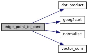
References dot_product(), GEOGRAPHIC_EDGE::end, geog2cart(), LW_FALSE, LW_TRUE, LWDEBUG, LWDEBUGF, normalize(), GEOGRAPHIC_EDGE::start, vector_sum(), POINT3D::x, POINT3D::y, and POINT3D::z.
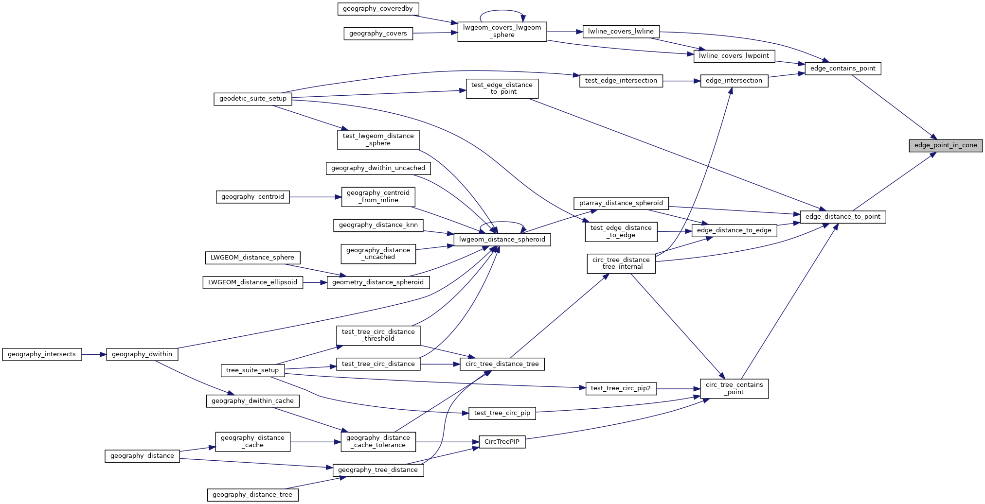
Referenced by edge_contains_point(), and edge_distance_to_point().
Here is the call graph for this function:
Here is the caller graph for this function: