Loading...
Searching...
No Matches
◆ ptarray_to_GEOSCoordSeq()
| GEOSCoordSeq ptarray_to_GEOSCoordSeq | ( | const POINTARRAY * | pa, |
| uint8_t | fix_ring | ||
| ) |
Definition at line 248 of file liblwgeom/lwgeom_geos.c.
249{
250 uint32_t dims = 2;
251 uint32_t i;
252 int append_points = 0;
255 GEOSCoordSeq sq;
256
258
259 if (fix_ring)
260 {
262 {
264 return NULL;
265 }
266 else
267 {
270 }
271 }
272
274 {
276 return NULL;
277 }
278
280 {
281 if (dims == 3)
282 {
283 p3d = getPoint3d_cp(pa, i);
286 }
287 else
288 {
289 p2d = getPoint2d_cp(pa, i);
291 }
292
293#if POSTGIS_GEOS_VERSION < 38
294 GEOSCoordSeq_setX(sq, i, p2d->x);
295 GEOSCoordSeq_setY(sq, i, p2d->y);
297#else
298 if (dims == 3)
300 else
302#endif
303
304 }
305
306 if (append_points)
307 {
308 if (dims == 3)
309 {
310 p3d = getPoint3d_cp(pa, 0);
312 }
313 else
314 p2d = getPoint2d_cp(pa, 0);
316 {
317#if POSTGIS_GEOS_VERSION < 38
318 GEOSCoordSeq_setX(sq, i, p2d->x);
319 GEOSCoordSeq_setY(sq, i, p2d->y);
320#else
322#endif
323
325 }
326 }
327
328 return sq;
329}
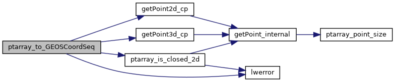
static const POINT3D * getPoint3d_cp(const POINTARRAY *pa, uint32_t n)
Returns a POINT2D pointer into the POINTARRAY serialized_ptlist, suitable for reading from.
Definition lwinline.h:103
static const POINT2D * getPoint2d_cp(const POINTARRAY *pa, uint32_t n)
Returns a POINT2D pointer into the POINTARRAY serialized_ptlist, suitable for reading from.
Definition lwinline.h:91
Definition liblwgeom.h:375
Definition liblwgeom.h:387
References POINTARRAY::flags, FLAGS_GET_Z, getPoint2d_cp(), getPoint3d_cp(), LWDEBUGF, lwerror(), POINTARRAY::npoints, ptarray_is_closed_2d(), POINT2D::x, POINT3D::x, POINT2D::y, POINT3D::y, and POINT3D::z.
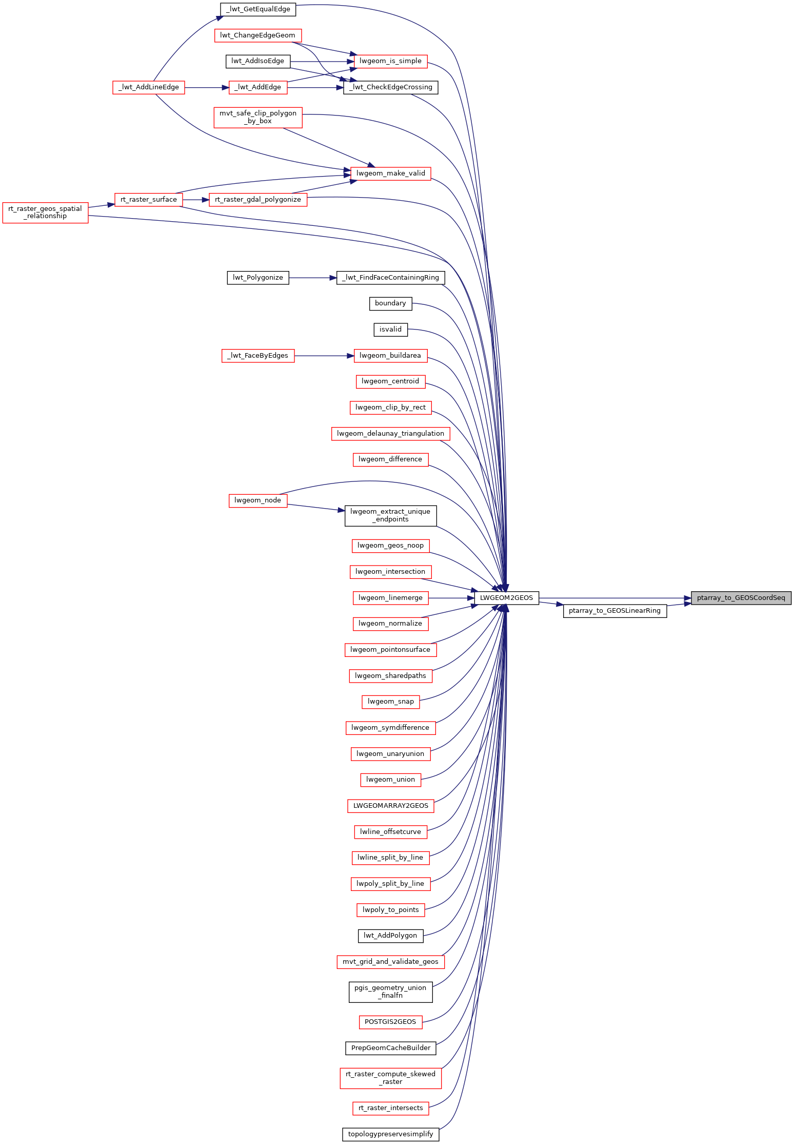
Referenced by LWGEOM2GEOS(), and ptarray_to_GEOSLinearRing().
Here is the call graph for this function:
Here is the caller graph for this function: