Loading...
Searching...
No Matches
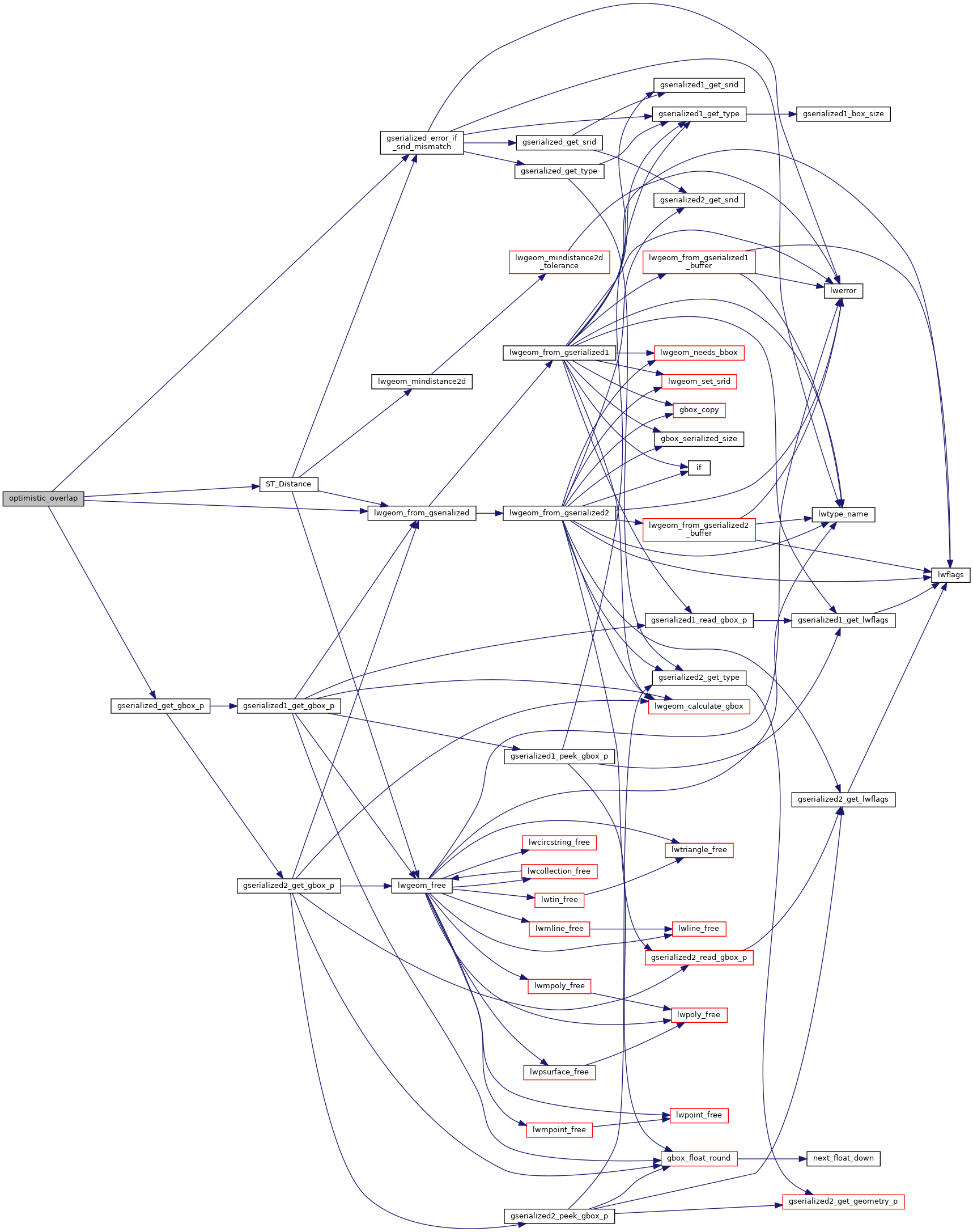
◆ optimistic_overlap()
| Datum optimistic_overlap | ( | PG_FUNCTION_ARGS | ) |
Definition at line 2595 of file lwgeom_functions_basic.c.
2596{
2597 GSERIALIZED *pg_geom1 = PG_GETARG_GSERIALIZED_P(0);
2598 GSERIALIZED *pg_geom2 = PG_GETARG_GSERIALIZED_P(1);
2599 double dist = PG_GETARG_FLOAT8(2);
2600 GBOX g1_bvol;
2601 double calc_dist;
2604 gserialized_error_if_srid_mismatch(pg_geom1, pg_geom2, __func__);
2605
2607 {
2608 elog(ERROR, "optimistic_overlap: first arg isn't a polygon\n");
2609 PG_RETURN_NULL();
2610 }
2611
2613 {
2614 elog(ERROR, "optimistic_overlap: 2nd arg isn't a [multi-]polygon\n");
2615 PG_RETURN_NULL();
2616 }
2617
2618 /*bbox check */
2619 gserialized_get_gbox_p(pg_geom1, &g1_bvol);
2620
2625
2628 {
2629 PG_RETURN_BOOL(false); /*bbox not overlap */
2630 }
2631
2632 /*
2633 * compute distances
2634 * should be a fast calc if they actually do intersect
2635 */
2636 calc_dist =
2637 DatumGetFloat8(DirectFunctionCall2(ST_Distance, PointerGetDatum(pg_geom1), PointerGetDatum(pg_geom2)));
2638
2639 PG_RETURN_BOOL(calc_dist < dist);
2640}
void gserialized_error_if_srid_mismatch(const GSERIALIZED *g1, const GSERIALIZED *g2, const char *funcname)
Definition gserialized.c:404
LWGEOM * lwgeom_from_gserialized(const GSERIALIZED *g)
Allocate a new LWGEOM from a GSERIALIZED.
Definition gserialized.c:239
int gserialized_get_gbox_p(const GSERIALIZED *g, GBOX *gbox)
Read the box from the GSERIALIZED or calculate it if necessary.
Definition gserialized.c:65
Definition liblwgeom.h:338
Definition liblwgeom.h:429
Definition liblwgeom.h:443
References LWGEOM::bbox, gserialized_error_if_srid_mismatch(), gserialized_get_gbox_p(), lwgeom_from_gserialized(), MULTIPOLYGONTYPE, POLYGONTYPE, ST_Distance(), LWGEOM::type, GBOX::xmax, GBOX::xmin, GBOX::ymax, and GBOX::ymin.
Here is the call graph for this function: