Loading...
Searching...
No Matches
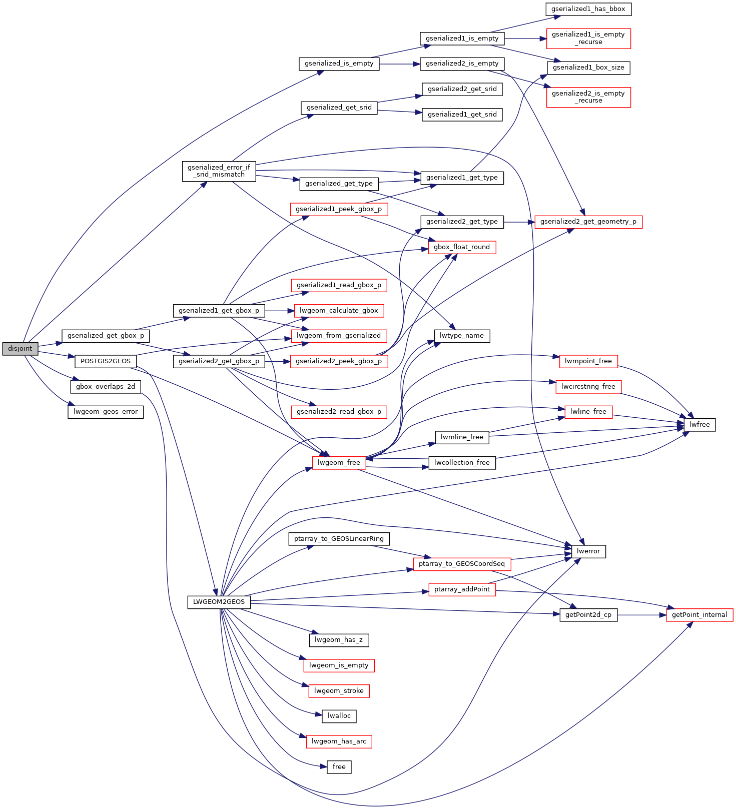
◆ disjoint()
| Datum disjoint | ( | PG_FUNCTION_ARGS | ) |
Definition at line 2370 of file postgis/lwgeom_geos.c.
2371{
2372 GSERIALIZED *geom1;
2373 GSERIALIZED *geom2;
2374 GEOSGeometry *g1, *g2;
2375 char result;
2376 GBOX box1, box2;
2377
2378 geom1 = PG_GETARG_GSERIALIZED_P(0);
2379 geom2 = PG_GETARG_GSERIALIZED_P(1);
2380 gserialized_error_if_srid_mismatch(geom1, geom2, __func__);
2381
2382 /* A.Disjoint(Empty) == TRUE */
2384 PG_RETURN_BOOL(true);
2385
2386 /*
2387 * short-circuit 1: if geom2 bounding box does not overlap
2388 * geom1 bounding box we can return TRUE.
2389 */
2391 gserialized_get_gbox_p(geom2, &box2) )
2392 {
2394 {
2395 PG_RETURN_BOOL(true);
2396 }
2397 }
2398
2399 initGEOS(lwpgnotice, lwgeom_geos_error);
2400
2401 g1 = POSTGIS2GEOS(geom1);
2402 if (!g1)
2404
2405 g2 = POSTGIS2GEOS(geom2);
2406 if (!g2)
2407 {
2408 GEOSGeom_destroy(g1);
2410 }
2411
2412 result = GEOSDisjoint(g1,g2);
2413
2414 GEOSGeom_destroy(g1);
2415 GEOSGeom_destroy(g2);
2416
2418
2419 PG_FREE_IF_COPY(geom1, 0);
2420 PG_FREE_IF_COPY(geom2, 1);
2421
2422 PG_RETURN_BOOL(result);
2423}
int gbox_overlaps_2d(const GBOX *g1, const GBOX *g2)
Return LW_TRUE if the GBOX overlaps on the 2d plane, LW_FALSE otherwise.
Definition gbox.c:323
void gserialized_error_if_srid_mismatch(const GSERIALIZED *g1, const GSERIALIZED *g2, const char *funcname)
Definition gserialized.c:404
int gserialized_get_gbox_p(const GSERIALIZED *g, GBOX *gbox)
Read the box from the GSERIALIZED or calculate it if necessary.
Definition gserialized.c:65
int gserialized_is_empty(const GSERIALIZED *g)
Check if a GSERIALIZED is empty without deserializing first.
Definition gserialized.c:152
Definition liblwgeom.h:338
Definition liblwgeom.h:429
References gbox_overlaps_2d(), gserialized_error_if_srid_mismatch(), gserialized_get_gbox_p(), gserialized_is_empty(), HANDLE_GEOS_ERROR, LW_FALSE, lwgeom_geos_error(), and POSTGIS2GEOS().
Here is the call graph for this function: