Loading...
Searching...
No Matches
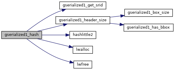
◆ gserialized1_hash()
| int32_t gserialized1_hash | ( | const GSERIALIZED * | g | ) |
Returns a hash code for the srid/type/geometry information in the GSERIALIZED.
Ignores metadata like flags and optional boxes, etc.
Definition at line 226 of file gserialized1.c.
227{
228 int32_t hval;
229 int32_t pb = 0, pc = 0;
230 /* Point to just the type/coordinate part of buffer */
232 uint8_t *b1 = (uint8_t*)g1 + hsz1;
233 /* Calculate size of type/coordinate buffer */
235 size_t bsz1 = sz1 - hsz1;
236 /* Calculate size of srid/type/coordinate buffer */
237 int32_t srid = gserialized1_get_srid(g1);
238 size_t bsz2 = bsz1 + sizeof(int);
239 uint8_t *b2 = lwalloc(bsz2);
240 /* Copy srid into front of combined buffer */
241 memcpy(b2, &srid, sizeof(int));
242 /* Copy type/coordinates into rest of combined buffer */
243 memcpy(b2+sizeof(int), b1, bsz1);
244 /* Hash combined buffer */
245 hashlittle2(b2, bsz2, (uint32_t *)&pb, (uint32_t *)&pc);
246 lwfree(b2);
247 hval = pb ^ pc;
248 return hval;
249}
void hashlittle2(const void *key, size_t length, uint32_t *pc, uint32_t *pb)
Definition lookup3.c:476
int32_t gserialized1_get_srid(const GSERIALIZED *s)
Extract the SRID from the serialized form (it is packed into three bytes so this is a handy function)...
Definition gserialized1.c:142
static uint32_t gserialized1_header_size(const GSERIALIZED *gser)
Definition gserialized1.c:121
#define SIZE_GET(varsize)
Macro for reading the size from the GSERIALIZED size attribute.
Definition liblwgeom_internal.h:128
References gserialized1_get_srid(), gserialized1_header_size(), hashlittle2(), lwalloc(), lwfree(), GSERIALIZED::size, and SIZE_GET.
Referenced by gserialized_hash().
Here is the call graph for this function:
Here is the caller graph for this function:
