Loading...
Searching...
No Matches
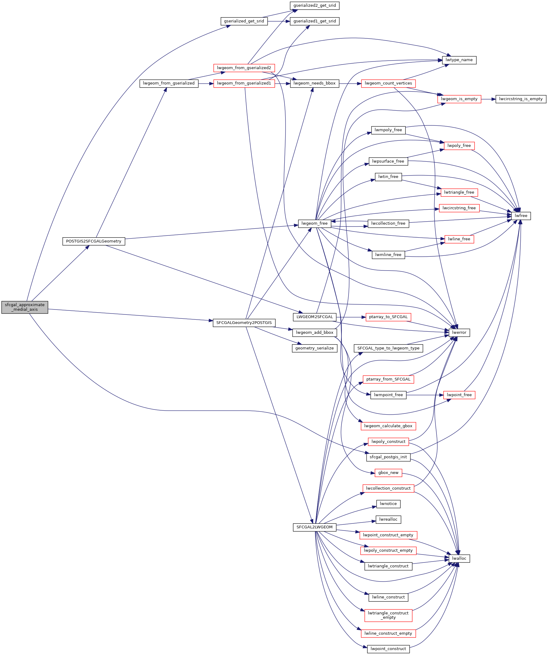
◆ sfcgal_approximate_medial_axis()
| Datum sfcgal_approximate_medial_axis | ( | PG_FUNCTION_ARGS | ) |
Definition at line 305 of file postgis/lwgeom_sfcgal.c.
306{
307 GSERIALIZED *input, *output;
308 sfcgal_geometry_t *geom;
309 sfcgal_geometry_t *result;
310 srid_t srid;
311
312 sfcgal_postgis_init();
313
314 input = PG_GETARG_GSERIALIZED_P(0);
315 srid = gserialized_get_srid(input);
316 geom = POSTGIS2SFCGALGeometry(input);
317 PG_FREE_IF_COPY(input, 0);
318
319 result = sfcgal_geometry_approximate_medial_axis(geom);
320 sfcgal_geometry_delete(geom);
321
322 output = SFCGALGeometry2POSTGIS(result, 0, srid);
323 sfcgal_geometry_delete(result);
324
325 PG_RETURN_POINTER(output);
326}
int32_t gserialized_get_srid(const GSERIALIZED *g)
Extract the SRID from the serialized form (it is packed into three bytes so this is a handy function)...
Definition gserialized.c:126
sfcgal_geometry_t * POSTGIS2SFCGALGeometry(GSERIALIZED *pglwgeom)
Definition postgis/lwgeom_sfcgal.c:75
GSERIALIZED * SFCGALGeometry2POSTGIS(const sfcgal_geometry_t *geom, int force3D, int32_t SRID)
Definition postgis/lwgeom_sfcgal.c:108
Definition liblwgeom.h:429
References gserialized_get_srid(), POSTGIS2SFCGALGeometry(), sfcgal_postgis_init(), and SFCGALGeometry2POSTGIS().
Here is the call graph for this function: