Loading...
Searching...
No Matches
◆ getTableInfo()
|
static |
Definition at line 858 of file pgsql2shp-core.c.
859{
860
861 /* Get some more information from the table:
862 - count = total number of geometries/geographies in the table
863
864 and if we have found a suitable geometry column:
865
866 - max = maximum number of dimensions within the geometry/geography column
867 - geometrytype = string representing the geometry/geography type, e.g. POINT
868
869 Since max/geometrytype already require a sequential scan of the table, we may as
870 well get the row count too.
871 */
872
873 PGresult *res;
874 char *query;
875 int tmpint;
876
877
879 {
880 /* Include geometry information */
882 {
883 query = malloc(150 + 4 * strlen(state->geo_col_name) + strlen(state->schema) + strlen(state->table));
884
885 sprintf(query, "SELECT count(1), max(ST_zmflag(\"%s\"::geometry)), geometrytype(\"%s\"::geometry) FROM \"%s\".\"%s\" GROUP BY 3",
887 }
888 else
889 {
891
892 sprintf(query, "SELECT count(1), max(ST_zmflag(\"%s\"::geometry)), geometrytype(\"%s\"::geometry) FROM \"%s\" GROUP BY 3",
894 }
895 }
896 else
897 {
898 /* Otherwise... just a row count will do */
900 {
902
904 }
905 else
906 {
908
910 }
911 }
912
914
916 free(query);
917
918 if (PQresultStatus(res) != PGRES_TUPLES_OK)
919 {
920 snprintf(state->message, SHPDUMPERMSGLEN, _("ERROR: Could not execute table metadata query: %s"), PQresultErrorMessage(res));
921 PQclear(res);
923 }
924
925 /* Make sure we error if the table is empty */
926 if (PQntuples(res) == 0)
927 {
928 snprintf(state->message, SHPDUMPERMSGLEN, _("ERROR: Could not determine table metadata (empty table)"));
929 PQclear(res);
931 }
932
933 /* If we have a geo* column, get the dimension, type and count information */
935 {
936 /* If a table has a geometry column containing mixed types then
937 the metadata query will return multiple rows. We need to cycle
938 through all rows to determine if the type combinations are valid.
939
940 Note that if we find a combination of a MULTI and non-MULTI geometry
941 of the same type, we always choose MULTI to ensure that everything
942 gets output correctly. The create_* conversion functions are clever
943 enough to up-convert the non-MULTI geometry to a MULTI in this case. */
944
945 int dummy, i;
946 uint8_t type = 0;
947 int typefound = 0, typemismatch = 0;
948
949 state->rowcount = 0;
950
951 for (i = 0; i < PQntuples(res); i++)
952 {
953 /* skip null geometries */
954 if (PQgetisnull(res, i, 2))
955 {
956 state->rowcount += atoi(PQgetvalue(res, i, 0));
957 continue;
958 }
959
960 geometry_type_from_string(PQgetvalue(res, i, 2), &type, &dummy, &dummy);
961
962 /* We can always set typefound to that of the first column found */
963 if (!typefound)
964 typefound = type;
965
966 switch (type)
967 {
970 typemismatch = 1;
971 else
972 typefound = MULTIPOINTTYPE;
973 break;
974
977 typemismatch = 1;
978 else
979 typefound = MULTILINETYPE;
980 break;
981
984 typemismatch = 1;
985 else
986 typefound = MULTIPOLYGONTYPE;
987 break;
988
991 typemismatch = 1;
993 typefound = POINTTYPE;
994 break;
995
998 typemismatch = 1;
1000 typefound = LINETYPE;
1001 break;
1002
1005 typemismatch = 1;
1007 typefound = POLYGONTYPE;
1008 break;
1009 }
1010
1011 /* Update the rowcount for each type */
1012 state->rowcount += atoi(PQgetvalue(res, i, 0));
1013
1014 /* Set up the dimension output type (note: regardless of how many rows
1015 the table metadata query returns, this value will be the same. But
1016 we'll choose to use the first value anyway) */
1017 tmpint = atoi(PQgetvalue(res, i, 1));
1018 switch (tmpint)
1019 {
1020 case 0:
1022 break;
1023 case 1:
1025 break;
1026 default:
1028 break;
1029 }
1030
1031 }
1032
1033 /* Flag an error if the table contains incompatible geometry combinations */
1034 if (typemismatch)
1035 {
1036 snprintf(state->message, SHPDUMPERMSGLEN, _("ERROR: Incompatible mixed geometry types in table"));
1037 PQclear(res);
1039 }
1040
1041 /* Set up the shapefile output type based upon the dimension information */
1042 switch (typefound)
1043 {
1046 {
1047 case 'z':
1049 break;
1050
1051 case 'm':
1053 break;
1054
1055 default:
1057 }
1058 break;
1059
1062 {
1063 case 'z':
1065 break;
1066
1067 case 'm':
1069 break;
1070
1071 default:
1073 }
1074 break;
1075
1079 {
1080 case 'z':
1082 break;
1083
1084 case 'm':
1086 break;
1087
1088 default:
1090 }
1091 break;
1092
1096 {
1097 case 'z':
1099 break;
1100
1101 case 'm':
1103 break;
1104
1105 default:
1107 }
1108 break;
1109 }
1110 }
1111 else
1112 {
1113 /* Without a geo* column the total is simply the first (COUNT) column */
1114 state->rowcount = atoi(PQgetvalue(res, 0, 0));
1115 }
1116
1117 /* Dispose of the result set */
1118 PQclear(res);
1119
1121}
int lwtype_is_collection(uint8_t type)
Determine whether a type number is a collection or not.
Definition lwgeom.c:1087
int geometry_type_from_string(const char *str, uint8_t *type, int *z, int *m)
Utility function to get type number from string.
Definition lwutil.c:489
void * malloc(YYSIZE_T)
void free(void *)
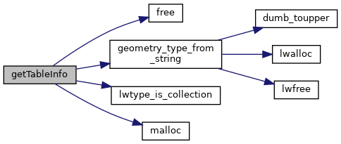
References _, shp_dumper_state::conn, free(), shp_dumper_state::geo_col_name, geometry_type_from_string(), LINETYPE, LWDEBUGF, lwtype_is_collection(), malloc(), shp_dumper_state::message, MULTILINETYPE, MULTIPOINTTYPE, MULTIPOLYGONTYPE, shp_dumper_state::outshptype, shp_dumper_state::outtype, POINTTYPE, POLYGONTYPE, shp_dumper_state::rowcount, shp_dumper_state::schema, SHPDUMPERERR, SHPDUMPERMSGLEN, SHPDUMPEROK, SHPT_ARC, SHPT_ARCM, SHPT_ARCZ, SHPT_MULTIPOINT, SHPT_MULTIPOINTM, SHPT_MULTIPOINTZ, SHPT_POINT, SHPT_POINTM, SHPT_POINTZ, SHPT_POLYGON, SHPT_POLYGONM, SHPT_POLYGONZ, and shp_dumper_state::table.
Referenced by ShpDumperOpenTable().
Here is the call graph for this function:
Here is the caller graph for this function: