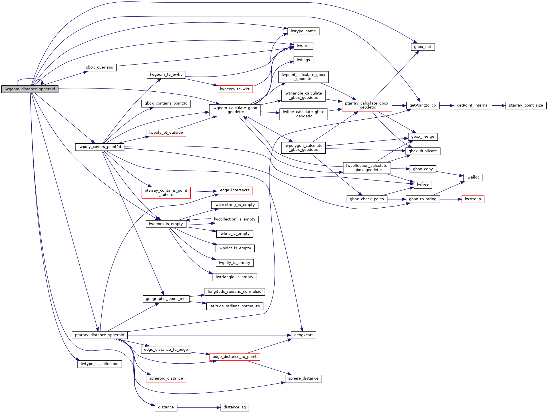
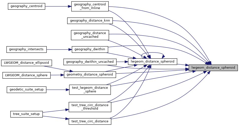
Calculate the distance between two LWGEOMs, using the coordinates are longitude and latitude.
Calculate the geodetic distance from lwgeom1 to lwgeom2 on the spheroid.
Return immediately when the calculated distance drops below the tolerance (useful for dwithin calculations). Return a negative distance for incalculable cases.
2188{
2189 uint8_t type1, type2;
2192
2195
2196 assert(lwgeom1);
2197 assert(lwgeom2);
2198
2199 LWDEBUGF(4,
"entered function, tolerance %.8g", tolerance);
2200
2201
2202
2204 {
2205 return -1.0;
2206 }
2207
2208 type1 = lwgeom1->
type;
2209 type2 = lwgeom2->
type;
2210
2211
2212 if ( lwgeom1->
bbox )
2213 gbox1 = *(lwgeom1->
bbox);
2214 else
2216
2217
2218 if ( lwgeom2->
bbox )
2219 gbox2 = *(lwgeom2->
bbox);
2220 else
2222
2223
2226
2227
2230 {
2232
2234 pa1 = ((
LWPOINT*)lwgeom1)->point;
2235 else
2236 pa1 = ((
LWLINE*)lwgeom1)->points;
2237
2239 pa2 = ((
LWPOINT*)lwgeom2)->point;
2240 else
2241 pa2 = ((
LWLINE*)lwgeom2)->points;
2242
2244 }
2245
2246
2249 {
2254 uint32_t i;
2255
2257 {
2259 lwpoly = (
LWPOLY*)lwgeom2;
2260 }
2261 else
2262 {
2264 lwpoly = (
LWPOLY*)lwgeom1;
2265 }
2267
2268
2270 {
2271 return 0.0;
2272 }
2273
2274
2275 for ( i = 0; i < lwpoly->
nrings; i++ )
2276 {
2282 }
2284 }
2285
2286
2289 {
2294 uint32_t i;
2295
2297 {
2298 lwline = (
LWLINE*)lwgeom1;
2299 lwpoly = (
LWPOLY*)lwgeom2;
2300 }
2301 else
2302 {
2303 lwline = (
LWLINE*)lwgeom2;
2304 lwpoly = (
LWPOLY*)lwgeom1;
2305 }
2307
2308 LWDEBUG(4,
"checking if a point of line is in polygon");
2309
2310
2312 return 0.0;
2313
2314 LWDEBUG(4,
"checking ring distances");
2315
2316
2317 for ( i = 0; i < lwpoly->
nrings; i++ )
2318 {
2320 LWDEBUGF(4,
"ring[%d] ring_distance = %.8g", i, ring_distance);
2325 }
2328
2329 }
2330
2331
2332
2334 {
2339 uint32_t i, j;
2340
2341
2344
2345
2348
2349
2350 for (i = 0; i < lwpoly1->
nrings; i++)
2351 {
2352 for (j = 0; j < lwpoly2->
nrings; j++)
2353 {
2354 double ring_distance =
2358 spheroid,
2359 tolerance,
2360 check_intersection);
2364 }
2365 }
2367 }
2368
2369
2371 {
2372 uint32_t i;
2375
2376 for ( i = 0; i < col->
ngeoms; i++ )
2377 {
2379 col->
geoms[i], lwgeom2, spheroid, tolerance);
2384 }
2386 }
2387
2388
2390 {
2391 uint32_t i;
2394
2395 for ( i = 0; i < col->
ngeoms; i++ )
2396 {
2402 }
2404 }
2405
2406
2408 return -1.0;
2409
2410}
int gbox_overlaps(const GBOX *g1, const GBOX *g2)
Return LW_TRUE if the GBOX overlaps, LW_FALSE otherwise.
void gbox_init(GBOX *gbox)
Zero out all the entries in the GBOX.
const char * lwtype_name(uint8_t type)
Return the type name string associated with a type number (e.g.
int lwtype_is_collection(uint8_t type)
Determine whether a type number is a collection or not.
#define POINTTYPE
LWTYPE numbers, used internally by PostGIS.
#define LW_TRUE
Return types for functions with status returns.
int lwpoly_covers_point2d(const LWPOLY *poly, const POINT2D *pt_to_test)
Given a polygon (lon/lat decimal degrees) and point (lon/lat decimal degrees) and a guaranteed outsid...
double lwgeom_distance_spheroid(const LWGEOM *lwgeom1, const LWGEOM *lwgeom2, const SPHEROID *spheroid, double tolerance)
Calculate the distance between two LWGEOMs, using the coordinates are longitude and latitude.
int lwgeom_calculate_gbox_geodetic(const LWGEOM *geom, GBOX *gbox)
Calculate the geodetic bounding box for an LWGEOM.
static double ptarray_distance_spheroid(const POINTARRAY *pa1, const POINTARRAY *pa2, const SPHEROID *s, double tolerance, int check_intersection)
#define LWDEBUG(level, msg)
#define LWDEBUGF(level, msg,...)
void lwerror(const char *fmt,...)
Write a notice out to the error handler.
static int lwgeom_is_empty(const LWGEOM *geom)
Return true or false depending on whether a geometry is an "empty" geometry (no vertices members)
static const POINT2D * getPoint2d_cp(const POINTARRAY *pa, uint32_t n)
Returns a POINT2D pointer into the POINTARRAY serialized_ptlist, suitable for reading from.
static double distance(double x1, double y1, double x2, double y2)